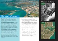
Edgeworth Renewal Corridor Project - Lake Macquarie City Council
Edgeworth Renewal Corridor Project - Lake Macquarie City Council
Edgeworth Renewal Corridor Project - Lake Macquarie City Council

You also want an ePaper? Increase the reach of your titles
YUMPU automatically turns print PDFs into web optimized ePapers that Google loves.
The LS2030 Workshops identified visual improvements for the <strong>Edgeworth</strong>Neighbourhood Centre and Main Road generally and intensification of developmentaround the <strong>Edgeworth</strong> Neighbourhood Centre.3.2.2 <strong>Lake</strong> <strong>Macquarie</strong> Local Environmental Plan 2004<strong>Lake</strong> <strong>Macquarie</strong> Local Environmental Plan 2004 (LMLEP 2004) allocates land use zonesand a range of development controls and requirements. The land use zoning of the<strong>Corridor</strong> is shown in Figure 10.The north-western side of the Crossroads intersection is zoned 3(1) Urban Centre (Core),from <strong>Lake</strong> Road west to Fairleigh Street. Further west the land on the northern side ofMain Road is zoned (2(2) Residential (Urban Living) as far as an area zoned 3(1) UrbanCentre (Core) on the northeast side of the intersection of Main Road and FrederickStreet.The land from the south-western side of the intersection along Main Road is zoned 6(1)Open Space from <strong>Lake</strong> Road to Frederick Street, with the exception of a strip of 17residential lots zoned 2(2) Residential (Urban Living) extending east along Main Roadfrom Frederick Street. A 2(2) zoning continues on both sides of Main Road until thebridge over Brush Creek just west of Hill Street.On the northern side of the road is an area of 3(2) zoned land east of Impala Street.Further west, the northern side of Main Road is zoned 2(1) Residential until the<strong>Edgeworth</strong> Neighbourhood. On the southern side of Main Road, land is zoned 2(1) as farwest as Thomas Street.The <strong>Edgeworth</strong> Neighbourhood Centre has a 3(1) zoning. To the south of the Centre isan area zoned 4(2) Industrial (General). To the south and west of the 4(2) zoned land isan extensive area of land zoned 6(1) Open Space.West of the Neighbourhood Centre and west of Park Street on the southern side of MainRoad is a small area of land zoned 3(2). The land further to the west as far as GarthStreet is zoned 2(2) for medium density residential development. This includes only asmall area to the south.There is an area of 2(2) to the north and west of the land zoned 3(1), on the northwesternside of the intersection of Main Road and Minmi Road. Further west, the land iszoned 2(1) on both sides of Minmi Road as far west as Northville Drive.In summary, the land use zones focus more intense development around the Crossroadsand the Frederick Street area in the east, and the intersection of Main Road and MinmiRoad in the west. This recognises the concentration of commercial activity in theseareas, and in the case of the Crossroads its high transport accessibility and proximity tothe Glendale Regional Centre.3.2.3 Proposed zones under the Draft LMLEP 2013Draft LMLEP 2013 is a conversion of LMLEP 2004 to the Department of Planning andInfrastructure standard instrument. The Draft was on public exhibition from September toDecember 2012. The land use zones as proposed by Draft LMLEP 2013 are shown inTable 11Draft Land Use Review – <strong>Edgeworth</strong> <strong>Renewal</strong> <strong>Corridor</strong> – Version 2 Page 23 of 85F2011/00577/06/08 – May 2013