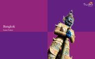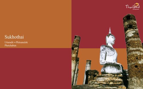
Sukhothai - Tourism Authority of Thailand, Malaysia
Sukhothai - Tourism Authority of Thailand, Malaysia
Sukhothai - Tourism Authority of Thailand, Malaysia
- No tags were found...

You also want an ePaper? Increase the reach of your titles
YUMPU automatically turns print PDFs into web optimized ePapers that Google loves.
<strong>Sukhothai</strong> Historical Park
10 11<strong>Sukhothai</strong> is located on the lower edge <strong>of</strong> the northern region,with the provincial capital situated some 450 km. north <strong>of</strong>Bangkok and some 350 km. south <strong>of</strong> Chiang Mai. The provincecovers 6,596 sq. km. and is above all noted as the centre <strong>of</strong> theold Thai kingdom <strong>of</strong> <strong>Sukhothai</strong>, with major historical remainsat <strong>Sukhothai</strong> and Si Satchanalai. Its main natural attraction isKhao Luang mountain park. The provincial capital, sometimescalled New <strong>Sukhothai</strong>, is a small town lying on the Yom Riverwhose main business is serving tourists who visit the nearby<strong>Sukhothai</strong> Historical Park.City AttractionsPhra Mae Ya ShrineSituated in front <strong>of</strong> the City Hall, the Shrine houses the PhraMae Ya figure, in ancient queen’s dress, said to have been madeby King Ramkhamhaeng as a dedication to his late mother NangSueang.Sangkhalok MuseumThe Museum displays Sangkhalok (Sawankhalok) ceramics <strong>of</strong>the kind produced in old <strong>Sukhothai</strong> and ceramics produced inthe old Lanna Kingdom (now northern <strong>Thailand</strong>). Located 1 km.from town on the Phitsanulok Road; open daily 8 a.m.-5 p.m.; admission : 100 baht adults, 20 baht children.Wat Si ChumFish MuseumLocated in Rama IV Park on the Phitsanulok Road, the Museumdisplays a variety <strong>of</strong> freshwater fish mentioned in Thai literature.Open daily except Tuesdays 9 a.m.-5 p.m., admission free.Old <strong>Sukhothai</strong>Founded in the 13 th century, <strong>Sukhothai</strong> was the first truly<strong>Sukhothai</strong> Historical Park Wat Mahathat<strong>Sukhothai</strong>The province covers 6,596 sq. km. and is aboveall noted as the centre <strong>of</strong> the old Thai kingdom<strong>of</strong> <strong>Sukhothai</strong>, with major historical remains at<strong>Sukhothai</strong> and Si Satchanalai.
12 13independent Thai kingdom, and it enjoyed a golden age underthe great King Ramkhamhaeng. Abandoned and overgrownfor many centuries, the superb temples and monuments <strong>of</strong> thissplendid city have been restored in <strong>Sukhothai</strong> Historical Park,a UNESCO World Heritage Site. A must-see for all travellers,<strong>Sukhothai</strong> is one <strong>of</strong> the most important historical sites inSoutheast Asia.Historical Background<strong>Sukhothai</strong>, which means “Dawn <strong>of</strong> Happiness”, was the firstkingdom <strong>of</strong> the Thais, formed after Thai forces drove theKhmers out <strong>of</strong> the city, a major frontier post <strong>of</strong> the KhmerEmpire, and established it as their capital in 1238. The firstking’s son, Ramkhamhaeng, ascended the throne in 1278 andreigned for forty years. A fine warrior, King Ramkhamhaeng theGreat made <strong>Sukhothai</strong> a powerful and extensive kingdom whichincluded many parts <strong>of</strong> what are today neighbouring countries.King Ramkhamhaeng the Great opened direct political relationswith China and made two trips there, from which he broughtback Chinese artisans who taught the Thai fine pottery techniques,resulting in the famous Sawankhalok ceramics. A majorachievement <strong>of</strong> his reign was the revision <strong>of</strong> various forms <strong>of</strong>the Khmer alphabet into a system suitable for the writing <strong>of</strong>Thai. The alphabet that the king invented in 1283 is essentiallythe same that is used today.King Ramkhamhaeng the Great’s reign is noted for prosperityand happiness, as recorded in a stone inscription well-known toThais.“This realm <strong>of</strong> <strong>Sukhothai</strong> is good. In the water there are fish;in the fields there is rice. The ruler does not levy a tax on thepeople who travel along the road together, leading their oxenWat Chang LomWat Phra Si Rattana Mahathaton the way to trade and riding their horses on the way to sell.Whoever wants to trade in elephants, so trades. Whoever wantsto trade in horses, so trades. Whoever wants to trade in silverand gold, so trades.”King Ramkhamhaeng the Great also promoted religion andculture, and through his efforts Buddhism progressed among thepeople. Inspirational faith gave birth to classic forms <strong>of</strong> Thai religiousart. Images <strong>of</strong> the Buddha sculpted during the <strong>Sukhothai</strong>era are cultural treasures which impart a feeling <strong>of</strong> peace andserenity. Eight kings ruled <strong>Sukhothai</strong>, whose gradual declineoccurred during the last two reigns. The end <strong>of</strong> the first Thaikingdom came in 1365 when it was reduced to a vassal state byAyutthaya, a young and rising Thai power to the south, whichbecame the capital for four centuries, succeeded by Bangkok.<strong>Sukhothai</strong> Historical ParkThe Park is located 12 km. from <strong>Sukhothai</strong> town on the TakHighway; open daily 8.30 a.m.-4.30 p.m.; admission 40 baht.
14 15Bicycles can be rented for touring the ruins. The Park’s TouristService Centre (Tel: 0 5569 7310) provides information anddisplays models <strong>of</strong> historical buildings and structures <strong>of</strong> the old<strong>Sukhothai</strong>. Lying over an extensive area, ruins <strong>of</strong> the royal palaces,Buddhist temples, city gates, walls, moats, dams, ditches,ponds, canals and the water dyke control system are preserved,with major restoration by the Fine Arts Department in cooperationwith UNESCO.Inside the City WallsThe core city was surrounded by walls and earthen ramparts;this forms the centre <strong>of</strong> the historical park. It was rectangular,1,300 m. by 1,800 m., with four gates. A stone inscriptionrecords that King Ramkhamhaeng the Great set up a bell at one<strong>of</strong> the gates. If his subjects needed help, they could ring the belland the king would come out to settle disputes and dispensejustice. Within the walls are the remains <strong>of</strong> 35 structures. Themost notable are described as follows:Royal Palace and Wat MahathatThe Royal Palace lies in the centre <strong>of</strong> the city, surrounded bya moat and contains two main compounds: the royal residenceand the royal sanctuary. Here, the famous stone inscription <strong>of</strong>King Ramkhamhaeng the Great was found by King Mongkut(Rama IV) in the 19 th century together with part <strong>of</strong> the stonethrone called Manangkhasila-at. King Ramkhamhaeng the Greatset up a throne in the midst <strong>of</strong> a sugar-palm grove where, at hisrequest, a monk preached on Buddhist holy days and the kingconducted the affairs <strong>of</strong> state on other days. This throne waslater installed in Bangkok’s Temple <strong>of</strong> the Emerald Buddha.Lying west <strong>of</strong> the Royal Palace compound is Wat Mahathat, theWat MahathatWat Mahathat
16 17Wat Mahathatroyal sanctuary, which is <strong>Sukhothai</strong>’s largest temple witha customary main chedi (bell-shaped stupa) in a lotus-bud shapeand ruined vihara (image hall). At the base <strong>of</strong> the chedi areBuddhist disciples sitting in adoration, and on the pedestal aresitting Buddha images. In front <strong>of</strong> this reliquary is a large viharaformerly containing a remarkable sitting bronze Buddha image<strong>of</strong> the <strong>Sukhothai</strong> style, which was cast and installed by KingLithai <strong>of</strong> <strong>Sukhothai</strong> in 1362. In the late 18 th century, the imagewas moved to the Vihara Luang <strong>of</strong> Wat Suthat in Bangkok bythe order <strong>of</strong> King Rama I and has since been named Phra SiSakaya Muni. In front <strong>of</strong> the large vihara, is another smallervihara which was probably built during the Ayutthaya period. Itsmain Buddha image (8 m. high) was installed inside a separatebuilding. In front <strong>of</strong> the southern image, a sculpture calledKhom Dam Din was found, now kept in the Mae Ya Shrinenear the <strong>Sukhothai</strong> City Hall. To the south stands a pedestal <strong>of</strong>a large stepped chedi, whose lowest platform is adorned withbeautiful stucco figures <strong>of</strong> demons, elephants, and lions withangels riding on their backs. A mural painting adorns this chedi.King Ramkhamhaeng the Great MonumentSituated to the north <strong>of</strong> Wat Mahathat, the bronze statue <strong>of</strong> KingRamkhamhaeng the Great sits on a throne with a bas-relief atthe base depicting the king’s life.Wat Mahathat
18 19its pedestal and laterite columns remain. Many monuments andmagnificent scenery are visible from this location.Wat Chana SongkhramSituated to the north <strong>of</strong> Wat Mahathat is Wat Chana Songkhram.Its main sanctuary is a round Singhalese-style chedi. In front<strong>of</strong> the chedi is the base <strong>of</strong> a vihara and behind the chedi standsan ubosot. Bases <strong>of</strong> twelve small chedi are also visible. NearCharot Withithong Road is a strange chedi with three bases,one on top <strong>of</strong> the other.San Ta Pha Daeng or Deity ShrineSituated to the north <strong>of</strong> Wat Mahathat is San Ta Pha Daeng.This monument consists <strong>of</strong> a single laterite prang witha staircase in front. Sandstone Hindu divine objects (Lop Buristyle) were found here.Wat MaiSituated to the north <strong>of</strong> Wat Mahathat is Wat Mai, with an Ayutthaya-stylebrick vihara as the main sanctuary, its columns made<strong>of</strong> laterite. A bronze image <strong>of</strong> Buddha under a Naga(a Lop Buri-style image) was found here and is now preservedin the Ramkhamhaeng National Museum.Loi Krathong and Candle FestivalWat Si SawaiSituated amid magnificent scenery southwest <strong>of</strong> Wat Mahathatis Wat Si Sawai, with three prangs surrounded by a lateritewall. Inside the wall, the vihara in the west, built <strong>of</strong> laterite, isseparated from the main prang (Khmer-style pagoda) which wasconstructed in the Lop Buri or Hindu-style. A trace <strong>of</strong> the Hindusculpture Sayomphu was found here, indicating this was originallya Hindu shrine, later converted into a Buddhist temple.Wat Traphang ThongSituated to the east <strong>of</strong> Wat Mahathat is Wat Traphang Thong.The temple is located on an island in the middle <strong>of</strong> the largepond. There is a ruined laterite Singhalese-style chedi and a newmondop containing the Lord Buddha’s Footprint slab that wascreated by King Lithai in 1390. An annual fair to worship thissacred footprint takes place during the Loi Krathong Festival.King Ramkhamhaeng the Great MonumentWat Traphang NgoenSituated to the west <strong>of</strong> Wat Mahathat is Wat Traphang Ngoenwith its square pedestal, main sanctuary and stucco standingBuddha image in four niches. There is a vihara in front, and tothe east <strong>of</strong> the pond there is an island with an ubosot(consecrated assembly hall). This edifice has crumbled and only
22 23Wat Saphan HinRamkhamhaeng National Park (Khao Luang <strong>Sukhothai</strong>)This exquisite national park with a combined natural and historicalbackground covers an area <strong>of</strong> 341 sq. km. <strong>of</strong> high hillsand steep cliffs, some over 1,200 m. high, together with waterfalls,varied vegetation and wildlife are the natural attractionsalongside archaeological remains.This park is accessed via Highway 101 south from <strong>Sukhothai</strong>for about 20 km. then west via a 16 km. laterite road. Trekkersmust bring food and essential equipment with them. Bungalowsand tents are available. For more information in Bangkok,contact the National Park,Wildlife and Plant ConservationDepartment Tel. 0 2562 0760.SawankhalokSawankhaworanayok National MuseumLocated at Sawankhalok town, 38 km. north <strong>of</strong> <strong>Sukhothai</strong> viaHighway 101, the Museum features sculptural art from variousperiods and Sangkhalok (Sawankhalok) pottery from the <strong>Sukhothai</strong>era, some <strong>of</strong> it retrieved from sunken vessels in the Gulf <strong>of</strong><strong>Thailand</strong>. Open Wednesday to Sunday, 8.30 a.m.-4 p.m.; except public holidays. For more information, call0 5564 1571.Lord Buddha <strong>of</strong> the Future.Wat Chang LomThe Sites to the EastWat Chang LomThis temple is located to the north <strong>of</strong> Charot Withithong Roadwith a bell-shaped chedi <strong>of</strong> Ceylonese influence standing at thecentre. The chedi is situated on a three-tiered square base witha platform decorated with rows <strong>of</strong> elephants. This type <strong>of</strong> elephant- decorated chedi is to be seen in many ancient towns <strong>of</strong>the <strong>Sukhothai</strong> period; for example, Kamphaeng Phet andSi Satchanalai.Wat Traphang ThonglangA square mondop is the main sanctuary. In front <strong>of</strong> the mondopto the east is a vihara and beyond the vihara stands an ubosot.The outer wall <strong>of</strong> the mondop is beautifully decorated withstucco figures in niches. The southern side portrays the LordBuddha flanked by angles descending from Tavatimsa Heaven(the second heaven in Buddhist six heavens). The west side portraysthe Lord Buddha preaching to his father and relatives. Thenorth side depicts the episode when the Lord Buddha returnedto preach to his wife. These stucco figures, especially those onthe south side, are masterpieces <strong>of</strong> <strong>Sukhothai</strong> art.
24 25Si SatchanalaiSi Satchanalai was a city <strong>of</strong> the <strong>Sukhothai</strong> kingdom,located close to the modern town <strong>of</strong> Si Satchanalai, which is67 km. north <strong>of</strong> new <strong>Sukhothai</strong> via Highway 101.Si Satchanalai Historical ParkSi Satchanalai Historical Park contains the remains <strong>of</strong> <strong>Sukhothai</strong>-eraStructures in a park and setting similar to <strong>Sukhothai</strong>Historical Park. The 13 th to 15 th century ruins are located besidethe Yom River among hills and are less restored than those <strong>of</strong><strong>Sukhothai</strong>. Open daily 8.30 a.m.- 4.30 p.m.The ancient site was the kingdom’s second city and theresidence <strong>of</strong> the crown prince. It enjoyed great importance, asdemonstrated by the size <strong>of</strong> its remains. Ruins <strong>of</strong> 134 structureshave been discovered within the park area.Wat Phra Si Rattana MahathatThis temple, also called Wat Phra Borommathat Mueang Chaliangor Wat Phra Prang, is situated 3 km. to the south <strong>of</strong> ancientSi Satchanalai’s walls. An immense laterite prang ona square base marks the centre <strong>of</strong> the temple. A steep staircasein front <strong>of</strong> the huge prang leads to a room where a reliquaryis enshrined.Wat Khao Phanom PhloengThis is a hilltop temple within the old town <strong>of</strong> Si Satchanalai.A laterite chedi in the centre, a large vihara or image hall infront and a small sanctuary behind all lie in ruins. Some lateritepillars and a damaged Buddha image constructed <strong>of</strong> lateriteslabs and coated with mortar are seen.Wat Khao Suwan KhiriThe hilltop temple is situated 200 m. from Phanom PhloengHill. A huge bell-shaped chedi on a five-tiered base marks theSi Satchanalai Historical ParkSi Satchanalai Historical Park
26 27centre <strong>of</strong> the temple. Ruins <strong>of</strong> a vihara, chedi and fragments <strong>of</strong>huge stucco figures lie scattered on the ground. Thesimilarity between some figures here and those at <strong>Sukhothai</strong>’sWat Chang Lom lead to the belief that King Ramkhamhaeng theGreat had this temple constructed.Wat Chang LomA huge bell-shaped chedi supported by 39 elephants, with fourat the cardinal points elaborately decorated marks the centre <strong>of</strong>the temple. Above the chedi’s base there are niches enshriningimages in the attitude <strong>of</strong> Subduing Mara (demon).Wat Chedi Chet ThaeoThis is one <strong>of</strong> the most beautiful temples in <strong>Sukhothai</strong> Province.Stupa <strong>of</strong> different artistic styles and influence were built here.Remnants <strong>of</strong> old mural paintings can still be seen in somestupa.Wat Suan Kaeo Utthayan YaiLocated near Wat Chedi Chet Thaeo, across a dirt road, thistemple has the ruins <strong>of</strong> a large image hall. It is also called WatKao Hong, the Nine-Roomed Temple.Wat Nang PhayaThis temple is famous for its delicate stucco reliefs on the remains<strong>of</strong> the northwestern wall <strong>of</strong> the seven-roomed vihara. Thepillars are decorated with unglazed ceramic designs. The centrallaterite stupa is surrounded by lamp-posts and accessible by aset Wat <strong>of</strong> Nang narrow Phaya stairs.Wat Suan Kaeo Utthayan NoiThis temple’s ruins consist <strong>of</strong> a frontal vihara housinga Buddha, complete with a laterite ro<strong>of</strong>.Sangkhalok Kiln Site Study and Conservation CentreAt one time, hundreds <strong>of</strong> huge pottery kilns lined the Yom Riverin this area. Several have been carefully excavated and one, ovalwith a curved ro<strong>of</strong> and 7-8 m. wide, can be viewed within thecentre, while at another site a short distance away, there isa large outdoor kiln prepared for viewing. The centre displayspottery and potsherds, found in the area and information on theevolution <strong>of</strong> ancient ceramics. Located some 4 km. north <strong>of</strong>Si Satchanalai; open daily 9 a.m.- 4 p.m. To get there, drive6.5 km. north <strong>of</strong> Si Satchanalai Historical Park to Ban Ko Noi,or take Highway 1201 from Si Satchanalai.Si Satchanalai National ParkThis forest and mountain park (213 sq. km.) <strong>of</strong>fers trekkingroutes to waterfalls, caves and a hot spring. The park is about100 km. from <strong>Sukhothai</strong> via Highways 1113 and 1294 andcan be reached by a local bus (once daily, 50 mins) from SiSatchanalai where there is accommodation. For reservations andmore information in Bangkok, call 0 2579 5734, 0 2579 7223 or0 5561 9214-5.FestivalsSi Satchanalai Ordination CelebrationAprilLocally called Buat Chang Hat Siao, this event is held at HatSieo, Si Satchanalai, arranged by the local Thai Phuan people.It features a spectacular procession <strong>of</strong> ordination candidates(men about to become Buddhist monks) in colourful costumeson the backs <strong>of</strong> some 20-30 decorated elephants.Songkran Festival13-15 AprilThis is the traditional Thai New Year celebration, also knownas the Water Festival. Songkran was mentioned in the famousstone inscription dating from the reign <strong>of</strong> King Ramkhamhaengthe Great.Loi Krathong and Candle FestivalOctober/ NovemberA grand Loi Krathong celebration is held at the <strong>Sukhothai</strong> HistoricalPark. The Festival is held over five days to celebrate Loi
30 31Wat Yai Tha SaoWat ThammathipataiUttaraditA flourishing port for regional trade, it wasrenamed Uttaradit, literally the Port <strong>of</strong> theNorth, by King Rama V (1868-1910) and madea provincial capital.A province in the Lower North, Uttaradit has a long history goingback to at least the <strong>Sukhothai</strong> period (13 th century).Today, it is most noted for the cultivation <strong>of</strong> langsat fruit and forthe major lake formed by the Sirikit Dam. The provincial capitalis located 491 km. from Bangkok and the province covers anarea <strong>of</strong> 7,838 sq.km. The original town, called Bang Pho ThaIt, was located on the right bank <strong>of</strong> the Nan River. A flourishingport for regional trade, it was renamed Uttaradit, literally thePort <strong>of</strong> the North, by King Rama V (1868-1910) and made aprovincial capital. When the northern railway line was built inthe early 20 th century with a stop at Uttaradit, the town receiveda further boost. Unfortunately, the town centre was largely destroyedin a fire in 1967 and was rebuilt in a modern style.City AttractionsWat ThammathipataiAt this temple, the door panels <strong>of</strong> the large and ancient vihara<strong>of</strong> Wat Phra Fang are kept. The wooden panels are 2.2 m. wideand 5.3 m. tall and are carved in the graceful style <strong>of</strong> the LateAyutthaya Period. Only the panels at Wat Suthat in Bangkok areregarded as better.Wat Tha Thanon
32 33Located beside the Nan River, this temple houses Luang PhoPhet, the principal Buddha statue <strong>of</strong> the province. It is in theancient Chiang Saen style and cast in bronze.Wat Yai Tha SaoSituated east <strong>of</strong> the town centre about 3 km. along SamranrunRoad, this temple features an old chapel with beautifully carvedwood door panels and lintels.Phaya Phichai Dap Hak MemorialThis statue commemorates a governor who in 1772 valiantlyfought the Burmese invaders until one <strong>of</strong> his swords broke intwo. Still he prevailed over them, and is remembered as“Phichai <strong>of</strong> the Broken Sword”.Uttaradit Provincial Cultural HallOnce the <strong>of</strong>ficial residence <strong>of</strong> the provincial governor, thislate 19 th century traditional wooden building houses importanthistorical relics. A major item is the Yan Mat, a carved woodencarrying pole made by Late Ayutthaya period craftsmen.Out-Of-City AttractionsWat KlangLocated about 3 km. outside town at Ban Kae, this old templehas beautiful plaster bas-reliefs over the ubosot. Inside are rarewall murals <strong>of</strong> the Early Rattanakosin period style depicting theJataka and assemblage <strong>of</strong> celestial beings.Wat Phra Boromathat Thung YangWat Phra Boromathat Thung YangWat Phra Thaen Sila AtLocated about 3 km. from town on Highway 102, this oldtemple, once called Wat Mahathat, has a large roundSri Lankan style chedi enshrining a holy relic.Wat Phra Yun Phutthabat YukhonSituated near Wat Phra Boromathat Thung Yang, this templefeatures a Chiang Saen-style mondop sheltering holy footprints.It also houses a bronze <strong>Sukhothai</strong>-style Buddha statue.LaplaeAn ancient community dating from the Ayutthaya period,Laplae is an attractive place to visit with old wooden houses,hand-woven textiles and other craft specialities. It is also amajor producer <strong>of</strong> langsat, the province’s famous fruit. It lieswest <strong>of</strong> town via Highway 102 for 3 km., then to the right alongHighway 1041 for a further 6 km.Wat Phra Thaen Sila AtLocated near Laplae, this temple is believed to be <strong>of</strong> the <strong>Sukhothai</strong>Period. Its major feature is the base <strong>of</strong> a sermon platformbuilt with laterite.Namtok Mae PhunLocated at Ban Ton Klua, about 20 km. from town, the waterfallfeatures multi-level cascades amid pleasant naturalsurroundings.Sirikit Dam
34 35MayA unique religious ritual, is performed at Wat Phra BoromathatThung Yang after Visakha Puja Day in May. It featuresa re-enactment <strong>of</strong> the Buddha’s funeral ceremony.Langsat Day FairLate SeptemberThis day celebrates the province’s famous fruit. Langsat-growinghas long been the main occupation <strong>of</strong> the local people. Thefair features exhibitions, contests and parades <strong>of</strong> floats decoratedwith fruits and flowers, as well as entertainment.ShoppingInteresting items include woven materials with lovely designsand colours, and preserved fruit such as the chewy Kluai Kuanmade from bananas.Sak Yai Forest ParkBo Lek Nam PhiSituated at Tha Pla some 68 km. from town on the Uttaradit-Tha Pla Road, this is the country’s largest earthen dam. Stemmingthe Nan River, the dam is 800 m. wide. The large lake hasbeautiful scenery and during the cool season the landscape iscovered in a pr<strong>of</strong>usion <strong>of</strong> colourful flowers and blooms. Accommodationand boating services are available.Sak Yai Forest ParkThis park, located in Amphoe Nam Pat about 80 km. from townon Highways 1045, 1146 and 1047, features the largest teak treein the world. It has a circumference <strong>of</strong> 9.87 m. and an age <strong>of</strong>about 1,500 years. Sadly, its top was broken <strong>of</strong>f in a storm, cuttingits height from 48.5 m. to 37 m., but it is still alive.Bo Lek Nam PhiHere swords and other weapons were forged from high qualitysteel. There are two mines still in existence, whose ores arebelieved to have been used to make the king’s swords only. Thisancient site is reached by going to Thong Saen Khan (42 km.southeast <strong>of</strong> town), then taking Highway 1245 for 14 km.FestivalsThe Tradition <strong>of</strong> Buddha CremationHow To Get There• By Car1. From Bangkok, take Highway 1 (alternative: Highway 32after Ayutthaya) to Nakhon Sawan, then Highway 117 to Phitsanulok,then Highways 12 and 11 to Uttaradit.2. From Bangkok, take Highway 1 to Ayutthaya, then Highway32 to In Buri, then Highway 11 to Uttaradit.• By BusAir-conditioned and non air-conditioned buses depart fromBangkok Bus Terminal on Kamphaeng Phet II Road for Uttaradit.For more information, call 0 2936 2852-66 or visit www.transport.co.th, or call Win Tour (0 2936 3753-4) or CherdchaiTour (0 2936 0199).• By RailTrains depart from Bangkok’s Hua Lamphong Station for Uttaraditeveryday. Tel. 0 2220 4334 or Hotline 1690, www.railway.co.th for more information.• By AirBangkok Airways flies from Bangkok to <strong>Sukhothai</strong>. For moreinformation, Tel.0 2265 5555 or Hotline 1771, www.bangkokair.com.
36 37Phitsanulok is a major province <strong>of</strong> the Lower North locatedwhere the Central Plains begin to rise into the Northern region.The provincial capital is 377 km. north <strong>of</strong> Bangkok and boasts anationally important temple. Most <strong>of</strong> the terrain is flat, contrastedby mountain ranges running along the east where waterfallsand national parks <strong>of</strong>fer opportunities for nature treks. The town<strong>of</strong> Phitsanulok, situated on the banks <strong>of</strong> the Nan River, has beena major community since ancient Khmer times and enjoyedgreat prosperity during the <strong>Sukhothai</strong> and Ayutthaya periods.During 1463-1487, the city was in effect the royal capital asKing Borom Trailokanat <strong>of</strong> Ayutthaya resided permanently inthe province. Regrettably, most <strong>of</strong> the city was destroyed by afire in 1955, and today it is built in the modern style.City AttractionsWat Phra Si Rattana MahathatThis nationally important temple, commonly called Wat Yai,with its origin in the 14 th century is on the river’s east bank. Thevihara houses what is regarded as the most beautiful and gracefulBuddha statue in <strong>Thailand</strong>, the large bronze sitting statue<strong>of</strong> Phra Phuttha Chinnarat in the <strong>Sukhothai</strong> style, dating fromthe 14 th century. A celebration honouring the Chinnarat Buddhais held in late January. Other prominent features are the imagehall’s large pearl-inlaid doors made in 1756 by royal craftsmenand an 8 m. tall standing Buddha image called Phra Attharot,Phra Phattha ChinnaratPhitsanulokThe provincial capital is 377 km. north <strong>of</strong> Bangkokand boasts a nationally important temple.Most <strong>of</strong> the terrain is flat, contrasted by mountainranges running along the eastwhere waterfalls and national parks <strong>of</strong>fer opportunitiesfor nature treks.Wat Phra Si Rattana Mahathat
38 39King Narai the Great <strong>of</strong> Ayutthaya. There is also a Khmer-stylepagoda (Prang) built with laterite, adorned with intricate swandesigns.King Naresuan the Great ShrineThe Shrine is on the site <strong>of</strong> the former Chan Palace, the birthplaceand residence <strong>of</strong> King Naresuan the Great, a revered kingfamous for defending the nation from the Burmese. Locatedclose to the river on the west bank, it features a statue <strong>of</strong> theking declaring independence from Burma.Wat Phra Si Rattana Mahathat<strong>of</strong> the same period as the Chinnarat Buddha, originally housedin a large hall which has all but crumbled away. In the centre<strong>of</strong> the compound is a great Khmer-style pagoda or prang. It isthought the structure was originally a lotus bud-shaped stupa <strong>of</strong><strong>Sukhothai</strong> style, and was altered into a prang during the earlyAyutthaya period.Folklore MuseumThis museum on Wisutkasat Road is regarded as <strong>Thailand</strong>’slargest and best collection <strong>of</strong> indigenous arts and utensils,a labour <strong>of</strong> love by Dr. Thawi. It displays pottery, kitchenware,agricultural tools and musical instruments, all reflecting the lifestyleand creativity <strong>of</strong> the traditional community. Open Tuesdayto Sunday, 8.30 a.m.- 4.30 p.m.; admission is free.Buddha - Casting FoundrySituated opposite the Folklore Museum and also created byDr. Thawi, the Foundry specialises in casting bronze Buddhaimages and statues, mostly copies <strong>of</strong> the Chinnarat Buddha inall sizes. Visitors are welcome; open Tuesday to Sunday,8.30 a.m.- 4.30 p.m.Wat RatchaburanaSituated on the east bank <strong>of</strong> the Nan River and south <strong>of</strong> WatPhra Si Rattana Mahathat, this temple also survived the fire. Theordination hall features a graceful three-headed Naga (mythicalserpent) over its eaves and murals painted in the early 19 thcentury. It was built by King Borom Trailokanat, who played amajor role in fostering Buddhism in the province.Wat Chedi Yot ThongLocated on Phaya Sua Road, this temple has a 15 th century lotusbud-shaped chedi <strong>of</strong> the typical <strong>Sukhothai</strong> style, the only suchstructure left in the province.Wat Chula ManiLocated on the east bank <strong>of</strong> the Nan River, about 5 km. south<strong>of</strong> the town centre on the Borom Trailokanat Road, this wasthe site <strong>of</strong> the original town. King Borom Trailokanat, accompaniedby more than 2,000 followers, was ordained as a monkhere in 1416. An important ancient structure in the temple is thehall containing a holy footprint and inscription stone built byCity WallsOriginally made <strong>of</strong> clay likethose <strong>of</strong> <strong>Sukhothai</strong> and builtduring the Ayutthaya periodto deter raids from Lannaand Burma, remnants canbe seen to the north andeast <strong>of</strong> town. Part <strong>of</strong> theold 12 m. wide city moatstill exists to the west <strong>of</strong>town parallel to Phra RuangRoad.HouseboatsUniquely situated withina Thai city, many peopledwell in houseboats mooredon the river.Out-Of-CityKing Naresuan the Great Shrine
40 41watersheds feeding several streams flowing into the Nan River.A good walking trail starts from the sub-<strong>of</strong>fice at Ban NongMae Na (Km.100) and leads alternately through forest andsavanna. Thung Non Son, a grassy plateau in the heart <strong>of</strong> thepark, abounds with wild flowers in October to December. It lies16 km. by car and a further 15 km. on foot from Ban Nong MaeNa.Namtok Chattrakan National ParkThis forest and waterfall park lies some 145 km. from town. Itis reached via Highway 12, turning left at Km.68 onto Highway2013 to Nakhon Thai, then taking Highway 1143 to ChattrakanDistrict. The water cascades down seven tiers to a wide poolwith a beach. Some cliff faces carry traces <strong>of</strong> prehistoric carvings.Camping is allowed after contacting park <strong>of</strong>ficials.Phu Soi Dao National ParkThis park stretches along the Thai-Lao border in ChattrakanDistrict with the highest peak being 2,102 m. and the climateis cool most <strong>of</strong> the year. Attractive features <strong>of</strong> the park arewild flowers in the rainy season, savanna and waterfalls. It isnecessary to use guides for access and camping equipment forovernight stays.Namtok Wang Nok AnAttractionsHighway 12 Scenic RouteCutting through the eastern mountain ranges <strong>of</strong> Phitsanulok, theroute <strong>of</strong>fers a series <strong>of</strong> attractive forested areas and waterfallswithin national parks. To visit these places, transport can behired in town. Highlights include: Namtok Wang Nok An, withinthe Sakunothayan Arboretum, which is 1 km. <strong>of</strong>f the mainhighway at Km.33, with Kaeng Sai Rapids. At Km.45, KaengSong Waterfall. At Km.72 and a further 2 km. <strong>of</strong>f the road is anextensive three-level waterfall, Namtok Kang Sopha runningover massive rock formations amongst lush vegetation. The besttime to visit all waterfalls is from September to December whenthe water flows are at a maximum.Phu Hin Rong Kla National ParkThis is an outstanding national park with unique scenic attractionsand historical significance. Located where Phitsanulokmeets Phetchabun Province, Phu Hin Rong Kla is reached viaHighway 12, turning right at Km.68 onto Highway 2013 travelling28 km. to Nakhon Thai, then taking Highway 2331 foranother 31 km. The mountainous area wasThung Salaeng Luang National ParkThung Salaeng Luang National ParkThis protected area <strong>of</strong> mountain forests and grasslands covers1,262 sq. km. The park <strong>of</strong>fice, where information may beobtained and accommodation booked, is at Km.80 on Highway12. The grasslands are bright with flowers, particularly duringthe late rainy season (October). The mountain ranges are
42 43ShoppingPreserved food products are a speciality, notably Kluai Tak,which are dried bananas coated with honey. Also popular areitems made from pork such as Nam (sour sausage) and Mu Yo.How To Get There• By Car1. From Bangkok, take Highway 1 and 32 to Nakhon Sawan,then Highway 117 to Phitsanulok (total 337 km.).2. From Bangkok, take Highway 1 to Ayutthaya, thenHighway 32 to In Buri, then Highway 11 to Wang Thong, thenHighway 12 to Phitsanulok (total 450 km.).Namtok Kang Sophaa communist guerilla base from 1967 to 1982 and many radicalstudents fled here after the 1976 massacre <strong>of</strong> students inBangkok. Reminders <strong>of</strong> the struggle are living quarters, schools,a hospital and other facilities. There are also beautiful waterfallsand strange rock formations with jagged boulders and deepcrevices. The Park has accommodation, campsites and foodfacilities.Interesting ActivityFlying VegetablesTouring Phitsanulok city by tricycle rickshaw (samlor, ortrishaw) is recommended, particularly around the river bankswhere floating restaurants abound with theatrical cooks making“flying vegetables”. The speciality is a dish called Phak BungLoi Fa to which is attached a big performance in which thecooks toss fried water spinach “sky-high”.FestivalLong Boat Races & FairOctoberThese races and fair are held when the Nan River is full at theclimax <strong>of</strong> the rainy season. The Fair is held in front <strong>of</strong> Wat PhraSi Rattana Mahathat. Robes are placed over the Phra PhutthaChinnarat, and there are contests <strong>of</strong> boat processions and raceswith scores <strong>of</strong> boats.• By BusBuses depart from Bangkok Bus Terminal on Kamphaeng PhetII Road. For more information call Transport Co., Ltd. on 0 29362852-66; Phitsanulok Yan Yon Tour on 0 2936 2924-5; CherdchaiTour on 0 2936 0199 or Win Tour on 0 2936 3753.• By RailTrains depart from Bangkok’s Hua Lamphong Railway Stationfor Phitsanulok. Call 1690 for more information.• By AirThai Airways operates daily flights (50 mins) from Bangkok toPhitsanulok. In Bangkok call 1566 for more information, or inPhitsanulok call 0 5525 8020.Long Boat Races
44 45Situated in the heart <strong>of</strong> <strong>Thailand</strong>, with its provincial capitalsome 346 km. north <strong>of</strong> Bangkok, Phetchabun is the meetingplace <strong>of</strong> three regions, the North, the Central Plains and theNortheast.The province centres on the Pa Sak River basin with mountainranges running along both the western and eastern reaches. Because<strong>of</strong> the fertility <strong>of</strong> the soil, Phetchabun has always been aproductive area, and its very name means “the land <strong>of</strong> crops andfood”. The province has a long and prosperous history and richtourism potential. Its climate is attractive due to the mountainsand forests.City AttractionsWat MahathatThis temple on Nikon Bamrung Road has several ancient stupas<strong>of</strong> the <strong>Sukhothai</strong> style.Phetchabun City Pillar ShrineRelocated from the ancient town <strong>of</strong> Si Thep, this is consideredthe oldest such structure in <strong>Thailand</strong>.Phu Tab BuekPhetchabunBecause <strong>of</strong> the fertility <strong>of</strong> the soil, Phetchabunhas always been a productive area, and its veryname means “the land <strong>of</strong> crops and food”. Theprovince has a long and prosperous history andrich tourism potential. Its climate is attractivedue to the mountains and forests.Wat Trai PhumThis temple on Phetcharat Road features a Buddha statue calledPhra Buddha Maha Dhammaracha cast in the ornamental LopBuri style. The ritual bathing <strong>of</strong> the image is performed eachSeptember.Out-Of-City AtrractionsHuai Pa Dang DamCreated by a dam constructed for irrigation purposes, locatedsome 8 km. west <strong>of</strong> town on Highway 2006, this isa pleasant place with scenic views.Accomodation in Khao Kho
46 47Tat Mok National ParkThis forest park has a huge waterfall fed by streams flowingdown mountain crevices, creating twelve beautiful tiers. Toreach the park, drive east for some 15 km. to Ban ChaliangLap, then take a right turn onto Highway 2275, then a left fork,continuing for 20 km.Si Thep Historical ParkSome 130 km. south <strong>of</strong> Phetchabun on Highway 21, and another9 km. after a left turn, lie the ruins <strong>of</strong> Si Thep. An ancient townwhere many structures still remain indicative <strong>of</strong> its past prosperityduring the 11 th -18 th Buddhist Centuries, Si Thep was thecentre <strong>of</strong> contact between the Dvaravati Kingdom in the CentralPlains and the Khmer Kingdom in the Northeast. There arewidespread remains <strong>of</strong> laterite buildings and <strong>of</strong> several ponds.Artefacts found here include elaborate lintels, Sema stones(used to mark out the limits <strong>of</strong> Buddhist temples) and jewellery.Khao KhoBare 1,000 m. high mountains to the northwest <strong>of</strong> town, KhaoKho was a base from which communist insurgents conductedtheir struggle from 1968 to1982. It is accessible via two routes:<strong>of</strong>f Highway 12 (Phitsanulok-Lom Sak) at Ban Camp Son,and <strong>of</strong>f Highway 21 at Ban Na Ngua, about 13 km. north <strong>of</strong>town. Both routes wind through steep terrain. Interesting placesinclude various viewing points, remains <strong>of</strong> guerrilla bases, a warmemorial, an arms museum, a stupa containing a holy relic, theSi Dit Falls and a royal palace.B.N. FarmThis experimental farm grows cold-climate crops, includingvarious flowers which bloom in season and is beautifully scenic.It is situated on the route to Khao Kho 3 km. from Ban CampSon, <strong>of</strong>f Highway 21 to the north <strong>of</strong> town. Fruit-based items areon sale.Phu Hin Rong KlaLocated in the mountains northwest <strong>of</strong> Lom Sak, in the north <strong>of</strong>the province, amidst exotic scenery, this was a communist guerrillabase in the 1970s and 1980s. See the Phitsanulok sectionfor more information.Namtok Man Daeng, Phu Hin Rong KlaNam Nao National ParkIts <strong>of</strong>fice located some 50 km. east <strong>of</strong> Lom Sak along Highway12, this is an immense tract <strong>of</strong> dry evergreen forest. Spread overrolling hills and including pineries and grasslands, it is the habitat<strong>of</strong> many diverse animals, and more than 100 bird species. InDecember and January, the temperature can drop to as low as2 degrees Celsius. Points <strong>of</strong> interest are spread out. Attractionsreached by taking Highway 12 include: Tham Pha Hong withstalactites and stalagmites, located 300 m. north from Km.39;Ban Paek Pinery, reached by a 5 km. walk from Km.49; PhuKhum Khao Pinery, 15 km. from Km.53, covering an area <strong>of</strong>about 10 sq.km. and Heo Sai and Sai Thong Falls, located onthe same trail, reached on foot, 1 km. and 1.5 km. respectively<strong>of</strong>f the main road at Km.67. There are also attractions on Highway2216 (Lom Kao-Huai Sanam Sai) such as Pha Lom-PhaKong which are 5 km. from Km.40 and Tham Yai Nam Naonear Km.60.FestivalsSweet Tamarind DayJanuary-FebruarySweet tamarind is strongly associated with Phetchabun andSweet Tamarind Day celebrates the harvest <strong>of</strong> this fruit. Duringthe festival, farmers bring their sweet tamarinds to sell atreasonable prices at Phetchabun’s provincial athletic field where
48 49best crop contests are held. In addition, there is a variety <strong>of</strong>other entertainment.Um Phra Dam Nam CeremonySeptemberHeld on the 15 th day <strong>of</strong> the waning moon in the 10 th lunarmonth, or Sat Thai Day, the day in which Thais make merit bypr<strong>of</strong>fering Krayasat, sticky paste made from rice, bean, sesameand sugar and other <strong>of</strong>ferings to monks. The festival honoursPhra Buddha Maha Dhammaracha, a highly revered ancientBuddha image. The image was found in the Pasak River bya group <strong>of</strong> farmers 400 years ago and taken to Wat Trai Phum.According to legend, the image twice wandered out <strong>of</strong> thetemple and was later found in water, and so the ritual bathingceremony came about. In the afternoon, the image is carriedaround town and then put under a tent in Wat Trai Phum,so Buddhists can pay respect by applying gold leaf to the statue.In the evening, prayers are chanted. At night, there are variouskinds <strong>of</strong> entertainment. The next morning, people make meritas it is Sat Thai Day. Food and other necessities are given tomonks. The Buddha image is then taken to be immersed inthe Pasak River by the governor <strong>of</strong> Phetchabun and traditionaldances are performed to show respect to it. After the ceremony,the water in the river is regarded as sacred, so people swim init or take the water to drink, and then there are traditional longboat races.ShoppingUm Phra Dam Nam CeremonyMakham Wan, sweet tamarind, a crop widely grown in Phetch-Resort in Khao Khoabun. Khanom Chin, a noodle-like dish made from flour, popularin Lom Kao District.How To Get There• By CarFrom Bangkok, take Highway 1 via Saraburi to Phu Khae(Km.125), then turn right onto Highway 21.• By BusBoth air-conditioned and non air-conditioned bus services plythe Bangkok-Phetchabun-Lom Sak route. Buses depart fromthe Bangkok Bus Terminal on Kamphaeng Phet II Road. Call0 2936 2852-66 for more information, or Phet Tour on 0 29363230 or Thin Siam Tour on 0 2936 0500.• By AirThai Airways flies from Bangkok to Phetchabun on Tuesday,Thursday and Saturday. Call 1566 or 0 2628 2000, for moreinformation.
THE AMERICASLOS ANGELES<strong>Tourism</strong> <strong>Authority</strong> <strong>of</strong> <strong>Thailand</strong>611 North Larchmont Boulevard, 1 st Fl.,Los Angeles, CA 90004, U.S.A.Tel : (1 323) 461 9814Fax: (1 323) 461 9834E-mail Address : tatla@ix.netcom.com,tatla@tat.or.thAreas <strong>of</strong> Responsibility : Alaska, Arizona,California, Colorado, Hawaii, Idaho, Kansas,Montana, Nebraska, Nevada,New Mexico, North Dakota, Oklahoma,Oregon, South Dakota, Texas, Utah, Washington,Wyoming, Guam Islandand all Central and South AmericancountriesNEW YORK<strong>Tourism</strong> <strong>Authority</strong> <strong>of</strong> <strong>Thailand</strong>61 Broadway, Suite 2810 New York,NY 10006Tel : (1 212) 432 0433Fax: (1 212) 269 2588E-mail Address : info@tatny.com, tatny@tat.or.thAreas <strong>of</strong> Responsibility: Alabama,Arkansas, Connecticut, Delaware, Florida,Georgia, Illinois, Indiana, Iowa, Kentucky,Louisiana, Maine, Maryland, Massachusetts,Michigan, Minnesota, Mississippi,Missouri, New York, New Hampshire, NewJersey, North Carolina, Ohio, Pennsylvania,Rhode Island, South Carolina, Tennessee,Vermont, Virginia, Washington D.C., WestVirginia, Wisconsin, Puerto Rico andthe Bahamas and Canada (West Canada:Alberta, British Columbia, Manitoba,Northwest Territories, Saskatchewan andYukon; East Canada: Ontario, Quebec,New Brunswick, Nova Scotia andNew Foundland)LOCAL OFFICESNorthTAT Northern Office: Region 1105/1 Chiang Mai-Lamphun Rd., AmphoeMueang, Chiang Mai 50000Tel : 66 5324 8604, 66 5324 8607,66 5324 1466Fax: 66 5324 8605E-mail Address : tatchmai@tat.or.thAreas <strong>of</strong> Responsibility : Chiang Mai,Lamphun, Lampang and Mae Hong SonTAT Northern Office: Region 2448/16 Singhakhlai Rd., Amphoe Mueang,Chiang Rai 57000Tel : 66 5371 7433, 66 5374 4674-5Fax: 66 5371 7434E-mail Address : tatchrai@tat.or.thAreas <strong>of</strong> Responsibility : Chiang Rai,Phayao, Phrae and NanTAT Northern Office: Region 3209/7-8 Surasi Trade Centre, BoromtrailokanatRd., Amphoe Mueang, Phitsanulok65000Tel : 66 5525 2742-3, 66 5525 9907Fax: 66 5523 1063E-mail Address : tatphlok@tat.or.thAreas <strong>of</strong> Responsibility : Phitsanulok,Phetchabun, <strong>Sukhothai</strong> and UttaraditTAT Northern Office: Region 4193 Taksin Rd., Tambon Nong Luang,Amphoe Mueang, Tak 63000Tel : 66 5551 4341-3Fax: 66 5551 4344E-mail Address : tattak@tat.or.thAreas <strong>of</strong> Responsibility : Tak, Phichit andKamphaeng PhetCentral RegionTAT Central Region Office: Region 1Saengchuto Rd., Tambon Ban Nuea,Amphoe Mueang, Kanchanaburi 71000Tel : 66 3451 1200, 66 3451 2500,66 3462 3691Fax: 66 3451 1200E-mail Address : tatkan@tat.or.thAreas <strong>of</strong> Responsibility : Kanchanburi,Nakhon Pathom, Samut Sakhon and SamutSongkhramTAT Central Region Office: Region 2500/51 Phetchakasem Rd., Cha-am,Phetchaburi 76120Tel : 66 3247 1005-6Fax: 66 3247 1502E-mail Address : tatphet@tat.or.thAreas <strong>of</strong> Responsibility : Phetchaburi(Cha-am), Ratchaburi andPrachuap Khiri KhanTAT Central Region Office: Region 3609 Mu 10 Tamnak Rd., Bang Lamung,Chon Buri 20260Tel : 66 3842 8750, 66 3842 7667Fax: 66 3842 9113E-mail Address : tatchon@tat.or.thAreas <strong>of</strong> Responsibility : Chon Buri (Pattaya)and Samut PrakanTAT Central Region Office: Region 4153/4 Sukhumvit Rd., Amphoe Mueang,Rayong 21000Tel : 66 3865 5420-1, 66 3866 4585Fax: 66 3865 5422E-mail Address : tatryong@tat.or.thAreas <strong>of</strong> Responsibility : Rayong andChanthaburiTAT Central Region Office: Region 5100 Mu 1 Trat-Laem Ngop Rd.,Tambon Laem Ngop,Amphoe Laem Ngop, Trat 23120Tel : 66 3959 7259-60Fax: 66 3959 7255E-mail Address : tattrat@tat.or.thAreas <strong>of</strong> Responsibility : Trat and itsislandsTAT Central Region Office: Region 6108/22 Mu 4, Tambon Pratu Chai,Amphoe Phra Nakhon Si Ayutthaya,Phra Nakhon Si Ayutthaya 13000Tel : 66 3524 6076-7Fax: 66 3524 6078E-mail Address: tatyutya@tat.or.thAreas <strong>of</strong> Responsibility : Phra Nakhon SiAyutthaya, Saraburi, Ang Thong, SuphanBuri, Pathum Thani and NonthaburiTAT Central Region Office: Region 7Rop Wat Phrathat Rd., Amphoe Mueang,Lop Buri 15000Tel : 66 3642 2768-9Fax: 66 3642 4089E-mail Address : tatlobri@tat.or.thAreas <strong>of</strong> Responsibility : Lop Buri, NakhonSawan, Uthai Thani, Chai Nat andSing BuriTAT Central Region Office: Region 8182/88 Mu 1 Suwannason Rd., AmphoeMueang, Nakhon Nayok 26000Tel : 66 3731 2282, 66 3731 2284Fax: 66 3731 2286E-mail Address : tatnayok@tat.or.thAreas <strong>of</strong> Responsibility : Nakhon Nayok,Sa Kaeo, Prachin Buri and ChachoengsaoNortheastTAT Northeastern Office: Region 12102-2104 Mittraphap Rd., AmphoeMueang, Nakhon Ratchasima 30000Tel : 66 4421 3666, 66 4421 3030Fax: 66 4421 3667E-mail Address : tatsima@tat.or.thAreas <strong>of</strong> Responsibility : Nakhon Ratchasima,Surin, Buri Ram and ChaiyaphumTAT Northeastern Office: Region 2264/1 Khuean Thani Rd., AmphoeMueang, Ubon Ratchathani 34000Tel : 66 4524 3770, 66 4525 0714Fax: 66 4524 3771E-mail Address : tatubon@tat.or.thAreas <strong>of</strong> Responsibility : Ubon Ratchathani,Amnat Charoen, Si Sa Ket andYasothonTAT Northeastern Office: Region 315/5 Pracha Samoson Rd., AmphoeMueang, Khon Kaen 40000Tel : 66 4324 4498-9Fax: 66 4324 4497E-mail Address : tatkhkn@tat.or.thAreas <strong>of</strong> Responsibility : Khon Kaen, RoiEt, Maha Sarakham and KalasinTAT Northeastern Office: Region 4184/1 Sunthon Wichit Rd., AmphoeMueang, Nakhon Phanom 48000Tel : 66 4251 3490-1Fax: 66 4251 3492E-mail Address : tatphnom@tat.or.thAreas <strong>of</strong> Responsibility : Nakhon Phanom,Sakon Nakhon and MukdahanTAT Northeastern Office: Region 516/5 Mukmontri Rd., Amphoe Mueang,Udon Thani 41000Tel : 66 4232 5406-7Fax: 66 4232 5408E-mail Address : tatudon@tat.or.thAreas <strong>of</strong> Responsibility : Udon Thani,Nong Khai, Nong Bua Lamphu and LoeiSouthTAT Southern Office: Region 11/1 Soi 2 Niphat Uthit 3 Rd.,Amphoe Hat Yai, Songkhla 90110Tel : 66 7424 3747, 66 7423 8518,66 7423 1055Fax: 66 7424 5986E-mail Address : tatsgkhl@tat.or.thAreas <strong>of</strong> Responsibility : Songkhla (HatYai) and SatunTAT Southern Office: Region 2Sanam Namueang, Ratchadamnoen Rd.,Amphoe Mueang, Nakhon Si Thammarat80000Tel : 66 7534 6515-6Fax: 66 7534 6517E-mail Address : tatnksri@tat.or.thAreas <strong>of</strong> Responsibility : Nakhon Si Thammarat,Trang and PhatthalungTAT Southern Office: Region 3102/3 Mu 2 Narathiwat-Takbai Rd.,Tambon Kaluwo Nuea, Amphoe Mueang,Narathiwat 96000Tel : 66 7352 2413, 66 7351 6144,66 7352 2411Fax: 66 7352 2412E-mail Address : tatnara@tat.or.thAreas <strong>of</strong> Responsibility : Narathiwat, Yalaand PattaniTAT Southern Office: Region 473-75 Phuket Rd., Amphoe Mueang,Phuket 83000Tel : 66 7621 2213, 66 7621 1036,66 7621 7138Fax: 66 7621 3582E-mail Address : tatphket@tat.or.thAreas <strong>of</strong> Responsibility : Phuket, Phangngaand KrabiTAT Southern Office: Region 55 Talat Mai Rd., Amphoe Mueang,Surat Thani 84000Tel : 66 7728 8817-9Fax: 66 7728 2828E-mail Address : tatsurat@tat.or.thAreas <strong>of</strong> Responsibility : Surat Thani,Chumphon and Ranong