Latitudes and Longitudes - Ciência Viva
Latitudes and Longitudes - Ciência Viva
Latitudes and Longitudes - Ciência Viva
You also want an ePaper? Increase the reach of your titles
YUMPU automatically turns print PDFs into web optimized ePapers that Google loves.
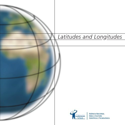
<strong>Latitudes</strong> <strong>and</strong> <strong>Longitudes</strong><br />
AGÊNCIA NACIONAL<br />
PARA A CULTURA<br />
CIENTÍFICA E TECNOLÓGICA
This booklet continues the experiments<br />
<strong>and</strong> activities introduced in Where are<br />
you? Material for observing <strong>and</strong><br />
experimenting, <strong>and</strong> is aimed at children aged ten<br />
<strong>and</strong> over. The experiments described here,<br />
together with the instruments described in the<br />
first booklet can be used to carry out experimental<br />
activities <strong>and</strong> observation at a basic education<br />
level. You should read the first booklet <strong>and</strong> carry<br />
out the activities <strong>and</strong> experiments described there<br />
before you read this one.<br />
Ciência <strong>Viva</strong> would like to thank Professor Rui Dilão for his<br />
ideas from project conception to final product <strong>and</strong> Professor<br />
Maurice Bazin <strong>and</strong> Dr. Elisa Figueira for unwavering support<br />
throughout the different stages of the project.<br />
Editorial Staff<br />
Text <strong>and</strong> Instruments: Rui Dilão<br />
Revision <strong>and</strong> Suggestions: Maurice Bazin, Elisa Figueira, Helena Fonseca,<br />
Carlos Rodrigues <strong>and</strong> the Ciência <strong>Viva</strong> team.<br />
Comments on the text: Ana Teodoro, Dulce Marcelino, Suzana Andrade <strong>and</strong><br />
Maria João Mora.<br />
Graphic Design: FPGBdesign<br />
Internet Edition: Simbiose<br />
Pilot testing in schools: E. S. Luísa de Gusmão (Lisboa), E. S. Rainha D. Amélia<br />
(Lisboa), E. S. José Régio (Vila do Conde) <strong>and</strong> EB2,3 D. Manuel I (Alcochete)<br />
<strong>and</strong> Colégio de Quiaios. Our thanks to the teachers <strong>and</strong> students who took<br />
part in these tests.<br />
Acknowledgements: The view of the Sun, the Earth <strong>and</strong> the aerial photograph<br />
of Lisbon <strong>and</strong> Setúbal on Pages 2, 3 <strong>and</strong> 21 courtesy of the NASA Photo Bank.<br />
The astrolabe diagram, the sextant <strong>and</strong> the 1502 planisphere courtesy of the<br />
Naval Museum. Some of the Earth pictures are from John Walker's web page.<br />
The world map on Page 20 was designed from data 88-MGG-02, Digital Relief<br />
of the Surface of the Earth, NOAA, National Geographic Data Center, Boulder,<br />
Colorado, 1988. Our thanks to all.<br />
Printers: Eurodois<br />
Print run: 1.000<br />
Depósito legal: 135929/02<br />
ISBN: 972-97805-8-7<br />
© Ciência <strong>Viva</strong> - Agência Nacional para a Cultura Científica e Tecnológica, 2002<br />
http://www.cienciaviva.pt
Index<br />
The Earth revolves around the Sun!<br />
The Earth’s Rotation.<br />
The North Star.<br />
How to travel on Earth without getting lost.<br />
The Ecliptic.<br />
The GPS.<br />
The Map of the Earth.<br />
Measuring latitude <strong>and</strong> longitude.<br />
1
2<br />
The Earth around the Sun!<br />
From a very young age, we get used to seeing that day follows night <strong>and</strong> night follows day. Why?<br />
Because we see the sun rising, moving across the sky <strong>and</strong> lighting up the world <strong>and</strong>, at the end of the day, it<br />
disappears behind the mountains or into the sea. Then the moon <strong>and</strong> the stars come out,<br />
rising <strong>and</strong> disappearing again in their turn to give way to the Sun.<br />
People who lived long ago thought the Sun revolved around the Earth. Around 450<br />
years ago, Nicholas Copernicus proved that it is the Earth that revolves around the<br />
Sun <strong>and</strong> day follows night <strong>and</strong> night follows day because the Earth spins on its<br />
own axis.<br />
The Earth moves in an almost circular path on its journey around the Sun.<br />
The Moon revolves around the Earth, accompanying it in its movement around the Sun.<br />
• Do you think that the reason we cannot see the stars during the day is because the sunlight is too bright?<br />
• Watch the sky closely at dusk <strong>and</strong> see how the stars become clearer <strong>and</strong> clearer.<br />
Nicholas Copernicus was born in Pol<strong>and</strong> in 1473, at the time that the Portuguese had just discovered the African<br />
Coast as far as the Gulf of Guinea.<br />
Copernicus dedicated himself to the study of medicine, law <strong>and</strong> astronomy.<br />
He was the first to present clear evidence that the Earth revolved around the Sun. He compiled his ideas in the<br />
book On the Rotation of Celestial Bodies, published in 1543 in Nuremburg, Germany. This was the year in which<br />
D. João III was king in Portugal <strong>and</strong> the Portuguese began their voyages to Japan.
Today using rockets <strong>and</strong> space ships we can travel far from the Earth <strong>and</strong> see that it revolves around the Sun<br />
taking 365 days <strong>and</strong> 6 hours to complete a full circle. From space ships we can photograph the Earth <strong>and</strong> look<br />
deeper into the Universe.<br />
A space station in orbit around the Earth. The movement of this<br />
station around the Earth is very similar to the movement of the<br />
moon around the Earth. The moon is just further away.<br />
A view of Earth from space at a height of 1000 km on the vertical of Lisbon.<br />
Just as we can see the Earth from the Moon, so also can we see<br />
the moon from the Earth. This picture of the Earth was taken from<br />
the spaceship Clementine when it was travelling near the moon.<br />
A year has 365 days <strong>and</strong> 6 hours, which is the approximate time it takes the Earth to make a complete circle<br />
around the Sun. Because of this, our calendar has years with 365 days <strong>and</strong> years with 366 days. A year with 366<br />
days is called a leap year. Knowing that 1996 had 366 days <strong>and</strong> 1997 had 365 days, underline the leap years in<br />
the list below.<br />
1995 1996 1997 1998 1999 2000 2001 2002 2003 2004 2005 2006 2007 2008<br />
3
4<br />
The revolving Earth. Days, nights <strong>and</strong> seasons of the year<br />
The Earth spins on an imaginary axis which runs from the North to the South Pole <strong>and</strong> every twenty four hours<br />
it has turned completely around. This means that every twenty-four hours, there is a day <strong>and</strong> a night.<br />
Night<br />
North Pole<br />
South Pole<br />
Day<br />
During the revolving movement of the Earth around the Sun, the north-south axis always points in the same<br />
direction. If you went on a space voyage for a year, far from the Earth, the Sun <strong>and</strong> the Moon, you would see<br />
that the Earth moves in the following way:<br />
21 March Equinox.<br />
The beginning of spring in the<br />
Northern Hemisphere <strong>and</strong> the<br />
beginning of autumn in the<br />
Southern Hemisphere.<br />
21 June Solstice.<br />
The beginning of summer in the Northern<br />
Hemisphere <strong>and</strong> the beginning of winter<br />
in the Southern Hemisphere.<br />
The Earth’s Orbit: the path travelled by<br />
the Earth in its journey around the Sun.<br />
The spinning of the Earth on its<br />
north-south axis causes day <strong>and</strong><br />
night to follow on each other.<br />
22/23 September Equinox.<br />
The beginning of autumn in the Northern<br />
Hemisphere <strong>and</strong> the beginning of spring<br />
in the Southern Hemisphere.<br />
21/22 December Solstice.<br />
The beginning of winter in the Northern<br />
Hemisphere <strong>and</strong> the beginning of summer<br />
in the Southern Hemisphere.
Imagine that the Earth’s orbit is on a plane - the plane of the Earth’s orbit - , that the north-south axis is inclined<br />
23º <strong>and</strong> 30’ relative to this plane <strong>and</strong> that it always points in the same direction. As you can see in the previous<br />
diagram, there is an area along the Earth’s orbit in which the North Pole has no sunlight while the South Pole has<br />
sunlight. At these times, it is winter in the Northern Hemisphere <strong>and</strong> summer in the Southern Hemisphere. When<br />
the North Pole is leaning more towards the sun, summer starts in the Northern Hemisphere: this is the June<br />
Solstice, the longest day of the year in the Northern Hemisphere.<br />
The Earth revolves around the Sun <strong>and</strong> its axis is tilted relative to the plane of the Earth’s orbit. These facts are<br />
what cause summer <strong>and</strong> winter in the areas above <strong>and</strong> below the Tropics of Cancer <strong>and</strong> Capricorn. In equatorial<br />
regions, the differences between summer <strong>and</strong> winter are less obvious.<br />
If you looked at the Earth <strong>and</strong> the Sun from a spaceship at the level of the plane of the Earth’s orbit during the<br />
solstices, you would see the following:<br />
June Solstice December Solstice<br />
The path of the Earth’s journey around the Sun is roughly circular. Actually there is a time of year when the Earth<br />
is closer to the Sun. This is on the 4 th January, midwinter in the Northern Hemisphere.<br />
• Place a lamp on a table so that it throws light onto your terrestrial globe. Turn the globe slowly on the imaginary<br />
axis running from the North to the South Pole.<br />
• On which parts of the globe is it day-time <strong>and</strong> on which is it night-time?<br />
• Try to make a rough estimate of the time in the bright <strong>and</strong> dark areas of the globe.<br />
• Move the globe around the table trying to copy the movement of the Earth around the Sun, always keeping the<br />
north-south axis pointing in the same direction. When is it summer <strong>and</strong> when is it winter in Lisbon?<br />
• What is the position of the Earth (globe) relative to the Sun (lamp) when it is midday in Lisbon on the following days:<br />
21st of December, 21st of March, 21st of June <strong>and</strong> 22nd of September.<br />
5
6<br />
The North Star<br />
Now let’s take a deeper look at the Universe.<br />
If we look at the sky at regular intervals during the night, we see that the stars move slowly around the North<br />
Star. In the Southern Hemisphere, all the stars move around a very dark area called the Coalsack.<br />
Nowadays, the North Star always shows the north <strong>and</strong> is only visible in the Northern Hemisphere. The Coalsack<br />
shows the south <strong>and</strong> is only visible in the Southern Hemisphere.<br />
• In which direction does the Earth spin on its north-south axis?<br />
• Why do the stars move around the North Star?<br />
Constellations are groups of stars which form imaginary<br />
figures <strong>and</strong> which always seem to be in the same<br />
position relative to each other. The North Star is one of<br />
the tail stars of the Little Dipper constellation.<br />
You can see the Big Dipper, Cassiopeia <strong>and</strong> the Little<br />
Dipper, among others, in the Portuguese sky. If you<br />
watch the night sky from a dark spot, you will see them<br />
easily. The most difficult one to find is the Little Dipper<br />
because the light of its stars is weaker. Start by finding<br />
the Big Dipper <strong>and</strong> Cassiopeia. Then try to find the<br />
Little Dipper by using the position of the three<br />
constellations as seen in the diagram.<br />
If you have your nocturnal with you, you will be able<br />
to tell what time it is.<br />
If you look at these constellations again an hour later,<br />
you will see that they have revolved around the North<br />
Star. Now you can check the time on your nocturnal<br />
again <strong>and</strong> you will see that one hour has gone by.<br />
Big Dipper<br />
Little Dipper<br />
Cassiopeia<br />
North Star
How to travel on Earth without getting lost<br />
By looking at the horizon <strong>and</strong> knowing the direction of sunrise <strong>and</strong> sunset, we can tell in which direction we are<br />
moving. To turn back, you simply turn around <strong>and</strong> go back in the opposite direction.<br />
This is easy when we are on l<strong>and</strong>. We only need to take a fix on one or two points on the horizon <strong>and</strong> go the<br />
opposite way, changing the reference points on the right to the left <strong>and</strong> the points on the left to the right.<br />
Of course, if you have a compass you can tell which direction is north, which is south <strong>and</strong> where the other cardinal<br />
points lie.<br />
But it is also possible to find your way without a compass, because for instance, in Portugal the midday sun is<br />
always in the south.<br />
Sunrise or East<br />
The position of the Sun throughout the day<br />
The position of the noon Sun in<br />
the Northern Hemisphere above<br />
the Tropic of Cancer.<br />
Sunset or West<br />
Finding our way at night, in the desert, or at sea is more difficult as we cannot see any reference points on the horizon.<br />
In the Northern Hemisphere, the North Star is always in the north <strong>and</strong> is visible at night. So if we turn to the North<br />
Star, the Sun will always rise on our right <strong>and</strong> set on our left.<br />
If you live in Cape Verde, which lies between the Tropic of Cancer <strong>and</strong> the Equator, you can still see the North<br />
Star in the north. But, depending on the season, the midday sun may be north or south of your position.<br />
If we travel to the Earth’s Southern Hemisphere like Portuguese navigators from the 15th century on, we can no<br />
longer see the North Star. But the Coalsack will always show us the way south.<br />
7
8<br />
• Find Cape Verde on the globe. Why do the inhabitants of Cape Verde sometimes see the midday sun in the<br />
north <strong>and</strong> at other times in the south?<br />
• Find the Equator <strong>and</strong> the north-south axis on the globe. Light up the globe with a lamp <strong>and</strong> tilt the axis slightly<br />
towards the light so that the area around the North Pole, outlined by the Arctic Circle, is lit up. Place a pencil<br />
against the globe <strong>and</strong> move it vertically on the globe.<br />
• As you can see, there is a point where the pencil casts no shadow. Now find the Tropic of Cancer on the globe<br />
<strong>and</strong> place the pencil against it. Tilt the axis so that there is no shadow when the pencil is on the Tropic of Cancer.<br />
The axis of the globe is now inclined 23º 30’ relative to the vertical. For anyone who is st<strong>and</strong>ing on the surface<br />
of the Earth at the point where the pencil meets the globe <strong>and</strong> who can see the sun in the position of the lamp,<br />
it is midday on June 21st .<br />
• If you move the pencil to the north, its shadow will point north <strong>and</strong> the Sun will be to the south. If you move<br />
the pencil towards the sun, its shadow will point south because the midday sun is to the north.<br />
North Pole<br />
Winter<br />
Summer<br />
Tropic of Cancer<br />
South Pole<br />
Equator<br />
Tropic of Capricorn<br />
• But if you tilt the axis in the opposite direction so that it is winter in the Northern Hemisphere, the pencil shadow<br />
will still point north in Cape Verde <strong>and</strong> in Lisbon.<br />
• So those who can see the midday sun to the north or to the south at different times of the year live between<br />
the Tropic of Cancer <strong>and</strong> the Tropic of Capricorn.<br />
• The answer to our question is simple. As the north-south axis of the Earth is inclined relative to the plane of<br />
the Earth’s orbit, the midday sun on the first day of summer south of the Tropic of Cancer will be in the north.<br />
But in the autumn, between the Equator <strong>and</strong> the Tropic of Cancer, the midday sun will be in the south.<br />
Eratosthenes was born 2274 years ago in the city of Cyrene in present day Libya. While he was running the famous Library of<br />
Alex<strong>and</strong>ria in Egypt, he noticed that on the June solstice in the Northern Hemisphere, a vertical stick in the city of Siena, 800 km<br />
to the south of Alex<strong>and</strong>ria, cast no shadow at midday. Then based on experiments with stick shadows, he calculated the length<br />
of the Equator <strong>and</strong> began to include leap years in the Greek calendar.
By observing the regularity of the Earth’s movement around the Sun, astronomers <strong>and</strong> geographers were able to<br />
find practical ways to determine our position on Earth.<br />
Paralels<br />
Equator<br />
25ºN<br />
0ºN<br />
<strong>Latitudes</strong><br />
50ºN<br />
25ºS<br />
Locations to the north <strong>and</strong> south of the Equator are<br />
marked along circular parallel lines drawn around<br />
the Earth. These lines are called the parallels <strong>and</strong><br />
their positions are measured in degrees: the Equator<br />
is the Zero Degree line, the North Pole is at a 90º N<br />
angle to the Equator <strong>and</strong> the South Pole lies at a 90º S<br />
angle to the Equator. The measurement of the northsouth<br />
position is called latitude.<br />
The latitude of the Tropic of Cancer is 23º 30’, exactly<br />
the same as the Earth’s tilt relative to the plane of<br />
its orbit around the Sun!<br />
To determine the latitude of a location during the day, in addition to knowing the angle of the midday sun above<br />
the horizon, the date, your approximate position on Earth, you also need to know if you are in the Northern or<br />
Southern Hemisphere <strong>and</strong> your position relative to the tropics. In the Northern Hemisphere the angle of the North<br />
Star above the horizon is the latitude of your location.<br />
The latitude of a location is the measurement of the angle if you<br />
travel from the Equator to the parallel which passes through this<br />
location, perpendicular to the Equator. At any time of night, this<br />
angle is equal to the angle of the North Star above the horizon.<br />
Measuring latitude is easy, because in the Northern Hemisphere,<br />
the North Star is always visible in the night sky.<br />
North Star<br />
• Measure the angle of the North Star above the horizon with your quadrant. This angle is the latitude of the<br />
place you are in.<br />
• Use your protractor to measure the angle of your sundial straw above the horizon. This angle should be roughly<br />
the same as the latitude of your position.<br />
30º<br />
30º<br />
The horizon<br />
Latitude:<br />
30ºN<br />
Equator<br />
9
10<br />
17 th century Portuguese astrolabe.<br />
• Use your quadrant <strong>and</strong> your protractor to measure<br />
the height of the noon sun. Compare the values<br />
obtained. You can calculate the noon sun time with<br />
the aid of your sundial.<br />
Based on experiments with stick shadows <strong>and</strong> much observation of the Sun <strong>and</strong> the North<br />
Star, instruments were devised to calculate our position on the surface of the Earth.<br />
With the astrolabe <strong>and</strong> the quadrant, we can find out if we are closer to the north<br />
or to the south by measuring the angle of the North Star above the horizon or<br />
by measuring the angle of the sun above the horizon.<br />
It was these instruments that enabled the beginning of the great ocean<br />
voyages from the 15th century on. They enabled sailors to return to<br />
their point of origin as well as allowing them to make other voyages<br />
along the same routes.<br />
It was during the 16th century that Portuguese mathematician Pedro<br />
Nunes developed instruments which allowed navigators to draw<br />
accurate charts of their sea routes.<br />
The modern version of the astrolabe<br />
<strong>and</strong> the quadrant is the sextant,<br />
which is still used today by all boats<br />
that sail the seas.<br />
Pedro Nunes was born in Alcácer do Sal in 1502. He lived at the height of the Portuguese Discoveries <strong>and</strong> in 1529 he was appointed<br />
Royal Cosmographer by D. João III.<br />
In order to resolve some of the difficulties of navigation, Pedro Nunes invented several astronomical instruments, such as the<br />
universal ringdial, the solar compass <strong>and</strong> the nonius, nowadays called vernier. The first two calculate the height of the Sun in<br />
the sky <strong>and</strong> the third, when fitted to a quadrant can measure to fractions of a degree <strong>and</strong> accurately establish the height of a star.<br />
Some of these instruments were tried out successfully by D. João de Castro on his voyages to Goa <strong>and</strong> the Red Sea.<br />
The nonius was used <strong>and</strong> adapted by the astronomer Tycho Brahe to build two quadrants. Brahe's observations on astronomy<br />
have been the basis of the modern description of planet movement since the end of the 16th century.
We now know how to determine locations further north or further south on the Earth, in other words, we can<br />
determine the latitude of a location. To pinpoint our position on Earth, we need to know if we are further east<br />
or west. This means that we need to know the longitude. Now the Sun <strong>and</strong> the stars cannot help us.<br />
The idea of establishing our east-west position originated in Egypt with the Greek astronomer Ptolemy, who was<br />
born about 2170 years ago. Ptolemy decided to draw vertical circles around the North <strong>and</strong> South Poles <strong>and</strong> call<br />
them meridians. The position of these meridians was measured relative to the Prime Meridian (Zero Degrees),<br />
which passed through a chosen point on the Equator. For Ptolemy, the Prime Meridian passed through the Canary<br />
Isl<strong>and</strong>s. This, however, is largely a matter of choice <strong>and</strong> kings <strong>and</strong> ministers over the years have changed the Prime<br />
Meridian to pass through the Azores, Cape Verde, Rome, Paris, Philadelphia <strong>and</strong> London. Today, it passes through<br />
the Greenwich Observatory which is to the east of London.<br />
Defining the meridians, however, is not enough to determine the longitude of a location, we also need instruments.<br />
One possibility is to measure time with the aid of a clock.<br />
Determining the longitude of a location is based on<br />
the fact that the Earth spins full circle on its northsouth<br />
axis approximately every 24 hours. We need<br />
to know the time difference between the noon sun<br />
of our position <strong>and</strong> that of a reference position.<br />
These times are determined by the maximum height<br />
of the sun at both locations. As the Earth spins<br />
a complete circle (360 degrees) every twenty-four<br />
hours, for every hour of difference between noon<br />
at our location <strong>and</strong> that of our reference location,<br />
the Earth moves 15 degrees east or west.<br />
For example, to determine longitude at sea,<br />
we need to sail with an accurate time-keeper.<br />
Then when it is noon at your current location,<br />
establish what time it is at your port of origin.<br />
With the aid of navigation tables which show<br />
noon times for the port of origin for each day<br />
of the year, pilots can calculate the time differences<br />
between noon at their current location <strong>and</strong><br />
at the port of origin.<br />
For each hour of difference, they are roughly<br />
15 degrees east or west relative to their port of origin.<br />
As we can determine our latitude by looking at<br />
the angle of the sun above the horizon at midday,<br />
or at night by the angle of the North Star above<br />
the horizon, we know which parallel we are on.<br />
Knowing the parallel <strong>and</strong> the meridian, we can now<br />
pinpoint our position on the terrestrial globe.<br />
40ºW<br />
20ºW<br />
Meridians<br />
0º<br />
20ºE<br />
The Greenwich<br />
Meridian<br />
Zero degrees<br />
longitude<br />
Equator<br />
The longitude scale<br />
is marked along the<br />
line of the Equator<br />
11
12<br />
However, taking a clock on a boat was a tricky business. 15th , 16th , 17th <strong>and</strong> 18th century clocks did not take<br />
kindly to the ship’s roll, the humidity <strong>and</strong> temperature differences.<br />
From the end of the 15th century, when Columbus discovered America, to the end of the 18th century, transporting<br />
a clock on board ship was considered the biggest problem in nautical science. Problems caused by ships sailing<br />
off course <strong>and</strong> shipwrecks were so great that in 1598, King Philip of Spain offered a prize to anyone who could<br />
discover a practical way to determine longitude. Later on, in 1714, the English King George III, by request of<br />
sailors <strong>and</strong> traders, introduced the Board of Longitude Award for anyone who could come up with the solution<br />
to the longitude problem.<br />
An accurate time-keeping clock was designed by the English carpenter John Harrison in the mid 18th century <strong>and</strong><br />
its first sea test was carried out in 1736 on a voyage to Lisbon. John Harrison’s invention was only recognised in<br />
1773, when he was awarded the Board of Longitude Award Prize.<br />
Only after 1773 was it possible to accurately determine longitude at sea. Until then navigation was very risky with<br />
many tales of accidents caused by sailing off course. Navigators very often played it safe <strong>and</strong> followed the same<br />
routes along the parallels, always keeping the noon sun at the same altitude. This was the case with Christopher<br />
Columbus who arrived in America in 1492 by sailing along the same parallel.<br />
Sample latitude <strong>and</strong> longitude:<br />
Lisbon: 38º 44’ N, 9º 8’ W<br />
Oporto: 41º 8’ N, 8º 22’ W<br />
Faro: 37º 1’ N, 9º 5’ W<br />
Bragança: 41º 49’ N, 6º 45’ W<br />
The Azores: 38º N, 25º W<br />
Madeira: 33º N, 17º W<br />
John Harrison was born in rural Engl<strong>and</strong> in 1693 <strong>and</strong> by the time he was 18, he had already built a wooden clock. In 1730, he<br />
left his native village for London, where he presented his sea-clock designs to Edmond Halley, one of the most famous astronomers<br />
of the time, but Halley received the plans sceptically. In the five years that followed, Harrison dedicated himself to building the<br />
first sea-clock prototype. This clock, which may be seen in the Greenwich Museum, still keeps accurate time. It weighed 35 kg<br />
<strong>and</strong> had four dials which showed the day, the time, the minutes <strong>and</strong> seconds. It was tried out successfully for the first time on<br />
the H.M.S. Centurion voyage to Lisbon where it kept time to within some seconds a day. John Harrison was about to win the<br />
Board of Longitude Prize. Much to everyone’s surprise, he asked to be given time to perfect his prototype. Harrison was not happy<br />
with either the precision or the size of his clock. Over the following twenty-five years, he built three more prototypes. During<br />
this time, he had the full support of the English Royal Society <strong>and</strong> developed all of the mechanisms which form part of the working<br />
of modern-day clocks.<br />
The fourth clock was only finished in 1759 <strong>and</strong> it weighed 1.5 kg. After navigation tests to India, John Harrison received the<br />
Board of Longitude Prize in 1773 <strong>and</strong> died three years later.<br />
Today his wooden clock <strong>and</strong> his three sea-clocks are still in working order. It is forecast that the last one will start to malfunction<br />
in four hundred years’ time!
During the time of the Discoveries, Portuguese navigators succeeded in making charts of undiscovered areas using<br />
just an astrolabe, a magnetic compass, a compass, a globe <strong>and</strong> an hour-glass. One of these maps is the 1502<br />
Alberto Cantino planisphere.<br />
Tropic<br />
of Cancer<br />
Equator<br />
Tropic<br />
of Capricorn<br />
Longitude<br />
1502 Cantino planisphere showing the meridians <strong>and</strong> the parallels.<br />
Greenwich Meridian<br />
0º<br />
Present day map showing the same area as the Cantino planisphere.<br />
Latitude<br />
23º 30’N<br />
If we compare both maps, we can see that the latitudes of the Tropics <strong>and</strong> the Equator are well-positioned.<br />
Longitude is not well-positioned owing to the inexistence of good clocks. These maps, which gave a rough idea<br />
of the shapes of the seas <strong>and</strong> continents, were of invaluable aid to sailors <strong>and</strong> traders.<br />
0<br />
23º 30’ S<br />
13
14<br />
How a navigator determines latitude <strong>and</strong> longitude<br />
A navigator sails from Lisbon with a clock that keeps time with another clock at the port of origin.<br />
After several days, when the Sun is at its highest in the sky (noon) he sees what time it is in Lisbon <strong>and</strong> then uses<br />
his astrolabe, quadrant or sextant to calculate the angle of the Sun above the horizon.<br />
With the aid of a compass the navigator establishes whether the midday sun is in the north or in the south. Then<br />
he writes down the following information about the noon sun at his location:<br />
Height <strong>and</strong> direction of the Sun at noon: 62º south<br />
Lisbon time: 13:28<br />
Date: 22 July<br />
Latitude <strong>and</strong> longitude of Lisbon (port of origin): 38º 44´ N, 9º 8´ W.<br />
From this information, the navigator uses the following methods to establish his position:<br />
Calculating latitude would be very easy if it was during one of the equinoxes when the midday sun is on the<br />
equator: as the North Star is at a 90º angle relative to the Equator, latitude would be calculated at 90º minus the<br />
angle of the Sun above the horizon. On the other h<strong>and</strong>, since I left Lisbon several days ago, the midday sun has<br />
always been to the south so I must be north of the Equator.<br />
Let’s see what the Sun’s position is during the equinox when I can see the midday sun in the south:<br />
Because the midday sun is on the Equator during the equinox<br />
<strong>and</strong> the Equator is at a 90º angle relative to the North Star,<br />
the latiude measured from the Sun’s angle at midday is equal<br />
to 90º minus the angle of the Sun above the horizon.<br />
The Sun during the Equinox<br />
Height of the Sun<br />
The North Star<br />
Lat.<br />
Lat.<br />
The horizon<br />
N<br />
S<br />
Cancer<br />
Equator
If it was during the solstice, the position of the Sun would be like this:<br />
The Sun during<br />
the solstice<br />
23º 30’<br />
Height of<br />
the Sun<br />
If today were June 21 st , the midday sun would be on the vertical of the tropic of Cancer <strong>and</strong><br />
would no longer be at a 90º angle with the North Star. But as the latitude of the Tropic of Cancer<br />
is 23º 30´ from the height of the Sun in my current location to determine the height of the Sun<br />
relative to a point on the Equator. With this new angle, I could calculate latitude as if it were a<br />
day during the equinox.<br />
North Star<br />
Lat.<br />
23º 30’<br />
The horizon<br />
N<br />
Lat.<br />
S<br />
Tropic<br />
of Cancer<br />
Equator<br />
As there are 92 days between the solstice <strong>and</strong> the equinox, the height of the midday sun relative to the equator<br />
varies 15’ 20” per day. I got this figure by dividing 23º 30’ by 92 days. So, on July 22nd , 61 days before the equinox<br />
the Sun is between the equator <strong>and</strong> the tropic. This means that the height of the Sun relative to the equator is 15’<br />
20” multiplied by 61 giving a total of 15º 35’. So to calculate the latitude of a place, I have to deduct this angle<br />
from what I measured, like I did during the solstice. Therefore the angle to calculate latitude is 62º minus 15º 35’<br />
which gives 46º 25’. Finally I can calculate latitude like on an equinoctial day: 90º - 46º 25’ = 43º 35’ N.<br />
To calculate longitude I need to know noon time in Lisbon <strong>and</strong> compare it with the time of the noon sun at my<br />
location. With the aid of the navigation tables drawn by the astronomers of my port of origin, I know that the noon<br />
sun in Lisbon was at 12:43. The noon sun at my location was 45 minutes later than in Lisbon. As the Earth spins<br />
15º per hour, a time difference of 45 minutes corresponds to an angle of 11º 15’. So, as the Earth spins from West<br />
to East, I am west of the point of origin on longitude 9º 8’ + 11º 15’ = 20º 23’ W.<br />
The navigator’s position on Earth is 43º 35’N, 20º 23’ W. If you mark these co-ordinates on the globe you will see<br />
that the navigator is in the Atlantic Ocean, north-west of Lisbon <strong>and</strong> north-east of the Azores isl<strong>and</strong>s.<br />
• Find the place where you live on the globe <strong>and</strong> determine its approximate latitude <strong>and</strong> longitude.<br />
15
16<br />
The Ecliptic<br />
Over two thous<strong>and</strong> years ago, while Egyptian <strong>and</strong> Greek astronomers were watching the night sky, they realised that<br />
there were sets of stars - constellations - which kept the same approximate positions relative to each other.<br />
Then they imagined that the Universe was an enormous sphere with fixed stars. They called this the Celestial Sphere<br />
<strong>and</strong> the set of stars the heavens. Today we know that this is not the case. The stars in the heavens move but they are<br />
so far away that it is very difficult to see them moving, even with more powerful telescopes.<br />
As the Earth lies in the middle of the Celestial Sphere, approximately every 24 hours the stars are seen in the same<br />
position in the heavens. But what happens in relation to the Sun?<br />
If we mark the position of the midday sun in the Celestial<br />
Sphere every day for a year, it will show a<br />
circumference with a 23º 30’ incline relative to the<br />
equator of the Celestial Sphere. The apparent<br />
orbit of the Sun in the Celestial Sphere is<br />
called the ecliptic. The incline of the<br />
ecliptic is the same as the north-south incline<br />
relative to the plane of the Earth’s orbit.<br />
It is approximately midday on March 21st at the point where the Equator meets<br />
the Greenwich meridian that the Sun in<br />
its apparent movement around the Earth, 23º 30’<br />
intersects the Celestial Equator. It is from Winter<br />
Solstice<br />
this moment that clocks which show days,<br />
nights <strong>and</strong> seasons are set. To maintain the<br />
regularity of the Sun’s apparent movement<br />
around the Earth, we need to adjust the calendar<br />
Celestial Sphere<br />
Ecliptic<br />
Celestial<br />
Equator<br />
Summer<br />
Solstice<br />
23º 30’<br />
every leap year <strong>and</strong> less often we need to put the clocks<br />
back or forward a few seconds. For example, under the Papal<br />
Decree of 1582, the 5th of October became the 15th of October. On the eve of the year 2000, the final seconds should<br />
have been counted 5, 4, 3, 2, 1, 1,0.<br />
It is by setting the clock by the approximate regularity of movement of the celestial bodies that we can determine<br />
latitude <strong>and</strong> longitude. The International Astronomy Union meets periodically to present average figures of the incline<br />
of the ecliptic <strong>and</strong> year length. Knowing that the Earth spins an average 15º every hour <strong>and</strong> that on 21st March 1999<br />
at 0º N 0º W the noon sun is at 12:06, we can determine quite accurately the time of the noon sun at any point on<br />
the Earth. For instance, in the year 2000 the ecliptic is at an angle of 23º 26' 21" to the Celestial Equator. The Earth<br />
spins an average of 15º 2' 28" every hour <strong>and</strong> the year is approximately 365 days, 5 hours, 58 minutes <strong>and</strong> 54 seconds.
It is by using data on the apparent movement of the Sun in the Celestial Sphere that astronomers draw up maritime<br />
charts for navigators. For instance, to determine the latitude of a location on any given day of the year, a navigator<br />
needs to know the height of the noon sun on the ecliptic. So astronomers draw up charts of the incline of the<br />
Sun throughout the year, as shown in the chart below. According to the chart, on 22 nd May, for example, the<br />
midday sun is on the vertical of the 16º N parallel. On the 7 th November, the midday sun is on the vertical of the<br />
12º parallel. The negative values in the chart refer to latitudes south of the Equator.<br />
0º<br />
5º<br />
-5º<br />
10º<br />
-10º<br />
Angle of correction used in determining latitude<br />
15º<br />
EMBER AUGUST<br />
-15º<br />
JULY<br />
20º<br />
23º30’ 20º<br />
JUNE<br />
-20º -23º30’-20º<br />
MAY<br />
MARCH FEBRUARY JANUARY DECEMBER NOVEMBER OCTOBER SEPT<br />
15º<br />
-15º<br />
APRIL<br />
10º<br />
-10º<br />
5º<br />
-5º<br />
0º<br />
17
18<br />
In order to determine longitude, the time of the noon sun in a location on Earth is shown in a chart. For example,<br />
at the Pavilhão do Conhecimento in Lisbon, the time of the noon sun shown on the clock is calculated by adding<br />
12 hours to the minutes shown in the chart. Using these charts, a quadrant, a compass <strong>and</strong> a clock with a local<br />
reference time, it is always possible to know where we are on Earth.<br />
JUNE<br />
JULY<br />
32 33 33 34 35 36 37 39<br />
APRIL<br />
MARCH<br />
Noon Sun at the<br />
Pavilhão do Conhecimento<br />
Lisbon 9º 5’ 42” W<br />
MAY 40 42 44 45 47 48 49 50 50 51 51 50 50 49 47 46 44 42 40 38 35 3331 29 27 25 23 22<br />
Corrections<br />
Oporto: about 3 minutes earlier<br />
Bragança: about 10 minutes earlier<br />
Faro: the same time<br />
Azores: about 1 hour <strong>and</strong> 3 minutes later<br />
Madeira: about 31 minutes later<br />
For mainl<strong>and</strong> Portugal <strong>and</strong> Madeira, add one hour<br />
during the period between the last Sunday in<br />
March <strong>and</strong> the last Sunday in October. For the<br />
Azores, subtract one hour between the last Sunday<br />
in October <strong>and</strong> the last Sunday in March.<br />
Using these charts, a quadrant, a compass <strong>and</strong> a clock with a local reference time, it is always possible to know<br />
where we are on Earth.<br />
FEBRUARY JANUARY DECEMBER NOVEMBER OCTOBER SEPTEMBER AUGUST<br />
21 20 20 20 20 21 21 23 24 26 27 29 31 33 35 36 38 39 40 41 42 4242 42 42 41 40 39 38 37 36 35 34 34 33 32 32
The GPS<br />
Nowadays, longitude <strong>and</strong> latitude can be calculated electronically using man-made satellites. This is a great aid<br />
to ships <strong>and</strong> planes in finding their way on the Earth.<br />
With man-made satellites, it is possible to find out our location on Earth, the time <strong>and</strong> the average height above<br />
sea-level. All in all, there are 24 satellites 20 200 km high which<br />
orbit the Earth every 12 hours. These satellites continually<br />
transmit radio waves to Earth, where they are captured by<br />
an antennae. Using an apparatus specially designed to<br />
capture these signals, we can immediately discover latitude,<br />
longitude <strong>and</strong> altitude on Earth. The signals from five<br />
out of eight of these satellites can always be received<br />
anywhere on Earth.<br />
This system is called GPS - Global Positioning System.<br />
The GPS satellite constellation in orbit<br />
around the Earth.<br />
Each of the GPS constellation satellites sends constant radio signals<br />
to Earth, which show its position, latitude, longitude <strong>and</strong> the time.<br />
Some radio waves arrive earlier <strong>and</strong> others later, depending on<br />
the distance of each satellite from the antennae. The calculator<br />
of the GPS apparatus is programmed to determine latitude <strong>and</strong><br />
longitude with signals from at least four of the satellites.<br />
Nowadays ships <strong>and</strong> planes are equipped with GPS<br />
receivers. However, reception of GPS signals is<br />
dependent on atmospheric weather conditions, so<br />
as a precaution, ships always carry a sextant on board.<br />
19
20<br />
The Map of the Earth<br />
A map is a simplified representation of populated areas, geographical features, roads, rivers, continents <strong>and</strong><br />
oceans. As well as maps of the Earth <strong>and</strong> its countries, there are city plans <strong>and</strong> ordnance survey charts. These are<br />
all maps. In the past they were drawn using a compass, an astrolabe <strong>and</strong> a tape measure. Nowadays, they are<br />
charted using aerial photography <strong>and</strong> the GPS.<br />
Maps are used for several purposes.<br />
The world map shows us countries, large rivers <strong>and</strong> mountains, the position of oceans <strong>and</strong> deserts, etc.<br />
A country map shows us the larger cities <strong>and</strong> towns, roads, etc.<br />
Ordnance survey maps show contours, roads, houses, forests, etc.<br />
A city plan shows us streets, monuments, parks, etc.<br />
All maps show the cardinal points as well as a scale.<br />
A world map showing the continents <strong>and</strong> the sea beds in relief. The blue represents the sea. Dark blue represents<br />
the deeper ocean beds <strong>and</strong> light blue the shallower beds. The continents are shown in yellow <strong>and</strong> the darker<br />
areas are the contours. The positions of the Equator, the Greenwich meridian, the Tropics of Cancer <strong>and</strong><br />
Capricorn, the Arctic <strong>and</strong> the Antarctic Circles are shown on the map.<br />
• Look at the map or at your globe. Find the mountains on the sea bed. Find the Azores archipelago <strong>and</strong> notice<br />
how they all form part of a chain which rises out of the sea bed <strong>and</strong> crosses the Earth from north to south.<br />
• Find the latitude <strong>and</strong> longitude scales on the planisphere.
• Here is an aerial photograph of Lisbon <strong>and</strong> Setúbal. Use tracing paper to copy the picture. Draw a map of this<br />
area <strong>and</strong> identify what you think are the relevant features. For example, rivers, bridges, roads, etc. Try to lay<br />
out your own map. This is how modern maps are made.<br />
21
22<br />
Measuring latitude <strong>and</strong> longitude<br />
Just before noon, point your sundial to the south with the aid of a compass. But the compass only gives an<br />
approximate indication of the North Pole’s position <strong>and</strong> your sundial needs to be accurate, so if you are in mainl<strong>and</strong><br />
Portugal you should turn it about 5º East. In the Azores, this angle needs to be 11º <strong>and</strong> 8º in Madeira. These<br />
angles vary only very slightly <strong>and</strong> up to the year 2007 they will decrease by just 1º.<br />
At noon, that is when the shadow of the straw on your sundial points to 12 on the scale, use your quadrant to<br />
measure the angle of the Sun above the horizon.<br />
Angle of the Sun above the horizon at noon<br />
To determine latitude from this information, we need to use a table similar to those used by 15 th <strong>and</strong> 16 th century<br />
Portuguese navigators. Look at the circular chart on Page 17 to find out the necessary correction angle for latitude<br />
of the location where the measurement is being taken:<br />
Latitude = 90º - (measured angle) + angle of correction =<br />
Note that the angle of correction may be positive or negative.<br />
It is possible to tell noon time using only a stick shadow. Just before midday place a stick vertically <strong>and</strong> mark the ends of the<br />
shadows it casts with chalk, then check the time. When the shadow is at its shortest then it is noon. In addition, the noon shadow<br />
points exactly North. Now you can carry out your experiment setting your sundial by the shadow <strong>and</strong> you don’t even need to<br />
use a compass. For example you could determine the direction of the north-south axis one day <strong>and</strong> measure latitude the next day.
In order to determine latitude we must first determine local noon time, know the longitude of a reference point<br />
<strong>and</strong> noon time at this point. Let’s use the Pavilhão do Conhecimento in Lisbon, Latitude 9º 5’ 42” W as our<br />
reference point.<br />
Just before noon, point the sundial to the south as described in the above activity. At noon, that is when the<br />
shadow of the straw on your sundial falls on 12 on the scale, look at the time on your wristwatch, which must<br />
be accurate by Lisbon time:<br />
Noon time at my location:<br />
Look at the circular chart on Page 18 to find out what noon time is at your reference point - the Pavilhão do<br />
Conhecimento:<br />
Noon time at the Pavilhão do Conhecimento:<br />
Now calculate the difference between noon time at your location <strong>and</strong> at the Pavilhão do Conhecimento:<br />
Time difference = Noon time at my location - noon time at the Pavilhão do Conhecimento =<br />
This number may be positive or negative <strong>and</strong> should be calculated in minutes. For example: 12.30 - 12.25 = 5<br />
minutes; 12.30 - 12.35 = -5 minutes; 12.25 - 13.35 = -70 minutes.<br />
As the Earth spins 15’ every minute, this time difference corresponds to the difference in longitude:<br />
Longitudinal difference = Time difference in minutes x 15’/minutes =<br />
As the Earth spins from West to East, the longitude of your location is:<br />
Longitude = 9º 5’ 42” W + longitudinal difference =<br />
23
24<br />
1.<br />
2.<br />
3.<br />
4.<br />
5.<br />
6.<br />
7.<br />
8.<br />
9.<br />
10.<br />
How many days are there in a year?<br />
How many days are there in a leap year <strong>and</strong> how often are they?<br />
Does the Earth revolve around the Sun or does the Sun revolve around the Earth?<br />
Which direction is the north, south, sunrise <strong>and</strong> sunset where you live?<br />
Which days are the solstices <strong>and</strong> the equinoxes?<br />
Can you point out the Little Dipper, Cassiopeia <strong>and</strong> the Milky Way?<br />
What is the latitude <strong>and</strong> longitude where you are?<br />
The Arctic Circle is the parallel which borders the areas of the Earth where there is no night on the<br />
21 st June. What is the latitude of this parallel?<br />
Draw a map of the streets <strong>and</strong> paths of your area. Do not forget to include a scale <strong>and</strong> a compass rose<br />
with north pointing to the North Pole.<br />
You can do lots of activities with your globe. For example, you can draw national borders, the largest rivers<br />
<strong>and</strong> deserts on Earth, the sea routes of 15 th <strong>and</strong> 16 th century Portuguese navigators <strong>and</strong> many more.
Ciência <strong>Viva</strong><br />
Agência Nacional para a Cultura<br />
Científica e Tecnológica<br />
Av. dos Combatentes, 43 A - 10ºA<br />
1600-042 Lisboa · PORTUGAL<br />
Tel.: (351) 21 727 02 28<br />
Fax.: (351) 21 722 02 65<br />
info@cienciaviva.pt<br />
www.cienciaviva.pt<br />
UNIÃO EUROPEIA<br />
POCTI · Comparticipação FEDER<br />
Fundos Nacionais do MCT


