GRASSED WATERWAY (412) - Field Office Technical Guide
GRASSED WATERWAY (412) - Field Office Technical Guide
GRASSED WATERWAY (412) - Field Office Technical Guide

Create successful ePaper yourself
Turn your PDF publications into a flip-book with our unique Google optimized e-Paper software.
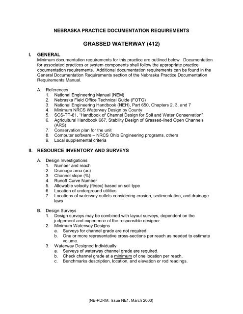
NEBRASKA PRACTICE DOCUMENTATION REQUIREMENTS<strong>GRASSED</strong> <strong>WATERWAY</strong> (<strong>412</strong>)I. GENERALMinimum documentation requirements for this practice are outlined below. Documentationfor associated practices or system components shall follow the appropriate practicedocumentation requirements. Additional documentation requirements can be found in theGeneral Documentation Requirements section of the Nebraska Practice DocumentationRequirements Manual.A. References1. National Engineering Manual (NEM)2. Nebraska <strong>Field</strong> <strong>Office</strong> <strong>Technical</strong> <strong>Guide</strong> (FOTG)3. National Engineering Handbook (NEH), Part 650, Chapters 2, 3, and 74. Minimum NRCS Waterway Design by County5. SCS-TP-61, “Handbook of Channel Design for Soil and Water Conservation”6. Agricultural Handbook 667, Stability Design of Grassed-lined Open Channels(ARS)7. Conservation plan for the unit8. Computer software – NRCS Ohio Engineering programs, others9. Local supplemental criteriaII. RESOURCE INVENTORY AND SURVEYSA. Design Investigations1. Number and reach2. Drainage area (ac)3. Channel slope (%)4. Runoff Curve Number5. Allowable velocity (ft/sec) based on soil type6. Location of underground utilities7. Locations of waterway outlets considering erosion, sedimentation, and drainagelawsB. Design Surveys1. Design surveys may be combined with layout surveys, dependent on thejudgement and experience of the responsible designer.2. Minimum Waterway Designsa. Surveys for channel grade are not required.b. One or more representative cross-sections per reach as needed to estimatevolume.3. Waterway Designed Individuallya. Surveys of waterway channel grade are required.b. Check channel grade at a minimum of one location per reach.c. Benchmarks description, location, and elevation or rod readings.(NE-PDRM, Issue NE1, March 2003)
Grassed Waterway-24. <strong>Field</strong> survey notes will conform to NEM Part 540 and follow standard field notedocumentation as illustrated in <strong>Technical</strong> Release 62 (TR-62) and/or NebraskaStandard Format for Engineering Notes Transmittal Sheets No. 3. Survey noteswill be prepared such that they exhibit legible, logical, clear and concise data.C. Environmental Inventory1. NEPA inventory of resources -- form NE-CPA-52 must be completed by NRCSduring planning2. Wetland effects, if applicable3. Archeological/Historical/Cultural Resourcesa. Complete all continuing environmental requirements stemming from planningas expressed in the General Documentation Requirements section of theNebraska Practice Documentation Requirements Manual.III. DESIGNA. Design data -- record on form NE-ENG-21 and provide printout from software (OHIOEngineering Programs)1. Hydrologic data -- peak design flows for each reach2. Hydraulic determinations -- safe velocities for each reach based on soils and/orvegetal retardance3. Required dimensions and capacity for each reach4. Description of temporary or permanent erosion control structures to be installed5. Quantity and cost estimates6. Seeding requirements and area to be seeded7. Legal description8. Initials/signatures and dates by the person(s) responsible for the design, approval,and checking of the design.B. Permits1. 404 permit (if applicable) -- document if individual permit was obtained,nationwide permit applies, or if practice is exempt.2. County road ditch discharge permits if applicable.IV. PLANS AND SPECIFICATIONSA. Plans1. Use form NE-ENG-21, 21A, or appropriate “D” or “B” sized sheets.2. Plan view -- may be superimposed on location map. Show stationing and identifyreaches. Include map orientation.3. Profile -- centerline of waterway. Show original ground superimposed on design,grade, stationing, reaches, etc. Centerline profiles are required on waterways asneeded. Determination is based on judgment of person with Job ApprovalAuthority.4. Cross-sections -- plot cross-sections for each reach.(NE-PDRM, Issue NE1, March 2003)
Grassed Waterway-35. Construction notes -- add notes to clarify a component and furnish directions forinstallations to supplement standard specifications as needed.a. Construction plans shall include a statement requiring the contractor to notifythe Nebraska One-Call System (Diggers Hotline) regarding utilities on theconstruction site. See the General Documentation Requirements section ofthe Nebraska Practice Documentation Requirements Manual for therecommended statement.b. Add notes as necessary to identify avoidance and, if needed, protection areasand boundaries associated with cultural resources, threatened or endangeredspecies, or other resources needing temporary protection during installation.6. Table of quantities.7. NRCS Engineering Job Class from NE-ENG-14.8. Location map with legal description.B. Specifications1. Nebraska FOTG Conservation Practice specifications, component specificationsfrom NEH Part 650, Engineering <strong>Field</strong> Handbook Appendix 1, or equivalent,modified as needed. Additional specifications may be written to provide fullmaterial and installation instructions.C. O&M Plans1. As specified in Waterway (<strong>412</strong>) Standard in Nebraska FOTG.D. Plans, Specifications, O&M Plans Delivery1. Case folder2. Transmittal letter copyV. LAYOUTA. Layout Surveys1. Use field notebook, forms, etc.2. Minimum Waterway Designa. Identify alignment of waterway for construction purposes.3. Individual Waterway Designa. Record in field notebook or on forms NE-ENG-21 and 21A.b. Reference stakes or slope stakes at each reach to control alignment andgrade as designed.c. Set stations on grade or land slope changes and at an interval based on thejudgment of the technician with Job Approval Authority. Recommendedmaximum interval – 500 feet.B. Quantity Computations1. Minimum Waterway Designa. Representative cross-sections for pre-construction quantities.2. Individual Waterway Designa. Obtain sufficient cross-sections per design reach to calculate volumes byaverage end area method. Final quantities are based on staked crosssectionsor approved changes.(NE-PDRM, Issue NE1, March 2003)
Grassed Waterway-4VI. COMPLIANCE CHECKINGA. Record in field notes or on NE-ENG-21 or 21A.1. Length, width, depth, and side slopes. Individual design waterways require aminimum of one cross-section per design reach.2. Statement on temporary or permanent erosion control measures installed.3. Status of seeding.4. Construction inspection report -- form NE-ENG-49.5. Statement of compliance - statement that construction is completed according toplans and specifications, signed and dated by the person certifying completion.B. “As Built” Plans1. Refer to NEM, 512.51 and 512.522. “As Built” plans are a record of constructed facilities. “As Built” plans are requiredwhen a significant change in design occurs during construction or when the job isdesignated Class V or higher. Changes are superimposed in a different color(usually red), or differentiated in some other manner (such as a drawing a boxaround the as-built value) on the official file copy and show:a. Significant 1 design changes.b. Significant 1 changes in linear measurement.c. Final quantities -- may be based on layout stake notes, if no changes wereapproved and work meets planned lines and grades.d. Identify as “As Built” on plans.1 Determination of "significant" is a matter of judgment by the technician. As a general rule, changes that exceednormal measuring error allowances, normal construction tolerances, and methods of mathematical computation,should be considered as significant.(NE-PDRM, Issue NE1, March 2003)