Erosion and Deposition along Rivers and Seashores - Part 2 ...
Erosion and Deposition along Rivers and Seashores - Part 2 ...
Erosion and Deposition along Rivers and Seashores - Part 2 ...
Create successful ePaper yourself
Turn your PDF publications into a flip-book with our unique Google optimized e-Paper software.
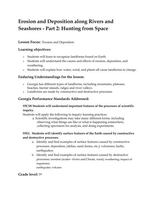
<strong>Erosion</strong> <strong>and</strong> <strong>Deposition</strong> <strong>along</strong> <strong>Rivers</strong> <strong>and</strong><strong>Seashores</strong> - <strong>Part</strong> 2: Hunting from SpaceLesson Focus: <strong>Erosion</strong> <strong>and</strong> <strong>Deposition</strong>Learning objectives:‣ Students will learn to recognize l<strong>and</strong>forms found on Earth.‣ Students will underst<strong>and</strong> the causes <strong>and</strong> effects of erosion, deposition, <strong>and</strong>weathering.‣ Students will explain how water, wind, <strong>and</strong> plants all cause l<strong>and</strong>forms to change.Enduring Underst<strong>and</strong>ings for the lesson:‣ Georgia has different types of l<strong>and</strong>forms, including mountains, plateaus,beaches, barrier isl<strong>and</strong>s, ridges <strong>and</strong> river valleys.‣ L<strong>and</strong>forms are made by constructive <strong>and</strong> destructive processes.Georgia Performance St<strong>and</strong>ards Addressed:S5CS8 Students will underst<strong>and</strong> important features of the processes of scientificinquiry.Students will apply the following to inquiry learning practices:a. Scientific investigations may take many different forms, includingobserving what things are like or what is happening somewhere,collecting specimens for analysis, <strong>and</strong> doing experiments.S5E1. Students will identify surface features of the Earth caused by constructive<strong>and</strong> destructive processes.a. Identify <strong>and</strong> find examples of surface features caused by constructiveprocesses: deposition, (deltas, s<strong>and</strong> dunes, etc.); volcanoes; faults;earthquakes.b. Identify <strong>and</strong> find examples of surface features caused by destructiveprocesses: erosion (water- rivers <strong>and</strong> Ocean, wind); weathering; impact oforganisms;earthquake; volcano.Grade level: 5 th
Materials: (per each group of four to six students)‣ Maps <strong>and</strong> Atlases of Georgia‣ Google Earth capable computer (one for every 2 students)‣ One per student: “<strong>Erosion</strong> <strong>and</strong> <strong>Deposition</strong> <strong>along</strong> <strong>Rivers</strong> <strong>and</strong> <strong>Seashores</strong>”worksheet‣ One per class: Promethean board or projector that can be connected to acomputerTime needed: One 1.5 hour periodBackground Information:<strong>Erosion</strong> is the process by which solids such as rocks <strong>and</strong> soil are broken down <strong>and</strong>transported. <strong>Erosion</strong> is usually driven by wind, by ice in the form of glaciers, or bywater in the form of rainfall, stream flow, waves or flooding. <strong>Erosion</strong> may also becaused by living organisms or by the force of gravity alone pulling soil particles down aslope. <strong>Erosion</strong> is a natural process, but rates of erosion may be affected by humanactivities such as agriculture, construction, <strong>and</strong> mining. In fact, some scientists say thathumans cause erosion to occur 10-15 times faster than it would occur naturally.On the other end of erosion is deposition, which is the laying down of sediment thatwas transported by wind, water, or ice. As wind, water, or ice loses its kinetic energy, itcan no longer carry the sediment <strong>and</strong> the sediment is deposited back onto the l<strong>and</strong>.How sediments are transported <strong>and</strong> deposited depends on the volume <strong>and</strong> the velocityof the wind, water, or ice transporting those sediments.All of these processes are driven in some way by the force of gravity. For example, as ariver flows downstream it carves out a river valley by scouring away some of the rock<strong>and</strong> sediment through which it flows. Larger volumes of water flowing down steeperslopes <strong>and</strong> through narrower channels will have more kinetic energy <strong>and</strong> will thereforepick up more sediment. As the river nears the coast <strong>and</strong> the slope levels out, theflowing water loses energy <strong>and</strong> slows down, depositing the largest sediments first <strong>and</strong>carrying smaller particles of s<strong>and</strong>, silt, <strong>and</strong> mud out to form river deltas <strong>and</strong> beaches.<strong>Erosion</strong> <strong>and</strong> deposition are responsible for the formation of l<strong>and</strong>forms such as valleys,canyons, cliffs, oxbow lakes, floodplains, beaches, river deltas, s<strong>and</strong>bars, <strong>and</strong> barrierisl<strong>and</strong>s, among others.
Learning Procedure:1. Review the concepts of erosion <strong>and</strong> deposition from <strong>Part</strong> 1. Discuss the results ofthe investigation using the pictures taken of the s<strong>and</strong> formations formed during<strong>Part</strong> 1 to remind everyone of the results.2. Inform the students that in <strong>Part</strong> 2 they will be trying to find similar formations inthe real world by looking at images taken by satellites in Earth orbit.3. Launch Google Earth (GE) on the computer <strong>and</strong> zoom in somewhere <strong>along</strong> thecoast of Georgia. Have the students do the same on their computer. Point outsome rivers, marshes, <strong>and</strong> barrier isl<strong>and</strong>s. Show where the latitude <strong>and</strong>longitude indicators are located at the bottom of the GE screen. Also showwhere the Eye Altitude indicator is located on the lower right h<strong>and</strong> side of thescreen.4. Review how to use latitude <strong>and</strong> longitude. Point out that even though GE showsthe coordinates to the hundredth of a minute, the coordinates they will be usingare estimated to the nearest minute.5. H<strong>and</strong> out the “<strong>Erosion</strong> <strong>and</strong> <strong>Deposition</strong> <strong>along</strong> <strong>Rivers</strong> <strong>and</strong> <strong>Seashores</strong> Worksheet”,read the introduction <strong>and</strong> demonstrate how to “fly” to the proper coordinates<strong>and</strong> altitude by doing A.1., A.2., <strong>and</strong> having the students fly <strong>along</strong> on theircomputers. Describe what they are viewing. Concentrate on the features causedby moving water.6. Have the students complete the worksheet by working in groups.7. After the groups finish, review each site discussing how the l<strong>and</strong>forms <strong>and</strong>surrounding topography have been affected by erosion <strong>and</strong> deposition.Evaluation:1. Evaluate the student’s completion of the worksheet. Emphasis should be given tothe completeness of the descriptions <strong>and</strong> whether they indicate an underst<strong>and</strong>ingof constructive <strong>and</strong> destructive effects of water.2. Have the student find one example of erosion or deposition anywhere on theplanet. Have them write a paragraph describing the visible evidence of erosion<strong>and</strong> deposition.
Extensions:1. Have the students build a model of a l<strong>and</strong>form shaped by erosion or deposition.Have them explain the part played by wind, water, ice, or human actions in itsformation.2. Have the students investigate whether erosion <strong>and</strong> deposition are possible onany other planet. Why or why not?3. Have students locate <strong>and</strong> describe erosion <strong>and</strong> deposition events in our Ocean.Resources:‣ Google Earth (ver. 5)‣ www.Geology.com : a wealth of internet links to all things geological.‣ Natural Resources Conservation Service (NRCS). <strong>Part</strong> of the USDA. Has greatinformation on erosion as well as many links to erosion related lesson plans <strong>and</strong>activities. http://www.nrcs.usda.gov/‣ “Humans have huge impact on erosion”. Associated Press.12/1/2006. http://www.msnbc.msn.com/id/15993162/ns/us_newsenvironment‣ Fundamentals of PhysicalGeography: http://www.physicalgeography.net/fundamentals/10ac.htmlLesson developed by: Javier Tavel, Hembree Springs Elementary SchoolThis activity is a product of the <strong>Rivers</strong> to Reef Educators Workshop sponsored by the Georgia Aquarium<strong>and</strong> Gray’s Reef National Marine Sanctuary in which the author was a participant. For moreinformation about this workshop, Georgia Aquarium, or NOAA Gray’s Reef National Marine Sanctuary,please visit our websites at www.georgiaaquarium.org or http://graysreef.noaa.gov/
<strong>Erosion</strong> <strong>and</strong> <strong>Deposition</strong> <strong>along</strong> <strong>Rivers</strong> <strong>and</strong> <strong>Seashores</strong>WorksheetNow that you have modeled erosion <strong>and</strong> deposition in the classroom <strong>and</strong> have seen it up close on theplayground, let’s see if you can recognize how these processes, <strong>and</strong> the l<strong>and</strong>forms they affect, look likefrom space. You will be using the computer <strong>and</strong> Google Earth to “fly” over areas on Georgia’s rivers <strong>and</strong>coast to see how these processes can build <strong>and</strong> destroy.A. Fly to the latitude / longitude coordinates <strong>and</strong> the eye altitude given to see some examples of theconstructive <strong>and</strong> destructive power of water.1. Coordinates: 31 o 22’ 55” N / 81 o 16’ 39” W Eye Alt: 6,000 ftDescription: S<strong>and</strong> being deposited on the south end of Sapelo Isl<strong>and</strong>2. Coordinates: 31 o 08’ 08” N / 81 o 23’ 04” W Eye Alt: 500 ftDescription: Rip-Rap (big rocks) being used on Saint Simons Isl<strong>and</strong> to protect houses frombeach erosion caused by the Ocean.3. Coordinates: 31 o 24’ 34” N / 81 o 28’ 33” W Eye Alt: 5,000 ftDescription: Loop in Cathead Creek near Darien, GA Filled in by sediment (deposition).4. Coordinates: 31 o 56’ 36” N / 82 o 18’ 40” W Eye Alt: 9,000 ftDescription: Altamaha River eroded through the neck of a loop creating an “ox bow” lake.5. Coordinates: 31 o 57’ 22” N / 82 o 32’ 32” W Eye Alt: 9,000 ftDescription: S<strong>and</strong>bars built up on the slower “inside” of turns where the Alcovy <strong>and</strong> theOconee <strong>Rivers</strong> meet to form the mighty Altamaha River.6. Coordinates: 30 o 42’ 57” N / 81 o 26’ 30” W Eye Alt: 22,000 ftDescription: S<strong>and</strong> being deposited <strong>along</strong> the south face of the Cumberl<strong>and</strong> Isl<strong>and</strong> jetty at themouth of the St. Mary’s River.B. Now that you know how to fly go to the following coordinates <strong>and</strong> altitudes <strong>and</strong> describe what yousee that may be caused by erosion or deposition1. Coordinates: 33 o 10’ 42” N / 84 o 01’ 00” W Eye Alt: 1,700 ftDescription: (Hint: Open the pictures!)2. Coordinates: 33 o 48’ 17” N / 84 o 84’ 09” WEye Alt: 5,000 ftDescription:
3. Coordinates: 32 o 04’ 07” N / 84 o 54’ 30” WEye Alt: 600 ftDescription: (Hint: See hint above)4. Coordinates: 31 o 27’ 00” N / 81 o 13’ 43” WEye Alt: 22,000 ftDescription:C. Now find four examples of erosion <strong>and</strong> deposition on your own. Two must be in Georgia <strong>and</strong> theother two can be from anywhere else on Earth. Give the coordinates, the eye altitude <strong>and</strong> adescription of the l<strong>and</strong>form.1. Coordinates: _____ o _____ ’ _____” N / _____ o _____’ _____” WEye Alt: ___Description:2. Coordinates: _____ o _____ ’ _____” N / _____ o _____’ _____” W Eye Alt: ___Description:3. Coordinates: _____ o _____ ’ _____” N / _____ o _____’ _____” W Eye Alt: ___Description:4. Coordinates: _____ o _____ ’ _____” N / _____ o _____’ _____” WEye Alt: ___Description:


