HERE - Inland Fisheries Ireland
HERE - Inland Fisheries Ireland
HERE - Inland Fisheries Ireland

You also want an ePaper? Increase the reach of your titles
YUMPU automatically turns print PDFs into web optimized ePapers that Google loves.
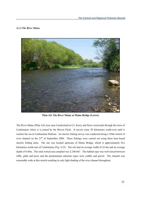
The Central and Regional <strong>Fisheries</strong> Boards4.2.4 The River MainePlate 4.8. The River Maine at Maine Bridge (Lower)The River Maine (Plate 4.8) rises near Castleisland in Co. Kerry and flows westwards through the town ofCastlemaine where it is joined by the Brown Flesk. It travels some 30 kilometres south-west until itreaches the sea at Castlemaine Harbour. An electric fishing survey was conducted along a 320m stretch ofriver channel on the 23 rd of September 2008. Three fishings were carried out using three boat basedelectric fishing units. The site was located upstream of Maine Bridge, which is approximately fivekilometres north-east of Castlemaine (Fig. 4.23). The site had an average width of 16.4m and an averagedepth of 0.48m. The total wetted area sampled was 5,248.0m 2 . The habitat type was well mixed betweenriffle, glide and pool, and the predominant substrate types were cobble and gravel. The channel wasreasonably wide at this stretch resulting in only light shading of the river channel throughout.32