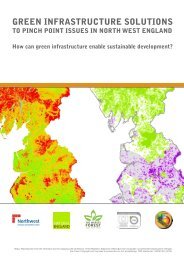
a Public Benefit Mapping Project - Green Infrastructure North West
a Public Benefit Mapping Project - Green Infrastructure North West
a Public Benefit Mapping Project - Green Infrastructure North West
- No tags were found...

Create successful ePaper yourself
Turn your PDF publications into a flip-book with our unique Google optimized e-Paper software.
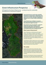
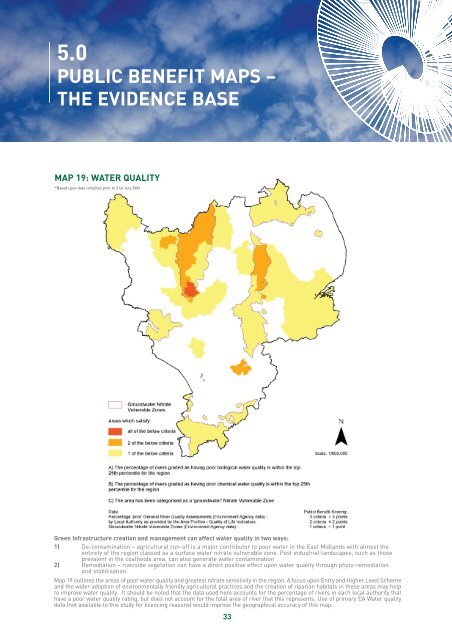
5.0PUBLIC BENEFIT MAPS –THE EVIDENCE BASEMAP 19: WATER QUALITY*Based upon data compiled prior to 21st July 2006<strong>Green</strong> <strong>Infrastructure</strong> creation and management can affect water quality in two ways:1) De-contamination – agricultural run-off is a major contributor to poor water in the East Midlands with almost theentirety of the region classed as a surface water nitrate vulnerable zone. Post industrial landscapes, such as thoseprevalent in the coalfields area, can also generate water contamination2) Remediation – riverside vegetation can have a direct positive effect upon water quality through phyto-remediationand stabilisation.Map 19 outlines the areas of poor water quality and greatest nitrate sensitivity in the region. A focus upon Entry and Higher Level Schemeand the wider adoption of environmentally friendly agricultural practices and the creation of riparian habitats in these areas may helpto improve water quality. It should be noted that the data used here accounts for the percentage of rivers in each local authority thathave a poor water quality rating, but does not account for the total area of river that this represents. Use of primary EA Water qualitydata (not available to this study for licencing reasons) would improve the geographical accuracy of this map.33