Bega - RTA - NSW Government
Bega - RTA - NSW Government
Bega - RTA - NSW Government

You also want an ePaper? Increase the reach of your titles
YUMPU automatically turns print PDFs into web optimized ePapers that Google loves.
ISBN 978-1-921766-60-2<br />
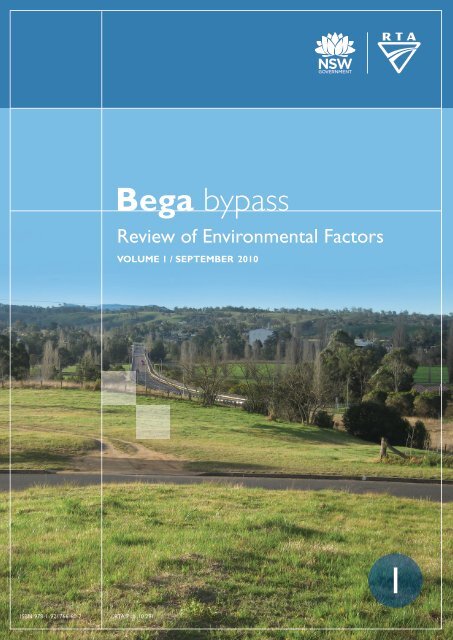
<strong>Bega</strong> bypass<br />
Review of Environmental Factors<br />
VOLUME 1 / SEPTEMBER 2010<br />
<strong>RTA</strong>/Pub. 10.291<br />
1
Roads and Traffic Authority<br />
<strong>Bega</strong> Bypass<br />
Review of Environmental Factors<br />
September 2010
Executive summary<br />
The proposal<br />
The Roads and Traffic Authority of <strong>NSW</strong> (<strong>RTA</strong>) proposes to construct a bypass of the township of <strong>Bega</strong><br />
located on the Princes Highway on the south coast of <strong>NSW</strong> (the proposal). The proposal is for a two lane<br />
highway bypass about 3.5 kilometres in length and would generally follow an existing road reservation to<br />
the west of the <strong>Bega</strong> township.<br />
The proposal extends from the southern abutment of the <strong>Bega</strong> River Bridge in the north to Finucane<br />
Lane in the south. It mainly follows an existing road reservation established by the <strong>Bega</strong> Valley Shire<br />
Council and aligns with the <strong>Bega</strong> River Bridge which was built in 1975 to be compatible with this road<br />
reserve.<br />
Key features of the proposal are:<br />
� A new bridge over the bypass on High Street.<br />
� A new bridge over the bypass on Ravenswood Street.<br />
� Two major access points linking the town, the bypass and properties to the west of the bypass<br />
including:<br />
– A new roundabout on the southern side of the <strong>Bega</strong> River bridge.<br />
– A new southern access in the vicinity of Boundary Road/Applegum Close.<br />
� A new road connecting Applegum Close to Ravenswood Street, due to loss of direct access from<br />
Applegum Close to the bypass.<br />
� Realignment of Finucane Lane.<br />
The <strong>Bega</strong> bypass would result in:<br />
� Improvement in the efficient movement of freight on the South Coast.<br />
� Improved amenity in <strong>Bega</strong> due to reduced heavy vehicle numbers in the <strong>Bega</strong> CBD improving noise<br />
and air quality impacts.<br />
� Improved safety within the <strong>Bega</strong> CBD with separation between local and through traffic.<br />
� Improve road safety by upgrading the Princes Highway to current design standards.<br />
� Improved pedestrian and cyclist safety within the <strong>Bega</strong> CBD due to reduction in heavy vehicles and<br />
other through traffic.<br />
� Improve travel times on the highway (proposed 100 km/h speed limit compared to through town<br />
travel speeds).<br />
A <strong>Bega</strong> bypass has been planned since the 1940’s, when the local council and the then Department of<br />
Main Roads began setting aside a road reservation which was subsequently incorporated into the <strong>Bega</strong><br />
planning scheme in 1965. A number of options have been considered for the proposal and the options<br />
consideration process has included input from the community and other stakeholders. The identification<br />
of the preferred option took into account social, environmental and economic factors.<br />
21/18937/157350<br />
<strong>Bega</strong> Bypass<br />
Review of Environmental Factors<br />
i
Community and stakeholder consultation<br />
During preparation of the REF, the <strong>RTA</strong> consulted with the local community and stakeholders such as<br />
<strong>Bega</strong> Valley Shire Council, the Aboriginal community and government agencies.<br />
Environmental impacts<br />
The proposal would have both beneficial and adverse environmental impacts. The adverse<br />
environmental impacts would be avoided, managed and mitigated through the implementation of sitespecific<br />
safeguards.<br />
The main environmental impacts associated with the proposal are discussed below.<br />
Ecology<br />
A total of around 6.95 hectares of Lowland Grassy Woodland endangered ecological community would<br />
be cleared. Of this, 0.58 hectares is of moderate to good condition and 6.37 hectares is of low condition.<br />
An assessment of significance found that the proposal is unlikely to have a significant impact on this<br />
endangered ecological community.<br />
About 24 hectares of vegetation, including both native and exotic vegetation, would be cleared. This<br />
includes the removal of six hollow-bearing trees at the southern end of the route and limited bushrock<br />
outcropping. Removal of these features would result in habitat loss for some species.<br />
Assessments of significance were undertaken for potential impact on nine fauna species. These<br />
assessments conclude that it is unlikely that there would be a significant impact on any threatened fauna<br />
species as a result of the proposal.<br />
Noise and vibration<br />
During construction, noise criteria would potentially be exceeded in sensitive receivers adjacent the<br />
proposal. Vibration impacts are likely to be noticeable, but unlikely to cause structural damage as the<br />
majority of works would occur at distances greater than 50 metres from residences. A construction noise<br />
and vibration management plan would be prepared and implemented to manage and mitigate impacts.<br />
A total of 63 receivers would need to be considered for operation noise mitigation measures. Feasible<br />
and reasonable noise attenuation at these receivers would be determined during detailed design.<br />
Visual amenity<br />
The proposal would have a moderate to high impact on the landscape character. These ratings are due<br />
to the predominantly open and rural setting combined with the landform and scattered vegetation<br />
present. Urban design principles and site specific safeguards have been developed and would apply to<br />
the proposal.<br />
Traffic and access<br />
During construction, traffic impacts would minimised as much of the work would be located on land that<br />
is currently undeveloped and separate from the Princes Highway. Access across the bypass corridor<br />
would be altered during operation with access proposed via the High and Ravenswood Street<br />
overbridges. This would result in some increased travel times for local residences however it would also<br />
reduce the need for local traffic to travel on the bypass and would increase road safety<br />
Long term benefits of the proposal include the reduction of vehicles from the <strong>Bega</strong> CBD, particularly<br />
heavy vehicles, which would improve safety and amenity within the CBD. The proposal would also allow<br />
21/18937/157350<br />
<strong>Bega</strong> Bypass<br />
Review of Environmental Factors<br />
ii
B-doubles to bypass <strong>Bega</strong> removing the need to unhitch and reattach trailers currently required when<br />
travelling northbound.<br />
Aboriginal cultural heritage<br />
A section 90 permit under the National Parks and Wildlife Act, 1974 has been obtained for the whole<br />
proposal footprint. The proposal would impact upon Aboriginal objects of low scientific significance in the<br />
proposal footprint.<br />
Soil, hydrology, drainage and water quality<br />
Construction activities would potentially cause erosion, sedimentation and degradation of local water<br />
quality including groundwater. During operation, the proposal would increase the volume and rate of<br />
stormwater run-off onto adjacent areas, potentially causing scour and impacts on water quality.<br />
Management plans would be prepared and implemented to mitigate these impacts.<br />
Socio economic issues<br />
Local businesses are expected to experience short-term positive impacts during construction, particularly<br />
in the accommodation, entertainment and grocery sectors, as well as trades and services. Businesses<br />
are not expected to be affected by any amenity changes during construction. Amenity in the vicinity of<br />
the construction footprint would be affected through the introduction of construction traffic, noise, dust<br />
and visual impacts.<br />
During operation access between the <strong>Bega</strong> CBD and existing properties on the western side of the<br />
corridor would be altered, resulting in increased travel distances and times. Noise and visual impacts, are<br />
expected for residences located adjacent to the proposed bypass. Amenity through the <strong>Bega</strong> CBD would<br />
improve, largely as a result of the reduction in the number of vehicles using the existing Princes<br />
Highway, in particular heavy vehicles<br />
While passing trade may reduce, no major impacts to businesses are expected in the long-term. This is<br />
due to the improved local amenity, continued local demand and modified business operations.<br />
Conclusion<br />
The REF has identified that the proposal is unlikely to have a significant impact on the environment or on<br />
matters of national environmental significance or Commonwealth Land.<br />
Display of the review of environmental factors<br />
This review of environmental factors is on display for comment between 20 September 2010 and 25<br />
October 2010. You can access the documents in the following ways:<br />
Internet<br />
The documents would be available as PDF files on the <strong>RTA</strong> website:<br />
http://www.rta.nsw.gov.au/constructionmaintenance/majorconstructionprojectsregional/southcoast/prince<br />
shwy/begabypass.html<br />
How can I make a submission?<br />
To make a submission on the proposal, please send your written comments to:<br />
<strong>RTA</strong> Project Manager<br />
21/18937/157350<br />
<strong>Bega</strong> Bypass<br />
Review of Environmental Factors<br />
iii
Nick Boyd<br />
PO Box 477, Wollongong <strong>NSW</strong> 2520 ,<br />
Email: nick_boyd@rta.nsw.gov.au<br />
Facsimile number: 02 4221 2590<br />
Submissions must be received by 25 October 2010.<br />
Privacy information<br />
All information included in submissions is collected for the sole purpose of assisting in the assessment of<br />
this proposal. The information may be used during the environmental impact assessment process by<br />
relevant <strong>RTA</strong> staff and its contractors.<br />
Where the respondent indicates at the time of supply of information that their submission should be kept<br />
confidential, the <strong>RTA</strong> would attempt to keep it confidential. However there may be legislative or legal<br />
justification for the release of the information, for example under the Freedom of Information Act 1989 or<br />
under subpoena or statutory instrument.<br />
The supply of this information is voluntary. Each respondent has free access at all times to the<br />
information provided by that respondent but not to any identifying information provided by other<br />
respondents if a respondent has indicated that the representation should be kept confidential.<br />
Any respondent may make a correction to the information that they have provided by writing to the same<br />
address the submission was sent.<br />
The information would be held by the Roads and Traffic Authority, 90 Crown Street, Wollongong, <strong>NSW</strong><br />
2500.<br />
What happens next?<br />
Following the submissions period, the <strong>RTA</strong> would collate submissions. Acknowledgement letters would<br />
be sent to each respondent. The details of submission authors would be retained and authors would be<br />
subsequently advised when proposal information is released.<br />
After consideration of community comments the <strong>RTA</strong> would determine whether the proposal should<br />
proceed as proposed, or whether any alterations to the proposal are necessary. The community would<br />
be kept informed regarding this <strong>RTA</strong> determination.<br />
If the proposal is approved, the <strong>RTA</strong> proceeds with final design and tenders are called for construction of<br />
the proposal.<br />
If you have any queries, please contact the <strong>RTA</strong> project manager on Ph: 02 4221 2438.<br />
21/18937/157350<br />
<strong>Bega</strong> Bypass<br />
Review of Environmental Factors<br />
iv
Contents<br />
Volume 1 – Main Report and Appendix A<br />
Executive summary i<br />
1. Introduction 1<br />
21/18937/157350<br />
1.1 Proposal identification 1<br />
1.2 Purpose of the report 2<br />
2. Need and options considered 7<br />
2.1 Strategic need for the proposal 7<br />
2.2 Proposal objectives 10<br />
2.3 Alternatives and options considered 11<br />
3. Description of the proposal 18<br />
3.1 The proposal 18<br />
3.2 Existing road and infrastructure 18<br />
3.3 Design parameters 21<br />
3.4 Major design features 22<br />
3.5 Construction activities 28<br />
3.6 Ancillary facilities 32<br />
3.7 Public utility adjustments 33<br />
3.8 Property acquisition 34<br />
4. Statutory and planning framework 37<br />
4.1 State Environmental Planning Policies 37<br />
4.2 Local Environmental Plans 40<br />
4.3 Other relevant legislation 40<br />
4.4 Confirmation of statutory position 42<br />
5. Stakeholder and community consultation 43<br />
5.1 Consultation strategy 43<br />
5.2 Community involvement 43<br />
5.3 Aboriginal community involvement 45<br />
5.4 <strong>Government</strong> agency and stakeholder involvement 45<br />
5.5 Ongoing or future consultation 51<br />
6. Environmental assessment 52<br />
<strong>Bega</strong> Bypass<br />
Review of Environmental Factors
21/18937/157350<br />
6.1 Ecology 52<br />
6.2 Noise and vibration 62<br />
6.3 Landscape character and visual amenity 74<br />
6.4 Traffic and access 79<br />
6.5 Greenhouse emissions 85<br />
6.6 Air quality 88<br />
6.7 Climate change 90<br />
6.8 Aboriginal cultural heritage 93<br />
6.9 Non-Aboriginal historic heritage 97<br />
6.10 Soils, hydrology, drainage and water quality 99<br />
6.11 Land use and property 108<br />
6.12 Socio-economic 110<br />
6.13 Demand on resources 115<br />
6.14 Waste management 116<br />
6.15 Hazards and risks 117<br />
6.16 Cumulative environmental impacts 119<br />
6.17 Summary of beneficial effects 121<br />
6.18 Summary of adverse effects 121<br />
7. Environmental management 122<br />
7.1 Environmental management plans (or system) 122<br />
7.2 Summary of safeguards and management measures 122<br />
7.3 Licensing and approvals 130<br />
8. Conclusion 132<br />
8.1 Justification 132<br />
8.2 Ecologically sustainable development 132<br />
8.3 Conclusion 134<br />
9. Certification 136<br />
10. References 137<br />
11. Terms and acronyms used in this REF 139<br />
Clause 228 Checklist 144<br />
Matters of National Environmental Significance 148<br />
Table Index<br />
Table 3.1 Existing road infrastructure 19<br />
<strong>Bega</strong> Bypass<br />
Review of Environmental Factors
21/18937/157350<br />
Table 3.2 Indicative heavy vehicle movements 31<br />
Table 3.3 Indicative property acquisition requirements 34<br />
Table 4.1 Matters for consideration under the LSCREP No 2 38<br />
Table 5.1 Summary of main community issues raised on the options 44<br />
Table 5.2 Summary of government agency and stakeholder issues 46<br />
Table 5.3 Assessment of items of Clauses 13, 14, 15 and 16 of the ISEPP48<br />
Table 6.1 Occurrence of endangered ecological communities 53<br />
Table 6.2 Occurrence of listed fauna species within the study area with<br />
potential for impact. 57<br />
Table 6.3 Types of vegetation cleared 59<br />
Table 6.4 Summary of significance assessments for threatened fauna 61<br />
Table 6.5 Interim Construction Noise Guideline construction noise criteria at<br />
sensitive receivers 63<br />
Table 6.6 British Standard 6472 human comfort vibration limits 63<br />
Table 6.7 Guideline values for short term vibration on structures (DIN 4150-3)<br />
63<br />
Table 6.8 Environmental Criteria for Road Traffic Noise operational traffic<br />
noise target levels, LAeq(period), dB(A) 64<br />
Table 6.9 Rating background level (RBL) dB(A) 68<br />
Table 6.10 Predicted construction noise levels, LAeq(15min) dB(A) 69<br />
Table 6.11 Typical vibration levels (mm/s peak) 69<br />
Table 6.12 Summary of road traffic noise impacts 71<br />
Table 6.13 Landscape character impacts 77<br />
Table 6.14 Average weekday traffic volumes 79<br />
Table 6.15 Projected traffic volumes without the <strong>Bega</strong> bypass, year 2015 (future<br />
existing) 81<br />
Table 6.16 Projected traffic volumes with the <strong>Bega</strong> bypass, year 2015 (with<br />
proposal) 81<br />
Table 6.17 Projected traffic volumes with the <strong>Bega</strong> bypass, year 2025 design<br />
82<br />
Table 6.18 Vehicle numbers on the existing Princes Highway through <strong>Bega</strong>82<br />
Table 6.19 Projected heavy vehicle numbers on the Princes Highway through<br />
<strong>Bega</strong> 83<br />
Table 6.20 Scenario one: emissions from traffic using <strong>Bega</strong> town route without<br />
bypass (2015) 87<br />
Table 6.21 Scenario two: emissions from traffic using both bypass and <strong>Bega</strong><br />
town route (2015) 87<br />
Table 6.22 Climate change projections for the <strong>Bega</strong> region 90<br />
Table 6.23 Preliminary assessment of archaeological potential within the<br />
proposal footprint 95<br />
<strong>Bega</strong> Bypass<br />
Review of Environmental Factors
21/18937/157350<br />
Table 6.24 Non-Aboriginal heritage items 97<br />
Table 7.1 Summary of site specific environmental safeguards 122<br />
Table 7.2 Summary of licensing and approval required 130<br />
Figure Index<br />
Figure 1.1 The proposal (northern end) 3<br />
Figure 1.2 The proposal (southern end) 4<br />
Figure 1.3 The general locality of the proposal 5<br />
Figure 1.4 The proposal footprint and the existing road reserve 6<br />
Figure 2.1 B-double route through <strong>Bega</strong> 9<br />
Figure 2.2 B-double decoupling area 10<br />
Figure 3.1 Site of the proposal at Ravenswood Street looking south 20<br />
Figure 3.2 Looking south along Princes Highway and Finucane Lane<br />
intersection 21<br />
Figure 3.3 Major features of the proposal 24<br />
Figure 3.4 Proposed site for the northern roundabout (looking north at existing<br />
<strong>Bega</strong> River Bridge) 25<br />
Figure 3.5 Artist sketch of High Street bridge 26<br />
Figure 3.6 Indicative property acquisition required for the proposal 36<br />
Figure 6.1 Endangered ecological communities present in the area 55<br />
Figure 6.2 Noise catchment areas and noise monitoring locations (north) 66<br />
Figure 6.3 Noise catchment areas and noise monitoring locations (south) 67<br />
Figure 6.4 Landscape character zones 76<br />
Figure 6.5 Artists impression heading south towards the proposed northern<br />
roundabout 78<br />
Figure 6.6 Soil landscapes at <strong>Bega</strong>, <strong>NSW</strong> 100<br />
Appendices<br />
A Environmental Checklists<br />
Volume 2 - Appendices<br />
B Consultation material<br />
C Biodiversity Assessment<br />
D Noise and Vibration Assessment<br />
E Visual Impact Assessment<br />
F Greenhouse Assessment<br />
G Aboriginal Heritage Assessments<br />
H Socio-economic Assessment<br />
<strong>Bega</strong> Bypass<br />
Review of Environmental Factors
1. Introduction<br />
1.1 Proposal identification<br />
The Roads and Traffic Authority of <strong>NSW</strong> (<strong>RTA</strong>) proposes to construct a bypass of the township of <strong>Bega</strong><br />
located on the Princes Highway on the south coast of <strong>NSW</strong> (the proposal). The proposal is for a two lane<br />
highway bypass about 3.5 kilometres in length. The alignment would following an existing road<br />
reservation to the west of the <strong>Bega</strong> township (refer to Figure 1.1 and Figure 1.2).<br />
The Princes Highway is the major north–south transport link between Sydney, the Illawarra and south<br />
coast regions. It is a critical link for both passenger and freight transport and is a major route for tourism.<br />
Currently northbound B-doubles are not permitted to travel through <strong>Bega</strong>. The proposal would enable the<br />
Princes Highway between the Snowy Mountains Highway and the Victorian border to be used by Bdouble<br />
vehicles in both directions. It would also remove through vehicles from the town centre, improving<br />
safety and amenity for residents.<br />
The proposal extends from the southern abutment of the <strong>Bega</strong> River Bridge in the north to Finucane<br />
Lane in the south. It mainly follows an existing road reservation established by the <strong>Bega</strong> Valley Shire<br />
Council in the 1960s and aligns with the <strong>Bega</strong> River Bridge which was built in 1975 to be compatible with<br />
the road reservation.<br />
Key features of the proposal are:<br />
� A new bridge over the bypass on High Street.<br />
� A new bridge over the bypass on Ravenswood Street.<br />
� Two major access points linking the town, the bypass and properties to the west of the bypass<br />
including:<br />
– A new roundabout on the southern side of the <strong>Bega</strong> River bridge.<br />
– A new southern access in the vicinity of Boundary Road/Applegum Close.<br />
� A new road connecting Applegum Close to Ravenswood Street, due to loss of direct access from<br />
Applegum Close to the bypass.<br />
� Realignment of Finucane Lane.<br />
The proposal is in the <strong>Bega</strong> Valley local government area (LGA) in the <strong>RTA</strong> Southern region on the <strong>NSW</strong><br />
south coast. The main land uses in the study area include residential, commercial and agricultural,<br />
particularly dairy farming. Other land uses include the Mimosa Rocks National Park and the Bournda<br />
Nature Reserve. The main water courses in the study area are the Brogo River and the <strong>Bega</strong> River. The<br />
<strong>Bega</strong> River crosses the Princes Highway just to the north of the proposal then runs parallel about 350<br />
metres to the west of the proposal. Refer to Figure 1.3 for the general locality of the proposal.<br />
The proposal footprint is defined as the area of direct impact. This is mainly in the allocated road<br />
reservation which is characterised by open pasture, with rural residential to the west and urban/industrial<br />
to the east. The proposal footprint and the existing road reservation are shown in Figure 1.4.<br />
The Australian and <strong>NSW</strong> governments have committed joint funding for planning and construction of the<br />
proposed bypass. The construction phase of the proposal is expected to be around two years and to be<br />
completed in late 2013.<br />
21/18937/157350<br />
<strong>Bega</strong> Bypass<br />
Review of Environmental Factors<br />
1
1.2 Purpose of the report<br />
This review of environmental factors (REF) has been prepared by GHD and nghenvironmental on behalf<br />
of <strong>RTA</strong> Southern region. For the purposes of these works, the <strong>RTA</strong> is the proponent and the determining<br />
authority under Part 5 of the Environmental Planning and Assessment Act 1979 (EP&A Act).<br />
The purpose of the REF is to describe the proposal, to document the likely impacts of the proposal on<br />
the environment, and to detail protective measures to be implemented.<br />
The description of the proposal and associated environmental impacts have been undertaken in context<br />
of clause 228 of the Environmental Planning and Assessment Regulation 2000, the Threatened Species<br />
Conservation Act 1995 (TSC Act), the Fisheries Management Act 1994 (FM Act), and the Australian<br />
<strong>Government</strong>’s Environment Protection and Biodiversity Conservation Act 1999 (EPBC Act). In doing so,<br />
the REF helps to fulfil the requirements of Section 111 of the EP&A Act, that the <strong>RTA</strong> examine and take<br />
into account to the fullest extent possible, all matters affecting or likely to affect the environment by<br />
reason of the activity.<br />
The findings of the REF would be considered when assessing:<br />
� Whether the proposal is likely to have a significant impact on the environment and therefore the<br />
necessity for approval to be sought under Part 3A of the EP&A Act.<br />
� The significance of any impact on threatened species as defined by the TSC Act and/or FM Act, in<br />
accordance with Section 5A of the EP&A Act and therefore the requirement for a Species Impact<br />
Statement.<br />
� The potential for the proposal to significantly impact a matter of national environmental significance<br />
or Commonwealth land and the need to make a referral to the Australian <strong>Government</strong> Department of<br />
the Environment, Water, Heritage and the Arts (DEWHA) for a decision by the Commonwealth<br />
Minister for the Environment Protection, Heritage and the Arts on whether assessment and approval<br />
is required under the EPBC Act.<br />
21/18937/157350<br />
<strong>Bega</strong> Bypass<br />
Review of Environmental Factors<br />
2
Legend<br />
Buckajo Road<br />
Ridge Street<br />
The proposal<br />
Waterways (lines)<br />
Highways<br />
West Street<br />
<strong>Bega</strong> River<br />
John Street<br />
Angle Street<br />
Princes Highway<br />
Valley Street<br />
Kooringal Place<br />
Major roads<br />
Secondary roads<br />
Other roads<br />
Bridge Street<br />
Norman Avenue<br />
Fairview Street<br />
Ravenswood Street<br />
overpass<br />
Northern<br />
roundabout<br />
High Street<br />
overpass<br />
High Street<br />
Old Highway Street<br />
Kirkland Crescent<br />
Poplar Street<br />
Figure 1.1 Concept design (Northern end)<br />
Meringo Street<br />
Dowling Street<br />
Ravenswood Street<br />
<strong>Bega</strong> Street<br />
Nelson Street<br />
Baker Street<br />
Gowing Avenue<br />
Prospect Street<br />
Maher Street<br />
Watson Street<br />
Bloomfield Avenue<br />
Minyama Parade<br />
Wallace Street<br />
Heath Street<br />
Eden Street<br />
Spindler Street<br />
Swan Street<br />
Broulee Street<br />
Hill Street<br />
Eden Street<br />
Mckee Avenue<br />
Peden Street<br />
Upper Street<br />
Girraween C rescent<br />
Victoria Street<br />
Rawlinson Street<br />
Lynjohn Drive<br />
Bodalla Road<br />
Auckland Street<br />
Zingel Place<br />
Barrack Street<br />
o<br />
1:10,000 (at A4)<br />
00.0375 0.075 0.15 0.225 0.3<br />
Kilometers<br />
Map Projection: Transverse Mercator<br />
Horizontal Datum: Geocentric Datum of Australia (GDA)<br />
Grid: Map Grid of Australia 1994, Zone 55<br />
G:\21\18937\GIS\Maps\21.18937.Z005_<strong>Bega</strong>_<strong>RTA</strong>_Location_Map(A4)_20100804.mxd<br />
Laws Drive<br />
Little Church Street<br />
Princes Highway<br />
Church Street<br />
Manning Street<br />
Game Crescent
Applegum Close to<br />
Ravenswood Street<br />
connection<br />
Max Slater Drive<br />
Legend<br />
Finucane Lane<br />
The proposal<br />
Waterways (lines)<br />
Highways<br />
Ravenswood Street<br />
Applegum Close<br />
Finucane Lane<br />
realignment<br />
Auckland Street<br />
Charlotte Street Redgum Close<br />
Major roads<br />
Secondary roads<br />
Other roads<br />
M inyama Parade<br />
Finucane Lane<br />
Figure 1.2 Concept design (Southern end)<br />
Mecklenberg Street<br />
Princes Highway<br />
Lynjohn Drive<br />
Intersection with<br />
Boundary Road<br />
and the existing<br />
Princes Highway<br />
Boundary Road<br />
Willow Court<br />
East Street<br />
Boundary R o ad<br />
o<br />
1:10,000 (at A4)<br />
00.0375 0.075 0.15 0.225 0.3<br />
Kilometers<br />
Map Projection: Transverse Mercator<br />
Horizontal Datum: Geocentric Datum of Australia (GDA)<br />
Grid: Map Grid of Australia 1994, Zone 55<br />
G:\21\18937\GIS\Maps\21.18937.Z005_<strong>Bega</strong>_<strong>RTA</strong>_Location_Map(A4)_20100804.mxd
Wadbilliga National Park !<br />
!<br />
Devils Hole<br />
Wyndham<br />
South East Forest<br />
National Park<br />
Morans Crossing<br />
Mogilla Rd<br />
Tantawangalo Mountain Rd<br />
Dubbo !<br />
Wollongong !<br />
Nowra !<br />
Wagga Wagga !<br />
Canberra "<br />
!<br />
Albury<br />
Melbourne<br />
Maitland !<br />
Newcastle !<br />
!<br />
BathurstCentral<br />
! Coast<br />
!<br />
Sydney "<br />
Candelo<br />
Numbugga<br />
Snowy Mountains Hwy<br />
Kameruka<br />
Myrtle Mountain<br />
!<br />
<strong>Bega</strong><br />
Regional Locality Map<br />
Toothdale<br />
South East Forest<br />
National Park<br />
B uckajo Rd<br />
<strong>Bega</strong> R iver<br />
Candelo <strong>Bega</strong> Rd<br />
Wyndham Ln<br />
Figure 1.3 Regional context<br />
Buckajo<br />
<strong>Bega</strong> Valley<br />
Black Range<br />
Kingswood<br />
Kanoona<br />
South Wolumla<br />
Yurammie<br />
State Forest<br />
Frogs Hollow<br />
Wolumla<br />
Princes Hwy<br />
Brogo<br />
Greendale<br />
Bro go River<br />
Coopers Gully<br />
Stony Creek<br />
<strong>Bega</strong><br />
Tarraganda<br />
Yellow Pinch<br />
Biamanga National Park<br />
Mumbulla Mountain<br />
Bournda<br />
Nature Reserve<br />
Angledale<br />
Tathra Rd<br />
Mimosa Rocks<br />
National Park<br />
Doctor George Mountain<br />
Chinnock Nelson<br />
Bournda<br />
Berrambool<br />
Merimbula<br />
Millingandi<br />
Bald Hills<br />
Jellat Jellat<br />
Reedy Swamp<br />
Tathra Rd<br />
Kalaru<br />
Wallagoot<br />
Sapphire Coast Dr<br />
Bournda<br />
National Park<br />
Tura Beach<br />
Beg a St<br />
Tanja<br />
Mogareeka<br />
Tathra<br />
Wapengo<br />
Tathra Bermagui Rd<br />
SOUTH PACIFIC OCEAN<br />
Legend<br />
Murrah<br />
The proposal<br />
Highways<br />
Major roads<br />
National Parks<br />
Conservation Area<br />
Woodland<br />
Waterways<br />
Seas<br />
<strong>Bega</strong> general area<br />
o<br />
1:200,000(at<br />
A4)<br />
0 1 2 4 6 8 10<br />
Kilometers<br />
Map Projection: Transverse Mercator<br />
Horizontal Datum: Geocentric Datum of Australia (GDA)<br />
Grid: Map Grid of Australia 1994, Zone 55<br />
G:\21\18937\GIS\Maps\21.18937.Z006_<strong>Bega</strong>_<strong>RTA</strong>_Regional_Context_fig1_3.mxd
Legend<br />
Buckajo Road<br />
Proposal footprint<br />
Existing bypass<br />
road reservation<br />
Waterways<br />
<strong>Bega</strong> RiverPrinces Highway<br />
Figure 1.4 Existing bypass road reservation<br />
and proposal footprint<br />
Angle Street<br />
Finucane Lane<br />
Highways<br />
Major roads<br />
Secondary roads<br />
Other roads<br />
Valley Street<br />
Poplar Street<br />
Kirkland Crescent<br />
Fairview Street<br />
High Street<br />
Meringo Street<br />
Ravenswood Street<br />
<strong>Bega</strong> Street<br />
BEGA<br />
Dowling Street<br />
Baker Street<br />
Gowing Avenue<br />
Minyama Parade<br />
Wallace Street<br />
Hill Street<br />
Eden Stre et<br />
Spindler Street<br />
Mecklenberg Street<br />
Applegum Close<br />
Finucane Lane<br />
Eden Street<br />
Redgum Close<br />
Koolgarra Drive<br />
Laws Drive<br />
Boundary Road<br />
Princes Highway<br />
Auckland Street<br />
Zingel Place<br />
High Street<br />
Church Street<br />
Barrack Street<br />
Manning Street<br />
Lynjohn Drive<br />
Bridge Street<br />
Gipps Street<br />
Douglas Street<br />
Canning Street<br />
Parker Street<br />
Rawlinson Street<br />
Carp Street<br />
Upper Street<br />
Park Lane<br />
Belmore Street<br />
East Street<br />
Tathra Road<br />
Bunyarra Drive<br />
East Street<br />
Glebe Avenue<br />
Boundary Road<br />
Glebe Lane<br />
Howard Avenue<br />
o<br />
0 100 200 400 600 800<br />
Meters<br />
Map Projection: Transverse Mercator<br />
Horizontal Datum: Geocentric Datum of Australia (GDA)<br />
Grid: Map Grid of Australia 1994, Zone 55<br />
G:\21\18937\GIS\Maps\21.18937.Z004_<strong>Bega</strong>_<strong>RTA</strong>_Existing_Bypass_fig1_4.mxd
2. Need and options considered<br />
2.1 Strategic need for the proposal<br />
2.1.1 Relevant strategies and plans<br />
<strong>NSW</strong> State Plan 2010<br />
The <strong>NSW</strong> State Plan – Investing in a Better Future identifies priorities and targets for delivering services<br />
for <strong>NSW</strong>. The State Plan identifies a number of priorities including ‘delivering better transport and<br />
liveable cities’.<br />
Targets within this priority include:<br />
� Improve the road network.<br />
� Improve road safety.<br />
� Grow centres as functional and attractive places to live, work and visit.<br />
These targets identify the need to upgrade the Princes Highway and to improve road safety outcomes by<br />
upgrading roads. They also identify the need to accommodate population growth in major regional<br />
centres such as <strong>Bega</strong> in an environment which makes places attractive for people to live.<br />
The proposal would assist in meeting these priorities and targets by upgrading the Princes Highway to<br />
improve traffic and freight efficiency and to improve road safety. It would also remove through vehicles<br />
from <strong>Bega</strong> town centre, improving safety and amenity for residents. The <strong>NSW</strong> State Plan therefore<br />
supports this proposal.<br />
South Coast Regional Strategy 2006-2031<br />
The South Coast Regional Strategy sets out land use plans for the South Coast and includes the<br />
Shoalhaven, Eurobodalla and <strong>Bega</strong> Valley local government areas. It identifies <strong>Bega</strong> as a major regional<br />
centre and as a growth area in which new urban development should be focussed.<br />
The strategy identifies the Princes Highway as regionally significant infrastructure. It further notes that<br />
there are transport and accessibility limitations in the south coast due to the dispersed settlement pattern<br />
and that the Princes Highway is very important in connecting communities, supporting economic<br />
development and linking to neighbouring regions.<br />
The proposal is consistent with the South Coast Regional Strategy as it would upgrade the Princes<br />
Highway. It is also in accordance with the existing road reserve which has largely been taken into<br />
account for existing and future development planning (refer to section 6.11 for further information on land<br />
use).<br />
2.1.2 Road network<br />
Road freight<br />
The Princes Highway is a critical north-south link between Sydney, Wollongong and the communities<br />
along the south coast down to the Victorian border. The railway does not extend south of Bomaderry in<br />
21/18937/157350<br />
<strong>Bega</strong> Bypass<br />
Review of Environmental Factors<br />
7
the Shoalhaven local government area and the Princes Highway is therefore the primary land transport<br />
route servicing the south coast,<br />
The Princes Highway through <strong>Bega</strong> is therefore an important freight route and is designated as a 25<br />
metre B-double route and a 4.6 metre high vehicle route. These vehicles are restricted access vehicles<br />
and may only be driven on approved routes.<br />
This B-double route is currently restricted to southbound travel only through <strong>Bega</strong> (refer to Figure 2.1).<br />
This is because the Princes Highway does not accommodate the turning circle for B-doubles travelling<br />
north at the corner of Gipps Street and Carp Street in <strong>Bega</strong>. Due to this restriction, northbound B-doubles<br />
are required to break their load south of <strong>Bega</strong>, and haul each trailer through <strong>Bega</strong> separately (refer to<br />
Figure 2.2). This results in a total of three movements through <strong>Bega</strong>, (ie two northbound trips and one<br />
southbound trip). Around 25 B-doubles undertake this manoeuvre per week.<br />
The proposal would improve accessibility to the south coast and freight efficiency by removing this<br />
inefficient travel pattern, as well as removing through heavy vehicles from <strong>Bega</strong>.<br />
Traffic data and efficiency<br />
Currently 40 per cent of all southbound traffic (counted north of the <strong>Bega</strong> River bridge) on the Princes<br />
Highway is through traffic. For northbound traffic on the Princes Highway, 42 per cent is through traffic<br />
(from Kerrisons Lane south of the proposed bypass to the bridge north of <strong>Bega</strong>).<br />
Current traffic volumes through <strong>Bega</strong> show the percentage of heavy vehicles is about 8-12 per cent<br />
(dependent on the direction). Heavy vehicle numbers in the year 2015 through <strong>Bega</strong> are expected to be<br />
in the order of 905 northbound and 648 southbound vehicles per day. With the bypass this is estimated<br />
to reduce to 419 vehicles per day northbound and 208 vehicles per day southbound, improving safety<br />
and amenity in <strong>Bega</strong>. The remaining heavy vehicles entering <strong>Bega</strong> would have a destination in the<br />
township.<br />
Currently the Princes Highway through <strong>Bega</strong> has a number of speed zones (ie 50 km/h, 60 km/h and<br />
80 km/h). The proposal would provide a consistent speed around <strong>Bega</strong> of 100 km/h. This would improve<br />
travel times and traffic efficiency. Refer to section 6.4 for further detail on traffic analysis.<br />
Road safety<br />
The vertical and horizontal alignment of the Princes Highway in the area is considered to be poor and<br />
inconsistent with the <strong>RTA</strong>’s current performance measures and planning targets. The proposal would<br />
improve road safety by upgrading the Princes Highway to current design standards and removing<br />
highway traffic, including heavy vehicles from the <strong>Bega</strong> township. Refer to section 6.4 for information on<br />
traffic crash history.<br />
21/18937/157350<br />
<strong>Bega</strong> Bypass<br />
Review of Environmental Factors<br />
8
Figure 2.1 B-double route through <strong>Bega</strong><br />
21/18937/157350<br />
<strong>Bega</strong> Bypass<br />
Review of Environmental Factors<br />
9
Figure 2.2 B-double decoupling area<br />
2.2 Proposal objectives<br />
The objectives of the proposal are to:<br />
� Provide continuous 25 metre B-double access on the Princes Highway between the Snowy<br />
Mountains Highway and the Victorian border.<br />
� Improve road safety by upgrading the Princes Highway to current design standards.<br />
� Improve road safety in the town by removing conflicts between local and through traffic.<br />
� Improve travel times on the highway (proposed 100 km/h speed limit compared to existing 50 km/h,<br />
60 km/h and 80 km/h speed limits).<br />
� Improve amenity in the town by removing heavy vehicle through traffic and reducing traffic noise<br />
levels.<br />
� Maintain the town’s east-west connectivity (including for pedestrians and cyclists).<br />
� Create a road that best fits with the landscape and allows the area to maintain its character and<br />
amenity.<br />
� Meet the sustainability objectives of the Australian and <strong>NSW</strong> <strong>Government</strong>s.<br />
� Provide value for money.<br />
21/18937/157350<br />
<strong>Bega</strong> Bypass<br />
Review of Environmental Factors<br />
10
2.3 Alternatives and options considered<br />
2.3.1 Background<br />
A <strong>Bega</strong> bypass has been planned since the 1940’s, when the local council and the then Department of<br />
Main Roads began setting aside a road reservation connecting the existing Princes Highway south of the<br />
<strong>Bega</strong> River and crossing to the southern outskirts of <strong>Bega</strong> on the western side of the township. In 1965<br />
<strong>Bega</strong> Municipal Council (now the <strong>Bega</strong> Valley Shire Council) included a road reservation for a bypass on<br />
the western edge of the town in its then planning scheme. In 1969, a concept design for a bypass was<br />
developed within this reservation. The alignment left the existing highway to the south of the <strong>Bega</strong> River<br />
Bridge and travelled south to near the intersection of the existing highway and Applegum Close. In 1975,<br />
the <strong>Bega</strong> River Bridge was completed with the bridge aligned to ensure that it would be compatible with<br />
the construction of a bypass along the existing road reservation.<br />
2.3.2 Methodology for selection of preferred option<br />
In 2008 the Federal <strong>Government</strong> announced funding for the <strong>Bega</strong> bypass as part of its Nation Building<br />
Program. <strong>RTA</strong> commenced strategic options investigations and confirmed that a bypass of <strong>Bega</strong> was the<br />
preferred strategic option.<br />
As a proposed bypass corridor had been established in the 1960s by the Department of Main Roads and<br />
the local council, this corridor route was initially investigated to determine if it was still feasible for a<br />
bypass. Having determined it was feasible, preliminary enquiries were also made into potential<br />
alternative corridors around <strong>Bega</strong>. These identified geographic constraints including flood prone land to<br />
the east of <strong>Bega</strong>, as well as prime agricultural land. To the west lies the <strong>Bega</strong> River and steeper<br />
topography. It was found that any alternative corridor would require a longer length of road and a new<br />
crossing of the <strong>Bega</strong> River. From these investigations it was determined that the assigned road corridor<br />
was the best fit for the proposed bypass of <strong>Bega</strong>.<br />
In 2009 an options study (Parsons Brinckerhoff 2009) was undertaken to re-examine existing design<br />
(from 1969) and identify further design options. These options formed the basis for the value and risk<br />
management workshop held in June 2009. Participants in this workshop included <strong>RTA</strong> project staff, and<br />
representatives from <strong>Bega</strong> Chamber of Commerce, <strong>Bega</strong> Valley Shire Council, <strong>NSW</strong> Department of<br />
Planning, <strong>NSW</strong> Police, <strong>Bega</strong> Local Aboriginal Land Council, GHD as well as an independent facilitator.<br />
From this workshop, six options associated with the existing reservations were identified. Community<br />
consultation on these six options was undertaken including:<br />
� Distribution of about 11,000 community updates in November 2009.<br />
� Display of the six options at <strong>Bega</strong> Valley Shire Council administration centre from 23 November 2009<br />
to 21 December 2009.<br />
� Open invitation to a community workshop held at <strong>Bega</strong> Town Hall on 9 December 2009 (further<br />
details on these options can be found in Appendix B).<br />
In December 2009, a second value management workshop involving the members of <strong>RTA</strong>, GHD, council<br />
and Chamber of Commerce as well as an independent facilitator was held to further analyse the options.<br />
This included developing criteria that took into account input from the community consultation. Each<br />
option was evaluated against the following criteria:<br />
� Community severance/social impacts.<br />
21/18937/157350<br />
<strong>Bega</strong> Bypass<br />
Review of Environmental Factors<br />
11
� Amenity impacts.<br />
� Safety impacts.<br />
� Footprint impacts (environmental).<br />
� Functionality.<br />
� Value for money.<br />
A preferred option was identified as a result of the value management workshop. Additional design<br />
issues raised were also investigated and considered. The process for identifying the preferred option is<br />
further described in section 2.3.3 below. The preferred option is described in chapter 3.<br />
2.3.3 Strategic options analysis<br />
Three strategic options have been analysed. These were:<br />
� The base case option.<br />
� Upgrade existing highway.<br />
� Western bypass of <strong>Bega</strong> option.<br />
These broad options and the analysis of each are described below.<br />
Base case (do nothing) option<br />
The base case option was considered for this proposal. It is important to assess any proposal against the<br />
‘base case’ option to clearly identify the benefits being achieved compared with taking no action. The<br />
base case option would involve retaining the existing poor and inconsistent section of the Princes<br />
Highway through <strong>Bega</strong> and maintaining it as required.<br />
This option would not be consistent with the Australian <strong>Government</strong> Nation Building Program through<br />
which funding has been provided for a bypass of <strong>Bega</strong>. This option would also not be consistent with the<br />
<strong>NSW</strong> State Plan 2010 to upgrade the Princes Highway, to improve road safety and to improve the<br />
amenity of <strong>Bega</strong>. This option would also not be consistent with the <strong>NSW</strong> South Coast Regional Strategy<br />
2006-2031 which identifies the Princes Highway as regionally significant infrastructure.<br />
The base case option was discounted as it would not meet the strategic need for the proposal and did<br />
not perform well against the project objectives.<br />
Upgrade existing highway option<br />
The upgrade existing highway option would include improvement of the bend at Carp Street and Gipps<br />
Street in <strong>Bega</strong>. This option would require reconstruction of the inside corner of this intersection to provide<br />
for the swept path of northbound B-doubles. A signalised pedestrian crossing would need to be<br />
implemented to account for the increased width of the highway.<br />
The upgrade existing highway option would not be consistent with the Australian <strong>Government</strong> Nation<br />
Building Program as funding has been provided specifically for a <strong>Bega</strong> bypass. This option would not<br />
bypass <strong>Bega</strong> and B-doubles and highway traffic including 4.6 metre high trucks would continue to pass<br />
through the township.<br />
21/18937/157350<br />
<strong>Bega</strong> Bypass<br />
Review of Environmental Factors<br />
12
This option would upgrade the Princes Highway however it would not be consistent with the <strong>NSW</strong> State<br />
Plan 2010 as it would not improve the amenity and attractiveness of <strong>Bega</strong> town which is a major regional<br />
centre.<br />
This option would be cheaper and would require less construction activity, reducing the level of ground<br />
disturbance and new infrastructure. It would also maintain the existing association of <strong>Bega</strong> and its<br />
businesses with the highway eg those businesses reliant on passing trade.<br />
This option however would not meet the following project objectives:<br />
� Speed limits would not increase to 100 km/h.<br />
� Conflicts between local and through traffic in <strong>Bega</strong> township would remain, impacting on road safety.<br />
� Heavy vehicle through traffic and traffic noise levels would not be removed from <strong>Bega</strong> town.<br />
The following further issues were identified with this option:<br />
� It would not take into account the historic and ongoing local planning for a western bypass for <strong>Bega</strong>.<br />
� Potential impacts to the clock tower, which has local heritage significance, the Court House and the<br />
Commercial Hotel.<br />
� Increased delays and congestion in high traffic times due to traffic signal control at Carp Street and<br />
Gipps Street.<br />
� Acquisition of town centre commercial property.<br />
� Substantial utility relocation.<br />
� Would not utilise land already reserved and purchased for the bypass.<br />
The upgrade existing highway option was discounted as it would not meet the strategic need for the<br />
proposal and did not perform well against the project objectives.<br />
Western bypass of <strong>Bega</strong> option<br />
The western bypass of <strong>Bega</strong> option is the preferred strategic option. This option would involve<br />
construction of a two lane highway on the alignment of an existing road reservation formally established<br />
since 1965. It would align with the southern end of <strong>Bega</strong> River Bridge and would involve construction of<br />
intersections into and out of <strong>Bega</strong> and connections to provide east to west connectivity across the<br />
bypass.<br />
This option would be in accordance with the Australian <strong>Government</strong> Nation Building Program through<br />
which funding has been provided for a <strong>Bega</strong> bypass. This option would be consistent with the <strong>NSW</strong> State<br />
Plan 2010 as it would upgrade the Princes Highway and improve road safety and the amenity of <strong>Bega</strong>.<br />
This option would further be consistent with the <strong>NSW</strong> South Coast Regional Strategy 2006-2031 which<br />
identifies the Princes Highway as regionally significant infrastructure.<br />
The proposal would meet all of the project objectives including providing continuous 25 metre B-double<br />
access on the Princes Highway between the Snowy Mountains Highway and the Victorian border. This<br />
option would improve road safety and amenity in the <strong>Bega</strong> township by removing highway through traffic<br />
and travel speeds would be 100 km/h, maximising travel efficiencies.<br />
The western bypass of <strong>Bega</strong> option is the preferred strategic option as it would best meet the strategic<br />
need for the proposal and the project objectives.<br />
21/18937/157350<br />
<strong>Bega</strong> Bypass<br />
Review of Environmental Factors<br />
13
2.3.4 Selection of preferred road alignment<br />
The <strong>Bega</strong> Bypass – Planning and Engineering Options Study (Parsons Brinkerhoff 2009) identified three<br />
alignment options within the preferred strategic option for consideration:<br />
� Alignment option 1 – Involved updating the 1969 design to comply with current design standards.<br />
� Alignment option 2 – This option had an identical horizontal alignment to option 1, however it had an<br />
improved vertical geometry to minimise gradients, which would result in improved light vehicle and<br />
heavy vehicle performance.<br />
� Alignment option 3 – This option extended the bypass to the south to Finucane Lane, bypassing an<br />
additional section of the Princes Highway that has a poor alignment and extended the horizontal and<br />
vertical alignment to achieve efficiencies in earthworks thereby reducing overall construction costs.<br />
Overall, there were no major differences between the three options, as the horizontal alignment for much<br />
of the proposed corridor has been fixed since 1965. However, the study recommended that option 3<br />
undergo further investigation as more detail was required for the vertical alignment and the extension of<br />
the bypass to Finucane Lane.<br />
As recommended by the study, option 3 was then further investigated. This was facilitated through a<br />
value and risk management workshop in June 2009 which was attended by representatives from the<br />
<strong>RTA</strong>, GHD and relevant stakeholders. Risks and opportunities of the proposal were discussed, leading to<br />
the development of a number of design refinement and options for the proposal. In particular six options<br />
for the southern access (refer to section 2.3.5) were identified.<br />
2.3.5 Selection of design access points<br />
Northern access<br />
Design opportunities for the northern access of the proposal were limited, as the bypass was required to<br />
align with the <strong>Bega</strong> River Bridge and still provide access into <strong>Bega</strong> CBD.<br />
The northern access includes a three way roundabout linking the existing Princes Highway and the<br />
bypass. The existing highway would provide access to the <strong>Bega</strong> CBD. The single lane roundabout would<br />
cater for B-doubles. It would also provide a physical speed constraint for vehicles transitioning from the<br />
100 km/h speed zone on the bypass to the 80 km/h speed zone on the <strong>Bega</strong> River Bridge and through<br />
North <strong>Bega</strong>.<br />
Southern access<br />
Six options were considered for the southern access arrangements and were placed on public display in<br />
late 2009.<br />
These options are described below and the design plans that went on public display are shown in<br />
Appendix B.<br />
Southern access - option 1<br />
Option 1 would include construction of a four way intersection on the bypass near Boundary Road. The<br />
intersection would connect to the existing highway to the east and to Applegum Close to the west. The<br />
bypass would have a posted speed limit of 100 km/h.<br />
21/18937/157350<br />
<strong>Bega</strong> Bypass<br />
Review of Environmental Factors<br />
14
This option was not considered appropriate due to the road safety issues associated with operating the<br />
four way intersection in a high speed environment, with movements from all directions (both the eastern<br />
and western access points). This would also impact on private property to the east and have an adverse<br />
visual impact on residences to the west.<br />
Southern access - option 2<br />
Option 2 includes the construction of an underpass beneath the bypass as an extension of Boundary<br />
Road. Two left-in/left-out only intersections would provide access to the north and southbound<br />
carriageways. The extension of Boundary Road underpass would meet Ravenswood Street which is<br />
located to the west of the bypass. This extension would provide access to the bypass for residents on<br />
Ravenswood Street. Access to Applegum Close would also be altered with access to be provided via the<br />
extension of Boundary Road. The bypass would have a posted speed limit of 100 km/h.<br />
This option was not considered appropriate due to the underpass arrangement being difficult to<br />
construct, requiring a large construction footprint, potentially being confusing for motorists, and being an<br />
expensive option. Neither the eastern or western access points were considered adequate for current<br />
design standards.<br />
Southern access - option 3<br />
Option 3 includes the construction of a roundabout on the bypass in the vicinity of Boundary Road. The<br />
roundabout would have five legs located at Boundary Road (existing), Applegum Close, Old Princes<br />
Highway east to <strong>Bega</strong>, for the new bypass and Princes Highway south to Eden. A road extension<br />
between Applegum Close and Ravenswood Street would also be constructed to provide access to<br />
residents on Ravenswood Street. The bypass would have a posted speed limit of 80 km/h.<br />
This option was assessed as two separate components (access to the east and west):<br />
� The eastern access for option 3 is considered to be an appropriate access into <strong>Bega</strong>, however when<br />
compared to other options it would result in a speed limit of 80 km/h, which is lower than the key<br />
proposal objective of achieving a 100 km/h posted speed limit.<br />
� The western access for option 3 was not considered appropriate due to the large amount of<br />
earthworks required to allow access to the western side of the bypass, resulting in impacts on utilities<br />
and private property including land acquisition and visual impacts. For the above reasons option 3<br />
was not considered as the preferred option.<br />
Southern access - option 4<br />
Option 4 includes the construction of two T-intersections. One would be located to the south of Boundary<br />
Road connecting to the existing Princes Highway. The second intersection would be located to the north<br />
of Boundary Road, connecting a new access road to Ravenswood Street. This access road would be<br />
located on an existing road reservation, west of the bypass. The existing access to Applegum Close<br />
would also be lost, with an alternate access to be provided off the new access road between the bypass<br />
and Ravenswood Street. The bypass would have a posted speed limit of 100 km/h.<br />
Option 4 was assessed as two separate components (access to the east and west):<br />
� The eastern access is considered an appropriate access for the bypass.<br />
� The western access for this option was deemed acceptable for further consideration however it was<br />
found that when coupled with the eastern access for Option 4, it would result in road safety issues.<br />
21/18937/157350<br />
<strong>Bega</strong> Bypass<br />
Review of Environmental Factors<br />
15
These issues included the potential weave movement between eastern and western accesses, as<br />
well as the mix of slow moving traffic with high speed bypass traffic. For this reason, this option was<br />
eventually considered to be inappropriate.<br />
Southern access - option 5<br />
Option 5 includes the construction of two T-intersections. One would be located to the north of Boundary<br />
Road providing access to the eastern side of the bypass and the existing Princes Highway. The second<br />
intersection provides access to the western side of the corridor to the south of Applegum Close in the<br />
vicinity of the existing private access that crosses the corridor. This access includes the construction of a<br />
new road between the bypass and Ravenswood Street on an existing road reservation of Auckland<br />
Street and Boundary Road. The bypass would have a posted speed limit of 100 km/h under this<br />
arrangement.<br />
Option 5 was not considered to be appropriate due to road safety issues similar to that described in<br />
option 4, in particular the potential weave movement between the two intersections. Other reasons for<br />
this option not being considered are:<br />
� Difficulty in constructing the proposal.<br />
� Impacts to a number of existing utility services.<br />
� The poor access to Boundary Road.<br />
Southern access - option 6<br />
Option 6 includes the construction of two T-intersections. One would be located to the south of Boundary<br />
Road and would provide access to the eastern side of the corridor to the existing Princes Highway. The<br />
second intersection would be located where Ravenswood Street and the bypass corridor intersect. This<br />
intersection would be slightly realigned to the south, and provide access to the residents living to the<br />
west of the bypass. Under this arrangement, Applegum Close would no longer be accessible directly<br />
from the existing highway or the new bypass. A new access road would be constructed between<br />
Applegum Close and Ravenswood Street via an existing road corridor. The bypass would have a posted<br />
speed limit of 100 km/h under this arrangement.<br />
Option 6 was considered to be a viable option with both the eastern and western access points<br />
considered to meet the objectives of the proposal. A potential road safety issue was later identified with<br />
this option. There is a potential conflict of southbound traffic with those turning into Ravenswood Street<br />
from the southbound lane of the bypass.<br />
Preferred option<br />
The northern access option and southern access option 6 was identified as the preferred option. These<br />
options address community concerns and issues raised at the value management workshop regarding<br />
access from the west. During this iterative process the following adjustments were made to the<br />
remainder of the <strong>Bega</strong> bypass concept design:<br />
� Realigning the proposed bypass at the southern end including lowering the vertical alignment to<br />
reduce the proposal footprint.<br />
� Raising the vertical alignment slightly between High Street and Charlotte Street to reduce the spoil<br />
created by the southern re-alignment.<br />
21/18937/157350<br />
<strong>Bega</strong> Bypass<br />
Review of Environmental Factors<br />
16
� Providing an overbridge at Ravenswood Street to eliminate conflicts with local and bypass traffic.<br />
This would also enable safe pedestrian access for residents on the western side of the bypass.<br />
� Realigning Finucane Lane and the new intersection to improve sight distance.<br />
� Providing three metre wide shoulder in the southbound direction between the proposed Boundary<br />
Road intersection and the existing cemetery access road to informally cater for slow moving funeral<br />
processions from town to the cemetery located to the south of the proposal.<br />
A detailed description of the preferred option (the proposal) is in chapter 3.<br />
21/18937/157350<br />
<strong>Bega</strong> Bypass<br />
Review of Environmental Factors<br />
17
3. Description of the proposal<br />
3.1 The proposal<br />
The proposal involves constructing a two lane undivided highway bypass to the west of <strong>Bega</strong>. It would<br />
involve the realignment of the Princes Highway for a distance of about 3.5 kilometres. It would extend<br />
from the southern abutment of the <strong>Bega</strong> River Bridge in the north to Finucane Lane in the south and<br />
follows an existing road reservation established in 1965.<br />
Key features of the proposal are:<br />
� A western bypass of <strong>Bega</strong>.<br />
� A new bridge over the bypass on High Street.<br />
� A new bridge over the bypass on Ravenswood Street.<br />
� Two major access points linking the town, the bypass and properties to the west of the bypass<br />
including:<br />
– A new roundabout south of the <strong>Bega</strong> River Bridge.<br />
– A new southern access in the vicinity of Boundary Road/Applegum Close.<br />
� A new road connecting Applegum Close to Ravenswood Street, due to loss of direct access from<br />
Applegum Close to the highway.<br />
� Realignment of Finucane Lane.<br />
Construction of the proposal would include stockpile sites, site compounds, internal roads and access<br />
tracks. Culverts, lighting at interchanges, bridge screening and safety barriers would be included as<br />
required as part of the proposal. At this stage no on site batch plant is anticipated.<br />
Refer to Figure 1.1 and Figure 1.2 for the concept design. The concept design may be refined following<br />
public exhibition of this REF and during the detailed design phase.<br />
3.2 Existing road and infrastructure<br />
3.2.1 Existing Princes Highway<br />
The Princes Highway (HW1) between the <strong>Bega</strong> River Bridge and Finucane Lane is a single undivided<br />
carriageway with a lane of traffic in each direction. Formal kerb and guttering is present except in the<br />
southern section of the highway where there is no adjacent development. Lane widths are on average<br />
3.5 metres through built up areas reducing to 3.3 metres in the more rural areas.<br />
Shoulder width is generally two to three metres in built up areas and closer to one metre in the southern<br />
rural sections of the highway. The shoulders through the built up areas are used for informal kerb side<br />
parking. Parking along the Princes Highway within the <strong>Bega</strong> CBD is formalised on both sides of the road.<br />
The vertical and horizontal alignment is poor and is inconsistent with the <strong>RTA</strong>’s current road design<br />
standards. The road geometry restricts speed to a maximum of 80 km/h, however the speed limit is<br />
mostly 60 km/h with the urban section between Swan Street and Loftus Street reduced to 50 km/h.<br />
21/18937/157350<br />
<strong>Bega</strong> Bypass<br />
Review of Environmental Factors<br />
18
Traffic signals are located at the intersections of Church Street and Auckland Street in the <strong>Bega</strong> CBD.<br />
Pedestrian crossing facilities include:<br />
� Traffic signals located south of High Street.<br />
� Kerbside pedestrian refuges located about 50 metres and 450 metres west of Gipps Street.<br />
� Pedestrian refuge near Rawlinson Street.<br />
� Pedestrian refuge 50 metres north of Elbe Street.<br />
There are no major traffic calming facilities, such as speed humps.<br />
The Princes Highway is a designated B-double route, however the highway through <strong>Bega</strong> (northbound)<br />
is not suitable for B-doubles due to the lack of suitable turning radius at the corner of Gipps Street and<br />
Carp Street. There are no restrictions to B-double movements in the southbound direction.<br />
The existing highway through <strong>Bega</strong> would be retained and reclassified as a local road once construction<br />
of the bypass is completed. After the opening of the proposal, traffic conditions through the <strong>Bega</strong><br />
township are expected to improve due to removal of through traffic and its conflict with local traffic.<br />
3.2.2 <strong>Bega</strong> bypass corridor<br />
The <strong>Bega</strong> bypass corridor is largely in the existing road reservation, however at the southern end some<br />
areas are outside the existing reservation (refer to Figure 1.4). The corridor commences at the southern<br />
abutment of the <strong>Bega</strong> River Bridge and travels to the south to Finucane Lane.<br />
A number of roads cross or intersect the corridor as outlined in Table 3.1 below.<br />
Table 3.1 Existing road infrastructure<br />
Road Description<br />
High Street High Street is a local road that runs perpendicular to and intersects the<br />
bypass corridor towards the northern end. The street comprises of two<br />
lanes with kerb and gutter on both sides. The pavement width kerb to<br />
kerb is 12 metres and the pavement surface is a spray seal. There are<br />
grassed verges on both sides but no formed paths. The drainage<br />
consists of gully pits at kerbs connected to a piped system.<br />
Fairview Street Fairview Street is a local road running east west to the south of High<br />
Street and intersects with Meringo and Valley Street. This road currently<br />
provides a connection east west across the bypass corridor. The street<br />
comprises of two lanes with kerb and gutter on both sides. The<br />
pavement width varies and the pavement surface is a spray seal. There<br />
are grassed verges on both sides but no formed paths. The drainage<br />
consists of gully pits at kerbs connected to a piped system.<br />
Ravenswood Street Ravenswood Street in the vicinity of the proposal is unsealed and is<br />
about six metres wide. Where it crosses the bypass corridor there is no<br />
kerb and gutter and its drainage consists of table drains on both sides.<br />
There are informal verges and no paths (refer to Figure 3.1).<br />
Boundary Road There is no formed road within the Boundary Road corridor west of the<br />
existing highway. It can best be described as a track which is four metres<br />
wide with no formal verges, paths or drainage.<br />
21/18937/157350<br />
<strong>Bega</strong> Bypass<br />
Review of Environmental Factors<br />
19
Road Description<br />
Applegum Close Applegum Close in the vicinity of the proposal is sealed and is about six<br />
metres wide. There is no kerb and gutter and its drainage consists of<br />
table drains on both sides. There are informal verges and no paths. It<br />
currently has a junction with the Princes Highway at the southern edge of<br />
the urban area of <strong>Bega</strong>.<br />
Finucane Lane Finucane Lane intersects with the existing Princes Highway where its<br />
speed limit is 100 km/h. It has a formal intersection arrangement<br />
including a widening of the highway to allow southbound vehicles to pass<br />
vehicles turning right into Finucane Lane (refer to Figure 3.2). It is sealed<br />
and is about 5.5 metres wide. There is no kerb and gutter and it has no<br />
formal drainage. There are informal verges and no paths.<br />
Figure 3.1 Site of the proposal at Ravenswood Street looking south<br />
21/18937/157350<br />
<strong>Bega</strong> Bypass<br />
Review of Environmental Factors<br />
20
Figure 3.2 Looking south along Princes Highway and Finucane Lane intersection<br />
3.3 Design parameters<br />
The following design parameters were considered during development of the concept design and would<br />
continue to be considered during detailed design:<br />
� Minimise the number of access points to the bypass.<br />
� Left-in/left-out at all at grade bypass access points where possible.<br />
� Provision of a main access point to <strong>Bega</strong> at the northern end of the proposal.<br />
� Provision of a minor access point to <strong>Bega</strong> at the southern end of the proposal.<br />
� Where property owners are required to travel more than 2.5 kilometres to access their properties, a<br />
U-turn bay is to be provided.<br />
� The fill batters for the fill embankments designed to minimise the width of the proposal and keep it<br />
within the designated road corridor.<br />
� Maintenance of property access during construction and operation.<br />
21/18937/157350<br />
<strong>Bega</strong> Bypass<br />
Review of Environmental Factors<br />
21
� The lowest edge of the shoulder of the proposed highway would be located 0.5 metres above the<br />
high flood level in that location.<br />
3.3.1 Design criteria<br />
Specific design criteria have been developed for the proposal including for the bypass and for works on<br />
adjacent roads. A summary of key criteria are identified below for both the proposed bypass and<br />
upgrades to local roads as a result of the proposal.<br />
The design criteria for the bypass include:<br />
� A design speed of 100 km/h.<br />
� A typical cross section of two 3.5 metre wide travel lanes and a 2.5 metre wide outside shoulder.<br />
� Bridges crossing the highway would have a minimum clearance of 5.3 metres and a maximum span<br />
of 35 metres.<br />
� A minimum sight distance of 175 metres would be provided to and from all access points.<br />
� The proposal would be designed for use by a 25 metre B-double.<br />
� There would be no raised medians.<br />
� A maximum vertical grade of five per cent and a minimum of 0.5 per cent.<br />
The design criteria on adjacent local roads include:<br />
� A minimum design speed of 50 km/h.<br />
� A typical cross section would have a minimum three metre wide sealed lanes and 0.8 metre wide<br />
shoulders in accordance with <strong>Bega</strong> Valley Shire Council standards.<br />
� Designed for use by 19 metre semi trailers, unless the road is a designated B-double route.<br />
� Allow for a 19 metre semi trailer to access properties.<br />
All other requirements for local roads would be negotiated with <strong>Bega</strong> Valley Shire Council.<br />
3.3.2 Engineering constraints<br />
Engineering constraints have been identified for the design and construction of the <strong>Bega</strong> bypass. These<br />
include:<br />
� Limited space available within the existing road reservation in order to achieve the design objectives.<br />
� The presence of existing utilities. These utilities are described in section 3.7.<br />
� Geology of the local landscape and its impact on bridge structures.<br />
� Connection with existing Princes Highway to meet current design standards.<br />
� East/west connectivity.<br />
� Local topography.<br />
3.4 Major design features<br />
A description of the major design features is provided below and illustrated in Figure 3.3. The concept<br />
design is included in Figure 1.1 and Figure 1.2.<br />
21/18937/157350<br />
<strong>Bega</strong> Bypass<br />
Review of Environmental Factors<br />
22
3.4.1 Access to <strong>Bega</strong> from the bypass<br />
Northern roundabout<br />
A three-legged roundabout is proposed at the northern tie in, linking the existing highway, the bypass<br />
and the road into <strong>Bega</strong> CBD (see Figure 3.4). The single lane roundabout has been designed to cater for<br />
B-doubles, and would provide a physical speed constraint for vehicles making the transition from the<br />
100 km/h bypass to the 80 km/h speed zoning for the <strong>Bega</strong> River Bridge and North <strong>Bega</strong>.<br />
A wall is proposed on the western side of the proposal at this location and would extend to the High<br />
Street overbridge. The wall would provide for noise attenuation as well as directing pedestrians to the<br />
High Street Bridge or <strong>Bega</strong> River Bridge pedestrian underpass.<br />
Intersection with Boundary Road and the existing Princes Highway<br />
A T-intersection catering for all vehicle movements is proposed at the southern end of the bypass. It<br />
would link the bypass to the existing Princes Highway via a new realigned Boundary Road. Right turn<br />
and left turn lanes from the highway onto the bypass are proposed and the intersection would allow for<br />
B-double movements. Boundary Road would consist of one lane in each direction widening to cater for a<br />
separate left turn lane at the intersection in the westbound direction. There are no pedestrian paths<br />
proposed at this intersection.<br />
21/18937/157350<br />
<strong>Bega</strong> Bypass<br />
Review of Environmental Factors<br />
23
Figure 3.3 Major features of the proposal<br />
�<br />
N
Figure 3.4 Proposed site for the northern roundabout (looking north at existing <strong>Bega</strong> River<br />
Bridge)<br />
3.4.2 East – west connectivity<br />
High Street overbridge<br />
The High Street overbridge would be on the existing alignment of High Street. The bridge would cross<br />
over the bypass and provide flood free connectivity between east and west <strong>Bega</strong>.<br />
It is proposed that Fairview Street would be closed at the bypass and all pedestrian and vehicular traffic<br />
redirected to High Street.<br />
The overbridge would be constructed from pre-cast concrete and founded on piled abutments. The<br />
bridge would consist of two 3.5 metre traffic lanes and one metre shoulders, plus a 3.5 metre shared<br />
cycle/pedestrian path on the northern side of the bridge and a two metre path on the southern side. The<br />
bridge would have anti-throw screens on both sides. Figure 3.5 is an artist’s impression of the High<br />
Street overbridge.<br />
21/18937/157350<br />
<strong>Bega</strong> Bypass<br />
Review of Environmental Factors<br />
25
Not to scale. Subject to detailed design<br />
Figure 3.5 Artist sketch of High Street bridge<br />
Ravenswood Street overbridge<br />
A new overbridge is proposed at Ravenswood Street to provide connectivity between the <strong>Bega</strong> CBD and<br />
the rural-residential properties to the south-west of <strong>Bega</strong>. The provision of the overbridge at Ravenswood<br />
Street would also assist in separating through highway traffic from local vehicles travelling between<br />
southwest <strong>Bega</strong> and the CBD. The bridge would consist of two 3.5 metre wide traffic lanes and one<br />
metre shoulders, plus a two metre path on the northern side of the bridge. The bridge would have antithrow<br />
screens on both sides.<br />
Ravenswood Street would be sealed near the bypass and drainage would be improved at the<br />
intersection of Ravenswood and Charlotte streets to provide flood immune access into <strong>Bega</strong>.<br />
3.4.3 Local roads<br />
Applegum Close to Ravenswood Street connection<br />
Due to the need to limit access point to the bypass, a new length of road is to be constructed to maintain<br />
community connectivity. The Applegum Close to Ravenswood Street connection would allow residents<br />
that currently access the highway via Boundary Road and Applegum Close to use this new length of<br />
local road, maintaining their access to the highway and <strong>Bega</strong> town centre. It would consist of two lanes,<br />
each three metres wide and 0.8 metre wide shoulders in accordance with <strong>Bega</strong> Valley Shire Council<br />
standards. The pavement surface would be a spray seal with no kerb and gutter. Table drains would be<br />
included within the proposed corridor. No formal paths are proposed.<br />
Finucane Lane realignment<br />
The existing T-intersection between the Princes Highway and Finucane Lane would be realigned about<br />
50 metres to the north of the existing intersection. This would provide improved sight distance and<br />
intersection geometry both on the highway and on Finucane Lane.<br />
The realignment would allow the new intersection to be constructed with minimal disruption to traffic as it<br />
is independent of the existing intersection.<br />
21/18937/157350<br />
<strong>Bega</strong> Bypass<br />
Review of Environmental Factors<br />
26
3.4.4 Cuts and fills<br />
There are numerous cuts and fills along the bypass alignment, due to the rolling terrain. Batters for cuts<br />
and fills would be designed to minimise maintenance requirements and reduce urban design impacts.<br />
Cut and fill batter slopes would generally need to be about 2:1, horizontal to vertical, with benches every<br />
six metres of height. The maximum cut depth would be around 12 metres and the maximum fill height<br />
would be around 10 metres.<br />
3.4.5 Retaining wall structures<br />
Where corridor width is restricted by adjacent private properties or environmental constraints, retaining<br />
walls have been proposed wherever possible to avoid and minimise property acquisition.<br />
Retaining wall structures would be in the following locations:<br />
� On the eastern side of the proposed bypass, generally to the north of the Boundary Street junction.<br />
� On the western side of the proposal, generally from Applegum Close to about 100m north.<br />
3.4.6 Noise attenuation<br />
Operational noise attenuation would be required at some receivers. The operational noise management<br />
and mitigation measures would be determined during detailed design after a feasible and reasonable<br />
assessment. This assessment would be undertaken in accordance with DECCW’s Environmental Criteria<br />
for Road Traffic Noise (EPA 1999) and the <strong>RTA</strong>’s Environmental Noise Management Manual (<strong>RTA</strong><br />
2001).<br />
Refer to section 6.2 for detailed assessment of construction and operational noise impacts and for where<br />
operational noise attenuation would be required.<br />
3.4.7 Urban design and landscape<br />
The core urban design principles for the proposal aim to:<br />
� Create a memorable varied experience for road users that maximises the broader views of the<br />
adjacent landscape and topographic features of the road design.<br />
� Reveal and celebrate rural landscape.<br />
� Maintain connectivity within <strong>Bega</strong>.<br />
� Create memorable but sympathetic gateways at north and south intersections.<br />
� Minimise visual impact through sensitive road and landscape design.<br />
Additional urban design principles for the proposal focus on:<br />
� A landscape treatment that draws upon the existing quality of both native grasslands and pasture<br />
grasslands to stabilise batters and ensure that new earthworks marry with existing landform.<br />
� Shaping of new batters to match the natural undulations of the existing topography.<br />
� Making use of the ‘hide and reveal’ nature of the cut and fill sections of highway to provide a<br />
memorable road user experience.<br />
21/18937/157350<br />
<strong>Bega</strong> Bypass<br />
Review of Environmental Factors<br />
27
� Treatment of intersections so that they provide memorable access points to <strong>Bega</strong> whilst<br />
complementing their rural context.<br />
� Using soft landscape treatments to ameliorate visual impacts.<br />
� Designing out road noise issues through minimising uphill grades and incorporating landscape<br />
mounds where appropriate.<br />
� Maintaining adequate connectivity for cyclists and pedestrians particularly in the north-west of <strong>Bega</strong><br />
where the bypass passes between residential areas and the town centre.<br />
3.4.8 Traffic facilities<br />
Roadside wire rope safety fence is proposed to provide protection from roadside hazards and to<br />
discourage pedestrians from crossing the bypass.<br />
Signage design would be undertaken as part of detailed design and would consider the relevant <strong>RTA</strong><br />
design and safety guidelines.<br />
Additional street furniture and sign posting requirements would be addressed as the concept design is<br />
finalised and during the detailed design.<br />
Street lighting requirements of the bypass would be considered as part of the detailed design.<br />
3.5 Construction activities<br />
3.5.1 Work methodology<br />
The work methodology for the proposal would be refined during the detailed design phase. Construction<br />
activities would be guided by a Construction Environmental Management Plan (CEMP) to ensure that<br />
works are carried out within the specified works area and are completed to incorporate all safeguards as<br />
described in this REF and any measures identified as a result of submissions to the REF.<br />
The proposal is expected to involve the following work methodology:<br />
� Progressive installation of temporary erosion, sedimentation and drainage controls.<br />
� Adjustment of utilities as required (this may include electricity, telecommunications, gas, water and<br />
sewer).<br />
� Establishment of a compound site.<br />
� Establishment of stockpile sites.<br />
� Removal of vegetation and grubbing.<br />
� Drainage works.<br />
� Construction of retaining structures including footings.<br />
� Surface preparation by graders, dozers, scrapers and other equipment.<br />
� Compaction of the resultant surface using compaction equipment.<br />
� Recycling of suitable excavated material and incorporation of suitable material in earthworks.<br />
� Cut and fill material to be transported and placed as compacted fill.<br />
21/18937/157350<br />
<strong>Bega</strong> Bypass<br />
Review of Environmental Factors<br />
28
� Importation of gravel materials.<br />
� Bridge construction including:<br />
– Piling.<br />
– Abutment construction.<br />
– Erection of main structural components.<br />
– Installation of bridge furniture eg lighting, throw screens, hand rails etc.<br />
� Installation of roadside drainage structures.<br />
� Construction of roadside batters.<br />
� Construction of roadside gutters and mounds.<br />
� Application of flexible asphalt pavement by pavers and rollers.<br />
� Landscaping and re-vegetation of the construction site.<br />
� Line marking and installation of signs and guide posts.<br />
� Site clean up and disposal of all surplus waste materials.<br />
No specific staging of the works is anticipated.<br />
3.5.2 Plant and equipment<br />
Plant and equipment for the proposal would be determined during the construction planning phase. It is<br />
expected that plant and equipment used for the proposal would include:<br />
� 30 tonne excavators � Graders<br />
� Air compressors � Jack hammers<br />
� Asphalt milling machine � Kerbing machine<br />
� Asphaltic paving machines � Line marking vehicles<br />
� Bulldozers � Mulcher<br />
� Chain saws � Road sweeper<br />
� Concrete cutters � Rollers/vibrating compactors<br />
� Concrete pump � Scrapers<br />
� Concrete supply agitator trucks � Small excavators or backhoes<br />
� Concrete vibrators � Stump grinder<br />
� Cranes/hiabs � Trucks<br />
� Demolition saw � Water tankers<br />
� Dump trucks � Light vehicles<br />
� Excavation plant � Pneumatic hand or power tools<br />
� Front end loaders<br />
21/18937/157350<br />
<strong>Bega</strong> Bypass<br />
Review of Environmental Factors<br />
29
3.5.3 Earthworks<br />
The estimated volume of material sourced from cuts would be around 197,660 cubic metres. The<br />
estimated volume of fill required is around 190,920 cubic metres. It is anticipated that there would be a<br />
surplus of material from cut to fill. To account for this excess, fill batters would be flattened where space<br />
permits.<br />
An estimated 53,590 cubic metres of topsoil, based on an average thickness of 400 millimetres, would be<br />
removed and used for landscaping on the bypass.<br />
Therefore, about 5000 cubic metres of material would need to be transported from the site by trucks. The<br />
accuracy of earthwork volumes is subject to variations in bulking factors for excavated material, relative<br />
compaction achieved for placed material and volume of unsuitable material.<br />
3.5.4 Source, disposal and quantity of materials<br />
Fill material would be sourced from surplus materials from other <strong>RTA</strong> projects, wherever possible. Other<br />
fill material required for the reinforced earth walls and the road pavement would be sourced from<br />
appropriately licensed facilities.<br />
Exact material quantities are unknown at this stage but would include concrete, steel, aggregate and<br />
quarry materials. These materials would be sourced from local quarries and commercial suppliers<br />
wherever possible. Initial estimates of quantities of material required include:<br />
� 42,000 tonnes of dense grade road base.<br />
� 65,000 square metres of spray seal.<br />
� 6,000 cubic metres of concrete (in situ).<br />
� 55,000 tonnes of select fill.<br />
Suitable surplus material from excavations would be used on site wherever possible, for example as<br />
noise mounds or landscaping treatments. Additional surplus material that cannot be used on site would<br />
be re-used or disposed of in the following order of priority:<br />
� Transfer to nearby <strong>RTA</strong> projects for immediate use.<br />
� Transfer to approved <strong>RTA</strong> stockpile site for future use during projects or routine maintenance.<br />
� Transfer to <strong>RTA</strong> approved site for re-use on concurrent private/local government project.<br />
� Disposal to an accredited materials recycling or waste disposal facility.<br />
� As otherwise provided for by the relevant waste legislation.<br />
� Quantities of water required during construction are unknown at this stage. It is proposed that water<br />
would be used from the construction sedimentation ponds, however where not available would be<br />
sourced from other local supplies. This is discussed further in section 6.10.2.<br />
3.5.5 Traffic management and access<br />
There would be a large number of heavy vehicle movements resulting from the construction of the<br />
proposal. These would mainly be associated with transport of construction machinery and equipment to<br />
the proposal site, import and disposal of fill material via trucks and removal of machinery post<br />
21/18937/157350<br />
<strong>Bega</strong> Bypass<br />
Review of Environmental Factors<br />
30
construction, However as the majority of the work would be located away from the existing highway<br />
traffic impacts would be minimised.<br />
Construction vehicles would access the proposal site from the existing Princes Highway either from the<br />
north or south of <strong>Bega</strong>. Where possible, truck movements through the <strong>Bega</strong> CBD along Gipps Street,<br />
Carp Street and Newtown Road would be minimised.<br />
Table 3.2 outlines the indicative heavy vehicle movements required during major aspects of the<br />
construction phase.<br />
Table 3.2 Indicative heavy vehicle movements<br />
Work item Duration Heavy vehicle<br />
movements per day<br />
21/18937/157350<br />
<strong>Bega</strong> Bypass<br />
Review of Environmental Factors<br />
Comments<br />
Earthworks 18 months 60 Does not include the movements of<br />
other smaller plant required to<br />
undertake this activity within the site.<br />
Bridgework 9 months 8 This excludes any earthworks<br />
required for bridges (numbers<br />
included above).<br />
Pavement works 6 months 50-100 Does not include the movements of<br />
other plant required to undertake this<br />
activity (i.e. compactors and graders<br />
within the site).<br />
Landscaping 3 months 5 Excludes movements with topsoil<br />
(included in earthworks).<br />
The majority of the 60 heavy vehicle trips required per day during earthworks would occur within the site.<br />
It is estimated that about 113 vehicles would be required to access the site daily during the busiest<br />
construction phase (ie if bridge, pavement and landscaping works were all to occur simultaneously).<br />
The movement of workers, supervision and the general movement of materials and small plant are<br />
estimated to generate a maximum of 150 small vehicles accessing the site daily.<br />
A Traffic Management Plan would be prepared to provide for two-way traffic flow and turning<br />
movements. Two-way traffic flow would be maintained on the Princes Highway for most of the<br />
construction period. At times during construction, traffic may be restricted to one lane with traffic control<br />
implemented on the Princes Highway. This would occur when the proposal is being connected to the<br />
existing alignment of the Princes Highway. Traffic management for the northern roundabout, southern<br />
intersection and highway tie-in would be reviewed and approved by the <strong>RTA</strong> prior to implementation.<br />
Some local roads would also be impacted due to the construction of the proposal.<br />
The traffic management plan would detail specific routes that construction traffic and local traffic would<br />
follow throughout the construction phase. This would be included in any contract documentation. Traffic<br />
management measures outlined in section 6.4.1 would also be implemented.<br />
3.5.6 Workforce and working hours<br />
It is estimated that 150 construction and site management personnel would be required.<br />
31
It is anticipated that work for the proposal would be undertaken during the DECCW recommended<br />
standard hours for construction work:<br />
� Monday to Friday: 7 am to 6 pm.<br />
� Saturday: 8 am to 1 pm.<br />
� Sundays and Public Holidays: no work.<br />
Construction outside of the standard hours is not anticipated as the proposal is mainly located on a<br />
vacant greenfield site with little interaction with traffic (apart from the local streets of High Street, Fairview<br />
Street and Ravenswood Street).<br />
Should any out of hours work be required, works would be undertaken in line with procedures contained<br />
in <strong>RTA</strong>’s Environmental Noise Management Manual 2001, Practice Notes vii – Roadworks Outside of<br />
Normal Working Hours. This would include notifying the local community of any works planned to be<br />
undertaken outside the standard hours.<br />
3.6 Ancillary facilities<br />
Ancillary facilities would include a site compound and stockpile sites. Ancillary facilities would be subject<br />
to an approved Construction Environmental Management Plan (CEMP).<br />
3.6.1 Site compound and stockpile locations<br />
A site compound would be used to store plant and equipment and to provide for construction staff<br />
parking, toilets and amenities. Chemicals and fuels for construction would be stored in appropriate<br />
storage areas in the compound site. The compound and stockpile sites would be subject to the site<br />
location criteria set out in the <strong>RTA</strong>’s Stockpile Site Management Procedures.<br />
The location of compound and stockpile sites is difficult to determine at this stage of proposal<br />
development and would be subject to change during the detail design stage. However, potential site<br />
compound locations are identified below:<br />
� South east of the proposed roundabout and around 0.7 hectares.<br />
� On the eastern side of the corridor between Fairview Street and Gowing Street and around 0.7<br />
hectares.<br />
� On the western side of the corridor to the south of Rawlinson Street and around 0.35 hectares.<br />
� On the western side of the corridor between Finucane Lane and the realigned Finucane Lane and<br />
around 0.25 hectares.<br />
It is anticipated that the site compounds would be located within the bypass corridor. When suitable<br />
compound site locations are determined during the detailed design phase, <strong>RTA</strong> regional environmental<br />
staff would be consulted for advice on the level of further environmental assessment required. Further<br />
assessment may include the preparation of an addendum to this REF once the final sites have been<br />
identified.<br />
21/18937/157350<br />
<strong>Bega</strong> Bypass<br />
Review of Environmental Factors<br />
32
3.7 Public utility adjustments<br />
3.7.1 Existing services<br />
Detailed site surveys have identified the location of existing services. Further detailed investigation would<br />
be required to confirm their location and depth as part of the concept and detailed design phase. Below<br />
is a summary of the services in the corridor and their estimated location.<br />
Water<br />
The potable water supply mains near the bypass corridor are listed below:<br />
� 250 millimetre diameter water main traversing Kooringal Place.<br />
� 200 millimetre diameter water main traversing High Street.<br />
� Unknown diameter water main running parallel to Brogo Street.<br />
� Unknown diameter water main traversing Fairview Street. It is noted that <strong>Bega</strong> Valley Shire Council<br />
believe this main is a redundant gas main. Further site survey has indicated that it could be water.<br />
� 450 millimetre diameter water main traversing <strong>Bega</strong> bypass road corridor.<br />
� 100 millimetre diameter water main running parallel to Ravenswood Street.<br />
� 100 millimetre diameter water main traversing Applegum Close.<br />
Sewer<br />
The sewer infrastructure in the vicinity of the bypass corridor is:<br />
� 150 millimetres diameter sewer main crossing High Street.<br />
� Sewer pumping station and utilities.<br />
� Sewer rising main to north of the proposed northern roundabout.<br />
Telstra<br />
There are numerous Telstra underground assets that may be impacted by the proposal. These include<br />
fibre optic and copper lines. Telstra would complete utility investigations and a scope of works for<br />
relocation and protection during the detailed design phase.<br />
Country Energy<br />
There are numerous Country Energy overhead assets that may be impacted by the proposal. Country<br />
Energy are being consulted to determine any protection and/or relocation requirements.<br />
3.7.2 Strategy for protection and relocation of assets<br />
Water<br />
<strong>Bega</strong> Valley Shire Council is considering a number of upgrade requirements for water mains. <strong>RTA</strong> is<br />
currently liaising with council to determine any impact on detailed design of the proposal.<br />
Sewer<br />
Council’s 150 millimetre diameter sewer traversing the proposed route at High Street would be<br />
decommissioned, flushed and capped off. Designs would be prepared during detail design.<br />
21/18937/157350<br />
<strong>Bega</strong> Bypass<br />
Review of Environmental Factors<br />
33
Telstra<br />
Telstra assets may be impacted and <strong>RTA</strong> is consulting with Telstra in accordance with standard<br />
procedures.<br />
Country Energy<br />
<strong>RTA</strong> is consulting with Country Energy to determine any design and/or construction requirements of any<br />
adjustments to its electrical infrastructure.<br />
3.8 Property acquisition<br />
The indicative property acquisitions required are shown in Table 3.3. Final areas would be determined<br />
during the detailed design phase and after geotechnical investigations have been completed. A map is<br />
provided in Figure 3.6.<br />
Table 3.3 Indicative property acquisition requirements<br />
Lot/DP Indicative area (m 2 ) Ownership<br />
Likely acquisition<br />
Lot 20, DP 811592 2,708 (complete acquisition) Private<br />
Lot 61, DP 1086574 Complete acquisition (area to be confirmed) Private<br />
Lot 17, DP 112193 Partial acquisition (Lot 8 DP 843822) (area to be<br />
confirmed)<br />
21/18937/157350<br />
<strong>Bega</strong> Bypass<br />
Review of Environmental Factors<br />
Council<br />
Lot 2941, DP 1086626 45,816 (partial acquisition) Private<br />
Potential acquisition<br />
Lot 40, DP 826237 400 (partial acquisition) Private<br />
Lot 1, DP 799865 220 (partial acquisition) School<br />
Lot 74, DP 750190 Partial (dependent on geotechnical investigation) Private<br />
Lot 62, DP 1086574 Partial (dependent on sediment basins) Private<br />
Lot 1, DP 244698 Partial (dependent on geotechnical investigation) Private<br />
Lot 3, DP 739255 Partial (dependent on geotechnical investigation) Private<br />
Lot 4, DP 739255 Partial (dependent on geotechnical investigation) Private<br />
Lot 5, DP 739255 Partial (dependent on geotechnical investigation) Private<br />
Lot 6, DP 739255 Partial (dependent on geotechnical investigation) Private<br />
Lot 71, DP 862966 Partial (dependent on local road investigations) Private<br />
Lot 1, DP 779337 Partial (dependent on local road investigations) Private<br />
Lot 9, DP 845274 Partial (dependent on sediment basins) Private<br />
Lot 22, DP 1064137 Partial (dependent on geotechnical investigation) Private<br />
34
All property valuations and acquisitions would be carried out in accordance with the <strong>RTA</strong> Land<br />
Acquisition Policy and the Land Acquisition (Just Terms Compensation) Act 1991. Property acquisition<br />
plans would be prepared for each of the affected properties as part of the detailed design.<br />
21/18937/157350<br />
<strong>Bega</strong> Bypass<br />
Review of Environmental Factors<br />
35
Figure 3.6 Indicative property acquisition required for the proposal
4. Statutory and planning framework<br />
4.1 State Environmental Planning Policies<br />
4.1.1 State Environmental Planning Policy (Infrastructure) 2007<br />
State Environmental Planning Policy (Infrastructure) 2007 (ISEPP) aims to facilitate the effective delivery<br />
of infrastructure across the State.<br />
Clause 94 of ISEPP permits development on any land for the purpose of a road or road infrastructure<br />
facilities to be carried out by or on behalf of a public authority without consent.<br />
As the proposal is for a road and is to be carried out by or on behalf of the <strong>RTA</strong>, it can be assessed<br />
under Part 5 of the Environmental Planning and Assessment Act 1979. Development consent from<br />
council is not required.<br />
The proposal is not located on land reserved under the National Parks and Wildlife Act 1974 and does<br />
not affect land or development regulated by State Environmental Planning Policy No. 14 - Coastal<br />
Wetlands or State Environmental Planning Policy No. 26 - Littoral Rainforests.<br />
Part 2 of the Infrastructure State Environmental Planning Policy (ISEPP) contains provisions for public<br />
authorities to consult with local councils and other public authorities prior to the commencement of<br />
certain types of development. Consultation, including consultation as required by ISEPP (where<br />
applicable), is discussed in section 5.4.1 of this REF.<br />
4.1.2 State Environmental Planning Policy No 44 – Koala Habitat Protection<br />
State Environmental Planning Policy No 44 – Koala Habitat Protection (SEPP 44) identifies the <strong>Bega</strong><br />
Valley LGA within Schedule 1 as land to which SEPP 44 applies. SEPP 44 does not apply to this<br />
proposal as development consent is not required.<br />
The aim of SEPP 44 is to:<br />
21/18937/157350<br />
encourage the proper conservation and management of areas of natural vegetation that provide<br />
habitat for koalas to ensure a permanent free-living population over their present range and<br />
reverse the current trend of koala population decline.<br />
SEPP 44 defines core and potential koala habitat as follows:<br />
Core koala habitat is an area of land with a resident population of koalas, evidenced by attributes<br />
such as breeding females (that is, females with young) and recent sightings of and historical<br />
records of a population.<br />
Potential koala habitat means areas of native vegetation where the trees of the types listed in<br />
Schedule 2 constitute at least 15 per cent of the total number of trees in the upper or lower strata<br />
of the tree component.<br />
Ecological investigations (2006) identified one feed tree species, Eucalyptus tereticornis (forest red gum)<br />
listed in Schedule 2 of the SEPP. The potential to impact koala habitat has been considered in the<br />
biodiversity assessment in Appendix C. This assessment determined that while one species of regional<br />
feed tree occurs in very low density in the study area, the habitat is considered too marginal to provide<br />
<strong>Bega</strong> Bypass<br />
Review of Environmental Factors<br />
37
core koala habitat, although it may be part of a wildlife corridor. The assessment considered that koalas<br />
were very unlikely to be present in the proposal site and that the proposal is not likely to impact koalas.<br />
Although SEPP 44 does not apply to this proposal as development consent is not required, care would<br />
be taken during construction to minimise the impacts to koalas and feed trees though the implementation<br />
of mitigation measures listed in section 6.1.4.<br />
4.1.3 Lower South Coast Regional Environmental Plan No 2<br />
From 1 July 2009, the Lower South Coast Regional Environmental Plan (No 2) (LSCREP No 2) is a<br />
deemed state environmental planning policy.<br />
Clause 6(e) of the LSCREP No 2 requires that a determining authority under Part 5 consider the aims,<br />
objectives, policies and principles that are relevant to the activity.<br />
Clauses 8, 11, 19, 22, 27, 34, 38 and 41 outline objectives in relation to a range of values, which are<br />
addressed specifically for the proposal in Table 4.1.<br />
Table 4.1 Matters for consideration under the LSCREP No 2<br />
Policy Response<br />
Natural areas<br />
(8)(a) to protect natural areas of ecological, scenic or scientific<br />
interest.<br />
(b) to strictly control any reduction in the extent of important<br />
natural areas.<br />
(c) to protect and preserve bushland:<br />
21/18937/157350<br />
(i) within urban areas, or<br />
(ii) which provides a natural buffer between settlements.<br />
Coastal and waterway environments<br />
(a) to minimise changes to natural coastal processes resulting from<br />
development,<br />
(b) to protect water quality,<br />
(c) to minimise risks to people and property resulting from coastal<br />
processes,<br />
(d) to maintain the visual quality of the coastal and waterway<br />
environments,<br />
(e) to provide for the appropriate recreational use of beaches, other<br />
coastal lands and waterways, and<br />
(f) to maintain or enhance public access to and use of beaches,<br />
other coastal attractions and waterways in appropriate locations.<br />
<strong>Bega</strong> Bypass<br />
Review of Environmental Factors<br />
Impacts on ecological values have been<br />
considered manageable and are<br />
discussed in section 6.5.<br />
The proposal is not located in or adjacent<br />
to coastal areas or waterways as defined<br />
by SCRLEP No 2, and is therefore not<br />
expected to impact on these areas.<br />
Potential for indirect impacts on <strong>Bega</strong><br />
River would be minimised through the<br />
implementation of mitigation measures<br />
listed in section 6.10.3.<br />
38
Policy Response<br />
Rural land<br />
19 (a) to conserve better quality agricultural lands for the purposes<br />
of agriculture,<br />
(b) to facilitate farm adjustments,<br />
(c) to enable other forms of development associated with, or<br />
compatible with, rural activity in appropriate locations, and<br />
(d) to minimise the cost to the community of fragmented and<br />
isolated development.<br />
Natural resources<br />
22 Water resources<br />
The objective of this plan in relation to water quality and water<br />
resources is to encourage the effective use and the protection of<br />
the quality of the region’s water resources.<br />
27 Fisheries<br />
The objective of this plan in relation to fisheries is to preserve and<br />
enhance recreational and commercial fishing activity.<br />
Urban land<br />
34 Residential development<br />
The objective of this plan in relation to residential development is to<br />
promote the provision of a range of adequate, affordable and<br />
suitable housing to meet the needs of the region’s population.<br />
Tourism & recreation<br />
38 (a) to provide opportunities for establishing a wide range of<br />
tourist and recreational opportunities within the region,<br />
(b) to encourage tourism activity that would complement the<br />
existing natural and man made features of the region and be of<br />
positive benefit to the region’s economy,<br />
(c) to encourage the location of tourism facilities to complement<br />
transport services, infrastructure, other tourism attractions and<br />
urban facilities, and<br />
(d) to encourage the adoption of planning controls containing<br />
incentives for tourism development where appropriate.<br />
21/18937/157350<br />
<strong>Bega</strong> Bypass<br />
Review of Environmental Factors<br />
The proposal is not located on land zoned<br />
for rural use. Further, the safeguards and<br />
mitigation measures in this REF are<br />
designed to minimise impact to areas<br />
outside the proposal site, which may be<br />
used for agricultural proposes.<br />
The design of the proposal has considered<br />
erosion and sedimentation risks and<br />
potential impacts on water quality. Specific<br />
environmental management measures to<br />
protect water quality are discussed further<br />
in section 6.10.3 and 6.13.<br />
Impacts to water quality in the <strong>Bega</strong> River,<br />
located in the vicinity of the proposal site,<br />
have the potential to impact on<br />
recreational fishing activity. Water quality<br />
is addressed in section 6.10 of this REF.<br />
Impacts on water quality are considered<br />
manageable with implementation of<br />
mitigation measures outlined in<br />
section 6.10.3.<br />
The proposal does not relate to, and<br />
would not impact on the provision of<br />
residential development. Amenity impacts<br />
such as noise and visual, are considered<br />
in section 6.2 and section 6.3 of this REF.<br />
The proposal is not expected to adversely<br />
impact on tourism and recreation.<br />
39
Policy Response<br />
Regional services<br />
41 Transport<br />
(a) Safeguard the role and efficiency of the main road system of the<br />
region, particularly by recognising the importance of primary arterial<br />
roads and identify priorities for the maintenance and improvement<br />
of road and air transport in the region.<br />
(b) to identify priorities for the maintenance and improvement of<br />
road and air transport in the region.<br />
4.2 Local Environmental Plans<br />
4.2.1 <strong>Bega</strong> Valley Local Environmental Plan 2002<br />
21/18937/157350<br />
<strong>Bega</strong> Bypass<br />
Review of Environmental Factors<br />
This proposal directly supports the<br />
transport objectives of the LSCRLEP No 2<br />
by improving the safety and efficiency of<br />
the main road system of the region.<br />
The proposal site is located within the <strong>Bega</strong> Valley Shire local government area (LGA). Development<br />
within this portion of the <strong>Bega</strong> Valley Shire LGA is controlled by the <strong>Bega</strong> Valley Local Environmental<br />
Plan 2002 (<strong>Bega</strong> Valley LEP).<br />
4.3 Other relevant legislation<br />
4.3.1 <strong>NSW</strong> State legislation<br />
Protection of the Environment Operations Act 1997<br />
The Protection of the Environment Operations Act 1997 (POEO Act) provides an integrated system of<br />
licensing for polluting activities within the objective of protecting the environment.<br />
The contractor and the <strong>RTA</strong> are obliged to notify DECCW when a ‘pollution incident’ occurs that causes<br />
or threatens ‘material harm’ to the environment.<br />
National Parks and Wildlife Act 1974<br />
The National Parks and Wildlife Act 1974 (NPW Act) legislates Aboriginal heritage in <strong>NSW</strong> and is<br />
administered by the DECCW.<br />
Part 6 of this Act refers to Aboriginal objects and places and prevents persons from impacting on an<br />
Aboriginal place or relic, without consent or a permit. The <strong>RTA</strong> Procedure for Aboriginal cultural heritage<br />
consultation and investigation was followed and an Aboriginal cultural heritage and archaeological<br />
assessment has been prepared. A test pit excavation program has been implemented in the proposal<br />
site.<br />
As discussed in section 6.7.1, there are Aboriginal objects present in the proposal site. Prior to any<br />
impacts on these objects the <strong>RTA</strong> must obtain Section 90 consent from the Director-General to destroy,<br />
deface or damage an Aboriginal object or Aboriginal place. A section 90 permit was obtained in August<br />
2010 for the whole proposal footprint. Refer to section 6.7.1 for further information on the Aboriginal<br />
cultural heritage assessment.<br />
40
Fisheries Management Act 1994<br />
The Fisheries Management Act 1994 (FM Act) aims to conserve, develop and share the fishery<br />
resources of the State for the benefit of present and future generations, including conserving fish stocks<br />
and fish habitat and promoting ecologically sustainable development.<br />
The definition of ‘reclamation work’ under the FM Act includes any work that involves:<br />
21/18937/157350<br />
(a) using any material (such as sand, soil, silt, gravel, concrete, oyster shells, tyres, timber or<br />
rocks) to fill in or reclaim water land,….<br />
The definition of ‘water land’ under the FM Act includes land submerged by water:<br />
(a) “whether permanently or intermittently….”<br />
As the proposal would involve the filling of drainage lines subject to intermittent submersion by water, the<br />
proposal would involve reclamation work as defined by the FM Act. The <strong>RTA</strong> is required to give written<br />
notification to the Minister for Fisheries for any dredging or reclamation work and consider any responses<br />
in accordance with Section 199 of the Fisheries Management Act 1994.<br />
An object of the Fisheries Management Act 1994 is to ‘conserve fish stocks and key fish habitat’. The<br />
proposal is located in an area mapped as key fish habitat. This includes the <strong>Bega</strong> River located north<br />
and west of the proposal footprint and wetlands located west of the proposal footprint. A flood channel<br />
(intermittent drainage line) that would be crossed by the Applegum Close to Ravenswood Street<br />
connection has potential to be key fish habitat. Industry and Infrastructure (Primary Industries Fisheries<br />
and Aquaculture) are currently preparing a draft Fish habitat conservation and management policy and<br />
guidelines. <strong>RTA</strong> would consult with Primary Industries Fisheries and Aquaculture regarding the potential<br />
key fish habitat in the proposal footprint. Refer to section 6.1 for assessment and mitigation of potential<br />
direct and indirect impacts on key fish habitat.<br />
Refer to sections 6.1.3 and 6.10.2 for further detail on the assessment of impact on aquatic ecology and<br />
hydrology.<br />
Water use approval<br />
As there is currently no water sharing plan in place within the proposal site, the Water Act 1912 would<br />
apply to any water taking activity in relation to the proposal. It is noted that a draft water sharing plan for<br />
the <strong>Bega</strong> and Brogo Rivers Area Unregulated, Regulated and Alluvial Water Sources is in preparation.<br />
4.3.2 Commonwealth legislation<br />
Environment Protection and Biodiversity Conservation Act 1999<br />
Under the Environment Protection and Biodiversity Conservation Act 1999 (EPBC Act) a referral is<br />
required to the Australian <strong>Government</strong> for proposed actions that have the potential to significantly impact<br />
on matters of environmental significance or on Commonwealth land. These are considered in Appendix<br />
A.<br />
The assessment of the proposal’s impact on matters of national environmental significance and on<br />
Commonwealth land found that there is unlikely to be a significant impact. Accordingly, the proposal has<br />
not been referred to the Australian <strong>Government</strong> Department of the Environment, Water, Heritage and the<br />
Arts (DEWHA).<br />
<strong>Bega</strong> Bypass<br />
Review of Environmental Factors<br />
41
4.4 Confirmation of statutory position<br />
All relevant statutory planning instruments have been examined for the proposal. It is concluded that<br />
ISEPP operates to remove the development consent requirements, thereby permitting assessment of the<br />
proposal under Part 5 of the EP&A Act.<br />
21/18937/157350<br />
<strong>Bega</strong> Bypass<br />
Review of Environmental Factors<br />
42
5. Stakeholder and community consultation<br />
5.1 Consultation strategy<br />
A community involvement plan for the project has been developed by the <strong>RTA</strong> to set out the approach for<br />
consultation.<br />
The objectives of the community involvement plan are to:<br />
� Inform the community of the scope of the proposal.<br />
� Consult the community to obtain feedback and community views/issues on the proposal.<br />
� Gain feedback to inform the concept design process for the:<br />
– East/west access arrangements onto and across the bypass corridor.<br />
– Urban design considerations.<br />
� Inform the community of the likely construction schedule.<br />
The community involvement plan sets out:<br />
� The strategic approach for dealing with all stakeholder groups in relation to the project works.<br />
� The responsibility for stakeholder consultation.<br />
� The communication strategy and activities to interface with the community.<br />
Consultation has been undertaken with the local community, Aboriginal stakeholders and government<br />
agencies and stakeholders. The details of consultation undertaken to date, and consultation are<br />
discussed in more details in the following sections. The <strong>RTA</strong> would continue to undertake community and<br />
stakeholder consultation as necessary.<br />
5.2 Community involvement<br />
The <strong>RTA</strong> conducted an initial four week consultation period regarding the proposal from 23 November<br />
2009 until 21 December 2009.<br />
During that time, about 11,000 community updates outlining the proposal were distributed to households<br />
in the <strong>Bega</strong> area and surrounding towns.<br />
The proposal was also displayed at the <strong>Bega</strong> Valley Shire Council Administration Centre, Zingel Place,<br />
<strong>Bega</strong> during this four week period.<br />
During the consultation period an open invitation community workshop was held on 9 December 2009 at<br />
the <strong>Bega</strong> Town Hall to discuss and compare different access options for the proposal as described in<br />
section 2.3.2. The workshop was attended by about 35 members of the local community.<br />
The <strong>RTA</strong> received 11 submissions from the community in response to the consultation. In addition, there<br />
were a range of other issues raised through the community workshop on 9 December 2009. A summary<br />
of the main issues raised is included in Table 5.1.<br />
21/18937/157350<br />
<strong>Bega</strong> Bypass<br />
Review of Environmental Factors<br />
43
Table 5.1 Summary of main community issues raised on the options<br />
Summary of main issues raised Response<br />
The southern access needs to be<br />
simple. Some of the options put forward<br />
are complex and confusing for<br />
motorists.<br />
There is a need for B-double access<br />
into Boundary Road from the bypass.<br />
Ravenswood Street needs to be<br />
upgraded to improve access for<br />
residents.<br />
Residents on the western side of the<br />
proposed bypass want access onto the<br />
bypass and into <strong>Bega</strong> township.<br />
Need to consider a lower speed limit<br />
along the bypass to decrease noise<br />
pollution and increase safety.<br />
Provide for pedestrian and cyclist<br />
access at the northern access<br />
roundabout and at Ravenswood Street.<br />
Residents wish to have sound barriers<br />
installed.<br />
Appropriate drainage needs to be<br />
installed to allow natural watercourses<br />
to flow.<br />
Need to keep Country Energy informed<br />
about the bypass so they can factor the<br />
proposal into the planned works.<br />
21/18937/157350<br />
<strong>Bega</strong> Bypass<br />
Review of Environmental Factors<br />
The <strong>Bega</strong> bypass proposal would be developed to ensure that all<br />
road users would be able to easily and safely access the bypass<br />
through the provision of a high standard of road environment and a<br />
well integrated signposting scheme (refer to section 3.3).<br />
The intersection at the bypass and existing highway has been<br />
configured so that B-double access is provided to Boundary Road.<br />
An overbridge would now be provided at Ravenswood Street instead<br />
of an at-grade junction providing access from the western side of the<br />
bypass into the <strong>Bega</strong> township.<br />
In addition, Ravenswood Street would be improved by sealing the<br />
road and improving drainage at the intersection of Ravenswood and<br />
Charlotte Streets to provide flood immune access into <strong>Bega</strong>.<br />
Applegum Close would be linked to Ravenswood Street by<br />
constructing a new road along Boundary Road reserve.<br />
Access into the <strong>Bega</strong> township would now be provided via the<br />
proposed bridges over the bypass, reducing the need for local traffic<br />
to travel on the bypass. However, due to safety issues, the existing<br />
Applegum Close access to the Princes Highway would be closed.<br />
Access to the bypass from this area would be via Ravenswood Street<br />
overbridge then via <strong>Bega</strong> to the proposed eastern intersection in the<br />
vicinity of Boundary Road (refer to sections 3.4 and 6.4.2).<br />
The proposed 100 km/h speed limit for the bypass is consistent with<br />
adjoining sections of the Princes Highway and the proposal<br />
objectives. Section 6.2 addresses noise impacts of the proposal.<br />
Support for the pedestrian and cyclist facilities at the northern<br />
roundabout is given and noted.<br />
At the northern roundabout, pedestrians and cyclists would be<br />
directed to access points at the existing <strong>Bega</strong> River Bridge and at the<br />
proposed High Street overbridge.<br />
At Ravenswood Street, pedestrians and cyclists would utilise the<br />
proposed Ravenswood overbridge pedestrian and cyclist facilities.<br />
Refer sections 3.4 and 6.4.2.<br />
A noise assessment has been undertaken as part of this REF. The<br />
results of the noise assessment are included in section 6.2 and<br />
Appendix D. The final methods of attenuation would be considered<br />
during detailed design.<br />
Drainage infrastructure would be designed to cater for designated<br />
storm events as well as maintaining natural flows (refer to<br />
section 6.10).<br />
The design of the bypass has been developed in consultation with all<br />
stakeholders including utility providers. The <strong>RTA</strong> would continue to<br />
liaise with Country Energy to ensure that the impacts to their<br />
infrastructure would be minimised (refer to Table 7.1).<br />
44
5.3 Aboriginal community involvement<br />
The Aboriginal community has been consulted in accordance with the <strong>NSW</strong> DECCW Interim community<br />
consultation requirements for applicants (DECCW 2005) and the <strong>RTA</strong>’s Procedure for Aboriginal Cultural<br />
Heritage Consultation and Investigation (<strong>RTA</strong> 2008).<br />
Kayandel Archaeological Services prepared an Aboriginal Cultural Assessment and Archaeological<br />
Survey Report for the <strong>RTA</strong> in relation to the proposal. This assessment included Aboriginal community<br />
involvement, as follows:<br />
� On 27 November 2008, a site visit was carried out by representatives of the <strong>RTA</strong> including the <strong>RTA</strong><br />
Aboriginal Cultural Heritage Advisor, <strong>Bega</strong> Local Aboriginal Land Council and Yukembruk Merung<br />
Ngarigi Consultancy (a local stakeholder) as part of the Stage 2 preliminary assessment of the <strong>RTA</strong><br />
Procedure for Aboriginal Cultural Heritage Consultation and Investigation. This survey identified<br />
cultural landscape features and two stone artefacts.<br />
� Three Aboriginal Focus Group meetings were held at <strong>Bega</strong> <strong>RTA</strong> office on 3 March 2009, 20 October<br />
2009 and 2 June 2010.<br />
� Aboriginal stakeholders, including nominated cultural knowledge holders, were invited to participate<br />
in an oral history program. Four interviews were held on 27 March and 1 June 2009.<br />
In March 2010 New South Wales Archaeology Pty Ltd conducted subsurface test excavations which<br />
involved representatives of the <strong>Bega</strong> Local Aboriginal Land Council, members of the local indigenous<br />
community that registered an interest (including Yukembruk Merung Ngarigo Consultancy).<br />
The Aboriginal Cultural Assessment and Archaeological Survey Report, including the outcomes of<br />
Aboriginal community involvement, are discussed further in section 6.7.1 of this REF, as are the<br />
outcomes of the sub-surface test excavations undertaken by New South Wales Archaeology Pty Ltd.<br />
5.4 <strong>Government</strong> agency and stakeholder involvement<br />
In December 2009, a number of government agencies and stakeholders were contacted by letter to<br />
provide preliminary details of the proposal and an opportunity to comment on the proposal. The agencies<br />
and stakeholders contacted were:<br />
� <strong>NSW</strong> Department of Environment, Climate Change and Water (Merimbula Office).<br />
� <strong>Bega</strong> Valley Shire Council.<br />
� <strong>NSW</strong> Heritage Branch.<br />
� <strong>NSW</strong> Department of Planning.<br />
� Australian <strong>Government</strong> Department of Environment, Water, Heritage and the Arts.<br />
� <strong>NSW</strong> Industry and Investment.<br />
� Far South Coast Conservation Management Network.<br />
� Southern Rivers Catchment Management Authority (<strong>Bega</strong> Office).<br />
� South East Livestock Health and Pest Authority (<strong>Bega</strong> Office).<br />
The issues raised in the submissions and <strong>RTA</strong>’s responses are provided in Table 5.2.<br />
21/18937/157350<br />
<strong>Bega</strong> Bypass<br />
Review of Environmental Factors<br />
45
Table 5.2 Summary of government agency and stakeholder issues<br />
Issue Response<br />
<strong>Bega</strong> Valley Shire Council<br />
Request the REF include an<br />
introduction outlining the scope,<br />
background and objectives.<br />
Request the REF include a detailed<br />
description of the extent of works.<br />
Request the REF include the<br />
environmental safeguards and impact<br />
mitigation.<br />
Request the REF include the<br />
statutory requirements.<br />
Request the REF include a detailed<br />
traffic assessment, biodiversity<br />
assessment and archaeological<br />
assessment.<br />
The proposal should allow for access<br />
to the unsealed section of<br />
Ravenswood street (vehicle and<br />
pedestrian), the proposed regional<br />
hospital, Boundary road (B-doubles),<br />
<strong>Bega</strong> cemetery and <strong>Bega</strong> (Bdoubles).<br />
The REF should include details of the<br />
entrance to <strong>Bega</strong> at both southern<br />
and northern ends.<br />
Consideration should be given to an<br />
industrial rezoning and possible new<br />
service centre between the old <strong>Bega</strong><br />
hospital and Kerrisons lane.<br />
Land on the western side of the<br />
bypass should not be isolated<br />
(especially residents of Kooringal<br />
Street and Valley Street).<br />
21/18937/157350<br />
<strong>Bega</strong> Bypass<br />
Review of Environmental Factors<br />
Chapter 1 of this REF contains an introduction that outlines the scope,<br />
objectives and explains where the proposal sits in a regional context.<br />
The objectives of the proposal are further discussed in section 2.2.<br />
This REF contains a detailed description of the extent of works in<br />
section 3.5.<br />
This REF describes a number of environmental safeguards to minimise<br />
impacts. A summary of the same is provided in section 7.2.<br />
The statutory requirements are outlined in section 4 of this REF.<br />
Environmental assessments including traffic, biodiversity and<br />
archaeological assessments are located in sections 6.4, 6.1, 6.7.1 and<br />
6.9 of this REF, respectively.<br />
The inclusion of an overbridge at Ravenswood Street would provide<br />
conflict free access to <strong>Bega</strong> for both motorists and pedestrians.<br />
Ravenswood Street would be improved by sealing the road where it<br />
crosses the proposal and improving drainage at the intersection of<br />
Ravenswood and Charlotte Streets to provide flood immune access into<br />
<strong>Bega</strong>. Applegum Close would be linked to Ravenswood Street by<br />
constructing a new road along Boundary Road.<br />
The proposal would also provide two sufficient access points linking the<br />
town, the bypass and properties to the west of the bypass. A new<br />
roundabout south of the <strong>Bega</strong> River Bridge and a new southern access<br />
in the vicinity of Boundary Road/Ravenswood Street would also be<br />
provided.<br />
The proposal would connect the existing Princes Highway with the<br />
proposed bypass at the intersection within the vicinity of Boundary Road.<br />
This intersection would provide all turning movements at grade and<br />
would cater for existing B-double movements into Boundary Road from<br />
the proposed bypass. The intersection would feature a dedicated right<br />
turn lane for northbound traffic wishing to enter the southern end of <strong>Bega</strong><br />
and a left turn-in slip lane for southbound traffic.<br />
Access to the proposed regional hospital would not be affected.<br />
The REF includes details of the entrance to <strong>Bega</strong> at both the northern<br />
and southern end in section 3.3 and section 6.3.<br />
Discuss of the impacts on current and future land uses is located in<br />
section 6.11.<br />
Two overbridges are proposed, one at High Street and another at<br />
Ravenswood Street, to provide connectivity between the <strong>Bega</strong> CBD and<br />
the rural-residential properties to the west of <strong>Bega</strong> (refer section 6.12).<br />
46
Issue Response<br />
Consideration should be given to the<br />
presentation of the bypass and avoid<br />
presenting neglected and overgrown<br />
batters.<br />
<strong>NSW</strong> Industry and Investment<br />
Agricultural land use conflicts should<br />
be minimised and related mitigatory<br />
responses discussed.<br />
Resource loss and fragmentation<br />
should be avoided.<br />
Operating farms should have reliable<br />
access to the road network,<br />
infrastructure and utilities. Their<br />
internal access should not be<br />
restricted. This should be the case<br />
during construction and operation.<br />
The REF should assess impacts on<br />
the safe use of farm machinery and<br />
routine farm activities during<br />
construction and operation.<br />
Where the proposal would divide<br />
existing farm operations an<br />
appropriate design to support<br />
ongoing agricultural use and be<br />
developed in consultation with the<br />
landholder.<br />
A weed management plan and<br />
measures to limit pest animal impacts<br />
should be implemented.<br />
Biosecurity, disease spread and risk<br />
of bushfires should be considered.<br />
Rehabilitation should be undertaken<br />
to curtail erosion, limit weed<br />
germination, avoid the sedimentation<br />
of waterways and restore productive<br />
land use options.<br />
21/18937/157350<br />
<strong>Bega</strong> Bypass<br />
Review of Environmental Factors<br />
The visual amenity and appropriate mitigation measures are discussed<br />
in section 6.3.<br />
Agricultural land use conflicts and appropriate mitigation measures are<br />
discussed in section 6.11.<br />
Resource loss and fragmentation has been minimised by providing<br />
sufficient access to both sides of the bypass, minimising acquisition as<br />
much as practicable and providing measures to minimise vegetation loss<br />
(sections 3.3, 6.4, 6.11 and 6.1).<br />
Access to all operating farms would be provided so that a 19 metre semi<br />
trailer can utilise local roads and turn into private properties. Access to<br />
infrastructure and utilities would be maintained throughout the<br />
construction and operation of the bypass (section 6.4.2).<br />
Access from local roads to operating farms would be provided (as stated<br />
above) so that farm machinery can access farm properties<br />
(section 6.4.2).<br />
The proposal is located mostly within the corridor that has been set<br />
aside for the bypass. Minimal land acquisition is required for the bypass<br />
(see section 3.8) and all acquisitions are located at the edge of<br />
properties and therefore the proposal would not result in division of any<br />
properties.<br />
Some sedimentation basins (construction and operation) may be<br />
required outside the bypass corridor, which would need to be subject to<br />
ongoing consultation with landowners.<br />
Weed management measures would be implemented as part of the<br />
proposal (refer section 6.1.4).<br />
Biosecurity, disease spread and bushfire risk would be managed<br />
through implementation of management measures outlined in the PEMP<br />
(refer to section 6.1 and 6.15).<br />
Soils, hydrology and water quality are discussed in section 6.10. Weed<br />
management is discussed in section 6.1.4.<br />
47
Issue Response<br />
The REF should identify areas of<br />
drainage impedance and potential<br />
flood prone land. Mitigation<br />
responses should address potential<br />
flooding and erosion on farmland and<br />
access to farmland.<br />
Consultation should be undertaken<br />
with local government weed<br />
authorities, catchment management<br />
authorities, and owners and<br />
managers of effected agricultural<br />
operations.<br />
<strong>NSW</strong> Heritage Branch<br />
The REF should address the heritage<br />
significance of the site and any<br />
potential impact upon it.<br />
Non-Aboriginal heritage items should<br />
be identified by field survey and a<br />
statement of significance and an<br />
assessment of the impact should be<br />
undertaken in accordance with the<br />
guidelines.<br />
Any required permits must be<br />
obtained and if any unexpected<br />
archaeological relics are uncovered<br />
during the course of work excavation<br />
should cease and excavation permit,<br />
or an exception notification<br />
endorsement obtained.<br />
21/18937/157350<br />
<strong>Bega</strong> Bypass<br />
Review of Environmental Factors<br />
Hydrology, water quality and flooding is discussed in section 6.10.<br />
Consultation has been undertaken with the Southern Rivers Catchment<br />
Management Authority and the other authorities and stakeholders of<br />
agricultural operations mentioned in this section of the REF.<br />
Heritage issues are discussed in sections 6.7.1 and 6.9 of this report.<br />
Non-Aboriginal heritage items are discussed in section 6.9 of the REF.<br />
This requirement is included in section 6.7.1 of this REF.<br />
Letters inviting a response were also sent to the Australian <strong>Government</strong> Department of Environment,<br />
Water, Heritage and the Arts, the <strong>NSW</strong> Department of Planning, Far South Coast Conservation<br />
Management Network, South East Livestock Health and Pest Authority (<strong>Bega</strong> Office) and Southern<br />
Rivers Catchment Management Authority (<strong>Bega</strong> Office). No response has been received to date.<br />
5.4.1 State Environmental Planning Policy (Infrastructure) 2007 (ISEPP)<br />
Clauses 13, 14, 15 and 16 of ISEPP requires that public authorities undertake consultation with councils<br />
and other public authorities, when proposing to carry out development without consent. Table 5.3 lists<br />
the item and assesses whether these are relevant to the proposal.<br />
Table 5.3 Assessment of items of Clauses 13, 14, 15 and 16 of the ISEPP<br />
Item Response<br />
Clause 13<br />
Substantial impact on stormwater management services<br />
provided by a council.<br />
The proposal would involve impacts to the<br />
stormwater system. Formal consultation with the<br />
<strong>Bega</strong> Valley Shire Council is required.<br />
48
Item Response<br />
Likely to generate traffic to an extent that would strain the<br />
capacity of the road system in a local government area.<br />
Involves connection to, and a substantial impact on the<br />
capacity of, any part of a sewerage system owned by a<br />
council.<br />
Involves connection to, and use of a substantial volume of<br />
water from, any part of a water supply system owned by a<br />
council.<br />
Involves the installation of a temporary structure on, or the<br />
enclosing of, a public place that is under a council’s<br />
management or control that is likely to cause a disruption<br />
to pedestrian or vehicular traffic that is not minor or<br />
inconsequential.<br />
Involves excavation that is not minor or inconsequential of<br />
the surface of, or a footpath adjacent to, a road for which a<br />
council is the roads authority under the Roads Act 1993 (if<br />
the public authority that is carrying out the development, or<br />
on whose behalf it is being carried out, is not responsible<br />
for the maintenance of the road or footpath).<br />
21/18937/157350<br />
<strong>Bega</strong> Bypass<br />
Review of Environmental Factors<br />
While a number of truck movements would be<br />
required during the construction phase, they would<br />
be managed to limit impact through a traffic<br />
management plan. This would include defining an<br />
appropriate route for trucks, to avoid local roads,<br />
and to determine the safest and most efficient<br />
method of ingress and egress from the site to limit<br />
the impact to local traffic in the <strong>Bega</strong> Valley Shire<br />
Council LGA. However, the proposal may strain the<br />
capacity of the road system during the construction<br />
period.<br />
Positive long term traffic changes are expected as a<br />
result of the proposal, specifically the removal of<br />
heavy vehicle through-traffic from the <strong>Bega</strong> CBD.<br />
Formal consultation with the <strong>Bega</strong> Valley Shire<br />
Council is required.<br />
The proposal would involve decommissioning<br />
Council’s sewer traversing High Street.<br />
Formal consultation with <strong>Bega</strong> Valley Shire Council<br />
would be required.<br />
The proposal would not involve connection to, and<br />
use of a substantial volume of water from any part<br />
of a water supply system owned by the <strong>Bega</strong> Valley<br />
Shire Council. Construction contractors would<br />
obtain water from the proposed sedimentation<br />
basins. This would only be supplemented from an<br />
appropriately licensed water distribution facility in<br />
the event there is insufficient availability of water in<br />
the basins.<br />
Formal consultation with <strong>Bega</strong> Valley Shire Council<br />
would not be required.<br />
The proposal would involve works that are likely to<br />
cause a disruption to pedestrian or vehicular traffic<br />
that is not minor or inconsequential. Constructing<br />
the bypass would change the existing east-west<br />
access arrangements between the town and areas<br />
to the west of the bypass. During construction, both<br />
vehicular and pedestrian access in the High Street<br />
area would be disrupted. A traffic management plan<br />
would be used to limit impacts to vehicular<br />
movements at this time. During the operational<br />
phase, a bridge over the bypass would be required<br />
at High Street and Ravenswood Street.<br />
Formal consultation with the <strong>Bega</strong> Valley Shire<br />
Council is required.<br />
The proposal would involve the substantial<br />
excavation of a road or footpath managed by the<br />
<strong>Bega</strong> Valley Shire Council. This is particularly<br />
relevant at High Street and Ravenswood Street.<br />
Formal consultation with the <strong>Bega</strong> Valley Shire<br />
Council is required.<br />
49
Item Response<br />
Clause 14<br />
Is likely to have an impact that is not minor or<br />
inconsequential on a local heritage item (other than a local<br />
heritage item that is also a State heritage item) or a<br />
heritage conservation area.<br />
Clause 15<br />
Development that is to be carried out on flood liable land<br />
that may be carried out without consent and that would<br />
change flood patterns other than to a minor extent.<br />
Clause 16<br />
Clause 16 of the ISEPP states that a consent authority<br />
must not carry out any of the following development<br />
without giving written notice to the specified authority and<br />
taken their responses into consideration:<br />
(a development adjacent to land reserved under the<br />
National Parks and Wildlife Act 1974—the Department of<br />
Environment and Climate Change,<br />
(b) development adjacent to a marine park declared<br />
under the Marine Parks Act 1997—the Marine Parks<br />
Authority,<br />
(c) development adjacent to an aquatic reserve<br />
declared under the Fisheries Management Act 1994—the<br />
Department of Environment and Climate Change,<br />
(d) development in the foreshore area within the<br />
meaning of the Sydney Harbour Foreshore Authority Act<br />
1998—the Sydney Harbour Foreshore Authority,<br />
(e) development comprising a fixed or floating<br />
structure in or over navigable waters—the Maritime<br />
Authority of <strong>NSW</strong>,<br />
(f) development for the purposes of an educational<br />
establishment, health services facility, correctional centre<br />
or group home, or for residential purposes, in an area that<br />
is bush fire prone land (as defined by the Act)—the <strong>NSW</strong><br />
Rural Fire Service.<br />
21/18937/157350<br />
<strong>Bega</strong> Bypass<br />
Review of Environmental Factors<br />
The proposal would likely have a minor or<br />
inconsequential impact on a local heritage item<br />
(other than a local heritage item that is also a State<br />
heritage item) or a heritage conservation area.<br />
Formal consultation with the <strong>Bega</strong> Valley Shire<br />
Council is not required.<br />
The proposal would not involve development on<br />
flood liable land.<br />
While the proposal would have the potential to<br />
affect the flow of water in minor drainage lines<br />
located outside identified flood liable land,<br />
mitigation measures, would ensure that<br />
downstream flood patterns would be unlikely to be<br />
affected other than to a minor extent.<br />
Formal consultation with the <strong>Bega</strong> Valley Shire<br />
Council is required.<br />
No part of the road corridor is land reserved under<br />
the National Parks and Wildlife Act 1974, is<br />
adjacent to a declared marine park or declared<br />
aquatic reserve or foreshore area and would not<br />
involve development over navigable waters or for<br />
the purposes of an educational establishment,<br />
health services facility, correctional centre or group<br />
home, or for residential purposes.<br />
As such, consultation with a specified public<br />
authority is not required under Clause 16 for this<br />
proposal.<br />
Formal consultation with <strong>Bega</strong> Valley Shire Council for clause 13 of the ISEPP has been undertaken and<br />
comments will be taken consideration. Comments received from <strong>Bega</strong> Valley Shire Council on 24 August<br />
2010 requested further meetings with the <strong>RTA</strong>. This would be undertaken as part of detailed design as<br />
requested.<br />
50
Consultation with <strong>Bega</strong> Valley Shire Council would continue throughout the construction of the proposal.<br />
5.5 Ongoing or future consultation<br />
This REF is to be placed on public display and community comments will be invited. Information days will<br />
also be held during the display period. Details of these information dates and locations will be advertised<br />
prior to the events and issued in the next <strong>RTA</strong> Community Update as well as through the local media.<br />
Following display of the REF, a submissions report will be prepared addressing issues raised and made<br />
available to the public via the project website.<br />
The community would be informed of any major design changes. The following ongoing consultation<br />
would be undertaken:<br />
� Consultation with community stakeholders to assist in managing impacts during construction.<br />
� Follow-up meetings to discuss access arrangements with directly affected landholders.<br />
� On-going meetings with local council, government agencies, utility providers and community<br />
stakeholders as required.<br />
� Ongoing updates throughout the planning phase and construction period to the immediately affected<br />
community as well as travelling public.<br />
� Ongoing updates as required of the project website<br />
(http://www.rta.nsw.gov.au/constructionmaintenance/majorconstructionprojectsregional/southcoast/pr<br />
inceshwy/begabypass.html).<br />
21/18937/157350<br />
<strong>Bega</strong> Bypass<br />
Review of Environmental Factors<br />
51
6. Environmental assessment<br />
This section of the REF provides a detailed description of the potential environmental impacts associated<br />
with the construction and operation of the proposal. All aspects of the environment potentially impacted<br />
upon by the proposal are considered. Site-specific safeguards are provided to ameliorate the identified<br />
potential impact.<br />
6.1 Ecology<br />
A biodiversity assessment was prepared by nghenvironmental in July 2010 to assess the direct and<br />
indirect ecological impacts of the proposal. A copy of the biodiversity assessment is provided in Appendix<br />
C, and a summary is provided below.<br />
6.1.1 Methodology<br />
Prior to field work the following database searches were carried out to identify threatened and migratory<br />
species that have the potential to occur in the proposal site:<br />
� The DECCW threatened species database was searched for the Southern Coastal Plains sub-region<br />
of the Southern Rivers Catchment Management Authority 28 October 2009.<br />
� The Department of Environment, Water, Heritage and the Arts, protected matters search tool was<br />
searched for an area 10 kilometres in radius from the centre of the proposal footprint 10 November<br />
2009.<br />
The potential for listed species to occur in the study area was evaluated based on the database findings,<br />
habitat preferences of species, the available habitat in the study area, as well as information from<br />
previous surveys in the locality.<br />
The broader ‘study area’ included a one kilometre buffer either side of the proposal footprint to account<br />
for indirect impacts. The field survey was undertaken over an eight day period in October 2009 and<br />
January and March 2010. The survey covered the proposal footprint and three wetlands located<br />
downstream.<br />
Flora survey methodology<br />
The ‘random meander’ method (Cropper 1993) was used to survey for flora listed under the TSC Act,<br />
EPBC Act and rare or threatened Australian plants (ROTAPs). Vegetation community condition was<br />
classified using DECCW’s Biometrics methodology (two condition classes: low and moderate to good).<br />
The surveys targeted all listed threatened species with potential to occur.<br />
Fauna survey methodology<br />
Day-time fauna survey methods included:<br />
� Identifying habitat features.<br />
� Opportunistic fauna sightings.<br />
� Searches for signs of fauna, such as scats, diggings and scratches.<br />
21/18937/157350<br />
<strong>Bega</strong> Bypass<br />
Review of Environmental Factors<br />
52
Nocturnal fauna survey methods included:<br />
� Spotlighting transects (for mammals, bats and owls).<br />
� Call playback (for frogs and owls).<br />
� Anabat recording (for microbats).<br />
� Stag watching (for arboreal mammals, bats and owls).<br />
� Surveys on directly impacted hollow-bearing trees.<br />
Survey effort is illustrated in the attached Biodiversity Assessment (Appendix C).<br />
6.1.2 Existing environment<br />
The proposal footprint has been extensively modified as a result of agricultural activities and<br />
infrastructure such as roads and utilities. Most of the proposal footprint is characterised by exotic<br />
vegetation. Several wetlands that form part of the <strong>Bega</strong> River floodplain and its tributary gullies are<br />
located within one kilometre west of the proposal footprint<br />
Flora<br />
Vegetation communities<br />
Vegetation communities in the proposal study area include:<br />
� Southeast Lowland Grassy Woodland.<br />
� Coastal Floodplain Wetland.<br />
Where the groundcover is dominated by exotic species, both the Southeast Lowland Grassy Woodland<br />
and the Coastal Floodplain Wetland are identified to be in low condition. In some locations the Southeast<br />
Lowland Grassy Woodland community is dominated by native groundcovers. Where this occurs, the<br />
community is identified as being in moderate to good condition, even if the canopy cover is as low as four<br />
per cent.<br />
Endangered ecological communities<br />
Three endangered ecological communities (EECs) have the potential to occur in the study area. Table<br />
6.1 outlines these communities.<br />
Table 6.1 Occurrence of endangered ecological communities<br />
EEC Statutory Listing Occurrence in study area<br />
Lowland Grassy Woodland TSC Act Present<br />
Freshwater Wetlands on Coastal<br />
Floodplains<br />
White Box, Yellow Box, Blakely’s<br />
Red Gum Grassy Woodland and<br />
Derived Grasslands (‘Box Gun<br />
Woodland’)<br />
21/18937/157350<br />
<strong>Bega</strong> Bypass<br />
Review of Environmental Factors<br />
TSC Act Present<br />
TSC Act - Endangered<br />
EPBC Act – Critically<br />
endangered<br />
Not present<br />
Lowland Grassy Woodland EEC and Freshwater Wetlands on Coastal Floodplains EECs occur in the<br />
study area and are mapped on Figure 6.1.<br />
53
While exotic vegetation is present over most of the proposal footprint, there are sufficient native species<br />
to qualify as the Lowland Grassy Woodland EEC. Of this EEC, up to 0.58 hectares is in moderate to<br />
good condition and around 6.37 hectares is in low condition.<br />
Three wetlands conforming to the EEC Freshwater Wetlands on Coastal Floodplains are located near<br />
the proposal footprint. Two of these wetlands are extremely degraded due to clearing, grazing and weed<br />
invasion, and have very few native flora species. The largest and most southerly of the three wetlands is<br />
in moderate to good condition. Although this wetland has been affected by disturbance, it includes a<br />
large area of open water, extensive stands of emergent native sedge species, patchy areas of sedges<br />
and rushes around the margins and a number of native forbs.<br />
Threatened flora<br />
The study area may provide potential habitat for four threatened flora species:<br />
� Austral Toadflax (Thesium australe), listed as Vulnerable on both the TSC and EPBC Acts.<br />
� Yellow Loosestrife (Lysimachia vulgaris), listed as Endangered under the TSC Act.<br />
� Square Raspwort (Haloragis exalata), listed as Vulnerable under the TSC and EPBC Acts.<br />
� Tall Knotweed (Persicaria elatior), listed as Vulnerable under the TSC and EPBC Acts.<br />
No threatened flora species listed under the TSC Act and/or EPBC Act were recorded during the field<br />
survey. The above four flora species may occur, however the likelihood of occurrence is considered to be<br />
low due to the high level of degradation and disturbance from clearing, grazing and weed invasion.<br />
21/18937/157350<br />
<strong>Bega</strong> Bypass<br />
Review of Environmental Factors<br />
54
Legend<br />
<strong>Bega</strong> River<br />
Buckajo Road<br />
Figure 6.1 Location of endangered ecological communities<br />
Angle Street<br />
Proposal footprint<br />
Waterways (lines)<br />
Highways<br />
Major roads<br />
Secondary roads<br />
Other roads<br />
Endangered ecological communities<br />
Freshwater Wetlands on<br />
Coastal Floodplains, low<br />
Freshwater Wetlands on<br />
Coastal Floodplains, mod-good<br />
Lowland Grassy Woodland, low<br />
Lowland Grassy Woodland,<br />
mod-good<br />
Finucane Lane<br />
Princes Highway<br />
Valley Street<br />
Poplar Street<br />
Kirkland Crescent<br />
Fairview Street<br />
High Street<br />
Meringo Street<br />
Ravenswood Street<br />
<strong>Bega</strong> Street<br />
Dowling Street<br />
Baker Street<br />
Gowing Avenue<br />
Minyama Parade<br />
Wallace Street<br />
Hill Street<br />
Eden Stre et<br />
Spindler Street<br />
Mecklenberg Street<br />
Applegum Close<br />
Finucane Lane<br />
Eden Street<br />
Redgum Close<br />
Koolgarra Drive<br />
Princes Highway<br />
Laws Drive<br />
Auckland Street<br />
Zingel Place<br />
High Street<br />
Church Street<br />
Barrack Street<br />
Manning Street<br />
Lynjohn Drive<br />
Rawlinson Street<br />
Boundary Road<br />
Bridge Street<br />
Gipps Street<br />
Douglas Street<br />
Canning Street<br />
Parker Street<br />
Carp Street<br />
Upper Street<br />
Park Lane<br />
Belmore Street<br />
East Street<br />
Tathra Road<br />
Bunyarra Drive<br />
East Street<br />
Glebe Avenue<br />
Boundary Road<br />
Glebe Lane<br />
Howard Avenue<br />
1:17,500 (at A4)<br />
o<br />
0 100 200 400 600 800<br />
Meters<br />
Map Projection: Transverse Mercator<br />
Horizontal Datum: Geocentric Datum of Australia (GDA)<br />
Grid: Map Grid of Australia 1994, Zone 55<br />
G:\21\18937\GIS\Maps\21.18937.Z007_<strong>Bega</strong>_<strong>RTA</strong>_Location_Map_EEC_fig6_1.mxd
Weeds<br />
The majority of the proposal footprint is dominated by exotic pasture grasses or weeds. The areas of<br />
native vegetation are also weed affected. Four of the weed species recorded are listed as Class 4<br />
Noxious Weeds in <strong>Bega</strong> Valley LGA. These are listed below and must be controlled in accordance with a<br />
management plan produced by the local control authority (<strong>Bega</strong> Valley Shire Council):<br />
� Blackberry (Rubus sp.).<br />
� Fireweed (Senecio madagascariensis).<br />
� African lovegrass (Eragrostis curvula).<br />
� Paterson’s Curse (Echium plantagineum).<br />
Two Class 5 weeds were recorded:<br />
� Willow (Salix spp.).<br />
� Bridal Creeper (Asparagus asparagoides).<br />
Weeds in Class 5 cannot be sold or propagated, but there is no legal requirement to control them.<br />
Fauna<br />
Fauna habitat types<br />
Three main habitat types were recorded in the study area, open pasture, pasture with scattered trees,<br />
and aquatic and riparian zones. Within each habitat type, important fauna resources including rocky<br />
outcrops and hollow-bearing trees were present. The main fauna habitat types are described below.<br />
Open pasture<br />
Most areas north of Applegum Close have been cleared of native vegetation for agricultural purposes. In<br />
a few areas, there are patches of vegetation which provide ‘stepping stones’ through the cleared<br />
landscape for mobile fauna such as birds. In general, open pasture provides little shelter or refuge for<br />
fauna, however it provides potentially suitable foraging habitat for microbats, owls, raptors and other<br />
aerial foragers.<br />
Pasture with scattered trees<br />
This habitat was recorded mostly south of Applegum Close and extends either side of the existing<br />
Princes Highway, beyond the proposal footprint. The majority of the ground cover consists of exotic<br />
grasses, however the scattered trees are native. This habitat is likely to be derived from a native grassy<br />
woodland community.<br />
The pasture with scattered trees provides a simplified, low quality habitat for some woodland species. It<br />
also provides hollow-bearing trees and a degree of connectivity within the fragmented landscape.<br />
Twenty-seven hollow-bearing trees were identified, mostly in open pasture. The majority of hollowbearing<br />
trees provide small to medium hollows, suitable for small bird species and microbats. In the <strong>Bega</strong><br />
Valley, agricultural practices have lead to the removal of a large number of trees and woodland areas.<br />
These features are therefore a limited resource of increasing conservation importance. Microbats and<br />
parrots, including threatened species, could potentially use these hollow-bearing trees as roosting or<br />
nesting habitat. The surrounding habitat is considered to be unsuitable for use by other threatened<br />
hollow-dependent fauna, including yellow-bellied gliders (not recorded despite targeted surveys, and not<br />
21/18937/157350<br />
<strong>Bega</strong> Bypass<br />
Review of Environmental Factors<br />
56
expected to occur) or large forest owls (hollows present are not large enough and owls not recorded<br />
despite targeted surveys).<br />
Pasture with scattered trees may be used by a number of introduced pests including rabbits, foxes and<br />
commonly occurring native fauna such as kangaroos, wallabies and wombats (none of which were<br />
recorded during the survey). While the common wombat is known to use a variety of habitats including<br />
river corridors, pasture areas and forests, they are considered ‘edge specialists’ and are most abundant<br />
where these habitat types intersect (Roger et al. 2010). Good quality habitat for the common wombat<br />
does not occur within or adjacent to the proposal footprint. Dispersing wombats may cross the highway.<br />
However, it is unlikely due to dispersal corridors being generally located within forested or wooded areas.<br />
Granite outcrops occur and were observed to provide basking and sheltering habitat for common species<br />
of reptiles and frogs.<br />
Aquatic habitat<br />
Six aquatic areas are present including three farm dams and three naturally occurring wetlands on the<br />
floodplain of the <strong>Bega</strong> River (refer section 6.10). <strong>Bega</strong> River and the wetlands are mapped as key fish<br />
habitat by Industry and Infrastructure (Primary Industries Fisheries and Aquaculture). A flood channel<br />
(intermittent drainage line) crosses the proposed Applegum Close and Ravenswood Road connection.<br />
This flood channel links a wetland in the north and a farm dam in the south. It has no pools, was dry<br />
during the site survey and is expected to only flow during high rain flooding events. This flood channel<br />
also has potential to be key fish habitat although its value is likely to be minimal as it is highly disturbed.<br />
All aquatic habitats are accessible to agricultural stock and have been impacted by trampling, clearing,<br />
weeds, and other impacts associated with stock access. However these areas provide habitat for native<br />
birds, frogs, reptiles and mammals.<br />
Threatened fauna<br />
The database searches identified 29 bird species, three species of amphibians, seven bats and eight<br />
marsupial species listed under the TSC Act with potential to occur within the study area. Twelve species<br />
listed under the EPBC Act were identified as having potential to occur, including three birds, four frogs,<br />
four mammals and one freshwater fish.<br />
Based on the habitat present and the results of field surveys, sixteen species were considered to have a<br />
greater than low potential to occur within the study area (refer Appendix C). However, only seven of<br />
these species (refer Table 6.2) were considered to have potential to occur (refer section 6.1.3 for<br />
discussion of impacts).<br />
Table 6.2 Occurrence of listed fauna species within the study area with potential for impact.<br />
Common Name Scientific Name Statutory Listing Potential occurrence in<br />
study area<br />
Green and gold bell<br />
frog<br />
21/18937/157350<br />
Litoria aurea TSC Act – Endangered<br />
<strong>Bega</strong> Bypass<br />
Review of Environmental Factors<br />
EPBC Act – Vulnerable<br />
May inhabit lagoons and<br />
dams outside proposal<br />
footprint in potential<br />
indirect impact area.<br />
Barking owl Ninox connivens TSC Act – Vulnerable May forage in study area.<br />
57
Common Name Scientific Name Statutory Listing Potential occurrence in<br />
study area<br />
Diamond firetail Stagonopleura<br />
guttata<br />
Eastern freetail-bat Micronomus<br />
norfolkensis<br />
Greater broadnosed<br />
bat<br />
21/18937/157350<br />
<strong>Bega</strong> Bypass<br />
Review of Environmental Factors<br />
TSC Act – Vulnerable May inhabit study area.<br />
TSC Act – Vulnerable Recorded within the<br />
proposal footprint.<br />
Scoteanax rueppelli TSC Act – Vulnerable Recorded within the<br />
proposal footprint.<br />
Large-footed myotis Myotis macropus TSC Act – Vulnerable May inhabit study area.<br />
Great egret Ardea alba EPBC Act - Migratory Recorded outside proposal<br />
footprint in potential<br />
indirect impact area.<br />
A total of eighty three fauna species were recorded during the field surveys. This includes:<br />
� Four frog species. No threatened amphibian species were recorded. Most of the frogs recorded were<br />
common species that are tolerant of disturbance. This supports the observation that most of the<br />
wetlands within the study area were highly modified and in low condition.<br />
� Sixty-nine bird species. Birds of open landscapes, wetlands birds (including the great egret which is<br />
listed as migratory under the EPBC Act) and raptors were recorded).<br />
� Nine mammal species. Eight bat species were recorded within the study area, including two<br />
microbats the Eastern freetail-bat and the Greater broad-nose bat. One introduced mammal, the red<br />
fox, was recorded.<br />
The majority of fauna species recorded are considered to be highly mobile species tolerant of degraded<br />
habitats. The full list of fauna species recorded during the field surveys, and the habitat in which they<br />
were recorded, is provided in Appendix C.<br />
6.1.3 Potential impacts<br />
Flora<br />
Vegetation communities<br />
Around 24 hectares of vegetation would be cleared. Refer to Table 6.3 for the break down of vegetation<br />
types that would be impacted.<br />
58
Table 6.3 Types of vegetation cleared<br />
Vegetation cleared Area 1 (hectares)<br />
Exotic dominated pasture 12.0<br />
Native dominated pasture: 12.0<br />
Lowland Grassy Woodland EEC (low condition) 6.37<br />
Lowland Grassy Woodland EEC (moderate to good condition) 0.58<br />
Derived from Lowland Grassy Woodland, but not EEC 5.05<br />
Total 24.00<br />
Note 1 Areas are approximate.<br />
Indirect impacts to vegetation communities may include altered drainage patterns which may affect the<br />
composition and structure of adjacent vegetation, including freshwater wetland EECs. Sedimentation of<br />
down slope areas from soil erosion may also affect vegetation communities. These impacts may<br />
particularly affect the nearby waterways, which are already degraded.<br />
Endangered ecological communities<br />
Up to 0.58 hectares of moderate to good condition Lowland Grassy Woodland EEC and 6.37 hectares of<br />
low condition Lowland Grassy Woodland EEC would be removed. Assessments of significance<br />
undertaken in accordance with Section 5A of the EP&A Act and Section 94 of the TSC Act concluded<br />
that the proposal would be unlikely to have a significant impact on the Lowland Grassy Woodland EEC,<br />
given the lack of viability of this community in the proposal footprint.<br />
The works would not directly impact any Freshwater Wetlands on Coastal Floodplains EEC but may<br />
degrade this community if indirect impacts such as changes to drainage patterns are not managed. For<br />
example. drainage structures would be constructed to divert stormwater and runoff. This could potentially<br />
affect the quality and quantity of runoff water into nearby natural wetlands which include EEC in<br />
moderate to good condition. Assessments of significance undertaken in accordance with Section 5A of<br />
the EP&A Act and Section 94 of the TSC Act concluded that the proposal would be unlikely to have a<br />
significant impact on Freshwater Wetlands on Coastal Floodplains EECs, provided recommended<br />
mitigation measures are implemented. Mitigation measures for the proposal are provided in section 6.1.4<br />
and 6.10.3.<br />
Threatened flora<br />
Potential impacts to threatened flora are considered very unlikely as no threatened flora species are<br />
considered likely to occur within the study area. No assessments of significance were undertaken.<br />
Weeds<br />
Activities including excavation, transport of soils and reshaping of landforms have potential to spread<br />
weed seeds. This may affect disturbed soils in the proposal footprint or vegetation surrounding the<br />
proposal footprint. Haulage of spoil material has the potential to spread seeds, including African<br />
Lovegrass, which is established at the northern end of the route, to new locations.<br />
21/18937/157350<br />
<strong>Bega</strong> Bypass<br />
Review of Environmental Factors<br />
59
Fauna<br />
During construction impacts on fauna may include:<br />
� Construction equipment may modify habitat through compaction or cause noise and vibration<br />
disturbance.<br />
� Pollutant risks - fuels and other chemicals associated with construction may spill and have the<br />
potential to degrade habitat for flora and fauna.<br />
� Disturbance of fauna movement patterns or mortality from vehicle collision.<br />
Fauna habitat and connectivity<br />
Six hollow-bearing trees and a limited number of bushrock outcropping would be removed resulting in<br />
habitat loss for some species.<br />
Drainage structures to divert stormwater and runoff could potentially affect the quality and quantity of<br />
runoff water into nearby natural wetlands and farm dams that provide potential habitat for native species.<br />
Soil and water management and mitigation measures would be implemented to manage this impact<br />
(refer to section 6.10.3).<br />
During flooding events, the proposed Applegum Close and Ravenswood Street connection may impact<br />
on aquatic fauna movement along a flood channel (intermittent drainage line) linking a farm dam and a<br />
wetland. This is potential key fish habitat. Aquatic fauna that may be affected include fish, amphibians<br />
and crustaceans. No threatened aquatic fauna would be impacted. <strong>RTA</strong> would consult with Primary<br />
Industries Fisheries and Aquaculture regarding aquatic fauna connectivity along this flood channel.<br />
Kangaroos, wallabies and wombats may be at risk of collision with vehicles on the bypass. High roadside<br />
fatality rates are reported for wombats along the Princes Highway around Brogo Pass and Yellow Pinch<br />
(personal communication Lenore Taylor via Nick Boyd 7 June 2010).<br />
These areas are outside of the study area and provide good quality wombat habitat (forest near water).<br />
Brogo Pass is a narrow section of highway near Brogo surrounded on both sides by forest, with the<br />
Brogo River running parallel to the road. Yellow Pinch is a wider section of highway near Wolumla,<br />
surrounded by forest. As there is lower habitat quality for wombats, kangaroos or wallabies adjacent to<br />
the proposal footprint, it is considered that there is a low likelihood of roadside fatality as a result of the<br />
proposal. No mitigation is proposed for this potential impact.<br />
Threatened fauna<br />
Assessments of significance were undertaken in accordance with Section 5A of the EP&A Act and<br />
Section 94 of the TSC Act for threatened fauna species recorded, or with a moderate or higher likelihood<br />
of occurring within the study area based on habitat availability. Assessments in accordance with<br />
Department of the Environment, Water, Heritage and the Arts (DEWHA) significant impact guidelines<br />
(DEH 2006) were undertaken for potential impacts on Matters of National Environmental Significance<br />
(MNES). These assessments took into consideration the effect of implementing appropriate safeguards<br />
(section 6.1.4). A summary of the results are provided in Table 6.4 below and detailed assessments are<br />
provided in Appendix C.<br />
21/18937/157350<br />
<strong>Bega</strong> Bypass<br />
Review of Environmental Factors<br />
60
Table 6.4 Summary of significance assessments for threatened fauna<br />
Common name Scientific name<br />
Green and gold bell<br />
frog<br />
21/18937/157350<br />
<strong>Bega</strong> Bypass<br />
Review of Environmental Factors<br />
Legislative status<br />
TSC Act EPBC Act<br />
Conclusion of<br />
significance<br />
assessment<br />
Litoria aurea Endangered Vulnerable Not significant<br />
(marginal habitat only)<br />
Barking owl Ninox connivens Vulnerable - Not significant<br />
(forage habitat only)<br />
Diamond firetail Stagonopleura<br />
guttata<br />
Eastern freetail-bat Micronomus<br />
norfolkensis<br />
Greater broad-nosed<br />
bat<br />
Scoteanax<br />
rueppelli<br />
Vulnerable - Not significant<br />
Vulnerable - Not significant<br />
(roost sites unlikely to<br />
be affected)<br />
Vulnerable - Not significant<br />
(roost sites unlikely to<br />
be affected)<br />
Large-footed myotis Myotis macropus Vulnerable - Not significant<br />
(roost sites unlikely to<br />
be affected)<br />
Great egret Ardea alba - Migratory Not significant<br />
(marginal habitat only,<br />
species is not at edge of<br />
distribution)<br />
With the implementation of recommended mitigation measures and safeguards outlined below, the<br />
proposal would be unlikely to result in a significant impact on any threatened ecological communities or<br />
species.<br />
6.1.4 Safeguards and mitigation measures<br />
� Prior to commencement of construction the works area and ‘no go’ areas would be clearly<br />
delineated.<br />
� Equipment and material movements would be programmed to minimise traffic across the site.<br />
� Weed management controls would be implemented for existing infestations, construction works and<br />
maintenance works. Noxious weeds (Blackberry, Fireweed, African lovegrass, Paterson’s curse)<br />
would be controlled in accordance with any applicable management plans produced by the <strong>Bega</strong><br />
Valley Shire Council.<br />
� The Freshwater wetland EEC located south of the Ravenswood Street overpass would be fenced as<br />
a no-go zone prior to and during all construction works.<br />
� Drainage and the Soil and Water Management Plan would be designed to protect nearby Freshwater<br />
Wetlands identified on Figure 6.1 and their associated feeder drainage lines. Drainage design would<br />
minimise changes to the quantity and quality of runoff to these lagoons.<br />
61
� <strong>RTA</strong> would consult with Industries and Infrastructure (Primary Industries Fisheries and Aquaculture)<br />
regarding aquatic fauna connectivity along the flood channel at the Applegum Close and<br />
Ravenswood Street connection.<br />
� Where clearing of fauna habitat is required, staged-clearing protocols would be put in place to<br />
minimise risks to resident fauna. These protocols would consider the timing and method of felling.<br />
� Where mature or hollow-bearing native trees would be removed, each lost hollow would be mitigated<br />
by the installation of a nest box (eg at a ratio of 1:1).<br />
� Disturbed areas would be rehabilitated as soon as practical after works using locally occurring native<br />
species where appropriate.<br />
6.2 Noise and vibration<br />
A noise and vibration assessment was undertaken by GHD to assess the noise and vibration impacts of<br />
the proposal. A full copy has been included in Appendix D and a summary of the noise and vibration<br />
assessment is provided in this section.<br />
Noise and vibration impacts have been addressed in accordance with DECCW’s Environmental Criteria<br />
for Road Traffic Noise (EPA 1999), the Interim Construction Noise Guideline, Assessing Vibration: A<br />
Technical Guideline, and the <strong>RTA</strong>’s Environmental Noise Management Manual (<strong>RTA</strong> 2001).<br />
6.2.1 Noise and vibration criteria<br />
Construction noise criteria<br />
The DECCW Interim Construction Noise Guideline provides guidance for assessment of construction<br />
noise. The guideline recommends standard hours for construction activities as follows:<br />
� Monday to Friday: 7am-6pm.<br />
� Saturday: 8am-1pm.<br />
� No work on Sundays or Public Holidays.<br />
Construction works are to be undertaken during the standard construction hours identified above (also<br />
refer to section 3.5.6).<br />
The Interim Construction Noise Guideline provides noise management levels for sensitive land uses. For<br />
non-residential sensitive land uses, the management levels apply only when the sensitive land use is<br />
occupied eg school hours. Table 6.5 provides the Interim Construction Noise Guideline construction<br />
noise criteria that apply to the proposal.<br />
Where the noise guideline management levels are exceeded all feasible and reasonable work practices<br />
to minimise noise should be applied.<br />
The assessment point is 30 metres from the residence, or the resident boundary, whichever is the closer<br />
to the dwelling.<br />
21/18937/157350<br />
<strong>Bega</strong> Bypass<br />
Review of Environmental Factors<br />
62
Table 6.5 Interim Construction Noise Guideline construction noise criteria at sensitive receivers<br />
Land use Interim Construction Noise Guideline management level, LAeq(15 min)<br />
Residential – recommended standard<br />
hours<br />
21/18937/157350<br />
<strong>Bega</strong> Bypass<br />
Review of Environmental Factors<br />
Noise affected level – Background + 10 dB(A)<br />
Highly noise affected level – 75 dB(A)<br />
Classroom Internal noise level – 45 dB(A)<br />
Hospitals Internal noise level – 45 dB(A)<br />
Place of worship Internal noise level – 45 dB(A)<br />
Passive recreational area External noise level – 60 dB(A)<br />
Construction vibration criteria<br />
Human comfort vibration criteria<br />
The human comfort limits applicable to construction works are shown in Table 6.6.<br />
Table 6.6 British Standard 6472 human comfort vibration limits<br />
Receiver type Period Continuous vibration<br />
(1 Hz to 80 Hz mm/s<br />
Peak 1 )<br />
Impulsive vibration<br />
(1 Hz to 80 Hz mm/s<br />
Peak 2 )<br />
Residential Day 0.28 8.6 0.2<br />
Note 1: Based on sinusoidal vibration sources.<br />
Structural damage vibration criteria<br />
Intermittent vibration<br />
dose value (VDV)<br />
(m/s 1.75 )<br />
Table 6.7 presents guideline values for the proposal for the maximum absolute value of velocity to impact<br />
foundations of nearby buildings. The values are considered conservative and do not necessarily lead to<br />
structural damage.<br />
Table 6.7 Guideline values for short term vibration on structures (DIN 4150-3)<br />
Line Type of structure<br />
1<br />
2<br />
Buildings used for commercial purposes,<br />
industrial buildings, and buildings of similar<br />
design.<br />
Dwellings and buildings of similar design and/or<br />
occupancy<br />
Guideline values for velocity (mm/s)<br />
1 Hz to 10 Hz 10 Hz to 50 Hz 50 Hz to 100 Hz<br />
20 20 to 40 40 to 50<br />
5 5 to 15 15 to 20<br />
Source: German Standard DIN 4150-3: 1999-02 Structural Vibration – Part 3: Effects of vibration on structures.<br />
63
Operational noise criteria<br />
The DECCW Environmental Criteria for Road Traffic Noise provides non-mandatory traffic noise target<br />
levels for residential receivers. In accordance with the <strong>RTA</strong> Environmental Noise Management Manual<br />
Practice Note (i), the criteria applicable to the proposal are:<br />
� New road - the majority of the proposal falls under the new road criteria.<br />
� Redevelopment of existing road - the redevelopment of existing road criteria may apply to residents<br />
at the northern and southern end of the bypass.<br />
The target levels should aim to be achieved 10 years after proposal opening.<br />
The road traffic noise target levels are in Table 6.8. Where the criteria are already exceeded, the existing<br />
road traffic noise levels should not be increased by more than 0.5 dB(A) and 2 dB(A) for new roads and<br />
redevelopments, respectively.<br />
Table 6.8 Environmental Criteria for Road Traffic Noise operational traffic noise target levels,<br />
LAeq(period), dB(A)<br />
Situation Day (7am – 10pm) Night (10pm – 7am)<br />
New freeway or arterial road corridor 55 LAeq(15hr) 50 LAeq(9hr)<br />
Redevelopment of existing freeway or arterial<br />
road<br />
21/18937/157350<br />
<strong>Bega</strong> Bypass<br />
Review of Environmental Factors<br />
60 LAeq(15hr)<br />
Existing school class room (internal) 45 LAeq(1hr) -<br />
Passive recreation and school playgrounds 55 LAeq(15hr) -<br />
Sleep disturbance<br />
55 LAeq(9hr)<br />
The DECCW Environmental Criteria for Road Traffic Noise outlines that sleep disturbance impacts are<br />
dependent on:<br />
� Maximum noise level of an event.<br />
� Number of occurrences.<br />
� Duration of the event.<br />
� Level above background or ambient noise levels.<br />
For continuous rather than intermittent traffic flow the <strong>RTA</strong> Environmental Noise Management Manual<br />
recommends maximum noise pass-by events should not exceed LAeq (1hr) noise levels by more than<br />
15 dB(A).<br />
6.2.2 Existing environment<br />
The sensitive receivers for noise in the study area are:<br />
� Urban residences to the north, south and east of the proposal footprint.<br />
� Scattered semi-rural residences to the west of the proposal footprint.<br />
� <strong>Bega</strong> West Public School (including indoor areas and outdoor playground areas).<br />
64
Noise catchment areas<br />
Eleven noise catchment areas (NCAs) were identified. These are shown in Figure 6.2 and Figure 6.3 and<br />
described below:<br />
� NCA-1W: Residential area to the west of the existing Princes Highway entering <strong>Bega</strong> from the north<br />
and near the proposed northern roundabout. This noise catchment area is impacted by existing<br />
traffic noise from the Princes Highway.<br />
� NCA-1E: Residential area to the east of the existing Princes Highway entering <strong>Bega</strong> from the north<br />
and near the proposed northern roundabout. This noise catchment area is impacted by existing<br />
traffic noise from the Princes Highway.<br />
� NCA-2W: Residential area to the west of the <strong>Bega</strong> bypass corridor and south of High Street. This<br />
noise catchment area is not substantially impacted by existing road traffic noise.<br />
� NCA-2E: Residential area to the east of the <strong>Bega</strong> bypass corridor near High Street. This NCA is not<br />
substantially impacted by existing road traffic noise.<br />
� NCA-3: Residential area to the east of the <strong>Bega</strong> bypass corridor and just north of <strong>Bega</strong> West Public<br />
School. This noise catchment area is not substantially impacted by existing road traffic noise.<br />
� NCA-4: Residential area to the east of the <strong>Bega</strong> bypass corridor near Minyama Parade. One isolated<br />
residential location on the west side of the corridor has also been included in this noise catchment<br />
area. This noise catchment area is not substantially impacted by existing road traffic noise.<br />
� NCA-5: Residential area to the east of the <strong>Bega</strong> bypass corridor near Redgum Close. Part of this<br />
noise catchment area is impacted by existing road traffic noise from the Princes Highway.<br />
� NCA-6: Scattered rural residences near the proposed southern intersection. This noise catchment<br />
area is impacted by existing traffic noise from the Princes Highway.<br />
� NCA-DA1: Approved seniors living development (DA 2006.0276) to the west of the <strong>Bega</strong> bypass<br />
corridor and just south of NCA2W. The DA has been approved, by <strong>Bega</strong> Valley Shire Council,<br />
subject to a condition requiring that the design and orientation of the dwellings meets the<br />
requirements of Australian Standard 3671 – Road Traffic Noise Intrusion. This may require the<br />
reorientation of the dwellings adjacent to the proposal.<br />
� NCA-DA2: Approved residential development (DA 2003 0265) to the west of the existing Princes<br />
Highway and just north of Finucane Lane. The proposal is shifting the existing Princes Highway<br />
alignment slightly closer to the approved development. A condition of the development consent<br />
requires that the dwellings be designed and constructed in accordance with AS 3671.<br />
� NCA-BWPS: <strong>Bega</strong> West Public School is located midway down the corridor on the eastern side.<br />
Figure 6.2 and Figure 6.3 illustrate the location of the noise catchment areas and their associated noise<br />
monitoring locations.<br />
21/18937/157350<br />
<strong>Bega</strong> Bypass<br />
Review of Environmental Factors<br />
65
Figure 6.2<br />
52 Valley Street<br />
Legend<br />
Background Noise Monitoring<br />
Road Traffic Noise Monitoring<br />
Noise Catchment Areas<br />
NCA1W<br />
NCA2W<br />
52 Fairview Street<br />
Seniors Living<br />
Development<br />
NCA1E<br />
Noise Catchment Areas and Noise<br />
Monitoring Locations (North)<br />
73 Kirkland Crescent<br />
NCA2E<br />
NCA3<br />
51 Meringo Street<br />
<strong>Bega</strong> West<br />
Public School<br />
1:4274<br />
0 20 40 80 120 160<br />
m<br />
Map Projection: Transverse Mercator<br />
Horizontal Datum: Geocentric Datum of Austrailia (GDA)<br />
Grid: Map Grid of Australia 1994, Zone 56<br />
G:\21\18937\Tech\Noise\Noise Modelling\SoundPlan\DGA Source Height SoundPlan Design Model\REF_Figure6_2_Rev2.sgs
Legend<br />
Background Noise Monitoring<br />
Figure 6.3<br />
Road Traffic Noise Monitoring<br />
Noise Catchment Areas<br />
NCA4<br />
Noise Catchment Areas and Noise<br />
Monitoring Locations (South)<br />
2 Ballima Court<br />
NCA5<br />
293 - 297 Newtown Road<br />
Approved<br />
Development<br />
Finucane Lane<br />
NCA6<br />
1:4766<br />
0 25 50 100 150 200<br />
m<br />
Map Projection: Transverse Mercator<br />
Horizontal Datum: Geocentric Datum of Austrailia (GDA)<br />
Grid: Map Grid of Australia 1994, Zone 56<br />
G:\21\18937\Tech\Noise\Noise Modelling\SoundPlan\DGA Source Height SoundPlan Design Model\REF_Figure6_2_Rev2.sgs
Noise monitoring results<br />
Noise monitoring was undertaken between 23 November and 3 December 2009. Background noise<br />
monitoring for the construction noise assessment was undertaken at four locations (52 Fairview Street,<br />
51 Meringo Street, <strong>Bega</strong> West Public School, and 2 Ballima Court) along the proposal footprint.<br />
The background noise monitoring results (away from the existing Princes Highway) are typical of rural<br />
areas with low background noise. The background noise levels at locations influenced by existing road<br />
traffic noise from the Princes Highway during the day-time period are 3 dB(A) to 8 dB(A) greater than<br />
background noise levels at locations not influenced by road traffic noise.<br />
Road traffic noise monitoring for the operational noise assessment was undertaken at four locations (52<br />
Valley Street, 73 Kirkland Crescent, 293 Newtown Road, and Finucane Lane) exposed to existing road<br />
traffic noise from the existing Princes Highway.<br />
The road traffic noise monitoring results are typical of areas influenced by road traffic noise. Road traffic<br />
noise is present during the night-time period though not to the same extent as during the day-time period.<br />
Logger data results of the rating background level (RBL) and road traffic noise descriptors are<br />
summarised in Table 6.9 and noise monitoring locations are shown in Figure 6.2 and Figure 6.3.<br />
Table 6.9 Rating background level (RBL) dB(A)<br />
Noise monitoring location Day LA90(Day) Evening LA90(Evening) Night LA90(Night)<br />
52 Fairview Street (NCA-2W) 34.0 29.0 27.5<br />
51 Meringo Street (north of NCA-3) 33.5 29.0 26.5<br />
<strong>Bega</strong> West Public School (NCA-BWPS) 35.5 29.5 26.0<br />
2 Ballima Court (NCA-4) 32.0 31.8 26.5<br />
52 Valley Street 1 (NCA-1W) 40.0 31.5 29.5<br />
73 Kirkland Crescent ` (NCA-1E) 35.5 28.5 25.0<br />
293 – 297 Newtown Road ` (NCA-5) 36.5 29.5 24.3<br />
Finucane Lane ` (NCA-DA2) 35.0 30.5 25.5<br />
Note 1: Road traffic noise monitoring locations corrected to represent ‘free-field’ conditions<br />
6.2.3 Potential impacts<br />
Construction noise<br />
Acoustic modelling was undertaken to predict noise levels during construction of the proposal.<br />
The predicted construction noise for each noise catchment area when all plant items are operating is<br />
shown in Table 6.10. An indicative list of equipment likely to be used during construction, and the sound<br />
pressure level generated, is included in Table 5-2 of Appendix D.<br />
21/18937/157350<br />
<strong>Bega</strong> Bypass<br />
Review of Environmental Factors<br />
68
Table 6.10 Predicted construction noise levels, LAeq(15min) dB(A)<br />
NCA Noise<br />
management<br />
level<br />
21/18937/157350<br />
Nearest<br />
offset<br />
distance<br />
(metres)<br />
<strong>Bega</strong> Bypass<br />
Review of Environmental Factors<br />
Preliminary<br />
site works (6<br />
months)<br />
Bulk<br />
excavation<br />
and base<br />
preparation<br />
(18 months)<br />
Bridgeworks<br />
(9 months)<br />
NCA-1W 50 50 m 64 69 58 65<br />
NCA-1E 46 70 m 62 67 54 63<br />
NCA-2W 44 40 m 64 69 66 65<br />
NCA-2E 44 35 m 66 71 73 67<br />
NCA-3 44 45 m 65 70 52 66<br />
NCA-4 42 55 m 63 68 52 64<br />
NCA-5 42 45 m 65 70 44 66<br />
NCA-6 47 60 m 58 63 35 59<br />
NCA-BWPS 55 50 m 64 69 61 65<br />
Note: Bold text indicates where construction noise levels may exceed the noise management level<br />
Road<br />
surfacing<br />
(6 months)<br />
The predictions represent a worst case noise level at the nearest residence to the road alignment for<br />
each noise catchment area. Construction activities have the potential to exceed the construction noise<br />
criteria at all the noise catchment areas surrounding residences. The highly noise affected level<br />
(�75dBA+) is not predicted to be exceeded.<br />
Every feasible and reasonable measure should be implemented to minimise the noise and vibration<br />
impacts of construction activities on sensitive receivers. Noise and vibration mitigation measures in<br />
section 6.2.4 would be included in the Construction Environment Management Plan. The management<br />
measures would be implemented where feasible and reasonable to reduce noise impacts.<br />
Construction outside of the standard working hours is not expected. Should any out of hours work be<br />
required, they would be undertaken in accordance with procedures in <strong>RTA</strong>’s Environmental Noise<br />
Management Manual 2001, Practice Notes vii – Roadworks Outside of Normal Working Hours. This<br />
would include notifying the local community of any works planned to be undertaken outside standard<br />
construction hours.<br />
Construction vibration<br />
The predicted ground vibrations at various distances are shown in Table 6.11 for typical equipment that<br />
may be used, based on data from the <strong>RTA</strong> Environmental Noise Management Manual.<br />
Table 6.11 Typical vibration levels (mm/s peak)<br />
Plant item<br />
Vibration level at distances (mm/s peak)<br />
10 m 20 m 50 m 100 m<br />
15 tonne roller 7 to 8 3.8 1.5 0.8<br />
7 tonne compactor 5 to 7 3.0 1.2 0.6<br />
69
Plant item<br />
21/18937/157350<br />
Vibration level at distances (mm/s peak)<br />
10 m 20 m 50 m 100 m<br />
Dozer 2.5 to 4 1.6 0.7 0.3<br />
Backhoe 1.0 0.5 0.2 0.1<br />
Pavement breaker 4.5 to 6 2.6 1.1 0.5<br />
The nearest residential receivers to construction activities are generally more than 30 metres however<br />
some are potentially closer. The majority of construction activities would occur at distances greater than<br />
50 metres from residences, where the risk of vibration impacts to the residential amenity is low.<br />
The vibration from construction plant would be considered intermittent vibration. It is likely that residents<br />
would notice vibration from construction activities. There is the potential for vibration levels to be intrusive<br />
where earthworks occur within 20 metres of adjacent residences, or where rolling and compacting<br />
activities occur within 50 metres of adjacent residences. With consideration to the criteria outlined in<br />
Table 6.7, the expected magnitude of ground vibrations should not cause damage if the equipment<br />
operates at distances greater than 10 metres from the buildings.<br />
Operational noise<br />
Road traffic noise predictions were undertaken using the United Kingdom Department of Transport<br />
‘Calculation of Road Traffic Noise’ (CoRTN) algorithm. Noise predictions were undertaken for the<br />
following:<br />
� Year 2015 future existing (traffic flow on the existing highway for year opening without construction of<br />
the proposal).<br />
� Year 2015 opening (proposal design for year opening).<br />
� Year 2025 design (proposal design 10 years after opening).<br />
Traffic forecast data for these scenarios are outlined in section 6.4. Other noise model inputs and<br />
assumptions are in Appendix D.<br />
The CoRTN algorithm and noise modelling process was validated against the road traffic noise<br />
monitoring data and simultaneous traffic counts undertaken for the proposal in November and December<br />
2009. A summary of the predicted future operational road traffic noise impacts on residences is provided<br />
in Table 6.12.<br />
A number of buildings were assessed at ground floor and first floor level as separate receivers, as<br />
mitigation may not be required for both levels of the one building.<br />
The road traffic noise target levels for the operation of the proposal are 55 dB(A) (day) and 50 dB(A)<br />
(night). However, as some receivers at the northern extent of the proposal are already affected by noise<br />
from existing roads, the criteria are already exceeded. In this case, the existing road traffic noise levels<br />
should not be increased by more than 0.5 dB(A) and 2 dB(A) for new roads and redevelopments,<br />
respectively. In addition, <strong>Bega</strong> West Primary School has a lower target still of 45 dB(A) that should be<br />
met indoors when occupied (during the day in this instance).<br />
<strong>Bega</strong> Bypass<br />
Review of Environmental Factors<br />
70
Table 6.12 Summary of road traffic noise impacts<br />
NCA Number of<br />
receivers<br />
NCA-1W 22<br />
(plus 3 first<br />
floor<br />
receivers)<br />
NCA-1E 18<br />
(plus 2 first<br />
floor<br />
receivers)<br />
NCA-2W 8<br />
(plus 1 first<br />
floor<br />
receiver)<br />
NCA-2E 7<br />
(plus 1 first<br />
floor<br />
receiver)<br />
NCA-3 11<br />
(plus 1 first<br />
floor<br />
receiver)<br />
NCA-4 19<br />
(plus 5 first<br />
floor<br />
receivers)<br />
NCA-5 4<br />
(plus 1 first<br />
floor<br />
receiver)<br />
NCA-6 3<br />
(no first<br />
floor<br />
receivers)<br />
NCA-<br />
BWPS<br />
21/18937/157350<br />
10 4<br />
(plus 8 first<br />
floor<br />
receivers)<br />
TOTAL 102<br />
(plus 22 first<br />
floor<br />
receivers)<br />
Noise target dB(A) Number of receivers<br />
that exceed target<br />
noise level<br />
<strong>Bega</strong> Bypass<br />
Review of Environmental Factors<br />
Number of receivers<br />
subject to acute<br />
noise exposure<br />
Day Night Day Night Day Night<br />
Various 1<br />
(55-65)<br />
Various 1<br />
(55-65)<br />
Various 1<br />
(50-60)<br />
Various 1<br />
(50-60)<br />
24 23 3 1 16<br />
5 5 0 0 0<br />
55 50 7 6 2 1 7<br />
55 50 4<br />
(incl. 1<br />
first floor)<br />
4<br />
(incl. 1<br />
first floor)<br />
Receivers<br />
to treat 3<br />
0 0 4<br />
(incl. 1 first<br />
floor)<br />
55 50 9 6 0 0 8<br />
55 50 18 17 0 0 18<br />
(incl. 1 first<br />
floor)<br />
55 50 3 2 1<br />
(incl. 1<br />
first floor)<br />
Various<br />
(59-65)<br />
45 2<br />
Various<br />
(45-65)<br />
Various<br />
(53-60)<br />
Not<br />
applicable<br />
Various<br />
(50-60)<br />
0 2<br />
1 1 0 0 1<br />
7<br />
(incl. 1<br />
first floor)<br />
78<br />
(incl. 2<br />
first floor)<br />
Not<br />
applicable<br />
64<br />
(incl. 1<br />
first floor)<br />
Not applicable<br />
6<br />
(incl. 1<br />
first floor)<br />
Not applicable<br />
7<br />
(incl. 1 first<br />
floor)<br />
2 63<br />
(incl. 3 first<br />
floor))<br />
1 Various: Noise target based on ENMM Practice note (i). New freeway or arterial road corridor and redevelopment of existing<br />
freeway or arterial road.<br />
2 Internal noise target (the management levels apply only at times when the sensitive land use is occupied)<br />
3 This is mitigation of receivers by Lot and DP.<br />
4 There are eight buildings at <strong>Bega</strong> West Primary School<br />
71
Practice note (iv) of the <strong>RTA</strong> Environmental Noise Management Manual provides guidance for selecting<br />
‘feasible and reasonable’ noise mitigation measures for reducing road traffic noise impacts at residences.<br />
The <strong>RTA</strong> Environmental Noise Management Manual considers it reasonable to consider noise mitigation<br />
options when any of the following apply:<br />
� There is no existing road traffic noise exposure and the Year 2025 Design noise levels are greater<br />
than 0.5 dB(A) above the Environmental Criteria for Road Traffic Noise traffic target noise levels.<br />
� There is existing road traffic noise exposure above the noise target levels and the Year 2025 Design<br />
noise levels are 2 dB(A) above the year 2015 Future Existing noise levels.<br />
� When there is existing road traffic noise exposure and the Year 2025 Design noise levels are above<br />
the acute 65 LAeq(15hr) Day and 60 LAeq(9hr) night noise levels.<br />
Table 6.12 identifies the 63 receivers that would need to be considered for mitigation. During the detailed<br />
design stage of the proposal, further investigation of all feasible and reasonable noise mitigation options<br />
would be undertaken for the receivers identified in Table 6.12 as requiring mitigation. All feasible and<br />
reasonable noise mitigation treatments would be considered for the affected receivers, in consultation<br />
with their respective landowners to reduce traffic noise levels to within the applicable noise limits.<br />
There are also two proposed subdivisions where the noise targets may potentially be exceeded. One is<br />
an approved seniors living development (DA 2006.0276) to the west of the <strong>Bega</strong> bypass corridor and just<br />
south of NCA2W. The second is an approved residential development (DA 2003 0265) to the west of the<br />
existing Princes Highway and just north of Finucane Lane. Individual receivers were not modelled for<br />
these two subdivisions however expected day time noise levels are shown in the noise contour plots in<br />
Figures 4.1, 4.2 and 4.4 in Appendix D. Detailed noise mitigation measures have not been provided as it<br />
is the developer’s responsibility to determine the mitigation requirements as per their development<br />
consent conditions.<br />
Assessment of maximum noise levels<br />
The use of engine brakes on the approach to the northern roundabout may potentially increase<br />
maximum noise level events from heavy vehicles. Therefore, there is the potential for exceedances of<br />
the sleep disturbance guidelines due to engine braking during the night-time period.<br />
The <strong>RTA</strong> Environmental Noise Management Manual uses the maximum noise level assessment to<br />
prioritise treatments as opposed to setting decisive criteria. An excerpt from the Environmental Noise<br />
Management Manual is as follows,<br />
21/18937/157350<br />
This maximum noise assessment should be used as a tool to help prioritise and rank mitigation<br />
strategies, but should not be applied as a decisive criterion in itself.<br />
Sleep disturbance at the northern roundabout would be considered in the selection of feasible and<br />
reasonable mitigation measures during detailed design of the proposal.<br />
There are no substantial road gradients or other traffic control devices along the alignment, therefore<br />
engine braking is not anticipated at other locations along the proposal. Therefore sleep disturbance<br />
impacts are not anticipated at other locations along the alignment.<br />
<strong>Bega</strong> Bypass<br />
Review of Environmental Factors<br />
72
6.2.4 Safeguards and management measures<br />
Construction<br />
A Construction Noise and Vibration Management Plan would be prepared and implemented to manage<br />
and mitigate adverse noise and vibration disturbance, taking into consideration DECCW’s Interim<br />
Construction Noise Guideline, 2009. The following measures would be included in the Construction<br />
Noise and Vibration Management Plan.<br />
Noise mitigation<br />
� The construction areas would be configured to minimise noise impacts to the surrounding<br />
community. The following would be considered:<br />
– Construction compounds would be laid out in such a way that the primary noise sources are at a<br />
maximum distance from residences, with solid structures (sheds, containers, etc) placed between<br />
sensitive noise receivers and noise sources and as close to the noise sources as is practicable.<br />
– Compressors, generators, pumps and any other fixed plant would be located as far away from<br />
residences as practicable and behind site structures.<br />
– Material dumps, loading and unloading areas would be located as far as practicable from the<br />
nearest residences.<br />
� Equipment would be selected to minimise noise emissions. Equipment would be fitted with<br />
appropriate silencers and be in good working order where possible. Machines found to produce<br />
excessive noise compared to normal industry expectations would be removed from the site or stood<br />
down until repairs or modifications can be made.<br />
� To reduce the annoyance associated with reversing alarms, broadband reversing alarms (audible<br />
movement alarms) would be used for site equipment where possible. Satisfactory compliance with<br />
occupational health and safety requirements would need to be achieved and a safety risk<br />
assessment may need to be undertaken to determine that safety is not compromised (refer to<br />
Appendix C of the Interim Construction Noise Guideline).<br />
� General construction activities would be limited to the recommended construction hours wherever<br />
feasible and reasonable.<br />
All site workers would be directed to take practical and reasonable measures to minimise the impact to<br />
local residences during the course of their activities. This would include:<br />
� Avoid the use of loud radios.<br />
� Avoid shouting and slamming doors.<br />
� Where practical, machines would be operated at low speed or power and switched off when not<br />
being used rather than left idling for prolonged periods.<br />
� Keeping truck drivers informed of designated vehicle routes, parking locations and delivery hours.<br />
� Minimise reversing.<br />
� Avoid dropping materials from height.<br />
� Avoid hard impact noise such as metal to metal contact.<br />
� Keep engine covers closed while equipment is operating.<br />
21/18937/157350<br />
<strong>Bega</strong> Bypass<br />
Review of Environmental Factors<br />
73
Vibration mitigation<br />
� The contractor would undertake a dilapidation survey for buildings within 50 metres of construction<br />
works. A copy of the report would be provided to the landholder.<br />
� Vibration monitoring would be undertaken in accordance with a procedure outlined in the<br />
Construction Noise and Vibration Management Plan.<br />
Community relations<br />
� The community would be kept informed of the project through regular updates including of the<br />
construction program and progress.<br />
� Affected residents would be given prior notification of nearby works and noisy or vibration generating<br />
activities.<br />
� The <strong>RTA</strong>’s Environmental Noise Management Manual 2001, Practice Note vii – Roadworks Outside<br />
of Normal Working Hours would be followed for any work outside of the standard working hours. This<br />
would include notifying the local community of any works planned to be undertaken outside standard<br />
construction hours.<br />
� A community liaison phone number and site contact would be provided so that noise and/or vibration<br />
related complaints, if any, can be received and addressed in a timely manner.<br />
Operation<br />
� Feasible and reasonable noise attenuation measures would be determined during detailed design for<br />
impacted areas.<br />
� A post-construction noise monitoring program would be undertaken to confirm that the noise level<br />
targets are achieved. The noise monitoring program (including simultaneous traffic counts) would be<br />
undertaken within 12 months of opening once traffic flows have stabilised.<br />
6.3 Landscape character and visual amenity<br />
A visual impact assessment was undertaken by Clouston Associates in July 2010. A full copy has been<br />
included in Appendix E and is summarised in this section.<br />
An Urban Design Report was undertaken by Clouston Associates in May 2010. A full copy has been<br />
included in Appendix E and is summarised in this section and section 3.4.<br />
6.3.1 Methodology<br />
The visual impact assessment is based on the <strong>RTA</strong>’s Environmental Impact Assessment Guidance Note<br />
- Guidelines for landscape character and visual impact assessment.<br />
The visual impact ratings are high, moderate and low. These are defined as:<br />
� High: The visual impact on these receptors/viewers would require amelioration at the site planning<br />
stage to allow viewers to continue to enjoy the existing visual amenity.<br />
� Moderate: The visual impact on these receptors/viewers is at a localised scale and can be mitigated<br />
at detail design phase or already has some existing screening or setback that minimises impact.<br />
� Low: The visual impact on these receptors/viewers is considered low and little or no amelioration is<br />
needed.<br />
21/18937/157350<br />
<strong>Bega</strong> Bypass<br />
Review of Environmental Factors<br />
74
6.3.2 Existing environment<br />
The urban design vision for the proposal is “A rural highway that best fits the scenic landscape through<br />
which it passes”. The vision is a reflection of the high scenic quality landscape that the township of <strong>Bega</strong><br />
lies within and that the bypass corridor overlooks. Refer to section 3.4 for the urban design objective and<br />
principles for the proposal.<br />
Landscape character<br />
<strong>Bega</strong> township is aligned along a ridgeline, with urban development straddling the ridge. The western<br />
side of the ridge offers a scenic outlook across the valley floor, to the <strong>Bega</strong> River and the foothills of the<br />
Great Dividing Range. The eastern side offers a less extensive visual catchment as the nearby hills limit<br />
the potential for distant views.<br />
The bypass corridor follows the western side of the ridgeline and crosses an undulating landscape. The<br />
corridor falls from north to south and changes in character from a suburban setting in the north that still<br />
offers scenic views to the foothills to open rural paddocks with scattered remnant native trees in the<br />
south.<br />
The bypass corridor generally has an urban edge to the east and a rural edge to the west. Features to<br />
the west include the <strong>Bega</strong> River floodplain, wetlands, the <strong>Bega</strong> River, semi-rural land with scattered<br />
residencies and open agricultural grazing land. The eastern side of the bypass corridor is higher land and<br />
is mostly urban development including low density housing, local streets, a school and utilities depot on<br />
the edge of the <strong>Bega</strong> central business district.<br />
The landscape character zones are shown in Figure 6.4.<br />
21/18937/157350<br />
<strong>Bega</strong> Bypass<br />
Review of Environmental Factors<br />
75
Figure 6.4 Landscape character zones<br />
6.3.3 Potential impacts<br />
The potential impacts on landscape character and visual amenity have been avoided and minimised<br />
during the concept design stage. A landscape and urban design concept plan has been developed in<br />
accordance with the urban design principles and would apply to the proposal (refer to Appendix E).<br />
Landscape character impacts<br />
The impact of the proposal was assessed for each landscape character zone as summarised in Table<br />
6.13.<br />
21/18937/157350<br />
<strong>Bega</strong> Bypass<br />
Review of Environmental Factors<br />
76
Table 6.13 Landscape character impacts<br />
Character zone impact rating Landscape character zones<br />
Moderate impact Urban Development and Urban-Rural Transition areas between 0.5<br />
and 2 km away from the proposal.<br />
Moderate-high impact Urban Development and Urban-Rural Transition areas within 0.5 km<br />
distance of the proposal.<br />
21/18937/157350<br />
<strong>Bega</strong> Bypass<br />
Review of Environmental Factors<br />
Floodplain areas up to 1 km away from the proposal.<br />
Floodplain, Cleared Undulating Grassland, Vegetated Hills and Open<br />
Farmland areas in 1 – 2 km distance of the proposal.<br />
High impact Floodplain and Cleared Undulating Grassland areas that are within<br />
0.5 km distance of the proposal.<br />
Cleared Undulating Grassland areas up to 1 km away from the<br />
proposal.<br />
These ratings result from the predominantly open and rural setting combined with the landform and<br />
scattered vegetation present.<br />
Visual impact analysis<br />
A viewshed analysis was completed to identify the likely extent to which the proposal may be viewed<br />
from the surrounding landscape, from both the public and private domain. Two scenarios were assessed:<br />
� Scenario one: impacts of the new bypass alignment on regional and localised views, excluding<br />
potential features such as noise mounds and noise walls.<br />
� Scenario two: impacts of the new bypass alignment on regional and localised views, including<br />
potential features such as noise walls or noise mounds. Note that any potential noise attenuation<br />
measures would be subject to feasible and reasonable assessment during detailed design (refer to<br />
section 6.2). For the purposes of scenario two, all potential noise walls and noise mounds were<br />
assessed.<br />
Scenario one impacts<br />
The visual impact ratings for scenario one range from moderate to moderate to high. This is primarily due<br />
to the rural and scenic nature of many of the viewpoints and because some viewpoints are close to the<br />
proposal.<br />
Scenario two impacts<br />
The visual impact ratings for scenario two range from a moderate to high rating. The increase in visual<br />
impact compared to scenario one is primarily due to potential noise attenuation measures, such as noise<br />
walls and noise mounds.<br />
77
Figure 6.5 Artists impression heading south towards the proposed northern roundabout<br />
To mitigate potential impacts on the existing visual quality rural views would be maintained where<br />
possible and landscaping and urban design would focus on blending the proposal with the surrounding<br />
landscape. This would also apply to any noise walls or noise mounds identified during detailed design. If<br />
noise walls or noise mounds are required, the <strong>RTA</strong> regional environmental staff would be consulted to<br />
advise on any additional environmental assessment required.<br />
6.3.4 Safeguards and management measures<br />
� Detailed design would be guided by the urban design principles for the proposal.<br />
� An appropriate planting and landform design would be developed to highlight and celebrate the key<br />
arrival and exit points to/from <strong>Bega</strong> and to integrate the highway into its rural setting.<br />
� Cut and fill batters would be designed to minimise visible cut faces; maintain smooth transitions<br />
between cut and fill and to incorporate appropriately grouped tree planting wherever practicable.<br />
� Soft landscape elements would be implemented wherever practicable to blend the proposal with the<br />
rural character, particularly native tree plantings and native grasses that reflect grazing character.<br />
� Structures (eg. High Street and Ravenswood Street bridges) would be designed to best suit<br />
surrounding landscape character.<br />
� Materials, finishes and colours for structures including any noise walls would aim to create a<br />
consistent form and to blend with the rural character of the surrounding landscape.<br />
� Landscaping would be used to minimise the visual impact of any noise walls or noise mounds.<br />
� Batter and landscaping maintenance would be incorporated into the overall maintenance program for<br />
the bypass.<br />
21/18937/157350<br />
<strong>Bega</strong> Bypass<br />
Review of Environmental Factors<br />
78
� If noise walls or noise mounds are required, <strong>RTA</strong> regional environmental staff would be consulted to<br />
advise on any additional environmental assessment required.<br />
6.4 Traffic and access<br />
6.4.1 Existing environment<br />
Princes Highway<br />
The major thoroughfare through <strong>Bega</strong> is the Princes Highway which runs along the <strong>NSW</strong> South Coast<br />
and into Victoria. The highway travels south through North <strong>Bega</strong> where it crosses the <strong>Bega</strong> River Bridge<br />
and enters the outskirts of town. The highway then turns east and travels through the CBD of <strong>Bega</strong><br />
where it forms the main street, known as Carp Street. The highway turns south at the end of Carp Street<br />
and becomes Gipps Street. The highway then winds its way south through <strong>Bega</strong> (where it is also referred<br />
to as Newtown Road), and then exits the town and continues south.<br />
Table 6.14 outlines the average weekday traffic volumes that use the existing Princes Highway for<br />
locations north and south of the proposed bypass. These locations were considered to provide an<br />
indication of traffic on the Princes Highway and the proposed bypass. These weekday traffic volumes are<br />
relatively low compared to other major regional centres on the south coast.<br />
Table 6.14 Average weekday traffic volumes<br />
Location Northbound Southbound Total<br />
Princes Highway north of <strong>Bega</strong><br />
bypass<br />
Princes Highway south of<br />
<strong>Bega</strong> bypass<br />
Existing local roads<br />
21/18937/157350<br />
<strong>Bega</strong> Bypass<br />
Review of Environmental Factors<br />
Daily % heavy<br />
vehicles<br />
Daily % heavy vehicles<br />
4074 12.0% 4143 7.6% 8217<br />
3223 8.0% 3276 9.7% 6499<br />
Descriptions of other local roads in the vicinity of the proposal are located in section 3.2.<br />
Crash history<br />
The crash history for the Princes Highway in the vicinity of the proposed <strong>Bega</strong> bypass indicates that<br />
between 1 October 2004 and 30 September 2009 there were 27 crashes on the highway through <strong>Bega</strong>.<br />
Of these, 12 resulted in injuries to a total of 14 people and 15 were tow away. The primary crash type<br />
was rear end collision, with 29.6 per cent being of this type, whilst a further 14.8 per cent involved<br />
intersection, adjacent approaches and 7.4 per cent involved hit pedestrians.<br />
The data also indicates that the crash rate for this section of the Princes Highway is 57 per 100 million<br />
vehicle kilometres travelled, which is 1.5 times the typical crash rate (of 38 per 100 million vehicle<br />
kilometres travelled) for a rural two-lane undivided highway.<br />
Pedestrians<br />
The majority of pedestrian connections in <strong>Bega</strong> are along formalised roads.<br />
79
Pedestrian movements near the proposal are mainly on local streets such as High Street, Fairview<br />
Street, Brogo Street, Ravenswood Street, Applegum Close and Finucane Lane, which do not have<br />
formal footpaths. Pedestrians generally use the road pavement, grass verges or nature strips.<br />
Formalised pathways generally only occur in the town centre and along residential frontages to the<br />
Princes Highway.<br />
East-west pedestrian movements occur across the vacant land near the proposed northern roundabout,<br />
although there are no formal pedestrian facilities in this location.<br />
Cyclists<br />
There are no formal cyclist facilities in the bypass corridor, with the nearest facilities located to the north<br />
of the proposed northern roundabout. Cyclists currently use the existing Princes Highway and streets<br />
that cross the bypass corridor.<br />
Bus stops<br />
The <strong>Bega</strong> Valley Local Transport Information Guide (<strong>Bega</strong> Valley Shire Council 2009) notes that there<br />
are currently three different local bus services in operation, as well as the state government CountryLink<br />
bus service which connects <strong>Bega</strong> to Sydney and Eden. The <strong>Bega</strong>-Tathra bus route also operates in the<br />
<strong>Bega</strong> township, including services to <strong>Bega</strong> West, High St, Fairview St and Ravenswood St.<br />
There are two bus stops on the Princes Highway at Applegum Close (one northbound and one<br />
southbound).<br />
6.4.2 Potential impacts<br />
Construction<br />
The impacts on existing road infrastructure would be minimal as the majority of the works would be on<br />
land that is currently undeveloped to the west of town. The following streets interface with the proposal<br />
and would be impacted during construction:<br />
� High Street.<br />
� Fairview Street.<br />
� Brogo Street.<br />
� Ravenswood Street.<br />
� Boundary Road.<br />
� Applegum Close.<br />
� Finucane Lane.<br />
� The private driveway that runs west from the cul-de-sac at the end of Gowing Street.<br />
During the construction there would be temporary impact on access at Ravenswood Street and High<br />
Street, where overbridges would be constructed. There would also be temporary impacts to access at<br />
Finucane Lane as a result of realignment. Alternate access would be provided during construction to<br />
ensure that movement across the bypass corridor into <strong>Bega</strong> is maintained. Some local road detours may<br />
slightly increase travel time across the proposed bypass.<br />
21/18937/157350<br />
<strong>Bega</strong> Bypass<br />
Review of Environmental Factors<br />
80
Whilst the High Street Bridge is constructed, alternative access for vehicles to High Street, Fairview<br />
Street and Brogo Street would likely be via Poplar Avenue. Alternatively, access across the corridor on<br />
Fairview Street may be maintained until the High Street overbridge is operational.<br />
During construction a large number of vehicles would be required to access the bypass corridor and the<br />
construction compounds (see section 3.6 for indicative compound locations). This would include small<br />
vehicles for construction workers, as well as heavy vehicles for equipment and material delivery and<br />
earthworks.<br />
About 113 heavy vehicles would be required to access the site daily during the busiest construction<br />
phase (if bridge, pavement and landscaping works all occur simultaneously). Vehicles are likely to<br />
access the site via the northern and southern extents of the proposal and would move along the bypass<br />
corridor internally. Therefore travel along the existing road network would be limited and impacts on<br />
traffic would be relatively minor.<br />
A Traffic Management Plan would be prepared in accordance with <strong>RTA</strong> QA Specifications and the <strong>RTA</strong>’s<br />
Traffic Control at Work Sites Manual 2003.<br />
Operation<br />
Traffic volumes<br />
Traffic forecast data for ‘Year 2015 Future Existing’, ‘Year 2015 Opening’ and Year 2025 Design’ cases<br />
is shown in Table 6.15, Table 6.16 and Table 6.17 respectively.<br />
Table 6.15 Projected traffic volumes without the <strong>Bega</strong> bypass, year 2015 (future existing)<br />
Location<br />
21/18937/157350<br />
<strong>Bega</strong> Bypass<br />
Review of Environmental Factors<br />
Northbound Southbound<br />
AADT % HV AADT % HV<br />
Princes Highway – North of the bypass 4588 12.% 4666 7.6%<br />
Princes Highway – South of the bypass 3630 8.0% 3689 9.7%<br />
Table 6.16 Projected traffic volumes with the <strong>Bega</strong> bypass, year 2015 (with proposal)<br />
Location<br />
Northbound Southbound<br />
AADT % HV AADT % HV<br />
<strong>Bega</strong> bypass 1885 14% 1866 12%<br />
Princes Highway – North of the bypass 4588 12.0% 4666 7.6%<br />
Princes Highway – South of the bypass 4244 8.0% 3689 9.7%<br />
Existing Princes Highway, from <strong>Bega</strong> township to northern<br />
intersection of the bypass<br />
Existing Princes Highway, from southern intersection of the<br />
bypass to <strong>Bega</strong> township<br />
2703 10.6% 2800 4.7%<br />
2359 3.2% 1823 7.3%<br />
Note: percentages have been calculated based on the assumption that heavy vehicle composition on the <strong>Bega</strong> bypass is 14 per<br />
cent.<br />
81
Table 6.17 Projected traffic volumes with the <strong>Bega</strong> bypass, year 2025 design<br />
Location<br />
21/18937/157350<br />
<strong>Bega</strong> Bypass<br />
Review of Environmental Factors<br />
Northbound Southbound<br />
AADT % HV AADT % HV<br />
<strong>Bega</strong> bypass 2297 14% 2275 12%<br />
Princes Highway – North of the bypass 5593 12.0% 5687 7.6%<br />
Princes Highway – South of the bypass 5173 8.0% 4497 9.7%<br />
Existing Princes Highway, from <strong>Bega</strong> township to northern<br />
intersection of the bypass<br />
Existing Princes Highway, from southern intersection of the<br />
bypass to <strong>Bega</strong> township<br />
3296 10.6% 3412 4.7%<br />
2876 3.2% 2222 7.3%<br />
Note: percentages have been calculated based on the assumption that heavy vehicle composition on the <strong>Bega</strong> bypass is 14 per<br />
cent.<br />
The proposal would result in better traffic conditions through the <strong>Bega</strong> township as traffic would bypass<br />
<strong>Bega</strong> to the west. Table 6.18 outlines the numbers of vehicles that are predicted to use the existing<br />
Princes Highway in <strong>Bega</strong> in each direction, with and without the bypass.<br />
Table 6.18 Vehicle numbers on the existing Princes Highway through <strong>Bega</strong><br />
Vehicles on existing Princes Highway in<br />
<strong>Bega</strong> entering via north intersection<br />
Vehicles on existing Princes Highway in<br />
<strong>Bega</strong> entering via south intersection<br />
Year Without bypass With bypass Without bypass With bypass<br />
2015 9254 5503 7319 4182<br />
2025 11,280 6708 8922 5098<br />
Without the proposed bypass, the number of vehicles using the Princes Highway through <strong>Bega</strong> (from the<br />
north or south) is forecast to increase between 2015 and 2025 by 22 per cent. Table 6.18 shows that,<br />
with the proposed bypass, the number of vehicles using the highway through <strong>Bega</strong> is predicted to be<br />
substantially reduced, by about 6900 vehicles per day in 2015 and about 8400 vehicles per day in 2025.<br />
This would result in:<br />
� Improved safety due to less vehicles being on the road within the <strong>Bega</strong> CBD (in particular heavy<br />
vehicles).<br />
� An improvement in general amenity (noise and air quality) in the <strong>Bega</strong> town centre.<br />
Heavy vehicle traffic volumes<br />
Table 6.19 outlines the predicted number of heavy vehicles that would travel on the existing highway<br />
through <strong>Bega</strong> if the bypass is not constructed (in the years 2015 and 2025) and also includes the<br />
predicted number of heavy vehicles on the existing highway with the proposed bypass.<br />
82
Table 6.19 Projected heavy vehicle numbers on the Princes Highway through <strong>Bega</strong><br />
Year Direction Heavy vehicle numbers on existing<br />
Princes Highway without bypass<br />
2015<br />
2025<br />
21/18937/157350<br />
<strong>Bega</strong> Bypass<br />
Review of Environmental Factors<br />
Heavy vehicle numbers on existing<br />
Princes Highway with bypass<br />
North 905 419<br />
South 648 208<br />
Total 1553 627<br />
North 1,103 509<br />
South 849 259<br />
Total 1893 768<br />
As can be seen from Table 6.19 the proposed bypass would result in a substantial reduction in the<br />
number of heavy vehicles from the existing Princes Highway within the <strong>Bega</strong> CBD. The majority of heavy<br />
vehicles bypassing <strong>Bega</strong> would consist of B-doubles and semi trailers, while heavy vehicles still travelling<br />
through <strong>Bega</strong> would mostly consist of smaller service and delivery vehicles. This would reduce the<br />
number of large slow moving vehicles from the roads in town, improving travel times. It would also<br />
increase safety as the available space through <strong>Bega</strong> for heavy vehicles is limited and therefore creates<br />
the potential for conflict between heavy vehicles and small vehicles or pedestrian and cyclists.<br />
Currently 25 metre B-doubles cannot travel through town in a northbound direction and therefore are<br />
required to remove one trailer before travelling through town only to return to pick up the second trailer<br />
before continuing their journey. This results in additional heavy vehicle movements through town due to<br />
the need for a truck to travel through <strong>Bega</strong> CBD twice. The proposed bypass would remove the need for<br />
B-doubles to undertake this manoeuvre (unless they are required to travel into <strong>Bega</strong> CBD) and therefore<br />
the number of B-doubles travelling on the highway through town would be reduced. This reduction of Bdouble<br />
traffic through <strong>Bega</strong> was not able to be quantified in the traffic forecasts as the source of traffic<br />
data does not provide detail of the composition of the heavy vehicle traffic.<br />
Access<br />
There would be several permanent changes to the local road network as a result of the proposal.<br />
Access into the <strong>Bega</strong> township from the western side of the bypass would be provided via the proposed<br />
bridges over the bypass. Access from Fairview Street into town would be via the proposed High Street<br />
overbridge, while access to <strong>Bega</strong> CBD from Applegum Close would be via the proposed Applegum<br />
Close to Ravenswood Street connection and the proposed Ravenswood Street overbridge (see Figure<br />
3.3). This would also reduce the need for local traffic to travel on the bypass.<br />
Due to safety issues, accessing the bypass directly from Ravenswood Street and Applegum Close would<br />
not be possible and therefore access to the bypass would be via the proposed eastern intersection in the<br />
vicinity of Boundary Road. This would be accessed via the proposed Ravenswood Street overbridge,<br />
local streets and the existing highway on the eastern side of the corridor.<br />
Access to all operating farms would be provided so that a 19 metre semi trailer and farm machinery can<br />
access farm properties, both through farmhouse gates and access gates to paddocks, where this facility<br />
currently exists.<br />
83
Road safety<br />
The proposal would reduce the number of vehicles required to travel through the <strong>Bega</strong> CBD reducing the<br />
potential for conflict between local and through traffic, particularly heavy vehicles. This would improve<br />
road safety throughout the <strong>Bega</strong> CBD, including the potential for vehicle crashes.<br />
The proposal would also improve the horizontal and vertical alignment of the Princes Highway between<br />
Boundary Street and Finucane Lane to meet current design standards and improve road safety.<br />
Pedestrians and cyclists<br />
The operation of the bypass would impact on some informal pedestrian and cyclist routes such as the<br />
use of Applegum Close and Fairview Street from the west of the proposal into the <strong>Bega</strong> township.<br />
Due to safety reasons, pedestrians would be prevented from crossing the bypass at the northern<br />
roundabout. A wall would be installed at this location and would extend to the High Street overbridge.<br />
This would direct pedestrians to use the High Street overbridge or the existing <strong>Bega</strong> River Bridge<br />
underpass to move between the <strong>Bega</strong> CBD and the western side of the bypass.<br />
Impacts to pedestrian and cyclist movements into <strong>Bega</strong> from Fairview Street are considered minimal as<br />
an alternate crossing of the bypass is located at High Street, one street to the north. This crossing<br />
includes the provision of a shared path on the either side of the bridge.<br />
Impacts to pedestrian and cyclist movements into <strong>Bega</strong> from Applegum Close are considered to be more<br />
substantial, as direct access across the bypass corridor to the southern edge of <strong>Bega</strong> would be removed.<br />
An alternate route would be provided via the proposed Applegum Close to Ravenswood Street<br />
connection and the proposed Ravenswood Street overbridge.<br />
Pedestrian access would not be permitted along the bypass corridor, however the bypass would be<br />
constructed with 2.5 metre wide shoulders to allow for cyclists to travel along the bypass.<br />
Bus stops<br />
Bus stops would be considered further during the detailed design phase. It may be preferable to relocate<br />
the existing bus stops closer to Ravenswood Street overbridge to enable commuters to cross the bypass<br />
safely by utilising the pedestrian facilities on the bridge. Local bus routes may require some rerouting to<br />
accommodate permanent changes in access during operation of the bypass. <strong>RTA</strong> would consult with<br />
local and regional bus companies and <strong>Bega</strong> Valley Shire Council prior to construction to minimise<br />
impacts on bus transport.<br />
6.4.3 Safeguards and management measures<br />
� A detailed Traffic Management Plan would be prepared in accordance with the <strong>RTA</strong>’s Traffic Control<br />
at Work Sites Manual 2003 and <strong>RTA</strong> Specification G10 - Control of Traffic, and approved by the <strong>RTA</strong><br />
prior to implementation to provide a comprehensive and objective approach to minimise any potential<br />
impacts on road network operations during construction.<br />
� The Traffic Management Plan would include such measures as provision of safe access points to<br />
work areas from the adjacent road network, safety barriers where necessary, impose temporary<br />
speed restrictions when necessary, maintain adequate sight distance and display prominent warning<br />
signage.<br />
� Construction traffic would enter/exit the construction zone only in areas designated for this purpose<br />
in the Traffic Management Plan.<br />
21/18937/157350<br />
<strong>Bega</strong> Bypass<br />
Review of Environmental Factors<br />
84
� Approval for road occupancy would be obtained for any lane closures or road traffic changes.<br />
� Movement of spoil would occur within the site where practicable, to minimise the number of trucks on<br />
the surrounding road network.<br />
� The community would be kept informed about upcoming road construction activities, including<br />
through advertisements in the local media and by prominently placed advisory notices.<br />
� Any disruption to access would be notified in advance in accordance with <strong>RTA</strong>’s Draft community<br />
involvement and communications resource manual, 2008.<br />
� Property access would be maintained at all times where feasible. Where changes to access<br />
arrangements are necessary, the <strong>RTA</strong> would advise owners and tenants and consult with them on<br />
alternate access arrangements.<br />
� Property access points would be separated from work areas (for example, through the installation of<br />
fencing) to ensure safety.<br />
� <strong>RTA</strong> would consult with local and regional bus companies and <strong>Bega</strong> Valley Shire Council prior to<br />
construction to minimise impacts on bus transport.<br />
6.5 Greenhouse emissions<br />
A greenhouse assessment was undertaken by GHD to assess the greenhouse emissions of the<br />
proposal. A full copy has been included in Appendix F and is summarised in this section.<br />
6.5.1 Methodology<br />
The greenhouse assessment was prepared in accordance with the principles of:<br />
� The Greenhouse Gas Protocol, A Corporate Accounting and Reporting Standard developed by the<br />
World Business Council for Sustainable Development 2004.<br />
� Life Cycle Assessment principles (ISO 14040 series).<br />
� Department of Planning’s Draft Guidelines Energy and Greenhouse in EIA, August 2002 (the<br />
‘Guidelines’).<br />
� The <strong>RTA</strong>’s Greenhouse Gas Inventory for Road Construction Projects calculator.<br />
The purpose of the greenhouse assessment was to calculate the greenhouse emissions associated with<br />
the proposal, and to identify strategies for reducing emissions. Emission sources considered included:<br />
� The extraction and processing of construction materials, such as concrete, steel and aluminium.<br />
� Transportation of construction materials to from and within the site.<br />
� Fuel use by excavators, trucks and other equipment during the construction phase.<br />
� Removal of vegetation.<br />
� Energy consumption for operation and maintenance of the completed bypass.<br />
� Changes in fuel consumption from vehicles using the <strong>Bega</strong> bypass.<br />
Greenhouse emissions were categorised, in accordance with the Greenhouse Gas Protocol, as follows:<br />
� Scope one emissions: greenhouse emissions created directly by a person or business from sources<br />
that are owned or controlled by that person or business. Scope one emissions are produced by the<br />
21/18937/157350<br />
<strong>Bega</strong> Bypass<br />
Review of Environmental Factors<br />
85
combustion of fuels such as diesel at the proposal site, and by vehicles and plant equipment which<br />
the proponent owns and has operational control over. Note that only the direct combustion of the<br />
fuels is considered as scope one.<br />
� Scope two emissions: greenhouse emissions created as a result of the generation of electricity,<br />
heating, cooling or steam that is purchased and consumed by a person or business. These are<br />
indirect emissions as they arise from sources that are not owned or controlled by the person or<br />
business who consumes the electricity. Scope two emissions arise from the consumption of<br />
electricity at the proposal site, in plant equipment that is owned and operated by the proponent<br />
(emissions arising from the extraction, processing and transportation and distribution of fuels and<br />
electricity are classified as scope three, since these activities are not within the operational control of<br />
the end user).<br />
� Scope three emissions: greenhouse emissions that are generated in the wider economy as a<br />
consequence of a person’s or business’s activities. These are indirect emissions as they arise from<br />
sources that are not owned or controlled by that person or business but they exclude scope two. All<br />
other emissions associated with the proposal are defined as scope three, since they are produced<br />
outside the proposal site, and the proponent does not have operational control of the facilities from<br />
which they originate. Emissions resulting from the combustion of fuels for this transportation are<br />
classified as scope three.<br />
Construction<br />
The estimation of greenhouse emissions from road use enables consideration of the changes to<br />
emissions resulting from changing road conditions. For this analysis, the emissions from road use in<br />
2015 were calculated for two scenarios:<br />
� Without bypass: traffic on the existing Princes Highway route through <strong>Bega</strong>.<br />
� With bypass: traffic on both the bypass and on the former Princes Highway route through <strong>Bega</strong>.<br />
Estimating future traffic emissions took into account:<br />
� Vehicle kilometres travelled by vehicle class.<br />
� Fuel types and consumption by each vehicle class.<br />
� Emissions from combustion of the fuel.<br />
6.5.2 Potential impacts<br />
Construction<br />
The assessment identified about 9710 tonnes CO2-equivalent (this is the emissions of other non-carbon<br />
dioxide greenhouse gases multiplied by their global warming potential so that their effects can be<br />
compared to the equivalent emissions of carbon dioxide) of greenhouse emissions for the construction<br />
period (equivalent to 500 tonnes CO2-equivalent per year over the 20 year life of the proposal). This<br />
included 4700 tonnes CO2-equivalent scope one emissions, 10 tonnes CO2-equivalent scope two<br />
emissions and 5000 tonnes CO2-equivalent scope three emissions.<br />
The major sources of emissions were:<br />
� Diesel consumption in plant and generators (50 per cent of total emissions).<br />
21/18937/157350<br />
<strong>Bega</strong> Bypass<br />
Review of Environmental Factors<br />
86
� Steel materials used in construction (17 per cent of total emissions).<br />
� Cement used in construction (15 per cent of total emissions).<br />
� Aggregate used in construction (seven per cent of total emissions).<br />
These four key emissions represented 89 per cent of the total emissions for construction.<br />
Operation<br />
Table 6.20 and Table 6.21 outline the estimated emissions from traffic with and without the bypass in<br />
2015.<br />
The assessment identifies that the bypass is projected to reduce overall emissions from vehicles. This<br />
saving would be about 1500 tonnes CO2-equivalent per year (based on year opening traffic levels),<br />
though this does not take into account increase in traffic levels over time. The annualised saving over 20<br />
years would be 1000 tonnes CO2-equivalent per year or a total of about 20,000 tonnes CO2-equivalent<br />
over a 20 year period.<br />
Table 6.20 Scenario one: emissions from traffic using <strong>Bega</strong> town route without bypass (2015)<br />
Without bypass<br />
21/18937/157350<br />
AADT<br />
2015<br />
<strong>Bega</strong> Bypass<br />
Review of Environmental Factors<br />
Annual estimate based on forecast AADT in 2015<br />
Annual vehicle<br />
kilometres travelled Annual fuel (litres)<br />
Town Light vehicles 8,349 14,322,500 1,762,000 4,500<br />
Town Heavy vehicles 905 1,553,000 928,000 2,700<br />
Total 9,254 15,875,500 2,690,000 7,200<br />
Annual tonnes<br />
CO2-e<br />
Table 6.21 Scenario two: emissions from traffic using both bypass and <strong>Bega</strong> town route (2015)<br />
With bypass<br />
AADT<br />
2015 1<br />
Annual estimate based on forecast AADT in 2015<br />
Annual vehicle<br />
kilometres travelled Annual fuel (litres)<br />
Bypass Light vehicles 3,263 4,151,000 501,000 1,300<br />
Bypass<br />
Heavy<br />
vehicles 488 621,000 313,000 900<br />
Town Light vehicles 5,085 8,723,000 935,000 2,400<br />
Town<br />
Heavy<br />
vehicles 418 717,000 392,000 1,100<br />
Total 9,254 14,212,000 2,141,000 5,700<br />
Annual tonnes<br />
CO2-e<br />
87
6.5.3 Safeguards and management measures<br />
Construction<br />
� Alternative fuels and power sources (such as biodiesels and ethanol blends) would be used<br />
wherever practicable.<br />
� Transport of materials would be scheduled and loads optimised to minimise trips required and<br />
associated emissions.<br />
� Construction equipment, plant and vehicles would be appropriately sized.<br />
� Equipment and plant would be regularly serviced to ensure efficient performance.<br />
� Energy efficient vehicles, plant and equipment would be selected for works wherever possible.<br />
� The use of recycled steel content would be investigated.<br />
� The use of waste material in cement would be investigated (eg fly ash, granulated blast furnace<br />
slag), to minimise the quantity of cement required.<br />
Operation<br />
� Alternative power sources (eg solar power) would be investigated for operational lighting.<br />
6.6 Air quality<br />
6.6.1 Existing environment<br />
Air quality monitoring has not been undertaken for the proposal and no air quality monitoring is<br />
undertaken in the <strong>Bega</strong> local government area. A search of the National Pollutant Inventory for the 2007<br />
to 2008 reporting period for <strong>Bega</strong> (postcode area 2250) identified 17 air pollutant substances from 10<br />
sources. The indicative top sources of air pollutants included:<br />
� Dairy product manufacturing.<br />
� Mineral, metal and chemical wholesaling.<br />
� Cropping.<br />
� Unimproved pasture.<br />
� Improved pasture.<br />
Most of the above sources are located away from the <strong>Bega</strong> township. The main source of emissions<br />
impacting upon air quality in the vicinity of the proposal is motor vehicles which are associated with the<br />
existing highway and the township of <strong>Bega</strong>. The impact of this source is minimal due to the relatively<br />
small levels of pollutants.<br />
The air quality surrounding <strong>Bega</strong> is considered to be relatively good as the land uses in the region are<br />
mainly for rural purposes, conservation (National Parks and Nature Reserves) or for natural resources<br />
(eg State Forests). Overall it is considered that air pollution levels in the vicinity of the proposal are<br />
relatively low.<br />
21/18937/157350<br />
<strong>Bega</strong> Bypass<br />
Review of Environmental Factors<br />
88
6.6.2 Impact assessment<br />
Construction<br />
During construction the following activities would potentially result in air quality impacts:<br />
� Clearing of vegetation.<br />
� Stripping, stockpiling and managing of topsoil.<br />
� Earthworks, leading to the creation of airborne dust, especially in dry and windy conditions.<br />
� Road sub-grade preparation and road pavement works.<br />
� Transport and handling of soils and materials.<br />
� Use of construction vehicles leading to the creation of exhaust fumes.<br />
Potential air quality impacts during construction would predominately be associated with the generation<br />
of dust. Dust settlement may impact upon adjacent residences causing soiling of washing and surfaces.<br />
Substantial dust generation could result in health impacts to nearby receivers. Air quality impacts as a<br />
result of dust generation are considered to be minor they would be limited to the short-term during the<br />
construction phase only and due to the implementation of the safeguards and management measures<br />
outlined in section 7.2.<br />
Machinery and other construction vehicles would emit exhaust fumes. The impact of these emissions<br />
would be temporary in nature and limited to the construction phase only.<br />
Odours may be generated during the application of asphalt and may affect nearby residential dwellings.<br />
The impacts of odour during construction would be minimal due to the short duration of asphalt-laying<br />
activities.<br />
Overall, potential air quality impacts during construction would be short-term in nature and would occur in<br />
a progressive fashion as the works progress along the length of the bypass.<br />
Operation<br />
Some properties adjacent to the bypass may experience a reduction in existing air quality, as they are<br />
currently located away from any major traffic source. This decrease is considered to be relatively minor<br />
as emissions would dissipate within a short distance of the bypass, maintaining existing regional air<br />
quality levels.<br />
The <strong>Bega</strong> bypass is not expected to increase traffic volumes through the area. Therefore it would not<br />
result in an increase of vehicle emissions within the region. The bypass would however reduce the<br />
amount of traffic through the <strong>Bega</strong> CBD. This would result in reduced localised emissions in the township<br />
due to fewer vehicles on the existing highway. The proposal would also result in more efficient traffic<br />
movements and a reduction of heavy vehicle movements by allowing B-doubles to travel on the bypass<br />
uninterrupted.<br />
6.6.3 Safeguards and management measures<br />
� The Construction Environmental Management Plan would detail the materials, methods and<br />
monitoring arrangements to manage air quality. Any monitoring would comply with DECCW<br />
guidelines for the Sampling and Analysis for Air Pollutants in <strong>NSW</strong>. Any conditions of licences or<br />
approvals, in relation to maximum air pollutant levels, would be complied with.<br />
21/18937/157350<br />
<strong>Bega</strong> Bypass<br />
Review of Environmental Factors<br />
89
� Exposed surfaces would be watered regularly to minimise dust emissions.<br />
� Stabilisation of disturbed surfaces would take place as soon as practicable.<br />
� All construction plant and machinery would be fitted with emission control devices complying with<br />
Australian Design Standards.<br />
� Construction plant and equipment would be maintained in a good working condition in order to limit<br />
impacts on air quality.<br />
� Plant and machinery would be turned off when not in use.<br />
� No burning of any timbers or other combustible materials would occur.<br />
� Work activities would be reprogrammed if the mitigation measures are not adequately restricting dust<br />
generation.<br />
� During periods of high winds, dust generating activities would cease.<br />
� Stockpiled materials would be covered or stored in areas not subject to high wind.<br />
� Construction facilities and site sheds would be designed and operated to minimise the emission of<br />
dust, smoke, and other substances.<br />
� Local residents would be advised of hours of operation and duration of works and supplied with a<br />
contact name and number for queries regarding air quality.<br />
6.7 Climate change<br />
Climate change refers to the warming temperatures and altered climate conditions associated with the<br />
concentration of gases in the atmosphere known as greenhouse gases. The following reports were<br />
reviewed to identify potential climate change impacts for the <strong>Bega</strong> bypass:<br />
� Climate Change in Australia: technical report (CSIRO 2007).<br />
� Climate Change in the Southern Rivers Catchment (CSIRO 2007).<br />
During development of the concept design, an impact identification and risk assessment workshop was<br />
undertaken with key project personnel to identify potential climate change impacts on the proposal.<br />
6.7.1 Projected climate change conditions<br />
Climate change projections for the ‘Southern Rivers catchment’ region were identified for the years 2030<br />
and 2070, presenting both the ‘high’ and ‘low’ greenhouse emission/concentration scenarios. Table 6.22<br />
summarises the climate change projections.<br />
Table 6.22 Climate change projections for the <strong>Bega</strong> region<br />
Climate change<br />
variable<br />
Temperature<br />
change ( o C)<br />
21/18937/157350<br />
Present climate<br />
Average<br />
maximum:<br />
Jan - 27 o C<br />
Jul – 16 o C<br />
<strong>Bega</strong> Bypass<br />
Review of Environmental Factors<br />
2030 2070<br />
Low High Low High<br />
+0.2 o C +1.8 o C +0.7 o C +5.6 o C<br />
90
Climate change<br />
variable<br />
Extreme heat –<br />
projected number<br />
of days above<br />
35 o C<br />
Extreme heat –<br />
projected number<br />
of days above<br />
40 o C<br />
Rainfall change –<br />
Annual (%)<br />
Extreme winds<br />
(%)<br />
Extreme rainfall 1<br />
(%)<br />
Hail risk 2 (no. of<br />
hail days per<br />
year)<br />
Fire risk 3 (no. of<br />
fire days per<br />
year) – for Nowra<br />
Evaporation<br />
increase (%)<br />
21/18937/157350<br />
Present climate<br />
2 days (Moruya)<br />
5 days (<strong>Bega</strong>)<br />
0 days (Moruya)<br />
1 day (<strong>Bega</strong>)<br />
<strong>Bega</strong> Bypass<br />
Review of Environmental Factors<br />
2030 2070<br />
Low High Low High<br />
2 days<br />
(Moruya)<br />
0 days<br />
(Moruya)<br />
3 days<br />
(Moruya)<br />
1 day<br />
(Moruya)<br />
2 days<br />
(Moruya)<br />
0 days<br />
(Moruya)<br />
6 days<br />
(Moruya)<br />
2 days<br />
(Moruya)<br />
866 mm/yr -13 % +7 % -40 % +20 %<br />
n/a -10 % + 16 % -32 % +23 %<br />
n/a +7% +5%<br />
n/a +0 days +2 days<br />
13 fire days<br />
(Nowra)<br />
1 Defined as a one in 40 year 1-day rainfall event<br />
2 A2 emissions scenario<br />
14 fire days 16 fire days 15 fire days 20 fire days<br />
1575 mm +1 % +13 % +2 % +40 %<br />
3 Number of days annually with a ‘very high’ or ‘extreme’ fire danger index. Changes are for 2020 and 2050, respectively<br />
6.7.2 Potential impacts<br />
Climate change has the potential to change weather patterns for the <strong>Bega</strong> area. The following potential<br />
changes in weather conditions are identified for the Southern Rivers catchment.<br />
� Temperature increases of between 0.2 o C and 5.6 o C by 2070.<br />
� An increase in the number of days with maximum temperatures over 35 o C and 40 o C.<br />
� Changes in annual rainfall levels including potential decreases and increases.<br />
� Changes in the number of extreme rainfall events.<br />
� An increase in the number of drought periods.<br />
During construction, there may be an increased risk for extreme weather events, such as intense rainfall<br />
causing flooding or dry, hot weather conducive to generation of dust. These impacts would be managed<br />
through implementation of the safeguards and management measures in section 6.6 and 6.10 of this<br />
91
REF. In addition, increased temperatures during construction may result in heat stress for workers as<br />
well as affecting asphalt laying activities.<br />
During operation of the bypass, an increase in maximum temperatures and the number of days<br />
experiencing extreme temperatures may affect the integrity of pavement, bridges and other infrastructure<br />
either directly or through evaporative changes.<br />
Changes to soil moisture content may cause expansion of contraction of some materials such as clay<br />
soils. To avoid future damage to the bypass, only suitable material would be used for construction of the<br />
road structural foundations.<br />
An increase in the intensity of rainfall events could potentially increase flood events and/or severity. By<br />
2030 rainfall could vary between -13 percent to +7 percent of current annual levels and by 2070 could<br />
vary between -40 percent to +20 percent of current rainfall levels. An increase in localised flooding at<br />
local watercourses could result in:<br />
� Drainage and stormwater impacts.<br />
� Aquaplaning (cars sliding in pooled water on the pavement).<br />
� Changes to flora and fauna species and distribution, including pest and weed species.<br />
� Soil and erosion and water quality impacts.<br />
� Potential over topping of basins.<br />
Due to the distance from the coast, the proposal would not be subjected to sea level rises or storm<br />
surges as a potential effect of climate change.<br />
The proposal has been designed for the 1 in 100 year flood event, including for the access east and west<br />
of the bypass. Design would be further refined during the detailed design phase.<br />
The proposal would result in greenhouse gas emissions which may contribute to climate change. It is<br />
anticipated that diesel use for heavy machinery would be the main emissions source during construction.<br />
The remainder of emissions as a result of construction would mostly be associated with the materials<br />
used in construction and clearing of biomass (vegetation). During operation the source of greenhouse<br />
gas emissions would largely be from lighting. A small amount of emissions would be generated from<br />
ongoing maintenance activities.<br />
The proposal is projected to reduce the overall emissions from vehicles over time. This would be<br />
achieved by increasing the efficiency of the road network and allowing highway traffic to bypass <strong>Bega</strong>.<br />
Refer to section 6.5 of this REF for further consideration of greenhouse gas emissions as a result of the<br />
proposal. Implementation of the safeguards and management measures in section 6.5 would minimise<br />
the impact of the proposal on climate change.<br />
6.7.3 Safeguard and management measures<br />
� Material that may expand or contract as a result of decreased rainfall would not be used for<br />
construction of the road structural foundation.<br />
� Detailed design, including for drainage and flood immunity, would take into consideration the effect of<br />
climate change on the project.<br />
� Clearing of biomass (vegetation) would be minimised wherever possible.<br />
21/18937/157350<br />
<strong>Bega</strong> Bypass<br />
Review of Environmental Factors<br />
92
� Energy efficient street lighting would be used wherever possible.<br />
6.8 Aboriginal cultural heritage<br />
Two Aboriginal heritage reports were prepared to assess the impacts of the proposal on Aboriginal<br />
heritage and are summarised in this section:<br />
� Aboriginal Cultural Assessment and Archaeological Survey Report, August 2009, Kayandel<br />
Archaeological Services<br />
– Cultural Assessment<br />
– Archaeological assessment (preliminary survey)<br />
� <strong>Bega</strong> Bypass Subsurface Test Excavation, April 2010, <strong>NSW</strong> Archaeology Pty Limited<br />
– Archaeological assessment (test pit excavation program)<br />
A copy of <strong>Bega</strong> Bypass Subsurface Test Excavation (<strong>NSW</strong> Archaeology Pty Limited 2010) is included in<br />
Appendix G. A copy of the Aboriginal Cultural Assessment and Archaeological Survey Report (Kayandel<br />
Archaeological Services 2009) has not been included due to culturally sensitive information.<br />
6.8.1 Methodology<br />
A search of the DECCW Aboriginal Heritage Information Management Systems (AHIMS) was<br />
undertaken on 26 September 2008 to identify any known sites within or immediately adjacent to the<br />
proposal footprint.<br />
A preliminary assessment of the potential effect of the proposal on Aboriginal cultural heritage was<br />
undertaken in accordance with the <strong>RTA</strong> Procedure for Aboriginal cultural heritage consultation and<br />
investigation (<strong>RTA</strong> 2008). A site visit was carried out on 28 November 2008. In attendance were<br />
representatives from the <strong>RTA</strong>, the <strong>Bega</strong> Local Aboriginal Land Council and Yukembruk Merung Ngarigi<br />
Consultancy. This survey identified cultural landscape features and two stone artefacts.<br />
Kayandel Archaeological Services was subsequently engaged to provide an Aboriginal Archaeological<br />
Survey Report and Cultural Heritage Assessment to identify any Aboriginal cultural heritage constraints.<br />
The report focused on identifying any past Aboriginal land use, areas of archaeological potential and<br />
potential constraints for future land use. <strong>NSW</strong> Archaeology were engaged to undertake a test pit<br />
excavation program. The assessment methodologies are detailed chronologically below.<br />
Both the Kayandel Archaeological Services and <strong>NSW</strong> Archaeology assessments were prepared in<br />
accordance with the <strong>NSW</strong> DECCW Interim Guidelines for Aboriginal Community Consultation -<br />
Requirements for Applicants.<br />
Cultural heritage assessment<br />
Historical and archaeological research and preliminary cultural mapping was undertaken and formed the<br />
basis for consultation with registered Aboriginal stakeholders. An Aboriginal Focus Group meeting was<br />
held on 3 March 2009 and input sought into a draft cultural assessment methodology. Aboriginal<br />
stakeholders were also invited to participate in an oral history program which occurred between March<br />
and June in 2009.<br />
21/18937/157350<br />
<strong>Bega</strong> Bypass<br />
Review of Environmental Factors<br />
93
Archaeological assessment<br />
Preliminary survey<br />
A second site inspection was undertaken on 10 February 2009 by Kayandel Archaeological Services and<br />
the <strong>RTA</strong>’s Aboriginal Cultural Heritage Adviser, Southern Region. The purpose of this inspection was to<br />
record information about actual and potential sites, their condition, the likelihood of deposits containing<br />
archaeological materials, and to ground truth a preliminary cultural and landform model.<br />
A pedestrian survey technique was used to investigate the proposal footprint. Opportunistic transects<br />
were taken to investigate any exposures and potential sites identified by <strong>Bega</strong> Local Aboriginal Land<br />
Council were revisited. Basic information about landforms, visibility and survey coverage was noted.<br />
Subsurface test excavation program<br />
Based on recommendations from the preliminary archaeological survey, a subsurface test excavation<br />
program was undertaken in March 2010 by <strong>NSW</strong> Archaeology and representatives of the <strong>Bega</strong> Local<br />
Aboriginal Land Council, registered Aboriginal stakeholders and Yukembruk Merung Ngarigo<br />
Consultancy.<br />
The subsurface test excavation program was conducted to determine:<br />
� Whether or not subsurface Aboriginal objects are present at the proposal site.<br />
� The nature and the integrity of the archaeological deposit.<br />
A total of 60 test squares in 10 test transects were excavated within five test areas along the bypass<br />
reservation. Two test transects each measuring 25 metres long were excavated in each of the test areas.<br />
An Aboriginal Focus Group meeting was held on 2 June 2010 to review the draft subsurface test report<br />
and submissions were invited prior to finalisation of the report.<br />
The results of the subsurface investigation, which included input from the Aboriginal Focus Group, were<br />
used to design appropriate management and mitigation strategies for the proposal.<br />
6.8.2 Existing environment<br />
The proposal site is located in the boundaries of the <strong>Bega</strong> Local Aboriginal Land Council.<br />
No registered AHIMS sites were located within the proposal footprint, however a potential bora ring<br />
(ceremonial) site is located about 130 metres west of the proposal. Twenty one Aboriginal objects or<br />
places are recorded within two kilometres of the proposal. These include ceremonial sites, scarred trees,<br />
stone artefacts and areas of potential archaeological deposits (PADs).<br />
Cultural heritage assessment<br />
A cultural heritage map was produced following consultation with registered Aboriginal stakeholders as<br />
part of the Cultural Heritage Assessment in the Aboriginal Cultural Assessment and Archaeological<br />
Survey Report. The map shows areas of Aboriginal cultural significance and value in and around the<br />
proposal.<br />
The Aboriginal cultural heritage map identifies the ridgeline that crosses the proposal as a pathway<br />
connecting sites of special ceremonial significance. The ridgeline has previously been subject to urban<br />
development and road construction. Wetlands, such as those west of the proposal, are generally<br />
identified as important sources of weaving materials. Views of ridgelines and overlooking wetlands were<br />
21/18937/157350<br />
<strong>Bega</strong> Bypass<br />
Review of Environmental Factors<br />
94
assessed as being of potential cultural significance and may have acted as a focus for past human<br />
occupation including thoroughfares, camping grounds and resource gathering.<br />
The oral history interviews indicated a strong sense of overall cultural significance is attached to the<br />
locality due to its focus as a gathering and meeting place for generations of Aboriginal people, both in the<br />
past and in the present. The interviews demonstrated a wide network of interconnecting people, sites,<br />
places and stories.<br />
The proposal site therefore occurs in areas of intangible Aboriginal cultural significance.<br />
Archaeological assessment<br />
Preliminary survey<br />
The preliminary survey considered the proposal footprint to have varying archaeological potential. No<br />
Aboriginal cultural heritage objects or places were observed during the field investigations. A number of<br />
locally occurring potential raw material sources such as quartzite, quartz and hornfels were located and<br />
may have been suitable for past human exploitation.<br />
The preliminary archaeological survey and assessment identified and mapped areas of possible<br />
archaeological potential in the proposal site. The results of this preliminary assessment and mapping are<br />
summarised in Table 6.23.<br />
Table 6.23 Preliminary assessment of archaeological potential within the proposal footprint<br />
Section of the proposal footprint Preliminary 2009 assessment of archaeological<br />
potential<br />
North of High Street Much of this area was assessed as having no<br />
archaeological potential, a small section was<br />
considered to have low archaeological potential<br />
High Street to Rawlinson Street Moderate archaeological potential or higher, in<br />
areas that have not been previously disturbed<br />
Rawlinson Street to Prospect Street Good views and proximity to wetlands equate to<br />
moderate potential<br />
Prospect Street to Applegum Close Moderate potential on flatter dry areas<br />
Applegum Close to the Reservoirs Low potential<br />
South of the Reservoirs to end Low potential<br />
Source: adapted from Kayandel Archaeological Services 2009<br />
The preliminary archaeological assessment recommended a subsurface archaeological testing program<br />
to ground-truth the preliminary mapping of archaeological potential.<br />
The sites in Table 6.23 were then used in developing a sub-surface excavation program.<br />
Subsurface test excavation program<br />
Two test transects were excavated in each of the following five test areas:<br />
� High Street to Rawlinson Street.<br />
21/18937/157350<br />
<strong>Bega</strong> Bypass<br />
Review of Environmental Factors<br />
95
� Rawlinson Street to Prospect Street.<br />
� Prospect Street to Applegum Close.<br />
� Opposite Finucane Lane (in a sediment control area).<br />
� Applegum Close to Reservoirs.<br />
A total of 83 stone artefacts were retrieved during the excavation program. The majority of the stone<br />
artefacts were representative of flaking debitage (flaking debris) however two retouched items were<br />
recovered. Artefacts were recovered from nine out of ten test transects. This result indicated that<br />
subsurface artefacts are widely distributed across the proposal footprint. The archaeological deposits in<br />
each of the test areas were assessed to be of low archaeological significance.<br />
The proposal footprint was assessed to be unlikely to contain human burials due to the shallow nature of<br />
the soils and their slight acidity which would prevent the long term preservation of bone.<br />
It was concluded that the proposal footprint is unlikely to contain deposits with more than low<br />
archaeological significance.<br />
6.8.3 Potential impacts<br />
Cultural heritage impacts<br />
The proposed excavation and construction activities would directly impact on an important ridgeline,<br />
which provided pathways to special sites surrounding the proposal. The ridgeline pathway has previously<br />
been disturbed by urban development and road construction. The proposal is therefore not inconsistent<br />
with previous development on the ridgeline. Potential impacts would be minimised by confining works to<br />
the proposal footprint, thereby avoiding impacts to areas of the ridgeline outside the proposal footprint.<br />
Potential indirect impact to wetlands located to the west of proposal may include reduced water quality<br />
as a result of erosion and sedimentation. These impacts are considered manageable with the<br />
implementation of safeguards detailed in section 7.2 of this REF.<br />
Aboriginal objects<br />
Subsurface Aboriginal objects may be impacted during construction as a result of civil earthworks. Cut<br />
and fill levels of plus or minus 10 metres (refer section 6.10.2) would result in the destruction of soil<br />
profiles with archaeological potential.<br />
The identified Aboriginal objects were assessed to be of low significance only. <strong>NSW</strong> Archaeology<br />
determined that there are no archaeological constraints relating to the proposal given that the results of<br />
the test excavation can be considered a reasonable accurate reflection of the nature of the Aboriginal<br />
objects located within the entire proposal footprint.<br />
Given the nature of the Aboriginal objects in the proposal footprint, no impact mitigation such as, salvage<br />
or monitoring is considered to be warranted in respect of the proposed impacts.<br />
6.8.4 Safeguards and management measures<br />
A section 90 permit has been received for the entire proposal footprint. The proposal would be carried<br />
out in accordance with the conditions of this permit and with the following safeguards.<br />
21/18937/157350<br />
<strong>Bega</strong> Bypass<br />
Review of Environmental Factors<br />
96
� Excavation and construction works would be confined to the minimum area required to limit impacts<br />
in culturally significant areas.<br />
� Indirect impacts to nearby wetlands would be mitigated by safeguards and measures outlined in<br />
section 6.10.3 to minimise erosion, sedimentation and water quality impacts.<br />
� Any future Aboriginal community consultation and assessment would be undertaken in accordance<br />
with the <strong>RTA</strong>s Procedure for Aboriginal Cultural Heritage Consultation and Investigation.<br />
6.9 Non-Aboriginal historic heritage<br />
A non-Aboriginal heritage assessment was carried out by nghheritage in November 2009 and is<br />
summarised below.<br />
6.9.1 Methodology<br />
A desktop investigation was completed to identify listed heritage items within and surrounding the<br />
proposal. This included searching:<br />
� The Australian Heritage Database (including the National and Commonwealth Heritage Lists and the<br />
Register of the National Estate.<br />
� The <strong>NSW</strong> State Heritage Register (items of State significance) and State Heritage Inventory (items<br />
listed by local government and State agencies).<br />
� The <strong>RTA</strong> Section 170 Heritage and Conservation Register.<br />
� The Heritage Schedule of the <strong>Bega</strong> Local Environment Plan (locally listed items).<br />
A site inspection was undertaken on 9 and 10 November 2009 in order to identify potential<br />
archaeological heritage items within the proposal footprint, including relics as defined by the Heritage Act<br />
1977. The site visit also assessed the likely impact of the proposal on the heritage significance of these<br />
items.<br />
6.9.2 Existing environment<br />
The search results of the identified heritage databases are found in Table 6.24.<br />
Table 6.24 Non-Aboriginal heritage items<br />
Search Regional context Proposal footprint and surrounding<br />
area<br />
Australian Heritage<br />
Database<br />
21/18937/157350<br />
Ninety one heritage items were found<br />
within <strong>Bega</strong> Valley Shire. Fourteen of<br />
the 91 heritage items were recorded<br />
in the <strong>Bega</strong> township area.<br />
<strong>Bega</strong> Bypass<br />
Review of Environmental Factors<br />
There are no heritage items listed on the<br />
National or Commonwealth Heritage List that<br />
are within or adjacent to the proposal.<br />
Additionally, there are no items listed on the<br />
Register of the National Estate that are<br />
within or adjacent to the proposal.<br />
97
Search Regional context Proposal footprint and surrounding<br />
area<br />
State Heritage Register<br />
and State Heritage<br />
Inventory<br />
<strong>Bega</strong> Valley Local<br />
Environmental Plan<br />
2002 (LEP) Schedule 5<br />
and 6 (Heritage Items)<br />
<strong>RTA</strong> Heritage &<br />
Conservation register<br />
21/18937/157350<br />
Fifty eight heritage items were within<br />
the <strong>Bega</strong> township area. One of<br />
these items – the former CBC Bank<br />
building is listed on the State<br />
Heritage Register under the Heritage<br />
Act 1977.<br />
Fifty six heritage items were recorded<br />
in the <strong>Bega</strong> township area.<br />
One heritage item, the Alsops Bridge,<br />
was recorded in the <strong>Bega</strong> township<br />
(this does not include items contained<br />
within the <strong>RTA</strong> <strong>Bega</strong> office and<br />
depot).<br />
<strong>Bega</strong> Bypass<br />
Review of Environmental Factors<br />
There are no heritage items listed on the<br />
State Heritage Register or State Heritage<br />
Inventory that are located within or adjacent<br />
to the proposal.<br />
The Old <strong>Bega</strong> Hospital, located around 150-<br />
200 metres from the southern end of the<br />
proposal, was the only heritage item<br />
identified to be within proximity to the<br />
proposal. The proposed bypass would be<br />
located further away from the hospital than<br />
the existing Princes Highway, which is about<br />
150 metres away. This item has local<br />
heritage significance.<br />
The Alsops Bridge is located further than 5<br />
kilometres of the proposal site and would not<br />
be affected by works. This item has local<br />
heritage significance.<br />
The majority of listed heritage items within and around the <strong>Bega</strong> township are concentrated on the northeastern<br />
part of the town. In this area there are many examples of buildings from the early settlement<br />
period.<br />
The proposal footprint has a history of agricultural land use since the 1860s. The site inspection did not<br />
reveal any additional heritage items or potential relics within the proposal area. Most of the residences<br />
adjacent to the proposal are of modern construction (post 1960s). No significant historic use or<br />
infrastructure, such as old road alignments that would be a potential source of relics, are known to have<br />
occurred in the proposal footprint. However due to past agricultural landuse practices in the proposal<br />
footprint, there is low potential for relics be present.<br />
6.9.3 Potential impacts<br />
The proposal would have no direct impact on listed heritage items as none are located in or near the<br />
proposal footprint. There is some potential for the proposal to detract from the immediate rural setting of<br />
the <strong>Bega</strong> township area; however no heritage conservation areas are identified. For assessment of visual<br />
impacts refer to section 6.3 of this REF.<br />
The Old <strong>Bega</strong> Hospital is listed as an item of local heritage significance and is located about 150 to 200<br />
metres east from the southern end of the proposal. It is not considered that the proposal would have any<br />
impacts on the Old <strong>Bega</strong> Hospital.<br />
Due to past agricultural land use, it is considered that the potential for relics to be present within the<br />
proposal footprint is low. However, if any sub-surface relics are present they may be disturbed by<br />
earthworks.<br />
98
6.9.4 Safeguards and management measures<br />
If any relics are uncovered during construction, works in the vicinity of the relic would immediately cease<br />
and the <strong>RTA</strong>’s Senior Environmental Officer and the <strong>RTA</strong> Senior Environmental Specialist (Heritage)<br />
would be contacted for advice on how to proceed.<br />
6.10 Soils, hydrology, drainage and water quality<br />
6.10.1 Existing environment<br />
Soils<br />
The topography of the region is characterised by undulating low hills and rises to moderately inclined<br />
hills. Elevation in the proposal footprint ranges from 20 metres Australian height datum to around 70<br />
metres Australian height datum.<br />
The geology at the proposal footprint consists of Lower Devonian <strong>Bega</strong> Batholith granitics and Brogo<br />
granodiorite (Tulau 1997a). Soil landscapes mapped within the proposal footprint are the Lower Brogo<br />
(lb) soil landscape (refer Figure 6.6).<br />
This soil landscape group is detailed below as adapted from Tulau (1997a).<br />
21/18937/157350<br />
Lower Brogo (lb): Soils on crests to midslopes are moderately well-drained leached Red Earths<br />
and leached Yellow Earths and shallow well-drained leached Yellow Earths. Lower slope and<br />
drainage line soils are poorly drained Yellow Podzolic Soils, Yellow Solodic Soils and Gleyed<br />
Podzolic Soils from the Bemboka soils landscape.<br />
These soils range from sandy loams to clayey coarse sand and are characterised as infertile, acid<br />
soils subject to seasonal water logging (lower slopes and springs) and water erosion hazard with<br />
localised bedrock outcrops. Soils may pose foundation and groundwater pollution hazards.<br />
Topsoils in the Lower Brogo soil landscape are not considered to be subject to dispersion<br />
limitations, however the A2, B2 and C horizon subsoils are all subject to dispersion limitations.<br />
Severe sheet and rill erosion have been known to occur where Lower Brogo soils have been disturbed<br />
by road construction (Tulau 1997a).<br />
Acid sulfate soils<br />
Soils in the Lower Brogo soil landscape are not identified as acid sulfate soils in Tulau (1997a). A search<br />
of the Australian Soil Resource Information System database on 8 June 2010 found a low probability of<br />
acid sulfate soils occurring in the proposal site.<br />
Contaminated land<br />
A search of the DECCW <strong>NSW</strong> Contaminated Lands database was undertaken on 8 June 2010. This<br />
found that there are no known cases of contaminated land in the <strong>Bega</strong> Valley Local <strong>Government</strong> Area. It<br />
is considered unlikely that there would be potential contamination associated with past agricultural land<br />
use at the site, which has involved grazing and an isolated patch of small scale vegetable production. No<br />
intensive agricultural land use likely to result in land contamination is known to have occurred within the<br />
proposal footprint.<br />
<strong>Bega</strong> Bypass<br />
Review of Environmental Factors<br />
99
(Source: Tulau, 1997b). (Not to scale)<br />
Figure 6.6 Soil landscapes at <strong>Bega</strong>, <strong>NSW</strong><br />
Hydrology and drainage<br />
The proposal is in the <strong>Bega</strong> River catchment in the Southern Rivers Catchment Authority. The <strong>Bega</strong><br />
River is about 400 metres north of the proposal and wraps around to the west of <strong>Bega</strong>, where it is about<br />
380 metres west of the proposal.<br />
Due to the undulating nature of the landscape, the proposal footprint contains a number of drainage lines<br />
which run in the gullies between the crests of hills. A contour assessment identifies that there are about<br />
14 drainage lines along the alignment, with the distance between drainage lines being between 250 and<br />
400 metres. There is potential for more drainage lines to be found during detailed drainage design.<br />
Three wetlands or natural lagoons are located west of the proposal (see Figure 6.1). The largest and<br />
nearest of these wetlands is about 100 metres from the proposal. This wetland is located to the north<br />
west of the Ravenswood and Charlotte Streets intersection.<br />
Two smaller wetland or natural lagoon areas are located:<br />
� 200 metres west of the proposal in the vicinity of Rawlinson Street.<br />
21/18937/157350<br />
<strong>Bega</strong> Bypass<br />
Review of Environmental Factors<br />
100
� 250 metres west of the proposal in the vicinity of Gowing Avenue.<br />
The wetlands or natural lagoons are associated with Freshwater wetland endangered ecological<br />
communities. These communities are considered to be sensitive to potential hydrological impacts. Refer<br />
to section 6.10.2 for assessment of this impact.<br />
Flooding<br />
Down slope of the proposal footprint, there are three wetlands or natural lagoons (discussed above)<br />
which form part of the <strong>Bega</strong> River floodplain and its tributary gullies. The proposed bypass is located<br />
outside of the extent of the 100 year average recurrence interval flood for the <strong>Bega</strong> River. However land<br />
in the vicinity of the Ravenswood and Charlottes streets and the Applegum Close and Ravenswood<br />
Street connection works experience localised flooding.<br />
The existing highway is currently located within the 10 and 100 year average recurrence interval flood<br />
extent for the <strong>Bega</strong> River in the vicinity of Kisses Lagoon, which is located about 250 metres east of the<br />
proposed northern roundabout.<br />
Water quality<br />
Water quality within <strong>Bega</strong> Valley LGA is considered to be generally of a good quality, largely due to 70<br />
per cent of the shire containing native forest (Office of the Commissioner for Sustainability and the<br />
Environment 2009).<br />
Water quality in the vicinity of the proposal has the potential to be of a lower quality as a result of nearby<br />
urban development and, in particular, the presence of rural land uses along much of the western edge of<br />
<strong>Bega</strong>. These rural land uses have the potential to reduce water quality as a result of the following<br />
sources:<br />
� Runoff from cleared, non-vegetated land, resulting in erosion and sedimentation of waterways.<br />
� Nutrient-rich water from livestock production.<br />
� Nutrient rich water from poorly maintained septic tanks.<br />
� Oils and other petroleum products from roads and sealed areas.<br />
� Spill over from farm dams, which may contain nutrients and other farm chemicals.<br />
Runoff from urban areas is also considered to impact upon water quality. Potential pollutants from run off<br />
from urban areas include, but are not limited to:<br />
� Rubbish/litter.<br />
� Oils and other petroleum products from roadways.<br />
� Nutrients from fertilisers used in domestic gardens.<br />
� Chemicals from underground oil or petrol tanks or septic tanks (either currently in use or disused but<br />
still present).<br />
Groundwater<br />
The Regional State of the Environment Report 2008 (Office of the Commissioner for Sustainability and<br />
the Environment 2008) states that groundwater in the <strong>Bega</strong> Valley Shire is generally of good to moderate<br />
quality and low yield (DLWC 1999), with a steadily decreasing water table (DWE 2008). Good quality<br />
groundwater fit for human consumption with minimal treatment can generally be found along the length<br />
21/18937/157350<br />
<strong>Bega</strong> Bypass<br />
Review of Environmental Factors<br />
101
of the <strong>Bega</strong> Valley LGA to about 20 kilometres inland. Groundwater suitable for some livestock, limited<br />
domestic and industrial uses can be found closer to the coast. Groundwater salinity in the <strong>Bega</strong> Valley<br />
ranges from low to moderate (DLWC 1999). <strong>Bega</strong> Valley Shire Council supplies 3.8 gigalitres per year of<br />
water to its customers (DWE 2006) of which 2.1 gigalitres per year is groundwater sourced from 11<br />
council bores (Office of the Commissioner for Sustainability and the Environment 2009). Six bores<br />
supplying drinking water are located about 380 metres to the west of the northern extent of the proposal<br />
footprint, adjacent to the <strong>Bega</strong> River.<br />
A search of <strong>NSW</strong> Natural Resources Atlas (<strong>NSW</strong> <strong>Government</strong> 2010) for groundwater bores has<br />
indicated that three existing bores (two privately owned and for domestic stock, one details unknown) are<br />
located in the vicinity of the proposal. Two of these boreholes have data indicating groundwater is<br />
present as shallow as 4.6 metres below the surface. These bores are located to the west of the proposal<br />
footprint further down slope. The presence of groundwater along the proposal alignment is currently<br />
unknown and would be investigated further during detailed design.<br />
6.10.2 Potential impacts<br />
Construction<br />
Soils<br />
Impacts to soil and landscapes within the proposal footprint would primarily result from earthworks during<br />
the construction phase. A Preliminary Erosion and Sedimentation Assessment for the proposal was<br />
completed in accordance with the <strong>RTA</strong>’s Erosion and Sedimentation Management Procedure (2009).<br />
The assessment identified that the proposal is high risk due to:<br />
� The scale of the proposed earthworks including a number of permanent and temporary sediment<br />
basins requiring installation and maintenance.<br />
� The high erosion hazard of the areas to be disturbed.<br />
� The potential for sediment laden runoff to impact sensitive wetland systems and the <strong>Bega</strong> River.<br />
Excavation<br />
The proposal would require a substantial amount of cut and fill to achieve planned design levels. In the<br />
middle section of the proposal site, near Auckland and Charlotte streets, and also in the northern portion<br />
near Brogo Street, the works would involve cuts of about 10 to 12 metres into the hillsides. Nine further<br />
areas would require cuts of about six metres or less. Excavation in these areas would remove vegetation<br />
that currently stabilises soils and would expose soils to weathering processes, increasing the risk of<br />
erosion and sedimentation. Large cut excavations also have the potential to destabilise landforms,<br />
particularly on cutting faces. Removal of vegetation can expose the topsoil layer to erosive forces,<br />
including water and wind, which can induce erosion and subsequent loss of this valuable soil resource.<br />
Topsoil loss can reduce agricultural value and slow rehabilitation and the re-establishment of native<br />
ecosystems (DLWC 2000).<br />
Excess excavated material would require temporary stockpiling. Inadequately stabilised stockpile<br />
material could erode in periods of high rainfall or windy conditions.<br />
21/18937/157350<br />
<strong>Bega</strong> Bypass<br />
Review of Environmental Factors<br />
102
Fill and compaction<br />
The fill requirements of the proposal have the potential to impact on soils and landforms. There are about<br />
12 areas along the proposal that would require filling, including one to a depth of about 10 metres. Three<br />
fill areas are about seven to eight metres deep and the remaining eight fill areas are about six metres or<br />
less.<br />
Filling of local natural depressions and the creation of sediment detention basins has the potential to<br />
change the distribution, quantity and quality of water in the local catchment. Loose fill may also increase<br />
the potential for erosion, sedimentation and mass movements of soils. This may in turn influence the<br />
vegetation and habitat of adjacent areas, as they become wetter or drier.<br />
Areas of fill would be compacted. This compaction and increase of sealed road surfaces would reduce<br />
the potential for water infiltration in the area and increase the amount and velocity of runoff. This would<br />
increase the erosive potential of drainage on the site.<br />
Areas of soil within the proposal site would be at risk of compaction from the movement of large<br />
machinery such as excavators, rollers and trucks. Heavy machinery can disturb the surface of the soil<br />
which increases the potential for erosion; however the weight of machinery can also result in the<br />
compaction of the deeper soil structure. Short term impact on soils is likely to be high, however it would<br />
be localised. Provided stabilisation strategies are effectively implemented, medium to long term impacts<br />
would be low stabilisation and revegetation would act to resist soil erosion to the same extent that<br />
existing vegetation now functions. There is some risk of increased impacts from stormwater runoff<br />
however the detailed design would include formalised drainage structures to address the potential<br />
impacts from runoff such as scouring.<br />
Hydrology and drainage<br />
Existing drainage lines would be impacted during construction as a result of the proposal cutting across<br />
them and restricting the movement of water to the <strong>Bega</strong> River. The majority of water within these<br />
drainage lines would be captured in sedimentation basins for treatment. Water within smaller drainage<br />
lines (ie those with smaller catchments) would not be directed to sedimentations basins but would be<br />
managed through sedimentation fencing and other appropriate controls. Wherever possible, treated<br />
water from sedimentation basins would be discharged back into drainage lines, to reduce the impacts on<br />
downstream flows.<br />
However, to minimise demands on other water supplies, water from the sedimentation basins would be<br />
reused on site where possible.<br />
Flooding<br />
Flood impacts on construction activities are generally considered low as the works are located outside<br />
the 100 year average recurrence internal flood. However land in the vicinity of the Ravenswood and<br />
Charlottes streets and the Applegum Close and Ravenswood Street connection may be affected by<br />
flooding if heavy rainfall occurs during construction.<br />
Localised flooding may occur at other areas due to topography and earthworks. These impacts are<br />
considered to be minor as adequate drainage would be implemented on site prior to construction<br />
(through implementation of the Soil and Water Management Plan).<br />
21/18937/157350<br />
<strong>Bega</strong> Bypass<br />
Review of Environmental Factors<br />
103
Water quality<br />
The proposed construction activities have the potential to degrade water quality within surrounding<br />
waterways, both in the immediate area and downstream. During construction there is potential for a wide<br />
range of pollutants to enter nearby drainage lines, particularly during high rain events. These include:<br />
� Sediments.<br />
� Soil nutrients.<br />
� Construction waste.<br />
� Fuels spilt during refuelling of plant and equipment.<br />
� Hydraulic and lubricating oil leaking from plant and equipment.<br />
� Rinse water from plant washing.<br />
� Concrete slurries.<br />
Introduction of the above pollutants from the proposal into the surrounding environment, if uncontrolled,<br />
could potentially have the following impacts on water quality:<br />
� Increased sediment load and organic matter resulting in adverse impacts to aquatic fauna and flora<br />
found on the bed of rivers, creeks and other water bodies.<br />
� Reduction in photosynthetic productivity of water bodies from increasing turbidity.<br />
� Reduction in channel habitat from sediment deposition.<br />
� Gross pollutants entering receiving creeks.<br />
� Reduction in water quality due to influx in man-made substances resulting in adverse impacts to<br />
aquatic flora and fauna.<br />
Impacts on water quality during construction would be minimal with the implementation of mitigation<br />
measures outlined in section 6.10.3.<br />
Groundwater<br />
Potential impacts to groundwater may include:<br />
� Intersecting groundwater during excavations, eg cuttings.<br />
� Potential use of groundwater sources for construction.<br />
� Pollution of groundwater supplies through spills.<br />
The potential for these impacts to occur is considered low to moderate. Geotechnical investigations are<br />
being undertaken to confirm the depth of groundwater. These results would be used to inform a<br />
groundwater management plan for the protection of groundwater quality.<br />
<strong>Bega</strong> Valley Shire Council and the <strong>NSW</strong> Office of Water (DECCW) would be consulted regarding the<br />
groundwater management plan to protect groundwater supplies and local bores.<br />
Operation<br />
Soils<br />
Disturbed areas during construction would be rehabilitated and landscaped, therefore the risk of soil<br />
erosion during operation would be low.<br />
21/18937/157350<br />
<strong>Bega</strong> Bypass<br />
Review of Environmental Factors<br />
104
The sealed road surface would reduce water infiltration and increase the amount and velocity of runoff,<br />
thereby increasing its erosive potential. However, the severity of erosion caused by increased runoff<br />
would be minimised by formalised drainage that would be designed to prevent scour.<br />
Maintenance activities during operation that could disturb soils and landforms are clearing of culverts and<br />
table drains and vegetation management including slashing and clearing of sight lines and clear zones.<br />
Disturbance to soils and landforms caused by maintenance activities would be minimised by adherence<br />
to relevant <strong>RTA</strong> specifications.<br />
Hydrology and drainage<br />
The proposal would increase the volume and rate of stormwater runoff due to an increase in paved and<br />
impervious areas associated with the construction of the proposal.<br />
This increase in runoff presents the following risks unless safeguards are provided:<br />
� Flooding of neighbouring properties.<br />
� Increased runoff due to the additional paved or impervious areas resulting in scouring of receiving<br />
creeks/waterways.<br />
The above impacts would be minimised through the conversion of a number of the construction<br />
sedimentation basins in to permanent stormwater detention basins. These basins would collect<br />
stormwater in order to allow for it to be treated while also controlling discharges of stormwater to ensure<br />
that existing drainage lines are not subject to high flows.<br />
Overall, the drainage and hydrology impacts during operation are considered to be minor as the drainage<br />
system would be designed to a level that would prevent any substantial impacts to both the new roadway<br />
and to the surrounding area.<br />
Flooding<br />
The proposal would be above the 1 in 100 average recurrence interval flood event. To make allowance<br />
for climate change, the modelled storm intensity for the proposal would be increased by six per cent and<br />
incorporated into the detailed design.<br />
The proposal would provide flood free access from rural properties on the western side of the corridor via<br />
both the High and Ravenswood street overbridges. Detailed design for the proposed works at<br />
Ravenswood and Charlottes streets and at the Applegum Close and Ravenswood Street connection<br />
would be undertaken to maintain the existing flood regime. This would take into account afflux to avoid<br />
flooding impacts on adjacent properties and to maintain current flows.<br />
Water quality<br />
Water quality impacts during operation would largely be a result of accidental spills and leaks from<br />
vehicles using the bypass. The potential impact of a spill or leakage is considered to be minor as the<br />
drainage system for the proposal would be designed in a way to capture and treat oil or chemical spills.<br />
The design of the proposed bypass would allow for the of capture spills 20,000 litres which is considered<br />
adequate for similar roads with higher volumes and higher risk (Hume Highway) This would enable runoff<br />
from the roadway to be treated prior to being released, therefore minimising impacts to water quality.<br />
21/18937/157350<br />
<strong>Bega</strong> Bypass<br />
Review of Environmental Factors<br />
105
Groundwater<br />
Cuttings made during construction may intersect/expose current groundwater layers. This would<br />
potentially be an ongoing impact on groundwater flows and water quality. Geotechnical investigations<br />
would inform detailed design and the groundwater management plan to manage impacts on groundwater<br />
during operation.<br />
6.10.3 Safeguards and management measures<br />
Pre-construction<br />
� Detailed design of the proposal would:<br />
– Be undertaken in line with <strong>RTA</strong>’s Code of Practice for Water Management and the <strong>RTA</strong>'s Water<br />
policy.<br />
– Protect nearby natural wetlands and their associated feeder drainage lines. Changes to the<br />
quantity and quality of run off to these wetlands would be minimised.<br />
– Design the system to drain the road pavement for a 10 year average recurrence interval flood,<br />
with an assessment of a 100 year average recurrence interval flood to be undertaken during<br />
detailed design to ensure no nuisance flooding would occur.<br />
– The detailed design at Ravenswood and Charlottes streets and at the Applegum Close and<br />
Ravenswood Street connection would take into account afflux to avoid flooding impacts on<br />
adjacent properties and would be undertaken to maintain the existing flood regime and current<br />
flows.<br />
– To account for climate change the modelled storm intensity would be increased by six per cent<br />
and incorporated into the detailed design.<br />
– Ensure that the drainage system would capture and adequately treat oil or chemical spills of<br />
20,000 litre capacity.<br />
– Consider runoff and scouring and include provision of short term construction controls<br />
(construction sediment basins) and long term drainage design (eg permanent stormwater<br />
detention basins).<br />
� The location and sizing requirements for the temporary sediment retention basins would be based on<br />
the guidelines and procedures set out in the publication entitled Soils and Construction – Managing<br />
Urban Stormwater Volume 1 (Landcom 2004) and Volume 2D (DECC 2008).<br />
� A Construction Environmental Management Plan (CEMP) would be prepared prior to the<br />
commencement of construction and would incorporate a Soil and Water Management Plan. This<br />
plan would:<br />
– Incorporate specifications outlined in Managing Urban Stormwater, Soils & Construction, Volume<br />
1 (Landcom 2004) and Managing Urban Stormwater, Soils and Construction, Volume 2D, Main<br />
Road Construction (DECC 2008).<br />
– Include an Erosion and Sedimentation Control Plan and a maintenance schedule for on-going<br />
maintenance of temporary and permanent sedimentation controls.<br />
� Geotechnical investigations would be undertaken to determine the presence and depth of<br />
groundwater in the vicinity of the proposal.<br />
21/18937/157350<br />
<strong>Bega</strong> Bypass<br />
Review of Environmental Factors<br />
106
� A groundwater management plan would be prepared for the protection of groundwater during<br />
construction and operation of the proposal. <strong>Bega</strong> Valley Shire Council and the <strong>NSW</strong> Office of Water<br />
(DECCW) would be consulted regarding the groundwater management plan.<br />
Construction<br />
� Works would be undertaken in accordance with the <strong>RTA</strong>’s specifications included but not limited to<br />
G38 Soil and Water Management (Soil and Water Management Plan), R44 Earthworks (Cut, Fill,<br />
Imported Fill and Imported Selected Material) and R50 Stabilisation of Earthworks.<br />
� Construction would be managed in accordance with the Blue Books 1 and 2D; Managing Urban<br />
Stormwater, Soils & Construction, Volume 1 (Landcom 2004) and Managing Urban Stormwater,<br />
Soils and Construction, Volume 2D, Main Road Construction (DECC 2008).<br />
� Existing natural channels and vegetation would be maintained where possible by installing protection<br />
devices such as energy dissipaters to reduce flow velocity and potential scouring.<br />
� Weather forecasts would be checked daily to ensure that high risk soil and erosion activities are not<br />
undertaken immediately prior to or during high rainfall or wind events.<br />
� An accredited soil conservationist would be engaged to regularly inspect works throughout the<br />
construction phase.<br />
� Clearing of vegetation and stabilisation/revegetation activities would be carried out progressively to<br />
limit the time disturbed areas are exposed to erosion processes.<br />
� A rehabilitation plan would be prepared for areas disturbed during the works. This would identify<br />
appropriate methods for stabilising and progressively revegetating disturbed soils to resist erosion<br />
and weed invasion.<br />
� Management of drainage lines to be addressed prior to any construction works beginning on site.<br />
� Stockpiles and compounds would need to be placed in higher areas, away from flood prone land.<br />
� Any chemicals, including hydrocarbons and herbicides, would be stored in a bunded, hard stand<br />
area, at the site compound away from any water courses or natural depressions or drainage lines.<br />
� A site specific spill containment/contamination management plan would be developed and<br />
communicated to all staff prior to the commencement of the works. This would include an emergency<br />
spill kit to be kept on site at all times and staff would be trained for its use.<br />
� Fuelling of machinery would only take place appropriately bunded areas.<br />
� If a spill occurs, the <strong>RTA</strong>’s Environmental Incident Classification and Management Procedure would<br />
be followed and the <strong>RTA</strong> senior environmental officer notified as soon as possible.<br />
� All sediment basins to be used as part of the proposal would be monitored throughout the<br />
construction phase.<br />
Operation<br />
� Outlet dissipaters would be constructed as required to reduce flow velocities to acceptable levels at<br />
discharge locations. Drainage paths between culverts would be rock lined to minimise scouring.<br />
� Drainage systems would be checked at regular intervals and maintained to ensure they are<br />
operating at full capacity (eg clearance of debris from drainage lines).<br />
21/18937/157350<br />
<strong>Bega</strong> Bypass<br />
Review of Environmental Factors<br />
107
6.11 Land use and property<br />
6.11.1 Existing environment<br />
Land use<br />
The proposal is mainly on land that has been reserved since the 1960s for the construction of a bypass.<br />
This land is currently vacant and is mainly vegetated by pasture grass. The <strong>RTA</strong> owns the majority of this<br />
land, due to progressively purchasing property over the years. There are no buildings in the bypass<br />
reservation and the southern end is currently used for grazing. There are some small areas at the<br />
northern and southern end that are outside the existing road reservation which the <strong>RTA</strong> would need to<br />
acquire (see section 3.8).<br />
Land use around the proposal footprint is mainly residential and rural development. To the east the land<br />
is mainly residential where north of Boundary Road. Non-residential land uses in this area include:<br />
� <strong>Bega</strong> West Public School on the corner of Rawlinson and Ravenswood streets (it is understood that<br />
this school may be relocated in the future).<br />
� Stockfeed business on Boundary Road.<br />
� Country Energy and <strong>Bega</strong> Shire Council properties on Mather Street.<br />
A small area of land north of Boundary Road and land south of Boundary Road is currently used for rural<br />
purposes.<br />
The western side of the proposal footprint is characterised by rural land uses. Rural residential properties<br />
are located along Ravenswood Street. The residential area of West <strong>Bega</strong> is located in the northern<br />
extent of the proposal footprint.<br />
Future land uses<br />
Two development applications have recently been approved near the proposal (refer to Figure 6.2 and<br />
Figure 6.3):<br />
� A seniors living development located west of the bypass reservation and south of Fairview Street.<br />
� A rural residential subdivision located west of the bypass reservation between Applegum Road and<br />
Finucane Lane.<br />
Zoning<br />
The proposal is in the <strong>Bega</strong> Valley local government area and land use is controlled by the <strong>Bega</strong> Valley<br />
Local Environmental Plan 2002. Much of the bypass corridor is zoned 9(c) Arterial Road Reservation.<br />
Where the proposal is not zoned 9(c) Arterial Road Reservation zone, the following zones apply:<br />
� 6(a) (Existing Open Space Zone) at the northern end of the proposal.<br />
� 2(f) (Future Urban Zone) at the southern end of the proposal.<br />
<strong>Bega</strong> Valley Shire Council is currently undertaking a review of its Local Environmental Plan. As part of<br />
the review, a ‘Land Use Planning Strategy’ (<strong>Bega</strong> Valley Shire Council 2008) was prepared to identify<br />
any possible re-zonings required for the growth of <strong>Bega</strong>.<br />
The following potential changes to zoning are near the proposal:<br />
21/18937/157350<br />
<strong>Bega</strong> Bypass<br />
Review of Environmental Factors<br />
108
� Land located between High Street and Finucane Lane: currently zoned for future urban<br />
development. This land is recommended to be rezoned to RU2 Rural Landscape. Despite the<br />
proposed rezoning this land is still intended to be reserved for potential future urban growth.<br />
� Land to the south of Finucane Lane: currently zoned for future urban development however due to<br />
the number of 2 hectare lots in this area it is recommended to be rezoned R5 Large Lot Residential.<br />
� Land on the southern side of Boundary Road: currently zoned for future urban development however<br />
in order to generate buffer between uses to the east, it would be rezoned R5 Large Lot Residential<br />
with a minimum size of one hectare.<br />
� Land located to the east of the highway in the vicinity of the Finucane Lane intersection: currently<br />
zoned for future urban development, however to be rezoned industrial.<br />
The above zoning changes are still under consideration and a new LEP has not yet been gazetted.<br />
However potential impacts on the proposed re-zonings have been assessed.<br />
6.11.2 Potential impacts<br />
Residential properties<br />
As the proposal would be located mostly within the existing road reservation, impacts to residential land<br />
uses are considered to be minimal. At this time only two residential properties would be completely<br />
acquired. Some partial acquisitions would also be required (see section 3.8). This acquisition would have<br />
minimal impact as it would not severe any properties with partial acquisition limited to the edge of<br />
property boundaries. The acquisitions would be undertaken in accordance with the <strong>RTA</strong>’s land<br />
acquisition policy, with compensation to be negotiated in line with Land Acquisition (Just Terms<br />
Compensation) Act 1991.<br />
Impacts on residential land uses would largely be limited to a reduction in amenity (noise, air quality and<br />
visual impacts) during both the construction and operation stages of the proposal. These impacts are<br />
discussed in the relevant sections of this REF.<br />
Use of land for rural purposes<br />
The proposal would impact on a small amount of rural land located at the southern end of the proposal to<br />
the north of Finucane Lane. This land is currently used for grazing purposes. The proposal would result<br />
in part of this land being acquired and therefore result in a loss of agricultural land. The impact of this<br />
loss is considered to be minimal due to the relatively small size of the acquisition and due to the owner<br />
being compensated for the loss. The land being acquired would also be isolated to the edge of properties<br />
avoiding severance of land.<br />
Some sedimentation basins (construction and operation) may be required outside the bypass corridor on<br />
private property. This would be subject to ongoing consultation with landowners during the detailed<br />
design phase.<br />
Other major land uses<br />
No other land uses would be directly impacted upon. Impacts to other land uses such as the <strong>Bega</strong> West<br />
Public School would relate to amenity (noise, air quality and visual). A discussion of these impacts can<br />
be found in the relevant sections of this REF.<br />
21/18937/157350<br />
<strong>Bega</strong> Bypass<br />
Review of Environmental Factors<br />
109
Future developments<br />
The proposal would not directly impact upon any future land uses that are currently proposed in the<br />
vicinity of the bypass. Impacts to these future developments would largely be related to indirect impacts<br />
such as noise and vibration, air quality and visual impacts. These impacts are considered in the relevant<br />
sections of this REF.<br />
6.11.3 Safeguards and management measures<br />
� All property acquisition would be undertaken in accordance with the <strong>RTA</strong>’s Land Acquisition Policy.<br />
� Compensation would be negotiated in accordance with the Land Acquisition (Just Terms<br />
Compensation) Act 1991.<br />
� The <strong>RTA</strong> would liaise and consult with landowners and tenants individually whose property would be<br />
acquired on an ongoing basis regarding the status and timing of acquisition.<br />
6.12 Socio-economic<br />
A socio-economic assessment was undertaken by GHD in September 2010 to assess the socioeconomic<br />
impacts of the proposal. A copy is in Appendix H and is summarised in this section.<br />
The socio-economic profile is for the <strong>Bega</strong> township and examines the characteristics of the <strong>Bega</strong> Valley<br />
LGA. It analyses data from the 2006 Census (ABS 2007) and incorporates findings from interviews<br />
undertaken with business leaders, community representatives and other key informants in the <strong>Bega</strong><br />
township.<br />
6.12.1 Existing environment<br />
In 2006 the population of <strong>Bega</strong> was 4537, an increase of 152 people or 3.4 per cent from 2001. This<br />
population growth is consistent with the population growth rate of <strong>NSW</strong>, but higher than the growth rate<br />
of the <strong>Bega</strong> Valley LGA, which was two per cent over the same period. Indigenous people made up 60<br />
per cent of the growth and 79.6 per cent were female (ABS 2007).<br />
Both the <strong>Bega</strong> township and the <strong>Bega</strong> Valley LGA have an ageing population. Residents over 55 make<br />
up 33.4 per cent of residents in the <strong>Bega</strong> Valley LGA and 30.8 per cent for the <strong>Bega</strong> township. This is<br />
high when compared to the <strong>NSW</strong> average of 24.8 per cent. The median age of <strong>Bega</strong> Valley LGA and<br />
<strong>Bega</strong> township residents is 45 and 40 respectively, with the <strong>NSW</strong> median age of 37 (ABS 2007).<br />
Evidence suggests the <strong>Bega</strong> township population is ageing faster then the LGA. <strong>Bega</strong> council has<br />
identified this issue in the <strong>Bega</strong> Valley Shire Council 2006-2011 Social Plan which predicts an ‘acute<br />
increase in the proportion of aged residents living in the community in the coming years’ (<strong>Bega</strong> Valley<br />
Shire Council 2006).<br />
Just over half (51.7 per cent) of the population within the <strong>Bega</strong> township has full-time employment, this is<br />
higher than the <strong>Bega</strong> Valley LGA, but is lower than the 60.8 per cent in <strong>NSW</strong>. The proportion of people in<br />
part-time employment in <strong>Bega</strong> (33.6 per cent) and <strong>Bega</strong> Valley LGA (35.9 per cent) is higher than for<br />
<strong>NSW</strong> (27.2 per cent) (ABS 2007).<br />
Unemployment in <strong>Bega</strong> has dropped from 9.6 per cent in 2001 to 8.3 per cent in 2006. This drop in<br />
unemployment is likely as a result of the aging population contributing to a decreasing labour force.<br />
21/18937/157350<br />
<strong>Bega</strong> Bypass<br />
Review of Environmental Factors<br />
110
The main employment sources in the <strong>Bega</strong> township include dairy product manufacturing (9.5 per cent),<br />
supermarket and grocery stores (4.8 per cent), hospitals (4.7 per cent), school education (4.2 per cent)<br />
and cafes, restaurants and takeaway food services (3.7 per cent). The average weekly income in <strong>Bega</strong><br />
of $350 per individual and $882 per family is less than the <strong>NSW</strong> average. Factors influencing this may<br />
include the occupation of residents, lower living costs in the region, or a large portion of the population<br />
being in part-time employment or retired (ABS 2007).<br />
The main industries contributing to the <strong>Bega</strong> Valley economy are the dairy, timber and tourism industries.<br />
The types of businesses operating in <strong>Bega</strong> town are similar to those found in other regional locations<br />
throughout <strong>NSW</strong>. These include retail outlets, professional services, manufacturing, tourism, agricultural<br />
and recreational businesses such as registered clubs. In the <strong>Bega</strong> CBD, the local business directory and<br />
yellow pages indicate that at least 76 retail, eatery, accommodation and grocery businesses operate.<br />
In the <strong>Bega</strong> township, a number of businesses are located along the section of the existing Princes<br />
Highway that would be bypassed by the proposal. These include service stations, retail outlets,<br />
restaurants and takeaway food outlets, hotels, motels, and commercial offices.<br />
The main form of transport in the <strong>Bega</strong> Valley LGA is private motor vehicle use with 94 per cent of<br />
residents owning one or more vehicles (<strong>Bega</strong> Valley Shire Council 2006). Ownership is lower in the <strong>Bega</strong><br />
township, at 82 per cent. The use of public transport to travel to work is very limited, with a total of only<br />
1.6 per cent of <strong>Bega</strong> residents travelling to work by bus or train (<strong>Bega</strong> Valley Shire Council 2006). The<br />
<strong>Bega</strong> Valley Local Transport Information Guide (<strong>Bega</strong> Valley Shire Council 2009) notes that there are<br />
currently three different local bus services in operation, as well as the state government CountryLink bus<br />
service which connects <strong>Bega</strong> to Sydney and Eden. Four different taxi services also operate in the shire.<br />
The corridor for the proposed bypass traverses undulating landscape that generally has an urban edge<br />
to the east and a rural edge to the west. <strong>Bega</strong> CBD currently has all Princes Highway through traffic,<br />
including heavy vehicles, travelling through the township. This is currently resulting in reduced amenity<br />
due to localised noise and air quality impacts.<br />
6.12.2 Potential impacts<br />
Issues such as air quality and dust, traffic and access, land use, noise and vibration and visual amenity<br />
would impact the local community and road users throughout construction and operation of the bypass.<br />
These issues have been outlined and assessed in other sections of this report. These can be found at:<br />
� Noise and vibration (section 6.2).<br />
� Visual impacts (section 6.3).<br />
� Traffic and access (section 6.4).<br />
� Air quality and dust (section 6.6).<br />
� Land use and property (section 6.11).<br />
Other socio-economic impacts that may occur throughout construction and operation of the proposal are<br />
outlined below.<br />
21/18937/157350<br />
<strong>Bega</strong> Bypass<br />
Review of Environmental Factors<br />
111
Construction<br />
Access<br />
Construction of the bypass would mainly be undertaken away from the existing Princes Highway, largely<br />
avoiding disruption to existing access to and from <strong>Bega</strong>. Some minor traffic delays may occur throughout<br />
construction of the connections of the bypass to the existing highway.<br />
It is expected that construction of the High Street bridge and Ravenswood Street bridge overpasses<br />
would be constructed at the beginning of the construction period. This would maintain access between<br />
the western side of the bypass and <strong>Bega</strong> throughout the construction period. The construction of these<br />
bridges and upgrades to existing local roads may require some traffic detours and delays, however<br />
access between <strong>Bega</strong> and the western side of the bypass would be maintained throughout construction.<br />
All access to private properties would be maintained throughout the construction period.<br />
Further assessment of traffic and access for the proposal is outlined in section 6.4.2.<br />
Amenity<br />
The properties currently adjoining the proposed bypass experience an agricultural atmosphere/outlook<br />
with minimal disturbance from traffic or urban life. The proposal would impact this general amenity<br />
throughout construction. Changes to amenity from construction activities would include:<br />
� Increases in noise.<br />
� Potential dust disturbance.<br />
� Loss of rural outlook.<br />
� Increase in construction traffic.<br />
These issues have been assessed in the sections outlined above.<br />
The general amenity within the <strong>Bega</strong> township would not be impacted throughout the construction period<br />
as the works would take place at the western edge of the town, away from the CBD.<br />
Business impacts<br />
It is anticipated that a workforce of around 150 people would be required during construction of the<br />
project. This number would vary depending on the stages of construction. Some of this workforce could<br />
be existing residents of <strong>Bega</strong> or surrounding localities, with the remainder brought in from other<br />
locations. This influx of the construction workforce may have the following impacts on local businesses:<br />
� Construction workers not local to the area would require accommodation throughout the construction<br />
period.<br />
� Take away shop, cafes, and other food outlets may experience an increase in trade from<br />
construction workers.<br />
� Service stations may experience an increase in trade.<br />
� Entertainment facilities may experience an increase in trade.<br />
These impacts on local businesses are expected to be short-term positive impacts contributing to<br />
economic stimulus.<br />
21/18937/157350<br />
<strong>Bega</strong> Bypass<br />
Review of Environmental Factors<br />
112
As most construction work would be located in the bypass corridor, and away from the town centre,<br />
businesses are not expected to be affected by any amenity changes during construction.<br />
Operation<br />
Access<br />
During operation, access between the <strong>Bega</strong> CBD and the properties located on the western side of the<br />
bypass corridor would be altered from the existing arrangement. The proposed new access<br />
arrangements are outlined in section 6.4. Changes to access would result in extended travel distances<br />
and time for some land owners on the western side of the reservation. However, these changes would<br />
improve road safety while still maintaining safe access into <strong>Bega</strong>.<br />
Access to and from the <strong>Bega</strong> CBD would be maintained as a result of the bypass from both the southern<br />
and northern approaches.<br />
Land in the vicinity of Applegum Close and Ravenswood Street is subject to some localised flooding. The<br />
proposal would involve the construction of a flood-free access to <strong>Bega</strong>, therefore improving access from<br />
these properties in the event of localised flooding.<br />
The <strong>Bega</strong>-Tathra bus route operates in the <strong>Bega</strong> township, including services to <strong>Bega</strong> West, High St,<br />
Fairview St and Ravenswood St. Local bus routes may require some rerouting to continue to service the<br />
areas during operation of the bypass. <strong>RTA</strong> would consult with local and regional bus providers and <strong>Bega</strong><br />
Valley Shire Council regarding bus access and routes.<br />
Amenity<br />
The general amenity of the <strong>Bega</strong> CBD is expected to improve during operation of the bypass, by<br />
removing through traffic, in particular heavy vehicles, from within the CBD. This would result in a<br />
reduction of noise and air pollution (discussed in sections 6.2 and 6.6 respectively) and improved safety<br />
for motorists and pedestrians.<br />
The amenity for residents adjacent to the bypass is expected to be impacted as a result of the operation<br />
of the bypass. It is expected that the bypass would carry about 1900 vehicles per day in each direction.<br />
Of this between 12 – 14 per cent of this traffic would be heavy vehicles. As a result of this it is expected<br />
that residents adjacent to the bypass would experience an increase in traffic noise, an impact to air<br />
quality, and an impact to the visual amenity. The level of the impact would vary depending on the<br />
distance from the bypass to the properties. These issues have been assessed in the sections outlined<br />
above.<br />
Business impacts<br />
The improved amenity could potentially make <strong>Bega</strong> CBD more attractive as a destination for shopping,<br />
dining, accommodation and service provision and a stop for motorists travelling along the Princes<br />
Highway.<br />
Discussions with local businesses, including retail, takeaways, restaurants, service stations and<br />
accommodation providers indicate that impacts are expected to be short-term in nature. While passing<br />
trade may reduce, no major impacts to businesses are expected in the long-term, due to the improved<br />
local amenity, continued local demand and modified business operations. Tourism Research Australia<br />
identifies that <strong>Bega</strong> is not a destination, but a stopping point on the way to a destination (Tourism<br />
Research Australia 2008). Given that there are no other major town centres within the surrounding areas<br />
21/18937/157350<br />
<strong>Bega</strong> Bypass<br />
Review of Environmental Factors<br />
113
along the Princes Highway and the <strong>Bega</strong> CBD is only about two kilometres from the proposed southern<br />
access from the bypass and about one kilometre from the proposed northern access, it is expected that<br />
this feature of tourism would still apply to the town.<br />
The bypass has the potential to impact upon food services located in the <strong>Bega</strong> CBD, as they currently<br />
receive a large component of their business from passing trade (ie through traffic). However, as identified<br />
above, <strong>Bega</strong> is expected to retain through trade from tourists stopping on their way to destinations.<br />
Businesses providing food services may also be able to adapt trading practices to take advantage of the<br />
improved amenity, such as outdoor dining, within the <strong>Bega</strong> CBD.<br />
Two service stations located on the existing Princes Highway would be bypassed. Impacts on the<br />
operation of these service stations are considered to be minimal as they currently do not have the<br />
facilities to service larger vehicles (eg heavy vehicles). In addition previous bypass studies (Parolin and<br />
Garner 1994) have identified that most service stations depend on the services of local customers rather<br />
than passing trade. A third service centre located to the north of <strong>Bega</strong> would not be impacted by the<br />
proposal.<br />
Minimal impacts are expected on the accommodation sector as a result of the bypass. While <strong>Bega</strong> is not<br />
considered a holiday destination, its location in relation to stops for long haul travellers and improved<br />
amenity from the bypass would likely see an ongoing demand for accommodation in the town.<br />
Community impacts<br />
The bypass is not expected to impact on the social profile of the town during the operation of the<br />
proposal.<br />
Improvements to the amenity of the <strong>Bega</strong> township are expected after the bypass. This improved<br />
amenity is expected to increase opportunities for walking, cycling and outdoor dining. Safer and more<br />
attractive pedestrian areas provide a venue for formal and incidental interaction in the community, and<br />
the potential to increase community identity and cohesion.<br />
The bypass would create the opportunity for main street development initiatives to further build on these<br />
changes to enhance community assets and identity.<br />
The proposal would maintain connectivity between the east and western parts of the <strong>Bega</strong> township<br />
through two over passes and provision for cyclists and pedestrians.<br />
Community consultation has suggested that the <strong>Bega</strong> community have been aware of this proposed<br />
bypass for many years and are eager to see this proposal completed due to the socio-economic benefits<br />
it would provide to the town.<br />
6.12.3 Safeguards and management measures<br />
Construction<br />
� Relevant stakeholders would be provided with sufficient information to enable them to understand<br />
the likely nature, extent and duration of vibration, dust and noise impacts.<br />
� A community information and consultation program would be undertaken to ensure local<br />
communities are aware of the construction programs and activities, and are able to communicate<br />
with the project team.<br />
21/18937/157350<br />
<strong>Bega</strong> Bypass<br />
Review of Environmental Factors<br />
114
� Measures outlined in sections 6.2.4, 6.3.4, 6.4.3, 6.6.3, and 6.11.3 would be implemented to address<br />
amenity-related socio-economic impacts.<br />
Operation<br />
� Develop a signage strategy to provide appropriate signage on approach to <strong>Bega</strong> and near<br />
interchanges to identify <strong>Bega</strong> as a stopping destination.<br />
� The <strong>RTA</strong> would liaise with the local chamber of commerce and <strong>Bega</strong> Valley Shire Council in<br />
developing the signing strategy.<br />
� Measures outlined in sections 6.2.4, 6.3.4, 6.4.3, 6.6.3 and 6.11.3 would be implemented to address<br />
amenity related socio-economic impacts.<br />
6.13 Demand on resources<br />
6.13.1 Potential impacts<br />
The activities proposed require the use of a number of resources, including<br />
� Direct resource use, such as:<br />
– Resources associated with the operation of construction machinery, and motor vehicles (this<br />
includes a variety of resources, the major one being fossil fuels).<br />
– Material required for road surface and bridge construction (road base, guard rails, paints,<br />
solvents, asphalt, spray seal, sand, concrete, aggregate, steel etc).<br />
– Fill required to meet design levels.<br />
– Construction water (for concrete and dust suppression).<br />
Initial estimates of materials required by the proposal are:<br />
� 42,000 tonnes of dense grade road base.<br />
� 65,000 square metres of spray seal.<br />
� 6,000 cubic metres of concrete (in situ).<br />
� 55,000 tonnes of select fill.<br />
The materials required during the proposed construction works are not currently restricted resources,<br />
however materials such as metals and fuels are considered non-renewable and should be used<br />
conservatively.<br />
The proposal is expected to generate a surplus of about 5000 cubic metres of excess soil and rock.<br />
Other fill material required for the construction of the reinforced earth walls and the road pavement would<br />
be sourced from appropriately licensed facilities. Excess cut would be disposed of in accordance with<br />
safeguards and mitigation measures outlined in section 6.14.3.<br />
As outlined in section 3.5.4, the amount of water required during the construction phase is currently<br />
unknown. The impacts on water supplies during construction would be reduced through the use of water<br />
from sedimentation basins when possible. Potable water would only be used in the event water in the<br />
sedimentation basins is not available either due to its quality or the amount available. Water sources for<br />
the construction phase would be determined during detailed design, including any approvals required<br />
under all relevant legislation.<br />
21/18937/157350<br />
<strong>Bega</strong> Bypass<br />
Review of Environmental Factors<br />
115
6.13.2 Safeguards and management measures<br />
Measures to address waste minimisation would also address the resource impacts of the proposal and<br />
are identified below in section 6.14. In addition, the following measures would be implemented:<br />
� Water captured in construction sediment basins would be reused for dust suppression, watering of<br />
landscaped areas and any other suitable construction activity where feasible.<br />
� Procurement would endeavour to use materials and products with a recycled content where that<br />
material or product is costs and performance effective.<br />
� Excavated material would be reused on-site for fill where feasible.<br />
� Any additional fill material required would be sourced from appropriately licensed facilities.<br />
6.14 Waste management<br />
6.14.1 Policy setting<br />
The <strong>RTA</strong> is committed to ensuring responsible management of unavoidable waste and to promoting the<br />
reuse of such waste through appropriate measures in accordance with the resource management<br />
hierarchy principles embodied in the Waste Avoidance and Resource Recovery Act, 2001 (WARR Act).<br />
The resource management hierarchy principles in order of priority as outlined in the WARR Act are:<br />
� Avoidance of unnecessary resource consumption.<br />
� Resource recovery (including reuse, reprocessing, recycling and energy recovery).<br />
� Disposal.<br />
By adopting the above principles, <strong>RTA</strong> encourages the most efficient use of resources and reduces cost<br />
and environmental harm in accordance with the principles of ecologically sustainable development, as<br />
outlined in section 8.2 of this REF.<br />
6.14.2 Potential impacts<br />
Proposal activities have the potential to generate waste from:<br />
� Excavation along the proposed alignment (including materials such as soil, rock fines and clay).<br />
� Excavation of pavement materials where existing paved local roads are intersected.<br />
� Vegetation (native, exotic and noxious) located along the road verges and within the new alignment.<br />
� Site preparation, specifically the removal of existing rubbish dumped on the proposal site near<br />
Applegum Close.<br />
The proposal would be expected to produce the following wastes, some of which would be able to be<br />
recycled or reused:<br />
� Vegetation as a result of clearing.<br />
� Soil and rocks excavated that cannot be reused onsite.<br />
� Pavement materials, from the sections of the existing alignment of the Princes Highway and local<br />
roads (eg High, Brogo and Fairview streets) that would be excavated.<br />
� Roadside materials (guide posts, guard rails etc).<br />
21/18937/157350<br />
<strong>Bega</strong> Bypass<br />
Review of Environmental Factors<br />
116
� Paper and office waste from project management.<br />
� General waste from staff (lunch packaging, portable toilets etc).<br />
The largest quantities of waste expected would be from excavation and clearing activities. There is good<br />
potential to reuse these materials onsite: mulched vegetation can be used in sediment erosion controls,<br />
stabilisation and rehabilitation and excavated material can be used onsite as fill, for landscaping or in<br />
earthen mounds designed to reduce noise impacts to adjacent landholders.<br />
Therefore, the impacts of waste generation at the site are considered to be low, given the opportunities<br />
to reuse and recycle materials.<br />
6.14.3 Safeguards and management measures<br />
� Resource management hierarchy principles would be followed:<br />
– Avoid unnecessary resource consumption as a priority.<br />
– Avoidance is followed by resource recovery (including reuse of materials, reprocessing, and<br />
recycling and energy recovery).<br />
– Disposal is undertaken as a last resort (in accordance with the WARR Act).<br />
� A Waste Management Plan would be prepared which would include the following:<br />
– Identify all potential waste streams associated with the works.<br />
– Identify opportunities to minimise the use of resources, and to reuse and recycle materials.<br />
– Outline methods of disposal of waste that cannot be reused or recycled at appropriately licensed<br />
facilities.<br />
� Cleared weed free vegetation would be chipped and reused onsite to stabilise disturbed soils where<br />
possible. Weedy mulch would either be composted to ensure propagules and seeds are sterilised or<br />
would not be reused.<br />
� Cleared vegetation would not be burned at the site.<br />
� Excess excavated material would be disposed of at an appropriate facility or reused appropriately for<br />
fill on the proposal site, or on other <strong>RTA</strong> projects, or as otherwise provided for by waste legislation.<br />
Weedy material would not be reused unless appropriately treated.<br />
� Garbage receptacles would be provided and recycling of materials encouraged. Rubbish would be<br />
transported to an appropriate waste disposal facility.<br />
� All wastes would be managed in accordance with the Protection of the Environment Operations Act<br />
1997 (POEO Act).<br />
� Toilets (eg portable toilets) would be provided for construction workers.<br />
� Site inductions would occur and be recorded by a Site Supervisor to ensure staff have a thorough<br />
knowledge of all key environmental/safety issues, including waste disposal protocols.<br />
6.15 Hazards and risks<br />
Hazards and risks associated with the proposal are discussed in terms of construction and operational<br />
phases.<br />
21/18937/157350<br />
<strong>Bega</strong> Bypass<br />
Review of Environmental Factors<br />
117
6.15.1 Construction hazards and risks<br />
Potential impacts<br />
Hazards and risks likely to be associated with construction include:<br />
� Spills or leakage of contaminants such as fuels, chemicals and hazardous substances entering<br />
surface and groundwater or contaminating soils.<br />
� Discharge of turbid runoff, resulting in pollution of waterways and vegetation.<br />
� Biosecurity risks from the spread of disease, weeds or other pathogens such as phytophthera (a<br />
plant root rot fungus) through materials brought to the site or by movement of machinery around the<br />
site.<br />
� Bushfire risk as a result of sparks from machinery or hotworks, particularly during summer months.<br />
Safeguards and management measures<br />
In addition to safeguards and measures identified in previous sections of this REF, particularly Sections<br />
6.1.4, 6.10.3, 6.13.2, and 6.14.3, the below measures would be implemented:<br />
� Designated washdown and hygiene stations would be provided in appropriately bunded areas at the<br />
proposal site and construction equipment and machinery would be washed prior to entering and<br />
leaving the proposal site.<br />
� The Construction Environmental Management Plan would include provisions to minimise the<br />
potential for ignition or spread of fire.<br />
� Construction machinery would be kept in good working order.<br />
6.15.2 Operational hazards and risks<br />
This includes hazards and risks associated with the use of the highway by motor vehicles, and those<br />
associated with the maintenance and management of the asset.<br />
Existing environment<br />
General hazards and risks associated with the operation of the existing highway alignment include:<br />
� Crashes due to the close proximity of high numbers of pedestrians and local vehicular traffic.<br />
� Contamination of local soils, surface water and groundwater, from hydrocarbon residues.<br />
� General pollution of the local environment from littering motorists.<br />
� Damage to public and private property due to the close proximity of a number of houses and a<br />
school in the event of an accident where a vehicle may veer from the highway.<br />
Potential impacts<br />
Operational hazards and risks involving a conflict between vehicles and pedestrians including those<br />
identified above would be minimised to a large extent by the proposed alignment that minimises frontage<br />
to houses and the main street of <strong>Bega</strong> (Carp Street) and congested intersections. The proposal achieves<br />
this and would result in:<br />
� Improved road safety for through traffic by upgrading the highway to current design standards.<br />
� Improved road safety in the town by removing conflicts between local and through traffic.<br />
21/18937/157350<br />
<strong>Bega</strong> Bypass<br />
Review of Environmental Factors<br />
118
� Improved amenity in the town by removing heavy vehicle through traffic and reducing traffic noise<br />
levels.<br />
The development of the concept design for the proposal has considered operational hazards and risks<br />
that have been assessed (and mitigation measures provided) in earlier sections of this chapter including:<br />
� Contamination of local soils, surface water and groundwater due to fuel and oil spills during<br />
operation and maintenance activities (refer section 6.10).<br />
� Creation of hard surface areas (road pavement) in closer proximity to drainage lines that flow into<br />
wetland areas offsite, which has the potential to increase turbid runoff and sedimentation (refer<br />
section 6.10).<br />
� Noise impacts on neighbouring residents previously not impacted by existing operational traffic noise<br />
(refer section 6.2).<br />
� Potentially higher incidences of native fauna roadkill due to realignment through pasture and open<br />
woodland fauna habitat (refer section 6.1).<br />
Additionally, biosecurity risks for locally important agriculture like the dairy industry may be present<br />
during operation in the event of crashes involving vehicles carrying animals or animal based products (eg<br />
milk) that could contain and spread diseases. The potential for such incidents to occur and for<br />
subsequent impacts to biosecurity would be reduced through a safe road design that minimises potential<br />
for accidents. This risk is present along all roads within the region.<br />
Bushfire risks would be present during the operational phase. The proposed infrastructure is not<br />
considered prone to damage by bushfire. However, operation of the proposal could result in ignition of<br />
bushfires as a result of inappropriate disposal of cigarette butts. Once plantings from revegetation are<br />
established, there is a minor risk of increased potential for fire, although this risk would be minimised by<br />
regular maintenance of vegetation (slashing) along the road verges.<br />
Safeguards and management measures<br />
In addition to the safeguards listed in other sections within this chapter:<br />
� A safety audit of the design would be undertaken prior to construction.<br />
� Maintenance activities would be undertaken in accordance with relevant <strong>RTA</strong> specifications.<br />
6.16 Cumulative environmental impacts<br />
6.16.1 Existing environment<br />
There is a requirement under Clause 228(2) of the Environmental Planning and Assessment Regulation<br />
2000 to take into account any cumulative environmental impacts with other existing or likely future<br />
activities.<br />
Road upgrades<br />
At present there are a number of other road upgrades occurring between Nowra and Eden on the <strong>NSW</strong><br />
south coast, however, no additional large scale road works are scheduled for the local area.<br />
21/18937/157350<br />
<strong>Bega</strong> Bypass<br />
Review of Environmental Factors<br />
119
Local developments<br />
A large redevelopment of the <strong>Bega</strong> civic and retail space, including works along Zingel Place and<br />
Auckland Streets, is proposed. The works would involve the redevelopment of the existing town hall,<br />
Woolworths and RSL Club. The works are located two blocks east of the proposed bypass alignment,<br />
however, cumulative visual, noise and traffic impacts could occur if construction timetables overlap with<br />
the bypass construction timetable.<br />
Several subdivisions are proposed adjacent to the southern end of the proposed bypass route: one on<br />
the eastern side of the existing highway, and two on the western side of the existing highway, near<br />
Finucane Lane. If undertaken concurrently with the <strong>Bega</strong> Bypass, these projects could contribute to<br />
cumulative visual, noise, traffic and biodiversity impacts.<br />
6.16.2 Potential impacts<br />
Cumulative biodiversity impacts<br />
Resources for flora and fauna are concentrated at the southern end of the route. This location coincides<br />
with proposed subdivision development. Mature and hollow-bearing trees and farm dams in this area<br />
provide habitat for some woodland species, including threatened microbats. These features can provide<br />
‘stepping stones’, assisting connectivity in fragmented landscapes.<br />
About 12 hectares of native dominated pasture (although this occurs as a mosaic within exotic<br />
dominated areas) and six hollow-bearing trees would be cleared for the development of the bypass.<br />
Residential and industrial development at the southern end of the proposed bypass is likely to be more<br />
flexible in retaining habitat features but modification of habitat and gradual degradation of its value to<br />
native flora and fauna over time is likely. Measures have been included in section 6.1.4 of this REF to<br />
address the biodiversity impact of the proposed bypass.<br />
Cumulative social impacts<br />
For residents and motorists in the western section of <strong>Bega</strong>, the combined impacts of the bypass activities<br />
including visual, noise and access impacts during construction may adversely affect amenity. This would<br />
be short-term and expected to be justified by the long-term positive cumulative impacts.<br />
Positive cumulative impacts<br />
Positive cumulative impacts would be experienced by motorists using the Princes Highway, residents of<br />
<strong>Bega</strong> and businesses. The <strong>Bega</strong> bypass would have positive cumulative impacts with ongoing upgrades<br />
on the Princes Highway, including:<br />
� Safer travelling conditions.<br />
� Improved travel times.<br />
� Support the region’s economy by allowing the Princes Highway between the Snowy Mountains<br />
Highway and the Victorian border to be used by B-double heavy vehicles in both directions.<br />
6.16.3 Safeguards and management measures<br />
It is considered that the potential for adverse cumulative impact is most effectively addressed by the<br />
application of the individual impact area safeguards recommended in this REF.<br />
21/18937/157350<br />
<strong>Bega</strong> Bypass<br />
Review of Environmental Factors<br />
120
6.17 Summary of beneficial effects<br />
The beneficial effects of the proposal would include:<br />
� Improvement in the efficient movement of freight on the South Coast.<br />
� Improved amenity in <strong>Bega</strong> due to reduced heavy vehicle numbers in the <strong>Bega</strong> CBD improving noise<br />
and air quality impacts.<br />
� Improved safety within the <strong>Bega</strong> CBD with separation between local and through traffic.<br />
� Improve road safety by upgrading the Princes Highway to current design standards.<br />
� Improved pedestrian and cyclist safety within the <strong>Bega</strong> CBD due to reduction in heavy vehicles and<br />
other through traffic.<br />
� Improve travel times on the highway (proposed 100 km/h speed limit compared to 50 km/h, 60 km/h<br />
and 80 km/h speed limits).<br />
6.18 Summary of adverse effects<br />
Adverse effects of the proposal would include:<br />
� Noise and vibration impacts to properties adjacent to the bypass during construction and operation.<br />
� Potential for minor air quality impacts to properties adjacent to the bypass during both construction<br />
and operation.<br />
� Impacts to Aboriginal cultural heritage.<br />
� Temporary disruptions to traffic flow and access.<br />
� Changes to access for properties in Applegum Close, Ravenswood Street, Fairview Street and<br />
Brogo Street.<br />
� Temporary increased risk for spills and contamination during construction.<br />
� Temporary increased risk of occurrence of erosion and sedimentation.<br />
� Potential for increased risk of degradation of water quality and adverse impacts on aquatic habitats.<br />
� Visual impacts associated with new infrastructure in an existing rural environment.<br />
� Clearing of native vegetation, including around 6.95 hectares of Lowland grassy woodland<br />
endangered ecological community.<br />
� Removal of potential habitat for threatened fauna.<br />
21/18937/157350<br />
<strong>Bega</strong> Bypass<br />
Review of Environmental Factors<br />
121
7. Environmental management<br />
This chapter describes how the proposal will be managed to reduce potential environmental impacts<br />
throughout detailed design, construction and operation. A framework for managing the potential impacts<br />
is provided with reference to environmental management plans and relevant <strong>RTA</strong> QA specifications. A<br />
summary of site-specific environmental safeguards is provided as detailed in chapter 6 and the licence<br />
and/or approval requirements required prior to construction are also listed.<br />
7.1 Environmental management plans (or system)<br />
Throughout this REF, a number of safeguards and management measures have been identified in order<br />
to minimise adverse environmental, social and economic impacts that could potentially arise from the<br />
proposal. These management measures would be incorporated into the detailed design and<br />
implemented during the construction and operation of the proposal.<br />
The identified safeguards and management measures would be incorporated into the detailed design<br />
phase and contractual arrangements, to be implemented in the construction and operation phases of the<br />
proposal. A project environmental management plan and a construction environmental management plan<br />
would be prepared to describe these safeguards and management measures, how they would be<br />
implemented and who would be responsible for their implementation.<br />
The plans would be prepared prior to construction of the proposal and must be reviewed and certified by<br />
the <strong>RTA</strong> Senior Environmental Officer, Southern Region, prior to the commencement of any on-site<br />
works. These plans would be working documents, subject to ongoing change and updated as necessary<br />
to respond to specific requirements. The Construction Environmental Management Plan and project<br />
environmental management plan would be developed in accordance with the specifications set out in the<br />
<strong>RTA</strong> QA Specification G36 – Environmental Protection (Management System), <strong>RTA</strong> QA Specification<br />
G38 – Soil and Water Management (Soil and Water Plan) and <strong>RTA</strong> QA Specification G40 – Clearing and<br />
Grubbing.<br />
7.2 Summary of safeguards and management measures<br />
Environmental safeguards outlined in this document would be incorporated into the detailed design<br />
phase of the proposal and during construction and operation of the proposal. These safeguards would<br />
minimise any potential adverse impacts arising from the proposal on the surrounding environment. All<br />
safeguards described in this REF and the decision report would be incorporated into the construction<br />
environmental management plan. These are summarised in Table 7.1.<br />
Table 7.1 Summary of site specific environmental safeguards<br />
Impact Environmental safeguards<br />
General � <strong>Bega</strong> Valley Shire Council would be consulted in accordance with the requirements<br />
of ISEPP.<br />
21/18937/157350<br />
� The <strong>RTA</strong> would continue to liaise with utility authorities to minimise impacts to their<br />
infrastructure.<br />
<strong>Bega</strong> Bypass<br />
Review of Environmental Factors<br />
122
Impact Environmental safeguards<br />
Ecology � Prior to commencement of construction the works area and ‘no go’ areas would be<br />
clearly delineated.<br />
Noise and vibration Construction<br />
21/18937/157350<br />
� Equipment and material movements would be programmed to minimise traffic across<br />
the site.<br />
� Weed management controls would be implemented for existing infestations,<br />
construction works and maintenance works. Noxious weeds (Blackberry, Fireweed,<br />
African lovegrass, Paterson’s curse) would be controlled in accordance with any<br />
applicable management plans produced by the <strong>Bega</strong> Valley Shire Council.<br />
� The Freshwater wetland EEC located south of the Ravenswood Street overpass<br />
would be fenced as a no-go zone prior to and during all construction works.<br />
� Drainage and the Soil and Water Management Plan would be designed to protect<br />
nearby Freshwater Wetlands identified on Figure 6.1 and their associated feeder<br />
drainage lines. Drainage design would minimise changes to the quantity and quality<br />
of runoff to these lagoons.<br />
� <strong>RTA</strong> would consult with Industries and Infrastructure (Primary Industries Fisheries<br />
and Aquaculture) regarding aquatic fauna connectivity along the flood channel at the<br />
Applegum Close and Ravenswood Street connection.<br />
� Where clearing of fauna habitat is required, staged-clearing protocols would be put in<br />
place to minimise risks to resident fauna. These protocols would consider the timing<br />
and method of felling.<br />
� Where mature or hollow-bearing native trees would be removed, each lost hollow<br />
would be mitigated by the installation of a nest box (eg at a ratio of 1:1).<br />
� Disturbed areas would be rehabilitated as soon as practical after works using locally<br />
occurring native species where appropriate.<br />
� A Construction Noise and Vibration Management Plan would be prepared and<br />
implemented to manage and mitigate adverse noise and vibration disturbance,<br />
taking into consideration DECCW’s Interim Construction Noise Guideline, 2009. The<br />
following measures would be included in the Construction Noise and Vibration<br />
Management Plan.<br />
Noise mitigation<br />
� The construction areas would be configured to minimise noise impacts to the<br />
surrounding community. The following would be considered:<br />
- Construction compounds would be laid out in such a way that the primary noise<br />
sources are at a maximum distance from residences, with solid structures<br />
(sheds, containers, etc) placed between sensitive noise receivers and noise<br />
sources and as close to the noise sources as is practicable.<br />
- Compressors, generators, pumps and any other fixed plant would be located as<br />
far away from residences as practicable and behind site structures.<br />
� Material dumps, loading and unloading areas would be located as far as practicable<br />
from the nearest residences.<br />
� Equipment would be selected to minimise noise emissions. Equipment would be<br />
fitted with appropriate silencers and be in good working order where possible.<br />
Machines found to produce excessive noise compared to normal industry<br />
expectations would be removed from the site or stood down until repairs or<br />
modifications can be made.<br />
� To reduce the annoyance associated with reversing alarms, broadband reversing<br />
alarms (audible movement alarms) would be used for site equipment where possible.<br />
<strong>Bega</strong> Bypass<br />
Review of Environmental Factors<br />
123
Impact Environmental safeguards<br />
21/18937/157350<br />
Satisfactory compliance with occupational health and safety requirements would<br />
need to be achieved and a safety risk assessment may need to be undertaken to<br />
determine that safety is not compromised (refer to Appendix C of the Interim<br />
Construction Noise Guideline).<br />
� General construction activities would be limited to the recommended construction<br />
hours wherever feasible and reasonable.<br />
� All site workers would be directed to take practical and reasonable measures to<br />
minimise the impact to local residences during the course of their activities. This<br />
would include:<br />
- Avoid the use of loud radios.<br />
- Avoid shouting and slamming doors.<br />
- Where practical, machines would be operated at low speed or power and<br />
switched off when not being used rather than left idling for prolonged periods.<br />
- Keeping truck drivers informed of designated vehicle routes, parking locations<br />
and delivery hours.<br />
- Minimise reversing.<br />
- Avoid dropping materials from height.<br />
- Avoid hard impact noise such as metal to metal contact.<br />
- Keep engine covers closed while equipment is operating.<br />
Vibration mitigation<br />
� The contractor would undertake a dilapidation survey for buildings within 50 metres<br />
of construction works. A copy of the report would be provided to the landholder.<br />
� Vibration monitoring would be undertaken in accordance with a procedure outlined in<br />
the Construction Noise and Vibration Management Plan.<br />
Community relations<br />
� The community would be kept informed of the project through regular updates<br />
including of the construction program and progress.<br />
� Affected residents would be given prior notification of nearby works and noisy or<br />
vibration generating activities.<br />
� The <strong>RTA</strong>’s Environmental Noise Management Manual 2001, Practice Note vii –<br />
Roadworks Outside of Normal Working Hours would be followed for any work<br />
outside of the standard working hours. This would include notifying the local<br />
community of any works planned to be undertaken outside standard construction<br />
hours.<br />
� A community liaison phone number and site contact would be provided so that noise<br />
and/or vibration related complaints, if any, can be received and addressed in a timely<br />
manner.<br />
Operation<br />
� Feasible and reasonable noise attenuation measures would be determined during<br />
detailed design for impacted areas.<br />
� A post-construction noise monitoring program would be undertaken to confirm that<br />
the noise level targets are achieved. The noise monitoring program (including<br />
simultaneous traffic counts) would be undertaken within 12 months of opening once<br />
traffic flows have stabilised.<br />
<strong>Bega</strong> Bypass<br />
Review of Environmental Factors<br />
124
Impact Environmental safeguards<br />
Landscape<br />
character and<br />
visual amenity<br />
21/18937/157350<br />
� Detailed design would be guided by the urban design principles for the proposal.<br />
� An appropriate planting and landform design would be developed to highlight and<br />
celebrate the key arrival and exit points to/from <strong>Bega</strong> and to integrate the highway<br />
into its rural setting.<br />
� Cut and fill batters would be designed to minimise visible cut faces; maintain smooth<br />
transitions between cut and fill and to incorporate appropriately grouped tree planting<br />
wherever practicable.<br />
� Soft landscape elements would be implemented wherever practicable to blend the<br />
proposal with the rural character, particularly native tree plantings and native grasses<br />
that reflect grazing character.<br />
� Structures (eg. High Street and Ravenswood Street bridges) would be designed to<br />
best suit surrounding landscape character.<br />
� Materials, finishes and colours for structures including any noise walls would aim to<br />
create a consistent form and to blend with the rural character of the surrounding<br />
landscape.<br />
� Landscaping would be used to minimise the visual impact of any noise walls or noise<br />
mounds.<br />
� Batter and landscaping maintenance would be incorporated into the overall<br />
maintenance program for the bypass.<br />
� If noise walls or noise mounds are required, <strong>RTA</strong> regional environmental staff would<br />
be consulted to advise on any additional environmental assessment required.<br />
Traffic and access � A detailed Traffic Management Plan would be prepared in accordance with the<br />
<strong>RTA</strong>’s Traffic Control at Work Sites Manual 2003 and <strong>RTA</strong> Specification G10 -<br />
Control of Traffic, and approved by the <strong>RTA</strong> prior to implementation to provide a<br />
comprehensive and objective approach to minimise any potential impacts on road<br />
network operations during construction.<br />
� The Traffic Management Plan would include such measures as provision of safe<br />
access points to work areas from the adjacent road network, safety barriers where<br />
necessary, impose temporary speed restrictions when necessary, maintain adequate<br />
sight distance and display prominent warning signage.<br />
� Construction traffic would enter/exit the construction zone only in areas designated<br />
for this purpose in the Traffic Management Plan.<br />
� Approval for road occupancy would be obtained for any lane closures or road traffic<br />
changes.<br />
� Movement of spoil would occur within the site where practicable, to minimise the<br />
number of trucks on the surrounding road network.<br />
� The community would be kept informed about upcoming road construction activities,<br />
including through advertisements in the local media and by prominently placed<br />
advisory notices.<br />
� Any disruption to access would be notified in advance in accordance with <strong>RTA</strong>’s<br />
Draft community involvement and communications resource manual, 2008.<br />
� Property access would be maintained at all times where feasible. Where changes to<br />
access arrangements are necessary, the <strong>RTA</strong> would advise owners and tenants and<br />
consult with them on alternate access arrangements.<br />
<strong>Bega</strong> Bypass<br />
Review of Environmental Factors<br />
125
Impact Environmental safeguards<br />
Greenhouse<br />
emissions<br />
21/18937/157350<br />
� Property access points would be separated from work areas (for example, through<br />
the installation of fencing) to ensure safety.<br />
� <strong>RTA</strong> would consult with local and regional bus companies and <strong>Bega</strong> Valley Shire<br />
Council prior to construction to minimise impacts on bus transport.<br />
Construction<br />
� Alternative fuels and power sources (such as biodiesels and ethanol blends) would<br />
be used wherever practicable.<br />
� Transport of materials would be scheduled and loads optimised to minimise trips<br />
required and associated emissions.<br />
� Construction equipment, plant and vehicles would be appropriately sized.<br />
� Equipment and plant would be regularly serviced to ensure efficient performance.<br />
� Energy efficient vehicles, plant and equipment would be selected for works wherever<br />
possible.<br />
� The use of recycled steel content would be investigated.<br />
� The use of waste material in cement would be investigated (eg fly ash, granulated<br />
blast furnace slag), to minimise the quantity of cement required.<br />
Operation<br />
� Alternative power sources (eg solar power) would be investigated for operational<br />
lighting.<br />
Air quality � The Construction Environmental Management Plan would detail the materials,<br />
methods and monitoring arrangements to manage air quality. Any monitoring would<br />
comply with DECCW guidelines for the Sampling and Analysis for Air Pollutants in<br />
<strong>NSW</strong>. Any conditions of licences or approvals, in relation to maximum air pollutant<br />
levels, would be complied with.<br />
� Exposed surfaces would be watered regularly to minimise dust emissions.<br />
� Stabilisation of disturbed surfaces would take place as soon as practicable.<br />
� All construction plant and machinery would be fitted with emission control devices<br />
complying with Australian Design Standards.<br />
� Construction plant and equipment would be maintained in a good working condition<br />
in order to limit impacts on air quality.<br />
� Plant and machinery would be turned off when not in use.<br />
� No burning of any timbers or other combustible materials would occur.<br />
� Work activities would be reprogrammed if the mitigation measures are not<br />
adequately restricting dust generation.<br />
� During periods of high winds, dust generating activities would cease.<br />
� Stockpiled materials would be covered or stored in areas not subject to high wind.<br />
� Construction facilities and site sheds would be designed and operated to minimise<br />
the emission of dust, smoke, and other substances.<br />
� Local residents would be advised of hours of operation and duration of works and<br />
supplied with a contact name and number for queries regarding air quality.<br />
Climate change � Material that may expand or contract as a result of decreased rainfall would not be<br />
used for construction of the road structural foundation.<br />
� Detailed design, including for drainage and flood immunity, would take into<br />
<strong>Bega</strong> Bypass<br />
Review of Environmental Factors<br />
126
Impact Environmental safeguards<br />
Aboriginal cultural<br />
heritage<br />
Non-Aboriginal<br />
historic heritage<br />
Soils, hydrology,<br />
drainage and water<br />
quality<br />
21/18937/157350<br />
consideration the effect of climate change on the project.<br />
� Clearing of biomass (vegetation) would be minimised wherever possible.<br />
� Energy efficient street lighting would be used wherever possible.<br />
� A section 90 permit has been received for the entire proposal footprint. The proposal<br />
would be carried out in accordance with the conditions of this permit and with the<br />
following safeguards.<br />
- Excavation and construction works would be confined to the minimum area<br />
required to limit impacts in culturally significant areas.<br />
- Indirect impacts to nearby wetlands would be mitigated by safeguards and<br />
measures outlined in section 6.10.3 to minimise erosion, sedimentation and<br />
water quality impacts.<br />
- Any future Aboriginal community consultation and assessment would be<br />
undertaken in accordance with the <strong>RTA</strong>’s Procedure for Aboriginal Cultural<br />
Heritage Consultation and Investigation.<br />
� If any relics are uncovered during construction, works in the vicinity of the relic would<br />
immediately cease and the <strong>RTA</strong>’s Senior Environmental Officer and the <strong>RTA</strong> Senior<br />
Environmental Specialist (Heritage) would be contacted for advice on how to<br />
proceed.<br />
Pre-construction<br />
� Detailed design of the proposal would:<br />
- Be undertaken in line with <strong>RTA</strong>’s Code of Practice for Water Management and<br />
the <strong>RTA</strong>'s Water policy.<br />
- Protect nearby natural wetlands and their associated feeder drainage lines.<br />
Changes to the quantity and quality of run off to these wetlands would be<br />
minimised.<br />
- Design the system to drain the road pavement for a 10 year average recurrence<br />
interval flood, with an assessment of a 100 year average recurrence interval flood<br />
to be undertaken during detailed design to ensure no nuisance flooding would<br />
occur.<br />
- The detailed design at Ravenswood and Charlottes streets and at the Applegum<br />
Close and Ravenswood Street connection would take into account afflux to avoid<br />
flooding impacts on adjacent properties and would be undertaken to maintain the<br />
existing flood regime and current flows.<br />
- To account for climate change the modelled storm intensity would be increased<br />
by six per cent and incorporated into the detailed design.<br />
- Ensure that the drainage system would capture and adequately treat oil or<br />
chemical spills of 20,000 litre capacity.<br />
- Consider runoff and scouring and include provision of short term construction<br />
controls (construction sediment basins) and long term drainage design (eg<br />
permanent stormwater detention basins).<br />
� The location and sizing requirements for the temporary sediment retention basins<br />
would be based on the guidelines and procedures set out in the publication entitled<br />
Soils and Construction – Managing Urban Stormwater Volume 1 (Landcom 2004)<br />
and Volume 2D (DECC 2008).<br />
� A Construction Environmental Management Plan (CEMP) would be prepared prior to<br />
the commencement of construction and would incorporate a Soil and Water<br />
Management Plan. This plan would:<br />
- Incorporate specifications outlined in Managing Urban Stormwater, Soils &<br />
<strong>Bega</strong> Bypass<br />
Review of Environmental Factors<br />
127
Impact Environmental safeguards<br />
21/18937/157350<br />
<strong>Bega</strong> Bypass<br />
Review of Environmental Factors<br />
Construction, Volume 1 (Landcom 2004) and Managing Urban Stormwater, Soils<br />
and Construction, Volume 2D, Main Road Construction (DECC 2008).<br />
- Include an Erosion and Sedimentation Control Plan and a maintenance schedule<br />
for on-going maintenance of temporary and permanent sedimentation controls.<br />
� Geotechnical investigations would be undertaken to determine the presence and<br />
depth of groundwater in the vicinity of the proposal.<br />
� A groundwater management plan would be prepared for the protection of<br />
groundwater during construction and operation of the proposal. <strong>Bega</strong> Valley Shire<br />
Council and the <strong>NSW</strong> Office of Water (DECCW) would be consulted regarding the<br />
groundwater management plan.<br />
Construction<br />
� Works would be undertaken in accordance with the <strong>RTA</strong>’s specifications included but<br />
not limited to G38 Soil and Water Management (Soil and Water Management Plan),<br />
R44 Earthworks (Cut, Fill, Imported Fill and Imported Selected Material) and R50<br />
Stabilisation of Earthworks.<br />
� Construction would be managed in accordance with the Blue Books 1 and 2D;<br />
Managing Urban Stormwater, Soils & Construction, Volume 1 (Landcom 2004) and<br />
Managing Urban Stormwater, Soils and Construction, Volume 2D, Main Road<br />
Construction (DECC 2008).<br />
� Existing natural channels and vegetation would be maintained where possible by<br />
installing protection devices such as energy dissipaters to reduce flow velocity and<br />
potential scouring.<br />
� Weather forecasts would be checked daily to ensure that high risk soil and erosion<br />
activities are not undertaken immediately prior to or during high rainfall or wind<br />
events.<br />
� An accredited soil conservationist would be engaged to regularly inspect works<br />
throughout the construction phase.<br />
� Clearing of vegetation and stabilisation/revegetation activities would be carried out<br />
progressively to limit the time disturbed areas are exposed to erosion processes.<br />
� A rehabilitation plan would be prepared for areas disturbed during the works. This<br />
would identify appropriate methods for stabilising and progressively revegetating<br />
disturbed soils to resist erosion and weed invasion.<br />
� Management of drainage lines to be addressed prior to any construction works<br />
beginning on site.<br />
� Stockpiles and compounds would need to be placed in higher areas, away from flood<br />
prone land.<br />
� Any chemicals, including hydrocarbons and herbicides, would be stored in a bunded,<br />
hard stand area, at the site compound away from any water courses or natural<br />
depressions or drainage lines.<br />
� A site specific spill containment/contamination management plan would be<br />
developed and communicated to all staff prior to the commencement of the works.<br />
This would include an emergency spill kit to be kept on site at all times and staff<br />
would be trained for its use.<br />
� Fuelling of machinery would only take place appropriately bunded areas.<br />
� If a spill occurs, the <strong>RTA</strong>’s Environmental Incident Classification and Management<br />
Procedure would be followed and the <strong>RTA</strong> senior environmental officer notified as<br />
soon as possible.<br />
� All sediment basins to be used as part of the proposal would be monitored<br />
128
Impact Environmental safeguards<br />
Land use and<br />
property<br />
21/18937/157350<br />
Operation<br />
Socio-economic Construction<br />
Demand on<br />
resources<br />
Waste<br />
management<br />
throughout the construction phase.<br />
� Outlet dissipaters would be constructed as required to reduce flow velocities to<br />
acceptable levels at discharge locations. Drainage paths between culverts would be<br />
rock lined to minimise scouring.<br />
� Drainage systems would be checked at regular intervals and maintained to ensure<br />
they are operating at full capacity (eg clearance of debris from drainage lines).<br />
� All property acquisition would be undertaken in accordance with the <strong>RTA</strong>’s Land<br />
Acquisition Policy.<br />
� Compensation would be negotiated in accordance with the Land Acquisition (Just<br />
Terms Compensation) Act 1991.<br />
� The <strong>RTA</strong> would liaise and consult with landowners and tenants individually whose<br />
property would be acquired on an ongoing basis regarding the status and timing of<br />
acquisition.<br />
� Relevant stakeholders would be provided with sufficient information to enable them<br />
to understand the likely nature, extent and duration of vibration, dust and noise<br />
impacts.<br />
� A community information and consultation program would be undertaken to ensure<br />
local communities are aware of the construction programs and activities, and are<br />
able to communicate with the project team.<br />
Operation<br />
� Develop a signage strategy to provide appropriate signage on approach to <strong>Bega</strong> and<br />
near interchanges to identify <strong>Bega</strong> as a stopping destination.<br />
� The <strong>RTA</strong> would liaise with the local chamber of commerce and <strong>Bega</strong> Valley Shire<br />
Council in developing the signing strategy.<br />
� Water captured in construction sediment basins would be reused for dust<br />
suppression, watering of landscaped areas and any other suitable construction<br />
activity where feasible.<br />
� Procurement would endeavour to use materials and products with a recycled content<br />
where that material or product is costs and performance effective.<br />
� Excavated material would be reused on-site for fill where feasible.<br />
� Any additional fill material required would be sourced from appropriately licensed<br />
facilities.<br />
� Resource management hierarchy principles would be followed:<br />
- Avoid unnecessary resource consumption as a priority.<br />
- Avoidance is followed by resource recovery (including reuse of materials,<br />
reprocessing, and recycling and energy recovery).<br />
- Disposal is undertaken as a last resort (in accordance with the WARR Act).<br />
� A Waste Management Plan would be prepared which would include the following:<br />
- Identify all potential waste streams associated with the works.<br />
- Identify opportunities to minimise the use of resources, and to reuse and recycle<br />
materials.<br />
<strong>Bega</strong> Bypass<br />
Review of Environmental Factors<br />
129
Impact Environmental safeguards<br />
Hazards and risks Construction<br />
21/18937/157350<br />
- Outline methods of disposal of waste that cannot be reused or recycled at<br />
appropriately licensed facilities.<br />
� Cleared weed free vegetation would be chipped and reused onsite to stabilise<br />
disturbed soils where possible. Weedy mulch would either be composted to ensure<br />
propagules and seeds are sterilised or would not be reused.<br />
� Cleared vegetation would not be burned at the site.<br />
� Excess excavated material would be disposed of at an appropriate facility or reused<br />
appropriately for fill on the proposal site, or on other <strong>RTA</strong> projects, or as otherwise<br />
provided for by waste legislation. Weedy material would not be reused unless<br />
appropriately treated.<br />
� Garbage receptacles would be provided and recycling of materials encouraged.<br />
Rubbish would be transported to an appropriate waste disposal facility.<br />
� All wastes would be managed in accordance with the Protection of the Environment<br />
Operations Act 1997 (POEO Act).<br />
� Toilets (eg portable toilets) would be provided for construction workers.<br />
� Site inductions would occur and be recorded by a Site Supervisor to ensure staff<br />
have a thorough knowledge of all key environmental/safety issues, including waste<br />
disposal protocols.<br />
� Designated washdown and hygiene stations would be provided in appropriately<br />
bunded areas at the proposal site and construction equipment and machinery would<br />
be washed prior to entering and leaving the proposal site.<br />
� The Construction Environmental Management Plan would include provisions to<br />
minimise the potential for ignition or spread of fire.<br />
� Construction machinery would be kept in good working order.<br />
Operation<br />
7.3 Licensing and approvals<br />
� A safety audit of the design would be undertaken prior to construction.<br />
� Maintenance activities would be undertaken in accordance with relevant <strong>RTA</strong><br />
specifications.<br />
The proposal would potentially require the following licences and/or approvals from relevant statutory<br />
agencies as outlined in Table 7.2.<br />
Table 7.2 Summary of licensing and approval required<br />
Requirement Timing<br />
Under section 90 of the National Parks and Wildlife<br />
Act 1974 a person must not knowingly destroy,<br />
damage or deface or knowingly cause or permit the<br />
destruction, damage or defacement of an Aboriginal<br />
object or Aboriginal Place without first obtaining the<br />
consent of the Director-General of the <strong>NSW</strong><br />
DECCW. Consents which enable a person to<br />
impact an Aboriginal object are issued by the <strong>NSW</strong><br />
<strong>Bega</strong> Bypass<br />
Review of Environmental Factors<br />
Section 90 permit was obtained from DECCW<br />
in August 2010.<br />
130
Requirement Timing<br />
DECCW upon review of a section 90 Aboriginal<br />
Heritage Impact Permit application.<br />
The archaeological deposits within the corridor are<br />
considered to be of low archaeological significance.<br />
The Fisheries Management Act 1994 requires<br />
public authorities, including local government and<br />
state authorities, to notify the Minister for Fisheries<br />
of any proposal to undertake reclamation works.<br />
21/18937/157350<br />
<strong>Bega</strong> Bypass<br />
Review of Environmental Factors<br />
The <strong>RTA</strong> would give written notification to the<br />
Minister for Fisheries for dredging or<br />
reclamation work and consider any responses<br />
in accordance with Section 199 of the Fisheries<br />
Management Act 1994.<br />
131
8. Conclusion<br />
8.1 Justification<br />
The proposal is consistent with:<br />
� The <strong>NSW</strong> State Plan – Investing in a Better Future 2010.<br />
� The South Coast Regional Strategy 2006 – 2031.<br />
The Princes Highway is a critical north-south link between Sydney, Wollongong and the communities<br />
along the south coast down to the Victorian border. The railway does not extend south of Bomaderry in<br />
the Shoalhaven local government area and the Princes Highway is therefore the primary land transport<br />
route servicing the south coast.<br />
The Princes Highway through <strong>Bega</strong> is therefore an important freight route and is designated as a 25<br />
metre B-double route and a 4.6 metre high vehicle route. This B-double route is currently restricted to<br />
southbound travel only through <strong>Bega</strong>. The proposal would improve accessibility to the south coast and<br />
freight efficiency by allowing B-doubles to bypass <strong>Bega</strong> and removing through traffic from <strong>Bega</strong> CBD.<br />
The proposal would improve road safety by upgrading the Princes Highway to current <strong>RTA</strong> road design<br />
standards and reducing conflicts between through and local traffic in the <strong>Bega</strong> CBD.<br />
The proposal addresses the following objectives:<br />
� Provide continuous 25 metre B-double access on the Princes Highway between the Snowy<br />
Mountains Highway and the Victorian border, improving efficiency of freight movement on the South<br />
Coast.<br />
� Improve road safety by upgrading the Princes Highway to current design standards.<br />
� Improved safety within the <strong>Bega</strong> CBD with separation between local and through traffic.<br />
� Improve travel times on the highway (proposed 100 km/h speed limit compared to 50 km/h, 60 km/h<br />
and 80 km/h speed limits).<br />
� Improved amenity in <strong>Bega</strong> due to reduced heavy vehicle numbers in the <strong>Bega</strong> CBD improving noise<br />
and air quality impacts.<br />
� Maintain the town’s east-west connectivity (including for pedestrians and cyclists).<br />
� Improved pedestrian and cyclist safety within the <strong>Bega</strong> CBD due to reduction in heavy vehicles and<br />
other through traffic.<br />
8.2 Ecologically sustainable development<br />
The Council of Australian <strong>Government</strong>s National Strategy for Ecologically Sustainable Development<br />
(Council of Australian <strong>Government</strong>s, 1992) defines ecologically sustainable development (ESD) as<br />
“using, conserving and enhancing the community's resources so that ecological processes, on which life<br />
depends, are maintained, and the total quality of life, now and in the future, can be increased” (Council of<br />
Australian <strong>Government</strong>s, 1992).<br />
Section 6(2) of the Protection of the Environment Administration Act 1991 outlines the principles of ESD<br />
that must be considered. These principles include:<br />
21/18937/157350<br />
<strong>Bega</strong> Bypass<br />
Review of Environmental Factors<br />
132
� The precautionary principle.<br />
� Intergenerational and intragenerational equity.<br />
� Conservation of biological diversity and ecological integrity.<br />
� Improved valuation and pricing of environmental resources.<br />
These principles have been incorporated into the concept design and environmental assessment of the<br />
proposal. The integration of these principles is discussed below.<br />
8.2.1 Precautionary principle<br />
This principle states that “if there are threats of serious or irreversible damage, lack of scientific certainty<br />
should not be used as a reason for postponing measures to prevent environmental degradation”.<br />
Evaluation and assessment of alternative options have aimed to reduce the risk of serious and<br />
irreversible impacts on the environment. Community consultation considered issues raised by the<br />
community and a range of specialist studies were undertaken for key issues to provide accurate and<br />
impartial information to assist in the evaluation of options.<br />
The detailed assessment of potential environmental impacts in the preparation of the concept design has<br />
sought to minimise impacts on the urban and natural amenity of the study area while maintaining<br />
engineering feasibility and safety for all road users. A number of safeguards have been proposed to<br />
minimise potential impacts. These safeguards would be implemented during construction and operation<br />
of the proposal. No safeguards have been postponed as a result of lack of scientific certainty.<br />
A Construction Environment Management Plan would be prepared prior to commencing construction.<br />
This requirement would ensure that the proposed upgrade achieves a high-level environmental<br />
performance. No mitigation measures or management mechanisms would be postponed as a result of a<br />
lack of information.<br />
8.2.2 Intergenerational equity<br />
The principle states, “the present generation should ensure that the health, diversity and productivity of<br />
the environment is maintained or enhanced for the benefit of future generations”.<br />
The proposal would benefit future generations by ensuring that the proposed bypass does not give rise<br />
to long term adverse impacts on the environment and potential impacts would be minimised by<br />
implementation of appropriate safeguards. This would ensure that the principle of intergenerational<br />
equity is not compromised.<br />
Should the proposal not proceed, the principle of intergenerational equity may be compromised, as future<br />
generations would inherit a lower level of service by the road transport network. Travel times and the<br />
number of accidents would both increase along this section of the highway as the volume of traffic<br />
increases over time.<br />
The proposal would benefit future generations by ensuring that road safety is improved, with this being a<br />
positive benefit for all road users.<br />
21/18937/157350<br />
<strong>Bega</strong> Bypass<br />
Review of Environmental Factors<br />
133
8.2.3 Conservation of biological diversity and ecological integrity<br />
This principle states that the “diversity of genes, species, populations and communities, as well as the<br />
ecosystems and habitats to which they belong, must be maintained and improved to ensure their<br />
survival”.<br />
A thorough assessment of the existing local environment has been undertaken in order to identify and<br />
manage any potential impacts of the proposal on local biodiversity. Specific design efforts have been<br />
taken to minimise impacts upon the local biodiversity.<br />
The proposal is not considered to have a significant impact on biological diversity and ecological<br />
integrity. An ecological assessment and appropriate site-specific safeguards are provided in section 6.1<br />
and Appendix C of this REF. Site-specific safeguards include consideration of design impacts upon<br />
biodiversity, vegetation management and weed management.<br />
8.2.4 Improved valuation, pricing and incentive mechanisms<br />
This principle requires that “costs to the environment should be factored into the economic costs of a<br />
project”.<br />
The REF has examined the environmental consequences of the proposal and identified mitigation<br />
measures for areas which have the potential to experience adverse impacts. Requirements imposed in<br />
terms of implementation of these mitigation measures would result in an economic cost to the <strong>RTA</strong>. The<br />
implementation of mitigation measures would increase both the capital and operating costs of the<br />
proposal. This signifies that environmental resources have been given appropriate valuation.<br />
The concept design for the proposal has been developed with an objective of minimising potential<br />
impacts on the surrounding environment. This indicates that the concept design for the proposal has<br />
been developed with an environmental objective in mind.<br />
8.3 Conclusion<br />
The proposal involves the construction of a <strong>Bega</strong> bypass consisting of a 3.5 kilometre, generally twolane,<br />
undivided highway largely along an existing road reservation to the west of the existing <strong>Bega</strong><br />
township. The proposed <strong>Bega</strong> bypass would start at the southern end of the <strong>Bega</strong> River Bridge and finish<br />
near Finucane Lane to the south of <strong>Bega</strong>, where it reconnects to the existing highway. The proposed<br />
bypass would have a speed limit of 100 km/h.<br />
The proposal would reduce the number of heavy vehicles and through traffic from within the <strong>Bega</strong> CBD,<br />
which would improve road safety, pedestrian and cyclist amenity and traffic conditions, as well as<br />
improving noise and air quality in <strong>Bega</strong>. The bypass would also support the region’s economy by<br />
allowing the Princes Highway between the Snowy Mountains Highway and the Victorian border to be<br />
used by B-double heavy vehicles in both directions.<br />
A bypass of <strong>Bega</strong> has been considered since the 1940s and placed onto the <strong>Bega</strong> planning scheme in<br />
the 1960s. A number of options have been considered for the proposal and the options consideration<br />
process included input from the community and other stakeholders. The identification of the preferred<br />
option took into account social, environmental and economic factors. The potential impacts of the<br />
proposal have been further assessed against the principles of ecologically sustainable development as<br />
outlined in section 8.2.<br />
21/18937/157350<br />
<strong>Bega</strong> Bypass<br />
Review of Environmental Factors<br />
134
As described and assessed in chapter 6 and outlined in sections 6.17 and 6.18 of this REF, the proposal<br />
would result in both positive and negative impacts, however the safeguards in chapter 7 of this REF<br />
would manage and mitigate the identified negative impacts The beneficial impacts including improved<br />
traffic efficiency and road safety are considered to outweigh the adverse impacts associated with the<br />
proposal.<br />
The description of the proposal and associated environmental impacts is in accordance with clause 228<br />
of the Environmental Planning and Assessment Regulation 2000, the Threatened Species Conservation<br />
Act 1995 (TSC Act), the Fisheries Management Act 1994 (FM Act), and the Australian <strong>Government</strong>’s<br />
Environment Protection and Biodiversity Conservation Act 1999 (EPBC Act).<br />
This REF finds that the proposal is unlikely to have a significant impact on the environment and therefore<br />
approval is not required to be sought under Part 3A of the EP&A Act. There would be no significant<br />
impact on threatened species as defined by the TSC Act and/or FM Act, in accordance with Section 5A<br />
of the EP&A Act and therefore no requirement for a Species Impact Statement. The proposal would not<br />
significantly impact a matter of national environmental significance or Commonwealth land and therefore<br />
a referral to the Australian <strong>Government</strong> Department of the Environment, Water, Heritage and the Arts<br />
(DEWHA) for a decision by the Commonwealth Minister for Environment Protection, Heritage and the<br />
Arts is not required under the EPBC Act.<br />
21/18937/157350<br />
<strong>Bega</strong> Bypass<br />
Review of Environmental Factors<br />
135
9. Certification<br />
This Review of Environmental Factors provides a true and fair review of the proposal in relation to its<br />
potential effects on the environment. It addresses to the fullest extent possible all matters affecting or<br />
likely to affect the environment as a result of the proposal.<br />
Katrina Smallwood<br />
Senior Environmental Scientist<br />
Date: September 2010<br />
I have examined this Review of Environmental Factors and the certification by Katrina Smallwood and<br />
accept the Review of Environmental Factors on behalf of the <strong>RTA</strong>.<br />
Nick Boyd<br />
Project Development Manager<br />
Date: September 2010<br />
21/18937/157350<br />
<strong>Bega</strong> Bypass<br />
Review of Environmental Factors<br />
136
10. References<br />
Australian Bureau of Statistics (ABS), 2007. 2006 Census Quickstats. www.censusdata.abs.gov.au<br />
(accessed 27 th November 2009)<br />
Australian Soil Resource Information System 2010, CSIRO maps, retrieved June 8, 2010, from<br />
www.asris.csiro.au/index_ie.html.<br />
<strong>Bega</strong> Valley Shire Council 2006, <strong>Bega</strong> Valley Social Plan 2006-2011.<br />
<strong>Bega</strong> Valley Shire Council 2009. <strong>Bega</strong> Valley Local Transport Information Guide,<br />
http://www.begavalley.nsw.gov.au/Community/transport/transport.htm#08 (accessed 30 th November<br />
2009)<br />
Council of Australian <strong>Government</strong>s (CoAG) 1992, National Strategy for Ecologically Sustainable<br />
Development.<br />
Cropper, H 1993, Management of Endangered Plants, Melbourne, CSIRO Publishing.<br />
DECCW 2005. Interim community consultation requirements for applicants.<br />
Department of Environment and Climate Change (DECC) 2008, Volume 2D Main Road Construction’ in<br />
Managing Urban Stormwater: Soils and Construction, DECC in association with the Sydney Metropolitan<br />
Catchment Management Authority.<br />
Department of Environment, Climate Change and Water (DECCW) 2010, contaminated land record,<br />
retrieved June 8, 2010, from www.environment.nsw.gov.au/prclmapp/searchregister.aspx.<br />
DLWC 1999, Groundwater Quality Protection Policy, Department of land and Water Conservation,<br />
Sydney<br />
Department of Land and Water Conservation (DWLC) 2000, Soil and Landscape issues in Environmental<br />
Impact Assessment Technical Report No. 34.<br />
Department of Water and Energy <strong>NSW</strong> 2006. 2005/06 Water Supply and Sewage Benchmarking Report<br />
on line http://www.deus.nsw.gov.au/Publications/dwe_nsw_water_supply_and_sewerage_<br />
benchmarking_report_2005-06.pdf<br />
DWE, 2008, Bore Location Information supplied in GIS format, Department of Water and Energy.<br />
Eco Logical 2006, Far South Coast Koala Management Framework Project No. 114-001, prepared for<br />
<strong>NSW</strong> Department of Environment and Conservation.<br />
Kayandel Archaeological Services 2009, <strong>RTA</strong> <strong>Bega</strong> Bypass: Aboriginal Cultural Assessment and<br />
Archaeological Survey Report. August 2009.<br />
Landcom 2004, Managing Urban Stormwater: Soils and Construction, Volume 1, 4th Edition.<br />
<strong>NSW</strong> <strong>Government</strong> 2010. <strong>NSW</strong> Natural Resource Atlas website. http://www.nratlas.nsw.gov.au, Accessed<br />
21 July 2010<br />
Office of the Commissioner for Sustainability and the Environment 2008. Regional State of the<br />
Environmental Report 2008<br />
21/18937/157350<br />
<strong>Bega</strong> Bypass<br />
Review of Environmental Factors<br />
137
Office of the Commissioner for Sustainability and the Environment 2009. Regional State of the<br />
Environmental Report 2009<br />
Parolin, B., Garner, B, 1996. Evaluation of the economic impacts of bypass roads on country towns: Final<br />
project report. School of Geography, University of <strong>NSW</strong>. Prepared for the <strong>NSW</strong> Roads and Traffic<br />
Authority<br />
Parsons Brinkerhoff 2009, <strong>Bega</strong> Bypass - Planning and Engineering Options Study.<br />
<strong>RTA</strong> 2008. Procedure for Aboriginal Cultural Heritage Consultation and Investigation. August 2008.<br />
Retrieved 25 August 2010 from<br />
http://www.rta.nsw.gov.au/environment/downloads/rtapachi_brochure_web.pdf<br />
<strong>RTA</strong> 2009. Environmental Impact Assessment Guidance Note - Guidelines for Landscape Character and<br />
Visual Impact Assessment.<br />
<strong>RTA</strong> 2009b. HW1 – Princes Highway <strong>Bega</strong> Bypass Drilling Investigation of Cuttings Stage 1. Report No:<br />
G4055, December 2009.<br />
Roger, E, Laffan, S and Ramp, D 2010, Road impacts a tipping point for wildlife populations in<br />
threatened landscapes, Population Ecology, published online April 2010, DOI 10.1007/s10144-010-0209-<br />
6.<br />
SEEC 2010, Erosion and Sediment Management Report – for <strong>Bega</strong> Bypass HW1 Princes Highway.<br />
Strategic Environmental and Engineering Consulting, Bowral.<br />
Tourism Research Australia 2008. Tourism Profiles for Local <strong>Government</strong> Areas in Regional Australia,<br />
Tourism Australia March 2008.<br />
Tulau, MJ 1997a, Soils Landscapes of the <strong>Bega</strong> – Goalen Point 1:100 000 Sheet Report, Sydney,<br />
Department of Land and Water Conservation.<br />
World Resources Institute and World Business Council for Sustainable Development 2004. Greenhouse<br />
Gas Protocol - A Corporate Accounting and Reporting Standard, Revised edition, March 2004.<br />
Personal communications<br />
T. McDermott, <strong>Bega</strong> Valley Shire Council, pers comm. January 2010<br />
Lenore Taylor, via Nick Boyd, pers comm. 7 June 2010 via Nick Boyd, 7 June 2010<br />
21/18937/157350<br />
<strong>Bega</strong> Bypass<br />
Review of Environmental Factors<br />
138
11. Terms and acronyms used in this REF<br />
AADT Annual average daily traffic<br />
Aboriginal Heritage Includes Aboriginal sites (places of evident Aboriginal occupation) and places<br />
of contemporary, spiritual and/or mythological importance according to<br />
Aboriginal culture.<br />
Acoustic Relating to hearing, noise and sound.<br />
Air Quality A measure of the pollutants in the air.<br />
AHIMS Aboriginal Heritage Information Management System<br />
am Ante Meridiem<br />
ARI Average Recurrence Interval<br />
AS Australian Standard<br />
AS/NZS Australian Standard/New Zealand Standard<br />
<strong>Bega</strong> CBD The commercial/retail area of <strong>Bega</strong>.<br />
<strong>Bega</strong> township The whole built-up area of <strong>Bega</strong>.<br />
B-double A truck with a double trailer<br />
Biodiversity The number, variety and genetic variation of different organisms found in a<br />
habitat or ecosystem.<br />
BWPS <strong>Bega</strong> West Public School<br />
CBD Central Business District<br />
CEMP Construction Environmental Management Plan<br />
Ch Chainage. The location along a road from a start point (in metres).<br />
CoAG Council of Australian <strong>Government</strong>s<br />
o C Degree Celsius<br />
CO2-e Carbon dioxide equivalent emissions (emissions of other greenhouse<br />
emissions are multiplied by their Global Warming Potential so that their effects<br />
can be compared to emissions of carbon dioxide)<br />
Conservation The protection, preservation, management or restoration of wildlife and of<br />
natural resources such as forests, soil and water.<br />
CoRTN United Kingdom Department of Transport ‘Calculation of Road Traffic Noise’<br />
(CoRTN) algorithm<br />
Cumulative Impact A substantial impact created by accumulation or successive additions of<br />
individual impacts, which may not themselves be substantial.<br />
DA Development Application<br />
dB Decibel is the logarithmic unit used for expressing the sound pressure level<br />
(SPL) or power level (SWL) in acoustics.<br />
21/18937/157350<br />
<strong>Bega</strong> Bypass<br />
Review of Environmental Factors<br />
139
dB(A) Frequency weighting filter used to measure ‘A-weighted’ sound pressure<br />
levels, which conforms roughly to the human ear response, as our hearing is<br />
less sensitive at very low and very high frequencies.<br />
DECCW <strong>NSW</strong> Department of Environment, Climate Change and Water<br />
DEWHA Australian <strong>Government</strong> Department of Environment, Water, heritage and the<br />
Arts<br />
DIN German Standard<br />
Ecological<br />
Community<br />
21/18937/157350<br />
An assemblage of populations of different species, interacting with one<br />
another.<br />
Ecology A branch of biology dealing with the relations and interactions between<br />
organisms and their environment, including other organisms.<br />
Ecosystem A natural unit consisting of all organisms in an area functioning together with<br />
all the non-living physical factors of the environment.<br />
EIA Environmental Impact Assessment<br />
ENMM Environmental Noise Management Manual (<strong>RTA</strong>)<br />
Emission The release of material into the environment (eg dust).<br />
EP&A Act Environmental Planning and Assessment Act 1979<br />
EPBC Act Environmental Protection and Biodiversity Conservation Act 1999<br />
ESD Ecologically sustainable development. Development that meets the needs of<br />
the present without compromising the ability of future generations to meet<br />
their own needs. It involves using, conserving and enhancing the community’s<br />
resources so that ecological processes are maintained, and the total quality of<br />
life can be increased.<br />
Fauna The animal life occurring in an area.<br />
FM Act Fisheries Management Act 1994<br />
Flora The plant life occurring in an area.<br />
Greenhouse<br />
emissions<br />
GHD GHD Pty Ltd<br />
Emissions that accumulate within the Earth’s atmosphere (eg: primarily water<br />
vapour, carbon dioxide and methane) which contribute to global climatic<br />
change/global warming (ie the ‘greenhouse effect’).<br />
Habitat The natural environment of an organism.<br />
HV Percentage of heavy/commercial vehicle traffic.<br />
Hydrology The science dealing with water on the land or under the surface and its<br />
properties, distribution and other characteristics.<br />
Hz Hertz<br />
ISEPP State Environmental Planning Policy (Infrastructure) 2007<br />
ISO International Standards Organisation<br />
KFH Key fish habitat<br />
km Kilometres<br />
<strong>Bega</strong> Bypass<br />
Review of Environmental Factors<br />
140
km/h Kilometres per hour<br />
LA10<br />
LAeq(period)<br />
LAeq(15hr)<br />
LAeq(9hr)<br />
LAeq(1hr)<br />
21/18937/157350<br />
A statistical sound measurement used to define noise levels, which are<br />
exceeded 10 percent of the time – about equivalent to the range of maximum<br />
noise levels.<br />
Equivalent sound pressure level: the steady sound level that, over a specified<br />
period of time, would produce the same energy equivalence as the fluctuating<br />
sound level actually occurring.<br />
The LAeq noise level for the period 7am to 10pm.<br />
The LAeq noise level for the period 10pm to 7am.<br />
The highest hourly LAeq noise level during the day and night periods<br />
LALC Local Aboriginal Land Council<br />
LEP Local environmental plan<br />
Level of service A qualitative measure describing operational conditions within a traffic stream<br />
and their perception by motorists and/or passengers.<br />
LGA Local government area<br />
LSCREP Lower South Coast Regional Environmental Plan (No 2)<br />
L Litre<br />
m Metres<br />
m/s Metres per second<br />
Magnitude The scale, form and character of a development proposal. In the case of<br />
visual assessment also how far the proposal is from the receptor. Combined<br />
with sensitivity provides a measurement of impact.<br />
Migratory Species A species that makes regular or seasonal journeys in response to changes in<br />
food availability, habitat or weather. Common in birds.<br />
mm Millimetres<br />
mm/s Millimetres per second<br />
Mitigation Limit the intensity of impacts or prevent impacts.<br />
MVKT Million vehicle kilometres travelled<br />
National Heritage Areas of natural, cultural and/or historic places that are of outstanding national<br />
value to the Australian nation as outlined by the Environment Protection and<br />
Biodiversity Conservation Act 1999.<br />
NCA Noise catchment area<br />
NPW Act National Parks and Wildlife Act 1974<br />
Noise Pollution Unwanted or harmful environmental noise.<br />
<strong>NSW</strong> New South Wales<br />
Overbridge Bridge travelling over the proposed bypass<br />
PEMP Project Environmental Management Plan<br />
pm Post Meridiem<br />
<strong>Bega</strong> Bypass<br />
Review of Environmental Factors<br />
141
Proposal The proposed <strong>Bega</strong> bypass.<br />
Proposal footprint The proposal boundary that was considered to be directly impacted by the<br />
proposal and construction activities.<br />
POEO Act Protection of the Environment Operations Act 1997<br />
Rating background<br />
level<br />
21/18937/157350<br />
The overall single-figure background noise level measured in each relevant<br />
assessment period during or outside the recommended standard hours.<br />
RBL Rating background level<br />
REF Review of Environmental Factors<br />
<strong>RTA</strong> <strong>NSW</strong> Roads and Traffic Authority<br />
<strong>RTA</strong> QA<br />
Specification<br />
Specifications developed by the <strong>RTA</strong> for use with roadworks and bridgeworks<br />
contracts let by the <strong>RTA</strong> or local councils.<br />
SEPP 44 State Environmental Planning Policy No 44 – Koala Habitat Protection<br />
Sensitivity The sensitivity of a landscape character zone or view and its capacity to<br />
absorb change. Combined with magnitude provides a measurement of impact.<br />
Study area The proposal footprint and surrounding area that is likely to be directly or<br />
indirectly affected by the proposal (approximately 2 kilometre buffer was<br />
considered).<br />
Threatened<br />
Species<br />
Species of flora and fauna that are listed as endangered species or vulnerable<br />
species under the Threatened Species Conservation Act 1995.<br />
TSC Act Threatened Species Conservation Act 1995<br />
Vegetative<br />
Community<br />
The plant species composition of a specific area.<br />
Vibration An instance of vibratory motion; oscillation; quiver; tremor.<br />
View The sight or prospect of some landscape or scene.<br />
Visual envelope The extent of the area that the proposal would be visible from.<br />
Visual impact The impacts on the views from residences and other public places.<br />
Visual impact rating Visual Impact Rating is determined by cross referencing sensitivity with<br />
magnitude.<br />
Visual receptors The public or community at large who would have views of the subject site<br />
either by virtue of where they live and/or work or from transport routes, paths,<br />
lookouts and the like.<br />
WARR Act Waste Avoidance and Resource Recovery Act 2001<br />
Wetland A lowland area that is saturated with moisture or water, especially when<br />
regarded as the natural habitat of wildlife.<br />
World Heritage A specific site that is of outstanding natural and/or cultural significance and<br />
has been nominated and confirmed for inclusion on the World Heritage list<br />
administrated by the UNESCO World Heritage Committee.<br />
<strong>Bega</strong> Bypass<br />
Review of Environmental Factors<br />
142
21/18937/157350<br />
Appendix A<br />
Environmental Checklists<br />
Consideration of the Clause 228 factors under the EP&A Act<br />
Matters of national environmental significance under the<br />
EBPC Act<br />
<strong>Bega</strong> Bypass<br />
Review of Environmental Factors
Clause 228 Checklist<br />
The following factors, listed in Clause 228(2) of the Environmental Planning and Assessment Regulation<br />
2000, are required to be considered to assess the likely impacts of the proposal on the natural and built<br />
environment.<br />
Factor Impact<br />
a. Any environmental impact on a community?<br />
The proposal would result in short-term negative impacts to the local community as a<br />
result of construction noise and traffic as discussed in sections 6.2 and 6.4. Potential<br />
traffic impacts include an increase in the volume of heavy vehicles, changes in speed<br />
limits and local traffic changes. Construction noise impacts would be managed by<br />
adopting reasonable and feasible noise management measures identified in the<br />
DECCW Interim Construction Noise Guideline in order to reduce noise levels as much<br />
as possible during construction.<br />
Long-term positive impacts would increase road safety, travel efficiencies and reduce<br />
vehicle numbers within the main street of <strong>Bega</strong>. The proposal provides capacity for the<br />
road to accommodate future traffic increases and provides better access particularly for<br />
heavy vehicles, than is provided by the existing alignment.<br />
b. Any transformation of a locality?<br />
The proposal would result in substantially less traffic in the centre of <strong>Bega</strong>; through<br />
traffic would be routed west of the town. This would increase amenity and safety in the<br />
<strong>Bega</strong> CBD. The roundabout proposed at the northern end of the route would change<br />
the character at the entrance of the town.<br />
The traffic alterations may affect the level of tourism and trade within the town, as a<br />
result of less passing traffic through <strong>Bega</strong>. However, amenity in the town centre would<br />
be improved as a result of reduced vehicle numbers and trade may be enhanced.<br />
Residences on the western edge of <strong>Bega</strong>, where the bypass would be located, would<br />
be subject to increased visual, and noise impacts. No transformation of the locality is<br />
anticipated as a result of the proposal.<br />
c. Any environmental impact on the ecosystems of the locality?<br />
The proposal would include the removal of approximately 12 hectares of nativedominated<br />
pasture including 6.95 hectares of Lowland Grassy Woodlands endangered<br />
ecological community. In the northern section, drainage lines feed into Freshwater<br />
wetland endangered ecological communities. Mitigation measures require that natural<br />
hydrological regimes are retained as much as possible and water quality risks (from<br />
chemical spills or sediment) are managed. In the southern section, resources that would<br />
be removed include mature hollow-bearing trees, which are a declining resource under<br />
pressure from development in the locality. Loss of hollows would be mitigated by<br />
installation of nest boxes..<br />
The loss of this vegetation is not considered to result in significant impacts to any<br />
threatened species (refer to section 6.1). Mitigation measures include noxious weed<br />
control and revegetation of disturbed areas.<br />
21/18937/157350<br />
<strong>Bega</strong> Bypass<br />
Review of Environmental Factors<br />
Short-term<br />
negative<br />
Long-term<br />
positive and<br />
negative<br />
Long-term<br />
positive<br />
Long-term<br />
negative<br />
Long-term minor<br />
negative
Factor Impact<br />
d. Any reduction of the aesthetic, recreational, scientific or other<br />
environmental quality or value of a locality?<br />
There would be a minor reduction in the aesthetic quality of the locality due to the<br />
removal of vegetation and increase in road infrastructure on the western side of <strong>Bega</strong> in<br />
an area that is currently undeveloped. Mitigation measures would be implemented to<br />
reduce visual and noise impacts. Revegetation of disturbed soils would be undertaken<br />
as part of the works program. The amenity of the <strong>Bega</strong> CBD and the existing highway,<br />
would be improved after the bypass is in operation, as a result of less traffic, enhanced<br />
safety and reduced noise in these areas.<br />
e. Any effect on a locality, place or building having aesthetic,<br />
anthropological, archaeological, architectural, cultural, historical, scientific or<br />
social significance or other special value for present or future generations?<br />
The proposal would destroy Aboriginal artefacts within the soil profile in the proposal<br />
footprint. The archaeological deposit is assessed to be of low scientific significance and<br />
does not surpass significance thresholds which would act to preclude impacts. A<br />
Section 90 consents has been be obtained for the Aboriginal heritage items. Refer to<br />
sections 6.7.1 and 6.9 for heritage impact assessments.<br />
The view to the <strong>Bega</strong> River and associated wetlands was considered of potential<br />
significance. Measures to retain the drainage line hydrology feeding natural lagoons are<br />
proposed however, substantial cut and fill works would affect the ridgelines overlooking<br />
the wetlands. Visual amenity impact mitigation and rehabilitation measures to restore<br />
disturbed areas are part of the proposal.<br />
There are no identified non-Aboriginal heritage items located within the proposal<br />
footprint. Most of the adjacent residences are of modern construction. Any buildings in<br />
the area of any potential heritage significance would not be impacted by the proposal.<br />
f. Any impact on the habitat of protected fauna (within the meaning of the<br />
National Parks and Wildlife Act 1974)?<br />
Native fauna would be impacted through removal of habitat including six hollow-bearing<br />
trees. If hollow bearing trees are not able to be retained then nest boxes would be<br />
installed in remaining trees to mitigate the loss of hollows. The site is already<br />
fragmented for all but highly mobile fauna such as bats and birds. Further fragmentation<br />
of habitat as a result of vegetation removal is unlikely to have a significant impact to<br />
local fauna. Refer to section 6.1 for an assessment of impacts to fauna habitat.<br />
g. Any endangering of any species of animal, plant or other form of life,<br />
whether living on land, in water or in the air?<br />
The proposal would remove habitat for a number of species. Assessments of<br />
Significance have been undertaken for a number of threatened species known to be<br />
present in the locality (refer to section 6.1).<br />
These assessments found that there would be no significant impact to any of these<br />
species and therefore the species would not be endangered as a result of the works<br />
(refer to Appendix C). No Assessments of Significance were considered to be<br />
warranted for threatened flora species.<br />
Impacts to non-listed native fauna have been assessed. It is considered unlikely that<br />
high rates of roadside fatality would occur for wombats, or other fauna such as<br />
kangaroos and wallabies.<br />
21/18937/157350<br />
<strong>Bega</strong> Bypass<br />
Review of Environmental Factors<br />
Long-term minor<br />
negative<br />
Long-term minor<br />
negative<br />
Long-term<br />
negative<br />
Nil
Factor Impact<br />
h. Any long-term effects on the environment?<br />
The proposal would have a positive long-term impact through improved reduced vehicle<br />
numbers through the <strong>Bega</strong> CBD and the capacity for the road to better accommodate<br />
heavy vehicles as well as increased vehicle numbers. It would have a positive long-term<br />
impact on road safety by reducing the number of traffic movements and directing<br />
through traffic away from the centre of <strong>Bega</strong>. It would thereby improve the amenity of<br />
the centre of <strong>Bega</strong>, for businesses, residents and tourists alike.<br />
Long-term negative impacts include an increase in the amount of road infrastructure in<br />
<strong>Bega</strong> in what is now pasture overlooking the <strong>Bega</strong> River and natural lagoons. The<br />
proposal would also impact on biodiversity through the removal of approximately 12<br />
hectares of native-dominated pasture and clearing of Lowland Grassy Woodland<br />
endangered ecological community. Six hollow-bearing trees would be removed however<br />
hollows lost would be mitigated by installation of nest boxes..<br />
i. Any degradation of the quality of the environment?<br />
The proposal would remove approximately 12 hectares of native-dominated pasture<br />
and six hollow-bearing trees. The site would be rehabilitated post-construction which<br />
would reduce the risk of long-term degradation to the environment. Mitigation measures<br />
would be implemented to control and prevent spread of noxious weeds during<br />
construction.<br />
Water quality could be reduced as a result of pollutants such as sediment, soil nutrients<br />
and waste entering drainage lines, particularly during high rain events. Spillage of fuel<br />
during refuelling and leakage of hydraulic and lubricating oil from plant and equipment<br />
or rinse water from plant washing and concrete slurries would also have the potential to<br />
enter drainage lines. Mitigation measures would be implemented to reduce impacts to<br />
water quality. Theses are provided in section 6.10.3.<br />
Air quality and noise impacts would be associated with the construction phase. Noise<br />
attenuation forms part of the proposal for dwellings which would be adversely affected<br />
by noise from the operational bypass.<br />
j. Any risk to the safety of the environment?<br />
There is potential for traffic safety to be reduced during construction however as the<br />
bypass has only two major tie in points with the existing Princes Highway alignment,<br />
these are considered manageable. Traffic management measures include the<br />
development of a Traffic Management Plan to address safety risks.<br />
The proposal would increase the long-term safety of the road by reducing the number of<br />
turning movements, separating through traffic and thereby reducing overall vehicle<br />
numbers in the centre of <strong>Bega</strong>.<br />
k. Any reduction in the range of beneficial uses of the environment?<br />
There would be a minor impact on agricultural and residential land uses in the road<br />
corridor, however the majority of this land has been vacant for some time. The plans to<br />
develop this bypass are well known and have been well communicated to the<br />
community.<br />
l. Any pollution of the environment?<br />
The proposal would result in minor short term air pollution from plant and machinery<br />
required for construction and potential dust generation. Air quality could be reduced in<br />
the long term from current conditions on the western edge of the town, which is<br />
currently undeveloped agricultural land.<br />
There is a potential for chemical and fuels spills to occur during construction which<br />
includes pollution events at waterways. The risk of spills would be managed through the<br />
implementation of a spill management plan to include the use of spill kits, worker<br />
training and erosion and sediment controls.<br />
21/18937/157350<br />
<strong>Bega</strong> Bypass<br />
Review of Environmental Factors<br />
Long-term<br />
positive and<br />
negative<br />
Short term<br />
negative,<br />
Long term nil<br />
Potential shortterm<br />
negative<br />
Long-term<br />
Positive<br />
Long-term minor<br />
negative<br />
Short-term and<br />
long-term minor<br />
negative
Factor Impact<br />
m. Any environmental problems associated with the disposal of waste?<br />
It is not anticipated that there would be any contaminated waste as a result of the<br />
proposal. Other waste streams generated during construction are common and would<br />
pose no difficulty in their disposal. Waste would be recycled wherever possible. This<br />
includes the reuse of excess cut material.<br />
n. Any increased demands on resources (natural or otherwise) that are, or<br />
are likely to become, in short supply?<br />
All resources required for the proposal are readily available and are not in short supply.<br />
o. Any cumulative environmental effect with other existing or likely future<br />
activities?<br />
Traffic efficiencies and the increased safety for motorists on the new bypass and within<br />
the town centre, where traffic pressure would be decreased, constitute long-term<br />
cumulative benefits of the proposal. The proposal is also part of a series of upgrades to<br />
the Princes Highway to improve safety on the <strong>NSW</strong> road network.<br />
Local developments proposed include <strong>Bega</strong> civic space and retail development in the<br />
centre of <strong>Bega</strong>, two blocks east of the proposed bypass route, as well as residential and<br />
industrial developments proposed at the southern section of the route.<br />
Should construction timetables overlap, there would be cumulative noise, visual, air<br />
quality and traffic/access impacts for the community in these areas. Particularly relevant<br />
to the southern section, increased development places increasing pressure on remnant<br />
vegetation which provides important resources (water sources, hollows) for the wide<br />
ranging fauna able to utilise these fragmented landscapes. Mitigation measures have<br />
been provided throughout this REF to minimise any potential impacts of the proposal.<br />
21/18937/157350<br />
<strong>Bega</strong> Bypass<br />
Review of Environmental Factors<br />
Nil<br />
Nil<br />
Long-term<br />
negative and<br />
positive
Matters of National Environmental Significance<br />
Under the environmental assessment provisions of the Environment Protection and Biodiversity<br />
Conservation Act 1999, the following Matters of National Environmental Significance are required to be<br />
considered to assist in determining whether the proposal should be referred to the Australian<br />
<strong>Government</strong> Department of the Environment, Water, Heritage and the Arts.<br />
Factor Impact<br />
a. Any impact on a World Heritage property?<br />
The proposal would not have any impact on a World Heritage property. There are<br />
no World Heritage properties within 10 kilometres of the proposal site.<br />
b. Any impact on a National Heritage place?<br />
The proposal would not have any impact on a National Heritage place. There are<br />
no National Heritage places within 10 kilometres of the proposal site.<br />
c. Any impact on a wetland of international importance?<br />
The proposal would not have any impact on a wetland of international importance.<br />
There are no wetlands of international importance within 10 kilometres of the<br />
proposal site.<br />
d. Any impact on a listed threatened species or communities?<br />
There is some potential for impact to green and golden bell frog (Litoria aurea),<br />
should a population occur in the study area. Potential effects include habitat<br />
degradation of wetlands downstream from the proposal. An EPBC Assessment of<br />
Significance was undertaken in respect of the green and golden bell frog (refer<br />
Appendix C). Given the low potential for a population of green and gold bell frog to<br />
occur in the vicinity of the proposal site, and the mitigation measures to minimise<br />
degradation processes (such as storm water and sedimentation control – refer to<br />
section 6.10.3 of this report) that could impact marginal habitat of this species, it<br />
was considered unlikely that the proposal would have a substantial impact on the<br />
species.<br />
e. Any impacts on listed migratory species?<br />
There is potential for impact to great egrets (Ardea alba), which utilise the wetlands<br />
downslope of the proposal. Degradation of habitat could occur from the effects on<br />
water quality, erosion and sedimentation as well as hydrological changes, during<br />
construction and operation of the proposal. The works may also exacerbate<br />
existing weed infestations. Standard impact mitigation measures would reduce<br />
effects to great egret, including weed control and erosion and sediment controls<br />
(refer to section 6.1.4 of this report). An EPBC Assessment of Significance was<br />
undertaken in respect of the great egret (refer Appendix C), which concluded the<br />
proposal was unlikely to have a substantial impact on this species.<br />
f. Any impact on a Commonwealth marine area?<br />
The proposal would not have any impact on a Commonwealth marine area. No<br />
Commonwealth marine areas occur within or within 10 kilometres of the proposal<br />
site.<br />
g. Does the proposal involve a nuclear action (including uranium<br />
mining)?<br />
The proposal does not involve a nuclear action.<br />
21/18937/157350<br />
<strong>Bega</strong> Bypass<br />
Review of Environmental Factors<br />
Nil<br />
Nil<br />
Nil<br />
Negligible<br />
Negligible<br />
Nil<br />
Nil
Factor Impact<br />
h. Additionally, any impact (direct or indirect) on Commonwealth land?<br />
There are two areas of Commonwealth land within 10 kilometres of the proposal<br />
site, however neither occur within the proposal site. The proposal would therefore<br />
not directly impact Commonwealth land, and is unlikely to indirectly impact<br />
Commonwealth land.<br />
21/18937/157350<br />
<strong>Bega</strong> Bypass<br />
Review of Environmental Factors<br />
Nil
GHD<br />
133 Castlereagh St Sydney <strong>NSW</strong> 2000<br />
-<br />
T: 2 9239 7100 F: 2 9239 7199 E: sydmail@ghd.com.au<br />
© GHD 2010<br />
This document is and shall remain the property of GHD. The document may only be used for the purpose<br />
for which it was commissioned and in accordance with the Terms of Engagement for the commission.<br />
Unauthorised use of this document in any form whatsoever is prohibited.<br />
Document Status<br />
Rev<br />
No.<br />
Author<br />
21/18937/157350<br />
B James<br />
A Webb<br />
Reviewer Approved for Issue<br />
Name Signature Name Signature Date<br />
K Smallwood<br />
B Marshall<br />
<strong>Bega</strong> Bypass<br />
Review of Environmental Factors<br />
M Roser<br />
15.09.10