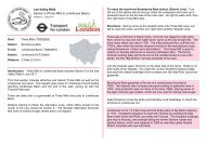
Thames Path Walk Section 1 south bank Teddington ... - Walk London
Thames Path Walk Section 1 south bank Teddington ... - Walk London
Thames Path Walk Section 1 south bank Teddington ... - Walk London

You also want an ePaper? Increase the reach of your titles
YUMPU automatically turns print PDFs into web optimized ePapers that Google loves.
<strong>Thames</strong> <strong>Path</strong> <strong>Walk</strong><strong>Section</strong> 1 <strong>south</strong> <strong>bank</strong><strong>Teddington</strong> Lock to Albert BridgeHam House is an outstanding survival of a 17th-century Stuart house andcontents, which in its heyday was a hotbed of court intrigue. The house andgardens are now managed by the National Trust (including a café and ashop). They can be visited separately (admission fee). At the boundary ofHam House is the ferry going over to the other side of the <strong>Thames</strong>.Start:Station:Version 1 : March 2011<strong>Teddington</strong> Lock (TQ167714)<strong>Teddington</strong>Finish: Albert Bridge / Battersea Park(TQ274744)Station:Battersea Park stationDistance: 15 miles (24 km)Introduction: Come for a stroll along the <strong>Thames</strong> <strong>Path</strong> National Trailbeside <strong>London</strong>’s Rural <strong>Thames</strong>, where the tranquil river rolls past palaces,and meadows, with the peaceful seclusion of willowy paths with nothing forcompany but wildflowers, birdsong and sky.The walking is easy, level and signed throughout as the <strong>Thames</strong> <strong>Path</strong>National Trail.Directions: From <strong>Teddington</strong> Lock, walk with the river on the left. The<strong>Thames</strong> <strong>Path</strong> is broad and gravelled here above the sloping river <strong>bank</strong> withtide-washed willows. The towpath can be flooded at high tides andalternative dry routes are signed. This haven is Ham Lands nature reserve,created from gravel pits filled with rubble from <strong>London</strong>’s wartime bombsites.As other paths disappear inland amongst the trees, the <strong>Thames</strong> <strong>Path</strong>marches on beside the river busy with rowers, to cross the entrance of thelagoon that forms the <strong>Thames</strong> Young Mariners Base. Now the Gothicsummerhouse of Radnor Gardens comes into view on the far <strong>bank</strong>, followedround the curve in the river by Eel Pie Island and the jetty of the RichmondYacht Club. The path opens out to the entrance of Ham House.Beyond the Ferry stage is Ham Polo Club, then soon the path reveals theclassic view of cattle grazing in Petersham Meadows, rising steeply toRichmond Hill. The <strong>Thames</strong> <strong>Path</strong> skirts the meadow wall to enterPetersham Road. Richmond Bridge is ahead, but looking back along theriver there’s not a single building in sight. <strong>Walk</strong> on through the park. Keepbeside the river as it passes the Richmond Canoe Club, restaurants, cafésand bars to walk under the arch of Richmond Bridge and into the sociablebuzz of the historic Richmond waterfront.Stay along the river front—the Capital Ring joins the <strong>Thames</strong> <strong>Path</strong> for awhile along here. After Twickenham Bridge, the view opens up into theCrown Estate’s Old Deer Park Recreation Ground, where George IIIestablished an Observatory on the old Kew Meridian, the line of which ismarked by two obelisks. Ahead is Richmond Bridge, painted green andcream. Here sluices are lowered to help regulate the <strong>Thames</strong> tides. Roundanother curve, at the far end of Isleworth Ait, is a sudden, lovely view of OldIsleworth with its slipway, church and pub. From this side a long greentunnel of overarching trees and wet woodland gives way to views ofBrentford’s Syon Park on the opposite <strong>bank</strong>, with the proud lion on theparapet of the Duke of Northumberland’s Syon House. The path is nowskirting the Royal Botanic Gardens Kew, the largest living plant collection inthe world and World Heritage Site.On the other <strong>bank</strong>, beyond the mouth of the River Brent and Grand UnionCanal, the tower of Kew Bridge Steam Museum comes into view. On theright past is Kew Palace, the former home of George III, which has beenrestored to its 18th-century splendour. <strong>Walk</strong> on past the Herbarium andLibrary to the side entrance of the gardens. Carry on with the <strong>Thames</strong> onthe left and onwards to Kew Bridge. The walk passes the prestigious newapartments of Kew Riverside Park. The landscaping has been designed toaccommodate the endangered two-lipped snail and also to screen variouswater works from sight.
Shortly Putney Town Rowing Club comes into view. The path broadens asit passes the well-kept grounds of Hammersmith Cemetery before goingbeneath an arch of Chiswick’s ornate suspension bridge. Pass <strong>Thames</strong>Bank, with its pastel-painted houses, and the Ship Inn. The <strong>Thames</strong> <strong>Path</strong>narrows here to squeeze between the river and the brewery wall, shaking offthe heady smell of hops to wend its way behind assorted flats, houses andcommunity buildings to the White Hart pub, an ideal spot for watching thefinal stages of the annual Boat Race.The University Boat Race, held around Easter, has been staged on the riverbetween Putney and Chiswick since 1845. Crews race over the 4 miles,374 yards upstream but with the flow of the tide. The Great River Race fromHam to Greenwich has been held in September since 1988. Over 200entries of different categories of boat from Viking longboats to Canadiancanoes cover a gruelling 22 miles.Barnes Bridge is straight ahead. Follow The Terrace under the bridge.Beyond Barnes High Street and the Bull’s Head hostelry (famous for itsjazz), the path leaves the road to beat a tranquil route around the oldreservoir, now the Leg o’ Mutton Nature Reserve, with distant views acrossto Chiswick Mall.Leg o’ Mutton (or Lonsdale Road) Reservoir takes its name from its shape.Bats are known to roost in the old poplar trees here, and a number of birdspecies, including grebes, cormorants and the rare pochard, use the lake -perhaps because it is not far from the <strong>London</strong> Wetlands Centre. A walkaround the entire perimeter comes to about a mile, although The <strong>Thames</strong><strong>Path</strong> only follows half way round.On the right, the Swedish School marks the start of numerous playing fieldswhich keep pace with the path all the way to Hammersmith Bridge. After thebridge, the tree-lined path shakes off its brief brush with the traffic, leadingon behind mansion blocks and the grandiose Harrods Furniture Depository,now apartments. From here the path makes for peaceful progress along theriver frontage with more attractive, modern flats, to reach a stunninglyremote and silent stretch with nothing but bushes, birdsong and acres ofopen sky.Behind the vast green <strong>bank</strong> lies the <strong>London</strong> Wetland Centre, 42 acres ofwetland habitats, home to rare and beautiful wildlife, including Bitterns,Kingfishers and a colony of endangered Water voles. There is a visitorcentre with restaurant, gift shop and cinema, a ‘Bird Airport’ viewingobservatory and wildlife hides, an adventure area and interactive DiscoveryCentre for children. It is managed by the Waterfowl & Wetland Trust whoput on free guided tours and regular events. Entry is via Queen Elizabeth<strong>Walk</strong> (signed Red Lion pub) beyond the monument to oarsman SteveFairbairn, sited at the Mile Post of the Boat Race course.Beyond that, Barn Elms Boathouse gives a hint of things to come. AtBeverley Brook, the Em<strong>bank</strong>ment becomes a succession of rowing andsailing clubs, stretching almost to the foot of Putney Bridge – the oldest<strong>Thames</strong> Bridge still in use. To walk on, cross over to St Mary’s Church, withthe blue and gold clock, and turn left behind it to reach cafés andrestaurants beside the river. Bear right through a huddle of mews cottagesthen first left into Deodar Road, passing under the railway bridge (with itsfootbridge to Putney tube station) and through the archway immediatelyahead into Blade Mews. Turn left out of the mews directly into WandsworthPark and head for the river.To leave the park, go past the moored boats and riverside restaurant by thepier and turn right immediately at Riverside Quarter, past cafés and a shop,onto a new estate road. Turn left here and cross the road to turn right downthe side of a new block of flats and then left into Osier Road.Follow Osier Road round a right-hand bend and left into Enterprise Way.This is all still industrial warehousing and a contrast to the luxury flats on theriverside. Go straight ahead through the gap beyond a row of trees, whichleads to the mouth of the River Wandle, called Bell Lane Creek at this point.Enjoy a brief browse around the Wetland Terraces beside the <strong>Thames</strong>, atthe mouth of the Wandle, then press on down the Causeway, following<strong>Thames</strong> <strong>Path</strong> <strong>Walk</strong><strong>Section</strong> 1 <strong>south</strong> <strong>bank</strong> (<strong>Teddington</strong> Lock to Albert Bridge)page 2www.walklondon.org.uk