Excursion Guidebook - Geoloogia Instituut
Excursion Guidebook - Geoloogia Instituut
Excursion Guidebook - Geoloogia Instituut

Create successful ePaper yourself
Turn your PDF publications into a flip-book with our unique Google optimized e-Paper software.
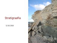
10 th International Symposium on Fossil Cnidaria and Porifera. <strong>Excursion</strong> B2: Field Guidecraters, locally known as dry lakes, are shallow hollowsbordered in places with the remains of a lowwall. The craters have formed in the clayey basal tilland underlying thick micro-bedded Upper Siluriandolomites. The main crater measures 105...110 m indiameter at the top of the mound, and is at least 22m deep. The upper part of the mound consists of thematerial ejected from the crater during the explosionand of partly overhanging dolomite layers tilted at anangle of 25–90°. The uplifted bedrock complex withan average thickness of 10 m has been split into nineshifted blocks, each up to 50 m wide (Tiirmaa 1997and references therein).The diameters of the secondary craters range from12...40 m being 1...4 m deep. On the bottom of craters4 and 5 meteorite impact traces have been discovered.The energy at the formation of the Kaali cratershas been estimated at 4x10 19 ergs for the main crater(Tiirmaa 1997 and references therein). Based on themain crater’s energy of formation and the supposedangle of incidence of 45°, the following ranges of valueswere obtained: initial mass of meteorite 400 to10,000 tonnes, mass at impact 20 to 80 tonnes, initialvelocity upon entering the atmosphere 15 to 45 km/s,velocity at impact 10 to 20 km/s. The meteorite piecescausing the small secondary craters separated at an altitudeof approximately 5...10 km, and their combinedmass did not exceed 18 to 20% of the total mass.Opinions differ as to the direction and angle of incidenceof the Kaali meteorite. The sizes of the cratersled the first investigators to believe that the directionof movement was from the southeast to the northwest(Tiirmaa 1997 and references therein). Aaloe, basingprimarily on the study of impact traces at the bottomof craters 4 and 5, maintained that the probable angleof incidence had been 35–40° relative to the horizon(Tiirmaa 1997 and references therein). The morphologyof the wall of the main crater, the geophysicaldata available on the destruction zones of the mainand secondary craters 1 and 6 and the distribution ofdispersed material in the craters and outside the craterfield suggest that the meteorite fell from the eastnortheast(Tiirmaa 1997 and references therein).Various methods have been used to determine theage of the craters. As neither deformed remnants fromthe explosion nor more recent sediments of marineorigin had been found in the crater, Linstow (1919)estimated the age of the crater at about 4000 to 8000years. Since the craters or their embankments did notreveal any traces of marine erosion or accumulation,Reinwald (Tiirmaa 1997 and references therein), basingon the data available on the history of the BalticSea at that time, considered the craters some 4000–5000 years in age. In his first papers, Aaloe expressedthe same opinion, but some years later he maintainedthat the age of the craters could not be more than 3000to 4000 years. 14 C dating of charcoal discovered in1961, yielded an age of 2660±200 years; the later dates2530±130 and 2920±40 years allowed Aaloe to placethe age of the craters erroneously at about 2800±100years (Tiirmaa 1997 and references therein).As it was not excluded that the dated charcoalwas much younger than the craters themselves, greathopes were placed on drilling and dating of lake sedimentsin the main crater. Palynological analysis byKessel (Tiirmaa 1997 and references therein) showedthat the bottommost sediments are Sub-Boreal in ageand the craters are more than 3500 years old. Simultaneous14 C and palynological investigations initiatedby L. Saarse, placed the craters’ age at approximately3500...4000 years (Saarse et al. 1990) or 4000 yearsBP (Saarse et al. 1992).Recent investigations have shown that the Kaaliarea was freed from the waters of the Baltic Sea alreadysome 8000 yr BP. In 1994, a high concentrationof microimpactites was detected in the peat ofthe Piila Bog, about 10 km to the northwest from theKaali craters. The age of the layer with microimpactiteswas established by means of palynological andradiocarbon methods. The studies suggest that theKaali craters were formed probably close to 7500 BP(Raukas et al. 1995a).The mid-1970s witnessed an ever growing interestof historians in the Kaali Crater. Impetus was givenby Lennart Meri’s books “Hõbevalge” (1976) and“Hõbevalgem” (1984) and by the first archaeologicalfinds in the east wall of the main crater in 1976.In 1978, excavations were begun on the discoveredfortification which is located on the outside slope ofthe northeastern wall of the main crater. From theside of the lake it is protected by a steep slope andfrom outside by a semi-circular wall. Archaeologicalfinds in the fortress area are limited, few earthenwarefragments are dated from the 7th century BC, most ofthe pottery dates from the Iron Age, the beginning ofwhich is considered to be 600 years BC locally (Lõugas1978, 1980).57