Union Pacific RailRoad cRossing stUdy - Regional Transportation ...
Union Pacific RailRoad cRossing stUdy - Regional Transportation ...
Union Pacific RailRoad cRossing stUdy - Regional Transportation ...

Create successful ePaper yourself
Turn your PDF publications into a flip-book with our unique Google optimized e-Paper software.
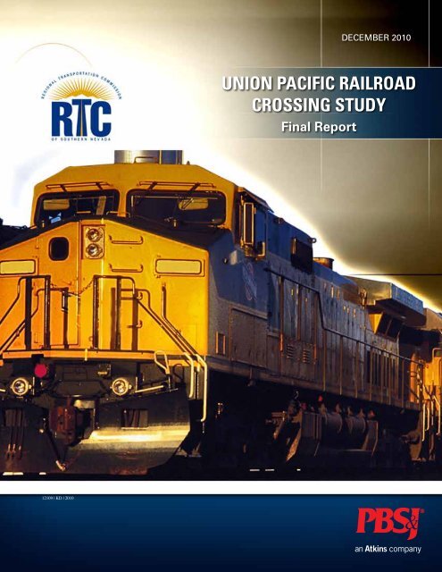
December 2010<strong>Union</strong> <strong>Pacific</strong> RailroadCrossing StudyFinal Report12109 | KD | 2010
Executive Summary | iExecutiveSummaryThe <strong>Union</strong> <strong>Pacific</strong> Railroad (UPRR) CrossingStudy focused on identifying current andfuture network deficiencies with respect to theUPRR, developing potential solutions, andprioritizing solutions with regard to the <strong>Regional</strong><strong>Transportation</strong> Commission of Southern Nevada’s(RTC) goals.The study commenced in October 2009 withdetailed field review and data collection in thestudy area—from the Cactus Avenue crossing inthe south to Las Vegas Boulevard in the north,along the UPRR mainline.A technical working group (TWG) wasestablished to guide alternative developmentand prioritization of UPRR crossings. The TWGincluded personnel from the RTC, UPRR,Clark County, City of Las Vegas, City of NorthLas Vegas, Clark County School District (CCSD),UPRR Crossing Study
ii | Executive SummaryNevada Department of <strong>Transportation</strong> (NDOT),and the Federal Highway Administration(FHWA). Through a collaborative meetingprocess, the TWG provided guidance foridentifying mobility and safety issues regardingexisting and future UPRR crossings, investigatingresolutions for identified issues, and definingthe stakeholder and user needs that influence thedecision process for prioritizing alternatives andcrossing needs.The UPRR, which runs approximately parallelto I-15 through much of the Las Vegas valley,acts as a mobility impediment in some cases. Byidentifying locations and potential solutions wheremobility is restricted, the RTC can better programand prioritize alternatives and potentially fundprojects to increase efficiency and effectiveness oftransportation in the valley.Identifying current network deficiencies andanalyzing land use and transportation conditionsin the areas surrounding the crossings led tothe development of several potential alternativesolutions to mitigate deficiencies. Transitconnectivity issues were identified at the gradeseparatedUPRR crossings with TropicanaAvenue, Charleston Boulevard, BonnevilleAvenue, and Ogden Avenue due to substandardvertical clearances. At the Charleston Boulevardgrade separation, shallow storm drain facilitiesunder the roadway would make re-profilingthe underpass extremely difficult and costly.Improvements at this location were therefore notconsidered. The structures at both BonnevilleAvenue and Ogden Avenue and the UPRR areconstructed as “box” type structures. Therefore,replacement of these structures at both locationswould be costly. This reconstruction wouldrequire the disruption of rail and vehicular trafficfor a considerable amount of time.Potential solutions were developed for twolocations: Oakey Boulevard/Wyoming Avenueand Cactus Avenue/Erie Avenue. The mitigationof future crossing deficiencies was capturedthrough the projects included in the <strong>Regional</strong><strong>Transportation</strong> Plan (RTP) or other local agencyplans.Criteria were developed based on stakeholderinput and a general scan of project selectioncriteria employed for similar selection processes.The criteria were grouped into seven majorcategories corresponding to stakeholder needsand addressing RTP’s regional goals andobjectives. The prioritization criteria were broadbasedand applicable across all major modesof transportation including automobile, transit,bicycle, and pedestrian. The criteria providedan assessment of the impact that the proposedalternative or crossing would have on mobilityand circulation, safety, efficiency, and theenvironment, while maintaining neighborhoodand community integrity.Evaluation results indicated that the criteriaequally captured all transportation modes. Projectsinvolving four primary modes (vehicular, transit,bicycle, and pedestrian) were contained in the topfive priorities within the short-term category ofcrossings:1. Sunset Road (vehicular)2. <strong>Union</strong> Park Pedestrian Bridge (pedestrian)3. Cactus Avenue (vehicular)4. Erie Avenue/Cactus AvenuePedestrian Underpass (pedestrian/bicycle)5. Discovery Drive/Lewis Avenue (transit)
Executive Summary | iiiThe Oakey Boulevard/Wyoming Avenue gradeseparation ranked first in the long-term categoryof crossing projects. This project assumes that theMLK/Industrial Connector has been already built.The prioritization criteria intended to capture theimportance of a crossing at a specific location.Many of the crossings evaluated through thisprocess were included in major regional projectswith more extensive benefits than a particularcrossing would provide. These benefits havenot been fully captured by this study’s criteria,which were focused on localized areas. Whilethey may not rank as high as expected on thisspecific study, major regional projects can beplaced into the perspective of more encompassing,multidisciplinary efforts.The prioritization process of the UPRR crossingswas based on available information, whichprimarily included existing facilities or near-termplans for specific routes. This lack of informationintroduced a subjectivity factor into the evaluationof long-term projects, especially those that includea crossing that does not yet exist.UPRR Crossing Study
iv | Executive SummaryNotes
ContentsContents | vExecutive Summary..........................................................................................................................i1 Overview ....................................................................................................................................11.1 Study Area .............................................................................................................................11.2 Need and Purpose...................................................................................................................31.3 Technical Working Group.......................................................................................................31.2 Report Organization...............................................................................................................32 Data Collection..........................................................................................................................52.1 Data Collection.......................................................................................................................52.2 Relevant Studies and Projects................................................................................................62.3 Future Mobility Needs............................................................................................................63 Assessment of Current Deficiencies...................................................................................73.1 Field Review...........................................................................................................................73.2 Roadway Conditions..............................................................................................................83.3 Railroad Conditions................................................................................................................93.4 Transit Connectivity.............................................................................................................103.5 Connectivity to Community Services and Facilities............................................................114 Prioritization Criteria.............................................................................................................154.1 Criteria Development Process..............................................................................................154.2 Selected Prioritization Criteria ............................................................................................164.3 Application of Prioritization Criteria....................................................................................175 Alternative Mitigation Measures......................................................................................195.1 Cactus Avenue/Erie Avenue Pedestrian Crossing Alternatives............................................195.2 Oakey Boulevard/Wyoming Avenue Improvement Alternatives.........................................216 Prioritization Results.............................................................................................................236.1 Organization of Supporting Data..........................................................................................236.2 Evaluation of Alternatives and Prioritization of Crossings..................................................247 Conclusions..............................................................................................................................27UPRR Crossing Study
vi | ContentsFiguresFigure 1. <strong>Union</strong> <strong>Pacific</strong> Railroad, Las Vegas, Nevada...........................................................................1Figure 2. Las Vegas Valley Urban Area.................................................................................................2Figure 3. Existing UPRR Crossings......................................................................................................8Figure 4. UPRR Grade Separation at Charlestone Blvd........................................................................8Figure 5. UPRR At-Grade Crossing at Desert Inn Road.......................................................................8Figure 6. UPRR At-Grade Crossing at Oakey Boulevard/Wyoming Avenue.......................................9Figure 7. Missing Sidewalk at Oakey Boulevard/Wyoming Avenue At-Grade Crossing.....................9Figure 8. Tropicana Avenue Grade Separation....................................................................................10Figure 9. Transit Alternative Route Opportunities..............................................................................11Figure 10. Desert Oasis High School..................................................................................................12Figure 11. Cactus Underpass...............................................................................................................12Figure 12. Pedestrian Crossing Alternatives for Desert Oasis High School.......................................20Figure 13. Pedestrian Trail Underpass at Cactus UPRR Structure......................................................21Figure 14. Pedestrian Trail Cross Section...........................................................................................21Figure 15. Pedestrian Overpass at Erie Avenue...................................................................................21Figure 16. Short-Term Improvements at Oakey Boulevard/Wyoming Avenue At-Grade Crossing...22TablesTable 1. TWG Members........................................................................................................................3Table 2. Planned Improvements Involving UPRR Crossings...............................................................6Table 3. Railroad Conditions.................................................................................................................9Table 4. Prioritization Criteria Weighting Matrix................................................................................18Table 5. List of Crossings by Implementation Timeframe..................................................................24Table 6. Ranking of Alternatives.........................................................................................................25Table 7. Crossing Priority by Timeframe............................................................................................25AppendicesAppendix A: Technical Memo - Existing Conditions and Future NeedsAppendix B: Technical Memo - Prioritization of Alternatives and Future UPRR CrossingsAppendix C: Prioritization Results
AcknowledgementsAcknowledgements | viiThis document is the result of more than one year of dedication and effort from a variety of stakeholders.Without their support, this study would not have been possible. The <strong>Regional</strong> <strong>Transportation</strong>Commission of Southern Nevada (RTC) is grateful for their participation and would like to take theopportunity to thank those that contributed in developing this study.RTCPhilip Banea, AICPPaulette Carolin, FAICPPerrin Palistrant<strong>Union</strong> <strong>Pacific</strong> RailroadAziz Aman, PEClark CountyLebene Ohene, AICPJoanna Wadsworth, PENevada Department of<strong>Transportation</strong>Lori CampbellJim Ceragioli, EIErick GlickChristopher JalksonCity of Las VegasRandy Fultz, PE, CFMNathan GoldbergGreg McDermottCity of North Las VegasClete Kus, AICPClark County School DistrictTracy MurphyPBS&JTom Cotton, PEPerry Gross, AICP, PE, PTOEEmily Kubovchik, PE, PTOEDanja Petro, PE, PTP, PTOEGeoffrey Schafler, RLAFederal Highway AdministrationBrenda RedwingUPRR Crossing Study
viii | AcknowledgementsNotes
Chapter 1 – Overview | 11OverviewIn this chapter: Project scope Need and purpose Technical working group Report organization1.1 Study AreaConstruction of a railway line between Salt LakeCity, Utah, and Los Angeles, California, viaLas Vegas, Nevada, began in 1901 with theformation of the San Pedro, Los Angeles, and SaltLake Railroad Company (LA&SL). The railroad’smainline was completed in 1905, and in 1916,company shareholders adopted the LA&SL name.Today the former LA&SL railroad tracks operateas an integral part of the <strong>Union</strong> <strong>Pacific</strong> Railroad(UPRR) system.Planning Process for Evaluation and Optimization of Ramp Metering in Las VegasFigure 1. <strong>Union</strong> <strong>Pacific</strong> Railroad in Las Vegas, Nevada
2 | Chapter 1 – OverviewThe UPRR mainline enters the Las Vegas ValleyUrban Area (Las Vegas) just south of CactusAvenue, west of Interstate 15 (I-15). Las Vegasis the largest urbanized area in Clark County andNevada with a July 1, 2008, population estimateof 1,936,376. Clark County has been one of thefastest growing areas of the country, with anaverage population growth of 5.22% from 1990to 2008. The number of vehicles traveling onthe roadways in the Las Vegas urban area alsoincreased substantially.Although the rate of population growth has beenin recent decline, Clark County’s population isprojected to be 2,715,000 by 2020 and 3,126,000by 2030.South of I-215, the UPRR crosses primarilyresidential areas and vacant land. Many of theseresidential areas lack connectivity to the restof the network and employment centers due tothe decline in development and plans for infilldevelopment that never occurred.Between I-215 and I-515, theUPRR crosses primarily industrialareas and runs parallel to theresort corridor, where the largestemployment centers are located.Several major arterials—includingFlamingo Road, TropicanaAvenue, Sahara Avenue, andCharleston Boulevard, all ofwhich serve Annual AverageDaily Traffic (AADT) ofapproximately 50,000 to 80,000vehicles—cross the UPRR inthis area. Several regional transitroutes also provide connectivitybetween the areas east and westof the UPRR and I-15. Significantpedestrian activity is present inthe areas near the resort corridor,but long crossing structures donot make these pedestrian tripswelcoming.Figure 2. Las Vegas Valley Urban AreaNorth of I-515, the UPRR crossesindustrial and residential areas onboth sides.
Chapter 1 – Overview | 31.2 Need and PurposeRunning approximately parallel to I-15 throughthe entire Las Vegas valley, the UPRR has alwaysbeen a mobility impediment. Many major arterialscrossing the UPRR have provided much-neededconnectivity, but in other areas the railroadcontinues to restrict mobility. Several of theseareas have been identified by local agencies, andprojects that provide additional connectivity havebeen included in the <strong>Regional</strong> <strong>Transportation</strong>Plan (RTP). Additionally, minor deficienciesexist and would provide improved mobility ifaddressed.Which UPRR crossings need to be funded first?That is the question that this study helpsto answer.Funding for transportation improvements isbecoming more and more difficult due to a declinein state and federal revenues, while the need forproviding connectivity is increasing.Under these circumstances, the <strong>Regional</strong><strong>Transportation</strong> Commission of SouthernNevada (RTC) needs a tool to better programand prioritize alternatives and to potentiallyfund projects that increase the efficiency andeffectiveness of transportation in the valley.The following goals are the foundation for thisplanning effort:• Improve safety• Improve overall system efficiency• Increase transportation network conveniencefor all modes• Update the transportation system to improveair qualityThe specific objectives of this project are to:• Identify current and future networkdeficiencies with respect to the UPRR• Develop potential solutions• Prioritize existing and future potentialsolutions with regard to the RTC’s goals1.3 Technical Working GroupThis study benefited from the active involvementand participation of a broad range of agenciesand stakeholders. In an effort to direct thedevelopment of this study, a Technical WorkingGroup (TWG) was organized to includerepresentatives from both governmental andprivate entities. The TWG held meetingsthroughout the project to discuss the progress ofeach study task, address issues, provide guidancein developing evaluation criteria, and commenton evaluation results. Table 1 lists the TWGmembers.Table 1. TWG MembersNameAziz Aman, PELori CampbellPaulette Carolin, FAICPClete Kus, AICPRandy Fultz, PE, CFMErick GlickNathan GoldbergTracy MurphyLebene OhenePerrin PalistrantDebra RedwingJoanna Wadsworth, PEUPRRNDOTRTCAgencyCity of North Las VegasCity of Las VegasNDOTCity of Las VegasClark County School DistrictClark CountyRTCFHWAClark CountyPlanning Process for Evaluation and Optimization of Ramp Metering in Las Vegas
4 | Chapter 2 – Data Collection1.4 Report OrganizationThis report is organized in the following manner:• Chapter 1 provides a project overviewincluding study goals, needs, and purpose.• Chapter 2 provides information on the datacollection effort and introduces the futureUPRR crossing needs identified by localagencies and included in the RTP.• Chapter 3 assesses existing crossingdeficiencies, identifies the need for futurecrossings not previously identified byagencies, and explores opportunities formitigation.• Chapter 4 focuses on the evaluation andprioritization criteria development process.• Chapter 5 presents potential solutions tomitigate the deficiencies identified inChapter 3.• Chapter 6 presents the prioritization results.• Chapter 7 summarizes findings and presentsconclusions.
Chapter 2 – Data Collection | 52Data CollectionIn this chapter: Data collection Relevant studies and projects Future mobility needsThe data collected for the project study areawas used to identify current and future UPRRcrossings, existing crossing conditions, andsafety issues. It also provided backgroundinformation for evaluating alternatives andprioritizing projects.This chapter provides information regarding thedata collection effort, introduces the crossinglocations studied, and presents the crossing needsidentified by local agencies in the RTP.2.1 Data CollectionThe focus of the data collection task was tocollect and summarize information relevant tothe existing UPRR crossings as well as plannedprojects within the study area. The data collectionprocess involved the following activities:• Obtain recently completed and ongoingtechnical/planning studies from the RTC andother agencies addressing pedestrian mobilitywithin and adjacent to the project study area.• Obtain U.S. Department of <strong>Transportation</strong>grade crossing inventory.• Obtain additional inventory and crash datafrom NDOT.• Review the RTP and obtain future trafficprojections from the regional travel demandmodel for 10- and 20-year horizons.UPRR Crossing Study
6 | Chapter 2 – Data Collection• Obtain and review the Master Plan of Streetsand Highways from the City of NorthLas Vegas and the City of Las Vegas.• Collect information on the ClarkCounty Trails Program, City of Las Vegas<strong>Transportation</strong> Trails Element, and the Cityof North Las Vegas Citywide Trails andBikeways Master Plan.• Collect information on planned bus routes andimpacts to existing UPRR crossings.• Develop a preliminary map illustratingexisting and planned UPRR crossings.• Review field conditions at each existing andfuture UPRR crossing.• Obtain information regarding ongoing studiesand designs that involve new or improvedUPRR crossings.• Meet with City of Las Vegas staff todiscuss existing land use, pedestrian, tourist,and employment destinationsand planned redevelopmentwithin the downtown area.2.2 Relevant Studies and ProjectsOther documents that providedinformation applicable to thisstudy were gathered, including theDowntown Pedestrian CirculationMaster Plan, the Project Neon DraftEnvironmental Impact Statement(DEIS), and the draft City of NorthLas Vegas Citywide Trails andBikeways Master Plan.Information was gathered regardingproposed projects that are underdesign and set to be implementedupon funding availability.UPRR crossings that are under design include:• Cactus Avenue UPRR crossing• Harmon Avenue/Valley View BoulevardUPRR crossing• Las Vegas Wash pedestrian bridge trail• Pedestrian bridges at <strong>Union</strong> Park• Sunset Road UPRR crossingMost of these projects have not received funding,except for the Las Vegas Wash pedestrian bridgetrail, which is funded by the Southern NevadaPublic Land Management Act (SNPLMA).2.3 Future Mobility NeedsFuture mobility needs were identified through areview of the RTP, local agency transportationplans, and concerns raised by staff and TWGmembers. Table 2 shows information from theRTP and other local agencies regarding plannedimprovements that involve UPRR crossings.Table 2. Planned Improvements Involving UPRR CrossingsCrossing Arterial Plan YearSunset Decatur to Valley View RTP 2009Lamb CC-215 – I-15 RTP 2009<strong>Union</strong> Park <strong>Union</strong> Park to Main Pedestrian Overpass RTP 2009<strong>Union</strong> Park Pedestrian Overpass CLV N/A<strong>Union</strong> Park Pedestrian Overpass CLV N/A<strong>Union</strong> Park Symphony/Lewis Overpass CLV N/ALV Wash Trail – Pedestrian Overpass CNLV N/AValley View Tropicana to Flamingo RTP 2011Jones Blue Diamond to Windmill RTP 2012Cactus Ft Apache to Rainbow (UPRR overpass) RTP 2015Oakey/WyomingI-15 to Main RTP 2019Windmill Durango to Decatur RTP 2020Lake Mead Losee to Las Vegas Boulevard RTP 2020Centennial Lamb to Range RTP 2020Tropicana Decatur to Polaris RTP 2024Robindale Jones to Valley View RTP 2025Washburn Pecos to Lamb RTP 2026Unnamed Las Vegas Boulevard to Farm RTP 2030
Chapter 3 – Assessment of Deficiencies | 73Assessment ofCurrentDeficienciesIn this chapter: Field review Roadway conditions Railroad conditions Transit connectivity Connectivity to community servicesand facilitiesThis chapter provides an assessment of existingcrossing deficiencies and identifies needs forfuture crossings not previously identified byagencies. The assessment includes roadwayand railroad physical characteristics; safety;vehicular, pedestrian, and transit connectivityto community services and facilities; andcontext. Potential deficiencies were identifiedby assessing traffic and safety data and throughdetailed field review of the features at eachcrossing. This chapter also explores opportunitiesto mitigate the identified issues. Detailedinformation regarding the identified deficienciescan be found in the technical memoranda in theappendices.3.1 Field ReviewSeveral sources were used to ascertain theinformation needed to assess the UPRR crossings.The study team conducted several field visits toUPRR Crossing Study
8 | Chapter 3 – Assessment of Deficienciesobserve safety, connectivity, and context and todocument geometric characteristics, includingsignage and marking. Also, field training wasorganized by the UPRR to observe safetyelements of each crossing, including driverbehavior.3.2 Roadway ConditionsThere are 28 existing crossings within the studyarea; the majority are grade-separated.Grade-Separated CrossingsField investigations and a review of agencyinformation indicated that transit connectivityissues existed at the grade-separated UPRRcrossings with Tropicana Avenue,Figure 4. UPRR Grade Separation at Charleston Blvd.Charleston Boulevard, Bonneville Avenue,and Ogden Avenue due to substandard verticalclearances.Another deficiency was identified at theLas Vegas Boulevard North underpass. Thecurrent vertical clearance is 14 feet, which maynot be sufficient to accommodate the growingtruck traffic in this area. The current span is 32feet and accommodates two 10-foot travel lanes ineach direction with no shoulders.At-Grade CrossingsThere are three at-grade crossings within thestudy area: Desert Inn Road, Oakey Boulevard/Wyoming Avenue, and Range Road. The RangeRoad crossing is a private crossing outside thejurisdiction of local agencies and NDOT and istherefore not considered within this study.Figure 3. Existing UPRR CrossingsFigure 5. UPRR At-Grade Crossing at Desert Inn Road
Chapter 3 – Assessment of Deficiencies | 9Several deficiencies critical to safety andpedestrian connectivity are identified at the OakeyBoulevard/Wyoming Avenue at-grade crossing.The crossing is located just east of a residentialarea; and 330 feet east of the crossing, WyomingAvenue crosses Industrial Road, which primarilyserves the businesses and casinos on the west sideof Las Vegas Boulevard.The automatic gates provide protection forvehicles only. Field observations during a trainride, however, showed that, due to the absence ofa median, drivers can maneuver around the gates.the roadway appear to be in poor condition.Alternative potential solutions for mitigatingthe deficiencies at this location are discussed inChapter 5 of this report.3.3 Railroad ConditionsThe daily train frequency in the rail corridorthrough the Las Vegas valley is 19 trains per day,with maximum train speeds from 60 to 79 mph.Crossing details for each location are included inAppendix A. Table 3 summarizes existing railroadconditions at both at-grade crossings.Crash data obtained from the Federal RailroadAdministration (FRA) indicate three crashes in thepast 10 years, all of which occurred at the DesertInn Road crossing. The crashes were limited toproperty damage only. Also, this crossing wasupgraded recently.Table 3. Railroad ConditionsDesert InnOakey Boulevard/RoadWyoming AvenueFigure 6. UPRR At-Grade Crossing atOakey Boulevard/Wyoming AvenueCrossingProtectionAutomaticgatesAutomaticgatesPedestrianconnectivity isabsent. As shownin Figure 7, thesidewalk is notconnected to apedestrian pathacross the railroadand is not protectedwith gates. Themarkings onSidewalkCrossingPanelsRailroad TrackConditionNoneNot providedN/ATrains per Day 19 19Number ofTracksTrain Speed(mph)2 260-79 20-79Not providedFigure 7. Missing sidewalk at Oakey Boulevard/Wyoming Avenue At-Grade CrossingUPRR Crossing Study
10 | Chapter 3 – Assessment of Deficiencies3.4 Transit ConnectivityRTC has opened a new regional transit centerat the corner of Bonneville Avenue and CasinoCenter Boulevard. The transit center allowspassengers to transfer from one route to anotheror to terminate trips in the downtown area. Toimprove system efficiency, the RTC is deployingdouble-deck buses, especially on routes with highridership volumes. Operating articulated vehiclesis more expensive per mile for the agency than adouble-deck vehicle, particularly on these routes.The existing and planned RTC transit routesalong Charleston Boulevard and Alta Drive canreach the new transit terminal either through theCharleston Boulevard underpass or the BonnevilleAvenue underpass. These two locations are notable to accommodate double-deck buses due tothe substandard clearance, as identified inSection 3.2.The Charleston Boulevard underpass is in a sumpcondition with the low point occurring directlyunder the bridge. There are existing inlets atthe low point, draining to a 42-inch reinforcedconcrete pipe (RCP) storm system that runseast beneath Charleston Boulevard. Alternativesolutions for this location are extremely limitedand costly and were therefore not considered.The Bonneville Avenue grade separation consistsof a single-span concrete bridge structure withcenter supporting piers on closed abutments. Theabutment walls are integral to the deck and thefootings, which extend across Bonneville Avenueas part of the roadway surface. The entire bridgestructure is essentially a culvert with piers downthe center. Replacing the structure is costly andwould require the disruption of rail and vehiculartraffic for a considerable amount of time.The study team looked into the transit vehiclesusing the Ogden Avenue underpass as analternative. However, the substandard verticalclearance of this underpass and the type ofstructure, similar to the Bonneville Avenueunderpass, makes it a non-viable alternative to theproposed Bonneville route.The redevelopment plans underway within thedowntown <strong>Union</strong> Park area may include anopportunity to provide transit route connectivitywith the new transit center. Constructing a newcrossing over UPRR that connects SymphonyParkway with Lewis Avenue is one of thetransportation improvement alternatives thatthe City of Las Vegas is considering in itsredevelopment planning.A similar connectivity issue was identified atTropicana Avenue in the westbound direction.Tropicana Avenue is a major east-west arterialthat connects residential areas on the east andwest side of the valley with major resort corridoremployment centers and UNLV. With an averagedaily ridership of 8,700 passengers, a clearanceimprovement to accommodate double-deck buseson this route is a priority for the RTC.Figure 8. Tropicana Avenue Grade Separation
Chapter 3 – Assessment of Deficiencies | 11Transit Route Options1234Figure 9. Transit Alternative Route OpportunitiesThe UPRR bridge structure crossing overTropicana Avenue is very old and the designplans were not available. Therefore, a specificestimate of the required improvement was notperformed. However, widening Tropicana Avenue,with rehabilitation or replacement of the UPRRstructure, is included in the RTP as a long-termimprovement in year 2024.3.5 Connectivity to Community Servicesand FacilitiesIdentification of locations where mobility isrestricted was performed through a reviewof existing land uses and public facilities andthrough visual investigation in the field. Theanalysis focused on restricted or out-of-directiontravel of vehicles, pedestrians, and bicycles ontheir routes to school, emergency services or otherpublic facilities, and commercial destinations.In the southern part of the valley, south ofI-215, the UPRR alignment is surroundedprimarily by undeveloped land. A significantamount of residential development started in thisarea within the past 10 years. These communitiesare isolated from each other, however, and inmany instances lack connectivity with commercialcenters and public facilities.Desert Oasis High School is located a quarter milesouth of Cactus Avenue and approximately700 feet east of the UPRR. The existing schoolzone extends west, and residential developmentexists approximately 700 feet west of the tracks.UPRR Crossing Study
12 | Chapter 3 – Assessment of DeficienciesFigure 10. Desert Oasis High SchoolThe Cactus Avenue/UPRR overpass projectis under design, but it is not planned to befunded through the RTP until 2015. The lack ofconnectivity between the residential areas andthe school at Erie Avenue and opposite the schoolcause out-of-direction automobile trips thatincrease the distance from less than a half mile tomore than seven miles. This situation reportedlyentices students to cross the UPRR tracks andfence at the school.Site observations indicate that there is one largedrainage structure under the tracks at CactusRoad and three small drainage structures in thearea between the residential development and theschool. A detention basin is being constructed justnorthwest of the future Cactus Avenue overpass.The flow in the area bounded by Erie Avenue, theUPRR, Rainbow Boulevard, and Star Avenue willcontinue to use the three existing culverts locatedbetween Erie Avenue and Star Avenue. The flowcrossing these culverts is significant and does notallow a safe pedestrian crossing. Also, to complywith ADA and UPRR requirements for verticalclearance, the structure may need to be replaced.Drainage issues and cost of replacement make thisalternative not feasible.Once the detention basin is completed, it isunderstood that the wash, over which the UPRRstructure at Cactus exists, will not be needed toconvey drainage flows. Using this structure asa pedestrian underpass offers a safer alternativeto crossing the tracks and an efficient option fordecreasing the walking distance to school. Moredetails on alternative potential solutions for thislocation are discussed in Chapter 5 of this report.Figure 11. Cactus UnderpassConnectivity issues also exist at Jones Boulevardnear Blue Diamond Road. The recent constructionon Blue Diamond Road and the UPRR gradeseparatedcrossing have improved connectivitywith areas southeast and northwest of thislocation. Out-of-direction trips still occur,however, due to the lack of connectivity alongJones Boulevard. The UPRR grade-separatedcrossing at Jones Boulevard is included in theRTP.In the central part of the valley, from I-215 toUS 95, the UPRR alignment runs in closeproximity to I-15 and crosses it near TwainAvenue. The land use surrounding the UPRRis primarily industrial and service commercial,with large-scale buildings adjacent to the resortcorridor. Construction of the Sunset Road/UPRRoverpass and Harmon Avenue/Valley ViewBoulevard overpass, which are under design, willimprove automobile and transit connectivity with
Chapter 3 – Assessment of Deficiencies | 13the resort corridor and contribute to distributingthe traffic to less congested arterials, therebyrelieving the adjacent arterials. The constructionof UPRR grade-separated crossings at theselocations is included in the RTP.In the northern part of the valley, connectivityis also limited to the major east-west arterials,spaced every mile. However, major safety andconnectivity issues have not yet been studied. TheNorth 5th project and the Las Vegas Wash Trail,which are under design, will provide additionalconnectivity for automobiles, transit, andpedestrians in this part of the valley.UPRR Crossing Study
14 | Chapter 3 – Assessment of DeficienciesNotes
Chapter 4 – Prioritization Criteria| 154PrioritizationCriteriaIn this chapter: Criteria development process Selected prioritization criteria Application of Prioritization CriteriaThe UPRR Crossing Study serves as an unbiased,methodological way of providing RTC directionin determining funding for projects throughprioritization. This chapter summarizes theprioritization criteria development process,introduces the selected prioritization criteria,describes what these criteria represent, andprovides information on the application andweighting of the criteria.4.1 Criteria Development ProcessCriteria development began with a workshop, withthe goal of broadly identifying railroad crossingconcepts that could be shaped into meaningfulproject selection criteria. The stakeholder agenciesand organizations that attended the workshopincluded:• RTC• UPRR• NDOT• FHWA• City of Las Vegas• City of North Las Vegas• Clark County School District• Clark CountyUPRR Crossing Study
16 | Chapter 4 – Prioritization CriteriaThrough detailed discussions and collaboration,the workshop identified user and stakeholderneeds.The second effort in criteria development was ageneral scan of project selection criteria employedfor similar selection processes, including the goalsand objectives driving the criteria. RTC’s goalsand objectives were included and emphasized.Combining this information with the criteriaworkshop results generated a comprehensive setof 12 criteria.An equitable process for applying criteria tomultiple project types with differing user groupswas then explored. Criteria selection processesinherently contain unfairness, due to issuessuch as preference, mathematics, linguistics,and decision science. Each element of partialityresulting from criteria application was identified,evaluated, and addressed to the highest degreepossible. This effort was undertaken throughan iterative revision process by a group of areaexperts. The result was the project prioritizationimplementation guide included in Appendix B.The developed prioritization criteria were broadbasedand applicable across all major modesof transportation including automobile, transit,bicycle, and pedestrian.4.2 Selected Prioritization CriteriaThe selected prioritization criteria, listed below,were question-based:1. Does the proposed crossing increaseaccessibility and mobility options? Thiscriterion rewards projects that improve accessto transit, support or provide for developmentof fully integrated modal options, and providefor connectivity among modes.2. Is the crossing regionally important? Thiscriterion rewards projects that provide morecrossing opportunities in terms of AADT.3. Does the project enhance safety for alltravelers? This criterion evaluates the safetybenefits of the proposed crossing based on theassessment of existing safety conditions.4. Does the project preserve and enhancethe existing transportation corridors?This criterion recognizes the importanceof preserving and enhancing the existingtransportation network and facilities inmaintaining mobility and providing reliabilityto the users.5. Does the specific project fit into the plannedphysical setting? This criterion measures therelationship between transportation and landuse by evaluating whether a specific projectfits into the planned physical setting and howit can impact planned land uses.6. Does the project improve reliability? Thiscriterion rewards projects that, throughbest judgment, improve reliability of travelbetween areas separated by the UPRR.7. Is the project’s cost lower than the giventhresholds? This criterion rewards projectsthat do not have a significant cost impact. Thefollowing thresholds are used:$ Project cost lower than $5 million$$ Project cost between $5 and $25 million$$$ Project cost higher than $25 million8. Does the project support more efficient freightmovement? This criterion rewards projectsthat contribute to safer and more efficientfreight movement along and across the UPRR.
Chapter 4 – Prioritization Criteria| 179. Does the project have any projected negativeimpacts on natural resources, air quality,noise, energy conservation, or disadvantagedareas? This criterion rewards projects thatare considered to have less opportunity fornegative impacts on natural resources, airquality, noise, energy conservation, anddisadvantaged areas.10. Does the project leverage funds? Thiscriterion recognizes projects that have theopportunity to leverage funds.11. Is the project ready for implementation? Manyprojects have already been through the designprocess and are ready for implementation.This criterion recognizes the readiness ofprojects that could proceed to constructionwithin 6 months.The interrelated nature of the major evaluationcategories allowed criteria to be relevant in morethan one category. The repetitiveness of a givencriteria was therefore an indicator of its weightor significance. The weighting criteria matrixshown in Table 4 was developed to capture therelationships and determine the weight.At this point in the process, it became apparentthat the criteria for selecting the preferredalternative solutions and the criteria forprioritizing the solutions were similar. The sameset of criteria was therefore used to select thepreferred alternatives to mitigate deficiencies atspecific locations and to prioritize and integratethese solutions into projects identified in the RTP.12. Does the project have community support?This criterion rewards the projects that, in bestjudgment, have community support.4.3 Application of Prioritization CriteriaTo simplify their application, the evaluationconsisted of a set of questions requiring a yes/noanswer, equaling 1 or 0 points.The criteria were grouped into seven majorcategories corresponding to stakeholder needsand addressing the RTP’s regional goals andobjectives:1. Connectivity2. Safety3. Defined pathway/context4. Economic impact5. <strong>Regional</strong> priority6. Preliminary NEPA compliance7. Project momentumUPRR Crossing Study
18 | Chapter 4 – Prioritization CriteriaTable 4. Prioritization Criteria Weighting MatrixWeighting CriteriaCategoriesConnectivitySafetyDefined Pathway/ContextEconomic Impact<strong>Regional</strong> PriorityProject MomentumMULTIPLIERNo.Evaluation Criteria1 Does the proposed crossing increase the accessibility and mobility options? (Y/N) 22 Is this crossing regionally important? (Y/N) 13 Does this project enhance safety for all travelers? (Y/N) 24 Does this project preserve and enhance the existing transportation corridors? (Y/N) 15 Does this specific project fits into the planned physical setting? (Y/N) 26 Does this project improve reliability? (Y/N) 17 Is the cost of this project lower than the given thresholds? (Low/Medium/High) 18 Does this project support more efficient freight movement? (Y/N) 19Does this project have projected negative impacts on natural resources, air quality, noise level,energy consumption and disadvantaged areas? (Y/N)110 Does this project leverage funds? (Y/N) 111 Is this project ready for implementation? (Y/N) 112 Does this project have community support? (Y/N) 1Total Score 2 1 2 3 4 3 15Category Weight 13% 7% 13% 20% 27% 20% 100%(*) Cost threshold will be provided with the evaluation matrix and include:$ Project cost lower than 5 million US$ 2$$ Project cost between 5 and 25 million US$ 1$$$ Project cost higher than 25 million US$ 0
Chapter 5 – Alternative Mitigation Measures | 195AlternativeMitigationMeasuresIn this chapter: Cactus Avenue/Erie Avenue PedestrianCrossing Alternatives Oakey Boulevard/Wyoming AvenueImprovement AlternativesThis chapter presents potential solutions tomitigate deficiencies identified in Chapter 3. Thedevelopment of mitigation alternatives focusedon pedestrian connectivity in the vicinity of theCactus Avenue crossing and safety improvementsat the Oakey Boulevard/Wyoming Avenue atgradecrossing.5.1 Cactus Avenue/Erie Avenue PedestrianCrossing AlternativesPedestrian crossing alternatives that facilitatepedestrian movements from the residentialcommunities west of the UPRR to the DesertOasis High School just south of Cactus crossinginclude:• Baseline Alternative• Alternative A: Trail under existing structureusing Rainbow BoulevardUPRR Crossing Study
S. Rainbow Blvd.Redwood St.20 | Chapter 5 – Alternative Mitigation MeasuresW. Cactus AveBaselineAlt AAlt BAlt CR.O.WVerona Wood St.S. Torrey Pines Dr.Rosanna St.W. Levi AveUPRR EasementW. Erie AveW. Erie AveFigure 12. Pedestrian Crossing Alternatives for Desert Oasis High School• Alternative B: Desert Oasis pedestriancrossing overpass• Alternative C: Trail under existing structureusing trail along UPRRFigure 12 shows the pedestrian paths for eachalternative.Baseline AlternativeThis alternative represents the planned CactusAvenue overpass. The facility is planned toinclude three vehicle travel lanes in eachdirection, shared bicycle routes, and standard5-foot sidewalks. Pedestrians from communitieswest of the UPRR will use Rainbow Boulevard,Cactus Avenue, and Torrey Pines Drive to reachthe high school. The average travel distance isapproximately 1.7 miles.Alternative AUnder this alternative, the existing UPRRstructure would remain partially open to facilitatethe movement of pedestrians and bicycles. A trailwould be constructed to connect the sidewalk onthe west side of the UPRR with the sidewalk orpath on the east side.
22 | Chapter 5 – Alternative Mitigation MeasuresFigure 16. Short-Term Safety Improvements at Oakey Boulevard/Wyoming AvenueAt-Grade CrossingThis alternative proposes the following interimimprovements:• Extension of the sidewalks on both sides ofthe street, based on ADA standards• A median that separates travel lanes• Gate relocation to the median• RestripingFigure 16 displays the improvements under thisalternative.Alternative BThis alternative provides a long-term solutionto the identified safety issues. The constructionof a grade separation is included in the RTP aspart of Project Neon, with a scope much widerthan the construction of an overpass at thislocation. Project Neon is anticipated to increaseaccessibility to the area surrounding the existingat-grade crossing and change regional travelpatterns. This may increase the issues related tosafety at this location. To capture the benefits of agrade-separated crossing here, it is assumed thatthe grade separation will be constructed with theother components of Project Neon.
Chapter 6 – Prioritization Results | 236PrioritizationResultsIn this chapter: Organization of supporting data Evaluation of Alternatives andPrioritization of CrossingsThis chapter summarizes the results of thealternative selection and prioritization ofcrossings.6.1 Organization of Supporting DataTo facilitate the evaluation process, the collecteddata was organized and mapped in a documentthat includes:• Existing and future crossings map• Existing and future crossings geometryand AADT• Land use maps• Bicycle routes map• Environmental resources• Jobs-housing balance• Transit routes• Ridership data• Project costs• Project readiness informationUPRR Crossing Study
24 | Chapter 6 – Prioritization ResultsThe document is provided as an attachment toTechnical Memorandum 3 and is included inAppendix B.Table 5. List of Crossings byImplementation TimeframeShort-Term CrossingProjects (2010 - 2015)Long-Term CrossingProjects (2016 - 2030)6.2 Evaluation of Alternatives and Prioritizationof CrossingsFollowing the results of the existing conditionsanalysis, identification of future needs, andmitigation of alternatives, a list of crossings thatrequired prioritization was compiled. The majorityof the crossings in this list belong to projectsincluded in and prioritized by the RTP.The prioritization of these projects in the RTP wasbased on a different scale that may not necessarilyhave focused on the crossing itself. Additionally,the criteria applied to the RTP used broadersources of information and targeted regional goalsand objectives. To honor the project prioritizationprovided by the RTP, the crossings were separatedinto two major groups based on the expectedimplementation timeframe. This allowed a relativeprioritization of projects within their own group,given the uncertainty of the information whenmoving farther into the future.Cactus AvenueSymphony Parkway/Lewis AvenueErie Avenue/CactusAvenue Pedestrian TrailJones BoulevardLamb BoulevardLas Vegas BoulevardOakey Boulevard/Wyoming AvenueSunset Road<strong>Union</strong> ParkPedestrian BridgeValley View Drive/Harmon AvenueCentennial ParkwayLake Mead BoulevardNorth Farm Road/UnnamedOakey Boulevard/Wyoming AvenueGrade SeparationRobindale RoadTropicana AvenueWashburn RoadWindmill LaneThe list of crossing projects for prioritization—separated into two major groups based onimplementation timeframe—is shown in Table 5.The alternative evaluation results summarizedin Table 6 (on page 25) did not differentiatea preferred alternative for the Cactus Avenuecrossing. Alternatives A, B, and C served thepedestrian element only, while the baselinealternative (UPRR overpass) was part of abroader project that included vehicular and transitcomponents.The evaluation indicated that an underpass trailwould be more cost effective and pedestrianfriendly than an overpass.The Oakey Boulevard/Wyoming Avenue gradeseparation ranked higher than rehabilitating thecurrent crossing. A direct comparison of thesetwo alternatives, however, may not be reasonable.An evaluation of at-grade crossing improvementsconsiders the current land use and transportationnetwork surrounding the crossing and is aninexpensive short-term safety improvement. Thegrade separation assumes that the MLK/IndustrialConnector, has been built.
Chapter 6 – Prioritization Results | 25Table 6. Ranking of AlternativesRank Crossing Arterial ScoreCactus Avenue/Desert Oasis Crossings1 Cactus Avenue Baseline Ft. Apache Road to Rainbow Boulevard (UPPR overpass) 551 Alternative A Trail under existing structure using Rainbow Boulevard 552 Alternative B Desert Oasis pedestrian crossing overpass 543 Alternative C Trail under existing structure using trail 53Oakey Boulevard/Wyoming Alternative Improvements1 Alternative B I-15 to Main Street grade separation 482 Alternative A Rehabilitation of existing crossing 47The prioritization ranking summarized inTable 7 indicates that the Sunset Road crossinghas the highest priority among the near-termproject crossings. This crossing will provideconnectivity to the newly developed areas in thesouthwest part of the valley, with industrial areaslocated in the vicinity of the crossing as well asa major commercial center just east of the UPRRand I-15. Appendix C contains additional detailson prioritization results.Table 7. Crossing Priority by TimeframeRankShort-Term Crossing Projects(2010 - 2015)ScoreRankLong-Term Crossing Projects(2016 - 2030)Score1 Sunset Road 58 1Oakey Boulevard/WyomingAvenue Grade Separation482 <strong>Union</strong> Park Pedestrian Bridge 56 2 Lake Mead Boulevard 463 Cactus Avenue 55 3 Tropicana Avenue 414Erie Avenue/Cactus AvenueUnderpass55 4 Windmill Lane 325 Symphony Parkway/Lewis Avenue 54 5 Washburn Road 306 Lamb Boulevard 51 6 Robindale Road 297 Oakey Boulevard/Wyoming Avenue 47 7 North Farm Road/Unnamed 288 Jones Boulevard 45 8 Centennial Parkway 269 Valley View Drive/Harmon Avenue 4010 Las Vegas Boulevard 31UPRR Crossing Study
26 | Chapter 6 – Prioritization ResultsNotes
Conclusions | 277ConclusionsIn this chapter: Findings summaryThis chapter summarizes the findings andhighlights key areas of the report:• Evaluation results indicated that the criteriaequally captured all modes of transportation.Four modes (vehicular, transit, bicycle, andpedestrian) were contained in the top fiveprojects.• Application of several criteria appeared to besubjective when considering scale (regionalvs. local) and use of information regardingfuture transit and bicycle plans.• The development of prioritization criteria wasintended to capture the importance of a UPRRcrossing at a specific location. Many of thesecrossings were included in major regionalprojects with more extensive benefits thana particular crossing would provide. Thesebenefits have not been fully captured by thecriteria, and therefore the evaluation resultsfor projects of a regional scale may be placedinto perspective.UPRR Crossing Study
Conclusions | 28• Local agencies are working on finalizingnear-term and long-term transit and bicycleplans. The prioritization process of theUPRR crossings was based on availableinformation, which primarily included existingfacilities or near-term plans for specificroutes, and existing long-term plans. Thelack of information on future facilities androutes introduced a subjectivity factor in theevaluation of long-term projects, especiallythose that include a non-existing crossing.• Providing transit connectivity for the doubledeckbuses in the downtown area significantlyinfluenced the ranking of the SymphonyParkway/Lewis Avenue overpass. Althoughthis project may not be pursued by the City ofLas Vegas, the ranking is an indication of theregional priority of transit connectivity inthis area.and services than other crossings, includingLamb Boulevard, Valley View Drive, andJones Boulevard. This project will connect thesecluded residential areas west of the UPRRwith services and other major arterials on theeast.• Both the Cactus Avenue grade separationand the Cactus trail underpass would providethe needed connectivity and a safe crossingfor the Desert Oasis High School. The trailunderpass is more convenient for pedestrians,and its construction would be a time- andcost- efficient investment that would addressimmediate and long-term needs.• The prioritization results obtained from thisstudy may be used by the RTC to inform theupdate of the Alternate Mode Plan.• The <strong>Union</strong> Park Pedestrian Bridge isperceived as an important project that willprovide pedestrian connectivity betweendowntown Las Vegas and <strong>Union</strong> Park andcontribute to reduced vehicular traffic in thisarea. However, the prioritization processdid not take into consideration the rate ofdevelopment at <strong>Union</strong> Park. The RTC maywish to coordinate with the City of Las Vegasin identifying the most likely implementationtimeframe of this project, should developmentplans be postponed. This will allow the RTCto allocate funds for other significant projects.• The Cactus Avenue grade separation isperceived as more critical in providingconnectivity and accessibility to other modesUPRR Crossing Study
Appendix A - Technical MemoExisting Conditions andFuture Needs
UPRR Crossing StudyTechnical Memorandum:Existing Conditions andFuture Mobility NeedsJanuary 25, 20101.0 IntroductionConstruction of a railway line between Salt Lake City, Utah, and Los Angeles, California, viaLas Vegas, Nevada, began in 1901 with the formation of the San Pedro, Los Angeles, and SaltLake Railroad Company (LA&SL). Construction of the railroad’s main line was completed in1905, and in 1916, company shareholders adopted the LA&SL name. Today the LA&SL railroadtracks operate as an integral part of the <strong>Union</strong> <strong>Pacific</strong> Railroad (UPRR) system.The UPRR runs approximately parallel to I-15 through much of the Las Vegas valley and can bea mobility impediment in addition to I-15 and Las Vegas Boulevard in some areas. Byidentifying locations and potential solutions where mobility is restricted, the <strong>Regional</strong><strong>Transportation</strong> Commission (RTC) of Southern Nevada can better program and prioritizealternatives and potentially fund projects to increase the efficiency and effectiveness oftransportation in the valley.The following goals are the foundation for this planning effort:• Improve safety,• Improve overall efficiency of the system,• Increase transportation network convenience for all modes, and• Update the transportation system to improve air quality.The specific objectives of this project are to:• Identify current and future network deficiencies with respect to the UPRR,• Develop potential solutions, and• Prioritize existing and potential solutions with regard to the RTC’s goals.2.0 Purpose of the MemoThe purpose of this memo is to report on progress made in the data collection process, theevaluation of existing conditions, and to summarize future mobility needs based on the results ofthe existing conditions analysis, future planned improvements and land uses, field evaluation,and agencies input.3.0 Data CollectionThe focus of the data collection task was to collect and summarize data and information relevantto the existing UPRR crossings as well as planned projects within the study area. The datacollection process involved the following activities.PBS&JUPRR Crossing Study – Technical Memo2270 Corporate Circle, Suite 100Henderson, NV 89074Phone 702.263.7275Fax 702.263.7200www.pbsj.comPage 1 of 10
• Obtain recently completed and ongoing technical/planning studies from the RTC and otheragencies that address pedestrian mobility within and adjacent to the project study area.• Obtain U.S. Department of <strong>Transportation</strong> grade crossing inventory.• Obtain additional inventory and crash data from the Nevada Department of <strong>Transportation</strong>(NDOT).• Review the RTC’s <strong>Regional</strong> <strong>Transportation</strong> Plan (RTP) and obtain future traffic projectionsfrom the regional travel demand model for 10- and 20-year horizons.• Obtain and review the Master Plan of Streets and Highways from the City of North LasVegas and the City of Las Vegas.• Collect information on the Clark County Trails Program, City of Las Vegas <strong>Transportation</strong>Trails Element, and the City of North Las Vegas Citywide Trails and Bikeways Master Plan.• Collect information on planned bus routes and impacts to existing UPRR crossings.• Develop a preliminary map illustrating existing and planned UPRR crossings.• Review field conditions at each existing and future UPRR crossing.• Obtain information regarding ongoing studies and designs that involve new or improvedUPRR crossings.• Meet with City of Las Vegas staff to discuss existing land use, pedestrian, tourist, andemployment destinations, and planned redevelopment within the downtown area.The data collected for the project study area were used to identify current and future UPRRcrossings, existing crossing conditions, and safety issues and to provide background informationfor evaluating alternatives and prioritizing projects.4.0 Proposed ProjectsInformation was gathered regarding proposed projects that are under design and will beimplemented upon funding availability. The UPRR crossings that are under design include:• Cactus Road UPRR crossing,• Harmon Avenue/Valley View Boulevard UPRR crossing,• Las Vegas Wash pedestrian bridge trail,• Pedestrian bridges at <strong>Union</strong> Park, and• Sunset Road UPRR crossing.5.0 Relevant StudiesOther relevant documents, which provide information applicable to this study, have beengathered, including the Downtown Pedestrian Circulation Master Plan, the Project Neon DraftEnvironmental Impact Statement (DEIS), and the draft City of North Las Vegas Citywide Trailsand Bikeways Master Plan.PBS&JUPRR Crossing Study – Technical Memo2270 Corporate Circle, Suite 100Henderson, NV 89074Phone 702.263.7275Fax 702.263.7200www.pbsj.comPage 2 of 10
6.0 Existing ConditionsThere are 28 existing crossings within the study area. During October and November, 2009,detailed field reviews were conducted to collect information and capture the characteristics ofeach crossing. Signing and striping evaluation at existing at-grade crossings was performedbased on the 2003 Manual on Uniform Traffic Control Devices (MUTCD). The updates inrecently released 2009 MUTCD, however, may impact the signage at existing crossings.6.1 Roadway ConditionsA majority of the crossings within the study area are grade separated. Field investigations and areview of agency information indicated that vertical clearances at Tropicana Avenue, CharlestonBoulevard, and Bonneville Avenue are not sufficient to accommodate double-deck buses.Operating articulated vehicles is more expensive per mile for the agency than a double-deckvehicle; improving the clearance at these locations may be a priority for the RTC. Although notpart of the existing and planned RTC transit routes, the Ogden Avenue underpass has a lowvertical clearance and cannot accommodate double-deck buses and therefore is not a viablealternative to the proposed Bonneville routeAnother deficiency identified at a grade-separated crossing includes the Las Vegas BoulevardNorth underpass. The current vertical clearance is 14 feet which may not be sufficient toaccommodate the growing truck traffic in this area. The current span is 32 feet andaccommodates two 10-foot travel lanes in each direction with no shoulders.Tables 1 and 2 summarize information regarding the grade-separated crossings wheredeficiencies were identified, and descriptions follow.Table 1. Mode Data at Deficient Grade-Separated CrossingsCrossingTraffic Transit Pedestrians Bicycles2008 AADT SpeedBus Route/Dedicated LaneSidewalk/TrailBicycleFacilities/TrailTropicana Avenue 56000 45 201 Yes NoCharleston Boulevard 51000 45 206 Yes NoBonneville Avenue 11250 35 207/108/105 Yes Yes/BL*Las Vegas Boulevard 2400 55 No No No* BL = bicycle laneBonneville Avenue Grade SeparationThe existing Bonneville Avenue/UPRR crossing is an underpass. The crossing consists of a cutsection with retaining walls along Bonneville Avenue on either side, approaching a single-spanconcrete bridge structure with center supporting piers on closed abutments. The abutment wallsare integral to the deck and the footings, which extend across Bonneville Avenue as part of thePBS&JUPRR Crossing Study – Technical Memo2270 Corporate Circle, Suite 100Henderson, NV 89074Phone 702.263.7275Fax 702.263.7200www.pbsj.comPage 3 of 10
oadway surface. The entire bridge structure is essentially a culvert with piers down the center.The bridge consists of two UPRR tracks and an open drainage channel, along with an 18-inchand 12-inch utility conduits within the bridge deck. The existing clearance is 14 feet, 6 inches.Bonneville Avenue is in a sump condition approximately 50 feet west of the existing bridge andrequires a storm water pump station. Pedestrian access is provided on Bonneville Avenue via asidewalk adjacent to traffic, separated by a handrail.Charleston Boulevard Grade SeparationThe existing Charleston Boulevard/UPRR crossing is an underpass. The crossing consists of acut section with concrete paved side slopes on either side, approaching a two-span steel bridgestructure on closed abutments. The bridge consists of three UPRR tracks, and the clearance is14 feet, 6 inches. Charleston Boulevard is in a sump condition with the low point occurringdirectly under the bridge. There are existing inlets at the low point, draining to a42-inch reinforced concrete pipe (RCP) storm system that runs east beneath CharlestonBoulevard. Pedestrians use Charleston Boulevard via an elevated sidewalk adjacent to theroadway under the bridge.Tropicana Avenue Grade SeparationDesign plans of this crossing have not yet been obtained.Las Vegas Boulevard North Grade SeparationDesign plans of this crossing have not yet been obtained.PBS&JUPRR Crossing Study – Technical Memo2270 Corporate Circle, Suite 100Henderson, NV 89074Phone 702.263.7275Fax 702.263.7200www.pbsj.comPage 4 of 10
Table 2. Geometrical Data at Deficient Grade-Separated CrossingsCrossingVertical ClearanceHorizontal ClearanceExisting Standard Existing StandardNotesTropicanaAvenue14’-6” 16’-6”86’ abutment to abutmentw/ center pier.Current Tropicana lanes and sidewalkare perpetuated through bridgecrossing and therefore does notrequire widening.Dimensionsbased on visualinspection.CharlestonBoulevard14’-0” 16’-6”70’ face of wall to face ofwall, including curb, gutterand center pier.81’ abutment wall toabutment wall. Additional11’ includes raised sidewalkon both sides.Current lane configuration onCharleston is perpetuated throughbridge location therefore additionalwidening is not necessary.Wall is forelevated 5’sidewalk.BonnevilleAvenue14’-0” 16’-6”100’ abutment to abutmentw / center pier.Current lane configuration isperpetuated through bridge sectiontherefore additional widening is notnecessary.Las VegasBoulevard14’-0” 16’-6” 32’ abutment to abutment,including curb and gutter.Current lane configuration isperpetuated through the bridgesection. There are currently no plansfor the widening of Las Vegas Blvd inthis area to a standard 100’ RTCsection.Dimensionsbased onvisualinspection.There are three at-grade crossings within the study area: Desert Inn Road, OakeyBoulevard/Wyoming Avenue, and Range Road. The Range Road crossing is a private crossingoutside the jurisdiction of local agencies and NDOT; as such, it will not be considered within thisstudy. Table 3 summarizes information regarding the at-grade crossings.Table 3. Mode Data at At Grade CrossingsCrossing2008 AADTTraffic Transit Pedestrians BicyclesSpeed(mph)Bus Route/Dedicated LaneSidewalk/TrailBicycleFacilities/TrailDesert Inn Road 14000 35 No Yes NoOakey Boulevard/Wyoming Avenue15000 35 No No NoPBS&JUPRR Crossing Study – Technical Memo2270 Corporate Circle, Suite 100Henderson, NV 89074Phone 702.263.7275Fax 702.263.7200www.pbsj.comPage 5 of 10
Desert Inn Road CrossingDesert Inn Road crosses the mainline UPRR double track at grade. The crossing is located withinthe Clark County unincorporated area, with Desert Inn Road designated as a collector.The crossing roadway has four 11-foot lanes and a 16-foot median, with 5-foot sidewalks. Theoverall crossing width is 100 feet. The roadway does not accommodate bicycles and is not usedby transit. The annual average daily traffic (AADT) recorded in 2006 was 14,000 vehicles perday and the posted speed limit is 35 mph. The crossing is located within anindustrial/commercial area, which is reflected in the 30 percent truck traffic along the route.On average, 19 trains per day cross Desert Inn Road, with speeds varying from 60 to 79 mph.Trains operate on a class 4 track with a site distance of 1,921 feet.The at-grade crossing has active protection including four automatic gates, two electronic bells,and cantilever flashing lights over the travel lanes. The crossing has been signed with W10-1,R15-1, R8-8, R15-2, I-13, High Speed Trains signage, and pavement markings in accordancewith MUTCD (2003). The automatic gates provide protection for vehicles and pedestrians. Thecrossing surfacing material is concrete with rubber flange fillers, and it appears to be in goodcondition.Oakey Boulevard/Wyoming Avenue CrossingOakey Boulevard/Wyoming Avenue crosses the mainline UPRR double track at grade. Thecrossing is located within the City of Las Vegas and is designated as collector. Improvements tothis at-grade crossing are included in the RTP and are planned as part of Project Neon in 2019.The crossing roadway has four 12-foot lanes. The roadway cross-section does not includesidewalks or bicycle lanes. The overall crossing width is 100 feet, and the roadway is used bytransit route 116 east of the crossing. The AADT, recorded in 2006, was 17,000 vehicles per day,and the posted speed limit is 35 mph.The crossing is located just east of a residential area; and 330 feet east of the crossing, WyomingAvenue crosses Industrial Road, which primarily serves the businesses and casinos on the westside of Las Vegas Boulevard.On average, 19 trains per day cross Wyoming Avenue, with speeds varying from 20 to 79 mph.Trains operate on a class 4 track with a site distance of 1,681 feet.The at-grade crossing has active protection including two automatic gates, two electronic bells,and cantilever flashing lights over the travel lanes. The crossing has been signed with W10-1,R15-1, R15-2, I-13, and pavement markings in accordance with MUTCD (2003). The automaticgates provide protection for vehicles only. The vehicular crossing surface material is concretewith rubber flange fillers, and it appears to be in good condition. The markings on the roadwayappear to be in poor condition. Pedestrian connectivity is absent. The sidewalk is not connectedto a pedestrian path across the railroad and is not protected with gates.PBS&JUPRR Crossing Study – Technical Memo2270 Corporate Circle, Suite 100Henderson, NV 89074Phone 702.263.7275Fax 702.263.7200www.pbsj.comPage 6 of 10
6.2 Railroad ConditionsThe daily train frequency in the rail corridor through the Las Vegas valley is 19 trains per day,with maximum train speeds from 60 to 79 mph. Table 4 summarizes existing railroad conditionsat both at-grade crossings.Table 4. Railroad ConditionsCrossingDesert Inn RoadOakey Boulevard/Wyoming AvenueCrossingProtectionAutomaticgatesAutomaticgatesSidewalkCrossingPanelsRR TrackConditionTrains perDayNumber ofTracksTrain Speed(mph)None Not Available 19 2 60-79N/A Not Available 19 2 20-79Crash data obtained from the Federal Railroad Administration (FRA) indicate three crashes inthe past 10 years, all of which occurred at the Desert Inn Road crossing. The crashes werelimited to property damage only.6.3 Connectivity to Community Services and FacilitiesIdentification of locations where mobility is restricted was performed through a review ofexisting land uses and public facilities and through visual investigation in the field. The analysisfocused on restricted or out-of-direction travel of vehicles, pedestrians, and bicycles on theirroutes to school, emergency services or other public facilities, and commercial destinations.In the southern part of the valley, south of I-215, the UPRR alignment is surrounded primarily byundeveloped land. A significant amount of residential development has started in this area withinthe past 10 years. These communities are isolated from each other, however, and in manyinstances lack connectivity with commercial centers and public facilities.Desert Oasis High School is located a quarter mile south of Cactus Avenue and approximately700 feet east of the UPRR. The existing school zone extends west, and residential developmentexists approximately 700 feet west of the tracks. The Cactus Avenue/UPRR overpass project isunder design, but it is not planned to be funded through the RTP until 2015. The lack ofconnectivity between the residential areas and the school at Cactus Avenue and opposite theschool cause out-of-direction automobile trips that increase the distance from less than a halfmile to more than seven miles. This situation may entice students to cross the UPRR fence at theschool.Site observations indicate that there is one large drainage structure under the tracks at CactusRoad and three small drainage structures in the area between the residential development and theschool. A detention basin is being constructed just northwest of the future Cactus Avenueoverpass. The flow in the area bounded by Erie, UPRR, Rainbow Boulevard and Star Avenuewill continue to use the 3 existing culverts located between Erie Avenue and Star Avenue. Theflow crossing these culverts is quite significant and does not allow a safe pedestrian crossing.PBS&JUPRR Crossing Study – Technical Memo2270 Corporate Circle, Suite 100Henderson, NV 89074Phone 702.263.7275Fax 702.263.7200www.pbsj.comPage 7 of 10
Also to comply with the ADA and UPRR requirements for vertical clearance the structure mayneed to be replaced.Once the detention basin is completed, it is understood that the wash, over which the UPRRstructure at Cactus exists, will not be needed to convey drainage flows. Using this structure as apedestrian underpass offers a safer alternative to crossing the tracks and an efficient option fordecreasing the walking distance to school.A trail project is planned by Clark County, using Southern Nevada Public Lands ManagementAct (SNPMLA) funds. The trail will run along St. Rose Parkway, turning north on SouthernHighland Parkway, and then west on Cactus Avenue. The trail will split from Cactus Avenue justeast of the Cactus Avenue overpass and will cross the UPRR north of the overpass using a gradeseparatedpedestrian structure. A review of crossing alternatives to improve the connectivity andsafety in this area will be performed in later stages of this project.Connectivity issues also exist at Jones Boulevard near Blue Diamond Road. The recentconstruction on Blue Diamond Road and the UPRR grade-separated crossing has improvedconnectivity with areas southeast and northwest of this location. Out-of-direction trips still occur,however, due to the lack of connectivity along Jones Boulevard.In the central part of the valley, from I-215 to US 95, the UPRR alignment runs in closeproximity to I-15 and crosses it near Twain Avenue. The land use surrounding the UPRR isprimarily industrial and service commercial, with large-scale buildings adjacent to the resortcorridor. Construction of the Sunset Road/UPRR overpass and Harmon Avenue/Valley ViewBoulevard overpass, which are currently under design, will improve automobile and transitconnectivity with the resort corridor and contribute to distributing the traffic to less congestedarterials, thereby relieving the adjacent arterials.In the northern part of the valley, connectivity is also limited to the major east-west arterials,spaced every mile. However, major safety and connectivity issues have not yet been studied. TheNorth 5th project and the Las Vegas Wash trail, which are under design, will provide additionalconnectivity for automobiles, transit, and pedestrians in this part of the valley.7.0 ConclusionsA review of existing conditions indicates the following.• The study may further explore improvement alternatives at the Oakey Boulevard/Wyoming Avenue UPRR crossing to accommodate pedestrian and bicycle movements andprovide for their safety.• The study may further explore improvement alternatives at Tropicana Avenue, CharlestonBoulevard, and Bonneville Avenue to accommodate the required clearance for existing andproposed transit routes.• The study may further explore improvement alternatives at Las Vegas Boulevard crossing theUPRR as the northeast area of the valley develops.PBS&JUPRR Crossing Study – Technical Memo2270 Corporate Circle, Suite 100Henderson, NV 89074Phone 702.263.7275Fax 702.263.7200www.pbsj.comPage 8 of 10
8.0 Future Mobility NeedsFuture mobility needs were identified through a review of the RTP, local agency transportationplans, and concerns raised by the staff and members of the working group. Table 5 showsinformation from the RTP and other local agencies regarding improvements that involve UPRRcrossings.Table 5. Planned Improvements Involving UPRR CrossingsCrossing Arterial ROW 2015 AADT 2020 AADTSunset Decatur to Valley View 120’ 38000 51000Lamb CC-215 – I-15 120’ 53000 83000<strong>Union</strong> Park <strong>Union</strong> Park to Main Pedestrian Overpass n/a Pedestrian Pedestrian<strong>Union</strong> Park Pedestrian Overpass n/a Pedestrian Pedestrian<strong>Union</strong> Park Pedestrian Overpass n/a Pedestrian Pedestrian<strong>Union</strong> Park Lewis /Symphony Overpass n/a Not avail Not avail.Las Vegas Wash Trail – Pedestrian Overpass n/a Pedestrian PedestrianDecaturWarm Springs to CC-215(2 UPRR overpasses)120’ 45000/19000 59000/17000Valley View Tropicana to Flamingo 120’ 27000 33000Jones Blue Diamond to Windmill 100’ 18000 26100North 5th Owens to Cheyenne tbd 42700 53200Cactus Fort Apache to Rainbow (UPRR overpass) 100’ 24000 31500Oakey/Wyoming I-15 to Main 80’ 16000 18500Windmill Durango to Decatur 100’ 800 17800Lake Mead Losee to Las Vegas Boulevard tbd 22000 30000Centennial Lamb to Range 100’ 0 1500Tropicana Decatur to Polaris 120’ 55000 57000Robindale Jones to Valley View 80’ 9000 6500Washburn Pecos to Lamb 80’ Not avail. Not avail.Unnamed Las Vegas Boulevard to Farm 100’ 0 Not avail.Project Neon Industrial MLK Connector 80’ 0 tbdPBS&JUPRR Crossing Study – Technical Memo2270 Corporate Circle, Suite 100Henderson, NV 89074Phone 702.263.7275Fax 702.263.7200www.pbsj.comPage 9 of 10
Project Neon requires a relatively high financial commitment from the City of Las Vegas, whichis currently evaluating additional alternatives to improve downtown connectivity with the areasouth of Charleston Boulevard. These alternatives may also involve additional UPRR crossings.Details on the outcome of the improvements planning will be provided once the study iscompleted and approved.Access from Martin Luther King Boulevard to the industrial/commercial area between I-15 andDean Martin Drive is available via Wall Street. Should Project Neon be constructed, Wall Streetwould be closed and a new access for this area would need to be established. The new accessmay require an at-grade crossing with UPRR at Circus Circus Drive, if this alternative isapproved by the City.PBS&JUPRR Crossing Study – Technical Memo2270 Corporate Circle, Suite 100Henderson, NV 89074Phone 702.263.7275Fax 702.263.7200www.pbsj.comPage 10 of 10
Appendix B - Technical MemoPrioritization of Alternativesand Future UPRR Crossings
UPRR Crossing StudyTechnical Memorandum:Prioritization of Alternatives and FutureUPRR CrossingsDecember 08, 20101.0 IntroductionAs part of the <strong>Regional</strong> <strong>Transportation</strong> Commission of Southern Nevada’s (RTC) strategicplanning process, a system-wide evaluation of mobility and circulation is necessary tocontinually improve safety, efficiency, and air quality and to increase mobility while maintainingneighborhood and community integrity. The <strong>Union</strong> <strong>Pacific</strong> Railroad (UPRR), which runsapproximately parallel to I-15 through much of the Las Vegas valley, acts as a mobilityimpediment in some cases. Locations have been identified where mobility is restricted, andpotential solutions have been developed. Prioritizing the potential solutions will help the RTCplan and program alternatives and potentially fund projects to increase the efficiency andeffectiveness of transportation in the valley.The following goals are the foundation for this planning effort:• Improve safety• Improve overall efficiency of the system• Increase transportation network convenience for all modes• Update the transportation system to improve air qualityThe specific objectives of this project are to:• Identify current and future network deficiencies with respect to the UPRR• Develop potential solutions for existing deficiencies• Prioritize potential solutions for existing and future deficiencies with regard to theRTC’s goals2.0 Purpose of the MemoIdentifying current network deficiencies and analyzing land use and transportation conditions inareas surrounding the crossings led to the development of several alternative potential solutionsto mitigate deficiencies. These potential solutions were developed for two locations:Oakey/Wyoming and Cactus/Erie. The mitigation of future deficiencies regarding UPRRcrossings has been captured through the projects included in the <strong>Regional</strong> <strong>Transportation</strong>Plan (RTP).The purpose of this document is to prioritize solutions for existing and future deficiencies and toprovide stakeholders the prioritization criteria used to select potential solutions.PBS&JUPRR Crossing Study – Technical Memo2270 Corporate Circle, Suite 100Henderson, NV 89074Phone 702.263.7275Fax 702.263.7200www.pbsj.comPage 1 of 6
3.0 Criteria Development ProcessCriteria development began with a criteria workshop, with the goal of broadly identifyingrailroad crossing concepts that could be shaped into meaningful project selection criteria. Aseries of brainstorming sessions generated extensive lists of ideas. Through detailed discussionsand active organization, these lists captured preliminary user and stakeholder needs. Thestakeholder agencies and organizations that attended the workshop included:• RTC• UPRR• Nevada Department of <strong>Transportation</strong>• Clark County• City of Las Vegas• City of North Las Vegas• Clark County School DistrictThe second effort in criteria development was a general scan of project selection criteriaemployed for similar selection processes, including the goals and objectives driving the criteria.RTC’s goals and objectives were included and emphasized. Combining this information with thecriteria workshop results generated a comprehensive set of criteria.The criteria were grouped into seven major categories corresponding to stakeholder needs andaddressing the RTP’s regional goals and objectives. The major criteria categories included:1. Connectivity2. Safety3. Defined pathway/context4. Economic impact5. <strong>Regional</strong> priority6. Preliminary NEPA compliance7. Project momentumAt this point in the process, it became apparent that the criteria for selecting the preferredalternative solutions and the criteria for prioritizing the solutions were similar. The same set ofcriteria was therefore used to select the preferred alternatives to mitigate deficiencies at specificlocations and to prioritize and integrate these solutions into projects identified in the RTP.An equitable process for applying criteria to multiple project types with differing user groupswas then explored. Criteria selection processes inherently contain unfairness, due to issues suchas preference, mathematics, linguistics, and decision science. Each element of partiality resultingfrom criteria application was identified, evaluated, and addressed to the highest degree possible.This effort was undertaken through an iterative revision process by a group of area experts,resulting in the project prioritization implementation guide in the attachment.The prioritization criteria were broad-based and applicable to all major modes of transportation,including automobile, transit, bicycle, and pedestrian. To simplify their application, thePBS&JUPRR Crossing Study – Technical Memo2270 Corporate Circle, Suite 100Henderson, NV 89074Phone 702.263.7275Fax 702.263.7200www.pbsj.comPage 2 of 6
evaluation consisted of a set of questions requiring a “yes/no” answer equaling 1 or 0 points. Themajor evaluation categories were interrelated, so the criteria within a major category could berepeated in other categories. This repetitiveness was an indicator of a specific criteria’s weight orsignificance. A weighting criteria matrix (included in the attachment) was developed to capturethe relationship and determine the weight.To facilitate the evaluation process, the collected data was organized and mapped into adocument that included:• Existing and future crossings map• Existing and future crossing geometry and annual average daily traffic (AADT)• Land use maps• Bicycle route map• Environmental resources• Jobs-housing balance• Transit routes• Transit Ridership• Project cost• Project readiness informationThis document is included in the attachment.4.0 Evaluation of Alternatives and Prioritization of CrossingsAs noted, criteria were similar for project selection and project prioritization. Accordingly, it wasdetermined that all alternatives be included on the project list for evaluation. The final rankingdetermined preferred alternatives for particular crossing locations. Table 1 indicates thealternatives included in the evaluation process by location.Table 1: UPRR Crossing AlternativesCrossingCactus BaselineAlternative AAlternative BAlternative CAlternative AArterialFort Apache to Rainbow(UPRR overpass)Trail Under existingstructure using RainbowDesert Oasis PedestrianCrossing OverpassTrail Under existingstructure using trailYearIncludedin the RTPCactus Avenue/Desert Oasis CrossingsRTPProject # Crossing Status Cost $2015 898 New/Design Stage $$NotIncludedNotIncludedNotIncludedOakey/Wyoming Alternative ImprovementsRehabilitation of ExistingCrossingNotIncluded$$$$PBS&JUPRR Crossing Study – Technical Memo2270 Corporate Circle, Suite 100Henderson, NV 89074Phone 702.263.7275Fax 702.263.7200www.pbsj.comPage 3 of 6
CrossingArterialYearIncludedin the RTPRTPProject # Crossing Status Cost $RODAlternative B I-15 to Main 2019 4249Obtained/Active/NewFollowing the results of the existing conditions analysis and identification of future needs, a listof crossings requiring prioritization was compiled and summarized into Table 2.Table 2: Crossing Prioritization ListCactus (1)CrossingArterialFort Apache to Rainbow(UPRR overpass)YearIncluded inthe RTPRTPProject #2015 898CrossingStatusNew/DesignStageCentennial Lamb to Range 2020 805 New $$Discovery/LewisJonesLake MeadGrand Central to MainBlue Diamond toWindmillLosee to Las VegasBoulevardNotIncludedNew/DesignStage$$$Cost $$$$$2012 568 New $$2020 4146 Active $$Lamb CC-215 – I-15 2009 145 New $$Las Vegas BoulevardNear ApexNotIncludedOakey/Wyoming (1) I-15 to Main 2019 4249Active $$EIS Stage/Active/NewRobindale Jones to Valley View 2025 595 New $$Sunset Decatur to Valley View 2009 617New/DesignStageTropicana Decatur to Polaris 2024 4247 Active $$$<strong>Union</strong> Park<strong>Union</strong> Park to MainPedestrian Overbridge2009 1561New/DesignandConstructionNorth ofFarm/Unnamed (2) Las Vegas Blvd to Farm 2030 863 New $$$Valley View/Harmon Tropicana to Flamingo 2011 4262New/DesignStageWashburn Pecos to Lamb 2026 823 New $$Windmill Durango to Decatur 2020 639 New $$Selected Cactus Avenue/Desert Oasis Alternative Crossings if other than Cactus CrossingSelected Oakey/Wyoming Alternative Improvement if other than Oakey/Wyoming Grade Separation(1) Although considered as an alternative this project will also be prioritized. As part of Project Neon scheduled in 2019 by the RTP, theevaluation of the grade separation will assume that all the other elements of the Project Neon have been built.(2) Project included in the RTP does not include a crossing over UPRR.$$$$$$$$$PBS&JUPRR Crossing Study – Technical Memo2270 Corporate Circle, Suite 100Henderson, NV 89074Phone 702.263.7275Fax 702.263.7200www.pbsj.comPage 4 of 6
The majority of the crossings included in Table 2 belong to projects included in the RTPAppendix 1: “List of Projects in the <strong>Transportation</strong> Capital Program 2009-2030”. Theprioritization of the crossings in this study will be performed within two time periods: short term(2010 – 2015) and, long term (2016 – 2030).The prioritization criteria developed within this study cannot necessarily be used in determiningthe timeframe in which these identified crossing projects will be implemented. The timeframedetermined by the RTP for the implementation of the projects, which include these crossings, isused to identify the projects within each time period.The List of Crossings grouped based on the expected implementation timeframe (short-term andlong-term), is shown in Table 3.Table 3: List of Crossings by Implementation TimeframeShort-Term Project Crossings (2010 – 2015) Long-Term Project Crossings (2016 – 2030)CactusDiscovery/LewisJonesLambLas Vegas BoulevardSunset<strong>Union</strong> Park Pedestrian BridgeValley View/HarmonOakey/Wyoming ImprovementsErie/Cactus Pedestrian TrailCentennialLake MeadOakey/Wyoming Grade SeparationWindmillRobindaleTropicanaNorth Farm/UnnamedWashburnThe independent evaluation results are summarized in Tables 4 and 5. The evaluation matrix isprovided electronically attached to this technical memo.Table 4: Ranking of AlternativesRank Crossing Arterial ScoreCactus Avenue/Desert Oasis Crossings1 Cactus Baseline Fort Apache to Rainbow (UPRR overpass) 551 Alternative A Trail Under existing structure using Rainbow 552 Alternative B Desert Oasis Pedestrian Crossing Overpass 543 Alternative C Trail Under existing structure using trail 53Oakey/Wyoming Alternative Improvements1 Alternative B I-15 to Main Grade Separation 482 Alternative A Rehabilitation of Existing Crossing 47PBS&JUPRR Crossing Study – Technical Memo2270 Corporate Circle, Suite 100Henderson, NV 89074Phone 702.263.7275Fax 702.263.7200www.pbsj.comPage 5 of 6
Table 5: Crossing Priority by TimeframeRankShort-Term Project CrossingsLong-Term ProjectScore Rank(2010 – 2015)Crossings (2016 – 2030)Score1 Sunset 58 1Oakey/Wyoming GradeSeparation482 <strong>Union</strong> Park Pedestrian Bridge 56 2 Lake Mead 463 Cactus 55 3 Tropicana 414 Erie/Cactus Underpass 55 4 Windmill 325 Discovery/Lewis 54 5 Washburn 306 Lamb 51 6 Robindale 297Oakey/WyomingImprovements47 7 North Farm/Unnamed 288 Jones 45 8 Centennial 269 Valley View/Harmon 4010 Las Vegas Boulevard 315.0 ConclusionsEvaluation results indicated that criteria captured all transportation modes. Projects involvingthree primary modes (vehicular, transit, and pedestrian) were contained in the top five projects.The results did not differentiate a preferred alternative for the Cactus crossing. Alternatives A, Band C served the pedestrian element only, while the baseline alternative (UPRR overpass) waspart of a broader project that includes vehicular and transit components. The evaluation indicatedthat an underpass trail would be more cost-effective and pedestrian friendly than an overpass.The Oakey/Wyoming grade separation ranked higher than rehabilitating the current crossing. Adirect comparison of these two alternatives, however, may not be reasonable. An evaluation ofat-grade crossing improvements considers the current land use and transportation networksurrounding the crossing and is an inexpensive short-term safety improvement. The gradeseparation assumes that the first phase of Project Neon, which includes the MLK/IndustrialConnector, has been already built.Some criteria appeared to be subjective when considering scale (for example, regional versuslocal) and future transit and bicycle plan information.The development of prioritization criteria was intended to capture the importance of the UPRRcrossing at specific locations. Many of these crossings were rolled over into major regionalprojects with more benefits than a particular crossing would provide. These benefits have notbeen fully captured by the criteria; therefore, the evaluation results for projects of a regionalscale may be placed into perspective.Local agencies are finalizing near-term and long-term transit and bicycle plans. Theprioritization process of the UPRR crossings was based on information currently available,which primarily included existing facilities or near-term plans for specific routes. This lack ofinformation introduced a subjectivity factor into the evaluation of long-term projects—especiallyregarding projects that included a crossing that does not exist.PBS&JUPRR Crossing Study – Technical Memo2270 Corporate Circle, Suite 100Henderson, NV 89074Phone 702.263.7275Fax 702.263.7200www.pbsj.comPage 6 of 6
<strong>Union</strong> <strong>Pacific</strong> RailroadCrossing StudyProject Prioritization Packet
Evaluation Criteria1. Does the proposed crossing increase accessibility and mobility options? This criterion rewardsprojects that improve access to transit, support or provide for development of fully integrated modaloptions, and provide for connectivity among modes.Roadway Projects“Yes” – This project accommodates existing or planned transit routes.“Yes” – This project accommodates sidewalks and bike routes if previously missing.Transit Projects“Yes” – This project accommodates pedestrians and bicycles“Yes” – This project provides transfer points to other routes or modes.Pedestrian and Bicycle Projects“Yes” – This project integrates with other modes.2. Is this crossing regionally important? This criterion rewards projects that provide more crossingopportunities in terms of AADT. To assist in making a judgment of the regional importance, existingimportant arterials were selected and their AADT and number of lanes were summarized. Review theinformation regarding future AADT and number of lanes provided for the projects on the prioritizationlist and compare them with the existing important arterials to determine the future importance.All Projects“Yes” – This project will have higher or comparable AADT and AADT per lane with the followingregionally important arterials or provide regional benefit to transit operationsand pedestrian movements.Arterial Existing AADT Existing No. of Lanes AADT/LaneTropicana 56,000 6 9,300Flamingo 80,000 6 13,000Desert Inn 40,000 6 6,600Sahara 61,000 6 10,200Charleston 51,000 6 8,500Cheyenne 49,000 6 8,200Craig 53,000 8 6,600
3. Does this project enhance safety for all travelers? This criterion evaluates the safetybenefits of the proposed crossing based on the assessment of existing safety conditions.All Projects“Yes” – This project provides grade separations or improvements to existing at grade crossings.Pedestrian and Bicycle Projects“Yes” – This project includes pedestrian and bicycle facilities that eliminate the conflict between bikesor pedestrians and trains.4. Does this project preserve and enhance the existing transportation corridors? This criterionrecognizes the importance of preserving and enhancing the existing transportation network andfacilities in maintaining mobility and providing reliability to the users.Roadway Projects“Yes” – This project enhances and improves travel along the major existing facilities through, forexample, pavement rehabilitation or construction of crossings that eliminate gap areas.Transit Projects“Yes” – Projects that improve the service along existing service routes and increase the efficiency andconnectivity of these routes with the existing network or other modes.Pedestrian and Bicycle Projects“Yes” – Projects that improve the existing bicycle and pedestrian facilities as well as new projects thatsupport and enhance the existing network based on the area-wide plans.5. Does this specific project fit into the planned physical setting? This criterion measures therelationship between transportation and land use by evaluating whether a specific project fits intothe planned physical setting and how it can impact planned land uses.Roadway Projects“Yes” – This project is necessitated by the planned changes in land use and includes alternativemodes which support efficient land use patterns.Transit Projects“Yes” – Transit projects that provide service to planned high density and transit orienteddevelopments and support efficient land use patterns.Pedestrian and Bicycle Projects“Yes” – Bicycle and Pedestrian paths or trails that accommodate user needs as a resultof a planned development.
6. Does this project improve reliability? This criterion rewards projects that, through best judgment,improve reliability of travel between areas separated by the UPRR.Roadway Projects“Yes” – Grade separations.Transit Projects“Yes” – Roadway improvements that improve reliability of transit service, connectivity to intermodalfacilities or regional transit centers that accommodate significant transfers.Pedestrian and Bicycle Projects“Yes” – Bicycle and pedestrian trails that will primarily serve commuters.7. Is the cost of this project lower than the given thresholds? This criterion rewards projects that do nothave a significant cost impact. The following thresholds are used:$ Project cost lower than $5 million$$ Project cost between $5 and $25 million$$$ Project cost higher than $25 millionRoadway Projects“Yes” – Lower than $$Transit Projects“Yes” – Lower than $$Pedestrian and Bicycle Projects“Yes” – Lower than $8. Does this project support more efficient freight movement? This criterion rewards projects thatcontribute to safer and more efficient freight movement along and across the UPRR.Roadway Projects“Yes” – projects that include a grade separation at the UPRR crossing.Transit Projects“Yes” – transit projects that include route modification or grade separated structures.Pedestrian and Bicycle Projects“Yes” – Pedestrian and Bicycle facilities on grade separated structures.
9. Does this project have any projected negative impacts on natural resources, air quality, noise, energyconservation, and disadvantaged areas? This criterion rewards projects that are considered to haveless opportunity for negative impacts on natural resources, air quality, noise, energy conservation,and disadvantaged areas.Roadway Projects“No” – This project is located within a previously impacted area and has less opportunity for negativeimpacts. This project is expected to reduce system-wide auto emissions by improving traffic flowand/or is expected to reduce system-wide VMT. This roadway project provides dedicated transit andbicycle lanes and sidewalks. The roadway project is not expected to increase noise levels. This projectis not expected to have a negative impact on the adjacent neighborhoods.Transit Projects“No” – This transit project will increase the ridership by inducing mode shift from single occupantvehicles. This transit project improves reliability, enhances service, and is expected to attract moreriders. This project enhances service to the adjacent neighborhoods.Pedestrian and Bicycle Projects“No” – This type of project will promote walking and biking as an alternative to single occupantvehicles. All projects in this category promote energy conservation and are not perceived to increasenoise levels. This project enhances the livability of the adjacent neighborhoods.10. Does this project leverage funds? This criterion recognizes projects that have the opportunity to leverage funds.Roadway ProjectsYes – This project relieves bottleneck(s) and/or promotes a shift to alternate modes of transportation.Transit ProjectsYes – This project introduces a federally funded project, including New Starts, Small Starts, or CMAQproject, and/or supports system enhancement.Pedestrian and Bicycle Projects“Yes” – This project is included with roadway and/or transit improvements or contributes to safetyand more livable communities.11. Is this project ready for implementation? Many projects have already been through the designprocess and are ready for implementation. This criterion recognizes the readiness of projects thatcould proceed to construction within 6 months.12. Does this project have community support? This criterion rewards the projects that, in best judgment,have community support.
Proposed Weighting CriteriaWeighting CriteriaCategoriesConnectivitySafetyDefined Pathway/ContextEconomic Impact<strong>Regional</strong> PriorityProject MomentumMULTIPLIERNo.Evaluation Criteria1 Does the proposed crossing increase the accessibility and mobility options? (Y/N) 22 Is this crossing regionally important? (Y/N) 13 Does this project enhance safety for all travelers? (Y/N) 24 Does this project preserve and enhance the existing transportation corridors? (Y/N) 15 Does this specific project fits into the planned physical setting? (Y/N) 26 Does this project improve reliability? (Y/N) 17 Is the cost of this project lower than the given thresholds? (Low/Medium/High) (*) 18 Does this project support more efficient freight movement? (Y/N) 19Does this project have projected negative impacts on natural resources, air quality, noise level,energy consumption and disadvantaged areas? (Y/N)110 Does this project leverage funds? (Y/N) 111 Is this project ready for implementation? (Y/N) 112 Does this project have community support? (Y/N) 1Total Score 2 1 2 3 4 3 15Category Weight 13% 7% 13% 20% 27% 20% 100%(*) Cost threshold will be provided with the evaluation matrix and include:$ Project cost lower than 5 million US$ 2$$ Project cost between 5 and 25 million US$ 1$$$ Project cost higher than 25 million US$ 0
UPRR Crossing Alternatives
Potential Crossing AlternativesFollowing the review of existing and future conditions, mitigation alternatives were further explored at thefollowing locations:• Other crossing alternatives in addition to the proposed Cactus overpass to facilitate the movement ofpedestrians to the Desert Oasis High School.• Improvement alternatives at the Oakey Boulevard/ Wyoming Avenue UPRR crossing to accommodatepedestrian and bicycle movements and provide for their safety.UPRR Crossing AlternativesCrossingCactus BaselineAlternative AAlternative BAlternative CAlternative AArterialYearIncluded inthe RTPCactus Avenue/Desert Oasis CrossingsFort Apache to Rainbow(UPRR overpass)2015 898Trail Under existingNotstructure using Rainbow IncludedDesert Oasis Pedestrian NotCrossing OverpassIncludedTrail Under existingNotstructure using trail IncludedOakey/Wyoming Alternative ImprovementsRehabilitation of ExistingCrossingNotIncludedAlternative B I-15 to Main 2019 4249RTPProject # Crossing Status Cost $New/DesignStageEIS Stage/Active/New$$$$$$$$$
Cactus Avenue/Desert Oasis UPRR CrossingDesert Oasis High School is located on Erie Avenue 700 feet east of UPRR. Residential developments arelocated on the west side of the UPRR and the need for pedestrians (especially students crossing the UPRRto go to school was identified during the review of the existing conditions. Construction of Cactus Avenueoverpass south of the school is planned to occur in 2015 when funds become available. In addition of thisbase alternative additional alternatives that would facilitate the pedestrian crossing were considered. Thealternatives include:Baseline Alternative – Cactus Avenue OverpassAlternative A – Cactus Avenue Underpass along Rainbow BoulevardAlternative B – Erie Avenue OverpassAlternative C – Cactus Avenue Underpass and trail along UPRRThe following figures provide information regarding the land use surrounding the crossing, location of thealternative routes and typical cross sections of the required improvements.
RAINBOW BLVDSILVERADORANCHBLVDN! ! ! ! !!!! !! ! !MOUNTAINS EDGE PKWYPYLE AVEJONES BLVD! ! ! ! ! ! ! ! ! ! ! ! ! ! ! ! !! ! !CACTUS AVE! ! ! ! ! ! ! ! !TORREY PINES DRLEVI AVESOMERSETHILLSAVE! ! ! ! ! ! ! ! ! !ERIE AVE ERIE AVESHINNECOCKHILLSAVESTARR HILLS AVESTARR AVESource: Clark County, Nevada.Cactus Ave CrossingCactus Ave 1 mile bufferChurchÆ Hospital¹SchoolPlanned Land Use ClassificationOpen LandsRural Neighborhood PreservationResidential SuburbanResidential MediumResidential HighOffice ProfessionalCommercial NeighborhoodCommercial GeneralBusiness and Design Research ParkIndustrialPublic FacilitiesMajor Development Project<strong>Union</strong> <strong>Pacific</strong> Railroad Crossingat Cactus AvenuePlanned Land Use1,500 750 0 1,5001 inch = 1,500 feetFeet
Cactus Erie Crossing AlternativesS. Torrey Pines Dr.Verona Wood St.W. Cactus AveW. Erie AveBaselineAlt AAlt BAlt CR.O.WW. Levi AveW. Erie AveRedwood St.UPRR EasementRosanna St.S. Rainbow Blvd.
Cactus Erie Crossing AlternativesAlternative A Crossing
Cactus Erie Crossing Alternatives Alternative B Crossing
Cactus Erie Crossing Alternatives Alternative C Trail
Oakey/Wyoming Avenue UPRR CrossingThe grade separation of Oakey/Wyoming and UPRR is planned within the Project Neon. The implementationof this project is scheduled in 2018 based on the RTP. Field investigations indicated that several safety deficienciesexist at this crossing. To provide mitigation for these deficiencies until the project Neon is fundedand implemented, the following interim improvements are proposed:• extension of the sidewalks based on the ADA standards,• median that separates travel lanes,• relocation of gates, and• restriping.The following figures provide information on the land use surrounding the crossing and the layout of theproposed alternative improvements.
PARADISE RDFREMONTSTTONOPAH DRALTA DRMARTIN L KING BLVDMAIN ST4TH STNRANCHO DROAKEY BLVDINDUSTRIAL RDCOMMERCE STLAS VEGAS BLVDOAKEY BLVDSAHARA AVEVEGAS VALLEY DRINTERSTATE15Source: Clark County, Nevada.Oakey/Wyoming CrossingOakey/Wyoming 1 mi bufferChurchPlanned Land Use ClassificationSingle FamilyPlexesCondominiumsResidential HighTourist CommercialOfficeService Commercial<strong>Union</strong> <strong>Pacific</strong> Railroad Crossingat Oakey/WyomingPlanned Land UseÆ Hospital¹SchoolApartmentsGroup QuartersNon-Profit OrganizationsGovernment & ReligiousGeneral CommercialInd/Comm/Trans/Utilities1,500 750 0 1,5001 inch = 1,500 feetFeet
Oakey/Wyoming Alternative Improvements
Project PrioritizationSupporting Information
Project Prioritization ListProject Prioritization ListCactus (1)CrossingArterialFort Apache to Rainbow(UPRR overpass)YearIncluded inthe RTP2015 898RTPProject # Crossing Status Cost $New/DesignStageCentennial Lamb to Range 2020 805 New $$Symphony/LewisJonesLake MeadGrand Central to MainBlue Diamond toWindmillLosee to Las VegasBoulevardNotIncludedNew/DesignStage2012 568 New $$2020 4146 Active $$Lamb CC-215 – I-15 2009 145 New $$Las Vegas BoulevardNear ApexNotIncludedOakey/Wyoming (1) I-15 to Main 2019 4249$$$$Active $$RODActive/NewRobindale Jones to Valley View 2025 595 New $$Sunset Decatur to Valley View 2009 617New/DesignStageTropicana Decatur to Polaris 2024 4247 Active $$$<strong>Union</strong> Park<strong>Union</strong> Park to MainPedestrian Overbridge2009 1561New/Design andConstructionNorth ofFarm/Unnamed (2) Las Vegas Blvd to Farm 2030 863 New $$$Valley View/Harmon Tropicana to Flamingo 2011 4262New/DesignStageWashburn Pecos to Lamb 2026 823 New $$Windmill Durango to Decatur 2020 639 New $$Selected Cactus Avenue/Desert Oasis Alternative Crossings if other than Cactus CrossingSelected Oakey/Wyoming Alternative Improvement if other than Project Neon(1) Although considered as an alternative this project will also be prioritized(2) Project included in the RTP does not include a crossing over UPRR.$$$$$$$$$
CACTUSWINDMILLERIEROBINDALEVALLEY VIEW/HARMONTROPICANASUNSETJONESOAKEY/WYOMINGLAKE MEADWASHBURNCENTENNIALLAMBUN-NAMEDLAS VEGAS BLVDINTERSTATE206204INTERSTATEExisting Facilities in theVicinity of the Future CrossingsINTERSTATE1521911111370921121850195106 214403210209208207103104215108105112213202301201109107INTERSTATE515402331215INTERSTATE110INTERSTATE15Roadway Facilities Transit RoutesI-15I-215US 95Railroad103104105106107Does Not Exist2 Lane4 Lane6 Lane1081091101111128 Lane113201202204206207208209210211213214215218219301331402403501705709
#639 WINDMILL17,760 AADT#898 CACTUS32,077 AADTFuture UPRR CrossingProject Locations#863 UN-NAMED1,174 AADTLAS VEGAS BLVD12,877 AADT#145 LAMB30,291 AADTINTERSTATE15#805 CENTENNIAL30,495 AADT#4035 WASHBURNNA#4035 NORTH 5TH53,517 AADT95#4146 LAKE MEAD46,937 AADT#4249 OAKEY/WYOMING38,493/21,620 AADTDISCOVERY/LEWIS#1561 PEDESTRIAN BRIDGE#4262 VALLEY VIEW33,113 AADT#4247 TROPICANA79,767 AADT#617 SUNSET52,215 AADTINTERSTATE515#595 ROBINDALE11,546 AADT#568 JONES19,807 AADT215INTERSTATEERIENAINTERSTATE15ROADWAY FACILITIESI-152 LaneI-2154 LaneUS 956 LaneRailroad8 Lane#XXXXRFP Project NumberXXXXX<strong>Regional</strong> Model 2020 AADTNANot Available
RANCHRED ROCKSANDSTONEBLUFFSFORT APACHEELCAPITANRAMPARTDURANGODURANGOCIMARRONCIMARONCIMARRONBUFFALOBUFFALOBUFFALOTENAYATENAYATENAYAANTELOPERAINBOWRAINBOWTORREY PINESTORREY PINESTORREY PINESJONESJONESJONESJONESLINDELLLINDELLDECATURARVILLEARVILLEVALLEY VIEWVALLEY VIEWINDUSTRIALLASVEGASBLVDKOVALGILESPIEBERMUDABERMUDAJOEW BROWNSWENSONPOLLOCKWILBURPARADISEMARYLANDMARYLANDS PENCERSPENCE RSPENCEREASTERNEASTERNEASTERNPALMJIMMY DURRANTESTEPHANIEMISSOURISTEPHANIEGIBSONEASTGATEWIESNERPACIFICGREENWAYCENTERPALO VERDECOLLEGEPUEBLORACETRACKMAGICFOOTHILLSAPPALOOSAFOOTHILLSCASINO CENTER BLVD.GASS AVE.High Point OverlookElevation4,771 FeetRed Rock WashOverlook4th ST.Downtown Las VegasRED ROCKLAS VEGAS BLVD.SCENIC LOOP7th ST.CLARK AVE.STEWART AVE.OGDEN AVE.FREMONT AVE.CARSON AVE.BRIDGER AVE.BONNEVILLE AVE.SandstoneQuarryCalico IIVisitor CenterElevation3,720 FeetCalico I13th ST.MARYLAND PKWY.SUMMERLINLAKE MEADDESERTPRIMROSEGARDEN PARKGARDEN MISTFLAMINGOTOWN CENTERHUALAPAISAHARAHUALAPAISKY POINTEGRAND TETONGRAND CANYONROCHELLEPEACEFARMELKHORNALTAHORSECAMPBELLDEER SPRINGSTROPICALANNWASHBURNLONE MOUNTAINCRAIGTROPICANAHACIENDACANYONGRANDSUNSETMAULEALEXANDERGOWANCHEYENNEFAR HILLS CANYON RUNDESERT FOOTHILLSCARRIAGE HILLThe Red Rock National ConservationArea’s 13-mile loop can be accessedfrom State Route 159, which nowincludes a bike lane. In addition to avisitor center, Red Rock has a bicyclepavilion offering water, a restroom,benches, picnic tables and fire grills.11SAGEBERRYPAVILION CENTERPARK CENTRES POTTED LE AFANASAZIHUALAPAIGREENMOORCRESTDALETRAIL WOODWESTLAKETOWN CENTERGRAND CANYONCENTENNIALCENTERHILLSCHARLESTONRED HILLSLAKESPRING MOUNTAIN10FORT APACHERUSSELLPATRICKEL CAPITANDURANGOEL CAPITANDEL WEBBLAKE NORTHSOUTH16EL CAPITANBLUE DIAMONDIRON MOUNTAINDURANGOFARMOSO BLANCADURANGOHARBOR ISLANDRACELCIMARRONCIMARRONSOARING GULLSGILMOREMARINERLAKE MEAD9BUFFALOBUFFALO12SKY POINTEBUFFALOTENAYACENTENNIAL13AZURETENAYABUCKSKINWESTCLIFF8ROBINDALEWINDMILLRAINBOWOAKEYDESERT INNTWAINWIGWAMPENNWOODSPRING VALLEY67ALTATORREY PINESDEER SPRINGSBADURAWARM SPRINGSPEAKIRON MOUNTAINSMOKE RANCHLAKE MEADVEGASWASHINGTONBRADLEYMICHAELDECATURANNRANCHOTROPICANAHACIENDAVALLEYHARMONSUNSETALLENWASHBURNSIMMONSCLAYTONLONE MOUNTAINOAKEYRANCHOCRAIGHORSEELKHORNDEER SPRINGSALEXANDERGOWANCHEYENNEBONANZAREVEREWYOMINGDESERT INNCOMMERCEST LOUISCENTENNIALTROPICALWASHBURNTAM PARKKARENKATIEDONNABRUCEARCATABRUCECIVIC CENTERCAREYOWENSEVANSVEGAS VALLEYRENOTWAINVIKING14McLEODMcLEODBELMONTFARMMOJAVEMOJAVEPECOSPECOSPECOSPECOSPECOSANNSUNRISEHARMONHACIENDAPATRICKROBINDALEWINDMILLWIGWAMSANDHILLWALNUTSANDHILLTROPICANAANNIE OAKLEYLAMBLAMBLAMBSPRUCE FERNALEXANDERALTOLAMBSTEWARTWYOMINGPALMDONOVANMOUNTAIN VISTASUNSETWARM SPRINGSMARION MARIONLAMONTOWENSNELLISNELLISNELLISRANGELAKE MEADTWAINDESERT INNEL CAMPO GRANDECABANACHRISTYLINNSLOANCAREYWASHINGTONSLOANVEGAS VALLEYPEBBLEPEBBLEPASEO VERDE21515SERENE SERENE HORIZON RIDGE4GOMERBLUE DIAMOND9515PILOTSILVERADO RANCHSeeDowntowndetail mapMARYLANDMARYLAND5LAS VEGAS BLVDBOULDER HWY BOULDER HWYVALLE VERDE515ARROYO GRANDEWHITNEY RANCHMT HOODFLAMINGOGALLERIASUNSETWIGWAMHOLLYWOODHOLLYWOODMISSOURIRUSSELLSTUFFLEBEAMAUTO SHOWRESERVE15ATHENSLAKE MEAD DRPABCOVICTORYBURKHOLDERWATERVAN WAGENEN3Nnot toscaleSUNSETLAKE MEADRUSSELLMOHAWKLAKE MEAD DRMAJORHORIZONRUSSELLESSEXITHACAWARM SPRINGSNEWPORTOLSENCALICO RIDGEEQUESTRIANLAKE LAS VEGASWhat does it all mean?Currently, there are more than 80 miles of bicycle routes,180 miles of bicycle lanes and 100 miles of bicyclepaths. The RTC will implement 735 miles of bicycle lanesand 385 routes in 12 years at a cost of $50 million.The <strong>Regional</strong> Bicycle Plan recognizes the following FederalHighway Administration (FHWA) definitions for a bicycle route,a bicycle lane and a shared-use path:#BICYCLE ROUTEA signed shared roadway is designated by placing signsalong the roadway, indicating it is a preferred route forbicycle use. Bicycle routes are designated on roadwaysthat have a wide curb lane of at least 14 feet or greaterbetween the lane line and the lip of the curb, plus a1.5-foot-wide gutter pan.BICYCLE LANEA bicycle lane is a portion of a roadway that has beendesignated using striping, signing, and pavement markingsfor the use of bicyclists. The width of the bicycle lane isset at a 4-foot minimum from the bicycle lane strip to theedge of the pavement, plus a 1.5-foot-wide gutter pan.SHARED-USE PATHA shared-use path is a bikeway physically separated frommotorized vehicular traffic by an open space or barrierand either within the highway right-of-way or within anindependent right-of-way. Pedestrians, skaters, wheelchairusers, joggers, and other non-motorized users alsomay use the shared-use paths. The minimum width for ashared-use path is 12 feet of paving for bidirectionaltravel, with a minimum 2-foot shoulder on bothBICYCLE COMPATIBLE STREET/ROADA bicycle-compatible street or road has at least 14 feet orgreater between the lane line and the lip of the curb, plusa 1.5-foot-wide gutter pan that can accommodate sharedlane travel between motorists and cyclists.BICYCLES PROHIBITEDLIBRARYHOSPITALBICYCLE SHOPTO LAKE MEADMIDDLE SCHOOLHIGH SCHOOLTO LAKE MEADPYLEPYLEHORIZON RIDGEHEATHEREASTERNHIGH MESACARNEGIEKING MESAJEFFREYSERIECACTUSCACTUSERIEAMIGOGREEN VALLEYMISSIONPARADISE HILLSDAWSONWAGON WHEELSTAR HILLS BLSOUTHERN HIGHLANDSSTONEWATERSTARRST ROSEGREEN VALLEYREUNIONSee other side for detailedBoulder City map.1ANTHEM2BICENTENNIALRECLAMATIONVOLUNTEERSUN CITY ANTHEM15
SUMMARY OF DATA FOR THE TRANSIT ROUTESCURRENTLY CROSSING UPRRBonnevilleRoute 105-Base service is every 30 minutes, seven days a week with later eveningservice operating hourly. Avg. daily ridership is 2,100 per dayRoute 207-Base service is every 30 minutes Mondays through Fridays and hourly onweekends and late evening. Avg. daily ridership is 2,000 per dayRoute 108 (uses both the Charleston and Bonneville underpasses)-Base service iscurrently every 20-25 minutes and every hour in the very late evening, seven days aweek. Average daily ridership is 3,900 (This route will be reconfigured in March 2010and will not use this crossing)CharlestonRoute 206-Base service every 18 minutes, seven days a week with service operatingevery 30 minutes in the evening. This is a 24-hour route. Avg. daily ridership is 9,900.In September 2010 after the Bonneville Transit Center opens, this route is proposed to nolonger utilize the Charleston underpass but rather use Bonneville. However, the routecould be structured in some fashion in the future where one branch may use theCharleston underpass and the other uses Bonneville.TropicanaRoute 201-Base service every 15 minutes with late evening service operating every 30and overnight every hour. This is a 24-hour route. Avg. daily ridership is 8,700.In March 2010, a new commuter route, called the ACExpress C line will operate fromCentennial Hills to downtown Las Vegas, then to the LV Premium Outlets, GovernmentCenter, the Strip and UNLV utilizing the Bonneville UPRR underpass. At this time, it isestimated to have a daily ridership of 1,800.In September 2010, Route 402 which currently operates from Meadows Mall to BoulderCity via downtown Las Vegas is being proposed for a reroute to use Bonneville from thenew transit center under the UPRR tracks, past the Government Center and the UMChospital area then onto 95. The current avg. daily ridership is 750, but is expected toincrease tremendously when we reroute through downtown and extend to a new park andride lot near the Summerlin Parkway.
The Bonneville underpass will become more and more important for the RTC and asmore routes are expanded and rerouted, we have to be careful of what equipment todeploy. Once Symphony Park fully develops near the World Market Center, we wouldlike to operate circulator bus service as well but will be unable to utilize double deckvehicles due to the low railroad bridge.While we don’t have the exact number of passengers that are on the buses as it goesunder, the routes themselves are very busy and we are limited to the fleet deployment.Route 201 and 206 are prime examples of high capacity routes that are constrained toutilizing only articulated coaches when a double deck would do just fine.
KKP1 23AL4G56G£¤ 95 §¨¦ 15LMLPLLLKLKM&PL&P11GL&PGPKM&PPGFL&IGJKLL789101867 215EC&EH67 215 GO GINDBHCOEG§¨¦ 215£¤95IGEIALC§¨¦ 15OC2425262753 54 555657 5859GDH12 13 14 15 1617HK&MGKHLMLGGE29 30 31 32 333435 36 37 38 394041 42 43 44 454647194820 21 222349502851EALLKML52A&LKHLGLLLLENVIRONMENTALLY SENSITIVE AREASLEGEND1ABCDEFGHIJKLMNOPUltimate DevelopmentBoundarySheet IndexAreas of Critical EnvironmentalConcernWetlandWhite BearpoppyLas Vegas Buckwheat andLas Vegas BearpoppyLas Vegas BearpoppyMojave MilkvetchMesquite/AcaciaRosy Twotone BeardtongueYellow Twotone BeardtongueBluediamond ChollaBLM Crucial Bighorn HabitatBLM Bighorn Winter RangeBLM_Quail_HabitatNOTES:Information displayed on this map is for general reference only.The environmentally sensitive areas presented on this figure areconservative and do not account for areas that are urbanized. Theseareas are meant to show only where there is a “potential” forsensitive resources to occur and are not meant to define exactlocations. The Bureau of Land Management, U.S. Fish and WildlifeService, Nevada Department of Wildlife, and the Nevada NaturalHeritage Program should be consulted for site specific information.Site-specific investigations and species-specific surveys must beconducted for each project to determine whether sensitiveenvironmental resources occur in a specific project area.*Potential habitat exists for the Mojave desert tortoise, westernchuckwalla, banded Gila monster, migratory birds, protected batspecies, and desert kit fox on undeveloped land throughoutthe study area.*Potential habitat for Gambel's Quail occurs in washes and wetlandareas throughout the entire study area.*Rosy Twotone Beardtongue habitat also exists southwest of theUltimate Development Boundary.*Cacti and yucca species occur on undeveloped land throughoutthe study area.*Wetlands are known to occur adjacent to the Las Vegas Wash inthe eastern portion of the study area.*Dry ephemeral washes occur throughout the study area.*Sensitive cultural resources may occur throughout the study area.*Areas of Critical Environmental Concern (ACEC) are designated bythe BLM "to protect and prevent irreparable damage to importanthistoric, cultural, or scenic values, fish and wildlife resources orother natural systems or processes, or to protect life and safetyfrom natural hazards". (Reference: Federal Land Policy AndLas Vegas BuckwheatManagement Act of 1976, 43 USC Sec. 1702).Paleontological Sensitive AreaBLM Horse and BurroManagement AreaLake Las VegasLake MeadMain HighwaysMajor Streets500 ft Contours (USGS)Flood Control FacilitiesExisting FacilitiesCategory A ProposedFacilitiesCategory B ProposedFacilitiesCategory A Remove & Replace/Parallel FacilitiesCategory B Remove & Replace/Parallel FacilitiesSOURCES:*Bureau of Land Management (BLM). 1998. Proposed Las VegasResource Management Plan and Environmental ImpactStatement. Vol II May.*BLM. 2002. Personal communication between Gayle Marrs-Smith,Vegetation Specialist and Billye Breckenridge (PBS&J). May 8.*BLM. 2004. Las Vegas Valley Disposal Boundary EnvironmentalImpact Statement. Prepared by PBS&J. December.*BLM. 2008. Online Geospatial data. UTM:http://www.blm.gov/nv/st/en/prog/more_programs/geographic_sciences/gis/geospatial_data.3.html. Accessed March.*BLM and U.S. Army Corps of Engineers. 2004. SupplementalProgrammatic Environmental Impact Statement, Clark County<strong>Regional</strong> Flood Control District, 2002 Master Plan Update, Final.Prepared by SWCA Environmental Consultants. September.*Clark County. 2000. The Multiple Species Habitat ConservationPlan and Environmental Impact Statement for Issuance ofPermit to Allow Incidental Take of 79 Species in Clark County,Nevada. June.*Nevada Natural Heritage Program (NNHP). 2008. Data requestreceived April 3.*PBS&J.2002. Clark County <strong>Regional</strong> Flood Control District2002 Las Vegas Valley Flood Control Master Plan Update. September.´0 2.254.5 9 13.5MilesScale: 1 inch = 4.5 miles
LAMB BLVDNRANGE RDCENTENNIAL PKWYAZURE AVEAZURE DRTROPICAL PKWYLAMB BLVDINTERSTATE15RANGE RDSource: Clark County, Nevada.Centennial Pkwy CrossingCentennial Pkwy 1 Mile BufferPlanned Land Use ClassificationSingle Family Low ( up to 6 du / ac )Single Family Medium ( up to 13 du / ac )Multi-Family ( up to 25 du / ac )Neighborhood CommercialResort CommecialCommunity CommercialPublic / Semi - PublicEmploymentHeavy IndustrialMixed - Use EmploymentMixed - Use CommercialMixed - Use NeighborhoodROW<strong>Union</strong> <strong>Pacific</strong> Railroad Crossingat Centennial ParkwayPlanned Land Use1,500 750 0 1,500Feet1 inch = 1,500 feet
JONES BLVDJONES BLVDTORREY PINESDRWINDMILL LNWINDMILL LNN! !WIGWAM AVERAINBOW BLVDLINDELL RDPEBBLE RDDECATUR BLVDSERENE AVESERENE AVESILVERADO RANCH BLVDSource: Clark County, Nevada.! !! ! !Jones Blvd CrossingJones Blvd 1 mile bufferChurchÆ Hospital¹SchoolPlanned Land Use ClassificationOpen LandsRural NeighborhoodRural Neighborhood PreservationResidential LowResidential SuburbanResidential MediumOffice ProfessionalCommercial NeighborhoodCommercial GeneralBusiness and Design Research ParkIndustrialPublic FacilitiesMajor Development Project<strong>Union</strong> <strong>Pacific</strong> Railroad Crossingat Jones BoulevardPlanned Land Use1,500 750 0 1,5001 inch = 1,500 feetFeet
¹ºCOMMERCE ST¹ºNCIVIC CENTER DRREVERE STINTERSTATE15DONNA STCAREY AVELOSEE RD5TH STLAKE MEAD SOUTH BLVDLAKE MEAD BLVD LAKE MEAD BLVDLAS VEGAS BLVDBRUCE STOWENS AVEMAIN STWASHINGTON AVESource: Clark County, Nevada.Lake Mead CrossingLake Mead 1 mile bufferChurchÆ Hospital¹SchoolCity of Las VegasPlanned Land UseSingle FamilyPlexesApartmentsGroup QuartersNon-Profit OrganizationsGovernment and ReligousTourist CommercialOfficeService CommercialGeneral CommercialInd/Comm/Trans/UtilitiesNorth Las Vegas Planned Land UseRESIDENTIALSingle Family Low ( up to 6 du / ac )Single Family Medium ( up to 13 du / ac )NON - RESIDENTIALOpen SpaceCommunity CommercialPublic / Semi - Public¹ºDowntown Business DistrictEmploymentHeavy IndustrialOTHERROW¹º¹ºMARYLANDPKWY<strong>Union</strong> <strong>Pacific</strong> Railroad Crossingat Lake Mead Boulevard ¹ºPlanned Land Use1,500 750 0 1,5001 inch = 1,500 feet¹ºFeet
PECOS RDPECOS RDLAMB BLVDNCENTENNIAL PKWYCENTENNIAL PKWYAZURE AVEAZURE DRRANGE RDWALNUT RDTROPICAL PKWYINTERSTATE15EL CAMPOGRANDEAVELAMB BLVDWASHBURN RDSource: Clark County, Nevada.ChurchÆ Hospital¹SchoolLamb Blvd CrossingLamb Blvd 1 mile bufferPlanned Land Use CategoriesRESIDENTIALSingle Family Low ( up to 6 du / ac )Single Family Medium ( up to 13 du / ac )Multi-Family ( up to 25 du / ac )NON - RESIDENTIALOpen Space¹ºNeighborhood CommercialResort CommecialCommunity CommercialHeavy IndustrialMIXED - USEMixed - Use EmploymentPublic / Semi - PublicMixed - Use CommercialDowntown Business District Mixed - Use NeighborhoodDowntown Area of Influence OTHEREmploymentROW<strong>Union</strong> <strong>Pacific</strong> Railroad Crossingat Lamb BoulevardPlanned Land Use1,500 750 0 1,5001 inch = 1,500 feetFeet
NLAS VEGAS BLVDINTERSTATE15Source: Clark County, Nevada.Las Vegas Blvd Crossing PointLas Vegas Blvd 1 mile bufferChurchÆ Hospital¹SchoolPlanned Land Use ClassificationHeavy IndustrialPublic FacilitiesROW<strong>Union</strong> <strong>Pacific</strong> Railroad Crossingat Las Vegas BoulevardPlanned Land Use1,500 750 0 1,5001 inch = 1,500 feetFeet
! ! ! ! ! ! !JONES BLVD! ! ! !! !! ! !DECATUR BLVD! ! !ARVILLE ST!!!!!!!! ! ! ! !MAULE AVENARBY AVEWARM SPRINGS RDWARM SPRINGS RDJONES BLVDLINDELL RDROBINDALE RD! ! ! ! ! ! !WINDMILL LN WINDMILL LN! ! !!! ! !!!!!WIGWAM AVESource: Clark County, Nevada.Robindale Rd CrossingRobindale Rd 1 mi bufferChurchPlanned Land Use ClassificationOpen LandsRural Neighborhood PreservationResidential SuburbanCommercial NeighborhoodCommercial GeneralCommercial TouristBusiness and Design Research Park<strong>Union</strong> <strong>Pacific</strong> Railroad Crossingat Robindale RoadPlanned Land UseÆ Hospital¹SchoolResidential MediumResidential HighResidential Urban CenterOffice ProfessionalIndustrialPublic FacilitiesMajor Development Project1,500 750 0 1,5001 inch = 1,500 feetFeet
! ! ! !!!!DECATUR BLVD! ! !!!!VALLEYVIEWBLVD! ! ! !!!!! ! ! !! ! !! !!RUSSELL RDARVILLE STN!!!!!!! !!!!! !LINDELL RD!PATRICKLN! ! ! !!!! !! ! !VALLEY VIEW BLVD! !! ! !! !! ! !SUNSET RD!!!! ! ! ! !ARVILLE STMAULE AVEARBY AVELINDELL RDDECATURBLVDWARM SPRINGS RDSource: Clark County, Nevada.Sunset Rd CrossingSunset Rd 1 mile bufferChurchÆ Hospital¹SchoolPlanned Land Use ClassificationOpen LandsRural Neighborhood PreservationOffice ProfessionalCommercial NeighborhoodCommercial TouristBusiness and Design Research ParkIndustrialPublic FacilitiesROW<strong>Union</strong> <strong>Pacific</strong> Railroad Crossingat Sunset RoadPlanned Land Use1,500 750 0 1,5001 inch = 1,500 feetFeet
! !! !VALLEY VIEW BLVD!FLAMINGO RD!NVALLEY VIEW BLVD!!!!!! ! !HARMON AVE! ! ! ! ! !HARMONAVEARVILLE ST!!DEAN MARTIN DR!!!!DECATUR BLVD!TROPICANA AVEFRANK SINATRA DR!!!HACIENDA AVEINTERSTATE15! !RUSSELL RD! ! !! !!ARVILLE STSource: Clark County, Nevada.Tropicana Ave CrossingTropicana Ave 1 mi bufferChurchÆ Hospital¹School!! !!!Planned Land Use Classification!!! !!!!! !!!Residential SuburbanResidential HighCommercial GeneralCommercial TouristIndustrialPublic Facilities<strong>Union</strong> <strong>Pacific</strong> Railroad Crossingat Tropicana AvenuePlanned Land Use1,500 750 0 1,5001 inch = 1,500 feetFeet
15TH STVEGAS DROWENS AVELAS VEGAS BLVDMAIN STNWASHINGTON AVEMARTIN L KING BLVDUS95BONANZA RDALTA DRMAIN STLAS VEGAS BLVDSTEWART AVEINTERSTATE15FREMONT STMARYLAND PKWY4TH STCOMMERCE STCHARLESTON BLVD¹ºSource: Clark County, Nevada.<strong>Union</strong> Park Pedestrian Overbridge CrossingOne Mile Radius BufferChurchÆ Hospital New Transit BldgSchool¹New City Hall Bldg¹ºPlanned Land Use ClassificationSingle FamilyMobile HomesPlexesTownhousesCondominiumsApartmentsGroup QuartersNon-Profit OrganizationsGovernment & ReligiousTourist CommercialOfficeService CommercialGeneral CommercialInd/Comm/Trans/Utilities<strong>Union</strong> <strong>Pacific</strong> Railroad Crossingat <strong>Union</strong> Park Pedestrian OverbridgePlanned Land Use¹º¹º1,500 750 0 1,5001 inch = 1,500 feetFeet
! !!!!!!TWAIN AVEINDUSTRIAL RDNLAS VEGAS BLVDVALLEY VIEW BLVD!!!!!! ! !DECATUR BLVDHARMON AVEARVILLE ST! ! ! ! ! !DEAN MARTIN DRFRANK SINATRADRHARMONAVELAS VEGAS BLVD!!!TROPICANA AVEVALLEY VIEW BLVDINTERSTATE15!Source: Clark County, Nevada.Valley View Blvd CrossValley View Blvd CrossChurchHACIENDA AVEPlanned Land Use ClassificationResidential HighResidential Urban CenterCommercial GeneralBusiness and Design Research ParkIndustrialPublic FacilitiesROW<strong>Union</strong> <strong>Pacific</strong> Railroad Crossingat Valley View/Harmon BoulevardPlanned Land Use! ! ! ! ! ! ! !Æ Hospital¹SchoolCommercial Tourist1,500 750 0 1,5001 inch = 1,500 feetFeet
!!!!!!LAMB BLVD!TROPICAL PKWYWALNUT RDTROPICALPKWYNPECOS RDWASHBURN RDLA MADRE WAYINTERSTATE15LONE MOUNTAIN RDLONE MOUNTAIN RDWALNUT RD! !!! ! ! ! !Source: Clark County, Nevada.! !!!RDPECOSWashburn Rd Crossing Planned Land Use ClassificationSingle Family Low ( up to 6 du / ac )Washburn Rd 1 mile bufferSingle Family Medium ( up to 13 du / ac )ChurchOpen SpaceNeighborhood CommercialÆ HospitalPublic / Semi - PublicSchool¹CRAIG RDEmploymentIndustrialHeavy IndustrialMixed - Use EmploymentROW<strong>Union</strong> <strong>Pacific</strong> Railroad Crossingat Las Vegas Boulevard! ! ! !Planned Land Use1,500 750 0 1,5001 inch = 1,500 feet!!! ! ! ! ! ! ! !!Feet
DECATUR BLVDARVILLE STWARM SPRINGS RDWARM SPRINGS RDNTORREY PINES DRROBINDALE RDJONES BLVDLINDELL RDROBINDALE RD! ! ! ! ! ! !WINDMILL LNWINDMILL LN! ! !!! ! !WIGWAM AVEBLUE DIAMOND RDPEBBLE RDARVILLE STSource: Clark County, Nevada.Windmill Ln Cross PointWindmill Ln 1 mile bufferChurchPlanned Land Use ClassificationOpen LandsRural NeighborhoodRural Neighborhood PreservationCommercial NeighborhoodCommercial GeneralBusiness and Design Research ParkIndustrial<strong>Union</strong> <strong>Pacific</strong> Railroad Crossingat Windmill LanePlanned Land UseÆ Hospital¹SchoolResidential SuburbanResidential MediumResidential HighOffice ProfessionalPublic FacilitiesMajor Development ProjectROW1,500 750 0 1,5001 inch = 1,500 feetFeet
Appendix CPrioritization Results
Summary of Prioritization ResultsSUMMARY OF PRIORITIZATION RESULTSNear Term Crossings (Year 2010 - 2015) Long Term Crossings (Year 2016 - 2030)No.CriteriaCactusSymphony/LewisJonesLambLas Vegas BoulevardSunset<strong>Union</strong> Park Ped BridgeValley View/HarmonErie/Cactus UnderpassErie OverpassErie/Cactus trailOakey/WyomingImprovementsCentenialLake MeadWindmillRobindaleTropicanaNorth ofFarm/UnnamedWashburnOakey Wyoming GradeSeparation1 Does the proposed crossing increase the accessibility and mobility options? (Y/N)2 Is this crossing regionally important? (Y/N)3 Does this project enhance safety for all travelers? (Y/N)4 Does this project preserve and enhance the existing transportation corridors? (Y/N)5 Does this specific project fits into the planned physical setting? (Y/N)6 Does this project improve reliability? (Y/N)7 Is the cost of this project lower than the given thresholds? (Y/N)(*)8 8 8 6 0 8 8 6 8 8 8 4 2 4 4 2 8 6 2 62 3 1 3 0 3 1 0 0 0 1 2 0 4 1 0 4 0 0 38 8 6 8 8 8 8 8 8 8 8 6 6 6 8 8 4 8 8 84 2 4 4 3 4 4 4 3 3 3 4 1 4 3 3 4 1 1 48 8 6 8 6 8 8 6 8 8 8 8 2 8 2 2 6 4 4 84 3 4 4 1 4 3 2 4 4 4 1 3 3 3 3 3 2 2 44 4 4 4 4 4 8 0 8 8 8 8 4 4 4 4 0 0 4 18 Does this project support more efficient freight movement? (Y/N)3 4 4 4 4 4 1 4 3 3 2 2 3 2 3 3 2 3 4 4Does this project have projected negative impacts on natural resources, air quality, noise9level, energy consumption and disadvantaged areas? (Y/N) 4 4 3 4 4 4 4 4 4 4 4 4 4 4 3 3 4 3 4 410 Does this project leverage funds? (Y/N)11 Is this project ready for implementation? (Y/N)12 Does this project have community support? (Y/N)3 3 1 2 1 3 3 0 4 3 4 3 0 3 0 0 3 0 0 23 3 1 2 0 4 4 3 1 0 0 1 0 0 0 0 0 1 0 04 4 3 2 0 4 4 3 4 4 4 4 1 4 1 1 3 0 1 4Total Score 55 54 45 51 31 58 56 40 55 53 54 47 26 46 32 29 41 28 30 48Rank 3 5 10 8 12 1 2 11 3 7 5 9 8 2 4 6 3 7 5 1
2270 Corporate Circle, Suite 100Henderson, Nevada 89074702.263.7275702.263.7200 (fax)