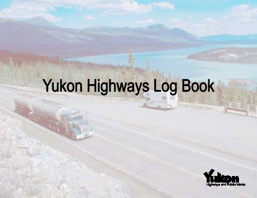
Highway Log - Highways and Public Works - Government of Yukon
Highway Log - Highways and Public Works - Government of Yukon
Highway Log - Highways and Public Works - Government of Yukon

Create successful ePaper yourself
Turn your PDF publications into a flip-book with our unique Google optimized e-Paper software.
HIGHWAYNAMEALASKAOGILVIEOLD CROW5EAGLE PLAINS1 ALASKA HIGHWAY2 KLONDIKE HIGHWAY3 HAINES ROAD4 CAMPBELL HIGHWAY5 DEMPSTER HIGHWAY6 CANOL HIGHWAY7 ATLIN ROAD8 TAGISH ROAD9 TOP OF THE WORLD HWY.10 NAHANNI RANGE ROAD11 SILVER TRAIL14 TAKHINI HOT SPRINGS RD.15 MITCHELL ROAD37 STEWART-CASSIAR HWY.NORTHWEST TERRITORIES9DAWSONCITYKLONDIKEYEAR-ROUND HIGHWAYSUMMER-ONLY HIGHWAYSTEWARTCROSSING11MAYOMAINTENANCE CAMPCAMP - SEASONAL0BEAVER CREEK1HAINESJUNCTIONCARMACKSDESTRUCTIONBAY3BLANCHARDSCALEKILOMETRES1001214CARCROSSFRASER82CHAMPAGNE24DRURYCREEKWHITEHORSE7615QUIET LAKETESLINTWINCREEKSROSS RIVERSWIFTRIVER6TUCHITUA1BRITISH COLUMBIA43710WATSON LAKE
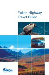
YUKON HIGHWAYS LOG BOOK October 2008The October 2008 <strong>Yukon</strong> <strong>Highway</strong>s <strong>Log</strong> Book reflects substantial completion <strong>of</strong> the Shakwak reconstruction project <strong>and</strong> updating <strong>of</strong>kilometre posts on the Alaska <strong>Highway</strong> between km 1636.6, Silver Creek, <strong>and</strong> km 1902.5, the <strong>Yukon</strong>\Alaska border.For many years a correction factor has been required in order to calculate distance along the the Alaska <strong>Highway</strong>. The correction factorreflected the shortening <strong>of</strong> the Alaska <strong>Highway</strong> due to reconstruction. With the grade reconstruction now completed, <strong>and</strong> the kilometermarkers reposted, the correction factor is no longer required within the <strong>Yukon</strong> Territory. Kilometer measurements are now continuous fromkm 967.6 at the <strong>Yukon</strong>\BC border near Watson Lake through to km 1902.5 at the <strong>Yukon</strong>\Alaska border north <strong>of</strong> Beaver Creek.For Historical reference, new kilometre posts were installed along the Alaska <strong>Highway</strong> from the BC/<strong>Yukon</strong> border to Champagne in October<strong>of</strong> 2002, from Champagne to Silver Creek in September 2005, <strong>and</strong> from Silver Creek to the Alaska border in October 2008.Also included in the log book lists <strong>of</strong> <strong>Yukon</strong> <strong>Highway</strong>s <strong>and</strong> Roads sorted by road name <strong>and</strong> road number.Additional information <strong>and</strong> updates to the <strong>Yukon</strong> <strong>Highway</strong>s <strong>Log</strong> Book may be obtained from the following sources:Mail: Telephone/Fax: Internet:Transportation Maintenance Whitehorse: (867) 667-5644 www.gov.yk.ca/transportationDepartment <strong>of</strong> <strong>Highway</strong>s <strong>and</strong> <strong>Public</strong> <strong>Works</strong> Toll-free (<strong>Yukon</strong>): 1 (800) 661-0408 ext. 5644<strong>Government</strong> <strong>of</strong> <strong>Yukon</strong> highways@gov.yk.caBox 2703 (W-12) Fax: (867) 667-3608Whitehorse, YTCanada Y1A 2C6
<strong>Yukon</strong> <strong>Highway</strong>s/Roads Inventory - Sorted by <strong>Highway</strong>/Road NumberHwy #<strong>Highway</strong> Name1 Alaska Hwy2 Klondike Hwy.3 Haines Road4 Campbell Hwy5 Dempster Hwy.6 Canol Road7 Atlin Road8 Tagish Road9 Top <strong>of</strong> the World10 Nahanni Range Road11 Silver Trail14 Takhini Hot Springs15 Mitchell Rd.37 Cassiar Hwy.101 Hakonson Subdivision102 Stewart Xing Subdivision103 East Point Road104 Army Beach Subd.105 Grizzly Valley Road106 Fish Lake Road107 Old Alaska <strong>Highway</strong>108 Annie Lake Road109 Tagish River Subd.110 Carmacks By-Pass Road111 Cowley Lake Road112 Windid Lake Road113 Jackfish Bay Road114 Johnson Crossing East Road115 Braeburn Lake Subd.116 Tagish Lake Subd.117 Taku Subd.118 Pilot Mountain Subd119 Golden Horn Subd120 Judas Creek Subd.121 Constabulary B. Subd.122 McClintock Place Sub.123 North McClintock Road124 South McClintock Rd.125 Five Mile RoadReportHwyInvByNumHwy # <strong>Highway</strong> Name Hwy # <strong>Highway</strong> Name Hwy # <strong>Highway</strong> Name126 Shallow Bay Road165 Lebarge Tower Rd/ Vista Rd 304 Clear Creek Rd.127 Five Mile Rd. Subd.166 Lewes Lake Road305 Dalton Post Rd.128 Chootla Subd.167 Teslin Airport Sub.306 Duncan Creek Rd.129 Jackson Lake Road168 Three Mile Road307 Ethel Lake Rd.130 River Valley Road169 North Fork West Rd.308 Five Mile Lake Rd.131 Kookatsoon Lake Road170 Old Constabulary Sub.309 Freegold Road132 Echo Lane171 New Hot Springs Subdivision 310 Frenchman Lake Rd.133 Mayo Subd. & Mayo Grp HomeRd.311 Hansen/McQuesten Rd.134 Bear Creek Subd.172 Robinson Subd.312 Hunker Granville Sulpher Loop135 Rock Creek Subd.173 Ross River Access Rd.313 Klukshu Rd.136 Lewes Dam Road174 Scout Lake Road314 Kusawa Lake Road137 Smiths Road175 Two Horse Creek Rd.315 Mayo Lake Rd.138 Marshall Creek Road176 Haines Jct. Airport Road317 Minto Lake Rd.139 Mayo Firebreak Rd.177 McClintock Valley Road318 Mount Nansen Rd.140 Mendenhall Roads178 Triple Cross Road319 Faro Mine Access Road141 Papineau179 Rivendel Farm Road320 Quartz Creek Rd.142 North Fork East Rd.180 Woodl<strong>and</strong> Road321 Simpson Lake Road143 Nygren Subd.181 West Dawson Subdivision322 Sixty Mile Rd.144 Pine Lake Road182 Watson River Subdivision Rd. 323 Snafu Lake Rd.145 Policemans Point Road183 Johnson Crossing West324 Snag Road146 Silver City Road184 Scott Road325 South McQuestion Rd.147 Takhini River Road185 Henderson Corner Sub326 Sunnydale Road148 Ten Mile Road186 Cranberry Road328 Tarfu Lake Rd.149 Cookies Road187 Meadow Road329 Upper Bonanza Rd.150 Teslin Lake Subd.188 Little Chouta Sub601 Keno City Com. Rds.151 Cormier Creek Road189 Cousins Airstrip Rd.602 Pelly X-ing Com. Rds.152 Little Salmon Subd.190 Creek Rd.603 Old Crow Comm. Roads153 Blind Creek Road191 Echo Valley Rd.604 Carcross Comm. Roads154 Brooks Brook Road192 Grayling Place605 Burwash Com. roads155 Burma Road193 Jackson Rd.606 Dest. Bay Com. Rds.156 Tagish Estates Road194 Johnston Rd.607 Beaver Crk. Com. Rds157 Deep Creek Road195 Cranberry Point608 Ross River Com.Rds.158 Deep Creek South Rd197 Mitchie Rd.609 Upper Liard Com. Rds159 Fossil Point Road198 Scout Bay Rd.701 Dome Road160 Gentian Road199 Champagne Access Rd.702 Pelly Ranch Rd.161 Gartner Road201 Pennycook Road162 Hett/Hase Drive301 Aishihik Lake Rd.163 Horse Creek Road302 Bonanza Rd.164 Ingo's Road303 Clinton Creek Rd.Sorted by <strong>Highway</strong>/Road Number Updated 2005/08/12
Driving Distances From Whitehorse (Two Mile Hill) to Selected Locations:Location Kms Comments Location Kms CommentsAnchorage, Alaska 1,134Ogilvie 690Arctic Circle 900Pelly Crossing 283Beaver Creek 456Prince George, BC 1,622Blanchard 257Quiet Lake 228Boundary, Alaska644 via Klondike HwyRancheria 326Burwash L<strong>and</strong>ing 281Canada/US Bdy Hwy #1 487Canada/US Bdy Hwy #2 155Canada/US Bdy Hwy #3 331Canada/US Bdy Hwy #9641Carcross 73Carmacks 176Dawson City 536Dawson Creek 1,426Destruction Bay 264Drury Creek 293Eagle Plains 864Edmonton, Alberta 1,998Fairbanks, Alaska 951Faro 358Fort Nelson 971Fort St. John, BC 1,341Fraser 142Haines Junction 156Haines, Alaska 402Inuvik, NWT 1,227Jakes Corner 84Johnson's Crossing 129Junction Hwys 1/37 424Klondike 560Mayo 407via Klondike Hwy2002/10/25Ross River415 via Klondike HwySeattle, Washington 2,521Spokane, Washington 2,683Stewart Crossing 354Swift River 289Tagish 105Teslin 181Tuchitua 556Twin Creeks533 via Klondike HwyValdez, Alaska 1,030Vancouver, BC 2,375Watson Lake 446Watson Lake (Weigh Scale) 450Whitehorse (Weigh Scale) 5Yellowknife, NWT 1,891YT/BC Border Hwy #1 458YT/BC Border Hwy #2 99YT/BC Border Hwy #3 257YT/BC Border Hwy #37 427YT/BC Border Hwy #7 127YT/NWT Border Hwy #10 687YT/NWT Border Hwy #5 959
<strong>Yukon</strong> <strong>Highway</strong>s <strong>Log</strong> BookAlaska <strong>Highway</strong> (1)10/8/2008Kilometre Description Kilometre Description967.6 100 km/h Ahead, 80 km/h Behind1003.4 Rest Area967.6 2-Lanes Ahead1004.0 Cranberry Road #186967.6 BC/YT Boundary #71020.5 Northwestel Tower - Milner967.6 BST Ahead1035.9 Little Rancheria River967.6 Eastern Region Ahead1042.1 Big Creek967.6 Historic Mile 627 (First Sign)1042.2 Big Creek Campground967.6 Watson Lake Section Ahead1059.9 Northwestel Tower - Transport968.0 Rest Are1060.0 3-Lanes Ahead, 2-Lanes Behind968.4 Historic Mile 627 (Second Sign)1060.0 Passing Lane Ends Behind969.6 Watson Lake Village Limits (South)1061.5 2-Lanes Ahead, 3-Lanes Behind970.6 Liard Canyon Recreation Site1061.5 Passing Lane Begins Behind972.9 Pavement Ahead, BST Behind1062.8 Rest Area974.0 Rest Area1062.8 Swift River Section Ahead, Watson Lake Section Behind975.9 70 km/h Ahead, 100 km/h Behind1063.1 Rancheria River (Lower)976.0 Watson Lake Weigh Scales (South Access)1075.4 Spencer Creek978.7 50 km/h Ahead, 70 km/h Behind1083.7 Rest Area980.0 Junction Campbell Hwy #4 (Km 0)1085.8 George's Gorge980.0 Watson Lake Airport (12.9 kms)1093.3 Northwestel Tower - Rancheria980.0 Watson Lake Maintenance Camp #54001099.8 Rancheria Lodge980.8 100 km/h Ahead, 50 km/h Behind1100.0 Historic Mile 710983.6 BST Ahead, Pavement Behind1100.0 Rancheria Campground984.0 Watson Lake Campground1102.9 Canyon Creek986.8 Watson Lake Village Limits (North)1108.4 Young Creek987.2 Historic Mile 6391111.6 Message Post Lodge991.0 Green Valley RV Park1112.4 3-Lanes Ahead, 2-Lanes Behind991.3 50 km/h Ahead, 100 km/h Behind1112.4 Auxiliary Lane Begins Ahead991.5 Upper Liard River (South Abutment)1112.5 Rancheria Falls Recreation Site991.6 Upper Liard River (North Abutment)1112.8 2-Lanes Ahead, 3-Lanes Behind992.1 Greenway's Greens1112.8 Auxiliary Lane Ends Ahead992.4 Upper Liard Cemetery1113.8 Porcupine Creek992.6 Rest Area1118.1 Walker's Continental Divide Lodge992.9 Albert Creek1118.5 Rancheria River (Upper)993.1 Albert Road1119.5 Pine Lake (Airstrip - F/S #5)993.2 100 km/h Ahead, 50 km/h Behind1119.9 Rest Area - Continental Divide993.9 Upper Liard Dump1124.0 Rest Area1001.2 Historic Mile 6491124.1 Swift River1001.2 Rantin Lake1126.6 Swift River Dump1001.6 Junction Stewart-Cassiar <strong>Highway</strong> #37 (Km 0)1130.4 Rest Area1002.7 Northern Beaver Post Lodge1135.9 70 km/h Ahead, 100 km/h BehindReportHwy<strong>Log</strong>Alaska #1 Km 967.6 - 1135.9
<strong>Yukon</strong> <strong>Highway</strong>s <strong>Log</strong> BookAlaska <strong>Highway</strong> (1)10/8/2008Kilometre Description Kilometre Description1136.2 50 km/h Ahead, 70 km/h Behind1244.2 George Johnston Museum1136.2 Seagull Creek1244.6 Teslin Airport Subdivision Road #1671136.7 Swift River Maintenance Camp #55001244.6 Teslin Flight Strip1137.3 YT/BC Boundary #61244.6 Teslin Maintenance Camp #58001137.4 70 km/h Ahead, 50 km/h Behind1246.0 Renewable Resources - DIAND1137.8 100 km/h Ahead, 70 km/h Behind1246.1 100 km/h Ahead, 70 km/h Behind1140.9 Partridge Creek1246.8 Rest Area1150.1 Screw Creek1247.1 Teslin Correctional Centre1152.1 Swan Lake1248.2 Teslin Tlingit Heritage Centre1158.8 Swan Lake Outfitters1248.7 Fox Creek1164.9 <strong>Log</strong>jam Creek1249.6 Fox Point Subdivision1167.9 <strong>Log</strong> Jam Creek Road1253.6 Teslin Cottage Lots - Teslin Lake Subdivision Road #1501177.3 Smart River1256.5 Mukluk Annie's Motel1186.7 Northwestel Tower - Smart1258.0 Rest Area1191.0 Hazel Creek (Upper)1258.0 Teslin Lake Campground1192.9 Hazel Creek (Lower)1258.1 Ten Mile Creek1194.0 Rest Area1264.1 Lone Tree Creek1194.0 Teslin Section Ahead, Swift River Section Behind1273.1 Deadman Creek1199.1 Andrew Creek1277.9 Timber Point1202.2 Morley Lake1283.6 Historic Mile 830 - Brook's Brook1202.6 BC/YT Boundary #71284.6 Brooks Brook1204.0 Morley River Recreation Site1284.8 Brooks Brook Road #1541204.3 Morley River1292.2 Pullout (LHS)1205.4 Historic Mile 7771294.9 70 km/h Ahead, 100 km/h Behind1205.4 Morley River Lodge1295.0 Junction Canol Rd, Hwy #6 (Km 0)1218.2 Strawberry Creek1295.5 Teslin River (South Abutment)1223.2 Hays Creek1296.0 Teslin River (North Abutment)1228.0 Historic Mile 7941296.2 Johnsons Crossing1232.2 Dawson Peaks Lodge1296.5 Johnsons Crossing West Road #1831232.3 Hett/Hase Drive #1621297.4 100 km/h Ahead, 70 km/h Behind1237.7 Forestry Demonstration Road1298.3 Pullout (LHS & RHS)1237.7 Historic Mile 8001300.4 Inn on the River Resort1240.9 Teslin Garbage Dump1303.2 Northwestel Tower - Squanga Creek1242.0 Rest Area1305.3 Squanga Lake (Airstrip-F/S #6)1242.4 50 km/h Ahead, 100 km/h Behind1313.5 Salmo Lake (South Access)1242.7 Nisutlin Bay (South Abutment)1314.3 Salmo Lake (North Access)1243.3 Nisutlin Bay (North Abutment)1314.7 Seaforth Creek1243.5 Historic Mile 8041315.9 Squanga Lake1243.9 70 km/h Ahead, 50 km/h Behind1320.7 Northwestel Tower - SquangaReportHwy<strong>Log</strong>Alaska #1 Km 1136.2 - 1320.7
<strong>Yukon</strong> <strong>Highway</strong>s <strong>Log</strong> BookAlaska <strong>Highway</strong> (1)10/8/2008Kilometre Description Kilometre Description1323.9 Historic Mile 8551392.9 <strong>Yukon</strong> River (South Abutment)1328.5 Rest Area1393.1 Lewes Dam Road #136 - <strong>Yukon</strong> River Subdivision1339.7 Pavement Ahead, BST Behind1393.1 <strong>Yukon</strong> River (North Abutment)1341.6 Jakes Corner1401.2 Gentian Lane #1601341.6 Junction Tagish Road #8 (Km 0 - Atlin 98 kms; Carcross 53.4 kms)1402.5 Golden Horn Subdivision - Venus Place #1191341.8 Historic Mile 8661402.9 Caribou RV Park1341.9 Western Region Ahead, Eastern Region Behind1403.4 Golden Horn Subdivision - Empress Road #1191341.9 Whitehorse Section Ahead, Teslin Section Behind1404.0 70 km/h Ahead, 100 km/h Behind1342.7 911 Service Area Ahead1404.1 Golden Horn Firehall1351.9 Judas Creek1404.4 Golden Horn Subdivision - Duncan Road #119 (North Access)1359.4 Judas Creek Subdivision Road #120 (South Access)1404.4 Junction Klondike <strong>Highway</strong> #2 (Km 157.8)1362.9 Judas Creek Subdivision Road #120 (North Access)/Doehle Drive1404.9 90 km/h Ahead, 70 km/h Behind1363.5 New Constabulary Subdivision/Armstrong Ave #121 (South Access)1405.2 Whitehorse City Limits (South)1364.1 New Constabulary Subdivision/Armstrong Ave #121 (North Access)1405.4 4-Lanes Ahead, 2-Lanes Behind1365.0 Old Constabulary Road #170 (South Access)1405.5 Cowley Subdivision - Salmon Trail1365.7 Old Constabulary Road #170 (North Access)1405.6 2-Lanes Ahead, 4-Lanes Behind1366.0 Scout Bay Road #1981406.2 Race Track1366.2 Johnston Road #1941406.6 Cowley Creek1367.6 Unnamed Road (LHS)1406.7 4-Lanes Ahead, -Lanes Behind1368.1 Michie Place #1971407.0 Mary Lake Subdivision - Fireweed Dr./Spruce Hill1368.4 Lone Moose Lane1407.2 2-Lanes Ahead, 4-Lanes Behind1369.5 BST Ahead, Pavement Behind1408.2 Wolf Creek1370.0 Historic Mile 883 - Marsh Lake Camp1408.2 Wolf Creek Campground1370.0 M'Clintock Place Subdivision Road #1221408.9 4-Lanes Ahead, 2-Lanes Behind1370.2 Nolan Drive1409.0 Dawson Road/Castle Drive1370.7 Grayling Place #192 (South Access)1409.2 2-Lanes Ahead, 4-Lanes Behind1371.1 Grayling Place #192 (North Access)1410.0 4-Lanes Ahead, 2-Lanes Behind1375.9 Rest Area - Commercial Trucks Only (RHS)1410.1 Cronkhite Road/Nansen Drive1378.0 Marsh Lake Dump1410.3 2-Lanes Ahead, 4-Lanes Behind1379.0 Marsh Lake Campground & Recreation Site1410.3 Historic Mile 9081379.0 Pavement Ahead, BST Behind1410.7 Blaker Place/Meadow Lakes Golf Course1379.2 Army Beach Subdivision Road #1041411.6 Fox Farm Road1380.1 South M'Clintock Subdivision Road #1241412.3 Railway Tracks1380.8 M'Clintock Valley Road #1771413.1 3-Lanes Ahead, 2-Lanes Behind1381.3 M'Clintock River1413.1 MacRae Inn1381.8 North M'Clintock Subdivision Road #1231413.1 Turning/Acceleration Lane Ends Behind1381.8 Swan Haven1413.3 Fraser Road1388.1 Kettley's Canyon1413.4 2-Lanes Ahead, 3-Lanes Behind1392.8 Rest Area - <strong>Yukon</strong> River1413.4 Turning/Acceleration Lane Begins BehindReportHwy<strong>Log</strong>Alaska #1 Km 1323.9 - 1413.4
<strong>Yukon</strong> <strong>Highway</strong>s <strong>Log</strong> BookAlaska <strong>Highway</strong> (1)10/8/2008Kilometre Description Kilometre Description1414.0 Lorne Road/Old Mt. Sima Ski Hill Road1427.1 2-Lanes Ahead, 3-Lanes Behind1414.7 Pioneer RV Park1427.1 Turning/Acceleration Lane Ends Ahead1415.1 Mount Sima Ski Hill Road/Utah L<strong>and</strong>ing1427.2 90 km/h Ahead, 70 km/h Behind1416.2 Miles Canyon Road1427.7 Copper Belt Railway1416.5 Canyon Crescent1428.2 3-Lanes Ahead, 2-Lanes Behind1418.4 Shell Station1428.2 McIntyre Creek1418.9 Lobird Road1428.2 Turning/Acceleration Lane Begins Ahead1419.0 Rest Area1428.3 Fish Lake Road #1061419.3 Robert Service Way (South Access Road)1428.7 Dump Road/Rabbit Foot Canyon South End1419.7 80 km/h Ahead, 90 km/h Behind1428.9 Turning/Acceleration Lane Ends Ahead1420.0 4-Lanes Ahead, 2-Lanes Behind1429.5 70 km/h Ahead, 90 km/h Behind1420.0 Sign Bridge1430.0 Centennial Street/Rabbit Foot Canyon North End1420.4 Whitehorse Weigh Scale1430.5 3-Lanes Ahead, 2-Lanes Behind1420.8 2-Lanes Ahead, 4-Lanes Behind1430.5 Turning Lane Begins Ahead1422.0 Radar Road/Lodestar Lane1430.7 15th Avenue/Birch Street1422.2 4-Lanes Ahead, 2-Lanes Behind1430.7 2-Lanes Ahead, 3-Lanes Behind1422.3 Beringia Centre1430.7 Turning Lane Ends Ahead1422.4 2-Lanes Ahead, 4-Lanes Behind1431.0 4-Lanes Ahead, 2-Lanes Behind1422.5 70 km/h Ahead, 80 km/h Behind1431.2 17th Avenue1422.6 Electra Crescent1431.5 Wann Road1422.7 Hillcrest Drive1431.6 2-Lanes Ahead, 4-Lanes Behind1422.8 Roundel Drive/Barkley-Grow Rd/Whitehorse Airport (South Access)1431.9 Trails North1423.0 Otter Road/Whitehorse Airport (North Access)1432.1 3-Lanes Ahead, 2-Lanes Behind1423.1 Burns Road1432.1 LaBerge Road1423.4 Salvation Army Adult Rehabilitation Centre (South Access)1432.1 Turning/Acceleration Lane Begins Ahead1424.0 Salvation Army Adult Rehabilitation Centre (North Access)1432.2 MacDonald Road1424.5 60 km/h Ahead, 70 km/h Behind1432.4 Azure Road/Crestview South Access1424.6 Range Road/Valleyview1432.6 2-Lanes Ahead, 3-Lanes Behind1424.7 4-Lanes Divided Ahead, 2-Lanes Undivided Behind1432.6 90 km/h Ahead, 70 km/h Behind1425.3 Sign Bridge Ahead1432.6 Turning/Acceleration Lane Ends Ahead1425.5 Two Mile Hill1433.3 3-Lanes Ahead, 2-Lanes Behind1425.5 Whitehorse Maintenance Camp #35001433.5 4-Lanes Ahead, 3-Lanes Behind1425.7 Sign Bridge Behind1433.6 3-Lanes Ahead, 4-Lanes Behind1425.8 2-Lanes Undivided Ahead, 4-Lanes Divided Behind1433.6 Kathleen Road/Crestview North Access1425.9 Bethany Tabernacle/Adorna Flowers/Weather/Forestry1433.7 2-Lanes Ahead, 3-Lanes Behind1426.0 70 km/h Ahead, 60 km/h Behind1434.3 4-Lanes Ahead, 2-Lanes Behind1426.6 3-Lanes Ahead, 2-Lanes Behind1434.4 Golden Hill Ventures (YAT) Yard1426.9 Prospector Road/Kopper King1434.6 2-Lanes Ahead, Behind1426.9 Turning/Acceleration Lane Begins Ahead1435.2 Cee & Cee S<strong>and</strong> QuarryReportHwy<strong>Log</strong>Alaska #1 Km 1414 - 1435.2
<strong>Yukon</strong> <strong>Highway</strong>s <strong>Log</strong> BookAlaska <strong>Highway</strong> (1)10/8/2008Kilometre Description Kilometre Description1436.3 Cousins Airstrip Road #1891534.8 Cracker Creek1436.4 Rest Area1546.0 Aishihik Lake Road #301 - Km 01437.0 Junction Klondike Hwy #2 (Km 191.8)1547.2 70 km/h ahead, 90 km/h behind1438.1 Old Ski Hill Road1547.5 Aishihik River1438.7 Parent Lane1547.5 Canyon1440.8 Whitehorse City Limits (North)1548.1 90 km/h ahead, 70 km/h behind1441.5 Echo Valley Road #1911562.5 Marshall Creek1441.8 Jackson Road #193 (South Access)1566.2 Rest Area - Mt. Hubbbard1442.0 Gardner Road #1611572.2 Pine Lake Campground1442.5 Jackson Road #193 (North Access)1573.1 Pine Lake Subdivision Road #1441442.8 Ibex Valley Firehall1575.0 Haines Junction Airport (1.6km)1442.9 Creek Road #190 (South Access)1577.9 Pavement ahead, BST behind1443.5 Creek Road #190 (North Access)1578.5 Junction Haines Road #3 (Km 246.1)1443.8 Old Alaska <strong>Highway</strong> #107 929-934 (South Access)1578.5 Marshall Creek Road #1381448.2 Old Alaska <strong>Highway</strong> #107 929-934 (North Access)1583.1 Pine Creek1452.5 Historic Mile 9361583.2 Kluane Park Headquarters1452.7 Woodl<strong>and</strong> Road #1801584.0 Rest Area1453.5 BST Ahead, Pavement Behind1584.2 BST ahead, Pavement behind1454.0 Rest Area - Old Takhini1589.1 Bear Creek1454.1 Old Takhini1589.1 Mackintosh Trading Post/Nygren Subdivision Road #1431468.3 Ibex River Road1594.7 Pump Station1468.8 Historic Mile 9461596.7 Spruce Beetle Trail Recreation Site1468.9 Takhini River1598.6 Bear Creek Summit1470.2 Takhini River Subdivsion Road1599.0 Rest Area1473.9 90 km/h Ahead, 50 km/h Behind1608.5 Jarvis River - Pull<strong>of</strong>f1476.7 Old Champagne Trail1610.0 Rest Area1481.0 Annie Ned Creek1614.2 Sulphur Lake1484.1 Historic Mile 956 (First Sign)1628.0 Rest Area1484.8 Stony Creek1630.4 Christmas Creek1485.0 Historic Mile 956 (Second Sign)1633.0 Bootillier Summit1487.0 Rest Area - Takhini Burn1633.6 CNT Microwave Site #1381489.1 Historic Mile 9601635.5 Rest Area1489.1 Kusawa Lake Road #314 - Km 01635.8 Silver City Road #1461495.7 Mendenhall Subdivision Road #1401636.6 Destruction Bay Section Ahead, Haines Junction Section Behind1502.1 911 Service Area Behind1636.6 Silver Creek1503.6 Haines Junction Section Ahead, Whitehorse Section Behind1638.5 Arctic Institute Access Intersection1503.6 Mendenhall River1642.1 Rest Area - Kluane Lake1504.5 Champagne Access Road #199 (South)1647.4 Slims River1518.4 Champagne Access Road #199 (North)1648.9 Rest AreaReportHwy<strong>Log</strong>Alaska #1 Km 1436.3 - 1648.9
<strong>Yukon</strong> <strong>Highway</strong>s <strong>Log</strong> BookAlaska <strong>Highway</strong> (1)10/8/2008Kilometre Description Kilometre Description1652.8 Cottonwood RV Park <strong>Highway</strong> Lodge RHS1737.0 Kluane Village <strong>Highway</strong> Lodge1662.5 Rest Area1739.7 Swede Johnson Creek1666.1 Congdon Creek Campground RHS1753.8 Communications Tower RHS1666.6 Congdon Creek1755.5 Rest Area - Icefield Ranges1676.8 Nines Creek1761.6 Donjek River1677.5 Mines Creek1770.4 Destruction Bay section behind, Beaver Creek section ahead1680.2 Bock's Creek1770.4 Pull<strong>of</strong>f LHS; No Services1683.4 Shakwak Street Intersection1782.5 Edith Creek1683.6 70 km/h ahead, 90 km/h behind1783.1 Pine Valley <strong>Highway</strong> Lodge RHS1683.9 50 km/h ahead, 70 km/h behind1791.1 Lake Creek Campground LHS1684.3 Destruction Bay Maintenance Camp LHS1802.1 Pickh<strong>and</strong>le Lake Recreational Site1684.4 Historic Milepost 108 Point <strong>of</strong> Interest RHS1810.1 Koidern River Fishing Lodge <strong>Highway</strong> Lodge RHS1684.5 Talbot Arm <strong>Highway</strong> Lodge LHS1810.2 Koidern River #21684.7 Destruction Bay Lodge <strong>Highway</strong> Lodge LHS1817.6 White River <strong>Highway</strong> Lodge LHS1684.9 70 km/h ahead, 50 km/h behind1818.6 White River1685.1 Rest Area1832.4 Sanpete Creek1685.3 Cluett Creek1837.5 Dry Creek # 11685.4 90 km/h ahead, 70 km/h behind1840.8 Rest Area1689.9 Scrap Metal Dump RHS1841.9 Dry Creek # 21690.3 Lewis Creek1849.3 Snag Road Intersection1691.9 Destruction Bay Dump RHS1849.6 Snag Junction Campground RHS1695.4 Copper Joe Creek1858.4 Rest Area1695.5 Copper Joe Subdivision Intersection1860.4 Enger Creek1696.0 Communications Tower LHS1864.6 70 km/h ahead, 90 km/h behind1698.4 Communications Tower RHS1864.8 Start Permafrost Test Study Site1699.9 70 km/h ahead, 90 km/h behind1865.4 End Permafrost Test Study Site1700.0 50 km/h ahead, 90 km/h behind1865.6 90 km/h ahead, 70 km/h behind Study Site1700.3 50 km/h ahead, 70 km/h behind1870.0 50 km/h ahead, 90 km/h behind1700.8 Burwash Museum RHS1870.4 Beaver Creek Maintenance Camp LHS1701.2 70 km/h ahead, 50 km/h behind1870.5 <strong>Yukon</strong> Health Center Governement Building LHS1701.6 90 km/h ahead, 70 km/h behind1870.6 Visitor's Center Governement Building LHS1702.8 Burwash Airstrip RHS1870.8 Dayuse Picnic Area1709.5 Duke River1870.8 RCMP Governement Building RHS1717.0 Burwash Creek1871.6 70 km/h ahead, 50 km/h behind1724.7 Sakiw Creek1872.3 70 km/h ahead, 50 km/h behind1726.0 Rest Area - Kluane River Lookout1872.9 Rest Area1727.6 Intesection Quill Creek Mine Road LHS1873.6 30 km/h ahead, 70 km/h behind1728.9 Quill Creek1873.6 Beaver Creek Airstrip LHS1731.4 Glacier Creek1873.8 Customs Governement BuildingReportHwy<strong>Log</strong>Alaska #1 Km 1652.8 - 1873.8
<strong>Yukon</strong> <strong>Highway</strong>s <strong>Log</strong> BookAlaska <strong>Highway</strong> (1)10/8/2008Kilometre Description Kilometre Description1874.0 90 km/h ahead, 30 km/h behind1875.1 Beaver Creek Dump Intersection1881.6 Snag Creek1883.7 Mirror Creek1884.4 Pull<strong>of</strong>f1891.8 Slide Area Study Site LHS1893.5 70 km/h ahead, 90 km/h behind1893.6 Gravel ahead, BST behind1895.2 BST ahead, Gravel behind1895.3 90 km/h ahead, 70 km/h behind1897.0 Little Scottie Creek1902.5 2-Lanes Behind1902.5 Beaver Creek Section Behind1902.5 BST Behind1902.5 Canada/USA Boundary1902.5 Interpretive Center1902.5 Western Region Behind1902.5 YT/AK Boundary1909.0 Border City Trading Post1956.7 Northway DoT Station1967.2 Northway Motel2027.4 Forty Mile Roadhouse2027.4 Junction Taylor <strong>Highway</strong> (Mile 0)2047.5 Junction Tok Cut<strong>of</strong>f <strong>Highway</strong> (Mile 121.9)2221.1 Delta Junction2372.8 FairbanksReportHwy<strong>Log</strong>Alaska #1 Km 1874 - 2372.8
<strong>Yukon</strong> <strong>Highway</strong>s <strong>Log</strong> BookKlondike <strong>Highway</strong> (2)5/1/2007Kilometre Description Kilometre Description24.1 90 km/h Ahead77.2 2-Lanes Ahead, 3-Lanes Behind24.1 AK/BC Boundary77.2 Passing Lane Begins Behind24.1 Fraser Section Ahead79.8 Dall Creek24.1 Pavement Ahead80.0 Carcross Section Ahead, Fraser Section Behind24.1 USA/Canada Boundary80.3 BC/YT Boundary24.1 Western Region Ahead80.3 Rest Area25.0 BST Ahead, Pavement Behind81.3 3-Lanes Ahead, 2-Lanes Behind25.0 Rest Area81.3 Passing Lane Begins Ahead25.7 Avalanche Area Ahead81.5 2-Lanes Ahead, 3-Lanes Behind28.2 Avalanche Area Behind81.5 Passing Lane Ends Ahead29.3 Summit Creek83.4 Old Historic Mill Site36.0 Pavement Ahead, BST Behind84.5 Pooly Creek36.3 30 km/h Ahead, 90 km/h Behind86.7 Avalanche Area Behind36.5 Avalanche Gates86.7 Old Venus Mill Site36.5 Canada Customs88.9 Montana (Conrad) Creek36.5 Fraser Maintenance Camp #330089.0 Old Historic Tramway36.8 90 km/h Ahead, 30 km/h Behind95.0 Rest Area - Bove Isl<strong>and</strong> Viewpoint36.8 Fraser Viewpoint (South Access)98.3 Avalanche Gates36.9 Fraser Viewpoint (North Access)99.6 3-Lanes Ahead, 2-Lanes Behind37.0 BST Ahead, Pavement Behind99.6 Passing Lane Ends Behind37.4 Avalanche Area Ahead100.8 2-Lanes Ahead, 3-Lanes Behind42.5 Major Culvert100.8 Passing Lane Begins Behind42.6 Avalanche Area Behind104.5 50 km/h Ahead, 90 km/h Behind43.9 <strong>Log</strong> Cabin Parking Lot104.5 Waterfront Drive44.0 Railway Crossing104.7 Natasaheeni Village53.7 Campground104.9 Montana Mountain Road56.2 Avalanche Area Ahead105.2 Nares River60.4 Major Culvert105.6 Carcross Road64.3 Boat Ramp106.2 Airstrip - Carcross64.5 Avalanche Area Behind106.2 Carcross Campground65.0 Major Culvert106.3 Dump Road71.3 3-Lanes Ahead, 2-Lanes Behind106.4 Junction Tagish Road #8 (Km 54.0)71.3 Passing Lane Begins Ahead106.5 90 km/h Ahead, 50 km/h Behind73.7 4-Lanes Ahead, 3-Lanes Behind107.5 3-Lanes Ahead, 2-Lanes Behind73.7 Passing Lane Ends Behind107.5 Turning/Acceleration Lane Ends Behind74.3 3-Lanes Ahead, 4-Lanes Behind107.7 Rest Area - Carcross Desert Viewpoint74.3 Passing Lane Ends Ahead108.0 2-Lanes Ahead, 3-Lanes Behind74.4 Venus Mine Site108.0 Turning/Acceleration Lane Begins Behind74.9 Avalanche Area Ahead108.6 Watson River Subdivision Road #182ReportHwy<strong>Log</strong>Klondike #2 Km 24.1 - 108.6
<strong>Yukon</strong> <strong>Highway</strong>s <strong>Log</strong> BookKlondike <strong>Highway</strong> (2)5/1/2007Kilometre Description Kilometre Description108.7 Wildlife Museum197.8 Junction Takhini Hot Springs Road #14 (Km 0)109.8 Carcross Sewage Treatment Site, Carcross Rod <strong>and</strong> Gun Club197.9 2-Lanes Ahead, 3-Lanes Behind112.5 Dry Creek198.1 Hootalinqua Firehall115.4 Spirit Lake Lodge (South Access)199.5 Five Mile Road #125115.5 Spirit Lake Lodge (North Access)201.5 Odometer Test Section Ahead117.6 Blue201.8 Circle P Ranch127.5 Lewes Creek202.1 Vista Road #165128.6 Lewes Lake Road #166204.2 Burma Road #155136.7 Rat Lake207.4 Policeman's Point Road #145138.3 911 Service Area Ahead207.5 Odometer Test Section Behind138.6 Bear Creek207.9 Ten Mile Road #148139.9 Annie Lake Road #108 (Km 0)208.7 Shallow Bay Road #126142.4 Rest Area - Robinson Roadhouse212.1 Horse Creek142.9 Robinson Subdivision Road #172212.2 Horse Creek Road #163143.2 Dump Road215.9 Scott Road #184147.2 Ingo's Road #164217.1 Northwestel Tower Access148.1 Cowley Lake Road #111224.2 Deep Creek148.5 Rest Area - Commercial Trucks Only (RHS)224.6 Deep Creek Road #157, Lake Laberge Campground148.6 Five Mile Road #127227.5 BST Ahead, Pavement Behind152.3 Kookatsoon Lake Recreation Site228.3 Fox Creek152.4 Kookatsoon Lake Road #131230.1 Pavement Ahead, BST Behind156.6 70 km/h Ahead, 90 km/h Behind230.9 BST Ahead, Pavement Behind157.3 50 km/h Ahead, 70 km/h Behind234.8 Pavement Ahead, BST Behind157.8 50 km/h Behind239.0 Fox Lake View Point157.8 Carcross Section Behind239.5 Cranberry Point Road #195 (South Access)157.8 Junction Alaska <strong>Highway</strong> #1 South (Km 1404.4)240.0 Cranberry Point Road #195 (North Access)191.8 90 km/h Ahead247.7 BST Ahead, Pavement Behind191.8 Junction Alaska <strong>Highway</strong> #1 North (Km 1437.0)247.7 Fox Lake Campground191.8 Pavement Ahead256.2 Carmacks Section Ahead, Whitehorse Section Behind191.8 Whitehorse Section Ahead256.2 Eastern Region Ahead, Western Region Behind192.6 4-Lanes Ahead, 2-Lanes Behind262.0 Pull-Off Little Fox Lake192.8 MacPherson Subdivision263.2 911 Service Area Behind192.9 2-Lanes Ahead, 4-Lanes Behind265.2 Northwestel Tower Access193.6 Couch Road (South Access)272.0 Rest Area194.3 Cloudberry Lane275.5 Pavement Ahead, BST Behind194.8 Couch Road (North Access)280.0 Braeburn Christian Camp195.4 Whitehorse City Limits280.7 Creek195.5 Takhini River280.8 Braeburn Lodge197.7 3-Lanes Ahead, 2-Lanes Behind281.4 Cinnamon Bun StripReportHwy<strong>Log</strong>Klondike #2 Km 108.7 - 281.4
<strong>Yukon</strong> <strong>Highway</strong>s <strong>Log</strong> BookKlondike <strong>Highway</strong> (2)5/1/2007Kilometre Description Kilometre Description281.5 Braeburn Lake Subdivision Road #115422.5 McCabe Creek291.1 BST Ahead, Pavement Behind422.5 Northern Region Ahead, Eastern Region Behind297.8 Conglomerates Point Of Interest422.5 Stewart Crossing Section Ahead, Carmacks Section Behind308.0 Twin Lakes Campground422.6 Midway Lodge313.4 Little Salmon/Carmacks First Nation Assembly Road429.0 Minto Resort Road320.7 Pit430.0 Airstrip - Minto322.4 Montague House430.8 Northwestel Tower Access/Crush Pit333.2 Pit438.6 Pit337.2 Pit442.0 Lhútsäw Lake Access339.2 Northwestel Tower Access448.8 Tthe Ndu (Rock Isl<strong>and</strong>) Lake (access)343.1 Granite Road450.0 Rest Area345.3 Pavement Ahead, BST Behind456.6 Pelly Crossing Garbage Dump Access352.4 Carmacks Village Limits (South)461.2 Pit/Stock Pile354.4 Rest Area - Carmacks461.7 50 km/h Ahead, 90 km/h Behind354.5 50 km/h Ahead, 90 km/h Behind463.1 RCMP Driveway354.6 Garvis Road463.6 Pelly River355.1 Ptarmigan Road464.1 Pelly Ranch Road #702355.7 Rowlinson Drive464.9 90 km/h Ahead, 50 km/h Behind356.0 Nansen Road464.9 Rest Area - Pelly River Lookout356.3 Carmacks Maintenance Camp #6000466.7 Airstrip - Pelly Crossing356.3 Freegold Road #309482.9 Pit356.9 Coal Mine Lake Road486.4 Tu Dettho (Willow Creek)357.1 <strong>Yukon</strong> River500.2 Pit357.8 Road To Indian Village503.6 Old Gravel Pit358.1 Trans North Road506.1 Wrong Lake Access359.0 BST Ahead, Pavement Behind507.8 Rest Area359.1 Junction Campbell <strong>Highway</strong> #4 (Km 582.3)518.6 Crush Pit359.4 90 km/h Ahead, 50 km/h Behind521.4 Rest Area - Crooked Creek360.6 Rest Area - Coal Mine Hill Pull<strong>of</strong>f523.6 Ethel Lake Road #307-364.8 Cliffside Agate Road529.5 Stewart Crossing Garbage Dump369.0 Pit532.1 50 km/h Ahead, 90 km/h Behind380.0 Five Finger Rapids Recreation Site534.0 Rest Area382.2 Tatchun River534.0 Stewart Crossing Maintenance Camp #1300382.4 Tatchun River Campground534.8 Stewart River383.4 Frenchman Lake Road #310535.1 90 km/h Ahead, 50 km/h Behind395.2 <strong>Yukon</strong> Crossing Rest Area535.1 Junction Silver Trail #11 (Km 0; Mayo 52 kms)396.7 Pit545.4 Dry Creek403.4 McGregor Creek551.0 Stewart River View Point415.5 Pit558.6 Moose Creek LodgeReportHwy<strong>Log</strong>Klondike #2 Km 281.5 - 558.6
<strong>Yukon</strong> <strong>Highway</strong>s <strong>Log</strong> BookKlondike <strong>Highway</strong> (2)5/1/2007Kilometre Description Kilometre Description558.9 Moose Creek697.3 70 km/h Ahead, 90 km/h Behind559.3 Moose Creek Campground697.5 Airport - Dawson City576.3 Hagar Fish Camp Road697.8 90 km/h Ahead, 70 km/h Behind580.4 McQuesten River700.2 Hunker Creek Road #312580.7 McQuesten River Lodge701.8 Hunker Creek587.7 Partridge Creek702.7 Bear Creek Road #134587.8 Partridge Creek Farm703.8 Bear Creek Historic Site589.3 Jackfish Lake706.0 Dawson City Limits Sign590.7 Airstrip - McQuesten706.1 Garbage Dump594.0 Clear Creek706.6 Dawson City Maintenance Camp #1400596.0 Pit709.1 Callison Subdivsion (South Access)608.6 Barlow Lake Road709.5 Callison Subdivsion (North Access)609.1 Clear Creek Road #304711.6 Bonanza Road #302614.0 Beaver Dam Creek712.0 50 km/h Ahead, 90 km/h Behind617.7 Willow Creek712.2 Klondike River621.0 Gravel Lake Rest Area713.4 Dome Road #701622.4 Dawson City Section Ahead, Stewart Crossing Section Behind714.0 Crocus Bluff Recreation Site622.8 Gravel Lake Access716.0 2-Lanes Behind627.6 Meadow Creek716.0 BST Behind628.0 Rest Area716.0 Dawson City Section Behind630.1 Pit716.0 Ferry L<strong>and</strong>ing (Yield Sign)634.5 French Creek716.0 Northern Region Behind639.7 Stone Boat Swamp655.2 Tintina Trench Lookout664.4 Flat Creek665.2 Too Much Gold Creek668.2 Klondike River Pull-Off674.3 50 km/h Ahead, 90 km/h Behind674.7 Junction Dempster <strong>Highway</strong> #5 (Km 0)674.9 Klondike River Lodge675.1 90 km/h Ahead, 50 km/h Behind682.7 Rest Stop684.1 Goring Creek685.9 Pit/Waterhole690.8 Henderson Corner Subdivision Road #185694.5 Rock Creek Subdivision Road #135 (South Access)696.3 Rock Creek Firehall696.7 Klondike River Campground696.7 Rock Creek Subdivision Road #135 (North Access)ReportHwy<strong>Log</strong>Klondike #2 Km 558.9 - 716
<strong>Yukon</strong> <strong>Highway</strong>s <strong>Log</strong> BookHaines Road (3)5/1/2007Kilometre Description Kilometre Description0.0 Haines Ferry Terminal200.6 Flipper Creek71.3 U.S. Customs - Dalton Cache202.3 Glacier Rock Viewpoint71.3 2-Lanes Ahead204.6 Northwestel Tower Access71.3 AK/BC Boundary206.9 Dalton Trail Lodge71.3 Blanchard Section Ahead219.6 Kathleen Lake Campground71.3 Pavement Ahead220.3 Kathleen Lake Lodge71.3 USA/Canada Boundary (Cairn), Pavement Begins221.1 Rest Area71.3 Western Region Ahead221.1 Kathleen River71.9 Canada Customs - Pleasant Camp233.3 Quill Creek72.0 Granite Creek239.1 Auriol Trail78.4 Five Mile Creek242.0 Rest Area92.6 Three Guardsman Lake245.3 Dezadeash River #195.7 Stonehouse Creek245.5 Dezadeash River #2102.2 Haines Road Summit (Elev. 1070 m)245.6 Weigh Scales Entrance106.7 Rest Area (LHS; 1 Outhouse, Garbage Bin, Interpretive Signage)245.8 Haines Junction Maintenance Camp #3600107.0 Chuck Creek246.1 2-Lanes Behind109.2 Nadahini River246.1 BST Behind115.2 Airstrip - Mule Creek246.1 Haines Junction Section Behind116.0 BST Ahead, Pavement Behind246.1 Junction Alaska Hwy #1 (Km 1578.5)116.5 Mule Creek246.1 Western Region Behind124.0 Goat Creek130.9 Twin Lakes134.5 Nansfield Creek136.4 Stanley Creek144.7 Blanchard River145.1 Blanchard Maintenance Camp #3900145.7 Rest Area - BC/YT Border159.1 Million Dollar Falls Campground159.3 Takahanne River162.0 Northwestel Tower Access162.0 Rest Area164.4 Dalton Post Road #305165.0 Day Use Area182.0 Klukshu Creek183.2 Klukshu Road #313190.4 Papineau Road #141192.6 Dezadeash Lodge192.6 Haines Junction Section Ahead, Blanchard Section Behind195.7 Dezadeash Lake CampgroundReportHwy<strong>Log</strong>Haines #3 Km 0 - 246.08
<strong>Yukon</strong> <strong>Highway</strong>s <strong>Log</strong> BookCampbell <strong>Highway</strong> (4)8/9/2004Kilometre Description Kilometre Description0.0 2-Lanes Ahead169.7 BST Ahead, Gravel Behind0.0 50 km/h Ahead170.6 Rest Area0.0 Eastern Ahead171.5 Frances Lake Campground0.0 Junction Alaska Hwy #1 (Km 979.9)171.6 Money Creek0.0 Pavement Ahead174.1 Gravel Ahead, BST Behind0.0 Power Pole178.6 Dick Creek0.0 Watson Lake Section Ahead198.6 Light Creek1.0 80 km/h Ahead, 50 km/h Behind202.9 VanBibber Creek2.1 3-Lanes Ahead, 2-Lanes Behind208.4 Wolverine Creek2.3 2-Lanes Ahead, 3-Lanes Behind230.0 Ross River Section Ahead, Tuchitua Section Behind6.7 70 km/h Ahead, 80 km/h Behind230.1 Finlayson River6.9 Ski Hill Road230.7 Finlayson Lake Road8.0 80 km/h Ahead, 70 km/h Behind231.8 Kudz Ze Kayah Mine Road10.1 Airport - Watson Lake232.9 Finlayson Lake View Point Day Use Area10.2 Gravel Ahead, Pavement Behind245.9 Airstrip - Finlayson Lake10.4 Windid Lake Road #112257.9 Campbell Creek10.6 Watson Creek267.4 Big Campbell Creek13.1 Watson Lake Village Limits279.7 Mink Creek16.5 Mcdonald Creek302.6 Hoole River28.3 BST Ahead, Gravel Behind312.1 Starr Creek30.8 Gravel Ahead, BST Behind323.0 Horton Creek35.9 Tom Creek323.4 Ketza Mine Access42.1 BST Ahead, Gravel Behind330.7 Bruce Creek46.8 Sa Dena Hes Road340.3 Ketza River47.6 Gravel Ahead, BST Behind342.3 Little Ketza Creek47.9 70 km/h Ahead, 80 km/h Behind345.7 Beautiful Creek57.3 Frances River352.0 90 km/h Ahead, 70 km/h Behind57.9 Tuchitua Section Ahead, Watson Lake Section Behind354.7 Junction Canol Road #6 South (Km 220.1; Ross River 8 kms)74.2 Lucky Creek354.9 Junction Canol Road #6 North (Km 220.3)77.6 Simpson Creek355.0 Jackfish Lake B&B81.1 Simpson Lake Campground Road #321362.5 Ross River Access Road #17392.5 Rest Area362.6 Rest Area107.6 Junction Nahanni Range Rd #10 (Km 0)364.0 Lapie River110.0 50 km/h Ahead, 70 km/h Behind364.2 Lapie Canyon Campground110.4 Tuchitua Maintenance Camp #5300368.4 Danger Creek110.5 Tuchitua River372.8 BST Ahead, Gravel Behind144.5 Jules Creek375.4 Gravel Ahead, BST Behind159.0 99 Mile Creek379.8 BST Ahead, Gravel Behind168.1 Caesar Creek380.2 Grew CreekReportHwy<strong>Log</strong>Campbell #4 Km 0 - 380.2
<strong>Yukon</strong> <strong>Highway</strong>s <strong>Log</strong> BookCampbell <strong>Highway</strong> (4)8/9/2004Kilometre Description Kilometre Description380.8 Gravel Ahead, BST Behind582.3 50 km/h Behind405.7 BST Ahead, Gravel Behind582.3 BST Behind406.5 Buttle Creek582.3 Carmacks Section Behind407.9 Gravel Ahead, BST Behind582.3 Eastern Region Behind414.3 BST Ahead, Gravel Behind582.3 Junction Klondike <strong>Highway</strong> #2 (Km 359.1)414.4 Junction Mitchell Road #15 - Km 0414.6 Drury Creek Section Ahead, Ross River Section Behind414.6 Rest Area417.4 Fish Eye Lake421.0 Faro Town Limits (West)433.9 Rest Area439.8 Creek445.3 Creek446.1 Airstrip - Ab<strong>and</strong>oned456.5 Gravel Ahead, BST Behind463.2 BST Ahead, Gravel Behind467.5 50 km/h Ahead, 90 km/h Behind468.1 Drury Creek Campground468.4 Drury Creek468.5 Drury Creek Maintenance Camp #5900469.0 90 km/h Ahead, 50 km/h Behind470.1 Rest Area479.0 Gravel Ahead, BST Behind493.3 Little Salmon Subdivision #152501.4 Little Salmon Lake Campground505.0 BST Ahead, Gravel Behind506.8 Bearfeed Creek508.0 Rest Area528.6 Carmacks Section Ahead, Drury Creek Section Behind528.6 Gravel Ahead, BST Behind542.7 Frenchman Lake Rd #310545.0 Little Salmon Village555.3 Eagle's Nest Bluff555.6 Rest Area - Colombian Disaster564.5 BST Ahead, Gravel Behind577.6 Airstrip - Carmacks580.4 Carmacks Village Limits (East)580.9 50 km/h Ahead, 90 km/h Behind582.3 2-Lanes BehindReportHwy<strong>Log</strong>Campbell #4 Km 380.8 - 582.3
<strong>Yukon</strong> <strong>Highway</strong>s <strong>Log</strong> BookDempster <strong>Highway</strong> (5)5/1/2007Kilometre Description Kilometre Description0.0 2-Lanes Ahead102.1 Rest Area - Lake <strong>and</strong> Snow Drift Study0.0 BST Ahead107.6 Rest Area - Old 68 Mile0.0 Junction Klondike <strong>Highway</strong> #2 (Km 674.7)114.7 West Blackstone Ridge0.0 Klondike Section Ahead115.2 Point <strong>of</strong> Interest0.0 Northern Region Ahead116.0 Rest Area - Chapman Lake0.3 Klondike River120.7 Doug Low Game Outfitters Camp1.0 North Fork West Road #169124.0 Airstrip1.0 Rest Area129.5 Cash Creek6.0 Gravel Ahead, BST Behind139.2 Ogilvie Section Ahead, Klondike Section Behind6.3 North Fork East Road #142142.6 Beaver Dam9.3 6 Mile Creek146.0 Windy Pass - Bottom <strong>of</strong> Hill South20.0 Revision152.8 Windy Pass - Top <strong>of</strong> Hill24.3 Glacier Creek158.6 Airstrip - Chapman Lake28.6 Benson Creek160.6 Engineer Creek30.3 Hill168.3 Red Creek32.5 Glacier169.0 Sulphur Springs33.9 Glacier177.0 Canyon34.1 Glacier179.9 Rusty Creek38.4 Glacier184.5 Sheep Lick40.7 Peasoup Creek189.2 Sulphur Creek44.1 Yin Yang Creek193.4 Engineer Creek Campground47.2 Scoutcar Creek194.6 (Big) Engineer Creek50.4 Wolf Creek195.2 Ogilvie Maintenance Camp #170058.0 Grizzly Creek195.2 Ogilvie River (Allen Jeckell Bridge)60.1 Moose lake198.8 South End <strong>of</strong> Canyon62.4 Black Mike Creek200.7 Creek North End <strong>of</strong> Bluff65.1 Klondike Maintenance Camp #1600212.1 Water Hole66.6 Klondike River - North Fork213.4 Snow Slide71.4 Tombstone Mountain Campground214.1 Keyhole Rock & Snow Slide Area74.0 Rest Area - Peter's Point219.3 Rock Bluff76.8 Boulder Creek221.2 Rest Area - Elephant Rock78.2 Hart River Road221.4 Davies Creek80.4 Summit224.0 Snow Slide Area & Cave80.5 Pullout (RHS; Trailhead Only)235.4 Oil Exploration Road85.9 East Blackstone River236.8 Airstrip - Ogilvie River90.7 Foxy Creek238.2 One-Way Traffic River92.4 Fish Lake242.0 Cut Above River97.5 Big Glacier243.0 End <strong>of</strong> Cut100.0 Vegetation Farm243.9 Joe Henry's CabinReportHwy<strong>Log</strong>Dempster #5 Km 0 - 243.9
<strong>Yukon</strong> <strong>Highway</strong>s <strong>Log</strong> BookDempster <strong>Highway</strong> (5)5/1/2007Kilometre Description Kilometre Description245.3 R<strong>and</strong>olph's Cabin426.2 Waterhole255.6 Snow Blower Shelter432.9 Sheep River258.8 Rest Area - Weather Centre <strong>and</strong> Viewpoint433.6 Pullout260.0 Airstrip442.9 Shallow Cut - Drifting Problem Area261.0 Drift Area445.0 Sister (South Cornwall) Creek263.7 Drift Area445.4 YTG Maintenance Garage265.9 Drift Area445.8 Rock River Campground266.6 Cut/Snow Drift Study Area446.5 Rock River269.4 Large Tanks454.1 First Cut272.6 Viewpoint455.6 Second Cut278.5 Start Drift Area456.8 Third Cut281.0 End Drift Area462.1 Fourth Cut286.0 Eagle Plains Section Ahead, Ogilvie Section Behind463.4 Picnic Table286.0 Old YTG Camp Site464.2 Al Wright Memorial306.0 Large YTG Tanks465.0 2-Lanes Behind321.7 Rest Area465.0 Eagle Plains Section Behind325.0 Rest Area - Airstrip465.0 Northern Region Behind327.6 Turn<strong>of</strong>f to Parkin Airstrip465.0 Rest Area348.0 Top <strong>of</strong> Fly Camp Hill (South)465.0 YT/NWT Boundary350.4 Ehnjuu Choo (Fly Camp) Creek467.6 Tuttle Access352.0 Top <strong>of</strong> Fly Camp Hill (North)550.6 Fort McPherson363.7 Eagle Camp Garbage Dump607.6 Tsiigèhnjik (Arctic Red River)369.2 Eagle Plains Maintenance Camp #1800732.6 Inuvik369.2 Eagle River Lodge - Eagle Camp376.8 Viewpoint377.5 Picnic Spot377.8 Eagle River389.5 Airstrip390.5 Drift Area393.5 Rock Cut - Drift Area395.5 Large Cut405.6 Rest Area - Arctic Circle411.0 Vichi Tik Tsiivii Creek (1st Past the Arctic Circle)413.4 2nd Creek Past the Arctic Circle414.0 Equipment Warning Sign414.8 3rd Creek Past the Arctic Circle414.8 Glacier Creek416.5 Vadzaih Kan Creek (4th Past the Arctic Circle)422.2 5th Creek Past the Arctic CircleReportHwy<strong>Log</strong>Dempster #5 Km 245.3 - 732.6
<strong>Yukon</strong> <strong>Highway</strong>s <strong>Log</strong> BookCanol Road (6)4/30/2004Kilometre Description Kilometre Description0.0 2-Lanes Ahead153.2 Rose River #60.0 Eastern Region Gravel Ahead154.8 Pony Creek0.0 Gravel Ahead155.0 Rest Area0.0 Junction Alaska <strong>Highway</strong> #1 (Km 1295.0)155.4 Rose Lake Access0.0 Quiet Lake (Teslin) Section Ahead160.4 Access Road0.8 Dump Entrance160.8 Groundhog Creek2.2 Creek162.8 Lapie Lake Access6.2 Meadow (4 Mile) Creek164.5 Ross River Section Ahead, Quiet Lake (Ross River) Section Behind10.1 Beaver Creek170.6 Lapie River #122.1 Muskrat (Moose) Creek174.7 Gold River27.4 17 Mile Creek177.0 Bacon Creek30.8 Murphy Creek180.1 Boulder Creek36.0 Survey Cutline for R12A191.0 Fox Creek42.9 Evelyn Creek191.0 Fox Creek45.6 Sidney Creek204.0 Rest Area48.6 Sidney Lake (access)210.2 Lapie River #250.0 Rest Area220.1 Junction Campbell <strong>Highway</strong> #4 South (Km 354.7)58.0 Nisutlin River Viewpoint220.3 Junction Campbell <strong>Highway</strong> #4 North (Km 354.9)58.3 Coyote Creek225.2 Dump Road62.0 Cottonwood Creek225.5 Ross River Access Road #17366.8 Nisutlin River Recreation Site226.6 BST Ahead, Gravel Behind75.9 Quiet Lake Campground226.7 Ross River Airport75.9 Ross River Section Ahead, Teslin Section Behind226.8 50 km/h Ahead - ?? Km/h Behind86.8 Lake Creek227.0 Ross River Maintenance Camp #520090.0 Rest Area228.0 Gravel Ahead, BST Behind97.7 Quiet Lake Maintenance Camp #5600228.0 Ross River Ferry99.0 Quiet Lake Recreation Site282.1 Twin Creeks Section Ahead, Ross River Section Behind102.2 Gravel Creek #1306.1 Blue Creek104.0 Rose River #1323.3 Caribou Creek104.3 Rose River Overflow Channel328.5 Pup Creek111.8 Canol Creek338.0 Rest Area114.0 Deep Creek343.0 Rest Area120.2 Gravel Creek #2343.1 Airstrip - Sheldon Lake F/S - YTG Summer132.9 Dodge Creek343.3 Twin Creeks #1138.4 Rose River #2343.6 Twin Creeks #2142.4 Rose River #3344.3 Twin Creeks Maintenance Camp #5700145.3 Rose River #4354.1 Riddell Creek149.0 Rose River #5362.5 Sheldon Creek151.1 Upper Sheep Creek376.7 Moose CreekReportHwy<strong>Log</strong>Canol #6 Km 0 - 376.7
<strong>Yukon</strong> <strong>Highway</strong>s <strong>Log</strong> BookCanol Road (6)4/30/2004Kilometre Description Kilometre Description379.0 Bench Mark 30 m Left387.0 Boulder Creek391.4 Bench Mark 50 m Left408.6 Itsi Creek410.6 Wagon Creek412.9 MacMillan River #1421.5 Jeff Creek425.3 Hess Creek428.7 Dewhurst Creek438.6 MacMillan River #2445.6 Sekie Creek #1450.0 MacMillan Airstrip450.0 Sekie Creek #2452.2 MacMillan River #3458.8 MacMillan River #4460.6 MacMillan River #5462.5 MacMillan River #6462.7 2-Lanes Behind462.7 Eastern Region Behind462.7 Twin Creeks Section Behind462.7 YT/NWT BoundaryReportHwy<strong>Log</strong>Canol #6 Km 379 - 462.7
<strong>Yukon</strong> <strong>Highway</strong>s <strong>Log</strong> BookAtlin Road (7)9/26/2003Kilometre Description Kilometre Description0.0 2-Lanes Ahead0.0 90 km/h Ahead0.0 BST Ahead0.0 Carcross Section Ahead0.0 Junction Tagish Road #8 (Km 1.7)0.0 Western Region Ahead1.0 Gravel Ahead, BST Behind2.2 Little Atlin Creek -Water Hole3.8 Rest Area - Little Atlin Lake7.8 White Mountain7.9 Glacier Area10.5 Country Road Farms12.4 Water Hole12.7 Haunka Creek16.0 Bench Mark 100' Lt. CL.22.5 Bench Mark Lt. CL.23.6 Sawmill Road24.6 Snafu Creek26.0 Snafu Lake Road #323 - Campground29.2 Tarfu Creek32.3 Tarfu Lake Road #328 - Campground32.5 Marcella Lake41.0 2-Lanes Behind41.0 90 km/h Behind41.0 Carcross Section Behind41.0 Gravel Behind41.0 Rest Area41.0 Western Region Behind41.0 YT/BC Boundary66.0 Indian River98.2 AtlinReportHwy<strong>Log</strong>Atlin #7 Km 0 - 98.2
<strong>Yukon</strong> <strong>Highway</strong>s <strong>Log</strong> BookTagish Road (8)5/28/2004Kilometre Description Kilometre Description0.0 2-Lanes Ahead43.1 Porcupine Creek0.0 90 km/h Ahead43.5 Lot 10310.0 BST Ahead43.6 Rabbit John Creek (Historic Mile 7)0.0 Carcross Section Ahead43.8 Lot 6020.0 Junction Alaska <strong>Highway</strong> #1 (Km 1337.3)48.0 Chootla Lake0.0 Western Region Ahead51.1 Carcross Dump1.7 Junction Atlin Road #7 (Km 0)52.1 Chootla Subdivision Road #1286.5 Meadow Creek52.8 50 km/h Ahead, 90 km/h Behind6.9 Gravel Ahead, BST Behind53.0 Little Chootla Subdivision Road #18816.3 BST Ahead, Gravel Behind53.2 Carcross Community School17.0 Beaver Problem53.2 Carcross Maintenance Camp #340017.0 Stinky Creek54.0 2-Lanes Behind17.6 Gravel Ahead, BST Behind54.0 50 km/h Behind18.0 Microwave Tower Road54.0 BST Behind19.0 Tagish Dump Road54.0 Carcross Section Behind19.4 Lot 1015, Tattoo Parlor54.0 Junction Klondike Hwy #2 (Km 106.4)20.2 Tagish Campground54.0 Western Region Behind20.4 Tagish Marina20.5 BST Ahead, Gravel Behind20.5 Post Office20.5 Tagish River North Abutment21.0 Tagish Bridge Recreation Site21.0 Tagish River South Abutment21.3 Sidney Street21.5 Tagish River Road #109 (North Access)22.0 Tagish Stores22.2 Tagish Community Association22.5 Tagish River Road #109 (South Access)23.2 Tagish Estates Road #15625.9 Tagish Beach Road #116 & Taku Subdivision #11735.0 Tagish Lake Resort36.0 Ten Mile Ranch Road37.5 Twelve Mile Creek37.5 Water Hole -Glacier Some Years38.1 Lot 106040.1 Crag Lake Subdivision/NWTel Electronics Cabinet40.5 Crag Lake42.4 Heat Tape43.0 Glacier Some YearsReportHwy<strong>Log</strong>Tagish #8 Km 0 - 54
<strong>Yukon</strong> <strong>Highway</strong>s <strong>Log</strong> BookTop <strong>of</strong> the World <strong>Highway</strong> (9)9/26/2003Kilometre Description Kilometre Description0.0 2-Lanes Ahead100.0 Side Hill Cut0.0 90 km/h Ahead101.0 Rest Area0.0 BST Ahead102.2 Access to Moose Creek0.0 Dawson City Section Ahead103.2 Access Road to 60 Mile River0.0 Northern Region Ahead105.9 2-Lanes Behind0.0 West Dawson Ferry L<strong>and</strong>ing105.9 90 km/h Behind0.3 <strong>Yukon</strong> River Campground105.9 BST Behind0.4 <strong>Highway</strong> Emergency Exit105.9 Canada/USA Boundary2.4 Access Road to Lou's Farm105.9 Dawson City Section Behind2.5 <strong>Highway</strong> Emergency Exit105.9 Northern Region Behind2.7 West Dawson Subdivision Road #183105.9 YT/AK Boundary3.9 Sunnydale Road #3266.2 <strong>Highway</strong> Emergency Exit9.5 Top <strong>of</strong> Hill Where Old Road Meets14.0 Rest Area17.0 Top <strong>of</strong> Hill18.4 View <strong>of</strong> <strong>Yukon</strong> River22.0 Gillespie's Old Camp Site35.5 Start <strong>of</strong> Horseshoe Bend38.0 End <strong>of</strong> Horseshoe Bend39.5 Survival Shack - Start <strong>of</strong> Drifting Area45.0 Guard Rail45.5 CN Repeater Site48.0 Looking Back See Km 39.5 Shack48.0 View <strong>of</strong> Ogilvie Mountains53.0 Survival Shack56.0 Castle Rock59.0 Clinton Creek Road #30361.2 Start <strong>of</strong> Bruin Creek Revision66.0 Far End <strong>of</strong> Bruin Creek Revision67.0 Access Road to California Creek70.0 Shale Pile By Saddle74.0 Drifting Area Top <strong>of</strong> Hill77.0 Duck Pond85.5 Old Cabin86.0 Sixty Mile Road #32293.5 Old Safe97.0 Beginning <strong>of</strong> Terra Dome Revision99.8 End <strong>of</strong> Terra Dome RevisionReportHwy<strong>Log</strong>Top <strong>of</strong> the World #9 Km 0 - 105.9
<strong>Yukon</strong> <strong>Highway</strong>s <strong>Log</strong> BookNahanni Range Road (10)10/25/2002Kilometre Description Kilometre Description0.0 2-Lanes Ahead0.0 Eastern Region Ahead0.0 Gravel Ahead0.0 Junction Campbell Hwy #4 (Km 107.8)0.0 Tuchitua Section Ahead8.1 Upper Frances River11.7 Sequence Creek18.7 Queen Creek21.0 King Creek34.5 Long Lake Creek38.6 Dolly Varden Creek45.7 French Creek52.4 South Branch Creek53.3 North Branch Creek65.3 Spruce Creek73.8 Conglomerate Creek84.0 Nahanni Range Campground84.5 North Moose Creek98.8 Flood Creek109.9 Hyl<strong>and</strong> River114.0 Airstrip - Hyl<strong>and</strong> River YTG121.5 Ostensibility Creek129.7 Piggott Creek129.9 Bench Mark 100 m Left134.0 2-Lanes Ahead134.0 Eastern Region Ahead134.0 Gravel Ahead134.0 Tuchitua Section Ahead196.0 Cantung, NWT (Tungsten)ReportHwy<strong>Log</strong>Nahanni Range Road #10 Km 0 - 196
<strong>Yukon</strong> <strong>Highway</strong>s <strong>Log</strong> BookSilver Trail (11)5/4/2004Kilometre Description Kilometre Description0.0 2-Lanes Ahead0.0 BST Ahead0.0 Junction Klondike <strong>Highway</strong> #2 (Km 532.8)0.0 Mayo Section Ahead0.0 Northern Region Ahead19.1 Devils Elbow43.7 U Slough47.5 Mayo Dump (LHS)49.9 Mayo River50.6 Intersection to Mayo51.7 Mayo Maintenance Camp #120052.0 Airstrip - Mayo55.4 Wareham Lake Dam Access56.8 Five Mile Lakes57.2 Five Mile Lakes Day Use Area57.2 Gravel Ahead, BST Behind57.3 Waterhole (RHS)58.7 Glacier Hill (Top)60.6 Survival Shack (RHS)63.8 Waterhole (LHS)64.0 Minto Creek68.0 Minto Lake Road #31768.2 Duncan Creek Road #30676.0 Halfway Lakes76.0 Mount Haldane Hiking Trail (LHS; 3.8 kms)77.0 Survival Shack (LHS)87.2 South McQuesten Road #32589.7 Survival Shack (LHS)89.7 Wilf's Culvert96.2 Elsa (South Access)97.8 Elsa (North Access)102.1 Hansen-McQuesten Road/Wind River Trail #311108.5 Christal Creek110.4 2-Lanes Behind110.4 Gravel Behind110.4 Keno City Museum110.4 Mayo Section Behind110.4 Northern Region BehindReportHwy<strong>Log</strong>Silver Trail #11 Km 0 - 110.4
<strong>Yukon</strong> <strong>Highway</strong>s <strong>Log</strong> BookTakhini Hot Springs Road (14)5/31/2004Kilometre Description Kilometre Description0.0 2-Lanes Ahead0.0 90 km/h Ahead0.0 BST Ahead0.0 Junction Klondike Hwy #2 (Km 197.8)0.0 Western Region Ahead0.0 Whitehorse Section Ahead1.9 Pilot Mountain Subdivision Road #1183.8 Smith's Road #1375.5 Three Mile Road #1686.5 Rivendale Road #1798.0 <strong>Yukon</strong> Wilderness Preserve8.5 50 km/h Ahead, 90 km/h Behind8.7 Takhini River Road #1479.2 2-Lanes Behind9.2 50 km/h Behind9.2 BST Behind9.2 Takhini Hot Springs9.2 Western Region Behind9.2 Whitehorse Section BehindReportHwy<strong>Log</strong>Takhini Hot Springs #14 Km 0 - 9.2
<strong>Yukon</strong> <strong>Highway</strong>s <strong>Log</strong> BookMitchell Road (15)8/28/2003Kilometre Description Kilometre Description0.0 2-Lanes Ahead0.0 80 km/h Ahead0.0 BST Ahead0.0 Drury Creek Section Ahead0.0 Eastern Region Ahead0.0 Junction Campbell Hwy #9 (Km 414.9)1.8 Carlson Road/Tintina Subdivision3.6 Faro Airport3.6 Johnson Lake Campground8.0 Pelly River9.8 60 km/h Ahead, 80 km/h Behind10.0 Faro Town Access Road10.3 2-Lanes Behind10.3 80 km/h Ahead, 60 km/h Behind10.3 Drury Creek Section Behind10.3 Eastern Region Behind10.3 Gravel Ahead, BST BehindReportHwy<strong>Log</strong>Mitchell Road #15 Km 0 - 10.3
<strong>Yukon</strong> <strong>Highway</strong>s <strong>Log</strong> BookStewart-Cassiar <strong>Highway</strong> (37)9/30/2004Kilometre Description Kilometre Description0.0 Junction Yellowhead Hwy #16 (Terrace 93 kms; Prince Rupert 246 kms;Prince George 488 kms)0.0 Kitwanga (Hazelton 43 kms)156.0 Meziadin Junction (Stewart 63 kms)249.0 Bell II392.0 Tatogga405.0 Iskut480.0 Dease Lake (Telegraph Creek 112 kms)595.0 Jade City595.0 Junction Cassiar Road (16 kms)629.0 Good Hope Lake723.6 2-Lanes Ahead723.6 BC/YT Boundary723.6 BST Ahead723.6 Eastern Region Ahead723.6 Watson Lake Section Ahead725.8 Albert Creek726.4 50 km/h Ahead, 90 km/h Behind727.0 2-Lanes Behind727.0 50 km/h Behind727.0 BST Behind727.0 Eastern Region Behind727.0 Junction Alaska Hwy #1 (Km 1001.6)727.0 Watson Lake Section BehindReportHwy<strong>Log</strong>Stewart-Cassiar #37 Km 0 - 727