


Create successful ePaper yourself
Turn your PDF publications into a flip-book with our unique Google optimized e-Paper software.
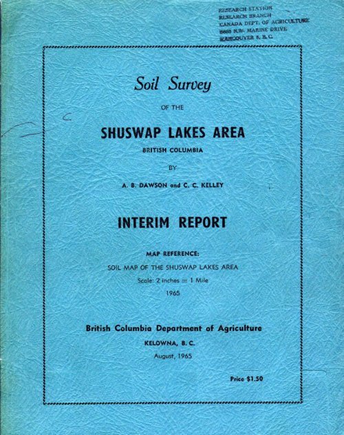
SOIL SURVEY^f theSHUSWAP LAKES AREABRITISH COLUMBIAbyA . B . Dawson and C . C . KelleyINTERIM REPORTMap Reference :Soil Map of the Shuswap Lakes AreaScale : 2 inches = 1 mile1965British Columbia Department of AgricultureKelowna9 B . C .August, 1965Price $1 .50
DESCRIPTION OF THE AREALocation and Extent .., l . . O O O . O . . e C O . . . . O O . . e O e . . . o , . e . o . e . o 2Community Facilities o o O O . . O . O ~ . . . . . , . O . ~ . O . . ~ ~ . ~ ~ . ~ ~ , ~ . ~ ~ . . 3Physiography and Drainage O . . O O ) ~ . n o ~ a . . . O ~ O . O ~ ~ ~ ~ ~ ~ .4Climate . ~ . . . D O ~ . ~ O . . . ~ O . 6Agriculture . "~.".....~..~~~.. O I J D . . . D ~ . . l . . ~ n O O ~ . ~ ~ . ~ ~ ~ . * . . 9Origin of Soil Forming Deposits O . O ~ . . O . . O . . . ~ . . O ~ C O . . , ~ ~ ~ ~ . 11Soil Mapping and Classification O O . o . . . . . O O a O D O o a O . e . J . e . a O . 16" ~ ~ ~' ~ ~ . ~ ~ ~ . ~ . . ~ . ~nark Gray Soils ..OOO...~L....~..Os~~.~~.....~.~....~ o o o o . , 57
A. ii .PageBrown Wooded Soils ......................................... 67Grizzly Hill Series ...................................... 67Larch Hill Series ........................................ 70O'Keefe Series ........................................... 72Pari Series .............................................. 73Lwnby Series ............................................. 75White Series ............................................. 77Moulton Series ........................................... 79Glenemma Series ........................................... 80Pillar Series ............................................. 82Broderick Series ......................................... 84Acid Brown Wooded Soils .................................... 86Hillcrest Series ......................................... 86Sauff Series ............................................. 88Banshee Series ........................................... 90Hobbç Series ............................................. 92Gray Forested Soils ........................................ 93Stepney Series ' 94Enderby Seqies ......................................................................................96Chum Series ............................................... 98Ida Series ............................................... 101Gray Wooded Soils .......................................... 102Reiswig Series ........................................... 103Carlin Series ............................................ 106Saltwell Series .......................................... 109Piaster Series ........................................... 110Tappen Series ............................................ 112Fowler Series ............................................ 114Moutell Series ........................................... 115Harper Series ............................................ 117Adams Series ............................................. 119Skimikin Series .......................................... 121Wallenstein Series ....................................... 123Willshore Series ......................................... 124Cherryville Series ....................................... 126Corning Series ........................................... 128Syphon Series ............................................ 131Leonard Series ........................................... 132Hobson Series ............................................. 135Metcalfe Series .......................................... 137Podzol Soils ............................................... 139Canoe Series ............................................. 140Spa Series ............................................... 143Onyx Series .............................................. 144Shuswap Series ........................................... 146Hupel Series .............................................. 148
.- iii .PageSolodized Solonetz Soils ................................... 149Broadview Series ......................................... 150Organic Soils .............................................. 153Loftus Muck .............................................. 154Okanagan Muck ............................................ 156Rabie Muck ............................................... 157Santabin Muck ............... ...OO...OO...*D.O....O..*.. ... 159Waby Peat ................................................ 160Miscellaneous Land TypesBluffs ................................................... 161Creeks ................................................... 161Grave1 Pi+, s .............................................. 161Lakes .................................................... 161Mar1 ..................................................... 161Ponds .................................................... 162Resort and Industrial Areas .............................. 162Rough Mountainous LandRock Outcrops ............................................................................... 162162Swamps ................................................... 162Classification According to Suitability for Irrigation .......... 163Chemical Properties of the Soils ................................ 180Pertility Status of Selected Soils .............................. 205References ...................................................... 207Glossary ........................................................ 226TABLES1 . Average Seasonal Temperatures ............................ 72 . Extreme Temperatures and Snowfall ........................ 73 . Classification of Soils and Parent Materials ............. 184 . Suitability of'the Soils for Irrigation .................. 1645 . Chemical Analyses of 61 Soils ............................ 1876 . Fertility Status of Selected Soils ....................... 205Appendix TablesA . Westwold Climatic Data ............................... 209B - Falkland (1) Climatic Data ........................... 210C - Falkland (2) Climatic Data ........................... 211D - Glenemma Climatic Data ............................... 211E - Monte Creek Climatic Data ............................ 212P - Chase Climatic Data .................................. 212G - Sorrento Climatic Data ............................... 213H - Eagle Bay Cliinatic Data .............................. 2141 - Tappen Climatic Data ................................. 216J - Salmon Arm (1) Climatic Data ......................... 217K - Salmon Arm (2) Climatic Data ......................... 219
1- iv -PageL - Canoe Point Climatic Data ~ O O . . . O . . ~ ~ O O O O ~ . . . O . . O O O O . . 219M - Enderby Climatic Data O O O ~ . . . . . ~ . n . . O ~ O ~ n . . . . ~ ~ . . ~ . ~ . . 220N - Armstrong Climatic Data O O ~ . L " . . . . ~ O ~ . . , . . O O " ~ * . . . . . . e 220O - Spring and Pal1 lirosts and. Frost-free 2eriod . . ~ 4 . e o o o 2220 - 3ainfall in May, Jme, July, and August O . c . o O e . e . O O . O 223Q - Hours of Sunshine at Salmon Arm ...................... 224
- 1 -ACKNOWLEDGEMENTThe classification of soils in the mapped area was undertaken bythe Soil Survey Branch, British Columbia Department of Agriculture,between 1961 and 1964 . Base maps and air photos were supplied by theSurveys and Mapping Branch, Department of Lands, Forests and WaterResources .Special acknowledgement is made to Dr . R . J . Fulton, GeologicalSurvey, Department of Mines and Technical Surveys? Ottawa, for informationin regard to surf icial deposits, and to J . D . Hazlette, DistrictAgriculturist, Salmon Arm, for general information .Participating staff of the Soil Survey Branch were P . N . Sprout,G . G . Runka, I . Cotic, and Dr . M . K . John . Student assistance wasgiven by G . Nielson, W . Skoczylas, M . J . Romaine, L . Sookochoff, andL, G . Rogerson . Laboratory analyses was undertaken by V . E . Osborneand I . Cotic .INTRODUCTIONThe soil survey of the Shuswap Lakes Area is the beginning of apioneer soil survey of the Thompson River valley . An interim reportpublished in mimeograph form in 1960 describes the soils of the ShuswapRiver drainage from Sugar Lake to Mara Lake (1) . In 1963 an interimmimeographed report for the Ashcroft-Savona Area was published (2) . In1964 a mimeographed report describing the soils of the Eagle Rivervalley was published (3) . This report covers a section of the ThompsonRiver drainage in the Shuswap Lake Topographic Sheet 82 L/NW . Surveyswill eventually be undertaken and reports published that will describeother sections of the South Thompson River valley .The field work that began in 1961 was subject to other priorities,thus limiting the acreage classified each year . The field sheets consistedof 9 x 9 inch air photos having a scale of two inches to a mile .A map, "Soil Map of the Shuswap Lakes Area", scale two inches to amile, was prepared . Hand tinted copies of this map are available togovernment agencies only . Others may obtain uncolored prints atnominal cost from the Department of Agriculture, Victoria, B . C .This report contains a general description of the area, and descriptionsof the soils and their land use . There is also some laboratoryanalyses of soil samples, and a glossary of technical terms usedin the report is appended .
- 2 -HOW TO USE A SOIL SURVEY REPORTMost people are interested only in a few sections of the report .If they thus confine their reading much information will be missed .The material is so organized that information which applies everywhereis given in each section . It is necessary to read the whole report atleast once before using any one section as a reference .Farmers living in the area know the soil distinctions on theirfarms, and on those of some of their neighbors ., However, they cannotcompare their own soil types and yields of crops with those in other.parts of the district or on experimental stations unless the soilsurvey report and map are used, When such comparisons are possible, newtechniques that have proved successful on a given soil type can beapplied wherever that soil type occurs .The nature of the soils on any farm can be determined by locatingthe farm on the soil map, Each type of soil is shown on the map by adistinctive color and symbol . To find the name of the soil on the map,refer to the map legend, and the soil profile and other information isgiven in the report,If a more general idea is wanted, read the soil descriptions thatcome under the section, "Descriptions of Soils" . It will be noted thatthe soil series are assigned to subgroups whose pedological characteristicsare described, For information as to the materials from which thesoils were derived, read the section, "Origin of Soil Forming Deposits",and refer to the section, "Soil Mapping and Classification" .Prospective settlers and others are interested in climatic information,and the amount of develnpment within the area . This informationis given under "Description of the Area" .The colors on the soil map are used to distinguish the soils fromone another, and to show the extent of each soil area . Soil boundariesvary in width, and generally take the form of a mixed zone that variesin width, though shown on the map as a line . Within some soil areas,areas of other soils may occur, that are so intermixed or small thatthey could not be separated at the scale of mapping used . Such areasare generally mapped as a "complex" of two or more soils .DESCRIPTION OF THE AREALOCATION AND EXTENTThe soil mapped area consists chiefly of the lower elevations inShuswap Lake Sheet 82 L/NW from 1190 00' westward to 1190 45' northlongitude, between 500 30' and 510 00' latitude . A small portion at
the northeast corner of Vernon Sheet 82 L/SW is included .The area includes the highland between Shuswap River and DeepCreek, the Salmon River valley from Glenemma to Shuswap Lake, and thewest side of the Shuswap Lake valley from Salmon Arm to Chase . Thenorth side of the Shuswap Lake area was surveyed from Anglemont toAdams Lake . The Chase Creek valley and the valleys of Hiuihill andLoakin creeks were included .The whole classified area occupies 1181162 acres . About 76,322acres are cultivated and potentially arable, and the remainingare nonarable .CONiPdIUNITY FACILITIES, POPULATION'------------------TRANSPORTATION,-AND--- CONEIIUNICATIONS_ -- .The Shuswap Lakes have exceptional scenery, and good facilitiesfor boating and sport fishing . Development to meet the requirements ofthe tourist trade has been rapid since completion of the Rogers PassHighway in 1962 . With about 600 miles of shoreline, the Shuswap Lakesare noteworthy as a recreational area, and visited by thousands oftourists each year .In this area the main industry is lumbering, with agriculturesecondary . Douglas fir, white and Engleman spruce, hemlock, cedar, andwhite pine are logged in the surrounding forests . The logging companiesand sawmills afford employment for a substantial part of the population .Incorporated as a city in 1912, Salmon Arm was reorganized as avillage in 1958 . The area is about 640 acres, and the population 1,506(4) . It has a sewerage and a domestic water system . Salmon Arm is thelargest business centre in the mapped area, and stimulated by theincrease of traffic after the opening of the Rogers Pass Highway . Itsfuture is made even more favorable by large hydro-electric developmentsto come on the comparatively nearby Columbia River .The District of Salmon Arm, the general area surrounding thevillage, was incorporated in 1905, with an area of 41,878 acres and presentpopulation of 4,300 (4) . It has a domestic water system in conjunctionwith Salmon Arm village .School District No . 20 is composed of Salmon Arm village, thedistrict municipality and adjoining rural territory, the total areabeing 2,347 square miles . This was incorporated in 1946 . The totalpopulation is 10,900, and the school population 3,030 (4) .The village of Chase is located at the west end of Little ShuswapLake . This is the only business centre of any size between Salmon Armand Kamloops . The population of the village and surrounding area isprobably around 1,000 . In the mapped area, there are a number of postoffices and small general stores .
The school population is accommodated in elementary and highschools at Salmon Arm, Chase, and Celista and several elementaryschools are located elsewhere . A school bus system serves the area .Power for the area is supplied by the British Columbia Hydro andPower Authority, from a plant located near Needles on Arrow Lakes .Telephone communication is by the Okanagan Telephone Co . in the SalmonArm locality and by the British Columbia Telephone Co . around Chase .C .B.C .television is received from satellites of parent stations atKelowna and Kamloops . Salmon Arm is served with natural gas by theInland Natural Gas Co .The area is served by the Shuswap Lake General Hospital at SalmonArm and the Royal Inland Hospital at Kamloops . There is a governmentoffice and forest ranger station at Salmon Arm and a ranger station atChase . Law enforcement is by the R .C .M .P .The mapped area has been served by the C .P .R . transcontinentalline since its construction in 1885 . Trans-Canada Highway No . I parallelsthe railway from Sicamous to Chase . There are paved secondaryroads in the more populous areas, and many others are gravelled . Anextensive network of logging roads give access to the surroundingmountains .Domestic water for Salmon Arm and the eastern section of themunicipality is pumped from Shuswap Lake and obtained by gravity froma reservoir on East Canoe Creek . The Chase Water Works Districtsupplies domestic water to the town of Chase . In the rural parts ofthe mapped area water is obtained from shallow and deep wells, creeksand springs . Tourist resorts, homes and summer cottages along the lakeshore get water from the lake . In general, the water is of goodquality insofar as its mineral content is concerned, but those usinglake or pond water should be sure of its freedom from pollution .PHYSIOGRAPHY AND DRAINAGEThe mapped area is within the Shuswap Highland . The mountainoussections consist of hills rounded by glaciation and wooded, that donot exceed 5,500 feet elevation . These sections are separated from oneanother by valleys partly filled with glacial debris and in partoccupied by lakes . The result is a scenic region, rich in touristattractions .A large part of the area is occupied by the Shuswap Lakes, whichform the upper part of the South Thompson Valley . They occupy deep andcomparatively narrow valleys, with an aggregate shoreline of about 600miles .The main division of the Shuswap Lake consists of two reaches, thefirst, nearest Little Shuswap Lake, may be called the Southeast Arm .
The second reach is Seymour Arm ; from the name of a small, early settlementat its head . Seymour River enters the head of the lake at Seymour .The second division of the lake is connected with the first by anopening about one-half mile wide . This is Cinnemousun Narrows . To thenorth this second section is called Anesty Arm and to the southwest,Salmon Arm . The Salmon Arm receives the Salmon River and a stream fromWhite Lake, which lies east of Balmoral . The fourth, or southeasterndivision of the lake is joined to the Salmon Arm by Sicamous Narrows,caused by the delta of Eagle River . This is the Mara Arm, more commonlycalled Mara Lake . It receives the Shuswap River at its south end . Inaddition to those mentioned there are about a dozen small lakes in thearea .The Shuswap River is the main tributary but it flows outside themapped area and need not be described . Second to it is Salmon River .The Salmon rises outside the mapped area southwest of Westwold, and thesoils are classified along about 20 miles of its course, It enters thesurveyed area at about 1,540 feet elevation and drops about 20 per mileto Shuswap Lake, where the delta is about two miles wide .Canoe Creek has headwaters in the Larch Hill Forest Reserve, andenters Shuswap Lake at Canoe . A reservoir on this creek is used as asource for the Salmon Arm Municipal Waterworks . The lower four milesof Canoe Creek is channeled through glacio-lacustrine deposits .The Adams River, in the northwest corner of the map-area, flowsinto Shuswap Lake near Squilax . This river, about six miles long,drains Adams Lake and a few creeks that enter its course . The deltaof Adams River separates Little Shuswap Lake from the main lake . Atits greatest extent the delta is about four miles wide .Scotch Creek rises in the Shuswap Provincial Forest . One of thelarger creeks, it flows in a narrow canyon over most of its length .The delta where it enters the north side of Shuswap Lake oppositeSorrento has a length of about 2~ miles from the lake to its apex, anda width of about 32 miles .Chase Creek enters the Thompson Valley from the south on the westside of Chase . The creek, which rises in the Fly Hill ProvincialForest, is restricted to a narrow canyon in its upper part . Thiswidens gradually downstream and the bottom is occupied by a narrowfloodplain and the small fans of tributaries . In its lower part thecreek is deeply incised where it has carved a channel in bedrock . Inthe Thompson Valley, from the mouth of the rock gorge, a large fan isspread on which the village of Chase and some small farms are situated .The creek enters the Thompson River near its exit from Little ShuswapLake .The South Thompson River occupies a wide valley over a distance of36 miles between Little Shuswap and Kamloops lakes . The water is clearand warm in summer . At minimum lake levels (1,130 and 1,103 feet res-
pectively) the gradient between the two lakes is nine inches per mile,and at high water (1,141 and 1,129 feet elevation) only four inches permile .CLIMATEThe main source of moisture in southern British Columbia is fromonshore air movement . Most of it is lost on the western slopes of thecoast mountains . This results in a dry climatic shadow over theInterior Plateau . In this region the average precipitation is around15 inches annually, but there are different degrees of dryness, as itaffects plant life, based on elevation . The higher elevations arecooler, there is greater moisture economy, and species of vegetationcan grow with relatively less moisture than in the lower and warmervalley bottoms .East of the plateau there is a secondary increase of precipitationthat starts as the Columbia Mountains are approached, and . reaches apeak on the west slopes of the Selkirks . Since this flow contributesmore moisture in the dormant season than in the one of growth, it mustbe supposed that the bulk of the precipitation in the secondary areathe year around, is supplied directly from onshore air from the PacificOcean .In winter, low-pressure systems cross the country from October toApril, and cause cloud-cover and precipitation for most of this period .These systems may come one after another with scarcely a clear daybetween, and may persist for weeks or even months . Occasionally thispattern is interrupted for a few days to a week or more when continentalarctic air covers the region . Such interruptions generally beginwith strong winds that clear away the clouds . The low temperaturesattained at such times depend on how deep the region is buried withinthe cold air mass .TemperatureTemperatures vary inversely with elevations . Unfortunately, thereis limited meteorological information at the higher elevations .Table 1 gives the average seasonal temperatures and elevations ofstations in the mapped area and nearby, and for comparison, of fourstations in the bottom of the Okanagan Valley .
Table 1 .-- Average Seasonal Temperatures at Stations in theThompson, Salmon and Okanagan Valleys .ElevationStation Feet Winter Spring Summer Fall AnnualSalmon and Thompson ValleysWestwold 2,100 23 44 61 43 43Falkland 1,500 27 45 64 44 45Chase 1,165 29 47 65 46 47Tappen 1,860 27 47 64 49 47Salmon A 1,660 27 47 65 46 46Okanagan ValleyVernon 1,582 25 46 64 46 45Kelowna 1,160 29 47 65 47 47Penticton 1,121 30 48 65 47 48Oliver 1,008 29 50 68 48 49Table 2 shows the extreme high and low temperatures and snowfallduring periods of record, and indicates the considerable variationsthat occur . The annual variations for the same stations and a fewothers are given in appended Tables A to N .(Inches) LowTable 2 . -- Extreme Temperatures and Snowfall and Average Snowfallat Salmon and South Thompson Valley Stations .NumberTemperature, oF SnowfallofStation Years High Low HighAnnualWestwold 1921-63 103 -50 107 .3 8 .5 36 .5Falkland 1924-30 100 -25 89 .7 23 .8 45 .51959-63 66 .2 20 .2Chase 1953-63 99 -18 49 .1 25 .7 33 .6Sorrento 1924-63 > . 88 .5 26 .3 58 .9Eagle Bay 1924-63 . . 101 .5 26 .9 61 .2Tappen 1916-63 106 -28 107 .9 21 .8 65 .4Salmon Arm 1916-63 106 -31 114 .2 17 .5 65 .5The winter extreme lows and the frequency of their occurrence aresignificant in regard to the survival of certain perennial crops, particularlythose that stand above the snow, or are caught when the
- 8 -ground is not snow-covered . The winter climate is the governing factorfor many varieties of tree fruits, grapes and cane fruits . Beforeplanting, it should be ascertained if the variety to be grown can withstandthe winter lows likely to occur . As shown in Table 1, summertemperatures in the Chase-Tappen-Salmon Arm region are only slightlylower than those in the Kelowna-Penticton area of the Okanagan . Thisindicates that certain annual crops that do well in the middle Okanaganmay be tried for commercial production in the Thompson Valley section .The Frost-Free PeriodThe dates of the last spring and first fall frosts have a bearingon the type of agriculture that can be undertaken . The frequency offrosts and the places in which they occur depend mainly on latitude,altitude, air drainage, and cloud conditions . Because of the complexityof these factors and others, the frost-free period is irregular . Inany locality frost records over a period of years give an estimate ofthe frost-free season for use as a guide . The dates for stations havingfrost records are shown in Appendix Table 0 .PrecipitationThe precipitation pattern for the area is strongly influenced bythe onshore movement of air from the Pacific Coast . In winter theincoming low-pressure systems discharge most of their moisture as rainand snow on the western slopes of the Coast Mountains . East of thesemountains they cause considerable cloud-cover . In summer there is lesscloud and precipitation, and some variation occurs in different partsof the area, due to elevation and other influences .As the mapped area is approached upstream on the Thompson River,it is noticed that Monte Creek is one of the driest spots in BritishColumbia, with only about nine inches annual precipitation . Upstreamthere is a slight increase to Pritchard, and from there a more pronouncedeffect, changing the natural grassland to forest . At Chase theprecipitation has increased to 14,27 inches . There is a steadyincrease eastward to 21 inches at Salmon Arm, and there are highervalues farther east, In the Salmon River valley the increase is from13 .75 inches at Westwold to 17 .18 at Falkland, the latter probablybeing high owing to a limited period of record .Insofar as agriculture is concerned, effective rainfall isrequired during the important months for crop growth, regardless of theannual total . These are May, June, July, and August for the kinds ofcrops grown in the surveyed area . Since the rainfall is applied tosoils that have different moisture requirements, the lighter texturedones are marginal or submarginal if there is only sufficient moisturefor moderate crops on the heavy soils .It is therefore of interest to know how much rain falls during thefour important months, as this proves the need of supplemental moisture,Such information is given in Appendix Table P . This table indicates
the variations from year to year, and averages for the times of record .It appears certain that the amounts shown are insufficient to give theyields of which the soils are capable, and so moisture is a chieflimiting factor . Irrigation is required throughout the area .In the design of irrigation works, important features are theamount of water that should be stored, where storage is required, andthe ability of the system to deliver enough water for the crop in thedriest month . The amount to store is evaluated by the acreage to beirrigated and any extreme lack of rainfall during a summer month . Inthe appended tables for all stations, the extreme low for at least oneof the summer months is less than a tenth of an inch, which for practicalpurposes, should be regarded as none at all . The irrigationsystem must have enough capacity to supply the requirement of eachsoil type in the driest month, and this is based on the lowest figureson record . This information is given in Appendix Tables A to N .Cloud and Bright SunshineThe only station in the mapped area that records sunshine is atSalmon Arm . Although considerable variation occurs for each month,the noteworthy feature is the amount of cloud and lack of sunshine inOctober, November, December, January, and February . In these monthsthe extreme lows in hours of sunshine are 57, 18, 3, 9, and 29 respectively. At times, however, polar air sweeps the clouds away, bringingclear skies and low temperatures that cause more damage to tree fruitsthan is the case in the southern Okanagan . By months and years, thesunshine record for Salmon Arm is shown in Appendix Table Q .AGRICULTUREAgriculture has undergone slow development since the railway wasbuilt in 1885 . The population, farm and otherwise, has increased anddecreased in response to economic cyclese Homesteads established inthe early days were enlarged, remained small or were abandoned . Landclearing in the days of hand methods was slow, but with mechanizationhas steadily increased .The size of farm u_nits varies from less than three acres to morethan 1,600 ; the greater percentage being from 10 to 180 acres (8) . Therange is from small farms with part-time operators to well-managedenterprises . Most farms have nonarable and unimproved potentiallyarable acreage used for grazing or forestry .The agriculture is diversified, with beef cattle the main type oflivestock . At the time of the survey (1964) dairying in the vicinityof Salmon Arm amounted to about 32 fluid milk producers . In addition,a number of farmers keep milk cows for their own milk, cream and butter .Any excess milk from the larger producers is used in the manufactureof dairy products . Hogs and poultry are produced and there are a few
- 10 -small flocks of sheep . Light horses for riding are becoming popular,and their numbers are increasing .Hay and pasture occupy the greater acreage . Alfalfa and mixturesof alfalfa and grasses are common for hay . Four to seven tons of haycrops are produced when irrigation and fertilizer are used . Bunker ortrench silos store a steadily increasing tonnage of silage . Pasturescomposed of Ladino clover, wild white and white Dutch clover, orchardand brome grasses, with reed canary grass in poorly drained spots,support beef and dairy stock . After the second hay crop is harvested,any further growth is often pastured .Cereal crops consist chiefly of coarse grains to feed livestock .Oats are produced mainly as a nurse crop, some winter wheat is grown,and field corn is used for silage . Potatoes are a cash crop in theSalmon River valley and on the Chase flat .In former years tree fruits occupied a considerable acreage in theBroadview locality east of Salmon Arm and near Sorrento . Severe wintersof 1950 and 1955 caused extensive damage, and since then replanting hasnot been important . In 1960 a total of 598 acres were in production,and the acreage is decreasing . The main acreage is in apples, withminor production of cherries, pears and prunes . The Orchard Survey of1960 revealed 65 orchard units operated by 56 growers (9) .Strawberry, raspberry and other small fruit acreage is graduallyincreasing . Marketing of small fruit on the prairies has improved sincethe Rogers Pass section of the Trans-Canada Highway opened in 1962 .The use of fertilizer has increased in recent years . The fertilizerrequirements of different soils and farms should be determined bythe crops to be grown, taking into account the past history and performanceof the farm . Recommendations in regard to kinds and quantitiesof nutrients should be obtained from the District Agriculturist, owingto soil variations and past management of the farm .Irrigation is necessary for most soils in the growing season,inasmuch as rainfall is insufficient to produce the yields of which thesoils are capable . In the Salmon River valley water for irrigation isavailable from the river and tributary creeks to those having waterrights . The Broadview locality and Tappen-Sorrento area would requirefairly large scale projects to supply irrigation water. On the northside of Shuswap Lake, water is available from tributary creeks and nearthe shore, from the lake itself . Near Chase the Chase IrrigationDistrict supplies the adjacent flat, and on the north side water isobtained from Nisconlith Lake .In 1964 most of the water resources were not us~ed to full advantage .Water is applied to a small acreage in comparison with the potentiallyirrigable area .
drainage-ways into the Mara Lake - Shuswap River part of the OkanaganValley . Well marked raised beaches and other features about 30 feetabove present lake level suggest that Shuswap Lakes were higher at sometime previous to assumption of the present westward drainage (7) .The till mantle above the glacio-lacustrine deposits is of variablecomposition, having a textural range from loamy sand to loam or heavier .The stone and gravel content varies within wide limits . Where derivedfrom granite, the till is sandy and may be loose or compact . Whereglaciated from finer textured rock formations, it is compact and richin silt and clay . Inasmuch as the topography of till areas is for themost part rolling and sloping, the derived soils are usually a mixtureof components consisting of the till in place in the lower part of theprofile, down-hill creep composed chiefly of weathered till,and loess .The soils derived from this material are the Armstrong, Bluespring,Grizzly Hill, Reiswig, Willshore, Cherryville, and Hcbson series .Second in the order of deposition are the deposits of gravelly outwashand slopewash over till . Some of these were formed by outwash onice with the ground moraine beneath . When the ice melted it let theoverlay material down on the till . In other cases slopewash came offsteep slopes and spread over till in place . These formations occurredas the ice left the areas in which the deposits are situated . This soilforming overlay on till was classified as the Hillcrest and Spa series .Morainal gravels are ice-contact deposits . These generally occuras end-morainal outwash left by a retreating glacier, and often theyhave irregular segments of ice buried in them . When this ice melts thearea becnmes pitted or kettled outwash, generally sandy and gravelly .Soils derived from this material are the Nahun, Moulton and Onyx series .Another type of glacial outwash consists of gravelly deposits thatformerly filled valley bottoms to level, gently sloping floodplains,but since that time the streams have carved their channels and terraceswere thus formed . The terraces were inundated during freshets when thestream channels were shallow, and veneered with a finishing coat offiner texture, ranging from loamy sand to loam, from a few inches toseveral feet thick . These valley bottom deposits often were floodplains,hence the terraces may slope gently toward the valley sides, and thereis also a gentle downstream slope, The mapped soils on these depositsare the Larch Hill, Glenemma and Sauff series,The sandy glacial outwash that formerly occupied sections of valleybottoms was deposited in the same way, as the gravelly deposits describedabove . The gravelly deposits are more common because gravel is a largerconstituent than sand in the till from which both eroded, and a considerableamount of sand is included with the gravels . The sorting out ofmore or less pure sand was due to the velocity of water flow in differentplaces . The gravels deposited in the faster and the sands in the slowermoving water . The sands were carved into terraces in the same way as thegravels .
It was observed that the surface soils of the sandy terraces havefine sandy loam, sandy loam and loamy sand textures . These grade tosand at a foot or more depth . The silt and clay in the topsoil was notderived from disintegration of sand particles . The only other sourceis from loess or a former finishing veneer due to freshet inundation .The soils that developed on the sandy materials were named Grandview,0'Keefe, Pillar, Banshee, Stepney, Corning, P1letcalfe, Shuswap, andCanoe series .For the purpose of soil classification the glacio-lacustrine siltsand clays shall be regarded as two separate formations, probablydeposited at different times . The silts are the earliest deposits inthe glacial lakes . It is here postualted that they represent a differentsource of material from the clays, owing to a comparative shortage ofclay in the so-called silt deposits, which are largely silts and veryfine sands laid down in separate strata .The silts and very fine sands probably originated as rock flour,sand-papered from many kinds of rock formations over which the icesheetmoved, and carried by sub-glacial streams to the area below theterminal moraine in Washington, and probably into some areas farthernorth as the ice-front retreated, The large fans of silty materialthus formed below the ice-front were eroded by wind as loess, somebeing blown north to settle on top of the ice-sheet . As the ice decayedthe material was washed down into glacial lakes in the major valleys,to become stratified silts and fine sands . This formation, which doesnot occur to a comparable extent north of 510 latitude, is the firstglacio-lacustrine deposit . It is exposed on the surface in parts ofthe Thompson Valley between Ashcroft and Salmon Arm and in the Oka_naganbetween Peachland and Okanagan Falls . In the mapped area the soilsderived from these silts are the Grier, Heubner, Neskain, Enderby, andCarlin series .The glacio-lacustrine clays overlie the silt formation from thevicinity of Pritchard to Salmon Arm, and thence in the Okanagan fromEnderby to Westbank . In places the clay forms a thin mantle over till .The high clay content of the material, which is stratified and oftenvarved, and its position, suggest a different source of material fromthat of the silts . In this regard it is postulated that the clay wasone of the products of till erosion, the others being the sands andgravels described above .By the time the ground moraine was exposed and its erosion began,certain sections of the silt deposits were no longer laked, and thesewere not surfaced with clay . The bulk of the clay need not be a directproduct of glaciation, in contrast to the silts, because the countryhad a soil mantle in pre-glacial time, in which most of the clayoccurred . During glaciation this soil mantle became mixed with thetill, and finally some of the clay was sorted from it by erosion anddeposited in glacial lakes . The soils derived from the glaciolacustrineclays are the Saltwell, Plaster, Tappen, and Broadviewseries .
The glacio-lacustrine deposits in the mapped area mark the sitesof a number of glacial lakes that occupied parts of the valleys atdifferent stages of ice recession . Most of these are remnants of lakebottom deposits that were larger before the lake basins were vacated bythe lowering of the drainage outlets . In some cases the depositsextended over ice in the valley bottoms, and thus delayed the meltingof the ice beneath .In addition to the soils that developed on deposits formed duringdecay of the ice, there are a number of others derived from more recentdeposits that vary in age . The soils also vary from Regosols toMinimal Podzols .In the course of general down-slope erosion, sandy outwash andslopewash has spread over the margins of glacio-lacustrine deposits .The thickness of the overlay varies . Where it is thin, the heaviertextured glacio-lacustrine material beneath may affect the drainage ofthe top layer, particularly where there is seepage, or when the landis irrigated . Only one soil in the mapped area is derived from thisoverlay, and it was named the Syphon series .At the higher elevations, on the tops of knolls and near outcroppingsof bedrock, downhill erosion has produced a kind of materialdefined as shallow colluvium over bedrock . Frost-flaking of theexposed rock has produced many angular fragments, loess and creep ofmedium texture is mixed in, and the result is a class of material inwhich the angular stone content varies within wide limits . The Equesis,Pari, Hobbs, and Fowler series were derived from this material .Post-glacial alluvial-colluvial fans are a common feature of thelandscape . They spread at the toe of the slope at the mouths ofcoulees tributary to any valley serving a watershed . Characteristically,the fan apex contains the coarsest material, which may be very stony .Some fans were rock glaciers in their early stages, and later the stonymass was covered by finer materials . The texture becomes finer andless stony down-slope, until on the larger fans, the lower margin maybe fine-textured and stone-free .On many fans, particularly the larger ones, the topography consistsof~a gentle downward slope toward the valley centre, with gentlelateral slopes to right and left . The smaller fans may have steeperslopes . In some cases fans may be built in a series of two or more,one above and back of the other . This occurs where the first fan wasbuilt at a higher level of drainage . When a lower drainage elevationwas established, a coulee was cut through the older fan, and a new onedeveloped lower down . These are called compound fans .Most fans were built as a series of tumultuous outwashes, usuallydue to violent rainstorms in their tributary watersheds, when there waslack of vegetative protection . These stage-built fans develop a newrunoff stream over the length of each outwash, and deposit a considerableamount of material each time . When a new outwash occurs, the former
Forested, Gray Wooded, Acid Brown Wooded, and Podzol soil groups . Theyounger soil-forming materials, composed of recent overlay on alluvialfans, river and stream, organic and beach deposits were classed asRegosol, Gleysol, Brown Wooded, and Organic soils .Table 3 shows the relationship of the soil-forming deposits tosoil subgroups and soil series . In the mapped area the soils developedunder a range of precipitation, which governs the amount of developmentand the density of vegetative growth . The classification grades fromRegosols (least weathered) to Podzols (most weathered) . The groundwatersoils are the Gleysol and Organic members .The basic mapping unit is the soil series . A soil series consistsof a group of related soils derived from similar parent material andhaving soil horizons similar in differentiating characteristics andarrangement in the soil profile, except for the texture at the surface .Areas having variable surface textures, but otherwise the same, aredistinguished as subdivisions of a soil series, and called soil types .A soil series having a surface texture that does not vary is also mappedas a soil type . Soil types are distinguished by the name of the series(e .g . Carlin), and the texture of the surface soil (e .g . silt loam), thefull name of the soil being Carlin silt loam . The series names areusually the names of lakes, creeks, railway sidings, villages, and otherestablished names in the localities in which the series was originallyidentified .A phase of a soil series may also be distinguished, particularlywhere this has significance to land use . Phases are based on variationsthat occur within a series, such as topography, depth of profile, stoniness,drainage, and others .In some cases it is not feasible to separate two or more series .Such areas are mapped as soil complexes . Where two or more soil serieshave been described separately in the report, the name of the complexconsists of the names of the series of which it is composed . Suchnames are hyphenated (e .g . Carlin-Tappen complex) . The name of theseries that occupies the major acreage comes first and the other namesfollow in order . Complexes of as many as four series are mapped,depending on the map scale and/or the intimacy with which the soils areintermingled .Soil series were assigned to subgroups according to the pedologicdevelopment that signifies their genetic relationships . These areshown in Table 3 . Descriptions of the main observable characteristicsof the subgroups head those of the soil series classed in each subgroup .
Table 3 . -- Classification of Soils and Parent Materials in the Shuswap Lakes Area .Soil Subgroups and SeriesOrthicPeatyGleyed Carbonated Regosol Peaty Carbonated RegoOrthic Orthic Mull Rego Rego to Rego Regc Rege HumicParent Materials Regosol Regosol Regosol Gleysol Gleysol Gleysol Gleyscl Gleysol GleysolGlacio-lacustrineSiltsGrierHeubnerAlluvial-ColluvialFansGrindrod - Schindler - Niowitch - Gardom Heubner BessetteRiver and Stream Falkland Rumball Bolean Apalmer - Mable Complex Gardom - BessetteDepositsYardBeach DepositsCelista
Table 3 .-- (Continued)Soil Subgroups and Seriesarent MaterialsOrthicHumicGleysolOrthicBlackOrthicDarkGrayGleyedOrthicDarkGrayOrthicBrownWoodedDegradedBrownWoodedOrthicAcidBrownWocdedOrthicGrayForestedGleyedGrayWoodedGlacial Till - Armstrong Bluespring - Grizzly HillGravelly Outwash orSlopewash over TillHillcrestMorainal Gravels - Nahun - - - MoultonGravelly Stream andDeltaic TerracesSa.ndy Stream andDeltaic TerracesLarch Hill Glenemma SauffGrandview - - 0'Keefe Pillar Banshee StepneyGlacio-lacustrineSiltsNeskain - - - - EnderbyShallow Colluviumover BedrockEquesis - Pari - HobbsAlluvial-ColluvialFansRiver and StreamDepositsririsconlith - Gulch - Lumby Broderick - ChumWhit eNisconlith - - Kosta - - - IdaWallenstein
Table 3 .-- (Continued)Soil Subgroups and SeriesGrayOrthic Dark Brunisolic Bisequa WoodedGray Gray Gray Gray Bisequa Minimal Solodized Shallow DeepParent Materials Wooded Wooded Wooded Wooded Podzol Podzol Solonetz Muck MuckPeatGlacial Till Reiswig Willshore Cherryville HobsonGravelly Outvrash or SpaSlopewash over TillMorainal Gravels - - - - - OnyxSandy Stream andDeltaic TerracesGlacio-LacustrineSiltsGlucio-LacustrineClay over TillCorning Metcalfe Canoe ShuswapCarlin - - - - - - - - -SaltwellPlaster0Glacio-LacustrineClayTappenBroadviewSandy Outwash andSlopewash over - - SyphonGlacio-LacustrineShallow Colluviumover BedrockAlluvial-ColluvialFansFowlerHarperIvIoutellAdamsLeonard - - HupelOrganic DepositsLoftusRabieOkanagan ~,~abyUantabinPond Deposits inOutwash and TillSkimikin
DESCRIPTIONS OF SOILSREGOSOL SOILSRegosols are mineral soils that lack observable horizons, or haveonly a very weakly developed Ah horizon . An L-H horizon less than 12inches thick may be present .In the surveyed area the Regosol soils are derived from recentlydeposited materials, and there is a vegetation of mixed deciduous andconiferous forest . Subgroups found were Orthic Regosol, OrthicRegosol (Calcareous Phase), Gleyed Orthic Regosol, and Mull Regosol(Calcareous Phase) .Orthic Regosol SoilsThese are mineral soils having little or no profile development .They lack observable horizons or have weakly developed Ah horizons .Under forest an L-H horizon up to two inches thick may be present .There is no visible evidence of accumulated salts or gley,In the surveyed area, Orthic Regosols that occur on alluvialcolluvialfans were assigned to the Grindrod series . Those found onthe drier, forested alluvial river and stream deposits are the Falklandseries . The soils that occur in the more humid forested areas are theYard series . Regosols were also included with two other subgroups inthe Mabel complex . Orthic Regosol beach deposits were assigned to theCelista series .Orthic Regosol Soils (Calcareous Phase)These are Orthic Regosols which are calcareous throughout theprofile . They occur on glacio-lacustrine materials as the Grier series .Gle,yed Orthic Regosol SoilsThe Gleyed subgroup is composed of mineral soils Orthic in theupper part of the profile, but with faint mottling in the C horizons .These soils are represented in the surveyed area by the Rumball series,which is derived from alluvial river and stream deposits . Gleyed Orth icRegosols also occur as undifferentiated parts of the Mabel complex.Mull Regosol Soils (Calcareous Phase )This is a subgroup of mineral soils lacking horizon developmentother than an Ah horizon . Under forest an L-H horizon up to two inchesthick may be present . These soils are calcareous throughout the profile. Representatives are the Schindler series on fan deposits, andthe Bolean series, which is derived from river and stream deposits .
- 22 -Orthic Regosol SoilsGRINDROD SERIESThe Grindrod soils are derived from alluvial-colluvial fan depositsscattered in the mapped area at elevations that lie between 1,200 and2,800 feet . The topography is gently to strongly sloping, the slopesbeing from three to 15 percent . Hummocky micro-relief is common . Thesesoils were differentiated as follows :ArableNonarableGrindrod gravelly sandGrindrod gravelly sand to gravelly loamy sandGrindrod loamy sandGrindrod gravelly loamy sandGrindrod stony, gravelly loamy sandGrindrod sandy loamGrindrod gravelly sandy loamGrindrod stony, gravelly sandy loamGrindrod gravelly sandy loam to loamGrindrod sandy loam to fine sandy loamGrindrod loamGrindrod loam to gravelly loamGrindrod-Lumby gravelly sandy loam to gravellyloamy sand complex16 - acres114 - "40 - "600 132 "- 95 "69 62 "510 16 "66 121 "29 - "217 - "20 - "53 - "- 655 "1,734 1,081 acresThe parent materials are poorly sorted, coarse to medium texturedfan deposits, located where tributary creeks enter the main valleys .Surface textures are from gravelly sand to loam, and subsoils fromgravelly sand to clay loam . Horizons vary as to thickness and graveland cobble content . In places there are horizons nf burned soil,signifying erosion after forest fire . Surface stoniness is from noneat all to excessive . The most stony areas are in fan apexes .The Orthic Regosol Grindrod soils are rapidly to moderately welldrained, with areas of seepage near creeks and fan margins . The nativevegetation consists of a light cover of birch, maple, saskatoon, willowyaspen and cottonwood, with an undergrowth of wild rose, aralia, twinflower,yarrow, pinegrass, and scattered weeds .. A cultivated profileof the Grindrod sandy loam was described as follows :DepthHorizon Inches DescriptionApl 0 - 2 Grayish-brown to dark grayish brown (l0YR 4.5/2,dry) or very dark gray (l0YR 3/1, moist) sandy loam .Very weak, medium subangular blocky structure .Soft when dry . Very friable when mnist . Abundantfine roots . pH 6 .2 .Gradual boundary :
-23-HorizonDepthInchesDescriptionAp2 2 - 6 Grayish-brown (l0YR 5/2, dry) or very dark grayishbrown (l0YR 3/2, moist) sandy loam . Very weak,medium subangular blocky structure . Soft when dry .Very friable when moist . Abundant roots . pH 6 .8 .Abrupt boundary :C 6 - 9 Light brownish gray (2 .5Y 6/2, dry) or dark grayishbrown (2 .5Y 4/2, moist) fine sandy loam . Moderatemedium subangular blocky structure . Slightly hardwhen dry . Occasional root . pH 7 .2 .Abrupt boundary :IIC1 9 -18 Light-gray (2 .5Y 7/2, dry) or grayish-brown (2 .5Y5/2, moist) loamy sand . Structureless . Singlegrained. Loose . Abundant roots . pH 7 .5 .IIC2 18 + Light-gray (2 .5Y 7/2, dry) nr grayish-brown (2 .5Y5/2, moist) gravelly sand . Single-grained . Loose .pH 7 .4 .Land UseAt the time of the survey (1964) small acreages of the Grindrodsoils were planted to forage crops . The majority of the acreage is inlight regrowth forest .These soils are mostly poor to doubtful for agriculture . They arelow in organic matter and have low moisture holding capacity, due tovariable textures in the profile .Irrigation is required and is available from some creeks for theproduction of forage and cereal crops . Additions of organic matter andfertilizers are essential . The suitability for irrigation of theGrindrod soils is shown in Table 4~FALKLAND SERIES^he Falkland soils occupy fairly extensive areas in the SalmonRiver valley from Glenemma to Shuswap Lake . Minor areas were foundnear Tappen, and in the Chase Creek valley . The range of elevation isfrom 2,100 feet in the Chase Creek valley to 1,145 near Shuswap Lake .Most of the topography is gently undulating, but there is variationfrom level areas to undulations associated with river oxbows . The soils,all arable, were mapped as follows :
- 24 -Falkland sand 14 acresFalkland loamy sand 115 "Falkland loamy sand to sandy loam g0 "Falkland sandy loam 492 "Falkland gravelly sandy loam 18 "Falkland fine sandy loam 138 "Falkland-Nisconlith sandy loam to loam complex 160 "Falkland-Nisconlith sandy loam to silt loam complex 235 "Falkland loamy sand to sandy loam-Gardom complex 113 "1,375 acresComplexes also occur with the Bolean, Bessette and Rumball series,where the Falkland soils occur as secondary members in areas of undulatingtopography .The parent material consists of moderately coarse to coarse texturedriver and stream alluvium of recent nrigin . The deposits, whichare of variable thickness, are stone-and-gravel free and micaceous .Surface textures range from sandy to fine sandy loam . Textures in thesubsoil are lnamy sand to fine sandy loam, with horizons.of silt loaminterspersed, The deposits grade to fine or coarse sand with depth .Falkland soils are well to moderately well drained and were classedas Orthic Regosols . Most of the acreage is clea'red and cultivated .Little native vegetation remains . The evidence indicates that thesesoils developed under a deciduous forest cover of cottonwood, willow,alder, and related undergrowth associated with river bottoms . A cultivatedpr ofile of the Falkland sandy loam was described as follows :HorizonDepthInchesDescriptionAp 0 - 4 Dark-gray to dark grayish brown (lOYR 4/1.5, dry)or very dark gray to black (10YR 2 .5/1, moist)sandy loam, Weak, medium subangular blocky breakingto single-grained structure . Very friablewhen moist . Abundant roots . pH 7 .8 .Abrupt boundary :C 4 -12 Grayish-brown (2 .5Y 5/2, dry) or very dark grayishbrown (2 .5Y 3/2, moist) fine sandy loam . Massivebreaking to single-grained structure . Very friablewhen moist . Occasional roots . pH 7 .9 .Clear boundary :IIC1 12 -18 Grayish-brown (2 .5Y 5/2, dry) or very dark grayishbrown (2 .5Y 3/2, moist) silt loam . Weak, mediumsubangular blocky structure, Very friable whenmoist . Small pockets of faint mottling . Occasionalroots . pH 7,8 .Abrupt boundary :
-25-DepthHorizon Inches DescriptionIIIC1 18 -23 Grayish-brown to light olive brown (2 .5Y 5/3, dry)or very dark grayish brown (2 .5Y 3/2, moist) loamysand . Weak, fine subangular blocky breaking easilyto single-grained structure . Loose . Roots common .pH 8 .1 .Abrupt boundary :IIC2 23 -29 Grayish-brown (2 .5Y 5/2, dry) or very dark grayishbrown (2 .5Y 3/2, moist) silt loam . Weak, mediumsubangular blocky structure . Friable when moist .Small pockets of faint gleying and mottling .C'ccasional root . Free carbonates along rootchannels . pH 8 .0 .Clear boundary :IIIC2 29 + Variable textured strata from loamy sand to coarsesand . Single-grained structure . Loose . Occasionalroot in upper part . pH 8 .2 .Land UseMost of the acreage of Falkland soils is cultivated . The maincrops are forage for hay and pasture, cereals and potatoes .These soils are fair to poor for agriculture . Due to coarse textureswithin the rooting zone, and the variable depths to sands, theyare droughty when dry farmed . Irrigation is necessary and is availablein most areas where the soils occur .In the native state there is a deficiency of organic matter .Crop rotation to improve organic matter status is essential . Additionsof fertilizer for agricultural crops are necessary . The classificationaccording to suitability for irrigation is given in Table 4 .YARD SERIESThe Yard series is derived from deposits of Scotch, Onyx and Rosscreeks on the north side of Shuswap Lake . The elevations vary between1,140 and 1,300 feet, The topography is gently to moderately slopingtoward Shuswap Lake, with slopes from two to six percent . Abandonedcreek channels are common . Where they occur the relief is a series ofirregular, short undulations . The Yard soils were mapped as follows :ArableNonarabl eYard loamy sand to sandy loam 49 - acresYard loamy sand to gravelly loamy sand 268 23 "Yard stony loamy sand to gravelly loamy sand - 52 "
-26-ArableNonarableYard gravelly loamy sand- 358Yard sandy loam 402 -Yard sandy loam to loam 263 -Yard sandy loam to fine sandy loam 551 -Yard fine sandy loam 18 -acresu,i1,551 433 acresThe Yard soils were derived from parent materials similar to thoseof the Falkland series, but in more humid locations . There was moreleaching and the soils are lower in bases . The parent material is composedof medium to coarse textured, recent deposits of creeks enteringShuswap Lake . Surface and subsoil textures vary from sand to loam ;some strata contain gravel . These materials are underlain at variousdepths by gravel . Areas of stoniness mark exposed bars where thevelocity of the stream flow was greater than average .The Yard soils support a forest of Douglas fir and birch, withscattered maple and cedar . The ground cover is composed of aralia,Oregon grape, princes' pine, thimbleberry, false solomorlsseal, andscattered moss . The soils were classified as Orthic Regosols . Theyare well to moderately well drained . Imperfect drainage occurs adjacent-tocreeks, and near the shore of Shuswap Lake, where there is anincreased growth of deciduous trees and undergrowth . A profile wasexamined in native forest and described as follows :HorizonDepthInchesDescriptionL-H 1 - 0Ahj 0 - 3Cl 3 -10C2 10 -14Coniferous and deciduous forest litter from raw topartially decayed . Roots abundant . pH 6 .0 .Abrupt boundary :Brown (l0YR 4 .5/39 dry) or very dark grayish brown(l0YR 3/2, moist) fine sandy loam . Weak, finesubangular blocky structure'. Soft when dry . Rootsabundant . pH 5 .8 .Abrupt boundary :Olive (5Y 5/3, dry) or dark grayish brown (2 .5Y4/2, moist) fine sandy loam . Weak to moderateymedium .to coarse subangular blocky structure .Slightly hard when dry . Roots abundant . pH 6 .4 .Clear boundary :Light olive brown (2 .5Y 5/4 , dry) or dark grayishbrown to olive-brown (2 .5Y 4/3, moist) sandy loam .Weak fine to medium subangular blocky structure .Soft when dry . Common roots . pH 6 .7 .Clear boundary :
- 27 -DepthHorizon Inches D escriptionC3 14 -20 Light olive brown (2 .5Y 5/4, dry) or dark grayishbrown to olive-brown (2 .5Y 4/3, moist) loam .Moderate, coarse subangular blocky structure . -Hardwhen dry . Common roots . pH 6 .7 .Abrupt boundary :IIC1 20 -22 Light olive brown (2 .5Y 5/4, dry) or dark grayishbrown to olive-brown (2 .5Y 4/3, moist) coarsesandy loam . Weak fine granular structure . Softwhen dry . Common roots . pH 6 .7 .Clear boundary :IIC2 22 -27 Light olive brown (2 .5Y 5/4, dry) or olive-brown(2 .5Y 4/4, moist) sand with a large proportion offerro-magnesium minerals . Single-grained . Loose .Occasional root . pH 6 .7 ., Irregular boundary :IIIC 27 + Varigated clean gravelly sands with a large proportionof ferro-magnesium minerals . Over 50 percentgravels and small cobbles . Loose . pH 6 .6 .Land UseAt the time of the survey (1964) only a small acreage of the Yardsoils were cleared and cultivated . A few acres of formerly cultivatedland is abandoned, and slowly reverting to regrowth forest .The Yard soils are fair to doubtful soils for agriculture, due tothe occurrence of gravel strata at variable depths, and to coarse textureswhich occur within the rooting zone . The soils are low in organicmatter and require additions in an effective crop rotation . Fertilizerand irrigation water, which is available from creeks, are required foragricultural crops .The soils are periodically logged, and have limited value forgrazing . Areas bordering Shuswap Lake have value for summer cabinsand resorts . The suitability for irrigation of the Yard series isshown in Table 4 .CELISTA SERIESThis series is composed of soils derived from beaches along theshoreline of Shuswap Lake, at elevations between 1,142 and 1,250 feet .The topography is mostly a gentle slope toward the lake, but in someplaces it is gently undulating . The soils were mapped as follows : ,
- 28 -ArableNcnarableCelista gravel - 49 acresCelista gravel to sand - 152 "Celista sand - 236 "Celista loamy sand 39 - "Celista sand to sandy loam 231 - "Celista sandy loam to loamy sand 175 - '445 437 acresThe parent materials are a variable assortment of beach deposits,formed when Shuswap Lake had a higher shoreline than at present . Theyinclude clean, angular gravel, with and without cobbly schist, roundedgravel, and various mixtures of sands . In places, the fans of creekshave been reworked by wave action to form sandy beaches . The depositscan be calcareous or non-calcareous, and roughly stratified .The Celista series supports a light forest cover which varies,depending on locality, from cedar-hemlock to Douglas fir, birch andmaple . The ground cover, like the forest cover, varies in composition,and is usually composed of mixtures of falsebox, Oregon grape, wildrose, false solomorLsseal, princes' pine, twinflower, and scattered mo%ss .The soils are rapidly drained Orthic Regosols . A profile of theCelista gravel was exami,led under forest cover and described as fmllows :HorizonDepthInchesDescriptionL-F 1 - 0 An accumulation of raw, partially decayed anddecayed forest litter . pH 6 .0 .Abrupt boundary :C1 0 - 6 Varigated clean sands and water worked flat, schistosegravel up to two inches in diameter . Structureless. Loose . Abundant roots . pH 6 .6 .Clear boundary :C2 6 -28 Varigated clean sands and predominantly waterworked flat, fine to coarse, schistose gravel .Structureless . Loose . Occasional roots . pH 6 .6in upper half and 6 .4 in lower half .Clear boundary :IIC 28 + Clean, washed sand . Single-grained . Loose . pH 6 .4 .In places a layer of loess up to three or four inches thick occursbeneath the leaf litter in the coarse textured soils .
-29-Land UseThe Celista soils are doubtful for agriculture, due to theircoarse textured solum . Their best use is for summer resorts and beachcottages, which are currently popular. The suitability of the soilsfor irrigation is given in Table 4 .Orthic Regosol Soils (Calcareous Phase )GRIER SILT LOAMThe Grier silt loam consists of a minor group of soils that occuras small acreages on glacio-lacustrine deposits in the vicinity ofNotch Hill, Tappen and on the Broadview highland east of Salmon Arm.The soils are usually associated with run-off channels and seepageareas, with topography that is gently to strongly sloping, with slopesfrom five to 15 percent . The elevations range from 1,200 to 1,500 feet .A total of 300 acres were mapped as arable, and 18 acres as nonarable .In addition, 38 acres were mapped as a Grier-Carlin silt loam soilcomplex . The soils occur in association with the Enderby, Carlin,Tappen, and Broaview series .These soils are derived from stratified, calcareous, glaci^lacustrinedeposits which have been subject to exposure of the parentmaterial by erosion, or arecalcareous tc the surface due to intermittentseepage water . The deposits are high in silt . Textures vary fromsilt loam to silty clay loam . Surface textures are mainly silt loam,with a minor inclusion of silty clay loam . Gravel and cobbles areabsent .Under natural conditions the soils contain a light forest cover,composed of deciduous trees . Reverted cultivation nr pasture supportsa vegetation of wild grasses, clover, scattered snowbrush, Canadathistle, and burdock . The soils were classified as Orthic Regosol(Calcareous Phase) . They are moderately well drained, with someassociated imperfect drainage . A profile was examined in a revertedpasture, used for grazing, and was given the following description :DepthHorizon Inches DescriptionAhjk 0 - 5 Light brownish gray (2 .5Y 6/2, dry) or dark grayishbrown (2 .5Y 4/2, moist) silt loam . Moderate,medium granular structure . Slightly hard when dry .Strongly calcareous . Roots abundant . pH 7 .9 .Conductivity 0 .5 .Abrupt boundary :
- 30 -HorizonDepthInchesDescriptionCkl 5 -16 Light-gray (2 .5Y 7/2, dry) or grayish-brown to lightbrownish gray (2 .5Y 5 .5/2, moist) silt loam .Moderate medium to coarse subangular blocky structure. H^.rd when dry . Strongly calcareous . Occasionalroot . pH 8 .4 .. Conductivity 0 .4 .Gradual boundary :Ck2 16 + , Light-gray (2 .5Y 7/2, dry) or light brownish gray(2 .5Y 6/2, moist) silt loam . Stratified parentmaterial, Hard when dry . Strongly calcareous .Occasional root . pH 8 .4 . Conductivity 0 .3 .Land UseThe Grier soils are used for pasture . In places they are in theprocess of reverting to native vegetation or couchgrass . They are poorsoils for alfalfa, and can only produce fair crops of hay or pasture ifplanted to forage crops tolerant to high lime and intermittent seepage .In places run-off water presents a problem and drainage has beenprovided, or is required for short periods of time . Areas subject toerosion are best kept in native tree growth, or allowed to remain inforage crops .Additions of organic matter in an effective crop rotation arenecessary to up-grade fertility . Organic matter incorporated in thesoil tends to dilute the effects of high lime . The soils are ratedaccording to suitability for irrigation in Table 4 .Gle,yedO rthic Regosol SoilsRUMBALL SERIESThe main acreage of these soils occur in the last five miles ofthe Salmon River valley, between Mount Ida and Shuswap Lake . Smallacreages occur in the White Creek and Chase Creek valleys . The topographyis from level to gently undulating, and elevations lie between1,150 and 2,750 feet . The Rumball soils and associated complexes, allarable, are as follows :Rumball sandy loam 79 acresRumball loam 29 ".Lumball silt loam 255 '1Rumball-Falkland sandy loam complex 378 "Rumballralkland loam to sandy loam complex 55 "Rumball-Nisconlith loam complex 55 "
Rumball-Nisconlith sandy loam to loam complex362 acresRumball-Nisconlith sandy loam to silt loam complex gl "Rumball-Wallenstein silt loam complex 26 "1,330 acresComplexes were mapped with the Nisconlith and Ida series in gentlyundulating areas where Rumball soils are secondary members .The parent material is moderately coarse to moderately fine texturedriver and stream alluvium- Stones or gravel are absent . Depositsare composed of horizons of variable thickness and texture, formed by avariable velocity of flow . Surface textures range from sandy loam tosilt loam, and subsoils are loam, silt loam, clay loam and silty clayloam . In places sandy loam, loamy sand and sand occur interstratifiedwith the heavier textures . The deposits grade to fine or coarse sandwith depth .The imperfectly drained Rumball soils were classed as Gleyed OrthicRegosols . They developed under deciduous tree cover composed of cottonwood,birch, maple, alder, wild rose, and others . A profile of Rumballloam was examined in a cultivated field and described as follows :HorizonDepthInchesDescriptionAp 0 - 6 Gray (l0YR 5/1, dry) or dark-gray to very dark gray(l0YR 3 .5/1, moist) loam . Weak, medium subangularblocky structure . Slightly hard when dry . Friablewhen moist . Abundant roots . pH 5 .5 .Abrupt boundary :IICgj 6 -15 Brown to yellowish-brown (l0YR 5/3 .5, dry) or brownto dark-brown (l0YR 4/3, moist) loamy sand . Singlegrainedstructure . A few-distinct mottles . Rootscommon . pH 6 .4 .Abrupt boundary :Cg 15 -24 Light-gray (l0YR 6/1, dry) or dark-gray (l0YR 4/1,moist) silty clay loam . Moderate, fine subangularblocky structure . Common, distinct mottles .Slightly hard when dry . Slightly firm when moist .Roots common . pH 5 .6 .Abrupt boundary :Cgj 24 + Grayish-brown (l0YR 5/2, dry) or dark grayish brown(l0YR 4/2, moist) sandy clay loam . Massive . Commonfaint mottles . Slightly hard when dry . Friablewhen moist . Occasional root in the upper part .pH 6 .0 .
- 32 -Land UseThe Rumball are among the better agricultural soils of the maparea. Most of the acreage is cultivated and used for raising cereals,forages for hay and pasture, corn and potatoes . The soils are fairlyproductive and good yields are obtained .Irrigation water is applied to a limited acreage in the SalmonRiver valley, in association with other soil series . Most of theacreage is dry farmed . The imperfect drainage is a source of moisturefor crops where irrigation is not used .In areas where the Rumball soils occur in association withBessette, Nisconlith and Gardom soils, forage crops of clover-grassmixtures are more suited for forage production than alfalfa-grass mixtures. Organic matter additions and fertilizers are necessary amendmentsto be included in suitable crop rotations for maximum production .The classification as to suitability for irrigation is given in Table 4 .Mull Regosol Soils (Calcareous Phase )SCHINDLER SERIESThe soils are derived from alluvial-colluvial fans . Most of theacreage is north of Sunnybrae and in the Canoe Creek valley . Othersmall areas are scattered through the map-area . The topography rangesfrom gently to strongly sloping ; slopes are from three to 15 percent .Elevations are from 1,150 to 2,000 feet . The soils were mapped asfollows :ArableNonarabl eSchindler sandy loam 49 - acresSchindler gravelly sandy loam 122 250Schindler gravelly sandy loam to gravelly loamysand 41 - rSchindler loam 205 -The 250 acres of nonarable land is excessively stony .417 250 acresThe fan parent material is in part derived from limestone formations,and the soil profile is calcareous . Surface textures are loam andgravelly sandy loam, with inclusions of gravelly loamy sand and sandyloam . The subsoils vary from loam to sand, with and without gravel .Profiles can be composed of horizons of similar texture, or of horizonshaving variable textures . Stoniness is from none at all to excessive .
-33-The Schindler soils were classified as a calcareous phase of theMull Regosol subgroup . They are moderately well drained . Some imperfectdrainage may be associated with seepage from creeks . The soilssupport a mixed coniferous-deciduous forest of Douglas fir, birch,aspen, maple, and willow . The understory is composed of saskatoon,juniper, filbert, thimbleberry, spiraea, false box, Oregon grape,crooked stem, solomon's seal, soopolallie, ocean spray, princes' pine,and a little moss . A profile was examined under forest and given thefollowing description :HorizonDepthInchesDescriptionL-H1-0Mixed coniferous-deciduous litter . Well decomposedin the lower part . Roots abundant . pH 6,1 .Abrupt boundary :Ahk 0 - 3 Dark grayish brown (10YR 4/2, dry) or very darkbrown (l0YR 2/2, moist) loam . Very weak, veryfine granular structure . Soft when dry . Veryfriable when moist, Precipitated marl which isgravel and small cobble size . Roots abundant .Strong effervescence . pH 7 .7 .Clear boundary :Ckl 3 - 7 Grayish-brown (l0YR 5/2, dry) or dark grayish brown(l0YR 4/2, moist) loam . Very weak, fine granularstructure . Soft when dry . Very friable when moist .Precipitated marl of gravel and small cobble size .Roots abundant . Strongly calcareous, pH 7 .8 .Abrupt boundary :Ck2 7 -15 Grayish-brown to dark grayish brown (l0YR 4,5/2,dry) or dark grayish brown to very dark grayishbrown (l0YR 3.5/2, moist) loam . Very weak, finegraunular structure . Soft when dry . Very friablewhen moist . Roots abundant . Strongly calcareous .pH 7~9~Ck3 15 -21 Grayish-brown (l0YR 5/2, dry) or dark grayish brown(l0YR 4/2, moist) loam . Very weak, fine granularstructure . Soft when dry . Very friable whenmoist . Roots common . Strongly calcareous . pH 8 .0
-34-DepthHorizon Inches DescriptionCk5 32 -44 Grayish-brown to dark grayish brown (l0YR 4 .5/2, dry)or dark-brown (l0YR 3/3, moist) loam . Weak moderatesubangular blocky structure . Soft to slightly hardwhen dry . Very friable to friable when moist . Afew angular gravels . Occasional root . Stronglycalcareous . pH 8 .0 .Clear boundary :Ck6 44 + Pale-brown to brown (l0YR 5 .5/3, dry) or dark grayishbrown to dark-brown (l0YR 3 .5/2 .5, moist) loam .Weak, moderate to coarse subangular blocky structure .Slightly hard when dry . Friable when moist . Commonto many angular and rounded gravels and cobbles .Occasional root . Strongly calcareous . pH 8 .0 .A gravelly substratum can be found at variable depths below 24inches .Land UseAt the time of the survey (1964) part of the acreage of theSchindler soils was cleared and planted to forage crops ; most of theacreage was in regrowth forest . Stands of alfalfa deteriorate quickly ;production is reduced by too much lime and chlorosis occurs . Wherecultivated, lime-tolerant crops and irrigation is required . Organicmatter is also required in effective crop rotations to help overcomethe effects of excessive lime .Land clearing on these soils involves the removal of a lightregrowth forest . Stone removal may be necessary along boundaries ofexcessively stony fans . The suitability of the Schindler soils forirrigation is given in Table 4.BOLEAN SERIESThe Bolean soils were found in the Salmon River valley betweenGlenemma and Shuswap Lake, and in the valley of White Creek . The topographyis from very gently undulating to undulating, and the elevationslie between 1,150 and 1,450 feet . The Bolean soils and associatedcomplexes, all arable, were mapped as follows :Bolean loam231 acresBolean silt loam 337Bolean silty clay loam 91Bolean silt loam-silty clay loam . 210 "Bolean-Falkland fine sandy loam complex 80 rBolean-Falkland loam-fine sandy loam complex 117 "
- 35-Bolean-Nisconlith silt loam complex270 acresBolean-Nisconlith silty clay loam complex 173 "Bolean-Nisconlith clay loam complex 108 "Bolean-Nisconlith loam (calcareous phase)complex 150 "Bolean-Nisconlith silt loam (calcareous phase)oomplex 39 "Bolean-Nisconlith silty clay loam (calcareous phase)complex 74 '~1,880 acresThe parent material is composed of medium to moderately fine texturedriver and stream alluvium . The deposits are micaceous and stoneand-gravel free . Surface and subsoil textures are loam, clay loam,silt loam and silty clay loam . Inter-strata of fine sandy loam andsandy loam occur . There are coarse or fine sands at depths . Theparent material is high in carbonates and the profiles are calcareous .The Bolean series is classified as a calcareous phase of the MullRegosol subgroup . The soils are moderately well drained, and weaklymottled at depths below 12 to 18 inches . The total acreage is cultivated. The native vegetation was deciduous and similar to that of theFalkland and Rumball soils . A profile of Bolean silt loam under cultivationwas described as follows :HorizonDepthInchesDescriptionApk 0 - 6 Grayish-brown (2 .5Y 5/2, dry) or very dark grayishbrown (2 .5Y 3/2, moist) silt loam . Moderate,medium subangular blocky structure . Slightly hardwhen dry . Friable when moist . Roots common . pH 7 .9 .Abrupt boundary :Ck 6 -12 Light brownish gray (2 .5Y 6/2, dry) or grayish-brownto dark grayish brown (2 .5Y 4 .5/2, moist) siltyclay loam . Moderate, medium subangular blockystructure . Slightly hard when dry . Friable whenmoist . Roots common . Strongly calcareous . pH 8 .3 .Clear boundary :IICgj 12 -19 Grayish-brown to light olive brown (2 .5Y 5/3, dry)or dark grayish brown to olive-brown (2 .5Y 4/3,moist) sandy loam . Weak, subangular blocky structure. Soft when dry . Friable when moist . A few,faint mottles . Occasional roots, Calcareous .pH 8 .2 .Gradual boundary :Cgj 19 + Light-gray to light brownish gray (2 .5Y 6 .5/2, dry)nr dark grayish brown to olive-brown ~(2 .5Y 4/3,moist) silt loam . Massive . Friable when moist .Common, distinct mottles . Occasional roots inupper part . Calcareous . pH 8 .4 .
-36-Land UseThe total acreage of Bolean soils is cleared and cultivated . Themain crops are forage and cereals for dairy and beef production .Potatoes are grown as a cash crop .Bolean soils are calcareous throughout and this has an effect oncrops and plant nutrient availability . Potato scab thrives in highlime soils, and the potatoes tend to be scabby . A combination of highlime and poor drainage associated with Bolean-Nisconlith soil complexesare not favorable for alfalfa production .The soils are low in organic matter, which must be built up ineffective crop rotations . Organic matter incorporated in the soil helpsto overcome the effects of high lime . A limited acreage of these soilsis irrigated in the Salmon River valley . Most of the acreage is dryfarmed in association with other soil series . The classificationaccording to suitability for irrigation is given in Table 4 .GLEYSOL SOILSThe Gleysols are poorly to very poorly drained soils . Theydeveloped under deciduous trees, shrubs and sedges, or they would producethis type of native vegetation if left undisturbed .Under natural conditions the mineral soil may be overlain byorganic horizons less than 12 inches thick, or may have a dark coloredmineral Ah horizon up to three inches thick, or both . Cultivated landhas a brownish to grayish plow layer, underlain by a gleyed horizon orhorizons . The gleyed mineral horizon or horizons are grayish, and maybe moderately to very strongly gleyed .In the surveyed area the Gleysol soils are represented by foursubgroups . . These are Rego Gleysol, Carbonated Rego Gleysol, PeatyRego Gleysol and Peaty Carbonated Rego Gleysol soils .Rego Gle,ysol SoilsThese may have an Ah horizon up to three inches thick, or an L-Hhorizon of organic matter up to six inches thick, or both . Thesehorizons are underlain by one or~more moderately to very stronglygleyed horizons . The representatives in the mapped area are theApalmer series, and members of the Mabel complex.Carbonated Reg o_Gle,ysol SoilsThis subgroup may have an Ah horizon up to three inches thick, oran L-H horizon of organic litter up to six inches thick, or both . Thesoils have a calcareous surface horizon that grades into one or morecalcareous, non-saline C horizons which are moderately to very stronglygleyed . The representative is the Mowitch series .
-37-Peaty Rego Gle,ysolSoilsThe soils are characterized by an L-H horizon from six to 12 inchesthick of muck, peat or both . An Ah horizon less than three inches thickmay occur beneath the L-H horizon . The L-H horizon is underlain by oneor more moderately to very strongly gleyed C horizons . The subgroup isrepresented in the mapped area by the Gardom series .Peaty Carbonated Rego_ Gleyso1_SoilsThese soils are characterized by a calcareous L-H horizon from sixto 12 inches thick, composed of muck, peat or both . A calcareous Ahhorizon less than three inches thick may be present beneath the L-Hhorizon . The L-H horizon is underlain by one or more calcareous, nonsaline,moderately to very strongly gleyed C horizons . The representativeis the Heubner series .Rego Gleysol SoilsAPALMER SERIESThis series occupies a minor acreage near the confluence of theSalmon River and Shuswap Lake . The topography is level to very gentlyundulating, and the elevation about 1,140 feet . A total of 208 acreswere classified, all arable .The parent material is composed of deltaic sediments of the SalmonRiver, and low-lying deposits inundated at the time of the freshet .Soil horizons are variable in texture and thickness, due to pondingand the meandering of the river . Surface textures are from silt loamto silty clay . Textures in the subsoil range from sand to clay .The Rego Gleysol Apalmer series is very poorly drained . A highwater tableInches Depthoccurs throughout the year . The native vegetation consistsof water-tolerant reeds, sedges and mint . A profile was described asfollows :HorizonDescriptionCgl 0 - 4 Grayish-brown (2 .5Y 5/2, dry) or dark greenishgray (5GY 4/1, moist) silty clay loam . Massivestructure . Firm when moist, Common raw sedgeroots scattered through horizon . pH 5 .3 .Abrupt boundary :Cg2 4 - 6 Grayish-brown to dark grayish brown (2 .5Y 4 .5/2,dry) or dark greenish gray (5GY 4/1, moist) siltyclay loam . Massive structure . Firm when moist .Raw and partially decayed sedge roots scatteredthrough horizon . pH 5 .3 .Abrupt boundary :
- 38 -DepthHorizon Inches DescriptionCg3 6 -18 Light-gray (2 .5Y 7/2, dry) or dark greenish gray(5GY 4/1, moist) silty clay matrix with common,dark brown (7 .5YR 4/4, moist), medium, distinctmottles . Massive structure . Firm when moist .Occasional root . pH 6 .4 .Abrupt boundary :IICgl 18 -24 Light brownish gray (2 .5Y 6/2, dry) or dark-gray(5Y 4/1, moist) sandy loam matrix with many darkbrown(7 .5Y 4/4, moist) coarse, prominent mottles .Massive structure . Water table at 18 inchesAugust 31, 1964 . pH 6 .4 .Clear boundary :IICg2 24 + Light brownish gray to grayish-brown (2 .5Y 5 " 5/2,dry) or dark-gray (5Y 4/1, wet) strata of variablethickness that vary in texture from coarse sand tosilty clay loam . pH 6 .5 .L d UseApalmer soils have use for late summer grazing . The nutritivevalue of the sedge growth is poor . These soils have low value foragriculture, due to their proximity to Shuswap Lake . Reclamation costswould be high, as dyking and drainage by pumping would be necessary .The classification according to suitability for irrigation is given inTable 4 .Carbonated Reg oGleysol SoilsMOWITCH SILT LOAMThis soil type occupies a small acreage on the fan of East CanoeCreek, at elevations between 1,400 and 1,500 feet . The topography isgently sloping . A total of 56 acres were mapped as Mowitch-Schindlersilt loam complex, all arable .The parent material consists of silty fan alluvium, derived fromthe finer sediments in till, or from erosion of glacio-lacustrine silt .The texture of the surface soil and of the whole solum is chiefly siltloam, with loam inclusions . Lighter textured material, including sandystrata, occurs below 18 inches in depth, and conveys calcareous seepagewater . The soil profile is calcareous .The poorly drained Mowitch silt loam is a Carbonated Rego Gleysolsoil . The native vegetation is mostly birch, alder, aspen, cottonwood,
-39-and scattered spruce and cedar . The understory is compcsed of snowbrush,blackberry, thimbleberry, aralia, burdock, nettle . and Canadathistle and redtop in open spaces . A profile under native vegetationwas given the following description :D epthHorizon Inches DescriptionHk Very dark brown (l0YR 2/2, dry) or black (l0YR 2/1,moist) muck . Friable when moist . Roots abundant .Strongly calcareous . pH 7 .8 .Abrupt boundary :0 - 4 White (l0YR 8/1, dry) or light-gray (l0YR 7/2,moist) volcanic ash . Single-grained . Abundantroots .Abrupt boundary :Cgkl 4- 4Grayish-brown (2 .5Y 5/3, dry) or grayish-brown todark grayish brown (2 .5Y 4 .5/2, moist) silt loam .Moderate, medium subangular blocky structure .Firm when moist . A few, fine, medium, distinctmottles . Organic matter filtered into cracks .Abundant roots . Calcareous . pH 8 .1 .Abrupt boundary :Cgk2 4 -13 Gray (5Y 6/1, dry) or dark-gray (5Y 4/1, moist)silt loam matrix with dark yellowish brown (l0YR4/4, moist) and dark-brown (7 .5YR 4/4, moist)common, distinct mottles . Massive . Sticky andplastic when wet . Occasional roots . Stronglycalcareous . pH 8 .2 .Clear boundary :Cgk3 13 -18 Olive (5Y 5/3, dry) or dark gray (5Y 4/1, moist)to dark greenish gray (5GY 4/1, moist) silt loammatrix with dark yellowish brown (l0YR 4/4, moist)and dark-brown (7 .5YR 4/4, moist) common, distinctto prominent mottles . Massive . Sticky and plasticwhen wet . Occasional roots . Strongly calcareous. pH 8 .2 .Clear boundary :IICgk 18 -23 Olive (5Y 5/3, dry) or dark-gray (5Y 4/1, moist)sand, silt loam, and loamy sand strata . Yellowishbrown(l0YR 4/4, moist) and dark-brown (7 .5YR 4/4,moist) common, distinct mottles . Single-grainedand massive structure . Non-sticky and sticky whenwet . Non-plastic and plastic when wet . Occasionalroot . Strongly calcareous . pH 8 .2 .Clear boundary :
-40-DepthHorizon Inches DescriptionCgk4 23 + Pale-olive (5Y 6/4, dry) or dark greenish gray(5GY 4/1, moist) silt loam to silty clay loam matrixwith yellowish-brown (l0YR 4/4, moist) and darkbrown(7 .5YR 4/4, moist) common, distinct to prominentmottles . Massive . Sticky and plastic when wet .Strongly calcareous . pH 8 .2 .Water table at 36 inches in August, 1964 .Land UseOnly one small area is cultivated and used for hay . This is apoor soil for agriculture . It requires good management and drainagefor satisfactory crop returns . Only lime tolerant crops are suitable .The classification of the Mowitch-Schindler soils according to suitabilityfor irrigation is given in Table 4 .Orthic Regosol to Rego Gle,ys ol SoilsMABEL SOIL COMPLEXThese are a group of soils that occupy low terraces of the Salmonand Thompson rivers . There is also a small acreage in the valley ofChase Creek . The general topography is level to gently sloping . Inplaces, stream braids, oxbows and abandoned channels have left shortslopes . Elevations are between 1,140 and 1,175 feet in the Salmon andThompson river valleys, and from 1,900 to 2,700 feet in the Chase Creekvalley . A total of 1,344 acres were mapped, of which only 27 are arable .The parent material consists of coarse to medium textured streamalluvium, with inter-stratification of various thicknesses and textures .The surface soil textures were too variable for differentiation at thescale of mapping used ; the variation is from loamy sand to silt loam .The materials become coarser with depth, and overlie coarse sand andgravel .The Mabel soils are subject to inundation during the annual freshet .Both deposition and erosion occur . There is a high water table whenthe streams are above normal flow . In the growing season the soilsare moderately well, imperfectly and poorly drained in different places .Under these conditions soil development consists of Orthic Regosol,Gleyed Orthic Regosol, and Rego Gleysol . Muck and peat from two to sixinches thick occurs in depressions in association with the Rego Gleysolsoils .The complex supports a light to medium growth of cottonwood,willow, birch, maple, alder, red-osier dogwood, chokecherry, elderberry,hawthorn, rose and others, including grasses . A profile under native
cover, typical of the Orthic Regosol member, was described as f ollews :HorizonDepthInchesDescriptionC 0 - 5 Grayish-brown (2 .5Y 5/2, dry) or dark grayish brown(2 .5Y 4/2, moist) sandy loam . Weak fine subangularblocky breaking to fine granular structure . Veryfriable when moist . Abundant roots . pH 6 .8 .Abrupt boundary :C-IIC 5 - 9 Grayish-brown (2 .5Y 5/2, dry) or dark grayish brown(2 .5Y 4/2, moist) lenses of. sandy loam, loamy sandand sand . Weak fine subangular blocky, weak finegranular and single-grained structure . Very friablewhen moist . Common roots . pH 6 .9 .Abrupt boundary :IIC-C 9 -12 Light brownish gray (2 .5Y 6/2, dry) or grayishbrownto dark grayish.brown (2 .5Y 4.5/2, moist)coarse sand with two thin lenses of sandy loam .Occasional feint mottle . Single-grained . Loose .Common roots . pH 7 .1 .Clear boundary :Cgjl 12 -16 Grayish-brown (2 .5Y 5/2, dry) or dark grayish brown(2 .5Y 4/2, moist) sandy loam . A few distinctmottles . Weak, fine granular structure . Veryfriable when moist . Common roots . pH 7 .1 .Clear boundary :IIC 16 -23 Variegated, clean, coarse sand . Single-grained .Loose . Occasional root . pH 6 .9 "Abrupt boundary :Cgj2 23 -26 Grayish-brown (2 .5Y 5/2, dry) or dark grayish brown(2 .5Y 4/2, .moist) loamy sand with a few, distinctmottles . Single-grained . Loose . Occasionalroot . pH 7 .3 .IIIC 26 + Variegated, clean, coarse sand . Assorted gravelsand cobbles . pH 7 .0 .Land UseAll areas were classed as nonarable, except for 27 acres of fifthclass land, because of susceptibility to spring flooding and run-offwater . There has been no agricultural development on these soils .Apart from very limited grazing they have little use . Necessary reclamationin the form of dyking, clearing and irrigation is not warranted .
-42-Peaty Rego__Gleysol SoilsGARDOM MUCKThe Gardom soils occur in the Salmon River valley, in the valleybetween Skimiken Lake and Squilax, and on the highland north of Celista .The topography varies from depressional and level to gently undulatingand sloping, between elevations of 1,150 and 1,850 feet . The soilswere mapped as follows :ArableNonarableGardom muck 291 - acresGardom complex 103 29 "Gardom-Loftus complex - 103 "Gardom-Okanagan complex 59 - IfGardom-F alkland sandy loam complex 42 - "Gardom-Mabel complex - 108 "Gardom-Nisconlith loam complex 97 -Gardom-Nisconlith silt loam complex 130 - "Gardom-Nisconlith silt loam (calcareous phase)complex 75 -797 240 acresThe Gardom muck is composed of a surface layer of sedge and woodremains from six to 12 inches thick . The muck is underlain by moderatelycoarse to moderately fine textured river, stream and fan alluvium .There is a high water table and drainage is very poor . The mineralsubsoil is dull in color and moderately to very strongly gleyed . Inplaces, between the muck and mineral soil, there is a discontinuouslayer of volcanic ash or diatomaceous earth that varies from one totwo inches, and in places up to four inches thick . Interstratifiedhorizons of muck and inwashed fan materials occur, which were mappedas Gardom complex.The Peaty Gleysol Gardom soils developed under a swamp forest ofdeciduous trees, sedges and other hydrophytic plants . A representativeprofile was described as follows :DepthHorizon Inches DescriptionHl 11 - 6 Very dark gray (l0YR 3/1, dry) or black (l0YR 2/1,moist) muck . Moderate fine granular structure .Friable when moist . Abundant roots . pH 6 .9 .Clear boundary :H2 6 - 0 Very dark grayish brown (l0YR 3/2, dry) or verydark brown (l0YR 2/2, moist) muck . Moderate, finesubangular blocky structure . Friable when moist .
-43-DepthHorizon Inches DescriptionAbundant roots . pH 6 .8 .Abrupt boundary :Cgl 0 - 7 Light brownish gray (2 .5Y 6/2, dry) or dark grayishbrown (2 .5Y 4/2, moist) fine sandy loam . Common,faint mottles . Massive . Friable when moist .Occasional root . pH 7 .2 .Clear boundary :Cg2 7 -11 Grayish-brown (2 .5Y 5/2, dry) or very dark grayishbrown (l0YR 3/2, moist) loam . Common faint mottles .Horizon contains two thin lenses of muck . Weakmedium subangular blocky structure . Friable whenmoist . Occasional root . pH 6 .8 .Clear boundary :Cg3 11 + Light-gray to gray (5Y 6/1, dry) or olive-gray(5Y 4/2, moist) silty clay loam . Many distinctmottles . Massive . Plastic when wet . Occasionalroot in the upper part . pH 7 .2 .Land UseMost of the classified acreage has been cleared and cultivated .The remainder is in native vegetation . The most important reclamationneeded on this soil series is drainage . Very little systematicdrainage has been undertaken . A few open ditches were seen at thetime of the survey (1964) .Gardom soils are used for hay and pasture, with clover, timothy,orchard grass, and reed canary the main crops . Fertilizer applicationsare essential for cultivated crops . Nearly all cultivated areas showinvasion by sedges, and general deterioration of the forage crops .With adequate drainage the Gardom muck could benefit from irrigation .The classification according to suitability for irrigation is given inTable 4 .Peaty Carbonate d Rego Gle .ysol SoilsHEUBNER MUCKThe Heubner muck occurs along East Canoe Creek, and in the vicinityof Notch Hill . The topography is depressional to gently sloping atelevations between 1,300 and 1,700 feet . Micro-undulations occur, dueto shrinking and settling after drainage . The Heubner muck and associateswere mapped as follows :
- 44 -ArableNonarabl eHeubner muck 206 - acresHeubner-Rabie complex 8 20 "Heubner-Rabie-Santabin complex 149 - "Heubner-Nisconlith silty clay loam (calcareousphase)-Rabie-Santabin complex 83 - "Heubner-Bessette sandy loam-Rabie complex 19 - "465 20 acresThese soils consist of a muck layer that varies from six to 12inches thick resting on fan and lacustrine deposits . Immediatelybeneath the muck layer, the calcareous subsoil consists of loam, siltloam and clay loam . This is underlain by strata of variable texturesthat becomes coarser with depth . Near Notch Hill, the muck is underlainby silty clay loam and silty clay of glacio-lacustrine origin .The muck is calcareous ; marl containing shells occurs in places betweenthe muck layer and subsoil . Water tables are high and the soils arevery poorly drained .The Peaty Carbonated Rego Gleysol Heubner soils support a swampforest of deciduous trees, sedges and other hydrophytic plants . Aprofile was examined under sedge growth, where the muck was underlainby glacio-lacustrine sediments, and described as follows :HorizonDepthInchesDescriptionHp 10 - 0Cgk 0 - 55 - 6IICca 6 - 9Very dark brown (l0YR 2/2) dry) or black (l0YR 2/1,moist) muck . Well decomposed . Abundant roots .Calcareous . pH 7 .6 .Abrupt boundary :Gray (5Y 5/1, dry) or very dark gray (5Y 3/1, moist)silty clay loam . Massive . Muck filtered downcracks into horizon . Occasional root . Stronglycalcareous . pH 8 .2 .Abrupt boundary :White (l0YR 8/1, dry) or light gray (l0YR 7/1,moist) volcanic ash . Calcareous . pH 8 .1 .Abrupt boundary :White (2 .5Y 8/2, dry) or light brownish gray (2 .5Y6/2, moist) marl . Thin lense of organic matter inhorizon and a few shells . Strongly calcareous .pH 8 .0 .Abrupt boundary :
-45-DepthHorizon Inches Descrip tionIIICg-H 9 -15 A mixture of very dark gray (2 .5Y 3/0, and 5Y 3/1rdry) or black (2 .5Y 2./0, and 5Y 2/l, moist) lensesof silt loam, clay and organic matter . Very stronglygleyed . Massive . Abundant roots . Calcareous .pH 7 .7 .Abrupt boundary :15 -17 White (2 .5Y 8/2, dry) or light brownish gray (l0YR6/2, moist) volcanic ash . pH 8 .1 .IVCg 17 + Black (2 .5Y 2/0, moist) clay . Very strongly gleyed .Massive . pH 7 .9 .Water table in late August, 1964, varies from 18 to 24inches from the surface .Land UseHeubner muck requires drainage to intercept seepage and removeexcess water . Drainage observed was through shallow ditches . Thesmall acreage cleared produces an abundant growth of sedges, and inplaces, the sedges are cut for hay . A few acres have been improvedand planted to forage tolerant to a high water table, such as reedcanary grass, orchard grass and timothy .Decomposition of the shallow organic layer occurs fairly soonafter drainage . Shrinkage of the organic matter may expose calcareousmineral soil to the surface . Such areas require the incorporation ofwell decayed muck and other organic litter to improve the soil structureand prevent baking .Applications of fertilizer are necessary . Only lime-tolerant cropsshould be grown . With adequate drainage the Heubner muck would benefitfrom irrigation . The classification according to suitability for irrigationis given in Table 4 .HUMIC GLEYSOL SOILSThese are poorly to very poorly drained soils that develop underdeciduous trees, shrubs and sedges, or they would produce this type ofvegetation if left undisturbed .Under natural conditions a dark colored mineral Ah horizon morethan three inches thick must be present, or if cultivated, the plowlayer is grayish to blackish in color . The underlying horizon or horizonsmay be moderately to very strongly gleyed . The mineral soil maybe overlain by organic horizons less than 12 inches thick . In thesurveyed area these soils are represented by Rego and Orthic HumicGleysol subgroups .
- 46 -Rep,o Humic Gle,ysol SoilsThis subgroup is distinguished by a dark colored Ah horizon morethan three inches thick, underlain by one or more moderately to verystrongly gleyed C horizons . There is no B horizon . An L-H horizonof organic matter up to six inches thick may be present . In the mappedarea the representative is the Bessette series .Orthic Humic Gle,ysol SoilsThese soils are characterized by a dark colored Ah horizon morethan three inches thick, underlain by a weakly developed, moderatelyto strongly gleyed B horizon . One or more moderately to very stronglygleyed C horizons occur beneath the B horizon . An L-H horizon oforganic matter up to six inches thick may be present . The only representativeis the Nisconlith series .Rego Humic Gle,ysol SoilsBESSETTE SERIESThe Bessette soils occur chiefly in the Salmon River valley .Areas of small acreages are located near Notch Hill, on the Celistahighland and in the Chase and Chum creek valleys . The topography variesfrom level to undulating and gently sloping . The range of elevationis from 1,145 to 2,700 feet . The soils, all arable, were mapped asfollows :Bessette loamy sand54 acresBessette sandy loam 142 "Bessette sandy loam (calcareous phase) 36 "Bessette gravelly sandy loam 30 "Bessette-Falkland sandy loam complex 21 "Bessette sandy loam-Nisconlith loam complex 41 "Bessette sandy loam-Gardom muck complex 25 ~~349 acresThe parent materials are composed of coarse to moderately coarsetextured stream alluvium and fan deposits . There is inter-stratificationof different textured horizons at depths, particularly where fansoverlap stream deposits . The main surface textures are sandy loam andloamy sand, with included gravelly sandy loam . Subsoils become coarserwith depth, grading to coarse sandy and gravelly strata .The poorly drained Rego Humic Gleysol Bessette soils developedunder high water tables . They are separated from the Nisconlith seriesby coarser texture, and slightly less profile development . The nativevegetation consists of cottonwood, aspen, birch, willow, alder, andshrubs . A cultivated Bessette sandy loam profile was described as follows :
- 47 -HorizonDepthInchesDescriptionAp 0 - 7 Gray (l0YR 5/1, dry) or very dark gray (l0YR 3/1,moist) sandy loam . Weak fine to medium subangularblocky structure . Friable when moist . Abundantroots . pH 6 .5 .Abrupt boundary :Cgl 7 -16 Light brownish gray (2 .5Y 6/2, dry) or dark grayishbrown to olive-brown (2 .5Y 4/3, moist) gravellyfine sandy loam . Common faint mottles . Very weakfine subangular blocky structure . Friable whenmoist . Common roots . pH 6 .6 .Gradual boundary :Cg2 16 -24 Light brownish gray (2 .5Y 6/2, dry) or dark grayishbrown (2 .5Y 4/2, moist) gravelly silt loam . Commonfaint mottles . Very weak fine subangular blockystructure . Friable when moist . Occasional root .pH 6 .8 .Abrupt boundary :IICgj 24 + Coarse sand and fine gravel . A few faint mottles . .Single-grained . Loose . pH 7 .2 .Land UseBessette soils vary from fair to poor for agriculture, dependingon profile texture and the level of the water table . Systematicdrainage with tiles or open drains is necessary in order that desirablecultivated crops can be grown . Fertilizers should be used for allcultivated crops,A large percentage of the acreage of Bessette soils is cultivatedand growing clover, timothy, reed canary grass, orchard grass, andbrome grass for hay and pasture, in support of dairy and beef cattle .Alfalfa is grown in association with other soil series having bettersoil drainage . Cereal crops such as oats are also grown . Fairly goodyields are obtained where seepage water maintains a supply of moisturenot too near the surface throughout the growing season . Irrigationmay be required for support of the crop when the water table has beenlowered below the reach of the plant roots . The classificationaccording to suitability for irrigation is given in Table 4 .
- 48 -Orthic Humic Gleysol SoilsNISCONLITH SERIESThese soils occupy parts of the Salmon River valley, and theyalso occur,near Notch Hill, in the Chase and Chum creek valleys andon the highland north of Celista . The topography varies from depressionaland level to undulating and gently sloping . The range of elevationis from 1,145 to 2,750 feet . The Nisconlith soils and associates,all arable, are as follows :Nisconlith loam 145 acresNisconlith loam (calcareous phase) 150 "Nisconlith loam (diatomaceous earth phase) 89 r'Nisconlith silt loam 382 ~~Nisconlith silt loam (calcareous phase) 501 "Nisconlith silt loam-Nisconlith silt loam (calcareousphase) complex 82 ~~Nisconlith silt loam (diatomaceous earth phase) 50 "Nisconlith silty clay loam (calcareous phase) 156 "Nisconlith clay loam 297~~Nisconlith clay loam (calcareous phase) 52 "Nisconlith clay 61 "Nisconlith clay (calcareous phase) 20 "Nisconlith clay (diatomaceous earth phase) 36 "N isconlith-Falkland silt loam to fine sandy loam complex 44 "Nisconlith-Rumball loam to sandy loam complex 61 "Nisconlith-Bolean silt loam complex 49Nisconlith-Bessette-Gardom complex 49 "2,224 acresThe parent materials are medium to fine textured stream and fanalluvium . Interstratif ication of different textures occur, particularlywhere fan material overlaps stream deposits . Surface texturesvary from loam to clay, and persist to depths of 18 inches or more,before coarser material is encountered . Gravel and cobbles are few orabsent . Areas of calcareous phase are limy to the surface . These areareas of evaporation, with a high water table, the water being chargedwith carbonates, and the whole profile is lime saturated .The diatomaceous earth phase has a horizon of diatomaceous earthup to six inches thick, within 12 inches of the surface . In placesthis is mixed in the plow layer . Where the diatomaceous earth isbelow cultivation, it may affect root and moisture movement, and suchareas were separated as a diatomaceous earth phase .The Orthic Humic Gleysol Nisconlith soils in general have poordrainage, but areas of imperfect drainage occur near boundaries ofbetter drained soils . There is also some variation in soil development .In places the B horizon is not apparent, and the soil is Rego Humic
-49-Gleysol . The native vegetation is composed of cottonwood, aspen, birch,willow, alder, and shrubs . A cultivated profile of Nisconlith loamwas described as follows :HorizonDepthInchesDescriptionAp 0 - 6Ah 6 -13Bg 13 -21Cg 21 +Dark grayish brown (l0YR 4/2, dry) or very darkgray to black (l0YR 2 .5/1, moist) silt loam . Weakmedium subangular blocky breaking to fine granularstructure . Friable when moist . Abundant roots .pH 7 .4 .Clear boundary :Dark grayish brown (l0YR 4/2, dry) or very darkgray (l0YR 3/1, moist) silt loam . Moderate mediumsubangular blocky breaking to coarse granularstructure . Friable when moist . Common roots .pH 7 . 6 .Light brownish gray to pale-brown (l0YR 6/2 .5,dry) or dark grayish brown (l0YR 4/2, moist) siltloam . Common prominent mottles . Strong mediumblocky structure . Firm when moist . Occasionalroot . pH 7 .3 .Clear boundary :Grayish-brown (l0YR 5/2, dry) or dark-gray to darkgrayish brown (l0YR 4/1 .5, moist) silt loam .Common distinct mottles . Massive . Firm when moist .Occasional root in the 21 to 30 inch depths . pH 7 .5 .A profile of Nisconlith silt loam (diatomaceous earth phase) wasexamined and the description is as follows :DepthHorizon Inches DescriptionAp 0 - 5 Gray (l0YR 5/1, dry) or very dark gray (l0YR 3/1'moist) silt loam containing some diatomaceousearth . Weak fine subangular blocky breaking tofine granular structure . Friable when moist .Abundant roots . pH 6~7 .Clear boundary :IIC 5 -10 Light-gray (l0YR 6 .5/1, dry) or gray (l0YR 5/1,moist) diatomaceous earth of silt loam texture .Massive but vesicular . Slightly firm when moist .A few faint mottles . Occasional roots . pH 6 .8 .Abrupt boundary :
-50-DepthHorizon Inches DescriptionBg 10 -19 Light brownish gray (l0YR 6/2, dry) or dark grayishbrown (l0YR 4/2, moist) silty clay . Common distinctmottles . Moderate medium subangular blocky structure. Firm when moist . Occasional roots . pH 7 .5 .Clear boundary :Cg 19 + Light brownish gray to grayish-brown (l0YR 5 .5/2,dry) or dark grayish br3wn (l0YR 4/2, moist) siltyclay loam . Common distinct mottles . Massive andslightly vesicular . Slightly firm when moist .Occasional root in the 19 to 30 inch depth . pH 7 .5 .Land UseA large percentage of the total acreage is cultivated . These aregood to poor soils for agriculture, depending on the drainage . Systematicdrainage with tiles or open ditches is necessary for crop production.With adequate drainage and fertilization, fair to good yields ofgrass-legume hay and pasture can be grown . The main crops producedfor dairy and beef cattle feed are clover, timothy, bromegrass, orchardgrass, and reed canary grass . Alfalfa is grown in association withbetter drained soils . Oats and some barley are also grown .The subsoil moisture supplied by the water table during the growingseason often supports a better crop than a dry-farmed well-drainedsoil of the same texture . Where drainage is adequate, irrigation maybe necessary in dry summers, when the water table drops below the reachof plant roots . The rating of the soils for irrigation is given inTable 4 .BLACK SOILSThe Black soils are well to imperfectly drained . They developin the most humid part of the natural grassland . They are characterizedby an accumulation of organic matter which imparts a very dark grayishbrown to black color to the Ah horizon or horizons . An underlyingbrownish Bm horizon or horizons may or may not occur . The underlyingC horizon is calcareous . Transitional AB and BC horizons may or maynot be present . In the surveyed area the Black soils are representedby the Orthic subgroup .Orthic Black SoilsThese are characterized by a very dark grayish brown to black Ahhorizon or horizons . This is underlain by a pale-brown to yellowishbrownBm.horizon or horizons that has subangular blocky to blocky
structure . The underlying C horizon is calcareous . AB and BC transitionalhorizons may or may not be present . The Orthic Black soils inthe mapped area are the Armstrong, Nahun and Grandview series .ARMSTRONG SERIESThe Armstrong soils occur on south-facing slopes on the northside of the South Thompson River between Chase and Pritchard . Thetopography varies from rolling to strongly rolling and steeply toextremely steeply sloping . Small undulating to gently rolling areasoccur . Elevations lie between 1,500 and 2,500 feet . The soils weredifferentiated as follows :ArableNonarableArmstrong sandy loam 37 188 acresArmstrong stony sandy loam - 380 nArmstrong loam - 205 riArmstrong sandy loam-Equesis stony sandy loamcomplex - 201 n37 974 acresThe Armstrong series also occurs as acomplexes with the Nahun series .secondary member of soilIn moderate topography the Armstrong soil profile is developedfrom the till that lies beneath . On steep. slopes in the surveyed area,the parent material of the soil profile may also be composed of downslopecreep derived from till and loess, and underlain by till at depthsfrom one to five feet .The till is calcareous, hard and impervious, and composed of aheterogeneous mixture of stones, cobbles, gravel, sand, silt, and clay .Surface textures are sandy loam, stony sandy loam, gravelly sandy loam,and loam . The subsoil textures may be similar or may grade to sandyclay loam and clay loam . Stoniness varies from moderate to excessive .The Orthic Black Armstrong series is well-drained . The climaxvegetation was bunchgrasses, but over-grazing is replacing them bycheatgrass, balsam root, yarrow, and other weeds . In the moisterdepressions there are a few shrubs, such as snowberry and saskatoon .A profile developed in creep on a steep south-facing slope was giventhe following description :DepthHorizon Inches DescriptionAhl 0 - 6 Dark-brown (l0YR 3/3, dry) or black (l0YR 2/1, moist)gravelly sandy loam containing a few cobbles . Weakmedium subangular blocky breaking to fine granular
- 52 -DepthHorizon Inches Desc riptionstructure . Soft when dry . Very friable when moist .Abundant ronts . pH 7 .0 .Clear boundary :Ah2 6 -13 Dark grayish brown (l0YR 4/2, dry) or very darkbrown (l0YR 2/2, moist) gravelly sandy loam . Weakmedium subangular blocky structure . Soft when dry .Very friable when moist . A few cobbles . Abundantroots . pH 7 .2 .Clear boundary :AB 13 -18 Grayish-brown to brown (l0YR 5/2 .5, dry) or darkbrown(l0YR 3 .5/3, moist) gravelly sandy loam :Weak medium to fine subangular blocky structure .Soft when dry, very friable when moist . Manyangular cobbles . Common roots . pH 7 .2 .Clear boundary :Bm 18 -28 Dark yellowish brown (l0YR 4/4, dry) or dark-brown(l0YR 3/3, moist) gravelly and cobbly sandy loam .Weak medium to fine subangular blocky structure .Soft when dry . Very friable when moist . Occasionalroot . pH 7~2,Gradual boundary :BC . 28 -33 Yellowish-brown (l0YR 5/4, dry) or dark yellowishbrcwn (l0YR 4/4, moist) gravelly and cobbly sandyloam to loamy sand, Very weak fine subangularblocky structure . Soft when dry, Very friablewhen moist . Occasional root . pH 7 .0 .Clear boundary :C-IIC 33 -48 Yellowish-brown (10YR 5/4,. dry) or dark yellowishbrown (l0YR 4/4, moist) gravelly and cobbly loamwith small pockets of fine sand . Moderate mediumblocky structure . Soft to slightly hard when dry .Friable when moist . Peds moderately vesicular .pH 7 .0 .Gradual boundary :IIC 48 + Gra ish-brown to dark grayish brown (2 .5Y 4 .5/2dry~ or very dark grayish brown 2 .5Y 3/2, moist jgravelly and cobbly sandy clay loam till containingsmall sand pockets . Hard when dry . pH 7 .5 .Ld Us eIn the mapped area the Armstrong soils were utilized for range atthe time of the survey (1964) . Most of the acreage has nonarable topo-
-53-graphy . Two small arable areas are surrounded by rough topography,and should probably remain in the native state . However, their suitabilityfor irrigation is given in Table 4 .NAHUN SERIESThis series is derived from morainal gravel in the form of kames andsome outwash . In the mapped area, such deposits occur on the northw~estside of the South Thompson River between Chase and the south end ofN isconlith Lake . The topography is strongly to very steeply slopingand strongly rolling where kettles occur . The elevations range from19350 to 1,800 feet . The soils were mapped as follows :ArableNonarabl eNahun gravelly sandy loam 34 293 acresNahun gravelly sandy lcam-Armstrong loam complex 171 - "N ahun gravelly sandy loam-Neskain silt loamcomplex 87»205 380 acresThe parent material consists of calcareous morainal gravellydeposits, with a finer textured overlay of gravelly sandy loam thatvaries in thickness from none at a11 to more than three feet . Beneaththe overlay, the deposits vary in composition from well-sorted sandand gravel strata to heterogeneous mixtures of the two containingcobbles and stones . Till may occur in scattered pods of various sizes .There is a variable profile on steep slopes, caused by slopewash orcreep . Angular talus is scattered on the surface near rock outcroppings .Calcareous horizons have lime plating on the undersides if cobbles andgravel . Stoniness is from light to excessive .The Orthic Black Nahun soils are rapidly drained . They developedunder bunchgrasses, now largely replaced by cheatgrass, balsam root,yarrow, and other weeds and annual grasses of minor feeding value .Clumps of chokecherry, saskatoon and waxberry occur in areas of greaterthan average moisture . A Nahun gravelly sandy loam profile on a steep,south-facing slope was described as follows :HorizonDepthInchesDescriptionAhl 0 - 7 Very dark grayish brown (l0YR 3/2, dry) or black(l0YR 2/1, moist) gravelly sandy loam . Weak,medium subangular blocky breaking to medium granularstructure . Soft when dry . Very friable whenmoist . Abundant roots . Cobbles crmmon . pH 6 .7 .Clear boundary :
-54-HorizonDepthInchesDescriptionAh2 7 -12 Dark-brown (l0YR 3/3, dr ) or very dark gray toblack (l0YR 2 .5/29 moist~ gravelly sandy loam .Weak medium subangular blocky structure . Softwhen dry . Very friable when moist . Abundant roots .Cobbles common . pH 7 .0 .Clear boundary :12 -16 Brown to dark-brown (l0YR 4/3, dry) or dark-brown(10YR 3/3, moist) gravelly sandy loam . Weak mediumto fine subangular blocky breaking to medium granularstructure . Soft when dry . Very friable whenmoist . Common roots . Many cobbles . pH 7 .0 .Clear boundary :Bm 16 -26 Yellowish-brown (l0YR 5/4, dry) or brown to darkbrown(l0YR 4/3, moist) gravelly sandy loam . Weakfine subangular blocky structure . Soft when dry .Very friable when moist . Common roots . Manycobbles . pH 7 .0 .Clear boundary :IIBC 26 -42 Brown (10YR 5/3, dry) or dark grayish brown (l0YR4/2, moist) gravelly and cobbly sand . Singlegrained. Loose . Abundant roots . pH 7 .5 .Gradual boundary :IIC 42 + Light brownish gray (l0YR 6/2, dry) or dark grayishbrown (l0YR 4/2, moist) gravelly and cobbly sand .Single-grained . Loose . Lime coatings on undersidesof gravel and cobbles . Occasional root inthe upper part . pH 8 .1 .Land UseIn the mapped area land for agriculture must be carefully chosen,owing to shallow solums, stoniness, coarse textures, and rough topography. The acreage was nearly all in the native state at the timeof the survey (1964) . Only one small area was cultivated . These soilsshould be regarded as submarginal for dry farming . In the nativecondition the soils have value for spring and late fall range .Areas in the better topography, with solums 18 inches or more indepth, would respond to irrigation and produce forage and cereal crops .The rating according to suitability for irrigation is given in Table 4 . .
-55-GRANDVIEW SERIESThese soils occur in association with the Nahun and Armstrongseries on the north side of the South Thompson River west of Chase .The topography varies from gently undulating to rolling, with somemoderately to strongly sloping areas . The elevations are between 1,160and 1,500 feet . The soils, all arable, were mapped as follows :Grandview sandy loam379 acresGrandview sandy loam-Neskain silt loam complex 187 "566 acresThe parent material consists of sandy glacial outwash . In themapped area the sandy outwash was deposited on glacio-lacustrine siltswhere separated pockets of glacier ice were buried . Melting of theburied ice reshaped the topography by collapse of the overlying sands .This factor and wind erosion created a soil surface where the siltsare exposed (Neskain series) or are covered by from one to 10 feet ormore of sands (Grandview series) . The predominant surface texture issandy loam, but inclusions of loamy sand and loam occur . The texturecoarsens with depth to coarse sand, The underlying sandy parentmaterial and glacio-lacustrine silts are calcareous .The Orthic Black Grandview series is well drained . The nativevegetation was bunchgrasses, now largely replaced by annual grassesand weeds . The soil was examined in a cultivated field growing couchgrass,fescue, and scattered red clover, milkweed, mullein, and dandelion. A Grandview sandy loam profile was described as follows :HorizonDepthInchesDescriQtionAp 0 - 6 Very dark gray (10YR 3/1, dry) or black (l0YR 2/l,moist) sandy loam . Weak medium subangular blockystructure . Soft when dry . Abundant roots . pH 6 .5 .Abrupt boundary :Ah 6 -12 Very dark grayish brown (lOYR 3/2, dry) or verydark gray to black (l0YR 2 .5/1, moist) sandy loam .Weak medium subangular blocky structure . Softwhen dry . Abundant roots . pH 6 .7 .Clear boundary :12 -15 Brown to dark-brown (l0YR 4/3, dry) or dark-brownto very dark grayish brown (l0YR 3/2 .5, moist)sandy lnam . Weak, medium subangular blocky structure. Soft when dry . Abundant roots . pH 6 .7 .Abrupt boundary :
-56-HorizonDepthInchasDescriptionBml 15 -20 Yellowish-brown (l0YR 5/4, dry) or dark-brown todark yellowish brown (10YR 3/3 .5, moist) sandyloam . Weak medium to coarse subangular blockystructure . Slightly hard when dry . Common roots,pH 6 .9 .Clear boundary :Bm2 20 -26 Yellowish-brown or dark-brown to dark yellowishbrown (lOYR 3/3 .5, moist) sandy loam . Weak mediumsubangular blocky structure . Slightly hard whendry . Common roots . pH 7 .0 .Clear boundary :Cl 26 -37 Brown (l0YR 5/3, dry) or brown to dark-brown (10YR3 .5/3, moist) loamy sand . Single-grained . Loose .Occasional root . pH 7 .0 .Gradual boundary :C2 37 -47 Brown (l0YR 5/3, dry) or dark-brown to dark yellowishbrown (l0YR 3/3 .5, moist) coarse sandy loam orloamy sand . Single-grained . Loose . Occasionalroot . pH 7 .6 .Abrupt boundary :IIC 47 -51 Light brownish gray (l0YR 6/2, dry) or grayish-brown(l0YR 5/2, moist) coarse sand . Single-grained .Loose . pH 7,8 .Abrupt boundary :IIICk 51 + Light-gray to gray (2 .5Y 6/2, dry) or gray (2 .5Y5/2, moist) silty clay loam . Stratified . Stronglycalcareous . pH 7 .8 .Land UseThe entire acreage of the Grandview soils in this map-area are.located within an Indian Reserve . Parts of the acreage are in nativerange or reverted cultivation, which is being used for grazing . Otherareas are currently growing forage crops under dryland conditions forhay production . Cultivation and replanting of deteriorated stands offorage crops has been neglected . Reverted areas are over-grazed andinvaded by couchgrass and annual weeds .Under dryland conditions these soils are marginal for most crops,due to their droughtiness . However, with irrigation and fertilizerthey are capable of producing cereals, forage crops and vegetables .The soils are very friable and stone-free, which makes them suitablefor potatoes, onions, tomatoes, asparagus, and other vegetable crops .
-57-The soils have developed under natural grassland and have a fairamount of organic matter in the surface horizons . The amount is higherthan on similar sandy deposits which developed under forest . However,additions of organic mat~ter in crop rotations would improve theirmoisture holding capacity, especially for the production of shallowrooted crops . The classification according to suitability for irrigationis given in Table 4,DARK GRAY SOILSThese are well to imperfectly drained soils that developed underopen forest with a grass ground cover . Though the soils retain characteristicsof grassland, degradation of the Ah horizon is apparent ;there is more brownish or grayish color than in normal grassland soils .The Ah horizon may be speckled with bleached sand grains that have losttheir organic coatings, In the surveyed area the Dark Gray soils arerepresented by the Orthic and Gleyed Orthic subgroups .Orthic Dark Gray SoilsThis subgroup often has an L-H horizon of forest litter that overliesAh or Ahe horizons . The peds in the A horizon may have relativelydark surfaces, but they crush or rub to brownish or grayish colors .The underlying Bm or Btj horizons are brighter in color, and have subangularblocky or blocky structure . The 0 horizon beneath is calcareous .Transitional AB and BC horizons may or may not occur .In the surveyed area the Orthic Dark Gray soils are representedby the Bluespring, Neskain, Equesis9 and Gulch series .Gle,yedOrthic Dark Gray -SoilsThe Gleyed subgroup is similar to the Orthic, but mottled in theC horizon . This is due to water table fluctuation that does not riseinto the solum . The only representative is the Kosta series .Orth ic Dark Gray SoilsBLUESPRING SERIESThere are small areas of Bluespring soils on south- and-southwestfacingslopes on the south end of a highland between Enderby and DeepCreek9 and to the south of Chase . The topography is composed of variedslopes from strongly to very steeply sloping, with rolling and hillyinclusions . The elevations are from 1,500 to 2,400 feet . These soilsare in association with the Equesis series and patches of rock outcroppings .A total of 302 acres of a Bluespring-Equesis complex was mapped, allnonarable~
-58-The parent material consists mainly of till, with inclusions oftill-like material derived from down-slope creep, which probably containsloess . The surface texture is gravelly sandy loam, with sandyloam inclusions . There is a variable content of cobbles and stones .The parent material is calcareous ; a horizon of lime accumulationoccurs beneath the solum .The Orthic Dark Gray Bluespring soils are well-drained . Theydeveloped under mixed tree and grass vegetation . The presence of treelitter accelerates degradation of organic matter in the Ah horizon,which accumulates as grasses decay . The resulting degraded Ah horizonis grayer or browner than in the associated grassland soils .The vegetation is semi-open forest, with grass ground cover . Thetrees are chiefly ponderosa pine and Douglas fir,, Pinegrass is commonin the treed areas ; bunch and downy bromegrasses survive in the openpatches . The shrubs are most common under trees . They consist ofwaxberry, saskatoon, ocean spray, chokecherry, false box, ceanothus,spirea, and others . Weeds also occur . A profile in creep on a steepsouthwest-facing slope was described as follows :DepthHorizon Inches DescriptionAhl 0 - 6 Dark grayish brown (10YR 4/2, dry) or very darkgrayish brown (l0YR 3/2~ moist) gravelly sandy loam .Weak medium subangular blocky breaking to weakmedium granular structure . Soft when dry . Veryfriable when moist . Many cobbles . Abundant roots .pH 7,2 .Clear boundary :Ah2 6 -11 Brown to dark brown (l0YR 4/3, dry) gravelly sandyloam . Very weak medium to fine subang.ular blockybreaking easily to medium granular structure .Soft when dry . Very friable when moist . Manycobbles . Abundant roots . pH 7 .2 .Clear boundary :BM 11 -20 Yellowish-brown (10YR 5/4, dry) gravelly sandyloam . Moderate medium blocky structure . Slightlyhard when dry . Friable to firm when moist . Manycobbles . Roots common . pH 7 .2 .Clear boundary :BC 20 -26 Pale-brown (l0YR 6/3, dry) gravelly sandy loam .Weak fine subangular blocky structure . Soft whendry . Very friable when moist . Many cobbles .Roots common . pH 8,0 .Clear boundary :
-59-HorizonDepthInchesDescriptionCk 26 -38 Pale-brown (l0YR 6/3, dry) gravelly sandy loam .Very weak medium to fine subangular blocky structure. Soft when dry . Very friable when moist .Many cobbles . Abundant roots . Strongly calcareous .pH 8 .0 .Abrupt boundary :Ck2 38 + Pale-brown (l0YR 6/3, dry) gravelly sandy loam .Moderate medium blocky structure . Slightly hardwhen dry . Friable when moist . Slightly compact .Contains ponkets of free carbonates . pH 8 .2 .Occasional limestone or calcareous schist pebbles occur throughoutthe profile .Land UseThe Bluespring soils are nonarable~ This is due to topographytoo rough for cultivation . The soils produce a strong growth of grassesand forbs, suitable for spring and fall range .NESKAIN SERIESThe Neskain soils are on the north side of the Thompson River,between Chase and Pritchard . The variable topography is from undulatingto moderately hilly, with some strong to very steep slopes . Most ofthe arable acreage is undulating to gently rolling . The range of elevationis from 1,175 to 1,700 feet . The soils were mapped as fol lows :ArableNonarableNeskain silt loam 588 230 acresNeskain silty clay loam 29 - "Neskain silt loam-Grandview sandy loam complex - 187Neskain silt loam-Nahun gravelly sandy loamcomplex 296 109 "913 52.6 acresThe Neskain soils also occur as secondary members of complexeswith the Grandview and Nahun series,The parent material consists of calcareous, glacio-lacustrinesilts . They are stratified and stone-free . Between Chase and NisconlithCreek, sandy and gravelly outwash of the Grandview and Nahun seriesoverlies the silts, leaving the silts exposed in places . Such areasof Neskain soils were mapped as complexes with the Grandview and Nahunseries . Shallow and deep kettles of different shapes and sizes in the-
-60-silts contribute the range of topography . The surface textures aremost commonly silt loam, with inclusions of silty clay loam .The Orthic Dark Gray Neskain soils are moderately well-drained .There are isolated trees and small clumps of ponderosa pine and Douglasfir . The shrubs are saskatoon, hawthorn, snowberry, and wild rose .Aspen and cottonwood occur in the kettles . There are fescues and bunchgrassesin open areas, and pinegrass, lupine and others under the trees .Weeds also occur . A profile was examined in an abandoned field in anIndian Reserve . The topography was a moderate south slope, and thedescription as follows :HorizonDepthInchesDescriptionApl 0 - 2Ap2 2 - 77 -10Bm 10 -20BC 20 -26Cca 26 -30Very dark rayish brown (l0YR 3/2, dry) or verydark gray ~l0YR 3/1, moist) silt loam . Weak fineto medium granular structure . Soft when dry .Heavy turf-like grass cover . Very abundant roots .pH 6 .9 .Abrupt boundary :Dark grayish brown to very dark grayish brown (l0YR3 .5/2, dry) or very dark gray (l0YR 3/1, moist)silt loam . Weak to moderate,medium subangularblocky structure . Slightly hard when dry . Abundantroots, pH 5,7 .Abrupt boundary :Brown (l0YR 4.5/3, dry) or dark-brown (l0YR 3/3,moist) silt loam or silty olay loam . Weak tomoderate ; medium subangular blocky struoture .Slightly hard when dry . Abundant roots . pH 6 .4 .Abrupt boundary ;Yellowish-brown (lOYR 5/4, dry) or brown to darkbrown(l0YR 4/3, moist) silty clay loam . Moderatemedium to coarse blocky structure . Hard when dry .Common roots . pH 6 .7 .Clear boundary :Pale-olive (5Y 6/3, dry) or olive-brown (2 .5Y 5/4,moist) silty clay loam . Weak to moderate, mediumsubangular blocky structure . Slightly hard whendry . Occasional root . pH 7 .3 .Clear boundary :Pale-olive (5Y 6/3, dry) or olive (5Y 5/3 , moist)silty clay loam . Weak to moderate, medium subangularblocky structure, Firm when moist . Stronglycalcareous . pH 8 .0 .Clear boundary :
DepthHorizon Inches DescriptionCk 30 + Pale-yellow (5Y 7/3, dry) or olive (5Y 5/3, moist)silty clay loam . Stratified . Firm when moist .Strongly calcareous . pH 8 .5 .Land UseMost of the acreage of the Neskain soils is in range or abandonedfields used for range . Some areas are cultivated for hay under dryfarming . A small acreage is irrigated .The greater part of the arable acreage is in an Indian Reserve .At the time of the survey (1964), cultivated fields were more nr lessneglected and the forage crops had deteriorated . Reverted fields wereover-grazed and invaded by weeds .Though the soils could produce most crops suited to the region,yields are limited under dry farming . With irrigation and fertilizationhigh yields of forage, cereals and vegetables are possible . Thesuitability of the Neskain soils for irrigation is given in Table 4 .EQUESIS SERIESThe Equesis soils occur on areas of the higher land between Chaseand Nisconlith Lake, south of Chase, and at the south end of the highlandbetween Enderby and Deep Creek . The topography is steep ; slopesare steeply to extremely sloping up to 70 percent or more . The rangeof elevation is from 1,500 to 2,400 feet . The mapped soils, all nonarable,are as follows :Equesis stony sandy loam177 acresEa,uesis stony sandy loam-rock outcrop complex 102 "273 acresThese soils were also mapped as secondary members of complexeswith the Bluespring and Willshore series .The parent material is composed of creep over bedrock . It takesthe form of a thin mantle of weathered till, colluvium, loess, andangular rock fragments mixed together . Outcroppings of bedrock occur .The gravel and stone content is variable . The surface texture is stonysandy loam with gravelly sandy loam inclusions .The Orthic Dark Gray Equesis soils are rapidly to well-drained .They support a semi-open stand of Douglas fir and ponderosa pine .Shrubs consist of saskatoon, ceanothus, spirea, and others . Bunchgrassesoccur in open areas, with pinegrass tazder the tree cover . Weeds alsooccur . A profile in a steeply sloping area is as follows :
-62-HorizonDepthInchesDescriptionL-F 1 - 0 Forest litter composed of needles, twigs and cones .Partly decomposed in the lower part . pH 5 .8 .Abrupt boundary :Ahl 0 - 7 Dark grayish brown (l0YR 4/2, dry) or very darkgrayish brown (l0YR 3/2, moist) gravelly sandyloam . Weak medium to coarse subangular blockystructure, Soft when dry . Very friable when moist .Sharp and angular gravel and cobbles . Abundantroots, pH 7,6 .Clear boundary :Ah2 7 -12 Brown to dark-brown (l0YR 4/3, dry) or dark-brown(l0YR 3/3, moist) gravelly sandy loam . Weak mediumto coarse blocky structure . Soft to slightly hardwhen dry . Friable when moist . Sharp and angulargravel and cobbles . Abundant roots . pH 7 .6 .Clear boundary :Bm 12 -20 Yellowish-brown (l0YR 5/4, dry) or brown to darkbrown(l0YR 4/3, moist) gravelly and cobbly sandyloam . Moderate medium blocky structure . Slightlyhard when dry . Friable when moist . Sharp andangular gravel and cobbles . Common roots . pH 7 .6 .Gradual boundary :IIC 20 + Shattered schist containing calcite veins . Calcareouscoatings on rock .Land UAcThe Equesis soils are nonarable, because of a shallow solum andrough topography . Their main use is for grazing and limited productionof timber .GULCH SERIESThe series is derived from alluvial-colluvial fans on both sidesof the Thompson River, between Chase and Pritchard . The topographyis very gently to strongly sloping, with the main slope toward thevalley centre . The elevations lie between 1,140 and 1,500 feet . Thesoils were mapped as follows :ArableNonarableGulch.sandy loam to loam - 38 acresGulch gravelly sandy loam 32 _Gulch loam to fine sandy loam 189 - ++
-63-ArableNonarabl eGulch loam to gravelly sandy loam 157 - acresGulch loam to gravelly loam 145 - "Gulch gravelly loam 80 -Gulch loam 17 -620 38 acresThe parent material consists of poorly sorted,moderately coarse tomedium textured fan deposits, eroded chiefly from glacial till by creekstributary to the Thompson River . The excessive stoniness and coarsertextures occur at the apexes of the fans, and become progressively finerdown-slope . Loam and coarser textures are at the surface along withlight to excessive stoniness, In places the fans overlie silty glaciolacustrinematerials,The Orthic Dark Gray Gulch soils are well-drained . The nativevegetation is composed of clumps of Douglas fir and ponderosa pine,saskatoon, hawthorn, snowberry, rose, bunch and pinegrass . Much ofthe land is cultivated and reverting . Reverting land contains couchgrassand weeds . A profile in an alfalfa field near Chase was described asfollows :HorizonDepthInchesDescriptionAp 0 - 7 Dark-gray to dark grayish brown (l0YR 4/1 .5, dry)or very dark gray (l0YR 3/1, moist) fine sandy loam .Weak to moderate coarse granular structure . Softto slightly hard when dry . Abundant roots . pH 6 .8 .Abrupt boundary :Bm 7 -15 Pale-brown (10YR 6/3, dry) or brown to dark-brown(l0YR 4/3, moist) fine sandy loam . Weak to moderatesubangular blocky structure . Soft to slightly hardwhen dry . Common roots . pH 7 .1 .Clear boundary :BC 15 -22 Grayish-brown to brown (10YR 5.5/3, dry) or darkgrayish brown or brown to dark-brown (lOYR 4/2 .5,moist) fine sandy loam or silt loam . Weak tomoderate, medium subangular blocky structure .Slightly hard to soft when dry . Common roots .pH 7 .0 .Clear boundary :C1 22 -29 Pale-brown to brown (l0YR 5 .5/3, dry) or dark-brown(l0YR 3 .5/3, moist) silt loam . Weak to moaerate,medium subangular blocky structure . Slightly hardwhen dry . Common roots . pH 7,2 .Clear boundary :
- 64 -DepthHorizon Inches DescriptionC2 29 -37 Light brownish gray to grayish-brown (lOYR 5/2 .57dry) or dark-brown (l0YR 3/3, moist) silt loam .Weak to moderate, medium to coarse subangularblocky structure . Slightly hard when dry . Occasionalroot . pH 7 .1 .Clear boundary :C3 37 -43 Grayish-brown to brown (l0YR 5/2 .5, dry) or darkbrown(l0YR 3/3, moist) loam . Weak medium subangularblocky structure . Slightly hard to soft whendry . Occasional root . pH 7 .0 .Abrupt boundary :IICl 43 -51 Grayish-brown (lOYR 5/3, dry) or dark grayish brown(10YR 4/2, moist) gravelly sandy loam . Weak mediumsubangular blocky structure . Soft when dry .Occasional root . pH 7 .0 .Clear boundary :IIC2 51 -56 Light brownish gray to grayish-brown (lOYR 5 .5/2,dry) or dark grayish brown to very dark grayishbrown (l0YR 3 .5/2, dry) gravelly loamy sand . Weakfine to medium subangular blocky structure . Softto loose when dry . pH 7 .0 .Abrupt boundary :IIIC 56 + Pale-brown (lOYR 6/39 dry) or brown to dark-brown(lOYR 4/3, moist) gravelly sand . Single-grained .Loose . pH 7 .0 .Land UseThe greater part of the arable acreage is irrigated, and used forthe production of forage crops . The remainder is reverted and rangeland.The Gulch series is marginal to submarginal for dry farming, butwith irrigation and fertilization a variety of crops can be produced .For cultivation the amount of stone removal that must be undertakenvaries from place to place . The rating of these soils according tosuitability for irrigation is given in Table 4 .
-65-GleTed Orthic Dark Gray SoilsKOSTA SERIESThis series occupies alluvial terraces of the Thompson Riverbetween Squilax and Pritchard . The topography is very gently sloping,gently undulating and undulating . Elevations are between 1,145 and1,160 feet . The total acreage, all arable, was mapped as follows :Kosta sandy loam79 acresKosta sandy loam to silt loam 100 "Kosta fine sandy loam 90 "Kosta loam to fine sandy loam 254 '~Kosta silt loam 411 "Kosta silty clay loam to silt loam 266 "Kosta silty clay loam 32 "1,232 acresThe parent material is derived from glacio-lacustrine and tributarystream deposits, reworked by the Thompson River . Surface texturesrange from sandy loam to silty clay loam ; silt loam is the most common .Sandy strata occur at depths . Gravel and cobbles are absent .These soils occupy river terraces situated above the flood level .At depths there is a water table that rises and falls with riverlevels . Mottled subsoils occur, due to the imperfect drainage . Welldrainedconditions also occur .The Gleyed Orthic Dark Gray Kosta series has, in some areas, ahigher organic content in the surface horizon than other Dark Graysoils, owing to imperfect drainage . These soils are either undercultivation or reverting, but evidence indicates a native vegetationsimilar to the Grandview and Neskain series . An imperfectly drainedsilty clay loam profile in an old alfalfa field near Shuswap wasdescribed as follows :DepthHorizon Inches DescriptionAp 0 - 7 Gray .to dark-gray (l0YR 4 .~5/1', dry) or very darkgray (l0YR~3/1, moist) silty "clay loam . Moderatemedium subangular blocky structure . Slightly hardwhen dry . Abundant roots . pH 6 .6 .Abrupt boundary :Bm 7 -16 Very pale brown to pale-brown (l0YR 6 .5/3, dry) orgrayish-brown (2 .5Y 5/2, moist) silty clay loam .Moderate medium to coarse subangular blocky structure. Slightly hard to hard when dry . Commonroots . pH 7 .1 .Clear boundary :
-66-DepthHorizon Inches DescriptionCgj 16 -22 Very pale brown (10YR 7/3, dry) or grayish-brownto brown (l0YR 5/2 .5, moist) silt loam . A few,faint mottles . Moderate to strong, coarse subangularto blocky structure . . Hard to very hard whendry . Common roots . Calcareous . pH 8 .0 .Clear boundary :Cgl 22 -28 Very pale brown (lOYR 7/3, dry) or dark grayishbrown to olive-brown (2 .5Y 4/3, moist) silt loam .Common, distinct mottles . Moderate coarse subangularblocky to blocky structure . Hard to veryhard when dry . Occasional root . Calcareous .pH 8 .3 .Clear boundary :Cg2 28 -33 Light-gray (2 .5Y 7/2, dry) or pale-brown to brown(l0YR 5 .5/3, moist) silt loam or very fine sandyloam . Common, distinct mottles . Weak to moderatemedium subangular blocky structure . Slightly hardwhen dry . Occasional root . Calcareous . pH 8 .3 .Clear boundary composed of a thin, discontinuouslens of volcanic ash :IICgl 33 -41 Light-gray (2.5Y 7/2, dry) or pale-brown to brown(l0YR 5 .5/3, moist) loamy sand . Common, distinctmottles . Weak to moderate, fine to medium subangularblocky structure . Slighty hard to soft whendry . Occasional root . pH 7 .8 .Clear boundary :IICg2 41 -48 Light-gray (2 .5Y 7/2, dry) or grayish-brown (2 .5Y5/2, moist) loamy sand . Common, distinct mottles .Weak fine subangular blocky structure . Soft whendry . Occasional root . pH 7 .4 .Clear boundary :IIICg 48 + Brownish-yellow (l0YR 6/6, dry) or yellowish-brown(l0YR 5/6, moist) sand . Common, faint mottles .Single-grained . Loose . pH 7 .4 .Land UseThe Kosta soils are under cultivation or in neglected fieldsformerly cultivated . Where neglected the hay crops are poor, but whenwell managed and irrigated, good yields of hay and cereals are produced .Commercial vegetables are grown near Shuswap .The soils have a fair supply of organic matter in the plow layer,and are not susceptible to crusting or baking . They require fertilizer
- 67 -when cropped . Under dry farming the crops are .restricted in dryweather, but reasonably good yields can be expected . When irrigatedthey are well suited for the production of crops suited to the region .Irrigation water is available from the nearby Thompson River . Thesuitability of the soils for irrigation is given in Table 4 .BROWN WOODED SOILSThese are well to imperfectly drained soils that developed underforest or mixed forest and grass . An L-H horizon is usually present .Distinct eluvial and. illuvial horizons are lacking . Higher color mayoccur in the upper part of the mineral solum than in the lower part .The parent material is usually calcareous .In the surveyed area the Brown Wooded soils are represented bythe Orthic and Degraded subgroups .Orthic Brown Wooded SoilsThe Orthic Brown Wooded soils in the mapped area have an L-Hhorizon at the surface . This is underlain by grayish-brown, pale-brown,brown or yellowish-brown Bf or Bm horizons that do not show evidenceof eluviation or illuviation . A transitional BC horizon may or maynot occur, The C horizon is usually calcareous .There are six representatives in the surveyed area . These arethe Grizzly Hill, Larch Hill, 0'Keefe, Pari, Lumby, and White series .Degraded Brown Wooded SoilsThese soils have a thin layer of forest litter on the surface .This is underlain by light brownish gray to dark grayish brown, palebrownto brown mineral horizons ; beneath which are weakly developedilluvial horizons that show some clay accumulation . A transitionalBC horizon may or may not occur, The C horizon is calcareous .This subgroup is represented by the Moulton,and Broderick series .Glenemma, Pillar,Orthic Brown Wooded SoilsGRIZZLY HILL SERIESIn the surveyed area these soils are located near Blind Bay andWhite Lake, and on west-facing slopes east of White Creek . The topographyis strongly to very steeply sloping, with rolling to stronglyrolling inclusions . The elevations lie between 1,500 and 2,100 feet .The soils were mapped as follows :
- 68 -ArableNonarabl eGrizzly Hill sandy loam 53 - acresGrizzly Hill gravelly sandy loam 40 49 'Grizzly Hill gravelly sandy loam-gravelly loam 229 - "Grizzly Hill gravelly loam 278 320 "Grizzly Hill stony loam-sandy loam - 66Grizzly Hill gravelly loam-Pari gravelly sandyloam complex 227 - "Grizzly Hill gravelly loam-Carlin silt loamcomplex - 50Grizzly Hill-Cherryville gr.avelly sandy loamgravellyloam-rock outcrop complex - 744Grizzly Hill-Cherryville-Carlin complex - 109 "827 1,338 acresThe parent material is composed of till or down-slope creep derivedfrom till and loess . The hard, compact, calcareous glacial till thatunderlies the solum is medium to moderately coarse textured . Surfaceand subsoils are mainly gravelly sandy loam and gravelly loam withsandy loam inclusions . Surface stoniness is moderate to excessive ;gravel, cobbles, stones and boulders are scattered through the solum .Outcroppings of calcareous bedrock occur in places .The Orthic Brown Wooded Grizzly Hill series is well-drained . Theregrowth forest is composed chiefly of Douglas f ir, birch, aspen,maple, willow, cottonwood, and cedar . The shrubs are Oregon grape,false box, soopalallie and others, and there are a number of forbs .White clover and redtop occur on logging roads and in open areas . Aprofile north of Balmoral was described as follows :HorizonDepthInchesDescrip_tionL-H 1 - 0 A mixed litter of coniferous needles and deciduousleaves . Roots abundant . pH 6 .9 "Bfh 0 - 4 Brown (7 .5YR 5/4, dry) or dark brown (7 .5YR 3/2,moist) loam . Weak, fine subangular blocky crushingto fine granular structure . Soft when dry . Veryfriable when moist . Occasional angular gravelsand cobbles, some of which are limestone . Rootsabundant . pH 6 .3 .Abrupt boundary :Bf 4 -12 Yellowish-brown (l0YR 5/4, dry) or dark-brown(7 .5YR 4/4 - 3/2, moist) loam . Weak, fine tomedium subangular blocky structure . Soft whendry . Friable when moist, Occasional angulargravels and cobbles, some of which are calcareous .Scattered stones . Roots abundant . pH 6 .3 .Clear boundary :
-69-HorizonDepthInchesDescriptionBC 12 -20 Grayish-brown to light olive brown (2 .5Y 5/3, dry)or dark grayish brown to olive-brown (2 .5Y 4/3,moist) loam . Moderate medium to coarse subangularblocky structure . Slightly hard when dry . Occasionalangular gravels and cobbles, some of whichare calcareous . Scattered stones . Roots common .pH 7 .0 .Clear boundary :Cca 20 -27 Light brownish gray (2 .5Y 6/2, dry) or grayishbrownto dark grayish brown (2 .5Y 4 .5/2, moist)loam . Moderate, coarse subangular blocky structure. Hard when dry . Common angular gravels,cobbles and scattered stones . Occasional root .Strongly calcareous . pH 7 .9 .Clear boundary :Ckl 27 -36 Light-gray (2 .5Y 7/2, dry) or olive-gray (5Y 5/2~moist) loam . Massive till with evident pressurelamina . Very hard when dry . Common angulargravels, cobbles and scattered stones . An occasionalroot which terminates in this horizon .Strongly calcareous . pH 8 .2 .Gradual boundary :Ck2 36 + Light-gray (2 .5Y 7/2, dry) or olive-gray (5Y 5/2,moist loam . Massive till with pressure lamina .Very hard to extremely hard when dry . Commonangular gravels, cobbles and scattered stones .Strongly calcareous . pH 8 .2 .Land UseMost of the acreage of this series was in the native state at thetime of the survey (1964) . The forest is periodically logged, and theland used for grazing . Small scattered clearings have been dry-farmedfor hay and some winter wheat . Since the crops are dependent chieflyon snowmelt moisture and rain, the yields are poor .The Grizzly Hill soils are of doubtful value for agriculture,owing to rough topography, and the high cost of removing the forestand stones} Additional requirements for cultivation would be improvementof the low organic matter content, and. fertilization . The ratingof these soils for irrigation is in Table 4 ..
-70-LARCH HILL SERIESThese soils occur near East Canoe Creek, between Tappen, Sorrentoand Notch Hill, in the side valleys between Phillips Lake and ChaseCreek, and on the north side of Shuswap Lake between Adams Lake andScotch Creek . The topography varies from level and gently undulatingterraces to steeply sloping and strongly rolling areas . Very steeplyand extremely sloping topography is associated with gullies and terracebluffs . The range of elevation is from 1,160 to about 2,000 feet . Thesoils were mapped as follows :ArableNonarableLarch Hill gravelly loamy sand 38 79 acresLarch Hill sandy loam 196 - '+Larch Hill gravelly sandy loam 536 122 "Larch Hill gravelly sandy loam to gravellyloamy sand complex 99 34Larch Hill stony loam - 33"Larch Hill-Sauff gravelly sandy loam complex 82 139 "Larch Hill-Enderby silt loam-Carlin gravellysilt loam complex - 263 "Larch Hill gravelly sandy loam-Carlin gravellysilt loam complex 336 -1,287 670 acresThe parent material is composed of gravelly glacial outwash in theform of stream and deltaic terraces . Minor areas of ka_aes, associatedwith steep topography near valley sides, were included . The materialsconsist of thick calcareous gravel and gravelly sands, with a cappingof finer texture from six to 20 inches thick . The main surface textureis gravelly sandy loam, with gravelly loamy sand and sandy loam inclusions. Stoniness is from moderate to excessive at the surface . Limecoatings occur on the undersides of gravel and cobbles within 24inches depth .The Orthic Brown Wooded Larch Hill soils are rapidly drained .Genetic development was retarded by limestone gravel and cobbles .This kept the base saturation percentage moderately high . In someparts of the mapped area, soils of medium base saturation have a calcareousgravelly stratum from 24 to 42 inches from the surface, and were classifiedas an Acid Brown Wooded-Brown Wooded intergrade Sauff-Larch Hillcomplex .The native forest consists of Douglas fir, with scattered cedar,lodgepole pine, willow and maple . The shrubs are spirea, false box,saskatoon, waxberry, kinnikinnick, and others . There is a groundcover of pinegrass and forbs . A profile under forest was describedas follows :
HorizonDepthInchesDescriptionL-H 1 - 0 Coniferous forest litter, well humified in thelower part . Common fine roots in the F and Hlayers . pH 5 .8 .Bml 0 - 5 Brown (l0YR 5/3, dry) or dark-brown (l0YR 3/3,moist) gravelly sandy loam . Very weak medium subangularblocky breaking easily to weak fine granularstructure . Soft when dry . Very friable when moist .Abundant roots . An occasional cobble . pH 6 .2 .Clear boundary :Bm2 5 -10 Brown to yellowish-brown (l0YR 5/3 .5y dry) or brownto dark-brown (l0YR 4/3, moist) gravelly sandyloam . Very weak medium subangular blocky breakingeasily to weak fine granular structure . Soft whendry . Very friable when moist . Abundant roots .An occasional cobble and limestone gravel . pH 6 .4 .Clear boundary :Bm3 10 -17 Brown to dark-brown (l0YR 4/3, dry) or dark grayishbrown to very dark grayish brown (l0YR 3 .5/2, moist)gravelly sandy loam . Moderate medium to coarseblocky structure . Slightly hard when dry . Friablewhen moist . Common roots . An occasional cobble .Common limestone gravel . pH 6 .6 .Clear change :IICk 17 -40 Pale-brown (l0YR 6/3, dry) or dark grayish brown(l0YR 4/29 moist) gravelly and cobbly sand . Veryweak medium to coarse subangular blocky structurebreaking easily to single grains . Soft to loosewhen dry . Loose when moist . Roots common toabundant . Lime coatings on undersides of gravelsand. cobbles, some of which are limestone . pH 7 .8at 17-29"9 pH 8 .2 at 29-40" .Clear change :IICca 40 + Gravelly and cobbly sand of variegated colors .Single-grained . Loose . Continuous lime coatingson gravel and cobbles . pH 8 .4 .LandUseA few small areas are cultivated near East Canoe Creek, and hayis grown with poor results . Elsewhere the land use is forestry andrange . These are limited use soils, due to coarse textures, shallowsolums over gravel, stoniness and unfavorable topography in places .Where the topography and solum are favorable for cultivation,care should be taken to disturb the solum as little as possible during
-72-land clearing, to avoid bringing the gravelly substratum to the surface .When cleared, the soils are submarginal for dry farming, but wouldproduce under irrigation . Organic matter and fertilizers are necessaryfor crop growth . Farming should be confined to forage crops, exceptin the deepest solums . The rating as to suitability for irrigation isgiven in Table 4 .0 'KEEFE SERIESThis series occurs in the mapped area on the north side of theShuswap Lakes between the north end of I:disconlith Lake and ScotchCreek . The topography consists of level to very gently undulatingterraces with inclusions of strong slopes, Steeply to extremely slopingtopography occurs on the sides of terrace bluffs and gullies . Theelevations are from 1,600 to 2,000 feet . The 0'Keefe soils, all arable,were mapped as follows :0'Keefe loamy sandy to sandy loam114 acres0'Keefe sandy loam 87 "0'Keefe sandy loam-Bluespring loam complex 113 "314 acresThe 0'Keefe soils were also mapped as minor members ofwith the Banshee and Corning series .complexesThe parent material consists of the coarser grades of sand in theform of sandy stream and deltaic terraces . There is a surface cappingof sandy loam to loamy sand, usually less than 18 inches thick, underlainby coarse sand, Where the surface capping is deeper, and thesands finer, Bt horizons occur and the soils were mapped as theBrunisolic Gray Wooded Corning series . In places, scattered gravelmay be found in the solum, but in general the parent material is graveland-stone-free . Lime occurs beneath the solum in the coarser gradesof sand . Gravelly strata occur at depths .The Orthic Brown Wooded 0'Keefe soils are rapidly drained . Thesesoils have a moderately high to medium base saturation percentage .This is due to the limited precipitation, and composition of the sandswithin the solum . In more humid areas, similar parent material producesthe Orthic Acid Brown Wooded Banshee series, which has a mediumto low base saturation percentage, due to more intense leaching . Certainareas of the 0'Keefe and Banshee soils were mapped as an intergradebetween the Orthic Brown Wooded and Orthic Acid Brown Wooded subgroups .They have medium base saturation percentage and were called the Banshee-0'Keefe complex .The 0'Keefe soils support a semi-open cover of scattered Douglasfir, and a light understory of false box, solomon's seal, twinflowerand pinegrass . A typical profile was described as follows :
-73--HorizonDepthInchesDescriptionL-F 1 - 0Ah 0 -Bfl ~- 6Bf2 6 -12Cl 12 -21C2 21 +i2Forest litter composed of undecomposed needles .PH 5 .41 .Gradual change :Pale-brown (l0YR 6/3, dry) or brown (l0YR 5/3,moist) medium sand . Single-grained . Loose .Occasional root . pH 7 .1 . ,Land UseMost of the acreage was in the native state at the time of thesurvey (1964) . Utilization is for range and timber . These soils havelow moisture holding capacity due to their porosity . They are incapableof producing good crops with natural precipitation under dry farming,but they would produce well under irrigation .When cleared and cultivated, additions of organic matter arerequired to improve moisture holding capacity and retention of plantnutrients . Hay and pasture crops, cereals and vegetables could beproduced with irrigation and fertilization . The rating of the 0'Keefesoils according to suitability for irrigation is given in Table 4 .PARISERIESThe Pari series occurs in the vicinity of White Lake . The topographyvaries from gently rolling to moderately hilly . Elevations lie
-74-between 1,500 and 2,000 feet . The soils, all nonarable, were mappedas follows :Pari-Rock Outcrop complex87 acresPari-Grizzly Hill-Rock Outcrop complex 568 '655 acresThe parent material consists of a thin mantle of soil derivedfrom shallow till, creep and loess mixed with angular rock fragments .The mantle is from one to three feet thick . It overlies the bedrockof the Sicamous Formation, which is a mixture of impure, platy limestoneand sericitic, calcareous schist (12) . The bedrock is susceptibleto frost action, by which it is flaked into angular fragmentsof many sizes . The rock debris may or may not be on the surface .Surface textures vary from gravelly sandy loam to gravelly loam .The Orthic Brown Wooded Pari series is well to rapidly drained .The natural vegetation is composed of a subclimax forest having a highcontent of cedar mixed with Douglas fir, and scattered birch, alder,maple and yew . Ground cover is lacking under cedar ; under other treesthere are false box, Oregon grape, twinflower and some pinegrass . Aprofile under forest was given the following description :HorizonDepthInchesDescriptionL-H 1 - 0 Regrowth forest litter composed of partially decayedleaves and needles, pH 6 .4 .Abrupt boundary :Bfh 0 - 3 Brown (7 .5YR 5/4, dry) or dark-brown (7 .5YR 3/2,moist) gravelly sandy loam . Weak to very weakfine subangular blocky structure . Very friablewhen moist . Scattered schistosic gravels . Abundantroots . pH 6 .1~Clear boundary :Bf 3 - 9 Yellowish-brown (l0YR 5/4, dry) or brown to darkbrown(7 .5YR 4/4, moist) gravelly sandy loam .Weak fine subangular blocky structure . Very friablewhen moist . Scattered schistosic gravels . Abundantroots . pH 6 .2 .Clear boundary :BC 9 -17 Yellowish-brown (lOYR 5/4, dry) or dark yellowishbrown (l0YR 4/4, moist) loam . Weak fine to mediumsubangular blocky structure . Very friable whenmoist . Calcareous in pockets . Scattered schistosicg.ravels . Abundant roots . pH 6 ..5 "Gradual boundary :
-75-HorizonDepthInchesDescriptionIIC17 + Calcareous schistosic bedrock shattered into stoneand cobble size with loam in the cracks and crevises .Root mat ends abruptly on contact with rock, Slightlyto strongly calcareous, pH of loam in crevises is7 .3 .Land UsePractically all of the acreage of Pari soils is in forest whichis periodically logged and used for grazing . A very small acreagehas been cleared in association with Grizzly Hill soils, and plantedto forage crops .The Pari soils are unsuitable for agriculture due to theirdroughty, shallow solum over bedrock and rough topography . Their bestuse is grazing and periodic logging of the very limited forest .LUIVIBYSERIESThe Lumby soils occur in scattered areas along the sides of theSalmon River valley, to the west of Gleneden and east of Canoe . Thefan topography is smoothly sloping, steepest near the apexes, and moregently toward the fan aprons . Slopes, from gentle to steep, are fromthree to 30 percent . The range of elevation is from 1,200 to 2,100feet . The soils were mapped as follows :ArableNonarableLumby loamy sand 15 - acresLumby loamy sand-sandy loam 95 _Lumby sandy loam 628 - "Lumby gravelly sandy loam 606 76 "Lumby stony gravelly sandy loam - 66 "Lumby sandy loam-gravelly sandy loam 96 - "Lumby gravelly sandy loam-sandy loam 318 - "Lumby-Grindrod sandy loam-gravelly sandy loamcomplex 15 _Lumby-Grindrod gravelly sandy loam-sandy loamcomplex - 14humby gravelly sandy loam-Broderick silt loamcomplex 85 _1,858 156 acresThe parent material consists of poorly sorted, moderately coarseto coarse textured fan deposits eroded out of glacial till . The surfacetextures are loamy sand to gravelly sandy loam, becoming coarser withdepths . Excessively stony areas occupy the fan apexes . In the lower
-76-parts of the fan aprons, stoniness varies from none at all to excessivewithin the limits of outwash stream channels . The fans generallyoverlie other parent materials at depths .The Orthic Brown Wooded Lumby soils are well-drained . The naturalvegetation is composed of light stands of aspen, willow and alder,scattered ponderosa pine and Douglas fir, and saskatoon, wild rose,pinegrass and bunchgrasses . A profile of the sandy loam, representativeof the series, was described as follows :DepthHorizon Inches DescriptionAh 0 - 1 Dark grayish brown (l0YR 4/2, dry) or very darkgrayish brown (l0YR 3/2, moist) sandy loam . Weakfine granular structure . Soft when dry . Abundantroots . pH 7 .2 .Clear change :1 - 3 Grayish-brown (l0YR 5/2, dry) or dark-gray (l0YR4/1, moist) sandy l~jam . Weak medium subangularblocky structure . Soft when dry . Common roots .pH 7 .2 .Gradual change :Bm 3 - 6 Dark-brown (l0YR 4/3 ; dry) or dark yellowish brown(l0YR 3 .5/4, moist) fine sandy loam . Moderatemedium subangular blocky structure . Slightly hardwhen dry . Abundant roots . pH 7 .6 .Abrupt change :BC 6 -14 Brown (l0YR 5/3, dry) or brown to dark-brown (l0YR4/3, moist) sandy loam . Very weak subangularblocky structure . Slightly hard when dry . Occasionalroots . pH 7 .6 .Clear change :C 14 -18 Grayish-brown (l0YR 5/2, dry) or brown (l0YR 5/3,moist) sandy loam . Moderate medium subar.gularblocky structure . Soft when dry . Occasionalroots . pH 7~4 .Abrupt change :IIC 18 + Grayish-brown (l0YR 5/2, dry) or brown (l0YR 5/3,moist) loamy fine sand . Very weak subangularblocky structure . Soft to loose when dry . Occasionalroots . pH 7~4 .Land UseMost of the acreage of the Lumby soils was in native forest atthe time of the survey (1964), and used for grazing and timber . Small,
-77-scattered areas were cultivated for hay . The greater part of theacreage is in the poor to doubtful category for agriculture, owing tocoarse textures, stoniness and some steeply sloping topography . Thesoils are submarginal for dry farming, but would respond to irrigation .The fores t cover and stones are expens ive to clear . Excessivelystony acreage should be left in the native state . Water is availablefor irrigation from some of the creeks that pass through the fans .The rating of these soils for irrigation is given in Table 4 .WHITE SERIESThis soil series occurs on calcareous, alluvial-colluvial fanson the east side of White Creek and in the vicinity of Adams Lake .The topography varies from moderately to strongly sloping ; slopes arefrom eight to 15 percent . The elevations range from 1,.350 to 2,000feet . The soils were mapped as follows :ArableNonarabl eWhite gravelly loamy sand - 32 acresWhite gravelly loamy sand-gravelly sandy loam - 180nWhite gravelly sandy loam 117 -White loam g -125 212 acresThe parent material was eroded from till and bedrock high in limestone,and deposited as fans . The soil textures grade from gravellyloamy sand to gravelly sandy loam, with loam inclusions on lower partsof fan aprons . Calcareous gravel, cobbles and stones are scattered onthe surface, and through the solum in moderate to excessive quantities .The soils developed on fans similar in composition to the Broderickand Schindler series, but the fans have been longer in stability and adeeper soil profile has been developed .The Orthic Brown Wooded White soils are well-drained . They supporta moderately dense forest of Douglas fir, with scattered maple,birch and willow . The other growth consists chiefly of false box,Oregon grape, ocean spray, kinnikinnick, and pinegrass . A pro-fileunder forest between White ~,reek and Bastion Mountain was describedas follows :DepthHorizon Inches DescriptionZ-H 1 - 0 Mixed coniferous and deciduous forest litter .pH 6 .0 .
- 78 -DepthHorizon Inches Descript ionBfh 0 - 6 Dark yellowish brown (l0YR 4/q., dry) or dark-brown(7 .5YR 3/2, moist) gravelly sandy loam to gravellyloam . Very weak fine to medium subangular blockybreaking to fine granular structure . Soft whendry, very friable when moist . Occasional limestonegravel . Roots abundant . pH 7 .1 .Clear boundary :Bm 6 -11 Brown to yellowish-brown (l0YR 5/3 .59 dry) or darkyellowish brown (l0YR 3/4, moist) gravelly sandyloam to gravelly loam . Very weak fine to mediumsubangular blocky breaking to fine granular structure. Soft when dry . Very friable when moist .Scattered limestone gravel . Roots abundant .pH 7 .4 .Clear boundary :BC 11 -20 Grayish-brown to brown (l0YR 5/2 .59 dry) or darkbrown(l0YR 3/3, moist) gravelly sandy loam . Veryfine granular structure . Soft when dry . Veryfriable when moist . Scattered limestone graveland cobbles . Abundant roots . Calcareous . pH 7 .9 .Gradual boundary :Ck 20 -30 Gra ish-brown to dark grayish brown (l0YR 4.5/2,dry~or dark-brown to very dark grayish brown(l0YR 3/2 .5, moist) gravelly sandy loam . Veryweak fine granular structure . Slightly hard whendry . Friable when moist . Scattered limestonegravel and cobbles . Common roots with aroot mat at 29 to 30 inch depth . Strongly calcareous,pH 7
-7gcareshould be taken to avoid bringing the calcareous subsoil to thesurface . With irrigation, increased organic matter and fertilization,the soils would produce hay and pasture crops . The ratings accordingto suitability for irrigation are given in Table 4 .Degraded Brown Wooded SoilsMOULTON SERIESThis is a minor group of soils that occur in one large area southof Nisconlith Lake . The topography is kettled, and strongly rollingto moderately hilly . Elevations lie between 1,500 and 2,000 feet .The total area mapped of 654 acres is all nonarable,The parent material consists of calcareous morainal gravel deposits,with a finer textured capping from less than a foot to three feet ormore thick . The deposits are composed of a variable mixture of deeplykettled sands and gravel . Till occurs in the mass as buried, irregularpods of different thicknesses< At depths beneath the solum, there arecalcareous horizons and lime plating on the undersides of gravel .Surface stoniness is from slight to excessive . Surface textures aresandy loam and gravelly sandy loam .The Degraded Brown Wooded Moulton soils are rapidly drained .Minor Brown Wooded and Gray Forested development occurs ., The naturalvegetation is mainly Douglas fir and a light understary of wild rose,huckleberry, Oregon grape, vine maple, and scattered patches of pinegrass. A sandy loam profile under native vegetation was given thefollowing description :HorizonDepthInchesDescriptionL-H 1 - 0 Forest litter composed of twigs, needles, andleaves, pH 6 .1~Ael 0 - 6 Pale-brovrn to brown (10YR 5z5/3, dry) or darkgrayish brown (lOYR 4/2, moist) sandy loam . Weakfine subangular blocky structure . Soft when dry .Abundant roots . pH 6 .7 .Clear boundary :Ae2 6 -11 Brown (l0YR 5/39 dry) or brown to dark-brown (l0YR4/3, moist) sandy loam . Weak_f-ine subangularblocky structure . Soft when dry . Abundant roots .pH 6 .9~Clear boundary :
- 80 -DepthHorizon Inches DescriptionAB 11 -18 Light yellowish brown to dark yellowish brown (l0YR5 .5/4, dry) or dark yellowish brown (l0YR 4/4,moist) sandy loam . Weak to moderate, fine tomedium subangular blocky structure . Slightly hardwhen dry . Occasional gravel . Abundant roots .pH 7 .2,Clear boundary :Btj 18 -25 Light yellcwish brown to dark yellowish brown (l0YR5 .5/4, dry) or dark yellowish brown (l0YR 4/4,moist) sandy lram, Moderate medium subangularblocky structure . Slightly hard to hard when dry .Occasional gravel . Common roots . pH 7 .2 .Clear boundary :IICca 25 -34 Brown (l0YR 5/3, dry) or olive-brown (2 .5Y 4/4,moist) gravelly loamy sand. or gravelly sandy loam .Weak fine to medium subangular blocky structure .Lime plating on undersides of gravel . Commonroots . pH 7 .2~Clear boundary :IICkl 34 -41 Grayish-brovm (l0YR 5/2, dry) or dark-brown todark yellowish brown (l0YR 4/3 .5, moist) gravellyloamy sand . Single-grained, Loose . Occasionalroot . Calcareous . pH 8 .0 .Clear boundary :IICk2 41 + Variable composition of gravelly loamy sand,graveliy sand . and coarse sand . Single-grained .Loose . Strongly calcareous . pH 8 .1 .Land UseThe Moulton soils are nonarable due to extremely rough topographyd are only suitable for livestock grazing and periodic logging .GLENEMMA SERIESIn the surveyed area the Glenemma soils occur on high outwashterraces, between Glenemma and Spa Creek in the southern part of theSalmon River valley . The topography is rolling and steeply sloping,some of which is due tc kettles, and to dissection by Fowler and Spacreeks . The elevations range from 1,600 to 1,825 feet . The soilswere mapped as follows :
- 81 -ArableNonarabl eGlenemma gravelly loamy sand 31 - acresGlenemma gravelly sandy loam 981 - 'Glenemmla stony gravelly sandy loam 476 - "Glenemma-Pillar gravelly sandy loam-loamy sandcomplex 675 - "Glenemma-Stepney gravelly sandy loam-loamysand complex - 212 "2,163 212 acresThe parent material consists of gravelly glacial outwash surfacedwith a finer textured overlay from six to 20 inches thick . At depthssome of the gravelly deposits are underlain by glacio-lacustrine silts .The main surface texture is gravelly sandy loam, which varies togravelly loamy sand . In places the Glenem .-na soils overlap sandyglacial outwash to form a mixture . Such areas were mapped as complexeswith the Pillar and Stepney series . Stoniness varies from slight toan excessively stony surface associated with thin overlay .The Degraded Brown Wooded Glenemma series is rapidly drained .The soils developed under relatively dry conditions, and the forestis a medium open stand of ponderosa pine and Douglas fir . The undergrowthconsists of ceanothus, balsam root, fleabane, dogbane, andpinegrass, and bunchgrasses on south-exposed slopes . A representativeprofile under natural vegetation was described as follows :' DepthHorizon Inches D escriptionZ-FAh2- 00 - 2Mixture of coniferous forest litter and grass .Only slightly decomposed in lower part . pH 4 .8 .Dark- ray (l0YR 4/1, dry) or black (l0YR 2/1,moist~ gravelly sandy loam, Weak fine platybreaking to moderate fine granular structure .Slightly hard when dry, friable when moist .Abundant roots . pH 6 .8 .Abrupt boundary :AejBtj2 -11 Dark grayish brown (l0YR 4/2, dry) or dark-brown(l0YR 3/3, moist) gravelly sandy loam . Weakmedium subangular blocky structure . Soft whendry . Very friable when moist . An occasionalccbble . Common roots . pH 6 .8 .Clear boundary :11 -21 Brown to dark-brown (l0YR 4/3, dry), dark-brown(l0YR 3/3, moist) gravelly sandy loam . Moderatemedium blocky structure . Hard when dry . Friablewhen moist . Common cobbles . Common roots . pH 6 .8 .Clear boundary :
- 82 -HorizonDepthInchesDescriptionI IBC 21 -29IICca 29 +Dark grayish brown to brown (l0YR 4/2 .5, dry) ordark-brown (l0YR 3/3, moist) gravelly and cobblyloamy sand . Very weak subangular blocky structurebreaking to single grains . Loose . Roots common .pH 6~8aGradual boundary :Gravelly and cobbly coarse sand of variegatedcolors . Single-grained . Loose . Gravel andcobbles lime plated on undersides . pH 7 .8 .Land UseThere were a few small fields and a small acreage cultivated andirrigated in association with the Stepney and Enderby soils at thetime of the survey (1964) . The balance of the arable acreage was inthe native state .The Glenemma soils are submarginal for dry farming, owing tocoarse textures and open subsoils . With irrigation the areas havingthe deeper solums would produce hay, pasture and other crops that donot require tillage . Organic matter should be increased and fertilizersused . In the natural state the soils have value for early springrange . Their suitability for irrigation is given in Table 4 .PILLAR SERIESThe Pillar soils occupy high outwash terraces on both sides ofthe Salmon River valley, mainly south of Wall Creek . Near Wall Creekthey cover dry southwest-facing slopes on the east side of the valley .In the Thompson Valley they are on both sides of the river in IndianReserve southwest of Chase .The topography is rolling to moderately hilly and strongly tovery steeply sloping . In places the rough surface is caused by kettlesand in others by erosion . The elevations are between 1,300 and 1,750feet . The soils were mapped as follows :ArableNonarablePillar loamy sand 155 - acresPillar sandy loam 861 - "Pillar-Stepney sandy loam complex 163 - "Pillar-Stepney loamy sand-sandy loam complex 630 -Pillar-Stepney sandy loam-loamy sand complex 795 311 "Pillar sandy loam-Enderby silt loam complex 119 - "Pillar-Stepney-Enderby complex 1,204 1,222 "3,927 1,533 acres
- 83 -The parent material is sandy glacial outwash in the form ofterraces, generally underlain at depths by glacio-lacustrine silts .The sands are in the coarser grades ; sandy loam and loamy sand arethe common surface textures . Gravel and cobbles are few to none atall . The Pillar soils are associated with the Gray Forested Stepneyseries on sandy parent material and with the Gray Forested Enderbyseries which occurs where the underlying silts are exposed . BetweenGlenemma and Spa Creek, -the Pillar soils are in places intermixedwith gravelly outwash and were mapped as a Glene:nma~-Pillar complex .The Degraded Brown Wooded Pillar series is rapidly drained . Inrelatively dry conditions the vegetative growth is a medium to openstand of ponderosa pine and scattered Douglas fir, with an understoryof ceanothus, dogbane9 kinnikinnick and pinegrass. . Bunchgrasses occuron south-facing slopes . A profile in native cover was described asfollows :HorizonLDepthInches2- 0DescriptionOrganic litter composed of fresh ponderosa pineneedles and pinegrass . Some charcoal . pH 4 .2 .Ah 0 - 2 Dark grayish brown (lOYR q/2, dry) or very darkbrown (l0YR 2/2, moist) loamy sand . Very weakfine granular structure . Soft when dry . Veryfriable when moist . Roots common . pH 6 .8 .Abrupt boundary :Ae 2 - 7 Grayish-brown to brown (l0YR 5/2 .59 dry) or darkgrayish brown to very dark grayish brown (l0YR3 .5/2, moist) loamy sand . Very weak mediumsubangular blocky structure . Soft when dry .Very friable when moist . Roots common . pH 7 .2 .Abrupt boundary :AB 7 -13 Brown (l0YR 5/3, dry) or dark-brown (l0YR 3/3,moist) loamy sand . Weak medium subangular blockystructure . Slightly hard when dry . Very friablewhen moist . Roots common . pH 7 .2 .Clear boundary :Btj 13 -18 Brown (l0YR 5/3, dry) or dark-brown (l0YR 3/3,moist) sand . Weak medium subangular blockystructure . Slightly hard when dry . Very friablewhen moist . An occasional root and gravel . pH 7 .0 .Abrupt change :BC 18 -23 Brown (l0YR 5/3, dry) or dark-brown (l0YR 3/3,moist) coarse sand . Very weak medium subangularblocky structure . Very friable to loose . Anoccasional root and gravel . pH 7 .0 .Clear boundary :
-84-DepthHorizon Inches DescriptionC 23 + Pale-brown (l0YR 6/3, dry) or dark grayish brownto brown (10YR 4/2 .59 moist) coarse sand . Singlegrained. Loose . An occasional root to 40 inches .Sands moderately micaceous . pH 7 .0 .Land UseMost of the acreage of the Pillar soils is in the natural state .A few fields have been cultivated and abandoned . A small acreage isirrigated in association with the Stepney, and Enderby soils . ThePillar soils are submarginal for dry farming, owing to coarse texturesand low moisture holding capacity . With irrigation forage and othercrops could be produced . The needs of the soil are organic matter andfertilizers . Their rating according to suitability for irrigation isgiven in Table 4~BRODERICK SERIESThe Broderick soils occur on east-facing slopes east of WhiteCreek and west of Sorrento . The topography varies from gently tostrongly sloping ; slopes are from four to 15 percent . The elevationslie between 1,200 and 1,700 feet . The Broderick series was mapped asfollows :ArableNonarableBroderick gravelly loam 153 337 acresBroderick silt loam 188 -nBroderick-Carlin-Enderby complex 60 -uBroderick-Tappen-Car.lin complex 127 -n528 337 acresErosion following forest fires at the higher elevations was responsiblefor the alluvial-colluvial fans from which these soils are derived .The fan material consists chiefly of eroded, calcareous glacial tillcontaining limestone gravel and cobbles . The fans overlie glaciolacustrinedeposits, which themselves have been eroded in places .Soil textures vary from gravelly loam to silt loam . Stoniness, mostlyflaggy limestone, is excessive in the apexes, grading to none at allin the fan aprons .The Degraded Brown Wooded Broderick soils are well-drained . Thevegetative cover is composed of young Douglas fir, cedar, birch andmaple, and an undergrowth of false box, princes' pine, waxberry, Oregongrape, spirea, and patches of thin moss . A profile under forest wasdescribed as follows :
-85-HorizonDepthInchesDescriptionL-F 4- 0Aej 0 - 3Btj 3 - 9BCk 9 -16Ckl 16 -36Ck2 36 +Mainly coniferous litter which grades throughpartially to well decomposed material in lower 4inch . pH 6 .7 .Grayish-brown (l0YR 5/2, dry) or very dark grayishbrown (l0YR 3/2, moist) silt loam . Moderate fineplaty structure . Slightly hard when dry . Friablewhen moist . A few scattered gravels, mostly calcareous. Roots abundant . pH 6 .7 .Clear boundary :Dark grayish brown (l0YR 4/2, dry) or very darkbrown to very dark gray (l0YR 2.5/1 .5, moist) siltloam . Moderate to coarse subangular blocky structure. Slightly hard when dry . Friable when moist .A few scattered gravels, mostly calcareous . Rootscommon . pH 7 .0 ..Abrupt boundary :Olive-gray (5Y 5/2, dry) or olive-gray to darkolive gray (5Y 3,5/2, moist) silt loam . Weakmedium subangular blocky structure . Soft toslightly hard when dry . Very friable to friablewhen moist, A few scattered gravels, mostd_y calcareous. An occasional flaggy limestone cobble .Common roots, Calcareous . pH 8 .0 .Clear boundary :Light olive gray (5Y 6/2, dry) or olive-gray (5Y4/2, moist) silt loam . Moderate medium blockystructure . Slightly hard when dry . Friable whenmoist . A few silt loam lime cemented nodules . Afew scattered gravels, mostly calca;eous . Anoccasin,i-ial flaggy limestone cobble . Common tooccasional roots . Strongly calcareous . pH g .2 .Gradual boundary :Light olive gray (5Y 6/2 , dry) or olive-gray (5Y4/2, moist) silt loam . Moderate medium blockystructure . Slightly hard . when dry . Friable whenmoist~ A few silt loam lime ..cemented nodules .A few scattered gravels, mostly calcareous . Anoccasional flaggy limestone cobble . Stronglycalcareous . Free calcium carbonate on the edgesof peds, pH 8 .4 .
-86-L d UseThe Broderick silt loam and the complexes were in part cultivatedand in forage crops at the time of the survey (1964) . The balance ofthe acreage was in forest . The arable areas are fair to doubful foragriculture, depending on the topography, stoniness and content oflime . Areas high in lime are more droughty than soils of normal limecontent, and cause lime induced chlorosis to lime-sensitive plants .The soils are deficient in organic matter . They require fertilizationand irrigation for satisfactory yields of forage crops . Thepresent forest has little value for timber, and grazing is scanty .The rating of the arable Broderick soils, as to their suitability forirrigation, is given in Table 4 .ACID BROWN WOODED SOILSThis group is composed of well to imperfectly drained soils thatdeveloped under forest . An L-H horizon of forest litter is presenton the surface and the underlying mineral soil shows no distinctevidence of eluvial and illuvial horizons . The upper part of thesolum is characterized by yellowish-brown, dark yellowish brown, darkbrownor strong-brown colors that fade with depth . A transitional BChorizon may or may not occur . The parent material is usually of lowbase saturation, or may have calcareous strata at depths . The Orthicsubgroup was the only one found in the surveyed area .Orthic Acid Brown Wooded SoilsThis subgroup has the same general description as that givenabove . The representatives in the mapped area are the Hillcrest,Sauff, Banshee, and Hobbs series .HIILCREST SERIESThis is a minor series . It occurs on the highland south ofSalmon Arm. The topography is from steeply sloping to strongly rolling .The elevations lie between 1,450 and 2,200 feet . The following soilswere mapped ;ArableNonarableHillerest gravelly sandy loam 32 - acresHillcrest-Cherryville complex - 212 "Hillcrest-Moutell complex _ 55 it32 267 acresSmall, scattered areas of Hillcrest soils occur in associationwith the Sauff and Cherryville series . The small scale of mapping didnot permit their differentiation .
- 87 -The parent material is composed of gravelly glacial outwash andgravelly slopewash over till . It is loose, porous and generally lessthan four feet thick over the till . The till is similar to that fromwhich the Cherryville series is derived . The main surface texture isgravelly sandy loam, moderately to excessively stony, .The Orthic Acid Brown Wooded Hillcrest~series is well to rapidlydrained . The forest is composed chiefly of medium stands of Douglasfir, and scattered cedar, maple and birch . The light undergrowthconsists of false box, princes' pine, Oregon grape, twinflower, andscattered pinegrass . A profile under forest was described as follows :DepthHorizon Inches DescriptionL-F 1 - 0 Mixed deciduous and coniferous forest litter,Bfh 0 - 6 Brown (l0YR 5/3, dry) or dark yellowish brown(l0YR 4/4, moist) gravelly sandy loam . Weak finesubangular blocky breaking to fine granular structure. Friable when moist . Scattered cobbles .Abundant roots . pH 6 .5 .Abrupt boundary :Bf 6 -12 Yellowish-brown (l0YR 5/4, dry) or dark yellowishbrown (l0YR 4/4, moist) gravelly sandy loam .Weak medium subangular blocky breaking to finegranular structure . Friable when moist . Scatteredcobbles . Abundant roots . pH 6 .5 .Abrupt boundary :BC 12 -17 Pale-brown (l0YR 6/3, dry) or brown (l0YR 5/3,moist) gravelly sandy loam . Weak fine to mediumsubangular blocky structure . Firm when moist .Scattered cobbles . Abundant roots . pH 6 .6 .Clear boundary :IIC 17 -30 Pale-brown (l0YR 6/3, dry) or brown to dark-brown(l0YR 4/3, moist) gravelly loamy sand . Weak fineto medium subanguTar blocky structure . Veryfriable when moist . Soft when dry . Scatteredcobbles . Occasional roots . pH 6 .9 .Clear boundary :IIIC 30 + Light olive gray (5Y 6/2, dry) or gray (5Y 5/1,moist) gravelly loam till . Strong, medium pseudoblockystructure . Very firm when moist . Veryhard when dry . An occasional cobble . pH 7 .5 .Land UseWith the exception of 32 acres, the Hillcrest soils are non-arabledue to coarse texture, shallow droughty solums and adverse topography .
-88-The soils are best utilized in the native state as a source of timberand for grazing .The rating according toTable 4 .suitability for irrigation is given inSAUFF SERIESThe soils of this series occur in most localities of the mappedarea, excepting the Salmon River valley . There is a wide range oftopography from very gently sloping and gently undulating terraces toareas that are steeply sloping and strongly rolling . Very steep toextremely steep slopes are on gully sides and terrace bluffs . Therange of elevation is from 1,160 to 2,000 feet . The soils were mappedas follows :ArableNonarableSauff gravelly loamy sandSauff gravelly sandy loamSauff gravelly sandy loam (deep phase)Sauff gravelly sandy loam-gravelly loamy sandSauff sandy loamSauff-Shuswap gravelly loamy sand-sandy loam148 56 acres65338130-"~r100 - "152 80 "complex 69 26 "Sauff-Larch Hill gravelly sandy loam-gravellyloamy sand complex 355 626 "Sauff-Larch Hill gravelly sandy loam-sandy loamcomplex 137 _ "sauff-Larch Hill gravelly sandy loam complex 2,267 442 "Sauff-Larch Hill sandy loam complex 662 19 "Sauff-Larch Hill gravelly loam complex 30 - "Sauff gravelly sandy loam-Stepney sandy loamcomplexSauff gravelly sandy loam-Shuswap sandy loam- 152 "complex 156 89 r'Sauff gravelly sandy loam-l~etcalfe loam complex 203 - r'Sauff gravelly sandy loam (deep phase)-Shuswapsandy loam complex 251 _Sauff gravelly sandy loam (deep phase)-Skimikinsilt loam complex 239 - "tSauff-Shuswap-Canoe complex - 54 + "Sauff-0'Keefe-Corning complex - 770 'Sauff-Larch Hill-Corning complex 108 - "Sauff-Larch Hill-Chum complex 364 - "Sauff-Larch Hill-Carlin complex - 42 " r5,932 2,486 acresThe parent material is composed of thick deposits of stratifiedgravel and gravelly sands, deposited as glacial stream and deltaic
- 89 -terraces . Minor areas of morainal gravel also occur . These depositsare overlain by a finer textured capping from six to 20 inches thick .Where the capping is more than 20 inches deep, the soils were mappedas a deep phase . The common surface texture is gravelly sandy loam ;variations of sandy loam, loamy sand and gravelly loamy sand areincluded . Surface stoniness varies from moderately to excessivelystony, the stones being most abundant in the areas of thin overlay .In addition to being mapped separately, the Sauff soils wereclassified as complexes with the sandy outwash of the Shuswap, Canoe,Metcalfe, Banshee, Corning, and Stepney series . Other complexes werewith the Skimikin, Carlin and Chum series . A large acreage was alsomapped as a Sauff-Larch Hill intergrade having calcareous gravellystrata at depths from 24 to 42 inches .The Orthic Acid Brown Wooded Sauff soils are rapidly drained .The forest cover is composed of a moderate to heavy stand of Douglasfir, lodgepole pine, birch, maple, and an occasional aspen . The undergrowthconsists of Oregon grape, spirea, ceanothus, princes' pine, andtwinflower . A profile of gravelly sandy loam, under forest, on agravelly terrace southeast of Salmon Arm, was given the followingdescription :HorizonD epthInchesDescriptionL-F 4- 0 Mixed deciduous and coniferous forest litter andsome moss . Abundant white mycelia . Common fineroots in the F layer, pH 5 .0 .Bfh 0 - 3 Pale-brown (l0YR 6/3, .dry) or dark-brown (l0YR3 .5/3, moist) gravelly sandy loam . Very weakmedium subangular blocky easily bi;eaking to weakfine granular structure . Soft when dry . Veryfriable when moist . Scattered cobbles . Abundantroots, pH 6 .6 .Abrupt boundary :Light yellowish brown (l0YR 6/4, dry) or brown todark-brown (l0YR 4/3, moist) gravelly sandy loam .Very weak medium subangular blocky breaking easilyto weak fine granular structure . Soft when dry .Very friable when moist . Scattered cobbles . Abundantroots pH 6 .5 .Abrupt boundary :IIBC 9 -18 Pale-brown (lOYR 6/3, dry) or olive-brown (2 .5Y4/4, moist) cobbly and gravelly sand . Weak mediumto coarse subangular blocky breaking to weakmedium granular structure, Slightly hard when dry.Friable when moist . Abundant roots . pH 6,5 .Clear boundary :
-90-DepthHorizon Inches DescriptionIN 18 + Light-gray to light brownish gray (2 .5Y 6 .5/2,dry) or dark grayish brown (2 .5Y 4/2, moist)cobbly and gravelly sand . Single-grained . Loose .An occasional root . . pH 6 .5 .Land UseA few small acreages have been cleared and planted to foragecrops . Crops grown were usually light . The balance of the Sauffsoils were under forest at the time of the survey (1964) .These are limited use soils, owing to coarse texture, shallowsolums over gravelly substrata, stoniness, and in places, rough topography. The forest is expensive to clear on the better topography .When clearing, care must be taken not to bring the substrata to thesurface . Stone removal is light to heavy . Clean cultivation isdifficult in places and not justifiable in others .The soils are submarginal without irrigation . When irrigatedthey are best suited for the production of hay and pasture . Organicmatter and plant nutrients are deficient . Fertilization is requiredfor crops . The soils are rated according to suitability for irrigationin Table 4 .BANSHEE SERIESThese soils occur on benches above the Adams River, and in theHiuihill Creek valley . The topography varies from gently sloping andgently undulating terraces to areas that are gently to strongly rolling,and strongly to steeply sloping . The elevations are between 1,600 and2,000 feet . The soils were mapped as follows :ArableNonarableBanshee-0'Keefe loamy sand complex 137 - acresBanshee-0'Keefe loamy sand to sandy loam complex 302 129Banshee-0'Keefe sandy loam complex 226 -iBanshee-0'Keefe-Corning complex 82 143747 272 acresThe parent material consists of coarse textured, gravel-free,sandy glacial outwash in the form of terrace and deltaic deposits . Asurface capping of sandy loam to loamy sand, usually less than 18 inchesthick, is underlain by coarse sands that are calcareous at depths . Inareas having more than 18 inch solums, Bt horizons have developed, andthe soils were mapped as a complex with the Corning series .
Under natural conditions the Banshee soils support a forest ofDouglas fir and lodgepole pine . The light undergrowth is composedmainly of false box, and scattered Oregon grape, aralia, princestpine, rose, twisted stock, and pinegrass .The Orthic Acid Brown Wooded Banshee soils are rapidly drained .In the more humid areas these soils have medium to low base saturationpercentage . The Orthic Brown Wooded 0'Keefe series, which occupydrier locations on the same parent material, have a medium to moderatelyhigh base saturation percentage . In this map-area the Banshee soilshave a medium base saturation percentage . Thus, they are an intergradewith the 0'Keefe soils . A profile of the Banshee-0'Keefe intergradeon a level terrace, north of Adams River Bridge, was described asfollows :HorizonL-HDepthInchesz- 0DescriptionConiferous litter composed of needles and twigs .Abundant roots . pH 5 .5 .Bfh 0 - 3 Yellowish-brown (l0YR 5/6, dry) or dark yellowishbrown (l0YR 3/4, moist) loamy sand . Very weakfine granular structure . Very friable when moist .Abundant roots . pH 5 .9 .Abrupt boundary :Bfl 3 -10 Yellowish-brown (lOYR 5/4, dry) or dark yellowishbrown (l0YR 3 .5/4, moist) loamy sand . Very weakfine subangular blocky breaking to fine granularstructure . Very friable when moist . Abundantroots . pH 6 .5 .Clear boundary :Bf 2 10 -2_7 Yellowish-brown (l0YR 5/4, dry) or dark-brown(lOYR 3 .5/3, moist) sand . Single-grained . Loose .Common roots . pH 6 .7 .Gradual boundary :Bf 3 17 -24 Yellowish-brown (l0YR 5/4, dry) or brown to darkbrown(l0YR 4/3, moist) sand . Single-grained-Loose . Occasional roots . pH 6 .7 .Abrupt boundary :IIC 24 -36 Yellowish-brown (l0YR 5/4, dry) or brown to darkbrown(l0YR 4/3, moist) coarse sand . Singlegrained. Loose . Scattered gravels . Occasionalroot . pH 6 .7 .Abrupt boundary :IIIC 36 -47 Brown (l0YR 5/3, dry) or brown to dark-brown (l0YR4/3, moist) coarse sand . Single-grained . Loose ..pH 6 " 9 "Abrupt boundary :
-92-HorizonDepthInchesDescriptionIVC 47 -53 Brown (l0YR 5/3, dry) or brown to dark-brown (l0YR4/3, moist) very coarse sand- . -Single-grained .Loose . pH 6 .9 "Clear boundary :VC 53 -63 Pinkish-gray (7 .5YR 7/2, dry and moist) cleanvery coarse sand . Single-grained . Loose . pH 7 .2 .Abrupt boundary :VICK 63 + Light-gray (7 .5YR 7/0, dry and moist) clean, calcareous,very coarse sand . Single-grained . Loose .Scattered gravel becoming more abundant with depth .Lime coatings on undersides of gravels . pH 7 .8 .Land UseThe total acreage of the Banshee soils was in native forest atthe time c,f the survey (1964) .~ These are poor to doubtful soils fordry farming, because of a sandy solum having low moisture holdingcapacity . In their natural condition they are deficient in organicmatter and other plant nutrients . Under irrigation, hay, pasture,cereals, and vegetables could be produced when the land is fertilized .The soils are rated according to their suitability for irrigation inTable 4 .HOBBS SERIESThis series occurs south of Gardom Lake, on the east slopes ofMount Hilliam, and southeast of Chase . The topography varies fromsteeply and extremely sloping to strongly rolling and hilly . : Therange of elevation is from about 1,800 to 2,700 feet . The soils arenonarable and were mapped as the following complexes :Hobbs-Cherryzrille complex758 acresHobbs-Reiswig complex 64 "Hobbs-Rock Outcrop complex 56 '878 acresThe Hobbs series also occurs as secondary members of complexeswith the Cherryville and Saltwell series .The parent material is composed of a thin mantle derived fromslopewash or creep, shallow till and loess mixed with various sizesand amounts of angular rock fragments . The mantle over bedrock isusually less than three feet thick . Deposits of till are in closeassociation . Talus rock is scattered on the surface near bedrock outcroppings.- The surface textures are a variable mixture of stony andgravelly loam, sandy loam and loamy sand .
-93-The Orthic Acid Brown Wooded Hobbs soils are well to rapidlydrained . They support a light forest of coniferous trees on dry slopes .The light ground cover is similar in composition to other soils withwhich the Hobbs series is associated . A profile was given the followingdescription :DepthHorizon Inches DescriRtionL-F 4- 0 Coniferous forest litter composed of needles andtwigs . pH 5 .9 .Bf 0 -10 Brown (l0YR 5/3, dry) or brown to dark-brown (7 .5YR4/3, moist) gravelly sandy loam . Weak mediumsubangular blocky structure . Soft when dry .Common angular gravel and cobbles . Common roots .pH 6 .3 .BC 10 -20 Brown (l0YR 5/3, dry) or yellowish-brown (l0YR 5/4?moist) gravelly sandy loam . Weak medium subangularblocky structure . Soft when dry . Many angulargravel and cobbles . Occasional roots . pH 6 .4 .IIC 20 + Shattered bedrock with soil filtered into cracksand crevices . Root mat ends abruptly on contactwith bedrock .L d UseThe Hobbs soils are nonarable due to their shallow, droughtysolum and steep topography . They are suitable for limited loggingand livestock grazing .GRAY FORESTEDSOILSThis group of soils developed under forest, with well to imperfectlydrained conditions . A thin L-H horizon of forest litter coversthe surface, and this is underlain by light colored, eluvial Ae horizons. There are illuvial horizons beneath, which may contain smallconcentrations of clay in isolated peds, tongues or pockets, or smallaccumulations of clay and/or iron in bands or lamellae, instead of acontinuous Bt horizon . Light colored eluvial material is often interspersedwith darker illuvial material to form horizons consisting ofpockets of A and B horizon materials . A transitional BC horizon occurs .Usually, the parent material is highly base saturated ; free lime mayor may not occur . The Orthic subgroup was the only one found in thesurveyed area .Orthic Gray Forested SoilsThe description of this subgroup is the same as the general oneabove . There are four representatives in the mapped area . These are
-94-the Stepney, Enderby, Chum, and Ida series .STEPNEY SERIESThe Stepney series occupies high terraces in the Salmon Rivervalley, and small areas occur in the Skimikin and Chase creek valleysand are scattered elsewhere . The topography varies from level andgently undulating to rolling and strongly to very steeply sloping .The range of elevation is from 1,325 to 3,000 feet . Stepney soils inthe Salmon River valley on high terraces are vulnerable to erosion .Areas dissected by gullies were mapped as a rough broken phase . Thesoils were classified as follows :ArableNonarableStepney sand 30 - acresStepney loamy sand n48 -Stepney sandy loam-loamy sand 29 - tStepney sandy loam-gravelly sandy loam 68 - nStepney sandy loam 979 67 uStepney fine sandy loam 196 - ttStepney-Pillar sandy loam-loamy sand complex - 208 nStepney sandy loam-Larch Hill gravelly sandyloam complex 34 -,tStepney sandy loam-Enderby silt loam complex 7 - nStepney-Canoe-Carlin complex 38 -nStepney-Carlin-Tappen complex - 277 ttStepney-Enderby-Carlin complex - 88 n1,429 640 acresThe parent material consists of sandy glacial outwash in the formof terraces, the upper two to three feet being finer textured thanthat below . Gravel and cobbles are generally absent ; some are foundnear boundaries with stony soils . The main surface texture is sandyloam, with minor variationsto sand, loamy sand and fine sandy loam .The deposits of sand may or may not be underlain at depths by glaciolacustrinesilts . In eroded areas the underlying silts are exposedin places, and the Stepney soils were mapped as complexes with soilsderived from the silts, namely Enderby, Carlin and Tappen series .Complexes were also mapped with the Pillar, Canoe and Larch Hill series .The Orthic Gray Forested Stepney soils are well-drained . Theyappear to have insufficient clay for development of Bt horizons . Thetranslocated clay is dispersed in pockets and thin bands . The forestconsists of a moderate stand of Douglas fir, ponderosa and lodgepolepine and scattered aspen and willow . The undergrowth varies in density .It is composed mainly of saskatoon, kinnikinnick, ceanothus, spirea,dogbane, fleabane, and pinegrass . A profile on a Salmon River valleyterrace was described as follows :
-95-HorizonDepthInchesDescriptionL-F 1 - 0 Organic litter consisting mainly of Douglas firneedles and pinegrass . Slightly decomposed inthe lower part . pH 5 .0 .Ael 0 - 2 Grayish-brown (l0YR 5/2, dry) or very dark grayishbrown (10YR 3/2, moist) sandy loam . Weak finegranular structure . Soft when dry . Very friablewhen moist . Abundant roots . pH 6 .6 .Abrupt boundary :Ae2 2 - 7 Light brownish gray (10YR 6/2, dry) or dark grayishbrown (l0YR 4/2, moist) coarse sandy loam . Weakmedium subangular blocky structure . Soft toslightly hard when dry . Friable when moist . Pedsmoderately vesicular . Roots common . Occasionalpocket of B material . pH 6 .8 .Clear boundary :Ae3 7 -12 Light brownish gray to pale-brown (l0YR 6/2 .5, dry)or dark grayish brown (l0YR 4/2, moist) coarsesandy loam . Moderate medium blocky structure .Slightly hard when dry . Friable when moist .Roots common . pH 6 .8 .Clear boundary :AB 12 -20 Pale-brown (l0YR 6/39 dry) or dark grayish brown(l0YR 4/2 .5, moist) sandy loam . Moderate mediumblocky structure . Hard to very hard when dry .Friable when moist . Horizon is mostly bleachedAe material with localized pockets showing clayaccumulation . Compact in place . Occasional roots .pH 6 .8 .Clear boundary :BA 20 -29 Pale-brown (10YR 6/3, dry) or dark grayish brownto olive-brown (2 .5Y 4/39 moist) sandy loam .Moderate coarse to medium blocky structure . Hardto very hard when dry . Friable when moist . Horizoncontains localized pockets showing clay accumulationand bleached Ae material . Compact in place .Occasional roots . pH 7 .0 .Gradual boundary :BC 29 -36 Light brownish gray to pale-brown (l0YR 6/2 .5, dry)or dark grayish brown (l0YR 4/2, moist) loamy sand .A few, faint mottles . Massive breaking to singlegrainedstructure . Hard when dry . Very friablewhen moist . pH 7 .2 .Gradual boundary :
-96-DepthHorizon Inches DescriptionIIC 36 + Medium sand of variegated colors .Loose . pH 8 .1 .Single-grained .Land UseThe moderate to semi-open forest produces timber and a good growthof pinegrass and herbs that afford fair grazing . Cultivation is restrictedto the most suitable topography . The soils are submarginalfor dry farming ; where this is done the yields are low . Smallacreages are irrigated to produce forage and cereal crops and potatoes .Effective crop rotations are necessary to increase the organicmatter content of the soil, and fertilizers should be used . The soilsare most suitable for forage crops . They were rated according tosuitability for irrigation in Table 4 .ENDERBY SERIESSoils of this series occupy narrow areas that flank the sides ofthe Salmon River valley . They also occur in the Broadview locality,between Tappen and Sorrento, south of Nisconlith Lake and in the lowerChase and Chum creek valleys .The topography varies from gently to very steeply sloping, andfrom undulating to strongly rolling and moderately hilly . The elevationslie between 1,200 and 2,000 feet . The high, narrow benchesflanking the Salmon River valley are vulnerable to erosion and dissectedby gullies . The soils were mapped as follows :ArableNonarableEnderby silt loam1,043Enderby-Carlin silt loam complex -Ehderby-Tappen silt loam complex 175Enderby-Grier silt loam complex 84Enderby-Stepney silt loam to sandy loam complex 582Enderby-Syphon loam to silt loam complex 71Enderby silt loam-Reiswig gravelly loam complex -Enderby-Stepney-Reiswig complex -1,955 2,310 acresThe parent material consists of silty glacio-lacustrine depositsthat are stratified, and contain a high percentage of silt and veryfine sand . The deposits are of considerable thickness . The generalsurface texture is silt loam, with fine sandy loam and loam inclusions .The parent material is alkaline ; calcareous horizons occur at from 24to 48 inch depths .
-97-The Enderby soils were mapped in complexes with the Carlin, Tappenand Grier series where erosion has removed the overlying material andexposed the silts . They were also mapped in complexes with the Stepney,Syphon and Reiswig series .The Orthic Gray Forested Enderby soils are well-drained . Thereis insufficient clay in the parent material to permit the formationof distinct Bt horizons . Clay accumulation occurs only in pockets,nodular forms and thin bands .There is a medium forest of Douglas fir, and scattered cedar,lodgepole pine, aspen ; willow, and alder . The undergrowth is composedof saskatoon, snowbrush, soopolallie, spirea, kinnikinnick, twistedstalk, dogbane, and pinegrass . A typical profile was described asfollows :HorizonDepthInchesDescripti.onAe 0 - 6AB1 6 -11AB2 11 -16Bm 16 -23Light-gray to light brownish gray (l0YR 6/1 .5, dry)or very dark grayish brown (l0YR 3/2, moist) siltloam . Weak medium subangular blocky structure .Soft when dry . Very friable when moist . Abundantroots . pH 6 .2 .Clear boundary :Light brownish gray (l0YR 6/2, dry) or dark grayishbrown (l0YR 4/2, moist) silt loam . Moderate mediumblocky structure . Hard when dry . Friable whenmoist . Horizon composed mainly of Ae materialwith pockets and thin layers of Bt material . Rootscommon . pH 6 .8 .Clear boundary :Pale-brown (l0YR 6/3, dry) or dark grayish brownto olive-brown (2.5Y 4/3, moist) silt loam . Strongcoarse blocky structure . Very hard when dry .Friable when moist . Horizon mainly Ae materialbut with more numerous pockets and thin layersof Bt material as compared to above horizon .Occasional roots . pH 6 .8 .Clear boundary :Light brownish gray to light yellowish brown (2 . 5Y6/3, dry) or dark grayish brown to olive-brown(2 .5Y 4/3, moist) silt loam . Moderate mediumblocky structure . Hard when dry . Friable whenmoist . Some iron staining . An occasional nodularform containing colloids .Clear boundary :Occasiona roots . pH 7 .2 .
- 98 -HorizonDepthInchesDescriptionBC 23 -32 Grayish-brown to light olive brown (2
-99-ArableNonarabl eChum loam 51 - acresChum loam to clay loam 53 - "Chum-Adams fine sandy loam to loam complex 529 - "Chum-Adams fine sandy loam to silt loam complex 402 - "Chum-Stepney sandy loam complex 24 - "2,337 714 acresThe parent material is composed of moderately coarse to mediumtextured sandy and gravelly deposits of creeks, some of which areinactive ; others are intermittent or flow continuously . The fans werebuilt by a succession of outwashes, which left the coarse materials atthe apexes and graded them successively finer toward the fan aprons .Gravel may or may not occur in the solum . The main surface texturesare gravelly sandy loam, sandy loam and loam . Minor inclusions ofclay loam occur . Stoniness varies from none at all to excessive . TheChum soils on the deltaic deposits of Scotch and Onyx creeks weremapped as complexes with the Adams series, and they are underlain bygravel at depths .The Orthic Gray Forested Chum soils are well-drained . The parentmaterial is in part granitic, low in ferro-magnesium minerals, andlacks sufficient clay to form distinctive Bt horizons . Clay accumulationoccurs in pockets and thin bands in the lower part of the solum .The forest cover consists chiefly of Douglas fir, with scatteredcedar, birch and alder . The understory is composed of rose, thimbleberry,Oregon grape, bunchberry, princes' pine, twinflower, clover,strawberry, and scattered patches of pinegrass . A profile, underforest, near Phillips Lake was described as follows :DepthHorizon Inches DescriptionL-H 1 - 0 Mixed coniferous-deciduous needle litter . Decayedin the lower part . Abundant roots . pH 5 .5 .Ael 0 - 6 Light brownish gray (2 .5Y 6/2, dry) or grayishbrown(2 .5Y 5/2, moist) sandy loam . Weak fine tomedium subangular blocky breaking to fine granularstructure . Soft when dry . Very friable when moist .Roots abundant . pH 5~5 .Abrupt boundary :Ae2 6 -13 Light brownish gray (2-5Y 6/2, dry) or grayishbrown(2 .5Y 5/2, moist) sandy loam . Weak mediumto coarse subangular blocky breaking to finegranular structure . A faint clay band at 11 inchesdepth . Soft when dry . Very friable when moist .Roots common . pH 6 .1 .Abrupt irregular boundary consisting of a clayband ~ inch thick :
- 100 -HorizonDepthInches13 -20DescriptionLight brownish gray (2 .5Y 6/2, dry) or grayishbrown(2 .5Y 5/2, moist) sandy loam . Weak tomoderate coarse subangular blocky structure . Thinfaint discontinuous clay bands . Slightly hardwhen dry . Very friable to friable when moist .Common roots . pH 6 .8 .Clear boundary :BA 20 -26BC 26 -32CK 32 +Light olive brown (2 .5Y 5/4, dry) or gra ish-brownto dark grayish brown (2 .5Y 4 .5/2, moist~ sandyloam matrix with olive-brown (2 .5Y 4/4, dry) ordark grayish brown (2 .5Y 4/2, moist) loam ., Clayflows in pockets, and two irregular clay bandsto 2 inches in thickness : Moderate coarse tovery coarse subangular and angular blocky structure. Slightly hard to hard when dry .to firm when moist . Occasional roots .Clear boundary :FriablepH 6 .7 .Light olive brown (2 .5Y 5/4, dry) or gra ish-brownto dark grayish brown (2 .5Y 4.5/2, moist~ sandyloam . Weak fine to medium subangular blockybreaking to fine granular structure . Soft toslightly hard when dry . Very friable to friablewhen moist . Occasional roots . pH 7 .0 .Abrupt boundary :Light olive brown (2 .5Y 5/4, dry) or gra ish-brownto dark grayish brown (2 .5Y 4 .5/2, moist~ sandyloam . Massive, crushing to fine granular structure,Slightly hard when dry . Very friable to friablewhen moist . Calcareous . pH 8 .0 .Land UseAt the time of the survey (1964) small areas of Chum soils werecultivated for forage crops, Most of the acreage is used for forestry .The soils are marginal for dry farming, owing to coarse textures andlow moisture holding capacity . With irrigation, the addition oforganic matter and fertilization, good crops could be produced .Inasmuch as these soils occupy the drier forested areas, landclearing is comparatively light . Stone removal is from light toheavy, depending on the position of a given acreage on a fan . Whencultivated the soils are most suitable for hay and pasture . Theirrating according to suitability for irrigation is given in Table 4 .
IDA SERIESThe main areas of the Ida soils are in the Salmon River valleyabout three miles south of Shuswap Lake . There is also a small acreagein the Chase Creek valley . The topography, gently undulating to undulating,was formed by stream meanders . The soils,, all arable, weremapped as follows :Ida fine sandy loam 5 acresIda loam 51 11Ida silt loam 68Ida-Rumball silt loam-sandy loam complex 738 "862 acresoccupies the higher posi-In undulating topography the Ida seriestions and the Rumball soils the lower ones .The parent material is composed of medium textured alluviumdeposited by the Salmon River and Chase Creek . The deposits are micaceousand stone- and- gravel-free . Surface textures vary from finesandy loam to silt loam . There are coarser textured strata below 18to 24 inch depths .The Orthic Gray Forested Ida soils are moderately well to welldrained. The total acreage is cultivated ; little native vegetationremains . However, the soils developed under deciduous forest, mainlycottonwood, aspen, willow, alder, and associated undergrowth . A cultivatedprofile near Mount Ida Community Hall was described as follows :HorizonDepthInchesDescript ionAp 0 - 6 Grayish-brown (2 .5Y 5/2, dry) or very dark grayishbrown (l0YR 3/2, moist) loam . Weak medium subangularblocky structure . Friable w4en moist . Commonroots . pH 6 .7 .Clear boundary :6 -11 Grayish-brown (2 .5Y 5/2, dry) or dark grayish brown(2 .5Y 4/2, moist) silt loam . Moderate coarse subangularblocky structure . Hard when dry . Occasionalroots . pH 7 .3 ..Gradual boundary :BC 18 -21 Pale-olive (5Y 6/3, dry) or olive-brown (2 ::5Y 4/4~moist) sandy loam . Very weak medium subangularblocky structure . Soft when dry . A few faintmottles . Occasional roots . pH-7 .5,;Gradual boundary :
- 102 -HorizonDepthInchesDescriptionIICg 21 -31 Pale-olive (5Y 6/3, dry) or olive-brown (2 .5Y 4/4,moist) loamy fine sand . Massive structure . Slightlyhard when dry . Common distinct mottles . Occasionalroots . pH 7~6 .Abrupt boundary :IICgj 31 + Pale-olive (5Y 6/3, dry) or olive-brown (2 .5Y 4/4,moist) loamy sand . Single-grained structure .Loose, A few faint mottles . An occasional root .pH 7~>8,Land UseThe Ida soils are all under cultivation, and produce cereals andforage crops . These are fair to good soils ; they have fair moistureholding capacity and are suitable for dry farming . However, irrigationwater is available and required in the latter part of the growingseason, particularly in dry summers .The soils are deficient in organic matter . With fertilizationthey would produce most climatically suited crops . The Ida soils arerated according to suitability for irrigation in Table 4 .GRAY WOODED SOILSThis group consists of well to imperfectly drained soils thatdeveloped on calcareous parent materials under forest . The soils arecharacterized by an L-H horizon of forest litter, underlain by a lightcolored Ae horizon or horizons of eluviation . This in turn is underlainby a Bt horizon or horizons of clay accumulation . The parentmaterial beneath, the C, Ck or Cca horizon, is highly base saturatedor calcareous, Transitional AB and BC horizons may or may not occur .The subgroups found in the surveyed area are Orthic, Gleyed, DarkGray, Brunisolic, and Bisequa Gray Wooded soils,Orthic Gray Wooded SoilsThese have an L-H horizon underlain by light colored and eluviatedAe horizon or horizons . There is an illuvial Bt horizon or horizonsbeneath, having clay accumulation and subangular blocky or blockystructure . The underlying parent material is highly base saturatedor calcareous . AB and BC horizons may or may not be present . Thecultivated surface is light colored .In the mapped area this subgroup is represented by 10 soils asfollows :- Reiswig, Carlin, Saltwell, Plaster, Tappen, Moutellp Harper,Adams, Fowler, and Skimikin series .
- 103 -G1e,y ed__Gra,y Wooded SoilsThis subgroup is similar to the Orthic, except for faint mottlingand gleying in the solum and parent material, Such mottling is dueto temporary water saturation at the time of the snow-melt or freshet .The only representative is the Wallenstein series .Dark_ Gray Wooded SoilsThe Dark Gray Wooded soils are similar to the Orthic subgroup,,except for a chernozemic-like ; dark colored Ah or Ahe surface horizonfrom two to four inches thick . When cultivated, the surface is darkerthan the Orthic subgroup but lighter than the Black soils . The onlyrepresentative is the Willshore series .Brunisolic Gray Wooded SoilsThese soils differ from the Orthic in that the upper part of theAe horizon is more brightly colored . . Generally, this grades into thenormal light colored Ae horizon that overlies AB, BA and Bt horizons .This subgroup is represented in the surveyed area by the Cherryville,Corning, Syphon, and Leonard series . .Bisequa Gray .Wooded SoilsThese are similar to the Orthic subgroup, except for a sequenceof podzolized Ae, Bfh and/or Bf horizons that develop in the upperpart of the normal Gray Wooded Ae horizon . . The Bfh and/or Bf horizonshave distinctive bright colors . The representatives are the Hobsonand Metcalfe series .Orthic Gray Wooded SoilsREISWIG SERIESThe Reiswig soils occur on west-facing slopes of the Salmon Rivervalley, lower north-facing slopes of Mount Ida, and in the Chase, Chumand Skimikin creek valleys . The topography varies from gently rollingto moderately hilly, and moderately to extremely sloping . The elevationsare between 1,700 and 3,000 feet . The soils were mapped asfollows :ArableNonarabl eReiswig gravelly sandy loam 30 473 acresReiswig stony sandy loam 226 - "Reiswig sandy loam 616 205 "Reiswig sandy loam to gravelly sandy loam 1,253 - "Reiswig gravelly sandy loam to gravelly loam - 546 "Reiswig sandy loam to loam - 735
- 104 -ArableNonarableReiswig gravelly loam 519 540 aoresReiswig loam to gravelly loam 46 90 "Reiswig loam - 54 "Reiswig sandy loam-Carlin silt loam complex - 303 "Reiswig gravelly loam-Stepney sandy loam complex 47 -Reiswig loam-Stepney loamy sand complex - 103 "Reiswig-Fowler complex - 419 "Reiswig-Hobbs-Rock Outcrop complex 64 724 "2,801 4,192 acresThe parent material consists of glacial till of moderately coarseto fine texture . The unweathered till is calcareous, laminated, compactand impervious to water, and derived from a range of rocks, from graniteto basaltic lava . Where derived from granite the color and texturesare light . Till eroded from lava is darker in color and has heaviertextures . The surface textures are sandy loam, gravelly sandy loamyloam and gravelly loam . Subsoils include clay loam, gravelly clayloam and gravelly light clay in addition to textures similar to thesurface . The gravel, cobble and stone content varies . Stoniness isfrom slight to excessive .The Orthic Gray Wooded Reiswig soils are well-drained . There isa light forest of Douglas fir, ponderosa pine and scattered cedar andbirch . Numerous shrubs occur, including saskatoon, waxberry, kinnikinnick,vine maple, ocean spray, spirea, timber sedge, and false box .Pinegrass is abundant . A profile on a steep, west-facing slope ofMount Ida was described as follows :Hori7onDepthInchesDescriptionL-H 12- 0 Coniferous forest litter of needles, twigs andwood . Humif ied and dark colored in lower part .pH 6 .2 .Ael 0 - 4 Light brownish gray (l0YR 6/2, dry) or dark grayishbrown to brown (l0YR 4/2 .5, moist) fine sandy loam .Very weak medium subangular blocky breaking easilyto fine granular structure . Soft when dry . Veryfriable when moist . Abundant roots . Gravelscommon . A few cobbles . pH 6 .5 .Clear boundary :Ae2 4~ -12 Grayish-brown (l0YR 5/2, dry) or dark brown to(l0YR 3 .5/3, moist) gravelly loam . Moderate mediumsubangular blocky structure . Slightly hard whendry . Very friable when moist . Abundant roots .Common cobbles . pH 6 .6 .Gradual boundary :
- 105 -DepthHorizon Inches Description--12 -19 Brown (l0YR 4,5/3, dry) or brown (7 .5YR 4 .5/2,moist) gravelly clay loam . Moderate fine blockystructure . Slightly hard when dry . Friable whenmoist . Peds are degrading and have light brownishgray (l0YR 6/2, dry) coatings with pockets ofsimilar colored material between the peds . Abundantroots, Many cobbles, pH 6 .5 .Gradual boundary :Btl 19 -25 Brown to yellowish-brown (l0YR 5/3 .5, dry) or darkgrayish brown to dark-brown (l0YR 4/2 .5, moist)gravelly clay . Strong fine blocky structure .Hard when dry . Slightly firm when moist . Abundantroots . Many cobbles . pH 6~8 .Gradual boundary :Bt2 25 -39 Brown (l0YR 5/3, dry) or dark grayish brown (10YRq~/2, moist) gravelly clay . Strong medium blockystructure . Hard when dry . Slightly firm whenmoist,. Roots common, Many cobbles . pH 7 .0 .Clear boundary :BC 39 -48 Brown (l0YR 5/3, dry) or dark grayish brown (l0YR4/2, moist) gravelly clay loam, Moderate mediumblocky structure, Hard when dry . Friable whenmoist . Roots common . Many cobbles . pH 7 .4 .Gradual boundary :Ck 48 -61 Brown (10YR 5/3~ dry) or dark grayish brown (l0YR4/2, moist) gravelly clay loam . Moderate fine tom2dium blocky structure . Hard when dry . Friablewhen moist, Many cobbles . An occasional root .pH 7^4 "Gradual boundary :Ck 61 + Brown (l0YR 5/3, dry) or grayish-brown to darkgrayish brown (10YR 4.5/2, moist) gravelly clayloam till . Compact in place but breaks out intomoderate fine to medium pseudo-blocky structure .Hard when dry . Friable when moist . A very occasionalroot in the upper part . Many cobbles .pH 7~4-Land UseSmall acreages were dry farmed for forage at the time of thesurvey (1964) . Over two-thirds of the total acreage classified istoo steep and stony for agriculture, and is best utilized for range.and forestry . In the better topography the soils have fair to good
- 106 -moisture holding capacity, and under dry farming cereals and foragecan be produced . Irrigation water is unavailable in most areas .Clearing costs for removing the forest cover are high . The amountof stones and topography generally determines whether or not any areashould be cleared and cultivated, Organic matter and fertilizationare necessary for cropping . The soils are rated according to theirsuitability for irrigation in Table 4,CARLIN SERIESThese soils occur mainly in the Salmon Arm, Notch .Hill and Tappenlocalities . There are minor areas in the Chase and Chum creek valleys,and west of Chase on the north side of -the Thompson River . The topographyvaries from level and very gently undulating to steeply slopingand strongly rolling . The range of elevation is from 19200 to 1,800feet, except for an area in the upper Chase Creek valley at 2,800 feet .The soils were mapped as follows :ArableNonarableCarlin loam 27 _ acresCarlin gravelly silt loam 810 - 11Carlin silt loam 1,500 177iCarlin silty clay loam -u247Carlin-Enderby loam to silt loam complex 19125 -Carlin-Enderby gravelly silt loam to silt loamcomplex 570 -Carlin-Enderby silt loam complex 1,525 n937Carlin-Tappen silt loam complex 135 - iCarlin gravelly silt loam-Rock Outcrop complex 36 - nCarlin silt loam-Canoe sandy loam complex 37 - nCarlin silt loam-Stepney sandy loam complex n19 -Carlin silt loam-Reiswig sandy loam complex - 194 nCarlin gravelly silt loam-Reiswig gravelly loamcomplex 36 -Carlin silty clay loam-Reiswig clay loamcomplex 117 - nCarlin silt loam-Syphon sandy loam complex 141 -Carlin-Enderby-Stepney complex 498Carlin-Enderby-Tappen complex - 226 n6,576 1,781 acresThe parent materials are calcareous, stratified, silty, glaciolacustrinedeposits similar to those from which the Enderby soils arederived . However, the deposits contain more clay in the upper part,and in places, this appears to be the remains of a thicker clay depositthat originally capped the silts, This extra clay in the solum resultsin the formation of a Bt horizon, As the clay overlay thickens theCarlin series grades to the Tappen series,
- 107 -On the Broadview area northeast of Salmon Arm, gravel and cobbleswere found in the upper six to 12 inches of the soil . This may be dueto ice-rafting and lodgement on a shoreline of a temporary glaciallake . Complexes were mapped with the Canoe and Stepney series wheresand underlies or overlies the silts . Complexes with the Reiswigsoils were found where silts were deposited on till, and erosion hasformed a complex pattern . Such areas usually have gravel and cobblesfrom slopewash at the surface, Surface textures of the Carlin soilsconsist mainly of silt loam, with loam, gravelly silt loam, and siltyclay loam inclusions . The textures are mixed near boundaries withcoarser textured soils .The Orthic Gray Wooded Carlin soils are well-drained, There isa moderate to heavy forest of Douglas fir, lodgepole pine, cedar,white pine, birch,and maple . Common shrubs are false box, waxberry,Oregon grape, and spirea . There are scattered patches of moss andlittle pinegrass . A profile in the Broadview area northeast of SalmonArm was described as follows :HorizonDepthInchesDescriptionL-H 12- 0 Mixed coniferous and deciduous forest litter .Abundant roots in the F and H layers . pH 6 .3 .Ae 0 - 4 Light-gray to light brownish gray (l0YR 6~5/2,dry) or dark grayish brown (l0YR 4/2, moist) siltloam . Weak medium platy structure . Soft whendry . Very friable when moist- Abundant roots .pH 6 .2 .Abrupt boundary :AB 4 - 6 Light-gray to light brownish gray (l0YR 6.5/2,dry) or dark grayish brown (10YR 4/2, moist) siltloam . Moderate medium to coarse blocky structure .Soft to slightly hard when dry . Friable whenmoist . Colloid remnants inside of peds . Rootsabundant . pH 6~4 .Abrupt boundary :Bt 6 -15 Pale-brown to grayish-brown (l0YR 6/3 - 5/2, dry)or dark grayish brown (lOYR 4/2, moist) silty clayloam . Strong medium to coarse blocky structure .Hard when dry . Firm when moist . Abundant roots .pH 5 .8 .Clear boundary :BC 15 -20 Pale-olive (5Y 6/3, dry) or olive (5Y 5/3, moist)silty clay loam or silt loam . Moderate mediumblocky structure with the ped interiors showingevidence of original stratification . Slightlyhard to hard when dry, Friable when moist . Some
- 108 -DepthHorizon Inches Descriptionorganic staining on ped faces . Roots common .pH 5 .9 .Clear boundary :CB 20 -30 Pale-yellow to pale-olive (5Y 6,5/3, dry) or olivebrown(2 .5Y 4/4, moist) silt loam consisting mainlyof broken stratif ications . Hard when dry. . Friablewhen moist, Roots common to occasional . Someorganic staining on stratification planes . pH 6 .8 .Clear boundary :Ckl 30 -39 Pale-olive (5Y 6/3, dry) or olive-gray (5Y 5/2,moist) stratified silt loam . Hard to very hardwhen dry . Firm when moist . Carbonates presentalong most stratification planes . Occasionalroots . pH 8 .2 .Gradual boundary :Ck2 39 + Pale-yellow (5Y 7/3, dry) or light olive gray toolive-gray (5Y 5a5/2, moist) stratified silt loam .Hard to very hard when dry . Firm when moist .~arbonates restricted to occasional vertical crackor stratification plane . pH 8 .4 .Land UseA large acreage of Carlin soils has been cleared for the productionof hay, pasture, cereals, tree fruits, and small fruits . Thebalance is in forest .Most of the surviving productive orchards in the Sorrento andSalmon Arm localities are on Carlin soils or complexes . Dry farmedorchard production is low, but the fruit is of good quality . Thesoils are mostly dry farmed, and fair yields are obtained . Irrigationis required for maximum production but water is currently unavailablefor a large part of the acreage The soils are susceptible to erosion . Clean cultivation shouldbe avoided on the steeper slopes, where strip cropping, or permanentforage crops should be grown . Additions of organic matter and fertilizersare required . The soils are suitable for hay, pasture, alfalfa,cereals, vegetables, and small fruits . They are rated according tosuitability for irrigation in Table 4~
- 109 -SALTWELL SERIESThis series occurs on the sides of the Spallumcheen Valley betweenArmstrong and Grindrod . In this map-area, it occurs in one area as acomplex with the Hobbs series . The topography is steeply to verysteeply sloping, at elevations between 1,400 and 1,850 feet . A totalof 413 acres were mapped, all nonarable .The parent material consists of a mixture of stony glacio-lacustrinesediments and glacial till . The upper two to three feet of the profileis generally heavier textured than the underlying till . Profile texturesvary from loam to clay, and the till beneath is sandy loam to loam .The composition of the topography and profile suggest that till originallyunderlaid a part of the Plaster series that eroded . During erosionthe parent material of the Plaster series mixed with weathered till,leaving a mixed profile from which the Saltwell series developed . Theaverage surface texture is loam, with clay loam inclusions . Scatteredgravel, cobbles and stones occur . Shallow Hobbs soils, that overliebedrock, and have Acid Brown Wooded soil development, were mapped as aSaltwell-Hobbs complex .The Orthic Gray Wooded Saltwell series is well-drained . There isa medium dense forest of Douglas fir, containing larch and a few spruce .The shrub layer is fairly heavy . A profile on a road cut three milesnorth of Armstrong, without litter on the surface, was described asfollows :HorizonD epthInchesDescriptionAe 0 - 7 Brown (l0YR 5/3, moist) loam . Strong, mediumblocky structure . Friable when moist . Pedsbleached and vesicular . Occasional gravelsandcobbles . Abundant roots . pH 6 .7 .Clear boundary :7 -12 Brown to dark-brown (l0YR 4/3, moist) loam . Strongmedium blocky structure . Friable to firm whenmoist . Some bleaching on faces of peds . Scatteredgravels and cobbles . Common roots . pH 7 .2 .Clear boundary :Bt 12 -20 Dark grayish brown (2 .5Y 4/2, moist) clay loam .Strong medium blocky structure . Firm when moist .Scattered gravels and cobbles . pH 7 .5 .Clear boundary :BC 20 -26 Very dark grayish brown (2 .5Y 3/2, moist) clayloam,, Massive to weak medium blocky structure .Firm when moist . Occasional roots . Scatteredgravels and cobbles . pH 7 .3 .Gradual boundary :
DepthHorizon Inches DescriptionC 26 + Dark grayish brown (2 .5Y 4/2, moist) loam till .Laminated structure . Very firm when moist . Darkcoatings on cleavage planes . pH 6 .6 .Land UseThe Saltwell soils in this map-area are all in native forest andsupport a good growth of trees for timber, The soils are nonarabledue to steep topography . Their only agricultural value is for forestedrange .PLASTER SERIESThe Plaster soils were found chiefly on the north side of ShuswapLake, between Celista and Anglemont . There is also a small area northwestof Enderby . Other areas, too small for separation at the scaleof mapping, occur where glacio-lacustrine and till soils are associated .The topography is gently to strongly rolling, and moderately to steeplysloping, with minor inclusions of very steeply sloping land . The rangeof elevation is from 1,400 to 1,700 feet . The soils were mapped asfollows :ArableNonarabl ePlaster clay loam 17 - acresPlaster clay loam to clay 386 415Plaster silty clay loam to clay 259 n-Plaster clay 31 -Plaster clay loam to clay-Hobson stony loamcomplex 87 -Plaster clay loam to clay-Grier silt loamcomplex 59 - 11Plaster clay loam to clay-Rock Outcrop complex -Plaster-Tappen clay loam to clay complex 156Plaster-Tappen silty clay loam to clay complex 129Plaster-Saltwell complex 10916--2951,233 726The parent materials consist of moderately fine to fine texturedglacio-lacustrine sediments that overlie a rolling glacial till deposit .The sediments vary from two to six feet in depth over the till . Theyare calcareous, stratified, and in places thickened by erosion orslumping . The surface and subsoil textures are clay loam, silty clayloam, silty clay, and clay . The Plaster soils are at higher elevationsthan those mapped as the Broadview series, and are intermixed with theTappen series . The association with the Tappen soils is often inseparableand is only differentiated in rolling topography by the depth to till .nn
Associated soils derived from till were mapped as the Hobson series .Steeply to very steeply sloping topography has a moderate stone content,probably derived from ice rafting or reworking of till, andinclusions of Saltwell soils .The Orthic Gray Wooded Plaster series is moderately well drained .The forest cover consists of Douglas fir, lodgepole pine, cedar, birch,and maple of moderate density . A profile under forest was given thefollowing description :HorizonDepthInchesDescriptionL-H 1 - 0 Coniferous and. deciduous forest litter . Abundantfine roots . pH 6 .8 .Ae 0 - 3 Light brownish gray (l0YR 6/2, dry) or dark grayishbrown (l0YR 4/2, moist) clay . Coarse platy structure. Vesicular, Firm when moist . Scatteredroots . pH 6 .9 .Abrupt boundary :AB 3 -10 Grayish-brown (l0YR 5/2, dry) or dark grayish brown(l0YR 4/2, moist) clay . Strong fine to mediumblocky structure . Firm to very firm when moist .Occasional roots . pH 7 .0,Clear boundary :Bt 10 -29 Grayish-brown (l0YR 5/2 ; dry) or dark grayish brown(l0YR 4/2, moist) heavy clay . Coarse prismaticbreaking to blocky structure . Firm to very firmwhen moist . Roots restricted to vertical cracksin prismatic structure . pH 6 .7 .Clear boundary :C 29 + Light olive gray (5Y 6/2, dry) or olive-brown (2 .5Y4/4, moist) stratified lacustrine clay . pH 6 .7 .Textures of the stratified materials between the Bt horizon andthe impervious till can vary from silt loam to clay .Land UseA part of the acreage of the Plaster soils is cultivated and thebalance is in forest having little value for range . The soils are dryfarmed for hay, with results that depend on management . They have finetextures and good moisture-holding capacity, but would benefit fromirrigation .When clearing, care should be taken to avoid bringing the Bthorizon to the surface . Incorporation of organic matter in the formof green manure and crop residues is required to improve the structure
of the surface soil . The soils are suitable for hay, pasture andcereals . Fertilizers should be used . The ratings according to suitabilityfor irrigation are given in Table 4 .TAPPEN SERIESThis series occurs in Salmon Arm Municipality, in the Tappen-Notch Hill-White Lake areas, near Eagle Bay, and north of Celista .There is also a small acreage in the Chase Creek valley . The topographyvaries from gently undulating and very gently sloping to stronglysloping and rolling . A minor inclusion of nonarable, steeply slopingtopography also occurs . Elevations are between 1,300 and 1,700 feet .The following soils were mapped :ArableNonarableTappen loam to silt loam 68 - acresTappen silty clay loam 520 126 "Tappen-Carlin silt loam complex 17340 - "Tappen silty clay loam-Carlin silt loamcomplex 1,626 - "Tappen-Broadview silty clay loam to silty claycomplex 366 - "Tappen-Plaster silty clay loam to clay complex 162 - "Tappen-Carlin-Enderby complex 171 - "Tappen-Pari-Rock Outcrop complex 596 - "4,849 126 acresThe Tappen soils are derived from, calcareous, stratified, glaciolacustrineclay, underlain by glacio-lacustrine silts . The clay overlayvaries in thickness, depending on the erosion that has occurred .The Tappen soils were mapped as an intermediate subgroup between theCarlin and Broadview series . Where the clay capping over silt isthin, and the soils have silt loam or silty clay loam Bt horizons andblocky structure, they were mapped as the Carlin series . Where thereis a thick capping of clay and the Bt horizon is dense, heavy claywith coarse prismatic structure, they were assigned to the Broadviewseries .The surface textures of the Tappen soils vary from silt loam toclay ; minor inclusions of loam occur near boundaries with other soils .A complex occurs with the Plaster series in association with a glacialtill underlay . Near White Lake the Tappen soils are derived fromshallow to deep sediments overlying calcareous bedrock, and were mappedas a complex with the Pari series and rock outcroppings .The Orthic Gray Wooded Tappen soils are moderately well-drained .There is a moderate forest of Douglas fir, lodgepole pine, cedar,birch, and maple . The undergrowth is largely saskatoon, spirea, Oregongrape, false box, snowberry, twinflower, and scattered patches of pine-
grass . A profile in forest, about two miles northwest of Tappen school,was described as follows :DepthHorizon Inches Descri~tionL-H 1 - 0 Mixed deciduous and coniferous forest litter .Roots common . pH 6 .5 .Ae 0 - 22 Light-gray (10YR 7/1, dry) or grayish brown todark grayish brown (l0YR 4 .5/2y moist) silt loam .Weak fine platy structure . Soft when dry . Friablewhen moist . Roots common . pH 6 .1 .Abrupt boundary :22- 4z Light-gray (10YR 7/1, dry) or grayish-brown (l0YR5/2, moist) silty clay loam . Moderate coarsesubangular blocky structure arranged in curvedaggregates capping the underlying columns . Hardwhen dry . Firm when moist . Peds are vesicularand contain small remnants of Bt material . Rootscommon . pH 6 .3 .Abrupt boundary :Btl 42-10 Light-gray (l0YR 7/2, dry) or grayish-brown todark grayish brown (l0YR 4 .5/2, moist) clay .Strong medium columnar breaking easily to strongmedium blocky structure . Very hard when dry .Firm when moist . Columns have thin lightercolored coating on sides, and thicker coating ontops . Roots common in the cleavages . pH 6 .4 .Clear boundary :Bt2 10 -20 Light brownish gray to grayish-brown (l0YR 5 .5/2,dry or dark grayish brown to very dark grayishbrown (2 .5Y 3 " 5/2, moist) clay . Strong mediumprismatic breaking to strong coarse blocky structure. Very hard when dry . Firm when moist . Anoccasional root in vertical cleavages . Prismshave clay coatings . pH 6 .1 .Clear boundary :BC 20 -24 Brown (l0YR .4 .5/3, dry) or olive-brown (2 .5Y 4/4,moist) silty clay . Moderate medium blocky structure. Very hard when dry, Firm when moist . Pedshave thin clay coatings . A few vertical crackscontaining an occasional root extend into thishorizon . pH 6 .2 .Clear boundary :
HorizonDe pthIn chesDescriptionCkl 24 -40 Pale-brown to brown (10YR 5 .5/3, dry) or olivebrown(2 .5Y 4/4, moist) silty clay loam consistingmainly of broken stratification . Hard when dry .Friable when moist . Brownish coatings and someclay on cleavage planes . Occasional roots . pH 6 .3 .Diffuse boundary :Ck2 40 + White (l0YR 8/1, dry) or gray (10YR 6/1, moist)stratified parent material, the strata rangingfrom silt loam to clay loam . pH 6 .8 .Land Use .The Tappen series is one of the best for agriculture in the surveyedarea . The acreage is in part cultivated for forage and cereals,and partly in forest having limited grazing value .These soils are suitable for dry farming, if well managed, andorganic matter and fertilizers are used . Cultivation should be undertakenunder optimum moisture conditions, in order to avoid baking orcrusting . The soils have good moisture-holding capacity but theywould benefit from irrigation . Their rating as to suitability forirrigation is given in Table 4 .FOWLER SERIESThe Fowler soils are confined to the southern portion of theupland between Enderby and Deep Creek . . The topography is stronglyrolling to steeply sloping at elevations between 1,700 and 2,100 feet .A total of 26 acres were mapped as a Fowler-Reiswig complex, allnonarable . The Fowler series also occurs as a secondary member of aReiswig-Fowler complex, which is nonarable .The parent material consists of shallow colluvium over bedrock .The soils are best developed on basaltic lavas . The colluvium is froma few inches to about three feet deep, and most of it is very stony .The surface textures range from gravelly loam to gravelly sandy loam-.The Orthic Gray Wooded Fowler soils are rapidly to well-drained-Recently logged (1964) the remaining tree growth consists of scatteredDouglas fir, ponderosa pine and willows . Spirea and pinegrass occurin the undergrowth . A profile was described as follows :DepthHorizon Inches DescriptionL-H 12- 0 Forest litter of needles, twigs, leaves and pinegrass. pH 5 .8 .-
HorizonDepthInchesDescriptionAe 0 - 3 Grayish-brown (l0YR 5/2, dry) stony and gravellyloam . Weak medium subangular blocky breaking tofine granular structure . Very friable when moist .Abundant roots . pH 7 .1 .Clear boundary :AB 3 - 6 Brown (7 .5YR 5/2, dry) stony and gravelly loam .Moderate fine subangular blocky structure . Friablewhen moist . Abundant roots . pH 7 .1 .Clear boundary :Bt 6 -14 Reddish-gray to dark reddish gray (5YR 4 .5/2, dry)stony and gravelly clay loam . Moderate mediumblocky structure . Friable when moist . Abundantroots on ped faces . pH 6 .9 .Abrupt boundary :IN, 14 + Shattered bedrock . Abundant roots along cleavagefaces in upper part,,Land UseAll areas mapped as Fowler-Reiswig complex or Reiswig-Fowlercomplex are nonarable . They are only suitable for very limited grazing,and have limited value for tree growth .MOIFTELL SERIESThese soils are mainly in the vicinity of Black Mountain andMount Hillian, and in the Hiuihill Creek valley, A minor acreageoccurs near Canoe Creek and on the north slope of Mount Ida . Thetopography is gently to steeply sloping, and the elevations are between1,200 and 2,200 feet . The soils were mapped as follows :ArableNonarableTvIoutell gravelly sandy loam 106 471 acresMoutell sandy loam 103 - "Moutell gravelly loam 263 - "Moutell loam 108 - "Moutell silt loam 81 -661 471 acresIn addition to the a}-re, this serieR also nccurc as a secondarymember of the Hupel-Moutell complex-
The calcareous parent material consists of poorly sorted fandeposits formed where tributary creeks enter main valleys .- The soilsare derived from dark colored materials high in ferro-magnsiumminerals . Lighter colored materials were mapped in the Canoe Creekand Mount Ida areas . The surface textures vary from gravelly sandyloam to silt loam, the sorting toward finer textures being downslopeon the fans . The subsoil textures vary from gravelly sand to clayloam . Surface stoniness varies from excessive at fan apexes and sometimesover a whole fan, to none at all in the lower parts of fan aprons .The Hupel-Moutell complex occupies compound fans ., where secondaryerosion and deposition occurs . Minimal Podzols and Gray Wooded soildevelopment are intermingled in these areas and were not differentiatedon the scale of mapping used .The Gray Wooded Pdloutell soils are well-drained . The forest ismedium to moderately dense, mostly young Douglas fir, cedar, whitepine, birch, and maple . The sparse undergrowth is largely composedof princes' pine, aralia, Oregon grape, moss, pinegrass, and whiteDutch clover in open areas . A profile on a north slope near NotchHill was described as follows :HorizonD epthInchesDescriptionZ-H .1 2- 0Ae 0 - 5Bt 5 -16IICkl 16 -22Ckl 22 -25Coniferous forest litter . pH 5 ..8 .Gray (5Y 3 .5/1, moist) gravelly sandy loam . Veryweak fine subangular blocky structure . Soft whendry . Very friable when moist . Abundant roots .pH 6 .3 .Clear boundary :Very dark gray (5Y 3 .5/1, dry) or black (5Y 2/1,moist) loam or clay loam . Moderate coarse subangularblocky structure . Faint evidence of clayflows in a very dark gray matrix . Hard when dry .Firm when moist . Abundant roots . pH 6 .5 .Clear boundary :Dark-gray (5Y 4 .5/1, dry) or very dark gray (5Y3 ..5/1, moist) gravelly sand .. Single-grained .Loose . Scattered angular gravels and cobbles .Strongly calcareous . Common roots. pH 7 .4 .Olive-gray (5Y 4/2, dry) or dark olive gray (5Y3/2, moist) loam . Massive . Slightly hard whendry . Friable when moist . Strongly calcareous .Common roots . pH 7 .4 .Clear boundary :
DepthHorizon Inches DescriptionCk2 25 -29 Gray (5Y 5 .5/1, dry) or very dark gray (5Y 3,5/1,moist) sandy loam . Soft when dry . Very friablewhen moist . Strongly calcareous . Common roots .pH 7 .7,IICk2 29 + Very dark gray (5Y 3 .5/1, dry) or black (5Y 2/1,moist) gravelly sand . Loose . Mixed rounded andangular gravel . Scattered small cobbles . Stronglycalcareous . pH 7 .8 .Land UseSmall acreages with better topography are cultivated for hay andpasture . The remainder is used for grazing and forestry . The Moutellsoils are marginal for agriculture . Their desirability for farmingdepends on the profile -texture and stoniness . The moisture holdingcapacity varies with texture and depth to the coarse substrata .Organic matter additions and fertilization are necessary, andthe soils would benefit from irrigation . The ratings according tosuitability for irrigation are given in Table 4 .HARPER SERIESThis series occupies a comparatively small acreage in the dryerforested areas . It is found mostly on north slopes on the south sideof the Thompson River between Shuswap and Pritchard . Small areasoccur near Nisconlith Lake and in the lower part of the Chase Creekvalley . The topography is moderately to steeply sloping . Elevationslie between 1,200 and 2,000 feet . The soils were mapped as follows :ArableHarper gravelly sandy loam -Harper sandy loam 417Harper sandy loam to loam -Harper loam 83Nonarable25211acresn500 236acresThe parent material consists of roughly stratified, poorly sortedfan deposits, composed chiefly of eroded glacial till . The fan stratacontain variable amounts of gravels, cobbles and stones . Surfacestoniness ranges from none at all to excessive . Surface texturesinclude gravelly sandy loam, sandy loam and loam . These are materialssimilar to those from which the Chum soils are derived, but enoughclay is present for a Bt horizon to develop .
The Orthic Gray Wooded Harper soils are well-drained . There isa light forest of Douglas fir, lodgepole pine, and hawthorn . Theundergrowth is composed of snowberry, Oregon grape, rose, and pinegrass .A profile southwest of Shuswap was described as follows :HorizonDepthInchesDescriptionL-H 1 - 0 Mixed coniferous and deciduous forest litter .pH 5 .4 .Ae 0 -10 Light brownish gray (l0YR 6/2, dry) or dark grayishbrown (l0YR 4/2, moist) sandy loam . Weak to moderatesubangular blocky structure . Slightly hard whendry . Scattered gravel . Abundant roots . pH 6 .4 .Abrupt boundary :10 -20 Light brownish gray to grayish-brown (2 .5Y 5..5/2,dry) or light olive brown to olive-brown (2 .5Y4
HorizonDepthInchesDescriptionC 39 -48Ck 48 +Yellowish-bro~,vn (10YR 5/4, dry) or dark yellowishbrown (5Y 4/4, moist) gravelly loamy sand . Moderatemedium pseudo-subangular blocky structure . Hardwhen dry . Scattered gravel . An occasional root .pH 7 .4 .Abrupt boundary :Pale-brown (l0YR 6/3, dry) or dark grayish brown(l0YR 4/2, moist) loamy sand . Single-grained .Scattered gravel . Calcareous . pH 8 .0 .Land UseAt the time of the survey (1964), two small areas were revertingthat had been cleared . The balance was in forest, These are marginalsoils for dry farming, owing to coarse textures and low moistureholdingcapacity . They require irrigation, which is available fromthe Thompson River and tributary creeks . Stone removal varies fromlight to heavy amounts .When cleared, cultivated and irrigated, the soils are suitablefor the production of hay and pasture . They require organic matterand fertilizers . Their ratings according to suitability for irrigationare given in Table 4 .ADAMS SERIESThe Adams series occurs on the deltas of Adams River and ScotchCreek and on the fan of Chase Creek . The over-all topography consistsof a gentle slope toward the valley centre . Gently undulating toundulating topography produced by stream meanders also occurs . Therange of elevation is from 1 ;150 to 1,200 feet . One soil type, Adamssilt loam, was differentiated . The total area is 444 acres, allarable . This series also occurs as the secondary member of a complexwith the Chum series on the Scotch Creek delta .The parent material is medium textured . The deposits occupy thelower and finer textured parts of the deltaic areas . The surfacesoils are mainly silt loam, with minor inclusions of fine sandy loamand loam . They are underlain by coarser material ; gravel occurs atdepths . The parent materials are stone- and- gravel-free, exceptnear boundaries with the nearby Sauff-ILarch Hill complex .The Orthic Gray Wooded Adams silt loam is moderately well drained ;there is some imperfect drainage near the shores of Shuswap and LittleShuswap lakes . The forest cover consists of Douglas fir, lodgepolepine and scattered birch and maple . The undergrowth is composed ofsaskatoon, Oregon grape, snowberry, rose, false box, and pinegrass .
- 120 -A profile on the Adams River delta was described as follows :HorizonDepthInchesDescriptionL-F 2- 0Ae 0 - 2AB 2 - 5Bt 5 -12BC 12 -18Cca 18 -25IICk 25 -30Ck 30 -35Thin coniferous and deciduous litter . pH 5 .4 .Light brownish gray (2,5Y 6/2, dry) or dark grayishbrown (2 .5Y 4/2, moist) silt loam . Weak mediumplaty structure . Soft when dry . Abundant roots .pH 6 .2 .Abrupt boundary :Light brownish gray (2 .5Y 6/2, dry) nr dark grayishbrown (2 .5Y 4/2, moist) silt loam : Moderate mediumsubangular blocky structure . Slightly hard whendry . Abundant roots . pH 6 .2 .Abrupt boundary :Yellowish-brown (l0YR 5/4, dry) or brown to darkbrown(l0YR 4/3, dry) silty clay loam with distinctclay flows on the peds . Strong, coarse to verycoarse blocky structure . Hard when dry . Abundantroots . pH 6,>4 .Clear boundary :Pale-olive (5Y 6/49 dry) or olive (5Y 5/3, moist)silt loam or silty clay loam . Moderate, coarseblocky and subangular blocky structure . Slightlyhard to hard when dry . Common roots . pH 7 .1 .Irregular abrupt boundary :Pale-olive (5Y 6/3, dry) or olive (5Y 5/4, moist)silt loam . Moderate coarse subangular blockystructure . Hard when dry . Strongly calcareous .Common roots . pH 8~0 .Abrupt boundary :Pale-olive (5Y 6/49 dry) or light olive brown(2 .5Y 5/4, moist) sandy loam . Weak fine to mediumsubangular blocky breaking to fine granular structure. Soft when dry . Strongly calcareous .Occasional roots . pH 8 .1 .Abrupt boundary :Pale-olive to olive (5Y 5 .5/4 , dry) or light olivebrown to olive-brown (2-5Y~4-5/4, moist) siltyclay loam . Massive, Hard when dry . Stronglycalcareous . Occasional roots . pH 8 .4 .Clear boundary :
DepthHorizon Inches DescriptionCgjk 35 -40 Pale-olive (5Y 6/39 dry) or light olive brown(2 .5Y 5/4, moist) silty clay loam . A few finefaint mottles . Massive . Slightly hard when dry .Calcareous . Occasional roots . pH 8 .4 .Clear boundary :IICgjk 40 + A series of stratified horizons of variable texturesfrom silt loam to fine sand, with a few finefaint mottles . pH to 60 inches plus varies from8 .4 to 8 .6 .L d UseSmall areas were cleared and producing hay by dry farming, andwith fair results, at the time of the survey (1964) . The Adams siltloam is suitable for hay, pasture, cereals, vegetables, and smallfruits, particularly when irrigated . Irrigation water is availablefrom the nearby lakes . Organic matter and fertilization are necessaryfor good crop production . This soil type is rated as to suitabilityfor irrigation in Table 4 .SKIMIKIN SERIESThis series occupies a small acreage near Skimikin Lake . Thetopography is gently undulating to very gently sloping . An areaassociated with glacial till is gently rolling and strongly sloping .The range of elevation is from 1,800 to 2,400 feet . A total of 198acres of Skimikin silt loam and 35 acres of silty clay loam were mapped,all arable . These soils also occur as secondary members of a complexwith the Sauff series .The parent material consists of post-glacial lacustrine siltseroded from basaltic lava on Black Mountain and Mount Hilliam . Thematerial filled kettles in glacial outwash in the Skimikin Valley,and along the north side of the valley it was deposited on glacialtill . The material is calcareous, stratified, and dark colored .Surface and subsoil textures are silt loam and silty clay loam ; thesilt loam being most common . Gravels and scattered cobbles occurnear the boundaries of Sauff soils and in areas of slopewash .The Orthic Gray Wooded Skimik~-n soils are well-drained . Theforest cover is chiefly Douglas fir, with scattered cedar, spruce andbirch . The undergrowth includes western yew, filbert, rose, thimbleberry,sarsaparilla, Oregon grape, bunchberry, and twinflower . Aprofile was described as follows :
- 122 -DepthHorizon Inches DescriptionL-H 2- 0 Coniferous forest litter composed of needles andtwigs, pH 6 .0 .Abrupt boundary :Ae 0 - 5 Light olive gray (5Y 6/2, dry) or olive-gray (5Y4/2, moist) silt loam . Weak to moderate, thinplaty structure . Slightly hard when dry . Friablewhen moist . Roots abundant . pH 6 .2 .Clear boundary :5 - 8 Olive-gray to light olive gray (5Y 5 .5/2, dry) ordark olive gray (5Y 3/2, moist) silt loam . Moderate,medium blocky structure . Slightly hard when dry .Firm when moist . Roots abundant . pH 6 .4 .Clear boundary :Bt 8 -14 Olive-gray (5Y 4/2, dr ) or very dark gray toblack (5Y 2 .5/1, moist ~ silty clay loam . Strong,coarse blocky structure . Hard when dry . Firmwhen moist . Common roots . pH 6 .7 .Clear boundary :BC 14 -17 Olive- ray (5Y 4~5/2, dry) or dark olive gray toblack ~5Y 2 .5/2, moist) silt loam . Moderate,medium to coarse blocky structure . Slightly hardto hard when dry . Friable to firm when moist .Occasional roots . pH 7 .2 .Clear boundary :C 17 -21 Olive-gray (5Y 5/29 dry) or dark olive gray toblack (5Y 2 .5/2, moist) silt loam . Massive structure. Slightly hard to hard when dry . Friableto firm when moist . Occasional roots . Calcareous .pH 7~8 .Cca 21 -25 Olive-gray (5Y 4/2, dry) or black (5Y 2/1, moist)silt loam . Massive structure, Hard when dry .Friable to firm when moist . Occasional roots .Strongly calcareous . pH 7 .8 ..Ck 25 + Olive-gray (5Y 5/2, dry) or dark olive gray (5Y3/2, moist) silt loam . Thin stratif ications .Slightly hard when dry . Friable to firm whenmoist . Occasional roots . Strongly calcareous .pH 8 .0 .
- 123 -Land UseAt the time of the survey (1964), all the acreage of the Skimikinsoils was in recently logged. forest, except for a small area inalfalfa . The area associated with glacial outwash has favorabletopography, and when cleared and cultivated, would produce foragecrops . The soils are deficient in organic matter and require fertilizationand irrigation . They are classified according to suitabilityfor irrigation in Table 4 .Gle,yed-Gra,y Wooded SoilsWALLENSTEIN SERIESThe soils of this series occupy a comparatively small acreage inthe lower seven miles of the Salmon River valley . The topographyvaries from level to gently undulating, at elevations between 1,150and 1,180 feet . The soils, all arable, were mapped as follows :Wallenstein silty clay loamWallenstein clay loam374 acres97 "471 acresThe parent material is moderately fine to fine textured riveralluvium that becomes coarser below depths of about two feet . Surfaceand subsoil textures are mainly silty clay loam and clay loam . Siltloam and clay textures also occur in the subsoil . Gravels and cobblesare absent .The Gleyed Gray Wooded Wallenstein series is imperfectly drained .The soils have developed under cottonwood, birch, alder, aspen, andscattered willows . The series is nearly all cultivated and little nativevegetation remains . An uncultivated profile was described as follows :HorizonDepthInchesDescriptionL-H 1 - 0 Deciduous forest litter .Ae 0 - 4 Light-gray to gray (5Y 6/l, dry) or olive-gray(5Y 4/2, moist) silty clay loam . Moderate coarseplaty structure . Hard when dry . Friable whenmoist . Common roots . pH 6 .9 .Clear change :4 - 6 Light brownish gray (2 .5Y 6/2, dry) or olive-gray(5Y 4.5/2, moist) silty clay loam . Moderate mediumsubangular blocky structure . Hard when dry .Slightly firm when moist . Common roots . pH 6 .8 .Clear boundary :
- 124 -HorizonDepthInchesDescriptionBtgj 6 -15BCg 15 -23Cg 23 -31IICg 31 +Light brownish gray (2 .5Y 6/2, dry) or olive-gray(5Y 4/29 moist) clay . Common faint mottles . Weakmacro-prismatic breaking to coarse blocky structure .Very hard when dry . Firm when moist . Occasionalroots . pH 6 .8 .Clear boundary :Light brownish gray to grayish-brown (2 .5Y 5 .5/2,dry) or olive-gray (5Y 4/2, moist) silty clayloam . Common distinct mottles . Weak mediumsubangular blocky structure . Friable when moist .Common roots . pH 7 .2 .Clear boundary :Light brownish gray (2 .5Y 6/2, dry) or olive-grayto olive (5Y 4/2 .59 moist) silt loam . Commondistinct mottles . Weak medium subangular blockystructure . Friable when moist . Common roots .pH 7 " 4 "Abrupt boundary :Light brownish gray to light yellowish brown (2 .5Y6/39 dry) or olive-gray to olive (5Y 4/2 .59 moist)sandy loam . Common distinct mottles . Weak mediumsubangular blocky structure . Very friable whenmoist . Occasional roots in the upper part . pH 7 .4 .Land UseThese are good soils for agriculture and nearly all the acreageis cultivated . Hay and pasture crops are produced, but the soils arenot well suited for alfalfa, owing to imperfect drainage . Littleunder-drainage is required . The extra groundwater moisture satisfiescrop needs well into the growing season . Some irrigation is requiredduring late summer .Incorporation of organic matter, and fertilizers are necessaryfor crop production . The suitability of these soils for irrigationis given in Table 4~Dark Gray Wooded SoilsWILLSHORE SERIESThese soils occur on the southern part of the upland betweenEnderby and Deep Creek on south and southwest slopes . The topographyis steeply to very steeply sloping, and the elevations range from
- 125 -1,800 to 2,800 feet . A total of 109 acres was mapped as a Willshore-Equesis complex, all nonarable .The parent material is composed of gravelly and stony sandy loamto loam glacial till . Downslope creep is common, and the solumgenerally consists of colluvium having the same texture as the till .The mapped areas are in association with outcroppings of bedrock .The Dark Gray Wooded Willshore series is well-drained . Thesesoils occur in the transition between grassland and forest . The semiopenforest consists of Douglas fir, ponderosa pine and scatteredwillows, with undercover of spirea, waxberry, false box, and pinegrass .In open areas there are bunchgrasses, downy brome and others . A profileon a steep southwest slope was described as follows :HorizonD epthInchesDescriptionAh 0 - 2-LBrown to dark-brown (l0YR 4/3, dry) sandy loam .Fine granular structure . Very friable when moist .Abundant fine roots .Abrupt boundary :Aeh 22- 5 Brown (l0YR 5/3, dry) gravelly and stony sandyloam . Moderate weak subangular blocky breakingto fine granular structure . Friable when moist .Abundant fine roots .Abrupt boundary :AB 5 -13 Brown to yellowish-brown (l0YR 5/3 .5, dry) stonysandy loam . Moderate medium subangular blockystructure . Friable when moist . Scattered roots .Clear boundary :Bt 13 -23 Yellowish-brown (10YR 5/4, dry) stony loam .Moderate medium blocky structure . Friable to firmwhen moist . Scattered roots .Clear boundary :BC 23 -28 Pale-brown (l0YR 6/3, dry) stony sandy loam .Moderate medium blocky structure . Friable to firmwhen moist . Occasional roots .Clear boundary :C 28 + Pale-brown (l0YR 6/3, dry) stony sandy loam till .Pseudo-blocky structure . Compact . Firm whenmoist . Pockets of free carbonates .Land UseThe total acreagP of Willshore soils are nonarable due to steeptopography . The soils produce a good growth of grasses that makes
- 126 -them suitable for grazing . Tree growth is slow ; the value for forestryis limited .Brunisolic Gray Wooded SoilsCHERRYVILLE SERIESThese soils occupy a considerable acreage of upland, chieflybetween Enderby and Deep Creek and on the north side of the SkimikinCreek valley . There are small areas along the valley side south ofEast Canoe Creek, near the height of land in north Broadview and nearNotch Hill . The topography varies from undulating to hilly and fromgently to extremely sloping. The range of elevation is from 1,600to 2,800 feet . The soils were mapped as follows :ArableNonarableCherryville gravelly loamy sand - 19 acresCherryville stony gravelly sandy loam 237 46 nCherryville gravelly sandy loam 583 n3,554Cherryville gravelly sandy loam to gravelly loam - 38 nCherryville sandy loam 317 203 rrCherryville gravelly loam - 80nCherryville loam 46 -nCherryville gravelly sandy loam-Carlin gravellysilt loam complex 50 - nCherryville-Hobbs complex - 1,248Cherryville-Reiswig complexn47 92Cherryville-Carlin-Stepney complex 384 rr-Cherryville-Stepney-Carlin complex 116 - nCherryville-Hobbs-Rock outcrop complex - 750 n1,780 6,030 acresThe parent material consists of moderately coarse to fine texturedglacial till, having a variable content of boulders, stones, cobbles,gravel,sand, silt, and clay . The unweathered till is hard, compact,often laminated, and calcareous or highly base-saturated,. Colluvialcreep derived from till occurs on the steeper slopes to depths of fromone to five feet . Surface textures are mainly gravelly sandy loamand gravelly loam, with inclusions of gravelly loamy sand, sandy loamand loam . The subsoils are similar, with inclusions of gravelly clayloam, clay loam, sandy clay loam, and sandy clay . Surface stoninessis from slight to excessive .The Brunisolic Gray Wooded Cherryville soils are well-drained .There is a medium to heavy forest of Douglas fir, lodgepole pine,cedar and scattered maple and birch . The undercover is largely waxberry,Oregon grape, rose, false box, and others . Pinegrass is patchyand there is also a thin, patchy moss cover . A profile was describedas follows :
- 127 -HorizonDepthInchesDescriptionZ-H 4- 0 Coniferous forest litter and moss . Decomposed inlower part, with abundant fine roots in the F andH layers . pH 5 .7 .Ael (Bf) 0 - 9 Brown (l0YR 5/3, dry) or dark yellowish brown tostrong brown (l0YR 4/4 to 7 .5YR 4/4, moist)gravelly sandy loam or gravelly loam . Moderatemedium to coarse subangular blocky structure .Slightly hard when dry . Friable when moist .Common_nnbbles . Common roots . pH 6 .2 .Clear boundary :Ae2 9 -13 Light-gray to light brownish gray (l0YR 6 .5/2,dry) or grayish brown (l0YR 5/2, moist) gravellysandy loam or gravelly loam . Moderate medium tocoarse blocky structure . Slightly hard when dry .Friable when moist . Many cobbles which form anill-defined stoneline . Common roots . pH 6 .2 .Clear boundary :13 -19 Light olive gray (5Y 6/3, dry) or olive-gray (5Y4/2, moist) gravelly sandy loam or gravelly loam .Strong medium to coarse blocky structure . Pedshave light brownish gray (10YR 6/2, dry) vesicularcoatings and similar colored pockets between peds .Hard to very hard when dry . Firm when moist .Common cobbles . Occasional roots . pH 6 .4 .Clear boundary :BtBtj19 -28 Olive (5Y 5/3f dry) or dark grayish brown (2 .5Y4/29 moist) gravelly loam . Strong medium blockystructure . Extremely hard when dry . Very firmwhen moist . Structure may be caused by laminationsinherited from parent material . The clay coatingsare confined to the surface planes of the peds ;the interiors of the peds appear to be unalteredparent material . Common cobbles . Occasionalroots . pH 6 .4,Diffuse boundary :28 -35 Pale-olive (5Y 6/3, dry) or olive-gray (5Y 4 .5/2,moist) gravelly loam . Strong medium blocky structurewhich may result from inherited laminationsas in Bt horizon . Extremely hard when dry . Veryfirm when moist . Clay coatings thinner than inBt, and absent in places . Common cobbles . Occasionalroots . pH 7 .5,Clear boundary :
- 128 -DepthHorizon Inches DescriptionCk 35 + Light olive gray (5Y 6/2, dry) or gray (5Y 5/1,moist) gravelly sandy loam to gravelly loam till .Strong medium pseudo-blocky structure whichappears to be formed by pressure lamina . Extremelyhard when dry, Very firm when moist . Cobblescommon . Some free carbonates in cleavages . pH 8 .2 .Ld UseOnly a small acreage has been cleared for agriculture . Most ofthe acreage mapped is nonarable, due to steep, rough topcgraphy orexcessive stoniness . The soils are mainly used for forestry and havelimited value for forested range .The arable areas of the Cherryville soils are marginal for dryfarming . Irrigation water is difficult to obtain and the soils areall dry farmed . The main crop is hay, with a few acres of orchard inthe north Broadview area .The soils are expensive to clear of forest and removal of stonesis required prior to cultivation . When cleared, they are deficientin organic matter and require fertilizers . They are rated accordingto suitability for irrigation in Table 4 .CORNING SERIESThis series occupies small areas on terraces of the Adams River,and extends into the Hiuihill and Loakin creek valleys . The topographyvaries from undulating to rolling and moderately sloping . Thesoils occur with other series on steeply to very steeply slopingtopography adjacent to Adams River and Hiuihill Creek . The range ofelevation is from 1,500 to 2,000 feet . The soils, all arable, weremapped as follows :Corning sandy loan,81 acresCorning loam 112 '193 acresThis series was also mapped as the third member in the Banshee-0'Keefe, Sauff-0'Keefe and Sauff=Larch Hill complexes .The parent material consists of thick sandy terrace and deltaicdeposits that have a finer textured capping from two to four feetthick . The capping contains more fine sand, silt and clay than thesands below . Surface and subsoil textures are sandy loam, fine sandyloam and loam . In places an occasional cobble or gravel are foundnear soil boundaries with other series : Coarse, gravelly strata occurat depth .
- 129 -The Brunisolic Gray Wooded Corning series is well-drained . TheBt horizon takes the form of thin bands and horizons of clay accumulationin the deeper and finer textured subsoil which separates thisseries from the Banshee and 0'Keefe series . The forest consists of amedium stand of Douglas fir, lodgepole pine, and scattered cedar,maple, and birch . The undergrowth is composed mainly of rose, falsebox, sarsaparilla, Oregon grape, princes' pine, twisted stock, twinflower,and scattered patches of moss . A profile on a terrace northof the Adams River bridge was described as follows :HorizonDepthInchesDescriptionL-H 1-0 Coniferous and deciduous forest litter . pH 5 .6 .Ael(Bf1) 0 - 5 Brown to dark-brown (7 .5YR 4/2, dry) or dark-brown(7 .5YR 3/2, moist) sandy loam . Very weak finesubangular blocky structure . Very friable whenmoist, Abundant roots . pH 6 .2 .Abrupt boundary :Ae2(Bf2) 5 -12 Brown (7 .5Y 5/4, dry) or brown to dark-brown (7 .5YR4/4, moist) sandy loam . Weak fine to mediumsubangular blocky structure . Friable when moist .Abundant roots . pH 6 .0 .Clear boundary :AB1 12 -20 Yellowish-brown (l0YR 5/4, dry) or dark yellowishbrown sandy loam . Very thin clay bands with anoccasional clay coating . Weak medium subangularblocky structure . Friable when moist . Commonroots . pH 6 .6,Clear boundary :AB2 20 -26 Yellowish-brown (l0YR 5/4, dry) or dark yellrwishbrown (l0YR 4/4, moist) sandy loam . Pockets andnodules of clay accumulation increasing towardsthe bottom of horizon . Weak to moderate, mediumto coarse subar.gular blocky and blocky structure .Firm when moist . Common roots . pH 6 :6 .Irregular abrupt boundary :Bt 26 -27 Dark ellowish brown (l0YR 4/4, dry, or l0YR 3/4,moisJ sandy loam to loam band with thick claycoatings . Varies in thickness from 2 to 14 inches .Strong medium blocky structure . Hard when dry .Occasional roots . pH 6 .6 .Irregular abrupt boundary :
- 130 -HorizonDepthInchesDescriptionAe 27 -30 Pale-brown (l0YR 6/39 dry) or grayish-brown (2 .5Y5/2, moist) sandy loam . Varies in thicknessfrom two to five inches . Moderate, medium tocoarse subangular blocky structure . Hard whendry . Occasional roots . pH 6 .5 .Irregular abrupt boundary :Bt 30 -32 Dark yellowish brown (l0YR 4/4, dry, or l0YR 3/4,moist) sandy loam to loam band with clay coatings .Varies in thickness from 1 to 24 inches . Strongmedium blocky structure . Hard when dry . Occasionalroots . pH 6 .2 .Irregular abrupt boundary :BC 32 -40 Yellowish-brown (lOYR 5/4, dry) or dark yellowishbrown (l0YR 4/49 moist) fine sand with faint claycoatings scattered through the horizon . Singlegrained. Occasional roots . pH 6 .8 .Abrupt boundary :C 40 -56 Brown to yellowish-brown (l0YR 5/3 .5, dry) orgrayish-brown to dark grayish brown (2 .5Y 4 .5/29moist) medium to coarse sand with three irregularbands of clay accumulation from 1/16 to 4 inchthick . Single-grained . Loose . pH 6 .9 "Abrupt boundary :IIC 56 -77 Variegated very coarse sand . Single-grained .Loose . pH 7 .0 .IIICca 77 + Variegated very coarse sand and fine gravel .Land UseLime coatings on the undersides of gravel . Loose .pH 8 .3 .The Corning soils were in forest at the time of the survey (1964) .Aside from forestry they were utilized for limited forested range .Though they have fair moisture holding capacity,they are marginal fordry farming due to limited rainfall . The organic matter content islow, and fertilizers would be required for crop production .The areas that occur with the better topography, when cultivated,irrigated and well managed, are suitable for vegetables, small fruits,forage and pasture crops . The soils are rated according to theirsuitability for irrigation in Table 4 .
SYPHON SERIESIn the mapped area the Syphon soils occupy a comparatively smallacreage from Gleneden northward to the Skimikin Valley . The topographyis gently to steeply sloping and elevations are from 1,300 to 1,600feet . The soils were mapped as follows :ArableNonarabl eSyphon sandy loam 268 - acresSyphon-Sauff complex 89 nSyphon sandy loam-Carlin silt loam complex 53 - rtSyphon-Enderby-Rock Outcrop complex - 230i410 230 acresIn addition the series occurs as a secondary member in complexeswith the Spa, Ehderby and Carlin series .The parent material consists of a thin mantle of sandy outwashor slopewash that overlies glacio-lacustrine deposits . The sandyoverlay is from 10 to 36 inches thick . The main surface texture issandy loam with inclusions of fine sandy loam . Scattered gravel mayoccur in the overlay near soil boundaries . Cobbles and stones aregenerally absent .The Brunisolic Gray Wooded Syphon soils are moderately well towell-drained, depending on the thickness of the overlay . A thin incipientAej horizon was occasionally found in places . The soils supporta medium to heavy stand of Douglas fir, cedar and scattered spruce andaspen . The undergrowth is mainly false box, princes' pine, kinnikinnick,and twinflower . A profile in the Gleneden area was described asfollows :HorizonDepthInchesDescr~tionL-H 2 - 0 Mainly coniferous forest litter . Common finernots present in the F and H layers . pH 5 .3 .(Aej) Discontinuous, and when present less than ~ inchthick .Ael(Bf) 0 -10 Pale-brown (10YR 6/3, dry) or brown to dark-brown(l0YR 4/3, moist) sandy loam . Weak fine subangularblocky structure . Soft when dry . Very friablewhen moist . Roots common . pH 6 .5 .Gradual boundary :
- 132 -HorizonDepthInchesDescriptionAe2 10 -19 Light brownish gray (l0YR 6/2, dry) or dark grayishbrown (l0YR 4/2, moist) fine sandy loam . Veryweak fine subangular blocky structure . Soft whendry . Very friable when moist . Occasional roots .pH 6 .5 .Gradual boundary :AB 19 -27 Light brownish gray to pale-brown (l0YR 6/2 .5,dry) or dark grayish brown (l0YR 4/2, moist) siltloam . Moderate medium subangular blocky structure .Slightly hard when dry . Friable when moist .Occasional roots . pH 6 .2 .Gradual boundary :IIBt 27 -36 Light brownish gray to light yellowish brown (2 .5Y6/3, dry) or olive-brown (2 .5Y 4/4, moist) siltyclay . Weak fine prismatic structure . Very firmwhen moist . Occasional roots . pH 6 .2 .Gradual boundary :IIC 36 + Light brownish gray to light yellowish brown (2 .5Y6/3, dry) or dark grayish brown to olive-brown(2 .5Y 4/3, moist) stratified silty clay . Thestrata are thin, and firm when moist . pH 6 .5 .Land UseA small acreage was cultivated at the time of the survey (1964),which produced forage crops . These soils support a good forest coverand grazing is fairly limited . They are deficient in organic matterand require fertilization and irrigation when farmed . With irrigationseepage spots may occur where the soil mantle is thin over the glaciolacustrinesediments . The rating according to suitability for irrigationis given in Table 4 .LEONARD SERIESThe Leonard series occurs chiefly in the Skimikin Creek valley .Scattered areas were found in the Hiuihill Creek valley, north ofCelista and at the lower elevations on the north slope of Mount Ida .The gently to steeply sloping topography lies at elevations between1,200 and 2,100 feet . The soils were mapped as follows :
- 133 -ArableNonarabl eLeonard gravelly sandy loam 329 149 acresLeonard sandy loam 243 -Leonard sandy loam to loam 304 - "Leonard loam 35 - "Leonard loam to clay loam 24 - "Leonard gravelly sandy loam-Stepney sandy loamcomplex 16 -Leonard sandy loam-Sauff gravelly sandy loamcomplex 15 -966 149 acresThe parent material is composed of medium to moderately coarsetextured fan deposits that eroded chiefly from glacial till, andoccupy areas where creeks enter the main valleys . Surface texturesvary from gravelly sandy loam to loam, with minor inclusions of clayloam . The texture of soil horizons may vary or be fairly uniform .Stoniness varies from excessive at fan apexes to none at all on theaprons . Complexes were mapped with the Sauff and Stepney series wherethe fans had eroded through gravelly or sandy outwash .The Brunisolic Gray Wooded Leonard soils are well-drained . Theysupport a medium-dense forest of Douglas fir, lodgepole pine, cedar,white pine, spruce, birch, and maple . The light undercover is mainlyfalse box, thimbleberry, Oregon grape, twinflower, bunchberry, andpatches of moss and pinegrass~ A profile in the Skimikin Creek valleyon a moderate north slope was described as follows :HorizonDepthInchesDescriptionL-F 2- 0 Coniferous forest litter composed of needles andtwigs, pH 5,9 .Ael(Bf) 0 -10 Yellowish-brown (7~5YR 5/4, dry) or dark yellowishbrown (7 .5YR 4/4 ; moist) sandy loam . Very weakfine subangular blocky breaking to fine granularstructure . Very friable when moist . Abundantroots, pH 6 .2 .Abrupt boundary :Ae2 10 -17 Pale-brown (l0YR 6/3, dry) or yellowish-brown(l0YR 5/4, moist) sandy loam . Weak fine to mediumsubangular blocky structure . Soft when dry . Veryfriable when moist . Common roots . pH 6 .4 .Abrupt irregular thin band less than 4 inch inthickness with clay coatings :
-134-DepthHorizon Inches Descri~ptionAB1 17 -24 Very pale brown to light yellowish brown (l0YR6 .5/4, dry) or yellowish-brown (l0YR 5/4, moist)sandy loam . Moderate medium subangular blockystructure . Slightly hard when dry . Friable whenmoist . Occasional roots . pH 6 .5 .Abrupt irregular thin band less than y~-, inch inthickness with clay coatings :AB2 24 -29 Very pale brown to light yellowish brown (l0YR6~5/4, dry) or dark yellowish brown (lOYR 4/4,moist) sandy loam . Moderate medium subangularblocky structure . Slightly hard when dry . Friablewhen moist . Occasional roots . pH 6 .5 .Abrupt irregular thin band less than 4 inch in-thickness with clay coatings :BA 29 -41 Light yellowish brown (l0YR 6/4, dry) or yellowishbrown(l0YR 5/6, moist) coarse sandy loam . Severalirregular thin bands with .^.lay coatings . Claycoatings on peds unevenly distributed through thehorizon . Weak fine to medium subangular blockystructure . Soft to slightly hard when dry . Veryfriable when moist . pH 6 .5 .Clear boundary :Bt 41 -44 Dark yellowish brown (lOYR 4/4, dry and moist)sandy loam to loam . Numerous clay coatings onpeds . Moderate medium to coarse subangular blockystructure . Hard when dry . Firm when moist .pH 6 .8 .Clear boundary :IIC 44 + Yellowish-brown (l0YR 5/8) gravelly sand . Singlegrained. Loose . pH 7 .0 .d UseTwo small areas were cleared, abandoned and reverting . Theremainder of the area was in recently logged native forest (1964) andused for forested range . The soils have low to moderate moistureholdingcapacity, depending on the profile textures, and they are lowin organic matter . They are marginal for dry farming and requirefertilization and irrigation for the production of forage and cerealcrops . Their rating as to suitability for irrigation is given inTable 4 .
-135-Bisequa Gray Wooded SoilsHOBSON SERIESThese soils occur on the north side of Shuswap Lake, north ofCalista, between Hlina and Ross creeks . The topography varies frommoderately to very steeply sloping, and from gently rolling tomoderately hilly . The elevations lie between 1.,500 and 2,000 fee t .The soils were mapped as follows :ArableNonarabl eHobson gravelly sandy loam 532 - acresHobson sandy loam 190 - nHobson gravelly loam 64Hobson stony loam 1,109 924Hobson loam 235 -Hobson stony loam-Sauff gravelly sandy loamcomplex 40nHobson loam-Onyx gravelly sandy loam complex 106 n2,130 1,070 acresThe parent material is derived from moderately coarse to finetextured glacial till . The till is a heterogeneous mixture of boulders,stones, cobbles, gravel, sand ., silt, and clay . The unweathered tillis hard, compact, laminated and calcareous or highly base saturated .The steeper slopes are covered by creep derived from till . Surfacetextures are mainly loam, with included gravelly sandy loam and sandyloam . Subsoils are similar to the surface textures, but also includegravelly clay loam, clay loam, sandy clay loam, and sandy clay . Surfacestoniness is from moderate to excessive .Morainal gravelsf rom two to six feet thick occur in places inthe western part of the area . These were included in the Hobson-Onyxcomplex or vice versa where extensive enough to be mapped . Where thetill is in association with gravelly deltaic outwash the soils weremapped as the Hobson-Sauff complex .The Bisequa Gray Wooded Hobson soils are well-drained . Theysupport a heavy tree cover of cedar, hemlock, white pine, Douglas fir,birch, and maple . The undergrowth is composed of soopolallie, princes'pine, queen's cup, twinf lowery false box, and bracken . A profile underforest was described as follows :DepthHorizon Inches DescriptionL-H 1 - 0 Mixed deciduous and coniferous forest litter .Abundant roots, pH 5 .6 .
- 136 -HorizonDepthInchesDescriptionAej 0 - 2 Light-gray (2 .5Y 7/2, dry) or light brownish gray(2,5Y 6/2, moist) sandy loam.Varies from nil toone inch in thickness . Single-grained . Loosewhen moist . Abundant roots .Irregular abrupt boundary :Bfh 2- 6 Strong-brown (7 .5YR 5/6, dry) or dark-brown (7 .5YR4/4, moist) loam . Weak, fine subangular blockystructure . Very friable when moist . Scatteredgravel . Roots abundant . pH 6 .6 .Abrupt boundary :Bf 6 - 9 Brown (l0YR 5/3, dry) or yellowish-brown (lOYR 5/4,moist) loam . Weak, fine to medium subangularblocky structure, Friable when moist . Scatteredgravel . Roots abundant . pH 6 .4 .Clear boundary :C 9 -17 light yellowish brown (2 .5Y 6/4, dry) or lightolive brotian (2~.5Y 5/4, moist) clay loam . Moderate,medium to coarse subangular blocky structure .Hard when dry . Occasional gravel, cobble and aboulder . Roots common . pH 6 .3 .Gradual boundary :17 -23 Light olive brown (2 .5Y 5/4, dry) or olive-brown(2 .5Y 4/4, moist) clay loam to sandy clay . Strong ;coarse blocky structure . Faint clay coatings onsome peds . Very hard when dry . Occasional gravel,cobble and a boulder. Roots common . pH 6 .3 .Gradual boundary :Bt 23 -31 Dark graiTish brown (2 .5Y 4/2, dry) or very darkgrayish brovm (2r5Y 3/2, moist) clay loam to sandyclay> Strong, coarse blocky structure . Claycoatings dispersed through horizon . Very hardwhen dry . Occasional gravel, cobble and stone . Occasionalroots . pH 6 .9Gradual b.oundar,y :BC 31 -39 Olive-brort~n (2 .5Y 4/4 ; dry) or dark grayish brown(2 .5Y 4/2, moist) clay loam . Strong coarse blockystructure . Very faint clay c~atings in upper part .Occasional gravel, cobble and stone . Very hardwhen dry . Occasional roots . pH 6 .9 .Gradual boundary :
-137-DepthHorizon Inches DescriptionC 39 -48 Light olive brown (2 .5Y 5/4, dry) or grayish-brown(2 .5Y 5/2, moist) clay loam . Massive structurewith faint evidence of pseudo-platy structure .An occasional gravel, cobble and stone whichextends into horizon below . Very hard when dry .Calcareous in small pockets . pH 7 .1 .Diffuse boundary :Ck 48 + Olive (5Y 4/3, dry) or olive-gray (5Y 4/2, moist)clay loam till . Strong pseudo-blocky breaking to" pseudo-platy structure . Very hard when dry .Occasional gravel, cobble and stone . Calcareous .pH 8 .2 .Land UseSeveral small areas were cleared and growing hay at the time ofthe survey (1964) . They were reverting to wild pasture . Most of theacreage is in thick, regrowth forest of limited grazing value .The forest is expensive to clear, and clearing is warranted onlyon good topography with low stone content . The soils are marginalfor agriculture without irrigation and fertilization . Moisture-holdingcapacity is good . Water is available in some areas from creeks . Theclassification according to suitability for irrigation is given inTable 4 .METCALFE SERIESThis is a minor series . It occurs in the southeast part of theSalmon Arm District Municipality and near Gleneden . The topography isgently to moderately sloping, and elevations are between 1,600 and1,800 feet . Two arable soil types were mapped as follows :Metcalfe sandy loam30 acresMetcalfe loam 42 "72 acresThese soils were also mapped as secondary members of a complexwith the Shuswap series . A small additional acreage associated withthe Canoe series was not separated, due to the small map scale .The parent material consists of deep, sandy outwash that has afiner textured capping from two to four feet thick . In places thereare glacio-lacustrine silt strata at depths . The soils occupy largekettles and small, abandoned stream channels . They were depositedduring erosion of the sandy outwash . The surface textures are sandy
-138-loam, fine sandy loam and loam . Subsoils are similar, with clay loaminclusions . The Bt horizon development in the finer textured subsoilseparates the Metcalfe from the Shuswap and Canoe series .The Bisequa Gray Wooded Metca.lfe soils are moderately well-drained .The vegetation is similar to that of the Canoe series . It is composedof lodgepole pine with regrowth cedar, white pine, Douglas fir, andscattered birch, maple and aspen . The undergrowth is chiefly soopolallie,false box, princes' pine, kinnikinnick, spirea, bracken, pinegrass, andwild clover in open areas . A profile was given the following description:DepthHorizon Inches DescriptionL-F ~- 0 Thin organic litter composed of needles, leaves,ferns, grass, and charcoal . Only slightly decomposedin the lower part . pH 5 .8 .Aej 0 - 1 Light brownish gray (l0YR 6/2, dry) or very darkgrayish brown (l0YR 3/2, moist) fine sandy loam .Weak fine to medium subangular blocky structure .Soft when dry . Very friable when moist . Abundantroots . pH 6 .5 .Abrupt boundary :Bfl 1 - 6 Light yellowish brown (l0YR 6/4, dry) or darkyellowish brown (l0YR 4/4, moist) fine sandy loamor loam . Weak fine to medium subangular blockystructure . Soft to slightly hard when dry .Friable when moist . Roots common . pH 6 .4 .Abrupt boundary :Bf2 6 - 8 Pale-brown (l0YR 6/3, dry) or dark grayish brownto dark-brown (l0YR 4/2.5, moist) loam . Weakmedium to coarse subangular blocky structure .Soft to slightly hard when dry . Friable whenmoist . Roots common . pH 6 .5 .Abrupt boundary :C 8 -11 Light brownish gray to pale-brown (l0YR 6/2 .5,dry) or dark grayish brown (l0YR 4/2, moist~ loam .Moderate medium to coarse blocky structure .Slightly hard when dry . Friable when moist .Peds are moderately vesicular . An occasionalroot . pH 6 .6 .Abrupt boundary :AB1 11 -18 Pale-olive (5Y 6/3, dry) or dark grayish brown toolive-brown (2 .5Y 4/3, moist) loam or clay loam .Moderate coarse blocky structure . Hard when dry .Firm when moist . Occasional roots . pH 6 .5 .Abrupt boundary :
- 139 -HorizonDepthInchesDescriptionAB2 18 -23 Pale-olive (5Y 6/3, dry) or dark grayish brown toolive-brown (2 .5Y 4/3, moist) loam . Weak tomoderate medium blocky structure . Slightly hardto hard when dry . Friable when moist . pH 6 .5 .Abrupt boundary :Bt 23 -31 Olive-brown (2 .5Y 4/4, dry) or very dark grayishbrown to olive-brown (2 .5Y 3/3, moist) clay loam .Moderate coarse blocky structure, Hard when dry .Very firm when moist . pH 6 .4 .Clear boundary :IICgj 31 + Light olive brown (2 .5Y 5/4, dry) or olive-brown(2 .5Y 4/4, moist) gravelly sand with loamy sandand sandy loam lenses . Common faint mottling .Single-grained . Loose . pH 6 .6 .Land UseThe Metcalfe soils were all in the native state at the time ofthe survey (1964) . Regeneration of the forest cover has been slow,and as yet, they have little value for timber . However, the soilssupport a ground cover which provides grazing .Metcalfe soils have fair moisture holding capacity and aremarginal for agriculture without irrigation . With irrigation, fertilizerand organic matter additions, the soils are suited to the productionof forage and pasture crops, cereals, vegetables, and smallfruits . The rating according to suitability for irrigation is listedin Table 4 .PODZOL SOILSThese soils are rapidly to imperfectly drained . They developedunder forest in the more humid sections of the mapped area . They arecharacterized by a layer of forest litter (L-H) on the surface, underlainby a thin, light colored eluviated Ae horizon, beneath which arebright colored Bfh and/or Bf horizons that contain organic matter andsesquioxides as the main accumulations . The parent material is noncalcareousor material from which lime has been leached . Bisequa andMinimal Podzol subgroups were found in the surveyed area .Bisequa Podzol SoilsThis subgroup has an organic L-H horizon on the surface . It isunderlain by an Ae9 Bfh, Bf9 and C horizon sequence that developed inthe Ae horizon of a Gray Wooded soil profile, The Bf and Bt horizonsare generally separated by a lighter colored remnant of the former
-140-Gray Wooded Ae horizon . This is regarded as the C horizon of theBisequa Podzol profile . The representative is the Canoe Series .Minimal Podzol SoilsThe Minimal Podzol has an L-H horizon of forest litter on thesurface . Beneath the organic horizon is a light colored Ae horizonless than an .inch thick . This may be patchy or continuous . The Aehorizon is underlain by friable, brighter colored, illuvial Bfh and/orBf horizons, more than eight inches thick, that contain accumulatedorganic matter and sesquioxides . The solum has a moderately low tolow base saturation, and is slightly to strongly acid . The parentmaterial is non-calcareous or the lime has been leached out at thetop of the C horizon. The representatives are the Spa, Onyx, Shuswap,and Hupel series .Bisequa Podzol SoilsCANOE SERIESThis series is located chiefly in the southeast part of SalmonArm District Municipality . Minor areas were found near Notch Hill and.Tappen . The topography varies from gently sloping and gently undulatingto steeply sloping and strongly rolling . Elevations are between1,500 and 1,900 feet . The soils were mapped as follows :ArableNonarableCanoe sandy loam 222 - acresCanoe gravelly sandy loam,r29 -Canoe fine sandy loam n1,717 254Canoe-Shuswap loamy sand to sandy loam complex n267 -Canoe-Shuswapnsandy loam complex 73 -Canoe-Shuswap fine sandy loam to loamy sandcomplex 82 - nCanoe-Shuswap fine sandy loam to sandy loamcomplex 202 - nCanoe-Enderby fine sandy loam to silt loamcomplex 41 - rrCanoe-Enderby-Carlin complex - 137 ttCanoe-Sauff-Shuswap complex n143 -Canoe-Larch Hill sandy loam to gravelly sandyloam complex 43 -n2,819 391 acresThe parent material consists of sandy glacial outwash generallyunderlain by glacio-lacustrine deposits . The two to four feet nearestthe surface contains more silt and clay than the coarser texturedmaterial beneath . The underlying sands may be stratified below five
feet depth . Surface and subsoil textures are mainly fine sandy loamwith sandy loam inclusions . Loamy sand, gravelly sandy loam, andcoarse silt loam occur near soil boundaries and in complexes . Graveland cobbles are generally absent .The Canoe series was mapped in complexes with the Shuswap series,which also developed on sandy outwash . A gradual gradation from oneto the other occurs . The Canoe series was distinguished by a thickeroverlay, finer sands and thin bands of clay accumulation (Bt) in thesolum . Some Metcalfe soils occur within the acreages mapped as Canoeseries . There are complexes with the Enderby and Carlin series wherethe parent material was eroded and the development occurs on sandyand silty deposits . There are other complexes with the Sauff andLarch Hill series in areas of gravelly terraces and deltaic deposits .The well to moderately well drained Canoe soils were assigned tothe Bisequa Podzol subgroup . Minor Bisequa Gray Wooded soil developmentoccurs . The forest consists of moderate to heavy stands of cedar,hemlock, Douglas fir, white pine, and scattered birch and maple . Theundergrowth is mostly false box, thimbleberry, princes' pine, spirea,queen's cup, bunchberry, sarsaparilla, pinegrass, and moss . A profiletwo miles southeast of Salmon Arm was described as follows :HorizonDepthInchesDescriptionL-F 1 - 0 Coniferous forest litter, slightly decomposed inthe lower part . The F layer contains myceliumand abundant fine roots . pH 5 .6 .Ae 0 - 1 .White to light-gray (l0YR 7 .5/2, dry) or grayishbrown(l0YR 5/2, moist) fine sandy loam . Weakfine granular structure . Soft when dry . Veryfriable when moist . Abundant roots . pH 5 .9 .Abrupt boundary :Bfl 1 - 7 Dark yellowish brown (10YR 4/4, dry) or dark-brown(7 .5YR 4/4, moist) fine sandy loam . Weak mediumsubangular blocky easily breaking to weak mediumgranular structure . Soft when dry . Very friablewhen moist . Abundant roots . pH 6 .2 .Abrupt boundary :Bf2 7 -11 Pale-brown (l0YR 6/3, dry) or brown to dark-brown(l0YR 4/3, moist) fine sandy loam . Weak mediumsubangular blocky structure . Soft to slightlyhard when dry . Very friable when moist . Commonroots . pH 5 .9 .Clear boundary :
- 142 -HorizonDepthInchesDescriptionC 11 -19AB 19 -24Btgj 24 -41BCgj 41 -52C 52 +Pale-brown to very pale brown (l0YR 6.5/3, dry)or brown (l0YR 5/3, moist) fine sandy loam . Weakmedium blocky structure . Slightly hard when dry .Friable when moist . Roots common . pH 6 .0 .Clear boundary :Horizon consists partly of pale-brown (l0YR 6/3,dry) or brown (l0YR 5/3, moist) fine sandy loamAe with brown to dark-brown (l0YR 4/3, dry) ordark yellowish brown (l0YR 4/49 moist) loam Btmaterial occurring as localized pockets and thinbands that branch in all directions . Moderatemedium to coarse blocky structure . Slightly hardto hard when dry . Friable to firm when moist .Occasional roots . pH 6 .4 .Gradual boundary :Horizon consists predominantly of brown (l0YR 5/39dry) or light olive brown (2 .5Y 5/4, moist) loamyfine sand Bgj with brown to dark-brown (l0YR 4/3,dry) or dark yellowish brown (l0YR 4/4, moist)sandy loam Bt material occurring as localizedpockets and thin bands . Weak, medium subangularblocky structure . Slightly hard when dry . Friablewhen moist . Bgj portion contains common faintmottles . Occasional roots . pH 6 .6 .Clear boundary :Brown (l0YR 5/3, dry) or light olive brown (2 .5Y5/4, moist) loamy fine sand to sandy loam withcommon faint dark yellowish brown (l0YR 4/4, moist)mottling . Massive . Soft when dry . Very friablewhen moist . Occasional roots ending in thishorizon. pH 6 .8 .Clear boundary :Light brownish gray (2 .5Y 6/2 , dry) or olive-brown(2 .5Y 4/4, moist) loamy fine sand . Faintly stratified,the stratification becoming pronounced withdepth . Soft when dry . Very friable when moist .pH 6 .9 to 7 .1 to 72 inches .Land UseThese are good soils for forestry, and have little value forrange . A fairly large acreage has been cleared and cultivated .Several areas at one time planted to orchard have been abandoned .Other cleared land is used for forage and small fruits, mainly strawberries. Early maturing small fruits do well, but the yield of forageunder dry farming is only fair, due to inadequate rainfall .
-143-The Canoe soils erode easily . Clean cultivated crops should notbe produced on rolling topography . The soils have moderate moistureholdingcapacity ; clay bands in the solum restrict drainage . Theirdeficiency of organic matter may be overcome by green manure crops .They require irrigation and fertilization for maximum production .Their rating according to suitability for irrigation is given inTable 4 .Minimal Podzol SoilsSPA SERIESThe Spa soils occur on north-facing slopes of the main valleywest of Tappen .. The topography is strongly to very steeply sloping,and elevations are between 1,500 and 2,000 feet . The soils weremapped as a Spa-Syphon-Enderby complex, of which there are 308 acres,all nonarable .The parent material consists of gravelly, sandy slopewash thatoverlies glacial till . The depth to the calcareous till varies betweenthree and six feet . In places the coarse textured slopewash is coveredby a thin layer of finer texture, probably derived from loess . Thisis often absent, probably due to erosion, Surface and subsoil texturesvary from gravelly sand to fine sandy loam . There is a variableamount of gravel and cobbles in the profile and on the surface .The Minimal Podzol Spa soils are well to rapidly drained . TheAe horizon varies from incipient to one inch thick . It does not occurwhere tree uprooting or erosion has disturbed the surface . There isa heavy forest of Douglas fir, cedar, hemlock, and scattered birchand maple . The well-shaded undergrowth varies from none at all toinclusions of queen's cup, false box, bunchberry, twinflower, and moss .The profile is as follows :DepthHorizon Inches DescriptionL 2 - 1 Fresh litter of moss, needles, twigs, and bark .pH 5 .4 .F-H 1 - 0 Partly to well decomposed organic litter containingabundant fine roots . pH 5 .2 .Aej 0 - 1 Light brownish gray (l0YR 6/2, dry) or gray (lOYR5/1, moist) sandy loam . Weak fine granular structure. Soft when dry . Very friable when moist .Common roots . Common gravel . pH 4 .6 .Abrupt boundary :
- 144 -DepthHorizon Inches DescriptionBfh 1 -11 Light yellowish brown (l0YR 6/4, dry) or darkyellowish brown (l0YR 4/4, moist) fine sandy loam .Very weak medium subangular blocky breaking toweak fine granular structure . Soft when dry .Very friable when moist . Abundant roots . Gravelly .pH 6 .0 .Abrupt boundary :IIC1 11 -16 Light brownish gray to pale-brown (l0YR 6/2 .5, dry)gravelly sand . Single-grained . Loose . Commoncobbles . Occasional roots . pH 5 .7 .Gradual boundary :IIC2 16 + Gravelly sand of variegated colors containingsome iron staining . Single-grained . Loose .Occasional roots in the upper part . Many cobbles .pH 6 .5 .IIIC Brown to dark-brown (7 .5YR 4/2, moist) loam texturedtill . Depth variable, but generally betweenthree and six feet .Land UseSpa soils are unsuitable for agriculture, due to steep slopes andcoarse textures . However, they support a coniferous forest that hasvalue as a source of timber .ONYX SERIESThese soils are derived from morainal gravel deposits on thenorth side of Shuswap Lake . Onyx Creek flows through the main acreage .There are small areas northwest of Celista and near Skmana Lake . Thetopography varies from gently rolling to moderately and steeply sloping .Elevations range between 1,600 and 2,200 feet . Deeply kettled, stronglyrolling to hilly areas occur, The soils were mapped as follows :ArableNonarabl eOnyx gravelly loamy sand 257 11 acresOnyx gravelly loamy sand to gravelly sandy loam 19 773Onyx gravelly sandy loam 168 396 "Onyx gravelly loamy sand to gravelly sandy loam-Hobson stony loam complex 84 -528 1,180 acres
- 145 -The parent material consists of coarse textured, poorly sortedmorainal gravel deposits derived mainly from schists . Minor gravellydeltaic deposits of similar composition were included . The depositshave a finer textured capping from six to 18 inches thick . Surfacetextures are chiefly gravelly loamy sand and gravelly coarse sandyloam . Sandy loam and some fine sandy loam, probably derived fromloess, occurs on kettle bottoms and sides . Surface stoniness variesfrom very stony to excessive, with gravel and cobbles predominating .The up-rooting of trees brings the gravelly and cobbly substratum tothe surface . There are, in places, kames from two to six feet deepover till, intermixed with the Hobson series . Where such areas couldbe separated, they are mapped as an Onyx-Hobson complex or vice versa,depending on the predominant acreage .The Minimal Podzol Onyx soils are rapidly drained . Where notdestroyed by fire, the forest consists chiefly of thick cedar andhemlock, with scattered birch . The undergrowth is composed mostly ofsmall cedar and hemlock, false box, queen's cup, thimbleberry, princes'pine, bracken, wild white clover, and scattered patches of moss . Aprofile was described between two kettles in undisturbed forest asfollows :HorizonDepthInchesDescriptionL-F (22-1)-0Ae10 - 2Bfh 2- 7Bf 7 -11Coniferous forest litter . Scattered moss . Rootsabundant . Variable thickness of moss and litter .pH 5 .6 .Light-gray (l0YR 7/2, dry) or light brownish gray(l0YR 6/2, moist) sandy loam . Single-grained .Loose . Roots abundant . Horizon varies from noneat all to one inch in depth depending on the amountof disruption due to tree throws .Abrupt boundary :Yellowish-brown (l0YR 5/4, dry) or dark-brown(7 .5YR 4/4, moist) gravelly sandy loam . Veryweak subangular blocky structure . Very friablewhen moist . Scattered schistosic gravel . Rootsabundant . pH 6 .0 .Clear boundary :Light-brown (l0YR 6/4 , dry) or dark-brown (l0YR4/3, moist) loam . Weak fine to medium subangularblocky structure . Friable when moist . Scatteredschistosic gravel and an occasional cobble . Rootsabundant . pH 5 .7 .Gradual boundary :
-146-DepthHorizon Inches Description.IIC1 11 -24 Variegated gravelly sand with a high concentrationof ferro-magnesium minerals . Structureless .Loose . Numerous angular gravels and cobblesderived from schists . Roots common . pH 5 .4 ..Gradual boundary :IIC2 24 + Variegated gravelly sand with a high concentrationof ferro-magnesium minerals . Structureless .Loose . Gravels and cobbles derived from schistsmake up over 50% of horizon . Occasional roots .pH 5 .3-Land UseA few acres of the Onyx soils were cleared and producing foragefor hay at the time of the survey (1964) . The remainder of the acreagewas in native forest recently logged .The soils are submarginal for dry farming due to their shallowsolum, coarse textures and stoniness . With irrigation, the soils arerated as doubtful for agriculture . Their best use is a limited sourceof timber and forested range . When cleared and cultivated they are ,only suitable for forage crops ; poor yields can be expected . Thesoils are rated according to suitability for irrigation in Table 4 .SHUSWAP SERIESThese soils occur southeast of Salmon Arm and near Broadview andTappen . The topography varies from gently undulating to rolling, andgently to strongly sloping . Elevations lie between 1,600 and 2,000feet . Erosion is responsible for rough topography where the soilsoccur on high terraces on the valley sides . The soils, all arable,were mapped as follows : . .Shuswap loamy sand339 acresShuswap sandy loam to loamy sand 188 "Shuswap-Metcalfe sandy loam to fine sandy loam complex 225Shuswap-Larch Hill loamy sand to gravelly sandy loamcomplexg760 acresThe parent material consists of coarse textured sandy glacialoutwash, capped by finer sands usually less than 18 inches thick .Where the overlay is deeper and the finer textured sands occur, Bthorizons develop and the soils were mapped as Metcalfe and Canoe series .Surface textures are loamy sand and sandy loam, generally free of
-147-gravel and stones . Scattered gravel and cobbles occur near boundariesof the Larch Hill and Sauff soils or those derived from glacial till .The Minimal Podzol Shuswap soils are rapidly drained . An Aehorizon up to an inch thick is generally present, though it may beincipient or missing in places, due to up-rooting of trees or logging .The soils developed under a heavy forest of Douglas fir, hemlock,lodgepole pine, birch, and yew . The scanty undergrowth is composedmostly of false box, princes' pine, and patches of moss . A representativeprofile near the southeast corner of Salmon Arm Municipality wasdescribed as follows :DepthHorizon Inches DescriptionL-H 1 - 0 Coniferous forest litter and moss . Mycelium andfine roots present in the F and H layers . pH 5 .6 .Aej30 - 4 Gray (l0YR 5 .5/1, dry) or dark gray (l0YR 4/.1,moist) sandy loam to loamy sand . Weak very finegranular structure . Soft when dry . Very friablewhen moist . Abundant roots . pH 6 .2 .Abrupt boundary :Bfl3_4 32 Pale-brown (lOYR 6/3, dry) or brown to dark-brown(l0YR 4/3, moist) loamy sand . Very weak finegranular structure . Soft when dry . Very friablewhen moist . Abundant roots . pH 6 .6 .Abrupt boundary :Bf2 32-12 Light yellowish brown (10YR 6/4, dry) or darkyellowish brown (l0YR 4/4, moist) loamy sand .Very weak fine to medium subangular blocky breakingeasily to very weak fine granular structure .Soft when dry . Very friable when moist . Commonroots . pH 6 .8 .Clear boundary :BC 12 -27 Light olive brown (2 .5Y 5/4, dry) or olive-brown(2 .5Y 4/4, moist) medium sand containing two verythin (1/16 inch) sinuous bands of clay and/oriron . Weak fine to medium subangular blockybreaking to single-grained structure, . Slightlyhard when dry . Friable when moist . Occasionalroots . pH 6 .5 .Gradual boundary :C 27 + Brown (l0YR 5/3, dry) or dark-brown (l0YR 3/3,moist) coarse sand . Single-grained . Loose .pH 6 .8 .
- 148 -Ld UseThe Shuswap soils support a heavy forest valuable for timber,but there is little forest range for livestock . A few small areaswere cleared, with hay and strawberries the main crops at the time ofthe survey (1964) . The soils have low moisture-holding capacity andare marginal for dry farming . They are not recommended for agricultureunless irrigated . Fair yields are obtainable with irrigation andfertilization . The soils are rated according to suitability forirrigation in Table 4 .HUPEL SERIESThe Hupel series occupy scattered areas in the Salmon River valley,near Notch Hill and on the highland north of Celista . The topographyis from gently to steeply sloping . The elevations range from 1,200to 2,100 feet . The soils were mapped as follows :ArableNonarableHupel stony gravelly loamy sand - 102 acresHupel gravelly loamy sand ill 21 "Hupel gravelly sandy loam 148 114 "Hupel sandy loam 24-9 26 "Hupel loam 118 - "Hupel-Moutell gravelly loam complex 434 _1,060 263 acresThe parent material consists of poorly sorted, coarse to mediumtextured fan deposits derived from the erosion of glacial till . Thefans occur where tributary creeks enter the main valleys . Surfacetextures range from gravelly loamy sand to gravelly loam . Subsoilsare similar, but they include sand and gravelly sand . Excessivestoniness and coarse textures are found on the upper parts of thefans . From there the finer textures are progressively free of stonesand gravel down-slope . The profile horizons vary as totsxture andcontent of gravel and stones . In places the fans overlie river alluvium,and glacio-lacustrine and other deposits . A complex with the Moutellseries was mapped on compound fans .The Minimal Podzol Hupel soils are rapidly drained . The forestconsists of a medium growth of Douglas fir, spruce, cedar, lodgepolepine, and scattered willow, maple and birch . The undergrowth is composedmostly of kinnikinnick, false box, spirea, twinflower, andscattered patches of pinegrass . A profile on a fan west of Mount IdaCommunity Hall was described as follows :
-149-DepthHorizon Inches Descriptionh-H 1 - 0 Coniferous forest litter composed of needles andtwigs .Aej 0 - 1 Light brownish gray (l0YR 6/2, dry) or grayishbrown(l0YR 5/2 ; moist) sandy loam . Weak finegranular structure . Very friable when moist .Abundant roots . pH 6 .5 .Abrupt boundary :Bf 1 -10 Yellowish-brown (l0YR 5/6, dry) or dark yellowishbrown (l0YR 4/4 ; moist) loamy sand . Very weaksubangular blocky structure . Very friable whenmoist . Common roots . pH 6 .5 .Gradual boundary :BfC 10 -15 Brown (l0YR 5/3, dry) or yellowish-brown (l0YR5/4, moist) gravelly loamy sand . Single-grained .Loose . Occasional roots, pH 6 .4 .Gradual boundary :C 15 + Grayish-brown (l0YR 5/2, dry) or dark grayishbrown (l0YR 4/2, moist) cobbly and gravelly sand .Single-grained . Loose . Occasional roots . pH 6 .2 .Land UseThe Hupelsoils were pratically all under native forest at thetime of the survey (1964), The forest has limited use for grazingand is logged periodically .The soils are submarginal for agriculture when dry farmed . Mostof the acreage is poor to doubtful for agriculture, due to coarsetextures, stoniness and steeply sloping topography . Areas requiringheavy clearing of stones are best left in native forest . Where theexpense of clearing warrants their development, the soils would produceforage crops with irrigation and additions of fertilizer . Theyare rated according to suitability for irrigation in Table 4 .SOLODIZED SOZONETZ SOILSThese are well to imperfectly drained soils that developed underiorest . There is an L-H horizon at the surface, underlain by a welldeveloped, light colored Ae horizon . The Bnt horizon beneath has astrongly expressed columnar structure, The columns are hard to veryhard, and have a light colored capping . The parent material is calcareous,of alkaline reaction and frequently saline (Cca, Ck, Cks) .
- 150 -Transitional AB and BC horizons occur . In the surveyed area thesesoils are represented by the Gray Wooded Solodized Solonetz subgroup .Gray Wood ed Solodized Solonetz SoilsAn L-H horizon of forest litter is at the surface . This isunderlain by a light colored Ae horizon that has platy structure .The Bnt horizon or horizons beneath is very hard, has coarse to verycoarse columnar structure, and makes an abrupt textural break fromthe friable Ae horizon . Generally, the Bnt horizon has a lightcolored capping . It has lighter colored coatings on the sides of thepeds, and contains more than 50 percent of exchangeable sodium plusmagnesium . Thin AB and thick BC horizons occur . The underlyingparent material is calcareous, and moderately alkaline but not saline .These soils are represented in the mapped area by the Broadview series .BROADVIEW SERIESThe Broadview soils occur in Salmon Arm District Municipality,in the Tappen-Sorrento-White Zake area, near Eagle Bay and north ofCelista . The topography is very gently to gently sloping and gentlyundulating to undulating . In places there is moderately sloping togently rolling topography, probably due to erosion . The range ofelevation is from 19200 to 1,450 feet . The soils were mapped asfollows :ArableNonarabl eBroadview clay 2,049 - acresBroadview-Tappen silty clay loam to clayncomplex 2,919 -Broadview-Tappen-Carlin complex 436 675,404 67 acresThese soils also occur as the secondary member of a complex withthe Tappen series .The parent material consists of glacio-lacustrine heavy clay,which is stratified, varved and calcareous . This clay is underlainby the parent material from which the Carlin and Enderby series arederived .Where erosion occurred, the clay stratum has been partly orcompletely removed . The resulting soils were mapped as complexes .The soil profile derived from the Broadview parent material has athin, friable Ae horizon underlain by heavy textured, thick Bnt horizonsthat have columnar and prismatic structure . The Bnt horizonsare dense, firm and hard and restrict downward movement of water .
The Gray Wooded Solodized Solonetz Broadview soils are moderatelywell-drained under dry farming conditions . The forest is composed ofDouglas fir, cedar, lodgepole pine, scattered white pine, birch, andmaple . The undergrowth is light to moderate . It includes false box,Oregon grape, spirea, thimbleberry, twisted stock, solomon's seal,twinflower, and scattered patches of moss and pinegrass . A profileon a north, gentle slope near Canoe was described as follows :HorizonDepthInchesDescriptionL-F 2 - 1 Composed mainly of moss and coniferous forestlitter, Abundant roots . pH 5 .9 .H 1 - 0 Well decomposed and finely divided organic remainscontaining abundant roots . pH 6~0 .Ae 0 - 2? Light-gray (l0YR 7/1, dry) or dark grayish brown(2 .5Y 4/2, moist) silt loam . Weak fine platybreaking to fine granular structure . Soft whendry . Very friable when moist . Abundant roots .pH 5 .5~Abrupt boundary :AB 22- 32 Light-gray (10YR 7/1, dry) or light brownish grayto grayish-brown (2,5Y 5 .5/2, moist) silty clayloam . Moderate coarse blocky structure whichoccurs in curved aggregates capping the underlyingcolumns . Slightly hard when dry . Friable to firmwhen moist . Small remnants of Bt material withinthe peds . Abundant roots . pH 6 .0 .Abrupt boundary :Bntl 32- 8 Gray (10YR 6/1, dry) or grayish-brown to darkgrayish brown (2>5Y 4 .5/2, moist) heavy clay .Strong coarse columnar breaking to coarse blockystructure, . Very hard when dry, Very firm whenmoist . Columns have a thin lighter colored coatingon the sides, and a thicker coating on thetops . Roots common in the vertical cleavages andoccasional to none elsewhere, pH 5 .5 .Clear boundary :Bnt2 8 -17 Light brownish -ray to grayish-brown (2 .5Y 5 .5/2,dry) or dark grayish brown to very dark grayishbrown (2 .5Y 3~5/2, moist) heavy clay . Strongcoarse to very coarse prismatic breaking withdifficulty to coarse and very coarse blocky structure,Very hard when dry, Very firm when moist .Prisms have clay coatings . An occasional obliqueslickenside occurs in the lower part . Roots com-
- 152 -HorizonDepthInchesDescriptionmon to occasional in the vertical cracks .8-12" - pH 5,8 ; 12-17" - pH 6 .6 .Gradual boundary :Bnt3 17 -27BC1 27 -36BC2 36 -43Ckl 43 -60Ck2 60 +Grayish-brown (2 .5Y 5/2, dry) .or very dark grayishbrown (2,5Y 3/2, moist) heavy clay . Strong mediumto coarse prismatic breaking to coarse blockystructure . Most of the horizontal cleavagesforming the blocky structure is caused by continuousoblique slickensided faces occurring atintervals of 1 to 3" throughout the horizon .Prisms have clay coatings, Very firm when moist .Roots common to occasional in the vertical cracks .pH 7 .2 .Gradual boundary :Light brownish gray (2 .5Y 6/2, dry) or dark grayishbrown to very dark grayish brown (2,5Y 3 .5/2,,moist) clay : Strong medium to coarse blockystructure . Firm when moist . An occasionaloblique slickenside . Roots common to occasional .pH 7 .7 .Gradual boundary :Light brownish gray (2 .5Y 6/2, dry) or dark grayishbrown (2 .5Y 4/2, moist) heavy clay . Moderatemedium to coarse blocky structure . Firm when moist .Interior of peds retain evidence of original stratifications. Occasional roots . pH 8 .1 .Clear boundary :Light brownish gray (2 .5Y 6/2, dry) or grayishbrown(2 .5Y 5/2, moist) stratified heavy clay toclay, Friable when moist . Free carbonates occuralong the strata, in pockets and in concretionaryforms, Occasional roots . pH 8 .3 .Diffuse boundary :Light-gray to light brownish gray (2 . 5Y 6 . 5/2 ,dry) or grayish-brown (2,5Y 5/2, moist) stratifiedclay . Firm when moist . Occasional small pocketsof carbonates . pH 8~4 .Land UseThis is one of the better soils in the surveyed area . A largeacreage of the Broadview soils is under cultivation, with the remainderin native vegetation .
- 153 -The Broadview soils are suitable for dry farming . They are productiveand well suited to the production of cereals and forage crops,especially alfalfa . Practically all of the acreage can be cultivated .Fertilizers are being used and are required for all agriculturalcrops . Organic matter incorporation in effective crop rotations isrequired to improve the physical structure of the soils, especaillyin the plow layer .The soils are difficult to clear as the Bnt horizons are broughtto the surface with the removal of stumps . Additional land levellingand filling in of stump-holes is required after clearing . Plowingwhen the soils are dry and hard makes subsequent seed bed preparationdifficult . Baking and crusting of the surface after seeding oftencauses poor germination .The soils have a high moisture holding capacity, but would benefitfrom irrigation in dry summers . When irrigated, water should beapplied slowly for penetration in order to prevent puddling . At thetime of the survey (19G4), only a small acreage could be irrigatedfrom creeks . The soils are classified according to suitability forirrigation in Table 4 .ORGANIC SOILSThese soils occur in very poorly drained areas, where a highwater table favors accumulation of organic matter . They contain morethan 30 percent organic matter, and must be more than 12 inches thick.They are derived from the litter of coniferous and deciduous trees,and of hydrophytic plants such as hardhack, tules, rushes, horsetail,sedges, and mosses . The damp environment delays decomposition oforganic matter ; the rate of accumulation is greater than that of decay.The state of decomposition varies from well decomposed muck, in whichplant remains cannot be identified, to raw, fibrous peat, in whichthey are identifiable .Muck SoilsThe Muck soils are composed of organic matter that is well decomposed,or with slightly less decomposition in the lower part than atthe surface . The deposits are underlain by strongly to very stronglygleyed mineral soil material . They are mapped according to the thicknessof the organic layer . Deposits from 12 to 24 inches thick overmineral subsoils were classed as Shallow Muck . Those deeper than 24inches were differentiated as Deep Muck . Loftus Muck represents theshallow and Okanagan Muck the deep phase in the surveyed area .Muck Soils (Calcareous Phase )These are similar in composition to the Muck Soils above, but
- 154 -with an underlay of marl between the organic deposit and the mineralsubsoil . This is generally caused by input of calcareous seepagewater, and may affect the reaction of the muck to the surface . ShallowMuck (Calcareous Phase) is represented by Rabie Muck, and Deep Muck(Calcareous Phase) by Santabin Muck .Peat SoilsThe Peat is composed of raw, fibrous organic matter throughout .The deposits have an acid reaction, and are underlain by strongly tovery strongly gleyed mineral soil at depths below 24 inches . In thesurveyed area the representative is Waby Peat .Shallow Muck SoilsLOFTUS MUCKLoftus Muck occurs in the White, Chum and Skimikin creek valleys .There is an additional acreage on the north side of Shuswap Lake,near Onyx and Hlina creeks . The topography varies from level to verygently sloping and very gently to gently undulating . The elevationslie between 1,150 and 1,950 feet . The soils, all arable, were mappedas follows :Loftus Muck 164 acre :jLoftus-Gardom Muck 142308 acresIn addition the Loftus Muck is awith Gardom and Okanagan Muck .secondary member of complexesThe parent material consists of organic matter from 12 to 24~inches thick . The organic layer overlies strongly to very stronglygleyed mineral soils derived from an assortment of parent materials .The muck is composed of sedge, tule, rush, moss, and wood remains andis well decomposed . Thin mineral soil strata, brought in by erosion,may or may not occur . In places a thin layer of volcanic ash occursin the profile :The Loftus Muck is very poorly drained . It occurs in depressionsand at the base of seepage slopes, and generally there is a high watertable . The vegetation varies in different bogs-. Some are sedgemeadows, others produce moss, tules, hardhack, willows, alder, andsmall cottonwood . Some bogs have a light forest cover consistingchiefly of cedar and cottonwood . A cultivated profile was given thefollowing description :
- 155 -DepthHorizon Inches DescriptionHp 22 -15 Very dark brown to black (10YR 2/1 .5, moist) muck .Well decomposed . Friable when moist . Abundantroots . pH 6 .0 .Clear boundary : .Hl 15 - 9 Very dark grayish brown to dark-brown (l0YR 3/2 .5,moist) muck . Well decomposed and slightly compact .Friable when moist . Abundant roots . pH 5 .5 .Abrupt boundary :9 - 7 Light-gray (l0YR 7/1, dry) or gray (l0YR 5/19moist) volcanic ash . Occasional roots . pH 6 .0 .Abrupt boundary :H2 7 - 3 Very dark brown (l0YR 2/2, moist) peaty muck .Partially decomposed . Friable when moist .Occasional roots, pH 6 .0 .Abrupt boundary :H3 3 - 0 Very dark brown to black (l0YR 2/1 .5, moist) muck .Well decomposed . Friable when moist . An occasionalroot, pH 6 .2 .Abrupt boundary :Cgl 0 - 9 Gray to dark-gray (l0YR 4 .5/1, moist) silt loam .Massive . Strongly gleyed . pH 6 .6 .Cg2 9 + Dark-gray (5Y 4/1, moist) fine sandy loam . Massive .Strongly to very strongly gleyed . pH 6 .2 .Land UseAt the time of the survey (1964) a few small areas of LoftusMuck were reclaimed and producing crops that tolerate high watertables, such as reed canary and other grasses used for hay and pasture,The remainder of the acreage was in native growth .Systematic drainage with a controlled water table is requiredfor agricultural use, Seepage from higher ground can often be pickedup by cutoff drainage bottomed on the underlying mineral soil . Theheight at which the water table is maintained governs crop growth andalso the rate at which the organic matter decays .For forage crops and others, the soil requires fertilization .With adequate drainage these soils may also require irrigation . Theirsuitability for irrigation is given in Table 4 .
- 156 -Deep Muck SoilsOKANAGAN MUCKThis soil type occurs in the Chum and Skimikin creek valleys, andon the north side of Shuswap Lake in the Hiuihill and Hlina creekvalleys and near Onyx Creek . The topography varies from level togently sloping and very gently to gently undulating . Elevations varyfrom 1,700 to 2,450 feet . The Okanagan Muck occupies 749 acres, ofwhich 49 are nonarable . It was also mapped as a minor member ofcomplexes with the Gardom and Loftus Muck .The parent material consists of an organic layer more than 24inches thick that overlies strongly to very strongly gleyed mineralsubsoils at depths . The organic matter is composed chiefly of sedge,tule, rush, moss, and wood remains of coniferous and deciduous trees .The surface material is well decomposed . This grades at depths topartly decomposed and raw organic matter in the form of mucky peat,peaty muck and raw peat .The Okanagan Muck developed under very poor drainage in depressions,at the base of slopes and fans where seepage occurs . The nativevegetation is variable . On some areas there is willow, alder, cottonwood,and scattered cedar . Sedge, rush, horsetail, moss, and otherhydrophtic Plants occur . A profile in the Hlina Creek valley wasdescribed as follows :HorizonDepthInchesD escript ionHp 36 -30 Black (l0YR 2/1, moist) muck . Well decomposed .Friable when moist . Roots abundant . pH 5 .9 .Clear boundary :H 30 -24 Very dark brown to black (lOYR 2/1 .5, moist) muck .Well decomposed . Friable when moist . Rootsabundant . pH 6 .1 .Clear boundary :H-F 24 -12 Very dark brown (10YR 2/2, moist) muck . Plantremains visible in some layers with others welldecomposed . Occasional roots . pH 6 .1 .F 12 - 0 Very dark brown (l0YR 2/2, moist) peat . Plantremains recognizable and layered . pH 5,1 .Water table 18 inches from the surface in late August, 1964 .
-157-Land UseA small acreage is cultivated for hay and pasture . A few reclaimedand abandoned areas are reverting . The balance is in native vegetation,which has poor grazing value .At the time of the survey (1964), drainage was chiefly by openditches . With systematic drainage, the soils are suitable for foragecrops tolerant of a high water table, and also for vegetables . Fertilizersare required for all crops . With adequate drainage, irrigationmay be necessary . The rating of the Okanagan Muck according tosuitability for irrigation is given in Table 4 .Shallow Muck Soils (Calcareous Phase)RABIE MUCKThis type of muck occurs in the White Creek valley and in depressionsnear Notch Hill . There are minor areas that were mapped ascomplexes with the Santabin series in the Canoe Creek valley, nearGleneden and west of Chum Lake . The topography is mainly level tovery gently undulating, with inclusions very gently sloping and gentlyundulating . The range of elevation is from 1,300 to 1,850 feet . Thesoil areas, all arable, were mapped as follows :Rabie Muck88 acresRabie Muck-Nisconlith silt loam (Calcareous Phase) complex 46 "134 acresThe parent material, vegetation and drainage of the Rabie Muckis similar to that of the Loftus Muck, except that the Rabie Muck issubject to calcareous seepage water and is underlain by marl . Thecalcareous seepage saturates the muck ; the profile is neutral tomoderately alkaline . Strongly to very strongly gleyed mineral soillies at 12 to 24 inches from the surface . A profile was examined in .a field of sedges that was at one time cultivated . The description isas follows :DepthHorizon Inches DescriptionHp 20 -14 Very dark brown (l0YR 2/2, moist) muck . Welldecomposed . Friable when moist . Abundant roots .pH 7 .8 .Abrupt boundary :
- 158 -HorizonDepthInchesDescriptionHl 14 - 88 - 7H2 7 - 00 - 4Cca 4 -10IICgk-H 10 -14IICgk 14 +Very dark brown (l0YR 2/2p moist) muck . Welldecomposed . Friable when moist . Some scatteredwood remnants . Abundant roots . pH 7 .0 .Abrupt boundary :White (l0YR 8/1, . dry) or light-gray (l0YR 7/1~moist) volcanic ash . Occasional roots . pH 7 .7 .Abrupt boundary :Very dark brown to black (l0YR 2/1 .5, moist) muck .Friable when moist . Occasional roots . pH 7 .2 .Abrupt boundary :Light-gray (l0YR 7/2, dry) or pale-brown (l0YR6/3, moist) diatomaceous earth with calcareousshells in the upper inch . Calcareous . pH 8 .0 .Clear boundary :Very pale brown (l0YR 7/3, dry) or pale-brown(l0YR 6/3, moist) marl with numerous calcareousshells, A thin lens of organic matter in thehorizon . Strongly calcareous, pH 8 .0 .Clear boundary :Lenses of pale-brown (l0YR 6/39 moist) dark andvery dark gray (2 .5Y 3/1, moist) silty clay .Strongly calcareous and very strongly gleyed .pH 7 .8 .Clear boundary :Very dark gray (2 .5Y 3/ly moist) silty clay .Massive . Very strongly gleyed . Calcare~ous .pH 7 .6 .Land UseWater table 15 inches from the surface in late August, 1964 .A small acreage is producing forage crops . The balance is inswamp forest or heavy sedge growth . Systematic drainage having provisionto keep the water table at a controlled depth is required forthese soils . In shallow muck soils, seepage can be removed by openditches or tile drains bottomed on the underlying mineral soil .The Rabie Muck is suitable for the production of lime-toleranthay, pasture or vegetables when drained . Fertilizers are required .With adequate drainage the soil may require irrigation . The suitabilityrating for irrigation of Rabie Muck is given in Table 4 .
-159-Deep__Muck Soils (calcareous Phase)SANTABIN MUCKThe Santabin Muck occurs near White and Chum lakes, and in depressionsnear Notch Hill . Minor areas were mapped as a complex with theRabie Muck in the Canoe Creek valley . The topography is mainly levelto very gently undulating, with very gently sloping and gently undulatinginclusions . The elevations lie between 1,300 and 1,850 feet . Thesoils, all arable, were mapped as follows : .Santabin '`uck144 acresSantabin-RabieMuck complex 55 "199 acresThe parent material, vegetation and drainage are similar toOkanagan Muck . This type is distinguished by being subject to calcareousseepage, and an underlay of marl . The profile is neutral tomildly alkaline . Strongly to very strongly gleyed mineral soilmaterial lies beneath at depths below 24 inches . A profile in areverted field near Notch Hill, covered by sedge growth, was describedas follows :HorizonDepthInchesDescriptionHp 40 -33 Very dark brown to black (l0YR 2/1 .5, moist) muck .Well decomposed . Friable when moist . Rootsabundant . pH 7 .3 .H1 33 -25 Very dark brown to black (l0YR 2/1,5, moist) muck .Well decomposed . Friable when moist . Rootsabundant . pH 6~7 .Abrupt boundary :25 -24 White (l0YR 8/1, dry) or light-gray (l0YR 7/1,moist) volcanic ash . Very friable when moist .Occasional roots . pH 7 .3 .Abrupt boundary :H2 24 -11 Very dark brown (l0YR 2/2, moist) muck . Welldecomposed . Friable when moist . pH 6 .5 .Abrupt boundary :IICca-H 11 - 8 Pale-brown (l0YR 6/3, moist) marl with lenses ofvery dark grayish brown (l0YR 3/2, moist) organicmatter . Numerous calcareous shells . Calcareous .pH 7 .4 .Clear boundary :
- 160 -HorizonDepthInchesDescriptionF 8 - 0 Very dark brown (l0YR 2/2, moist) mucky peat .Partially decayed and partially identifiable plantremains in layers . An oRcasional calcareous shellin the upper part . pH 6 .,6 .F-L (~ - Dark-brown to very dark brown (l0YR 2 .5/2 .5,moist) raw stratified peat . pH 6 .4 .Land UseA small acreage of Santabin Muck was cultivated for hay and pastureat the time of the survey (1964) . The rest of the acreage wasin native cover that varies from sedges to trees . Drainage of thecultivated land was confined to open ditches . Systematic drainageand a controlled water table are essential for agricultural use .Fertilizers are necessary for crop production . Irrigation may berequired after adequate drainage . This soil type is rated accordingto suitability for irrigation in Table 4 .Peat SoilsWABY PEATThe Waby Peat occupies small areas on the north side of ShuswapLake in the Hlina Creek valley and east of Onyx Creek . The topographyis very gently to gently sloping ; and elevations lie between 1,600 and1,700 feet . The series, all nrnarable, amnunts to 106 acres .The parent material consists of an accumulation of raw organicmatter more than 24 inches thick, which overlies very strongly gleyedmineral soil . The peat,deposits are composed chiefly of the remainsof rushes, sedges, tules, mosses, and tree litter .The very poorly drained Waby Peat is located in areas of seepage .The living vegetation consists of cedar, willows, alder, birch,cottonwood, hardhack, scattered devil's club, skunk cabbage, andothers . A profile in a wet location was described as follows :DepthHorizon Inches DescriptionH1 42 -30 Dark-brown (l0YR 3/3, moist) fibrous peat . Veryslightly decomposed . Wet . pH 6 .5 .
DepthHorizon Inches DescriptionH2 30 - 0- Dark reddish brown (5YR 3/3, moist) mucky peat .Plant remains recognizable and some layeringevident . Some scattered wood remains . Very wet .pH 6 .2 .Land UseWater table at 12 inches in late August, 1964 .The Waby Peat acreage was all under native cover at the time ofthe survey (1964) . Both drainage and clearing of vegetation would berequired in preparation for agriculture . Under the natural conditionsthe Waby Peat has limited use .MISCELLANEOUS LAND TYPESBluff sTwo acres of extremely sloping bluffs in glacio-lacustrine depositsoccur east of Tappen and northeast of Pritchard . They occupy 199 acres .CreeksThe acreage mapped as creeks occupies 843 acres . It includessteep sides and watercourses of Hlina, Onyx, Celistown, Chum, Tappen,and Loakin creeks,Gravel PitsTwo gravel pits in the vicinity of Sorrento and Magna Bay occupy17 acres . They are in calcareous, gravelly deltaic deposits nearShuswap Lake .LakesChum, Phillips, Fleming, Skimikin, Santabin, and Loftus lakesoccupy 267 acres .MarlFour marl deposits, from seven to 80 acres in size, occupy 128acres . They occur east of Canoe Creek, south of Salmon Arm, on thenorth slope of Mount Ida, and near the east end of White Lake . Themarl is associated with still active calcareous seepage . The marlaccumulations are at various depths, and the areas are generallycovered by light deciduous and cedar growth .
- 162 -PondsNine shallow ponds in the mapped area occupy 64 acres .vary in size from five to 14 acres .The pondsResort and Industrial AreasAn area of 23 acres is a sawmill site . There are 29 acres devotedto a resort area . These two areas are on the south shore of AdamsLake .Rough Mountainous LandNear Eagle Bay an area of 160 acres of Rough Mountainous Landwas mapped . This heavily forested area has very steeply to extremelysloping topography .Rock OutcropsThese are scattered throughout the surveyed area . There is asmall acreage in complexes with soils . The Rock Outcrop and soilassociations, all nonarable, were mapped as follows :Rock outcrop1,631 acresRock outcrop-Shuswap sandy loam complex 22 "Rock outcrop-Enderby silt loam complex 229Rock outcrop-Carlin gravelly silt loam complex 17 "Rock outcrop-Hobbs-Reiswig complex 198 "Rock outcrop-Reiswig-Grindrod complex 75 "Rock outcrop-Reiswig-Stepney complex 46 "2,218 acresThe rock outcrops are either devoid of vegetation or supportscanty tree growth . A light ground cover grows from cracks and creviceswhere colluvium, loess and moss can accumulate . The arable soils thatoccur in complexes with rock outcroppings are described elsewhere inthis report .SwampsThere are 311 acres of Swamps . These are in the Hiuihill Creekvalley, near Skmana, Nisconlith, Chum, and Phillips lakes . The watertable is at or near the surface, and the vegetation varies from a thinstand of willows to cedar . Hydrophytic plants also occur .
-163-CLASSIFICATION ACCORDING TO SUITABILITY FOR IRRIGATIONTable 4 lists the soils according to suitability for irrigation .Class I to IV soils are recommended for agriculture . Class V is notrecommended . In the Shuswap Lakes map area, Class V is best left inthe native state or used for a non-agricultural purpose .The method of classification according to suitability for irrigationis outlined elsewhere (22) . Short definitions of the irrigableland classes are as follows :CLASS ISOILSThese are the soils most suitable for irrigation . This classincludes deep, uniform, well-drained soils of medium to fine texture,such as fine sandy loam, loam, silt loam, and silty clay loam . ClassI soils have desirable structure and other profile features, withlittle or no deduction for alkali, adverse topography or stoniness .Soils of this class are capable of producing most commercial cropsthat can be grown under prevailing climatic conditions .CLASS II SOILSThese are good irrigation soils, Class II includes well-drainedsandy loam and soils of medium to fine textures with little or nodeduction for alkali, but moderate deductions for adverse topography,stoniness, and impeded drainage . Soils of this class are capable ofproducing most of the commercial crops that can be grown on Class Isoils, but are given a lower classification because of less uniformity .CLASS III SOILSClass III are fair irrigation soils . It includes soils of similartextures to those of Class I and II . There is little or no deductionfor alkali, but moderate to high deductions for adverse topography,stoniness, and impeded drainage, etc . Moderately well-drained heavyclays and comparatively stone-free gravelly river terraces and channeldeposits are included . Soils of this class are less suited to irrigationthan those of_ Class II and have a more limited range of cropadaptation .CLASS IV SOILSThese are poor irrigation soils . This class includes soils oflimited use as a result of thin solums, heavy concentrations of graveland/or stones, adverse topography, alkalinity, poor drainage, etc .They are restricted to fewer crops than Classes I to III, and generallyto those which form a more or less permanent cover .
- 164 -CLASS V SOILSThis class includes soils of doubtful suitability for irrigation .Such soils are characterized by coarse and shallow solums, rough orsteep topography, extreme stoniness, etc . They have very limited use .They are restricted to crops that form a more or less permanent coveror native forest .Table 4 : -- Classification of Soils in the Shuswap Lakes Area Accordingto Suitability for Irrigation .SoilsIrrigable Land Clas ses inlst 2nd 3rd 4thAcres5th Na* TotalAdams silt loam 444 - - - - 444Apalmer silt loam 208 - 208Armstrong St .S .L . 380 380Armstrong sandy loam 37 188 225Armstrong loam 205 205Armstrong S . L . -Equesis St .S .L .complex 201 201Banshee-0'Keefe L.S . 137 - - 137Banshee-0'Keefe L.S .-S .L . complex 302 - 129 431Banshee-0' Keef e S . L .complex 144 82 - 226Banshee-0'Keefe-Corning complex 82 143 225Bessette loamy sand 54 - - 54Bessette sandy loam 41 101 - - 142Bessette G .S .L . 16 14 - 30Bessette S .L .(Calcareous Phase) 17 - 19 - 36Bessette-FalklandS .L . complex 21 - - 21Bessette S .L .-Nisconlith loamcomplex 41 41Bessette S .L .-Gardom muck complex 25 - - 25Bluestring-Equesiscomplex 302 302
- 165 -Table 4 (Continued)IrrigableLand -Clas ses_ in_AcresSoilslst 2nd3rd 4th5th Na* TotalBolean loam - 30 201 - - - 231Bolean silt loam - 298 39 - - - 337Bolean silty clayloam - - 91 - - - 91Bolean silt loamsiltyclay loam - - 210 - - - 210Bolean-FalklandF .S .L . complex - - 80 - - - 80Bolean-Falklandloam-F .S .L . complex - - 117 - - - 117Bolean-Nisconlithsilt loam complex - 270 - - - - 270Bolean-Nisconlithsilty clay loamcomplex - 173 - - - - 173Bolean-Nisconlithclay loam complex - - 108 - - - 108Bolean-Nisconlithloam (CalcareousPhase) complex - 18 132 - - - 150Bolean-Nisconlithsilt loam(Calcareous Phase)complex - 39 - - - - 39Bolean-Nisconlithsilty clay loam(Calcareous Phase)complex - - 74 - - - 74Broadview clay - 124 19681 244 - - 21049Broadview-Tappensilty clay-claycomplex - 393 2,526 - - - 2,919Broadview-Tappen-Carlin complex - - 119 - 317 67 503Broderick gravellyloam - - - 153 - 337 490Broderick silt loam - - - - 188 - 188Broderick-Carlin-Enderby complex - - - - 60 - 60Broderick-Tappen-Carlin complex - - 127 - - - 127
- 166 -Table 4(Continued)IrrigableLand ClassesinAcresSoilslst2nd3rd4th5th Na* TotalCanoe sandy loam - 18 96 89 19 - 222Canoe G .S .L . - - - - 29 - 29Canoe F .S .L . - 312 174 1,231 - 254 1,971Canoe-Shuswap L .S .-S .L . complex - - - - 267 - 267Canoe-Shuswap S .L .complex - - - 73 - - 73Canoe-Shuswap F .S .L .-L .S . complex - - - - 82 - 82Canoe-Shuswap F .S .L .-S .L . complex - - 19 49 134 - 202Canoe-Enderby F .S .L .-Pilt loam complex - - 15 - 26 - 41Canoe-Enderby-Carlincomplex - - - - - 137 137Canoe-Sauff -Shuswapcomplex - - - - 143 - 143Canoe-Larch HillS . L . -G . S . L . complex - - -43 - -43Carlin loam -Carlin Grav . silt loam -Carlin silt loam 185Carlin silty clay-9830527350368-362495--147--177278101,677loam - - - - - 247 247Carlin-Enderby loamsiltloam complex - - - 1,125 - - 1,125Carlin-Enderbygravelly silt loamsiltloam complex - - - 456 114 - 570Carlin-Enderby siltloam complex - - 605 480 440 937 2,462Carlin-Tappen siltloam complex - - 34 101 - - 135Carlin gravelly siltloam-Rock Outcropcomplex - - - 36 - - 36Carlin silt loam-Canoe S .L . complex - - 37 - - - 37Carlin silt loam-Stepney S .L . complex - - - 19 - - 19Carlin silt loam-Reiswig S .L . complex - - - - - 194 194Carlin gravelly siltloam-Reiswiggravelly loamcomplex - - - 36 - - 36
Table 4(Continued)IrrigableLand Classes inAcresSoilslst 2nd3rd 4th5th Na* Total-167-Carlin silty clayloam-Reiswig clayloam complex - - - - 117 - 117Carlin silt loam-Syphon S .L . complex - - - - 141 - 141Carlin-Enderby-Stepney complex - - - - 498 - 498Carlin-Enderby-Tappen complex - - - - - 226 226Celista gravel - - - - - 49 49Celista gravel-sand - - - - - 152 152Celista sand - - - - - 236 236Celista loamy sand - - - - 39 - 39Celista sand-S .L . - - - - 231 - 231Celista S .L .-L .S . - - - - 175 - 175Cherryville G .L.S . - - - - - 19 19Cherryville stonygravelly sandy loam - - - - 237 46 283Cherryville G .S .L . - - 9 150 424 3,554 4,137Cherryville G .S .L .-gravelly loam - - - - - 38 38Cherryville S .L . - - - 215 102 203 520Cherryvillegravelly loam - - - - - 80 80Cherryville loam - - - 46 - - 46Cherryville G .S .L .-Carlin gravellysilt loam complex - - 50 - - - 50Cherryville-Hobbscomplex - - - - - 1,248 1,248Cherryville-Reiswigcomplex - - - - 47 92 139Cherryville-Carlin-Stepney complex - - 269 115 - - 384Cherryville-Stepney-Carlin complex - - - - 116 - 116Cherryville-Hobbs-Rock Outcropcomplex - - - - - 750 750
-168-Table 4(Continued)SoilsI rr igable Land Classes inlst 2nd 3rd 4thAcres5th Na* TotalChum G .S .L . - - 38 200 610 714 1,562Chum sandy loam - - 59 90 95 - 244Chum S .L-G .S .L . - - - - 87 - 87Chum S .L.-loam - - 99 - - - 99Chum loam - - 51 - - - 51Chum loam-clay loam - 53 - - - - 53Chum-Adams F .S .L.-loam complex - - 529 - - - 529Chum-Adams F .S .L.-silt loam complex - - 402 - - - 402Chum-Stepney sandyloam complex - - - 24 - - 24Corning sandy loam - - - 81 - - 81Corning loam - - - 112 - - 112Enderby silt loam - - 332 567 144 1,108 2,151Ehderby-Carlin siltloam complex - - - - - 165 165Enderby-Tappen siltloam complex - - - - 175 336 511Enderby-Grier siltloam complex - - - 21 63 - 84Enderby-Stepney siltloam-S .L . complex - - - 84 498 509 1,091Enderby-Syphon loamsiltloam complex - - - 71 - - 71Enderby silt loam-Reiswig gravellyloam complex - - - - - 97 97Enderby-Stepney-Reiswig complex - - - - - 95 95Equesis St .S .L . - - - - - 177 177Equesis St .S .L .-Rock Outcrop complex - - - - - 102 102Falkland sand - - - - 14 - 14Falkland loamy sand - - - 115 - - 115Falkland L .S .-S .L . - - - 90 - - 90Falkland sandy loam - - 2q-2 250 - - 492Falkland G .S .L . - - - 8 10 - 18Falkland F .S .L . - - 138 - - - 138Falkland-NisconlithS .L .-loam complex - - 75 45 40 - 160Falkland-NisconlithS .L .-silt loamcomplex - - - 235 - - 235Falkland L .S .-S .L.-Gardom complex - - - 113 - - 113
-169-Table 4(Continued)IrrigableLand Classes inAcresSoilslst 2nd3rd4th5th Na* TotalFowler-Reiswigcomplex - - - - - 26 26Gardom Muck - - - 235 56 - 291Gardom complex - - - 103 - 29 132Gardom-Loftus complex - - - - - 103 103Gardom-Okanagancomplex - - - 59 - - 59Gardom-Falklandsandy loam complex - - - - 42 - 42Gardom-Mabel complex - - - - - 108 108Gardom-Nisconlithloam complex - - - - 97 - 97Gardom-Nisconlithsilt loam complex - - 63 46 21 - 130Gardom-Nisconlithsilt loam(Calcareous Phase)complex - - - - 75 - 75Glenemma G .L.S . - - - - 31 - 31Glenemma G . S.L . - - - 49 932 - 981Glenemma St :G :S .L . - - - - 476 - 476Glenemma-PillarG .S .L.-L .S : complex - - - - 675 - 675Glenemma-StepneyG .S .L.-L .S . complex - - - - - 212 212Grandview sandy loam - - 71 263 45 - 379Grandview S.L.-Neskain silt loamcomplex - - 99 88 - - 187Grier silt loam - - 13 112 67 18 210Grier series - - 86 22 - - 108Grier-Carlin siltloam complex - - - 38 - - 38Grindrod gravellysand - - - - 16 - 16Grindrod gravellysand-G.L .S . - - - - 114 - 114Grindrod loamy sand - - - - 40 - 40Grindrod G .L .S . - - - 40 560 132 732Grindrod St .G.L.S . - - - - - 95 95Grindrod sandy loam - - - 10 59 62 131Grindrod G .S .L . - - - - 510 16 526Grindrod St .G .S .L . - - - - 66 121 187Grindrod G .S .L .-loam - - - - 29 - 29
- 170 -Table 4(Continued)IrrigableLand Clas ses inAcresSoilslst 2nd3rd 4th5th Na* TotalGrindrod S .L.-F .S .L . - - 217 - - - 217Grindrod loam - - - 20 - - 20Grindrod loamgravellyloam - - - - 53 - 53Grindrod-Lumby G .S .L .-G .L .S . complex - - - - - 655 655Grizzly Hill S .L . - - - 38 15 - 53Grizzly Hill G .S .L . - - - - 40 49 89Grizzly Hill G .S .L .-gravelly loam - - - - 229 - 229Grizzly Hillgravelly loam - - - -Grizzly Hill stony278 320 598loam-S .L . - - - - - 66 66Grizzly Hillgravelly loam-PariG .S.L . complex - - - - 227 - 227Grizzly Hillgravelly loam-Carlin silt loamcomplex - - -Grizzly Hill-- = 50 50Cherryville G .S .L .-gravelly loam-RockOutcrop complex - -Grizzly Hill-- - - 744 744Cherryville-Carlincomplex - - - - - 109 109Gulch S . L . -loam -38 36Gulch G .S .L . - 32 - 32Gulch gravelly loam - - - - 80 - 80Gulch loam-F .S .L . - 189 - - - - 189Gulch loam-G .S.L . - - 157 . - - - 157Gulch loam-gravellyloam - - - 145 - - 145Gulch loam - - - 17 - - 17Harper G .S .L . - - - - - 25 25Harper sandy loam - - - - 417 - 417Harper S .L .-loam - - - - - 211 211Harper loam - - - 83 - - 83
Table 4(Continued)SoilsIrrigable_Land Classes inlst 2nd 3rd 4thAcres5th Na* TotalHeubner Muck - - 32 47 127 - 206Heubner-Rabie complex - - - - 8 20 28Heubner-Rabie-Santabin complex - - - 18 131 - 149Heubner-N isconlithsilty clay loam(Calcareous Phase)-Rabie-Santabincomplex - - - - 83 - 83Heubner-Bessette S .L .-Rabie complex - - - - 19 - 19Hillcrest G.S .L . - - - - 32 - 32Hillcrest-Cherryvillecomplex - - - - - 212 212Hillcrest-Moutellcomplex - - - - - 55 55Hobbs-Cherryvillecomplex 758 758Hobbs-Reiswigcomplex 64 64Hobbs-Rock Outcropcomplex 56 56Hobson G .S .L . - - - - 532 - 532Hobson sandy loam - - - 190 - - 190Hobson gravelly loam - - - - 64 - 64Hobson stony loam - - - 35 11074 924 2~033Hobson loam - - 87 -- 148 - 235Hobson stony loam-SauffG .S .L . complex - - - - - 40 40Hobson loam-OnyxG.S .L . complex - - - - - 106 106Hupel St .G .L .S . - - - - - 102 102Hupel G .L .S . - - - - 111 21 132Hupel G .S .L . - - - - 148 114 262Hupel sandy loam - - - 208 41 26 275Hupel loam - - - 84 34 - 118Hupel-Moutellgravelly loamcomplex - - - 434 - - 434Ida F.S .L . - - - 5 - - 5Ida loam - - 51 - - - 51Ida silt loam - 38 30 - - - 68Ida-Rumball siltloam-S .L . complex - 738 - - - - 738
- 172 -Table 4(Continued)IrrigableLand Classes inAreasSoilslst 2nd3rd4th5th Na* TotalKosta sandy loam - - 50 29 - - 79Kosta S .L.-silt loam - - 100 - - - 100Kosta F .S .L . - 68 22 - - - 90Kosta loam-F .S .L . - 254 - - - - 254Kosta silt loam 97 182 132 - - - 411Kosta silty clayloam-silt loam 266 - - - - - 266Kosta silty clayloam - - 32 - - - 32Larch Hill G.L .S . - - - - 38 79 117Larch Hill S .L . - - - 43 153 - 196Larch Hill G .S .L . - - - 197 339 122 658Larch Hill G.S .L .-G .L .S . complex - - - 99 - 34 133Larch Hill stonyloam - - - - - 33 33Larch Hill-SauffG .S .L . complex - - - 53 29 139 221Larch Hill-Ehderbysilt loam-Carlingravelly silt loamcomplex - - - - - 263 263Larch Hill G .S .L .-Carlin gravellysilt loam complex - - - - 336 - 336Leonard G .S .L . - - - 159 170 149 478Leonard sandy loam - - 169 74 - - 243Leonard S.L.-loam - - 304 - - - 304Leonard loam - - - - 35 - 35Leonard loam-clayloam - - 24 - - - 24Leonard G . S . L . -Stepney S .L .complex - - - 16 - - 16Leonard S .L :-SauffG.S .L . complex - - - 15 - - 15Loftus Muck - - - 33 131 - 164Loftus-Gardom Muckcomplex - - - - 142 - 142
- 173 -Table 4(Continued)SoilsIrrigable L and Classes inlst 2nd 3rd 4thAcres5th Na* TotalLumby loamy sand - - - - 15 - 15Lumby L .S .-S .L . - - - - 95 - 95Lumby sandy loam - - 15 613 - - 628Lumby G.S .L . - - - 308 298 76 682Lumby St .G.S .L . - - - - - 66 66Lumby S .L .-G .S .L . - - - 96 - - 96Lumby G .S .L.-S .L . - - - 149 169 - 318Lumby-Grindrod S .L .-G .S .L . complex - - - 15 - - 15Lumby-Grindrod G .S .L .-S .L . complex - - - - - 14 14Lumby G . S . L . -Broderick siltloam complex - 85 - - - - 85Mabel complex - - - - 27 1,344 1,371Metcalfe S .L . - - - 30 - - 30Metcalfe loam - 42 - - - - 42Moulton S .L.-G .S .L . - - - - - 654 654Moutell G .S .L . - - - 82 24 471 577Moutell sandy loam - - - - 103 - 103Moutell gravellyloam - - 58 100 105 - 263Moutell loam - 55 53 - - - 108Moutell silt loam - 81 - - - - 81Mowitch silt loam-Schindler loamcomplex - - - - 56 - 56Nahun G . S . L . - - - - 34 293 327Nahun G .S .L.-Armstrong loamcomplex - - - - 171 - 171Nahun G .S .L .-Neskain silt loamcomplex - - - - - 87 87Neskain silt loam 96 - 327 - 165 230 818Neskain silty clayloam - - - 29 - - 29Neskain silt loam-Grandview S .L .complex - - 296 - - 109 405Neskain silt loam-Nahun G . S . L .complex - - - - - 187 187
- 174 -Table 4(Continued)IrrigableLand Classes inAcresSoilslst2nd3rd4th5th Na* TotalNisconlith loam - 78 32 16 19 - 145Nisconlith loam(Calcareous Phase) -Nisconlith loam- 28 117 5 - 150(Diatomaceous Phase) - 89 - - - - 89Nisconlith silt loam - 69 220 54 39 - 382Nisconlith silt loam(Calcareous Phase) - 87 400 14 - - 501Nisconlith silt loam-Nisconlith silt loam(Calcareous Phase)complex - - 49 - 33 - 82Nisconlith silt loam(Diatomaceous Phase) - 50 - - - - 50Nisconlith silty clayloam (CalcareousPhase) - 127 - - 29 - 156Nisconlith clay loam - 297Nisconlith clay loam- - - - 297(Calcareous Phase) - 52 - - - - 52Nisconlith clay - 19 - 24 18 - 61Nisconlith clay(Calcareous Phase) - - 20 - - - 20Nisconlith clay(Diatomaceous Phase) - 36 - - - - 36Nisconlith-Falklandsilt loam-F .S .L .complex - - -Nisconlith-Rumball44 - - 44loam-S .L . complex - - - 61 - - 61Nisconlith-Boleansilt loam complex - - 49 - - - 49Nisconlith-Bessette-Gardom complex - - - 49 - - 49Okanagan Muck - - - - 700 49 7490'Keefe L .S .-S .L . - - - - 114 - 1140'Keefe sandy loam - - - 41 46 - 870'Keefe S .L.-Bluespring loamcomplex - - - - 113 - 113
-175-Table 4(continued)IrrigableLand Clas ses inAcresSoilslst 2nd3rd 4th5th Na* TotalOnyx G.L .S . - - - - 257 11 268Onyx G.L .S .-G .S .L . - - - - 19 773 792Onyx G .S .L . - - - 48 120 396 564Onyx G .L .S .-G .S .L.-Hobson stony loamcomplex - - - - 84 - 84Pari-Rock Outcropcomplex - - - - - 87 87Pari-Grizzly Hill-Rock Outcropcomplex - - - - - 568 568Pillar loamy sand - - - - 155 - 155Pillar sandy loam - - - 223 638 - 861Pillar-Stepney S .L .complex - - - 163 - - 163Pillar-Stepney L .S .-S .L . complex - - - 46 584 - 630Pillar-Stepney S .L .-L,S . complex - - - 460 335 311 1,106Pillar S .L .-Enderbysilt loam complex - - - - 119 - 119Pillar-Stepney-Enderby complex - - - - 19204 19222 2,426Plaster clay loam - - - 17 - - 17Plaster clay loamclay- - - 67 319 415 801Plaster silty clayloam-clay - - - 259 - - 259Plaster clay - - 13 18 - - 31Plaster clay loamclay-Hobsonstonyloam complex - - - - 87 - 87Plaster clay loamclay-Griersiltloam complex - - - 59 - - 59Plaster clay loamclay-RockOutcropcomplex - - - - - 16 16Plaster-Tappen clayloam-clay complex - - - - 156 - 156Plaster-Tappen siltyclay loam-claycomplex - - - 97 32 - 129Plaster-Saltwellcomplex - - - - 109 295 404
-176-Table 4(Continued)IrrigableLand Classes inAcresSoilslst 2nd3rd4th5th Na* TotalRabie Muck - - 18 59 11 -- 88Rabie Muck-Nisconlithsilt loam complex - - 46 - - - 46Reiswig G .S .L . - - 19 - 11 473 503Reiswig St .S .L . - - - - 226 - 226Reiswig sandy loam - - - 575 41 205 821Reiswig S .L .-G.S .L . - - - 11253 - - 17253Reiswig G .S .L .-gravelly loam - - - - - 546 546Reiswig S .L .-loam - - - - - 735 735Reiswig gravelly loam - - - 149 370 540 1,059Reiswig loamgravellyloam - - - - 46 90 136Reiswig loam - - - - - 54 54Reiswig S .L .-Carlinsilt loam complex - - - - - 303 303Reiswig gravellyloam-Stepney S .L .complex - - - 38 9 - 47Reiswig loam-StepneyL .S . complex - - - - - 103 103Reiswig-Fowlercomplex - - - - - 419 419Reiswig-Hobbs-RockOutcrop complex - - - - 64 724 788Rumball sandy loam - - 42 13 24 - 79Rumball loam - - 21 8 - - 29Rumball silt loam - - 246 9 - - 255Rumball-FalklandS .L . complex - - - 337 41 - 378Rumball-Falklandloam-S .L . complex - - 55 - - - 55Rumball-Nisconlithloam complex - - 55 - - - 55Rumball-NisconlithS .L .-loam complex - - 362 - - - 362Rumball-NisconlithS . L . -silt loamcomplex - - - 92 - - 92Rumball-Wallensteinsilt loam complex - - 26 - - - 26Santabin Muck - - - 144 - - 144Santabin-Rabie Muckcomplex - - - 55 - - 55
- 177 -Table 4(Continued)IrrigableLand Clas ses inAcresSoilslst2nd3rd4th5th Na* TotalSaltwell-Hobbscomplex - - - - - 413 413Sauff G . L . S . - - - - 148 58 206Sauff G .S .L . - - 32 106 515 130 783Sauff G .S .L . (DeepPhase) - - - 38 - - 38Sauff G .S .L .-G .L .S . - - - 62 38 - 100Sauff sandy loam - - - 63 89 80 232Sauff-Shuswap G.L.S .-S .L . complex - - - - 69 26 95Sauff-Larch HillG .S .L .-G .L .S .complex - - - - 355 626 981Sauff-Larch HillG.S .L .-S,L . complex - - - - 137 - 137Sauff-Larch HillG.S .L . complex - - - 555 11712 442 21709Sauff-Larch HillS .L . complex - - - 617 45 19 681Sauff-Larch Hillgravelly loamcomplex - - - 30 - - 30Sauff G .S .L .-StepneyS .L . complex - - - - - 152 152Sauff G . S . L . -ShuswapS,L . complex - - - - 156 89 245Sauff G . S . L . -Metcalfeloam complex - - 203 - - - 203Sauff G . S . L . (DeepPhas e ) -Shusv,iap S . L .complex - - - 251 - - 251Sauff G.S .L . (DeepPhase) -Skimikinsilt loam complex - - 239 - - - 239Sauff-Shuswap-Canoecomplex - - - - - 54 54Sauff-0'Keefe-Corning complex - - - - - 770 770Sauff-Larch Hill-Corning complex - - - - 108 - 108Sauff-Larch Hill-Chum complex - - - - 364 - 364Sauff-Larch Hi11-Carlin complex - - - - - 42 42
- 178 -Table 4(Continued)TrrigableLand Classes inAcresSoilslst 2nd3rd4th5th Na* TotalSchindler sandy loam - - 19 25 4 - 48Schindler G .S .L . - - - 21 101 250 372Schindler G .S .L.-G .L .S . - - - - 41 - 41Schindler loam - - 79 127 - - 206Shuswap loamy sand - - - 333 6 - 339Shuswap S .L .-L .S . - - - 188 - - 188Shuswap-MetcalfeS .L .-F .S .L . complex - - - 225 - - 225Shuswap-Larch HillL .S .-G .S .L . complex - - - - 8 - 8Skimikin silt loam - - 43 - 155 - 198Skimikin silty clayloam - 35 - - - - 35Spa-Syphon-Enderbycomplex - - - - - 308 308Stepney sand - - - - 30 - 30Stepney loamy sand - - - 15 33 - 48Stepney S .L .-L .S . - - - 29 - - 29Stepney S.L .-G.S .L . - - - - 68 - 68Stepney sandy loam - - 309 310 360 67 1~046Stepney F.S .L . - - -Stepney-Pillar S .L .196 - - 196-L .S . complex - - - - - 208 208Stepney S .L .-LarchHill G .S .L . complex - - -Stepney S .L .-Enderby- 34 - 34silt loam complex - - - 7 - - 7Stepney-Canoe-Carlincomplex - -Stepney-Carlin-- - 38 - 38Tappen complex - - - - - 277 277Stepney-Enderby-Carlin complex - - - - - 88 88Syphon sandy loam - - 146 76 46 - 268Syphon-Sauff loamysand complex - - -Syphon S .L .-Carlin89 - - 89silt loam complex - - - 53 - - 53Syphon-Enderby-RockOutcrop complex - - - - - 230 230
- 179 -Table 4(Continued)SoilsIrr igable Land Classes inlst 2nd 3rd 4thAcres5th Na* TotalTappen loam-silt loam - - 68 - - - 68Tappen silty clayloam - 68 367 52 33 126 646Tappen-Carlin siltloam complex - 495 645 200 - - 1,340Tappen silty clayloam-Carlin siltloam complex - - 461 1,165 - - 1,626Tappen-Broadviewsilty clay loamsiltyclay complex - - - 366 - - 366Tappen-Plaster siltyclay loam-claycomplex - - - 162 - - 162Tappen-Carlin-Enderbycomplex - - - 171 - - 171Tappen-Pari-RockOutcrop complex - - - - 596 - 596Waby Peat - - - - - 106 106Wallenstein siltyclay loam - 374 - - - - 374Wallenstein clay loam - 97 - - - - 97White G.L .S . - 32 32White G.L .S .-G.S .L . - - - - - 180 180White G.S .L . - - - 106 11 - 117White loam - - 8 - - - 8Willshore-Equesiscomplex - - - - - 109 109Yard L .S .-S .L . - - - 49 - - 49Yard L .S .-G .L .S . - - - - 268 23 291Yard St .L .S .-G.L.S . - - - - - 52 52Yard G .L .S . - - - - - 358 358Yard sandy loam - - - 402 - - 402Yard S .L.-loam - - - 263 - - 263Yard S.L.-F .S .L . - - - 551 - - 551Yard F .S .h . - - - 18 - - 18Miscellaneous Areas :-Bluffs - - - - - 199 199Creeks - - - - - 843 843Gravel Pits - - - - - 17 17Lakes - - - - - 267 267Marl - - - - - 128 128
- 180 -Table 4(Cbntinued)SoilsPondsResorts-IndustrialareasRough MountainousLandRock OutcropRock Outcrop-ShuswapS .L . complexRock Outcrop-CarlinG.S .L . complexRock Outcrop-Enderbysilt loam complexRock Outcrop-Hobbs-Reiswig complexRock Outcrop-Reiswig-Grindrod complexRock Outcrop-Reiswig-Stepney complexSwampsTotalIrrigable Land Classes in Acreslst 2nd 3rd 4th 5th Na* Total64 6452 52160 1601,631 1,63122 2217 17229 229198 19875 7546 46311 311644 6,280 16,430 24,483 28~485 41,840 118,162*Na : Nonarable Land, S.L . : Sandy Loam, G .S .L . : Gravelly Sandy Loam,St .S .L . : Stony Sandy Loam, St .G.S .L . : Stony Gravelly Sand Loam,L .S . : Loamy Sand, G .L.S . : Gravelly Loamy Sand, St .L.S . : Stony Loamy Sand,St .G.L .S . : Stony Gravelly Loamy Sand, F .S .L . : Fine Sandy Loam .CHEMICAL PROPERTIES OF THE SOILSSome studies were made as to the chemical properties of the soils,and these are given in Table 5 . In this connection, it will be understoodthat the fertility status of individual farms varies according topast management, and that the number of analyses in Table 5 is toolimited to use as a basis for fertilizer recommendations .When an ideal balance of plant nutrients and organic matter hasbeen achieved in the cultivated layer of well-drained soils, optimumplant growth can be expected if there is adequate moisture . Propertiesof the soil profile, such as depth, texture, structure, consistency,and reaction, are also important . These largely determine the efficiency
of available moisture use, and crop adaptation . The parent material,or C horizon, is in some cases important as a source of plant food(Sulphur is available in the parent material of the Broadview series)~~and in others it affects soil drainage .Soil ReactionThe degree of soil reaction is expressed as pH . Plants vary intheir ability to flourish at different pH values ; pH often influencesnutrient availability .In the surveyed area9 soil reactions are related to the commonoccurrence of lime in the parent materials . To a greater or lesserdegree, the lime has been leached downward in the soil profiles,depending on the amoun~ of precipitation in different places . In profilesof forested soils, the lime has moved downward$ and there is amildly acid reaction near the surface . The displaced lime accumulatesin the lower horizons, and there is a consequent increase of pH . Inareas of low precipitation the soils have a neutral to slightly alkalinereaction in the surface horizons . Soils in seepage areas generallyhave a higher lime content, introduced by incoming water, and thereaction is mildly alkaline . The significant values of pH are asfollows :NitrogenExtremely alkaline Above 10 .0Strongly alkaline 9 .0 - 10 .0Moderately alkaline 8 .0 - 9 .0Mildly alkaline 7 .3 - 8 .0Neutral 6 .5 - 7 .3Slightly acid 6 .0 - 6 .5Moderately acid 5 .5 - 6 .0Strongly acid 4 .5 - 5 .5Extremely acid Below 4 .5Large quantities of nitrogen are required by plants, so efficientmanagement includes an adequate nitrogen supply . The ultimate sourceis the atmosphere, but gaseous nitrogen must be fixed by bacteriabefore it can be utilized by the higher plants . Efficient use ofnitrogen by the farmer involves prevention of soil erosion, applicationof manures and crop residues, the introduction of nitrogen fixingbacteria by soil inoculation, and the use of nitrogen fertilizers .Because soil nitrogen is derived from several sources, the estimationof its status by chemical tests is difficult . Response to nitrogenfertilizer depends on previous cultural practice and the weatherin any growing season . Analytical values for total nitrogen serve asa guide as to the nitrogen supplying power of a given soil . In thisregard the following levels may be used :
- 182 -Very low Below 0 .10 percentLow 0 .10 - 0 .25 "Medium 0 .25 - 0 .40High Over 0 .40 "Nitrogen content is associated with the level of organic matterin the soil . In newly reclaimed soils the accumulated forest littercontributes, but due to the high carbon/nitrogen ratio and the thinlayer of litter, this contribution is not very important . Much morenitrogen is required in forest soils when they are cultivated .PhosphorusPhosphorus is present in all living tissue . It concentrateschiefly in the younger parts of plants, and in the seed . Growthbecomes slow and maturity is delayed in a plant when available soilphosphorus is inadequate . Most of the phosphorus in the soil existsin forms that are fixed and unavailable to the plant .Available phosphorus is derived from the weathering of soilminerals and decompsotion of organic matter . Micro-organisms convertorganic phorphorus to inorganic forms that are available . When phosphorusis applied as fertilizer it does not move from the point ofapplication . Therefore, such fertilizer application should be placednear the roots to ensure that it will supply the growing plant .The apatite minerals are the sources of most of the soil phosphorus. As weathering proceeds, these forms slowly convert into morestable adsorbed forms of phosphorus . In mature soils of humid climatesacid conditions prevail and most of the phosphorus exists as iron andaluminum phosphates . In young soils that have calcareous parentmaterials and in the calcareous soils of dry climates, calcium phosphatepredominates .Iron and aluminum phosphates are least soluble at pH 4 .0 . AspH increases solubility is also increased . Calcium phosphates beginto form around pH 6 .0 . Their solubility decreases as the reactionapproaches pH 7 .5 ; the greatest availability is in the range from pH6 .5 to 7 .0 . As pH increases from pH 7 .5 to 8 .5, there is a decreaseof availability .When phosphorus is applied as fertilizer, it changes to formssimilar to those present in the soil . Iron, aluminum and calciumcombine with the water-soluble phosphates of fertilizer and thus convertthem to less soluble forms . This effect, called fixation, mayreduce the efficiency of added phosphorus to different extents indifferent soils . Such differences of efficiency result from differencesof the pH of the soils .In Table 5, two different values for phosphorus are given . TheP2 form is an indication of reserve supply . The Plform is a measurementof phosphorus available to plants . The following values may be
- 183 -used as a guide tosoils :estimate the levels of available phosphorus inVery low Less than 5 parts per millionLow 5 - 10 " " "Medium 10 - 20 " " "High Over 30 " " "The supply of available phosphorus in surface horizons of theBrunisolic and Podzolic soils of the surveyed area is adequate . Butmany of the Regosols, Gleysols and Chernozemic soils show phosphorusdeficiency . This finding is supported by plant analyses and fieldexperiments with alfalfa confirm the need of phosphorus, when thelevel of available phosphorus is below 25 parts per million by the Plmethod of analysis .SulphurSulphur is derived by micro-organisms from organic matter andoxidized to sulphates, the form in which it is used by plants . Othersources are soil minerals, sulphur in rain, and as sulphur dioxide inthe atmosphere which can be absorbed by plant leaves . In some casessulphur is supplied by irrigation water to the extent of supplyingcrops with their total requirements . Certain fertilizers containsulphur . Where sulphur is deficient in the soil, the application ofthis element has produced increases of yield at one time attributedto phosphatic fertilizer .Sulphur deficiency in plants is similar in effect to nitrogendeficiency . The plants are stunted, with leaves pale-green to yellowin color . Sulphur deficiency can show up if nitrogen levels are toohigh .In Table 5 data for available sulphur is presented . The resultswere obtained by extraction with ammonium acetate . Research on soilsof the map-area and the Thompson and Okanagan valleys indicate thatalfalfa requires soil test values of less than 16 pounds per acre(8 parts per million) by ammonium acetate extraction to show yieldincrease from sulphur application . The following values may be usedas a guide to the relative requirements of available sulphur for plantgrowth :Parts per MillionPounds per AcreVery low Less than 2 4Low 2 - 6 4 - 12Moderate 6 - 10 12 - 20Moderately high 10 - 20 20 - 40High 20 plus 40 plusThe distribution of sulphur in the soils of the surveyed area isrelated to soil development, texture and content of organic matter .
-184-Since sulphur is easily leached from the surface horizons of theBrunisolic and Podzolic soils, they are deficient of this element .Sulphur may accumulate in the lower horizons of heavy textured soils .Comparatively high amounts were found in the Gleysolic and Organicsoils, and moderate amounts in the Chernozemic soils .Field experiments on light textured, forested soils of thesurveyed area indicate that applications of 30 to 50 pounds of sulphurper acre considerably increases the yields of alfalfa .Cation_ _ Exchange_ C apacit_yThe process of interchange between cations in exchangeable formand in solution is known as cation exchange . The cation exchangecapacity represents the total number of exchangeable cations . Thisis expressed as milli-equivalents per 100 grams of oven-dry soil, andcan range from almost none to over 100 .The main sources of cation exchange capacities are organic matterand clay minerals . In peat, muck and mineral soils high in organicmatter, the high cation exchange capacity is attributable to theorganic matter . In soils with low organic matter the exchangecapacities are found mainly in the mineral fraction .The cation exchange capacity of the mineral fraction dependsupon the area of surface of the particles and the nature of the surface. The smaller particles have a greater surface area per unit ofweight and a larger cation exchange capacity than the larger ones .Because most of the cation exchange capacity in the mineral portionof the soil is in the clay fraction, the clay content is of importance .The clay fractions contain a number of minerals, the conduct of whichmay differ .According to Grim (18) the exchange capacity in milli-equivalentsper 100 grams of oven-dry clay is three to 15 for kaolinite, 10 to 40for illite and chlorite, and 80 to 150 for montmorillonite . Thus,identification of the clay minerals permits better understanding ofthe cation exchange capacity of a soil and its fertility potential .Since the cation exchange capacity depends on the content oforganic matter and clay in a soil, and this varies from horizon tohorizon, the exchange capacities of different soil horizons are ofinterest . It is also possible to study the cation exchange capacitiesof different soil series, families, subgroups, and groups, and sortout the differences that occur . The data in Table 5 show cationexchange capacities of soils in the surveyed area . The followingvalues may be used as a guide to the relative levels of the cationexchange capacities of soils :
- 185 -Exchangeable Cati onsMilli-equivalentsper 100 grams of soilVery low Less than 5Low 5 - 10Medium 10 - 20High20 plusThe principal exchangeable cations, or exchangeable basesq arein terms of the relative quantities of calcium, magnesiumq potassium,sodium, aluminium, and hydrogen . The amounts vary from soil to soil,depending on inherited characteristics and past management of cultivatedsoils . In humid regions, where soils are acid, hydrogen andaluminium are the dominant cations . In arid and semi-arid areas thesoils are neutral to alkaline, are highly base saturated, and calciumand magnesium are the dominant cations .Primary minerals and silicate clays are the two main sources ofnon-exchangeable bases . The rate of their release to exchangeableforms is directly proportional to the intensity of weathering . Soilsin regions of maximum weathering lose the supply of non-exchangeablebases faster than those in drier climates . Soil acidity indicatesthat the non-exchangeable bases are not being released fast enoughto keep the exchangeable bases in equilibrium . Thus the percentagebase saturation indicates the relationship between loss of exchangeablebases and their replacement from the non-exchangeable storage .Though the majority of the soils in the surveyed area are wellsupplied with available potassium, some of the lighter textured onesappear to be potassium deficient . It was found that continuouscropping depletes the potassium supply . The Brunisolic and Podzolicsoils are the least base saturated, but most of them are not too lowto affect crop production . The following values of available potassiummay be used as a guidefor forage crops :Milli-equivalentsper 100 gramsPounds per acreLow Less than 0 .1 78Moderate 0 .1 - 0 .2 78 - 156Moderately high 0 .2 - 0 .3 156 - 235High Over 0 .3 Over 235The exchangeable sodium content of the mapped soils is not highenough to cause unfavorable conditions . Exchangeable magnesium variesfrom 0 .13 to 33 .88 milli-equivalents per 100 grams of oven-dry soi19the latter being in the B horizon of the Solodized Solonetz Broadviewseries . As a rule, magnesium should be maintained in the cultivatedlayer above 0 .8 m.e ./100 grams of soil for most crops .
-186-All of the mapped soils have an adequate supply of calcium . Afew are lime saturated, and were mapped as calcareous phases . As such,they require special management .Methods of AnalysesThe soil reaction was determined by a method described by Peach(21) . Soil organic matter was obtained by the wet combustion methodalso described by Peach (21) . Total nitrogen was determined by themethod described by Atkinson et _al (13), modified by use of seleniumas a catalyst as suggested bY7_ Bremner (16) . Available phosphorus wasobtained by the method described by Laverty (19) . Sulphur was determinedby the method described by Bardley et al (14) .Analysis for exchangeable cations and exchange capacity wereundertaken by the method described by Peach (21) . Cation exchangecapacity was determined on the ammonium acetate extract . Versenatetitration was used to determine calcium plus magnesium, using ErichromeBlack T as an indicator, and calcium alone using Calcon as the indicator. Analyses for potassium and sodium were obtained by using aBeckman B flame spectrophotometer .
Table 5 : -- Chemical Analyses of 61 Soil Profiles in the Shuswap Lakes Area .HorizonDepthInchespH1 :1Exchangeable Cations and Exchange Capacity-- - - -----m.e . 100~------------rams-TotalBaseOrganic Nitro- P P Cation Satu-Matter gen C-N 1 2 SExchange ration% % Ratio p.p .m . p .p .m . p .p .m . Ca Mg K Na Total CapacityAdams silt loam - Orthic Gray Wooded SoilL-x ?- 0 5 .4* 82 .9 1 .49 32 .2 - - - - - - - - - -Ae 0 - 2 6 .2 5 .0 0 .1.4 20 .0 53 - 2 .0 10 .40 0.90 0.80 Tr . 12 .10 19 .20 63 .0AB 2 - 5 6 .2 2 .1 0.03 15 .0 27 - 2 .5 7.00 1.50 0.60 0 .10 9 .20 13 .50 68 .1Bt 5 -12 6 .4 1 .2 0.06 14 .0 28 - 1 .5 10 .20 2.90 0.60 0 .10 13 .80 17 .30 79 .8BC 12 -18 7 .1 0 .4 0.03 7 .9 33 - 2 .5 8 .60 1.50 0.10 0 .10 10 .30 12 .30 83 .7Apalmer silty clay loam -Rego Gle,ysol SoilC%gl 0 - 4 5.3* 7 .4 0.34 12 .9 6 - 28 .0Cg2 4 - 6 5.3* 25 .1 1.21. 12 .0 11 - 116.0C93 6 -18 5.3* 2 .5 0.13 11 .7 3 - 45 .0Armstrong gravell,y sandyloam - Orthic Black SoilAhl 0 - 6 7 .0 2 .6 0.11 14 .3 44 198 3 .0 9 .46 0.43 0 .94 0 .05 10 .88 11 .16 97 .5Ah2 6 -13 7 .2 1 .9 0.08 13 .7 44 151 0 .5 8.26-0.41 0 .88 0 .05 9 .60 10 .34 92 .8AB 13 -18 7 .2 1 .0 0 .05 14 .0 42 l0l 0 .0 5 .77 0 .47 0 .70 0 .05 6 .99 7 .48 93 .4Bm 18 -28 7 .2 0 .6 0.04 9 .8 36 84 0 .5 4 .09 0.25 0 .49 0 .10 4.93 6 .12 80 .6BC 28 -33 7 .1 0 .5 0.02 12 .6 24 59 0.5 3.83 0.36 - 0 .05 - 4 .51C-IIC 33 -48 7 .1 0 .1 0 .02 3 .5 9 67 0 .5 5 .42 9 .44 0.42 0 .05 6.33 6.30 100 .0IC 8 + 7 . 5 0 . 1 0 .02 2 .3 6 152 1 .0 - - - - 8 0 35 -Banshee-0'Keefe sandy loam - Orthic Acid Brcwr. Wcodsd -- Crchic Br-ty,n ncoded Tnt-rgradeL-H 2- 0 5 .5* 78 .0 1 .15 39 .4 -Bfh 0 - 3 5 .9 3 .4 0.09 21 .6 157 7 .5 3 .90 0 .60 0 .20 Tr . 4 .70 11 .30 41 .0Bfl 3 -10 6 .5 1 .0 0 .05 11 .4 123 5 .5 2 .40 0 .30 0 .10 Tr . 2 .80 6 .00 46 .7Bf2 l0 -17 6 .7 0 .9 0 .03 17 .7 31 2 .5 1 .90 0.20 0.20 Tr . 2.20 3 .70 59 .5Bf3 17 -24 6 .7 0 .6 0 .02 17 .4 6 3 .5 2.00 0 .20 0 .10 Tr . 2.30 3 .10 74 .2
Table 5(Continued)HorizonDepth pHInches 1 :1OrganicMatter%TotalNitrogen%C-NRatioPlp .p .m .p2p .p .m .Sp .p .m . Ca MgExchangeable Cations and Exchange Capacitym .e ./100 gramsBaseCation SaturationExchangeK Na Total Capacity oBessette sandy loam - Rego_Humi c Gle,ysol SoilAp 0 - 7 6 .5 7 .1 0 .27 15 .4 14 288 12 .1 18 .19 1.86 0 .36 0 .26 20 .67 29 .48 70 .0Cgl 7 -16 6 .6 0 .8 0 .04 12 .2 15 118 1 .5 10 .98 2 .67 0 .38 0 .13 14 .16 19 .03 74 .4Cg2 16 -24 6 .8 0.6 0 .03 10 .6 13 112 2 .8 16 .48 3 .38 0 .49 0 .17 20 .52 23 .87 85 .9IICgj 24 + 7 .3 0 .3 0.02 - 11 70 4 .8 6.56 1.48 0.18 0 .11 8,33 14,27 58 .4Bluespring--gravell~~_sandy loam - Orthic Dark Gray SoilAhl 0 - 6 7 .2 2 .2 0.08 15 .2 10 25 0 .5 9 .67 0.13 0 .81 0.08 10 .69 12 .46 85 .8Ah2 6 -11 7 .2 1 .5 0 .06 15 .7 9 24 2 .2 7 .56 0.51 0 .62 0 .06 8.75 10 .41 84 .1Bm 11 -20 7 .3 0 .4 0 .03 8 .9 _7 48 0 .5 3 .90 0 .26 0 .30 0 .06 4 .52 5 .11 88 .5BC 20 -26 8 .0 0 .4 0 .02 11 .9 4 31 1 .5 - - - - - 3.88 -Ckl 26 -38 8 .0 1 .1 0 .04 14 .8 8 29 9 .6 - - - - - 5.54 -Ck2 38 + 8 .3 0 .2 0 .01 8 .0 1 5 29 .1 - - - - - 2 .85 -Bolean silt loam - Mull Regosol SoilApk 0 - 6 7 .9 3 .0 0 .12 15 .3 24 85 46 .7 20 .30 2.58 0.84 0 .25 23 .97 15 .62 100 .0Ck 6 -12 8 .3 0 .5 0.03 11 .0 12 63 12 .1 11 .09 4 .51 0.90 0 .42 16 .92 13 .63 100.0IICgj 12 -19 8 .2 0 .4 0.03 8 .7 6 56 20 .0 10 .54 3.65 0.62 0 .42 15 .23 10 .21 100.0Cgj 19 + 8 .5 0 .4 0.02 9 .4 16 44 00 .0 21 .42 1~71 0.31 0 .56 24 .00 6 .41 100 .0Broadview clay - Gray Wooded Solodized Solonetz SoilL-F 2 - 1 5.9* 98 .2 1.12 48 .0 - - - - - - - - - -1 - 0 6 .0* 82 .0 1.36 35 .0Ae 0 - 22 5 .5 3 .4 0 .12 16 .7 55 91 2 .1 3 .18 2 .72 0.35 0.21 6 .46 13 .07 49 .4AB 22- 32 6 .0 1 .0 0 .07 8 .4 44 71 6 .2 3 .53 4 .69 0.51 0 .34 9 .07 13 .39 67 .7Bntl 32- 8 5 .5 2 .0 0 .11 10 .7 40 101 27 .2 8 .86 20 .24 1 .15 1 .00 30 .25 39 .49 76 .7Bnt28 -12 5 .8 1 .8 0 .09 11 .9 24 100 8 .9 11 .92 28 .49 1 .93 1 .59 43 .93 51 .56 85 .212 -17 6 .6 1 .7 0.08 12 .2 22 101 16 .8 11~98 29
Table 5(Continued)Exchangeable Cations and Exchange Capacitym .e ./100 gramsBase .TotalOrganic Nitro-Cation Satu-Depth pH Matter gen C-N pl P2 S Exchange rationHorizon Inches 1 :1 1 J Ratio p .p .m . p .p .m . p .p .m . Ca Mg K Na Total CapacityBroadview clay - Gray Wooded Solodized Solonetz Soil (continued)BC2 36 -43 8 .1 0 .6 0 .05 7 .5 8 271 253 .0 - - - - - 36 .60C43 -50 8 .3 0 .7 0 .05 7 .9 4 15 244 .0 = _ _ _ = 31 .72ki50 -60 8 .3 0 .6 0 .06 5 .8 5 9 225 .0 29 " 35Ck2 60 + 8 .4 0 .3 0 .04 4 .9 7 56 233 .0 - - - - - 29 .87Broderick silt loam - Degraded Brown Wooded SoilL-F 4- 0 6 .7* 79 .6 1 .30 35 .4 - - - - - - - - - -Aej 0 - 3 6 .7 2 .8 0.11 14 .2 51 91 6 .0 10 .66 0 .94 0.90 0.07 12 .57 17 .63 70 .7Btj 3 - 9 7 .0 2 .1 0.11 10 .8 53 114 2 .8 16 .70 0.60 0 .77 0 .07 18 .14 18 .48 98 .2BCk 9 -16 8 .0 2 .6 0 .11 14 .1 20 - 11 .6 - - - - - 10 .37 100.0Ckl 16 -36 8 .2 1 .7 0 .07 10 .1 - - 10 .6 - - - - - 5.45 100.0Ck2 36 + 8 .4 0 .7 0 .07 6 .5 - - 12 .3 - - - - - 3 .91 100 .0Canoe fine sandy loam - Bisequa Podzol SoilL-F 1 - 0 5 .6* 80 .5 1.27 36 .8 - - - - - - - - - -Ae 0 - 1 5 .9 5 .8 0.11 30 .5 120 216 5 .1 6.61 0.60 0.62 0.11 7 .94 15 .00 52 .9Bf1 1 - 7 6 .2 1 .3 0.04 19 .0 187 265 4 .1 2 .38 0 .79 0.52 0 .10 3 .79 13 .29 28 .5Bf2 7 -11 5 .9 0 .4 0~02 12 .5 21 45 1 .0 3 .00 0 .65 0 .30 0 .10 4.05 6 .76 59 .9C 11 -19 6 .0 0 .3 0's02 9 .7 10 46 0 .5 3 .30 0 .87 0 .10 0.10 4.37 5.90 74 .1AB 19 -24 6 .4 0 .3 0.01 13 .2 9 83 0 .5 4.89 1.77 0, -.13 0.09 6.88 8.42 81 .724 -31 6 .6 0 .1 0 .01 13 .5 7 91 0 .5 3 .30 1 .26 0 .18 0 .08 4 .72 5 .38 80 .3Btgj31 -41 6 .8 0 .1 0.01 13 .5 8 90 1 .0 3.50 1.38 0.09 0 .08 5.05 5 .89 85 .7BCgj 41 -52 6 .8 0 .1 0 .01 13 .5 3 123 1 .0 3 .46 1 .35 0 .09 0 .07 4 .97 6 .01 82 .7Cl 52 -72 6 .9 0 .1 0.01 13 .5 4 116 0 .5 3 .20 1.52 0 .07 0.04 4 .83 5 .47 88 .3C2 72 + 7 .1 0 .1 0 .01 20 .0 3 143 1 .0 3 .16 1 .27 0 .07 0 .09 4 .59 3 .69 100 .0
Table 5(Continued)HorizonDepthInchespH1°1TotalOrganic Nitro-Matter gen% %C-NRatioP1p .p .m .P2p .p .m .Exchangeable Cations and Exchange CapacityMgm-e1100 gramsBaseCation SaturationSExchangep .p .m . Ca K Na Total CapacityCarlin siltloam - Orthic Gray Wooded SoilL-H 12- 0 6 .3* 81 .2 1 .47 32 .2 - - - - - - - - - -Ae 0 - 4 6 .2 1 .8 0 .09 11 .5 102 223 5 .8 7 .56 1 .24 0 .45 0,14 9 " 39 13 .06 71 .9AB 4 - 6 6 .4 1 .1 0 .05 11 .7 42 67 4 .2 7 .74 2 .34 0 .54 0 .14 10 .76 12 .86 83 .7Bt 6 -15 5 .8 0 .6 0 .05 6 .8 41 128 8 .7 10 .63 5 .52 0 .70 0 .16 17 .01 19 .61 86 .7BC1 15 -20 5 .9 0 .6 0 .05 7 .0 51 265 4 .9 10 .48 5 .65 0 .50 0 .19 16 .82 19 .59 85 .9BC2 20 -30 6 .8 0 .5 0 .04 8 .2 29 275 3 .5 10 .84 4 .82 0 .34 0 .17 16 .17 13 .63 100 .0Ckl 30 -39 8 .2 0 .5 0 .03 9 .1 20 118 3 .4 - - - - - 12 .13 -Ci;2 39 + 8 .4 0 .2 0 .03 3 .3 19 39 2 .0 - - - - - 11 .71 -Cherryville gravelly sandy loam - Brunisolic Gray Wooded SoilL-H 4- 0 5 .7* 62 .1 1.00 30 .6 - - - - - - - - - -Ael(Bf) 0 - 9 6 .2 1 .6 0 .06 14 .6 71 117 1 .7 4 . .46 1 .18 0 .33 0 .17 6 .14 11 .24 39 .7Ae2 9 -13 6 .3 0 .6 0 .04 10 .3 20 33 1 .7 2 .69 0.45 0 .18 0 .15 3 .47 6 .13 56 .6AB 13 -19 6 .4 0 .4 0 :02 10 .4 13 33 1 .0 3 .77 0 .46 0 .19 0 .15 4 .57 6 .52 70 .1Btl 19 -28 6 .4 0 .4 0 .02 9 .8 14 85 1 .5 5.27 0 .72 0 .21 0 .16 6 .36 8 .69 73 .2Btj 28 -35 7 .5 0 .4 0 .02 9 .8 7 82 1 .5 - - - - - 9 .01 -Ck 35 + 8 .2 0 .4 0 .02 10 .8 4 21 13 .6 - - - - - 6 .73 -Chum sandy -loam _--Orthic Gray Forested SoilL-H 1 - 0 5 .5* 73 .9 1 .19 36 .1 - - - - - - - - - -Ael 0 - . 6 5 .5 1 .2 0 .05 14 .5 84 116 - 2 .64 0 .68 0 .14 0 .10 3 .56 7 .27 49 .0Ae2 6 -13 6 .1 0 .1 0 .03 - - - - 2 .90 0 .76 0 .30 0 .06 4 .02 5 .14 78 .2AB 13 -20 6 .8 0 .1 - - - - - 3 .16 0 .56 0 .19 0 .06 3 .97 4 .60 86 .3BA 20 -26 6 .7 0 .1 - - - - - 6 .78 0.59 0.41 0 .11 7.89 9 .71 81 .3BC 26 -32 7 .0 0 .1 - - - - - 5 .06 0 .21 0 .21 0 .11 5 .59 5 .71 97 .9Ckl 32 -40 8 .0 - - - - - - - - - - - 3 .88 100 .0Ck2 40 -48 8.1 - - - - - - - - - - - 3 .66 100 .0
Table 5 (Continued)Exchangeable Cations and Exchange Capacitym . e . /100 F,,ramsOrganicDepth pH MatterHorizon Inches 1 :1TotalNitrogenC-N P1 P2 SRatio p .p .m . p .p .m . p .p .m . CaCation'ExchangeMg K Na Total CapacityBaseSaturationCorning sandy loam - Brunisolic Gray Wooded SoilL-H 1 - 0 5.6* 76 .1 1.37 31 .8 - - - - - - - - - -Ael(Bfl) 0 - 5 6 .2 2 .1 0 .06 19 .8 234 - 5 .5 3 .80 0 .40 0 .50 Tr . 4 .70 10 .60 44 .3Ae2(Bf2) 5 -12 6 .0 0 .5 0 .03 9 .0 27 - 3 .5 2 .40 0 .60 0 .30 0 .10 3 .40 5 .10 66 .7AB1 12 -20 6 .6 0 .2 0.02 6 .5 12 - 2 .5 2.70 0.60 0 .10 0.10 3 .50 4.50 77 .8AB2BtAeBtBCEnderb,y20 -26 6 .626 -27 6 .627 -30 6 .530 -32 6 .232 -40 6 .8----------- 9- 14- 8- 8- 5silt loam - Orthic Gray Forested Soil-----2 .03 .01 .04 .53 .02.504 .30-4 .702 .000 .401 .20-1.700.500.10 Tr~0.20 0.10- -0.10 0 .10Tr . Tr .L-H 12- 0 5 .6x 67 .7 1 .09 36 .0 - - - - - - - - - -Ae 0 - 6 6 .3 2 .6 0 .04 35 .1 30 56 0 .0 6 .92 1 .80 0 .09 0 .89 9 .70 14 .66 66 .2AB1 6 -11 6 .8 1 .1 0.04 14 .7 35 65 0.0 8 .74 3 .46 0.09 0.81 13 .10 16 .32 80 .3AB2 11 -16 6 .9 0 .7 0.03 14 .8 38 111 0 .5 9 .52 4 .08 0.62 0 .08 14 .30 15 .90 89 .9Bm 16 -23 7 .2 0 .6 0 .03 11 .6 55 284 0 .0 9 .23 2 .53 0 .14__0.,19 12 .09 13 .12 91 .4BC 23 -32 7 .9 0 .6 0.02 16 .6 41 199 0 .7 8 .79 3 .18 0.20 0.10 12 .27 12 .96 94 .7-kl 32 -40 8 .8 1 .6 0.07 14 .4 12 255 0 .5 - - - - - 11 .69 -Ck2 40 + 8 .6 0 .6 0 .02 16 .6 8 129 0 .5 - - - - - 9 .19 --3 .005.80-6.602.503.807 .30-9 .002.9078 :979 .5-73 .386 .2Equesis gravell,y sandy loam -_ Orthic Dark_ Gray-SoilL-F 1 - 0 5 .8* 64 .7 0 .82 46 .0 - - - - - - - - - -Ahl 0 - 7 7 .6 2 .9 0 .11 14 .7 44 93 3 .1 16 .17 0 .29 2 .64 0 .15 19 .25 22 .61 85 .1Akt2 7 -12 7 .6 1 .7 0 .07 14 .3 14 29 3 .6 14 .30 0.38 1.17 0 .15 16 .00 19 .41 82 .4Bm 12 -20 7 .6 0 .9 0 .06 9 .0 9 20 2 .1 - - - - - 9 .67 -IIC 20 + - - - - - - - - - - - - - -
Table 5 (Continued)HorizonDepthInchespH1 :1OrganicMatterJTotalNitrogen%C-NRatioP1p .p .m .P2p .p .m .Exchangeable Cations and Exchange CapacityMgm.e ./100 gramsBaseCation SaturationSExchangep .p .m . Ca K Na Total CapacityFalkland sandy loam - Orthic Regosol SoilAp 0 - 4 7 .8 4 .6 0 .16 16 .7 57 244 14 .6 25 .23 1 .16 2 .10 0 .08 28 .57 20 .34 100 .0C 4 -12 7 .9 1 .6 0 .07 14 .1 25 158 2 .1 16 .74 2. .17 1 .34 0 .06 20 .31 17 .74 100 .0IICl 12 -18 7 .9 2 .7 0 .11 14 .1 5 102 4 .6 23 .42 3 .85 1.84 0 .09 29 .20 25 .66 100 .0IIICl 18 -23 8,1 1 .4 0 .05 14 .6 4 117 2 .8 12 .30 2 .59 1 .47 0 .06 16 .42 15 .74 100 .0IIC2 23 -29 8 .0 2 .8 0 .13 12 .3 3 84 13 .6 22 .78 6 .39 1 .33 0 .09 30 .59 25 .57 100 .0IIIC2 29 + 8 .3 0 .6 0 .03 11 .4 9 68 2 .0 5 .96 2 .62 0.55 0 .09 9 .22 8.57 100 .0Fowler gravelly loam - OrthicGray Wooded SoilL-H 12- 0 508* 88 .2 1 .48 34 .5 - - - - - - - - - -Ae 0 - 3 7 .1 2 .9 0.10 1693 76 .6IIC 14 + - - - - - - - - - - - - - -Gardom muck - Peaty Rego Gle,ysolSoilHl 11 - 6 6 .9* 53 .4 1 .89 16 .5 8 50 5 .2 78 .87 11 .62 0 .40 0 .19 91 .08 101 .61 89 .6~I2 6 - 0 6 .9* 44 .6 1 .55 16 .7 6 46 26 .6 65 .60 9 .45 0 .47 0 .21 75 .73 92 .24 82 .1Cgl 0 - 7 7 .3 1 .4 0 .04 18 .4 4 168 3 .7 19 .88 3 .12 0 .18 0 .27 23 .45 22 .39 100 .0Cg2 7 -11 6 .8 16 .3 0 .51 18 .6 5 75 10 .9 38 .38 6 .69 0.35 0 .32 45 .74 58056 78 .1Cg3 11 + 7 .2 2 .3 0.04 24 .6 3 170 10 .0 24 .41 5 .16 0.22 0 .35 30 .14 23>48 100 :0Glenernma gravell,y sandy loam - Degrade d Brown Wooded SoilZ-F -21- 0 4 .8* 100 .0 1 .03 56 .5 - - - - - - - - - -Ah 0 - 2 6 .9 5 .6 0 .17 18 .8 31 74 4 .2 18 .61 2 .72 1 .33 0 .15 22 .81 27 .94 81 .6Aej 2 -11 6 .9 1 .4 0 .07 12 .7 33 71 2 .8 14 .08 2 .41 0 .94 0 .16 17 .59 22 .39 79 .6Btj 11 -21 6 .9 0 .6 0 .04 20 .0 20 170 2 .8 15 .20 2 .17 0 .66 0 .16 18 .19 21 .58 84 .3IIBC 21 -29 6 .9 0 .6 0 .03 13 .4 18 173 2 .0 15 .15 2 .32 0 .59 0 .16 18 .22 20 .73 87 .9IICca 29 + 7 .9 0 .3 0 .01 16 .9 9 99 8 .0 15 .35 1 .99 0 .56 0 .16 18 .06 17 .15 100 .0
Table 5(Continued)Exchangeable Cations and Exchange Capacitym . e . /100 _ grams __orizonDepthInchespH1 :1OrganicMatter%TotalNitrogen%C-N P1 P2Ratio p .p .m . p .p .m .Sp .p .m . a g K a otalCationExchangeCapacityBaseSaturationGrandview sandy loam - Orthic Black SoilAp 0 - 6 6 .5 4 .5 0 .19 13 .3 79 - - 14 .60 1.70 0 .90 0 .10 17 .30 21 .20 81 .6Ah 6 -12 6 .7 1 .9 0 .18 11 .6 26 - - 14 .70 1 .40 0 .80 0 .20 17 .10 17 .40 98 .3AB 12 -15 6 .7 1 .7 0 .09 10 .7 23 - - 10 .60 1 .50 0 .70 0 .30 13 .10 12 .10 100 .0Bml 15 -20 6 .9 0 .9 0 .06 8 .3 15 - - 7.10 3.10 0 .60 0 .10 10 .90 10 .40 100 .0Bm2 20 -26 7 .0 0 .5 0 .04 7 .3 11 - - 6 .20 3 .40 0 .50 0 .50 10 .60 8 .50 100 .0Grindrod sandy loam - Orthic Regosol SoilApl 0 - 2 6 .3 5 .1 0.15 19 .9 51 127 5 .2 8.78 0 .55 0.32 0.06 9 .71 14 .18 68 .5Ap2 2 - 6 6 .8 2 .9 0.07 23 .1 142 243 2 .4 10 .75 0 .48 0 .24 0.06 11 .53 14 .07 82 .0C 6 - 9 7 .2 1 .1 0 .04 16 .3 19 80 2 .4 11 .68 - 0 .20 0 .06 11 .91 12 .61 94 .7IICl 9 -18 7 " 5 0 .6 0.02 21 .2 7 29 2 .4 7.07 0 .73 0 .09 0.06 7 .95 8.15 97 .6IIC2 18 + 7 .5 0 .3 0.01 21 .8 4 26 3 .1 3 .42 0 .85 0.05 0.05 4.37 4.42 98 .9Grizzly Hill loam - Orthic Brown Wooded SoilL-H 1 - 0 6 .9* 65 .3 1 .75 21 .6 - - - - - - - - - -Bfh 0 - 4 6 .8 2 .8 0 .09 17 .8 5 - 4 .5 9 .90 1 .40 1 .40 Tr . 12 .70 16 .90 75 .1Bf 4 -12 6 .3 1 .9 0.05 21 .8 4 - 6 .0 8.90 1.30 0.90 0.10 11 .20 15 .40 72 .7BC 12 -20 7 .0 1 .2 0.04 17 .5 3 - 2 .5 11 .20 0 .50 0.30 0.10 12 .10 13 .50 89 .6Gulch finesandy loam - Orthic-Dark Gray SoilAp 0 - 7 6 .8 3 .7 0 .15 14 .1 3 - 4 .5 11 .90 1 .20 0 .30 0 .10 13 .50 16 .10 83 .9Bm 7 -15 7 .1 0 .6 0 .04 8 .8 14 - 1 .5 8 .20 0 .70 0 .20 0 .10 9 .20 10 .30 89 .3BC 15 -22 7 .0 0 .8 0 .04 11 .6 18 - 2.5 9 .20 0 .70 0 .20 0 .10 10 .20 11 .80 86 .4Cl 22 -29 7 .2 - - - 18 - 2 .5 12 .00 1 .10 0 .20 0 .10 13 .40 15 .70 85 .4C2 29 -37 7 .1 - - - 12 - 3 .0 - - - - - - -C3 37 -43 7 .0 - - - 11 - 2 .0 -
Table 5(Continued)orizonDepthInchespH1 :1OrganicMatter%TotalNitrogen%C-NRatioP1p .p .m ..p P2.m .SpExchangeable Cations and Exchange Capacitym .e ./100 gramsp .p .m . a g K a otalCationExchangeCapacityBaseSaturationHarper_s andy loam - Orthic Gray Wooded SoilL-H 1 - 0 5 .4* 50 .2 0,73 37 .3 - - - - - - - - - -Ae 0 -10 6 .4 1 .0 0 .04 13 .6 45 - 2 .5 4 .80 0 .80 0 .60 Tr . 6 .20 8 .00 77 .5AB 10 -20 6 .7 0 .3 0 .01 16 .2 37 - 2 .5 3 .70 0 .10 0 .40 Tr . 4 .20 4 .10 100 .0Bt 20 -27 6 .7 0 .3 0 .03 5 .4 39 - 4 .0 3 .60 0 .60 0 .30 Tr . 4 .50 5 .40 83 .3Bt j 27 -33 6 .8 - - - 45 - 1 .5 - - - - - - -BC 33 -39 7 .0 - - - 36 - 2 .5 - - - - - - -C 39 -48 7 .4 - - - - - - - - - - - - -Ck 48 + 8 .0 - - - - - - - - - - - - -Heubner muck - Peaty Calcareo us Rego Gleysol SoilHp 10 - 0 7 .6* 66 .1 2 .64 14 .5 2 - ~-100 .0Cgk 0 - 5 8 .2 2 .8 - 19 .5 2 - ~100 .05 - 6 8 .1 - - - - - -IICa 6 - 9 8 .0 8 .4 0 .29 16 .8 - - -IIICgH 9 -15 7 .7 11 .0 0 .41 15 .4 2 - -15 -17 8 .1 - - - - - -IvCg 17 + 7 .9 4 .0 0.09 25 .2 3 - -tiobson loam - Bisequa Gray Wooded SoilL-H 1 - 0 5 .6* 89 .2 1 .33 38 .9 - - - - - - - - - -Bfh 1 - 6 6 .6 3 .0 0 .07 23 .8 83 - 4 .0 5 .00 0 .60 0 .40 0 .10 6 .10 18 .00 33 .8Bf 6 - 9 6 .4 0 .7 0 .03 13 .3 31 - 5 .0 2 .50 0 .40 0 .20 Tr . 3 .10 5 .30 58 .2C 9 -17 6 .3 0 .3 0 .03 5 .4 5 - 3 .5 2 .40 0 .50 0 .10 Tr . 3 .00 4 .50 66 .6AB 17 -23 6 .3 - - - 7 - 3 .5 - - - - - - -Bt 23 -31 6 .5 - - - 4 - 2 .5 - - - - - - -BC 31 -39 6 .9 - - - 1 - 3 .5 - - - - - - -C 39 -48 7 .1 - - - 1 - - - - - - - - -Ck 48 + 8 .2 - - - - - - - - - - - - -
Table 5(Continued)Depth pHHorizon Inches 1 :1TotalOrganic ititro-Matter gen% %Hupel loamy sand- - Minimal Podzol SoilC-NRatioP1 P2p .p .m . p.p .m .Exchangeable Cations and Exchange Capacitym.e ./100 grams --TotalSp .p .m . Ca Mg K NaCationExchangeCapacityBaseSaturationL-H 1 - 0 5 .0* 91 .1 1.15 45 .9 - 95 - - - - - - - -Aej 0 - 1 6,5 3 .1 0 .07 26 .7 110 31 - 4 .67 0 .55 0 .46 0 .04 5 .72 13 .73 41 .7Bf 1 -10 6 .5 1 .1 0 .04 18 .6 76 264 - 1.67 0.77 0.31 0 .04 2 .79 9 .98 28 .1Bfc 10 -15 6 .4 0 .4 0 .02 13 .9 36 64 - 1.26 1 .04 0.24 0 .06 2 .60 5.51 47 .2C 15 + 6 .2 0 .3 0 .01 15 .2 13 18 - 1 .52 0 .76 0 .15 0 .05 2~45 3 .02 82 .1Ida loam - Orthic Gray Forested SoilAp 0 - 6 6 :7 3 .7 0 .11 15 .1 46 224 4 .1 14 .97 1 .77 0 .45 0 .09 17 .28 20 .75 83 .3AB 5 -11 7 .0 2 .5 0 .10 14 .7 48 216 3 .4 13 .10 3 .22 0 .34 0 .1.1 16 .77 21 .57 77 .8BA 11 -18 7 .3 0 .8 0.04 12 .2 39 234 3 .6 10 .07 2 .80 0 :26 0 .11 13024 15 .47 85 .5BC 18 -21 7 .5 0 .5 0.02 14 .4 24 183 44 .0 8.88 1.11 0 .18 0.14 10 .31 10 .06 100 .0IICg 21 -31 7 .6 0 .4,1- 0.02 13 .3 21 143 205 .0 - - - - - 8.84 -IICgj 31 + 7 .8 0 .4 " 1 0 .01 20 .6 15 100 191 .0 5 .49 2.23 0 .11 0 .29 8 .12 6 .19 100 .0Kosta silty clay loam - Gleyed Orthic Dark Gray SoilAh 0 - 7 6 .6 4 .9 0 .22 13 .1 - - 1 .5 14 .80 1 .90 0 .50 0 .10 17 .30 20 .60 84 .0Bm 7 -16 7 .1 0 .8 0.05 9 .7 26 - 3 .0 12 .50 1.50 0 .20 0 .20 14 .40 16 .80 85 .7Cgj 16 -22 8 .0 0 .4 0 .03 9 .2 21 - 1 .5 10 .60 2 .20 0 .10 0 .80 13 .70 14 .80 92 .6Cgl 22 -28 8 .3 - , ~ - - 6 - 7 .0 - - - - - - -Cg2 28 -33 8 .3 -,~ - - 5 - 6 .0 - - - - - - -Larch Hill gravell,y sandy loam - Orthic Brown Wooded SoilL-F 1 - 0 5 .8* 81 .9 1 .40 34 .0 - - - - - - - - - -Bml 0 - 5 6 .2 2 .7 0 .06 24 .0 126 264 7 .9 4 .65 0 .66 0 .70 0 .07 6 .08 12 .17 50 .0Bm2 5 -10 6 .4 1 .2 0.04 19 .0 91 144 7 .2 3 .62 0 .39 0 .39 0 .15 4 .55 9 .69 47 .0Bm3 10 -17 6 .7 0 .7 0 .02 19 .3 44 46 2 .7 4 .90 0 .47 0 .23 0 .15 5 .75 8.04 71 .5IICkl 17 -29 7 .8 0 .4 0 .01 22 .7 16 48 - 6 .72 0 .08 0 .14 0 .11 7 .05 7 .82 90 .0IICk2 29 -40 8 .2 0 .2 0 .01 8 .7 - - 10 .0 7 .08 0 .07 0 .09 0 .13 7 .37 3 .95 100 .0IICca 40 + 8 .5 0 .2 0.02 6 .8 7 12 11 .3 - - - - - 2.60 100 .0
Table 5 (Continued)Exchangeable Cations and Exchange Capacitym ~ e ./100 gramsorizonDepthInchespH1 :1OrganicMatterTotalNitrogenC-NRatioP1p .p .m~P2 Sp~p .m, . p
Table 5(Continued)Exchangeable Cations and Exchange Capacitym .e ./100 gramsTotalBaseOrganic Nitro- Cation Satu-Depth pH Matter gen C-N P1 P2 S Exchange rationHorizon Inches 1 :1 % % Ratio p .p .m . p .p .m . p .p .m . Ca Mg K Na Total Capacity `JNahun gravell,ysandy loam - Orthic Black SoilAhl 0 - 7 6 .7 2 .9 0 .12 14 .6 15 65 - . 9 .53 0 .30 0 .76 0.04 10 .63 11 .79 90 .2Ah2 7 -12 7 .0 2 .1 0.11 12 .0 17 45 - 8.47 0.18 0.61 0.05 9 .31 10>58 88 .0AB 12 -16 7 .0 1 .3 0.07 11.1 18 41 - . 6 ..14 0.20 0 .61 0.05 7.00 8 .17 85 .7Bm 16 -26 7 .1 0 .6 0 .04 14 .9 9 28 - 4.49 0 .15 0 .29 0.05 4.98 5 .46 91 .2IIBC 26 -42 7 .5 0 .5 0.02 12 .4 7 23 - - - - - - 4:24 -IICca 42 + 8 .1 0 .3 0.02 9 .6 3 17 - - - - - - 3,82 -Neskain siltloam - Orthic Dark Gray SoilApl 0 - 2 6 .9 13 .8 0 .58 13 .3 23 - 10 .5 21 .50 5 .00 2 .40 0 .10 29 .00 35 .90 80 .8Ap2 2 - 7 6 .7 8 .3 0 .38 12 .6 18 - 5 .5 19 .00 2 .90 1 .70 0 .10 23 .70 30 .80 7609AB 7 -10 6 .4 2 .9 0 .16 10 .4 10 - 2 .5 12 .00 2.30 1.20 0 .10 15 .60 20 .90 74 .6Bml 10 -15 6 .7 1 .6 0.09 10 .3 4 -- 1 .5 12 .20 3 .10 0.90 0.10 16 .30 19 .40 84 .0Bm2 15 -20 6 .7 1 .2 0.08 8.8 2 - 1 .5 12 .00 3 .60 0.70 0;10 16 .40 19 .90 82 .4BC 20 --26 7 .3 1 .3 0 .08 9 .6 1 - 4 .5 16 .40 3 .00 0 .40 0 .10 19 .9 16 .30 100 .01idisconlith loam - Orthic Humic Gleysol SoilAp 0 - 6 7 .4 14 .9 0.53 16 .2 23 182 46 .8 42 .98 2.12 0 .34 0 .25 45 .69 53 .59 85 .3Ah 6 -13 7 .6 8 .5 0 .33 15 .0 24 189 16 .6 37 .69 2 .66 0 .30 0 .23 40 .88 44 .15 92 .6Bg 13 -21 7 .3 0 .9 0 .06 9 .1 6 98 7 .5 31 .29 5 .07 0 .53 0 .23 37 .12 39 .76 93 .4Nisconlith silt loam (Diatomaceous Phase) - Orthic Humic Gl eysol_SoilAh 0 - 5 6 .3 22 .1 0 .88 14 .6 45 180 16 .0 40 ..15 7,00 0 .58 0 .17 47 .90 66 .47 70 .6IIC 5 -10 6 .9 2 .1 0 .10 11 .8 39 290 6 .4 19 .42 5 .14 0 .27 0 .38 25 .21 36 .21 69 .6Bg 10 -19 7 .5 1.1 0 .01 - 53 289 9 .5 22 .36 5 .72 0 .27 0 .44 28 .79 33 .83 85 .1Cg 19 + 7 .5 0 .5 0 .03 8 .8 46 257 29 .7 19 .77 5 .04 0 .24 0 .49 25 .54 29 .20 87 .5
Table 5(Continued)Exchangeable Cations and Exchange Capacitym.e ./lOO gramsTotalBaseOrganic Nitro- Cation Satu-Depth pH Matter gen C-N P1 P2 S Exchange rationHorizon Inches 1 :1 % % Ratio p .p .m . p .p .m . p .p .m . Ca Mg K Na Total CapacityOkanagan muck -_Deep Muck SoilHp 36 -3C 5 .9* 100 .0 4 .00 15 .1 8 - ~_100 .0H 30 -24 6 .1* 100 .0 3 .58 16 .6 5 - y100 .0H-F 24 -12 6 .1* 99 .5 2.76 20 .9 3 - ~,200 .0F 12 - C 5 .1* 66 .5 1 .80 21 .4 - - -Onyx gravell,y sandy loam - Minimal Podzol SoilL-HBfhBf2- 0 5 .6*0 - 7 6 .07 -11 5 .760 .65 .1-0 .920 .12-38 .425 .5-Pari gravelly sandy loam - Orthic Brown Wooded Soil-7638---L-H 1 - 0 6 .4* 44 .3 0 .77 33 .5 - - - - - - - - - -Bfh 0 - 3 6 .1 3 .4 0 .10 19 .8 - - - 6 .90 0 .40 0 .49 0 .10 7 .89 21 .78 36 .2Bf 3 - 9 6 .2 1 .8 0 .02 14 .6 - - - 11 .56 0 .37 0 .58 0 .18 12 .69 21 .01 60 .4BC 9 -17 6 .5 1 .6 0 .06 16 .0 - - - 15 .40 0.44 0 .55 0 .13 16 .52 21 .53 76 .7IN 17 + 7 .3 1 .5 0 .06 14 .7 - - - - - - - - 17 .86 --6 .55 .5-2 .901 .90-0 .500 .60-0 .200 .20-0 .10Tr .-3 .702 .70-21 .906 .50-16 .941 .5iPillar loamy sand - Degraded Brown Wooded SoilL-H 2- 0 4.2* - - - - - - - - - - - - -Ah 0 - 2 6 .9 2 .2 0 .06 22 .5 62 111 2 .7 4 .84 0 .96 0 .79 0 .13 6 .72 9 .05 74 .3Ae 2 - 7 7 .2 0 .9 0 .03 18 .9 14 43 0 .5 4 .14 0 .64 0.35 0 .13 5 .26 6 .76 77 .8AB 7 -13 7 .2 0 .4 0 .02 14 .7 20 49 0 .5 3 .03 0 .79 0 .30 0 .13 4 .25 5 .28 80 .5Btj 13 -18 7 .0 0 .4 0 .02 13 .9 21 58 0 .5 3 .15 0 .67 0 .23 0 .13 4 .18 5 .56 75 .2BC 18 -23 7 .0 0 .4 0.02 13 .9 15 62 1 .5 2.54 0 .69 0.15 0 .13 3.51 3 .83 91 .7C 23 + 7 .0 0 .3 0 .02 10 .5 12 64 1 .5 2 .58 0 .52 0 .09 0 .13 3 .32 4 .23 78 .5
Table 5(Continued)Exchangeable Cations and Exchange Capacitym .e ./100 grams_TotalBaseOrganic Nitro- P P Cation Satu-Depth pH Matter gen C-N 1 2 S Exchange rationHorizon Inches 1 :1 % % Ratio p .p .m . p .p .m . p .p .m . Ca Mg K Na Total CapacityRabie muck - Shallow Muck SoilHpHlH220 -1414 - 88 - 77 - 07 .8*7 .0*7 .77 .2*80 .266 .0-80 .03 .452 .63-2 .9113 .514 .9-15 .933-2----~200 .0~200 .0-~100 .0Reiswig_gravelly loam - Orthic Gray Wooded -Soilh-H 1z- 0 6 .3* 62 .3 1. .00 36 .2 - - - - - - - - 92 .41 -Ael 0 - 4 6 .5 3 .2 0 .08 21 .9 94 173 1 .5 11 .03 1 .57 1 .82 0 .16 14 .58 19 .32 75 .5 0Ae2 4 -12 6 .0 1 .1 0 .05 13 .7 65 99 1 .0 9 .71 1 .17 0 .92 0 .18 11 .98 15 .84 75 .6 0AB 12 -19 6 .5 0 .9 0 .04 11 .9 58 99 1 .0 12 .79 2 .28 0 .87 0 .19 16 .13 20 .66 78 .1Btl 19 -25 5 .8 0 .9 0 .03 15 .1 68 144 1 .5 15 .19 3 .45 0 .88 0 .19 19 .71 24 .02 82 .1Bt2 25 -39 7 .0 0 .6 0.03 11.6 47 247 0 .5 17 .32 4 .96 0.60 0 .25 23 .13 25 .52 90 .6BC 39 -48 7 .5 0 .4 0 .03 8 .5 24 246 0 .5 - - - - - 18 .01 -Ckl 48 -61 7 .4 0 .~T 0 .03 6 .5 17 266 0 .5 16 .37 5 .05 0 .32 0 .35 22 .09 23,95 92 .2Ck2 61 -74+ 7 .4 0 .2 0 .03 4 .7 13 246 1 .0 14 .54 4 .71 0.36 0 .36 19 .97 23 .11 86 .4Rumball loam - Gleyed Orthic Regosol SoilAp 0 - 6 5 .9 2 .1 0 .08 14 .9 15 134 1 .5 9 .08 1 .70 0 .28 0 .11 11 .17 15 .43 72 .41ICgj 6 -15 6 .5 0 .4 0 .02 13 .2 11 80 1 .5 2 .58 2 .01 0 .14 0 .09 4 .82 6 .48 74 .4Cg 15 -24 5 .6 0 .7 0.04 9 .1 9 147 8 .9 18 .45 5 .41 0.37 0 .35 24 .58 33 .57 73 .2Cgj 24 + . 6 .0 0 .4 0 .03 9 .1 11 122 10 .8 11 .03 3 .57 0 .19 0 .27 15 .06 19 .15 78 .6Santabin muck - Deep Muck SoilHp 4 0 -33 7 .3* 100 .0 3 .04 19 .5 4 - ~100 .0H1 33 -25 6 .7* 90 .6 3 .04 17 .3 4 - ~200 .025 -24 7 .3 - - - - - -H2 24 -11 6 .5# 100 .0 2 .80 21 .5 3 - -iICcg-H ll - ~' 7 .4* 58 .0 1 .58 21 .2 - - -F 8 - C 6 .6* 91 .8 3 .03 17 .6 - - -F-L 0 -- 6 .4* 100 .0 2 .98 21 .4 - - -
Table 5(Continued)Exchangeable Cations and Exchange Capacitym .e . /100 gramsTotalBaseOrganic Nitro- Cation Satu-Depth pH Matter gen C-N Pl P2 S Exchange rationHorizon Inches 1 :1 % % Ratio p .p .m . p .p .m . p .p .m . Ca Mg K Na Total CapacitySauff gravelly sandy loam - Orthic Acid Brown Wooded SoilL-FBfhBfIIBCIN4- 00 - 33 - 9.9 -1818 +5 .0~'6 .66 .56 .56 .580 .74 .02 .11 .81 .81 .240 .120 .08--37 .620 .014 .5- .--734085-2591101316-5 .74 .32 .04 .1-4 .284 .274 .494 .97-0 .470 .230 .150 .75-0 .740 .470 .180 .16-0 .210 .230 .110 .11-5 .705 .204.935 .99-21 .7419 .737 .628 .06-26 .426 .464 .774 .3Schindler loam - Mull R egosol SoilL-H 1 - 0 6 .1* 98 .0 1 .86 30 .5 - - - -- - - - - - - oA'rik 0 - 3 7 .7 10 .3 1 :37 16 .3 8 10 5 .1 Calcium Saturated 23 .46 100 .0 ~'Ckl 3 - 7 7 .8 6 .6 0 .23 16 .5 - - 5 .6 " " 15 .54 100 .0Ck2 7 -15 7 .9 6 .0 0 .21 16 .7 - - 10 .5 15 .79 100 .0Ck3 15 -21 8 .0 4 .3 0 .16 15 .7 - - 3 .9 '~ " 12 :65 100 .0Ck4 21 -32 8 .0 4~0 0 .16 15 .1 - - 9 .0 " 'o 14 .24 100 .0Ck5 32 -44 8 .0 3 .2 0 .13 14 .2 - - 9 .0 " " 11 .92 100 .0CF6 44 + 8 .0 0 .4 - - - - 9 .7 " " 14 .32 100 .0iShuswap oamy-sand -- Minimal Podzol Soilh-H 1 - 0 5 .6* 55 .5 0 .85 37 .7 55 94 - - - - -.n - - -Aej 0 - 1 6 .2 3 .0 0 .07 27 .0 134 172 1 .0 4 .81 0 .81 0 .30 0 .08 6 .00 12 .37 48 .5Bfl 1 - 32 6 .6 2 .4 0.06 22 .9 241 276 1 .4 4 .10 0 .43 0.46 0.08 5.07 14 .41 35 .2Bf2 32-12 6 .8 2.5 - - 76 144 2 .5 2 .98 0 .38 0 .42 0 .08 55 .86 10 .40 37 .1BC 12 -27 6 .5 0.2 - - 7 21 4 .2 2 .83 0 .44 0 .20 0 .11 3 .58 5 .25 68 .2C 27 -48+ 6 .8 0.2 - - 5 24 2 .2 3 .03 0 .88 0 .13 0 .06 4 .10 4 .95 82 .8
Table 5(Continued)Exchangeable Cations and Exchange Capacitym . e . /100 gramsTotalBaseOrganic Nitro- P P Cation Satu-Depth pH Matter gen C-N 1 2 S Exchange rationHorizon Inches 1 :1 % % Ratio p .p .m . p .p .m . p .p .m . Ca Mg K Na Total CapacitySkimikensilt loam - Orthic-Gray Wooded Soilh-H 2- 0 6 .0* 100 .0 1 .57 31 .6 - - - - - - - - - -Ae 0 - 5 6 .2 2 .2 0 .08 15 .5 - - - 8 .36 1 .11 0 .75 0 .10 10 .32 15 .93 64 .8AB 5 - 8 6 .4 1 .3 0 .06 12 .4 - - - 11 .53 1 .55 0 .93 0 .09 14-.10 20 .10 70 .2Bt 8 -14 6 .7 1 .0 0 .06 11 .0 - - - 12 .74 2 .41 0 .97 0 .09 16 .21 15 .62 100 .0BC 14 -17 7 .2 0 .9 0 .04 12 .7 - - - - - - - - 15 .36 -C 17 -21 7 .8 0 .9 0 .04 12 .6 - - - - - - - - 10 .52 -Cca 21 -25 7 .8 1 .2 0 .05 14 .6 - - - - - - - - 13 .41 -Ck 25 + 8 .0 1 .5 0 .04 16 .7 - - - - - - - - 12 .54 -Spa fine sandy loam - Minimal Podzol SoilL 2 - 1 5 .4* 83 .0 1 .39 34 .6F-H 1 - 0 5 .2* 87 .8 1 .45 35 .1Aej 0 - 1 4 .7 4 .9 0 .13 22 .0Bfh 1 -11 6 .0 5 .0 0 .14 21 .3IICl 11 -16 5 .7 0 .8 0 .03 17 .2IIC2 16 + 6 .5 0 .6 0 .01 24 .9305951184724990618 .64 .32 .76 .33 .225 .455 .285 .500 .530 .410 .500 .660 .210 .520 .440 .340 .090 .090 .050 .054 .056 .476 .276 .5513 .9624 .279 .647 .7529 .026 .765 .087 .92Stepney sandy loam - Orthic Gray Forested SoilZ-F 3. - 0 5 .0* 85 .7 1 .21 41 .1 - - - - - - - - - -Ael 0 - 2 6 .6 2 .5 0 .08 17 .4 23 43 2 .0 7 .74 1 .83 0 .99 0 .11 10 .67 14 .10 75 .7Ae2 2 - 7 6 .8 1 .0 0 .04 14 .1 17 32 0 .5 7 .59 0 .71 0 .74 0 .14 9 .14 11 .65Ae378 .57 -12 6 .8 0 .7 0 .04 10 .3 23 50 1 .0 7 .25 1 .57 0 .67 0 .15 9 .64 11 .86 81 .312 -206 .8 0 .4 0 .02 9 .7 49 113 1 .5 7 .32 2 .12 0 .66 0 .11 10 .21 11 .90 85 .8BA 0 - 29 7 .0 0 .3 0 .02 8 .5 30 172 2 .7 7 .25 1 .99 0 .54 0 .10 9 .88 12 .83 77 .0BC 29 -36 7 .2 0 .4 0 .02 13 .7 22 184 10 .7 7 .78 1 .89 0 .25 0 .11 10 .03 11 .61 86 .4IIC 36 + 8 .1 0 .3 0 .01 13 .7 7 67 12 .8 7 .47 0 .61 0 .20 0 .10 8 .28 6 .96 100 .0
Table 5(Continued)Exchangeable Cations and Exchange Capacitym . e ./100 grams _ _CationExchan .geTotal CapacityTotalOrganic Nitro-PDepth pH Matter gen C-N 1 ` 2 SHorizon Inches 1 :1 °Jo f Ratio p .p .m . p .p .m . p .p .m . Ca Mg K NaBaseSaturationSyphon sandy - loam - Brunisolic Gray Wooded SoilL-H 2 - 0 5 .3* 89 .3 1 .40 37 .0 - - - - - - - - - -Ael(Bf) 4-10 6 :5 3 .1 0 .05 35 .5 175 265 - 3 .48 0 .87 0 .59 0 .06 5 .00 13 .75 36 :4Ae2 10 -19 6 " 5 0 .3 0 .01 13 .4 8 36 - 2 .11 0 .60 0 .19 0 .05 2 .95 3 :86 74 :4AB 19 -27 6 .3 0 .3 0 .02 7 .4 11 74 - 7 .40 4 .43 0 :50 0 .09 12 .42 15 .26 81 .4IIBt 27 -36 6.2 0 .4 0 .03 7 .7 15 117 - 16 .14 9 .59 0 .94 0.18 26 .85 32 .53 82 .5IIC 36 + 6 .5 0 .5 0 .03 10 .6 14 156 - 20 .59 13 .69 1 .15 0 .23 35 .66 42 .66 83 .6Tappen silty clay loam - Gray Wooded Solod SoilL-H 1 - 0 6 .5* 89 .1 1 .55 33 .3 - - - - - - - - - -Ae 0 - 2z 6 .1 1 :5 0 .07 12 .6 93 264 1 .0 7 " 90 1 .46 0 .89 0 .06 10 .31 14 .11 73 .1AB 22- . 42 6 .3 1 .2 0 :06 10 :9 67 108 1 :0 7 .76 1 .52 0 .81 0 .08 10 .17 13 .86 73 .4Btl 42-10 6 .4 0 .9 0 .05 9 :8 43 82 0 .5 12 .14 3 .66 1 .05 0 .08 16 .93 21 .05 80 .4Bt2 10 -20 6 .1 0 .9 0 :04 11 .7 37 152 2 .0 20 .21 6 .96 1 :39 0 .11 28 .67 33 .77 84 .9BC, 20 -24 6 .2 0 .4 0 .03 7 .5 64 136 1 .0 15 .56 5 .71 0 .87 0 .09 22 .23 24 .06 92 .4Ckl 24 -40 6 .3 0 .4 0 :03 7 .3 25 269 1 .0 19 " 38 6 .79 0 .70 0 .14 27 .01 30 .08 89 .8Ck2 40 + 6 .8 0 .4 0 .03 7 .3 15 328 2 .8 15 .80 3 .97 0 .41 0 .16 20 .34 22 .09 92 .1iNWallenstein silty clay loam - Gleyed Gray Wooded SoilAe 0 - 4 7 .0 3 .6 0 .14 15 .2 43 286 16 .7 13 .88 2 .88 0 .73 0 .21 17 .70 23 .75 74 .5AB 4 - 6 6 .9 1 .7 0 . .08 12 .3 38 255 1.5 15 .16 3 .58 0 .56 0.35 19 .65 23 .54 83 .4Btgj 6 -15 6 .8 0 .5 0 .05 6 .4 39 258 1 .5 18 .51 5 .38 0 .66 0 .91 25 .45 31 .47 80 .9BCg 15 -23 7 .2 0 .5 0 .04 7 .3 34 217 1 .0 14 .50 4.04 0 .33 1 .17 20.04 22 .05 90 .9Cg 23 -31 7 .4 0 .5 0 .03 8 .9 18 174 0 .5 14 .68 2 .68 0 .31 1 .51 19 .18 22 .90 83 .8IICg 31 + 7 .5 0 .2 0 .02 7 .5 13 98 0 .5 5 .43 2 .93 0 .15 0.66 9 .17 9 .97 91 .5
Table 5 (Continued)Exchangeable Cations and Exchange Capacitym.e ./100 gramsTotalBaseOrganic Nitro- Cation Satu-Depth pH Matter gen C-N Pl P2 S Exchange rationHorizon Inches 1 :1 % % Ratio p .p .m . p .p .m . p .p .m . . Ca Mg K Na Total Capacity °foWhite gravelly _sandy loam - Orthic Brown Wooded SoilL-H 1 - 0 6 .0* 92 .6 1 .58 34 .1 - - - - - - - - - -Bfh 0 - 6~ 7 .1 4 .9 0 .13 22 .3 64 146 - 17 .05 0 .67 1 .22 0 .06 19 .00 18 .17 100 .0Bm 6 -i1 7 .4 2 .7 0 .07 21 .4 25 59 - - - - - - 19 .53 -BC 11 . -20 7 .9 2 .5 0 .09 16 .6 22 - - - - - - - 16 .84 -Ck 20 -30 7 .9 6 .4 0 .18 25 .7 13 18 - - - - - - 11 .49 -IICk 30 + 8 . .2 0 .7 0 .03 14 .0 25 - - - - - - - 2 .00 -Yard fine sandy loam - Orthic Regosol Soil. L-H 1 - 0 6 . 0* - 0 .65 - - - - - - - - - - - a'Ahj 0 - 3 5 .8 2.2 0 .07 17 .8 76 - 4 .0 4 .80 0 .60 0 .10 Tr . 5 .50 9 .30 59 .1 1Cl 3 -10 6 .4 0 .9 0 .04 12 .8 36 - 4 .5 4 .10 0 .40 0 .10 Tr . 4 .60 6 .20 74 .2C2 10 -14 6 .7 0 .-6 0 .02 1 .7 .7 18 - 2 .5 3 .40 0 .40 0 .10 Tr. 3 .90 4 .80 81 .3iNTr .1 :5 soil-water ratioGreater thanTrace
- 205 -THE FERTILITY STATUS' OF SELECTED SOILSComposite samples were tested from farms on agriculturally importantsoils, and the results are shown in Table 6 . These indicatesimilarities that occur within soil types, and emphasize variationsdue to individual farm management .The Broadview series, which is derived from glacio-lacustrinesediments, is high in available phosphorus and potassium . By tracingthe cropping history of each farm, however, it was found that the phosphorusand potassium values were lowered by cropping over a 25 yearperiod .The phosphorus, potassium and sulphur values of Regosolic andGleysolic soils that developed on recent river and stream deposits,namely, Rumball9 Bolean, Falkland, and Nisconlith series, are generallylow . The analyses also indicate that the values vary, chiefly throughthe addition of manures and fertilizers . It is noteworthy that inplaces, the values have been raised higher than an economic returnlevel, indicating wasteful or excessive use of fertilizers .Since the fertility status of the soils can vary from farm tofarm and from field to field, as shown in Table 6, it appears advisableto sample fields that have different soils or cultural practicesseparately for soil tests, in order to determine the most economicalapplications of fertilizers .Table 6 :-- The Fertility Status of Composite Soil Samples from SurfaceSoils of Six Farms .FarmNo .SoilsFieldNo .pHP1p .p .m .P2p .p .m .Km.e ./100 gm .Sp .p .m .1 . Rumball series 1 . 7 .6 17 .0 137 .0 0 .29 1 .52 . 7 .8 78 .0 147 .0 0 .26 2 .13 . 7 .7 11 .5 192 .0 0 .34 2 .34 . 6 .7 52 .5 131 .0 0 .20 1,05 . 7 .8 32 .7 196 .0 0 .52 7 .26 . 7 .7 118 .0 188 .0 0 .52 2 .07 . 7 .6 168 .0 210 .0 0 .42 0 .52 . Rumball series 1 . 7 .5 66 .0 69 .0 0 .22 0 .52 . 7 .1 25 .3 78 .0 0 .34 11 .13 . 7 .4 35 .9 91 .3 0 .28 1 .24~ 7 .1 52 .5 142 .0 0 .34 1 .55 . 7 .4 23 .0 165 .0 0 .37 1 .26 . ~6 .9 30 .0 196 .0 0 .52 1 .4
- 206 -Tabe 6(Continued)FarmNo .SoilsFieldNo .pHP1p .p .m .P2p .p,m .Km .e ./100 gm .Sp .p .m .3 . Bolean series 1 . 7 .8 38 .0 102 .5 1 .22 140 .02 . 7 .5 9 .0 59 .0 0 .52 3 .5Falkland-Bolean complex 3 . 7 .2 22 .0 78 .0 0 .47 1 .24 . 7 .2 17 .0 64 .0 0 .38 1 .0Bolean series 5 . 7 .9 26 .7 75 .0 1 .19 26 .86 . 8 .0 14 .5 56 .3 0 .75 119 .07 . 8 .0 16 .3 82 .0 0 .52 203 .08 . 7 .6 6 .0 57 .0 0 .51 1 .59 . 6 .9 36 .5 90 .3 0 .47 1 .010 . 6 .9 21 .0 105 .0 0 .37 2 .84 . Nisconlith series 1 . 6 .2 70 .0 121 .0 1 .03 8 .02 . 6 .6 68 .0 111 .0 0 .66 3 .33 . 6 .8 221 .0 360 .0 0 .70 12 .34 . 6 .6 157 .0 287 .0 0 .62 8 .05 . Tappen series 1 . 7 .0 49 .5 86 .5 0 .45 19 .02 . 6 .9 18 .5 41 .5 0.37 3 .56 . Broadview series 1 . 6 .5 76 .0 140 .0 1 .10 8 .92 . 6 .3 97 .5 175 .0 1 .19 16 .93 . 6 .0 38 .7 74 .0 0 .81 8 .64 . 6 .4 66 .0 130 .0 0 .97 12 .45 . 6 .4 98 .7 171 .0 1 .01 10 .86 . 6 .2 52 .5 124 .0 1 .01 19 .07 . 5 .9 52 .5 102 .5 0.80 30 .68 . 6 .3 27 .3 74 .0 0.90 9 .39 . 6 .3 76 .0 157 .5 0.71 7 .210 . 5 .9 43 .0 81 .0 0 .70 10 .411 . 6 .0 45 .0 97 .5 0 .72 14 .012 . 6 .3 48 .0 102 .5 0 .88 8 .013 . 6 .4 95 .0 167 .5 1 .02 17 .414 . 6 .3 90 .0 162 .5 0 .89 15 .015 . 6 .1 92 .5 162 .5 1 .11 23 .716 . 6 .6 87 .5 146 .0 0 .98 8 .6P1 - Available phosphorus by the Bray method .P2 - Acid soluble phosphorus by the Bray method .K - Available potassium .S - Sulphur .p .p .m . - Parts per million .m .e ./100 gm . - Milli-equivalents per hundred grams soil .
- 207 -REFERENCES1 . Sprout, P . N., and C . C . Kelley . Soil Survey of the North OkanaganValley . B . C . Department of Agriculture Interim Report . Kelowna,B . C . September, 1960 .2 . Sprout, P . N ., and C . C . Kelley . Soil Survey of the Ashcroft-SavonaArea, Thompson River Valley . B . C . Department of Agriculture InterimReport . Kelowna, B . C . March, 1963 .3 . Dawson, A . B., and C . C . Kelley . Soil Survey of the Eagle RiverValley . B . C . Department of Agriculture Interim Report . Kelowna,B, C . May, 1964 .4 . B . C . Municipal Year Book, 1964 . Mitchell Press Ltd . in collaborationwith the B . C . Bond Dealers Association .5 . Fulton, R . J . Descriptive notes . Map 9, 1963 . Kamloops Lake,British Columbia . 92 1/NE . Geological Survey of Canada, Ottawa .6 . Mathews, W . H . Glacial Lakes and Ice Retreat in South Central B . C . ;Trans . Roy . Soc . Canada, Sec . IV, Vol . 38, 1944 .7 . Fulton, R . J . Personal communication .8 . Dominion Bureau of Statistics . Ottawa, Canada . Census Reports onAgriculture . 1961 .9 . B . C . Department of Agriculture . Orchard Surveyof the OkanaganValley . Lillooet to Osoyoos . 1960 .10 . Munsell Color Co ., Inc ., Baltimore 2, Maryland, U .S .A . 1954 .11 . National Soil Survey Committee Report of the fifth meeting . CanadaDepartment of Agriculture, Ottawa . 1963,12 . Jones, A . G . Memoir 296 . Vernon Map-Area, British Columbia,Geological Survey of Canada, Ottawa . 1959 .13 . Atkinson , H . J ., G . R . Giles, A . J . MacLean, and J . R . Wright .Chemical methods of soil analysis . Contribution No . 169 . ChemistryDivision, Science Service, Canada Department of Agriculture, Ottawa .1958 .14 . Bardsley, C . E., and J . D . Lancaster . Determination of reservesulphur and soluble sulphates in soils . Soil Science Society ofAmerica Proceedings, Vol . 24, No . 4 . 1960 .15 . Black, C . A . Soil-plant relationships . Department of Agronomy,Iowa State College, Ames, Iowa, Second printing . John Wiley & Sons .1960 .
-- 208 -16 . Bremner, J . M . Determination of nitrogen in the soil by the Kjeldah3.method . Journal of Agricultural Science, Vol . 559 No . 1 . 1960 .17 . British Columbia Department of Agriculture, Victoria . Climate ofBritish Columbia . Annual reports, 1916 - 1963 .18 . Grim, R, E . Clay minerology . Department of Geology, University ofIllinois, Urbana, Illinois . 1953~19 " Zaverty, J . C . The Illinois method (Bray P1) for determiningavailable phosphorus in soils . Department of Agronomy, Universityof Illinois, Urbana, Illinois . 1961 .20 . Lyons, C . P . Trees, shrubs and flowers to know in British Columbia .Second edition . J . M, Dent & Sons (Canada) Ltd ., Vancouver . 1959 "21 . Peach, M ., L . T . Alexander, L, A . Dean, and J . F . Reed . Methods ofsoil analyses for soil fertility investigations . U .S .D .A . Cir .No . 757 . Washington, D . C . 1957 "22 . Proceedings of the Reclamation Committee, Brief 22 . British ColumbiaDepartment of Agriculture, Kelowna, B ., C . 1953 .23, Rice, C . M . Dictionary of geological terms . Edwards Bros . Inc .,Ann Arbor, Michigan . 1957 .24 . United States Department of Agriculture . Soil Survey Manual .U .S .D .A . Handbook No- 18 . U . S . Government Printing Office,Washington 25, D . C . 1962 .25 . United States Department of Agriculture . Soil . 1957 Yearbook ofAgriculture . U, S . Government Printing Office, Washington 25, D, C .26 . Connor, A . J~ The Frost-Free Season in British Columbia .Meteorological Division, Department of Transport, Toronto . 1949 .
APPENDIXTable A: WESTWOLD-MONTHLY AND ANNUAL PRECIPITATION(OF), AT 2,100 FEET ELEVATION (17) .ND ANNUAL SNOW (INCHES),XTREME HIGH AND LOWEMPERATURESeareb . March April May June JulyAug .- SeRt Oct . Nov .Dec . Annual_ Snow1921 . . . . 1 .03 1 .99 0.48 0 .94 0 .80 0 .29 1.35 0.951922 1 .25 1 .15 1 .47 0 .99 0.64 0 .35 0 .32 1 .07 1 .79 2 .19 0 .69 1.74 13 .65 43 .5 94 -271923 0 .85 0.65 0 .93 1 .27 1 .29 3 .26 1 .33 1 .43 0 .53 1 .03 1 .27 2 .28 16 .12 34 .0 95 -301924 2 .70 0 .49 0 .51 0 .59 0 .50 2 .46 1 .06 1 .52 1 .20 0 .94 0.87 4 .01 16 .85 62 .0 99 -321925 2 .23 0 .79 0 .56 0 .85 1.09 1.28 0 .42 0 .92 0 .63 0 .92 0 .36 2 .23 12 .28 38 .3 98 -111926 2 .22 0 .69 0 .47 0 .61 1 .84 1 .34 0 .27 1 .68 1 .52 1 .43 1.14 1 .67 14 .88 30 .7 99 -131927 1 .60 0 .72 1 .10 0 .40 1 .83 2 .15 1.74 2 .60 2 .32 2 .65 3.24 2 .50 22 .85* 66 .6 96 -361928 1 .70 0 .19 1 .01 1 .21 1 .15 2 .06 1 .15 0 .18* 0 .33 0 .91 0 .96 0.10* 10 .95 19 .7 97 -141929 2 .45 0.17* 1 .16 0 .89 1 .50 2 .32 0 .37 0 .59 1 .01 1 .67 0 .92 2 .29 15 .34 50 .0 99 -351930 0 .85 1 .74 1 .08 0 .83 1 .69 1 .54 0 .06 0 .73 0 .56 1 .82 1 .06 0 .26 12 .22 27 .0 98 -301931 0 .58 0 .90 1 .64 0 .51 0.91 1 .20 0 .59 0 .42 1 .78 1 .18 1.35 3 .17 14 .23 47 .7 100 -131932 1.25 0.74 2 .62* 1 .12 0 .97 1 .09 1 .15 1 .31 1.06 1.14 2 .84 0.99 16 .28 30 .5 94 -301933 1 .10 1 .53 1 .94 0.62 1 .69 1 .76 0 .74 0 .71 2 .25 3 .04* 1 .36 2 .54 19 .28 53 .7 97 -151934 0.72 0.45 2 .20 0.56 1 .88 1 .06 1 .19 0 .65 1.83 0 .96 0.86 1 .98 14 .34 25 .4 99 - 61935 2 .10 0 .53 1 .64 0 .33 1.01 3 .32 3 .00* 1 .31 0 .57 1 .73 0 .94 0 .65 17 .18 43 .7 92 -371936 1.52 1.82 0 .91 0 .74 0 .98 2 .37 0 .39 1 .91 0 .96 0 .39 0.54 2 .05 14 .58 52 .5 97 -351937 3 .30* 3 .62* 0 .83 1 .01 1.07 1 .68 0 .73 1 .42 0 .79 0.89 3 .53* 1 .34 20 .21 107 .3* 91 -291938 0 .75 1 .45 0 .40 0 .18 0 .50 1 .73 0 .46 2 .14 0 .90 1.42 0.94 4 .23* 15 .10 . . ,1939 2.67 0.82 0 .53 0.35 1 .48 3 .60 0 .71 0 .19 1 .20 1 .65 0.77 1 .15 15 .12 . . .1940 0 .97 1 .89 1 .27 1 .53* 1 .86 0 .73 1 .35 0 .24 0 .83 1 .19 1 .67 .1941 . . 0-17* 0 .55 1 .79 3 .00 2 .27 1 .58 2 .08 0.95 0 .43 0 .84 - . 103* .1942 0.11* 0.26 0 .29 1 .00 2 .41* 1 .61 2 .95 0 .44 0 .32 0 .77 0 .45 1 .45 12 .06 . 97 -101943 1 .07 0 .68 0 .37 0 .39 0 .91 1 .58 0 .03* 1 .59 0 .36 1 .94 0 .16* 0.85 9 .93 . 92 -351944 0 .36 1 .12 0 .46 0 .79 1 .62 1 .35 1 .24 2 .29 2.21 0 .48 1.06 0 .81 13-79 . 97 -101945 1 .63 0 .68 0 .40 0 .77 0 .41 1 .60 0 .89 0 .69 1 .66 2 .75 0 .82 0 .71 13 .01 . 93 - 31946 1.53 0.58 0.21 0 .62 1 .06 1 .92 0 .57 1 .35 0 .68 1 .54 1 .35 0.89 12 .30 . 93 -191947 0.83 0.78 0.53 0 .23 0 .27 2 .54 1 .06 0.95 0 .91 1 .63 1 .24 0 .90 11 .87 . 90 -201948 0 .29 1 .12 0 .36 2 .15 1 .55 1 .47 2 .32 2 .44 1 .42 0 .53 1 .58 0 .93 16 .16 . 90 -231949 1 .32 1 .35 0.85 0 .35 1 .12 1 .24 1 .25 1 .01 0 .67 0 .89 0 .49 2.30 12 .84 . 91 -341950 0.62 0.49 0.68 0 .87 0 .65 0.29* 1 .67 0 .53 0 .25 0 .92 1 .08 1 .86 9 .91 . 96 -50*1951 1 .19 2 .53 0 .97 0 .30 0 .55 0.78 0 .97 0 .66 0 .64 1 .59 0.44 2 .33 12 .95 . 92 -381952 1 .27 1 .00 0 .67 0 .17 0 .51 1 .31 0 .69 0 .30 0 .11* 0 .18* 0.35 0 .53 7 .09* . 94 -351953 ~ 0 .95 1 .26 0 .35 1 .30 0 .83 3 .70* 1 .05 1 .08 0 .41 0 .83 0.67 1 .91 14 .34 . 96 - 1*1954 2.70 0.54 0 .28 0 .71 0 .92 1 .31 1 .28 3 .11* 1 .01 0 .39 1.12 0 .52 13 .89 . 89* -381955 0 .91 0.77 0 .62 0 .45 0 .95 1 .35 1 .84 0 .30 1 .03 0 .93 1 .57 1 .31 12 .03 . 94 -29HighLow
Table A (Continued)YearJan .Feb .MarchAprilMayJuneJulyAug .1956 1 .56 1 .58 0 .53 0 .-54 0 .64 1 .75 0 .38 1 .21 1 .35 0 .74 0 .46 2 .83 13 .57 53 .1 95 -291957 1 .82 0 .56 0 .38 0 .33 0 .97 1 .19 0 .60 2 .10 0 .26 0 .94 0 .88 0 :49 10 .52 49 .7 93 -391958 1 .06 0 .77 0 .41 0 .89 0 .39 1 .59 0 .53 0 .40 2 .27 1 .29 1 .36 1 .40 12 .36 10 .4 97 -101959 1 .41 1 .05 0 .44 0 .21 2 .32 1 .64 1 .00 1 .33 2 .73* 1 .60 1 .77 0 .42 15 .92 32 .9 97 -231960 1 .22 0 .36 0 .36 0 .11* 1 .74 0 .73 0 .34 2 .04 0 .84 0 .77 0 .79 1~.00 10 .30 29 .4 99 -151961 0 .63 0 .82 0 .40 0 .77 1 .41 1 .35 1 .92 1 .04 1 .05 1 .37 1 .15 1 .97 13 .88 26 .9 97 -131962 1 .78 0 .41 0 .27 1 .09 1 .28 0 .66 1 .98 1 .19 0 .54 1 .27 0 .98 0 .67 12 .12 46 .8 90 -301963 0 .63 0 .70 0 .95 1 .15 0 .16* 1 .09 2 .60 1 .45 1 .43 0 .49 1 .16 1 .54 13 .35 8 .5* 91 -28Sept .Oct,Nov .Dec .AnnualSnowHighLowHigh 3 .30 3 .62 2 .62 1.53 2.41 3 .70 3 .00 3 .11 2 .73 3 .04 3 .53 4 .23 22
Table C : FALKLAND-MONTHLY AND kTNUAL PRECIPITATION AND ANNUAL SNOW ~INCHES), EXTREME HIGH AND LOW TEMPEkATURES(OF), AT 1,500 FEET ELEVATION (17) .1959 . 0 . 30* 2 .37 2 .17* 0 .58 1 .22* 3 .50* 2 .39* 2 .42* 0 .69*1960 1 .55 1 .43 0 .84 1 .20 3 .03* 0 .96 0 .04* 2 .01* 1 .01 0 .76 1 .90 1 .90 16 .63 53 .3 100* -101961 0 .98* 2 .00* 1 .35* 1 .38 2 .25 1 .35 1 .01 1 .36 0 .70* 1 .47 1 .37* 3 .41* 18 .63* 41 .6 98 1*1962 1 .98* 0 .71* 0 .74* 1 .13 0 .71 0 .76* 1 .29* 1 .52 1 .08 1 .75 1 .58 0 .75 14 .00* 66 .2* 94* -25*1963 1 .51 0 .95 1 .25 1 .66* 0 .67* 1 .28 1 .20 1 .94 0 .90 0.40* 1 .84 2 .15 15 " 75 20 .2* 95 -17High 1.98 2 .00 1 .35 1.66 3 .03 2 .17 1 .29 2 .01 3 .50 2 .39 2 .42 3 .41 18 .63 66 .2 100 1Low 0 .98 0 .71 0 .74 0 .30 0 .67 0 .76 0 .04 1 .22 0 .70 0 .40 1 .37 0 .69 14 .00 20 .2 94 -25Average 1 .51 1 .27 1 .05 1 .42 1.81 1.30 0 .82 1.61 1 .44 1 .35 1 .82 1 .78 17 .18** 45 .5**.Record missing**1959-63Table D :GLENEM_MA-MONTHLY AND Aia?TUAL PRECIPITATION(OF), AT 1,350 FEET ELEVATION (17) .AND ANNUAL SNOW (INCHES),EXTREME HIGHAND LOWTEMPERATURESYearJan . Feb . March April May June JulyAug . Sept . Oct . Nov .Dec .Annual1916 0 .30* 2 .64* 1.52 1 .54 1 .37 2 .13 3 .23* 0 .77* 0 .70 0 .87 2 .84 4 .55 22 .46* 65 .7 98 -28*1917 3.25 1 .05 2.51 4 . 55* 2 .89* 4 .11* 0 .72 1.35 1 .25 . . . . 94 -201921 . 0 .35* 1 .35 0 :76 0.96 1.73 0 .30 1 .21 1 .47 0 .74* 3 .39* 0 .54* " " 95 -161922 2 .13 1 .00 2 .55* 1.23 1 .92 0 .08* 0 .49 0 .97 2 .09* 2.71* 0.95* 2.42 18 .54 52 .0 99 -15*1923 1 .60 0 .60 0 .10* 0 .90 1.80 3 .55 0.10* 0 .90 0 .10* 1 .30 1 .54 1 .60 14 .09* 35 .2* 92* -181924 3 .50* 1 .75 0 .40 0 . 68* 0 .30* 1 .92 0.59 2.10* 0 .57 1 .04 1 .44 4 .92* 19 .22 84 .7* 102* -21SnowHighLowHigh 3 .50 2 .64 2.55 4 .55 2.89 4 .11 3 .23 2.10 2.09 2,71 3 .39 4.92 22 .46 84 .7 102 -15Low 0 .30 0 .35 0 .10 0 .68 0 .30 0 .08 0 .10 0 .77 0 .10 0 .74 0 .95 0 .54 14 .09 35 .2 92 -28
Table E : IYIoNTE CREEK-MONTHLY AND tLLT~TUIiL PRECIPITATION AND ANNUAL SNOW (INCHES), EXTREME HIGH AND L~.IW TEMPERATURES(OF), AT 1,514 FEET ELEVATION (17) .Year Jan. Feb . March hpril May June July Aug . Sept . Oct . Nov . Dec . Annual Snow High how1916 0 .95 1 .15* 0.46* 0 .46 1 .08 1 .87 1 .33* 0 .28* 0 .40 0 .13* 1 .34* 0 .53 9 .98 32 .8* 95* -33*1917 0 .49 0 .35 0 .40 0 .46 2 .08* 0 .38 0 .00* 0 .94 0 .31 0 .34 0 .00* 1 .87 7 .62* 25 .7 96 -301918 0 .72 0 .28 0.25 0 .20 1 .24 0 .29 0 .92 2 .41* 0 .29* 1 .08 0 .94 1 .06 9 .68 9 .4 101 -21*1922 1 .25 0 .65 0.32 1.52* 0 .34 0 .21* 0 .73 1 .19 1 .36* 1 .41* 0 .27 0 .21* 9 .46 24 .2 96 -241923 0 .47* 0 .30 0 .22 0 .05* 1 .15 2 .56* 0 .93 1 .21 0 .46 0 .57 0 .64 1 .24 9 .80 20 .0 96 -21*1924 1 .35* 0 .03* 0 .10* 0 .15 0 .30 2 .05 1 .05 0 .70 0 .63 0 .58 0 .20 4 .00* 11 .14* 4 .0* 104* -27High 1 .35 1 .15 0 .46 1 .52 2 .08 2 .56 1 .33 2 .41 1 .36 1 .41 1 .34 4 .00 11 .14 32 .8 104 -21Dec .Low 0 .47 0 .03 0 .10 0 .05 0 .30 0 .21 0 .00 0 .28 0 .29 0 .13 0 .00 0 .21 7 .62 4 .0 95 -33nable F : CHASE-MONTHLY AND ANNUAL PRECIPITATION AND ANNUAL SNOW (INCHES) , EXTREME HIGH AND LOW TEMPERATURES (oF) ,AT 1,160 FEET ELEVATION (17) .Year Jan . Feb . March April May June July Aug. Sept_._ Oct ._ Nov .Snow High Low ' NN1953 1 .51 1 .74* 0 .58 0 .93 0 .98 3 .57* 0 .71 1 .26 0 .64* 1 .02 1 .47 16 .33. 92* 3*1954 1 .48 0 .37* 0.47 . 1 .39 .1 .92Annual1957 . 1 .06 1 .41 1 .15195~' 2 .33* 1 .52 0.70 1 .37 0 .59 1 .40 1 .14 0 .44* 1 .19 1 .33 1 .99 2 .11* 16 .11 32 .7 97 21959 1 .92 1 .55 1 .05* 0 .16* 1 .60 1 .17 0 .61 2 .78* 3 .57# 1.80* 2.11* 0.42* 18 .74* 49 .1* 97 -101960 . . 0.30* 0 .37 2 .11* 1 .35 0 .37* 2 .14 1 .12 1 .01 1 .40 1 .76 . . 98 - 21961 0 .35* 1 .45 0 .79 1 .39 1 .02 1 .53 0 .53 0 .51 1 .51 1.65 2 .10 1.95 14 .78 25 .7* 99* 51962 1 .83 . 0 .35 0 .83 1 .06 0 .88 0 .89 1 .08 1 .05 . 0 .76* 1.42 . . 94 -18*1963 1 .16 0 .88 0 .96 2 .08* 0 .12* 0 .87* 1 .29* 1 .03 1 .31 0 .19* 1 .38 1 .36 12 .63* . 97 -11High 2 .33 1 .74 1 .05 2 .08 2.11 3 .57 1.29 2.78 3 .57 1.80 2 .11 2.11 18 .74 49 .1 99 3Lo,,,,, 0 .35 0 .37 0 .30 0 .16 0 .12 0 .87 0 .37 0 .44 0 .64 0 .19 0 .76 0 .42 12 .63 25 .7 92 -18Average 1 .51 1 .25 0 .65 1 .02 1 .04 1 .60 0 .78 1 .22 1 .34 1 .07 1 .41 1 .38 14 .27** 33 .6** 47**.Record missing**8 years
Table G :SORRENTO-i+20NTHLY AND ANNUAL PRECIPITATION AiU ANNUAL SNOW (INCHES), EXTREME HIGH AND LOW TEMPERATURES(OF), AT 1,280 FEET ELEVATION (17) .Year Jan . Feb . March April May June July Aug . Sept . Oct . Nov . Dec . Annual_ __ Snow -High- - Low1924 1 .94 1 .01 1 .25 0 .93 1 .39 1 .96 1 .28 1.16 1 . 22 1 .46 1 .65 2 .37 17 .62 55 .5 95 -191925 2 .07 1 .09 1 .23 0 .93 1 .35 1 .87 1 .18 1 .16 1 .17 1 .47 1 .61 2 .50 17 .63 56 .0 91 - 11926 2 .13 1 .08 1 .18 0 .93 1 .43 1 .78 1.09 1.17 1 .28 1 .53 1 .62 2 .57 17 .79 41 .5 96 - 41927 1 .50 0.90 0.62 0 .55 1 .46 1 .51 1 .50 2 .08 1 .25 2 .43 2 .14 2 .25 18 .19 48 .0 . .1928 2 .09 1 .03 1 .19 0.95 1 .41 1 .82 1 .15 1 .18 1 .21 1 .62 1 .65 2 .52 17 .82 36 .0 . .1929 1.60 1.00 1.44 1 .22 1 .63 2 .83 0 .71 1 .21 1 .31 1.87 0.90 1.90 17 .62 41 .4 . .1930 1 .61 2 .40 1 .21 0 .87 0 .97 1 .22 0 .55 0 .40 1 .00 2 .66 1 .50 1 .65 16 .04 47 .4 . .1931 2 .15 1 .35 0 .74 0 .80 0 .85 2 .73 0.25* 0 .75 1 .87 1 .63 1 .12 2 .60 16 .90 35 .7 . .1932 1 .96 1-95 2 .96 2 .09 1 .55 1 .05 1 .12 1 .00 1 .29 2 .48 3 .44 1 .78 22 .67 61 .0 . .1933 2 .42 1 .80 2 .15 0 .20* 2 .00 1 .78 0 .82 1 .05 2 .25 4 .26* 2 .03 2.90 23 .66 72 .5 . .1934 2 .75 0 .50 1 .35 0 .57 1.44 1 .08 0 .70 0 .70 3 .20 0 .92 1 .90 3.80 18 .91 59 .0 . .1935 3 .80 1 .45 0.70 0 .45 0.93 1 .25 4 .37 1.47 1 .05 1 .90 1 .40 1 .57 20 .34 60 .0 . .1936 2 .45 1 .40 2 .30 0 .73 1 .13 1 .74 0 .95 0.70 2.08 0.80 0.81 2 .65 17 .74 75 .0 . .1937 2 .50 2 .60* 1 .39 2.40 1.00 2 .38 1 .39 1.33 0 .43 1 .25 2 .66 1.82 19 .25 88 .5* . .1938 0 .95 1 .55 0.85 0 .59 0.41 1 .43 0 .93 1 .36 1 .25 1 .67 2 .26 3 .45 16 .701939 2 .85 1 .72 0.93 0 .20* 1.58 2.63 1.01 0.25 1 .09 3.01 1.08 2 .48 18 .831940 1 .88 2.05 3.20* 0 .98 2.10 0 .27* 2 .29 0 .34 0 .81 2 .17 2.64 2.00 20 .731941 1 .23 1.08 1.10 0 .67 1 .67 2 .27 1 .36 1 .57 3 .49 1 .56 1 .50 1 .43 18 .931942 0 .33* 0 .52 0 .74 1 .20 3 .30* 1 .59 4 .56* 1 .34 0 .88 1 .57 1 .88 2.30 20 .211943 2 .77 0 .83 0 .28* 0.78 0.85 2 .18 1.07 1.20 0 .46 2 .72 0 .49* 2 .44 16 .071944 0 :81 1.77 0 .62 1 .40 1 .27 1 .93 1 .46 1.08 3 .01 1.40 2.82 0 .96 18 .531945 3 .19 1 .30 1 .14 1.38 0.89 1.45 1.06 0.67 2 .02 3 .04 2 .52 1.53 20 .191946 2 .79 1 .62 0 .062 O .9 i U . y.L 7 .Ut9 U . yo 1 .32 1 .13 1.04 1 .10 1 .75 17 .271947 1 .73 2 .35 1 .08 0 .77 0 .75 2 .70 1.67 0 .99 0 .97 2 .08 1. .80 2 .21 19 .10 . .1948 0 .90 2 .45 0 .85 2 .52 2 .45 0.42 2.07 3.27* 1.61 0.98 3 .57 1 .85 22 .941949 1.18 2 .41 1 .12 1.28 1 .14 1 .48 1 .23 0 .93 0 .84 2 .05 1 .22 3 .35 18 .231950 1 .45 1 .91 1 .34 1 .44 0 .97 0 .81 1 .09 1 .04 0.49 1 .84 2 .35 2 .85 17 .581951 4.28* 2 .47 1 .98 0 .31 1 .32 0 . 69 1 .26~ 0 .74 1 .38 3 .71 1 .65 3.28 23 .071952 2 .46 2 .07 1 .06 0 .39 1 .14 2 .29 0 .92 0 . 54 0 . 24* 0 .41* 0 .50 1 .60 13 .62*1953 2 .27 1 .64 0 .99 1 .010 1 .53 4 .38* 0.62 1 .55 0 .71 1 .50 2 .34 2.52 21 .111954 2 .89 0 .92 1 .14 1 .16 1 .83 2.13 2 .40 2 .61 1 .35 0 .72 2 .53 1.62 21 .301955 2 .05 1.36 1 .27 0 .90 1 .47 3 .58 3 .52 O .Ocs* 1 .15 1 .96 3 .82* 4.14* 25 .30*1956 3 .40 1 .65 1 .25 1.05 0.81 3 .39 1 .28 2 .36 1 .10 2 .25 0 .95 3 .84 23 .33 87 .3 . .1957 2 .48 1 .33 1 .18 0 .65 1 .53 2 .81 1 .52 1 .94 0 .52 0 .90 0 .88 1 .77 17 .51 80 .0 . .1958 3 .67 2 .07 1 .21 1 .58 0.84 2 .46 0 .58 1 .10 1 .50 1 .32 1 .70 3 .01 21 .04 35 .1 . .1959 2 .84 1 .89 1 .47 0 .45 1.54 1 .39 1 .01 3 .21 4 .47* 2 .89 2 .19 0.49* 23 .84 68 .6 . .
Table G (Continued)Year Jan . Feb . March April May June July Aug . Sapt . Oct . Nov . Dec . Annual Snow High Low1960 2 .42 1 .40 0 .57 0.62 2 .79 1 .41 0 .33 3 .02 1 .59 1 .47 1 .75 2 .57 19 .94 45 .61961 1 .19 2 .10 1 .24 2 .32 1 .35 2 .24 1 .79 1 .40 1 .55 1 .78 1 .80 2 .89 21 .65 63 .8 .1962 1 .93 0 .35* 0 .76 1 .40 1. .18 0 .83 2 .51 1 .96 1 .90 1 .42 1 .44 1 .91 17 .59 60 .91963 1 .22 1 .31 1 .28 2 .78* 0 .39* 1 .47 1 .6~t 1 .51 1 .17 0 .69 1 .72 2 .29 17 .47 26 .3*High 4.28 2 .60 3 .20 2.78 3 .30 4 .38 4 .56 3 .27 4.47 4 .26 3.82 4.14 25 .30 88 .5Low 0.33 0.35 0.28 0 .20 0 .39 0.27 0 .25 0 .08 0.24 0 .41 0.49 0 .49 13 .62 26 .3Average 2.30 1 .65 1.25 0.99 1 .40 i .96 1.46 1 .32 1.47 1.85 1.90 2 .35 19 .90** 58 .9"".. Record missing**Thirty-year standard period average - 1931-60Table H :EAGLEBAY-MONTHLY ANDA:TNUyL PRECIPITATION ANDANNUALSNOW (INCHES),AT1,200 FEETELEVATION (17)-YearJFeb . March Apri 1May June July Aug .Sept .Oct . Nov. Dec .AnnualSnowN192/1r 2.80 1 .09 0.54 0.31 0 . 42 2 .05 0 .99 2.48 2 .18 1 .36 2 .03 3 .15 19 " 40 57 .71925 2.75 2 .23 1.29 0 .66 0 .9 3 1 .23 0 .18 1 .90 1.08 2 .08 1 .23 3 .28 18 .84 53 .41926 2.12 1 .04 0.37* 1.22 1 .58 0 .48 0.11 1 .28 3 .85 2 .65 1 .77 3 .22 19 .79 49 .21927 3.32 1 .03 1.26 0 .81 1 .34 2 .48 1 .41 3 .30 2.28 2 .42 2 .50 3 .16 25 .31 95 .41928 1 .42 0 .43 1.86 1 .80 1 .30 2 .97 0.55 0 .1412 0 .56 1.91 1.82 1.04 16 .08* 26 .9*1929 1 .93 0 .68 1.59 1.17 0 .95 1.99 0.49 1.51 1 .12 2.26 0 .79 1.90 16 .38 46 .91930 1 .30 3 .37 0.93 0.96 1 .76 1.22 0.24 0.55 1 .70 3 .24 1.86 1.25 18 .38 73 .81931 2 .57 1 .86 1.20 0 .64 0 .41* 3 .43 0.81 0 .23 2 .50 1.80 3 .73 2.15 21 .33 63 .71932 2 .30 2 .47 2.1+ 2 .03 1 .27 1.48 0 .86 1~.12 1 .08 1.85 3 .68 2.72 23 .00 73 .71933 2 .50 1 .60 1 .74 0 .43 1 .52 1 .71 0 .79 0 .75 2 .60 3 .06 1 .28 3 .55 21 .53 86 .0193Y 2 .08 0 .50 1.37 0 .~~0 0 .90 1 ..00 1 .02 0.37 3 .00 0.67 0.71 4.32* 16 .34 54 .01935 6 .05 1 .70 1.58 0.72 1 .17 3.03 4.15 0.70 0 .97 2.53 2.60 1 .63 26 .83 101.5*1936 2.66 2.25 2 .23 1.34 0.93 2.22 1.42 1.57 1 .50 0.87 1 .11 3 .40 21 .50 85 .51937 3 .40 2 .90 1 .23 2 .29 1 .14 2 .24 1 .72 1 .40 . 0 .73 1 .79 1 .55 2 .76 23 .15 90 .91938 1 .55 1 .67 1.16 0 .68 0 .57 1 .06 0 .58 1 .50 1 .58 1 .59 2 .64 4 .01 18 .59 "1939 3.22 1.60 0.75 0.11" 1.96 2 .42 0.78 0.26 0.66 2 .57 1.11 2 .68 18 .22 .1940 1 .45 2 .55 3 .80* 1 .33 1 .86 0 .37 2 .14 0 .50 1 .35 2 .01 2 .45 2 .57 22 .38 .1941 2 .57 1 .17 1 .19 1 .37 1 .79 2 .19 1 .48 1 .77 5 .19* 1 .89 0 .93 1 .46 23 .00 .1942 0.89* 0 .21* 0 .74 1 .19 4 .42* 1 .92 4 .74* 1 .62 0 .61 2 .14 2 .24 3 .75 24 .47 .1943 2.95 0 .95 0 .47 1 .33 1 .17 2 .71 1 .48 1 .06 0 .64 2 .82 1 .35 2 .51 19 .44 .1944 1 .17 1 .42 1 .09 2 .13 1 .51 0 .69 1 .40 1 .83 3 .68 2 .33 3 .09 1 .45 21 .82 ,
Table H (Continued)Year Jan . Feb . March April May- June July Aug . S ~pt . _ Oct . Nov . Dec . Annual Snow1945 3 .14 1 .21 1 .25 1 .47 1 .07 0 .78 1 .08 0 .63 2 .41 3 .60 2 .68 2 .50 21 .82 .1946 4 .02 2 .16 0 .82 1 .81 0 .98 3 .08 0 .67 1 .31 0 .61 2 .16 1 .66 2 .41 21 .69 .1947 2 .55 2 .82 1 .53 1 .66 0 .95 2 .98 2 .58 2 .13 1 .02 2 .73 1 .81 2 .86 25 .62 .1948 1 .01 3 .60* 0 .66 3 .72* 2 .99 0 .51 2 .20 3 .23 1 .60 1 .20 4 .40* 2 .30 27 .42* .1949 1 .30 2 .80 1.09 1.15 1.95 1 .22 1 .28 0 .94 1 .14 2 .24 1 .38 3 .56 20 .051950 2 .30 1 .90 2 .30 1 .44 1 .18 1 .12 0 .76 1 .31 0.38 2 .29 1 .79 3 .10 19 .87 .1951 3 .93 2 .62 1 .27 0 .49 1 .43 0 .34* 1.68 1.28 1 .38 4 .03* 1 .74 3 .00 23 .19 .1952 3 .27 1.81 1 .59 0 .90 1 .05 3 .97* 1 .23 0 .87 0 .10* 0 . 52* 0 .38* 2 .42 18 .111953 3 .36 2 .10 1 .17 1 .61 0 .85 3 .13 0 .72 2.04 0 .85 2 .33 2 .70 3 .73 24 .591954 3 .10 0.55 1.95 0 .84 3 .03 2 .62 1 .91 3 .64* 2.37 0 .87 3 .49 2 .62 26 .99 .1955 1 :43 1 .84 1 .11 0 .53 1 .12 1 .74 3 .10 0 .16* 1 .30 1 .73 3 .57 3 .60 21 .23 .1956 3 .74 1 .49 1 .22 0 .93 0 .49 3 .24 1 .99 2 .15 1 .64 2.54 1 .06 3 .98 24 .47 77 .71957 2 .53 0 .90 1 .36 0 .67 1 .34 3 .27 1 .1011 .69 0 .68 1 .19 1 .30 2 .63 18 .70 75 .11958 4.87* 2 .23 1 .38 2 .19 1.52 2.41 0 .55 1 .00 2 .29 1.86 2 .71 3 .32 26 .33 31 .71959 3 .04 2 .04 1 .96 0 .51 1 .93 1 .49 0 .91 3 .09 4 .91 3 .05 2 .71 0 .85* 26 .49 72 .41960 3 .06 1 .061 0 .49 0 .82 3.27 1 .22 0 .03* 3 .38 1 .97 1 .96 1 .75 1 .92 22 .28 57 .01961 0 .9s 1 .97 1 .47 2 .01 1 .87 1 .61 1 . 11 1 .67 1.87 2.18 2 .97 2 .85 22 .54 45 .41962 2 .17 0 .80 1.12 1.26 1 ._54 1 .55 2.17 2 .32 2.01 1 .75 1 .99 3 .05 21 .73 58 .81963 1.74 1.84 1 .47 3 .15 0 .46 1 .83 2 .33 1 .10 1 .52 0 .87 2 .49 2.36 21 .16 28 .0High 4.87 3 .60 3 .80 3 .72 4 .42 3 .97 4 .74 3 .64 5 .19 4 .03 4 .40 4 .32 27 .42 101.5Low 0.89 0 .21 0 .37 0 .11 0.41 0.34 0.03 0 .16 0 .10 0 .52 0 .38 0 .85 16 .08 26 .9Average 2.76 1.82 1.39 1 .22 1 .53 1 .99 1 .51 1 .45 1.69 2.07 2 .12 2.79 22 .34** 61 .2}*.Record missing**Thirty-year standard period average - 1931-60
Table I :TAPPEN-MONTHLY AKD ANNUAL PRECIPITATION AND ANNUAL -SNOW (INCHES), EXTREME HIGH AND LOW TEMPERATURES(OF).., AT 1,450 FEET ELEVATION (17) .Year J Feb . March April May June July Aug. Sept . Oct . Nov . Dec . Annual Snow High low1916 2 .06 1 .86 1 .92 1 .55 1 .92 1 .90 3 .83 0 .76 0 .59 0 .34* 1 .51 2 .40 20 .64 70 .8 97 -231917 2 .38 1 .60 1 .73 1 .70 2 .14 2 .78 0 .28 1 .93 1 .58 1 .86 1 .03 5 .04* 24 .05 107 .9* 101 -201918 4 .37 2 .06 0 .78 0 .70 1 .10 0 .66 1 .13 2 .43 0 .14* 2 .70 1 .81 1 .86 19 .76 . 100 -121919 1 .04 2 .15 0 .87 0 .85 1 .41 1 .00 0 .62 0 .41 2 .43 1 .36 2 .36 1 .95 16 .45 57 .8 106* -121920 2.42 0.42* 1.28 0.92 1.00 2.50 0.45 1 .92 3 .04 4.28* 3 .36 2.32 24 .91 44 .6 99 - 41921 3 .20 1 .24 1 .18 1 .18 1 .12 1 .36 0 .38 1 .01 2 .16 1 .69 3 .99 2 .33 20 .84 77 .5 94 -141922 3 .00 2.25 2.28 1.81 1.11 0.32 0.39 1.44 2.28 2.53 0 .96 4.83 23 .20 91 .5 96 -151923 2.99 1.48 1 .35 1.12 1.63 2.14 1.23 1.17 1 .63 1 .97 2 .30 2 .82 21 .83 67 .5 93 -181924 3 .92 1 .30 0 .29* 0 .48 0 .44 2 .44 0 .86 2 .13 1 .36 1 .12 2 .27 3 .93 20 .54 69 .0 106* -221925 4.50 2.26 1 .11 0.88 0.87 1.32 0.33 1 .06 0.68 1 .62 1 .55 3 .90 20 .08 73 .0 103 41920 3 .44 1.33 0 .63 1.18 2.21 0.83 0.47 1 .50 2.04 2.48 1.98 4 .09 22 .18 49 .0 102 - 61927 3 .60 1.93 0.83 0.92 2 .24 1.29 1.62 2 .50 2.02 1.99 3.15 3 .63 25 .72* 101 .9 100 -201928 2 .13 0 .61 1 .55 1 .75 0 .85 2 .90 0 .85 0 .23 0 .29 1 .58 i. .31 1 .44 15 .49 38 .1 97 - 51929 2.03 0.62 1.77 1.24 0 .67 2.73 0.89 1.22 1.41 1.90 0.85 2.76 18 .09 54 .3 97 -181930 1.58 2.48 1.26 1.38 1.56 1.24 0.05* 0 .41 1.16 2.71 1.81 1 .23 16 .87 63 .6 101 -131931 2 .69 1.22 1 .07 0.55 0 .77 2.55 0.35 0 .49 1.88 1.83 2.24 3.28 18 .92 70 .5 100 21932 2 .23 2.08 2.27 2.22 1 .28 1.27 0.81 1 .31 0.95 2 .22 4.14* 2.28 23 .06 66 .1 96 -151933 2.90 1.86 2.32 0.36 1.39 1.80 0.87 0 .70 2.43 4.01 1.68 3.40 23 .72 91 .3 97 -141934 2 .13 0.74 1.88 0.80 1.59 1.47 0.96 0 .64 3 .01 1.15 2.57 3 .86 20 .80 57 .4 101 - 91935 4 .93* 1.50 1.01 0.77 1.09 1.75 4.29 1 .05 0.80 1.88 1.47 1.52 22 .06 76 .1 91 -28*1936 3 .22 2.25 1.21 0.59 1 .39 1.99 1.17 0.86 1.85 0 .86 0.54 2.94 18 .87 87 .9 96 -261937 " 2 .24 1.17 2 .26 1 .07 2 .14 2.23 1 .50 0.60 0.68 4.09 2.63 " 93 .1 93 .1938 1.78 2.01 1.32 0 .61 0 .56 1.30 0.74 1.07 1.17 1 .27 2.61 4.42 18 .86 . , ,1930, 3.18 1.75 1.07 0 .14* 1 .42 2 .44 0 .59 0 .12* 1.01 2 .31 0.86 3 .91 18 .80 . , ,1940 1 .96 2 .13 2 .85* 1 .18 2 .10 0 .37 1.82 0 .36 1.15 1.67 2.40 2.57 20 .56 . , ,1941 1.88 1.37 0.90 0 .80 2.48 2 .28 1 .05 1.92 4.32 1 .25 1.33 2.28 21 .86 . 105 31942 0 . ~ 66 0.43 0.44 1 .09 3 .81'f' 2 .21 4 .36* 1.08 1 .24 1 .81 1 .97 3 .61 22 .71 . 98 21943 3.63 1 .43 0 .72 0 .82 1.25 2 .12 1 .15 0.86 0 .42 2 .73 0.78 2.51 18 .42 . 95 -241944 1 .31 2 .30 1 .16 2 .72* 1 .38 1 .19 0 .69 1 .63 3 .04 1 .99 2 .95 1 .64 22 .00 . 104 01945 4 .17 1 .75 1 .66 1 .76 0 .78 1 :41 0 .77 0.52 2 .06 3 .34 3 .25 2 .55 24 .02 . 99 31940 4.05 2.48 0.72 1 .29 1.16 2.99 0 .68 1 .60 0 .80 1.55 2 .14 2.27 21 .73 . 94 - 119L~~7 2 .31 2.52 1 .09 1 .05 0.94 2.85 2 .20 1 .21 1 .06 3 .32 2 .22 2.15 22 .92 . 96 -191951 2 .91 2.64 2.36 0.67 1.42 0.51 1.76 0.93 1 .40 3 .62 1.81 4.36 24 " 39 " 93 -181952 2 .51 1 .88 1 .05 1 .23 1.08 2 .64 1 .10 0 .41 0 .14* 0 .45 0 .42* 2 .45 15 .36* . 93 -221953 2 .11 2 .63 0.88 1.49 0.85 4.02 0.82 2.25 0 .70 1.44 2.43 2.79 22 .41 . 91 31954 3 .28 1 .11 2 .53 1 .35 2 .59 2 .68 1 .66 3 .41* 0.85 0 .51 3 .48 0 .73 24 .18 . 85* -181955 1 .90 1 .03 1 .01 0 .39 1 .16 2 .29 2 .32 0 .14 0.97 1 .77 3 .43 3 .86 20 .27 . 91 -13
Table I (Continued)Year Jan . Feb . March A Low1956 3 .06 1 .45 1 .49 0.61 0 .77 2 .96 1 .43 1 .86 0.99 2 .08 1 .49 2 .51 20 .70 72 .6 95 -171957 2 .97 1 .14 1 .74 0 .87 2 .21 4 .18* 0 .78 1 .65 0 .26 1 .24 1 .24 1 .59 19 .87 75 .6 87 -271958 2 .69 3 .07* 1.48 2 .28 1 .19 1 .46 0.67 0 .47 2 .33 1 .32 1 .69 1.99 20 .64 34 .6 95 51959 2 .55 1 .23 0 .90 0 .37 2 .03 1 .85 0 .99 2 .43 5 .08* 2 .27 2 .22 1 .03* 22 .95 46 .9 94 -131960 1 .68 . 0 .73 1 .05 3 .15 1 .46 0 .12 3 .31 1 .06 . . 1 .78 . , 96 - 81961 0 .90'~ 1.87 1.14 2 .57 1 .94 . 2 .20 0 .95 1 .52 1.88 . 3.00 . 3~'~ .7 95 8*1962 . . . . . . . 1.51 1 .79 2 .26 1.91 1 .75 . , . .1963 1 .36 1.14 1.42 2.91 0 .35'f' 1.82 1 .74 1:13 1 .15 0 .44 2 .72 2.90 19 .08 21 .8* 94 -10High 4 .93 3 .07 2 .85 2 .72 3 .81 4.18 4 .36 3 .41 5 .08 4 .28 4 .14 5 .04 25 .72 107 .9 106 8Low 0 .90 0 .42 0 .29 0 .14 0 .35 0.32 0 .05 0 .12 0 .14 0 .34 0 .42 1 .03 15 .36 21 .8 85 -28Average 2 .64 1 .78 1 .37 1 .09 1 .49 2 .03 1 .32 1 .24 1 .49 1 .85 2 .07 2 .67 21 .04** 65 .4**.Record missing**Thirty-year standard period average - 1931-60Table JDSAD'ION ARM (1~-MONTHLY AND ANNUAL PRECIPITATIONTEMPERATURE ( F), AT 19660 FEET ELEVATION (17) .AND A10UAh SNOW (INCHES)9EXTREiVIEHIGH A1~TDLOWYearJan . Feb . March April May June July Aug.Sept . Oct . N -,,v . Dec .AnnualSnow. High Low1916 0.85 2.28 1.55 0 .76 1 .09 1.90 2 .87 1.00 0 .32 0 .19* 1.57 2 .28 16 .66 54 .75 94 -31*1917 3 .68 1 .55 1.55 2 .36 1 .09 1 .72 0 .07 1.30 1.41 1 .41 1.08 3 .66 20 .88 114 .25* 95 -31*1918 6.50* 1.85 0 .44 0 .35 0 .62 1 .46 0 .79 2.81 0.21 2 .56 2.07 1.80 21 . .46 106 .50 99 -141919 2.05 2.30 1.70 0 .85 1 .06 0 .64 0.70 0.47 1.55 1 .51 3 .11 2 .81 18 .75 90 .00 101 -171920 2 .43~ 0 .45 1 .75 1 .63 1 .12 2.78 0 .38 1.32 2 .63 2 .81 2.40 2 .87 22 .57 52 .25 101 -111921 3 .13 2.20 0 .80 0 .86 1 .06 1.75 0 .36 0 .85 1.26 1.40 3 .38 1 .47 18 .52 86 .75 94 -121922 2.55 2.15 1.97 1 .14 0 .71 0.06* 0 .29 1.52 2 .04 2 .65 0.60 3 .19 18 .87 83 .75 98 -111923 3 .02 1.10 1 .14 0 .80 2 .20 5.02* 0 .77 1.29 0 .78 1.00 1.60 3 .35 22 .07 82 .00 94 -131924 2 .86 0 .98 0 .26 0 .28 0 .28* 0 .96 0 .85 2 .14 1 .63 1 .16 2 .11 3 .61 17 .12 65 .25 103 -161925 4.37 2 .11 0 .61 0 .49 0.66 0 .92 0 .37 1.10 0 .41 0 .85 0.65 3 .04 15 .58 91 .35 99 31926 3.22 0 .91 0 .22* 0 .40 1.13 0 .58 0 .06* 0.76 0.99 0 .89 1.52 2.67 13 .35 53 .40 104 - 51927 2.03 1.40 0 .55 0 .47 2 .10 0 .98 1.42 2 .71 2.22 1 .68 3 .10 2 .42 21 .08 73 .90 98 -201928 1.20 0 .45 1 .76 1.38 0 .75 2 .14 0 .34 0.26 0.05* 0 .76 1.45 1.07 11 .61* 22 .50 101 - 81929 1.20 0 .10* 0.92 1 .86 0 .96 3 .23 0 .57 1.34 1.27 1 .54 0.86 2 .49 16 .34 40 .00 98 -181930 1.50 2 .36 0 .91 1 .15 2 .03 1 .46 0 .23 0.70 0 .90 2.87 2.01 0 .79# 16 .91 62 .70 100 -15
Table J (Continued)Year J Feb . March April MaY June Jul Aug. Sept Oct . Nov. De(, . Annual Snow HIgh . Low1931 2 .01 0 .80 1 .19 0.88 0.76 2 .90 0 . 29 0 . 41 1 .84 1 .85 2 .52 2 .76 18 .21 58.10 101 11932 1.92 1.45 2 .38 2.11 1 .24 1 .32 1 .02 1 .16 0 .79 2 .25 3 .30 2 .15 21 .09 68 .50 98 -171933 1 .65 1 .30 2 .35 0 .29 1 .52 1 .32 0 .96 0 .62 2 .07 4 .00 1 .45 3 .06 20 .59 86 .30 100 -151934 1 .78 0.26 2 .24 0 .47 1 .13 0 .51 1 .11 0 .45 3 .48 1 .40 2.92 3 .06 18 .81 54 .80 103 - 41935 3 .75 1 .13 1 .12 0 .77 1 .35 1 .71 4 .29 0 .49 1 .01 1 .86 1 .47 1 .85 20 .80 68 .00 99 -251936 4 .32 2 .63 2 .31 2 .05 1 .10 2 .27 0 .50 0 .91 1 .95 0 .59 0 .66 3 .99 23 .19 101.90 100 -201937 2 .42 3..75* 0 .72 2 .83 1 .17 2 .44 1 .55 1 .16 0.43 0.95 4 .45* 2.57 24 .44 107 .50 97 -111938 1.73 2_25 0 .78 0 .42 0 .55 1 .73 1 .45 1 .05 1 .49 1 .27 1 .83 4 .47 19 .021939 2-93 1 .53 0 .94 0 .16* 1 .66 3 .43 0 .48 0 .23 1.01 1.83 0 .87 4 .06 19 .131940 2.08 2_97 4 .44* 0 .74 2 .16 0 .58 1 .19 0 .42 0 .53 2.22 1 .69 2 .34 21 .361941 1 .47 1-95 0 .42 0.51 2 .83 3 .35 1.81 1.26 3 .55 1 .25 1 .70 1.88 21 .98 . 106* 61942 0 .43* Q.41 0.32 1.02 3 .08 1.90 4 .84* 1 .15 0 .87 1.67 0 .45 0 .95 17 .09 100 - 11943 1 .76 0 .43 0 .65 0 .83 1 .09 1 .94 1 .11 0 .89 0 .35 2 .75 0 .78 2 .25 14 .83 94 -261944 1.57 2 .25 1 .06 1.50 1 .33 1 .08 1.00 1.96 2 .53 1 .38 2 .85 1.31 19 .82 . 102 41945 3 .68 1.67 1.12 1.42 0 .60 1 .31 1.54 1.02 1 .93 3 .33 3 .12 2 .69 23 .43 . 98 01946 -4 .45 2..02 0.84 1.23 1 .37 2 .60 0 .45 1.28 1 .43 1 .74 3 .00 2.06 22 .47 . 98 - 3i1 .30 2.78 1 1 .23 0 .82 3.80 2 .11 2.42 22 .69 . 92 -15N1 .51 1 .26 2 .69 2 .15 25 .48* tJ194719482.371.101.472 .851 .211.261 .242.85* 3 .91* 0 .78.942.41 2.71 95 - 51949 0.87 3 .45 1 .05 0 .71 1 .83 1 .96 1 .55 1 .29 0.68 1 .90 1.08 3.63 20 .00 94 -131950 1 .65 1 .73 1 .55 1 .46 1 .26 0 .63 1 .47 0 .67 0.39 3 .08 2 .45 3 .09 19 .43 97 -30i1951 2.88 2.97 2.24 0 .62 0 .83 0 .36 1 . 45 1 . 25 1 .27 3 .80 1.80 4 .57* 24 .04 93 -181952 2.45 0.97 0.61 0 .89 0.81 2.35 0 .67 0 .17* 0.33 0 .29 0,39* 4 .18 14 .11 95 -161953 1.69 1 .78 1 .17 1 .83 0 .65 4 .42 0 .97 3 .45* 0 .76 1 .31 2 .13 2 .65 22 .81 92 - 21954 3 .68 1.13 1.64 1.10 2 .78 1 .75 1 .95 3 .42 0 .84 0 .65 4 .24 1 .83 25 .04 . 89* -141955 1 .95 1 .45 1 .08 0 .45 1 .40 1 .61 2 .20 0 .44 0 .93 2.25 2 .95 3 .26 19 .97 . 94 -151956 3 .06 0 .91 1 .34 0 .37 0 .52 2 .64 1 .24 1.92 1 .15 2.29 2 .56 3 .73 21 .73 92 .40 97 -171957 2 .31 1.04 2 .26 1.01 1 .63 3 .79 1 .02 3.26 0.40 1 .34 1 .41 1 .60 21 .07 92 .10 90 -211958 3 .57 3 .39 1 .49 2 .05 1 .12 1 .82 0 .62 0 .82 2 .54 1.50 2.52 2.52 23 .96 47 .80 98 7*1959 2.54 1.61_ 0.80 0.54 1 .77 2 .53 1 .01 2 .26 5 .04* 2.48 1.70 0 .88 23 .16 56 .60 99 -151960 2 .53 2 :.06 0 .68 1 .14 2 .89 ?.38 0 .13 2 .87 1 .22 1 .37 1 .66 2.07 20 .00 46 .60 98 - 51961 0- .91 2..34 1 .44 1 .38 1 .82 1 .76 3 .15 1 .44 1.20 2.87 1 .28 2.44 22 .03 45 .80 99 61962 2.34 0.27 0.85 1.27 1 .17 1 .35 1 .34 1 .82 1.29 1 .93 1 .81 1 .22 16 .66 58 .10 99 -101963 1 .07 0 .93 1_72 2 .75 0 .61 1 .53 1.34 i .60 1.34 0 .77 2 .73 2 .00 18 .39 17 .50* 94 -10High 6 .50 3 .75 4 .44 2 .85 3 .91 5 .02 4.84 3 .45 5 .04 4 .00 4 .45 4 .57 25 .48 114 .25 106 'jLow 0 .43 0.10 0 ..22 0 .16 0.28 0 .06 0 .06 0 .17 0 .05 0 .19 0 .39 0.79 11 .61 17 .50 89 -31Average 2 .35 1 .79 1 .38 1 .12 1 .52 1 .97 1 .41 1 .34 1 .44 1 .92 2 .09 2 .67 21 .00** 65 .50**. Record, missing**Thirty-year standard period average - 1931-60
Table K : SALMON ARM (2~o(2)-MONTHLY ANDANNUAL PRECIPITATION ANDANNUAL SIV 0~`~(INCHES), EXTREME HIGH ANDTEMPERATURES ('F), AT 1,300 FEET ELEVATION (17) .LOWYear Jan . Feb . March April May June July Aug . Sept . Oct . Nov . Dec . Annual Snow High Low1952 3 .08 1.54 1 .04 1 .27 0 .78 2 .96 1 .04 0 .33* 0 .43 0 .17* 0 .52* 2 .40 15 .56* . 96 -221953 2 .22 1 .85 0 .93 1 .96 0 .66* 3 .84* 1 .29 3 .08 0 .92 1 .67 2 .40 3 .02 23 .84 . 92 41954 3 .57 1.00 1.63 0 .88 2 .42 1 .71 2 .41 4 .41* 1.17 0.78 4.81* 1.94 26 .73* . 90* -211955 2 .09 1
Table M- ENDERBY-iJIONTHLY AND ANNUAL PRECIPITATION AND ANNUAL SNOW (INCHES), EXTREME HIGH AND LOW TEMPERATURES. (oF), AT 1,1800 FEET ELEVATION (17) .Year Jan . Feb . March April May June July Aug . Sept . Cct . Nov. Dec . Annual Snow High Low1916 0 .85* 2 .10 1 .30 0 .87 0 .94 1 .86 3 .13* 1 .22 0 .74 0 .20* 1 .18 1 .97 16
Table N (Continued)Year J Feb . March April May June__- July Aug . Sept . Oct . Nov, Dec . Annual Snow High Low1930 1 .15 2 .06 0 .78 0 .97 1 .43 0 .81 0 .04* 0 .47 0 .37 1 .93 1 .16 0 .40* 11 .57 37 .5 100 -221931 0 .55 0 .36 1 .20 0 .56 1 .01 3 .76 0.42 0.44 1 .82 1 .91 . . . . 98 .1932 . . . 1 .75 0 .94 1 .08 0 .80 1 .70 0 .91 1 .60 2 .43 5 .80* . . 90* .1933 1 .42 1 .26 1 .42 0.46 0 .81 1 .37 1 .29 0 .31 2 .26 4 .07* 1.40 3 .64 19 .71 79 .1 93 -241934 1 .78 0 .18* 1 .69 0 .32 1.54 0 .79 0.78 0 .41 2 .75 1 .24 1 .94 2 .61 16 .03 42 .2 100 - 51935 2 .43 1 .26 1 .59 0 .52 1 .27 2 .10 3 .38 1 .04 0 .73 1 .92 1 .30 1 .15 18 .69 53 .3 97 -381936 2 .86 2 .26 0 .99 0.98 0 .87 2 .32 0 .94 0 .78 1 .92 0 .52 0 .33 2 .90 17 .68 70 .4 102 -381937 3 .53 2 .43 0 .12~"- 1 .56 0 .57 2 .33 0 .89 0 .68 0 .23 0.46 4 .79* 1 .98 19~57 l0l .l* 96 -341938 1.10 0 .84 0 .43 0 .14 0 .18 0 .56 0 .59 0 .99 1.67 1.22 1.10 3 .73 12 .55 . . .1939 1 .65 1 .35 0 .46 0 .11* 1.42 2 .10 1 .03 0 .00* 0.48 1.62 0.64 2.12 12 .99 . . .1940 1.32 1.02 1 .86* 0 .51 0 .93 0 .25 1.21 1.19 0 .44 0 .89 2.64 1 .41 13 .67 . . .1941 1 .82 1 .13 0 .55 0 .40 3 .97* 2 .74 0 .58 1 .36 3 .54* 1 .95 1 .34 1 .41 20 .79 . 105* - 41942 0.23* 0 .38 0 .47 0 .92 3 .65 2 .17 4 .89* 1 .29 0 .27 1 .69 0 .64 2 .63 19 .23 , 102 - 51943 1.31 0.85 0 .28 0 .48 1 .07 0 .88 0 .81 1.51 0 .56 2 .52 0 .32 1 .80 12 .39 . 97 -391944 0 .92 1 .75 0.35 1 .05 0 .57 0.30 0 .97 1 .19 1 .74 0 .97 2 .59 1 .75 14,15 . 103 -121945 1.60 1.67 0 .20 0 .68 0 .76 0 .12 1.11 0.05 2.10 3 .32 1 .22 1 .85 14 .68 . 99 - 51946 2.99 1.03 0.88 0 .72 0 .78 2 .53 . 0 .46 0 .59 1 .75 3 .00 1 .63 16 .36 . 99 -l01947 1 .53 1 .48 0 .84 0 .45 0 .23 3 .41 1.98 0 .27 1 .16 2 .64 2 .00 2 .97 18 .96 . 95 -161948 0.25 2.80* 1.15 2 .77* 2 .40 1 .43 1 .91 3 .77* 1 .16 1 .59 1 .14 2 .18 22 .55* . 100 -171949 1.15 2.75 0 .87 1.16 1.26 1.27 2 .06 0 .94 0 .99 1.26 0 .82 3 .68 18 .21 97 -271950 0 .65 1 .21 1 .26 1 .16 1.18 0.24 0.93 0 .77 1 .06 1 .50 1 .74 4 .54 16 .24 . 98 -1951 1.22 2.58 1 .57 0.41 0.75 0.02* 1.57 0 .70 0 .81 3 .17 0 .76 4 .97 18 .53 . 97 -381952 1 .60 1 .36 0.93 0.76 1 .10 2 .01 0 .56 0 .30 0.22* 0 .16 0 .22* 1 .37 10 .59* . 99 -311953 1 .90 2 .43 0.53 1 .70 0 .55 3 .51 0 .67 2 .03 0 .99 1 .00 1.90 2 .88 20 .09 . 98 5*1954 4 .17* 0 .59 0 .38 0.27 1 .72 2 .53 1 .47 1 .75 1.55 0 .08* . 0 .88 . . 91 -311955 0.87 0.79 0 .28 0.11* 0 .61 1 .24 2.27 0 .17 1.53 1 .34 2 .70 3 .21 15 .12 . 99 -211956 1 .90 1 .38 1 .35 0.27 0 .69 2 .65 0 .54 1 .16 1 .94 1 .76 1.01 3 .34 17 .99 66 .1 99 -271957 3 .41 1 .10 1.72 0.63 1 .20 2 .10 0 .75 2 .43 0.65 . 0.73 1 .10 . 85 .5 92 -311958 2 .92 1 .75 0 .97 1 .44 1 .41 2 .20 0 .38 0 .59 1.76 1 .80 2 .25 2.94 20 .41 . 99 -1959 2 .95 1 .47 1 .22 0.53 2 .20 1 .77 0.39 2 .01 3 .28 2 .05 2.28 0 .91 21 .06 74 .1 99 -191960 2 .53 1 .47 0 .66 0 .73 3.12 0 .75 0.07 2 .08 1.23 0 .89 1.62 1 .91 17 .06 56 .2 103 -111?1961 0:69 1 .83 0 .91 1.38 1 .85 1 .76 1 .48 2 .31 1.06 1 .55 1.74 3 .26 19 .82 44 .0 101 11962 2 .43 0 .66 0 .95 0 .68 0.92 0 .80 1 .19 1.74 1 .64 1 .45 1 .61 0 .87 14 .94 72 .9 96 -201963 1.03 0.82 1.22 1.95 0.57 1 .48 1 .35 1.86 1.26 0 .94 1.87 1.94 16 .29 16 .2* 96 -19High 4 .17 2 .80 1 .86 2 .77 3 .97 4 .15 4 .89 3 .77 3 .54 4 .07 4 .79 5 .80 22 .55 101 .1 1n5 5.Low 0.23 0 .18 0 .12 0.11 0 .12 0.02 0 .04 0.00 0 .22 0 .08 0.22 0 .40 10 .59 16 .2 90 -44Average 1.81 1.41 0 .87 0.79 1.29 1 .68 1 .17 1 .08 1 .34 1 .56 1.55 2 .38 16 .93** 53 .0**.Record missing**Th ;rtv-vear standard period average - 1931-60i
Table 0 : SPRING AND FALL FROSTS AND DURATION OF FROST-FREE PERIODS (26) .StationLast Frost inMeanEarliestSpringLatestMeanFirstFrost inEarliestFallLatestFrostfreeDaysNumbercfYearsElevationFeetWestwold June 2 May 12 July 3 Sept . 8 Aug . 15 Oct . 7 98 26 2~125Glenemma May 12 March 5 June 23 Sept . 5 July 31 Sept . 23 116 7 19480Monte Creek (Ducks) May 23 May 7 June 13 Sept . 16 Aug . 31 Oct . 28 116 11 19156Tappen May 11 April 15 June 3 Sept . 29 Sept . 10 Nov. 12 141 33 19450Salmon Arm May 6 April 7 June 3 Oct . 5 Sept . 10 Nov. 3 153 35 17600
- 223 -Table P :YearRAINFALL DURING MAY, JUNE, JULY , AND AUGUST IN INCHES AT NINESALMON AND THOMPSON VALLEY STAT IONS FOR THE PERIODS SHOWN .Westwold Falkland GlenemmaMonteCreekChase Sorrento EagleBayTappenSalmonArm1916 7 .50 4 .56 8.41 6 .861917 9 .07 3 .40 7 .13 4 .181918 4 .86 5 .32 5 .681919 3 .44 2 .871920 5 .87 5 .601921 4 .44 4 .20 3 .87 4 .021922 2 .38 3 .46 2 .47 3 .26 2 .581923 7 .31 6 .35 5 .85 6 .17 9 .281924 5 .54 5 .54 4 .91 4 .10 5 .97 5 .94 5 .87 4 .231925 3 .71 4 .27 5 .56 4 .24 3 .58 3 .051926 5 .13 6 .48 5 .47 3 .45 5 .01 2 .531927 8 .32 8.11 6 .55 8 .53 7 .65 7 .211928 4 .54 5 .28 5 .56 5 .24 4 .83 3 .491929 4 .78 3 .80 6 .38 4 .94 5 .51 6 .101930 4 .02 2 .06 3 .14 3 .77 3 .26 4 .421931 2 .70 4 .58 4 .88 4 .16 4 .361932 4 .52 4 .72 4 .73 4 .67 4 .741933 4 .90 5 .65 4 .77 4 .76 4 .421934 4 .78 3 .92 3 .29 4 .66 3 .201935 8 .64 8 .02 9 .05 8 .18 7 .841936 5 .65 4 .52 6 .14 5 .41 4 .691937 4 .90 6 .10 6 .50 6 .94 6 .321938 4 .83 4 .13 3 .71 3 .67 4 .781939 5 .98 5 .47 5 .42 4 .57 5 .801940 4 .18 5 .00 4 .87 4 .65 4 .351941 8 .64 6 .87 7 .23 7 .73 9 .251942 7 .41 10 .79 12 .70 11 .46 10 .971943 4 .11 5 .30 5 .85 5 .38 5 .031944 6 .50 5 .74 5 .46 4 .89 5 .371945 3 .59 4 .07 3 .53 3 .48 4 .471946 4 .90 6 .27 6 .04 6 .43 5 .701947 4 .82 6 .11 8 .64 7 .20 7 .251948 7 .78 8 .21 8 .93 9 .811949 4 .62 4 .78 5 .39 6 .631950 3 .14 3 .91 4 .37 4 .031951 2 .96 4 .41 4 .73 4 .62 3 .891952 2 .81 4 .89 7 .12 5 .23 4 .001953 6 .66 6 .52 8 .08 6 .74 7 .94 9 .491954 6 .62 8 .97 11 .20 10 .34 9 .901955 4 .44 8 .65 6 .12 5 .91 5 .651956 3 .98 7 .84 7 .87 7 .02 6 .321957 4 .85 7 .80 7 .44 8 .82 9,701958 2 .91 3 .57 4 .98 5 .48 3 .79 4 .381959 6 .29 6 .34 6 .16 7 .15 7 .42 7 .30 7 .571960 4 .85 6 .04 5 .97 7 .55 7 .90 8.04 7 .271961 5 .72 5 .97 3 .59 6 .78 6 .24 8 .171962 5 .11 4 .28 3.91 6 .48 7 .58 5 .681963 5 .30 5 .09 3 .31 5 .01 5 .72 5 .04 5 .08Average 5 .10 5 .27 5 .91 4 .20 4 .72 6 .02 6 .23 5 .85 5 .80
Table Q :SAILiVIONARM-HOURSOF BRIGHT SUNSHINE(17) .YearJ Feb . MarchApril May JuneJuly Aug . Sept . Oct . Nov. Dec . Annual1914 31 57 122 163 261 201 294 299 122 121 29 23 197231915 41 52 158 195 210 224 262 319* 159 117 56 43 1,8361916 93* 96 94 165 206 214 233 302 200 173* 76* 33 1 ;8851917 39 64 121 171 209 201 366 311 188 135 58 32 198951918 26 66 105 252* 224 287 272 223 282* 97 51 37 1,9221919 - 29 53 122 193 207 265 329 272 207 87 35 51 1,8501920 36 130* 102 152 206 221 346 279 164 97 44 23 178001921 44 83 111 173 297 220 328 248 136 115 40 53* 118481922 50 95 132 185 218 291 256 222 181 104 47 39 1 ;8201923 49 105 154 236 200 212 320 276 234 141 43 37 2,007*1924 52 94 136~ 147 303 272 299 231 199 93 60 49 1,9351925 40 56 118 191 271 254 320 183 172 137 64 12 1 ;8181926 9* 52 199* 228 199 293 293 182 155 98 31 20 1197601927 28 55 117 179 200 245 293 261 132 76 21 34 1,6411928 25 88 119 150 190 203 282 297 205 119 45 13 19'7361929 41 99 124 190 270 206 328 291 178 118 48 15 199081930 89 89 166 161 185 207 347* 275 180 85 21 21 1,8271931 30 36 95 157 224 181 333 262 114 119 30 18 115971932 42 56 94 157 241 280 239 234 177 105 26 51 1,7021933 34 57 116 199 195 231 331 303 102 105 21 20 117131934 34 92 117 235 252 296 301 310 129 68 33 12 1 ;8781935 32 58 87 181 230 205 242 220 215 95 39 20 1 ;6241936 12 86 100 153 199 222 330 274 158 131 37 31 1,7341937 75 58 139 91 243 232 299 179 230 111 25 35 177151938 30 77 I11 166 226 258 326 215 198 132 34 17 1 ;8901939 26 83 100 189 199 180 291 292 191 97 42 24 1~7161940 45 36 116 136 235 268 253 252 219 94 49 22 197251941 22 89 168 222 199 224 332 224 100* 67 60 26 1 ;733194,12 37 68 134 178 150 219 249 272 225 119 22 12 196821943 35 87 138 142 212 241 304 223 230 79 42 28 1 ;7611944 48 79 137 172 230 237 296 235 179 98 30 16 1,7551945 26 64 106 150 268 200 315 293 157 108 26 7 117201946 22 54 106 109* 298* 177 296 304 177 109 42 , 1;6921947 13 74 167 168 262 192 314 251 201 90 20 14 1,7661948 40 54 125 126 195 266 250 165* 162 124 25 . .1949 . 59 167 170 249 228 256 245 221 104 42 31 1,772
Table Q (Continued)Year Jan . Feb . March A1950 56 55 105 146 203 287 306 278 273 80 55 12 1,8561951 50 68 107 268 242 260 340 265 203 89 45 32 1,9691952 31 43 71* 163 241 192 296 251 201 121 . 12 .1953 17 59 113 133 211 126* 230 231 164 78 31 19 1,412*1954 16 38 128 128 215 177 259 207 139 93 35 16 1,4521955 12 50 111 145 149 195 220* 317 206 84 64 17 1,5691956 27 50 105 220 278 149 328 275 187 57* 20 6 1,7011957 50 73 92 151 244 173 233 223 171 83 33 3* 1,5291958 11 28 132 146 297 225 331 274 137 99 33 3* 1;7161959 20 58 95 200 187 185 314 209 102 64 30 7 1,4721960 15 66 119 179 144* 180 343 192 162 65 20 4 1,4891961 18 29* 83 152 205 315* 293 273 152 65 42 11 1,6371962 17 72 102 137 187 226 271 186 171 74 18* 5 1,4651963 29 44 77 112 264 201 217 266 178 67 26 10 1,491High 93 130 199 252 298 315 347 319 282 173 - 76 53 2,007Low 9 29 71 109 144 126 220 165 100 57 18 3 1,412,Record missing
- 226 -GLOSSARYAlluvium - All materials moved and deposited by running water .Acre-foot - The amount of irrigation water required to cover an acre toa depth of one foot .Alluvial fan - A fan-shaped deposit of outwash at the toe of a slopewhere a tributary enters a main valley .Available plant nutrients - Nutrients in the soil in condition to betaken up by plant roots .Boulders - Fragments of rock over two feet in diameter .Calcareous - Material containing free calcium carbonate . It effervesceswhen treated with dilute hydrochloric acid . When the effervescenceis strong to violent, the material is strongly calcareous,Cobbles - Fragments of rock from three to 10 inches in diameter .Colluvium - Poorly sorted material which accumulates at the base ofsteep slopes through the influence of gravity .Concretions - Hard concentrations of soil cemented by certain chemicalcompounds into aggregates or nodules of various sizes and shapes .Consistence - The mutual attraction of particles in a soil mass andtheir resistance to separation or deformation . It is described asloose, very friable, friable, firm, very firm, soft, slightly hard,hard or very hard .Creep - Mass movement of soil or soil material down slopes primarilyby gravity, but helped by saturation with water and alternate freezingand thawing .Delta - An alluvial deposit at the mouth of a river or stream, more orless triangular in shape .Delta terraces - Deposits of streams in temporary glacial lakes . Whenthe drainage cycle eroded to present levels they were left as highterrace-like deposits at the mouths of tributary valleys, which terminateabruptly where they enter a main valley that contained a lake .Dry farming - Farming without irrigation, particularly in areas whererainfall in the growing season is not adequate for optimum crop production.Eluvial horizon - A soil horizon from which material has been removedin solution or water suspension .Erosion - The wearing away of the land surface by running water, windor other forces . It includes sheet, rill and gully erosion of soils .Eolian deposits - Wind deposited sediments, such as loess and dunesand .
- 227 -Farm delivery requirement - The amount of irrigation water required bya given soil type during an irrigation season, expressed in acre-inchesor acre-feet . Sometimes referred to as the duty of water .Floodplain - A river deposit subject to overflow . A floodplain ischaracterized by a series of lateral accretions near the river channel,and a gentle down-slope to a generally swamped inner margin . Fossilfloodplains are chiefly floodplain remnants beyond the reach of highwater .Glacial till - An unsorted, generally unconsolidated, heterogeneousmixture of stones, gravel, sand, silt, and clay produced by glaciersand deposited during recession of the ice-front .Glacio-lacustrine deposits - Material carried by melt-water and depositedin temporary glacial lakes .G1e,y - A soil process in which the material has been modified by areduction process brought about by saturation with water for long periodsin the presence of organic matter . The soils are described as beingweakly, moderately, strongly or very strongly gleyed .Gravel - Rock fragments from two millimeters to three inches in diameter .Horizon - A layer in the soil profile approximately parallel to theland surface with more or less well-defined characteristics producedthrough the operation of soil-forming processes . The soil horizons areas follows :Organ ic horizonsL - A layer of organic matter in which the plant remains can beidentified .F - A layer of partly decomposed organic matter . The plant remainscan be identified, but with difficulty .H - A layer of well decomposed organic matter .cannot be identified .Master mineral horizonsThe plant remainsA - A mineral soil horizon or horizons formed at or near the surfacein the zone of maximum removal of materials in solution and suspensionand/or maximum accumulation of organic matter . Itincludes (1) horizons in which organic matter has accumulated asa result of biological activity (Ah), (2) horizons that have beeneluviated of clay, iron, aluminium and/or organic matter (Ae),(3) horizons dominated by (1) and (2) above but transitional tounderlying B or C (AB or A and B), (4) horizons markedly disturbedby cultivation or pasturing (Ap) .B - As used in this report, a mineral soil horizon or horizons characterizedby one or more of the following (1) an enrichment ofsilicate clay, iron and aluminium (Bt, Bf) and (2) an alterationby hydrolysis or oxidation to give a change of color or structure,but does not meet the requirement of (1) above (Bm) .
-228-C - A mineral horizon or horizons comparatively unaffected by pedogenicprocesses operative in A and B, excepting the process ofgleying (Cg), and the accumulation of magnesium carbonate andmore soluble salts (Cca, Ck, Cs) .Lower case suffixesA cemented (irreversible) pedogenic horizon .A horizon with secondary carbonate enrichment .Cemented (irreversible) pedogenic concretions .A horizon characterized by removal of clay, iron, aluminium ororganic matter . Usually lighter in color than the layer below .' - A horizon enriched with iron . Usually browner or redder incolor than the horizon above or below .g A horizon characterized by chemical reduction and gray colors ;often mottled (gley) .h - A horizon enriched with organic matter .j - A horizon whose characteristics are weakly expressed (juvenile) .k - A horizon in which the presence of carbonates isvisible effervescence with dilute acid .indicated bym - A horizon slightly altered by hydrolysis and/or solution togive a change of color and/or structure .n - A horizon with distinctive morphologioal and physical characteristicsas shown by coatings on the surface of the peds andcharacterized by prismatic or columnar structure, and hard tovery hard consistency when dry . It contains more than 12 percent exchangeable sodium or more than 50 per cent exchangeablesodium plus magnesium .ptA layer disturbed by man's activities ; i .e ., by cultivation orpasturing . Used only with the A horizon .A horizon enriched with silicate clay .Additional termsLithologic changes are indicated by Roman numeral prefixes(II, III, with I assumed) .Horizon subdivisions are shown with figures as suffixes (Apl,Ap2, etc .) .If more than one lower case suffix is required and if only oneis a weak expression, then the "j" is linked to the suffix witha bar ; i .e ., Ahej .Horizon boundary - The vertical width or thickness between soil horizonboundaries is defined as follows :Abrupt - Less than one inch wide .Clear - From one to two inches wide .Gradual - From 22 to five inches wide .Diffuse - More than five inches wide .
- 229 -Humus - The well decomposed, more or lessorganic matter .Ice-rafted - Stones or other material transportedfloating ice .stable part of the soiland deposited byIlluvial horizon - A horizon that has received material in solutionfrom some other part of the soil profile .Kame - A more or less conical or irregular knoll, hummock or terracelikedeposit, usually composed of sand and/or gravel, originallydeposited in irregular channels along the margin of a valley glacier,or in a crevasse in the ice .Kettle - A depression formed in outwash by collapse of the surfaceafter the melting of buried ice . Kettles vary in size . Some are dry ;others contain ponds or swamps .Leaching - The removal of constituents from the soil by percolatingwater . -Lime-plated - Precipitated calcium carbonate on gravel, cobbles andstones or other soil material .Loess - Materials having a silty to very fine sand texture producedby glaciers as rock flour, and distributed by the wind .Marginal soils - Soils of doubtful value for a given purpose .Meander - One of a series of loop-like bends in the course of a river .Mottled - Irregular spots or streaks of different colors in soils .They indicate oxidation and reduction caused by a fluctuating watertable .Muck - Fairly well decomposed organic soil, often containing a highproportion of mineral material .Orthic - A term that identifies the normal or central concept of aGreat Soil Group . Other subgroups are departures from the Orthic .Outwash - All materials washed out of melting glacier ice and depositedby melt-water streams .Parent material - The unconsolidated geological material from whichthe solum of a soil develops .Peat - Undecomposed to partly decomposed organic material with recognizableplant remains . Peat accumulates in bogs and seepage areasunder very moist conditions .Peds - An individual natural soil aggregate .pH - A logarithmic designation of the relative acidity or alkalinityof soils or other materials . The range of pH is as follows :
- 230 -Extremely acid ~ pH 4 .5Very strongly acid pH~4 .5 to 5~0Strongly acid pH-5,1 to, 5 .5Medium acid , pH'5 .6 to 6 .0Slightly acid pH 6 .1 to 6 .5Neutral . pH 6 .6 to 7 .3Mildly alkaline pH 7,4 to 7 .8Moderately alkaline , pH 7 .9 to 8 .4Strongly alkaline , pH,8 .5 to 9,0Plant nutrients - The elements taken in bytthe plant, essential to itsgrowth, and used by it in the . elaboration of its food,and tissue ;These include nitrogen, phosphorus, potassium, calcium, magnesium,sulphur, iron, zinc, boron, copper, manganese, and perhaps othersobtained from the soil ; and carbon, hydrogen and oxygen obtainedchiefly from air and water.Soil drainage - The frequency and durationiof periods when the soilis free of saturation . The following drainage classes were used inthis report : .' ,Rapidly drained - Soil moisture seldom exceeds field capacity 1n anyhorizon except immediately after additions of water . Soils are freeof mottling throughout the profile .Well-drained - Soil moisture in excess of field capacity does not hotremain in any horizon for a large part of the growing season .are free of mottling in the A and B horizons, but may be mottled inthe C horizon or below depths of several feet . ;Moderately well drained - Soil moisture-in excess of field capacityremains for a small but significant part of the growing season . Thesoils are mottled in the B and C horizons . The Ae horizon may beslightly mottled in fine textured soils or in medium textured soilsthat have a slowly permeable layer beneath the solum, In grasslandsoils the B and C horizons may be faintly mottled and the A horizonis thick and dark .Imperfectly drained - Soil moisture in excess of field capacityremains in subsurface horizons for significant periods duringitheyear . In grassland soils, mottling usually occurs immediately belowthe A horizon .Poorly drained - Soil,moisture in excess of field capacity remainsin all horizons for a large part of the year . In poorly drainedgrassland soils there is generally a thickened mucky surface horizonunderlain by yellowish to bluish subsoil with or without mottling .Very poorly drained - Free water remains at or within 12 inc1~es ofthe surface most of the growing season . In grassland soils verypoor drainage is generally accompanied,by a thin, mucky surface .horizon underlain by yellowish to bluish subsoil with or withoutmottling .Soil Profile - A vertical section through all soil horizons and extendinginto the parent material . "
- 231 -Solum - That part of the soil profile above the parent material in .which soil formation is taking place? namely~ the A and B horizons .Soil structure - The morphological aggregates in which soil particlesare arranged . The following types of soil structure are mentioned inthis reports .Granular - More or less rounded,with no smooth faces and edges,.Platy - Thin, horizontal plates ; the horizontal axis is longer thanthe vertical one .Subangular blocky - Block-like aggregates with rounded corners,horizontal and vertical axes are about the same length . ,TheBlocky - Block-like aggregates with sharp, angular corners .Columnar - Large aggregates with the vertical axis longer than thehorizontal . The vertical edges near the top of the columns are notsharp . The columns may be flat-topped, round-topped or irregular .Prismatic - Large aggregates with the vertical axis longer than thehorizontal . The vertical faces are well defined and the edges aresharp .Single-grained - Each grain by itself, as in sand .Massive - A cohesive mass of soil, with noparticles .observable aggregation ofStcnes - Rock fragments over 10 inches put less than two feet indiameter .Stoniness - The classes of stoniness as defined in this reportthe soil map -are as follows :Stones 0 - Non-stony land,and onStones1 - Slightly stony land - some stones which offer only slightto no hindrance to cultivation .cause some .inter-Stones 2 - Moderately stony land - enough stones toference with cultivation .Stones 3 - Very stony land - sufficient stones to constitutehandicap to cultivation . Some clearing required .Stones 4 - Exceedingly stony land - sufficient stones to preventcultivation until. considerable clearing is done . 'Stones 5Stratifiedapplied toa' serious- Excessively stony land - too stony to permit any cultivation(boulder or stone pavement) .- Composed or arranged in strata or layers . The term:iswater-sorted geological materials from which soils are derived .Stream braiding - In shallow water a stream loaded with fine sedimentsmay choke its channel with deposits, then overflow and cut new channels .When repeated this process is called braiding .Submargi.nal soils - Soils that are unsuitable for a given purpose . ,
- 232 - j;Talus - Rock fragments and soil material accumulated at the foot of acliff or steep slope, chiefly by gravity .''Terrace - A relatively flat, horizontal or gently inclined plain . :Terraces are usually long and .narrow,along valley sides, with a steepslope to,the river .on une side, and to another terrace or valley side :,,on the other .Texture - Soil texture is based on the amoun't of sand9 silt and claya soil may have . Sand consists of particles ranging in size f rom'2 .0t,o 0 .05 mm, silt from 0 .05 to 0 .002 mm, and' ;clay is composed of allparticles smaller than 0 ..002 mm .Texture groupings - Soil textures are classified in five classes asfollows : ` .Coarse textured soils - sands, loamy sands .Moderately coa.rse textured soils - sandyFfioam9 fine sandy loam .Medium textured soils - very fine sandy loam, loam, silt loam,silt .Moderately fine textured soils - clay loam, sandy clay loam, siltyclay loam . ' rFine textured soils - sandy clay, silty clay, clay . ,Topography - The following topographic classes and slope percentageshave been used : °Simple topography (single slopes ;Symbolregular surfaces)Percent SlopeDepressional to .level A 0 to 0 .5Very gently sloping B 0 .5 to 2Gently sloping . C 2 to 5Moderately sloping D ' 6 to 9Strongly sloping E 10~ to 15Steeply sloping F 16 to 30Very steeply sloping G 31 to 60Extremely-sloping H - .~-Over 60Complex topography (multiple slopes ;ir.xegular surfaces).Very gently undulating a 0 to 0,.5Gently undulating b ~0 .5 to 2Undulating c 2 to'' 5Gently rolling d 6 - to 9Rolling e 10 to 15Strongly rolling , f - 16 to 30,Moderately hilly g 31 . to 60Hilly h ' : Over 60Water table - The upper limit of that part of the soil profile ~~or underlyingmaterial that is wholly saturated with water . ,, .Weathering - The physical and chemical disintegration and decompositionof rocks and minerals ..


