Residential Traffic Guidebook - City of Bellevue
Residential Traffic Guidebook - City of Bellevue
Residential Traffic Guidebook - City of Bellevue

Create successful ePaper yourself
Turn your PDF publications into a flip-book with our unique Google optimized e-Paper software.
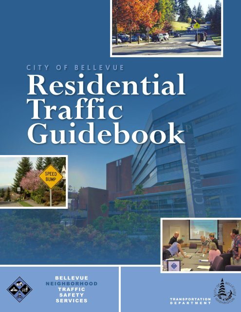
CITY OF BELLEVUE<strong>Residential</strong><strong>Traffic</strong><strong>Guidebook</strong>BELLEVUENEIGHBORHOODTRAFFICSAFETYSERVICESTRANSPORTATIOND E P A R T M E N T
Welcome!Thank you for taking an interest in improving trafficsafety in your neighborhood. Daily traffic and parkingproblems can compromise our sense <strong>of</strong> communityand personal well-being, while safe and pleasantstreets can enhance our quality <strong>of</strong> life. <strong>Bellevue</strong>’sNeighborhood <strong>Traffic</strong> Safety Services staff is committedto working with residents to protect and preserveneighborhood livability. Through a variety <strong>of</strong> toolsand efforts, together we can make a difference. Thisguide will provide you with the tools and informationyou and your neighbors need to work with the <strong>City</strong> onaddressing traffic concerns.
Clockwise from top-left:Pedbee educates children about traffic safety; colored pavement creates a buffer around a curve; 25 mph pavement marking; parking restrictionsnear downtown; entering a residential area; school zone flashing beacon. 4
HOW THE TRAFFICSAFETY PROCESS WORKSSubmit a Request for Action online @www.bellevuewa.gov/rfa.htmYou and your neighbors become an active part in helping to identify trafficconcerns, develop recommendations, and implement solutions.Step 1Submit a Request for Action form describing your concerns in as much detail aspossible including if there is a specific time <strong>of</strong> day or day <strong>of</strong> the week you notice theproblem to be at its worst. The more information we have as we assess the situation,the better prepared we are to address your concern.Step 2Staff travel to the location and review traffic conditions. They may conduct speed andvolume counts and/or look at previous traffic studies or reported accidents.Step 3A <strong>Traffic</strong> Action Plan is developed. This plan is specifically tailored to your concernbased on the findings in step 2 and other citizen observations. The plan includes alist <strong>of</strong> tools selected from those available in this guidebook which are best suited toaddress your concerns.Step 4Together, citizens work with staff on implementing the <strong>Traffic</strong> Action Plan. This isyour opportunity to become an active partner in helping to solve your neighborhoodtraffic concerns.Step 5The effectiveness <strong>of</strong> the plan is evaluated through additional follow-up studies andcitizen input, if needed.5 easysteps6<strong>City</strong> <strong>of</strong> <strong>Bellevue</strong><strong>Residential</strong> <strong>Traffic</strong> <strong>Guidebook</strong>
WHAT TYPES OF TOOLS ARE AVAILABLE?There are a number <strong>of</strong> tools that have been identified to address specific traffic conditionsoccurring in your neighborhood. These tools are categorized into three areas:Education, Encouragement, and EnforcementEducating the community on transportation issues is an important first step in addressing trafficconcerns in neighborhoods. One <strong>of</strong> the most frequent comments made to the TransportationDepartment is the need to address speeding along residential streets. Our studies show thatthe majority <strong>of</strong> speeders on neighborhood streets in <strong>Bellevue</strong> are local residents. By educatingthe community and encouraging safe driving, we can begin to change driver behavior andreduce vehicle speeds. Enforcement, such as police citations, can also help to alleviate speedingconcerns.Modifying StreetscapePhysically changing how the road looks—whether with signing, curbing, or other traffic calmingt lsmeasures—works to alter the behavior <strong>of</strong> motorists, pedestrians, and bicyclists. These toolshelp to manage traffic volumes, reduce vehicle speeds, and improve sight distance. Engaging thecommunity in developing the <strong>Traffic</strong> Action Plan and garnering support is key to the success <strong>of</strong>any project that modifies the streetscape.ParkingParking availability in neighborhoods is <strong>of</strong>ten affected by non-resident vehicles parked in areasadjacent to businesses, schools, and other public facilities. These tools reduce spillover parkingby restricting the use <strong>of</strong> on-street parking.<strong>City</strong> <strong>of</strong> <strong>Bellevue</strong><strong>Residential</strong> <strong>Traffic</strong> <strong>Guidebook</strong>7
Clockwise from top-left:A speed hump in a neighborhood; Pedbee teaches school children about traffic safety; students walk to school; a median helps identify the entranceto a neighborhood; a school child helps families safely cross the street; a raised crosswalk is combined with a median to provide mid-street safety;curb extensions and a traffic circle narrow the roadway; a landscaped median brightens up the neighborhood<strong>City</strong> <strong>of</strong> <strong>Bellevue</strong><strong>Residential</strong> <strong>Traffic</strong> <strong>Guidebook</strong>8
TRAFFIC SAFETYTOOLKITPage1313141415151616Education, Encouragement,and EnforcementNeighborhood Speed Watch ProgramNeighborhood <strong>Traffic</strong> Safety NewslettersPedbee Education ProgramPortable Radar DollyRadar TrailerSign and Pledge Program<strong>Traffic</strong> EnforcementTrips to SchoolSLOWManage <strong>Traffic</strong> VolumeReduce ExcessiveVehicle SpeedsImprove Pedestrianand Bicycle SafetyEnhance NeighborhoodIdentityEducate the CommunityManage NeighborhoodParkingHeighten School ZoneAwarenessPage17192123252729313335373941434547495153Page555657Modifying StreetscapeBrush TrimmingChicanes/Slow PointsCurb ExtensionsFull ClosureLane StripingMediansNeighborhood EntrancesPartial ClosureRaised Crosswalk“<strong>Residential</strong> Area” SignsSchool Zone Flashing BeaconsSpeed CushionsSpeed DotsSpeed HumpsSpeed Limit Pavement MarkingsSpeed MoundsSplit Speed HumpsStationary Radar Sign<strong>Traffic</strong> CirclesParkingGeneral Parking RestrictionsGood Neighbor Parking Program<strong>Residential</strong> Parking Zone (RPZ)<strong>Traffic</strong> conditions are different for each location resulting in numerous tools that can addressyour specific neighborhood concern. In addition, some tools are only applied after guidelineshave been met. The above chart lists the tools available to residents. The presence <strong>of</strong> a blackdot ( ) indicates which tools best address a specific area <strong>of</strong> concern. For each tool, specificinformation and guidelines for their use are defined on subsequent pages.<strong>City</strong> <strong>of</strong> <strong>Bellevue</strong><strong>Residential</strong> <strong>Traffic</strong> <strong>Guidebook</strong>9
IMPLEMENTING TOOLSFor each tool, a set <strong>of</strong> guidelines has been established based on the level <strong>of</strong> public participationneeded, requirements needed to approve the tool, and traffic considerations.PUBLICPARTICIPATIONREQUESTOR For most tools, there is an expectation that the person whosubmits a traffic safety concern will work alongside <strong>City</strong> staff to resolve theissue and serve as the conduit between the <strong>City</strong> and his/her neighbors.TRAFFIC COMMITTEES are groups <strong>of</strong> resident volunteers who meet with<strong>City</strong> staff on an ongoing basis and help develop neighborhood-wide plans.<strong>Traffic</strong> Committee members attend <strong>Traffic</strong> Committee meetings, becomeknowledgeable about <strong>City</strong> policies and guidelines as they relate to trafficcalming, and share information with their neighbors. In general, the timecommitment for <strong>Traffic</strong> Committee members is approximately 20-30 hours.COMMUNITY AND NEIGHBORHOOD ASSOCIATIONS are <strong>of</strong>ten asked toparticipate in the traffic safety process when tools affect the neighborhoodas a whole. Board members help to share information with theneighborhood and/or may assign a member to the <strong>Traffic</strong> Committee.SCHOOL ADMINISTRATION/PTSAs assist with implementation <strong>of</strong> trafficsafety programs at the local school.<strong>City</strong> <strong>of</strong> <strong>Bellevue</strong><strong>Residential</strong> <strong>Traffic</strong> <strong>Guidebook</strong> 10
APPROVALREQUIREMENTSNOTIFICATION <strong>of</strong> a project is needed when tools minimally impactadjacent properties, such as the installation <strong>of</strong> signs.ADJACENT PROPERTY support is needed whenever a tool, such asspeed humps, directly impacts a property. This support is neededbefore a project moves to the next step.MAJORITY NEIGHBORHOOD SUPPORT (65%) is needed when a toolwill impact a community at large. Through a voting process, 65% <strong>of</strong>households must show support by returning their ballots.SCHOOL DISTRICT support may be needed if a project is adjacent to oraffects the traffic operations <strong>of</strong> a school.TRAFFICCONSIDERATIONSVEHICLE SPEEDS listed in the tools are minimum 85th percentilespeeds required for that tool to be effective; this means 85% <strong>of</strong> thevehicles are traveling at or below a specific speed.AVERAGE DAILY TRAFFIC refers to the average number <strong>of</strong> vehiclespassing a specific point during a 24-hour period. There are minimumtraffic volumes and maximum volumes for when certain tools may beimplemented.EMERGENCY RESPONSE TIME is the time it takes for Fire/Police torespond in an emergency. Some tools that modify the streetscape willimpact the response time <strong>of</strong> emergency vehicles from 1-9 seconds.Tools will be labeled as moderately or significantly impact emergencyresponse depending on the delay caused.<strong>City</strong> <strong>of</strong> <strong>Bellevue</strong><strong>Residential</strong> <strong>Traffic</strong> <strong>Guidebook</strong> 11
ADDITIONAL CONSIDERATIONSIn addition to the guidelines listed on the previous pages, the following are considerations thatapply to every tool and help to determine the appropriateness <strong>of</strong> each tool:• Is the street a school bus or transit route?• Are there adjacent arterials to divert traffic?• Is the roadway grade less than 8%?• Are there horizontal or vertical curves?• Where are driveways and intersectionslocated?• Are streetlights needed?• Are larger vehicle’s turning movementsaffected?• Are there drainage and maintenance issues?• Will parking be affected?• How many reported accidents have occurredin the area?We are always looking for ways to improve how we work with residents on traffic safety issues.As such, to ensure we are providing innovative and effective services, this document is subjectto change based on the continual review <strong>of</strong> our processes. While we make every effort tokeep the guidelines listed in this document current, there may be some instances where theguidelines are subject to change based on the specific context and location <strong>of</strong> the traffic safetyconcern, current regulations, or changes to engineering standards. Additionally, there may beopportunities for alternative tools not listed in this guidebook on a pilot basis.<strong>City</strong> <strong>of</strong> <strong>Bellevue</strong><strong>Residential</strong> <strong>Traffic</strong> <strong>Guidebook</strong> 12
EDUCATION,ENCOURAGEMENT,& ENFORCEMENTNEIGHBORHOOD SPEEDWATCH PROGRAMSpeed Watch is apublic awarenessprogram thatprovides citizenswith partnershipopportunities insolving speedingproblems in their neighborhood. Residentsmonitor the speed <strong>of</strong> vehicles with radarequipment on loan from the TransportationDepartment. NTSS staff train residents howto use the radar unit to record license platenumbers <strong>of</strong> those motorists driving at least 5mph above the posted speed limit. A letteris sent from both the Transportation andPolice Departments to the registered owners<strong>of</strong> those vehicles informing them <strong>of</strong> theobserved violation and encourages them ordrivers <strong>of</strong> their vehicle to drive at or below theposted speed limit. Since this is a communityawareness program, no formal citations or finesare issued.PUBLIC PARTICIPATIONNEIGHBORHOOD TRAFFICSAFETY NEWSLETTERSNeighborhood <strong>Traffic</strong>Vuecrest <strong>Traffic</strong>Safety NewsletterNew restrictions limit weekday parkingSafety Newsletters areIn response to growing concern overexcessive parking in the Vuecrestneighborhood. The neighborhoodrecently approved parking restrictionspublished by the <strong>City</strong>during weekdays from 8am-5pm. onthe west side <strong>of</strong> the street. Residentsand non-residents alike are notpermitted to park there during thesehours. However, parking on theand contain personalizedweekends is permitted.Given the proximity to downtown,the Vuecrest neighborhood wasexperiencing a large volume <strong>of</strong>information about yourvehicles parking in the neighborhoodfor the workday and walkingdowntown only to return laterin the evening.The parking restrictions will helpneighborhood’s trafficto control the amount <strong>of</strong> nonresidentparking.If you have additional traffic safetyconcerns, please do not hesitate tosafety concerns. Thiscontact NTSS!newsletter also explainsthe results <strong>of</strong> the Transportation Department’sspeed and volume studies and recommendsactions that may alleviate the traffic concern.Additionally, traffic and pedestrian safety basicsare covered. Although <strong>City</strong> staff develop thisnewsletter, the local neighborhood associationis welcome to assist with newsletter contentand distribution. Staff can also providehomeowner associations with traffic safetyarticles to include in their newsletters or ontheir website.PUBLIC PARTICIPATIONThe neighborhood association may providecontent and help to distribute the newslettersto neighborhood residents.A short 20 minute training session is providedto the requestor by city staff. The requestorcollects motorist data and submits the resultsto <strong>City</strong> staff.Manage<strong>Traffic</strong>VolumeSLOWReduceVehicleSpeedsImprovePedestrian& BicycleSafetyEnhance Educate theNeighborhood CommunityIdentityManageNeighborhoodParkingHeightenSchool ZoneAwarenessSLOWManage<strong>Traffic</strong>VolumeReduceVehicleSpeedsImprovePedestrian& BicycleSafetyEnhance Educate theNeighborhood CommunityIdentityManageNeighborhoodParkingHeightenSchool ZoneAwareness<strong>City</strong> <strong>of</strong> <strong>Bellevue</strong><strong>Residential</strong> <strong>Traffic</strong> <strong>Guidebook</strong>13
EDUCATION,ENCOURAGEMENT,& ENFORCEMENTPEDBEE EDUCATIONPROGRAMThe PedbeeEducationProgram teacheschildren ingrades K-5 aboutpedestrian andtraffic safety.The majority <strong>of</strong> child pedestrian injuries area result <strong>of</strong> children crossing the street in anunsafe manner such as darting out into theroadway. Taking the time to educate studentsabout traffic safety lessons is one way accidentscan be prevented. The Pedbee mascot visitsschools, leads pedestrian safety activities suchas how to properly cross a street, and hands outfun, educational workbooks.PORTABLE RADAR DOLLYA radar dolly is ahandcart equippedwith a radar unitwhich detects anddisplays the speed<strong>of</strong> passing vehicleson a digital readerboard. The radar dolly may also record thespeed and volume <strong>of</strong> passing vehicles for usein future analysis. Residents concerned aboutspeeding in their neighborhood may borrowand place the dolly in their front yard for up to2 weeks. By heightening motorists’ awareness<strong>of</strong> the posted speed limit, as well as thespeed at which they are driving, motorists areencouraged to modify their speed accordingly.Pedbee materials are also available forcommunity use on a first-come, first-servedbasis.APPROVAL REQUIREMENTSSchool administration approval is required forin-school events.To borrow the radar dolly please visitwww.bellevuewa.gov/radardolly.htmPUBLIC PARTICIPATIONA short 20 minute training session is providedto the requestor by <strong>City</strong> staff. The requestorcoordinates with the <strong>City</strong> to arrange pick-upand drop-<strong>of</strong>f times for the equipment at therequestor’s home.SLOWManage<strong>Traffic</strong>VolumeReduceVehicleSpeedsImprovePedestrian& BicycleSafetyEnhanceNeighborhoodIdentityEducate theCommunityManageNeighborhoodParkingHeightenSchool ZoneAwarenessManage<strong>Traffic</strong>VolumeSLOWReduceVehicleSpeedsImprovePedestrian& BicycleSafetyEnhance Educate theNeighborhood CommunityIdentityManageNeighborhoodParkingHeightenSchool ZoneAwareness<strong>City</strong> <strong>of</strong> <strong>Bellevue</strong><strong>Residential</strong> <strong>Traffic</strong> <strong>Guidebook</strong>14
EDUCATION,ENCOURAGEMENT,& ENFORCEMENTRADAR TRAILERThe radar trailer isa portable trailerequipped with aradar unit whichdetects the speed <strong>of</strong>passing vehicles anddisplays the speedon a reader board. Like the radar dolly, thegoal is to heighten drivers’ awareness <strong>of</strong> boththe speed at which they are traveling and theposted speed limit. This encourages drivers toadjust their speeds, if needed.Tow companies voluntarily place the radartrailers at locations experiencing frequentspeeding. An additional trailer is available byrequest. The Police Department may use thetrailer as a “speed checkpoint” and have an<strong>of</strong>ficer present to issue citations to violators.PUBLIC PARTICIPATIONTo request a radar speed trailer be placed at aparticular location, call (425)452-6940.SIGN AND PLEDGEPROGRAMThis program involveslending communitiesportable signs thatencourage motoriststo respect theneighborhood, driveresponsibly, and drive 25 mph. The signs aremoved by community volunteers from placeto place throughout the neighborhood everyfew days. The second part <strong>of</strong> the program isa neighborhood pace car program. Residentswho pledge to drive responsibly and drive thespeed limit on all neighborhood streets receivemagnetic bumper stickers or window clingsto place on their vehicles. As these motoristsdrive 25 mph on residential streets, they set thepace for drivers behind them.PUBLIC PARTICIPATIONThe requestor and neighborhood volunteersare responsible for placement <strong>of</strong> signs aroundthe community. In addition, the volunteersencourage their neighbors to sign the pace carpledge. There is a 20 minute training sessionprovided by Transportation staff.SLOWAPPROVAL REQUIREMENTSManage<strong>Traffic</strong>VolumeReduceVehicleSpeedsImprovePedestrian& BicycleSafetyEnhance Educate theNeighborhood CommunityIdentityManageNeighborhoodParkingHeightenSchool ZoneAwarenessWritten neighborhood association andvolunteer support is required.SLOWManage<strong>Traffic</strong>VolumeReduceVehicleSpeedsImprovePedestrian& BicycleSafetyEnhanceNeighborhoodIdentityEducate theCommunityManageNeighborhoodParkingHeightenSchool ZoneAwareness<strong>City</strong> <strong>of</strong> <strong>Bellevue</strong><strong>Residential</strong> <strong>Traffic</strong> <strong>Guidebook</strong>15
EDUCATION,ENCOURAGEMENT,& ENFORCEMENTTRAFFIC ENFORCEMENTTRIPS TO SCHOOLThe TransportationDepartmentworks closelywith the<strong>Bellevue</strong> PoliceDepartmentto enforcespeed limits and other traffic laws inneighborhoods. Using key traffic data providedby Transportation staff, <strong>of</strong>ficers focus theirscheduled patrols on the times and placeswhere speeding most <strong>of</strong>ten occurs. Typically,targeted enforcement occurs during a oneweektimeframe.Enforcement is also available by request.PUBLIC PARTICIPATIONTo request enforcement, go towww.bellevuewa.gov/traffic_service_request.htmor call (425)452-6940.The Trips toSchool programencourageselementaryschool studentsto walk, bike,carpool, andride the bus to and from school. <strong>City</strong> staffcoordinate with participating schools todevelop a customized plan to enhance trafficsafety for their school. The plan can includeinformational campaigns about school traveloptions, walking school buses, incentivebasedprograms, carpool coordination efforts,assemblies, opportunities for state and federalgrants, and encouraging students to walk toschool every week on a specific day.PUBLIC PARTICIPATIONA school volunteer or faculty/staff member isneeded to serve as a primary contact and bewilling to work with the <strong>City</strong> to develop andimplement the customized plan.SLOWAPPROVAL REQUIREMENTSManage<strong>Traffic</strong>VolumeReduceVehicleSpeedsImprovePedestrian& BicycleSafetyEnhance Educate theNeighborhood CommunityIdentityManageNeighborhoodParkingHeightenSchool ZoneAwarenessSchool administration approval is required.SLOWManage<strong>Traffic</strong>VolumeReduceVehicleSpeedsImprovePedestrian& BicycleSafetyEnhanceNeighborhoodIdentityEducate theCommunityManageNeighborhoodParkingHeightenSchool ZoneAwareness<strong>City</strong> <strong>of</strong> <strong>Bellevue</strong><strong>Residential</strong> <strong>Traffic</strong> <strong>Guidebook</strong>16
MODIFYINGSTREETSCAPEBRUSH TRIMMINGOvergrown brush and trees at intersections, driveways,sidewalks, and along roadways limits motorists’ ability tosafely navigate neighborhood streets. Overgrown brushcan block important signs and limit a driver’s ability tosee on-coming traffic at intersections. Brush trimmingtargets those trouble areas and increases the visibility <strong>of</strong>pedestrians, bicyclists, and motorists.The <strong>City</strong> has guidelines for sight-lines based on postedspeed limits. When brush trimming is required, <strong>City</strong> staffnotify adjacent households <strong>of</strong> the concern, requestingthey do the maintenance on their own within a specifiedperiod <strong>of</strong> time. If the landscaping does not get sufficientlytrimmed back, <strong>City</strong> crews do the maintenance at theproperty owners’ expense.PUBLICPARTICIPATIONThe requestor alerts <strong>City</strong> staff to areas <strong>of</strong> concern in the neighborhood.SLOWManage<strong>Traffic</strong>Volume<strong>City</strong> <strong>of</strong> <strong>Bellevue</strong><strong>Residential</strong> <strong>Traffic</strong> <strong>Guidebook</strong>ReduceVehicleSpeedsImprovePedestrian& BicycleSafetyEnhanceNeighborhoodIdentityEducate theCommunityManageNeighborhoodParkingHeightenSchool ZoneAwareness17
MODIFYINGSTREETSCAPEToo High(trim to lowerheight)7 1 / 2’CorrectHeightCorrectHeight30”Trim your hedge,bushes, and trees forimproved safety and visibility<strong>City</strong> <strong>of</strong> <strong>Bellevue</strong><strong>Residential</strong> <strong>Traffic</strong> <strong>Guidebook</strong>18
MODIFYINGSTREETSCAPECHICANES/SLOW POINTSChicanes are a series <strong>of</strong> two to three curbextensions that alternate from one side <strong>of</strong> thestreet to the other forming S-shaped curveson what would be an otherwise straightroadway. Slow points are curb extensionsthat narrow a roadway, sometimes allowingonly one car at a time to pass. This treatmentis used to reduce vehicle speeds.In some cases, this tool can be designed as aone-lane zone which allows only one vehicleat a time to pass, requiring vehicles at bothends to stop or yield before proceedingthrough. This creates delay for motorists andcan reduce cut-through traffic as a result.PUBLICPARTICIPATIONAPPROVALREQUIREMENTSTRAFFICCONSIDERATIONSThe requestor should be proactive throughout the process in assisting the <strong>City</strong> inobtaining support and should also serve as a member <strong>of</strong> the <strong>Traffic</strong> Committee, ifone is formed.Adjacent property support is needed. If this tool is part <strong>of</strong> a neighborhood-wideplan, the community will vote to determine level <strong>of</strong> support. Sixty-five percent(65%) <strong>of</strong> returned ballots must support the project for it to be designed andconstructed.• Posted speed limit <strong>of</strong> 25 mph• Vehicle speeds <strong>of</strong> >35 mph (>30 mph if adjacent to neighborhood park/school)• Average daily traffic <strong>of</strong> 300-3500 vehicles• Moderate impact to emergency responseSLOWManage<strong>Traffic</strong>Volume<strong>City</strong> <strong>of</strong> <strong>Bellevue</strong><strong>Residential</strong> <strong>Traffic</strong> <strong>Guidebook</strong>ReduceVehicleSpeedsImprovePedestrian& BicycleSafetyEnhanceNeighborhoodIdentityEducate theCommunityManageNeighborhoodParkingHeightenSchool ZoneAwareness19
MODIFYINGSTREETSCAPECHICANES/SLOW POINTSThe circle represents thegeneral area where the slowpoint is located.A chicane/slow point islocated in the 500 block<strong>of</strong> 128 th Ave NE and on NE5 th St between 120 th AveNE and 124 th Ave NE in theWilburton neighborhoodNMap not to scale<strong>City</strong> <strong>of</strong> <strong>Bellevue</strong><strong>Residential</strong> <strong>Traffic</strong> <strong>Guidebook</strong>20
MODIFYINGSTREETSCAPECURB EXTENSIONSCurb extensions narrow the roadway byextending the curb toward the center <strong>of</strong> thestreet helping to reduce vehicle speeds. Curbextensions can also be used at intersectionsor mid-block locations to increase sightdistance.They can also be installed inconjunction with speed humps to createplanting areas or raised crosswalks to shortenpedestrian crossing distances.Can also be used with: partial closure, medians, neighborhood entrance, “residential area” signs, raised crosswalks, speedhumps, traffic circlesPUBLICPARTICIPATIONAPPROVALREQUIREMENTSThe requestor should be proactive throughout the process in assisting the <strong>City</strong> inobtaining support and should also serve as a member <strong>of</strong> the <strong>Traffic</strong> Committee, ifone is formed.Adjacent property support is needed. If this tool is part <strong>of</strong> a neighborhood-wideplan, the community will vote to determine level <strong>of</strong> support. Sixty-five percent(65%) <strong>of</strong> returned ballots must support the project for it to be designed andconstructed.TRAFFICCONSIDERATIONS• Posted speed limit <strong>of</strong> 25 mph• Average daily traffic <strong>of</strong> 300-6500 vehicles• Moderate impact to emergency response• On-street parking may need to be restrictedSLOWManage<strong>Traffic</strong>Volume<strong>City</strong> <strong>of</strong> <strong>Bellevue</strong><strong>Residential</strong> <strong>Traffic</strong> <strong>Guidebook</strong>ReduceVehicleSpeedsImprovePedestrian& BicycleSafetyEnhanceNeighborhoodIdentityEducate theCommunityManageNeighborhoodParkingHeightenSchool ZoneAwareness21
MODIFYINGSTREETSCAPECURBEXTENSIONSEach circle represents thegeneral area <strong>of</strong> wherea project included curbextensions.Example project locations:4600-4900 block <strong>of</strong> SomersetBlvd1600 block <strong>of</strong> 180 th Ave NENMap not to scale<strong>City</strong> <strong>of</strong> <strong>Bellevue</strong><strong>Residential</strong> <strong>Traffic</strong> <strong>Guidebook</strong>22
MODIFYINGSTREETSCAPEFULL CLOSUREA full closure physically closes a roadway in aneighborhood and is considered the most restrictiveand severe form <strong>of</strong> traffic calming. These installationseliminate or reroute cut-through traffic but come withsignificant trade-<strong>of</strong>fs for residents including increasedtravel time to and from their homes. Typicallythe <strong>City</strong> installs a temporary closure to provide anopportunity for residents to live with the restrictionbefore determining if it becomes permanent.A full closure can be designed to accommodate nonmotorizedtravel such as pedestrians and bicyclists, aswell as access for emergency response vehicles.PUBLICPARTICIPATIONAPPROVALREQUIREMENTSTRAFFICCONSIDERATIONSThe requestor should be proactive throughout the process in assisting the <strong>City</strong> inobtaining support and should also serve as a member <strong>of</strong> the <strong>Traffic</strong> Committee, ifone is formed.Adjacent property support is needed. This tool significantly impacts drivingpatterns in a neighborhood by forcing residents to find alternative routes toand from their home. As a result, sixty-five percent (65%) <strong>of</strong> all households inthe neighborhood need to support the restriction. The project may include aninitial demonstration project before determining whether the closure is installedpermanently.• Posted speed limit <strong>of</strong> 25 mph• Average daily traffic >300 vehicles• During peak 2-hour period, 30% <strong>of</strong> one-direction peak-period volume shouldbe cut-through with at least 30 total vehicles cutting through.• Significant impact to emergency responseSLOWManage<strong>Traffic</strong>Volume<strong>City</strong> <strong>of</strong> <strong>Bellevue</strong><strong>Residential</strong> <strong>Traffic</strong> <strong>Guidebook</strong>ReduceVehicleSpeedsImprovePedestrian& BicycleSafetyEnhanceNeighborhoodIdentityEducate theCommunityManageNeighborhoodParkingHeightenSchool ZoneAwareness23
MODIFYINGSTREETSCAPEFULL CLOSUREThe circle represents thegeneral area <strong>of</strong> where thefull closure is located.A full closure was built atNE 5 th St east <strong>of</strong> 92 nd AveNE in the West <strong>Bellevue</strong>neighborhood.NMap not to scale<strong>City</strong> <strong>of</strong> <strong>Bellevue</strong><strong>Residential</strong> <strong>Traffic</strong> <strong>Guidebook</strong>24
MODIFYINGSTREETSCAPELANE STRIPINGLane striping helps to define theroadway. Whether installed with paintor buttons, it can delineate parkingareas, travel lanes, bike lanes, and evenwalking areas. It can be used to narrowtravel lanes in an effort to reducevehicle speeds.PUBLICPARTICIPATIONAPPROVALREQUIREMENTSTRAFFICCONSIDERATIONSThe requestor should be proactive throughout the process in assisting the <strong>City</strong> inobtaining support and should also serve as a member <strong>of</strong> the <strong>Traffic</strong> Committee, ifone is formed.Adjacent property support is needed. If this tool is part <strong>of</strong> a neighborhood-wideplan, the community will vote to determine level <strong>of</strong> support. Sixty-five percent(65%) <strong>of</strong> returned ballots must support the project for it to be designed andconstructed.• Posted speed limit <strong>of</strong> 25 mph• Average daily traffic >300 vehicles• Parking may be restrictedSLOWManage<strong>Traffic</strong>Volume<strong>City</strong> <strong>of</strong> <strong>Bellevue</strong><strong>Residential</strong> <strong>Traffic</strong> <strong>Guidebook</strong>ReduceVehicleSpeedsImprovePedestrian& BicycleSafetyEnhanceNeighborhoodIdentityEducate theCommunityManageNeighborhoodParkingHeightenSchool ZoneAwareness25
MODIFYINGSTREETSCAPELane striping can help define the roadwayalerting drivers, cyclists, and pedestrians tothe correct travel lanes.<strong>City</strong> <strong>of</strong> <strong>Bellevue</strong><strong>Residential</strong> <strong>Traffic</strong> <strong>Guidebook</strong>26
MODIFYINGSTREETSCAPEMEDIANSMedians are raised islands placed in thecenter <strong>of</strong> a roadway to separate opposingtraffic. They can be placed mid-block or atentrances into neighborhoods. Medians areused to narrow the roadway and are <strong>of</strong>tenlandscaped to provide a visual enhancementand create a perception <strong>of</strong> a narrowerroadway.They can be used in conjunction with apedestrian crossing to provide a refuge area.Can also be used with: curb extensions, neighborhood entrances, speed cushions, split speed humpsPUBLICPARTICIPATIONAPPROVALREQUIREMENTSTRAFFICCONSIDERATIONSThe requestor should be proactive throughout the process in assisting the <strong>City</strong> inobtaining support and should also serve as a member <strong>of</strong> the <strong>Traffic</strong> Committee, ifone is formed.Adjacent property support is needed. If this tool is part <strong>of</strong> a neighborhood-wideplan, the community will vote to determine level <strong>of</strong> support. Sixty-five percent(65%) <strong>of</strong> returned ballots must support the project for it to be designed andconstructed.• Posted speed limit <strong>of</strong> 25 mph• Vehicle speeds >35 mph (>30 mph if adjacent to neighborhood park/school)• Average daily traffic >300 vehicles• Limited impact to emergency response vehicles, depending on location• Should not be located where they affect driveway access• Parking may be restrictedSLOWManage<strong>Traffic</strong>Volume<strong>City</strong> <strong>of</strong> <strong>Bellevue</strong><strong>Residential</strong> <strong>Traffic</strong> <strong>Guidebook</strong>ReduceVehicleSpeedsImprovePedestrian& BicycleSafetyEnhanceNeighborhoodIdentityEducate theCommunityManageNeighborhoodParkingHeightenSchool ZoneAwareness27
MODIFYINGSTREETSCAPEMEDIANSEach circle represents thegeneral area <strong>of</strong> wheremedians have beenconstructed.Example project locations:Multiple entrances intoSurrey Downs neighborhoodEntrances into Somersetneighborhood <strong>of</strong>f Forest DrSE and Somerset DrSE and Forest Dr SEand Highland DrNMap not to scale<strong>City</strong> <strong>of</strong> <strong>Bellevue</strong><strong>Residential</strong> <strong>Traffic</strong> <strong>Guidebook</strong>28
MODIFYINGSTREETSCAPENEIGHBORHOODENTRANCESA neighborhood entrance is a raised islandin the center <strong>of</strong> a roadway and/or a raisedpavement treatment, such as a patternedbrick pavement, that identifies the entranceinto a neighborhood.Neighborhood entrances notify driversthat they are entering a neighborhoodor residential area and thus encourageslower vehicle speeds. They may alsodiscourage cut-through traffic. In addition,opportunities may exist for additionalenhancement by adding landscapedmedians and/or “residential area” signs.Can also be used with: curb extensions, medians, “residential area” signs, speed moundsPUBLICPARTICIPATIONAPPROVALREQUIREMENTSThe requestor should be proactive throughout the process in assisting the <strong>City</strong> inobtaining support and should also serve as a member <strong>of</strong> the <strong>Traffic</strong> Committee, ifone is formed.Adjacent property support is needed. If this tool is part <strong>of</strong> a neighborhood-wideplan, the community will vote to determine level <strong>of</strong> support. Sixty-five percent(65%) <strong>of</strong> returned ballots must support the project for it to be designed andconstructed.TRAFFICCONSIDERATIONS• Average daily traffic >300 vehicles• Parking may be restrictedSLOWManage<strong>Traffic</strong>Volume<strong>City</strong> <strong>of</strong> <strong>Bellevue</strong><strong>Residential</strong> <strong>Traffic</strong> <strong>Guidebook</strong>ReduceVehicleSpeedsImprovePedestrian& BicycleSafetyEnhanceNeighborhoodIdentityEducate theCommunityManageNeighborhoodParkingHeightenSchool ZoneAwareness29
MODIFYINGSTREETSCAPENEIGHBORHOODENTRANCESEach circle represents thegeneral area <strong>of</strong> whereneighborhood entrances havebeen constructed.Example project locations:SE 2 nd St west <strong>of</strong> 108 th AveSE in the Surrey DownsneighborhoodN131 st Ave NEsouth <strong>of</strong> NE 8 th Stin the WilburtonneighborhoodMap not to scale<strong>City</strong> <strong>of</strong> <strong>Bellevue</strong><strong>Residential</strong> <strong>Traffic</strong> <strong>Guidebook</strong>30
MODIFYINGSTREETSCAPEPARTIAL CLOSUREPartial closures restrict the roadway to onedirection <strong>of</strong> travel. They limit vehicular accessinto neighborhoods while still providingresidents with either an exit or entrancedepending on the restriction.Partial closures permanently change trafficpatterns for residents within a neighborhoodsometimes resulting in longer travel times andtraffic shifts within the residential area. Designfeatures can include landscaping.Can also be used with: curb extensionsPUBLICPARTICIPATIONAPPROVALREQUIREMENTSTRAFFICCONSIDERATIONSThe requestor should be proactive throughout the process in assisting the <strong>City</strong> inobtaining support and should also serve as a member <strong>of</strong> the <strong>Traffic</strong> Committee, ifone is formed.Adjacent property support is needed. This tool significantly impacts drivingpatterns in a neighborhood by forcing residents to find alternative routes toand from their home. As a result, sixty-five percent (65%) <strong>of</strong> all households inthe neighborhood need to support the restriction. The project may include aninitial demonstration project before determining whether the closure is installedpermanently.• Posted speed limit <strong>of</strong> 25 mph• Average daily traffic >300 vehicles• During peak 2-hour period, 30% <strong>of</strong> one-direction peak-period volume shouldbe cut-through with at least 30 total vehicles cutting through.• Significant impact to emergency response• May restrict parkingSLOWManage<strong>Traffic</strong>Volume<strong>City</strong> <strong>of</strong> <strong>Bellevue</strong><strong>Residential</strong> <strong>Traffic</strong> <strong>Guidebook</strong>ReduceVehicleSpeedsImprovePedestrian& BicycleSafetyEnhanceNeighborhoodIdentityEducate theCommunityManageNeighborhoodParkingHeightenSchool ZoneAwareness31
MODIFYINGSTREETSCAPEPARTIAL CLOSUREEach circle represents thegeneral area <strong>of</strong> where apartial closure has beenconstructed.Partial closures are locatedat NE 4 th St and 100 th Ave NEand 139 th Ave SE and SE 26 thSt.NMap not to scale<strong>City</strong> <strong>of</strong> <strong>Bellevue</strong><strong>Residential</strong> <strong>Traffic</strong> <strong>Guidebook</strong>32
MODIFYINGSTREETSCAPERAISED CROSSWALKA raised crosswalk is an area <strong>of</strong> roadwaypavement that has been raised approximately3” and includes a crosswalk marked on top.Raised crosswalks are typically implementedon streets where speed control at pedestriancrossings is desired, such as in school zonesor adjacent to neighborhood parks. Raisedcrosswalks can be used in conjunction withother tools such as curb extensions, whichnarrow the crossing distance for pedestrians.Can also be used with: curb extensionsPUBLICPARTICIPATIONAPPROVALREQUIREMENTSTRAFFICCONSIDERATIONSThe requestor should be proactive throughout the process in assisting the <strong>City</strong> inobtaining support and should also serve as a member <strong>of</strong> the <strong>Traffic</strong> Committee, ifone is formed.Adjacent property support is needed. If this tool is part <strong>of</strong> a neighborhood-wideplan, the community will vote to determine level <strong>of</strong> support. Sixty-five percent(65%) <strong>of</strong> returned ballots must support the project for it to be designed andconstructed.• Posted speed limit <strong>of</strong> 25 mph• Average daily traffic <strong>of</strong> 300-3500 vehicles• Significant impact to emergency response vehicles• Should not be located where they affect driveway access• Potential noise impacts from motorists traversing the raised crosswalkSLOWManage<strong>Traffic</strong>Volume<strong>City</strong> <strong>of</strong> <strong>Bellevue</strong><strong>Residential</strong> <strong>Traffic</strong> <strong>Guidebook</strong>ReduceVehicleSpeedsImprovePedestrian& BicycleSafetyEnhanceNeighborhoodIdentityEducate theCommunityManageNeighborhoodParkingHeightenSchool ZoneAwareness33
MODIFYINGSTREETSCAPERAISEDCROSSWALKEach circle represents thegeneral area <strong>of</strong> projects thatcontained raised crosswalks.Example project locations:17600 block <strong>of</strong> NE 16 th St1800 block <strong>of</strong> 168 th Ave SENMap not to scale<strong>City</strong> <strong>of</strong> <strong>Bellevue</strong><strong>Residential</strong> <strong>Traffic</strong> <strong>Guidebook</strong>34
MODIFYINGSTREETSCAPE“RESIDENTIAL AREA”SIGNS<strong>Bellevue</strong>’s blue “<strong>Residential</strong> Area” signs note that oneis entering a residential area. The sign is designed topromote a sense <strong>of</strong> community by showing pictures <strong>of</strong>homes, bicyclists, pedestrians, and vehicles. It has asupplemental plaque that states “<strong>Residential</strong> Area.”These signs are placed in areas where trafficimprovement have been implemented and/or wherethere needs to be a definition between a neighborhoodand commercial or business area.Can also be used with: neighborhood entrancePUBLICPARTICIPATIONAPPROVALREQUIREMENTSTRAFFICCONSIDERATIONSSome signing may require adjacent household support. If so, the requestorshould be proactive throughout the process <strong>of</strong> obtaining adjacent propertyowner support.Adjacent property support may be needed.• Posted speed limit <strong>of</strong> 25 mphSLOWManage<strong>Traffic</strong>Volume<strong>City</strong> <strong>of</strong> <strong>Bellevue</strong><strong>Residential</strong> <strong>Traffic</strong> <strong>Guidebook</strong>ReduceVehicleSpeedsImprovePedestrian& BicycleSafetyEnhanceNeighborhoodIdentityEducate theCommunityManageNeighborhoodParkingHeightenSchool ZoneAwareness35
MODIFYINGSTREETSCAPE“RESIDENTIALAREA” SIGNSEach circle represents thegeneral area <strong>of</strong> where“residential area” signs havebeen installed.Example project locations:131 st Ave NE south <strong>of</strong> NE8 th St in the WilburtonneighborhoodNMap not to scale<strong>City</strong> <strong>of</strong> <strong>Bellevue</strong><strong>Residential</strong> <strong>Traffic</strong> <strong>Guidebook</strong>36
MODIFYINGSTREETSCAPESCHOOL ZONEFLASHING BEACONSTo reinforce reduced speed limits near schools,<strong>Bellevue</strong> posts flashing yellow beacons nearsome elementary schools, as funding allows.These signs are installed in school zonesalerting drivers to slow to 20 mph duringschool start and dismissal times. Typically,the signs are programmed to flash 30 minutesbefore start time and 10 minutes following. Fordismissal, they begin to flash 10 minutes beforedismissal time and 30 minutes following.School zones are defined as 300 feet fromschool property or a marked school crosswalk.<strong>Traffic</strong> fines in school zones are double.Can also be used with: stationary radar signPUBLICPARTICIPATIONAPPROVALREQUIREMENTSSchools or school districts can qualify for traffic safety grants when available.Residents are notified when school zone flashing beacons are installed.SLOWManage<strong>Traffic</strong>Volume<strong>City</strong> <strong>of</strong> <strong>Bellevue</strong><strong>Residential</strong> <strong>Traffic</strong> <strong>Guidebook</strong>ReduceVehicleSpeedsImprovePedestrian& BicycleSafetyEnhanceNeighborhoodIdentityEducate theCommunityManageNeighborhoodParkingHeightenSchool ZoneAwareness37
MODIFYINGSTREETSCAPESCHOOL ZONEFLASHINGBEACONSEach circle represents thegeneral area <strong>of</strong> whereflashing beacons have beenconstructed around schools.There are usually multiplebeacons adjacent to eachschool.Example project locations:Phantom Lake Elementaryand Newport Hills ElementaryNMap not to scale<strong>City</strong> <strong>of</strong> <strong>Bellevue</strong><strong>Residential</strong> <strong>Traffic</strong> <strong>Guidebook</strong>38
MODIFYINGSTREETSCAPESPEED CUSHIONSSpeed cushions are different from speedhumps in that they have gaps to allow for theexpedient passing <strong>of</strong> emergency vehicles.Typically speed cushions consist <strong>of</strong> two ormore raised and rounded areas <strong>of</strong> pavementplaced laterally across a road. There aregaps for emergency vehicles to pass throughwithout significant jostling or displacement.Non-emergency vehicles are generally toonarrow to travel through the gaps and mustdrive over the bump helping to reducevehicle speeds.Can also be used with: mediansPUBLICPARTICIPATIONAPPROVALREQUIREMENTSTRAFFICCONSIDERATIONSThe requestor should be proactive throughout the process in assisting the <strong>City</strong> inobtaining support and should also serve as a member <strong>of</strong> the <strong>Traffic</strong> Committee, ifone is formed.Adjacent property support is needed. If this tool is part <strong>of</strong> a neighborhood-wideplan, the community will vote to determine level <strong>of</strong> support. Sixty-five percent(65%) <strong>of</strong> returned ballots must support the project for it to be designed andconstructed.• Posted speed limit <strong>of</strong> 25 mph• Vehicle speeds >35 mph (>30 mph if adjacent to neighborhood park/school)• Average daily traffic <strong>of</strong> 300-3500 vehicles• Moderate impact to emergency response vehicles• Should not be located where they affect driveway access• Potential noise impacts from motorists traversing the speed cushionSLOWManage<strong>Traffic</strong>Volume<strong>City</strong> <strong>of</strong> <strong>Bellevue</strong><strong>Residential</strong> <strong>Traffic</strong> <strong>Guidebook</strong>ReduceVehicleSpeedsImprovePedestrian& BicycleSafetyEnhanceNeighborhoodIdentityEducate theCommunityManageNeighborhoodParkingHeightenSchool ZoneAwareness39
MODIFYINGSTREETSCAPESPEED CUSHIONSThe circle represents thegeneral area <strong>of</strong> wherethe speed cushion wasconstructed as part <strong>of</strong> aproject. A speed cushionwas built at NE 30 th St and164 th Ave NE.NMap not to scale<strong>City</strong> <strong>of</strong> <strong>Bellevue</strong><strong>Residential</strong> <strong>Traffic</strong> <strong>Guidebook</strong>40
MODIFYINGSTREETSCAPESPEED DOTSA speed dot is a small circular or oval island locatedin the center <strong>of</strong> the road at mid-block locations. Itreduces vehicle speeds by narrowing the roadwayand redirecting vehicles around the circle. Theeffect on vehicle speeds depends on the roadwaywidth, in addition to the size and number <strong>of</strong> speeddots. They can be used in a series resulting in araised median effect but includes better drivewayaccess. They can also be landscaped.PUBLICPARTICIPATIONAPPROVALREQUIREMENTSTRAFFICCONSIDERATIONSThe requestor should be proactive throughout the process in assisting the <strong>City</strong> inobtaining support and should also serve as a member <strong>of</strong> the <strong>Traffic</strong> Committee, ifone is formed.Adjacent property support is needed. If this tool is part <strong>of</strong> a neighborhood-wideplan, the community will vote to determine level <strong>of</strong> support. Sixty-five percent(65%) <strong>of</strong> returned ballots must support the project for it to be designed andconstructed.• Posted speed limit <strong>of</strong> 25 mph• Vehicle speeds >35 mph (>30 mph if adjacent to neighborhood park/school)• Average daily traffic <strong>of</strong> 300-3500 vehicles• Moderate impact to emergency response vehicles• Should not be located where they affect driveway access• May restrict parking• May require removal <strong>of</strong> some landscaping in the right-<strong>of</strong>-way <strong>of</strong> adjacent yardsSLOWManage<strong>Traffic</strong>Volume<strong>City</strong> <strong>of</strong> <strong>Bellevue</strong><strong>Residential</strong> <strong>Traffic</strong> <strong>Guidebook</strong>ReduceVehicleSpeedsImprovePedestrian& BicycleSafetyEnhanceNeighborhoodIdentityEducate theCommunityManageNeighborhoodParkingHeightenSchool ZoneAwareness41
MODIFYINGSTREETSCAPESPEED DOTSThe circle represents thegeneral area <strong>of</strong> where thespeed dot was constructed.Speed dots were built at 108 thAve NE between NE 10 th Stand NE 24 th St and on 108 thAve SE south <strong>of</strong> SE 60 th St.NMap not to scale<strong>City</strong> <strong>of</strong> <strong>Bellevue</strong><strong>Residential</strong> <strong>Traffic</strong> <strong>Guidebook</strong>42
MODIFYINGSTREETSCAPESPEED HUMPSSpeed humps (also known as speed bumps) have beenused in the <strong>City</strong> <strong>of</strong> <strong>Bellevue</strong> since 1985 as a techniqueto reduce vehicle speeds. A speed hump is a raisedarea <strong>of</strong> roadway pavement approximately 3 inchesin height. They are different from the more severespeed humps you may find in a parking lot. A speedhump causes a vehicle to produce a rocking motion,creating an uncomfortable sensation for the occupants<strong>of</strong> speeding vehicles thus encouraging the driver toreduce their speed. The <strong>City</strong> uses two different designsbased on roadway characteristics. The first is a 12’ long (in the direction <strong>of</strong> travel) with a gentle rise to3 inches at the center and the other a 22’ long design that is 3” in height, with a 10’ flat top. The latterdesign is used for raised crosswalks and in areas with transit and higher traffic volumes.Can also be used with: curb extensionsPUBLICPARTICIPATIONAPPROVALREQUIREMENTSTRAFFICCONSIDERATIONSThe requestor should be proactive throughout the process in assisting the <strong>City</strong> inobtaining support and should also serve as a member <strong>of</strong> the <strong>Traffic</strong> Committee, ifone is formed.Adjacent property support is needed. If this tool is part <strong>of</strong> a neighborhood-wideplan, the community will vote to determine level <strong>of</strong> support. Sixty-five percent(65%) <strong>of</strong> returned ballots must support the project for it to be designed andconstructed.• Posted speed limit <strong>of</strong> 25 mph• Vehicle speeds >35 mph (>30 mph if adjacent to neighborhood park/school)• Average daily traffic <strong>of</strong> 300-3500 vehicles• Significant impact to emergency response vehicles• School bus or transit route• Potential noise impacts from motorists traversing the speed humpSLOWManage<strong>Traffic</strong>Volume<strong>City</strong> <strong>of</strong> <strong>Bellevue</strong><strong>Residential</strong> <strong>Traffic</strong> <strong>Guidebook</strong>ReduceVehicleSpeedsImprovePedestrian& BicycleSafetyEnhanceNeighborhoodIdentityEducate theCommunityManageNeighborhoodParkingHeightenSchool ZoneAwareness43
MODIFYINGSTREETSCAPESPEED HUMPSSpeed humps vary in widththroughout <strong>Bellevue</strong>: 12’ or 22’.Each circle represents thegeneral area <strong>of</strong> where speedhumps were constructed.Example project locations:NE 2 nd St between 124 th AveNE and 128 th Ave NE in theWilburton neighborhoodNMap not to scale<strong>City</strong> <strong>of</strong> <strong>Bellevue</strong><strong>Residential</strong> <strong>Traffic</strong> <strong>Guidebook</strong>44
MODIFYINGSTREETSCAPESPEED LIMITPAVEMENT MARKINGSThe <strong>City</strong> uses pavement markings noting “25MPH” at locations where drivers may need tobe reminded <strong>of</strong> the posted speed limit. Thesepavement markings are typically eight feet longand are either painted onto the pavement orapplied with a special tape. Locations are selectedbased on field review and speed study results.PUBLICPARTICIPATIONAPPROVALREQUIREMENTSTRAFFICCONSIDERATIONSThe requestor should be proactive throughout the process in assisting the <strong>City</strong> inobtaining support.Residents are notified when speed limit pavement markings are installed.• Posted speed limit <strong>of</strong> 25 mph• Vehicle speeds >30 mphSLOWManage<strong>Traffic</strong>Volume<strong>City</strong> <strong>of</strong> <strong>Bellevue</strong><strong>Residential</strong> <strong>Traffic</strong> <strong>Guidebook</strong>ReduceVehicleSpeedsImprovePedestrian& BicycleSafetyEnhanceNeighborhoodIdentityEducate theCommunityManageNeighborhoodParkingHeightenSchool ZoneAwareness45
MODIFYINGSTREETSCAPE164th Ave SESPEED LIMITPAVEMENT MARKINGSThe <strong>City</strong> <strong>of</strong> <strong>Bellevue</strong> hasinstalled numerous 25mph pavement markingsthroughout the city.90Shown are some examples<strong>of</strong> markings that are installedthroughout the city.NMap not to scale<strong>City</strong> <strong>of</strong> <strong>Bellevue</strong><strong>Residential</strong> <strong>Traffic</strong> <strong>Guidebook</strong>46
MODIFYINGSTREETSCAPESPEED MOUNDSSpeed mounds are slightly raised areas<strong>of</strong> pavement that guides drivers througha designated area. Unlike traffic circleswhich force drivers around the device,speed mounds allow vehicles to pass overthe raised pavement. They may be builtwith colored and/or textured pavement.Speeds mounds are used as an alternativeto curb extensions or medians and aresuccessful when existing driveways andturning movements restrict physical curbedtreatments, such as traffic circles.Can also be used with: curb extensions, neighborhood entrancePUBLICPARTICIPATIONAPPROVALREQUIREMENTSTRAFFICCONSIDERATIONSThe requestor should be proactive throughout the process in assisting the <strong>City</strong> inobtaining support and should also serve as a member <strong>of</strong> the <strong>Traffic</strong> Committee, ifone is formed.Adjacent property support is needed. If this tool is part <strong>of</strong> a neighborhood-wideplan, the community will vote to determine level <strong>of</strong> support. Sixty-five percent(65%) <strong>of</strong> returned ballots must support the project for it to be designed andconstructed.• Posted speed limit <strong>of</strong> 25 mph• Vehicle speeds >35 mph (>30 mph if adjacent to neighborhood park/school)• Average daily traffic <strong>of</strong> 300-3500 vehicles• Moderate impact to emergency response vehicles• School bus or transit routeSLOWManage<strong>Traffic</strong>Volume<strong>City</strong> <strong>of</strong> <strong>Bellevue</strong><strong>Residential</strong> <strong>Traffic</strong> <strong>Guidebook</strong>ReduceVehicleSpeedsImprovePedestrian& BicycleSafetyEnhanceNeighborhoodIdentityEducate theCommunityManageNeighborhoodParkingHeightenSchool ZoneAwareness47
MODIFYINGSTREETSCAPESPEED MOUNDSThere is one speed moundin <strong>Bellevue</strong>, located in theWilburton neighborhood at128 th Ave SE and SE 4 th Pl.NMap not to scale<strong>City</strong> <strong>of</strong> <strong>Bellevue</strong><strong>Residential</strong> <strong>Traffic</strong> <strong>Guidebook</strong>48
MODIFYINGSTREETSCAPESPLIT SPEED HUMPSSplit speed humps are modified speed humpsthat allow emergency vehicles to navigate aroundsplit speed humps without much delay. Motoriststhat are not associated with the Fire Departmentare directed to travel over the speed hump.Split speed humps are appropriate tools forstreets that are a designated emergencyresponse route or where many traffic calmingmeasures, such as traditionally-designed speedhumps, cannot be installed. As a result, asplit speed hump does not unduly impact theFire Department. Split speed humps containlandscaped medians as part <strong>of</strong> the project.Can also be used with: mediansPUBLICPARTICIPATIONAPPROVALREQUIREMENTSTRAFFICCONSIDERATIONSThe requestor should be proactive throughout the process in assisting the <strong>City</strong> inobtaining support and should also serve as a member <strong>of</strong> the <strong>Traffic</strong> Committee, ifone is formed.Adjacent property support is needed. If this tool is part <strong>of</strong> a neighborhood-wideplan, the community will vote to determine level <strong>of</strong> support. Sixty-five percent(65%) <strong>of</strong> returned ballots must support the project for it to be designed andconstructed.• Posted speed limit <strong>of</strong> 25 mph• Vehicle speeds >35 mph (>30 mph if adjacent to neighborhood park/school)• Average daily traffic <strong>of</strong> 300-3500 vehicles• Moderate impact to emergency response vehicles• School bus or transit route• Potential noise impacts from motorists traversing the split speed humpsSLOWManage<strong>Traffic</strong>Volume<strong>City</strong> <strong>of</strong> <strong>Bellevue</strong><strong>Residential</strong> <strong>Traffic</strong> <strong>Guidebook</strong>ReduceVehicleSpeedsImprovePedestrian& BicycleSafetyEnhanceNeighborhoodIdentityEducate theCommunityManageNeighborhoodParkingHeightenSchool ZoneAwareness49
MODIFYINGSTREETSCAPESPLIT SPEEDHUMPSThere is one split speedhump in <strong>Bellevue</strong> located atSE 60 th St and 116 th Ave SE.NMap not to scale<strong>City</strong> <strong>of</strong> <strong>Bellevue</strong><strong>Residential</strong> <strong>Traffic</strong> <strong>Guidebook</strong>50
MODIFYINGSTREETSCAPESTATIONARYRADAR SIGNStationary radar signs direct a driver’s attention to theposted speed limit and digitally display the speed <strong>of</strong> thedriver’s vehicle on a large message board. This instantfeedback results in a greater awareness <strong>of</strong> the speedlimit and encourages motorists to adjust their speedaccordingly, if needed. Typically, these signs are installedwhere other physical traffic calming measures are notappropriate. These installations have been shown toreduce vehicle speeds by 6-8 mph.Locations are selected based on prioritized scoringcriteria and available funding. Scoring criteria considersvehicle speed, traffic volume, street conditions, proximity to parks and schools, and reported accidenthistory.After locations are determined, residents in the proposed locations for the sign must support theinstallation through a balloting process before proceeding to final design and construction.Can also be used with: school zone flashing beaconsPUBLICPARTICIPATIONAPPROVALREQUIREMENTSTRAFFICCONSIDERATIONSThe requestor should be proactive throughout the process in assisting the <strong>City</strong> inobtaining support and should also serve as a member <strong>of</strong> the <strong>Traffic</strong> Committee, ifone is formed.Adjacent property support is needed and 65% <strong>of</strong> responding households in theaffected area must support installation <strong>of</strong> the sign.• Score based on predetermined criteria• Should be placed where on-street parking is minimalSLOWManage<strong>Traffic</strong>Volume<strong>City</strong> <strong>of</strong> <strong>Bellevue</strong><strong>Residential</strong> <strong>Traffic</strong> <strong>Guidebook</strong>ReduceVehicleSpeedsImprovePedestrian& BicycleSafetyEnhanceNeighborhoodIdentityEducate theCommunityManageNeighborhoodParkingHeightenSchool ZoneAwareness51
MODIFYINGSTREETSCAPESTATIONARYRADAR SIGNSEach circle represents thegeneral area <strong>of</strong> wherestationary radar signs arelocated.Example project locations:100 th Ave NE north andsouth <strong>of</strong> NE 16 th St and alongLakemont Blvd SE near LewisCreek ParkNMap not to scale<strong>City</strong> <strong>of</strong> <strong>Bellevue</strong><strong>Residential</strong> <strong>Traffic</strong> <strong>Guidebook</strong>52
MODIFYINGSTREETSCAPETRAFFIC CIRCLESA traffic circle is a raised circular islandlocated in the center <strong>of</strong> an intersection. Thisdesign requires vehicles to keep right andtravel through the intersection in a counterclockwisedirection around the island.The shape and size <strong>of</strong> the traffic circle isdetermined by the size <strong>of</strong> the intersection.<strong>Traffic</strong> circles can be placed at four-leggedand three-legged intersections. Installations<strong>of</strong> traffic circles can be very effective atreducing the number <strong>of</strong> vehicle collisions atan intersection.Can also be used with: curb extensionsPUBLICPARTICIPATIONAPPROVALREQUIREMENTSTRAFFICCONSIDERATIONSThe requestor should be proactive throughout the process in assisting the <strong>City</strong> inobtaining support and should also serve as a member <strong>of</strong> the <strong>Traffic</strong> Committee, ifone is formed.Adjacent property support is needed. If this tool is part <strong>of</strong> a neighborhood-wideplan, the community will vote to determine level <strong>of</strong> support. Sixty-five percent(65%) <strong>of</strong> returned ballots must support the project for it to be designed andconstructed.• Posted speed limit <strong>of</strong> 25 mph• Vehicle speeds >35 mph (>30 mph if adjacent to neighborhood park/school)• Average daily traffic <strong>of</strong> 300-3500 vehicles• Significant impact to emergency response vehicles• School bus or transit route• May require parking restrictionsSLOWManage<strong>Traffic</strong>Volume<strong>City</strong> <strong>of</strong> <strong>Bellevue</strong><strong>Residential</strong> <strong>Traffic</strong> <strong>Guidebook</strong>ReduceVehicleSpeedsImprovePedestrian& BicycleSafetyEnhanceNeighborhoodIdentityEducate theCommunityManageNeighborhoodParkingHeightenSchool ZoneAwareness53
MODIFYINGSTREETSCAPETRAFFIC CIRCLESEach circle represents thegeneral area <strong>of</strong> where a trafficcircle has been constructed.Example project locations:104 th Ave SE and SE 10 th St inthe Enatai neighborhoodSE 46 th Way and 161 st Ave SEin the Whispering HeightsneighborhoodNMap not to scale<strong>City</strong> <strong>of</strong> <strong>Bellevue</strong><strong>Residential</strong> <strong>Traffic</strong> <strong>Guidebook</strong>54
PARKINGGENERAL PARKINGRESTRICTIONSParking restrictions are installed in neighborhoods for avariety <strong>of</strong> reasons, such as for sight-distance issues near anintersection, limited roadway widths, and spillover parkingfrom businesses, schools, or parks. These restrictions donot allow any vehicles to park in these areas during thetime indicated on the signs. Parking in these areas is alsorestricted to residents.PUBLICPARTICIPATIONThe requestor should be proactive throughout the process in assisting the <strong>City</strong> inobtaining support.APPROVALREQUIREMENTSTRAFFICCONSIDERATIONSIf sign installation is based on safety, no adjacent property support is neededand <strong>City</strong> staff will proceed. If the restrictions are non-safety related, 100%<strong>of</strong> adjacent property support is needed through a ballot.• Nature <strong>of</strong> parking concernSLOWManage<strong>Traffic</strong>Volume<strong>City</strong> <strong>of</strong> <strong>Bellevue</strong><strong>Residential</strong> <strong>Traffic</strong> <strong>Guidebook</strong>ReduceVehicleSpeedsImprovePedestrian& BicycleSafetyEnhanceNeighborhoodIdentityEducate theCommunityManageNeighborhoodParkingHeightenSchool ZoneAwareness55
PARKINGGOOD NEIGHBORPARKING PROGRAMWhen parking issues in the neighborhood ariseas a result <strong>of</strong> a single establishment, such as achurch, school, or business, it helps when bothsides are willing to work to find solutions. TheGood Neighbor Parking Program seeks to manageparking demand and supply, decrease the number<strong>of</strong> auto trips generated, and to lessen spilloverparking impacts on the neighborhood.The <strong>City</strong> works with the establishment andsuggests solutions that can be implemented suchas better drop <strong>of</strong>f/pick up routes, pursuing sharedparking agreements with adjacent or nearbybusiness, and incentives to promote alternativesto driving like carpooling and taking the bus.PUBLICPARTICIPATIONAPPROVALREQUIREMENTSCooperation is the key for the Good Neighbor Parking Program to work. Thebusiness generating the traffic must be willing to be a “good neighbor” and putforth the effort to enforce consequences if there are violations.Good neighbor agreements work best when they are reciprocal. Theestablishment owner agrees to be responsive to neighborhood concerns, butit helps when the neighbors do what they can to help the business succeed. Ifparking restrictions are required, adjacent properties need to agree to havethem in the neighborhood before the signs are installed.SLOWManage<strong>Traffic</strong>Volume<strong>City</strong> <strong>of</strong> <strong>Bellevue</strong><strong>Residential</strong> <strong>Traffic</strong> <strong>Guidebook</strong>ReduceVehicleSpeedsImprovePedestrian& BicycleSafetyEnhanceNeighborhoodIdentityEducate theCommunityManageNeighborhoodParkingHeightenSchool ZoneAwareness56
PARKINGRESIDENTIALPARKING ZONEA <strong>Residential</strong> Permit Parking Zone (RPZ) is an area establishedby a city ordinance to restrict non-residential parking onneighborhood streets. Unlike general parking restrictions,residents and their guests are exempt from the RPZ restrictionsif they are parking legally and displaying an RPZ permit.RPZ restrictions are common for neighborhoods adjacent tocommercial areas, including downtown <strong>Bellevue</strong> and aroundhigh schools.PUBLICPARTICIPATIONAPPROVALREQUIREMENTSThe requestor and/or the neighborhood association submits a written requestdescribing the problem and its location. A ballot is circulated to determine if65% <strong>of</strong> all households in the area support the restriction.65% <strong>of</strong> the neighborhood must support the implementation <strong>of</strong> a residentialparking zone. <strong>City</strong> Council must approve the ordinance before the RPZ cantake effect.SLOWManage<strong>Traffic</strong>Volume<strong>City</strong> <strong>of</strong> <strong>Bellevue</strong><strong>Residential</strong> <strong>Traffic</strong> <strong>Guidebook</strong>ReduceVehicleSpeedsImprovePedestrian& BicycleSafetyEnhanceNeighborhoodIdentityEducate theCommunityManageNeighborhoodParkingHeightenSchool ZoneAwareness57
PARKING25415798163 111614RESIDENTIAL PARKINGZONES1 Surrey Downs2 Interlake H.S.3 <strong>Bellevue</strong> H.S.4 Bellewood5 Manor Hill6 Sammamish H.S.7 111 th Ave NE & NE 12 th St8 Main & 110th Ave SE9 West <strong>Bellevue</strong>10 Mockingbird Hill11 Kelsey Creek14 <strong>Bellevue</strong> Community College15 NE 14 th & NE 15 th between 110 thAve NE & 112 th Ave NE16 123 rd Ave NE south <strong>of</strong> NE 8 th10NMap not to scale<strong>City</strong> <strong>of</strong> <strong>Bellevue</strong><strong>Residential</strong> <strong>Traffic</strong> <strong>Guidebook</strong>58
INDEXTRAFFIC SAFETY BENEFITS.......................................................................................... 5HOW THE TRAFFIC SAFETY PROCESS WORKS.............................................. 6TYPES OF TOOLS AVAILABLE................................................................................... 7TRAFFIC SAFETY TOOLKIT......................................................................................... 9IMPLEMENTING TOOLS................................................................................................ 10Education, Encouragement, and EnforcementNeighborhood Speed Watch Program.............................................................. 13Neighborhood <strong>Traffic</strong> Safety Newsletters...................................................... 13Pedbee Education Program..................................................................................... 14Portable Radar Dolly................................................................................................... 14Radar Trailer..................................................................................................................... 15Sign and Pledge Program......................................................................................... 15Speed Enforcement..................................................................................................... 16Trips to School................................................................................................................ 16Modifying StreetscapeBrush Trimming.............................................................................................................. 17Chicanes/Slow Points ................................................................................................ 19Curb Extensions ........................................................................................................... 21Full Closure ....................................................................................................................... 23Lane Striping .................................................................................................................. 25Medians ............................................................................................................................ 27Neighborhood Entrances.......................................................................................... 29Partial Closure ............................................................................................................... 31Raised Crosswalk ........................................................................................................ 33“<strong>Residential</strong> Area” Signs ........................................................................................... 35School Zone Flashing Beacons.............................................................................. 37Speed Cushions ............................................................................................................ 39Speed Dots ..................................................................................................................... 41Speed Humps ................................................................................................................. 43Speed Limit Pavement Markings ....................................................................... 45Speed Mounds............................................................................................................... 47Split Speed Humps....................................................................................................... 49Stationary Radar Sign ............................................................................................... 51<strong>Traffic</strong> Circles ................................................................................................................. 53ParkingGood Neighbor Parking Program........................................................................ 55General Parking Restrictions ................................................................................ 56<strong>Residential</strong> Parking Zone (RPZ) .......................................................................... 57<strong>City</strong> <strong>of</strong> <strong>Bellevue</strong><strong>Residential</strong> <strong>Traffic</strong> <strong>Guidebook</strong>59
WHAT’S NOT IN THE TOOLKIT?SPEEDLIMIT25Will lowering the speed limit alleviate speeding in my neighborhood?Engineering studies show that speed limit signs are not the most significant factorinfluencing driver speeds. Research indicates that a reasonable and prudent driver willdrive the speed suggested by roadway and traffic conditions, to the extent <strong>of</strong> disregardingthe posted speed limit. A speed limit that is unrealistic invites the majority <strong>of</strong> drivers todisregard posted speeds.How are speed limits established?Washington State Law allows cities and counties to set speed limits that differ from thestandards speed limits set under the Revised Code <strong>of</strong> Washington (RCW) 46.61.400 thatstate 25 mph on city streets unless otherwise posted. Higher or lower speed limits aredetermined through traffic review.Speed studies, roadway geometry, sight distance, and accident history are considered inthe review. If these factors are not limiting, the 85th percentile speed is used to set thespeed limit. The 85th percentile speed is the speed at which 85% <strong>of</strong> vehicles are travelingat or under. It is generally accepted that this speed is considered reasonable for theroadway.Lowering the posted speed limit does not significantly lower traffic speed and can lead tounreasonable ticketing for acceptable driving behavior.STOPSLOWCHILDRENAT PLAYWhy are stop signs not used for speed control?It seems like an obvious, inexpensive way to reduce vehicle speeds. However whatseems to be a perfect solution can actually create a less desirable situation. When stopsigns are used as “nuisances” or “speed breakers,” there is a high incidence <strong>of</strong> driversintentionally violating the stop. When vehicles do stop, the speed reduction is effectiveonly in the immediate area <strong>of</strong> the stop sign, since a large percentage or motorists thenincrease their speed to make up for lost time. This results in increased mid-block speeds.For these reasons, we do not use stop signs for speed control drivers. Instead, they areused to improve safety at intersections where traffic volumes or accidents require theirinstallation.Can we get a Children at Play sign?Some parents believe that the safety <strong>of</strong> their children playing in or near the street can beenhanced through the installation <strong>of</strong> “Slow Children” or “Children at Play” signs. <strong>Traffic</strong>studies have shown that “Children at Play” signs do not increase a driver’s attentionto the point <strong>of</strong> reducing vehicles speeds or reducing pedestrian accidents. In fact,placement <strong>of</strong> these signs can increase the potential for accidents to conveying to childrenand parents a sense <strong>of</strong> a protected area, which does not exist and cannot be guaranteed.For these reasons, the <strong>City</strong> does not install these types <strong>of</strong> signs, and instead encouragesparents to find alternative play areas for children, such as a backyard or local park.<strong>City</strong> <strong>of</strong> <strong>Bellevue</strong><strong>Residential</strong> <strong>Traffic</strong> <strong>Guidebook</strong>60
BELLEVUE, WASHINGTONNMap not to scale61
CITY OF BELLEVUE<strong>Residential</strong><strong>Traffic</strong><strong>Guidebook</strong>Updated: October 2013www.bellevuewa.gov/traffic_services.htmbellevuentss.wordpress.com