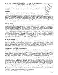
metallic metals - Government of Manitoba
metallic metals - Government of Manitoba
metallic metals - Government of Manitoba

Create successful ePaper yourself
Turn your PDF publications into a flip-book with our unique Google optimized e-Paper software.
52(ibid); no sulphides were noted with the gold. Thesoutherly shear zone, widening locally to 6 m, wasfollowed for 600 m but showed relatively little veinquartz, except at the west end where free gold wasfound in the early days in a vein, 50 cm wide, with alength <strong>of</strong> 60 m.References: Cambell 1971; Davies et a/1962, p 51;Russell 1952a; Stephenson 1971, 1972; Stewartin prep; Stockwell & Lord 1939; Weber 1971a,1971b; Wright 1932The Oro Grande mine (C 30) was located nearthe north end <strong>of</strong> Beresford Lake, 10 km east <strong>of</strong> LongLake. The inclined shaft, 78 m deep, is about 400 mwest <strong>of</strong> the lake; it is connected, at the 40 m level, tothe Solo shaft, which is 160 m deep and located 150m to the southeast. All shaft-sinking was done, instages, between 1923 and 1933. The ore was inquartz-filled openings along the Oro Grande shearzone where it cuts a large diorite sill near theeastern contact with overlying volcanics <strong>of</strong> the RiceLake Group. The Oro Grande shaft is at the southend <strong>of</strong> a ridge <strong>of</strong> diorite which rises above thenearby swamps. lhe Solo shaft is also in the sill, butless than 50 m from its contact with tuffaceoussediments. The shear zone, which strikesnorthwesterly and dips to the east, contains veins,up to 6 m long, <strong>of</strong> sugary quartz. These veins,exposed in outcrops on the ridge, yielded free goldduring the early prospecting. The shear zone wassubsequently traced to the north by trenching, andthere is a 15 m prospect shaft 120 m north <strong>of</strong> theinclined shaft. Trenches and an open stope in thisvincinity showed white, cherty and glassy quartzlenses, bordered by sheared gabbro, which hasbeen altered to dark grey quartz-chloritecarbonateschists, with minor biotite schist. Theveins and the rusty-weathering wall-rocks containcoarse pyrite cubes, also pyrrhotite and minorchalcopyrite. Coarse gold was reported undergroundat many locations down to 70 m. Visiblegold and rare sphalerite were found in a recentsurvey <strong>of</strong> surface material (J.W. Stewart, pers.com.). lhe presence <strong>of</strong> specular hematite in thechloritic wall-rock appears to indicate hightemperaturemineralization. The mill operatedfrom 1932 to 1934, and 1938 to 1940, producing 164.9kg <strong>of</strong> gold and 16.3 kg <strong>of</strong> silver.The Gunnar mine (C 31), which was at the southend <strong>of</strong> Beresford Lake, less than 1 km west <strong>of</strong> theshore, produced 3101 kg <strong>of</strong> gold between 1936 and1942. Owing to the good vertical extent <strong>of</strong> the orezone,the main, 3-compartment shaft reached adepth <strong>of</strong> 625 m. A second shaft, 210 m to thenorthwest, was down to 114 m. The mineralizationis in andesite and basalt, including some pillowpillow-lavas, near the south end <strong>of</strong> a dykelike body <strong>of</strong> albitegranite, about 45 m wide, that trends northerlyfor 2.5 km. Some smaller porphyry dykes,3 m or so in width, strike north-northwest throughthe volcanics. The main shaft is located immediatelynorth and east <strong>of</strong> the intersection <strong>of</strong> one such dykewith the principal mineralized shear zone, whichwas traced roughly east-west on the surface for 820m by numerous pits and trenches. The lavas withinthe shear zone have been altered to chloritic schistand s<strong>of</strong>t, greenish grey carbonate schist. The pitsreveal a lenticular vein, less than 1 m thick,consisting <strong>of</strong> grey sugary quartz and ankerite, andwell mineralized in places with pyrite andchalcopyrite. Sixty metres west <strong>of</strong> the main shaft,the shear follows a contact between andesite andan easterly projection <strong>of</strong> the granite. The richestorebody was located near this contact. Althoughnearly 5 m wide in the volcanics, the shear is weaklydefined where it crosses the granite, wideningagain in andesites to the west. The wall-rocks, asseen in the pits, are heavily carbonated chloriteschists showing disseminated cubes <strong>of</strong> pyrite; theyalso contain quartz and andesine. Pyrite was themost abundant <strong>metallic</strong> mineral in all the ore-veins,but chalcopyrite, pyrrhotite, arsenopyrite,sphalerite and galena were also present. Visiblegold was common in the quartz; the highest valueswere found in grey sugary quartz where cut byveinlets <strong>of</strong> glassy quartz. Another indication <strong>of</strong>high-grade ore was finely granulated, streaky pyritealong cracks insugary quartz; chalcopyrite,sphalerite and galena tended to accompany gold instreaks along these cracks. In the shear zoneadjoining the smaller shaft, some large but lowgrademasses <strong>of</strong> pyrite were found in packed grainsup to 1 cm across. The gangue minerals in all veinsincluded chlorite and carbonate with lesseramounts <strong>of</strong> albite, tourmaline, fuchsite and sericite.The rock-dumps have unfortunately been removedin recent years for road construction purposes.References: Campbell 1971 ; Cole 1938; Davies et al1962, p 51; Russell 1952a; Stephenson 1971,1972; Stewart in prep; Stockwell & Lord 1939;Traill 1970; Weber 1971a, 1971b; Wright 1932The Diana-Gem Lake mine (C 32), 18 km furthersouth, was less than 1 km from the Ontario border.The site is 3 km south <strong>of</strong> Gem Lake and 300 mnorthwest <strong>of</strong> Kickley Lake. The 3-compartmentshaft had reached 236 m in 1931. lhe earliestproduction was in 1928 but most <strong>of</strong> the mining wasdone between 1934 and 1936. Total production was235.5 kg <strong>of</strong> gold and 13.2 kg <strong>of</strong> silver. The mine wasclosed in 1938 but minor salvage operations tookplace in 1941. Regionally, the orebodies were on