The Upper Caura, Venezuela - Forest Peoples Programme
The Upper Caura, Venezuela - Forest Peoples Programme
The Upper Caura, Venezuela - Forest Peoples Programme

Create successful ePaper yourself
Turn your PDF publications into a flip-book with our unique Google optimized e-Paper software.
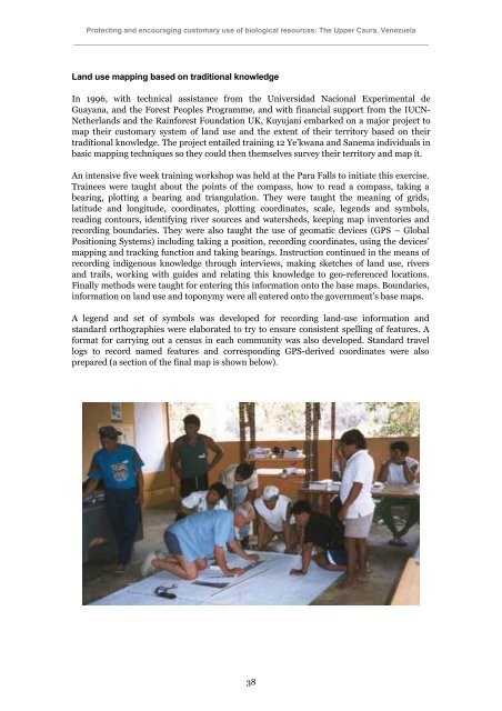
Protecting and encouraging customary use of biological resources: <strong>The</strong> <strong>Upper</strong> <strong>Caura</strong>, <strong>Venezuela</strong>_________________________________________________________________________________________Land use mapping based on traditional knowledgeIn 1996, with technical assistance from the Universidad Nacional Experimental deGuayana, and the <strong>Forest</strong> <strong>Peoples</strong> <strong>Programme</strong>, and with financial support from the IUCN-Netherlands and the Rainforest Foundation UK, Kuyujani embarked on a major project tomap their customary system of land use and the extent of their territory based on theirtraditional knowledge. <strong>The</strong> project entailed training 12 Ye’kwana and Sanema individuals inbasic mapping techniques so they could then themselves survey their territory and map ít.An intensive five week training workshop was held at the Para Falls to initiate this exercise.Trainees were taught about the points of the compass, how to read a compass, taking abearing, plotting a bearing and triangulation. <strong>The</strong>y were taught the meaning of grids,latitude and longitude, coordinates, plotting coordinates, scale, legends and symbols,reading contours, identifying river sources and watersheds, keeping map inventories andrecording boundaries. <strong>The</strong>y were also taught the use of geomatic devices (GPS – GlobalPositioning Systems) including taking a position, recording coordinates, using the devices’mapping and tracking function and taking bearings. Instruction continued in the means ofrecording indigenous knowledge through interviews, making sketches of land use, riversand trails, working with guides and relating this knowledge to geo-referenced locations.Finally methods were taught for entering this information onto the base maps. Boundaries,information on land use and toponymy were all entered onto the government’s base maps.A legend and set of symbols was developed for recording land-use information andstandard orthographies were elaborated to try to ensure consistent spelling of features. Aformat for carrying out a census in each community was also developed. Standard travellogs to record named features and corresponding GPS-derived coordinates were alsoprepared (a section of the final map is shown below).38