2010075-4364-Hartridge-Manor-Cottage-Cranbrook-Kent-HBR
2010075-4364-Hartridge-Manor-Cottage-Cranbrook-Kent-HBR
2010075-4364-Hartridge-Manor-Cottage-Cranbrook-Kent-HBR

Create successful ePaper yourself
Turn your PDF publications into a flip-book with our unique Google optimized e-Paper software.
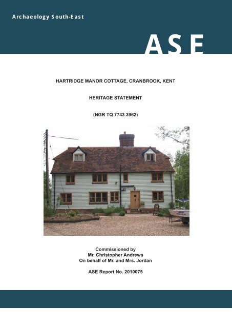
Archaeology South-EastASEHARTRIDGE MANOR COTTAGE, CRANBROOK, KENTHERITAGE STATEMENT(NGR TQ 7743 3962)Commissioned byMr. Christopher AndrewsOn behalf of Mr. and Mrs. JordanASE Report No. <strong>2010075</strong>
Archaeology South-East<strong>Hartridge</strong> <strong>Manor</strong> <strong>Cottage</strong>, <strong>Cranbrook</strong>, <strong>Kent</strong>Heritage StatementHARTRIDGE MANOR COTTAGE, CRANBROOK, KENTHERITAGE STATEMENT(NGR TQ 7743 3962)Commissioned byMr. Christopher AndrewsOn behalf of Mr. and Mrs. JordanASE Project No. <strong>4364</strong>Site Code: HMC10Report No. <strong>2010075</strong>May 2010Prepared by Jane ClubbArchaeology South-EastUnits 1 & 22 Chapel PlacePortsladeEast SussexBN41 1DRii
Archaeology South-East<strong>Hartridge</strong> <strong>Manor</strong> <strong>Cottage</strong>, <strong>Cranbrook</strong>, <strong>Kent</strong>Heritage StatementCONTENTSPageList of ContentsList of FiguresList of Platesiiiivv1.0 Introduction 12.0 Scope and methodology 13.0 Location 14.0 Current Listed status of the building 25.0 Cartographic evidence 26.0 Historical sources 47.0 Architectural description 58.0 Summary of the building’s development 9AcknowledgementsReferencesAppendix 1: Listed Building DetailsAppendix 2: Schedule of Lands belonging to <strong>Hartridge</strong> Farmand <strong>Hartridge</strong> Mill Farm, c.1810Appendix 3: Detail of <strong>Cranbrook</strong> Tithe Apportionment 1868Appendix 4: Schedule of Lands pertaining to <strong>Hartridge</strong> Farmincluded in conveyance of property 1897FiguresPlatesiii
Archaeology South-East<strong>Hartridge</strong> <strong>Manor</strong> <strong>Cottage</strong>, <strong>Cranbrook</strong>, <strong>Kent</strong>Heritage StatementLIST OF FIGURESFigure 1Figure 2Figure 3Figure 4Figure 5Figure 6Site location1870-1885 1st Edition 1:2500 O.S. map (top); 1898 2ndEdition 1:2500 O.S. map (bottom)1908 3rd Edition 1:2500 O.S. map (top); 1936 4th Edition1:2500 O.S. map (bottom)1970 1:2500 O.S. map<strong>Cranbrook</strong> Estate Map, c.1810: <strong>Hartridge</strong> Farm<strong>Cranbrook</strong> Estate Map, c.1810: <strong>Hartridge</strong> Mill FarmFigure 7 Plan of plots included in sale, 1897Figure 8 Plans as existing, 2010iv
Archaeology South-East<strong>Hartridge</strong> <strong>Manor</strong> <strong>Cottage</strong>, <strong>Cranbrook</strong>, <strong>Kent</strong>Heritage StatementLIST OF PLATESPlate 1Plate 2Plate 3Plate 4Plate 5Plate 6Plate 7Plate 8Plate 9Plate 10Plate 11The track leading to Paley Lane with <strong>Hartridge</strong> <strong>Manor</strong><strong>Cottage</strong> to the right<strong>Hartridge</strong> <strong>Manor</strong> <strong>Cottage</strong> (right) and <strong>Hartridge</strong> Mill (far left)Northern end of rear wall of main range showing headbraceas seen from the rear rangeRear and south elevations of <strong>Hartridge</strong> <strong>Manor</strong> <strong>Cottage</strong>Small window (blocked) in front wallTrimmer joist in lobby showing mortices for earlier stairpartitionHall chamber fireplace and possible stair door to the rightSteps leading from parlour to lean-to outshut19th-century fireplace and oven in lean-to outshutFront of chimney stack showing plain pilasterSection of original rear roof showing surviving raking strutand purlinv
Archaeology South-East<strong>Hartridge</strong> <strong>Manor</strong> <strong>Cottage</strong>, <strong>Cranbrook</strong>, <strong>Kent</strong>Heritage Statement1.0 INTRODUCTION1.1 In May 2010 Archaeology South-East (a division of the Centre for AppliedArchaeology, UCL) was commissioned by Mr. Christopher Andrews to compilea Heritage Statement of <strong>Hartridge</strong> <strong>Manor</strong> <strong>Cottage</strong>, <strong>Cranbrook</strong>, <strong>Kent</strong> (Fig. 1), toaccompany an application for the proposed extension of the existing house.This is in response to a request by Tunbridge Wells Borough Council thatfurther information about the property be submitted in order to ascertain thebuilding’s listed status.1.2 This Heritage Statement outlines the listed status of the property, anarchitectural description of the house and its significance, the evidence ofearlier phases of the house based upon historical maps and evidence relatingto the house and its past owners, especially at the time that the neighbouringproperty, <strong>Hartridge</strong> <strong>Manor</strong>, was listed. Where relevant, any evidence relatingto the current proposed alterations has been discussed.2.0 SCOPE & METHODOLOGY2.1 A Heritage Statement typically comprises an overview of the building’shistorical development and a summary of the available documentary andcartographic evidence.2.2 In the collection of data for analysis, the site was visited by a team of historicbuildings archaeologists to assess the archaeological development of thebuilding (or buildings) on the site and to gain an understanding of thebuilding’s function and setting.2.3 Any relevant and available primary and secondary documents were consultedin order to further the understanding of the site and its history. This includesthe analysis of historic maps and plans.2.4 The site was visited by Jane Clubb and Maggie Henderson in May 2010 inorder to carry out the survey.3.0 LOCATION (Fig. 1)3.1 <strong>Hartridge</strong> <strong>Manor</strong> <strong>Cottage</strong> is situated 0.25 km to the south of <strong>Hartridge</strong> <strong>Manor</strong>,along a track leading south from Paley Lane (Plate 1). The house is alignedon a NNW-SSE axis (hereafter assumed north-south), with its principal façadefacing WSW (hereafter assumed west). The collection of houses is situatedapproximately halfway between the villages of <strong>Cranbrook</strong> to the south andStaplehurst to the north, and lies within the parish of <strong>Cranbrook</strong>, 3.4 km northof the parish church. The house is at 40 m above Ordnance Datum (O.D.),and has a small watercourse to the south-east and north-west. The northwesternstream cuts across the land between <strong>Hartridge</strong> <strong>Manor</strong> and <strong>Hartridge</strong><strong>Manor</strong> <strong>Cottage</strong>, and the south-east watercourse appears to be a stream1
Archaeology South-East<strong>Hartridge</strong> <strong>Manor</strong> <strong>Cottage</strong>, <strong>Cranbrook</strong>, <strong>Kent</strong>Heritage Statementleading towards a former mill, which stands just to the south of <strong>Hartridge</strong><strong>Manor</strong> <strong>Cottage</strong> (Plate 2).4.0 CURRENT LISTED STATUS OF THE BUILDING4.1 <strong>Hartridge</strong> <strong>Manor</strong> was listed grade II on 9th June 1952, its listed buildingreference being TQ 73 NE 3/205. The description in the list entry is purely forthe purpose of recognition and is normally, therefore, primarily based onexternal appearance. The date is given as C17. [Source: English Heritage,Images of England - website]. The description must not be treated as acomprehensive schedule of those elements which are legally protected as, nomatter what the grade, the legislative cover not only relates to both the interiorand exterior, but also extends to any building within the curtilage whichpredates the 1st July 1948.4.2 <strong>Hartridge</strong> <strong>Manor</strong> <strong>Cottage</strong> (formerly 3-4 <strong>Hartridge</strong> <strong>Manor</strong> <strong>Cottage</strong>s) is not listedin its own right. At present, the <strong>Cottage</strong> is considered to be included within thecurtilage of the <strong>Manor</strong> house.4.3 The Planning (Listed Buildings and Conservation Areas) Act 1990 sets out inSection 1 (5) that “‘listed building’ means a building which is for the time beingincluded in a list compiled or approved by the Secretary of State…and…(a) any object or structure fixed to the building;(b) any object or structure within the curtilage of the building which,although not fixed to the building, forms part of the land and has doneso since before 1st July 1948,shall be treated as part of the building.4.4 Nigel Hewitson, Legal Director for English Heritage, has clarified the definitionof a curtilage-listed structure (2005). He states that“one building will be in the curtilage of another if, at the date of listing,there was a clear relationship between the buildings: specifically, thatone was ancillary to the use of the other, the buildings had commonownership or occupation and were not physically fenced off from eachother”.In ascertaining this relationship between the buildings, it is important toconsider the following points:1) the physical layout of the buildings;2) their past and present ownership, and3) their past and present function and use (Hewitson 2005).5.0 CARTOGRAPHIC EVIDENCE5.1 The 1st Edition 1:2500 Ordnance Survey (O.S.) map (Fig. 2: top), datedbetween 1870 and 1885 shows <strong>Hartridge</strong> <strong>Manor</strong> <strong>Cottage</strong> as a rectangularstructure with a small projection at the eastern end of the southern wall. Atthis date the structure appears to be larger than the <strong>Manor</strong> to the north.2
Archaeology South-East<strong>Hartridge</strong> <strong>Manor</strong> <strong>Cottage</strong>, <strong>Cranbrook</strong>, <strong>Kent</strong>Heritage Statement<strong>Hartridge</strong> <strong>Manor</strong> <strong>Cottage</strong> lies within an enclosure which seems to include thestructures to south-west and south. There is a small structure to the northeastof the house: the track is widened between these two buildings so thattheir northern elevations front the track. Between these two structures there isa boundary line, which extends from the south-western corner of the smallstructure, leaving the width of a pathway to the east of the larger house, to thesouth-eastern stream, bending slightly in the middle. The house is accessedfrom the track to the north-west by a short path; a second path leads to therear wall of the house and a third extends to the south-east, where it meetsthe stream to the north of the two southern buildings. These structures arelikely to be the mill buildings, as there is a short spur of water which leads toone of the buildings; they are accessed separately from the main track.Though there appears to be a short length of boundary extending northwestwardsfrom north of the presumed mill structures, they are not containedwithin their own separate enclosure, and therefore it seems that the fourbuildings within this plot were in single ownership at this date. <strong>Hartridge</strong><strong>Manor</strong>, standing to the north, is located within its own plot.5.2 By 1898, the house had been separated off from the surrounding buildings bythe addition of a boundary to the south of the house, as shown on the 2ndEdition O.S. map (Fig. 2: bottom). By this date a tiny structure had been builtto the south of the house. This map shows clearly that the house was in twooccupations at this date. It is not known whether it was a single dwelling orwas divided in 1880, as the house shading has hidden any dividing line. Bythis date the mill seems to have been disused, as there is no extension of thestream towards the buildings. To the north-east of the sharp bend in the trackthere now stood a long building with an open space to the front.5.3 There were no obvious changes to the existing structures or plots by 1908,when the 3rd Edition O.S. map was drawn (Fig. 3: top). However, to thesouth-west, two further structures had been built, including one which appearsto have had pens outside, which suggests that it was being used to houselivestock. Between <strong>Hartridge</strong> <strong>Manor</strong> and <strong>Hartridge</strong> <strong>Manor</strong> <strong>Cottage</strong>, on theeastern side of the track, a pair of semi-detached cottages had been built,each of ‘L’-plan, and with no separate yard or garden.5.4 Many of the buildings were still unaltered in 1936 (Fig. 3: bottom). The tinystructure to the south of <strong>Hartridge</strong> <strong>Manor</strong> <strong>Cottage</strong> had been demolished andthe projection on the south elevation had been removed, but the house wasstill in two occupations. One of the new buildings at this date appears to havebeen sized-down, whilst the pair of semi-detached cottages to the north havebeen extended: the re-entrant angle in the ‘L’ had been filled in. The northernend of the eastern boundary around <strong>Hartridge</strong> <strong>Manor</strong> <strong>Cottage</strong> was re-alignedat this date to create a semi-circular area outside the rear elevation.5.5 The 1:2500 O.S. map of 1970 (Fig. 4) labels the present <strong>Hartridge</strong> <strong>Manor</strong><strong>Cottage</strong> as ‘<strong>Hartridge</strong> <strong>Manor</strong> <strong>Cottage</strong>s’, and the semi-detached houses to thenorth are labelled the same. The map also shows the numbers which thehouses have been designated, the northern two being 1 and 2, and the3
Archaeology South-East<strong>Hartridge</strong> <strong>Manor</strong> <strong>Cottage</strong>, <strong>Cranbrook</strong>, <strong>Kent</strong>Heritage Statementincorporated into <strong>Hartridge</strong> Farm. The distinction between ‘mill’ and ‘house’indicates that there were two discrete structures fulfilling each function: theseare likely to have been the existing mill house and <strong>Hartridge</strong> <strong>Manor</strong> <strong>Cottage</strong>respectively. The whole was sold for £13,250, of which £3,250 was paid uponthe transfer, with the remainder to be paid in instalments.6.4 Upon the death of Charles Hoare less than a decade later, the property hehad recently bought passed to his widow and son, who continued to pay theoutstanding sum to Fiennes Cornwallis. However, the Hoare family were notresident on the farm: it appears that <strong>Hartridge</strong> Farm was rented out to WalterThomas Tipples, who appears on the electoral register of 1906, with his abodeat <strong>Hartridge</strong>, <strong>Cranbrook</strong>, <strong>Kent</strong> and his qualification for the vote being ‘land andtenement’. Five other men registered for the vote at <strong>Hartridge</strong>, though theirqualification was simply ‘dwelling-house’. As <strong>Hartridge</strong> is listed without thesuffix ‘Farm’ or ‘Mill’, it is impossible to gain further details of tenancy, but it isclear that the Farm and Mill were still under single ownership. Until c.1922Walter Thomas Tipples continued to be registered as farmer and hopgrower,<strong>Hartridge</strong> Farm, as listed in Kelly’s Directory of <strong>Kent</strong>. However, the 1922directory listed Constance and Mary Hoare (Misses) as farmers, <strong>Hartridge</strong>Farm. It is not known whether Constance and Mary were now the owners ofthe farm or whether they were renting the property from another member oftheir family.6.5 It was between 1927 and 1930 that <strong>Hartridge</strong> acquired the ‘<strong>Manor</strong>’ in its name,which is confirmed by the evidence from historic maps. At this dateConstance and Mary were still listed as its farmers, but the upgrading of<strong>Hartridge</strong> Farm to <strong>Hartridge</strong> <strong>Manor</strong> Farm suggests that its owners wanted toincrease the farm’s status, possibly as a result of a change of ownership. Thisis, however, conjectural, and cannot at this time be confirmed.7.0 ARCHITECTURAL DESCRIPTIONLayout7.1 The house comprises a four-bay, two-storeyed front range and a two-storeyedrear range at right angles, with a lean-to outshut along the remainder of therear wall. At present, on the ground floor there are two large rooms within thefront range, one room in the rear range and one large room in the outshut,with a WC and a lobby at the northern end. The front range rooms are eachheated by a fireplace in the large central, axial stack. The front door leads intoa lobby to the west of this stack. The rear range is positioned at the northernend of the eastern elevation, and is accessed from the large, two-bay northernroom, which is served by an inglenook fireplace. A doorway leads through theeastern wall to the south of the rear range, into the lean-to outshut, andanother doorway leads through the southern wall of the rear range. The leantooutshut is also accessed from the southern, single-bay room, which isserved by a smaller fireplace. One doorway leads to the garden through theeastern wall of the lean-to outshut, and there is one doorway through the5
Archaeology South-East<strong>Hartridge</strong> <strong>Manor</strong> <strong>Cottage</strong>, <strong>Cranbrook</strong>, <strong>Kent</strong>Heritage Statementeastern wall of the rear range. The stairs to the first floor are positioned at thenorthern end of the main range.7.2 The stairs from the ground floor lead onto a corridor/landing, which extends forthree bays on the eastern side of the main range. To the west of this corridorthere are two rooms in the two northern bays. At the southern end of thehouse, there is a room which extends the full width of the first floor. Leadingfrom this room there is a WC to the west of the chimney stack. There is asingle room in the rear range, and storage space in the roof void of the leanto.In the centre of the first-floor, open to the corridor, a stair leads up to theattic, which is divided into three spaces: a central landing and a room at eachend.7.3 When this house was first built, it is likely that it took the form of a three-cell,lobby-entry house, with the high-status end to the south and the services tothe north. Mortices in the soffit of the central girder in the service bay suggestthat there were two service rooms. The stairs to the first floor are likely tohave been located to the west of the chimney stack. At first-floor level, therewere three rooms, which were accessed through one another, without the useof a corridor. The stairs to the attic probably rose in the service chamber.7.4 At a later date, probably during the 18th century, the rear range was added tothe earlier house. This probably comprised, as now, a single room on eachfloor, and due to its lower floor level, would have been accessed via a shortflight of steps.7.5 Still later, and probably at the end of the 18th century or the beginning of the19th century, the lean-to outshut was constructed, forming a house with arectangular footprint. At some point during the 19th century, the house wasdivided into two occupations, though all evidence of this has been removed.The front door into the northern part of the house was to the north of truss T3.Wall Construction7.6 The house today has most of its wall infill hidden by plaster, but there aresome details visible. The principal posts which form the primary frame are ofgenerally heavy scantling, and appear to be reused from an earlier building,though it may not have been a building on this site. The tiebeams are held innormal assembly over the wallplates, and due to the camber of the tiebeams,the joists are carried on a bearer in order that the attic floor is constructedlevel.7.7 The wall construction of the main range is of large-panel type, incorporatingstandard bracing (Plate 3), and with the walls divided by vertical studs peggedto the principal timbers. In some cases the studs are notched into thetiebeams: this usually indicates a later insertion, but the studs in question aredoor jambs, and probably represent a feature which has been fitted after initialerection of the frame, rather than being planned and jointed during the originallaying-out of the frame. The original wall panels are of lath and plaster. The6
Archaeology South-East<strong>Hartridge</strong> <strong>Manor</strong> <strong>Cottage</strong>, <strong>Cranbrook</strong>, <strong>Kent</strong>Heritage Statementsoleplate is supported on a low, brick sleeper wall, and externally, the wallsare clad with weather-boarding.7.8 The rear range, as it displays no corner posts, is likely to be of regular-studconstruction which was designed to be plastered-over from the outset.However, the walls are currently hidden. The range is clearly subsidiary to thefront range as it supported on the frame of the front range. The easternground-floor wall has been rebuilt in brickwork at the same time as the wallsaround the lean-to outshut have been rebuilt. This brickwork dates from the20th century, and incorporates queen-closers at the jambs of the windows anddoors in this walls (Plate 4).Windows and Doors7.9 All the present windows are of 20th-century date, and have timber frames. Asthe structure of the walls around the windows is hidden, it is not knownwhether these windows are in historical locations. In two places there ispossible evidence for former windows. One of these is still visible as a featurein the first-floor closet, comprising a small, rectangular blocked opening with acentral, timber diamond-section glazing bar (Plate 5). The second possibleevidenced earlier window is positioned at the northern end of the rear wall ofthe main range. This is now blocked, but the presence of an internallyprojectingcill suggests the former existence of a window. The dormerwindows are not original and are likely to have been inserted contemporarywith the rebuilding of the front roof slope, probably in the late 18th or early19th century.7.10 As with the windows, the present doors in the house are of 20th-century date.The locations of the existing doors can be seen on Figure 8, and the locationsof the two original first-floor doorways, now blocked, are shown in pink. Thejambs of these doors have been notched into position, except for that in trussT3, where the eastern jamb is pegged as it flanks the fireplace.Floors, Ceilings and Stairs7.11 The ceilings in the former hall, hall chamber, former service room(s), parlourand rear range are of central-girder construction. The girders are chamferedand have stepped-and-hollowed stops. The joists are also chamfered andstopped. In contrast, the parlour chamber has longitudinally-set joists. In thecrossbeams of trusses T2 and T3 there are mortices for longitudinally-setjoists, but these appear to be residual mortices from earlier use of the timbers,rather than being indicative of a separate phase of this structure’s history.7.12 There has been much replacement of joists in the ceiling above the formerservice room(s), possibly as a result of a historical rearrangement of access tothe first floor. Some replacement of joists and a small trimmed opening abovethe service chamber suggests that the stairs to the attic rose from this room.The present stair to the attic rises at the northern side of the chimney stack. Itis of modern date.7
Archaeology South-East<strong>Hartridge</strong> <strong>Manor</strong> <strong>Cottage</strong>, <strong>Cranbrook</strong>, <strong>Kent</strong>Heritage Statement7.13 A series of stave holes in a trimmer joist above the lobby suggests that theremay once have been a partition dividing the area between the front door andthe chimney stack (Plate 6). If this was the case, it is likely that the originalstairs to the first floor were positioned in this location, probably rising from theparlour to the hall chamber, as indicated by the first-floor doorway in truss T3(Plate 7).7.14 As the ground slopes slightly to the east, the floor level within the rear rangeand lean-to is lower by 560 mm than the floor level in the main range. Thishas resulted in the insertion of steps leading down from the main range intothe rear rooms. This seems to have been a historical feature, as the brick,timber-nosed steps (Plate 8) leading down from the parlour to the lean-tooutshut are of some antiquity, likely predating the outshut.Chimneys7.15 The brick chimney stack in the main range has four flues. On the ground floorthere is a large inglenook fireplace serving the hall and a smaller fireplaceserving the parlour. The inglenook fireplace would have historically been thecooking hearth: the lintel and crossbeam bear notches for a clockwork spitmechanism. In contrast, the parlour fireplace would have been used forheating purposes, and is more decorative, to suit the higher status of theroom, incorporating splayed jambs. Of the two original first-floor hearths, onlyone remains open; this is the hall-chamber fireplace. The parlour-chamberfireplace has been blocked at a later, unknown date.7.16 It is clear from the external chimney stack that the west elevation has beenconsidered the principal façade from the outset, as the west face of the stackincorporates a projecting pilaster (Plate 10). This is only formed of plain brickheaders, but is nevertheless a decorative feature which is absent from theeastern - rear - face of the stack.7.17 There are two further chimney stacks, one of which is located at the southernend of the lean-to outshut, serving the added fireplace in this location, and oneof which is an externally-projecting stack positioned on the north-easterncorner of the rear range. The southern stack serves a small fireplace, on thewestern side of which is a brick oven (Plate 9). The cartographic evidenceindicates that the oven originally projected to the south of the lean-to, and wasextant by the 1st Edition O.S. map. The brickwork has been repointed, but thestack appears to be of 19th-century date. The stack at the northern end of thelean-to is not shown on any maps, but this may be because it was too small tobe depicted. There appears to be a small section of earlier brickwork, but themassive lower part of the stack is contemporary with the brick wall of the leantooutshut, and the stack above this also appears to be of a late, but unknown,date. The fireplace to this stack has been blocked by the later kitchen fittingswithin the rear range.8
Archaeology South-East<strong>Hartridge</strong> <strong>Manor</strong> <strong>Cottage</strong>, <strong>Cranbrook</strong>, <strong>Kent</strong>Heritage StatementRoof7.18 The half-hipped roof over the main range has been largely rebuilt, probably inthe late 18th or early 19th century, and likely in conjunction with the insertionof the two dormer windows which light the attic rooms. As first built, the roofwas of clasped-side-purlin construction, incorporating raking queen strutswhich supported the purlins at the trusses. The principal rafters which surviveare notched to house the purlin. Only one raking queen strut survives: that intruss T3 (Plate 11). The use of these raking struts indicates that the attic wasdesigned to be used from the outset. The later rebuilding incorporates collarsin each rafter pair to support an underplastered ceiling, thereby furtherenhancing the space. The rafters below this ceiling were also hidden fromview by plaster. The late 18th/early 19th century roof is constructed, wherevisible, using slender rafters, in one location strengthened by diagonal strutsplaced in between the rafters. It appears that the whole front slope has beenrebuilt, and possibly the end bays of the rear slope, though it is evident that inbays 2 and 3, the rear slope has been retained. The roof is covered with plainclay tiles.7.19 Prior to renovation works, the roof over the rear range was of ‘M’ profile(Emma Jordan, pers. comm.). Today it is hipped to the east and has a singleridge: it is constructed in hardwood, in a traditional style, using apparentlytraditional methods. The lean-to outshut is ceiled in flush plasterwork abovethe level of the tiebeams, hiding the rafters, though the tiebeams and the lowerparts of the raking struts which help support the roof are exposed.8.0 SUMMARY OF THE BUILDING’S DEVELOPMENT8.1 <strong>Hartridge</strong> <strong>Manor</strong> <strong>Cottage</strong> was built in the early-mid 17th century, andcomprised a three-cell, lobby-entry house, fully-floored throughout, and withattic space designed to be used as accommodation. The house is well-built,and incorporates timbers of large scantling, though many of these timbersdisplay redundant mortices which indicate that they are secondhand in theirexisting locations. The house is served by a four-flue brick chimney which hasmodest decorative detailing. Though the house is later shown as an ‘L’-planstructure, there is no evidence currently visible to suggest that this was thecase from the outset.8.2 The second phase of the building’s development took place during the 18thcentury, when the two-storeyed rear range was constructed against theeastern wall of the existing house. Originally, this had an ‘M’-profile roof, butprobably comprised of a single room on each floor.8.3 At the end of the 18th or the beginning of the 19th century a lean-to wasconstructed against the remainder of the east wall of the front range. At thatdate there was no oven against the southern wall.9
Archaeology South-East<strong>Hartridge</strong> <strong>Manor</strong> <strong>Cottage</strong>, <strong>Cranbrook</strong>, <strong>Kent</strong>Heritage Statement8.4 Around 1810, <strong>Hartridge</strong> <strong>Manor</strong> <strong>Cottage</strong> was illustrated as being of ‘L’-plan,having a face-wing added to the southern end of the front wall. However, thismay be an error on the part of the cartographer, who has reversed the positionof the house: the face-wing may be the rear range. If this was the case, itshows that the lean-to had not been built by 1810. At this date, the house waspart of <strong>Hartridge</strong> Mill Farm, owned by Sir Horatio Mann, and tenanted byJoseph Wood. What is now <strong>Hartridge</strong> <strong>Manor</strong> to the north was then called<strong>Hartridge</strong> Farm. This was also owned by Sir Horatio, but was tenanted by Mr.Joseph Miller.8.5 The farm was still tenanted separately at the time of the tithe in 1868, but in1897, when <strong>Hartridge</strong> Farm was sold by the Mann family, the farmland of<strong>Hartridge</strong> Mill Farm appears to have been subsumed into another property,with the house and mill listed separately in the sales particulars. The sale ofthe property kept all the <strong>Hartridge</strong> property in single ownership, in the hands ofthe Hoare family. Though the Hoare family did not apparently live at<strong>Hartridge</strong>, their connection was more than mere land ownership, for after aperiod in which Walter Thomas Tipples was registered as farmer andhopgrower at <strong>Hartridge</strong> Farm, Constance and Mary Hoare became the jointfarmers of <strong>Hartridge</strong> Farm. It is while these two women were farming<strong>Hartridge</strong> farm that its name was changed to <strong>Hartridge</strong> <strong>Manor</strong>. The manner inwhich the houses to the south of <strong>Hartridge</strong> <strong>Manor</strong> were numbered, they seemto have been considered as subsidiary to the main house, suggesting thatthey were in the same ownership, but probably rented out to farm workers.The present <strong>Hartridge</strong> <strong>Manor</strong> <strong>Cottage</strong> does not seem to have been anautonomous farmhouse from the last quarter of the 19th century, but itmaintains physical separation from the main house by boundaries around thegardens and the fields and watercourse in between.8.6 At all phases in its history, this house has been used as domesticaccommodation, initially as a single dwelling, and then being divided into twocottages during the 19th century, before being converted into a single houseagain under the present ownership.ACKNOWLEDGEMENTSArchaeology South-East would like to thank Gareth and Emma Jordan andChris Andrews, architect. We would also like to thank the staff at the Centrefor <strong>Kent</strong>ish Studies for their help in locating documents.10
Archaeology South-East<strong>Hartridge</strong> <strong>Manor</strong> <strong>Cottage</strong>, <strong>Cranbrook</strong>, <strong>Kent</strong>Heritage StatementREFERENCESPrimary documentsCKS U78 P31 nos. 29 & 34 <strong>Cranbrook</strong> Estate Map c. 1810CKS p100/27/A <strong>Cranbrook</strong> Tithe Apportionment 1868CKS U24 2/4/4/7 Miscellaneous MSS Cornwallis papersKelly’s Directory of <strong>Kent</strong>Electoral Registers: Ashford ConstituencyPlanning (Listed Buildings and Conservation Areas) Act 1990, Chp. 9Ordnance Survey Maps 1:25001st Edition 1870-18852nd Edition 18983rd Edition 19104th Edition 19361970Secondary documentsHewitson, N. 2005. ‘Legal developments: The extent of listing’, ConservationBulletin: 48, p. 42.WebsitesEnglish Heritage, Images of Englandhttp://www.imagesofengland.org.uk/Details/Default.aspx?id=169055&mode=adv Accessed on 18th June 201011
143000N142000141000140000The Site1390001380000 1kmReproduced from the Ordnance Survey's 1:25000 map of 1997with permission of the Controller of Her Majesty's Stationary Office.Crown Copyright. Licence No. AL 503 10 A577000578000579000© Archaeology South-EastProject Ref: <strong>4364</strong> May 2010Report Ref: <strong>2010075</strong> Drawn by: JC<strong>Hartridge</strong> <strong>Manor</strong> <strong>Cottage</strong>, <strong>Cranbrook</strong>, <strong>Kent</strong>Site locationFig. 1
N<strong>Hartridge</strong> <strong>Manor</strong><strong>Hartridge</strong> <strong>Manor</strong> <strong>Cottage</strong><strong>Hartridge</strong> <strong>Manor</strong><strong>Hartridge</strong> <strong>Manor</strong> <strong>Cottage</strong>© Archaeology South-East<strong>Hartridge</strong> <strong>Manor</strong> <strong>Cottage</strong>, <strong>Cranbrook</strong>, <strong>Kent</strong>Project Ref: <strong>4364</strong> May 2010 1870-1885 1st edition 1:2500 O.S. map (top);Report Ref: <strong>2010075</strong> Drawn by: JC1898 2nd edition 1:2500 O.S. map (bottom)Fig. 2
N<strong>Hartridge</strong> <strong>Manor</strong><strong>Hartridge</strong> <strong>Manor</strong> <strong>Cottage</strong><strong>Hartridge</strong> <strong>Manor</strong><strong>Hartridge</strong> <strong>Manor</strong> <strong>Cottage</strong>© Archaeology South-East<strong>Hartridge</strong> <strong>Manor</strong> <strong>Cottage</strong>, <strong>Cranbrook</strong>, <strong>Kent</strong>Project Ref: <strong>4364</strong> May 2010 1908 3rd edition 1:2500 O.S. map (top);Report Ref: <strong>2010075</strong> Drawn by: JC1936 4th edition 1:2500 O.S. map (bottom)Fig. 3
N<strong>Hartridge</strong> <strong>Manor</strong><strong>Hartridge</strong> <strong>Manor</strong> <strong>Cottage</strong>© Archaeology South-EastProject Ref: <strong>4364</strong> May 2010Report Ref: <strong>2010075</strong> Drawn by: JC<strong>Hartridge</strong> <strong>Manor</strong> <strong>Cottage</strong>, <strong>Cranbrook</strong>, <strong>Kent</strong>1970 1:2500 O.S. mapFig. 4
N<strong>Hartridge</strong> <strong>Manor</strong>© Archaeology South-EastProject Ref: <strong>4364</strong> May 2010Report Ref: <strong>2010075</strong> Drawn by: JC<strong>Hartridge</strong> <strong>Manor</strong> <strong>Cottage</strong>, <strong>Cranbrook</strong>, <strong>Kent</strong><strong>Cranbrook</strong> Estate Map, c.1810: <strong>Hartridge</strong> FarmFig. 5
N© Archaeology South-EastProject Ref: <strong>4364</strong> May 2010Report Ref: <strong>2010075</strong> Drawn by: JC<strong>Hartridge</strong> <strong>Manor</strong> <strong>Cottage</strong>, <strong>Cranbrook</strong>, <strong>Kent</strong><strong>Cranbrook</strong> Estate Map, c.1810: <strong>Hartridge</strong> Mill FarmFig. 6
N© Archaeology South-EastProject Ref: <strong>4364</strong> May 2010Report Ref: <strong>2010075</strong> Drawn by: JC<strong>Hartridge</strong> <strong>Manor</strong> <strong>Cottage</strong>, <strong>Cranbrook</strong>, <strong>Kent</strong>Plan of plots included in sale, 1897Fig. 7
Archaeology South-East<strong>Hartridge</strong> <strong>Manor</strong> <strong>Cottage</strong>, <strong>Cranbrook</strong>, <strong>Kent</strong>Heritage StatementPlate 1The track leading to PaleyLane with <strong>Hartridge</strong> <strong>Manor</strong><strong>Cottage</strong> to the rightPlate 2<strong>Hartridge</strong> <strong>Manor</strong> <strong>Cottage</strong>(right) and <strong>Hartridge</strong> Mill(far left)Plate 3Northern end of rear wall ofmain range showingheadbrace as seen fromthe rear range
Archaeology South-East<strong>Hartridge</strong> <strong>Manor</strong> <strong>Cottage</strong>, <strong>Cranbrook</strong>, <strong>Kent</strong>Heritage StatementPlate 4Rear and south elevationsof <strong>Hartridge</strong> <strong>Manor</strong> <strong>Cottage</strong>Plate 5Small window (blocked) infront wallPlate 6Trimmer joist in lobbyshowing mortices forearlier stair partition
Archaeology South-East<strong>Hartridge</strong> <strong>Manor</strong> <strong>Cottage</strong>, <strong>Cranbrook</strong>, <strong>Kent</strong>Heritage StatementPlate 7Hall chamber fireplace andpossible stair door to therightPlate 8Steps leading from parlourto lean-to outshutPlate 919th-century fireplace andoven in lean-to outshut
Archaeology South-East<strong>Hartridge</strong> <strong>Manor</strong> <strong>Cottage</strong>, <strong>Cranbrook</strong>, <strong>Kent</strong>Heritage StatementPlate 10Front of chimney stackshowing plain pilasterPlate 11Section of original rear roofshowing surviving rakingstrut and purlin
Archaeology South-East<strong>Hartridge</strong> <strong>Manor</strong> <strong>Cottage</strong>, <strong>Cranbrook</strong>, <strong>Kent</strong>Heritage StatementAPPENDIX 1: LISTED BUILDING DETAILSIoE Number: 169055Location: <strong>Hartridge</strong> <strong>Manor</strong>, Paley Lane (South Side) <strong>Cranbrook</strong>, Tunbridge Wells,<strong>Kent</strong>Date listed: 09 June 1952Date of last amendment: 09 June 1952Grade IICRANBROOK PALEY LANE, (SOUTH TQ 73 NE SIDE) 3/2059.<strong>Hartridge</strong> <strong>Manor</strong> Farmhouse. C17, clad in C19 and extended in mid and later C19.Timber-framed on wide red brick plinth, tile-hung above. Plain tiled roof, half-hippedwith brick ridge stack. 2 storeys. Three windows, regular through the central first floorwindow is blocked. Tripartite glazing bar sashes. Entrance at rear. L-shaped blockwith mid C18 2 storey block in angle of L to rear with further wing beyond, (to northeast).Triple-span hipped roofed extension to right (south).
Archaeology South-East<strong>Hartridge</strong> <strong>Manor</strong> <strong>Cottage</strong>, <strong>Cranbrook</strong>, <strong>Kent</strong>Heritage StatementAPPENDIX 2: SCHEDULE OF LANDS BELONGING TO HARTRIDGE FARM AND HARTRIDGEMILL FARM, C.1810 (FIGS. 5 & 6)<strong>Hartridge</strong> FarmNo. Acres Rods Perches1 Buildings Yards &c 2 1 52 Wood 1 2 63 Wood 3 - 64 8 - -5 Ruffet 1 2 156 4 1 17 11 - 398 4 - 169 Barn & Yard [in pencil] - 1 110 3 2 3611 9 2 -12 6 2 1913 4 2 1214 13 3 2915 11 - -16 8 3 717 8 3 3918 6 - 2519 15 2 2520 9 - 3821 Wood 1 2 2722 7 1 -23 8 1 524 Shaw - 2 3425 5 1 3426 11 2 20162 2 6Bounds In Farm1 House & Garden - 3 132 1 - 173 1 2 84 - 1 75 1 2 85 1 13167 3 19
APPENDIX 3: DETAIL OF CRANBROOK TITHE APPORTIONMENT 1868<strong>Hartridge</strong> Farm (Owner: Earl Cornwallis; Occupier: David Butler)No.Name and Description of Lands andPremisesArchaeology South-East<strong>Hartridge</strong> <strong>Manor</strong> <strong>Cottage</strong>, <strong>Cranbrook</strong>, <strong>Kent</strong>Heritage StatementQuantitiesPayable toAppropriatora r p £ s d1361 Banky Meadow 6 0 101362 Orchard 4 1 11363 Field 2 3 21364 Ruffet 1 2 151365 Field 0 2 81366 Field 1 1 10 0 17 31367 Field 2 0 371368 Wood 1 2 61369 Buildings Yards &c 2 1 51370 Barn Meadow 3 2 361371 Stable Meadow 4 0 161371a Barn Yard &c 0 1 11372 Part of Banky Meadow 5 0 291373 The Thirteen Acres 11 3 261374 Part of Thirteen Acres 2 0 31375 Summer House Field 4 2 121376 The Eleven Acres 11 0 01381 The Eight Acres 11 2 301381a The Eight Acre Shaw 1 2 27 3 7 71382 Field 6 2 191383 Floodgate Field 7 1 201383a Part of Floodgate Field 2 0 201384 Field 8 1 51384a Shaw 0 2 341385 The Seven Acres 7 1 01387 The Brook 5 1 341388 Hazelden 11 2 201409 Bagden Shaw 2 2 32 13 18 6130 3 18 18 3 11
Archaeology South-East<strong>Hartridge</strong> <strong>Manor</strong> <strong>Cottage</strong>, <strong>Cranbrook</strong>, <strong>Kent</strong>Heritage Statement<strong>Hartridge</strong> Mill Farm (Owner: Earl Cornwallis; Occupier: Walter Larkin)No.Name and Description of Lands andPremisesQuantitiesPayable toAppropriatorA r p £ s d1401 Buildings Pond Sail Yards &c 5 3 21403 Alders 0 3 261404 Orchard 0 3 01405 House field 2 0 111406 Orchard Meadow 3 1 281407 Saw Pit Meadow 4 0 281408 Wood 0 2 361432 Farthest Lane Field 3 1 01433 Nearest Lane Field 6 1 241434 The Six Acres 6 0 01435 The Five Acres 5 3 231436 Barn Field 6 0 351438 Little Field 1 1 251439 White Field 8 2 141440 Hollow Field 8 2 01441 The Ten Acres 9 3 331441a The Wood Field 1 2 361443 Part of Six Acres 1 3 341444 Field 0 0 321445 Burnt Hill FIeld 3 0 180 3 13 11 2 6
Archaeology South-East<strong>Hartridge</strong> <strong>Manor</strong> <strong>Cottage</strong>, <strong>Cranbrook</strong>, <strong>Kent</strong>Heritage StatementAPPENDIX 4: SCHEDULE OF LANDS PERTAINING TO HARTRIDGE FARM INCLUDED INCONVEYANCE OF PROPERTY 1897 (FIG. 7)No. Acres Rods Perches486 Chandler’s Hopgarden 5 3 12487 Chandler’s Meadow 8 3 18488 Shaw 0 3 5489 Mill Shaw 0 3 0490 Three <strong>Cottage</strong>s Gardens &c 1 1 23491 Chandler’s Orchard 2 1 18492 Grubbed Brook 2 2 26493 Shaw 0 1 37494 Orchard 1 0 0495 Apple Orchard 0 2 12496 House Gardens Buildings &c 0 2 22497 House Field 3 2 17498 Calves Field 7 2 39499 Orchard Hopgarden 4 0 14500 Bank Field 6 2 31501 Bank Meadow 5 1 14502 Barn Yards &c 0 1 24503 Barn Field 11 1 30504 Thirteen Acres 13 1 29506 Floodgate Field 13 2 25518 Nine Acres 11 0 38505 Shaw by Road 0 1 45507 Shaw Stream 0 2 16508 Acre and One Quarter 1 3 5509 Pit and Shaw 1 0 6510 Pond Tail 4 0 27511 Nabs 0 3 27512 Plat Adjoining 0 1 25513 Upper Brook 3 0 31514 Two Seven Acres 16 2 28515 Seven Acre Shaw 1 3 37516 Shaw (Grubbed) 0 2 11517 Eight Acres 11 3 24519 Book [Brook?] Hopgarden 2 1 8520 Hazelden Field 11 3 35160 3 8
Head OfficeUnits 1 & 22 Chapel PlacePortsladeEast Sussex BN41 1DRTel: +44(0)1273 426830 Fax:+44(0)1273 420866email: fau@ucl.ac.ukWeb: www.archaeologyse.co.ukLondon OfficeCentre for Applied ArchaeologyInstitute of ArchaeologyUniversity College London31-34 Gordon Square, London, WC1 0PYTel: +44(0)20 7679 4778 Fax:+44(0)20 7383 2572Web: www.ucl.ac.uk/caaThe contracts division of the Centre for Applied Archaeology, University College Londonc Archaeology South-East