Carruthers Creek - Toronto and Region Conservation Authority
Carruthers Creek - Toronto and Region Conservation Authority
Carruthers Creek - Toronto and Region Conservation Authority
- No tags were found...

Create successful ePaper yourself
Turn your PDF publications into a flip-book with our unique Google optimized e-Paper software.
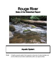
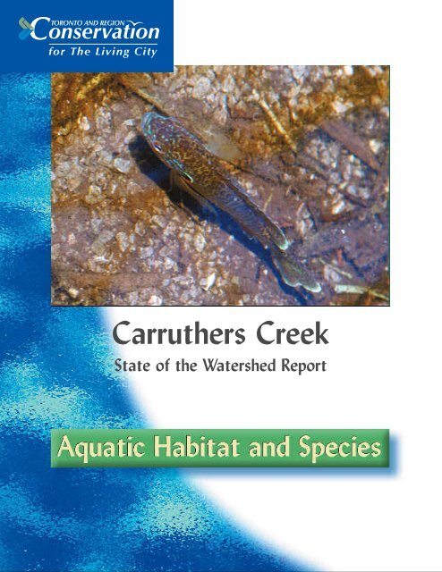
<strong>Carruthers</strong> <strong>Creek</strong>State of the Watershed Report
Introduction to AquaticHabitat <strong>and</strong> SpeciesThe health of the aquatic environment <strong>and</strong> the condition of the<strong>Carruthers</strong> <strong>Creek</strong> watershed are interconnected. This is becausethe aquatic environment is directly affected by the quality <strong>and</strong>quantity of water that flows over or through the l<strong>and</strong>. Thehealth of the aquatic habitat, therefore, is an indicator of thehealth of the watershed.The aquatic ecosystem is most often described as fish habitatsince fish communities are important resources, <strong>and</strong> as such,have a long history of being used as indicators of aquaticecosystem health. Aquatic habitat is an integral part of thewatershed’s ecosystem as it provides feeding, breeding <strong>and</strong>rearing areas for resident <strong>and</strong> migratory fish <strong>and</strong> invertebratespecies. Within the watershed, aquatic habitats can be dividedinto several different habitat categories on the basis of suitabilityfor differentiating aquatic communities. These habitat categoriesfall into three broad groups: riverine habitat (creeks <strong>and</strong> rivers),lacustrine habitat (ponds <strong>and</strong> lakes) <strong>and</strong> estuarine habitat(coastal marsh). In the following sections each habitat categoryis identified <strong>and</strong> its significance, condition <strong>and</strong> any changes incondition over time are described.In 2000, a survey of fish communities <strong>and</strong> habitat wasconducted to provide a benchmark of our current knowledge ofthe watershed, allowing for the identification of significantmanagement issues as well as gaps in our knowledge. Acomprehensive analysis of the fish community, aquatic habitat<strong>and</strong> a management plan for the aquatic ecosystem will becompleted early in 2002.2
6significantly increase the volume of surface runoffas well as the frequency of runoff. It also reducesthe time it takes for runoff to reach the creek.For the creek, this change in runoff causes thecreek to become ‘flashy,’ meaning that water levelsrise <strong>and</strong> drop quickly. In response to storm events,the creek enlarges, destroying cover <strong>and</strong> increasingsediment loads. If these changes to the surface<strong>and</strong> groundwater regimes are extensive enough,they can significantly impact fish habitat.Some rural l<strong>and</strong> use activities may also affectriverine habitat. The primary impact to the creekecosystem in rural areas is the loss of woodyvegetation from the riparian zone <strong>and</strong> othervegetative buffers. In many areas, especially theheadwaters, the area next to the watercourse hasbeen cleared of woody vegetation <strong>and</strong> the l<strong>and</strong>has been cropped very close to stream banks.However, over the past 40 years the condition ofthe riparian zone has been improving. Based ona qualitative assessment of 1958 <strong>and</strong> 1999 aerialphotography, there is currently more woodyriparian vegetation in the watershed than waspresent in 1958. There also appeared to be morevegetated buffers present in 1999 than in 1958.Overall, the riparian zone appears to be in bettercondition today than in recent history, althoughthere is still much room for improvement.The presence of in-stream barriers to fish passagein the watershed can have an impact on theaquatic system. Structures that act as barriersinclude dams, weirs, level crossings, <strong>and</strong> someculverts. In-stream barriers in the <strong>Carruthers</strong><strong>Creek</strong> watershed generally occur north of TautonRoad, fragmenting the habitat <strong>and</strong> limitingaccess to summer refugia, feeding areas orspawning habitat. Managing the effects of instreambarriers is an important issue that mustbe addressed in the development of a watershedfisheries management plan.In the <strong>Carruthers</strong> <strong>Creek</strong> watershed, changes suchas transportation, urbanization, water taking,<strong>and</strong> ponds, among others, have impacted thewatershed, however their extent within thewatershed is limited <strong>and</strong> the system can likely berehabilitated. Management efforts in the futureshould address five areas:• ensuring that future developments do notalter the flow regime• retrofit stormwater controls in areas alreadydeveloped• planting riparian zones with trees <strong>and</strong> shrubs• modifying in-stream barriers to allow fishpassage• exp<strong>and</strong>ing tablel<strong>and</strong> forests to reduce runoff.Lacustrine HabitatLacustrine habitat is characterized by the presenceof slow moving or st<strong>and</strong>ing water. In general,there are two types of lacustrine habitat in the<strong>Carruthers</strong> <strong>Creek</strong> watershed – online <strong>and</strong> offlineponds. Online ponds are directly connected to astream or river with the creek passing directlythrough the waterbody. Offline ponds are isolatedwith little or no connection to a stream or river,or indirectly connected through a subsurface pipeor a channel that directs some flow from the streamto the pond. In total, there are seven online ponds<strong>and</strong> 20 offline ponds with a combined surfacearea of three hectares within the watershed.Ponds can also be created through a variety ofacts of nature. Many ponds are created by beaverbuildimg dams with wood <strong>and</strong> other debris.These structures are generally not a concern asthey are natural <strong>and</strong> tend to be transient innature. Ponds may also be formed through thenormal migration of the creek, which can createoxbow lakes or ponds.Online ponds are depositional areas thataccumulate sediments <strong>and</strong> tend to evolve intowetl<strong>and</strong>s <strong>and</strong> eventually upl<strong>and</strong>s over time. Theaccumulated sediments can pose a risk todownstream fish communities if released fromthe pond or reservoir. Online ponds may alsocontribute to warming of the creek because largeponds <strong>and</strong> lakes, such as the ponds north ofTaunton Road, slow the water <strong>and</strong> allow thesurface temperatures to rise. This results in
increased temperatures downstream <strong>and</strong> maymake the habitat less suitable for coldwaterspecies. In some cases this warming effect can bemitigated if the water is released from the bottomof the pond where it is usually cooler.Estuarine HabitatThe estuarine area, located at the confluence of<strong>Carruthers</strong> <strong>Creek</strong> <strong>and</strong> Lake Ontario, covers eighthectares. This habitat serves as a transition zonebetween the lake <strong>and</strong> the creek <strong>and</strong> a total of 24species have been recorded here (Table 2). Speciesfound here include warmwater fish, such aslargemouth bass <strong>and</strong> carp, as well as exclusivelylake species such as white bass, white perch,gizzard shad <strong>and</strong> alewife. This area is importantto both lake <strong>and</strong> creek species because it providesspawning areas for 10 species <strong>and</strong> provides rearingareas for 16 species. In total, 75 per cent of thespecies found in the marsh use the area for eitherspawning or rearing purposes (Stephenson, 1988).This is a consequence of the dense plant growththat serves as excellent cover for maturing fish.Another important fact is that marshes are highlyproductive because they receive significantamounts of nutrients from upstream areas. Thesenutrients provide a resource/food base for thedeveloping fish <strong>and</strong> prey.Maintenance <strong>and</strong> protection of the coastalmarshes is of critical importance. This area notonly supports creek species but lake species aswell. Thus, by protecting the marsh we will bemaintaining spawning, rearing <strong>and</strong> feedinghabitat for a wide variety of species.Table 2. Cumulative Fish SpeciesRecorded From the <strong>Carruthers</strong><strong>Creek</strong> Estuarine Marsh Area.Common Name Scientific NamealewifeAlosa pseudoharengusgizzard shad Dorosoma cepedianumnorthern pike Esox luciuscentral mudminnow Umbra limiwhite sucker Catostomus commersonicarpCyprinus carpiogolden shiner Notemigonus crysoleucasemerald shiner Notropis antherinoidescommon shiner Luxilus cornutusspottail shiner Notropis hudsoniusbluntnose minnow Pimephales notatusfathead minnow Pimephales promelascreek chubSemotilus atromaculatusbrown bullhead Ameiurus nebulosuswhite perchMorone americanawhite bassMorone chrysopsrock bassAmbloplites rupestrispumpkinseed Lepomis gibbosussmallmouth bass Micropterus dolomieuilargemouth bass Micropterus salmoidesblack crappie Pomoxis nigromaculatusyellow perch Perca flavescensjohnny darter Etheostoma nigrumlogperchPercina caprodesData T. Stephenson, 19857
ReferencesBird <strong>and</strong> Hale, Ltd., 1997. Natural Heritage Assessment <strong>and</strong> Evaluation,Additional Herbaceous Plant <strong>and</strong> Fisheries Information. Town of Ajax A8Community Plan Area.Eyles, N., Boyce, J. <strong>and</strong> Gerber, R., 1997. Hydrological Study of the NorthPickering Development Corporation L<strong>and</strong>s <strong>and</strong> the Duffins <strong>Creek</strong> Watershed.Prepared for the North Pickering Development CorporationKarr, J.R., 1981. Assessment of Biotic Integrity Using Fish Communities.Fisheries 6: 21-27.Sibul, U., K.T. Wang <strong>and</strong> D. Vallery, 1997. Groundwater Resources of the Duffins<strong>Creek</strong> – Rouge River Drainage Basins. Water Resources Report: 8. Ministryof the Environment, Water Resources Branch. <strong>Toronto</strong>, Ontario.Steedman, R.J., 1988. Modification <strong>and</strong> Assessment of an Index of BioticIntegrity to Quantify Stream Quality in Southern Ontario. CanadianJournal of Fisheries <strong>and</strong> Aquatic Sciences 45: 492-500.Stephenson, T., 1988. Fish Utilization of <strong>Toronto</strong> Area Costal Marsh Areas.M.Sc. Thesis, Department of Zoology, University of <strong>Toronto</strong>, <strong>Toronto</strong>,ON., Canada. 222p.9