Program Manual - Recreation PEI
Program Manual - Recreation PEI
Program Manual - Recreation PEI
- No tags were found...

You also want an ePaper? Increase the reach of your titles
YUMPU automatically turns print PDFs into web optimized ePapers that Google loves.
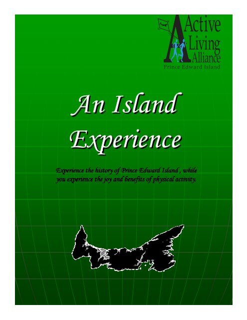
An IslandExperienceExperience the history of Prince Edward Island , whileyou experience the joy and benefits of physical activity.
An Island ExperienceTable of Contents• Introduction/Welcome• What counts as physical activity?• How do I chart my physical activity?• Who can participate?• Brief outline• Guidelines to earning points.• Key for points, level of activity, points needed each week,total time per day or week.• Checkpoint• Checkpoint for students (includes websites)• Resources for teachers (includes information on Lighthouses,Heritage roads, and all other historic and heritage sites aswell as short biographies on historic figures from <strong>PEI</strong>.
Dear Adventurer/Teacher,An Island ExperienceCongratulations on choosing to take part in An Island Experience. You will get to virtually travelacross all of <strong>PEI</strong> and visit many sites and locations that you may not have known even existed.Within your leaders manual you will find student booklets for every child in your class. There isalso an “Island Experience” checkpoint printout with websites that you will photo copy for each ofyour students. This is their guide to touring the Island. To advance from one checkpoint toanother they will have to accumulate the points needed to do so. The points needed each weekare in the student booklet and are listed with each checkpoint. There is a key in the leader’sprogram manual that will help guide your students to earn their points each week. The programmanual also includes resources that cover every location on <strong>PEI</strong> that the students will visit.What counts as physical activity?In this adventure physical activity is seen as any physical movement (non-motorized)which one participates in for a period of at least 5 minutes. Physical activity may involveendurance activitiesEndurance activities help your heart, lungs and circulatory system stay healthy. They also giveyou more energy. Examples of endurance activities range from walking, jogging, biking,swimming and dancing to organized exercise programs and recreational sports.Stretching/flexibility activities Flexibility activities help you to move easily. They keep yourmuscles relaxed and your joints mobile. Examples of flexibility activitiesReaching, bending, stretching, Yoga and Tai Chi are all examples of flexibility activities.Strength activities Strength activities help your muscles and bones stay strong. To ensure goodoverall strength, try to do a combination of activities that work the muscles throughout your body.Examples of strength activities, lifting weights, doing sit-ups or carrying heavy loads are allexamples of strength activities.This could include playing outside at recess, going for a walk, involvement in a sport (hockey,basketball, etc.), participating in physical education classes, etc.How do I chart my physical activity?Each day you will be asked to complete a form where you record how much physical activity youhave participated in that day. Physical Activity will be monitored in 5-minute sessions. Forexample if you are running around and playing at recess for 10 minutes, these 10 minutes counttoward your amount of physical activity for that day. If you walk from your car or the bus into theschool and it only takes one minute, you cannot record this activity as part of the adventure. It isalso important to make sure you only count your active time during the activity. If you havehockey practice for an hour but you end up spending half the time either listening to coachexplain something or waiting in line for a drill, make sure to only put 30 minutes on your log.Who can participate?This adventure is open to all students and teachers who wish to join.Details concerning how the adventure works can be found throughout this booklet.
An Island ExperienceHop off Northumberland Ferries Ltd at Woods Islands and start your adventureacross all of <strong>PEI</strong>. You will get to travel from tip to tip enjoying many stops along theway. Travel by heritage roads, waterways or the confederation trail and stop and see<strong>PEI</strong>’s oldest lighthouse, one of the largest miniature train sets in Canada, or the firstlanding site on <strong>PEI</strong>.This adventure has been designed to take you through 8 checkpoints whilevisiting all parts of <strong>PEI</strong>. Each leg of the journey includes a short description of the areaand indicates how much physical activity is required to reach that checkpoint. Every 5-minute session of physical activity you perform can be added until you reach the requiredtime to complete the leg.
Guidelines1 point activities: Receive 1 point for any light intensity physical activity that lasts atleast 5 minutes in duration.Examples:• Light activities – light walking, stretching, volleyball, easy gardening2 points activities: Receive 2 point for any moderate intensity physical activity that lastsat least 5 minutes in duration.Examples:• Moderate activities – brisk walking, biking, raking leaves, swimming3 points activities: Receive 3 points for any vigorous intensity physical activity that lastsat least 5 minutes in duration.Examples:• Vigorous activity – aerobics, jogging, hockey, basketballKeyVigorous = 5 min. = 3 ptsModerate = 5 min. = 2 pts.Light = 5 min. = 1 pt.Vigorous: aerobics, jogging, hockey, basketballModerate: brisk walking, biking, raking leaves,swimmingLight: light walking, stretching, volleyball, easygardeningWeekPointsneededTime needed withLight activities Moderate Vigorous1 66 5.5 hrs./wk or 47 min./day 2.75 hrs/wk or 24 min./day 1.8 hrs./wk or16 min/day2 96 8 hrs/wk or 69 min/day 4 hrs/wk or 34 min/day 2.6 hrs/wk or 23 min/day3 120 10hrs/wk or 86 min/day 5 hrs/wk or 43 min/day 3.3 hrs/wk or 29 min/day4 150 12.5hrs/wk or 107 min/day 6.25 hrs/wk or 54 min/day 4.2 hrs/wk or 36 min/day5 18015hrs/wk or 2hrs. & 8min/day7.5 hrs/wk or 1hr. & 4min/day5 hrs/wk or 43 min/day6 19216hrs/wk or 2 hrs. & 17min/day8 hrs/wk or 1 hr. & 8min/day5.3 hrs/wk or 46 min/day7 22218.5 hrs/wk or 2hrs. & 38min/day9.25 hrs/wk or 1 hr. & 19min/day6.2 hrs/wk or 53 min/day8 252 21 hrs/wk or 3 hrs./day 10.5 hrs/wk or 1.5 hrs./day 7 hrs/wk or 60 min/day
Students/Teachers CheckpointsStart at Wood Islands FerryAn Island ExperienceCheckpoint 1:• Wood Islands Lighthouse and Interpretive Centero built 1876o http://www.gov.pe.ca/infopei/index.php3?number=66290• Orwell Corner Historic Villageo 1890’s communityo http://www.orwellcorner.isn.net/• Sir Andrew MacPhail Homesteado Orwell, restored to 1850so http://www.islandregister.com/macphailfoundation.html• Point Prim Lighthouseo <strong>PEI</strong>’s oldest lighthouse, brick, 80ft above sea levelo http://www.gov.pe.ca/infopei/index.php3?number=66290• Roma at Three Riverso Junction Montague and Brudenell Rivero 1 st ever Road on <strong>PEI</strong>o 1731, built by Jean Pierre de Roma, linked French settlements inEastern Kings (Brudenell Pt, Cardigan, Souris, St. Peters) – roadsovergrew after British attacked the colony at Brudenello http://www.romapei.com/• Cape Bear Lighthouse & Marconi Museumo Lighthouse house built 1881, still operational – Replica of firstCanadian land station (1905-1922) to allegedly receive distress signalsfrom Titanico http://www.gov.pe.ca/infopei/index.php3?number=66290• Panmure Island Lighthouseo <strong>PEI</strong>’s oldest wooden lighthouseo http://www.gov.pe.ca/infopei/index.php3?number=66290• Heritage Road Klondyke Roado 1900s, sawmills and homesteads, 1920-30s, rumrunnerso http://www.gov.pe.ca/infopei/index.php3?number=3541• Heritage Road County Line Roado Boundary between Queens and Kings countyo http://www.gov.pe.ca/infopei/index.php3?number=3541
Checkpoint 2:• East Point Lighthouseo “first generation” light houseo http://www.gov.pe.ca/infopei/index.php3?number=66290• Elmira Railway Museum & Miniature Railwayo Story of railroad on <strong>PEI</strong>, one of the largest miniature collection in Canadao http://www.edu.pe.ca/easternkings/elmira/history_of_elmira_station.htm• Basin Head Fisheries Museumo Inshore fisheries history, adjacent to Singing Sand Beacho http://www.edu.pe.ca/easternkings/fishing/basinhead.htm• Heritage Road Mellish Roado 1800s, route to Perth Millso http://www.gov.pe.ca/infopei/index.php3?number=3541• St Andrews Chapelo Built in 1803, in 1864 transported down the Hillsbourgh River to Charlottetown(turned into girls school), returned to original site in 1990o http://www.peicaps.org/~mountstewart/st_andrews.html• Bishop A B MacEacherno 1829, 1 st Bishop of Charlottetown – 1831, founded 1 st institution of higher learning atSt Andrewso http://www.peicaps.org/~mountstewart/st_andrews.html• Greenwich <strong>PEI</strong> National Parko Unusually large and parabolic dunes, rare phenomenon in NA – traces lefts by allmajor cultures that have existed on <strong>PEI</strong>o http://www.pc.gc.ca/voyage-travel/pv-vp/itm3-/page7_e.asp• Dalvay By The Seao Built 1896-1899, summer home Alexander MacDonald (American Oil Industrialist) ofCincinnatio http://www.dalvaybythesea.com/• Canadian Heritage River – Hillsborough Rivero Named Mimtugaak by the mi’Kmaq --> important to all groups that settled on <strong>PEI</strong> –mouth is Ch’town where Father of Confederation meto http://collections.ic.gc.ca/rivers/facts/hills/hill_eng.htmlo http://www.ccge.org/ccge/english/Resources/rivers/tr_rivers_hillsboroughRiver.aspo http://images.google.ca/imgres?imgurl=http://users.eastlink.ca/~mountstewart/mi%27kmaq_wigwam_pei.jpg&imgrefurl=http://users.eastlink.ca/~mountstewart/aboriginal.html&h=397&w=310&sz=36&tbnid=lDxeEf_0m4J:&tbnh=120&tbnw=93&hl=en&start=3&prev=/images%3Fq%3DHillsborough%2Briver%2Bpei%26svnum%3D10%26hl%3Den%26lr%3D%26sa%3DN• Heritage Road Glen Roado Allegedly largest tree on <strong>PEI</strong> just of road, Nellie MacPhee, had fortune telling abilities,last to live in the “Glen”o http://www.gov.pe.ca/infopei/index.php3?number=3541• Heritage Road New Harmony Roado Eastern side, demonstration woodlot – Rumrunners hide cargo from boats off theNorth Shoreo http://www.gov.pe.ca/infopei/index.php3?number=3541
Checkpoint 3:• Charlottetown City Hallo Built 1888, oldest municipal hall in <strong>PEI</strong>o http://www.gov.pe.ca/infopei/index.php3?number=15009o http://www.gov.pe.ca/infopei/index.php3?number=3987&lang=E• Hughes Drug Store/Apothecaries Hall Historic Monumento Corner of Queen/Grafton, original building replaceso http://www.gov.pe.ca/infopei/index.php3?number=3991&lang=Eo http://www.gov.pe.ca/infopei/index.php3?number=3987&lang=E• The Land Tenure Question Brighton Compoundo Brighton Power Magazine built 1866 when troops where stationedthere to squash the tenants leagueo http://www.gov.pe.ca/infopei/index.php3?number=3987&lang=Eo http://www.gov.pe.ca/infopei/index.php3?number=3987&lang=E• Ardgowan National Historic Site of Canada Ch’towno Home of William Henry Pope, site of Grand Reception for delegates in1864o http://www.gov.pe.ca/infopei/index.php3?number=16333&lang=Eo http://www.pc.gc.ca/voyage-travel/pv-vp/itm3-/page4_e.asp• Province House National Historic Site of Canadao Ch’town, Birthplace of Confederationo http://www.gov.pe.ca/infopei/index.php3?number=3987&lang=E• All Souls Chapelo Built 1884, St Peter’s Cathedral, Ch’towno http://www.stpeter.org/chapel.html• “The Bog” Schoolo African Canadian community in Ch’towno http://http-server.carleton.ca/~mflynnbu/PositivePresenceAbsence/
Checkpoint 4:• Port-la-Joye/Fort Amherst National Historic Siteo Rocky point, 1720, 1 st European (French) settlement – 1758 Britishcaptured settlement and built forto Monument to 1 st governor of St John Island (1769-1787), WalterPattersono http://www.pc.gc.ca/lhn-nhs/pe/amherst/natcul/index_E.asp• Car Life Museumo Bonshaw, over 20 vehicles, 1959 Elvis Cadillac, 1898 steam car, 1914tractoro http://www.gov.pe.ca/visitorsguide/search/display.php3?number=359• Victoria Seaport Lighthouse Museumo Second oldest lighthouse on <strong>PEI</strong>o http://www.gov.pe.ca/infopei/index.php3?number=66290• Heritage Road – Junction Roado Late 1800s early 1900s sawmills were located at northern end of theroad.• http://www.gov.pe.ca/infopei/index.php3?number=3541• Heritage Road – Currie-Farrar Roado Named after early settlers, area was actively farmer, used to haulwood and dressed meat to marketo http://www.gov.pe.ca/infopei/index.php3?number=3541
Checkpoint 5:• Green Gables House Cavendisho Cavendish, Home of David Jr. and Margaret MacNeill – LMM cousinso http://www.pc.gc.ca/lhn-nhs/pe/greengables/natcul/index_E.asp• The Canadian Centre for Home Childreno Dedicated to more then 100, 00 British children who left their familiesand were sent to Canada between 1869 and 1948 to work as farmlabourers or domestic servants. On the site of the first settled farm inCavendish in 1791o http://www.homechildren.ca/• The Farmers’ Bank of Rustico Museumo National Historic site of Canada, 1864, one of the first cooperativebanks of Canadao http://www.naturalchoicejournal.com/heritage%20website/QueensArticleDoucethouse.html• Kensington Stationo 1904, stone station – plaque to commemorate the start of the 147 milerailway in 1871, debt that accumulated important reason for joiningconfederationo http://collections.ic.gc.ca/chip/english/railway/station.htmo http://www.kata.pe.ca/railway.htm• Fanning School Cabot Beach Prov. Parko Cabot Beach Provincial Park, built 1794, unique 2-story building useduntil 1969, moved to Cabot in 1993 and restoredo http://collections.ic.gc.ca/chip/gallery/fanning.htm• Heritage Road – Princetown-Warburton Roado Warburton Road dates 1898, Princetown Road, circa 1771 – was themain road that connected Ch’town to Princetown (original capital ofPrince county)o http://www.gov.pe.ca/infopei/index.php3?number=3541• Heritage Road – County Line Road (Prince/Queens)o On border between Prince/Queens countyo Rumrunners en route to Kensigntono http://www.gov.pe.ca/infopei/index.php3?number=3541
Checkpoint 6:• Ice Boat Serviceo 1827, Cape Traverse to Cape Tormentine, mail and passenger serviceo http://www.islandregister.com/iceboat.html• Confederation Bridgeo 12.9 kms. Longest bridge over ice-covered waters in the world.o http://www.tourcanada.com/cbridge.htm• James Colledge Pope Lower Bedequeo 1 st Premier of <strong>PEI</strong>, lower Bedeque plaque on Howatt’s Storeo Played important role in <strong>PEI</strong> entering confederationo http://www.collectionscanada.ca/confederation/kids/h2-1605-e.html• Lucy Maud Montgomery Lower Bedeque School Museumo Albany, school restored to 1898 conditiono http://www.isn.net/~cmapei/prince.html#Bedeque• Heritage Road – Walls Roado 1868, road and Mill constructed, by 1900 mill shut downo http://www.gov.pe.ca/infopei/index.php3?number=3541
Checkpoint 7:• Former Summerside Post Officeo 1883-1886, Summerside Town Hallo http://www.gov.pe.ca/infopei/index.php3?number=4021&lang=E• Georgia Fane Popeo Mounted on Old Summerside Armoury, born in Ch’towno Nurse in Canadian Military – South African Waro 1 st Canadian to receive the Royal Red Crosso 1 st Nursing Matron head of all nurseso http://www.gov.pe.ca/infopei/index.php3?number=4020&lang=Eo http://www.civilization.ca/tresors/nursing/nccat25e.htmlo http://www.civilization.ca/cwm/boer/georginapope_e.html• <strong>PEI</strong> Sports Hall of Fame & Museum Summersideo Summerside, Wyatt Center, commemorates athletes and builders ofsport in <strong>PEI</strong>o http://www.peisportshalloffame.ca/• Eglise Notre-Dame-du-Mont-Carmel Churcho Century old, Acadian church, neo gothic architectureo http://sites.ipe.gazel.ca/eglisedemontcarmelo http://www.peionline.com/communities.php?sid=&id=17• Acadian Museum/Musee Acadien Mischouseo Mischouse, 1720 to present, Acadian Cultureo http://collections.ic.gc.ca/island/museumsandhistoricvillages.htm
Checkpoint 8:• Green Park Shipbuilding Museum and Yeo Houseo Tyne Valley, 1800’s shipbuilding, recreated shipyard and home• Shipbuilding Museum and Historic Yeo Houseo Tyne Valley, Green Parko http://www.gov.pe.ca/peimhf/index.php3?number=80682&lang=Eo http://images.google.ca/imgres?imgurl=http://www.isn.net/~cmapei/greenpark.jpg&imgrefurl=http://www.isn.net/~cmapei/about.html&h=189&w=299&sz=22&tbnid=tt8tLvMr4WkJ:&tbnh=70&tbnw=111&hl=en&start=11&prev=/images%3Fq%3Dgreen%2Bpark%2Bshipbuilding%26svnum%3D10%26hl%3Den%26lr%3D%26sa%3DN• Lennox Island Mi’Kmaq Cultural Center and Trail Heado Community museum and walking trailo http://www.lennoxisland.com/• West Point Lighthouse Museumo Cedar Dunes Prov. Park, lighthouse still active, history of lighthouseson <strong>PEI</strong>o http://www.gov.pe.ca/infopei/index.php3?number=66290• Alberton Museum & Genealogy Centreo 1878, Former courthouse and jail, national historic significanceo http://www.isn.net/~cmapei/alberton/index.html• Discovery of Prince Edward Islando Jacques Cartier Provincial Park, June 30 th , 1534, commemorating400 th anniversary of landingo http://www.gov.pe.ca/visitorsguide/explore/parks/jacquescartier.php3• Historic Site at the Green Tignisho Tignish, 1799, landing of 8 founding familieso http://www.gov.pe.ca/visitorsguide/search/display.php3?number=4194• Heritage Road – John Joe Roado Aka, Hackney Road, believed to be involved in construction, 1912-14 –John Joe, a past resident of the roado http://www.gov.pe.ca/infopei/index.php3?number=3541Finish North Cape Lighthouse• http://www.gov.pe.ca/infopei/index.php3?number=66290
Lighthouses of Prince Edward Island
Lighthouses of <strong>PEI</strong>Following is a brief description of lighthouses on <strong>PEI</strong>. All information is courtesy ofthe Government of <strong>PEI</strong> webpage under Arts, Culture, and Heritage – Museums andHeritage sites. http://www.gov.pe.ca/infopei/index.php3?number=66290http://www.lorneslights.com/PE/Wood Islands LighthouseBuilt in 1876 and situated on the south side of the eastern portion of the Island.In 1941, a fog horn was requested to help the ferry in docking. In July of that year, thehorn was received and made ready for operation. In 1958, the dwelling and light towerwere electrified and the light itself operated on a 1000 watt airway beacon lamp andhad changed from a fixed light to a flashing light. The original light keeper’s quartersare still an integral part of the structure. The light has the unique distinction of beingthe last lighthouse on <strong>PEI</strong> where the light keeper and his family lived right in thelighthouse.Point Prim LighthousePoint Prim Lighthouse is the only round brick lighthouse in Canada. The oldestlighthouse in <strong>PEI</strong>, it was designed and built in 1845 by Isaac Smith, the same architectwho designed Province House in Charlottetown. The brick had been made locally andthe outside started to deteriorate so after several years the lighthouse was sheathedwith wooden strapping and shingles.Cape Bear LighthouseThe first Canadian land station to hear the SOS of the Titanic as she sank in1912 was the Marconi station at Cape Bear. The station is no longer there, but theCape Bear Lighthouse is still there and has been in existence since 1881. The lighthouseis a square three story tower with a warning beacon on top. It has gabled windows ateach level, on three sides of the structure. The light is 23 meters above the water, whilethe tower itself stands at 12 meters.During the Second World War, the lighthouse proved useful for spottingGerman U-boats that neared the coast. Several were seen along the shore, butdisappeared while being tracked. They probably vanished into the deep trench whichruns between the Magdalen Islands and Prince Edward Island.
Panmure Head LighthouseThis lighthouse was built in 1853 and is located on the southwest extremity ofCardigan Bay. It marks the entrance to Georgetown Harbor, on the east coast of PrinceEdward Island. A lot of changes were made to the light stations and new things werebeing added as science got more advanced.The light tower was constructed I 1853. It had a wooden octagonal tower.This light was used as a coast light serving considerable steamer, schooner, and fishingboat traffic. In 1909, the dwelling was built. It was reconstructed in 1958 as thebuilding disintegrated over the years. It was made as a one and a half storey. In 1909,the fog alarm building was put together. It consisted of a wooden frame structure. Thegarage was also built and it also consisted of a wooden frame structure. In 1986, theyhad three options with regard to Panmure Island lighthouse: the first being that theyrent it with a maximum lease of 5 years; the second being that they sell it with thebuilding being removed from the property; and the third being that they sell it completewith a parcel of land. The chose that it would be sold as it would not be preserved aswell if rented out to different people.East Point LighthouseBuilt in 1867, this lighthouse is one of the Island’s last manned lighthouses andis now one of the most popular sights on the Island. It is also one of the busiest aids tonavigation stations for both deep sea traffic and the inshore and offshore fishery. Inthe East Point lighthouse the stairs wind up to the top of the white octagonal tower.The light station consists of a lighthouse, cottage, fog alarm, radio, beacon station, andoil shed. In 1885, an addition was built to the fog alarm.The light was put in operation during the winter months of 1940 – 1945 as anaid to the local Flying Schools. In 1965, there was a construction of a dwelling. It ispresently running by means of electricity.West Point LighthouseEstablished in 1875, this lighthouse was built for the federal Department ofMarine. With a total height of over 21 meters from ground to vane, it is the tallestsquare design on the Island. There are straight flights of stairs along the east wallconnecting each floor.From 1942 – 1945, the light was kept on over the winter months as a guide forthose training at the aviation school.On May 29, 1963, the light was converted to automatic. A major improvementwas made in 1985. It was converted into a gift shop and a full service restaurant thatoffers up lobster suppers and chowder which is popularity there. Accommodations arealso offered to tourists both in the lighthouse and in the new addition. Only five Island
lighthouses pre-date the West Point Lighthouse. It has a strong symbolic value as animportant local historic site and it is an increasingly major tourist attraction.Victoria Seaport LighthouseThe Victoria Seaport Lighthouse Museum is located on Water Street and housedin the second oldest lighthouse on <strong>PEI</strong>. Visit the "Keepers of the Light" exhibit whichtraces the settlement of Victoria and its growth as a seaport. On display are 1920'sseaport navigational aids, including the kerosene lamp which was tended daily by alight keeper. View the harbor from the second floor or climb to the top to see the light.North Cape LighthouseThe North Cape Lighthouse is on the northwestern point of Prince EdwardIsland. A lighthouse has served shipping and fishermen in this area since 1866. Thefirst light though was a portable lamp erected by local fishermen on a makeshift stage.The lighthouse was built in the following year, and still stands.
Heritage Roads on Prince Edward Island
Heritage RoadsTunnels of sugar, maple, red maple, beech, and red oak, bordered by lupins, black-eyedSusan’s, daisies, and Queen Anne’s lace…..Prince Edward Island’s heritage roads are delightfulpathways to the Island’s rural past. These red clay, sun-dappled roads bordered by wildflowers andnative shrubs twist along fields and through wooded hills. In their day, they were commonly traveledroads between communities, connecting farms to saw-mills and furniture factories. Having escapedasphalt paving, these clay lanes and their surrounding vegetation are now protected from alteration.Island wildlife also enjoy these roads which serve as corridors for foxes, squirrels, and snowshoe haresand as nesting areas for song birds. The Island’s heritage roads constitute a cultural and naturalheritage unto themselves.In Prince Edward Island, scenic heritage designation of roads became possible in 1987.Under the Planning Act regulations, individuals are prohibited from cutting or removing trees,shrubbery or plant life or in any way altering the landscape of a scenic heritage road without writtenpermission from the minister responsible for the environment. There are sixteen heritage roads acrossthe Island: three in Prince County, nine in Queens, and four in Kings County. All informationregarding the Island’s Heritage Roads is courtesy of the Government of <strong>PEI</strong> Webpagehttp://www.gov.pe.ca/infopei/index.php3?number=3553&lang=E.Prince County Heritage RoadsJohn Joe Road: A pleasant rural lane where fields of grain and potatoes alternate with woodland toform the border, this patchwork of farm and forest creates ideal conditions for the ruffed grouse andgrey partridge. Corn-lily, bracken fern and trillium are found under the tree cover. This road has twolocal names, the John Joe Road and the Hackney Road. The former is after a man by the name of JohnJoe Gallant, a past resident of the road, the latter from a Mr. Hackney who is believed to have beeninvolved in its construction around 1912-14. Prior to this time the road was a cart track that led to ahomestead in the wood. Traces of an old stagecoach road that stretched from the Kelly Road towardAlberton are found near the southern end. Location: Officially unnamed but locally known as theJohn Joe Road, this trail runs north from the Kelly Road (Rte 142) for 2.2 km to meet Rte. 136 nearMill River Resort.Walls Road: Open farmlands encompass either end of this variable lane until it breaks into a lovelywoodland scene where the road crosses the Dunk River. Spruce, birch, pin cherry and alderssurrounding this area and common wildflowers enhance the picture. Upon closer exploration you maydiscover the provincial flower, the pink Lady's Slipper. Common to the area are muskrats, greypartridge and red fox. The rare but showy bald eagle has also been spotted along here. Officially thisroad is unnamed, but it is well known in the area as Wall's Road. About 1868 the road and Wall'sMills, which included a saw and grist mill, were constructed. A shingle mill was added by 1880. By1900 the mills had ceased operation; the only reminder of their existence is the flattened area near theriver which now provides a great spot for picnics. Nature lovers and fishing enthusiasts willappreciate this road/river combination, as will those seeking winter recreation such as skiing orsnowshoeing. Location: West of Scales Pond Park in the Freetown area, Wall's Road runs south fromRte. 113 to Rte. 111 for 1.5 km.
County Line Road – Anne’s Land: Open farmland and mixed woodland lead the way over rollinglandscape to a very high "magnetic" hill, the summit of which provides a spectacular view of the Gulfof St. Lawrence to the north and rolling hills to the south. Erosion and yearly scraping have literallycarved this road several feet into the landscape. Rumrunners, en route to Kensington, transported their"cargo" along this secluded trail risking the sharp incline of the hill. It is reported to be so steep at thebase that a wagon driver with a full load of grain could touch the ears of his horses while sitting in hisseat! The rugged hill provides a challenge to the traveler as well as wonderful vistas for sightseeing,while the woodland invites exploration on foot. Location: In the Darnley-Seaview area, this road runssouth for 4.5 km from Rte. 103 to Rte. 101 near Irishtown, along the border of Prince and QueensCounties. Note: this road begins and ends on short paved sections.Queens County Heritage RoadsMillman Road:. The Millman road was one of the first scenic heritage roads to be designated. Awonderful view of the surrounding countryside is provided from a high hill near the northern end. Avariety of hardwood and softwood forms the border with branches reaching up and over to create alovely canopy through which the sun dapples onto the red soil. In spring, sweet-scented apple blossomscreate a profusion of bloom, attracting not only humans, but a variety of birds as well. In 1855, theIrishtown Anglican Church was erected. A nearby school and general store followed approximately 20years later. These were the places upon which life outside the farm focused. Horse-drawn wagons andsleighs transported those in need of spiritual comfort, education or local "exchange" at the countrystore. Visions of children rambling along and of young lovers strolling come to mind. Location : Northof Kensington, the Millman Road runs south from Rte. 101 in Irishtown for 2 km to meet with Rte.231 in Burlington. Traveling from north to south provides a good vantage point.Princetown - Warburton Road: An air of seclusion and wilderness prevails on this steeply hilled andwinding road which has been designated as a scenic heritage road. The high hills provide a panoramicview of the surrounding farmland. The road wanders through a border of woodlands, hedgerows andpastoral landscape. The Warburton Road dates to 1898, while the Princetown Road, circa 1771, isone of the most famous early roads. Once the main artery connecting Charlottetown to Princetown,the original capital of Prince County, its use has decreased over the years. (Hikers, watch for thesection east of the intersection of the two roads.) A fascination and familiarity with hills and hollowshas often prompted locals to give them names. Interesting examples here include Inch Hill, Mile Hill,Burnt Hill and Marianne's Hollow. Location: Sections of the Princetown and Warburton Roads forma "Y" shape covering 7.8 km. From Rte. 239 near Millvale the Warburton Road travels south toFredericton Station. The adjoining section of the Princetown Road runs west from the WarburtonRoad toward South Granville.Perry Road: Carved through the hilly terrain of Central Queens, this narrow passage is heavilybordered by softwood and various hardwoods. Bushes and ground vegetation encroach upon the road,providing a secure habitat for wildlife. Exploring on foot you may discover the provincial flower, thepink Lady's Slipper, and chanterelle mushrooms. (Please do not pick.) This road is one of those whichhave been officially designated under the Planning Act.It is reported that, during construction of the road, the government of the day was defeated and work was halted. Landfor this first section of the road had been purchased from a landowner of the appropriate political stripe. Land requiredfor completion was acquired, on the opposite side of the road's intended line, from a landowner sympathetic to the new
government. This created a "dog leg" or "crook" midway along the road. On foot or by vehicle, bring along a camera orbinoculars and catch the flora and fauna that abound here.Location: Near St. Patrick's in central Queens, the Perry Road runs south from Rte. 239 for 2 km to meet Rte. 228,near Hazelgrove.Junction Road: Handsome stands of hardwood and softwood, including maple, beech, yellow birch,spruce and hemlock, provide an appealing backdrop for this pleasant lane in Central Queens. Just offthe road near the southern end is a mature hemlock stand. Some of the trees are estimated to be ninetyyears old. Wildflowers, including trillium, Lady's Slippers and Sweet William bloom among themosses. In the late 1800s to the early 1900s sawmills were located near the northern end of this road.After hauling wood to the mill, travelers, at the first sign of dusk, would hasten down the JunctionRoad to avoid the place known as "Spooky Hollow". Locals were well aware of the mysterious eventsrumored to have occurred here. From the first buds of spring through the splendor of autumn, this roadprovides a tranquil drive or stroll. Winter recreations such as sleigh riding, skiing and snowshoeing arealso popular pursuits. Location: This road is part of Rte. 227 near Hartsville. Entering from Rte .225,the designated portion begins 420 meters from Rte. 225 and extends northwest for 1.7 kmMcKenna-Appin Road: The upper arms of the road travel through a tremendous variety of hardwoodsand softwoods that form a light to extensive canopy. This provides a wonderful "cooling" effectespecially enjoyed by farmers leaving hot dusty fields. Ground vegetation, including wood ferns andfire weeds, competes for space along the roadside. The southern section is somewhat less wooded but isquite winding and hilly, with views of open farmland and spruce stands. The Appin Road was built in1862. Its name probably is derived from Strath of Appin, Perthshire, or Appin, Argyleshire, Scotland.The McKenna Road, constructed in 1904, is named for Hugh McKenna, a property owner in the area.It now serves as a shortcut from Emyvale to Rte. 246. These roads form part of an interesting networkof clay lanes in southwestern Queens County offering a wide variety of bordering vegetation -- awonderful place for a peaceful ramble through the countryside.Currie-Farrar Road: Bordered by spruce, hemlock, sugar maple and beech that extend from hedgerowto a light canopy, this road features wonderful visual variety. Rose bushes, bracken ferns and mossesare found scattered along the roadside and within the woodland. These low bushes provide protectivenesting and roosting sites for birds common to the area. The high hills of the Currie provide excellentvantage points for viewing the surrounding countryside and Northumberland Strait. The Farrar,bordered by a hedgerow and a small canopy, is somewhat lower and less winding. The Currie andFarrar families were property owners along these routes for several generations. The roads have beennamed for these early settlers. In the late 1800's and early 1900's, the area was actively farmed. Horsesand wagons were used for hauling wood and dressed meats to market. Although the farmsteads aregone, reminders of early rural life are easily embraced on a drive through this country lane.Jack's Road: A narrow, winding trail where time seems to stand still, this rustic passage is a gentlereminder of simpler times past. Leafy arches are created by a border of hardwoods such as sugar maple,beech and birch. Stately hemlocks appear as one goes round a bend, adding dimension and depth.Mosses form a textured carpet under the tree cover. The pervading silence is broken only by the trillingof songbirds and the trickling of nearby streams. Muskrats, hares and red fox find this secluded woodan ideal location to feed and raise their families. Jack MacPherson owned a large farm to the north ofthe road in the early 1900s. Locals traveled the road to get to his place and, consequently, it becameknown and has remained Jack's Road. Location: Near the south shore and Wood Islands this roadruns from Rte. 1 in Flat River to Rte. 207 for a distance of 4.1 m.
Klondyke Road: Uphill and down, the Klondyke cuts a sturdy swath through a border of sugar maple,birch and spruce. Foxes, raccoons and hares have a secure corridor amid the trees and lower vegetationas they scurry from one woodland thicket to another. In the early 1900s, sawmills and severalhomesteads were located here. Colonel Weatherbie, known in military circles as the "Father ofCanadian Munitions" due to his expertise in that field, was the last settler to live on the road. Hishomestead, now abandoned, was once a welcome retreat where visitors enjoyed both the beautifulflower gardens and the musical talent of the family. The 1920s and 30s set the scene for anotheractivity - rumrunners, under cover of darkness, would steal along the road, hiding their contraband ina secure place. A rag tied to a tree indicated the location. Location: For 4.9 km the Klondyke roadtravels roughly in an east west direction from the Selkirk Road (Rte. 23) south of Iona, to the MurrayHarbour Road (Rte. 24).MacArthur Road:. Retaining the rustic charm of a century or more ago, the MacArthur Road twistsand turns uphill and down through beautiful stands of hardwood and softwood and agriculturalfields. Sunlight filters through a protective umbrage of maples, birch, pine and spruce. Old appleorchards, the remnants of abandoned farmsteads, add their blooms in spring. An assortment ofwildlife, especially perching birds, find this type of habitat irresistible. This road has receivedprotection through designation as a scenic heritage road. Prosperous farmland once surrounded theroad and, in the mid- to late-1800s, a sawmill and furniture factory were located here. Now officiallyknown as Peter's Road, it has become known locally as the MacArthur Road after families of thatname who settled here. Near the turn of the century, diphtheria swept through this small community.A pioneer cemetery known as the MacArthur Cemetery, on the west side near the top of the hill, bearssad witness to the fate of families stricken by this dreaded disease. A sense of history, both human andnatural, prevails on this pleasant country lane. Location: Near Strathgartney Provincial Park thissection of Rte. 244 begins 700 meters north of the Trans Canada Highway and extends to Elmwoodfor a distance of approximately 2 km.Kings County Heritage RoadsCounty Line Road - Hills and Harbours:A drive through the County Line Road offers many vantagepoints for viewing the surrounding countryside. Mid way along the road is a small but lovelyhardwood stand. This road has been designated as a scenic heritage road. In earlier years horse-drawncarriages transported passengers along this lane, at that time bordered by beautiful hardwood standsthat arched overhead to form a delightful canopy. Although the area has changed little over the years,recent widening of the roadbed has resulted not only in a decrease in aesthetic appeal but a loss for thewildlife that once found refuge in the trees and surrounding vegetation. Perhaps, through time andproper management, this road will regain its former splendor. The County Line Road derives its namefrom the fact that it is on the boundary of the two counties, Kings and Queens. Location: Thedesignated portion of this road (Rte. 325) begins at Caledonia at the intersection of Rte. 315 and runsnorth for 2.6 km until it intersects with Rte. 317.Glen Road:This rich, red clay passage wanders through a bright green "glen" where wonderfulwoodland and pastoral farmland greet the traveler. Just off this road on the eastern end is a largeAmerican elm believed to be the largest tree on <strong>PEI</strong>. It is reputed to be so big that two men cannotreach each other's hands around its base. This was once a prosperous farming community with a milland two blacksmith shops. Fine horses and driving wagons were status symbols the residents proudlydisplayed along this route. Today activity in the area centers on a shingle mill and farming. Stories of
fairies abounded (and still linger) in the area, and children would quietly await the appearance ofthese magical creatures. Nellie MacPhee, a lifelong resident, is well remembered for her fortune-tellingabilities. Clinging to her beloved homestead to the end, she was the last person to live in "the Glen".Location: Northeast of Souris, this road is the section of Rte. 303 that runs west from the Baltic Road(Rte. 302, through Glencorradale or "the Glen" as it is known locally, to the New Harmony Road.Mellish Road: Cattle grazing on sloping hillsides, a farmer plowing his fields, rural scenes such asthese enliven a drive down this country lane. As one enters from the northern end, one looks upon openfields and then a hedgerow bordering the road to an old mill pond where mixed woodland creates alight canopy overhead. Wildflowers, including daisies, dandelions and Queen Anne's lace, grow alongthe roadside. In the late 1800s this road served as the route to Perth Mills. A MacDonald familyowned the land on the northern section of the road. The enterprise became known as MacDonald'sMills and the road as the MacDonald Mill Road. Other variations of the name include "Mill Road","Fish Pond Road" and the "Dam Road". Today the road provides farmers with access to fields andsports enthusiasts with winter pursuits such as skiing and snowmobiling. This road has beendesignated as a scenic heritage road.New Harmony Road: Wonderful hardwoods, interspersed with softwood, combine to form a leafycanopy where sunlight dapples onto this rich clay passage, creating a brilliant green "tunnel". On theeastern side of the road the Provincial Department of Energy and Forestry operates a demonstrationwoodlot, which lends an educational aspect as well as aesthetic appeal. Visitors are welcome to tourthis site. Once part of a thriving agricultural community where French, Irish, English and Scottishnationalities settled, the farmland has now been reclaimed by woodland. Today the road is used as anaccess to property, and a scenic drive and shortcut to the north shore. During Prohibition years, theremoteness of the road made it a prized location for rumrunners to hide illegal cargo unloaded fromboats lying off the north shore.
Museums, Heritage Sites, and Historical Figures
Museums, Heritage Sites & Historical FiguresDuring your Island Experience you will travel through places that are home to some of <strong>PEI</strong>’sNational Historic sites, as well as museums that preserve the Island’s history. Following is a briefdescription of some of the stops in an Island Experience. The information gathered is courtesy of thegovernment webpage: www.gov.pe.ca under the category of Heritage and Culture. Other sources usedare referenced at the end of this section.Checkpoint #1Orwell CornerOrwell Corner Historic Village opened in July of 1973. Orwell was named in 1769 bySurveyor General Captain Samuel Holland in honor of Lord Francis Orwell, British Minister ofPlantations. Much of the early settlement took place at Orwell Cove and as fields were cleared androads improved settlement moved inland. The small crossroads community was founded in the earlynineteenth century by Scots that arrived on the Island with the Glenaladale Settlers brought out byCaptain John MacDonald, as well as families that came from the Isle of Skye, County Monaghan inIreland and United Empire Loyalists. Many of the current residents in the Orwell community aredescendants of these early pioneers. In 1970 the Provincial Centennial Commission, variousdepartments of the Provincial and Federal governments and dedicated volunteers in the community setplans into action and the site was restored to the late nineteenth century. The buildings were furnishedwith artifacts from the Provincial Collection and it opened to the public in July of 1973.Currently it is owned by the Province of Prince Edward Island and administered by thePrince Edward Island Museum and Heritage Foundation and the Orwell Corner Pioneer VillageCorporation with support from various departments of government as well as generated revenues.Sir Andrew MacPhailPhysician, editor, man of letters, and professor at McGill University, Sir Andrew was abrilliant scholar of wide interests. These included agriculture, so vital to his native Prince EdwardIsland, and social commentary, steeped in his Celtic heritage.Born in Orwell, Andrew Macphail was educated in Uigg School, entered Prince of WalesCollege at age fifteen; received his medical education at McGill in Montreal and editor of the McGillUniversity magazine, where he graduated B.A. in 1888, and M.D., C.M. in 1891, later becoming theirfirst professor of the history of medicine. Sir Andrew was founder and first editor of the CanadianMedical Association Journal. Beginning in 1905 he published more than 10 books. At the age of 50 heenlisted, spending twenty months at the Front with a field ambulance corps in World War One. Heconsidered his greatest honour being knighted by the King on New Year's Day, January 1, 1918; thiswas in recognition of both his military and literary contribution. He made Orwell both his family'ssummer sanctuary and a place to experiment in agriculture. His semi-autobiographical book TheMaster's Wife provides lasting insight into 19th century Island life. It was written in the 1920's, andfirst published in 1939. It is an excellent description of 19th century life on P.E.I., a very importantsocial history of P.E.I.'s past. The "Master" was his father, William, the book about his family and thecommunity they lived in, Orwell. Sir Andrew was a noted social critic, his writings reflecting his
Scottish Protestant upraising in rural Orwell. Sir Andrew Macphail passed away on September 23,1938.Sir Andrew's birthplace is a memorial to his genius and diversity of interests. In visiting the140-acre site you are offered a memorable experience. You may feel that Sir Andrew has just steppedout of his study. You can visit the stream where he bathed. Because he was ahead of his time in hisconcern for sustainable land and forest practices, you can share in his spirit by walking the naturetrail, watching for birds, identifying trees and flowers, exploring the reforestation project or wildlifegardens designed to continue his environmental interests. Guided tours of the house and property withobservations from the Master's Wife will also tell you about the pillar gates from McGill, the storybehind the Wallace stone steps, and the church bell in the front yard.Sir Andrew's memorial offers other services: extensive grounds for special events like familyreunions or picnics; a large conference room in the former dining room; a tea room in the sun porch,with catering for groups on request; a gift shop and a library. The homestead is a short ride fromOrwell Corner historic Village and the Trans Canada Highway.Sir Andrew Macphail Homestead is a unique natural area that will appeal to our interest inthe environment, in heritage, or in meeting a creative mind. Or, it can be just a quiet place to relax andenjoy nature.Roma at Three RiversTrois Rivières, Early French Settlement on <strong>PEI</strong>In June 1732 Jean Pierre Roma and his small band of settlers, workers and fishermen sailed intoCardigan Bay on eastern Isle St. Jean (now Prince Edward Island) and landed on what is now knownas Brudenell Point to start the settlement which he called Trois Rivières. One of the three ships weredescribed was carrying “wine, whiskey and other effects” a second brought “fishermen” and a thirdcarried “engagés” (workers who signed up for three years). This was not only an early French colonybut the first commercial venture on <strong>PEI</strong> that survived for 13 years against all manner of setbacks andwas starting to prosper and repay its debts when a British war ship ravaged the site and ended thecolony.In 1731 King Louis XV of France granted the owners of the Compagnie de l’Est de l’Isle St.Jean exclusive rights to a 220km by 2.5km strip of coastline along eastern <strong>PEI</strong>. The terms of the grantcreated a large feudal estate held in homage to Louisbourg but free of Royal dues. Jean Pierre Romabecame the moving spirit behind the venture and the director of the company.Note: French maps of the 1700s show NORTH towards the BOTTOM of the page and SOUTHtowards the TOP of the page!Roma envisaged the colony becoming not only a fishing community but the centre of a fivecorneredinternational trade between Isle St. Jean, and Québec, Louisbourg, France and the WestIndies. The company’s five large ships would take fish to France; bring food from Quebéc until TroisRivières would become self-sufficient, carry fish and lumber to the West Indies and bring back sugar,molasses and coffee and supply food grown at Trois Rivières to Louisbourg. Trois Rivières would be aninternational trade centre. This conflicted with his partners’ ideas. They wanted only to exploit theresources (fish) for a quick profit. Roma was full of plans; one was to produce beer for sale or trade.
This supports the rumor that he made glass on Panmure Island. With a large military presence in thearea there was a ready market for alcohol.The terms of the grant specified that the company would bring out 80 settlers with thenecessary stock in 1732 and another 30 in each subsequent year. The settlers would be encouraged toclear the land and construct public and private buildings and of course churches. The company alsohad permission to establish fish-drying facilities on the north shore at Havre St. Pierre (now St. PetersBay) and receive land in proportion to the number of chaloupes (small boats) used for fishing.Jean Pierre Roma was a superb organizer and planner, energetic, ambitious and determined(obsessed?) but to his detriment he also was self-righteous and obstinate in dealing with people. Thisbrought on conflict with partners, government officials and clergy. The problem with the clergy startedwith a dispute over working on Sunday. Fortunately the governor of Louisburg sided with Roma. Onthe surface the future of the settlement looked good but there was a string of difficulties/disasters,some by chance and some due to Roma’s personality, which delayed progress. The success of the colonycan be attributed largely to the detailed planning and scheduling by Roma. He kept meticulous recordsof his accomplishments and activities from which we can get a feel for life at Trois Rivières.About 50 acres of land were cleared and 6000 stumps removed and the hollows filled to makeway for the buildings and crops in the first two years. Later reports indicate about 200 acres werecleared in all. Stumps described as needing 10 to 15 men to move gives an idea of the magnitude of thetask.To protect the point from erosion (still a problem in 2004) Roma leveled the top of the hill onthe point (which was 36ft high) and built up the base with rocks and timber. For cargo handling, heconstructed a pier 45.5ft out from the bank to a water depth of 11 ft at high tide. This required 300tons of stone. A smaller wooden jetty 40ft x 12ft was built for the canoes and chaloupes.Since travel by water was unpredictable in small boats, Roma’s men blazed roads through toHavre St. Pierre (St. Peter’s Bay), Port La Joye (on the Hillsborough River), Sturgeon, Tracadie andBaie de la Fortune. This work was done in the winter with the men staying in temporary shelters builtalong the route.Nine buildings were constructed on the plateau overlooking the water. Two 80 foot buildings,one called the Maison de la Compagnie housed Roma and his family along with a store room and theother accommodated the company’s fishermen. A sixty foot building housed the laborers and visitorsand a second sixty foot one housed the officers and crews of the ships. The supervisors and tradesmenhad a roomy dwelling of 69 feet. One building of 50 feet was partitioned for stores. There was also aforge, a stable and a bake house, each of which was 40 feet. Some of the timbers were dragged acrossthe ice from where Georgetown now stands. The bricks for the 13 massive chimneys and fireplaceswere made on location. Moss and clay were used between the logs of the buildings.Marconi MuseumIn 1998 the Northumberland Community Development Corporation began to develop andrenovate the lighthouse as a tourist facility. It opened to visitors in the spring of 1999. Over 2,000visitors came and with this encouragement, plans were continued to add the Marconi Museum.An annex was added in 1999 to contain a replica of the Marconi Station that stood beside thelighthouse from 1905 until 1924. By the spring of 2000, the annex was completed with an observation
deck around two sides, and the lighthouse generator room was converted for use as a display and craftarea.The museum facility opened on June 12, 2000. Throughout the summer, the number of visitorsincreased to 3,500. These attendance counts are based on those who signed the guest book. It isestimated that twice this number visited the site. The light is still operational, and in clear weather itcan be seen for up to 14 miles.The Marconi Museum is notable because the Cape Bear station is said to be the first Canadianland station to hear the S-O-S signal from The Titanic as she sank south of Newfoundland in 1912.The Museum contains an audio-visual reproduction of operator Tom Bartlett receiving the S-O-Smessage, period furniture, artifacts and historical pictures.Checkpoint #2Elmira Railroad MuseumKnown as the end of the line for those traveling east on Prince Edward Island, ElmiraStation became an important part of railroading on the Island in the early 1900’s. Opening in 1912,during the last major extension on the rail line, the station became a beehive of activity.The yard featured five rail spurs, an engine house, a 200-foot coal shed, a barn, bunkhouse and shacksfor the conductors and engineers. Only the wooden station house, the platform, freight shed and threemaster’s office has been re-created with maps and artifacts, such as the telegraph, which was oftenused at Elmira as passengers came and went.The station was unusual in that it had two waiting rooms, one for men and one for women.The men’s was primarily used for playing cards, and later, the women’s was converted into a baggagearea. The two rooms now house thematic displays that illustrate various facets of railway life.Basin Head Fisheries MuseumSpectacularly situated on a headland overlooking one of the Island's most beautiful whitesand beaches, Basin Head Fisheries Museum near Souris, Kings County, depicts the changing natureof the province's historic inshore fishery through a wealth of displays and artifacts. Basin Head is partof the <strong>PEI</strong> Museum and Heritage Foundation. In 1973 the Basin Head Fisheries Museum was builtunder the direction of the Prince Edward Island Museum and Heritage Foundation and was open tothe public.Since then a number of changes have taken place. Boat sheds were built to house fishing boats and largerartifacts as part of the museum exhibits. A box factory was also constructed and wooden boxes were built for a periodof time to simulate the designs of boxes used years ago to carry, pack, and ship fish to its destinations. All this enablesthe Museum to tell the story of the Province’s historic inshore fishery through its displays and artifacts. On site aredioramas illustrating methods and materials, small craft displays, and the restored cannery with its aquariums andcoastal ecology exhibit? There is also a lab where the biologists and researchers from the lagoon and area can record,store and complete their research and data. Soon the upper level will also be completed to house a full lobster exhibit.In 1995-96 huge renovations took place on the site by the Eastern Kings Development Association. Thisincluded a board walk which features access to the magnificent "Singing Sands" white sandy beach, gift shops, food, andbeach services and a children’s play village. Provincial Parks take care of the grounds. Locals and visitors alike come toenjoy the site, its beauty, the people, our culture, history and heritage. Some decide to buy land here and others taketheir experiences back to share with others about this fantastic Island.St. Andrew’s Chapel
Because of its unique history, St. Andrew's Chapel is an important heritage site. But itshistory was destined to be forgotten had it not been saved for demolition in 1998 and moved fromCharlottetown to St. Andrew's <strong>PEI</strong>, where it was built in 1805.Built by Scottish settlers who had come in 1772, it was the first major church in Prince EdwardIsland.Considered "elegant in its construction" this fine chapel was built under the direction ofFather MacEachern, at that time the only missionary to serve all the settlers on Prince Edward Island- the Scots, the French, the Irish and the Micmacs.Replaced by a larger church in 1862, it stood abandoned until 1864 when it was moved 20miles over the ice to Charlottetown, a feat considered little less than miraculous at that timeA first-hand account of the day tells us that with the help of 500 men and 50 teams of horses, thehuge building was placed on runners and dragged very slowly to Charlottetown. But disaster struck asthey approached the channel where the ice was thinner. The building went through the ice requiringsuperhuman effort to drag it from the water. It was finally landed on Pownal Street on the third dayof its perilous journey.The building was renovated and handed over to the Sisters of Notre Dame for use as a school,and on September 6, 1864, St. Joseph's Convent opened with more than 100 pupils. The Sistersoperated the school for girls in Charlottetown for more than 100 years.On July 17, 1987, the old chapel, now vacant once again for some time, suffered a disastrous fire.Interior damage was mainly to the renovations dating from 1864, but the fine and firm structure ofthe building remained, revealing huge hand hewn timbers and wide board construction typical of theearly 19th century.Aside for the history of the building it was these qualities that justified an extraordinaryeffort to save it form demolition. So the building was carefully cut into four pieces and hauled back toSt. Andrew'sDuring the restoration and refurbishing, the original round-headed windows were discovered.This important architectural detail, along with those described in old letters and diaries, establishedthat the building was a fine example of 18th Century Georgian architecture, a style used by the veryearly settlers from England and Scotland.Once again the focus of widespread interest in <strong>PEI</strong>, St. Andrew's Chapel will be used forlectures, seminars, concerts, plays, family reunions and anniversary celebrations.The Chapel is located on Rte 2, 3km east of Mt. Stewart and 28 km from Charlottetown.Greenwich National ParkThe area contains an extensive and fragile coastal dune system, wetlands and various natural habitats in whichnumerous rare plant species are found. Among the most spectacular natural characteristics protected at Greenwich arethe unusually large and highly mobile crescent-shaped or parabolic dunes with their associated counter ridges.Greenwich is also noted for its cultural and historical richness.The facilities, services and activities offered at Greenwich allow visitors to experience the sitein a manner that is sensitive to its fragile resources and to gain an understanding of its pricelesslegacy.Dalvay By The SeaThe House was built in 1895 by Alexander McDonald, a wealthy businessman and one timepresident of Standard Oil Company with John D. Rockefeller. Originally from Scotland, McDonaldleft his native home to seek his fame and fortune and eventually landed in Cincinnati, Ohio.
He became director of numerous companies, including several successful rail-lines, miningcompanies and the Third National Bank. He was also active in charities and philanthropy. Hissalaries and investments from a number of these posts allowed him to amass a considerable personalfortune.He married Laura Palmer in 1862. They had one son, who died in infancy, leaving their only daughter, whothey also named Laura. Daughter Laura married Edmund Stallo, a young Cincinnati lawyer and son of the U.S.Ambassador to Rome. Laura and Edmund had two daughters, Helena and a third Laura. Unfortunately, Laura Stallodied at a young age in 1895, leaving the two girls in the care of Mr. & Mrs. McDonald. With Alexander's wealth, thegranddaughters were given the best possible education and were able to travel with the McDonalds all over the world.It was on one of these vacations that Alexander McDonald and his family spent their first summer on Prince EdwardIsland. After a few days in Charlottetown they moved on to the old Acadian Hotel in Tracadie. (Since destroyed byfire.) McDonald became so intrigued with the area that he contracted George Longworth, a leading island businessman,to act as his agent on P.E.I. They bought 120 acres of land on the north shore, which included a variety of clearedfarmland and forested area.Building was underway in late 1895. He named the house "Dalvay" after his boyhood home. Construction ofDalvay was said to have run close to $50,000. Local building materials were used exclusively in the construction ofDalvay. The lower half of the house was built with Island Sandstone in its natural boulder form and the hugefireplaces were also constructed with quarried blocks of the famous reddish sandstone.Much of the furniture was oak and mahogany. The family had traveled all over the world and bought beautifularticles of furniture, pottery and draperies in England, France, Egypt and Italy. Some very fine pieces of furniture werealso purchased from established British families in Charlottetown.It cost $10,000 a year to operate Dalvay, a huge sum even by today's standards. They kept a large number ofservants, cooks, housemaids, a gardener, two butlers, two laundresses', a caretaker and two men to look after the horsesand stable. MacDonald and his family entertained a great deal and his summer home was usually filled with guests.Every season before leaving, they gave a dance for the local people with a hired violinist; a lavish affair that wasenjoyed and remembered by all.Hillsborough River – A Canadian Heritage RiverThe Mi’'Kmaq name for the river - Mimtugaak- describes a waterway from Northumberland Strait, at theentrance to Charlottetown Harbour, winding inland through rich farm country to its source close to the white sandbeaches of the north shore. For centuries, the Mi'Kmaq people fished and camped along its shores. Europeans settledhere in the early 18th century, using the river far transportation and as a major ship building area in the days of sail.For most of its length, the Hillsborough is a tidal estuary with extensive salt marshes - a rich breeding area forthousands of marine birds and other creatures of the land and the sea. The great blue heron is the "statesman" of theriver, an ambassador of the serenity found along its shores.Human populations originating from various European sources over the past 275 years, adapted well to thediversity of an estuarine waterway. Attracted to its life sustaining qualities humans have at various times harvestedoysters, quahogs and mussels; dyked and harvested wetlands; played in and along the river; built large sailing vessels;and used it as a link to local and foreign shores.In recognition of its importance to our human heritage and because of its outstanding recreational values, theHillsborough was nominated to the Canadian Heritage Rivers System in 1994. The nomination was sponsored by theProvince of Prince Edward Island in partnership with the Hillsborough River Association - local citizens concerned forthe river's future and appreciative of its past. Not forgotten are the days when people homesteaded by the river andused the steamer service in summer and the frozen estuary in winter.Checkpoint #3Charlottetown City HallConstructed in 1888, City Hall included a fire station whose doors opened all at once when the bolt was drawnand also housed the police station with five cells in the basement. Located on the corner of Kent and Queen Streets.The Charlottetown City Hall is the oldest municipal hall in Prince Edward Island. Designed by Phillips and Chappellin the Romanesque Revival style often favored for 19th-century civic buildings.Hughes Drug Store
On December 24, 1810, Thomas Desbrisay Jr. opened an apothecary shop on this site. In 1874, GeorgeHughes bought Apothecaries Hall and operated it under the title "Apothecaries Hall - Hughes Drug Co. Ltd." Theoriginal building was replaced by the present brick structure in 1900. A plaque is mounted on the corner of the buildingpresently housing COW'S Ice Cream on the corner of Queen and Grafton Streets.The Land Tenure QuestionThe Land Tenure Question (Brighton Compound) Land dominated Island politics for over a century. In 1767,the British government granted the Island into 67 lots to 100 proprietors. Over time, leasehold tenures disappeared withthe sale of land and estates to tenants and the government. This was required by law after 1875. The Brighton PowderMagazine was built in 1866, when troops were stationed here to quash the Tenant's League.The Tenant League was an organization of farmers on Prince Edward Island that attempted to force aresolution to the absentee landlord question. The league was formed in December 1863, and membership grew throughthe winter and spring. By August 1864 the vast majority of land tenants on the Island had joined the Tenant League.The league held a convention at Charlottetown, where it adopted a constitution urging its members towithhold rent payments until the absentee landowners agreed to sell their lands. On March 17, 1865, both Catholic andProtestant members of the league attended the St. Patrick's Day Parade at Charlottetown. An attempt by the localpolice to arrest Tenant League leader Samuel Fletcher at the parade was thwarted by the crowd.Subsequently Governor George Dundas declared the Tenant League a seditious movement, and banned it.However, farmers refused to disband the league. There were several clashes between farmers and the bailiffs and sheriffswho were sent out to collect rents. These clashes are sometimes called the Tenant League Riots. The unrest became sosevere that the governor requested a contingent of British troops be sent to the Island to restore order. The troops wereobliged to remain for more than a year.Ardgowan National Historic SiteArdgowan National Historic Site (2 Palmers Lane) the former home of William Henry Pope, one of the Fathersof Confederation. Now the headquarters for Parks Canada's District Office. The exterior has been restored consistentwith styles and materials of the 1850s. The interior has been renovated to provide modern office accommodation. Opento visitors year round, the restored grounds feature garden fashions from Pope's time." It is an example of a picturesquerural cottage from the Victorian era, and the house and grounds have been restored to the period. Visitors can experiencethe serenity of the restored Victorian grounds, enjoy a family picnic or take a leisurely stroll.Province House National Historic SiteStanding proudly on the crest of Great George Street is Province House National HistoricSite of Canada—the very heart of the 1864 Conference and now, a national icon. Its impressiveColonial portico welcomes all, while its stone walls echo of past debates and dances.As the second-oldest active legislature in Canada, this is a building where past and presentblend seamlessly. The west wing houses the meticulously restored Confederation Chamber while theeast wing comes to life regularly as the Provincial Legislature sits in session with local politicalbusiness.All Souls ChapelAll Souls' Chapel was originally conceived as a memorial to Father George Hodgson, the first "priest-incumbent"of St. Peter's Cathedral, and was built in 1888 to plans prepared by William Critchlow Harris, ARCA (1854-1913), amember of the first class confirmed in St Peter's Church in 1869. The arched reredos, with statues of apostles andevangelists occupying the niches, is typical of Harris's altar screens. The Chapel walls are occupied by 16 paintings byWilliam's brother, Robert Harris, CMG, PRCA (1849 - 1919). The round painting above the reredos is of Christascending to Heaven, and has been a treasured icon to generations of Cathedral parishioners. The Chapel was built byLowe Brothers of Charlottetown, and the woodwork was carved by Messrs Whitlock and Doull.The Bog SchoolOn Prince Edward Island in the 19th century, the gulf between the rich and the lower classes was enormous.Nowhere was this more obvious than in the Bog area of Charlottetown where many Black Islanders lived.
In the Bog, on Rochford Street, was an integrated school for the underprivileged. For overfifty years in the Bog School (1848 - 1903) Sarah Harvie, trained more than two thousand children.Sarah, who was African Canadian, was highly respected for the positive influence she exerted on thelocality. (Hornby 1991) One can imagine the 1860 meeting in Charlottetown similar to the oneportrayed here. Some protested the fact that children of "respectable parents" were sending theirchildren to Sarah Harvie to benefit from her progressive teaching.On the same street as the Bog School was Robert Harris' family church, St. Peter's. Harris,who returned often to his Island home, was very attached to this Church. His brother was thearchitect of St. Peter's Chapel and Harris contributed numerous paintings to decorate the interior. It isfrom here that Harris was buried in 1919. In the 1880's Church meetings must have been heated when,against the wishes of more conservative members, St. Peter's Chapel became a Chapel of Ease for thepoor people of the Bog. (Tuck 1997)The Bog was razed in a redevelopment project shortly after the school's closing in 1903. Withthe local community scattered many black Islanders became part of an exodus. Within ten years theIsland lost most of its African Canadians. The majority went to Boston, joining thousands of AfricanCanadians moving south in search of community and opportunity. (Hornby 1991)Checkpoint #4Port-lala-Joye/Fort Amherst National Historic SitePort-lala-JoyeIn 1720, the Compte de St. Pierre arrived at Port-la-Joye with 3 ships and 300 settlers toestablish the first European settlement on Prince Edward Island. The ships were owned by theCompagnie de l'Isle Saint-Jean and officials of the Compagnie hoped the combined efforts of thesesettlers would result in a thriving agricultural community capable of supplying French centres likeLouisbourg. The Comte experienced financial failures and lack of support and abandoned the Island in1724.Thereafter, those who chose to stay saw their Island home recognized as a crown colony withits own commandant sent from Louisbourg in 1726. Suitable structures were erected to accommodatethe garrison and civil authorities; such as a chapel, store-house, bakery forge powder magazine,barracks and the commandant's lodgings. In 1720, Michel Haché-Gallant formerly of Beaubassin inAcadia established his holdings between the French post and the creek flowing into the landing cove.Michel Haché's household and those of his sons and daughters constituted the core of Port-la-Joyecivilian community. They and their neighbors remained at Port-la-Joye until the autumn of 1744 whenthe threat of British attack compelled them to relocate inland. Another group of French colonistsarrived in the 1730's and established a settlement at Trois-Rivières (now known as Brudenell Point).Port-la-Joye served as a point of entry to the island, as well as a meeting place for French, Acadian,Mi'kmaq allies and activists.In 1745, a force of New Englanders fresh from victory at Louisburg arrived to takepossession of the Island. The settlements at Trois-Rivières and Port-la-Joye were burned. Acadiansand Mi'kmaq forced fought the invaders but were forced to retreat and the population came under
British rule. The French garrison departed for Quebec but returned again in 1748 following the Treatyof Aix-la-Chapelle. The struggle for control continued between the English and French in the1750'sand many Acadians were forced to abandon their homes and fled to island. These numbersincreased dramatically after the expulsion of the Acadians from Nova Scotia in 1755. However,following the fall of Louisburg in 1758, the commandant at Port-la-Joye surrendered peaceably toLieutenant-Colonel Andrew, Lord Rollo commander of the British forces on the island. Following theBritish takeover, Lord Rollo used part of his force of 500 to collect an estimated 3,500 inhabitantsand refugees for transport to France. Of the total exiled, at least 700 drowned and many others diedof sickness en route. Some families managed to escape by fleeing to safer French territories of byhiding. Thirty families of one parish escaped the deportation and the thousands of Acadians who liveon the island today are descended from these families and from others who returned after 1764.Fort AmherstLord Rollo established Fort Amherst on the same bluff as the French outpost and settlement.It served as the main defense point for the British on the island. With the return of peace in 1763,Fort Amherst's importance as a military fort declined. Soldiers from the fort assisted Captain SamuelHolland with his survey of the island in 1764 and 1765. British settlers chose the new town sitenamed Charlottetown some distance from Fort Amherst and at the mouth of the Hillsborough River asthe colony's capital. In 1768 military authorities ordered the withdrawal of the garrison from FortAmherst. Following the withdrawal of the garrison the land was leased for agricultural purposes. Ablockhouse and battery were built at the harbor entrance to protect Charlottetown from French andAmerican privateers during the Napoleonic Wars.Port-lala-Joye– Fort Amherst TodayThe lands adjacent to the Fort Amherst ruins were united under one Leasee in the late 1800'sand the land associated with the fort lot were purchased by the same Leasee, John Newson in 1892.The property was sold to the Province of Prince Edward Island in 1959. The Historic Sites andMonuments Board recognized the site's national historic significance in 1958. The following"Statement of Commemorative Intent" was created indicating the significance of the site. "FortAmherst/Port-la-Joye is on national historic significance because, from 1720 to 1770, it served as theseat of government and port of entry for settlers to the island, and because of its role as a colonialoutpost in the Franco-British struggle for dominance in North America." The site was proclaimed anational historic park in 1967 and was officially opened in 1973.Did you know that...?• In 1720, Prince Edward Island was under French rule and was known as Isle St. Jean. Portla-Joyewas established as its capital.• Michel Haché-Gallant, an early Acadian settler at Port-la-Joye, had 100 grandchildren and isthe ancestor of the "Gallants" on Prince Edward Island today.• In 1746, the Mi"kmaq fought alongside the Acadians during a British attack on Port-la-Joye.The Mi"kmaq also helped many Acadians to escape to Malpeque during the expulsion.
• Early fishermen stood in a large barrel lashed to the outside of their boat. This put them closerto the water and they could throw the fish over their shoulder into the boat.• The common cattail was an important source of food to early colonists. The stems and rootswere cooked, eaten raw and even ground into flour.• In 1758, the British constructed an underground tunnel leading from the shore to the centreof Fort Amherst.• The flag flown during the British reign at Fort Amherst was known as "Queen Anne's Jack".It lacked the red "X" representative of Ireland that is present on the "Union Jack" of today.Car Life MuseumLocated on the Trans Canada Hwy., between Borden-Carleton and Charlottetown. Over 20automobiles, tractors, farm equipment, wheeled vehicles from the 19 th century. Includes a 1959Cadillac owned by Elvis Presley, 1898 Mason steam car, 1914 tractor, well-restored farm machinery.Checkheckpoint #5Green Gables HouseGreen Gables, part of Prince Edward Island National Park has become famous around theworld as the inspiration for the setting in Lucy Maud Montgomery's classic tale of fiction, Anne ofGreen Gables. In real life, this farm was the home of David Jr. and Margaret Macneill, who werecousins of Montgomery's grandfather. Shortly after her death in 1942, Lucy Maud Montgomery wasrecognized by the Historic Sites and Monuments Board of Canada as being a person of nationalhistoric significance, and a monument and plaque were erected at Green Gables in 1948.The Canadian Centre for Home ChildrenLike a sudden flood, the Industrial Revolution swept away the old way of life. Machinery replaced thecraftsman. The rural population migrated to the cities in waves. Capital triumphed over labor and created a new formof serfdom. Competition depressed wages to the minimum required for subsistence. The loss of employment, disability, orthe death of a wage earner often condemned whole families to pauperism and the workhouse. The first serious socialsurveys made at the end of the 19th century indicated that about 40% of the working class lived in poverty or evenworse.In times of economic crisis, many parents placed their children in the care of ‘charitable’ society homes as atemporary expedient until times improved. Unfortunately, these societies viewed child emigration as a solution topoverty and overcrowding in Britain’s cities. Parental consent to a child’s emigration was often overlooked, and manyparents were never informed of their children’s emigration. Others would receive written notification only after the shipcarrying their children had left port.The Centre is dedicated to the more than 100,000 British children who left their families behind, when theywere sent to Canada between 1869 and 1948 to work as farm laborers or domestic servants.
The Center’s primary objective is to assist Home Children and their descendants by discoveringtheir real identities, obtaining confirming documentation (birth certificates), and the tracing andlocating of living relatives.LocationThe Centre is on the site of the first farm settled in Cavendish in 1791. Located in the <strong>PEI</strong> NationalPark, on Route 6, the Centre is across the road from Avonlea Village, and is just half a mile west ofGreen Gables House.The Farmers’ Bank of Rustico MuseumThe Farmers' Bank of Rustico, a National Historic Site, operated from 1864 to 1894 as thefirst people's bank and is credited with being "the precursor of the credit union movement in NorthAmerica." The museum, which describes the settlement of the community by the Acadians and theestablishment of the bank, also contains a genealogical centre. The Doucet House, now situatedadjacent to the bank, is a 1772 Acadian period log house which has been restored and is open forvisitation.Kensington Train StationAt the start of the 1870s, the Island was a thriving and independent British colony, made prosperous andeven a little bit overconfident by the shipbuilding boom. By 1873, it had to throw itself on the mercy of the federalgovernment to offload over three million dollars worth of debt. What happened in between was the building of theP.E.I. Railway. Many of the difficulties the government experienced can be traced back to the shortcomings of theoriginal contract, which agreed to pay the contractors per mile of track laid and failed to specify an exact route. As aresult, the builders went around instead of through obstacles, and engaged in under-the-table dealings to determinewhere the track would make its bends.The result was one of the most winding and circuitous road beds in Canada. The constantneed to veer left and right posed real challenges for the crew of the old steam engines, who would haveto re-adjust the steam pressure to take each bend at the right speed. Adding to this already formidabletask was the fact that, despite the yeoman service of rail foremen, every spring thaw would change therails into a province-wide series of dips and humps. When the Island was converted to diesel in 1950,not many thought they would miss the unpredictable old steamers. But they soon discovered that thesteam engines were not only sometimes easier to repair, but also possessed a romance and personalitythat the quiet, efficient diesel could never replace.If the railway was important in determining the fate of our province, it exerted an even greater influence on thedevelopment of Kensington. The same railway that was the undoing of the province was the making of our community;it can honestly be said that, without the tracks, there might not be any town at all. Before the arrival of the rails in the1870's, the town was no more than a village at a crossroads, with a couple of inns for travelers. It was a far fromobvious decision to route the rail lines through Kensington, as communities with water frontage-- such as Margate--were the real commercial centres in the region at the time.But thanks to a little backroom wheeling and dealing, the big bend bypassed Margate and thecommerce followed the tracks right into Kensington. Businesses clustered around the town's trainstation, the final version of which is a beautiful stone structure completed in 1905. Perhaps thesaddest day in the history of the building came on August 25, 1900 when it housed the dying DavidPound, injured in a terrible train crash outside the town. While trains may no longer pull in and out ofthe yard, an engine will always remain there, thanks to those who rescued Engine 1762 to serve as a
perpetual reminder of our rich railroad past. Once a bustling railway hub, now a heritage destination,Kensington station remains at the core of the community.Fanning SchoolA Provincial Heritage Site, the schoolhouse was named after Governor Fanning and wasbuilt in 1794. This schoolhouse was very unique at the time because it was a two-storey building.People were still being taught in the schoolhouse in 1969; and, in 1993, it was moved to Cabot Beachday-use area and was restored.Checkpoint #6Ice Boat ServiceOn December 19, 1827 a new mail service began from Cape Traverse across the icyNorthumberland Strait to Cape Tormentine, NB. The ice boat was small, sturdy and fitted withrunners so it could be used in water or on ice. Soon the ice boat became standard equipment for theservice. With calculated daring, ice boat expeditioners conquered drifting ice and sudden storms tobring passengers and mails safely to land. Until the first car ferry ice breaker began duty in 1917, theCapes Ice Boat Service afforded the quickest and most reliable means of winter communicationbetween Prince Edward Island and the mainland.Memorial commemorating the Ice Boats and their Crews!Crew and Passengers Involved in the 1885 Incident:Boat one: In command of Captain Muncey IrvingCrew:Alex (Sandy) StewartBlucher RobinsonWilliam HowattWilliam Campbell.Boat 2: In command of Newton MuttartCrew:Hector CampbellMont Campbell
many years and finally, the technology of the 90's made the construction of almost a 13 kilometerbridge possible.In June of 1997, the Confederation Bridge, linking Cape Jourimain, New Brunswick, andBorden-Carleton, Prince Edward Island, became a reality. Just prior to the first day of vehicle traffic,thousands of people lined up for a history making walk across the bridge. An aura of excitementgripped the participants even though the walk took much longer than the 12 minute drive over the Sshaped bridge which spans 12.9 kilometers. As well, the trip is now much shorter in time than theprevious 3 hour ferry voyage, plus the tolls are deemed to be reasonable. The 1997 rates for cars startedat $35 and the 2003 rates are provided in the table below.The Confederation Bridge is indeed a tribute to the Atlantic Provinces. Not only does it makeexploring the scenery and peoples of this part of the Maritimes easier, it was constructed with themajor part of the labor force and the main subcontractors coming from the area. It is presently thelongest bridge in the world to cross ice-covered salt water. While the bridge only has two lanes, and aspeed limit of 80 kilometers per hour, bridge patrol vehicles will assist motorists if they shouldencounter vehicle problems en route. In fact, emergency call boxes, equipped with telephones, fireextinguishers and an external alarm button, are located along the bridge at 750 meter intervals, allthere to assist in safe passage. You will be part of history in the making if you choose to motor overthis bridge, and as an added bonus, you will experience some of Canada's most scenic areas!James Colledge PopeMerchant, shipbuilder, and statesman, and three times as Premier of Prince Edward Island.He played a significant role in the final negotiations that preceded Prince Edward Island's entry intoConfederation. Minister of Marine and Fisheries for Canada. Born in Bedeque, June 11, 1826. Died inSummerside May 18, 1885.Lucy Maud Montgomery Lower Bedeque School MuseumSchoolhouse restored to 1898 condition. School is dedicated to Lucy Maud Montgomery andall one room schoolhouse teachers on <strong>PEI</strong>. Museum houses old double desks and slate blackboard.Picnic area outsideCheckpoint #7Former Summerside Post OfficeLocated at Summerside Town Hall. Built from 1883-86, this structure was designed underthe direction of Thomas Fuller who served as Chief Architect of the Department of Public Works from1881-86. This basic design was adapted to many small post offices across the country and came tosymbolize the federal presence throughout Canada.
Georgina Fane PopeBorn in Charlottetown, Georgina Pope trained and worked as a nurse in the United Statesbefore being selected in 1899 to superintend Canada's military nurses in the South African War. Shewas the first Canadian to receive the Royal Red Cross, and in 1908, she became Canada's first NursingMatron having charge of all Canadian military nurses.<strong>PEI</strong> Sports Hall of FameThe Prince Edward Island Sports Hall of Fame and Museum was incorporated in 1968 and ismanaged by a board of Directors appointed by Executive Council of the Province of Prince EdwardIsland. It had its first home at the Summerside High School, then Summerside Town Hall beforemoving to the Eptek Centre in 1978. The Hall relocated too its present location in Summerside's Centrein September of 1998.P.E.I. Sports Hall of Fame's Banquet of Champions and Induction Ceremonies, in conjunction with the Summerside Lobster Carnival'spopular Celebrity Dinner, was the Hall of fame's major activity during its early years. In its first year of operation, five well known Island sportindividuals were inducted into the Sports Hall of Fame. They were; Alfred Groom - track and field, Vern Handrahan - baseball, Forbes Kennedy- hockey, Davis Lidstone - baseball/coach, Norman "Small d" Macdonald - sports journalist, Dr. Archie MacMurdo - official, and Joe O'Brien -harness racing.Since its inception in 1968 the Sports Hall of Fame has inducted over a hundred individuals and sports teams as honored members. TheHall of Fame has two classes of membership, Athlete and Builder. Eligible nominees are those who have brought distinction to Prince EdwardIsland in any field of sport, and those who have made a major contribution to the development of sports in the Province.There are two primary purposes for the Sports Hall of Fame; (1) to recognize and pay tribute to those athletes and builders of sport whohave brought special honor to our province and (2) to collect artifacts, photographs and other memorabilia relating to, and illustrating the historyof sport in Prince Edward Island, and display them in a manner to be enjoyed by all who visit.When the Wyatt Centre opened in July 1998 upwards of 2000 square feet of space was made available for the Sports hall of Fame tomore than adequately honor its present 109 members and future inductees.The newly constructed space consists of four components: an inductee shrine, a public interaction area, a history of Prince EdwardIsland sports area and a reception merchandising area.As the continuing story of sport unfolds with the achievements of athletes and those who work on their behalf, the Prince EdwardIsland Sports Hall of Fame and Museum Incorporated will be there, ready to record and honor their excellence for future generations.Eglise Notre-DameDame-dudu-MontMont-Carmel ChurchPicturesquely nestled along the coast-line in the heart of P.E.I`s Acadian region, MontCarmel exudes the rustic charm and fun-loving hospitality of this French-speaking culture. The OurLady of Mont Carmel Church, one of the Island’s oldest, provides a perfect example of the dazzlingarchitecture and craftsmanship characteristic of so many structures of its era. Constructed of Islandbrick, the turn of the century church towered majestically over a magnificent shoreline backdrop.Numerous festivals hosted throughout the region provide visitors with an opportunity to delight in thecelebratory Acadian culture while offering the finest in both musical and artistic talent.Acadian Museum/Musee Acadien
Since heritage has a great deal to do with the identity of a people, the Acadian Museumwishes to create awareness among Island Acadians and make them proud of their culture, languageand heritage, and thus contribute to the survival and development of Prince Edward Island's Acadiancommunity.Checkpoint #8Green Park Shipbuilding Museum and Yeo HouseGreen Park Shipbuilding Museum traces the history of the once mighty shipbuilding industryand offers visitors a glimpse of a by-gone era through the restored Victorian rooms of the Historic YeoHouse. Located in Port Hill, (near Tyne Valley in Prince County), Green Park was the home and siteof a shipyard owned and operated by James Yeo who was considered to be the richest and mostinfluential man in the colony. He was a merchant, landowner and politician, but his wealth wasfounded on shipbuilding. Green Park invites you to explore the Island's shipbuilding industry duringits Golden Age.Lennox Island Mi’Kmaq Cultural CentreThe Lennox Island Mi'kmaq Cultural Centre is a community museum, opened in 2000, by theGovernor-General of Canada, Adrienne Clarkson.A visit to the Cultural Centre will touch on subjects such as the:traditional Mi'kmaq territorytraditional governmentmedicineslocal archaeological historyspirituality and religionand the historical Mi'kmaq-Acadian relationshipSurrounded by the waters of Malpeque Bay, our island is home to a rich legacy of Mi’kmaqculture, preserved through oral tradition. This oral tradition, as well as significant archeologicalevidence, indicates the presence of our people on Malpeque Bay dating back about 10,000 years.Much of Mi’kmaq traditional culture evolved over countless generations as a way of surviving theextreme weather of the Mi’kmak in the traditional Mi’kmaq territory.The seasonal migration patterns of our ancestors developed from traditional knowledge gainedover many lifetimes. That knowledge allowed them to arrive in an area when food was at its mostplentiful. A Mi’kmaq of old grew up knowing when to arrive at the coast in time for hunting seals,when to get to rich rivers in time for salmon runs, or to bird colonies in time for collecting eggs.While traditional knowledge could help families and communities find food, there also developedfrom this experience a great wealth of knowledge of the value of medicinal plants and natural
emedies. The use of these important medicines became inseparable from prayer and spirituality,forming important cornerstones of Mi’kmaq culture.The Government of the Mi’kmaq people also followed a rich tradition. Each community wouldhave a hereditary Chief; this Chief would consult a regional Chief called a “Sagamore”. The Mi’kmaqgrand council was made up of all Sagamores and a grand Chief. The Grand Chief of the Mi’Kmaq wascalled the Chief of Unama’kik, now called Cape Breton. The Grand Council would deal with issuesthat affected the entire nation. These issues included treaty signing and the negotiation of alliances.Alberton Museum & Genealogy CentreThe building that currently houses the Alberton Museum, pictured above, was originally theAlberton Courthouse. Following the passage of the Prince Edward Island County Courts Act in 1873,six circuit courthouses were built around the province. The Alberton Courthouse was built in 1878 bythe company of James Wiggins & Sons. This building served in the capacity of a courthouse untilcourt services were moved to the former Fielding School, located on Dufferin Street, in 1978.The Alberton Museum was established in 1964 by Mrs. W.R. Oulton. At first, the museumconsisted of the private collection of Mrs. Oulton who housed this collection in her barn. The museumwould develop and would eventually move to its present location in the old town courthouse in 1980.The building is a National Historic site and a Designated Provincial Historic site. The museumcurrently contains displays of artifacts of early residents, many local photos illustrating the history ofAlberton and its inhabitants, and extensive genealogical information on area families. It is also hometo the West Prince Genealogy Centre.The building itself is of great historical and architectural significance. It stands at a height ofone and one half stories. It was one of two courthouses which contained a jail (located in thebasement) and two large front windows. The only other town to have a courthouse similar in style tothis was in Souris, in eastern <strong>PEI</strong>. However, this courthouse has not survived.Jacques Cartier Provincial ParkThe island's first European visitor came ashore in 1534 in the vicinity of this provincial parkwhich bears his name, Jacques Cartier. He remarked that this was “the fairest land 'tis possible to see!”The park holds a celebration of this great discovery every July on Rediscovery Day. Jacques CartierProvincial Park offers a wide range of activities for all ages.Historic Site at the GreenOff Rte 12, approximately 3 km north of Tignish on Founder's Lane. Visit the 1799 landingsite of the eight founding families. Find a protected archeological area of natural, unspoiled beauty.Includes trails leading to the site of the first church and cemetery, an observation deck and view ofTignish Harbor, the original campsite, amphitheatre and parking lot. The gazebo has an orientationmap, history and local information.
Referenceshttp://www.peisportshalloffame.ca/about/http://www.peionline.com/communities.php?sid=&id=17http://www.teleco.org/museeacadien/anglais/menuangl.htmhttp://www.gov.pe.ca/infopei/index.php3?number=3094&lang=Ehttp://www.lennoxisland.com/liae/his.htmhttp://www.townofalberton.ca/museum.htmhttp://www.tourcanada.com/cbridge.htmhttp://collections.ic.gc.ca/chip/english/railway/station.htmhttp://www.homechildren.ca/http://www.pc.gc.ca/lhn-nhs/pe/amherst/natcul/index_E.asphttp://http-server.carleton.ca/~mflynnbu/PositivePresenceAbsence/http://www.stpeter.org/chapel.htmlhttp://www.collectionscanada.ca/confederation/023001-2993-e.htmlhttp://collections.ic.gc.ca/rivers/facts/hills/hill_eng.htmlhttp://www.dalvaybythesea.com/http://www.peicaps.org/~mountstewart/st_andrews.htmlhttp://www.edu.pe.ca/easternkings/fishing/basinhead.htmhttp://www.elmirastation.com/http://www.murrayrivercomm.pe.ca/marconi.htmlhttp://www.romapei.com/http://www.islandregister.com/macphailfoundation.htmlhttp://www.orwellcorner.isn.net/