Mining, Minerals and More in the Western Ouachita Mountains
Mining, Minerals and More in the Western Ouachita Mountains
Mining, Minerals and More in the Western Ouachita Mountains
- No tags were found...
Create successful ePaper yourself
Turn your PDF publications into a flip-book with our unique Google optimized e-Paper software.
STATE OF ARKANSASARKANSAS GEOLOGICAL SURVEYBEKKI WHITE, DIRECTOR AND STATE GEOLOGIST______________________________________________________________________________EDUCATIONAL WORKSHOP SERIES 06______________________________________________________________________________<strong>M<strong>in</strong><strong>in</strong>g</strong>, <strong>M<strong>in</strong>erals</strong> <strong>and</strong> <strong>More</strong> <strong>in</strong> <strong>the</strong> <strong>Western</strong> <strong>Ouachita</strong> Mounta<strong>in</strong>sAngela Ch<strong>and</strong>lerLittle Rock, Arkansas2013
STATE OF ARKANSASMike Beebe, GovernorArkansas Geological SurveyBekki White, State Geologist <strong>and</strong> DirectorCOMMISSIONERSDr. Richard Cohoon, Chairman…………………………RussellvilleWilliam Willis, Vice Chairman…………………………...Hot Spr<strong>in</strong>gsGus Ludwig…….…………………………………...........QuitmanKen Fritsche………………………………………………GreenwoodWilliam Ca<strong>in</strong>s………………………………………………AltusQu<strong>in</strong> Baber…………………………………………………BentonDavid Lumbert……………………………………………..Little RockLittle Rock, Arkansas2012
Table of ContentsGeologic Sett<strong>in</strong>g..………………………………………………....1Description <strong>and</strong> deposition of <strong>the</strong> Stanley Formation…………4<strong>Ouachita</strong> Mounta<strong>in</strong> Build<strong>in</strong>g Event…………………………… ...7L<strong>and</strong>forms <strong>in</strong> <strong>the</strong> <strong>Ouachita</strong> Mounta<strong>in</strong> Region…………………..8Mercury District of southwest Arkansas…………………………10Location Map………………………………………………………10Day 1………………..………………………………………………12Day 2………………………………………………………………..17Day 3……………….……………………………………………….18References…………………………………………………………20Appendix 1 – Plant fossils………………………………………...21L<strong>and</strong>form Exercises………………………………………………..23
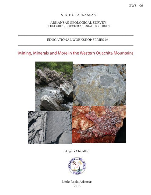
AcknowledgmentsThis laboratory manual is written for Arkansas teachers study<strong>in</strong>g Earth Science. It isalso written with <strong>the</strong> Arkansas Science Curriculum <strong>in</strong> m<strong>in</strong>d so that students can meet<strong>the</strong> requirements <strong>and</strong> goals set for <strong>the</strong>ir age groups. Thanks to various staff membersat <strong>the</strong> Arkansas Geological Survey for suggestions <strong>and</strong> edits to this booklet.Special thanks to <strong>the</strong> quarry owners (Meridian <strong>and</strong> Ouro <strong>M<strong>in</strong><strong>in</strong>g</strong>) who allow access to<strong>the</strong>ir quarries <strong>and</strong> properties. Thanks also to teachers <strong>and</strong> Science Specialists atHenderson State University for request<strong>in</strong>g this workshop. Without you, <strong>the</strong>re would beno need for <strong>the</strong> workshop!For <strong>in</strong>formation related to this manual please contact Angela Ch<strong>and</strong>ler: 501-683-0111www.geology.arkansas.govArkansas Geological Survey3815 W Roosevelt RdLittle Rock, AR 72204501-296-1877Front cover images:upper left – dipp<strong>in</strong>g s<strong>and</strong>stone at Cossatot Fallsupper right – tuff at Hatton Tuff quarrylower left – Lepidodendron fossil at Bates, ARlower right – c<strong>in</strong>nabar on s<strong>and</strong>stone
Educational Workshop Series 06 – “<strong>M<strong>in</strong><strong>in</strong>g</strong>, <strong>M<strong>in</strong>erals</strong> <strong>and</strong> <strong>More</strong>” <strong>in</strong> <strong>the</strong> western<strong>Ouachita</strong> Mounta<strong>in</strong>sThis is a three day workshop <strong>in</strong> <strong>the</strong> <strong>Ouachita</strong> Mounta<strong>in</strong>s near <strong>the</strong> town of Mena <strong>in</strong> westernArkansas. The <strong>the</strong>me of this workshop is mostly m<strong>in</strong><strong>in</strong>g <strong>and</strong> m<strong>in</strong>erals. The "more" <strong>in</strong>cludesplant fossil collect<strong>in</strong>g <strong>and</strong> a visit to Cossatot River State Park. The first day of <strong>the</strong> workshop wewill travel north <strong>in</strong>to <strong>the</strong> Arkansas River Valley to look for plant fossils <strong>in</strong> a reclaimed coalm<strong>in</strong><strong>in</strong>g area at Bates. The second day we will visit a local quarry <strong>in</strong> <strong>the</strong> Hatton Tuff Member of<strong>the</strong> Stanley Formation <strong>in</strong> <strong>the</strong> morn<strong>in</strong>g, <strong>the</strong>n travel to Cossatot River State Park <strong>in</strong> <strong>the</strong> afternoon.The third day we will visit c<strong>in</strong>nabar work<strong>in</strong>gs along <strong>the</strong> C<strong>in</strong>nabar Trail at Lake Greeson.S<strong>in</strong>ce we are stay<strong>in</strong>g <strong>in</strong> <strong>the</strong> town of Mena, very close to Queen Wilhelm<strong>in</strong>a State Park, <strong>the</strong>re isan added fieldtrip <strong>and</strong> lesson for l<strong>and</strong>forms <strong>in</strong> this area.The follow<strong>in</strong>g frameworks <strong>in</strong> Earth <strong>and</strong> Space Sciences will be addressed:8.3.1 - Dist<strong>in</strong>guish among Earth's materials8.4.1 - Locate natural divisions of Arkansas8.3.7 - Identify common uses of rocks <strong>and</strong> m<strong>in</strong>erals8.6.9 - Research local, regional <strong>and</strong> state l<strong>and</strong>forms created by <strong>in</strong>ternal forces <strong>in</strong> <strong>the</strong> earth8.5.7 - Identify characteristics of sedimentary <strong>and</strong> igneous rocks9.5.2 - Analyze fossil record evidence about plants <strong>and</strong> animals that lived long ago9.5.3 - Infer <strong>the</strong> nature of ancient environments based on fossil record evidence9.8.1 - Expla<strong>in</strong> processes that have changed Earth's surface that have resulted from suddenevents <strong>and</strong> gradual changes9.8.2 - Analyze how rock sequences may be disturbed
Geologic Sett<strong>in</strong>gThe <strong>Ouachita</strong> Mounta<strong>in</strong>s of west-central Arkansas are part of <strong>the</strong> largest surface exposure of amuch larger system of complexly folded <strong>and</strong> faulted b<strong>and</strong> of Paleozoic strata that was uplifteddur<strong>in</strong>g <strong>the</strong> <strong>Ouachita</strong> Orogeny or mounta<strong>in</strong> build<strong>in</strong>g event. This system is approximately 1300miles long <strong>and</strong> extends from east-central Mississippi westward <strong>and</strong> southward <strong>in</strong>to west Texas(Fig. 1). The <strong>Ouachita</strong> Mounta<strong>in</strong>s <strong>in</strong> Arkansas consist of a series of east-west trend<strong>in</strong>g sharpridges, separated by narrow to broad valleys that extends from Little Rock to <strong>the</strong> westernborder of <strong>the</strong> state <strong>and</strong> has an average width of 80 miles (Fig. 2).Figure 1. Location of <strong>Ouachita</strong> Mounta<strong>in</strong>s region outl<strong>in</strong>ed <strong>in</strong> purple.The sedimentary rocks of <strong>the</strong> <strong>Ouachita</strong> Mounta<strong>in</strong>s range <strong>in</strong> age from Late Cambrian to MiddlePennsylvanian. They can be placed <strong>in</strong>to two sequences based on rock type <strong>and</strong> rates ofdeposition (Fig 3). These two sequences were deposited <strong>in</strong> very different environments. Theolder sequence consists of rocks of Late Cambrian to Mississippian age <strong>and</strong> are composedma<strong>in</strong>ly of th<strong>in</strong>-bedded black to dark gray shale <strong>and</strong> chert with m<strong>in</strong>or limestone <strong>and</strong> s<strong>and</strong>stone.The younger sequence consists of rocks of middle Mississippian to middle Pennsylvanian age<strong>and</strong> is composed of <strong>in</strong>terbedded black to dark gray shale <strong>and</strong> s<strong>and</strong>stone.1
Figure 2. Digital ortho-photograph show<strong>in</strong>g development of east-westtrend<strong>in</strong>g ridges.Deposition of older sequence - Cambrian to Early Mississippian (542 – 345 million years ago)This sequence of rocks was deposited dur<strong>in</strong>g a fairly calm time <strong>in</strong> <strong>the</strong> geologic history ofArkansas, before <strong>the</strong> mounta<strong>in</strong> build<strong>in</strong>g event that would form <strong>the</strong> <strong>Ouachita</strong> Mounta<strong>in</strong>s. In <strong>the</strong>nor<strong>the</strong>rn part of <strong>the</strong> state a shallow sea progressively deepened to <strong>the</strong> south <strong>in</strong> <strong>the</strong> bas<strong>in</strong> nowknown as <strong>the</strong> <strong>Ouachita</strong> Mounta<strong>in</strong>s. Thick sequences of shales slowly accumulated <strong>in</strong> <strong>the</strong> deepwater of <strong>the</strong> bas<strong>in</strong> to form <strong>the</strong> Collier, Mazarn, <strong>and</strong> Womble Shales. Small amounts of sedimentderived from <strong>the</strong> north formed th<strong>in</strong> s<strong>and</strong>stone units such as <strong>the</strong> Crystal Mounta<strong>in</strong>, Blakely <strong>and</strong>Blaylock S<strong>and</strong>stones. It is thought that <strong>the</strong> Arkansas Novaculite <strong>and</strong> Bigfork Chert formedslowly from <strong>the</strong> rema<strong>in</strong>s of silica-bear<strong>in</strong>g animals liv<strong>in</strong>g <strong>in</strong> <strong>the</strong> deep water.Deposition of younger sequence - middle Mississippian to Pennsylvanian (345 – 299 millionyears ago)This sequence of rocks was deposited from <strong>the</strong> beg<strong>in</strong>n<strong>in</strong>g of <strong>the</strong> <strong>Ouachita</strong> mounta<strong>in</strong> build<strong>in</strong>gevent until <strong>the</strong> end. A shallow platform still existed <strong>in</strong> <strong>the</strong> nor<strong>the</strong>rn part of <strong>the</strong> state <strong>and</strong> waterdepth became progressively deeper to <strong>the</strong> south <strong>in</strong> <strong>the</strong> <strong>Ouachita</strong> Mounta<strong>in</strong>s region. Dur<strong>in</strong>g thistime, <strong>the</strong> cont<strong>in</strong>ent Llanoria was collid<strong>in</strong>g with what is now Arkansas, caus<strong>in</strong>g large amounts ofsediment to be brought <strong>in</strong> from <strong>the</strong> east, south <strong>and</strong> north. The sediments rapidly filled <strong>the</strong> bas<strong>in</strong><strong>and</strong> formed s<strong>and</strong>stone <strong>and</strong> shale <strong>in</strong> <strong>the</strong> Stanley, Jackfork, Johns Valley <strong>and</strong> Atoka Formations.2
sequeSILURIAN DEVONIANPeriod<strong>Ouachita</strong>sArkansas Novaculite(part)Missouri Mtn. ShaleBlaylock S<strong>and</strong>stoneLatePolk Creek ShaleBigfork ChertPeriod<strong>Ouachita</strong>sCAMBRIAN ORDOVICIANEarly MiddleWomble ShaleBlakely S<strong>and</strong>stoneMazarn ShaleCrystal Mtn. S<strong>and</strong>stoneCollier Shale(unexposed)CARBONIFEROUSPENNSYLVANIANMISSISSIPPIANAtokaJohns ValleyJackforkStanleyHatton TuffArkansas Novaculite (part)Figure 3. Stratigraphic column for <strong>the</strong> <strong>Ouachita</strong>s show<strong>in</strong>g oldersequence <strong>in</strong> p<strong>in</strong>k <strong>and</strong> younger sequence <strong>in</strong> purple.3
This workshop focuses on <strong>the</strong> Stanley Formation which crops out at <strong>the</strong> tuff quarry <strong>in</strong> Hatton,Arkansas, Cossatot Falls Natural Area <strong>and</strong> <strong>the</strong> C<strong>in</strong>nabar Trail at Lake Greeson. The StanleyFormation was deposited at <strong>the</strong> beg<strong>in</strong>n<strong>in</strong>g of <strong>the</strong> <strong>Ouachita</strong> Orogeny.Description <strong>and</strong> deposition of <strong>the</strong> Stanley ShaleThe Stanley Shale is named for <strong>the</strong> village of Stanley <strong>in</strong> Pushmataha County, Oklahoma. Theformation consists ma<strong>in</strong>ly of shale; however it also conta<strong>in</strong>s s<strong>and</strong>stone <strong>and</strong> a little tuff <strong>and</strong>conglomerate. S<strong>and</strong>stone is more abundant <strong>in</strong> <strong>the</strong> lower <strong>and</strong> upper parts of <strong>the</strong> formation. Thes<strong>and</strong>stone is f<strong>in</strong>e-gra<strong>in</strong>ed <strong>and</strong> varies <strong>in</strong> color from bluish gray to greenish. Most of <strong>the</strong>s<strong>and</strong>stone is <strong>in</strong>terbedded with shale.Tuff beds occur <strong>in</strong> <strong>the</strong> lower part of <strong>the</strong> formation. Tuff is a pyroclastic igneous rock made upof volcanic ash <strong>and</strong> dust that may conta<strong>in</strong> up to 50% sedimentary material. The thickest tuffbed is <strong>the</strong> Hatton tuff, which is usually around 90 feet thick <strong>and</strong> named for <strong>the</strong> town of Hatton(Miser <strong>and</strong> Purdue, 1929) <strong>in</strong> western Arkansas (Fig. 4). Tuff beds have been found as far east asHot Spr<strong>in</strong>gs, Arkansas (Danilchik <strong>and</strong> Haley, 1969). The tuff is a hard compact, f<strong>in</strong>e-gra<strong>in</strong>edbluish gray rock (Fig 5). The rock is made up of 4 pyroclastic components: crystals of quartz<strong>and</strong> feldspar, pumice, shards <strong>and</strong> volcanic ash (Niem, 1971). The largest gra<strong>in</strong>s (2mm) <strong>in</strong> <strong>the</strong>rock are feldspars that wea<strong>the</strong>r white to give <strong>the</strong> rock a spotted appearance. Locally <strong>the</strong> tuffconta<strong>in</strong>s flattened green lapilli of celadonite (iron-rich muscovite) with large white feldsparfragments. Lapilli is a size term for tephra, which is material that falls out of <strong>the</strong> air dur<strong>in</strong>g avolcanic eruption. Lapilli range <strong>in</strong> size from 2 mm to 64 mm <strong>in</strong> diameter.Figure 4. Location map show<strong>in</strong>g outcrop area of Hatton Tuff.4
Figure 5. Tuff conta<strong>in</strong><strong>in</strong>g shale clasts (left) <strong>and</strong> f<strong>in</strong>e-gra<strong>in</strong>ed tuff conta<strong>in</strong><strong>in</strong>g white feldspar fragments(right).In middle Mississippian time mounta<strong>in</strong> build<strong>in</strong>g began as a result of subduction of an oceanicplate beneath <strong>the</strong> North American cont<strong>in</strong>ental plate near what is now sou<strong>the</strong>rn Arkansas (Fig.9). An isl<strong>and</strong> arc system (Fig. 6) probably resulted. It is likely that a vent or fissure <strong>in</strong> <strong>the</strong> systemproduced an extremely violent eruption of magma creat<strong>in</strong>g an ash flow <strong>and</strong> overrid<strong>in</strong>g ashcloud (Niem, 1977). The ash <strong>in</strong>teracted with sea water <strong>and</strong> generated a steam-<strong>in</strong>flatedturbulent slurry of pyroclastic debris (Fig. 7). The slurry was denser than sea water <strong>and</strong> floweddownslope as a density current. The flow<strong>in</strong>g mass scoured <strong>the</strong> muddy sea floor br<strong>in</strong>g<strong>in</strong>g piecesof shale <strong>in</strong>to <strong>the</strong> tuff (Fig. 7). Cont<strong>in</strong>ued eruptions brought more material <strong>in</strong> surges downslope<strong>in</strong>to <strong>the</strong> bas<strong>in</strong>. The pyroclastic flows were deposited with<strong>in</strong> m<strong>in</strong>utes to hours, while f<strong>in</strong>e ash<strong>and</strong> buoyant pumice that floated on <strong>the</strong> sea surface eventually sank to <strong>the</strong> bottom over a muchlonger period of time.Figure 6. Diagram show<strong>in</strong>g possible scenario that occurred dur<strong>in</strong>g <strong>the</strong> <strong>Ouachita</strong> Orogeny <strong>in</strong>Arkansas to form <strong>the</strong> Hatton Tuff (from U.S. Geological Survey).5
Studies of paleocurrent, gra<strong>in</strong> size distribution <strong>and</strong> geometry of <strong>the</strong> Hatton Tuff suggest avolcanic source to <strong>the</strong> south or sou<strong>the</strong>ast (Niem, 1977) (Fig. 9). Analyses of recent ash fallsshow that gra<strong>in</strong> size <strong>in</strong>creases <strong>and</strong> <strong>the</strong> deposits thicken toward <strong>the</strong> source. This is <strong>the</strong> case with<strong>the</strong> Hatton Tuff as well.A.B.C.Figure 7. A. Early <strong>in</strong> a volcanic eruption, a large volume of pyroclastics produced apyroclastic flow that deposited thick unstratified tuff. B. Numerous th<strong>in</strong> slurries followed<strong>the</strong> ma<strong>in</strong> flow <strong>and</strong> deposited th<strong>in</strong>-bedded tuff. C. Toward <strong>the</strong> end of <strong>the</strong> volcanic eruptions,settl<strong>in</strong>g of f<strong>in</strong>e ash produced f<strong>in</strong>e-gra<strong>in</strong>ed tuff (from Niem, 1977).6
<strong>Ouachita</strong> Orogeny (Middle Mississippian-Pennsylvanian, 345-299 million years ago)The rocks exposed <strong>in</strong> <strong>the</strong> <strong>Ouachita</strong> Mounta<strong>in</strong>s region are no longer flat-ly<strong>in</strong>g as <strong>the</strong>y wereorig<strong>in</strong>ally deposited. They are steeply <strong>in</strong>cl<strong>in</strong>ed <strong>and</strong> have been folded <strong>in</strong>to anticl<strong>in</strong>es <strong>and</strong>syncl<strong>in</strong>es. Compare <strong>the</strong> attitude of <strong>the</strong> rocks <strong>in</strong> <strong>the</strong> <strong>Ouachita</strong> Mounta<strong>in</strong>s region with those <strong>in</strong> <strong>the</strong>Arkansas River Valley <strong>and</strong> <strong>the</strong> Ozark Plateaus Regions.Figure 8. This figure displays an anticl<strong>in</strong>e that has been distorted due to fold<strong>in</strong>g. Look for <strong>the</strong>se types offolds at each fieldtrip stop.To underst<strong>and</strong> why <strong>the</strong> rocks are no longer flat-ly<strong>in</strong>g we need to look back <strong>in</strong> geologic time. By<strong>the</strong> Middle Pennsylvanian Period, geologists believe that <strong>the</strong>re was approximately 50,000 feetof sediment that had been deposited <strong>in</strong> a deep ocean bas<strong>in</strong> <strong>in</strong> <strong>the</strong> area of <strong>the</strong> present day<strong>Ouachita</strong> Mounta<strong>in</strong>s (Stone <strong>and</strong> Haley, 1982). At that time, around 345 million years ago, platetectonics began to shape what is now Arkansas (Fig.5). The cont<strong>in</strong>ents of Laurasia <strong>and</strong> Llanoriabegan to collide, push<strong>in</strong>g toge<strong>the</strong>r this large mass of material. Over time, this collision caused<strong>the</strong> rocks to be folded, faulted <strong>and</strong> uplifted <strong>in</strong>to <strong>the</strong> <strong>Ouachita</strong> Mounta<strong>in</strong>s that we see today.Deformation of <strong>the</strong> rocks <strong>in</strong>creases as one travels from south to north, with more complexfolds, thrust faults <strong>and</strong> sizeable quartz ve<strong>in</strong>s <strong>in</strong> <strong>the</strong> nor<strong>the</strong>rn region.7
LaurasiaFigure 9. Late Mississippian to mid Pennsylvanian paleogeography of Arkansas show<strong>in</strong>g <strong>the</strong> collision ofLaurasia <strong>and</strong> Llanoria, location of volcanics <strong>and</strong> formation of <strong>the</strong> <strong>Ouachita</strong> Mounta<strong>in</strong>s. From Guccione,1993.L<strong>and</strong>forms <strong>in</strong> <strong>the</strong> <strong>Ouachita</strong> Mounta<strong>in</strong>s RegionThe <strong>Ouachita</strong> Mounta<strong>in</strong>s Region conta<strong>in</strong>s thick sequences of sedimentary rocks deposited <strong>in</strong> adeep ocean bas<strong>in</strong> that have been uplifted <strong>and</strong> compressed northward <strong>in</strong>to east-west trend<strong>in</strong>gcomplex folds (anticl<strong>in</strong>es <strong>and</strong> syncl<strong>in</strong>es) <strong>and</strong> thrust faults due to a major orogenic (mounta<strong>in</strong>build<strong>in</strong>g) process called <strong>the</strong> <strong>Ouachita</strong> Orogeny.The rocks <strong>in</strong> <strong>the</strong> <strong>Ouachita</strong> Mounta<strong>in</strong>s Region have been exposed to wea<strong>the</strong>r<strong>in</strong>g <strong>and</strong> erosions<strong>in</strong>ce approximately 290 million years ago. This process has resulted <strong>in</strong> a series of sharp ridges,mostly east-west trend<strong>in</strong>g <strong>and</strong> often buckled <strong>and</strong> distorted, separated by narrow to broadvalleys. Streams display a trellis dra<strong>in</strong>age pattern due to <strong>the</strong> geologic structure <strong>in</strong> this region.(Fig. 11)8
L<strong>and</strong>forms <strong>in</strong> this regionThe <strong>Ouachita</strong> Mounta<strong>in</strong> Region conta<strong>in</strong>s mounta<strong>in</strong>s, canyons, valleys, ridges <strong>and</strong> p<strong>in</strong>nacles.Some isl<strong>and</strong>s are present <strong>in</strong> Lake <strong>Ouachita</strong>. Refer to <strong>the</strong> follow<strong>in</strong>g quadrangles for <strong>the</strong>sel<strong>and</strong>forms: Crystal Spr<strong>in</strong>gs, Founta<strong>in</strong> Lake, Hamilton <strong>and</strong> P<strong>in</strong>nacle Mounta<strong>in</strong>.Figure 10. Diagram show<strong>in</strong>g different l<strong>and</strong>forms from <strong>the</strong> Ozark plateau surfaces to<strong>the</strong> hogbacks <strong>in</strong> <strong>the</strong> <strong>Ouachita</strong> Mounta<strong>in</strong>s region.Figure 11. The three major dra<strong>in</strong>age patterns <strong>in</strong> Arkansas.9
Vary<strong>in</strong>g stream patterns develop accord<strong>in</strong>g to <strong>the</strong> underly<strong>in</strong>g geology of an area. Byfamiliariz<strong>in</strong>g oneself with <strong>the</strong> different patterns a quick look at streams on a map will allow foran <strong>in</strong>terpretation of <strong>the</strong> evolution of a l<strong>and</strong>scape. Figure 11 shows <strong>the</strong> common streamdra<strong>in</strong>age patterns observed <strong>in</strong> map view. The most common dra<strong>in</strong>age pattern is dendritic,resembl<strong>in</strong>g <strong>the</strong> branches of a tree or a root system. This dra<strong>in</strong>age pattern is typical of streamsthat develop <strong>in</strong> regions underla<strong>in</strong> by relatively flat-ly<strong>in</strong>g or uniformly eroded sedimentary rock.A trellis pattern results where rocks have been folded <strong>and</strong> bent <strong>in</strong>to long folds <strong>and</strong> eroded <strong>in</strong>toresistant ridges <strong>and</strong> valleys. A me<strong>and</strong>er<strong>in</strong>g stream develops <strong>in</strong> areas of relatively low relief.Mercury District of Southwest ArkansasThe follow<strong>in</strong>g excerpt from Information Circular 23 by Clardy <strong>and</strong> Bush, published by <strong>the</strong>Arkansas Geological Commission <strong>in</strong> 1976.C<strong>in</strong>nabar was discovered <strong>in</strong> southwestern Arkansas <strong>in</strong> 1930. <strong>M<strong>in</strong><strong>in</strong>g</strong> began <strong>in</strong> 1931 <strong>and</strong> mercurywas produced each year through 1944. Production through this period was approximately12,500 76-pound flasks. <strong>M<strong>in</strong><strong>in</strong>g</strong> has been negligible s<strong>in</strong>ce 1944.Figure 12. Location map show<strong>in</strong>g Mercury district (stippled pattern).10
The mercury district occurs <strong>in</strong> a belt 12 miles wide <strong>and</strong> 50 miles long extend<strong>in</strong>g from easternHoward County through Pike County <strong>and</strong> <strong>in</strong>to western Clark County (Fig. 12). The two areas ofgreatest concentration of m<strong>in</strong><strong>in</strong>g were just west of <strong>the</strong> Anto<strong>in</strong>e River <strong>and</strong> on both sides of <strong>the</strong>Little Missouri River.At our fieldtrip location, <strong>the</strong> mercury ore occurs <strong>in</strong> s<strong>and</strong>stone units near <strong>the</strong> top of <strong>the</strong> StanleyShale. The s<strong>and</strong>stone is gray <strong>and</strong> made up of a f<strong>in</strong>e to medium gra<strong>in</strong>ed mosaic of rounded tosub-angular gra<strong>in</strong>s of quartz with m<strong>in</strong>or amounts of shale, white angular feldspar gra<strong>in</strong>s <strong>and</strong>flakes of mica. Locally, <strong>the</strong> s<strong>and</strong>stone may conta<strong>in</strong> quartz <strong>and</strong> chert pebbles.C<strong>in</strong>nabar is <strong>the</strong> only primary ore m<strong>in</strong>eral <strong>in</strong> <strong>the</strong> district. Freshly exposed c<strong>in</strong>nabar is translucent<strong>and</strong> bright vermillion red. The c<strong>in</strong>nabar occurs as f<strong>in</strong>e to medium crystall<strong>in</strong>e coat<strong>in</strong>gs onfracture surfaces <strong>and</strong> as coarsely crystall<strong>in</strong>e material fill<strong>in</strong>g larger fractures <strong>and</strong> open spaces.Dickite <strong>and</strong> quartz also crystallized with <strong>the</strong> c<strong>in</strong>nabar <strong>and</strong> are associated with it <strong>in</strong> <strong>the</strong> fracturefill<strong>in</strong>gs. Dickite is a soft white to light brown clay m<strong>in</strong>eral. It is often powdery or has a f<strong>in</strong>egra<strong>in</strong>edappearance. Dickite is present at all of <strong>the</strong> m<strong>in</strong>es <strong>and</strong> prospects <strong>in</strong> <strong>the</strong> district. Quartzoccurs as small clear crystals <strong>and</strong> as massive milky quartz <strong>in</strong> fractures <strong>and</strong> open spaces.C<strong>in</strong>nabar <strong>and</strong> o<strong>the</strong>r primary m<strong>in</strong>erals were deposited from aqueous solutions ris<strong>in</strong>g throughfractures <strong>and</strong> porous rock. These mercury bear<strong>in</strong>g solutions were probably <strong>the</strong> result ofepi<strong>the</strong>rmal discharges of fluids from metamorphic rocks at depth west of <strong>the</strong> presentm<strong>in</strong>eralized area (Howard, 1979). It is thought that <strong>the</strong> solutions traveled northward up faultplanes <strong>and</strong> <strong>in</strong>to fractured s<strong>and</strong>stones <strong>and</strong> fault breccias where c<strong>in</strong>nabar was precipitated <strong>in</strong>open spaces. Ore bodies occur as pipe-like bodies <strong>in</strong> association with m<strong>in</strong>or folds <strong>and</strong> faults <strong>and</strong>as tabular bodies generally restricted to an <strong>in</strong>dividual s<strong>and</strong>stone bed or a small group of beds.11
Figure 13. Map show<strong>in</strong>g location of fieldtrip stops.Day 1Stop 1 – Ouro <strong>M<strong>in</strong><strong>in</strong>g</strong> – Plant Fossil Locality – Bates, ArkansasCoal seams occur <strong>in</strong> various places <strong>in</strong> <strong>the</strong> Arkansas River Valley, rang<strong>in</strong>g from two <strong>in</strong>ches to sixfeet thick. Major coal beds occur <strong>in</strong> <strong>the</strong> McAlester Formation <strong>and</strong> <strong>the</strong> Savanna Formation (Fig.14). Coal production <strong>in</strong> Arkansas started <strong>in</strong> <strong>the</strong> late 1800’s mostly from underground m<strong>in</strong>es. In<strong>the</strong> 1950’s surface m<strong>in</strong><strong>in</strong>g began <strong>and</strong> became <strong>the</strong> dom<strong>in</strong>ant form of m<strong>in</strong><strong>in</strong>g well <strong>in</strong>to <strong>the</strong> 1970’s(Haley, 1978). The only coal m<strong>in</strong>ed <strong>in</strong> Arkansas at this time is from <strong>the</strong> Lower Hartshorne Coal <strong>in</strong><strong>the</strong> McAlester Formation. There are two active m<strong>in</strong>es <strong>in</strong> Sebastian County. The major use ofthis coal is <strong>in</strong> steel-mak<strong>in</strong>g.12
The Lower Hartshorne Coal was strip-m<strong>in</strong>ed at this locality from 2004-2006. Older work<strong>in</strong>gswere encountered dur<strong>in</strong>g <strong>the</strong> m<strong>in</strong><strong>in</strong>g which h<strong>in</strong>dered operations. This site has s<strong>in</strong>ce beenreclaimed <strong>and</strong> sold to Ouro <strong>M<strong>in</strong><strong>in</strong>g</strong> to undertake an underground m<strong>in</strong><strong>in</strong>g effort.Figure 14. Generalized stratigraphic column show<strong>in</strong>g named coal beds.13
This area is rich <strong>in</strong> plant fossils. Fragments of a lycopod known as Lepidodendron (Fig. 15) areabundant as well as its root system (Stigmaria) (Fig. 16). Leaves <strong>and</strong> o<strong>the</strong>r woody fragmentsare also present.Figure 15. Reclaimed strip m<strong>in</strong><strong>in</strong>g at Bates (left) <strong>and</strong> Lepidodendron fragment (right).Figure 16. Crossopteris leaves (left) <strong>and</strong> Stigmaria fragment (right) from Bates, Arkansas.Cross<strong>in</strong>g from Arkansas River Valley Region to <strong>Ouachita</strong> Mounta<strong>in</strong>s RegionAs we drive back to Mena we will cross back <strong>in</strong>to <strong>the</strong> <strong>Ouachita</strong> Mounta<strong>in</strong>s Region. Look for <strong>the</strong>small community of Boles about four miles before <strong>the</strong> town of Y City. As we cross Ross Creekwe will be cross<strong>in</strong>g <strong>the</strong> Ross Creek Fault which is <strong>the</strong> nor<strong>the</strong>rnmost thrust fault of <strong>the</strong> <strong>Ouachita</strong>Mounta<strong>in</strong>s Region. Do you notice any change <strong>in</strong> l<strong>and</strong>forms?14
Stop 2 - <strong>Ouachita</strong> l<strong>and</strong>forms drive up Highway 88 – Rich Mounta<strong>in</strong>We will take Highway 88 north of Mena on top of Rich Mounta<strong>in</strong> which is a ridge classified as ahogback (Fig.10). There are several spots to pull over <strong>and</strong> view <strong>the</strong> scenery along <strong>the</strong> way, butwe will stop at <strong>the</strong> Rich Mounta<strong>in</strong> Lookout Tower to get a good view of <strong>the</strong> l<strong>and</strong>forms <strong>and</strong>structure to <strong>the</strong> north <strong>and</strong> south of <strong>the</strong> ridge (Fig 17).Figure 17. Google map show<strong>in</strong>g geologic structures north <strong>and</strong> south of Rich Mounta<strong>in</strong>.Day 2 – Morn<strong>in</strong>gStop 3 - Meridian Tuff Quarry – Hatton, ArkansasThe m<strong>in</strong><strong>in</strong>g at this locality has opened up an area where <strong>the</strong> Hatton Tuff can be studied <strong>in</strong> greatdetail. We will visit <strong>the</strong> work<strong>in</strong>g quarry after watch<strong>in</strong>g a video that provides details on <strong>the</strong>company, m<strong>in</strong><strong>in</strong>g <strong>and</strong> uses of <strong>the</strong> rock. S<strong>in</strong>ce we are look<strong>in</strong>g at rock <strong>in</strong> <strong>the</strong> <strong>Ouachita</strong>s, beprepared for steeply dipp<strong>in</strong>g rock.15
The active portion of <strong>the</strong> quarry is located <strong>in</strong> <strong>the</strong> f<strong>in</strong>e-gra<strong>in</strong>ed gray tuff (Fig. 18). Look form<strong>in</strong>eralization (pyrite, calcite or quartz) along bedd<strong>in</strong>g planes as well as sedimentary structures.Notice <strong>the</strong> thickness of <strong>the</strong> beds <strong>and</strong> f<strong>in</strong>e-gra<strong>in</strong>ed character of <strong>the</strong> rock.The m<strong>in</strong>e manager has collected samples of tuff that have <strong>the</strong> large green lapilli (Fig. 18).Compare <strong>the</strong> two rocks. Look for shale rip-up fragments.Figure 18. F<strong>in</strong>e-gra<strong>in</strong>ed gray tuff display<strong>in</strong>g small scale cross-bedd<strong>in</strong>g (left). Large (1-2cm) green lapilli <strong>in</strong>a f<strong>in</strong>e-gra<strong>in</strong>ed matrix (right).We will also look at <strong>the</strong> nor<strong>the</strong>rn section of <strong>the</strong> quarry where <strong>the</strong> Arkansas Novaculite ispresent. At various times <strong>the</strong> novaculite has been m<strong>in</strong>ed as well. Look for manganesedendrites (Fig. 19). Notice <strong>the</strong> red chert nodules <strong>in</strong> <strong>the</strong> novaculite. What o<strong>the</strong>r rock types canyou f<strong>in</strong>d?Figure 19. Manganese dendrites on novaculite (left). Red chert nodules <strong>in</strong> novaculite (right).16
Day 2 – AfternoonStop 4 - Cossatot River Visitor Center <strong>and</strong> Cossatot FallsAfter a visit to <strong>the</strong> new Cossatot River Visitor Center we will walk along <strong>the</strong> trail past <strong>the</strong> shalepit <strong>and</strong> glade to Baker Creek (Fig. 20). This is a good opportunity to look at shale <strong>and</strong> s<strong>and</strong>stone<strong>in</strong> <strong>the</strong> Stanley Formation.Figure 20. Shale glade near <strong>the</strong> Visitor’s Center (left) <strong>and</strong> s<strong>and</strong>stone along Baker Creek (right).Next we will travel to Cossatot Falls Natural Area. This area is a rugged <strong>and</strong> rocky canyon thathas ledges of s<strong>and</strong>stone <strong>in</strong> <strong>the</strong> Stanley Shale over which <strong>the</strong> river drops 33 feet <strong>in</strong> elevation <strong>in</strong>1/3 of a mile (Fig. 21). Notice <strong>the</strong> <strong>in</strong>cl<strong>in</strong>ation of <strong>the</strong> s<strong>and</strong>stone beds. At this location we willtake a strike <strong>and</strong> dip read<strong>in</strong>g.1. Which direction are <strong>the</strong> beds dipp<strong>in</strong>g?_____________________________________2. How many degrees from horizontal are <strong>the</strong> ledges <strong>in</strong>cl<strong>in</strong>ed?_________________________________3. List sedimentary features that are here____________________________________4. F<strong>in</strong>d load features <strong>in</strong> <strong>the</strong> s<strong>and</strong>stone (Fig. 21). Which surface is <strong>the</strong> top of <strong>the</strong> bed?_____________5. Why are <strong>the</strong> beds <strong>in</strong>cl<strong>in</strong>ed?______________________________________________17
Figure 21. Load features on s<strong>and</strong>stone bed at <strong>the</strong> falls (left). Incl<strong>in</strong>ed (dipp<strong>in</strong>g) beds of s<strong>and</strong>stoneat <strong>the</strong> falls (right).This is also a good area to do a gravel bar experiment.Day 3Stop 5 – C<strong>in</strong>nabar Trail – Lake GreesonThis trail offers a short walk to good examples of ab<strong>and</strong>oned c<strong>in</strong>nabar prospects <strong>in</strong> s<strong>and</strong>stone of<strong>the</strong> Stanley Formation. This particular area is called <strong>the</strong> Gap Ridge Prospect. The SouthwesternQuicksilver Corporation operated <strong>the</strong> m<strong>in</strong>e <strong>in</strong> 1934 <strong>and</strong> Arkansas Quicksilver M<strong>in</strong>es, Inc.operated it <strong>in</strong> 1940 (Clardy <strong>and</strong> Bush, 1978). The ma<strong>in</strong> prospect is 25 feet wide by 75 feet long<strong>and</strong> filled with water (Fig. 22). It is reported to have been 230 feet deep with 5,980 tons of rockremoved. Several hundred flasks of mercury were produced from <strong>the</strong> m<strong>in</strong>e. O<strong>the</strong>r smallertrenches <strong>and</strong> digs are located west on <strong>the</strong> ridge.The c<strong>in</strong>nabar occurs as fracture fill<strong>in</strong>gs <strong>and</strong> as dissem<strong>in</strong>ated gra<strong>in</strong>s <strong>in</strong> <strong>the</strong> s<strong>and</strong>stone. Associatedm<strong>in</strong>erals are dickite, quartz, limonite, siderite <strong>and</strong> barite. There are several faults at thislocation. Slickensides on s<strong>and</strong>stone fragments show evidence of movement with<strong>in</strong> of <strong>the</strong> bedsof s<strong>and</strong>stone (Fig 23). Slickensides are polished <strong>and</strong> smoothly striated surfaces that result fromfriction along a fault plane. Look around for c<strong>in</strong>nabar <strong>and</strong> slickensides on <strong>the</strong> tail<strong>in</strong>gs.18
Figure 22. C<strong>in</strong>nabar on s<strong>and</strong>stone (right) <strong>and</strong> Gap Ridge Prospect (left).Figure 23. Slickensides on s<strong>and</strong>stone (left). M<strong>in</strong>e tail<strong>in</strong>gs from Gap Ridge prospect (right).19
References:Clardy, B.F., <strong>and</strong> Bush, W.V., 1976, Mercury district of southwest Arkansas: Arkansas GeologicalCommission Information Circular 23, 52 p.Danilchik, W. <strong>and</strong> Haley, B.R., 1964, Geology of <strong>the</strong> Paleozoic area <strong>in</strong> <strong>the</strong> Malvern quadrangle,Garl<strong>and</strong> <strong>and</strong> Hot Spr<strong>in</strong>g Counties, Arkansas: U.S. Geological Survey MiscellaneousInvestigations Map I-405.Guccione, M.J., 1993, Geologic history of Arkansas through time <strong>and</strong> space: National ScienceFoundation Grant No. ESI-8855588.Haley, Boyd R., 1978, Resources of low-volatile bitum<strong>in</strong>ous coal <strong>and</strong> semianthracite <strong>in</strong> westcentralArkansas, 1978: U.S. Geological Survey Bullet<strong>in</strong> 1632.Howard, J.M., 1979, Antimony district of southwest Arkansas: Arkansas Geological CommissionInformation Circular 24, 29 p.Miser, H.D. <strong>and</strong> Purdue, A.H., 1929, Geology of <strong>the</strong> DeQueen <strong>and</strong> Caddo Gap quadrangles,Arkansas: U.S. Geological Survey Bullet<strong>in</strong> 808, 195 p.Niem, A.R., 1971, Stratigraphy <strong>and</strong> orig<strong>in</strong> of tuffs <strong>in</strong> <strong>the</strong> Stanley Group (Mississippian), <strong>Ouachita</strong>Mounta<strong>in</strong>s, Oklahoma <strong>and</strong> Arkansas: University of Wiscons<strong>in</strong> M.S. Thesis, 151 p.Niem, A.R., 1977, Mississippian pyroclastic flow <strong>and</strong> ash-fall deposits <strong>in</strong> <strong>the</strong> deep-mar<strong>in</strong>e<strong>Ouachita</strong> flysch bas<strong>in</strong>, Oklahoma <strong>and</strong> Arkansas: Geological Society of America Bullet<strong>in</strong>vol. 88, no.1, pp. 49-61.Stone, C.G. <strong>and</strong> Haley, B.R., 1984, A guidebook to <strong>the</strong> geology of <strong>the</strong> central <strong>and</strong> sou<strong>the</strong>rn<strong>Ouachita</strong> Mounta<strong>in</strong>s, Arkansas: Arkansas Geological Commission Guidebook 84-2,131 p.Vanarsdale, R., 1991, Geologic <strong>in</strong>terpretation of remote sensor imagery <strong>and</strong> topographic maps:<strong>in</strong> Methods <strong>and</strong> Practices of Physical Geology, third edition, by Konig <strong>and</strong> Zachry Jr.:University of Arkansas Physical Geology Lab book.20
Appendix 1 – Plant FossilsLycopodsThroughout geologic time <strong>the</strong> seas have undergone transgressions (high sea level) <strong>and</strong>regressions (low sea level). Dur<strong>in</strong>g regression <strong>the</strong>re is more l<strong>and</strong> exposed <strong>and</strong> <strong>in</strong> <strong>the</strong>Mississippian <strong>and</strong> Pennsylvanian Periods <strong>the</strong>re was abundant plant life thriv<strong>in</strong>g <strong>in</strong> subtropicalconditions throughout <strong>the</strong> world. Most of <strong>the</strong> plants grew <strong>in</strong> swampy areas, where <strong>the</strong>yeventually accumulated <strong>in</strong> large numbers to ultimately form coal. This led to <strong>the</strong> nameCarboniferous Period or Coal Measures, for rocks deposited dur<strong>in</strong>g this time. The dom<strong>in</strong>anttrees of this period were <strong>the</strong> lycopods Lepidodendron <strong>and</strong> Sigillaria. O<strong>the</strong>r plants that weremore common on higher ground <strong>and</strong> floodpla<strong>in</strong>s were <strong>the</strong> horsetails called Calamites. Thesewere tree-sized plants reach<strong>in</strong>g a height of approximately 20 meters or 65 feet. In Arkansas,<strong>the</strong> best preserved of <strong>the</strong>se fossils are found <strong>in</strong> Pennsylvanian-age rocks from <strong>the</strong> ArkansasRiver Valley Region. Fragments of plant fossils can also be found <strong>in</strong> Pennsylvanian age rocks<strong>in</strong> <strong>the</strong> Ozark Plateaus Region.Lepidodendron, an ext<strong>in</strong>ct coal-age tree. Illustrations by Sherrie Shepherd.21
Sigillaria, an ext<strong>in</strong>ct coal-age tree. Illustrations by Sherrie Shepherd.Calamites, an ext<strong>in</strong>ct horsetail. Illustrations by Sherrie Shepherd.22
L<strong>and</strong>form ExercisesExercise 1 (Refer to l<strong>and</strong>forms diagram <strong>and</strong> Rich Mounta<strong>in</strong> Quadrangle)Exam<strong>in</strong>e Rich Mounta<strong>in</strong>. Follow Highway 88 (Skyl<strong>in</strong>e Drive) <strong>and</strong> notice <strong>the</strong> steepness on bothsides of <strong>the</strong> ridge.Which l<strong>and</strong>form name can be applied to this ridge?________________________In which physiographic region is <strong>the</strong> feature located? _____________________________________________Exercise 2 (Refer to l<strong>and</strong>forms diagram <strong>and</strong> Ferndale Quadrangle)Exam<strong>in</strong>e <strong>the</strong> ridge created by Brush Mounta<strong>in</strong> <strong>in</strong> <strong>the</strong> sou<strong>the</strong>rn portion of <strong>the</strong> quadrangle. Notice<strong>the</strong> steepness of both sides of <strong>the</strong> ridge.Which l<strong>and</strong>form name can be applied to this ridge?________________________What can you <strong>in</strong>fer from <strong>the</strong>se features <strong>and</strong> <strong>the</strong> stream pattern?______________23


