Download pdf - Arkansas Geological Survey
Download pdf - Arkansas Geological Survey
Download pdf - Arkansas Geological Survey

You also want an ePaper? Increase the reach of your titles
YUMPU automatically turns print PDFs into web optimized ePapers that Google loves.
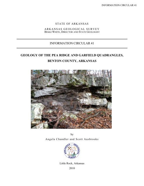
INFORMATION CIRCULAR 41STATE OF ARKANSASA R KANS AS GEOLO G IC A L S UR V EYBEKKI WHITE, DIRECTOR AND STATE GEOLOGISTINFORMATION CIRCULAR 41GEOLOGY OF THE PEA RIDGE AND GARFIELD QUADRANGLES,BENTON COUNTY, ARKANSASbyAngela Chandler and Scott AusbrooksLittle Rock, <strong>Arkansas</strong>2010
STATE OF ARKANSASA R KANS AS GEOLO G IC A L S UR V EYBEKKI WHITE, DIRECTOR AND STATE GEOLOGISTINFORMATION CIRCULAR 41GEOLOGY OF THE PEA RIDGE AND GARFIELD QUADRANGLES,BENTON COUNTY, ARKANSASbyAngela Chandler and Scott AusbrooksLittle Rock, <strong>Arkansas</strong>2010
STATE OF ARKANSASMike Beebe, Governor<strong>Arkansas</strong> <strong>Geological</strong> <strong>Survey</strong>Bekki White, State Geologist and DirectorCOMMISSIONERSDr. Richard Cohoon, Chairman…………………………RussellvilleWilliam Willis, Vice Chairman…………………………...Hot SpringsDavid J. Baumgardner…………………………………...Little RockBrad DeVazier…………………………………………….Forrest CityKeith DuPriest……………………………………………..MagnoliaQuin Baber………………………………………………...BentonDavid Lumbert……………………………………………..Little RockLittle Rock, <strong>Arkansas</strong>2010
Table of ContentsIntroduction……………………………………………………….1Stratigraphy………………………………………………………..2Structure…………………………………………………………..13Lineaments……………………………………………………….14Faults………………………………………………………………..15Karst………………………………………………………………….18Economic Geology……………………………………………..20Acknowledgments……………………………………………..21References…………………………………………………………22
Geology of the Pea Ridge and Garfield Quadrangles, Benton County, <strong>Arkansas</strong>Angela Chandler and Scott Ausbrooks2009IntroductionThis report is one in a series of companionreports to Digital <strong>Geological</strong> Quadrangle Mapspublished by the <strong>Arkansas</strong> <strong>Geological</strong> <strong>Survey</strong>.Its purpose is to: 1) provide a more detaileddiscussion of the stratigraphy in thequadrangles, 2) provide surface and subsurfacegeologic interpretations and 3) provideinformation pertaining to economic naturalresources in the area.The Pea Ridge and Garfield quadrangles arelocated northeast of Rogers, <strong>Arkansas</strong> in thenorthwestern part of the state, Missouri beingthe northern border (Fig. 1). The area is ruralwith the largest town being Pea Ridge with apopulation of 2,346. Smaller communitieswithin the area with a population of less than500 include Avoca, Garfield and Gateway. Onesmall town (Lost Bridge Village) is located onBeaver Lake. Pea Ridge National Military Park islocated on the Pea Ridge quadrangle andencompasses approximately seven squaremiles. Portions of Beaver Lake including IndianCreek Public Use Area and Lost Bridge PublicUse Area are present on the Garfieldquadrangle. The area is easily accessed by stateand county road systems. A section of theBurlington Northern and Sante Fe Railwaysystem extends from north of Gateway on theGarfield quadrangle southwest to the Pea Ridgequadrangle following Highway 62 to the RogersMunicipal Airport.Figure 1. Location map of Pea Ridge and Garfield Quadrangles.1
The Pea Ridge and Garfield Quadrangles arelocated in the Ozark Plateaus Region of north<strong>Arkansas</strong>. Specifically, the majority of thequadrangles are located on the SpringfieldPlateau surface, consisting mostly of a fairly flator gently rolling topography which is capped bythe Mississippian Boone Limestone. Theescarpment between the Springfield and SalemPlateaus is present on the Garfield Quadranglenear Beaver Lake. In this area tributaries to thelake have dissected the plateau surface creatingfairly steep hollows that expose older Devonianand Ordovician formations. Several hills ofsmall areal extent rise above the SpringfieldPlateau surface and are capped by theMississippian Wedington Sandstone Member ofthe Fayetteville Shale.Previous research in this area is limited to acouple of publications in the late 1800’s andearly 1900’s. Simonds and Hopkins (1894)discuss the geology of Benton County withhistoric descriptions of the prairies andeconomic geology of the area. A goodstratigraphic synthesis had yet to be developed.The Pea Ridge quadrangle was mapped in theFayetteville Folio by Adams and Ulrich in 1905.This folio contains detailed descriptions offormations but covers such a large area that acomprehensive geologic map of Pea Ridge islacking.Geologic worksheets for both quadrangles weredeveloped for the Geologic Map of <strong>Arkansas</strong>,1976. The Pea Ridge geology for the GeologicMap of <strong>Arkansas</strong>, 1976, was based loosely uponwork done in the Fayetteville Folio. TheGarfield Geologic Worksheet produced by E.E.Glick in 1970 was based on work by Purdue andMiser, (1916).StratigraphyApproximately 400 to 700 feet (121‐213 m) ofLower Ordovician, Middle to Upper Devonian,Lower and Upper Mississippian and Quaternaryage strata are present on these quadrangles(Fig. 2). The Lower Mississippian BooneLimestone comprises the surface rock over themajority of the quadrangles and forms thesurface of the Springfield Plateau. TheSpringfield Plateau surface is fairly flat on thePea Ridge quadrangle, however on the Garfieldquadrangle near Beaver Lake the plateausurface is heavily dissected creating steepdrainages and a hilly topography. These steepdrainages also form the escarpment betweenthe Springfield and the Salem Plateau surfaces.Upper Ordovician and Devonian strata crop outaround Beaver Lake and its tributaries on theGarfield quadrangle and form the surface of theSalem Plateau. Upper Mississippian age strataare present on the higher hills that are cappedby resistant sandstone of the WedingtonMember of the Fayetteville Shale. Quaternaryterrace and alluvium deposits are presentwithin the larger creek drainages in the area.2
Lower OrdovicianCotter DolomiteThe Cotter Dolomite was named by E.O. Ulrichfor the town of Cotter, <strong>Arkansas</strong> where it is wellexposed (Purdue and Miser, 1916). A typesection at the Cotter Bridge was designated byCullison in 1944. The Cotter ranges up to 400feet (121 m) in thickness, however only theupper 60‐100 feet (18‐30 m) of this formation isexposed on the Garfield Quadrangle.Dolostones in this unit are exposed alongBeaver Lake and in tributaries to the lake. TheCotter Dolomite is overlain unconformably bythe Powell Dolomite or the Clifty Sandstone inthe Garfield quadrangle.This formation consists of fine‐to mediumgrainedgray dolostone that is thin‐ to thickbedded.The dolostone usually contains chertfragments or nodules, especially near the uppercontact with the Powell Dolomite.Stromatolites, oolitic chert and drusy quartzfragments are present in the dolostone in thisarea. Stromatolites are present as small crinklebands or as large heads up to 3 feet (.9 m) indiameter. Large stromatolites create anundulatory surface that gives the appearance ofdisturbed strata. At a few localities greenishclay shale and white coarse‐grained sandstoneare present in the upper portion of the unit.The base of the sandstone is not a planar bed.Instead it fills in lows and drapes over theirregular dolostone surface. Small vugscontaining pink dolomite are present in thedolostone in the Indian Creek area.(A)(B)Figure 3. (A) Chert fragments in the Cotter Dolomite. (B) Weathered stromatolitic surface in the CotterDolomite. Stromatolites are 2‐3 inches across.Lower OrdovicianPowell DolomiteThe Powell Dolomite was named by E.O. Ulrichfor Powell Station, <strong>Arkansas</strong> where it is wellexposed on the White River branch of the St.Louis, Iron Mountain & Southern Railway(Purdue and Miser, 1916). The Powell rangesup to 300 feet (91 m) thick. Where present, thisunit ranges up to 30 feet (9 m) thick aroundBeaver Lake and its tributaries on the Garfieldquadrangle. Middle and Upper Ordovician,Silurian and Lower Devonian formations are not4
present at the surface in this area so that thePowell is unconformably overlain by the MiddleDevonian Clifty Sandstone.This formation consists of very fine‐ to finegrainedgray to white dolostone that is verythin‐ to medium‐bedded. The very thin‐ to thinbeddeddolostone is argillaceous and weathersto small blocky pieces. Calcite nodules arepresent near the contact with the overlyingClifty Sandstone. Gastropods are present in athin bed of mottled dolostone at one localitynear the upper part of the unit. The Powell alsocontains laminated flat crinkle stromatolites. Ata few localities, very thin bedded gray‐green toreddish shales are interbedded with thedolostone. Sandstone is present in the upperportion of the Powell in paleokarst features.The basal contact with the Cotter Dolomite isplaced at the appearance of banded chertand/or chert nodules or breccia. The PowellDolomite is relatively chert free which alongwith the argillaceous fine‐ grained characterhelps to distinguish it from the Cotter Dolomite.(A)(B)Figure 4. (A) Weathered Powell Dolomite. (B) Interbedded shale in the Powell Dolomite.Middle DevonianClifty LimestoneThe Clifty was originally named the CliftyLimestone for exposures in the East Fork ofLittle Clifty Creek, <strong>Arkansas</strong> where it consists ofa 2 ½ foot (0.7 m) bed of sandy limestone(Purdue and Miser, 1916). In 1967 Wise andCaplan state that the Clifty Limestone is actuallya lens in a sandstone unit that is approximately20 feet (6 m) thick and unconformable with theoverlying and underlying formations.Subsequent stratigraphic analysis by Hall(1978), and Hall and Manger (1978) documentsthe Clifty as primarily a sandstone unit thatappears to be confined to the area surroundingBeaver Lake, Benton and Carroll Counties,<strong>Arkansas</strong>. The Clifty is subsequently referred toas the Clifty Sandstone by workers in <strong>Arkansas</strong>and for purposes of this publication. The CliftySandstone ranges from 2‐10 feet (0.6‐3 m) onthe Garfield quadrangle.This formation consists of fine‐grained thin‐tothick‐bedded, silica cemented sandstone that is5
white on fresh surfaces and gray to orange onweathered surfaces. At some localities the sandis friable, but more commonly is silicacemented.Usually two sandstone beds can bedistinguished by a bedding plane surface withinthe sandstone ledge; however at a few localitiesseveral sandstone beds can be differentiated.The Sylamore Sandstone, which is the basalmember of the Chattanooga Shale, may bepresent in the upper portion of this sandstoneas it is at Beaver Dam (Manger, 1985).The Clifty Sandstone contains chert fragmentsand pebble clasts/molds on the basal portion ofbedding planes.At one locality on the Garfield quadrangle,mostly bedded chert is present instead ofsandstone. Vertical trace fossils are alsopresent in the sandstone interval. A lycopod(plant) fossil was found at one locality. Thissandstone forms a small ledge underneath thegentle slope of the Chattanooga Shale. The topof the underlying Powell Dolomite usually formsa re‐entrant beneath the sandstone ledgeallowing a small overhang with waterfalls. TheClifty Sandstone is unconformable with theunderlying Powell or Cotter Dolomites. Locallythis unconformity is angular.(A)(B)Figure 5. (A) Clifty sandstone contact with Powell (top of rock hammer).above the Cotter Dolomite.(B) Clifty sandstone ledgeUpper DevonianChattanooga ShaleThe Chattanooga Shale was named forexposures in Chattanooga Tennessee where it iswell developed (Hays, 1891). This terminologywas applied to <strong>Arkansas</strong> in 1905 in theFayetteville quadrangle by Adams and Ulrich.They described it as a persistent black shalegenerally underlain by a basal sandstonemember known as the Sylamore Sandstone.The Chattanooga Shale is thickest innorthwestern <strong>Arkansas</strong> averagingapproximately 40 feet (12 m) thick. On theGarfield quadrangle, the shale ranges from 10‐40 feet (3‐12 m) thick.This formation consists of clay shale that isblack on both fresh and weathered surfaces. Itcontains very small iron concretions and pyrite‐6
marcasite concretions that vary in size from oneto three inches (25‐76 mm) in diameter. Atmany localities the upper contact of theChattanooga with the basal portion of the St.Joe will consist of greenish‐gray shale which isLower Mississippian (Manger et al., 1988) onblack Chattanooga Shale. Many of the homesalong Beaver Lake are built upon theChattanooga Shale because of the favorablechange in slope from the steep St. JoeLimestone to the fairly flat Clifty Sandstone. Asa result, several cracks in foundations and wallsof new homes have developed due to expansiveclays in the weathered shale. The ChattanoogaShale forms a gentle slope between the St. JoeLimestone and the underlying Clifty Formation.(A)(B)Figure 6. (A) Green Mississippian shale overlying black Devonian Chattanooga Shale. (B) ChattanoogaShale slope along Indian Creek with St. Joe above.Lower MississippianSt. Joe Limestone MemberThe St. Joe Limestone was named for the villageof St. Joe, <strong>Arkansas</strong> by J.C. Branner, where itwas first studied by the <strong>Arkansas</strong> <strong>Geological</strong><strong>Survey</strong> (Hopkins, 1893). Girty (1915) states thatit is likely that the type locality is beside therailroad grade along Mill Creek, a short distancenorthwest of St. Joe. The St. Joe LimestoneMember ranges from absent to approximately40 feet (12 m) thick throughout north <strong>Arkansas</strong>and appears to be the thickest and mostpersistent in northwest <strong>Arkansas</strong>.Approximately 20‐40 feet (6‐12 m) of St. Joe ispresent on the Garfield quadrangle.This member consists of shale, fine‐ mediumgrained thin‐bedded limestone, argillaceouslimestone and fine‐to coarse‐crystallinelimestone. Four separate units that arerecognized as formations in Missouri are asfollows: Bachelor, Compton, Northview andPierson, respectively from oldest to youngest.These same units can be recognized in the St.Joe Limestone Member in northwest <strong>Arkansas</strong>,however they are too thin to map at a 1:24,000scale.Pierson – A fine‐to coarsely‐crystalline, thin‐tothick‐planar‐bedded crinoidal limestone that isgray to white on weathered surfaces and grayto reddish gray on fresh surfaces. This unitforms the upper 10‐15 feet (3‐4 m) of the St.Joe bluff above the Northview re‐entrant.7
Northview – A fine‐grained argillaceouslimestone that is red to gray green on fresh andweathered surfaces. This unit forms 2‐3 feet(0.6‐0.9 m) re‐entrant between the Comptonand Pierson Limestones.Compton – A fine‐to medium‐grained crinoidallimestone with wavy or nodular thin bedding. Itis gray to reddish gray on fresh surfaces butweathers light‐gray to white and containsbrown to reddish chert with white crinoidfragments and horizontal trace fossils. This unitranges from 12‐15 feet (3‐4 m) thick.Bachelor – gray green clay shale. The contactwith underlying Chattanooga Shale is sharp andunconformable. This basal unit ranges from 0‐1foot (0‐0.3 m) thick.The St. Joe Limestone forms a small bluff on topof the gentle slope of the underlyingunconformable Chattanooga Shale. The St. Joeis unconformable with the underlyingChattanooga Shale in the Garfield Quadrangle.(A)(B)Figure 7. (A) Contact of St. Joe Limestone with Chattanooga Shale. (B) St. Joe Limestone along tributaryto Indian Creek.Lower MississippianBoone FormationThe Boone Limestone was named by J.C.Branner for Boone County, <strong>Arkansas</strong> wherecherts and cherty limestones form thepredominate rock type in the region (Penrose,1891). The Boone Formation (including the St.Joe Member) can range up to 400 feet (121 m)thick. Approximately 220 feet (67 m) is exposedon the Pea Ridge quadrangle and a completesection of 340‐400 feet (103‐121 m) is exposedon the Garfield quadrangle.The Boone Limestone consists of coarse‐grainedfossiliferous and fine‐grained gray limestonesinterbedded with anastomosing and beddedchert. The chert varies in color from white tolight gray in the upper portion to dark‐gray orblue‐gray in the lower portion. The lower darkcherts are probably equivalent to the ReedsSprings Formation in southwestern Missouri.Fairly chert‐free sections are petroliferous andcontain brachiopods, corals and crinoids. Awhite oolitic limestone, possibly equivalent to8
the Short Creek Oolite in southwesternMissouri, is present in the upper part of theBoone at a few localities. Springs and sinkholesare abundant throughout the formation.A regolith of unconsolidated rock materialforms a mantle over the Boone at variouslocalities on the quadrangles. This regolith iscomprised of a sequence of thin to thickintervals of chert and cherty beds of clay. Theclay is typically red to red‐orange in color, whilethe chert is predominately white in color. Mostof the weathered clay of the regolith exhibitsrelict bedding interbedded with beds of whitechert and cherty fragments. The regolith variesfrom 0 to 40 feet (0‐12 m) thick across thequadrangles. The Boone appears to beconformable with the underlying St. JoeMember.(A)(B)Figure 8. (A) Boone Formation with 40 feet of overlying regolith. (B) Contact of cherty Boone withunderlying St. Joe Limestone Member.Upper MississippianBatesville SandstoneHindsville Limestone MemberThe Batesville Sandstone was named by J.C.Branner for the town of Batesville, <strong>Arkansas</strong>where it is well developed (Penrose, 1891).The Batesville Sandstone consists of sandstonein the north‐eastern and north‐central portionof <strong>Arkansas</strong> that ranges from 60‐ 160 feet (18‐48 m) thick. The formation consists ofsandstone and a basal limestone member, theHindsville Limestone, in northwestern <strong>Arkansas</strong>.The Hindsville Limestone is named by Purdueand Miser (1916) for the town of Hindsvillewhere it is well developed. The limestone isabsent to thin in north‐central <strong>Arkansas</strong> butthickens to approximately 80 feet (24 m) innorthwest <strong>Arkansas</strong>. The Hindsville LimestoneMember ranges from 40 ‐ 70 feet (12‐21 m)thick on the Pea Ridge quadrangle with noBatesville Sandstone. Approximately 60 ‐ 80feet (18‐24 m) of Hindsville Limestone ispresent on the Garfield quadrangle with 5 ‐15feet (1‐4 m) of Batesville Sandstone.The Batesville Sandstone consists of very finegrainedthin‐bedded micaceous sandstone. Thesandstone is light‐brown to gray on freshsurfaces but weathers orange‐buff to light‐gray.It contains pyrite and green shale partings9
which give the sandstone a greenish color at afew localities. The sandstone also containstrace fossils, crinoid molds, laminae and crossbedding.The Batesville Sandstone isconformable with the Hindsville LimestoneMember.The Hindsville Limestone Member consists ofthin‐bedded, fine‐to coarsely crystallinelimestone. The limestone is light to dark grayon fresh surfaces, but generally weathers tolight gray or brown. It usually has a strongpetroliferous odor on freshly broken surfaces.The limestones are fossiliferous and/or oolitic,contain pyrite and at various localities areinterbedded with thin layers of clay shale andthin beds of siltstone to fine‐grained sandstone.A breccia containing angular chert andlimestone fragments at the base of this intervalis present locally in each quadrangle.(A)(B)Figure 9. (A) Batesville Sandstone, Garfield quadrangle. (B) Hindsville Limestone at Pea Ridge NationalPark.Upper MississippianFayetteville ShaleLower partThe Fayetteville Shale was named by J.C.Branner for its extensive exposure near thetown of Fayetteville, <strong>Arkansas</strong> (Penrose, 1891).In northwest <strong>Arkansas</strong> the WedingtonSandstone Member of the Fayetteville Shale ispresent and the Fayetteville is divided intolower and upper parts separated by the middlesandstone unit. Only the lower part and theWedington Sandstone Member are present onthe Pea Ridge and Garfield quadrangles. Thelower part of the Fayetteville Shale ranges from20‐50 feet (6‐15 m) beneath the WedingtonSandstone Member on both quadrangles.The lower part consists of black clay shale thatcontains ironstone concretions at a fewlocalities. The Fayetteville is unconformablewith the underlying Hindsville LimestoneMember of the Batesville Sandstone.10
(A)(B)Figure 10. (A) Lower Fayetteville near Bentonville Pea Ridge Fault. (B) Lower Fayetteville, Garfieldquadrangle.Upper MississippianWedington Sandstone MemberThe Wedington Sandstone was named forWedington Mountain, Benton and WashingtonCounties, <strong>Arkansas</strong>, which is the type locality(Adams and Ulrich, 1905). The sandstoneranges from 20‐80 feet (6‐24 m) and is a smallbluff former that caps the highest hills on boththe Pea Ridge and Garfield quadrangles.The Wedington consists of fine‐ to mediumgrainedsandstone that contains thin to verythin, ripple‐ bedded siltstones at the base. Thesandstone is thin‐ to medium‐bedded andcontains cross‐beds, liesegang banding andpock‐marks or honeycomb weathering. Plantfossils, bryozoans and brachiopods are alsopresent. The sandstone is yellowish to reddishor white on fresh surfaces but weathers gray.Sandstone concretions are present in thismember near the Bentonville‐Pea Ridge fault inthe northwest corner of the Pea Ridgequadrangle. The contact with the underlyinglower part is rarely seen, but at one locationconsists of shale interbedded with very thinbeddedripple‐bedded silt to very fine‐grainedsandstone.11
(A)(B)Figure 11. (A) Thin bedded Wedington near lower contact. (B) Wedington sandstone bluff in Pea RidgeNational Park.QuaternaryAlluvium and terrace depositsAlluvium and terrace deposits consist ofunconsolidated clay, silt, sand and gravelincluding deposits on one or more terracelevels. The gravel consists of mostly rounded toangular chert from the Boone Formation.Approximately 5 ‐10 feet (1‐3 m) of thesedeposits are exposed in the streams on both ofthe quadrangles.Figure 12. Alluvium and terrace deposits, Big Sugar Creek, Pea Ridge12
QuaternaryLandslide depositsThe Fayetteville Shale and the ChattanoogaShale are susceptible to landslide eventshowever; none were mapped on thesequadrangles. The landslide deposit depicted onthe Pea Ridge quadrangle is a rock fall eventthat occurred in January 2008. Large blocks ofthe Wedington Sandstone Member aredetached from the main bluff line at the EastOverlook in Pea Ridge National Military Park.One of these leaning blocks broke into smallerblocks which fell and slid down the slope belowthe overlook.(A)(B)Figure 13. (A) Large fractured block that broke apart. (B) Blocks of sandstone down slope from rock fall,January 2008.StructureThe two quadrangles are located on thesouthern flank of the Ozark Dome, an area ofuplift, centered in southeast Missouri. Rockstrata in northern <strong>Arkansas</strong> have a regional dipof one to two degrees to the south; howeverfaulting can produce localized dips upward to20 degrees. A series of northeast‐southwesttrending faults in the area were recognized byearly workers (Adams and Ulrich, 1905, andCroneis, 1930) and compiled on the GeologicMap of <strong>Arkansas</strong> (Haley et. al., 1993). Twopreviously undocumented lineamentmonoclineshave been found to parallel thisfault system. Newly discovered faults havebeen named on the geologic quadrangles andused in this publication.13
LineamentsLinear features are often visibly located onsatellite imagery to be used as a guide whenmapping rocks at the surface. Lineaments arelinear topographic features of regional extentthat probably represent fracture traces in thesubsurface or buried faults. It is not uncommonfor some lineaments to actually be the surfacetrace of a fault. For this mapping project,lineaments were located on digital orthophotographsand 3‐D topographic maps toassist in finding faults or other structures.Lineaments and faults characteristic ofnorthwest <strong>Arkansas</strong> are present in thesequadrangles (Fig. 15). The majority oflineaments show no displacement of rockformations at the surface; however two minoroffsets in Upper Mississippian units are presentalong the Chambers and the ClantonvilleLineaments (Fig. 14).The Chambers Lineament‐Monocline is anortheast to southwest trending structuralfeature that extends from the headwaters ofBrushy Creek to Roller Ridge. The location ofthis feature was determined from the 1:24,000digital ortho‐photograph. It is named from theChambers Spring Syncline (Adams and Ulrich,1905), which appears to be on trend with thestructure found on the Pea Ridge quadrangle.The trend of this lineament is approximately N50 o E. Other lineaments trend N 45 o E, E‐W andN 25‐40 o W. The structure causes the HindsvilleLimestone through the Wedington Sandstonesequence to crop out approximately 40 feet (12m) higher in elevation on the southeast side ofElkhorn Mountain than on the northwest side.The Clantonville Lineament – Monocline is anortheast to southwest trending structuralfeature that extends from north of Clantonvilleto Ventris Hollow. The location of this featurewas determined from the 1:24,000 3‐Dtopographic quadrangle and from structuraldisparities in the Lower Mississippian rock units.Lead‐zinc mineralization in an old prospect pitnear Clantonville may be related to thepresence of this structural feature. The trend ofthis lineament‐monocline is N 30‐40 o E. Thisstructure causes the Hindsville LimestoneMember to thin and crop out 30‐40 feet (10‐12m) higher in elevation across two small hillssouthwest of Clantonville. Smaller monoclinesare present in the southern portion of thequadrangle and correlate with faults from theWar Eagle quadrangle. The trend of theseopposing structural features are N 45‐50 o W.Paleokarst features in the top of the PowellDolomite are present around Beaver Lake andcoincident with a lineament in Limekiln Hollow.This supports the theory that lineamentsdelineate zones of more intense solutioning andfracturing of the bedrock in the subsurface(Lattman and Parizek, 1964).14
Figure 14. Map showing lineaments (black lines) on Pea Ridge and Garfield Quadrangles.Blue and green lines represent monoclines and faults.FaultsThe Bentonville‐Pea Ridge Fault is present in thenorthwest part of the Pea Ridge quadrangle andtrends N 60‐70 0 E. There is approximately 200feet (60 m) of displacement along this fault. Itis an off‐shoot of a much longer fault thatextends to Bentonville and southwest to SiloamSprings. This fault has a trend similar to theFayetteville and Drakes Creek Faults to the east.Wedington Sandstone beds at the fault arealmost vertical and silica cemented. Small foldsin the interbedded siltstone and shale of thelower part of the Fayetteville are also presentnear the fault.15
Figure 15. Lineament map showing correlation of lineaments from this report to others in northwest<strong>Arkansas</strong> (modified from MacDonald et. al., 1977). Maroon colored lineaments traces are those of theauthors, present report.Figure 16. Small fold in lower part of Fayetteville Shale near Bentonville‐Pea Ridge Fault.16
The Fayetteville Fault is concealed by BeaverLake in the southeastern part of the Garfieldquadrangle but can be seen to the southweston the War Eagle quadrangle, Sullivan (1999).On the northwest side of the fault the top ofthe St. Joe Limestone crops out at 1300 feet(396 m) in elevation. Across the fault on a smallisland near the Starkey Public Use Area theBoone Formation crops out at 1100 feet (335m) in elevation. According to these elevationsthere is at least 200 feet (60 m) of offset alongthe Fayetteville Fault at this location. This faultis the west side of a graben that has downdroppedthe Boone Formation to lake level.The Starkey Fault bounds the east side of thegraben. Both faults trend approximately N45 0 E. One section of the Starkey fault trends N60‐70 0 E and dips 68 0 N. Sandstone dikes, calciteveins, deformation bands, and slickensides arepresent near the Starkey Fault System. Thefault also contains a breccia zone ofapproximately 40‐80 feet (3‐24 m).BoonePowell(A)(B)Figure 17. (A) Boone island on southeast side of Fayetteville Fault. (B) Starkey Fault plane showingPowell against Boone.17
KarstKarst is a type of topography that develops onlimestone, dolostone, gypsum and other rocksby solution. This process involves the dissolvingof calcium carbonate, the main ingredient inlimestone, dolostone and other carbonaterocks, by carbonic acid derived from rainwaterduring its passage through the atmosphere andsoil. Once the dissolved calcium carbonate isremoved by groundwater, open spaces are leftwithin the rock formation and eventually theseopen spaces can become interconnected toform karst related features such as springs,caves, disappearing streams and sinkholes.All of the limestone and dolostone formationsin this area are susceptible to karstification.The majority of the rock covering the surface ofthe two quadrangles is the Boone Formationwhich consists of varying thicknesses oflimestone interbedded with chert. The rock isfractured and a majority of these fractures areenlarged by solutioning, creating passagewaysfor water flow. Ten springs and twenty onesinkholes were found on the Pea Ridgequadrangle. One pit cave is also present on thePea Ridge quadrangle. The St. Joe Limestone isalso highly fractured and contains enlargedsolution fractures. The St. Joe contains fourknown caves forming tunnels along joints andfracture systems on the Garfield quadrangle.(A)(B)Figure 18. (A) Avoca Spring in the Boone Formation, Pea Ridge quadrangle. (B) Solutionally enlargedjoint in St. Joe Limestone, Garfield quadrangle.PaleokarstPaleokarst is rock that has been subjected tokarstification in the past and subsequentlyburied under sediments. Paleokarst featurescan be microscopic to megascopic and are oftenoriented perpendicular or oblique to beddingand usually are of a different rock type than thehost rock. For this publication we areconcerned with megascopic paleokarst featuresonly. Most of the paleokarst features arepresent on the Garfield quadrangle in theCotter and Powell Dolomites.All of the paleokarst infillings consist ofsandstone of either Ordovician or Devonianage. At one locality along Beaver Lakepaleokarst occurs below the contact with the18
Clifty Formation in the Powell Dolomite with noapparent connectivity by a dike. It is assumedthe sandstone has an Ordovician source.Several other paleokarst features appear asirregular sandstone bodies are present alongBeaver Lake just below or at the contact of theDevonian Clifty Formation with the PowellDolomite. It is believed the source for thesepaleokarst features is the Devonian CliftyFormation. Other features include joints andfractures in the Powell Dolomite in‐filled withsandstone from the overlying Clifty Formation.Similar features have been observed wheresandstone from the basal Mississippian hasfilled enlarged joints in Silurian limestones alongthe Buffalo River on the Marshall quadrangle.Several sandstone filled dikes were seen nearthe Starkey Public Use Area. The dike featuresare located near the Starkey Fault system whichcould have contributed to their formation.Sweeting (1972) points out that fault zones arecommonly areas of selective dissolution in karstterranes.(A)(B)Figure 19. (A) Sandstone paleokarst in Powell Dolomite. (B) Possible Devonian sandstone paleokarst onBeaver Lake.Figure 20. In‐filled fractures in Powell Dolomite near the Starkey Fault.19
Economic GeologyThe economic resources of Benton County werefirst reported by Simonds and Hopkins in 1892.They discuss building stone, lime, clay, soil, leadand zinc and oil and gas possibilities in a fewspecific locations within the two quadrangles.Few mineral resources in these quadrangleshave been developed since that time. Currentmineral resources of the area consist of crushedstone, building stone and sand and gravel.Crushed StoneStone that is crushed and suitable for use asaggregate or used as a base for paved andunpaved roads, is present in the BooneFormation and Hindsville Limestone Member ofthe Batesville Sandstone. The upper portion ofthe Boone Formation is currently quarried atthe Avoca Quarry in Avoca <strong>Arkansas</strong> which islocated in the south‐central portion of the PeaRidge quadrangle. One inactive quarry in theHindsville Limestone is present in Pea RidgeNational Military Park. Another inactiveHindsville Limestone quarry is located nearHighway 62 in the SW ¼ Sec 22, T 21 N, R 28 W.Dimension StoneStone suitable for use as building stone may bein the St. Joe Limestone Member of the BooneFormation, the Batesville Sandstone or theCotter Dolomite. Several small inactive quarriesin the Batesville Sandstone are present nearPond Mountain on the Garfield quadrangle.One small inactive quarry in the St. JoeLimestone is present in the SW ¼ Sec 18 T 20 N,R 27 W. No quarries are present in the CotterDolomite; however it is used as dimensionstone from a quarry in the community ofBeaver, <strong>Arkansas</strong> on the Beaver quadranglewhich borders the Garfield quadrangle on theeast side.Sand and GravelThe alluvium and terrace deposits from thelarger streams on the quadrangles contain sandand gravel. Presently there is only one sandand gravel operator located on the northeastportion of the Pea Ridge quadrangle. Twoinactive gravel pits are present in these depositsin the southern portion of the Pea Ridgequadrangle.Regolith from the Boone Formation is also usedas fill. The regolith is rich in clay and whenadded to chert and limestone compacts moreeasily.LimeLimestone from the Boone Formation wasquarried and burned in the late 1800’s nearSugar Creek northwest of Garfield (Simonds andHopkins, 1894). Lime produced was used in themanufacture of cement and concrete. Thequarry has not been in operation since 1888.20
Lead and ZincLow grade deposits of galena and sphaleritehave been found in Benton County (McKnight,1935). In 1929 a fifty foot shaft wasconstructed in the Boone Formation in Sec. 13,T 21 N, R 28 W. The shaft has been filled insince that time.AcknowledgmentsThe Pea Ridge and Garfield Quadrangles weremapped at a 1:24,000 scale from July 2008 toJune 2009 for the STATEMAP Program. Thisprogram is a matching grants programadministered by the U.S. <strong>Geological</strong> <strong>Survey</strong>through the National Cooperative GeologicMapping Program. These two quadranglescontain Pea Ridge National Military Park, one offour national parks in <strong>Arkansas</strong> chosen by theNational Park Service to be mapped in theirGeologic Resource Inventory Program. Thismanuscript is submitted for publication with theunderstanding that the United StatesGovernment is authorized to reproduce anddistribute reprints for governmental use. Thework done to produce this publication wassupported by the U.S. <strong>Geological</strong> <strong>Survey</strong>,National Cooperative Geologic MappingProgram under assistance Award No.08HQAG0108.21
ReferencesAdams, G.I., and Ulrich E.O., 1905, Fayetteville Folio: US <strong>Geological</strong> <strong>Survey</strong> Geologic Atlas of theUnited States, No. 119, 7 p.Cline, L.M., 1934, Osage Formations of southern Ozark Region, Missouri, <strong>Arkansas</strong>, and Oklahoma:Bulletin of the American Association of Petroleum Geologists, Vol. 18, no.9, pp. 1132‐1159, 2 figs.Croneis, C.G., 1930, Geology of the <strong>Arkansas</strong> Paleozoic area, with especial reference to oil and gasPossibilities: <strong>Arkansas</strong> <strong>Geological</strong> <strong>Survey</strong> Bulletin 3, 477p.Cullison, J.S., 1944, The stratigraphy of some Lower Ordovician Formations of the Ozark Uplift:University of Missouri School of Mines and Metallurgy, Bulletin Technical Series, vol. XV, No. 2, 112 p.Girty, G.H., 1915, Faunas of the Boone Limestone at St. Joe, <strong>Arkansas</strong>: US <strong>Geological</strong> <strong>Survey</strong>Bulletin 598, 50 p.Glick, E.E., 1970, Geologic map of the Garfield Quadrangle Benton County, <strong>Arkansas</strong>: <strong>Arkansas</strong><strong>Geological</strong> <strong>Survey</strong> Geologic Worksheet, 1:24,000 scale, 1 sheet.Hall, J.D., 1978, Devonian‐lowermost Mississippian lithostratigraphy and conodont biostratigraphy,Northern <strong>Arkansas</strong>: University of <strong>Arkansas</strong>, M.S. Thesis, 137 p.Hall, J.D., and Manger, W.L., 1977, Devonian sandstone lithostratigraphy, northern <strong>Arkansas</strong>:<strong>Arkansas</strong> Academy of Science Proceedings, vol. XXXI, pp. 47‐49.Hayes, C.W., 1891, The overthrust faults of the southern Appalachians: <strong>Geological</strong> Society of AmericaBulletin, v. 2, p. 141‐154.Haley, B.R., Glick, E.E., Bush, W.V., Clardy, B.F., Stone, C.G., Woodward, M.B. and Zachry, D.L., 1993,Geologic Map of <strong>Arkansas</strong>: <strong>Arkansas</strong> <strong>Geological</strong> Commission and U.S. <strong>Geological</strong> <strong>Survey</strong>,1:500,000 scale. 1 sheet.Hopkins, T.C., 1893, Marbles and other limestones: <strong>Arkansas</strong> <strong>Geological</strong> <strong>Survey</strong>, Annual Report of the<strong>Geological</strong> <strong>Survey</strong> of <strong>Arkansas</strong> for 1890, vol. IV, 443 p., Separate bound atlas with six geological foldout maps.Lattman, L.H., and Parizek, R.R., 1964, Relationship between fracture traces and the occurrence ofground water in carbonate rocks: Journal of Hydrology, vol.2, pp. 73‐91.McKnight, E.T., 1935, Zinc and lead deposits of northern <strong>Arkansas</strong>: U.S. <strong>Geological</strong> <strong>Survey</strong> Bulletin 853,22
311 p.MacDonald, H.C., Steele, K.F., and Gaines E., 1977, Landsat linear trend analysis: A tool for groundwaterexploration in northern <strong>Arkansas</strong>: University of <strong>Arkansas</strong>, <strong>Arkansas</strong> Water Resources Center,PUB‐49 B, 108 p.Manger, W.L., 1985, Devonian–Lower Mississippian lithostratigraphy, northwestern <strong>Arkansas</strong>: Southcentralsection <strong>Geological</strong> Society of America Fieldtrip Guidebook, 25 p.Manger, W.L, Shelby, PR., Farris, S.G., 1988, Devonian‐Lower Mississippian lithostratigraphy,northwestern <strong>Arkansas</strong> in The Compass, vol. 65, no.4: Sigma Gamma Epsilon, Norman, Oklahoma.Penrose, Jr., R.A.F., 1891, Manganese: Its uses, ores and deposits: <strong>Arkansas</strong> <strong>Geological</strong> <strong>Survey</strong> AnnualReport for 1890, vol. I, 3 maps, 642 p.Purdue, A.H., and Miser, H.D., 1916, Eureka Springs – Harrison Folio: US <strong>Geological</strong> <strong>Survey</strong>, GeologicAtlas of the United States, No. 202, 8 p.Simonds, F.W., and Hopkins, T.C., 1894, The geology of Benton County: <strong>Arkansas</strong> <strong>Geological</strong> <strong>Survey</strong>,Annual Report of the <strong>Geological</strong> <strong>Survey</strong> of <strong>Arkansas</strong> for 1891, vol. II, pp. 1‐152.Sullivan, R.A., 1999, Revised geology of War Eagle quadrangle, Benton County, <strong>Arkansas</strong>: University of<strong>Arkansas</strong> M.S. Thesis, 70 p.Sweeting, M.M., 1972, Karst landforms: London, MacMillan, 362 p.Wise, O.A., and Caplan, W.M., 1967, Silurian and Devonian rocks of northern <strong>Arkansas</strong>: Tulsa <strong>Geological</strong>Society Digest, vol. 35, Symposium Volume, 11 p.23