Geologic float on Lake Ouachita from Lake Ouachita State Park
Geologic float on Lake Ouachita from Lake Ouachita State Park
Geologic float on Lake Ouachita from Lake Ouachita State Park
- No tags were found...

Create successful ePaper yourself
Turn your PDF publications into a flip-book with our unique Google optimized e-Paper software.
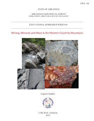
STATE OF ARKANSASARKANSAS GEOLOGICAL SURVEYBEKKI WHITE, DIRECTOR AND STATE GEOLOGIST_____________________________________________________________________EDUCATIONAL WORKSHOP SERIES 04_____________________________________________________________________<str<strong>on</strong>g>Geologic</str<strong>on</strong>g> <str<strong>on</strong>g>float</str<strong>on</strong>g> <strong>on</strong> <strong>Lake</strong> <strong>Ouachita</strong><strong>from</strong> <strong>Lake</strong> <strong>Ouachita</strong> <strong>State</strong> <strong>Park</strong>Angela Chandler and Erica DoerrLittle Rock, Arkansas2010
STATE OF ARKANSASMike Beebe, GovernorArkansas <str<strong>on</strong>g>Geologic</str<strong>on</strong>g>al SurveyBekki White, <strong>State</strong> Geologist and DirectorCOMMISSIONERSDr. Richard Coho<strong>on</strong>, Chairman…………………………RussellvilleWilliam Willis, Vice Chairman…………………………...Hot SpringsDavid J. Baumgardner…………………………………...Little RockBrad DeVazier…………………………………………….Forrest CityKeith DuPriest……………………………………………..MagnoliaQuin Baber…………………………………………………Bent<strong>on</strong>David Lumbert……………………………………………..Little RockLittle Rock, Arkansas2010
AcknowledgmentsThis laboratory manual is written for Arkansas teachers studying earth science. Thiswas also written with the Arkansas Science Curriculum in mind so that students canmeet the requirements and goals set for their age groups. Various staff at theArkansas <str<strong>on</strong>g>Geologic</str<strong>on</strong>g>al Survey c<strong>on</strong>tributed material to this manual. Special thanks go toCharles St<strong>on</strong>e for his invaluable assistance <strong>on</strong> the geology of <strong>Lake</strong> <strong>Ouachita</strong>.For informati<strong>on</strong> related to this manual please c<strong>on</strong>tact Angela Chandler:501-683-0111Arkansas <str<strong>on</strong>g>Geologic</str<strong>on</strong>g>al Survey3815 W Roosevelt RdLittle Rock, AR 72204501-296-1877
Figure 3. Stratigraphic columns of rocks in the <strong>Ouachita</strong> Mountains showing the twoformati<strong>on</strong>s (highlighted) seen <strong>on</strong> the geologic <str<strong>on</strong>g>float</str<strong>on</strong>g> trip. Modified <strong>from</strong> McFarland, 1998.
To understand why the rocks are no l<strong>on</strong>ger flat-lying we need to look back in geologictime. By the Middle Pennsylvanian Period, geologists believe that there wasapproximately 50,000 feet of rock that had been deposited in the deep <strong>Ouachita</strong> oceanbasin (St<strong>on</strong>e and Haley, 1982). At this time, around 310 milli<strong>on</strong> years ago, platetect<strong>on</strong>ics began to shape what is now Arkansas (Fig.4). The c<strong>on</strong>tinents of Laurasia andLlanoria began to collide, pushing together this large mass of material. This collisi<strong>on</strong>caused the rocks to be folded, faulted and uplifted into the <strong>Ouachita</strong> Mountains that wesee today. Deformati<strong>on</strong> of the rocks increases as <strong>on</strong>e travels <strong>from</strong> south to north withmore complex folds, thrust faults and sizeable quartz veins in the northern regi<strong>on</strong>.LaurasiaFigure 4. Middle Pennsylvanina paleogeography of Arkansas showing the collisi<strong>on</strong> ofLaurasia and Llanoria and formati<strong>on</strong> of the <strong>Ouachita</strong> Mountains. From Gucci<strong>on</strong>e, 1993.Erosi<strong>on</strong> and igneous intrusives (Cretaceous 145.5-65.5 milli<strong>on</strong> years ago)Since the beginning of the uplift in late Pennsylvanian time the <strong>Ouachita</strong> Mountains areahas been exposed and underg<strong>on</strong>e erosi<strong>on</strong> with approximately 20,000 feet of rock beingremoved. During the Cretaceous the Gulf of Mexico reached it’s highest level andcovered southern and eastern Arkansas (Fig. 5). Al<strong>on</strong>g the southern boundary of the<strong>Ouachita</strong> Mountains, Early to <strong>Lake</strong> Cretaceous strata overlie deformed Mississippianand Pennsylvanian aged rocks.During the Cretaceous Period all of the igneous rocks in Arkansas were implaced asdikes (cuts across bedding) or sills (parallel to bedding), (Howard, 2010, Arkansas<str<strong>on</strong>g>Geologic</str<strong>on</strong>g>al Survey in-house data). It is thought that reactivati<strong>on</strong> of the Reelfoot Riftcaused the mobilizati<strong>on</strong> of magma <strong>from</strong> a deep-seated source (Brewer, 1986). TheReelfoot Rift is the term used for the late Precambrian to early Cambrian rifting event
which caused the c<strong>on</strong>tinent to stretch or extend al<strong>on</strong>g the “fall line” separating theInterior Highlands <strong>from</strong> the Gulf Coastal Plain. This rifting event led to deep fractures inthe earth’s crust that allowed igneous masses to rise to the surface.Figure 5. Late Cretaceouspaleogeography of Arkansasshowing major igneousintrusi<strong>on</strong>s. Modified <strong>from</strong>Gucci<strong>on</strong>e, 1993.Figure 6. Late Precambrian toearly Cambrian rifting inArkansas that was reactivated inthe Cretaceous. FromGucci<strong>on</strong>e, 1993.
<str<strong>on</strong>g>Geologic</str<strong>on</strong>g> Float StopsRefer to the figure below for locati<strong>on</strong>s <strong>on</strong> this geologic <str<strong>on</strong>g>float</str<strong>on</strong>g>. For purposes of this <str<strong>on</strong>g>float</str<strong>on</strong>g>the boat leaves <strong>from</strong> the marina at <strong>Lake</strong> <strong>Ouachita</strong> <strong>State</strong> <strong>Park</strong>.Figure 7. Locati<strong>on</strong> of stops for geologic <str<strong>on</strong>g>float</str<strong>on</strong>g> <strong>on</strong> <strong>Lake</strong> <strong>Ouachita</strong>.Stop 1 – Submarine Slide in Blakely Formati<strong>on</strong>The small finger of land <strong>on</strong> which the <strong>State</strong> <strong>Park</strong> is located is an anticline. On thenorthern edge or limb the rocks dip to the north. At our stop locati<strong>on</strong>, interbeddedsandst<strong>on</strong>e and shale in the Blakely Formati<strong>on</strong> dip approximately 15 degrees to thesouth. At the southern end of the point the rocks increase in dip to 50 degrees. Therocks are slightly folded <strong>on</strong> this southern limb and c<strong>on</strong>tain fractures that are filled withquartz.Notice the large gray masses of rock sitting <strong>on</strong> the hill above the tilted rock at lake level.These gray rounded masses look very distinct <strong>from</strong> the underlying rocks. They weatherand erode differently because they are a c<strong>on</strong>glomerate made up of boulders, cobblesand pebbles of sedimentary rocks. These masses are called exotics because thepieces of rock that make up the mass were broken off the shelf and carried down theslope of the c<strong>on</strong>tinental shelf to their current positi<strong>on</strong>. The exact mechanism thatbrought the material down the slope is unknown, however we can postulate that therewas possibly an earthquake that broke the rocks off the shelf and caused them to slidedown the slope.
Figure 8. Large exotic (outlined in red) in the Blakely Formati<strong>on</strong>.Figure 9a. Interbedded sandst<strong>on</strong>e and shale with quartz fillingfractures in the sandst<strong>on</strong>e bed.
Figure 9b. Overlay of rock types <strong>on</strong> picture.Stop 2 – Zebra Rock – Blakely Formati<strong>on</strong>This stop is known for its quartz veins which give the rock its striped or zebraappearance. Quartz veins are found in a wide belt extending <strong>from</strong> Little Rock, Arkansasto Broken Bow, Oklahoma in the central core area of the <strong>Ouachita</strong> Mountains (St<strong>on</strong>eand Haley, 1984). The quartz came <strong>from</strong> a soluti<strong>on</strong> of hot water formed during the<strong>Ouachita</strong> Mountain building event. There is a close associati<strong>on</strong> of quartz veins withfault z<strong>on</strong>es. Faulting causes the adjacent rocks to become cracked and opens upfractures creating pathways for water to flow. The hot water soluti<strong>on</strong> was rich in silicaand as it flowed through the open fractures quartz precipitated out of the soluti<strong>on</strong>.This stop is located <strong>on</strong> the northern limb of the same anticline as Stop 1. Notice therock layers dipping to the north.
Figure 10. Blakely sandst<strong>on</strong>e c<strong>on</strong>taining quartz veins.Stop 3 – Folding in the Womble ShaleThe Womble Shale is mostly black shale that weathers to a brown color and c<strong>on</strong>tainssome thin lenses and beds of limest<strong>on</strong>e, sandst<strong>on</strong>e and chert. At this locati<strong>on</strong> there isthin- to medium-bedded fine-grained dense blue- gray limest<strong>on</strong>e exposed in theWomble al<strong>on</strong>g the lake. Also present are beds of c<strong>on</strong>glomerate that are believed tohave been transported to their current positi<strong>on</strong> as debris flows <strong>from</strong> a higher shelf to thenortheast. All of these beds have been tightly folded and faulted in their current positi<strong>on</strong>al<strong>on</strong>g the lake. Try to find a recumbent fold in this area.
Figure 11. Faulted recumbent folds in limest<strong>on</strong>es of the Womble Shale. Faultis located as red line.Determine the relative ages of the folding in relati<strong>on</strong> to the fault in Figure 11. Try torec<strong>on</strong>struct the the formati<strong>on</strong> of events <strong>from</strong> depositi<strong>on</strong> to current positi<strong>on</strong>.Figure 12. Overturned anticline with debris flow c<strong>on</strong>glomerate (darker beds)interbedded with Womble limest<strong>on</strong>es.
Stop 4 – Checkerboard Point – Blakely Sandst<strong>on</strong>eThe sandst<strong>on</strong>e at this locati<strong>on</strong> shows a well defined joint system that has allowed therock to be more easily weathered and eroded to resemble a checkerboard pattern. Ajoint is a fracture or parting in the rock without displacement. Joints are present in mostrock formati<strong>on</strong>s and provide a record of the stress and strain the rock has underg<strong>on</strong>e.When two or more joints intersect it is called a joint system. The joint system at thislocati<strong>on</strong> c<strong>on</strong>sists of a primary joint set in the N/S directi<strong>on</strong> with a sec<strong>on</strong>dary joint set inthe E/W directi<strong>on</strong>. The primary joint set formed at right angles to the compressi<strong>on</strong> eventthat formed the <strong>Ouachita</strong> Mountains.Figure 13. Joint system in the Blakely Sandst<strong>on</strong>e at Checkerboard Rock.Stop 5 – Small Island – Igneous Dike in Womble ShaleThe Womble Shale is dipping to the southwest at this locality and c<strong>on</strong>tains an igneousdike (Fig. 14). The Womble Shale was deposited in the Middle Ordovician Period andfolded and deformed in the Pennsylvanian to Permian Periods . The dike intruded intothe Womble in the Cretaceous Period. Use the principal of cross-cutting to determinethe relative age of the units in this outcrop. Try to rec<strong>on</strong>struct the formati<strong>on</strong> of events<strong>from</strong> depositi<strong>on</strong> to current positi<strong>on</strong>.The Womble Shale c<strong>on</strong>tains graptolites. Take a minute to explore <strong>on</strong> this island and tryto discover these fossils. Also, try to find the dike cutting through <strong>on</strong> the opposite sideof the island.
Figure 14. Igneous dike (outlined in red) in Womble Shale.Figure 15. Graptolites in the Womble Shale.
References:Brewer, S.I., 1986, Study of crustal structure in the middle Mississippi Embaymentusing l<strong>on</strong>g-period synthetic seismogram techniques: Memphis <strong>State</strong> UniversityM.S. Thesis.Gucci<strong>on</strong>e, M.J., 1993, <str<strong>on</strong>g>Geologic</str<strong>on</strong>g> history of Arkansas through time and space: Nati<strong>on</strong>alScience Foundati<strong>on</strong> Grant No. ESI-8855588.Haley, B.R. and St<strong>on</strong>e, C.G., 1982, Structural framework of the <strong>Ouachita</strong> Mountains,Arkansas: Abstract, South Central <str<strong>on</strong>g>Geologic</str<strong>on</strong>g>al Society of America.Howard, J.M., 2010, Overview of the Igneous Rocks of Arkansas: Arkansas <str<strong>on</strong>g>Geologic</str<strong>on</strong>g>alSurvey in-house data.McFarland, J.D., 1998, Stratigraphic summary of Arkansas: Arkansas <str<strong>on</strong>g>Geologic</str<strong>on</strong>g>alCommissi<strong>on</strong> Informati<strong>on</strong> Circular 36, 39 p.St<strong>on</strong>e, C.G. and Haley, B.R., 1984, A guidebook to the geology of the central andSouthern <strong>Ouachita</strong> Mountains, Arkansas: Arkansas <str<strong>on</strong>g>Geologic</str<strong>on</strong>g>al Commissi<strong>on</strong>Guidebook 84-2, 131 p.
Exercise 1Refer to the cross-secti<strong>on</strong> diagram below which corresp<strong>on</strong>ds to Stop 5, Figure 14.Determine the relative ages of the rock bodies and features marked with letters.Indicate their relative age relati<strong>on</strong>ships by writing their letters <strong>on</strong> the blanks <strong>from</strong> oldestto youngest. What caused the Womble Shale to be inclined or dipping? What causedthe dike? What age is the Womble Shale? What age is the dike?______ Youngest___________________ Oldest
Exercise 2Refer to the cross-secti<strong>on</strong> diagram below which corresp<strong>on</strong>ds to Stop 1, Figure 9.Determine the relative ages of the rock bodies and features marked with letters.Indicate their relative age relati<strong>on</strong>ships by writing their letters <strong>on</strong> the blanks <strong>from</strong> oldestto youngest. What age is the Blakely Sandst<strong>on</strong>e? When did the quartz fill the fracturesin the rock?________ Youngest________________________ Oldest
Exercise 3Refer to the cross-secti<strong>on</strong> diagram below which corresp<strong>on</strong>ds to Stop 3, Figure 12.Determine the relative ages of the rock bodies and features marked with letters.Indicate their relative age relati<strong>on</strong>ships by writing their letters <strong>on</strong> the blanks <strong>from</strong> oldestto youngest. Is this an anticline or syncline? Is it symmetrical or overturned? Whatrock type is letter A? How did this rock type become interbedded with the WombleLimest<strong>on</strong>es?______ Youngest__________________ Oldest