Port of Hay Point Land Use Plan - North Queensland Bulk Ports ...
Port of Hay Point Land Use Plan - North Queensland Bulk Ports ...
Port of Hay Point Land Use Plan - North Queensland Bulk Ports ...
- No tags were found...
You also want an ePaper? Increase the reach of your titles
YUMPU automatically turns print PDFs into web optimized ePapers that Google loves.
<strong>Port</strong> <strong>of</strong> <strong>Hay</strong> <strong>Point</strong><strong>Land</strong> <strong>Use</strong> <strong>Plan</strong>April 2010Approved by the Minister for Transport on 5 July 2010NORTH QUEENSLAND BULK PORTS CORPORATION LIMITEDACN: 136 880 218Registered Office: Floor 24, 300 Queen StBRISBANE QLD 4001About <strong>North</strong> <strong>Queensland</strong> <strong>Bulk</strong> <strong>Port</strong>s Corporation Limited (NQBP)<strong>North</strong> <strong>Queensland</strong> <strong>Bulk</strong> <strong>Port</strong> Corporation Limited (NQBP) was formed as a result <strong>of</strong> the 2008<strong>Queensland</strong> Government Review <strong>of</strong> the <strong>Queensland</strong> <strong>Port</strong> Network Structure. As an outcome <strong>of</strong>this review, NQBP became a port authority on 1 July 2009, under the Transport InfrastructureAct 1994, for the sea port facilities at <strong>Hay</strong> <strong>Point</strong>, Mackay, Abbot <strong>Point</strong>, Weipa and Maryborough.<strong>Port</strong>s Corporation <strong>of</strong> <strong>Queensland</strong> Limited (PCQ) and Mackay <strong>Port</strong>s Limited (MPL) are nowsubsidiaries <strong>of</strong> NQBP.NQBP is one <strong>of</strong> Australia’s largest port authorities by tonnage throughput and more than half <strong>of</strong><strong>Queensland</strong>'s trade, by tonnage, pass through NQBP ports. Our aim is to be the recognisedleader in the delivery <strong>of</strong> bulk cargo infrastructure.The sea port facilities NQBP manage are vital to the export and import performance <strong>of</strong><strong>Queensland</strong> and Australia. NQBP ports handle bulk shipments <strong>of</strong> coal, bauxite, sugar, grain,petroleum and general cargo. Coal is by far the main commodity handled in NQBP ports.
<strong>Land</strong> <strong>Use</strong> <strong>Plan</strong> – <strong>Port</strong> <strong>of</strong> <strong>Hay</strong> <strong>Point</strong>CONTENTSSECTION 1 - INTRODUCTION .................................................................................. 41.1 Purpose <strong>of</strong> the <strong>Port</strong> <strong>of</strong> <strong>Hay</strong> <strong>Point</strong> <strong>Land</strong> <strong>Use</strong> <strong>Plan</strong> .............................................. 41.2 <strong>Land</strong> <strong>Use</strong> <strong>Plan</strong> Structure ................................................................................... 41.3 Legislative Context............................................................................................ 51.4 Assessment Requirements ............................................................................... 6SECTION 2 – PORT PROFILE................................................................................... 82.1 Physical Setting, <strong>Land</strong>scapes and Existing Development ................................ 82.2 Relationship to Local Government <strong>Plan</strong>ning ..................................................... 92.3 The Significance <strong>of</strong> the <strong>Port</strong> to the Region........................................................ 92.4 Vision for the <strong>Port</strong> <strong>of</strong> <strong>Hay</strong> <strong>Point</strong> ....................................................................... 10SECTION 3 - DESIRED ENVIRONMENTAL OUTCOMES ...................................... 11SECTION 4 – LAND USE PLAN DESIGNATIONS................................................... 13Table 1 – <strong>Port</strong> <strong>of</strong> <strong>Hay</strong> <strong>Point</strong> <strong>Land</strong> <strong>Use</strong> <strong>Plan</strong> Designations................................. 22<strong>Plan</strong> 1 - <strong>Port</strong> <strong>of</strong> <strong>Hay</strong> <strong>Point</strong> – Area Designations ................................................ 27<strong>Plan</strong> 2 - <strong>Port</strong> <strong>of</strong> <strong>Hay</strong> <strong>Point</strong> – DBCT and HPCT Area Designations.................... 28<strong>Plan</strong> 3 - <strong>Port</strong> <strong>of</strong> <strong>Hay</strong> <strong>Point</strong> – Dudgeon <strong>Point</strong> Area Designations........................ 29
<strong>Land</strong> <strong>Use</strong> <strong>Plan</strong> – <strong>Port</strong> <strong>of</strong> <strong>Hay</strong> <strong>Point</strong>SECTION 1 - INTRODUCTION1.1 Purpose <strong>of</strong> the <strong>Port</strong> <strong>of</strong> <strong>Hay</strong> <strong>Point</strong> <strong>Land</strong> <strong>Use</strong> <strong>Plan</strong><strong>North</strong> <strong>Queensland</strong> <strong>Bulk</strong> <strong>Port</strong>s Corporation Limited (NQBP) is seeking to achieve through landuse planning at the <strong>Port</strong> <strong>of</strong> <strong>Hay</strong> <strong>Point</strong>, development which is ecologically sustainable andmeets the demand for world class port facilities to support and grow the regions economy.The <strong>Port</strong> <strong>of</strong> <strong>Hay</strong> <strong>Point</strong> <strong>Land</strong> <strong>Use</strong> <strong>Plan</strong> has been prepared in accordance with the statutoryprovisions <strong>of</strong> the Transport Infrastructure Act 1994 (TIA). It sets out NQBP’s planning anddevelopment intents for its strategic port land at the <strong>Port</strong> <strong>of</strong> <strong>Hay</strong> <strong>Point</strong> giving carefulconsideration to core matters relevant to the local and regional area including environmental,economic and social sustainability.Development on strategic port land is subject to the provisions <strong>of</strong> the Sustainable <strong>Plan</strong>ningAct 2009 (SPA) via the Integrated Development Assessment System (IDAS). The <strong>Land</strong> <strong>Use</strong><strong>Plan</strong> is the principal tool used by NQBP as the Assessment Manager for managing andassessing development on strategic port land at the <strong>Port</strong> <strong>of</strong> <strong>Hay</strong> <strong>Point</strong>, including all premises,roads and waterways within strategic port land boundaries. The <strong>Land</strong> <strong>Use</strong> <strong>Plan</strong> overrides theLocal Government planning scheme.The <strong>Land</strong> <strong>Use</strong> <strong>Plan</strong> will be reviewed and updated as needed to ensure that it reflects anysignificant changes that may occur at the <strong>Port</strong>. It will be completely reviewed every eight (8)years as a minimum under the Transport Infrastructure Act 1994.1.2 <strong>Land</strong> <strong>Use</strong> <strong>Plan</strong> StructureThe <strong>Land</strong> <strong>Use</strong> <strong>Plan</strong> provides an overall framework for the appropriate regulation andmanagement <strong>of</strong> development on strategic port land at the <strong>Port</strong> <strong>of</strong> <strong>Hay</strong> <strong>Point</strong>. Importantly itidentifies existing and any proposed future strategic port land and allocates this land intodesignations which reflect its desired use.Outcomes are sought through the following two mechanisms:Establishing a Vision for the <strong>Port</strong> <strong>of</strong> <strong>Hay</strong> <strong>Point</strong> – <strong>Land</strong> <strong>Use</strong> <strong>Plan</strong>s under the TIA arerequired to identify Desired Environmental Outcomes (DEOs) which provide the overarchingvision and direction for future development at the <strong>Port</strong> <strong>of</strong> <strong>Hay</strong> <strong>Point</strong>. The DEOs have beenstructured according to the three drivers <strong>of</strong> ecological sustainability: economic development,ecological processes and community wellbeing.Allocating Strategic <strong>Port</strong> <strong>Land</strong> into <strong>Land</strong> <strong>Use</strong> <strong>Plan</strong> Designations – All strategic port landhas been allocated within a land use designation which reflects its function, attributes andNQBP’s development intent. The designations have been influenced by the overarchingDEOs for the <strong>Port</strong> <strong>of</strong> <strong>Hay</strong> <strong>Point</strong>.Operating in conjunction with the <strong>Land</strong> <strong>Use</strong> <strong>Plan</strong> is a separate ‘Development Guidelines’document which includes Codes against which development on strategic port land at the <strong>Port</strong><strong>of</strong> <strong>Hay</strong> <strong>Point</strong> is to be assessed. The Development Codes are based on the DEOs and guidethe desired form and structure <strong>of</strong> development on strategic port land, addressing issuesincluding built form, environmental management, infrastructure provision, and site design andlandscaping.4
<strong>Land</strong> <strong>Use</strong> <strong>Plan</strong> – <strong>Port</strong> <strong>of</strong> <strong>Hay</strong> <strong>Point</strong>1.3 Legislative ContextThe following diagram represents the legislative framework under which land use planningand development assessment on strategic port land operates.Transport Infrastructure Act 1994 (TIA)Establishes the legislative context for requiring and preparing a <strong>Land</strong> <strong>Use</strong> <strong>Plan</strong> for strategicport land<strong>Port</strong> <strong>of</strong> <strong>Hay</strong> <strong>Point</strong> <strong>Land</strong> <strong>Use</strong> <strong>Plan</strong>Guides land use planning and decision-making at the <strong>Port</strong> <strong>of</strong> <strong>Hay</strong> <strong>Point</strong>Sustainable <strong>Plan</strong>ning act 2009 (SPA)Provides the legislative context for the Development Assessment ProcessIntegrated Development Assessment System (IDAS)(Application Stage, Information and Referral Stage, Notification Stage and Decision Stage)Transport Infrastructure Act 1994 (TIA)The TIA establishes the regime under which port authorities plan for the future development<strong>of</strong> strategic port land. Specifically, provisions confirm that port authorities are the AssessmentManager for all assessable development on strategic port land and that <strong>Land</strong> <strong>Use</strong> <strong>Plan</strong>s arerequired by all port authorities as the principal tool for development assessment. Strategicport land at the <strong>Port</strong> <strong>of</strong> <strong>Hay</strong> <strong>Point</strong> can only be utilised for port related functions. Therefore this<strong>Land</strong> <strong>Use</strong> <strong>Plan</strong> only includes land for which NQBP intends to be developed for <strong>Port</strong> purposesor is designated as a buffer or environmental protection area. All land identified as strategicport land is not subject to Local Government planning schemes.The provisions <strong>of</strong> the TIA effectively reflect the process established by the Sustainable<strong>Plan</strong>ning Act 2009 (SPA), and its predecessor the Integrated <strong>Plan</strong>ning Act 1997 (IPA), forpreparing and amending planning schemes. Accordingly <strong>Land</strong> <strong>Use</strong> <strong>Plan</strong>s under the TIA arerequired to:- contain details <strong>of</strong> strategic port land;- coordinate and integrate the ‘core matters’ relevant to the <strong>Land</strong> <strong>Use</strong> <strong>Plan</strong> 1 ,- identify Desired Environmental Outcomes (DEOs) for the port land; and- include measures to achieve the DEOs.As part <strong>of</strong> the formal approval process established under the TIA for <strong>Land</strong> <strong>Use</strong> <strong>Plan</strong>s, theMinister must also be satisfied that State interests will not be adversely affected. Stateinterests vary from port to port, but in the main include:1 Core Matters are defined in s 284 <strong>of</strong> the TIA and means each <strong>of</strong> the following matters (a) land use anddevelopment; (b) port facilities; and (c) valuable features.5
<strong>Land</strong> <strong>Use</strong> <strong>Plan</strong> – <strong>Port</strong> <strong>of</strong> <strong>Hay</strong> <strong>Point</strong>- state development areas;- resources including extractive deposits, water and fisheries resources;- infrastructure including State controlled roads, State rail networks and airports;- tidal and coastal processes, wetlands, vegetation and marine life;- acid sulphate soils;- biosecurity;- <strong>Queensland</strong> waters;- marine park waters;- heritage (including cultural and indigenous heritage); and- regional planning.Sustainable <strong>Plan</strong>ning Act 2009 (SPA)Under SPA, NQBP functions as the ‘Assessment Manager’ for strategic port land in theoverall context <strong>of</strong> <strong>Queensland</strong>’s Integrated Development Assessment System (IDAS). IDAS isthe process by which applications for development are made, assessed and decided. SPAestablishes the circumstances by which referral is required to the <strong>Port</strong> Authority fordevelopment which is located within port limits.1.4 Assessment RequirementsAssessment ProcessesThere are two assessment processes that apply to development on strategic port land:1. NQBP’s <strong>Port</strong> Development Consent process.2. Assessment under the Sustainable <strong>Plan</strong>ning Act 2009.<strong>Port</strong> Development Consent<strong>Port</strong> Development Consent must be obtained for development on port land unless anexemption for the proposal has been granted by NQBP. This process is utilised prior to anIDAS development application being made or where an application does not trigger approvalunder the Sustainable <strong>Plan</strong>ning Act 2009. The purpose <strong>of</strong> this process is to make certain thatthe proposed development is corporately supported by NQBP as the land owner, and toensure that the best environmental, engineering, and planning outcomes are being achieved.This <strong>Land</strong> <strong>Use</strong> <strong>Plan</strong> and its associated Development Guidelines are consulted as part <strong>of</strong> thisprocess.The scale and nature <strong>of</strong> the proposed development will determine the complexity <strong>of</strong> theapplication required. The term ‘development’ may include, however is not limited to, suchmatters as:- the establishment <strong>of</strong> a new use;- construction <strong>of</strong> new buildings, structures, and infrastructure/ utilities;- replacement <strong>of</strong> existing buildings, structures, and infrastructure/ utilities;- increasing or altering the extent <strong>of</strong> hardstand areas;- changing the intensity or scale <strong>of</strong> an existing development;- commencing new Environmentally Relevant Activities (ERAs) or making a change toan existing ERA; and- undertaking any activity that results in an increase in traffic volume in the <strong>Port</strong> area.Before undertaking any development, applicants should contact NQBP in the first instance todetermine whether an application for <strong>Port</strong> Development Consent is required and theassessment process.6
<strong>Land</strong> <strong>Use</strong> <strong>Plan</strong> – <strong>Port</strong> <strong>of</strong> <strong>Hay</strong> <strong>Point</strong>Assessment under the Sustainable <strong>Plan</strong>ning Act 2009NQBP has the responsibilities <strong>of</strong> Assessment Manager under the Sustainable <strong>Plan</strong>ning Act2009 for development on strategic port land. In situations where development is not onstrategic port land but it is within port limits, NQBP is triggered as a Referral Agency underthis Act.Applications for assessable development under the Sustainable <strong>Plan</strong>ning Act 2009 are to bemade in accordance with the Integrated Development Assessment System (IDAS) identifiedunder the Act.Further information on the Sustainable <strong>Plan</strong>ning Act 2009, the triggers for approvals,regulations, appeals, as well as the forms for making an IDAS development application, areavailable from the Department <strong>of</strong> Infrastructure and <strong>Plan</strong>ning’s website.Using the <strong>Land</strong> <strong>Use</strong> <strong>Plan</strong> for Assessing DevelopmentA proposed development will be assessed against the <strong>Port</strong> <strong>of</strong> <strong>Hay</strong> <strong>Point</strong> <strong>Land</strong> <strong>Use</strong> <strong>Plan</strong>, theassociated Development Guidelines and relevant state legislation, to determine:− consistency with the Desired Environmental Outcomes for the <strong>Port</strong>;− correlation with the relevant <strong>Land</strong> <strong>Use</strong> designation; and− the ability <strong>of</strong> the development to meet relevant development assessment principlesand criteria in the Development Guidelines.Proponents are to address all these elements in making a development application.The <strong>Land</strong> <strong>Use</strong> Designations have separate intents, development principles and indicativeuses. To determine the appropriateness <strong>of</strong> any proposed development in a particular portarea, proponents should in the first instance address the intent statements <strong>of</strong> the <strong>Land</strong> <strong>Use</strong>Designations.The Development Guidelines is a technical document that describes requirements for thephysical form and operation <strong>of</strong> different types <strong>of</strong> development on strategic port land. Itprovides specific outcomes and acceptable solutions to ensure that buildings, facilities andother development will realise the desired environmental outcomes and precinct principlesdescribed in the <strong>Land</strong> <strong>Use</strong> <strong>Plan</strong>.The Development Guidelines can be amended from time to time by NQBP to reflect new portstandards, or innovations in planning, engineering and environmental management.<strong>Port</strong> <strong>of</strong> <strong>Hay</strong> <strong>Point</strong> Environmental Management <strong>Plan</strong>The <strong>Port</strong> <strong>of</strong> <strong>Hay</strong> <strong>Point</strong> Environmental Management <strong>Plan</strong> is an important reference documentfor current and potential users <strong>of</strong> the <strong>Port</strong> <strong>of</strong> <strong>Hay</strong> <strong>Point</strong>. It outlines the current environmentalmanagement practices and controls required by NQBP to protect and enhance the portenvironment and is to be referred to in the making <strong>of</strong> development applications. Under theEnvironmental Management <strong>Plan</strong>, any new project undertaken on NQBP land requires aproject specific Environmental Management <strong>Plan</strong> to be developed by the proponent and thenapproved by NQBP.7
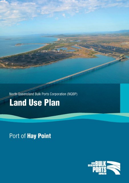
<strong>Land</strong> <strong>Use</strong> <strong>Plan</strong> – <strong>Port</strong> <strong>of</strong> <strong>Hay</strong> <strong>Point</strong>SECTION 2 – PORT PROFILE2.1 Physical Setting, <strong>Land</strong>scapes and Existing DevelopmentThe <strong>Port</strong> <strong>of</strong> <strong>Hay</strong> <strong>Point</strong> is situated about 40 kilometres south <strong>of</strong> Mackay, close to the beachsidelocalities <strong>of</strong> Louisa Creek, Salonika and Half Tide and the rural residential communities <strong>of</strong>Timberlands and Fenechvale. The <strong>Port</strong> Limits, as defined in the Transport Infrastructure Act1994, extend to Half Tide Tug Harbour in the south and to Bakers Creek in the north.The <strong>Port</strong> <strong>of</strong> <strong>Hay</strong> <strong>Point</strong> was purpose built to export coal from the Bowen Basin Coalfields inCentral <strong>Queensland</strong>. There are two coal terminals which operate at <strong>Hay</strong> <strong>Point</strong>, namely theDalrymple Bay Coal Terminal (DBCT) and the <strong>Hay</strong> <strong>Point</strong> Coal Terminal (HPCT).The two coal terminals serve the coalfields <strong>of</strong> Central <strong>Queensland</strong> through an integrated railnetwork. Both terminals have stockpile areas, coal transfer infrastructure, <strong>of</strong>fices, and <strong>of</strong>fshorejetty and wharf facilities. The DBCT wharf is serviced by four berths and the HPCTwharf by two.A number <strong>of</strong> ancillary services are located at the <strong>Port</strong> which support the overall operation <strong>of</strong>the coal terminals. These include a quarantine waste service, port pilotage, and helicopteroperations. Maritime Safety <strong>Queensland</strong> is responsible for pilotage services for vesselsentering the <strong>Port</strong>, with most transfers to and from ships via helicopter. Also located at the<strong>Port</strong> is the Half Tide Tug Harbour, which allows for the safe mooring <strong>of</strong> the tug boats providingtowage to ships in the <strong>Port</strong>. A boat ramp is also located at this facility for public use.The area <strong>of</strong> Dudgeon <strong>Point</strong> has been set aside since the 1970’s as being a site for futureindustrial activity and additional port land has been included within this <strong>Land</strong> <strong>Use</strong> <strong>Plan</strong> toallow for future port expansion and development at Dudgeon <strong>Point</strong>. Currently no specifictrade has been finalised for Dudgeon <strong>Point</strong> however it is a potential location for the export <strong>of</strong>coal from deposits in Central <strong>Queensland</strong>. Master planning studies are to be undertaken intothe future development <strong>of</strong> Dudgeon <strong>Point</strong> to prepare a whole-<strong>of</strong> area concept plan forpossible port infrastructure, taking into consideration environmental, social and planningconstraints.Environmental <strong>Land</strong>scapeThe <strong>Port</strong> <strong>of</strong> <strong>Hay</strong> <strong>Point</strong> (including Dudgeon <strong>Point</strong> and the wider port limit area) comprises anumber <strong>of</strong> terrestrial, riparian and marine communities. Specific areas <strong>of</strong> conservationsignificance in the vicinity <strong>of</strong> strategic port land include the Mount Hector Conservation Park,Lake Barfield and Sandringham Bay. These areas are valued for their ecological, scenic andrecreational value, as well as economic value to local fisheries as breeding and nurserygrounds for a range <strong>of</strong> marine organisms. Comprehensive details on the environmental areas<strong>of</strong> significance at the <strong>Port</strong> <strong>of</strong> <strong>Hay</strong> <strong>Point</strong> are detailed in the <strong>Port</strong> <strong>of</strong> <strong>Hay</strong> <strong>Point</strong> EnvironmentalManagement <strong>Plan</strong>. This document should be consulted for information on theseenvironmental values and the environmental management practices and controls used byNQBP to protect and enhance the port environment.NQBP and the terminal operators have a strong commitment to ensuring that practices aresustainable and employ rigorous environmental programs to monitor port activities. This <strong>Land</strong><strong>Use</strong> <strong>Plan</strong> will continue to promote ecologically sustainable development at the <strong>Port</strong> throughdesignating areas with significant environmental values for protection and ensuring thatmanagement measures are in place for their ongoing protection.8
<strong>Land</strong> <strong>Use</strong> <strong>Plan</strong> – <strong>Port</strong> <strong>of</strong> <strong>Hay</strong> <strong>Point</strong>The Guidelines associated with this plan have been formulated to ensure port activities meetstrong outcomes for environmental management and addresses factors including theprotection <strong>of</strong> significant ecological and cultural areas, water sensitive urban design, climatesensitive building design and the appropriate discharge <strong>of</strong> wastes. Detailed environmentalassessments will continue to be an important component <strong>of</strong> the assessment <strong>of</strong> any newactivity on port land or within port limits.Cultural ContextThe Wiri#2 group is the registered native title claimants <strong>of</strong> most <strong>of</strong> the <strong>Port</strong> <strong>of</strong> <strong>Hay</strong> <strong>Point</strong> area.The Yuibera group are the registered claimants <strong>of</strong> an area adjacent to Louisa Creek. A largeand culturally diverse indigenous population exists in the area, along with a large number <strong>of</strong>well organised indigenous groups that have established themselves to take variousrepresentation roles.<strong>Land</strong>s occupied by the coal terminals have been extensively disturbed and modified in theprocess <strong>of</strong> ongoing development and surveys <strong>of</strong> the land have shown there to be limitedarchaeological potential. Cultural remnants have been identified in some coastal areasalongside Dudgeon <strong>Point</strong>. The involvement <strong>of</strong> the Traditional Owners in the management <strong>of</strong>these significant areas is a critical component <strong>of</strong> ensuring the success <strong>of</strong> any potentialdevelopment.NQBP will continue to work closely with indigenous representatives to ensure cultural valuesare protected in any development work undertaken at Dudgeon <strong>Point</strong>, with archaeologysurveys undertaken prior to any significant soil disturbance, along with cultural heritagemonitoring during vegetation clearing and initial earthworks. If development <strong>of</strong> Dudgeon <strong>Point</strong>is to be undertaken in the future, a Cultural Heritage Management <strong>Plan</strong> will be produced inconsultation with the Traditional Owners.2.2 Relationship to Local Government <strong>Plan</strong>ningThe surrounding Local Government to the <strong>Port</strong> <strong>of</strong> <strong>Hay</strong> <strong>Point</strong> is the Mackay Regional Council.The Mackay Regional Council came into effect on the 15 March 2008 under the LocalGovernment Reform Legislation and is an amalgamation <strong>of</strong> the former Mackay City Council,Mirani and Sarina Shire Councils. The areas adjacent to the strategic port land are includedin the former Sarina Shire Council’s <strong>Plan</strong>ning Area.Whilst strategic port land is not subject to Local Government planning provisions, NQBP aimsto ensure that consistent and compatible land use and development outcomes are achievedthrough involving the Mackay Regional Council in strategic planning and referral <strong>of</strong>development applications. NQBP is currently developing a Memorandum <strong>of</strong> Understandingwith the Mackay Regional Council to ensure on-going cooperation with the Council whenprojects on port land are assessed.2.3 The Significance <strong>of</strong> the <strong>Port</strong> to the RegionThe <strong>Port</strong> <strong>of</strong> <strong>Hay</strong> <strong>Point</strong> is located in the Whitsunday Hinterland and Mackay (WHAM) regionwhich covers the Local Government areas <strong>of</strong> Mackay, Whitsunday and Isaac.The region’s economic strength comes from its mining, livestock, agriculture, manufacturing,and tourism industries. Whilst the region has typically been associated with farming,specifically sugar cane farming, more recently coal mining has dominated the economy andthis trend is expected to continue into the future with new coal deposits being explored.Overall, the Bowen Basin coalfields contribute more than half <strong>of</strong> Australia’s export coal.9
<strong>Land</strong> <strong>Use</strong> <strong>Plan</strong> – <strong>Port</strong> <strong>of</strong> <strong>Hay</strong> <strong>Point</strong>Given the significance <strong>of</strong> mining to the region, the <strong>Port</strong> <strong>of</strong> <strong>Hay</strong> <strong>Point</strong> is <strong>of</strong> strategic value as itprovides world class facilities for the export <strong>of</strong> coal. The <strong>Port</strong> benefits the region, socially andeconomically, through investment and employment, with port operations and constructionproviding employment both locally and regionally. Further coal terminal expansions and thepotential development <strong>of</strong> port facilities at Dudgeon <strong>Point</strong> will further contribute to theeconomic development <strong>of</strong> the region.2.4 Vision for the <strong>Port</strong> <strong>of</strong> <strong>Hay</strong> <strong>Point</strong>The <strong>Port</strong> <strong>of</strong> <strong>Hay</strong> <strong>Point</strong> is one <strong>of</strong> the largest coal ports in the world. NQBP’s vision is tomaintain the <strong>Port</strong> <strong>of</strong> <strong>Hay</strong> <strong>Point</strong> as one <strong>of</strong> <strong>Queensland</strong>’s premier bulk materials handling ports.In achieving this, contributions will be made to the Local, Regional and State economy andlocal employment opportunities will be continue to be provided.Strategic port land under the Transport Infrastructure Act 1994 can only be utilised for portrelated purposes and therefore NQBP will only seek future business opportunities that have adirect link to the <strong>Port</strong> (such as the import or export <strong>of</strong> a commodity) or that provides a portrelated service (such as government maritime agencies and shipping agencies; engineeringworks for port industry; concrete batching; and providore services). Coal is currently theonly export through the <strong>Port</strong>. Although other bulk material exports will be investigated asopportunities arise, further expansion <strong>of</strong> the coal export capacity <strong>of</strong> the <strong>Port</strong> is expected in thefuture, with the <strong>Port</strong> <strong>of</strong> <strong>Hay</strong> <strong>Point</strong> being one <strong>of</strong> <strong>Queensland</strong>'s three major coal export ports, aswell as one <strong>of</strong> the largest coal ports in the world.The <strong>Port</strong> <strong>of</strong> Mackay is also operated by NQBP. Given their close proximity, the two ports willendeavour not to duplicate services or infrastructure, however opportunities for combined portservices, such as the use <strong>of</strong> quarantine waste facilities, will be explored to provide costeffectiveservices to port users. Mackay will continue to be a major regional seaport for theimport <strong>of</strong> raw materials, fuel and general cargo and export <strong>of</strong> raw resources and finishedproducts from the Region (including grain and sugar). Given the <strong>Port</strong> <strong>of</strong> Mackay is located ina dense urban environment, bulk resources (such as coal) will be encouraged to continue tolocate at the <strong>Port</strong> <strong>of</strong> <strong>Hay</strong> <strong>Point</strong>.10
<strong>Land</strong> <strong>Use</strong> <strong>Plan</strong> – <strong>Port</strong> <strong>of</strong> <strong>Hay</strong> <strong>Point</strong>SECTION 3 - DESIRED ENVIRONMENTAL OUTCOMESThe <strong>Land</strong> <strong>Use</strong> <strong>Plan</strong> is required to identify Desired Environmental Outcomes (DEOs) whichbroadly establish the focus for all activities and development at the <strong>Port</strong> <strong>of</strong> <strong>Hay</strong> <strong>Point</strong>, with theaim <strong>of</strong> ensuring that ecologically sustainable port development is achieved.The following statements reflect a balancing <strong>of</strong> the three components <strong>of</strong> ecologicalsustainability and form the fundamental basis from which all other provisions <strong>of</strong> the <strong>Land</strong> <strong>Use</strong><strong>Plan</strong> and other related planning documents flow. Each DEO is sought to be achieved to theextent practicable having regard to each <strong>of</strong> the other DEOs.DEOs are not intended to be solely achieved through the implementation <strong>of</strong> the <strong>Land</strong> <strong>Use</strong><strong>Plan</strong>. As such, the DEOs for the <strong>Port</strong> <strong>of</strong> <strong>Hay</strong> <strong>Point</strong> will also be reflected through corporateplanning programs, the environmental management plan, supporting development guidelinesand other relevant planning initiatives.ECONOMIC DEVELOPMENTDEO ECON. 1 The future strategic intentions <strong>of</strong> the <strong>Port</strong> will be documented, including thepotential development <strong>of</strong> new port facilities at Dudgeon <strong>Point</strong>.DEO ECON. 2 Capital will continue to be invested into the port facilities to maintain the <strong>Port</strong>as a world class facility and to capitalise on the coal export opportunities inthe Bowen Basin.DEO ECON. 3 The <strong>Port</strong> will provide regional employment opportunities in its ongoingoperations and management as well as during development and constructionperiods.DEO ECON. 4 The development <strong>of</strong> port related industries and activities in appropriatelocations on strategic port land is facilitated.DEO ECON. 5 <strong>Land</strong> will be retained and acquired that is strategic to the future operationsand development <strong>of</strong> the <strong>Port</strong>.DEO ECON. 6 <strong>Port</strong> uses will be consolidated to provide cost effective infrastructure.DEO ECON. 7 NQBP will actively liaise with infrastructure providers and planners, includingthe Mackay Regional Council, Department <strong>of</strong> Infrastructure and <strong>Plan</strong>ning,Department <strong>of</strong> Main Roads, <strong>Queensland</strong> Rail and Ergon/ Powerlink,regarding the provision <strong>of</strong> services and infrastructure to the <strong>Port</strong>.DEO ECON. 8 Sustainable technologies will be incorporated into <strong>Port</strong> Development todecrease long term operating costs and reduce the environmental footprint.11
<strong>Land</strong> <strong>Use</strong> <strong>Plan</strong> – <strong>Port</strong> <strong>of</strong> <strong>Hay</strong> <strong>Point</strong>COMMUNITY WELLBEINGDEO SOC. 1DEO SOC. 2DEO SOC. 3DEO SOC. 4DEO SOC. 5DEO SOC. 6DEO SOC. 7Community amenity forms an essential part <strong>of</strong> design considerations andpotential impacts from port development and operation, such as noise, dust,traffic and scenic, are minimised and mitigated.<strong>Port</strong> operations prioritise the safety and security <strong>of</strong> all visitors and employeesaccessing port land.NQBP will work with the Mackay Regional Council to ensure port operationsare separated where possible from sensitive receiving environments (such asresidential).NQBP will continue to manage and protect Indigenous cultural heritagevalues on port land with Traditional Owner involvement.Public boating access will continue to be allowed where consistent withsafety and security regulations.Multi-modal transport options will form part <strong>of</strong> future terminal planning.NQBP will continue to maintain and enhance its relationship with thecommunity and Mackay Regional Council, to provide transparency forplanning and development at the <strong>Port</strong>.ENVIRONMENTDEO ECOL. 1 Protection <strong>of</strong> the <strong>Port</strong> environment, including ecological values, is to beachieved through pro-active management.DEO ECOL. 2 Sustainable environmental management is to be promoted and incorporatedinto all aspects <strong>of</strong> port planning, development and operations at the <strong>Port</strong>.DEO ECOL. 3 The coastal environment and associated values are protected throughresponsible and ecologically sustainable development.DEO ECOL. 4 Development on port land does not significantly affect the environmentalvalues <strong>of</strong> identified areas with high conservation significance including theGreat Barrier Reef Marine Park and adjacent Mt Hector Conservation Park.DEO ECOL. 5 Climate change assessment will form part <strong>of</strong> the design <strong>of</strong> projects onstrategic port land as appropriate.DEO ECOL. 6 The potential cumulative impacts resulting from the development <strong>of</strong> the whole<strong>of</strong> the <strong>Port</strong> (including individual terminals) are measured as part <strong>of</strong>assessments <strong>of</strong> major <strong>Port</strong> expansions to ensure continued sustainability isprovided.DEO ECOL. 7 Buffer areas with aesthetic and conservation values are maintained betweenport facilities and areas adjoining the strategic port land.12
<strong>Land</strong> <strong>Use</strong> <strong>Plan</strong> – <strong>Port</strong> <strong>of</strong> <strong>Hay</strong> <strong>Point</strong>SECTION 4 – LAND USE PLAN DESIGNATIONSThe <strong>Land</strong> <strong>Use</strong> <strong>Plan</strong> divides all strategic port land at the <strong>Port</strong> <strong>of</strong> <strong>Hay</strong> <strong>Point</strong> into one (1) <strong>of</strong> seven(7) <strong>Land</strong> <strong>Use</strong> <strong>Plan</strong> designations.The designations reflect strategic port land that has similar functions, attributes, or land useintents and is the primary means <strong>of</strong> establishing and determining the consistency <strong>of</strong> proposeddevelopment with the <strong>Land</strong> <strong>Use</strong> <strong>Plan</strong>. The designations are as follows:- <strong>Port</strong> Handling Activities- Offshore <strong>Port</strong> Infrastructure- Access and <strong>Port</strong> Infrastructure- <strong>Port</strong> Related and Support- Transport Infrastructure- General Buffer- Environmental ProtectionIndicative uses are listed for each land use designation signifying the types <strong>of</strong> uses anddevelopment considered desirable. The list is not exhaustive and uses not listed may still begenerally consistent with the intent <strong>of</strong> the particular designation.A Wildlife Corridor overlay also affects a number <strong>of</strong> land holdings identified as General Bufferand is shown on the <strong>Land</strong> <strong>Use</strong> <strong>Plan</strong> Area Designations Map. Any proposed infrastructuredevelopment in this area must be consistent with the intent <strong>of</strong> the overlay.A full description <strong>of</strong> each parcel <strong>of</strong> land to be included as strategic port land under this <strong>Land</strong><strong>Use</strong> <strong>Plan</strong>, together with a description <strong>of</strong> its current and proposed use is included at Table 1.13
<strong>Land</strong> <strong>Use</strong> <strong>Plan</strong> – <strong>Port</strong> <strong>of</strong> <strong>Hay</strong> <strong>Point</strong>PORT HANDLING ACTIVITIES DESIGNATIONDesignates onshore strategic port land that has a direct nexus with the waterfront for thehandling <strong>of</strong> commodities for export.IntentThis area represents land that is strategic to the existing and futureoperations and development <strong>of</strong> the <strong>Port</strong>. It provides for the corecommercial business <strong>of</strong> the <strong>Port</strong> <strong>of</strong> <strong>Hay</strong> <strong>Point</strong> and is intended to caterfor the future extension <strong>of</strong> these core port activities.The designation includes areas utilised for the loading/ unloading,stockpiling, and transfer <strong>of</strong> commodities. It also includes areas forland access, transport corridors (both rail and road) and port related<strong>of</strong>fices.<strong>Use</strong>s that facilitate the expansion, improvement or maintenance <strong>of</strong><strong>Port</strong> Handling Activities are compatible.This designation includes the <strong>Hay</strong> <strong>Point</strong> Administration Buildingwhich includes visitor access and viewing facilities which support theregion’s tourism industry.Precinct Principles1. New development is to integrate with existing activities toensure the efficient movement <strong>of</strong> commodities through the<strong>Port</strong>.2. Continued capital investment in infrastructure is to beundertaken to facilitate the efficient operation <strong>of</strong> new andexisting <strong>Port</strong> Handling Activities.3. Opportunities for future <strong>Port</strong> Handling Activities are protectedby excluding land uses not associated with the <strong>Port</strong> and theprotection <strong>of</strong> buffer areas.4. Development is to achieve high standards <strong>of</strong> amenity with theincorporation <strong>of</strong> environmental management plans in projectplanning.5. All operations are to be safe and have regard to on-site vehicleand pedestrian movements.Indicative <strong>Use</strong>s− <strong>Bulk</strong> terminal storage− Storage <strong>of</strong> goods ormaterials (includingstockpiles)− Processing and transfer <strong>of</strong>goods or materials forshipment− Water storage− Ancillary services(workshops, warehousesetc)− <strong>Port</strong> related <strong>of</strong>fices− <strong>Port</strong> services including,customs, port pilotage,AQIS, and shippingagents− Quarantine waste facilities− Transport <strong>of</strong> goods/materials, whether byroad, rail or air− Maritime support facilitiesincluding vessel refueling/servicing/ and repair− Visitor viewing andinformation facilities− Facilities for terminaloperators including carparking, and other generalamenities− <strong>Use</strong>s that facilitate theexpansion, improvementor maintenance <strong>of</strong> porthandling activities(including lay down areas,engineering works,concrete batching plantsetc)− Extractive industry− Utilities, includingelectrical, water andsewerage infrastructure− Temporaryaccommodation camp forconstruction (Dudgeon<strong>Point</strong> only)14
<strong>Land</strong> <strong>Use</strong> <strong>Plan</strong> – <strong>Port</strong> <strong>of</strong> <strong>Hay</strong> <strong>Point</strong>OFFSHORE PORT INFRASTRUCTURE DESIGNATIONDesignates areas for <strong>of</strong>fshore infrastructure, predominately used for the berthing <strong>of</strong>port vessels and transfer <strong>of</strong> materials for shipment.IntentThese areas are located <strong>of</strong>fshore and include essentialstructures or infrastructure for vessels accessing the <strong>Port</strong> andthe transfer <strong>of</strong> materials/ goods for shipment. New infrastructuremust relate to the key activities being undertaken at the <strong>Port</strong>.The designation allows for infrastructure such as dredgechannels, swing basins and navigational aids or equipment thatare important for protecting the function, commercial viabilityand safety <strong>of</strong> the <strong>Port</strong>.Precinct Principles1. Construction and operation does not impede portoperations and maintains navigational safety for maritimevessels.2. Public access to port infrastructure is generally prohibited.Indicative <strong>Use</strong>s− Wharfage/ dockingfacilities− Tug facilities− Loading/ unloadinginfrastructure− Temporary constructionlaydown areas− Navigational equipmentor aids− Tidal works includingdredge channels andswing basins− GeotechnicalInvestigations andsurveys− Reclamation3. Existing areas <strong>of</strong> public access, such as the public boatramp at the Half Tide Tug Harbour, are to be maintained.15
<strong>Land</strong> <strong>Use</strong> <strong>Plan</strong> – <strong>Port</strong> <strong>of</strong> <strong>Hay</strong> <strong>Point</strong>ACCESS AND PORT INFRASTRUCTURE DESIGNATIONDesignates areas below the high water mark which buffer port land andaccommodate access to structures or infrastructure that assist in the efficientoperation <strong>of</strong> the <strong>Port</strong>.IntentThese areas are located below the high water mark andcurrently provide access to <strong>Port</strong> infrastructure for operational,maintenance and construction purposes. The designation allowsfor the development <strong>of</strong> infrastructure such as jetties, tug facilitiesand dredge channels that relate to the key activities beingundertaken at the <strong>Port</strong>.Public recreational boating access is permitted within this areawhere consistent with port operations and safety and navigationis not compromised.Precinct Principles1. Development demonstrates that it is, or provides accessto, infrastructure or facilities that contribute to the efficientoperation <strong>of</strong> the <strong>Port</strong>.2. Construction and operation does not impede portoperations and maintains navigational safety for maritimevessels.Indicative <strong>Use</strong>s− Navigational equipmentor aids− Tidal works includingdredge channels andSwing basins− Wharfage/ dockingfacilities− Loading/ unloadinginfrastructure− Jetties− Tug facilities− Recreational and leisurefacilities (ie fishing andsailing) except nearshipping or structures− GeotechnicalInvestigations andsurveys− Reclamation for portrelated activities orforeshore development16
<strong>Land</strong> <strong>Use</strong> <strong>Plan</strong> – <strong>Port</strong> <strong>of</strong> <strong>Hay</strong> <strong>Point</strong>PORT RELATED AND SUPPORT DESIGNATIONDesignates areas <strong>of</strong> strategic port land integral to and supporting the key functions/interests <strong>of</strong> the <strong>Port</strong>.Intent<strong>Land</strong> within this designation is to accommodate activities thathave a strong physical, operational or supporting role to the coreoperations in the <strong>Port</strong> Handling Activities area. The designationincludes activities that contribute to port efficiency by shorteningthe supply chain or providing logistical benefits.Short term uses that relate to the expansion <strong>of</strong> the <strong>Port</strong> arecompatible and industrial activities relevant to the function <strong>of</strong> the<strong>Port</strong> may be appropriate.Precinct Principles1. Development or activities are seen as important to thefunction, commercial viability and safety <strong>of</strong> the <strong>Port</strong>.2. Proposed development should not compromise the longterm efficient operation <strong>of</strong> the <strong>Port</strong>.3. Proposed development must demonstrate that amenitycan be provided to activities at the port interface, havingregard to the strategic and economic significance <strong>of</strong>activities in this designation.Indicative <strong>Use</strong>s− <strong>Port</strong> services including,customs, port pilotage,AQIS, and shippingagents− Quarantine wastefacilities− <strong>Port</strong> related <strong>of</strong>fices− Warehouse/ storage <strong>of</strong>goods or material− <strong>Port</strong> related light/medium industry,including engineeringworks and concretebatching plants− Temporary activitiesassociated with port useor construction includinglay down areasconstruction <strong>of</strong>fices, andcontractor parking− Temporaryaccommodation campfor construction− Extractive industry− Utilities, includingelectrical, water andsewerage infrastructure17
<strong>Land</strong> <strong>Use</strong> <strong>Plan</strong> – <strong>Port</strong> <strong>of</strong> <strong>Hay</strong> <strong>Point</strong>TRANSPORT INFRASTRUCTUREDesignates a corridor intended for the future expansion <strong>of</strong> rail and road transportlinks servicing the <strong>Port</strong>.Intent<strong>Land</strong> within this designation is to accommodate future transportcorridors and infrastructure that provides access to the <strong>Port</strong>.Precinct Principles1. Transport infrastructure contributes to port efficiency,shortening the supply chain, increasing trade capacity orproviding logistical benefits.2. Transport infrastructure provides for a safe transportnetwork.Indicative <strong>Use</strong>s− Future transportcorridors (road and rail)and associatedinfrastructure− Utilities, includingelectrical transmissionand water transferinfrastructure− Short term storageareas duringconstruction3. Development achieves a high standard <strong>of</strong> amenity byproviding landscaping or screening. In particular,vegetated areas within the designation that are notrequired for transport infrastructure are to be retained asvegetated open space to maintain visual amenity.4. The construction and operation <strong>of</strong> transport infrastructureminimises adverse environmental impacts, including light,noise and exhaust emissions.18
<strong>Land</strong> <strong>Use</strong> <strong>Plan</strong> – <strong>Port</strong> <strong>of</strong> <strong>Hay</strong> <strong>Point</strong>GENERAL BUFFER DESIGNATIONDesignates areas provided to reduce the impact <strong>of</strong> port operations on sensitivereceiving environments.IntentThese areas represent a physical buffer to areas surroundingthe <strong>Port</strong>. The retention <strong>of</strong> buffer areas in a largely undevelopedstate is essential to the future viability <strong>of</strong> the port in order tominimise impacts <strong>of</strong> commercial port operations on adjoiningland uses.Lot 3 on RP748343 is located between the existing lay downarea at the Tug Harbour and the Half Tide residential area andis included in this designation. This site is to be set aside asopen space and revegetated, in order to buffer the surroundingcommunity from <strong>Port</strong> operations.Indicative <strong>Use</strong>s<strong>Use</strong>s complementary tothe attributes <strong>of</strong> the land,including for example:− Park/ open space− Vegetated areas− Utilities, includingtelecommunications,electrical, water andsewerage infrastructure− Access corridors(vehicular and rail)This designation allows for the development <strong>of</strong> corridors forservices, utilities and transport (road and rail) to serviceDudgeon <strong>Point</strong>. The final alignment <strong>of</strong> these corridors isdependent upon environmental, traffic and engineering studiesbeing undertaken.Precinct Principles1. The General Buffer area is to be retained largely in anundeveloped state.2. Prior to any proposed utility or transport relateddevelopment being sited in the General Buffer area,evidence is to be provided that alternative sites fordevelopment have been considered.3. The potential environmental impacts <strong>of</strong> any proposedutility or transport related development is to be determinedand mitigation measures established prior to anyapplication being submitted for approval.4. Suitable measures must be incorporated in the design,and management <strong>of</strong> any proposed utility or transportrelated development to ensure acceptable outcomes areachieved in relation to its location.5. The owners <strong>of</strong> land adjoining development within theGeneral Buffer designation are to be consulted in projectplanning.6. Existing native vegetation is to be retained to the extentthat is possible.19
<strong>Land</strong> <strong>Use</strong> <strong>Plan</strong> – <strong>Port</strong> <strong>of</strong> <strong>Hay</strong> <strong>Point</strong>ENVIRONMENT PROTECTION DESIGNATIONDesignates broadly the areas <strong>of</strong> Strategic <strong>Port</strong> <strong>Land</strong> identified with high conservationsignificance.IntentThese areas designate land that exhibits recognised ecologicaland/ or cultural heritage values that are to be protected,managed and enhanced. Development or activities that conflictwith the conservation <strong>of</strong> these values is inappropriate.Indicative <strong>Use</strong>s− Environmental andcultural areas− Buffer− BoardwalksDevelopment that provides access to coastal areas/ beachesand other significant natural and cultural features may beacceptable.Precinct Principles1. The environmental and cultural integrity <strong>of</strong> these areasand scenic values are maintained for the long term.2. Community enjoyment <strong>of</strong> these protected areas isprovided where appropriate and consistent with theindigenous and/ or environmental values, as well as anyport safety or security limitations.20
<strong>Land</strong> <strong>Use</strong> <strong>Plan</strong> – <strong>Port</strong> <strong>of</strong> <strong>Hay</strong> <strong>Point</strong>WILDLIFE CORRIDOR OVERLAYThis overlay indicates areas in which the migration <strong>of</strong> native fauna is to be allowedfor.IntentThis overlay affects areas within the General Buffer designation where it has beendetermined that the establishment <strong>of</strong> a wildlife corridor is essential to provide habitat linkagesfor native fauna to environmental areas.In the General Buffer areas, limited development <strong>of</strong> corridors for services, utilities andtransport (road and rail) is allowed. This overlay ensures that any development is designed toconserve the level <strong>of</strong> connectivity required to facilitate the movement <strong>of</strong> fauna between keyareas.The Development Guidelines document provides specific outcomes for the design <strong>of</strong> anyinfrastructure and maintenance <strong>of</strong> wildlife linkages in this area.21
<strong>Land</strong> <strong>Use</strong> <strong>Plan</strong> – <strong>Port</strong> <strong>of</strong> <strong>Hay</strong> <strong>Point</strong>Table 1 – <strong>Port</strong> <strong>of</strong> <strong>Hay</strong> <strong>Point</strong> <strong>Land</strong> <strong>Use</strong> <strong>Plan</strong> DesignationsReference Lot <strong>Plan</strong>Number Number Reference Present <strong>Use</strong> Future <strong>Use</strong> Area m² Tenure1 A AP19508Access and <strong>Port</strong> Access and <strong>Port</strong>Permit toInfrastructure Infrastructure 24,432,440 Occupy2 C AP19508Access and <strong>Port</strong> Access and <strong>Port</strong>Permit toInfrastructure Infrastructure 5,205,051 Occupy3 A AP19508Offshore <strong>Port</strong> Offshore <strong>Port</strong>Permit toInfrastructure Infrastructure 851,637 Occupy4 96 SP231132Offshore <strong>Port</strong> Offshore <strong>Port</strong>PerpetualInfrastructure Infrastructure 2,846,086 Lease5 126 SP123776Offshore <strong>Port</strong> Offshore <strong>Port</strong>PerpetualInfrastructure Infrastructure 1,602,097 Lease6 95 SP231132Offshore <strong>Port</strong> Offshore <strong>Port</strong>PerpetualInfrastructure Infrastructure 2,079,855 Lease7 143 SP121683Access and <strong>Port</strong> Access and <strong>Port</strong>PerpetualInfrastructure Infrastructure 806,648 Lease8 144 SP121683Offshore <strong>Port</strong> Offshore <strong>Port</strong>Infrastructure Infrastructure 127,449 Freehold9 134 SP185573<strong>Port</strong> Handling <strong>Port</strong> HandlingPerpetualActivitiesActivities 11,866 Lease10 130 SP105841<strong>Port</strong> Handling <strong>Port</strong> HandlingPerpetualActivitiesActivities 7,452 Lease11 131 SP136318<strong>Port</strong> Handling <strong>Port</strong> HandlingActivitiesActivities 1,384,147 Freehold12 135 SP185580<strong>Port</strong> Handling <strong>Port</strong> HandlingPerpetualActivitiesActivities 2,987 Lease13a 132 SP136318<strong>Port</strong> Handling <strong>Port</strong> HandlingActivitiesActivities 588,247 Freehold13b 132 SP136318 General Buffer General Buffer 14,025 Freehold14 11 RP733237<strong>Port</strong> Related & <strong>Port</strong> Related &SupportSupport 39,018 Freehold15 10 RP733237<strong>Port</strong> Related & <strong>Port</strong> Related &SupportSupport 47,355 Freehold16a 9 RP733237<strong>Port</strong> Related & <strong>Port</strong> Related &SupportSupport 34,973 Freehold16b 9 RP733237 General Buffer General Buffer 15,690 Freehold17 31 RP733239<strong>Port</strong> Related & <strong>Port</strong> Related &SupportSupport 135,778 Freehold18 135 SP136320<strong>Port</strong> Related & <strong>Port</strong> Related &SupportSupport 65,411 Freehold19 41 SP136319<strong>Port</strong> Handling <strong>Port</strong> HandlingTermActivitiesActivities 885 Lease20 42 SP136319<strong>Port</strong> Handling <strong>Port</strong> HandlingTermActivitiesActivities 533 Lease21 43 SP185559<strong>Port</strong> Handling <strong>Port</strong> HandlingTermActivitiesActivities 1,056 Lease22 133 SP136320<strong>Port</strong> Handling <strong>Port</strong> HandlingActivitiesActivities 524,217 Freehold23 134 SP187029<strong>Port</strong> Handling <strong>Port</strong> HandlingActivitiesActivities 22,294 Freehold22
<strong>Land</strong> <strong>Use</strong> <strong>Plan</strong> – <strong>Port</strong> <strong>of</strong> <strong>Hay</strong> <strong>Point</strong>Reference Lot <strong>Plan</strong>Number Number Reference Present <strong>Use</strong> Future <strong>Use</strong> Area m² Tenure24 42 SP187030<strong>Port</strong> Handling <strong>Port</strong> HandlingActivitiesActivities 41,728 Freehold25 43 SP187031<strong>Port</strong> Handling <strong>Port</strong> HandlingActivitiesActivities 51,795 Freehold26a 25 RP733239<strong>Port</strong> Handling <strong>Port</strong> HandlingActivitiesActivities 35,569 Freehold26b 25 RP733239 General Buffer General Buffer 11,530 Freehold<strong>Port</strong> Handling <strong>Port</strong> Handling27a 44 SP202062 ActivitiesActivities 135,749 Freehold27b 44 SP202062 General Buffer General Buffer 33,317 Freehold28a 6 RP748343Environmental EnvironmentalProtection Protection 178,200 Freehold28b 6 RP748343<strong>Port</strong> Related & <strong>Port</strong> Related &SupportSupport 20,512 Freehold29 1 RP728282<strong>Port</strong> Related & <strong>Port</strong> Related &SupportSupport 26,439 Freehold30 2 RP728282<strong>Port</strong> Related & <strong>Port</strong> Related &SupportSupport 24,589 Freehold31 3 RP728282<strong>Port</strong> Related & <strong>Port</strong> Related &SupportSupport 23,358 Freehold32 4 RP728282<strong>Port</strong> Related & <strong>Port</strong> Related &SupportSupport 21,710 Freehold33 8 RP748343<strong>Port</strong> Related & <strong>Port</strong> Related &SupportSupport 13,549 Freehold34 5 RP748343<strong>Port</strong> Related & <strong>Port</strong> Related &SupportSupport 2,432 Freehold35 4 SP132651 General Buffer General Buffer 2,705 Freehold<strong>Port</strong> Related & <strong>Port</strong> Related &36a 1 RP736155 SupportSupport 32,814 Freehold36b 1 RP736155 General Buffer General Buffer 5,062 Freehold37 3 RP748343 General Buffer General Buffer 21,194 Freehold38a 150 CI3444<strong>Port</strong> Handling <strong>Port</strong> HandlingTermActivitiesActivities 140,309 Lease38b 150 CI3444Environmental EnvironmentalTermProtection Protection 15,908 Lease39a 10 C124600<strong>Port</strong> Handling <strong>Port</strong> HandlingActivitiesActivities 589,650 Freehold39b 10 C124600 General Buffer General Buffer 83,204 Freehold39c 10 C124600Environmental EnvironmentalProtection Protection 294,232 Freehold40a 101 CI3107<strong>Port</strong> Handling <strong>Port</strong> HandlingTermActivitiesActivities 92,973 Lease40b 101 CI3107Environmental EnvironmentalTermProtection Protection 158,561 Lease41 8 C124538<strong>Port</strong> Handling <strong>Port</strong> HandlingActivitiesActivities 169,136 Freehold23
<strong>Land</strong> <strong>Use</strong> <strong>Plan</strong> – <strong>Port</strong> <strong>of</strong> <strong>Hay</strong> <strong>Point</strong>Reference Lot <strong>Plan</strong>Number Number Reference Present <strong>Use</strong> Future <strong>Use</strong> Area m² Tenure42a 7 C124538<strong>Port</strong> Handling <strong>Port</strong> HandlingActivitiesActivities 150,927 Freehold42b 7 C124538Environmental EnvironmentalProtection Protection 7,694 Freehold43a 6 C124538<strong>Port</strong> Handling <strong>Port</strong> HandlingActivitiesActivities 45,844 Freehold43b 6 C124538 General Buffer General Buffer 31,066 Freehold43c 6 C124538Environmental EnvironmentalProtection Protection 80,465 Freehold44a 136 C124538Environmental EnvironmentalProtection Protection 68,536 Freehold44b 136 C124538 General Buffer General Buffer 94,061 FreeholdEnvironmental Environmental45a 137 C124538 Protection Protection 156,524 Freehold45b 137 C124538 General Buffer General Buffer 7,189 Freehold<strong>Port</strong> Handling <strong>Port</strong> Handling46a 135 C124538 ActivitiesActivities 75,938 Freehold46b 135 C124538 General Buffer General Buffer 64,588 Freehold46c 135 C124538Environmental EnvironmentalProtection Protection 21,674 Freehold47 2 C124538<strong>Port</strong> Handling <strong>Port</strong> HandlingActivitiesActivities 158,434 Freehold48 1 C124538<strong>Port</strong> Handling <strong>Port</strong> HandlingActivitiesActivities 165,583 Freehold49 100 CI3106Environmental EnvironmentalTermProtection Protection 87,821 Lease50a 747 CI4509<strong>Port</strong> Handling <strong>Port</strong> HandlingActivitiesActivities 1,582,859 Freehold50b 747 CI4509 General Buffer General Buffer 142,570 Freehold50c 747 CI4509Environmental EnvironmentalProtection Protection 171,843 Freehold51 1645 C124512Environmental EnvironmentalProtection Protection 113,069 Freehold52a 123 CI3868Environmental EnvironmentalTermProtection Protection 66,233 LeaseTerm52b 123 CI3868 General Buffer General Buffer 18,620 Lease53a 124 CI3868 General Buffer General Buffer 90,123TermLease53b 124 CI3868Environmental EnvironmentalTermProtection Protection 130,614 Lease54a 1 RP736529<strong>Port</strong> Handling <strong>Port</strong> HandlingActivitiesActivities 194,606 Freehold54b 1 RP736529 General Buffer General Buffer 396,616 FreeholdEnvironmental Environmental54c 1 RP736529 Protection Protection 264,353 Freehold24
<strong>Land</strong> <strong>Use</strong> <strong>Plan</strong> – <strong>Port</strong> <strong>of</strong> <strong>Hay</strong> <strong>Point</strong>ReferenceNumberLotNumber55a 3 RP736529<strong>Plan</strong>Reference Present <strong>Use</strong> Future <strong>Use</strong> Area m² Tenure<strong>Port</strong> Handling <strong>Port</strong> HandlingActivitiesActivities 790,531 Freehold55b 3 RP736529 General Buffer General Buffer 23,945 Freehold56 4 RP736529<strong>Port</strong> Handling <strong>Port</strong> HandlingActivitiesActivities 224,323 Freehold57 1543 C124313<strong>Port</strong> Handling <strong>Port</strong> HandlingActivitiesActivities 163,465 Freehold58a 1 RP736532<strong>Port</strong> Handling <strong>Port</strong> HandlingActivitiesActivities 1,912,248 Freehold58b 1 RP736532 General Buffer General Buffer 1,092,675 Freehold58c 1 RP736532Environmental EnvironmentalProtection Protection 348,555 Freehold59a 60 CI1554<strong>Port</strong> Handling <strong>Port</strong> HandlingTermActivitiesActivities 259,798 LeaseTerm59b 60 CI1554 General Buffer General Buffer 535,361 Lease59c 60 CI1554Environmental EnvironmentalTermProtection Protection 187,248 Lease60 5 RP736529<strong>Port</strong> Handling <strong>Port</strong> HandlingActivitiesActivities 64,756 Freehold61 1370 C124275 General Buffer General Buffer 647,401 Freehold62 1375 C124275 General Buffer General Buffer 657,133 Freehold63a 29 RP742352Transport TransportInfrastructure Infrastructure 281,534 Freehold63b 29 RP742352Environmental EnvironmentalProtection Protection 109,472 Freehold64 6 RP742349Transport TransportInfrastructure Infrastructure 10 Freehold65 2 RP742350Transport TransportInfrastructure Infrastructure 13,995 Freehold66 7 RP742350Transport TransportInfrastructure Infrastructure 1,804 Freehold67 1 RP742350Transport TransportInfrastructure Infrastructure 5,042 Freehold68 3 RP742351Transport TransportInfrastructure Infrastructure 1,112 Freehold69 8 RP742351Transport TransportInfrastructure Infrastructure 1,533 Freehold70 20 RP896822Transport TransportInfrastructure Infrastructure 60,725 Freehold71 19 RP896822Transport TransportInfrastructure Infrastructure 64,026 Freehold72 7 RP742355Transport TransportInfrastructure Infrastructure 12,983 Freehold73 17 RP896821Transport TransportInfrastructure Infrastructure 15,380 Freehold74 16 RP896821Transport TransportInfrastructure Infrastructure 40,219 Freehold25
<strong>Land</strong> <strong>Use</strong> <strong>Plan</strong> – <strong>Port</strong> <strong>of</strong> <strong>Hay</strong> <strong>Point</strong>Reference Lot <strong>Plan</strong>Number Number Reference Present <strong>Use</strong> Future <strong>Use</strong> Area m² Tenure75 14 RP896821Transport TransportInfrastructure Infrastructure 54,466 Freehold76 47 SP187035Transport TransportInfrastructure Infrastructure 41,842 Freehold26
<strong>Land</strong> <strong>Use</strong> <strong>Plan</strong> – <strong>Port</strong> <strong>of</strong> <strong>Hay</strong> <strong>Point</strong><strong>Plan</strong> 1: <strong>Port</strong> <strong>of</strong> <strong>Hay</strong> <strong>Point</strong> – Area Designations27
<strong>Land</strong> <strong>Use</strong> <strong>Plan</strong> – <strong>Port</strong> <strong>of</strong> <strong>Hay</strong> <strong>Point</strong><strong>Plan</strong> 2: <strong>Port</strong> <strong>of</strong> <strong>Hay</strong> <strong>Point</strong> – DBCT and HPCT Area Designations28
<strong>Land</strong> <strong>Use</strong> <strong>Plan</strong> – <strong>Port</strong> <strong>of</strong> <strong>Hay</strong> <strong>Point</strong><strong>Plan</strong> 3: <strong>Port</strong> <strong>of</strong> <strong>Hay</strong> <strong>Point</strong> – Dudgeon <strong>Point</strong> Area Designations29
16 July 2010] QUEENSLAND GOVERNMENT GAZETTE No. 99 1137NOTIFICATIONTransport Infrastructure Act 1994Department <strong>of</strong> Transport and Main RoadsBrisbane, 16 July 2010It is hereby notified in pursuance <strong>of</strong> the provisions <strong>of</strong> the act, that on 5 July 2010, the approval <strong>of</strong> the Honourable the Minister forTransport was given to amendments to the <strong>North</strong> <strong>Queensland</strong> <strong>Bulk</strong> <strong>Port</strong>s Corporation Limited for <strong>Port</strong> <strong>of</strong> <strong>Hay</strong> <strong>Point</strong> land use plan,in the schedule <strong>of</strong> its strategic port land.The following schedule shows the current holdings <strong>of</strong> strategic port land for the <strong>Port</strong> <strong>of</strong> <strong>Hay</strong> <strong>Point</strong> and supersedes the publishedschedule dated 19 September 2003 and any subsequent amendments.Real Property Description Tenure Present <strong>Use</strong> Future <strong>Use</strong>Lot A on AP19508 Permit to Occupy Access and <strong>Port</strong> Infrastructure Access and <strong>Port</strong> InfrastructureLot C on AP19508 Permit to Occupy Access and <strong>Port</strong> Infrastructure Access and <strong>Port</strong> InfrastructureLot A on AP19508 Permit to Occupy Offshore <strong>Port</strong> Infrastructure Offshore <strong>Port</strong> InfrastructureLot 96 on SP231132 Perpetual Lease Offshore <strong>Port</strong> Infrastructure Offshore <strong>Port</strong> InfrastructureLot 126 on SP123776 Perpetual Lease Offshore <strong>Port</strong> Infrastructure Offshore <strong>Port</strong> InfrastructureLot 95 on SP231132 Perpetual Lease Offshore <strong>Port</strong> Infrastructure Offshore <strong>Port</strong> InfrastructureLot 143 on SP121683 Perpetual Lease Access and <strong>Port</strong> Infrastructure Access and <strong>Port</strong> InfrastructureLot 144 on SP121683 Freehold Offshore <strong>Port</strong> Infrastructure Offshore <strong>Port</strong> InfrastructureLot 134 on SP185573 Perpetual Lease <strong>Port</strong> Handling Activities <strong>Port</strong> Handling ActivitiesLot 130 on SP105841 Perpetual Lease <strong>Port</strong> Handling Activities <strong>Port</strong> Handling ActivitiesLot 131 on SP136318 Freehold <strong>Port</strong> Handling Activities <strong>Port</strong> Handling ActivitiesLot 135 on SP185580 Perpetual Lease <strong>Port</strong> Handling Activities <strong>Port</strong> Handling ActivitiesLot 132 on SP136318 Freehold <strong>Port</strong> Handling Activities <strong>Port</strong> Handling ActivitiesLot 132 on SP136318 Freehold General Buffer General BufferLot 11 on RP733237 Freehold <strong>Port</strong> Related & Support <strong>Port</strong> Related & SupportLot 10 on RP733237 Freehold <strong>Port</strong> Related & Support <strong>Port</strong> Related & SupportLot 9 on RP733237 Freehold <strong>Port</strong> Related & Support <strong>Port</strong> Related & SupportLot 9 on RP733237 Freehold General Buffer General BufferLot 31 on RP733239 Freehold <strong>Port</strong> Related & Support <strong>Port</strong> Related & SupportLot 135 SP136320 Freehold <strong>Port</strong> Related & Support <strong>Port</strong> Related & SupportLot 41 on SP136319 Term Lease <strong>Port</strong> Handling Activities <strong>Port</strong> Handling ActivitiesLot 42 on SP136319 Term Lease <strong>Port</strong> Handling Activities <strong>Port</strong> Handling ActivitiesLot 43 on SP185559 Term Lease <strong>Port</strong> Handling Activities <strong>Port</strong> Handling ActivitiesLot 133 on SP136320 Freehold <strong>Port</strong> Handling Activities <strong>Port</strong> Handling ActivitiesLot 134 on SP187029 Freehold <strong>Port</strong> Handling Activities <strong>Port</strong> Handling ActivitiesLot 42 on SP187030 Freehold <strong>Port</strong> Handling Activities <strong>Port</strong> Handling ActivitiesLot 43 on SP187031 Freehold <strong>Port</strong> Handling Activities <strong>Port</strong> Handling ActivitiesLot 25 on RP733239 Freehold <strong>Port</strong> Handling Activities <strong>Port</strong> Handling ActivitiesLot 25 on RP733239 Freehold General Buffer General BufferLot 44 on SP202062 Freehold <strong>Port</strong> Handling Activities <strong>Port</strong> Handling ActivitiesLot 44 on SP202062 Freehold General Buffer General BufferLot 6 on RP748343 Freehold Environmental Protection Environmental ProtectionLot 6 on RP748343 Freehold <strong>Port</strong> Related & Support <strong>Port</strong> Related & SupportLot 1 on RP728282 Freehold <strong>Port</strong> Related & Support <strong>Port</strong> Related & SupportLot 2 on RP728282 Freehold <strong>Port</strong> Related & Support <strong>Port</strong> Related & SupportLot 3 on RP728282 Freehold <strong>Port</strong> Related & Support <strong>Port</strong> Related & SupportLot 4 on RP728282 Freehold <strong>Port</strong> Related & Support <strong>Port</strong> Related & SupportLot 8 on RP748343 Freehold <strong>Port</strong> Related & Support <strong>Port</strong> Related & SupportLot 5 on RP748343 Freehold <strong>Port</strong> Related & Support <strong>Port</strong> Related & SupportLot 4 on SP132651 Freehold General Buffer General BufferLot 1 on RP736155 Freehold <strong>Port</strong> Related & Support <strong>Port</strong> Related & SupportLot 1 on RP736155 Freehold General Buffer General BufferLot 3 on RP748343 Freehold General Buffer General BufferLot 150 on CI3444 Term Lease <strong>Port</strong> Handling Activities <strong>Port</strong> Handling ActivitiesLot 150 on CI3444 Term Lease Environmental Protection Environmental ProtectionLot 10 on C124600 Freehold <strong>Port</strong> Handling Activities <strong>Port</strong> Handling ActivitiesLot 10 on C124600 Freehold General Buffer General BufferLot 10 on C124600 Freehold Environmental Protection Environmental ProtectionLot 101 on CI3107 Term Lease <strong>Port</strong> Handling Activities <strong>Port</strong> Handling ActivitiesLot 101 on CI3107 Term Lease Environmental Protection Environmental Protection
1138 QUEENSLAND GOVERNMENT GAZETTE No. 99 [16 July 2010Real Property Description Tenure Present <strong>Use</strong> Future <strong>Use</strong>Lot 8 on C124538 Freehold <strong>Port</strong> Handling Activities <strong>Port</strong> Handling ActivitiesLot 7 on C124538 Freehold <strong>Port</strong> Handling Activities <strong>Port</strong> Handling ActivitiesLot 7 on C124538 Freehold Environmental Protection Environmental ProtectionLot 6 on C124538 Freehold <strong>Port</strong> Handling Activities <strong>Port</strong> Handling ActivitiesLot 6 on C124538 Freehold General Buffer General BufferLot 6 on C124538 Freehold Environmental Protection Environmental ProtectionLot 136 on C124538 Freehold Environmental Protection Environmental ProtectionLot 136 on C124538 Freehold General Buffer General BufferLot 137 on C124538 Freehold Environmental Protection Environmental ProtectionLot 137 on C124538 Freehold General Buffer General BufferLot 135 on C124538 Freehold <strong>Port</strong> Handling Activities <strong>Port</strong> Handling ActivitiesLot 135 on C124538 Freehold General Buffer General BufferLot 135 on C124538 Freehold Environmental Protection Environmental ProtectionLot 2 C124538 Freehold <strong>Port</strong> Handling Activities <strong>Port</strong> Handling ActivitiesLot 1 on C124538 Freehold <strong>Port</strong> Handling Activities <strong>Port</strong> Handling ActivitiesLot 100 on CI3106 Term Lease Environmental Protection Environmental ProtectionLot 747 on CI4509 Freehold <strong>Port</strong> Handling Activities <strong>Port</strong> Handling ActivitiesLot 747 on CI4509 Freehold General Buffer General BufferLot 747 on CI4509 Freehold Environmental Protection Environmental ProtectionLot 1645 on C124512 Freehold Environmental Protection Environmental ProtectionLot 123 on CI3868 Term Lease Environmental Protection Environmental ProtectionLot 123 on CI3868 Term Lease General Buffer General BufferLot 124 on CI3868 Term Lease General Buffer General BufferLot 124 on CI3868 Term Lease Environmental Protection Environmental ProtectionLot 1 on RP736529 Freehold <strong>Port</strong> Handling Activities <strong>Port</strong> Handling ActivitiesLot 1 on RP736529 Freehold General Buffer General BufferLot 1 on RP736529 Freehold Environmental Protection Environmental ProtectionLot 3 on RP736529 Freehold <strong>Port</strong> Handling Activities <strong>Port</strong> Handling ActivitiesLot 3 on RP736529 Freehold General Buffer General BufferLot 4 on RP736529 Freehold <strong>Port</strong> Handling Activities <strong>Port</strong> Handling ActivitiesLot 1543 on C124313 Freehold <strong>Port</strong> Handling Activities <strong>Port</strong> Handling ActivitiesLot 1 on RP736532 Freehold <strong>Port</strong> Handling Activities <strong>Port</strong> Handling ActivitiesLot 1 on RP736532 Freehold General Buffer General BufferLot 1 on RP736532 Freehold Environmental Protection Environmental ProtectionLot 60 on CI1554 Term Lease <strong>Port</strong> Handling Activities <strong>Port</strong> Handling ActivitiesLot 60 on CI1554 Term Lease General Buffer General BufferLot 60 on CI1554 Term Lease Environmental Protection Environmental ProtectionLot 5 on RP736529 Freehold <strong>Port</strong> Handling Activities <strong>Port</strong> Handling ActivitiesLot 1370 on C124275 Freehold General Buffer General BufferLot 1375 on C124275 Freehold General Buffer General BufferLot 29 on RP742352 Freehold Transport Infrastructure Transport InfrastructureLot 29 on RP742352 Freehold Environmental Protection Environmental ProtectionLot 6 on RP742349 Freehold Transport Infrastructure Transport InfrastructureLot 2 on RP742350 Freehold Transport Infrastructure Transport InfrastructureLot 7 RP742350 Freehold Transport Infrastructure Transport InfrastructureLot 1 RP742350 Freehold Transport Infrastructure Transport InfrastructureLot 3 on RP742351 Freehold Transport Infrastructure Transport InfrastructureLot 8 on RP742351 Freehold Transport Infrastructure Transport InfrastructureLot 20 on RP896822 Freehold Transport Infrastructure Transport InfrastructureLot 19 on RP896822 Freehold Transport Infrastructure Transport InfrastructureLot 7 on RP742355 Freehold Transport Infrastructure Transport InfrastructureLot 17 on RP896821 Freehold Transport Infrastructure Transport InfrastructureLot 16 on RP896821 Freehold Transport Infrastructure Transport InfrastructureLot 14 on RP896821 Freehold Transport Infrastructure Transport InfrastructureLot 47 SP187035 Freehold Transport Infrastructure Transport InfrastructureLawrence HannahGeneral ManagerRail, <strong>Port</strong>s and Freight DivisionDepartment <strong>of</strong> Transport and Main Roads


