St Andrews & East Fife Local Plan - Home Page
St Andrews & East Fife Local Plan - Home Page
St Andrews & East Fife Local Plan - Home Page
- No tags were found...

Create successful ePaper yourself
Turn your PDF publications into a flip-book with our unique Google optimized e-Paper software.
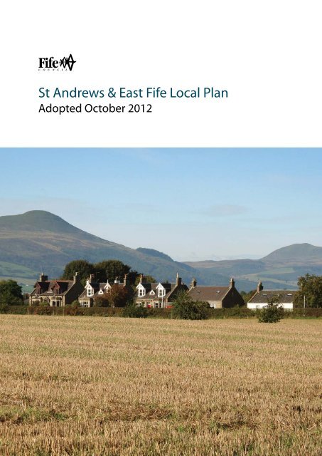
<strong>St</strong> <strong>Andrews</strong> & <strong>East</strong> <strong>Fife</strong> <strong>Local</strong> <strong>Plan</strong>Adopted October 2012
In preparing this <strong>Local</strong> <strong>Plan</strong>, extensive consultation took place with communityrepresentatives, local interest groups, developers and elected members. The<strong>Plan</strong> has been informed by the outcome of public consultation on the <strong>St</strong>rategicEnvironmental Assessment and a revised version of the EnvironmentalReport is being published to accompany the adoption of the <strong>Local</strong> <strong>Plan</strong>.This <strong>Plan</strong> replaces in full the adopted <strong>St</strong> <strong>Andrews</strong> Area <strong>Local</strong> <strong>Plan</strong> (1996) andthe adopted Tay Coast <strong>Local</strong> <strong>Plan</strong> (1998). It also replaces in part the Largo &<strong>East</strong> Neuk <strong>Local</strong> <strong>Plan</strong> (1995) and the Cupar & Howe of <strong>Fife</strong> <strong>Local</strong> <strong>Plan</strong> (2003).I would like to express my thanks on behalf of <strong>Fife</strong> Council to all who havecontributed to the preparation of this <strong>Local</strong> <strong>Plan</strong> through its many stages andlook forward to its implementation.
IntroductionThe <strong>Fife</strong> Development <strong>Plan</strong> provides the statutory policy framework for landuse planning in <strong>Fife</strong>. It is made up of the <strong>Fife</strong> <strong>St</strong>ructure <strong>Plan</strong> and <strong>Local</strong> <strong>Plan</strong>s.The <strong>St</strong>ructure <strong>Plan</strong> sets the strategic guidance for the future development of<strong>Fife</strong> and identifies the general location and scale of development.The <strong>Fife</strong> <strong>St</strong>ructure <strong>Plan</strong> covers the 20-year period from 2006-26. The <strong>St</strong><strong>Andrews</strong> & <strong>East</strong> <strong>Fife</strong> <strong>Local</strong> <strong>Plan</strong> is one of 4 <strong>Local</strong> <strong>Plan</strong>s being prepared. <strong>Fife</strong>’sother <strong>Local</strong> <strong>Plan</strong>s cover Mid <strong>Fife</strong>, and Dunfermline & West <strong>Fife</strong>, and there is a<strong>Local</strong> <strong>Plan</strong> dedicated solely to minerals, called the <strong>Fife</strong> Minerals Subject <strong>Local</strong><strong>Plan</strong>.The strategy of this <strong>Local</strong> <strong>Plan</strong> complements that of the <strong>St</strong>ructure <strong>Plan</strong> andcovers the period 2008-22. It applies the <strong>St</strong>ructure <strong>Plan</strong> strategy locally,establishing a detailed, site-specific framework of policies and proposals forland use and other related matters. It guides and promotes development inthe area and explains how towns and villages will change over the <strong>Plan</strong>period. In addition, it provides for stability in areas where no significantchange is proposed.Figure 1.2 (<strong>St</strong> <strong>Andrews</strong> & <strong>East</strong> <strong>Fife</strong> <strong>Local</strong> <strong>Plan</strong> Process) outlines the <strong>Local</strong><strong>Plan</strong> process.A finalised draft <strong>St</strong> <strong>Andrews</strong> & <strong>East</strong> <strong>Fife</strong> <strong>Local</strong> <strong>Plan</strong> was approved by theformer Environment & Development Committee on 31 st August, 2006 as abasis for public consultation. However, the planned consultation on thatdocument (scheduled for the early months of 2007) had to be cancelled dueto uncertainties surrounding the <strong>Fife</strong> <strong>St</strong>ructure <strong>Plan</strong> position at that time.The Finalised <strong>St</strong> <strong>Andrews</strong> & <strong>East</strong> <strong>Fife</strong> <strong>Local</strong> <strong>Plan</strong> 2009 updated and replacedthe finalised draft <strong>Plan</strong>, which was prepared following public consultation onthe consultative draft <strong>Local</strong> <strong>Plan</strong>. This took place during spring 2005 when thedraft <strong>Plan</strong> was placed on deposit as part of the Be a Part of <strong>Fife</strong>’s Futureconsultation. In preparing the consultative draft <strong>Local</strong> <strong>Plan</strong> in 2004-05, <strong>Fife</strong>Council Development Services consulted with a wide range of bodies. Wealso ran a series of public consultation events from 2003 including YourPlace, Your <strong>Plan</strong> in spring 2004. Community <strong>Plan</strong>ning partners and publicagencies such as the Scottish Environment Protection Agency (SEPA) andScottish Natural Heritage (SNH) were involved throughout theseconsultations.Now adopted, the <strong>St</strong> <strong>Andrews</strong> & <strong>East</strong> <strong>Fife</strong> <strong>Local</strong> <strong>Plan</strong> replaces, in whole or inpart, the 4 <strong>Local</strong> <strong>Plan</strong>s (Cupar and Howe of <strong>Fife</strong>; Tay Coast; <strong>St</strong> <strong>Andrews</strong> Area;Largo and <strong>East</strong> Neuk) that were previously in place for the <strong>St</strong> <strong>Andrews</strong> and<strong>East</strong> <strong>Fife</strong> area. All of the views and comments made at the consultative draft,SEA Scoping, finalised draft and First <strong>St</strong>age Environmental Report stageswere considered in preparing this <strong>Plan</strong>. Many opportunities have already beenprovided for local people and community organisations to become involved in
the shaping of the policies and proposals that make up the <strong>St</strong> <strong>Andrews</strong> & <strong>East</strong><strong>Fife</strong> <strong>Local</strong> <strong>Plan</strong>.This <strong>Local</strong> <strong>Plan</strong> comprises:• The <strong>Plan</strong> <strong>St</strong>atement which describes the overall strategy and providesa summary of the planning issues, policies, and proposals affectingindividual towns and villages. These are described in Settlement <strong>Plan</strong>s.• A Proposals Map identifying the location of development proposalsand where policies apply geographically. The Proposals Map includesindividual Settlement map insets• Policies which are used in decisions to manage and promotedevelopment.An Action Programme is published along with the <strong>Local</strong> <strong>Plan</strong> describingplanning proposals, who is responsible for implementing them, and theiranticipated timescales. The Action Programme will be updated every twoyears to monitor progress on implementing the <strong>Local</strong> <strong>Plan</strong>.The Action Programme includes the <strong>Plan</strong>ning Obligations FinancialFramework.A CD containing the <strong>Plan</strong> documents and supporting papers is available. Thedocuments and all associated papers are also available online atwww.fifedirect.org.uk. A link from this website allows all of the documents tobe viewed interactively. It should be noted that non-<strong>Fife</strong> Council documentsincluded as supporting papers have not been endorsed by the Council forplanning purposes and do not form part of the <strong>St</strong> <strong>Andrews</strong> & <strong>East</strong> <strong>Fife</strong> <strong>Local</strong><strong>Plan</strong>.The Environmental Assessment of <strong>Plan</strong>s and Programmes (Scotland)Regulations 2004 has made <strong>St</strong>rategic Environmental Assessment (SEA) oflocal development plans a statutory requirement. SEA has been undertaken inpreparing the <strong>Local</strong> <strong>Plan</strong> to comply with the Regulations and Europeanlegislation and an environmental report has been prepared alongside the<strong>Local</strong> <strong>Plan</strong>. The intention of SEA is to provide for a high level of protection ofthe environment and to contribute to the integration of environmentalconsiderations into the preparation and adoption of plans and programmeswith a view to promoting sustainable development (EC Directive 2001/42/EC).
Policy ContextThe Scottish Government has published Scotland’s National <strong>Plan</strong>ningFramework 2, which sets out an achievable long-term vision for Scotland andidentifies the likely change to 2025. It identifies the strategic developmentpotential of the Aberdeen-Edinburgh-Newcastle transport corridor, whichcrosses the <strong>Local</strong> <strong>Plan</strong> area, and identifies Mid <strong>Fife</strong> as an area of nationalpriority for environmental enhancement. <strong>Local</strong> <strong>Plan</strong> strategy has beenreviewed to ensure that any changes necessitated through the National<strong>Plan</strong>ning Framework 2 are incorporated within the <strong>Local</strong> <strong>Plan</strong>.The <strong>Local</strong> <strong>Plan</strong> has also been prepared in the context of the NationalEconomic <strong>St</strong>rategy. This promotes sustainable economic growth and theproposals contained within the <strong>Local</strong> <strong>Plan</strong> contribute to this objective.The <strong>Local</strong> <strong>Plan</strong> is prepared under the umbrella of the <strong>Fife</strong> Community <strong>Plan</strong>and the <strong>Fife</strong> <strong>St</strong>ructure <strong>Plan</strong>, which has been prepared in the context of theNational <strong>Plan</strong>ning Framework. The Community <strong>Plan</strong> provides the sharedvision for <strong>Fife</strong> of public sector partners and the wider <strong>Fife</strong> community over thenext ten years. The <strong>Local</strong> <strong>Plan</strong> also has regard to other plans andprogrammes prepared by <strong>Fife</strong> Council and its partners, including the <strong>Fife</strong>Economic Development <strong>St</strong>rategy, the <strong>Local</strong> Housing <strong>St</strong>rategy and the <strong>Local</strong>Transport <strong>St</strong>rategy. The <strong>St</strong>ructure <strong>Plan</strong> will be replaced by new <strong>St</strong>rategicDevelopment <strong>Plan</strong>s for both Edinburgh and Dundee City Regions. <strong>Fife</strong> iswithin both of these regions for strategic planning.The <strong>Fife</strong> Development <strong>Plan</strong> fits into a wider legal context set by EuropeanDirectives and is guided by the Scottish Government’s Scottish <strong>Plan</strong>ningPolicy (SPP), <strong>Plan</strong>ning Advice Notes (PANs) and circulars. These areavailable on the Scottish Government website – http://www.scotland.gov.uk.Their contents are reflected in this <strong>Plan</strong>’s policies but not repeated.
<strong>St</strong>rategic Context1. The National <strong>Plan</strong>ning Framework (NPF), which is a strategy for thelong-term development of Scotland’s towns, cities and countryside,identifies key strategic infrastructure needs to ensure that each part ofthe country can develop to its full potential. The <strong>Fife</strong> <strong>St</strong>ructure <strong>Plan</strong>takes account of the NPF, provides a 20 year vision for <strong>Fife</strong> and setsthe strategic land use policy context for <strong>St</strong> <strong>Andrews</strong> and <strong>East</strong> <strong>Fife</strong>. Thefollowing paragraphs list what this means for the whole <strong>Local</strong> <strong>Plan</strong>area.2. Sustainable development:• Developing and maintaining sustainable communities by deliveringaffordable housing as part of new development. This includespromoting <strong>St</strong>rategic Land Allocations in Cupar, <strong>St</strong> <strong>Andrews</strong>,Tayport/Newport/Wormit and in the <strong>East</strong> Neuk settlements• Accommodating projected growth in <strong>Fife</strong>’s population• Supporting and strengthening the rural economy by encouraging itsdiversification• Further developing <strong>St</strong> <strong>Andrews</strong> as a high quality tourist destination andbuilding on the tourism industry throughout <strong>Fife</strong>• Providing a choice of quality housing as well as a choice of differentlocations, prices and tenures3. Developing the economy:• Attracting inward investment, and supporting and strengthening therural economy. In this context, <strong>St</strong> <strong>Andrews</strong> will be promoted as one of<strong>Fife</strong>’s key town centres and will be developed as an internationaldestination with the potential to build on its international profile as acultural, sporting, leisure, visitor destination and centre of academicexcellence• Identifying strategic employment sites together with a seven-yearsupply of employment land in towns with a population greater than5,000 and in clusters in rural areas. This includes promoting class 4business use in town centre locations• Increasing job opportunities and directing new employment-creatingdevelopment to <strong>St</strong> <strong>Andrews</strong>• Supporting <strong>St</strong> <strong>Andrews</strong>’ development as an asset for the knowledgebasedeconomy. This includes support to realise the commercialpotential of the higher education sector and working with the Universityto explore development of the campus• Focussing retail growth in <strong>St</strong> <strong>Andrews</strong> and in Cupar as district shoppingcentres, enhancing the service role of Cupar Town Centre andconsolidating growth in other town centres
4. Safeguarding and improving the environment:• Designating a Green Belt for <strong>St</strong> <strong>Andrews</strong> which will manage long termplanned growth for the town and take account of the need to protectthe town’s character, landscape setting and identity5. Developing the transport network:• Maximising the efficient use of the Tay road and rail crossings toincrease car sharing and the use of public transport• Promoting mixed use developments to achieve improved accessibility• Focussing major developments on public transport interchanges andtown centres served by public transport and increasing developmentdensities in these areas. This includes identifying opportunities forimprovements to public transport infrastructure• Supporting the provision of strategic transport improvements includinga relief road for Cupar and a link road for <strong>St</strong> <strong>Andrews</strong><strong>St</strong>rategic Locations6. The <strong>Local</strong> <strong>Plan</strong> applies the <strong>St</strong>ructure <strong>Plan</strong> strategy at a local level andprovides more detailed local guidance.7. The <strong>St</strong>ructure <strong>Plan</strong> identifies <strong>St</strong>rategic Land Allocations at Cupar, <strong>St</strong><strong>Andrews</strong>, Tayport/Newport/Wormit and in the <strong>East</strong> Neuk settlements.These locations present the best opportunity to further developestablished settlements at a scale which can deliver infrastructure andservices, and which are sustainable in terms of location and in the mixof land uses to meet community and economic needs. Development inthese areas will largely be on greenfield land due to the limited amountof brownfield land in <strong>East</strong> <strong>Fife</strong>, whilst maximising the re-development ofbrownfield land where possible. All new development will require to beof a high quality in terms of layout and design, and should adhere tothe principles contained within the guidance in <strong>Fife</strong> Council's <strong>Fife</strong>Masterplans Handbook.8. Masterplans will be prepared to guide development in the <strong>St</strong>rategicLand Allocations. The masterplans will specify the phasing, scale andsiting of development in line with the <strong>Fife</strong> Development <strong>Plan</strong> and will beprepared in consultation and with the involvement of the communitiesaffected. The masterplans will require <strong>Fife</strong> Council approval before theyare implemented and must demonstrate how they will help to createsustainable communities by providing:• Housing to meet a wide variety of needs, including affordable housing;• Employment land to attract and retain jobs; and• Development to meet identified social and community needs.
9. All development must be of high quality design to produce an attractiveand safe environment in which to live, work, play, invest and learn.10. The <strong>Local</strong> <strong>Plan</strong> provides detail over the period to 2022 while indicating,in broad terms, development over the longer term to informcommunities, landowners and investors.11. In determining locations for new development, <strong>Fife</strong> Council has takenaccount of opinion expressed through public involvement events andbalanced this against wider public interests. These are areas whereinfrastructure capacity is available, or where it should be provided andcan be supported by further development; which relate well with thetransport network; which have an acceptable or manageableenvironmental impact; and which are accessible to core communityservices such as schools, shops, or local facilities either on a selfcontainedbasis or collectively as a cluster of communities12. <strong>St</strong> <strong>Andrews</strong>13. <strong>St</strong> <strong>Andrews</strong> remains one of Scotland’s most popular locations as aplace to live. Its role as the principal town in <strong>East</strong> <strong>Fife</strong> is recognised inthe <strong>Local</strong> <strong>Plan</strong> strategy. The development strategy is to expand <strong>St</strong><strong>Andrews</strong> over the next 20 years to realise the potential of tourism andthe University as an economic driver for <strong>Fife</strong>, whilst balancing this withthe need to protect its internationally important heritage. Developmentat North Haugh/Langlands, and at land at Craigtoun Road, make upthe <strong>St</strong> <strong>Andrews</strong> West <strong>St</strong>rategic Land Allocation. This will provide foremployment land, 1,090 houses (including a minimum of 30%affordable), and community development over a 20-year period. The<strong>Fife</strong> <strong>St</strong>ructure <strong>Plan</strong> proposes a slightly lower proportion of housingdevelopment for the <strong>St</strong> <strong>Andrews</strong> Housing Market Area than its share of<strong>Fife</strong>’s population would merit and this is reflected in the <strong>Local</strong> <strong>Plan</strong>.14. To fulfil <strong>St</strong> <strong>Andrews</strong>’ role, the town needs further employment land toprovide opportunities for economic development, and to deliveraffordable housing, whilst protecting and enhancing the landscapesetting. To increase the contribution that science and technology maketo the <strong>Fife</strong> economy and develop links outwith <strong>Fife</strong>, opportunities areidentified for a science park, new business parks, and expansion of thetourism sector. New business parks will support local businesses aswell as providing opportunities for further employment in the town.15. The <strong>Local</strong> <strong>Plan</strong> allocates sites at the University of <strong>St</strong> <strong>Andrews</strong>’ NorthHaugh/Langlands campus west of the town centre to identify andprotect the land required to accommodate the academic growth andcommercial spin-off developments anticipated to take place over theperiod to 2026. It also identifies opportunities for housing development.This housing development, in addition to meeting housing needs, is akey element of the expansion of this area of <strong>St</strong> <strong>Andrews</strong> as it willenable the proposed improvement to the University’s facilities through
the provision of shared infrastructure. In turn, the extension of theUniversity campus, incorporating a Science Park, will ensure thatresearch at the University can be commercialised for the benefit of thelocal economy. The Council will work with the University of <strong>St</strong> <strong>Andrews</strong>to explore the development of the campus over a 20-year period.Depending on the masterplanning process for <strong>St</strong> <strong>Andrews</strong> West, a newprimary school will be provided either at North Haugh/Langlands or atCraigtoun Road.16. There is also a need to explore options to provide a replacement forMadras College.17. <strong>St</strong> <strong>Andrews</strong>’ attraction as a place to live, together with limiteddevelopment opportunities, has affected the housing market. Land andhouse prices have increased to the extent that new affordable housingfor local people on lower incomes has all but disappeared.Development pressure on the town’s open spaces and olderemployment sites has also increased. In response to this, <strong>St</strong> <strong>Andrews</strong>has been designated as a Pressured Area which suspends sometenants’ rights to buy their council or housing association house. Due tothe high need for affordable housing in the area, a higher proportion ofnew housing development is required to be affordable, compared toother areas in <strong>Fife</strong>. <strong>St</strong> <strong>Andrews</strong> needs to provide the scale ofdevelopment that will help to contribute investment in new housingwithin the <strong>St</strong> <strong>Andrews</strong> Housing Market Area and to provide, within thetown, housing that is affordable to more people in the local community,community facilities and services, places of worship, employmentopportunities and infrastructure, thereby helping to sustain thecommunity. The <strong>Local</strong> <strong>Plan</strong> acknowledges the need to support publicsector funding for new facilities serving <strong>St</strong> <strong>Andrews</strong> and the wider area.However, significant private sector capital secured through developercontributions will be required to provide the scale of investmentnecessary.18. The strategy recognises that the town's landscape setting has limitedcapacity to accommodate expansion. This limit is defined by a GreenBelt boundary which is set for 20 years and will be subject to a reviewby 2028. Development within the first 14 years of that period isidentified on the Proposals Map. The Green Belt boundaries takeaccount of the need to manage development over and beyond the<strong>Local</strong> <strong>Plan</strong> period, and to protect <strong>St</strong> <strong>Andrews</strong>’ character and landscapesetting19. Cupar20. Cupar’s growth over the last 30 years has not been matched by thegrowth in the town’s services and facilities. Cupar has remainedpopular as a place to live and this was reflected in rapid increases inhouse prices which placed it as one of the least affordable towns inScotland in which to buy a house according to pre-recession surveys.
The town has lost its role as a ‘County Town’ and agricultural marketfor the surrounding area. Demand for houses in the town remains highbut this has not been matched by growth in employment opportunities.21. The <strong>Local</strong> <strong>Plan</strong> strategy for Cupar is to consolidate the town’s role asthe principal centre for services and facilities, places of worship,serving the wider rural hinterland, involving the development of 1,400houses, community facilities and infrastructure, enhanced educationfacilities and business and commercial land over a 20-year period. Theproposals in this <strong>Local</strong> <strong>Plan</strong> begin the move towards this aim bypromoting development to accommodate changes in household size,increases in population, attracting and retaining services, providingemployment opportunities and addressing traffic management issues.The scale of development proposed will help to minimise infrastructurecosts.22. One of the main challenges for the town is how development can bechannelled to resolve transportation issues. The development strategyfor the town over the next 20 years will enable the construction of anorthern relief road to be funded through development. The road willresolve many of the congestion and environmental issues which impacton the town centre. It will also provide development options foremployment land (including a business park), housing, bulky-goodsretailing, community facilities, infrastructure, and public transportconnections. Binding legal agreements will ensure that the road is builtearly in the construction phase of associated housing developments.23. Construction of the relief road will allow for further traffic calmingmeasures and associated environmental improvements to beintroduced in the town centre guided by a Town Centre ImprovementFramework. In addition, any house building on sites within Cupar (butoutwith the Cupar North <strong>St</strong>rategic Land Allocation) will be required tomake financial contributions to the revitalisation of the town centre.Further details on financial contributions are contained in the <strong>Plan</strong>ningObligations Financial Framework in the Action Programmeaccompanying the <strong>Local</strong> <strong>Plan</strong>.24. These measures are seen as part of a package to safeguard theviability and function of central Cupar as the town is extended to thenorth. They will include environmental and public path improvementswhich should make a significant contribution to improvingenvironmental quality within the town. It is envisaged that a betterquality environment in the town centre should also attract furtherbusinesses and the <strong>Local</strong> <strong>Plan</strong> encourages the development of officebasedbusiness there.25. Development will be phased over the 20 year period and will be guidedby masterplans to be prepared for Council approval. The masterplanswill also address development phasing, design principles, land-usesand layout, access, and integration with the built up area. They will help
avoid piecemeal development and will be the means through which aplanned extension to the town can be created to a high standard.Public involvement will continue as the masterplans are developed andimplemented.26. Tayport/Newport/Wormit27. The Tay Bridgehead communities, focussed on Tayport, Newport-on-Tay, and Wormit, are important to <strong>Fife</strong>’s connections to the northbecause of the cross-Tay transport links, and the shopping, business,and employment relationships with Dundee and Angus. The planningstrategies of <strong>Fife</strong>, Dundee and Angus have been to meet the housingand development needs of their respective areas, particularly inrelation to housing, so that unnecessary commuter traffic isdiscouraged. This approach to housing land and the provision of newopportunities for local employment land is continued in this <strong>Local</strong> <strong>Plan</strong>.The <strong>Fife</strong> <strong>St</strong>ructure <strong>Plan</strong> identifies development of up to 630 housesover a 20-year period. The scale of development proposed meetsneeds for housing and employment land and supports the case for theopening of a rail halt at Wormit in the longer term. The <strong>Local</strong> <strong>Plan</strong>identifies development to 2022 and indicates the direction of growthbeyond that period.28. <strong>East</strong> Neuk Settlements29. The <strong>East</strong> Neuk is less well served in respect of its connections with thetransport network when compared with other population centres in <strong>Fife</strong>.It is nevertheless a popular area to set up home and to visit, and playsan important role in <strong>Fife</strong>’s rural economy. The principal service centrefor the area is Anstruther & Cellardyke which, together, have becomeestablished as an area of tourism and commercial activity. The <strong>East</strong>Neuk is also notable for a high proportion of second homes which addpressure to the local housing market. This is indicative of the changingrole of the <strong>East</strong> Neuk which has suffered economically fromrestructuring in fishing and agriculture and is increasingly seen as anattractive location for retirees and ‘weekend residents’ which affectslocal economic activity. As with <strong>St</strong> <strong>Andrews</strong>, in 2006 the ScottishGovernment agreed to <strong>Fife</strong> Council’s request to identify part of the <strong>East</strong>Neuk as a Pressured Area. This suspends the rights of some tenantsto buy their house. A higher proportion (30%) of new housingdevelopment is required to be affordable, compared to other areas in<strong>Fife</strong>, due to the high need for affordable housing.30. The <strong>Fife</strong> <strong>St</strong>ructure <strong>Plan</strong> identifies development of 500 houses ongreenfield sites over a 20-year period. The <strong>Local</strong> <strong>Plan</strong> will help tofurther develop diversity and growth in this area by capitalising on theexisting assets and encouraging economic diversity. The character ofthe area will be safeguarded and its distinctiveness retained byavoiding coalescence along the coastal strip. Whilst developmentproposals are predominantly housing-led, other development land
eleases will be for commercial and employment land appropriate tothe needs of the area. Employment land is identified in Anstruther, <strong>St</strong>Monans, and Crail.Sustainable Development31. The <strong>Local</strong> <strong>Plan</strong> aims to safeguard resources and to locate developmentwhere it has limited impact on the environment and the most positivesocial and economic effects. Sites have been selected for housing,employment and other development from those considered best able tomeet these aims and so help create sustainable communities. Newsettlements are not proposed; instead, new developments will beintegrated with existing communities so that more people can benefitfrom enhanced facilities. Sustainability should not be seen as a barrierto building on previously undeveloped land or countryside, however.Where proposals can bring benefits to new and existing communities,development will be considered in line with the <strong>Local</strong> <strong>Plan</strong> strategy andpolicies.32. The <strong>Local</strong> <strong>Plan</strong> will promote sustainable communities through:• Identifying sites which encourage people to walk, cycle or use publictransport to get to work, school and community facilities either inindividual settlements or collectively across a number of neighbouringcommunities;• Improving travel choices through promoting public transport and thedevelopment of non-vehicular links such as pedestrian and cycle pathsin conjunction with the core paths identified in the <strong>Fife</strong> Core Paths <strong>Plan</strong>;• Supporting new development which minimises and mitigatesenvironmental impact, including moving towards low or zero carbondevelopment where it conforms with other <strong>Local</strong> <strong>Plan</strong> policies;• Supporting the provision of garden ground and allotments;• Encouraging domestic renewable energy and shared sources ofenergy;• Promoting buildings that can provide for different needs over time;• Safeguarding and creating green corridors for biodiversity and access -the latter in conjunction with the core paths system;• Providing for a range of housing densities appropriate to the scale andlocation of the site, and increasing the number of units per hectare,particularly where the development sites are close to town centresand/or key public transport interchanges; and• Providing a choice of quality housing styles and size, as well as achoice of different locations, prices and tenures.33. Substantial progress has already been achieved in the promotion ofsustainable development in other parts of <strong>Fife</strong>, and this has beenreflected through a number of proposed major developments such asrenewable energy at Energy Park <strong>Fife</strong> in Methil and development of agreen business park at Westfield, near Kinglassie. We will seek to
encourage suitable proposals to promote sustainable development in<strong>East</strong> <strong>Fife</strong> where these accord with Development <strong>Plan</strong> policies.Developing the economy34. The <strong>Local</strong> <strong>Plan</strong> sets objectives to expand the economy by:• Improving local employment prospects by identifying land for businessand commerce which will help to sustain the rural economy andprovide jobs;• Supporting <strong>St</strong> <strong>Andrews</strong> in its role as a centre of academic excellenceand encouraging business to develop on that foundation;• Promoting Cupar as a location for business investment and growth andconsolidating its role as the service centre for <strong>East</strong> <strong>Fife</strong>;• Diversifying the business and employment base by supporting neweconomic development;• Encouraging new job opportunities close to rural communities;• Promoting sites for hotel development in support of the touristeconomy; and• Providing for employment land across the <strong>Plan</strong> area, includingpromoting sites within town centres for business use.35. Competition for jobs is increasing not only within <strong>Fife</strong> but also acrossScotland, the UK, and in an expanded Europe. The 2009 recession hasadded to these pressures. The planning system needs to support theassets that can attract new and diverse economic activity. <strong>East</strong> <strong>Fife</strong>has a high dependence on a large number of small businesses mainlyin agriculture, construction, and services. The <strong>Local</strong> <strong>Plan</strong> strategy is notto compete with larger urban areas but to build on the area’s strengthssuch as the high quality environment, tourist attractions, andeducational assets.36. A healthy local economy and business sector is essential tosustainable communities. This is acknowledged in <strong>Fife</strong>'s Community<strong>Plan</strong>. Private and public sector initiatives can, within the <strong>Fife</strong>Development <strong>Plan</strong> framework, help create an environment in which thelocal economy can thrive and provide for the establishment of newbusinesses – important in rural areas where traditional jobs in thefishing and farming sectors are under pressure.37. <strong>East</strong> <strong>Fife</strong> also has a considerable industrial heritage but, compared toother parts of <strong>Fife</strong>, manufacturing is not well represented in the patternof employment. The recent closure of Curtis Fine Papers inGuardbridge provides evidence of further pressure on that sector.Nevertheless, over 84% of the adult population in <strong>East</strong> <strong>Fife</strong> iseconomically active, above the <strong>Fife</strong> average of 80%. The areacontinues to attract economically active residents, partly because manyare able to travel out of the area to work in skilled and professionaloccupations. Significant local employment with large service sectorestablishments is restricted mainly to RAF Leuchars and the University
of <strong>St</strong> <strong>Andrews</strong>, and also to public services in healthcare and with <strong>Fife</strong>Council.38. There are two strands to broadening the local business base. The firstis to build on the potential for academic links to foster businessopportunities. The University of <strong>St</strong> <strong>Andrews</strong>, in particular, has a keyrole in this respect by developing its landholdings at the western edgeof the town to encourage small and medium size businesses in spin-offbusiness space. Scotland has the capacity to develop such businesseswhich can create wealth through the commercial development ofresearch and teaching. The University's global reputation forexcellence in scientific research is an asset to <strong>Fife</strong> and Scotland. Asone of the highest rated universities in the field of scientific research, itprovides a platform for developing knowledge based business,attracting further investment, and making a major contribution to the<strong>Fife</strong> economy through the volume and value of jobs it creates. The<strong>Local</strong> <strong>Plan</strong> strategy is to work with the University to realise theUniversity's potential to create economic opportunities from itsacademic activities as part of a western expansion of <strong>St</strong> <strong>Andrews</strong>. The<strong>St</strong> <strong>Andrews</strong> Settlement <strong>Plan</strong> illustrates where development will takeplace.39. The second strand to expanding the business base in <strong>East</strong> <strong>Fife</strong> is toprovide a flexible planning policy framework which will allow newemployment opportunities and commerce in rural areas as well as intowns. The <strong>Local</strong> <strong>Plan</strong> does this with a view to supportingdiversification of farming activities, giving preference to business useover housing when considering the redevelopment of rural properties,and encouraging more sites for employment land in areas where thedemand is high and the opportunities exist.40. A strategic objective of the <strong>Fife</strong> Development <strong>Plan</strong> is to provide aseven-year supply of employment land in towns with a populationgreater than 5,000 and in clusters within rural areas. The <strong>Local</strong> <strong>Plan</strong>identifies new employment land in <strong>St</strong> <strong>Andrews</strong> and Cupar, in the <strong>East</strong>Neuk and the Tay Bridgehead, and in some smaller settlementsthroughout <strong>East</strong> <strong>Fife</strong> to assist job prospects available to smaller andmore rural communities. These development opportunities areidentified in the Settlement <strong>Plan</strong>s. In addition, there is policy support forsmall scale business development at the edge of settlements wherethese contribute to the employment land supply and meet otherplanning policies.41. Class 4 business uses are promoted within the town centres of <strong>St</strong><strong>Andrews</strong> and Cupar. Within some Areas of Mixed Use, developers willbe required to provide fully-serviced class 4 business premises prior tocompletion of housing development.
42. Town centres43. The main town centres in <strong>East</strong> <strong>Fife</strong> have a key role in local economicgrowth by supporting employment, leisure and cultural services, andretailing and business. <strong>St</strong> <strong>Andrews</strong> is one of the town centres in <strong>Fife</strong>regarded as key to <strong>Fife</strong>'s economic growth and the <strong>Plan</strong> strategyrecognises that the town has the potential to make a contribution to theeconomy of <strong>East</strong> <strong>Fife</strong> and <strong>Fife</strong> as a whole. The Settlement <strong>Plan</strong> for <strong>St</strong><strong>Andrews</strong> explains in more detail what this means in terms of land useand development in the town. Compared to that envisaged for Cupar,<strong>St</strong> <strong>Andrews</strong>' retail role is seen as serving more visitor and tourismneeds, but with an emphasis on quality. This will include changes tothe town centre's environment to provide for a more attractive andcomfortable experience for all who use it.44. Cupar has a role as the service centre for much of rural <strong>East</strong> <strong>Fife</strong>. The<strong>Local</strong> <strong>Plan</strong> proposes additional development in the town to enhancethis function. This will be met within the town centre, providing furtheropportunities for retail and business use, and through a new retail parkin association with the northern expansion of the town. The retail parkwill accommodate bulky goods retail to complement, rather thancompete with, the retailing available within the town centre and willprovide for the retention of retail expenditure within <strong>Fife</strong>. The vision forCupar is one which consolidates its role as an important retail centrefor <strong>East</strong> <strong>Fife</strong>, given its central location, and where non-retail businesses- such as the professional services sector - can develop further.45. Tourism46. <strong>East</strong> <strong>Fife</strong> has a leisure economy based around golf and tourism.Tourism is a cornerstone of the local economy in many parts of <strong>East</strong><strong>Fife</strong>, and is nationally significant in terms of income and supportingemployment. <strong>St</strong> <strong>Andrews</strong>’ role is again central to the <strong>Plan</strong> strategy as ithas a competitive advantage as the recognised 'home of golf' andthrough its cultural connections. In addition, the University has potentialto support tourism through its heritage, accommodation, and academicresources. <strong>East</strong> <strong>Fife</strong> as a whole is attractive to visitors as a place forleisure activities with assets such as the environment of the <strong>East</strong> Neukcoastal villages, championship golf courses, the <strong>Fife</strong> Coastal Path, <strong>Fife</strong>cycleways and inland walking routes.47. Opportunities for hotel and commercial leisure development aresupported by the <strong>Plan</strong> strategy and identified in <strong>St</strong> <strong>Andrews</strong>, Cupar,Guardbridge and Tayport.
48. Minerals49. Mineral working is an important economic activity but it consumesfinite resources and can also result in significant impacts on theenvironment and communities. Restoration, aftercare and after-use ofsites are therefore important planning considerations. The <strong>Fife</strong><strong>St</strong>ructure <strong>Plan</strong> and the <strong>Fife</strong> Minerals Subject <strong>Local</strong> <strong>Plan</strong> provide policyguidance on matters relating to minerals. Coal bed methane is also animportant economic resource and policy guidance on this matter isprovided in the <strong>Fife</strong> Minerals Subject <strong>Local</strong> <strong>Plan</strong> under Policy MIN 2b,Onshore Gas including Coal Bed Methane (CBM), which wasintroduced to the subject plan by means of an alteration, adopted April2011.50. Developers should bear in mind that development in former coalfieldareas may be affected by, or may itself affect, any of a number of areasof concern arising as a legacy of coal mining. Such areas of concernmay be related to problems of ground stability, minewatercontamination or seepage of mine gases to the surface. Developmentproposals will require to take account of these possibilities.Meeting housing needs51. The <strong>Local</strong> <strong>Plan</strong> <strong>St</strong>rategy to meet housing need is by:• Allowing for housing development to meet the strategic housing landrequirement and providing a minimum five year effective land supply atall times within each Housing Market Area, where this does not conflictwith the strategy of the strategic development plan;• Contributing to providing affordable and special needs housing to helpmeet <strong>Fife</strong> <strong>Local</strong> Housing <strong>St</strong>rategy objectives;• Allocating suitable land for development in locations that are accessibleto public transport and basic community services, either on a selfcontained basis in settlements, or collectively within a cluster ofcommunities;• Providing for a range of densities appropriate to the scale and locationof the site, particularly in relation to proximity to the main publictransport nodes and interchanges;• Encouraging new houses which are adaptable to meet future trends;and• Creating sustainable communities and applying the principlescontained in the <strong>Fife</strong> Urban Design Guide.
52. <strong>Local</strong> <strong>Plan</strong> housing land requirement 2008-2253. National planning policy requires development plans to ensure thatthere is, at all times a minimum five-year supply of housing land inevery Housing Market Area (HMA). This land is expected to be freefrom development constraints (ready to build) within the <strong>Plan</strong> period.There is an effective five-year land supply in the <strong>St</strong> <strong>Andrews</strong> and North<strong>East</strong> <strong>Fife</strong> Housing Market Area. In the Cupar and North West <strong>Fife</strong>Housing Market Area, the current economic conditions and thecomplex nature of the site mean that the Cupar North <strong>St</strong>rategic LandAllocation is likely to deliver houses later and at a slower rate thanoriginally envisaged There is not, therefore, a minimum five-yearsupply of effective housing land in this housing market area. Additionalallocations to compensate have not been made in Cupar, as they couldthreaten the deliverability of Cupar North and hence the town centrerelief road. The local plan allocates a sufficient supply of housing siteselsewhere in the housing market area to meet the balance of structureplan Proposal PH1 (Future <strong>Local</strong> <strong>Plan</strong> Allocation). Additionalallocations of housing land outwith Cupar would be contrary to thestructure plan strategy of enhancing the role of the town as the servicecentre for rural <strong>East</strong> <strong>Fife</strong>. The land supply should, where possible,provide a variety of sites in terms of size, location, and house types inareas where potential house-buyers want to live. The <strong>Fife</strong> <strong>St</strong>ructure<strong>Plan</strong> sets the housing land requirement up to 2026. The <strong>Local</strong> <strong>Plan</strong>identifies land to meet this requirement over the period to 2022.54. The number of houses that require to be identified through this <strong>Local</strong><strong>Plan</strong> by Housing Market Area and by <strong>Local</strong> <strong>Plan</strong> Area are calculated asfollows:
Housing LandRequirement(A)Shortfall(C)--Existing HousingSupply (B)<strong>St</strong>rategic LandAllocation (D)= Shortfall (C)=Sites to beidentified throughthe <strong>Local</strong> <strong>Plan</strong> (E)<strong>Fife</strong> <strong>St</strong>ructure <strong>Plan</strong> Housing Market Area (HMA) Housing LandRequirement 2012- 2022HousingMarket Area(HMA)Cupar & NW<strong>Fife</strong> HMA<strong>St</strong> <strong>Andrews</strong>& NE <strong>Fife</strong>HMANotes:HousingLandRequirement(A)Existingsupply(B)Shortfall(C)<strong>St</strong>rategicLandAllocation(D)Number to befound through the<strong>Local</strong> <strong>Plan</strong>(E)1,400 830 570 558 122,200 1,417 783 1,127 -344(A) The <strong>St</strong>ructure <strong>Plan</strong> requirement (A) is the 2008-18 portion of the <strong>St</strong>ructure<strong>Plan</strong> 20 year (2006-26) requirement relating to the <strong>St</strong> <strong>Andrews</strong> and North <strong>East</strong><strong>Fife</strong>, and Cupar and North West <strong>Fife</strong> Housing Market Areas.(B) The existing supply figure comes from the effective housing supply(source: <strong>Fife</strong> Housing Land Audit 2011) and small sites (fewer than 5houses), windfall, and urban capacity sites assumptions (source: <strong>Fife</strong><strong>St</strong>ructure <strong>Plan</strong> Report of Survey, 2006), updated following the <strong>Local</strong> <strong>Plan</strong>Examination process(D) The <strong>St</strong>rategic Land Allocation figure (D) comes from the approved <strong>Fife</strong><strong>St</strong>ructure <strong>Plan</strong> (2006-26) and includes the additional allocations it identifies forthe period 2008-18, updated following the <strong>Local</strong> <strong>Plan</strong> Examination process(E) The <strong>Fife</strong> <strong>St</strong>ructure <strong>Plan</strong> requires the <strong>Local</strong> <strong>Plan</strong> to allocate 450 houses tothe Cupar & NW <strong>Fife</strong> Housing Market Area, and 930 houses to the <strong>St</strong><strong>Andrews</strong> & North <strong>East</strong> <strong>Fife</strong> Housing Market Area. The <strong>Local</strong> <strong>Plan</strong> allocationfor each Housing Market Area (E) is smaller than those figures because muchof the <strong>St</strong>ructure <strong>Plan</strong>’s requirement is contained in the existing supply (B) and<strong>St</strong>rategic Land Allocations. Additional <strong>Local</strong> <strong>Plan</strong> allocations have been madeto provide additional land supply in each Housing Market Area. Figuresupdated following the <strong>Local</strong> <strong>Plan</strong> Examination process.
<strong>Fife</strong> <strong>St</strong>ructure <strong>Plan</strong> Housing Land Requirement 2006-26 for <strong>St</strong>rategic LandAllocations (SLAs) as at August 2012<strong>St</strong>rategic Land Allocations2011-162016-21 2021-26 2006-26Cupar North 54 420 336 810<strong>St</strong> <strong>Andrews</strong> West 90 250 360 700Tayport/Newport/Wormit 124 180 35 339<strong>East</strong> Neuk 130 248 129 507TOTAL 398 1,098 860 2,356(Source: Approved <strong>Fife</strong> <strong>St</strong>ructure <strong>Plan</strong> Proposals PH2 and PH3; <strong>Fife</strong> HousingLand Audit 2011)Notes:These figures include the additional allocations introduced by the approved<strong>St</strong>ructure <strong>Plan</strong>, May 2009, and are shown phased across each 5 year period,Figures updated following the <strong>Local</strong> <strong>Plan</strong> Examination process55. The housing land requirement takes into account the existing landsupply, urban capacity assessments, and contributions from windfall(unanticipated) sites, and small (fewer than 5 houses) sites. [However,note that the housing land requirement is likely to be reviewed in thefuture due to the introduction of <strong>St</strong>rategic Development <strong>Plan</strong>Authorities.]56. In allocating land for development, the Council has taken account ofthe availability of infrastructure (or its provision through developmentfunding), the transport network, environmental factors, and access tocore community services such as schools, shops, or local facilities.Community consultations undertaken in preparing the <strong>Plan</strong> confirmedthat there is widespread concern, particularly among smallercommunities, that small towns and villages will become swamped bynew development. Where possible, therefore, the Council has soughtto apply some proportionality in allocating land for development andhas adjusted the distribution of housing land to take account ofphysical, infrastructural, and environmental factors.57. Five-year housing land supply58. The housing land supply in the <strong>Fife</strong> Housing Land Audit 2011 providesthe most up-to-date housing position for the <strong>Local</strong> <strong>Plan</strong> and sets thebaseline for meeting the housing land requirement. The <strong>Local</strong> <strong>Plan</strong> isthe preferred means of identifying land for development; however,there may be other opportunities which come forward during thelifetime of the <strong>Plan</strong>. The Settlement <strong>Plan</strong>s and the Action Programme
provide details of sites identified to meet the requirement. TheProposals Map identifies new allocations. The identified sites achievean effective five-year land supply in the <strong>St</strong> <strong>Andrews</strong> and North <strong>East</strong> <strong>Fife</strong>Housing Market Area. In the Cupar and North West <strong>Fife</strong> HousingMarket Area, the current economic conditions and the complex natureof the site mean that the Cupar North <strong>St</strong>rategic Land Allocation is likelyto deliver houses later and at a slower rate than originally envisagedThere is not, therefore, a minimum five-year supply of effective housingland in this housing market area. Additional allocations to compensatehave not been made, as explained above in paragraph 53.59. Affordable housing60. Two of <strong>Fife</strong>’s greatest assets – its location and environmental quality –contribute to pressuring the housing market. Lying within commutingdistance of Dundee, Perth, <strong>St</strong>irling, and Edinburgh has helped to attracta high demand from both within and beyond <strong>Fife</strong>’s boundaries. The<strong>Local</strong> Housing <strong>St</strong>rategy (update 2008) states that 60% of secondhomes in <strong>Fife</strong> are in <strong>East</strong> <strong>Fife</strong> (almost 38% in the <strong>East</strong> Neuk alone).The greatest house price rises in <strong>Fife</strong> between 1998 and 2003 (80%and above) have been in the <strong>East</strong> Neuk and <strong>St</strong> <strong>Andrews</strong>. The ScottishGovernment acknowledges the housing market issues within the <strong>Plan</strong>area and agreed to the <strong>Fife</strong> Council <strong>East</strong> Neuk and <strong>St</strong> <strong>Andrews</strong>localities having Pressured Area <strong>St</strong>atus, which suspends the right tobuy for some tenants.61. Other initiatives include the Council’s Affordable Housing Policy, theselection of a preferred partnership for the delivery of subsidisedaffordable housing in <strong>Fife</strong> (currently the <strong>Fife</strong> Housing AssociationAlliance) and the <strong>St</strong>rategic Housing Investment <strong>Plan</strong> (SHIP). <strong>Fife</strong>Council has also identified funding in order to provide new build councilhousing in the region of 50 units per annum over the next five years.62. Affordable housing, including special needs housing, will be soughtwhere there is a demonstrated need. A mix of tenures will be soughtincluding low cost ownership and social rented although the Council’spreference is for social rented housing. Given <strong>Fife</strong>’s changingdemographic profile, in terms of a projected increase in the number ofelderly persons, the provision of special needs housing will beimportant.63. The <strong>St</strong>ructure <strong>Plan</strong> sets the requirements for the provision of affordablehousing. The proportions that apply are: 20% in the Cupar and NorthWest <strong>Fife</strong> Housing Market Area, and; 30% in the <strong>St</strong> <strong>Andrews</strong> and North<strong>East</strong> <strong>Fife</strong> Housing Market Area. The Council will work with the housebuilding industry in providing affordable housing as part of developmentproposals. In the interests of equity, delivery of affordable housing willbe sought on all appropriate development, commensurate with scale.
(This may also be applied to non residential development.) The Councilhas produced Supplementary Guidance on Affordable Housing (2011)which provides detailed advice on how affordable housing will beachieved and remain affordable to meet the future needs of localpeople.Safeguarding and improving the environment64. The <strong>Local</strong> <strong>Plan</strong> sets objectives to safeguard and improve theenvironment by:• Ensuring new development accords with the principles of sustainabilityand encourages more walking, cycling and use of public transport;• Promoting high standards of design and development to conservelandscape and urban character;• Protecting the countryside from unplanned development sprawl whilstallowing for development which supports the rural economy or has aspecific need for a rural location;• Conserving priority habitats and species; protecting and enhancingbiodiversity; and conserving the built heritage;• Supporting, where appropriate, renewable energy initiatives.65. Quality in the built environment66. Well designed new development and public spaces are essential toquality of life. Good design can also have a positive effect on bothregeneration and economic wellbeing. It can improve local pride andownership in a community. Poorly designed development and publicspace often has precisely the opposite effect.67. The <strong>Fife</strong> Development <strong>Plan</strong> promotes good environmental quality.Aided by the <strong>Fife</strong> Urban Design Guide, Creating a Better <strong>Fife</strong> and the<strong>Fife</strong> Masterplans Handbook, the <strong>Local</strong> <strong>Plan</strong> strategy is to apply thisobjective to new development as well as the natural environment sothat the planning system improves what already exists, and createsvalue for the future. Specific proposals in the <strong>Local</strong> <strong>Plan</strong> are identifiedto bring about improvements in the built and natural environment.Redevelopment of brownfield, derelict or damaged land, whereappropriate, is encouraged in preference to greenfield development.However, greenfield release is still required to implement the <strong>Plan</strong>strategy. The <strong>Local</strong> <strong>Plan</strong>'s policies support the re-use of buildings intown and country where the proposed use is acceptable and meets theterms of these policies. In addition, the <strong>St</strong> <strong>Andrews</strong> Design Guidelinesoffers specific guidance for development in <strong>St</strong> <strong>Andrews</strong>.68. The quality of design in new developments can be a contentious matterbut there is no doubt that a greater desire exists for design standardsto be raised and for guidance to be applied. In many cases standardshave improved but have done so inconsistently, and <strong>Local</strong> <strong>Plan</strong>s havenot assisted as much as they might have done. This <strong>Local</strong> <strong>Plan</strong>
addresses these concerns by raising design standards and proposingthe development of design guidance in planning briefs and masterplansfor large or particularly important sites. Supplementary, more detailed,design guides will emerge during the lifetime of the <strong>Local</strong> <strong>Plan</strong>. For the<strong>St</strong>rategic Land Allocations in <strong>St</strong> <strong>Andrews</strong> and Cupar, development willbe on a phased basis and lead to the creation of a series of smallneighbourhoods, rather than a single urban expansion. Distinct urbandesign in each area will help create a sense of place.69. <strong>Plan</strong>ning briefs, including masterplans, provide planning guidancewhich complements and supports the statutory development plan. Theyare not alternatives to the development plan but provide design, layout,infrastructure, and implementation guidelines or requirements forproposed development and provide clear advice to developers andcommunities on what is expected from development proposals. Whenthe Council approves planning briefs and masterplans, followingconsultation with the local communities affected by them, they willbecome material policy guidance in deciding planning applications.New and innovative designs are encouraged in locations where theywill add quality to the built environment. Such locations will includeconservation areas and rural locations. Design considerations in theseplaces will be more complex by virtue of their settings and the need toprotect and augment their characters.70. The environmental assets of <strong>East</strong> <strong>Fife</strong> are considerable. Theseinclude: over 3,100 listed buildings; 27 conservation areas; landscapeof quality and character; over 4,500 archaeological sites and more than200 ancient monuments; 3 Special Areas of Conservation, 3 Ramsarsites and 4 Special Protection Areas under European legislation,including the Isle of May; numerous sites of more local importance; and129 Tree Preservation Orders. Afforested areas and the coastline areparticular characteristics of rural <strong>East</strong> <strong>Fife</strong>. The <strong>Fife</strong> <strong>St</strong>ructure <strong>Plan</strong>provides policy guidance in relation to nature conservation sites ofinternational and national significance; the <strong>Local</strong> <strong>Plan</strong> provides localpolicy.71. The pattern of towns, villages, and hamlets across the <strong>Local</strong> <strong>Plan</strong> areais an integral part of the area's character. <strong>Local</strong> <strong>Plan</strong> proposals for newdevelopment take account of these features with a view to protectingthe overall environmental quality, and have used landscape plans,where they exist, to inform the <strong>Plan</strong>. The <strong>Local</strong> <strong>Plan</strong> Proposals Mapdefines settlement envelopes only for those towns and villages of 25houses or more, or where the <strong>Local</strong> <strong>Plan</strong> supports development thatwill increase a settlement’s size to beyond 25 houses. Settlements withfewer than 25 houses are not defined by envelopes in the <strong>Local</strong> <strong>Plan</strong>and will be regarded as established clusters of housing within thecountryside.
72. Twenty-seven conservation areas are defined in the <strong>Local</strong> <strong>Plan</strong>. Aphased programme is underway to review <strong>Fife</strong>’s built heritage assets.In accordance with National <strong>Plan</strong>ning Policy, conservation areaappraisals and management plans will be prepared and broughtforward for consultation for all of the conservation areas in <strong>East</strong> <strong>Fife</strong>over the <strong>Local</strong> <strong>Plan</strong> period.73. The reasons for the designation and the most important attributes ofconservation areas needs to be better explained to assist decisions ondevelopment likely to have an impact on their character. Characterappraisals will therefore be prepared during the <strong>Local</strong> <strong>Plan</strong> period inaccordance with national planning policy.74. The most significant spaces within and between town and villages aregiven policy protection from development pressures. A Green Belt for<strong>St</strong> <strong>Andrews</strong> has been defined. This will direct planned growth toappropriate locations and protect the town's landscape setting andcritical views to and from the historic core, in accordance with nationalgreen belt policy.75. In defining the Green Belt, the Council has decided that its boundaryshould endure and not be subject to frequent revisions to meet newdevelopment needs. The Green Belt boundary has been drawn toreflect a long term settlement strategy and ensure that planned longterm growth can be accommodated. This is necessary to avoid thecumulative erosion of the integrity of the Green Belt through theapproval of individual planning permissions. Inner boundaries havetherefore been drawn to create an area between the current settlementenvelope and the Green Belt suitable to accommodate planned growthover a 20 year period without the need to encroach on Green Belt land.The Green Belt therefore sets a context for the future direction of <strong>St</strong><strong>Andrews</strong>’ growth for at least 20 years.76. Development within the Green Belt’s inner boundary is managed byplanning policy, including the use of masterplans, to identify how,where, and the broad extent of <strong>St</strong> <strong>Andrews</strong>’ future growth over the next20 years. This will include guidance on landscape measures requiredto accommodate future development, where appropriate.77. Green spaces are also shown where they help to safeguard importanttracts of undeveloped land which penetrate built-up areas and provideaccess to the surrounding countryside.78. Areas of Great Landscape Value (AGLVs) have been important in <strong>Fife</strong>in helping to identify areas where the landscape is held in high regardand have been designated in <strong>Fife</strong> for many years to protect theirspecial landscape character from unsympathetic development.However, the inclusion within <strong>Local</strong> <strong>Plan</strong>s of other policies ondevelopment in the countryside, forestry and nature conservation aswell as the cultural heritage can provide a similar level of landscape
protection at both the broad and site specific landscape scale whenconsidering development proposals.79. The <strong>Fife</strong> <strong>Local</strong> Landscape Designation Review has been used both toidentify and designate <strong>Local</strong> Landscape Areas and can also supportthe enhancement of areas of lesser landscape and habitat quality. Thisreflects emerging national planning policy and will be a materialconsideration when assessing development proposals. Alldevelopment proposals in these areas will need to demonstrate acommitment to landscape protection and improvement, and takeaccount of the existing landscape features.80. Rural and coastal development81. Development in the countryside is an area of planning policy sittingbetween the twin aims of safeguarding <strong>Fife</strong>'s rural landscape andsupporting the rural economy and communities. The <strong>Local</strong> <strong>Plan</strong>'spolicies provide a balance between these objectives by supportingdevelopment for employment and residential uses where they will helpto sustain rural communities and encourage diversification. The aim isto enhance and diversify the rural economy, provide for the creation oflocal jobs in sustainable locations, support agricultural diversification,reduce the need to travel to work, and improve access, in particular tolarger employment centres.82. New businesses and commercial leisure and housing developmentscan assist rural regeneration of communities and the services theydraw on. However, this runs contrary to conventional transport policy.Assessment must be made to inform environmental, community, andtransport considerations. The <strong>Local</strong> <strong>Plan</strong> identifies opportunities fordevelopment within the rural area which provide for local needs andsustain local services and facilities.83. <strong>Fife</strong>'s coast forms part of its landscape character – its ‘fringe of gold’ –and is recognised as having an environmental and economic value.Provision is made for development that requires a coastal location andcontributes to the local economy. (The coastal zone is defined to assistdecisions on development proposals. It includes land related to andinfluenced by the coast, land up to 250 metres inland from Mean HighWater Springs; the coastal landscapes defined in the <strong>Fife</strong> LandscapeCharacter Assessment; and coastal habitats. The developed coast hasbeen defined as that within settlements with a population greater than2,000 and where there is existing large-scale development for industry,tourism and recreation outwith settlement limits.)
Providing for Infrastructure and CommunityNeeds84. The <strong>Local</strong> <strong>Plan</strong> sets objectives for providing for community needs andinfrastructure by:• Supporting the development or improvement of educational,recreational, and leisure opportunities and enabling the development ofcommunity facilities and places of worship where the means ofproviding them are available.• Encouraging the use of renewable energy technologies as analternative to fossil fuels and encouraging renewable energy initiativeswithin local communities.85. Successful implementation of the <strong>Local</strong> <strong>Plan</strong> strategy will rely ondevelopments making a contribution to the costs they create in terms ofimpact on the environment, communities, infrastructure, and services.Where deficiencies occur, developers will be expected to make anappropriate contribution to any shortfall related to their development aswell as providing for all that is required to bring forward thatdevelopment.86. The Council wishes to work in partnership with developers to assistdelivery and seeks to develop mechanisms to achieve this. <strong>St</strong>ructure<strong>Plan</strong> Policy DC1 and <strong>Local</strong> <strong>Plan</strong> Policy D1 (Developer Contributions)set out the Council’s requirement for all new development to addressany shortfalls in community infrastructure and/or mitigate any adverseimpact they create by seeking development contributions to the costs.The Settlement <strong>Plan</strong>s indicate the nature of contributions sought fromdevelopment proposals. Specific contributions will be agreed as part ofthe development management process and, where appropriate, set outin masterplans and planning briefs.87. This <strong>Local</strong> <strong>Plan</strong> includes a financial framework which apportions thetotal cost of infrastructure and services across development(s), andtakes into account the locational and cumulative pressures of each.The financial framework helps to illustrate developer requirementswithin the <strong>Plan</strong> area and is consistent with national planning policy onthis matter. It will be reviewed as part of the <strong>Local</strong> <strong>Plan</strong> ActionProgramme.88. The age structure of the Scottish population has changed significantlyover recent years and the pattern in <strong>Fife</strong> closely follows the nationaltrend. The population profile for <strong>East</strong> <strong>Fife</strong>, compared to the Scottishaverage, is characterised by fewer residents aged under 16, and moreresidents older than 64. There is a need to plan ahead so that futuredevelopment takes account of the anticipated needs likely to arise andto ensure social services such as education and healthcare are
accessible to <strong>Fife</strong>’s residents.89. <strong>Plan</strong>ning for current and future health care provision means locatingservices locally or enabling good access to services on a regional basis– across Council boundaries, if necessary. Healthcare, recreational,and retail services – if not provided locally – are available in Mid <strong>Fife</strong>,Dundee, and Perth. Transport links to these areas are thereforeimportant to those resident in the <strong>Local</strong> <strong>Plan</strong> area. Taken together withother aspects of the strategy, the policy objectives in this <strong>Local</strong> <strong>Plan</strong>contribute to achieving the aims of <strong>Fife</strong>’s Community <strong>Plan</strong> in terms ofproviding for stronger, safer, and well-educated communities.90. The strategy for the future development of <strong>Fife</strong>’s hospital andcommunity health services in the <strong>Local</strong> <strong>Plan</strong> area includes theconstruction of a new hospital and health centre in <strong>St</strong> <strong>Andrews</strong>, servingthe wider area. In Cupar, the NHS <strong>Fife</strong> Project Team has takenaccount of new housing development over the period to 2026 whenreporting plans for healthcare provision. A business case has beenprepared for the redevelopment of the Adamson Hospital and theCupar Health Centre to include health centre and hospital facilitieswithin the Cupar locality. Where necessary, land will be zoned forhealth and care facilities including nursing homes. Developercontributions will be sought to assist in the provision of new orexpanded facilities where this is necessitated by new housingdevelopment. Sites for care homes are also identified as part of mixeduse development for <strong>St</strong>rategic Land Allocations.91. Services infrastructure92. The supply and availability of water services – sewerage in particular –is a national planning issue. Scottish Water, as the body responsiblefor these services, is required to meet the EU Water FrameworkDirective 2000, on the treatment of wastewater and this is driving itsspending priorities. This has had the effect of restricting the availabilityof resources to meet the infrastructure needs arising from newdevelopment and means that the implementation of the <strong>Local</strong> <strong>Plan</strong>’sdevelopment strategy is affected significantly by the available capacityin the system for the first five years or so of the <strong>Plan</strong> period. Land fornew development is allocated and phased to take account of thisrestriction. This is reflected in the phasing of land for development inAnstruther, Cupar, <strong>St</strong> <strong>Andrews</strong>, and within the Tayport/Newport/Wormitarea. In accordance with Policy D1 (Developer Contributions), wheredevelopment proposals require additional investment in water anddrainage services, the Council requires that these will be paid for bythe developments to be served.93. Waste management is primarily a strategic matter and is addressed inthe <strong>Fife</strong> <strong>St</strong>ructure <strong>Plan</strong> and in the <strong>Fife</strong> Area Waste <strong>Plan</strong>. The <strong>Local</strong> <strong>Plan</strong>contributes to the implementation of these documents’ policies bysafeguarding land at Lower Melville Woods, by Ladybank, as a site for
waste disposal and recycling. Waste management at a neighbourhoodlevel will be supported by requiring new developments toaccommodate facilities for waste recycling, segregation, and collection.94. Telecommunications infrastructure is now an essential part of everydaysocial, business, and leisure activities. It has also opened opportunitiesfor access to services and learning opportunities in rural locations. The<strong>Local</strong> <strong>Plan</strong> provides a policy framework which supports thedevelopment of telecommunications infrastructure whilst having regardto environmental considerations.95. Renewable energy96. National planning policy on renewable energy and associated advicenotes provide the national context for renewable energy. Furtherguidance is given in the Council’s <strong>Plan</strong>ning Customer GuidelineRenewable Energy in <strong>Fife</strong> (2007) and Supplementary <strong>Plan</strong>ningGuidance Wind Energy (2008). <strong>Fife</strong> Council is committed to reducingcarbon dioxide emissions and promotes the use of passive solardesign to achieve reductions in energy requirements. The Council willalso seek to achieve further savings by securing at least 15% of adevelopment’s predicted energy requirements generated on site fromlow or zero carbon technologies or by other measures on sitedelivering an equivalent carbon dioxide reduction.97. The commercial exploitation of potential renewable energy sources,including energy crops (biomass), is likely to be in the rural parts of the<strong>Plan</strong> area and should be considered in the context of planning policiescovering such locations. In the case of commercial wind farms, the<strong>Local</strong> <strong>Plan</strong> defines a broad area of search to guide developmentproposals. In addition, the <strong>Plan</strong>ning Customer Guidelines provide ageneral indication of preferred areas for other technologies such ashydro power, geothermal energy, solar power, and passive solardesign.98. Community infrastructure and services99. Education capacity in primary and secondary schools is a recurringtheme expressed through community consultations when preparing the<strong>Local</strong> <strong>Plan</strong>. School investment by <strong>Fife</strong> Council will be determined by areview of school assets covering primary and secondary facilities. Theland use implications of this are still being identified.100. The Council’s School Estate <strong>St</strong>rategy, approved in 2005,provides the strategic context for education across <strong>Fife</strong>. The <strong>St</strong>rategywill inform a rolling programme for the future development of schoolbuildings and lead to the identification of education priorities across allof <strong>Fife</strong>. This is a long-term commitment but, in the interim, where newdevelopment causes pressure on existing school capacity, a financialcontribution will be required from the developer to alleviate that
pressure. The proposed housing allocations will impact on schoolcapacities and further public consultation will be undertaken if the <strong>Local</strong><strong>Plan</strong> is amended. Where 1,000 or more houses are proposed in onelocation the <strong>Local</strong> <strong>Plan</strong> sets out requirements for a new primary schoolto be provided. In the event that this is not needed due to capacity inother schools, this requirement will not be pursued. In cases wherethere is a need for developers to provide a new school or to make acontribution towards education infrastructure, these are identified in theSettlement <strong>Plan</strong>s in the <strong>Local</strong> <strong>Plan</strong>. This approach is consistent withthe School Estate <strong>St</strong>rategy.101. There is also a need to explore options to provide a replacementfor Madras College.102. The <strong>Plan</strong>’s strategy for leisure and recreation includes promotingfurther development of urban greenspace. The emerging <strong>Fife</strong>Greenspace <strong>St</strong>rategy will provide further information. In Cupar and <strong>St</strong><strong>Andrews</strong> greenspace will be promoted through linking existing openspaces and seeking to identify opportunities to create new linksthrough the towns and to the countryside. The <strong>Fife</strong> Core Path <strong>Plan</strong>, theprimary policy document for access and path proposals, identifiesfurther land use proposals which will require planning policy support.Developing the Transport Network103. The <strong>Local</strong> <strong>Plan</strong> objectives for developing the transport networkare:• Providing for a pattern of land use which reduces unnecessary traveland supports a choice of more sustainable travel options;• Assisting the implementation of <strong>Fife</strong>’s <strong>Local</strong> Transport <strong>St</strong>rategy;• Safeguarding options for future development of the transport network;• Supporting improvements to regional transport connections to <strong>East</strong> <strong>Fife</strong>104. In addition to the <strong>Fife</strong> Development <strong>Plan</strong>, <strong>Fife</strong> Council has a<strong>Local</strong> Transport <strong>St</strong>rategy. The <strong>St</strong> <strong>Andrews</strong> & <strong>East</strong> <strong>Fife</strong> <strong>Local</strong> <strong>Plan</strong> hasbeen prepared alongside the <strong>Local</strong> Transport <strong>St</strong>rategy and itsconstituent Area Transport <strong>Plan</strong> for <strong>East</strong> <strong>Fife</strong>. Details of transportationpolicies and proposals are contained within the <strong>East</strong> Area Transport<strong>Plan</strong>. The respective strategies of these <strong>Plan</strong>s complement each otherand the Area Transport <strong>Plan</strong> will be updated early in the life of the<strong>Local</strong> <strong>Plan</strong>. The <strong>East</strong> Area Transport <strong>Plan</strong> translates strategic trafficand transport objectives into local action. Improved public transportprovision is integral to this document including development atLeuchars railway station, and improved integrated public transportfeeder services between <strong>St</strong> <strong>Andrews</strong> and Leuchars railway station. APark and Ride/Choose at the North Haugh, with a focus on touristtraffic, will be developed as part of the western expansion of <strong>St</strong><strong>Andrews</strong>. The <strong>East</strong> Area Transport <strong>Plan</strong> also includes a commitment toidentify, cost, and appraise measures to address Cupar’s traffic
problems including the creation of a relief road.105. The predominantly rural nature of <strong>East</strong> <strong>Fife</strong> means there is ahigher than average dependency on private transport. This is due to acombination of the dispersed settlement pattern, restricted publictransport network, and higher household income levels leading to 31%of households with more than one car, compared with 25% for thewhole of <strong>Fife</strong>. Enhancement of public transport and transportinfrastructure (through public and private funding) will aid in improvingaccessibility to and within the <strong>Plan</strong> area. The proposed re-opening ofthe Levenmouth rail link to passengers would help serve the <strong>East</strong>Neuk.106. The <strong>Local</strong> <strong>Plan</strong> strategy involves supporting the transportnetwork by promoting development where homes, jobs, and servicesare in close proximity and, where possible, accessible to publictransport to minimise the impact of commuting. In addition,development is located where it can best underpin the transportnetwork by means of development-led funding or by providing asupporting population to contribute to the viability of new publictransport investment. Most development is proposed in areas thatpromote good access and relate to the main strategic transportconnections in the <strong>Plan</strong> area: Leuchars; Guardbridge; <strong>St</strong> <strong>Andrews</strong>;Cupar; and Tayport, Newport and Wormit. This provides good road andrail links to the main centres of <strong>Fife</strong> and to Scotland’s principal urbancentres.107. The <strong>East</strong> Coast mainline railway serves the <strong>Local</strong> <strong>Plan</strong> area,and connects it with England, north-east Scotland, and the central beltof Scotland via Edinburgh or Dundee. Proposals to further develop railconnections in West <strong>Fife</strong> will bring added benefits to this area byoffering additional connections – for freight in the first instance – to thecentral Scotland rail network. New development of the scale proposedin the <strong>Local</strong> <strong>Plan</strong> strategy will require improvements to the rail networkand so the <strong>Local</strong> <strong>Plan</strong> safeguards land for new rail halts at Newburghand Wormit. Details of these and any relevant developmentcontributions to them are in the respective Settlement <strong>Plan</strong>s.Additionally, Park and Choose sites, which will complement establishedrail facilities, are proposed in the <strong>Plan</strong>.108. The Area Transport <strong>Plan</strong> identifies specific proposals for the<strong>Local</strong> <strong>Plan</strong> area. Proposals requiring land to be safeguarded and whichare programmed for implementation during the <strong>Local</strong> <strong>Plan</strong> period areshown in the Settlement <strong>Plan</strong>s and listed in the Action Programme.Land required for longer term development is safeguarded fromdevelopment that would prejudice its use for transport.109. <strong>East</strong> <strong>Fife</strong> is well served by harbours, many of which are stillworking facilities. The <strong>Local</strong> <strong>Plan</strong> strategy encourages the developmentof the harbours as operational facilities or for leisure and tourism
purposes. Anstruther, where there is scope for more resident berthsand to attract more visitors, should be regarded as the <strong>Fife</strong> centre forsailing and cruising.Implementation, Monitoring and Review110. The <strong>St</strong> <strong>Andrews</strong> & <strong>East</strong> <strong>Fife</strong> <strong>Local</strong> <strong>Plan</strong> will set a developmentstrategy for 2008 - 2022. It provides a framework for the Council toguide development and changes in land-use and seeks to promotedevelopment in accordance with the <strong>Plan</strong> strategy. Monitoring andreviewing the implementation of the policies and proposals of the <strong>Local</strong><strong>Plan</strong> is therefore important to ensure that they remain relevant.Monitoring is also critical to assess how well the <strong>Local</strong> <strong>Plan</strong> performs inachieving its objectives.111. The Action Programme prepared with this <strong>Local</strong> <strong>Plan</strong> lists theactions required to implement the <strong>Plan</strong>’s proposals. It identifies whatactions are required; who is responsible for undertaking those actions;and the timescales for implementation. The majority of proposals in the<strong>Local</strong> <strong>Plan</strong> will be achieved through private sector investment; somewill also require joint working between the Council, private sector andrelevant agencies.112. The Action Programme also identifies proposals involving landin which the Council has ownership interests. The Action Programmewill be reviewed and updated at least every two years throughout thelifetime of the <strong>Local</strong> <strong>Plan</strong> to monitor progress on implementing theproposals and to inform the <strong>Local</strong> <strong>Plan</strong> review.113. The <strong>Plan</strong>ning etc. (Scotland) Act 2006, which received RoyalAssent in December 2006, introduced a new development plan system.This <strong>Local</strong> <strong>Plan</strong> will be subject to review within five years and will itselfbe replaced in due course by the <strong>Fife</strong>-wide <strong>Local</strong> Development <strong>Plan</strong>,with the recently-adopted TAYplan <strong>St</strong>rategic Development <strong>Plan</strong> as itsstrategic framework. TAYplan did not seek to reconsider strategicdevelopment allocations from the approved <strong>Fife</strong> <strong>St</strong>ructure <strong>Plan</strong>, sincethat structure plan had been approved relatively recently (2009).Rather it focusses on the spatial strategy and vision for the city regionover the period to 2032, taking account of these existing strategicdevelopment intentions. The function of this local plan in respect ofland use and development management will be maintained. Furtherinformation is set out in <strong>Fife</strong> Council's Development <strong>Plan</strong> Scheme,which will be updated annually.
Settlement <strong>Plan</strong>sIntroductionSettlement <strong>Plan</strong>s are prepared for each town and village that has proposalswithin the <strong>Local</strong> <strong>Plan</strong> area and that either have a minimum of 25 houses, orwill be expected to have a minimum of 25 houses when the <strong>Local</strong> <strong>Plan</strong>proposals are built. Settlement <strong>Plan</strong>s are an important part of the <strong>Local</strong> <strong>Plan</strong>.They set out the range, type and scale of development the Council willsupport and highlight the future development potential of a settlement.What the terms in the Settlement <strong>Plan</strong>s mean• Map ref: gives the location of the land on the Proposals Map, forexample AUC 01 refers to Auchtermuchty site 01.• Location: where the proposal is.• Area (ha): the size of the land, in hectares.• Class/type: what type of development (Use class or type) the Councilwill give its support to on this land.• No. of houses: the estimated number of houses that can be built onthe land. When planning permission is granted for development, thenumber of houses may be higher or lower than the estimated numberin the local plan.• Lead: the name of the organisation, for example <strong>Fife</strong> Council (FC),private sector developer (Private), or Housing Association (HA),responsible for developing the land.• <strong>St</strong>atus, additional development requirements and otherinformation:o <strong>St</strong>atus: the current position of a site e.g. is it a <strong>Local</strong> <strong>Plan</strong>allocation, does it also have planning permission, is it underconstruction?o Additional development requirements: any specificcontributions (additional to requirements set by Development<strong>Plan</strong> policies), that a developer is required to make to addressthe impact of proposals, for example developers must pay fornew roads or roundabouts, or make a contribution to a school(either the cost of building a new school or extending an existingschool). Further detail on development requirements can befound in the <strong>Plan</strong>ning Obligations Financial Framework in theAction Programme.o Other information: any other factors the Council thinks areimportant for people, including developers and local people, toknow.• <strong>Plan</strong>ning permission: this means the Council has given its permissionfor a certain type of development to go ahead, for example new housesor business premises. The planning permission will set down anyconditions which must be followed.
• Outline planning permission: this means the Council has given, inprinciple, permission for a certain type of development to go ahead.Before a development can be built, full planning permission (above)must be obtained.• <strong>St</strong>rategic Land Allocation: the <strong>Fife</strong> <strong>St</strong>ructure <strong>Plan</strong> identifies a numberof <strong>St</strong>rategic Land Allocations throughout <strong>East</strong> <strong>Fife</strong> to be developedbetween 2006 and 2026. These areas will include a minimum of 300houses and may include a mix of land uses depending on the location.The text for each <strong>St</strong>rategic Land Allocation gives details of theacceptable land uses for the site.• <strong>Local</strong> <strong>Plan</strong> allocation: this site has been identified as a proposal inthe <strong>Local</strong> <strong>Plan</strong>.• Development Opportunity: this site has the potential for developmentas described.Definitions for many other terms used in the Settlement <strong>Plan</strong>s can be found inthe Glossary.In addition to the Settlement <strong>Plan</strong>s, an Action Programme is published alongwith the <strong>Local</strong> <strong>Plan</strong>. This identifies all the proposals within the Settlement<strong>Plan</strong>s and gives information on:• who is responsible for implementing them; and• their anticipated timescales.The Action Programme will be updated every 2 years. It is important to notethat the <strong>Local</strong> <strong>Plan</strong> allocations set out in the Settlement <strong>Plan</strong>s can changeafter a public consultation process or a <strong>Local</strong> <strong>Plan</strong> Examination.Settlement and Landward <strong>Plan</strong>sSettlements with ProposalsAnstruther & CellardykeAuchtermuchtyBalmerino & Kirkton of BalmerinoBalmulloColinsburghCrailCuparCupar MuirDairsieDrumoigDunshaltElie & EarlsferryFalklandGauldryGuardbridge
Kettlebridge & KingskettleKilconquhar & BarnyardsKingsbarnsLadybankLargowardLeucharsLower Largo & Upper LargoLundin LinksNewburgh & BurnsideNewport on Tay & WormitPittenweemSpringfield<strong>St</strong> <strong>Andrews</strong><strong>St</strong> Monans<strong>St</strong>ratheden<strong>St</strong>rathkinnessTayportLandward Area (Development Proposals outwith Settlement Boundaries)There are no <strong>Local</strong> <strong>Plan</strong> proposals for the towns and villages listed below.Consequently, Settlement <strong>Plan</strong>s have not been prepared for these areas andthere is no requirement to refer to the Action Programme. During the <strong>Local</strong><strong>Plan</strong> period, infill opportunities may arise within these settlements. These areencouraged, subject to compliance with the policies of the <strong>Local</strong> <strong>Plan</strong>.ArncroachBalmalcolmBlebo CraigsBoarhillsCeresChance InnCollessieCraigrothieFoodieashFreuchieGatesideGrange of LindoresKilmanyKilrennyLethamLuthrieMount MelvilleNew GilstonPeat InnPitlessiePitscottie<strong>St</strong>rathmiglo
The Source for all population figures is: General Register Office for Scotland(GRO(S)) Small Area Population Estimates 2007.The figures stated in the settlement statements are derived from aggregatingGRO(S)’ datazones to best fit the settlement boundaries as defined in the<strong>Local</strong> <strong>Plan</strong>.Designation MapsFinally, the Proposals Maps should not be looked at in isolation andmust be read in conjunction with the Designation Maps. These recordnatural, cultural and built assets protected by policy, safeguarded areas, andhighlight other relevant designations which may have policy implications.The Designation Maps can be found on the CD and are listed below:Designation Map 1 – Areas of Archaeological Regional ImportanceDesignation Map 2 – Areas of Great Landscape ValueDesignation Map 3 – Conservation AreasDesignation Map 4 – Core Path NetworkDesignation Map 5 – Country ParksDesignation Map 6 – Denominational School Catchment AreasDesignation Map 7 – Gardens & Designed LandscapesDesignation Map 8 – Listed BuildingsDesignation Map 9 – <strong>Local</strong> Nature ReservesDesignation Map 10 – National Nature ReservesDesignation Map 11 – Primary School Catchment AreasDesignation Map 12 – Ramsar SitesDesignation Map 13 – Regional ParksDesignation Map 14 – Regionally Important Geological SitesDesignation Map 15 – Scheduled Ancient MonumentsDesignation Map 16 – Scottish Wildlife Trust SitesDesignation Map 17 – Secondary School Catchment AreasDesignation Map 18 – Sites of Special Scientific InterestDesignation Map 19 – Smoke Control AreasDesignation Map 20 – Special Areas of ConservationDesignation Map 21 – Special Protection AreasDesignation Map 22 – Tree Preservation OrdersDesignation Map 23 – Trunk Road Consultation CorridorDesignation Map 24 – Wildlife SitesDesignation Map 25 – Major Accident Sites & Hazard Pipeline RoutesDesignation Map 26 – Windfarm Areas of SearchPlease Note - Developers should bear in mind that development in formercoalfield areas may be affected by, or may itself affect, any of a number ofareas of concern arising as a legacy of coal mining. Such areas of concernmay be related to problems of ground stability, minewater contamination orseepage of mine gases to the surface. For this reason, drilling or test boring
of old mineworkings, mine entries and coal seams requires the prior writtenapproval of the Coal Authority.In addition (and not restricted to coalfield areas) potential development sitesmay have been subject to mining operations other than coal, such asironstones, limestone and oil shales for example. Development proposals willrequire to take account of these facts.
Anstruther and Cellardyke Settlement <strong>Plan</strong>Population– 3,631Anstruther and Cellardyke, as part of the <strong>East</strong> Neuk and <strong>St</strong> <strong>Andrews</strong><strong>Local</strong>ities, have Pressured Area <strong>St</strong>atus. This suspends the rights of sometenants to buy their house.The planning issues to be addressed in this <strong>Local</strong> <strong>Plan</strong>:• Together Anstruther and Cellardyke comprise the main settlementgrouping on the <strong>East</strong> Neuk coastline, providing a centre for service,fishing and tourism facilities. As Scotland’s fishing industry hasdeclined and tourism has developed, there is a need to support the roleof Anstruther and Cellardyke as a local service centre for the <strong>East</strong>Neuk.• Contributing to the requirements for affordable housing.• Safeguarding employment land and providing planning policies toattract new businesses.• Promoting and preserving the harbours.• Managing new development to retain the distinctiveness and characterof the towns, particularly the conservation areas, and preserving theseparation between the coastal villages.Other:• The Murray Library building, Shore <strong>St</strong>reet, held in Trust for communitybenefit, offers accommodation or a development opportunity, subject tothe terms of the Trust. Specified uses are education, recreation andleisure. Proposals will be supported where consistent with <strong>Local</strong> <strong>Plan</strong>policies.• The Anstruther Community Regeneration Project Group is currentlyexamining various development options with regard to improvements inthe harbour and town centre areas. Again, proposals which emergewithin the lifetime of this <strong>Local</strong> <strong>Plan</strong> will be supported where they areconsistent with <strong>Local</strong> <strong>Plan</strong> policies.
Anstruther and Cellardyke - <strong>Local</strong> <strong>Plan</strong> Proposals and DevelopmentRequirementsMaprefANS01LocationArea(ha)Class/TypeEstimatedNo. ofhousesLead<strong>St</strong>atus,additionaldevelopmentrequirements,and otherinformation.contributes 37houses to the<strong>East</strong> NeukSettlements<strong>St</strong>rategic LandAllocation. 294houses are partThis siteCellardykeCaravan Park 10.8 Housing 331 Privateof the existinghousing landsupply.<strong>Plan</strong>ningpermission10/01104/ARCwas granted on03/11/2010.ANS02Crichton<strong>St</strong>reet
period for thatpermission, wasgranted on16/02/2011.The site has thepotential tocontribute to thehousing landsupply.This site is adevelopmentopportunity.ANS04Depot,PittenweemRoad0.4Brownfieldsite12<strong>Fife</strong>Council/PrivateIt has thepotential tocontribute 12houses to thehousing landsupply.Beforedevelopmenttakes place,potentialcontamination ofthis site shouldbe investigated,and mitigated ifrequired.This site is adevelopmentopportunity.ANS05AnstrutherWesterPrimarySchool0.2Brownfieldsite8<strong>Fife</strong>Council/PrivateIt has thepotential tocontribute 8houses to thehousing landsupply.A flood riskassessment isrequired beforedevelopmenttakes place.
This site is a<strong>Local</strong> <strong>Plan</strong>allocation.Vehicle accessvia B9131.Classes 4(business), 5(generalindustrial) &6(storage &distribution).ANS06<strong>St</strong> <strong>Andrews</strong>Roadextension3.9 Employment<strong>Fife</strong>Council/PrivateRetain scope tolink site to theestablishedemploymentarea to thesouth.Safer route toschool to besafeguarded(indicated on theproposals map).A flood riskassessment isrequired beforedevelopmenttakes place.ANS07Harbour &town centreimprovements21.0Infrastructurefacilities,boatservicing,pontoons(phase 2)<strong>Fife</strong>Council/OtherAnstrutherCommunityRegenerationProject Group iscurrentlyexaminingdevelopmentoptions.Anstruther<strong>East</strong>er Harbouris category BListed byHistoricScotland.Development
ANS08Dreelside 1.0 Allotments<strong>Fife</strong>Council/Privateproposals mayemerge withinthe lifetime ofthis <strong>Local</strong> <strong>Plan</strong>.A flood riskassessment isrequired beforedevelopmenttakes place.Development onthe functionalfloodplain shouldbe avoided.This site is a<strong>Local</strong> <strong>Plan</strong>allocation.Land to bereserved forallotments.Access fromQueensGardens andMilton track.See Action Programme for programming and site details and also refer to theFinancial Framework.
Auchtermuchty Settlement <strong>Plan</strong>Population – 2,068Auchtermuchty - <strong>Local</strong> <strong>Plan</strong> Proposals and Development RequirementsMaprefLocationArea(ha)Class/TypeEstimatedNo. ofhousesLead<strong>St</strong>atus,additionaldevelopmentrequirements,and otherinformation.This site is a<strong>Local</strong> <strong>Plan</strong>allocation.Views south tothe Lomond Hillsto be protected.AUC01<strong>East</strong> of<strong>St</strong>rathedenPlace 0.7Housing 18 PrivateDevelopers willbe required toproduce anIndicativeDevelopmentFramework for<strong>Fife</strong> Councilapproval.A flood riskassessment isrequired beforedevelopmenttakes place.This site is a<strong>Local</strong> <strong>Plan</strong>allocation.AUC02Adjacent tocemetery0.2 Employment<strong>Fife</strong>Council/PrivateClasses 4(business), 5(generalindustrial) & 6(storage &distribution).Access from<strong>St</strong>ation Road
Industrial Estate.A flood riskassessment isrequired beforedevelopmenttakes place.This site is a<strong>Local</strong> <strong>Plan</strong>allocation.AUC03North of Old<strong>St</strong>ation,(<strong>St</strong>erlingWarehouse)2.0 Employment<strong>Fife</strong>Council/PrivateClasses 4(business), 5(generalindustrial) & 6(storage &distribution).Site boundariesand details to bedetermined by<strong>Plan</strong>ningApplication.A flood riskassessment isrequired beforedevelopmenttakes place.This site is a<strong>Local</strong> <strong>Plan</strong>allocation.AUC04FormerIronworks<strong>St</strong>ationRoad3.7Area ofMixed Use(primarilyhousing).25 PrivateIt has thepotential tocontribute to thehousing landsupply and toprovideemploymentland, openspace andcommunitywoodland.Developer topreparedevelopmentframework for
<strong>Fife</strong> Councilapproval;developmentframework toinclude land usemix, distributionanddevelopmentphasing withrespect to floodrisk, siteremediationrequirementsand access.See Action Programme for programming and site details and also refer to theFinancial Framework.
Balmerino and Kirkton of Balmerino Settlement<strong>Plan</strong>Population – 123Balmerino and Kirkton of Balmerino - <strong>Local</strong> <strong>Plan</strong> Proposals andDevelopment RequirementsMaprefLocation Area(ha)Class/TypeEstimatedNo. ofhousesLead<strong>St</strong>atus,additionaldevelopmentrequirements,and otherinformation.BAL01OppositeBalmerinoAbbey/MemorialCottages0.6Housing, andtransport andenvironmentalimprovements5 PrivateThis site formspart of theexisting housingland supply.<strong>Plan</strong>ningpermission09/00408/EFULLfor 5 houses wasgranted subject toa S75 agreementon 25/05/2009.Tourist car parkfor visitors toabbey/village.Environmentalimprovements –includinglandscaping andview protection.Larger gardens inrural settingadjacent to theConservationArea.See Action Programme for programming and site details and also refer to theFinancial Framework.
Balmullo Settlement <strong>Plan</strong>Population – 1,470Balmullo, as part of the <strong>East</strong> Neuk and <strong>St</strong> <strong>Andrews</strong> <strong>Local</strong>ities, has PressuredArea <strong>St</strong>atus. This suspends the rights of some tenants to buy their house.Development close to RAF Leuchars is likely to be affected by operationalnoise. Additional noise mitigation measures will be required for alldevelopments within areas affected. The RAF produced A Report on anEnvironmental Noise Survey of Aircraft Activity at RAF Leuchars in August2008. The noise contour map is a background paper to this <strong>Plan</strong> (available onCD and at www.fifedirect.org.uk).Prospective developers are advised to consult Scottish Water at an earlystage in order that waste water treatment requirements can be assessed.Balmullo - <strong>Local</strong> <strong>Plan</strong> Proposals and Development RequirementsMaprefLocation AreaEstimated(ha) Class/Type No. ofhousesLead<strong>St</strong>atus, additionaldevelopmentrequirements, andother information.This site is a <strong>Local</strong><strong>Plan</strong> allocation.BLO01BalmulloFarm0.9 Housing 23 PrivateThis site includes acategory B ListedBuilding.A flood riskassessment isrequired beforedevelopment takesplace.See Action Programme for programming and site details and also refer to theFinancial Framework.
Colinsburgh Settlement <strong>Plan</strong>Population – 376Colinsburgh, as part of the <strong>East</strong> Neuk and <strong>St</strong> <strong>Andrews</strong> <strong>Local</strong>ities hasPressured Area <strong>St</strong>atus. This suspends the rights of some tenants to buy theirhouse.Colinsburgh - <strong>Local</strong> <strong>Plan</strong> Proposals and Development RequirementsMaprefLocation Area (ha) Class/TypeEstimatedNo. ofhousesLead<strong>St</strong>atus,additionaldevelopmentrequirements,and otherinformation.This sitecontributes tothe <strong>East</strong> NeukSettlements<strong>St</strong>rategic LandAllocation.COB01South<strong>East</strong> ofVillage2.4(includingpost2018)Housing 25 PrivateTotal sitecapacity is 40houses, ofwhich 15 shouldbe developed ina later phase.Primary accessto be taken fromthe B942.This sitepresents adevelopmentopportunity.COB02SouthWyndDepot0.3BrownfieldSite5 PrivateIt has thepotential tocontribute 5houses to thehousing landsupply.
COB03Main<strong>St</strong>reet
Crail Settlement <strong>Plan</strong>Population – 1,742Crail as part of the <strong>East</strong> Neuk and <strong>St</strong> <strong>Andrews</strong> <strong>Local</strong>ities has Pressured Area<strong>St</strong>atus. This suspends the rights of some tenants to buy their house.The main <strong>Plan</strong>ning issue to be addressed in this <strong>Local</strong> <strong>Plan</strong> is:• The heritage value of Crail Airfield constrains re-use and redevelopment.The <strong>Local</strong> <strong>Plan</strong> seeks to reconcile this by identifyingsympathetic development opportunities which retain the site’s uniquehistoric character.Post 2018:• A longer-term development site is identified to the north of the village.• Guidance on the development of this site will be included within asingle Indicative Development Framework (to be prepared by <strong>Fife</strong>Council) covering sites CRA02, CRA03, CRA04 (and the adjacentlonger-term development area).Crail - <strong>Local</strong> <strong>Plan</strong> Proposals and Development RequirementsMaprefCRA01CRA02CRA03LocationPinkertonFarm Phase2PinkertonFarm Phase3Area(ha)Class/TypeEstimatedNo. ofhousesLead5.7 Housing 38 Private4.6(includingpost2018)Cemetery 0.5Housing 30 PrivateCemeteryextension<strong>Fife</strong>Council<strong>St</strong>atus, additionaldevelopmentrequirements, andother information.This site hasplanningpermission for78houses and isunder construction.The remaining 38houses are part ofthe existinghousing landsupply.This sitecontributes to the<strong>East</strong> NeukSettlements<strong>St</strong>rategic LandAllocation.Total site capacityis 100 units, ofwhich 70 should be
developed in alater phase.Land to besafeguarded forlink to <strong>St</strong> <strong>Andrews</strong>Road.Cemetery site to beprepared for <strong>Fife</strong>Council approval.Access fromBalcomie Road -via Balcomie LinksCaravan Parkaccess andthrough PinkertonFarm Phase 2, andvia future link to <strong>St</strong><strong>Andrews</strong> Road.Sites CRA02,CRA03, CRA04and the adjacentlonger-termdevelopment areaare to be coveredby a singleIndicativeDevelopmentFrameworkprepared by <strong>Fife</strong>Council incollaboration withlandowners.A flood riskassessment isrequired beforedevelopment takesplace.Development onthe functionalfloodplain shouldbe avoided.
<strong>St</strong> <strong>Andrews</strong>Road(Housing)2.5(includingpost2018)Housing 20 PrivateThis sitecontributes to the<strong>East</strong> NeukSettlements<strong>St</strong>rategic LandAllocation.Total site capacityis 40 units, ofwhich 20 should bedeveloped in alater phase.Low density due toflood risk andsafeguarding landfor link road.CRA04<strong>St</strong> <strong>Andrews</strong>Road(Employment)1.0 EmploymentPrivate/<strong>Fife</strong>CouncilServicedemployment landfor Classes 4(business), 5(general industrial),6 (storage &distribution) to bean integral part ofdevelopment.Housingdevelopers will berequired to providea minimum of onehectare (netdevelopable) offully-serviced landfor employmentuse, to betransferred at nilcost to <strong>Fife</strong>Council. This couldinclude:o Class 4businesscentre-typefloorspace -(625 squaremetres aftercompletionof first third
ooof totalhousingnumbers,625 squaremetres aftercompletionof two-thirdsof housing);orTwo 0.25hafullyservicedplotssuitable forClass 4businessuse to betransferredto <strong>Fife</strong>Council (orother notfor-profitagency) toensureretention inemploymentuse inperpetuity;oraproportionate commutedsum.Part of this site isprone to flooding.A flood riskassessment isrequired beforedevelopment takesplace anddevelopment onthe functionalfloodplain shouldbe avoided.Link road between<strong>St</strong> <strong>Andrews</strong> Road,Pinkerton, and
Balcomie Road.Sites CRA02,CRA03, CRA04and the adjacentlonger-termdevelopment areaare to be coveredby a singleIndicativeDevelopmentFrameworkprepared by <strong>Fife</strong>Council incollaboration withlandowners.CRA05FormerTennis Courts0.3 Housing 8HousingAssociationThis site is a <strong>Local</strong><strong>Plan</strong> allocation.Flatteddevelopment maybe appropriate.This site is a <strong>Local</strong><strong>Plan</strong> allocation.Part of this site is aScheduled AncientMonument. It isalso Listed byHistoric Scotland.LW416Crail Airfield 145.0Area ofmixed useTo beconfirmedPrivateDevelopers toprepare adevelopment briefand undertakecommunityconsultation for<strong>Fife</strong> Councilapproval.Development:oomust relatesympathetically to thecharacter ofthe site;may includethe
oooocontinuationof someoutdoorevents;existing andnewemploymentuses; multiusecommercialor leisuredevelopment andholidayaccommodation;may includelimitedhousingdevelopment;must haveregard to theamount,layout andtype of builtdevelopment which islikely to beacceptable;conservationor repairwork shouldbe carriedout usingappropriatematerials tomaintainbuildingcharacter;andshouldresolve siteaccessissues fromCrail to theairfield andCrail golfcourses - an
oalternativeroute will berequired.To be inaccordancewith theDevelopment <strong>Plan</strong> andforpermissionto begranted,detailedproposals,includingapplicationsfor planningpermissionin principle,mustdemonstratethat thedevelopment would notadverselyaffect theintegrity ofthe Firth ofForth SPA,either aloneor incombinationwith otherplans orprojects.See Action Programme for programming and site details and also refer to theFinancial Framework.
Cupar Settlement <strong>Plan</strong>Population – 8,873The <strong>Plan</strong>ning issues to be addressed in this <strong>Local</strong> <strong>Plan</strong>:• Enhancing Cupar’s role as the commercial and service centre for rural<strong>East</strong> <strong>Fife</strong> by encouraging further retail development in the town centreand attracting commercial investment. This includes protecting andenhancing the role of the town centre whilst providing land for a bulkygoods retail park.• Providing for mixed-tenure housing development, including affordablehousing to meet local needs.• Ensuring development makes an effective contribution to infrastructureprovision, including development of the strategic transport network.This includes providing better links from the railway station andsurrounding area to the town centre and promoting the provision of anorthern relief road for the town.• Any house building on other sites within Cupar but outwith Cupar Northwill be required to make financial contributions to the revitalisation ofthe town centre, local infrastructure and amenities.• Providing additional employment land by allocating land for a businesspark and general industrial use.• Encouraging Class 4 business opportunities within and on the edge ofthe town centre.• Promoting the redevelopment of redundant property and land,particularly in the town centre where proposals to revitalise the centrethrough additional retail provision will be supported where thesecomply with Development <strong>Plan</strong> policies.• Support the Town Centre Improvement Framework including improvedaccess to alternative transport modes and streetscape enhancement.• Assessing and addressing the impact of additional development ontown centre traffic congestion.Cupar was a traditional market town now functioning as the main service,employment and public transport centre for a large surrounding ruralhinterland.An important aspect of developing an extension to the town is the mechanismthrough which the land uses are implemented. Development in Cupar shall bephased over the 20 year period envisaged in the <strong>Fife</strong> <strong>St</strong>ructure <strong>Plan</strong> and willbe shaped initially by a <strong>St</strong>rategic Development Framework, and thereafter afully inclusive masterplan process. This will ensure that all necessaryservices, infrastructure, employment land, commercial development, andcommunity infrastructure such as educational facilities and open space, isdeveloped alongside the proposed housing.The preparation of a masterplan shaped by active community engagementwill ensure that a single suburban expansion is avoided and that small
neighbourhoods with distinct urban design and recognisable character aredelivered to complement Cupar’s architectural heritage. The masterplan willensure that all elements of the development relate well to each other and willbe the means through which the planned extension to the town is created to ahigh standard.In tandem with the revitalisation of the town centre through environmental orstreetscape improvements guided by a Town Centre ImprovementFramework, the Cupar North development will help to attract commercialinvestment whilst supporting improvements to services, employment,infrastructure and public transport.Traffic management in Cupar was identified as a continuing issue for thecommunity during the preparation of the <strong>Local</strong> <strong>Plan</strong>. Although, in the shortterm, further development will add pressure to the road system in the towncentre, in the medium term the relief road will more than offset this growth intraffic. A management board was established to administer the Air QualityAction <strong>Plan</strong>ning process for Bonnygate, which led to an Air Quality Action<strong>Plan</strong> for the area.A Draft Conservation Area Appraisal has been prepared for Cupar. It will bepublished for consultation on www.fifedirect.org.uk during the lifetime of the<strong>Local</strong> <strong>Plan</strong>.CUP 01 – Cupar North <strong>St</strong>rategic Land AllocationA masterplan for a northern extension to Cupar will be prepared. Themasterplan will require the approval of <strong>Fife</strong> Council in its role as planningauthority. Community involvement in its preparation will be essential. Theprimary objective of the masterplan will be to avoid suburban sprawl and tocreate a townscape of which existing and future residents of Cupar can beproud. The proposed development will deliver a fully-funded relief road, a newprimary school, a contribution to secondary education, affordable housing,retail, employment and community facilities. This <strong>Local</strong> <strong>Plan</strong> anticipates thatthere will remain a high demand for housing in Cupar and that the town’spopulation will continue to grow. Historically, this demand has not been met.Consequently, it is proposed to increase opportunities for new housingthrough the phased allocation of land both during and beyond the <strong>Local</strong> <strong>Plan</strong>period. This includes bringing forward land for mixed housing andemployment development at Gilliesfaulds West as part of the Cupar North<strong>St</strong>rategic Land Allocation.Building on consultant studies and initial investigation work, we envisage amixed-tenure housing development set in a well-designed street layoutincorporating generous open space, paths and habitat corridors. Advanceplanting of tree belts and structural landscaping will ensure that theenvironmental setting of the town is protected and that new housing is sitedwithin mature and established surroundings. Special consideration will begiven to protection of the Dalgairn Garden, designed landscape, and thesetting of the remains of <strong>St</strong> Christopher’s Church (Scheduled Ancient
Monument). Commercial and business development is also anticipated alongwith a hotel and restaurant within the <strong>St</strong>rategic Land Allocation.The masterplan will set the route of the proposed relief road and will detaildeveloper contributions, ensuring commitments to new or upgraded water anddrainage networks (including Sustainable Drainage Systems – SUDS) whererequired. Community infrastructure, including education and healthcare, willbe required and will be planned for in partnership with the respectiveagencies. Through the masterplan process, we will ensure that the localcommunity and their elected representatives will have ample opportunity toinfluence the size and type of new community facilities that are required. Themasterplan will indicate development phasing, design, land uses and layout,in addition to establishing responsibilities relating to implementation andfunding. All of this should ensure the provision of high quality newdevelopment of areas with a recognisably local character.Ultimately the proposed development shall serve the town and wider localeconnecting Cupar and its rural hinterland with an improved and thrivingservice centre. To protect retail provision in the town centre in the short term,retail provision associated with the northern relief road will only proceed oncethe relief road is constructed. Small neighbourhood retail facilities will beencouraged, however, in order to serve local needs and reduce unnecessarytravel for everyday items.
Cupar North Development FrameworkThe Cupar North Development Framework diagram above illustratessuggested indicative land uses and an indicative boundary that satisfies <strong>Fife</strong><strong>St</strong>ructure <strong>Plan</strong> requirements. Whilst it is informed by landscape andtransportation analysis, the details of the proposed development are subjectto review and validation through a process of masterplanning. Thismasterplan process will involve community engagement on all aspects of theproposals, and will ultimately form part of a planning application. The usesshown on the Cupar North development Framework diagram are indicativeand may well change following the masterplan process.Development Framework PrinciplesProduce a well designed and integrated northern development area toinclude:Design and Density:• Range of housing densities from high (45 dwellings per hectare) to low(25 dwellings per hectare).• Mixed house type, tenure and density including affordable and selfbuild provision.In line with the <strong>Fife</strong> Council affordable housing policy, a minimum of 20% ofhousing will be a mix of social rented and other low cost housing for sale suchas shared equity. <strong>Local</strong>ly distinctive design, using materials and buildingorientation sympathetic to the existing town, is encouraged. Considerationshould be given to reducing development density on more visible hill slopes.Transport, Infrastructure and Circulation·<strong>St</strong>rategic transport network improvements.·Public transport facilities including improved access and links to Cuparrailway station.• Advance construction of an A class single carriageway relief road andassociated infrastructure including landscaping.• On site provision of drainage and renewable energy networks ortechnologies. This includes sustainable urban drainage and combinedheat and power or similar.Direct and frequent access to public transport, including routes for walkingand cycling into Cupar town centre, is required. Circulation should include asafe and convenient path network linking main access points, facilities,development sites, transport points, car parks and greenspace.
Landscape and Greenspace Management• Landscaping.• Greenspace.• Provision of networks of greenspace, allotments and sports pitches.Development should include networks of greenspace and habitat areas thatstrengthen links to the wider area. Areas of potential greenspace or plantingare identified on the framework diagram and Proposals Map. Continuousdense woodland planting at either side of the relief road will be avoided byapplying a planting and topography strategy that complements existingwoodland and field patterns.Employment, Business, Retail and Commercial land uses• Class 4 business park.• Class 1 retail park (bulky goods only – max 6,500 sq m).• Leisure including safeguarded land for hotel provision.Community Provision• Sport and recreation.• Community and social infrastructure.• Provision for a recycling centre.• On site provision of a primary school.• Financial contribution towards secondary school improvements.• Safeguarding land for a primary healthcare and/or community facility.<strong>Local</strong> provision of equipped play areas, and interlinked areas of greenspacewill be encouraged. Existing facilities should be supplemented includingpotential co-location of development areas around existing uses or facilitiessuch as Elmwood College, Duffus Park and Haugh Park.Elmwood College• Elmwood College is an important community planning partner with asignificant land-holding within the Cupar North <strong>St</strong>rategic LandAllocation area. Elmwood is currently considering a range of options forits education provision within Cupar and development proposals mayemerge from the College within the lifetime of this <strong>Local</strong> <strong>Plan</strong>. If there isa decision to redevelop, there is scope for the grounds of the Collegeto be considered as part of an Area of Mixed Use within the CuparNorth <strong>St</strong>rategic Land Allocation area. The grounds of the Collegecontain mature woodland which could also usefully be subject to awoodland management plan.
Post 2018:• The development of Cupar’s northern expansion will continue,complemented by ongoing improvements to road and transportnetworks.• Further revitalisation of the town centre with continued commercialinvestment alongside additional streetscape improvements and towncentre health checks.• Safeguarding of a possible route for a south-western transport corridor.Cupar - <strong>Local</strong> <strong>Plan</strong> Proposals and Development RequirementsMaprefLocationArea(ha)Class/TypeEstimatedNo ofhousesLead<strong>St</strong>atus, additionaldevelopmentrequirements, andother information.Cupar North<strong>St</strong>rategicLandAllocation110.0Classes 1(specialising inbulky goods), 4(business), 5(generalindustrial),housing,leisure/hotelfacility, carehome,communityfacilities.3906.0 Housing 168This site representsthe Cupar North<strong>St</strong>rategic LandAllocation.Total site capacity is1,400 houses, ofwhich 842 shouldbe developed in alater phase, creatinga high qualitywestern gateway totown.CUP01Cupar North(GilliesfauldsWest)<strong>St</strong>rategicLandAllocation3.0 EmploymentPrivateSee the CuparNorth DevelopmentFramework diagramand text (above) fordetails of proposedland uses , whichare shownindicatively and maychange.Masterplanning (toinclude phasing)and consultationarrangements to beapproved by <strong>Fife</strong>Council.All housing andcommercial
development withinthe <strong>St</strong>rategic LandAllocation arearequires tocontribute on anequitable basis tothe essentialcommunityinfrastructure,includingtransportation andemployment land.Fund and constructrelief road withinearly phases ofhouse-building,including junctionsat A91.Safeguarding landas greenspace forfuture infrastructureincluding future roadcorridor atGilliesfaulds West.Implement advanceplanting andlandscaping.Specialconsideration will begiven to protectionof the DalgairnGarden, designedlandscape, and thesetting of theremains of <strong>St</strong>Christopher’sChurch (ScheduledAncient Monument).Design statement tobe produced foreachneighbourhood andsubmitted to <strong>Fife</strong>Council for
approval.Retail park to berestricted to bulkygoods (max 6,500sq m). Includesleisure andcommercial (hotel)development.Provision ofemployment land(class 4).New primary school.Contribution tosecondaryeducation.Care home(s).Possible location ofcommunity recyclingcentre and newallotment provision.A flood riskassessment isrequired beforedevelopment takesplace.CUP02FerrymuirFarm3.4 Housing 8 PrivateThis site hasplanning permissionfor 31 houses ofwhich 8 remained tobe completed whenthe <strong>Fife</strong> HousingLand Audit 2011was produced.CUP03<strong>St</strong> Columba’s 0.4 Housing 15 PrivateIt is part of theexisting housingland supply.This site is a <strong>Local</strong><strong>Plan</strong> allocation.It has the potentialto contribute to the
housing landsupply.DevelopmentBrief produced;approved by North<strong>East</strong> <strong>Fife</strong> AreaCommittee (12thNovember 2008).Contribution to therevitalisation of thetown centre, localinfrastructure andamenities.This site is a <strong>Local</strong><strong>Plan</strong> allocation.Classes 5 (generalindustrial), 6(storage anddistribution).CUP04Prestonhall<strong>East</strong>5.8up to2018,2.4post2018EmploymentPrivateContribution to therevitalisation of thetown centre, localinfrastructure andamenities.Landscaping toscreen thedevelopment fromall approaches.CUP05CUP06Ceres Rd 0.8 Brownfield site PrivateFormerSnooker Hall,0.2 Brownfield site 10 PrivateA flood riskassessment isrequired beforedevelopment takesplace.This site is adevelopmentopportunity.Contribution to therevitalisation of thetown centre, localinfrastructure andamenities.This site is adevelopment
NorthBurnsideopportunity.Preferred use ishousing.CUP07Kirk Wynd 0.1 Brownfield site 5 PrivateIt has the potentialto contribute to thehousing landsupply.Contribution to therevitalisation of thetown centre, localinfrastructure andamenities.A flood riskassessment isrequired beforedevelopment takesplace.This site presents adevelopmentopportunity.It has the potentialto contribute to thehousing landsupply.Contribution to therevitalisation of thetown centre, localinfrastructure andamenities.This site is adevelopmentopportunity.CUP08ProvostWynd,FormerLeucharsRemovals0.2 Brownfield site 10 PrivateIt has the potentialto contribute to thehousing landsupply.Preferred use isresidential (highdensity,flatteddevelopment).
Contribution to therevitalisation of thetown centre, localinfrastructure andamenities.This site is a <strong>Local</strong><strong>Plan</strong> allocation.It includes acategory C(s) ListedBuilding.CUP09Bell BaxterWest Port0.7Area of MixedUse21 PrivateDevelopment Briefproduced; approvedby North <strong>East</strong> <strong>Fife</strong>Area Committee (12November 2008) forup to 20 flats.It forms part of theeffective housingland supply.Contribution to therevitalisation of thetown centre, localinfrastructure andamenities.This site is a <strong>Local</strong><strong>Plan</strong> allocation.CUP10Granary Site,(Watts) CoalRoad0.4Area of MixedUsePrivateContribution to therevitalisation of thetown centre, localinfrastructure andamenities.CUP11South Road 1.5Area of MixedUsePrivateThis site hasplanning permission04/04296/EFULLgranted on28/05/2007It is a <strong>Local</strong> <strong>Plan</strong>allocation.CUP12<strong>St</strong>ation RoadPedestrian/CycleBridge overRiver EdenPrivateThis proposal is thesubject of a Section75 Agreementattached to planning
permissionreference08/01079/EFULL.A flood riskassessment isrequired beforedevelopment takesplace.Crossgate-<strong>St</strong>Catherine <strong>St</strong>reet-<strong>East</strong> Bridge corridorimprovements toimprove traffic flowand create a betterquality public space.CUP13Town centretrafficmanagement,environmentalimprovementsTrafficmanagement<strong>Fife</strong>Council/PrivateSupplement, amendor replace existingmeasures inconjunction with theTown CentreImprovementFramework,including improvedaccess to publictransport andstreetscapeenhancement.CUP14Cemetery 0.7Cemeteryextension<strong>Fife</strong>CouncilThis site is a <strong>Local</strong><strong>Plan</strong> allocation.See Action Programme for programming and site details and also refer to theFinancial Framework.
Cupar MuirPopulation – 202Cupar Muir - <strong>Local</strong> <strong>Plan</strong> Proposal and Development RequirementsMaprefCPM01Location AreaEstimated(ha) Class/Type No. ofhousesLeadSawmill 1.9 Housing 37 Private<strong>St</strong>atus, additionaldevelopmentrequirements, andother information.This site gainedplanning permission07/01297/EARM on25/10/07 for 37housesIt has the potentialto contribute to thehousing land supply.See Action Programme for programming and site details and also refer to theFinancial Framework.
Dairsie Settlement <strong>Plan</strong>Population – 382Dairsie - <strong>Local</strong> <strong>Plan</strong> Proposal and Development RequirementsMaprefLocationArea(ha)Class/TypeEstimatedNo. ofhousesLead<strong>St</strong>atus,additionaldevelopmentrequirements,and otherinformation.This site is a<strong>Local</strong> <strong>Plan</strong>allocation.Total site capacityis 40 houses, ofwhich 10 shouldbe developed in alater phase.DAI01South ofOsnaburghCourt1.4 upto2018,0.4post2018Housing 30 PrivateDesign and layoutto protect viewsfrom OsnaburghCourt.Vehicle accessfrom OsnaburghCourt and onto<strong>St</strong>ation Road.Pedestrian linksonto <strong>St</strong>ationRoad.Low densityreflects ruralsetting, protectingviews andopportunity forlarger gardens orallotments.See Action Programme for programming and site details and also refer to theFinancial Framework.
Drumoig Settlement <strong>Plan</strong>Population – 234The planning issues to be addressed in this <strong>Local</strong> <strong>Plan</strong> are:• Drumoig has developed rapidly in recent years but with no local orcommunity facilities to serve the population. It is not currently regardedas a sustainable location for further residential development. Rather, itshould be allowed to mature in its rural location.• For the future, a modest increase in housing numbers could begin toencourage the introduction of the community services and facilities thatDrumoig currently lacks.• This being the case, a longer-term proposal for 30 new houses(targeting development in the ten year period beyond 2018) isidentified. This should be the subject of an Indicative DevelopmentFramework showing how the improvement of Drumoig as a settlementwill be achieved.• The introduction of commercial leisure proposals at Drumoig to servethe wider rural economy, building on the business/golf developmentalready on site, should be considered as part of the IndicativeDevelopment Framework.• Further housing development alone at Drumoig, without considerationof the issues identified above, will not be considered favourably.• Regard should be had to the principles of place-making as identified inthe <strong>Fife</strong> Masterplans Handbook.Drumoig - <strong>Local</strong> <strong>Plan</strong> Proposal and Development RequirementsMaprefLocation Area(ha)Class/TypeEstimatedNo ofhousesLead<strong>St</strong>atus, additionaldevelopmentrequirements, andother information.This site is a <strong>Local</strong><strong>Plan</strong> allocation.DRG01Drumoig
prominent location.Developmentancillary to the golfclub would beacceptable inprinciple.Housingdevelopment alonewill not beconsideredfavourably.<strong>Local</strong> shop needed(could haveresidentialaccommodationabove).Area to include wellintegratedgreenspace.Site boundaries tobe identified for <strong>Fife</strong>Council approval.Details to bedetermined by<strong>Plan</strong>ningApplication.A flood riskassessment isrequired beforedevelopment takesplace.See Action Programme for programming and site details and also refer to theFinancial Framework.
Dunshalt Settlement <strong>Plan</strong>Population – 325Dunshalt – <strong>Local</strong> <strong>Plan</strong> Proposal and Development RequirementsMaprefDSH01Location AreaEstimated(ha) Class/Type No. ofhousesFormerDunshaltPrimarySchool
Elie and Earlsferry Settlement <strong>Plan</strong>Population – 947Elie and Earlsferry , as part of the <strong>East</strong> Neuk and <strong>St</strong> <strong>Andrews</strong> <strong>Local</strong>ities, havePressured Area <strong>St</strong>atus. This suspends the rights of some tenants to buy theirhouse.The <strong>Plan</strong>ning issues to be addressed in this <strong>Local</strong> <strong>Plan</strong> are:• Encourage development that will assist in diversifying the ruraleconomy, including support for traditional industries such asagriculture.• Provide for mixed tenure residential development, including affordablehousing to meet local needs.• Preserve separation between coastal villages.Elie and Earlsferry - <strong>Local</strong> <strong>Plan</strong> Proposals and DevelopmentRequirementsMaprefEAE01Location AreaEstimated(ha) Class/Type No. ofhousesSouth ofHealthCentreLead0.8 Housing 20 Private<strong>St</strong>atus, additionaldevelopmentrequirements, andother information.This sitecontributes to the<strong>East</strong> NeukSettlements<strong>St</strong>rategic LandAllocation.See Action Programme for programming and site details and also refer to theFinancial Framework.
Falkland Settlement <strong>Plan</strong>Population – 1187The <strong>Plan</strong>ning issues to be addressed in this <strong>Local</strong> <strong>Plan</strong> are:Smith Anderson’s modern paper packaging operation is being constrained byits current long-established, but outdated, facility at Well Brae. In the eventthat the company wishes to relocate to more modern premises elsewhere, amixed employment and housing development on the <strong>St</strong> John’s Works may beconsidered where this accords with Development <strong>Plan</strong> policies and <strong>Fife</strong>Council is convinced that such development is vital to the company’srelocation.A Draft Conservation Area Appraisal has been prepared for Falkland. It will bepublished for consultation on www.fifedirect.org.uk during the lifetime of the<strong>Local</strong> <strong>Plan</strong>.Falkland - <strong>Local</strong> <strong>Plan</strong> Proposals and Development RequirementsMaprefLocation Area(ha)Class/TypeEstimatedNo. ofhousesLead<strong>St</strong>atus, additionaldevelopmentrequirements, andother information.This site is identifiedas a <strong>Local</strong> <strong>Plan</strong>allocation foremployment uses.FAL01<strong>St</strong> John’sWorks2.2 Employment PrivateIn the event that thecompany wishes torelocate to moremodern premiseselsewhere, a mixedemployment andhousingdevelopment on the<strong>St</strong> John’s Works maybe considered wherethis accords withDevelopment <strong>Plan</strong>policies and <strong>Fife</strong>Council is convincedthat suchdevelopment is vitalto the company’srelocation.
An IndicativeDevelopmentFramework will berequired.A flood riskassessment will berequired before anydevelopment takesplace. Developmenton the functionalfloodplain should beavoided.See Action Programme for programming and site details and also refer to theFinancial Framework.
Gauldry Settlement <strong>Plan</strong>Population – 674Gauldry - <strong>Local</strong> <strong>Plan</strong> Proposals and Development RequirementsMaprefLocation AreaEstimated(ha) Class/Type No. ofhousesLead<strong>St</strong>atus, additionaldevelopmentrequirements, andother information.This site is a <strong>Local</strong><strong>Plan</strong> allocation.Development shouldnot break the skylinewhen viewed fromthe north.GAU01PrioryRoadNorth1.0 Housing 20 PrivateLow density toreflect rural settingand landscaping.Developmentintentions should bebrought to theattention of ScottishWater as soon aspracticable in orderto allow assessmentof the impact on thesewage treatmentworks.This site is a <strong>Local</strong><strong>Plan</strong> allocation.GAU02PrioryFarm<strong>St</strong>eading0.5 Housing 10 PrivatePriory Farm<strong>St</strong>eading is acategory C(s) ListedBuilding.Development shouldnot break the skylinewhen viewed fromthe south or north.Developmentintentions should bebrought to the
attention of ScottishWater as soon aspracticable in orderto allow assessmentof the impact on thesewage treatmentworks.See Action Programme for programming and site details and also refer to theFinancial Framework.
Guardbridge Settlement <strong>Plan</strong>Population – 706The <strong>Plan</strong>ning issues to be addressed in this <strong>Local</strong> <strong>Plan</strong>:Guardbridge , as part of the <strong>East</strong> Neuk and <strong>St</strong> <strong>Andrews</strong> <strong>Local</strong>ities, hasPressured Area <strong>St</strong>atus. This suspends the rights of some tenants to buy theirhouse.The loss of a principal source of local employment, in the shape of Curtis FinePapers, has been a major blow in economic terms, both to the formeremployees of the paper mill and to the wider area. The closure of the mill alsomeans that there is a large brownfield site at the heart of Guardbridge in needof redevelopment. Whilst mindful of the negative economic impactexperienced, the <strong>Local</strong> <strong>Plan</strong> views the redevelopment of the paper mill site asan opportunity to:• allocate land to begin to provide replacement jobs for those lostthrough the closure of the mill;• establish a new centre for Guardbridge, incorporating small-scaleconvenience shopping, hotel use and other leisure/tourism uses;• plan for an element of new housing on the site, in order to begin to rebuildand enhance the urban fabric of Guardbridge; and• enhance existing visitor facilities, including the Eden Centre, andestablish a <strong>Fife</strong> Ranger base.Some initial public consultation on the possible redevelopment of the CurtisFine Papers site was carried out in November and December of 2008, onbehalf of the Administrators dealing with the closure of the business. This ledto the production of an indicative development framework for the site, whichforms a background document to this <strong>Local</strong> <strong>Plan</strong> (available on CD and atwww.fifedirect.org.uk). In general terms, there was support in the communityfor a mixed-use redevelopment of the paper mill site so long as these usesintegrate well with the existing village. The consensus view was that any newuses on site should also lead to employment, economic, social andcommunity benefits for Guardbridge. It is expected that a mix of uses,including employment, a new village centre and housing will be developed,with the full detail of the proposals being set out in a masterplan andultimately subject to a planning application. New development here will allowthe urban fabric of Guardbridge to be rebuilt in a manner which should benefitthe village’s future.Elsewhere in Guardbridge, other opportunities are identified in order to takeadvantage of the village’s location, within easy access to <strong>St</strong> <strong>Andrews</strong> andenjoying ready access to Leuchars Rail <strong>St</strong>ation and strategic road links via theA919 towards Dundee. The <strong>Local</strong> <strong>Plan</strong> identifies land for mixed-usedevelopment, phased over the <strong>Plan</strong> period and beyond. Taken together, thispackage of new sites should:
• help to relieve <strong>St</strong> <strong>Andrews</strong> of some of the housing-led developmentpressure and broaden development opportunities in Guardbridge toinclude employment and community needs;• provide a good range of new housing, including affordable housing tomeet local needs;• ensure that new development makes an effective contribution toinfrastructure costs; and• encourage more people to take advantage of the public transportconnections via Leuchars rail station.Other:• Development close to RAF Leuchars is likely to be affected byoperational noise. The RAF produced A Report on an EnvironmentalNoise Survey of Aircraft Activity at RAF Leuchars in August 2008. Thenoise contour map is a background paper to this <strong>Plan</strong> (available on CDand at www.fifedirect.org.uk).Additional noise mitigation measures willbe required for all developments within areas affected by the airbase.No new residential development should take place in Zone D otherthan to implement current planning permissions.• Prospective developers are advised to consult Scottish Water at anearly stage in order that sewage treatment requirements can beassessed.Guardbridge - <strong>Local</strong> <strong>Plan</strong> Proposals and Development RequirementsMaprefLocation Area(ha)Class/TypeEstimatedNo ofhousesLead<strong>St</strong>atus, additionaldevelopmentrequirements, andother information.GUA01Main<strong>St</strong>reetSouth0.2 Housing 12 PrivateThis site has thepotential to contributeto the housing landsupply.GUA02MotrayPark1.9 Housing 69 PrivateThis site was grantedplanning permission08/00313/EFULL on27/06/2008 subject toa S75 agreement.Should this planningpermission not beimplemented, a floodrisk assessmentshould be prepared toaccompany any futuredevelopment
proposals.This site is a <strong>Local</strong><strong>Plan</strong> allocation.<strong>Local</strong> transportimprovements tojunction with A919.Contribution toprimary educationprovision.GUA03North ofAshgrove
GUA05Site ofFormerCurtisFinePapers9.6Area ofMixed UseThis site is a <strong>Local</strong><strong>Plan</strong> allocation. It hasthe potential tocontribute to thehousing land supply.Masterplan required,building on the April2009 Initial <strong>Plan</strong>ningFramework preparedon behalf of theAdministrators forCurtis Fine Papers(available on CD andatwww.fifedirect.org.uk).Provision ofemployment landand/or buildings.The developer shallprovide a minimum ofTo beconfirmed Private one hectare (netdevelopable area) offully-serviced land foremployment use, tobe transferred at nilcost to <strong>Fife</strong> Council.Alternatively, subjectto a scheme beingagreed with <strong>Fife</strong>Council, the provisionof serviced land andits subsequentdevelopment foremployment use, maybe undertakenindependently.Creation of villagecentre includingsmall-scale retail(between 500 sqmetres and 1,000 sqmetres gross floorarea), hotel use, andother leisure/tourism
uses.Enhance existingvisitor facilities,including the EdenCentre, and establisha <strong>Fife</strong> Ranger base.Housing development(numbers to beconfirmed).Contribution toprimary educationprovision.A flood riskassessment isrequired beforedevelopment takesplace.Developers should beaware of the adjacentNatura 2000designations and thehigh level of statutoryprotection afforded tothese sites.All access will be viaexisting site accessesand will not be takenover the foreshore.As a precautionarymeasure any worksalong the seadefences will berestricted to avoid thewinter period(September – March).To be in accordancewith the Development<strong>Plan</strong> and forpermission to begranted, detailedproposals, including
applications forplanning permissionin principle, must notpropose developmentwithin the inter-tidalarea.In addition, proposalsmust demonstratethat the developmentwould not adverselyaffect the integrity ofthe Firth of Tay andEden EstuarySPA/SAC, eitheralone or incombination withother plans orprojects.GUA06SeggieFarm5.9CommunityWoodland/OpenSpacePrivateSites GUA04 andGUA06 (includinglong-termdevelopment area)are to be covered bya single masterplanprepared by thedeveloper for <strong>Fife</strong>Council approval.Public access to thearea must beassured.See Action Programme for programming and site details and also refer to theFinancial Framework.
Kettlebridge and Kingskettle Settlement <strong>Plan</strong>Population – 1,042Kettlebridge and Kingskettle - <strong>Local</strong> <strong>Plan</strong> Proposal and DevelopmentRequirementsMaprefLocation AreaEstimated(ha) Class/Type No. ofhousesLead<strong>St</strong>atus, additionaldevelopmentrequirements, andother information.This site is a <strong>Local</strong><strong>Plan</strong> allocation.KKL01LowFarm0.4 Housing 11 PrivateThe Horsemill is acategory C(s) ListedBuilding.There is a drainageconstraint on thissite. The site willremain ineffectiveuntil this constraint isremoved.See Action Programme for programming and site details and also refer to theFinancial Framework.
Kilconquhar and Barnyards Settlement <strong>Plan</strong>Population – 193Kilconquhar and Barnyards, as part of the <strong>East</strong> Neuk and <strong>St</strong> <strong>Andrews</strong><strong>Local</strong>ities, have Pressured Area <strong>St</strong>atus. This suspends the rights of sometenants to buy their house.Kilconquhar and Barnyards - <strong>Local</strong> <strong>Plan</strong> Proposal and DevelopmentRequirementsMaprefLocation Area(ha)Class/TypeEstimatedNo. ofhousesLead<strong>St</strong>atus,additionaldevelopmentrequirements,and otherinformation.KIC01Car Park
Kingsbarns Settlement <strong>Plan</strong>Population – 359Kingsbarns, as part of the <strong>East</strong> Neuk and <strong>St</strong> <strong>Andrews</strong> <strong>Local</strong>ities, hasPressured Area <strong>St</strong>atus. This suspends the rights of some tenants to buy theirhouse.Kingsbarns - <strong>Local</strong> <strong>Plan</strong> Proposals and Development RequirementsMaprefLocationArea(ha)Class/TypeEstimatedNo. ofhousesLead<strong>St</strong>atus,additionaldevelopmentrequirements,and otherinformation.Private This sitecontributes tothe <strong>East</strong> NeukSettlements<strong>St</strong>rategic LandAllocation.KIN01West of theSquare2.6 Housing 40Engagementwithcommunity toproduce adevelopmentbrief for theplannedexpansion ofthe village.Brief subject to<strong>Fife</strong> Councilapproval.Formal openspace (e.g.village green).Low densityreflectsgreenspace,rural setting,and thepossibility oflarger gardens
or allotments.<strong>Fife</strong>Council<strong>Plan</strong>ningpermission inprinciple hasbeen grantedon appeal fortheconstruction of40 houses, ofwhich 12should beaffordablehouses.This site is a<strong>Local</strong> <strong>Plan</strong>allocation.KIN02South westof theVillage2.0 CemeterySite to bedeterminedduring lifetimeof <strong>Local</strong> <strong>Plan</strong>in consultationwith the localcommunity.NB: No mapannotation.See Action Programme for programming and site details and also refer to theFinancial Framework.
Ladybank Settlement <strong>Plan</strong>Population – 1,570Ladybank - <strong>Local</strong> <strong>Plan</strong> Proposals and Development RequirementsMaprefLAD01LAD02LocationCommercialCrescentCuparRoadArea(ha)Class/TypeEstimatedNo. ofhousesLead0.77 Housing 19 Private2.3 Housing 60 Private<strong>St</strong>atus,additionaldevelopmentrequirements,and otherinformation.This site is a<strong>Local</strong> <strong>Plan</strong>allocation.A flood riskassessment isrequired beforedevelopmenttakes place.This site hasplanningpermission05/02569/EFULLgranted on28/03/2007.It is part of theexisting housingland supply.This site receivedplanningpermission04/01863/EARMon 06/02/2006.LAD03Monksmoss 4.4 Housing 60 PrivateIt has thepotential tocontribute to thehousing landsupply but isidentified as partof the currentlynon-effectivehousing landsupply in the <strong>Fife</strong>Housing LandAudit 2011.
This site is a<strong>Local</strong> <strong>Plan</strong>allocation.LAD04MonksmossNorth0.9 Housing 22 Private<strong>Local</strong> transportimprovementsmay be requiredto meettransportationguidelines.Site remediationrequired.Vehicle accessfrom BeechGrove (north) andMonksmoss(south).This site is a<strong>Local</strong> <strong>Plan</strong>allocation.LAD05TheBeeches2.8 Employment PrivateClasses 4(business),5(generalindustrial), 6(storage &distribution).LAD06FormerRailwayGoods Yard1.6BrownfieldsitePrivateThis site is adevelopmentopportunity.Minimum 0.5haservicedemployment land.LAD07<strong>East</strong> ofLadybankRail <strong>St</strong>ation0.4ImprovedCar ParkingNetworkRailThis site is a<strong>Local</strong> <strong>Plan</strong>allocation.Ladybank <strong>St</strong>ation<strong>East</strong> Block iscategory B Listedby HistoricScotland.See Action Programme for programming and site details and also refer to theFinancial Framework.
Largoward Settlement <strong>Plan</strong>Population – 274Largoward, as part of the <strong>East</strong> Neuk and <strong>St</strong> <strong>Andrews</strong> <strong>Local</strong>ities, hasPressured Area <strong>St</strong>atus. This suspends the rights of some tenants to buy theirhouse.Largoward - <strong>Local</strong> <strong>Plan</strong> Proposals and Development RequirementsMaprefLAR01Location AreaEstimated(ha) Class/Type No. ofhousesHall ParkWestLead0.4 Housing 10 Private<strong>St</strong>atus, additionaldevelopmentrequirements, andother information.This site contributesto the <strong>East</strong> NeukSettlements<strong>St</strong>rategic LandAllocation.Upgrading ofdrainage/sewerageinfrastructure may berequired. To beprovided bydeveloper in liaisonwith Scottish Water.This site presents adevelopmentopportunity.LAR02Opposite<strong>St</strong>agheadHoteladjacentto A9150.2BrownfieldsitePrivateUpgrading ofdrainage/sewerageinfrastructure may berequired. To beprovided bydeveloper in liaisonwith Scottish Water.A flood riskassessment isrequired beforedevelopment takesplace.See Action Programme for programming and site details and also refer to theFinancial Framework.
Leuchars Settlement <strong>Plan</strong>Population – 2,897Leuchars, as part of the <strong>East</strong> Neuk and <strong>St</strong> <strong>Andrews</strong> <strong>Local</strong>ities, has PressuredArea <strong>St</strong>atus. This suspends the rights of some tenants to buy their house.The <strong>Plan</strong>ning issues to be addressed in this <strong>Local</strong> <strong>Plan</strong>:The village relies largely on RAF Leuchars to support the local economy.There is scope to broaden job opportunities by providing land for newinvestment in the local economy. RAF Leuchars provides a very limitedcommercial air facility to privately owned aircraft. However, there are nocurrent or future plans to develop this commercial air facility further. <strong>Fife</strong>Council would, in principle, look positively on commercialisation should thissituation change and will work in partnership with the RAF to review anyopportunities to facilitate economic development at Leuchars.The <strong>Local</strong> <strong>Plan</strong> identifies land for mixed-use development, phased over the<strong>Plan</strong> period and beyond, which should:• help to relieve <strong>St</strong> <strong>Andrews</strong> of some of the housing-led developmentpressure and broaden development opportunities to includeemployment and community needs;• provide a good range of new housing, including affordable housing tomeet local needs;• ensure that new development makes an effective contribution toinfrastructure costs; and• encourage more people to take advantage of the public transportconnections via Leuchars rail station.Other:• Development close to RAF Leuchars is likely to be affected byoperational noise. The RAF produced A Report on an EnvironmentalNoise Survey of Aircraft Activity at RAF Leuchars in August 2008. Thenoise contour map is a background paper to this <strong>Plan</strong> (available on CDand at www.fifedirect.org.uk). Additional noise mitigation measures willbe required for all developments within areas affected by the airbase.No new residential development should take place in Zone D otherthan to implement current planning permissions.• Prospective developers are advised to consult Scottish Water at anearly stage in order that waste water treatment requirements can beassessed.Post 2018:• The continuing development at Henderson’s Meadow/Doocot Field.
Leuchars - <strong>Local</strong> <strong>Plan</strong> Proposals and Development RequirementsMaprefLocationArea(ha)Class/TypeEstimatedNo. ofhousesLead<strong>St</strong>atus,additionaldevelopmentrequirements,and otherinformation.Henderson’sMeadow /Doocot Field7.8up to2018,11.6post2018Housing 125This site gainedplanningpermission07/00073/EOPPon 04/02/2008subject to a S75Agreement.It is a <strong>Local</strong> <strong>Plan</strong>housingallocation.LEU01andLEU02 Main <strong>St</strong>reet 1.5 EmploymentPrivateIt includesLeuchars CastleDoocot, which isa category AListed Building,and LeucharsCastle, motteand associatedremains, whichis a ScheduledAncientMonument.Masterplan andconsultationarrangements forsites LEU01 andLEU02 to besubject to <strong>Fife</strong>Councilapproval.Integration withthe neighbouringdevelopment.Open spaceprovision.
New road linktaking accessfrom the A919via a newroundaboutserving both thehousing andemployment landareas.<strong>St</strong>ructurallandscaping.Employmentland for Class 4(business), 5(generalindustrial) & 6(storage &distribution).Housingdevelopers willbe required toprovide;• aminimumof 1.5hectare(netdevelopable) of fullyservicedland foremployment use, tobetransferred at nilcost to<strong>Fife</strong>Council,or• aproportionatecommute
d sum.Alternatively,subject to ascheme beingagreed with <strong>Fife</strong>Council, theprovision ofserviced landand itssubsequentdevelopment foremployment usemay beundertakenindependently.Improved accessto employmentsite LEU02 toprovide for class4 business use.A flood riskassessment isrequired beforedevelopmenttakes place.LEU03Railway<strong>St</strong>ation0.6Car parkextension<strong>Fife</strong>CouncilThis site is a<strong>Local</strong> <strong>Plan</strong>allocation.See Action Programme for programming and site details and also refer to theFinancial Framework.
Lundin Links, Lower Largo & Upper LargoSettlement <strong>Plan</strong>Population – 2475Lundin Links, Lower Largo & Upper Largo, as part of the <strong>East</strong> Neuk and <strong>St</strong><strong>Andrews</strong> <strong>Local</strong>ities, have Pressured Area <strong>St</strong>atus. This suspends the rights ofsome tenants to buy their house.The <strong>Plan</strong>ning issues to be addressed in this <strong>Local</strong> <strong>Plan</strong>:Largo House is a category ‘B’ Listed building dating from c.1750, located in anattractive landscape setting west of Upper Largo and with Largo Law as abackdrop. Whilst the building is now in a ruinous state, its policies contain acategory ‘C’ Listed walled garden and the remains of a formal garden. Thereare a number of other Listed Buildings within the vicinity of Largo House andthe overall contribution to the landscape is important. This <strong>Local</strong> <strong>Plan</strong> seeks toprotect Largo House and its immediate environs against inappropriatedevelopment.
Lundin Links, Lower Largo & Upper Largo - <strong>Local</strong> <strong>Plan</strong> Proposal andDevelopment RequirementsMaprefLLA01Location AreaEstimated(ha) Class/Type No. ofhouses<strong>East</strong> ofDurhamWynd,LowerLargoLead3.2 Housing 60 Private<strong>St</strong>atus, additionaldevelopmentrequirements, andother information.This site contributesto the <strong>East</strong> NeukSettlements<strong>St</strong>rategic LandAllocation.<strong>Fife</strong> Council willprepare anindicativedevelopmentframework takinginto account the sitefeatures shown inthe diagram in thesettlement plan.See Action Programme for programming and site details and also refer to theFinancial Framework.
Newburgh and Burnside Settlement <strong>Plan</strong>Population – 2,213The <strong>Plan</strong>ning issues to be addressed in this <strong>Local</strong> <strong>Plan</strong> are:The relatively recent development at Newburgh waterfront on the site of theformer linoleum factory has demonstrated the potential of this historic town. Itis well located to have a strong functional role, both within <strong>Fife</strong> and lookingoutwards to Perthshire. This <strong>Local</strong> <strong>Plan</strong> proposes a significant housingallocation for the town, to be the subject of a masterplan, which will supportthe development of a new rail halt to help realise the town's potential as agateway to <strong>Fife</strong>.• There is local demand and support for new housing in the town andthis is addressed over the life of the <strong>Fife</strong> <strong>St</strong>ructure <strong>Plan</strong>.• The first phases of development are identified through the <strong>Local</strong> <strong>Plan</strong>.• A masterplan should be prepared to cover all phases of development,including the land identified for development beyond the <strong>Local</strong> <strong>Plan</strong>period.• Newburgh is identified through the Area Transport <strong>Plan</strong> as havingpotential for a new rail halt.• Identification of land for school expansion as housing developmentproceeds.• The need to provide opportunities for local jobs by providingemployment land in the town.• Land needs to be reserved for a cemetery extension.• In the longer-term, adequate separation must be maintained betweenhousing at the eastern edge of Newburgh and the houses in Burnside.Post 2018:Longer term development opportunities are identified to the east of the town,to be guided by a masterplan.Newburgh and Burnside - <strong>Local</strong> <strong>Plan</strong> Proposals and DevelopmentRequirementsMaprefLocationArea(ha)Class/TypeEstimatedNo. ofhousesLead<strong>St</strong>atus,additionaldevelopmentrequirements,and otherinformation.NEB01South ofCuparRoad5.3up to2018,2.9Housing 150 PrivateThis site is a<strong>Local</strong> <strong>Plan</strong>allocation.
post20181.5 Employment0.6PrimarySchoolExpansion<strong>Fife</strong>Council/Private<strong>Fife</strong>CouncilTotal sitecapacity is 225houses, of which75 housesshould bedevelopedbeyond the<strong>Local</strong> <strong>Plan</strong>period.1.2CemeteryExpansion<strong>Fife</strong>CouncilAn IndicativeDevelopmentFramework forthe wholeNEB01 siteshould beprepared by thedeveloper for<strong>Fife</strong> Councilapproval.Key elements ofthe IndicativeDevelopmentFrameworkshould includeemploymentland for Classes4 (business), 5(generalindustrial) & 6(storage &distribution),andcommunityfacilities in theshape of land forthe expansion ofthe local primaryschool and landfor an extensionto the cemetery.Masterplanningand consultationarrangements tobe prepared bydevelopers for<strong>Fife</strong> Councilapproval to
follow on fromtheDevelopmentFramework anddefine the limitsand phasing ofthedevelopment.TheDevelopmentFramework andmasterplan forthis site will be avehicle to deliverthe mix of usesrequired and theinfrastructure tosecureimplementation.The land areasspecified forthese uses areindicative only.It is anticipatedthat subsequentplanningapprovals maybe subject toappropriateplanningobligations tosecure fullimplementation.This sitepresents adevelopmentopportunity.NEB02Mugdrum<strong>East</strong>0.3BrownfieldSite10 PrivateIt has thepotential tocontribute 10houses to thehousing landsupply.NEB03NewburghRail Halt1.0New rail haltwith park &ride andemploymentPrivate/<strong>Fife</strong>CouncilThis site is a<strong>Local</strong> <strong>Plan</strong>allocation.
<strong>St</strong>rategictransportnetworkimprovements.TransportScotland has nocommitmenttowards fundingthe delivery of astation at thislocation.TransportScotland’s policyis to promotebetter utilisationof the existingnetwork as afirst choice and,as such,welcomesproposals forPark-and-Choose siteswhichcomplementestablished railfacilities.The case for anew station willbe consideredwhere the needsof localcommunities,workers orvisitors would besufficient togenerate a highlevel of demand,and feederrather than interurbanserviceswould serve thestation.Junction and carparking
improvement.Servicedemploymentland.NEB04CuparRoadTransportation<strong>Fife</strong>CouncilThis site is a<strong>Local</strong> <strong>Plan</strong>allocation.Environmentalimprovements &trafficmanagement.See Action Programme for programming and site details and also refer to theFinancial Framework.
Newport on Tay and Wormit Settlement <strong>Plan</strong>Population – 4,328The <strong>Plan</strong>ning issues to be addressed in this <strong>Local</strong> <strong>Plan</strong> are:• The need to identify sites for up to 630 new houses in theTayport/Newport/Wormit area (in the period to 2026) as identified in the<strong>St</strong>ructure <strong>Plan</strong>.• <strong>St</strong>eep slopes and the A92 constrain development opportunities in largeparts of Newport on Tay and Wormit.• Safeguarding of land for a new rail halt in Wormit.• Provision of a wide range of new housing, including affordable housingto meet local needs.• The need to ensure that development makes an effective contributionto infrastructure costs.• Provision of new employment land to encourage investment andgrowth in local jobs.• The need for a community recycling facility.Roundabout at A92/B946 junction:• The area to the south east of the Tay Bridge roundabout is beingexamined as a possible location for a park-and-choose facility.Post 2018:• We have identified a housing site at land south of Wormit Farm to bedeveloped in a later phase. It is required to meet the <strong>St</strong>ructure <strong>Plan</strong>housing land requirement to 2026 and should be guided by amasterplan.• Housing development will continue in later phases at sites NEW02 andNEW03 (see table, below).Newport on Tay and Wormit - <strong>Local</strong> <strong>Plan</strong> Proposals and DevelopmentRequirementsMaprefNEW01Location Area (ha) Class/TypeBoat Road,NewportEstimatedNo. ofhousesLead0.1 Housing 9 Private<strong>St</strong>atus,additionaldevelopmentrequirements,and otherinformation.This site hasplanningpermission05/04111/EFULLgranted on
22/09/2006.It has thepotential tocontribute to thehousing landsupply but isidentified ascurrently noneffectivein the<strong>Fife</strong> HousingLand Audit 2011.In the event thata furtherplanningapplication issubmitted, aflood riskassessment isrequired beforedevelopmenttakes place.This sitecontributes totheTayport/Newport/Wormit <strong>St</strong>rategicLand Allocation.NEW02ErichtRoad,Newport2.7 up to2018, 2.8post2018Housing 50 PrivateTotal sitecapacity is 100houses, of which50 should bedevelopedbeyond in alater phase.Developmentshould not breakthe skyline whenviewed fromDundee’swaterfront.Vehicle accessto be taken fromEricht Road and
Flass Road.The layout of thedevelopmentshouldsafeguard aroute for a futureroad through thesite to the east.A flood riskassessment isrequired beforedevelopmenttakes place.This sitecontributes totheTayport/Newport/Wormit <strong>St</strong>rategicLand Allocation.NEW03South ofVictoriaPark,Newport1.9 Housing 50 PrivateAccess to thesite to be takenvia the local roadnetwork.A flood riskassessment isrequired beforedevelopmenttakes place.This site is a<strong>Local</strong> <strong>Plan</strong>allocation.NEW04North Westof ForganRoundabout2.8Area of MixedUsePrivateMinimumrequirement for50% servicedemployment landwith theremainder of thesite to comprisesome or all of thefollowing uses:• Roadside
family/businesshotel orsimilar;• 50 placeNursery;• 300sq.metreshop.Direct accessonto the A92(T)should beavoided as far asis practicable.Access shouldbe from the localroad network fornon-roadsideservice uses. Anappropriatetransportappraisal will berequired todetermine andagree accessarrangements.A flood riskassessment isrequired beforedevelopmenttakes place.This site is a<strong>Local</strong> <strong>Plan</strong>allocation.NEW05South <strong>East</strong>of the TayBridgeRoundaboutat theA92/B946junctionTo beconfirmed TransportationSE<strong>St</strong>ran/ <strong>Fife</strong>CouncilLand to besafeguarded forpossibleprovision of apark-and-choosefacility.Site boundariesare indicative.Only low level(single storey)
uildingsancillary to thecar park will bepermitted.Landscapescreening will berequired tomaintain thequality of thisapproach to andfrom the TayRoad Bridge.Details, includinglandscaping andscreening, to bedetermined byplanningapplication.This sitecontributes totheTayport/Newport/Wormit <strong>St</strong>rategicLand Allocation.WOR01WormitFarm(Housing)1.0 Housing 30 PrivateWormitFarmhouse,steading andboundary wallsare categoryC(s) Listed byHistoricScotland.Land identifiedas part of siteWOR04 to betransferred to<strong>Fife</strong> Councilownership forsafeguarding asa rail halt.WOR02WormitSandpit1.9 Housing 47 PrivateThis sitecontributes totheTayport/Newport/Wormit <strong>St</strong>rategic
Land Allocation.Environmentalimprovements toinclude siteremediation.This sitecontributes totheTayport/Newport/Wormit <strong>St</strong>rategicLand Allocation.WOR03South ofWormitFarm5.4 Housing 70 PrivateTo be developedonly once asubstantive startto constructionhas been madeat both sitesWOR 01, WormitFarm (Housing)and WOR 02,Wormit Sandpit.Site capacity 135houses.This site is a<strong>Local</strong> <strong>Plan</strong>allocation.Landsafeguarding forRail Halt.WOR04WormitFarm (RailHalt)1.9 TransportationPrivate/<strong>Fife</strong>CouncilTransportScotland has nocommitmenttowards fundingthe delivery of astation at thislocation.TransportScotland’s policyis to promotebetter utilisationof the existingnetwork as a firstchoice and, assuch, welcomes
proposals forPark-and-Choose siteswhichcomplementestablished railfacilities.The case for anew station willbe consideredwhere the needsof localcommunities,workers orvisitors would besufficient togenerate a highlevel of demand,and feederrather than interurbanserviceswould serve thestation.See Action Programme for programming and site details and also refer to theFinancial Framework.
Pittenweem Settlement <strong>Plan</strong>Population – 1,639Pittenweem, as part of the <strong>East</strong> Neuk and <strong>St</strong> <strong>Andrews</strong> <strong>Local</strong>ities, hasPressured Area <strong>St</strong>atus. This suspends the rights of some tenants to buy theirhouse.The <strong>Plan</strong>ning issues to be addressed in this <strong>Local</strong> <strong>Plan</strong> are:• To encourage development that will assist in diversifying the ruraleconomy, including support for traditional industries such as fishingand agriculture;• To provide a wide range of new housing, including affordable housingto meet local needs; and• To identify development of an appropriate scale and design to retainthe distinctiveness and character of the <strong>East</strong> Neuk villages.Other:• The <strong>Local</strong> <strong>Plan</strong> safeguards the Harbour Offices and Fish market foremployment uses in recognition of Pittenweem’s role as the centre ofthe local fishing industry.Pittenweem - <strong>Local</strong> <strong>Plan</strong> Proposals and Development RequirementsMaprefLocationEstimatedArea(ha) Class/Type No. ofhousesLead<strong>St</strong>atus, additionaldevelopmentrequirements,and otherinformation.PIT01<strong>St</strong>Margaret’sFarm2.8 Housing 70 PrivatePart of this site(40) contributes tothe <strong>East</strong> NeukSettlements<strong>St</strong>rategic LandAllocation and part(30) forms part ofthe housing landsupply.Layout of site andinternal roadsmust allow forfuturedevelopment tothe north.
<strong>St</strong> Margaret'sFarm buildings arecategory C(s)Listed by HistoricScotland.PIT02Cemetery 0.3Cemeteryextension<strong>Fife</strong>CouncilThis site is a <strong>Local</strong><strong>Plan</strong> allocation.See Action Programme for programming and site details and also refer to theFinancial Framework.
Springfield Settlement <strong>Plan</strong>Population – 1,125Springfield - <strong>Local</strong> <strong>Plan</strong> Proposals and Development RequirementsMaprefLocationArea(ha)Class/TypeEstimatedNo. ofhousesLead<strong>St</strong>atus,additionaldevelopmentrequirements,and otherinformation.SPF01Land <strong>East</strong>ofPennyacreCourt0.4 Housing 5 PrivateThis site is a<strong>Local</strong> <strong>Plan</strong>allocation.Development tobe in line withfindings ofplanning appealP/PPA/250/732.SPF02<strong>East</strong> ofCrawfordPark1.8 Housing 50 PrivateThis site is a<strong>Local</strong> <strong>Plan</strong>allocation.SPF03DerelictDairyFarmbehindMain<strong>St</strong>reet0.5 Housing 8 PrivateThis site receivedplanningpermission06/01604/EOPPon 05/09/2007subject to a S75agreement.This site is a<strong>Local</strong> <strong>Plan</strong>allocation.SPF04SpringfieldRail<strong>St</strong>ation0.4Transportation/ EmploymentPrivateThis site is a<strong>Local</strong> <strong>Plan</strong>allocation.<strong>St</strong>ationimprovementsand employmentland.LW411RussellMains0.7 Housing 6 PrivateThis site gainedplanningpermission
04/04028/EFULLon 06/02/2006and is underconstruction.It forms part ofthe existinghousing landsupply.See Action Programme for programming and site details and also refer to theFinancial Framework.
<strong>St</strong> <strong>Andrews</strong> Settlement <strong>Plan</strong>Population – 16,351<strong>St</strong> <strong>Andrews</strong> is the largest town in <strong>East</strong> <strong>Fife</strong>. The <strong>Fife</strong> <strong>St</strong>ructure <strong>Plan</strong> identifies itas one of <strong>Fife</strong>’s three key towns, and it is recognised nationally andinternationally as a cultural, leisure and visitor destination; and as a centre ofacademic excellence and the developing knowledge-based economy.The development strategy is to expand <strong>St</strong> <strong>Andrews</strong> over the next 20 years torealise the potential of tourism and the University as an economic driver for<strong>Fife</strong>, whilst balancing this with the need to protect its internationally importantheritage.<strong>St</strong> <strong>Andrews</strong>, as part of the <strong>East</strong> Neuk and <strong>St</strong> <strong>Andrews</strong> <strong>Local</strong>ities, hasPressured Area <strong>St</strong>atus. This suspends the rights of some tenants to buy theirhouse and reflects the demand for housing in the town.The <strong>Local</strong> <strong>Plan</strong> vision for the town centre is to create a quality builtenvironment and conditions to support a vibrant business community in <strong>St</strong><strong>Andrews</strong> which can satisfy the needs of residents and the range of visitorsfrom around the world whilst respecting the heritage of the town. In doing so,deficiencies in the physical environment can be addressed and those who liveand work in the town will benefit from the resulting improvements. In thisconnection, <strong>Fife</strong> Council has produced <strong>St</strong> <strong>Andrews</strong> Design Guidelines forbuildings, streets and shopfronts in <strong>St</strong> <strong>Andrews</strong> Conservation Area and on themain approaches to the town.Community consultation identified the absence of local employmentopportunities as a concern. Sites suited to business development are inlimited supply and established small sites in residential areas have been lostto redevelopment for housing. The <strong>Local</strong> <strong>Plan</strong> therefore identifies land for thedevelopment of a science park within a new University campus area, andbusiness and employment land in <strong>St</strong> <strong>Andrews</strong> West.There is a need to explore options to provide a replacement for MadrasCollege. In cases where there is a need for developers to provide a newschool or to make a contribution towards education infrastructure, these areidentified in the Development Requirements. This approach is consistent withthe School Estate <strong>St</strong>rategy.Beyond the 20 year <strong>St</strong>ructure <strong>Plan</strong> period, development pressures will bedirected away from <strong>St</strong> <strong>Andrews</strong>. A Green Belt has been defined which willmanage long term planned growth. It will protect and enhance the character,landscape setting and identity of <strong>St</strong> <strong>Andrews</strong>, and critical views to and fromthe historic core. It will also provide opportunities for access to open spaceand the countryside.
It is proposed to extend the <strong>St</strong> <strong>Andrews</strong> Conservation Area to include the areaof Fleming Place and Park <strong>St</strong>reet. This extension, indicated on the proposalsmap, has been recommended by Historic Scotland and in the Draft <strong>St</strong><strong>Andrews</strong> Conservation Area Appraisal and Management <strong>Plan</strong>, which will bepublished on www.fifedirect.org.uk .The <strong>Plan</strong>ning issues to be addressed in this <strong>Local</strong> <strong>Plan</strong>:• High demand for new housing.• House prices.• Town expansion options and economic potential for <strong>Fife</strong>.• Academic and business-related University expansion.• Protection and enhancement of the town’s landscape setting.• Protection and improvements to the historic core and seafronts.• Development of the tourism and golf facilities.• Improving transport links to the national road and rail networks.• Review of school provision.• Limited availability of business or employment land.• The impact of houses in multiple occupation on the character of thetown centre.• Allocation of land for hotel development in support of the touristeconomy.• Identification of land (4ha) for new cemetery and green burial site, to beidentified within the lifetime of this <strong>Local</strong> <strong>Plan</strong>.STA01 – <strong>St</strong> <strong>Andrews</strong> West <strong>St</strong>rategic Land AllocationA masterplan for a western extension to <strong>St</strong> <strong>Andrews</strong> will be prepared. Themasterplan will require the approval of <strong>Fife</strong> Council as planning authority. Thelocal community will be involved in its preparation. The primary objective ofthe masterplan will be to create neighbourhoods that complement, preserveand enhance the town’s historic core. The development proposed will deliver,via neighbourhoods or ‘hubs’, a science park, University and communityfacilities, a site for a new primary school, retail and employment land,affordable and mainstream housing, a care home, a hotel, a park and ride orchoose site, and a road linking the A91 and Craigtoun Road.Building on consultant studies and the <strong>St</strong> <strong>Andrews</strong> West DevelopmentFramework, we envisage linked mixed-tenure housing neighbourhoods set ina well-designed street layout incorporating mixed uses including retail andemployment, generous open space, paths and habitat corridors. Advanceplanting of tree belts and structural landscaping will ensure that theenvironmental setting of the town is protected and that new housing is sitedwithin mature and established surroundings.The masterplan will set the route of the proposed road link. It will detaildeveloper contributions, ensuring commitments to climate change and lowcarbon technology (such as Combined Heat and Power), new or upgradedwater and drainage networks (including Sustainable Drainage Systems –SUDS) where required. Community infrastructure, including shops, education,
community facilities, and healthcare, will be required and will be planned for inpartnership with the respective agencies. Through the masterplan process,the local community and their elected representatives will have ampleopportunity to influence the size and type of new community facilities that arerequired. The masterplan will indicate development phasing, design, landuses and layout, in addition to establishing responsibilities relating toimplementation and funding. All of this will ensure the provision of areas ofhigh quality new development with a recognisably local character.<strong>St</strong> <strong>Andrews</strong> West Development FrameworkThe <strong>St</strong> <strong>Andrews</strong> West Development Framework diagram above illustratessuggested indicative land uses and an indicative boundary that satisfies <strong>Fife</strong><strong>St</strong>ructure <strong>Plan</strong> requirements. The details of the proposed development aresubject to review and validation through a process of masterplanning. Thismasterplan process will involve community engagement on all aspects of theproposals, and will ultimately form part of a planning application. The usesshown on the Development Framework diagram are indicative and may wellchange following the masterplan process.
Development Framework PrinciplesProduce a well designed and integrated development to include:Design and Density:• Mixed house types, tenures and densities.• <strong>Local</strong>ly distinctive design, sympathetic to the existing town.• Range of housing densities from high (45 dwellings per hectare) to low(25 dwellings per hectare).• Main housing requirement 2, 3 and 4 bedroom general needs, at least100 barrier free, 20 wheelchair, and 150 no stairs.In line with the <strong>Fife</strong> Council affordable housing policy, 30% of housing will bea mix of social rented and low cost housing for sale such as shared equity orself build plots. <strong>St</strong>udent accommodation and University staff housing will alsobe provided. Co-housing may be considered.Transport, Infrastructure and Circulation• <strong>St</strong>rategic road infrastructure.• Public transport facilities.• On site provision of drainage and renewable energy networks ortechnologies. This includes sustainable drainage and combined heatand power or similar.A single carriageway road and associated infrastructure including landscapingwill link the A91 to Craigtoun Road. A Park and Ride car park off the A91 willserve the town and facilities in the development. Direct and frequent access topublic transport, and routes for walking and cycling into <strong>St</strong> <strong>Andrews</strong> TownCentre, are expected. Circulation routes should include safe and convenientpaths linking main access points, facilities, transport points, car parks andgreenspace.Landscape and Greenspace Management• Landscaping.• Greenspace.Landscaping will provide a link to the Green Belt and help protect views toand from the town. Greenspace includes structural landscaping, andallotments.Networks of greenspace should include recreation and amenity areas, andareas of habitat value to promote biodiversity, and link to the wider area.Existing areas of habitat value, including the pond at the North Haugh, shouldbe retained and protected. Larger areas of potential greenspace or plantingare identified on the framework diagram and proposals map. Views to thetown will be protected and enhanced as part of the detailed developmentlayout.
Employment, Business, Retail and Commercial land usesSome activities will be in areas of mixed use, integrated with housing• 10 ha Science Park associated with the University• 5ha business park• 8ha of employment land for use classes 4 (business), 5 (generalindustrial) and 6 (storage and distribution), which could be integratedwith other development where appropriate• Land for a hotel• <strong>Local</strong> retail and local business provision:o University – 400 sq m.o <strong>St</strong>rathkinness High Road – 200 sq m.o Craigtoun Road – 2,000 sq m.Community Provision• Community and social infrastructure including shops and communityfacilities.• Site safeguarding of 1.5 ha for a primary school.Development will grow from hubs that provide community facilities such ashealthcare, library, place of worship, hall or centre, care home, pub. Housingwill include equipped play areas and be interlinked by areas of greenspaceand public open space. Public Art will be incorporated into development.<strong>East</strong> Sands and Harbour:A masterplan approach will be taken for redevelopment and improvement ofthe <strong>East</strong> Sands and Harbour area.Post 2018:• Continued development of the <strong>St</strong> <strong>Andrews</strong> West <strong>St</strong>rategic LandAllocation.• Continued business and academic development of the University of <strong>St</strong><strong>Andrews</strong>.
<strong>St</strong> <strong>Andrews</strong> - <strong>Local</strong> <strong>Plan</strong> Proposals and Development RequirementsMaprefLocationArea(ha)Class/TypeEstimatedNo. ofhousesLead<strong>St</strong>atus,additionaldevelopmentrequirements,and otherinformation.This siterepresents the <strong>St</strong><strong>Andrews</strong> West<strong>St</strong>rategic LandAllocation.STA01<strong>St</strong> <strong>Andrews</strong>West116Housing,Universityaccommodation,communityfacilities, retail,hotel, 10hascience park,5ha businessand 8 haemploymentland (Classes 4,5 and 6), carehome, Park &Ride/Choose.Link road fromA91 toCraigtoun Road,greenspaceincludingallotments,networks andlandscaping405Universityof <strong>St</strong><strong>Andrews</strong>/Private/<strong>Fife</strong>CouncilTotal site capacityis 1,090 houses,of which 685should bedeveloped in alater phase, to bedeveloped on aphased basis indistinctneighbourhoodsor “hubs”.Masterplanningand consultationarrangements tobe prepared bydevelopers for<strong>Fife</strong> Councilapproval to followonfrom theDevelopmentFramework, anddefine the limitsand phasing ofdevelopment. Seethe <strong>St</strong> <strong>Andrews</strong>WestDevelopmentFrameworkdiagram and text(above) for detailsof proposed landuses, which areshown indicatively
and may change.All housing andcommercialdevelopmentwithin the<strong>St</strong>rategic LandAllocation arearequires tocontribute on anequitable basis tothe essentialcommunityinfrastructure,includingtransportation andemployment land.Advance plantingof tree belts andstructurallandscaping toscreendevelopmentareas and ensurevisual integration,and protection ofthe environmentalsetting of the townamidst matureand establishedsurroundings.Mature trees andexistinglandscapefeatures shouldbe retainedwhereverpossible. Thepond at the NorthHaugh should beretained andprotected fromencroachment.Potential forcombined heatand power plant.
Employment landmay be integratedwith other uses,including housing,hotelaccommodation,Care <strong>Home</strong>.Communityfacilities includingplace(s) ofworship.Fundingcontribution tosecondaryeducation.Fundingcontribution toeducation also toinclude sitesafeguarding of1.5ha for aprimary schooland potentialprovision of asingle streamprimary school.5 ha businesspark (Class 4).A road will link theA91 to CraigtounRoad to assist inminimising theimpact ofdevelopment tothe west of <strong>St</strong><strong>Andrews</strong> on thetown centre andimprove travelaround the town.This willcomplement aproposed Parkand Ride facility
off the A91.10 ha researchand developmentor Science Parkrelated enterprise.Housing north of<strong>St</strong>rathkinnessLow Road willsupport theplannedexpansion of theUniversity overthe next 20 years.University useand 6.3ha in otherownerships.8ha employmentpark – Classes 4(business), 5(generalindustrial) & 6(storage &distribution).To be inaccordance withthe Development<strong>Plan</strong> and forpermission to begranted, detailedproposals,includingapplications forplanningpermission inprinciple, mustdemonstrate thatthe developmentwould notadversely affectthe integrity of theFirth of Tay andEden EstuarySPA/SAC, eitheralone or incombination with
other plans orprojects.A flood riskassessment shallbe undertaken toinform themasterplan andplanningapplicationprocesses.This site hasplanningpermission and isunderconstruction.STA02169-173South <strong>St</strong>reet0.1 Housing 8 PrivateIt includes acategory C(s)Listed building.It forms part of theexisting housingland supply.This site formspart of theexisting housingland supply.STA03GrangeRoad2.2 Housing 50 PrivateThe layout of thedevelopmentshould safeguardroutes through toKilrymontCrescent and tothe west of thesite.This site is a<strong>Local</strong> <strong>Plan</strong>allocation.STA04Bassaguard 0.3 Employment<strong>Fife</strong>CouncilClass 4(Business)The layout of anynew developmenton the site shallavoid the flood
plain.Research anddevelopment,high technologydevelopment,proposals whichrequire links tothe university.General industrialuse notappropriate.Hotel use.STA05<strong>St</strong>rathtyrum 6.8Employment/hotelPrivateThe prominentlocation at animportant entry tothe towndemands a highstandard ofdesign and finishand low densitydevelopment witha high standard oflandscaping.This site wasallocated in the <strong>St</strong><strong>Andrews</strong> Area<strong>Local</strong> <strong>Plan</strong> (1996).To be inaccordance withthe Development<strong>Plan</strong> and forpermission to begranted, detailedproposals,includingapplications forplanningpermission inprinciple, mustdemonstrate thatthe developmentwould not
adversely affectthe integrity of theFirth of Tay andEden EstuarySPA/SAC, eitheralone or incombination withother plans orprojects.This site isidentified as adevelopmentopportunity.Preferred useshousing andemployment.It has thepotential tocontribute to thehousing landsupply.STA06New ParkSchool1.5Area of MixedUse21 PrivateUse Class 4 –Business (whichincludes officeuse, research anddevelopment andindustrial use, allable to be carriedon in a residentialarea with nodetrimentalimpact onamenity).Improve accessand on site carparking.Respect thesurroundingconservationarea.Relatesympathetically toexisting Tree
PreservationOrders.Development tobe in line withfindings ofplanning appealP/PPA/250/760.This site isidentified as adevelopmentopportunity.The site includes<strong>St</strong> NicholasHouse and AbbeyPark House whichare category BListed by HistoricScotland.A <strong>St</strong>rategicDevelopmentFramework hasbeen approved by<strong>Fife</strong> Council.STA07<strong>St</strong> Leonard’sandMemorialHospital site6.9Area of MixedUse260NHS <strong>Fife</strong>/PrivateIt has thepotential tocontribute to thehousing landsupply.Class 4 officedevelopment of1,000 squaremetres.Hotel.Public accessbetween theformer hospitalsite and theformer schoolsite.
Retain andenhance openspace, includingthe orchard, andcreate openspace linkages tothe wider area tohelp retain historicand naturalquality.Multi-use pathsand communityfacilities, includingthe footpath alongthe northern sideof the KinnessBurn, to furtherensure accessand localprovision.Public art,building designand orientation toannounce keyareas orfrontages.Fundingcontributionstowardsinfrastructure,transportimprovementsand education.A flood riskassessment isrequired.STA08<strong>East</strong> Sands /HarbourImprovementArea13.0Mixed usedevelopmentincludingacademic andresearch relateduniversityexpansion;tourism, leisureand supportingTo beconfirmed<strong>Fife</strong>Council/Universityof <strong>St</strong><strong>Andrews</strong>/TheCrownEstate/ <strong>St</strong><strong>Andrews</strong>This site is a<strong>Local</strong> <strong>Plan</strong>allocation.It has thepotential tocontribute to thehousing land
ancillary uses;residential,includingstudentaccommodation;and, harbourimprovements.HarbourTrust/Private .supply.<strong>St</strong> <strong>Andrews</strong>Harbour iscategory A Listedby HistoricScotland. Thearea includessome other ListedBuildings.<strong>Fife</strong> Councilapproved the<strong>East</strong> Sands UrbanDesignFramework on 1 stSeptember 2010.Land use andbuildings toprovide for a mixof public andprivate uses,including:potential visitordestinations;improvements toand safeguardingof harbourfacilities; tourists,leisure andancillary retail;residential(including studentaccommodation);and educationand researchfacilities.Opportunities toenhancemovement shouldfocus on:• relievingexistingpatterns ofvehicularcongestion;
• maintaininga corecoastalpath route,with neweast-westconnections;• improvingpedestrianintegrationwith thebeachfront; and• resolvingtheprovision ofpublic/private carparking, inresponseto highdemandduringpeakperiods.Existing publicspaces andhabitats (namelythe beach, TheBents and coastalpaths) to beprotected, withaccessibility to beproperlyintegrated intoany futuredevelopmentproposals.Opportunity toenhance the openspacesurrounding theleisure centre, asareas ofrecreation and
leisure value.Enhance localviews into andacross the siteand contributepositively to thehistoric skylinefrom more distantviews; andProvide anappropriatesetting for ListedBuildings andenhance thebuilt/naturalheritage assets.Proposal areaincludesredundantgasometer site atBalfour Place.STA09West Sands 37.1Environmentalimprovement &enhancement offacilities.<strong>Fife</strong>Council/<strong>St</strong><strong>Andrews</strong>LinksTrustThis site is a<strong>Local</strong> <strong>Plan</strong>allocation.STA10Market<strong>St</strong>reet &surroundingarea<strong>St</strong>reetscapeimprovements<strong>Fife</strong>CouncilThis site is a<strong>Local</strong> <strong>Plan</strong>allocation.The area is withinthe ConservationArea and includesa number ofListed Buildings.STA11FlemingPlace,Kinnesburnand Park<strong>St</strong>reetExtension ofConservationArea<strong>Fife</strong>CouncilThis site is a<strong>Local</strong> <strong>Plan</strong>allocation.<strong>Fife</strong> Council willseek to extendthe <strong>St</strong> <strong>Andrews</strong>ConservationArea to include
the area ofFleming Placeand Park <strong>St</strong>reet.This extensionhas beenrecommended byHistoric Scotlandand in the <strong>St</strong><strong>Andrews</strong>ConservationArea Appraisaland Management<strong>Plan</strong>.This site is a<strong>Local</strong> <strong>Plan</strong>allocation.Craigtoun Park isa DesignedLandscape andcontains anumber ofstructures listedby HistoricScotland.LW415CraigtounCountry Park 16.3Tourism &CommercialDevelopment<strong>Fife</strong>Council/PrivateExamine optionsfor the long termsustainablemanagement andmaintenance ofCraigtoun CountryPark throughcomplementarytourism linked tothe upgrading ofthe park(includingsensitive, smallscale, commercialleisure or hoteldevelopment).LW420<strong>St</strong> <strong>Andrews</strong> 4.0CemeteryExtension<strong>Fife</strong>CouncilTo include GreenBurial area.Site to beidentified throughmaster planning
process.NB: No mapannotation.LW424<strong>St</strong> <strong>Andrews</strong> 2887Green Belt<strong>Fife</strong>CouncilRefer to PolicyE17.See Action Programme for programming and site details and also refer to theFinancial Framework.
<strong>St</strong> Monans Settlement <strong>Plan</strong>Population – 1,343<strong>St</strong> Monans, as part of the <strong>East</strong> Neuk and <strong>St</strong> <strong>Andrews</strong> <strong>Local</strong>ities, hasPressured Area <strong>St</strong>atus. This suspends the rights of some tenants to buy theirhouse.The <strong>Plan</strong>ning issues to be addressed in this <strong>Local</strong> <strong>Plan</strong> are:• To encourage development that will assist in diversifying the ruraleconomy, including support for traditional industries such as fishingand agriculture.• To provide a good range of new housing, including affordable housingto meet local needs.• To identify development of an appropriate scale and design to retainthe distinctiveness and character of <strong>East</strong> Neuk villages.• To preserve separation between coastal villages.• To respect archaeological and historic remains that may be uncoveredduring development.Prospective developers are advised to consult Scottish Water at an earlystage to determine the impact of development on the pumping station, whichhas limited capacity.<strong>St</strong> Monans – <strong>Local</strong> <strong>Plan</strong> Proposals and Development RequirementsMaprefLocationArea(ha)Class/TypeEstimatedNo. ofhousesLead<strong>St</strong>atus,additionaldevelopmentrequirements,and otherinformation.STM01West ofManse(Housing)1.7up to2018,2.6post2018Housing 50 PrivateThis sitecontributes tothe <strong>East</strong> NeukSettlements<strong>St</strong>rategic LandAllocation.Total sitecapacity is 100houses, 50 ofwhich shouldbe developedin a laterphase.
Sites STM01and STM03(and theadjacentlonger-termdevelopmentarea) are to becovered by asingleIndicativeDevelopmentFrameworkprepared by<strong>Fife</strong> Council.A flood riskassessment isrequired beforedevelopmenttakes place.Developmenton thefunctionalfloodplainshould beavoided.This site is a<strong>Local</strong> <strong>Plan</strong>allocation.STM02NethertonIndustrialEstate0.8 Employment<strong>Fife</strong>Council/PrivateClasses 4(business), 5(generalindustrial) & 6(storage &distribution).This site is a<strong>Local</strong> <strong>Plan</strong>allocation.STM03West ofManse(Allotments)0.9 Allotments<strong>Fife</strong>CouncilSites STM01and STM03(and theadjacentlonger-termdevelopmentarea) are to becovered by asingle
IndicativeDevelopmentFrameworkprepared by<strong>Fife</strong> Council.This site isprovisional. Ifan acceptablealternativelocation isidentified bythe community,the <strong>Local</strong> <strong>Plan</strong>will be alteredaccordingly.This site is a<strong>Local</strong> <strong>Plan</strong>allocation.STM04Cemetery 0.4Cemeteryextension<strong>Fife</strong>CouncilArchaeologicalinvestigation ofhistoricremains andmitigation ifnecessary.STM05TheCommon0.6Car ParkImprovements<strong>Fife</strong>CouncilThis site is a<strong>Local</strong> <strong>Plan</strong>allocation.See Action Programme for programming and site details and also refer to theFinancial Framework.
<strong>St</strong>ratheden Settlement <strong>Plan</strong>Population – 138<strong>St</strong>ratheden - <strong>Local</strong> <strong>Plan</strong> Proposal and Development RequirementsMaprefLocationArea(ha)Class/TypeEstimatedNo. ofhousesLead<strong>St</strong>atus, additionaldevelopmentrequirements, andother information.This site is adevelopmentopportunity.SED01<strong>St</strong>rathedenHospital28.7Health.Possiblelow-densityhousing,hotel,leisure,educationand openspace use.To beconfirmedNHS<strong>Fife</strong>Rationalisation andpart re-developmentof hospital land, andopportunity for re-useof surplus land.Possible new usescould include lowdensityhousing,open space, college,leisure andcommunity facilities.Developmentintentions and designstatement to beprepared bydevelopers for publicconsultation andsubsequent <strong>Fife</strong>Council approval.This statement toindicate:o The range ofuses and theirlocations(includingretainedhospitalfacilities);o Designstrategy forthe wholedevelopment;
o Design andmassing of theindividualelements;o Integration ofnew uses anddevelopment;o Location orrelocation ofopen spaceand otherappropriatecommunityfacilities; ando Developmentphasing.See Action Programme for programming and site details and also refer to theFinancial Framework.
<strong>St</strong>rathkinness Settlement <strong>Plan</strong>Population – 961<strong>St</strong>rathkinness, as part of the <strong>East</strong> Neuk and <strong>St</strong> <strong>Andrews</strong> <strong>Local</strong>ities, hasPressured Area <strong>St</strong>atus. This suspends the rights of some tenants to buy theirhouse.<strong>St</strong>rathkinness - <strong>Local</strong> <strong>Plan</strong> Proposals and Development RequirementsMaprefLocationEstimatedArea(ha) Class/Type No. ofhousesLead<strong>St</strong>atus, additionaldevelopmentrequirements,and otherinformation.STK01Main<strong>St</strong>reet/Sunnyside1.9 Housing 32 PrivateThis site is a <strong>Local</strong><strong>Plan</strong> allocation. Itincludes 8affordable housesthat are part of theexisting housingland supply.<strong>Plan</strong>ningpermission07/03876/EFULL,was granted on02/06/2008.Underconstruction.STK02South ofRecreationGround0.5 Housing 12<strong>Fife</strong>Council/PrivateThis site is a <strong>Local</strong><strong>Plan</strong> allocation.It has the potentialto contribute to thehousing landsupply.See Action Programme for programming and site details and also refer to theFinancial Framework.
Tayport Settlement <strong>Plan</strong>Population – 3,894The <strong>Plan</strong>ning issues to be addressed in this <strong>Local</strong> <strong>Plan</strong>:• The need to identify sites for up to 630 new houses in theTayport/Newport/Wormit area (in the period to 2026) as identified in the<strong>St</strong>ructure <strong>Plan</strong>.• High demand for new housing and its affordability.• Preservation and promotion of the Harbour as a commercial leisurefacility.• Re-development of brownfield sites.Other:• Proposals for hotel development, which accord with other <strong>Local</strong> <strong>Plan</strong>policies, will be encouraged during the <strong>Plan</strong> period.• The Tayport sewage treatment works has limited capacity availableand developers are advised to provide Scottish Water with as muchnotice as possible of proposed development.Tayport - <strong>Local</strong> <strong>Plan</strong> Proposals and Development RequirementsMaprefTAY01TAY02Location Area(ha)LinksRoad 2Nelson<strong>St</strong>reetClass/TypeEstimatedNo. ofhousesLead0.1 Housing 6 Private0.1 Housing 5 Private<strong>St</strong>atus,additionaldevelopmentrequirements,and otherinformation.This sitecontributes totheTayport/Newport/Wormit <strong>St</strong>rategicLand Allocation.This sitecontributes totheTayport/Newport/Wormit <strong>St</strong>rategicLand Allocation.A flood riskassessment isrequired beforedevelopmenttakes place.
This sitecontributes totheTayport/Newport/Wormit <strong>St</strong>rategicLand Allocation.TAY03NetDryingGreen0.2 Housing 10 PrivateOpportunity for aflatteddevelopment.TAY04TAY05TAY06NewportRoadNorth ofSpearsHill RoadAbertayWorks1.2 Housing 57HousingAssociation0.5 Housing 12 Private1.2Area of MixedUse15<strong>Fife</strong>Council/TayportCommunity& SportsCentreActionGroupA flood riskassessment isrequired beforedevelopmenttakes place.This site wasgranted planningpermission07/01812/EFULLon Appeal.It contributes totheTayport/Newport/Wormit <strong>St</strong>rategicLand Allocation.This sitecontributes totheTayport/Newport/Wormit <strong>St</strong>rategicLand Allocation.The housingelement of thissite contributesto theTayport/Newport/Wormit <strong>St</strong>rategicLand Allocation.Other uses are<strong>Local</strong> <strong>Plan</strong>allocations.It has thepotential tocontribute atleast 15 houses
to the housingland supply anda minimum of500 sq metresclass 4 businesscentre or 0.3 haemploymentland.<strong>Local</strong> communitygroup is active inpromoting amixeddevelopment(such as acommunityfacility/employment/housing).<strong>Fife</strong> Council willre-allocate thesite foremployment andresidential usesif the communitygroup are unableto secureplanningpermission andfunding beforethe end of 2012.A flood riskassessment isrequired beforedevelopmenttakes place.TAY07GlebeSouth
TAY09LinksRoad0.2 Car Park<strong>Fife</strong>CouncilThis site is a<strong>Local</strong> <strong>Plan</strong>allocation.This site is a<strong>Local</strong> <strong>Plan</strong>allocation.<strong>Fife</strong> Council willwork withTayport HarbourGroup to:TAY10Harbour 3.7EnvironmentalImprovements<strong>Fife</strong>Council/TayportHarbourGrouppreserve thecategory BListed structure;carry outenvironmentalimprovements tothe harbourarea;promoterecreational use;andprovideemployment andother ancillaryuses of theharbour.See Action Programme for programming and site details and also refer to theFinancial Framework.
Landward Area – Development Proposalsoutwith Settlement BoundariesPopulation – 7,801The <strong>Plan</strong>ning issues to be addressed in this <strong>Local</strong> <strong>Plan</strong>:• Managing housing development in the countryside, balancing the highdemand for housing with the need to promote sustainability.• Protection and enhancement of the landscape whilst supporting, inprinciple, small-scale development where it complies with Development<strong>Plan</strong> policies.• Rural regeneration including support in principle for development thatrequires a countryside location, particularly where local employmentopportunities can be created.• Ensuring development makes an effective contribution to infrastructurecosts, including development of the strategic transport network.• Helping to address the need for better public transport links throughcareful siting and design of new development.Other:• The <strong>East</strong> Neuk and <strong>St</strong> <strong>Andrews</strong> <strong>Local</strong>ities have Pressured Area <strong>St</strong>atus.This suspends the rights of some tenants to buy their house.• Development close to RAF Leuchars is likely to be affected byoperational noise. The RAF produced A Report on an EnvironmentalNoise Survey of Aircraft Activity at RAF Leuchars in August 2008. Thenoise contour map is a background paper to this <strong>Plan</strong> (available on CDand at www.fifedirect.org.uk). Additional noise mitigation measures willbe required for most developments within areas affected by theairbase. No residential development should take place in Zone D.Landward Area - <strong>Local</strong> <strong>Plan</strong> Proposals and Development RequirementsMaprefLocationEstimateArea(ha) Class/Type d No. of Leadhouses<strong>St</strong>atus,additionaldevelopmentrequirements,and otherinformation.LW401BankheadFarm, PeatInn0.5 Housing 5 PrivateThis site gainedplanningpermission05/01775/EFULLon 06/02/2006.It forms part ofthe existing
housing landsupply.NB no mapannotation.LW402Denmylne<strong>St</strong>eading,Den ofLindores0.4 Housing 5 PrivateThis site is a<strong>Local</strong> <strong>Plan</strong>allocation. It hasthe potential tocontribute to thehousing landsupply.NB no mapannotation.LW403<strong>East</strong>Pitcorthie,Crail0.6 Housing 5 PrivateThis site gainedplanningpermission05/0134/EFULLon 26/04/2007.It has thepotential tocontribute to thehousing landsupply.NB nomap annotation.LW404Elie HouseGrounds,Elie7.0 Housing 7 PrivateThis site hasplanningpermissions07/01983/EFULL, granted on06/03/2008, and02/03637/EFULL, granted on04/04/2003.It forms part ofthe existinghousing landsupply.Elie House is acategory AListed Building.NB no mapannotation.
LW405GlenduckieFarm,Lindores0.7 Housing 12 PrivateThis site hasplanningpermission05/1153/EFULL,granted on04/03/2008.It has thepotential tocontribute to thehousing landsupply.NB no mapannotation.LW406Newton ofNydie,<strong>St</strong>rathkinness0.7 Housing 5 PrivateThis site hasplanningpermission andis underconstruction.It forms part ofthe existinghousing landsupply.NB no mapannotation.LW407NorthbankFarm,Cameron7.8Area ofMixed Use15 PrivateThis site gainedplanningpermission06/02854/EOPPon 05/02/2008,subject to a S75agreement.This site is a<strong>Local</strong> <strong>Plan</strong>allocation.NB no mapannotation.LW408ParkhillFarm,Newburgh1.2 Housing 15 PrivateThis site wasgranted planningpermission05/02125/EFULLon 25/01/2006.
It forms part ofthe existinghousing landsupply.Parkhill Farm isa category C(s)Listed Building.NB no mapannotation.LW409Pitlair 2,Bow of <strong>Fife</strong>0.3 Housing 8 PrivateThis site has thepotential tocontribute to thehousing landsupply.NB no mapannotation.LW410Pitlethie<strong>St</strong>eading,Leuchars0.5 Housing 11 PrivateThis site hasplanningpermission andis underconstruction.It forms part ofthe existinghousing landsupply.NB no mapannotation.LW411RussellMains,Springfield0.7 Housing 6 PrivateThis site is a<strong>Local</strong> <strong>Plan</strong>allocation. It hasthe potential tocontribute to thehousing landsupply.LW412<strong>St</strong>ruthersBarnsFarm,Craigrothie0.7 Housing 2 PrivateThis site hasplanningpermission(02/03606/EARM 12/02/2003)
for 7 houses, ofwhich 2 remainto be completed.It forms part ofthe existinghousing landsupply.NB no mapannotation.This site wasgranted planningpermission06/04136/EOPPon Appeal.LW413Sypsies,Crail0.5 Housing 12 PrivateIt has thepotential tocontribute to thehousing landsupply.NB no mapannotation.This site is a<strong>Local</strong> <strong>Plan</strong>allocation.LW414Cameron 3.4Area ofMixed UseEmployment andhousingTo beconfirmedPrivateSmall scalehousingassociated withClasses 4(business), 5(generalindustrial), 6(storage &distribution) onserviced sites.Address amenityissue.Vehicular accessto be taken fromexisting accessafter upgrading.No alternative
access or exitpoints to the siteare envisaged.Prospectivedevelopers areadvised toconsult ScottishWater at anearly stage inorder to allowassessment ofeffluent disposalrequirements.This site is a<strong>Local</strong> <strong>Plan</strong>allocation.Craigtoun Parkis a DesignedLandscape andcontains anumber ofstructures Listedby HistoricScotland.LW415CraigtounCountryPark16.3Tourism &CommercialDevelopment<strong>Fife</strong>Council/PrivateExamine optionsfor the long termsustainablemanagementandmaintenance ofCraigtounCountry Parkthroughcomplementarytourismlinked tothe upgrading ofthe park(includingsensitive, small scalecommercialleisure or hoteldevelopment).LW416Crail Airfield 145.0Area ofmixed useTo beconfirmedPrivateThis site is a<strong>Local</strong> <strong>Plan</strong>allocation.
Part of this siteis a ScheduledAncientMonument. It isalso Listed byHistoricScotland.Developers toprepare adevelopmentbrief andundertakecommunityconsultation for<strong>Fife</strong> Councilapproval.Development:must relatesympatheticallyto the characterof the site;may include thecontinuation ofsome outdoorevents; existingand newemploymentuses; multi usecommercial orleisuredevelopmentand holidayaccommodation;may includelimited housingdevelopment;must haveregard to theamount, layoutand type of builtdevelopmentwhich is likely to
e acceptable;conservation orrepair workshould becarried out usingappropriatematerials tomaintain buildingcharacter; andshould resolvesite accessissues from Crailto the airfieldand Crail golfcourses - analternative routewill be required.To be inaccordance withthe Development<strong>Plan</strong> and forpermission to begranted, detailedproposals,includingapplications forplanningpermission inprinciple, mustdemonstrate thatthe developmentwould notadversely affectthe integrity ofthe Firth of ForthSPA, eitheralone or incombination withother plans orprojects.LW417BoarhillsCemetery2.0CemeteryExtension<strong>Fife</strong>CouncilThis is identifiedas a <strong>Local</strong> <strong>Plan</strong>allocation.Site to bedetermined
during lifetime of<strong>Local</strong> <strong>Plan</strong> inconsultation withthe localcommunity.NB: No mapannotation.LW418CarnbeeCemetery2.0CemeteryExtension<strong>Fife</strong>CouncilThis site is a<strong>Local</strong> <strong>Plan</strong>allocation.LW419KembackCemetery2.0CemeteryExtension<strong>Fife</strong>CouncilThis site is a<strong>Local</strong> <strong>Plan</strong>allocation.LW420<strong>St</strong> <strong>Andrews</strong> 4.0CemeteryExtension<strong>Fife</strong>CouncilTo includeGreen Burialarea.NB: No mapannotation.This site is a<strong>Local</strong> <strong>Plan</strong>allocation.Development ofwaste treatmentoptions such ascomposting andanaerobicdigestion.LW421LowerMelvilleWoods,Ladybank66.7Extensionof LandfillandRecyclingCentre<strong>Fife</strong>CouncilDetailedconsideration ofthe layout,height andlandform,together withassessment oftheenvironmentalhealth factorsaffecting sitedevelopment,will be subject tolocalconsultation aspart of anyplanning
LW422LW423LW424<strong>St</strong> <strong>Andrews</strong>toDunfermlineTayport toNewburgh(option forlink toPerth)PilgrimWay LongDistanceFootpathExtensionof <strong>Fife</strong>CoastalFootpath<strong>St</strong> <strong>Andrews</strong> 2887 Green Belt<strong>Fife</strong> Coast&Countryside Trust<strong>Fife</strong> Coast&Countryside Trust<strong>Fife</strong>Councilapplication.Access to thesite to be takenvia the local roadnetwork.Route to beidentified via <strong>Fife</strong>Council CorePath <strong>Plan</strong>.NB: no mapannotation.Route to beidentified via <strong>Fife</strong>Council CorePath <strong>Plan</strong>.NB: no mapannotation.Refer to PolicyE17.See Action Programme for programming and site details and also refer to theFinancial Framework.
<strong>Local</strong> <strong>Plan</strong> PoliciesThe policies contained in this <strong>Local</strong> <strong>Plan</strong> form an integral part of the <strong>Fife</strong>Development <strong>Plan</strong>. Their purpose is to provide a consistent framework across<strong>Fife</strong> for the Council in making decisions on planning applications and to informbusiness when making investment decisions. The policies complement andexpand upon current national Scottish <strong>Plan</strong>ning Policy (SPP) guidance andstrategic policies of the <strong>Fife</strong> <strong>St</strong>ructure <strong>Plan</strong> and should be consideredalongside these and the policies of the <strong>Fife</strong> Minerals Subject <strong>Local</strong> <strong>Plan</strong>. Thepolicies will also be reviewed and updated in future versions of the <strong>Local</strong> <strong>Plan</strong>to reflect the consolidated Scottish <strong>Plan</strong>ning Policy.The policies should be read in conjunction with the whole <strong>Local</strong> <strong>Plan</strong> whichcomprises the <strong>Plan</strong> <strong>St</strong>atement, Settlement <strong>Plan</strong>s, Proposals Map, ActionProgramme and electronic Designation Maps (on the CD).It is important that all of the policies and Designation Maps are considered atan early stage in the planning process to ensure that relevant issues aretaken into account.A development proposal that would be contrary to the key land use basedpolicies and proposals of the Development <strong>Plan</strong>, and which would underminethe spatial strategy of the Development <strong>Plan</strong>, will be advertised as contrary tothe land use policies and proposals of the Development <strong>Plan</strong>.The policies have been assessed as part of the <strong>St</strong>rategic EnvironmentalAppraisal (SEA) of the <strong>Local</strong> <strong>Plan</strong>.
POLICY INDEXD1 Developer ContributionsD2 <strong>Local</strong> Employment AgreementsR1 Retail CentresR2 Convenience Retail Outwith Town or <strong>Local</strong> CentresR3 Comparison Retail Outwith Town or <strong>Local</strong> CentresR4 Factory ShopsB1 Established Employment Areas - SafeguardingB2 Protecting Existing Employment/Tourism/<strong>Local</strong> Community FacilitiesB3 Working From <strong>Home</strong>B4 Areas of Mixed UseB5 Tourism and Hotel DevelopmentsB6 Commercial Leisure DevelopmentH1 Affordable and Special Needs HousingH2 Houses in Multiple OccupationH3 Gypsy Travellers and Travelling Show PeopleE1 Development Outwith Town and Village EnvelopesE2 Development Within Town and Village EnvelopesE3 Development Quality – Environmental ImpactE4 Development Quality – DesignE5 Housing Development and Open SpaceE6 Contaminated and Potentially Unstable LandE7 Conservation AreasE8 Listed BuildingsE9 Demolition of Listed Buildings
E10 Protection of Orchards and RiggsE11 Historic Gardens and Designed LandscapesE12 Ancient Monuments and Archaeological SitesE13 <strong>St</strong>reet FurnitureE14 Public ArtE15 Development in the CountrysideE16 Housing Development in the CountrysideE17 Green BeltE18 Protection of Agricultural LandE19 <strong>Local</strong> Landscape AreasE20 Water EnvironmentE21 European Protected SitesE22 <strong>Local</strong> Biodiversity and Geodiversity SitesE23 Protection of BiodiversityE24 Tree Preservation OrdersE25 Trees on Development SitesE26 New Tree <strong>Plan</strong>tingE27 The CoastE28 LandfillE29 Waste Management SitesC1 Community and Leisure FacilitiesC2 Sports Facilities within SettlementsC3 Sports and Recreational Facilities in the CountrysideC4 Open Space and Urban ParksC5 Public Open Space
C6 AllotmentsC7 School and Further Education Establishment GroundsC8 Footpaths/Cycleways/BridlewaysT1 The Transport NetworkT2 Traffic Safety in New DevelopmentI1 Renewable EnergyI2 Combined Heat and PowerI3 Water and SewerageI4 Flooding and Water QualityI5 Sustainable Urban DrainageI6 Electronic Communications NetworkI7 Health and Safety Consultation Zones
POLICY D1 DEVELOPER CONTRIBUTIONSDeveloper ContributionsFor all new development the Council will seek appropriate contributionsfrom developers to ensure adequate infrastructure provision and tomitigate for any adverse environmental impact brought about by aproposed development. Where relevant, contributions will also besought to assist with town centre regeneration consistent with the <strong>Local</strong><strong>Plan</strong> strategy. <strong>Plan</strong>ning conditions and legal agreements will beinformed by a clear methodology to secure appropriate developercontributions related to the impact of each development.Each <strong>Local</strong> <strong>Plan</strong> will include a financial framework which apportions thetotal cost of infrastructure and services across development(s), andtakes into account the locational and cumulative pressures of each. Thefinancial framework will help to illustrate developer requirements withinthe <strong>Local</strong> <strong>Plan</strong> area consistent with statements of national planningpolicy as set out in Circular 1/2010, and will be reviewed as part of the<strong>Local</strong> <strong>Plan</strong> Action Programme.Developer requirements and contributions will take account ofexceptional development costs arising from specific developments, forexample in respect of urban regeneration and affordable housing.The Council will seek either the direct provision of requirements bydevelopers or contributions towards their cost (in whole or part) if theseare to be provided by others, including the Council.ReasonNew development can impose a significant burden upon the infrastructure andamenity of a community, stretching existing community resources andcreating the need for additional provision or mitigation. Where deficienciesoccur, developers will be expected to make an appropriate contribution to anyshortfall related to their development as well as providing for all that isrequired to bring forward that development.Circular 1/2010 confirms the approach to what are known as “planningobligations” and states that Section 75(1) of the 1997 Act provides that aplanning authority may enter into an agreement with any person interested inland in their district (in so far as the interest of that person enables him to bindthe land) for the purpose of restricting or regulating the development or use ofthat land, either permanently or during such a period as may be prescribed bythe agreement.(http://www.scotland.gov.uk/Publications/2009/02/13153723/9)The Council will expect the development industry to provide the essentialcommunity infrastructure needed to support their developments, including
transportation improvements and facilities. The financial frameworkassociated with this <strong>Local</strong> <strong>Plan</strong> will assist by providing specific information onthe anticipated infrastructure required. Further details are also contained in<strong>Local</strong> <strong>Plan</strong> policies and in supplementary guidance such as <strong>Fife</strong> CouncilAffordable Housing Policy 2010, Wind Energy 2011 and <strong>Fife</strong> Urban DesignGuide 2005. Each is subject to review and will, where appropriate, bemonitored within the <strong>Local</strong> <strong>Plan</strong> Action Programme.Contributions from developers will also be essential to ensuring effective towncentre regeneration. Accordingly the Council will work in partnership withdevelopers, communities, and other interested parties to ensure the deliveryof required community infrastructure or to satisfy other identified regenerationneeds.Examples of community infrastructure include: the provision of education,open space, sport, and healthcare facilities; local shops and services; publictransport facilities and services; strategic and local transportationimprovements; walking and cycling improvement links; affordable housing;environmental improvements or landscape enhancement schemes; and publicart.POLICY D2 LOCAL EMPLOYMENTAGREEMENTS<strong>Local</strong> Employment AgreementsThe use of <strong>Local</strong> Employment Agreements (LEAs) will be supported forall major developments.ReasonLEAs are a tool that can achieve a number of desired community benefits. Bytargeting the opportunities created from new investment, it may be possible toimprove the levels of social inclusion and employment prospects for <strong>Fife</strong>residents.Developers are encouraged to enter into initial discussions at an early stage,particularly before submitting planning applications. Following thesediscussions and prior to gaining planning approval the business will beencouraged to enter into a <strong>Local</strong> Employment Agreement with <strong>Fife</strong> Council,the focus of which will be the provision of employment and trainingopportunities to targeted groups in <strong>Fife</strong>. Through LEAs, developers andretailers will identify and agree a range of employment opportunities i.e. jobs,interviews and training places. This arrangement will serve to assist thebusiness contribute to economic and community benefits and it will alsoincrease the extent to which the benefits of local development are targeted atlocal communities.Within the terms of such an agreement, the developer will:
• commit a number of recruitment/training opportunities to targetedgroups;• be actively involved and committed to cascading the agreement’sobligations down to other contractor(s)/sub-contractor(s) involved in thedevelopment;• liaise with a named member of Enterprise, <strong>Plan</strong>ning & ProtectiveServices staff, initially, to provide guidance on the company’srecruitment and training requirements;• participate in pre and post recruitment promotional/publicity activities;and• contribute to evaluation of customised training and recruitmentactivities.The local economy will benefit through using this new resource and LEAs willalso assist businesses in contributing to economic and community benefits.LEAs will be negotiated with developers/employers and will form part of legalagreements and <strong>Fife</strong> Council staff will support their implementation.Major developments are those defined in the Town and Country <strong>Plan</strong>ning(Hierarchy of Developments) (Scotland) Regulations 2009 and Circular5/2009 – Hierarchy of Developments.POLICY R1 RETAIL CENTRESRetail Centresi) Within the network of centres, proposals for retail floorspace in theform of new development, extensions or redevelopment will besupported providing that they are located in town centres or identified ina settlement statement in this local plan. A retail impact assessment willnot normally be required for these proposals. For other locations, aretail impact assessment will be required for developments of 1,000square metres gross floorspace or more. For all locations outwith towncentres, the sequential approach will be applied.ii) The loss or change of use of retail premises in town centres andsecondary shopping areas/neighbourhood centres to non-retail useswill only be supported where:a. there is a clear community need for the proposed use whichoutweighs the retailing need; orb. the proposed use would be an acceptable complementary use tothe retail role of the centre; orc. the premises are vacant with no demand for other retail use.If the premises are part of a group of shops, the loss should notadversely affect the character, vitality and viability of that group.
ReasonRetailing is a key driver of the economy, and appropriate new developmentshould be encouraged, particularly in town centres. This policy is intended tosupport new retail development, direct it to the most sustainable locations,and in doing so, support town centres strongly. The retail network hierarchy isdefined as:Type of centre Location RoleSub-regional towncentresDunfermline andKirkcaldy (not within the<strong>St</strong> <strong>Andrews</strong> & <strong>East</strong> <strong>Fife</strong><strong>Local</strong> <strong>Plan</strong> area)Smaller catchment areasthan city centres butwider than district towncentres and localcentres. Provides abroad range ofcomparison and foodshopping, financial,business, and leisureuses.District town centres Cupar and <strong>St</strong> <strong>Andrews</strong> Provides a smaller rangeof comparison and foodshopping. Includes somelocal financial, andleisure facilities.<strong>Local</strong> town centresEdge of town centrelocationsSmall town centres suchas Anstruther, Newburghand Tayport.These will vary betweentown centres, but theywill generally be adjacentto town centreboundaries. They will bewithin easy andcomfortable walkingdistance of the identifiedprime retail area. Mayalso overlap with someother commercialcentres such asCarnegie Drive RetailPark (not within the <strong>St</strong><strong>Andrews</strong> & <strong>East</strong> <strong>Fife</strong><strong>Local</strong> <strong>Plan</strong> area)..<strong>Local</strong> catchment servingeither entire settlementsand their ruralhinterlands or suburbanparts of largersettlements. This list isnot prescriptive and mayvary.*Retailing in suchlocations should besupportive of andcomplementary to towncentres.
Secondary shoppingareas/NeighbourhoodCentresCommercial centresFor example suburbancentres such as <strong>St</strong> Clair<strong>St</strong>reet, Kirkcaldy or <strong>St</strong>Leonards in Dunfermline.Also neighbourhoodcentres such asGlenwood Centre,Glenrothes or DulochPark Centre,Dunfermline (not withinthe <strong>St</strong> <strong>Andrews</strong> & <strong>East</strong><strong>Fife</strong> <strong>Local</strong> <strong>Plan</strong> area).Retail Parks i.e. SaltireRetail Park, Central <strong>Fife</strong>Retail Park, HalbeathRetail Park, CarnegieDrive Retail Park (notwithin the <strong>St</strong> <strong>Andrews</strong> &<strong>East</strong> <strong>Fife</strong> <strong>Local</strong> <strong>Plan</strong>area)..Neighbourhood centresserve a local area or partof a settlement in termsof convenience goods.They have a limited role.Retail parks specialise inlarger format retail unitsand bulky goods. Mayhave restrictions on thetype of goods to be sold.Out-of-centre Morrisons, <strong>St</strong> <strong>Andrews</strong>. Within urban areas butseparated from towncentres and commercialcentres.* Includes small town & village centresRetail proposals forming part of a local plan proposal and identified in thesettlement plan will be supported as part of the appropriate level of the retailnetwork hierarchy and the sequential approach.To support the hierarchy of the retail centre network, the sequential approachto capacity and therefore site selection – as promoted by SPP8 Town Centres& Retailing – will be applied, irrespective of ownership. In order of preference,the clear sequence of site selection is: first, defined town centres; then edgeof town centre locations; then secondary shopping areas and neighbourhoodcentres; then commercial centres; and, as a last resort, out of centre sitessuch as stand alone superstores. Any application of the sequential approachwill take into account the size and nature of the centre and the proposedcatchment area of the retail proposal. For example higher order town centresshould accommodate larger-scale proposals than small town/village centres.Edge of town centre locations will generally be defined as being adjacent totown centre boundaries, and well linked to and within easy walking distance ofthe town centre. Policy R1 is intended to assist in making <strong>Fife</strong>’s town centresmore distinctive and competitive, and ensuring that new retailing is accessibleto as many sectors of the community as possible. Retail impact assessmentsfor proposals in town centres will not be required in most circumstances, giventhe Council’s wish to promote these centres for retail use, but the Councilreserves the right to ask for such an assessment if it has reason to believe
that a proposal will introduce a scale or type of retail use which will be harmfulto the role and character of the centre. In cases where retail impactassessments are required, the range of goods should be specified wherepossible.New development should be designed to a high standard, be consistent withthe character, and role of the centre, be accessible to all sectors of thecommunity. Furthermore, it must not adversely affect residential amenity.The <strong>Fife</strong> <strong>St</strong>ructure <strong>Plan</strong> 2006-26 identifies the district town centres as beingGlenrothes, Cupar, <strong>St</strong> <strong>Andrews</strong>, Leven, and Cowdenbeath, which shouldcomplement rather than compete with the sub-regional town centres ofDunfermline and Kirkcaldy.Proposals leading to the loss of retail and other commercial floorspace (UseClasses 1, 2, 3; and food and drink, hot food takeaways, and licensedpremises) will be assessed against the impact which the proposal will have onthe role of the town or local centre. The change of use of retail floorspace tonon-retail uses within these centres will have to be justified and will thereforebe monitored to assess its impact against the need to ensure that town andother commercial centres continue to provide local shopping facilities. Thisassessment will include consideration of whether the proposed non-retail usewill be compatible with the character and role of the centre, and make apositive contribution to its range of facilities and attractions.In the case of vacant premises, the Council will need to be satisfied that thereis no demand for retail use. This is likely to require evidence that premiseshave been marketed effectively for retail use for at least 12 months withoutreceiving a reasonable response from prospective occupiers.Town centres are more than just shopping areas and they provide a range ofvital civic, leisure and service facilities for the <strong>Plan</strong> area. The <strong>Local</strong> <strong>Plan</strong> seeksto maintain and promote this character and diversity, which will be monitoredthrough annual town centre audits and health checks.POLICY R2 CONVENIENCE RETAIL OUTWITHTOWN OR LOCAL CENTRESConvenience Retail Outwith Town or <strong>Local</strong> CentresConvenience retail development outwith defined town centres will onlybe supported where:a. it can be demonstrated to the Council’s satisfaction that physicalcapacity does not exist in the existing town centre; and
. it will not have a detrimental effect, either cumulatively orindividually, on the vitality and viability of town and, to a lesserextent, local centres; andc. it will not undermine the viability of proposed town centredevelopments, including schemes under construction; andd. the scale and character of the development is in keeping with thelocation or role of the settlement; ande. it provides consumer benefits in terms of choice, quality,minimising the need to travel, accessibility and convenience.Where it can be proved to the Council’s satisfaction that no equivalentphysical capacity exists within the town centre then a sequentialapproach will be used favouring firstly, local centres, edge of centrelocations, followed by neighbourhood centres, other commercialcentres and finally out of centre locations.Proposals for convenience shopping development should be welllocated in relation to the communities they are intended to serve, shouldbe accessible on foot and by public transport, and should minimise theneed for travel between settlements. They should be informed by themost up-to-date retail capacity study. Relocation of existing town centrestores over 1,000 sq m gross floorspace to locations outwith towncentres will not generally be supported.ReasonScottish <strong>Plan</strong>ning Policy requires the sequential approach to be applied toretail proposals, including those for convenience floorspace with a clearpreference for town centre sites. It is essential that developments involvingconvenience shopping are easily accessible to all sectors of the community,are well served by public transport and minimise the need for travel. Foodshopping in particular should be located to satisfy local demand and beaccessible on foot and by public transport. New development should notadversely affect residential amenity.A retail impact assessment will be therefore be required for developments of1,000 square metres gross floorspace or more to assess the retail impact onthe role of the town centres and may be required to assess the impact onlocal centres. In cases where retail impact assessments are required, namedoperators and the range of goods to be sold should be specified.For all locations outwith town centres, the sequential test will be applied,irrespective of ownership.
POLICY R3 COMPARISON RETAIL OUTWITHTOWN OR LOCAL CENTRESComparison Retail Outwith Town or <strong>Local</strong> CentresTown centre locations will be the preferred location for comparisonretailing, especially personal goods. Proposals for comparisonfloorspace outwith these locations, will only be supported where:a. it can be demonstrated to the Council’s satisfaction that physicalcapacity does not exist in the existing town centre; andb. it will not have a detrimental effect on the vitality and viability,either cumulatively or individually, of town centres; andc. it provides consumer benefits in terms of choice, quality,accessibility and convenience; andd. the scale and character of the development is compatible with thelocation.The sequential approach to physical capacity will be adopted,irrespective of site ownership. Town centre sites will be stronglypreferred. If no such opportunities exist then local centre sites will begiven preference over edge of centre sites which will be givenpreference over other commercial centres which in turn will be givenpreference over out of centre locations.Modern superstores now provide a range of goods includingcomparison goods to complement their convenience offering. Newsuperstore proposals outwith town centres will require to demonstrateto the Council’s satisfaction that that the levels of both convenience andcomparison impact on established town centres do not harm theirvitality and viability. The size of such stores may be restricted. Althougha limited display of comparison goods is acceptable to reflect modernretailing trends, the Council may seek to set a limit on the floorspacedevoted to such goods in order to support <strong>Fife</strong>’s town centres.Retail parks will focus on the provision of bulky goods and twin tradingmay only be permitted where the nature of the goods to be sold is notthe same as those available in town centres.Notes:1) Proposals for comparison retailing which is ancillary towholesaling/distributive business (10% or less of turnover) are exemptfrom this policy.2) The only circumstances under which percentage floorspacethresholds might be exceeded would be when they are promoted by <strong>Fife</strong>Council as part of an agreed or approved regeneration scheme.
ReasonScottish <strong>Plan</strong>ning Policy requires the sequential approach to be applied toretail and commercial leisure proposals with a strong preference for towncentre sites. It is essential that developments are easily accessible to allsectors of the community, are well served by public transport and minimisethe need for travel. It is essential that such proposals do not adversely affectresidential amenity and can be adequately accessed by public and privatetransport. Proposals for comparison retailing, particularly those involvingpersonal goods such as clothing and footwear, will be directed to towncentres. With this aim, prospective developers of floorspace not in accord withthat approach will require to satisfy the sequential approach (irrespective ofownership), the provisions of Policy R3 and submit a retail impact assessmentfor proposals in excess of 1,000 square metres gross floorspace. In caseswhere retail impact assessments are required, named operators and therange of goods to be sold should be specified.In recent years there has been a tendency for large food superstores to sellan increasing range of comparison goods. Depending upon the location andsize of the store in question this can undermine the vitality and viability ofnearby town and commercial centres and the Council’s planning strategy isfor the continued concentration of comparison floorspace in town centres.Restrictions on the extent of comparison goods sold by food superstores inedge of centre, out of centre and retail park locations may therefore beapplied by restricting the proportion of sales area given over to comparisongoods if justified by the retail impact assessment. Each application will bejudged according to the particular location and circumstances. Generally,superstores in edge of centre locations will be permitted a slightly higherproportion of comparison floorspace than those in out of centre locations,although less than those in town centres.Retail Parks outwith town centres should focus on the sale of bulky/DIY goodsand should complement, not undermine the role of town centres. Conditionsrestricting the sale of particular goods or the format of individual units will beused in support of the sequential test. Twin trading (the presence of a specifictype of retailer in both town centre and out of town centre locations) may onlybe permitted where the range of goods to be sold are not the same as thoseavailable in town centres in order to give preference to town centres as moresustainable locations. The range of comparison goods to be sold fromlocations outwith town centres such as retail parks will be limited by conditionsto exclude the undernoted categories: clothing or footwear; jewellery orwatches/clocks; books, CDs, or DVDs/video recordings, including gamessoftware.
POLICY R4 FACTORY SHOPSFactory ShopsFactory shops which are ancillary to industrial uses and which sellgoods manufactured on the premises will be supported provided thatthey do not affect the vitality and viability of nearby town centres,commercial centres, or employment land, and the development and itssurroundings can accommodate the number of shoppers attracted.ReasonFactory shops which are ancillary to the factory are supported in principle.However, an important consideration is the scale of the proposals and theneed to avoid adverse impact on the vitality and viability of nearby town andother commercial centres.POLICY B1 ESTABLISHED EMPLOYMENTAREAS - SAFEGUARDINGEstablished Employment Areas - SafeguardingEstablished employment areas, as identified on the Proposals Map, andothers that, in the view of <strong>Fife</strong> Council serve a valuable employmentpurpose, will be safeguarded for continued industrial and business use.Proposals for change of use will only be supported where:a. they do not prejudice the available supply of developmentopportunities for the existing designated use classes within thesite; andb. it is demonstrated that there is no clear evidence of futureemployment use or development; andc. the proposed use would not be likely to restrict the range of useswhich can be carried out by existing or potential futurebusinesses on neighbouring employment sites; andd. a 7-year supply of employment land is maintained in settlementsabove 5,000 population and in clusters in rural areas; ore. they are appropriate ancillary services that can be demonstratedto meet the needs of employees and complement existingbusinesses and satisfy the criteria set out in Policy E4.
ReasonThe applicant will be required to demonstrate through evidence of marketingat a reasonable rate, which will be determined at the date of the application,for a reasonable time period, that neither the existing building nor the sitehave a prospect of being redeveloped for employment use classes 4, 5 & 6.Other uses, such as motor showrooms and children’s play centres will not beacceptable in allocated and established employment areas unless it can bedemonstrated that there are no sites available within areas identified in theProposals Map, the proposal satisfies the sequential test, and the proposeddevelopment is accessible by public transport and not reliant on the use of theprivate car. In respect of clause (d), developers may be required to replacelost employment land if development is otherwise acceptable and where theproposal would lead to the 7 year employment land supply (monitored through<strong>Fife</strong> Council’s Employment Land Audit) not being maintained. In respect ofclause (e), ancillary uses will apply only to sites with total employmentexceeding 500 jobs or to sites of 6 hectares or more and will relate in scale tothe employment area within which they are located.POLICY B2 PROTECTING EXISTINGEMPLOYMENT/TOURISM/LOCAL COMMUNITYFACILITIESProtecting Existing Employment/Tourism/<strong>Local</strong> Community FacilitiesThere will be a presumption against the loss of facilities that serve avaluable employment, tourism and/or local community purpose, such ashotels, public houses, restaurants and leisure facilities. If seekingchange of use, applicants will be required to demonstrate that:(a) the existing business is not viable, and(b) the existing building cannot be reused for its existing purpose orredeveloped for a similar local community or tourism purpose; and(c) that equivalent alternative facilities for this use exist elsewhere in thelocal communityReasonThe <strong>Local</strong> <strong>Plan</strong> strategy aims to promote sustainable communities and tostrengthen and enhance the role of town and village centres whilst also
supporting additional tourism development and the local economy in ruralareas. The loss of local facilities that serve a valuable community/ tourismpurpose can have a significant impact on the local economy and applicantswill be required to demonstrate through evidence of marketing at fair marketvalue for the current market use, for a reasonable time period i.e. 18 months,that the existing building cannot be reused for its existing purpose, thatequivalent alternative facilities exist in the local community, and that the sitecannot be redeveloped for a local community or tourism purpose.POLICY B3 WORKING FROM HOMEWorking from <strong>Home</strong>Proposals from occupiers for the part change of use of their house, topermit working from home, will be supported where:a. there is no adverse effect on:• the amenity of the occupiers of the house;• the amenity of occupiers of neighbouring premises;• the character and appearance of the house and its locality; andb. there is no advertising on the premises.A temporary permission is most likely to be granted to permit theCouncil to review the situation, and to take account of any changes tothe intensity or nature of the activities, including business traffic.ReasonThe growth of e-commerce is likely to fuel an increasing demand for workingfrom home. In this respect, dwellinghouses can provide suitableaccommodation for new and small-scale businesses that create nodisturbance to neighbours. The <strong>Local</strong> <strong>Plan</strong> does not seek to stifle appropriateinitiatives, but nevertheless will protect neighbours from disturbance due tonoise, odours or increased callers or traffic. Detailed Guidance Notes onworking from home will be produced during the lifetime of the <strong>Local</strong> <strong>Plan</strong>.POLICY B4 AREAS OF MIXED USEAreas of Mixed UseThe co-location of compatible uses will be supported within the Areas ofMixed Use identified on the Proposals Map.ReasonRigid segregation of land uses within built-up areas is appropriate forincompatible land uses such as housing and heavy industry. Co-location of
compatible uses (i.e. uses which do not require special abatement to beemployed at the premises in order to avoid nuisance), however, promotesbalanced communities, accessibility to services, and more sustainable travelpatterns. Areas of Mixed Use are characterised by a mix of employmentsources and commercial and community facilities. Regeneration, andpromoting development opportunities within these areas will expand anddiversify the range of facilities and services available to the local populationwhilst providing localised employment opportunities. Where relevant, theimpact upon residential amenity will be an important consideration inassessing development proposals, though it cannot be the sole determinantas might be the case in entirely residential areas.POLICY B5 TOURISM AND HOTELDEVELOPMENTSTourism and Hotel DevelopmentsThe development of new hotels, tourist facilities and attractions or theimprovement or expansion of existing facilities will be supported where:a. the proposal is of a scale, nature and design appropriate to itssetting;b. the proposal does not have a material adverse impact on thenatural and built environment, or on the vitality and viability oftown centres;c. the proposal is accessible to, or able to be made accessible to,the existing or planned public transport network; andd. the traffic generated does not have a material adverse impactupon the road network.ReasonTourist development is important to the <strong>Fife</strong> economy. However, it is alsoimportant that schemes are well located and site services are available or canbe provided. Such development and the resulting scale of increase in visitorpressure are most likely to be acceptable if the proposal forms part of a farmdiversification scheme or is located as part of an existing commercial or touristrelated business. Holiday accommodation makes an important contribution tovisitor accommodation. The Council is committed to improving visitoraccommodation throughout the <strong>Plan</strong> area. It is, however, important to preventthe use of holiday accommodation such as chalets and caravans aspermanent residences and the Council will produce supplementary guidanceon this issue during the lifetime of the <strong>Local</strong> <strong>Plan</strong>.
POLICY B6 COMMERCIAL LEISUREDEVELOPMENTCommerical Leisure DevelopmentCommercial leisure development will be supported where:a. it satisfies the sequential approach;b. it is compatible with surrounding uses;c. there is an identified demand for the facility; andd. the operation of the proposed facility is, or can be, served byappropriate public transport.ReasonThe sequential approach, promoted by Scottish <strong>Plan</strong>ning Policy sets out thepreferred order of priority of locations for consideration of retail and andleisure proposals as follows: first, defined town centres, then edge of towncentres, then other established commercial centres including local shoppingareas or retail parks, and finally, out of centre sites. Significant commercialleisure development appropriate to an urban area is best located in or close toa town centre where it can complement other visitor attractions offered andprovide good public transport links for access by the community and visitorsalike.POLICY H1 AFFORDABLE AND SPECIALNEEDS HOUSINGAffordable and Special Needs HousingThe Council will facilitate the provision of good quality affordablehousing to meet identified needs. This should be fully integrated intonew development and be indistinguishable from other forms of housing.In order to achieve mixed and balanced communities, mixed tenuredevelopments will be promoted: for example, social rented housing,shared equity housing and low cost housing for sale.At Housing Market Area (HMA) level, the following overall requirementswill apply:Cupar and North West <strong>Fife</strong> HMA: 20%<strong>St</strong> <strong>Andrews</strong> and North <strong>East</strong> <strong>Fife</strong> HMA: 30%These requirements will not be sought from sites solely for affordable orspecial needs housing. As the scale of affordable housing need in the <strong>St</strong><strong>Andrews</strong> & NE <strong>Fife</strong> Housing Market Area has been demonstrated to besignificantly higher than elsewhere in <strong>Fife</strong>, a requirement of 30% has
een established for that area. Percentage requirements will varyoutwith the <strong>Local</strong> <strong>Plan</strong> cycle in line with the most up to date HousingNeeds and Demand <strong>St</strong>udy and progress made towards achievingtargets. This will be reviewed through the <strong>St</strong>ructure <strong>Plan</strong> Action <strong>Plan</strong>and supplementary guidance.In urban areas, the contribution should be provided on-site for sites of20 units and above and off-site for sites of between 2 and 19 units,inclusive. In rural areas, the contribution should be provided on-site forsites of 15 units and above and off-site for sites of between 5 and 14units, inclusive. Reductions will only apply where there are exceptionalcircumstances which clearly demonstrate that a contribution is notpossible. Where on-site provision is not possible the contributionshould normally be provided within the same locality area or, failingthat, within the same Housing Market Area.Proposals in excess of the <strong>St</strong>ructure <strong>Plan</strong> housing land requirement butsolely for the provision of affordable and special needs housing will besupported where the proposed houses:a. are made available for local need, identified in partnership with<strong>Fife</strong> Council, and will continue to be available for that need; andb. are on non-brownfield sites within or adjacent to the identifiedsettlement limits and no alternative brownfeld site is available;andc. do not prejudice the implementation of Development <strong>Plan</strong>policies.The Council’s strongly preferred option will be for built units on site butthe provision of serviced land may be appropriate, depending on thelocal circumstances. Off-site contributions should also take the form offully serviced land. If these options are not achievable or, in exceptionalcircumstances, would not provide the most beneficial outcome, theCouncil will be prepared to negotiate a financial contribution to theprovision of affordable housing. The Council anticipates the sparinguse of financial contributions.The form and level of the contribution required will be negotiated on thebasis of the percentage of affordable housing identified for theparticular housing market area taking account of the value of the land.Where an on-site contribution is to be made, the valuation should reflectlocation, the type of affordable housing proposed and any other factorsinfluencing the value. Where, exceptionally, it is agreed that analternative to an on-site contribution would be acceptable, the valueshould be equivalent to the cost of providing the percentage of servicedland required by the policy.The Council will seek provision and retention of affordable housing forsuccessive occupiers/owners through a range of appropriatemechanisms.
Note: Special needs housing provided through this policy should alsobe affordable.ReasonAffordable housing is defined as housing of a reasonable quality that isaffordable to people on modest incomes, and will include a range of tenures,including property for rent and/or sale and shared ownership. Provision inexcess of the above percentage requirements will be welcomed.Affordable and special needs housing will be exempt from any permittedchange of use to a house in multiple occupation, as detailed in Policy H2. It isimportant that affordable housing should remain available to meet the futureneeds of local people and the Council will seek retention for successiveowners/occupiers for a minimum of 10 years through the use of planningagreements, negotiations with owners/developers, and other mechanisms.The <strong>Fife</strong> Housing Partnership (FHP), established in October 2001, is one ofthe <strong>St</strong>rategic partnerships within the Council’s Community <strong>Plan</strong>ningFramework. It has, amongst its objectives, the provision of good qualityspecial needs housing and a commitment to agreed priority areas and priorityhousing needs. <strong>Fife</strong> Council will work in partnership with key stakeholderswithin the FHP to help to deliver affordable housing. Detailed supplementaryguidance is contained within the Supplementary Guidance on AffordableHousing (November 2005) and the Affordable Housing Policy ImplementationGuide (November 2005). Developers are encouraged to enter into preapplicationdiscussions and further advice on <strong>Fife</strong> Council’s AffordableHousing Policy can be obtained from <strong>Fife</strong> Council Housing Service.POLICY H2 HOUSES IN MULTIPLEOCCUPATIONHouses in Multiple OccupationThe use of a new build house or flat as a house in multiple occupation(HMO) will not be permitted unless the development is purpose-built forthat use. The Council will impose this restriction by applying a conditionto planning permissions.Other than within the <strong>St</strong> <strong>Andrews</strong> Central Conservation Area, a changeof use application for an existing property to be used as a house inmultiple occupation will only be permitted if:a. in the case of a flat with a shared internal stair or entrance, allother properties sharing the stair and entrance are already inmultiple occupancy and have planning permission to operate as aHMO;b. it will not be detrimental to pedestrian or traffic safety arising fromcar or bicycle parking;
c. it will not be detrimental to the established residential characterand amenity; andd. the property is not designated as affordable housing providedthrough policies requiring affordable housing (Policy H1 or theearlier policy equivalents).Within the <strong>St</strong> <strong>Andrews</strong> Central Conservation Area, proposals for thechange of use of a house or a flat for multiple occupation will not besupported.ReasonThis policy aims to achieve some degree of balance between the competingdemands for accommodation and the need to maintain balanced and mixedcommunities. The Council supports the future development of purpose-builthouse accommodation which can specifically serve the needs of those whomay benefit from this type of accommodation. At the same time there is aneed to protect new development from being priced out of the market forgeneral needs and affordable homes. The policy therefore prohibits the use ofnew houses and flats as HMOs and seeks to control the changes in use ofexisting property for use as HMOs.Within the <strong>St</strong> <strong>Andrews</strong> Central Conservation Area, which extends over most ofthe centre of the town, the number of houses in multiple occupation hasreached a level which threatens the balance of the community. <strong>Fife</strong> Counciltherefore considers it appropriate to apply a policy restricting any furtherchange of use to houses and flats in multiple occupation. Supplementaryplanning guidance has been prepared on this matter. The policy will bereviewed in two years.Affordable housing provided as a result of policies requiring affordablehousing contributions need to be safeguarded for that purpose to maintainthat housing stock. These, too, are protected from change of use to HMOs.POLICY H3 GYPSY TRAVELLERS ANDTRAVELLING SHOWPEOPLEGypsy Travellers and Travelling Showpeople<strong>Fife</strong> Council will support proposals identified through the Development<strong>Plan</strong> or <strong>Local</strong> Housing <strong>St</strong>rategy process to establish sites for theaccommodation of gypsy travellers and travelling showpeople providedthat:a. the proposal will not result in the loss of prime quality agriculturalland;b. the site is not located within or adjacent to residential areas,strategic employment land or recreational areas;c. there is no adverse effect on sites of ecological value;
d. the site does not create a danger to the health and safety oftravellers;e. the proposal would not lead to excessive establishment orservicing costs;f. proper management of any site will be undertaken by <strong>Fife</strong> Councilor an appropriate agency;g. the site is accessible to community services required to meet theneeds of site occupants; andh. the site is not conspicuous from any view from a major road.In addition, the site must be easily accessible, but not conspicuous fromany view from a major road. All road safety concerns must be met inaccordance with the <strong>Fife</strong> Council's Transportation DevelopmentGuidelines. Proposals for small, privately owned sites will be assessedagainst the criteria in this policy.ReasonScottish <strong>Plan</strong>ning Policy requires local authorities to have regard to the needsof gypsies/travellers through the <strong>Local</strong> Housing <strong>St</strong>rategy and the developmentplan. Through its Co-operation Policy, the Council recognises gypsy travellers’rights to travel. The Council recognises that it would be inappropriate to useland-use controls to force people to abandon their traditional way of life. <strong>Fife</strong>Council has, therefore, provided for permanent sites for Gypsy Travellers at:Tarvit Mill, Cupar; Heathery Wood, Kirkcaldy; and Thornton Wood, Kelty.Further public sector provision for gypsy travellers is currently beingconsidered in accordance with Scottish Government Guidance. A total of 6 to8 sites are required to be found throughout <strong>Fife</strong>. There is also an opportunityfor privately-run sites to be established to meet the recognised demand toaccommodate gypsy travellers. Criteria for establishing such sites will helpguide site development, which, if completed, will create a better basis onwhich to enforce action against unauthorised sites.POLICY E1 DEVELOPMENT OUTWITH TOWNAND VILLAGE ENVELOPESDevelopment Outwith Town and Village EnvelopesOutwith the settlement limits as defined by town and village envelopesshown on the Proposals Map, development will only be permitted whereit is in accordance with policies E15 to E29.ReasonTown and village envelopes as shown on the Proposals Map define theexisting and planned development limits of individual settlements. Theyprevent the unplanned outward expansion of settlements into the countryside,where developments will be controlled by policies E15 to E29. The envelopes,and the <strong>Local</strong> <strong>Plan</strong> allocations within them, have been determined by a variety
of factors, including: physical boundaries such as roads, walls, woodlands andlandform; the protection of sites of amenity or conservation value; agriculturalland quality; whether or not sites have planning permission; and therequirement for additional development land to meet community needs whilstalso having regard to the avoidance of settlement coalescence.POLICY E2 DEVELOPMENT WITHIN TOWN ANDVILLAGE ENVELOPESDevelopment within Town and Village EnvelopesWithin the settlement limits as defined by town and village envelopes,development will be supported where:a. it conforms to relevant Development <strong>Plan</strong> policies and proposals;orb. it is for affordable or special needs housing as provided for underPolicy H1;and the proposal:• is not prejudicial to the land supply strategy of the <strong>Local</strong> <strong>Plan</strong>;• is compatible with neighbouring uses; and will not adverselyaffect the privacy of neighbours;• respects the character, appearance and prevailing pattern ofdevelopment of the adjacent townscape in terms of density, scale,massing, design, external finishes and access arrangements;• does not prejudice comprehensive (re)development; and• has regard to any development brief or other planning guidancewhich has been agreed or issued by <strong>Fife</strong> Council.ReasonWhere land falls within the settlement limits, it does not necessarily imply thatdevelopment will always prove acceptable. Development proposals will stillneed to satisfy the criteria in Policy E2 which aim to protect and enhance theamenity of built-up areas; whilst support is offered to proposals whichmaximise the potential of development land. Care must be taken to avoidover-development or damage to any areas of special character, particularly inconservation areas and also to low-density areas comprising largerproperties, including the development of backland sites.
POLICY E3 DEVELOPMENT QUALITY –ENVIRONMENTAL IMPACTDevelopment Quality - Environmental ImpactNew development must make a positive contribution to the quality of itsimmediate environment both in terms of its environmental impact andthe quality of place it will create. This will be achieved through theapplication of the following principles which the Council will take intoaccount in assessing planning applications. New development isrequired to:(a) secure the most practicable energy efficiency benefits by use oflayout, siting, orientation, building design features, and other energyefficient measures;(b) demonstrate a commitment to landscape protection andimprovement taking into account linkages to existing landscapefeatures and the need to provide biodiversity enhancement;(c) include measures to promote, enhance, and add to biodiversity;(d) address foul and surface water drainage issues;(e) include water and energy conservation measures;(f) incorporate appropriate waste recycling, segregation, and collectionfacilities; and(g) minimise waste by design and during construction.Developers will also be required to have regard to relevantsupplementary planning guidance produced in this regard.ReasonThe Council expects high standards of design and environmental quality in allnew developments in order to enhance the built environment and to protectthe character of individual areas, in support of the provisions of Scottish<strong>Plan</strong>ning Policy. Policy E3 will be applied proportionally to the scale of eachdevelopment proposal and seeks to ensure that all development makes apositive contribution to its immediate environment.A key role of the planning system is to support a move towards low and zerocarbon development through the use of energy efficient, micro-generating andrenewable energy systems. Policy E3 will be applied to assist in achieving thisaim as new development takes place. This approach is supported by Policy I1(Renewable Energy) which sets out the specific requirements for all newdevelopments.
In 2006 the UK ratified the Council of Europe’s European LandscapeConvention, an international treaty which highlights the importance oflandscape alongside other areas such as biodiversity and cultural heritage. Itpromotes the protection, management and planning of all landscapes. TheScottish Landscape Forum, set up in 2006 to discuss and present anapproach to better care for Scotland’s landscapes, reported to ScottishMinisters in 2007. The recommendations of the Forum are being takenforward by the Scottish Government, including in the review of SPP14 – TheNatural Heritage. The Forum recognised the importance of designations aspart of an ‘all landscapes’ approach and recommended further action tostrengthen local landscape designations. Areas of Great Landscape Value(AGLVs) have been reviewed in preparing this <strong>Local</strong> <strong>Plan</strong>, and replaced with<strong>Local</strong> Landscape Areas.Opportunities should be taken to promote, enhance, and add to biodiversitythrough layout, landscaping, overall design and wildlife corridor links toadjoining areas.Built development should be avoided within functional floodplains. Moredetails are to be found in Policy I4 Flooding and Water Quality.The provision of recycling facilities within housing developments will also berequired. Current <strong>Fife</strong> Council guidance requires provision of facilities at aratio of 1 per 500 houses. Developers are encouraged to enter into preapplicationdiscussions and further advice can be obtained from <strong>Fife</strong> CouncilEnvironmental Services. The design and layout of new houses must also takeaccount of the need to store recycling bins.Where larger developments are proposed, or where the site is prominent orenvironmentally sensitive, a detailed development brief and/or masterplanmay be prepared by the Council to guide developers on key issues. Thedeveloper will be required to demonstrate that the environmental and trafficimpacts of the proposals are acceptable by preparing environmental andtransport assessments and drainage impact assessments. For majordevelopments a master and phasing plan, showing all land uses and thetimescale for implementation, will also be required to ensure an integratedand comprehensive development. In addition, development must take fullaccount of the <strong>Fife</strong> Urban Design Guide Creating a Better <strong>Fife</strong> and, whereappropriate, the advice in the <strong>Fife</strong> Masterplans Handbook.Finally, the environmental impact of waste from new development can beminimised through the lifecycle of the development from design toconstruction to end use. The Council encourages developers to avoid andthen minimise waste from the early stages of development design and in thecase of all non-domestic buildings with a footprint in excess of 500 squaremetres, water recycling systems must be incorporated into the design of thebuilding, unless it can be demonstrated by the developers that this wouldjeopardise the commercial viability of the development.
POLICY E4 DEVELOPMENT QUALITY - DESIGNDevelopment Quality - DesignNew development must make a positive contribution to its immediateenvironment in terms of the quality of the development. This will beachieved through the application of the following principles which theCouncil will take into account in assessing planning applications. Newdevelopment is required to:a. demonstrate well thought out design, and high standards ofarchitecture in terms of form, scale, layout, detailing, and choiceof materials;b. make best use of site attributes – particularly landform, trees andwoodland, and natural and built heritage features;c. provide open space which should include individual areas forequipped play, sport, and general recreation appropriate to thescale and nature of the development and secure the long - termmaintenance of public and common areas;d. provide safe and convenient access for pedestrians, cyclists andpeople with disabilities or impaired mobility, including safe routesto school, links to the core path network and for sustainablemodes of transport;e. protect personal privacy and amenity; andf. enhance community safety.The application of innovative design solutions will be supported. Toraise and maintain design standards throughout <strong>Fife</strong>, all developmentproposals must comply with the principles in the <strong>Fife</strong> Urban DesignGuide.For larger, prominent or sensitive sites, <strong>Fife</strong> Council will preparedevelopment briefs and masterplans. Developers may also be requiredto prepare development briefs, masterplans, or design statements andthese will be subject to agreement or approval of the Council and mustcomply with the <strong>Fife</strong> Masterplans Handbook. Subsequent developmentwill require to conform to the approved guidance.ReasonThe Council expects high standards of design and environmental quality in allnew developments in order to enhance the built environment and to protectthe character of individual areas, in support of the provisions of SPP1. PolicyE4 will be applied proportionally to the scale of each development proposaland seeks to ensure that all development makes a positive contribution to itsimmediate environment.
Where development in the countryside is acceptable in principle, the designguidelines in Policies E3 and E16 will apply to ensure high quality. Sensitivelocation and siting of development is also essential to its successfulintegration into the natural environment. The Council fully supports theapproach set out in PAN44: Fitting New Development into the Landscape andthe Scottish Government policy statement Designing Places, the principles ofwhich can be applied to most developments.New developments shall incorporate proposals to maintain the local diversityand distinctiveness of landscape and townscape character. This includesnatural and built heritage features of landscape value such as woodland,hedges, ponds, stone walls, and historic sites/features. Development shouldalso enhance landscape characteristics where they have been weakened andneed improvement. Particular consideration should be given to therelationship of the proposed development to the surrounding buildings orlandscape. Landscaping using existing or new tree and hedge planting shouldbe included in development proposals to define the edges of development,where appropriate. Developers should also ensure that designs incorporateany requirements for sustainable urban drainage systems (SUDs) at an earlystage.All land forming public open space must be maintained by the developer (orfactor on their behalf) or be conveyed to <strong>Fife</strong> Council for adoption andmaintenance on payment to the Council of a lump sum equivalent to aminimum of 25 years maintenance costs, where necessary by bindingagreement prior to the granting of planning permission. The refurbishment orrestoration of landscape, recreation, and play areas may be needed withinthis timescale and, where appropriate, a capital sum will also be sought tocover these costs. On larger sites, a landscape bond will be required assecurity for the adequate provision of public open space. Open spacerequirements for housing developments are specifically addressed in PolicyE5.It is also expected that privacy, amenity and safety will be properly takenaccount of in the design of new development. Safety considerations includeboth road safety by, for example, providing for pedestrian and cycle use,employing traffic calming measures, restricting access to employment usesthrough residential areas, and the safety of the public from crime by layoutand landscape design which provides open and defensible public space. TheUK-wide police initiative Secured by Design gives guidance and supports theprinciples of 'designing out crime' by use of effective crime prevention andsecurity standards. PAN 77: Designing Safer Places highlights the positiverole that planning can play in helping to create attractive, well-managedenvironments which help to discourage antisocial and criminal behaviour.In addition, development must take full account of the <strong>Fife</strong> Urban DesignGuide Creating a Better <strong>Fife</strong> and, where appropriate, the <strong>Fife</strong> MasterplansHandbook.
POLICY E5 HOUSING DEVELOPMENT ANDOPEN SPACEHousing Development and Open SpaceHousing proposals and mixed use developments of 10 houses or moreor greater than 0.5ha in area shall provide an appropriate level ofopenspace per household. Provision of accessible and secure equipped play,sport and recreational facilities commensurate with the scale ofdevelopment is also required. Flexibility may be applied where there isplanned occupancy by single persons or the elderly and, for small sites,town centre sites, brownfield sites and where sites are adjacent toexisting public open space.Developers will be required to ensure that maintenance arrangementsand procedures are established for public and common areas. All landforming public open space must be maintained by the developer (orfactor on their behalf) or be conveyed to <strong>Fife</strong> Council for adoption andmaintenance on payment to the Council of a lump sum equivalent to aminimum of 25 years’ maintenance costs. The refurbishment orrestoration of landscape, recreation and play areas may be neededwithin this timescale and, where appropriate, a capital sum to coverthese costs should be added to the amount provided for maintenancecosts.ReasonIn determining open space requirements for new housing developments, theneeds of all age ranges should be taken account of, and consideration will begiven to existing local provision, the need for open space in the vicinity, andthe type of facilities required. The level and type of facilities required will varywith location, type of housing and market segment. As a minimum, 0.6hectares of usable open space will be required for every one hundred housesproposed on greenfield sites. Smaller schemes will be assessed on a pro ratabasis and financial contributions sought for provision, where appropriate.Policies C4 and C5 deal with established areas of open space and seek toprevent their loss.This requirement for public open space is currently based on the ‘six acrestandard’ guidelines prepared by the National Playing Fields Association (nowFields in Trust). Scottish <strong>Plan</strong>ning Policy requires local authorities to carry outan open space audit and prepare a strategy to guide the provision of new andimproved open space appropriate to local circumstances.During the lifetime of this <strong>Local</strong> <strong>Plan</strong>, the Council will complete its ongoingwork to prepare a Greenspace strategy. This work will inform new minimumstandards for open space in development.
Developers will be required to ensure that maintenance arrangements andprocedures are established for public and common areas. All land formingpublic open space must be maintained by the developer (or factor on theirbehalf) or be conveyed to <strong>Fife</strong> Council for adoption and maintenance onpayment to the Council of a lump sum equivalent to a minimum of 25 years’maintenance costs. The refurbishment or restoration of landscape, recreationand play areas may be needed within this timescale and, where appropriate, acapital sum will also be sought to cover these costs.On larger sites, a landscape bond will be required as security for the adequateprovision of public open space.POLICY E6 CONTAMINATED LAND ANDPOTENTIALLY UNSTABLE LANDContaminated Land and Potentially Unstable LandWhere development proposals involve sites where land instability or thepresence of contamination is suspected, the developer will be requiredto submit details of site investigation to assess the nature and extent ofany risks presented by land instability or contamination which may bepresent.Where development proposals involve sites where land instability or thepresence of contamination is known to be present, the developer will berequired to notify <strong>Fife</strong> Council of the appropriate remediation measuresproposed to render the site fit for its intended use.Where possible, remediation strategies must be agreed by <strong>Fife</strong> Council,in conjunction with the Scottish Environment Protection Agency and theCoal Authority, where appropriate, prior to the determination of anyplanning application.Reason<strong>Fife</strong> Council will work with the Scottish Environment Protection Agency, theCoal Authority, Scottish Water and other agencies, polluters and landownersto prevent or reduce pollution or risk from known contaminants or potentiallyunstable land. The Council seeks the remediation of land known to becontaminated or potentially unstable, particularly where such land is proposedfor development and, to this end, has an approved Contaminated LandInspection <strong>St</strong>rategy. The terms of PAN 33: Development of ContaminatedLand – are also relevant.
POLICY E7 CONSERVATION AREASConservation AreasDevelopment and demolition within a Conservation Area, or affecting itssetting, shall preserve or enhance its character and be consistent withany relevant Conservation Area appraisal or management plan that mayhave been prepared for the area.The design, materials, scale and siting of any development shall beappropriate to the character of the Conservation Area and its setting.Trees that are considered by the planning authority to have amenityvalue shall be preserved. Given the importance of assessing designmatters, applications for planning permission in principle will not beconsidered appropriate for developments in Conservation Areas.Where an existing building, listed or not, contributes positively to thecharacter of the Conservation Area, Policy E9 on demolition shall apply.In all cases, proposals for demolition will not be considered in theabsence of a detailed planning application for a replacementdevelopment that enhances or preserves that character. Demolition willnot begin until evidence is given of contracts let for the approveddevelopment.ReasonConservation Areas are areas of special architectural or historic interest, thecharacter of which it is important to preserve or enhance. Changes to theircharacter must be very carefully considered if environmental quality is to bemaintained. Authenticity of detail and of overall approach is of paramountimportance. Proposals that fail to respect the unique character of theConservation Area within which they are located, or are adjacent to, will beunlikely to succeed in obtaining consent.Progress with Conservation Area appraisals and management plans will bereported through the biennial <strong>Local</strong> <strong>Plan</strong> Action Programme.POLICY E8 LISTED BUILDINGSListed BuildingsDevelopment affecting a listed building, or its setting, shall preserve thebuilding, or its setting, or any features of special architectural or historicinterest which it possesses.The layout, design, materials, scale, siting and use of any developmentshall be appropriate to the character and appearance of the listedbuilding and its setting.
ReasonBuildings of special architectural or historic interest are listed by the ScottishMinisters and divided into categories A, B, or C(s). The purpose of listing is toensure that any demolition, alteration, repair or extension that would affect thebuilding’s special interest is controlled. Listed buildings are part of animportant finite asset that should be safeguarded for present and futuregenerations.POLICY E9 DEMOLITION OF LISTED BUILDINGSDemolition of Listed BuildingsProposals for the total or substantial demolition of a listed building willonly be supported where it is demonstrated beyond reasonable doubtthat every effort has been exerted by all concerned to find practicalways of keeping it. This will be demonstrated by inclusion of evidence tothe planning authority that the building:a. has been actively marketed at a reasonable price and for a periodreflecting its location, condition and possible viable uses withoutfinding a purchaser; andb. is incapable of physical repair and re-use through the submissionand verification of a thorough structural condition report.RCAHMS shall be formally notified of all proposals to demolish listedbuildings to enable features to be recorded.ReasonListed buildings are part of an important finite asset that should besafeguarded for present and future generations. The Royal Commission onAncient and Historic Monuments for Scotland (RCAHMS) shall be formallynotified of all proposals for demolition of listed buildings to enable features tobe fully recorded.POLICY E10 PROTECTION OF ORCHARDS ANDRIGGSProtection of Orchards and RiggsNew development shall respect traditional orchards and the historiclinear pattern of garden riggs. Development that results in the loss oftraditional orchards and garden rigg patterns will be resisted.
ReasonA number of settlements in <strong>Fife</strong> are characterised by traditional orchards andgarden riggs that contribute to local distinctiveness. These will be protectedfrom development which would result in their loss.POLICY E11 HISTORIC GARDENS ANDDESIGNED LANDSCAPESHistoric Gardens and Designed LandscapesDevelopment affecting Historic Gardens and Designed Landscapes shallprotect, preserve, and enhance such places and shall not impactadversely upon their character, upon important views to, from or withinthem, or upon the site or setting of component features whichcontribute to their value.ReasonHistoric Gardens and Designed Landscapes provide the setting for historicbuildings and enrich the diversity of the <strong>Fife</strong> landscape. A range of elements,either partial or complete, contributes to a sense of place and adds tocommunity well-being.The Inventory of Historic Gardens and Designed Landscapes was compiled in1987 by the predecessor bodies of Historic Scotland and Scottish NaturalHeritage. This represented only the first count of obvious candidates forprotection and work on supplementary volumes is ongoing. There is currentlyno legislation to give statutory protection to historic gardens and designedlandscapes. However, the Inventory is recognised formally within the planningsystem. Since 1992, planning authorities – under the terms of the GeneralDevelopment Procedure Order (GDPO) (1992) – are required to consultHistoric Scotland and Scottish Natural Heritage on applications that affectInventory sites.Inventory sites are designated on the basis of their works of art, historical,horticultural, architectural, scenic and nature conservation value, and theCouncil will protect them from any development that would adversely affecttheir overall character including their setting or any feature of value. Protectionwill also be given to non-Inventory Historic Gardens and DesignedLandscapes recorded in <strong>Fife</strong> Council’s Sites and Monuments Record and toother sites pending their inclusion in the Inventory.
POLICY E12 ANCIENT MONUMENTS ANDARCHAEOLOGICAL SITESAncient Monuments and Archaeological SitesScheduled Ancient Monuments and other identified nationally importantarchaeological resources shall be preserved in situ, and with anappropriate setting. Developments that have an adverse effect onscheduled monuments or the integrity of their setting shall not bepermitted unless there are exceptional circumstances.All other archaeological resources shall be preserved in situ whereverfeasible. The significance of any impacts on archaeological resourcesand their settings will be weighed against other merits of thedevelopment proposals in the determination of planning applications.The developer may be requested to supply a report of an archaeologicalevaluation prior to determination of the planning application. Where thecase for preservation does not prevail, the developer shall be requiredto make appropriate and satisfactory provision for archaeologicalexcavation, recording, analysis, and publication in advance ofdevelopment.Where compatible with their preservation, proposals for theenhancement, promotion and interpretation of ancient monuments andarchaeological sites will be supported.ReasonThe Council has identified a number of Archaeological Sites of RegionalImportance in the <strong>Plan</strong> area, details of which are available from <strong>Fife</strong> Council’sArchaeologist. These are amongst the most important examples of their typein <strong>Fife</strong>, and the Council will continue to oppose development that wouldadversely affect them or their settings. The list identifies Scheduled AncientMonuments that have been designated by the Scottish Government as beingof national importance and are stringently protected by law. The Council willseek to enhance and secure the sensitive management and, whereappropriate, interpretation of sites and landscapes, and will continue to extend<strong>Fife</strong>’s database of our cultural heritage.
POLICY E13 STREET FURNITURE<strong>St</strong>reet FurnitureThe design and location of street furniture should be appropriate tolocal characteristics and, where appropriate, should use materials,colours and styles in keeping with the traditional character of its setting,or with any existing street furniture which is being retained.The application of innovative design solutions will be supported. Toraise and maintain design standards throughout <strong>Fife</strong>, all developmentproposals must comply with the principles set out in the <strong>Fife</strong> UrbanDesign Guide.Reason<strong>St</strong>reet furniture such as telephone call boxes, lamp standards, refuse bins,public shelters, and post boxes collectively influence the appearance of urbanstreetscapes to a great degree. Most items of street furniture are installed by,or are the responsibility of, local authorities and statutory undertakers. Theimpact of poorly designed or located street furniture can be significant,however, especially in sensitive settings such as Conservation Areas andclose to listed buildings. Consequently, the Council will actively encourage,and expect close liaison with, those bodies responsible for street furniture topromote greater sensitivity in the siting and design of these structures.Consideration will also be given to the requirements of the DisabilityDiscrimination Act 1995 and 2005 in the siting of new street furniture and <strong>Fife</strong>Council will examine its own areas of responsibility, with a view to using moresympathetic designs and materials (for items such as litter bins) in locationswhere the highest standards of design are required.POLICY E14 PUBLIC ARTPublic ArtThe Council will seek the provision of public art in developmentproposals. For all major developments and proposals on prominentsites the Council will seek a contribution of at least 1% of theconstruction cost for the provision of public art as an integral part of theproject. For all other applications, an appropriate contribution will bediscussed with the developer.ReasonThe aim of this policy is to encourage the inclusion of publicly accessible artand design as part of development proposals. Public art can be permanent ortemporary and may include drawing, painting, sculpture, photography, light,sound and music, or live art.
Public art is integral to achieving high quality design. Encouraging public artenhances the appearance of buildings and public spaces and promotes astrong sense of place and community pride. Public art refers to artists workingalong with local communities, as part of process of creating new spaces andbuildings. The Council will encourage developers to involve artists from thestart of the planning and design process.This policy supports a <strong>Fife</strong> Council wide approach to public art and is in linewith national policy and advice. Further guidance is included in the Council’sUrban Design Guide - Creating a Better <strong>Fife</strong> and the <strong>Fife</strong> MasterplansHandbook. Further supplementary guidance on Public Art will also beprepared during the lifetime of the <strong>Local</strong> <strong>Plan</strong>.Major developments are those defined in the Town and Country <strong>Plan</strong>ning(Hierarchy of Developments) (Scotland) Regulations 2009 and Circular5/2009 – Hierarchy of Developments.POLICY E15 DEVELOPMENT IN THECOUNTRYSIDEDevelopment in the CountrysideDevelopment in the countryside will only be supported where it:a. is required for agricultural, horticultural, woodland or forestryoperations; orb. is for new enterprises which either diversify the above land-basedbusinesses to bring economic support to the existing business oradd local value by using the products of, or servicing, land-basedbusinesses or other established countryside activities; orc. diversify or add to the above land-based businesses to bringeconomic support to the existing business or add local value byusing the products of, or servicing, land-based businesses orother established countryside activities; ord. is for the extension of established businesses; ore. provides for small scale employment land adjacent to settlementboundaries, which contributes to the Council’s employment landsupply requirements; orf. is for facilities for access to the countryside; org. is for facilities for outdoor recreation or tourism or otherdevelopment which demonstrates a proven need for a countrysidelocation; orh. is for housing (as supported by Policy E16);and is of a scale and nature compatible with surrounding uses; is welllocatedin respect of available infrastructure and contributes to the needfor any improved infrastructure; will result in an overall enhancement tothe landscape and environmental quality of an area; providesemployment for local people or supports local services and that
equivalent alternative capacity does not exist within the local area (orsettlement boundary).ReasonThe countryside is defined as the area outwith the town and village envelopesshown on the Proposals Map. It includes land designated as green belt.Scottish <strong>Plan</strong>ning Policy highlights the need to be aware of the increaseddemand for new types of development in rural areas. A proactive approachneeds to be taken to enable new development, including small-scale housingand business opportunities, to take place in appropriate locations.One of the objectives of the <strong>Plan</strong> <strong>St</strong>rategy is to protect the countryside fromunplanned development. However, it is recognised that there are activitieswhich require a countryside location or which are important contributors to thediversification of farms into new enterprises in order to survive as viablebusinesses. Small scale employment sites adjacent to settlement boundarieswhich serve to maintain the Council’s employment land supply requirements(monitored through <strong>Fife</strong> Council’s Employment Land Audit) and which meetthe criteria set out in the policy will also be supported.The protection and enhancement of the built, natural and historic qualities ofthe countryside are important considerations and these attributes must bemaintained and enhanced wherever possible. There are a range of policieswhich protect these valued environments and where development will not bepermitted if there may be adverse environmental impacts which cannot bemitigated. Policy E19 (<strong>Local</strong> Landscape Areas) and the <strong>Fife</strong> LandscapeCharacter Assessment will be important considerations in the determination ofplanning applications.POLICY E16 HOUSING DEVELOPMENT IN THECOUNTRYSIDEHousing Development in the CountrysideThe development of housing in the countryside will only be permittedwhere it:a. is required for the operational needs of an agricultural,horticultural, woodland, forestry or other business supported byPolicy E15 and will be located as an integral part of the business;orb. is for affordable housing of modest, limited scale which meets anidentified need; orc. is for a site within an established and clearly defined cluster ofdwellings of 5 houses or more; or
d. is for the renovation of a substantially complete building (i.e.external walls are complete and sound to wallhead level) last usedas a house; ore. provides for the rehabilitation and/or conversion of complete orsubstantially complete existing buildings of traditional long lifeconstruction (but excluding proposals involving substantialdemolition/rebuilding); orf. is for the demolition and replacement of a house: -(i) which cannot otherwise be brought up to modernstandards at a reasonable cost; or(ii) where the replacement would be of exemplary siting anddesign resulting in an overall enhancement to thelandscape and environmental quality of the area; org. secures the development of a derelict site with ruinous buildingswhere this would result in an overriding benefit in terms of visualand environmental improvement.Note: this policy does not apply in land designated as green belt.New housing in the green belt should be considered in the contextof Policies E15 and E17.ReasonIn Scottish <strong>Plan</strong>ning Policy, the Scottish Government has sought todiscourage isolated development in the countryside unless merited byparticular circumstances. Housing development in the countryside could resultin the gradual erosion of the rural landscape, its character and qualities.Scottish <strong>Plan</strong>ning Policy highlights that, through supporting policies, demandfor new housing in the countryside can still be met in a way which can bringsocial, environmental and economic benefits. The replacement of housing ofpoor design and condition and change of use of a range of redundant ruralbuildings can help to support rural businesses and maintain vibrantcommunities. Policy E19 (<strong>Local</strong> Landscape Areas) and the <strong>Fife</strong> LandscapeCharacter Assessment will be important considerations in the determination ofplanning applications.The delivery of affordable housing development in rural areas may requiredevelopment in the countryside to meet local housing needs and provide fordevelopment of a modest scale which meets rural needs and is of a scale ofdevelopment suited to its rural setting. In such circumstances and subject toPolicies H1 and E16, development for affordable housing may be supported.Policy H1 and <strong>Fife</strong> Council Supplementary Guidance on Affordable Housinggive detailed guidance on overall requirements and site thresholds. Together,these policies allow for some flexibility in meeting affordable housing needs inrural areas in line with national policy.Where a new house is proposed as part of a business, the business must beoperational for at least 2 years and must be capable of providing the whole ormain source of livelihood for the occupant.
The Council will complete its ongoing work to prepare supplementary planningguidance to support this policy.POLICY E17 GREEN BELTGreen BeltDevelopment in the green belt is required to conform to national andstrategic planning policies as defined in Scottish <strong>Plan</strong>ning Policy andthe <strong>Fife</strong> <strong>St</strong>ructure <strong>Plan</strong>. The development constraints set by thesepolicies will apply, except at the following locations:<strong>St</strong> <strong>Andrews</strong>• Craigtoun Country Park – for small-scale, commercial leisuredevelopment complementing existing use and linked to theupgrading of the park;• Old Course Hotel – for development ancillary to the hotel;• <strong>St</strong> <strong>Andrews</strong> Links complex – for development ancillary to theseven <strong>St</strong> <strong>Andrews</strong> Links Trust golf courses and clubhouses.In all cases, development must:• be of a scale and nature compatible with surrounding uses;• maintain the setting and the key views to and from the historiccore of the town;• result in an overall enhancement to the landscape andenvironmental quality of the green belt;• improve local infrastructure (which may include improvingopportunities for public access between the town and thecountryside by linking green spaces);• create new development of exemplary design; and• in the case of redevelopment, be within existing developmentenvelopes.This policy will apply to any existing greenbelt or those identified andadopted within the lifetime of this <strong>Local</strong> <strong>Plan</strong>.ReasonNational policy permits development within designated green belt in certaincircumstances. These are identified in Scottish <strong>Plan</strong>ning Policy and in <strong>Fife</strong><strong>St</strong>ructure <strong>Plan</strong> Policy ENV1 (Green Belts for <strong>St</strong> <strong>Andrews</strong> and Dunfermline).National policy also allows for non-conforming uses to be identified throughthe Development <strong>Plan</strong>. Policy E17 specifies those locations and types of usethat will be supported as acceptable non-conforming uses within the <strong>St</strong><strong>Andrews</strong> green belt in order to support the continued operation andappropriate development of established businesses and leisure or visitorfacilities. Applications for development which do not conform to the
Development <strong>Plan</strong>, including this policy, shall be subject to the notificationarrangements set out in Scottish Office Circular 4/1997: Notification of<strong>Plan</strong>ning Applications leading to a referral to the Scottish Government.The development of land within the inner boundary, and shown for futuredevelopment beyond the <strong>Local</strong> <strong>Plan</strong> period, will take place only as it isreleased in accordance with phasing to be identified in future <strong>Local</strong> <strong>Plan</strong>reviews. A key to the success of the green belt will be proactive work towardsenvironment enhancement and improved public access opportunities.Development within or adjacent to the green belt will be required to addressthese requirements as part of their proposals.A major consideration will be maintaining the landscape setting of the town,including its scenic quality and those areas which are valued for their historic,recreational, or ecological interest. It is also expected that the overalllandscape attributes will be enhanced, including through improvements toderelict or vacant sites, reuse of buildings of architectural or historic merit,exemplary built and landscape development and linkage of green spaces.POLICY E18 PROTECTION OF AGRICULTURALLANDProtection of Agricultural LandIrreversible development of prime agricultural land will be supportedonly if there are overriding national or local circumstances, or if the landis zoned for development in the <strong>Local</strong> <strong>Plan</strong>.ReasonDespite recent changes in agriculture and the trend toward farmdiversification, there is still a need to protect prime quality agricultural land asa long-term national resource. Prime quality land is that which falls intoClasses 1, 2, and 3.1 as defined by the Hutton Institute and is the mostproductive agricultural land.
POLICY E19 LOCAL LANDSCAPE AREAS<strong>Local</strong> Landscape AreasDevelopment proposed within a <strong>Local</strong> Landscape Area or outwith theboundary but which may impact upon the designated area, will only bepermitted where it has no significant adverse affect on the identifiedlandscape qualities of the area and/or its overall landscape integrity andsetting. Proposals must demonstrate, through form, scale, layout,detailing, siting, design, materials, and landscape treatment, how thedevelopment will contribute to the conservation, restoration orenhancement of the <strong>Local</strong> Landscape Area and its associated landscapecharacter and qualities.ReasonGuidance on <strong>Local</strong> Landscape Designations, published by Scottish NaturalHeritage/Historic Scotland (2004), recommends designating locally importantlandscapes as part of a Scotland-wide ‘all landscapes’ approach. This advicesets out a refreshed approach to assessing and evaluating landscapecharacter and qualities.In <strong>Fife</strong>, Areas of Great Landscape Value (AGLVs) have been reviewed inpreparing this <strong>Local</strong> <strong>Plan</strong> and replaced by <strong>Local</strong> Landscape Areas asadvocated in Scottish <strong>Plan</strong>ning Policy (2010). This review has enabled a morerobust policy approach to be formulated for both landscape designations andthe wider landscape. The <strong>Local</strong> Landscape Areas are identified on theProposals Map.POLICY E20 WATER ENVIRONMENTWater EnvironmentDevelopment will not be permitted where it would have an adverseeffect, either directly or indirectly, on the ecological status of waterbodies or the quality of groundwater.ReasonAll water bodies, including rivers, reservoirs and lochs, coastal and transitionalwaters, smaller burns and ponds, wetlands and marshes, and groundwater,are a focus for wildlife and native woodland. They are usually a scenic asset,and are often a recreational resource. The <strong>Fife</strong> <strong>Local</strong> Biodiversity Action <strong>Plan</strong>,together with the policies and proposals in the <strong>Local</strong> <strong>Plan</strong>, provides the basisupon which the Council will seek to protect these natural assets. Developmentthat may result in pollution, erosion, channelling, major culverting, the loss ofhabitat, or any other detriment to the amenity of the watercourse will not besupported.
The Scottish Environment Protection Agency (SEPA), in partnership with <strong>Fife</strong>Council and Scottish Water, has responsibility for controlling the quality of runoffinto open watercourses. PAN61: <strong>Plan</strong>ning and Sustainable UrbanDrainage Systems details the role of the different agencies and gives goodpractice advice. Further information on ecological status and the implicationsof the Water Framework Directive may be obtained from SEPA. In alldevelopment, regard should be had to the terms of Policies I3, I4 and I5.The requirements of the Water Framework Directive (2000/60/EC) are metthrough the terms of the River Basin Management <strong>Plan</strong> for Scotland. Morelocally, the Forth Area Management <strong>Plan</strong> 2005-2015 provides supplementaryguidance. Development must not compromise the the objectives of thesedocuments.POLICY E21 EUROPEAN PROTECTED SPECIESEuropean Protected SpeciesDevelopment that will have an adverse affect on European ProtectedSpecies will not be permitted unless the developer shows that:(a) the proposed development is in the interests of preserving publichealth or public safety or other imperative reasons of overriding publicinterest, including those of a social or economic nature and beneficialconsequences of primary importance for the environment; and(b) there is no satisfactory alternative; and(c) the proposed development will not be detrimental to the maintenanceof the population of the European protected species concerned atfavourable conservation status in their natural range.Where a proposed development is likely to affect European protectedspecies the developer must submit a survey of the status of that speciesat the site. If present, an assessment must identify what impact thedevelopment will have on the protected species and a detailed methodstatement provided of all the mitigation work that is proposed in relationto the European protected species.The three tests set out in (a), (b) and (c) must be satisfied beforeconsideration can be given to the granting of planning permission.ReasonA number of species identified as European Protected Species (EPS) areprotected by the Conservation (Natural Habitats etc.) Regulations 1994 (asamended in 2007) which implements the European Habitats and BirdsDirectives; this provides a more stringent regime for the protection of speciesthan that found in national legislation.
Developers must be aware of the importance of identifying whether or notEuropean Protected Species are found on or near development sites. Ifactivity, including development, is likely to have an adverse affect on an EPSa licence (issued by the Scottish Government) is usually required to carry outwork.The Council, therefore, has a key role relating to European Protected Speciesas it must not give permission for any development which cannot,subsequently, meet the requirements for a licence. If a development will havean adverse affect on a European Protected Species the three tests necessaryfor the granting of a licence [points (a)-(c), in the policy text] must be satisfied.POLICY E22 LOCAL BIODIVERSITY ANDGEODIVERSITY SITES<strong>Local</strong> Biodiversity and Geodiversity SitesDevelopment that may affect a <strong>Local</strong> Biodiversity Site or <strong>Local</strong>Geodiversity Site will not be permitted unless the developer submits anappraisal which demonstrates that:(a) the overall ecological integrity of the site will not be compromised; or(b) any significant adverse affects on the site are clearly outweighed bysocial or economic benefits of significant local importance.Where development will adversely affect the Site, the developer'sappraisal must identify:• how any anticipated damage will be minimised or mitigated,including replacement habitat for any losses incurred; and• proposals for the conservation, protection, enhancement andfuture management of the natural heritage interest of the Site.Where appropriate, planning conditions and agreements will be used toensure these proposals are achieved.Reason<strong>Fife</strong> has many sites that are important for wildlife, geology and the naturalprocesses that shape the landscape.The Council has the role of establishing and managing a new system of localconservation sites and such sites will be known as <strong>Local</strong> Biodiversity Sitesand <strong>Local</strong> Geodiversity Sites. Previously, the sites were known as:• Sites of Importance for Nature Conservation (which included ListedWildlife Sites and Scottish Wildlife Trust Sites);• <strong>Local</strong> Nature Reserves; and
• Regionally Important Geological and Geomorphological Sites.The sites are identified on the Designation Maps contained in the CD locatedon the inside front cover of the <strong>Local</strong> <strong>Plan</strong>.The sites are all locally important for their natural heritage interest. They arevaluable individually and in combination with other sites, and their number anddiversity provides an important network of habitats. It is essential that thesesites are not lost entirely or damaged to such an extent that they becomeisolated and no longer provide a link in the network or cannot remain as viablerefuges. This policy aims to protect <strong>Fife</strong>’s locally important sites fromdamaging development. The Nature Conservation (Scotland) Act 2004places a duty on the Council to protect and enhance these sites.Further information on these local sites is available from the Take a Pride in<strong>Fife</strong> Environmental Information Centre (TAPIF-EIC).Sites in <strong>Fife</strong> of international importance (Natura and Ramsar sites) andnational importance (Sites of Special Scientific Interest and National NatureReserves) are also shown on the Designation Maps as follows:Natura sites – map 20, Special Areas of Controlmap 21, Special Protection AreaRamsar site – map 12Sites of Special Scientific Interest – map 18National Nature Reserve – map 10European directives and national legislation protect the natural heritage ofthese areas. Protective planning policies for these sites are included in the inthe <strong>Fife</strong> <strong>St</strong>ructure <strong>Plan</strong> 2006-26 (Policies ENV2 and ENV3)POLICY E23 PROTECTION OF BIODIVERSITYProtection of BiodiversityDevelopment that may affect national and local priority habitats orspecies, as identified in the Scottish Biodiversity List or <strong>Fife</strong> <strong>Local</strong>Biodiversity Action <strong>Plan</strong>, will not be permitted unless the developersubmits an appraisal showing that:(a) there will be no adverse affect on the habitats or species within theecosystem; or(b) any significant adverse affect on the habitats or species is clearlyoutweighed by social or economic benefits of significant localimportance.
Where development adversely affects the habitats or species, thedeveloper's appraisal must show:• how the damage will be minimised and mitigated, including,where appropriate, replacement habitat for any losses incurred;and• proposals for the conservation, protection, enhancement andfuture management of habitats and species (biodiversity). Thesemust ensure that there is net benefit to biodiversity within thedevelopment site and also in habitat linkages to the site asappropriate. Particular regard should be given to priority habitatsand species of conservation concern identified within the <strong>Fife</strong><strong>Local</strong> Biodiversity Action <strong>Plan</strong>.Where appropriate, planning conditions and agreements will be used toensure these proposals are achieved.All development should contribute to overall environmentalenhancement by taking into account benefits to biodiversity (see PolicyE3 Development Quality – Environmental Impact)ReasonThis policy aims to protect priority habitats and species across all of <strong>Fife</strong> someof which may not fall within the protection afforded by designated sites.Without care, poorly sited and designed development can affect and lead tothe loss of species and habitats at any location. To achieve overall benefits forbiodiversity it is important to ensure the protection and enhancement of thewider <strong>Fife</strong> environment wherever development is proposed thuscomplementing the site protection system, which is at the centre of thebiodiversity conservation process, and supporting the regard for landscapefeatures of value to flora and fauna under the Habitats Regulations(Regulation 37).The Wildlife and Countryside Act 1981 (as amended) and the Protection ofBadgers Act 1992 give specific protection to a range of species. The NatureConservation (Scotland) Act 2004 extended the scope of this protection byplacing a duty on local authorities to further the conservation of biodiversity inundertaking their functions and in so doing to have regard to the ScottishBiodiversity <strong>St</strong>rategy (Scottish Executive, 2004). The Scottish Biodiversity List(2005) was prepared in support of these requirements. It lists the flora, faunaand habitats considered by the Scottish Ministers to be of principal importancefor furthering the conservation of biodiversity.The Scottish Biodiversity <strong>St</strong>rategy has a key objective of halting the loss ofbiodiversity and continuing to reverse previous losses through targetedactions for species and habitats. The <strong>Fife</strong> <strong>Local</strong> Biodiversity Action <strong>Plan</strong> 2003-2006 includes a series of actions to protect habitats and species and is thelocal means of meeting the objective of the Scottish <strong>St</strong>rategy whilst also
taking forward action local to <strong>Fife</strong>. The <strong>Fife</strong> LBAP is currently being reviewedalong with draft species and habitat action plans.Further information on species and habitats in <strong>Fife</strong> is available from the Takea Pride in <strong>Fife</strong> Environmental Information Centre (TAPIF – EIC).POLICY E24 TREE PRESERVATION ORDERSTree Preservation OrdersTree Preservation Orders will be designated where a tree or group oftrees has an important amenity value, particularly where under possiblethreat. Support will not be given for works to a tree or woodlandprotected by a Tree Preservation Order unless it is demonstrated that:ora. the health and appearance of the tree will not be impaired and• the works are necessary for its continued retention andconsistent with good arboricultural practice; or• in the case of a woodland, the proposed works are consistent withthe principles of sound woodland management and goodarboricultural practice;b. the tree is dead, diseased or dangerous, in which case felling maybe necessary.Where felling is necessary under the terms of this policy, appropriatereplacement planting will be required.ReasonThe Council cannot provide protection to all trees and woodlands. It can,however, designate Tree Preservation Orders, control the felling of trees fordevelopment, and enter into agreements with owners of trees and woodlandsto encourage proper management and public access. Tree PreservationOrders provide protection in law for significant trees. In assessing the value ofa tree or group of trees, the Council will consider the aesthetic, recreationaland wildlife value, the rarity, and the value as an example of a particularspecies. Trees in Conservation Areas are given similar protection to thoseprotected under a Tree Preservation Order.
POLICY E25 TREES ON DEVELOPMENT SITESTrees on Development SitesWhere development is proposed on a site where trees are present,consideration will be given to whether, and in what form, developmentshould be supported, having regard to the desirability of retaining andprotecting mature and semi-mature trees, and other examples likely tobecome attractive in amenity terms, or of a rare species. Trees,woodlands, and hedgerows that have a landscape, amenity and/ornature conservation value will be protected from development.When submitting a proposal for development for a site where trees arepresent, the developer shall be required to:(a) submit a comprehensive tree survey;(b) identify on site any affected trees; and(c) submit for agreement a programme of works, details of treeprotection and landscaping proposals, including any appropriate treeplanting.ReasonThroughout the <strong>Plan</strong> area, trees and woodlands support wildlife, provide adiversity of habitats, enhance the amenity of the countryside and builtenvironment and improve air quality. They also provide an importantcontribution towards recreation and tourism. Their protection andmanagement is an important objective of this <strong>Local</strong> <strong>Plan</strong>, particularly wherethey have been identified by the Inventory of Ancient, Long-Established, andSemi-Natural Woodland.The Council recognises that trees and woodlands will require soundmanagement which often requires work to the trees themselves. All tree workmust comply with BS 3998: 1991 - Recommendations for Tree Work. This willensure best practice. Tree felling may also require a Felling Licence whichrequires replanting irrespective of the presence of Tree Preservation Orders(detailed guidance is given in “Tree Felling and Permissions” available fromthe Forestry Commission). Work to preserve trees solely for reasons ofresidential amenity will not generally be supported. Policies E24 and E25 willalso apply to the protection of street trees, particularly where affected by ductlayingoperators. Considerable damage can be caused to trees by theinstallation of utilities. Work should be carried out in accordance with theguidance set out by the National Joint Utilities Group Publication 10 -Guidelines for the <strong>Plan</strong>ning, Installation and Maintenance of Utility Services inProximity to Trees, April 1995.
POLICY E26 NEW TREE PLANTINGNew Tree <strong>Plan</strong>tingNew on-site tree planting will be sought as an integral part of newdevelopment. <strong>Plan</strong>ning agreements will be used to achieve off-site orother additional tree planting and partnerships encouraged to securetree planting and sustainable woodlands.ReasonWhere trees have to be felled as an element of site development, or areaffected by development, it is essential that this is professionally overseen.Replacement planting will be specified to compensate for the loss of anytrees. Works should be carried out in accordance with the guidance set out bythe National Joint Utilities Group and BS5837: 1991 - Trees in Relation toConstruction. There are frequent concerns that trees, particularly when theybecome mature, will fall on adjacent property. Detailed consideration of therelationships between existing trees and new development is needed andprofessional arboricultural advice must be sought to ascertain potentialconflicts. The choice of species for new planting in relation to existingbuildings, and within and around development sites, should be influenced bythe physical and technical restrictions posed by the site. <strong>Plan</strong>ting should seekto relate to existing features and build on local landscape character asidentified by the <strong>Fife</strong> Landscape Character Assessment. Native speciesshould be encouraged and should be located to maximise the green networkwherever appropriate. Works should be carried out in accordance with thedetailed recommendations in BS5837:2005 - Trees in Relation toConstruction.Development on sites adjacent to woodland can affect drainage patterns notjust through the development site but also through the woodland. To avoidpotential damage to the woodland resource, developers will be heldresponsible for ensuring that drainage from their site is effectively preventedfrom entering the adjoining woodland.POLICY E27 THE COASTThe CoastDevelopment on the undeveloped coast will not be supported unless itcan be demonstrated that:a. there is a proven need for a coastal location;b. the proposal avoids the use of greenfield sites and can reusevacant land;c. the proposal demonstrates high standards of design and siting;d. the proposal does not contribute to or is at risk of coastalerosion;
e. the proposal is not subject to nor will it contribute to flood risk;f. the proposal safeguards cultural and natural heritage resources;g. the proposal does not prejudice the footpath and/or cyclenetwork; andh. the proposal does not result in the coalescence of coastalvillages.Development which is proven to require a coastal location or whichcontributes to the economic regeneration of coastal settlements shouldbe located on the developed coast in the first instance.ReasonThe <strong>Fife</strong> coast has a varied and distinctive nature with a role to play in the <strong>Fife</strong>economy and will be protected from unnecessary and unsympatheticdevelopments. Provision will be made for development that requires a coastallocation, reuses brownfield land or contributes to the local economy. Thecoastal zone, the land related to and influenced by the coast, includes land upto 0.25km inland from Mean High Water Springs the coastal landscapesdefined in the <strong>Fife</strong> Landscape Character Assessment and coastal habitats.The developed coast has been defined as settlements with a populationgreater than 2,000 and where there is existing large-scale development forindustry, tourism and recreation outwith settlement limits. To maintain andenhance the high quality of the coastline, development that does not require acoastal location will be resisted. Development that, for operational reasons,requires a coastal location, e.g. boatyards, water-based sports, will in the firstinstance be directed to the developed coast.The undeveloped coast includes agriculture and forestry land, low intensityrecreational uses and smaller settlements which depend on the coast for theirlivelihood. Development on the undeveloped coast should only be consideredwhere there are no feasible alternative sites within settlements or onpreviously developed land and where the proposal can be expected to yieldsocial and economic benefits which outweigh any potentially detrimentalimpact on the coastal environment.Development proposals will require to provide a full and robust justification fortheir coastal location.
POLICY E28 LANDFILLLandfillProposals for new landfill sites will not be supported.Proposals for the improvement or restoration of land by the deposit ofresidual waste will only be supported where the purpose is for:a. agricultural land improvement where a significant improvement inthe agricultural land classification grade will be achieved; orb. land restoration as part of a regeneration project or programme.Applicants will be required to demonstrate that the improvement isessential for the use of the land and cannot be achieved by othermeasures. Applicants will also be required to demonstrate that theproposal will not compromise the objectives of Scotland’s Zero Waste<strong>Plan</strong>; and will not have a detrimental impact on ground or surface waterresources.ReasonThere may be circumstances where disposal of residual inert waste to landmay be justified as part of land reclamation for either agricultural landimprovement or as part of a regeneration project or programme. This wouldbe acceptable where there is a genuine need for this to be achieved. Therewill need to be specific justification for the tipping of waste as the only methodof returning land to effective use.POLICY E29 WASTE MANAGEMENT SITESWaste Management SitesExisting waste management sites (and sites with extant consents), asidentified on the Proposals Map, will be safeguarded for future wastemanagement use and protected from development which may prejudicetheir existing or future use for waste management. Where appropriate,sites will be safeguarded for expansion, in keeping with therequirements of the <strong>Fife</strong> Area Waste <strong>Plan</strong>.Proposals for new waste management facilities located within orimmediately adjacent to existing waste management facilities, onsuitable industrial land and brownfield or previously contaminated land,will be supported where they are accompanied by an assessmentdemonstrating that the following issues have been addressed:(a) proximity to the sources of waste, the best practicable environmentaloption and minimisation of the transport of waste, particularly by road;
(b) the impact of emissions, odour and noise on the environment andcommunities;(c) the requirements of Scotland’s Zero Waste <strong>Plan</strong> and Area Waste<strong>Plan</strong>;d) the impact on ground or surface water resources.ReasonProposals for waste management facilities will be assessed against theprinciples of Scotland’s Zero Waste <strong>Plan</strong> and the Area Waste <strong>Plan</strong> for <strong>Fife</strong>.The Area Waste <strong>Plan</strong> provides a framework for the development of wastemanagement facilities to meet landfill diversion targets. Proposals for newwaste management facilities should therefore be accompanied by anenvironmental statement that demonstrates that those principles outlined inthe Area Waste <strong>Plan</strong>, and other issues arising, have been addressed.Proposals for new waste management facilities are likely to be acceptable ingeneral industrial areas provided that the proposed site is not in a prominentlocation or a prime site for industrial development. Such locations are likely tobe the most appropriate due to being less likely to conflict with thesurrounding land uses, while such locations tend to benefit from good accessand road links. Where appropriate, cycle, and pedestrian access will bepermitted to waste management facilities subject to overriding health andsafety legislation and guidance.In considering proposals for any type of new development the Council willalso take into account the extent to which they effectively manage andpromote the reduction, reuse, recycling and recovery of waste during theconstruction and operation of the development including any measures forwaste separation and collection at source.Note: PoliciesI1 and I2 deal with renewable energy and combined heat andpower respectively.POLICY C1 COMMUNITY AND LEISUREFACILITIESCommunity and Leisure FacilitiesThe development of community and leisure facilities will be supportedwhere:a. they will satisfy an identified demand for the facility; orb. they are located within an edge-of-centre or neighbourhoodcentre or edge-of-town centre and it can be demonstrated that nosuitable sites or premises exist within a town and local centre;
and they:• do not on their own or cumulatively adversely affect the vitalityand viability of town and local centres;• are easily accessible by and can be served by a choice of meansof transport during their hours of operation; and• are compatible with neighbouring uses.ReasonAt a time of limited financial resources, <strong>Fife</strong> Council’s programme of proposalsfor community and leisure facilities is restricted, and unlikely to meet the fullrange of demands. Considerable emphasis is therefore placed on attractingnational agencies and private enterprise to contribute to meeting future needsin the <strong>Plan</strong> area. The Council has also prepared the Sports Facilities <strong>St</strong>rategyfor <strong>Fife</strong> 2008-18, which sets out a strategic framework for the development ofsports facilities in <strong>Fife</strong> and provides further information on current needs andprovision of facilities within the area. <strong>Fife</strong> Council will seek to take advantageof grants to improve recreational provision, and encourage landowners andlocal groups to do likewise.This policy confirms the applicability of the sequential approach, particularlyfor indoor facilities. Outdoor Class 11 uses within built-up areas tend not to belocated in, or be appropriate for, town centres. Suitable proposals could belinked with open space, educational, or ‘green corridor’ land, subject to the<strong>Local</strong> <strong>Plan</strong> policy position relevant to these areas.POLICY C2 SPORTS FACILITIES WITHINSETTLEMENTSSports Facilities Within SettlementsNew sports facilities within settlements will be supported in principlewhere they are compatible with adjacent land uses.Development which would result in the loss of existing sports facilitieswill not be permitted except where one of the following circumstancesapply:(a) the proposed development is ancillary to the principal use of the site;(b) the proposed development involves a minor part of the sports facilitywhich would not affect its use and potential for sport and training;(c) the sports facility that would be lost as a result of the proposeddevelopment would be replaced by:i) a new sports facility of a comparable or greater benefit for sportand in a location that is convenient for its users; or
ii) the upgrading of an existing sports facility to provide a betterquality facility, either within the same site or at another locationthat is convenient for its users and that maintains or improves theoverall playing capacity in the area.(d) it can be demonstrated that there is a clear excess of sports facilitiesto meet the current and anticipated future demand in the area and thatthe site in question could be developed without detriment to the overallquality of provision.ReasonSport and physical recreation are recognised as being key elements inmaintaining a healthy lifestyle. The provision of such facilities can contributeto the health and well being of the community and enhanced quality of life. Tosupport town centres such facilities should ideally be placed here, thereafterthe sequential approach applies. The Council has also prepared the SportsFacilities <strong>St</strong>rategy for <strong>Fife</strong> 2008-18, which sets out a strategic framework forthe development of sports facilities in <strong>Fife</strong> and provides further information oncurrent needs and provision of facilities within the area. Sportscotland will beconsulted on any planning application for development that is likely toprejudice or lead to the loss of land used as a sports facility or playing field.Whilst not an exhaustive list, sports facilities include sports pitches andplaying fields, athletics tracks, golf courses, bowling greens and tennis courts.POLICY C3 SPORTS AND RECREATIONALFACILITIES IN THE COUNTRYSIDESports and Recreational Facilities in the CountrysideProposals for the provision of formal sports and recreational facilities inthe countryside will be assessed against the following criteria:a. the proposal must be of a scale, nature and design appropriate toits setting;b. it must not have a material adverse impact on landscape, natureconservation or archaeological interests;c. the traffic generated must not have a material adverse impact onlandscape, nature conservation or archaeological interests;d. there is a locational justification for the development;e. the proposal would not compromise public safety in the locality;f. the developer has demonstrated that the use/re-use of vacant orderelict land and buildings and land previously affected bymineral development or forestry schemes has been firstconsidered; andg. if relevant, must be consistent with Policy E17 (Green Belt).
ReasonThe countryside may have potential to accommodate a range of formal sportsand recreational facilities. These can range from golf courses and drivingranges to more noisy and potentially intrusive sports facilities such as thosefor water/jet skiing, motor sports, clay target shooting, flying and paintball/wargames. Activities such as these can introduce a level of use that may be aliento the surrounding area. Careful attention must therefore be given to ensuringthat uses such as these can be accommodated on sites where the potentialrisk of damage or disturbance can be managed within an acceptable level.The re-use of previously developed sites should therefore be considered.Attention will be given to the detailed guidance contained in Scottish <strong>Plan</strong>ningPolicy when dealing with individual applications.POLICY C4 OPEN SPACE AND URBAN PARKOpen Space and Urban ParkExisting or proposed open spaces which are identified on the ProposalsMap, or others which serve a valuable amenity, wildlife, or recreationalpurpose, will be protected from development.ReasonOpen space is both a major urban land use and an essential part of thetownscape. It provides land for leisure, play, and relaxation through parks,playing fields and children’s play areas. It can act as an amenity bufferbetween developments and between housing and traffic. In built-up settings,open space can provide an attractive landscaped backcloth and allow viewsof surrounding buildings, and its enhancement can help towards achieving theobjectives of the <strong>Fife</strong> <strong>Local</strong> Biodiversity Action <strong>Plan</strong>. Given the importance ofamenity and recreational open space, existing areas will be safeguarded.Development ancillary to the use of land as open space will be consideredacceptable. This includes provision of changing facilities and extensions toexisting facilities. The Proposals Map shows the main parks, playing fieldsand amenity space in each community. Other, smaller areas of public openspace will also be protected where they serve a valuable amenity orrecreational purpose.It should also be noted that during the lifetime of this <strong>Local</strong> <strong>Plan</strong>, the Councilwill complete its ongoing work to prepare a Greenspace <strong>St</strong>rategy. This workwill inform new minimum standards for open space provision in settlements.
POLICY C5 PUBLIC OPEN SPACEPublic Open SpaceThe change of use of public open space to private garden ground willnot be supported, where it results in any of the following:(a) a loss of visual amenity; or(b) a reduction in the amount of space available for recreationalpurposes; or(c) a reduction in open space which has amenity value; or(d) the creation of difficulties in maintaining the remaining open space;or(e) a detrimental impact upon the ecological or nature conservationinterest and integrity of the open space.Where the area affected contains trees, these should be retained.ReasonThe incremental loss of small amounts of open space, often in areas whichmay be less well-used or poorly maintained, can individually or collectivelylead to significant reductions in open space which are to the detriment of localamenity. Commonly, such losses are as a result of changes of use or areduction in the ease and efficiency with which the remaining open space canbe maintained. Such changes of use will be resisted where any of theseimpacts are likely to occur.Where open space is provided as part of a private development, developerswill be required to ensure that maintenance arrangements and procedures areestablished for public and common areas. All land forming public open spacemust be maintained by the developer (or factor on their behalf) or beconveyed to <strong>Fife</strong> Council for adoption and maintenance on payment to theCouncil of a lump sum equivalent to a minimum of 25 years’ maintenancecosts. The refurbishment or restoration of landscape, recreation and playareas may be needed within this timescale and, where appropriate, a capitalsum will also be sought to cover these costs.On larger sites, a landscape bond will be required as security for the adequateprovision of public open space.In determining open space requirements for housing developments,consideration will be given to the existing localised provision, the need foropen space in the vicinity, and the type of facilities required. Developersshould have regard to open space standards as outlined in Policy E5.
POLICY C6 ALLOTMENTSAllotmentsThe provision of new allotments will be supported for all majordevelopments.The change of use of allotments to other purposes will not be supportedwhere the allotments remain in use or there is a demonstrable demandfor their use, unless appropriate alternative provision is made.ReasonAlternative uses will not be supported which result in the loss of allotmentsthat are still being cultivated or there is a local demand that could be met bythe site. During the lifetime of this <strong>Local</strong> <strong>Plan</strong>, the Council will complete itsongoing work to prepare an allotments strategy, which will inform newminimum standards for allotment provision. This work has been consideredwithin the wider context of <strong>Fife</strong> Council’s emerging <strong>Fife</strong> Greenspace <strong>St</strong>rategyand Scottish <strong>Plan</strong>ning Policy.Some Settlement <strong>Plan</strong>s identify development requirements for allotments inmajor developments. These requirements will require the scale and nature ofthe allotments to be agreed with the Council. Major developments are thosedefined in the Town and Country <strong>Plan</strong>ning (Hierarchy of Developments)(Scotland) Regulations 2009 and Circular 5/2009 – Hierarchy ofDevelopments.POLICY C7 SCHOOL AND FURTHEREDUCATION ESTABLISHMENT GROUNDSchool and Further Education Establishment GroundSchool and further education establishment grounds will be protectedfrom non-educational development not related to the educational use ofthe site.ReasonSchool grounds make a significant contribution to the provision of recreationalopen space. A number of schools are also designated as Community Schoolsand their grounds are available for wider use. <strong>Fife</strong>’s Grounds for Learningscheme supports the creation of wildlife areas and environmentalimprovements within school grounds as part of the school curriculum. TheProposals Map identifies boundaries of primary and secondary schools, andthe development of school grounds for non-education purposes will beresisted unless it can be demonstrated that they will not be required in future
y the school or wider community. This policy will also be applied to furthereducation establishments.POLICY C8FOOTPATHS/CYCLEWAYS/BRIDLEWAYSFootpaths/Cycleways/BridlewaysExisting rights of way and established footpaths, cycleways, andbridleways will be safeguarded and kept open and free from obstruction.Where development affecting such routes is deemed appropriate,suitable re-routing must be provided before the developmentcommences, and before the existing route is removed from use. TheCouncil will seek to maintain and extend the network, whereappropriate, for multi-use including walkers, cyclists, horse riders andpaths accessible to people of all abilities, by establishing a Core PathNetwork, and will support new development that contributes to this end.ReasonThere are many paths in the towns, villages and countryside that provideimportant connections and recreational routes. The Council recognises thevalue of these paths as safe, convenient and attractive facilities for walkers,cyclists and horse riders. It continuously seeks to identify and signpostestablished paths in consultation with landowners. As funds permit, aprogramme of upgrading works will be undertaken to improve the pathnetwork. Location plans indicating known routes are available for inspection atEnterprise, <strong>Plan</strong>ning & Protective Services offices, and from the CountrysideRanger Service. <strong>Fife</strong> Council has prepared a Core Paths <strong>Plan</strong> for <strong>Fife</strong> asrequired under the Land Reform (Scotland) Act 2003, which identifies corepaths for walking, cycling, horse riding and use by the disabled across <strong>Fife</strong>.Footpaths, cycleways and bridleways can also contribute to the establishmentof green networks.POLICY T1 THE TRANSPORT NETWORKThe Transport NetworkNew development must:a. be accessible to, or be able to be made accessible to, the existingor planned public transport network;b. be located where road network capacity is or can be madeavailable, but only after access by other more sustainable modes
has been maximised and there is no creation or worsening of aroad safety problem;c. provide for safe and convenient cycle and pedestrian access orthrough-routes;d. provide for, and do not prejudice existing, safer routes to schoolsand further education sites;e. provide for secure and convenient cycle parking;f. provide for the protection and integration of existing routes;g. provide for safe routes to stations and major public transportationinterchanges; andh. provide multiple points of access with the surrounding publiclocal road network.ReasonThe policy is intended to provide a framework for the shift to more sustainablemodes of transport, thereby assisting in reducing emissions from transportsources.Developers must make adequate provision for pedestrian and cyclemovement in proposed schemes, commensurate with the scale of thedevelopment proposal. Footpaths and cycleways should be planned to linkhousing with employment, commercial and leisure areas. They should besegregated from traffic where appropriate, conveniently located for publictransport and designed to ensure the personal safety of users. <strong>Fife</strong> Council’sTransportation Development Guidelines and Supplementary ‘Designing<strong>St</strong>reets’ Guidance (April 2009) together with design criteria contained in the<strong>Fife</strong> Urban Design Guide seek to integrate facilities for pedestrians and cyclemovement. These guidelines will be applied in determining developmentproposals. The supplementary guidance also specifies that multiple points ofvehicular and pedestrian access should be provided, but there may bejustification to relax these standards for small scale development. Therequirements of clause (h) of this policy will, therefore, be subject toagreement on a site-by-site basis with <strong>Fife</strong> Council Transportation &Environmental Services and, where appropriate, Transport Scotland.POLICY T2 TRAFFIC SAFETY IN NEWDEVELOPMENTTraffic Safety in New DevelopmentThe Council will encourage a masterplanning approach to newdevelopment in the hope of achieving well-designed streets while stillensuring road safety is maintained.
Measures to improve pedestrian safety for all road users are anexpectation in all new developments, including where appropriatefootway provision and improvements, construction of suitable trafficcalming measures, and the reduction of speeds in residential areas to20MPH or less where appropriate.Road layout, construction, access and parking provision should bedesigned with regard to <strong>Fife</strong> Council’s Transportation DevelopmentGuidelines and supplementary “Designing <strong>St</strong>reets” guidance, <strong>Fife</strong> UrbanDesign Guide, Scottish <strong>Plan</strong>ning Policy (2010) and other relevantnational policy standards where appropriate. Development proposalslikely to generate a significant amount of traffic should be accompaniedby Transport Assessments, including, where appropriate, Travel <strong>Plan</strong>s,and Environmental Impact Assessments. Cumulative TransportAssessments will be required to be prepared and funded bydevelopers/landowners working in partnership with the Council wheremultiple development sites require to be assessed on a cumulativebasis.ReasonA safe residential environment requires that the design and use of roads inexclusively residential streets are of a high quality of design, are safe andeasy to move around, and are well connected to existing networks. Newresidential development should take account of Designing <strong>St</strong>reets: a policystatement for Scotland 2010, which provides advice on the design of betterquality residential streets and focuses on key factors which can createsuccessful street design.The Council will ensure that all new developments meet satisfactory roadsafety and traffic management standards for all road users includingpedestrians, cyclists, children and the elderly. This will be achieved havingregard to the <strong>Fife</strong> Urban Design Guide, the <strong>Fife</strong> Masterplans Handbook, <strong>Fife</strong>Council Transportation Development Guidelines and supplementary <strong>Fife</strong>Council “Designing <strong>St</strong>reets” guidance (April 2009).In the case of both major planning proposals and new road proposals,Transport Assessments and Environmental Impact Assessments will berequired to allow the fullest consideration of all relevant issues. Travel <strong>Plan</strong>smay also be required to demonstrate how sustainable travel options can beachieved in cases where development proposals will give rise to significantlevels of commuting and/or customer-related travel.Where roads are to be private, <strong>Fife</strong> Council will require to be satisfied at thetime of granting planning permission that adequate arrangements will exist toensure maintenance, repair, cleanliness and, in the long-term, replacement ofroads/drains/lighting.
POLICY I1 RENEWABLE ENERGYRenewable EnergyA range of technologies for renewable energy generation, includingmicro-renewables, will be encouraged. Renewable energydevelopments will be supported provided that:a. there is no significant adverse impact on local communitiesand/or the built and natural environment;b. they provide employment opportunities, particularlydiversification of the rural economy; andc. they make use of brownfield or contaminated land, wherepossible.All proposals will be required to provide detailed information onassociated infrastructure required; including roads and gridconnections, impact during construction and operational phases of thedevelopment, including visual and environmental impact, noise, andodour issues; and provisions for the restoration of the site.All new developments should make a positive contribution toenvironmental quality by incorporating on-site zero and low carbontechnologies contributing at least an extra 15% reduction in CO 2emissions beyond the 2007 Building Regulations carbon dioxideemissions standard.All new renewable energy developments should take account of anypotential impact on sport and recreation interests.Proposals for combustion of biomass, composting, landfill gas andother technologies will be supported where:d. they make use of brownfield or contaminated land; ore. they provide rural employment opportunities and are consistentwith other Development <strong>Plan</strong> policies.Biomass fuel processing and energy production facilities will besupported where it can be demonstrated that generating efficiency willbe enhanced by co-location and, subject to transportation impact, sitingand design.Proposals to abstract geothermal energy from groundwater and othersources will be supported throughout <strong>Fife</strong> provided that the drilling,engineering and abstraction operations do not:f. cause unacceptable impacts on the built and natural environment,and residential and other sensitive properties; andg. do not cause pollution of groundwater.
Proposals for hydro power developments will be supported throughout<strong>Fife</strong>’s river network provided that they do not cause damage to fisheries,fish and other aquatic life within the river catchment.Proposals for using solar panels will be supported provided that theycomply with Development <strong>Plan</strong> policy and <strong>Plan</strong>ning CustomerGuidelines.ReasonRenewable energy technologies can be used to generate electricity, heatwater and provide space heating. The technologies can be developed on adomestic, community or commercial scale. They may be incorporated intonew development proposals and introduced to existing development. There isa range of technologies which could be exploited in <strong>Fife</strong>, including wind,hydro, biomass, waste, geothermal, heat exchange, solar (direct andphotovoltaic) and passive solar design. There is also scope for offshore windpowereddevelopments and other technologies that operate on the coast andon or under the surface of the sea.A key role of the planning system is to support a move towards low and zerocarbon development through the use of energy efficient, micro-generating anddecentralised renewable energy systems. The policy requirement for aminimum of 15% accords with national guidance contained in SPP6:Renewable Energy. Further detailed advice on specific requirements andcalculations are contained in PAN 84 : Reducing Carbon Emissions in NewDevelopment. It should be noted however that the 15% requirement will besubject to review when the Building Regulations are amended (anticipated2010) but applicants will be required to provide clear evidence using <strong>St</strong>andardAssessment Procedure (SAP) 2005 or equivalent, to demonstrate theirproposals comply with the policy targets when submitting a planningapplication or discharging a planning condition. Advice on calculating carbonfootprint is available at:• http://www.carbontrust.co.uk• http://www.themertonrule.orgIn order to ensure that all future development contributes to sustainableprinciples, <strong>Fife</strong> Council is also currently preparing a ‘sustainability checklist’which will be used as a basis for assessing applications for development.<strong>Fife</strong> Council also has direct control over renewable energy developmentsbelow 50mW (mega watts) and hydro schemes below 1mW and consulteestatus for larger scale proposals. SPP6: Renewable Energy, PAN 45:Renewable Energy Technologies and the Annex to PAN 45 dealing withmicrogeneration, together with guidelines on and PANs, guide how <strong>Fife</strong>Council will address the wide range of renewable technologies that may bedeveloped in <strong>Fife</strong> during the <strong>Plan</strong> period.
Whilst some technologies will be suitable for sites within built-up areas (e.g.industrial estates), others will be constrained in their location e.g. landfill gas.There is potential to develop further hydro powered schemes within the <strong>Fife</strong>river network and potential for abstracting energy from a range of sources ofgeothermal energy. All schemes must accord with Policy E20 unless there isan over-riding socio-economic reason in favour of development in accordancewith Article 4 of the Water Framework Directive 2000.Solar power can be used for electricity generation, water and space heatingand optimum use should be made of site layouts through passive solar designtechniques. Coastal applications and landfall installations must not cause orexacerbate coastal flooding or erosion and undergrounding of cables shouldbe used to minimise the impacts in sensitive locations. There is potential forrenewable energy technologies in the water off the coast of <strong>Fife</strong> utilising wind,wave and tide sources. <strong>Fife</strong> Council will only be a consultee in respect ofsuch proposals. Shoreline installations of less than 50MW and landfallinstallations from offshore generating plant will be controlled by <strong>Fife</strong> Council.The sources of potential commercial and community renewable energy arelikely to be in the rural areas of the <strong>Plan</strong> area and will be considered in thecontext of the <strong>Plan</strong>'s natural, built and historic environment policies. Withinthis context, the Council will take a positive view of renewable energyproposals, recognising the wider benefits inherent in the development ofrenewable energy technology for electricity generation and the employmentand economic benefits that they may bring. Any commercial renewableenergy electricity generation project will usually require connection to theelectricity distribution grid. This can involve the siting of overhead cables orthe laying of cables underground. In both instances, visual amenity andprotection of the environment will be primary considerations, paying particularregard to the terms of the <strong>Fife</strong> Landscape Character Assessment. Policy E3 –Development Quality – Environmental Impact will also apply.The exploitation of energy crops and forestry and farm waste are also likely torequire countryside locations, both for the crop itself and the associatedgenerating plant as there are benefits of co-locating crops and combustionplants. Such uses may be appropriate in the countryside subject to detailedconsideration of their visual impact, noise, traffic generation and pollutioncontrol. Where timber is the energy crop full account must be taken of theIndicative Forestry <strong>St</strong>rategy. Combined heat and power combustion plantsremote from crop growing areas may be supported.All proposals will be assessed against the policy protection given in the <strong>Plan</strong>to the natural and built environment. Every proposal will be assessed againsta range of criteria including landscape, visual, and noise impact as well as theeffect on wildlife. While there is scope for commercial and communityexploitation of a number of technologies, it is anticipated that the mainpressure will be from wind power. Proposals for commercial wind farms willbe assessed in relation to Policy R1 of the <strong>Fife</strong> <strong>St</strong>ructure <strong>Plan</strong>, and to <strong>Fife</strong>Council Supplementary <strong>Plan</strong>ning Guidance (June 2011) – Wind Energy .The
<strong>Local</strong> <strong>Plan</strong> Proposals Map also identifies ‘Areas of Search for Wind TurbineDevelopment’ to guide development proposals.Further detailed guidance on the development of renewable energytechnologies is also included in <strong>Fife</strong> Council <strong>Plan</strong>ning Customer Guideline‘Renewable Energy in <strong>Fife</strong>’ and can be viewed at www.fifedirect.org.ukInformation regarding the licensing requirements for hydro schemes can befound at www.sepa.co.ukPOLICY I2 COMBINED HEAT AND POWERCombined Heat and PowerProposals for combined heat and power plant will be supported where:a. the heat or electricity generated contributes to the on-siterequirements; and/orb. any surplus heat or electricity can make a contribution to thewider energy grid or other consumers; andc. there is no significant adverse impact on local communitiesand/or the built and natural environment;d. they provide employment opportunities, particularlydiversification of the rural economy; ande. they make use of brownfield or contaminated land, wherepossible.All proposals will be required to provide detailed information onassociated infrastructure required; including roads and gridconnections, impact during construction and operational phases of thedevelopment, including visual impact, noise, and odour issues; andprovisions for the restoration of the site.Further guidance on the thermal treatment of municipal, commercial andindustrial waste is also provided by the Scottish Environment ProtectionAgency (SEPA).ReasonConventional fuel combustion electricity generating units, or heat onlyindustrial operations, are not energy efficient. Their efficiency can besignificantly improved by using heat, for example for space or water heatingpurposes. In formulating proposals for fossil fuel powered combustionoperations, developers should fully evaluate the potential for utilising heatenergy released. Treated waste is also a potential heat source and the AreaWaste <strong>Plan</strong> identifies that there may be a need for additional facilities in theform of a thermal treatment or combined heat and power plant by 2013 tomeet landfill diversion targets. Further guidance on the thermal treatment ofmunicipal waste is provided in SEPA’s Thermal Treatment of Waste
Guidelines 2009, which apply to all thermal treatment plants for municipalwaste and/or commercial and industrial waste. The guidelines can be viewedat:http://www.sepa.org.uk/waste/waste_regulation/energy_from_waste.aspx.POLICY I3 WATER AND SEWERAGEWater and SewerageA public sewer connection must be used, if available, at anydevelopment site. Development proposals involving the provision ofprivate waste water treatment plant, biodiscs, septic tanks or similar,will only be supported where:a. the site is not served by the public sewerage system and it cannotbe connected to the public system at reasonable cost;b. there is no additional detrimental effect to water bodies;c. the proposed septic tank, biodisc or similar, and associatedsoakaway is within the application site, is no less than 15 metresfrom adjoining habitable properties, is no less than 5 metres fromthe application site boundaries for a single house; andd. the developer enters into a legal agreement to cover ownershipand maintenance where shared drainage systems are involved.(This agreement should also secure connection with publicinfrastructure if and when that becomes available).ReasonPrivate drainage systems, septic tanks and biodiscs have traditionally beenimportant for new development in locations outwith public-sewered areas.Private drainage systems, particularly small treatment plants, have beenincreasingly viewed as a means of overcoming development constraintsaffecting public sewerage systems in towns and villages. There is concern,however, over the potential for pollution and environmental hazard, includingthe effect private systems can have on both ground water and surface waterbodies. The general approach adopted will be to discourage private seweragesystems in areas served by a public sewerage system regardless of whetheror not there is capacity within the system.Any discharges to the environment from private systems need authorisationby SEPA under the Water Environment (Controlled Activities) (Scotland)Regulations 2005 (as amended). The SEPA position statement on wastewater can be viewed at:http://www.sepa.org.uk/customer_information/planning/waste_water_drainage.aspx
POLICY I4 FLOODING AND WATER QUALITYFlooding and Water QualityDevelopment will not be supported if:a. it would increase the risk of flooding• by reducing the capacity of flood storage or conveyancing areasor by altering the flow characteristics of a river channel, orincreasing flows within an area known to flood; or• through the discharge of additional surface water; or• by harming flood defences; orb. it would be at risk from flooding and adequate provision is notmade for access to watercourses for maintenance;unless adequate mitigation measures can be secured by conditionsattached to a planning permission or a legal agreement.On functional flood plains, built development will only be supported inexceptional circumstances; such exceptional development should notadversely affect the ability of the flood plain to store and convey water,and should not either be at risk of floding or increase the risk of floodingelsewhere.In areas at known risk from tidal flooding and coastal erosion,development will not be supported unless it is related to coastal defenceworks.In all instances, developers will be required to provide both flood riskappraisals, in support of applications for development in low andmedium-to-high known flood risk areas, and drainage impactassessments. Developers will be required to provide or contributetowards costs associated with flood management works. Furtherguidance is provided in Scottish <strong>Plan</strong>ning Policy. In addition, the <strong>Fife</strong>Flood Appraisal Group is currently preparing a guidance note for use inassessing development proposals. The terms of Policy I5 in relation toSustainable Urban Drainage Systems (SUDS) are also applicable.ReasonThe Flood Risk Management (Scotland) Act 2009 sets in place a statutoryframework for delivering a sustainable and risk-based approach to managingflooding. Development of an area that is exposed to frequent or extensiveflooding is likely to be unsuitable and should be avoided. In making decisionsregarding possible flood risk, the Council will apply the precautionaryprinciple; that is, taking action now to avoid possible environmental damageeven when the evidence for acting may be inconclusive but the potential
impact could be great. Comprehensive information on areas susceptible toflooding is not available at present but, if and when it becomes available, theCouncil will incorporate it into the <strong>Local</strong> <strong>Plan</strong> at the earliest opportunity.Proposals that include flood mitigation measures will be considered in light ofthe expected life span of the development and may require provision by thedeveloper for the continued maintenance of these measures. A planningapproval will not imply the absence of flood risk. The Risk Framework outlinedin Scottish <strong>Plan</strong>ning Policy characterises areas for planning purposes by theirannual probability of flooding and gives the appropriate planning response. Inareas classified as medium to high risk for watercourse and coastal flooding,where the probability of flooding is greater than 0.5% (1:200), newdevelopment should be focussed on built-up areas and all development mustbe safeguarded from the risk of flooding. Where there is a perceived risk offlooding, the Council will require to be satisfied that adequate mitigationmeasures can be put in place to avoid or minimise such risk. Developers willbe required to submit a Flood Risk Assessment. Detailed technical advice onpreparing flood risk a ssessments and SEPA’s Indicative River and CoastalFlood Map (Scotland) is available from SEPA directly or from their website.See:http://www.scotland.gov.uk/Topics/Environment/Water/Floodingandhttp://www.sepa.org.uk/flooding/flood_risk.aspxPOLICY I5 SUSTAINABLE URBAN DRAINAGESustainable Urban DrainageDevelopment proposals involving surface water run-off will only besupported where Sustainable Urban Drainage Systems (SUDS) or similarappropriate measures are undertaken. SUDS or similar appropriatemeasures should:a. maintain public safety;b. provide or enhance wetland habitat and biodiversity;c. provide sufficient attenuation to surface water flows asappropriate; andd. ensure there is adequate treatment of surface water flows, suchthat there is no diminution in quality of any receiving watercourse.Agreement on the design and long-term maintenance of SUDS will berequired prior to the commencement of development.
ReasonThe Scottish Environment Protection Agency (SEPA), in partnership with <strong>Fife</strong>Council and Scottish Water, has responsibility for controlling the quality of runoffinto open watercourses. PAN61: <strong>Plan</strong>ning and Sustainable UrbanDrainage Systems details the role of the different agencies and gives goodpractice advice. The use of SUDS techniques will be required for newdevelopments to achieve attenuation on sites where downstream floodingmay be an issue, to improve the quality of water being discharged, and tointroduce diverse wildlife habitats into newly created ponds and wetlandareas. Development will not be permitted to commence until full details of anySUDS scheme is approved. Specific guidance on appropriate measures andbest practice is available from SEPA (www.sepa.org.uk) or, alternatively, referto the Construction Industry Research and Information Associationpublication, The SUDS Manual (C697).POLICY I6 ELECTRONIC COMMUNICATIONSNETWORKElectronic Communications NetworkThe expansion of the telecommunications network, includingtelecommunications, broadband and digital infrastructure, will besupported. In particular , proposals for telecommunications masts andrelated infrastructure will be supported, provided that:a) they cause minimal adverse effects on the character andappearance of the surrounding area; andb) it can be demonstrated that the environmental impact will beminimised by:• use of the least obtrusive infrastructure necessary to satisfy theoperators’ network requirements;• consideration of opportunities to share existing masts ortelecommunications sites;• consideration of opportunities to locate on existing buildings orother structures;• including details to conceal or disguise the installation;• the siting, scale, design, and colour of the installation, takingaccount of townscape, landform, built and natural features - withparticular reference to the impact on the skyline or horizon, ridgesand hilltops;• its relationship to the natural and built heritage; and• in the case of equipment replacing existing installations, ensuringthat the replacement infrastructure will be less visually intrusivethan the existing installation.Note: Applications for planning permission are to be accompanied by astatement on each of the above clauses. Applications for radio
telecommunications must also include a declaration that the equipmentand installation is in accordance with the Government’s guidelines forpublic exposure to radio frequency radiation.ReasonGeneral support is given to the expansion of the electronic communicationsnetwork.For effective operational purposes, telecommunications antennae requirerelatively clear lines of sight. This has led to a proliferation of masts inenvironmentally sensitive locations. The challenge is to balance this operatorrequirement with the need to ensure that new telecommunicationsdevelopment is an unobtrusive feature of urban and rural areas. This requiressensitive, imaginative and creative design and siting solutions with fullconsideration of the options available, as set out in PAN 62: RadioTelecommunications.Masts/antennae should be located where they cause the least environmentalimpact. Low profile locations on or adjacent to existing telecommunicationsapparatus, on other isolated structures such as electricity pylons or on highstructures such as chimneys are preferred. Only where operatorsdemonstrate that such opportunities are not possible or where these are notthe most sensitive environmental options will the Council consider the case fornew ground based masts.It is often possible to conceal apparatus from public view by the use of smallscaleequipment, the judicious use of buildings or landscape features anddisguise. PAN 62 gives extensive advice on these matters.Particular attention has to be paid to the siting and design oftelecommunications networks and infrastructure where they affect <strong>Local</strong>Landscape Areas, coastal areas, public open space, green corridors, natureconservation sites, wildlife sites, historic gardens and designed landscapes,conservation areas, listed buildings and scheduled monuments. Operatorsshould refer to the relevant policies within the <strong>Plan</strong> if any of the above arelikely to be affected. Where proposals are in close proximity to schools avisual representation of the beams of greatest intensity strength at variouspoints within the area surrounding the mast must be provided.Where new masts must be provided, they should avoid visually prominentlocations. Masts that are sited on ridges or hilltops or that break the skylineare not generally desirable and should be viewed as a last resort.Within urban areas, industrial and commercial, as opposed to residential,locations are likely to be more acceptable. Masts should be slim and simplein form and disguised within the landscape or townscape. Large lattice towersshould only be used as a means to secure mast sharing. Operators of mastslocated on prominent roadside locations and in urban areas will also berequired to be demonstrate how the equipment is to disguised or concealed.
Site boundaries and landscaping should be designed in a sensitive mannerand respect local topography, and local building and planting traditions.Where existing equipment is being replaced, the new infrastructure shall beless visually intrusive. When equipment becomes redundant, it must beremoved and the site left in good order at the operators’ expense.POLICY I7 HEALTH AND SAFETYCONSULTATION ZONESHealth and Safety Consultation ZonesDevelopment proposals within the safeguard consultation zones andpipeline consultation corridors identified on the Proposals Map will bedetermined in consultation with the Health and Safety Executive and thefacility's operators/owners.ReasonCertain sites and pipelines are designated as notifiable installations by virtueof the quantities of hazardous substance present. The siting of suchinstallations will be subject to planning controls, for example under the Townand Country <strong>Plan</strong>ning (Hazardous Substances) (Scotland) Regulations 1993,aimed at keeping these separated from new development with which suchinstallations might be incompatible from a safety viewpoint. In accordancewith Circular 5/93, <strong>Fife</strong> Council will consult the Health and Safety Executive(HSE), as appropriate, about the siting of any proposed notifiable installations.<strong>Fife</strong> Council and operators prepare emergency contingency plans in respectof these hazards, and have regard to the terms of the <strong>Plan</strong>ning (Control ofMajor Accident Hazards)(Scotland) Regulations 2000.These installations are subject to the Control of Major Accident HazardRegulations 1999 (COMAH), the Pipelines Safety Regulations 1996, and theHealth and Safety at Work Act 1974. There are likely to be severe restraintson certain types of development. The Health and Safety Executive operates aprecautionary policy in assessing risks, consequences and tolerability of risks;and in doing so has regard to the terms of its own document, 'Risk Criteria forLand Use <strong>Plan</strong>ning in the vicinity of Major Industrial Hazards' in giving itsadvice.
GlossaryThis glossary is designed to explain terms that are common in planning.It aims to help readers who are not used to the planning system. Moredetailed definitions of planning terms can be found in Scottish <strong>Plan</strong>ningPolicy (SPP) and <strong>Plan</strong>ning Advice Notes (PANs) published by theScottish Government.Arboriculture: the cultivation and management of trees within the landscape.Accessibility: how easy it is to travel within, into, and between places.Adoption: the bringing into force of a <strong>Local</strong> <strong>Plan</strong> as part of the Development<strong>Plan</strong> through a resolution of the Council as <strong>Plan</strong>ning Authority.Affordable Housing: housing of a reasonable quality that is affordable topeople on modest incomes. It includes property for rent or sale (or both ofthese) and shared ownership. It could also include small low cost starterhomes and self build plots.Amenity: This term is used to describe the influence of the many elementsthat can make a place pleasant to be in. These might include historicbuildings, trees, open spaces, green areas and local facilities, such as playareas, sports centres and shops. Amenity can also describe the elements thatcontribute to an area’s distinctive character.Appropriate Assessment: process required of the Birds Directive79/409/EEC and Habitats Directive 92/43/EEC to avoid adverse effects ofplans, programmes and projects on Natura 2000 sites and thereby maintainthe integrity of the Natura 2000 network and its features.Archaeological Area of Regional Importance (AARI): a definedgeographical area within which a number of related archaeological sites andmonuments exist.Area of Mixed Use (AMUs): An area where various types of development areacceptable, for example homes, shops, offices and leisure facilities. The<strong>Local</strong> <strong>Plan</strong> will define what uses are preferred in each individual AMU.Area Transport <strong>Plan</strong> (ATP): a plan that translates the <strong>Local</strong> Transport<strong>St</strong>rategy into local policies and projects. <strong>Fife</strong> has ATPs covering West, Centraland <strong>East</strong> <strong>Fife</strong>.Area Waste <strong>Plan</strong>: a waste management strategy prepared for <strong>Fife</strong> as part ofSEPA’s strategy to implement the National Waste <strong>St</strong>rategy.
Article 4 Direction: an order approved by the Scottish Government allowingthe Council to extend its planning controls over work in Conservation Areasthat does not normally require planning permission. Could, in principle, beapplied to other areas where the Council feel extended planning controls arerequired.Basic Community Facilities or Services: everyday facilities such as a shop,post office or school.Best Practicable Environmental Option (BPEO): the outcome of asystematic and consultative decision-making procedure, which emphasisesthe protection and conservation of the environment across land, air andwater. The BPEO procedure establishes, for a given set of objectives, theoption that provides the most benefits or the least damage to the environmentas a whole, at acceptable cost, in the long-term as well as the short-term.Biodisc: a form of private waste water treatment.Biodiversity: the variety of living things and how they interact with theenvironment they exist in. A Biodiversity Action <strong>Plan</strong> (BDAP) encourages andprotects this diversity.Biomass: living and recently dead biological material that can be used forrenewable fuel and energy production.Brownfield: land or a site that has previously been developed. This couldinclude:• vacant or derelict land;• infill sites (sites in a built-up area such as a town or village);• land occupied by redundant or unused buildings; and• land that has already been developed where the Council considers thatthe purpose it is currently being used for could be intensified, forexample adding shops or houses.It does not include mineral workings, temporary uses, parks and gardens,sports and recreation grounds, woodlands and amenity open spaces(landscaped areas that improve an area’s appearance).Built Environment: all buildings and structures including archaeology.Built Heritage: buildings, (including archaeology) and structures of historicinterest and importance.Campus: group of buildings with a similar or linked use.Capacity (Housing): the estimated number of houses that can be built on asite.
Capacity Constraint (Transportation): too much traffic for the existing roador rail system.Census Output Area: the smallest Census Area used, formed by analysingpostcodes and accurately nesting these output areas within larger areas suchas Council Areas.Class 2 - Offices: offices for financial, professional, and other services asdefined in the Town and Country <strong>Plan</strong>ning (Use Classes) (Scotland) Order1997.Class 4 - Business: light industry, research and development, and office useas defined in the Town and Country <strong>Plan</strong>ning (Use Classes) (Scotland) Order1997.Classes 5 - General Industry: Use for the carrying on of an industrialprocess other than one falling within Class 4.Class 6 - <strong>St</strong>orage or Distribution: Wholesale warehouse, distributioncentres, repositories.Clean manufacturing: Industrial or commercial processes which have a lowenvironmental impact.Coalescence: when towns or villages, which were previously separate,merge.Coastal Zone: lands and waters adjacent to the coast that exert an influenceon the uses of the sea and its ecology, or whose uses and ecology areaffected by the sea. Includes land up to 250 metres inland from Mean HighWater Springs, the coastal landscapes defined in the <strong>Fife</strong> LandscapeCharacter Assessment, and coastal habitats.Combined Heat and Power (CHP) Schemes: the generation of heat andpower in a single process. CHP schemes generate electricity and use theotherwise wasted heat in industrial applications or in community heatingprojects.Commercial Recreation: leisure and recreation facilities provided by theprivate sector as a business enterprise.Community Facilities or Services: such as shops, post office, schools,leisure, entertainment, recreation and transport.Community <strong>Plan</strong>ning: the process by which organisations come together toset a joint agenda in the Community <strong>Plan</strong> for improving the wellbeing of <strong>Fife</strong>.The Community <strong>Plan</strong> can be accessed at, and downloaded from,www.fifedirect.org.uk.
Commuted Sum/Payment: a sum payable for the provision of, for example,affordable housing, or serviced employment land elsewhere in an area, as aresult of an obligation on another site.Comparison (Non-Food) Shopping: shopping where the purchaser willcompare the prices, quality and quantity before a purchase is made. e.g.clothes, fashion merchandise, electrical goods, furniture, etc.Conservation Area: an area designated by a planning authority inaccordance with Section 61 of the <strong>Plan</strong>ning (Listed Buildings andConservation Areas) (Scotland) Act 1997 as being of special architectural orhistoric interest, the character or appearance of which it is desirable toenhance or preserve.Constraints: anything that may limit the development potential of a site.Contaminated Land: land covered by or containing any substance which is:• causing or is presenting a significant possibility of causing harm; or• likely to be causing pollution of controlled waters.Convenience (Food) Shopping: broadly defined as food shopping, drinks,tobacco, newspapers, magazines, confectionery, etc., purchased regularly forrelatively immediate consumption.Co-operative or Co-Housing: housing where facilities can be shared; bybeing owned or managed by a group of people with common interests.Core Paths <strong>Plan</strong>: a plan that defines a basic network of paths sufficient forthe purpose of giving the public reasonable access throughout their area.Countryside: all areas outwith the settlement boundaries, as defined in <strong>Local</strong><strong>Plan</strong>s.Density: the number of houses per hectare.Departure Procedure: special consultation and advertisement procedure thatenables the public to make known their views on development proposals thatare not included in the Development <strong>Plan</strong>.Derelict Land: previously developed land that has fallen into a ruinous stateand requires treatment or clearance before it can be brought back intobeneficial use.Developed Coast: defined as within settlements with a population greaterthan 2,000 or where there is existing large-scale development for industry,tourism and recreation outwith settlement limits.
Development: the carrying out of building, engineering, mining or otheroperations in, on, over or under land or the making of any material change inthe use of buildings or other land (a legal definition can be found in the<strong>Plan</strong>ning etc (Scotland) Act 2006).Development Brief: guidance prepared on the layout, design, and planningrequirements for a defined area of land. May also be called a <strong>Plan</strong>ning orDesign Brief.Development Framework: see <strong>St</strong>rategic Development Framework.Development Opportunity: sites available for redevelopment, for examplefor housing, business or leisure uses.Development <strong>Plan</strong>: <strong>St</strong>ructure <strong>Plan</strong> and <strong>Local</strong> <strong>Plan</strong>(s) that together providethe statutory planning framework for <strong>Fife</strong>. (See also <strong>St</strong>ructure <strong>Plan</strong> and <strong>Local</strong><strong>Plan</strong>, which are being replaced by <strong>St</strong>rategic Development <strong>Plan</strong>s and <strong>Local</strong>Development <strong>Plan</strong>s respectively.)<strong>Fife</strong> Development <strong>Plan</strong> Scheme: sets out the programme for preparing andreviewing local development plans and what is likely to be involved at eachstage.District Town Centre: the town centres of Cowdenbeath, Cupar, Glenrothes,Leven and <strong>St</strong> <strong>Andrews</strong>, as identified in the <strong>Fife</strong> <strong>St</strong>ructure <strong>Plan</strong> 2006-2026.Domestic Renewable Energy: such as small scale wind turbines, geothermalheat pumps and solar panels.Eco, Environmentally Friendly or Low Impact Housing: housing that isbuilt to a high environmental specification that reduces its energy use andimpact on the environment.Edge-of-centre: a location adjacent to, or within easy walking distance of thetown centre.Effective Housing Supply: the part of the established land supply that isexpected to be free of constraints in the 5-year period under considerationand be available for construction of houses.Employment Areas: all land allocated for employment use in <strong>St</strong>ructureand/or <strong>Local</strong> <strong>Plan</strong>s, or that has a valid planning consent for such a use. This issplit into 3 categories:• <strong>St</strong>rategic Employment Land – undeveloped land allocated for specificpurposes within Proposal PE1 of the <strong>Fife</strong> <strong>St</strong>ructure <strong>Plan</strong> 2006-2026• Allocated Employment Areas – undeveloped land allocated foremployment use in <strong>St</strong>ructure and/or <strong>Local</strong> <strong>Plan</strong>s and/or land that has avalid planning consent for these uses. Does not include land identifiedas a strategic allocation.
• Existing Employment Areas – land developed for employment usewhich should be safeguarded for continued employment use.Employment Land: all land identified for business (Class 4) and industrial(Classes 5 and 6) uses.Employment Land Audit: An annual audit used to monitor the supply anddevelopment of employment areas. The audit, which is available atwww.fifedirect.org.uk, should be referred to for a fuller explanation of theterms associated with employment areas.Environmental Impact Assessment: procedure set out in EnvironmentalImpact Assessment (Scotland) Regulations 1999 that must be followed forassessing likely significant environmental effects of certain types of project,before they can be given development consent.Established Housing Land Supply: the remaining capacity of sites underconstruction, sites with planning consent, sites in adopted local plans and,where appropriate, other buildings and land with agreed potential for housingdevelopment.Farm Diversification: using farms for purposes other than farming.<strong>Fife</strong> Landscape Capacity <strong>St</strong>udy: a study undertaken to assess the capacityof the landscape to accommodate new development adjacent to settlementsin <strong>Fife</strong>.<strong>Fife</strong> Minerals Subject <strong>Local</strong> <strong>Plan</strong>: a <strong>Fife</strong>-wide <strong>Local</strong> <strong>Plan</strong> concerned solelywith minerals.<strong>Fife</strong> Partnership:a partnership of public and private sector bodies with leadresponsibility for community planning in <strong>Fife</strong>. The <strong>Fife</strong> Partnership bringstogether <strong>Fife</strong> Council, NHS <strong>Fife</strong>, <strong>Fife</strong> Constabulary, CVS <strong>Fife</strong>, ScottishEnterprise <strong>Fife</strong>, and <strong>Fife</strong>’s Further and Higher Education establishments todirect action and monitor progress towards achieving the <strong>Fife</strong> Community<strong>Plan</strong>.Financial Framework: provides guidance on and sets out the basis of theCouncil’s approach to developer contributions. Part of the Action Programmeaccompanying the <strong>Local</strong> <strong>Plan</strong>.General Needs Housing: housing not intended for use by a specific type ofresident (for example elderly, infirm, frail or disabled people, or students).General Permitted Development Order (GPDO): part of planning law thatdefines what does and does not require planning permission. (Full details arein the Town and Country <strong>Plan</strong>ning (General Permitted Development)(Scotland) Order 1992 as amended by the Town and Country <strong>Plan</strong>ning(General Permitted Development) (Scotland) Amendment Order 1997.)
Geothermal Energy: a form of renewable energy derived form the heat withinthe earth’s crust. The heated groundwater which is produced by theprocesses involved can be used to heat homes and to produce electricity.Green Belt: areas adjacent to settlements designated to direct plannedgrowth, protect the character, landscape setting and identity and preserveexisting views to and from of the settlement’s historic core and to protect andgive access to open space.Green Burial Site: where burial usually takes place in a biodegradable coffinor shroud. A tree, shrub or wild flowers are planted as a memorial instead ofhaving a headstone.Green Transport <strong>Plan</strong>: a plan or strategy that seeks to reduce travel by car.It seeks to enhance opportunities for employees or visitors to travel bywalking, cycling, or public transport.Greenfield: a site which has never previously been developed or used for anurban use or land that has been brought into active and beneficial use foragriculture or forestry i.e. fully restored derelict land.Greenfield Release: releasing a Greenfield site for development.Ground Issues: usually refers to concern about to an area that has hadprevious mining activity or industrial uses.Housing Land Audit: an annual survey of all housing sites in <strong>Fife</strong> for thepurposes of monitoring the housing land supply and identifying those siteswithin the established housing land supply which are expected to be effectivewithin the period under consideration.Housing Land Requirement: the number of houses needed, informed by theHousing Needs and Demand Analysis and the <strong>Local</strong> Housing <strong>St</strong>rategy. Itincludes an element of flexibility to allow for uncertainties.Housing Market Area: a geographical area which is relatively self-containedin terms of reflecting people’s choice of location for a new home, i.e. a largepercentage of people buying a house in the area will have sought a houseonly in that area.Housing Need: for the purposes of the <strong>Local</strong> <strong>Plan</strong>, housing need isdemographic, as indicated by the change in the number of households. Alsorefers to households lacking their own housing or living in housing which isinadequate or unsuitable, who are unlikely to be able to meet their needs inthe housing market without some assistanceHydro-Power: a system of converting the energy created by water flow intoelectricity.
Infill Development: the development of vacant areas of land betweenexisting buildings.In Situ: in the original position.Indicative Development Framework: Demonstrates in a conceptual form, apossible means of developing a site by demonstrating key design,development, layout and possibly phasing principles. It can include principalpedestrian and vehicle connections, arrangement of open spaces and alsosome density and capacity expectations.Indicative Forest <strong>St</strong>rategy: a document published by <strong>Fife</strong> Council to indicatethe suitability, or otherwise, of areas for afforestation.Industry: the making of any article or part of any article including a ship orvessel; the altering, repairing, maintaining, ornamenting, finishing, cleaning,washing, packing, canning, adapting for sale, breaking up or demolition of anyarticle; or the getting, dressing or treatment of minerals.Infrastructure: basic services such as roads, water, sewerage, gas andelectricity, which are necessary for development to take place; may includeschools and community facilities.Inventory of Gardens and Designed Landscapes: Historic Scotland andthe former Countryside Commission for Scotland in 1983 published theInventory. It covers Scotland's most outstanding historic gardens andincludes parks and cemeteries.Inward Investment: the attraction of businesses and enterprises to an area.Knowledge-based Industry: an industry that is recognised as being highlyinnovative as a result of knowledge and intellectual creativity.Knowledge Economy: employment related to University or collegeeducation, such as research and development, and medi-science.Landfill: permanently disposing of waste above or below the ground.Landfill Diversion Target: a target that <strong>Fife</strong> Council is striving to meet toreduce the quantity of waste disposed in landfill sites.Landfill Site: an area of land for the disposal of waste.Landscape Capacity: the capability of landscape to absorb newdevelopment.Landscape Character Assessment: assessment undertaken by ScottishNatural Heritage which defines the strategic elements which make up thelandscape character of the area.
Listed Building: a building of special architectural or historic interestdesignated by Scottish Ministers. Such buildings are categorised A, B or C(S)to reflect their relative importance.<strong>Local</strong> Development <strong>Plan</strong>: The <strong>Plan</strong>ning etc (Scotland) Act 2006 provided forthe replacement of <strong>Local</strong> <strong>Plan</strong>s with <strong>Local</strong> Development <strong>Plan</strong>s. These willform part of the Development <strong>Plan</strong>.<strong>Local</strong> Town Centre or <strong>Local</strong> Centre: the centres of settlements of less than8,000 population serving their local catchment.<strong>Local</strong> Geodiversity Sites: formerly known as RIGS (Regionally ImportantGeological and Geomorphological Sites), geological or geomorphologicalsites identified as being of local interest or value in educational or researchterms due to their geology or geomorphology. Geomorphology is the scienceof the physical features of the earth (rocks, for example) on land and belowwater.<strong>Local</strong> Housing <strong>St</strong>rategy: the Housing (Scotland) Act 2001 requires localauthorities to lead in the assessment of housing supply, needs, demands, andconditions and, through the development of a shared understanding of theoperation of local housing markets, to plan and implement a long-termstrategy for housing improvement.<strong>Local</strong> Landscape Area: a valuable local landscape area that meritsprotection for its special character and qualities. (These supersede the formerAreas of Great Landscape Value.)<strong>Local</strong> Nature Reserve: designated by <strong>Local</strong> Authorities where they own orlease the land or have an agreement with the landowner. Designation isusually the result of both a site’s natural heritage interest and its value foreducation and informal recreation.<strong>Local</strong> <strong>Plan</strong>: part of the Development <strong>Plan</strong> setting out a detailed land useframework for an area. (Note that these will be replaced by <strong>Local</strong>Development <strong>Plan</strong>s.)<strong>Local</strong> Transport <strong>St</strong>rategy (LTS): document explaining the local authority’stransport policies and strategies to the public and setting out the strategicvision for transport provision and an integrated transport network. It is used tosupport funding bids to the Scottish Government and other bodies.Masterplan: a comprehensive plan to guide the long-term physicaldevelopment of a particular area.Micro-Generation (Micro-Renewables): the production of heat less than 45kilowatts (kW) and/or electricity less than 50 kW from zero or low carbonsources.
Mixed Tenure Housing: usually a mix of social rented, affordable and openmarket housing.Modal Choice: the kind (mode) of transport chosen for a particular journey.Multi-function Service Centre: a building or property with multiple uses,users, or both.National Nature Reserve: a site designated by Scottish Natural Heritage,which is considered to be of national importance for its natural heritageinterest. National Nature Reserves are managed with nature conservation asthe primary objective.National <strong>Plan</strong>ning Framework (NPF): a strategy for the long-termdevelopment of Scotland's towns, cities and countryside, prepared by theScottish Government to guide the development of Scotland to 2025, settingout a vision in which other plans and programmes can share.National Waste <strong>Plan</strong>: a compendium of all the Scottish Area Waste <strong>Plan</strong>sincluding the <strong>Fife</strong> Area Waste <strong>Plan</strong>.National Waste <strong>St</strong>rategy: a national strategy, by the Scottish EnvironmentProtection Agency (SEPA) for dealing with waste in Scotland.National Transport <strong>St</strong>rategy: a national framework for transport to beproduced by the Scottish Executive in 2006.Natural Environment: geology, wildlife, habitats and landscape.Natura 2000 Site: part of a European network of Special Protection Areas(SPAs) and Special Areas of Conservation (SACs).Night time Economy: economic activity, usually leisure and entertainment,that takes place after 5pm.Non-Effective Site: a housing site not expected to contribute to the HousingLand Requirement due to constraints. Such sites may become effective iftheir constraints are addressed.Non-Food (Comparison) Shopping: shopping where the purchaser willcompare the prices, quality and quantity before a purchase is made e.g.clothes, fashion merchandise, electrical goods, furniture, etc.Open Space: open space includes greenspace consisting of any vegetatedland or structure, water or geological feature within and on the edges ofsettlements, including allotments, trees, woodland, paths and civic spaceconsisting of squares, market places and other paved or hard landscapedarea with a civic function.
Out-of-centre: a location that is separated from a town centre but within anurban area including programmed extensions in approved or adopteddevelopment plans.Park & Choose: scheme combined with Park & Ride (bus and/or rail) toincrease the flexibility of journey choice, thereby increasing the attractivenessof car sharing, using public transport or cycling to increase car occupancieson congested corridors.Park & Ride: scheme enabling motorists to leave their vehicles at edge-oftowncar parks and travel into town centres by public transport or bicycle.<strong>Plan</strong>ning Advice Notes (PANs): Documents issued by the ScottishGovernment providing advice on good practice and other relevant information.<strong>Plan</strong>ning Agreement: see Section 75 Agreement.<strong>Plan</strong>ning Brief: see Development Brief.<strong>Plan</strong>ning Customer Guideline: a guidance note produced and approved by<strong>Fife</strong> Council to give detailed advice on a specific topic.<strong>Plan</strong> Examination: a legal process to scrutinise a <strong>Local</strong> <strong>Plan</strong>. Examinationsare held by an appointee from the Scottish Government’s Directorate for<strong>Plan</strong>ning and Environmental Appeals. After the Examination the appointeemakes a recommendation on how the Council should proceed.<strong>Plan</strong>ning Permission: where <strong>Fife</strong> Council has given permission for a certaintype of development, for example new houses or business premises. Theplanning permission will set down any conditions which must be followed.<strong>Plan</strong>ning Permission in Principle: where <strong>Fife</strong> Council has given permissionto the principle of a certain type of development. Before a development canbe built, full planning permission must be obtained.Policy: a statement of attitude or intent in response to certain planning issuesor circumstances.Precautionary Principle: principle adopted by the UN Conference on theEnvironment and Development (1992) that in order to protect theenvironment, a precautionary approach should be widely applied, meaningthat where there are threats of serious or irreversible damage to theenvironment, lack of full scientific certainty should not be used as a reason forpostponing cost-effective measures to prevent environmental degradation.Pressured Area <strong>St</strong>atus: where a shortage of affordable housing createsdifficulties in meeting demand for social rented housing and where thesedifficulties have been exacerbated by the operation of the Right to Buy (RTB),local authorities may propose that specific areas be designated by the
Scottish Government as "pressured areas" for purposes of suspending theRTB for some tenants.Prime Agricultural Land: Classes 1, 2, and 3.1 of the Hutton Institute(formerly the Macaulay) Soil Survey of Scotland). The classes are termed“land capability” reflecting the range of crops that the different soils couldsustain.Private Sector Housing: housing for sale or rent provided by privatedevelopers or other commercial organisations. The term 'owner-occupiedsector' excludes the private rented element.Proposal: a specific development project that involves physical land usechange.Public Transport Infrastructure: all facilities used by trains, buses andferries.Public Transport Integration: all modes of public transport working together.Public Transport Corridor: a route used by public transport.Ramsar Site: a wetland site for birds protected through the RamsarConvention on Wetlands of International Importance (1971). These sitescontain habitats that have declined worldwide and are often important forwaterfowl and other wetland birds. Ramsar sites receive the same level oflegal protection as areas that have been designated as Special ProtectionAreas under the EC Birds Directive or Special Areas of Conservation underthe Habitats DirectiveRCAHMS: the Royal Commission on the Ancient and Historical Monumentsof Scotland (RCAHMS) is the public body responsible for recording,interpreting and collecting information about the built environment.Regeneration: bringing economic and social activity and environmentalimprovement into an area.Registered Social Landlord: a landlord such as a Housing Associationregistered with and regulated by the Scottish Housing Regulator or <strong>Local</strong>Authority such as <strong>Fife</strong> Council.Regulations: laws that set down procedures that people must adopt.Renewable Energy: energy that flows from the sun, wind and water.Includes energy that can be generated from renewable resources such ascrops and waste.Retail Capacity <strong>St</strong>udy: a retail study to assess the capacity of an area toaccommodate additional shopping floorspace over a given period.
Retail Impact Assessment: a detailed appraisal of the effects of a proposedretail development on the existing shopping facilities within the catchment ofthe proposal.Retail Leakage: the net loss of retail expenditure from the population of adefined area to other places outside that area.Retail Warehouse: a large individual retail store with at least 1,000 squaremetres of selling space with car parking, selling non-food goods such as DIY,furniture/carpets, electrical goods, gardening goods, and toys.Review: the revision by the Council of an adopted <strong>Local</strong> <strong>Plan</strong>, or of anapproved <strong>St</strong>ructure <strong>Plan</strong>, with a view to publishing a replacement.Right of Way: a right of passage over private property by a route more orless defined, created by usage which exists through common law.Rural Economy: economic and employment activity that takes place in thecountryside, includes agriculture, forestry, tourism and local facilities.Scheduled Ancient Monument: a monument, existing above or belowground, which by virtue of its national archaeological importance has beenstatutorily protected under the Ancient Monuments and Archaeological AreasAct 1979.Scottish Index of Multiple Deprivation (SIMD): Scottish Governmentresearch that identifies the most deprived areas across Scotland. It is basedon 31 indicators in the six individual domains of Current Income, Employment,Housing, Health, Education Skills and Training, and Geographic Access toServices and Telecommunications, giving a comprehensive picture of relativedeprivation across Scotland.Scottish <strong>Plan</strong>ning Policy (SPPs): the statement of the ScottishGovernment’s policy on nationally important land use planning matters.Scottish Water: the government body responsible for the water network.Scottish Transport Appraisal Guidance (STAG): Scottish Governmentguidance refreshed by Transport Scotland in 2008 which involves theappraisal of generated options which could potentially address identifiedproblems and opportunities against a range of criteria. Available atwww.transportscotland.gov.uk/scot-tagSection 75 Agreement: legally binding agreement under the terms of Section75 of the Town and Country <strong>Plan</strong>ning (Scotland) Act 1997 used to controlappropriate planning matters outwith the scope of planning conditions. SeeCircular 12/1996.
SEPA: the Scottish Environment Protection Agency; the public bodyresponsible for environmental protection in Scotland, established by theEnvironment Act 1995.Sequential Approach: the preferred order of priority of locations forconsideration of retail and associated leisure proposals. The order ofpreference is 1, town centres; 2, edge-of-town centres; 3, secondaryshopping areas and neighbourhood centres; 4, commercial centres; and 5,out of centre.Service Sector: enterprises that provide services (rather than, or in additionto, products).SESplan: the name of the <strong>St</strong>rategic Development <strong>Plan</strong>ning Authority (SDPA)for Edinburgh and South <strong>East</strong> Scotland. Membership comprises the City ofEdinburgh Council, <strong>East</strong> Lothian Council, <strong>Fife</strong> Council, Midlothian Council, theScottish Borders Council and West Lothian Council.SESTRAN: The South <strong>East</strong> of Scotland Transport Partnership.Settlement: term used to identify towns and villages.Settlement Envelope: The line drawn around a town or village in the <strong>Local</strong><strong>Plan</strong> that defines what is within the settlement and what is countryside. Alsocalled Settlement Boundary.Shared Sources of Energy: usually refers to combined heat and power plantshared by a number of users.Shared Ownership Housing: a mixed tenure between renting and homeownership.Site of Importance for Nature Conservation (SINC): a site identified by alocal authority as being of regional or local importance in terms of its natureconservation interest.Site of Special Scientific Interest (SSSI): a site notified by Scottish NaturalHeritage (SNH) under the Wildlife and Countryside Act 1981 as an area ofland or freshwater or seawater to the Mean Low Water Mark of OrdinarySpring Tides, which in the view of SNH is of special interest in a nationalcontext. SSSIs form the main national designation, which underpins otherdesignations including those of international status.Small Housing Sites: housing sites of fewer than 5 units.Solar Power: can be used passively to heat and light buildings and/or used toharness the sun’s energy by collecting and transforming it to generateelectricity.
Special Needs Housing: housing specifically intended for use by particulargroups (e.g. older people with additional needs, those with disabilities, peoplewith learning difficulties).Special Areas of Conservation (SACs): an area defined by internationalstatutory designation as important beyond its national context for theconservation of natural heritage, wildlife, habitats, geology or scenery.Special Protection Areas (SPAs): an area defined by international statutorydesignation as important beyond its national context for the protection ofnatural heritage, wildlife, habitats, geology or scenery.<strong>St</strong>rategic Development Framework: a framework to inform future moredetailed masterplanning work. It identifies appropriate areas for developmentand establishes core design and development principles. Not a Masterplan.<strong>St</strong>rategic Development <strong>Plan</strong>: The <strong>Plan</strong>ning etc. (Scotland) Act 2006provided for the replacement of <strong>St</strong>ructure <strong>Plan</strong>s and the creation of <strong>St</strong>rategicDevelopment <strong>Plan</strong>s (SDPs). It gave Ministers the power to designate groupsof <strong>Plan</strong>ning Authorities to work together to prepare and review these newplans. <strong>Fife</strong> is involved in two of these; TAYplan which includes north <strong>Fife</strong> andSESplan which includes central and west <strong>Fife</strong>.<strong>St</strong>rategic Employment Site: an allocation in the <strong>St</strong>ructure <strong>Plan</strong> identified inthe <strong>Local</strong> <strong>Plan</strong>.<strong>St</strong>rategic Environmental Assessment (SEA): an environmental assessmentof certain plans and programmes which complies with the EU Directive2001/42/EC, carried out under the terms of the Environmental Assessment(Scotland) Act 2005. The environmental assessment involves the preparationof an environmental report; carrying out of consultations; taking into accountof the environmental report and the results of the consultations in decisionmaking; provision of information when the plan or programme is adopted;showing that the results of the environment assessment have been taken intoaccount.<strong>St</strong>rategic Land Allocation (SLA): an area for development allocated in the<strong>Fife</strong> <strong>St</strong>ructure <strong>Plan</strong> 2006-2026, with a minimum of 300 houses.<strong>St</strong>rategic Transport Improvements: transport improvements identified in the<strong>Fife</strong> <strong>St</strong>ructure <strong>Plan</strong> 2006- 2026 or the <strong>Fife</strong> <strong>Local</strong> Transport <strong>St</strong>rategy 2006-2026.<strong>St</strong>ructure <strong>Plan</strong>: part of the Development <strong>Plan</strong> prepared by the Council andsetting out broad policy on matters such as housing, transport, infrastructure,economic development, and the environment. These will be replaced by<strong>St</strong>rategic Development <strong>Plan</strong>s.Suburban Sprawl: the spreading of towns and suburbs over rural countrysideat the edge of settlements.
Supplementary Guidance: additional information on a particular subject,subject to consultation and approved by the Council.Superstore: a single level self-service store selling mainly food, or food andnon-food goods, usually with at least 2,500 square metres of tradingfloorspace with dedicated car parking.Sustainable Communities: usually communities that have communityfacilities and employment and are well served by public transport.Sustainable Development: development that meets the needs of the presentwithout compromising the ability of future generations to meet their ownneeds.Sustainable Travel Options: usually walking, cycling or public transport.Sustainable Urban Drainage System (SUDS): technique for dealing withproblems of flooding and surface water quality using the best practicableenvironmental solution.TAYplan: the name of the <strong>St</strong>rategic Development <strong>Plan</strong>ning Authority (SDPA)for Dundee, Perth, Angus and North <strong>Fife</strong>. Membership comprises DundeeCity Council, Angus Council, <strong>Fife</strong> Council and Perth and Kinross Council.Townscape: a picture or view of a town or a part of a town.Town and Village Boundaries: The line drawn around a settlement (town orvillage) in the <strong>Local</strong> <strong>Plan</strong> that defines what is within the settlement and what iscountryside. Also known as a Settlement Envelope or boundary.Town Centre Action <strong>Plan</strong>: a means of identifying, addressing andimplementing initiatives to promote and protect town centres.Traffic Calming: measures, often applied in residential areas, to reducetraffic speeds.Transport Assessment: an assessment of the full transport impact of adevelopment proposal.Travel <strong>Plan</strong>: a plan or strategy that seeks to reduce travel for businesspurposes by car. It seeks to enhance opportunities for employees or visitors totravel by walking, cycling or public transport.Travel to Work Area (TTWA): Government-defined areas that show theemployment catchment of the main towns in Scotland and which are used forpresenting statistical data on employment.Tree Preservation Order (TPO): an order made by the Council to ensure theefficient management of a tree or a group of trees.
Trunk Road: a major road that is the responsibility of the ScottishGovernment.Twin Trading: two stores operated by the same retailer operating within thesame town.Undeveloped Coast: the coast outwith settlements with a population greaterthan 2,000 or areas of existing large-scale development for industry, tourismand recreation, it includes agriculture and forestry land, low intensityrecreational uses and smaller settlements which depend on the coast for theirlivelihood.Urban Capacity <strong>St</strong>udy: an assessment of the potential for further housingdevelopment within settlement boundaries, particularly on previouslydeveloped land and through conversions of existing buildings.Urban Regeneration Company: a non-profit making company set up toencourage and deliver local or regional development.Use Classes Order: The Town and Country <strong>Plan</strong>ning (Use Classes)(Scotland) Order, 1997 defines 11 classes of development. <strong>Plan</strong>ningpermission is required to change some uses between classes.Vacant and Derelict Land Survey: a survey undertaken to establish theextent and state of vacant and derelict land and the amount of land that hasbeen reclaimed since the previous survey.Visibility Splays: these are areas around a road junction or access thatshould be free from obstruction so that motorists can see traffic andpedestrians.Waste Arising: all waste materials to be disposed of.Waste Management: the reduction, re-use, recovery, treatment, and disposalof waste.Windfall site: a site not specifically allocated for development in theDevelopment <strong>Plan</strong> but for which planning permission for development isgranted.