Sinyala Fault, <strong>Grand</strong> <strong>Canyon</strong>—1984Iglance back uphill at the slowly disappearing shapeof Alan, where I left him perched on an overhangingrock ledge, sketching the remote and incomprehensiblelandscape visible from the tip of the Great ThumbMesa, part of the Havasupai Indian Reservation. It’sJune, which is a really stupid time to be hiking in thedesert, but I needed some solitude, some exercise, someadventure. A deep azure blue cloudless sky is rimmedwith gigantic, seared, barren, flat topped mountains asfar as the eye can see in panoramic view. I am lookingdown upon these mesas from an even higher rim. Nearly8,000 feet above the mighty pulsing sea somewhere offto my left. There’s a hell of a lot of rock out there shimmeringin the heat.I’ve been working too hard, and the usual politics aredriving me crazy, which means I’m probably drivingeveryone around me crazy, too. So, I’m off for howeverlong it takes to cleanse my soul yet again. Ten days’ offood on my back—more if I need to stretch things,aiming for a remote and difficult route I’d been hearingabout from knowledgeable sources. All of them are crazysons-a-bitches, like me.I am about thirty or forty miles due west as the crowflies from <strong>Grand</strong> <strong>Canyon</strong> Village, where around fivemillion visitors annually drive carefully to theirappointed parking spots and gaze over the railings.However, unless you have wings, to get from there tohere is about six hours or more of torturous gravel andfour-wheel-drive bone-rattling. It is waterless—somehand-painted signs warning that all this foreboding sandand twisted juniper is owned by the local natives. A fewbony Indian cattle straggling through the scrub seek anelusive blade of brown, dead grass. Needless to say, thereare no signs of recent traffic. The Great Thumb Mesa isan enormous peninsula of South Rim country forcingthe Mighty Colorado <strong>River</strong> to flow north in a 45-miledetour around its 4,000-foot descending scarps, where itis finally allowed to flow west, then south again. Themagical canyons of Stone Creek, Tapeats Creek, andDeer Creek face the tip of “The Thumb” from across theriver. Each side canyon deserving its own special notationin this vast geography. I’ve hiked several routes herebefore, though none solo, and none in June. All havepresented wild difficulties of impassible cliff, plunge pool,steep barely cemented scree, dizzying exposure. All havealso offered up evidence of the Hisatsinom, as the Hopitribe call their ancient ancestors, or, as the Navajo tribecall these same people, Anasazi, their “ancient enemies”.Flaked flint and points, rock art, “Moki steps” appear tothe initiated in unlikely vertical cliff faces. I’d deliberatelyonly scanned the maps, wanting to find my ownway, needing the taste of feeling like the first person in along time to pass this way.I wave to Alan, who doesn’t respond as he’sengrossed in somehow capturing a sense of this enormityon his canvas. He’ll return the way we came, in my beatupDatsun, 4x4 pickup, bouncing crazily along the track,sometimes right on the edge of space, a 1,500-foot dropto the Esplanade Plateau below. Not many peopleventure here, even fewer drop into the abyss, followingold Indian trails, which in turn follow fault zones, whichoffer up the few opportunities to descend towards theriver for the 280-mile length of the <strong>Grand</strong> <strong>Canyon</strong>…My goal, this time, is not the river itself, but totraverse eleven miles as the crow flies (probably 35 asthe human stumbles) to the heads of some rather remoteand beautiful side canyons within the main <strong>Canyon</strong>. I’vefloated by the mouths of these same canyons along theColorado, hiked half of them, and always wonderedwhat was around the next bend. The relentless verticalelement will also add another few miles to the journey,up and down, down and up, one way or the other.Another typical hike in The <strong>Canyon</strong>. 140-Mile, Olo,Matkatamiba, Sinyala, thence to Cataract <strong>Canyon</strong>,otherwise known as Havasu <strong>Canyon</strong>, and out and upthrough Havasu back to the rim, where my truck will bewaiting, I hope. Ten days seems more than enough forthis distance. Anywhere else, a fit person might makethat kind of mileage in just a few days. Here, however,impassible obstacles are simply part of the discourse.Headingmiles up long canyons to get to the oppositeside, to which you could have almost thrown a stonehours before, is not unusual. Mistakenly planning to eatlunch at a waterhole noted on the map might turn intoa bit of an ordeal as you are stopped short at a 300-footcliff face. A good trick here, in the “Big Ditch”, is totake two maps, one topographic, one geologic. If youknow the rock layers well, you can double check yourexact location, including elevation. You can, with care,also figure out what cliffs might divide you from your canof tuna.Several natural bridges are rumored to be along thisroute, one actually on the map. Plenty of water holesand springs have been inked onto my maps, and routesalong fault lines through seemingly vertical cliff faces ofRedwall and Muav Limestone layers are noted simplywith a tentative jotted line. I’m going light: no tent, nostove, no fuel, minimal sleeping bag and pad. I’ll simplycamp under an overhang if the weather moves in, anunlikely event during the pre-monsoon season. Andknowing I’m on the Res, I’m not concerned about Parkrules requiring no open fires. Actually, I’m not all thatgreat at following rules in the best of times.As I hit the bottom of the steep 1,000-foot brokenpage 18grand canyon river guides
scree slope and the angle mellows a bit to meet theEsplanade, I’m feeling a bit tired and hot. I drop mypack and lean down to grab my water bottle, and as Istand back upright, I become momentarily dizzy. Dehydration,my worst enemy, is tentatively knocking. I scanthe horizon far above me; no sign of Alan, probably longgone. Not a soul for many days in any direction,including even rafting parties, separated from me bymiles of unscalable cliffs, even if they had an inkling Iwas here. I drink my Gatorade, thinking to myself totake it slow and easy the first couple of days until I’mback in shape. Been doing too much rowing a desklately.The hours drift away as I pick my way around housesizedboulders, down short, broken cliff walls, checkingmy maps to be sure I’m descending into the correctcanyon to reach water, and tomorrow, Keyhole NaturalBridge. It’s rough going in the 115 degree heat, but I’vebeen there before. You have to drive through andbeyond the sweat, the heat dragging at your heels,feeling like you’re baking in a convection oven.Somehow, you have to twist your mind and spirit intosucking in the heat, inhaling the burning rock, shrinkingyour presence into your sombrero and sunglasses andworn running shoes. Going beyond insane into primal,focused intensity. Keep drinking, more than you want,enough to make your belly uncomfortably full. Don’thold out and drink little slurps, hoping to defer theinevitable empty bottle, or you will slowly but surelydehydrate inch by inch until delirium sets in. Drink up,lads, and to hell with the consequences. That way, if yourun out before you reach the next water source, the slowbut inexorable decline will have been delayed somewhat.Perhaps the sun will descend to a reasonable anglebefore the full effect starts to hit you. Then, if need beand terrain allows, proceed by flashlight till you hear thefrogs. Then bring the cool sensual water drippingthrough your fingers over your face and combing throughyour hair and into your mouth like a gift from a harshand insatiable lover.Deep below some red sandstone Esplanade cliffs, in anarrow cleft, I first hear, then see the enchanting shimmerson the eastern wall as the descending sun reflectsoff of the pool. I’m not feeling too well at all, which isconfusing me as I usually have overcome the barrier bynow. As I have plenty of food, I decide to take tomorrowoff, base camp here and day hike to the Bridge and back,read a little of A Farewell to Arms. Acclimatize.I drink from the pool all night long, in between peeingon a nearby rock, splattering my bare feet. Suzanne’s floweredSouthwestern motif bandana, a long-ago gift fromanother desert rat river guide, dips in the water, gets tiedaround my neck once again, and keeps me cool. More orless. No need for the sleeping bag tonight.I awake from bizarre dreams to the early solsticedawn, intending on an early start and being back in theshade by the pool by midday or so. I still don’t feel sogood. My urine is clear, and I wonder aloud to myself;“Can’t be dehydrated, hmmm, maybe it’s the oppositeand I’m drinking too much water?” I start off anyway,slowly, towards the intended geologic feature. It is wellworth the effort, a hidden treasure within other treasures.I take it in from various angles, exploring for artifactsunder boulders and in small caves. I ponder itsimmensity, keeping in mind how small and insignificantit really is in the unimaginable context of The <strong>Canyon</strong>.Back at camp, I try to lose my worry in the book, to noavail. Something’s wrong, and I don’t know what it is;dehydration? The Flu? Too much water? What? Alanwon’t send out a search party for nearly two weeks, andthat’s enough room to die in. I hadn’t counted on this,so early.* * *To those unfamiliar with this desert canyon world, itmight seem a trifle melodramatic to talk of death at thispoint. It’s difficult to describe the terrible realities of thisunforgiving ecology—more so to explain why one wouldeven want to be in it in the first place. Withering heatand dryness; sparse, tiny, ephemeral, well hidden watersources; impassible cliff barriers at every hand, accessibleonly via barely discernable flaws hewn from solid rock amillion years before, or along jumbled fault lines.Human visitors since that time to be counted on onehand, perhaps maybe two. Indescribable beauty and solitude,every step a discovery, a challenge not only tobody but to spirit and will. A twisted ankle, a blockedpath, and you’re on your own to solve the puzzle orperish.Nothing to do but press on. The way I’m feeling allof a sudden, I’d never make it back up to the rim.Wouldn’t matter, anyway, as this part of the rim is manymiles from anybody and anywhere. It’s closer, and hopefullyeasier, to press on towards Havasu. Slowly, achingly,I step from boulder to boulder, following uphill the drystream course that has carved itself over the millenniaby infrequent floods along the cracked stone of the faultline. It takes forever. Finally, I reach the next saddleafter an excruciating climb, and rest. The view, asexpected, is stunning, and thankfully it fills my senses fora time. I check my maps, and slowly move onwards.Down the mirror image drainage, following the Sinyalafault line on the map, down into the head of Olo<strong>Canyon</strong>. Here, it is only maybe six or seven feet wide,but over a hundred feet deep. It is tempting to try andsave time by leaping across, but I refrain from that recklessnessand turn left to head the canyon a mile or so upand then return to the fault line, my highway.Drinking sparingly and seeking water in everyboatman’s quarterly review page 19
- Page 1: the journal of Grand Canyon River G
- Page 4 and 5: FarewellsHenry Quayle, 1946-2007Exc
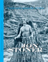
- Page 6: Guide ProfilesClint Spahn, Age 19Wh
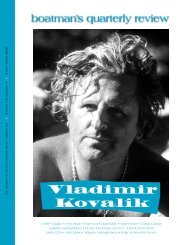
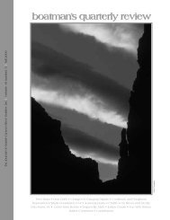
- Page 9 and 10: Matt Fahey / faheyfoto.comboatman
- Page 11 and 12: Barclay Trimble served as the recre
- Page 13 and 14: Egg DayI was up early a hectic daya
- Page 15 and 16: With one of the first copies of thi
- Page 17: Company, the authors—who happen t
- Page 21 and 22: survive. Some of these plants need
- Page 23 and 24: flashlight, hoping there are no rea
- Page 25 and 26: Tempest”Matt Fahey / faheyfoto.co
- Page 27 and 28: up—where you start at that canyon
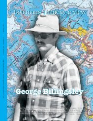
- Page 29 and 30: Steiger: What year was that?Billing
- Page 31 and 32: saying, “Sue, are you warm enough
- Page 33 and 34: At the Little Colorado River - July
- Page 35 and 36: Susan, Ryan, and Marijka, family bo
- Page 37 and 38: iver. We had it figured out, and th
- Page 39 and 40: Matt Fahey / faheyfoto.comboatman
- Page 41 and 42: R.I.P. Shorty—Forty Years LaterOn
- Page 43 and 44: Carl & Marge BoyerHjalmar BrantingJ
- Page 45 and 46: Grand Canyon River Guides, Inc.Prof
- Page 47 and 48: 2007 GCRG T-Shirts AvailableThe 200