Ninth international conference on - Marum
Ninth international conference on - Marum
Ninth international conference on - Marum

Create successful ePaper yourself
Turn your PDF publications into a flip-book with our unique Google optimized e-Paper software.
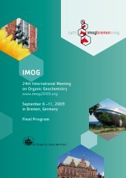
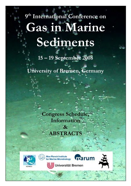
9 th Internati<strong>on</strong>al C<strong>on</strong>ference <strong>on</strong><br />
Gas in Marine<br />
Sediments<br />
15 – 19 September 2008<br />
University of Bremen, Germany<br />
C<strong>on</strong>gress Schedule,<br />
Informati<strong>on</strong><br />
&<br />
ABSTRACTS
9 th Internati<strong>on</strong>al C<strong>on</strong>ference <strong>on</strong><br />
Gas in Marine<br />
Sediments<br />
September 15 – 19, 2008<br />
University of Bremen, Germany<br />
C<strong>on</strong>gress Schedule,<br />
Informati<strong>on</strong>, and Abstracts<br />
Hosts<br />
The <str<strong>on</strong>g>c<strong>on</strong>ference</str<strong>on</strong>g> is jointly hosted by Gerhard Bohrmann, Department of Geosciences,<br />
University of Bremen and Bo Barker Jørgensen, Max Planck Institute for Marine<br />
Microbiology, Bremen.<br />
Local organizing committee<br />
Gerhard Bohrmann<br />
Heiko Sahling<br />
Greta Ohling<br />
Angelika Rinkel<br />
Thomas Pape<br />
Bo Barker Jørgensen<br />
Ulrike Tietjen
Program overview<br />
M<strong>on</strong>day<br />
September 15<br />
Tuesday<br />
September 16<br />
Wednesday<br />
September 17<br />
Thursday<br />
September 18<br />
Friday<br />
September 19<br />
Morning Afterno<strong>on</strong> Evening<br />
09:00 – 19:00 Field trip to the Harz Mountains<br />
09:00 – 11:00 Talks<br />
11:00 – 11:30 Coffee<br />
11:30 – 13:00 Talks<br />
13:00 – 14:00 Lunch<br />
09:00 – 11:00 Talks<br />
11:00 – 11:30 Coffee<br />
11:30 – 13:00 Talks<br />
13:00 – 14:00 Lunch<br />
09:00 – 11:00 Talks<br />
11:00 – 11:30 Coffee<br />
11:30 – 13:00 Talks<br />
(HERMES & WND<br />
project sessi<strong>on</strong>)<br />
13:00 – 14:00 Lunch<br />
14:00 – 16:00 Talks<br />
16:00 – 16:30 Coffee<br />
16:30 -18:30 Posters<br />
16:30 – 18:30 OFOP<br />
short course<br />
16:30 – 17:30 IODP<br />
core repository<br />
14:00 – 16:00 Talks<br />
16:00 – 16:30 Coffee<br />
16:30 -18:00 Talks<br />
14:00 – 16:00 Talks<br />
16:00 – 16:30 Coffee<br />
16:30 -18:30 Posters<br />
08:30 – 20:00 Field trip to Spiekeroog,<br />
the Wadden Sea<br />
19:00 Registrati<strong>on</strong><br />
Icebreaker/Barbecue<br />
at MPI<br />
19:30<br />
C<strong>on</strong>ference Dinner<br />
Town hall cellar<br />
Field Trip to the Harz Mountains guided by Jörn Peckmann<br />
The field trip starts at 8:30 am at the Betriebshof <strong>on</strong> the northern side of the Geo building (see map). We will<br />
use several vans to visit the outcrops. We plan to visit two locati<strong>on</strong>s, <strong>on</strong>e north of the Harz Mountains and<br />
<strong>on</strong>e in the Harz Mountains during a <strong>on</strong>e-day field trip (200 km southeast of Bremen). The first site is the type<br />
locati<strong>on</strong> where Kalkowsky suggested the term "stromatolite" for the first time (1908). The outcrop shows<br />
w<strong>on</strong>derful stromatolitic structures in lacustrine sediments of the lower Triassic Buntsandstein. The sec<strong>on</strong>d<br />
locati<strong>on</strong> is an Early Carb<strong>on</strong>iferous seep site <strong>on</strong> top of the drowned Dev<strong>on</strong>ian Iberg atoll reef. Please bring<br />
rain gear and field boots. Hard hats will be provided. The costs for food and drinks for the lunch break will be<br />
between 5 to 10 Euros depending <strong>on</strong> your appetite. We will be back at least around 19:00 so that we will not<br />
miss the icebreaker.<br />
Field Trip to Spiekeroog, Frisian Wadden Sea guided by Christian Winter & Achim<br />
Wehrmann<br />
A bus will bring us to Neuharlingersiel from where the ferry boat will start at 11:00. 45 minutes later we will<br />
arrive <strong>on</strong> the island. Like other Frisian barrier islands Spiekeroog is separated from the mainland coast by a<br />
backbarrier or tidal basin, well known as the Wadden Sea, which is completely inundated at high tide and<br />
largely exposed at low tide. During the field trip we will see major sediment envir<strong>on</strong>ments represented in this<br />
highly dynamic tidal system <strong>on</strong> the island. The walking distance of the field trip is 8-9 km, so hiking boots as<br />
well as a rain coat would be helpful. For sun protecti<strong>on</strong> also sun loti<strong>on</strong> is needed. The ferry back starts at<br />
17:00 and the bus transportati<strong>on</strong> from Neuharlingersiel back to Bremen will take until around 20:00.<br />
C<strong>on</strong>ference Dinner<br />
The <str<strong>on</strong>g>c<strong>on</strong>ference</str<strong>on</strong>g> dinner is planned for Wednesday evening in the historical “Cellar of the town hall"<br />
(Rathauskeller) which is the "exquisite foundati<strong>on</strong>" of the Gothic building from 1405. Food will be included<br />
into the <str<strong>on</strong>g>c<strong>on</strong>ference</str<strong>on</strong>g> fee (not the drinks).
How to find the Campus and the Geo Building of the University of Bremen<br />
Arriving in Bremen by train: Exit the main stati<strong>on</strong> in directi<strong>on</strong> Centrum. Take tram number 6 directi<strong>on</strong><br />
Universität. Disembark from tram at stop Universität – Zentralbereich. After disembarking, cross the tracks<br />
and go up the stairs found by the bridge. In 50m (opp. Mensa) turn right. The grey building <strong>on</strong> your right with<br />
white banister and metal world map is the GEOscience building.<br />
Arriving by plane at the airport: Take tram number 6 directi<strong>on</strong> Universität. Disembark from tram at stop<br />
Universität – Zentralbereich. After disembarking, cross the tracks and go up the stairs found by the bridge. In<br />
50m (opp. Mensa) turn right. The grey building <strong>on</strong> your right with white banister and metal world map is the<br />
GEOscience building.<br />
Overview map of the city of Bremen.<br />
Campus map of the University of Bremen showing the main locati<strong>on</strong>s of the <str<strong>on</strong>g>c<strong>on</strong>ference</str<strong>on</strong>g>.
9 th Internati<strong>on</strong>al C<strong>on</strong>ference <strong>on</strong> Gas in Marine Sediments<br />
Bremen University, September 15 – 19, 2008<br />
M<strong>on</strong>day, Sept 15, 2008<br />
09:00 – 19:00 Field trip to the Harz Mountains guided by Jörn Peckmann<br />
19:00 – 21:00 Icebreaker, registrati<strong>on</strong> at the Max Planck Institute for marine Microbiology<br />
Tuesday, Sept 16, 2008<br />
08:00 Registrati<strong>on</strong> starts in fr<strong>on</strong>t of the lecture room (Geo building)<br />
09:00 – 09:15 Opening of the <str<strong>on</strong>g>c<strong>on</strong>ference</str<strong>on</strong>g> in the lecture hall (Geo building)<br />
09:15 – 09:45 Leifer I, Kamerling M, Luyendyk B, Wils<strong>on</strong> D, Stubbs C, Lorensen T (invited talk):<br />
Large-scale spatial and temporal trends in seep emissi<strong>on</strong>s in the Coal Oil<br />
Point seep field – Using a seep resistance model to understand geologic and<br />
envir<strong>on</strong>mental c<strong>on</strong>trol<br />
09:45 – 10:00 Bigalke N, Gust G, Rehder G: Hydrodynamically c<strong>on</strong>strained flux of in-situ<br />
generated methane hydrate dissolving into undersaturated seawater<br />
10:00 – 10:15 Stöhr M, Schanze J, Khalili A: Gas-liquid mass transfer of rising bubbles:<br />
Visualizati<strong>on</strong> via PLIF<br />
10:15 – 10:30 Nikolovska A, Sahling H, Bohrmann G: Underwater acoustics in<br />
marine seeps research<br />
10:30 – 10:45 Géli L, Henry P, Zitter TAC, Dupré S, Try<strong>on</strong> M, Çağatay MN, Mercier<br />
de Lépinay B, Le Pich<strong>on</strong> X, Şengör AMC, Görür N, Natalin B, Uçarkuş G,<br />
Özeren S, Bourlange S, Volker D, Marnaut Scientific Party: Acoustic detecti<strong>on</strong> of<br />
gas emissi<strong>on</strong>s and active tect<strong>on</strong>ics within the submerged secti<strong>on</strong> of the North<br />
Anatolian Fault z<strong>on</strong>e in the Sea of Marmara<br />
10:45 – 11:00 Greinert J, McGinnis D, Naudts L, Linke P, De Batist M: Spatial methane<br />
bubble flux quantificati<strong>on</strong> from seeps into the atmosphere <strong>on</strong> the Black Sea<br />
shelf<br />
11:00 – 11:30 Coffee break<br />
11:30 – 11:45 Sahling H, Bohrmann G, Artemov Y, Bahr A, Brüning M, Klapp SA,<br />
Klaucke I, Kozlova E, Nikolovska A, Pape T, Reitz A, Wallmann K: Gas bubble<br />
streams at Vodyanitskii mud volcano, Sorokin Trough, Black Sea<br />
11:45 – 12:00 Pape T, Bahr A, Abegg F, Hohnberg HJ, Klapp SA, Bohrmann G:<br />
Shallow gas hydrates in an eastern Black Sea high intensity gas seepage area<br />
– Quantificati<strong>on</strong> by autoclave technology
12:00 – 12:15 Stadnitskaia A, Ivanov MK, Poludetkina EN, Kreulen R, van Weering TCE:<br />
Sources of hydrocarb<strong>on</strong> gases in mud volcanoes from the Sorokin Trough, NE<br />
Black Sea, based <strong>on</strong> molecular and carb<strong>on</strong> isotopic compositi<strong>on</strong>s<br />
12:15 – 12:30 I<strong>on</strong> G, I<strong>on</strong> E, Dutu F, Popa A, Radulescu V: Gas presence in the<br />
sediment pile – Black Sea case<br />
12:30 – 12:45 Sakvarelidze E, Amanatashvili I, Meskhia V, Gl<strong>on</strong>ti L: About relati<strong>on</strong><br />
between seismicity and anomalies of thermal field in the eastern part of the<br />
Black Sea water area<br />
12:45 – 13:00 Zitter TAC, Henry P, Géli L. Ozeren S, Çağatay MN, Mercier de Lépinay B,<br />
Try<strong>on</strong> M, Bourlange S, Burnard P, Sultan N, Marnaut Scientific Party: Fluid<br />
seepage and mass wasting processes al<strong>on</strong>g the North Anatolian Fault <strong>on</strong> the<br />
Sea of Marmara<br />
13:00 – 14:00 Lunch<br />
14:00 – 14:30 Rehder G, Boetius A, deBeer D, Häckel M, Inagaki F, Mehrtens C,<br />
Nakamura K, Ratmeyer V, Schneider J, Yanagawa K (invited talk): Where Mother<br />
Earth runs lab for us – Investigating carb<strong>on</strong> storage in the deep sea by<br />
looking at natural CO2 seepage in the Okinawa Trough hydrothermal system<br />
14:30 – 14:45 Orange DL, Teas PA, Decker J, Baillie P, Widodo, Hamdani A, Widjanarko,<br />
Bernard BB, Brooks JM, Levey M, AOA Geophysics Shipsboard Reps: Mapping<br />
and sampling seafloor seeps to prove hydrocarb<strong>on</strong> prospectivity in<br />
Ind<strong>on</strong>esia’s fr<strong>on</strong>tier basins<br />
14:45 – 15:00 Mau S, Heintz M. Valentine DL: Methane budget of the down-current<br />
plume from Coal Oil Point seep field, Santa Barbara Channel, California<br />
15:00 – 15:15 Naudts L, Greinert J, Poort J, Belza J, Vangampelaere E, Bo<strong>on</strong>e D,<br />
Linke P, Henriet JP, De Batist M: Submeter mapping of methane seeps by<br />
ROV observati<strong>on</strong>s and measurements at the Hikurangi Margin,<br />
New Zealand<br />
15:15 – 15:30 Schwalenberg K, Pecher I, Poort J, Coffin R, Wood W, Jegen M: Evidence<br />
of submarine gas hydrate deposits in c<strong>on</strong>text with methane seepage and<br />
active venting <strong>on</strong> the Hikurangi margin, NZ, from marine c<strong>on</strong>trolled<br />
source electromagnetics<br />
15:30 – 15:45 Bussmann I, Schloemer S, Wessels M, Schlüter M, Spickenboom K:<br />
Pockmark-like structures in Lake C<strong>on</strong>stance<br />
15:45 – 16:00 Spiess V, Fekete N, Ding F, Caparachin C, Foucher JP and the M76/3 shipboard<br />
scientific parties: Shallow gas accumulati<strong>on</strong> and seepage in deep water <strong>on</strong> the<br />
SW African c<strong>on</strong>tinental margin – seismic and acoustic signatures<br />
16:00 – 16:30 Coffee break<br />
16:30 – 18:30 Poster sessi<strong>on</strong>
Wednesday, Sept 17, 2008<br />
09:00 – 09:30 Pimenov N, Ulyanova M, Kanapasky T, Veslopolova E, Sivkov V (invited talk):<br />
Microbial activity in the south-eastern Baltic Sea (Russian sector) with<br />
special reference to the methane and sulfur cycling<br />
09:30 – 09:45 Raggi L, Schubotz F, Hinrich KU, Sahling H, Dublier N: Bacterial symbi<strong>on</strong>ts<br />
related to hydrocarb<strong>on</strong> degraders in mussels from the asphalt cold seep<br />
Chapopote, Gulf of Mexico<br />
09:45 – 10:00 Knab NJ, Dale AW, Jørgensen BB: Thermodynamic and kinetic c<strong>on</strong>trol <strong>on</strong><br />
anaerobic oxidati<strong>on</strong> of methane and sulfate reducti<strong>on</strong><br />
10:00 – 10:15 Schellig F, Schmale O, Niemann H, Rehder G: Dispersi<strong>on</strong> of biomarker in the<br />
AOM dominated upper sediment of Quepos slide offshore Costa Rica<br />
10:15 – 10:30 Zemskaya TI, Shubenkova OV, Chernitsina SM, Egorov AV, Kalmychkov GV,<br />
Pogadaeva TP, Khlystov OM, Buryukhaev S, Namsaraev BB: Microbial<br />
communities in sediments of Lake Baikal mud volcanoes<br />
10:30 – 10:45 Deusner C, Ferdelmann TG, Widdel F: High-pressure c<strong>on</strong>tinuous-incubati<strong>on</strong><br />
studies of sediments c<strong>on</strong>taining highly active communities of anaerobic<br />
methanotrophs<br />
10:45 – 11:00 Formolo MJ, Ly<strong>on</strong>s TW: Carb<strong>on</strong> and sulfur cycling at cold seeps in the<br />
Gulf of Mexico and new perspectives <strong>on</strong> old seeps<br />
11:00 – 11:30 Coffee break<br />
11:30 – 11:45 Felden J, Niemann H, Lichtschlag A, de Beer D, Wenzhöfer F, Boetius A:<br />
Budgets of oxygen, sulfate and methane fluxes at an active mud volcano<br />
11:45 – 12:00 Matveeva T, Mazurenko L, Prasolov E, Kulikova M, Beketov E, Poort J,<br />
Shoji H, Jin YK, Obzhirov A, Logvina E, Krylov A, Minami H, Hachikubo A:<br />
Gas hydrates <strong>on</strong> the Sakhalin slope (the Sea of Okhotsk): Origin, formati<strong>on</strong><br />
c<strong>on</strong>trol, and gas resources<br />
12:00 – 12:15 Lorens<strong>on</strong> TD: Methane seepage from the Arctic Shelf – Origin from<br />
permafrost, gas hydrate, or river-borne organic matter?<br />
12:15 – 12:30 Logvina E, Krylov A, Matveeva T, Stadtnitskaia A, v<strong>on</strong> Weering TCE,<br />
Ivanov M, Blinova V: The authigenic chimney formati<strong>on</strong> in the Gibraltar<br />
Diapiric Ridge (NE Atlantic)<br />
12:30 – 12:45 Somoza L and MVSEIS 08 Team: New discovery of mud volcanoes related to<br />
active strike-slip faults and thrusting ridges in the Moroccan margin (Gulf of<br />
Cadiz, Eastern Central Atlantic)<br />
12:45 – 13:00 Piñero E, Cruz Larrasoaña, Martínez Ruiz F, Gràcia E: Magnetic ir<strong>on</strong>-<br />
sulphides as methane proxies in southern Hydrate Ridge sediments (ODP Leg<br />
204): Preliminary results<br />
13:00 – 14:00 Lunch
14:00 – 14:30 Kastner M, Torres M, Solom<strong>on</strong> E, Spivack A (invited talk): Marine pore fluid<br />
profiles of dissolved sulfate; Do they reflect in situ methane fluxes?<br />
14:30 – 14:45 Riedinger N, Jørgensen BB: Methane fluxes in diffusi<strong>on</strong>-c<strong>on</strong>trolled marine<br />
sediments: C<strong>on</strong>sequences for the global methane cycle<br />
14:45 – 15:00 Tizzard L, Judd A, Upstill-Goddard R, Uher G: The c<strong>on</strong>tributi<strong>on</strong> to atmospheric<br />
methane from sub-seabed sources <strong>on</strong> the UK c<strong>on</strong>tinental shelf<br />
15:00 – 15:15 Solom<strong>on</strong> EA, Kastner M, MacD<strong>on</strong>ald I: C<strong>on</strong>siderable methane fluxes to the<br />
atmosphere from perennial deepwater hydrocarb<strong>on</strong> plumes in the Gulf of<br />
Mexico<br />
15:15 – 15:30 Valyaev BM: Gas hydate reservoir of carb<strong>on</strong> in the global system of<br />
subsurfacial carb<strong>on</strong> reservoirs<br />
15:30 – 15:45 Bourry C, Charlou JL, D<strong>on</strong>val JP, Ruffine L, Foucher JP, Chazall<strong>on</strong> B,<br />
Moreau M, Brunelli M: Bubble and gas hydrate characterizati<strong>on</strong> in marine<br />
sediments from c<strong>on</strong>trasted geological envir<strong>on</strong>ment<br />
15:45 – 16:00 Schlüter M, Gentz T, Bussmann I, Wessels M, Schlömmer S: Applicati<strong>on</strong><br />
of Membrane Inlet Mass Spectrometry for <strong>on</strong>line analysis of seafloor<br />
emissi<strong>on</strong>s to the water column and the atmosphere at pockmarks in Lake<br />
C<strong>on</strong>stance<br />
16:00 – 16:30 Coffee break<br />
16:00 – 16:15 Clark JF, Washburn L: Variability of gas compositi<strong>on</strong> and flux intensity in<br />
natural marine hydrocarb<strong>on</strong> seeps<br />
16:15 – 16:30 García Gil S, Muñoz Sobrino C, Iglesias J, Judd A, Diez B: A relati<strong>on</strong>ship<br />
between Holocene sea-level change and shallow gas generati<strong>on</strong><br />
16:30 – 16:45 Natalicchio M, Dela Pierre F, Martire L, Petrea C, Clari P, Cavagna S:<br />
Methane-derived carb<strong>on</strong>ate c<strong>on</strong>creti<strong>on</strong>s as proxies of an ancient gas hydrate<br />
stability z<strong>on</strong>e: Evidences from Upper Miocene sediments of the Tertiary<br />
Piedm<strong>on</strong>t Basin (NW Italy)<br />
16:45 – 17:00 Petrea C, Martire L, Natalicchio M, Dela Pierre F, Cavagna S, Clari P:<br />
Direct petrographic evidence of the past occurrence of gas hydrates in<br />
Oligo-Miocene sediments of the Tertiary Pierdm<strong>on</strong>t Basis (NW Italy)<br />
17:00 – 17:15 Iglesias J, García Gil S, Judd A, Ercilla G: When a pockmark is not a pockmark:<br />
Large pockmark-like features <strong>on</strong> the Landes Plateau (Bay of Biscay)<br />
17:15 – 17:30 M<strong>on</strong>teys X, Garcia X, Szpak M, García Gil S, Kelleher B, O’Keeffe E: Multi-<br />
disciplinary approach to the study and envir<strong>on</strong>mental implicati<strong>on</strong>s of two<br />
large pockmarks <strong>on</strong> the Malin Shelf, Ireland<br />
17:30 – 17:45 Ding F, Spiess V, Fekete N, Brüning M, Bohrmann G: The role of near-surface<br />
structures in hydrocarb<strong>on</strong> accumulati<strong>on</strong> and seepage, case studies in<br />
Campeche Knolls, Gulf of Mexico and the fr<strong>on</strong>tal Makran Prism<br />
19:30 C<strong>on</strong>ference Dinner (Town hall cellar)
Thursday, Sept 18, 2008<br />
09:00 – 09:30 Ivanov M, Blinova V, Malyshev N, Pevzner R, Volk<strong>on</strong>skaya A, Bouriak S (invited<br />
talk) Mapping and main characteristics of multiple BSR reflectors in the<br />
Tuapse Trough (Black Sea)<br />
09:30 – 09:45 Maignien L, Parkes J, Cragg B, Bo<strong>on</strong> N, R/V James Cook JC10 Shipboard<br />
scientific party: Envir<strong>on</strong>mental c<strong>on</strong>strains <strong>on</strong> anaerobic methane oxidati<strong>on</strong> and<br />
microbial community structure in marine sediments: The case of Cadiz mud<br />
volcanoes<br />
09:45 – 10:00 D<strong>on</strong>durur D, Coşkun S, Gürçay S, Okay S, Özer P, Çifçi G, Ergün M:<br />
Acoustic observati<strong>on</strong>s of shallow gas accumulati<strong>on</strong>s, gas seeps and<br />
active pockmarks in the Gulf of Izmir, Aegean Sea<br />
10:00 – 10:15 Chevalier N, Bouloubassi I, Stadtnitskaia A, Pierre C, Hopmans E,<br />
Damste JS, Saliot A: Archaeal and bacterial lipids at cold seeps <strong>on</strong> the<br />
Norwegian margin<br />
10:15 – 10:30 Wenzhöfer F, Felden J, Lichtschlag A, de Beer D, Feseker T, Foucher JP,<br />
Bohrmann G, Inagaki F, Boetius A: Methane emissi<strong>on</strong> and associated<br />
biogeochemical c<strong>on</strong>sumpti<strong>on</strong> rates: How important are cold seep geo-<br />
structures <strong>on</strong> a local and global scale<br />
10:30 – 10:45 Lichtschlag A, Felden J, Wenzhöfer F, Boetius A, de Beer D: Thiotrophic<br />
mats and their associati<strong>on</strong> with methane seeps – Comparis<strong>on</strong> of different cold<br />
seep sites<br />
10:45 – 11:00 Pierre C, Bay<strong>on</strong> G, Blanc Valleri<strong>on</strong> MM, Rouchy JM, Mascle J, Dupré S,<br />
Bouloubassi I, Sarrazin J, Foucher JP, Medeco scientific team: Authigenic<br />
carb<strong>on</strong>ate crusts from active cold seep sites in the Eastern Mediterranean:<br />
New results from MEDECO cruise<br />
11:00 – 11:30 Coffee break<br />
11:30 – 11:45 Foucher JP, Feseker T, Dupré S, Fabri MC, Harmegnies F, Normand A,<br />
Satra C, Boetius A: How unstable with time are submarine mud volcanoes:<br />
Examples from the European seas<br />
11:45 – 12:00 Dupré S, Brosolo L, Mascle J, Pierre C, Harmegnies F, Mastalerz V, Bay<strong>on</strong> G,<br />
Ducassou E, de Lange G, Foucher JP, Victor ROV Team and Medeco Leg 2<br />
scientific party: The Menes mud volcano caldera complex: An excepti<strong>on</strong>al site<br />
of brine seepage in the deep waters off north-western Egypt<br />
12:00 – 12:15 Praeg D, Mascle J, Geletti R, Uniithan V, L<strong>on</strong>cke L, Harmegnies F: Evidence<br />
of gas hydrates <strong>on</strong> the central Nile deep sea fan<br />
12:15 – 12:30 Brückmann W, Bialas J, Brown K, Feseker T, Hensen C, Hölz S, Jegen M,<br />
Linke P, Nuzzo M, Reitz A, Scholz F: The West Nile Delta mud volcano project<br />
12:30 – 12:45 Feseker T, Nuzzo M, Scholz F, Brown K and P362/2 scientific party:<br />
Excepti<strong>on</strong>ally high levels of mud volcano activity <strong>on</strong> the western Nile deep<br />
sea fan – First results from the P362/2 cruise of R/V POSEIDON
12:45 – 13:00 Nuzzo M, Scholz F, Reitz A, Hensen C, Elvert M, Hinrichs KU, Liebetrau V<br />
and R/V POSEIDON P362/2 scientific party: The origin of hydrocarb<strong>on</strong>s and<br />
fluids at North Alex and Giza mud volcanoes, West Nile Delta (Egyptian<br />
margin)<br />
13:00 – 14:00 Lunch<br />
14:00 – 14:30 Dando PR, Canet C, Prol-Ledesma RM (invited talk): Massive carb<strong>on</strong> dioxide<br />
venting al<strong>on</strong>g the Wagner Fault, Gulf of California, Mexico and the<br />
associated fauna<br />
14:30 – 14:45 Hauschildt J, Unnithan V, Vogt J: Gas hydrate induced fluid flow alterati<strong>on</strong><br />
14:45 – 15:00 Kaul N, Villinger H: Is heat flow probing a direct measure for gas hydrate<br />
stability boundary c<strong>on</strong>diti<strong>on</strong>s?<br />
15:00 – 15:15 Kulikova M, Matveeva T, Poort J, Jin Y, Shoji H: 3D modelling of a gas hydrate<br />
accumulati<strong>on</strong> based <strong>on</strong> thermal, acoustic and coring data<br />
15:15 – 15:30 Lavrenova E, Senin B, Kruglyakova M, Gorbunov A: Good opening of oil- andgas-c<strong>on</strong>tent<br />
of Azov Sea are result of 3D modeling<br />
15:30 – 15:45 Egorov AV, Kalmychkov GV, Zemskaya TI, Khlystov OM: Methane distributi<strong>on</strong> in<br />
the deep water sediments of the Lake Baikal<br />
15:45 – 16:00 Bohrmann G, Bahr A, Brüning M, Gassner A, Kasten S, Klapp SA, Nasir M, Pape T,<br />
Spieß V, Rethemeyer J, Rossel P, Sahling H, Thomanek K,<br />
Yoshinaga M, Z<strong>on</strong>neveld K: Highly variable seep systems al<strong>on</strong>g the Makran<br />
subducti<strong>on</strong> z<strong>on</strong>e – Influence from the accreti<strong>on</strong>ary wedge structure and the<br />
oxygen minimum z<strong>on</strong>e<br />
16:00 – 16:30 Coffee break<br />
16:30 – 18:30 Poster sessi<strong>on</strong><br />
Friday, Sept 19, 2008<br />
08:30 – 20:00 Field trip to Spiekeroog, the Wadden Sea<br />
guided by Christian Winter and Achim Wehrmann
Abstracts of oral presentati<strong>on</strong>s<br />
(alphabetic order)
Abstracts of oral presentati<strong>on</strong>s 13<br />
Hydrodynamically c<strong>on</strong>strained flux of in-situ generated methane hydrate<br />
dissolving into undersaturated seawater<br />
N. Bigalke 1 , G. Gust 2 , G. Rehder 3<br />
1 Leibniz Institute of Marine Sciences, Wischhofstr. 1-3, 24148 Kiel, Germany<br />
2 Technical University Hamburg-Harburg, Schwarzenbergstr. 95, 21073 Hamburg, Germany<br />
3 Baltic Sea Research Institute Warnemuende, Seestr. 15, 18119 Rostock, Germany<br />
Clathrate hydrates of natural gases (“gas hydrates“ in the following) are widely distributed within sediments<br />
al<strong>on</strong>g active and passive c<strong>on</strong>tinental margins. Gas hydrates and gas hydrate stability specifically have become an<br />
important field of study in the past decades. The stability of methane hydrate depends <strong>on</strong> the physicochemical<br />
equilibrium between all coexisting phases. In terms of P and T, the stability of methane hydrate is well<br />
c<strong>on</strong>strained. Dissoluti<strong>on</strong> due to an undersaturati<strong>on</strong> of dissolved methane (hydrate) in a coexisting liquid phase<br />
has, however, not been given sufficient attenti<strong>on</strong>. Specifically, the flux of methane dissolving into undersaturated<br />
seawater has yet to be quantified. This is especially true for hydrates that are exposed to flow whether they are<br />
buried in the marine sediment or whether they are exposed at the immediate sea-floor surface. Assessment of the<br />
stability of gas hydrates in these envir<strong>on</strong>ments requires the test if incorporati<strong>on</strong> of hydrodynamic as well as<br />
thermodynamic variables into numerical models is required to quantify the flux of methane into the ocean. To<br />
the best of our knowledge, the role of flow <strong>on</strong> the dissoluti<strong>on</strong> of gas hydrates has not yet been determined for<br />
lack of c<strong>on</strong>cise hydrodynamic data, though qualitatively, a resp<strong>on</strong>se of hydrate dissoluti<strong>on</strong> <strong>on</strong> current velocity<br />
has been described from an open field experiment (Rehder et al., 2004) Here we report <strong>on</strong> mass transfer rates of<br />
CH4 from decomposing in-situ generated flat methane hydrate surfaces exposed to precisely adjusted, spatially<br />
homogeneous wall shearing stresses at selected P-/T-c<strong>on</strong>diti<strong>on</strong>s within the hydrate stability field (30 MPa, 4°C).<br />
The data reveal that hydrate decompositi<strong>on</strong> is an entirely diffusi<strong>on</strong>-c<strong>on</strong>trolled process under the c<strong>on</strong>diti<strong>on</strong>s<br />
investigated. The experiments were carried out in an autoclaved interfacial flux chamber with calibrated,<br />
spatially homogeneous wall shearing stress characterized as ‘microcosm’ in Tengberg et al. (2004).<br />
References<br />
Rehder, G.; Kirby S. H.; Durham, W. B.; Stern, L. A.; Peltzer, E. T.; Pinkst<strong>on</strong>, J.; Brewer, P. G. Dissoluti<strong>on</strong> rates<br />
of pure methane hydrate and carb<strong>on</strong>-dioxide hydrate in undersaturated seawater at 1000-m depth. Geochim.<br />
Cosmochim. Acta 2004, 68, 285-292.<br />
Tengberg, A.; Stahl, H.; Gust, G.; Müller, V.; Arning, U.; Anderss<strong>on</strong>, H.; Hall, P. O. J. Intercalibrati<strong>on</strong> of<br />
benthic flux chambers I. Accuracy of flux measurements and influence of chamber hydrodynamics. Prog.<br />
Oceanogr. 2004, 60, 1-28.<br />
Highly variable seep systems al<strong>on</strong>g the Makran subducti<strong>on</strong> z<strong>on</strong>e – influence from the<br />
accreti<strong>on</strong>ary wedge structure and the oxygen minimum z<strong>on</strong>e<br />
G. Bohrmann 1 , A. Bahr 1 , M. Brüning 1 , A. Gassner 1 , S. Kasten 2 , S. Klapp 1 , M. Nasir 3 , T. Pape 1 , V. Spiess 1 ,<br />
J. Rethemeyer 2 , P. Rossel 1 , H. Sahling 1 , K. Thomanek 1 , M. Yoshinaga 1 , K. Z<strong>on</strong>nefeld 4<br />
1 Research Center Ocean Margins, University Bremen, Germany<br />
2 Alfred-Wegener-Institut für Polar- und Meeresforschung, Bremerhaven, Germany<br />
3 Nati<strong>on</strong>al Institute of Oceanography, Karachi, Pakistan<br />
4 Department of Geosciences at University of Bremen, Germany<br />
Up to 7 km sediments from the oceanic part of the Arabic Plate are folded, sheared and repeatedly thrust within<br />
the accreti<strong>on</strong>ary wedge of the Makran subducti<strong>on</strong> z<strong>on</strong>e. Although these sediments form a huge reservoir for fluid<br />
and gas seepage just minor amounts of cold seeps have been reported up to recent from this collisi<strong>on</strong> z<strong>on</strong>e. We<br />
therefore c<strong>on</strong>ducted a research cruise (R/V METEOR M74/3; 30 October – 28 November, 2007) to the area in<br />
order to explore the margin for further sea floor seep structures. Indicati<strong>on</strong>s for potential sites of seepage came<br />
from TOBI backscatter sea floor mapping and from acoustic plume imaging measured by the <strong>on</strong>board<br />
PARASOUND echosounder during Cruise M74/2. Fifteen acoustic plumes distributed over the entire Makran<br />
slope showed gas emissi<strong>on</strong> sites from the sea floor. We could investigate 9 sites between 500 m and 3000 m<br />
water depth during 18 dives using ROV QUEST4000. Gas seeps between 575 m and 1020 m water depth are<br />
highly variable and the occurrence of chemosynthetic fauna shows clear relati<strong>on</strong>ship with the oxygen<br />
c<strong>on</strong>centrati<strong>on</strong> within the oxygen minimum z<strong>on</strong>e. Four seeps between 1460 m and 1820 m are characterised by<br />
large communities of bivalves (Mytilidae, Vesicomyidae), tube worms (Vestimentifera) and authigenic<br />
carb<strong>on</strong>ates which cover hundreds of square meters of the sea floor. I all cases free gas bubbles have been<br />
observed to be released at the sea floor. Seeps deeper as 2000 m water depth do not show the carb<strong>on</strong>ate<br />
pavement and seem to represent recently developed cold seeps. In <strong>on</strong>e case fluid outflow could be observed and<br />
documented, where no chemosynthetic fauna was found. The distributi<strong>on</strong> of various seep systems from the<br />
Makran margin will be presented during the talk.
14<br />
Abstracts of oral presentati<strong>on</strong>s<br />
Subducti<strong>on</strong>-induced genesis of fossil cold-seep carb<strong>on</strong>ates from the<br />
Outer Carpathians<br />
M. J. Bojanowski 1<br />
1 Institute of Geochemistry, Mineralogy and Petrology, Faculty of Geology, University of Warsaw, Poland<br />
The Outer Carpathians is a Miocene thrust-and-fold orogenic belt. The youngest deposits is the Krosno<br />
Formati<strong>on</strong>, which is represented by flysch siliciclastics: alternating turbidite sandst<strong>on</strong>es and mudst<strong>on</strong>es. They are<br />
interbeded with numerous slump deposits and are frequently accompanied with soft-sediment deformati<strong>on</strong>s,<br />
clastic dykes, slump bedding, which indicate widespread fluidizati<strong>on</strong> and slope destabilizati<strong>on</strong>. Sedimentati<strong>on</strong> of<br />
the Krosno Fm. in the southern part of the Silesian basin occurred in proximity and in close relati<strong>on</strong> to the<br />
emerging accreti<strong>on</strong>ary prism, which was prograding from the south. This work describes cold-seep carb<strong>on</strong>ates<br />
from this formati<strong>on</strong>, and focuses <strong>on</strong> their genesis in relati<strong>on</strong> to the orogenic processes.<br />
The seep carb<strong>on</strong>ates comprise calcite c<strong>on</strong>creti<strong>on</strong>s, a laminated limest<strong>on</strong>e bed and a carb<strong>on</strong>ate build-up composed<br />
of intraformati<strong>on</strong>al carb<strong>on</strong>ate breccia. All these rocks are str<strong>on</strong>gly depleted in 13 C and attain δ 13 CPDB values lower<br />
than -30‰, which unequivocally indicate that the carb<strong>on</strong>ate precipitated due to hydrocarb<strong>on</strong> oxidati<strong>on</strong><br />
(Bojanowski 2007). The fluid inclusi<strong>on</strong>s examined in the c<strong>on</strong>creti<strong>on</strong>s c<strong>on</strong>tain gaseous carb<strong>on</strong> dioxide and/or<br />
methane, which is a direct evidence of methane in the porewaters. The laminated limest<strong>on</strong>e bed is 20-cm thick<br />
and exhibits a clear trend in stable C and O isotopic compositi<strong>on</strong>: δ 13 CPDB and δ 18 OPDB values change gradually<br />
from the base to the top of the bed from -37‰ to -19‰ and from -0,7‰ to -4,8‰ respectively. This trend<br />
probably reflects isotopic gradient which existed in the porewaters: the proporti<strong>on</strong> of HCO3 - produced by<br />
methane oxidati<strong>on</strong> to HCO3 - produced by sulfate reducti<strong>on</strong> decreased upwards. Such a gradient could have<br />
existed in the z<strong>on</strong>e of anaerobic oxidati<strong>on</strong> of methane and it is suggested that the limest<strong>on</strong>e bed precipitated<br />
within this z<strong>on</strong>e due to a diffuse, although pervasive methane seepage.<br />
The limest<strong>on</strong>e bed becomes thicker and fractured in the vicinity of the carb<strong>on</strong>ate buildup. The degree of<br />
fragmentati<strong>on</strong> increases so that the fractured limest<strong>on</strong>e changes gradually to a m<strong>on</strong>omictic intraformati<strong>on</strong>al<br />
breccia <strong>on</strong> the flanks of the build-up. Towards the center the m<strong>on</strong>omictic breccia is gradually replaced by a<br />
polymictic breccia. The clasts in the polymictic breccia often include fragments of the m<strong>on</strong>omictic breccia.<br />
Precipitati<strong>on</strong> of these methane-derived carb<strong>on</strong>ates was mediated by microbial activity, which is suggested by the<br />
presence of calcified biofilms covering carb<strong>on</strong>ate clasts and calcified filaments of a large sulfur bacteria<br />
(Bojanowski 2007). The c<strong>on</strong>duit z<strong>on</strong>es, which appear in the center of the build-up, c<strong>on</strong>tain also clasts of the<br />
underlying shales. In c<strong>on</strong>trast to the limest<strong>on</strong>e bed and the c<strong>on</strong>creti<strong>on</strong>s, the build-up grew as a result of a more<br />
focused flow of methane-bearing fluids, probably al<strong>on</strong>g a tect<strong>on</strong>ic disc<strong>on</strong>tinuity of the arising accreti<strong>on</strong>ary<br />
prism. This fluid rise caused carb<strong>on</strong>ate precipitati<strong>on</strong> and hydraulic brecciati<strong>on</strong>, which happened repeatedly and<br />
interchangeably with each other.<br />
Characteristic dark druses occasi<strong>on</strong>ally appear in the breccia. The walls of the druses are lined with fringes of<br />
pure calcite (Fig. 1), which clearly precipitated in cavities. Some druses are even still hollow in the center.<br />
Fig. 1. Photomicrograph (plane polarized light) of the druses from the polymictic breccia – inferred<br />
pseudomorphoses after gas hydrates. The width of the image corresp<strong>on</strong>ds to 22 mm.
Abstracts of oral presentati<strong>on</strong>s 15<br />
However, the clast-like appearance of the druses suggests that these spaces had originally been particles<br />
composed of a solid substance, probably gas hydrate aggregates. Such a hypothetic presence of gas hydrate in<br />
the Silesian basin has been supported by theoretical evaluati<strong>on</strong> of gas hydrate stability in that basin (Bojanowski<br />
2007). The relative sea-level significantly dropped in the Silesian basin at the final stages of depositi<strong>on</strong> due to<br />
orogenic movements of the prograding accreti<strong>on</strong>ary prism. This could have also triggered extensive gas hydrate<br />
dissociati<strong>on</strong>, which in turn could have directly caused the large-scale submarine slumping and the widespread<br />
fluidizati<strong>on</strong> of the Krosno Fm.<br />
Reference<br />
Bojanowski MJ (2007) Oligocene cold-seep carb<strong>on</strong>ates from the Carpathians and their inferred relati<strong>on</strong> to gas<br />
hydrates. Facies 53:347-360<br />
Bubble and gas hydrate characterizati<strong>on</strong> in marine sediments from c<strong>on</strong>trasted geological<br />
envir<strong>on</strong>ments<br />
C. Bourry 1 , J. L. Charlou 1 , J. P. D<strong>on</strong>val 1 , L. Ruffine 1 , J. P. Foucher 1 , B. Chazall<strong>on</strong> 2 , M. Moreau 3 , M. Brunelli 4<br />
1 Département Géosciences Marines, IFREMER Centre de Brest, 29 800 PLOUZANE, France<br />
2 Laboratoire de Spectroscopie Infra-Rouge et Raman (LASIR), Université Lille 1, UNMR CNRS 8516, 59655<br />
Villeneuve d’Ascq, France<br />
3 Laboratoire de Physique des Lasers, Atomes et Molécules (CERLA), Université Lille 1, UMR CNRS 8523,<br />
59655 Villeneuve d’Ascq, France<br />
4 European Synchrotr<strong>on</strong> Radiati<strong>on</strong> Facility (ESRF), BP 220 – 38043 Grenoble cedex, France<br />
Sediments <strong>on</strong> c<strong>on</strong>tinental margins hold enormous quantities of low molecular weight hydrocarb<strong>on</strong>s as dissolved<br />
gas, free gas or gas hydrates which crystallize where the necessary pressure and temperature c<strong>on</strong>diti<strong>on</strong>s are met<br />
and where the abundance of methane is sufficient to exceed the local solubility. Gas hydrates and free gas<br />
bubbles were collected from the West African margin (the C<strong>on</strong>go-Angola basin, ZAINGO cruise; the Nigerian<br />
margin, NERIS cruise), Hak<strong>on</strong> Mosby Mud Volcano <strong>on</strong> the Norwegian margin (Vicking cruise, HERMES<br />
Program) and the Marmara Sea (MARNAUT cruise). Physical properties of gas hydrates were measured by Xray<br />
synchrotr<strong>on</strong> diffracti<strong>on</strong> (European Synchrotr<strong>on</strong> Radiati<strong>on</strong> Facility) and Raman spectroscopy. Gas hydrates<br />
from Norwegian and African margins crystallize in a type I structure whereas hydrates from the Marmara Sea<br />
exhibit a type II structure. These first data are in accordance with the stable carb<strong>on</strong> and hydrogen isotope<br />
compositi<strong>on</strong>s of hydrate-bound gases which indicate that hydrates from the Norwegian and African margins<br />
have a biogenic origin, in c<strong>on</strong>trast with hydrates from the Marmara Sea which have a thermogenic isotopic<br />
signature. Chemical and isotopic compositi<strong>on</strong>s of gas bubbles collected by the PEGAZ, a new efficient tool<br />
manipulated by submersibles and/or ROVs, were also compared with those of associated hydrates collected <strong>on</strong><br />
Hak<strong>on</strong> Moby and in the Marmara Sea. Gas bubbles have the same isotopic signature as hydrates but slight<br />
differences in chemical compositi<strong>on</strong> are observed between bubbles and hydrates, especially for samples from the<br />
Marmara Sea. Thermodynamical modelling experiments successfully predicted the structure I and II for gas<br />
hydrates from Hak<strong>on</strong> Mosby and the Marmara Sea respectively and c<strong>on</strong>firm the link between the gas bubbles<br />
and hydrates compositi<strong>on</strong>s. A notable difference between gas bubbles and hydrates compositi<strong>on</strong>s from the<br />
Marmara Sea c<strong>on</strong>firms clearly that a preferential enclathrati<strong>on</strong> in the structure II is CH4 < C2H6 < C3H8 < i-<br />
C4H10. These results are discussed in terms of the origin of gases, the mechanisms involved in gas hydrate<br />
formati<strong>on</strong> and the evoluti<strong>on</strong> of free gas and hydrates in the marine sediments.<br />
The West Nile Delta mud volcano project<br />
W. Brückmann 1 , J. Bialas 1 , K. Brown 1 , T. Feseker 1 , C. Hensen 1 , S. Hölz 1 , M. Jegen 1 ,<br />
P. Linke 1 , M. Nuzzo 1 , A. Reitz 1 , F. Scholz 1<br />
1 IFM-GEOMAR, Institute for Marine Sciences, Kiel, Germany<br />
Submarine mud volcanoes have been discovered in large numbers in many different c<strong>on</strong>tinental margin settings,<br />
often associated with hydrocarb<strong>on</strong> provinces. They are characterized by fluid formati<strong>on</strong> and fluidizati<strong>on</strong><br />
processes occurring at depths of several kilometers below the sea floor which are driving a complex system of<br />
interacting geochemical, geological and microbial processes. As mud volcanoes (MV) act as natural leakages for<br />
oil and gas reservoirs, near-surface phenomena can be used for m<strong>on</strong>itoring processes occurring at great depth. In
16<br />
Abstracts of oral presentati<strong>on</strong>s<br />
the West Nile Delta two large mud volcanoes, Giza and North Alex MV, apparently rooted at depths of several<br />
kilometers have been discovered. Focussing <strong>on</strong> these mud volcanoes the West Nile Delta (WND) project is using<br />
existing and newly developed tools and techniques to better understand and quantify the internal dynamics and<br />
l<strong>on</strong>g-term variability of these unique sea floor features and their relati<strong>on</strong> to gas reservoirs. Supported by the<br />
companies developing gas fields in the wider West Nile Delta area, RWE-Dea and BP Egypt work within the<br />
WND project is subdivided into four major subtasks:<br />
* the primary objectives of WND Subproject I are to investigate the origin of fluids, hydrocarb<strong>on</strong> gases and<br />
sediments expelled at the North Alex and Giza MV and to c<strong>on</strong>strain in situ rates of fluid expulsi<strong>on</strong> at both sites.<br />
For this purpose, pore water, gas, sediment and clast samples were retrieved by means of gravity coring and<br />
multicoring during the first research cruise to the West Nile Delta, R/V POSEIDON P362/2 in February 2008.<br />
Str<strong>on</strong>g degassing of the sediment samples up<strong>on</strong> recovery <strong>on</strong> board was the immediate indicator of present MV<br />
activity at both sites. Preliminary results from pore water organic and inorganic geochemistry analyses show that<br />
the fluids seeping at Giza and North Alex have a deep sedimentary origin, with maximum formati<strong>on</strong><br />
temperatures of ~150ºC (see presentati<strong>on</strong>s by Nuzzo et al. and Reitz et al.).<br />
* within WND Subproject II new techniques of geophysical imaging of mud volcanoes are developed. As such<br />
structures tend to be comparatively small, it is difficult to apply large-scale acquisiti<strong>on</strong> systems. Here, small and<br />
flexible systems provide a more cost-effective, high-quality soluti<strong>on</strong> that can be operated from small research<br />
vessels. Therefore, <strong>on</strong>e of the primary aims of this subproject is building a SwathSeis 3D seismic acquisiti<strong>on</strong><br />
system c<strong>on</strong>sisting of up to 24 short parallely towed streamers. Its output , complemented with cross correlati<strong>on</strong>s<br />
from C<strong>on</strong>trolled-Source-Electromagnetic (CSEM) data taken in parallel, is greatly enhancing the quality of<br />
internal imaging of such structures.<br />
* the objective of WND Subproject III is the quantificati<strong>on</strong> of variability of dewatering and degassing through<br />
l<strong>on</strong>g-term in situ observati<strong>on</strong>s of temperature, pressure and fluid flow. It has been l<strong>on</strong>g known that the activity of<br />
mud volcanoes varies significantly over periods of m<strong>on</strong>ths and weeks. This subproject investigates seepage and<br />
mud expulsi<strong>on</strong> at both mud volcanoes in the study area to provide detailed informati<strong>on</strong> about the variability of<br />
seepage in space and time. During cruise P362/2 sediment temperature and heat flow measurements c<strong>on</strong>ducted at<br />
both MVs c<strong>on</strong>firmed that both mud volcanoes are currently in an active phase and helped identifying the most<br />
active parts. Near-surface temperatures of several tenths of °C at both North Alex and Giza MV suggest high<br />
levels of fluid seepage, potentially associated with very recent mud expulsi<strong>on</strong>. (see presentati<strong>on</strong> by Feseker et<br />
al.).<br />
* Finally, biostratigraphic analysis of sediments to determine the erupti<strong>on</strong> history of mud volcanoes and the<br />
present day distributi<strong>on</strong> patterns of benthic foraminifera are studied as part of WND Subproject IV.<br />
Pockmark-like structures in Lake C<strong>on</strong>stance<br />
I. Bussmann 1,2 , S. Schloemer 3 , M. Wessels 4 , M. Schlüter 2 , K. Spickenboom 3<br />
1 University of K<strong>on</strong>stanz<br />
2 Alfred-Wegener Institute<br />
3 Federal Institute for Geosciences and Natural Resources, Germany<br />
4 Institute for Lake Research, Langenargen<br />
The role of lakes in the global methane budget seems to be higher than previously thought. Numerous<br />
pockmarks have been described for the marine envir<strong>on</strong>ment, but at freshwater fluid seeps the geological,<br />
chemical and biological processes operating are largely unknown.<br />
Based <strong>on</strong> different observati<strong>on</strong>s of intense gas flow through the water column at Lake C<strong>on</strong>stance two joint<br />
research cruises were c<strong>on</strong>ducted in winter 2005/06 to systematically search and study these structures. Several<br />
large fields of pockmark like structures were found in the eastern part of the lake (side scan s<strong>on</strong>ar, echo sounder).<br />
Water and gas was selectively sampled and based <strong>on</strong> these preliminary data a joint DFG-funded research project<br />
was arranged.<br />
The objectives are to (1) locate, describe and map pockmark areas at Lake C<strong>on</strong>stance, (2) identify the pockmark<br />
formati<strong>on</strong> mechanism, (3) quantify the methane flux and the temporal variability and (4) identify the source of<br />
methane.<br />
So far more than 450 pockmarks larger > 2 m have been identified by side-scan s<strong>on</strong>ar. The pockmarks vary<br />
largely in size (dm-range to maximum diameters of 15m) and spatial distributi<strong>on</strong>. At some places, they are<br />
irregular spaced, but now and then smaller decimetre sized pockmarks are evenly spaced al<strong>on</strong>g small lineaments.<br />
Often, large pockmarks are located at morphological highs, such as channel rims or little hills at the lake floor.<br />
There is no morphological evidence for a catastrophic gas release (solid discharge at the rim, or irregular<br />
sediment patterns near the pockmarks). The observed structures point to a c<strong>on</strong>stant gas release from a deeper<br />
reservoir.
Abstracts of oral presentati<strong>on</strong>s 17<br />
Two representative locati<strong>on</strong>s (water depth 12m and 85m) close to the former Rhine estuary have been selected<br />
for further geochemical examinati<strong>on</strong>s. After deploying a digital horiz<strong>on</strong>tal s<strong>on</strong>ar system at the lake floor to allow<br />
for exact positi<strong>on</strong>ing, water and sediment samples were taken within the pockmark with niskin bottles from a<br />
rosette and multicorer. In additi<strong>on</strong>, sediment samples and gas samples were taken by divers across the shallow<br />
pockmark. Gas c<strong>on</strong>centrati<strong>on</strong> and isotope ratios of dissolved gas in water were measured using standard GC-FID<br />
and GC-irMS techniques. Methane c<strong>on</strong>centrati<strong>on</strong> in sediment samples was measured directly after coring by<br />
means of by a diffusi<strong>on</strong>-based methane sensor.<br />
Preliminary results of the isotope analysis of methane (δ 13 C, δD) and CO2 (δ 13 C) as well as the absence of<br />
higher molecular weight alkanes str<strong>on</strong>gly indicate a bacterial formati<strong>on</strong> of the gases rather than a thermogenic<br />
origin of the methane. The results of the analysis of free gas of the sediments indicate the methyl formati<strong>on</strong> as<br />
dominant pathway. However, up to now available data suggest a certain difference in the gases located at the<br />
deep pockmark, the corresp<strong>on</strong>ding reference site and gas sampled at the shallow pockmark.<br />
In the sediments of the deep pockmark high methane c<strong>on</strong>centrati<strong>on</strong>s were recorded, however with no significant<br />
differences between the pockmark and c<strong>on</strong>trol cores. At the shallow pockmark sediment cores could be<br />
positi<strong>on</strong>ed more precisely. Here methane c<strong>on</strong>centrati<strong>on</strong>s vary within meters in order of magnitude.<br />
Several aut<strong>on</strong>omous devices for gas flow measurements using different approaches were deployed in March<br />
2008 at selected gas emanating pockmarks. Data are not yet available but will hopefully presented<br />
.<br />
Fig 1: S<strong>on</strong>ar image of a large pockmark (diameter 16m) at Lake C<strong>on</strong>stance. Note the gas bubbles ascending<br />
from the structure<br />
δ 13 C-methane (‰)<br />
-110<br />
-90<br />
-70<br />
-50<br />
-30<br />
artificial<br />
methane<br />
fermentati<strong>on</strong><br />
mix<br />
-10<br />
-400 -300 -200 -100<br />
mix<br />
CO 2 reducti<strong>on</strong><br />
thermal<br />
δD-methane (‰)<br />
MUC 1 inside deep pockmark<br />
MUC 2 reference site deep pockmark<br />
stab tubes shallow pockmark<br />
TT(m)<br />
TT(h)<br />
atmosphere<br />
Fig. 2: Carb<strong>on</strong> and deuterium isotopical compositi<strong>on</strong> of selected samples in a diagnostic diagram
18<br />
Abstracts of oral presentati<strong>on</strong>s<br />
Archaeal and bacterial lipids at cold seeps <strong>on</strong> the Norwegian margin<br />
N. Chevalier 1 , I. Bouloubassi 1 , A. Stadnitskaia 2 , C. Pierre 1 , E. Hopmans 2 , J. Sinninghe Damste 2 and A. Saliot 1<br />
1 Laboratoire d’Océanographie et du Climat: Expérimentati<strong>on</strong> et Approches Numériques (LOCEAN/IPSL),<br />
Université Pierre et Marie Curie, Paris, France<br />
2 Royal Netherlands Institute for Sea Research (NIOZ), Den Burg, Texel, The Netherlands<br />
In the framework of the HERMES project, the VICKING cruise (2006) focussed <strong>on</strong> the explorati<strong>on</strong> and<br />
multidisciplinary study of fluid escape features (pockmarks and mud volcanoes) <strong>on</strong> the Norwegian margin.<br />
Detailed observati<strong>on</strong>s and multidisciplinary sub-sampling was carried out with the ROV Victor 6000 and a set of<br />
specific tools in two sites: the northern flank of the Storegga Slide characterized by the occurrence of gas<br />
hydrates in the slope sediments, large slides and numerous fluid escape structures, mainly pockmarks (Nyegga)<br />
and the active mud expulsi<strong>on</strong>s at the Hak<strong>on</strong> Mosby Mud Volcano.<br />
We investigated specific, diagnostic lipids in carb<strong>on</strong>ates crusts and sediments aiming to gain insight into<br />
microbial assemblages and processes in these methane-rich settings and compare them with previously studied<br />
cold seeps <strong>on</strong> European margins. Carb<strong>on</strong>ate crusts generally c<strong>on</strong>tained abundant 13 C-depleted lipids from<br />
methanotrophic archaea al<strong>on</strong>g with lipids derived from unspecified sulphate reducing bacteria, c<strong>on</strong>firming their<br />
formati<strong>on</strong> through anaerobic oxidati<strong>on</strong> of methane (AOM). Similarly, the lipid compositi<strong>on</strong> of two sediment<br />
push-cores taken in an area col<strong>on</strong>ised by gastropods and pog<strong>on</strong>ophorans (16 cm) and bacterial mat (5 cm) at the<br />
Nyegga pockmark showed high amounts of AOM-derived archaeal and bacterial lipids. Their vertical<br />
distributi<strong>on</strong> profiles reflect maximum AOM-related microbial biomass at ca. 8-10 cm below the sea floor for<br />
sediment in the gastropods/pog<strong>on</strong>ophorans area and 1-2 cm for sediment in the bacterial mat site. Compared to<br />
available biomarker data from cold seep settings, the occurrence, relative abundance and distributi<strong>on</strong> of specific<br />
13 C-depleted archaeal lipids am<strong>on</strong>g crocetane, unsaturated PMI’s, archaeol, sn2-hydroxyarchaeol and glycerol<br />
tetraethers pointed to the prevalent presence of ANME-2 and ANME-1 archaeal groups. Characteristic<br />
fingerprints for AOM-related sulphate reducers comprised specific fatty acids and n<strong>on</strong>-isoprenoidal glycerol<br />
diethers and m<strong>on</strong>oethers. Their patterns reflect the presence of SRB typically found in associati<strong>on</strong> with the<br />
ANME archaea. Discrepancies in archaeal and bacterial lipid fingerprints compared to previously investigated<br />
seep settings, including the Hak<strong>on</strong> Mosby Mud Volcano <strong>on</strong> the Norwegian margin, may indicate the presence of<br />
multiple ANME/SRB assemblages or c<strong>on</strong>tributi<strong>on</strong>s from methane-depended microbial species not yet<br />
characterised.<br />
Variability of gas compositi<strong>on</strong> and flux intensity in natural marine hydrocarb<strong>on</strong><br />
seeps<br />
F. J. Clark 1 and L. Washburn 2<br />
1 Dept. of Earth Science, University of California, Santa Barbara, CA 93106, USA<br />
2 Dept. of Geography, University of California, Santa Barbara, CA 93106, USA<br />
The relati<strong>on</strong>ship between surface bubble compositi<strong>on</strong> and gas flux to the atmosphere was examined at Coal Oil<br />
Point seep field, which is located about 3 km offshore of Santa Barbara County, CA in the Santa Barbara<br />
Channel. The field research was c<strong>on</strong>ducted using a spar buoy designed to simultaneously measure the surface<br />
gas flux, the buoy’s positi<strong>on</strong> with differential GPS, and collect gas samples. Bubbling gas flux was objectively<br />
mapped with a spatial resoluti<strong>on</strong> of about 2 m. Results show that the gas compositi<strong>on</strong> varies by 10-20% at subseeps<br />
within large seep areas. The total flux of gas from these areas exceed 3,000 m 3 /day. The nitrogen mole<br />
fracti<strong>on</strong> correlated directly with oxygen mole fracti<strong>on</strong> (R 2 = 0.94) and inversely with methane mole fracti<strong>on</strong> (R 2 =<br />
0.97). These data dem<strong>on</strong>strate that the bubble compositi<strong>on</strong> is modified by gas exchange during ascent from the<br />
seafloor: dissolved air enters and hydrocarb<strong>on</strong> gases leave the bubbles. While compositi<strong>on</strong>al differences were<br />
observed at sub-seeps, there was no relati<strong>on</strong>ship between flux and compositi<strong>on</strong>. Factors other than seep intensity<br />
c<strong>on</strong>trols the amount of gas transfer between the ocean water and bubbles. Therefore, when calculating the<br />
atmospheric source functi<strong>on</strong> of specific gases such as methane from marine seeps, it is best to use mean<br />
compositi<strong>on</strong>al values determined for bubbles collected near the sea surface.
Abstracts of oral presentati<strong>on</strong>s 19<br />
Massive carb<strong>on</strong> dioxide venting al<strong>on</strong>g the Wagner Fault,<br />
Gulf of California, Mexico, and the associated fauna<br />
P. R. Dando 1 , C. Canet 2 , R. M. Prol-Ledesma 2<br />
1 Marine Biological Associati<strong>on</strong> of the United Kingdom, Citadel Hill. Plymouth PL1 2PB, UK<br />
2 Departemento de Recursos Naturales, Instituto de Geofisica, UNAM, Mexico<br />
The northern Gulf of California is an extensi<strong>on</strong>al basin that has been nearly filled with sediments from the<br />
Colorado River system and volcanic and marine deposits. The northernmost basins today are the 200 m deep<br />
Wagner and C<strong>on</strong>sag Basins that overly 5 Km of sedimentary deposits. Extensi<strong>on</strong>al stresses have caused heavy<br />
faulting of these sediments, especially al<strong>on</strong>g the Wagner Fault that runs al<strong>on</strong>g the NE boundary of these basins.<br />
Large-scale CO2 release occurs al<strong>on</strong>g this faults gave rise to gas-saturated sediment, gas chimneys, pockmarks<br />
and sorted sediments, hard grounds due to cemented sediments, mud-volcanism and massive gas plumes that<br />
reach the sea surface and acidify the entire water-column. These features were mapped using a TOPAS subbottom<br />
profiler and echosounders. Preliminary sampling indicated that the fauna of the venting area has a higher<br />
diversity than that of the surrounding sediments where polychaete-dominated the fauna, comprising 97 % of all<br />
specimens.<br />
One of an estimated 15000 gas plumes in the northern Gulf of California.<br />
High-pressure c<strong>on</strong>tinuous-incubati<strong>on</strong> studies of sediments c<strong>on</strong>taining highly active communities<br />
of anaerobic methanotrophs<br />
C. Deusner 1 , T. G. Ferdelman 1 , F. Widdel 1<br />
1 Max Planck Institute for Marine Microbiology, Celsiusstrasse 1, 28359 Bremen, Germany<br />
The anaerobic oxidati<strong>on</strong> of methane (AOM) coupled to sulfate reducti<strong>on</strong> in marine sediments is an important<br />
sink in the global methane budget. However, the biochemistry of methane oxidati<strong>on</strong> and assimilati<strong>on</strong> by<br />
anaerobic methanotrophs (ANMEs) is not yet fully understood and knowledge about the regulating factors is<br />
very limited.<br />
For the study of mechanism and regulati<strong>on</strong> of AOM as well as to enrich the catalyzing organisms from<br />
envir<strong>on</strong>mental samples we have established a unique multiple-phase c<strong>on</strong>tinuous-incubati<strong>on</strong> system that is<br />
designed to simulate c<strong>on</strong>diti<strong>on</strong>s of high c<strong>on</strong>centrati<strong>on</strong>s of aqueous gases (e.g. gas seeps, hydrate systems). The<br />
system is designed to be operated in a wide range of pressure (up to 45 MPa) and temperature (up to 230°C).<br />
In l<strong>on</strong>g-term c<strong>on</strong>tinuous-incubati<strong>on</strong> studies at 15 MPa with approximately 60 mM of aqueous methane using<br />
dilute biomass prepared from microbial mats from the Black Sea and a hydraulic retenti<strong>on</strong> time of 35 h, AOM
20<br />
Abstracts of oral presentati<strong>on</strong>s<br />
rates reached 6 mMol⋅gDW -1 ⋅d -1 . It was shown that the process was insensitive towards changing substrate<br />
c<strong>on</strong>centrati<strong>on</strong>s and the accumulati<strong>on</strong> of dissolved sulfide of up to 18 mM. Furthermore, the biomass could<br />
survive prol<strong>on</strong>ged periods of starvati<strong>on</strong>. After eight weeks of incubati<strong>on</strong> without supplying substrate, analysis of<br />
total biomass indicated than no significant degradati<strong>on</strong> of biomass took place. Cell integrity was c<strong>on</strong>firmed by<br />
FISH (Fluorescent In Situ Hybridizati<strong>on</strong>) analysis. AOM activity was re-established after supplying methane<br />
without measurable lag phase.<br />
Unexpectedly, in experiments where we varied biomass density, AOM rates at high methane partial pressure<br />
were not dependent <strong>on</strong> biomass c<strong>on</strong>centrati<strong>on</strong>. FISH analysis with specific probes revealed the enrichment of<br />
sulfate-reducing bacteria (SRB) as compared to ANME. This is in c<strong>on</strong>trast to batch incubati<strong>on</strong> at near<br />
atmospheric pressure where usually ANMEs are enriched compared to sulfate reducing bacteria. This<br />
observati<strong>on</strong> combined with the apparent process stability towards changing incubati<strong>on</strong> c<strong>on</strong>diti<strong>on</strong>s and the high<br />
methane turnover rates suggest that both ANME and SRB are active in the catalysis of methane oxidati<strong>on</strong> and<br />
that the biochemical system and the physiological coupling of the organisms must allow a high degree of both<br />
flexibility and efficiency towards changing availabilities of C1 compounds.<br />
Possible BSR reflecti<strong>on</strong>s <strong>on</strong> high resoluti<strong>on</strong> multichannel seismic reflecti<strong>on</strong> profiles from western<br />
Black Sea c<strong>on</strong>tinental slope<br />
D. D<strong>on</strong>durur 1 , S. Coşkun 1 , S. Gürçay 1 , S. Okay 1 , P. Özer 1 , G. Çifçi 1 , M. Ergün 1<br />
1 Dokuz Eylül University, Institute of Marine Sciences and Technology, Inciraltı, Izmir, Turkey<br />
Black Sea is an interesting semi-isolated basin with occurrences of several gas-related processes. Abundant<br />
organic matter supply and rapid sediment depositi<strong>on</strong> cause high amounts of shallow gas accumulati<strong>on</strong>s as well as<br />
gas hydrate formati<strong>on</strong>s in deeper basin, and pockmarks, gas seeps and mud volcanoes are comm<strong>on</strong> all around the<br />
basin.<br />
Approximately 360 km of high resoluti<strong>on</strong> multi-channel seismic reflecti<strong>on</strong> data were collected together with<br />
high resoluti<strong>on</strong> 3.5 kHz Chirp profiles from the western Black sea c<strong>on</strong>tinental slope using a 96 channel seismic<br />
recorder and 45+45 inch 3 GI gun in order to map possible shallow gas accumulati<strong>on</strong>s as well as gas hydrate<br />
formati<strong>on</strong>s appears as Bottom Simulating Reflecti<strong>on</strong>s (BSR) <strong>on</strong> the seismic lines. On the processed lines, some<br />
very high amplitude reflecti<strong>on</strong>s which mimic the seabed were observed (Fig. 1). They lie approximately 200 ms<br />
below the sea floor and appear just below the channel banks, and therefore they are interpreted as BSR<br />
reflecti<strong>on</strong>s associated with the channel-levee systems.<br />
We also computed complex trace attributes of these anomaly reflecti<strong>on</strong>s and obtained reflecti<strong>on</strong> strength<br />
(envelope), apparent polarity and instantaneous frequency secti<strong>on</strong>s. BSR reflecti<strong>on</strong>s which were observed have<br />
very large amplitude with negative polarity with respect to the seabed reflecti<strong>on</strong> as usual case.<br />
Fig. 1: Multichannel seismic reflecti<strong>on</strong> data from western Black Sea slope showing a BSR reflecti<strong>on</strong>.
Abstracts of oral presentati<strong>on</strong>s 21<br />
Acoustic observati<strong>on</strong>s of shallow gas accumulati<strong>on</strong>s, gas seeps and active pockmarks<br />
in the Gulf of İzmir, Aegean Sea<br />
D. D<strong>on</strong>durur 1 , S. Coşkun 1 , S. Gürçay 1 , S. Okay 1 , P. Özer 1 , G. Çifçi 1 , M. Ergün 1<br />
1 Dokuz Eylül University, Institute of Marine Sciences and Technology, Inciraltı, Izmir, Turkey<br />
The Gulf of İzmir is a semi-enclosed basin which extends E-W directi<strong>on</strong> to the East and N-S directi<strong>on</strong> to the<br />
West. Water depth changes from 20 m in the inner gulf to about 70 m in the outer parts. It is affected by Western<br />
Anatolian extensi<strong>on</strong>al tect<strong>on</strong>ic regime in N-S directi<strong>on</strong> together with an E-W compressi<strong>on</strong>al tect<strong>on</strong>ics, which<br />
both in-turn produce several strike-slip faults with significant vertical movements both inside of the gulf and <strong>on</strong><br />
land.<br />
The Gulf could be separated into 7 physic-geographical sub-provinces from inner gulf to outer parts and<br />
performed high resoluti<strong>on</strong> Chirp sub-bottom profiler, multiyear bathymetry and deep-towed combined side scan<br />
s<strong>on</strong>ar and Chirp sub-bottom profiler systems. The main purpose of the study was to map the active faults of the<br />
gulf together with possible shallow gas accumulati<strong>on</strong>s and gas flares. We have found that southern and<br />
southwestern boundary of the gulf is str<strong>on</strong>gly affected by active strike-slip faulting with normal comp<strong>on</strong>ent<br />
which, in place to place, affects the seabed. It has also been observed that there are several other normal faults<br />
producing small-scale graben structures in the central part of the outer gulf. Especially in areas very close to the<br />
fault planes, there are several gas flares seen as gas plumes <strong>on</strong> the Chirp profiles which usually reach to the sea<br />
surface (Fig. 1). Small-scale collapse structures were also observed <strong>on</strong> the seabed where the flares occur, which<br />
indicate pockmark formati<strong>on</strong>s.<br />
In additi<strong>on</strong> to the flares, large scale shallow gas accumulati<strong>on</strong>s were also observed <strong>on</strong> the Chirp profiles as<br />
acoustically transparent z<strong>on</strong>es with very sharp vertical lateral boundaries located in the southern area of outer<br />
gulf. This area is the ancient delta of Gediz River and mainly c<strong>on</strong>sists of very well bedded terrigenous sediments<br />
which produce possibly biogenic gas in shallow sediments.<br />
Fig. 1. Chirp sub-bottom profiler record from outer gulf showing a gas flare.<br />
The Menes mud volcano caldera complex:<br />
An excepti<strong>on</strong>al site of brine seepage in the deep waters off north-western Egypt<br />
S. Dupré 1,2,3 , L. Brosolo 2 , J. Mascle 2 , C. Pierre 1 , F. Harmegnies 3 , V. Mastalerz 4 , G. Bay<strong>on</strong> 3 , E. Ducassou 5 , G. de<br />
Lange 4 , J.-P. Foucher 3 , the Victor ROV Team 6 and the Medeco Leg 2 Scientific Party<br />
1 UPMC, LOCEAN, Paris, France<br />
2 Géosciences Azur, Villefranche sur Mer, France<br />
3 Département Géosciences Marines, Ifremer, Plouzané, France<br />
4 Geosciences Department, Utrecht Universiteit, The Netherlands<br />
5 Université de Bordeaux I, Talence, France<br />
6 Genavir, La Seyne/Mer, France<br />
The Nile Deep Sea Fan hosts numerous active fluid escape structures (L<strong>on</strong>cke et al., 2004) including several<br />
large gas emitting mud volcanoes, carb<strong>on</strong>ate mounds and pockmarks, and briny mud volcanoes. During the near<br />
bottom geophysical surveys of the 2007 Medeco2 expediti<strong>on</strong> (HERMES program), the Victor ROV (Remotely
22<br />
Abstracts of oral presentati<strong>on</strong>s<br />
Operated Vehicle) was equipped with 1) a multibeam Res<strong>on</strong> 7125 operated at 400 kHz for microbathymetry and<br />
backscatter seafloor imagery, and 2) a camera OTUS for l<strong>on</strong>g range optical black and white imaging. For the<br />
first time, the detail of the morphology of <strong>on</strong>e of the major fluid releasing complex, previously discovered <strong>on</strong> the<br />
foot of the northwestern Egyptian c<strong>on</strong>tinental slope (Huguen et al., 2007), were revealed. Extending by 3000<br />
metres water depths and with a diameter of ~8 km, the Menes caldera c<strong>on</strong>tains several mud volcanoes,<br />
associated with brines for the most active of them, Chefren and Cheops (Fig. 1).<br />
Fig. 1. Shaded morphology map of the Menes mud volcano caldera complex located in the western Nile Deep<br />
Sea Fan Province.<br />
Chefren mud volcano is a twin craters structure of 250 to 300 m in diameter each. The northern crater is filled up<br />
with muddy brine sediments. Within this brine lake, salinity reaches high values (120 to 145 psu). Gas analysis<br />
in the water column revealed high methane c<strong>on</strong>centrati<strong>on</strong>s, 0.4 to 5.6 mmol/l. The temperatures within the lake<br />
indicate uniform values with depth, reaching ~60°C. In c<strong>on</strong>trast, the southern crater is relatively cold with<br />
thermal gradients similar to background values. This crater 10 to 20 metres deep corresp<strong>on</strong>ds to a former brine<br />
lake that is at present inactive in terms of brine seepage. Running outflows emitted from the northern brine lake<br />
are visible all around the mud volcano with its most recent activity located at the northern side. The seepage<br />
activity there corresp<strong>on</strong>ds to highly unstable seafloor envir<strong>on</strong>ment. The fauna is mostly restricted within the<br />
close periphery of the brine lake. The small and narrow subcircular plateaus that composed the upper part of the<br />
crater attract many crabs and polychaete tubeworms. Within the brine lake, the less unstable areas appear to be<br />
characterized by dense accumulati<strong>on</strong> of white filaments that corresp<strong>on</strong>d to sulfur associated with arcobater,<br />
sulphide oxidizing bacteria (Boetius et al.).<br />
Cheops mud volcano, similarly to Chefren, exhibits high salinity values and methane c<strong>on</strong>centrati<strong>on</strong>s<br />
(respectively 210 to 240 psu and 2.4 to 3.7 mmol/l). Cheops mud volcano, with an average diameter of ~250m,<br />
is composed of a brine lake surrounded by an almost c<strong>on</strong>tinuous depressi<strong>on</strong> ring, covered in some places with<br />
recent outflows. This latter probably corresp<strong>on</strong>ds to a former edge of the lake. As previously suspected by<br />
Huguen et al. (2007), the inner domain of this mud volcano correlates with an almost flat top where numerous<br />
muddy brine pools, decimetre to metre in scale and covered by whitish filaments, were observed at the surface of<br />
the lake. An average temperature of ~43°C was recorded from the surface of the lake down to 440m through a<br />
very unc<strong>on</strong>solidated material. The uniformity of the temperature profile with depth clearly supports the<br />
occurrence of first order active c<strong>on</strong>vecti<strong>on</strong> within a mud/brine/fluid c<strong>on</strong>duit.<br />
References<br />
Huguen, C., Foucher, J.-P., Mascle, J., Ondréas, H., Thouement, M., G<strong>on</strong>tharet, S., Stadnitskaia, A., Pierre, C.,<br />
Bay<strong>on</strong>, G., L<strong>on</strong>cke, L., Boetius, A., Bouloubassi, I., De Lange, G., Fouquet, Y., Woodside J., M., and the<br />
NAUTINIL Scientific Party, The Western Nile Margin Fluid seepage features: “in situ” observati<strong>on</strong>s of the<br />
Menes caldera (NAUTINIL Expediti<strong>on</strong>, 2003). In review, Marine Geology, Special ESF Issue.<br />
L<strong>on</strong>cke, L., Mascle, J., and Fanil Scientific Parties, 2004, Mud volcanoes, gas chimneys, pockmarks and mounds<br />
in the Nile deep-sea fan (eastern Mediterranean); geophysical evidences: Marine and Petroleum Geology,<br />
21, 669-689.
Abstracts of oral presentati<strong>on</strong>s 23<br />
Methane distributi<strong>on</strong> in the deep-water sediments of the Lake Baikal<br />
A. V. Egorov 1 , G. V. Kalmychkov 2 , T. I. Zemskaya 3 , O. M. Khlystov 3<br />
1 P.P.Shirshov Institute of Oceanology RAS, 36, Nakhimovsky Avenue, Moscow 117218<br />
2 Institute of Geochemistry SB RAS, 1a, Favorsky, Irkutsk 664033, Russia;<br />
3 Limnological Institute SB RAS, 3, Ulan-Batorskaya, Irkutsk 664033, Russia;<br />
The Lake Baikal is the deepest lake in the World (1640 m). The lake’s water is fresh and cold. Below the 300<br />
meters depth the water temperature is practically c<strong>on</strong>stant and equals 3.3÷3.5 0 С. As a result, the bottom<br />
thermobaric c<strong>on</strong>diti<strong>on</strong>s are favorable for the gas hydrate (GH) stability starting from ~350 m. It marks out the<br />
Lake Baikal am<strong>on</strong>g the other lakes and approaches it to the World Ocean, where favorable c<strong>on</strong>diti<strong>on</strong>s for GH<br />
stability exist at the 90 % of the bottom. As well as for the Ocean, <strong>on</strong>ly a lack of methane limits the GH<br />
formati<strong>on</strong> in the Baikal deep-water sediments. From this point of view the investigati<strong>on</strong>s of the methane<br />
distributi<strong>on</strong> in the bottom sediments can help to estimate the possibilities and magnitudes of methane<br />
accumulati<strong>on</strong> in the form of GH.<br />
In spite of that GH in the Baikal sediments were first found in 1997, the regular studies of the methane<br />
distributi<strong>on</strong> in the sediments started <strong>on</strong>ly in 2003. Some results of these studies for the period 2003-2007 are<br />
presented here. The field studies were c<strong>on</strong>ducted both at the background stati<strong>on</strong>s, and in the areas of prospective<br />
underwater gases discharge. In some of these areas the GH samples were lifted. The methane c<strong>on</strong>centrati<strong>on</strong>s<br />
were measured in the sediments sampled with ordinary n<strong>on</strong>hermetic gravity cores, so in a case of extremely high<br />
c<strong>on</strong>centrati<strong>on</strong> the part of gas should be lost. Methane c<strong>on</strong>tent was determined with the traditi<strong>on</strong>al Head Space<br />
Technique and gas chromatograph with flame i<strong>on</strong>izati<strong>on</strong> detector [Bol'shakov Egorov 1987]. The probes were<br />
analyzed during a day after sampling. The data received for the Lake Baikal was compatible with the data from<br />
the different regi<strong>on</strong>s of the Ocean received with the same technique during the expediti<strong>on</strong> in the last 20 years.<br />
There were obtained the main features of the Lake Baikal deep-water sediments methane vertical distributi<strong>on</strong>.<br />
The methane c<strong>on</strong>centrati<strong>on</strong> in the surface sediments varies over a wide range, reaching up to four orders of<br />
magnitude (from 1 μl/l up to 20 ml/l). As a rule, the methane c<strong>on</strong>tent linearly increased with the depth. However<br />
in some profiles it was possible to distinguish the c<strong>on</strong>cavities that are typical for the methane distributi<strong>on</strong> in the<br />
marine sediments.<br />
We propose a model for the estimating of the possible GH accumulati<strong>on</strong> depth in the sediments, based <strong>on</strong> the<br />
rate of the growth of methane c<strong>on</strong>centrati<strong>on</strong> with depth. The possible GH presence depth was estimated for the<br />
background areas as 100-130 meters, which coincided with the data <strong>on</strong> a BSR depth positi<strong>on</strong> and the results of<br />
the GH detecti<strong>on</strong> in the frames of the BDP-97 program. The calculated model depths of the GH occurrences are<br />
in accordance with the observed depths in four investigated GH bearing Baikal areas.<br />
The upward diffusi<strong>on</strong> methane flux in sediments is characterized by values from 100 up to 5000 m 3 /km 2 year.<br />
The first value corresp<strong>on</strong>ded to the background areas, while the sec<strong>on</strong>d characterized the z<strong>on</strong>es of the located<br />
methane discharge.<br />
The total value of upward methane flux (about 2*10 6 m 3 /year) allows us to estimate the minimal value of the<br />
annual methane turnover in the Baikal Lake. The obtained estimates of the upward methane fluxes were used for<br />
an estimati<strong>on</strong> of the potential resources methane in the GH form. Taking into account the geological age of the<br />
Lake Baikal, the density of the methane resources in the GH form can reach 5,35*10 8 m 3 /km 2 . Therefore, the<br />
potential resources of GH in the Lake Baikal sediments ( ~1*10 13 m 3 ) can be comparable with the largest in the<br />
World Ocean GH c<strong>on</strong>gesti<strong>on</strong> at Blake Ridge.<br />
Budgets of oxygen, sulfate and methane fluxes at an active mud volcano<br />
J. Felden 1 , H. Niemann 1 , A. Lichtschlag 1 , D. deBeer 1 , F. Wenzhöfer 1 , A. Boetius 1,2<br />
1 Max-Planck-Institute for Marine Microbiology, Celsiusstr. 1, 28359 Bremen, Germany<br />
2 Jacobs University Bremen, 28759 Bremen, Germany<br />
The Håk<strong>on</strong> Mosby Mud Volcano (HMMV) is an active mud volcano which has been studied in high resoluti<strong>on</strong><br />
during several ROV-equipped cruises within the last few years in the framework of the EU project HERMES.<br />
Based <strong>on</strong> first biogeochemical measurements and visual observati<strong>on</strong>s, the HMMV has been subdivided into three<br />
main habitats 1) the flat center dominated by aerobic oxidati<strong>on</strong> of methane, 2) large thiotrophic bacterial mats<br />
covering an area dominated by anaerobic oxidati<strong>on</strong> of methane coupled to sulfate reducti<strong>on</strong> (AOM), and 3) fields<br />
of siboglinid tubeworms extending with their roots into a subsurface AOM z<strong>on</strong>e (1). In this study, variati<strong>on</strong>s in<br />
microbial activities within and between the identified habitats were analyzed by situ biogeochemical<br />
measurements from 4 different expediti<strong>on</strong>s. Budgets of methane and oxygen for the entire HMMV were<br />
established using total fluxes of dissolved methane and oxygen between seafloor and water column measured in<br />
selected habitats and estimates of areal distributi<strong>on</strong> of habitats.
24<br />
Abstracts of oral presentati<strong>on</strong>s<br />
For our investigati<strong>on</strong>s we used a combinati<strong>on</strong> of different in situ devices (Microprofiler, Benthic chamber) and<br />
ex situ techniques to quantify the dominant biogeochemical processes. Total oxygen c<strong>on</strong>sumpti<strong>on</strong> and methane<br />
emissi<strong>on</strong> rates were measured using a ROV operated benthic chamber module incubating a sediment area of<br />
approximately 280 cm 2 with overlaying bottom water. Sediment cores were incubated with radiolabeled tracer<br />
( 14 CH4 and 35 SO4 2- ) to determine ex situ methane oxidati<strong>on</strong> and sulfate reducti<strong>on</strong> rates.<br />
The data indicate that Beggiatoa mats from different areas of the HMMV have <strong>on</strong> average similar and high<br />
turnover rates of methane (10 mmol m -2 d -1 ) and sulfate (14 mmol m -2 d -1 ). On a smaller scale within <strong>on</strong>e<br />
Beggiatoa mat small heterogeneities are measurable, reflected also in the bacterial coverage of the sediment<br />
surface. Additi<strong>on</strong>ally, aerobic oxidati<strong>on</strong> of methane within the mat may be an important sink for oxygen, as<br />
biomarker analyses indicate the presence of bacterial methantrophs (2). The total oxygen c<strong>on</strong>sumpti<strong>on</strong> rates from<br />
Beggiatoa mats are significantly higher than the previously reported diffusive uptake rates, and may be explained<br />
by high abundances of meiobenthos (mainly nematodes (3)).<br />
Compared to other seep systems (4) our methane emissi<strong>on</strong> rates reveal a much higher export of dissolved<br />
methane to the hydrosphere. Our data indicated that 4 times more dissolved methane is emitted (215 mol d -1 ) to<br />
the water column than via gas bubble flow (5) and in total nearly 40 % of the methane is c<strong>on</strong>sumed within the<br />
sediment of the HMMV. The research was carried out in the framework of the BMBF-DFG Geotechnologies<br />
program “MUMM” as well as of the EU 6th FP HERMES.<br />
References<br />
H. Niemann et al., Nature 443, 854 (Oct 19, 2006).<br />
M. Elvert, H. Niemann, Organic Geochemistry 39, 167 (2008).<br />
S. van Gaever et al., (in prep. .).<br />
A. Boetius, E. Suess, Chemical Geology 205, 291 (MAY 14, 2004).<br />
E. J. Sauter et al., Earth and Planetary Science Letters 243, 354 (Mar 30, 2006).<br />
Excepti<strong>on</strong>ally high levels of mud volcano activity <strong>on</strong> the western Nile deep sea fan –<br />
First results from the P362/2 cruise of R/V Poseid<strong>on</strong><br />
T. Feseker 1 , M. Nuzzo 1 , F. Scholz 1 , K. Brown 1 and the P362/2 scientific party<br />
1 IFM GEOMAR, Leibniz Institute of Marine Sciences at Kiel University, Germany<br />
Mud volcanoes act as natural leakages for oil and gas reservoirs and provide insights into fluid formati<strong>on</strong> and<br />
fluidizati<strong>on</strong> processes that occur at depths of several kilometers below the seafloor. Giza mud volcano (Giza<br />
MV) and North Alex mud volcano (North Alex MV) are located in the vicinity of designated gas producti<strong>on</strong><br />
wells <strong>on</strong> the upper slope of the western Nile deep-sea fan. The dynamics of these unique seafloor features that<br />
are apparently rooted at depths of more than 5 km and their relati<strong>on</strong> to gas reservoirs is investigated within the<br />
framework of the West Nile Delta Project at IFM-GEOMAR.<br />
Both mud volcanoes were studied in detail during the research cruise P362/2 of the German R/V Poseid<strong>on</strong> in<br />
February 2008. Sediment samples were obtained using a multicorer and a gravity corer. The geochemical<br />
porewater compositi<strong>on</strong> and the gas c<strong>on</strong>tent of the samples were determined in order to characterize the source of<br />
the fluids and to quantify the seepage rates. Sedimentological and micropale<strong>on</strong>tological analyses of the samples<br />
were c<strong>on</strong>ducted to provided informati<strong>on</strong> about the origin of the mud matrix and the clasts. In additi<strong>on</strong>, a large<br />
number of in-situ sediment temperature and heat flow measurements yielded detailed maps of temperature<br />
anomalies associated with the ascent of fluids and mud.<br />
Giza MV is a 2-km-wide circular feature approximately 25 nautical miles off the Egyptian coast at a water depth<br />
of 700 m that was studied for the first time during this cruise. Both geochemical porewater analyses and in-situ<br />
sediment temperature measurements indicate that the activity is focussed at the highest point of the mud volcano,<br />
slightly southeast of the geometrical center. Sediment temperatures of around 40 °C at 5 mbsf, high gas<br />
c<strong>on</strong>centrati<strong>on</strong>s and a rapid decrease of porewater chlorinity with depth suggest <strong>on</strong>-going seepage of gas-rich,<br />
chloride-depleted porewater. Away from the center, the temperature gradients decrease rapidly and the<br />
geochemical transiti<strong>on</strong> z<strong>on</strong>e between the bottom water and the mud volcano fluid becomes wider.<br />
North Alex MV is located approximately 25 nautical miles north-east of Giza MV at a water depth of 500 m.<br />
Circular in shape, the main mud volcano is less than 1.5 km wide, while the surrounding moat reaches up to 3<br />
km in diameter. Previous investigati<strong>on</strong>s of this mud volcano in 2003 and 2004 within the framework of the<br />
Euromargins/Mediflux project had shown evidence for gas ebulliti<strong>on</strong> at the center and moderate levels of fluid<br />
seepage. During the cruise P362/2, in c<strong>on</strong>trast, sediment temperatures of more than 70 °C at 5 mbsf and a very<br />
sharp geochemical porewater boundary between seawater and mud volcano fluids at the center of the mud<br />
volcano pointed to extremely high seepage rates and very recent mud expulsi<strong>on</strong>. Numerous authigenic
Abstracts of oral presentati<strong>on</strong>s 25<br />
precipitates such as carb<strong>on</strong>ate chimneys and pyrite cristals that were found in the sediment samples suggest a<br />
l<strong>on</strong>g history of methane seepage at North Alex MV.<br />
Based <strong>on</strong> the results of this cruise, further investigati<strong>on</strong>s in November 2008 will focus <strong>on</strong> the subsurface<br />
structure of the two mud volcanoes. Uncabled seafloor observatories will be installed to study the dynamics of<br />
their activity over a period of several years.<br />
Carb<strong>on</strong> and sulfur cycling at cold seeps in the Gulf of Mexico and new perspectives <strong>on</strong><br />
old seeps<br />
M. J. Formolo 1* and T. W. Ly<strong>on</strong>s 2<br />
1 Department of Geological Sciences, University of Missouri, Columbia, Missouri, 65211<br />
(*) present address: Max-Planck-Institute for Marine Microbiology, Bremen, Germany<br />
2 Department of Earth Sciences, University of California, Riverside, 92521<br />
The Green Cany<strong>on</strong> regi<strong>on</strong> in the northern Gulf of Mexico is characterized by abundant cold seeps. It provides an<br />
ideal natural laboratory to study biogeochemical cycling of sulfur, carb<strong>on</strong>, and oxygen in clathrate- and<br />
hydrocarb<strong>on</strong>-rich deep marine settings. Of particular interest are diagnostic sulfur isotope compositi<strong>on</strong>s<br />
associated with bacterial sulfate reducti<strong>on</strong> (BSR) coupled to the anaerobic oxidati<strong>on</strong> of methane and the<br />
oxidati<strong>on</strong> of other n<strong>on</strong>-methane hydrocarb<strong>on</strong>s. Whereas most of the published literature regarding sulfur<br />
isotopes in cold-seep systems pertain to pore-water species, our comprehensive study integrates both dissolved<br />
and solid sulfur species and their sulfur isotope properties, including: acid-volatile sulfides (AVS), pyrite,<br />
elemental sulfur (S°), and dissolved sulfate and sulfide. 35 SO4 2- reducti<strong>on</strong> rate measurements and δ 13 C and δ 18 O<br />
data for authigenic carb<strong>on</strong>ates are also integrated into this sulfur biogeochemical framework to address sulfate<br />
reducti<strong>on</strong> rates driven by the variability in both the fluxes and compositi<strong>on</strong> of hydrocarb<strong>on</strong> seepage throughout<br />
the regi<strong>on</strong>.<br />
Our results indicate extreme variability, in the c<strong>on</strong>centrati<strong>on</strong>s of dissolved sulfur species and 35 SO4 2- reducti<strong>on</strong><br />
rates, over small spatial scales and brief temporal intervals within short distances (meters) from active seeps.<br />
Such small-scale variability must reflect the structure and temporal dynamics of hydrocarb<strong>on</strong> migrati<strong>on</strong> in the<br />
presence of low amounts of background organic matter. Our previous work dem<strong>on</strong>strated that electr<strong>on</strong> d<strong>on</strong>ors<br />
other than methane drive significant levels of microbial activity at these seeps. Furthermore, we showed that the<br />
δ 18 O and δ 13 C signatures of the authigenic carb<strong>on</strong>ates document active destabilizati<strong>on</strong> of hydrates, while<br />
recording the microbial oxidati<strong>on</strong> of mixed pools of methane and n<strong>on</strong>-methane hydrocarb<strong>on</strong>s. These variati<strong>on</strong>s in<br />
hydrocarb<strong>on</strong> input are related to the observed variability in the dissolved-sulfur species.<br />
Solid-phase sulfur species and authigenic carb<strong>on</strong>ate c<strong>on</strong>centrati<strong>on</strong>s also exhibit extreme heterogeneity<br />
throughout the Green Cany<strong>on</strong>. Elevated pyrite and diagenetic carb<strong>on</strong>ate c<strong>on</strong>tents, and the depleted δ 13 C values<br />
of associated carb<strong>on</strong>ates, relative to background sediments are diagnostic of active seepage; however, δ 34 S<br />
compositi<strong>on</strong>s indicate more complex histories. The c<strong>on</strong>centrati<strong>on</strong>s and δ 34 S values of the transient,<br />
‘instantaneous’ products of sulfur cycling - AVS and S° - record evoluti<strong>on</strong> of the sulfur reservoir as elevated<br />
δ 34 S values that increase with depth. Most of the pyrite appears to form very early, presumably as a c<strong>on</strong>sequence<br />
of limitati<strong>on</strong>s in reactive Fe.<br />
In cold-seep envir<strong>on</strong>ments the sulfur isotope compositi<strong>on</strong> of the solid-phase pool is c<strong>on</strong>trolled by a balance<br />
between the rates of sulfate reducti<strong>on</strong> driven by external fluxes of hydrocarb<strong>on</strong>s, the recycling of sulfur species,<br />
and the available reactive ir<strong>on</strong> pool. These variati<strong>on</strong>s lead to an observed decoupling between the instantaneous<br />
products of sulfur cycling and the final pyrite δ 34 S signatures preserved in the sediments. When sulfate reducti<strong>on</strong><br />
rates are elevated due to enhanced hydrocarb<strong>on</strong> seepage, the pyrite δ 34 S signature does not adequately record the<br />
evoluti<strong>on</strong> of the sulfur reservoir but instead represents an early formed pyrite recording the initial stages of<br />
sulfate depleti<strong>on</strong>. In modern cold seep settings the generati<strong>on</strong> of instantaneous products c<strong>on</strong>tinues to record the<br />
evoluti<strong>on</strong> of the sulfur reservoir. As such, δ 34 S values for pyrite can show c<strong>on</strong>sistently light sulfur isotope values<br />
that fail to record (integrate) the full extent of BSR and sulfur recycling, and thus the intensity of the seep<br />
system. Since pyrite can misrepresent the magnitude of BSR, and the instantaneous products are transient in<br />
nature, we suggest that sulfate trapped within the diagenetic carb<strong>on</strong>ate (carb<strong>on</strong>ate-associated sulfate) may<br />
provide another isotopic window into the recogniti<strong>on</strong> and characterizati<strong>on</strong> of cold seeps, particularly when<br />
supplies of reactive Fe are limited.
26<br />
Abstracts of oral presentati<strong>on</strong>s<br />
How unstable with time are submarine mud volcanoes: Examples from the European seas<br />
(ARK XIX/3, MEDIFLUX and HERMES Projects).<br />
J.-P. Foucher 1 , T. Feseker 1,3 , S. Dupré 1,2 , M.-C. Fabri 1 , F. Harmegnies 1 , A. Normand 1 , C. Satra 1 , A. Boetius 4<br />
1 Ifremer, Brest, France,<br />
2 Géosciences Azur, Villefranche sur Mer, France,<br />
3 IFM-GEOMAR, Kiel, Germany,<br />
4 Max-Planck-Institute for Marine Microbiology, Bremen, Germany<br />
Several <strong>on</strong>shore mud volcanoes are known to experience major mud and fluid erupti<strong>on</strong>s with periodicities of<br />
decades or less. In c<strong>on</strong>trast, little remains known about temporal changes in the activity of submarine mud<br />
volcanoes. This is mainly because of a lack of observati<strong>on</strong>s. We report <strong>on</strong> geothermal and seafloor mapping data<br />
that bring observati<strong>on</strong>al evidence for temporal changes of the morphology and fluid discharge activity of<br />
submarine mud volcanoes. We use observati<strong>on</strong>s made as part of cooperative projects allowing for repeated<br />
measurements at selected sites of m<strong>on</strong>itoring in the European seas over the recent years (ARK XIX/3,<br />
MEDIFLUX and HERMES Projects).<br />
Håk<strong>on</strong> Mosby Mud Volcano (HMMV) is an exemplary site of extremely active methane-rich fluid seepage off<br />
northern Norway. Dive and acoustic gas flare observati<strong>on</strong>s point to large variati<strong>on</strong>s both in time and space of<br />
free gas emissi<strong>on</strong>s. Free gas bubbling sites observed in 2006 were at seafloor locati<strong>on</strong>s distinct from those of<br />
bubbling sites observed in 2003. Furthermore, a comparis<strong>on</strong> of bathymetric maps produced in 2003 and 2006<br />
show c<strong>on</strong>siderable changes in the morphology of the southern part of the mud volcano. A spectacular change in<br />
the mud temperature profile in the central part of the volcano occurred during the winter 2005-2006, thus<br />
attesting to a profound change in the fluid flow system.<br />
The Nile deep sea fan (NDSF) is another HERMES-targeted area characterized by hydrocarb<strong>on</strong>-rich water and<br />
brine seepage. As part of the MEDIFLUX and HERMES projects, high-resoluti<strong>on</strong> seafloor mapping surveys and<br />
dive observati<strong>on</strong>s were c<strong>on</strong>ducted at several mud volcanoes of the NDSF. Brine-filled craters characterize the<br />
Cheops and Chefren mud volcanoes in the so-called Menes Caldera that was investigated with L’Atalante<br />
(2003), the Meteor (2006) and the Pourquoi pas? (2007). Video surveys suggest changes in the brine flow<br />
activity. At the Isis mud volcano, geothermal and chemical data suggest periods when fluid was flowing into the<br />
seafloor sediment instead of flowing out of it into the bottom sea water.<br />
How temporal changes in the fluid flow system impact <strong>on</strong> the biota remains little observed. A deep-sea<br />
observatory to m<strong>on</strong>itor chemical flux changes and resp<strong>on</strong>ses of the benthic communities to these changes has<br />
been planned at the HMMV (ESONET/LOOME project, MPI Bremen coordinator).<br />
Diversity of mud volcanoes in the Transylvanian Basin (Romania)<br />
A. Gál 1 , Z. Unger 2<br />
1 Babeş-Bolyai University, Department of Physical Geography, Cluj-Napoca, Romania<br />
2 Hungarian Geological Institute, Budapest, Hungary<br />
Mud volcanoes are comm<strong>on</strong> in many sedimentary basins, where fine-grained, plastic, buoyant sediments ascend<br />
through the sedimentary successi<strong>on</strong>. The Transylvanian Basin, known as <strong>on</strong>e of Europe's best delimitated and<br />
highly purified hydrocarb<strong>on</strong> basins (99% methane), represents a suitable locati<strong>on</strong> for the occurrence of mud<br />
volcanoes. The average thickness of the sediment sequence is 4-5 km, its actual architecture being complicated<br />
by the migrati<strong>on</strong> of salt and lateral tensi<strong>on</strong>s related to the uplift of the Carpathians.<br />
In comparis<strong>on</strong> with the Azerbaijani mud volcanoes which are several hundreds of meters high and more than 1<br />
km large, the mud volcanoes of Transylvania are miniature features, having a maximum of 6 meters in height<br />
and 20 meters in diameter and are characterized by quiescent activity.<br />
The mud volcanoes are spread all over the basin, with various surface expressi<strong>on</strong>s being spatially c<strong>on</strong>fined to gas<br />
deposits and faults. This kind of relati<strong>on</strong>ship has been c<strong>on</strong>firmed by many other studies from different mud<br />
volcano regi<strong>on</strong>s.<br />
This study summarizes the occurrences of mud volcanoes in the Transylvanian Basin with special attenti<strong>on</strong> to<br />
the diversity in morphology, the evoluti<strong>on</strong> and dynamics from 1932 (Banyai, 1932) to 2002-2008. By shallow<br />
drillings we gained insight into the structure of these small size mud volcanic manifestati<strong>on</strong>s. On this basis we<br />
propose a new morphological classificati<strong>on</strong> for the mud volcanoes in the Transylvanian Basin.
Abstracts of oral presentati<strong>on</strong>s 27<br />
A relati<strong>on</strong>ship between Holocene sea-level change and shallow gas generati<strong>on</strong><br />
S. García-Gil 1 , C. Muñoz Sobrino 2 , J. Iglesias 1 , A. Judd 3 , B. Diez 1<br />
1 Dpt. Geociencias Marinas, University of Vigo, Spain<br />
2 Dpt. Biología Vegetal y Ciencias del suelo, University of Vigo, Spain<br />
3 Alan Judd Partnership, High Mickley, Northumberland, NE43 7LU, UK<br />
Analysis of pollen from cores collected from the inner Ría de Vigo, NW Spain combined with seismic sequence<br />
stratigraphy has: 1) revealed a history of changing marine and terrestrial influences, 2) made it possible to<br />
determine the history of sea level changes over the last few thousand years, and 3) enabled the determinati<strong>on</strong> of<br />
the age and envir<strong>on</strong>ment of depositi<strong>on</strong> of sediments in which shallow gas has been generated.<br />
Fig. 1: Ría de Vigo: the extent of acoustic turbidity (shallow gas) is indicated in yellow, the core locati<strong>on</strong>s in red,<br />
and the bathymetric profile (below) in white.<br />
The sediments of the ría were deposited <strong>on</strong> a basement of granitic and metamorphic rocks. Water depths<br />
decrease from the open sea towards the inner ría (see figure), which was exposed (and crossed by river channels)<br />
during the main periods of lower sea level (late glacial maximum – the Würm – and the Younger Dryas). During<br />
the climatic ameliorati<strong>on</strong>, the coastline transgressed into the ría eventually flooding the innermost part, San<br />
Sim<strong>on</strong> Bay where the post-glacial record is restricted to the most recent sediments.<br />
The sediments of San Simón Bay are characterised by shallow gas which obscures all seismic detail, except in<br />
the coarse sediments of the Rend<strong>on</strong>dela River delta. The Cesantes beach sediments include an organic horiz<strong>on</strong>,<br />
ancient alluvial fan sands, and the modern sand and gravel beach. Gas bubbling from the intertidal z<strong>on</strong>e is<br />
thought to be derived both from peat which lies directly <strong>on</strong> weathered granite, and also from Holocene organicrich<br />
muds.<br />
Pollen analysis was undertaken <strong>on</strong> four cores, two collected outside the Rande Strait (see figure), and the other<br />
two <strong>on</strong> a beach in San Simón Bay. The first two sites were flooded since 8,000 yrs BP, and the other within the<br />
last 4,000 years. Core VIR94 was taken from a gas-free locati<strong>on</strong> where the sediment sequence is compressed, so<br />
the core was able to reach sediments deposited before the flooding of San Simón Bay (Fig. 1b). The beach cores<br />
c<strong>on</strong>tain marine palynomorphs deposited at the end of the middle Holocene (
28<br />
Abstracts of oral presentati<strong>on</strong>s<br />
Acoustic detecti<strong>on</strong> of gas emissi<strong>on</strong>s and active tect<strong>on</strong>ics within the submerged secti<strong>on</strong> of the<br />
North Anatolian Fault z<strong>on</strong>e in the Sea of Marmara<br />
L. Géli 1 , P. Henry 2 , T. A. C. Zitter 2 , S. Dupré 1 , M. Try<strong>on</strong> 3 , M. N. Çağatay 4 , B. Mercier de Lépinay 5 , X. Le<br />
Pich<strong>on</strong> 2 , A. M. C. Şengör 4 , N. Görür 4 , B. Natalin 4 , G. Uçarkuş 4 , S. Özeren 4 , S. Bourlange 6 ,<br />
D. Volker 7 and the Marnaut Scientific Party<br />
1 Ifremer, Marine Geosciences Department, 29280, Plouzané, France<br />
2 CEREGE and Collège de France, Europôle de l'Arbois, BP80, Aix-en-Provence, France<br />
3 Scripps Instituti<strong>on</strong> of Oceanography, La Jolla, CA, 92093-0244, USA<br />
4 Istanbul Technical University, Faculty of Mines, Geology Department, Maslak, Istanbul, Turkey<br />
5 Geosciences Azur, Université de Nice-Sophia Antipolis, Valb<strong>on</strong>ne,, France<br />
6 CRPG, 15 Rue Notre Dame des Pauvres, 54501 Vandoeuvre Les Nancy, France<br />
7 IFM-GEOMAR, Wischhofstr. 1-3, D-24148 Kiel, Germany<br />
We here present results of acoustic surveys and Nautile submersible dives in the Sea of Marmara, and show that<br />
most gas emissi<strong>on</strong>s in the water column are found near the surface expressi<strong>on</strong> of known active faults. In the Gulf<br />
of Izmir at the eastern end of the Sea of Marmara, expulsi<strong>on</strong> of gas through seafloor fault ruptures was observed<br />
after the 1999 Kocaeli earthquake <strong>on</strong> the North Anatolian Fault (Alpar, 1999; Kuscu et al., 2003). In September<br />
2000, acoustic reflectivity images of the deeper parts of the Sea of Marmara were obtained with a 180 kHz side<br />
scan s<strong>on</strong>ar towed by R/V Le Suroit, ~75 m above seafloor. Echoes produced by gas plumes were observed<br />
before the first seafloor arrival. In May-June 2007, during the Marnaut cruise of R/V L’Atalante, a SIMRAD<br />
EK60 echo sounder operating at 38 kHz and mounted <strong>on</strong> a fish towed at approximately 10 m depth was used for<br />
plume detecti<strong>on</strong>. All sites where acoustic anomalies were detected in 2000, were still active when revisited seven<br />
years later. Gas emissi<strong>on</strong>s are unevenly distributed. The linear fault segment which crosses the Central High<br />
exhibits relatively less gas emissi<strong>on</strong>s and scenarios for historical seismicity suggest that this segment c<strong>on</strong>necting<br />
the Cinarcik Basin to the Central Basin forms a seismic gap -as it has the l<strong>on</strong>gest time elapsed since the last<br />
earthquake. In the eastern Sea of Marmara, active gas emissi<strong>on</strong>s are also found above a buried transtensi<strong>on</strong>al<br />
fault z<strong>on</strong>e, which displayed microseismic activity after the 1999 event. Remarkably, this z<strong>on</strong>e of gas emissi<strong>on</strong><br />
extends westward all al<strong>on</strong>g the southern edge of Cinarcik basin, well bey<strong>on</strong>d the z<strong>on</strong>e where 1999 aftershocks<br />
were observed. Our findings suggest that, at least in some settings, the distributi<strong>on</strong> of gas seeps may provide an<br />
indicati<strong>on</strong> of recent fault activity and even help identify buried structures.<br />
Spatial methane-bubble flux quantificati<strong>on</strong> from seeps into the atmosphere<br />
<strong>on</strong> the Black Sea shelf<br />
J. Greinert 1,2 , D. F. McGinnis 2 , L. Naudts 1 , P. Linke 2 and M. De Batist 1<br />
1 Renard Centre of Marine Geology (RCMG), Ghent University, Krijgslaan 281 s8, B-9000 Gent, Belgium<br />
2 Leibniz-Institute of Marine Science IFM-GEOMAR, Wischhofstrasse 1-3, 24148 Kiel, Germany<br />
Particularly free gas fluxes at seeps are transient in time and space, triggered by external forces (wind, tides) as<br />
well as internal properties, e.g. gas reservoir sizes or gas supply from deeper sediment horiz<strong>on</strong>s. In 2003 and
Abstracts of oral presentati<strong>on</strong>s 29<br />
2004, multibeam and single beam surveys and the deployment of the hydroacoustic lander system GasQuant<br />
were carried out in an active seep area west of the Crimea Peninsula within the CRIMEA project. Multibeam<br />
data (bathymetry and backscatter mapping) and single beam data (bubble seep localizati<strong>on</strong>) were used for<br />
mapping the seep distributi<strong>on</strong> and for determining the relati<strong>on</strong> of seeps/m 2 and backscatter values. Backscatter<br />
data are used to quantify the amount of active seeps in the entire mapped area based <strong>on</strong> the full coverage<br />
backscatter maps derived from the multibeam survey (Fig. 1).<br />
Fig. 1: Backscatter data from the<br />
study area and seep positi<strong>on</strong>s (red<br />
dots). The very good correlati<strong>on</strong><br />
allows using the backscatter data to<br />
calculate the number of seeps/m2<br />
for specific back scatter values and<br />
to extrapolate the number of seeps<br />
for the entire area (21.8 km 2 ).<br />
Flux measurements using the submersible JAGO yielded very accurate single spot fluxes but do not provide<br />
informati<strong>on</strong> about the temporal variability of bubble release. To analyse this, the GasQuant lander was deployed.<br />
The data gained show that by far the majority of bubble releasing seeps is <strong>on</strong>ly active for less than 10% of the<br />
time (Greinert, JGR 2008). Distinct release patterns could be observed, varying from frequent and periodic<br />
releases to sporadic and periodic, to erratic or single bursts. These patterns are related to the filling and emptying<br />
of gas reservoirs, e.g. underneath bacteria mats or carb<strong>on</strong>ate slabs triggering periodic bubble release <strong>on</strong> a minute<br />
basis. Tidal cycles were not observed as the Black Sea does not have prominent sea level changes (< 20 cm).<br />
Using the average bubble release activity (<strong>on</strong>ly 12% of the time) together with the directly measured fluxes (0.24<br />
to 0.63 mmol/s), the total number of seeps in the study area (2709), and correcting this flux with the mean<br />
activity measured by GasQuant results in a methane flux of 14043 mol/d (224 kg of C).<br />
To estimate the maximum amount of methane that could be transported to the sea surface, we applied a bubble<br />
dissoluti<strong>on</strong> model (McGinnis at al., JGR 2006). The amount of methane that reaches the sea surface was<br />
modeled by assuming different bubble size spectra and taking the changing water depth c<strong>on</strong>diti<strong>on</strong> in the study<br />
area into account. Based <strong>on</strong> the most likely initial Gaussian bubble size distributi<strong>on</strong> we can estimate that <strong>on</strong>ly 0.2<br />
to 3.3 % (110 and 70m water depth, respectively) of the initially released methane reaches the sea surface<br />
(Figure 2). For the entire study area this sums up to <strong>on</strong>ly 1680 mol/d or 20.16 kg of carb<strong>on</strong>.<br />
Gas hydrate induced fluid flow alterati<strong>on</strong><br />
J. Hauschildt 1 , V. Unnithan 1 , J. Vogt 1<br />
1 Jacobs University, Bremen<br />
The formati<strong>on</strong> of sub-seafloor gas hydrates in marine envir<strong>on</strong>ments can be described as a coupled transport and<br />
thermodynamic process inside a host sediment matrix undergoing structural evoluti<strong>on</strong>. The transport processes<br />
are driven by the sedimentary load and induced overpressure gradients, c<strong>on</strong>trolled by the sediment permeability.<br />
For accurately modelling the resulting fluid flow profile, the alterati<strong>on</strong> of the sediment permeability during<br />
hydrate precipitati<strong>on</strong> has to be taken into account, which affects both the transport of solutes and the sediment<br />
compacti<strong>on</strong>.<br />
We investigated the effect of the flow deflecti<strong>on</strong> due to local permeability reducti<strong>on</strong> <strong>on</strong> the total hydrate<br />
abundance in scenarios of a laterally varying thickness of the hydrate stability field.<br />
The predicted results of the coupled system of the sediment and fluid transport, of the thermodynamic<br />
equilibrium and of the pore pressure were obtained using a semi-implicit two-dimensi<strong>on</strong>al Finite Volume
30<br />
Abstracts of oral presentati<strong>on</strong>s<br />
Model. The large range of time scales involved requires a solver for stiff differential equati<strong>on</strong>s, and the<br />
Numerical Differentiati<strong>on</strong> Formulae turned out to provide an efficient soluti<strong>on</strong>.<br />
Assumpti<strong>on</strong>s <strong>on</strong> the microscopic structure of gas hydrate crystals in the host sediment matrix can influence the<br />
permeability reducti<strong>on</strong> depending <strong>on</strong> whether a moderate hydrate saturati<strong>on</strong> can already clog fluid pathways. We<br />
present the resulting sensitivity of hydrate abundance and solute profiles to the underlying porosity-permeability<br />
model assumpti<strong>on</strong>.<br />
water depth m<br />
water depth m<br />
bubble diameter mm CH fracti<strong>on</strong> of initial amount %<br />
4<br />
N fracti<strong>on</strong> of bubble %<br />
2<br />
CH fracti<strong>on</strong> of bubble %<br />
4<br />
Fig. 2: Model runs for<br />
the bubble dissoluti<strong>on</strong><br />
clearly show that<br />
bubble size and release<br />
depth have a great<br />
impact <strong>on</strong> the amount<br />
of methane that is<br />
finally transported to<br />
the sea surface (CH4<br />
fracti<strong>on</strong> of initial<br />
amount). During their<br />
rise through the water<br />
column bubbles strip<br />
nitrogen and oxygen<br />
from the water and<br />
methane is dissolved.<br />
The stripping effect is<br />
greater with smaller<br />
bubbles so that quite<br />
large bubbles with<br />
12mm initial diameter<br />
transport 15% (from<br />
90m depth) to 25%<br />
(70m depth) of the<br />
initial methane to the<br />
atmosphere.<br />
This flux is in very good agreement with geochemically measured sea surface fluxes by Schmale et al. (GRL<br />
2005). However, compared to other methane sources as e.g. sheep, each of which burps out about 20 g of<br />
methane per day, the studied seep site, which has been classified as highly active (Naudts et al., Marine Geology<br />
2006), is negligible as an atmospheric methane source compared to e.g. the about 40,000,000 sheep that<br />
discharge methane in New Zealand al<strong>on</strong>e.<br />
When a pockmark is not a pockmark: Large pockmark-like features <strong>on</strong> the Landes Plateau (Bay<br />
of Biscay)<br />
J. Iglesias 1,2 , S. García-Gil 1 , A. Judd 3 and G. Ercilla 2<br />
1 Dpt. Geociencias Marinas, University of Vigo, Spain<br />
2 CSIC, Instituto Ciencias del Mar, Barcel<strong>on</strong>a, Spain<br />
3 Alan Judd Partnership, High Mickley, Northumberland, NE43 7LU, UK<br />
Pockmark-like seabed depressi<strong>on</strong>s have been found in the deep (1200 to 2000 m) waters of the Landes Plateau,<br />
Bay of Biscay (Fig. 1). This plateau lies between the Capbret<strong>on</strong> and Cap Ferret Cany<strong>on</strong>s which provide<br />
sediment transfer routes to the deep ocean from the Spanish and French c<strong>on</strong>tinental shelves.
Abstracts of oral presentati<strong>on</strong>s 31<br />
The seabed depressi<strong>on</strong>s are 800 to 1500 m across and 10 to 50 m deep according to multi-beam echo sounder<br />
data (Fig. 2). Some are isolated, others occur in groups aligned NE-SW; these groups create el<strong>on</strong>gate depressi<strong>on</strong>s<br />
up to 4 km l<strong>on</strong>g. Seismic (air-gun and TOPAS) profiles show that each feature comprises a stack of identical<br />
features which extend to the base of the Quaternary sequence. They are located above diapiric features, and<br />
faults extending upwards from these salt diapirs almost to the seabed provide migrati<strong>on</strong> pathways for any<br />
buoyant fluids.<br />
This study provides an explanati<strong>on</strong> for the formati<strong>on</strong> of these features, involving the influence of the collisi<strong>on</strong><br />
between the Iberian and Eurasian Plates during the Tertiary Alpine Orogeny, diapiric activity which affected the<br />
Miocene sequence, and Neogene and Quaternary sedimentary regimes, but not the erosi<strong>on</strong> of seabed sediments<br />
by escaping fluids.<br />
Fig. 1: Landes Plateau study area.<br />
Fig. 2: Multibeam bathymetry and seabed slope map, Landes Plateau. Inset: multibeam bathymetry showing<br />
examples of pockmark-like features.
32<br />
Abstracts of oral presentati<strong>on</strong>s<br />
Gas presence in the sediment pile – Black Sea case<br />
G. I<strong>on</strong> 1 , E. I<strong>on</strong> 1 , F. Dutu 1 , A. Popa 1 , V. Radulescu 1<br />
1 GeoEcoMar, 23-25 D. Onciul, 024053-Bucharest, Romania<br />
Black Sea is <strong>on</strong>e of the most researched areas in terms of gas presence, in the sediment pile. This is mainly due<br />
to its very specific characteristics: an almost enclosed basin, 93% of its depth being anoxic and a geologic<br />
history marked by successive states of fresh and saline waters. Large amounts of sediments have been<br />
accumulated in some parts of the black sea (more than 12000 m in some areas).<br />
The water level dynamics specific to the evoluti<strong>on</strong> of the Black Sea in glacial time, produced best envir<strong>on</strong>ments<br />
(deltas, marshes, migrating shoreline and river channels, etc.) for the producti<strong>on</strong> of important spots or even belts<br />
of large amounts of organic matter that produced biogenic gas. Oil and gas proven provinces exists in the Black<br />
Sea. Some methane originating from deep parts of the sediment pile ascends and reaches the shallow sediments<br />
and even the water column. The fluids follow the most permeable structures and c<strong>on</strong>duits, as tect<strong>on</strong>ic features or<br />
mud volcanoes.<br />
Specific seismo-acoustic facies can be attached to characteristic geological structures. C<strong>on</strong>trasting facies are<br />
specific for the presence of gas in the sediment pile (as wipe outs and acoustic turbid z<strong>on</strong>es, etc) and a correct<br />
geological interpretati<strong>on</strong> requires great care and experience.<br />
The mixing of biogenic and thermogenic methane can exist <strong>on</strong> all specific areas of the sea: c<strong>on</strong>tinental shelf,<br />
shelf break, c<strong>on</strong>tinental slope and the deep sea. The possible bio-geochemical reworking of methane makes<br />
difficult to distinguish between biogenic and thermogenic gas.<br />
On the c<strong>on</strong>tinental slope gas hydrate accumulati<strong>on</strong>s are present. Double BSR structures are quite comm<strong>on</strong> <strong>on</strong> the<br />
western part of the c<strong>on</strong>tinental slope and a unique and a strange feature made by four stacked BSRs has been<br />
reported for the first time in the same area by I<strong>on</strong> G. et. al., in 2002.<br />
It is thought that Prokaryote organisms play a major role in mediating the methane producti<strong>on</strong> and c<strong>on</strong>sumpti<strong>on</strong><br />
in the sediment pile. In the last years Black Sea has been and still is a huge natural laboratory to study the<br />
complex processes related to the microbiology and geology of the methane gas.<br />
Mapping and main characteristics of multiple BSR reflectors in the Tuapse Trough (Black Sea)<br />
M. Ivanov 1 , V Blinova 1, 2 , N. Malyshev 2 , R. Pevzner 3 , A. Volk<strong>on</strong>skaya 1 , S. Bouriak 3<br />
1 UNESCO Centre for Marine Geology and Geophysics, Geological department, Moscow State University,<br />
Moscow, Russia.<br />
2 Corporate Research and Technology Centre, Rosneft oil company, Russia<br />
3 Deco Geophysical, Moscow, Russia<br />
Large numbers of the multichannel commercial 2D seismic records were analyzed to reveal a distributi<strong>on</strong> of<br />
BSR reflectors in sedimentary cover of the Tuapse Trough. Special set of seismic processing methods oriented<br />
<strong>on</strong> detailed study of uppermost sedimentary secti<strong>on</strong> (until 500 m bsf) have been applied. It allows ensuring<br />
maximum resoluti<strong>on</strong> and dynamic characteristics of seismic records at this depth interval.<br />
BSR type reflectors have been detected in the most of seismic secti<strong>on</strong>s and map of gas hydrate bearing deposits<br />
was created. Two areas of gas hydrate distributi<strong>on</strong>: North-western and Central have been definitely identified. In<br />
N-W area BSR reflector is very well traced in Quaternary deposits simulating complex relief of channel-levee<br />
system. In Central area BSR reflectors are coincide with Maikopian folds. They are disc<strong>on</strong>tinuous and crossing<br />
discordant with layers of different ages. Total area of BSR distributi<strong>on</strong> in the Tuapse Trough is not less than<br />
5100km 2 .<br />
Maps of temperature gradients and heat flow were built <strong>on</strong> the base of BSR distributi<strong>on</strong> map. They dem<strong>on</strong>strate<br />
very high heat flow variati<strong>on</strong>s in this area ranges between 15 and 60 mW/m2, while highest values coincide with<br />
outer, probably, most active folds. These data are in accord with direct measurements of heat flow at this area<br />
and allow to give reas<strong>on</strong>able explanati<strong>on</strong> for big variati<strong>on</strong>s of heat flow <strong>on</strong> relatively limited area.<br />
Multiple BSR’s (from 2 to 4) have been revealed <strong>on</strong> several seismic lines. By simple modeling of P-T c<strong>on</strong>diti<strong>on</strong>s<br />
it was c<strong>on</strong>cluded that uppermost BSR in this vertical successi<strong>on</strong> coincide with present-day bottom of gas hydrate<br />
stability z<strong>on</strong>e.<br />
Comparis<strong>on</strong> of these data with multiple BSR’s in N-W part of the Black Sea (Danube deep=sea fan) dem<strong>on</strong>strate<br />
that they have similar nature and most probably reflect some local regi<strong>on</strong>al climatic changes influenced warming<br />
of sea bottom water temperature in whole Black sea during last 10 m.y. due to opening of Bosporus Strait.
Abstracts of oral presentati<strong>on</strong>s 33<br />
Marine pore fluid profiles of dissolved sulfate; do they reflect in situ methane fluxes?<br />
M. Kastner 1 , M. Torres 2 , E. Solom<strong>on</strong> 1 , A. Spivack 3<br />
1 Scripps Instituti<strong>on</strong> of Oceanography, University of California San Diego, La Jolla, CA 92093, USA<br />
2 College of Oceanic and Atmospheric Sciences, Oreg<strong>on</strong> State University, Corvallis, OR 97331, USA<br />
3 Graduate School of Oceanography, Narragansett, RI 02882, USA<br />
To establish the structural and lithological c<strong>on</strong>trols <strong>on</strong> gas hydrate distributi<strong>on</strong> and to asses the associated<br />
methane fluxes in the Indian Ocean, n<strong>on</strong>-pressurized and pressurized cores were recovered from the Krishna-<br />
Godavari (KG) and Mahanadi deepwater Basins (900-1170 meters) offshore southeast India, and from an<br />
Andaman Sea site (1600 meters water depth). The pore fluids were analyzed for a large range of chemical<br />
species and isotopic ratios; the significance of the dissolved sulfate and δ 13 C-DIC (dissolved inorganic<br />
carb<strong>on</strong>ate) proiles are emphasized below. Evidence for gas hydrates was obtained at each of the sites.<br />
A main objective was to use sulfate gradients and δ 13 C-DIC values as proxies for sub-seafloor hydrocarb<strong>on</strong><br />
fluxes and to identify the nature of the sulfate reducti<strong>on</strong> reacti<strong>on</strong>s. In anoxic sediments methane is produced in<br />
the subsurface by organic matter diagenesis, and DIC is present mainly as the HCO3 - i<strong>on</strong>. The reacti<strong>on</strong> of organic<br />
matter oxidati<strong>on</strong> linkd to sulfate reducti<strong>on</strong> produces 2 moles of bicarb<strong>on</strong>ate per mole sulfate reduced. In high<br />
methane flux areas in the sulfate-methane transiti<strong>on</strong> (SMT) z<strong>on</strong>e, the coupled reacti<strong>on</strong> of anaerobic methane<br />
oxidati<strong>on</strong> (AOM) with sulfate reducti<strong>on</strong>, produces <strong>on</strong>e mole of bicarb<strong>on</strong>ate per <strong>on</strong>e mole of sulfate reduced,<br />
shown in the two equati<strong>on</strong>s.<br />
1. 2 (CH2O) + SO4 -2 → 2HCO3 - + H2S<br />
2. CH4 + SO4 -2 → HCO3 - + HS - + H2O<br />
The δ 13 C–DIC values provide a clear distincti<strong>on</strong> between these two reacti<strong>on</strong>s, because the δ 13 C of methane is 20<br />
to 75‰ more negative than of organic matter.<br />
The SMT z<strong>on</strong>e separates sulfate-bearing and methane depleted sediments and sulfate-depleted and methane-rich<br />
sediments. This is a biogeochemical redox boundary in methane-rich sediments with methane hydrate. In this<br />
redox transiti<strong>on</strong> z<strong>on</strong>e the sulfate reducti<strong>on</strong> and AOM reacti<strong>on</strong>s are mediated by a marine microbial c<strong>on</strong>sortium.<br />
Significant variati<strong>on</strong>s in sulfate c<strong>on</strong>centrati<strong>on</strong> gradients were observed in the KG Basin, with both the shallowest<br />
and deepest SMT z<strong>on</strong>e at ~9 and 30 mbsf; the highest c<strong>on</strong>centrati<strong>on</strong>s of gas hydrates were observed in the KG<br />
Basin. At six of the 8 sites analyzed the δ 13 C of the DIC is c<strong>on</strong>trolled by organic matter oxidati<strong>on</strong> linked to<br />
sulfate reducti<strong>on</strong>, with δ 13 C-DIC values that range from -12‰ to - 26‰. Only, at two of the sites (14 and 10)<br />
AOM dominates, with δ 13 C-DIC values of -36‰ and -47‰, respectively. At these two sites the SMT as well<br />
ccurs at ~20 mbsf. At the Mahanadi Basin, with just minor disseminated gas hydrates, and in the Andaman Sea,<br />
with methane hydrates <strong>on</strong>ly below ~250 mbsf the SMT occurs at ~20 mbsf. The δ 13 C-DIC values at these sites<br />
are -38‰ and -46‰, respectively, indicating the predominance of the AOM reacti<strong>on</strong>. These results indicate that<br />
shallow depths of the SMT z<strong>on</strong>e do not necessarily indicate that AOM is the resp<strong>on</strong>sible reacti<strong>on</strong> for sulfate<br />
reducti<strong>on</strong>. Hence, the steepness of the sulfate c<strong>on</strong>centrati<strong>on</strong> profiles does not automatically reflect that AOM is<br />
the dominant reacti<strong>on</strong>; analysis of δ 13 C-DIC is required to distinguish between the dominant reacti<strong>on</strong> resp<strong>on</strong>sible<br />
for the sulfate c<strong>on</strong>centrati<strong>on</strong> profile. Furthermore, there is no corresp<strong>on</strong>dence between the depth of the SMT, or<br />
the steepness of the sulfate profile, and the depth or amplitude of the BSR, suggesting that these two interfaces<br />
are reflecting different aspects of the subsurface methane hydrology.<br />
Preliminary modeling of fluid advecti<strong>on</strong> rates, based <strong>on</strong> Cl c<strong>on</strong>centrati<strong>on</strong> profiles, indicate that fluid flow rates<br />
are as well c<strong>on</strong>siderably higher in the KG Basin, following by the Andaman Sea site and lowest in the Mahanadi<br />
Basin.<br />
Is heat flow probing a direct measure for gas hydrate stability boundary c<strong>on</strong>diti<strong>on</strong>s?<br />
N. Kaul 1 and H. Villinger 1<br />
1 Universität Bremen, Department of Geosciences<br />
Exchange processes of gas hydrates with pore water and finally with sea-water have often been postulated but<br />
rarely been observed. Especially at the upper boundary of gas hydrate hosting sediment layers at the sea floor<br />
and in some distance beneath, stability of gas hydrates is c<strong>on</strong>trolled not <strong>on</strong>ly by temperature and pressure but<br />
additi<strong>on</strong>ally by solubility of methane, salinity of pore water and other parameters. This sensitive balance is<br />
probably destroyed during coring, making observati<strong>on</strong>s <strong>on</strong> core material difficult. Therefore in-situ measurement<br />
techniques should be applied to investigate this sensitive boundary.<br />
In numerous temperature profiles, measured with a heat probe in the upper 4 to 6 m of gas hydrate pr<strong>on</strong>e shelf<br />
sediments from the Arctic to the equatorial Pacific we observe unusual and characteristic deviati<strong>on</strong>s from linear
34<br />
Abstracts of oral presentati<strong>on</strong>s<br />
positive temperature gradients. Str<strong>on</strong>g excursi<strong>on</strong>s and even negative partial gradients occur. Collocated in-situ<br />
measurements of thermal c<strong>on</strong>ductivity show jumps to lower values which is easily possible if gas is present in<br />
the pore space. These observati<strong>on</strong>s are most likely associated with the dissociati<strong>on</strong> of gas hydrate which may be<br />
caused by locally very steep methane c<strong>on</strong>centrati<strong>on</strong> gradients in the pore water.<br />
We expect, that the temperature anomalies are an expressi<strong>on</strong> of the dynamic equilibrium of the upper boundary<br />
of gas hydrate layers.<br />
Thermodynamic and kinetic c<strong>on</strong>trol <strong>on</strong> anaerobic oxidati<strong>on</strong><br />
of methane and sulfate reducti<strong>on</strong><br />
N. J. Knab 1,2 , A. W. Dale 3 , B. B. Jørgensen 1<br />
1 Max-Planck Institute for Marine Microbiology, Department of Biogeochemistry, Bremen, Germany<br />
2 University of Southern California, Department of Biological Sciences, Los Angeles, USA<br />
3 Utrecht University, Department of Earth Sciences, Utrecht, The Netherlands<br />
Biologically mediated anaerobic oxidati<strong>on</strong> of methane (AOM) coupled to sulfate reducti<strong>on</strong> (SRR) in marine<br />
sediments has a very low standard free energy yield of ΔG° = -33 kJ mol -1 . The free energy yield of microbial<br />
respirati<strong>on</strong> reacti<strong>on</strong>s can <strong>on</strong>ly be exploited by organisms if it is sufficient to be c<strong>on</strong>served as biologically usable<br />
energy in the form of ATP. The in situ energy yield that the organisms gain from performing AOM-SRR<br />
therefore str<strong>on</strong>gly depends <strong>on</strong> the c<strong>on</strong>centrati<strong>on</strong>s of substrates and products in the pore water of the sediment. In<br />
this work ΔG for the AOM-SRR process was calculated from the pore water c<strong>on</strong>centrati<strong>on</strong>s of methane, sulfate,<br />
sulfide, and dissolved inorganic carb<strong>on</strong> (DIC) in sediment cores from different sites of the European c<strong>on</strong>tinental<br />
margin in order to determine the influence of thermodynamic regulati<strong>on</strong> <strong>on</strong> the activity and distributi<strong>on</strong> of<br />
microorganisms mediating AOM-SRR. In the sulfate methane transiti<strong>on</strong> z<strong>on</strong>e (SMTZ) the energy yield of the<br />
coupled process was favorable for the microorganisms with energy yields between ca. 19 and 42 kJ mol -1 .<br />
Theoretical calculati<strong>on</strong>s c<strong>on</strong>firm that under the pore water c<strong>on</strong>centrati<strong>on</strong>s prevailing in a typical SMTZ of<br />
sediments dominated by diffusive transport ΔG of AOM-SRR is not becoming significantly less exerg<strong>on</strong>ic than -<br />
20 kJ mol -1 . In most cases the energy yield was surprisingly c<strong>on</strong>stant over the entire interval of the SMTZ but the<br />
occurrence of rates was restricted to the bottom of this thermodynamically favourable z<strong>on</strong>e. The distributi<strong>on</strong> of<br />
SRR and AOM rates was reflected in the profile of the kinetic drive, calculated from a dual Michaelis Menten<br />
equati<strong>on</strong> using the measured substrate c<strong>on</strong>centrati<strong>on</strong>s. The maximum AOM rates closely matched the peak of the<br />
kinetic drive at the bottom end of the SMTZ, where methane c<strong>on</strong>centrati<strong>on</strong>s were high and sulfate was almost<br />
depleted.<br />
The observed dependence of the main AOM activity <strong>on</strong> the kinetic c<strong>on</strong>diti<strong>on</strong>s in the sediment might results from<br />
methane c<strong>on</strong>centrati<strong>on</strong>s being much lower than the half-saturati<strong>on</strong> c<strong>on</strong>stant KM(CH4) whereas sulfate<br />
c<strong>on</strong>centrati<strong>on</strong>s are higher or in the same range as KM(SO4 2- ). Yet, such a str<strong>on</strong>g kinetic influence can be <strong>on</strong>ly<br />
expected when the c<strong>on</strong>centrati<strong>on</strong> of <strong>on</strong>e of the substrates has the same magnitude or is even lower than its KM. If<br />
the in situ c<strong>on</strong>centrati<strong>on</strong> is much higher than the KM the FK becomes close to 1 and therefore insignificant. The<br />
influence of the kinetic drive <strong>on</strong> AOM in the cores investigated in this study explain the restricted occurrence of<br />
the major AOM-SRR activity at the bottom of the SMTZ. and also the often observed str<strong>on</strong>g dependency of<br />
AOM rates <strong>on</strong> methane c<strong>on</strong>centrati<strong>on</strong>s.
Abstracts of oral presentati<strong>on</strong>s 35<br />
3D modelling of a gas hydrate accumulati<strong>on</strong> based <strong>on</strong> thermal, acoustic and coring data<br />
M. Kulikova 1 , T. Matveeva 1 , J. Poort 2 , Y. Jin 3 , H. Shoji 4<br />
1 VNIIOkeangeologia, Angliyskiy pr. 1, 190121, St-Petersburg, Russia<br />
2 Renard Centre of Marine Geology, Gent University, Krijgslaan 281, B9000, Gent, Belgium<br />
3 Korea Polar Research Institute, 503 Get-Pearl Tower, Ye<strong>on</strong>su-gu Inche<strong>on</strong>, 406-840, Korea<br />
4 Kitami Institute of Technology, 165 Koen-cho, 090-8507, Kitami, Japan<br />
During the 31 st and 32 nd cruises of the R/V ‘Akademik M. A. Lavrentyev’ carried out in the framework of the<br />
CHAOS (Hydro-Carb<strong>on</strong> Hydrate Accumulati<strong>on</strong>s in the Okhotsk Sea) Internati<strong>on</strong>al Project (Shoji et al. 2005,<br />
Matveeva et al. 2005), more than sixty structures related to fluid venting were discovered using the SONIC-3<br />
deep-towed system (side scan s<strong>on</strong>ar (SSS) combined with 3.5-kHz subbottom profiler). On the SSS records these<br />
flare locati<strong>on</strong>s corresp<strong>on</strong>d to structures of enhanced backscatter with an isometric and c<strong>on</strong>centric form. The<br />
acoustic anomalies occupy a floor space of 27.9 km 2 (up to 14%) from the total area of about 200 km 2 covered by<br />
SSS.<br />
Acoustic, coring and thermal modeling data for the CHAOS seep were analyzed and compared. As a result we<br />
built 3D model of gas hydrate (GH) accumulati<strong>on</strong> associated to the CHAOS seep. Comparis<strong>on</strong> of sediment<br />
coring data with those <strong>on</strong> backscatter intensity for the CHAOS structure has shown that this GH occurrence<br />
c<strong>on</strong>fines to z<strong>on</strong>e of very high backscatter (110-140 c<strong>on</strong>venti<strong>on</strong>al units) (Fig. 1). The z<strong>on</strong>e of maximal backscatter<br />
in its turn corresp<strong>on</strong>ds to that of high temperature gradient suggesting discharge of gas-saturated water. Based <strong>on</strong><br />
the thermal modeling it was established that within the CHAOS both free gas and gas-saturated water are<br />
discharged (Kulikova et al. 2007). Sediment recovered from the z<strong>on</strong>e of high temperature gradient (0.1 K/m)<br />
represented by massive and vein GH-induced sediment structures. These structures suggest GH precipitati<strong>on</strong><br />
from gas-saturated water in those locati<strong>on</strong>s where the presence of high temperature gradient is resp<strong>on</strong>sible for<br />
the decrease of gas solubility in the pore water. The z<strong>on</strong>e of backscatter intensity of 75-110 c<strong>on</strong>venti<strong>on</strong>al units<br />
corresp<strong>on</strong>ds to average temperature gradient values suggesting GH formati<strong>on</strong> during water segregati<strong>on</strong> by<br />
diffusing gas al<strong>on</strong>g free gas venting fr<strong>on</strong>t (Ginsburg, Soloviev, 1998). Thus, our 3D model may serve as a useful<br />
tool for predicti<strong>on</strong> of a mechanism of GH formati<strong>on</strong> and probably by phase state of the discharging fluid (free-<br />
and dissolved in water gases).<br />
Fig. 1. CHAOS seep <strong>on</strong> SSS record – from the left; 3D model of GH accumulati<strong>on</strong> within the CHAOS seep –<br />
from the right.<br />
Based <strong>on</strong> the calculated velocity of ascending fluid flux (0.15 m/year; Kulikova et al. 2007), it is possible to<br />
estimate a volume of the discharging fluid (water and dissolved gas) as a whole and gas dissolved in the water<br />
separately. According to our estimati<strong>on</strong>s, 3·10 3 m 3 /year of the fluid will discharged from the active z<strong>on</strong>e of the<br />
CHAOS structure with 80 m radius. Since methane c<strong>on</strong>centrati<strong>on</strong> in the fluid at a given temperature and<br />
calculated pressure can not exceed 2 cm 3 /g (Ginsburg, Soloviev, 1998), the amount of dissolved methane<br />
discharging through the active z<strong>on</strong>e of the CHAOS seep should nor exceed 6·10 3 m 3 /year. It should be noted that<br />
we did not c<strong>on</strong>sider the volume of free gas discharging at the studied structure that implies increase of the total<br />
amount of discharging gas in several times.
36<br />
Abstracts of oral presentati<strong>on</strong>s<br />
Good opening of oil-and-gas-c<strong>on</strong>tent of Azov Sea are result of 3D modeling<br />
E. Lavrenova 1 , B. Senin 1 , M. Kruglyakova 1 , A. Gorbunov 1<br />
1 Chernomorneftegaz, Gelendzhik, Russia<br />
3D Modeling of sediment cover and transiti<strong>on</strong> complex Azov Sea was performed. Results of modeling describe<br />
general elements of petroleum system and estimate prospect of oil-and-gas-c<strong>on</strong>tent. Prospects of oil-and-gasc<strong>on</strong>tent<br />
may be c<strong>on</strong>nected with sediment of transiti<strong>on</strong> complex (PZ-early MZ). Sediment rocks of Paleozoic are<br />
sours rock in our case. Sediment rocks of Mesozoic (T-J) are sours rock for MZ trap of Timashevskaya Step<br />
and north flange of Indolo-Kubanskiy Trough.<br />
Generati<strong>on</strong> of oil-and-gas in Paleozoic sediment takes place in trough to the south and north of Azov Ridge.<br />
The beginning of generati<strong>on</strong> applies to Triassic period and gets out of oil-window by the end of the Middle<br />
Jurassic. Paleozoic petroleum system was realized about half potential <strong>on</strong> the Azov Ridge and in full potential<br />
<strong>on</strong> the Indolo-Kubanskiy Trough and Timashovskaya Step by the end of the Late Jurassic.<br />
Mesozoic sours rock beginning generati<strong>on</strong> is not yet observed by present day <strong>on</strong> Azov Ridge and it reached to<br />
oil-window by maykopian period (P3-N1mk) <strong>on</strong> Indolo-Kubanskiy Trough.<br />
Accumulati<strong>on</strong> of oil-and-gas <strong>on</strong> Paleozoic and Early Mesozoic reservoir sediment began occur at the time of<br />
Triassic-Jurassic <strong>on</strong> highlands of Azov Ridge.<br />
Accumulati<strong>on</strong> of oil-and-gas <strong>on</strong> Upper Paleozoic and Low Triassic reservoir rock of Indolo-Kubanskiy Trough<br />
and Timashevskaya Step occur by Early Triassic. The result of thermal creaking are distracti<strong>on</strong> this<br />
accumulati<strong>on</strong> by Late Jurassic. Accumulati<strong>on</strong>s of oil-and-gas were formed <strong>on</strong> trap of Low Jurassic reservoir<br />
sediment dated by Cretaceous.<br />
Large-scale spatial and temporal trends in seep emissi<strong>on</strong>s in the Coal Oil Point seep field – Using<br />
a seep resistance model to understand geologic and envir<strong>on</strong>mental c<strong>on</strong>trol<br />
I. Leifer 1 , M. Kamerling 2 , B. Luyendyk 3 , D. Wils<strong>on</strong> 3 , C. Stubbs 3 , T. Lorens<strong>on</strong> 4<br />
1 Marine Science Institute, University of California, Santa Barbara, USA<br />
2 Venoco, Inc.<br />
3 Department of Earth Sciences, University of California, Santa Barbara, USA<br />
4 US Geologic Survey, 345 Middlefield Rd., Menlo Park, CA USA<br />
S<strong>on</strong>ar surveys of marine seep fields provide an ideal opportunity to map the number of seeps and qualitatively<br />
map the spatial distributi<strong>on</strong> of seep intensity. These data, when repeated over time can be studied with respect to<br />
better understanding the c<strong>on</strong>trolling envir<strong>on</strong>mental parameters of marine hydrocarb<strong>on</strong> seepage. Repeated surveys<br />
of the Coal Oil Point (COP) seep field spanning a decade have revealed both large-scale spatial evoluti<strong>on</strong>ary<br />
changes, and persistent seep spatial distributi<strong>on</strong>s. Here, hydrocarb<strong>on</strong>s migrate from the M<strong>on</strong>terey Formati<strong>on</strong>, a<br />
Miocene-age shale, to the seabed through the Sisquoc Formati<strong>on</strong>, a late Miocene-Pliocene-age siltst<strong>on</strong>e. Oil<br />
producti<strong>on</strong> from some of the M<strong>on</strong>terey Formati<strong>on</strong> underlying the seep field has affected reservoir pressures and<br />
as a c<strong>on</strong>sequence the spatial distributi<strong>on</strong> of seepage. Thus, this hydrocarb<strong>on</strong> producti<strong>on</strong> can be c<strong>on</strong>sidered as a<br />
massive perturbati<strong>on</strong> experiment <strong>on</strong> natural processes affecting hydrocarb<strong>on</strong> seep migrati<strong>on</strong>.<br />
Significant changes were noted, specifically, a decrease in the spatial extent of seepage, and a relative increase in<br />
the importance of intense, focused seeps relative to small, dispersed seeps. Moreover, these changes were <strong>on</strong> a<br />
field-wide length scale, and because surveys required 4 days, could not result from tidal time scale or shorter<br />
variability. Based <strong>on</strong> evidence of l<strong>on</strong>g-term, persistent seepage (more than 500kA), these trends suggest<br />
significant recharge events <strong>on</strong> 100-year time-scales.<br />
Seepage spatial distributi<strong>on</strong>s were linked to a 3D seismic data set of the geology underlying the seep field.<br />
Analysis revealed close spatial correlati<strong>on</strong> and c<strong>on</strong>trol between anticlines and faults and trends in seepage. For<br />
example, in several cases, the hanging wall of a fault clearly delineated seepage areas. Data also suggested a<br />
correlati<strong>on</strong> between areas of intense seepage and the slope of the M<strong>on</strong>terey-Sisquoc c<strong>on</strong>tact. In some cases,<br />
intersecting faults were identified that were co-located at the seabed with areas of intense seepage.<br />
The seep spatial-distributi<strong>on</strong> and the temporal changes in the distributi<strong>on</strong> were investigated through an electrical<br />
network, c<strong>on</strong>ceptual model of seepage. Previously, the model has been used to better understand seepage<br />
changes <strong>on</strong> meter scale and hourly time scales. Interpretati<strong>on</strong> of the analysis with the model was c<strong>on</strong>sistent with<br />
the observed changes throughout the seep field, including areas affected by decreased reservoir pressure due to<br />
producti<strong>on</strong>.
Abstracts of oral presentati<strong>on</strong>s 37<br />
Fig. 1 Map of s<strong>on</strong>ar return for the Coal Oil Point seep field, Sept 2005. All seep names are informal. C<strong>on</strong>tours<br />
and color map are logarithmically spaced, normalized s<strong>on</strong>ar return. Inset shows southwest US, with small box<br />
indicating study area. Data key and length scale <strong>on</strong> figure. S<strong>on</strong>ar spatial resoluti<strong>on</strong> is 100 m x 100 m for the<br />
deep seeps, and 50 x 50 m for the Coal Oil Pt Seeps, respectively. North-south low-pass filter applied to s<strong>on</strong>ar<br />
returns.<br />
Thiotrophic mats and their associati<strong>on</strong> with methane seeps<br />
- comparis<strong>on</strong> of different cold seep sites<br />
A. Lichtschlag 1 , J. Felden 1 , F. Wenzhöfer 1 , A. Boetius 1,2 , D. deBeer 1<br />
1 Max-Planck-Institute for Marine Microbiology, Bremen<br />
2 Jacobs University Bremen, 28759 Bremen<br />
A typical feature of cold seeps is a rich benthic community fuelled by methane, sulfide and often higher<br />
hydrocarb<strong>on</strong>s rising upwards from a deep source. Within z<strong>on</strong>es where sulfate penetrates from the water column<br />
into the sediment, the methane is c<strong>on</strong>sumed by anaerobic methane oxidati<strong>on</strong> (AOM) coupled to sulfate reducti<strong>on</strong><br />
(SR). This process is mediated by a c<strong>on</strong>sortium of methane oxidizing archea and sulfate reducing bacteria.<br />
Sulfide as <strong>on</strong>e main product of this reacti<strong>on</strong> can either be precipitated geochemically or it can nourish the highly<br />
adapted seep community, which often c<strong>on</strong>sists of chemosynthetic siboglinid tubeworms, bivalves or thiotrophic<br />
bacteria. Prominent representatives of the bacteria are for example Beggiatoa, Thioploca or Arcobacter that often<br />
build up extensive mats using the oxidati<strong>on</strong> of sulfide with oxygen or nitrate as energy source.<br />
This study aims to provide an overview <strong>on</strong> differences and similarities of various cold seep structures in terms of<br />
sulfide producti<strong>on</strong> and its c<strong>on</strong>sumpti<strong>on</strong> by thiotrophic bacteria <strong>on</strong> a regi<strong>on</strong>al as well as <strong>on</strong> a global scale. We<br />
compare several seep sites with dense thiotrophic mats i) with each other and ii) with sediments where no mats<br />
have developed. Selected target areas are seep structures in the Nyegga area of the coast of Norway, the Håk<strong>on</strong><br />
Mosby Mud Volcano (Barents Sea) and the Nile Deep Sea Fan, where numerous seeps have been found. The<br />
biogeochemistry of these seeps is compared to that of the Dvurechenskii Mud Volcano (Black Sea) where<br />
permanent anoxia in the water column prohibits the occurrence of thiotrophic bacterial mats. Clear differences<br />
are detectable between the systems: those with high sulfide fluxes are associated with dense thiotrophic mats and<br />
extremely high oxygen c<strong>on</strong>sumpti<strong>on</strong> rates. The thiotrophic mats c<strong>on</strong>trol sulfide emissi<strong>on</strong>, and certain bacteria are<br />
associated with certain sulfide fluxes: I) Arcobacter is associated with high sulfide fluxes and fluidic sediments,<br />
II) Beggiatoa mats are found at medium to high sulfide fluxes and III) Thiomargarita are associated with low<br />
fluxes. In c<strong>on</strong>trast, in oxygen depleted envir<strong>on</strong>ments like the Black Sea large quantities of sulfide are exported to<br />
the water column due to the absence of thiotrophic mats.
38<br />
Abstracts of oral presentati<strong>on</strong>s<br />
The authigenic chimney formati<strong>on</strong> in the Gibraltar diapiric Ridge<br />
(NE Atlantic)<br />
E. Logvina 1 2 , A. Krylov 1 , T. Matveeva 1 , A. Stadnitskaia 3 , T.C.E. van Weering 3,4 , M. Ivanov 5 and V. Blinova 2<br />
1 All-Russia Research Institute for Geology and Mineral Resources of the Ocean (VNIIOkeangeologia), 190121,<br />
1, Angliyskiy ave., St.Petersburg, Russia<br />
(e-mail: Liza_Logvina@mail.ru)<br />
2 St.Petersburg State University (SPbSU), Universitetskaya nab. 7/9, St.Petersburg, Russia<br />
3 Royal NIOZ, Landsdiep 4, 1797 SZ, ’t Horntje, Texel, the Netherlands<br />
4 Department of Peloclimatology and Geomorphology, Free University of Amsterdam, de Bolelaan 1085, 1081<br />
HV Amsterdam, the Netherlands<br />
5 Moscow State University (MSU), 119899, Vorobjevy gory 1, Moscow, Russia<br />
Dredging <strong>on</strong> the Gibraltar diapiric Ridge during TTR14 cruise <strong>on</strong>board R/V “Professor Logachev” yielded a<br />
large amount of carb<strong>on</strong>ate chimneys. Two of them c<strong>on</strong>venti<strong>on</strong>ally named as “Big” and “Small” were studied<br />
during this work. The area, where the studied chimneys were sampled, situated <strong>on</strong> the modern boundary of gas<br />
hydrate stability z<strong>on</strong>e, thus their formati<strong>on</strong> during the Early Pleistocene (Ivanov et al., 2004) might be related to<br />
formati<strong>on</strong> of gas hydrates.<br />
Subsamples for isotopic δ 13 CVPDB, δ 18 OVPDB and XRD analysis were picked out from the chimneys using the<br />
scheme presented <strong>on</strong> figure 1. The main goal of the study was to reveal possible sources of carb<strong>on</strong> and oxygen<br />
incorporated into the bulk carb<strong>on</strong>ate material. More than 70 subsamples were measured for δ 13 CVPDB and<br />
δ 18 OVPDB isotopic compositi<strong>on</strong>s at the Stable Isotope Laboratory in the Free University of Amsterdam.<br />
Mineralogical compositi<strong>on</strong> of carb<strong>on</strong>ates was studied by powder X-ray diffracti<strong>on</strong> (XRD) analyses <strong>on</strong> apparatus<br />
Rigaku Rint 1200.<br />
Fig. 1 Sketch representing subsamples (1-24) positi<strong>on</strong> <strong>on</strong> the (A) “Big” and (B) “Small” chimneys. The dotted<br />
curves represent inner canals of the chimneys; numbers I-V indicate cross secti<strong>on</strong>s positi<strong>on</strong>.<br />
XRD shows that both studied chimneys as whole c<strong>on</strong>sist of dolomite, calcite, quartz and some amount of<br />
goethite. “Small” chimney characterizes by predominance of dolomite. The highest c<strong>on</strong>centrati<strong>on</strong>s of dolomite<br />
observed in the top of the “Small” chimney (secti<strong>on</strong> I-II). Calcite c<strong>on</strong>centrati<strong>on</strong> is increased to the canal of the<br />
chimney (subsample No1). The “Big” chimney c<strong>on</strong>sists predominantly of calcite with some admixture of<br />
dolomite around the canal (subsamples No11&20). The quartz c<strong>on</strong>tent in the “Small” chimney is higher as<br />
compared to “Big” <strong>on</strong>e. Goethite was identified in different parts of both studied chimneys. Highest c<strong>on</strong>tent of<br />
goethite in the “Big” chimney observed in the periphery part (subsample No15) and in bottom of the “Small’<br />
chimney (secti<strong>on</strong> IV-V, subsamples No6,1).<br />
The obtained δ 13 CVPDB values vary from -2.37 to -27.9‰. There is no significant difference in carb<strong>on</strong> isotopic<br />
compositi<strong>on</strong>s between two studied chimneys. At the same time, negative trend in δ 13 CVPDB distributi<strong>on</strong>s from<br />
canal to periphery of the chimneys is remarkable. The variati<strong>on</strong>s in measured carb<strong>on</strong> isotopic values may be<br />
explained by different sources of carb<strong>on</strong> inherited by carb<strong>on</strong>ate: (a) carb<strong>on</strong> depleted in 13 C deriving after AOM,<br />
(b) CO2 enriched in 13 C released during methane generati<strong>on</strong>, (c) carb<strong>on</strong> of ambient sea-water (δ 13 CVPDB ~0‰),<br />
(d) carb<strong>on</strong> of the autochth<strong>on</strong>ous organic matter (δ 13 CVPDB ~-27‰).<br />
The measured values of δ 18 OVPDB vary from +1.63 to +4.8‰ (+3‰ <strong>on</strong> average). Most of the measured values are<br />
typical for MDAC (+3…+6‰). The δ 18 OVPDB of the studied chimneys is c<strong>on</strong>trolled by combinati<strong>on</strong> of the<br />
following factors: (a) the temperature of formati<strong>on</strong>, (b) the carb<strong>on</strong>ate mineralogy, and (c) δ 18 OVPDB compositi<strong>on</strong>
Abstracts of oral presentati<strong>on</strong>s 39<br />
of discharged fluid. Theoretical δ 18 O values for the dolomite were calculated according to the equati<strong>on</strong> from<br />
Fritz and Smith (1970) for bottom water with δ 18 OSMOW=0‰ and measured T=13 o C (Diaz-del-Rio et al., 2003).<br />
Our calculati<strong>on</strong>s show that the oxygen isotopic compositi<strong>on</strong> of the dolomite precipitating in the present-day<br />
envir<strong>on</strong>ment is 3.7‰ (PDB), which is in the good agreement with the measured values. The differences between<br />
the calculated and measured values <strong>on</strong>e can explain by the variati<strong>on</strong>s in the temperature and isotopic<br />
compositi<strong>on</strong> of the ambient water. An extremely light value of -3.39‰ (VPDB) measured in the top of the «Big»<br />
chimney suggests either anomalous high temperature of carb<strong>on</strong>ate formati<strong>on</strong> or light isotopic compositi<strong>on</strong> of<br />
original fluid.<br />
Thus, the data obtained testify formati<strong>on</strong> of studied chimneys at the water temperature over 13 o C during venting<br />
of gas (perhaps thermogenic origin). The carb<strong>on</strong>ate precipitati<strong>on</strong> of the chimneys occurred from the canal<br />
(around gas flux) to the outer side.<br />
Methane seepage from the Arctic Shelf – Origin from permafrost, gas hydrate,<br />
or river-borne organic matter?<br />
T. D. Lorens<strong>on</strong> 1<br />
1 U.S. Geological Survey 345 Middlefield Rd. MS-999 Menlo Park CA, 94025 USA<br />
The Arctic shelf is currently undergoing warming related to Pleistocene and Holocene sea level rise starting 1.6<br />
M.Y. ago. Recent global warming has dramatically increased the temperature of the Arctic regi<strong>on</strong> over the last<br />
30 years. During the Holocene transgressi<strong>on</strong> warmer waters flooded the relatively cold permafrost of the Arctic<br />
Shelf. The thermal pulse is still propagating down into the submerged permafrost resulting in thawing from both<br />
above and below. Gas hydrates, if present in and beneath permafrost, may become thermally unstable, resulting<br />
in methane emissi<strong>on</strong> into the water column and atmosphere.<br />
A recent assessment of the Arctic regi<strong>on</strong> identified 1000 - 2000 Pg C of stored carb<strong>on</strong> that is vulnerable to<br />
climate change over the next century. It appears that northern high latitude regi<strong>on</strong>s are a sink for atmospheric<br />
carb<strong>on</strong> dioxide of approximately 0.5 Pg C per year and a source of atmospheric methane of approximately 50<br />
Tg C per year. Gas hydrates and drowned permafrost were identified as having the greatest potential to release<br />
methane.<br />
Several studies c<strong>on</strong>ducted cooperati<strong>on</strong> with the USGS during the past 20 years have attempted to find<br />
geochemical evidence for gas hydrate dissociati<strong>on</strong> <strong>on</strong> the Beaufort Sea shelf where a variety of overlapping<br />
geologic scenarios exist: 1) drowned permafrost, 2) known petroleum systems of Prudhoe Bay and the<br />
Mackenzie River, 3) submerged pingo-like features (PLF’s), 4) pockmark fields, and 5) several river deltas<br />
entering the Arctic Ocean, the largest of which in the Mackenzie River. The results of these studies show that<br />
methane source and locati<strong>on</strong> in the geosphere are variable.<br />
On the Alaskan Beaufort Shelf, methane in seawater is elevated in water depths less than about 10 m, This<br />
methane appears to be can be associated with drowned permafrost, and likely originates from microbial<br />
degradati<strong>on</strong> of organic matter deposited by rivers. Deeper <strong>on</strong> the shelf, north of the Prudhoe Bay oil field, some<br />
excepti<strong>on</strong>ally high bottom water methane c<strong>on</strong>centrati<strong>on</strong>s were measured with carb<strong>on</strong> isotopic signatures very<br />
similar (~ -46 to -48‰) to gas hydrate sampled from the Mt. Elbert 01 gas hydrate test well drilled in 2007. It is<br />
clear that this methane is associated with the Prudhoe Bay petroleum system resulting in compelling but not yet<br />
c<strong>on</strong>clusive evidence that gas hydrate dissociati<strong>on</strong> is occurring <strong>on</strong> the shelf.<br />
Gas venting in and around the Mackenzie River delta is associated with offshore PLF’s and pockmarks. PLF’s<br />
resemble <strong>on</strong>shore pingos, however their genesis is uncertain. The regi<strong>on</strong> is underlain by an active petroleum<br />
system and drowned permafrost. Methane c<strong>on</strong>centrati<strong>on</strong>s are elevated in cores from the PLF’s and remote<br />
ocean vehicle (ROV) surveys revealed streams of microbial – sourced methane bubbles (-76 to -80‰)<br />
emanating from at least two PLF’s. These PLF’s are associated with an excepti<strong>on</strong>ally thick area of submerged<br />
permafrost and are may be produced by upward-migrating, overpressured gas and water. It has been suggested<br />
that the gas and water originate from decomposing, intra-permafrost gas hydrate, however migrati<strong>on</strong> of methane<br />
from decompositi<strong>on</strong> of deeply buried organic matter water in sequestered in permafrost cannot be ruled out.<br />
Microbial methane (-72 to -99‰) from the Kugmallit pockmark field, near the mouth of the Mackenzie delta is<br />
isotopically similar to methane emanating from sampled PLF’s. Methane in deeper gas hydrates of the<br />
Mackenzie delta is thermogenic (mean value -42.7‰). Inland, gas seeps occur in shallow p<strong>on</strong>ds and streams,<br />
resulting in steep-sided pockmarks. This methane is thermogenic, has been venting vigorously for at least 45<br />
years, and is very similar in compositi<strong>on</strong> to deeper gas hydrate and thermogenic gas in nearby gas fields.
40<br />
Abstracts of oral presentati<strong>on</strong>s<br />
Envir<strong>on</strong>mental c<strong>on</strong>strains <strong>on</strong> anaerobic methane oxidati<strong>on</strong> and microbial community structure<br />
in marine sediments: The case of Cadiz mud volcanoes<br />
L. Maignien 1 , J. Parkes 2 , B. Cragg 2 , N. Bo<strong>on</strong> 1 , and the RV James Cook JC10 shipboard scientific party.<br />
1 Laboratory of microbial ecology and technology (LabMET), Ghent University, Belgium<br />
2 Laboratory of Geomicrobiology, School of Earth, Ocean and Planetary Sciences, Cardiff University, UK<br />
Anoxic oxidati<strong>on</strong> of methane (AOM) in marine sediments is a widespread microbialy mediated reacti<strong>on</strong>, with<br />
high envir<strong>on</strong>mental impact. It locks methane carb<strong>on</strong> in the sediment while promoting the development of<br />
thriving chemosynthetic ecosystems <strong>on</strong> the c<strong>on</strong>tinental margins.<br />
The aim of this study is to identify possible envir<strong>on</strong>mental c<strong>on</strong>trols <strong>on</strong> the amplitude of this reacti<strong>on</strong>, and <strong>on</strong> the<br />
structure of the AOM microbial community. During a recent RV “James Cook” cruise, we therefore targeted<br />
three mud volcanoes (mv’s) in the Gulf of Cadiz, which differ in term of structure and geochemical<br />
envir<strong>on</strong>ments, with the aim to measure methane turnover, its potential c<strong>on</strong>trols and associated microbial<br />
diversity. Sulphate reducti<strong>on</strong> and methane oxidati<strong>on</strong> activities were measured using radio-labelled substrates<br />
immediately up<strong>on</strong> sediment recovery, whereas diversity survey was carried by mean of Fluorescence In Situ<br />
Hybridisati<strong>on</strong> and 16s rDNA libraries.<br />
Typical Methane and sulphate gradients associated with AOM where present in these sediments except at<br />
MERCATOR mv, where dissoluti<strong>on</strong> of Gypsum (CaSO4) maintained high sulphate c<strong>on</strong>centrati<strong>on</strong> al<strong>on</strong>g the<br />
entire core. At MERCATOR, DARWIN, and CARLOS RIBEIROS mv’s, we found maximum methane<br />
oxidati<strong>on</strong> activity ranging from 6 to 300 nmol/cm 3 /d. The lowest activities were measured at MERCATOR mv,<br />
where high salts c<strong>on</strong>centrati<strong>on</strong> (up to 10 times sweater c<strong>on</strong>centrati<strong>on</strong>) may inhibit the AOM reacti<strong>on</strong>. At<br />
DARWIN mv, discrete AOM near-surface hot-spots sampled with the Remote Operated Vehicle ISIS resulted in<br />
highest activities and thus revealed the very heterogeneous structure of this mv. Archaeal and bacterial 16s cl<strong>on</strong>e<br />
libraries revealed that AOM communities differed c<strong>on</strong>siderably in between these three ecosystems. At DARWIN<br />
and CARLOS RIBEIRO mv’s, these communities where relatively diverse and dominated by ANME-2, ANME-<br />
3 and associated Sulfate Reducing Bacteria phylotypes, whereas microbial diversity at MERCATOR was much<br />
lower and dominated by the ANME-1b phylotype. These results where c<strong>on</strong>firmed by direct observati<strong>on</strong> of<br />
ANME-2-DSS shell-type clusters and ANME-1 “filaments” respectively. Overall, these results dem<strong>on</strong>strate the<br />
influence of several envir<strong>on</strong>mental parameters such as sediment geochemistry, seep relocalizati<strong>on</strong> following<br />
carb<strong>on</strong>ate crust development and methane flux <strong>on</strong> the microbial activity and community structure at these cold<br />
seep sites.<br />
Gas hydrates <strong>on</strong> the Sakhalin slope (the Sea of Okhotsk): Origin, formati<strong>on</strong> c<strong>on</strong>trol, and gas<br />
resources<br />
T. Matveeva 1 , L. Mazurenko 1 , E. Prasolov 1 , M. Kulikova 1 , E. Beketov 1 , J. Poort 2 , H. Shoji 3 , Y. К. Jin 4 , A.<br />
Obzhirov 5 , E. Logvina 1 , A. Krylov 1 , H. Minami 3 , A. Hachikubo 3<br />
1 All-Russia Research Institute for Geology and Mineral Resources of the World Ocean (VNIIOkeangeologia),<br />
St-Petersburg, Russia<br />
2 Renard Centre of Marine Geology, Gent UniversityBelgium<br />
3 Korea Polar Research Institute, Ye<strong>on</strong>su-gu Inche<strong>on</strong>, Korea<br />
4 Kitami Institute of Technology, Kitami, Japan<br />
5 PV.Ilyichev’s Pacific Oceanographical Institute, Vladivostok, Russia<br />
The Sakhalin shelf and slope towards the Derugin Basin (the Sea of Okhotsk) form a remarkable active methane<br />
seep regi<strong>on</strong> provided by deep hydrocarb<strong>on</strong> source layers through active fault systems. An area of focused fluid<br />
venting off NE Sakhalin, was investigated in 2003-2006 during expediti<strong>on</strong>s within the framework of the CHAOS<br />
(Hydro-Carb<strong>on</strong> Hydrate Accumulati<strong>on</strong>s in the Okhotsk Sea) (Shoji et al., 2005, Matveeva et al., 2005;<br />
Mazurenko et al., 2005; Jin et al., 2005, 2006) and later in 2007 in the frame of the SSGH (Shoji et al., 2008)<br />
Internati<strong>on</strong>al Projects. Numerous structures related to seafloor gas venting were discovered and gas hydrates<br />
were sampled from ten of them. As a result a large hydrochemical (major element geochemistry and oxygen and<br />
hydrogen isotope determinati<strong>on</strong>s of over 500 samples) and geophysical (acoustic profiling with various<br />
frequencies) dataset was obtained and supplemented with geothermal investigati<strong>on</strong>s.<br />
With this extensive dataset, we were able to draw a picture of the gas hydrate occurrence over the area and at the<br />
separate gas hydrate accumulati<strong>on</strong>s (GHA). The following key parameters were c<strong>on</strong>sidered: mechanisms of gas<br />
hydrate formati<strong>on</strong>; hydrate-forming fluids (water and gas) and their compositi<strong>on</strong>s and origin; distributi<strong>on</strong> of<br />
GHAs and their structural c<strong>on</strong>trol; dynamics of the discharging fluids in respect to gas hydrate formati<strong>on</strong>; the<br />
thickness of GHSZ over the area and at separate GHAs; the quantity of methane captured by gas hydrates in<br />
separate GHAs and within the area as a whole.
Abstracts of oral presentati<strong>on</strong>s 41<br />
Geochemical analysis of the interstitial fluids was used to define the mechanisms of GHA and spatial<br />
distributi<strong>on</strong> pattern of gas hydrates in the seeps sediment. The principal significance of the mechanisms is the<br />
existence of the gas diffusi<strong>on</strong> halo which also associated with the infiltrati<strong>on</strong> of gas saturated water through the<br />
gas hydrate stability z<strong>on</strong>e. Segregated and precipitated gas hydrates occur in vicinity of upward free gas flows, at<br />
the c<strong>on</strong>tact z<strong>on</strong>es of dissolved gas flows, and in the intervals with different sediments permeability and gradients<br />
of pore water salinity.<br />
Combinati<strong>on</strong> of chemical and isotopic analyses of the interstitial and hydrate waters allowed to c<strong>on</strong>clude that in<br />
different GHAs hydrates were formed either in-situ pore water or from seawater and an ascending fluid enriched<br />
in salts. The gas hydrate-forming water c<strong>on</strong>sists of about 70% pore water derived from the host sediment and<br />
30% from the ascending fluid. The overall isotopic compositi<strong>on</strong> of the ‘fluid’ taking part in hydrate formati<strong>on</strong><br />
was calculated as δ 2 H ~ -11‰ and δ 18 O ~ -1.5‰.<br />
A model of the ascending fluid discharge al<strong>on</strong>g the seeps was made based <strong>on</strong> the measured chlorinity (salinity<br />
functi<strong>on</strong>) of the pore waters and calculated chlorinity gradients (Fig.1). The chloride i<strong>on</strong> distributi<strong>on</strong> profiles<br />
with depth represents alike increasing and decreasing trends both in hydrate-bearing and hydrate-free cores. The<br />
model testifies an upward water infiltrati<strong>on</strong> of more saline water and/or relatively desalinated water al<strong>on</strong>g free<br />
gas flux. Revealed dynamic of the fluid discharge together with thermal field obviously c<strong>on</strong>trol the gas hydrate<br />
formati<strong>on</strong>.<br />
C<strong>on</strong>siderati<strong>on</strong> of geophysical, geothermal data, and coring results suggests that studied GHAs c<strong>on</strong>trolled by<br />
morphological features of Sakhalin slope (venting sites locati<strong>on</strong> at cany<strong>on</strong>s, juncti<strong>on</strong>s of faults, close to shelf), by<br />
the presence superficial faulting or land slides from slope instabilities, and structurally deeper faulting. The<br />
bottom of GHSZ depends from the geothermal gradient whereas the top is functi<strong>on</strong> of gas flux intensity.<br />
Based <strong>on</strong> our calculati<strong>on</strong>s, the total methane c<strong>on</strong>tent in the proved and potential GHAs occurring off NE<br />
Sakhalin ranges from 3·10 10 to 10 11 m 3 . The comprehensive study allows us to c<strong>on</strong>clude that the area of gas<br />
venting -related GHA is large gas hydrate-bearing province.<br />
Fig. 1. Map of chlorinity (Gcl) gradient (mM/cm) distributi<strong>on</strong> within the southern part of the CHAOS structure.<br />
The structure boundary is shown by a dotted line. The cores that recovered gas hydrates are represented by<br />
circles, hydrate-free cores are represented by squares. The gas-hydrate-bearing cores are focused at locati<strong>on</strong>s of<br />
intensive ascending flows of water enriched/depleted with salts. In c<strong>on</strong>diti<strong>on</strong>s if a gradient of water salinity exist<br />
under c<strong>on</strong>diti<strong>on</strong>s of hydrate stability, diffusi<strong>on</strong> of methane induces hydrate formati<strong>on</strong> by segregati<strong>on</strong> <strong>on</strong> the<br />
outside a boundary fresher/saline water.
42<br />
Abstracts of oral presentati<strong>on</strong>s<br />
Methane budget of the down-current plume from Coal Oil Point seep field, Santa Barbara<br />
Channel, California.<br />
S. Mau 1 , M. Heintz 1 , D. L. Valentine 1<br />
1 University of California, Santa Barbara<br />
Previous research indicates that 5.5-9.6 x 10 6 mol/d (90-150 t/d) of methane are emitted from the seafloor into<br />
the coastal ocean near Coal Oil Point (COP), Santa Barbara Channel (SBC), California. Methane c<strong>on</strong>centrati<strong>on</strong>s<br />
and biologically-mediated oxidati<strong>on</strong> rates were quantified at 12 stati<strong>on</strong>s in a 198 km 2 area down-current from<br />
COP during the SEEPS’07-Cruise with the R/V Atlantis. A ship-board Acoustic Doppler Current Profiler<br />
(ADCP) recorded current velocity patterns simultaneously with water sampling. The observed methane<br />
distributi<strong>on</strong> matches the cycl<strong>on</strong>ic gyre which is the normal current flow in this part of the Santa Barbara Channel<br />
- pushing water to the shore near the seep field and then broadening the plume while the water turns offshore<br />
further from the source. A methane budget was calculated using a box model, with budget terms including<br />
methane burden, sea-air flux, oxidative loss, and flux in and out of the 51 km 3 box. The results indicate a 0.3%<br />
loss via sea-air exchange and a 0.8% loss due to microbial oxidati<strong>on</strong>. The majority of the methane is advected in<br />
and out of the box. This data enables a calculati<strong>on</strong> of the amount of dissolved methane emitted from the COP<br />
seep field, and when combined with published measurements of bubble flux, allows for a revisi<strong>on</strong> of the total<br />
methane flux from the COP seeps. Revised estimates for the dissolved methane flux for COP are 9.6 x 10 6<br />
mol/d, raising the total COP methane release to 11.5-15.6 x 10 6 mol/d (180-250 t/d). These results represent a<br />
snapshot, but serve as a base for the first complete dissolved methane budget of the water column above a seep<br />
site in the marine realm.<br />
Multidisciplinary approach to the study and envir<strong>on</strong>mental implicati<strong>on</strong>s of two large pockmarks<br />
<strong>on</strong> the Malin Shelf, Ireland<br />
X. M<strong>on</strong>teys 1 , X. Garcia 2 , M. Szpak 3 , S. Garcia-Gil 4 , B. Kelleher 3 , E. O’Keeffe 5<br />
1 Geological Survey of Ireland, Beggars Bush, Haddingt<strong>on</strong> Road, Dublin 4, Ireland<br />
2 Dublin Institute for Advanced Studies,5 Merri<strong>on</strong> Sq., Dublin 2, Ireland<br />
3 School of Chemical Sciences, Dublin City University, Dublin 9, Ireland<br />
4 Dpto. Geociencias Marinas, Facultad de Ciencias, University of Vigo, 36310-Vigo, Spain<br />
5 Martin Ryan Institute, Nati<strong>on</strong>al University of Ireland, Galway, Ireland<br />
Shallow geophysical datasets and ground truthing have been used in this research to characterise in detail two<br />
large gas related depressi<strong>on</strong>s in a recently discovered pockmark field <strong>on</strong> the Malin Shelf, northwest Ireland.<br />
Pockmarks are aligned to the main fault of the regi<strong>on</strong>, the SW-NE Skerryvore Fault. High resoluti<strong>on</strong> multibeam<br />
echosounder (MBES) bathymetry reveals the surface morphology of these seabed features to the meter scale.<br />
They appear as subcircular depressi<strong>on</strong>s and are composite (presenting several units) within a generally smooth<br />
seabed (Fig. 1). Pockmark A is c. 650 m in diameter and 6 m deep, and presents two subunits (c. 100 m in<br />
diameter); Pockmark B, is c. 750 m in diameter, 8 m deep, and has three subunits (c.120m in diameter). Shallow<br />
seismic and single-beam echosounder (SBES) records reveal evidence of gas related activity within the<br />
subsurface strata; such as masking, gas accumulati<strong>on</strong>, disturbed sediments and enhanced reflectors; in<br />
associati<strong>on</strong> with these pockmarks. Pockmark B is observed to be near an igneous intrusi<strong>on</strong> dyke (c. 20 m below<br />
seabed), it has a higher gas accumulati<strong>on</strong> facies suggesting that the dyke, and associated steeper dipping<br />
reflectors, influenced the gas migrating upwards to the seabed. Based <strong>on</strong> the marine electromagnetic data, there<br />
is a good correlati<strong>on</strong> between pockmarks and low electrical c<strong>on</strong>ductivities. There seems to be an increase in the<br />
electrical c<strong>on</strong>ductivity <strong>on</strong> the edges of the pockmarks and a drop below regi<strong>on</strong>al levels within. This could be<br />
caused by the presence of gas or by changes in physical properties of the sediment arising from sediment<br />
structure collapse due to escaping gas which in turn caused a redistributi<strong>on</strong> of sediments, resulting in a more<br />
heterogeneous physical envir<strong>on</strong>ment. Records of SBES (12 kHz) c<strong>on</strong>firm the disturbance of the subsurface<br />
structure underneath the pockmark (Fig. 2). MBES backscatter (95 kHz) levels are homogenous within and<br />
around the pockmarks, suggesting a similar sediment cover. This is c<strong>on</strong>firmed by the analysis carried out <strong>on</strong> a<br />
number of sediment cores taken around the pockmarks that show two distinctive lithological units. The top unit<br />
(0.5 -1m in thickness), is primarily composed of fine sand, which is underlained by at least 2.5 m of cohesive<br />
muddy sediments. Radiocarb<strong>on</strong> dating from core BS-21, indicate that the entire sediment record (2.6 m) is<br />
Holocene (between 2.9 – 5 ky BP). Recent plankt<strong>on</strong>ic foraminifera assemblages suggest temperate waters The<br />
seafloor captured <strong>on</strong> video showed a large number of burrowing systems bel<strong>on</strong>ging to Nephrops norvegicus.<br />
Numerous occurrences of hermit crab, sea pens and anem<strong>on</strong>es were also recorded. No carb<strong>on</strong>ate crusts or gas<br />
plumes were observed <strong>on</strong> the video footage.
100<br />
Abstracts of oral presentati<strong>on</strong>s 43<br />
Fig. 1: Multibeam bathymetry shaded relief images around pockmarks features with associate depth profiles.<br />
Dots represent sample locati<strong>on</strong>s. Dotted lines symbolize navigati<strong>on</strong> track lines.<br />
a<br />
b<br />
c<br />
1<br />
2<br />
1 2<br />
1<br />
100 m<br />
1 2<br />
Fig. 2: a) Multibeam bathymetry shaded relief image around pockmark B (plan view). b) Shallow seismic<br />
profile (3.5 kHz) imaging the gas accumulati<strong>on</strong> fr<strong>on</strong>t and the igneous intrusi<strong>on</strong>. c) SBES profile showing thinlayered<br />
strata and acoustic scattering beneath the pockmark (12 kHz).<br />
Methane-derived carb<strong>on</strong>ate c<strong>on</strong>creti<strong>on</strong>s as proxies of an<br />
ancient gas hydrate stability z<strong>on</strong>e:<br />
Evidences from Upper Miocene sediments of the Tertiary Piedm<strong>on</strong>t Basin (NW Italy)<br />
M. Natalicchio 1 , F. Dela Pierre 1,2 , L. Martire 1 , C. Petrea 1, P. Clari 1 and S. Cavagna 1<br />
1 Dipartimento di Scienze della Terra, Università degli Studi di Torino, Via Valperga Caluso 35, 10125 - Torino<br />
2 C.N.R., Istituto di Geoscienze e Georisorse, Sezi<strong>on</strong>e di Torino, Via Valperga Caluso 35, 10125 - Torino<br />
In present day settings gas hydrates are comm<strong>on</strong>ly observed both cropping out at the sea floor or buried below it.<br />
They are frequently associated to authigenic carb<strong>on</strong>ates characterized by negative δ 13 C and positive δ 18 O values.<br />
On the c<strong>on</strong>trary the past occurrence of gas hydrates in ancient sedimentary successi<strong>on</strong>s has been <strong>on</strong>ly rarely<br />
hypothesized <strong>on</strong> the basis of distinctive isotopic values of peculiar carb<strong>on</strong>ate c<strong>on</strong>creti<strong>on</strong>s, supposedly related to<br />
gas hydrate formati<strong>on</strong> and dissociati<strong>on</strong>.<br />
Several carb<strong>on</strong>ate c<strong>on</strong>creti<strong>on</strong>s, embedded in lower Messinian slope deposits (Sant’Agata Fossili Marls = SAF)<br />
have been recently recognized in the Tertiary Piedm<strong>on</strong>t Basin (NW Italy). All of them show negative δ 13 C values<br />
B<br />
20 m<br />
500 m<br />
2
44<br />
Abstracts of oral presentati<strong>on</strong>s<br />
(-15,11 to -59,64 ‰ PDB) and positive δ 18 O <strong>on</strong>es (from +1,56 to +8,11 ‰ PDB) suggesting that carb<strong>on</strong>ate<br />
precipitati<strong>on</strong> was induced by bacterial degradati<strong>on</strong> of methane sourced by gas hydrate destabilisati<strong>on</strong>.<br />
Two major groups of c<strong>on</strong>creti<strong>on</strong>s have been recognized: 1) Lucina-bearing c<strong>on</strong>creti<strong>on</strong>s c<strong>on</strong>sisting of a lensshaped<br />
body (chemoherm) of cemented mud breccias, rich in chemosymbiotic macrofauna (Lucina bivalves and<br />
tube worms). The chemoherm is enclosed in the lower part of SAF and represents the sea floor products of an<br />
ancient venting site; 2) Lucina-free c<strong>on</strong>creti<strong>on</strong>s, in which the lack of chemosymbiotic fossil remains and of<br />
traces of exposure at the sea floor suggest that their formati<strong>on</strong> occurred below the sea floor, within the<br />
sedimentary column. Within this group, that occurs in the upper part of SAF, two subtypes can be distinguished<br />
<strong>on</strong> the basis of their shape: a) stratiform c<strong>on</strong>creti<strong>on</strong>s, 20 to 60 cm thick and up to 20 m wide. Some of them are<br />
characterized by an intricate network of septarian-like fractures and veins, filled both with different generati<strong>on</strong> of<br />
fine–grained sediments and with complex polyphase carb<strong>on</strong>ate cements. Others appear brecciated and c<strong>on</strong>tain<br />
mm to cm - sized angular clasts separated by polyphase carb<strong>on</strong>ate cements. Unusual petrographic features (e.g.<br />
collapse breccias, pinch out of cements in open cavities) indicate that these rocks record formati<strong>on</strong> and<br />
successive destabilizati<strong>on</strong> of gas hydrates in the sub-seafloor. In particular, the brecciated c<strong>on</strong>creti<strong>on</strong>s resemble<br />
the collapse breccias that, in present day settings, are frequently reported in gas hydrates stability z<strong>on</strong>e.<br />
b) Cylindrical c<strong>on</strong>creti<strong>on</strong>s, showing a visible maximum height of 120 cm and a diameter of about 50 cm. These<br />
c<strong>on</strong>creti<strong>on</strong>s crop out at different levels of SAF, both above of the stratiform <strong>on</strong>es and below the chemoherm.<br />
They corresp<strong>on</strong>ds to ancient fluid c<strong>on</strong>duits originated by the localized cementati<strong>on</strong> of sediments by focused<br />
methane rich-fluids, sourced by gas hydrate destabilisati<strong>on</strong> and ascending toward the seafloor. A network of<br />
mesoscopic fractures and faults sub-perpendicular to bedding c<strong>on</strong>trolled their distributi<strong>on</strong>.<br />
The relative timing of all the c<strong>on</strong>creti<strong>on</strong>s found shows that, in the Early Messinian, at least two phase of<br />
methane-rich fluid expulsi<strong>on</strong> occurred. During the first <strong>on</strong>e, methane-rich fluids sourced by gas hydrate<br />
destabilisati<strong>on</strong> reached the sea floor, forming the chemoherm embedded in the lower part of SAF. The ascending<br />
fluid pathways in the subsurface is marked by the cylindrical c<strong>on</strong>creti<strong>on</strong>s located below the chemoherm. The<br />
sec<strong>on</strong>d phase is showed by stratiform and cylindrical c<strong>on</strong>creti<strong>on</strong>s enclosed in the upper part of the SAF.<br />
In c<strong>on</strong>clusi<strong>on</strong>, type 1 c<strong>on</strong>creti<strong>on</strong>s document sea floor seeping, whereas type 2, c<strong>on</strong>sisting of subsurface products,<br />
provide a reliable evidence of the past formati<strong>on</strong> of gas hydrates in the sedimentary column, of their<br />
destabilisati<strong>on</strong> and of the migrati<strong>on</strong> of the resulting hydrocarb<strong>on</strong>-rich fluids toward the seafloor.<br />
Submeter mapping of methane seeps by ROV observati<strong>on</strong>s and measurements at the Hikurangi<br />
Margin, New Zeeland<br />
L. Naudts 1 , J. Greinert 1 , J. Poort 1 , J. Belza 1 , E. Vangampelaere 1 , D. Bo<strong>on</strong>e 1 , P. Linke 2 ,<br />
J.-P. Henriet 1 , M. De Batist 1<br />
1 Renard Centre of Marine Geology (RCMG), Universiteit Gent, Krijgslaan 281 s8, B-9000 Gent, Belgium<br />
2 Leibniz-Institut für Meereswissenschaften, Wischhofstrasse 1-3, 24148 Kiel, Germany<br />
During R.V. S<strong>on</strong>ne cruise SO191-3, part of the “New (Zealand Cold) Vents” expediti<strong>on</strong>, RCMG deployed the<br />
CHEROKEE ROV “Genesis” at the Hikurangi Margin . This accreti<strong>on</strong>ary margin, <strong>on</strong> the east coast of New<br />
Zealand’s North Island, is related to the subducti<strong>on</strong> of the Pacific Plate under the Australian Plate. Several cold<br />
vent locati<strong>on</strong>s as well as an extensive BSR, indicating the presence of gas hydrates, were found at this margin<br />
(Lewis & Marshall, 1996; Henrys et al., 2003; Faure et al., 2006). The aims of the ROV-work were to precisely<br />
localize active methane vents, to c<strong>on</strong>duct detailed visual observati<strong>on</strong>s of the vent structures and activity, and to<br />
perform measurements of physical properties and collect samples at and around the vent locati<strong>on</strong>s.<br />
The data obtained during the seven ROV dives has been integrated with data from other TV-guided equipment<br />
deployed or towed over the covered areas. Two areas were investigated (Faure Site & LM-3 site); both generally<br />
have a flat to moderately undulating sea floor with soft sediments alternating with platform-like areas c<strong>on</strong>sisting<br />
of carb<strong>on</strong>ates (Fig. 1). Active bubble-releasing seeps were observed at the Faure and LM-3 areas. These were the<br />
first ever visual observati<strong>on</strong>s of bubbling seeps at the Hikurangi Margin. At Faure Site six different seep clusters<br />
were discovered within a 2500 m 2 active area during three separate dives. Bubble-releasing activity was very<br />
variable in time, with periods of almost n<strong>on</strong>-activity alternating with periods of violent outbursts (Fig. 2). Over a<br />
period of 20 minutes 6 outbursts were observed with each a durati<strong>on</strong> of 1 minute and with an interval 3 minutes<br />
between the outbursts. These violent outbursts were accompanied by the displacement and resuspensi<strong>on</strong> of<br />
sediment grains and the formati<strong>on</strong> of small depressi<strong>on</strong>s showing what is possibly an initial stage of pockmark<br />
formati<strong>on</strong>. Bottom-water sampling at the seep sites revealed methane c<strong>on</strong>centrati<strong>on</strong>s of up to five volume<br />
percentage of the extracted total gas volume and methane with microbial signature (δ 13 C=66.6‰VPDB). At the<br />
LM-3 site <strong>on</strong>ly <strong>on</strong>e very small, single bubbling seep was observed during <strong>on</strong>e of the two dives at this site. At<br />
both sites, bubble release occurred mainly from prominent depressi<strong>on</strong>s in soft-sediment sea floor away from the<br />
carb<strong>on</strong>ate platforms. Comparable depressi<strong>on</strong>s, but without bubble release, were observed throughout both areas.<br />
The presence of the carb<strong>on</strong>ate platforms together with the depressi<strong>on</strong>s indicates that seepage is probably much
Abstracts of oral presentati<strong>on</strong>s 45<br />
more comm<strong>on</strong> <strong>on</strong> l<strong>on</strong>ger time scales than we have observed. Both sites are covered with dense fields of shell<br />
debris and with local sp<strong>on</strong>ges and/or soft tissue corals in associati<strong>on</strong> with carb<strong>on</strong>ate platforms. Only at the LM-3<br />
site, which c<strong>on</strong>sists of a large carb<strong>on</strong>ate platform, live clams occur, often in associati<strong>on</strong> with tube worms (Fig.<br />
1). Sediment-temperature measurements, in both areas, were largely comparable with the bottom-water<br />
temperature except for <strong>on</strong>e LM-3 site that was densely populated by polychaetes, where anomalous low<br />
sediment-temperature was measured (Fig. 1).<br />
Fig. 1: Screenshots taken from the ROV footage; clams and tubeworms at the carb<strong>on</strong>ate platforms of the LM-3<br />
site, sediment-temperature measurement at a ‘raindrop site’ (LM-3) and bubble release at a ‘raindrop site’ (Faure<br />
Site).<br />
Fig. 2: Screenshots taken from the ROV footage, showing the temporal variability of bubble release at the Faure<br />
Site.<br />
The analysis of the ROV data together with the integrati<strong>on</strong> of other datasets leads to a complete characterizati<strong>on</strong><br />
of the seep structure and envir<strong>on</strong>ment which shows the real extent of the present active seep areas. Overall it is<br />
clear that the present seeps areas are very c<strong>on</strong>fined in space and that the active seep sites have shifted in locati<strong>on</strong><br />
over time.<br />
References:<br />
Faure, K., Greinert, J., Pecher, I.A., Graham, I.J., Massoth, G.J., De R<strong>on</strong>de, C.E.J., Wright, I.C., Baker, E.T. and<br />
Ols<strong>on</strong>, E.J., 2006. Methane seepage and its relati<strong>on</strong> to slumping and gas hydrate at the Hikurangi<br />
margin, New Zealand. N. Z. J. Geol. Geophys., 49, 503-516.<br />
Henrys, S.A., Ellis, S. and Uruski, C., 2003. C<strong>on</strong>ductive heat flow variati<strong>on</strong>s from bottom-simulating reflectors<br />
<strong>on</strong> the Hikurangi margin, New Zealand. Geophys. Res. Lett., 30, 1065–1068.<br />
Lewis, K.B. & Marshall, B.A., 1996. Seep faunas and other indicators of methane-rich dewatering <strong>on</strong> New<br />
Zealand c<strong>on</strong>vergent margins. N. Z. J. Geol. Geophys., 39, 181-200.
46<br />
Abstracts of oral presentati<strong>on</strong>s<br />
Underwater acoustics in marine seeps research<br />
A. Nikolovska 1 , H. Sahling 1 and G. Bohrmann 1<br />
1 MARUM – Center for Marine Envir<strong>on</strong>mental Sciences and Faculty of Geosciences, University of Bremen,<br />
Leobener Str., 28359 Bremen, Germany<br />
Detailed acoustic investigati<strong>on</strong> of bubble streams rising from the seafloor were c<strong>on</strong>ducted during R/V Meteor<br />
Cruise-M72/3a at a deep submarine hydrocarb<strong>on</strong> seep envir<strong>on</strong>ment. The area is located offshore Georgia<br />
(Eastern part of the Black Sea) at a water depth between 840 m and 870 m. The sediment echosounder<br />
PARASOUND DS-3/P70 was used for detecting bubbles in the water column that causes str<strong>on</strong>g backscatter in<br />
the echographs (“flares”). Employing the swath echsounder KONGSBERG EM710 flares in the water column<br />
were mapped al<strong>on</strong>g the entire swath width of approximately 1000 m at high spatial resoluti<strong>on</strong>. The exact locati<strong>on</strong><br />
of the flares could be extracted manually despite the rudimentary possibilities of acquiring and analysing the<br />
water column data of the system. Subsequently, the horiz<strong>on</strong>tally looking s<strong>on</strong>ar KONGSBERG Digital Telemetry<br />
MS1000 mounted <strong>on</strong> a remotely operated vehicle (ROV) was utilized to quantify the flux of bubbles. A model<br />
was developed that is based <strong>on</strong> the principle of finding the ‘acoustic mass’ in order to calculate the volume flux<br />
from the backscatter data.<br />
The acoustic approach resulted in bubble fluxes in the range of approximately 0.01 to 5.4 L/min at in situ<br />
c<strong>on</strong>diti<strong>on</strong>s. Independent flux estimati<strong>on</strong>s using a funnel-shaped device showed that the acoustic model<br />
c<strong>on</strong>sistently produced lower values but that this bias is low with differences of less than 12 %. Furthermore, the<br />
deviati<strong>on</strong> decreased with increasing flux rates. A field of bubble streams was scanned three times from different<br />
directi<strong>on</strong>s in order to reveal the reproducibility of the method. Flux estimati<strong>on</strong>s yielded c<strong>on</strong>sistent fluxes of about<br />
2 L/min with variati<strong>on</strong>s of less than 10 %.<br />
Although gas emissi<strong>on</strong>s have been found at many sites at the seafloor in a range of geological settings, the<br />
amount of escaping gas is still largely unknown. With this study presenting a novel method of quantifying<br />
bubble fluxes employing a horiz<strong>on</strong>tally-looking s<strong>on</strong>ar system it is intended to c<strong>on</strong>tribute to the global effort of<br />
better c<strong>on</strong>straining bubble fluxes at deep-sea settings.<br />
The origin of hydrocarb<strong>on</strong>s and fluids at North Alex and Giza mud volcanoes, West Nile Delta<br />
(Egyptian margin)<br />
M. Nuzzo 1 , F. Scholz 1 , A. Reitz 1 , C. Hensen 1 , M. Elvert 2 , K.-U. Hinrichs 2 , V. Liebetrau 1 and the RV-Poseid<strong>on</strong><br />
P362/2 Scientific Party<br />
1 IFM-GEOMAR, Institute for Marine Sciences, Kiel, Germany<br />
2 MARUM, Organic Geochemistry Group, University of Bremen, Bremen, Germany<br />
Interstitial fluids, hydrocarb<strong>on</strong> gases and sediment samples were collected al<strong>on</strong>g transects across Giza and North<br />
Alex mud volcanoes (MVs) in the western Nile Delta in the ambit of the West Nile Delta (WND)-Project (RWE-<br />
DEA/IFM-GEOMAR) in February 2007. Giza and North Alex MVs are located at a water depth of about 700<br />
and 500 m, and have a diameter of about 2500 and 1500 m, respectively, and show evidence for recent mud<br />
flows and fluid/gas advecti<strong>on</strong>. Here we combine the analysis of molecular and isotopic geochemistry of<br />
hydrocarb<strong>on</strong> gases, geochemistry of sedimentary lipids, and inorganic geochemistry of pore fluids to investigate<br />
their origins.<br />
In the Nile Deep Sea Fan (NDSF), intense seepage activity is related to salt tect<strong>on</strong>ics, the presence of wide<br />
wrench faults and high sediment instability across the delta. Data from drill holes revealed that thermogenic<br />
gases and petroleum pooling in Mio-Pliocene reservoirs have migrated from deeper source rocks underlying<br />
Mesozoic strata (Vandré et al.; 2007).<br />
Extruded sediments at Giza and North Alex MVs are saturated in thermogenic hydrocarb<strong>on</strong> gases and enriched<br />
in petroleum. However, the thermal maturity and extent of biodegradati<strong>on</strong> of the petroleum is highly variable,<br />
with the occurrence of mature and n<strong>on</strong>-degraded oil at Giza MV and of overmature and/or highly biodegraded<br />
oil at North Alex MV (Fig. 1). This suggests that at Giza MV, petroleum adsorbed <strong>on</strong> the sediments may<br />
originate from Mio-Pliocene reservoirs, whereas at North Alex MV it may have a deeper origin. The origins of<br />
sedimentary organic matter are highly variable, with a predominance of terrestrial sources at Giza MV and of<br />
marine and mixed sources at North Alex MV. The fluids venting at the geographical centre of both MVs are<br />
highly depleted in chloride (up to 140 mM; normal bottom water (BW): ~600 mM) and highly enriched in bor<strong>on</strong><br />
(up to 2.7 mM; BW: 0.4 mM), typical for fluids advecting from deep strata and c<strong>on</strong>sistent with a thermogenic<br />
origin of the gases. This is also in agreement with elevated amm<strong>on</strong>ium c<strong>on</strong>centrati<strong>on</strong>s in these fluids,<br />
presumably released during the thermal degradati<strong>on</strong> of organic matter at depth. In order to substantiate our<br />
knowledge <strong>on</strong> the origin/age of the fluids, 87 Sr/ 86 Sr ratios will be determined to approximate the age/origin of the<br />
source strata. Overall, the comparative analysis of the geochemistry of the fluids, gases and sediments across
Abstracts of oral presentati<strong>on</strong>s 47<br />
Giza and North Alex MVs yields insights into multiple origins and transport mechanisms of the products<br />
expelled at these cold seeps.<br />
Fig. 1: Total I<strong>on</strong> Current chromatograms showing the distributi<strong>on</strong> in apolar lipid compounds extracted from<br />
sediments of North Alex (GC36 and GC46) and Giza (GC34) mud volcanoes.<br />
Reference<br />
Vandré C., Cramer B., Gerling P., and Winsemann J. (2007) Natural gas formati<strong>on</strong> in the western Nile delta<br />
(eastern Mediterranean): thermogenic versus microbial. Organic Geochemistry 38, 523-539.<br />
Mapping and sampling seafloor seeps to prove hydrocarb<strong>on</strong> prospectivity in Ind<strong>on</strong>esia’s<br />
Fr<strong>on</strong>tier Basins<br />
D. L. Orange 1 , P. A. Teas 1 , J. Decke 1 , P. Baillie 2 , Widodo 1 , A. Hamdani 1 , Widjanarko 3 , B. B. Bernard 4 , J. M.<br />
Brooks 4 , M. Levey 5 , AOA Geophysics Shipboard Reps 5<br />
1 Black Gold Energy LLC, Jakarta, Ind<strong>on</strong>esia<br />
2 TGS-NOPEC Geophysical Company, Perth Australia<br />
3 MIGAS, Jakarta, Ind<strong>on</strong>esia<br />
4 TDI-Brooks Internati<strong>on</strong>al Inc., College Stati<strong>on</strong>, Texas, USA<br />
5 AOA Geophysics Inc., Moss Landing, California, USA<br />
Seafloor seeps can provide direct informati<strong>on</strong> about a basin’s petroleum system, and, in particular, charge,<br />
source, and maturity. The goal of a seep-based explorati<strong>on</strong> program is to rapidly and efficiently delineate and<br />
high grade prospects and prospective areas in previously under-explored basins. This explorati<strong>on</strong> approach<br />
(which we refer to as SeaSeep TM ) combines large volumes of high resoluti<strong>on</strong> multibeam bathymetry and<br />
backscatter, sea bottom coring, gravity, magnetics, 2D seismic and hydrocarb<strong>on</strong> geochemistry informati<strong>on</strong> in <strong>on</strong>e<br />
data suite to explore a basin via traditi<strong>on</strong>al detecti<strong>on</strong> of oil and gas seeps juxtaposed with robust structures.<br />
The primary tool we used to identify sites of potential seafloor seepage was multibeam s<strong>on</strong>ar (bathymetry and<br />
backscatter). Anomalous bathymetric features of interest included mounds, mud volcanoes, pockmarks, and fault
48<br />
Abstracts of oral presentati<strong>on</strong>s<br />
z<strong>on</strong>es. Anomalous high backscatter targets were present <strong>on</strong> some bathymetric anomalies, but also occurred in<br />
areas with no anomalous relief.<br />
The multibeam survey covered 400,000 square kilometers in water depths ranging from 200m to 3500m.<br />
Bathymetric grids (25m bin) and backscatter mosaics (5m pixel) were integrated with all of the other data sets in<br />
order to come up with a suite of potential targets. A final suite of targets was selected for each basin that would<br />
sample a wide range of target types, interrogate targets of interest for petroleum explorati<strong>on</strong> (leads), evaluate<br />
multiple sub-basins, and provide areal distributi<strong>on</strong> even if some parts of the survey area showed fewer or less<br />
charismatic seep targets. 1300 targets were sampled using 6m (and rarely 3 or 9m) pist<strong>on</strong> cores. By accurately<br />
tracking the positi<strong>on</strong> of the pist<strong>on</strong> cores in 3D in real time using Ultra-Short Baseline navigati<strong>on</strong> (USBL), we<br />
were able to place the core barrel within meters of the intended target and precisely sample the seafloor feature<br />
of interest. The cores were then subsampled for detailed geochemical analysis. In some of the survey areas,<br />
pist<strong>on</strong> cores <strong>on</strong> high backscatter features yielded no recovery, or at best, fragments of authigenic carb<strong>on</strong>ate or<br />
outcrop; in other survey areas, pist<strong>on</strong> cores <strong>on</strong> high backscatter targets yielded near-complete recovery and<br />
excellent geochemistry. As such, we could not predict with whether the first high backscatter core target in basin<br />
would be c<strong>on</strong>ducive to recovery. We did find, however, that in any given basin similar features behaved a similar<br />
fashi<strong>on</strong>.<br />
Survey operati<strong>on</strong>s began in early December, 2006, and were completed by early April, 2008, with the last<br />
geochemical results received by late April. 11% of the cores c<strong>on</strong>tain evidence of migrated liquid petroleum, and<br />
46% of the cores c<strong>on</strong>tain thermogenic gas. Over 400 isotope pairs, and 20 biomarker (molecular fingerprinting)<br />
suites provide insight into the maturity and source of multiple gas and oil petroleum systems. Live<br />
chemosynthetic communities were sampled with the pist<strong>on</strong> core in numerous locati<strong>on</strong>s; at several of these sites<br />
we re-deployed a box core, using USBL navigati<strong>on</strong>, to sample within meters of the pist<strong>on</strong> core in order to obtain<br />
large quantities of chemosynthetic fauna for later study.<br />
The large number of geochemical hits, both oil and gas, in a project <strong>on</strong> the scale of this survey is unprecedented.<br />
We attribute the high success rate to a combinati<strong>on</strong> of factors: (1) the presence of thermogenic oil and gas<br />
charge, (2) the quality of the high resoluti<strong>on</strong> survey program used to identify potential seep targets, and (3) the<br />
quality of the navigati<strong>on</strong> that allowed precise sampling of the targets by the pist<strong>on</strong> core. The distributi<strong>on</strong> of the<br />
oil and gas ‘hits’, and their compositi<strong>on</strong> informati<strong>on</strong>, are being tied back to the explorati<strong>on</strong> data volume in order<br />
to identify areas where we will go forward with additi<strong>on</strong>al explorati<strong>on</strong> activity.<br />
Shallow gas hydrates in an Eastern Black Sea high intensity gas seepage area – quantificati<strong>on</strong> by<br />
autoclave technology<br />
T. Pape 1 , A. Bahr 1,2 , F. Abegg 1,2 , H.-J. Hohnberg 1 , S.A. Klapp 1 , and G. Bohrmann 1<br />
1 MARUM – Center for Marine Envir<strong>on</strong>mental Sciences, University of Bremen<br />
2 IFM-GEOMAR, The Leibniz Institute of Marine Sciences, Kiel<br />
(tpape@uni-bremen.de / ph<strong>on</strong>e +494212183918)<br />
During R/V METEOR cruise M72/3 in 2007, in situ inventories of low-molecular-weight hydrocarb<strong>on</strong>s<br />
(LMWHC) were determined in shallow sediments of <strong>on</strong>e of the largest seep sites in the southeastern Black Sea<br />
(Klaucke et al., 2006). The Batumi seep area is located offshore Georgia, in about 835 m water depth close to the<br />
upper boundary of the nominal gas hydrate stability field. It is characterized by sea bottom features typical for<br />
intense hydrocarb<strong>on</strong> seepage (e.g., rough topography, authigenic carb<strong>on</strong>ates forming pavements and slabs,<br />
pockmark-like structures).<br />
C<strong>on</strong>trolled <strong>on</strong>-board degassing of pressurized sediment cores allowed for accurate quantificati<strong>on</strong>s of gas and gas<br />
hydrates present in the shallow subsurface. Using our Dynamic Autoclave Pist<strong>on</strong> Corer (DAPC), seven<br />
pressurized cores of up to 264 cm core length were recovered from a seafloor area of about 0.2 km 2 . The mean<br />
gas compositi<strong>on</strong> of sub-samples taken during core degassing was str<strong>on</strong>gly dominated by methane (up to 99.97<br />
mol % of ΣC1-C4 LMWHC, CO2) followed by ethane, carb<strong>on</strong> dioxide and trace amounts of C3 and C4 LMWHC.<br />
Molecular ratios of LMWHC (C1/[C2+C3] > 1,000) and mean stable isotopic compositi<strong>on</strong>s of methane (δ 13 C = –<br />
53.5‰ VPDB; D/H = –175‰ SMOW) suggest a gas mixture of biogenic and thermogenic origin. Total methane<br />
c<strong>on</strong>centrati<strong>on</strong>s in five pressurized cores str<strong>on</strong>gly exceeded theoretical equilibrium c<strong>on</strong>centrati<strong>on</strong>s of dissolved<br />
methane with the hydrate phase of about 93 mM (after Tishchenko et al., 2005), dem<strong>on</strong>strating the presence of<br />
substantial amounts of shallow-buried gas hydrates.<br />
Pressurized and n<strong>on</strong>-pressurized cores generally c<strong>on</strong>tained sediments bel<strong>on</strong>ging to the Black Sea stratigraphic<br />
Units 1, 2, and 3. A positive correlati<strong>on</strong> between the thickness of the stratigraphic Unit 3 in pressurized cores and<br />
gas amounts released during degassing suggests preferential precipitati<strong>on</strong> of gas hydrates below Unit 2. This<br />
interpretati<strong>on</strong> is corroborated by computerized X-ray tomographic imaging and visual observati<strong>on</strong>s of<br />
c<strong>on</strong>venti<strong>on</strong>al gravity cores. Gas hydrates were found to precipitate as distinct, massive layers at the base of Unit
Abstracts of oral presentati<strong>on</strong>s 49<br />
2 and as widespread, disseminated chunks in Unit 3. The presence of hydrate structure I was deduced from the<br />
LMWHC compositi<strong>on</strong> and c<strong>on</strong>firmed by X-ray diffracti<strong>on</strong> techniques.<br />
Comparative calculati<strong>on</strong>s including all pressurized cores were performed to assign nominal Unit-specific<br />
c<strong>on</strong>centrati<strong>on</strong>s of dissolved methane. The results c<strong>on</strong>firm that highest nominal methane c<strong>on</strong>centrati<strong>on</strong>s occur in<br />
Unit 3 deposits. Respective in situ c<strong>on</strong>centrati<strong>on</strong>s of dissolved methane in Unit 3 deposits ranged between about<br />
770 and 2,400 mM. To the best of our knowledge, this is the first high-resoluti<strong>on</strong> investigati<strong>on</strong> of in situ amounts<br />
of gas and gas hydrates in a high-intensity seepage area. The results obtained allow for an estimati<strong>on</strong> of the total<br />
amount of gas hydrates and methane-bound carb<strong>on</strong> in shallow deposits of the entire Batumi seep area.<br />
References<br />
Klaucke I., Sahling H., Weinrebe W., Blinova V., Bürk D., Lursmanashvili N., Bohrmann G., (2006) Acoustic<br />
investigati<strong>on</strong> of cold seeps offshore Georgia, eastern Black Sea. Marine Geology, 231, 51-67.<br />
Tishchenko P., Hensen C., Wallmann K., W<strong>on</strong>g C.S. (2005) Calculati<strong>on</strong> of the stability and solubility of<br />
methane hydrate in seawater. Chemical Geology, 219, 37-52.<br />
Direct petrographic evidence of the past occurrence of gas hydrates in Oligo-Miocene sediments<br />
of the Tertiary Piedm<strong>on</strong>t Basin (NW Italy).<br />
C. Petrea 1 , L. Martire 1 , M. Natalicchio 1 , P. F. Dela Pierre 1 , S. Cavagna 1 , P. Clari 1<br />
1 Dipartimento di Scienze della Terra, Torino University, Italy<br />
The Tertiary Piedm<strong>on</strong>t Basin (TPB) and in particular the M<strong>on</strong>ferrato regi<strong>on</strong> are am<strong>on</strong>g the first areas in the<br />
world where CH4-derived authigenic carb<strong>on</strong>ates have been described. Methane-derived rocks occur at different<br />
stratigraphic levels in a successi<strong>on</strong> c<strong>on</strong>sisting mainly of clastic sediments and spanning in age the Oligocene and<br />
Miocene. They include both classical chemoherms, characterized by richness of chemosymbiotic mollusc<br />
remains, and other products of methane oxidati<strong>on</strong>, devoid of seep fossils, that are interpreted to result from<br />
carb<strong>on</strong>ate precipitati<strong>on</strong> in the pores of buried sediments at some metres or tens of metres below the sea floor. All<br />
the investigated carb<strong>on</strong>ates share very depleted δ 13 C values (down to -52 ‰ PDB) and some samples also show<br />
positive δ 18 O values (up to + 8 ‰ PDB). Such positive O values suggest that dissociati<strong>on</strong> of clathrates could be<br />
the source of methane-rich fluid flow to the surface as observed <strong>on</strong> many present day c<strong>on</strong>tinental margins.<br />
A detailed study of the TPB CH4-derived rocks, c<strong>on</strong>ducted with a multidisciplinary approach (petrography,<br />
cathodoluminescence, UV epifluorescence, SEM-EDS, isotope geochemistry, fluid inclusi<strong>on</strong> analysis, Raman<br />
microspectrometry) allowed to identify unusual diagenetic features that point to the possible past occurrence of<br />
gas hydrates. Different kinds of features may be distinguished in several samples coming from different<br />
localities: (1) antigravitati<strong>on</strong>al structures: cm-sized cavities are filled with c<strong>on</strong>centrically arranged laminated<br />
microcrystalline carb<strong>on</strong>ates separated or even floating in limpid calcite spar. Microcrystalline carb<strong>on</strong>ates mainly<br />
c<strong>on</strong>sist of dolomite and display spherulitic and peloidal fabric referable to microbial activity. (2) irregular<br />
distributi<strong>on</strong> of sparry and fibrous calcite cements within cm-sized cavities corresp<strong>on</strong>ding to syneresis cracks or<br />
gas c<strong>on</strong>duits. Cathodoluminescence evidences that cements do not make isopachous rims but pinch out <strong>on</strong> cavity<br />
walls giving rise to very asymmetric authigenic fillings. (3) complex, irregular, crusts of mm thickness occurring<br />
at fissure walls: they c<strong>on</strong>sist of very thin stromatolitic-like microcrystalline microbial laminae with a very large<br />
open framework now centripetally filled with dolomite spar. (4) geopetal fills of sec<strong>on</strong>dary pores: sharp-edged<br />
mm-sized cavities within muddy sand dykes are geopetally filled with mud and authigenic pyrite <strong>on</strong> the bottom<br />
and by sparry dolomite.<br />
The genesis of the first three puzzling fabrics can be explained with the former presence of a solid compound<br />
pr<strong>on</strong>e to a progressive volume reducti<strong>on</strong> that gave rise to increasingly larger new open spaces. Gas hydrates, that<br />
may form at the sea floor or within buried sediments and short after dissociate depending <strong>on</strong> P and T changes,<br />
are the best candidates for explaining these features. The new open spaces could occur either at the boundary<br />
between gas hydrate and cavity walls or within the gas hydrate mass itself and were filled with authigenic<br />
carb<strong>on</strong>ates whose precipitati<strong>on</strong> was induced by microbial oxidati<strong>on</strong> of methane. Geopetal structures (4), instead,<br />
were generated by dissociati<strong>on</strong> of small clasts of gas hydrates: sediment particles c<strong>on</strong>tained within the gas<br />
hydrate clast fell <strong>on</strong> the bottom of the resultant pore that was plugged by dolomite cement c<strong>on</strong>comitantly with<br />
pyrite authigenesis.<br />
The described features may be c<strong>on</strong>sidered a new type of diagenetic structures, that can be defined “melt and<br />
seal”, and provide a direct documentati<strong>on</strong> of the presence and dissociati<strong>on</strong> of gas hydrates in ancient sedimentary<br />
successi<strong>on</strong>s. Given the small size of these structures, their recogniti<strong>on</strong> requires a detailed petrographic analyses<br />
but the effort is rewarding because it greatly helps in rec<strong>on</strong>structing hydrocarb<strong>on</strong> and fluid migrati<strong>on</strong> in fossil<br />
systems.
50<br />
Abstracts of oral presentati<strong>on</strong>s<br />
Authigenic carb<strong>on</strong>ate crusts from active cold seep sites in the Eastern Mediterranean: New<br />
results from MEDECO cruise (HERMES Project)<br />
C. Pierre 1 , G. Bay<strong>on</strong> 2 , M.-M. Blanc-Valler<strong>on</strong> 3 , J.-M. Rouchy 3 , J. Mascle 4 , S. Dupré 1 ,<br />
I. Bouloubassi 1 , J. Sarrazin 2 , J.-P. Foucher 2 and the Medeco scientific team<br />
1 UPMC, LOCEAN, Paris, France, 2 Ifremer, Brest, France, 3 Muséum Nati<strong>on</strong>al d’Histoire Naturelle, Paris, France,<br />
4 Géosciences Azur, Villefranche sur Mer, France.<br />
Active cold seeps associated to mud volcanoes and pockmarks are widely distributed in the Eastern<br />
Mediterranean.Sea. In situ studies <strong>on</strong> these geological structures initiated ten years ago in the frame of the<br />
french-dutch MEDINAUT survey and of the ESF-MEDIFLUX program during which two oceanographic<br />
cruises (NAUTINIL and BIONIL) were realized. These operati<strong>on</strong>s have dem<strong>on</strong>strated the importance to use a<br />
submersible to obtain in situ observati<strong>on</strong>s, sampling and measurements at precise locati<strong>on</strong>s of fluid seepage.<br />
During fall 2007, MEDECO cruise, <strong>on</strong>board the « R.V. Pourquoi Pas ? », has allowed to investigate, during two<br />
m<strong>on</strong>ths, deep Mediterranean ecosystems using the ROV-Victor. A large part of the time was devoted to study<br />
several active cold seeps already known <strong>on</strong> the Mediterranean Ridge, Anaximander Mountains and the Nile deep<br />
sea fan.<br />
At cold seep sites, special attenti<strong>on</strong> was given to sample authigenic carb<strong>on</strong>ate crusts covering the sea floor either<br />
as massive and indurated large pavements, or as thin and highly porous laminated crusts. These carb<strong>on</strong>ate crusts<br />
represent hard substrates where abundant fauna are living either fixed or sheltered within cavities.<br />
The carb<strong>on</strong>ate mineralogy indicates low-Mg calcite that originates from the pelagic sediment, whereas the<br />
authigenic carb<strong>on</strong>ate cement is composed of Mg-calcite, arag<strong>on</strong>ite and dolomite. No obvious difference was<br />
observed in carb<strong>on</strong>ate compositi<strong>on</strong> of the crusts from the different sites, with the excepti<strong>on</strong> of the absence of<br />
dolomite in the crusts from Cheops mud volcano located in the western Nile deep sea fan.<br />
The oxygen and carb<strong>on</strong> isotopic compositi<strong>on</strong>s of the carb<strong>on</strong>ate crusts vary within wide ranges : 2.47< δ 18 O ‰V-<br />
PDB
Abstracts of oral presentati<strong>on</strong>s 51<br />
Microbial activity in the south-eastern Baltic Sea (Russian sector) with special reference to the<br />
methane and sulfur cycling<br />
N. Pimenov 1 , M. Ulyanova 2 , T. Kanapasky 1 , E .Veslopolova 1 , V. Sivkov 2<br />
1 Winogradsky Institute of Microbiology, RАS<br />
2 Atlantic Branch of Shirshov Institute of Oceanology, RAS<br />
The geographical positi<strong>on</strong> and the hydrological regime of the Russian sector of the Gdansk basin of the Baltic<br />
Sea make it a z<strong>on</strong>e of excessive influx of both natural allochth<strong>on</strong>ous and anthropogenic OM and biogenic<br />
elements. Low depths of this area result in incomplete destructi<strong>on</strong> of OM; the suspensi<strong>on</strong> reaching the bottom<br />
c<strong>on</strong>tains therefore labile OM, which is actively utilized by microorganisms of various physiological groups. Due<br />
to intensive microbial processes, oxygen is rapidly c<strong>on</strong>sumed; sulfate-reducing and methanogenic<br />
microorganisms are therefore activated in the upper sediment layer. Seas<strong>on</strong>al observati<strong>on</strong>s revealed significant<br />
oxygen limitati<strong>on</strong> in the near-bottom water of the Gdansk Basin at depths over 65 m; methane c<strong>on</strong>centrati<strong>on</strong>s<br />
increase to 90–500 nmol/l, while its usual c<strong>on</strong>centrati<strong>on</strong> in Baltic waters does not exceed 35 nmol/l. During<br />
autumn, H2S - (up to 60 nmol/l) was revealed in the pre-bottom water of the stati<strong>on</strong>s deeper than 95 m.<br />
Radioisotope measurements revealed high rates of sulfate reducti<strong>on</strong> (SR) in the upper sediment layers (up to 0.6<br />
mmol dm -3 day -1 ). In autumn, SR (up to 8 µmol l -3 day -1 ) was detected also in the near-bottom water column.<br />
СН4 c<strong>on</strong>tent in the aleuric and pelitic silts increased sharply with depth, reaching 190–900 mmol dm -3 20–30 cm<br />
below the surface. In spite of high CH4 c<strong>on</strong>tent, intensive methanogenesis (MG) was not revealed. The highest<br />
MG rate in anaerobic surface sediment layers was 2.5 µmol dm -3 day -1 .<br />
Significant anomalies in the c<strong>on</strong>tent of gaseous hydrocarb<strong>on</strong>s in the Baltic Sea near-bottom waters revealed in<br />
early 1970s by the scientists of Shirshov Institute of Oceanology, are associated with discharge of gas-c<strong>on</strong>taining<br />
fluids localized in the regi<strong>on</strong>s with specific geomorphological structure of the sea bottom (Craters=pockmarks).<br />
We have investigated several pockmarks in the Russian sector of the Gdansk Basin. Microbiological,<br />
biogeochemical, and isotopic investigati<strong>on</strong> of the near-bottom water and surface sediments of the pockmarks<br />
revealed their significant differences from other regi<strong>on</strong>s of the deep-water z<strong>on</strong>e of the Gdansk Basin. We found<br />
out anomalies of methane c<strong>on</strong>centrati<strong>on</strong> (up to 2.5 m from the bottom) above the crater. This z<strong>on</strong>e was also<br />
characterized by increased microbial numbers, rates of dark CO2 fixati<strong>on</strong> and methane oxidati<strong>on</strong>. Increased 12 С<br />
c<strong>on</strong>tent in POC was observed in the near-bottom water of the pockmark area; this finding c<strong>on</strong>firms our results <strong>on</strong><br />
increased microbial activity and suggests that in the near-bottom horiz<strong>on</strong> above the pockmark, apart from<br />
methanotrophs, a sulfur-oxidizing bacterial community is formed, oxidizing the reduced sulfur compounds<br />
derived from highly reduced bottom sediments.<br />
Analysis of the data <strong>on</strong> integral SR rates in the upper 30 cm of the sediments revealed that the typical rate of<br />
formati<strong>on</strong> of reduced sulfur compounds via OM decompositi<strong>on</strong> was 2-3 mmol m -2 day -1 . In the pockmark<br />
sediments, where significantly higher methane c<strong>on</strong>tent was detected, anaerobic methane oxidati<strong>on</strong> (AMO)<br />
played the major role in formati<strong>on</strong> of reduced sulfur compounds. SR rate there was 8.4 mmol m -2 day -1 , and<br />
AMO rate, 6.4 mmol m -2 day -1 . The origin of methane can not be determined unequivocally from the δ 13 С-СН4<br />
values. At 10–20 cm depth, in the z<strong>on</strong>e of the highest AMO rate, δ 13 С-СН4 varied from -53.2 to -56.6 ‰; in<br />
deeper layers of the sediment, it became heavier (from -40 to -45‰). Obviously apart from c<strong>on</strong>temporary<br />
microbial methane, isotopically heavier methane of deep sediment layers is accumulated in the surface sediments<br />
of pockmarks.<br />
Magnetic ir<strong>on</strong>-sulphides as methane proxies in southern Hydrate Ridge sediments<br />
(ODP Leg 204): Preliminary results<br />
E. Piñero 1 , J. Cruz Larrasoaña 2 , F. Martínez-Ruiz 3 , E. Gràcia 1<br />
1 Unitat de Tecnologia Marina, Centre Mediterrani d’Investigaci<strong>on</strong>s Marines i Ambientals, Barcel<strong>on</strong>a, Spain<br />
2 Institut de Ciències de la Terra Jaume Almera (CSIC), Lluís Solé i Sabarís s/n, 08028 Barcel<strong>on</strong>a, Spain<br />
3 Instituto Andaluz de Ciencias de la Tierra, Universidad de Granada, Granada, Spain<br />
Southern Hydrate Ridge (SHR) is a structural high located in the Cascadia Accreti<strong>on</strong>ary Complex (Oreg<strong>on</strong><br />
margin), which has been exhaustively studied since the identificati<strong>on</strong> of gas hydrates. During Leg 204 of the<br />
Ocean Drilling Program, nine sites were drilled in SHR sediments (Fig. 1) in order to evaluate the role of gas<br />
hydrates as a trigger of slope failures, their potential impact <strong>on</strong> climate change and its c<strong>on</strong>tributi<strong>on</strong> as a carb<strong>on</strong><br />
budget <strong>on</strong> the global cycle.<br />
The presence of magnetic minerals in methane-rich envir<strong>on</strong>ments has already been related to gas hydrate<br />
formati<strong>on</strong> and preservati<strong>on</strong> (e.g. Larrasoaña et al., 2006). Thus, sulphides form during the early diagenesis as a<br />
c<strong>on</strong>sequence of the biological mediated reacti<strong>on</strong> between the ascending methane and sulphate (Anaerobic<br />
Oxidati<strong>on</strong> of Methane - AOM). This reacti<strong>on</strong> also c<strong>on</strong>trols the precipitati<strong>on</strong> of authigenic carb<strong>on</strong>ates.
52<br />
Abstracts of oral presentati<strong>on</strong>s<br />
Fig. 1. Locati<strong>on</strong> of Hydrate Ridge in the Cascadia Margin. a) Plate tect<strong>on</strong>ic setting of the Cascadia accreti<strong>on</strong>ary<br />
complex. Black outlined box shows the locati<strong>on</strong> of Hydrate Ridge. b) Detailed bathymetric map (20 m c<strong>on</strong>tour<br />
intervals) of SHR. Locati<strong>on</strong> of ODP Leg 204 Sites 1244 to 1252, from where the samples presented in this study<br />
were collected.<br />
The main objectives in this work are: to characterize the magnetic minerals present in SHR sediments, to<br />
evaluate their possible mechanisms and envir<strong>on</strong>ments of formati<strong>on</strong> and to study the relati<strong>on</strong>ship between their<br />
distributi<strong>on</strong> with depth and the variati<strong>on</strong> of the positi<strong>on</strong> of the sulphate-methane transiti<strong>on</strong> (SMT) in the<br />
sedimentary column with time.<br />
Previous textural analyses reveal that SHR is composed by hemipelagic silty-clay sediments interbedded with<br />
numerous mass-transport deposits including turbidites and debris flows. The magnetic mineralogy of these gas<br />
hydrate-rich sediments (revealed by remanent magnetizati<strong>on</strong> data) is dominated by magnetite and two magnetic<br />
ir<strong>on</strong> sulphides: greigite and pyrrhotite (Larrasoaña et al., 2006). Magnetite is more abundant in coarse-grained<br />
sediments and therefore it is interpreted to be detrital in origin. Greigite and pyrrhotite have been recognized as<br />
diagenetically produced during microbial reducti<strong>on</strong> of sulphate in 3 z<strong>on</strong>es: the sulphate z<strong>on</strong>e (above SMT), the<br />
anaerobic oxidati<strong>on</strong> of methane z<strong>on</strong>e (SMT), and the methanic z<strong>on</strong>e (below SMT). Electr<strong>on</strong>ic scanning<br />
microscopy analyses were performed in order to study the paragenetic sequence of the different magnetic<br />
sulphide minerals in every ambient of SHR. Results show that greigite forms above and at the SMT z<strong>on</strong>e, while<br />
pyrrhotite preferentially forms below this depth (Larrasoaña et al., 2007).<br />
The formati<strong>on</strong> of magnetic sulphide minerals depends <strong>on</strong> the proporti<strong>on</strong> of Fe versus Fe extractable in the<br />
sediments, which c<strong>on</strong>trols the completi<strong>on</strong> of the pyritizati<strong>on</strong> reacti<strong>on</strong> in marine sediments. In order to study the<br />
chemical c<strong>on</strong>diti<strong>on</strong>s in which these magnetic ir<strong>on</strong> sulphides (greigite and pyrrhotite) are produced and preserved,<br />
we have measured the total Fe (TFe), reactive_Fe, total organic carb<strong>on</strong> (TOC) and total S (TS) of a set of ca. 100<br />
samples with distinctive magnetic assemblages (magnetite+greigite, greigite-, and pyrrhotite-dominated). TOC<br />
and TS were analysed by an elemental analyser and, TFe and reactive_Fe were measured by atomic absorpti<strong>on</strong><br />
spectrometry.<br />
TS c<strong>on</strong>tents vary between 0.2 and 0.9%. TFe values range between 4.3 and 7.3%, in which the reactive_Fe<br />
represents the 23-39%. TS/TOC ratio values are near the oxic and normal marine seawater c<strong>on</strong>diti<strong>on</strong>s (TS/TOC<br />
= 0.36), except for two magnetite+greigite and greigite-dominated samples that show higher TS c<strong>on</strong>tents. All the<br />
samples show TS/reactive_Fe ratios c<strong>on</strong>siderably lower than of saturated pyrite (1.15), which implies a low<br />
degree of pyritizati<strong>on</strong> in the envir<strong>on</strong>ment.<br />
These preliminary S and Fe results suggest that pyritizati<strong>on</strong> reacti<strong>on</strong>s at the different diagenetic z<strong>on</strong>es in SHR are<br />
not driven to completi<strong>on</strong> (Figure 2), and formati<strong>on</strong> and preservati<strong>on</strong> of greigite and pyrrhotite meta-stable<br />
minerals are favoured by a low H2S flux or by high reactive-Fe c<strong>on</strong>tents in their local micro-envir<strong>on</strong>ments of<br />
formati<strong>on</strong>. In this situati<strong>on</strong>, the net c<strong>on</strong>sumpti<strong>on</strong> of available sulphide would be used in producing new greigite<br />
or pyrrhotite rather than evolving into pyrite.<br />
A reacti<strong>on</strong> model will be applied to all the dataset in order to c<strong>on</strong>strain the necessary time to form the magnetic<br />
sulphide minerals in every envir<strong>on</strong>ment, and thus, modelling changes of the SMI depth and methane flux over<br />
time.
Abstracts of oral presentati<strong>on</strong>s 53<br />
Fig. 2. Left: Reacti<strong>on</strong>s of pyritizati<strong>on</strong> in marine sediments evolving to different ir<strong>on</strong> sulphides. Right: Plot of<br />
Sulfur versus Extractable Ir<strong>on</strong> in selected SHR sediment samples. Lines of the saturati<strong>on</strong> ratios of the different<br />
ir<strong>on</strong> sulphides are also depicted.<br />
References<br />
Larrasoaña, J.C., Gràcia, E., Garcés, M., Musgrave, R.J., Piñero, E., Martínez-Ruiz, F., Vega, M.E., 2006. Rock<br />
magnetic identificati<strong>on</strong> of magnetic ir<strong>on</strong> sulfides and its bearings <strong>on</strong> the occurrence of gas hydrates,<br />
ODP Leg 204 (Hydrate Ridge). In: Tréhu, A.M., Bohrmann, G., Torres, M.E., Colwell, F.S. (Eds.),<br />
Proc. ODP, Sci. Res., vol. 204. Ocean Drilling Program, College Stati<strong>on</strong>, TX, pp. 1–33.<br />
Larrasoaña, J.C., Roberts, A.P., Musgrave, R.J., Gràcia, E., Piñero, E., Vega, M., Martínez-Ruiz, F., 2007.<br />
Diagenetic formati<strong>on</strong> of greigite and pyrrhotite in gas hydrate marine sedimentary systems: results from<br />
ODP Leg 204 (southern Hydrate Ridge). Earth Planet. Sc. Lett. 261 (3-4), 350-366.<br />
Evidence of gas hydrates <strong>on</strong> the central Nile deep-sea fan<br />
D. Praeg 1 , J. Mascle 2 , R. Geletti 1 , V. Unnithan 3 , L. L<strong>on</strong>cke 4 , F. Harmegnies 5<br />
1 Istituto Nazi<strong>on</strong>ale di Oceanografia e di Geofisica Sperimentale (OGS), Trieste, Italy<br />
2 Géosciences Azur, B.P. 48, 06235, Villefranche-sur-Mer, France<br />
3 Jacobs University Bremen, Germany<br />
4 Université de Perpignan, France<br />
5 IFREMER Centre de Brest, Plouzané, France<br />
Gas hydrates have been found at seabed at <strong>on</strong>e locati<strong>on</strong> in the eastern Mediterranean Sea, but bottom simulating<br />
reflecti<strong>on</strong>s (BSRs) that might indicate their wider presence have not been documented. Here we present evidence<br />
for a BSR indicative of gas hydrates <strong>on</strong> the Nile deep-sea fan, based <strong>on</strong> a re-examinati<strong>on</strong> of multichannel seismic<br />
(MCS) profiles held by academic institutes. The MCS data include profiles acquired by OGS in 1973 (using<br />
explosive sources and a 2.4 km l<strong>on</strong>g streamer), reprocessed for this study; and MCS profiles acquired by<br />
Géosciences Azur from 1998-2002 (using airgun sources and streamers 0.3 to 4 km l<strong>on</strong>g). Geothermal<br />
measurements obtained during the recent MEDECO2 campaign of the Pourquoi pas? were used to c<strong>on</strong>strain the<br />
theoretical hydrate stability z<strong>on</strong>e. The BSR is observed as a reflecti<strong>on</strong> of inverse polarity that can be traced over<br />
a depth range of 2000-2500 m <strong>on</strong> the central Nile fan, deepening from c. 220-330 ms below seabed and in places<br />
cross-cutting (disc<strong>on</strong>tinuous) stratal reflecti<strong>on</strong>s. Comparis<strong>on</strong> with the modeled methane hydrate stability z<strong>on</strong>e<br />
(MHSZ) indicates the BSR to be c<strong>on</strong>sistent with free gas at the base of a hydrate occurrence z<strong>on</strong>e up to 250 m<br />
thick. These findings provide public c<strong>on</strong>firmati<strong>on</strong> of what is known to those engaged in explorati<strong>on</strong> offshore<br />
Egypt, i.e. that the central Nile Fan hosts a gas hydrate system.<br />
The central Nile fan is a slope with a history of large-scale mass failures, and c<strong>on</strong>tains numerous cold seeps that<br />
are venting gases, derived in part from underlying hydrocarb<strong>on</strong> systems. Modeling of hydrate stability for
54<br />
Abstracts of oral presentati<strong>on</strong>s<br />
c<strong>on</strong>diti<strong>on</strong>s representative of the last glacial stage in the Mediterranean Sea, when sea levels were lower and<br />
bottom waters cooler (by up to 4°C), shows that the MHSZ would have been up to 50% thicker and its upper<br />
limit up to 300 m shallower. The glacial to interglacial transiti<strong>on</strong> therefore corresp<strong>on</strong>ded to a significant<br />
reducti<strong>on</strong> in hydrate stability, with implicati<strong>on</strong>s for slope stability al<strong>on</strong>g the upper limit of the MHSZ as it<br />
migrated downslope (across a depth range of c. 900-1200 m), as well as for the supply of gas to the many cold<br />
seeps that lie within the area of gas hydrate occurrence. An improved understanding of the dynamics of the gas<br />
hydrate system <strong>on</strong> the Nile fan may thus be relevant both to studies of its sedimentary evoluti<strong>on</strong> and to the<br />
functi<strong>on</strong>ing of its cold seep systems.<br />
Bacterial symbi<strong>on</strong>ts related to hydrocarb<strong>on</strong> degraders in mussels from the asphalt cold seep<br />
Chapopote, Gulf of Mexico<br />
L. Raggi 1 , F. Schubotz 2 , K.-U. Hinrichs 2 , H. Sahling 2 , N. Dubilier 1<br />
1 Max-Planck Institut for Marine Microbiology, Celsiusstr. 1, 28359 Bremen, Germany<br />
2 MARUM, University of Bremen, Leobener Str., 28359 Bremen, Germany<br />
Chemosynthetic life was recently discovered in the southern Gulf of Mexico (GoM) where lava-like flows of<br />
solidified asphalt cover a large area at 3000 m depth that also includes oil seeps and gas hydrate deposits<br />
(MacD<strong>on</strong>ald et al. 2004). This site, called Chapopote, is col<strong>on</strong>ized by animals with chemosynthetic symbi<strong>on</strong>ts<br />
such as vestimentiferan tubeworms, mussels, and clams.<br />
Two mussel species are present at Chapopote, Bathymodiolus heckerae and B. brooksi based <strong>on</strong> morphological<br />
and molecular analyses (COI gene). As many other deep-sea bathymodiolin mussels, these hosts harbor cooccurring<br />
sulfur- and methane-oxidizing bacteria in their gills, based <strong>on</strong> comparative analyses of genes providing<br />
informati<strong>on</strong> about the phylogeny and metabolism of their symbi<strong>on</strong>ts (16S rRNA, pmoA, aprA, RubisCO genes)<br />
combined with fluorescence in situ hybridizati<strong>on</strong> (FISH). Unexpectedly, we discovered a novel symbi<strong>on</strong>t in B.<br />
heckerae that is closely related to hydrocarb<strong>on</strong> degrading bacteria of the genus Cycloclasticus. Stable carb<strong>on</strong><br />
isotope analyses of lipids typical for heterotrophic bacteria were c<strong>on</strong>sistently heavier by 3‰ than other lipids<br />
indicating that the novel symbi<strong>on</strong>t might use isotopically heavy hydrocarb<strong>on</strong>s from the asphalt seep as an energy<br />
and carb<strong>on</strong> source.<br />
The discovery of a novel symbi<strong>on</strong>t that may be able to metabolize hydrocarb<strong>on</strong>s is particularly intriguing<br />
because until now <strong>on</strong>ly methane and reduced sulfur compounds have been identified as energy sources in<br />
chemosynthetic symbioses. The large amounts of hydrocarb<strong>on</strong>s available at Chapopote would provide these<br />
mussel symbioses with a rich source of nutriti<strong>on</strong><br />
Where Mother Earth runs a lab for us – investigating carb<strong>on</strong> storage in the deep sea by looking<br />
at natural CO2 seepage in the Okinawa Trough hydrothermal system<br />
G. Rehder 1 , A. Boetius 2 , D. de Beer 2 , M. Häckel 3 , F. Inagaki 4 , C. Mertens 5 , K. Nakamura 6 , V. Ratmeyer 7 ,<br />
J. Schneider 1 , K. Yanagawa 8<br />
1 Baltic Research Institute, Seestraße 15, 18119 Rostock-Warnemünde, Germany<br />
2 Max Planck Institute for Marine Microbiology, Celsiusstr.1, 28359 Bremen, Germany<br />
3 Leibniz-Institute for Marine Sciences IFM-GEOMAR, Wischhofstr. 1-3, 24148 Kiel, Germany<br />
4 Kochi Institute for Core Sample Research, JAMSTEC, M<strong>on</strong>obe B200, Nankoku, Kochi 783-8502, Japan<br />
5 University of Bremen, Institute of Envir<strong>on</strong>mental Physics, Otto Hahn Allee, NW1, 28334 Bremen<br />
6 Nati<strong>on</strong>al Institute of Advanced Industrial Science and Technology, Ibaraki, Japan<br />
7 MARUM Zentrum für Marine Umweltwissenschaften, Leobener Strasse, 28359 Bremen<br />
8 University of Tokyo, Dept. of Earth and Planetary Sciences, 7-3-1 H<strong>on</strong>go, Tokyo 113-0033, Japan<br />
From March 3 rd to 26 th , 2008, a German-Japanese research c<strong>on</strong>sortium ventured <strong>on</strong> a field expediti<strong>on</strong> to some<br />
sites of known hydrothermal activity in the Okinawa Trough, South China Sea, using RV “SONNE” as a<br />
platform to deploy the remotely operated vehicle (ROV) “Quest 4000”. The Okinawa Trough is <strong>on</strong>e of <strong>on</strong>ly two<br />
known marine geological settings worldwide where liquid CO2 is accumulated in – and emanating from - the<br />
seafloor. The c<strong>on</strong>densed CO2 is generated by complex phase separati<strong>on</strong> processes of the hydrothermal fluids, and<br />
shows varying c<strong>on</strong>centrati<strong>on</strong>s of other gas comp<strong>on</strong>ents. The hydrothermal generati<strong>on</strong> of liquid CO2 is a<br />
scientifically fascinating phenomen<strong>on</strong> <strong>on</strong> its own. However, the general scope of the expediti<strong>on</strong> was to use this<br />
setting to evaluate the potential reacti<strong>on</strong>s of the marine system to deliberate storage of manmade liquefied CO2 in
Abstracts of oral presentati<strong>on</strong>s 55<br />
the deep sea and deep-sea sediments. This scenario is currently discussed as an opti<strong>on</strong> to mitigate further rise of<br />
atmospheric CO2 c<strong>on</strong>centrati<strong>on</strong>s.<br />
The talk will present the observati<strong>on</strong> of multi-comp<strong>on</strong>ent gas mixtures with varying ratios of the gas<br />
compositi<strong>on</strong>, describe the phase transiti<strong>on</strong> processes and transport mechanisms of liquid CO2-rich phases,<br />
discuss the buffering effect of weathering reacti<strong>on</strong>s in silicate-bearing sediments, report <strong>on</strong> observati<strong>on</strong>s of the<br />
distributi<strong>on</strong> of CO2-seep-specific and n<strong>on</strong>-specific deep sea fauna, show some first results <strong>on</strong> in situ<br />
measurements of benthic fluxes and turnover, and dem<strong>on</strong>strate the propagati<strong>on</strong> of CO2 in the water column by<br />
larger scale CTD/rosette surveys. It will also emphasize the great potential as well as some caveats of the use of<br />
natural CO2-emitting sites as natural analogues for future deliberate marine carb<strong>on</strong> storage scenarios.<br />
Methane fluxes in diffusi<strong>on</strong>-c<strong>on</strong>trolled marine sediments:<br />
C<strong>on</strong>sequences for the global methane cycle<br />
N. Riedinger 1 and B. B. Jørgensen 1,2<br />
1 Max Planck Institute for Marine Microbiology, Celsiusstraße 1, 28359 Bremen, Germany<br />
2 Center for Geomicrobiology, Department of Biological Sciences, University of Aarhus, Århus C, Denmark<br />
Biogenic methane from the microbial decay of buried organic matter plays an important role in the global marine<br />
carb<strong>on</strong> cycle. Anaerobic oxidati<strong>on</strong> of methane (AOM) coupled with sulfate reducti<strong>on</strong> is a major c<strong>on</strong>trol <strong>on</strong> the<br />
upward migrating methane fluxes which basically c<strong>on</strong>trol the depth of the sulfate/methane transiti<strong>on</strong> (SMT). To<br />
determine the global diffusive methane flux and the loss of methane in the sediment due to AOM, we established<br />
an extensive marine data base <strong>on</strong> methane, sulfate and other relevant parameters. Diffusi<strong>on</strong> fluxes were<br />
determined from the c<strong>on</strong>centrati<strong>on</strong> profiles. The results of multivariate data analyses show, inter alia, that the<br />
global relati<strong>on</strong>ship between sedimentary methane and sulfate fluxes is linear over several orders of magnitude.<br />
Yet, most flux ratios between methane and sulfate do not show a 1:1 relati<strong>on</strong> as would be expected from a simple<br />
stoichiometry (SO4 2- + CH4 + 2H + → H2S + CO2 + 2H2O) but rather indicate a lower methane flux relative to the<br />
sulfate flux.<br />
Our compilati<strong>on</strong> of data aims at a global methane flux budget for marine sediments. By comparis<strong>on</strong> to global<br />
data <strong>on</strong> methane emissi<strong>on</strong> and methane storage we will analyze the role of methane for the global carb<strong>on</strong> and<br />
sulfur cycles.<br />
Gas bubble streams at Vodyanitskii Mud Volcano, Sorokin Trough, Black Sea<br />
H. Sahling 1 , G. Bohrmann 1 , Y. G. Artemov 2 , A. Bahr 3 , M. Brüning 1 , S. A. Klapp 1 , I. Klaucke 3 , E. Kozlova 4 ,<br />
A. Nikolovska 1 , T. Pape 1 , A. Reitz 3 , K. Wallmann 3<br />
1 MARUM – Center for Marine Envir<strong>on</strong>mental Sciences and Faculty of Geosciences, Bremen, Germany<br />
2 Institute of Biology of the Southern Seas, Nati<strong>on</strong>al Academy of Sciences of Ukraine, Sevastopol, Ukraine<br />
3 IFM-GEOMAR – Leibniz-Institute of Marine Sciences, Wischhofstr. 1-3, 24148 Kiel, Germany<br />
4 UNESCO-MSU Center for marine Geosciences, Geological Faculty, Moscow State University, Russia<br />
Vodyanitskii mud volcano is <strong>on</strong>e of many mud volcanoes located in the Sorokin Trough, Black sea. It is a 500 m<br />
wide and 20 m high c<strong>on</strong>e surrounded by a depressi<strong>on</strong> located at a water depth of about 2070 m. A sidescan s<strong>on</strong>ar<br />
profile shows different generati<strong>on</strong>s of mud flows. Gravity corer sampling revealed of the mud flows yielded mud<br />
breccia, authigenic carb<strong>on</strong>ates and gas hydrates. The fluids that flow through or erupt with the mud are enriched<br />
in chloride suggesting a deep source, which is similar to the fluids of the close-by Dvurechenskii mud volcano.<br />
Direct observati<strong>on</strong> with the ROV QUEST revealed gas bubbles emanating at two distinct sites at the crest of the<br />
mud volcano, which c<strong>on</strong>firms earlier observati<strong>on</strong>s of bubble-induced hydroacoustic anomalies in echosounder<br />
records. The sediments at the main bubble emissi<strong>on</strong> site show a thermal anomaly with temperatures at ~60 cm<br />
sediment depth that were 0.9°C warmer than the bottom water. Chemical and isotopic analyses of the emanated<br />
gas revealed that it c<strong>on</strong>sists primarily of methane and that it is of microbial origin. The gas flux was estimated<br />
using the video observati<strong>on</strong>s of the ROV. Assuming that the flux is c<strong>on</strong>stant with time, about 1.1 ± 0.5 * 10 6 mol<br />
of methane is released every year. This value is in the same order of magnitude as reported fluxes of dissolved<br />
methane that is released with advecting pore water at other mud volcanoes, suggesting that bubble emanati<strong>on</strong> is a<br />
significant pathway transporting methane from the sediments into the water column.
56<br />
Abstracts of oral presentati<strong>on</strong>s<br />
About relati<strong>on</strong> between seismicity and anomalies of thermal field in the eastern part of the<br />
Black Sea water area<br />
E. Sakvarelidze 1 , I. Amanatashvili, V. Meskhia 1 , L Gl<strong>on</strong>ti 1<br />
1 Centre of the Seismic M<strong>on</strong>itoring, Tbilisi, Georgia<br />
The Caucasus represents <strong>on</strong>e of the active regi<strong>on</strong>s of Alpine-Himalayan c<strong>on</strong>tinental collisi<strong>on</strong>. Seismicity of this<br />
regi<strong>on</strong> is c<strong>on</strong>diti<strong>on</strong>ed by movement of the Arabian plate from south towards the Eurasian plate. On the Caucasus<br />
territory earthquakes of 7 magnitude can take place and their effect reaches 9 points.<br />
South-east part of the Black Sea water area and adjoining sea coast line are characterized by quite high<br />
seismicity. Within paleoseismic researches of the z<strong>on</strong>e, several ranges of paleoseismic dislocati<strong>on</strong> structures are<br />
revealed, which originate from str<strong>on</strong>g earthquakes. Seismicity map of western Georgia gives us opportunity to<br />
judge about str<strong>on</strong>g earthquake epicenters’ saturati<strong>on</strong> in the south-east part of the Black sea water area. These<br />
seismic events point to the fact, that western Georgia territory and the Black Sea basin are seismically active.<br />
Therefore, the regi<strong>on</strong> seismicity study and researches of the earthquakes’ distributi<strong>on</strong> regularity in space and<br />
time, determinati<strong>on</strong> of relati<strong>on</strong> between seismicity and modern geotect<strong>on</strong>ic processes in the crust are of current<br />
importance.<br />
It is now determined that hypocenters of all perceptible earthquakes are related to the depth cracks. Regi<strong>on</strong><br />
seismicity naturally evokes change of the resilient characteristics of the earth crust, which can become apparent<br />
in oscillati<strong>on</strong>s of speed attitudes of l<strong>on</strong>gitudinal and transverse waves (Vp/ Vs) and corresp<strong>on</strong>dingly in variati<strong>on</strong>s<br />
of Puass<strong>on</strong> coefficient. These variati<strong>on</strong>s in their turn can be evoked by those thermo resilient tensi<strong>on</strong>s, which<br />
appear due to the anomalies of thermal field.<br />
Data analysis of thermal flows available in the eastern part of the Black Sea shows large-scale dispersi<strong>on</strong> of flow<br />
values. The biggest values of thermal flows are noted in the comparably narrow area in the south-east part of the<br />
sea, el<strong>on</strong>gated from Batumi traverse westward, where flow values reach (81-84) mWt/m 2 . Apparently, this area<br />
is c<strong>on</strong>tinuati<strong>on</strong> of Adjara-Trialeti plicate system, also characterized by analogue flows’ values. Northward from<br />
the area of anomalous high values, field flow is characterized by temperate values around 40-50 mWt/m 2 .<br />
Calculati<strong>on</strong> of depth temperatures <strong>on</strong> the crystal fundament, C<strong>on</strong>rad and Moho surfaces, performed by us for the<br />
eastern part of the Black Sea, showed that <strong>on</strong> C<strong>on</strong>rad and Moho surfaces had been z<strong>on</strong>es of high temperatures<br />
corresp<strong>on</strong>ding to the z<strong>on</strong>es of maximum thermal flows. Temperatures in these z<strong>on</strong>es are equal: 500-700 0 C for<br />
C<strong>on</strong>rad surface and 1600 0 C for Moho surface. If we take into account that temperatures of the adjoining z<strong>on</strong>e<br />
from north are equal corresp<strong>on</strong>dingly 150-200 0 and 350 0 C, then it can be c<strong>on</strong>cluded that due to the presence of<br />
big horiz<strong>on</strong>tal temperature gradients here thermo resilient strains can be evoked, which cause anomalous values<br />
of Puass<strong>on</strong> coefficient, and as a result earthquakes take place in this regi<strong>on</strong>.<br />
Our future researches are going to be dedicated to the estimati<strong>on</strong> of Puass<strong>on</strong> coefficient in the c<strong>on</strong>cerned regi<strong>on</strong>.<br />
Dispersi<strong>on</strong> of biomarker in the AOM dominated upper sediment of Quepos slide offshore<br />
Costa Rica<br />
F. Schellig 1,2 , O. Schmale 2 , H. Niemann 3,4 ,G. Rehder 1,2<br />
1 S<strong>on</strong>derforschungsbereich 574 (SFB 574), Christian-Albrechts-Universität Kiel (Germany)<br />
2 Leibniz-Institut für Ostseeforschung Warnemünde (IOW), Sekti<strong>on</strong> Meereschemie, Rostock (Germany)<br />
3 Max Planck Institut für Marine Mikrobiologie, Bremen<br />
4 Institute for Envir<strong>on</strong>mental Geosciences, Basel<br />
Enormous quantities of methane are stored in marine sediments but just a little is released into the water column<br />
due to the microbial process of anaerobic oxidati<strong>on</strong> of methane (AOM). Microbial and biogeochemical<br />
investigati<strong>on</strong>s have shown that a c<strong>on</strong>sortium of methane oxidizing archaea and sulfate reducing Bacteria (SRB)<br />
are resp<strong>on</strong>sible for this highly efficient methane-sink (BOETIUS et al., 2000). Apart from these kind of<br />
investigati<strong>on</strong>s specific biomarkers can be used to identify the process of AOM in the sediment. These biomarkers<br />
are archaeal and bacterial cell membrane lipids which can give insights into the diversity of organisms involved<br />
in AOM (Hinrichs et al., 2002).<br />
Our study area is located in a water depth of nearly 400 m offshore Costa Rica and is part of the subducti<strong>on</strong> z<strong>on</strong>e<br />
of the Middle American Margin. The Cocos Plate is subducted beneath the Caribbean Plate at a rate of nearly 88<br />
mm yr -1 (KIMURA et al., 1997) whereas methane rich fluids from the underthrust oceanic sediments ascend<br />
through high-permeability c<strong>on</strong>duits to the seafloor. On Meteor cruise M66/2 a remote operating vehicle (ROV)<br />
was used for detailed sampling of fluid and gas releasing seep sites. Three different study sites were chosen,<br />
which were indicated by differently colored microbial mats and different fluid flow rates. To get a spatial<br />
impressi<strong>on</strong> of the microbial distributi<strong>on</strong> <strong>on</strong> these sites, the marine sediment was sampled by 20 cm push cores<br />
al<strong>on</strong>g transects crossing the microbial mats. . These samples were investigated for biomarkers and nutrients.
Abstracts of oral presentati<strong>on</strong>s 57<br />
Our biomarker examinati<strong>on</strong>s show a variety of different comp<strong>on</strong>ents. Known fatty acids from C14 to C18 like<br />
C16:1w5c , C16:1w7c , C18:1w7c as well as higher molecular comp<strong>on</strong>ents like the C30 five rings hopanoid diploptene or<br />
hop-22(29)-ene have been identified. A final comparis<strong>on</strong> with geochemical pore water data and genetic studies<br />
will offer a perfect 2D-insight in the running processes in the upper sediment.<br />
References:<br />
Boetius, A., K. Ravenschlag, et al. (2000). A marine microbial c<strong>on</strong>sortium apparently mediating anaerobic<br />
oxidati<strong>on</strong> of methane. Nature 407: 623-626.<br />
Hinrichs, K. U. and A. Boetius (2002). The Anaerobic Oxidati<strong>on</strong> of Methane: New Insights in Microbial<br />
Ecology and Biogeochemistry. Ocean Margin Systems. G. Wefer, D. Billett, D. Hebbelnet al. Berlin<br />
Heidelberg, Springer Verlag: 457-477.<br />
Kimura, G., Silver, E.A., Blum, P., Blanc, G., Bolt<strong>on</strong>, A. and Clennell, M. (1997). Costa Rica accreti<strong>on</strong>ary<br />
wedge. Ocean Drilling Program.<br />
Applicati<strong>on</strong> of membrane inlet mass spectrometry for <strong>on</strong>line analysis of seafloor emissi<strong>on</strong>s to the<br />
water column and the atmosphere at pockmarks in Lake C<strong>on</strong>stance<br />
M. Schlüter 1 , T. Gentz 1 , I. Bussmann 1 , M. Wessels 2 , S. Schlömmer 3<br />
1 Alfred-Wegener-Insitute for Polar and Marine Research, Bremerhaven, Germany<br />
2 Institute for Lake Research, Langenargen, Bodensee<br />
3 Federal Institute for Geosciences and Natural Resources, Hannover, Germany<br />
Methane c<strong>on</strong>centrati<strong>on</strong>s around pockmarks were investigated in Lake C<strong>on</strong>stance. The pockmarks are located in<br />
water depths of 13m and 80m. Intense release of gas bubbles from sediments was observed by visual inspecti<strong>on</strong><br />
even from board of the research vessel. For a detailed mapping of gas c<strong>on</strong>centrati<strong>on</strong>s in bottom waters as well as<br />
surface waters we applied the membrane inlet mass spectrometer (MIMS) Inspectr 200-200. The Inspectr 200-<br />
200 is designed for in situ measurements down to water depths of 200m and allows gas analysis (AMU 1-200)<br />
with a scan rate of 1.3 sec<strong>on</strong>ds (Fig. 1).<br />
During cruises with the RV Kormoran we applied the Inspectr 200-200 <strong>on</strong>board of the vessel and used a<br />
submersible pump system for water sampling. By this means we analysed the c<strong>on</strong>centrati<strong>on</strong> field of methane,<br />
oxygen, arg<strong>on</strong>, nitrogen as well as carb<strong>on</strong> dioxide for different water depths al<strong>on</strong>g transects crossing the<br />
Pockmarks. For studies of methane in surface and bottom waters we designed a simple and reliable volumetric<br />
calibrati<strong>on</strong> technique for the quantificati<strong>on</strong> of CH4 over a wide range of c<strong>on</strong>centrati<strong>on</strong>s. Furthermore, a cool-trap<br />
system was developed to minimize interferences caused by the high water vapour c<strong>on</strong>tent, permeating through<br />
the membrane inlet into the vacuum secti<strong>on</strong> of the mass spectrometer. By applicati<strong>on</strong> of the cool-trap the<br />
detecti<strong>on</strong> limit was lowered to less than 16 nmol/L CH4. Analyses by this rather new technique were compared<br />
with CH4 c<strong>on</strong>centrati<strong>on</strong>s derived by “classical” water rosette sampling and subsequent head space analysis by<br />
gas chromatography. Around pockmarks very steep horiz<strong>on</strong>tal gradients of methane c<strong>on</strong>centrati<strong>on</strong>s were<br />
observed in bottom as well as surface waters. An increase in CH4 c<strong>on</strong>centrati<strong>on</strong>s by a factor of more than 5 were<br />
observed within a distance of less than 10 meters (Fig. 2). By compilati<strong>on</strong> of gas analyses obtained for different<br />
waters depths a kind of 3D visualisati<strong>on</strong> of the methane c<strong>on</strong>centrati<strong>on</strong>s field is presented. This allows estimates<br />
<strong>on</strong> gas emissi<strong>on</strong>s from the seafloor. Based <strong>on</strong> gas c<strong>on</strong>centrati<strong>on</strong>s measured in surface waters (~1.2 m bsl) al<strong>on</strong>g<br />
transects from the harbour to the pockmarks sites as well as at pockmark sites gas emissi<strong>on</strong> to the atmosphere<br />
were estimated for different seas<strong>on</strong>s of the year.<br />
Fig. 1: The Inspectr200-200 underwater mass spectrometer was applied for <strong>on</strong>line and in situ analysis of trace<br />
gases. The system c<strong>on</strong>sists of a roughing pump, an embedded PC, an Infic<strong>on</strong> mass spectrometer, a microc<strong>on</strong>troller<br />
(µC) for adjustment and c<strong>on</strong>trol of the flow rate delivered by the gear pump as well as of the<br />
temperature of the Membrane Inlet System (MIS). A more detailed c<strong>on</strong>siderati<strong>on</strong> of this system is provided by<br />
Wenner et al. (2004) or Short et al. (2006).
58<br />
CH 4 [µmol/L]<br />
0.30<br />
0.25<br />
0.20<br />
0.15<br />
0.10<br />
0.05<br />
Abstracts of oral presentati<strong>on</strong>s<br />
0.00<br />
09:00:00 10:00:00 11:00:00 12:00:00 13:00:00<br />
Time [hour]<br />
Fig. 2: Methane c<strong>on</strong>centrati<strong>on</strong>s obtained by the membrane inlet mass spectrometer Inspectr 200-200 in surface<br />
waters around two Pockmarks. The high scan rate of 1.3 sec<strong>on</strong>ds allows a very detailed c<strong>on</strong>siderati<strong>on</strong> of the<br />
horiz<strong>on</strong>tal as well as vertical c<strong>on</strong>centrati<strong>on</strong> field of CH4 around the pockmarks.<br />
References:<br />
Short R. T., Toler S. K., Kibelka G. P. G., Rueda Roa, D. T., Bell, R. J., Byrne, R. H. (2006). Detecti<strong>on</strong> and<br />
quantificati<strong>on</strong> of chemical plumes using a portable underwater membrane introducti<strong>on</strong> mass<br />
spectrometer. TrAC, Trends Anal. Chem. 25 (7), 637–646<br />
Wenner P.G., Bell P. G., van Amerom, F.H.W., Toler S.K., Edkins J.E., Hall M.L., Koehn K., Short R.T. and<br />
Byrne, R.H. (2004). Envir<strong>on</strong>mental chemical mapping using an underwater mass spectrometer. Trends<br />
in Analytical Chemistry, 23, 288-295.<br />
Evidence of submarine gas hydrate deposits in c<strong>on</strong>text with methane seepage and active venting<br />
<strong>on</strong> the Hikurangi margin, NZ, from marine c<strong>on</strong>trolled source electromagnetics<br />
K. Schwalenberg 1 , I. Pecher 2 , J. Poort 3 , R. Coffin 4 , W. Wood 5 , M. Jegen 6<br />
1 Federal Institute for Geosciences and Natural Resources, Stilleweg 2, 30655 Hannover, GERMANY<br />
2 Institute of Petroleum Engineering, Heriot Watt University, Edinburgh, EH14 4AS, UK<br />
3 Laboratoire de Geosciences Marines, Institut de Physique du Globe de Paris, 7505 Paris, FRANCE<br />
4 Naval Research Laboratory, Marine Biogeochemistry, Overlook Avenue, SW, Washingt<strong>on</strong> DC, 20375, USA<br />
5 Naval Research Laboratory, Stennis Space Center, Mississippi 39529, USA,<br />
6 IFM-GEOMAR, Wischhofstr. 1-3, 24148 Kiel, GERMANY<br />
Methane seepage from the seafloor and the existence of submarine gas hydrates is known from the Hikurangi<br />
Margin <strong>on</strong> the east cost of New Zealand’s North Island. Widespread BSR’s have been observed in seismic data<br />
and several gas seep sites have been identified with echo sounders and video observati<strong>on</strong>s during expediti<strong>on</strong>s <strong>on</strong><br />
New Zealand’s RV Tangaroa. The first systematic investigati<strong>on</strong> of methane seepage took place in 2006 <strong>on</strong> cruise<br />
TAN0607 and culminated in the <str<strong>on</strong>g>internati<strong>on</strong>al</str<strong>on</strong>g> multidisciplinary “New Vents” project in 2007 <strong>on</strong> RV S<strong>on</strong>ne<br />
cruise SO191.<br />
Marine c<strong>on</strong>trolled source electromagnetics (CSEM) is an explorati<strong>on</strong> method that recently gained c<strong>on</strong>siderable<br />
recogniti<strong>on</strong> in the offshore oil and gas exploiting industry. This is because the electrical resistivity derived from<br />
CSEM data is sensitive to the presence of resistive hydrocarb<strong>on</strong>s such as oil, gas, and also gas hydrates.<br />
Submarine gas hydrates form in the available pore space of the sediment matrix and replace c<strong>on</strong>ductive pore<br />
fluid, with the c<strong>on</strong>sequence that the observed resistivity increases over areas, where hydrate forms in sufficient<br />
quantities.<br />
Within the “New Vents” project it was the first time that marine CSEM has been applied within a German<br />
project as well as in New Zealand coastal waters. Four profiles have been served in three target areas of known<br />
venting and methane seepage. The instrumentati<strong>on</strong> used is a unique bottom-towed electric dipole-dipole system,<br />
capable to sense the seafloor to a depth of some hundred meters with a lateral resoluti<strong>on</strong> of about 100m. Three<br />
profiles show a str<strong>on</strong>g coincidence between the locati<strong>on</strong> of seep sites and very anomalous resistivities. Deposits<br />
of c<strong>on</strong>centrated gas hydrate at depth are likely the cause for these anomalies, but free gas may also play a role. In<br />
particular, data from the Wairarapa at the SE corner of the North Island point to c<strong>on</strong>siderable sources of gas<br />
hydrates in the first 100mbsf. There is <strong>on</strong>e seep site where active venting, high heat flow, shallow gas hydrate<br />
recovered from cores, and seismic fault planes have been observed, but no resistivity anomaly. The reas<strong>on</strong>s
Abstracts of oral presentati<strong>on</strong>s 59<br />
could be a) the gas hydrate c<strong>on</strong>centrati<strong>on</strong> is too low, even though methane venting is evident, b) str<strong>on</strong>g temporal<br />
or spatial variati<strong>on</strong>s, and c) the thermal anomaly indicates rather temperature driven fluid expulsi<strong>on</strong> that hampers<br />
the gas hydrate formati<strong>on</strong> beneath the vent. The fourth profile across Porangahau Ridge shows an anomaly over<br />
a seismic high amplitude reflecti<strong>on</strong> band extending from the BSR to about halfway to the seafloor, which may<br />
c<strong>on</strong>stitute a gas hydrate “sweetspot” above a z<strong>on</strong>e of free gas. Geochemical analysis of pore water profiles also<br />
support that active venting takes place at this locati<strong>on</strong>. Seismic profiles show significant shoaling of the base of<br />
gas hydrate stability indicative of larger-scale fluid-flow expulsi<strong>on</strong> while surface heat flow data display a mildly<br />
advective signature.<br />
C<strong>on</strong>siderable methane fluxes to the atmosphere from perennial deepwater hydrocarb<strong>on</strong> plumes<br />
in the Gulf of Mexico<br />
E. A. Solom<strong>on</strong> 1 , M. Kastner 1 , I. R. MacD<strong>on</strong>ald 2<br />
1 Scripps Instituti<strong>on</strong> of Oceanography, University of California, San Diego, , USA<br />
2 Physical and Life Sciences Department, Texas A&M University-Corpus Christi, Corpus Christi, USA<br />
Methane is an important trace gas in the atmosphere playing a significant role in greenhouse warming and oz<strong>on</strong>e<br />
destructi<strong>on</strong>. The current global CH4 source strength is relatively well c<strong>on</strong>strained at ~582 Tg CH4 yr -1 , but the<br />
methane fluxes from individual sources are not 1 . Although marine geological sources may be significant, most<br />
remain poorly quantified and are not included in the global oceanic CH4 flux to the atmosphere (4 Tg CH4 yr -<br />
1 ) 1,2 . Thus, quantitative studies of the CH4 discharge through seafloor seeps, the amount lost/c<strong>on</strong>sumed in the<br />
water column, and the flux to the atmosphere are critical for evaluating the role of the ocean in the global<br />
methane flux to the atmosphere.<br />
During two research expediti<strong>on</strong>s in the northern Gulf of Mexico (GOM), water column CH4 c<strong>on</strong>centrati<strong>on</strong> and<br />
isotopic depth profiles were collected by a submersible from six deepwater (~500-600 m) perennial hydrocarb<strong>on</strong><br />
plumes. Navigati<strong>on</strong> through the water column was based <strong>on</strong> visual identificati<strong>on</strong> of gas bubbles during ascent.<br />
Traditi<strong>on</strong>ally, hydrocasts have been used to sample water column CH4 c<strong>on</strong>centrati<strong>on</strong>s above seeps; they have<br />
difficulty targeting these relatively narrow plumes and typically fail in sampling the seafloor source. Previous<br />
studies have indicated that bubble plumes emanating from water depths >200 m do not reach the mixed layer as<br />
a result of bubble dissoluti<strong>on</strong> and methane oxidati<strong>on</strong>. The results of this study show that bubble dissoluti<strong>on</strong> and<br />
methane oxidati<strong>on</strong> are inhibited in the GOM plumes, and, as a result, surface water methane c<strong>on</strong>centrati<strong>on</strong>s are<br />
up to 2,000 times supersaturated. The calculated diffusive methane fluxes from individual plumes to the<br />
atmosphere range from 641-16,397 μmol m -2 d -1 . These fluxes are 3-4 orders of magnitude greater than the<br />
diffusive fluxes from the deepwater marine envir<strong>on</strong>ment and 1-3 orders of magnitude greater than from shallow<br />
water seep areas, including the prodigious shallow seeps at Coal Oil Point, California 3 .<br />
These results expand the depth range where CH4 emissi<strong>on</strong>s from marine seeps are c<strong>on</strong>sidered significant, and<br />
show that the diffusive fluxes from the mixed layer to the atmosphere above these GOM plumes are, to our<br />
knowledge, the highest reported to date. C<strong>on</strong>sidering there are ~5,000 active seep sites in the northern GOM, a<br />
preliminary estimate for the CH4 flux out of this small area of the global ocean ranges from 0.3 to 0.85 Tg CH4<br />
yr -1 . This potential CH4 flux is 21% of the current estimated global ocean flux to the atmosphere 1,2 . This<br />
suggests that GOM hydrocarb<strong>on</strong> plumes, and likely hydrocarb<strong>on</strong> plumes in other oil-rich basins such as the<br />
Persian Gulf, Caspian Sea, West African Margin, North Sea, and the Alaska North Slope represent a significant<br />
source of 14 C-depleted (“fossil”) methane to the atmosphere.<br />
References<br />
1 Denman, K.L. et al., in: Climate Change 2007: The Physical Science Basis. C<strong>on</strong>tributi<strong>on</strong> of Working Group I to<br />
the Fourth Assessment Report of the Intergovernmental Panel <strong>on</strong> Climate Change, S.D. Solom<strong>on</strong> et al.,<br />
Eds. (Cambridge University Press, Cambridge, UK and New York, NY, USA, 2007), chap. 7.<br />
2 Wuebbles, D.J., & Hayhoe, K. Atmospheric methane and global change. Earth Sci. Rev. 57, 177-210 (2002).<br />
3 Mau, S., et al. Dissolved methane distributi<strong>on</strong>s and air-sea flux in the plume of a massive seep field, Coal Oil<br />
Point, California. Geophys. Res. Lett. 34, L22603, doi:10.1029/2007GL031344 (2007).
60<br />
Abstracts of oral presentati<strong>on</strong>s<br />
New discovery of mud volcanoes related to active strike-slip faults and thrusting ridges in the<br />
Moroccan margin (Gulf of Cadiz, Eastern Central Atlantic)<br />
L. Somoza 1* and MVSEIS_08 Team:<br />
M. Benmakhlouf 2 , D. Casas 3 , P. Esquete 4 , F. Estrada 3 , C. Falagán 4 , Y. El Frihmat 5 , A. García 4 , F. J. G<strong>on</strong>zález 1 ,<br />
R. León 1 , N. López 6 , P. Mata 4 , T. Medialdea 1 , S. Mosquera 7 , L. F. Pérez 7 , C. Roque 8 , J. T. Vázquez 6 .<br />
1 Geological Survey of Spain, IGME. Rios Rosas 23, Madrid 28003, Spain<br />
2 Faculté des Sciences, Universidad Abdelmalek Essaadi,Tétouan , Morocco<br />
3 Instituto de Ciencias del Mar ICM-CSIC, Barcel<strong>on</strong>a , Spain<br />
4 Facultad de Ciencias del Mar y Ambientales, Universidad de Cádiz, Cádiz, Spain<br />
5 Institut Scientifique, Rabat, Morocco<br />
6 Instituto Español de Oceanografía IEO, Centro Oceanográfico de Málaga, Fuengirola, Spain<br />
7 Facultad de Ciencias del Mar, Universidad de Vigo. Vigo, Spain<br />
8 Instituto Naci<strong>on</strong>al de Engenharia, Tecnología e Innovaccio, Alfagride, Portugal<br />
Preliminary results of the MVSEIS_08 cruise (May – June 2008) <strong>on</strong>board R/V Hespérides, as part of the ESF<br />
EuroCORE-EuroMARGINS programme, have revealed the presence of twelve new mud volcanoes in the Gulf<br />
of Cádiz. The survey area corresp<strong>on</strong>ds to the offshore prol<strong>on</strong>gati<strong>on</strong> of the Betic-Rifean Arc. Two new mud<br />
volcanoes were discovered in the Eastern Moroccan Field (EMF) named as Al Gacel and Boabdil at water depths<br />
between 780 and 1100 m, close to the known Yuma and Ginsburg mud volcanoes. Mud breccia deposits with a<br />
str<strong>on</strong>g H2S smell was recovered from these mud volcanoes. Eastwards, data acquired in Vernasdky Ridge<br />
indicates the presence of fault-related minor c<strong>on</strong>es yielding mud breccia, bacterial mats and carb<strong>on</strong>ate crusts. In<br />
additi<strong>on</strong>, “relict” coral mounds aligned with strike-slip faults were also observed related to the Vernasdky Ridge<br />
as well as to the Al Arraiche mud volcano field. South of this field, new nine mud volcanoes were found at water<br />
depths ranging from 1300 to 1800 m in relati<strong>on</strong> to active thrusting ridges, large strike-slip faults, and diapiric<br />
structures affecting the Allocth<strong>on</strong>ous Unit of the Gulf of Cádiz (AUGC). These later area have been named the<br />
Moroccan Arc Field (MAF). Two main types of mud volcano morphologies have been observed in this field.<br />
The first type c<strong>on</strong>sists of “asymmetric” c<strong>on</strong>es with large outflows flowing towards the deep basin as observed <strong>on</strong><br />
detailed 3D swath bathymetry. This type of mud volcanoes are clearly aligned with strike-slip faults. There are<br />
three of them aligned al<strong>on</strong>g the main strike-slip fault, named as Maim<strong>on</strong>ides, Almanzor and Madrid mud<br />
volcanoes. Several stacked deposits of mud breccia were recovered from these mud volcanoes. The sec<strong>on</strong>d type<br />
is characterised by 1-2 km diameter edifices with flat top and are found at the fr<strong>on</strong>t of the thrust ridges. The most<br />
characteristic mud volcano of this type has been named as MVSEIS. Cores recovered from these later mud<br />
volcanoes have revealed alternative layers of mud breccia and mud flow deposits, that we preliminary interpret<br />
as different episodes of mud erupti<strong>on</strong>. Other c<strong>on</strong>es surveyed at the fr<strong>on</strong>t of the thrust ridges did not yield mud<br />
breccia but grey mud layers interpreted as mud flow deposits. In additi<strong>on</strong> a new mud volcano, named Gazul, was<br />
discovered <strong>on</strong> the Spanish at <strong>on</strong>ly 380 m water depth, therefore being the shallowest mud volcano in the Spanish<br />
margin, also related to active faults. Gazul is an isolated c<strong>on</strong>ic-shaped mud volcano of 116 m in high, surrounded<br />
by a depressi<strong>on</strong> with scattered coral mounds. Most of new hydrocarb<strong>on</strong> seeps discovered during MVSEIS cruise<br />
are related to recent strike-slip faults and thrusting ridges evidencing the close relati<strong>on</strong>ship between fluid venting<br />
and recent tect<strong>on</strong>ic activity in this area.<br />
Shallow gas accumulati<strong>on</strong>s and seepage in deep water <strong>on</strong> the SW African c<strong>on</strong>tinental margin -<br />
Seismic and acoustic signatures<br />
V. Spiess 1 , N. Fekete 1 , F. Ding 1 , C. Caparachin 1 , J.-P. Foucher 2 and the M76/3 Shipboard Scientific Parties 1,2<br />
1 MARUM –Center for Marine Envir<strong>on</strong>mental Sciences, Bremen University, Germany<br />
2 Ifremer Centre de Brest, Marine Geosciences, Plouzané, France<br />
During R/V Meteor Cruise M76/3 in June/July 2008, seismic and acoustic methods were applied to study the<br />
distributi<strong>on</strong> of seep structures and associated subsurface feeder systems. From the combinati<strong>on</strong> of swath<br />
bathymetry and backscatter, sediment echosounder, water column imaging and high-resoluti<strong>on</strong> multichannel<br />
seismics, numerous new seep sites could be identified.<br />
From previous studies, a few ‘giant’ pockmarks had been documented, representing deeply rooted migrati<strong>on</strong><br />
z<strong>on</strong>es and a few hundred meters wide and a few meters to more than ten meters depressi<strong>on</strong>s as the morphological<br />
expressi<strong>on</strong>s of fluid and gas expulsi<strong>on</strong>s. The new studies c<strong>on</strong>firmed a widespread occurrence of such structures<br />
for the wider area of the c<strong>on</strong>tinental margins of Gab<strong>on</strong>, C<strong>on</strong>go and Angola in deeper water.<br />
Spatial surveys have further shown that seep structures are present <strong>on</strong> different scales, in particular also with<br />
smaller sizes of tens of meters in diameter and a morphology <strong>on</strong> the meter scale. While these structures seem to<br />
be related to relatively shallow gas reservoirs, larger structures reveal roots to gas reservoirs in several hundred
Abstracts of oral presentati<strong>on</strong>s 61<br />
meters sub-bottom depth. At some of these locati<strong>on</strong>s, gas flares could be identified in the water column of some<br />
hundred to over thousand meters height.<br />
In comparis<strong>on</strong> of working areas north and south of the C<strong>on</strong>go Cany<strong>on</strong>, it became evident that different driving<br />
forces and sedimentary and tect<strong>on</strong>ic boundary c<strong>on</strong>diti<strong>on</strong>s may be resp<strong>on</strong>sible for fluid seepage and its<br />
distributi<strong>on</strong>. While in the North a thick sediment cover restricts seepage to selected z<strong>on</strong>es of weakness and<br />
higher permeability, salt diapirism in the South is massively fracturing overlying sediments, have created<br />
numerous promising morphological features at the seafloor. However, <strong>on</strong>ly few active seeps could be found in<br />
the area of salt diapirism.<br />
Future work will particularly focus <strong>on</strong> the details of seep systems, the comparis<strong>on</strong> with site-specific informati<strong>on</strong><br />
from coring and video surveys and the integrated interpretati<strong>on</strong> of the acoustic and seismic data sets.<br />
Sources of hydrocarb<strong>on</strong> gases in mud volcanoes from the Sorokin Trough, NE Black Sea, based<br />
<strong>on</strong> molecular and carb<strong>on</strong> isotopic compositi<strong>on</strong>s<br />
A. Stadnitskaia 1,2 , M. K. Ivanov 2 , E. N. Poludetkina 2 , R. Kreulen 4 , T. C. E. van Weering 1,3<br />
1 Royal Netherlands Institute for Sea Research (NIOZ), P.O. Box 59, 1790 AB Den Burg, Texel, The Netherlands<br />
2 UNESCO-MSU Centre for Marine Geosciences, Moscow State University, Russian Federati<strong>on</strong><br />
3 Department of Paleoclimatology and Geomorphology, Free University of Amsterdam, The Netherlands<br />
4 ISOLAB, 1e Tieflaarsestraat 23, 4182 PC Neerijnen, The Netherlands<br />
Molecular and stable carb<strong>on</strong> isotope properties of hydrocarb<strong>on</strong> gases (methane through pentanes and sometimes<br />
hexanes) from seven sediment cores collected from five mud volcanoes (MVs) in the Sorokin Trough (NE Black<br />
Sea) suggest that these gases are initially derived from the comparable hydrocarb<strong>on</strong> pools and are likely initial<br />
products of n<strong>on</strong>-microbial oil cracking processes. Our results state that dry characteristics of gas and 13Cdepleted<br />
signatures of methane are result of a high admixture of sec<strong>on</strong>dary microbial gas formed due to<br />
subsequent microbial anaerobic degradati<strong>on</strong> of redeposited hydrocarb<strong>on</strong>s in the shallow reservoirs. The wet gas<br />
comp<strong>on</strong>ents in all MVs and gas hydrates are related to each other. The compositi<strong>on</strong>al variati<strong>on</strong>s in C2+ c<strong>on</strong>tent<br />
appear to result from a complex of sec<strong>on</strong>dary processes such oil cracking in the deep subsurface, migrati<strong>on</strong> and<br />
mixing of resulted gaseous and liquid hydrocarb<strong>on</strong>s, biodegradati<strong>on</strong> of possibly redeposited hydrocarb<strong>on</strong>s<br />
forming shallow reservoirs, and additi<strong>on</strong>al alterati<strong>on</strong>s of hydrocarb<strong>on</strong> gases in the surface sediments due to<br />
currently active microbial processes, such as AOM, C2+ c<strong>on</strong>sumpti<strong>on</strong>, etc. Our data show that the most<br />
unaltered gas is in the mud breccia from the Kazakov MV. The gas mixture possibly represents the original<br />
properties of the hydrocarb<strong>on</strong>s trapped in the deep subsurface of the Sorokin Trough. Analysis of the<br />
hydrocarb<strong>on</strong> gas data, complemented with published maturity characteristics of organic matter from Maycopian<br />
rock clasts and mud breccia matrix implies that the original source of gases is likely to be located below the<br />
Maycopian Shale Formati<strong>on</strong>.<br />
Gas-liquid mass transfer of rising bubbles: Visualizati<strong>on</strong> via PLIF<br />
M. Stöhr 1 , J. Schanze 2 , A. Khalili 3,4<br />
1 German Aerospace Center (DLR), Stuttgart, Germany<br />
2 Massachusetts Institute of Technology, Cambridge, USA<br />
3 Max Planck Institute for Marine Microbiology, Bremen, Germany<br />
4 Jacobs University Bremen, Bremen, Germany<br />
We use planar laser-induced fluorescence (PLIF) technique combined with an aqueous soluti<strong>on</strong> of the pHsensitive<br />
dye Naphthofluorescein and CO2 as a tracer gas to visualize the gas-liquid mass transfer at the interface<br />
of rising gas bubbles.<br />
By obtaining high spatial resoluti<strong>on</strong> and frame rates of up to 500 Hz, cinematographic image sequences become<br />
possible. In additi<strong>on</strong>, by shifting the laser light sequences of three-dimensi<strong>on</strong>al LIF images can be recorded. The<br />
technique is applied to freely rising bubbles with diameters between 0.5 and 5 mm, which perform rectilinear,<br />
oscillatory or irregular moti<strong>on</strong>s.<br />
The resulting PLIF image sequences reveal the evoluti<strong>on</strong> of characteristic patterns in the near and far wake of the<br />
bubbles. This technique has the potential to throw some light <strong>on</strong> the spatial and temporal dynamics of mass<br />
transfer of<br />
rising gas bubbles, and provide more insight into the estimati<strong>on</strong> of bubble size and rising velocity.
62<br />
y [mm]<br />
280<br />
260<br />
240<br />
220<br />
200<br />
180<br />
160<br />
140<br />
Abstracts of oral presentati<strong>on</strong>s<br />
120 t=271 ms t=412 ms t=553 ms t=694 ms t=835 ms t=977 ms<br />
x [mm] -20 -10 0 10 20 -20 -10 0 10 20 -20 -10 0 10 20 -20 -10 0 10 20 -20 -10 0 10 20 -20 -10 0 10 20<br />
The c<strong>on</strong>tributi<strong>on</strong> to atmospheric methane from sub-seabed sources <strong>on</strong> the UK c<strong>on</strong>tinental shelf<br />
L. Tizzard 1 , A. Judd 2 , R. Upstill-Goddard, G. Uher<br />
School of Marine Science and Technology, University of Newcastle up<strong>on</strong> Tyne, UK<br />
1 present affiliati<strong>on</strong>: Wessex Archaeology, Old Sarum, Salisbury, UK<br />
2 present affiliati<strong>on</strong>: Alan Judd Partnership, High Mickley, Northumberland, UK<br />
A detailed geographic informati<strong>on</strong> system (GIS) database was created showing the distributi<strong>on</strong> of sub-seabed<br />
methane sources (microbial and thermogenic) and fluid migrati<strong>on</strong> pathways <strong>on</strong> the UK c<strong>on</strong>tinental shelf<br />
(UKCS). This GIS was used to create spatial models, based <strong>on</strong> a 1 km 2 grid covering the whole UKCS;<br />
geological, seabed and water column models were developed to evaluate the fate of methane derived from the<br />
various sources identified in the database.<br />
The geological model predicted the likelihood of seabed seepage from ‘modern’ (Holocene) and ‘pre-modern’<br />
(pre-Holocene) methane sources. For each model the likelihood of seeps was assessed according to a rigid<br />
classificati<strong>on</strong> scheme. The models were c<strong>on</strong>strained by comparing predicted seep likelihood to known<br />
occurrences of seeps, shallow gas, pockmarks, and methane-derived authigenic carb<strong>on</strong>ates. The geological<br />
models predicted that diffusive seepage is likely in approximately 8% of seabed sediments and that focussed<br />
seepage is likely in 72% of pre-modern sediments. Areas where pre-modern seep sources are likely are<br />
widespread due to the extensive occurrence of potential source rocks of Dev<strong>on</strong>ian to Tertiary age. Estuaries are<br />
dominated by modern sources; hence they are <strong>on</strong>ly minor c<strong>on</strong>tributors of pre-modern methane. Seepage of<br />
potentially mixed (modern and pre-modern) provenance is likely <strong>on</strong> <strong>on</strong>ly 6% of the UKCS.<br />
The seabed models predicted the likely flux of seepage methane escaping to the hydrosphere based <strong>on</strong> published<br />
and fieldwork data. Models were developed taking into account diffusive flux from modern sources and bubble<br />
flux from pre-modern seep locati<strong>on</strong>s. The models predicted that the total flux (diffusi<strong>on</strong> and bubble transport)<br />
from sub-seabed sources in the UKCS amounts to between 0.087 and 2.90 Tg CH4 yr -1 seeping through the<br />
seabed into the water column. Approximately 94% of this flux is sourced from seeps; the remaining 6% arises<br />
via diffusi<strong>on</strong> across the sediment-water interface.<br />
The water column model used existing models to estimate the methane flux direct to the atmosphere via bubble<br />
transport. As the results of each model were passed to the next model (geological to seabed to water column) the<br />
methane flux to the atmosphere has been estimated for each 1 km 2 grid square <strong>on</strong> the UKCS (Figure 1).<br />
A total atmospheric flux of 0.01 to 0.48 Tg CH4 yr -1 was estimated for the UKCS (Figure 2). If the true value<br />
lies towards the top of this range, then natural sub-seabed methane is the largest single natural source of<br />
atmospheric methane in the UK, and is exceeded <strong>on</strong>ly by emissi<strong>on</strong>s from landfills and agriculture according to<br />
UK government figures. Although the UKCS may be unusually well endowed with sub-seabed methane<br />
sources, these results suggest that the global c<strong>on</strong>tributi<strong>on</strong> from such sources is c<strong>on</strong>siderable and should not be<br />
excluded from atmospheric methane budgets.
Fig. 2: Methane flux to the atmosphere from the UKCS.<br />
Abstracts of oral presentati<strong>on</strong>s 63<br />
Fig. 1: Average methane flux to the water<br />
column from dissolving pre-modern bubble<br />
seeps and diffusive flux from modern sediments.<br />
(N.B. exp<strong>on</strong>ential scale has been used.)<br />
Gas hydrate reservoir of carb<strong>on</strong> in the global system of subsurfacial carb<strong>on</strong> reservoirs<br />
B. M. Valyaev 1<br />
1 Oil and Gas Research Institute, Moscow, Russia<br />
Gas hydrate (GH) reservoir of carb<strong>on</strong> takes a peculiar place in the global system of mobile subsurfacial<br />
reservoirs of carb<strong>on</strong>e. This can be explaned not <strong>on</strong>ly by its huge volume – the recent estimati<strong>on</strong>s make up<br />
5·10 17 g. Carb<strong>on</strong> reservoir in the atmosphere equels to the same volume. Hovewer, these reservoirs differ<br />
extremly both in the nature of oxidati<strong>on</strong> – the reducti<strong>on</strong> of carb<strong>on</strong> (the first c<strong>on</strong>tains mainly CH4, the sec<strong>on</strong>d –<br />
CO2) and in its isotope (δ 13 C) compositi<strong>on</strong> (the methane carb<strong>on</strong>e of gas hydrates (GHs) varies from 45 %0 up to -<br />
70 %0, the carb<strong>on</strong>e of the atmosphere carb<strong>on</strong>e dioxide equels to – 8 %0).
64<br />
Abstracts of oral presentati<strong>on</strong>s<br />
The gas hydrate reservoir of carb<strong>on</strong> is also characterised by some other features. It exist <strong>on</strong>ly in the glacial<br />
epochs. Warm epochs are not favorable both for the formati<strong>on</strong> and c<strong>on</strong>servati<strong>on</strong> of gas hydrates. In the glacial<br />
epochs the z<strong>on</strong>e of stability of gas hydrates (ZSGH) is widespread including the ocean floor. Hovewer, GHs<br />
turned up to be spread extremly enevenly. Large accumulati<strong>on</strong>s of GHs are discrete within the limits of ZSGH<br />
both in space and in the sediment secti<strong>on</strong>. The distributi<strong>on</strong> of large GH accumulati<strong>on</strong>s is c<strong>on</strong>trolled by deep<br />
tect<strong>on</strong>ic (geodynamic) factors and by the localized flows of deep hydrocarb<strong>on</strong> fluids (Dmitrievsky and Valyaev,<br />
1998, 2001; and others).<br />
In many cases these localised flows appear to be through and are manifested <strong>on</strong> the sea bottom as hydrocarb<strong>on</strong><br />
discharges (mud volcanoes, seepages, etc.). In these discharge sites subbottom GH fields are formed and specific<br />
microbial c<strong>on</strong>sortiums are developed as well. According to the data of deep water drilling within hydrocarb<strong>on</strong><br />
discharges microbial c<strong>on</strong>sortiums are discovered in the sediment secti<strong>on</strong>s of ZSCH <strong>on</strong> different depths. High<br />
intensity of deep microbial life is discovered near the bottom of ZSGH – BSR – as well (Parkes et al, 2000; and<br />
others). Favourable c<strong>on</strong>diti<strong>on</strong>s for the development of deep microbial life, caused by the energy of anaerobic<br />
oxidati<strong>on</strong> of methane (hydrocarb<strong>on</strong>) are typical not <strong>on</strong>ly for ZSGH bottom.<br />
As it has turned out in the formati<strong>on</strong> of GH accumulati<strong>on</strong>s <strong>on</strong> the different depths of the secti<strong>on</strong> of ZSGH pore<br />
sediments are filled with GHs <strong>on</strong>ly partially (up to 10-20 %, sometimes more). In that way in the medium of<br />
pore waters, saturated by the methane, the stability of GHs is not absolute, it is relative. Typically GH<br />
accumulati<strong>on</strong>s do not form the unique stratum – m<strong>on</strong>olith, but they are spread in the form of numerous specific<br />
inclusi<strong>on</strong>s (different volumes) in the interval of sediment secti<strong>on</strong>s of ZSGH favourable for the formati<strong>on</strong> of gas<br />
hudrates. Thus, the processes of the formati<strong>on</strong> and the destructi<strong>on</strong> of GH accumulati<strong>on</strong>s are accomp<strong>on</strong>ied by the<br />
development of different microbial c<strong>on</strong>sortiums. Gas hydrate accumulati<strong>on</strong>s and GH reservoirs <strong>on</strong> the whole are<br />
formed <strong>on</strong>ly owing to the utilizati<strong>on</strong> of the residial part of the ascending localized flows of hydrocarb<strong>on</strong> fluids.<br />
The methane excreted as a result of the destructi<strong>on</strong> of GHs may migrate either up into the sea water or may be<br />
utilized by the microbial c<strong>on</strong>sortiums of the sediments. The important role of the GH reservoir of carb<strong>on</strong>e in the<br />
stabilizati<strong>on</strong> of the c<strong>on</strong>diti<strong>on</strong>s for the existance of microbial c<strong>on</strong>sortiums (deep life) in the marine sediments is<br />
evident. Gas hydrate reservoirs of carb<strong>on</strong> in the marine sediments should be c<strong>on</strong>sidered as the most important<br />
reservoir of the carb<strong>on</strong> for the deep biosphere.<br />
Methane emissi<strong>on</strong> and associated biogeochemical c<strong>on</strong>sumpti<strong>on</strong> rates: How important are cold<br />
seep geostructures <strong>on</strong> a local and global scale<br />
F. Wenzhöfer 1 , J. Felden 1 , A. Lichtschlag 1 , D. deBeer 1 , T. Feseker 1,2 , J.P. Foucher 2 ,<br />
G. Bohrmann 3 , F. Inagaki 4 , A. Boetius 1,5<br />
1 Max Planck Institute for Marine Microbiology, Bremen, Germany<br />
2 Centre Ifremer de Brest, Depart. Geosciences Marines, BP7, 29280 Plouzane, France<br />
3 Research Center Ocean Margins, Bremen, Germany<br />
4 JAMSTEC, Yokosuka, Japan<br />
5 Jacobs University Bremen, Germany<br />
Cold seeps (e.g. mud volcanoes, pockmarks) are very interesting ecosystems, both from the biological and<br />
geological perspective. The rising fluid, mud and gas represent a window between the deep geosphere and the<br />
biosphere. Cold seeps can be an important natural source of the greenhouse gas methane to the hydrosphere and<br />
sometimes even the atmosphere. Recent investigati<strong>on</strong>s show that the number of active submarine cold seeps<br />
might be much higher than anticipated, and that gas emitted from deep-sea seeps might reach the upper mixed<br />
ocean. Unfortunately, global methane emissi<strong>on</strong> from active submarine seeps cannot be quantified because their<br />
number and gas emissi<strong>on</strong> rates are unknown. It is also unclear how efficiently methane-oxidizing<br />
microorganisms remove the methane. With regard to greenhouse gas effects, the study of cold seeps at<br />
c<strong>on</strong>tinental margins is an important c<strong>on</strong>tributi<strong>on</strong> to our understanding and quantificati<strong>on</strong> of the methane sources<br />
and sinks <strong>on</strong> earth.<br />
C<strong>on</strong>centrated around ocean margins, the focused emissi<strong>on</strong> of cold and often hydrocarb<strong>on</strong>-laden fluids from<br />
subsurface reservoirs into the oceanic hydrosphere is creating highly dynamic cold-seep ecosystems at the<br />
seafloor. These systems are shaped by a complex interplay of biological, geochemical, and geological processes.<br />
Associated with fluid outflow at seeps are chemosynthetic communities that utilize the chemical energy of<br />
reduced comp<strong>on</strong>ents such as H2S, CH4, and other hydrocarb<strong>on</strong>s. The producti<strong>on</strong> of biomass by these<br />
communities can be several orders of magnitude greater than at n<strong>on</strong>-seep sites <strong>on</strong> the nearby ocean floor. These<br />
chemosynthetic communities are nourished by the chemical energy – mostly methane - rising from subsurface<br />
sources and forming the basis of cold-seep ecosystems. In additi<strong>on</strong> to these unique and highly specialized<br />
ecosystems, cold seeps are recognized by several morphological features, like pockmarks, hydrocarb<strong>on</strong> seeps <strong>on</strong><br />
top of salt diapirs, asphalt volcanoes, brine pools, mud diapirs, and mud volcanoes. These geostructures are<br />
characterized by specific chemical envir<strong>on</strong>ments, e.g. oxygen depleti<strong>on</strong> within the first few millimeters of the
Abstracts of oral presentati<strong>on</strong>s 65<br />
sediment surface, high sulfide fluxes, mineral precipitates (e.g., authigenic carb<strong>on</strong>ate and gas hydrates), and<br />
diagnostic stable-isotope signals in inorganic and organic phases.<br />
Here we present fluxes and c<strong>on</strong>sumpti<strong>on</strong> rates from different cold seep systems including mud volcanoes,<br />
pockmarks, gas and asphalt seeps from the Arctic regi<strong>on</strong> (Hak<strong>on</strong> Mosby Mud Volcano), the Eastern<br />
Mediterranean (Am<strong>on</strong> Mud Volvano, Central Pockmarks), the Golf of Mexico (Chapopote), the Japan Trench<br />
(Calyptogena accumulati<strong>on</strong>s). We compare in situ oxygen c<strong>on</strong>sumpti<strong>on</strong> rates as an indicator for the (micro-<br />
)biological and chemical activities, as well as methane discharge and subsurface c<strong>on</strong>sumpti<strong>on</strong>. Our data show<br />
that cold seeps are heterogeneous ecosystems in which abiotic as well as biotic processes are str<strong>on</strong>gly influenced<br />
by fluid and gas fluxes often varying in space and time. In situ measurements reveal that at geostructure scale,<br />
specific habitats with distinct O2 c<strong>on</strong>sumpti<strong>on</strong> and methane emissi<strong>on</strong> rates can be identified. Combining habitatspecific<br />
rate measurements with video observati<strong>on</strong> enables us to estimate the spatial distributi<strong>on</strong> of the different<br />
habitats providing first data <strong>on</strong> methane and oxygen budgets of a variety of cold seeps world wide. By scaling<br />
our measured rates from local to regi<strong>on</strong>al and global levels, we evaluate the ecological importance of cold seeps,<br />
which is crucial to understand the role of methane in the global carb<strong>on</strong> cycle.<br />
Microbial communities in sediments of Lake Baikal mud volcanoes<br />
T.I. Zemskaya 1 , O.V. Shubenkova 1 , S.M. Chernitsina 1 , A.V. Egorov 2 , G.V. Kalmychkov 3 , T.P. Pogadaeva 1 ,<br />
O.M. Khlystov 1 , S. Buryukhaev 4 , B.B. Namsaraev 4<br />
1 Limnological Institute SB RAS, 3 Ulan-Batorskaya st., Irkutsk 664033, Russia<br />
2 P.P. Shirhov’s Institute of Oceanology, 36 Nachimovskii pr., Moscow 117997, Russia<br />
3 A.P. Vinogradov’s Institute of Geochemistry, 1а Favorskii st., Irkutsk 664033, Russia<br />
4 Institute of General and Experimental Biology, 6 Sach’yanovoi st., Ulan-Ude 670047, Russia<br />
Till now Lake Baikal is the <strong>on</strong>ly freshwater reservoir where methane hydrates have been discovered (Kuzmin et<br />
al., 1997; Klerkx et al., 2003). Subsurface deposits of gas hydrates are located in areas of mud volcanoes and<br />
natural oil seepage (Khlystov et al., 2007). Studies of isotopic compositi<strong>on</strong> of gases discharged at dissociati<strong>on</strong> of<br />
gas hydrates in these areas show that gas is of different genesis. Methane from the mud volcano “Malenki” is of<br />
bacterial origin: δ 13 С(CH4) varies between -65.6‰ and -66.2‰. Gas discharged at hydrate dissociati<strong>on</strong> from the<br />
core of the mud volcano “K-2” has the following values: (δ 13 С(CH4) = -51.6 and -52.6‰, СН4/С2Н6 = 5.66;<br />
δ 13 С(CH4) = -52‰, СН4/С2Н6 = 37.66 – 42.62). These high c<strong>on</strong>centrati<strong>on</strong>s of ethane and rather heavy isotopic<br />
compositi<strong>on</strong> are attributed to c<strong>on</strong>siderable amounts of gas of thermogenic genesis in sediments of the mud<br />
volcano “K-2”.<br />
The analysis of chemical compositi<strong>on</strong> of pore waters of sediments from the mud volcano “Malenki” shows that<br />
there is a discharge of gas-saturated sulfate-calcium fluid with mineralizati<strong>on</strong> of up to 1700 mg/l. In the crater of<br />
the mud volcano “K-2” there is a discharge of several fluids which differ in i<strong>on</strong>ic compositi<strong>on</strong> and level of<br />
mineralizati<strong>on</strong>: sulfate-calcium with mineralizati<strong>on</strong> of up to 1800 mg/l, hydrocarb<strong>on</strong>ate-calcium (up to 500 mg/l)<br />
and chloride-sodium. The c<strong>on</strong>centrati<strong>on</strong> of these ani<strong>on</strong>s in pore waters in background regi<strong>on</strong>s is not higher than 8<br />
and 0.4 mg/l. Methane c<strong>on</strong>centrati<strong>on</strong>s in bottom sediments of background areas increase with depth, and<br />
especially this abrupt rise is observed in areas of mud volcanoes. Radioactive-labeled substrates revealed high<br />
velocities of methane oxidati<strong>on</strong> and sulfate reducti<strong>on</strong> not <strong>on</strong>ly in surface layers of bottom sediments (1-2 cm)<br />
where there are methanotrophic bacteria, but also in the well-recovered deep layers of sediments (Klerkx et al.,<br />
2003; Dagurova et al., 2005). High velocities of methane oxidati<strong>on</strong> (0.12-4.7 ml СН4 dm -3 day -1 ) and the<br />
abundance of aerobic methanotrophic bacteria (10 7 cell/ml, versus 10-10 4 cell/ml in background areas) are<br />
recorded <strong>on</strong> the boundary “water-bottom sediments” in areas of mud volcanoes. Molecular microbiological<br />
analysis shows that Baikal bacteria possess genes resp<strong>on</strong>sible for synthesis of methane m<strong>on</strong>ooxygenases which<br />
provide methane oxidati<strong>on</strong>. It is established that methanotrophic bacteria of type I prevail in Baikal bottom<br />
sediments which have the highest homology with members of the genus Methylobacter.<br />
The archaeal comp<strong>on</strong>ent of sediments obtained from the three sites of Lake Baikal (mud volcanoes “Malenki”<br />
and “K-2” and the background site) has been studied with 16S rRNA gene fragment analysis. Identical<br />
sequences of archaea have been found in sediments from mud volcanoes. They are characteristic of sediments<br />
and GH crystals from both sites. Archaea are represented by 9 phylotypes bel<strong>on</strong>ging to the phylogenetic<br />
subdivisi<strong>on</strong> Euryarchaeota and nine phylotypes representing Crenarchaeota. The comparis<strong>on</strong> of sequences of<br />
Baikal archaea with microorganisms which participate in anaerobic methane oxidati<strong>on</strong> in marine ecosystems<br />
shows that they bel<strong>on</strong>g to the same order Methanosaeta as groups ANME-1 and ANME-2. However, Baikal<br />
sequences do not form a comm<strong>on</strong> cluster with them and are not identical in structure to groups from marine<br />
ecosystems. They occupy an intermediate positi<strong>on</strong> <strong>on</strong> the phylogenetic tree between groups ANME-2 and<br />
ANME-3.<br />
This work was supported by RAS Presidium Programme 18.10, SB RAS Integrati<strong>on</strong> Project No. 58, and RFBR<br />
Grant No. 08-05-00709-a.
66<br />
Abstracts of oral presentati<strong>on</strong>s<br />
Fluid seepage and mass wasting processes al<strong>on</strong>g the North Anatolian fault<br />
in the Sea of Marmara<br />
T. A. C. Zitter 1 , P. Henry 1 , L. Géli 2 , S. Ozeren 3 , M. N. Çağatay 3 , B. Mercier de Lépinay 4 ,<br />
M. Try<strong>on</strong> 5 , S. Bourlange 6 , P. Burnard 6 , N. Sultan 2 , and the Marnaut Scientific Party<br />
1 CEREGE, Europôle de l'Arbois, BP80, 13545 Aix-en-Provence Cedex 04 -France<br />
2 Ifremer, Marine Geosciences Department, 29280, Plouzané, France<br />
3 Istanbul Technical University, Faculty of Mines, Geology Department, Maslak, 34469 Istanbul, Turkey<br />
4 Geosciences Azur, Université de Nice-Sophia Antipolis, Valb<strong>on</strong>ne, France<br />
5 Scripps Instituti<strong>on</strong> of Oceanography, La Jolla, CA, 92093-0244, USA<br />
6 CRPG, 15 Rue Notre Dame des Pauvres, 54501 Vandoeuvre Les Nancy, France<br />
The MARNAUT cruise of Ifremer R/V L’Atalante in May-June 2007 investigated cold seeps in the Sea of<br />
Marmara combining visual observati<strong>on</strong>s, sampling and l<strong>on</strong>g term instrument deployments with the Nautile<br />
manned submersible, as well as operati<strong>on</strong>s from the ship (sounding, coring, yoyo piezometer, heat flux<br />
measurements and water column sampling). The Sea of Marmara is located al<strong>on</strong>g the submerged secti<strong>on</strong> of the<br />
North Anatolian fault system, and displays numerous sites of fluid venting, as well as mass wasting processes in<br />
associati<strong>on</strong> with the active deformati<strong>on</strong> at this major transcurrent plate boundary. This c<strong>on</strong>tributi<strong>on</strong> examines the<br />
relati<strong>on</strong>ship between fluid outflow and tect<strong>on</strong>ic and sedimentary setting.<br />
Manifestati<strong>on</strong>s of fluid emissi<strong>on</strong>s in the Sea of Marmara are diverse and range from highly focussed brackish<br />
water outflow emitted from authigenic carb<strong>on</strong>ate chimneys to more extensive and diffuse fluid seepage areas.<br />
Seeping sites exhibits large patches of blackish sulfidic sediments, associated with authigenic carb<strong>on</strong>ate crusts,<br />
white or yellow bacterial mats, and chemosynthetic fauna such as shells, polychetes, corals, urchins and sea<br />
anem<strong>on</strong>es. At some sites, gas bubbles were observed escaping through narrow c<strong>on</strong>duits piercing the black<br />
sediments or from open fractures. Several fluid emissi<strong>on</strong> sites expel fluids originating from deep within the<br />
sedimentary basin (thermogenic gas, oil, and brines) and, possibly, mantle.<br />
Mapping of cold seeps distributi<strong>on</strong> both <strong>on</strong> the seafloor and from the water column indicates that fluid emissi<strong>on</strong>s<br />
are primarily associated with deep-rooted active faults. Fluid seeps are localized both al<strong>on</strong>g the main strike-slip<br />
fault system and al<strong>on</strong>g extensi<strong>on</strong>al sec<strong>on</strong>dary fractures. On the topographic highs, compressive structures <strong>on</strong> the<br />
top of NE-SW anticlinal ridges at about 1 km away from the main fault trace c<strong>on</strong>tribute to gas emissi<strong>on</strong>.<br />
Observati<strong>on</strong>s also suggest that the sedimentary envir<strong>on</strong>ment play a role to provide drain for fluid expulsi<strong>on</strong>,<br />
mainly in the case of diffuse seepage and water outflow. The steep slopes of the Sea of Marmara, reaching more<br />
than 18° in some places, are affected by significant mass wasting processes, imaged with high resoluti<strong>on</strong><br />
multibeam bathymetric data. The slopes are characterized by numerous submarine cany<strong>on</strong>s, with steep flanks<br />
displaying slope failures and scars, and by large destabilized areas. Mass wasting deposits, such as turbidites,<br />
debris flows, and avalanche debris are recognized within the basins. Fluid emissi<strong>on</strong>s sites are observed in close<br />
relati<strong>on</strong>ship with these deposits or at the toe of destabilized slopes. In the northeastern Sea of Marmara, fluid<br />
seepage has been observed at the base of a scree slope with meter-sized boulders. At the water outflow sites, and<br />
especially within the Tekirdag Basin, pore fluid compositi<strong>on</strong> profiles indicate that the brackish pore fluids are<br />
laterally channelled by sand layers deposited at the outlet of submarine cany<strong>on</strong>s. Avalanche debris and coarse<br />
sandy turbidites provide thus high permeable c<strong>on</strong>duits to drain fluid from the basin towards the active fault<br />
scarp.
Poster Sessi<strong>on</strong> <strong>on</strong> September 16 and 18, 16:30 – 18:30<br />
Abstracts of posters<br />
(alphabetic order)
Abstracts of posters 69<br />
Methane and organic matter as sources for excess carb<strong>on</strong> dioxide in intertidal surface sands of<br />
the North Sea: Biogeochemical and stable isotope evidence<br />
A.M. Al-Raei 1 , M. E.Böttcher 1,2 , V. Heuer 3 , Y. Hilker 4 , B. Engelen 4 , K. U. Hinrichs 3 , M. Segl 3<br />
1 Max Planck Institute for Marine Microbiology, D-28359 Bremen, FRG<br />
2 Leibniz Institute for Baltic Sea Research, FRG<br />
3 RCOM und FB Geowissenschaften, University of Bremen, Germany<br />
4 ICBM, Oldenburg University, Germany<br />
Reduced organic carb<strong>on</strong> as organic matter is mineralized in marine sediments by microbial activity using<br />
predominantly oxygen, sulfate, and metal oxides as electr<strong>on</strong> acceptors. Besides this, methane can also be<br />
produced and oxidized aerobically or anaerobically. Both lines of oxidati<strong>on</strong> produce carb<strong>on</strong> dioxide, and both<br />
carb<strong>on</strong> dioxide and methane are str<strong>on</strong>g green-house gases that may be liberated from the intertidal surface<br />
sediments into the bottom waters or the atmosphere. The most important anaerobic mineralizati<strong>on</strong> process is<br />
bacterial sulfate reducti<strong>on</strong> which is also accompanied by the liberati<strong>on</strong> of carb<strong>on</strong> dioxide. Different carb<strong>on</strong>bearing<br />
substrates act as carb<strong>on</strong> sources for sulfate reducti<strong>on</strong>. Methane is involved in anaerobic oxidati<strong>on</strong> of<br />
methane. The carb<strong>on</strong> isotopic compositi<strong>on</strong> of dissolved inorganic carb<strong>on</strong> (DIC) is a useful tracer for the<br />
biogeochemical transformati<strong>on</strong>s of different carb<strong>on</strong> sources and is used here to identify the key reacti<strong>on</strong>s in the<br />
carb<strong>on</strong>-sulfur cycle of intertidal surface sediments.<br />
Pore waters from intertidal sands of the back-barrier tidal area of Spiekeroog and Sylt islands (southern and<br />
eastern North Sea) have been sampled down to 40 cm using different techniques, and water samples and<br />
sediments are analyzed for a number of (bio)geochemical parameters as, for instance TOC, TIC, DIC, TA,<br />
methane, microbial sulfate reducti<strong>on</strong> rates, salinity, pH, sulfate, sulfide, pyrite, AVS, reactive Fe* and Mn*, and<br />
the carb<strong>on</strong> isotopic compositi<strong>on</strong> of DIC and methane. Analytical methods include radio tracer incubati<strong>on</strong>, GC<br />
and IC, i<strong>on</strong>-selective electrodes, extracti<strong>on</strong> and titrati<strong>on</strong> methods, and irmMS with different inlet systems.<br />
In the present study, the pore water compositi<strong>on</strong> and stable isotopic compositi<strong>on</strong> of DIC is investigated to<br />
characterize the different biogeochemical processes in intertidal surface sands below oxic and anoxic surfaces.<br />
Below reduced sediment surfaces, the isotopic compositi<strong>on</strong> of DIC down to -36 per mil indicates methane as a<br />
source for the oxidized carb<strong>on</strong> pool, in agreement with chemical pore water gradients. In c<strong>on</strong>trast, DIC is less<br />
enriched in the lighter isotope below oxidized surface sands were oxidati<strong>on</strong> of organic matter via using oxygen<br />
and sulfate as electr<strong>on</strong> acceptors dominate.<br />
Gas indicators in seismic data<br />
J. Appel 1 , R. Lutz 1 , H. Keppler 1 , C. Gaedicke 1<br />
1 Federal Institute for Geosciences and Natural Resources (BGR), Stilleweg 2, 30655 Hannover, Germany<br />
The term “shallow gas” defines gas accumulati<strong>on</strong>s in depths till 1000 m below seafloor. It c<strong>on</strong>sists of CO2, H2S,<br />
N2 and some lighter hydrocarb<strong>on</strong>s. The most frequent gaseous hydrocarb<strong>on</strong> is methane, followed by ethane,<br />
propane, and less butane and pentane (with their equivalent alkenes). The gas indicators were examined in 2-D<br />
and3-D seismic data located in the German North Sea. They mostly occur in unc<strong>on</strong>solidated sediments.<br />
Already small amounts of free gas in pore fluids may have a visible effect in seismic images. Comm<strong>on</strong> effects<br />
are amplitude anomalies. They can be classified as enhanced reflecti<strong>on</strong>s or bright spots. Enhanced reflecti<strong>on</strong>s<br />
appear as extended amplitude anomalies with less defined boundaries. In c<strong>on</strong>trast bright spots appear as spatially<br />
limited amplitude anomalies within c<strong>on</strong>sistent reflectors. In the northwestern part of the German North Sea large<br />
bright spot accumulati<strong>on</strong>s were detected. They occur above salt diapirs at depth of ~400 m to ~1000 m below<br />
seafloor. These accumulati<strong>on</strong>s are of a nearly circular shape and it seems that they are c<strong>on</strong>nected to the crestal<br />
fault systems, which developed above the diapirs.<br />
Furthermore gas chimneys, acoustic turbidity, and absent reflecti<strong>on</strong>s are other possible gas indicators in the<br />
observed seismic data. Chimneys are vertical or near vertical columnar disturbances in seismic data. Acoustic<br />
turbidity is characterized by z<strong>on</strong>es of chaotic reflecti<strong>on</strong>s. The effect of absent or faint reflecti<strong>on</strong>s is characterized<br />
by z<strong>on</strong>es of acoustic blanking and mostly occur in high-frequency seismic data.<br />
All this potentially gas-indicating effects appear in seismic data of the North Sea. Based <strong>on</strong> 2-D and 3-D seismic<br />
data we mapped the occurrences of bright spots in the German North Sea. This map can be used to minimize the<br />
risks of geohazards (e.g. blow-out risk) related with shallow gas.
70<br />
Abstracts of posters<br />
Quantitative analysis of methane seep flares using gas bubble model<br />
Yu. G. Artemov 1<br />
1 Institute of Biology of the Southern Seas, 2 Nakhimov Prospect, Sevastopol, 99011, Ukraine<br />
It is extremely difficult to perform observati<strong>on</strong>s of evoluti<strong>on</strong> of methane bubbles in sea seep flares, so<br />
applicati<strong>on</strong> of mathematical modelling for scrutinizing gas bubble behaviour in the water column becomes a<br />
standard practice. The rising speed of bubbles (vb) and the gas transfer coefficient (kb) are parameterized in most<br />
known gas bubble models by generalized empirical and semi-empirical formulae. The model, based <strong>on</strong> the Peng-<br />
Robins<strong>on</strong> EOS, is developed where vb and kb values are calculated depending <strong>on</strong> bubble residence time in the<br />
water column at gradual alterati<strong>on</strong> of behaviour regime from “clean” to “dirty” due to adsorpti<strong>on</strong> of surfactants<br />
or clathrate hydrate shell forming [Artemov, subm.].<br />
The developed model can help in better understanding of gas flare echograms at natural bubbling seep sites.<br />
There is presented in Figure 1a the 38 kHz echogram of gas flare above the Vodyanitskiy mud volcano (VMV)<br />
obtained with the use of scientific echo-sounder SIMRAD EK-500. Acoustic data were processed with the<br />
WaveLens software [Artemov, 2006]. The profile of flare backscattering cross-secti<strong>on</strong>, integrated in 10 m depth<br />
bins and averaged over 30 pings when gas flare crossed the axis of sound beam, is shown in Figure 1b<br />
(integrati<strong>on</strong> boundaries are indicated by black rectangle). Local peaks of the profile corresp<strong>on</strong>d to the res<strong>on</strong>ance<br />
of bubbles of different sizes. The evoluti<strong>on</strong> of gas bubbles with initial diameters of 4.5, 6.5, 7.5 and 10.5 mm<br />
was calculated by the developed model. Then the backscattering cross secti<strong>on</strong> of bubbles al<strong>on</strong>g the gas flare was<br />
rec<strong>on</strong>structed from modeled bubble size data and plotted in the same Figure 1b. Comparing backscattering crosssecti<strong>on</strong><br />
profiles in Figure 1 it is reas<strong>on</strong>able to assume that the main c<strong>on</strong>tributi<strong>on</strong> to the VMV gas flare in May<br />
2004 owed to gas bubbles with initial sizes of 4 – 8 mm. In additi<strong>on</strong>, there presented also in the gas flare some<br />
number of bubbles with initial equivalent diameter of about 10.5 mm. At that, VMV sporadically emitted single<br />
bigger bubbles which are distinguished in echogram Fig. 1 as tilted lines at the top of gas flare. It is believed that<br />
such an approach can be also employed for analysis of acoustic data acquired with un-calibrated single beam<br />
echo-sounders.<br />
Fig. 1. 38 kHz echogram of gas flare above the Vodyanitskiy mud volcano (left); backscattering cross-secti<strong>on</strong> of<br />
gas flare and gas bubbles of 4 size groups (right).<br />
References<br />
Artemov, Yu. G. Software support for investigati<strong>on</strong> of natural methane seeps by Hydroacoustic method //<br />
Marine Ecological Journal. – 2006. – 5, no. 1. – P. 57 - 71.<br />
Artemov, Yu. G. Modeling of gas bubbles emitted from cold seeps // Marine Ecological Journal. [In Russian]
Abstracts of posters 71<br />
Carb<strong>on</strong> dioxide producti<strong>on</strong> in surface sediments of temporarily anoxic basins (Baltic Sea) and<br />
resulting sediment-water interface fluxes<br />
M. E. Böttcher 1 , A. M. Al-Raei 2 , O. Dellwig 1 , C. Lenz 1 , V. Winde 1 , T. Leipe 1 , S. Forster 3 , M. Segl 4<br />
1 Leibniz Institute for Baltic Sea Research, D-18119 Warnemünde<br />
2 Max Planck Institute for Marine Microbiology, D-28359 Bremen<br />
3 University of Rostock, D-18119 Rostock<br />
4 FB5 and MARUM, University of Bremen, D-28359 Bremen<br />
Organic matter is mineralized in marine sediments by microbial activity using predominantly oxygen, sulfate,<br />
and metal oxides as electr<strong>on</strong> acceptors. Modern euxinic basins as found in the Baltic Sea or the Black Sea are of<br />
particular importance because they may serve as type systems for anoxia in Earth’s history.<br />
We present here results from biogeochemical investigati<strong>on</strong>s carried out in the Baltic deeps (Gotland Basin,<br />
Landsort Deep) during the first scientific cruise of RV M.S. MERIAN in 2006, additi<strong>on</strong>ally during RV Prof.<br />
Penck cruises in 2006 and 2007. Short sediment cores were obtained with a multi-corer and analyzed for<br />
particulate and dissolved main, minor and trace elements, pH, DIC, methane alkalinity, besides the stable carb<strong>on</strong><br />
isotopes of dissolved inorganic carb<strong>on</strong> (DIC). Microsensors were applied to analyze steep gradients of oxygen,<br />
sulphide and sulphate. Pore water profiles are evaluated in terms of process rates and associated element fluxes<br />
using the PROFILE software. Gross and net anaerobic mineralizati<strong>on</strong> rates were additi<strong>on</strong>ally obtained from core<br />
incubati<strong>on</strong>s with 35 S. Steep gradients in DIC are associated with a str<strong>on</strong>g enrichment of the light stable isotope<br />
resulting in the Gotland basin from oxidized OM. Element fluxes across the sediment-water interface are<br />
compared with literature data and show for the Baltic Sea a dependence from bottom water redox c<strong>on</strong>diti<strong>on</strong>s, and<br />
sediment compositi<strong>on</strong>s and formati<strong>on</strong> c<strong>on</strong>diti<strong>on</strong>s (e.g., accumulati<strong>on</strong> rates).<br />
DIC in the anoxic part of the water column in the Landsort Deep and the Gotland Deep show relatively similar<br />
isotope values, close to the bottom water value, but steep gradients towards heavier values above the pelagic<br />
redoxcline.<br />
Extensive methane seepage <strong>on</strong> the Makran c<strong>on</strong>tinental slope off Pakistan<br />
imaged with side scan s<strong>on</strong>ar<br />
M. Brüning 1 , T. Le Bas 2 , B. Murt<strong>on</strong> 2 , H. Sahling 1 , G. Bohrmann 1<br />
1 MARUM, University of Bremen, PO 330440, 28334 Bremen<br />
2 NOC, Southampt<strong>on</strong>, European Way, Southampt<strong>on</strong>, SO14 3ZH, England<br />
Seepage of methane from the seafloor is known from several locati<strong>on</strong>s around the world: Hydrate Ridge, Costa<br />
Rica, Black Sea, Golf of Mexico, Håk<strong>on</strong> Mosby Mud Volcano. The list becomes l<strong>on</strong>ger with the increasing<br />
number of expediti<strong>on</strong>s searching c<strong>on</strong>tinental slopes. Now Makran can be added to the list above.<br />
The Makran subducti<strong>on</strong> z<strong>on</strong>e south of Pakistan has a high potential for methane generati<strong>on</strong> due to a sediment<br />
thickness of 7 km. The subducti<strong>on</strong> had pushed up a series of accreti<strong>on</strong>ary ridges. Early RV S<strong>on</strong>ne expediti<strong>on</strong>s<br />
found indicati<strong>on</strong>s for fluid seepage (v<strong>on</strong> Rad et al., 1996, 2000, Wiedecke et al., 2001). In October and<br />
November 2007 the German RV Meteor visited Makran to c<strong>on</strong>duct a large scale search for fluid seepage. The<br />
first leg involved high resoluti<strong>on</strong> multichannel seismics and deep-towed side scan s<strong>on</strong>ar (NOC’s TOBI, 30 kHz),<br />
the sec<strong>on</strong>d leg focused <strong>on</strong> ROV work. The strategy of geophysical rec<strong>on</strong>naissance with side scan s<strong>on</strong>ar, followed<br />
by single beam echo sounder bubble search in the water column, and/or TV sled <strong>on</strong> backscatter anomalies<br />
assigned to seepage, and finally ROV work <strong>on</strong> previously c<strong>on</strong>firmed seep hot-spots proved very successful. We<br />
found 15 bubble flares, 9 places of chemosynthetic fauna, or carb<strong>on</strong>ates, out of 14 video sleds. Nine sites were<br />
investigated by ROV. We can translate the video observati<strong>on</strong>s to most backscatter anomalies found.<br />
In the backscatter imagery we identified the following types of anomalies attributed to fluid escape; firstly,<br />
higher backscatter intensities <strong>on</strong> steep slopes, linear features <strong>on</strong> flat areas close to slumps, or <strong>on</strong> slightly elevated<br />
areas, and, sec<strong>on</strong>dly, at pockmarks, possible mud volcanoes, mounds<br />
The first kind of anomalies represents the majority. They are mainly located at ridges. Active seepage of<br />
methane was present in small porti<strong>on</strong>s of the anomalies. The sec<strong>on</strong>d type was found in slope basins between<br />
ridges. The <strong>on</strong>e visited pockmark did not show seep-activity. The other features were not video checked, as they<br />
were discovered after post-cruise processing. Gas discharge showed z<strong>on</strong>ati<strong>on</strong>s: around the deformati<strong>on</strong> fr<strong>on</strong>t and<br />
at a ridge 36 km from the deformati<strong>on</strong> fr<strong>on</strong>t seepage was more pr<strong>on</strong>ounced than in other areas. The Oxygen<br />
Minimum Z<strong>on</strong>e between 300 m and 1000 m water depth limits life of carb<strong>on</strong>ate precipitators in the shallow part.<br />
Lower amounts of solid carb<strong>on</strong>ate together with the steep topography of the upper slope worsen the<br />
identificati<strong>on</strong> of seeps from side scan imagery in the shallow area.
72<br />
Abstracts of posters<br />
Modelling of fluid overpressure beneath a shallow marine gas hydrate province: Hikurangi<br />
Margin, New Zealand<br />
G. J. Crutchley 1 , I. A. Pecher 2 , S. Geiger 2 , A. R. Gorman 1 , S. A. Henrys 3<br />
1 Department of Geology, University of Otago, PO Box 56, Dunedin 9054, New Zealand<br />
2 Institute of Petroleum Engineering, Heriot-Watt University, Edinburgh EH14 4AS, UK<br />
3 GNS Science, PO Box 30368, Lower Hutt 5040, New Zealand<br />
The crest of Rock Garden, a shallow bathymetric expressi<strong>on</strong> within New Zealand’s Hikurangi Margin gas<br />
hydrate province, is eroded close to the top of the regi<strong>on</strong>al base of gas hydrate stability (BGHS). This suggests a<br />
str<strong>on</strong>g link between the gas hydrate system and slope failure (Pecher et al., 2005). Ten high-resoluti<strong>on</strong> 2D<br />
seismic lines, acquired over Rock Garden in 2006 as part of a specialised gas hydrate research cruise, reveal<br />
numerous pockets of gas close to the seafloor. They manifest seismically as regi<strong>on</strong>s of anomalous amplitudes,<br />
and are focused mostly beneath the predicted BGHS (e.g. Figure 1 - examples from north-eastern Rock Garden).<br />
This suggests that gas may be at least partially trapped by a permeability c<strong>on</strong>trast between sediments below (free<br />
of gas hydrate) and sediments above (partially saturated with gas hydrate, reducing permeability). The gas<br />
pockets have the potential to c<strong>on</strong>tribute excess fluid pressure and ultimately load pre-existing structures or intact<br />
sediments to failure. We are currently c<strong>on</strong>ducting 2D finite element modelling to determine the sensitivity of the<br />
system to the gas pockets and to permeability c<strong>on</strong>trasts at the BGHS. Our first models are aimed at determining<br />
which c<strong>on</strong>diti<strong>on</strong>s cause sufficient over-pressure for failure by hydro-fracturing. Initial results show how<br />
important the permeability c<strong>on</strong>trast is to generati<strong>on</strong> of overpressure at the BGHS. Partial saturati<strong>on</strong> of free gas<br />
within these pockets adds <strong>on</strong>ly a minor c<strong>on</strong>tributi<strong>on</strong> to the excess fluid pressure. Failure by other modes, such as<br />
reactivati<strong>on</strong> of pre-existing faults, will also be c<strong>on</strong>sidered.<br />
Fig. 1. Oblique view looking down <strong>on</strong> the north-eastern reaches of Rock Garden. (A): Sub-figure showing the<br />
tect<strong>on</strong>ic setting of New Zealand and the positi<strong>on</strong> of Rock Garden - marked by the ‘X’. (B): Sub-figure showing<br />
bathymetry of north-eastern Rock Garden, with the seafloor reflecti<strong>on</strong>s of five seismic lines overlain. (C): The<br />
main figure displaying seismic data from the lines shown in (B) by stripping away the bathymetry – the field of<br />
view is the same as in (B). The seafloor is highlighted white, the interpreted BGHS is marked by the broken<br />
black line, and major gas pockets are marked.<br />
A first assessment of the relati<strong>on</strong>ship between sedimentati<strong>on</strong> rates, organic matter preservati<strong>on</strong>,<br />
and gas generati<strong>on</strong>; Ría de Vigo, NW Spain<br />
E. de Blas 1 , D. Zúñiga 2 , J. Iglesias 3 , F. Al<strong>on</strong>so-Pérez 2 , N. Martínez 3 , E. Anfuso 2 , C. G. Castro 2 , S. García-Gil 3<br />
1 Dpt. Biología Vegetal y Ciencia del Suelo, University of Vigo, Spain<br />
2 Instituto de Investigacións Mariñas (IIM), CSIC, Vigo, Spain<br />
3 Dpt. Geociencias Marinas, University of Vigo, Spain<br />
Ría de Vigo is <strong>on</strong>e of the Galician Rías Baixas, four embayments which lie near the northern boundary of the<br />
NW African coastal upwelling system. From May to October prevailing winds cause the upwelling of nutrientrich<br />
Eastern North Atlantic Central Waters <strong>on</strong> the c<strong>on</strong>tinental shelf and into the rías, promoting a massive<br />
increase in phytoplankt<strong>on</strong> biomass. Primary producti<strong>on</strong> rises to an average of 1.4 g C.m -2 .day -1 (range 0.1 to 3 g<br />
C.m -2 .day -1 ) according to 14 C measurements. This high primary producti<strong>on</strong> enables the Rías Baixas to support
Abstracts of posters 73<br />
the highest mussel producti<strong>on</strong> in Europe (~243 x 10 6 kg.y -1 of edible mussels). Mussel farming seems to alter the<br />
trophic network of the rías’ ecosystem, and affects the envir<strong>on</strong>mental c<strong>on</strong>diti<strong>on</strong>s of the seabed providing suitable<br />
c<strong>on</strong>diti<strong>on</strong>s for methanogenesis close to the seabed.<br />
In this study, comparis<strong>on</strong>s are made between the sedimentati<strong>on</strong> rates, the preservati<strong>on</strong> of organic matter, and gas<br />
generati<strong>on</strong> at two sites in the Ría de Vigo. One site is located in an area which has been occupied by mussel<br />
rafts for approximately the last 50 years. In the core collected adjacent to a raft there is a clear boundary<br />
between the normal ría sediments and the relatively under-compacted sediments resulting from mussel farming;<br />
this anthropogenic-mediated sediment is approximately 60-80 cm thick. Deeper within this core gas voids are<br />
present, supporting the interpretati<strong>on</strong> of acoustic turbidity <strong>on</strong> high resoluti<strong>on</strong> seismic profiles as gas. At the<br />
c<strong>on</strong>trol site, outside the mussel farming area, there are no such voids and there is no acoustic turbidity.<br />
Sedimentati<strong>on</strong> rates and the rates of depositi<strong>on</strong> of particulate organic carb<strong>on</strong> (POC) were estimated using<br />
sediment traps deployed during the autumn, winter and spring seas<strong>on</strong>s (Fig. 1). Core sample data provide total<br />
organic carb<strong>on</strong> (TOC), and oxidati<strong>on</strong>/reducti<strong>on</strong> potential (Eh; Fig. 2).<br />
The total sedimentati<strong>on</strong> rate based <strong>on</strong> sediment trap data is higher beneath the mussel rafts (~1.32 and 2.35<br />
cm.yr -1 during the autumn and winter, respectively) compared to the c<strong>on</strong>trol site (~0.17 cm.yr -1 for each of the<br />
two seas<strong>on</strong>s). Although the rate of accumulati<strong>on</strong> of POC beneath the rafts (accumulati<strong>on</strong> rates average: ~2,180<br />
mg.m -2 .d -1 ) is high compared to the c<strong>on</strong>trol site (1,037 mg.m -2 .d -1 ), this equates to <strong>on</strong>ly 4.8% of the total<br />
sedimentati<strong>on</strong> compared to 17.5% at the c<strong>on</strong>trol site.<br />
At the c<strong>on</strong>trol site the majority of the organic matter at and near the seabed is utilised under the prevailing<br />
sulphate reducti<strong>on</strong> c<strong>on</strong>diti<strong>on</strong>s (Eh 0 to -150 mV). In c<strong>on</strong>sequence the TOC preserved in the sediment is
74<br />
Abstracts of posters<br />
C<strong>on</strong>trolling factors <strong>on</strong> the morphology and spatial distributi<strong>on</strong> of hydrocarb<strong>on</strong>-related tubular<br />
c<strong>on</strong>creti<strong>on</strong>s – study of a Lower Eocene seep system<br />
E. De Boever 1 , M. Huysmans 1 , R. Swennen 1 , P. Muchez 1 , L. Dimitrov 2<br />
1 K.U.Leuven, Department of Earth and Envir<strong>on</strong>mental Sciences. 3001 Heverlee (Leuven), Belgium<br />
2 Institute of Oceanology (IO-BAS), P.O. Box 152, 9000 Varna, Bulgaria<br />
Tubular, calcite-cemented sandst<strong>on</strong>e c<strong>on</strong>creti<strong>on</strong>s, which are excepti<strong>on</strong>ally well exposed in the Pobiti Kamani<br />
area (Varna, Bulgaria) are the subsurface geological product of Lower Eocene methane-related fluid migrati<strong>on</strong>.<br />
Tubular c<strong>on</strong>creti<strong>on</strong>s were classified in five field-based morphological types and the positi<strong>on</strong> of individual tubular<br />
c<strong>on</strong>creti<strong>on</strong>s, together with their characteristics, were mapped in detail <strong>on</strong> a scale of several 100m² at three<br />
selected locati<strong>on</strong>s. C<strong>on</strong>creti<strong>on</strong> growth and morphology were primarily c<strong>on</strong>trolled by a buoyancy-driven,<br />
vertically upward directed fluid flow through the rather homogeneous sandy host sediments. Their morphology<br />
was additi<strong>on</strong>ally influenced by differences in the depositi<strong>on</strong>al/diagenetic fabric affecting the fluid path and<br />
assumed changes in the fluid flux.<br />
GPS-mapping of the positi<strong>on</strong>s of tubular c<strong>on</strong>creti<strong>on</strong>s within individual clusters (fig. 1) str<strong>on</strong>gly suggests that<br />
focused fluid migrati<strong>on</strong> is c<strong>on</strong>trolled by the Paleogene structural framework whereby the detailed spatial<br />
distributi<strong>on</strong> of the tubes mimics the typical geometry of deformati<strong>on</strong> structures in fault damage z<strong>on</strong>es in loose<br />
sediments. A geostatistical data analysis of tube c<strong>on</strong>tour data c<strong>on</strong>firms the spatial cluster structure. The<br />
directi<strong>on</strong>s of maximal spatial correlati<strong>on</strong> of “tube c<strong>on</strong>tours” (m) (over distances >100m) are interpreted as an<br />
indicati<strong>on</strong> for the c<strong>on</strong>tinuity of fluid flow characteristics over a certain distance and time al<strong>on</strong>g specific<br />
lineati<strong>on</strong>s.<br />
Fig. 1: Strashimirovo group. (A) Cluster geometry and mapped tubular c<strong>on</strong>creti<strong>on</strong>s with indicati<strong>on</strong> of tube<br />
type. (B) Rose diagram of the strikes of c<strong>on</strong>necti<strong>on</strong> lines between two distinct tubular c<strong>on</strong>creti<strong>on</strong>s. (C)<br />
Experimental and modelled omnidirecti<strong>on</strong>al variogram (n = 126; lag distance = 15m) dem<strong>on</strong>strates the<br />
presence of a spatial structure in the distributi<strong>on</strong> of tubular c<strong>on</strong>creti<strong>on</strong>s.
Abstracts of posters 75<br />
Mapping of vent-related structures with multi-frequency seismo-acoustic profiling<br />
at the Makran C<strong>on</strong>tinental Margin, offshore Pakistan<br />
N. Fekete 1 , M. Bruening 1 , F. Ding 1 , T. Schwenk 1 , V. Spiess 2<br />
1 Research Centre Ocean Margins (MARUM), Bremen, Germany<br />
2 Department of Earth Sciences, University of Bremen, Germany<br />
A multi-frequency seismo-acoustic dataset was collected offshore Pakistan in October 2007. The margin wedge,<br />
which is covered by a uniquely thick pile of sediments, was surveyed from the shelf edge to the abyssal plain by<br />
various geophysical profiling tools including sediment echosounder, side scan s<strong>on</strong>ar, and a high-resoluti<strong>on</strong><br />
multichannel seismic system. On our poster we present first results with special focus <strong>on</strong> subsurface structures<br />
and gas accumulati<strong>on</strong> and their relevance for margin dewatering.<br />
The primary aim of investigati<strong>on</strong>s was to identify, and map, recently active fluid and gas vent locati<strong>on</strong>s. While<br />
such are well-known to occur at tect<strong>on</strong>ically active areas such as the Black Sea or the Middle America<br />
Subducti<strong>on</strong> Z<strong>on</strong>e, the influence of such a thick sedimentary cover <strong>on</strong> the fate of fluids and the nature of<br />
expulsi<strong>on</strong> has been a matter of speculati<strong>on</strong>.<br />
Another intriguing scientific goal c<strong>on</strong>cerns the structure and dynamics of Makran vent sites. Their variati<strong>on</strong> as a<br />
c<strong>on</strong>sequence of local seafloor features such as nearby faults, cany<strong>on</strong>s, and slumps, is studied in detail.<br />
The data indicate the presence of over a dozen active gas and fluid seep sites <strong>on</strong> the Makran accreti<strong>on</strong>ary margin.<br />
They are manifested in form of gas flares in the water column, seafloor locati<strong>on</strong>s of high backscatter, shallow<br />
gas accumulati<strong>on</strong>s within the sediments, and active pathways al<strong>on</strong>g tect<strong>on</strong>ic boundaries, often in c<strong>on</strong>necti<strong>on</strong> with<br />
<strong>on</strong>e another. Seeps occur al<strong>on</strong>g the entire surveyed area from the shelf edge to the proto deformati<strong>on</strong> z<strong>on</strong>e in as<br />
much as 3000 m water depth. Investigati<strong>on</strong>s show that intense deformati<strong>on</strong> allows upward gas migrati<strong>on</strong><br />
especially near the lower-slope ridges, where gas enters the gas hydrate stability field locally.<br />
The unique dataset of simultaneously acquired side scan and seismic profiles allows joint geological<br />
interpretati<strong>on</strong> and thus c<strong>on</strong>tributes significantly to our present understanding of this tect<strong>on</strong>ically unique setting.<br />
Mature hydrocarb<strong>on</strong>s in Fe-Mn nodules from the Gulf of Cadiz: deep-seated fluids migrati<strong>on</strong>,<br />
bacterial activity and biomineralizati<strong>on</strong> products<br />
F.J. G<strong>on</strong>zález 1 , L. Somoza 1 , T. Torres 2 , J.E. Ortiz 2 , R. Lunar 3 and J. Martínez-Frías 4<br />
1 Geological Survey of Spain (IGME). Madrid, Spain<br />
2 Laboratorio de Estratigrafía Biomolecular (ETSIM/UPM). C/ Ríos Rosas 21, Madrid, Spain<br />
3 Facultad de Ciencias Geológicas (UCM). Madrid, Spain<br />
4 Centro de Astrobiología (CAB/CSIC/INTA). Madrid, Spain<br />
During the Tasyo Project cruises extensive fields of ferromanganese nodules were discovered at the base and<br />
flanks of carb<strong>on</strong>ate-mud mounds and mud volcanoes al<strong>on</strong>g the Guadalquivir Diapiric Ridge (Central eastern<br />
Atlantic). The presence of biomarkers has been detected based <strong>on</strong> semi-quantitative analyses, over powdered<br />
samples of the oxide layers and nuclei from ten nodules. Extracts from Fe-Mn nodules were analyzed using Gas<br />
Chromatography (GC) and carb<strong>on</strong> isotopic analyses were d<strong>on</strong>e using Gas Chromatography-Combusti<strong>on</strong>-Isotope<br />
Ratio Mass Spectrometry (GC-C-IRMS).<br />
The ferromanganese nodules are tabular to irregular in shape, and show an internal structure characterised by a<br />
layered dispositi<strong>on</strong> of Fe-Mn oxides surrounding a carb<strong>on</strong>ated nucleus. Only in some samples is possible<br />
distinguish clearly their cores and layers. Fe-Mn layers and carb<strong>on</strong>ated nucleus display the same microtextural<br />
features, composed by z<strong>on</strong>ed rhombohedral crystals (authigenic Fe-Mn oxides in layers, and siderite to<br />
rhodochrosite in the nuclei) surrounded by detrital grains (silicates) and framboidal associati<strong>on</strong>s (fresh pyrite or<br />
totally pseudomorphised by goethite). The centers of the rhombohedral crystals are enriched in manganese and<br />
their exterior edges are ir<strong>on</strong> enriched for both, Fe-Mn oxides and Fe-Mn carb<strong>on</strong>ates. Fe-Mn oxides exhibit<br />
filamentous and bulbous textures that could have been generated by microorganisms mediati<strong>on</strong>.<br />
The nodules hold in their oxide layers hydrocarb<strong>on</strong>s (n-alkanes) derived from marine bacterial activity, also with<br />
presence of aromatic hydrocarb<strong>on</strong>s as phenanthrene and antracenes, characteristic of mature petroleum. The<br />
mean value for TOC in bulk samples is 1.12% with c<strong>on</strong>tents ranging between 0.33 and 3.85%. Both, nucleus and<br />
oxide layers present presence of the same biomarkers. Gas chromatograms of the total hydrocarb<strong>on</strong> fracti<strong>on</strong><br />
show similar pattern in all the studied samples, comprising a modal n-alkane distributi<strong>on</strong> with a first<br />
c<strong>on</strong>centrati<strong>on</strong> maximum at n–C18 and an important presence at n-C16 and n-C20. Pristane and phytane and/or<br />
crocetane (2, 6, 11, 15-tetrametilhexadecano) are present in all the samples analysed. The chromatograms show a<br />
c<strong>on</strong>vex morphology known as unresolved complex mixture (UCM), characteristic of samples which have<br />
underwent an intense degree of marine microbial degradati<strong>on</strong>. The lack of n-alkanes with large chains (>n-C25)
76<br />
Abstracts of posters<br />
suggest absence or low input of terrestrial organic matter, or their intense degradati<strong>on</strong> by bacterial activity.<br />
Moreover, the carb<strong>on</strong> preference index (CPI) ranges from 0.66 to 1.15, which is also characteristic of mature<br />
samples. In additi<strong>on</strong>, phenanthrene and antracene were detected in all the nodules analysed, being this substance<br />
not biological in origin, <strong>on</strong>ly occurring in petroleum and coals with a high mature degree. Isotopic values of δ 13 C<br />
of these compounds range between -20 and -37 per mil (vs. PDB) supporting the idea of deep thermal<br />
maturati<strong>on</strong>.<br />
Fatty acids are detected in all the nodule samples being composed by saturated acids (C14-C18) which indicates a<br />
recent bacterial origin. Organic sulphur has been detected in the nucleus of <strong>on</strong>e of the two nodules analysed,<br />
indicating sulphate-reducing bacterial activity. Esqualene is present in nuclei and oxide layers and it is a lipid<br />
present in archaea.<br />
Bacteria-mediated oxidati<strong>on</strong> of hydrocarb<strong>on</strong>s and organic matter through Mn 4+ and Fe 3+ reducti<strong>on</strong>, might be<br />
related to the precipitati<strong>on</strong> of Fe-Mn carb<strong>on</strong>ates, forming siderite-rhodochrosite c<strong>on</strong>creti<strong>on</strong>s bellow the redox<br />
boundary within the mud-breccia extruded sediment, that later were transformed into ferromanganese-oxide<br />
nodules by exhumati<strong>on</strong> and expositi<strong>on</strong> to the sea bottom oxidising waters. Mature hydrocarb<strong>on</strong>s discovered into<br />
the Fe-Mn nodules could be fuelled by fluid migrati<strong>on</strong> from deep-seated sources al<strong>on</strong>g the fracture systems.<br />
The deep water gas seeps in Lake Baikal<br />
N. G. Granin 1 , M. M. Makarov 1 , R. Yu 1 , Gnatovsky 1 , K .M. Kucher 1<br />
1 Limnological Institute SD RAS, Irkutsk, Russia<br />
The gas escapes from the bottom are known in Lake Baikal since the XXVII century. Some shallow-water<br />
methane escapes were investigated during the 1920-1970s. After the methane gas hydrates have been discovered<br />
in Baikal sediments in late 1990s, the interest to study gas seeps was newly recommenced. Our systematic<br />
observati<strong>on</strong>s performed during 2005-2008 allowed us discovering in the first time the deep-water methane<br />
escapes from the bottom. Their manifestati<strong>on</strong> is exemplified by the highest gas flare shown <strong>on</strong> Fig. 1, left.<br />
The water depth at the sites of these seeps occurrence ranges 400 to 1400 m, the flare heights varies 100 to 900<br />
m. The deep-water gas seeps were found in different regi<strong>on</strong>s of the lake, their locati<strong>on</strong>s are shown by numbers<br />
<strong>on</strong> Fig. 1, right. During 2005-2006, deep-water gas flares were registered in Central Baikal: near the mud<br />
volcano “St. Petersburg” (1) and near the Ludar’ cape (2); near the Gorevoi Utes cape (3), both gas and oil<br />
escapes were recorded. In Southern Baikal, the deep-water gas seeps were discovered a few kilometers offshore<br />
opposite the mouths of the Mishikha (4) and the Snezhnaya (5) Rivers. In 2007, new deep-water gas seeps were<br />
found near the city of Nizhne-Angarsk (6), <strong>on</strong> S-E slope of the underwater Academician Ridge (7), <strong>on</strong> the crosssecti<strong>on</strong><br />
the Anga River – the Sukhaya River (8), near Krasnyi Yar (9) and Kadilny (10) capes. The deep-water<br />
gas seeps were discovered both in the lake’s regi<strong>on</strong>s characterized by BSR existence and outside such areas.<br />
Fig. 1. Echogram of the highest (900 m) gas flare recorded near the mud volcano “St. Petersburg”(left) and a<br />
scheme of deep water gas seeps locati<strong>on</strong> in Lake Baikal (right)<br />
Some of the deep-water gas escapes (for example, near mud volcano “St. Petersburg”, near the Gorevoi Utes<br />
cape) were systematically observed during l<strong>on</strong>g period of time, whereas other <strong>on</strong>es were <strong>on</strong>ce registered (for<br />
example, near the Ludar’ cape). It was recorded <strong>on</strong> a satellite image that a ring structure of 6 km in diameter has<br />
appeared <strong>on</strong> the ice near the Krestovskii cape (Central Baikal) <strong>on</strong> April 6, 2003 (Fig. 2, left). We suggest that its<br />
appearance is related to substantial gas erupti<strong>on</strong> from the bottom. Such erupti<strong>on</strong> has to lead to rising of isopycnic
Abstracts of posters 77<br />
surfaces and further formati<strong>on</strong> of dome-shaped density structure. As a result, ring cycl<strong>on</strong>ic water current has to<br />
be generated under the ice. In the z<strong>on</strong>e of the highest current velocities, a vertical water exchange increases and<br />
the ice thickness rapidly decreases (or the ice is partly destructed). This process may be reflected as a ring<br />
structure <strong>on</strong> the ice surface. Careful examinati<strong>on</strong> of available satellite images allowed us to establish similar<br />
structures formed <strong>on</strong> the ice at the same regi<strong>on</strong> <strong>on</strong> April 1999, 2005, and 2008. Analogous ring structures were<br />
also observed <strong>on</strong> the ice opposite the Turka River mouth (April 2008) (Fig. 2, right) and in the northern part of<br />
Maloe More strait (May 2004, 2005).<br />
Both the deep-water methane escapes from the bottom and the ring structures regularly appearing <strong>on</strong> the ice<br />
surface may testify to the present activity of mud volcanoes in Lake Baikal. To evaluate c<strong>on</strong>tributi<strong>on</strong> of different<br />
factors (seismic activity, fluctuati<strong>on</strong>s of the lake level, etc.) into such activity, c<strong>on</strong>tinuous observati<strong>on</strong>s need to<br />
be organized in the future.<br />
.<br />
Fig. 2. The ring structures <strong>on</strong> the Baikal ice recorded near the Krestovskii cape in April 2003 (left) and April<br />
2008 (right).<br />
Regi<strong>on</strong>al characteristics of isotopic compositi<strong>on</strong> of gas hydrates in Lake Baikal<br />
A. Hachikubo 1 , O. Khlystov 2 , T. Zemskaya 2 , A. Krylov 1,3 , H. Sakagami 1 , H. Minami 1 , Y. Nunokawa 1 , H. Shoji 1 ,<br />
S.Nishio 4 , M. Kida 5 , T. Ebinuma 5 , G. Kalmychkov 6 , J.Poort 7<br />
1 Kitami Institute of Technology, 165 Koen-cho, Kitami 090-8507, Japan<br />
2 Limnological Institute, SB RAS, 3 Ulan-Batorskaya St., Irkutsk 664033, Russia<br />
3 Present address:All-Russia Research Institute for Geology and Mineral Resources<br />
4 Shimizu Corporati<strong>on</strong>, 3-4-17 Etchujima, Koto-ku, Tokyo 135-8530, Japan<br />
5 Advanced Industrial Science and Technology, 2-17-2-1, Tsukisamu-Higashi, Sapporo 062-8517, Japan<br />
6 Vinogradov Institute of Geochemistry, SB RAS, 1-a Favorsky St., Irkutsk 664033, Russia<br />
7 Renard Centre of Marine Geology, Ghent University, Krijgslaan 281-S8, Ghent B-9000, Belgium<br />
Gas hydrates are crystalline clathrate compounds composed of water and gas molecules that are stable at low<br />
temperature, high partial pressure of each gas comp<strong>on</strong>ent, and high gas c<strong>on</strong>centrati<strong>on</strong>. Ten years ago natural gas<br />
hydrates were retrieved for the first time from the sublacustrine sediments of Lake Baikal and since then the<br />
specifics of their formati<strong>on</strong> process has been discussed by researchers. In an <str<strong>on</strong>g>internati<strong>on</strong>al</str<strong>on</strong>g> collaborative<br />
investigati<strong>on</strong> program of Lake Baikal with the Limnological Institute SB RAS, Russia, since 2002, we collected<br />
new gas hydrate samples from the lake bottom sediment in the following mud volcanoes and methane seep sites:<br />
Malenky, Bolshoy, Malyutka, Peschanka, Goloustnoye Flare and Kukuy K-0 & K-2. Our study focussed <strong>on</strong> the<br />
isotopic compositi<strong>on</strong> of guest gas in gas hydrates in order to understand their formati<strong>on</strong> process and gas origin.<br />
Whiticar et al. (1986) proposed a genetic classificati<strong>on</strong> diagram for natural gas using δ 13 C and δD of methane. In<br />
the diagram, large and small δ 13 C values of methane indicate thermogenic and mic robial origins, respectively,<br />
and δD of methane provides informati<strong>on</strong> <strong>on</strong> methyl-type fermentati<strong>on</strong> or CO2 reducti<strong>on</strong> in the microbial regi<strong>on</strong>.<br />
Kida et al. (2006) c<strong>on</strong>cluded from isotopic signatures of Kukuy gas hydrates that the guest gas is of microbial<br />
origin due to methyl-type fermentati<strong>on</strong> and c<strong>on</strong>tains thermogenic methane and ethane. For the isotopic analyses<br />
of carb<strong>on</strong> and hydrogen, a c<strong>on</strong>tinuous flow-isotope ratio mass spectrometer (CF-IRMS, DELTA plus XP;<br />
Thermo Finnigan) was used. Methane δ 13 C and δD of all observati<strong>on</strong> sites were in the range of -70 to -55 ‰ and<br />
-330 to -300 ‰, respectively, and indicated a microbial origin produced by methyl-type fermentati<strong>on</strong>. Methane
78<br />
Abstracts of posters<br />
δ 13 C of Kukuy K-2 mud volcano was rather large (from -60 to -55 ‰) and c<strong>on</strong>tained much ethane. Goloustnoye<br />
Flare, where gas hydrate discovered in 2007, also showed high c<strong>on</strong>centrati<strong>on</strong> of ethane and similar isotopic<br />
compositi<strong>on</strong>s of methane and ethane to those in Kukuy K-2, respectively. In the profiles of methane and ethane<br />
δ 13 C hydrate gas seemed to be several permil smaller than the gas in dissolved pore water, whereas Hachikubo et<br />
al. (2007) reported undetectable fracti<strong>on</strong>ati<strong>on</strong> in δ 13 C at the formati<strong>on</strong> of methane and ethane hydrates. We<br />
c<strong>on</strong>clude that the hydrate gas of Kukuy K-2 and Goloustnoye Flare is mainly microbial origin and partly<br />
c<strong>on</strong>tains thermogenic methane and ethane. A new diagram of ethane δ 13 C and δD shows regi<strong>on</strong>al characteristics<br />
and provides informati<strong>on</strong> <strong>on</strong> how these hydrocarb<strong>on</strong>s accumulate in the lake bottom sediment.<br />
Isotopic compositi<strong>on</strong> of gas hydrates obtained from offshore Sakhalin,<br />
the Sea of Okhotsk<br />
A. Hachikubo 1 , A. Krylov 1,2 , H. Sakagami 1 , H. Minami 1 , Y. Nunokawa 1 , H. Shoji 1 , Y. K. Jin 3 , A. Obzhirov 4<br />
1 Kitami Institute of Technology, Kitami 090-8507, Japan<br />
2 Present address: All-Russia Research Institute for Geology and Mineral Resources<br />
of the Ocean, St.Petersburg 190121, Russia<br />
3 Korea Polar Research Institute, KORDI, Ye<strong>on</strong>su-gu, Inche<strong>on</strong> 406-840, Korea<br />
4 V.I. Ilíchev Pacific Oceanological Institute FEB RAS, Vladivostok 690041, Russia<br />
Gas hydrates are crystalline clathrate compounds composed of water and gas molecules that are stable at low<br />
temperature, high partial pressure of each gas comp<strong>on</strong>ent, and high gas c<strong>on</strong>centrati<strong>on</strong>. New hydrate-bearing<br />
seepage structures offshore Sakhalin, the Sea of Okhotsk, have been investigated from 2003 to 2006 within the<br />
framework of the CHAOS project (hydroCarb<strong>on</strong> Hydrate Accumulati<strong>on</strong>s in the Okhotsk Sea). We retrieved<br />
hydrate-bearing sediments by using a gravity corer <strong>on</strong> October 2003, May 2005 and May 2006 (CHAOS1,<br />
CHAOS2 and CHAOS3, respectively). Whiticar et al. (1986) proposed a genetic classificati<strong>on</strong> diagram for<br />
natural gas using methane isotopes. In the diagram, large and small δ 13 C values of methane indicate thermogenic<br />
and microbial origins, respectively, and δD of methane also provides informati<strong>on</strong> <strong>on</strong> methyl-type fermentati<strong>on</strong> or<br />
CO2 reducti<strong>on</strong> in the microbial origin. Isotopic compositi<strong>on</strong>s of carb<strong>on</strong> and hydrogen were measured by using a<br />
c<strong>on</strong>tinuous flow-isotope ratio mass spectrometer (CF-IRMS, DELTA plus XP; Thermo Finnigan). Methane δ 13 C<br />
and δD were in the range -65 to -62 ‰ and -205 to -195 ‰, respectively. These results indicate a microbial<br />
origin produced by CO2 reducti<strong>on</strong> according to Whiticar's diagram. Regi<strong>on</strong>al characteristics of isotopic<br />
compositi<strong>on</strong> were also found between each seepage structures. In the depth profile of isotopic compositi<strong>on</strong><br />
between hydrate gas and the gas in dissolved pore water seemed to be the same in the case methane δ 13 C,<br />
whereas less than 10 ‰ difference between them was found in methane δD. Hachikubo et al. (2007) reported<br />
that δD of hydrate-bound molecules of methane hydrate was several ‰ lower than that of residual gas molecules<br />
in the formati<strong>on</strong> processes, while there was no difference in the case of δ 13 C. Ethane c<strong>on</strong>centrati<strong>on</strong> in the gas<br />
samples was 30-150ppm for hydrate-bearing sediments and 10-100ppm for n<strong>on</strong>-hydrate sediments, and<br />
depended <strong>on</strong> each seepage structure. We discussed the formati<strong>on</strong> process of gas hydrate in the shallow sediment<br />
cores according to the experimental results of isotopic fracti<strong>on</strong>ati<strong>on</strong> at the formati<strong>on</strong> of gas hydrates.<br />
The origin of the Nyegga Pockmark Field <strong>on</strong> the Norwegian c<strong>on</strong>tinental margin<br />
B. O. Hjelstuen 1 , H. Haflidas<strong>on</strong> 1<br />
1 Department of Earth Science, University of Bergen, Allegt 41, 5007 Bergen, Norway<br />
TOPAS high-resoluti<strong>on</strong> seismic profiles and EM1002 bathymetric data, collected during a R/V G.O. Sars cruise<br />
in 2007, c<strong>on</strong>firm that slope deposits in the Nyegga area <strong>on</strong> the south Vøring Plateau, Norwegian margin, are<br />
intensively perforated by pockmarks. More than 200 seabed depressi<strong>on</strong>s have been identified. The features have<br />
diameters of up to 200 m, maximum depths of c. 10 m, and they are situated in an area where gas hydrates and<br />
pre-Pliocene polyg<strong>on</strong>al faults are found. The largest, and most complex, pockmarks are found al<strong>on</strong>g the rim of<br />
the hydrate reservoir. Shallow cores indicate that some of the pockmarks are active at present. The pockmarks<br />
have evolved within a sedimentary package that is characterized by glacimarine and hemipelagic well-layered<br />
deposits. Glacigenic debris flow units, deposited during shelf edge glaciati<strong>on</strong>s, interfinger these sediments <strong>on</strong> the<br />
upper slope. The well-layered sediments are delivered to the c<strong>on</strong>tinental slope by icebergs, suspensi<strong>on</strong> fall-out in<br />
fr<strong>on</strong>t of an ice margin and from meltwater plumes released during the disintegrati<strong>on</strong> of the Fennoscandian Ice<br />
Sheet. The sediment rates may have been as high as 35 m/ky during depositi<strong>on</strong> of these sediments. Our findings<br />
suggest a relati<strong>on</strong> between the Nyegga Pockmark Field and the observed gas hydrate reservoir. However, we<br />
note that the pockmarks <strong>on</strong>ly are found in a very limited area of the 3000 km 2 large South Vøring Plateau gas<br />
hydrate regi<strong>on</strong>. We ascribe this to local variati<strong>on</strong>s in sediment characteristics.
Abstracts of posters 79<br />
Preparative model-study for a CSEM-experiment at the North Alex mud volcano<br />
S. Hölz 1 and M. Jegen 1<br />
1 IFM-GEOMAR, CAU-Kiel, Wischhofstr. 1-3, 24148 Kiel<br />
Marine c<strong>on</strong>trolled source electromagnetic (CSEM) has proven to be a feasible geophysical method for the<br />
investigati<strong>on</strong> of the subsurface's c<strong>on</strong>ductivity structure of the seafloor. The bulk c<strong>on</strong>ductivity of seafloor<br />
sediments is mainly a functi<strong>on</strong> of porosity and c<strong>on</strong>nectivity of the pore fluid, i.e. seawater, and is decreased<br />
where electrically insulating free gas and/or gas hydrates form in sufficient quantities.<br />
We plan to use CSEM to image porosity and fluid and gas c<strong>on</strong>tents at the North Alex mud volcano located in the<br />
outer reaches of the West-Nile-Delta. Due to the small scale of the mud volcano (1.5 km in diameter) and safety<br />
c<strong>on</strong>siderati<strong>on</strong> (seafloor communicati<strong>on</strong> cables) we have opted to develop a compact transmitter which is moved<br />
al<strong>on</strong>g the seafloor by a ROV together with stati<strong>on</strong>ary electric field receivers <strong>on</strong> the seafloor. The design of the<br />
CSEM receivers is based <strong>on</strong> the existing IFM-GEOMAR OBMT (ocean bottom magnetotelluric) stati<strong>on</strong>s.<br />
We performed a straight forward 1D modeling study to derive specificati<strong>on</strong>s for the transmitter and to assess<br />
necessary modificati<strong>on</strong>s for the receivers. Within the study, the achievable depth of penetrati<strong>on</strong> for various<br />
measurement geometries (i.e. transmitter-receiver separati<strong>on</strong>s) was estimated by calculating the 1D sensitivity<br />
for two and three layered models. Summarizing the results, it can be stated that a small transmitter system with a<br />
dipole moment of approximately 200Am (20A output into a 10m dipole) is suitable to generate detectable<br />
signals for transmitter-receiver separati<strong>on</strong>s of up to 250-350m. Depending <strong>on</strong> the separati<strong>on</strong>, the resulting depth<br />
of penetrati<strong>on</strong> is between a few meters up to approximately 100-200m.<br />
The first deployment of the new CSEM-system is scheduled during the field experiment in the West-Nile-Delta<br />
in November 2008. The CSEM-experiment will be complemented by a simultaneous MT- and MMRexperiment,<br />
which cover the deeper c<strong>on</strong>ductivity structure of the North Alex.<br />
Hydrocarb<strong>on</strong>s of Lake Baikal (Eastern Siberia)<br />
O. Khlystov 1<br />
1 Limnological Institute, SB RAS, 664033 Irkutsk, Russian Federati<strong>on</strong><br />
Lake Baikal is the largest and oldest water body <strong>on</strong> the globe. During its l<strong>on</strong>g geological development (>25 My),<br />
more than 7 km of sediments saturated with organic matter accumulated. This matter was transformed with time<br />
into hydrocarb<strong>on</strong>s of different types. Natural gas in free, dissolved and solid (gas hydrates) state, as well as oil<br />
are found in the lake sediments.<br />
Gas and oil seeps in shallow water in Lake Baikal are known since its first descripti<strong>on</strong>s in XVII-XVIIIth<br />
centuries. First laboratory investigati<strong>on</strong>s in the last century showed that methane occurs more often than other<br />
gases. The oil from Lake Baikal is heavily biodegraded, which makes it difficult to determine its age and<br />
genesis. The idea <strong>on</strong> possible availability of gas hydrates in lake sediments was declared for the first time in<br />
1980. In 1989, geophysical indicati<strong>on</strong>s for gas hydrates (BSRs) were found. In 1997, first proofs of hydrate<br />
occurrence were obtained by deep drilling at subbottom depths of >120 m. In 2000, first agglomerati<strong>on</strong>s of gas<br />
hydrates were found in the near-bottom sediments (subbottom depth of
80<br />
Abstracts of posters<br />
experience in gas hydrates research and investigati<strong>on</strong>s allow us to c<strong>on</strong>tinue not <strong>on</strong>ly large-scale basic research,<br />
but also testing of instruments and equipment for their studies and technology of gas explorati<strong>on</strong> from subaquatic<br />
nearsurface hydrates.<br />
References<br />
Kalmychkov G. V., Egorov A. V., Kuz’min M. I.., Khlystov O.M. Genetic Types of Methane from Lake Baikal<br />
// Doklady Earth Sciences, 2006. V. 411A. No. 9. P. 1462–1465.<br />
Kida M., Khlystov O., Zemskaya T., et al Coexistence of structure I and II gas hydrates in Lake Baikal<br />
suggesting gas sources from microbial and thermogenic origin // Geophysical Research Letter, 33.<br />
L24603. 2006. doi:10.1029/2006GL028296.<br />
Khlystov O. M., Gorshkov A. G., Egorov A. V. et al. Oil in the Lake of World Heritage // Doklady Earth<br />
Sciences, 2007. Vol. 415. No. 5. P. 682–685.<br />
Crystal size distributi<strong>on</strong>s of naturally occurring gas hydrates<br />
S. A. Klapp 1 , S. Hemes 2 , H. Klein 2 , G. Bohrmann 1 , W. F. Kuhs 2 and F. Abegg 1<br />
1 MARUM, University of Bremen, PO Box 330440, 28334 Bremen, Germany<br />
2 GZG, Abt. Kristallographie, Universität Göttingen, Goldschmidtstrasse 1, 37077 Göttingen<br />
Gas hydrates are c<strong>on</strong>sidered to host a large reservoir of volatile hydrocarb<strong>on</strong>s. Hydrates crystallize at sites of gas<br />
seepage both from gases percolating through pore space as well as from pore waters.<br />
Many gas hydrate-related processes involve the hydrate surface area or grain boundaries, for instance gas<br />
exchange reacti<strong>on</strong>s, mass transport or hydrate dissociati<strong>on</strong>. But due to experimental difficulties, size distributi<strong>on</strong>s<br />
of gas hydrate crystallites are largely unknown in natural samples.<br />
Here, we report <strong>on</strong> crystallite size distributi<strong>on</strong>s of several natural gas hydrates for samples retrieved from the<br />
Gulf of Mexico, the Black Sea and from Hydrate Ridge offshore Oreg<strong>on</strong> from varying depth below the sea floor.<br />
High-energy synchrotr<strong>on</strong> radiati<strong>on</strong> provides high phot<strong>on</strong> fluxes as well as high penetrati<strong>on</strong> depth and thus allows<br />
the investigati<strong>on</strong> of bulk sediment samples. The gas hydrate crystallite sizes measured with a newly developed<br />
diffracti<strong>on</strong> technique, utilizing the excellent beam collimati<strong>on</strong>, appear to be (log-) normally distributed in the<br />
natural samples and to be of roughly globular shape. This could be c<strong>on</strong>firmed by measurements c<strong>on</strong>ducted <strong>on</strong><br />
differently positi<strong>on</strong>ed and rotated samples.<br />
The mean crystallite sizes are typically in the range from 200-300 µm for hydrates recovered from near the sea<br />
floor while a tendency for bigger grains was noticed in greater depth for the Hydrate Ridge samples, indicating a<br />
difference in the formati<strong>on</strong> age or formati<strong>on</strong> process. Laboratory produced methane hydrate, starting from ice<br />
and aged for 3 weeks, shows half a lognormal curve with a mean value in the order of 40µm. This <strong>on</strong>e order-ofmagnitude<br />
smaller grain sizes suggests that care must be taken when transposing crystallite-size sensitive (petro-<br />
) physical data from laboratory-made gas hydrates to natural settings.<br />
Regulati<strong>on</strong> of anaerobic oxidati<strong>on</strong> of methane in diffusive sediments of the Black Sea<br />
N. J. Knab 1,2 , B. Cragg 3 , E. Hornibrook 4 , R. J. Parkes 3 , C. Borowski 1 , B. B. Jørgensen 1<br />
1 Max-Plank Institute for Marine Microbiology, Department of Biogeochemistry, Bremen, Germany<br />
2 University of Southern California, Department of Biological Sciences, Los Angeles, USA<br />
3 Cardiff University, School of Earth, Ocean & Planetary Sciences, Cardiff, Wales, U.K.<br />
4 University of Bristol, Department of Earth Sciences, Bristol, U.K.<br />
Anaerobic oxidati<strong>on</strong> of methane (AOM) and sulfate reducti<strong>on</strong> (SRR) were investigated in sediments of the<br />
western Black Sea, where methane transport is c<strong>on</strong>trolled by diffusi<strong>on</strong>. To understand the regulati<strong>on</strong> and<br />
dynamics of methane producti<strong>on</strong> and oxidati<strong>on</strong> in the Black Sea, rates of methanogenesis, AOM, and SRR were<br />
determined using radiotracers in combinati<strong>on</strong> with pore water chemistry and stable isotopes. On the shelf of the<br />
Danube paleo-delta (P771GC) and the Dnjepr Cany<strong>on</strong> (P806GC), AOM did not c<strong>on</strong>sume methane effectively<br />
and upwards diffusing methane created an extended sulfate-methane transiti<strong>on</strong> z<strong>on</strong>e (SMTZ) that spread over<br />
more than 2.5 m and was located in formerly limnic sediment. Measurable AOM rates occurred mainly in the<br />
lower part of the SMTZ, sometimes even at depths where sulfate seemed to be unavailable. The incomplete<br />
oxidati<strong>on</strong> of methane in the major AOM z<strong>on</strong>e and resulting methane tailing is a comm<strong>on</strong> feature of diffusi<strong>on</strong><br />
dominated methane rich sediments of the western Black Sea. The reas<strong>on</strong> for the sluggish and inefficiency<br />
oxidati<strong>on</strong> seems to be related with the locati<strong>on</strong> of the SMTZ inside the sediment with a limnic history (below the
Abstracts of posters 81<br />
marine deposits shaded in grey in the figure) since in all cores methane was completely oxidized at the limnicmarine<br />
transiti<strong>on</strong>.<br />
The upward tailing of methane was less pr<strong>on</strong>ounced in a core from the deep sea in the area of the Dnjepr Cany<strong>on</strong><br />
(P824GC), the <strong>on</strong>ly stati<strong>on</strong> where the SMTZ was located close to the marine-limnic boundary and where the<br />
limnic sediment was covered by a thick layer of marine deposits. The importance of the limnic-marine boundary<br />
depth from top of core in cm<br />
P806GC<br />
SO 4 2- in mM<br />
0 5 10 15 20<br />
CH4 in mM<br />
0.0 0.5 1.0 1.5 2.0<br />
0<br />
50<br />
100<br />
150<br />
200<br />
250<br />
300<br />
CH4<br />
SO4 2-<br />
H2S in mM<br />
0 1 2 3 4 5<br />
DIC in mM<br />
0 5 10 15 20 25<br />
H2S<br />
DIC<br />
depth from top of core in cm<br />
was further indicated by the restricti<strong>on</strong> of heterotrophic SRR to the marine deposits in P824GC. Sulfate<br />
reducti<strong>on</strong> rates were mostly extremely low, and in the SMTZ they were even lower than AOM rates.<br />
Rates of bicarb<strong>on</strong>ate-based methanogenesis were below detecti<strong>on</strong> limit in two of the cores, but δ 13 C values of<br />
methane indicate a biogenic origin. In c<strong>on</strong>trary to the typical increase in δ 13 C-CH4 due to δ 12 C CH4 utilizati<strong>on</strong> in<br />
the AOM z<strong>on</strong>e the stable isotopes became lighter in the SMTZ of the core from the deep sea suggesting that<br />
methanogenic recycling of δ 13 C-depleted CO2, derived from AOM, occurred in this core in c<strong>on</strong>trast to P771GC<br />
and P806GC. Such a methane cycling in the AOM z<strong>on</strong>e might be based <strong>on</strong> higher levels of organic matter at the<br />
site of P824GC. In c<strong>on</strong>trary, at the sites where the SMTZ is located in the originally limnic sediments it might be<br />
suggested that methanogenesis above the AOM z<strong>on</strong>e could result in a tailing of the methane profile, which<br />
would be c<strong>on</strong>sistent with the data from P806GC but could not be c<strong>on</strong>fimed at P771GC.<br />
Occurrence of authigenic gypsum, pyrite and carb<strong>on</strong>ate mineralizati<strong>on</strong> in the sediments of<br />
Mahanadi off shore basin eastern c<strong>on</strong>tinental margin of India: An indirect proxy to locate the<br />
presence of sub-surface gas hydrates in unknown marine sediments?<br />
M. Kocherla 1<br />
1 Nati<strong>on</strong>al Institute of Oceanography, Goa, India.<br />
About10 sediment cores (~30m length) in the gas hydrate pr<strong>on</strong>e sediments have been collected in the water<br />
depths between 400 and 1866 m in the off shore regi<strong>on</strong>s of Mahanadi basin in Eastern c<strong>on</strong>tinental margin of<br />
India using Mari<strong>on</strong> Dufresne in April 2007. Microscopic examinati<strong>on</strong> of 110 sub-samples from 10 selected<br />
sediment cores showed the occurrence of authigenic gypsum crystals, micro c<strong>on</strong>creti<strong>on</strong>s, crystal aggregates, inter<br />
growths al<strong>on</strong>g with abundant pyrite and carb<strong>on</strong>ate mineralizati<strong>on</strong>.<br />
XRD patterns and EDS analyses show that, all the crystals have typical peaks, and the typical main chemical<br />
compositi<strong>on</strong>s of gypsum. Microscopic and SEM observati<strong>on</strong>s show that the gypsum crystals have clear crystal<br />
boundaries, planes, edges and cleavages of gypsum in form either of single crystal or of twin crystals.<br />
In view of the fact that there are abundant pyrite nodules, slabs, tubes, and chimneys interspersed with authigenic<br />
gypsums cemented with authigenic carb<strong>on</strong>ates, it could be inferred reas<strong>on</strong>ably that the gypsums also formed<br />
authigenically in the gas hydrate-pr<strong>on</strong>e envir<strong>on</strong>ment, most probably due to pyrite oxidati<strong>on</strong>, and anaerobic<br />
methane oxidati<strong>on</strong>. Striking authigenic morphology of gypsum crystals, al<strong>on</strong>g with abundant pyrite, and<br />
authigenic carb<strong>on</strong>ates, accompanied with detrital comp<strong>on</strong>ents, indicate that they are precipitated most likely in<br />
same sulfate rich interstitial water dynamic envir<strong>on</strong>ments. So, the distinct authigenic gypsum crystals found in<br />
gas hydrate-pr<strong>on</strong>e sediments from Gas hydrate survey area could also be c<strong>on</strong>sidered as <strong>on</strong>e of the parameter<br />
which could be used to indicate the presence of sub-surface gas hydrates in an unknown marine envir<strong>on</strong>ment.<br />
Further studies are in progress for comprehensive understanding of the process involved in the Indian c<strong>on</strong>tinental<br />
margins of India.<br />
100<br />
200<br />
300<br />
400<br />
P824GC<br />
SO 4 2- in mM<br />
0 5 10 15 20<br />
CH4 in mM<br />
0.0 0.5 1.0 1.5 2.0<br />
0<br />
SO4 2-<br />
CH4<br />
H2S<br />
H 2 S in mM<br />
0 1 2 3 4 5<br />
DIC in mM<br />
0 5 10 15<br />
DIC
82<br />
Abstracts of posters<br />
Fig. 1: Typical Characteristic crystals of Gypsum: Gypsum (Selenite) with Lenticular shape (a), Gypsum<br />
(Selenite) Variety (b), Gypsum Rosette with euhedral crystals (C), Intergrowths of Gypsum crystal (d), Cluster<br />
of Bladed Gypsum crystals (e), Complex aggregates Gypsum crystals (f).<br />
Fig. 2: Typical Characteristic crystals of Gypsum: Gypsum (Selenite) with Lenticular shape, with authigenic<br />
carb<strong>on</strong>ate cements (a&b), cubical pyrite crystals in anaerobic sediments (c), co-occurrence of authigenic<br />
gypsum, pyrite with carb<strong>on</strong>ate cementati<strong>on</strong>s (c).<br />
New data of fluids migrati<strong>on</strong>s <strong>on</strong> Shatskiy ridge in the Black Sea<br />
R. Kruglyakova 1 , V. Artemenko 1 , N. Shevtsova 1<br />
1 Federal Scientific Centre "Yuzhmorgeologiya", Ministry of Natural Resources, Russia<br />
In the East of Shatskiy ridge the wide complex of works including seismo-acoustic method (NSAP-OGT),<br />
gravity and magnetic prospecting, geothermy, geochemical studying of bottom sediments is executed.<br />
Gases. The seismicity of high resoluti<strong>on</strong> has given the opportunity of observing breaks, which are the channels<br />
of transit of hydrocarb<strong>on</strong> fluids from perspective complexes of a secti<strong>on</strong> and areas of burrowed highs to a surface<br />
of bottom and to plan points of sampling. At geological sampling by gravity corer (up to depth of 340 cm)<br />
novochernomorskie, drevnechernomorskie and novoevkinskie sediments are revealed. 100 stati<strong>on</strong>s with the<br />
analysis of hydrocarb<strong>on</strong>ic gases (HCG) in two intervals are tested. Methane is prevailing am<strong>on</strong>g HCG in<br />
structure of a gas phase of deposits with the c<strong>on</strong>tent <strong>on</strong> 3÷5 orders higher, than its homologues. The c<strong>on</strong>tent of<br />
methane changes from 0,005 up to 71,7 cm 3 /kg, average value – 4.8 cm 3 /kg. The area as a whole is characterized
Abstracts of posters 83<br />
by high c<strong>on</strong>tent of methane. Deposits of the Black Sea abyssal are characterized by low c<strong>on</strong>tent of all<br />
homologues of methane. The total c<strong>on</strong>tent of light homologues of methane averages 0,276x10 -3 cm 3 /kg (a<br />
maximum-1,37x10 -3 cm 3 /kg), heavy homologues - 0,045x10 -3 cm 3 /kg (a maximum - 0,44x10 -3 cm 3 /kg). Am<strong>on</strong>g<br />
light homologues ethane prevails.<br />
Attributes of oil and gas presence are expressed in geochemical anomalies of methane of the "mixed" type where<br />
with methane of biogenic origin, migrated to a surface of bottom, thermogenic methane is present, and also by<br />
anomalies of easy and heavy methane homologues. Large breaks are emphasized by a lot of attributes of fluids<br />
migrati<strong>on</strong>. Except for geochemical anomalies, anomalies of the increased thermal stream, and also seismic<br />
anomalies of "bright spot" type are marked. The most numerous and c<strong>on</strong>trast seismic anomalies of "bright spot"<br />
type are marked in the West of Shatskiy ridge. Less c<strong>on</strong>trast, but more extensive seismic dynamic anomalies are<br />
in the East-Black Sea basin. We assume a deep gas seep at stati<strong>on</strong> 49, dated for a deep break, and <strong>on</strong> stati<strong>on</strong> 84<br />
(CH4=71,2 cm 3 /kg, reef high).<br />
Pore waters. For the first time <strong>on</strong> Shatskiy ridge pore waters research (182 samples) is carried out, deposits with<br />
mineralized (20÷22 g/l) and str<strong>on</strong>gly freshened (12÷15 g/l) pore water are distinguished. Areas with anomalous<br />
high c<strong>on</strong>tent of methane homologues are characterized by str<strong>on</strong>g freshening of pore waters of sediments. It is<br />
possible to assume, as the freshened waters together with deep hydrocarb<strong>on</strong>ic fluids rise from depths of<br />
sedimentary thickness. Hence, the chemical c<strong>on</strong>tent of pore waters is an indirect attribute of migrati<strong>on</strong> of fluids<br />
from possible deposits of hydrocarb<strong>on</strong>s.<br />
Thermal stream. Am<strong>on</strong>g structures of the Black Sea Shatskiy ridge have a high thermal stream (q), background<br />
value q exceeds <strong>on</strong> 30 %÷ 40 % the values known for Western and East deep-water basins. On Shatskiy ridge<br />
northwest and southeast areas are detected, the average thermal stream of which is more than 52 mV/m 2 . Local<br />
areas are marked by anomalies exceeding 65÷70 mV/m 2 . Two types of anomalies of thermal stream are notable.<br />
The first type represents the usual localized increase of thermal stream. Anomalies which in a c<strong>on</strong>tour of the<br />
increased thermal stream have an area of their lowered values (q=34÷43 mV/m 2 ) c<strong>on</strong>cern to the sec<strong>on</strong>d type. The<br />
most c<strong>on</strong>trast low geothermal parameters are in the East-Black Sea basin. Gas saturated sedimentary thicknesses<br />
and direct gas-bearing traps, being thermal barriers <strong>on</strong> a way of distributi<strong>on</strong> of a deep thermal stream, cause<br />
presence of negative anomalies of geothermal parameters.<br />
Isotopic compositi<strong>on</strong> of dissolved inorganic carb<strong>on</strong> in the subsurface sediments of the gas<br />
hydrate-bearing mud volcanoes, Lake Baikal.<br />
A. A. Krylov 1,2 , O. M. Khlystov 3 , A. Hachikubo 1 , H. Minami 1 , Y. Nunokawa 1 , H. Tomaru 1 , K. Hyakutake 1 , T. I.<br />
Zemskaya 3 , T. V. Pogodaeva 3 , H. Shoji 1<br />
1 Kitami Institute of Technology, 165 Koen-cho, Kitami 090-8507, Japan<br />
2 Present address: VNIIOkeangeologia, 1 Angliyskiy pr., St. Petersburg 190121, Russia<br />
3 Limnological Institute SB RAS, 3 Ulan-Batorskaya st., Irkutsk 664033, Russia<br />
Lake Baikal, eastern Siberia, is the largest freshwater basin in the world with a maximal depth of 1642 m (De<br />
Batist et al., 2002) and the <strong>on</strong>ly freshwater lake known to c<strong>on</strong>tain gas hydrates. First near-bottom methanehydrates<br />
were sampled at the Malenky mud volcanoes in March 2000 (Van Rensbergen et al., 2002; Klerkx et<br />
al., 2003; Matveeva et al., 2003). Investigati<strong>on</strong>s of Kida et al. (2006) indicate that the main porti<strong>on</strong> of methane<br />
was produced due to methyl-type fermentati<strong>on</strong>. The authigenic siderites were found in subsurface gas hydratebearing<br />
sediments of the Malenky, K-2 and Irkutsk mud volcanoes. The δ 13 C values of the siderites (+3.3 to<br />
+21.9‰ PDB) indicate that their formati<strong>on</strong> is due to methanogenesis (Krylov et al., 2008).<br />
The isotopic compositi<strong>on</strong> of dissolved inorganic carb<strong>on</strong> (DIC) was measured in the several mud volcanoes<br />
(Malenky, Peschanka, Irkutsk, Goloustnoe). The δ 13 C values of the DIC are varied from the -10‰ PDB in the<br />
uppermost part of sedimentary secti<strong>on</strong> up to +20‰ PDB at the layers deeper than 1 m below lake floor.<br />
The oxidati<strong>on</strong> of the rising CH4 in the uppermost sediments is associated with a kinetic isotope effect for carb<strong>on</strong><br />
which tends to c<strong>on</strong>centrate the lighter 12 C isotope in the produced CO2. As a result, the 13 C theoretically should<br />
be c<strong>on</strong>centrated in the residual CH4. However, it is not the case for investigated sites where the DIC and CH4<br />
have the general tendency to be depleted in 13 C in the uppermost sedimentary layers. The reas<strong>on</strong> for observed<br />
phenomena is not clear. Since the sulfate-reducti<strong>on</strong> z<strong>on</strong>e in the Lake Baikal freshwater envir<strong>on</strong>ment is<br />
insignificant, we speculate that the anaerobic methane-oxidati<strong>on</strong> in the near-bottom sediments is, probably,<br />
overwhelmed by the processes of the methane generati<strong>on</strong>.<br />
The str<strong>on</strong>g enrichment of DIC in 13 C at the layers deeper than 1 m below lake floor indicates active<br />
methanogenesis. The methane generati<strong>on</strong> is the exact reas<strong>on</strong> for the enrichments of both siderites and DIC in<br />
13 C.
84<br />
Abstracts of posters<br />
Anaerobic hydrocarb<strong>on</strong> degrading communities and their influence <strong>on</strong> AOM<br />
and sulphate reducti<strong>on</strong><br />
W. D. Leavitt 1 , S. D. Wankel 1 , H. K. White 1 , S. B. Joye 2 , P. Girguis 1<br />
1 Department of Organismic and Evoluti<strong>on</strong>ary Biology, Harvard University, Cambridge, MA, USA.<br />
2 Department of Marine Science, University of Georgia, Athens, GA, USA.<br />
Anaerobic microbial oxidati<strong>on</strong> of the hydrocarb<strong>on</strong>s methane through pentane (C1-C5) is a dominant source of<br />
carb<strong>on</strong> and metabolic energy at marine seeps. Unlike methane, however, little is known about the cycling of C2-<br />
C5 hydrocarb<strong>on</strong>s. In marine seeps, such as those <strong>on</strong> the northern slope of the Gulf of Mexico (GOM), C2-C5<br />
hydrocarb<strong>on</strong>s are often present at high abundances, and anaerobic microbial oxidati<strong>on</strong> of these compounds is<br />
likely more energetically favorable than methane at seeps (Orcutt et al. 2004). While the integrati<strong>on</strong> of<br />
biogeochemistry and microbial ecology over the past decade has unraveled much of what we know about<br />
anaerobic oxidati<strong>on</strong> of methane (AOM), little is known about the microorganisms resp<strong>on</strong>sible for C2-C5<br />
oxidati<strong>on</strong> in hydrocarb<strong>on</strong> seeps (Kneimeyer et al. 2007) and no study has related their distributi<strong>on</strong>, abundance,<br />
and activity to the observed geochemistry (e.g. c<strong>on</strong>centrati<strong>on</strong>s and isotope ratios). In this study, we lay the<br />
foundati<strong>on</strong>s to addressing this by combining molecular microbiological and geochemical techniques to study the<br />
microbial ecology and biogeochemistry of anaerobic C1-C4 hydrocarb<strong>on</strong> degradati<strong>on</strong> in laboratory-based<br />
“artificial seep” experiments (as in Girguis et al. 2003).<br />
To carry out c<strong>on</strong>tinuous flow incubati<strong>on</strong>s in the laboratory that mimic c<strong>on</strong>diti<strong>on</strong>s at thermogenic gas seeps, we<br />
designed four independent anaerobic hydrocarb<strong>on</strong> incubati<strong>on</strong> systems (AHIS). The utility of the AHIS resides in<br />
its ability to enrich for slow-growing organisms under a c<strong>on</strong>tinuous flow regime via c<strong>on</strong>stant input of nutrients<br />
(that stimulate growth rates bey<strong>on</strong>d what is achieveable in batch reactors of equal volume) and eliminati<strong>on</strong> of<br />
waste products.<br />
Briefly, anaerobic hydrocarb<strong>on</strong> seep sediments from the Gulf of Mexico (1900 meters water depth) were mixed<br />
with quartz sand and packed into gas-tight pressure housings. Seawater equilibrated with H2S and a select<br />
hydrocarb<strong>on</strong> (C1 – C4) is then passed through the sediment-bead matrix at a c<strong>on</strong>stant rate. Here we present our<br />
preliminary findings with respect to shifts in microbial community compositi<strong>on</strong> over the course of a four m<strong>on</strong>th<br />
incubati<strong>on</strong>. In additi<strong>on</strong> we present geochemical analyses of pore-water c<strong>on</strong>diti<strong>on</strong>s pre- and post-reactor, as a<br />
proxy for microbial activity, as well as rates of anaerobic alkane oxidati<strong>on</strong>. Future work will include more<br />
precise quantitati<strong>on</strong> of hydrocarb<strong>on</strong> oxidati<strong>on</strong> rates as related to the activity of dominant ecotypes from the seepenriched<br />
communities.<br />
References<br />
Girguis, P. R., V. J. Orphan, S. J. Hallam, and E. F. DeL<strong>on</strong>g. 2003. Growth and methane oxidati<strong>on</strong> rates of<br />
anaerobic methanotrophic archaea in a c<strong>on</strong>tinuous-flow bioreactor. Appl. Envir<strong>on</strong>. Microbiol. 69: 5472–<br />
5482.<br />
Kniemeyer, O. et al. 2007. Anaerobic oxidati<strong>on</strong> of short-chain hydrocarb<strong>on</strong>s by marine sulphate-reducing<br />
bacteria. Nature 449, 898-901.<br />
Orcutt, B.N., Boetius, A., Lugo, S.K., MacD<strong>on</strong>ald, I.R., Samarkin, V., Joye, S.B., 2004. Life at the edge of<br />
methane ice: methane and sulfur cycling in Gulf of Mexico gas hydrates. Chem. Geol. 205: 239-251<br />
Remote sensing of atmospheric methane from a marine seep source<br />
I. Leifer 1 , E. Bradley 2 , R. Cheung 2 , D. Roberts 2<br />
1 Marine Science Institute, University of California, Santa Barbara, USA<br />
2 Dept of Geography, University of California, Santa Barbara, USA<br />
Methane is a critically important greenhouse gas that recent studies suggest may c<strong>on</strong>tribute 30% of greenhouse<br />
warming and whose c<strong>on</strong>centrati<strong>on</strong>s have more than doubled over the last century. Central to predicting<br />
methane’s impact <strong>on</strong> the global climate, as well as emissi<strong>on</strong> m<strong>on</strong>itoring objectives, are accurate and<br />
comprehensive assessments of local methane sources. Remote sensing provides an ideal tool for such a<br />
characterizati<strong>on</strong> due to methane’s str<strong>on</strong>g absorpti<strong>on</strong> in the Short Wave Infrared, which can be detected with<br />
appropriate sensors. This study seeks to develop techniques for high resoluti<strong>on</strong> methane chartography using<br />
shallow marine seeps as an optimal natural laboratory and test bed and the Airborne Visible Infrared Imaging<br />
Spectrometer (AVIRIS).<br />
Marine seeps provide unique opportunities including a relatively homogeneous spectral background, freedom of<br />
movement, and the ability to locate and quantify seep emissi<strong>on</strong>s through s<strong>on</strong>ar surveys because bubbles are<br />
excellent s<strong>on</strong>ar reflectors. The Coal Oil Point (COP) seep field is c<strong>on</strong>veniently located near shore and features<br />
extreme diversity in seep emissi<strong>on</strong> and intensity from more than 3 km 2 of seabed. Data from preliminary surveys<br />
using Flame I<strong>on</strong> Detecti<strong>on</strong> (FID) measurements of total hydrocarb<strong>on</strong>s (THC) during transects of an active seep
Abstracts of posters 85<br />
area were fit to a Gaussian plume. This created a 3D model of the plume from which methane column<br />
abundances greater than 0.5 g/m 2 Were estimated for an area covering ~1000 m 2 . Radiative-transfer simulati<strong>on</strong>s<br />
with these column abundances indicated AVIRIS could map methane within the seep-field oceanic boundary<br />
layer.<br />
Fig. 1 A. C<strong>on</strong>tour map of atmospheric methane plume from an intense area of seepage. B. Methane column<br />
abundances from Gaussian plume model fit to data.<br />
AVIRIS data were collected over the COP seep field in August 2008, and methane anomalies were successfully<br />
mapped. To correct for albedo variati<strong>on</strong>s, the 2138 nm band (largely insensitive to H2O, CO2, and CH4<br />
absorpti<strong>on</strong>) was compared between AVIRIS data and a model atmosphere calculati<strong>on</strong> for the appropriate solar<br />
and view geometry (MODTRAN 4.3, surface albedo 10%). Residuals were calculated from the AVIRIS data and<br />
the best fit Modtran simulati<strong>on</strong> from an albedo-specific lookup table. Signal to noise was improved by<br />
integrating the residuals over several bands sensitive to methane to derive a single metric. Distinct methane<br />
plumes were identified for the largest intense, mega seeps (10 6 cm 3 /day from direct flux buoy measurements)<br />
down to seeps many orders of magnitude weaker. There was good spatial agreement between the locati<strong>on</strong> of<br />
atmospheric plumes and s<strong>on</strong>ar-mapped bubble plumes.<br />
Fig. 2 Color density -slice image of the integral of residuals between 2200 and 2350 nm for the albedo-specific<br />
model (for all pixels with albedos greater than 5%). Residual spectra are shown for several areas that<br />
dem<strong>on</strong>strated str<strong>on</strong>g methane signatures and several areas that did not. C<strong>on</strong>tours shown are for s<strong>on</strong>ar-mapped<br />
bubble plume data.<br />
Preliminary surveys used Foxboro, OVA-88 FIDs and measured THC in the air above the seeps and assumed all<br />
THC was methane. These instruments also had a slow resp<strong>on</strong>se time. These limitati<strong>on</strong>s were overcome for<br />
ground validati<strong>on</strong> of aerial surveys with a four-channel FID gas chromatograph c<strong>on</strong>figured as a dual mudlogger<br />
and modified for operati<strong>on</strong> <strong>on</strong> small (7-m) boats. The system provides periodic speciati<strong>on</strong> of the THC. Surveys<br />
showed that atmospheric plumes in the seep field can be locally enhanced in some areas with higher<br />
hydrocarb<strong>on</strong>s – namely ethane and propane. Plumes c<strong>on</strong>tained butane and pentane as well.
86<br />
Abstracts of posters<br />
Engineered bubble plumes and the study of natural marine seepage<br />
– a natural bubble-driven buoyancy flow<br />
I. Leifer 1,2 H. Jeuthe 3 , S. H. Gjøsund 4 , V. Johansen 4<br />
1 Marine Sciences Institute, University of California, Santa Barbara, CA, 93106, US.<br />
ira.leifer@bubbleology.com.<br />
2 Institute for Crustal Studies, University of California, Santa Barbara, CA, 93106.<br />
3 Norwegian College of Fishery Science, University of Tromsø, NO-9073 Tromsø, Norway.<br />
4 SINTEF Fisheries and Aquaculture, NO-7465 Tr<strong>on</strong>dheim, Norway.<br />
Bubble plume upwelling flows were studied in the marine envir<strong>on</strong>ment through dye releases into engineered<br />
plumes and natural marine seep plumes. For engineered plumes, these experiments measured the water-column<br />
averaged upwelling flows, , for a wide range of flows and depths. From , the local upwelling flow,<br />
Vup(z), where z is depth, was calculated and agreed well with published relati<strong>on</strong>ships between Vup(z) and flow, Q,<br />
Vup~Q^ 0.23 , for plumes str<strong>on</strong>g enough to penetrate the near surface thermally stratified layer.<br />
These data were used to interpret observati<strong>on</strong>s at a natural marine seep, where the upwelling flow was decreased<br />
towards the sea surface instead of increase as observed for the engineered plumes. Data showed a significantly<br />
colder and more saline upwelling flow of water being lifted towards the sea surface. The increased density<br />
difference between this upwelling fluid and the surrounding fluid most likely caused flow decelerati<strong>on</strong>.<br />
Comparis<strong>on</strong> of dimensi<strong>on</strong>s of the engineered and seep bubble-plumes and Vup estimated a total seep flow of<br />
similar magnitude as direct flux measurements. However, applicati<strong>on</strong> fo the results of this study to observati<strong>on</strong>s<br />
of a blowout predicted a flux many orders of magnitude too large, indicating that other processes likely are<br />
important for large transient emissi<strong>on</strong>s.<br />
Blind submarine valleys in the gulf of Cadiz: Fluid flow geological structures<br />
R. León 1 , T. Medialdea 1 , L. Somoza 1 , J. T. Vazquez 2 and F. J. G<strong>on</strong>zalez 1<br />
1 Marine Geology Dv., Geological Survey of Spain IGME, Rios Rosas 23, 28003 Madrid, Spain<br />
2 Instituto Español de Oceanografía IEO, Fuengirola, 29640 Málaga, Spain<br />
During Tasyo, Mounforce and MVSEIS cruises, blind valleys have been defined as geological structures related<br />
to seabed fluid flow in the Gulf of Cadiz. Blind valleys are located in the Central Sector of Tasyo Field where<br />
several minor channels, pockmarks, mudvolcanoes and HDAC are present. Blind valleys (Fig 1) are giant<br />
el<strong>on</strong>gated collapses, from 3 to 10 km l<strong>on</strong>g, without open extremes. These valleys start and finish by pockmarks<br />
or sub-circular collapsed structures, thus c<strong>on</strong>stitute whole structure of collapse generate by fluid flow. They are<br />
located al<strong>on</strong>g normal and strike slip faults, clearly distinguished <strong>on</strong> seismic and multibeam data aligned al<strong>on</strong>g<br />
NE-SW and NW-SE. Seismic profiles show as blind valleys have diapire structures below and the faults, which<br />
c<strong>on</strong>trol the blind valley structure, work as fluid path ways.<br />
The geological study of the crater-like structures of fluid flow in the Gulf of Cadiz allows establishing an<br />
evoluti<strong>on</strong>ary model for generati<strong>on</strong> of blind valleys c<strong>on</strong>stituted by three stages: i) initial stage ii) progress stage,<br />
and c) mature stage. Initial stage is defined by the presence of single depressi<strong>on</strong> structures resulting from fluid<br />
flow, locally jointed. Single structures are mainly c<strong>on</strong>ic and U-shaped aligned al<strong>on</strong>g focused fluid flow pathways<br />
defined by normal and strike-slip faults. In the progress stage, pockmarks and collapses trend to alienate al<strong>on</strong>g<br />
the principal directi<strong>on</strong> of faulting, generating el<strong>on</strong>gated asymmetric pockmarks by the growing up and uni<strong>on</strong><br />
with the neighbours. Finally, in mature stage, fluid path-ways c<strong>on</strong>trolled by faults are wide-extend affected by<br />
collapse and pockmark processes. Fluid path-ways c<strong>on</strong>figure a huge el<strong>on</strong>gated areas fully collapsed by the<br />
absence of mass below the seafloor due the ejecti<strong>on</strong> of fluids and sediments. The distinctive morphological type<br />
is the blind valley. Blind valleys present singular processes and structures such as: collapses in the extremes of<br />
the valleys, slumps around the flank, an irregular floor due to presence of carb<strong>on</strong>ate mounds, mudvolcanoes,<br />
minor collapses or pockmarks.<br />
The evoluti<strong>on</strong> and c<strong>on</strong>sequent growth by merging with other lineal collapses produce blind submarine valleys of<br />
nearly 10 km l<strong>on</strong>g. Presently these blind valleys work in the Tasyo Field as furrows al<strong>on</strong>g which MOW is<br />
channelized. Even though blind submarine valleys can behave as channels of undercurrents they are deep-rooted<br />
with faults and fluid path ways and their origin is related to a gravitati<strong>on</strong>al collapse due to fluid flow.
Abstracts of posters 87<br />
Fig 1:- Blind valley located in the Central Sector of Tasyo Field (Gulf of Cadiz, Spain). This geological structure<br />
is an el<strong>on</strong>gated collapses, from 3 to 10 km l<strong>on</strong>g, without open extremes, that start and finish by pockmarks or<br />
sub-circular collapsed structures.<br />
Methane-derived authigenic carb<strong>on</strong>ates in modern intertidal surface sediments<br />
G. Liebezeit 1 , M. E. Böttcher 2 , P.-L. Gehlken 3 , G. Gerdes 4 , L. Giani 5 , A. Heinze 6 , J. Mederer 7 ,<br />
B. Schnetger 8 and M. Segl 9<br />
1 Research Centre Terramare, Wilhelmshaven, Germany<br />
2 Leibniz Institute for Baltic Sea Research, FRG<br />
3 Dr. Gehlken-Analysis of Raw and Residual Materials, Ebergötzen, FRG<br />
4 ICBM, Meeresstati<strong>on</strong> Wilhelmshaven, Germany<br />
5 Institute für Biologie und Umweltwissenschaften, Universität Oldenburg, FRG<br />
6 Museum „Leben am Meer“, Esens, Germany<br />
7 BGR, Hannover, Germany<br />
8 ICBM, Oldenburg University, Germany<br />
9 FB Geowissenschaften, University of Bremen, Germany<br />
A large number of carb<strong>on</strong>ate c<strong>on</strong>creti<strong>on</strong>s are found in the intertidal area of the drowned village Otzum in the<br />
backbarrier area of Langeoog Island (Lower Sax<strong>on</strong>ian Wadden Sea, southern North Sea). From field<br />
observati<strong>on</strong>s they are associated with the former settlement having, however, formed in different intertidal flat<br />
sediments. The majority occurs as horiz<strong>on</strong>tal plates although in a few instances vertical positi<strong>on</strong>s have been<br />
observed, too. The latter appear to be related to mud cracks. Authigenic carb<strong>on</strong>ates in modern temperate<br />
sediments are a rather unusual observati<strong>on</strong>. Therefore, to deduce formati<strong>on</strong> c<strong>on</strong>diti<strong>on</strong>s, a detailed investigati<strong>on</strong> of<br />
these c<strong>on</strong>creti<strong>on</strong>s was started combining geochemical, stable isotope geochemical, sedimentological and<br />
microfacies analyses.<br />
The c<strong>on</strong>creti<strong>on</strong>s c<strong>on</strong>sist to about 40 -50% calcium carb<strong>on</strong>ate (essentially low-magnesium calcite with up to 9<br />
mol% Mg 2+ in solid-soluti<strong>on</strong>, and arag<strong>on</strong>ite), the remainder being quartz and small amounts of chlorite, illite,<br />
kaolinite and feldspar. The organic carb<strong>on</strong> c<strong>on</strong>tents of the bulk c<strong>on</strong>creti<strong>on</strong>s are typically low. Solid phase ir<strong>on</strong>,<br />
magnesium, str<strong>on</strong>tium, sulphur and phosphorus c<strong>on</strong>tents are partly associated with the carb<strong>on</strong>ate and sulfide<br />
fracti<strong>on</strong>. Calcium carb<strong>on</strong>ate stable carb<strong>on</strong> has δ 13 C values down to about -36‰ vs. V-PDB, indicating that<br />
oxidati<strong>on</strong> of methane c<strong>on</strong>tributed significantly to the dissolved carb<strong>on</strong>ate species fixed in the authigenic<br />
carb<strong>on</strong>ate lattice. Carb<strong>on</strong>ate oxygen isotope ratios indicate formati<strong>on</strong> from <strong>on</strong>ly slightly diluted seawater<br />
soluti<strong>on</strong>s, as found in the modern intertidal ecosystem. The carb<strong>on</strong> isotope signature is similar to the results<br />
observed in pore water DIC of intertidal surface sands that are under influence of methane oxidati<strong>on</strong>.<br />
Microfacies analysis suggests that the sec<strong>on</strong>dary carb<strong>on</strong>ates formed within primary matrices characteristic of<br />
both sandy as well as muddy tidal flats. The primary fabrics of the sand-flat type are composed of rounded<br />
quartz grains of fine to medium sand size. Included are various biogenic compounds such as diatom and mollusc
88<br />
Abstracts of posters<br />
shells characteristic of tidal flats, but also botanical macro-remains. The primary pore spaces are almost entirely<br />
occupied by carb<strong>on</strong>ate crystals. In the carb<strong>on</strong>ate precipitates various diatom tests have left moulds. In the mudflat<br />
c<strong>on</strong>creti<strong>on</strong>, biogenic compounds increase in number and diversity. Some of these are also furnished with<br />
organic coatings characteristic of biofilms. Remaining primary pore spaces as well as sec<strong>on</strong>dary pores are<br />
relatively more frequent within this type of c<strong>on</strong>creti<strong>on</strong>. Pyrite framboids are also present occasi<strong>on</strong>ally.<br />
Acknowledgements: The authors wish to thank Thomas Höpner for his support in the early phase of the project,<br />
and R. Botz and G. Bohrmann for stimulating discussi<strong>on</strong>s.<br />
Methane in water and sediments in Sevastopol Bays, Black Sea<br />
L.V. Malakhova 1 , T.V. Malakhova 1 , V.N. Egorov 1 , S.B. Gulin 1 , Yu.G. Artemov 1<br />
1 Institute of Biology of the Southern Seas 2, Nakhimov Av., Sevastopol, 99011, Ukraine<br />
The purpose of study was to determine the methane c<strong>on</strong>tent in water column and bottom sediments of the coastal<br />
Black Sea area adjacent to Sevastopol bays (SW Crimea) where a number of shallow gas seepages have been<br />
found during the last years. Measurements of the dissolved CH4 were carried out in water and sediments sampled<br />
at m<strong>on</strong>itoring stati<strong>on</strong>s shown in Fig. 1b. Also, the gas bubble samples were taken for methane analysis over the<br />
permanently functi<strong>on</strong>ing seepage in summer and autumn periods (Fig. 1a)<br />
44°40′<br />
a)<br />
44°35′<br />
b)<br />
1<br />
Black Sea<br />
2<br />
ЧЕРНОЕ МОРЕ<br />
Казачья бухта<br />
3<br />
4<br />
Бухта<br />
Омега<br />
Камышовая бухта<br />
5<br />
13<br />
14<br />
Стрелецкая бухта<br />
Карантинная<br />
бухта<br />
Fig. 1. (a) Locati<strong>on</strong> of gas seepages: ● – observed in 1989-1999, ▲ – observed in 2002 and 2006 [1], ▼– found<br />
in 2007, - - - is lines of geodynamic faults. (b) – C<strong>on</strong>centrati<strong>on</strong>s of the dissolved methane (µl·l -1 ) in water of<br />
Sevastopol bays area: ▌– measured in April-May 2007, – in August-September 2007.<br />
Measurements of CH4 were carried out using the gas chromatograph HP5890 with a flame i<strong>on</strong>izati<strong>on</strong> detector<br />
(FID), whose column was packed with sorbent Porapack 80-100 mesh. The c<strong>on</strong>centrati<strong>on</strong> was calculated in<br />
comparis<strong>on</strong> with an external methane standard. According to our data, the bubble gas c<strong>on</strong>tains methane (C1) and<br />
his homologous (total c<strong>on</strong>centrati<strong>on</strong> C2+). The measured ratio of the methane and homologous has suggested its<br />
biological origin. C<strong>on</strong>centrati<strong>on</strong>s of the dissolved gas in surface waters of Sevastopol area varied from 0.47 to<br />
20.36 µl·l -1 , and in the bottom sediments – from 0.02 to 18.67 µl·cm -3 . It was found that c<strong>on</strong>centrati<strong>on</strong>s of<br />
methane dissolved in water column over the seepages corresp<strong>on</strong>d with the background level. C<strong>on</strong>tent of methane<br />
12<br />
15<br />
17<br />
18<br />
7<br />
8<br />
▼<br />
Sevastopol<br />
33°20′ 33°25′ 33°35′<br />
10<br />
Севастопольская бухта<br />
Южная бухта<br />
6<br />
Севастополь<br />
Sevastopol<br />
16<br />
CH4, µk?l -1 CH4, µl·l -1<br />
20<br />
15<br />
10<br />
5<br />
0<br />
9
Abstracts of posters 89<br />
dissolved in water is correlated with methane c<strong>on</strong>centrati<strong>on</strong> in bottom sediments with correlati<strong>on</strong> coefficients of<br />
0.87 in summer period and 0.62 in autumn.<br />
Reference<br />
Eremeev, V.N., Egorov, V.N., Polikarpov, G.G., Artemov, Yu.G., Gulin, S.B., Evtushenko, D.B., Popovichev,<br />
V.N., Stokozov, N.A. Nezhdanov, A.I. (2007). New methane seeps in Sevastopol marine area.<br />
Proceedings (Visnyk) of the Nati<strong>on</strong>al Academy of Sciences of Ukraine, 4, pp. 47-50 (in Ukrainian).<br />
Key sediment properties affected by the presence of gas hydrates in the “Anaximander” deep<br />
sea mud volcanoes.<br />
D. Marinakis 1 , N. Varotsis 1 , C. Perissoratis 2<br />
1 Department of Mineral Resources Engineering, Technical University of Crete, Greece.<br />
2 Institute of Geology and Mineral Explorati<strong>on</strong>, Athens, Greece.<br />
The present study examines some of the key properties of the marine sediments, which are affected by the<br />
presence of the hydrates, such as permeability and compressive strength.<br />
Permeability plays an important role to the rate of hydrate formati<strong>on</strong>. High permeability values facilitate the<br />
mass transport of the gas comp<strong>on</strong>ents through the pore fluids, thus increasing the rate of hydrate formati<strong>on</strong>. As<br />
hydrates are formed in the sediment’s pore space permeability drops, inhibiting thus any further mass transport<br />
through the sediment layers. On the other hand, very low permeability values could result in pore pressure build<br />
up and subsequently in the rupture of the sediment layers and the formati<strong>on</strong> of fluid chimneys.<br />
Compressive strength is directly related to the mechanical stability of the sediment formati<strong>on</strong>. At low values of<br />
the compressive strength, the sediment will behave plastically with compressi<strong>on</strong>, in which case severe<br />
deformati<strong>on</strong> will occur with stress, leading to the mechanical failure of the geological formati<strong>on</strong>.<br />
The “Amsterdam” mud volcano was c<strong>on</strong>sidered as a case study, where gas hydrates were discovered just 40cm<br />
below the sea floor at water depths of 2000m and seabed temperatures between 12 and 14 o C. Previous studies<br />
c<strong>on</strong>cluded that the presence of hydrates near the seabed of the “Amsterdam” mud volcano can be explained by<br />
their formati<strong>on</strong> either from gas dissolved in the water phase, or from the rapid cooling of hot fluid fluxes, which<br />
c<strong>on</strong>tain free gas and rise up through the sediment layers during geological events. Gas hydrates formed at such<br />
warm envir<strong>on</strong>ments are notably susceptible to temperature variati<strong>on</strong>s: 20% of the total hydrate deposits will<br />
dissolve in the sea water if the sediment’s temperature increases by just 1 o C.<br />
Laboratory tests were c<strong>on</strong>ducted with gas hydrates formed in the pore space of clayish sediment sampled from<br />
gravity cores collected from the “Amsterdam” MV. C<strong>on</strong>trary to what was expected, hydrate formati<strong>on</strong> was found<br />
to bear a moderate effect <strong>on</strong> the permeability of the “Amsterdam” MV sediment, by reducing it to almost a third<br />
of its original values (Fig.1), even at high pore saturati<strong>on</strong> (45%) in gas hydrates.<br />
Hydrate formati<strong>on</strong> bears a profound effect <strong>on</strong> the compressive strength of the sediment (Fig.2). Tests revealed<br />
that the stiffness of the sediment increases more than 50% of its initial value, if the in-situ temperature rises from<br />
14 to 18 o C. Any further temperature increase results in progressive hydrate dissociati<strong>on</strong>, which in turn bears a<br />
str<strong>on</strong>g impact <strong>on</strong> the compressive strength of the host formati<strong>on</strong>. Above 22 o C in-situ temperature, the<br />
compressive strength of the host sediment was found to practically collapse, a c<strong>on</strong>sequence that could lead to<br />
possible subsea landslides near the foot of the mud volcano slope.<br />
Fig. 1: Permeability of natural sediment c<strong>on</strong>taining gas hydrates. The permeability of the sediment was recorded<br />
over a range of temperatures from 12 o C, where all hydrates are stable, up to 27 o C, where all the hydrates are<br />
dissociated. The sediment is c<strong>on</strong>fined in a core holder setup at c<strong>on</strong>stant pore pressure of 20MPa and at 2MPa<br />
c<strong>on</strong>fining stress. Hydrate c<strong>on</strong>tent is 10% of the sediment volume.
90<br />
Abstracts of posters<br />
Fig. 2: Compressive strength of natural sediment c<strong>on</strong>taining gas hydrates. The sediment is c<strong>on</strong>fined in a pist<strong>on</strong><br />
cell and it is subjected to weak compressive stresses at c<strong>on</strong>stant pore pressure of 20MPa. The strength of the<br />
sediment, which is assessed by its modulus of elasticity at each temperature, increases from 5MPa at 12 o C to<br />
maximum value of 14MPa at 18 o C – close to the stability limit of the hydrate phase - and then reduces sharply<br />
down to 2MPa at 26 o C, where all hydrates are dissociated.<br />
A simple applicable transfer functi<strong>on</strong> to estimate (2D) marine gas hydrate inventories derived<br />
from precise geochemical modelling<br />
M. Marquardt 1 , T. Henke 2 , R. Gehrmann 3 , C. Hensen 1 , C. Müller 2 , K. Wallmann 1<br />
1 IFM-GEOMAR Kiel<br />
2 Federal Institute for Geosciences and Natural Resources (BGR)<br />
3 University of Leipzig<br />
Offshore gas hydrate inventories have been estimated so far either by the use of available pore water data<br />
(usually restricted to ODP drill sites) or by the interpretati<strong>on</strong> of seismic records. However, the results derived<br />
from these two methods very often revealed significant differences in terms of quantity and distributi<strong>on</strong> for<br />
identical locati<strong>on</strong>s.<br />
The project HYDRA aims at a complementary<br />
approach using geochemical reactive-transport<br />
models and geophysical rock physics modelling to<br />
quantify regi<strong>on</strong>al GH inventories. Geochemical<br />
transport-reacti<strong>on</strong> models has been c<strong>on</strong>strained <strong>on</strong><br />
DSDP/ ODP drill Sites 685, 1230, 1233, 1040, 1041<br />
and 1043 (Costa Rica, Peru and Chile) to derive a<br />
simplified general transfer-functi<strong>on</strong>. The applicati<strong>on</strong><br />
of that general functi<strong>on</strong> requires incorporati<strong>on</strong> of<br />
regi<strong>on</strong>al parameters i.e. sediment thickness,<br />
sedimentati<strong>on</strong> rate, thermal c<strong>on</strong>diti<strong>on</strong>s and SO4<br />
penetrati<strong>on</strong> depth (depends <strong>on</strong> CH4 flux and is in<br />
relati<strong>on</strong> to the degradati<strong>on</strong> of organic carb<strong>on</strong>). SO4<br />
penetrati<strong>on</strong> and sedimentati<strong>on</strong> rate were derived from<br />
sediment and pore water data of gravity cores.<br />
Seismic interpretati<strong>on</strong> yields both the thermal gradient<br />
Fig. 1: Map of Costa Ricans Pacific coast. On the<br />
red line (seismic line BGR-99 44) a first<br />
applicati<strong>on</strong> of the transfer functi<strong>on</strong> has been<br />
performed.<br />
and the sediment thickness. Therefore a velocity<br />
analysis calculating the seismic velocities vp and vs<br />
from the elastic moduli and the rock density (effective<br />
medium theory), planar informati<strong>on</strong> of sediment<br />
thickness, and the thermal gradient has been applied.<br />
Imprecise parameters in the geophysical model (e.g.<br />
porosity) were adjusted before with the geochemical<br />
model in order to maintain two coherent and valid models.<br />
The main target of the project is the accurate estimati<strong>on</strong> of margin-wide gas hydrate inventories. A first<br />
applicati<strong>on</strong> has been performed <strong>on</strong> the c<strong>on</strong>tinental slope offshore Costa Rica (see figure 1). First results include a<br />
2D-distributi<strong>on</strong> al<strong>on</strong>g the seismic profile BGR99-44 across ODP sites 1040 and 1041. All data used (SO4<br />
penetrati<strong>on</strong> depth, sedimentati<strong>on</strong> rate, sediment thickness and BSR distributi<strong>on</strong>) are derived from ODP leg 170,<br />
the seismic profile BGR-99 44 and the cruises M-54 and SO-173. The resulting profile show the formati<strong>on</strong>
Abstracts of posters 91<br />
potential of CH4 stored in GH (figure 2). The c<strong>on</strong>centrati<strong>on</strong>s vary between 0 and 65g CH4 / cm 2 seafloor. As the<br />
gas hydrate z<strong>on</strong>e widens with increasing sediment thickness and a subsiding BSR the potential formati<strong>on</strong> of gas<br />
hydrate increases significantly. Integrati<strong>on</strong> of the GH bearing sediments al<strong>on</strong>g the profile and subsequent<br />
extrapolati<strong>on</strong> <strong>on</strong>to 1 km of c<strong>on</strong>tinental margin yield a potential of 1 x 10 13 g CH4 / km. Global extrapolati<strong>on</strong> <strong>on</strong><br />
the entire c<strong>on</strong>tinental margin this would result in submarine GH inventories of about 2 x 10 18 g CH4.<br />
Fig. 2: The coloured bars in the seismic profile of BGR-99-44 shows the potential amount<br />
of CH4 bounded in the GH. The GH occurence z<strong>on</strong>e begins at about 100m below the<br />
seafloor. The lower end is determined by the BSR (blue line) or the transiti<strong>on</strong> of slope<br />
sediments to c<strong>on</strong>tinental crust (black dotted line). The c<strong>on</strong>centrati<strong>on</strong> is given in g CH4/cm 2<br />
seafloor (see legend).<br />
Variati<strong>on</strong>s in the depth of the gas fr<strong>on</strong>t<br />
N. Martínez 1 , S. García-Gil 1 , J. Iglesias 1 , A. Judd 2<br />
1 Dpt. Geociencias Marinas, University of Vigo, Spain<br />
2 Alan Judd Partnership, High Mickley, Northumberland, NE43 7LU, UK<br />
High resoluti<strong>on</strong> seismic surveys undertaken over recent years have shown that San Simón Bay (Ría de Vigo,<br />
NW Spain) is characterised by extensive acoustic turbidity indicating the presence of shallow gas. The gas fr<strong>on</strong>t,<br />
the top surface of the acoustic turbidity, lies close (~80 cm) to the seabed, but the depth varies between surveys.<br />
To understand what causes these depth variati<strong>on</strong>s selected survey lines have been repeated numerous times over<br />
the last 6 years. This bay is semi-enclosed (see Figure 1) and the water is shallow (
92<br />
Abstracts of posters<br />
5 survey lines (Fig. 1) have been repeated at a total of 10 times at various times of year, at high and low tide;<br />
water depth, temperature and salinity, and atmospheric pressure variati<strong>on</strong>s have been recorded in each case.<br />
Although sub-seabed c<strong>on</strong>diti<strong>on</strong>s are generally characterised by muddy sediments, the survey line closest to the<br />
Rande Strait is crossed by two channels in which there are coarser sediments (muddy silts). Salinity is affected<br />
by the introducti<strong>on</strong> of fresh water from the Red<strong>on</strong>dela River. Atmospheric pressure, water depth and sub-seabed<br />
depth have been used to calculate the hydrostatic pressure at the gas fr<strong>on</strong>t.<br />
The data presented in Figure 2 represent extreme cases in which <strong>on</strong>ly <strong>on</strong>e of the main parameters varies:<br />
1) salinity variati<strong>on</strong>s have little or no effect; a change from 18.95 to 32.89‰ was accompanied by 4 cm<br />
(average) change in the depth of the gas fr<strong>on</strong>t.<br />
2) a change in hydrostatic pressure from 109 to 135 kPa (mainly caused by a 2.7 m change in water depth)<br />
was reflected by a gas fr<strong>on</strong>t movement of 10 cm (average).<br />
3) the greatest change (13 cm average) was associated with a rise 4.2º in seawater temperature.<br />
Fig. 2: Three pairs of survey lines, each showing a significant variati<strong>on</strong> in 1 of the 3 parameters: temperature<br />
(∆T), hydrostatic pressure (∆P) and salinity (∆S). Corresp<strong>on</strong>ding changes in gas fr<strong>on</strong>t depths can be seen in the<br />
profiles and the average change in gas fr<strong>on</strong>t depth (∆Dg).<br />
Although the water temperature had the greatest influence <strong>on</strong> the depth of the gas fr<strong>on</strong>t, it is interesting to note<br />
that the gas fr<strong>on</strong>t became closer to the seabed when the temperature was higher in the muddy sediments, but<br />
actually fell at those locati<strong>on</strong>s where the seabed sediment c<strong>on</strong>tains a greater proporti<strong>on</strong> of gravel-sized particles<br />
(mainly shell material) suggesting that the sediment texture also has some influence.<br />
Miocene seep-carb<strong>on</strong>ates as indicators of style and intensity of fluid migrati<strong>on</strong><br />
S. Mecozzi 1 , S. C<strong>on</strong>ti 1 & D. F<strong>on</strong>tana 1<br />
1 Department of Earth Sciences of the University of Modena and Reggio Emilia<br />
Miocene seep-carb<strong>on</strong>ates have been reported from marine sedimentary successi<strong>on</strong>s of the northern Apennines.<br />
They are recognized by their peculiar palaeoecological, sedimentological, compositi<strong>on</strong>al and isotopic features as<br />
products of the microbial oxidati<strong>on</strong> of methane-rich fluids and represent an excellent example of carb<strong>on</strong>ate<br />
bodies interpreted as the remains of ancient cold seeps.<br />
These seep-carb<strong>on</strong>ates occur from internal tect<strong>on</strong>ic z<strong>on</strong>es (Piedm<strong>on</strong>t Terziary basins, epi-Ligurian and minor<br />
basins) to external z<strong>on</strong>es of the foredeep. In the Miocene foredeep, they crop out in large turbiditic bodies (Mt.<br />
Cervarola and Marnoso-arenacea Formati<strong>on</strong>s) and in slope hemipelagites (Vicchio and Verghereto Marls, and<br />
Ghioli di letto mudst<strong>on</strong>es). Dominant rock types are calcilutitic/marly limest<strong>on</strong>es, calcareous marls and<br />
calcarenites. Enclosing sediments are hemipelagic/turbiditic mudst<strong>on</strong>es, muddy sandst<strong>on</strong>es and marlst<strong>on</strong>es.<br />
In the Apenninic chain, the abundance and the extent of the outcrops provide a rare opportunity to study the<br />
geometry, facies distributi<strong>on</strong> and internal structures of fossil methane-derived carb<strong>on</strong>ates.<br />
On the basis of morphological and stratigraphic features two main types of seep-carb<strong>on</strong>ates were distinguished in<br />
the field (type 1 and 2).<br />
The type 1 is composed of a horiz<strong>on</strong>tal repetiti<strong>on</strong> of decametric to heptometric carb<strong>on</strong>ate bodies, lenses and<br />
pinnacles. They have a thickness of 5 - 30 m and an extensi<strong>on</strong> that ranges from 10 m to 100 m. The basal<br />
porti<strong>on</strong>s of these huge bodies are str<strong>on</strong>gly brecciated, made up of intraformati<strong>on</strong>al polygenic breccias and rarely<br />
extraformati<strong>on</strong>al. The Sasso Streghe (Figure 1, Modena Apennines) and M<strong>on</strong>te Petra (Romagna Apennines)
Abstracts of posters 93<br />
carb<strong>on</strong>ate outcrops are excellent examples of this type of seep-carb<strong>on</strong>ates. The type 2 is made of numerous<br />
marly-calcareous lenses, irregular column-like bodies with a dimensi<strong>on</strong> ranging from some decimetres to 3 – 4 m<br />
and a thickness of 20- 30 cm to 3 m. Carb<strong>on</strong>ate bodies are aligned al<strong>on</strong>g bedding strikes, or horiz<strong>on</strong>tally and<br />
vertically scattered and not related to a precise stratigraphic level. The Vicchio outcrops (Figure 2, Tuscan<br />
Apennines) are representative of this sec<strong>on</strong>d type of carb<strong>on</strong>ates.<br />
Mineralogical analyses of type 1 carb<strong>on</strong>ate samples indicate that dolomite and ankerite represent the most<br />
dominant phases while Low-Mg calcite represents type 2 dominant carb<strong>on</strong>ate phase.<br />
The carb<strong>on</strong> and oxygen isotopic compositi<strong>on</strong>s of the carb<strong>on</strong>ates display very large ranges, from -10‰ to -55‰<br />
Vienna PeeDee Belemnite (V-PDB) and from -3‰ to 6‰ V-PDB, respectively. Seep-carb<strong>on</strong>ates type 1 appear<br />
significantly depleted in δ 13 C (ranging from -30‰ to -55‰ V-PDB) while seep-carb<strong>on</strong>ates type 2 are <strong>on</strong>ly<br />
moderately depleted (δ 13 C varying from -10‰ to -23‰ V-PDB). Petrographic observati<strong>on</strong>s show complex facies<br />
relati<strong>on</strong>ships, as indicative of different stages in seep-carb<strong>on</strong>ates growth.<br />
Our presentati<strong>on</strong> will report the result of a detailed field observati<strong>on</strong> of the two types of seep-carb<strong>on</strong>ates coupled<br />
with geochemical, petrographic and mineralogical studies. In particular we discuss distinctive characters,<br />
geometry, isotope geochemistry and mineralogy, in relati<strong>on</strong>ship with precipitati<strong>on</strong> and recrystallisati<strong>on</strong> processes<br />
of the carb<strong>on</strong>ates, the origin of carb<strong>on</strong> rich fluids, and with different mechanisms of seep-carb<strong>on</strong>ate formati<strong>on</strong>.<br />
Fig. 1. Panoramic view of the southern side of the “Sasso delle Streghe” type 1 seep-carb<strong>on</strong>ates, Termina<br />
Formati<strong>on</strong> Epiligurian sequence.<br />
Fig. 2. Small scattered type 2 seep-carb<strong>on</strong>ates enclosed in marls. Fosso Ric<strong>on</strong>i, Vicchio Marls<br />
foredeep slope-closure pelites.
94<br />
Abstracts of posters<br />
Early diagenetic dolomite precipitati<strong>on</strong> during gas hydrate dissociati<strong>on</strong> in the Peru Trench<br />
P. Meister 1 , M. Gutjahr 2 , M. Frank 3 , S. M. Bernasc<strong>on</strong>i 4 , C. Vasc<strong>on</strong>celos 4 , J. A. McKenzie 4<br />
1 Max-Planck-Institute for Marine Microbiology, Celsiusstr. 1, 28359 Bremen, Germany<br />
2 Bristol Isotope Group, Dept. of Earth Sciences, University of Bristol, Queens Road, Bristol, United Kingdom<br />
3 Leibnitz Institute of Marine Sciences, IFM-GEOMAR, Wischhofstrasse 1-3, 24148 Kiel, Germany<br />
4 Geological Institute, ETH Zürich, Universitätstrasse 16, 8092 Zürich, Switzerland<br />
The release of CH4 from marine sediments due to dissociati<strong>on</strong> of gas hydrates has been suggested to be<br />
resp<strong>on</strong>sible for some of the major climatic perturbati<strong>on</strong>s in Earth’s history. Since gas hydrates are comm<strong>on</strong>ly<br />
associated with diagenetic carb<strong>on</strong>ates, such precipitates and their isotopic signatures may provide important<br />
informati<strong>on</strong> to understand the dynamics of hydrate formati<strong>on</strong> and dissociati<strong>on</strong> within the gas hydrate reservoir.<br />
During Ocean Drilling Program (ODP) Leg 201, dolomite layers were recovered from a 200-m-thick Pleistocene<br />
sequence of methane-rich and gas-hydrate-c<strong>on</strong>taining sediments in the Peru Trench (Site 1230). The results<br />
presented here allow us to correlate distributi<strong>on</strong> patterns of dolomite with the subsurface biogeochemistry and to<br />
propose a possible linkage between gas hydrate stability and dolomite precipitati<strong>on</strong>.<br />
The methane-rich sequence is capped by a thin layer of dolomite and underlain by several up to 20-cm-thick<br />
brecciated dolomite layers, whereas virtually no carb<strong>on</strong>ate occurs within the gas hydrate z<strong>on</strong>e. The absence of<br />
carb<strong>on</strong>ate is unexpected c<strong>on</strong>sidering that interstitial waters c<strong>on</strong>tain up to 150 mM of dissolved inorganic carb<strong>on</strong><br />
(DIC), but can be explained by a drop in pH due to producti<strong>on</strong> of CO2 during microbial methanogenesis. Layers<br />
of early diagenetic dolomite typically form due to pH increase during anaerobic methane oxidati<strong>on</strong> (AMO) and<br />
dolomite formati<strong>on</strong> accompanying AMO is indicated by δ 13 C isotope values around -35‰ in the capping<br />
dolomite layer (Meister et al., 2007). A mass balance calculati<strong>on</strong> based <strong>on</strong> δ 13 C in the deep dolomite breccia<br />
layer and DIC indicates a c<strong>on</strong>tributi<strong>on</strong> of up to 18% AMO-carb<strong>on</strong> to the DIC pool. However, no SO4 2- is<br />
presently available at 200 m sediment depth to drive AMO and SO4 2- may have been delivered by a hydrothermal<br />
fluid, which, according to more radiogenic Sr-isotopes, originated from greater depth within the accreti<strong>on</strong>ary<br />
prism.<br />
The dolomite layer which formed at 7.5 m depth near the present AMO z<strong>on</strong>e, is probably the result of elevated<br />
AMO activity following a recent degassing event. A release of substantial amounts of CH4 from gas hydrates is<br />
reflected in the CH4 profile and is also indicated by a kink in the Cl - profile at 18 m below seafloor, which is a<br />
comm<strong>on</strong> diffusi<strong>on</strong> effect at the margins of gas hydrate-cemented z<strong>on</strong>es. The gas hydrate stability field is now<br />
below 80 m depth and gas hydrates formerly present above this depth must have dissociated. Methane was<br />
probably largely retained as gas hydrate throughout depositi<strong>on</strong> of the entire sedimentary sequence, whereby<br />
AMO was suppressed at the methane-sulphate interface, and hence, no dolomite was precipitated.<br />
Our results hence dem<strong>on</strong>strate how dolomite layers and their C isotope c<strong>on</strong>tent can be used to trace AMO z<strong>on</strong>es<br />
in the past. Moreover, the distributi<strong>on</strong> of dolomite layers at Peru Trench Site 1226 show evidence for episodic<br />
AMO during phases of gas hydrate dissociati<strong>on</strong>. This mechanism is capable of explaining the c<strong>on</strong>trol of early<br />
diagenetic dolomite precipitati<strong>on</strong> by the formati<strong>on</strong> and dissociati<strong>on</strong> of gas hydrates in other organic carb<strong>on</strong>-rich<br />
ocean margin sediments and in analogous sediments in the geological record.<br />
Reference<br />
Meister, P., McKenzie, J.A., Vasc<strong>on</strong>celos, C., Bernasc<strong>on</strong>i, S., Frank, M., Gutjahr, M., and Schrag, D.P. (2007)<br />
Dolomite formati<strong>on</strong> in the dynamic deep biosphere: results from the Peru Margin (ODP Leg 201).<br />
Sedimentology 54, 1007-1032.<br />
Modelling δ 13 C of dissolved inorganic carb<strong>on</strong> in deep-sea sediment under<br />
n<strong>on</strong>-steady state c<strong>on</strong>diti<strong>on</strong>s<br />
P. Meister 1 , K. Javadi 1 , A. Khalili 1 and T. Ferdelman 1<br />
1 Max-Planck-Institute for Marine Microbiology, Celsiusstrasse 1, 28359 Bremen, Germany<br />
Variati<strong>on</strong>s and disequilibria in δ 13 C signatures measured in dissolved inorganic carb<strong>on</strong> (DIC) and early<br />
diagenetic carb<strong>on</strong>ate recovered from sediments of the Peru c<strong>on</strong>tinental margin (ODP Leg 201) indicate dynamic<br />
biogeochemical c<strong>on</strong>diti<strong>on</strong>s throughout the Pleistocene depositi<strong>on</strong> history (Meister et al., 2007). As also indicated<br />
by n<strong>on</strong>-steady state interstitial water chemistry, variati<strong>on</strong>s in deep biosphere activity that are driven by past<br />
oceanographic c<strong>on</strong>diti<strong>on</strong>s may lead to upward and downward migrati<strong>on</strong>s of the sulphate/methane interface.<br />
Under such c<strong>on</strong>diti<strong>on</strong>s, a whole range of δ 13 C values can occur in the DIC and may get preserved in the<br />
diagenetic carb<strong>on</strong>ate record.<br />
In order to better understand the dynamics of δ 13 C signatures in the subsurface, δ 13 C variati<strong>on</strong> of the DIC was<br />
simulated using a numerical model. The model is run over a time period of several 100 ka and a depth domain of<br />
200 m below seafloor, which was divided into three subdomains for sulphate reducti<strong>on</strong>, anaerobic methane
Abstracts of posters 95<br />
oxidati<strong>on</strong> (AMO) and methanogenesis. For each reactive type, a c<strong>on</strong>stant C fracti<strong>on</strong>ati<strong>on</strong> was assumed with δ 13 C<br />
values in the produced DIC of -15‰, -35‰, and +15‰, respectively. As source terms, the directly measured<br />
turnover rates from radiotracer incubati<strong>on</strong>s were applied. An additi<strong>on</strong>al downward advecti<strong>on</strong> term was always<br />
included in the diffusi<strong>on</strong> equati<strong>on</strong> in order to simulate sedimentati<strong>on</strong> rate.<br />
Preliminary model runs show initially a sharp increase of δ 13 C values at the sulphate methane boundary due to<br />
isotopically heavy DIC produced during methanogenesis. However, this effect is rapidly outcompeted by<br />
downward diffusi<strong>on</strong> of DIC with negative δ 13 C values that is produced at much higher rates by sulphate<br />
reducti<strong>on</strong>. Applying the present activity rates to the model allowed to partially reproduce the trends in modern<br />
DIC isotopic signatures, but do not explain the more positive δ 13 C values preserved in the carb<strong>on</strong>ates. In order<br />
to simulate the dynamics that occurred in the past, a further refinement of the model is necessary that integrates<br />
organic matter reactivity, sulphate and methane diffusi<strong>on</strong>, and isotope specific DIC producti<strong>on</strong>. In particular,<br />
organic matter (OM) reactivity needs to be represented as an exp<strong>on</strong>ential decay process including a fixed decay<br />
c<strong>on</strong>stant and a distributi<strong>on</strong> factor for OM reactivity. This model provides a theoretical basis necessary to<br />
understand δ 13 C patterns in dynamic diffusive systems and to postulate c<strong>on</strong>diti<strong>on</strong>s of past deep biospheres from<br />
δ 13 C records of early diagenetic carb<strong>on</strong>ate.<br />
Reference<br />
Meister, P., McKenzie, J.A., Vasc<strong>on</strong>celos, C., Bernasc<strong>on</strong>i, S., Frank, M., Gutjahr,.M., and Schrag, D.P. (2007)<br />
Dolomite formati<strong>on</strong> in the dynamic deep biosphere: results from the Peru Margin. Sedimentology 54,<br />
1007–1031.<br />
Isotopic and chemical analyses of gas hydrate- and pore- water samples obtained from gas<br />
hydrate-bearing sediment cores retrieved from mud volcanoes in Lake Baikal<br />
H. Minami 1 , A. Krylov 1,2 , A. Hachikubo 1 , H. Sakagami 1 , H. Tomaru 1 , K. Hyakutake 1 , S. Kataoka, S. Yamashita,<br />
N. Takahashi 1 , S. Nishio 3 , H. Shoji 1 , O. M. Khlystov 4 , T. I. Zemskaya 4 , T. V. Pogodaeva 4 , and M. Grachev 4<br />
1 Kitami Institute of Technology, 165 Koen-cho, Kitami 090-8507, Japan<br />
2 VNIIOkeangeologia, 1 Angliyskiy pr., St. Petersburg 190121, Russia<br />
3 Institute of Technology, Shimizu Corp, 3-4-17 Etchujima, Koto-ku, Tokyo 135-8530, Japan<br />
4 Limnological Institute SB RAS, 3 Ulan-Batorskaya st., Irkutsk 664033, Russia<br />
Internati<strong>on</strong>al cooperative research projects for the natural gas hydrate sampling operati<strong>on</strong> and isotopic/chemical<br />
core analyses at the mud volcanoes such as Malenky (southern basin) and Kukuy K-2 (central basin) in Lake<br />
Baikal, Eastern Siberia, Russia were c<strong>on</strong>ducted during 2005 to 2007. The gas hydrate-bearing sediment cores<br />
were retrieved from the bottom of the lake floors by using steel gravity corers. The pore water sampling was<br />
c<strong>on</strong>ducted <strong>on</strong> board by a squeezer designed and c<strong>on</strong>structed at Kitami Institute of Technology. The hydrate<br />
water sample was obtained by the dissociati<strong>on</strong> of the hydrate <strong>on</strong> board. In order to clarify the origin and<br />
compositi<strong>on</strong> of the gas hydrates-forming fluid, the isotopic and chemical analyses of the gas hydrate-, pore-, and<br />
lake water samples were c<strong>on</strong>ducted. Stable isotope ratios of oxygen and hydrogen of the water samples were<br />
analyzed by using a mass spectrometer (Model Finnigan Delta plus XP, Thermo Fisher) equipped with a gasbench<br />
system (Model Gas-Bench II, Thermo Fisher).<br />
The δ 18 O and δD values of the hydrate water samples obtained were up to +2.7‰ (δ 18 O) and +10‰ (δD) heavier<br />
than those of the lake bottom water sampled from 50 cm above the lake floor.<br />
The c<strong>on</strong>centrati<strong>on</strong>s of major i<strong>on</strong>s in samples of water obtained by decompositi<strong>on</strong> of different hydrate samples are<br />
broadly variable, and do not correlate with the compositi<strong>on</strong> of the pore water of the in-filled sediments.<br />
Remarkable are the extremely high c<strong>on</strong>centrati<strong>on</strong>s of Cl - , Na + , SO4 2- in some of them. This fact suggests that the<br />
c<strong>on</strong>centrati<strong>on</strong>s of salts in hydrate-forming gas-saturated fluids change in the course of upward migrati<strong>on</strong> of<br />
hydrates which carry away pure water and leave salts behind.<br />
Effect of methane gas phase dynamics <strong>on</strong> the coupled methane-sulfur cycles in the subsurface<br />
J. Mogollón 1 , I. L’Heureux 2 , A. Dale 1 , and P. Regnier 1<br />
1 Faculty of Geosciences, Utrecht University, Budapestlaan 4, 3508TA Utrecht, The Netherlands<br />
2 Department of Physics, University of Ottawa, Macd<strong>on</strong>ald Hall, 150 Louis Pasteur, Ottawa, ON, Canada<br />
Reactive-transport models of geomicrobiological dynamics in subsurface envir<strong>on</strong>ments have largely ignored the<br />
role of biogenic gas generati<strong>on</strong>, transport, and dissoluti<strong>on</strong>. In natural systems characterized by high rates of
96<br />
Abstracts of posters<br />
methanogenesis of labile organic matter, methane gas ebulliti<strong>on</strong> can be significant. This gas may be transported<br />
towards the sulfate-methane transiti<strong>on</strong> z<strong>on</strong>e (SMTZ) where biogenic methane diffusing up the sediment column<br />
encounters sulfate diffusing down from the sediment-water interface. Here, methanotrophic microbes may<br />
c<strong>on</strong>sume most of the biogenic methane in the presence of sulfate reducti<strong>on</strong> through a process termed anaerobic<br />
oxidati<strong>on</strong> of methane (AOM). Minimal energy yields are available for AOM to take place due, in part, to the low<br />
methane c<strong>on</strong>centrati<strong>on</strong>s encountered in the SMTZ. C<strong>on</strong>sequently, gaseous methane may be an effective<br />
mechanism which can sustain the microbial community carrying out the AOM. In this work, a generalized<br />
reactive transport model including mass, momentum, and volume c<strong>on</strong>servati<strong>on</strong> for three phases (solid, aqueous,<br />
and gas) coupled with an explicit representati<strong>on</strong> of the methane-using microbial community (governed by<br />
thermodynamic and kinetic c<strong>on</strong>straints) is used to explore the fate of methane gas in unc<strong>on</strong>solidated marine<br />
sediments. The model is able to elucidate the dynamics of methane bubbles as well as revealing important<br />
feedbacks between dissolved and gaseous methane transport and geomicrobial reacti<strong>on</strong> rates.<br />
What is c<strong>on</strong>trolling shallow active methane seeps in Lake Baikal?<br />
Posolsky Bank case-study<br />
L. Naudts 1 , N. Granin 2 , O. Khlystov 2 , A. Chensky 3 , J. Poort 1 , M. De Batist 1<br />
1 Renard Centre of Marine Geology (RCMG), Universiteit Gent, Krijgslaan 281 s8, B-9000 Gent, Belgium<br />
2 Limnological Institute, SB RAS, 664033 Irkutsk, Russian Federati<strong>on</strong><br />
3 Irkutsk State University, 664033 Irkutsk, Russian Federati<strong>on</strong><br />
Active methane seeps and gas hydrates occur worldwide in the marine envir<strong>on</strong>ment especially at c<strong>on</strong>tinental<br />
margins. Lake Baikal represents a unique case to study active methane seeps and gas hydrates in an active<br />
tect<strong>on</strong>ic, lacustrine setting. In this study we present and explain the distributi<strong>on</strong> of several shallow active<br />
methane seeps located <strong>on</strong> the Posolsky Bank, a major tilted fault block in the central part of Lake Baikal.<br />
Active methane seeps were detected with a single-beam echosounder, which is able to detect gas bubbles in the<br />
water column due to the impedance c<strong>on</strong>trast between water and free gas (bubbles). Possible fluid-flow pathways<br />
below the lake floor have been mapped based <strong>on</strong> the integrati<strong>on</strong> of the seep positi<strong>on</strong>s and high-resoluti<strong>on</strong> sparker<br />
seismic data. Subsurface sediment characteristics of a possible fluid pathway have been derived from BDP-99<br />
well data<br />
Fig. 1: Seismic sparker profile where the top of the gas-bearing layer (TGBL) has been traced,from the seep area<br />
3 (arrow) down the Posolsky Bank, to within the theoretical gas-hydrate stability z<strong>on</strong>e (GHSZ), where the base of<br />
the hydrate stability z<strong>on</strong>e (BHSZ) shows up as a series of enhanced reflecti<strong>on</strong>s <strong>on</strong> the seismic data.<br />
The detected seeps occur near the crest of the Posolsky Bank above the Posolsky fault system. Seismic data<br />
suggest, however, that the fault does not act as a fluid c<strong>on</strong>duit resulting in seepage, but rather cuts off a gasbearing<br />
layer (Fig. 1 & 2). This possible gas-bearing layer could be traced, down the Posolsky Bank, to within
Abstracts of posters 97<br />
the theoretical gas-hydrate stability z<strong>on</strong>e, where it shows up as a series of enhanced reflecti<strong>on</strong>s <strong>on</strong> the seismic<br />
data (Fig. 1 & 2). Enhanced reflecti<strong>on</strong>s <strong>on</strong> seismic data are possible indicati<strong>on</strong>s for the presence of free gas in the<br />
subsurface. The enhanced reflecti<strong>on</strong>s are positi<strong>on</strong>ed below the theoretical base of the hydrate-stability z<strong>on</strong>e.<br />
Sediment characteristics of the gas-bearing layer, derived from the BDP-99 well data (Bezrukova et al., 2005),<br />
suggest a sandy layer covered by clayey sediments.<br />
Fig. 2: 3D view of sparker profile SELE29 together with the INTAS bathymetry of the Posolsky Bank and seep<br />
positi<strong>on</strong>s plotted as red dots or 3D flares. The locati<strong>on</strong> of the seismic profile shown in Fig. 1 is also indicated, as<br />
well as the possible limit of the gas hydrate stability z<strong>on</strong>e at 500 m water depth (Golmshtok et al., 2000).<br />
Our data suggest that the shallow gas seeps near the crest of the Posolsky Bank are partially supplied by methane<br />
from below the base of the gas-hydrate stability z<strong>on</strong>e. This differs from other deep-water Baikal seeps and mud<br />
volcanoes, which are believed to be related to destabilizing gas hydrates under the influence of a tect<strong>on</strong>ically<br />
c<strong>on</strong>trolled geothermal fluid pulse al<strong>on</strong>g adjacent faults (De Batist et al., 2002).<br />
References<br />
Bezrukova, E. et al., 2005. A new Quaternary record of regi<strong>on</strong>al tect<strong>on</strong>ic, sedimentati<strong>on</strong> and paleoclimate<br />
changes from drill core BDP-99 at Posolskaya Bank, Lake Baikal. Quat. Int., 136, 105-121.<br />
De Batist, M., Klerkx, J., Van Rensbergen, P., Vanneste, M., Poort, J., Golmshtok, A.Y., Kremlev, A.A.,<br />
Khlystov, O.M. and Krinitsky, P., 2002. Active hydrate destabilizati<strong>on</strong> in Lake Baikal, Siberia? Terra<br />
Nova, 14, 436-442.<br />
Golmshtok, A.Y., Duchkov, A.D., Hutchins<strong>on</strong>, D.R. and Khanukaev, S.B., 2000. Heat flow and gas hydrates of<br />
the Baikal Rift Z<strong>on</strong>e. Int. J. Earth Sci., 89, 193-211.<br />
Anomalous sea-floor backscatter patterns in methane venting areas, Dnepr paleo-delta,<br />
NW Black Sea<br />
L. Naudts 1 , J. Greinert 1,2 , Y. Artemov 3 , S. E. Beaubien 4 , C. Borowski 5 , M. De Batist 1<br />
1 Renard Centre of Marine Geology (RCMG), Universiteit Gent, Krijgslaan 281 s8, B-9000 Gent, Belgium<br />
2 Leibniz-Institut für Meereswissenschaften IFM-GEOMAR, Wischhofstrasse 1-3, D-24148 Kiel, Germany<br />
3 A.O. Kovalevsky Institute of Biology of the Southern Seas NAS of Ukraine, 99011 Sevastopol, Ukraine<br />
4 Department of Earth Sciences, Rome University La Sapienza, Piazalle Aldo Moro 5, I-00185 Roma, Italy<br />
5 Max-Planck-Institut für Marine Mikrobiologie, Celsiusstrasse 1, D-28359 Bremen, Germany<br />
During the 58 th and 60 th cruise of R.V. Vodyanitskiy, c<strong>on</strong>ducted in the framework of the EU-funded CRIMEA<br />
project, almost 3000 active bubble-releasing seeps were detected with an adapted split-beam echosounder within<br />
the 1540 km 2 of the studied Dnepr paleo-delta area. The distributi<strong>on</strong> of these active seeps is not random, but is<br />
c<strong>on</strong>trolled by morphology, by underlying stratigraphy and sediment properties, and by the presence of gas<br />
hydrates acting as a seal and preventing upward migrating gas to be released as bubbles in the water column<br />
(Naudts et al., 2006).
98<br />
Abstracts of posters<br />
Fig. 1: 3D view of multibeam bathymetry overlain with backscatter data, bathymetric c<strong>on</strong>tours and seep<br />
locati<strong>on</strong>s (black dots). Pockmarks are characterized by high- to very-high-backscatter values with seeps located<br />
<strong>on</strong> their margins. The sediment dunes have higher backscatter values <strong>on</strong> the ENE flanks (Naudts et al., 2008).<br />
Here we present the relati<strong>on</strong> between acoustic sea-floor backscatter and the distributi<strong>on</strong> of more than 600 active<br />
methane seeps detected within a small area <strong>on</strong> the c<strong>on</strong>tinental shelf (Fig. 1) (Naudts et al., 2008). This study is<br />
further sustained by visual sea-floor observati<strong>on</strong>s, high-resoluti<strong>on</strong> seismic data, pore-water data and grain-size<br />
analysis. The backscatter data indicate that seeps are generally not located within high-backscatter areas, but<br />
rather surround them. Most seeps are located within shallow pockmarks which are characterized by mediumbackscatter<br />
values, whereas deeper pockmarks have high-backscatter values with much lower seep densities<br />
(Fig. 1). The seismic data show the presence of a distinct gas fr<strong>on</strong>t (free gas); shallow gas fr<strong>on</strong>ts corresp<strong>on</strong>d to<br />
high- and medium-backscatter areas, which are associated with gas seeps, whereas deep gas fr<strong>on</strong>ts corresp<strong>on</strong>d to<br />
low-backscatter areas without seeps. The presence of shallow gas is also c<strong>on</strong>firmed by the pore-water data,<br />
showing higher amounts of dissolved-methane c<strong>on</strong>centrati<strong>on</strong>s for areas with medium- to high-backscatter values.<br />
Visual observati<strong>on</strong>s showed that the high-backscatter areas corresp<strong>on</strong>d to white Beggiatoa mats (Fig. 2). These<br />
thiotrophic bacterial mats are indicators for the anaerobic oxidati<strong>on</strong> of methane (AOM) which results in the<br />
formati<strong>on</strong> of methane-derived carb<strong>on</strong>ates (MDAC’s). AOM was also c<strong>on</strong>firmed by the pore-water data.<br />
Fig. 2: Screenshots from JAGO dive 852 (METROL project) showing different stages in bacterial math growth<br />
and authigenic carb<strong>on</strong>ate occurrences. The arrows point to bubbles being released at the center of a cluster of<br />
bacterial mats (after Naudts et al., 2008).<br />
No clear correlati<strong>on</strong> with grain-size distributi<strong>on</strong> could be established. Based <strong>on</strong> the integrati<strong>on</strong> of all datasets, we<br />
c<strong>on</strong>clude that the observed high-backscatter anomalies are a result of methane-derived authigenic carb<strong>on</strong>ates<br />
(MDAC’s). The carb<strong>on</strong>ate formati<strong>on</strong> appears to lead to a gradual (self)-sealing of the seeps, followed by a<br />
relocati<strong>on</strong> of the bubble-releasing locati<strong>on</strong>s. Furthermore, the degree of MDAC-formati<strong>on</strong> is directly linked to<br />
the backscatter intensity and seep activity which makes it possible to use the backscatter strength as a proxy for<br />
the seep activity and distributi<strong>on</strong> (see talk J. Greinert).<br />
References<br />
Naudts, L., Greinert, J., Artemov, Y., Staelens, P., Poort, J., Van Rensbergen, P. & De Batist, M., 2006.<br />
Geological and morphological setting of 2778 methane seeps in the Dnepr paleo-delta, northwestern<br />
Black Sa. Mar. Geol., 227, 177-199.<br />
Naudts, L., Greinert, J., Artemov, Y., Beaubien, S.E., Borowski, C. & De Batist, M., 2008. Anomalous sea-floor<br />
backscatter patterns in methane venting areas, Dnepr paleo-delta, NW Black Sea. Mar. Geol., 251, 253-<br />
267.
Abstracts of posters 99<br />
Hydroacoustic study of the role of water level decline <strong>on</strong> methane emissi<strong>on</strong> and bottom sediment<br />
characteristics in Lake Kinneret (Israel)<br />
I. Ostrovsky 1 and J. Tęgowski 2<br />
1 Israel Oceanographic & Limnological Research, Migdal, Israel.<br />
2 Institute of Oceanology Polish Academy of Sciences, Sopot, Poland.<br />
Rapid changes in water level associated with unbalanced use of aquatic resources of Lake Kinneret require<br />
effective methods for m<strong>on</strong>itoring of gas emissi<strong>on</strong> and bottom sediment parameters. Acoustic reflectance and<br />
scattering properties of bottom sediments were characterized by energetic, statistical, spectral, wavelet, and<br />
fractal parameters of a single beam echo envelope. A comm<strong>on</strong> feature of the chosen parameters is indicati<strong>on</strong> of<br />
energy distributi<strong>on</strong> in the frequency domain and fractal descripti<strong>on</strong> of the echo envelope shape. Data collected<br />
with a 120-kHz echo sounder al<strong>on</strong>g several transects were used to determine the flux of gaseous methane from<br />
the bottom (Ostrovsky et al. 2008), study the acoustical properties of surface sediments, and evaluate their spatial<br />
and temporal changes in Lake Kinneret. Some acoustical parameters showed close associati<strong>on</strong> with<br />
granulometric variables and organic matter c<strong>on</strong>tent in the upper sediments. The observed effect of water level<br />
fluctuati<strong>on</strong> <strong>on</strong> several echo parameters was apparently associated with changes in gas c<strong>on</strong>tent in the sediments<br />
positi<strong>on</strong>ed in the deep part of the lake. Spatial distributi<strong>on</strong> of some echo parameters were very stable with time;<br />
while other parameters showed large changes in the deep central part of the lake, but were nearly unchanged at<br />
the lake periphery. Overall, the suggested approach can be a useful tool for m<strong>on</strong>itoring of fine modificati<strong>on</strong>s in<br />
surface sediments.<br />
A data starvati<strong>on</strong> and the identificati<strong>on</strong> of fluid flow features: Less<strong>on</strong>s from the Alboran Sea<br />
M. Pérez 1 , S. García-Gil 1 , A. Judd 2 , F. Estrada 3 , B. Al<strong>on</strong>so 3 , G. Ercilla 3<br />
1 Dpt. Geociencias Marinas, University of Vigo, Spain<br />
2 Alan Judd Partnership, High Mickley, Northumberland, NE43 7LU, UK<br />
3 CSIC, Instituto Ciencias del Mar, Barcel<strong>on</strong>a, Spain<br />
Single channel seismic profiles and low-resoluti<strong>on</strong> multibeam data from the Alboran Sea offer tantalising<br />
suggesti<strong>on</strong>s of shallow gas and fluid flow seismic features (Fig. 1). The indicati<strong>on</strong>s of gas are at the distal<br />
domains of turbidite systems, and it is speculated that fluid migrati<strong>on</strong> pathways may exist within the relatively<br />
coarse sediments found in distributary channels and channel overbank deposits as well as associated to massflow<br />
deposits.<br />
Fig. 1: Multibeam echo sounder coverage, seismic profiles are aligned al<strong>on</strong>g the centre of the multibeam tracks.<br />
Locati<strong>on</strong>s of possible fluid flow features are indicated. This study provides examples of possible fluid flow<br />
features in order to explain the problems associated with ‘data starvati<strong>on</strong>’. In some cases (e.g. Fig. 2), the<br />
coincidence of some features adds strength to the interpretati<strong>on</strong> that they are indicati<strong>on</strong>s of fluid/fluid flow. The<br />
study area partially overlies a mud diapir province where core analyses have proved the gas presence. Therefore,<br />
the hypothesis of gas in these flows becomes more supported.
100<br />
Abstracts of posters<br />
Seabed depressi<strong>on</strong>s, which may be pockmarks, are associated with patches of high amplitude reflecti<strong>on</strong>s, which<br />
may (or may not) be gas enhancement. However, the ‘pockmarks’ are too small to be resolved <strong>on</strong> the available<br />
multibeam data, and the absence of parallel seismic lines makes it difficult to c<strong>on</strong>firm that these features are real<br />
pockmarks. Similarly, attempts to c<strong>on</strong>firm the true nature of fossil seabed depressi<strong>on</strong>s are frustrated because they<br />
are found <strong>on</strong>ly <strong>on</strong> single lines; are they buried pockmarks or small channels?<br />
Fig. 2: Single channel seismic profile with two possible pockmarks and enhanced reflecti<strong>on</strong>s in two places.<br />
These images are insufficient to positively identify the features as pockmarks/enhanced reflecti<strong>on</strong>s, but spatial<br />
coincidence supports this interpretati<strong>on</strong>.<br />
Thermal features and gas hydrate formati<strong>on</strong> in Lake Baikal mud volcanoes and other deep-sea<br />
seepage areas.<br />
J. Poort 1* , O. Khlystov 2 , M. Kulikova 3 , L. Naudts 1 , H. Shoji 4 , S. Nishio 5 , M. De Batist 1<br />
1 Renard Centre of Marine Geology, Universiteit Gent, Belgium<br />
*Currently at Institut du Physique du Globe de Paris, France<br />
2 Limnological Institute, Irkutsk, Russia<br />
3 VNIIOkeangeologiya, Saint-Petersburg, Russia<br />
4 Kitami Institute of Technology, Kitami, Japan<br />
5 Institute of Technology, Shimizu Corporati<strong>on</strong>, Tokyo, Japan<br />
In Lake Baikal, shallow gas hydrates have already been identified in five mud volcano/seep structures through<br />
joint Russian, Japanese and Belgian research. These mud volcano/seep structures are found at different water<br />
depths (from 1380 m to as shallow as 440 m) and c<strong>on</strong>tain shallow hydrates of both structure I and II (Kida et al.,<br />
2006). Bottom Seismic Reflecti<strong>on</strong>s (BSRs), indicative for the presence of deep-seated hydrates, has been<br />
observed <strong>on</strong> nearby seismic profiles. We will report <strong>on</strong> detailed thermal investigati<strong>on</strong>s in associati<strong>on</strong> with gravity<br />
coring performed over the last three years in the following gas hydrate c<strong>on</strong>taining mud volcanoes: “K-2”,<br />
“Malenkiy” and “Bolshoy”.<br />
The “K-2” mud volcano is located <strong>on</strong> the flanks of the Kukuy Cany<strong>on</strong> at a water depth of 900 m water depth.<br />
This oval structure of 60 m in height and 800 m in diameter c<strong>on</strong>sists of two separate mud volcanoes<br />
corresp<strong>on</strong>ding to two culminati<strong>on</strong>s. Sediment cores have been retrieved in more than 75 sites (15 c<strong>on</strong>tained<br />
hydrates), with temperature sensors attached to the corer in 22 occasi<strong>on</strong>s. Shallow hydrates were <strong>on</strong>ly found in<br />
two z<strong>on</strong>es of not more 50-100 m diameter: <strong>on</strong> the top and between the two culminati<strong>on</strong>s. These z<strong>on</strong>es also stand<br />
out by anomalous low (30-43 mK/m) and high (90-113 mK/m) thermal gradients in comparis<strong>on</strong> to what is<br />
measured outside the mud volcano (60-70 mK/m).<br />
Cores with hydrates were directly correlated to low thermal gradient and large n<strong>on</strong>-linearity in the temperaturedepth<br />
profiles. This can be explained in three ways: (1) heat absorpti<strong>on</strong> by hydrate dissociati<strong>on</strong>; (2) topographic
Abstracts of posters 101<br />
effect combined with a dynamic hydrate system; and (3) infiltrati<strong>on</strong> of cold lake water, possibly induced by local<br />
c<strong>on</strong>vecti<strong>on</strong> and/or water segregati<strong>on</strong>.<br />
69<br />
88<br />
29<br />
43<br />
52<br />
78 85<br />
44 114 77<br />
85<br />
80<br />
80<br />
43<br />
76<br />
68 54<br />
67<br />
Fig. 1. (a) Lake Baikal Rift DEM view from the north with locati<strong>on</strong> of Kukuy mud volcano area in<br />
Central Basin. (b) Kukuy K-2 mud volcano with measured thermal gradients (in mK/m) and stati<strong>on</strong>s<br />
were hydrates were cored in red. Remark that sites with hydrates returned mostly anomalous small<br />
thermal gradients with increased thermal gradients at nearby sites.<br />
Fig. 2. To explain the distributi<strong>on</strong> of gas hydrates and thermal gradient anomalies as observed in K-2 mud<br />
volcano, we propose a model were the formati<strong>on</strong> of impermeable hydrate lumps locally blocks and diverts<br />
the upflow of warm seep fluids, while c<strong>on</strong>tinued water segregati<strong>on</strong> associated with the hydrate formati<strong>on</strong><br />
induces infiltrati<strong>on</strong> of cold sea water from above.<br />
The localized occurrence of hydrates within the mud volcanoes and a close relati<strong>on</strong> to thermal anomalies was<br />
also observed in the mud volcanoes “Malenkiy” and “Bolshoy”, located at a water depth of about 1380m. More<br />
than 30 gravity cores in both structures indicate z<strong>on</strong>es with shallow hydrates in local depressi<strong>on</strong>s and <strong>on</strong><br />
culminati<strong>on</strong>s. Thermal stati<strong>on</strong>s show the presence of anomalous thermal gradients, up to 180 mK/m, at short<br />
distances of background values.<br />
The mud volcanoes in Lake Baikal do not display a str<strong>on</strong>g activity in terms of acoustic flaring in the water<br />
column (almost absent) and large-scale temperature anomalies (< 1 degrees C). However, they comprise local<br />
shallow hydrate systems in close associati<strong>on</strong> with anomalous low and high thermal gradients. We will compare<br />
the Baikal results with thermal signatures from hydrate-c<strong>on</strong>taining seeps and mud volcanoes in the Gulf of<br />
Cadiz, the Black Sea, the Sea of Okhotsk and the Hikurangi Margin.<br />
This work was supported by the Bilateral Flanders-Russian Federati<strong>on</strong> Project: Gas hydrate accumulati<strong>on</strong>s<br />
associated with active fluid seeps: a combined thermal and acoustic approach.<br />
References<br />
Kida, M., Khlystov, O., Zemskaya, T., Takahashi, N., Minami, H., Sakagami, H., Krylov, A., Hachikubo, A.,<br />
Yamashita, S., Shoji, H., Poort, J. and Naudts, L., 2006. Coexistence of structure I and II gas hydrates in<br />
Lake Baikal suggesting gas sources from microbial and thermogenic origin. Geophys. Res. Lett.,<br />
33(24).<br />
b.<br />
500 m<br />
53<br />
61
102<br />
Abstracts of posters<br />
Mud volcanic activity and anoxic ecosystems <strong>on</strong> the Calabrian accreti<strong>on</strong>ary prism: Results from<br />
the HERMES Medeco2 campaign<br />
D. Praeg 1* , C. Pierre 2 , J. Mascle 3 , S. Dupré 3,4 , A. Andersen 5 , G. Bay<strong>on</strong> 4 , I. Bouloubassi 1 , L. Camera 2 ,<br />
S. Ceramicola 1 , F. Harmegnies 4 , L. L<strong>on</strong>cke 6 , V. Mastalerz 7 , A. Mostafa 8 , A. Vanreusel 9 ,<br />
the Victor ROV Team 10 and the Medeco Leg 2 Scientific Party<br />
1 Istituto Nazi<strong>on</strong>ale di Oceanografia e di Geofisica Sperimentale (OGS), Trieste, Italy<br />
2 CNRS-UPMC (Université Pierre et Marie Curie), LOCEAN, Paris, France<br />
3 Géosciences Azur, Villefranche sur Mer, France<br />
4 Département Géosciences Marines, Ifremer, Brest Centre, Plouzané, France<br />
5 CNRS-UPMC, Stati<strong>on</strong> Biologique de Roscoff, France<br />
6 Université de Perpignan, France<br />
7 University of Utrecht, Netherlands<br />
Alexandria University, Egypt<br />
9 University of Gent, Belgium<br />
10 Genavir, La Seyne/Mer, France<br />
Two mud volcanic structures <strong>on</strong> the Calabrian accreti<strong>on</strong>ary prism were investigated during Leg 2 of the<br />
HERMES Medeco expediti<strong>on</strong>: the Pythagoras mud pie and the Mad<strong>on</strong>na dello I<strong>on</strong>io. These structures were<br />
discovered in 2005 during the HERMES-HYDRAMED campaign of the OGS Explora (Ceramicola et al. 2006);<br />
the Mad<strong>on</strong>na was briefly visited in 2006 during the HERMES M70-1 ROV campaign of the Meteor. Here we<br />
present results from ROV seabed video observati<strong>on</strong>s, sampling and geothermal measurements during Medeco2<br />
in November 2007, which provide evidence of extrusive activity and associated anoxic ecosystems.<br />
The Mad<strong>on</strong>na dello I<strong>on</strong>io mud volcanoes lies c. 40 km from the Calabrian coast in water depths of 1650-1850 m;<br />
the structure comprises three circular mud volcanic features 1.5-3 km wide (twin c<strong>on</strong>es 140 m high and a low<br />
caldera-like feature forming the ‘head’), all of which were examined by the ROV. Geothermal measurements<br />
(using the 60 cm T_ROV probe as well as a gravity corer) indicate higher gradients near the centres of all three<br />
extrusive features. Fresh outflows of reduced gray (warm) mud were observed and sampled locally <strong>on</strong> two of the<br />
features (the SE c<strong>on</strong>e and the ‘head’). The mud flows overlie more widespread pelagic sediments that in many<br />
places are intensely bioturbated; a blade core from the top of the SE c<strong>on</strong>e c<strong>on</strong>tained siboglinid polychaete<br />
tubeworms that live in symbiosis with chemolithotrophic bacteria (generally sulfate oxidizing), indicating<br />
reduced c<strong>on</strong>diti<strong>on</strong>s within 30 cm of seabed. The pelagic sediments drape an undulating relief indicative of<br />
former mud flows, and mud breccias are exposed in places. Normal faults were observed adjacent to and within<br />
the structure, as seabed escarpments up to 2 m high, suggesting recent vertical movements.<br />
The Pythagoras mud pie, c. 100 km from the Calabrian coast, is 8 km wide and c. 250 m high. ROV<br />
investigati<strong>on</strong>s focused <strong>on</strong> its summit, in water depths of 1960-2010 m, which includes two domes flanked by<br />
low-relief ‘terraces’. The northern dome includes evidence of violent, eruptive activity: an area of chaotic<br />
seabed, with an irregular, metre-scale relief of exposed mud breccias, bordered by a network of orthog<strong>on</strong>al<br />
fissures. The southern dome displays a smoother relief of undulating ridges and depressi<strong>on</strong>s, indicative of mud<br />
flows draped by pelagic mud. Geothermal measurements indicate low gradients.<br />
These observati<strong>on</strong>s indicate that the Mad<strong>on</strong>na dello I<strong>on</strong>io c<strong>on</strong>tinues to be active, while the Pythagoras mud pie<br />
has been recently active; both are characterized by a low level of activity relative to the prior widespread<br />
extrusi<strong>on</strong> of mud breccias. Geochemical and biological analyses of sediment and water samples acquired are<br />
underway and expected to provide more informati<strong>on</strong> <strong>on</strong> the functi<strong>on</strong>ing of these cold seep systems.<br />
Reference:<br />
Ceramicola, S., Praeg, D. & the OGS Explora Scientific Party (2006). Mud volcanoes discovered <strong>on</strong> the<br />
Calabrian Arc: preliminary results from the HERMES-HYDRAMED IONIO 2005 campaign. CIESM<br />
Workshop M<strong>on</strong>ographs, n. 29, p. 35-39.<br />
Activity of North Alex and Giza mud volcanoes and its fluid and hydrocarb<strong>on</strong> gas genesis, West<br />
Nile Delta (Egyptian margin)<br />
A. Reitz 1 , F. Scholz 1 , M. Nuzzo 1 , C. Hensen 1 , S. M. Weise 2 , and the RV-Poseid<strong>on</strong> P362/2 Scientific Party<br />
1 Leibniz-Institute of Marine Sciences - IFM-GEOMAR, Kiel, Germany<br />
2 UFZ - Helmholtz Centre for Envir<strong>on</strong>mental Research, Dept. of Isotope Hydrology, Halle, Germany<br />
Within the framework of the West-Nile-Delta (WND) project two mud volcanoes (MVs), Giza and North Alex<br />
MV, were intensely investigated with respect to their pore fluid and hydrocarb<strong>on</strong> gas geochemistry. The aim is to<br />
decipher their activity as well as the chemical and physical changes that c<strong>on</strong>trolled the compositi<strong>on</strong> of the fluids<br />
and gases <strong>on</strong> their way up to the seafloor. Both MVs are located <strong>on</strong> the upper domain of the western Nile deep
Abstracts of posters 103<br />
sea fan, north of the Rosetta Cany<strong>on</strong>, the upper limit of the c<strong>on</strong>tinental platform, in 500 m (North Alex MV) and<br />
700 m (Giza MV) water depth. Even though seepage activity in the Nile deep sea fan is induced by salt tect<strong>on</strong>ics,<br />
besides high sedimentati<strong>on</strong> rates and c<strong>on</strong>sequent rapid subsidence, Messinian evaporite influence <strong>on</strong> fluid<br />
geochemistry is absent at North Alex and Giza MVs.<br />
The sediments recovered from the MVs are enriched in petroleum and saturated with thermogenic hydrocarb<strong>on</strong><br />
gases, interspersed with mud clasts from deeper, compacted source strata and carb<strong>on</strong>ate c<strong>on</strong>creti<strong>on</strong>s as well as a<br />
few carb<strong>on</strong>ate chimneys, a product of subsurface authigenic carb<strong>on</strong>ate precipitati<strong>on</strong> related to anaerobic<br />
oxidati<strong>on</strong> of methane in the subsurface sediments. The fluids from the centre of both MVs are c<strong>on</strong>spicuously<br />
depleted in chloride (up to 140 mM; normal bottom water (BW): ~600 mM) and potassium (up to 0.6 mM; BW:<br />
~10?) with depth and show increasing bor<strong>on</strong> c<strong>on</strong>centrati<strong>on</strong>s, and B/Li and Na/Cl molar ratios with depth (Fig. 1),<br />
all together known as indicati<strong>on</strong>s for fluids derived from clay mineral dehydrati<strong>on</strong> at depth. The decreasing K<br />
and the increasing Na/Cl ratio are known as indicati<strong>on</strong> for smectite-illite transformati<strong>on</strong> during which K and Cl<br />
are lost from the pore fluid by integrati<strong>on</strong> into illite. However, to get a better understanding about the processes<br />
that occurred during fluid formati<strong>on</strong> and migrati<strong>on</strong> it is vital to analyse the fluids with respect to their stable<br />
oxygen and hydrogen as well as the δ 37 Cl isotopic fracti<strong>on</strong>ati<strong>on</strong>. These parameters will provide us with<br />
informati<strong>on</strong> related to chemical reacti<strong>on</strong>s (e.g. mineral dissoluti<strong>on</strong>/precipitati<strong>on</strong>) and temperature c<strong>on</strong>diti<strong>on</strong>s.<br />
Furthermore the element depth profiles seem to indicate a recent mud flow at Giza MV displaying a<br />
negative/positive spike overlying background c<strong>on</strong>centrati<strong>on</strong>s.<br />
sediment depth / cm<br />
0<br />
100<br />
200<br />
300<br />
400<br />
0 40 80 120<br />
K<br />
0 4 8 12<br />
+ / mM; B / mM<br />
B/Li<br />
Giza MV North Alex MV<br />
B/Li / mol/mol<br />
Na/Cl<br />
Cl - K +<br />
100 200 300 400 500 600 700<br />
Cl- 500<br />
/ mM<br />
0.4 0.8 1.2 1.6 2<br />
Na/Cl / mol/mol<br />
sediment depth / cm<br />
100<br />
200<br />
300<br />
400<br />
500<br />
100 200 300 400 500 600 700<br />
Cl - / mM<br />
Fig. 1: Element c<strong>on</strong>centrati<strong>on</strong>s and element molar ratios of pore fluids from the centre of Giza and North Alex<br />
MVs<br />
0<br />
B/Li / mol/mol<br />
0 40 80 120<br />
K<br />
0 4 8 12<br />
+ / mM; B / mM<br />
0.4 0.8 1.2 1.6 2<br />
Na/Cl / mol/mol<br />
Surface sediments of the Black Sea: Sink and source for methane in the water column<br />
N. Riedinger 1 , B. Brunner 1 , T.G. Ferdelman 1 , Y.-S. Lin 2 , A. Voßmeyer 1, B .B. Jørgensen 1,3<br />
1 Max Planck Institute for Marine Microbiology, Bremen, Germany<br />
2 MARUM - Zentrum für Marine Umweltwissenschaften, University of Bremen, Germany<br />
3 Center for Geomicrobiology, Department of Biological Sciences, University of Aarhus, Denmark<br />
High resoluti<strong>on</strong> methane c<strong>on</strong>centrati<strong>on</strong> profiles were measured in surface sediments and at the water sediment<br />
transiti<strong>on</strong> in the Black Sea. Additi<strong>on</strong>ally, the stable carb<strong>on</strong> isotope compositi<strong>on</strong> of methane was determined. At<br />
the investigated sites the sulfate/methane transiti<strong>on</strong> (SMT) is characterized by a broad z<strong>on</strong>e where methane is not<br />
completely c<strong>on</strong>sumed but shows a tailing up into sediments with high sulfate c<strong>on</strong>centrati<strong>on</strong>s. At shallow water<br />
sites methane migrates from the sediment into the water column. The carb<strong>on</strong> isotope data show that the<br />
sediments at these sites are a source for methane depleted in 13 C relative to the isotope compositi<strong>on</strong> of methane<br />
in the water column. At deep water sites methane c<strong>on</strong>centrati<strong>on</strong>s decrease with depth in the upper layers and<br />
increase again in proximity to the SMT. The minimum flux of methane from the water column into the sediment<br />
is between 1 and 4 µmol m -2 d -1 . Numerical modeling of the methane c<strong>on</strong>centrati<strong>on</strong> and isotope data show a<br />
c<strong>on</strong>sumpti<strong>on</strong> of methane in the uppermost few cm in the sediment. This suggests that the removal of water<br />
column methane in the surface sediments is not related to anaerobic oxidati<strong>on</strong> of methane (AOM) taking place in<br />
the z<strong>on</strong>e of SMT.<br />
Na/Cl<br />
K +<br />
B/Li<br />
Cl -
104<br />
Abstracts of posters<br />
Comparis<strong>on</strong> of microbial communities in sub-surface sediments from Haak<strong>on</strong> Mosby mud<br />
volcano and a n<strong>on</strong>-seep site in the Barents Sea<br />
A. G. Rike 1 , E. Eribe 1 , E. Roinaas 2 , R. Orr 3 , K. S. Jakobsen 3 , T. Kristensen 2<br />
1 Norwegian Geotechnical Institute, P.O.Box 3930 Ullevaal Stadi<strong>on</strong>, NO-0806 Oslo, Norway<br />
2 Department of Moleculear Biosciences, University of Oslo, Norway<br />
3 Centre for Ecological and Evoluti<strong>on</strong>ary Synthesis (CEES), Department of Biology, University of Oslo, Norway<br />
The archaeal and bacterial diversity in sub-surface sediments at the Haak<strong>on</strong> Mosby Mud Volcano (HMMV) site,<br />
located at 72.0020 o N – 14.4350 o E, and at a n<strong>on</strong>-seep site (NSS) west of HMMV, at 72.0030 o N – 14.3700 o E, in<br />
the Barents Sea was studied. Both sampling sites are located at about 1300 m water depth. HMMV has been<br />
investigated by both geologists and biologists, and the microbial communities at different habitats have been<br />
described (Lösekann et al 2007, Niemann et al 2006). To the best of our knowledge, the microbial diversity in<br />
sediments not influenced by seeps in this regi<strong>on</strong> has not been characterized, and we were interested in studying<br />
the differences of these two microbial habitats.<br />
The bacterial and archaeal diversity at the sites was determined in sediments from 2-20 cm depth by 16S<br />
ribosomal DNA (16S rDNA) sequence analysis. DNA isolated from the sediments was PCR amplified, with<br />
universal-bacterial and -archaeal primers, and cl<strong>on</strong>ed into Escherichia coli. Sequences of approximately 900<br />
bases of cl<strong>on</strong>ed 16S rDNA inserts were used to determine species identity, or closest relatives, by comparis<strong>on</strong><br />
with sequences of known species. Geochemical parameters of sediments and pore water were determined to<br />
provide an envir<strong>on</strong>mental c<strong>on</strong>text of the sediment c<strong>on</strong>diti<strong>on</strong>s.<br />
Altogether, 245 microbial cl<strong>on</strong>es (from archaea and bacteria) were sequenced from the two sites, 152 from<br />
HMMV and 93 from the NSS. Archaeal cl<strong>on</strong>es represented 36% of total cl<strong>on</strong>es at HMMV and 26% at NSS.<br />
All 79 archaeal cl<strong>on</strong>es sequenced were detected as novel and their sequences were organized into tree clusters of<br />
Chrenarchaeota (A, B and C) and two clusters of Euryarchaeota (D and E).<br />
The 55 archaeal cl<strong>on</strong>es retrieved from HMMV represent 13 different phylotypes, all bel<strong>on</strong>ging to the<br />
Euryarchaeota clade E of anaerobic methane oxidizing archaea (ANME). The phylotypes are affiliated with<br />
clusters of ANME-2A, ANME-2B, ANME-2C and ANME-3. No Crenarchaeota were detected in the HMMV<br />
sediment investigated in this study. With the excepti<strong>on</strong> of two cl<strong>on</strong>es closely related to uncultured<br />
Thermoplasmatales in the Euryarchaeota phylum, the other 22 cl<strong>on</strong>es from the NSS sample affiliated to the<br />
Chrenarchaeota phylum. 63% of the NSS achaeal cl<strong>on</strong>es were close relatives of uncultured Desulfurococcus.<br />
166 bacterial cl<strong>on</strong>es, 97 from HMMV and 69 from the NSS were sequenced. Uncultured Epsil<strong>on</strong>proteobacteria<br />
accounted for 49% of the total bacterial cl<strong>on</strong>es in the HMMV sediments. Other main bacterial phyla detected at<br />
HMMV were Deltaproteobacteria (12%) and Gammaproteobacteria (10%). At the NSS the dominating phyla<br />
were Planctomycetes (25% ), Alphaproteobacteria (23%) and Obsidian Pool 11 (OP11) (14%). Out of 17<br />
bacterial phyla <strong>on</strong>ly 4 (OP11 group, Chloroflexi I/II, Gammaproteobacteria I/II and Deltaproteobacteria I/II)<br />
were comm<strong>on</strong> to both sites but any cl<strong>on</strong>es were detected at both HMMV and the NSS.<br />
The archaeal diversity in the anaerobic methane and hydrocarb<strong>on</strong> influenced HMMV sediments was<br />
significantly lower than in the aerobic deep cold sediments from the NSS. The bacterial diversity, however, was<br />
great at both sites. This may indicate that the archaeal comp<strong>on</strong>ent of the microbial community is most suceptible<br />
to seep influence than the bacterial comp<strong>on</strong>ent.<br />
Microbial methane cycle in the Black Sea sediments and its effect <strong>on</strong> the atmosphere<br />
and water column<br />
I. Rusanov 1 , N. Pimenov 1 , S. Yusupov 1 , and M. Ivanov 1<br />
1 Winogradsky Institute of Microbiology, RAS<br />
Methane is am<strong>on</strong>g the major terminal products of anaerobic organic matter (OM) transformati<strong>on</strong>, c<strong>on</strong>tributing to<br />
the atmospheric pool of greenhouse gases. During the period of 1990–2007, a unified procedure was applied to<br />
the radioisotope investigati<strong>on</strong> of microbial methane producti<strong>on</strong> and oxidati<strong>on</strong>, with short-term incubati<strong>on</strong> under<br />
in situ c<strong>on</strong>diti<strong>on</strong>s.<br />
The Black Sea area includes the following characteristic biogeochemical z<strong>on</strong>es:<br />
(1)sediments of the highly productive shallow coastal z<strong>on</strong>e, river estuaries, and river alluvial deposits; (2)<br />
extensive areas of shelf sediments, depths over 40–50 m; (3) sediments of the c<strong>on</strong>tinental slope and deep basins,<br />
permanently covered with anaerobic water; and (4) sediments of the methane seeps and mud volcanoes.<br />
Methane levels of the upper 30–50 cm of the sediments from the Dnepr and Dnestr estuarine coastal z<strong>on</strong>e, of the<br />
Danube delta and prodelta, and of the coastal shallow shelf stati<strong>on</strong>s were rather high for marine sediments.<br />
Methane c<strong>on</strong>centrati<strong>on</strong> increased sharply from 0.01–0.5 ml/dm 3 at the surface sediments to 0.1–66.0 ml/dm 3 at<br />
the depth 25–30 cm. This distributi<strong>on</strong> is caused by extensive microbial methane producti<strong>on</strong> (up to tens of µl/dm 3<br />
per day) in the upper 50 cm of the sediment and methane migrati<strong>on</strong> from the deeper sediment horiz<strong>on</strong>s. The
Abstracts of posters 105<br />
profiles of methanogenesis rates are c<strong>on</strong>firmed by the numbers of methanogenic archaea in the coastal<br />
sediments. The measured δ 13 С values for methane of the surface sediments (from -70.7 to -81.8‰) suggest<br />
microbial origin of most of the shelf methane.<br />
Methane c<strong>on</strong>tent in the upper sediment horiz<strong>on</strong>s of this area is at least an order of magnitude higher than in the<br />
near-bottom water. Most of the methane dissolved in seawater was found to arrive from bottom sediments. Low<br />
depths and insufficient methane oxidati<strong>on</strong> enables methane arrival to the atmosphere.<br />
In the open shelf sediments (depths over 40–50 m) methane c<strong>on</strong>centrati<strong>on</strong>s are 2–3 orders of magnitude higher<br />
than in the shallows (from 3–30 µl/dm 3 at the surface to 10–100 µl/dm 3 at 30–50 cm). These sediments exhibit<br />
significantly lower microbial methane producti<strong>on</strong> (up to hundreds nl/dm 3 per day). The balance of methane<br />
producti<strong>on</strong> and oxidati<strong>on</strong> indicates that <strong>on</strong>ly a minor part of methane penetrates from the open shelf sediments<br />
into the water; it is there completely oxidized by the methanotrophic bacterial community and does not affect the<br />
atmosphere.<br />
Methane seeps of the shelf and the upper c<strong>on</strong>tinental slope supply significantly higher amounts of methane to<br />
the water column. Most of this methane is oxidized in the water column; a minor part from the seeps at the<br />
depths up to 100–150 m reaches the atmosphere.<br />
The methane profile in the sediments of the c<strong>on</strong>tinental slope and deep basins is radically different from its<br />
distributi<strong>on</strong> in the shelf and shallow sediments. In the upper layer of deep-water sediments, methane c<strong>on</strong>tent is<br />
2–40 times lower than in the near-bottom water (200–350 µl/l); its c<strong>on</strong>centrati<strong>on</strong> decreases gradually to 50–70<br />
cm sediment layers. Thus, most of the methane of the Black Sea is produced by microorganisms of the anaerobic<br />
water column or supplied by numerous deep-water methane seeps and mud volcanoes. Methane distributi<strong>on</strong><br />
profiles in the deep basin area indicate that high methane c<strong>on</strong>tent in anaerobic waters does not affect the oxygenc<strong>on</strong>taining<br />
horiz<strong>on</strong>s; CH4 is practically fully oxidized in the water column by microbial anaerobic and aerobic<br />
community.<br />
Gas and gas hydrate in shallow sediments of the western deep-water Ulleung Basin, East Sea<br />
B.-J. Ryu 1 , M. Riedel 2 , J.-H. Kim 1 , R. D. Hyndman 3 , S.-C. Park 4 , Y.-J. Lee 1 , B.-H. Chung 1<br />
1 Petroleum and Marine Resources Divisi<strong>on</strong>, Korea Institute of Geoscience and Mineral Resources, Korea<br />
2 Department of Earth and Planetary Sciences, McGilll University, Quebec, Canada<br />
3 Pacific Geoscience Centre, Geological Survey of Canada, British Columbia, Canada<br />
4 Department of Oceanography, Chungnam Nati<strong>on</strong>al University, Korea<br />
Geological and geophysical studies <strong>on</strong> hydrocarb<strong>on</strong>s within shallow sediments of the western deep-water<br />
Ulleung Basin, East Sea of Korea have been carried out using pist<strong>on</strong> cores, multi-channel reflecti<strong>on</strong> seismic<br />
profiles, and high resoluti<strong>on</strong> sub-bottom profiles and echo-sounding images. The heat-flow measurement and<br />
core analysis revealed high heat flow, high amounts of total organic carb<strong>on</strong> (TOC) and high sedimentati<strong>on</strong> rates,<br />
which indicate good c<strong>on</strong>diti<strong>on</strong> for hydrocarb<strong>on</strong> generati<strong>on</strong>. If similar TOC c<strong>on</strong>tent and sedimentati<strong>on</strong> rate also<br />
occur at a deeper sedimentary interval, substantial amounts of hydrocarb<strong>on</strong> gas could be generated. Within the<br />
natural gas hydrate stability z<strong>on</strong>e, hydrate would also be formed by migrati<strong>on</strong> of hydrocarb<strong>on</strong> gas generated.<br />
However, variati<strong>on</strong>s in the depth to the sulfate-methane interface (SMI) data suggests lateral differences in<br />
upward hydrocarb<strong>on</strong> gas fluxes, and thus in potential hydrocarb<strong>on</strong> gas generati<strong>on</strong> and c<strong>on</strong>centrati<strong>on</strong> at greater<br />
depth. The cores recovered from the southern study area showed high residual hydrocarb<strong>on</strong> gas (mainly<br />
methane) c<strong>on</strong>centrati<strong>on</strong>s that favor the formati<strong>on</strong> of natural gas hydrate. The lack of higher hydrocarb<strong>on</strong>s and the<br />
δ 13 CCH4 ratios indicate that the methane is primarily biogenic. In these cores, cracks generally developed parallel to<br />
bedding planes were well observed. They can generally be formed by expansi<strong>on</strong> of in-situ free gas up<strong>on</strong> core<br />
recovery. However, the in-situ c<strong>on</strong>diti<strong>on</strong>s for the cores are within the stability z<strong>on</strong>e of natural gas hydrate, cracks<br />
caused by the gas dissociated from in-situ hydrate are also expected. A number of near-vertical chimneys of<br />
reduced seismic reflectivity were well observed <strong>on</strong> the seismic profiles (Fig. 1). They may represent c<strong>on</strong>duits of<br />
upward fluid and gas migrati<strong>on</strong>, and probably c<strong>on</strong>tain free gas and/or natural gas hydrate. Often, they are<br />
associated with reflector pull-up structures that are interpreted to be the result of high-velocity hydrate. Analyzed<br />
higher seismic velocities and natural gas hydrate recovery within the chimney structures showing pull-up<br />
structures support this interpretati<strong>on</strong>. Natural gas hydrate discoveries by the pist<strong>on</strong> coring and deep-drilling in<br />
2007 support the interpretati<strong>on</strong> of substantial hydrate in many of these structures. The chimney structures mainly<br />
occur in mid-eastern part of the study area. Seismic data show also widespread bottom-simulating reflectors<br />
(BSRs), which generally occur <strong>on</strong> the interface between overlying natural gas hydrate-bearing sediments and<br />
underlying free gas-bearing sediments. However, most of the reflecti<strong>on</strong> amplitude is caused by the underlying<br />
free gas. BSRs are widespread in the southern part of the study area. However, the occurrence of BSRs in this<br />
area is patchy and their reflecti<strong>on</strong> amplitudes are generally low. Str<strong>on</strong>g BSRs were observed in a few areas,<br />
especially over a gentle anticline structure in the mid-western study area. Decrease of seismic interval velocity<br />
beneath the BSR may suggest the presence of free gas below. The echo-sounding images showed the presence of
106<br />
Abstracts of posters<br />
distinct gas seepages in the water column. Seepages mainly occur in southeastern part of the study area, and are<br />
often found together with pockmarks and/or dome-like structures. Pockmarks were well observed <strong>on</strong> the high<br />
resoluti<strong>on</strong> sub-bottom profiles. They are formed by the depressi<strong>on</strong> of seafloor sediments by escaping fluids or<br />
gas. The presence of pockmarks <strong>on</strong> near-seafloor sediments may indicate the accumulati<strong>on</strong> of free gas below the<br />
stability z<strong>on</strong>e of natural gas hydrate as well. The distributi<strong>on</strong> of chimneys, BSRs and seepages are generally<br />
limited to the regi<strong>on</strong>s, however, pockmarks occur sporadically in the entire study area.<br />
Fig. 1. Chimneys <strong>on</strong> a multi-channel seismic reflecti<strong>on</strong> profile.<br />
Processes of methanogenesis and microbial methane c<strong>on</strong>sumpti<strong>on</strong> in bottom sediments<br />
of arctic seas<br />
A. Savvichev 1 , I. Rusanov 1 , N. Pimenov 1 and M. Ivanov 1<br />
1 Winogradsky Institute of Microbiology RAS, Moscow<br />
Understanding of the scale of greenhouse effect requires investigati<strong>on</strong> of methane producti<strong>on</strong> and oxidati<strong>on</strong> rates<br />
in terrestrial, freshwater, and marine ecosystems. Methane is the terminal product of decompositi<strong>on</strong> of organic<br />
matter arriving to bottom sediments. In the Arctic seas, annual average temperature are low, ice cover persists<br />
for most of the year, and photosynthetic activity is brief. Influx of organic matter into the sediments of the Arctic<br />
seas is therefore limited. However, in some areas the bottom sediments are enriched with additi<strong>on</strong>al organic<br />
matter due to river run-off and fr<strong>on</strong>tal phenomena at the currents’ borders. The littoral located at the sea–shore<br />
interface is a specific, highly productive z<strong>on</strong>e.<br />
The goal of our investigati<strong>on</strong>s in various Arctic regi<strong>on</strong>s since 1993 was determinati<strong>on</strong> of methane c<strong>on</strong>centrati<strong>on</strong>s<br />
in water and sediments and direct measurements of the rates of microbial methanogenesis (MG) and methane<br />
oxidati<strong>on</strong> (MO) in these envir<strong>on</strong>ments. Methane c<strong>on</strong>centrati<strong>on</strong> was determined by the head space method. The<br />
rates of MG and MO were determined by the radioisotope method using the following 14 C-labeled compounds:<br />
NaH 14 CO3, 14 CH4, and 14 CH3COONa. Both the CO2 from methane oxidati<strong>on</strong> and methane carb<strong>on</strong> incorporated<br />
into organic matter were c<strong>on</strong>sidered.<br />
Organic-poor bottom sediments of low methane producti<strong>on</strong>, mostly gray aleuric-pelitic muds oxidized<br />
throughout the layer, cover significant areas (Sea of Kara, Chukchi Sea, northern Barents Sea, and central White<br />
Sea). Methane c<strong>on</strong>centrati<strong>on</strong> in the upper sediment layer was 0.5-10 µl СН4 dm -3 and MG and MO rates, 0.002 -<br />
0.2 and 0.0005-0.05 µl СН4 dm -3 day -1 , respectively. Dark brown and gray sediments with black hydrotroilite<br />
inclusi<strong>on</strong>s form the muds of the Chukchi Sea shallows, the estuaries of Ob’, Yenisei, and Severnaya Dvina, as<br />
well as the White Sea small bays exhibit moderate methane producti<strong>on</strong>. Methane c<strong>on</strong>centrati<strong>on</strong> in the upper<br />
layer was 10-1000 µl СН4 dm -3 , MG and MO rates were 0.2 -2.0 and 0.05 to 5.0 µl СН4 dm -3 day -1 , respectively.<br />
Both methane c<strong>on</strong>centrati<strong>on</strong> and MO rate were usually low in the upper sediment layer and increased with depth.<br />
In the black reduced sediments of the White Sea small bays and in the sediments of stagnati<strong>on</strong> z<strong>on</strong>es of shallow<br />
estuaries, methane c<strong>on</strong>centrati<strong>on</strong> in the upper layer reached 100-2000 µl СН4 dm -3 ; MG and MO rates were 2-<br />
100 and 5.0-100 µl СН4 dm -3 day -1 , respectively. The calculated gross methane producti<strong>on</strong> from 1 km 2 of the<br />
littoral (August), corrected for the areas with various producti<strong>on</strong> levels, was 300 l СН4 km -2 day -1 .<br />
In the sediments of most stati<strong>on</strong>s, acetoclastic methanogenesis c<strong>on</strong>stituted 10% or less of the total. Comparis<strong>on</strong><br />
of organic matter c<strong>on</strong>sumpti<strong>on</strong> revealed that bacterial sulfate reducti<strong>on</strong> was 50-800 times more active than<br />
methanogenesis.<br />
Biogenic methane is produced by methanogenic archaea, a specific microbial group requiring anaerobic<br />
c<strong>on</strong>diti<strong>on</strong>s for metabolism. In organics-rich sediments, such c<strong>on</strong>diti<strong>on</strong>s are created due to organotrophic bacteria<br />
which c<strong>on</strong>sume oxygen by respirati<strong>on</strong>. In oligotrophic muds, methanogens develop in micr<strong>on</strong>iches associated
Abstracts of posters 107<br />
with organic particles (dead plankt<strong>on</strong>ic organisms, zooplankt<strong>on</strong> pellets). Additi<strong>on</strong>ally methane of both biogenic<br />
and thermogenic origin (formed from inorganic compounds under high pressure and temperature) arrives from<br />
lower horiz<strong>on</strong>s. Microbial methane oxidati<strong>on</strong> determined by the radiocarb<strong>on</strong> method is the sum of two processes<br />
performed by aerobic methane-oxidizing bacteria and anaerobic methane-oxidizing archaea. Methanotrophic<br />
bactteria develop <strong>on</strong>ly in the aerobic sediment layer; their activity depends <strong>on</strong> both methane and oxygen<br />
c<strong>on</strong>centrati<strong>on</strong>s. Methane-oxidizing archaea do not require oxygen but depend <strong>on</strong> the trophic partners within<br />
anaerobic communities.<br />
The transient resp<strong>on</strong>se of the Black Sea methane budget to massive short-term submarine inputs<br />
of methane<br />
O. Schmale 1 , M. Haeckel 2<br />
1 Institut für Ostseeforschung Warnemünde and der Universität Rostock, 18119 Rostock, Germany<br />
2 Leibniz Institute of Marine Science (IFM-GEOMAR), Wischhofstrasse 1-3, 24148 Kiel, Germany<br />
A steady-state box model was developed to establish a revised methane budget of the Black Sea and to estimate<br />
the methane input into the water column from seeps and mud volcanoes (MV) at various water depths. Our<br />
model results suggest a total input of methane of 67.4 Tg yr-1 of CH4 and an average methane residence time<br />
between 0.3 and 6.4 yr. The model predicts that the input of methane is largest in water depths between 100 and<br />
600 m (82 % of the total input), suggesting that the dissociati<strong>on</strong> of methane gas hydrates in water depths<br />
equivalent to their upper stability limit may represent a major source of methane into the water column. In<br />
additi<strong>on</strong> to the CH4 depth distributi<strong>on</strong>, we also analysed the stable carb<strong>on</strong> isotope signature of methane. The<br />
model results point towards an increasing influence of a thermogenic methane source with increasing water<br />
depth. Finally, we discuss the effects of massive short-term methane inputs (e.g. through deep water MV<br />
erupti<strong>on</strong>s or submarine landslides in intermediate water depth) <strong>on</strong> the Black Sea methane budget and the<br />
resulting methane emissi<strong>on</strong> into the atmosphere. This n<strong>on</strong>-steady-state model predicts that these inputs will be<br />
effectively buffered by intense microbial methane c<strong>on</strong>sumpti<strong>on</strong> and that the upward flux of methane is str<strong>on</strong>gly<br />
hampered by the pr<strong>on</strong>ounced density stratificati<strong>on</strong> of the Black Sea water column. For instance, an assumed<br />
erupti<strong>on</strong> of 1,000 submarine MVs (equivalent to 179 Tg CH4 d-1) in water depths below 1,000 m (where most<br />
of the Black Sea MVs occur) shows that the influence <strong>on</strong> the sea/air methane flux is negligible and increases the<br />
air-sea CH4 flux by <strong>on</strong>ly 0.01 %.<br />
Fig. 1: Map of gas and fluid discharge in the Black Sea. Triangles and dots represent locati<strong>on</strong>s of submarine mud<br />
volcanoes and areas of intense fluid discharge, respectively. Red areas represent regi<strong>on</strong>s of gas seepage and<br />
seabed pockmarks. Map is based <strong>on</strong> a data compilati<strong>on</strong> from Kruglyakova et al. (2004) and Vassilev and<br />
Dimitrov (2002).
108<br />
Abstracts of posters<br />
Activity and compositi<strong>on</strong> of hydrocarb<strong>on</strong> degrading microbial communities in the<br />
Sumatra fore-arc basin<br />
M. Siegert 1 , G. Köweker 1 , A. Schippers 1 , M. Krüger 1<br />
1 Geomicrobiology, Federal Institute for Geosciences and Natural Resources (BGR), Hannover, Germany<br />
In September 2006 sediment samples were taken during the R/V S<strong>on</strong>ne cruise SO189-2. The aim was to estimate<br />
the distributi<strong>on</strong> and activity of hydrocarb<strong>on</strong> degrading microorganisms in the fore-arc of Sumatra suspected to<br />
harbour large reservoirs of oil and gas. Samples from a methane seep as well as different ‘background’ sites were<br />
compared. Cell counts using CARD-FISH probes for Bacteria and Archaea and DAPI total cell counts revealed<br />
cell numbers up to 10 9 cells cm -3 for total cells and up to 10 7 cells cm -3 for both domains at the seep locati<strong>on</strong>.<br />
Seep locati<strong>on</strong> cell counts resemble to n<strong>on</strong>-seep locati<strong>on</strong>s in their order of magnitude. These results could be<br />
c<strong>on</strong>firmed by quantitative PCR analysis. Additi<strong>on</strong>ally, DGGE analysis was c<strong>on</strong>ducted to investigate the<br />
microbial community with primers for Archaea as well as Bacteria. In this report we also present first results<br />
from enrichment cultures capable of hydrocarb<strong>on</strong> degradati<strong>on</strong> under aerobic and anaerobic c<strong>on</strong>diti<strong>on</strong>s. Growth<br />
c<strong>on</strong>diti<strong>on</strong>s were set up for psychrophilic microorganisms, but mesophilic enrichments have also been studied.<br />
Our results indicate hydrocarb<strong>on</strong> degradati<strong>on</strong> under Fe(III), Mn(IV) reducing as well as methanogenic<br />
c<strong>on</strong>diti<strong>on</strong>s. The latter, observed by methane evoluti<strong>on</strong>, served as an indicator for anoxic hydrocarb<strong>on</strong> degradati<strong>on</strong><br />
in sediment enrichment cultures.<br />
Spreading of gas-bearing sediments in the Russian part of the Baltic Sea by acoustic data<br />
V. Sivkov 1 , M. Ulyanova 1 , V. Zhamoida 2 , Yu. Kropachev 2 , A. Grigoriev 2<br />
1 Atlantic Branch of P.P. Shirshov Institute of Oceanology, RAS (ABIORAS)<br />
2 A.P. Karpinsky Russian Research Geological Institute (VSEGEI)<br />
Gdansk Deep. In the beginning of 70 th of last century some geophysical and geochemical anomalies were<br />
discovered in the sediments of the Gdansk Deep by P.P.Shirshov Institute of Oceanology. Detailed study of four<br />
key-areas was carried out and as a result gas-bearing sediments (GBS) were c<strong>on</strong>toured and few pockmarks were<br />
defined. It was laid a base of knowledge <strong>on</strong> gas-bearing muddy sediments in the SE part of the Baltic Sea. But<br />
taking into account the unsatisfactory ships positi<strong>on</strong>ing systems at those times and also appearance of new<br />
methods of investigati<strong>on</strong>s we decided to recommence this study.<br />
Last few years we have used ship parametrical sediment echosounder ATLAS PARASOUND (PARAmetric<br />
Sediment Survey EchoSOUNDer) with frequency 18 and 23.5 kHz; portable echosounder Simrad EA 400SP (38<br />
and 200 kHz); and ship echosounder ELAC (30 kHz). Z<strong>on</strong>es of acoustical anomalies associated with GBS were<br />
defined and mapped in the eastern part of Gdansk Deep. The largest anomaly is situated in the south-eastern part<br />
of Gdansk Deep and has complicated freakish form and occupies about 370 km 2 . Around large anomalies there<br />
are a lot of small <strong>on</strong>es which weren’t studied yet. Fulfilled investigati<strong>on</strong>s allowed defining some anomalies<br />
earlier not known. For detailed study we chose <strong>on</strong>e of the key-areas in the northern part of the Gdansk Deep,<br />
where we discovered <strong>on</strong>e large pockmark (horiz<strong>on</strong>tal size approx. 1500 x 200 m), <strong>on</strong>e medium (1000 x 120 m)<br />
and <strong>on</strong>e small (200 x 200 m), with the maximum deep 3 m.<br />
Gulf of Finland. According the result of geological survey carried out by VSEGEI in the eastern Gulf of Finland<br />
the gas-saturated Holocene sediments are widespread. These sediments are represented by porous olive-grey and<br />
black silty clayey mud with a high c<strong>on</strong>tent of dispersed organic matter. If the gas c<strong>on</strong>tent in sediment is high, it<br />
might form an acoustically impenetrable horiz<strong>on</strong> in the seafloor. At the same time at the sea bottom surface some<br />
crater-like structures up to 20 meters in diameter were found using side-scan s<strong>on</strong>ar (CM2, C-MAX Ltd.). It was<br />
supposed that these pockmarks were formed by gas-seeping processes. Specific structures which can also be<br />
interpreted as pockmarks were detected in the sub-surface geological secti<strong>on</strong> by the method of c<strong>on</strong>tinuous<br />
seismic-acoustic profiling.<br />
The comm<strong>on</strong> features of GBS are noticeable for both areas. From <strong>on</strong>e side the GBS are situated at the margins of<br />
the mud accumulati<strong>on</strong> basins and accordingly gas might be produced due to organic matter transformati<strong>on</strong>. From<br />
the other side some tect<strong>on</strong>ic faults were fixed inside studied areas and it is possible to suppose migrati<strong>on</strong> of deep<br />
earth gas to the surface al<strong>on</strong>g tect<strong>on</strong>ic lineaments from lower levels in the earth's crust. Some of pockmarks were<br />
buried under the recent sediments. Presence of GBS is <strong>on</strong>e of the exploring indicati<strong>on</strong>s for hydro-carb<strong>on</strong><br />
deposits. It is very actually for Gdansk Basin where the oil explorati<strong>on</strong> of the structure D-6 is developed and the<br />
new oil prospecting is carried out.<br />
So our main result is a digital map of GBS and pockmarks in the Russian sector of Gdansk Deep. This map let us<br />
to calculate the area of GBS spreading and also it is very useful for maritime planning.
Abstracts of posters 109<br />
Development of a submarine gas flow m<strong>on</strong>itoring system<br />
K. Spickenbom 1 , E. Faber 1 , J. Poggenburg 1 , C. Seeger 1<br />
1 Federal Institute for Gesciences and Natural Resources (BGR) Stilleweg 2, 30655 Hannover<br />
As part of the EU-financed project CO2ReMoVe (Research, M<strong>on</strong>itoring, Verificati<strong>on</strong>), which aims to develop<br />
innovative research and technologies for the m<strong>on</strong>itoring and verificati<strong>on</strong> of CO2 geological storage, we are<br />
developing a submarine gas flow m<strong>on</strong>itoring system. This system is designed to m<strong>on</strong>itor CO2 storage leakage <strong>on</strong><br />
submarine CO2 sequestrati<strong>on</strong> sites, but can also be used for m<strong>on</strong>itoring of any free gas emissi<strong>on</strong> (bubbles) <strong>on</strong> the<br />
seafloor.<br />
Fig. 1: General design of a submarine gas flow sensor system prototype.<br />
The basic design of the gas flow sensor system was derived from former prototypes developed for m<strong>on</strong>itoring<br />
CO2 and CH4 <strong>on</strong> mud volcanoes in Azerbaijan (Delisle et al., submitted). This design was adapted for mounting<br />
<strong>on</strong> a buoy in the Gulf of Trieste, using a funnel <strong>on</strong> the seafloor to collect the gas, which is then guided above<br />
water level through a flexible tube. Sensors for CO2 flux and c<strong>on</strong>centrati<strong>on</strong> and electr<strong>on</strong>ics for data storage and<br />
transmissi<strong>on</strong> are mounted <strong>on</strong> the buoy, together with battery-buffered solar panels for power supply.<br />
Besides some technical problems (c<strong>on</strong>densed water in the tube; movement of the buoys due to waves leading to<br />
biased measurement of flow rates), this setup provides a cost-effective soluti<strong>on</strong> for shallow waters. However, a<br />
buoy interferes with ship traffic, and it is also difficult to adapt this design to greater water depths. Therefore, a<br />
completely submersed system would be the optimal soluti<strong>on</strong>.<br />
The prototype of such a completely submersed system is shown in Fig. 1. It c<strong>on</strong>sists of a gas collector, a sensor<br />
head and a pressure housing for electr<strong>on</strong>ics and power supply. The collector is a plastic funnel (350 mm diameter<br />
for this prototype, but larger diameters up to 4 m are under c<strong>on</strong>structi<strong>on</strong>), enclosed in a stainless-steel frame to<br />
add weight and stability. The whole unit is fixed to the sediment by nails or sediment screws.<br />
On top of the funnel different exchangeable sensor heads can be mounted, which allows simple adapti<strong>on</strong> of the<br />
system to different flow rates. The pictured prototype is equipped with an “inverted tipping-bucket” sensor,<br />
which basically works like a turned upside-down rain gauge. It fills with the collected gas until full, then empties<br />
completely and starts again. It allows the calculati<strong>on</strong> of the flow rate by c<strong>on</strong>tainer volume and frequency of the<br />
cycle. This sensor type is very robust and suitable for very low to medium flow rates. For higher flow rates<br />
different sensor heads using turbine wheels or pressure differences are also available.<br />
The pressure housing for this prototype is made of aluminium and c<strong>on</strong>tains a Hobo Pendant data logger with<br />
integrated battery supply. More evolved versi<strong>on</strong>s will include a multi-channel data logger, data transmissi<strong>on</strong> by<br />
acoustic modem or cable and a lithium-battery power supply.<br />
Laboratory tests with these setups have been very promising. A field test is currently running in Lake C<strong>on</strong>stance<br />
(Bodensee), where the prototype shown in Fig. 1 was installed <strong>on</strong> a CH4 vent close to the Rhine estuary at a<br />
depth of 14 m in March 2008. It will be recovered at the end of May and we hope to be able to present the data at<br />
the <str<strong>on</strong>g>c<strong>on</strong>ference</str<strong>on</strong>g>.<br />
Reference<br />
Delisle, G., Teschner, M., Panahi, B., Guliev, I., Aliev, C. and Faber, E. (submitted). A first approach to quantify<br />
fluctuating gas emissi<strong>on</strong>s of methane and rad<strong>on</strong> from mud volcanoes in Azerbaijan.
110<br />
Abstracts of posters<br />
Shallow Gas in the Baltic Sea - A multi-frequency seismoacoustic view<br />
V. Spiess 1 and participants <strong>on</strong> GeoB student cruises to the Baltic Sea<br />
1 Department of Geosciences, Bremen University, Germany<br />
Since 2000, several expediti<strong>on</strong>s with R/V Heincke and R/V Alkor had been carried out to the Mecklenburger<br />
Bay and northeast of Rügen Island in the Baltic Sea as part of geophysics student courses. Different acoustic and<br />
seismic survey methods have been used to image the shallow and deeper sub-sea floor, namely with acoustic<br />
systems as side scan s<strong>on</strong>ar, parametric echosounder, boomer as well as with watergun and GI Gun as seismic<br />
sources. Data were recorded with a 100 m l<strong>on</strong>g, 16-channel analog streamer or a 50 m l<strong>on</strong>g, 48-channel analog<br />
streamer.<br />
A specific focus was given to the processes in the Holocene sediment cover, which varies in thickness from less<br />
than 1 m to more than 20 meters in the regi<strong>on</strong>s investigated. Two areas, in the Mecklenburger Bay and northeast<br />
of Rügen Island, had been chosen for detailed studies of reflectivity and seismic signature of gas z<strong>on</strong>es as a<br />
functi<strong>on</strong> of frequency, ranging from appx. 50 Hz to more than 2000 Hz.<br />
Reflecti<strong>on</strong>s from gas z<strong>on</strong>es appear mostly diffuse, which may indicate either a vertical distributi<strong>on</strong> of scattering<br />
gas bubbles or str<strong>on</strong>g backscatter from the top of the gas z<strong>on</strong>e. Seismic velocities and amplitudes were analyzed<br />
to determine the character of gas charge and to estimate total gas volume. Furthermore, the detecti<strong>on</strong> of gas in<br />
general and the locati<strong>on</strong> precisi<strong>on</strong> of the top of the gas z<strong>on</strong>e will be investigated as a functi<strong>on</strong> of wavelength,<br />
resp. source frequency.<br />
Sediment-microbe interacti<strong>on</strong>s in permeable sediments at hydrocarb<strong>on</strong> seeps in the Santa<br />
Barbara Channel, California<br />
T. Treude 1,2 , W. Ziebis 1<br />
1 University of Southern California, Department of Marine Envir<strong>on</strong>mental Biology, Los Angeles, CA, USA<br />
2 Present address: Leibniz Institute of Marine Sciences (IFM-GEOMAR), Kiel, Germany<br />
Sediments of marine cold-seep areas exhibit high rates of hydrocarb<strong>on</strong> discharge and are unique dynamic<br />
systems with specific microbial communities c<strong>on</strong>nected to methane and/or oil degradati<strong>on</strong> processes. Microbial<br />
activity in such systems is in general tightly coupled to advective transport mechanisms of fluids and<br />
hydrocarb<strong>on</strong>s as well as to geochemical gradients in the sediment. Seeps in coastal shallow-water areas are, in<br />
c<strong>on</strong>trast to deep-sea mud, characterized by sandy permeable sediments, thus enabling enhanced substrate<br />
exchange due to accelerated pore water transport processes. We investigated sandy sediments off Coal Oil Point<br />
(Santa Barbara Channel, California), <strong>on</strong>e of the world’s largest hydrocarb<strong>on</strong>-seep area, to study the effect of pore<br />
water transport processes <strong>on</strong> microbial hydrocarb<strong>on</strong> turnover rates, biogeochemical gradients as well as<br />
microbial community structure. Our results dem<strong>on</strong>strate that microbial activity, such as anaerobic oxidati<strong>on</strong> of<br />
methane and sulfate reducti<strong>on</strong>, is accelerated in comparis<strong>on</strong> to deep-sea seep envir<strong>on</strong>ments in areas where<br />
reduced fluids, rich in hydrocarb<strong>on</strong>s, seep through permeable surface sediments. Biogeochemical parameters of<br />
vertical and horiz<strong>on</strong>tal sulfide, oxygen, methane, and sulfate c<strong>on</strong>centrati<strong>on</strong> reveal gradients and small-scale<br />
distributi<strong>on</strong> patterns that differ from cold-seep systems of the deeper oceans. We suggest that these gradients and<br />
the resulting microbial activity are a result of pore water transport processes, where the supply of substrates is<br />
not limited to diffusi<strong>on</strong>. Our preliminary data indicate that fast substrate supply and removal of inhibitory end<br />
products is an important factor enabling efficient microbial c<strong>on</strong>sumpti<strong>on</strong> of hydrocarb<strong>on</strong>s in marine sediments.<br />
Gas hydrate occurrence from seismic analysis, offshore south Chile<br />
I. Vargas 1,2 , U. Tinivella 2 , F. Accaino 2 , M. F. Loreto 2 , F. Fanucci 1<br />
1 Università degli Studi di Trieste, Dip. DISGAM, Trieste<br />
2 Istituto Nazi<strong>on</strong>ale di Oceanografia e di Geofisica Sperimentale - OGS, Trieste<br />
The active subducti<strong>on</strong> of the oceanic crust al<strong>on</strong>g the Chilean C<strong>on</strong>tinental margin is characterized by the<br />
interacti<strong>on</strong> between the Nazca plate and South American plate defining a complex structural domain. We use<br />
multichannel seismic data to explain the regi<strong>on</strong>al setting of the c<strong>on</strong>tinental margin from 35°S to 45°S and to<br />
study the relati<strong>on</strong>s between tect<strong>on</strong>ic and gas hydrate occurrence.<br />
The seismic data were acquired during the C<strong>on</strong>rad (1988) and S<strong>on</strong>ne (2001) geophysical cruises by American<br />
and German teams respectively. The data processing was performed by using Seismic Unix. The data processing
Abstracts of posters 111<br />
c<strong>on</strong>sisted of a standard sequence to produce stacked secti<strong>on</strong>s and post-stack Kirchhoff depth migrati<strong>on</strong> secti<strong>on</strong>s<br />
by using the interpolated and smoothed stack velocity fields. Seismic reflecti<strong>on</strong> profiles are characterized by the<br />
presence of remarkable Bottom Simulating Reflector (BSR) showing reverse phase with respect to the sea<br />
bottom and a very high-amplitude. To better define the seismic character of the hydrate bearing sediments, we<br />
selected parts of two seismic lines to perform a detailed velocity analysis by using iteratively the pre-stack depth<br />
migrati<strong>on</strong>. Then, we translated the velocity field in terms of gas hydrate and free gas c<strong>on</strong>centrati<strong>on</strong>.<br />
The selected part of the line RC2901-734 is 20 km l<strong>on</strong>g. This seismic line is located in the southern sector, close<br />
to 44°S. The fr<strong>on</strong>tal part of the prism is characterized by an intense active accreti<strong>on</strong>, realized trough thrust faults<br />
ocean-ward vergent, as evidenced by some anticline folds. A str<strong>on</strong>g and c<strong>on</strong>tinuous BSR was recognized and it<br />
is about 200 m depth (Fig. 1).<br />
Note that the BSR is shallower than expected in corresp<strong>on</strong>dence to the structural high; this feature can be<br />
explained supposing a lateral variability of the geothermal gradient.<br />
The final velocity model allowed us to recognize the high velocity layer (1700-2200 m/s) above the BSR<br />
associated to gas hydrate presence and the low velocity layer (1200-1400 m/s) associated to free gas presence<br />
(Fig. 1). We detected a reflector below the BSR that we interpreted as the base of the free gas layer (BGR). We<br />
estimated average c<strong>on</strong>centrati<strong>on</strong>s of 12% and 1% of volume of gas hydrate and free gas respectively. We<br />
detected str<strong>on</strong>g lateral variability of c<strong>on</strong>centrati<strong>on</strong> and thickness in the free gas layer.<br />
Fig.1: Velocity model and pre-stack depth migrated secti<strong>on</strong> of a selected part of seismic line RC2901-734 (see<br />
positi<strong>on</strong> map). A str<strong>on</strong>g BSR is presents; above it, a weak reflector was interpreted as the BGR. Note, above<br />
BSR, the high velocity layer associated to the gas hydrate occurrence and, below the it, the low velocity layer<br />
associated to free gas occurrence.<br />
Al<strong>on</strong>g the seismic line SO161-44 line, we selected a segment 25 km l<strong>on</strong>g, located close to 39°S. The c<strong>on</strong>tinental<br />
slope is characterized by small slope basins located in corresp<strong>on</strong>dence of paleo-thrust and normal faults. The<br />
BSR is disc<strong>on</strong>tinuous and deeper than the selected part of the RC2901-734 line, and it reaches 500 m of depth, as<br />
expected.<br />
The deformati<strong>on</strong>al style <strong>on</strong> the accreti<strong>on</strong>ary prism may influence the pressure and temperature c<strong>on</strong>diti<strong>on</strong>s, which<br />
allow the gas-hydrate stability c<strong>on</strong>diti<strong>on</strong>. We associated the accreti<strong>on</strong>al process variability al<strong>on</strong>g of the Chilean<br />
c<strong>on</strong>tinental margin with the BSR features and the gas hydrate occurrences.