ILLAWARRA BIODIVERSITY STRATEGY Vol. 2 - Wollongong City ...
ILLAWARRA BIODIVERSITY STRATEGY Vol. 2 - Wollongong City ...
ILLAWARRA BIODIVERSITY STRATEGY Vol. 2 - Wollongong City ...
- No tags were found...
You also want an ePaper? Increase the reach of your titles
YUMPU automatically turns print PDFs into web optimized ePapers that Google loves.
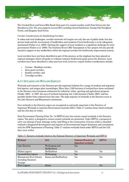
The CrookedRiverand Seven Mile Beach form partofacoastalcorridor southfrom Gerroainto theShoalhavenLGA. The areasupportsseveralEECs including LittoralRainforest, SwampOak FloodplainForest, and Bangalay SandForest.Corridor Considerations forEstablishingCorridorsIn urbanand rurallandscapes,corridornetworkswillrequire not only the use ofpubliclands, but alsoprivate landsand the involvementof landholdersandresidentsif local biodiversity isto be adequatelymaintained(Parker et al. 2008).Enlistingthe supportof localresidents is asignificant challengeforlocalgovernment (Parker etal. 2008). The SouthernRiversCMA ‘Escarpmentto Sea’ project willalso provideincentivesupportto key landholders within the regional corridorsfor biodiversity improvementactions.Localcorridorshavenot been identifiedaspartof this process, asthe emphasishas beenplacedonregional strategies whichwill guide co-ordinatecommonbiodiversity goalsacross the Illawarra.Localcorridors have beenidentifiedinother previouswork,however,require further consideration include:• Croome -Blackbuttcorridor;• Keira green corridor;• Kembla corridor; and• Towradgi corridor;6.11 ESTUARINEAND WETLAND HABITATSWetlands andestuaries inthe Illawarraprovide important habitats for arangeof resident andmigratorybird species,and unique plantassemblages. Morethan 1,500hectaresofwetlandhave beenreclaimedin the IllawarrasinceEuropeansettlementforindustrial, urban, sporting and agricultural purposes(Chafer 1997). In 1997, the areaofwetlandremaining was1,044 hectares(Chafer 1997), andhaspossibly further beenreducedsince this time. The large majority ofwetlands in the Illawarraoccur inthe Lake IllawarraandMinnamurracatchments.Four wetlandsin the Illawarraregionare recognised as nationally important in the DirectoryofImportant Wetlands inAustralia(EnvironmentAustralia 2001). Table17outlinesthose listedwetlandsand the LGA they lie within.State EnvironmentPlanning Policy No.14 (SEPP14)also listscertaincoastal wetlands in the Illawarraregion. The policy is designed to ensure coastalwetlands are protected. UnderSEPP14, aproposal tocarry out clearingof land, drainage works,landfilling or the constructionof levees withinaclassifiedwetlandisdesignated development and requires anEnvironmentalImpact Statementand consultationwith theNSWDepartmentofPlanning. Table17 outlineswetlandslisted under SEPP14and theLGAthey occur within.Table 17:Illawarra wetlands listedon the NationalDirectory of ImportantWetlandsandSEPP14Wetland LGA National Directoryof SEPP14ImportantwetlandsLakeIllawarra<strong>Wollongong</strong> andYesShellharbourKillaleaLagoon Shellharbour Yes YesCoomaditchieLagoon <strong>Wollongong</strong> YesMinnamurraRiver Estuary KiamaandShellharbour Yes Yes(Including DunmoreSwamp)WerriLagoon Kiama Yes<strong>ILLAWARRA</strong> <strong>BIODIVERSITY</strong><strong>STRATEGY</strong><strong>Vol</strong>.2Background document 29


