ILLAWARRA BIODIVERSITY STRATEGY Vol. 2 - Wollongong City ...
ILLAWARRA BIODIVERSITY STRATEGY Vol. 2 - Wollongong City ...
ILLAWARRA BIODIVERSITY STRATEGY Vol. 2 - Wollongong City ...
- No tags were found...
You also want an ePaper? Increase the reach of your titles
YUMPU automatically turns print PDFs into web optimized ePapers that Google loves.
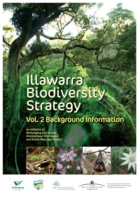
IllawarraBiodiversityStrategy2011Ajoint project between the IllawarraCouncils;<strong>Wollongong</strong> <strong>City</strong>Council, Shellharbour <strong>City</strong> CouncilandKiama Municipal Council. Funded by the NSW Environmental Trust.AcknowledgementsThis strategy hasbeen developedby <strong>Wollongong</strong> <strong>City</strong>Council’s NaturalResourceOfficer, Jedda Lemmonthrough consultation witharange of agency representatives and stakeholders.Acknowledgementshouldfirstly go tothe reference group andsteering committee members that haveguided the developmentofthe strategy, Tony Miskiewicz andVanniDe Luca(<strong>Wollongong</strong> <strong>City</strong> Council),MickFields and GlenIsbester(Shellharbour <strong>City</strong> Council),Paul Czulowksi(KiamaMunicipalCouncil), James Dawson(DECCW), DrKrisFrench(UOW), Jane Caldwell (SRCMA),MeganRowlatt (Illawarra Landcare), andAndrew Britton(SmallFarmsNetwork).Other significantcontributions have beenmade through provisionof expert advice, and/or participation inworkshops,Gary Leonard,Garry Daly, Neill Rendell,DavidPomery, Vanessa John, Denise Black,LeonFuller,AndersBofeldt, Peter Gill,Peter Stuckey, Andrew Knowlson,Peter Nelson, Jay Windsor, Marcus Burgess,Wendy Midgley, KarenFildes, Clairede Lacey, Steve Chamberlain,Martin Schulz,KylieMadden,ByronRobinson, Jamie Erskine, Mike Swanson, Tuesday Heather, Andrew Glover, PaulFormosa,Lynne Kavanagh,RichardScarborough, AlisonScobie, AlisonMellor, Gaby Kirwood, Aimee Beardsmore and Jo Ferguson.Thankyouto ChrisEdmondfor allowing the useof hisphotography.<strong>ILLAWARRA</strong> <strong>BIODIVERSITY</strong><strong>STRATEGY</strong><strong>Vol</strong>.2Background document 1
Figure 1: Tenureclassesinthe Illawarraregion.<strong>ILLAWARRA</strong> <strong>BIODIVERSITY</strong><strong>STRATEGY</strong><strong>Vol</strong>.2Background document 5
3.2 FEDERAL LEGISLATION AND POLICYAnumberof national statutesandpoliciesfurther define Australia’s commitment to biodiversityconservation. The most significant areoutlinedbelow.3.2.1 Environment Protectionand BiodiversityConservation Act1999 (EPBC Act)The EPBC Act providesanational scheme for environmentalprotectionand biodiversity conservation.The ActidentifiesapprovedmattersofNationalEnvironmental Significance(NES) andprovides anassessmentprocessforthese. MattersofNES include:• WorldHeritageProperties;• National Heritage Places;• Wetlandsof International Importance (Ramsarwetlands);• ThreatenedSpecies andEndangeredEcologicalCommunities;• Migratory Species-JAMBA/CAMBA/ROKAMBA Species;• CommonwealthMarine Areas; and• Nuclear Actions(includingmining).ImpactsonmattersofNEStraditionally triggerareferral process to the Department ofEnvironment,Water,Heritage and the Arts.However,since the Commonwealthand the NSWGovernment signedaBilateral Agreementon18January 2007, pursuant toSection45of theEPBC Act,impactsonmattersofnational environmentalsignificance arenow assessedunder the ImpactAssessment Regimes ofPart3a,4and5of theEPAAct. Thisbilateral agreementwillexpire on18January2012.Appendices 3, 4, 5 and6highlight thosespecies andcommunities in theIllawarra which arelisted underthe EPBC Act. Table 2: also lists the recovery plansmade under theEPBC Act thatare relevant to theIllawarra.Table 2: National RecoveryPlans for speciesoccurringin the IllawarraFloraDaphandra species CIrenepharsustrypherusZieriagranulataPterostylis gibbosaFaunaGiant Burrowing Frog(inpreparation)Green andGoldenBell Frog(inpreparation)StutteringFrog (inpreparation)EasternBristlebird(inpreparation)Spotted-tailedquoll(inpreparation)Grey-headed Flying-fox (inpreparation)BroadHeadedSnake(inpreparation)International migratorybirdsThe AustralianGovernment has entered intothreebilateralmigratory birdagreements. These are:• Japan-Australia MigratoryBirdAgreement(JAMBA);• China-AustraliaMigratory BirdAgreement(CAMBA); and• RepublicofKorea -Australia Migratory BirdAgreement (ROKAMBA).<strong>ILLAWARRA</strong> <strong>BIODIVERSITY</strong><strong>STRATEGY</strong><strong>Vol</strong>.2Background document 6
All migratory birdspecies listedin the annexes to these bilateralagreements areprotectedinAustraliaas matters ofNESunder the Commonwealth EnvironmentProtection andBiodiversityConservation Act1999 (DEWHA,2009). Those specieswhich are likely tooccur inthe IllawarraaretabledinAppendix 7.The agreementslist terrestrial, water andshorebirdspeciesthatmigrate betweenAustraliaand therespectivecountries. Themajorityoflistedspecies are shorebirds. The agreementsrequirethe partiesto protectmigratorybirdsby limiting tradeofmigratory birds; protectingandconserving importanthabitats; exchanging information; and buildingco-operative relationships(DEWHA 2009).3.2.2 Australia’s BiodiversityConservationStrategy 2010-2020: ConsultationDraftAustralia’s BiodiversityConservationStrategy 2010-2010: ConsultationDraft (CommonwealthofAustralia 2009) provides national directionforbiodiversity conservation.Prioritiesshownin Table3areoutlinedto guidestate, regional andlocalbiodiversityplanning.Table 3: Australia’s Biodiversity Conservation Strategy (ConsultationDraft) prioritiesPriorityPriority forchange 1:Building ecosystemresilience.ActionsAction1.1.2: Prepare and implementplansforbiodiversity conservationat alllevels(local, regional,stateandnational) thatmaintain ecosystem healthandprotect threatenedand endangeredspecies.Action1.1.3: Establishconservationlinkages whichprovideconnectivity acrossbioregions,includingata continentalscale.Action1.1.5: Establishanational framework foroff-reserve conservation.Priority forchange 2:Mainstreamingbiodiversity.Action2.1.1: Teachallprimary schoolchildrenabout biodiversity and itsbenefitstotheir well beingand the worldatlarge.Action2.1.2: Implementanongoing national campaign that demonstrates theimportanceof biodiversity to the sustainabilityof communitiesand the qualityofour lives.Priority forchange 3:Knowledge for all.Priority forchange 4:Gettingresults.Priority forchange 5:InvolvingIndigenouspeoples.Action2.3.3: Ensure arrangementsfor emerging markets for carbonandwatertake account of biodiversity risksand benefits.Action3.1.1: Assessknowledge needs,identify gaps and set prioritiesatnational, stateandregionallevels.Action4.3.2: Review and reformlegislationto improvebiodiversityconservationoutcomesacrossallsectors.Action5.1.2: Whereverpossible and appropriate, recognise traditionalIndigenous knowledgeandenvironmentalmanagement expertise,andapplyor extend suchmanagement for biodiversity conservation.Priority forchange 6:Measuring success.*Sourcedfrom Commonwealthof Australia(2009)Action6.1.1: Build baselinedatasets, including key indicators, tomeasurebiodiversityconditionandtrends overtime.Action6.1.3: Implementandmaintainanationally representativeset oflongtermmonitoringprotocolsandsites.Action6.2.2: Incorporate biodiversity and ecosystemservices into nationalaccountsandcorporate reporting.<strong>ILLAWARRA</strong> <strong>BIODIVERSITY</strong><strong>STRATEGY</strong><strong>Vol</strong>.2Background document 7
developerseekingapproval toclearvegetationwillbe requiredto purchasecredits fromasite with thesameorsimilar vegetationcommunity.More informationonBioBankingcanbe sought at http://www.environment.nsw.gov.au/biobanking/3.3.2 Environmental Planningand Assessment Act 1979 (EPAAct)This is the principal planninglegislationfor NSW, providingaframework for theoverallenvironmentalplanning and assessmentof developmentactivities.The EPAAct providesfor the developmentof LocalEnvironmental Plans(LEPs), StateEnvironmentalPlans(SEPPS), andRegionalEnvironmentalPlanningPolicies(REPs).UnderParts 4 and5of theAct, Councils are required to assessthe impactonthreatenedspeciesof developmentsarising from bothapplicantson private land anditsownactivitiesonpublicland. This is done throughthe Assessmentof Significance (Section5a).Whilst applicantsare required to submit assessmentstothis effect, Councilhasthe primaryresponsibility for determining whetherasignificanteffect islikely to occur. If theassessmentshows asignificant impacton threatened speciesor anEEC is likely tooccur thenaSpecies Impact Statement(SIS) is requiredtobe prepared under directions from theDirectorGeneralof the DepartmentofEnvironment, ClimateChange andWater.Alternatively, theproposalmay bemodified such that asignificant effecton threatenedbiodiversity isunlikely (DEC 2004).Councils have aresponsibility toensure that they make decisions relating to threatenedspecies,communities and populationson the best availableinformation.One aimofthe Strategy is to improvethe applicationof environmentalassessment under the EPAAct.3.3.3 Local Government Act1993 (LG Act)The LGActsetsout the responsibilitiesof Councils including publiclandmanagement,activityapprovals,corporate andoperation planning, ordersand enforcement powers, settingratesandcharges (LGSA 2009).Section 7(e)of the ActrequiresCouncils,CouncillorsandCouncilemployees to have regardto theprinciplesof ecologically sustainable development incarryingout their responsibilities. TheCharter(Section 8)also requiresCouncils to properly manage,develop, protect, restore,enhance andconservethe environmentof the area forwhichit isresponsible, inamanner that is consistent withandpromotes the principlesofecologically sustainable development.Underthis Act, Councils are requiredto havePlansofManagement for allCouncilownedland.3.3.4 Native Vegetation Act 2003 (NV Act)The Native VegetationAct2003 (NV Act)regulatesvegetationclearing in non-urbanareas. This Actapplies to theIllawarraCouncilsinallareas,except where landis zoned “residential” (but not “ruralresidential”),“village”, “township”, “industrial” or “business” underan environmentalplanninginstrument(Schedule 1, part 3of the Act).Arange ofspecificRoutineAgricultural ManagementActivities (RAMAs)and some other typesofclearingare also exempt from thisAct. These activities couldhowever,stillrequire consent for clearing underaCouncil’s LEP.Apersonseekingto clear native vegetationunderthe NV Act needsto applyto the relevantCatchmentManagementAuthority. They may also simultaneouslyneedconsentby the localCouncil. The CMAmayrequire aProperty VegetationPlan(PVP) tobe developed.APVP is anegotiated,legally bindingagreement between the landholder and the localCatchmentManagementAuthority.DevelopmentconsentoranapprovedPVP is requiredto clear remnant nativevegetationandprotected regrowth.Clearing ofother regrowth(post1January1990) doesnot require consentoraPVP.Approvalofclearing willonly be givenif clearingof thevegetation willimproveormaintain environmental<strong>ILLAWARRA</strong> <strong>BIODIVERSITY</strong><strong>STRATEGY</strong><strong>Vol</strong>.2Background document 9
outcomes asassessedby the PVPDeveloper,the decisionsupport toolusedby the CMAs(EcoLogicalAustralia, 2007). The NV Act is currentlyundergoing review.3.3.5 FisheriesManagement Act1994 (FM Act)Part7aof the FMActcontains provisions similar to the TSC Act1995 inrelationtoaquatic animals andmarinevegetation.Itprovides for the listing of threatened species, populations,ecologicalcommunitiesand KTPs, criticalhabitatandpreparationof recovery plans and threat abatement plans.3.3.6 Water Management Act2000(WM Act)This is the main pieceofwater legislationfor NSW ensuring that water isprovidedfortheenvironmentand more secureaccesstowaterusers.The provisionsofthe WM Act are being progressivelyimplemented inNSW.Across the entireState, workswithin40metresof ariver,lakeorestuary requireaControlledActivity Approval under thisAct.The recently repealed RiversandForeshoresImprovement(RFI) Act hasbeenintegratedinto the WaterManagementAct2000.3.3.7 Noxious WeedsAct 1993 (NWAct)Administered by Industry andInvestmentNSW (formerly theDepartmentofPrimary Industries), this Actallowsfor the listingoffivecategoriesofdeclarednoxious weeds. Itprovidesforthe specificationofcontrolmeasures andpublic andprivate landresponsibilities.Noxiousweedsoccurring in the Illawarraare listedin Appendix 2.3.3.8 NationalParksand WildlifeAct 1974 (NPW Act)This Act isadministered bythe DepartmentofEnvironment,ClimateChange andWater(DECCW) andprovidesfor the establishment ofNational Parks,other conservationreserves, and the protectionofflora andfauna. The NPWAct contains provisions under Section132, for the licensingof activities forscientific, educationalor conservation purposesthatmaylead to harmof floraor fauna. Bushregenerationactivities in threatenedspecieshabitatneedto seek licensing under Section132of theNPW Act. The Act alsocontains provision forthe protectionof native floraandfauna.3.3.9 NSW State Plan2006The NSW StatePlan(Departmentof Planning2006)sets thedirectionfor New SouthWalesoverthenext tenyears. ThePlanincludes 34 priorities and60targets designedto deliverbetterservicesandimproveaccountability acrossthe publicsector.Prioritiesrelevantto biodiversity include:• PriorityE4: Betteroutcomes for native vegetation,biodiversity, land, riversand coastalwaterwayssets the following targets for Biodiversity;o By 2015there is anincrease in native vegetation extent andanimprovement innativevegetation condition;o By 2015there is anincrease in thenumber ofsustainable populations of arangeof nativefaunaspecies;o By 2015there is anincrease in therecoveryof threatenedspecies, populations andecologicalcommunities; ando By 2015there is areductionin the impactof invasivespecies.3.3.10 NSW Invasive Species Plan 2008 - 2015Outlines acoordinatedresponse to minimise the impactof weedsandpest animalsand is linkedtonational prevention systems (LGSA2009).<strong>ILLAWARRA</strong> <strong>BIODIVERSITY</strong><strong>STRATEGY</strong><strong>Vol</strong>.2Background document 10
3.3.11 NSW WetlandsManagement Policy1996This policyoutlines a whole of government approachtowardthe conservationand sustainablemanagementofNSW wetlands(LGSA 2009).3.3.12 State Environmental PlanningPolicyNo. 14 Coastal WetlandsSEPP14aims to protect coastal wetlands. Wetlands protectedunderSEPP14 inKiamaincludeMinnamurraestuary,Werri Lagoon, andSpring Creek.KoonaBay wetlands,Minnamurraestuary,KillaleaLagoonand partsof Lake Illawarra entrance are listedinShellharbour.Haywards Bay wetlandsare listedfor<strong>Wollongong</strong>.3.3.13 State Environmental PlanningPolicyNo. 26 Littoral RainforestThe aim of thisPolicyis toprovide amechanism for the consideration ofapplicationsfor developmentthat are likely to damageor destroy littoral rainforestareas withaview to the preservationof thoseareas in their naturalstate.3.4 REGIONALAND LOCAL PLANS3.4.1 IllawarraRegional Strategy 2006The IllawarraRegional Strategywas preparedby theNSW DepartmentofPlanning (DoP) toguidegrowthandinfrastructuredevelopmentover a25 year period(2006 -2031)in the <strong>Wollongong</strong>,Shellharbour and KiamaLGAs.RecommendedActionslisted under the naturalenvironment themeareshowninTable5.Table 5: Illawarra RegionalStrategyActions for the NaturalEnvironmentActions<strong>Wollongong</strong><strong>City</strong> Council will incorporate the planningcontrol recommendedin the IllawarraEscarpment StrategicManagementPlaninto itsLEP.WCC andDoPwillcontinue to workwithDECCW and SRCMA towards achievingbiodiversitycertificationof the WestDaptoLEP.Opportunitiesfor the longtermsurvivalof Melaleucaarmillaris shrublandEECswillbe consideredthrough the planningreview of the Shellharbour/Kiama hardrockresourceandimplemented in theShellharbour and KiamaLEPs.LEPsare tomaximise protectionof ‘SignificantNativeVegetation’, ‘Indicative DEC RegionalHabitatCorridor’ and ‘Other IndicativeHabitat Corridors’.Department ofPrimary Industry (nowIndustry andInvestmentNSW)to identify regionally significantaquatic habitatsand associatedriparianbuffersto inform preparationof LEPsandconsiderationofdevelopment.Councils willmanage theimpactof landuse change anddevelopment inthe catchmentsof highvaluecoastal lakes, estuariesand wetlands.Councilswillconsider the NSW Government-endorsedEstuaryManagementandCoastal Zone ManagementPlansinundertaking this task.Whenplanning new urbanareas, the Strategic AssessmentofRiparian CorridorsMethodologydeveloped by the Department ofNaturalResources(now DECCW) inconjunctionwith the DoP willbeusedby:-incorporating the assessments intostructure plans.-appropriate zoning.-appropriatemanagement throughadevelopment controlplan.Development proposalsaffecting riparianlandswillberequiredto suitably protect thevaluesofriparianlands by methodssuchasmaximising the retentionof nativevegetation, especially in riparian<strong>ILLAWARRA</strong> <strong>BIODIVERSITY</strong><strong>STRATEGY</strong><strong>Vol</strong>.2Background document 11
corridors and rehabilitating disturbedareas.Require LEPsto zone all SEPP14 Wetlands and SEPP26 LittoralRainforesttoachieveenvironmentalprotectionthroughzones suchas E2 orW1.Councils to consultwithSRCMA toensure the appropriate integrationofCatchment ActionPlan(CAP)and LEPs.3.4.2 SouthernRivers Catchment Action Plan 2006Southern RiversCatchmentActionPlan (CAP)(SouthernRiversCMA2006) detailskey priorities for thewholeof the SouthernRivers CMA forthe nexttenyears (2006-2016) from<strong>Wollongong</strong>LGA in thenorthto the Victorian border, including the IllawarraCouncils. Table 6 listsbiodiversity targets relevanttothe Illawarra.Table 6: The CAP Biodiversity TargetsCommunity andlandholder knowledgeand skillsB1By 2016 there willbean increase in the numberof landmanagerswho adoptmanagement practices thatconserve biodiversity andpromote sustainableproduction.Native vegetationconservationB2B3By 2016 throughvoluntaryparticipationby landmanagers, theareaof landactively managed to conserve priority vegetationtypeswillincrease from11,000 hectares to atleast41,000 hectares.By 2016 throughvoluntaryparticipationby landmanagers, anadditional 10,000 hectaresof nativevegetation willbeactivelymanagedto buildaresilient landscape withgoodconnectivitywhich conserves biodiversity.By 2016 the priority recovery actions identifiedin theSouthernRivers threatenedspeciesstrategy will have beenimplemented.Native speciesB4conservationInvasive species B5 By 2016 vertebrate pest specieswillbecontrolled inkey locations.B6 By 2016 priority weed species willbe controlledinkey locations.The intentof targets B2 andB3 isto ensurepriority vegetation types are targeted, thatis, thosewithless than30%of their originaldistributioncurrently being managedforconservation. Or,if they arealready clearedbelow30%of theiroriginaldistribution, toensurethe rest ismanagedforconservation(SouthernRivers CMA 2006).3.4.3 Local EnvironmentPlansLocalEnvironmentPlans (LEPs) are the principal legaldocument for controllingdevelopment at theLocalGovernment level.LocalEnvironmentPlans identify the zoningprovisionsfor all landwithin aLocalGovernment Area that establishpermissible usesand standards thatregulate the useof that land.They are preparedby councilandapprovedby theMinister forPlanning after public exhibition.The three Illawarra Councils have revisedtheir LocalEnvironmentalPlans. Within<strong>Wollongong</strong>LGA,the <strong>Wollongong</strong> LEP 2009 and<strong>Wollongong</strong>LEP(WestDapto) 2010 are inforce. Within KiamaLGA,the draftKiama LEPhas beenpublicly exhibitedand submittedto the NSWDepartmentof Planning forapproval. WithinShellharbour LGA, the draft Shellharbour LEP hasbeenapprovedby theDepartmentofPlanningand Infrastructure for exhibitionand willbe publicly exhibitedin thenear future. NewDevelopment ControlPlans (DCPs)will bedeveloped alongside the LEPsto provide moredetailedguidance onlanduseactivitiesanddevelopmentassessmentprocesses.<strong>ILLAWARRA</strong> <strong>BIODIVERSITY</strong><strong>STRATEGY</strong><strong>Vol</strong>.2Background document 12
3.4.4 IllawarraNRMPlan2010The IllawarraNRMPlanwas finalisedin2010 by the SouthernRiversCMA.It setsout a tenyear programof actionswhichcontribute tomeetingthe 2006CatchmentActionPlan(CAP) targets in the Illawarraregion. The plan identifiesexisting programs, andhighlights additional potentialprojects thatwouldcontribute to targets.3.4.5 IllawarraSustainabilityRoadmap 2008The Sustainability Roadmap(2008) is apartnershipof the IllawarraCouncils whichoutlinesaprogramtoembedsustainability into allareasof Council, includingdecision-making, processes,planning,reporting andoperations.4 DATAAUDITAreviewof biodiversity data was undertakenof bothspatial(GIS) and nonspatialbiodiversity data heldby thethreeCouncils. Theobjectiveof the data auditwas toestablishaknowledge basetoensuretheStrategyconsideredallavailable andup to dateinformation. The collation of this informationalsoenabled the identificationof knowledge gaps so thatfuture datacollection work canbe targeted topriority areas.Assessingbiodiversity knowledge needs, identifying gapsandsetting prioritiesare alsoone of the priority actions inAustralia’s BiodiversityStrategy-ConsultationDraft (CommonwealthofAustralia 2009).The review targetedthe following biodiversity information, including:• Threatenedspecies records;• Vegetationmapping;• Floraand fauna studies;• Conservationassessments;• Corridors; and• Wetlands;Appendix 1 providesasummaryof the major data sources reviewed.4.1 VEGETATION MAPPINGThere have beenchallengesindeveloping thisStrategy due to non-standardisation ofregionalvegetationmapping. Classifying and mappingvegetation communities has beenundertaken using arange ofmethodsinNSW and the Illawarra.Eachmethodology comes with their varyingstrengths andweaknesses(NPWS2002a). This has presentedchallenges in the preparation ofthe IllawarraBiodiversityStrategy.In the Illawarra, there are six majorvegetationmaps that coverallor partsof theIllawarra region.Unfortunately, they each come withdifferent terminology for plantcommunities,andhavemostly beenderivedfrom differentmethods.Assuch,theydo notalign well to eachother.The dataauditinAppendix 1 providesmoredetailabout eachmappingdataset.The key vegetationmapsfor theIllawarraare:• Tozer et al. (2006) Nativevegetationof southeast NSW: arevisedclassification andmapfor thecoastand easterntablelands. NSWDepartmentofEnvironmentand Conservation andNSWDepartment of Infrastructure, PlanningandNaturalResources, Sydney.• Mills andAssociates (2006a) The Natural Vegetationin the MunicipalityofKiama, NSW.• NPWS(2003b)Native VegetationoftheWoronora, O'HaresandMetropolitan Catchments.<strong>ILLAWARRA</strong> <strong>BIODIVERSITY</strong><strong>STRATEGY</strong><strong>Vol</strong>.2Background document 13
• NPWS(2002a) Native Vegetationofthe Illawarra EscarpmentandCoastalPlain.NSW NationalParksandWildlife Service.• Mills andAssociates (2001) The NaturalVegetationinthe <strong>City</strong>of Shellharbour,NSW.• DECCW (2009) Draft NativeVegetationofthe SydneyMetropolitanCatchmentManagementAuthority Area.The SouthCoast-IllawarraVegetationIntegration(SCIVI) (Tozer et al. 2006) is themost recentmap thatgivestheonly consistentclassificationacrossthe Illawarra region.Theothermaps are limitedto specificLGAsor parts thereof.They havealso takendifferent approachestovegetationclassification, hencethey cannot be alignedeasily foraregional assessment ofbiodiversityvalues. Thebiodiversity strategyhas thereforepartlyrelieduponSCIVImappingfor itsassessmentofbiodiversity priorities.Limitations withSCIVImappingThe SCIVImapping is producedat ascale of approximately 1:100 000; this issomewhat broader thanthe LGA specificmapping whichvariesbetween1:14,000 and1:25,000. Some localvegetationassemblages are not well defined in theSCIVImapping. The followingvegetationassemblages,andpossibly others, are not well definedamongst the mapunitsin the SCIVImapping:• SpottedGum ForestofMangerton andTarrawanna escarpment footslopes• Brown Myrtle Forest -StanwellPark• Redgum/ RedMahogany association-Helensburgh(C.deLacey pers.comm.)• Melaleucaarmillaris shrubland (EEC) locatedatDunmore ismistakenly mappedinpart asMortonMallee Heath(G.Daly 2009, pers.comm.)• SouthernSydney ShelteredForest (EEC)<strong>ILLAWARRA</strong> <strong>BIODIVERSITY</strong><strong>STRATEGY</strong><strong>Vol</strong>.2Background document 14
4.2 DATA GAPSThe dataaudithighlightedthe followingdata gaps andknowledge managementissues acrossall threecouncils. These areoutlinedin Table7.Table 7:DatagapsandprioritiesTheme Gap PrioritytoaddressVegetationand mappingMapping inaccuracies.Some smallercommunities including EECs are notmappedinKiamaand Shellharbour LGAs.Any furthersurvey work shouldtarget EECs.Lackof dataonpre-European extentofvegetationcommunities.ThreatenedspeciesAquatic dataFloraandfaunageneralInvertebratesGeneticdiversityVegetationmapping inconsistenciesbetweenCouncils.Some localvegetationcommunitiesnot welldescribed inregionalmapping (Tozer et al.2006).Lackofknowledgeon appropriate fire regimesfor local vegetationcommunities,especially forareasmanagedforassetprotection.Vegetation communities not alwaysaligningclearly to EECdeterminations.Vegetation condition.Absenceofmore recentGISdata delineatingextant (existing) vegetation.Lackof records,particularly inShellharbourandKiama LGAs.Lackoftargetedsurveys.Poormanagement of newsurvey data. Not always includedin theWildlife AtlasDatabase.No regional datasets.Limitedsitespecificsurveysonly.Nonvascular plants suchasbryophytes(mosses, liverworts andhornworts),andalgae arenot generally recorded.Poorly known.Fauna survey datapoor, particularly inShellharbour and KiamaLGAs.Incompatible mapping systemsand datamanagementsystems whichlimits data sharingbetweencouncils.Fauna habitat modelling not available for KiamaandShellharbour.Inconsistent reportingon key indicatorsbetween Councils inState ofEnvironmentReporting.Few site specific studiesonly. Very poorlyknown.No dataavailable.As stated in<strong>Vol</strong>umeOne,itis recommended that theIllawarraCouncilswork towardaddressing thesedata gaps over timewhenfundingand resourcesare available.Projectsaddressingdatagapsshouldfocuson priorityareas, speciesor communities where limitedresources are available.<strong>ILLAWARRA</strong> <strong>BIODIVERSITY</strong><strong>STRATEGY</strong><strong>Vol</strong>.2Background document 15
5 THREATS TO<strong>BIODIVERSITY</strong>Destructionand disturbance ofnativevegetationrepresentsthe greatest threat to biodiversity(Coutts-Smith et al. 2007).The introductionofpestspecies (exoticanimals and weeds)poses thesecondgreatest threat, andisalsorecognisedglobally as amajor cause of biodiversity decline (Coutts-Smith etal. 2007).The following sectiondescribesthevariousthreatsto biodiversity in the Illawarra.5.1 KEY THREATENING PROCESSESThe CommonwealthEPBCAct, the NSW ThreatenedSpecies ConservationAct (TSC Act, schedule3), andFisheries Management Act (FM Act, Schedule6)allowfor the listingof KTPs asoutlined inSection3.Ingeneral, threatsare listedwhen they cause anadverse affecttothreatenedspecies, populationsorecologicalcommunities;orit couldcause species, populationsor ecologicalcommunitiesthatare notthreatenedto becomethreatened. Table 8liststhose listed threatsthat are relevant to theIllawarraand indicates underwhichlegislation.Inaddition to listedKTPs,there areanumberofother threatsimpacting onbiodiversity inthe Illawarra.Through engagement withkeyregionalstakeholders, identificationofadditional threatswasundertaken. These are alsoincludedin Table8.All threatswere thenclassifiedintomajor threatcategories recognisedby Coutts-Smith et al. (2007)asshownin Table8.Table 8:Key threateningprocesses relevanttothe IllawarraThreat categoryRegionalThreatAnthropogenicdestructionanddisturbance ofnativevegetationAnthropogenicdestructionanddisturbance ofnativefaunaAnthropogenicmodificationanddegradationof physicalfactorsClearingof native vegetation. * *Extinctionsof localpopulationsof species(due to lackofrecruitment, inbreeding depression, fragmentationorother).Grazing and disturbance by stock.Hard rock extraction/quarrying activities.Lossofhollow bearing trees. *Roadsidemowing (weed dispersal, and impactson nativevegetation wetlands).The degradationof native riparianvegetationalong NSWwatercourses.Fishing andharvestingof aquatic resources(includingfish, shellfishandcrustaceans).Roadkill.Bushrock removal. *Alterationofhabitat following subsidence due to*longwallmining.* *<strong>ILLAWARRA</strong> <strong>BIODIVERSITY</strong><strong>STRATEGY</strong><strong>Vol</strong>.2Background document 16
IntroductionofalienspeciesDiseasesAlterationto thenaturalflow regimesof riversand *streams and their floodplains and wetlands.Bushrock removal. *Dumpinggardenrefuse,andrubbish.Ecologicalconsequencesofhighfrequency fires. *Human-caused climate change. * * *Instreamstructures andother mechanisms thatalter*naturalflow.Removalof deadwood anddeadtrees. *The removaloflarge woody debris from NSW rivers and *streams.Useof insecticides, herbicides, fertilizers.Waterquality degradationarisingfrom increasedurbanization.Competitionfrom feralhoneybees. *Impactsassociated withferal animals: rabbit, bees,deer,pigs, goats, exoticfish, cat, redfox, andplagueminnow*(Listed separatelyasKTPs).Introductionofnon-indigenous fishandmarinevegetationto thecoastal watersof NSW.Invasionofexotic gardenplants, exotic grasses,vine andscramblers; invasionof Lantana, andBitouBush.( Listed separatelyas KTPs)Disease/ soilpathogens Eg. Phytopthora spp.Infectionof frogs by amphibianchytridcausing thedisease chytridiomycosis.InfectionbyPsittacine circoviral(beakandfeather)disease affectingendangeredPsittacine species andpopulations.* *** ** **DECC(2007a:Appendix A)providesfurther guidanceon whichthreatenedfaunain the GreaterSouthern Sydney Regionare at risk from these threats.5.2 THREAT ABATEMENT PLANSThreat abatement plansare preparedunder the TSC Act and EPBC Actto researchandproposemanagementactions to addressKTPs.Many of therecommendedactionsare not sitespecific; howeversome plans list prioritysites, suchas forBitouBush control. Threat abatement plansrelevant to theIllawarraarelistedin Table 9.Table 9: Threatabatementplans prepared under the TSC Act and the EPBC ActThreatAbatementPlan TSC Act EPBCAct#ofsitespecificactionslisted for theIllawarraCompetitionand land degradationby rabbits. * NilPredationby the Europeanredfox. * * 1prioritysitetargetingLong-nosedPotaroo atBarrenGrounds NatureInfectionof amphibians withchytrid fungus* Nilresulting inchytridiomycosis.Competition and land degradation by unmanaged * Nil<strong>ILLAWARRA</strong> <strong>BIODIVERSITY</strong><strong>STRATEGY</strong><strong>Vol</strong>.2Background document 17
goats.Predationby feralcats. * NilBitou bush andboneseed. * 3prioritysites: Bass Point,Killaleaand SevenMileBeachPredationby the plagueminnow (Gambusia * Nilholbrookii).Planto protect environmental assetsfrom Lantana(Draft).* No specific sitesidentified.Anumberof actionsapplygenerally.Giventhe lack of spatialinformationavailable on the locationof specific threats,aspatialanalysisofthreatswas not undertaken.It is for this reasonavalues basedapproachhasbeen takenfor prioritisingworksandpriority actionsin the strategy. That is, works to reduce theimpactofthreatsshouldbeundertakenin areasof highest known biodiversity value.5.3 CLIMATE CHANGEClimate change is themostpervasive,least understoodandleast predictableof all the threateningprocesses (AuldandKeith2009). Evidencesuggests changes in the Earth’s physical environmentconsistentwithglobal warming arealready occurring. It isvery likely(>90% certain) that greenhousegas increases causedmostof the warmingalready seenin themid twentiethcentury (DECC2007b).Increases ingreenhouse gases areprimarily due tofossilfuelcombustion,agriculture andlandusechange (DECC 2007b).Onaper capitabasis, Australiansare responsibleforreleasinggreatervolumesofgreenhouse gases thananyothercountry(DECC2007b).There stillremainsome unknownsoverthetiming and extentof projectedchangesinclimate thiscentury due to uncertainties aboutthe amountof greenhouse gases that willbe released intotheatmospherelater this century, compoundedby uncertainties aboutthe climate system itself (DEFRA2007).For biodiversity, there is expectedto be arange ofdirect and indirect impactsofachanging climate.DECC(2008a) havesummarisedpredictedclimaticchangesby 2050 for the Illawarra to be:• Hotter daysoverallseasons(1.5-3°C increase).• Substantial increases in summer rainfallandaslight tomoderate increase inspring/autumnrain.• Increasedevaporation leading to slightly drierconditions in winterand spring.• Increasedsealevelrise -upfrom 1990 levels by 40cm by2050, and90cm by 2100.• Increasedstorminess,intensity andfrequency ofstorms.For biodiversity, the mainthreat fromclimatechange is whether species andcommunities canadapt tosurvive themagnitudeandrateof change.Individual species havetwo possible survivalmechanisms –adaptationor migration (DECC 2007b).Adaptive evolutionis considered unlikely due to thepredictedrapidrateof change whichis 10-60 timesfaster thanhas occurredin the past(DECC 2007b), thereforemigrationandbehaviouralchange ismore likely to bethemajorsurvivalmechanism.Generalexpectedchangesto biodiversity include (DECC 2007b):• Speciesrangeshiftsto cooler latitudes (south)or higher elevations;• Changes toflowering andfruiting times;• Vegetation thickeningin eucalyptwoodlands from carbon dioxide enrichment;<strong>ILLAWARRA</strong> <strong>BIODIVERSITY</strong><strong>STRATEGY</strong><strong>Vol</strong>.2Background document 18
• Behavioural changesinfauna populations;• Extinctionsof local populationsalong range boundaries;• Increasing invasionof highlymobile, opportunistic,weedy plant species;• Progressive ‘decoupling’ (breakage)ofspeciesinteractions (e.g. timing offoodavailability);• Increasing threatto freshwater ecosystemsthroughchanges in watertemperature andchemistry and potentialsaline inundation;• Increasedcarbondioxide willfavour plants utilizing the C 3 photosyntheticpathwayofphotosynthesis (rather than C 4 ) – thiswill alter competitiverelationships between plants andmayresultin substantialchanges in species composition, andincreasedcompetition fromweedy species (Adam2009); and• Decoupling of pollinator – plant relationships, leading toreducedpollination(Adam2009).Ecosystems in the Illawarra whicharelikely to be vulnerable to climate change are outlinedin Table10.Table 10:Communitiesandspeciesvulnerable to climate changein the IllawarraTypeRiparian vegetation.Coastalzone vegetation.Low lying coastal areas.Freshwater wetlands.Rainforest.Speciesat thenorthernlimits oftheir range.Speciesandcommunities alreadystresseddue to fragmentation.Specieswithgeographicallyrestricteddistributions andspecialist habitat requirements.Areas vulnerable to high fireintensity andfrequency.ThreatIncreased disturbance from predicted increase instorm andfloodevents.Increased pressure from sealevel rise, coastal erosionand stormevents. Likely to impact dune vegetation, saltmarsh, wetlands,littoralrainforest, andestuarine vegetation.At risk from inundation,potentialsalineinfluences.Saline influences from sea levelriseor intrusionfrom the watertable.Increasingthreat from decreasingwaterflowsandchangesin water temperature andchemistry.Increasedevapotranspirationleading to decreasedmoisturelevels/humidity.Species likely toshift range to coolerlatitudes orhigherelevations.This applies to allvegetationof the Illawarracoastalplain.Manyofthe threatenedandrare species inthe Illawarra.Potentialto migrate ismore likely to beconstrainedby habitatfragmentationorother barriers (Adam2009).Vastareas of thesandstone plateau,and escarpment.Plant specieswithwide ranging seed dispersalstrategies suchasviafrugivorous birds and bats,waterand wind areexpected to be more capableofaccommodating climatechange and crossingmigrationbarriers than plants that disperse seedclose to the parent plants suchasmyrmecochorous(antdispersed) species(Adam 2009).Vegetationclearing andfragmentationDecadesof clearing anddevelopmenton the Illawarracoastal plain has resulted inmanyisolatedandsmallpocketsof remnant vegetation. Fragmentationhas many negative impactsonnative vegetationincluding: genetic deterioration (lossof diversity andincreasedinbreeding); changedlandscapeprocesses anddisturbanceregimes; increasededgeeffects; increase abundanceof invasive species;andalteredspeciesinteractionsaffecting pollination, seeddispersal, predation,competition(HobbsandYates2003).Arecentstudy (Broadhurst2007) hasshownsmallpopulations are highly susceptible todecliningseedproduction,lossof genetic diversity increasedinbreeding leading to poorseedlingvigour<strong>ILLAWARRA</strong> <strong>BIODIVERSITY</strong><strong>STRATEGY</strong><strong>Vol</strong>.2Background document 19
and increasedhybridisation.Increasing patchsizeand reconnecting suchisolatedremnants isonewayto increase theviability and reduce threatsto these remnants.5.4 WEEDSWeedinvasionin theIllawarrahas beenoccurring since 1815,withthe earliestnon-indigenoussettlements andhascontinuedsince (BES,2006). There are more than 200 weedspeciesknownin theIllawarra,which are listedin Appendix 2.Most are environmentalweeds that pose threatstobiodiversity,however some arealso listedas noxious, as national Weedsof National Significance(WONS),or asKTPs underthe ThreatenedSpecies Act.Weeds threaten biodiversity dueto theirabilitytooutcompete native plants. This leads to areductionin the diversity of floraandfauna habitat.Weeds in the Illawarra include arangeof grasses, forbs, shrubs, trees andvinesand aquatic weeds.Duetotheabsence ofweed mapping, the IllawarraEscarpmentWeedStrategy(BES2006)recommends weedcontrol tobetargetedatbiodiversity sites of highestvalue. Itis recommendedthat this approachistakenacross theIllawarra region.5.5 PEST ANIMALSSince Europeansettlementof Australia,more than 220 terrestrialvertebrates have beenintroducedtoAustralia (Coutts-Smith etal. 2007).Of these,many haveestablished populations that pose significantthreatstobiodiversity andsome have been implicated in the extinctionofmany nativespecies andinthe declineofothers (Coutts-Smith et al. 2007).Pest animalspose directthreatsto biodiversitythroughvariousmeans includingdegradationof habitat,competition; along withinadvertent impacts fromassociated pestcontrol, grazingand browsing (Coutts-Smith etal. 2007).Table 11outlinespestanimalsandprioritiesfor controlin the Illawarra. The impacts and priorities forcontrol arebasedonrecentwork by DECC (2007a) for the metropolitanregion. Some species prioritiesweremodifiedbased on their knownimpactsand abundance in the Illawarra.Table 11:PestanimalsandprioritiesforcontrolPest animal Impacts onbiodiversity PriorityforcontrolDeer(Rusa, Red andFallow deer).Overgrazing, trampling, ring-barking, dispersalofweeds,accelerationoferosion,concentration ofnutrientsanddegradationofwaterquality (NSW ScientificCommitteeHigh-potentialtoexpandrange tothesouth.2004 inDECC 2007a).Contributing to trafficaccidents.Feralcat. Preyonnative animals. Moderate.Feralgoat. Soil damage and erosion, trampling, dispersalofweeds, High.preventionof native species regenerationthrough grazing,competitionwithnative faunafor foodandresources.Feralpig. Preyonnative animals; compete withnative faunafor foodresources,habitat alterationby wallowing, rootingandforaging, spreadofweeds,reductioninwater quality,Moderate.spread ofrootrotfungus (Phytopthora cinnamomi).Fox.Preying onnativespecies, competition withnative faunafor foodandresources.Indian Myna. Potentialcompetitionfornestingsites andhollows. Low.Rabbit.Land degradation throughgrazing, ringbarkingof trees, Moderate.constructionof burrows,soil erosion.Competition withnative faunaforfood andresources.High-refer to RedFoxThreat AbatementPlan.<strong>ILLAWARRA</strong> <strong>BIODIVERSITY</strong><strong>STRATEGY</strong><strong>Vol</strong>.2Background document 20
There are anumberofother pestanimalspecies present in the region; howeverthese have notbeenlistedas theyare considered to have lesssignificant impactsonbiodiversity (DECC 2007a).Rusa, RedandFallowdeerare themostsignificantcurrent threat.Wide ranging impactsacrosstheIllawarraEscarpment include destructionof understorey vegetation.In recentyears, they have migratedfrom theRoyal NationalPark to Ulladulla, and havethe potentialtosignificantlyexpand their rangefurther south(DECC 2007a).6 <strong>BIODIVERSITY</strong> VALUESThe landformsofthe Illawarraregiongivesrisetoahighlevelof biodiversity. TheIllawarra Councilscover an areaapproximately 108,000 hectares in size.Approximately halfof thisis vegetated. Mostofthe retainedvegetationis foundon the Illawarra Escarpmentslopes and sandstone plateauwestof theescarpment,whichis largely watercatchmentland. The Illawarracoastalplain however, hasmostlybeencleared, leavingmostly isolatedremnantsof vegetationvulnerable to anumberofongoingthreats.Biodiversityvaluesappliedin the Strategy aremore fully describedbelow.6.1 ENDANGERED ECOLOGICAL COMMUNITIESThere are19 EndangeredEcological Communities (EECs)listedas threatenedunder the NSW TSC Actorthe CommonwealthEPBC Act in the Illawarra. Some are distributedacrossallthreeLGAs,others arerestrictedto particular LGAs as indicatedin Table 12.Due tothe highlevelofvegetationclearingon the coastal plainforagriculture industry and residentialdevelopment, mostvegetation typesthatoccuronthe Illawarracoastal plainare nowlistedas EECs.Other EECs alsooccuron the IllawarraEscarpment,WoronoraPlateauand MossValeTablelands. Table12 providesalistof the EECsand the prioritisationofthosecommunitiesbasedonanassessmentof thelevelof threatto thecommunity, andpopulationstatus. This assessmentmethodwas adoptedfromDECC(2008b), however, withafocuson the Illawarraregion.Appendix 3provides further informationon the distributionofEECs.Table 12:EndangeredEcologicalCommunities (EECs) of theIllawarraEndangered EcologicalCommunity(EEC)TSCActEPBCAct<strong>Wollongong</strong>LGAShellharbourLGAKiamaLGAPrioritiesBangalay Sand Forest yes * * * HighCoastalSaltmarsh yes * * * HighFreshwater Wetlandson Coastal yes * * * HighFloodplainsIllawarraLowlands GrassyWoodland yes * * * Highestin the Sydney BasinBioregionIllawarraSubtropicalRainforest in yes * * * HighestSydney BasinBioregionLittoral Rainforest (TSCAct); LittoralRainforest andCoastalVine Thicketsof Eastern Australia(EPBCAct)yes yes * * * High<strong>ILLAWARRA</strong> <strong>BIODIVERSITY</strong><strong>STRATEGY</strong><strong>Vol</strong>.2Background document 21
Melaleucaarmillaris TallShrubland yes * * HighestO'Hares Creek Shale Forest yes * HighestRiver-flat Eucalypt ForestonCoastal yes yes * * HighFloodplainsRobertsonBasaltTallOpen-forest yes * * HighRobertsonRainforest yes * * HighShale/ SandstoneTransition Forest yes yes * HighSouthernHighlands ShaleWoodlands * HighSouthernSydney ShelteredForest yes * HighestSwampOak FloodplainForest yes * * * HighSwamp Sclerophyll ForestonCoastalFloodplainsyes * * * HighSydney Freshwater Wetlands in the yes * * HighestSydney BasinBioregionTemperate HighlandPeat yes * HighThemeda Grassland onseacliffs andcoastalheadlandsyes * * High6.2 ENDANGERED POPULATIONSThe NSWTSC Actallows for the listingofendangeredpopulations.Thereare currently 35listedpopulations in NSW, withthreeoccurring in the Illawarra. Table 13detailsthe Illawarrapopulations.Table 13: ListedEndangered Populationsof the IllawarraPopulation Description LGALespedezajuncea.Knownfrom just one roadside populationsouthofDapto.Disjunct from other populations inWestern Sydney, far southcoastandsouthern tablelands.<strong>Wollongong</strong>Chorizemaparvilorum.Callitrisendlicheri,WoronoraPlateauPopulation.This populationhas beenrecorded from betweenAustinmerandAlbionPark.It typically occupies woodlandor forest dominatedby ForestRedGum (Eucalyptus tereticornis) and/orWoollybutt(E. longifolia).At Austinmer, the speciesis recordedfromacoastalheadland.This populationrepresent the easternlimitof the species, and isdisjunct fromotherknownpopulations.The Woronorapopulationisrestricted toasingle sandstoneoutcropapproximately twohectarein area.Shellharbourand<strong>Wollongong</strong><strong>Wollongong</strong>The Lespedeza and Chorizema populations aremost at risk, particularly as they are withinfragmentedhabitats that willface increasing threats withproposedfuture urban expansionof West Dapto/YallahCalderwood area. The Callitrisendlicheri populationisactivelymanagedbythe NationalParksandWildlife Serviceas partofDharawal Nature Reserve.<strong>ILLAWARRA</strong> <strong>BIODIVERSITY</strong><strong>STRATEGY</strong><strong>Vol</strong>.2Background document 22
6.3 THREATENED SPECIESThreatenedspeciesrecords forthe Illawarrawerecompiledusing ATLAS data(dated Feb2009),engagement with experts,andherbarium recordsfrom the NSW andJanet CoshHerbariums.There are66 threatenedfaunaspecies, and31 threatened floraspecieswhichhave been recordedwithin thestudy area.Appendices4,5and6providedetailedlists of those flora,faunaand aquaticspecies.Of the threatenedfauna, themajorityarebirds and mammals thatarethreatened. Ahighproportionof the locally occurring frogsare also threatened.Threatenedspecieshave beenprioritised basedon the levelof threat andtheir importanceto theIllawarraregion. These prioritiesare also shown inAppendix 4 and5. Theprioritisationwas initiallytakenfrom the ThreatenedSpeciesPrioritisationand ImplementationStrategy for the Priorities ActionsStatementfortheMetropolitanRegion(DECC2008b).However, asthis regionis amuch larger studyarea, it wasconsidered alocal review of these priorities was required to betterreflect prioritiesandthreats inthe Illawarra. The prioritisation rules devised by DECC (2008b) that were usedto guide thereview are showninTable14.Table 14:Prioritisationrules for revisedrankingsPRIORITY Level of endemism Levelof threat PopulationstatusHighest High to medium levelofendemism andabundance to IllawarraHighExtremely rare torareHighMedium to Low levelof endemism andabundance to IllawarraHigh tomedium Extremely rare torareMedium Mediumto Low levelof endemism andabundance to IllawarraMediumto Low rare to locallycommonLowMedium to Low levelof endemism andabundance to IllawarraMediumto Low UncommontocommonIt is noted thatseveral species have becomeextinct inthe region. Protectedmigratory birds arealsolistedinAppendix7, andcovered insection3.2.1.The IllawarraCouncils willsupport DECCW to prioritisekey actions from thePriority ActionsStatement, and RecoveryPlans sothat opportunities to invest inthreatened species recoverywill betargetedappropriately.6.4 CRITICAL HABITATPart3of the TSC Act1995allowsfor the listingofcriticalhabitat. There iscurrently no listedcriticalhabitat in the Illawarra.6.5 RARE FLORARegionallyrare florafor the Illawarrahave beenidentified inpreviouswork (NCC 1999, MillsandAssociates2000, andFairley 2004) andincorporatedinto thisStrategy in Appendix 8.94 species intotalhave beenflaggedasrarein the region.Someof these are listedas Rare or Threatened AustralianPlants(ROTAPS) underthe schedule preparedby BriggsandLeigh (1996).<strong>ILLAWARRA</strong> <strong>BIODIVERSITY</strong><strong>STRATEGY</strong><strong>Vol</strong>.2Background document 23
6.6 RARE FAUNARare faunahave beencompiledfrom several datasetscollated within the region(Chafer etal. 1999,Mills andAssociates2000,NPWS2002b,MillsandAssociates2006b, DECC2007a). There has beencomparativelylesssystematic fauna surveyacrosstheIllawarra thanfor flora, asaresultthere is lessunderstandingof rare faunaspecies.Given theactivemembershipof the IllawarraBird ObserversClub,there ismore known aboutbirds thanother fauna groups in the region.Appendix 9 containsthe list ofrare faunacompiledfor the Illawarra.6.7 FAUNA HABITATSFaunadataacross the regionisvery variable. Fauna data ismore available forthe northof the region,withfewer records andlesssystematicstudies available in Shellharbour andKiamaLGAs.Giventhispaucityof consistent faunadataacrossthe Illawarra, broad vegetationclasseswere usedas anindicatorof threatenedfauna habitats.Habitattypeswere used that hadbeendefinedin recentstudies (DECC2007a,DECC 2007d). Thehabitat approachisoftenmore practical compared withaspecies-by-speciesapproach, especially whenthere aremanythreatenedspeciesinan area(DECC 2007a), andanabsenceof systematic survey data.Each threatenedfaunaspecies recordedfor theregionhas beenassignedto itspredominant habitattype basedonknowledgeof their distributions described in existingliterature (DECC 2007a,DECC2007d, and NPWS 2003b).The full listofspeciesby habitat canbeseenat Appendix 10.6.8 VEGETATION COMMUNITIESThere are threemajor landformtypes inthe Illawarra: the coastal plain; IllawarraEscarpment; andplateau, comprising the WoronoraandBudderoo Plateaux.Eachlandform gives rise to differentgeologiesandclimate, leading to avery high diversity ofvegetation types.The coastalplainis highly urbanisedin the northof the region, andprogressivelymore ruraltowards thesouth.Mostof the vegetationof the coastalplain hasbeen cleared, andwhat little remains ismostlylistedas EEC. There remain scatteredremnantsof grassy woodlands, wetlands,saltmarsh,rocky coastalheadlandsanddune vegetation.Mostof thecoastalplainis flat andmildly undulating withvolcanichillsgiving rise to dry andsubtropical rainforests.The Escarpment slopes are mostly vegetated withmoist eucalypt forests and rainforests,whichprovideascenic backdropto thecoastal plain.The WoronoraandBudderoosandstone plateaux beyond the Escarpmentinclude another suiteofvegetation typesincludingwoodlands, heaths, uplandswamps,shale forests andshelteredgully forests.Table 15 shows thedistributionof extant(current) vegetation acrossthe councilareasof theIllawarra.Table 15:Proportionofvegetatedlands acrossthe Illawarra RegionKiama Shellharbour <strong>Wollongong</strong> IllawarraRegionLGA totalarea(ha) 25,791 14,759 68,437 108,987Totalvegetation(ha) 12,841 5,309 47,666 65,816%of LGA 50 36 72 100% ofIllawarra region 12 5 44 60<strong>ILLAWARRA</strong> <strong>BIODIVERSITY</strong><strong>STRATEGY</strong><strong>Vol</strong>.2Background document 24
Extantvegetationfiguresin Table15 are basedonmappingby Tozer et al. (2006)from aerial photostakenbetween1994 and2001. Therefore,these figures are likely toover represent current extantvegetation.As shownin Table15, mostofthe vegetationis distributed withinthe <strong>Wollongong</strong> LGA.Alargeportionof this is within thecontrolof theSydney Catchment Authority.Appendix 11 liststhe vegetationunitsasdefinedby Tozer et al. (2006) that occur in the Illawarra, alongside asummaryofthe key speciesandhabitat for eachcommunity.6.9 VEGETATION PRIORITIESThe SouthernRiversCMACatchment ActionPlan(CAP) (2006) broadly defines priority vegetationtypesas thosewith ‘30% of theiroriginal distributionbeingmanagedfor conservation’. The barriertodetermining this isthat there is no reliablemappingof the pre-Europeanextentof vegetationcommunities in the Illawarra. To define amore specificlistof vegetationprioritiesfor the IllawarrawedevisedaclassificationofvegetationprioritiesusingSCIVIvegetationmapping (Tozer et al. 2006).To do this,anassessmentwasmade ofthe endemism and reservationstatusof eachvegetationcommunity in the Illawarracomparedwiththe entireSCIVIstudy area. TheSCIVIstudy area extendsfromSydney in the north to the Victorianborder in the southand westtoGoulburn(Tozer et al. 2006).This enabledacomparisonto be made between the distributionsof plantcommunities within theIllawarraagainstthewholeSCIVIstudy area.Usingthis information, aranking ofthree priority classeshas beendeveloped(1 being highest). This isdesigned to helpinform themeeting of CAP targetsandpriority conservationareasacross the Illawarra.Table 16:Vegetationpriority classesPriorityEndemism%ofdistributionwithinthe Illawarra1 >60%
and endemism status,butare listedas EECs,were also includedinPriority 2 duetotheir threatenedstatusunderthe TSC ActorEPBCAct.Priority 3communitieswere those thatmeet the 30%reservationstatus, and arenot particularlyendemicto theIllawarra.In the Illawarraregion, they are confinedmostly to theBudderooPlateauwithinNationalPark estate. This classincludedsandstonewoodlands, gully forests andheaths.Appendix 12shows the complete listof vegetationunits withtheir determinedpriority class.Vegetationpriorities shouldbeusedtoguidepriorities for investment and conservationefforts onland outsideof the regional corridors.These priorities canalsobeusedtotarget opportunities forland acquisitionorincentives.6.10 REGIONAL <strong>BIODIVERSITY</strong> CORRIDORSThe Strategy consolidates andmapsanetwork ofregionalbiodiversity corridorsacrossthe Illawarra.The biodiversity valueof corridor networksiswell known. Landscapes thatretainmore connectionsbetweenpatchesofotherwise isolatedareasof vegetationare more likely to maintainmore numerousand more diverse populationsof various plantand animal species(LindenmayerandFischer, 2006).Conversely, alack of landscape connectivity canhave arange of negative impactson speciespopulations(Lindenmayerand Fischer, 2006).It isthought that ifexisting remnants are leftto persistwithoutsufficientimmigrationtomaintain genetic diversity,continuedlossesofbiodiversity are certain(Parker et al. 2008).Mostof theareasdefinedin the Strategyas forming part ofaregional corridor network have alreadybeenflaggedascore conservationareasinpreviousstudies. This is because theyare large,biologicallydiverse,containadiversityof habitatsandvegetationcommunities, containhabitats for threatenedspecies,andcontainvegetationcommunitiesthat are significant to New SouthWalesandthe Illawarraregion(MillsandAssociates 2000).There isaclearmandatefor planningfor biodiversity corridorsas shownby the various state, regionaland localpoliciesandplanspromoting them includingAustralia’s Biodiversity ConservationStrategydraft(Commonwealthof Australia2009),The SouthernRiversCatchment ActionPlan(SouthernRiversCMA2006), IllawarraNRMPlan(SouthernRiversCMA2010), and the IllawarraRegional Strategy(DoP2006).This Strategy hasresponded tothesehigh order targets and regional plans byconsulting withlocalexperts, andreviewof previous studiesto delineate andmapboundaries inorderto define aregionalcorridornetwork. Thiswasdone to facilitate improvedincorporation of thecorridorsinto planninginstruments, andto guidebiodiversity planningandconservationpriorities.The proposedobjectivesof the Illawarrabiodiversity corridorsareto:• Delineate areasof high quality habitat;• Conserve andprotectareas of high quality habitat;• Enhance existingconnectivitywithin corridorsby regenerating orrevegetatingmissing linkswhere possible;• Consolidate andmanage these continuous linksto provide large scale connectivity through thelandscape;• Implementeffective planningcontrols to prevent further fragmentation;• Maintainviability of nativevegetationandprovide dispersalcorridorsforfauna;• Minimising further clearing within these areas;and<strong>ILLAWARRA</strong> <strong>BIODIVERSITY</strong><strong>STRATEGY</strong><strong>Vol</strong>.2Background document 26
• To minimise the impactofdevelopmenton land within andadjoining the regional corridors.Methodused toMapIllawarraBiodiversity CorridorsRegional corridors for the<strong>Wollongong</strong> LGA have already beenlargely defined through existing studies(MillsandAssociates 2000, NPWS2002b,NPWS2003a, Eco Logical2004, WCC 2005,Mills andAssociates2006b, WCC 2007, DECC 2007d, andDoP 2006). They include anorth-south escarpmentmoist forest corridor, and an east-westcorridor linkage throughYallah andMarshall Mount.TheMarshallMountcorridor boundary needs to benegotiated as partof theupcoming WestDaptoLEPStage 5.Through engagement withlocalfloraandfaunaexperts and review of existingstudies, regionalcorridors to the southof <strong>Wollongong</strong> LGAwere defined. The north-southescarpmentmoistforestcorridor was extendedalong the escarpment tothe southernboundaryof KiamaLGA, andmajor eastwestlinkswerealsoidentified.The informationwhich wasconsideredin thedraftingof corridorboundariesincludes:• Aerial photography;• Bufferingofextant vegetationby 50m using SCIVImapping - whereothermapping did notexist;• Mappingof highconservation value areas (Mills andAssociates2001and 2006, NPWS2003a);• Advice from engagementwithlocal floraand fauna experts;and• Other studies which have outlinedsignificant linkages(Mills and Associates 2001,SRCMA 2008,DoP2006,WCC2007).The regional corridorsmaps are showninAppendix 1of <strong>Vol</strong>ume One. Asummary of the maincorridorlinks is providedbelow.Escarpment MoistForest CorridorThe escarpmentmoist forest corridorwasoriginallydefinedin the<strong>Wollongong</strong> LGA from Helensburghin the north, to the Calderwood Valley inShellharbour (NPWS2003).However, the southernboundaryof thiscorridorwas definedat Calderwooddue to study area limitations.Physically, themoistforestcorridorcontinues the length ofthe Illawarra Escarpment from the Royal National Parkin the north,andcontinuesto thesouthalong the Escarpment throughShellharbour and Kiama LGAs,southto theShoalhaven, where itendsat Cambewarra.For the purposesof the Strategy, the boundarieswere delineatedonlyto Foxground to the southernboundaryof the KiamaLGA. The Escarpment supportslarge areaof native vegetationand adiversityofhabitat types, andtherefore contains alarge proportionof the biodiversityof the Illawarra(MillsandAssociates2006b). Themoist eucalyptforests providequality habitat for bird,arborealmammal, reptileand bat assemblages(NPWS 2002b).The Escarpmentcorridorprovidesthe largest, continuouscoreconservationarea in the region.Protectionand improved connectivityof thiscorridormay allow for therecolonisationof faunaspecies thatmay be locally extinctin<strong>Wollongong</strong>, but areknowntooccurfurther southsuchas the Stuttering Frog and theSpotted-tailQuoll (NPWS2002b). Threatsto theIllawarraEscarpmentoccurmostly from developmentpressure in the foothills, andfrom pest animaland weedinvasion.Yallah CorridorAfew studies have attempted todefineacorridor through the Yallah-MarshallMount precinct (NPWS2002b,Eco Logical2004, WCC 2007).AGrowthCentres Commissionreport (2008) onthe WestDaptoRelease Arearecommendedreviewof thiscorridor. This corridor presentsthe mainopportunity inthe<strong>ILLAWARRA</strong> <strong>BIODIVERSITY</strong><strong>STRATEGY</strong><strong>Vol</strong>.2Background document 27
Illawarrafor conservationof thelargest remnantsof IllawarraGrassy Woodlands. This community isendemicto theIllawarra,and due toits distributionon the coastalplaininprimeagriculturalland, hasbeenseverely depleted.The conservation andmanagementof thissignificantcommunitywillneedtobe managed throughrevisedcorridor designsthatmaximiseconnectivityandviabilityof thiscommunityinto the future.Grassywoodlands in the Illawarraalso providequality habitat forbird, reptile andbatassemblages (NPWS2002b). Itis recommendedthat stateagencies including DECCW,andtheSRCMAare included inthe redesign of this corridoraspart oftheWestDaptoLEP Stage 5.Catchment CorridorThe Catchment Corridordelineatestheoperational areaof the SydneyCatchment Authority (SCA).These are landsthathave beendeclared under the Sydney WaterManagement Act 1987 for theirvaluein the protecting the quality drinking water providedto greater Sydney,and fortheir ecological integrity(SCA andDEC, 2007).This landis managedby the SCAin accordancewith the SpecialAreas StrategicPlanof Management(SASPoM). This planisguidedbytwoprimary goals, firstly to protect water quality,and secondly to conserve ecosystem integrity, naturaland cultural values (SCA andDEC, 2007).Johnstons SpurCorridorJohnstonsSpur isan eastern corridor extension from the EscarpmentMoistForest Corridor. It has beenidentified as acore conservationarea by MillsandAssociates(2000) for its extensive areaof dryfoothills forests, including RedGumanddry rainforest communities; habitat forseveral forestdwellingthreatenedfauna species;and habitat formany regionally significant floraand faunaspecies(MillsandAssociates2000).Tongarra-StockyardMountain CorridorTongarra-StockyardMountainarea inShellharbour and KiamaLGAshas beenidentifiedasacoreconservationarea inMills and Associates (2000) for its extensive areasofmoist escarpment forests,extensivedry foothills forests includingRed Gum anddry rainforest,habitat for forest dwellingthreatenedfauna species and several threatenedandregionally significant floraand faunaspecies.Saddleback CorridorThe slopesof SaddlebackMountainhavepreviouslybeenidentifiedby MillsandAssociates(2006b) asacore conservationareaas it supportslarge standsof Illawarra Subtropical Rainforest knownto providehabitat forseveral threatenedspeciesincluding Daphnandra sp.Illawarra, Zieriagranulata andCynanchum elegans.Dunmore Hills CorridorThis areais definedas acore conservationareain Mills and Associates(2000) extending from Oak Flats,Dunmore andthe Jamberoo Valley. Itcontainshabitatfor arange of threatenedspecies andthree EECsincludingBracelet Honeymyrtle Shrubland (Melaleucaarmillaris)whichis restricted to theKillalea-Dunmore-Jamberoo areaonvolcanicoutcrops (GaiaResearch2009).Recentfauna surveywork (GaiaResearch 2009) show the areasupporting habitat for four threatenedfaunaspecies,and threethreatenedplantspecies.Minnamurra River EstuaryCorridorThe Minnamurra Riverforms the boundary betweenKiamaand ShellharbourLGAs. The estuaryprovidesarichdiversity ofhabitats includingmudflats, mangroves, saltmarsh andfloodplainvegetationwithimportant values for bothterrestrial andaquaticfauna (Mills andAssociates2006b).TheMinnamurraprovides the largest estuarine system between Lake Illawarraand the ShoalhavenRiver(MillsandAssociates 2006b).CrookedRiverandSevenMile BeachCorridor<strong>ILLAWARRA</strong> <strong>BIODIVERSITY</strong><strong>STRATEGY</strong><strong>Vol</strong>.2Background document 28
The CrookedRiverand Seven Mile Beach form partofacoastalcorridor southfrom Gerroainto theShoalhavenLGA. The areasupportsseveralEECs including LittoralRainforest, SwampOak FloodplainForest, and Bangalay SandForest.Corridor Considerations forEstablishingCorridorsIn urbanand rurallandscapes,corridornetworkswillrequire not only the use ofpubliclands, but alsoprivate landsand the involvementof landholdersandresidentsif local biodiversity isto be adequatelymaintained(Parker et al. 2008).Enlistingthe supportof localresidents is asignificant challengeforlocalgovernment (Parker etal. 2008). The SouthernRiversCMA ‘Escarpmentto Sea’ project willalso provideincentivesupportto key landholders within the regional corridorsfor biodiversity improvementactions.Localcorridorshavenot been identifiedaspartof this process, asthe emphasishas beenplacedonregional strategies whichwill guide co-ordinatecommonbiodiversity goalsacross the Illawarra.Localcorridors have beenidentifiedinother previouswork,however,require further consideration include:• Croome -Blackbuttcorridor;• Keira green corridor;• Kembla corridor; and• Towradgi corridor;6.11 ESTUARINEAND WETLAND HABITATSWetlands andestuaries inthe Illawarraprovide important habitats for arangeof resident andmigratorybird species,and unique plantassemblages. Morethan 1,500hectaresofwetlandhave beenreclaimedin the IllawarrasinceEuropeansettlementforindustrial, urban, sporting and agricultural purposes(Chafer 1997). In 1997, the areaofwetlandremaining was1,044 hectares(Chafer 1997), andhaspossibly further beenreducedsince this time. The large majority ofwetlands in the Illawarraoccur inthe Lake IllawarraandMinnamurracatchments.Four wetlandsin the Illawarraregionare recognised as nationally important in the DirectoryofImportant Wetlands inAustralia(EnvironmentAustralia 2001). Table17outlinesthose listedwetlandsand the LGA they lie within.State EnvironmentPlanning Policy No.14 (SEPP14)also listscertaincoastal wetlands in the Illawarraregion. The policy is designed to ensure coastalwetlands are protected. UnderSEPP14, aproposal tocarry out clearingof land, drainage works,landfilling or the constructionof levees withinaclassifiedwetlandisdesignated development and requires anEnvironmentalImpact Statementand consultationwith theNSWDepartmentofPlanning. Table17 outlineswetlandslisted under SEPP14and theLGAthey occur within.Table 17:Illawarra wetlands listedon the NationalDirectory of ImportantWetlandsandSEPP14Wetland LGA National Directoryof SEPP14ImportantwetlandsLakeIllawarra<strong>Wollongong</strong> andYesShellharbourKillaleaLagoon Shellharbour Yes YesCoomaditchieLagoon <strong>Wollongong</strong> YesMinnamurraRiver Estuary KiamaandShellharbour Yes Yes(Including DunmoreSwamp)WerriLagoon Kiama Yes<strong>ILLAWARRA</strong> <strong>BIODIVERSITY</strong><strong>STRATEGY</strong><strong>Vol</strong>.2Background document 29
SpringCreek Kiama YesAlbionPark Aerodrome Shellharbour YesHaywards Bay <strong>Wollongong</strong> YesKoona Bay Shellharbour YesWollingurryPoint (Yallah) <strong>Wollongong</strong> YesPicnic andWerrang Islands Shellharbour YesThe RamsarConventionor'ConventiononWetlandsof International Importance'is an internationalregisterof significant wetlands. This convention recognises over120millionhectaresof internationallysignificant wetlands.Australiahas more than60Ramsarsitesregistered(DECC 2008c), however, noneto date are listedfrom the Illawarra region.Wetland Care Australiaand the SouthernRiversCMAhave prioritisedand mapped wetlandsof thesouthernriversregion(WetlandCare Australia2010).This work shouldbe usedas aguiding documentfor wetlandprioritiesin the Illawarraregion.Anumberof coastal estuaries provide furtherwetlandhabitat in the Illawarra.MostoftheseareclassifiedasICOLLs (IntermittentClosedand OpenLakes and Lagoons) for whichconditions withinvarydepending on whetherthey areopenorclosedtothe sea (Industry andInvestment NSW 2009).Macrophytes (aquaticplants)ofmajorestuaries andlakesof the Illawarrahave recently beenmapped(Industry andInvestmentNSW, 2009).Thismapping coversTowradgi Creek, AllansCreek, LakeIllawarra, Elliott Lake, Shellharbour Creek,KillaleaLagoon, MinnamurraRiver, Werri LagoonandCrookedRiver. Thismapping delineates the distributionof seagrassessuchas Zostera, Halophila,Ruppia, and mangroveandsaltmarsh communities.Table 18:Estuariesof the IllawarraEstuary ManagementPlan Council ResponsibilityHargraves Yes <strong>Wollongong</strong>Stanwell Creek Yes <strong>Wollongong</strong>Stony Creek Yes <strong>Wollongong</strong>Flannagans Creek Yes <strong>Wollongong</strong>HewittsCreek Yes <strong>Wollongong</strong>Tramway Creek Yes <strong>Wollongong</strong>Slacky Creek Yes <strong>Wollongong</strong>WhartonsCreek Yes <strong>Wollongong</strong>Collins Creek Yes <strong>Wollongong</strong>BellambiGully Yes <strong>Wollongong</strong>Towradgi Creek Yes <strong>Wollongong</strong>Fairy Creek Yes <strong>Wollongong</strong>Tom Thumb Lagoon Yes <strong>Wollongong</strong>LakeIllawarra Yes LakeIllawarraAuthority inpartnership with<strong>Wollongong</strong> and ShellharbourAllans Creek No <strong>Wollongong</strong>LakeElliott Yes ShellharbourMinnamurra Yes KiamaCrookedRiver Yes Kiamaonbehalfof the Departmentof Lands.WerriLagoon Yes KiamaSpringCreek Yes Kiama<strong>ILLAWARRA</strong> <strong>BIODIVERSITY</strong><strong>STRATEGY</strong><strong>Vol</strong>.2Background document 30
Estuaries inthe Illawarra are managedunder estuarymanagementprograms.EachCouncil isguidedbyan estuarymanagement program which defines priority actions,includingactions relevanttobiodiversity,in theestuaries under its responsibility.Table 19:Estuary ManagementPlansLGA<strong>Wollongong</strong>LGAShellharbour LGAKiama LGAEstuaryManagementPlansEstuary Management Planfor EstuaryManagement Study andPlanfor Fairy,Towradgi, Hewitts andTramway Creeks 2005.Estuary Management Planfor Several<strong>Wollongong</strong>CreeksandLagoons2007.This addresses the following estuaries: TomThumbLagoon (includingSpringhillandJ.J.Kelly catchments; BellambiLagoon; BellambiGully (including FarraharsCreek catchment); CollinsCreek; WhartonsCreek; Slacky Creek; FlanagansCreek(including Thomas GibsonCreek); Stoney Creek; Stanwell Creek; andHargravesCreek.ElliotLake Estuary ManagementPlan2003.MinnamurraRiver Estuary ManagementPlan2003.CrookedRiver EstuaryManagementPlan2003.7 PRIORITISING RESTORATIONWORKS ON PUBLICLANDAs partof theStrategy, anassessmentof the biodiversityvaluesof publiclandsunder Council care andcontrol (Community andCrownland)was undertakento identify priority sites forundertaking bushrestoration.Through engagement withthe biodiversity reference group, ahierarchyofvariables wasidentifiedtoprioritise those siteswith the highest biodiversityvalue. Eachof thesevariableswas classifiedtoenableasystematic rankingofsites and their relativevalues.The rankingwas basedonacombinationofvariables includingvegetationtype, connectivity (presence within aregional corridor), patchsize, andtype ofexistingmanagement.Eachvariablewas classified withdifferentscore weightingsas shown inTable 20.Priority vegetationtypes were deemedto havethe highest importance indeterminingpriority sites.Once the priorityvegetation types were identified, these werecombined withthe othervariables.Theexistingmanagementregime was alsoincludedso that current efforts wouldbeacknowledged.Table 20:Assessmentmatrix fordeterminingpriorities for protectionand restorationof publiclandsVariablePriority VegetationScoringapproachPriority1=4Priority2=2= 2 ifintersects withmapped regionalcorridorConnectivityPatchsize >10ha =32-10ha = 1
Table 21:Community LandPriority ScoresScorePriority10 -11 Highest Priority7-9 HighPriority3-6 ModeratePriority10ha.This categorisationisbasedonstudiesthat demonstrate that 2hais the thresholdfor plantsunder whichbiodiversity declinesrapidly (Drinnan2006). Patch size was determinedbyassessing the extentofcontinuousvegetationbeyondproperty boundaries.PrioritySitesAs aresultof the assessment processdescribedabove, arankingof Community andCrownlandsiteswerederivedfor each LGA. Themapsshowingthesepriority sitesareshowninAppendix 13.In summary the highest prioritysites for investmentin the regionare listed in Table 22.Alargernumberof High andModeratePriority sites are also defined, andcanbe seenin the complete setofmapsinAppendix 13.Table 22:Highest priority sites for investmentReserveMinnamurraRiver EstuaryCrookedRiver EstuaryJerraraDamBass PointReserveBlackbuttReserveCroome ReserveBellambiLagoon RecreationAreaIntegral EnergyPark-DarkesRdMt BrownReservePerkinsBeachPuckeysEstatePurrungully WoodlandBardessCrescentReserve,Farmborough HeightsLGAKiamaKiamaKiamaShellharbourShellharbourShellharbour<strong>Wollongong</strong><strong>Wollongong</strong><strong>Wollongong</strong><strong>Wollongong</strong><strong>Wollongong</strong><strong>Wollongong</strong><strong>Wollongong</strong><strong>ILLAWARRA</strong> <strong>BIODIVERSITY</strong><strong>STRATEGY</strong><strong>Vol</strong>.2Background document 32
8 GUIDING PRINCIPLESFORTHE MANAGEMENT OF NATURALAREASThemanagementof naturalareas shouldbe guided byaclearsetofmanagementprinciples. Theprimaryprinciple isthe biodiversity benefitsof protecting and enhancing existingremnant vegetationfar outweigh those of ‘compensatory’ plantinginclearedareas(AABR2005).It isimportant to bemindful thatclearingandplantingin existing naturalareas canirreversiblydamage the integrity ofnatural areasandundermine their naturalrecovery potential. Inan effort tominimise this threat, it isproposed the IllawarraCouncilsadoptthe ‘3RPrinciples’ as definedbyAABR (2005)in 23.Table 23: The 3RPrinciplesRetainfirst.Regenerate second.Replant last.Conserving existingnaturalareas is the first priority.Effortsshould bedirectedto protecting these areasfromthreatening processessuchasweeds,grazing, stormwater, mowingetc.Where bushlandis degraded by threats suchasweedinvasion,grazing, orother disturbances,regenerationis the primary goal.This involvesmitigatingthreatssuchasweedinvasion to encouragenaturalregeneration.Planting shouldonlybe considered after asite’snatural abilitytoregeneratehas beenassessedasverypoor.Acommonbarrier tothis approach is thetime constraints associatedwithgrant funding andbudgetcycles.Grant funding is oftenan annual program,where insufficient time is allowed to monitornatural recruitment. Where possible, longer contracts shouldbenegotiated sorecruitmentcanbemonitoredand aplantingscheduledevelopedaccordingly,if needed.Other guidingprinciples fornaturalareamanagementare:• Threatening processessuch as erosion,stormwater, and weedinvasion shouldbe controlledprior to revegetationworkwhere possible.• Plantings inor nearbushlandshould ensure that no plant pathogensor weedpropagules areintroducedviapottingmedia, on boots,gloves, tools,materials,equipment,vehicles etc.• Mulchshouldonlybe usedif it can beguaranteed weedfree.• Speciesselection shouldaim to replicatespeciesdiversity and structural complexityof priororiginal vegetationtype.Speciesselectionshouldaimto include species fromallstrataof thecommunity.• Plantings innatural areasshouldbe recorded, including amap, date, species planted, numberofplantsofeachspeciesplanted, provenanceof eachspecies,and source nursery.8.1 PROVENANCEProvenance is a termthatreferstothe location from where plantseedhas beencollected.Collectingfrom ‘local’ provenance hasbeen the dominantapproachinrecent yearsdueto the theory that localspeciesexhibit provenancevariation inmorphologicalandphysiological features,andare better able tocopewiththe localconditions. ‘Local’ hasoftenbeeninterpretedas from the target site,or as close aspossible.However, dueto the manyvariouspollination strategiesof different plant species, distance isthoughtto beapoor indicatorof adaptive variation(Florabank 17/8/09).Collectingfrom the closestpossible sitemay result in seed being collectedfrom small, inbredpopulationswhichmay have negativeconsequences for the receivingvegetation (Florabank17/8/09).<strong>ILLAWARRA</strong> <strong>BIODIVERSITY</strong><strong>STRATEGY</strong><strong>Vol</strong>.2Background document 33
It is now accepted that it ismore important tomatchthe environmentalconditions at theseedcollectionsite withthose at the revegetationsite (HNCMA,17/8/09).Soil type, aspect,elevation, andthe vegetationcommunityare theobviousfeatures to compare betweensites.Climate change brings new questionsto the localprovenance approach (Adam2009),anddebate is nowturning towhetherwe should modify the ‘local’ provenance standards.Arecentstudy (Broadhurst2007)onthe genetic diversityof small, isolatedplantpopulations hasshown thatmajor negativegeneticeffects wereobservedwhenpopulationsize fell below 100-200reproductiveplants.Populationsunder this threshold areassociated withdeclining seedproduction,inbreeding andincreasedhybridisation.For this reason, seedcollectionundertakenfor revegetation projects shouldbe sourcedfromlarge populationsgreater than100-200 plants.The IllawarraCouncils propose to adopt the followingrecommendationsadaptedfrom the Hawkesbury-NepeanCMA(undated) andBroadhurst (2007) for provenance:• Collect seed from large, healthy, genetically diverse, natural populations(more than 100 plants)or combine severalcollectionsfromsmaller populations within theIllawarrasub-catchment(definedby <strong>Wollongong</strong>, Shellharbour andKiamaLGAs).• Identify target speciesforseedcollection andcollectmatureseed.• Collect seed from at least 20 widely spaced, healthy parent plantstomaximise genetic diversity.• Collect nomore than10%of the seedor20% of the fruit on any individual plant.• Ensure thatseedis notover-collectedfrom any siteorpopulation.and• Seedcollectionshouldbe undertakenfrom naturalareas ratherthan parksand gardens.Nurseriesgenerally need6-8 monthslead time to grow tubestock,or upto 18months if provenanceseedis notavailableand isrequired to becollected. Seed collectionneedstocomply withlicensingconditionsset out inSection 132Cof the National Parks and Wildlife Act1974 (HNCMA,17/8/09).9 GRANT OPPORTUNITIESThe following outlines themajor grantopportunities that canbesoughttoassistwithimplementationof the IllawarraBiodiversity Strategy.9.1 CARING FOROUR COUNTRYCaringforour Country is the FederalGovernment'snatural resourcemanagementprogram.Itcommencedon1July2008and integrates delivery ofthe Commonwealth's existingnaturalresourcemanagementprograms: the Natural HeritageTrust; the NationalActionPlanforSalinity and WaterQuality; the NationalLandcare Program; the EnvironmentalStewardshipProgram; and theWorkingonCountry IndigenousLandand EnvironmentalProgram.Further information:http://www.nrm.gov.au/funding/index.htmlPhone:1800 552008.9.2 LANDAND PROPERTY MANAGEMENT AUTHORITY – CROWN LANDS PROGRAMThe Land andProperty ManagementAuthority NSW (LPMA) provides grantopportunities to assistmanagersofCrown land. Fundingis made available to improve facilities, and protect the heritagevalueof the Crownland.Further information: http://www.lands.nsw.gov.au/crown_land/crown_reserves/fundingPhone:02 9228 6666.<strong>ILLAWARRA</strong> <strong>BIODIVERSITY</strong><strong>STRATEGY</strong><strong>Vol</strong>.2Background document 34
9.3 INDUSTRYAND INVESTMENT NSW-FISH HABITAT RESTORATION PROGRAMHabitatActionGrantsareopen to individuals, community groups,andlocalCouncilsforprojects toenhance fish habitat including rivers, creeks,estuaries, and wetlands inNSW.Grants are limitedto$30,000(GST excl) andproposals should includematchedfundsor contributing in-kindsupport fromthe applicantorothersources.HabitatActionGrantproposals areadvertisedby Industry andInvestmentNSW (formerlyDPI)every year, usually aroundAugust.Further information:http://www.dpi.nsw.gov.au/fisheries/recreational/your-fees/habitat-actiongrants-funding-up-to-$30,000Ph: (02)66261107 or (02)49163926.9.4 NSWENVIRONMENTAL TRUSTThe Restoration andRehabilitationProgramaims to protect, restoreand enhance degraded naturalecosystems, and forwasteavoidance andrecovery.Funds are usuallyavailablefor community groups,and State andLocal Governments.Further information:http://www.environment.nsw.gov.au/grants/restoration.htmPhone: (02) 88376093.9.5 EDUCATION FOR SUSTAINABILITY GRANTS PROGRAMThe Educationfor Sustainability GrantsProgram aimsto support projects that facilitate changes incommunity attitudesandbehavioursin support ofsustainable development inAustralia.Further information: http://www.environment.gov.au/education/programs/index.htmlPh: 026274 1111.9.6 SOUTHERN RIVERS CMA‘Caringforour Coasts’ is aNSW wide program, funded by the AustralianGovernment’s Caring forourCountry Program. This program aimstostrengthen the awarenessand capacity of coastal communitiesto rehabilitate andprotectprioritycoastalecosystems.Community groups andCouncils withaninterestin protecting andrestoringcoastal environmentsare able to submit proposals forfunding between$5,000 and$50,000.Further information:http://www.southern.cma.nsw.gov.au<strong>ILLAWARRA</strong> <strong>BIODIVERSITY</strong><strong>STRATEGY</strong><strong>Vol</strong>.2Background document 35
10 REFERENCESAABR and National Trust(2005)Planting in Bushland? (factsheet).Adam,P.(2009)Goingwith the flow? Threatened speciesmanagement andlegislation in the face ofclimate change. Ecological Management andRestoration <strong>Vol</strong> 10 (1),44-52.Auld, T.D.andKeithD.A. (2009)Dealingwith threats:Integratingscience andmanagement. EcologicalManagement andRestoration <strong>Vol</strong>10 (1),79-87.BES (2006) StrategicWeedManagementPlan.Illawarra Escarpment. Areport for<strong>Wollongong</strong> <strong>City</strong>Council byBushfire EnvironmentalServices.Briggs, J.D.andLeigh, J.H.(1996)Rareor ThreatenedAustralianPlants.Revised Edition, CSIROPublishing, Collingwood.Broadhurst,L.(2007) Managing genetic diversity inremnantvegetation. TechnicalNote01/2007.Publishedby the AustralianGovernmentDepartmentof Land andWater.Retrievedon10/9/09 fromhttp://lwa.gov.au/files/products/native-vegetation-program/pk071323/pk071323.pdfChafer, C.(1997) Biodiversity of Wetlands inthe Illawarra Catchments, Aninventory. IllawarraCatchmentManagementCommittee.Chafer, C.J, Brandis,C.C.P.andWright, D.(1999) Handbook ofBirds foundin the Illawarra, Shoalhavenand Adjacent Tablelands.IllawarraBirdObserversClub, <strong>Wollongong</strong>.Commonwealthof Australia(2009) Australia’s Biodiversity Conservation Strategy 2010-2020.Consultation draft.Prepared by the NationalBiodiversity Strategy Review Task Group.Coutts-Smith, A.J.,Mahon,P.S., Letnic,M.andDowney,P.O.(2007) Thethreatposed by pest animalstobiodiversity inNew SouthWales.Invasive AnimalsCooperativeResearchCentre,Canberra.DEC (2004) Threatened Biodiversity Survey andAssessment: Guidelines forDevelopments andActivities.WorkingDraft.Department ofEnvironment and Conservation(NSW).DECC(2007a)TerrestrialVertebrate Faunaof the Greater SouthernSydney Region.<strong>Vol</strong>ume 2: FaunaofConservation Concern andPriorityPest Species. Ajoint project betweenthe Sydney CatchmentAuthorityand theDepartmentofEnvironmentandClimate Change (NSW).DECC(2007b) AdaptationStrategy forClimate Change Impactson Biodiversity.Actionsto implementthe National BiodiversityandClimate Change ActionPlanand theNSW Biodiversity andClimate Changeand Adaptation Framework.Publishedby DECC, Sydney, NSW.DECC(2007c) Introducingthe NSW ThreatenedSpecies Priorities ActionStatement (PAS).DECC(2007d) Terrestrial Vertebrate Faunaof theGreater SouthernSydneyRegion.<strong>Vol</strong>ume 4: TheFaunaof Metropolitan, O’Hares Creek andWoronoraSpecialAreas.Ajoint project between the SydneyCatchment Authority andthe Departmentof EnvironmentandClimate Change (NSW).DECC(2008a) SummaryofClimate Change Impacts,IllawarraRegion.<strong>ILLAWARRA</strong> <strong>BIODIVERSITY</strong><strong>STRATEGY</strong><strong>Vol</strong>.2Background document 36
DECC(2008b) Threatenedspecies prioritisationandimplementationstrategy for the priorities actionsstatement.EPRG,MetropolitanBranch.DECC(2008c)(updated21/2/08)RamsarWetlands.Retrievedon21/9/09fromhttp://www.environment.nsw.gov.au/wetlands/RamsarWetlands.htmDECC(undated) Threatened SpeciesPrioritiesActionStatementDatabase.Retrievedfromhttp://www.threatenedspecies.environment.nsw.gov.au/tsprofile/pas_search.aspxDECCW (undated)Native VegetationType Standard.Departmentof EnvironmentClimate Change andWater.DECCW (2009) The NativeVegetationof theSydney MetropolitanCatchmentManagement AuthorityArea. Departmentof Environment andClimate Change NSW,Hurstville.DEFRA (2007) Conserving biodiversity in achangingclimate: guidanceon buildingcapacity to adapt.Department ofEnvironment andFoodAffairs,UK.DEWHA(2009) (updated22 Jan2009)Bilateral Migratory BirdAgreements.Departmentof EnvironmentHeritage,Water and the Arts.Retrieved9/11/09 fromhttp://www.environment.gov.au/biodiversity/migratory/waterbirds/bilateral.html#rokambaDrinnan, I.N.(2006) The searchfor fragmentation thresholds in asouthernSydney suburb. BiologicalConservation. <strong>Vol</strong>124,339-349.Department ofPlanning(2006) Illawarra RegionalStrategy2006-2031.NewSouth WalesGovernmentDepartment ofPlanning.Eco LogicalAustralia(2004)Floraand Fauna assessment, WestDapto Transport Link.Report preparedfor <strong>Wollongong</strong> <strong>City</strong> Council.Eco LogicalAustralia(2007)Goulburn Mulwaree Biodiversity Strategy.Prepared for Goulburn MulwareeCouncil.EnvironmentAustralia(2001) ADirectory of ImportantWetlandsAustralia.Retrievedon 13/8/09 fromhttp://www.environment.gov.au/water/publications/environmental/wetlands/directory.htmlFairley, A.(2004) Seldom Seen.Rareplantsof GreaterSydney.ReedNew Holland, Australia.Florabank (undated)Species andProvenance Selection.Retrievedon17/8/09 fromhttp://www.florabank.org.au/default.asp?V_DOC_ID=961Gaia ResearchPty Ltd (2009) FaunasurveysinremnantforestsintheDunmoreregionof the Illawarra.ReportpreparedfortheDepartment of EnvironmentandClimate Change.GrowthCentres Commission(2008) WestDapto Release AreasReview. Planningreport preparedfor<strong>Wollongong</strong><strong>City</strong> Council.HNCMA (undated)Usingplantsoflocal provenance inthe Hawkesbury–Nepean catchment. Factsheet.Hawkesbury NepeanCMA.Retrievedon18/8/09 from<strong>ILLAWARRA</strong> <strong>BIODIVERSITY</strong><strong>STRATEGY</strong><strong>Vol</strong>.2Background document 37
http://www.hn.cma.nsw.gov.au/multiversions/4230/FileName/provenance%20fact%20sheet_low%20res.pdfHobbs, R.J.and Yates,C. J.(2003) TurnerReview No. 7.Impactsof ecosystem fragmentationonplantpopulations: generalising the idiosyncratic. AustralianJournal of Botany. <strong>Vol</strong>. 51 (5)471-488.Industry andInvestment NSW(2009)Mapping thehabitatsof NSWestuaries. Areportto the HunterRiversCatchment ManagementAuthority. http://www.dpi.nsw.gov.au/research/areas/systemsresearch/aquatic-ecosystems/estuarine-habitats-mapsLindenmayer,D.B.andFischer, J.(2006). Habitat fragmentationandlandscape change: anecologicaland conservation synthesis.IslandPress, WashingtonD.C.Lindenmayer,D.(2007) OnBorrowedTime.CSIROPublishing.LGSA (2009)IntegrationofNatural Resource ManagementintoLocal Government Operations:<strong>Vol</strong>ume2:Land UsePlanning. Areport prepared for the LocalGovernment and Shires Association.Mills, K.and Associates(1988) The Conservationof RainforestPlantSpecies, Illawarra of New SouthWales:Inventory, Assessment and RecommendationsforManagement.NationalParks andWildlifeService ofNewSouthWales, Hurstville, Australia.Mills, K.and Associates(2000)Nature ConservationStudy Rural lands StudyArea,<strong>City</strong>of Shellharbour.Unpublishedreport for Shellharbour Council.Mills, K.and Associates(2001) The Natural Vegetationin the <strong>City</strong>of Shellharbour.Unpublishedreportfor ShellharbourCouncil.Mills, K.and Associates(2006a) The NaturalVegetationin theMunicipalityofKiama, NSW.UnpublishedReportforKiamaMunicipalCouncil.Mills, K.and Associates(2006b)The FaunaofKiama.UnpublishedReportforKiamaMunicipal Council.NCC (1999) Toward anIllawarra Regional VegetationManagementPlanUnpublished report preparedbyRobinson, M.V., Robinson, A.G, Bofeldt, A.T., Corby, R., Clegg, M.,Asquith, J.andKravchenko, P.NatureConservation CouncilofNSW, Sydney.<strong>Vol</strong>umes1 & 2.NPWS (2002a) BioregionalAssessment Study Part I.NativeVegetationof the IllawarraEscarpment andCoastalPlain.NPWS(2002b)BioregionalAssessment StudyPart II. Fauna of the IllawarraEscarpment, CoastalPlainand Plateau.NPWS(2003a) BioregionalAssessment Study Part III.ConservationAssessment identifying areas ofNational, State andbioregional significanceforbiodiversity within<strong>Wollongong</strong> LGA.NPWS(2003b) TheNativeVegetationof Woronora, O’Hares andMetropolitan Catchments.Unpublishedreportcommissioned by the Special Areas PlanofManagement(SASPoM).NSW Government(2006) StatePlan.ANew Directionfor NSW. Retrieved fromhttp://www.nsw.gov.au/stateplan/<strong>ILLAWARRA</strong> <strong>BIODIVERSITY</strong><strong>STRATEGY</strong><strong>Vol</strong>.2Background document 38
NSW ScientificCommittee (2005) Final Determination: Alterationof habitat followingsubsidence duetolongwallmining.Parker, K.,Head, L., Chisolm,L.and Fenely, N.(2008)Aconceptualmodelof ecologicalconnectivity inthe Shellharbour Local Government Area, NewSouthWales.Puslednik,L. (2002)Dietary preferencesof twospecies of Meridolum (Camaenidae: Eupulmonata:Mollusca) in southeasternAustralia. MolluscanResearch 22;17-22.Southern RiversCMA(2006) Catchment ActionPlan.Southern RiversCMA,<strong>Wollongong</strong>, NSW.Southern RiversCMA(2010) IllawarraNRM ActionPlan. SouthernRiversCMA,<strong>Wollongong</strong>, NSW.SCA andDEC(2007) SpecialAreas StrategicPlanofManagement.Preparedby theSydney CatchmentAuthority, and theDepartmentofEnvironment andConservation.TozerM.G.,Turner,K., Simspon, C.,Keith, D.A., Beukers, P., Mackenzie,B., Tindall, D., andPennay, C.(2006) Native Vegetationof southeast NSW: arevisedclassification andmapfor the coast andeasterntablelands.NSWDepartment of Environment andConservationand NSWDepartmentofInfrastructure,Planning and Natural Resources, Sydney.Wetland Care Australia(2010) Mapcompilation, WetlandClassificationandPrioritisation AttributeAssignment.Healthy wetlands for healthy catchmentin the Southern Riversregion(SRCMA).Aprojectundertakenfor Southern RiversCMA.WCC (2005) IllawarraEscarpment Strategic ManagementPlan.Preparedby <strong>Wollongong</strong><strong>City</strong> Council.WCC (2007) Yallah- MarshallMount PrecinctNative VegetationStrategy.Draft for public exhibition.PreparedinconjunctionwithDECC, Dept.ofPlanningand SRCMA.Preparedby <strong>Wollongong</strong> <strong>City</strong>Council.<strong>ILLAWARRA</strong> <strong>BIODIVERSITY</strong><strong>STRATEGY</strong><strong>Vol</strong>.2Background document 39


