International Arctic Buoy Programme (IABP) Marine Environmental ...
International Arctic Buoy Programme (IABP) Marine Environmental ...
International Arctic Buoy Programme (IABP) Marine Environmental ...

Create successful ePaper yourself
Turn your PDF publications into a flip-book with our unique Google optimized e-Paper software.
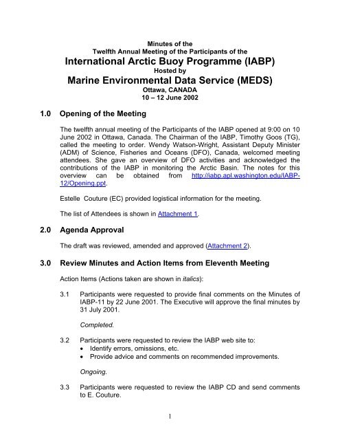
Minutes of theTwelfth Annual Meeting of the Participants of the<strong>International</strong> <strong>Arctic</strong> <strong>Buoy</strong> <strong>Programme</strong> (<strong>IABP</strong>)Hosted by<strong>Marine</strong> <strong>Environmental</strong> Data Service (MEDS)Ottawa, CANADA10 – 12 June 20021.0 Opening of the MeetingThe twelfth annual meeting of the Participants of the <strong>IABP</strong> opened at 9:00 on 10June 2002 in Ottawa, Canada. The Chairman of the <strong>IABP</strong>, Timothy Goos (TG),called the meeting to order. Wendy Watson-Wright, Assistant Deputy Minister(ADM) of Science, Fisheries and Oceans (DFO), Canada, welcomed meetingattendees. She gave an overview of DFO activities and acknowledged thecontributions of the <strong>IABP</strong> in monitoring the <strong>Arctic</strong> Basin. The notes for thisoverview can be obtained from http://iabp.apl.washington.edu/<strong>IABP</strong>-12/Opening.ppt.Estelle Couture (EC) provided logistical information for the meeting.The list of Attendees is shown in Attachment 1.2.0 Agenda ApprovalThe draft was reviewed, amended and approved (Attachment 2).3.0 Review Minutes and Action Items from Eleventh MeetingAction Items (Actions taken are shown in italics):3.1 Participants were requested to provide final comments on the Minutes of<strong>IABP</strong>-11 by 22 June 2001. The Executive will approve the final minutes by31 July 2001.Completed.3.2 Participants were requested to review the <strong>IABP</strong> web site to:• Identify errors, omissions, etc.• Provide advice and comments on recommended improvements.Ongoing.3.3 Participants were requested to review the <strong>IABP</strong> CD and send commentsto E. Couture.1
Ongoing.3.4 The Chair will send a letter to MEDS recognizing the CD as a significantcontribution to the <strong>IABP</strong>.A letter and plaque acknowledging these contributions were sent toMEDS.3.5 The Coordinator will contact the owners of buoys with incorrect GTSheaders and suggest corrections.Ongoing. This item should be considered for addition to the Terms ofReference for the Coordinator of the <strong>IABP</strong>.3.6 The Coordinator will provide information on deployment opportunities inthe <strong>Arctic</strong> to the DBCP Technical Coordinator for inclusion in theJCOMMOPS deployment opportunities web page. The Coordinator willalso add a link on the <strong>IABP</strong> web pages to this web page.Ongoing. This item should be considered for addition to the Terms ofReference for the Coordinator of the <strong>IABP</strong>.3.7 The Coordinator will request that the owners of position only buoyobservations to post their data on the GTS.Ongoing.3.8 The Coordinator will contact the buoy manufacturers and owners toinvestigate the use of the Argos frequency outside of the centralbandwidth to take advantage of the 10% discount and better datareception.Ongoing. Although this discount has been withdrawn, users areencouraged to use this bandwidth to avoid data dropouts.3.9 MEDS will investigate the feasibility of participating in the DBCP <strong>Buoy</strong>-QCGuidelines as a center responsible for quality control of position datadistributed on the GTS (Item 10.1).Completed. At the DBCP-17, MEDS agreed to participate as a PrincipalMeteorological or Oceanographic Center responsible for quality control ofGTS buoy data (PMOC) for location data.2
3.10 Meteorological Service of Canada (MSC) will investigate the feasibility ofparticipating in the DBCP QC guidelines as a center responsible for thequality control of GTS buoy data in the <strong>Arctic</strong>.Incomplete. The MSC agreed to investigate their participation in the DBCPQC guidelines to assure the quality of data for the <strong>IABP</strong> buoys.3.11 MSC in collaboration with MEDS will investigate the quality of the positiondata on SSVX02-CWEG.Ongoing.3.12 The DBCP Technical Coordinator will write a letter to MEDS regarding thelocation quality flag issue.Completed.4.0 Coordinator's ReportIgnatius Rigor reported on: 1.) the status of the buoy array, 2.) deployment plansand opportunities, and 3.) the progress of data management and publicationsrelated to the <strong>IABP</strong>.The Coordinator’s report is given in Attachment 3, and is available on the web athttp://iabp.apl.washington.edu/<strong>IABP</strong>-12/Coord.ppt.DiscussionEtienne M. Charpentier (EMC) recommended maintaining a deployment log forthe <strong>IABP</strong>. It was noted that this information is published in the annual buoyreports and will be made available on the web.Ed T. Hudson (ETH) asked if the Argos ids on the buoy map that overlap couldbe separated.5.0 Report from Data <strong>Buoy</strong> Co-operation Panel (DBCP) (E.Charpentier)EMC reported on the activities of the DBCP since the last <strong>IABP</strong> meeting. A statusof global buoy programmes was presented. Details regarding current DBCPactivities can be found at http://www.dbcp.noaa.gov/dbcp/highlights.html.EMC identified two items that he wanted the <strong>IABP</strong> to consider participation in:1.) Cataloging metadata on buoys, and3
2.) Evaluation sub-group.This report is given in Attachment 4.DiscussionParticipants discussed the Metadata working group of the DBCP. This group isproducing a general manufacturer’s specification sheet in order to collectconsistent metadata from manufacturers about their buoys. Participants agreedthat IR would be the <strong>IABP</strong> representative to this working group.Participants discussed the work of the DBCP Evaluation sub-group and theopportunity for the <strong>Programme</strong> to participate. It was noted that errors in thereporting position of buoys was one of the issues the evaluation group isconsidering. Participants agreed that the <strong>IABP</strong> would collaborate with the subgroupconcerning the issue of errors in position noted for <strong>IABP</strong> buoys.Participants agreed that EC would be the <strong>IABP</strong> representative to this sub-group.Participants discussed the apparent errors in position of buoys in messages onthe GTS from the Edmonton LUT. Participants recommended that the MSCinvestigate the cause of the issue and implement appropriate processes toquality control these positions. Participants also recommended the EdmontonLUT use the location flag (in buoy code) to indicate the accuracy of the positionof the buoy. MSC agreed to conduct this investigation.6.0 Status Report on Membership and Letters of Intent (I. Rigor)IR reported that our membership has not changed during the past year. Weofficially list 24 Participants from 10 different countries, and one internationalorganization, the WCRP (Attachment 1).IR also reported that he has contacted Dr. Burghard Bruemmer (Met. Institute, U.Hamburg), who deployed 12 buoys in Fram Strait about joining the <strong>IABP</strong>.The list of Participants is shown in Attachment 5.DiscussionVladimir Ryabinin (VR) asked if the <strong>IABP</strong> should have a paper or presentation atthe 2003 <strong>Arctic</strong> Science Summit Week in Kiruna, Sweden. It was noted thatRoger Colony (RC), Sergey Priamikov (SP) and VR might attend and be able torepresent the <strong>IABP</strong>. TG suggested that a standardized <strong>IABP</strong> PowerPointpresentation be prepared for participants to use for such occasions, in addition toupdated brochures, handouts, or posters.4
It was agreed that IR would contact the inactive participants regarding theirparticipation in the <strong>IABP</strong>.7.0 Presentations7.1 T. Agnew7.1.1 Loss of Decades old sea-ice plugs in the Canadian QueenElizabeth IslandsSverdrup Channel and Nansen Sound, along the northwestern coastline ofthe Queen Elizabeth Islands (QEI) in the Canadian High <strong>Arctic</strong>, have beenblocked by sea ice plugs for several decades. These plugs constitutesome of the oldest sea ice in the northern hemisphere and they blockthese northern channels from intrusions of sea ice from the <strong>Arctic</strong> Ocean.During the record minimum sea ice cover in the Queen Elizabeth Islands(QEI) in the summer of 1998, both these ice plugs were dislodged andremoved from the Queen Elizabeth Islands. The last time this occurredwas during another record minimum summer ice cover in 1962. Despitethe exceptionally low sea-ice cover in 1998, reconstruction of a 38-yearrecord of minimum sea ice extent from weekly Canadian sea ice chartsshows no long term trend to less sea ice in the Queen Elizabeth Islands.Ice conditions for the summers of 1999 and 2000 suggest a return tonormal ice conditions in the QEI and reformation of the ice plugs. Theabsence of any long term trend in sea ice extent and the recovery tonormal sea ice conditions in 1999 and 2000 is consistent with large scalesea ice dynamics and atmospheric circulation which on averagecontinuously forces the <strong>Arctic</strong> ice pack up against the northern coastline ofthe QEI. It is also consistent with differences in the trends in sea ice coverand length of the melt season between the eastern and western <strong>Arctic</strong>found in other studies.This presentation can be viewed at http://iabp.apl.washington.edu/<strong>IABP</strong>-12/Agnew.ppt.7.1.2 The passive microwave sea ice concentration record - howreliable is it?'The recent digitization of Canadian and US sea ice charts has producedan easily accessible and valuable record of sea ice conditions over thenorthern hemisphere over the last 30-years. An analysis of ice type ofinformation that can be obtained is shown. One interesting result is thatthe East Coast of Canada has the highest proportion of new and youngsea ice types of any Canadian region. This is related to the sea iceregime on the East Coast where sea ice advances unconstrained on itseastern and southern edge opening up the sea ice cover and accelerating5
surface sea ice formation. This record is compared to the passivemicrowave sea ice concentration record over the last 20 years. Results ofthe comparison using the NASA Team algorithm over the 1979 to 1996period demonstrates the consistency with which sea ice concentration andsea ice area is underestimated during summer melt and fall freeze-upconditions. This underestimation is considerably larger than previouscomparisons using satellite remotely sensed data.7.2 Scalable Maps of <strong>Arctic</strong> – C. SchockAt the <strong>IABP</strong>-10 meeting in Alaska, MEDS was asked to enhance their<strong>Arctic</strong> maps to show more information about each buoy such as WMO id,Argos id, etc. In response, MEDS created a new application to view arcticbuoys. This application is based on SVG (Scalable Vector Graphics), anew graphics file format, based on XML, that describes 2D graphics in theform of shapes (e.g., paths consisting of straight lines and curves), imagesand text. SVG has built in zoom and pan capabilities with no loss in qualityon resizing. It follows the DOM (Document Object Model), which can allowfor interactive and dynamic applications/graphics. SVG is text-based,created from predefined tags similar to HTML and so can easily becreated using any text editor. Other programs are becoming available thatgive an interface to creating SVG files (ex. Jasc Webdraw) as well assome that can export SVG (ex. Adobe Illustrator). At present, SVGrequires a viewer to see SVG files. MEDS used the Adobe SVG Viewer,which is a free download available on the Adobe website. In the future,browsers may have built in SVG support. SVG is quite new and became aweb standard in September 2001 by the W3C (World Wide WebConsortium).The MEDS application shows arctic buoy tracks for the current month anduses javascript and the DOM to give the user an interactive experience.They can click and drag to select an area to zoom in to, or use other zoomin/out buttons, and up/down/left/right pan buttons to adjust their view. Areset to original view is also available. A data table to the right of the mapis filled in with metadata taken from table.txt on the <strong>IABP</strong> websitewhenever users mouseover a buoy track. Clicking the track will link themto another page with the data for that buoy. At this time, the application isonly viewable to Internet Explorer users and will be made available to thepublic through the MEDS website by the end of June 2002 in both officiallanguages.This presentation can be viewed at http://iabp.apl.washington.edu/<strong>IABP</strong>-12/Schock.ppt.7.3 The State of the Canadian <strong>Arctic</strong> Cryosphere during the ExtremeWarm Summer of 1998 – B. Alt6
The presentation provided an overview of The State of the Canadian<strong>Arctic</strong> Cryosphere during the Extreme Warm Summer of 1998. Thecomplete paper can be accessed via http://www.socc.uwaterloo.ca/ . Thepresentation then focused on a few interesting things with respect to ice inthe Canadian <strong>Arctic</strong> islands.1998 was the warmest year on record in Canada (and globally) withparticularly pronounced warming anomalies located over the Canadian<strong>Arctic</strong> in the spring and fall seasons. This warming had major implicationsfor snow, ice and permafrost (the "cryosphere") in the north e.g. openwater formed earlier than had been previously observed, sea ice extent inthe Canadian <strong>Arctic</strong> in September was 25% less than the previousrecorded minimum, and there were above normal glacier ablation, snowmelt and active layer development. The aim of this project was to carry outa detailed assessment of the response of the <strong>Arctic</strong> cryosphere to thiswarming event, to place this event in the context of the known climatevariability over the last 3-4 decades, and to understand how some of theobserved changes interact with the <strong>Arctic</strong> climate system.The summer of 1998 was characterized by a warm southerly flowaccompanying a strong surface pressure ridge over western NorthAmerica which extended across the Mackenzie Delta and the Canadian<strong>Arctic</strong> Islands to Greenland. These conditions have been linked to thestrong El Niño of 1997/1998 by a number of researchers. The abovenormaltemperatures resulted in rapid retreat of the snow line across NorthAmerica in April, May and June, and an amplification of the initial warming.The warming was associated with earlier thaw of the "active layer" (thesoil layer above permafrost which thaws in the summer) in the MackenzieDelta region, early snow free conditions in the high arctic, early break-upof lake ice particularly in north-eastern Canada, early and extensiveclearing of Beaufort Sea ice, relatively early sea ice break-up in the <strong>Arctic</strong>Islands and Hudson Bay and early initiation of melt on ice caps in the<strong>Arctic</strong> Islands. Temperatures remained above normal during the summerin all regions, although in parts of the eastern <strong>Arctic</strong> conditions were notextreme. The most notable feature of the summer of 1998, however, wasthe extended period of warmth into the fall season, particularly in the<strong>Arctic</strong> Islands. This resulted in an exceptionally long melt season, greaterthaw penetration (12 cm greater than previously recorded) and probableice wedge melt in the Mackenzie Delta. The large amount of thawing ofthe surface layer was associated with surface slides and slumps ("activelayer detachments") along the Beaufort Sea coast and in northernEllesmere Island. The extended fall warming also led to a record late startto the snow cover season over the eastern <strong>Arctic</strong>, late freeze-up of lakes,the latest recorded date (and extreme percent) of maximum open water inthe High <strong>Arctic</strong> Islands and an extended glacier melt season in the7
western and south-eastern High <strong>Arctic</strong>. Synthesis and analysis of 30 to 40year time-series of climate and cryosphere variables revealed othersummers that were comparable to 1998 in terms of melt intensity(particularly 1962, and for various regions and components 1981, 1971,1988 and 1995). However, the length of the melt season of 1998 appearsto unique in the available cryospheric record.A number of lag-effects were noted in the study. For example, in the west,the warmth of the 1997/1998 winter and preceding summer (1997) was amajor factor in the early sea ice break-up and ground thaw during thespring of 1998, while in the spring of 1999, lake ice broke-up early due tolate freeze-up in the summer of 1998. Similarly in the High <strong>Arctic</strong>, theextensive open water at the close of the summer of 1998 allowed earlybreak-up in 1999 and 2000. The long-term records showed that it takes 2-5 years for the sea ice regime to regain previous coverage after anextreme season. In the north-eastern High <strong>Arctic</strong>, the summer of 1999was in fact even warmer than 1998. There are some indications that thedistinctive atmospheric circulation conditions (positive AO) whichcharacterized the period from about 1988 may actually have begun toreverse by 1998. In general the 1990 decade showed warming in thewestern <strong>Arctic</strong> culminating in the warm summer of 1998, while in the east,several very cold summers during the decade made the conditions of1998 and 1999 stand out against the general lack of long term warming inthe region. It was evident from the study that an extreme season, though itprovides many valuable insights into the interactions of climate and thecryosphere, cannot be studied in isolation.Another important finding of the study was the critical role that individualsynoptic events have on the high <strong>Arctic</strong> cryosphere's response towarming. For example, a strong southerly wind event was responsible forbreaking the last of the Nansen plug and for dislodging the Sverdrup plug,and an early snowfall event shut down melt on some of the glaciers andice caps in the Queen Elizabeth Islands.This study was the first time the Canadian scientific community has beencharged with taking an integrated look at the response of the <strong>Arctic</strong>cryosphere to warming. This culminated in a special 1-day "Summer of1998" workshop in Edmonton on February 11, 2001 with importantexchanges of information and ideas. A number of areas for follow-on workwere identified as a result of this study. These include: studying thefrequency of critical synoptic events that have a major impact the northerncryosphere; differing regional responses; and the role of large-scaleatmospheric circulation patterns such as the <strong>Arctic</strong> Oscillation.This presentation can be viewed at http://iabp.apl.washington.edu/<strong>IABP</strong>-8
12/Alt.ppt.7.4 Operational Monitoring of First Year Sea Ice Strength at the CanadianIce Service – R. DeAbreuThe Canadian Ice Service is now providing a new chart describing theseasonal decrease in first year sea ice strength. First year ice strength isan important control on the break-up of sea ice and the ability of ships towork in and around ice. The prototype Ice Strength Chart regularly reportson the strength of un-deformed first year ice relative to its mid-winterstrength and should be used in conjunction with <strong>Arctic</strong> Regional Charts.The Ice Strength Chart also reports on the condition of the ice surface byestimating the Stages of Melt. The chart utilizes a relationship betweenair temperature data and ice strength. The chart was developed in, and iscurrently being validated for, the approaches to Resolute area (LancasterSound).This presentation can be viewed at http://iabp.apl.washington.edu/<strong>IABP</strong>-12/DeAbreu.ppt.7.5 <strong>Marine</strong> Remote Sensing Data Applications Development at theCanadian Ice Service – D. FlettThe Canadian Ice Service (CIS) is the Canadian government organizationmandated to provide information on ice conditions to mariners operating inCanadian ice-infested waters. In order to monitor such a vast area overthe entire annual cycle of ice formation and break-up, the CIS reliesheavily on remote sensing systems to provide the data necessary togenerate ice information products. The CIS uses data from a variety ofremote sensing sources including optical and passive and activemicrowave satellites, and airborne remote sensing platforms. These dataare received and processed at the CIS in near real-time and integratedand analysed by expert analysts and forecasters in conjunction withsurface observations, environmental data (met, ocean, etc.), and modeloutputs. In the past 10 years, Synthetic Aperture Radar (SAR) hasbecome the primary data source upon which the CIS relies to monitor iceconditions. This started in 1990 with a contracted dual-sided airborneSAR service which was replaced in the early to mid-1990's with satelliteSAR data, notably from the ERS satellites and starting in 1996 withRADARSAT. The CIS has developed several products and applicationsover the last 10 years using these various remote sensing data sourcesdirected primarily at enhancing the use of the data for our internalOperations clients. A few examples include: ice motion tracking, lake/seasurface temperature products, image data fusion methods, integration of9
new data sources into Operations (e.g. QuikScat), monitoring ice decayand break-up, and R&D for future multiple polarization SAR sensors.Two applications development projects are highlighted in more detail:Iceberg Detection using SAR and <strong>Marine</strong> Winds Information from SAR.The CIS has had an ongoing Panel on Energy R&D (PERD) fundedproject the last 3 years to investigate the potential of and operationallyintegrate the used of satellite SAR for our operational iceberg monitoringprogram. Field validation programs have been carried out during theiceberg seasons to establish the capabilities and limitations of detectingicebergs from RADARSAT. Manual methods for extracting potentialiceberg targets and automated algorithms are currently beingimplemented in our operational environment and will be further tested andevaluated in the years to come, particularly with new systems becomingavailable, such as Envisat and RADARSAT-2. A second project withfunding from the Canadian Space Agency (CSA) has been under way thelast 2 years demonstrating the potential of extracting marine windinformation from satellite SAR data as an additional information source formarine weather forecasting. An infrastructure for extracting marine windsinformation from the CIS operational RADARSAT data stream anddelivery of image and wind products to 3 participating weather centres hasbeen established. Initial results from this project are encouraging and theweather centres have been generally quite positive in their feedback.Further demonstrations are planned for summer 2002 and winter 2003.In summary, the CIS is a true operational user of remote sensing data andprides itself on being a showcase example. In the future we intend tofocus on improving the use of existing and new remote sensing datasources, expanding our remote sensing products and applicationsdevelopment, and working towards the assimilation of remote sensingobservations into ice and marine environmental models.This presentation can be viewed at http://iabp.apl.washington.edu/<strong>IABP</strong>-12/Flett.ppt.7.6 Prediction of Summer Sea Ice Concentration – I. RigorThe data from the <strong>IABP</strong> has been essential in the detection of <strong>Arctic</strong>Climate Change. For example:1.) Walsh et al. (1996) used the <strong>IABP</strong> Sea Level Pressure (SLP)fields to show that the pressure over the <strong>Arctic</strong> had decreased >4 mb. from 1979-1994; and2.) Rigor et al. (2000) used the <strong>IABP</strong>/POLES Surface AirTemperature (SAT) fields to show that the warming trendsfound over land extend out over the <strong>Arctic</strong> Ocean. During winter10
advanced preparations for the White Trident 02. She further summarizedthe performance of the ICEXAIR buoys, emphasizing the comparativelylong lifetime of the ICEXAIR. CMR will work to improve the lifetime andreliability of the ICEXAIR even further, as the optimum lifetime for thebuoys is 4 -5 years. This is related to the current deployment strategy of inthe White Trident, causing most of the buoys to stay in the area of interestfor 3-5 years.This presentation can be viewed at http://iabp.apl.washington.edu/<strong>IABP</strong>-12/ICEX02.ppt.8.0 Status Reports from each Participant8.1 Meteorological Service of Canada8.1.1 Canadian Ice Service – L. DesjardinsThis report is given as Attachment 6.8.1.2 <strong>Arctic</strong> Weather Center – E. HudsonThis report is given as Attachment 7.8.2 National Ice Center – C. O’ConnorsIn 2001-2002, the U.S. Interagency <strong>Arctic</strong> <strong>Buoy</strong> Program (US<strong>IABP</strong>)received fiscal support, manpower resources, and other services from sixU.S. Government agencies. Presently, the US<strong>IABP</strong> has 13 buoysoperating in the buoy network covering the central <strong>Arctic</strong> Basin and/oradjoining seas. This number includes 5 Coastal <strong>Environmental</strong> System(CES) buoys, 8 Christian Michelsen Research (CMR) ICEXAIR buoys.Accomplishments from the 2001-2002 intercessional period:1. Continued funding for the <strong>IABP</strong> Coordinator / Data Managementfunction.2. Co-location of CRREL Ice Thickness buoys with CES met buoy.Thanks to the efforts of Meteorological Services of Canada (MSC)assets.3. Deployment of two CES buoys via icebreakers.4. Deployment of two ICEX buoy during White Trident 2001.5. Provided a CES buoy to the Polar Science Center.6. Coordination and travel costs for the 2001 White Trident Operation.Anticipated 2002 US<strong>IABP</strong> activities include:12
1. Coordination of the 2002 White Trident deployment.2. MSC deployment of one US<strong>IABP</strong> Zeno buoy3. Alternate communications studyDiscussion:Christopher O’Connors (CO) asked if the <strong>IABP</strong> can support the ARGOobjective, and if the <strong>IABP</strong> should be part of the ARGO programme. Thegeneral conclusion of the Participants was that the overall mission ofARGO was different from that of the <strong>IABP</strong>, since the ARGO programme isinstrument driven and such instruments are not available for use under thethick pack ice of the <strong>Arctic</strong>. It was also noted that the ARGO programme isstill a pilot project.On a similar question, VR asked if GODAE could use our oceanographicdata? IR will contact users about posting all buoy data on the GTS.8.3 World Climate Research <strong>Programme</strong> – V. RyabininThe 2002 session of the WCRP Join Scientific Committee took place inMarch, in Hobart, Australia.The continuing support by the WCRP of the <strong>IABP</strong> (and IPAB) wasconfirmed at the meeting.The JSC meeting discussed the current state and the general directions ofdevelopment of the WCRP. A most important initiative is the GlobalClimate Experiment: an proposal on massive integration of observingsystems, data assimilation, and modeling, studies of predictability on aregional basis, from monthly to seasonal time scale.Current ACSYS and CliC priorities were seen as follows.1. Conclude ACSYS observational programmes and studies, summarizethe results with the goal to achieve realistic representation of <strong>Arctic</strong>region and corresponding processes in global climate models.2. Summarize current knowledge of the <strong>Arctic</strong> climate, its current stateand prospects for future.3. Formulate and guide the CliC observational and modeling activities fordetermining the role of cryosphere in global climate and its realisticrepresentation in global climate models.4. Ensure that important ACSYS activities, which are crucial for thesuccess of CliC project and the WCRP as a whole, are continuedwithin CliC.13
5. Strengthen links and co-ordination of CliC activities with other WCRPprojects and relevant research and observational programmes outsideWCRP.6. Complete the first version of the Initial CliC Implementation Plan andbe successful in receiving commitments of potential contributors to theA possibility of SCAR sponsoring CliC was discussed and receivedgeneral support. However, the actual level and organization of this supportneeded further consideration and discussion.The following meetings have been and are being organized by ACSYSand CliC:• Sea ice extent and the global climate system, April 2002, Toulouse• Climate of the Barents Sea Region, April 2002, Toulouse• CliC/GEWEXGCOS Solid Precipitation Workshop, June 2002,Fairbanks• Measurements and models of the <strong>Arctic</strong> Ocean, June 2002, Lamont -Doherty• ULS (or IPS) workshop, July 2002, Tromso• Joint NEG/OPP meeting on ice sheets, Fall 2002, Tokyo• SSG-III, Fall 2002, Beijing• CliC Science/Commitments Conference, 2003, Geneva• ACSYS final Conference, 2004, St. PetersburgThis presentation is available at http://iabp.apl.washington.edu/<strong>IABP</strong>-12/WCRP.ppt.8.4 <strong>Arctic</strong> and Antarctic Research Institute of Roshydromet –S. PriamikovDuring the year 2001-2002 period, <strong>Arctic</strong> & Antarctic Research Institute ofRoshydromet in cooperation with US Interagency <strong>Arctic</strong> <strong>Buoy</strong> Program(NAVOCEANO) have constructed and deployed 4 <strong>Arctic</strong> driftingmeteorological buoys. Deployment was carried out using Russianhelicopters based on Sredniy Island (Severnaya Zemlya Archipelago).Due to the limited radius of the helicopter's flight, buoys have beendeployed on pack ice relatively close (200 km) to north-northeast flank ofSevernaya Zemlya Archipelago. At this moment, two of the buoys areoperating and are located north of Franz Joseph Land. The buoys drift ishomogenous and no visible divergence or convergence has observed.No deployments are planned for this summer. Next year, threeAARI/NAVO drifting meteorological buoys will be built and deployed in theLaptev Sea sector.14
Work to finalize procedures to get WMO numbers for three <strong>IABP</strong> coastalbuoys continues.The LUT as given to AARI of Roshydromet on loan basis byNAVOCEANO is helping very much with <strong>Arctic</strong> buoys design andconstruction.8.5 Naval Oceanographic Office – E. HortonDuring Operation WHITE TRIDENT last year, NAVOCEANO deployed 7ICEX Air drifters working out of Point Barrow in the Barents and Chukchiseas. We purchased 4 ice drifters from AARI and they deployed themfrom an icebreaker using a helicopter for final positioning. These weredeployed near Severnaya Zemlya. Plans are well underway for this year'sWHITE TRIDENT operation, with another 7 ICEX Air drifters to bedeployed. In addition, several prototype AARI ice drifters are beingexamined for refurbishment. If they are still in acceptable condition, theywill be deployed at the next available opportunity. Three ice drifters havebeen contracted for construction by AARI, and will probably be deployednext spring by icebreaker.8.6 <strong>Marine</strong> <strong>Environmental</strong> Data Service – E. CoutureAs the Responsible National Oceanographic Data Center (RNODC) fordrifting buoys, MEDS continues to capture, quality control and archivedata distributed on the Global Telecommunication System (GTS) in BUOYcode.Issues with MEDS' quality control of location were reported at <strong>IABP</strong>-11.After discussions, the Participants present at the meeting agreed thatMEDS should change their flagging practices. Furthermore, the DBCPtechnical coordinator was asked to send a letter to MEDS requesting thischange. The letter was received and MEDS accepted the request.Implementation of the new flags and reprocessing of the archives will takeplace in the summer of 2002.As of June 2002, 85 CD-ROMs of <strong>IABP</strong> data were left from the 500 thatwere initially produced. The CDs were distributed mostly to <strong>IABP</strong>Participants and several were also distributed to the <strong>International</strong><strong>Programme</strong> for Antarctic <strong>Buoy</strong>s (IPAB) Participants and other relatedorganizations (WMO, Service Argos, etc…). Approximately 15 CDs havebeen requested through the CD's advertisement page on the web. MEDSwill start thinking about producing version 2.0 for 2004.Web developments for this year include Scalable Vector Graphics (SVG)maps of the <strong>Arctic</strong> showing data and meta data on each of the buoys. The15
deployment of this tool is planned for the end of June 2002 and theinformation will be updated daily from then on. This application wasdeveloped in response to the request made by the Participants at <strong>IABP</strong>-10in Alaska to enhance maps posted by MEDS on the web. For moreinformation on SVG maps see item 7.1.This presentation can be viewed at http://iabp.apl.washington.edu/<strong>IABP</strong>-12/MEDS.ppt.DiscussionEC asked if we should prepare Version 2 of this CD? It was decided thatwe should hold off, and consider only producing a CD every few years.ETH also suggested that the next CD should include selected sciencepapers using the <strong>IABP</strong> data.8.7 Polar Science Center (PSC) – I. RigorThe PSC coordinates the <strong>IABP</strong> and manages the <strong>IABP</strong> databases asspecified in the Terms of Reference for the Coordinator of the <strong>IABP</strong>Appendix to the <strong>IABP</strong> Operating Principles.The PSC in collaboration with JAMSTEC, PMEL and the University ofOregon conducts annual expeditions each April to the North Pole to takethe pulse of the <strong>Arctic</strong> Ocean and learn how the world's northernmost seahelps regulate global climate. The team establishes a group of buoys,collectively called an observatory, to record data throughout the remainderof the year on everything from the salinity of the water to the thickness andtemperature of the ice cover. For more info on the NPEO, please visithttp://psc.apl.washington.edu/northpole/. The NPEO can also deploy otherbuoys for the <strong>IABP</strong>.DiscussionNIC plans to provide a CES buoy for the NPEO deployments in 2003.8.8 Reports from Participants who were not able to attend8.8.1 AWI – C. HaasThe table and attached maps summarize the state of our buoys, deployedin the last years, and some of them are still in operation. All CMR buoyshave been contributed to WT and been deployed by aircraft. This year, wewill deploy only one ICEX-AIR with WHITE TRIDENT. We have boughtthree more buoys, which were planned for deployment in the Laptev Sea,pending research permission to work in Russian waters.16
ID Start (date, position) Stop Sensors Type3311 16.08.99 79.992N 149.618E P,Ta,GPS CMR8065 16.08.99 74.951N 170.352E P,Ta,GPS CMR8066 22.04.00 87.485N 90.870W 27.02.01 69.015N 16.452W P,Ta,GPS SK8059 24.04.00 89.041N 91.909W 22.12.00 77.656N 2.647W P,Ta,GPS SK9360 14.08.00 74.935N 160.022W 30.12.01 76.034N 139.783W P,Ta CMR8063 10.08.01 80.005N 169.835E P,T,GPS CMR9357 03.09.01 86.092N 83.582E P,T,GPS SK9359 06.09.01 89.989N 129.206W P,T,GPS SK8056 15.09.01 87.460N 53.513E 25.03.02 69.980N 18.379W P,T,GPS SKCMR = Christian Michelsen ResearchSK = Sellmann & Kruse8.8.2 IARC – R. ColonyPlans to continue contributing to the <strong>IABP</strong> through the US-<strong>IABP</strong>.8.8.3 JAMSTEC – T. Kikuchi• J-CAD 4 deployment as a component of NPEO 2002On April 26th 2002, JAMSTEC has deployed J-CAD 4 at 88.51N, 76.93E.The J-CAD 4 can obtained the data of SLP, Air temperature, wind speedand direction as meteorological data, just as same as previous J-CAD. Inaddition, the J-CAD 4 is equipped with 6 CT/CTD, 1 ADCP, and 1 Watsoncompass as a underwater sensors. The Watson compass providesmagnetic heading information using a precision 3-axis fluxgatemagnetometer and two clinometers. It is useful to calculate the absolutecurrent velocity observed by the ADCP mounted in the J-CAD. As of now,the data transmission of J-CAD 4 using ARGOS system works very well.The current position of J-CAD 4 is near the <strong>Arctic</strong> Mid Ocean Ridge(87.278N 44.166E).The J-CAD information and data can be seen in the following web site.http://w3.jamstec.go.jp:8338/J-CAD_e/jcadindex_e.htmhttp://w3.jamstec.go.jp:8338/J-CAD_e/jcaddata_frame.htmJ-CAD trajectories, meteorological, GPS drift, and CTD data is shown inthe above web site.• Deployment plan of J-CAD in 2002-2003Since this year, JAMSTEC is initiating a multidisciplinary joint fieldexperiment, JWACS (Joint Western <strong>Arctic</strong> Climate Studies) involvingJapan and Canada to understand the role of ocean circulation on theWestern <strong>Arctic</strong> climate system. In this project, J-CAD 5 will be installed in17
9.0 New Businessthe Canadian Basin of the <strong>Arctic</strong> Ocean in September 2002. 6 CT/CTDand 2 ADCP sensors will be mounted on J-CAD 5 to measure an upperocean condition (temperature, salinity, and ocean current) at the depthfrom the surface to 250m. Meteorological data will be also obtained fromthe J-CAD 5.In 2003, JAMSTEC is planning to deploy one J-CAD (J-CAD 6) as acomponent of NPEO as well as 2000-02. J-CAD 6 will be equipped withthe same sensors as J-CAD 4 that was deployed in April 2002.8.8.4 PMEL – J. OverlandPMEL has been collaborating with the PSC to deploy buoys at the NPEO,and also plans to deploy some buoys in the Beaufort from the ONR IceCamp.8.8.5 Other Participants – I. RigorNMI contributed 1 ICEX-AIR for WHITE TRIDENT 2002, and currently has2 buoys reporting. NPI contributed 1 ICEX-AIR for WHITE TRIDENT 2002,and currently has 1 buoy reporting; and UKMO currently has 2 buoysreporting.9.1 DBCP MeetingsDBCP-18 will be held in Martinique on 14 - 18 October 2002. EC willrepresent the <strong>IABP</strong> at the meeting. EC, and EH will also attend. ETH willprepare the report.Thanks were given to ETH and EC for preparing and presenting last yearsreport. The full text of this report is given in Attachment 8.9.2 Summary of Participant contributions (T. Goos)Contributions further the objectives of the <strong>IABP</strong> and are defined in theOperating Principles of the <strong>IABP</strong>, section 6.5.The Participant Contributions table has been amended to reflectcontribution from non-<strong>IABP</strong> Participants and is given in Attachment 9.9.3 Location of 13th meeting (T. Goos)18
10.0 New DirectionsA European venue with coordination with some other <strong>Arctic</strong> meeting wassuggested and preferred by Attendees.VR reported that WCRP might be able to hold the meeting in February orat the latest at the beginning of March. Another opportunity would be tohave the meeting in conjunction with the joint EGS/AGU meeting in April inNice, France. Another consideration would be the <strong>Arctic</strong> Science SummitWeek in March, in Kiruna, Sweden.SP also noted that we might be able to hold the meeting at AARI.The Executive and Coordinator will discuss the options and make adecision in the fall.10.1 Provisions for withdrawalA number of Participants have been inactive. The intent of theseParticipants should be determined. IR will contact these participantsregarding their intent.TG raised the question as to whether the <strong>IABP</strong> should define a new levelof Participant who are less “active”, but who have an interest in the <strong>IABP</strong>.It was decided that a new level of Participant should not be defined10.2 Evaluation of communication and new sensors for buoys.The DBCP is interested in knowing about (i) tests and results of datacollection systems other than Argos, and (ii) sensor/instrument testing andevaluation.David Meldrum, vice-Chairman of the DBCP, is conducting an ongoingstudy on such systems (see http://www.dbcp.noaa.gov/dbcp/1smms.html).The <strong>IABP</strong> Participants can contribute and benefit from DM’s compilation.Elizabeth Horton chairs the DBCP EVALUATION GROUP.DiscussionCO agreed to help gather information on other satellite data collectionsystems and buoy sensor development. IR will compose a web page withspecifications on the <strong>IABP</strong> buoys.11.0 Review and Approval of the <strong>IABP</strong> Operating Principles19
The Operating Principles were revised and are given in Attachment 10.12.0 Election of OfficersA nominations committee consisting of ETH and IR determined that all membersof the Executive Committee were willing to serve another year. Nominations weresolicited from other attendees.In accordance with the <strong>IABP</strong> Operating Principles, the following officers wereelected:Chairman: Timothy Goos, CanadaVice Chairman: Thor Kvinge, NorwayMember: Christopher O’Connors, USAMember: Ivan Frolov, Russian FederationIgnatius Rigor was re-appointed as the Coordinator of the <strong>IABP</strong>.13.0 Action Items13.1 <strong>IABP</strong> Executive will finalize the minutes by 31 August 2002.13.2 Coordinator will add a deployment log to the <strong>IABP</strong> web pages (see section4.0).13.3 Coordinator will contact inactive Participants regarding their participationin the <strong>IABP</strong> (see section 6.0 and 10.1).13.4 Coordinator will ensure that all <strong>IABP</strong> data is posted on the GTS.13.4.1 Resolve discrepancy between the list of buoys that on the monthlytable and what is received at various met. centers.13.4.2 Post other geophysical variables on GTS in addition to SLP, andSAT (see item 8.2).13.5 MSC will investigate the cause of positioning errors from the EdmontonLUT, and use a location flag to indicate the accuracy of the positions ofthe buoys (see section 5.0).13.6 ETH and IR will make a standardized <strong>IABP</strong> PowerPoint presentation foruse at various meetings. (see section 6.0).13.7 CO will investigate the cost of Iridium, Orbcomm, and other satellite datacollection options (see item 10.2).13.8 IR will make web pages for:13.8.1 <strong>Buoy</strong> History13.8.2 <strong>Buoy</strong> Specs13.8.3 <strong>IABP</strong> Citations13.9 Review ongoing items from section 3.0.14.0 Draft and Approve Meeting Minutes20
Participants reviewed the draft minutes. The draft minutes will be available to allparticipants for final comment, and will be approved by 31 August 2002.21
Attachment 1 – List of AttendeesJeff AndrewsNational Ice CenterFOB# 4 Rm 23014251 Suitland Rd.Washington DC 20395USAPhone: +1 301 457 5303 x330Fax: +1 301 457 5300andrewsj@natice.noaa.govTom AgnewClimate Research BranchMeteorological Service of CanadaPhone: +1 416 739-4385tom.agnew@ee.gc.caEtienne CharpentierTechnical Coordinator, DBCPJCOMMOPSParc Technologique du Canal8-10 Rue HermésF-31526 Ramonville St. AgneFrancePhone: +33 5 61 39 47 82Fax: +33 5 61 75 10 14charpentier@jcommops.orgManon Chouinard<strong>Marine</strong> <strong>Environmental</strong> Data ServiceW082, 12 th Floor200 Kent StreetOttawa, Ontario K1A OE6CanadaPhone: 613 990-6065Fax: 613 993 4658chouinam@meds-sdmm.dfo-mpo.gc.caEstelle Couture<strong>Marine</strong> <strong>Environmental</strong> Data ServiceW082, 12 th Floor200 Kent StreetOttawa, Ontario K1A OE6CanadaPhone: 613 990 0259Fax: 613 993 4658couture@meds-sdmm.dfo-mpo.gc.caLuc DesjardinsCanadian Ice Service373 Sussex Dr. Block E-3Ottawa, Ontario KIA 0H3CanadaPhone: +1 613 996-1617Luc.desjardins@ec.gc.caTimothy GoosEnvironment CanadaMeteorological Service of CanadaTwin AtriaBuilding, Room 200Edmonton, Alberta T6B 2X3CanadaPhone: +1 780-951-8847Fax: +1 780-951-8634tim.goos@ec.gc.caAnne A. HagebergChristian Michelsen Research InstituteFantoftvn 38P.O. Box 6031 PostterminalenN-5892, Bergen, NorwayPhone: +47 55 574361Fax: +47 55 574041anne@cmr.noCommanding OfficerATTN: Elizabeth Horton, N010Naval Oceanographic Office1002 Balch BoulevardStennis Space Center, MS 39522-5001Phone: +1 228 688-5725Fax: +1 228 688-5514hortone@navo.navy.milEdward Hudson<strong>Arctic</strong> Weather CentreMeteorological Service of CanadaTwin Atria Bldg. 2nd Floor22
4999 98 AvenueEdmonton, Alberta T6B 2X3CanadaPhone: +1 780 951 8878Fax: +1 780 951 8602Edward.Hudson@ec.gc.caChristopher O'ConnorsNational Ice CenterFOB# 4 Rm 23014251 Suitland Rd.Washington DC 20395Phone: +1 301 457 5303 x403Fax: +1 301 457 5300oconnorsc@natice.noaa.govSergey Priamikov<strong>Arctic</strong> and Antarctic Research Institute38 Bering Str., St. Petersburg199397, RussiaPhone: +7 (812)3520096Fax: +7 (812) 3522688 or 3522685priamiks@aari.nw.ruIgnatius RigorPolar Science Center, APLUniversity of WashingtonSeattle, WA 98105-6698Phone: +1 206 685 2751Fax: +1 206 616-3142ignatius@apl.washington.eduVladimir RyabininJPS for WCRPWMO Secretariat7bis, Avenue de la PaixCP2300, Geneva 2CH-1211, Switzerlandphone: + 41 (0) 22 730 8486fax: + 41 (0) 22 730 8036Ryabinin_V@gateway.wmo.chCara-Lynn Schock<strong>Marine</strong> <strong>Environmental</strong> Data ServiceW082, 12 th Floor200 Kent StreetOttawa, Ontario K1A OE6Phone: 613 998 2886Fax: 613 993 4658schock@meds-sdmm.dfo-mpo.gc.caAnh Tran<strong>Marine</strong> <strong>Environmental</strong> Data ServiceW082, 12 th Floor200 Kent StreetOttawa, Ontario K1A OE6Phone: 613 990-0301Fax: 613 993 4658chouinam@meds-sdmm.dfo-mpo.gc.ca23
Attachment 2 – AgendaMonday, 10 June 20020900 - 1200 <strong>IABP</strong> Business Meeting1.0 Meeting Opens -- Chairman, T. Goos1.1 Welcome (W. Watson-Wright)1.2 Call to order (T. Goos)1.3 Meeting Information (E. Couture)2.0 Agenda Approval (T. Goos)3.0 Review Action Items from Eleventh Meeting (T. Goos)4.0 Coordinator's Report (I. Rigor)5.0 Report from Data <strong>Buoy</strong> Co-operation Panel (DBCP) (E. Charpentier)6.0 Status Report on Membership and Letters of Intent (I. Rigor)1300 - 1600 Technical Session7.0 Presentations7.1 Scalable Maps of <strong>Arctic</strong> (C. Schock)7.2 Prediction of Summer Sea Ice Concentration (I. Rigor)7.3 ICEX buoys (A. Hageberg)7.4 Operational Monitoring of First Year Sea Ice Strength at the Canadian Ice Service (R.DeAbreu, CIS)7.5 <strong>Marine</strong> Remote Sensing Data Applications Development at the Canadian Ice Service (D.Flett, CIS)7.6 The State of the Canadian <strong>Arctic</strong> Cryosphere during the Extreme Warm Summer of 1998(T. Agnew, MSC)1630 Tour and Reception at Canadian Ice ServiceTuesday, 11 June 20020900 – 1200 <strong>IABP</strong> Business Meeting (Continued)8.0 Status Reports from each Participant (T. Goos)9.0 New Business (T. Goos)9.1 18th DBCP session is planned in Martinique, 14-18 October 2002 (T. Goos)9.2 Summary of Participant Contributions (T. Goos)9.3 Location of 13th meeting (T. Goos)1300 - 1430 <strong>IABP</strong> Business Meeting (Continued)10.0 New Directions (T. Goos)11.0 Review and Approval of the <strong>IABP</strong> Operating Principles (T. Goos)12.0 Election of Officers (T. Goos)1500 Tour and Reception at MEDSWednesday, 12 June 20020900 - 1200 Conclusion13.0 Review of Meeting and Recommendations (T. Goos)14.0 Draft and Approve Meeting Minutes24
Attachment 3 – Coordinator’s ReportThe Coordinator reported on: 1.) the status of the buoy array, 2.) deployment plans andopportunities, and 3.) the progress of data management and publications related to the<strong>IABP</strong>.Status of the <strong>Buoy</strong> ArrayOn our last meeting, 40 buoys were reporting in the <strong>Arctic</strong>. Since then, 23 buoys ceasedtransmitting, and 32 buoys were deployed. Figure 1 shows the current map of buoys.The buoys that were deployed during the intercessional period are:• July: NIC deployed 1 CES buoy from the Odin.• August: 7 by WHITE TRIDENT (ICEX-AIRS contributed by AWI, EC, NMI,US-<strong>IABP</strong> (3), and UKMO) in August 2001• September: AWI deployed 3 L&K buoys from the Polarstern. One of thesebuoys was placed at the NPEO site where all the met. buoys had failed.PMEL deployed 9 buoys in a cluster in the Beaufort Sea from the Sir WilfridLaurier.• March: Burghard Bruemmer from the University of Hamburg deployed 12buoys in Fram Strait. These buoys are not included in the buoy count.• April: 12 buoys were deployed at the 2002 NPEO. EC deployed 1 Calib, 1EC buoy, and 2 collocated buoys from NIC (CES) and CRREL. The CRRELbuoy was designed to measure the mass balance of ice.Figure 2 shows the remaining deployment plans for the year from the Polarstern thissummer, and the WHITE TRIDENT deployments this August. The buoys that will bedeployed by WHITE TRIDENT were provided by. AWI, EC, NMI, NPI, US-<strong>IABP</strong> (3).Deployment OpportunitiesWe need 7 more buoys for the WHITE TRIDENT mission in 2003.Other deployment opportunities are provided by EC, PSC, AARI, and by ships operatingin the <strong>Arctic</strong> Ocean.Data and Publications• The <strong>IABP</strong> data have been updated through December 2001 and are available on theweb.• A few copies of the draft of the 2001 buoy report are available. A PDF of this datareport and reports dating back to 1995 are available from our web pages.• We plan to improve the navigation of the web pages this summer, and update thecontent. We plan to reproduce all the buoy reports as PDF’s, which will be madeavailable on the web. We welcome any suggestions on these web pages.25
Figure 1: <strong>Buoy</strong> Positions on 3 June 200226
Table 1: <strong>Buoy</strong> Positions on 3 June 2002Month Year Argos # WMO # Expr. # GTS Header Lat Lon Words P T <strong>Buoy</strong> DescriptionSep 1997 2417 48572 1053 SSVX02-CWEG 75.181 -126.877 16 Y CES / Zeno Ice <strong>Buoy</strong>Apr 1998 1301 48581 1053 SSVX02-CWEG 61.637 -31.450 16 Y Y Metocean TOGAApr 1998 2416 47523 1053 SSVX02-CWEG 77.927 -160.020 32 Y ZENO-3200Aug 1998 3004 25535 1053 SSVX02-CWEG 86.917 -126.609 17 Y Y ICEX-AIRAug 1999 1222 48601 484 SSVX07-LFPW 80.243 -137.655 17 Y ICEX-AIRAug 1999 20858 48574 1053 SSVX12-KARS 76.821 -136.313 17 Y Y ICEX-AIRAug 1999 20859 48575 1053 SSVX12-KARS 73.618 -136.135 17 Y Y ICEX-AIRAug 1999 3311 25569 919 SSVX01-LFPW 86.474 -108.123 21 Y Y ICEX-AIRAug 1999 5312 48523 627 SSVX02-CWEG 77.220 -138.448 17 Y Y ICEX-AIRAug 1999 8065 25570 919 SSVX01-LFPW 82.361 151.521 21 Y Y ICEX-AIRAug 2000 15524 48537 29 SSVX12-LFPW 76.206 -169.430 21 Y Y ICEX-AIRAug 2000 20857 48536 1053 SSVX12-KARS 82.754 -108.584 17 Y Y ICEX-AIRAug 2000 24289 25548 1053 SSVX12-KARS 78.038 150.801 16 Y Y ICEX-AIRAug 2000 3692 48534 314 SSVX12-LFPW 83.090 -131.300 21 Y Y ICEX-AIRAug 2000 5311 48535 627 SSVX12-KARS 81.989 -127.230 21 Y Y ICEX-AIRSep 2000 26996 282 76.735 149.113 12 Y Y NAVO/AARI (land station)Sep 2000 26998 282 77.519 82.227 12 Y Y NAVO/AARI (land station)Sep 2000 26999 282 80.765 78.904 12 Y Y NAVO/AARI (land station)Apr 2001 12791 26511 282 SSVX16-KARS 83.553 67.024 12 Y Y NAVO/AARIApr 2001 12793 25541 282 SSVX16-KARS 82.977 74.448 12 Y Y NAVO/AARIApr 2001 24294 48590 1053 SSVX02-CWEG 82.941 -88.932 32 Y Y CES / Zeno Ice <strong>Buoy</strong>May 2001 2419 48589 1053 SSVX02-CWEG 83.916 -27.343 32 Y Y CES / Zeno Ice <strong>Buoy</strong>Deployed from the Odin in July 2001Jul 2001 24291 25551 1053 SSVX12-KARS 82.737 -0.282 32 Y Y CES / Zeno Ice <strong>Buoy</strong>Deployed by WHITE TRIDENTAug 2001 19577 48582 1053 SSVX12-KARS 82.518 -175.183 21 Y Y ICEX-AIRAug 2001 19578 48583 1053 SSVX12-KARS 82.100 -163.947 21 Y Y ICEX-AIRAug 2001 19579 48584 1053 SSVX12-KARS 77.670 -169.129 21 Y Y ICEX-AIRAug 2001 27414 48540 484 SSVX07-LFPW 76.856 179.010 21 Y Y ICEX-AIRAug 2001 3693 48092 314 SSVX07-LFPW 79.687 -176.080 21 Y Y ICEX-AIRAug 2001 5300 48539 627 SSVX12-KARS 80.689 176.050 21 Y Y ICEX-AIRAug 2001 8063 25571 919 SSVX07-LFPW 84.606 -172.567 21 Y Y ICEX-AIRDeployed by EC in September 2001Sep 2001 24292 25552 1053 SSVX12-KARS 70.419 -21.512 32 Y Y CES / Zeno Ice <strong>Buoy</strong>Deployed from the Polarstern in September 2001Sep 2001 9357 63662 919 SSVX07-LFPW 71.573 -19.326 25 Y Y Sellmann & KruseDeployed from the Louie St. Laurent in October 2001Oct 2001 21076 695 76.274 -169.557 32 PMELOct 2001 22206 695 75.583 -171.063 32 Y Y PMELOct 2001 9114 695 75.590 -171.033 32 PMELOct 2001 9115 695 74.285 -174.230 32 PMELOct 2001 9161 695 76.060 -173.136 32 PMELDeployed by PSC at the NPEO in April 2002Apr 2002 9120 695 87.581 45.065 32 PMELApr 2002 20726 695 87.576 43.920 32 PMELApr 2002 21078 695 87.583 44.472 32 PMELApr 2002 22204 695 87.582 45.047 32 PMELApr 2002 22207 46501 695 SSVX12-KARS 87.581 44.983 32 Y Y PMELApr 2002 25499 48116 20016 87.580 45.554 4 Y Y JAMSTEC-JCADApr 2002 26697 1053 86.381 159.761 32 Y CES / Zeno Ice <strong>Buoy</strong>Deployed by EC in April 2002Apr 2002 5303 48522 627 SSVX02-CWEG 76.700 -129.700 4 Y Y CALIBApr 2002 5315 47538 627 SSVX02-CWEG 86.354 -62.644 24 Y Y MSCApr 2002 24293 48585 1053 SSVX12-KARS 81.019 -119.958 32 Y Y CES / Zeno Ice <strong>Buoy</strong>Apr 2002 7956 695 80.928 -120.170 32 CRREL27
Figure 2: Remaining <strong>Buoy</strong> Deployment Plans for 200228
Attachment 4 – Report from the Data <strong>Buoy</strong> Cooperation PanelSince the last <strong>IABP</strong> meeting in Yokohama, June 2001, the DBCP activities were mainly related to the followingissues:o 17 th DBCP session, Perth, 22-26 October 2001.More than 50 people attended the DBCP workshop. 48 people attended the main DBCP session, includingrepresentatives from 14 countries plus representatives from buoy manufacturers, data telecommunication providers,WMO, and IOC Secretariats, and DBCP Action Groups. 25 presentations were made at the Scientific and Technicalworkshop.The Panel decided to extend the terms of references of the SVPB/SVPBW evaluation group to include other types ofbuoys as well as other technical issues (e.g. Argos message formats) and therefore renamed the group to “DBCPEvaluation Group”.DBCP implementation strategy was reviewed and commitments in the Southern Ocean discussed (about 80barometer buoys committed in the region for 2002).The Panel discussed information exchange and technical issues (QC, GTS codes, Argos system, newcommunication techniques, GTS distribution of buoy data collected through commercial satellite systems, SVPBupgrade), and particularly, the Panel:• Acknowledged agreement by MEDS to act as PMOC for location data• Acknowledged agreement by MEDS to change its flagging practice for location data and agreed to reprocessits archives and web site maps accordingly.• Asked the TC to make a proposal for integrating data buoy, profiling float, and XBT observing systemsin a quality control relay mechanism similar to the DBCP QC guidelines. Proposal was then submittedto the JCOMM OPA (see below).• Asked David Meldrum and TC to investigate impact of data timeliness on programme performances(loss of Lannion STIP data).• Recommended to include quality control of Argo profiling float data in the Argos developmentprogramme (recommendation to the JTA).• Asked the TC and CLS to prepare a document on the feasibility of using Service Argos as a relay forinserting buoy data on GTS for data collected through other satellite systems and adequately formattedaccording to WMO regulations.• Discussed safety issue (i.e. risk of buoy explosion) and issued a set of recommendations to buoyoperators and manufacturers (see below).• Decided to increase the delay before re-allocation of WMO numbers from 3 months to at least 6months.• Endorsed the proposal by Canada to establish a North Pacific Action Group18 th DBCP session is planned in Martinique, 14-18 October 2002.o QC guidelines.As discussed at the first JCOMM Observations Coordination Group meetin in La Jolla, 24-27 April 2002, the DBCPQC guidelines (quality information relay mechanism) will be integrated within JCOMM and may eventuallyincluded other types of in situ marine observing systems such as the VOS. This is an opportunity to modernize theDBCP QC guidelines by using for example dedicated web pages to report on detected problems.o Argos & Argos GTS sub-systema) Olso LUT is now connected to the Argos System. Data collected in real-time in Olso are thereforeprocessed through the standard Argos system, including for location, and GTS distribution purposes. These29
data distributed on GTS are therefore consistent with the Argos data collected for the same buoys throughother Argos receiving stations (local or global).b) The new version of the BUOY code was finally implemented at Service Argos on 27 March. Main GTSusers and buoy operators were contacted and encouraged to provide Service Argos with new informationwhich can now be coded in the new format (e.g. buoy type, drogue type, anemometer height).c) GTS buoy data are now delivered to Météo France for global GTS distribution via tcp/ip (instead of X25dedicated link).d) The Argos GTS sub-system reference guide was updated to reflect latest improvements with the system.The new guide was published by the DBCP (Revision 1) and can be obtained from the TechnicalCoordinator of the DBCP.e) Developments are underway at Service Argos for implementation of the BUFR code within the Argos GTSsub-system. BUFR should be available in the beginning of 2003.f) Following discussions by the DBCP evaluation group, updated list of DBCP recommended Argos messageformats is available from the DBCP web site at: http://www.dbcp.noaa.gov/dbcp/1ramf.htmlo Metadata/Manufacturer's spec. sheet.Discussion is underway on specifications sheet for manufacturers to fill in upon buoy purchase. This would facilitatecollection and access to metadata. The matter was particularly discussed between the EGOS Technical Secretary,Anne Hageberg, and the Technical Coordinator of the DBCP, Etienne Charpentier. Things have been clarified tosome extend although work is still required to eventually agree on (i) what metadata are needed, (ii) which metadataare mandatory and which are optional, (iii) what are the metadata that need to be provided by the manufacturer andwhat are those which need to be provided by the buoy operator, (iv) how the metadata should be provided (structureof spec. sheet), (v) who should eventually make necessary developments, and (vi) who should fund suchdevelopments.o New Lagrangian drifter design.The Global Drifter <strong>Programme</strong> is in the process of redesigning the SVP drifter, including the SVPB by reducing itssize in order to lower the cost and therefore increase the number of buoys deployed worldwide at constant budget.While keeping a drag area ratio of about 40, new design will be cheaper, smaller in size (2/3 of original size), droguediameter will be 60cm, drogue will be 6m long and include 4 sections. 7.5V and 0.5W Toyocom Argos transmitterswill be used. Cost is expected to be in the order of $1700 per unit (i.e. standard SST drifter) instead of $2200 at themoment. 50% of the drifters purchased in 2002 should have new design.o DBCP web site.DBCP web site moved. New URL is now http://www.dbcp.noaa.gov/o JCOMMOPS.Following support by the DBCP (DBCP-16) and by SOOP which provide most of JCOMMOPS resources, JCOMMin situ Observing Platform Support Center (JCOMMOPS) concept was discussed and strongly endorsed at the firstJCOMM meeting, Akureyri, Iceland, 19-29 June 2001. See description of JCOMMOPS athttp://www.jcommops.org/doc/jcommops/jcommops.htm.o Safety.Following explosion in august 2001 of a moored data buoy during maintenance onboard a ship in the Bay of Bengalwhich resulted in the death of a crew member, the Indian National Institute for Ocean Technology (NIOT) whooperated the buoy constituted an expert committee to examine the incident. This committee had concluded that the30
explosion was due to the emission of hydrogen and oxygen from overcharged batteries, ignited by an electricalspark. The recommendations of the expert committee were then placed before the Data <strong>Buoy</strong> Cooperation Panel andthe issue was discussed further with the buoy operator, Panel Members, and manufacturers at its 17th session. Afterdiscussion, the panel recommended that manufacturers should enhance buoy safety through improved design in thefollowing areas:• Batteries are to be placed in a vented compartment, eliminating voids as far as possible, with adouble venting arrangement;• Incorporation of an overcharge controller and temperature controlled switch, to disconnect thebatteries from the solar panels when required;• Incorporation of an explosive gas sensor and temperature sensor inside the battery compartment andinstrument cylinder, with the data to be transmitted once a day, to allow corrective action, or suitableexplosive gas testing procedures, to be undertaken on buoy retrieval or servicing;• Incorporation of continuous monitoring of battery charge current and voltage, to be transmittedwith the buoy data;• Incorporation of a suitable purging system and procedures.<strong>Buoy</strong> operators and manufactuers are urged to take above information into account. A dedicated web page isavailable at http://www.dbcp.noaa.gov/dbcp/safety.htmlo DBCP evaluation group.The terms of references of the SVPB/SVPBW evaluation group had been extended to include other types of buoyand to work on other issues such as Argos message format etc. Sub-group works mainly through mail exchange anduse the DBCP technical forum (http://forum.jcommops.org/) for basic open discussion, record of those discussionsand publication of intermediary or final results. Sub-group presently includes the following people: ElizabethHorton, Navoceano (Chairperson), Pierre Blouch, Météo France, Sarah North, UKMO, Graeme Brough, BOM,Peter Niiler, SIO, Etienne Charpentier, DBCP, Tony Chedrawy, Metocean, Jeff Wingenroth, Technocean, GaryWilliams, Clearwater Instrumentation, Sergey Mothyzev, MARLIN, Louis Vermaak, SAWB, Ron McLaren,Environment Canada, Julie Fletcher, MSNZ, New Zealand, and Satheesh Shenoi, NIO, India. Any other personinterested in participating in the evaluation group should contact Elizabeth Horton.o DBCP definitions.Following recommendations by the DBCP at its 17 th session in Perth, the DBCP evaluation group proposed a set of"DBCP Definitions". These included definitions of specific DBCP ocean areas. For example DBA area is defined asthe Atlantic Ocean between <strong>Arctic</strong> Circle and 55S and for southern latitudes between 65W (Drake passage) and 20E(Cape of Good Hope). It includes Norwegian Sea, Labrador Sea, North Sea, and excludes Gulf of Mexico,Caribbean Sea, Hudson Bay, Baffin Bay, Mediterranean Sea, Baltic Sea. NDNA area is defined as DBA North ofTropic of Cancer. Other definitions which are for DBCP use only, include for example resolution (time, horizontal,vertical), useful observation, useful day of observation, early failure/infant failure, required variables, operationaland useful life-time, delay, data availability. Details on DBCP definitions can be found on the JCOMMOPS forumunder DBCP at http://forum.jcommops.org/31
Table 1: For each variable, number of buoys reporting in BUOY format in April 2002 (GTS reports receivedat Météo-France), average number of reports per day, and average delay (reception-time - observation time).Variable <strong>Buoy</strong>s Reports/day Average RemarkDelay (min.)Air pressure 311 6231 244Sea Surface temperature 695 7881 177Air temperature 123 907 211Wind 115 864 229 Mainly TIP moored buoys; small numberof coastal buoys reporting in BUOY formatAir pressure tendency 245 4591 247Air relative humidity or dew 72 339 253point temperatureSub-surface temperatures 85 321 243 Mainly TIP moored buoys; small numberof drifting buoys with thermistor stringsSub-surface salinity 2 17 181 Small number of buoysWaves (height, period) 18 66 183 Small number of buoysTable 2: For each variable, number of buoys reporting in SHIP format (e.g. US and Canadian meteorologicalmoored buoys) in April 2002 (GTS reports received at Météo-France), average number of reports per day,and average delay (reception-time - observation time).Variable <strong>Buoy</strong>s Reports/day AverageDelay (min.)Air pressure 109 329 28Sea Surface temperature 109 327 29Air temperature 105 313 27Wind 104 306 29Air pressure tendency 109 321 29Air relative humidity or dew 38 111 26point temperatureWaves (height, period) 107 321 28Remark33
Figure 1: DBCP status (drifting and moored buoys) for April 2002.34
Attachment 5 - Membership and Letters of Intent(Last revised July 2002)ParticipantContactAlfred Wegener Institut für Polar undChristian HaasMeeresforschungTel: +49-471-4831-1128Postfach 12 01 61Fax: +49-471-4831-1797D-28359 Bremerhavenchaas@awi-bremerhaven.deGermany<strong>Arctic</strong> and Antarctic Research Institute38, Bering Street199397 St. PetersburgRussian Federation<strong>Arctic</strong> CentreUniversity of LaplandP.O. Box 122SF-96101 RovaniemiFinlandMeteorological Service of CanadaTwin Atria Bldg. 2nd Floor4999 98 AvenueEdmonton, Alberta T6B 2X3CanadaChristian Michelsen Research InstituteFantoftvegen 38N-5036 FantoftNorwayCollecte Localisation Satellites18 Avenue Edouard-BelinFR-31055 Toulouse CEDEXFranceInstitute of Ocean SciencesP.O. Box 6000Sidney, B.C. V8L 4B2CanadaInstitute of OceanologyChinese Academy of Sciences7 Nanhai RoadQindao 266071Peoples Republic of ChinaIvan FrolovTel: +7 812 351 0319/1520Fax: +7 812 352 2688aaricoop@aari.nw.ruManfred LangeTel: +49 251 83 3591Fax: +49 251 83 8397manfred.a.lange@t-online.deEd HudsonTel: 1 780 951 8629Fax: 1 780 951 8762Edward.Hudson@ec.gc.caThor KvingeTel: +47 55.12.16.88Fax: +47 55.12.14.36thkvinge@online.noChristian OrtegaTel: +33 61 39 47 20Fax: +33 61 75 10 14c.ortega@cls.cnes.frHumfrey MellingTel: +1 604 363 652Fax: +1 604 363 6746mellingh@dfo-mpo.gc.caJinping ZhaoTel: +86 532-2879062 extn 5804Fax: +86 532-2870882jpzhao@ms.qdio.ac.cn35
Participant<strong>International</strong> <strong>Arctic</strong> Research CenterFrontier Research System for Global ChangeUniversity of Alaska FairbanksJapan <strong>Marine</strong> Science and Technology CenterOcean Research Department2-14, NatsushimaYokosuka 237Japan<strong>Marine</strong> <strong>Environmental</strong> Data ServiceW082, 12 th Floor200 Kent StreetOttawa, Ontario K1A OE6CanadaNansen <strong>Environmental</strong> andRemote Sensing CenterEdvard Griegsvei 3AN-5037 Bergen – SolheimsvikenNorwayNational Ice Center4251 Suitland RoadWashington DC 20397-5180USANaval Meteorology andOceanography CommandBuilding 1100Stennis Space Center, MS 39522-50029USANorwegian Polar InstitutePolarmiljøsenteretHjalmar Johansensgt. 14Postboks 399N-9001 TromsøNorwayNorwegian Meteorological InstitutePostboks 320-BlindernN-0313 OsloNorwayContactRoger ColonyPhone: 907 474 5115Fax: 907 474 2643rcolony@iarc.uaf.eduTakatoshi TakizawaTel: +81 468 67 3468Fax: +81 468 65 3202takizawat@jamstec.go.jpEstelle CoutureTel: +1 613 990 0259Fax: +1 613 993 4658couture@meds-sdmm.dfo-mpo.gc.caOla M JohannessenTel: +47 55 29 72 88Fax: +47 55 20 00 50Ola.Johannessen@nrsc.noURL: http://www.nrsc.no/Christopher O’ConnorsTel: +1 301 457 5303 ex 304Fax: +1 301 457 5305oconnorsc@natice.noaa.govElizabeth HortonTel: +1 228 688 5725Fax: +1 228 688 5514hortone@navo.navy.milTerje LoyningTel: +47 77 75 05 00Fax: +47 77 75 05 01Terje.Loyning@npolar.noKnut BjørheimTel: +47 22 96 30 00Fax: +47 22 96 30 50knut.bjorheim@dnmi.no36
ParticipantPacific <strong>Marine</strong> <strong>Environmental</strong> LaboratoryBldg. 3Bin C15700 CB 3579407600 Sand Point Way NESeattle, WA 98115-0070USAPolar Science CenterApplied Physics LaboratoryUniversity of Washington1012 NE 40th StreetSeattle, WA 98105-6698USARussian Federal Service forHydrometerology and<strong>Environmental</strong> MonitoringROSGIDROMET12 Novovagan’kovsjy Street123242 MoscowRussian FederationScott Polar Research InstituteUniversity of CambridgeLensfield RoadCambridge CB2 1ERUnited KingdomService Argos1801 McCormick Drive, Suite 10Landover, MD 20785USAUnited Kingdom Meteorological OfficeBeaufort ParkEasthampstead, WokinghamBerkshire, RG40 3DNUnited KingdomWoods Hole Oceanographic InstituteWoods Hole, MA 02543-1541USAContactJames OverlandTel: +1 206 526 6824Fax: +1 206 526 6485overland@pmel.noaa.govIgnatius RigorTel: +1 206 685 2751Fax: +1 206 616 3142ignatius@apl.washington.eduSergey HodkinTel: +7 095 252 0728Fax: +7 095 255 2400Peter WadhamsTel: +44 1223 336 542Fax: +44 1223 336 549pw11@cus.cam.ac.ukBill WoodwardTel: +1 301 925 4411Fax: +1 301 925 8995woodward@argosinc.comBob Shearman (Interim Contact)Tel: +44 1 344 855 603Fax: +44 1 344 855 897bob.shearman@metoffice.comRichard KrishfieldTel: +1 508 289 2849Fax: +1 508 457 2175rkrishfield@whoi.edu37
ParticipantJPS for WCRPWMO Secretariat7bis, Avenue de la PaixCP2300, Geneva 2CH-1211, SwitzerlandContactVladimir Ryabininphone: + 41 (0) 22 730 8486fax: + 41 (0) 22 730 8036Ryabinin_V@gateway.wmo.ch38
Attachment 6 – Participant’s Report from CISCanadian Ice Service Beacon ProgramSubmitted by Luc Desjardins, Ice Forecaster,Canadian Ice Service, Meteorological Service of CanadaOverviewThe Canadian Ice Service has anactive buoy on ice program acrossBaffin Bay, Labrador Sea and icepermitting the Gulf of St Lawrence.CALIB buoys are used. TheCanadian Ice Service recentlyprovided two CALIBs to the<strong>International</strong> Ice Patrol to drop onicebergs. The Canadian Ice Servicealso provides a buoy from time totime in support of the <strong>Arctic</strong> WeatherCentre’s <strong>IABP</strong> activities and relieson the <strong>Arctic</strong> Weather Centre / the<strong>IABP</strong> with respect to buoys on icethe <strong>Arctic</strong> Basin.CALIB <strong>Buoy</strong>The CALIB is a cylindrical buoy, which canbe air-deployed by both the EnvironmentCanada Ice Patrol Dash 7 and the CanadianForces. A GPS version of a CALIB is alsoavailable. For the GPS to work, a stand tokeep the CALIB upright is required.Alkaline or lithium batteries are usedtypically providing energy for respectively 4months and 9 to 12 months. Position onlyCALIBs are usually used on the ice of theGulf of St. Lawrence and Labrador Sea.CALIBs with pressure sensors are typicallyequipped with the longer living lithiumbatteries and put on ice in Baffin Bay. TheCALIB typically lies on the ice, and after afew storms can be insulated under freshsnow cover. The temperature data is notusually sent to GTS due to significant39
differences with true outside air temperature.Baffin BayCanadian Ice Service endeavors to have at least one CALIB deployed each fall on a multi-yearfloe in Baffin Bay. The deployment is typically done from the Canadian Ice Service Dash-7operating in the area to support the last icebreaker to depart the Canadian <strong>Arctic</strong> for the season.The CALIB deployed is lithium battery equipped and routinely has an air pressure sensor. Thefollowing figure shows the path of a buoy from November 2001 in northwestern Baffin Bay toMay 2002 eastern Hudson Strait.Nov 2001Dec2001Jan 2002Mar 2002Apr 2002May 2002Labrador SeaCanadian Ice Service endeavors to track first-year-ice floes to provide ground truthing reports tothe Ice Modeling Lab for Model verification/calibration. Deployments are done by the CIS Dash-7 aircraft in one or two waves of three beacons dropped near 54N, 56N and 58N.Gulf of St. LawrenceThe ice on the Gulf of St. Lawrence has been too thin the past couple of years to safely deploybuoys.Use of beaconsCanadian Ice Service uses beacons on ice to:• Compute mean drift for a given period.• Mark the leading edge of significant old ice concentration in the fall.• Support scientific experiments such as ice and iceberg model drift verification along theLabrador Coast and ice pressure measurements in the Gulf of St. Lawrence.FutureThe Canadian Ice Service will continue its Baffin Bay, Labrador Sea and Gulf of St. Lawrencebuoy activities.40
Attachment 7 – Participant’s Report from ECMeteorological Service ofCanada Participant Report for<strong>IABP</strong>-12Submitted by Edward HudsonPrairie Aviation and <strong>Arctic</strong> Weather Centre,Meteorological Service of Canada, Environment Canadaat the Twelfth Meeting of <strong>International</strong> <strong>Arctic</strong> <strong>Buoy</strong><strong>Programme</strong>Ottawa, Canada, 10-12 June 2002photo courtesy Brent Sargeant 24 April 2002Deployments July 2001 to May 2002 (from <strong>IABP</strong>-11 to <strong>IABP</strong>-12)During the period since the June 2001 <strong>IABP</strong> meeting in Japan, 6 buoys had the Meteorological Service ofCanada (MSC), Environment Canada, “touch” going on ice.ICEX-AIR, <strong>Arctic</strong> Basin, August 2001 - ICEX-AIR Argos ID 5300 / WMO ID 48539 was deployed byU.S. Naval Meteorology and Oceanography Command in their August 2001 White Trident exercise. Theyear 2001 deployment was the third year that MSC funded a buoy for the White Trident Exercise.Status: operating 1 May 2002.CALIB, northwest of Prince Patrick Island, February 2002 - CALIB Argos ID 11257 / WMO ID 48522air-deployed by Canadian Forces 22 February 2002 at approximately 78 N 130 W.Status: ceased operation 6 March, less than 2 weeks later. WMO number re-assigned to “next” CALIB.CALIB, northwest of Prince Patrick Island, April 2002 - CALIB Argos ID 5303 / WMO ID 48522 airdeployedby Canadian Forces 5 April 2002 at approximately 78 N 130 W ((same area as 11257).Status: operating 1 May 2002.MSC buoy, between Ellesmere Island and north pole at about 86N, April 2002 - MSC buoy Argos ID5315 / WMO 47538 deployed 17 April at 86 25' N 76 42''W via Twin Otter landing on ice. This buoy wasdeployed at a fuel cache and hence position accuracy beyond which we archive in-house is required.Class 2 / 3 position service was provided by Service Argos with the positions being auto emailed to FirstAir in Resolute and to Ed Hudson in Edmonton. The buoy has taken breaks in transmitting from time totime. For example, the buoy was not heard from mid day 27 May to morning of 1 June. Transmitter 5313will be swapped in when the site is next visited and 5313 will remain on ice when the fuel cache isremoved. The WMO number will remain 47538. Service Argos estimated accuracy is:• Class 3.. within 150 meters• Class 2.. within 150 - 350 meters and• Class 1.. within 350 - 1000 metersStatus: 5315 replaced by 5313 _________.41
US National Ice Center CES ZENO buoy and U.S. ColdRegions Research and Engineering Laboratory (CRREL)ice thickness buoy, <strong>Arctic</strong> Basin west of EllesmereIsland, April 2002 The annual spring deployment flight viaTwin Otter landing on ice was conducted 24 April 2002 out ofEureka. Polar Continental Shelf Project provided Twin Otterflying hours in support of the flight. CES Zeno buoy Argos24293 / WMO 48585 was deployed for the US National IceCenter at approximately 81N 120W. Also deployed at thesame site was an ice thickness measuring buoy for the U.S.Cold Regions Research, Argos ID 7956. See photo at right.Status: CES Zeno operating end of May 2001Status of data from CRREL ice thickness buoy unknown.The following map acquired from the <strong>IABP</strong> web site and dated 3 June 2003 shows buoys with MSC history.<strong>Buoy</strong>s with the MSC “touch” since June 2001 are red dots. Previous buoys with the MSC touch are blue dots.The table on the next page provides more detail.<strong>IABP</strong> Brochures, Posters and ReportsBrochures and posters - None produced.Report - The <strong>International</strong> <strong>Arctic</strong> <strong>Buoy</strong> <strong>Programme</strong> Chairman’s and Coordinators Report andPowerPoint presentation for the Seventeenth Session of the Data <strong>Buoy</strong> Cooperation Panel, 26 to42
30 October 2001, Hobart, Australia was prepared by Ed Hudson and presented at the session byEstelle Couture (MEDS).LUT Acquisition, Processing and Transmission of <strong>Buoy</strong> Data onto GTSMSC, Edmonton, continues to operate a LUT and put data from a few buoys on GTS. We still have work to dowith respect to allowing spurious positions to make it to circuit, We also have a problem wiih coding pressuretendencies to fix. From time to time we give a code that says pressure is steady but follow it with valuesimplying otherwise.Shifting LUT from Edmonton to ResoluteWhen MSC acquires a permanent high speed data link to/from the polar orbiting satelliteacquisition and processing system in Resolute, MSC will consider shifting the LUT for theprocessing of arctic buoy data from Edmonton to Resolute.DATE ARGOS WMO EXPR GTS POSITION DATA P T BUOYDEPLOYED ID ID # HEADER LAT LONG BYTES DESCRIPTIONAug 1999 1222 48601 484 SSVX07-LFPW 80.243 -137.655 17 Y ICEX-AIRApr 1998 1301 48581 1053 SSVX02-CWEG 61.637 -31.450 16 Y Y Metocean TOGAApr 1998 2416 47523 1053 SSVX02-CWEG 77.927 -160.020 32 Y ZENO-3200Sep 1997 2417 48572 1053 SSVX02-CWEG 75.181 -126.877 16 Y CES/Zeno Ice <strong>Buoy</strong>May 2001 2419 48589 1053 SSVX02-CWEG 83.916 -27.343 32 Y Y CES/Zeno Ice <strong>Buoy</strong>Aug 1998 3004 25535 1053 SSVX02-CWEG 86.917 -126.609 17 Y Y ICEX-AIRAug 1999 3311 25569 919 SSVX01-LFPW 86.474 -108.123 21 Y Y ICEX-AIRAug 2000 3692 48534 314 SSVX12-LFPW 83.090 -131.300 21 Y Y ICEX-AIRAug 2001 3693 48092 314 SSVX07-LFPW 79.687 -176.080 21 Y Y ICEX-AIRAug 2001 5300 48539 627 SSVX12-KARS 80.689 176.050 21 Y Y ICEX-AIRApr 2002 5303 48522 627 SSVX02-CWEG 76.700 -129.700 4 Y Y CALIBAug 2000 5311 48535 627 SSVX12-KARS 81.989 -127.230 21 Y Y ICEX-AIRAug 1999 5312 48523 627 SSVX02-CWEG 77.220 -138.448 17 Y Y ICEX-AIRApr 2002 5315 47538 627 SSVX02-CWEG 86.354 -62.644 24 Y Y MSCApr 2002 7956 695 SSVX12-KARS 80.928 -120.170 CRRELAug 2001 8063 25571 919 SSVX07-LFPW 84.606 -172.567 21 Y Y ICEX-AIRAug 1999 8065 25570 919 SSVX01-LFPW 82.361 151.521 21 Y Y ICEX-AIROct 2001 9114 695 75.590 -171.033 32 PMELOct 2001 9115 695 74.285 -174.230 32 PMELApr 2002 9120 695 87.581 45.065 32 PMELOct 2001 9161 695 76.060 -173.136 32 PMELSep 2001 9357 63662 919 SSVX07-LFPW 71.573 -19.326 25 Y Y Sellmann & KruseApr 2001 12791 26511 282 SSVX16-KARS 83.553 67.024 12 Y Y NAVO/AARIApr 2001 12793 25541 282 SSVX16-KARS 82.977 74.448 12 Y Y NAVO/AARIAug 2000 15524 48537 29 SSVX12-LFPW 76.206 -169.430 21 Y Y ICEX-AIRAug 2001 19577 48582 1053 SSVX12-KARS 82.518 -175.183 21 Y Y ICEX-AIRAug 2001 19578 48583 1053 SSVX12-KARS 82.100 -163.947 21 Y Y ICEX-AIRAug 2001 19579 48584 1053 SSVX12-KARS 77.670 -169.129 21 Y Y ICEX-AIRApr 2002 20726 695 87.576 43.920 32 PMELAug 2000 20857 48536 1053 SSVX12-KARS 82.754 -108.584 17 Y Y ICEX-AIRAug 1999 20858 48574 1053 SSVX12-KARS 76.821 -136.313 17 Y Y ICEX-AIRAug 1999 20859 48575 1053 SSVX12-KARS 73.618 -136.135 17 Y Y ICEX-AIROct 2001 21076 695 76.274 -169.557 32 PMELApr 2002 21078 695 87.583 44.472 32 PMELApr 2002 22204 695 87.582 45.047 32 PMELOct 2001 22206 695 75.583 -171.063 32 Y Y PMELApr 2002 22207 695 87.581 44.983 32 Y Y PMELAug 2000 24289 25548 1053 SSVX12-KARS 78.038 150.801 16 Y Y ICEX-AIRJul 2001 24291 25551 1053 SSVX12-KARS 82.737 -0.282 32 Y Y CES/Zeno Ice <strong>Buoy</strong>Sep 2001 24292 25552 1053 SSVX12-KARS 70.419 -21.512 32 Y Y CES/Zeno Ice <strong>Buoy</strong>Apr 2002 24293 48585 1053 SSVX12-KARS 81.019 -119.958 32 Y Y CES/Zeno Ice <strong>Buoy</strong>Apr 2001 24294 48590 1053 SSVX02-CWEG 82.941 -88.932 32 Y Y CES/Zeno Ice <strong>Buoy</strong>Apr 2002 25499 48116 20016 87.580 45.554 4 Y Y JAMSTEC-JCADApr 2002 26697 1053 86.381 159.761 32 Y CES/Zeno Ice <strong>Buoy</strong>Sep 2000 26996 282 76.735 149.113 12 Y Y NAVO/AARI land stationSep 2000 26998 282 77.519 82.227 12 Y Y NAVO/AARI land stationSep 2000 26999 282 80.765 78.904 12 Y Y NAVO/AARI land stationAug 2001 27414 48540 484 SSVX07-LFPW 76.856 179.010 21 Y Y ICEX-AIR43
Status of <strong>Buoy</strong> Data onto GTSThe most recent MSC, Edmonton, monthly ARGOS Summary Report is datedOctober 2001. No one has requested an update and MSC proposes to cease itsproduction. The report is done by Dennis Oracheski and emailed out. Recipientsinclude Etienne Charpentier, Technical Coordinator, Drifting <strong>Buoy</strong> Cooperation Paneland, Estelle Couture, <strong>Marine</strong> <strong>Environmental</strong> Data Systems, Department of Fisheriesand Oceans, Canada.The summary outlines buoys / data being transmitted to GTS from the ARGOS DirectReadout Stations at CWEG ... Edmonton, Alberta, Canada and CYQX ... Gander,Newfoundland, Canada (data from Gander uses the CHWX identifier). Included is thelatitude (deg N) and longitude (deg E) position and the list of sensors for each buoy.The report also includes the “status” of some of the data.<strong>Buoy</strong> Strategy and Deployment Plans June 2002 to end of May 20031. Purchased ICEX-Air for this year’s (2002) White Trident deployment.2. MSC buoy will be on board Canadian Coast Guard Ice Breaker Louis S. St. Laurentfor deployment in September west or northwest of Banks Island in support of theJoint (Canada and Japan) Western <strong>Arctic</strong> Climate Study. Plan to provide a buoy forstudy again 2003.3. Plan to continue landing-on-ice deployment out of Eureka in March or Aprilcontingent on continued Polar Continental Shelf Project support and the U.S.National Ice Service allowing us to deploy at least 1 of their buoys on these flights.A minimum of 2 and up to 4 buoys will be deployed with the additional buoys beingin-house assembled MSC buoys.4. Plan to provide a buoy through the April May period for the fuel cache siteestablished about half way between Ellesmere Island and the north pole.Surrounding buoy array will be assessed prior to fuel cache pull-out and the buoymay be left.5. Do not plan to purchase any more CALIB buoys.Edward Hudson 780 951-8878Prairie Aviation and <strong>Arctic</strong> Weather Centre, fax 780 951-8602Meteorological Service of Environment CanadaTwin Atria Bldg - 2nd Floor, 4999 - 98 StreetEdmonton, AB, T6B 2X3Canadaedward.hudson@ec.gc.ca44
Attachment 8 – <strong>IABP</strong> Report for DBCP-17INTERNATIONAL ARCTIC BUOY PROGRAMME (<strong>IABP</strong>)http://<strong>IABP</strong>.apl.washington.eduCHAIRMAN’S AND COORDINATOR’S REPORTfor the Seventeenth Session of the DATA BUOY CO-OPERATION PANELPerth, Australia, 22-26 October 2001prepared 7 September 2001 by edward.hudson@ec.gc.caThis report summarizes activities of the <strong>IABP</strong> that have occurred since the report filed September 2000for the 16 th session of the Data <strong>Buoy</strong> Co-operation Panel.INTERNATIONAL ARCTIC BUOY PROGRAMME (<strong>IABP</strong>) ELEVENTH ANNUAL MEETING,YOKASUKA, JAPAN - Members of the <strong>International</strong> <strong>Arctic</strong> <strong>Buoy</strong> <strong>Programme</strong> met 30 May to 01 June,Yokosuka, Japan, for the eleventh annual business meeting. Host for the year 2001 meeting was theJapan <strong>Marine</strong> Science and Technology Centre (JAMSTEC). Participants were honored to be the firstusers of JAMTEC’s <strong>International</strong> Guest House.<strong>IABP</strong> EXECUTIVE AND COORDINATOR - The elected <strong>IABP</strong> executive and appointed coordinator:Chairman: Timothy Goos, Environment Canada, Canada tim.goos@ec.gc.caVice Chairman: Thor Kvinge, Christian Michelsen Research, Norwaythkvinge@online.noMember: Ivan Frolov, <strong>Arctic</strong> and Antarctic Research Institute, Russia aaricoop@aari.nw.ruMember: Christopher O’Connors, U.S. National Ice Center, U.S.A. oconnorsc@natice.nooa.govCoordinator: Ignatius Rigor, Polar Science Center, U.S.A. ignatius@apl.washington.eduBUOY ARRAY STATUS 04 SEPTEMBER - The buoy array in place 04 September 2001 per the mapand sheet posted on the <strong>IABP</strong> web page - http://<strong>IABP</strong>.apl.washington.edu - showed 32 buoys on theGlobal Telecommunication System (GTS) 26 of which gave both surface air pressure and surface airtemperature, 5 of which gave surface air pressure only, and 1 of which provided temperature only.Another buoy was added to the array mid September near the north pole. The <strong>IABP</strong> strives to maintain anarray of at least 25 buoys evenly distributed across the <strong>Arctic</strong> Ocean.DEPLOYMENTS 2001 - The following outlines some of the deployment strategies that resulted in buoysbeing deployed 2001.White Trident August 2001 - The annual White Trident Deployment was conducted by the Commander,(U.S.) Naval Meteorology and Oceanographic Command. This deployment remains the key deploymentstrategy of the <strong>IABP</strong>. ICEX-AIR buoys for this years White Trident Exercise were provided by:• (U. S.) National Ice Centre representing several agencies (3)• Alfred Wegner Institute for Polar and <strong>Marine</strong> Research (1)• Norwegian Meteorological Institute (1)• U. K. Meteorological Office (1) and• Meteorological Service of Environment Canada (1).<strong>Buoy</strong>s on Ice via Environment Canada - April 2001.The photo shows one of the CES Zeno buoys deployed for US National Ice Service 23 and 24 April 2001to the west of the Canadian <strong>Arctic</strong> Islands by Meteorological Service of Canada personnel via Twin Otteraircraft landing on ice. These deployments are an annual event and are supported by Polar ContinentalShelf Project, Natural Resources, Canada.<strong>Buoy</strong>s on Ice via Icebreakers in <strong>Arctic</strong> Basin. - September 2001The US Coast Guard icebreaker Healy and the Alfred Wegener Institute (AWI) for Polar and <strong>Marine</strong>Research vessel Polarstern were near the north pole summer 2001. An AWI buoy was deployedSeptember as the Healy exited the area.45
RECENT PUBLICATIONSPapers• Rigor, I.G., J.M. Wallace, and R.L. Colony, On the Response of Sea Ice to the <strong>Arctic</strong> Oscillation, J.Climate, accepted, 2001.<strong>Buoy</strong> reports• Rigor, I., and M. Ortmeyer, <strong>International</strong> <strong>Arctic</strong> <strong>Buoy</strong> Program 2000 Data Report, APL-- UW TM 4-01, Applied Physics Laboratory, University of Washington, 2001.• Rigor, I., and M. Ortmeyer, <strong>International</strong> <strong>Arctic</strong> <strong>Buoy</strong> Program 1999 Data Report, APL- UW TM 6- 00,Applied Physics Laboratory, University of Washington, 2000.• Rigor, I., and M. Ortmeyer, <strong>International</strong> <strong>Arctic</strong> <strong>Buoy</strong> Program 1998 Data Report, APL- UW TM 3- 00,Applied Physics Laboratory, University of Washington, 2000.CDs• <strong>IABP</strong> CD See http://www.meds-sdmm.dfo-mpo.gc.ca/alphapro/rnodc/<strong>IABP</strong>_CD_e.shtmlPARTICIPANTS OF <strong>IABP</strong> - Participants of the <strong>IABP</strong> remain a mix of operational agencies,meteorological and oceanographic institutes, research agencies and non-government organizations thatare interested in the <strong>Arctic</strong> Ocean and who contribute actively to the program.PROBLEMS WITH RESPECT TO LUT POSITION ACCURACY - A problem was noted with positions asgiven on GTS by Edmonton processed buoys. Investigation showed that a similar position problem existswith positions given by other LUTS such as Oslo’s.Tim Goos, Chairman <strong>IABP</strong>Ignatius Rigor, Coordinator <strong>IABP</strong>Director, Meteorological Service of CanadaPolar Science CenterPrairie and Northern RegionApplied Physics LaboratoryEnvironment CanadaUniversity of WashingtonTwin Atria Bldg - 2 nd Floor1013 NE 40 th StreetEdmonton, Alberta, T6B 2X3 Seattle, WA 98105CanadaU.S.A46
Attachment 9 – Contributions to <strong>IABP</strong><strong>IABP</strong> Participant Contributions † 1999 – 2002Participant, Country 1999-2000 2000-2001 2001-2002 Plans for2002-2003Alfred Wegener Institutefor Polar and <strong>Marine</strong>Research, GermanyChristian MichelsenResearch, Norway1 ICEX-AIR,2 Sellmann &Kruse buoys,ADP.1 ICEX-AIR,ADP.1 ICEX-AIRfor WHITETRIDENT,ADP.<strong>Buoy</strong> research and production.Deploy 3Sellmann &Kruse buoys& 1 NIC buoyfromPolarstern<strong>International</strong> <strong>Arctic</strong>Research Center,University of AlaskaFairbanks, USAJapan <strong>Marine</strong> Scienceand Technology, Japan<strong>Marine</strong> <strong>Environmental</strong>Data Service, CanadaMeteorological Serviceof Canada (MSC)Joined <strong>IABP</strong>in 2000Hosted TenthAnnualMeetingProducedbuoyanimations.Partial funder of the US-<strong>IABP</strong>, scientific and technical advice.2 J-CAD1 J-CADbuoys, ADP.buoy, ADP1 J-CADbuoys, ADP,HostedEleventhAnnualMeeting2 J-CAD (1 atnorth pole, 1in Beaufort),ADP.Host TwelfthAnnualMeeting.Developmentof ScalableVectorGraphics(SVG) Maps,Ongoing QCof locationson GTS.Data Archive; <strong>IABP</strong> CDROM; <strong>IABP</strong> Monthly Inventories,Maps and Statistics (on web).2 EC buoys, 3 CALIBs, 21 buoy buoysdeployed for deployed forNIC, 1 ICEX- NIC, 1 MSC,AIR1 ICEX-AIR1 MSC, 2CALIBs, 1ICEX-AIR,deployedbuoys forNIC, &CRREL.1 MSC, 2CALIBs, 1ICEX-AIR,deploy buoyfor NIC.47
National Ice Center / US-<strong>IABP</strong>, USANaval OceanographicOffice, USANorwegian PolarInstitute, NorwayChairs <strong>IABP</strong>, operates LUT, produces <strong>IABP</strong> brochures andpromotional material, submits annual report for DBCP,deploys MSC and other Participants buoys via Twin Otterlanding on ice.Coordinates and represents the US-<strong>IABP</strong> (NASA, NOAANESDIS, NOAA OAR, NOAA OGP, NSF, ONR, USN,USCG). Funds the Coordinator of the <strong>IABP</strong>. Provides 3-7ICEX-AIR and CES buoys/year and logistics support. ADP.2 AARI buoys 4 AARI buoys 1 ICEX-AIR RefurbishAARI AirDrop buoys,and 3 moreAARI buoysnext springWHITE TRIDENT buoy deployments. Funds AARI buoydevelopment.1 ICEX-AIR,ADP.ADP.1 ICEX-AIR,ADP.ADP.Norwegian Met Institute,Norway1 ICEX-AIR,ADP, LUT.1 ICEX-AIR,ADP, LUT1 ICEX-AIR,ADP, LUT.1 ICEX-AIR,ADP, LUT.Pacific <strong>Marine</strong><strong>Environmental</strong>Laboratory, NOAA, USAPolar Science Center,Applied PhysicsLaboratory, Universityof Washington, USAROSHYDROMET/AARIRussian FederationScott Polar ResearchInstiuteService Argos, Franceand USA2 buoys atNPEODeployed 7buoys @NPEO.2 buoys atNPEODeployed 4buoys atNPEO.9 buoys inBeaufort, 6buoys atNPEODeployed 8buoys atNPEO, & 1NIC CESbuoy.<strong>Buoy</strong>s inBeaufort,and at NPEODeploybuoys atNPEO.Data Management and Coordination of the <strong>IABP</strong>. Researchon/using buoy data.<strong>Buoy</strong>Development,2 AARIbuoys.<strong>Buoy</strong>Development,Installed 4fixed buoys,Deployed 4AARI driftingbuoys.<strong>Buoy</strong>Development.Deploy AARIdriftingbuoys.RefurbishAARI AirDrop buoys,and 3 moreAARI buoysnext spring<strong>Buoy</strong> arrays in Greenland Sea to study Odden and deepconvection.Data Collection and support for meetings.48
United KingdomMeteorological Office,United KingdomWoods HoleOceanographic Institute,USAWorld Climate Research<strong>Programme</strong>1 ICEX-AIR,ADP.1 ICEX-AIR,ADP.ADP for IOEBADP on 2buoys.ADP.Travel support for some participants. Scientific advice.Other Contributions † to <strong>IABP</strong> 1999 – 2002United KingdomMeteorological Office,United Kingdom1 ICEX-AIR,ADP.1 ICEX-AIR,ADP.ADP on 2buoys.ADP.†Contributions further the objectives of the <strong>IABP</strong> and are defined in the OperatingPrinciples of the <strong>IABP</strong>, section 6.5.Some abbreviations:ADP: Argos Data ProcessingIOEB: Ice-Ocean Environment <strong>Buoy</strong>LUT: Local User Terminal49
1. ObjectiveAttachment 10<strong>International</strong> <strong>Arctic</strong> <strong>Buoy</strong> <strong>Programme</strong> (<strong>IABP</strong>)Operating Principles(Revised, June 2002)The objective of the <strong>International</strong> <strong>Arctic</strong> <strong>Buoy</strong> <strong>Programme</strong> (<strong>IABP</strong>) is to establish andmaintain a network of data buoys in the <strong>Arctic</strong> Ocean to provide meteorological andoceanographic data for real-time operational requirements and research purposes,including support to the World Climate Research <strong>Programme</strong> (WCRP) and the WorldWeather Watch (WWW) <strong>Programme</strong>. The <strong>Programme</strong> will build upon cooperationamong agencies and institutions with arctic interests.2. <strong>Programme</strong> ResponsibilitiesThe <strong>IABP</strong> will:2.1. Maintain an observational data network over the <strong>Arctic</strong> Ocean using data buoys;2.2. Distribute basic meteorological data (atmospheric pressure, air temperature) andbuoy location from the network in real time over the Global TelecommunicationSystem (GTS) of the World Meteorological Organization (WMO) and distributerelevant additional real-time data approved for public dissemination;2.3. Ensure data from the network are archived; and2.4. Cooperate with and provide results of the <strong>Programme</strong> to other relatedprogrammes.3. Observation <strong>Programme</strong>3.1. Operational AreaThe operational area of the <strong>Programme</strong> will include the central <strong>Arctic</strong> Ocean andits marginal seas, excepting Exclusive Economic Zones where agreements ofthe Coastal States have not been obtained.3.2. VariablesBasic meteorological variables (See item 2.2) will be measured. Additionalvariables such as atmospheric pressure tendency, wind speed and direction,snow, and sea-ice properties, as well as subsurface oceanographiccharacteristics are desirable.3.3. Basic Network DensityThe <strong>Programme</strong> will strive to establish and maintain a basic network withobservational points no more than 500 kilometers apart. As far as practical,buoys will be deployed to achieve and maintain this density over the operationalarea.4. Data Acquisition and Distribution4.1. TransmittersAll buoys in the basic network will be equipped with transmitters to enabletransmission of basic meteorological data in real time (synoptic and asynoptic50
modes). The preferred approach is to collect and locate data via Service Argosusing the TIROS N series of satellites or their replacements.4.2. CodingAll basic meteorological data and buoy location will be coded in approved WMOcode(s).4.3. Global Telecommunication SystemParticipants are responsible for inserting data into the GTS in real-time (See item2.2).5. Data Archiving5.1. Operational ArchivingAll data transmitted on the GTS will be archived by the <strong>Marine</strong> <strong>Environmental</strong>Data Service (MEDS) as the Responsible National Oceanographic Data Centre(RNODC) for Data <strong>Buoy</strong>s, on behalf of both the IntergovernmentalOceanographic Commission (IOC) of UNESCO and the WMO.5.2. Research Data BaseA uniform, quality-controlled data base for surface meteorology and ice motionhas been established at the Polar Science Center, University of Washington foruse by the arctic research community, and is maintained by the Coordinator.Periodically these data will be submitted to World Data Centre A (Glaciology),World Data Centre B (Sea-Ice), and to MEDS.6. Management Structure6.1. Participants<strong>Programme</strong> Participants can be operational agencies; meteorological andoceanographic institutes; research agencies; data centres; and nongovernmentalorganizations interested in the <strong>Arctic</strong> Ocean and contributingactively to the <strong>Programme</strong>. Participants will indicate their participation in the<strong>Programme</strong> by means of a Letter of Intent.On an annual basis, the Participants will review the membership to identifypotential new Participants and to re-affirm the intent of existing Participants.Participants who chose not to re-affirm their participation will be deemed to havewithdrawn.Participants may withdraw from the <strong>Programme</strong> with a letter to the Chairman ofthe <strong>IABP</strong>.A Participant who is unable to attend may designate a Participant to act as Proxyat an annual meeting by notifying the Chair in advance of the meeting.6.2. Election of <strong>Programme</strong> ExecutivesThe <strong>Programme</strong> is coordinated by the Participants. The Participants will arrangefor the implementation of the <strong>Programme</strong> within the framework of the<strong>Programme</strong> Objective.On an annual basis, the Participants will elect a Chair and Vice Chair andappoint a <strong>Programme</strong> Coordinator. The Chair, Vice Chair, and two51
epresentatives elected from the Participants will form the Executive Committee.Elections will be held at annual meetings of the Participants and will be decidedby a simple majority if a quorum of Participants is present. A quorum will consistof a simple majority of Participants. If a quorum is not present at the annualmeeting of Participants, elections will be by unanimous vote.A Participant who is unable to attend the annual meeting may register a proxyvote delivered by an attending Participant if such authority is signified in writingto the Chair.6.3. Executive CommitteeThe Executive Committee will be responsible for the day-to-day management ofthe <strong>Programme</strong> within the guidelines set at the annual meeting of Participants.The Executive Committee will provide guidance and direction to the Coordinator.6.4. CoordinatorThe Coordinator will act as the focal point for the <strong>Programme</strong> and will carry outthe directives of the Executive Committee during intercessional periods. Specificresponsibilities and duties of the Coordinator are contained in Appendix 1.6.5. Funding ProvisionsThe <strong>Programme</strong> will be self-sustaining, supported by contributions of equipment,services (such as communications, deployment, archiving, and scientific ortechnical advice), coordination, and monetary contributions. As necessary, theParticipants will establish a budget to implement the <strong>Programme</strong>. Other fundingarrangements made between the Participants will be recognized as contributionsto the <strong>IABP</strong> if they further the Objective of the <strong>Programme</strong>.6.6. <strong>Programme</strong> Review7. MeetingsThe management structure and operation of the <strong>Programme</strong> will be reviewed atthe annual meeting of Participants. The operating principles and procedures willbe reviewed and updated as necessary at the annual meeting.An annual meeting of the Participants will be held at a location to be determined bythe Participants.52
APPENDIX 1 toThe <strong>International</strong> <strong>Arctic</strong> <strong>Buoy</strong> <strong>Programme</strong> (<strong>IABP</strong>) Operating PrinciplesTerms of Reference for the Coordinator of the <strong>IABP</strong>The Coordinator is appointed at the annual meeting of the Participants and is directedby the Executive Committee. The Coordinator's specific responsibilities are as follows:1. To monitor and receive appropriate Argos and non-Argos data from the buoynetwork and to prepare a monthly status report of buoys;2. To stay informed of the activities of non-Argos buoy programmes and other fieldoperations and to make those data available, as possible;3. To liaise with Principal Investigators and managers of individual buoy programmes inthe <strong>Arctic</strong> Ocean;4. To arrange for the maintenance of a research quality data base of ice motion andsurface meteorological data, and to submit through the World Data Centre A(Glaciology) to World Data Centre B (Sea-Ice) and MEDS;5. To develop a deployment strategy to maintain an optimum buoy network in the<strong>Arctic</strong>;6. To identify and coordinate opportunities for buoy deployment;7. To liaise on technical aspects of buoy deployment;8. To prepare an annual summary of resources committed to the <strong>Programme</strong>;9. To liaise with the Technical Coordinator of the Data <strong>Buoy</strong> Cooperation Panel toensure that; a) the proper quality control of arctic data is maintained and; b) the dataare distributed over GTS;10. To arrange for the purchase of buoys and ancillary equipment, as authorized;11. To arrange for the payment of Argos data acquisition and Argos processing fees, asauthorized;12. To prepare and distribute an annual data report;13. To maintain a distribution list for monthly status reports and annual data reports;14. To respond to requests from the international arctic science community for reportson arctic climatology, global change, and advice on experiment design;15. To maintain a web page that promotes the <strong>IABP</strong>, provides access to the <strong>IABP</strong>datasets, and provides news and information to the Participants and generalcommunity;16. To organize the annual meeting of Participants, present a report of the precedingyear's activities, and prepare a plan for the following year; and17. To promote the <strong>IABP</strong> so as to attract potential Participants.NOTE: Additional contractual duties of the Coordinator that may be required in thefuture will be approved through the Executive Committee.53