Bundalong - Moira Shire Council
Bundalong - Moira Shire Council
Bundalong - Moira Shire Council
- No tags were found...

Create successful ePaper yourself
Turn your PDF publications into a flip-book with our unique Google optimized e-Paper software.
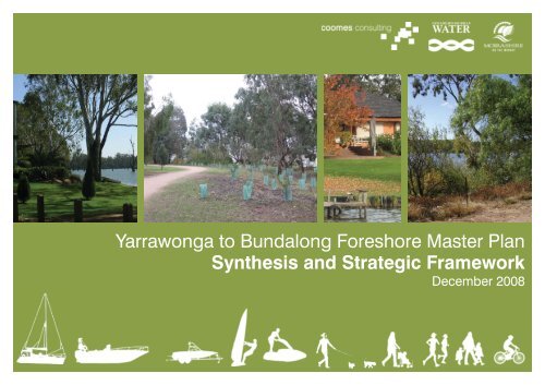
Yarrawonga to <strong>Bundalong</strong> Foreshore Master PlanSynthesis and Strategic FrameworkDecember 2008
Acknowledgements and RecognitionCoomes Consulting Group Pty Ltd24 Albert RoadSouth MelbourneVictoria 3205Prepared by: Mai Luu and Danielle GriffinWe would also like to thank the following contributors:Lake Mulwala Reference Group <strong>Moira</strong> <strong>Shire</strong> <strong>Council</strong>lors<strong>Moira</strong> <strong>Shire</strong> <strong>Council</strong> Staff Goulburn Murray Water StaffDepartment of Sustainability and Environment Lake Mulwala Steering CommitteeThe communities of Yarrawonga, Bathumi, <strong>Bundalong</strong>,Mulwala and Melbourne.........................................................Authorised by: David Dreadon........................................................Date: 16 December 2008
1.0 IntroductionIn March 2007 <strong>Moira</strong> <strong>Shire</strong> <strong>Council</strong> and GoulburnMurray Water appointed Coomes Consulting Groupin association with @leisure and Practical Ecologyto prepare a master plan that will provide directionfor an integrated and sustainable approach to themanagement, use and development of the LakeMulwala foreshore between Yarrawonga and <strong>Bundalong</strong>.The project involves partnerships between all levelsof Government; Federal (Murray Darling BasinCommission), State (Goulburn Murray Water) and Local(<strong>Moira</strong> <strong>Shire</strong> <strong>Council</strong>). It is also a positive example ofgovernment and the community working together toprotect and enhance the environmental, social andeconomic values of the lake.An analysis program which involved site assessment, areview of previous reports and background information,and an extensive community consultation program hasbeen completed. The findings of this preliminary phaseof the project has been summarised in the AnalysisReport. This includes a description of the existingsite conditions and characteristics of the area, anda summary and findings of all stages of communityconsultation. The Analysis Report also outlines anumber of key issues, and these provide a guide for avision of the foreshore from Yarrawonga to <strong>Bundalong</strong>.This report seeks to collate the issues highlighted bythe consultation process and the site assessment studyby presenting broad design options and identifyingstrategic actions for the master plan.Page 1
1.1 Why this plan?Lake Mulwala and the surrounding areas have anumber of competing demands from agricultural uses,residential development, tourism and recreation.The foreshore from Yarrawonga to <strong>Bundalong</strong> isan essential component of these uses; howeverstakeholders of each use hold differing views about theideal future use and development of the foreshore.The impact of previous planning decisions concerningresidential development (that are now consideredinappropriate) and the increasing pressure for publicand private use of the limited foreshore land are issuesto be addressed in this plan.This plan has been developed to co-ordinate themanagement of the southern Lake Mulwala foreshorearea by <strong>Moira</strong> <strong>Shire</strong> <strong>Council</strong> and Goulburn MurrayWater. To ensure effective outcomes, there is a needfor the two authorities to adopt a co-ordinated andsustainable approach to the use, ongoing developmentand management of the Lake Mulwala foreshore. Thiswill enable the values held by all stakeholders and thecommunity to be maintained and enhanced.The Yarrawonga to <strong>Bundalong</strong> Foreshore Master Planprovides an opportunity to;–––––Enhance community access andexperiences along the foreshore.Improve the natural habitat.Maintain and control the effects ofurban residential development.Respond to the demand by recreational activities.Implement future initiatives that ensure LakeMulwala and the foreshore will continue toremain a significant asset to the area.Page 2
1.2 Leisure DemandDemand for the foreshore from Yarrawonga to<strong>Bundalong</strong> is likely to be influenced by a range of onsiteand off-site trends. These include:––Population growth and changing demographicsOutdoor recreation patterns generallyThe implications for the foreshore of an increase indemand from visitors are:––The strong demand for accommodation on andin the vicinity of the foreshore eg campingThe demand for services such as toilets,shelters, picnic areas and other facilities.Lake Mulwala has a residential catchment ofapproximately 9,500 people incorporated in the suburbsof Yarrawonga (6,100), Mulwala (2,000), <strong>Bundalong</strong>(480), Burramine (360), Wilby (200), Boomanooma (200)and Collendina (200). Population forecasts estimate theresident population of the area will almost double in thenext 15 years 3Demand for outdoor recreation activitiesFitness and stress release, weight control and bodyimage are key drivers in recreational choice making.Convenience is also a major influence in participationand a high proportion of people are choosing toundertake physical activity outside the club sportenvironment.–––––Boat ownership and registrationsThe quality of the recreation resourceand facilities availableEconomic conditions generallyPopulation Growth and DemographicsThe pressure along the Lake Mulwala foreshoreis growing due to the increasing demand for thelake side as a visitor destination and due to theincreasing residential population in the area.VisitorsIt is estimated that well over 500,000 people visit thearea each year, with the greatest demand over thesummer months. Tourism numbers are increasing,particularly from interstate and international visitation 1Strengths of the Yarrawonga region for tourism includebeing close to the Rutherglen wine region and the waterbased activities associated with Lake Mulwala.Camping and caravanning in the Murray region havea higher proportion of visitors than the rest of regionalVictoria–––The importance of on-site management,in particular, clear signageThe management of operators using thewater and foreshore facilities, includingthe importance of visitor informationThe likely high demand for sports and leisureactivities that can be undertaken socially atany time, and not necessarily as part of aclub. These might include; walking, cycling,fishing, boating, tennis, skating and BMXResidentsThe ABS Census published the population ofYarrawonga 2 in 2006 to be 5,727 people. In the ten yearsto 2006 the population of Yarrawonga has increasedby 27%. The town is growing significantly faster thanthe <strong>Moira</strong> <strong>Shire</strong> average (9.7%) and this is creatingconsiderable demand on the local infrastructureand the Lake Mulwala foreshore. The population ofYarrawonga’s NSW “twin-town”, Mulwala has remainedrelatively static over this period with a population ofapproximately 1,650 residents.The key demographic characteristics influencingdemand for the foreshore include:––––––The increasing choice of Yarrawonga as aresidential location due to environmental andrecreational characteristics of the areaAn aging population, (the area is becomingmore attractive to retirees looking for apleasant setting, good climate and moreactive lifestyle during retirement)A larger population of older adults that seekopportunities for walking, cycling golf, fishing andboating along the foreshore and on the lakeOlder permanent residents who are likely to be moresensitive to change, and will expect less activityon the foreshore than young holiday makersA significant decrease in residents aged below35 years; principally due to the commutingdistance required for working opportunitiesIncreased affluence is likely to increase thedemand for larger and more water craft to accessthe lake for fishing and pleasure cruisingWhilst there are no local sources of data availableconcerning demand for leisure activities, there areindicators from State sources of participation data thatsuggest demand for water based, trail based and parkbased activities are generally increasing.As such, it can be assumed that the use of LakeMulwala as a setting for physical and social recreationactivities is likely to increase.–The increase in holiday makers/weekendersand day visitors to the area1Yarrawonga – Mulwala Tourism Centre – conversation with Alan2 ABS Census of population and housing 2006 - Yarrawonga - Mulwala (Yarrawonga Part) (Urban Centre/Locality)3ID forecast 2007 - <strong>Moira</strong> <strong>Shire</strong> WebsitePage 3
Page 4
1.3 Principles of the PlanThe following sustainability and design principles provide the vision and direction for the master plan:Sustainability principlesThere are a number of principles behind the concept of sustainable development that have a particular bearing ondemand and the approach that should be taken in the master plan.–Taking a holistic and integrated approachAll the various impacts of use should be taken into account in foreshore planning and development. Furthermore,foreshore use and development should be well balanced and integrated with a whole range of facilities that areprovided around the lake, particularly in Yarrawonga, <strong>Bundalong</strong> and Mulwala.–Planning for the long termSustainable development is about taking care of the needs of future generations as well as our own. Long termplanning requires the ability to sustain actions over time.– Using best available knowledgePolicies and actions should be informed by the latest and best knowledge available. Information on demand, trendsand impacts, as well as user preferences should be continually monitored and shared with all stakeholders.– Minimising and managing risk; the precautionary principleWhen an activity or proposed development raises the threat of harm or detriment to the environment or humanhealth, precautionary measures should be taken, even if there is scientific uncertainty about cause and outcomes.– Reflecting impacts in costsThe pricing of any facilities and services should reflect the real costs of consumption, environmental impact andshould be directed to those who derive benefits, or create the impact. Pricing also has a marketing and demandmanagement role. This has implications not simply for pollution, but for charging for use of facilities that havesignificant management costs attached to them.– Achieving an appropriate pace and rhythm of developmentThe level and pace of development should reflect and respect the character, resources and needs of hostcommunities and destinations.– Setting and respecting limits, where appropriateThe carrying capacity of individual sites and wider areas should be recognised, with a readiness and ability to limit,where and when appropriate, the amount of use or development and volume of use.– Involving all stakeholdersAll stakeholders in Lake Mulwala and its foreshore need to participate in the decision making process and beinvolved in the practical implementation of any development projects.– Undertaking continuous monitoringSustainability is all about understanding impacts and being alert to them all the time, so that the necessary changesand improvements can be made.Page 6
Design PrinciplesA number of broad strategic design principles have been identified as being applicable to the future developmentand management of the Yarrawonga to <strong>Bundalong</strong> Foreshore. These include;–Protecting and enhancing the environmentThe need to protect and enhance the environmental values of the foreshore and lake will be paramount indetermining the nature and scale of any developments.–Variety of parkland settings and experiencesA variety of parkland settings and experiences will be promoted on the foreshore, from a small number of selectivenodes of high use that may be urban in form and where higher-level service provision and use is appropriate, toareas where there is a focus on environmental values with a corresponding low-level of service provision, low usernumbers and high environmental quality.–Development of activity hubsAny infrastructure development will be consolidated within activity hubs to minimize incremental urbanization anddevelopment along the foreshore.Social EquityProviding the community with equal opportunities and access to all public land.Protection of public accessPublic access to and along the foreshore, for people of all abilities will be promoted.– Providing for suitable activitiesThe demand for a range of activities that are suitable and capable of being sustained on the foreshore and on thelake will be met through the provision of support facilities in selected areas.The priority will be given to activities that are dependant on a foreshore location, those that are less likely to conflictwith other core foreshore activities and those that cannot be sustained elsewhere.– Managing the demand for activitiesDemand for some activities may need to be managed so as to be consistent with the carrying capacity of theforeshore. Participation can be restricted through design measures, or by redirecting demand to other areas andservices capable of accommodating the demand.– Managing the interface between residential areas and the foreshoreThe interface between residential areas and the foreshore will be managed in such a way as to protect the amenity ofboth and minimise the conflict between private and public uses.– Maintaining the foreshore as a safe recreation areaManagement will seek to maintain the foreshore as a safe recreation area, for permanent and non-permanentresidents, as well as visitors.Page 7
Page 8
1.4 Objectives forchangeThis study identifies opportunities for change that willimprove the use and management of the foreshore andguide future development.These include:––––A clear and concise management system,with defined roles and responsibilities for thevarious authorities that govern the foreshore.Controls governing the development ofpublic facilities and private developmentalong the foreshore, and are dependanton the parkland setting.Clarification of where public access will beencouraged, where different types of pathand facility development will occur and whereinformal access only will be permitted.The establishment of a variety of parklandsettings and differing user experiences.1.5 Strategic frameworkThis document addresses the following elements:–––––––Land and water-based recreationalpursuits associated with the foreshoreCirculation and access withinand along the foreshoreExisting and proposed facilities andstructures on the foreshoreVegetation and habitat associated with the foreshoreThe treatment of the lake edgeThe policy and planning framework to identifyhow actions from the plan will be enshrinedinto <strong>Council</strong>’s planning processesManagement and planning controlsto protect desirable conditions onand adjacent to the foreshoreStrategies to address these key issues are organisedunder the following headings:– Demand management strategy - therecommended method to manage thedemand surrounding the issue– Communication strategy - how the issue can becommunicated to foreshore users or stakeholders– Facility strategy - what the implications arefor facilities and amenities at the foreshore,given the implementation of the recommendeddemand management strategy– Location strategy - where actions will bedistributed or located along the foreshorePolicy and planning strategy– - recommendedadditions or amendments to policies, planningcontrols and local laws, to protect the directionsof this plan, or address the specific issue.––Clear policies, planning controls and regulationsto protect values, and manage the use anddevelopment around the foreshore.Even when “no change” or no development isrequested, planning and policy may be required tomanage change, existing use (such as dog use)and to preserve current values and vegetationPage 9
Lake MulwalaJane RdLa Bamba DrMurphy StWoods RdBelmore StBathumiMurray ValleyMcColl StM RdBotts RdWhites RdKeenans RdBoomahnoomoonah RdStevenson PlRosemary CtHenderson StLinthorpe DrThornton WayOld Wilby RdBotts RdHogans RdAnchorage WaySite planRiver RdWitt RdMurray Valley HighwayYarrawongaPage 10Chinaman’s Island
2.0 The Plan2.1 ContextLake Mulwala is an operational water storage areacreated by Yarrawonga Weir on the Murray River. It isvitally important storage supplying water to irrigationdistricts and towns in the Murray Valley. Water divertedfrom the lake supports agricultural production worthbillions of dollars annually to the regional economy.ayMajors LnMajors CreekMurray Valley HighwayPhalaris LnGraham AvePasley StThe study area in this project is the southern foreshoreof Lake Mulwala from the Yarrawonga Weir toLewingtons Road, <strong>Bundalong</strong>. However, to understandthe issues, values and opportunities for a foreshoremaster plan, a wider view has been considered, and thisincludes the land areas between the lake foreshore andthe Murray Valley Highway and takes into considerationthe existing access and facilities from the townshipsof Yarrawonga, Bathumi and <strong>Bundalong</strong>. The area isabout 4,500 hectares and the lake foreshore on theVictorian side between Yarrawonga weir and LewingtonsRoad in <strong>Bundalong</strong> is approximately 22.5 kilometreslong.The significance of the lake is widely recognised by themanaging authorities and the community for irrigation,recreation, habitat, environmental values, general wellbeing and local character.Wrights RdMcDouglas RdMcPhails RdMontroses RdLakeside Dr<strong>Bundalong</strong>Pyke StBailey StTo address the number of competing interests, themaster plan identifies how public use of the foreshorecan be managed and improved in an effective way toguide authorities and the community in utilising one ofthe areas most significant assets – the foreshore.Williams StFrancis Elliot CtWilkinsons RdLewingtons RdPage 11
2.2 Community ConsultationThe community are very passionate about LakeMulwala, and an extensive consultation programme hasbeen carried out with <strong>Moira</strong> <strong>Shire</strong> <strong>Council</strong>, GoulburnMurray Water, key stakeholder organisations, communitygroups and the general public.This included:–––––Project posters on display boards and panelsin both Yarrawonga and <strong>Bundalong</strong> andupdated throughout the stages of the projectMedia releases through the Yarrawonga ChronicleStakeholder interviews with localbusinesses, clubs, schools, real estates,developers and community groupsA project website to provide backgroundinformation and a feedback formthroughout the stages of the projectListening Post sessions provide theopportunity for the community to discussideas at a personal level, and to obtain moredetailed information about the project.––––Project postcards were distributed toadvertise and invite the community to aworkshop that was held in Yarrawonga.Community workshops were held both inYarrawonga and in Melbourne (to provide anopportunity for Melbourne based <strong>Bundalong</strong> ratepayers to participate in the consultation program).These workshops provided an understanding ofthe values, issues and vision for the foreshore.The Draft Master Plan was placed on publicexhibition during May, June and July 2008. Duringthis period it was encouraged that the communityprovide a response to the proposed Master Plan.A public meeting was held on Saturday 21st ofJune at the Yarrawonga Foreshore. Facilitated bythe Mayor, the meeting was well attended andprovided an opportunity for the community tocomment on the project. During this meeting itwas emphasised that the Draft Master Plan was onpublic exhibition and responses were encouragedDuring public exhibition of the Yarrawonga to<strong>Bundalong</strong> Foreshore Master Plan, in the order of 120responses were received from the community anda number of formal submissions were received byrecreation and community groups.Yarrawonga to <strong>Bundalong</strong>Foreshore Master PlanListening PostPostcardExample of Display PosterPage 12
The main issues that were raised included:––––Removal of the existing willowsAmalgamation of the Yarrawonga Yacht, Rowing andAngling ClubsRelocation of The Junction (Pasley Street) BoatRampRelocation of Bank Street Boat RampMany respondents also took the opportunity to providesuggestions.Issues and suggestions that were outside the scope ofthis project, or could not realistically be addressed bythe land managers and/or stakeholders, have not beenincorporated into the Master Plan.Whilst it is acknowledged that some residents andcommunity groups will be disappointed by this, amaster plan of this nature seeks to provide pragmaticsolutions that set out a framework for effectivelymanaging change over the coming years.PHOTOThe underlying premise has been to consider the lakeforeshore as a public resource that is accessible to all.Community consultation workshopPage 13
Concept Master Plan2.3 Strategic area planand actionsThe Yarrawonga to <strong>Bundalong</strong> Foreshore MasterPlan acknowledges the input of a significant rangeof stakeholders and it aims to achieve a long termoutcome that will deliver their vision for the southernLake Mulwala foreshore.Invariably this involves change. The intent of themaster plan is to manage this change in such a waythat the values held by the community, visitors and landmanagers are respected and maintained.The main principles of the master plan are;––To acknowledge existing land uses,Strengthen particular facilities at specific locations,Belmore StPiper StMurphy StABank StWoods RdRiver RdYarrawongaB C DYACHTCLUBMURRAY VALLEY HIGHWAYChinamansIslandJane RdBotts RdProposedSilverwoodsEstate*Linthorpe Dr Luton DrHogans RdHenderson StRosemary CtE– Provide public access to and along the lake front– Provide opportunities for a variety of experiences– Accommodate change whilst protectingthe inherent values of the areaThe master plan is based on a series of interventionsat specific locations (nodes), continuous pedestrianaccess to the lake front, more intense activity at existingsuburban areas (particularly Yarrawonga to Woodlands),improved management and maintenance practices, andenhancing environmental values to the upper reaches ofthe lake.AOld Wilby RdVInformal public access to lakeLEGENDVProposed formal pathfrontage(Proposed formal path in the long term Vake-10-20 years).Boat RampLEGENDSpecific Intervention NodesProposed formal path(Refer to Section 4).Botts RdMURRAY VALLEY HIGHWAYWhites RdStevenson PlKeenans RdInformal public access to lakefrontagePage 14
ensure easy public access.HPhalaris Ln Graham AveLakeside DrPasley StProposedJunctionEstate*<strong>Bundalong</strong>Bailey StPyke StMontroses RdFrancis Elliot CtMURRAY VALLEY HIGHWAYAustins RdWilliam StLewingtons RdPage 15McPhails RdMcDouglas RdMajors LnWrights sRRdCEMETERYBoomahnoomoonah RdMcColl StMoransRdBathumiMajors CreekMURRAY VALLEY HIGHWAYLake MulwalaFGPRIVATEPRIVATE
2.4 Major project opportunities and synergiesA number of major project opportunities have beenidentified to enhance potential synergies betweenrelated activities and to more effectively use availableresources. These are intended to be partnershipsbetween the relevant stakeholders, and to provide thecatalyst for improved recreational, tourist, commercialand environmental initiatives.Major project initiatives to be explored include;The Yarrawonga Foreshore; Maintain and reinforcethe existing landscape character of the YarrawongaForeshore. The provision of facilities for tourist activities,as well as establishing mixed-use commercial activitiesalong Hunt Street should develop the YarrawongaForeshore as a vibrant and active tourist precinct.Explore the opportunities for locating a new Yarrawonga-Mulwala interpretive visitor centre in this area (refer tothe Lake Mulwala Foreshore: Yarrawonga Master Plan2002).A Water Play Theme Park; The consolidation of playequipment into a water themed play space on theforeshore at Bank Street. Associated picnic facilitieswill provide a family orientated facility overlooking LakeMulwala.An Aquatic Recreation Centre; The consolidation of theaquatic recreation clubs (the Yacht Club, the RowingClub and the Angling Club) into a single facility at thesite of the existing yacht club building on River Road.This facility could provide additional opportunities forcommunity functions.In addition to the development of this site as an aquaticrecreation base, an area of the lake front could be setaside as a public reserve to enable the community toaccess a vantage point over the lake.Botts Road Reserve; The redevelopment of the BottsRoad Reserve; the removal of the Rowing Club buildingfrom the Botts Road location (and relocation to acombined aquatic recreation club facility),––The construction of a new public boatramp and trailer parking areaThe development of the promontory asa public reserve with short term tie upfacilities for boats and picnic facilitiesOpportunities exist to explore co-operation with theadjoining Silverwoods residential project for theimplementation of a new boat ramp.Bathumi Reserve; The establishment of a public reserveon the edge of the lake and Murray Valley Highway atBathumi. This reserve is intended to provide travellersand visitors with an interesting road side stop whereinterpretation of the natural and cultural history of theLake Mulwala area can be appreciated. To this end,opportunities exist to work with a variety of agencies toimplement the project, eg VicRoads, historical groups,and local artists. In addition, the opportunity exists toincorporate within the reserve, a commercial facility thatpromotes and sells local produce.Majors Creek Reserve; The master plan proposes anupgrade of the existing boat launching facility at MajorsCreek Lane and the establishment of a nature reservewhere the environmental values of the Lake Mulwalaforeshore and Majors Creek can be appreciated frominterpretation trails.<strong>Bundalong</strong>; The existing facilities at <strong>Bundalong</strong> arereviewed to provide opportunities for residents andvisitors to access the Murray and Ovens River frontagesand to gain some experience of the ‘everglade’character of the area. The existing boat launchingfacilities at the ends of Pasley Street and Pyke Street areupgraded to provide better trailer parking, less conflictwith day visitors and easy access off the Murray ValleyHighway.A linear trail; The thread tying these activity nodestogether is a linear trail between Yarrawonga and<strong>Bundalong</strong>. The ‘Lake Mulwala Trail’ provides theopportunity for short loop circuits, leisurely strolls, naturewalks, cycle tours and meeting places. Public accessto the lake front is an important consideration, alongwith the opportunity to experience a variety of differentlandscapes, and this trail will provide the means for this.The linear trail will pass along existing paths, roadreserves, unmade government roads, through existingand future residential subdivisions, and existing lakesidereserves, and will meander through the area as eitherconstructed paths or informal areas. It is intendedto be a formally constructed shared path that willbe implemented over time, address the concerns ofexisting lake front residents yet provide unambiguouspublic access to the lake front.Page 16
3.0 Function and Setting types along the foreshoreThe planning framework proposed in this Plan is toderive specific open space benefits from the foreshore.By classifying open space areas according to thedifferent function they service, it is possible to ensurethe desired benefits can be protected.A number of different types of spaces are neededto ensure different types of benefits are availableto residents and visitors. These benefits are widelydocumented. Broadly, they include:– Health and well being: clean air, exercise,psychological need for contact with nature– Child development and play: ability to exploreand manipulate the environment, experiencechallenge, develop physical and social skills– Recreation: including social interaction,personal challenge, relaxation, contemplation,escape, nature appreciation, spiritualfulfilment, and artistic expression– Civic pride / tourism: providing acompetitive strength that will attractvisitors and provide economic benefit– Biodiversity and conservation: protectionof natural and cultural heritageDividing open space into different types also enablesplanners to assess the range and distribution ofopportunities available, and then to ensure that adiversity of opportunities is provided that:Some spaces need to cater for visitors, who may needtoilets, information and other support facilities thatare not required by locals. Therefore it is desirable toconsciously decide on what the catchment of the userwill be before a space is designed.Apart from the function, and catchment, the landscapesetting of the space should also be considered. Thiswill help to determine the character and specificleisure experiences that the area is able to provide.The landscape setting type is largely determined byvegetation, the presence of any built form and in thisinstance, the edge treatment of the lake. Determiningdifferent setting types along the lake will determinelimits of acceptable change and ensure that the entireforeshore will not become incrementally developed andrelatively uniform.The setting types along the foreshore should range fromrough natural area with high environmental values andlow interparty contact at one end of the spectrum, tothose more highly manicured and more urban spaceswith hard engineered edge treatments. These areas aresuited to higher use and more social experiences. Inaddition vegetation could range from protected forestedareas, to open parkland (grass and trees), to opengrassy areas.–Are in keeping with the values of the foreshore–Complement (rather than duplicate) those availableon the other shore or in the township–Can ensure a wide range of the population isable to find spaces that meet their needs.Page 17
Functions and Settings PlanOpen ParklandBushlandNaturalAreaNaturalAreaOpenParklandNaturalAreaNaturalAreaNaturalAreaNB: The whole foreshore area functions as a buffer for environmental protection, however some sites have been identified specifically.Page 18
This plan sets out the objectives for future landscapesettings along the Lake Mulwala Foreshore andthe function that these should aim to provide.FUNCTIONSETTINGBushlandNaturalAreaBushlandSETTINGS–OPEN PARKLAND- Grass area and trees,little or no environmental significancewith a variety of edge treatments.Natural Area–NATURAL AREA- Re-establishment of grasses,trees and shrubs with a medium to highenvironmental value in a cultural setting.NaturalArea–BUSH-LAND - Dense planting, generallyof high environmental significancewith soft lake edge treatments.FUNCTIONSNaturalArea– Yellow - Social recreation and play– Blue - Relaxation/environmental appreciation– Red - Visual amenity– Green - Buffer/environmental protectionand conservation of biological speciesThis plan is intended to be a guide for the development of thisarea and it is intended that all proposed works will be subject toappropriate approval processes and detailed design studies.NaturalAreaPage 19
3.1 Lake edge treatmentsThe type of edge treatment along the foreshore impactson the functionality of the area for different recreationalactivities, the visual character or experiential ‘setting’ ofthe space, the habitat value of the foreshore, and theability of the foreshore to withstand erosion.The nature of the edge treatment should be consistentwith the primary function of the space and thelandscape setting type These will be key aspects toconsider for design specifications.––Ensure the foreshore continues to supporta suite of spaces that vary in their functionand setting type, and selectively attractdifferent users from different catchmentsEnsure that incremental development is notallowed to impact on the quality of experiencesthat depend on the natural values of spaces. i.e.more conservation based functions should havemore forested settings with natural edge treatmentsand a relatively low level of facility provision––Trail options include; unformed access waysfor walking, unsealed paths suitable forwalking and cycling, elevated boardwalksmore suited to walking than cycling, andpaved shared paths for a variety of users.Explore hard engineering options for the lakeedge along the foreshore where appropriate,ie; where habitat significance is low, therisk of erosion is high, and for a lake sidepromenade within a suburban settingThe StrategyDemand Management Strategy––Establish a range of parkland settings tosupport a diversity of experiences along theforeshore, that consider demand and thatenable the assets to be maintained in anacceptable condition. Then designate thenature of user (catchment), function and settingtype for each reserve to manage demandThe range of settings would be basedon a number of factors, including:––––––Page 20The nature of the existing conditions and anunderstanding of the activities dependanton those conditions, including erosion.The degree of environmental sensitivitysurrounding the reserveThe functions, activities and settings ofneighbouring land along the foreshoreThe necessary water edge treatment tosupport the desired activities at the reserveThe proximity to residents and touristattractions, and the subsequentdesire for nature based experiencesor highly serviced destinationsThe likelihood of long or short visitsto the reserve (i.e. play for twentyminutes, or picnic for a day)–Provide selected areas suitable of sustaininghigh levels of use and that encourage socialinteraction and provision for visitorsCommunication Strategy–Provide an overview of the foreshore in signageand in brochure form that clearly articulate therange of spaces (including the function, landscapecharacteristics and nature of facilities they canexpect to find at the space) and areas suitable fordifferent types of activities, for visitors and residentsFacility Strategy––––Ensure the nature of facilities provided on theforeshore match the catchment of users, andthe function and setting types of the spacesProvide a hierarchy for each type of facility inkeeping with functions and setting typesFor example, boat launching: Provide welldesigned public boat launching facilities that canserve power boats. Low key community jetties,canoe steps, rowing landing stages and grassyembankments can support non powered boatlaunching in less social and select locationsA range of access ways / trails along the foreshorecan be provided in areas where formed pathwaysare not suitable (i.e. in front of residences frontingthe lake where the public land reserve is narrow).––––To the area of active erosion along River Road,substantial engineering works are requiredto address bank stability. Preliminary studieshave been initiated to provide informationabout the feasibility of such works. Thesecould be developed further to incorporate apedestrian promenade and to improve theaesthetic values of the current treatmentPhase out the use of rough rock for edgetreatments or for stabilising the embankment,and replace with other more suitabletreatments depending on the intended functionand setting type of that part of the foreshoreAlong the lake edge to the Woodlandsresidential area, a variety of small retainingwalls have been implemented by localresidents. It is recommended GoulburnMurray Water develop a standard lake edgespecification (for a small retaining wall) andthat this be licensed to adjacent privateland owners for construction and ongoingmaintenance. Opportunities also exist for softengineering treatments in this area such asgeo-textile matting and riparian vegetationUse soft edge treatments such as geo-textilematting and aquatic vegetation (grass, shrubs, waterreeds) in areas of moderate and high environmentalsignificance, where these values are to bemaintained and protected. This type of treatmentalso provides increased opportunity for habitatestablishment, particularly in the Bathumi area––Where the construction of a shared pathway alongthe foreshore reserve is not possible, an elevatedboardwalk in the lake is considered to be aninteresting alternative to provide public accessConsider the provision of a variety ofretaining walls in high use areas or grassedembankments in low profile areas whereshort term tie up options are availablePolicy and Planning Strategy–Pedestrian promenade and retaining wall exampleSoft engineering (geo-textile matting) exampleAdopt the guidelines identified in the FacilityStrategy, regarding edge treatments, into the overalldesign guidelines developed for the foreshore
Page 21
Page 23thumiMurray Valley HighwayMurray Valley Highway<strong>Bundalong</strong>Majors CreekWrights RdMcPhails RdMontroses RdPyke StAustins RdWilkinsons RdBaBaBaBaBaBaBaBaBaBaBaBaBaBaBaBaBaBaBaBaBaBaBaBaBaBaBaBaBaBaBaBaBaBaBaBaBaB ilililililililililililililililililililililililililililili eyeyeyeyeyeyeyeyeyeyeyeyeyeyeyeyeyeyeyeyeyeyeyeyeyeyeyeyeyeyeyeyeyeyeyeyeyeyeye StLaLaLaLaLaLaLaLaLaLaLaLaLaLaLaLaLaLaLaLaLaLaLaLaLaLaLaLaLaLaLaLaLaLaLaLaLaLaLaLaLaLaLaLaLaLaLaLaLaLaLaLaLaLaLaLaLaLaLaLaLakekekekekekekekekekekekekekekekekekekekekekekekekekekekekekekekekekekekekekekekekekekekekekekekekekekekekesisisisisisisisisisisisisisisisisisisisisisisisisisisisisisisisisisisisisisisisisidededededededededededededededededededededededededededededededededededededededededededededededede DrGrGrGrGrGrGrGrGrGrGrGrGrGrGrGrGrGrGrGrGrGrGrGrGrGrGrGrGrGrGrGrGrGrGrGrGrGrahahahahahahahahahahahahahahahahahahahahahahahahahahahahahahahahahahahahahamamamamamamamamamamamamamamamamamamamamamamamamamamamamamamamamamamamamamamamamamamamamam AvevevevevevevevevevevevevevevevevevevevevevevevevevevevevevevevevevevevevevevevevevevevePhPhPhPhPhPhPhPhPhPhPhPhPhPhPhPhPhPhPhPhPhPhalalalalalalalalalalalalalalalalalalalalalalalalalalalalalala arararararararararararararararararararararararararararararararararararararararararisisisisisisisisisisisisisisisisisisisisisisisisisisisisisisisisisisisisis LnPaPaPaPaPaPaPaPaPaPaPaPaPaPaPaPaPaPaPaPaPaPaPaPaPaPaPaPaPaPaPaPaPaPaPaPaPaPaPaPaPaPaPaPaPaPaPaPaPaslslslslslslslslslslslslslslslslslslslslslslslslslslslslslslslslslslslslslslslslslslslslslslslsleyeyeyeyeyeyeyeyeyeyeyeyeyeyeyeyeyeyeyeyeyeyeyeyeyeyeyeyeyeyeyeyeyeyeyeyeyeyeyeyeyeyeyeyeyeye StFrFrFrFrFrFrFrFrFrFrFrFrFrFrFrFrFrFrFrFrFrFrFrFrFrFrFrFrFrFrFrFrFrFrFrFrFrFrFrFrFrFrFrFrFrFrananananananananananananananananananananananananananananananananananananananananananancicicicicicicicicicicicicicicicicicicicicicicicicicicicicicicicicicicicicis ElElElElElElElElElElElElElElElElElElElElElElElElElElElElElElEllilililililililililililililililililililililiotototototototototototototo Ctiototototot CtLewingtons RdMcDouglas RdMorans RdMaMaMaMaMaMaMaMaMaMaMaMaMaMaMaMaMaMaMaMaMaMaMaMaMaMaMaMaMaMaMaMaMaMaMaMaMaMaMaMaMaMaM jojojojojojojojojojojojojojojojojojojojojojojojojojojojojojojoj rsrsrsrsrsrsrsrsrsrsrsrsrsrsrsrsrsrsrsrsrsrsr LnWiWiWiWiWiWiWiWiWiWiWiWiWiWiWiWiWiWiWiWiWiWiWiWiWiWiWiWiWiWiWiWiWiWiWiWiWiWiWilllllllllllllllllllllllllllllllllllllllllllllllliaiaiaiaiaiaiaiaiaiaiaiaiaiaiaiaiaiaiaiaiaiaiaiaiaiaiaiaiamsmsmsmsmsmsmsmsmsmsmsmsmsmsmsmsmsmsmsmsmsmsmsmsmsmsmsmsmsmsmsmsmsmsmsmsmsmsmsmsmsms StmHard edge treatmentSoft edge treatmentAreas of current erosionLEGENDThis plan is intended to be a guide for the development of thisarea and it is intended that all proposed works will be subject toappropriate approval processes and detailed design studies.
4.0 Activities and Functions4.1 Land based activitiesCommunity consultation and past studies haveidentified social and family recreation as a key use ofthe foreshore, as well as an aspect requiring furtherdevelopment.Residents have observed an increased use of theforeshore and lake by visitors in recent years. Residentssuggest this use has altered the previous ‘community’feel of the foreshore (especially around <strong>Bundalong</strong>),and reduced the perception of safety that has allowedchildren to play freely along the foreshore and at thewater’s edge.In addition, increased residential development iscurrently occurring in Yarrawonga and <strong>Bundalong</strong>.To address the demand for open space recreation,attention needs to be paid to the provision of reservesaway from the lake foreshore, and to appropriate linksbetween the various components of the network.The Development Plan that has been prepared forthe Yarrawonga East area clearly shows open spaceprovision away from the foreshore to cater for futureresidents and also green links to the lake front precinctto ensure public accessibilitySuggestions for general improvements to social andfamily recreation opportunities along the lake foreshorehave centred on minimising the use of power boatsclose to shore, protecting private residential amenity,managing the impact of some activities (eg dogs offleash) and rubbish collection. The provision of additionalshade, basic facilities (such as seats, water taps andpicnic tables), and more substantial facilities (such asshelters, barbeques and toilets) at public reserves arealso recommended.Yarrawonga East Development PlanPage 24
The StrategyDemand Management Strategy–––––Control powered vessels accessing, launchingfrom and mooring at key reserves to protectsocial and family recreation opportunitiesConsider designing one reserve for smallscale water based activities suitable forfamilies and canoe and pedal boat hireContain dog off-lead exercise to designated areasEnsure well designed parkland is providedin all new residential areas to divert localdemand away from the foreshoreExplore opportunities to establish guidelinesfor developer contributions of open space innew residential areas to ensure that adequateareas and recreational amenity are provided.The reserves should focus on providingsocial/family recreation opportunitiesCommunication StrategyFacility Strategy––––Develop visitor facilities and boat rampsat strategic nodes, consistent with theclassification of the each park reserveRetain some sites with minimal facilities along theforeshore for quieter contemplative experiences.Provide opportunities for dog off-lead exerciseat selected areas along the foreshoreProvide ‘nodes’ of social and family recreationopportunities at parkland reserves, includingplay equipment, natural play opportunities,open space to kick a ball around, entertainmentstages / rotundas, bbq and picnic facilitiesLocation Strategy–Provide public parkland reserves servingsocial and family recreation opportunities(or access to these reserves) within walkingdistance of local residents, including:– Yarrawonga Foreshore / River Road–––––––Yacht Club areaBotts Road ReserveWoodland ParkLuton Drive ReserveBathumi ReserveMajors Lane<strong>Bundalong</strong> Reserve at Pasley StreetThese sites will be explored in detail in the followingsection–––Consider the provision of signage at logical entrypoints to each reserve, identifying the reservename and necessary regulations (i.e. dogsallowed off-lead, no camping, no boating etc)Consider the provision of interpretive signagearound the walking trail of Chinamans Island,and promote the Island as a habitat areafor quiet contemplation and respitePromote each public parkland reserve and theirspecific setting type and character on the <strong>Council</strong>website and through information brochures.Identify facilities provided at each reservePage 25
Luton DriveReserveLay ayThorornt ntononJane ne RdHendnderson StLaBamambaDrWiWittRdMurprphyStWoods RdRdBeBelmor ore StRosesemamaryCtBathumiReserveStevevenensoson PlKeenans RdLintinthorhorprpe Dro WayBotts RdWhites RdMurray Valley HighwayPage 26YarrawongaChinaman’s IslandOld Wilby RdBotts RdHogansRdage WyAnchchoragWRivever Rd4.1.1 Parkland ReservesThe plan has identified eight parkland reserves alongthe foreshore to accommodate social and familyrecreation, these are:–Yarrawonga Foreshore-linking toKennedy Park and River Road–Existing Yacht Club area–Botts Road Reserve–Woodland Park–Luton Drive Reserve–Bathumi Reserve–Majors Creek Reserve–<strong>Bundalong</strong> Reserve.The Yarrawonga Foreshore (including River Road) isconnected further inland to Kennedy Park. These openspace areas serve a district catchment. They havehighly modified environments, larger and more complexpurpose built facilities and a greater managementpresence compared to elsewhere along the foreshore,and are highly used.Chinamans Island is a wetland reserve within a low-keynatural parkland setting.The remaining reserves have minimal or no publicfacilities and are currently open grass areas along theforeshore.Parkland and Reserves PlanYarrawonga foreshoreand River RoadYachtClubAreaBotts RdReserveWoodlandPark
Page 27BathumiMurray Valley HighwayMurray Valley HighwayLake Mulwala<strong>Bundalong</strong>Majors CreekBoBoBoBoBoBoBoBoBoBoBoB omomomomomomomomomomo ahahahahahaha nononononononononononononononon omomomomomomomomomomomomomomo ooooooooooooooo nananananananananananan h RdRdRdRdRdRdRdRdRdRdRdRWrWrWrWrWrWrWrWrWrWrWrWrWrWrWrWrWrWrWrWrWrWrWrWrWrWrWrWrWrWrWrWrWrWrW igigigigigigigigigigigigigigigigigigigigigigigigigigigigi hththththththththththththththththththththththththththththththththththththth s RdRdRdRdRdRdRdRdRdRdRdRdRdRdRdRdRdRdRdRdRdRdRdRdRdRdRdRdRdRdRdRMcMcMcMcMcMcMcMcMcMcMcMcMcMcMcMcMcMcMcMcMcMcMcMcMcMcMcMcMcMcMcMcMcM PhPhPhPhPhPhPhPhPhPhPhPhPhPhPhPhPhPhPhPhPhPhPhPhPhPhPhPhPhP aiaiaiaiaiaiaiaiaiaiaiaiaiaiaiaiaiaiaiaiaiaiaiaia lslslslslslslslslslslslslslslslslslslsl RdMoMoMoMoMoMoMoMoMoMoMoMoMoMoMoMoMoMoMoMoMoMoMoMoMoMoMoMoMoMoMoMoMoMoMoMoM ntntntntntntntntntntntntntntntntntntntntntntntntntntntntntn rororororororororororororororororororororororororororororororororororororoseseseseseseseseseseseseseseseseseseseseseseseseseseseseseseses s RdRdRdRdRdRdRdRdRdRdRdRdRdRdRdRdRdRdRdRdRdRdRdRdRdRdRdRdRdRdRdRdRdRdRdRPyPyPyPyPyPyPyPyPyPyPyPyPyPyPyPyPyPyPyPyPyPyPyPyPyPyPyPyPyPyPyPyPyPyPyPyPyPyPykekekekekekekekekekekekekekekekekekekekekekekekekekekekekekekekekekekeke StAuAuAuAuAuAuAuAuAuAuAuAuAuAuAuAuAuAuAuAuAuAuAuAuAuAuAuAuAuAuAuAuAuA stststststststststststststststststststststststststststststststinininininininininininininininininininininininini s RdRdRdRdRdRdRdRdRdRdRdRdRdRdRdRdRdRdRdRdRdRdRdRdRdRdRdRdRdRdRdRdRdRWiWiWiWiWiWiWiWiWiWiWiWiWiWiWiWiWiWiWiWiWiWiWiWiWiWiWiWiWiW lklklklklklklklklklklklklklklklklklklklklklklklklklklklklklkininininininininininininininininininininininininininsosososososososososososososososososososososososososososososososososonsnsnsnsnsnsnsnsnsnsnsnsnsnsnsnsnsnsnsnsnsnsnsnsnsnsnsnsnsnsnsnsnsns RdBaBaBaBaBaBaBaBaBaBaBaBaBaBaBaBaBaBaBaBaBaBaBaBaBaBaBaBaBaBaBaBaBaBaBaBaB ililililililililililililililililililililililili eyeyeyeyeyeyeyeyeyeyeyeyeyeyeyeyeyeyeyeyeyeyeyeyeyeyeyeyeyeyeyeyeyeyeyeye StLaLaLaLaLaLaLaLaLaLaLaLaLaLaLaLaLaLaLaLaLaLaLaLaLaLaLaLaLaLaLaLaLaLaLaLaLaLaLaLaLaLaLakekekekekekekekekekekekekekekekekekekekekekekekekekekekekekekekekekekekekekekekekekesisisisisisisisisisisisisisisisisisisisisisisisisisisisisisidedededededededededededededededededededededededededededededededededededededededede DrGrGrGrGrGrGrGrGrGrGrGrGrGrGrGrGrGrGrGrGrGrGrGrGrGrGrGrGrGrGrGrGrGrGrGrGrGrGrGrahahahahahahahahahahahahahahahahahahahahahahahahahahahahahahahahahahamamamamamamamamamamamamamamamamamamamamamamamamamamamamamamamamamamamamamamamamam AvevevevevevevevevevevevevevevevevevevevevevevevevevevevevevevevevevevevevevevevevevevevevevevePhPhPhPhPhPhPhPhPhPhPhPhPhPhPhPhPhPhPhPhPhPhPhalalalalalalalalalalalalalalalalalalalalalalalalalalalalalalalalalalala arararararararararararararararararararararararararararararararararararararararararisisisisisisisisisisisisisisisisisisisisisisisisisisisisisisisisisisisisisis LnPaPaPaPaPaPaPaPaPaPaPaPaPaPaPaPaPaPaPaPaPaPaPaPaPaPaPaPaPaPaPaPaPaPaPaPaPaPaslslslslslslslslslslslslslslslslslslslslslslslslslslslslslslslslslslslslslslslslslsleyeyeyeyeyeyeyeyeyeyeyeyeyeyeyeyeyeyeyeyeyeyeyeyeyeyeyeyeyeyeyeyeyeyeyeyeyeyey StFrFrFrFrFrFrFrFrFrFrFrFrFrFrFrFrFrFrFrFrFrFrFrFrFrFrFrFrFrFrFrFrFrFrFrFrFranananananananananananananananananananananananananananananananancicicicicicicicicicicicicicicicicicicicicicicicicicicicicicicicicicicicicicis ElElElElElElElElElElElElElElElElElElElElElElEllililililililililililililililililililililiotototototototototot Ctiotototototot CtMcMcMcMcMcMcMcMcMcMcMcMcMcMcMcMcMcMcMcM CoCoCoCoCoCoCoCoC llllllllllllllll StLeLeLeLeLeLeLeLeLeLeLeLeLeLeLeLeLeLeLeLeLeLewiwiwiwiwiwiwiwiwiwiwiwiwiwiwiwiwiwiwiwiwiwiwiwiwiw ngngngngngngngngngngngngngngngngngngngngngngngngngngngngngngngtotototototototototototototototototototototototototototototonsnsnsnsnsnsnsnsnsnsnsnsnsnsnsnsnsnsnsnsnsnsnsnsnsnsnsnsnsnsnsns RdMcMcMcMcMcMcMcMcMcMcMcMcMcMcMcMcMcMcMcMcMcMcMcMcMcM DoDoDoDoDoDoDoDoDoDoDoDoDoDoDoDoDoDoDoDoDoDoDoDoDoDoDoDoDoDoDoDoD ugugugugugugugugugugugugugugugugugugugugugugugugugugugugugugugugugugugugu lalalalalalalalalalalalalalalalalalalalalalalalalal s RdRdRdRdRdRdRdRdRdRdRdRdRdRdRdRdRdRdRdRdRdRdRdRdRdRdRdRdRdRdRdRdRdRdRdRMoMoMoMoMoMoMoMoMoM rararararararararansnsnsnsnsnsnsnsns RdMaMaMaMaMaMaMaMaMaMaMaMaMaMaMaMaMaMaMaMaMaMaMaMaMaMaMaMaMaMaMaMaMaMaM jojojojojojojojojojojojojojojojojojojojojojojojojojojojojojoj rsrsrsrsrsrsrsrsrsrsrsrsrsrsrsrsrsrsrsrsrsrsrsrsrsrsrsr LnWiWiWiWiWiWiWiWiWiWiWiWiWiWiWiWiWiWiWiWiWiWiWiWiWiWiWiWiWiWiWiWiWiWiWiWilllllllllllllllllllllllllllllllllliaiaiaiaiaiaiaiaiaiaiaiaiaiaiaiaiaiaiaiamsmsmsmsmsmsmsmsmsmsmsmsmsmsmsmsmsmsmsmsmsmsmsmsmsmsmsmsmsmsmsmsms StmMajors CreekReserve<strong>Bundalong</strong>ReserveBathumiReserve
Landscape Concept A: Yarrawonga ForeshoreThe area from Yarrawonga weir east to the start ofChinamans Island serves a social / family recreationfunction in an open parkland setting. It is a highlymodified landscape with high levels of use by residentsand visitors from a large catchment area. The areahas hard engineered edge treatments and provides adiversity of recreation and open space facilities with playand picnic opportunities.––––Provide drinking taps at regular intervals.Provide additional natural shade areasProvide additional seating to overlook the skate parkProvide ‘skate-able’ paths from Belmore Street toaccess the skate parkManagement ResponsibilitiesIt is proposed that:–<strong>Moira</strong> <strong>Shire</strong> <strong>Council</strong> will be responsible for themanagement of all open space areas, picnic areas andrecreational facilities including rubbish bins, shelters,seats, toilet facilities and car parking areasMaintain this area as a highly modified landscape and amain activity area for tourism and recreation facilities forboth families and visitors alike:–––––Consider relocating the water slide to the AquaticCentre at ‘The Grove’To address user safety issues, consider the removalof the toddlers pool and the Lake Pool enclosure.Consider constructing a high quality water themedplay area, with kiosk and cafe facilities near-by toprovide a tourist attractionWhere feasible, realign the existing path to maximizeopen space areas, and provide a new sharedpathwayConsider the provision of new public toilets andchange rooms––––––Provide appropriate parking spaces for the play andpicnic area, restaurant and tourist information kiosk.Maintain the angle car parking area along BankStreetUpgrade the public toilets and change rooms atBank Street Reserve.Investigate the opportunity to install a new automatictoilet facility near the skate park.Promote and encourage tourist focused recreationaland business opportunities along the YarrawongaForeshore of Lake Mulwala.Review the existing water play facilities and explorethe feasibility of developing a high quality watertheme play area as a recreational destination forlocals and tourists.––Goulburn-Murray Water will be responsible for the shortterm tie up facilities, and lake edge retaining walls.<strong>Moira</strong> <strong>Shire</strong> <strong>Council</strong> and Goulburn-Murray Water shallbe jointly responsible for the licence of any commercialactivities eg. kiosk.A water theme play park exampleBBQ, picnic tables and shelter exampleWater theme play area exampleA water theme play park example––Maintain the gazebo and picnic facilitiesUpgrade the existing kiosk and extend openinghours–Encourage and promote tourist focused businessand mixed use commercial activities (as per theplanning scheme) to create a vibrant and activeprecinct along Hunt Street (between Belmore andLynch Street).–Explore opportunities to develop a landscape andlighting design theme as part of a feature boulevardalong the foreshore–Maintain the existing memorial references (W.J.RyanReserve, T.O’C. Hanrahan Drinking Fountain, FrankKeenan Reserve)–Install park furniture that is consistent with theadopted design theme–Provide picnic areas that include shelters, tables,rubbish bins and barbeque.The existing landscape character will be maintained along the Yarrawonga ForeshorePage 28
–––Maintain the existing park character of the Yarrawonga Foreshore.Reinforce tourist and recreation opportunities.Explore the opportunity to create a water themed play area as a tourist attraction along the foreshore.A Yarrawonga Foreshore - Bank Street ReserveConsider relocatingthe existing TouristInformation Centredepending onthe outcomes ofthe new bridgealignment.Otherwise maintainthe current highprofile location.ExistingTouristInformationCentreIRVINE PARADEBELMORESTREETMELBOURNE STREET (C373)Boat HireProposed automaticpublic toiletExistingSkate ParkBusiness Zone 1HUME STREETShort term boattie-up facilitiesHUNT STREETMixed Use ZoneTraffic calming measure toslow traffic speeds alongHunt Street and to providepedestrian connectivitybetween YarrawongaForeshore and KennedyPark.PPRZoneLYNCH STREETHAEBICH DRIVERemove existingplay area andrelocate to waterthemed playarea.PlayAreaW.J. Ryan ReserveResidentialZone 1Paddle BoatCruisersMURPHY STREETPicnic areas with, bbq, tables,shelters & rubbish binsResidentialZone 1ResidentialZone 1COGHILL STREETWater-themeplay areaBANK STREETLEGENDGrass land and publicly accessible areasShrub planting areasRecreation facilities (tables, seats, etc)Proposed shared pathThis plan is intended to be a guide for the development of thisarea and it is intended that all proposed works will be subject toappropriate approval processes and detailed design studies.WITT STREETKennedy ParkPage 29
Landscape Concept A : Bank Street / River RoadThis area continues on from the Yarrawonga foreshoreand shares similar functions and settings.Management ResponsibilitiesIt is proposed that:Establish this area as a highly modified landscape anda main activity area for tourism and recreation facilitiesfor both families and visitors alike:––Retain and upgrade the existing boatramp at Bank Street and Ely StreetImplement a traffic study to resolve boatlanding maneuvers, parking facilities andgeneral pedestrian and vehicular circulationat the existing Bank Street boat ramp.––<strong>Moira</strong> <strong>Shire</strong> <strong>Council</strong> will be responsible for thewater theme play park, and maintaining the openspace and landscape features along Bank Streetand River Road and the upkeep of River Road.Goulburn-Murray Water will be responsible forestablishment of licences for the boat ramp &jetty, licencing of private jetties and short termtie up facilities, erosion control along the lakeedge, and re-vegetation where appropriate.–––Upgrade shared pathway along RiverRoad to provide access for all includingseating and rubbish binsExplore opportunities to implement landscapedesign and lighting as part of a pedestrianpromenade along the foreshoreProvide a viewing platform at a selectedlocation along the promenadeExisting Bank Street boat ramp––Provide drinking taps at regular intervalsProvide additional natural shade areasPedestrian promenade examplePage 30Pedestrian promenade examplePedestrian promenade example
A Yarrawonga Foreshore - River Road– Retain and upgrade the existing boat ramp and car parking facilities at the corner of Bank and Ely Street.– Implement erosion control measures, through both soft and hard engineering options, where appropriate along the foreshore.– Maintain the existing willows along the foreshore until an appropriate alternative is found. Trim or remove any willows that are identified as a safety hazard or are dead.– Upgrade the shared pathway along River Road to ensure it is accessible to all and includes seating and rubbish bins.Short term boat tie-upfacilitiesBANKSTREETConsider renovating the stone buildingas a public toilet facilityRetain existing boat ramp. Implement trafficstudy to resolve boat landing manoeuvres,parking facilities and general pedestrianand vehicular circulation.MurrayExistingcar andtrailer parkConsider upgrading theexisting hard engineering edgeto incorporate a pedestrianpromenade and to addressaesthetic valuesMaintain the existing willows alongthe foreshore until an appropriatealternative is found. Willows identifiedas dead or presenting a safety hazardwill need to be trimmed or removed. Asoft engineered edge treatment withindigenous/native planting should beconsidered to replace any willowsremoved.Implement a combination of softengineered edge treatment along theforeshore to control erosion.RiverUpgrade shared pathway toprovide access for all, includingseating and rubbish containers.Explore opportunities toimplement landscape elementsand lighting as part of a featureboulevard.HUNT STREETRIVER ROADELY STREETWOODS ROADLEGENDGrass land and publicly accessible areasShrub planting areasRecreation facilities (tables, seats, etc)Proposed shared pathThis plan is intended to be a guide for the development of thisarea and it is intended that all proposed works will be subject toappropriate approval processes and detailed design studies.Page 31
Landscape Concept B: Aquatic Recreation FacilityIt is proposed to upgrade the existing Yacht Club buildingto provide a combined facility for aquatic recreationclubs (Yacht Club, Rowing Club and Anglers Club, plusother water based groups such as water skiers, canoes/ kayakers, etc). This building should also consideropportunities for community functions.––Implement landscape design and lighting as partof a pedestrian promenade along the foreshore.Explore opportunities for the installation of anautomatic public toilet to replace the existing toilets.Management responsibilitiesDefine responsibilities of local access roads betweenGoulburn-Murray Water and <strong>Moira</strong> <strong>Shire</strong> <strong>Council</strong>.It is proposed that:By combining aquatic recreation clubs into one building, acollegiate approach to meeting rooms, administration andsocial events can be achieved. This is likely to producebetter outcomes in terms of funding opportunities, landmanagement support, abd social / club membershipintegration.<strong>Moira</strong> <strong>Shire</strong> <strong>Council</strong> is to manage all open space facilities;play area, rubbish bins, shelters, picnic and toilet, and thelicence for the Aquatic Recreation Clubhouse facilities.Goulburn-Murray Water will be responsible for the licencingof the public boat ramp and jetty, erosion control along thelake edge, and re-vegetation where appropriate.The existing pathway is compacted granitic gravel which is in keeping with theinformal natural character of the area––––––It is recommended that a working group be setup to explore opportunities, synergies and designoptions for an Aquatic Recreation Facility. Thiswill ensure that the expectations and aspirationsof all the various stake holders are addressedand considered in a feasibility proposal.Remove the yacht storage area locatedagainst the neighbouring residential properties.Provide a yacht maintenance area associatedwith the Aquatic Recreation Facility.Upgrade the existing public boat rampfacility at River Road to consider trafficand pedestrian safety issues.Upgrade the open space area as a public reservewith picnic facilities, including bbqs, drinkingtaps, rubbish bins, tables and play area.Provide car parking, for functions andevents held by the community, for membersof the aquatic recreation clubs, andfor vistors to Chinaman’s Island.A new shared pathway is proposed toprovide access for all to the lake edge.The Aquatic Recreation Club is to be responsible for themanagement of the boat ramp and jetty toGoulburn-Murray Water Standards.Page 32Explore an iconic architectural design for the aquatic recreation facilities as a landmark feature on the lake frontAround the proposed Aquatic Recreation Clubhouse, concrete pavementwould be more suitable
Explore the opportunity to upgrade the existing Yacht Club building to provide a combined facility for aquatic recreation clubs and to provide–opportunities for community facilities.–––Upgrade the existing public boat ramp at River Road to consider traffic and pedestrian safety issues.Consider a new shared pathway that provides access for all to the lake edge and Chinamans Island.Provide an Aquatic Club Facility in a parkland setting.RESTRICTED ACCESS FOR POWER BOATS(LONG TERM PREFERENCE)B Yacht Club AreaChinamansIslandNew picnic areas with,bbq, tables, shelters, andrubbish binsAGREED EXISTING LIMITFOR BOAT ACCESSExisting publicboat ramp tobe retainedand upgraded.Existing launchingramp for Yacht ClubAquaticRecreationClubhouseYachtMaintenanceAreaNew car parkProposed boundary ofChinamans Island Reserve (formanagement purposes)This plan is intended to be a guide for the development of thisarea and it is intended that all proposed works will be subject toappropriate approval processes and detailed design studies.RIVER ROAD LEGENDExisting public toiletsExplore opportunities toupgrade to an automatedfacilityNew public car parkGrass land and publicly accessible areasShrub planting areasRecreation facilities (tables, seats, etc)Proposed shared pathScale 1 : 150015 0 15 30 45mPage 33
Kennedy Park––Improve pedestrian access and visual linkagesbetween Kennedy Reserve and YarrawongaForeshore via the green reserve flankedby Haebich Drive and Lynch Street.Plan a systematic approach to the provisionof fencing and placement of bollards toseparate pedestrians from vehicles, facilitateeasy pedestrian access, and maintainpleasant views along the foreshoreChinamans IslandChinamans Island (and surrounds) has a native wetlandsetting with high environmental and habitat values.Soft edge treatments are important here as a naturaltransition between land and water. The primary functionof the area is for relaxation / environmental appreciation/ escape, with general social and family recreationforming a secondary function. Low-key facilities (pathand seating) are to be maintained to support walkingand bird watching activities etcRetain this area as a wetland reserve:–––Protect and enhance the environmentaland habitat valuesConsider provision of interpretive signage toeducate reserve users of the environmentaland habitat values of Chinamans IslandDo not provide any additional infrastructureor recreation facilities at this locationChinamans Island is to be managed by the EasternForeshore Committee under a Section 86 licencearrangement with <strong>Moira</strong> <strong>Shire</strong> <strong>Council</strong> and GoulburnMurray Water.–Include the ‘inlet’ south west of the island as partof the wetland reserve and treat this area as anenvironmental buffer to the island, with a longterm preference to restrict access to all boats.ChinamansIslandKennedyParkPage 34
Page 35
Landscape Concept C: Chinamans Island and Botts Road ReserveChinamans Island and the area surrounding Botts RoadReserve is primarily used for passive recreational use.However, it also has environmental amenity and hasbeen managed by the Eastern Foreshore Committee toenhance these values.The objective for this area is to enhance these values,but also to add facilities that reinforce family orientatedrecreation in a landscape of moderate environmentalsignificance:Management Responsibilities\It is proposed that:Goulburn-Murray Water will be responsible for licencing theboat ramp & jetty, lake edge retaining walls, short term tie upfacilities and re-vegetation where appropriate.<strong>Moira</strong> <strong>Shire</strong> <strong>Council</strong> will be responsible for the managementof the access road, car parking, pathways, open spaceareas and facilities (including tree planting).–––Review the existing Rowing Club storage facility, andexplore options for a smaller building that can fitwithin the overall objectives for Botts Road Reserve.Explore the opportunity to provide a new publicboat ramp, with jetty and car parking facilitiesProvide short term tie up facilities for boatsaround the existing promontoryChinamans Island including the lake edge is to be managedby the Eastern Foreshore Committee under a Section 86agreement with <strong>Moira</strong> <strong>Shire</strong> <strong>Council</strong> and Goulburn-MurrayWater.–––Create a family orientated recreation area with toiletand low key picnic facilities (tables, bins, a watertap and barbeques ). Maintain a grass foreshorearea suitable for picnicking and spreading rugs.Reinforce and/or implement soft edge treatmentsto the lake edge to enhance environmental values.Provide a foreshore path that connects to theproposed residential estate of Silverwoods.Silverwoods Landscape Master PlanSilverwoods housing subdivision will be developed toprovide a foreshore of an open grassy nature, for visualamenity. The area will also allow for the continuation ofoff road trails as there will be a variety of soft and builtlake edges including a boardwalk which are able to beincorporated into the master plan.Proposed Silverwoods EstatePlans and details provided byThomson Perrett Pty LtdLandscape Architectsand Jayral Developers.Proposed boardwalk in Silverwoods *still under negotiationPage 36
––––Explore opportunities for a smaller Rowing Club and Angling Club storage facility (including public toilets) and an adjoining launching areaConsider relocating the existing Rowing Club adminstration to the proposed Aquatic Recreation Clubhouse.Explore the feasibility of constructing a new public boat ramp and jetty with car and trailer parking facilities.Provide a foreshore path that connects to the proposed residential estate of Silverwoods and provides access to the lake edge.C Botts Road ReserveChinamans Island is toremain as a nature reservewith further improvementsby the Eastern ForeshoreCommittee.Maintain existing willows alongthe foreshore until an appropriatealternative is found. Willows identifiedas dead or presenting a safety hazardwill need to be trimmed or removed. Asoft engineered edge treatment withindigenous/native planting should beconsidered to replace any willowsremoved.ChinamansIslandGoulburn-Murray Water to workin conjunction with the EasternForeshore Committee. Implement asoft engineered edge treatment withindigenous and native planting alongthe foreshore edgeProposed boundary ofChinamans Island Reserve (formanagement purposes)Short term boat tie-upfacilitiesNew picnic area with,bbq, tables, sheltersand rubbish bins.Possible smaller RowingClub and Angling Clubstorage building and newlaunching areaExplore the feasibility ofconstructing a new boatramp and jetty with car andtrailer parking in this area.Facilitate management of Crownland to <strong>Moira</strong> <strong>Shire</strong> <strong>Council</strong>.Foreshore path to link up with theproposed Silverwoods ResidentialDevelopment.LEGENDGrass land and publicly accessible areasShrub planting areasRecreation facilities (tables, seats, etc)Proposed shared pathThis plan is intended to be a guide for the development of thisarea and it is intended that all proposed works will be subject toappropriate approval processes and detailed design studies.Scale 1 : 200020 0 20 40 60mPage 37
Landscape Concept D:Woodland ParkWoodland Park, at the end of Hogans Road, will forma social / family recreation node in an open parklandsetting. Planting here will be for function (such as windprotection and framing views) rather than conservationvalue, and a variety of recreational pursuits will becatered for.–––––Upgrade the existing public boat ramp, andconsider the provision of a community jetty.Provide informal car and trailer parkingExplore the opportunity to providea new public car park.Provide picnic facilities, including tables, shelters,bins, a drinking fountain and barbequesDefine the boundaries of Woodlands Park withstrategic tree planting, and consider providingbarrier fencing to the Linthorpe Drive frontage.Landscape Concept D:Luton Drive ReserveLuton Drive Reserve will form a social / family recreationnode in an informal natural setting.Establish this site for social / family recreation, in alandscape of low environmental significance––––––Provide bins and a drinking fountain.Permit dog off-lead exercise in this reserveEnsure the foreshore edge is publiclyaccessible and links are provided toWoodlands Park and Woodlands Estate.Define boundaries of this reserve withtree planting and barrier fencing eg.bollards, post & chain fence, etcProvide a loop pathway around the perimeterProvide a connecting path toWoodland Park and Woodlands.Management responsibilitiesDefine the responsibilities of Goulburn Murray Water and<strong>Moira</strong> <strong>Shire</strong> <strong>Council</strong>.It is proposed that:Goulburn Murray-Water will be responsible for licencing theboat ramp & jetty, lake edge retaining walls, erosion controlmeasures, short term tie up facilities, and re-vegetation ofthe lake edge where appropriate.<strong>Moira</strong> <strong>Shire</strong> <strong>Council</strong> will be responsible for the managementof all open space areas, including furniture, play equipment,vegetation, parking and rubbish.–––Ensure the foreshore edge is publiclyaccessible and links are provided toWoodlands and Silverwoods Estates.Provide a connecting path to Luton Drive Reserve.Explore opportunities for the installationof an automatic public toilet facility.BBQ, picnic tables and shelter exampleTypical signage examplePlay area examplePage 38
––Explore the opportunity to upgrade the existing public boat ramp and jetty.Luton Drive Reserve is to provide opportunities for a dog off-lead exercise area.D Woodland Park & Luton Drive ReserveNewpubliccarparkProvide a link to theSilverwoods Estate.WoodlandParkPicnic area with, bbq,tables, shelters, toiletfacilities, water tap, rubbishbins and play area.Public jetty and boat rampwith associated car parking.Informal trailerparking.Maintain existing willowsalong the foreshore until anappropriate alternative is found.Willows identified as dead orpresenting a safety hazard willneed to be trimmed or removed.A soft engineered edgetreatment with indigenous/nativeplanting should be consideredto replace any willows removed.Implement a soft engineerededge treatment with indigenousspecies along the foreshoreedge to allow for short term tieup facilities.Dog off lead exercise area,with loop path.Informal public access alongthe lake front to HendersonCourt and Rosemary CourtHOGANS ROADLINTHORPE DRIVELuton DriveReserveLUTON DRIVETHORNTON WAYThis plan is intended to be a guide for the development of thisarea and it is intended that all proposed works will be subject toappropriate approval processes and detailed design studies.LEGENDGrass land and publicly accessible areasShrub planting areasRecreation facilities (tables, seats, etc)Proposed shared path25 0 25 50 75mScale 1 : 2500Page 39
Landscape Concept E: Woodlands AreaGoulburn Murray Water with the support of <strong>Moira</strong> <strong>Shire</strong><strong>Council</strong> is to continue liaison with private land owners:––To define boundaries betweenprivate and public landTo ensure the lake edge is publicly accessible–Attention is to be paid to ensuring thatgeneral public access is provided alongthe foreshore to Luton Drive Reserve andto the developing residential areas inland.This includes developing the drainagechannel reserve around CampbellfieldDrive as an open space link.––To implement an appropriate and consistentmaintenance program with local authoritiesTo explore the long term (10-20 year)objective of constructing a sharedpathway along the lake edge betweenWoodlands Park and Keenans Road.–Where there is limited space for informalpublic access along the foreshore, considerthe construction of a boardwalk over water toensure continuity of the public access link.Management responsibilitiesAn example of native planting along the lake edge, which is to be encouraged.–Maintain the modified landscape characterof the lake front in this area, but encouragethe use of native vegetation.– Implement a program to gradually replaceexisting Willows with indigenous and nativetree species as they become hazardousor reach the end of their useful life.––Implement and encourage soft engineering methodsto ensure bank stability along the Woodlands area.Goulburn Murray Water will develop a standardlake edge specification for a small retaining wallthat can be licensed to the adjacent private landowners for construction and ongoing maintenance.It is proposed that:Goulburn Murray-Water will be responsible for the licencingof public boat ramps, jetties, erosion control (includingretaining walls) along the lake edge and re-vegetation whereappropriate.<strong>Moira</strong> <strong>Shire</strong> <strong>Council</strong> will be responsible for the managementand maintenance of public open space areas; includingfurniture, play equipment, vegetation, parking and rubbish.<strong>Moira</strong> <strong>Shire</strong> <strong>Council</strong> will also liaise with adjoining privateland owners to establish a suitable mowing schedule for thegrassed areas–Woodlands North; the lake front area fromLuton Drive to Rosemary Court is to be acontinuation of the Woodlands area, with wellmaintained grassy areas that are clearly andeasily accessible to the general public.–There are some wider areas of foreshorereserve in the area around HendersonStreet, and the opportunity exists to developthis as informal public open space.Maintain the modified landscape character of the foreshore at Woodlands, encourage soft engineering approaches for bank stability andensure clear public access. If necessary, define the boundary between private and public land to remove any doubts about public access.Page 40
–Maintain the cultural landscape along the lake edge in this area and continue ongoing liaison between Goulburn-Murray Water and private landowners.E Woodlands areaROSEMARY CTMaintain the low key boatramp and jetty. Improvepublic facilities (toilet, seats,rubbish bins and limited carparking).Maintain the cultural landscapecharacter of the foreshorereserve, though graduallyreplace the existing willowswith native and indigenous treespecies.Rosemary Courtand StephensonPlace areaProvide informal public accessalong the foreshore reserve.Explore the long term (10 - 20 Years)objective of a shared path fromKeenans Road to Woodlands ParkViews across lakeSTEPHENSON PLFuture residential development asoutlined in the Yarrawonga EastDevelopment PlanKeenans RoadareaSTEPHENSON PLKEENANS ROADFuture residential development asoutlined in the Yarrawonga EastDevelopment PlanMURRAY VALLEY HIGHWAYThese plans are intended to be a guide for the development of thisarea and it is intended that all proposed works will be subject toappropriate approval processes and detailed design studies.LEGENDGrass land and publicly accessible areasShrub planting areasRecreation facilities (tables, seats, etc)Proposed shared path20 0 20 40 60mScale 1 : 2000Page 41
Landscape Concept F: Bathumi ReserveBathumi Reserve is set along an open grassy foreshoreand provides opportunities for a variety of functions; aroadside stop, passive recreation, interpretation of localenvironmental and cultural heritage, and environmentalrehabilitation.Establish this reserve as a roadside stop in an area ofhigh environmental significance:––Investigate the opportunity to provide a carpark that will accommodate approximately10-20 cars and a few buses.Provide picnic facilities, including tables,shelters, a bin, drinking tap, barbeques,and an accessible public toiletManagement responsibilitiesDefine the responsibilities of Goulburn-Murray Water and<strong>Moira</strong> <strong>Shire</strong> <strong>Council</strong> above full supply level.It is proposed that:Goulburn-Murray Water will be responsible for licencing ofthe public jetty and erosion control on the lake edgeembankments and riparian re-vegetation where appropriate.<strong>Moira</strong> <strong>Shire</strong> <strong>Council</strong> will investigate the development andmaintainenance of the public reserve; including the parkingarea, rubbish collection, play area, toilets, park furniture andbbqs. The installation of heritage follies, sculptural elementsand commercial ventures will fall under the responsibility of<strong>Moira</strong> <strong>Shire</strong> <strong>Council</strong>.Paddle steamer–Consider the provision of a communityjetty and viewing platform–Explore the opportunity to provide some low key playequipment and an open space for ball games etc––Encourage a local community group toparticipate in the development of the reserve byimplementing planting programs, and facilitatingthe installation of a heritage element.Explore opportunities for a commercialventure to feature local produce andcrafts as part of the area’s heritage.Small scale commercial building exampleLandscape sculpture examplePage 42Landscape sculpture example
–––F Bathumi ReserveExplore the opportunity to establish this reserve as a roadside stop area for travellers to stretch their legs, enjoy views of Lake Mulwala and provide recreational walking/exercise activities.Consider the provision of a small car parking area and picnic facilities including bbq, shelters, toilet, water tap and tables are provided.Consider the provision of a community jetty and viewing platformConsider the implementationof soft engineering treatmentsto the lake edge withindigenous/native plantingPicnic area with, bbq, tables,shelters, rubbish bins, playarea and toilet facilitiesCommunity Jetty/Over waterviewing platformInformal public access toBathumi*Loop trackaround reserveMURRAY VALLEY HIGHWAY*Explore opportunities to incorporate a significantheritage item as part of the landscape design for thisreserve. This could include:–––an old paddle steameran old river bargea building to reflect the local heritage (Considerthe potential to incorporate commercialopportunities within this feature eg: Craftshop or Aboriginal Culture Centre).LEGENDGrass land and publicly accessible areasShrub planting areasRecreation facilities (tables, seats, etc)Proposed shared pathThis plan is intended to be a guide for the development of thisarea and it is intended that all proposed works will be subject toappropriate approval processes and detailed design studies.Scale 1 : 200020 0 20 40 60mPage 43
Landscape Concept G: Majors Creek ReserveThe proposal for this area is to enhance the naturalvalues of Majors Creek as an area of moderateenvironmental significance and to provide a gateway tothe ‘Everglades’ further eastEstablish a social / family recreation reserve here inconjunction with the existing boating facilities:Management responsibilitiesDefine responsibilities between Goulburn-Murray Water and<strong>Moira</strong> <strong>Shire</strong> <strong>Council</strong> for land along the foreshore, includingthe car parking area and a well defined picnic area (by abollard and cable fence).It is proposed that:–––Upgrade the existing public boat ramp andconsider including a community jetty with fishingplatforms, a drinking fountain, fish washingtap, seating, and a public composting toiletProvide picnic facilities including tables, abin, a drinking fountain and a shelterDefine the boundaries of the picnic areawith a barrier fence (eg bollards and cable)and native / indigenous vegetation.Goulburn-Murray Water will be responsible for licencing theboat ramps & jetty, erosion control, access paths andre-vegetation where appropriate.<strong>Moira</strong> <strong>Shire</strong> <strong>Council</strong> will be responsible for the parkingarea, access road, interpretation trails and the picnic area(including shelters, bbq, rubbish removal and the publictoilets).Goulburn-Murray Water have carried out a revegetation program and installed this fence to the foreshore reserve nearMajors Creek.–Plant out the land surrounding the reservewith native / indigenous species, toestablish a natural parkland setting–Provide a pathway from Majors Laneboat ramp area to Majors Creek Reservewhere a loop trail will be provided.Example of a pedestrian bridge over creekPage 44
It is proposed that the Majors Creek area be a significant boat launching area and a public nature reserve (to be negotiated with adjoining private land owners)G Majors Creek ReservePublic boat ramp and jetty withfishing platforms, associatedcar and trailer parking, bins,toilets and fish washing taps.Picnic area with, bbq, tables,shelters, rubbish bins andtoilet facilitiesLoop trail and plantingof native and indigenousspecies.Agricultural ZoneSubject to recommendation ofRegional Rural Strategy.MajorsCreekMAJORS LANEMURRAY VALLEY HIGHWAYLEGENDGrass land and publicly accessible areasShrub planting areasRecreation facilities (tables, seats, etc)Proposed shared pathThis plan is intended to be a guide for the development of thisarea and it is intended that all proposed works will be subject toappropriate approval processes and detailed design studies.Scale 1 : 500050 0 50 100 150mPage 45
Landscape Concept H: <strong>Bundalong</strong><strong>Bundalong</strong> is set amongst a natural area withsignificant Redgums dominating the foreshorecharacter. The foreshore acts as a buffer betweenthe residential development of the township and thelake, and offer opportunities for an appreciation ofthe environmental values of the area. The area has apicnic reserve within a lakeside setting, and this canbe enhanced to reinforce recreation activities along thelake frontage.Establish the reserve at the junction of Pasley Streetand Bailey Street as a social / family recreation reservewith moderate environmental values:––There are opportunities to provide signage from theMurray Valley Highway and to provide long-termtrailer parking in a designated area of Pyke Street..Retain the private community boat ramps atWilliams Road, and Lewingtons Road.Management responsibilitiesDefine responsibilities between Goulburn Murray Water and<strong>Moira</strong> <strong>Shire</strong> <strong>Council</strong> above full supply level.It is proposed that:–Provide clear public access along the foreshoreand liaise with adjoining land owners to definethe boundary between public and private land.Goulburn-Murray Water will be responsible for thelicencing of public boat ramps & jetties, erosion control onthe lake edge and re-vegetation where appropriate.––Retain and upgrade the existing boat ramp atthe end of Pasley Street with consideration of thesurrounding family and social recreational activities.Explore the opportunity to provide a playground, picnic facilities, (including tables,shelters, bins, a drinking fountain andbarbeques), and accessible public toilets<strong>Moira</strong> <strong>Shire</strong> <strong>Council</strong> will be responsible for the managementand maintenance of open space areas including toilets,bbq, play equipment, parking and rubbish. They willmaintain the carpark, rubbish and toilet facilities at the boatramp area.An example of a boat ramp and jetty that is suitable for the <strong>Bundalong</strong> area–Consider implementing a transport study toresolve boat landing maneuvers, parking facilitiesand general pedestrian and vehicular circulationat the existing Pasley Street boat ramp.–Explore the feasibility of developing the existingboat ramp area at the end of Pyke Street as themain public boat launching area in <strong>Bundalong</strong>.Address the flooding issues to ensure that itcan be used in flood events, and provide largecar and trailer parking facilities. This locationreduces the potential for conflict with incompatibleuser groups - such as day visitors who wantto access the lake edge in the “Everglades’.Page 46A good car and trailer parking example that has been set amongst large trees.
H <strong>Bundalong</strong>It is proposed to review existing facilities in this area to provide more effective access to the lake and river frontages.Ensure the lake frontage is easily accessible to the public by continuing the ongoing liaison between Goulburn-Murray Water and private landowners:- Retain and upgrade the existing public boat ramp at Pasley Street and create a family based open space reserve that highlights the environmental significance of the Ovens River.- Upgrade the public toilet, picnic facilities, car parking and play area.- Upgrade the existing boat ramp facilities at Pyke Street with a larger car parking area, toilet facilities, fish washing area, and rubbish bins.Provide a shared path along theforeshore reserve.LAKESIDE DRIVEProposed road frontage toresidential developmentProvide informal public accessalong the foreshore reserve.Explore the long term (10 - 20Years) objective of buildinga formal shared path to<strong>Bundalong</strong>.PASLEYThe JunctionProposed DevelopmentSTREETPicnic area with, car park, bbq,tables, shelters, rubbish bins,toilet facilities and play area.Consider implementing atransport study to resolve boatlanding maneuvers, parkingfacilities and general pedestrianand vehicular circulation atthe existing Pasley Street boatramp.LIGAR STREETBAILEY STREETGoulburn-Murray Wateris to continue liaison withlandowners regarding publicaccess and the foreshoreedge treatment in this area.TO MURRAY VALLEYHIGHWAYExplore opportunities to create a long termboat trailer facility off Pyke Street.PYKE STREETThis plan is intended to be a guide for the development of thisarea and it is intended that all proposed works will be subject toappropriate approval processes and detailed design studies.Trailercar parkConsider developing this areaas an improved and enhancedboating ramp, providing alarger area for trailer parking.This location provides lessconflict with day visitors andeasy access off Murray ValleyHighway.LEGENDGrass land and publicly accessible areasShrub planting areasRecreation facilities (tables, seats, etc)Proposed shared pathPage 47
Guidelines for Landscape DesignFor each of the designated open space reserves andthe open space links, it is recommended that a policyand planning strategy be developed to control theextent of future development at that reserve.Landscape guidelines should address:––––––––––––––––The design of trails, including width, surface materialSeatsPicnic tablesWater tapsRubbish binsShelters / gazebosLightingFencing / bollardsThe provision of facilitiesToiletsBarbequesBoat ramps – short term tie up facilities,jetties, fishing platforms.ParkingThe design of edge treatmentsVegetation themesThe provision and design of furniturePage 48
4.1.2 CampingThe demand for camping is increasing. This is avaluable recreation activity however its uncontrollednature on the foreshore is detrimental to other uses andlong-term management objectives.Issues associated with camping on the foreshoreinclude:– The presence of campers outsidedesignated caravan parks– A current lack of suitable amenities tosupport camping outside caravan parks– The loss of vegetation due to campfiresCommunication Strategy––––Produce a camping brochure about the foreshore,for distribution at the visitor information centrePromote the different types of campingareas through the tourist and informationcentre and the <strong>Council</strong> websiteUndertake an awareness-raisingcampaign to educate campers as toappropriate camping behaviourInclude “no camping” on strategic signageat all public parkland reservesPlanning Framework–Establish and implement a local lawprohibiting camping on the foreshore, andoutside established caravan parks.–The conflict with a number of otheractivities pursued at the foreshoreFacility Strategy–Increased management and maintenance requiredby formalising camping areas on the foreshore–Provide no facilities for campingalong the entire foreshore–The impact on the environment dueto a lack of waste management–Remove all public lighting and power connectionsfrom the foreshore where they service camp sitesThe StrategyDemand Management Strategy–Consider the expansion of the riverside caravanpark immediately west of the weir in Yarrawonga––––Prohibit camping on private landadjacent to the foreshoreProhibit camping on public parklandreserves along the foreshoreDirect demand for social / caravan basedcamping and campers looking for a high levelof facilities to the existing caravan parksDirect demand for more environmental ornature based camping with only a low level offacilities to Parks Victoria camping areasLocation Strategy––Caravan parks within the study area are locatedimmediately west of the weir, along the MurrayValley Highway in <strong>Bundalong</strong> and on the northshore of the lake in Mulwala. A permit has beenissued for another caravan park to be built east ofThe Murray Valley Highway, near Goughs Lane.Bush camping areas are managed by Parks Victoriaand located East and West of the study area, atYarrawonga Regional Park (west of the Yarrawongaweir) and South and East of Lewingtons Road.Page 49
4.1.3 Walking and CyclingConsultation and analysis has shown that walking isthe most popular recreational activity across all agesand genders in the area. There are many recreationalpursuits that are undertaken at the foreshore andwith the possible provision of additional trail types,management of trail use is required to avoid conflictbetween users and activities. Providing a variation oftrail types creates a diversity of experiences for therecreation user and a range of recreational user groups.At present there is one formed path (shared trail) fromYarrawonga Foreshore to Chinamans Island.People also walk along the grassy foreshore ofWoodlands and <strong>Bundalong</strong> where there are no madepaths, and make use of nearby roads for cycling.There is a compacted gravel path path along sectionsof the Murray Valley Highway between Yarrawonga and<strong>Bundalong</strong>, though relatively small numbers of peopleuse these due to the noise, fumes and perceived safetyissues from passing vehicles.This lack of clearly defined trail routes and formed pathslimits the use of the foreshore for cycling and walking,concentrates recreational walking in one area of theforeshore, and can cause conflict and safety concernsbetween cyclists and pedestrians.Generally speaking, trail routes arranged in circuitsconnecting activity nodes (i.e. there is no requirementon a user to retrace their route) are convenient andencourage people to run, walk or cycle for exercise.Circuits can be designed to interconnect and providedifferent experiences, ranging from a visit to the localplayground to day-trip cycling expeditions.There is a variable width of public land along the lakeedge. In some areas the public corridor is very narrowand private infrastructure has been built over or adjacentto public land. This discourages public access alongthe foreshore.Goulburn-Murray Water have commenced a liaisonprogram with private landowners to address theseissues, and it is recommended that this be continued.There are opportunities to provide a boardwalk alongareas of the foreshore edge where an on-land path isunable to be provided. The limited number of publicopen spaces in Yarrawonga generally puts the foreshorein high demand as a destination for local recreationpursuits. Easy access to the foreshore from residentialareas is desirable.The width of the foreshore and current delineation ofpublic and private land, makes public access along theforeshore difficult in some areas. Greater access, whilerespecting residential privacy, must be addressed.For some activities such as cycling where distancestravelled may be greater than other trail based activities,access need not be formally provided at the watersedge, or in the foreshore reserve at all. Rather, offroadtrail routes can be directed through a variety ofdifferent landscape settings types, in adjacent parklandincluding along the adjacent road verge, and at differentdistances from the water.The StrategyDemand Management StrategyAccommodate a variety of paths to and along theforeshore, to minimize conflict between cyclists andother trail users:––––––Locate the shared pathway along theforeshore edge where appropriate.Vary the alignment of paths along the foreshoredepending on width of the foreshore reserve, thenature of the setting and the function of openspaces. Vary the width, surface material, andother design elements of the trails to differentiatetypes and the needs of different users andactivities. Limit the construction of sealed sharedtrails on the foreshore to urban areas, andrestrict high speed cyclists to trails that do notinterfere with social / family recreation areasContinue to remove barriers such as cross fences,vegetation and private infrastructure that prevent ordiscourage public access along the foreshore.Encourage meandering walking/ strolling in thegrassed foreshore areas of Woodlands and<strong>Bundalong</strong>.Discourage cycling and high-speed transit inthe grassed foreshore areas of Woodlands and<strong>Bundalong</strong>Explore a long term (10-20 year) objective ofconstructing a shared pathway along the lake edgebetween Woodlands Park and Keenans Road. Thiscould also be extended to the <strong>Bundalong</strong> area.Communication StrategyPrepare a map highlighting the various trail routes toand throughout the foreshore and surrounding parks, forpublishing and distribution.––––Indicate the degree of trail accessibility on themap, i.e. identify steps, gradient of slopes,surface materials and trail width etcMake these maps available on the<strong>Council</strong> website and through the TouristInformation Centre, and distribute to relevantcommunity groups and stakeholders.Establish an implementation schedule illustratingthe staged construction of each portion of theforeshore that involves the community andneighbouring residents where appropriateImplement a ‘generational change’ strategyregarding the construction of shared pathwaysalong the foreshore in Woodlands and <strong>Bundalong</strong>.In the short term (0-10 years) there is to be noconstructed pathways, however a long term (10-20years) strategy to provide a formal access pathor pedestrian promenade is to be considered.Facility StrategyProvide a hierarchy of trail routes to accommodatewalkers, dog walkers, and wheels including cyclists,skates, wheelchairs and prams, as follows:––––At the highest level of service: a wide sealed sharedpath, suitable for skating, wheelchairs and cyclingAn unsealed path suitable for running, cyclingor walking and some mobility aidsBoardwalk, or pedestrian promenadesuitable for walking and mobility aidsAt the lowest level: an unmade trackwith occasional signage bollardsPage 50
Page 51
Page 52
Explore the opportunity to establish a continuous andcircuitous network of trail, that:–––––––Connects to, along and parallel to the foreshoreConnects activity nodesPasses through a variety of settings, includingboardwalks in the lake, rough natural trailsthrough treed areas, high speed cycle trailsalong the Murray Valley Highway, and manicuredgrass links for walking along the foreshore.Direct off-road trail routes through a variety ofdifferent landscape settings types, in adjacentparkland including along the adjacent roadverge and at different distances from the waterMaintain visual connections between off-road trailsand the lakeMade paths will not be appropriate in all areas ofthe foreshore at present, due to potential impact onprivate space between residences and the lakeDesignate an area suitable for staging/launchingfitness events from, that has adequate supportfacilities including public toilets and change roomsLocation––Refer to the Master Plan drawing for the proposedroutes of different trail typesEncourage informal access along the entireforeshorePolicy & Planning -Establish guidelines that specify the design of differenttrail types, including the specified width, surfacematerials and ancillary facilities.4.1.4 Dog walkingPet ownership affords many benefits to owners -however dogs on trails, in the water and in areas of highenvironmental significance may create risks for otherusers as well as impact on habitat values.Dog waste also has negative social and environmentalimpacts on public areas. Consultation identified thatadjacent residents are concerned that they have topick up after other peoples dogs, and that enforcementof animal management laws doesn’t occur on theforeshore.For owners who wish to exercise their dogs it is not clearwhere they may run off-leash and if they can enter thewater.Opportunities for dogs to go swimming can bebeneficial for the dogs’ health and socialisation,however, can jeopardise environmental values, bankstability and water quality.The StrategyDemand Management StrategyAccommodate dog walkers along the foreshore inselect zones, as follows:––Dog off-lead areas (where dogs can run freelywithout causing harm to themselves, adjacentresidents, significant habitat, or other park users)Dog prohibited areas (in areas of high environmentaland habitat value; and other park facilities such asskate parks, picnic facilities and playgrounds)–Dog on-lead areas (in all other areasand two metres either side of trails)Restrict cats from areas of environmental value and limitdog access into the lake to specified areas (prohibitfrom all other areas) through vegetation, strategicallylocated bollards and public signage.Communication StrategyMap animal access zones and distribute with othercouncil animal management informationMake these maps available on the <strong>Council</strong> website andthrough the Tourist Information Centre, and distributedto relevant community groups and stakeholders.In relation to dog and cat use of the foreshore:––––Provide clear signage at all entry points torelevant areas indicating dog off-lead orcat and dog prohibited regulationsPromote that if there is no sign, thenthe area is dog on-lead areaPromote that dog owners must carrya sufficient supply of plastic bags withthem, to clean up after their dogPromote dog exercise informationin a variety of ways:––––<strong>Council</strong> telephone on-hold messagesPosters at <strong>Council</strong> librariesSignage on siteDistribution of maps and informationat the Tourist Information CentreFacility Strategy––––Provide a safe access ramp adjacent dog off-leadareas, where dogs may enter the lake for swimmingProvide park bins at entry points to all dogoff-lead areas, for disposal of dog wastePhase out any existing waste bagdispensers, over timeProvide drinking fountains with built in dogdrinking bowls in dog off-lead areas.Location Strategy–Refer to the Master Plan drawing for dog offleadand prohibited areas; dog lake accessareas; and cat prohibited areas. Note: unlessotherwise marked areas on the MasterPlan drawing are dog on-lead areas.Policy and Planning StrategyEnsure <strong>Council</strong>’s animal management local law includesthe following:–––––Whilst on the foreshore dog owners mustcarry multiple plastic bags with them at alltimes, and pick up after their dogsProvision for dog on-lead and dog offleadreserves is required in sub-divisionsof <strong>Bundalong</strong> and BathumiDogs must be on-lead two metres eitherside and on all foreshore trailsUnless otherwise signposted, dogsmust be on-lead at the foreshoreUnless otherwise signposted, dogs arenot permitted to access the lake.Page 53
Page 54BathumiMurray Valley HighwayMurray VLake MulwalaYarrawongaChinaman’s IslandBotts RdWhites RdKeenans RdBoomahnoomoonah RdOld Wilby RdMcMcMcMcMcMcMcMcMcMcMcMcMcMcMcMcMcMcMcMcMcMcM CoCoCoCoCoCoCoCoCoCoCoColl StMcColl StStStStStStStStStStStStStStStStStStStStStStStStStStStStStStStStStStStStStStStStStStStStStStStStStStStStStStStStStStStStStStStStevevevevevevevevevevevevevevevevevevevevevevevevevevevevevevevevevevevevevevevevevevevevevevevevevevevevevevevenenenenenenenenenenenenenenenenenenenenenenenenenenenenenenenenenenenenenenenenenenensososososososososososososososososososososososososososososososososososososososososososososososososososososososon PlPlPlPlPlPlPlPlPlPlPlPlPlPlPlPlPlPlPlPlPlPlPlPlPlPlPlPlPlPlPlPlPlPlPlPlPlPlPlPlPlPlPlPlPlPlPlPlPlPlPlPlPlPlPlPlPlPlRoRoRoRoRoRoRoRoRoRoRoRoRoRoRoRoRoRoRoRoRoRoRoRoRoRoRoRoRoRoRoRoRoRoRoRoRoRoRoRoRoRoRoRoRosesesesesesesesesesesesesesesesesesesesesesesesesesesesesesemamamamamamamamamamamamamamamamamamamamamamamamamamamamamamamamamamamamamamamamamamamaryryryryryryryryryryryryryryryryryryryryryryryryryryryryryryryryryryryryryryryryryryryry CtHogans Rdogans RdoLiLiLiLiLiLiLiLintntntntntntntntntntntntntntntntntntntntntntntntntntntnthohohohohohohohohohohohohohohohohohohohohohohohohorprprprprprprprprprprprprprprprprprprprprprprprprprpe DrDrDrDrDrDrDrDrDrDrDrDrDrDrDrDrDrDrThorororntntntntntntntntntntntntntntntntntntntntntntntntn ononononononononono WayayayayHeHeHeHeHeHeHeHeHeHeHeHeHeHendndndndndndndndererererererererererererersosososososososososososososososon StStStStStStStStStStStStStStStStStStStRiRiRiRiRiRiRiRiRiRiRiRiRiRiRiRiRiRiRiRiRiRiRiRiRiRiRiRiRiRiRiRiRiRiRiRiRiRiRiRiRiRiRiRiRiRiRiRiRiRiRiRiRiRiRiRiRiRiRiRiR vevevevevevevevevevevevevevevevevevevevevevevevevevevevevevevevevevevevevevevevev r RdRdRdRdRdRdRdRdRdRdRdRdRdRdRdRdRdRdRdRdRdRdRdRdRdRdRdRdRdRdRdRdRdRdRdRdRdRdRdRdRdRdRdRdRdRdRdRdRdRdRdRdRdRdRdRdRdRdRdRdRdRdRdRdRdRdRdRdRdRdRRiver RdBeBeBeBeBeBeBeBeBeBeBeBeBeBeB lmlmlmlmlmlmlmlmlml orororororororo e StStStStStStStStStStStSWoWoWoWoWoWoWoWoWoWoWoWoWoWoWoWoWoWoWoWoWoWoWoWoWoWoWoWoWoWoWoWoWoWoWoWoWoWoWoWoWoWoW ododododododododododododododododododododododododododododododo s RdRdRdRdRdRdRdRdRdRdRdRdRdRAnAnAnAnAnAnAnAnAnAnAnAnAnAnAnAnAnAnAnAnAnAnAnAnAnAnAnAnAnAnAnAnAnAnAnAnAnchchchchchchchchchchchchchchchchchchchchchchchchchchchchchchchchchchchchchchc ororororororororororororororororororororo agagagagagagagagagagagagagagagagagagagagagagagagagagagagaga e WyWJaJaJaJaJaJaJaJaJaJaJaJaJaJ nenenenenenenenenenenenenenenenenene RdBotts RdLaLaLaLaLaLaLaLaLaLaLaLaLaLaLaLaLaLaLaLaLaLaLaLaLaLaLaLaLaLaL Bamamamamamamamamamamamamamamamamamamamamamamamamamamamama bababababababababababababababababababababababababababababababababababab DrMuMuMuMuMuMuMuMuMuMuMuMuMuMuMuMuMuM rprprprprprprprprprprprprphyhyhyhyhyhyhyhyhyhyhyhyhyhyhyhyhyhyhyhyhyh StWiWiWiWiWiWiWiWiWiWiWiWiWiWiWiWiW ttttttttttttttttttttttttttttttttttttttt RdLinkages Plan
Page 55iray Valley HighwayMurray Valley Highway<strong>Bundalong</strong>Majors CreekWrights RdMcPhails RdMontroses RdPyke StPyke SAustins RdAustins RdWilkinsons RdBaBaBaBaBaBaBaBaBaBaBaBaBaBaBaBaBaBaBaBaBaBaBaBaBaBaB ililililililililililili eyeyeyeyeyeyeyeyeyeyeyeyeyeyeyeyeyeyeyeyeyeyeyeyeyeyeyeyeyeyeyeyeye StBailey SLaLaLaLaLaLaLaLaLaLaLaLaLaLaLaLaLaLaLaLaLaLaLaLaLaLaLaLaLaLaLaLaLaLaLaLaLaLaLaLaLaLaLaLaLaLaLaLakekekekekekekekekekekekekekekekekekekekekekekekekekekekekekekekekekekekekekekekekekekekekekekekekekekekekekekekesisisisisisisisisisisisisisisisisisisisisisisis dedededededededededededededededededededededededededededededededededededededededede DrDrGrGrGrGrGrGrGrGrGrGrGrGrGrGrGrGrGrGrGrGrGrGrGrGrGrGrGrGrGrGrGrGrGrGrGrGrGrGrGrGrGrGrGrGrGrGrGrGrahahahahahahahahahahahahahahahahahahahahahahahahahahahahahahahahahahahahahahahahahahahamamamamamamamamamamamamamamamamamamamamamamamamamamamamamamamamamamamamamamamamamamam AvevevevevevevevevevevevevevevevevevevevevevevevevevevePhPhPhPhPhPhPhPhPhPhPhPhPhPhPhPhPhPhPhPhPhPhPhPhalalalalalalalalalalalalalalalalalalalalala arararararararararararararararararararararararararararararararararisisisisisisisisisisisisisisisisisisisisisisisisisisis LnPPaPaPaPaPaPaPaPaPaPaPaPaPaPaPaPaPaPaPaPaPaslslslslslslslslslslslslslslslslslslslslslslslslslslslslslslslsleyeyeyeyeyeyeyeyeyeyeyeyeyeyeyeyeyeyeyeyeyeyeyeyeyeyeyeyeyeyeyeyeyeyey StPasley StFrFrFrFrFrFrFrFrFrFrFrFrFrFrFrFrFrFrFrFrFrFrFrFrFrFrFrFrFrFrFrFrFrFrFrFrFrFrFrFrFrFrFrFrFrFrFrFrFrFrananananananananananananananananananananananananananananananananananancicicicicicicicicicicicicicicicicicicicicicicicicicicicicicicicicicicicicicis ElElElElElElElElElElElElElElElElElElElElElElElElElElElEllililililililililililililililililililililililililiototototototototototo Ctiototototot CtFr Elliot CtLewingtons RdLewingtons RdMcDouglas RdMorans RdMaMaMaMaMaMaMaMaMaMaMaMaMaMaMaMaMaMaMaMaM jojojojojojojojojojojojojojojoj rsrsrsrsrsrsrsrsrsrsrsrsrsrsr LnMajors LnWiWiWiWiWiWiWiWiWiWiWiWiWiWiWiWiWiWiWiWiWiWiWiWiWiWiWiWiWiWiWiWiWiWiWiWiWiWiWiWilllllllllllllllllllllllllliaiaiaiaiaiaiaiaiaiaiaiaiaiaiaiaiaiaiaiaiamsmsmsmsmsmsmsmsmsmsmsmsmsmsmsmsmsmsmsmsmsmsmsmsmsms StmParkland ReservesProposed formal pathInformal public accessto foreshore(Proposed formal path in the longterm, 10-20 years)Rowing CourseProposed SilverwoodsboardwalkLEGENDThis plan is intended to be a guide for the development of thisarea and it is intended that all proposed works will be subject toappropriate approval processes and detailed design studies.
4.2 Water based activitiesManagement of water based activities at the lake isrequired to control excessive use, protect the visual andenvironmental values of the lake and foreshore, and tomaintain user safety.The lake and associated rivers are primarily used forprivate recreational boating activities; however twocommercial cruise boats currently operate.Both powered and non powered vessels use thelake and associated rivers. Powered vessels includepersonal watercraft (PWC’s: wave runners, jet skis,speed boats etc often towing water skiers, wakeboarders or tubes), bbq boats, dinghies and cruiseboats. Non powered vessels include sail boards,sailboats or yachts (both off-the-beach and trailersailers), rowing boats, canoes and kayaks.There are a number of issues concerning both poweredand non-powered vessels, including:–The number of vessels and carrying capacity ofLake Mulwala and the upper reaches (includingthe ‘Everglades’ and the Ovens River).–––Increasing diversification of vessel types inYarrawonga, making management of the watersincreasingly difficultThe location and occupancy arrangementassociated with club houses serving water basedsportsThe storage of watercrafts on the lake.New South Wales Maritime is currently responsiblefor the management of boating activities on the lake.Goulburn-Murray Water are the landowners and licencethe private jetties and related structures. In addition,<strong>Moira</strong> <strong>Shire</strong> <strong>Council</strong> is experiencing increased pressureto provide public tie up facilities in the area, as atpresent, permanent moorings on Lake Mulwala is illegal.4.2.1 Powered vesselsLake Mulwala is primarily used for PWCs, water skiing,barbeque boats, and cruise boats. Wake boarding andwater skiing is increasingly popular further upstream inthe rivers around <strong>Bundalong</strong>. There are a number ofissues specific to powered vessels, and their impact onother lake and foreshore users: These include– The power and speed of vessels, and associatednoise– The general safety of boat users and other lakeusers– The proximity of high speed vessels to the shoreline– Over crowding of river traffic– The wake generated by vessels and towedpassengers, and the associated bank erosion– The impact of boat launching from informal privateboat ramps.– Concerns about the safety of refuelling, and potentialpollution spills.– Rails used by wake boarders are being left in thelake. These may be hazardous to other users– The general carrying capacity of the lake beingexceeded in the summer monthsIn Victoria there are an average of 760 recreation marinevessel incidents that occur each year . These incidentsinclude disablement of vessel, groundings, capsizingand collisions and result in vessel damage, loss ofvessel, injury and fatalities.Annually there are over 150 hospital admissions forrecreation boating accidents in Victoria. The greatestincrease in hospital admissions relate to water skiingand other towed water sports.The major cause of injuries involving boats includes fallsand being hit/struck/crush incidents that involve objects.5% of incidents resulted from being struck by or acollision with another person. Young adults, aged15–29 years, were more likely than other age groupsto be admitted to hospital or present to the emergencydepartment with non-fatal recreational boating injury.–––The increasing size of vessels, and theirimpact on other lake users, on-shore residentsand visitors, and shoreline erosionIncreased demand for mooring and launch facilitiesWhere vessels are allowed to operateIn addition to these, community consultation identifiedthat the lake and associated rivers are at (and oftenexceeding) capacity during the summer months, andanecdotal evidence suggests vessel operators donot always comply with the NSW Maritime Boatingregulations.–The presence and condition of private jettiesand the demand for community jettiesPage 56
Page 57
The majority (66%) of Victorian boat owners own vesselsup to 5.5m long. Statistics are similar throughoutAustralia, though there has been a trend towards theownership of larger vessels in recent years.An increase in large vessels accessing Lake Mulwalawill heighten the present management issues of thelake, including the carrying capacity. Congestion on thelake will lead to increased hazards and safety risks; aswell as increased noise disturbance, wakes and generalconflicts with other user groups. There will also bethe likelihood of increased pressure for larger supportfacilities such as car and trailer parking areas, boatlaunching facilities and permanent lake mooring.The StrategyDemand management strategyPercentage of boat ownership by size of vesselIt is recommended that the number of vesselsaccessing the lake and rivers be limited to protect theinherent values of the lake, the surrounding foreshoreand general amenity. Measures to achieve this couldinclude;––Limiting the size and type of vessels launching andusing the lake and rivers (eg; a licence system)Provide boat launching facilities with suitablesupporting infrastructure at selective nodes alongthe foreshore, to prevent over use and congestion atone site–––––Encouraging smaller boats to use the lake. Thiscan be undertaken through the design of;––Car and trailer parking sizesboat ramps and staging areasDesignate some no-boating zones to promote otheractivitiesRestrict launching and short term tie up facilities ofboats to identified public boat ramps only.Continue to limit the number of barbeque boats andcruise boats that operate at the lake.Work with NSW Maritime to implement a programthat educates and enforces the requirement forvessels travelling at 5 knots or more to keep at least30m away from:–other vessels not engaged in water sports–––Water buoys and signage, and on land beacons toidentify no-boating or no powered vessel zones etcPresence of authority groups (e.g. patrols by NSWMaritime)Local radio announcements during peak holidayseasonsFacility Strategy––The design of all new boat ramps is to include,wherever possible, public jetties, fishingplatforms and appropriate on-shore facilitieseg; car parking, toilets, drinking fountainsConsider the provision of space for thestorage of wake boarding rails off the waterat a possible aquatic recreation facility.Policy and Planning Strategy60%50%40%30%–––the water’s edgea fixed or floating structure (jetty, wharves)Implement suitable edge treatments andembankment vegetation to minimise erosionin narrow channels where significant wakegeneration by boats has been identified.Communication StrategyContinue to promote on water boating regulations to allusers. This could include;––Explore the opportunity to establish designguidelines controlling design specifications ofall new boat ramps and associated facilitieseg; accommodating a variety of car parkand capacity to manage the demandMaintain and strengthen the policy (with thehelp of NSW Maritime) of not permitting theconstruction of new private boat ramps and jetties,including the transfer of associated licences.20%–Promotion through networks and stakeholdergroups, such as the Angling Club.10%–Promotion through stakeholder websites and theTourist Information Centre0%4m or less 4.1 - 5.5m 5.6 - 7m 7.1 - 10m Above 10m–Information Signage at all boat ramp locationsPage 58
4.2.2 Non-powered boatingNon-powered vessels that operate on the lake andassociated rivers are primarily club-based activitieswith affiliated facilities. There are a number of issuessurrounding the use of these non-powered vessels andtheir associated clubs:––––Different vessels have specific water conditionrequirements for successful operationThe sustainability of clubs and their facilities,including tenure arrangementsThe location, provision and condition of clubfacilities, including storage and parking allowancesPotential conflicts with powered vessels4.2.3 Yachting/SailingThe Yacht Club is sited on a high profile area of theforeshore. It has a relatively low membership base forit’s strategic location on the foreshore, though the clubdoes host some significant events. There are no onshoreyachting facilities on the Mulwala side of the lake.The consultation process for this project found strongcommunity support for the Yacht Club, and enthusiasmfor enhancing the use of the clubhouse facilities. TheYacht Club building is used as a regular meeting placefor community groups.The club has a storage compound adjacent to the clubrooms that can accommodate some 20 vessels. This ispoorly located adjoining newly constructed residentialproperties and within a public reserveA small boat ramp facility is located at the corner ofRiver Road and the access road to the Yacht Club.This presents some safety issues, particularly sincethe opening of the local road network through to WittStreet has resulted in increased traffic and pedestriancirculation in this area; drawn to Chinamans Island,the open space reserve and the new residentialdevelopment. Attention to resolving land ownership andmanagement responsibilities for River Road and theaccess road to the Yacht Club will assist in providing theopportunity for a safe and efficient environment aroundthe Yacht Club Precinct.The Yacht Club is currently investigating opportunitiesto upgrade the existing building. There may beopportunities to consolidate aquatic recreation clubactivities to this location, and at the same time provideopportunities for a small function centre or communitymeeting facility.The StrategyDemand Management Strategy–––The number of vessels accessing the lake andrivers should be limited to protect user safetyConsider limiting the size and type of sailing vesselsusing the lake by the design of launching facilities,on-shore storage facilities and licences.Explore the opportunity to develop the YachtClub building as a central clubhouse facilityfor multiple aquatic water sports, and tomaximise its public use and viability.Communication Strategy–Continue to promote on boating regulations to allusers through existing networks and stakeholdergroups, including the Yacht Club.Facility Strategy–––Investigate the feasibility of redeveloping theYacht Club building into an Aquatic RecreationFacility that can accommodate the YachtClub, Angling Club, the Rowing and CanoeClub, plus other water based groups.Also explore opportunities to provide:–––––Social club space and meeting rooms(that can be hired out for functions andevents, including community meetings).Storage space for equipmentChanging rooms, toilets andshowers for members to use.A small kitchen area.Opportunities for a kiosk to beoperated by clubs on event / regattadays or summer weekends.Undertake a review of the yacht storagecompound with land owners, land managersand the Yacht Club to explore opportunitiesfor a viable long-term solution that addressesall of the parties priorities and objectives.Policy & Planning Strategy––Encourage the Aquatic Recreation Clubhousemembers to take up the Marine Association ofAustralia’s “Clean Marinas Australia” program; anational, voluntary accreditation system for vesselrelated clubs and industry to reduce ‘non-pointsource pollution’ and promote clean air and water.Review the current planning zone in thisarea to ensure that the desired activities,facilities and functions can occur (seePlanning framework for further details)–Promote yachting as a suitable waterbased activity on the lake, through <strong>Council</strong>and the Tourist Information Centre.Page 59
4.2.4 RowingCommunication StrategyFacility StrategyLocation StrategyThe Rowing Club is sited on a small peninsula of land atthe end of Botts Road. The Club’s membership is lowand the current facilities are in relatively poor condition.There are no rowing facilities on the Mulwala side of thelake. The Club would like to attract more members andupgrade their facilities, including: connection to the townwater supply, providing an efficient sewerage system,and constructing an improved landing stage. However,at present the Rowing Club is unable to fund any majorworks.Due to the configuration of the lake and the locationof standing dead trees in the water, the location of arowing course is constrained to the vicinity currentlyused. The location of the Rowing Club is not entirelyconsistent with the objectives of the club and the longterm values of the area. As such, the opportunity existsto explore alternative possibilities that can assist withimproving the profile of the club, and the recreationaland landscape values of the current site at Botts Road–––The Rowing Club could actively promote the activityto residents and visitors in order to ensure that thesport has a profile in the region.Explore the opportunity to prepare a plan to guidethe future development of the sport, and how it canoperate in the area - especially in conjunction withsimilar aquatic recreational activities.Prepare and distribute information material aboutrowing in Lake Mulwala, and in the surroundingregion to highlight opportunities for participation.––Explore opportunities for a smaller RowingClub storage facility (including public toilets)and an adjoining launching area.Consider social and administrative aspectsof the Rowing Club as part of a feasibilitystudy for an Aquatic Recreation Facility.–Designate a suitable site for a two to threekilometre rowing course around the Botts Rdto Keenans Rd area, ensure the course is wideenough to permit at least two crews side by side.Policy & Planning Strategy––Rowing should be promoted as suitable waterbased activity on the lake and surroundingrivers, and managed to facilitate thisRestrict powered vessels accessing thedesignated rowing course while in progress.The StrategyDemand Management Strategy–Promote awareness of rowing as apopular recreational sport in the area withappropriate supporting facilities.Page 60
4.2.5 Canoeing/KayakingThe Canoe Club operates from the riverside caravanpark west of the weir, under an informal arrangement.Membership of the Canoe Club has been growing inrecent years, and the Club is currently investigatingoptions to expand their facilities.Facility Strategy–Assist the Canoe Club to develop theiractivities at their riverside location (off thelake) caravan site west of the weir.The Club focuses its activity along the Murray River.Use of the foreshore and lake by canoe members islimited to calm days when the water is still enough topaddle along the water’s edge as far as the Yacht Club.Previously, a number of canoe / kayak hire and tourshave operated from the lake. The lack of suitableconditions and edge treatment for safe launching, aswell as increasing insurance costs and variable weatherconditions, make canoeing or kayaking on the lakedifficult.The StrategyDemand Management Strategy–Create a focus for canoe activity on the river,west of the weir, rather than the lake.Communication Strategy–––Work with canoeing and kayaking, yachting, rowingand angling clubs to actively promote these activitiesto residents and visitors, to grow their sports,and plan for the development of joint facilities.Promote canoeing and kayaking as suitable waterbased activities at the lake and surrounding rivers,through <strong>Council</strong> and the Tourist Information Centre.Prepare a map showing the location of all publicboating facilities for Lake Mulwala to be availableon the <strong>Council</strong> website, and the Aquatic RecreationClubhouse and Tourist Information Centre.Page 61
Page 62
4.2.6 Boat ramps, moorings and jettiesThe number of boats accessing the lake and riversneeds to be limited in order to protect user safety on thewater and the inherent values of the area. The location,design and number of boat ramps along the foreshorecan influence the demand and subsequent use of boatson the lake. The intention of this plan is to establish abalance between desired use and the carrying capacityof Lake Mulwala for recreational activities and lifestyleamenity.Community jetties are able to facilitate fishing, andother activities such as appreciating views, launching ofsmaller recreational boats (eg. canoes), and the pick upof additional passengers and gearBy locating these facilities at designated locations alongthe foreshore, user demand and the carrying capacityof the various areas of the lake can be catered for. Thefollowing recommendations and proposals could beimplemented to meet the requirements of the lake,foreshore and users alike:Policy and Planning Strategy–––––Provide for launching and short term tie up ofvessels through the provision of boat ramps,community jetties, and hoops at designated areasalong the lake edge.Provide supporting facilities at the boat ramp site,including space for car and trailer parking, low-keypublic toilets (similar to Parks Victoria style publictoilets), drinking fountains and accessible fishingplatform / floating pontoons.Provide the public boat ramps in a range of settingsand with a range of accompanying social / familyrecreation activities, to provide for different boatingexperiences.Control the number of boats by limitations to theprovision of parking on-land and associated parkingfacilities.Control the launching of boats by the design of boatramps and staging areas.–Introduce the following elements into relevantregulations, permits and Local Laws:–––Control the number of barbeque and touristcruise boats allowed to operate on the lake,and revise the permissible number on abiennial basis. Maintain license agreementswith the operatorsProhibit all power vessels accessing, launchingfrom and mooring at the ‘inlet’ on the west sideof Chinamans IslandMaintain regulations restricting the constructionof private structures on public foreshore land–––Maintain regulations prohibiting theconstruction of private jettiesProhibit car parking on the foreshore,unless in a designated car parking area.Formalise a memorandum of understandingand long term licences between <strong>Moira</strong><strong>Shire</strong> <strong>Council</strong> and Goulburn-Murray Waterfor the management of public assets.Explore the opportunity to a provide new public boatramp at Botts Road – the existing Rowing Club siteConsider upgrading the following boat ramps at:- Bank Street (near Ely Street)- River Road, near the existing Yacht Club.- Woodland Park- Majors Lane- Pasley street (<strong>Bundalong</strong>)- Pyke Street (<strong>Bundalong</strong>)–Provide short term tie-off points only, and maintainthe current policy of not permitting any permanentmooring on the lakeThe following existing boat ramps are unchanged:- Campbellfield Drive (Woodlands)- Rosemary Court & Stephenson Place- Williams Street – (<strong>Bundalong</strong>)- Lewingtons Road – (<strong>Bundalong</strong>)Page 63
4.3 Other Aquatic Activities4.3.1 SwimmingThe lake and associated rivers are popular spots forswimming, wading and shallow water play. However,given the lake setting, relatively concentrated boatingactivity and submerged obstacles, swimming at the lakeis inherently dangerous. Demand for swimming, andespecially for wading and water play in the shallows, isincreasing. Despite this, swimming is not encouragedin the lake and river, and is only to be undertaken at theacknowledged risk of the swimmer.Issues associated with swimming and the foreshoreinclude:–Conflict with boating activities.The StrategyDemand Management–Direct all demand for swimming to establishedaquatic recreation sites eg; The Aquatic Centre atBurley Grove, Yarrawonga.Communication Strategy––Provide warning signs at the foreshore notifyingvisitors that the lake is not endorsed as a publicswimming area, and that visitors who choose toswim do so at their own riskUndertake an awareness-raising campaignthrough the Tourist Information Centre, and AquaticRecreation Clubhouse to educate swimmers how tominimise risks and safety precautions needed if theychoose to swim in the lakeLocation Strategy–Focus formal water based recreationalfacilities at Yarrawonga, including the existingaquatic centre and a possible water themedplay space on the lake foreshore.Policy & Planning Strategy––The management authorities do not officiallycondone or endorse swimming in the lake andassociated riversRegularly monitoring water quality to ensurecompliance with the EPA acceptable water qualityfor primary contact recreation activities.–Submerged objects and floating timber trunks in thewater.Facility Strategy–Condition, design and seasonality of on-landswimming and water play facilities.–Consider removing the existing ‘lake pool’ due tosafety reasons.–Water quality, including the increasing occurrence ofblue-green algae in the water.–Explore opportunities for the provision of a watertheme play area on the foreshore at Yarrawonga.–The existing condition and safety of the ‘lake pool’.–The existing ladders along the Yarrawonga foreshorewill remain as a safety measure and a means of exitfrom the water, rather than accessPage 64
4.3.2 FishingFishing from both boats and the shoreline is asignificant recreational and social activity in LakeMulwala. The Boating Industry Association indicatesthat in 2006, 74% of boating activity involvedparticipation in fishing. Lake Mulwala is also a highlysignificant fishing spot for Murray Cod, and has anannual fishing competition which attracts many peoplefrom the area and surrounding towns.An Angling Club currently operates from the RowingClub building at Botts Road.–––Prepare an information brochure and plan identifyingrecommended fishing spots (both on-water andforeshore) and distribute this through <strong>Council</strong>,associated peak bodies, and the Tourist InformationCentrePromote fishing as a popular water based activity atLake Mulwala.Promote fishing independently of the Angling Club toencourage visitor and non-resident participation.Facility StrategyIssues concerning fishing on the lake and associatedrivers include:– Weather dictates when and where fishing is possible–Consider the provision of accessible fishingplatforms at each public boat launching area, atdesignated fishing spots or along the areas where aboardwalk is provided.–––Weed growth in the lake interferes with fish habitatand vessel motorsThe demand for fishing is increasing, which may putpressure on fish populationsSafe and easily accessible shore based fishingfacilities are not well developed.The StrategyDemand Management Strategy––Fishing should be encouraged as an appropriatewater based activity at the lake, but managed tomaintain sustainable fish populations.Further develop and support the Angling Clubthrough <strong>Council</strong>, and include them into thepossible Aquatic Recreation Facility at River Road,Yarrawonga.Communication Strategy–Explore opportunities to provide fish cleaningfacilities at the principal boat launching areas forfishing (Majors Lane, <strong>Bundalong</strong>).Location Strategy––Consider the relocation of the Angling Club from theRowing Club site at Botts Road to a possible AquaticRecreation Facility at River Road (Yarrawonga), andprovide administrative and social spacesExplore opportunities to develop well maintainedfacilities for fishing (including information signs) atdesignated locations to focus access and use there(eg Majors Lane and <strong>Bundalong</strong>)Policy and Planning Strategy–Encourage the Angling Club to adopt the RecFishAustralia “National Code of Practice” for fishing; avoluntary guide addressing fishing responsibilityincluding looking after fisheries, protecting theenvironment, and respecting the rights of other.DRAFTPage 65
5.0 VegetationLake Mulwala offers a variety of experiences throughtourism, recreation, environment and lifestyleopportunities. The area also provides a haven for anumber of bird life and aquatic species, due to thevariety of habitats. Most of the lake is a forest offlooded tree stumps which creates an interesting visuallandscape. It is desirable that these characteristicsis generally considered a greater problem than theweeping willows. Goulburn-Murray Water currentlyimplements a targeted control program for the invasivewillow species in the upper lake areas.Demand Management StrategyThe existing weeping willows in the urban areas should5.2 Native vegetationMost of the foreshore upper lake area is dominatedby River Red Gums (Eucalyptus camaldulensis), whichcontributes significantly to the landscape character.To maintain and reinforce this character, enhancenative biodiversity and to help address the issue of5.3 Aquatic vegetationIncreased nuisance aquatic vegetation has been notedin Lake Mulwala by a variety of stakeholders during theconsultation process. However this issue is beyond thescope of work for this study and we do not propose toaddress it in this Master Plan,are maintained for the benefit of wildlife, residents andvisitors.5.1 WillowsWillow trees line much of the lake shore fromYarrawonga to <strong>Bundalong</strong>. Problems associated withwillows are increasingly well understood, such as theirinvasive nature, the limited habitat they provide fornative species, their impacts on water quality and thevery large volumes water they consume. However theroots of willow trees are often effective soil binders,and at Lake Mulwala any removal or replacement mustbe undertaken with great care and in conjunction withmeasures to maintain bank stability against erosion.The majority of the willow trees found along theforeshore in the more urbanised lower lake areabetween Yarrawonga and Woodlands are the weepingwillow (Salix babylonica). Many people consider them tobe aesthetically pleasing, and they provide shade alongforeshore areas. However most are now ageing andthey will continue to deteriorate with time, presentingsafety and aesthetic issues. As such these treespresent an ongoing management problem. At presentGoulburn-Murray Water undertakes trimming and orlimited removal of these where a need is identified by aprofessional arborist.In the mid and upper lake areas between Bathumi and<strong>Bundalong</strong> there are also many of the more invasivewillow species such as crack willow (Salix fragilis) whichbe maintained, particularly in areas where they arehelping to stabilise the bank, until an effective alternativecan be found and proven. However some trees willneed to be trimmed or removed in situations wherethey are identified as being dead or presenting a safetyhazard.Invasive willow species such as the crack willow shouldcontinue to be removed from the undeveloped mid andupper lake areas.Where willows have to be removed G-MW should seekto incorporate soft engineering solutions to stabilise theforeshore, combined with replacement planting of nativespecies suited to the site.Communications StrategyA communication program to raise awareness of thestatus of the various willow species is recommended,particularly focussed on the invasive species. Howeverit is also important to explain that many existing weepingwillow trees in the urban foreshore areas are reachingthe end of their useful life and that considerableresources are required to maintain them.Facility StrategyTo maintain the weeping willows in the urban foreshoreareas of the lower lake until such time as an effectivealternative can be found, except where they areidentified as presenting a public safety risk.To progressively replace the invasive willows (crackwillows) with suitable indigenous species in the mid andupper lake areas.environmental weed infestations (particularly invasivecrack willow trees) it is proposed to implementa program that preferentially utilises appropriateindigenous and native vegetation species for anyplanting along the lake edge.Demand Management StrategyIncrease the availability, knowledge and the expectationof the community for appropriately selected indigenousand native vegetation.Prioritise native vegetation enhancement programs tothose areas where the existing vegetation is in poorcondition, or where significant erosion is occurring.Communications StrategyRaise appreciation of indigenous and native species tofulfil the objectives of the Master Plan strategy.Provide information about appropriate species forparticular uses along the lake front through <strong>Moira</strong> <strong>Shire</strong><strong>Council</strong>, Goulburn-Murray Water, and local nurseries.Implement pilot projects to highlight the advantagesof indigenous and native vegetation, includinginterpretation material that explain these.Facility StrategyGradually enhance indigenous vegetation in theYarrawonga to Woodlands area and supplement theexisting vegetation wherever possible in the area fromBathumi through to <strong>Bundalong</strong>. Some suggested nativeplant species are shown opposite.Site visits and assessments have indicated thatnuisance aquatic vegetation is occasionally chokingsome of the boat ramps and stretches of waterpopular with boating activities. This has an impact onrecreational activities and appreciation of the lake. Notall aquatic vegetation in the area are considered bad, asmany species have a critical role in aquatic habitationand erosion control. These identified species should bemanaged to ensure that their beneficial characteristicsare not removed.As detailed information about the reasons forincreased aquatic vegetation is poorly understood, itis recommended that an additional study about thesources and impacts of aquatic weeds in Lake Mulwalabe undertaken by suitably qualified consultants.Page 66
Carex appressaAcacia acinaceaEucalyptus melliodoraBursaria spinosaEucalyptus camaldulensisPage 67
Page 68
6.0 Adjoining land usesThe design and nature of land use adjoining theforeshore will affect conditions (level of use, wear andtear, views), access to and along the lake edge, and theoverall experiences of the lake. Similarly, activities onthe water and along the foreshore may impact on theamenity of shore based activities.The main issues associated with lake side land usesinclude:–––––The design and treatment of the interfacebetween residential and foreshore zonesResidential development generatingincreased demand for foreshore facilitiesThe nature of the adjacent landuse abutting the foreshorePressure placed on the foreshore due toinsufficient or poorly designed public openspace in adjacent residential areasLimited width of public access along the foreshorebetween lake front residential properties and thewater.There are benefits if the foreshore and adjacentresidential areas are separated by a road way andformed pathways. Such a roadway will provide abuffer along the lake edge, create passive surveillanceopportunities, establish easy and unambiguous publicaccess to the lake front, and a define the limits of publicand private space.The provision of a road along the foreshore also hastourism benefits as a scenic route and also for thepotential of cycle and road based recreation events.It is noted that existing development significantly restrictopportunities for the retrofitting of a lakeside road,but wherever possible, new developments shouldincorporate this feature.The nature and density of residential developmentadjacent to the foreshore will impact on foreshoreactivities, and the experiences of those using theforeshore. A number of residents have expressed theview that the area adjacent to the lake is being overdevelopedand that the carrying capacity of public openspace, current infrastructure and the lake has alreadybeen exceeded. <strong>Council</strong> is in a position to control therate and nature of residential development, and the formand design of development through planning controls.It is considered that the rural land between Bathumiand <strong>Bundalong</strong> is not financially viable in the longterm, and that alternative, more profitable, uses shouldbe explored. A Regional Rural Strategy will guideopportunities for the future development of this land,though it is recommended that the intrinsic landscapevalues of the area be maintained, and that adequateprovision for lakeside access be provided.The <strong>Moira</strong> <strong>Shire</strong> Planning Scheme in conjunction with anumber of other Development Plans govern the landuseand development in the study area.The StrategyPolicy and Planning StrategyConsider the introduction of the following policies forfuture development along the foreshore in the studyarea:––A public roadway must separate any residentialsub-division, commercial development or otherdevelopment from the foreshore to enableunrestricted public access and to allow theconstruction of a formed path along this reserve.Residential dwellings and other buildingsadjoining the foreshore must front a publicroadway and face towards the lake.–––Residential dwellings along the foreshoreshall have a specified setback from the lakefront property boundary to ensure that thereis adequate private open space and to avoidbuilt form dominating the lake front reserve.Residential sub-divisions abutting the foreshoreshould provide a minimum building setback of50 metres from full supply level of the lake.<strong>Council</strong> should seek open space contributions fromdevelopers in subdivisions adjoining the foreshore,to create local open space for social/ familyrecreation within walkable distance from all houses.6.1 Residential propertiesThe lake front to the residential houses at Woodlandsis a highly modified open grassy area with a varietyof edge and landscape treatments that have beenimplemented by residents. Residences in <strong>Bundalong</strong>share similar characteristics with unclear boundariesbetween private and public land.While there is a public reserve along the lake front, thereis a lack of clarity about public accessibility due to thepresence of private garden settings on the lake edge,the absence of property fences, and the blurring ofprivate gardens and lawns with public land.Goulburn-Murray Water is currently liaising withresidents in these areas to clarify land ownershipboundaries, remove inappropriate infrastructure and toensure public accessibility along the lake front.It is recommended that this continue to ensure that allcurrent and future lake front residents are fully awareof the public nature of the foreshore reserve and of theimplications of living in such a location.Demand Management StrategyTo reduce the expectation that private land ownerscan occupy the lake front reserve, continue ongoingliaison with residents, including the removal of privateinfrastructure.Ensure that real estate agents, developers and newresidents are aware of policies that provide for clear andunimpeded public access along the foreshore.Communications StrategyConsider the preparation of a leaflet with landscapeguidelines showing how appropriate lake front gardenscan be implemented.Distribute these to all existing residents, land ownersand developers These will also be available on the<strong>Moira</strong> <strong>Shire</strong> <strong>Council</strong> website and at <strong>Council</strong>’s offices.Policy and planningConsider adopting design guidelines regardingresidential private gardens into the overall designguidelines developed for the foreshore. Some of thesecould be:––––Enforce the 50 metre minimum set back for allbuildings from the full supply level.Permit visually permeable fences (i.e. pool fencing,picket, mesh) along the foreshore boundaries.Prohibit solid fences along the foreshore boundaries.Trees should be planted to maintain views of the lakefrom the road and public foreshore land whereverpossible.Page 69
7.0 Planning Framework7.1 Land OwnershipPublic land extends along practically all of the Victorianshoreline of Lake Mulwala, and the delineation of publicand private land is not always clear. This Master Planrecommends that the current program of delineation ofpublic land continues, and that suitable levels of publicaccess are provided, dependant on the width of thepublic corridor. This public access should not impactadversely on environmental values, user safety andresidential privacy.A variety of edge treatments and visual barriers havebeen installed along the foreshore edge due to thelack of clarification about ownership and maintenanceresponsibilities. These include private boat launchingfacilities, private jetties, lake edge retaining walls,extensions of private gardens and the installation ofprivate garden settings on public land. These willneed to be addressed to achieve consistency, improverisk management and ensure that unambiguous andclear public access is provided. Inappropriate privateinfrastructure will need to be removed off public landand in some instances private launch ramps crossingthe public corridor will need to be redesigned orregraded to allow public access along the foreshore.Goulburn-Murray Water is encouraged to continue themarking of boundaries between private and publicforeshore land along the entire extent of the foreshore,and removing private infrastructure and barriers topublic access. This will be of benefit and knowledge tothe community, and is the first step in a gradual processof changing the community’s attitude towards publicaccess and land use along the foreshore.The agricultural land between Bathumi and <strong>Bundalong</strong>is currently under utilised and in high demand forestablishment of alternative, more profitable, uses. Thisland has intrinsic environmental values that need to beprotected. Future options for this area will be discussedin the soon to be released Regional Rural Strategy.Planning measures must be put in place now toguide future developments towards the provision ofappropriate and well designed public open space andtreatments of foreshore land.Policy and Planning StrategyA number of amendments to the current allocation ofplanning zones and overlays are recommended:––––––––Re-zone areas of the Yarrawonga foreshore onBank St from PCRZ to PPRZ to allow for commercialactivities and facilities to occur.Re-zone the agricultural land between Bathumi and<strong>Bundalong</strong> in line with the recommendation of thesoon to be released Regional Rural Strategy.Extend the Significant Landscape Overlay (SLO)from the Aquatic Recreation Clubhouse (formerYacht Club) at River Road (Yarrawonga) toLewingtons Road, (<strong>Bundalong</strong>) and include theOvens River.Zone all new reserves, social and family recreationareas, and ‘publicly accessible foreshore areas’ aseither Public Park and Recreation Zone (PPRZ) orPublic Conservation and Recreation Zone (PCRZ),as appropriate.Consider rezoning the Residential Area 1 aroundthe Yarrawonga foreshore, Hunt Street and HaebichDrive, and Bank Street and Murphy Street to MixedUse zone to allow future commercial facilities toevolve along this foreshore area.Consider re-zoning undeveloped land in Bathumi asLow Density Residential ZoneConsider a Development Plan Overlay (DPO) overall land in Bathumi to control and guide futureresidential developmentImplement the recommendations of the <strong>Bundalong</strong>Strategy Plan adopted in November 2007The following policies are recommended for all futureresidential development in the study area:–––––––––––There are to be no further private boat ramps andjetties constructed on public foreshore landProperties adjacent the foreshore are to front aroadway and face towards the lakeProperties adjacent the foreshore are to have aspecified setback from the property boundary toaccommodate adequate private open space beforeadjoining public foreshore landRecommendations are to restructure the parcels inBathumi to include accessible open spaces to allresidentsBoundaries between private and public land are tobe clearly defined with visible markers/bollardsAll new residential and commercial buildings arerequired to be setback a minimum of 50 metre fromthe full supply level of the lakeGuidelines for private gardens shouldbe considered for properties fronting theforeshore (refer to the design guidelinesfrom the ‘private gardens’ topic above)Design guidelines should be consideredfor properties fronting the foreshore,concerning suitable house colour schemesand fencing types and heights etcPrivate structures such as fences and outdoorfurniture are not to be constructed on public landContributions of developable land (minimum onehectare) are to be taken for provision of inland publicopen space, to serve the new residentsPreparation of additional specific guidelines arerecommended for future development in the areas ofBathumi and <strong>Bundalong</strong>.Page 70
8.0 Management responsibilitiesThere is currently a lack of clarity about who manageswhat facilities and spaces on the foreshore, and thereare no current occupancy agreements for facilitieslocated on the public land on foreshore.The lack of clarity about management and occupancy,acts as a disincentive to development, due to theuncertainty about security of tenure.This plan seeks to provide a unified direction onmanagement roles and responsibilities. A formalagreement may need to be reached between <strong>Moira</strong><strong>Shire</strong> <strong>Council</strong> and Goulburn-Murray Water to clarifyownership, occupancy and roles associated with themanagement of public assets on the foreshore.Goulburn-Murray Water should be primarily responsiblefor all facilities in the water; boating facilities includingboat ramps, landings, jetties and fishing platforms; andthe embankment itself, including the edge treatmentof natural edges up to the full supply level, as well asgeneral embankment and waterway health and revegetationworks.The StrategyFormalise a memorandum of understanding between<strong>Council</strong> and Goulburn-Murray Water for management ofpublic assets:––––Assign Goulburn Murray Water as the managementauthority over the boat ramps, public jetties andthe shoreline up to the top of embankmentAssign <strong>Moira</strong> <strong>Shire</strong> <strong>Council</strong> as the managementauthority over all other public land and assets,including toilet blocks, picnic and barbeque facilities,car parks and land above the top of embankment.Introduce a “take your rubbish home” policy in linewith Parks Victoria for areas where rubbish binsare not provided (except dog off-leash areas)Introduce a local law requiring dog owners tocarry multiple plastic bags with them to pickup after their dog, when on the foreshore8.1 Waste managementProvision of public rubbish bins is recommended atsites that provide for picnic and barbeque facilities(social / family recreation areas), and where dog off-leadexercise is permitted, but not along the rest of the publicforeshore.It is recommended that rubbish bins be sited on landthat is nominated as <strong>Moira</strong> <strong>Shire</strong> <strong>Council</strong>’s responsibilityto ensure clarity of management.8.1.1 Dog waste managementDog owners are to pick up after their dog, in any publicplace including the foreshore. It is recommended thatdog owners carry plastic bags with them to clean upafter their dogs, (rather than <strong>Council</strong> provide them) andplace dog waste in the public rubbish bins provided.Where they are provided the removal of waste frompublic rubbish bins should be a responsibility of<strong>Council</strong>.8.2 Weeds and feral animalsWeeds and feral animals need to be managed toprotect the environmental values of the foreshore andlake. This may best be achieved in partnership between<strong>Moira</strong> <strong>Shire</strong> <strong>Council</strong>, Goulburn-Murray Water, ParksVictoria (where the foreshore abuts Parks Victoria land),local land holders and local community groups such asthe Eastern Foreshore Committee, and Landcare.8.3 Marketing & communicationThere are a wide range of different activity groupsusing the foreshore. Each is likely to seek differentexperiences. <strong>Council</strong> and Goulburn Murray waterwill need to use different methods to effectivelycommunicate with each. Key visitor activity groupsinclude those are listed on the following page:Goulburn-Murray Water should also remain responsiblefor marking the delineation between public and privateland.<strong>Moira</strong> <strong>Shire</strong> <strong>Council</strong> will be primarily responsible for theprovision and maintenance of on-land facilities such astrails, playgrounds, public toilets and change rooms,rubbish bins in parks and overall management ofaquatic recreation club facilities that will be maintainedon a day to day basis by the clubs.More staff may need to be employed to maintain theon-land facilities.Page 71
VISITOR ACTIVITY GROUP DESCRIPTION COMMUNICATION METHODOut and about localsYarrawonga residents using the foreshore for exercise, – Ratepayers noticerelaxation and for casual recreational activities.– Website– Local newspapers– Dog obedience clubs– Pet shops– Cycle shops– Walking groups– Mothers groupsAquatic recreation clubsMembers of the rowing, yachting and angling club and – Email / correspondence to clubany other future club such as triathlon, ski, sail board, – <strong>Council</strong> sports development communicationdragon boat, wakeboard or swim club,methods– Website– License agreement processVisitors or local residents using registered boats – Vic roads registration (all motor boats)– BIA association communications– Public notices at key boat ramps– Visitor information services– Local newspapers– Mulwala water Ski ClubTourist operators using the water eg boating, angling,canoeing, events, BBQ boatsNature based interested personsCasual visitorsVisitors using the foreshore for exercise, relaxation forcasual recreation activities––––––––––––––GMW licensesLocal tourist associationDirect mailLocal chamber of commerceEastern Foreshore Committee of ManagementParks VictoriaLand care<strong>Council</strong> Environmental OfficerLocal bird observers, Field Naturalists clubs or similar<strong>Council</strong> Recreation OfficerTourist information officeRACV publicationsKiosk on the foreshorePublic notice of social family recreationIt is recommended that <strong>Moira</strong> <strong>Shire</strong> <strong>Council</strong> and Goulburn-Murray Water maintain a unified working relationship, and promote themselves to the community as such.Page 72
9.0 SummaryThe Yarrawonga to <strong>Bundalong</strong> Foreshore Master Planhas identified a number of initiatives to ensure thatLake Mulwala and the foreshore continue to remain asignificant asset to the local communities of Yarrawongaand <strong>Bundalong</strong>, and to visitors. Community andstakeholder consultation has highlighted a number ofissues, and also provided an indication of expectationsfor the future of the Lake Mulwala foreshore betweenYarrawonga and <strong>Bundalong</strong>.To address these, the Yarrawonga to <strong>Bundalong</strong>Foreshore Master Plan proposes a set of strategiesand design principles to guide ongoing developmentand management programs. It is considered that theongoing development of the Lake Mulwala foreshorebetween Yarrawonga and <strong>Bundalong</strong> will ultimatelychange the inherent character of the area, and impacton the current values that are appreciated by localresidents, temporary residents and visitors. Therefore itis imperative that measures are implemented to ensurethat change is managed effectively and appropriately.The Yarrawonga to <strong>Bundalong</strong> Foreshore Master Planprovides guidance for the management of the LakeMulwala foreshore between Yarrawonga and <strong>Bundalong</strong>,and proposes a series of concepts for the developmentof activity nodes that will cater for the expectations ofthe land managers, the local community and visitors. Itis a reference document to provide security for futureplanning and to ensure that ongoing development of theforeshore areas is carried out in a managed way thatenhances the values of the area.Priority actionsThe Yarrawonga to <strong>Bundalong</strong> Foreshore Master Planhas been prepared in collaboration with the responsiblemanagement authorities, the local community andrelevant stakeholders. An important priority is toestablish ‘ownership’ of the master plan so that thereis the commitment and enthusiasm to put the visioninto action. This will then ensure that the appropriateresources are allocated to the various projects and thatthey will be built.Implementation of the Yarrawonga to <strong>Bundalong</strong>Foreshore Master Plan will be over a long term period,and will be dependant on the availability of funds toimplement particular projects. As the availability offunds from the immediate management authoritiesmay not coincide with potential funds from externalsources, there needs to be a certain amount of flexibilityin an implementation program. However, as a priority,the resolution and endorsement of managementresponsibilities and the exploration of potential fundingsources needs to be undertaken. This will enable anidea of likely projects that can be undertaken in theshort, medium and longer terms.Access to the lake front is considered to be ofparamount importance to <strong>Moira</strong> <strong>Shire</strong> <strong>Council</strong>,Goulburn-Murray Water, local residents and visitors. Assuch, ensuring that there is clear public access to thelake front is a priority. This can be achieved by a varietyof means;–Ongoing liaison between Goulburn MurrayWater and local residents whose propertiesfront the lake edge. This will also includethe removal of private structures from publicland, and the marking of title boundaries.The Yarrawonga to <strong>Bundalong</strong> Foreshore Master Planproposes a series of activity nodes along the foreshorein an effort to concentrate facilities and demands inwell managed locations, and to provide low key linksbetween these in order to protect the inherent qualitiesand values.It is considered that the development of these activitynodes will be undertaken over a relatively long timeframe (20 years) dependant on;– Wider strategic programs by land managers (inorder to achieve synergies wherever possible).– Available funding opportunities over and aboveannual capital works programs.– Community initiatives (including stakeholder groupssuch as recreation clubs).– Demand for facilities.Land managers can influence the direction andprioritisation of an implementation program. An integralcomponent of this master plan is to manage thedemand for particular facilities at particular locationsalong the southern foreshore of Lake Mulwala. In orderto achieve this objective that will protect the areas withhigher environmental values, promote increased touristand recreational activities at designated sites, andconsider existing residential amenity, it is recommendedthat the development of upgraded facilities in theexisting built up areas of Yarrawonga and <strong>Bundalong</strong>be implemented as a priority. It is considered that thisapproach will provide greater benefit to a larger numberof people in a shorter time frame and therefore be amore effective use of available resources.Once these have been implemented, a wider programthat includes the development of areas with sensitiveenvironmental values and issues should be initiated toallow controlled public access, and the appreciationand preservation of these aspects of Lake Mulwala.––The upgrade or construction of shared paths.The installation of information and directionalsignage.Page 74
Page 75
Schedule of ImplementationTime frame: The plan is expected to have an active life for 20 years, but within a long term 50 year vision for the lake and foreshore:Short term: 2008 - 2013Medium term: 2013 - 2020Long term: 2020 - 2028The estimated costs are based on concept drawings contained in this master plan, and are indicative only and to be used as a guide only.They are based on 2007 rates and will need to be reviewed as part of detailed design for specific projects.ACTION PRIORITY TIME FRAME ESTIMATED COSTS FUNDING SOURCESOwnership and endorsement of Master Plan High 2008 - 2013 - <strong>Moira</strong> <strong>Shire</strong> <strong>Council</strong> & Goulburn-Murray WaterResolution of land management, maintenance and responsibilities High 2008 - 2013 - <strong>Moira</strong> <strong>Shire</strong> <strong>Council</strong> & Goulburn-Murray Water– Implementation of appropriate maintenance programs. Includes such items as:High 2008 - 2013 -–––Provision and clearing of rubbishRegular cleaning and up-keep of toilet facilities, picnic(bbq, seating, shelters) and play facilitiesVegetation maintenance (Grass mowing, clearing of weeds both on-land and in the lake)<strong>Moira</strong> <strong>Shire</strong> <strong>Council</strong><strong>Moira</strong> <strong>Shire</strong> <strong>Council</strong><strong>Moira</strong> <strong>Shire</strong> <strong>Council</strong> & Goulburn Murray-WaterPage 76
––Upgrade of boat ramps and jetties<strong>Bundalong</strong> Area– Pyke Street<strong>Moira</strong> <strong>Shire</strong> <strong>Council</strong>, Goulburn Murray- Water andMarine Safety Victoria–• Prepare a design layout for an upgraded boat launching facility• Construction of a new boat launching ramp, jetty, parking facilitiesand landscape (Costs depend on approved design)Pasley StreetHighHigh2008 - 20132008 - 2013$30,000to be determined<strong>Moira</strong> <strong>Shire</strong> <strong>Council</strong>, Goulburn Murray- Water andMarine Safety Victoria<strong>Moira</strong> <strong>Shire</strong> <strong>Council</strong>, Goulburn Murray- Water andMarine Safety Victoria–• Prepare design layout for an upgrade to the boat ramp and surrounding facilities• Construction of new boat launching ramp, jetty, parking facilities, improvedpicnic area and landscape (Costs depend on approved design)Yarrawonga AreaHighHigh2008 - 20132013 - 2020$30,000to be determined<strong>Moira</strong> <strong>Shire</strong> <strong>Council</strong>, Goulburn Murray- Water andMarine Safety Victoria<strong>Moira</strong> <strong>Shire</strong> <strong>Council</strong>, Goulburn Murray- Water andMarine Safety Victoria–Bank St / Ely Street• Undertake a traffic study to resolve boat launching manoeuvres, parking facilitiesand general pedestrian and vehicular circulation. Based on this study, preparea design layout for an upgrade to the boat ramp and parking facilitiesMedium2013 - 2020$40,000• Construction of new car and trailer parking facilities (Costs depend on approved design)Medium2013 - 2020to be determined–Yacht Club• Prepare a design layout for an upgrade to the boatramp and surrounding parking facilitiesMedium2013 - 2020$20,000• Construction of a new boat launching ramp, parking facilitiesand landscape (Costs depend on approved design)Medium2013 - 2020to be determined–Botts Road• Prepare a design layout for a new boat launching ramp and parking facilitiesMedium2013 - 2020$30,000• Construction of a new boat launching ramp, jetty, parking facilitiesand landscape (Costs depend on approved design)Medium2013 - 2020to be determinedACTION PRIORITY TIME FRAME ESTIMATED COSTS FUNDING SOURCESPage 77
–Woodlands Park• Prepare a design layout for an upgraded boat launching facility• Construction of a new boat launching ramp and jetty,(Costs depend on approved design)MediumMedium2013 - 20202013 - 2020$15,000to be determined<strong>Moira</strong> <strong>Shire</strong> <strong>Council</strong>, Goulburn-Murray Water andMarine Safety Victoria<strong>Moira</strong> <strong>Shire</strong> <strong>Council</strong>, Goulburn-Murray Water andMarine Safety Victoria–Majors Lane• Prepare a design layout for an upgraded boat launching facilityLow2020 - 2028$30,000<strong>Moira</strong> <strong>Shire</strong> <strong>Council</strong>, Goulburn-Murray Water andMarine Safety Victoria• Construction of a new boat launching ramp, jetty, parking facilitiesand landscape (Costs depend on approved design)Low2020 - 2028to be determined<strong>Moira</strong> <strong>Shire</strong> <strong>Council</strong> and Goulburn-Murray Water–Others–Review the following boat ramps to determine ongoing status :<strong>Moira</strong> <strong>Shire</strong> <strong>Council</strong>, Goulburn-Murray Water andMarine Safety Victoria• <strong>Bundalong</strong>: Lewingtons Road and Williams StreetLow2020 - 2028$5,000• Woodlands: Rosemary Court/Stephenson PlaceLow2020 - 2028$5,000–Investigate the ongoing feasibility of the launching facility at Campbellfield Drive, WoodlandsLow2020 - 2028$5,000–Prepare a policy of standards for community launchingfacilities to enable their inclusion in licencesHigh2008 - 2013$10,000–Shared Path Network–Ongoing liaison with landowners to establish title boundaries, removal of all private infrastructureand provide clear public access to lake front reserve (Woodlands and <strong>Bundalong</strong>)High2008 - 2013-Goulburn-Murray Water–‘Sow the seed’ for the long term implementation of a shared pathwayalong the lake foreshore between Yarrawonga and <strong>Bundalong</strong>.High2008 - 2028-Goulburn-Murray Water and <strong>Moira</strong> <strong>Shire</strong> <strong>Council</strong>–Review and upgrade the existing shared path from Belmore St (Yarrawonga) to BottsRoad, including provision of rest stops (seats, rubbish bins, drinking taps)High2008 - 2013$65,000<strong>Moira</strong> <strong>Shire</strong> <strong>Council</strong>–Investigate/design and construct a shared path loop from MajorsLane to McPhails Road along the lake frontageMedium2013 - 2020$40,000<strong>Moira</strong> <strong>Shire</strong> <strong>Council</strong>–Construct shared paths from the Murray Valley Highway to the lake frontage at:Low2020 - 2028–Keenans Road2020 - 2028$50,000–McColl Street$25,000–McDouglas Rd$25,000–Montrose Rd$20,000Page 78
ACTION PRIORITY TIME FRAME ESTIMATED COSTS FUNDING SOURCES–Woodland Park- Car and trailer parking facilities- Picnic facilities- Toilet facilities- Planting of indigenous and native species- Play ground equipmentLow2020 - 2028$0.9 million<strong>Moira</strong> <strong>Shire</strong> <strong>Council</strong>, Goulburn Murray-Water,Parks Victoria, Sport and Rec Victoria–Luton Drive Reserve- Loop track- Planting of indigenous and native speciesLow2020 - 2028$450,000<strong>Moira</strong> <strong>Shire</strong> <strong>Council</strong>, Goulburn Murray-Water,Parks Victoria, Sport and Rec Victoria––Yacht Club area- Car and trailer parking facilities- Picnic facilities- Toilet facilities- Planting of indigenous and native species- Play ground equipmentFacilities–Aquatic Recreation CentreIdeally in conjunction with boat ramp upgradeMediumMedium2013 - 20202013 - 2020$0.7 million-<strong>Moira</strong> <strong>Shire</strong> <strong>Council</strong>, Goulburn Murray-Water,Parks Victoria, Sport and Rec VictoriaThe Yarrawonga Yacht Club, <strong>Moira</strong> <strong>Shire</strong><strong>Council</strong> and Sport Rec Victoria–––Rowing Boat Shed and launching rampInformation/Cultural Centre at Bathumi ReserveCommercial node on the Yarrawonga foreshore– Lake Edge treatments - Vegetation and erosion controlMediumLowHigh2013 - 20202020 - 20282008 - 2013---The Rowing Club, <strong>Moira</strong> <strong>Shire</strong> <strong>Council</strong> andSport Rec VictoriaCommercialCommercial–River Road(in conjunction with a pedestrian promenade)High2008 - 2013$400,000Goulburn-Murray Water and <strong>Moira</strong> <strong>Shire</strong><strong>Council</strong>––Botts Road/Chinamans Island(in conjunction with the Eastern Foreshore Committee)Keenans Road in BathumiImplementation of a soft edge engineering treatment(geo textile mats and vegetation)MediumMedium2013 - 20202008 - 2013$50,000$35,000Goulburn-Murray Water and <strong>Moira</strong> <strong>Shire</strong><strong>Council</strong>Goulburn-Murray Water and <strong>Moira</strong> <strong>Shire</strong><strong>Council</strong>–Bathumi to <strong>Bundalong</strong>Ongoing implementation of willow removal and revegetationwhere appropriate to lakeside buffer strip(including fencing from adjoining farm land).Medium2013 - 2020-Goulburn-Murray WaterPage 79
Page 80
For further enquiries please contact:David Becroft at <strong>Moira</strong> <strong>Shire</strong> <strong>Council</strong> on 03 5871 9222Page 81