Falcon 4.0 (BMS)
Falcon 4.0 (BMS)
Falcon 4.0 (BMS)
- No tags were found...
You also want an ePaper? Increase the reach of your titles
YUMPU automatically turns print PDFs into web optimized ePapers that Google loves.
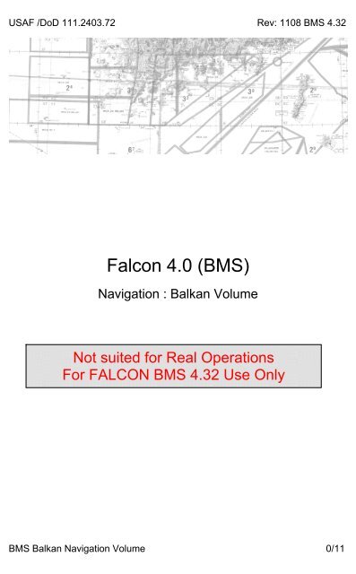
USAF /DoD 111.2403.72 Rev: 1108 <strong>BMS</strong> 4.32<strong>Falcon</strong> <strong>4.0</strong> (<strong>BMS</strong>)Navigation : Balkan VolumeNot suited for Real OperationsFor FALCON <strong>BMS</strong> 4.32 Use Only<strong>BMS</strong> Balkan Navigation Volume 0/11
USAF /DoD 111.2403.72 Rev: 1108 <strong>BMS</strong> 4.32CONTENTS1. Contents.2. TACAN Selection Normal and backup mode / ILS selection.3. Blank for Notes.4. Airbases – Italy5. Airbases – Italy (continued)6. Airbases – Italy (continued) / Sicily / Greece7. Airbases & Airstrips – Macedonia / Albania8. Airbases & Airstrips – Slovenia / Montenegro.9. Airbases & Airstrips – Serbia / Bosnia Herzegovina.10. Airbases & Airstrips – Croatia / Hungary11. Frequency: Common / Mission Spec.<strong>BMS</strong> Balkan Navigation Volume 1/11
USAF /DoD 111.2403.72 Rev: 1108 <strong>BMS</strong> 4.321. ICP2. DED3. ICP4. DED5. DED6. HSI7. HSI8. ICP1. TACAN switch2. TACAN domain3. TACAN band4. TACAN channel5. HSI6. HSI7. TACAN switchTACAN SELECTION – NORMAL MODESelect T-ILS pageCheck scratchpad selected. If not use the DCS-up btn to selectscratchpad entry.(between asterisks)Input TCN channel (numeric btns) then ENTER keyCheck TCN domain (A/A TR or TR) Toggle domain with DCS-SEQ button.Check band. X for ground Y for air. Change band by imputing 0(zero) on the scratchpad.Select TCN mode and check in range (flags off)Select Radial (CRS knob) and navigate.DCS-Rtn button to return to main DED page.TACAN SELECTION – BACKUP OPSSelect BACKUPAs required manually A/A TR or TRAs required manually X (ground) or Y (air)manually input TCN channel.Select TCN mode and check in range (flags off)Select Radial (CRS knob) and navigateBack to UFC if required.Backup mode is provided in case of avionic failure or battle damage.When all instruments are lost the backup mode may be the only meanto recover to friendly territory. All backup switches are on the left panel.ILS SELECTION1. ICP2. DED3. ILS4. CRS5. CMD STRG6. HSI7. ADI8. HUD & HSISelect T-ILS pageCheck scratchpad selected. If not use the DCS-up btnto select scratchpad entry (between asterisks)Input ILS frequency (5 digits) then ENTER keyCheck CRS selected. If not use DCS-down to selectCRS entry. Input RWY CRS (3 digits)As required (ON or OFF) visible in HUD onlySelect TCN/ILS or NAV/ILS mode and set RWY CRSConfirm Flags OFF (Loc & Glide)Confirm ILS loc & glide bars visible.LOC interception is performed first. GLIDE interception then followsfrom below. Normally LOC and GLIDE interception is completed atOuter Marker and gear is lowered.<strong>BMS</strong> Balkan Navigation Volume 2/11
USAF /DoD 111.2403.72 Rev: 1108 <strong>BMS</strong> 4.32AIRBASES - ITALYAirportTwr(UHF/VHF)TcnChTcnRngILS (RWY) RWY ElevAmendola 257.8 / 118.2 054X 40 11/29 160GPSCoordN41°07.44'E16°47.02'N42°42.03'Ampugnano 359.15 / 122.1 039X 50 18/36 638E11°19.43'Asiago 334.2 / 122.6 R353° 081X Dme17 05/23 L/R 3409 N45°08.59'E11°39.34'Aviano284.65 /142.05111X 25 109.5 (03) 03/21 418Bologna 257.8 / 120.8 059X 50 108.9 (12) 12/30 122Bolzano 257.8 / 120.6 117X 25 02/20 L/R 784Brindisi-Casale 257.8 / 118.1 079X 50 109.5 (33)01/1915/33Capodichino 235.15 / 118.5 125X 25 109.5 (26) 08/26 298CerviaCiampino338.225 /122.1308.775 /120.548083X 40 12/30 19045X 40 109.9 (16) 16/34 426Crotone 257.8 / 119.1 R085° 072X Dme46 02/20 520<strong>Falcon</strong>ara 257.8 / 119.8 035X 25 111.9 (20) 02/20 50N45°16.71'E13°05.20'N43°54.23'E11°21.31'N45°38.77'E11°23.51'N40°19.77'E19°23.62'N40°34.86'E14°58.03'N43°36.99'E12°40.85'N41°23.35'E12°57.83'N38°47.63'E18°10.37'N43°01.43'E13°59.48'Fiumicino Intl. 305.5 / 118.7 096X 80109.7 (14R)108.1 (14L)16/34 L/R 14N41°22.28'E12°31.55'Forli 257.8 / 118.95 R262° 083X Dme15 12/30 98Frosinone 360.4 / 122.1 R096° 096X Dme55 16/34 594Ginolisa 362.3 / 118.85 R246° 054X Dme12 16/34 266Gioia del colleGrazzanise275.325 /122.1324.65 /118.025N43°35.37'E12°20.72'N41°16.35'E13°43.11'N41°08.88'E16°31.88'124X 50 16/34 L/R 1187 N40°26.24'E18°10.09'122X 25 08/26 29Grosseto 264.75 / 122.1 028X 25 02/20 15Grottaglie 257.8 / 118.7 115X 40 02/20 216N40°42.94'E14°43.58'N42°16.70'E11°05.46'N40°11.69'E18°43.12'<strong>BMS</strong> Balkan Navigation Volume 4/11
USAF /DoD 111.2403.72 Rev: 1108 <strong>BMS</strong> 4.32AirportTwr(UHF/VHF)TcnChTcnRngGuidogna 257.8 / 122.1 R066° 096X Dme30ILS (RWY) RWY Elev GPS Coord16/3418/36Istrana 234.1 / 122.1 054X 25 08/26 143Lamezia Terme 257.8 / 119.7 072X 50 110.3 (02) 02/20 40Latina 261.0 /119.15 049X 50 12/30 93LecceAIRBASES - ITALY (CONT)234.65 /119.55289075X 50 14/32 158Matera 230.95 / 126.2 R227° 124X Dme27 14/32 360Mattarello 220.1 / 119.65 R315° 081X Dme35 08/26 607Padova 257.8 / 123.25 R125° 081X Dme1705/23L/R44N41°34.13'E13°08.56'N44°58.30'E12°25.01'N38°43.86'E17°12.66'N41°08.27'E13°18.44'N39°27.14'E19°34.19'N40°07.92'E17°42.08'N45°16.68'E11°08.81'N44°42.73'E12°01.80'Palese Macchie(Lezhe in 4.5)302.5 / 118.3 100X 50109.3 (08)111.3 (26)08/26 176N40°45.64'E17°59.57'Peretola 230.15 / 118.3 072X 50 110.3 (03) 03/21 144Perugia 325.15 / 118.1 031X 50 110.95 (01) 01/19 693Pescara 257.8 / 118.45 106X 50 110.7 (20) 02/20 48Practica di Mare 358.9 / 122.1 024X 40 108.5 (30) 12/30 41Ravenna 230.15 / 123.5 R323° 083X Dme10 08/26 0Reggio Calabria 257.8 / 118.25 047X 50109.3 (14R)111.0 (14L)14/32L/RRimini 278.1 / 119.1 109X 50 109.3 (30) 12/30 41Rivolto 234.15 / 122.1 037X 50 08/26 184Roma Urbe 257.8 / 123.8 R063° 096X Dme19 16/34 55Ronchi deilegionariSan Pancrazio257.8 / 130.2 089X 40 109.7 (11) 11/29 37230.15 /118.1Treviso 278.2 / 118.795R205° 079X Dme15 02/20 160R086° 081XDme35109.3 (08) 08/26 57N43°14.36'E11°15.16'N42°35.56'E12°53.09'N41°57.30'E14°55.13'N41°14.73'N12°48.57'N43°45.07'E12°32.87'N37°55.36'E16°26.17'N43°24.60'E13°02.02'N45°13.44'E13°39.51'N41°34.44'E12°53.36'N45°06.36'E14°13.48'N40°07.92'E19°15.11'N44°55.12'E12°31.70'<strong>BMS</strong> Balkan Navigation Volume 5/11
USAF /DoD 111.2403.72 Rev: 1108 <strong>BMS</strong> 4.32AIRBASES - ITALY (CONT)AirportTwr(UHF/VHF)TcnChTcnRngVenezia Tessera 257.8 / 120.2 100X 40 110.3 (05R)Vicenca389.25 /130.4ILS (RWY) RWY Elev GPS Coord05/23L/R081X 50 18/36 1287N44°47.58'E12°45.92'N44°52.43'E11°43.72'AIRBASES - SICILYAirportCataniaFontanarossaTwr(UHF/VHF)TcnChTcnRngILS (RWY) RWY Elev234.5 / 118.7 058X 50 109.9 (08) 08/26 40Palermo 257.8 / 119.05 077X 50Pantelleria279.125 /118.45108X 50Sigonella 337.6 / 118.05 053X 50Trapani Birgi 339.45 / 119.7 025X 50109.9 (23L)109.5 (23R)05/23L/R02/20L/R14/32L/R16/34L/R646368125GPSCoordN37°26.26'E15°39.26'N38°02.80'E13°27.46'N36°48.54'E12°06.29'N37°19.80'E15°30.73'N37°48.36'E12°45.37'AIRBASES – GREECEAirportTwr(UHF/VHF)TcnChTcnRngILS (RWY) RWY ElevIoannina 257.8 / 132.2 023X 50 14/32 1563Kefallinia 257.8 / 122.25 047X 50 03/21 60Preveza 257.8 / 122.1 029X 50 110.9 (08) 08/26 13Zakinthos 257.8 / 125.5 045X 50 02/20 14GPSCoordN39°24.81'E22°40.60'N38°00.75'E22°05.80'N38°43.32'E22°31.70'N37°39.73'E22°27.83'<strong>BMS</strong> Balkan Navigation Volume 6/11
USAF /DoD 111.2403.72 Rev: 1108 <strong>BMS</strong> 4.32AIRBASES – MACEDONIAAirportTwr(UHF/VHF)TcnChTcnRngILS (RWY) RWY Elev GPS CoordOhrid 250.2 / 119.2 072X 25 108.9 (02) 02/20 2313N40°48.33'NE22°50.10'AIRBASES & AIRSTRIPS – ALBANIAAirportBeratTwr(UHF/VHF)230.15 /119.2TcnChTcnRngILS (RWY) RWY Elev GPS CoordR160° 076X Dme93 02/20 420Cerrik airtsrip 231.4 / 123.4 R146° 076X Dme103 18/36 920Durres airstrip 231.4 / 123.4 R167° 076X Dme56 18/36 40ElbasanGjirokasterGramshKorce NorthKukes230.15 /119.15230.15 /126.2230.15 /129.5230.15 /126.2230.15 /126.2R150° 076X Dme86 05/23 L/R 440R302° 023X Dme43 16/34 666R142° 076X Dme32 16/34 23R357° 023X Dme55 02/20 665R105° 076X Dme68 14/32 1120Lushnje airstrip 231.4 / 123.4 R163° 076X Dme78 18/36 60Mifol230.15 /126.2R175° 076X Dme98 02/20 110Peshkopi airstrip 231.4 / 123.4 R120° 076X Dme77 18/36 2500ShkoderTirane LaprankaTirane Rinas230.15 /126.2230.15 /126.2230.15 /122.5R135° 076X Dme23 14/32 80R154° 076X Dme63 12/30 295R154° 076X Dme58 02/20 125N40°26.78'E21°42.57'N40°27.85'E22°13.19'N40°59.11'E21°19.95'N40°40.25'E21°56.80'N39°46.90'E21°57.35'N41°28.20'E21°34.63'N40°18.69E22°45.59'N41°35.75'E22°35.67'N40°39.17'E21°31.06'N40°17.08'E21°09.24'N41°15.27'E22°34.18'N41°36.83'E21°31.72'N40°56.95'E21°42.02'N41°02.34'E21°38'.32'<strong>BMS</strong> Balkan Navigation Volume 7/11
USAF /DoD 111.2403.72 Rev: 1108 <strong>BMS</strong> 4.32AIRBASES & AIRSTRIPS – SLOVENIAAirportBloska PolicaairstripTwr(UHF/VHF)TcnChTcnRngILS (RWY) RWY Elev GPS Coord236.6 / 122.6 R165° 074X Dme27 09/27 2550Cerklje airstrip 236.6 / 122.6 R279° 084X Dme41 09/27 510Cerklje 230.15 / 126.2 R106° 074X Dme62 08/26 510Ljubljana 385.15 / 118.1 074X 100Maribor 375.15 / 119.2Portoroz230.15 /129.325R079° 074XDme70110.5(30)110.1(34)12/30 127316/34 876R227° 074X Dme65 16/34 7Slovenj Gradec 205.2 / 123.5 R069° 074X Dme39 16/34 1645N45°45.01'E15°39.37'N45°06.98'E16°40.18'N45°09.67'E16°53.44'N45°26.91'E15°31.52'N45°40.92'E17°10.60'N44°44.34'E15°32.97'N45°42.00'E16°23.66'AIRBASES & AIRSTRIPS – MONTENEGROAirportDanilovgradairstripGorazde airstripIvangradTwr(UHF/VHF)233.7 /127.7233.7 /127.7230.15 /118.1TcnChTcnRngPodgorica 305.4 / 118.2 076X 80Tivat324.15 /118.0ILS(RWY)R328° 076X Dme11 09/27 180RWY Elev GPS CoordR290° 114X Dme42 09/27 2480R055° 076X Dme41 01/19 2270R275° 076XDme29111.0(23R)05/23 L/R 121110.3 (32) 14/32 20N42°02.15'E21°06.88'N42°59.81'E21°08.92'N42°16.70'E22°00.92'N41°52.99'E21°12.66'N41°55.15'E20°33'.90'<strong>BMS</strong> Balkan Navigation Volume 8/11
USAF /DoD 111.2403.72 Rev: 1108 <strong>BMS</strong> 4.32AirportBatajnicaBeogradKovinKraljevoLepa GlavaTwr(UHF/VHF)230.15 /118.15275.195 /118.1230.15 /118.1230.15 /118.1230.15 /118.1TcnChTcnRngILS (RWY) RWY Elev GPS CoordR324° 070X Dme7 16/34 L/R 265070X 150110.3 (12)109.9 (30)12/30 335R096° 070X Dme33 12/30 280R165° 070X Dme59 14/32 680R213° 070X Dme65 12/30 2733Sabac airstrip 233.7 / 127.7 R267° 070X Dme38 18/36 210SjenicaSomborAIRBASES & AIRSTRIPS – SERBIA230.15 /118.1230.15 /118.1R190° 070X Dme090 12/30 3285R305° 070X Dme86 14/32 290N44°15.79'E22°57.85'N44°10.40'E22°57.85'N44°07.16'E23°42.23'N43°14.36'E23°06.72'N43°15.15'E21°59.16'N44°08.78'E22°04.96'N42°43.10'E22°19.52'N45°00.51'E21°29.92'AIRBASES & AIRSTRIPS – BOSNIA HERZEGOVINAAirportTwr(UHF/VHF)TcnChTcnRngBanja Luka 295.4 / 118.95 R316°114XDme86ILS (RWY) RWY Elev GPS Coord108.7 (16) 16/34 400Bihac 230.15 / 118.1 R291° 114X Dme156 12/30 1120Brcko airstrip 233.8 / 122.8 R347° 069X Dme28 09/27 290Mostar 365.4 / 124.2 096X 25 16/34 R/L 174Sarajevo IntlSlavonski Brodairstrip234.15 /118.25114X 150 110.7 (12) 12/30 1707233.8 / 122.8 R267° 070X Dme38 09/27 210Tuzla 379.5 / 130.85 069X 25 109.7 (12) 12/30 785Trebinje airstrip 233.8 / 122.8 R179° 114X Dme59 18/36 2030N44°16.32'E19°04.26'N44°11.47'E17°03.36'N44°17.40'E20°46.79'N42°43.10'E19°34.50'N43°14.90'E20°18.16'N44°08.78'E22°04.96'N44°50.46'E20°50.57'N42°16.16'E20°10.87'<strong>BMS</strong> Balkan Navigation Volume 9/11
USAF /DoD 111.2403.72 Rev: 1108 <strong>BMS</strong> 4.32AIRBASES & AIRSTRIPS – CROATIAAirportTwr(UHF/VHF)TcnChTcnRngILS (RWY) RWY Elev GPS CoordBjelovar airstrip 233.8 / 122.8 R080° 084X Dme43 18/36 310Dubrovnic Intl 305.15 / 118.5 101X 100 110.1 (30) 12/30 527Karlovac airstrip 233.8 / 122.8 R235° 084X Dme33 18/36 550Osijek 230.15 / 118.8 R015° 114X Dme94 02/20 L/R 292Pula 366.4 / 120.0 049X 100 111.5 (26) 08/26 276Rijeka 308.8 / 119.9 125X 100 108.5 (08) 08/26 279Split 230.15 / 118.1 104X 100 110.5 (03) 03/21 79Udbina 230.15 / 118.1 R331° 104X Dme65 12/30 2462Varazdin 230.15 / 118.1 R030° 084X Dme35 02/20 548Zadar 236.6 / 123.7 023X 70 08/26 289Zagreb 370.2 / 118.3 084X 100109.5 (05R)109.1 (23R)05/23 L/R 351N45°07.51'E18°37.08'N42°04.31'E19°34.50'N44°42.19'E16°57.46'N44°44.88'E21°05.83'N44°13.09'E14°45.18'N44°37.88'E15°32.97'N42°59.27'E17°39.62'N43°55.85'E17°0<strong>4.0</strong>1'N45°30.15'E18°0<strong>4.0</strong>0'N43°29.98'E16°32.43'N45°00.51'E17°36.70'AIRBASES & AIRSTRIPS – HUNGARYAirportTwr(UHF/VHF)TcnChTcnRngILS (RWY) RWY Elev GPS CoordNagykanisza 230.15/118.1 R053° 084X Dme63 16/34 470OcsenyPecs EastSatorhelySzegedTaszar230.15 /118.1230.15 /126.9230.15 /118.1230.15 /118.1230.15 /123.0R010° 114X Dme139 16/34 295R356° 114X Dme124 16/34 350R005° 114X Dme118 08/26 410R350° 070X Dme78 02/20 L/R 259089X 50 16/34 L/R 526N45°37.69'E18°51.95'N45°30.69'E21°10.92'N45°15.60'E20°26.11'N45°10.75'E20°55.11'N45°26.91'E22°56.23'N45°37.15'E20°04.30'<strong>BMS</strong> Balkan Navigation Volume 10/11
USAF /DoD 111.2403.72 Rev: 1108 <strong>BMS</strong> 4.32RADIO FREQUENCY - COMMONGuard 243.0 UHF121.5 VHFRADIO FREQUENCY – MISSION SPECIFICCH FREQ 7 377.1 / 132.35 14 377.2 / 121.11 297.5 / 138.05 8 292.2 / 126.15 152 381.30 / 138.10 9 264.6 / 132.875 163 275.8 / 138.2 10 286.4 / 132.325 174 294.7 / 126.2 11 354.4 / 123.575 185 279.6 / 134.25 12 269.1 / 121.2 196 349.00 / 133.15 13 307.3 / 119.5 20 280.5 / 121.7<strong>BMS</strong> Balkan Navigation Volume 11/11


