Transportation Master Plan (TMP) - Region of Durham
Transportation Master Plan (TMP) - Region of Durham
Transportation Master Plan (TMP) - Region of Durham
- No tags were found...

Create successful ePaper yourself
Turn your PDF publications into a flip-book with our unique Google optimized e-Paper software.
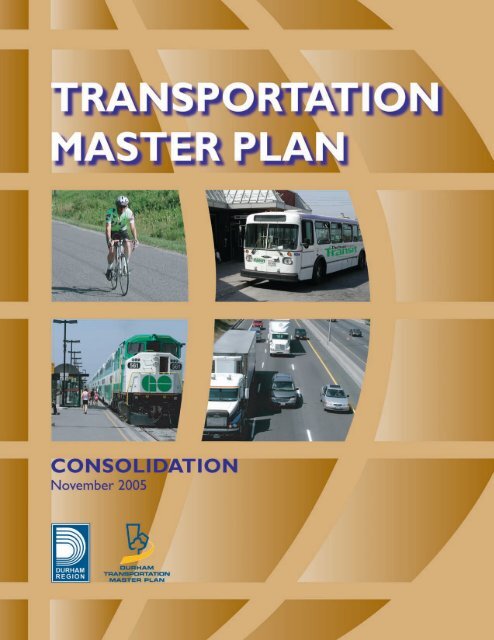
REGION OF DURHAMPLANNING AND WORKS DEPARTMENTSWITH THE ASSISTANCE OF TSH ASSOCIATESAPPROVED BY REGIONAL COUNCILDECEMBER 17, 2003
<strong>Transportation</strong> <strong>Master</strong> <strong>Plan</strong><strong>Region</strong>al Municipality <strong>of</strong> <strong>Durham</strong>
TABLE OF CONTENTSEXECUTIVE SUMMARY.................................................................................... S-1SUMMARY OF RECOMMENDED ACTIONS ....................................................................................... S-7PREFACE AND ACKNOWLEGEMENTS .................................................................. iSteering Committee..................................................................................................................................iCommunity Advisory Committee ...........................................................................................................iiStudy Consultants...................................................................................................................................ii<strong>Region</strong>al Staff Team ................................................................................................................................iiCHAPTER 1 - INTRODUCTION ........................................................................... 11.1 Purpose and Scope <strong>of</strong> the <strong>Plan</strong>................................................................................................. 11.2 <strong>Plan</strong> Context................................................................................................................................ 31.2.1 <strong>Region</strong>al Policy Framework ............................................................................................. 31.2.2 Federal and Provincial Policies and Initiatives................................................................. 51.3 Environmental Assessment Status........................................................................................... 61.4 <strong>Plan</strong> Organization ....................................................................................................................... 7CHAPTER 2 - THE FOUNDATION ELEMENTS ...................................................... 82.1 <strong>Transportation</strong> Vision, Goals and Principles ........................................................................... 82.2 The Existing System................................................................................................................. 122.3 Future <strong>Transportation</strong> Demand ............................................................................................... 152.3.1 Population and Employment Forecasts ......................................................................... 152.3.2 Mode Share Targets...................................................................................................... 162.3.3 Corridor Capacity Analysis ............................................................................................ 172.4 The Outlook for <strong>Transportation</strong> in <strong>Durham</strong> <strong>Region</strong> ............................................................... 19CHAPTER 3 - THE PLAN ELEMENTS.................................................................. 223.1 The Strategies........................................................................................................................... 223.2 Providing More Travel Choices ............................................................................................... 233.2.1 <strong>Transportation</strong> Demand Management ........................................................................... 243.2.2 Land Use Management ................................................................................................. 263.2.3 Walking and Cycling ...................................................................................................... 293.2.4 Transit and Other Public <strong>Transportation</strong> Services ......................................................... 323.3 Improving the Road System .................................................................................................... 423.3.1 Road System Hierarchy and Design.............................................................................. 433.3.2 Provincial Highways and Other Road Connections ....................................................... 443.3.3 <strong>Region</strong>al Roads ............................................................................................................. 453.3.4 Road Safety................................................................................................................... 503.3.5 <strong>Transportation</strong> System Management............................................................................. 523.3.6 Goods Movement and Access to Ports and Harbours................................................... 533.4 Mitigating Environmental and Community Effects ................................................................ 543.4.1 Air Quality and Emissions.............................................................................................. 553.4.2 Road Drainage .............................................................................................................. 563.4.3 Traffic in Residential Communities ................................................................................ 57<strong>Transportation</strong> <strong>Master</strong> <strong>Plan</strong><strong>Region</strong>al Municipality <strong>of</strong> <strong>Durham</strong>
CHAPTER 4 - THE IMPLEMENTATION ELEMENTS ............................................ 604.1 The Implementation Process................................................................................................... 604.1.1 Programming – Establishing Priorities and Financing Requirements ............................ 614.1.2 Facility <strong>Plan</strong>ning, Design and Construction – Implementing the Projects ...................... 634.1.3 Operations and Maintenance – Managing the System .................................................. 644.1.4 Monitoring – Dealing with Uncertainty and Tracking Change ........................................ 644.2 Effects <strong>of</strong> the <strong>Plan</strong> .................................................................................................................... 674.2.1 Mobility .......................................................................................................................... 674.2.2 Safety ............................................................................................................................ 684.2.3 Natural Environment...................................................................................................... 694.2.4 Community .................................................................................................................... 704.3 <strong>Plan</strong> Review and Update ..........................................................................................................71APPENDIX 1 – Analysis <strong>of</strong> Specific Road Segments ........................................ 74APPENDIX 2 – Proposed <strong>Region</strong>al Road Rehabilitation, Reconstruction andReplacement Projects (2004 – 2008).............................................................. 82APPENDIX 3 – Proposed <strong>Region</strong>al Road Intersection and CorridorImprovement Projects (2004 – 2021)............................................................. 86APPENDIX 4 – Proposed <strong>Region</strong>al Road Expansion Projects (2004 – 2021)... 88PPENDIX 5 – Glossary <strong>of</strong> Terms .................................................................... 100<strong>Transportation</strong> <strong>Master</strong> <strong>Plan</strong><strong>Region</strong>al Municipality <strong>of</strong> <strong>Durham</strong>
LIST OF FIGURESFigure 1 <strong>Region</strong>al Municipality <strong>of</strong> <strong>Durham</strong> and its Local Municipalities in the Greater Toronto AreaFigure 2 Community Strategic <strong>Plan</strong> ObjectivesFigure 3 Afternoon Peak Period Person Trips by Travel ModeFigure 4 Origins <strong>of</strong> Afternoon Peak Period Work to Home Trips Destined to <strong>Durham</strong> HouseholdsFigure 5 Percentage <strong>of</strong> Lane-Kilometres Requiring Improvement by Type <strong>of</strong> Treatment for the<strong>Region</strong>al Road NetworkFigure 6 Forecasted Peak Period Travel Demands and Mode SharesFigure 7 Forecast 2021 Afternoon Peak Hour Traffic Conditions at Major Screenlines with CurrentMode Choice TrendsFigure 8 Forecast 2021 Afternoon Peak Hour Traffic Conditions at Major Screenlines with 15%Reduction in Auto TripsFigure 9 <strong>Transportation</strong> <strong>Master</strong> <strong>Plan</strong> StrategiesFigure 10 A Comparison <strong>of</strong> Auto-Oriented and TDM-Supportive Development PatternsFigure 11 Transit Priority NetworkFigure 12 Components <strong>of</strong> Bus Rapid Transit (BRT)Figure 13 Freeway and Arterial Road Network (two parts)Figure 14 Proposed <strong>Region</strong>al Road Rehabilitation, Reconstruction and Replacement Projects (2004 –2008)Figure 15 Proposed <strong>Region</strong>al Road Intersection and Corridor Improvement Projects (2004 – 2021)Figure 16 Proposed <strong>Region</strong>al Road Expansion Projects (2004 – 2021)Figure 17 Strategic Goods Movement NetworkFigure 18 The Implementation Process<strong>Transportation</strong> <strong>Master</strong> <strong>Plan</strong><strong>Region</strong>al Municipality <strong>of</strong> <strong>Durham</strong>
LIST OF TABLESTable 1 <strong>Transportation</strong> System Goals and PrinciplesTable 2 <strong>Transportation</strong> System Objective <strong>of</strong> the Community Strategic <strong>Plan</strong>Table 3 Forecast Population and Employment GrowthTable 4 Possible TDM Measures for <strong>Durham</strong> <strong>Region</strong>Table 5 Future Transit OpportunitiesTable 6 Estimated Capital and Operating Costs to the Year 2021 for the <strong>Region</strong>al Road NetworkTable 7 Potential Monitoring Program IndicatorsTable 8 Effects on Mobility <strong>of</strong> Recommended Road Improvement Program<strong>Transportation</strong> <strong>Master</strong> <strong>Plan</strong><strong>Region</strong>al Municipality <strong>of</strong> <strong>Durham</strong>
DURHAM TRANSPORTATION MASTER PLANEXECUTIVE SUMMARYIntroductionThe <strong>Transportation</strong> <strong>Master</strong> <strong>Plan</strong> (<strong>TMP</strong>) is a strategic planning document designed to define the policies,programs and infrastructure improvements required to address the <strong>Region</strong>al Municipality <strong>of</strong> <strong>Durham</strong>’stransportation needs for the next 20 years and beyond. Developed through the <strong>Durham</strong> Mobility Study, the<strong>TMP</strong> reflects the growth and development policies outlined in the <strong>Region</strong>al Official <strong>Plan</strong> and will be animportant foundation document for the review <strong>of</strong> the Official <strong>Plan</strong> now underway. The <strong>TMP</strong> has regard forthe directions <strong>of</strong> the <strong>Region</strong>’s Community Strategic <strong>Plan</strong>. The proposed infrastructure plans are consistentwith and support the long-range capital plans contained in the 2003 Development Charge Background Study.Preparation <strong>of</strong> the <strong>TMP</strong> followed the master planning process defined in the Municipal Class EnvironmentalAssessment (EA). The work completed in preparing the <strong>TMP</strong> is consistent with the first two phases <strong>of</strong> theClass EA planning and design process for the proposed <strong>Region</strong>al Road projects. Project specificinvestigations are required to satisfy EA requirements.In keeping with the principles <strong>of</strong> environmental assessment, the <strong>Durham</strong> Mobility Study featured a highdegree <strong>of</strong> public involvement. Public open houses, an opinion survey, website, newsletters and aCommunity Advisory Committee were all utilized to obtain citizen and business input on transportationpriorities and trade<strong>of</strong>fs.Current and Future ConditionsThe <strong>Region</strong>’s existing transportation system consists <strong>of</strong> an integrated network <strong>of</strong> roads, railways, publictransit routes, airports, marine facilities, and trails which collectively facilitate the movement <strong>of</strong> people andgoods. Several levels <strong>of</strong> government, as well as private companies, are responsible for the development,operation, and maintenance <strong>of</strong> the system.Future demand on the transportation system is expected to increase as the <strong>Region</strong> grows. Recent forecastsindicate that the <strong>Region</strong>’s population and employment will increase by 55% (from about 550,000 to 850,000persons) and 83% (from 170,000 to 311,000 jobs) respectively, by 2021. The impact <strong>of</strong> these increases wasassessed using a computer-based model that predicted how future travel demand could change as a result<strong>of</strong> this anticipated growth. The results <strong>of</strong> this analysis indicate that the <strong>Region</strong> will face several challenges inachieving an efficient, safe and reliable transportation system without changes in travel behaviour and theprovision <strong>of</strong> new services and facilities.During the afternoon peak period in 2001, about 87% <strong>of</strong> <strong>Durham</strong> residents travelled by automobile (either asa driver or passenger), compared to 6% by transit and 7% by other modes. If this trend continues, thenumber <strong>of</strong> person trips made by residents travelling in automobiles will increase by about 230,000 trips<strong>Transportation</strong> <strong>Master</strong> <strong>Plan</strong> Page S-1<strong>Region</strong>al Municipality <strong>of</strong> <strong>Durham</strong>
during the peak period <strong>of</strong> an average day in 2021. This forecasted amount <strong>of</strong> growth in automobile travel isalmost double 2001 volumes – a trend that is clearly unsustainable.Vision, Goals and PrinciplesIn consultation with the public, it was determined that a continuation <strong>of</strong> the current trend <strong>of</strong> an autodominatedtransportation system was not desirable. Citizens felt that the <strong>Region</strong> should concentrate on abalanced transportation strategy that focussed on investing in both road infrastructure and measures aimedat reducing single-occupant vehicle travel (i.e. transit and transportation demand management). Acommitted effort to reduce automobile use will be required to achieve this goal.With this in mind, a <strong>Transportation</strong> Vision or “desired end state” for <strong>Durham</strong> <strong>Region</strong> is proposed for the year2021, as follows:The transportation system for the <strong>Region</strong> <strong>of</strong> <strong>Durham</strong> is integrated and balanced, using a range <strong>of</strong>transportation strategies to address the mobility and goods movement requirements <strong>of</strong> the entire community,to sustain investment in industry, agriculture and tourism, to maintain community “wellness”, and to integratewith the environment.The auto continues to be the dominant mode <strong>of</strong> transportation. However, the community has realized a shifttowards greater use <strong>of</strong> transit, pedestrian and cycling facilities.The changes in modal usage have been accomplished by increased urban densities, mixed usedevelopment, policies that encourage reduced auto use, higher order transit facilities linking centres within<strong>Durham</strong> and other urbanized areas in the Greater Toronto Area and improved integration <strong>of</strong> the variousmodes <strong>of</strong> transportation.The necessary funding available from all levels <strong>of</strong> government has been put in place and all possibleopportunities for private sector funding to achieve the improvements necessary to ensure a liveablecommunity have been investigated.The <strong>Transportation</strong> Vision is supported by goals and principles, which promote: facilitating sustainableeconomic growth; effective use <strong>of</strong> the system; safe, reliable and efficient movement <strong>of</strong> people and goods;choices in services; and responsible development and environmental integrity.The <strong>Plan</strong>The <strong>TMP</strong> details three co-ordinated and comprehensive strategies to achieve the <strong>Region</strong>’s <strong>Transportation</strong>Vision, being:• Providing More Travel Choices• Improving the Road System• Mitigating Environmental and Community Effects<strong>Transportation</strong> <strong>Master</strong> <strong>Plan</strong> Page S-2<strong>Region</strong>al Municipality <strong>of</strong> <strong>Durham</strong>
These strategies provide a framework for establishing a more sustainable transportation system in keepingwith the directions <strong>of</strong> the Community Strategic <strong>Plan</strong> and <strong>Region</strong>al Official <strong>Plan</strong>. Each strategy issupplemented by a series <strong>of</strong> recommended actions intended to define specific activities for implementing thestrategy. A summary <strong>of</strong> the actions is attached.Providing More Travel ChoicesOffering a greater variety <strong>of</strong> choices is a fundamental goal <strong>of</strong> the <strong>TMP</strong>. Actions to provide more travelchoices focus on:<strong>Transportation</strong> Demand Management (TDM)<strong>Transportation</strong> Demand Management (TDM) is a co-ordinated series <strong>of</strong> actions aimed at maximizing thepeople moving capability <strong>of</strong> the transportation system. Intended to reduce single-occupant auto use,potential TDM measures include: TDM supportive land use; bicycle and pedestrian programs and facilities;public transit improvements; preferential treatments for buses and high occupancy vehicles; ridesharing; andemployee incentives. The <strong>TMP</strong> recommends that the <strong>Region</strong> take an active role in implementing a TDMprogram to reduce projected 2021 peak period automobile driver trips to 15% below forecasts based oncurrent mode choice trends. This will be assisted by engaging a TDM Co-ordinator to develop and deliverthe program. Education and marketing will be key components.Land Use ManagementThe form development takes and its location directly affect the amount <strong>of</strong> travel, the length <strong>of</strong> trips, and thechoice <strong>of</strong> travel mode. The <strong>TMP</strong> recommends implementing land use plans and encouraging developmentforms that help make alternatives to the automobile, especially transit, more attractive and viable. It alsorecommends supportive land use designations, and the preparation <strong>of</strong> complimentary implementationguidelines and checklists. These actions will help to detail and promote conformity with the <strong>Region</strong>al Official<strong>Plan</strong>, which already establishes a sound framework for land use management.Walking and CyclingWalking and cycling alternatives should be promoted through supportive urban and road design, provision <strong>of</strong>appropriate facilities, such as dedicated paths and paved road shoulders, and education about routes andthe benefits <strong>of</strong> active living. The <strong>TMP</strong> recommends the development <strong>of</strong> a <strong>Region</strong>al Bicycle <strong>Plan</strong>, andconsideration <strong>of</strong> the needs <strong>of</strong> cyclists and pedestrians in the planning, design, construction, maintenance andoperation <strong>of</strong> the <strong>Region</strong>al Road network.Transit and Other Public <strong>Transportation</strong> ServicesPublic transportation (i.e. specialized and conventional transit services, paratransit, taxis, and intercity publictransportation) is an integral and important element <strong>of</strong> the <strong>Region</strong>’s transportation system. The approved<strong>Region</strong>al Transit Improvement <strong>Plan</strong> (TIP) outlines short and long-term actions to integrate and improve intermunicipaltransit service within <strong>Durham</strong>.<strong>Transportation</strong> <strong>Master</strong> <strong>Plan</strong> Page S-3<strong>Region</strong>al Municipality <strong>of</strong> <strong>Durham</strong>
In support <strong>of</strong> the TIP, the <strong>TMP</strong> identifies a Transit Priority Network, as shown in Figure 11, that will providethe foundation for a Bus Rapid Transit (BRT) system. BRT service is anticipated to evolve in the corridorsthat comprise the network, from buses in mixed traffic to vehicles operating in dedicated lanes. The <strong>TMP</strong>also recommends actions to support the Transit Priority Network, including: identifying right-<strong>of</strong>-wayrequirements; developing a phased service strategy for BRT; considering transit priority measures; workingwith GO Transit to expand commuter rail and bus services; and conducting feasibility studies to identifyfuture routes.Other public transportation recommendations include: considering a Community <strong>Transportation</strong> Program;and investigating demand responsive services.Improving the Road SystemThe <strong>TMP</strong> places a strong emphasis on actions aimed at protecting, improving and making the best use <strong>of</strong> theexisting road system in <strong>Durham</strong> <strong>Region</strong>. However, the <strong>TMP</strong> recognizes that selective road expansion isneeded to support growth. Actions to improve the road system focus on:Road System Hierarchy and DesignThe major road system designated in the <strong>Region</strong>al Official <strong>Plan</strong> is composed <strong>of</strong> a functional hierarchy <strong>of</strong>arterial roads and freeways. The <strong>TMP</strong> recommends that this hierarchical approach be maintained, anddesign characteristics detailed through the development <strong>of</strong> Arterial Road Corridor Design Guidelines. The<strong>TMP</strong> also recommends an updated Freeway and Arterial Road network for the <strong>Region</strong>al Official <strong>Plan</strong> thatreflects changes to designations identified through the development <strong>of</strong> the <strong>TMP</strong>.Provincial Highways and Other Road ConnectionsThe Provincial Highway network forms the backbone <strong>of</strong> the transportation system in <strong>Durham</strong>. The <strong>TMP</strong>recommends that the <strong>Region</strong> petition the Provincial Government to continue to improve the freeway systemin <strong>Durham</strong>, and invest in trade corridors connecting the <strong>Region</strong> to markets in other parts <strong>of</strong> Canada and theUnited States.<strong>Region</strong>al RoadsThe <strong>Region</strong> is responsible for an extensive network <strong>of</strong> arterial roads and structures (bridges and culverts).The <strong>TMP</strong> recommends a series <strong>of</strong> actions aimed at ensuring timely maintenance, safe and efficientoperation, and selective expansion <strong>of</strong> the <strong>Region</strong>al Road network. The proposed <strong>Region</strong>al Road expansionprojects are shown in Figure 16.Road SafetyMotor vehicle collisions represent a significant public safety concern. They result in economic loss, personalpain and suffering, and occasionally the loss <strong>of</strong> life. To lessen the severity or eliminate certain crashesaltogether, the <strong>TMP</strong> recommends addressing road safety in a proactive manner through the developmentand implementation <strong>of</strong> a Safety Management Strategy. The <strong>TMP</strong> also recommends other safety-related<strong>Transportation</strong> <strong>Master</strong> <strong>Plan</strong> Page S-4<strong>Region</strong>al Municipality <strong>of</strong> <strong>Durham</strong>
actions, which include: working with the <strong>Durham</strong> <strong>Region</strong>al Police and others to encourage more responsibledriving habits; allowing electronic enforcement methods, where suitable; establishing appropriate policiesand warrants for various traffic control measures; and using road safety audits in the planning and design <strong>of</strong>future roads.<strong>Transportation</strong> System Management<strong>Transportation</strong> System Management (TSM) solutions can <strong>of</strong>fer substantial, low-cost gains in operationalefficiency. The <strong>Region</strong> will continue to apply a variety <strong>of</strong> TSM measures, including computerized trafficsignal co-ordination and localized roadway modifications. A wide range <strong>of</strong> emerging technologies, referred toas Intelligent <strong>Transportation</strong> Systems (ITS), will also be considered. These solutions can make thetransportation system safer and more efficient, reliable and environmentally friendly, without the need forcostly and intrusive road improvements. Examples <strong>of</strong> ITS measures include traffic surveillance andemergency vehicle signal pre-emption. The <strong>TMP</strong> also recommends the development <strong>of</strong> an ITS Strategy andIncident Management <strong>Plan</strong>s, and the continued upgrade and modernization <strong>of</strong> the <strong>Region</strong>’s traffic controlsystems to maximize safe and efficient operation for a variety <strong>of</strong> modes.Goods Movement and Access to Ports and HarboursThe <strong>TMP</strong> proposes a Strategic Goods Movement Network to ensure reliable and efficient goods movementwithin <strong>Durham</strong> <strong>Region</strong> and to the entire Greater Toronto Area. Implementation <strong>of</strong> this network will focus onactions to ensure routes are continuous, capable <strong>of</strong> accommodating heavy vehicles and connected to keydestinations and intermodal facilities. Opportunities to use other modes, such as rail, will also be promoted.To gain a better understanding <strong>of</strong> the challenges faced by industry, a Goods Movement Roundtable will beestablished to provide an on-going forum for industry and other stakeholders.Mitigating Environmental and Community EffectsThe environmental consequences <strong>of</strong> providing transportation services need to be considered and mitigatedin the development and operation <strong>of</strong> facilities. Actions to mitigate environmental and community effectsfocus on:Air Quality and Emissions<strong>Transportation</strong> is one <strong>of</strong> the largest sources <strong>of</strong> air pollution in Canada. By managing congestion and <strong>of</strong>feringa choice <strong>of</strong> travel options, the adverse effects on air quality will be lessened. Technological advances toreduce energy consumption, improve engine and vehicle performance, and enhance fuels will also help. The<strong>TMP</strong> recommends that the <strong>Region</strong> take a number <strong>of</strong> actions, including: continuing to participate in initiativessuch as the Smog Summit and Greater Toronto Area Clean Air Council; and developing an education andmarketing program to inform people <strong>of</strong> the impact <strong>of</strong> transportation related air pollution and travel choicedecisions.<strong>Transportation</strong> <strong>Master</strong> <strong>Plan</strong> Page S-5<strong>Region</strong>al Municipality <strong>of</strong> <strong>Durham</strong>
Road DrainageThere is growing concern over environmental issues related to stormwater drainage and its effects onreceiving bodies <strong>of</strong> water and nearby vegetation, soils and wildlife. The <strong>TMP</strong> recommends theimplementation <strong>of</strong> a Road Drainage Policy to address this concern.Traffic in Residential AreasSpeed and volume <strong>of</strong> traffic travelling through neighbourhoods is an issue for many residents. In addition,the public is becoming increasingly concerned about traffic noise, particularly from major streets. To addressthese concerns, the <strong>TMP</strong> recommends the development <strong>of</strong> a <strong>Region</strong>al Road Traffic Management Policy, aHamlet By-pass Policy and a <strong>Region</strong>al Road Noise Abatement Policy.ImplementationThe process for implementing the <strong>TMP</strong> and its recommended actions is cyclical and involves the public. Theprocess begins with the development <strong>of</strong> the <strong>TMP</strong> and the establishment <strong>of</strong> policy direction. Through variousannual programming exercises (e.g. Servicing and Financing Studies, the annual current and capital budgetsand longer term financial forecasts), investment priorities and timings are established. The planning anddesign phase for future infrastructure begins once priorities are set, and follows the Municipal Class EAprocess. Physical implementation occurs with construction, and continues into the operation andmaintenance <strong>of</strong> the facilities. Monitoring is undertaken to gauge the effectiveness <strong>of</strong> the policies, programsand infrastructure improvements in achieving the <strong>TMP</strong> goals and objectives. Shifts in underlyingassumptions or achievement <strong>of</strong> objectives signal the need for a review <strong>of</strong> the basic policy direction, and theprocess starts again.A regular review <strong>of</strong> the <strong>TMP</strong> is proposed every five years, ideally at the same time the <strong>Region</strong> carries out thestatutory assessment <strong>of</strong> the need for an update to its Official <strong>Plan</strong>. The <strong>Region</strong> may amend the <strong>TMP</strong> in theintervening period to incorporate substantive changes resulting from the Official <strong>Plan</strong> review process or othermajor initiatives, but on-going updates are not contemplated.<strong>Transportation</strong> <strong>Master</strong> <strong>Plan</strong> Page S-6<strong>Region</strong>al Municipality <strong>of</strong> <strong>Durham</strong>
SUMMARY OF RECOMMENDED ACTIONSFOR THE TRANSPORTATION MASTER PLAN1. Develop a <strong>Transportation</strong> Demand Management (TDM) Program to reduce projected year 2021peak period automobile driver trips by 15% below forecasts based on current trends, focussing firston actions to promote:• Transit, pedestrian and cycling-oriented development through land use management;• Walking, cycling and ridesharing; and• Use <strong>of</strong> transit and other public transportation services.2. Subject to budget approval, engage the services <strong>of</strong> a TDM Co-ordinator to:• <strong>Plan</strong> and design a TDM Program;• Develop and conduct marketing and education initiatives related to TDM;• Approach potential businesses to participate in the TDM Program;• Assess the potential market for ridesharing and, if promising, introduce a ridematchingservice with the assistance <strong>of</strong> other groups and agencies; and• Monitor and report on the effectiveness <strong>of</strong> the TDM Program.3. Pursue funding opportunities with the Provincial and Federal Governments and the private sector forthe TDM Program.4. Conduct a Commuter Parking Lot Feasibility Study to determine:• The potential location and demand for commuter parking lots;• How to integrate the lots into the overall TDM program and to co-ordinate with other<strong>Region</strong>al and Greater Toronto Area initiatives; and• Partnership opportunities.5. Petition the Federal Government to amend taxation laws to enable employers to provide income taxexempttransit passes to employees.6. Investigate opportunities and, where feasible and subject to budget approval, lead initiatives toencourage intensification and more mixed-use development, and to create incentives forredevelopment and infilling adjacent to transit priority facilities, especially in the Highway 2 corridor.7. Prepare TDM-Supportive Land use Guidelines in consultation with the Local Municipalities that:• Define the concept and elements <strong>of</strong> TDM-supportive land use patterns;• <strong>Plan</strong> for transit services and TDM-supportive facilities in the formative stage <strong>of</strong> plandevelopment;• Determine applicable locations for TDM-supportive development, which will typically beadjacent to Transit Corridors and <strong>Transportation</strong> Centres;• Identify complementary policies and initiatives; and• Define implementation and performance measures.<strong>Transportation</strong> <strong>Master</strong> <strong>Plan</strong> Page S-7<strong>Region</strong>al Municipality <strong>of</strong> <strong>Durham</strong>
8. Develop a Development Application Checklist in consultation with the Local Municipalities thatrequires:• Consistency with the approved TDM-Supportive Land Use Guidelines and Arterial RoadCorridor Design Guidelines;• Encouragement and support for the safe and convenient use <strong>of</strong> transportation modes otherthan the automobile;• The early input <strong>of</strong> transit agencies in the review <strong>of</strong> development applications;• The presence <strong>of</strong> a grid system <strong>of</strong> arterial roads, and collector roads where necessary; and• A plan for implementing transit service and TDM-supportive facilities early in developingareas.9. Examine the concept <strong>of</strong> centres and corridors through the <strong>Region</strong>al Official <strong>Plan</strong> review as anapproach to promoting transit-supportive development in desired locations.10. Develop a <strong>Region</strong>al Bicycle <strong>Plan</strong> in consultation with the Local Municipalities, the Ministry <strong>of</strong><strong>Transportation</strong> and other stakeholders, which:• Focuses activity on the Local Municipal road and path systems;• Connects the Local Municipal bicycle systems together;• Integrates with other modes <strong>of</strong> transportation, especially walking and transit;• Considers the need for bicycle facilities within <strong>Region</strong>al Road corridors;• Identifies facilities that may be required on the Provincial Highway network to achievenetwork continuity, which may be subject to municipal funding; and• Defines an implementation strategy, identifying public education and marketing initiatives,costs, financing sources and responsibilities.11. Develop guidelines for ensuring the needs <strong>of</strong> pedestrians and cyclists are considered in theplanning, design, construction, operation and maintenance <strong>of</strong> the <strong>Region</strong>al Road network.12. Designate the Transit Priority Network depicted in Figure 11 as part <strong>of</strong> the <strong>Region</strong>al Official <strong>Plan</strong>and, subject to budget approval, implement this network by:• Identifying right-<strong>of</strong>-way requirements within each transit corridor to permit serviceevolution, including needs for stations, and incorporating such provisions into the <strong>Region</strong>alOfficial <strong>Plan</strong>;• Developing a phased service strategy for evolving towards a Bus Rapid Transit (BRT)system;• Considering transit priority measures, such as reserved lanes, queue jump lanes andtransit-activated signals, where feasible and warranted;• Incorporating policies and designations into the <strong>Region</strong>al and Local Official <strong>Plan</strong>s topromote transit-supportive land uses abutting corridors and other supportive measures;and• Incorporating transit corridor design parameters into the Arterial Road Corridor DesignGuidelines and TDM-Supportive Land Use Guidelines.<strong>Transportation</strong> <strong>Master</strong> <strong>Plan</strong> Page S-8<strong>Region</strong>al Municipality <strong>of</strong> <strong>Durham</strong>
13. Recognize Highway 2 as <strong>Durham</strong>’s most significant transit corridor and, subject to budget approval,develop the corridor to its fullest potential by:• Continuing to prepare corridor studies to outline the actions necessary to transform theexisting road into a “mainstreet”;• Requiring transit-supportive land uses as development and redevelopment occurs;• Enhancing streetscape and urban design;• Balancing the need to preserve mobility with the desire to create a more pedestrianorientedenvironment in the review <strong>of</strong> operating conditions and development applications;and• Incorporating appropriate supporting policies and designations into the <strong>Region</strong>al and LocalOfficial <strong>Plan</strong>s.14. Request GO Transit to:• Expand commuter rail service through the City <strong>of</strong> Oshawa to the proposed station in thevicinity <strong>of</strong> Harmony Road and Bloor Street along the CPR Belleville subdivision; and• Expand bus services along Highways 401 and 407 and to the northern urban areas in<strong>Durham</strong> <strong>Region</strong>, and begin by providing more service on existing routes.15. Request the Ministry <strong>of</strong> <strong>Transportation</strong> to consider the designation <strong>of</strong> reserved lanes on Highway 401for Bus Rapid Transit, and the designation <strong>of</strong> a transitway on proposed Highway 407 to Highway35/115, including the two high-speed links with Highway 401.16 Subject to budget approval (if necessary), support the protection <strong>of</strong> corridors for future:• Transit service to the future Seaton community in the City <strong>of</strong> Pickering, in the vicinity <strong>of</strong>Brock Road and Taunton Road, along the CPR Belleville subdivision;• Transit service to the Municipality <strong>of</strong> Clarington along the CPR Belleville subdivision, withstations in Courtice at Courtice Road and in Bowmanville at Martin Road; and• <strong>Transportation</strong> opportunities in the CPR Havelock and former CNR Uxbridge corridors.17 Explore the interest in establishing a Community <strong>Transportation</strong> Program with potential stakeholders.18. Co-operate in the promotion <strong>of</strong> a Greater Toronto Area-wide inter-regional transit plan, afterconsidering the financial and service implications for <strong>Durham</strong>.19. Request GO Transit, the Toronto Transit Commission and York <strong>Region</strong> Transit to introducemeasures that make public transportation more attractive to longer-distance commuters andexamine opportunities to improve inter-regional connections and their compatibility with the TransitPriority Network.<strong>Transportation</strong> <strong>Master</strong> <strong>Plan</strong> Page S-9<strong>Region</strong>al Municipality <strong>of</strong> <strong>Durham</strong>
20. Encourage potential public and private sector service providers to participate more in the delivery <strong>of</strong>public transportation services in the <strong>Region</strong>, with a focus on:• Working with taxis and other commercial carriers to provide <strong>of</strong>f-peak, low volume and nontraditionalservices, and to improve their connectivity with other public transportationservices;• Providing better service to the rural area and passengers with special needs; and• Expanding inter-city transportation options, including air, rail and marine modes.21. Conduct feasibility studies to examine the use <strong>of</strong> the following corridors for passenger transportationpurposes:• The CPR Belleville subdivision between the City <strong>of</strong> Toronto and the Municipality <strong>of</strong>Clarington (Bowmanville);• <strong>Region</strong>al Highway 47 between Township <strong>of</strong> Uxbridge and York <strong>Region</strong>; and• Hydro corridors within <strong>Durham</strong> <strong>Region</strong>.22. Designate the hierarchical road system comprising Type A, B and C arterial roads and the freewaysystem shown in the <strong>TMP</strong> as part <strong>of</strong> the <strong>Region</strong>al Official <strong>Plan</strong>.23. Prepare Arterial Road Corridor Design Guidelines in consultation with the Local Municipalities andother stakeholders that:• Define the role <strong>of</strong> the arterial road system and public space principles;• Determine an appropriate approach for balancing mobility objectives for vehicularmovement and property access with liveability objectives for community design, landscapecharacter, and non-auto modes;• Define roadway access management criteria;• Provide design criteria for the roadway, boulevard and adjacent lands, such as roadallowance widths, cross-section, location <strong>of</strong> utilities and connections, in advance <strong>of</strong>development, where possible;• Consider the most appropriate placement for pedestrian, cycling and transit facilities withinthe road allowance, subject to financial considerations;• Define implementation measures.24. Advise the Local Municipalities <strong>of</strong> the actions in the <strong>TMP</strong> regarding the designation and jurisdiction <strong>of</strong>specific arterial roads.25. Petition the Provincial Government to improve the Provincial Highway network in <strong>Durham</strong> <strong>Region</strong>through:• The extension <strong>of</strong> Highway 407 to Highway 35/115, including two high-speed freewayconnections to Highway 401;• The expansion <strong>of</strong> Highway 401, including the construction <strong>of</strong> new or improvedinterchanges;• The extension <strong>of</strong> Highway 404 and the related widening <strong>of</strong> Highways 48 and 12/48; and• The improvement <strong>of</strong> Highways 7, 7A and 7/12.<strong>Transportation</strong> <strong>Master</strong> <strong>Plan</strong> Page S-10<strong>Region</strong>al Municipality <strong>of</strong> <strong>Durham</strong>
26. Request the Ministry <strong>of</strong> <strong>Transportation</strong> to review the location and configuration <strong>of</strong> future Highway 401interchanges and grade separations in <strong>Durham</strong> <strong>Region</strong>, especially near Liverpool Road (City <strong>of</strong>Pickering), in the vicinity <strong>of</strong> Harmony Road and Townline Road (City <strong>of</strong> Oshawa/Municipality <strong>of</strong>Clarington) and east <strong>of</strong> Courtice Road (Municipality <strong>of</strong> Clarington), and liaise with the Ministry andthe Local Municipalities in conducting the review.27. Petition the Provincial and Federal Governments to invest in the expansion and on-goingimprovement <strong>of</strong> Canada/U.S. trade corridors, especially as it relates to the freeway system.28. Request the Ministry <strong>of</strong> <strong>Transportation</strong> to investigate strategies, such as dedicated facilities, toimprove the flow <strong>of</strong> truck traffic and the movement <strong>of</strong> goods.29. Request the City <strong>of</strong> Toronto and/or York <strong>Region</strong> to proceed with:• The continued widening <strong>of</strong> Steeles Avenue;• The improvement <strong>of</strong> 14th Avenue; and• The implementation <strong>of</strong> the Markham-Scarborough link.30. Subject to annual review and approval through the Roads Servicing and Financing Study andappropriate budgets, develop and maintain the <strong>Region</strong>al Road network in a manner that promotes:• Safe and efficient operation for all road users;• Sufficient capacity to accommodate travel demands;• Cost-effective service delivery;• Asset management strategies for timely preventative maintenance and rehabilitation;• Investment decisions based on life-cycle cost consideration; and• The application <strong>of</strong> appropriate technologies.31. Require that utility cuts and other actions that detrimentally impact the life <strong>of</strong> a pavement or structurebe minimized and restored to a reasonable state.32. Benchmark and monitor the effectiveness <strong>of</strong> infrastructure management programs.33. Engage the railway companies proactively to gain their support, including financial, for gradeseparating railway crossings <strong>of</strong> <strong>Region</strong>al Roads where conflict warrants have been established,beginning with:• Brock Road at the CPR Belleville (City <strong>of</strong> Pickering);• Bloor Street at the CPR Belleville (City <strong>of</strong> Oshawa); and• Hopkins Street at the CPR Belleville (Town <strong>of</strong> Whitby).34. Determine if there are locations on the <strong>Region</strong>al Road network where at-grade intersections shouldbe grade-separated to alleviate traffic safety or operational concerns.<strong>Transportation</strong> <strong>Master</strong> <strong>Plan</strong> Page S-11<strong>Region</strong>al Municipality <strong>of</strong> <strong>Durham</strong>
35. Develop a Safety Management Strategy and establish targets to measure its success, which mayinclude:• Striving for fewer fatalities and personal injury collisions;• Promoting safer walking and bicycling; and• Reducing the number <strong>of</strong> intersection-related collisions.36. Work with the <strong>Durham</strong> <strong>Region</strong>al Police Service and other stakeholders to reinforce the benefits <strong>of</strong>safe driving and to encourage more responsible driver behaviour through:• Regular educational and promotional programs;• Programs like Road Watch, Save A Life and RIDE; and• Targeted enforcement initiatives.37. Establish and observe appropriate policies and warrants for the implementation <strong>of</strong> traffic controlmeasures, including traffic signals, speed zones and turn restrictions.38. Petition the Provincial Government to allow electronic enforcement methods, such as photo radar,where their introduction is feasible, cost-effective and likely to effect the desired change in driverbehaviour.39. Examine safety explicitly in the planning and design process for future road projects throughinitiatives such as Road Safety Audits.40. Develop an Intelligent <strong>Transportation</strong> Systems Strategy to enhance the efficiency and reliability <strong>of</strong>the regional transportation system.41 Develop Incident Management <strong>Plan</strong>s to outline traffic diversion strategies for unforeseen events.42. Designate a Strategic Goods Movement Network as part <strong>of</strong> the <strong>Region</strong>al Official <strong>Plan</strong> afterconsulting with the Local Municipalities and key stakeholders.43. Confirm the Strategic Goods Movement Network by:• Signing preferred truck routes;• Identifying and promoting potential locations for inter-modal transfer facilities to enablemore use <strong>of</strong> rail and other modes;• Disseminating information on the network widely;• Confirming its suitability for the movement <strong>of</strong> hazardous goods; and• Eliminating by-law restrictions to truck movement on these preferred truck routes, wherepossible.44. Establish a Chairman’s Roundtable on Goods Movement to provide a forum for on-going dialoguebetween industry, affected stakeholders, Local Municipalities, senior governments and the <strong>Region</strong>.45. Conduct or participate in goods movement surveys and other data collection initiatives to improveunderstanding <strong>of</strong> the structure and nature <strong>of</strong> freight activity.<strong>Transportation</strong> <strong>Master</strong> <strong>Plan</strong> Page S-12<strong>Region</strong>al Municipality <strong>of</strong> <strong>Durham</strong>
46 Continue to participate in programs and organizations, like the Smog Summit and the GreaterToronto Area Clean Air Council, aimed at reducing harmful emissions and improving air quality, andcarry through with commitments.47. Investigate the introduction <strong>of</strong> an anti-idling by-law.48 Conduct education and marketing as part <strong>of</strong> the recommended TDM Program to inform citizensabout the adverse impacts <strong>of</strong> transportation-related air pollution and on measures to reduce autotravel.49. Train employees to be more environmentally responsible when operating vehicles.50. Develop a <strong>Region</strong>al Road Drainage Policy that balances environmental and development objectivesand identify state <strong>of</strong> the art and best management practices for the mitigation <strong>of</strong> stormwater run-<strong>of</strong>ffrom both public and private lands.51. Develop a <strong>Region</strong>al Road Traffic Management Policy in consultation with the Local Municipalities,the <strong>Durham</strong> <strong>Region</strong>al Police Service, and appropriate stakeholders to address concerns with trafficon <strong>Region</strong>al Roads in residential areas.52. Develop a Hamlet By-Pass Policy in consultation with the Local Municipalities that identifies criteria(including financial) for establishing the need and justification <strong>of</strong> future arterial road realignmentsaround communities, and review the proposed by-pass locations designated in the <strong>Region</strong>al Official<strong>Plan</strong> for conformance with the policy.53. Consult with the aggregate industry and other stakeholders to establish preferred haul routes aroundsensitive residential areas using the Strategic Goods Movement Network as a basis.54. Develop a <strong>Region</strong>al Road Noise Abatement Policy in consultation with the Local Municipalities andthe development community to establish noise level thresholds and applicable mitigation measures.55. Use the annual Servicing and Financing Study and appropriate budget processes to update costs,refine priorities and present a comprehensive program and financial perspective for the <strong>Region</strong>alRoad network.56. Petition the Provincial and Federal Governments to provide municipalities with the tools to obtainsustainable, dedicated funding sources for financing transportation infrastructure and services.57. Subject to annual review and approval through the Roads Servicing and Financing Study andappropriate budgets, proceed with Municipal Class Environmental Assessment studies, detaileddesign, land acquisition and utility relocation for the projects identified in Figure 16 in a timelymanner.58. Preserve, and if necessary mitigate impacts to, environmentally sensitive and significant naturalareas and prime agricultural lands through planning, design, landscaping measures and bestmanagement practices when upgrading or expanding transportation facilities.<strong>Transportation</strong> <strong>Master</strong> <strong>Plan</strong> Page S-13<strong>Region</strong>al Municipality <strong>of</strong> <strong>Durham</strong>
59. Inform and involve the public in the planning, design and construction <strong>of</strong> <strong>Region</strong>al Roadimprovements to the greatest extent possible, in keeping with statutory obligations and projectconstraints.60. <strong>Plan</strong> infrastructure, including modifications, in a manner that recognizes implications for service levelstandards, operating and maintenance practices and costs for service delivery.61. <strong>Plan</strong> infrastructure to provide adequate snow storage space and adequate green space.62. Introduce right-<strong>of</strong>-way enhancements, such as street furniture and planters, in a manner thatmaintains safe traffic operations and preserves a clear, unencumbered right-<strong>of</strong>-way for maintenanceservices, wherever possible.63. Develop, and subject to budget approval, conduct a region-wide <strong>Transportation</strong> Monitoring Programand report progress to <strong>Region</strong>al Council on a regular basis.64. Subject to budget approval, support new and on-going data collection initiatives critical to monitoringtransportation conditions and predicting future needs, including the:• Census <strong>of</strong> Canada;• <strong>Transportation</strong> Tomorrow Survey;• Cordon Count Program; and• <strong>Region</strong>al Geographical Information System.65. Conduct a comprehensive review <strong>of</strong> the <strong>TMP</strong> every five years, ideally in conjunction with a review <strong>of</strong>the <strong>Region</strong>al Official <strong>Plan</strong>.66. Consider the policies and recommendations <strong>of</strong> the <strong>TMP</strong> in future reviews <strong>of</strong> the <strong>Region</strong>al and LocalOfficial <strong>Plan</strong>s.<strong>Transportation</strong> <strong>Master</strong> <strong>Plan</strong> Page S-14<strong>Region</strong>al Municipality <strong>of</strong> <strong>Durham</strong>
PREFACE AND ACKNOWLEGEMENTSThis report provides the <strong>Transportation</strong> <strong>Master</strong> <strong>Plan</strong> (<strong>TMP</strong>) for the <strong>Region</strong>al Municipality <strong>of</strong> <strong>Durham</strong>. The<strong>TMP</strong> is a strategic planning document designed to identify and address the long-term transportation needs <strong>of</strong><strong>Durham</strong> <strong>Region</strong> to the year 2021 and beyond. Building on the directions provided in the CommunityStrategic <strong>Plan</strong> and the <strong>Durham</strong> <strong>Region</strong>al Official <strong>Plan</strong>, the <strong>Plan</strong> establishes the goals and strategiesnecessary to achieve our future transportation vision.The <strong>TMP</strong> was developed through the <strong>Durham</strong> Mobility Study, which commenced in September 1999. ASteering Committee <strong>of</strong> <strong>Region</strong>al Council members and senior <strong>Region</strong>al staff chaired by Councillor RickJohnson guided the study.Preparation <strong>of</strong> the <strong>TMP</strong> followed the planning process defined in the Municipal Class EnvironmentalAssessment (EA). The Municipal Class EA process provides a framework for planning municipalinfrastructure projects in keeping with the spirit and intent <strong>of</strong> the Ontario Environmental Assessment Act.<strong>Master</strong> <strong>Plan</strong>s are a specific provision <strong>of</strong> the Municipal Class EA. They provide a means to examine aninfrastructure system comprehensively and outline the framework for planning subsequent projects anddevelopment.In keeping with the principles <strong>of</strong> environmental assessment, the process <strong>of</strong> preparing the <strong>TMP</strong> involvedconsiderable public involvement. The community’s views on transportation and growth management playeda key role in defining the <strong>Plan</strong>’s strategies. The feedback received through the public involvement processhelped to identify and validate the issues, trends, and community preferences related to transportationservices in <strong>Durham</strong>. It was particularly helpful for assessing the trade-<strong>of</strong>fs that the public would be willing toconsider in making mobility decisions.Working papers, newsletters, media releases and an Internet web site kept people informed <strong>of</strong> studyprogress and invited their input on an on-going basis. Public meetings held at key points allowed residents,businesses and other interested parties the opportunity to express their views. A Community AdvisoryCommittee formed at the outset <strong>of</strong> the study provided valuable feedback, and served as a sounding board forreviewing study findings. The results <strong>of</strong> a March 2000 public opinion survey conducted by the Angus ReidGroup (now IPSOS Reid) were also instructive.The <strong>TMP</strong> reflects the input <strong>of</strong> many dedicated and helpful citizens, businesses and organizations from acrossthe <strong>Region</strong>. We wish to acknowledge the efforts <strong>of</strong> those individuals who directly contributed to thedevelopment <strong>of</strong> the <strong>Plan</strong>:Steering CommitteeThe following members <strong>of</strong> <strong>Region</strong>al Council and senior <strong>Region</strong>al staff served on the Steering Committee,providing valuable direction and support for the project:<strong>Transportation</strong> <strong>Master</strong> <strong>Plan</strong><strong>Region</strong>al Municipality <strong>of</strong> <strong>Durham</strong>Page i
1999 – 2000 2001 – 2003Councillor R. Johnson (Pickering – Chair)Councillor K. Gadsden (Scugog – Vice Chair )<strong>Region</strong>al Chair R.M. AndersonMayor M. Brunelle (Whitby)Mayor N. Diamond (Oshawa)Mayor D. Hamre (Clarington)Councillor B. Nicholson (Oshawa)Councillor M. Novak (Clarington)Councillor S. Para (Uxbridge)Mayor S. Parish (Ajax)Mayor K. Shier (Brock)Commissioner A.L. Georgieff (<strong>Plan</strong>ning)Commissioner V.A. Silgailis (Works)Councillor R. Johnson (Pickering – Chair)Councillor K. Carruthers (Scugog – Vice Chair)<strong>Region</strong>al Chair R.M. AndersonMayor M. Brunelle (Whitby)Mayor T. Clayton (Brock)Councillor S. Crawford (Ajax)Mayor N. Diamond (Oshawa)Councillor J. Mc<strong>Master</strong> (Ajax)Councillor S. Para (Uxbridge)Councillor J. Schell (Clarington)Commissioner A.L. Georgieff (<strong>Plan</strong>ning)Commissioner J.R. McCorkell (Works)Commissioner C.R. Curtis (Works)Community Advisory CommitteeThe following members <strong>of</strong> the public and representatives <strong>of</strong> interested organizations served on theCommunity Advisory Committee, <strong>of</strong>fering their opinions and displaying considerable patience andenthusiasm in working through the study:C. AntramR. AtkinsonB. DanfordS. DeRykeE. FulfordM. HartleyR. JonesP. KellandB. KellyS. LaskowskiM. LeekR. MacKayJ. MarklandJ. McMullenP. MuellerD. ReadD. SmithJ. SmithT. SpringerG. TaylorT. TonkinsonJ. VincentP. WhiteS. WilsonStudy ConsultantsThe consultant team led by Mr. D.I. Allingham <strong>of</strong> TSH Associates worked closely with <strong>Region</strong>al staff incompleting the study. Sub-consultants McCormick Rankin Associates (transit), Cumming and Company(facilitation), Peter Dalton Consulting (demand forecasting) and Angus Reid Group (public opinion) assisted.<strong>Region</strong>al Staff TeamStaff from the <strong>Region</strong>al Works, <strong>Plan</strong>ning and Finance Departments took an active role in the study. The staffProject Management Team, led by Mr. G. Chartier, managed the project, led the public involvement programand prepared the final <strong>Plan</strong>.<strong>Transportation</strong> <strong>Master</strong> <strong>Plan</strong><strong>Region</strong>al Municipality <strong>of</strong> <strong>Durham</strong>Page ii
CHAPTER 1 – IntroductionCHAPTER 1 - INTRODUCTION1.1 PURPOSE AND SCOPE OF THE PLANThe <strong>Region</strong>al Municipality <strong>of</strong> <strong>Durham</strong>, shown with its constituent municipalities in Figure 1, is one<strong>of</strong> the fastest growing communities in Canada. The <strong>Region</strong>’s population has more than doubledover the past twenty-five years to about 550,000 people today, and is expected to reach 1,055,000by 2031 1 .With the <strong>Region</strong> poised for continued growth, the safe, efficient and reliable movement <strong>of</strong> peopleand goods will become increasingly more important and challenging. The provision <strong>of</strong> an effectivetransportation system will be key to maintaining the <strong>Region</strong>’s quality <strong>of</strong> life and creating the type <strong>of</strong>community and economy envisioned by the Community Strategic <strong>Plan</strong> and the <strong>Durham</strong><strong>Region</strong>al Official <strong>Plan</strong>, <strong>Region</strong>al Council’s principle policy documents.FIGURE 1 – <strong>Region</strong>al Municipality <strong>of</strong> <strong>Durham</strong> and its Local Municipalities in theGreater Toronto Area1<strong>Durham</strong> <strong>Region</strong> <strong>Plan</strong>ning Department, “Population, Employment and Urban Land” Discussion Paper, June 2003<strong>Transportation</strong> <strong>Master</strong> <strong>Plan</strong> Page 1<strong>Region</strong>al Municipality <strong>of</strong> <strong>Durham</strong>
CHAPTER 1 – IntroductionThe <strong>Durham</strong> <strong>Transportation</strong> <strong>Master</strong> <strong>Plan</strong> (<strong>TMP</strong>) is a strategic planning document designed toidentify the transportation facilities and services required to meet these future challenges. The<strong>Plan</strong> defines the policies, programs and infrastructure improvements needed to manageanticipated transportation demands to the year 2021, and to support the development patterndesignated in the <strong>Durham</strong> <strong>Region</strong>al Official <strong>Plan</strong> (ROP). Particular emphasis is placed onactions related to the <strong>Region</strong>al Road network, as it is the only element <strong>of</strong> the transportation systemvested solely with the <strong>Region</strong>al Corporation.The <strong>TMP</strong> serves four primary purposes, being to:• Identify the new and improved facilities and services needed to serve planned growth;• Define strategies and programs to encourage the use <strong>of</strong> travel modes other than thesingle-occupant automobile;• Outline approaches to improve the movement <strong>of</strong> goods; and• Recommend ways to preserve and better use existing transportation resources.The <strong>Plan</strong> supports broader policy objectives, including promoting responsible growth, preservinginfrastructure, respecting the environment and communities, enhancing safety, and encouragingeconomic development. Changing community values, emerging demographic and developmenttrends, and the reality <strong>of</strong> fiscal constraints influenced the <strong>Plan</strong>’s direction.The actions recommended in the <strong>TMP</strong> represent the stated intentions <strong>of</strong> <strong>Region</strong>al Council, and willguide investment and policy decisions. However, the <strong>Plan</strong> only provides a “blueprint” for futureaction and will need to be implemented through several mechanisms further detailed in Chapter 4,including:• Development Charge By-laws, Annual Servicing and Financing Studies, Annual Currentand Capital Budgets and Longer-term Financial Forecasts – These financial instrumentswill identify and provide the necessary resources to implement the recommended programsand infrastructure improvements;• Amendments to the <strong>Region</strong>al Official <strong>Plan</strong> – Elements <strong>of</strong> the <strong>TMP</strong> will be incorporated intothe ROP as planning policy to ensure implementation through local <strong>of</strong>ficial plans and thereview and approval <strong>of</strong> development applications;• Implementation Strategies and Action <strong>Plan</strong>s – The scope, timeframe and resourcerequirements for the recommended major initiatives need to be further detailed;• Environmental Assessments – Prior to proceeding with <strong>Region</strong>al Road improvementprojects, the <strong>Region</strong> must carry out Class Environmental Assessment (EA) studies to complete<strong>Transportation</strong> <strong>Master</strong> <strong>Plan</strong> Page 2<strong>Region</strong>al Municipality <strong>of</strong> <strong>Durham</strong>
CHAPTER 1 – Introductionthe planning and design process initiated through this <strong>Plan</strong>. This is necessary to satisfyprovincial and federal statutory requirements; and• Guideline Documents – Guidelines, such as those setting design standards andrecommended operating and maintenance procedures, are needed to provide furtherimplementation detail.Certain assumptions underlying the <strong>TMP</strong> may prove imprecise over time due to changingconditions. Although the <strong>Plan</strong> is flexible enough to accommodate minor deviations, the <strong>Region</strong> willneed to periodically review and update the document. Ideally, this would be linked to the five-yearreviews required for the ROP. The <strong>Region</strong> may amend the <strong>TMP</strong> in the intervening period toincorporate substantive changes resulting from the Official <strong>Plan</strong> review process or other majorinitiatives, but on-going updates are not contemplated.Successful implementation <strong>of</strong> the <strong>TMP</strong> will ultimately depend on the co-operation and activeparticipation <strong>of</strong> many stakeholders, including the Local Municipalities; the provincial government;local agencies, boards and commissions; the private sector; the business community; and localcitizens. The <strong>Plan</strong> provides a framework for co-operation between these stakeholders, but is notbinding upon any party other than the <strong>Region</strong>al Municipality <strong>of</strong> <strong>Durham</strong>. However, the <strong>Region</strong> willuse the <strong>Plan</strong> to guide its input into the activities <strong>of</strong> others, and will seek to implement the <strong>Plan</strong>’sprovisions through its review <strong>of</strong> local <strong>of</strong>ficial plans, development applications and other suchinitiatives.1.2 PLAN CONTEXT1.2.1 <strong>Region</strong>al Policy FrameworkThe <strong>TMP</strong> complements and supports the overarching policy framework provided by:• Growing Together – <strong>Durham</strong>’s Community Strategic <strong>Plan</strong> – The Community Strategic <strong>Plan</strong>is the “umbrella document” that establishes the framework for other <strong>Region</strong>al strategies.Developed through extensive public consultation, the Community Strategic <strong>Plan</strong> defines avision <strong>of</strong> the future for the broader community and outlines six objectives (shown in Figure 2)and supporting actions for the <strong>Region</strong> to undertake.The <strong>TMP</strong> defines many <strong>of</strong> the strategies and recommended actions needed to achieve theCommunity Strategic <strong>Plan</strong> objective <strong>of</strong> strengthening and integrating the transportationsystem. Implementation <strong>of</strong> the <strong>Plan</strong> will also help in the attainment <strong>of</strong> the other five objectives,which are inextricably linked with or are dependent on having an effective transportationsystem for their success. Alignment <strong>of</strong> the <strong>TMP</strong> with the Community Strategic <strong>Plan</strong> isdiscussed further in Section 2.1 in the context <strong>of</strong> developing the <strong>Transportation</strong> Vision.<strong>Transportation</strong> <strong>Master</strong> <strong>Plan</strong> Page 3<strong>Region</strong>al Municipality <strong>of</strong> <strong>Durham</strong>
CHAPTER 1 – IntroductionTo increasepartnerships andgovernmenteffectivenessTo strengthenand integrate thetransportationsystemTo protect andenhance theenvironment<strong>Durham</strong>’s StrategicObjectivesTo build the<strong>Region</strong>’seconomyTo support safe,healthy andcaringcommunitiesTo ensurebalanced growthand liveablecommunitiesFIGURE 2 – Community Strategic <strong>Plan</strong> Objectives• <strong>Durham</strong> <strong>Region</strong>al Official <strong>Plan</strong> – Required by the <strong>Plan</strong>ning Act, the ROP guides the growthand development <strong>of</strong> the <strong>Region</strong>. The <strong>TMP</strong> builds on the land use and transportation policyframework in the ROP, identifying the facilities and services required to achieve the Official<strong>Plan</strong>’s development pattern and growth targets. The <strong>TMP</strong> also provides further detail to thegrowth management, urban form and transportation system policies contained in the ROP.Concurrent with the preparation <strong>of</strong> the <strong>TMP</strong>, <strong>Region</strong>al Council initiated a two-phase review <strong>of</strong>the ROP. The first phase confirmed that the basic elements and directions <strong>of</strong> the Official <strong>Plan</strong>remain sound, but identified the need to consider refinements to certain policy areas, includingtransportation, through Phase 2 <strong>of</strong> the review. The <strong>TMP</strong> establishes the direction for suchchanges to transportation related policies in the ROP.The <strong>TMP</strong> is premised on the <strong>Region</strong> achieving the year 2021 population and employmentprojections <strong>of</strong> 850,000 people and 311,000 jobs proposed through the ROP review 2 . The<strong>Region</strong>al Road expansion projects proposed in the <strong>Plan</strong> are based on these updated growthprojections, which are explained further in Section 2.3.1.• <strong>Region</strong>al Development Charge By-law and Background Study – The Development ChargeBy-law enables the <strong>Region</strong> to capture the growth-related share <strong>of</strong> capital improvement costsfrom new development. Development charges are an important source <strong>of</strong> revenue for the<strong>Region</strong>, and are fundamental to the timely implementation <strong>of</strong> the <strong>Plan</strong>.The Development Charge By-law was renewed in 2003 based on the growth projectionsprepared for the ROP review. The proposed <strong>Region</strong>al Road improvements outlined in2<strong>Durham</strong> <strong>Region</strong> <strong>Plan</strong>ning Department, “Population, Employment and Urban Land” Discussion Paper, June 2003.<strong>Transportation</strong> <strong>Master</strong> <strong>Plan</strong> Page 4<strong>Region</strong>al Municipality <strong>of</strong> <strong>Durham</strong>
CHAPTER 1 – IntroductionSections 3.3.3 and 4.1.1 are consistent with the long-range capital program and financial plandeveloped for the by-law renewal.1.2.2 Federal and Provincial Policies and InitiativesThe <strong>TMP</strong> also has regard for several overarching federal and provincial policies and initiatives,including:• Future Pickering Airport and Seaton Lands – In the 1970’s, the Federal and Provincialgovernments acquired land in north Pickering to develop an airport and new urban community,respectively. Although timing remains uncertain, development <strong>of</strong> the Pickering Airport and theSeaton community will significantly impact population and employment growth in <strong>Durham</strong>.Additional households will generate travel demands requiring new transportation facilities andservices. The availability <strong>of</strong> more local job opportunities will influence travel patterns and helpreduce out-commuting, allowing the <strong>Region</strong> to become more self-contained.The <strong>TMP</strong> has assumed the Pickering Airport and the Seaton community will be underdevelopment by 2021. Travel demand forecasting for the <strong>Plan</strong> has assumed population andemployment growth <strong>of</strong> 54,000 people and 20,000 jobs in north Pickering, and airport-orientedtraffic commensurate with the development <strong>of</strong> a typical reliever airport. Although the ROP setspopulation and employment targets <strong>of</strong> 90,000 people and 45,000 jobs for Seaton, recentplanning efforts suggest the ultimate yield will be less due to environmental constraints.The <strong>Plan</strong> does not address the necessity, location or type <strong>of</strong> airport development, or theconfiguration <strong>of</strong> the supporting transportation system. These matters are beyond the scope <strong>of</strong>this report (and generally the <strong>Region</strong>’s jurisdiction), and subject to further review and planningby the responsible agencies. The importance <strong>of</strong> integrating the airport with the other elements<strong>of</strong> the transportation system is discussed in Section 3.3.6.The <strong>TMP</strong> also does not fully address the configuration <strong>of</strong> the road system serving Seaton,except for the major <strong>Region</strong>al Roads connections. The need and location <strong>of</strong> other arterialroads, such as the proposed Dixie Road extension, will be determined once more definitiveplans for Seaton are known. Until such time, options need to be protected, as discussed inSection 3.3.1.• Highway 407 East Extension – Highway 407 opened as a toll highway to east <strong>of</strong> Brock Roadin 2001. The freeway is proposed to extend easterly through <strong>Durham</strong> <strong>Region</strong> to Highway35/115, with two Highway 401-407 connecting links and a transitway. An individualEnvironmental Assessment is currently underway for the proposed transportation corridor, butimplementation timing is uncertain.Similar to the future Pickering Airport, the extension <strong>of</strong> Highway 407 will significantly influencepopulation and employment growth in the <strong>Region</strong>. The presence <strong>of</strong> the highway is expected tospur development, especially employment uses, on abutting lands designated for urban growth<strong>Transportation</strong> <strong>Master</strong> <strong>Plan</strong> Page 5<strong>Region</strong>al Municipality <strong>of</strong> <strong>Durham</strong>
CHAPTER 1 – Introductionin the ROP. As well, the extension will provide a transportation corridor (transitway) for BusRapid Transit (BRT) or other higher-order service to serve growing travel demands with York<strong>Region</strong> and points west. However, construction <strong>of</strong> Highway 407 will create pressure to expandthe <strong>Region</strong>al Road system serving the facility.Consistent with the ROP, the <strong>TMP</strong> recommends the extension <strong>of</strong> Highway 407, given theanticipated economic and transportation system benefits. However, the <strong>Plan</strong> acknowledgesthat other processes will establish the need, justification, and location <strong>of</strong> the highway. Traveldemand forecasting for the <strong>Plan</strong> has assumed the freeway will be extended to the proposedEast <strong>Durham</strong> freeway link, with two Highway 401 connections, by the year 2021. This may bean aggressive timeframe, but results in a more pragmatic and less extensive <strong>Region</strong>al Roadexpansion program. The implications <strong>of</strong> Highway 407 are discussed further in Sections 2.3.3and 3.3.2.• The Oak Ridges Moraine – In December 2001, the Province enacted the Oak Ridges MoraineConservation Act, establishing land use planning and resource management direction forprotecting the moraine. The Oak Ridges Moraine Conservation <strong>Plan</strong> (ORMCP), prepared inaccordance with the Act, defines policy requirements for infrastructure projects undertaken inthis environmentally significant area. The ORCMP permits new transportation, infrastructure,and utility uses on the Oak Ridges Moraine, provided the need for the project has beendemonstrated and there is no reasonable alternative.The <strong>TMP</strong> respects the provisions <strong>of</strong> the ORMCP, and does not propose new transportationfacilities on the moraine. Any future initiatives related to existing infrastructure in this area willhave regard for the ORMCP, as noted in Section 4.2.3.1.3 ENVIRONMENTAL ASSESSMENT STATUSPreparation <strong>of</strong> the <strong>TMP</strong> followed the master planning process defined in the Municipal Class EA 3 .This process integrates the planning for infrastructure requirements for existing and future land usewith the principles <strong>of</strong> environmental assessment planning, which include:• Consulting with affected parties early and <strong>of</strong>ten;• Considering a reasonable range <strong>of</strong> alternatives;• Identifying and considering the effects <strong>of</strong> each alternative on all aspects <strong>of</strong> the environment;• Evaluating the alternatives systematically to determine their net environmental effects; and• Providing clear, complete and traceable documentation <strong>of</strong> the planning process.3Ontario Municipal Engineers’ Association, Municipal Class Environmental Assessment, 2000.<strong>Transportation</strong> <strong>Master</strong> <strong>Plan</strong> Page 6<strong>Region</strong>al Municipality <strong>of</strong> <strong>Durham</strong>
CHAPTER 1 – IntroductionThe work completed in preparing the <strong>Plan</strong> is consistent with the first two phases <strong>of</strong> the MunicipalClass EA planning and design process for the proposed <strong>Region</strong>al Road projects. However, the<strong>TMP</strong> was not prepared in a manner that would allow the document, on its own, to serve as theproblem and opportunity statement (Phase 1), or the assessment <strong>of</strong> alternative solutions (Phase 2)for the identified projects. More detailed investigations and public involvement are still required t<strong>of</strong>ulfil consultation and documentation requirements. The <strong>Plan</strong> will be relied upon in completing thisfuture work.The <strong>TMP</strong> does not require approval under the Environmental Assessment Act, although theprojects recommended by the <strong>Plan</strong> must fulfil all appropriate EA requirements. Requests for anorder to comply with Part II <strong>of</strong> the Act, the portion <strong>of</strong> the legislation regarding appeals, is possibleonly for those projects that are subject to the Municipal Class EA, and not the <strong>Plan</strong> itself. All<strong>Region</strong>al Road improvements fall into this category.1.4 PLAN ORGANIZATIONThe remainder <strong>of</strong> the <strong>TMP</strong> is organized into three chapters:• The Foundation Elements – Chapter 2 establishes the policy foundation for the <strong>Plan</strong>. Itpresents a vision, goals and objectives for the transportation system, outlines the currenttransportation context, and describes the process <strong>of</strong> projecting future transportation demandsthat the <strong>Plan</strong> is intended to serve.• The <strong>Plan</strong> Elements – Chapter 3 details the strategies and recommended actions for meetingfuture transportation challenges and opportunities, while moving towards the <strong>Region</strong>’s<strong>Transportation</strong> Vision. It describes three strategies to address the demands <strong>of</strong> continuedgrowth and other trends affecting transportation in <strong>Durham</strong> <strong>Region</strong>.• The Implementation Elements – Chapter 4 outlines how the <strong>Plan</strong> will be implemented and itsexpected effects. The approach for monitoring long-term performance and keeping thestrategy current is detailed.The companion Technical Summary Report documents the analysis and public consultation carriedout in preparing the <strong>Plan</strong>, and summarizes the proposed <strong>Region</strong>al Road improvements.<strong>Transportation</strong> <strong>Master</strong> <strong>Plan</strong> Page 7<strong>Region</strong>al Municipality <strong>of</strong> <strong>Durham</strong>
CHAPTER 2 – The Foundation ElementsCHAPTER 2 - THE FOUNDATION ELEMENTS2.1 TRANSPORTATION VISION, GOALS AND PRINCIPLESThe process <strong>of</strong> strategic planning begins with defining the desired end state, or vision, <strong>of</strong> thefuture condition. In preparing the <strong>TMP</strong>, this involved the development <strong>of</strong> a <strong>Transportation</strong> Vision,and supporting goals and principles. Four distinctly different options for meeting futuretransportation needs were considered in establishing the vision:• Do nothing beyond currently programmed improvements. This is referred to as the DoNothing option;• Continue current transportation investment practices and do nothing to influence travelbehaviour. Current levels <strong>of</strong> automobile, transit, cycling and walking remain unchanged atexisting levels (i.e. as a percentage <strong>of</strong> total travel). This is referred to as the Trend option;• Concentrate primarily on initiatives to promote the use <strong>of</strong> transit and transportation modesother than the single-occupant automobile at the expense <strong>of</strong> expanding the road system. Thisis referred to as the Non-Road option; and• Invest in both road infrastructure improvements and transportation demand management(including transit) initiatives, with the expectation that demand for single-occupant auto travelwill be moderated or diverted to other travel modes. The resulting transportation systemprovides for a greater balance between auto and other modes <strong>of</strong> transportation, and is referredto as the Balanced option for this reason.The public input received through the study indicated that the Do Nothing option wasunacceptable. Citizens are concerned about the long-term consequences <strong>of</strong> continueddependence on the automobile for personal travel. During the public involvement process,stakeholders indicated that auto use should be curtailed to preserve the environment and protectcommunities.Although the public felt the Trend option <strong>of</strong> an auto-dominated transportation system was notdesirable, few people supported more restrictive measures to achieve the Non-Road option. Mostwere <strong>of</strong> the opinion the Balanced option was the preferred approach, as it <strong>of</strong>fered a choice <strong>of</strong>travel modes, without unduly constraining the ability to travel by automobile. The public opinioncompared favourably with the technical evaluation <strong>of</strong> the four options described in the companionTechnical Summary Report.<strong>Transportation</strong> <strong>Master</strong> <strong>Plan</strong> Page 8<strong>Region</strong>al Municipality <strong>of</strong> <strong>Durham</strong>
CHAPTER 2 – The Foundation ElementsThe conclusions reached above are consistent with the experiences <strong>of</strong> other rapidly growing areas.In those communities, solutions to urban transportation problems are focussing on a combination<strong>of</strong> actions to improve both roads and other modes <strong>of</strong> travel, especially transit 4 .The Balanced option meets the needs <strong>of</strong> a greater number <strong>of</strong> users. A strategy that relies solelyon public transportation will not serve the travel needs <strong>of</strong> residents unable to use transit, and doesnot help goods movement by truck. A roads-based strategy, on the other hand, only providesshort-term relief from congestion, because the new capacity created is usually consumed bygrowth. As well, road widening is a finite activity due to property and fiscal constraints, and itsadverse impacts on existing neighbourhoods and the environment.Achieving a more balanced transportation system will require a committed effort to reduceautomobile use. Moving away from today’s auto-dominated society presents a formidablechallenge, given the nature <strong>of</strong> existing infrastructure, current development trends, prevailing socialvalues, and the flexibility afforded by the automobile. But meeting these challenges will result in amore sustainable transportation system. This is a system that safeguards the naturalenvironment, uses less land for roads, and lowers the capital and life cycle costs for services andinfrastructure.A sustainable transportation system is an important component <strong>of</strong> a sound growth managementstrategy, as advocated by both the Community Strategic <strong>Plan</strong> and ROP. It contributes towards:• Allowing people without automobiles, or not wishing to own one, to gain access to jobs,shopping and community activities;• Making communities more attractive and liveable, through urban design oriented towardspeople rather than the automobile;• Increasing the sustainability <strong>of</strong> built and natural environments and limiting the potential forclimate change by safeguarding environmentally sensitive areas, preserving open space andfarmland, and reducing auto-related pollution and energy consumption;• Reducing land consumed for transportation facilities;• Lowering capital and life-cycle costs for services and infrastructure;• Increasing economic activity and employment opportunities in the <strong>Region</strong>; and• Bolstering a greater sense <strong>of</strong> community and civic pride.Each community has its own impression <strong>of</strong> what a sustainable transportation system should looklike. The <strong>Transportation</strong> Vision for <strong>Durham</strong> <strong>Region</strong> presented below embodies the concepts <strong>of</strong>4City <strong>of</strong> Charlotte and Mecklenburg County, NC, The Charlotte-Mecklenburg Transit/Land Use <strong>Plan</strong>, 1997(www.ci.charlotte.nc.us/cititransit/virtual_centre/transit_plans/2025/index.htm)<strong>Transportation</strong> <strong>Master</strong> <strong>Plan</strong> Page 9<strong>Region</strong>al Municipality <strong>of</strong> <strong>Durham</strong>
CHAPTER 2 – The Foundation Elementssustainable transportation, while representing <strong>Durham</strong>’s unique character. The vision reflects thecommunity values and principles articulated during the public involvement processes conducted forthe Community Strategic <strong>Plan</strong> and the <strong>TMP</strong>. It builds on the policies <strong>of</strong> the ROP, and captures thekey thrusts <strong>of</strong> the <strong>Transportation</strong> Association <strong>of</strong> Canada’s New Vision for Urban <strong>Transportation</strong>previously endorsed by <strong>Region</strong>al Council 5 .By the year 2021:A TRANSPORTATION VISION FOR DURHAM REGIONThe transportation system for the <strong>Region</strong> <strong>of</strong> <strong>Durham</strong> is integrated and balanced, using a range <strong>of</strong>transportation strategies to address the mobility and goods movement requirements <strong>of</strong> the entirecommunity, to sustain investment in industry, agriculture and tourism, to maintain community“wellness”, and to integrate with the environment.The auto continues to be the dominant mode <strong>of</strong> transportation; however, the community hasrealized a shift towards greater use <strong>of</strong> transit, pedestrian and cycling facilities.The changes in modal usage have been accomplished by increased urban densities, mixed usedevelopment, policies that encourage reduced auto use, higher order transit facilities linkingcentres within <strong>Durham</strong> and other urbanized areas in the GTA and improved integration <strong>of</strong> thevarious modes <strong>of</strong> transportation.The necessary funding available from all levels <strong>of</strong> government has been put in place and allpossible opportunities for private sector funding to achieve the improvements necessary to ensurea liveable community have been investigated.The <strong>Transportation</strong> Vision is supported by the goals and principles for action presented in Table 1.These statements guided development <strong>of</strong> the policies, programs and infrastructure investmentsoutlined in Chapter 3. The goals and principles are consistent with the strategic actions anddesired end results <strong>of</strong> the transportation objective in the Community Strategic <strong>Plan</strong>, which aresummarized in Table 2.It is important to recognize that achieving the <strong>Transportation</strong> Vision will be challenging in light <strong>of</strong>current trends and forecast conditions, which are discussed in the following sections. Even minorchanges in travel behaviour will require a cultural shift and likely government influence throughinvestment, regulation and/or pricing. To this end, the <strong>TMP</strong> sets a framework for “evolutionary”change, building on a series <strong>of</strong> strategies that, when taken together, will help guide future travelbehaviour in a more sustainable manner.5Joint Report No. 1999-J-10, adopted by <strong>Region</strong>al Council on April 6, 1999.<strong>Transportation</strong> <strong>Master</strong> <strong>Plan</strong> Page 10<strong>Region</strong>al Municipality <strong>of</strong> <strong>Durham</strong>
CHAPTER 2 – The Foundation ElementsTABLE 1 – <strong>Transportation</strong> System Goals and PrinciplesGOAL AFacilitate Sustainable Economic GrowthGOAL BUse the System EffectivelyGOAL CMove People and Goods Safely, Reliablyand EfficientlyGOAL DProvide Choice in ServicesGOAL EPromote Responsible Development andEnvironmental IntegrityDevelop and provide a transportation systemthat supports the retention <strong>of</strong> existingbusinesses and attraction <strong>of</strong> new investmentand economic activity in an increasinglycompetitive market.Preserve and maximize the use <strong>of</strong> existing andunderutilized facilities as a means <strong>of</strong> avoidingor deferring the need for new infrastructure.Provide and maintain a transportation systemthat is safe, efficient and reliable for all usersand modes.Provide and maintain a transportation systemthat <strong>of</strong>fers choices for moving people andgoods.Provide and maintain a transportation systemthat supports sustainable growth and respectsthe natural, social and cultural environments.Principles for Action:Principles for Action:Principles for Action:Principles for Action:Principles for Action:1. Support the planning, design and delivery <strong>of</strong> afully integrated regional transportation system,composed <strong>of</strong> roads, transit, railways, airportsand harbours.2. Develop a transportation system that facilitatesthe efficient movement <strong>of</strong> goods by truck andother modes.3. Develop a transportation system that providesservice to new and developing areas.4. Identify and protect transportation corridors andsupporting facilities.5. Encourage neighbouring municipalities toimplement transportation improvements thatcomplement <strong>Durham</strong>’s network.6. Encourage the Provincial government toupgrade and expand their highway network.7. Encourage partnerships between the <strong>Region</strong>,the private sector and other agencies toimprove the transportation system.8. Pursue Provincial and Federal governmentfunding for transportation facilities and services,promoting the economic and social benefits thataccrue.9. Identify and promote the benefits that accrue tothe <strong>Region</strong> and its citizens when assessing anddeveloping infrastructure improvements.1. Complete missing connections within thetransportation system to minimize therequirements for additional infrastructure.2. Optimize the transportation system to reducedelays and maximize available capacity.3. Encourage and support development thatmaximizes the use <strong>of</strong> existing transportationinfrastructure.4. Take advantage <strong>of</strong> public transportationservices to manage high levels <strong>of</strong> demand incongested corridors.5. Apply new and emerging transportationengineering standards, practices andtechnologies to maximize system utilization.6. Utilize abandoned rail and utility corridors fornew transportation facilities.7. Place priority on infrastructure preservationprojects and programs that address publicsafety, structural inadequacy and operationalefficiency, in that order, in allocating resources.8. Consider life-cycle cost implications associatedwith operating, maintaining, rehabilitating andreplacing an asset in making infrastructureinvestment decisions.1. Place priority on infrastructure improvementprojects and programs that improve safety andoperational efficiency in allocating resources.2. Reduce congestion and improve the efficiency<strong>of</strong> the transportation system through the use <strong>of</strong>appropriate management measures.3. Encourage cost-effective operating policies andcapital improvements.4. Identify and give priority to improvementsaimed at addressing safety concerns.5. Make safety an explicit element and criterionfor identifying, evaluating, selecting, anddesigning transportation projects.6. Consider the personal security needs <strong>of</strong> usersin the planning, design and operation <strong>of</strong> thetransportation system.7. Design, operate and maintain thetransportation system in accordance withaccepted transportation engineering standardsand guidelines.8. Utilize incident management measures tosafeguard the public and minimize theconsequences <strong>of</strong> events.9. Improve the level <strong>of</strong> safety and minimize therisk to the public associated with thetransportation <strong>of</strong> dangerous goods.10. Be prepared to respond in the case <strong>of</strong> anincident or emergency event.11. Eliminate at-grade crossing conflicts at highactivity locations.1. Provide reasonable access to a variety <strong>of</strong>transportation modes.2. Establish an integrated and co-ordinated publictransportation system for trips both within andexternal to the <strong>Region</strong>.3. Provide a basic level <strong>of</strong> service for those whomust rely on public transportation services.4. Recognize the unique requirements <strong>of</strong> ruralresidents in the provision <strong>of</strong> transportationservices.5. Recognize the unique requirements <strong>of</strong> themobility challenged in the design <strong>of</strong> facilitiesand provision <strong>of</strong> services.6. Preserve opportunities for higher-order transittechnologies.7. Design facilities and services to provideconvenient transfers and maximize integrationbetween transportation modes.8. Develop safe, convenient and well-integratedbicycle and pedestrian facilities that link keyactivity nodes.9. Encourage urban design and built form thatsupports greater use <strong>of</strong> transit, cycling andwalking.10. Inform and educate the public on theimplications and availability <strong>of</strong> travel choices.11. Promote the use <strong>of</strong> air, rail and marine modesfor passenger and goods movement.1. Consider natural, social and culturalenvironmental impacts in the development anddelivery <strong>of</strong> transportation facilities and services.2. Avoid environmentally sensitive and significantnatural areas and prime agricultural land wherepossible in the planning <strong>of</strong> transportationfacilities.3. Support measures that reduce vehicleemissions, minimize energy consumption, andlimit natural environmental consequences.4. Ensure that transportation and land usedecisions are consistent with ROP and the<strong>TMP</strong> policies, and are made in a <strong>Region</strong>alcontext, recognizing that such decisions havefar-reaching implications.5. Ensure that new urban development andredevelopment exhibit characteristics that aretransit, pedestrian and bicycle-supportive.6. Apply appropriate mitigation measures tominimize the adverse effects <strong>of</strong> thetransportation system.7. Explore and support new and emergingtechnologies that help to mitigate the adverseeffects <strong>of</strong> the transportation system.8. Monitor ongoing transportation conditions toensure <strong>Plan</strong> objectives are being satisfied andto identify the need for <strong>Plan</strong> updates.9. Establish a stable, on-going transportationplanning cycle covering all modes <strong>of</strong> surfacetransportation for passenger and goodsmovement.<strong>Transportation</strong> <strong>Master</strong> <strong>Plan</strong> Page 11<strong>Region</strong>al Municipality <strong>of</strong> <strong>Durham</strong>
CHAPTER 2 – The Foundation ElementsTABLE 2 – <strong>Transportation</strong> System Objective <strong>of</strong> the Community Strategic <strong>Plan</strong>Objective:StrategicActions:DesiredEndResults:A. To strengthen and integrate the transportation system so that people can move easilyaround the <strong>Region</strong> and access other parts <strong>of</strong> the Greater Toronto Area and beyond.A1. Developing a viable, affordable and integrated transit plan within the <strong>Region</strong> and linking with therest <strong>of</strong> the GTA and beyondA2. Upgrading and maintaining regional roads to effectively serve and connect communities, andaccommodate growing traffic volumesA3. Supporting the development <strong>of</strong> alternative methods <strong>of</strong> transportation including waterfront trails andother trail systemsA4. Advocating for transportation improvements to address commuter needs and support effectivemovement <strong>of</strong> goods and services by all modes• People can move with ease by affordable transit between communities in <strong>Durham</strong> and beyond• Less congestion on roads• People have transportation choices• Completion <strong>of</strong> Highways 407, 404 and 401• System <strong>of</strong> regional trails is in place connecting open spaces and natural features• Interconnected regional waterfronts• <strong>Durham</strong> <strong>Region</strong> is serviced by enhanced transportation services in all modesAchieving the <strong>Transportation</strong> Vision will also be strongly influenced by the <strong>Region</strong>’s ability to attractgreater levels <strong>of</strong> employment and by the type <strong>of</strong> land development that occurs. Providing more jobopportunities locally and achieving supportive development will contribute to reduced average triplengths, making modes other than the automobile more attractive. Even if individuals choose todrive, their shorter trips will diminish the need for road improvements by better distributing trafficand reducing total vehicle-kilometres <strong>of</strong> travel. The <strong>TMP</strong> supports the objective <strong>of</strong> facilitatingeconomic development through transportation investment in its vision, goals, principles andrecommended actions, and promotes more compact, pedestrian-oriented urban form.2.2 THE EXISTING SYSTEMThe transportation system serving <strong>Durham</strong> <strong>Region</strong> is an integrated network <strong>of</strong>: roads (freeways,arterials, collectors and locals); transit services (on-road bus, GO rail and park and ride lots);pedestrian and cycling facilities (sidewalks, multi-use pathways and on-road cycling facilities);railways; airports; and harbours. Local citizens and businesses rely extensively on this system toserve about 1.1 million 6 person trips and many freight movements daily.Several levels <strong>of</strong> government, as well as the private sector, are responsible for the development,operation, and maintenance <strong>of</strong> the transportation network. The <strong>Region</strong> is responsible for 832kilometres (2,087 lane kilometres) <strong>of</strong> arterial road and 209 bridge and culvert structures. The eightLocal Municipalities own and operate local, collector and some arterial roads that fall within theirboundaries, as well as all sidewalks (including those on <strong>Region</strong>al Roads) and multi-use pathwaysunder their jurisdiction. The Provincial government has responsibility for major highways, including400 series freeways. Highway 401 forms the backbone <strong>of</strong> the <strong>Region</strong>’s transportation system,6Source: Data Management Group, 2001 <strong>Transportation</strong> Tomorrow Survey.<strong>Transportation</strong> <strong>Master</strong> <strong>Plan</strong> Page 12<strong>Region</strong>al Municipality <strong>of</strong> <strong>Durham</strong>
CHAPTER 2 – The Foundation Elementscarrying more than 200,000 vehicles per day at the <strong>Durham</strong> – Toronto boundary 7 . Highway 407was recently constructed as a toll road to east <strong>of</strong> Brock Road.GO Transit provides inter-regional and inter-municipal rail and bus transit service. There are fourmunicipal transit systems in <strong>Durham</strong> <strong>of</strong>fering service: Ajax-Pickering Transit, Clarington Transit,Oshawa Transit, and Whitby Transit. Ajax-Pickering Transit Authority and Handi-TransitIncorporated, a not-for-pr<strong>of</strong>it agency funded by the Local Municipalities, provide specialized transitservice. Intercity passenger train service is provided by VIA Rail, connecting the Oshawa VIAstation to the Windsor-Quebec City corridor. Several intercity bus companies serve the <strong>Region</strong>.The Canadian National Railway (CNR) and Canadian Pacific Railway (CPR) provide freight railservice, on rail lines generally running parallel to Highway 401. The Oshawa Airport provideschartered passenger and cargo services, and accommodates recreational flying. Port Oshawa is acommercial harbour that can accommodate any type <strong>of</strong> cargo vessel operating on the St.Lawrence Seaway system. Recreational marinas are located at Frenchman’s Bay (Pickering),Whitby Harbour, Port Oshawa, Port Darlington, and Newcastle Village on Lake Ontario. Marinasalso exist in Port Perry on Lake Scugog, and in Beaverton on Lake Simcoe.Figure 3 shows that the single-occupant automobile is the primary mode <strong>of</strong> travel. Travel modechoice has remained relatively consistent over the past fifteen years, with the exception <strong>of</strong> averageautomobile occupancy, which has decreased from 1.27 persons per vehicle in 1986 to 1.21 in2001 8 .Auto Driver72%Walk/Cycle5%School Bus2%Transit6%Auto Passenger15%FIGURE 3 – Afternoon Peak Period Person Trips by Travel ModeSource: Data Management Group, 2001 <strong>Transportation</strong> Tomorrow SurveyFigure 4 shows the origins <strong>of</strong> trips made by <strong>Durham</strong> residents from work to home during the threehourafternoon peak period. In 1986, 65% <strong>of</strong> work-to-home trips originated from within the <strong>Region</strong>.78Source: <strong>Durham</strong> <strong>Region</strong> <strong>Plan</strong>ning Department, 2001 Cordon Count ProgramSource: Data Management Group, 2001 <strong>Transportation</strong> Tomorrow Survey. Represents average auto occupancyin the afternoon peak period.<strong>Transportation</strong> <strong>Master</strong> <strong>Plan</strong> Page 13<strong>Region</strong>al Municipality <strong>of</strong> <strong>Durham</strong>
CHAPTER 2 – The Foundation ElementsThe remaining 35% began their journey from outside <strong>Durham</strong>. Over the last fifteen years, thepercentage <strong>of</strong> <strong>Durham</strong> residents who commute to employment opportunities outside the <strong>Region</strong>(also known as out-commuting) has grown steadily. In 2001, the percentage reached 46%, ornearly half <strong>of</strong> all afternoon work-to-home trips.For goods movement, trucks are the primary carriers <strong>of</strong> freight, with rail being the next dominantmode, especially for the local automotive manufacturing industry. Air and marine modes carryrelatively small shares <strong>of</strong> total freight.<strong>Durham</strong>Origin <strong>of</strong> Work-to-Home TripTorontoYork1986199119962001Other0% 10% 20% 30% 40% 50% 60% 70%Percentage <strong>of</strong> Afternoon Work-to-Home Trips Destined to <strong>Durham</strong> HouseholdsFIGURE 4 – Origins <strong>of</strong> Afternoon Peak Period Work to Home Trips Destined to<strong>Durham</strong> HouseholdsSource: Data Management Group, 2001 <strong>Transportation</strong> Tomorrow SurveyThe volume <strong>of</strong> commercial vehicles on freeways and major arterial roads is considerable, althoughits share <strong>of</strong> total vehicular traffic has remained somewhat constant 9 . As an example, trucksaccount for about 13% <strong>of</strong> total daytime traffic, or a volume <strong>of</strong> about 14,300 vehicles 10 , on Highway401 at Lake Ridge Road. In certain locations along Highway 401, trucks represent almost aquarter <strong>of</strong> the traffic stream 11 .91011<strong>Durham</strong> <strong>Region</strong> <strong>Plan</strong>ning Department, “2001 <strong>Durham</strong> Cordon Count Program” Facts Sheet, 2003.Source: <strong>Durham</strong> <strong>Region</strong> <strong>Plan</strong>ning Department, 2001 Cordon Count Program. Volumes measured between 6:30a.m. and 6:30 p.m.Source: <strong>Durham</strong> <strong>Region</strong> <strong>Plan</strong>ning Department, 2001 Cordon Count Program. Volumes measured between 6:30a.m. and 6:30 p.m. at the Clarington east limit station.<strong>Transportation</strong> <strong>Master</strong> <strong>Plan</strong> Page 14<strong>Region</strong>al Municipality <strong>of</strong> <strong>Durham</strong>
CHAPTER 2 – The Foundation ElementsMany daily automobile, truck, bus and bicycle trips in <strong>Durham</strong> are made on the <strong>Region</strong>al Roadnetwork. Given the growing volume <strong>of</strong> traffic these roads are serving, it is not surprising that thesystem requires improvement. Figure 5 indicates that more than two-thirds <strong>of</strong> the <strong>Region</strong>al Roadnetwork needs some type <strong>of</strong> improvement, be it preventative maintenance (i.e. crack sealing oroverlay), rehabilitation (i.e. grind and overlay), full reconstruction or widening.PreventativeMaintenance24%No Improvements28%Widening6%Reconstruction5%Rehabilitation37%FIGURE 5 – Percentage <strong>of</strong> Lane-Kilometres Requiring Improvement by Type <strong>of</strong>Treatment for the <strong>Region</strong>al Road Network 12Source: <strong>Durham</strong> <strong>Region</strong> Works Department2.3 FUTURE TRANSPORTATION DEMAND<strong>Transportation</strong> system demand will increase as the <strong>Region</strong> grows. The magnitude <strong>of</strong> this increasewas assessed using a computer-based model that predicted how travel demand could change as aresult <strong>of</strong> anticipated population and employment growth. The purpose <strong>of</strong> this forecasting exercisewas to identify the facilities and services needed to serve transportation demands to the year 2021.2.3.1 Population and Employment ForecastsTable 3 summarizes the population and employment forecasts for <strong>Durham</strong> <strong>Region</strong> contained in theROP review discussion paper on population, employment and urban land 13 . These forecasts areconsistent with recent monitoring that suggests the current ROP targets <strong>of</strong> 970,000 people and485,000 jobs will not likely be reached by 2021. Using these updated figures ensures consistencybetween the ROP review and <strong>TMP</strong> processes, and with the results <strong>of</strong> the 2003 <strong>Region</strong>alDevelopment Charge by-law renewal. The long-range capital program and financial plandeveloped for the by-law renewal are based on these same development forecasts.1213Improvement requirements are based on the type <strong>of</strong> treatment, as determined from the <strong>Region</strong>’s pavementmanagement system. The treatment type is based primarily on the latest Pavement Condition Index, which forthis report was estimated through the 2002 Road Needs Study update.<strong>Durham</strong> <strong>Region</strong> <strong>Plan</strong>ning Department, “Population, Employment and Urban Land” Discussion Paper, June 2003.<strong>Transportation</strong> <strong>Master</strong> <strong>Plan</strong> Page 15<strong>Region</strong>al Municipality <strong>of</strong> <strong>Durham</strong>
CHAPTER 2 – The Foundation ElementsIt should be noted that these growth forecasts are being used only for forecasting travel demand,and are not intended for other planning purposes at this time. Approved forecasts will beincorporated into the <strong>TMP</strong>, if different, at the conclusion <strong>of</strong> the on-going ROP review process.TABLE 3 – Forecast Population and Employment GrowthPopulationEmployment2001 1 2011 2021 2031 2001 2011 2021 2031Ajax 76,655 103,525 141,400 183,535 22,125 31,985 48,095 68,720Brock 12,595 14,165 16,255 18,545 2,875 3,410 4,240 5,270Clarington 72,585 96,695 130,155 167,375 14,985 21,495 32,000 45,465Oshawa 144,615 159,775 183,220 209,955 57,425 67,890 85,700 108,115Pickering 90,625 122,900 166,580 215,235 28,220 41,145 61,605 87,815Scugog 20,980 24,005 26,220 26,830 5,410 6,710 7,850 8,520Uxbridge 18,070 21,980 23,860 24,665 4,745 6,270 7,190 7,860Whitby 90,930 120,885 162,085 207,925 30,535 43,520 64,315 90,885DURHAM 527,055 663,930 849,775 1,054,065 166,320 222,425 310,995 422,650Ten Year Growth 136,875 185,845 204,290 56,105 88,570 111,655% Growth Over 2001 26% 61% 100% 34% 87% 154%Jobs/Person 0.32 0.34 0.37 0.40Source: <strong>Durham</strong> <strong>Region</strong> <strong>Plan</strong>ning DepartmentNote: 1. Based on the 2001 Census <strong>of</strong> Canada estimate <strong>of</strong> 506,901, factored up by 4% to reflect theexpected undercount <strong>of</strong> population.Table 3 shows that population and employment are forecast to grow 61% and 87%, respectivelybetween 2001 and 2021. Although the growth in population is notable, the significant increase inemployment requires explanation.The anticipated growth in employment is premised on <strong>Durham</strong>’s “activity rate”, or jobs to populationratio, rising from 0.32 jobs per person in 2001 to 0.37 in 2021. This projected activity rate isconsistent with rates experienced in other high-growth municipalities within the GTA. It alsoreflects trends observed in the 1980’s when the <strong>Region</strong> was more “self-contained” (i.e. a morebalanced employment and population ratio and fewer people commuting out <strong>of</strong> the <strong>Region</strong> forwork). These trends are expected to re-emerge as development patterns in <strong>Durham</strong> continue tomature and several key economic growth stimulants, such as Highway 407, the Pickering Airport,and the new university, are realized. The outcomes <strong>of</strong> achieving these forecasts, andconsequences <strong>of</strong> not, were highlighted in Section 2.1.2.3.2 Mode Share TargetsForecasting travel demand requires assumptions about the relative use <strong>of</strong> each travel mode in thefuture. The <strong>Transportation</strong> Vision described in Section 2.1 is founded on the premise that the<strong>Region</strong> will exhibit a more balanced transportation system by the year 2021 and use <strong>of</strong> modesother than the automobile will increase.<strong>Transportation</strong> <strong>Master</strong> <strong>Plan</strong> Page 16<strong>Region</strong>al Municipality <strong>of</strong> <strong>Durham</strong>
CHAPTER 2 – The Foundation ElementsThe <strong>TMP</strong> aims to achieve the highest diversion <strong>of</strong> single-occupant automobile travel to othermodes that is reasonably practical given current travel habits and the present transportationsystem focus <strong>of</strong> serving the automobile. For modelling and analysis purposes, the <strong>Plan</strong> sets atarget <strong>of</strong> reducing afternoon peak-period automobile driver trips by 15% compared t<strong>of</strong>orecasts based on current trends. In achieving this 15% target by the year 2021, it is assumedthat most drivers will divert to transit, although walking, cycling, ridesharing and work-at-home areall expected to increase over this period.A 15% auto reduction target is consistent with the conclusions <strong>of</strong> other long-range transportationplanning exercises undertaken by the Province 14 , and other Canadian municipalities. The goal willbe challenging to reach, but can be achieved through implementation <strong>of</strong> the strategiesrecommended in the <strong>TMP</strong> in a comprehensive and co-ordinated fashion.Figure 6 summarizes forecasted year 2021 peak period travel demands (in person trips) based onthe population and employment forecasts summarized in Table 3. Total afternoon peak periodtravel demand is expected to grow from 285,000 person trips in 2001 to about 552,000 person tripsin 2021. This increase <strong>of</strong> 94% is greater than the population growth <strong>of</strong> 61% over the same period,and is a reflection <strong>of</strong> the considerable increase in employment anticipated.Figure 6 also compares resulting mode shares for the 15% auto reduction target scenario and theforecast based on the continuance <strong>of</strong> current mode choice trends. The figure shows that nearly60,000 peak period automobile driver trips would be diverted to other modes <strong>of</strong> travel. Achievingthis 15% target will more than double the number <strong>of</strong> transit trips that would have occurred in theyear 2021 without this change in travel behaviour, and increase transit ridership by 450% overcurrent levels.2.3.3 Corridor Capacity AnalysisA subsequent detailed analysis was carried out to determine the implications <strong>of</strong> future automobiledemands on the existing road system. Demand forecasting results were compared to existingtraffic capacities at key screenlines 15 to identify locations where road capacities would not besufficient in the year 2021 to provide an acceptable level <strong>of</strong> service. The traffic forecasts representtypical afternoon peak period conditions 16 .The <strong>TMP</strong> establishes the acceptable level <strong>of</strong> service for a screenline to be 90% <strong>of</strong> its vehicularcapacity, or a volume to capacity (v/c) ratio <strong>of</strong> 0.9. Traffic flows on roads exceeding this v/c ratio,commonly referred to as level <strong>of</strong> service “E”, tends to be unstable, with longer periods <strong>of</strong>congestion and reduced travel speeds during peak travel conditions. <strong>Plan</strong>ning for a v/c ratio <strong>of</strong> 0.9141516Ministry <strong>of</strong> <strong>Transportation</strong>, Technical Report #5 – Preliminary Review <strong>of</strong> <strong>Transportation</strong> Demand Management,Towards a Greater Toronto <strong>Transportation</strong> <strong>Plan</strong>, 1997.A screenline is an imaginary or actual physical barrier used as a control location to examine major traffic flows.The three-hour afternoon peak period was selected as it typically represents the highest travel demand conditionon the transportation system.<strong>Transportation</strong> <strong>Master</strong> <strong>Plan</strong> Page 17<strong>Region</strong>al Municipality <strong>of</strong> <strong>Durham</strong>
CHAPTER 2 – The Foundation Elementsalso acknowledges that road expansion is not limitless, and that some congestion will occur duringpeak periods.600,000Afternoon Peak Period Person Trips500,000400,000300,000200,000100,000The number <strong>of</strong> auto drivertrips grows between 2001and 2021 for both scenarios,but not at the same rate43,400205,60020,00016,10038,600 40,90082,800 84,90033,10088,300397,400337,800OtherAuto PassengerTransitAuto Driver02001 Observed 2021 Forecast Based onCurrent Mode Shares2021 Forecast With 15%Auto ReductionModeAuto DriverAutoPassengerMode Share ScenarioObserved 2001 1 Forecast 2021PersonTrips% PersonTrips%% Changefrom 2001to 2021Based on Current Mode Share 205,600 72% 397,400 72% 93%With 15% Reduction in Auto Driver Trips 337,800 61% 64%Decrease in Auto Driver Trips -59,600 -15%Based on Current Mode Share 43,400 15% 82,800 15% 91%With 15% Reduction in Auto Driver Trips 84,900 15% 96%Transit 2 Increase in Auto Passenger Trips 2,100 3%Based on Current Mode Share 16,100 6% 33,100 6% 106%With 15% Reduction in Auto Driver Trips 88,300 16% 448%Increase in Transit Trips 55,200 167%Other 3 Based on Current Mode Share 20,000 7% 38,600 7% 93%With 15% Reduction in Auto Driver Trips 40,900 7% 105%Increase in Other Trips 2,300 6%TOTAL 285,100 551,900 94%Notes: 1. Source: Data Management Group, 2001 <strong>Transportation</strong> Tomorrow Survey2. “Transit” includes GO rail, GO bus and local bus modes3. “Other” includes walk, cycle, school bus, motorcycle and taxi modesFIGURE 6 – Forecasted Peak Period Travel Demands and Mode Shares<strong>Transportation</strong> <strong>Master</strong> <strong>Plan</strong> Page 18<strong>Region</strong>al Municipality <strong>of</strong> <strong>Durham</strong>
CHAPTER 2 – The Foundation ElementsAs with the 2003 Development Charge by-law renewal, the traffic forecasts prepared for the <strong>TMP</strong>assumed that Highways 401 and 407 would be expanded to the proposed East <strong>Durham</strong> link by theyear 2021, with two high-speed connections between the two freeways.Figures 7 and 8 illustrate the results <strong>of</strong> the screenline analysis for the scenarios based on thecontinuation <strong>of</strong> current mode choice trends and the 15% auto reduction target, respectively. Thefollowing two observations were noted:• Traffic demands grow over time at every screenline, and reach over-capacity conditions inmost areas. Road expansion will be required to rectify capacity constraints.• The continuation <strong>of</strong> current mode choice trends poses a greater impact on the road system,and requires a more comprehensive road expansion program to address future traveldemands.2.4 THE OUTLOOK FOR TRANSPORTATION IN DURHAM REGIONThe foregoing sections have illustrated that the <strong>Region</strong> faces considerable challenges in achievingits <strong>Transportation</strong> Vision. Growth pressures, lagging employment rates, entrenched travelbehaviour, deteriorating infrastructure conditions, and a rising rate <strong>of</strong> out commuting will need to beovercome. Other challenges and emerging trends include:• Changing demographics and users needs. The <strong>Region</strong> has an aging population, but continuesto experience an influx <strong>of</strong> new families. Both out <strong>of</strong> necessity and because <strong>of</strong> different values,transportation needs will change over time;• Managing congestion for the continually increasing volume <strong>of</strong> trucks moving goods. Traveltime reliability is key for businesses dependent on just-in-time delivery and who have timesensitive markets;• Limiting negative environmental impacts related to automobile and truck use, includinggreenhouse gas emissions, air pollution, noise, speeding traffic, and community separation;and• Responding to the changing relationship between transportation and society resulting fromfundamental shifts in technology, market structure and regulatory frameworks.The <strong>Region</strong>’s ability to finance transportation system maintenance and improvement is also a keyconcern. Senior governments have systematically withdrawn their financial assistance formunicipal transportation services and have downloaded responsibility for road and transit systemsonto the property tax bill. Without additional, sustainable financing sources, such as dedicated fueltaxes, vehicle registration fees or tolls, current funding levels are insufficient to meet future needs.<strong>Transportation</strong> <strong>Master</strong> <strong>Plan</strong> Page 19<strong>Region</strong>al Municipality <strong>of</strong> <strong>Durham</strong>
FIGURE 7LakeSimcoeTOWNSHIP OF BROCKFORECAST 2021 AFTERNOON PEAK HOURTRAFFIC CONDITIONS AT MAJOR SCREENLINESWITH CURRENT MODE CHOICE TRENDSLevel <strong>of</strong> ServiceGood (v/c < 0.8)Urban AreaTOWNSHIP OFUXBRIDGELakeTOWNSHIP OFSCUGOGScugog0 4 8 12Enlargement DetailTOWNSHIPCongested (v/c > 0.9)OFVolumeSCUGOGV/CUnstable (0.8 < v/c < 0.9)Note: V/C refers to Volumeto Capacity RatioKilometresCITY OF PICKERINGTOWN OFWHITBYCITY OFOSHAWAMUNICIPALITYOFCLARINGTON2TOWNOF AJAXSee Enlargement for DetailLake Ontario28500.6245000.89CITY OF PICKERING52335000.6357/1251250.9533900.62571 2407173 4 5TOWN OF WHITBY73CITY OF OSHAWA3MCScreenline Location1 East <strong>of</strong> York-<strong>Durham</strong> Townline2 East <strong>of</strong> Brock Rd.3 East <strong>of</strong> Lake Ridge Rd.4 East <strong>of</strong> Thornton Rd.5 East <strong>of</strong> Townline Rd.6 North <strong>of</strong> Taunton Rd.7 North <strong>of</strong> Highway 4018 South <strong>of</strong> Highway 401235751.232749801.07429000.85200001.1443128TOWNOF AJAX136501.2562848500.81262123001.1152750.91335579000.8620500.7534NOTES:60251.2040145000.90240157501.0349001.00763501.32822 40140145000.9486000.8975000.8622223751.03Urban area based on <strong>Region</strong>al Official <strong>Plan</strong>.This figure forms part <strong>of</strong> the <strong>Durham</strong> <strong>Transportation</strong><strong>Master</strong> <strong>Plan</strong> and must be read in conjunction withthe text.0 1 2 4 6 8 10KilometresLake Ontario9750.42401L:\projects\<strong>Transportation</strong>_<strong>Master</strong>_<strong>Plan</strong>\<strong>TMP</strong>_MXD_2003\Consolidation\07_Screenline_2021.mxdLake Ontario
TOWNSHIP OF BROCKLakeSimcoeFORECAST (2021) AFTERNOON PEAK HOURTRAFFIC CONDITIONS AT MAJOR SCREENLINESWITH 15% REDUCTION IN AUTO TRIPSLevel <strong>of</strong> ServiceFIGURE 8Good (v/c < 0.8)Urban AreaTOWNSHIP OFUXBRIDGELakeScugogTOWNSHIP OFSCUGOG0 4 8 12Enlargement DetailUnstable (0.8 < v/c < 0.9)TOWNSHIP OFCongested (v/c > 0.9)SCUGOGVolumeV/CNote: V/C refers to Volumeto Capacity RatioKilometresCITY OF PICKERINGTOWNOF AJAXTOWN OFWHITBYSee Enlargement for DetailCITY OFOSHAWALake OntarioMUNICIPALITYOFCLARINGTON123250.51CITY OF PICKERING237750.7552336250.6657/1244250.823 TOWN OF WHITBY4 5228000.525734071773CITY OF OSHAWAMCNOTES:Screenline Location1 East <strong>of</strong> York-<strong>Durham</strong> Townline2 East <strong>of</strong> Brock Rd.3 East <strong>of</strong> Lake Ridge Rd.4 East <strong>of</strong> Thornton Rd.5 East <strong>of</strong> Townline Rd.6 North <strong>of</strong> Taunton Rd.7 North <strong>of</strong> Highway 4018 South <strong>of</strong> Highway 401207500.952744750.8554251.084014175000.9425000.74240131TOWNOF AJAX42851500.9241500.8542250.70138501.2795251.1539000.70 39250.82628773000.73822 401401262106500.7349250.6865850.78335569500.6918000.29223428000.912Urban area based on <strong>Region</strong>al Official <strong>Plan</strong>.This figure forms part <strong>of</strong> the <strong>Durham</strong> <strong>Transportation</strong><strong>Master</strong> <strong>Plan</strong> and must be read in conjunction withthe text.0 1 2 4 6 8 10KilometresLake Ontario8250.35401L:\projects\<strong>Transportation</strong>_<strong>Master</strong>_<strong>Plan</strong>\<strong>TMP</strong>_MXD_2003\Consolidation\08_Screenline_2021.mxdLake Ontario
CHAPTER 2 – The Foundation ElementsMeeting growing and changing user expectations is another challenge. Through the publicinvolvement process, citizens shared their future outlook for the transportation system, whichincluded:• Public transit services with better connections, better service and greater coverage;• Equitable travel options for those without cars or unable to drive;• Protection for the natural environment and neighbourhoods;• Reduced auto use through the use <strong>of</strong> incentives; and• Improvements to the road system, given the continued importance <strong>of</strong> the automobile as theprime mode <strong>of</strong> transportation for most people.<strong>Transportation</strong> <strong>Master</strong> <strong>Plan</strong> Page 20<strong>Region</strong>al Municipality <strong>of</strong> <strong>Durham</strong>
CHAPTER 2 – The Foundation Elements<strong>Transportation</strong> <strong>Master</strong> <strong>Plan</strong> Page 21<strong>Region</strong>al Municipality <strong>of</strong> <strong>Durham</strong>
CHAPTER 3 – The <strong>Plan</strong> ElementsCHAPTER 3 - THE PLAN ELEMENTS3.1 THE STRATEGIESThe previous chapter illustrated that a long-term plan is required to address the diversetransportation needs <strong>of</strong> a growing and changing community. The <strong>TMP</strong> responds to these futurechallenges and opportunities with three co-ordinated and comprehensive strategies that reconcilethe many aspirations, goals, values, and priorities for the transportation system, as Figure 9shows:Providing More Travel Choices<strong>Transportation</strong> Demand ManagementLand Use ManagementWalking and CyclingTransit and Other Public <strong>Transportation</strong> ServicesTRANSPORTATIONVISION|Goals and PrinciplesImproving the Road SystemRoad System Hierarchy and DesignProvincial Highways<strong>Region</strong>al RoadsRoad Safety<strong>Transportation</strong> System ManagementGoods Movement and Access to Ports and TerminalsSustainable Economic GrowthEffective Use <strong>of</strong> the SystemSafe, Reliable and Efficient Movement <strong>of</strong> People and GoodsChoice in ServicesResponsible Development and Environmental IntegrityMitigating Environmental and Community Impacts EffectsAir Quality and EmissionsRoad DrainageTraffic in Residential CommunitiesFIGURE 9 – <strong>Transportation</strong> <strong>Master</strong> <strong>Plan</strong> StrategiesThese strategies provide a framework for establishing a more sustainable transportation system, inkeeping with the directions <strong>of</strong> the Community Strategic <strong>Plan</strong>, the ROP and the <strong>Transportation</strong>Vision, goals and principles. The main themes and thrusts <strong>of</strong> the strategies are to:• Manage travel demand and traffic congestion;• Offer a wider range <strong>of</strong> travel options and equitable access to transportation services;<strong>Transportation</strong> <strong>Master</strong> <strong>Plan</strong> Page 22<strong>Region</strong>al Municipality <strong>of</strong> <strong>Durham</strong>
CHAPTER 3 – The <strong>Plan</strong> Elements• Keep the transportation system in a state <strong>of</strong> good repair;• Enhance safety for users;• Optimize the use <strong>of</strong> previous and future investments in transportation infrastructure;• Improve the efficiency and reliability <strong>of</strong> moving goods within and through <strong>Durham</strong>;• Limit, and where necessary mitigate, the social, environmental and community-related effects<strong>of</strong> transportation;• Minimize the cost <strong>of</strong> providing transportation services; and• Monitor and adapt to changing conditions.Each strategy is supplemented by a series <strong>of</strong> recommended actions that define specificimplementation activities. These recommended actions address the differing requirements <strong>of</strong> the<strong>Region</strong>’s urban and rural communities, and provide guidance on how to manage both the supplyand demand <strong>of</strong> transportation service.Accommodating the transportation demands <strong>of</strong> planned growth is the fundamental purpose <strong>of</strong> the<strong>TMP</strong>. The challenges presented by future growth are addressed through the combined effects <strong>of</strong>the various actions, which will moderate the extent to which congestion would otherwise occur.3.2 PROVIDING MORE TRAVEL CHOICESOffering more choices to travellers is one <strong>of</strong> the fundamental goals <strong>of</strong> the <strong>TMP</strong>. Providing a range<strong>of</strong> travel options:• Enables more equitable access to transportation services for all individuals;• Offers viable and competitive alternatives to the automobile throughout the day;• Allows communities to become more compact, which enhances their attractiveness andliveability; and• Encourages a healthier lifestyle that promotes physical activity and reduces harmful naturalenvironmental consequences.Actions to provide more travel choices outlined in the <strong>TMP</strong> focus on four themes:• <strong>Transportation</strong> Demand Management• Land Use Management• Walking and Cycling• Transit and Other Public <strong>Transportation</strong> Services<strong>Transportation</strong> <strong>Master</strong> <strong>Plan</strong> Page 23<strong>Region</strong>al Municipality <strong>of</strong> <strong>Durham</strong>
CHAPTER 3 – The <strong>Plan</strong> Elements3.2.1 <strong>Transportation</strong> Demand ManagementThe <strong>Transportation</strong> Vision developed for the <strong>TMP</strong> emphasizes the importance <strong>of</strong> providing a morebalanced transportation system. In support <strong>of</strong> this goal, the <strong>Plan</strong> sets a year 2021 target to reducepeak period automobile driver trips by 15% below forecasts based on current trends, as discussedin Section 2.3.2.One way to reduce auto travel is through the introduction <strong>of</strong> a <strong>Transportation</strong> DemandManagement (TDM) Program. TDM is a co-ordinated series <strong>of</strong> actions aimed at maximizing thepeople moving capability <strong>of</strong> the transportation system. The objectives <strong>of</strong> TDM are to encourageindividuals to make fewer trips, to travel less by single-occupant auto, to travel outside the peakperiods, and to reduce the distance <strong>of</strong> their trips. Similar to the <strong>Region</strong>’s existing waste reductionand water efficiency programs, TDM has the goal <strong>of</strong> reducing consumption and dependency byinfluencing the conditions affecting demand, not the supply <strong>of</strong> services. By using the existingsystem more effectively and efficiently, TDM promotes environmental sustainability and fiscalresponsibility.Table 4 presents a list <strong>of</strong> potential TDM measures for use in <strong>Durham</strong> <strong>Region</strong>. Disincentivemeasures tend to be the most effective and may generate revenue to fund other infrastructureimprovements. However, disincentives also tend to have the least public and political supportbecause they are typically more intrusive and generally require supporting legislation andenforcement.Possible TDM MeasureTABLE 4 – Possible TDM Measures for <strong>Durham</strong> <strong>Region</strong>MeasureCurrentlyUsed inthe <strong>Region</strong>PublicAcceptancePotential to AffectChange in TravelBehaviourHighLowRECOMMENDEDFOR FURTHERCONSIDERATIONIncentive MeasuresTDM-Supportive Land Use Bicycle/Pedestrian Programs and Facilities Public Transit Service Improvements Priority Measures (i.e. HOV or Bus Lanes) Ridesharing (i.e. Car/Vanpooling) Employee Incentives (i.e. SubsidizedTransit Passes, Preferential Parking) Alternative Work Hours Telecommuting Parking Supply Management and PricingAuto Usage ChargesTollsDisincentive Measures<strong>Transportation</strong> <strong>Master</strong> <strong>Plan</strong> Page 24<strong>Region</strong>al Municipality <strong>of</strong> <strong>Durham</strong>
CHAPTER 3 – The <strong>Plan</strong> ElementsA TDM program in <strong>Durham</strong> could begin with the incentive measures noted in Table 4, building onexisting initiatives already underway. Their combined influence will help to reduce the growth inpeak period automobile travel. Even a small reduction or shift in trips can reduce traffic congestionand limit the need for infrastructure expansion. Actions related to land use management, walkingand cycling, and transit are discussed in greater detail in the following sections.Ridesharing is another TDM initiative recommended for further consideration in the <strong>TMP</strong>.Complementary facilities, such as carpool lots and matching services, would be required.Employee incentives, like employer subsidized transit passes and preferred parking for carpools,are also recommended.Success <strong>of</strong> the TDM Program will depend on marketing and public education. Even minor changesin travel behaviour will require a cultural shift, given current reliance on the automobile. Educatingthe public about the environmental, social, health and economic benefits associated with TDM iskey. Potential marketing and education initiatives include:• Providing promotional and educational materials, targeted initially towards urban areaemployers, rural residents, school children and community groups, that outline the benefits andopportunities presented by TDM and the need to change personal travel behaviour;• Holding regular forums to enable stakeholders to share information and promote programs;• Approaching potential businesses to pursue the benefits associated with TDM; and• Placing material on the <strong>Region</strong>’s Internet site.There is a role for all levels <strong>of</strong> governments and the private sector to play in developing, fundingand implementing the TDM Program, but the program needs to be integrated and co-ordinated at aregion-wide level to promote accessibility, service and equity across jurisdictional boundaries.Many <strong>of</strong> the actions will require intervention and leadership to happen.The <strong>Region</strong> has recently taken a more active role in promoting actions to encourage TDM, such asdeveloping a Transit Improvement <strong>Plan</strong>, which is discussed further in Section 3.2.4. The <strong>Region</strong> isalso working with other GTA <strong>Region</strong>s and the Cities <strong>of</strong> Toronto and Hamilton to establish a network<strong>of</strong> <strong>Transportation</strong> Management Associations (TMAs). With matching municipal and private sectorfinancing, the TMAs will deliver a host <strong>of</strong> TDM-related initiatives.The appointment <strong>of</strong> a TDM Co-ordinator by the <strong>Region</strong> is recommended to initiate and manage theprogram, and to forge co-operative relationships with stakeholders. This approach has beensuccessful in promoting waste reduction and water efficiency measures in <strong>Durham</strong>, having reducedor deferred the need for infrastructure related to these services. Other municipalities, such as the<strong>Region</strong> <strong>of</strong> Waterloo, the City <strong>of</strong> Ottawa, and the Town <strong>of</strong> Markham, have engaged co-ordinators tomanage similar programs. These jurisdictions are showing that dedicating resources to bettermanaging transportation demands can have a positive effect.<strong>Transportation</strong> <strong>Master</strong> <strong>Plan</strong> Page 25<strong>Region</strong>al Municipality <strong>of</strong> <strong>Durham</strong>
CHAPTER 3 – The <strong>Plan</strong> ElementsRecommended Actions:1. Develop a <strong>Transportation</strong> Demand Management (TDM) Program to reduce projected year2021 peak period automobile driver trips by 15% below forecasts based on current trends,focussing first on actions to promote:• Transit, pedestrian and cycling-oriented development through land use management;• Walking, cycling and ridesharing; and• Use <strong>of</strong> transit and other public transportation services.2. Subject to budget approval, engage the services <strong>of</strong> a TDM Co-ordinator to:• <strong>Plan</strong> and design a TDM Program;• Develop and conduct marketing and education initiatives related to TDM;• Approach potential businesses to participate in the TDM Program;• Assess the potential market for ridesharing and, if promising, introduce a ridematchingservice with the assistance <strong>of</strong> other groups and agencies; and• Monitor and report on the effectiveness <strong>of</strong> the TDM Program.3. Pursue funding opportunities with the Provincial and Federal Governments and the privatesector for the TDM Program.4. Conduct a Commuter Parking Lot Feasibility Study to determine:• The potential location and demand for commuter parking lots;• How to integrate the lots into the overall TDM program and to co-ordinate with other<strong>Region</strong>al and Greater Toronto Area initiatives; and• Partnership opportunities.5. Petition the Federal Government to amend taxation laws to enable employers to provideincome tax-exempt transit passes to employees.3.2.2 Land Use ManagementThe integration <strong>of</strong> transportation and land use is a fundamental premise <strong>of</strong> the <strong>TMP</strong>. Byintensifying densities and increasing mixed-use development along designated corridors and withinspecified nodes, TDM-supportive land use plans can make alternatives to the automobile,especially transit, more attractive and viable as Figure 10 shows. Concentrating employment,especially <strong>of</strong>fice and service jobs, in locations supported by high quality transit service help topromote ridership. Placing higher density residential developments near potential transit stopscreates common destinations for transit riders. The <strong>Plan</strong> does not, though, encourage higher<strong>Transportation</strong> <strong>Master</strong> <strong>Plan</strong> Page 26<strong>Region</strong>al Municipality <strong>of</strong> <strong>Durham</strong>
CHAPTER 3 – The <strong>Plan</strong> Elementsdensities and more mixed-use development in stable residential neighbourhoods away from majortransportation corridors.FIGURE 10 – A Comparison <strong>of</strong> Auto-Oriented and TDM-Supportive Development PatternsSources:Canadian Institute <strong>of</strong> <strong>Plan</strong>ners (top)Public Streets for Public Use, Portland’s Arterial Street Classification, Dottemer, 1987 (bottom)<strong>Transportation</strong> <strong>Master</strong> <strong>Plan</strong> Page 27<strong>Region</strong>al Municipality <strong>of</strong> <strong>Durham</strong>
CHAPTER 3 – The <strong>Plan</strong> ElementsCreating compact urban form that utilizes land efficiently helps to minimize the need for costlyinfrastructure expansion and service extensions. This form <strong>of</strong> development makes better use <strong>of</strong>existing facilities and services, and poses less impact on the environment. Travel by modes otherthan the automobile is also easier when land uses are closer together.The land use and growth management framework embodied in the ROP is consistent with andsupportive <strong>of</strong> the above directions. The Official <strong>Plan</strong> already promotes:• Intensification, higher densities and more compact urban form;• Focusing higher intensity and mixed use development in nodes (such as Central Areas) andalong arterial road corridors, in conjunction with transit facilities;• Linkages for pedestrians and cyclists within and external to communities, and to public transit;• A grid system <strong>of</strong> arterial, and collector roads where necessary, to provide for a transitsupportiveroad pattern;• Greater self-containment <strong>of</strong> employment to reduce out-commuting;• Protection <strong>of</strong> existing residential neighbourhoods; and• Enhanced protection for urban boundaries to restrain land absorption, to preserve the naturalenvironment, to maximize transportation opportunities, and to limit servicing requirements.While the ROP policies are supportive <strong>of</strong> these directions, more detailed TDM-Supportive LandUse Guidelines are needed to define the implementation aspects. A Development ApplicationChecklist is also recommended to ensure proposed plans have regard for the guidelines, the ROPand the <strong>TMP</strong>. Development <strong>of</strong> these tools should be done co-operatively with the LocalMunicipalities, given their important role in land use planning and granting development approvals.Consideration should also be given to promoting centres and corridors as supporting land usemeasures for the Transit Priority Network introduced in Section 3.2.4. These areas would becharacterized by mixed-use and higher density development, and parking provisions that reflecthigher levels <strong>of</strong> transit service. The on-going ROP review has identified the commercial benefits <strong>of</strong>this type <strong>of</strong> urban form and intends to examine the merits further 17 .17<strong>Durham</strong> <strong>Region</strong> <strong>Plan</strong>ning Department, “Commercial Policy Review” Discussion Paper, June 2003.<strong>Transportation</strong> <strong>Master</strong> <strong>Plan</strong> Page 28<strong>Region</strong>al Municipality <strong>of</strong> <strong>Durham</strong>
CHAPTER 3 – The <strong>Plan</strong> ElementsRecommended Actions:6. Investigate opportunities and, where feasible and subject to budget approval, leadinitiatives to encourage intensification and more mixed-use development, and to createincentives for redevelopment and infilling adjacent to transit priority facilities, especially inthe Highway 2 corridor.7. Prepare TDM-Supportive Land use Guidelines in consultation with the Local Municipalitiesthat:• Define the concept and elements <strong>of</strong> TDM-supportive land use patterns;• <strong>Plan</strong> for transit services and TDM-supportive facilities in the formative stage <strong>of</strong> plandevelopment;• Determine applicable locations for TDM-supportive development, which will typicallybe adjacent to Transit Corridors and <strong>Transportation</strong> Centres;• Identify complementary policies and initiatives; and• Define implementation and performance measures.8. Develop a Development Application Checklist in consultation with the Local Municipalitiesthat requires:• Consistency with the approved TDM-Supportive Land Use Guidelines and ArterialRoad Corridor Design Guidelines;• Encouragement and support for the safe and convenient use <strong>of</strong> transportationmodes other than the automobile;• The early input <strong>of</strong> transit agencies in the review <strong>of</strong> development applications;• The presence <strong>of</strong> a grid system <strong>of</strong> arterial roads, and collector roads wherenecessary; and• A plan for implementing transit service and TDM-supportive facilities early indeveloping areas.9. Examine the concept <strong>of</strong> centres and corridors through the <strong>Region</strong>al Official <strong>Plan</strong> review asan approach to promoting TDM-supportive development in desired locations.3.2.3 Walking and CyclingWalking and cycling are environmentally friendly and sustainable modes <strong>of</strong> transportation thatrequire less infrastructure than the automobile to serve travel demand. They provide an excellentalternative for short distance trips, support and complement the use <strong>of</strong> transit, reduce vehicle<strong>Transportation</strong> <strong>Master</strong> <strong>Plan</strong> Page 29<strong>Region</strong>al Municipality <strong>of</strong> <strong>Durham</strong>
CHAPTER 3 – The <strong>Plan</strong> Elementsemissions and consumption <strong>of</strong> non-renewable energy resources, and promote a more active,healthier lifestyle.The Local Municipalities are currently responsible for providing pedestrian and cycling facilities andservices in <strong>Durham</strong> <strong>Region</strong>, including sidewalks in <strong>Region</strong>al Road allowances 18 . Somemunicipalities have extensive recreational path systems for walking and cycling to complementtheir sidewalk inventory. A few have designated on-street bicycle lanes.There are locations where expansion <strong>of</strong> the local cycle/pathway system into the <strong>Region</strong>al Roadallowance could help to increase the level <strong>of</strong> walking and cycling. Urban <strong>Region</strong>al Road corridorsin close proximity to major pedestrian and bicycle trip generators, such as <strong>Durham</strong> College/UOIT,or those connecting Local Municipal routes together should be considered. Facilities should belocated within the boulevard if possible, given cost 19 and the conflicts with vehicular traffic. Incases where the <strong>Region</strong>al Road forms a barrier to connecting Local Municipal routes together,means <strong>of</strong> conveyance, such as traffic signals or structures, could be considered where warranted.In the rural area, cyclists are <strong>of</strong>ten forced to the gravel shoulders <strong>of</strong> what are typically roads withfast moving traffic and considerable volumes <strong>of</strong> trucks. Although not for cycling purposes, the<strong>Region</strong> has been partially paving shoulders during rehabilitation projects over the past ten years toaddress pavement deterioration concerns. Continuing this practice on all rural <strong>Region</strong>al Roadscould help to provide safer cycling conditions and would <strong>of</strong>fer other benefits. In some instances,paving the shoulder will not be feasible due to right-<strong>of</strong>-way, terrain or financial reasons. Cyclistswould need to be warned in advance <strong>of</strong> changing conditions.With several Local Municipalities having completed or considering trail and bike route plans, it isimportant to provide for region-wide system connectivity and consistency where possible. Thishelps to promote cycling as a viable option for more trips. Development <strong>of</strong> a <strong>Region</strong>al Bicycle<strong>Plan</strong> is recommended to better co-ordinate these initiatives, and to consider appropriate treatmentfor bicycles within the <strong>Region</strong>al Road allowance. The Bicycle <strong>Plan</strong>, to be developed in consultationwith the Local Municipalities and other stakeholders, would also define implementation costs andresponsibilities. <strong>Region</strong>al financing for any recommended initiative would need to be reallocatedfrom and/or added to existing budgets, and would be subject to further review and approval.The <strong>Plan</strong> also recommends developing guidelines to ensure the needs <strong>of</strong> pedestrians and cyclistsare considered in the planning, design, construction, operation and maintenance <strong>of</strong> the <strong>Region</strong>alRoad network. Specific guidance could include:• Providing better sightlines to increase the visibility <strong>of</strong> pedestrians and cyclists;1819Municipal Act, 2001, S.O. 2001, c. 25, s. 55The estimated cost to provide bicycle lanes on an urban <strong>Region</strong>al Road is about $200,000 per km and about$60,000 per km on rural roads (2003 dollars).<strong>Transportation</strong> <strong>Master</strong> <strong>Plan</strong> Page 30<strong>Region</strong>al Municipality <strong>of</strong> <strong>Durham</strong>
CHAPTER 3 – The <strong>Plan</strong> Elements• Using appropriate and warranted traffic controls, such as Intersection Pedestrian Signals, tominimize hazardous conflicts;• Ensuring catchbasins are oriented in a manner that does not impede or cause harm to on-roadcyclists;• Limiting sidewalk/pathway/bikeway grades consistent with terrain constraints;• Separating pedestrian and vehicular paths, where possible;• Including medians, islands or other pedestrian refuges on streets more than four lanes wide toprovide safer pedestrian crossings;• Using curb extensions to reduce intersection crossing distances in locations with limited heavyvehicle traffic;• Ensuring that crossings are adequately designed and clearly delineated; and• Installing detection at signalized intersections to ensure signal timing is sufficient to crosssafely.Recommended Actions:10. Develop a <strong>Region</strong>al Bicycle <strong>Plan</strong> in consultation with the Local Municipalities, the Ministry<strong>of</strong> <strong>Transportation</strong> and other stakeholders, which:• Focuses activity on the Local Municipal road and path systems;• Connects the Local Municipal bicycle systems together;• Integrates with other modes <strong>of</strong> transportation, especially walking and transit;• Considers the need for bicycle facilities within <strong>Region</strong>al Road corridors;• Identifies facilities that may be required on the Provincial Highway network toachieve network continuity, which may be subject to municipal funding; and• Defines an implementation strategy, identifying public education and marketinginitiatives, costs, financing sources and responsibilities.11. Develop guidelines for ensuring the needs <strong>of</strong> pedestrians and cyclists are considered inthe planning, design, construction, operation and maintenance <strong>of</strong> the <strong>Region</strong>al Roadnetwork.<strong>Transportation</strong> <strong>Master</strong> <strong>Plan</strong> Page 31<strong>Region</strong>al Municipality <strong>of</strong> <strong>Durham</strong>
CHAPTER 3 – The <strong>Plan</strong> Elements3.2.4 Transit and Other Public <strong>Transportation</strong> ServicesAn efficient and effective public transportation system is critical to the long-term economic,environmental and community sustainability <strong>of</strong> the <strong>Region</strong>. While transit and other publictransportation services cannot <strong>of</strong>fer benefits universally, at all times <strong>of</strong> the day for all trips, servicesshould be expected to:• Meet the basic mobility needs <strong>of</strong> people who have no other travel alternatives through a baselevel <strong>of</strong> service at a reasonable cost;• Offer a viable and competitive alternative to the automobile during peak periods <strong>of</strong> travel inhigh demand corridors; and• Expand the carrying capacity <strong>of</strong> the transportation system.Greater use <strong>of</strong> transit for peak period travel will be key to achieving the <strong>TMP</strong>’s 15% auto reductiontarget and accommodating growing travel demands. Increased transit ridership during <strong>of</strong>f-peaktimes is another important objective. Also key is improving the capacity <strong>of</strong> public transportation toserve individuals without access to automobiles or residing in areas more difficult to service.3.2.4.1 Integration <strong>of</strong> Inter-Municipal Transit Services – <strong>Durham</strong> <strong>Region</strong> Transit Improvement <strong>Plan</strong>With the level <strong>of</strong> growth experienced in <strong>Durham</strong> over the last few decades and the emergence <strong>of</strong>activity centres across the <strong>Region</strong>, there has been greater pressure for more integrated intermunicipaltransit service. Residents attending public open houses and forwarding commentsduring the study expressed a strong desire for more transit connections between municipalities.Less than half (46%) <strong>of</strong> the public opinion survey respondents were satisfied with bus servicebetween municipalities, and about 85% felt that better inter-municipal transit was either essential orfairly important 20 . Throughout the study, the Community Advisory Committee strongly advocatedfor better transit service integration.The potential market for cross-boundary service is growing. Between 1986 and 2001, the number<strong>of</strong> trips between the municipalities in <strong>Durham</strong> <strong>Region</strong> increased by about 65% 21 . These traveldemands can be expected to climb with the growth anticipated to occur over the coming years.The continued evolution <strong>of</strong> transit service to a fully integrated system in the southern portion <strong>of</strong><strong>Durham</strong> is needed to serve growing travel demands. Similar to water supply and sanitarysewerage services, the planning, co-ordination and delivery <strong>of</strong> transit service should be consideredin a larger geographical context to ensure service is efficient, integrated and equitable. This willhelp to promote the use <strong>of</strong> public transportation services on a region-wide basis.2021Angus Reid Group, <strong>Durham</strong> Mobility Study Public Opinion Survey, 2000Data Management Group, 1986 and 2001 <strong>Transportation</strong> Tomorrow Surveys<strong>Transportation</strong> <strong>Master</strong> <strong>Plan</strong> Page 32<strong>Region</strong>al Municipality <strong>of</strong> <strong>Durham</strong>
CHAPTER 3 – The <strong>Plan</strong> ElementsIn recognition <strong>of</strong> the growing pressure to integrate transit services, <strong>Region</strong>al Council struck a TaskForce to “develop a plan to consider a regional transit system” in October 2001. Following anextensive study process, <strong>Region</strong>al Council approved a Transit Improvement <strong>Plan</strong> (TIP) for the<strong>Region</strong> in October 2003.The TIP outlines a short-term (5 years) action plan and long-term implementation strategy for:service delivery; fleet and infrastructure requirements; financial matters; transportation demandmanagement directions; and exclusive transit facilities. While the TIP did not advocate a single-tiertransit system, it lays the framework for more integrated inter-municipal services.3.2.4.2 Transit Priority and Bus Rapid TransitThe <strong>TMP</strong> identifies a Transit Priority Network to help support implementation <strong>of</strong> the TIP. Thenetwork combines the key elements <strong>of</strong> the GO Transit rail system, with priority measures onarterial roads and freeways, and separate facilities where required. Its purpose is to give priority inkey transportation corridors to make transit a more competitive and attractive alternative to theautomobile.Current and anticipated transit use trends, future travel demands, and the ROP land use plans andpolicies were assessed in developing the network. Consideration was also given to the location <strong>of</strong>existing GO Transit routes and stations, existing transit designations in the Official <strong>Plan</strong>, and otherinter-regional transit plans.The Transit Priority Network shown in Figure 11 comprises several elements:• Major Transit Corridors facilitate inter-regional and inter-municipal service, and intersect withMinor Transit Corridors and local transit services. They link to <strong>Transportation</strong> Centres,commuter and inter-city passenger rail stations, and connect the Central Areas designated inthe ROP with other major employment and population nodes. Land use along these corridorsshould be designed to support transit consistent with their designations in the ROP and local<strong>of</strong>ficial plans. Major Transit Corridors will be considered for reserved lanes first, assumingservice levels necessitate priority treatment (potentially 20 or more buses per hour in the peakdirection).Highway 2 is the <strong>Region</strong>’s “mainstreet” and most significant inter-municipal transit corridor.This Major Transit Corridor connects the populated urban centres along the Lake Ontarioshore and will feature the highest levels <strong>of</strong> service, provide enhanced connections with otherTransit Corridors, and be the target <strong>of</strong> the highest density, most mixed use development in the<strong>Region</strong>. Corridor guidelines identifying the actions necessary to transform Highway 2 to amainstreet have been developed in the City <strong>of</strong> Pickering and in the Municipality <strong>of</strong> Clarington.Similar strategies for other portions <strong>of</strong> the corridor should be pursued.• Minor Transit Corridors facilitate inter-municipal and local municipal transit service, andintersect with local transit services and Major Transit Corridors. They also link with commuter<strong>Transportation</strong> <strong>Master</strong> <strong>Plan</strong> Page 33<strong>Region</strong>al Municipality <strong>of</strong> <strong>Durham</strong>
Lake OntarioFIGURE 1150TRANSIT PRIORITYNETWORK48LakeSimcoe232315Major Transit CorridorsMinor Transit Corridors"Mainstreet" Highway 2Highway 407 Transit CorridorHighway 401 Bus Rapid Transit<strong>Transportation</strong> CentresMunicipal BoundariesUrban Area2348TOWNSHIP OF BROCK12127NOTES:Urban area based on <strong>Region</strong>al Official <strong>Plan</strong>.This figure forms part <strong>of</strong> the <strong>Durham</strong> <strong>Transportation</strong><strong>Master</strong> <strong>Plan</strong> and must be read in conjunction withthe text.This map is intended as a framework for planning anddesign. All projects are subject to further detailed studyin accordance with the Environmental Assessment Act.Enlargement DetailCommuter RailFuture <strong>Transportation</strong> CorridorNote: Dashed lines represent TransitPriority corridors on future roads.131102551339131313237/12TOWNSHIP OFUXBRIDGE11237/127/126CITY OF PICKERINGTOWN OF WHITBY33047CITY OF PICKERING407811784721514788TOWN OFWHITBY732CITY OFOSHAWA27Lake7/12 7A7A21231925237/12TOWNSHIP OFSCUGOGScugog575737A5720MUNICIPALITYOFCLARINGTON0 1 2 4 6 8 101153535/115Kilometres9274074172TOWNOF AJAX43128417282632CITY OF OSHAWA335534274014240143128TOWNOF AJAX222628401401335534222571444218401401 22 401401222See Enlargement for Detail40140135/115172401Lake Ontario0 1 2 4 6 8 10KilometresY:\GeoProj\Transp\<strong>Transportation</strong><strong>Master</strong><strong>Plan</strong>\Reports\Recommended<strong>Plan</strong>\11_TransitPriorityNetwork.mxd
CHAPTER 3 – The <strong>Plan</strong> Elementsand inter-city passenger rail stations where appropriate. Service levels and vehicle priority areexpected to be lower than for Major Transit Corridors.• Commuter Rail service is provided by GO Transit. This inter-regional transit service isintended to carry passengers over longer distances, typically between downtown Toronto andthe surrounding urban areas. Stations are spaced at intervals that enable high-speedoperation and minimize the number <strong>of</strong> stops, partially due to the heavy rail vehicles used.• <strong>Transportation</strong> Centres facilitate transfers between different modes <strong>of</strong> travel or betweentransit services. They will feature passenger amenity areas and facilities, sufficient parking,efficient transfer provisions, and real-time traveller information. The scale and form <strong>of</strong> thenodes will evolve over time, and be designed to match demand. Through their evolution, thecentres may progress from park and ride facilities to major intermodal terminals. Severalcentres are located on or near lands that are designated for high-density commercial, retail ormixed-use development. A hierarchy <strong>of</strong> <strong>Transportation</strong> Centres is proposed, with the highestorder nodes being the Pickering GO Station and the Oshawa Centre/GO Transit locations.Both centres will serve a range <strong>of</strong> travel modes, are strategically located in Main Central Areasat the confluence <strong>of</strong> key transportation routes, and abut higher intensity land uses.• Highway 401 Bus Rapid Transit (BRT) facilitates longer-distance inter-regional and intermunicipaltransit trips. A study by GO Transit recommended that Kingston Road (Highway 2)and Bayly Street initially provide access to the Pickering GO Station from the proposedHighway 401 BRT route. Implementation and further system expansion would be subject tothe approval <strong>of</strong> the Ministry <strong>of</strong> <strong>Transportation</strong>.• Highway 407 Transit Corridor accommodates inter-regional transit service between <strong>Durham</strong><strong>Region</strong> and the <strong>Region</strong>s <strong>of</strong> York, Peel and Halton. The corridor connects to PearsonInternational Airport, York University and other employment areas. Stations along theTransitway and linkages to adjacent routes will be needed to effectively reach a range <strong>of</strong>destinations. Station locations and a preferred corridor configuration were established within<strong>Durham</strong> in the Highway 407 Transitway System <strong>Plan</strong> and Station Site <strong>Plan</strong> Study 22 .Implementation will be subject to the approval <strong>of</strong> the Ministry <strong>of</strong> <strong>Transportation</strong> and theauthority responsible for operating the highway if it becomes a toll road.The Transit Priority Network provides the foundation for a future Bus Rapid Transit (BRT) systemin <strong>Durham</strong> <strong>Region</strong>. BRT combines the routing flexibility and service adaptability <strong>of</strong> conventionalbuses, with the travel time advantages <strong>of</strong>fered by segregated fixed rail facilities. BRT, in manyrespects, is rubber-tired Light-Rail Transit (LRT), but with greater operating flexibility and potentiallylower capital and operating costs. Often, a relatively small investment in dedicated facilities forBRT can provide regional rapid transit. Figure 12 summarizes the seven components <strong>of</strong> BRT.22Entra Consultants, Highway 407 Transitway System <strong>Plan</strong> and Station Site <strong>Plan</strong> Study, August 1997<strong>Transportation</strong> <strong>Master</strong> <strong>Plan</strong> Page 34<strong>Region</strong>al Municipality <strong>of</strong> <strong>Durham</strong>
CHAPTER 3 – The <strong>Plan</strong> ElementsEvolution <strong>of</strong> the BRT system will occur over time as demand and service levels grow. Initially, thesystem will feature buses operating in mixed traffic. Dedicated facilities, like high occupancyvehicle (HOV) lanes, reserved bus lanes or a separate busway, will be developed as demand andpolicy objectives dictate. Future opportunities for Light Rail Transit (LRT) will be preserved in somecorridors.Table 5 lists other potential transit opportunities, including several railway and hydro corridorswithin and through the <strong>Region</strong>. Some <strong>of</strong> these corridors may not warrant service in the near term,but should still be protected for future public transportation, or possibly cycling or walking purposes.For transit to capture a greater share <strong>of</strong> the inter-regional travel market, service between <strong>Durham</strong><strong>Region</strong> and the City <strong>of</strong> Toronto and <strong>Region</strong> <strong>of</strong> York will need to be more efficient. Continuous,direct connections to destinations in north Scarborough and the Highway 404/Highway 407 areawould serve emerging travel destinations for <strong>Durham</strong> citizens not well serviced by transit today.Several potential linkages are identified in Table 5.3.2.4.3 Rural Public <strong>Transportation</strong>Public transportation options for residents <strong>of</strong> the <strong>Region</strong>’s smaller urban areas and ruralcommunities are currently limited. Some areas have access to peak period and weekend GOTransit bus services and specialized transit for qualifying riders.Providing higher levels <strong>of</strong> traditional transit services would be difficult to justify financially because<strong>of</strong> the limited number <strong>of</strong> potential riders and the spatial separation between locations. For thisreason, the needs <strong>of</strong> residents in these areas are likely best met through demand-responsiveparatransit services and strategically located <strong>Transportation</strong> Centres. Paratransit encompassesdiverse forms <strong>of</strong> public transportation that fill the niche between private transportation and transit.It includes such services as subscription transportation (e.g. van pools, school buses), for-hiretransportation (e.g. taxis, rental cars), and public paratransit (e.g. jitneys, dial-a-ride). The handitransitservices operated within the <strong>Region</strong> would be classified as public paratransit.In April 2003, the Townships <strong>of</strong> Scugog, Uxbridge and Brock released the North <strong>Durham</strong> TransitStudy that examined the feasibility <strong>of</strong> providing transit services to these municipalities. Althoughthe study concluded that new services for the most part are not viable at this time, the <strong>Region</strong>, inco-operation with the northern area municipalities, should continue to monitor for opportunities.<strong>Transportation</strong> <strong>Master</strong> <strong>Plan</strong> Page 35<strong>Region</strong>al Municipality <strong>of</strong> <strong>Durham</strong>
CHAPTER 3 – The <strong>Plan</strong> ElementsFIGURE 12 – Components <strong>of</strong> Bus Rapid Transit (BRT)Source: “Bus Rapid Transit – Volume 1: Case Studies in Bus Rapid Transit”, Levinson, H., Zimmerman, S.,Clinger, J. Rutherford, S., Smith, R.L., Cracknell, J., and Soberman, R., <strong>Transportation</strong> Research Board,Washington, D.C., 2003<strong>Transportation</strong> <strong>Master</strong> <strong>Plan</strong> Page 36<strong>Region</strong>al Municipality <strong>of</strong> <strong>Durham</strong>
CHAPTER 3 – The <strong>Plan</strong> Elements3.2.4.4 Services for the <strong>Transportation</strong> DisadvantagedAccess to reliable and efficient transportation services poses a challenge for some residents <strong>of</strong><strong>Durham</strong> who are unable to drive or do not have access to an automobile because <strong>of</strong> age, incomeand/or physical disability. If they are unable to arrange their own private trip, these individualsmust rely on conventional or specialized (para) transit, or transportation provided by a health orsocial service agency. The number <strong>of</strong> people in <strong>Durham</strong> dependent on these services is rising asa result <strong>of</strong> the <strong>Region</strong>’s growing and ageing population. The increased demand places additionalpressure on specialized transit services that are already “at capacity”.The TIP identified opportunities to enhance specialized transit services within the <strong>Region</strong>. Itrecommended that:• Specialized transit services be integrated within the region under the sole operation <strong>of</strong> Handi-Transit Incorporated;• Prior to this transfer <strong>of</strong> responsibility to Handi-Transit Incorporated, the two specialized transitproviders work towards: harmonizing fares; instituting a common fare rate structure; improvingcommunications for cross boundary trips; and, establishing a centralized call centre and/orwebsite; and• The use <strong>of</strong> accessible taxis and a taxi scrip program be expanded to supplement specializedtransit services within the <strong>Region</strong>.Other options for improving service for people dependent on community transportation may exist,including:• Community shuttles, which blend the responsiveness <strong>of</strong> specialized services with the efficiency<strong>of</strong> conventional operations;• Low-floor buses, which enable conventional transit operators to <strong>of</strong>fer accessible service to awider range <strong>of</strong> users;• Fixed-route deviation; and• Van and taxi programs, which could be <strong>of</strong>fered in the evenings by area transit operators.The <strong>TMP</strong> recommends consulting with potential stakeholders to determine the interest inestablishing an on-going Community <strong>Transportation</strong> Program to explore and act upon these andother opportunities. The program could initially be facilitated by the <strong>Region</strong> and directed by anadvisory committee, comprised <strong>of</strong> representatives <strong>of</strong> the various sectors involved in communitytransportation. One <strong>of</strong> the advisory committee’s first tasks would be to consider the merit <strong>of</strong>establishing a “lead agency” to manage mobility responsibilities, such as information dissemination,scheduling and dispatching, and brokering service arrangements. Collaboration, co-operation andfinding a long-term “champion” will be the key to sustained success <strong>of</strong> such a program.<strong>Transportation</strong> <strong>Master</strong> <strong>Plan</strong> Page 37<strong>Region</strong>al Municipality <strong>of</strong> <strong>Durham</strong>
TABLE 5 – Future Transit OpportunitiesCorridor/Facility Opportunities and Challenges Recommended ActionCPR Belleville Subdivision• Rapid transit connection fromBowmanville to future NorthPickering/Seaton <strong>Transportation</strong> Centre• Commuter rail connections from futureNorth Pickering/Seaton <strong>Transportation</strong>Centre to downtown (Union Station) andmid-town (Eglinton Avenue/St. ClairAvenue) in Toronto• Rapid transit connection from futureNorth Pickering/Seaton <strong>Transportation</strong>Centre to Finch Hydro Corridor inTorontoCPR Havelock Subdivision• Passenger rail connection from Torontoto Peterborough, traversing <strong>Durham</strong>Former CN Uxbridge Subdivision• Commuter rail extension from Stouffvilleto Uxbridge• Crosses most Transit Corridors and connects with commuter rail at Oshawa GOStation/Oshawa Centre <strong>Transportation</strong> Centre• Traverses residential and employment areas, including Bowmanville West, Oshawadowntown, Whitby downtown and future Seaton Main Central Areas• May require consolidation <strong>of</strong> freight rail traffic on CN Kingston, which would eliminaterail movements through the predominately residential areas in <strong>Durham</strong> abutting theCPR Belleville• Could alleviate the need for future <strong>Region</strong>al Road grade separations• May be possible to use upgraded Rossland Road as western connection or interimrouting• Crosses Scarborough-Markham link and connects into GO Transit rail system• Provides additional service into downtown Toronto, and possibly along the highlydeveloped Finch area, into Pearson International Airport• Provides transit connection to Seaton and the Federal Airport Lands in Pickering• Could use Steeles Avenue/Taunton Road as an interim facility until the rail corridor canbe acquired and developed• May be concerns about traversing the Rouge Park area• Provides transit connection to the Federal Airport Lands in Pickering• Traverses primarily rural area, including portions <strong>of</strong> the Oak Ridges Moraine, which isunlikely to experience urban development• Limited ridership potential in <strong>Durham</strong>, given orientation <strong>of</strong> travel and small populationbase in close proximity• Traverses primarily rural area, including portions <strong>of</strong> the Oak Ridges Moraine, which isunlikely to experience urban development• Limited ridership potential in <strong>Durham</strong>, given orientation <strong>of</strong> travel and small populationbase in close proximityConduct feasibility study toexamine potential ridership,station locations, technologyoptions, and property protectionrequirementsConduct feasibility study toexamine potential ridership,station locations, technologyoptions, and corridor protectionrequirementsProtect corridor to preservefuture optionsProtect corridor to preservefuture options
TABLE 5 – Future Transit OpportunitiesCorridor/Facility Opportunities and Challenges Recommended ActionHighway 407• Interregional transit service from futureNorth Pickering/Seaton <strong>Transportation</strong>Centre to Pearson International Airport,possibly in dedicated transitway<strong>Region</strong>al Road Highway 47• Possible interregional transit service fromUxbridge to Stouffville GO Station andinto York <strong>Region</strong>Hydro Corridors in <strong>Durham</strong>• Potential transit, cycling and/or hikingroutes• Connects with major destinations in Markham at the Beaver Creek Business Park and inthe area <strong>of</strong> 14 th Avenue/Woodbine Avenue• Provides service to Burlington, Oakville, Mississauga, Brampton, Vaughan, RichmondHill and Markham, and to Pearson International Airport• Provides a transit link between the Federal Airport Lands in Pickering and PearsonAirport• Could use Steeles Avenue/Taunton Road as an interim facility until the service isimplemented• Connects to Stouffville, Newmarket, Aurora, Markham and Richmond Hill, travellingalong Bloomington Side Road or other east-west route in York <strong>Region</strong> to Highway 404• Connects to commuter (GO) rail system at Stouffville GO Station• Complements commuter (GO) rail system and may be replacement for proposed railservice in this corridor, since more flexible service options exist• Serves longer-distance, inter-regional travel• May be limited interest in ridesharing or it may divert transit use• Traverse the <strong>Region</strong>• Right-<strong>of</strong>-way may be available, but encumbered by towers and restrictions• Uncertain as to merit at this time for transit due to possible right-<strong>of</strong>-way constraints,obstructions and orientation <strong>of</strong> lines• Province’s recent assumption <strong>of</strong> hydro corridor lands and the <strong>Region</strong> and localmunicipalities participation in a two-year planning exercise for declaration <strong>of</strong> interests forsecondary uses on these landsRequest GO Transit tomonitor for futureimplementationConduct feasibility study withGO Transit and York <strong>Region</strong>to investigate potentialConduct feasibility study todetermine merit
CHAPTER 3 – The <strong>Plan</strong> Elements3.2.4.5 Taxis“Taxicabs are a vital public service. They complement the smooth operation <strong>of</strong> public transitservices, whether urban or inter-urban, and for some groups <strong>of</strong> people are the only availablemeans <strong>of</strong> transportation (disabled, rural dwellers, etc.). Taxis are also a back-up service forunplanned travel (business, visitors, emergencies, etc.). As a result, authorities bear aresponsibility in ensuring the availability and proper operation <strong>of</strong> this transportation service.” 23<strong>Durham</strong> <strong>Region</strong>, the Local Municipalities regulate taxi services.InThe taxi industry can help achieve the <strong>Plan</strong>’s objectives by <strong>of</strong>fering a travel option for some users.Taxis have the potential to link rural and urban areas, integrate with other travel modes, andsupport tourism and commercial business, but their rates may be prohibitive for some individuals.Implementation <strong>of</strong> the Transit Priority Network and supporting guidelines identified in the <strong>Plan</strong> willtake taxis into consideration.3.2.4.6 Intercity Public <strong>Transportation</strong><strong>Durham</strong> is connected to its neighbours and the rest <strong>of</strong> world through intercity public transportationlinkages that support the <strong>Region</strong>’s economic well-being and the travel needs <strong>of</strong> its citizens. The<strong>Region</strong> can help facilitate the movement <strong>of</strong> people between cities by ensuring its policies arecompatible with the current and planned operation <strong>of</strong> intercity transportation facilities and services,and by providing linkages to the regional transportation system. These linkages typically occur atstations or other transfer facilities.Recommended Actions:12. Designate the Transit Priority Network depicted in Figure 11 as part <strong>of</strong> the <strong>Region</strong>al Official<strong>Plan</strong> and, subject to budget approval, implement this network by:• Identifying right-<strong>of</strong>-way requirements within each transit corridor to permit serviceevolution, including needs for stations, and incorporating such provisions into the<strong>Region</strong>al Official <strong>Plan</strong>;• Developing a phased service strategy for evolving towards a Bus Rapid Transit(BRT) system;• Considering transit priority measures, such as reserved lanes, queue jump lanesand transit-activated signals, where feasible and warranted;• Incorporating policies and designations into the <strong>Region</strong>al and Local Official <strong>Plan</strong>s topromote transit-supportive land uses abutting corridors, and other supportivemeasures; and• Incorporating transit corridor design parameters into the Arterial Road CorridorDesign Guidelines and TDM-Supportive Land Use Guidelines.23Quebec Department <strong>of</strong> <strong>Transportation</strong>, Taxi Services, “The Fundamentals <strong>of</strong> Taxi Regulation and The QuebecExperience”, February 1995.<strong>Transportation</strong> <strong>Master</strong> <strong>Plan</strong> Page 40<strong>Region</strong>al Municipality <strong>of</strong> <strong>Durham</strong>
CHAPTER 3 – The <strong>Plan</strong> Elements13. Recognize Highway 2 as <strong>Durham</strong>’s most significant transit corridor, and, subject to budgetapproval, develop the corridor to its fullest potential by:• Continuing to prepare corridor studies to outline the actions necessary to transformthe existing road into a “mainstreet”;• Requiring transit-supportive land uses as development and redevelopment occurs;• Enhancing streetscape and urban design;• Balancing the need to preserve mobility with the desire to create a more pedestrianorientedenvironment in the review <strong>of</strong> operating conditions and developmentapplications; and• Incorporating appropriate supporting policies and designations into the <strong>Region</strong>aland Local Official <strong>Plan</strong>s.14. Request GO Transit to:• Expand commuter rail service through the City <strong>of</strong> Oshawa, to the proposed stationin the vicinity <strong>of</strong> Harmony Road and Bloor Street along the CPR Bellevillesubdivision; and• Expand bus services along Highways 401 and 407 and to northern urban areas in<strong>Durham</strong> <strong>Region</strong>, and begin by providing more service on existing routes.15. Request the Ministry <strong>of</strong> <strong>Transportation</strong> to consider the designation <strong>of</strong> reserved lanes onHighway 401 for Bus Rapid Transit, and the designation <strong>of</strong> a transitway on proposedHighway 407 to Highway 35/115, including the two high-speed links with Highway 401.16. Subject to budget approval (if necessary), support the protection <strong>of</strong> corridors for future:• Transit service to the future Seaton community in the City <strong>of</strong> Pickering, in thevicinity <strong>of</strong> Brock Road and Taunton Road, along the CPR Belleville subdivision;• Transit service to the Municipality <strong>of</strong> Clarington along the CPR Bellevillesubdivision, with stations in Courtice at Courtice Road and in Bowmanville at MartinRoad; and• <strong>Transportation</strong> opportunities in the CPR Havelock and former CNR Uxbridgecorridors.17. Explore the interest in establishing a Community <strong>Transportation</strong> Program with potentialstakeholders.18. Co-operate in the promotion <strong>of</strong> a GTA-wide inter-regional transit plan, after considering thefinancial and service implications for <strong>Durham</strong>.<strong>Transportation</strong> <strong>Master</strong> <strong>Plan</strong> Page 41<strong>Region</strong>al Municipality <strong>of</strong> <strong>Durham</strong>
CHAPTER 3 – The <strong>Plan</strong> Elements19. Request GO Transit, the Toronto Transit Commission and York <strong>Region</strong> Transit to:• Introduce measures that make public transportation more attractive to longerdistancecommuters; and• Examine opportunities to improve inter-regional connections and their compatibilitywith the Transit Priority Network.20. Encourage potential public and private sector service providers to participate more in thedelivery <strong>of</strong> public transportation services in the <strong>Region</strong>, with a focus on:• Working with taxis and other commercial carriers to provide <strong>of</strong>f-peak, low volumeand non-traditional services, and to improve their connectivity with other publictransportation services;• Providing better service to the rural area and passengers with special needs; and• Expanding inter-city transportation options, including air, rail and marine modes.21. Conduct feasibility studies to examine the use <strong>of</strong> the following corridors for passengertransportation purposes:• The CPR Belleville subdivision between the City <strong>of</strong> Toronto and the Municipality <strong>of</strong>Clarington (Bowmanville);• <strong>Region</strong>al Highway 47 between Township <strong>of</strong> Uxbridge and York <strong>Region</strong>; and• Hydro corridors within <strong>Durham</strong> <strong>Region</strong>.3.3 IMPROVING THE ROAD SYSTEMThe <strong>TMP</strong> lays the framework for a transportation system that is less dependent on the automobile.However, the auto will continue to be the predominant mode <strong>of</strong> travel for the foreseeable future.Because much <strong>of</strong> the road infrastructure required to serve future needs is in place today, the <strong>Plan</strong>places a strong emphasis on actions aimed at preserving, improving and better using the existingsystem. Selective expansion <strong>of</strong> the <strong>Region</strong>al Road and Provincial freeway networks will also beneeded to support anticipated growth, as discussed in Section 2.3.3.Actions to improve the road system described in the <strong>TMP</strong> focus on six themes:• Road System Hierarchy and Design• Provincial Highways and Other Road Connections• <strong>Region</strong>al Roads• Road Safety• <strong>Transportation</strong> System Management• Goods Movement and Access to Ports and Terminals<strong>Transportation</strong> <strong>Master</strong> <strong>Plan</strong> Page 42<strong>Region</strong>al Municipality <strong>of</strong> <strong>Durham</strong>
CHAPTER 3 – The <strong>Plan</strong> Elements3.3.1 Road System Hierarchy and DesignRoad systems are typically classified according to a hierarchy that recognizes different types <strong>of</strong>roads serve different purposes. A roadway hierarchy will typically reflect variations in designstandards, flow characteristics, traffic volumes, traffic control, access control, vehicle type andabutting land uses.The ROP designates a hierarchy <strong>of</strong> major roads, without regard for jurisdiction, comprising threecategories <strong>of</strong> arterial roads (Type A, B and C) and freeways. Each <strong>of</strong> these roads is intended toperform a specific function, ranging from local distribution and collection (Type C arterials) to theprovision <strong>of</strong> mobility over longer distances (Type A arterials and Freeways).The Official <strong>Plan</strong> designations <strong>of</strong> certain arterial roads were reviewed at the request <strong>of</strong> <strong>Region</strong>alCouncil, the Local Municipalities and other stakeholders. Each road was examined to assess itsrole in serving network traffic needs, in providing future transit and emergency servicesconnections, and in facilitating access to underutilized land. The review recommended somechanges in designation or jurisdiction to better reflect the intended purpose <strong>of</strong> the facility.Appendix 1 summarizes the results <strong>of</strong> this review. The resulting Freeway and Arterial RoadNetwork is shown in Figure 13.Over time, design and jurisdiction should more closely reflect classification. This will ensure similarclass roads are designed, maintained and operated consistently. Although the ROP details thedesign characteristics <strong>of</strong> arterial roads, Arterial Road Corridor Design Guidelines are need toprovide more detailed direction for implementation. The guidelines will consider compatibility <strong>of</strong>adjacent land uses and all modes <strong>of</strong> travel. Specific attention will be given to the role, function anddesign <strong>of</strong> Type C arterial roads.Efforts to rationalize the arterial road system are underway, following <strong>Region</strong>al Council directionrelated to the Public Works Officials “Who Does What” initiative in June 2002.Recommended Actions:22. Designate the hierarchical road system comprising Type A, B and C arterial roads and thefreeway system shown in Figure 13 as part <strong>of</strong> the <strong>Region</strong>al Official <strong>Plan</strong>.23. Prepare Arterial Road Corridor Design Guidelines in consultation with the LocalMunicipalities and other stakeholders that:• Define the role <strong>of</strong> the arterial road system and public space principles;• Determine an appropriate approach for balancing mobility objectives for vehicularmovement and property access with liveability objectives for community design,landscape character, and non-auto modes;• Define roadway access management criteria;<strong>Transportation</strong> <strong>Master</strong> <strong>Plan</strong> Page 43<strong>Region</strong>al Municipality <strong>of</strong> <strong>Durham</strong>
WLIBERT Y STAFREEWAY AND ARTERIAL ROAD NETWORKFIGURE 13.1HIGHWAY4847SIMCOE23LAKE2315Ex is ti ngPr op osedFreewayType A Arterial RoadHIGHWAY 48Type B Arterial RoadHIGHWAY 1212 122XType C Arterial RoadInterchangesExisting Interchanges To Be RemovedRailwayHamletHIGHWAY 7Urban Area (generalized)32C. N.R. Bala3912310133913133011HIGH AY127 -62DAVIS DRSCUGOGLAKE SCUGOG8237578LAKE87A2147HIGHWAY 21HIGHWAY57211930C.P.R. Havelock5 5232035115HIGHWAY 7HI GHWAY4073H IGHW A Y579THICKSON RDHIGHWAY 40122SOLINA RDM A R TIN R D144L AMB' S RDTO W NLI N E E ST42HIGHWAY 1535-11718LAKE ONTARIOX17HIGHWAY 2See Figure '13.2’ For DetailSt. Mary'sCement DockLAKE ONTARIOC.P.R.Bellevilles oC.N.R. King t nNOTES:Urban Area based on <strong>Region</strong>al Official <strong>Plan</strong>.This figure forms part <strong>of</strong> the <strong>Durham</strong> <strong>Transportation</strong><strong>Master</strong> <strong>Plan</strong> and must be read in conjunction withthe text.Y:\GeoProj\Transp\<strong>Transportation</strong><strong>Master</strong><strong>Plan</strong>\Reports\Recommended<strong>Plan</strong>\13_FreewayArterial_1.cdrThis map is intended as a framework for planningand design. All projects are subject to furtherdetailed study in accordance with theEnvironmental Assessment Act.
B R OCK RDHA R M O NY R DFIGURE 13.2FREEWAY AND ARTERIALROAD NETWORKNOTES:* The designation <strong>of</strong> Dixie Road (Pickering),the proposed roads in Columbus (Oshawa)and the location <strong>of</strong> the proposed West <strong>Durham</strong>link between Highway 401 and Highway 407 (Whitby)are all deferred in the current <strong>Region</strong>al Official <strong>Plan</strong>.Urban Area based on <strong>Region</strong>al Official <strong>Plan</strong>.This figure forms part <strong>of</strong> the <strong>Durham</strong> <strong>Transportation</strong><strong>Master</strong> <strong>Plan</strong> and must be read in conjunction withthe text.This map is intended as a framework for planningand design. All projects are subject to furtherdetailed study in accordance with theEnvironmental Assessment Act.Ex is ti ngFreewayType A Arterial RoadType B Arterial RoadType C Arterial RoadInterchangesPr op osedXExisting Interchanges To Be RemovedRailwayHamletUrban Area (generalized)BRAWLEY RDHOWDEN RD30C.P.R . HavelockFutureFederal AirportCOLUMBUS RD3HIGHWAY 407HGH WAY 7 I32737FINCH AVE1CHURCH STWESTNEY RDC.P.R. BellevilleSALE M R D41AUDLEY RDLAKE RIDGE RD2331 36CORONA T IONRD4HIGHWAY 2H I GHWAY 12BROCK STANDERSON STDTH IC KS O N R 26ROSSLAND RDOshawaAirportSTEVENSON RD28SIMCO E S TCONLINRITS O N RDRDT O WN L IN E R D2 163355C O URTICE R D34TRULLS R DA L T ONA RDW H IT ES RD38DIX I E R D2924HIGHWAY 401XBAYLY ST22C.N.R. KingstonVICTORIA ST53XXBLOORST22LAKE ONTARIOOshawaHarbourY:\GeoProj\Transp\<strong>Transportation</strong><strong>Master</strong><strong>Plan</strong>\Reports\Consolidation\13_FreewayArterial_2.cdr
CHAPTER 3 – The <strong>Plan</strong> Elements• Provide design criteria for the roadway, boulevard and adjacent lands, such as roadallowance widths, cross-section, location <strong>of</strong> utilities and connections, in advance <strong>of</strong>development, where possible;• Consider the most appropriate placement for pedestrian, cycling and transitfacilities within the road allowance, subject to financial considerations; and• Define implementation measures.24. Advise the Local Municipalities <strong>of</strong> the actions in Appendix 1 to the <strong>TMP</strong> regarding thedesignation and jurisdiction <strong>of</strong> specific arterial roads.3.3.2 Provincial Highways and Other Road ConnectionsContinued investment in Provincial highway improvements within the <strong>Region</strong> is fundamental topreserving and enhancing <strong>Durham</strong>’s economic competitiveness and to facilitating planned growth.Improvements to Highway 401 and the extension <strong>of</strong> Highway 407 are key parts <strong>of</strong> this strategy.The travel demand forecasts prepared for the <strong>TMP</strong> illustrated the need to expand Highway 401 andextend Highway 407 within the <strong>Region</strong>. The growing volume <strong>of</strong> traffic travelling through <strong>Durham</strong>and the access benefits to the <strong>Region</strong>’s businesses further reinforces the need for theseimprovements. The need for improvements to outdated Highway 401 interchanges at Brock Street,Simcoe Street, Harmony Road, Waverly Road and Liberty Street is also becoming more apparentas the <strong>Region</strong> continues to grow. Consistent with the ROP, consideration should be given toextending Highway 407 to Highway 35/115, with two high-speed freeway connections to Highway401. Technical studies by the Province will confirm need and justification and the scope <strong>of</strong>improvements if warranted.The extension <strong>of</strong> Highway 404 into <strong>Durham</strong> and related improvements to Highways 48 and 12/48would provide economic and social benefits for the <strong>Region</strong>’s northern areas. It would <strong>of</strong>fer betteraccess to York <strong>Region</strong> and the rest <strong>of</strong> the GTA, and would help to relieve truck traffic pressures on<strong>Region</strong>al Roads within the rural communities. Further improvements to Highways 7, 7A and 7/12are required as well to meet growing truck and recreational demands, and should be a priority <strong>of</strong>the Province. This may include the proposed Highway 7 – York <strong>Region</strong>al Road 32 (RavenshoeRoad) interconnection discussed further in Appendix 1.Improvements to Provincial highways and the road systems <strong>of</strong> other jurisdictions beyond <strong>Durham</strong>’sboundaries are equally critical. With most export activity to and from the <strong>Region</strong> oriented west,trucks must negotiate the <strong>of</strong>ten-congested highway system through the City <strong>of</strong> Toronto and the<strong>Region</strong>s <strong>of</strong> Peel and Halton as part <strong>of</strong> their trips. The <strong>Plan</strong> encourages efforts to alleviate thisgridlock, which is reportedly costing the GTA economy as much as $2 billion a day.Road improvements by the City <strong>of</strong> Toronto and York <strong>Region</strong> on roads connecting at the boundaryand in close proximity will also be required. These works are paramount to making the most <strong>of</strong><strong>Durham</strong>’s investment in improving the Taunton Road corridor and accommodating the <strong>Region</strong>’splanned growth.<strong>Transportation</strong> <strong>Master</strong> <strong>Plan</strong> Page 44<strong>Region</strong>al Municipality <strong>of</strong> <strong>Durham</strong>
CHAPTER 3 – The <strong>Plan</strong> ElementsRecommended Actions:25. Petition the Provincial Government to improve the Provincial Highway network in <strong>Durham</strong><strong>Region</strong> through:• The extension <strong>of</strong> Highway 407 to Highway 35/115, including two high-speed freewayconnections to Highway 401;• The expansion <strong>of</strong> Highway 401, including the construction <strong>of</strong> new or improvedinterchanges;• The extension <strong>of</strong> Highway 404 and the related widening <strong>of</strong> Highways 48 and 12/48;and• The improvement <strong>of</strong> Highways 7, 7A and 7/12.26. Request the Ministry <strong>of</strong> <strong>Transportation</strong> to review the location and configuration <strong>of</strong> futureHighway 401 interchanges and grade separations in <strong>Durham</strong> <strong>Region</strong>, especially nearLiverpool Road (City <strong>of</strong> Pickering), in the vicinity <strong>of</strong> Harmony Road and Townline Road(City <strong>of</strong> Oshawa/Municipality <strong>of</strong> Clarington) and east <strong>of</strong> Courtice Road (Municipality <strong>of</strong>Clarington), and liaise with the Ministry and the Local Municipalities in conducting thereview.27. Petition the Provincial and Federal Governments to invest in the expansion and on-goingimprovement <strong>of</strong> Canada/U.S. trade corridors, especially as it relates to the freeway system.28. Request the Ministry <strong>of</strong> <strong>Transportation</strong> to investigate strategies, such as dedicatedfacilities, to improve the flow <strong>of</strong> truck traffic and the movement <strong>of</strong> goods.29. Request the City <strong>of</strong> Toronto and/or York <strong>Region</strong> to proceed with:• The continued widening <strong>of</strong> Steeles Avenue;• The improvement <strong>of</strong> 14 th Avenue; and• The implementation <strong>of</strong> the Markham-Scarborough link.3.3.3 <strong>Region</strong>al RoadsThe <strong>TMP</strong> recommends a series <strong>of</strong> actions for <strong>Durham</strong>’s entire transportation system. However, the<strong>Region</strong> only has direct responsibility for the <strong>Region</strong>al Road network. The following actionsrecommended in regard to timely maintenance, safe and efficient operation, and selectiveexpansion <strong>of</strong> the <strong>Region</strong>al Road network relate to this direct responsibility. These works constitutethe vast majority <strong>of</strong> proposed <strong>Region</strong>al expenditures over the life <strong>of</strong> the <strong>Plan</strong>.<strong>Transportation</strong> <strong>Master</strong> <strong>Plan</strong> Page 45<strong>Region</strong>al Municipality <strong>of</strong> <strong>Durham</strong>
CHAPTER 3 – The <strong>Plan</strong> Elements3.3.3.1 Preventative Maintenance and RehabilitationA comprehensive, co-ordinated program <strong>of</strong> on-going preventative maintenance and timelyrehabilitation is key to preserving the <strong>Region</strong>’s road network. Preventative maintenancetreatments, such as crack sealing, resurfacing and joint replacements, and rehabilitation activitieslike deck replacements and in-place asphalt recycling, extend the life <strong>of</strong> existing facilities andreduce the overall life-cycle cost 24 <strong>of</strong> providing infrastructure. Without these planned activities, the<strong>Region</strong> will need to reconstruct or replace expired infrastructure elements earlier than necessary,and at a substantially higher cost and disruption than the deferred works. Studies have shown thata dollar spent on rehabilitation can prevent up to five dollars in reconstruction costs 25 .In recent years, needed preventative maintenance and rehabilitation work has been deferred dueto a lack <strong>of</strong> funding. Until recently, the budget allocated to rehabilitation and resurfacing has onlyallowed the <strong>Region</strong> to address about 1% <strong>of</strong> its road network annually. Although <strong>Region</strong>al Councilhas dedicated more funding in recent years, the unsatisfied backlog <strong>of</strong> road needs continues tomount as the system ages and traffic volumes increase due to growth.At present, the backlog <strong>of</strong> unmet preventative maintenance and rehabilitation needs for pavementsand structures (bridges and culverts) is estimated at $87.4 million and $13.3 million, respectively 26 .An additional $51.8 million is required to reconstruct and replace existing facilities. When addedtogether, the <strong>Region</strong> is facing total capital maintenance needs <strong>of</strong> over $150 million.Continued deferral will only exacerbate the situation. The road system is approaching a criticaljuncture for two reasons:• Aging bridges – Without preventative maintenance or rehabilitation treatments, a bridgetypically lasts 40 to 45 years from initial construction. The average age <strong>of</strong> <strong>Durham</strong>’s bridges is32 years, with over 58% <strong>of</strong> the structures built in a 20-year period between 1960 and 1979.• Deteriorating pavement condition – Preventative maintenance treatments are suitable forroads with a Pavement Condition Index (PCI) 27 between 65 and 90 (on a scale <strong>of</strong> 100). Morecostly rehabilitation is required below a PCI <strong>of</strong> 65, with 30 being the threshold for fullreconstruction. The average PCI for the <strong>Region</strong>al Road system today is 67, suggestingseveral roads are moving from being candidates for preventative maintenance to requiringmore expensive rehabilitation treatments. Approximately 24% <strong>of</strong> the <strong>Region</strong>’s roads currentlyfall into this preventative maintenance category. Similarly, about 37% <strong>of</strong> the inventory hasreached the need for rehabilitation. Without timely investment, these roads will progress toreconstruction status.24252627Life-cycle costing is an economic analysis procedure used to compare alternative infrastructure managementstrategies over an extended period <strong>of</strong> time, taking into account the total cost incurred (for initial construction andall subsequent maintenance and rehabilitation).City <strong>of</strong> Edmonton, <strong>Transportation</strong> <strong>Master</strong> <strong>Plan</strong>, April 1999.TSH Associates, 2002 <strong>Region</strong>al Road and Structure Appraisals Summary Report, 2003.The Pavement Condition Index (PCI) is a measure <strong>of</strong> the condition <strong>of</strong> the road surface and underlying structurebased on field assessments.<strong>Transportation</strong> <strong>Master</strong> <strong>Plan</strong> Page 46<strong>Region</strong>al Municipality <strong>of</strong> <strong>Durham</strong>
CHAPTER 3 – The <strong>Plan</strong> ElementsThe <strong>Region</strong> needs to establish a cost-effective preventative maintenance and rehabilitationstrategy to preserve its aging bridge inventory and repair the deteriorating road system.Development <strong>of</strong> this program is evolving through on-going work on the <strong>Region</strong>’s AssetManagement Strategy. The Asset Management Strategy will provide a systematic approach foroperating, maintaining and upgrading the <strong>Region</strong>al Road infrastructure in a cost-effective manner.This strategy could prevent millions <strong>of</strong> dollars in reconstruction costs over the life <strong>of</strong> the <strong>Plan</strong>.Implementing the Road Asset Management Strategy will require long-term commitment toadditional financing. It is estimated that an annual investment <strong>of</strong> at least $12 million per year inpavement rehabilitation is required to maintain the PCI at its current level. A more desirable PCItarget <strong>of</strong> 70 would require only slightly more funding annually, in the vicinity <strong>of</strong> $13 to 14 million.This level <strong>of</strong> funding is about double the current investment.To succeed, a preventive maintenance program requires long-term commitment, on-goingimprovements, and documented and reported program benefits. Life-cycle cost analysis plays apivotal role in selecting pavement preservation treatments and in evaluating any trade-<strong>of</strong>f betweenthe initial pavement structure and the subsequent need for maintenance and rehabilitation. Manyagencies have found that applying a series <strong>of</strong> low-cost preventive treatments extends the servicelife <strong>of</strong> pavements. This translates into a better investment, better ride quality and increasedcustomer satisfaction and support. 28Over the next five years, a number <strong>of</strong> pavement and structure rehabilitative treatments areplanned, as shown in Figure 14. This list <strong>of</strong> proposed rehabilitation, reconstruction andreplacement projects, as summarized in Appendix 2 <strong>of</strong> the <strong>Plan</strong>, is based on current financinglevels. Implementation <strong>of</strong> these projects will be subject to annual review and approval through theRoads Servicing and Financing Study and the Roads Capital Budget.3.3.3.2 Safety and Operational ImprovementsRecent collision statistics suggest efforts to make the <strong>Region</strong>al Road system safer have helped.The number <strong>of</strong> collisions has remained relatively constant over the past ten years, despiteincreased traffic volumes and more registered vehicles.Part <strong>of</strong> this success can be attributed to the <strong>Region</strong>’s on-going program <strong>of</strong> intersection and corridorimprovements. Targeted at improving roadway geometry and eliminating traffic conflicts, projectsin this category include:• Improving intersection geometry and road alignment to eliminate sight line deficiencies andinsufficient stopping sight distances;• Building turn and auxiliary lanes to separate through traffic movements from slower movingand turning vehicles;28National Guide to Sustainable Municipal Infrastructure, Timely Preventative Maintenance for Municipal Roads – APrimer, Ottawa, September 2002.<strong>Transportation</strong> <strong>Master</strong> <strong>Plan</strong> Page 47<strong>Region</strong>al Municipality <strong>of</strong> <strong>Durham</strong>
44 44 444444 4444 44 4411 1 136 36 363636 3636 36 3634 34 343434 3434 34 3450 50 505050 5050 50 5077 7 744 4 433 3 399 9 947 47 474747 4747 47 4711 11 111111 1111 11 1162 62 626262 6262 62 62PROPOSED REGIONAL ROAD REHABILITATION,RECONSTRUCTION AND REPLACEMENT PROJECTS (2004 - 2008)FIGURE 14HG48Lake SimcoeTHORAHISLANDN233838BEAVERTONCK15Pavement RehabilitationRoad Reconstruction3737373723Structure RehabilitationStructure Replacement48Urban Area2312CANNINGTONJ2312TOWNSHIP OF BROCK73921SUNDERLAND106113392422 TOWNSHIP OFUXBRIDGE11I12313 137/126117171771843 4343 43 43 43 43 43 438UXBRIDGE476023847101010PORTPERRYLakeSCUGOGISLANDScugog577A473112135352118 19888822726 27TOWNSHIP OFSCUGOG197A572928 2929 300 2 4 6 8 10kilometres3214 1515CITY OF PICKERING7422 2146BD454531TOWNOFAJAX3349 49 49 49 49 49 49 49 4940122232355 5656F4016TOWNOFWHITBY757/1239 39 39 39 39 39 39 39 3952 52 52 52 52 52 52 52 525941CITYOFOSHAWA326666421255 553 5448485451513344341357 58M222E40157A20BOWMANVILLE30MUNICIPALITYOFCLARINGTON14ORONOL4235/11535/115NEWCASTLE351159584011819 202525220Lake OntarioNOTES:Urban Area based on <strong>Region</strong>al Official <strong>Plan</strong>.This figure forms part <strong>of</strong> the <strong>Durham</strong> <strong>Transportation</strong> <strong>Master</strong><strong>Plan</strong> and must be read in conjunction with the text.See Appendix 2 for further details about the proposed projects.This map is intended as a framework for planning and design.All projects are subject to further detailed study in accordancewith the Environmental Assessment Act and budget approvalby <strong>Region</strong>al Council.L:\projects\<strong>Transportation</strong>_<strong>Master</strong>_<strong>Plan</strong>\<strong>TMP</strong>_MXD_2003\Recommended<strong>Plan</strong>\<strong>TMP</strong>_MXD_2003\14_Road_Rehabilitation.WOR
CHAPTER 3 – The <strong>Plan</strong> Elements• Placing guide rail, or better, removing fixed obstructions to mitigate roadside hazards;• Upgrading shoulders through grading and paving to provide safe refuge for disabled vehiclesand for cyclists;• Installing and upgrading traffic control devices, including traffic signals where warranted, toimprove the flow <strong>of</strong> traffic;• Introducing barriers and restrictions such as raised median islands to control access and toseparate directions <strong>of</strong> travel; and• Providing additional illumination where needed.The <strong>TMP</strong> recommends continuing this important and effective program <strong>of</strong> road safety andoperational improvements. Figure 15 shows the location and suggested timing <strong>of</strong> proposedintersection and corridor improvements over the life <strong>of</strong> the <strong>Plan</strong>. The list <strong>of</strong> locations issummarized in Appendix 3. Implementation <strong>of</strong> these projects will be subject to annual review andapproval through the Roads Servicing and Financing Study and the Roads Capital Budget.Efforts to eliminate level rail crossings and at-grade road intersections at locations with high trafficvolumes and collision histories should also be pursued where warranted. Several critical railwaygrade separation projects will be addressed through the proposed <strong>Region</strong>al Road expansionprojects outlined in Section 3.3.3.3.3.3.3.3 ExpansionExpansion <strong>of</strong> the <strong>Region</strong>al Road network will be required to accommodate the projectedautomobile traffic demands summarized in Section 2.3.3. Figure 16 illustrates the program <strong>of</strong> roadwidening and new connections proposed to meet anticipated demands. The description, rationale,anticipated timing and estimated cost for these proposed projects are provided in Appendix 4.The scope, timing and cost <strong>of</strong> the projects noted in the appendix will be re-evaluated over time,during updates to the plan and when other circumstances warrant. Implementation will be subjectto annual review and approval through the Roads Servicing and Financing Study and the RoadsCapital Budget.The proposed <strong>Region</strong>al Road expansion projects are required to serve the year 2021 traveldemand forecasts described in Section 2.3.3 for the scenario reflecting the continuation <strong>of</strong>current mode choice trends (Exhibit 7). The program does not reflect the targeted 15%reduction in afternoon peak period automobile driver trips. Widening <strong>of</strong> Highway 401 andextension <strong>of</strong> Highway 407 to the East <strong>Durham</strong> link, with the two connecting links wereassumed in preparing the demand forecasts, as noted in Section 2.3.3.This capital forecasting approach is consistent with the process used to prepare the 2003Development Charges By-law Background Study and is the preferred method for prudent financialplanning. The recommended program in Figure 16 matches the long-range capital forecastapproved by <strong>Region</strong>al Council in July 2003 as part <strong>of</strong> Development Charge by-law renewal, since<strong>Transportation</strong> <strong>Master</strong> <strong>Plan</strong> Page 48<strong>Region</strong>al Municipality <strong>of</strong> <strong>Durham</strong>
CHAPTER 3 – The <strong>Plan</strong> Elementsboth programs are based on similar growth and travel behaviour assumptions. The <strong>TMP</strong> processprovided an opportunity to confirm the Development Charge study road program through a morerigorous evaluation <strong>of</strong> alternatives in keeping with the Municipal Class EA process.The pace and location <strong>of</strong> development, and resulting growth in traffic volumes, will dictate the needfor and timing <strong>of</strong> future <strong>Region</strong>al Road expansions. The implementation <strong>of</strong> further freewayexpansions and improvements by the Province will also have a bearing on the priority and staging<strong>of</strong> <strong>Region</strong>al works. It is anticipated that the recommended TDM Program will reduce singleoccupantautomobile travel, thereby moderating the need for road expansion. Financingconsiderations play a major role in programming construction projects. On-going monitoring andregular reviews will confirm the ultimate timing, phasing and need for the recommended <strong>Region</strong>alRoad expansions, and may necessitate refinements to the proposed scope and scheduling <strong>of</strong>projects.Development <strong>of</strong> the recommended <strong>Region</strong>al Road expansion program assumed improvements totwo roads currently under the jurisdiction <strong>of</strong> the Local Municipalities, being:• The upgrading and expansion <strong>of</strong> the 3 rd Concession Road/Rossland Road connection throughthe City <strong>of</strong> Pickering, Town <strong>of</strong> Ajax and Town <strong>of</strong> Whitby; and• The widening and extension <strong>of</strong> Salem Road from Kingston Road to Taunton Road in the Town<strong>of</strong> Ajax.The demand forecasting showed expansions <strong>of</strong> both roads would be needed to serve expectedtraffic demands. Section 3.3.1 discusses the future role, function and jurisdiction <strong>of</strong> these roads.Several Highway 401 interchange and grade separation projects are also listed in the program toaddress projected crossing and access needs. Works at Salem Road/Harwood Avenue,Stevenson Road/Park Road and Lake Ridge Road are currently in the construction, design andplanning stages, respectively, as joint initiatives with the Province and the Local Municipalities.The analysis completed for the <strong>Plan</strong> reiterated the need for improvements to the existing HarmonyRoad interchange, as well as an additional interchange east <strong>of</strong> Harmony Road, to alleviateHighway 401 crossing and accessing constraints in east Oshawa. The location for this additionalinterchange, potentially Colonel Sam Drive, needs to be confirmed and pursued.Recommended Actions:30. Subject to annual review and approval through the Roads Servicing and Financing Studyand appropriate budgets, develop and maintain the <strong>Region</strong>al Road network in a mannerthat promotes:• Safe and efficient operation for all road users;• Sufficient capacity to accommodate travel demands;<strong>Transportation</strong> <strong>Master</strong> <strong>Plan</strong> Page 49<strong>Region</strong>al Municipality <strong>of</strong> <strong>Durham</strong>
FIGURE 15LakeSimcoe23482350TOWNSHIP OF BROCK124815NOTES:PROPOSED REGIONAL ROADINTERSECTION AND CORRIDORIMPROVEMENT PROJECTS(2004 - 2021)Urban area based on <strong>Region</strong>al Official <strong>Plan</strong>.This figure forms part <strong>of</strong> the <strong>Durham</strong> <strong>Transportation</strong><strong>Master</strong> <strong>Plan</strong> and must be read in conjunction withthe text. See Appendix 3 for further details aboutthe proposed projects.Intersection Improvements2004-20072008-20122013-2021Corridor ImprovementsUrban Areaprovincial; regionalmunicipal; other13131232714101272This map is intended as a framework for planningand design. All projects are subject to further detailedstudy in accordance with the Environmental AssessmentAct and budget approval by <strong>Region</strong>al Council.See Appendix 3 for further details about the proposedprojects.A25Enlargement Detail53913171313237/12TOWNSHIP OFUXBRIDGE237/12CITY OF PICKERING1511167/126TOWN OF WHITBY83304727CITY OF PICKERING4078401413178472401214315128TOWNOF AJAX22TOWN OFWHITBYSee Enlargement for Detail82323754721284017/122687/12 7A22CITY OFOSHAWA3240165LakeTOWNSHIP OFSCUGOG335571934227A32Scugog53544015720579123157F4955487A57MUNICIPALITYOFCLARINGTON14401204421335/115172564010 1 2 4 6 8 101153535/115Kilometres9182741D4TOWNOF AJAX29 24252 26404075117364013531428C401 21 122 23 2422 4014012534 33 327304350B28392628443452CITY OF OSHAWAG46410191838373375547E2211342Lake Ontario0 1 2 4 6 8 10KilometresL:\projects\<strong>Transportation</strong>_<strong>Master</strong>_<strong>Plan</strong>\<strong>TMP</strong>_MXD_2003\Recommended<strong>Plan</strong>\15_IntersectionAndCorridor.mxdLake Ontario
27.21.31.21.523.238.338.238.536.126.52.116.235.133.3112.126.626.326.252.153.116.133.253.255.255.355.1FIGURE 16LakeSimcoe23504815PROPOSED REGIONAL ROADEXPANSION PROJECTS(2004 - 2021)New ConnectionWiden to 3 - 5 LanesWiden to Ultimate 6 Lanes39 131232348TOWNSHIP OF BROCK10121272NOTES:Urban area based on <strong>Region</strong>al Official <strong>Plan</strong>.This figure forms part <strong>of</strong> the <strong>Durham</strong> <strong>Transportation</strong><strong>Master</strong> <strong>Plan</strong> and must be read in conjunction withthe text. See Appendix 4 for further details aboutthe proposed projects.This map is intended as a framework for planningand design. All projects are subjectto further detailed study in accordance with theEnvironmental Assessment Act and budget approvalby <strong>Region</strong>al Council.See Appendix 4 for further details about the proposedprojects.Enlargement Detail22.1Local Municipal Road ProjectsNew Highway 401 Interchange/RampNew Highway 401 Grade SeparationUrban AreaProject Number135539TOWNSHIP OFUXBRIDGE111323137/127/12136CITY OF PICKERING23TOWN OF WHITBY7/12330147.14781847147.2211823472187/12 7A2.222LakeTOWNSHIP OFSCUGOG7197AScugog577A570 1 2 4 6 8 10Kilometres2727.440799.14.199.2411.47TOWNOF AJAX4.2 4.3431.57112.23.132CITY OF OSHAWA4.44.54.627CITY OF PICKERING407401417240143152328TOWNOF AJAX22TOWN OFWHITBYSee Enlargement for Detail75284017/1226CITY OFOSHAWA324013355342232401575757.1MUNICIPALITYOFCLARINGTON1414.14012044235/1151724011153535/11591827.327.137.1102.238.438.1401102.329.11.122.1240131.231.13131.42831.322.2102.4401.123.1401.222.32822 401401.322.42626.426.158.125.322.5401.459.159.228.122.6 22.733.4 33.133401.528.222.85558.222.934222Lake Ontario0 1 2 4 6 8 10KilometresY:\GeoProj\Transp\<strong>Transportation</strong><strong>Master</strong><strong>Plan</strong>\Reports\Consolidation\16_RoadExpansion.mxd
CHAPTER 3 – The <strong>Plan</strong> Elements• Cost-effective service delivery;• Asset management strategies for timely preventative maintenance andrehabilitation;• Investment decisions based on life-cycle cost consideration; and• The application <strong>of</strong> appropriate technologies.31. Require that utility cuts and other actions that detrimentally impact the life <strong>of</strong> a pavementor structure be minimized and restored to a reasonable state.32. Benchmark and monitor the effectiveness <strong>of</strong> infrastructure management programs.33. Engage the railway companies proactively to gain their support, including financial, forgrade separating railway crossings <strong>of</strong> <strong>Region</strong>al Roads where conflict warrants have beenestablished, beginning with:• Brock Road at the CPR Belleville (City <strong>of</strong> Pickering);• Bloor Street at the CPR Belleville (City <strong>of</strong> Oshawa); and• Hopkins Street at the CPR Belleville (Town <strong>of</strong> Whitby).34. Determine if there are locations on the <strong>Region</strong>al Road network where at-gradeintersections should be grade-separated to alleviate traffic safety or operational concerns.3.3.4 Road SafetyRoad safety is a fundamental objective <strong>of</strong> all road authorities. Motor vehicle collisions result infinancial loss, pain and suffering, and sometimes loss <strong>of</strong> life. They are also a major cause <strong>of</strong> trafficcongestion and economic impacts for the broader community.The approach <strong>of</strong> targeting known road safety concerns with reactive counter-measures has provensuccessful. However, more effort is still needed to address driver behaviour. Developing newinitiatives and continuing existing programs like Road Watch, Save a Life and RIDE co-operativelywith the <strong>Durham</strong> <strong>Region</strong>al Police Service and other stakeholders will help to make drivers moreaware <strong>of</strong> their actions.The observance and application <strong>of</strong> appropriate warrants and criteria for the installation <strong>of</strong> trafficcontrol devices can also help to promote a safer operating environment for all road users.Inappropriate or poorly placed measures like traffic control signals, speed zones and turnrestrictions contribute to driver frustration and violation <strong>of</strong> the devices, in addition to gridlock. Newand emerging techniques, including electronic enforcement, have a role to play in improving roadsafety. Again, recognized warrants and criteria should be considered prior to implementation.It may be possible to lessen the severity or eliminate certain collisions altogether by addressingsafety in a proactive manner. The <strong>TMP</strong> recommends development <strong>of</strong> a more formal Safety<strong>Transportation</strong> <strong>Master</strong> <strong>Plan</strong> Page 50<strong>Region</strong>al Municipality <strong>of</strong> <strong>Durham</strong>
CHAPTER 3 – The <strong>Plan</strong> ElementsManagement Strategy that combines the 3 Es (engineering, education and enforcement) andbuilds on existing programs. Consistent with a safety-conscious planning philosophy, the strategywill feature actions to:• Co-ordinate and integrate broad-based safety programs;• Develop processes to ensure that major safety problems are identified and addressed;• Consider safety early and explicitly for all transportation programs and projects, throughprocesses like Road Safety Audits;• Identify safety needs <strong>of</strong> special and vulnerable user groups;• Ensure routine maintenance and operation <strong>of</strong> the safety measures and other infrastructureelements; and• Market the program to the community and stakeholders to encourage their involvement fromthe start. 29Recommended Actions:35. Develop a Safety Management Strategy and establish targets to measure its success,which may include:• Striving for fewer fatalities and personal injury collisions;• Promoting safer walking and bicycling; and• Reducing the number <strong>of</strong> intersection-related collisions.36. Work with the <strong>Durham</strong> <strong>Region</strong>al Police Service and other stakeholders to reinforce thebenefits <strong>of</strong> safe driving and to encourage more responsible driver behaviour through:• Regular educational and promotional programs;• Programs like Road Watch, Save A Life and RIDE; and• Targeted enforcement initiatives.37. Establish and observe appropriate policies and warrants for the implementation <strong>of</strong> trafficcontrol measures, including traffic signals, speed zones, and turn restrictions.38. Petition the Provincial Government to allow electronic enforcement methods, such asphoto radar, where their introduction is feasible, cost-effective and likely to effect thedesired change in driver behaviour.39. Examine safety explicitly in the planning and design process for future transportationprojects through initiatives such as Road Safety Audits.29Institute <strong>of</strong> <strong>Transportation</strong> Engineers, Traffic Engineering Handbook, Washington, D.C., 1999<strong>Transportation</strong> <strong>Master</strong> <strong>Plan</strong> Page 51<strong>Region</strong>al Municipality <strong>of</strong> <strong>Durham</strong>
CHAPTER 3 – The <strong>Plan</strong> Elements3.3.5 <strong>Transportation</strong> System Management<strong>Transportation</strong> system management solutions can <strong>of</strong>fer substantial, low-cost benefits and gains inoperational efficiency, such as:• Smoother traffic flow and reduced congestion;• Reduced fuel consumption and vehicle emissions;• Reduced user costs for fuel and vehicle maintenance;• Potential for fewer accidents and lower related costs; and• Delay to the need for costly road expansion.The transportation system management initiatives identified in the <strong>TMP</strong> can be described asIntelligent <strong>Transportation</strong> Systems (ITS) solutions. ITS is the name given to a broad range <strong>of</strong>diverse and emerging technologies. These measures can make the transportation system saferand more efficient, reliable and environmentally friendly, without the need for physical changes toexisting infrastructure. ITS solutions are typically considered to:• Better manage available capacity within the transportation system;• Disseminate information to users before and during their trips;• Improve the safety and effectiveness <strong>of</strong> commercial and transit vehicles, and reduce cost <strong>of</strong>operation and regulatory compliance; and• Make vehicles safer and more efficient, through driving assistance and vehicle controlintervention systems.The <strong>Region</strong> has already implemented a number <strong>of</strong> ITS initiatives, such as traffic surveillance,responsive traffic control systems, and emergency vehicle signal pre-emption. Future activities willbe identified and co-ordinated through an ITS Strategy. Initiatives to be considered for thestrategy include:• Adaptive signal control, in which signal timing is continually adjusted to meet changing, realtime conditions;• Advance traveller information, through the use <strong>of</strong> changeable message signs, the Internet, andother communications solutions; and• Incident management plans to outline the preferred approach for managing the trafficimplications <strong>of</strong> unforeseen events.<strong>Transportation</strong> <strong>Master</strong> <strong>Plan</strong> Page 52<strong>Region</strong>al Municipality <strong>of</strong> <strong>Durham</strong>
CHAPTER 3 – The <strong>Plan</strong> ElementsThe process <strong>of</strong> preparing and implementing ITS strategies typically involves a number <strong>of</strong> publicand private sector partners. This helps to ensure initiatives are delivered to travellers in a coordinatedand seamless manner.Recommended Actions:40. Develop an Intelligent <strong>Transportation</strong> Systems Strategy to enhance the efficiency andreliability <strong>of</strong> the regional transportation system.41. Develop Incident Management <strong>Plan</strong>s to outline traffic diversion strategies for unforeseenevents.3.3.6 Goods Movement and Access to Ports and HarboursThe <strong>TMP</strong> highlights the importance <strong>of</strong> ensuring reliable and efficient goods movement, both withinthe <strong>Region</strong> and the entire GTA. In <strong>Durham</strong>, most freight is carried by truck. Because truckingrelies heavily upon major roads for access to industrial and commercial centres, a high-qualityfreeway and arterial road network is necessary.Figure 17 shows a Strategic Goods Movement Network proposed to better facilitate themovement <strong>of</strong> heavy vehicles within and through the <strong>Region</strong>. Existing haul routes, the location <strong>of</strong>major generators <strong>of</strong> truck traffic, and ROP road designations were considered in developing thenetwork. Routing <strong>of</strong> truck traffic around residential areas was also a priority. Complementaryactions to mitigate the community impacts <strong>of</strong> heavy vehicle traffic on communities are provided inSection 3.4.3.Implementation <strong>of</strong> the network should focus on actions to ensure the routes are continuous, withouttruck bans or restrictions; serve typical truck weights and dimensions; and are clearly marked.Road improvements will be required in certain locations to eliminate impediments to truck travel,such as seasonal and permanent load restrictions, insufficient turning radii, and narrow lanes.Implementation <strong>of</strong> these works will be subject to annual review and approval through the RoadsServicing and Financing Study and Roads Capital Budget. Further consultation with the LocalMunicipalities and affected stakeholders, including the trucking industry, is needed to confirm thenetwork and establish implementation priorities.Connection <strong>of</strong> the road system to freight terminals, airports and harbours is another importantconsideration in establishing the Strategic Goods Movement Network. Intermodal facilities areencouraged as a means to better co-ordinate the movement <strong>of</strong> freight between modes. Emergingopportunities to use rail to carry conventional truck trailers should also be promoted. Divertingsome heavy vehicle traffic could reduce truck volumes on major roads, while still enabling flexibledelivery options.Unlike passenger travel, information on goods movement is limited and municipal governments arenot as familiar with the challenges facing the industry. Better goods movement information and ongoingdialogue with stakeholders are needed. To this end, the <strong>Plan</strong> recommends establishing a<strong>Transportation</strong> <strong>Master</strong> <strong>Plan</strong> Page 53<strong>Region</strong>al Municipality <strong>of</strong> <strong>Durham</strong>
STRATEGIC GOODS MOVEMENT NETWORKFIGURE 17504823LakeSimcoe15ExistingProposed2348TOWNSHIP OF BROCK12AirportsArterial RoadsFreewaysHarboursRailways2312Urban Area71131021339131313TOWNSHIP OFUXBRIDGE237/126117/1212308847847Lake7Scugog5787A4712123217/127A7ATOWNSHIP OFSCUGOG57190 1 2 4 6 8 10552KilometresCITY OF PICKERING4071723TOWN OFWHITBY77/12CITY OFOSHAWA3235720MUNICIPALITYOFCLARINGTON3535/1151159274014240143128TOWNOF AJAX22284012640133552234257144421840140135/115 172401Lake OntarioNOTES:Urban area based on <strong>Region</strong>al Official <strong>Plan</strong>.This figure forms part <strong>of</strong> the <strong>Durham</strong> <strong>Transportation</strong><strong>Master</strong> <strong>Plan</strong> and must be read in conjunction withthe text.This map is intended as a framework for planning.All projects are subject to further detailed study inaccordance with the Environmental Assessment Actand budget approval by <strong>Region</strong>al Council.Y:\GeoProj\Transp\<strong>Transportation</strong><strong>Master</strong><strong>Plan</strong>\Reports\Recommended<strong>Plan</strong>\17_GoodsMovementNetwork.mxd
CHAPTER 3 – The <strong>Plan</strong> ElementsChairman’s Roundtable on Goods Movement to provide a forum for on-going dialogue betweenindustry, affected stakeholders, Local Municipalities, Senior Governments, and the <strong>Region</strong>.Enhanced data collection efforts are also recommended.Recommended Actions:42. Designate a Strategic Goods Movement Network as part <strong>of</strong> the <strong>Region</strong>al Official <strong>Plan</strong> afterconsulting with the Local Municipalities and key stakeholders on the plan shown in Figure17.43. Confirm the Strategic Goods Movement Network by:• Signing preferred truck routes;• Identifying and promoting potential locations for inter-modal transfer facilities toenable more use <strong>of</strong> rail and other modes;• Disseminating information on the network widely;• Confirming its suitability for the movement <strong>of</strong> hazardous goods;• Considering roadway geometric standards that better accommodate trucks indesign; and• Eliminating by-law restrictions to truck movement on these preferred routes, wherepossible.44. Establish a Chairman’s Roundtable on Goods Movement to provide a forum for on-goingdialogue between industry, affected stakeholders, Local Municipalities, seniorgovernments and the <strong>Region</strong>.45. Conduct or participate in goods movement surveys and other data collection initiatives toimprove understanding <strong>of</strong> the structure and nature <strong>of</strong> freight activity.3.4 MITIGATING ENVIRONMENTAL AND COMMUNITY EFFECTSWhile transportation plays an important role in enhancing quality <strong>of</strong> life and economic prosperity,expansion and increased use <strong>of</strong> the system has environmental and community consequences.These effects need to be considered in overall system planning and the design <strong>of</strong> transportationfacilities.Actions to mitigate environmental and community effects as presented in the <strong>TMP</strong> focus on threethemes:• Air Quality and Emissions• Road Drainage• Traffic in Residential Communities<strong>Transportation</strong> <strong>Master</strong> <strong>Plan</strong> Page 54<strong>Region</strong>al Municipality <strong>of</strong> <strong>Durham</strong>
CHAPTER 3 – The <strong>Plan</strong> Elements3.4.1 Air Quality and Emissions<strong>Transportation</strong> is one <strong>of</strong> the largest sources <strong>of</strong> air pollution in Canada. Implementing the actionsoutlined in Sections 3.2 and 3.3 will help to limit the amount <strong>of</strong> auto travel and to keep operatingspeeds at levels that help minimize emissions.Technology <strong>of</strong>fers one <strong>of</strong> the most promising solutions to air quality and emissions concerns.Substantial technological advancements over the last twenty years have reduced energyconsumption, improved engine and vehicle performance and enhanced fuels. Furtherdevelopments on the horizon will help to reduce air pollution and emissions even further.Over the past few years, there has been a number <strong>of</strong> international, national, and provincialinitiatives aimed at reducing vehicle-related emissions and air pollution. The most significant <strong>of</strong>these is the Kyoto Protocol, which was ratified by the Federal government in December 2002.Through the protocol, Canada is committed to reducing carbon dioxide (CO 2 ) emissions and fiveother greenhouse gases to 6% below 1990 levels sometime between 2008 and 2012. InNovember 2002, the Federal government released the Climate Change <strong>Plan</strong> for Canada, whichsets out a three-step approach for achieving this emission reduction objective.Municipalities have an important role to play in achieving the objectives <strong>of</strong> the Kyoto Protocol, andother Federal and Provincial government air quality and emissions initiatives, such as the OzoneAnnex to the Canada-United States Air Quality Agreement and Ontario’s Anti-Smog Action <strong>Plan</strong>.Local governments are charged with managing land development and transportation infrastructure,two <strong>of</strong> the prime determinants in vehicular traffic demands. By integrating transportation and landuse in a manner that reduces per capita automobile travel and encourages travel by non-motorizedmodes, municipalities can help achieve the broader air quality and greenhouse gas reductionobjectives. Related actions are discussed in Sections 3.2.The <strong>Region</strong> has taken several steps to respond to air quality and emissions concerns:• The <strong>Region</strong> joined the Greater Toronto Area Clean Air Council (GTA-CAC) in March 2002.The GTA-CAC is an inter-governmental working group formed to enhance the co-ordination <strong>of</strong>air quality initiatives across the GTA and highlight concerns about air pollution. The GTA-CAChosts an annual Smog Summit, at which time an Inter-Governmental Declaration on Clean-Airis signed. The 2003 declaration committed GTA municipalities to support the development <strong>of</strong>strategies to reduce emissions <strong>of</strong> air pollutants and greenhouse gases. This included aninvestigation into the purchase <strong>of</strong> low sulphur fuel fleet vehicles and participation in an antiidlingeducation campaign.• The <strong>Region</strong> has introduced a Corporate Model for Clean Air as part <strong>of</strong> its commitment to theGTA-CAC. The <strong>Plan</strong> defines actions that <strong>Region</strong>al employees can take throughout the year,and especially during smog alerts, to reduce their impact on air quality. Recommended actionsinclude encouraging staff to keep their vehicles well maintained, minimize vehicle idling time,encouraging staff to use transit or rideshare, and on smog days, refuel vehicles after sundownor before sunrise.<strong>Transportation</strong> <strong>Master</strong> <strong>Plan</strong> Page 55<strong>Region</strong>al Municipality <strong>of</strong> <strong>Durham</strong>
CHAPTER 3 – The <strong>Plan</strong> Elements• The <strong>Region</strong> continues to mitigate the impacts <strong>of</strong> its operations through the application <strong>of</strong>environmentally friendly Green Fleet measures wherever possible. These initiatives attempt toinfluence not only the type and number <strong>of</strong> vehicles purchased, but also how the vehicles areoperated and how the corporation conducts its business.• The <strong>Region</strong> looks for opportunities to procure materials and services that create fewergreenhouse gas emissions and consume less energy. Studies conducted by other agencieshave demonstrated both financial and environmental benefits to their purchase <strong>of</strong> energyefficient equipment, such as lower glare fixtures as an example.The <strong>Plan</strong> recommends that the <strong>Region</strong> continue its involvement in initiatives supporting energy andemissions reductions, and conduct education and marketing as part <strong>of</strong> the TDM Program.Recommended Actions:46. Continue to participate in programs and organizations, like the Smog Summit and theGreater Toronto Area Clean Air Council, aimed at reducing harmful emissions andimproving air quality, and carry through with commitments.47. Investigate the introduction <strong>of</strong> an anti-idling by-law.48. Conduct education and marketing as part <strong>of</strong> the recommended TDM Program to informcitizens about the adverse impacts <strong>of</strong> transportation-related air pollution and on measuresto reduce auto travel.49. Train employees to be more environmentally responsible when operating vehicles.3.4.2 Road DrainageThere is growing concern over the environmental issues related to road drainage and its impactson receiving bodies <strong>of</strong> water, vegetation, soils and wildlife. Environment Canada has identifiedpotentially harmful environmental effects related to road salt run-<strong>of</strong>f. Other substances containedin road drainage and the erosion effects <strong>of</strong> unchecked water volumes also pose significantconcerns.Roads with ditches, known as rural cross-sections, deal with stormwater in the mostenvironmentally friendly manner. However, reconstruction to urban standards with curb, gutter andstormwater sewerage systems is <strong>of</strong>ten required as development occurs to:• Control the quantity and quality <strong>of</strong> drainage;• Delineate a pavement edge or pedestrian path to improve safety;• Eliminate open ditch drainage to reduce right-<strong>of</strong>-way width;• Reduce maintenance operations;<strong>Transportation</strong> <strong>Master</strong> <strong>Plan</strong> Page 56<strong>Region</strong>al Municipality <strong>of</strong> <strong>Durham</strong>
CHAPTER 3 – The <strong>Plan</strong> Elements• Control access; and/or• Improve aesthetics. 30Existing <strong>Region</strong>al policy regarding road drainage relates primarily to guidance in the design andconstruction <strong>of</strong> storm sewer systems. A <strong>Region</strong>al Road Drainage Policy is needed to addressnew and evolving drainage-related challenges and opportunities, including:• Identifying “state-<strong>of</strong>-the-art” and “best management” practices that the <strong>Region</strong> can use tomitigate the impacts <strong>of</strong> stormwater run-<strong>of</strong>f; and• Defining the role and responsibility <strong>of</strong> the <strong>Region</strong>al Road storm drainage system inaccommodating flows from adjacent development, and identifying opportunities for integratingsystems.Recommended Actions:50. Develop a <strong>Region</strong>al Road Drainage Policy that balances environmental and developmentobjectives and identifies state <strong>of</strong> the art and best management practices for the mitigation<strong>of</strong> stormwater run-<strong>of</strong>f from both public and private lands.3.4.3 Traffic in Residential CommunitiesResidents in <strong>Durham</strong> are becoming increasingly concerned about the speed and volume <strong>of</strong> traffictravelling through their neighbourhoods. Traditional regulatory efforts to alleviate these concerns,such as reduced speed limits, stop signs, and vehicle prohibitions, have become less effectivebecause <strong>of</strong> limitations on enforcement and driver disregard for the measures.Public frustration in this regard has led to the popularity <strong>of</strong> traffic calming in some communities.Traffic calming attempts to restore streets to their intended function through physical changes tothe road. Electronic enforcement methods, like photo radar and red light cameras, are also beingconsidered in some jurisdictions amid public debate.The <strong>TMP</strong> recommends the development <strong>of</strong> a <strong>Region</strong>al Road Traffic Management Policy tooutline suitable approaches for managing traffic on <strong>Region</strong>al Roads in residential areas. The policywill attempt to balance potentially conflicting community objectives with overall networkconsiderations, recognizing that arterial roads are intended to carry larger volumes <strong>of</strong> traffic athigher speeds. If their ability to serve this function is restricted, traffic will divert to the local roadsystem to escape congestion, causing additional problems.The need for specific direction related to school areas, hamlets and community facilities would beassessed in developing the policy. For good reason, vehicle speeds and the safety <strong>of</strong> crossinglocations tend to be concerns in these areas. The application <strong>of</strong> sound traffic engineering practices30<strong>Transportation</strong> Association <strong>of</strong> Canada, Urban Supplement to the Geometric Design Guide for Canadian Roads,Ottawa, ON, 1995<strong>Transportation</strong> <strong>Master</strong> <strong>Plan</strong> Page 57<strong>Region</strong>al Municipality <strong>of</strong> <strong>Durham</strong>
CHAPTER 3 – The <strong>Plan</strong> Elementscoupled with invaluable community input is key to ensuring the safest environment for vulnerablepedestrians and cyclists.In some situations, congestion on the major road system is causing traffic infiltration problems inadjacent neighbourhoods. Improving system operation, as discussed in Section 3.3.5, can help tolimit adverse community impacts by keeping vehicles on the roads intended to carry the heaviertraffic. Complementary land use planning actions are also needed to ensure the developmentoccurring adjacent to the transportation facility is appropriate and designed to minimize possibleeffects. Previous sections <strong>of</strong> the <strong>Plan</strong> discussed these concepts in further detail.Rural communities have become increasingly concerned about truck traffic, especially vehicleshauling aggregate resource material. The boom in the economy has increased the demand forbuilding materials, and consequently the number <strong>of</strong> gravel trucks travelling on roads in <strong>Durham</strong>’srural areas. Although these roads were designed from an engineering perspective toaccommodate trucks, the noise, dust, odour and emissions emanating from the heavy vehiclesusing the road affects the liveability <strong>of</strong> adjacent homes.Offering attractive alternate routes is the preferred solution. However, this approach may provechallenging since the roads being used today present the shortest distance, and hence time andcost, options available. The ROP identifies several future by-pass locations that could help todivert truck traffic. Some <strong>of</strong> these by-passes would be costly to implement, be difficult to achievedue to property or other constraints, or pose adverse economic impacts on the local businesscommunity. A Hamlet By-Pass Policy is proposed to identify criteria for establishing the need andjustification <strong>of</strong> future arterial road realignments around communities.There are also situations where upgrading a parallel route or providing better signing couldalleviate a concern about truck traffic. These opportunities will be discussed with LocalMunicipalities and other stakeholders, such as the aggregate industry, in the review <strong>of</strong> the StrategicGoods Movement Network, per Section 3.3.6.Citizens are growing more concerned about traffic noise. A <strong>Region</strong>al Road Noise AbatementPolicy is proposed to outline the <strong>Region</strong>’s approach to mitigating road-related noise.Recommended Actions:51. Develop a <strong>Region</strong>al Road Traffic Management Policy in consultation with the LocalMunicipalities, the <strong>Durham</strong> <strong>Region</strong>al Police Service, and appropriate stakeholders toaddress concerns with traffic on <strong>Region</strong>al Roads in residential areas.52. Develop a Hamlet By-Pass Policy in consultation with the Local Municipalities thatidentifies criteria (including financial) for establishing the need and justification <strong>of</strong> futurearterial road realignments around communities, and review the proposed by-passlocations designated in the <strong>Region</strong>al Official <strong>Plan</strong> for conformity with the policy.<strong>Transportation</strong> <strong>Master</strong> <strong>Plan</strong> Page 58<strong>Region</strong>al Municipality <strong>of</strong> <strong>Durham</strong>
CHAPTER 3 – The <strong>Plan</strong> Elements53. Consult with the aggregate industry and other stakeholders to establish preferred haulroutes around sensitive residential areas using the Strategic Goods Movement Network asa basis.54. Develop a <strong>Region</strong>al Road Noise Abatement Policy in consultation with the LocalMunicipalities and the development community to establish noise level thresholds andapplicable mitigation measures.<strong>Transportation</strong> <strong>Master</strong> <strong>Plan</strong> Page 59<strong>Region</strong>al Municipality <strong>of</strong> <strong>Durham</strong>
CHAPTER 4 – The Implementation ElementsCHAPTER 4 - THE IMPLEMENTATION ELEMENTS4.1 THE IMPLEMENTATION PROCESSThe cyclical process <strong>of</strong> implementing the <strong>TMP</strong> is shown in Figure 18.FIGURE 18 – The Implementation ProcessThe process begins with establishing policy direction through the preparation <strong>of</strong> the <strong>TMP</strong>document, which is founded on the policy framework <strong>of</strong> the Community Strategic <strong>Plan</strong> and theROP. The programming phase follows, where investment priorities and timing are establishedbased on the <strong>Plan</strong> recommendations, tempered by monitoring results and fiscal realities. Theplanning and design <strong>of</strong> future facilities begins once priorities are set, and follows the MunicipalClass Environmental Assessment process.Physical implementation occurs with the construction stage, and continues into the operationsand maintenance phases. The <strong>Plan</strong> will guide the development <strong>of</strong> the annual capital andoperating programs for these purposes, and serve as a basis for day-to-day practices. Monitoringis done to gauge the effectiveness <strong>of</strong> the policies, programs and infrastructure improvements inachieving the <strong>Transportation</strong> Vision, goals and principles defined in Section 2.1. Shifts inunderlying assumptions and/or attainment <strong>of</strong> <strong>Plan</strong> goals signal the need for a review <strong>of</strong> the basicpolicy direction, and the process starts over again. Public involvement permeates the entireprocess to ensure stakeholder needs are addressed throughout.The following sections detail how the phases will be carried out to support implementation <strong>of</strong> the<strong>TMP</strong>.<strong>Transportation</strong> <strong>Master</strong> <strong>Plan</strong> Page 60<strong>Region</strong>al Municipality <strong>of</strong> <strong>Durham</strong>
CHAPTER 4 – The Implementation Elements4.1.1 Programming – Establishing Priorities and FinancingRequirementsImplementation <strong>of</strong> the <strong>TMP</strong> strategy will involve progressive improvements to infrastructure, as wellas to services and programs, based on need and financial capability. The timing for theseinvestments will be better defined through on-going monitoring <strong>of</strong> transportation systemperformance and land development, as discussed in Section 4.1.4.Table 6 summarizes the potential capital and operating expenditures to the year 2021 for the<strong>Region</strong>al Road network based on the cost estimates prepared for the 2003 Development ChargesBy-law Background Study.TABLE 6 – Estimated Capital and Operating Costs to the Year 2021 for the <strong>Region</strong>alRoad Network (Thousands <strong>of</strong> 2003 dollars)CAPITAL COSTS2003 –20072008 –20122013 –20212003 –2021REHABILITATION PROJECTS (Figure 14)Road and Storm Sewer Reconstruction Projects $10,850 $3,500 $7,200 $21,550Road Resurfacing and Rehabilitation Program $24,450 $40,000 $96,000 $160,450Structure Replacement Projects $1,435 $4,500 $8,000 $13,935Structure Rehabilitation Program $4,480 $2,500 $5,600 $12,580OPERATIONAL AND SAFETY PROJECTS (Figure 15)Intersection Improvements and Signal Installations $14,025 $19,050 $29,000 $62,075Corridor Improvements $1,785 $3,000 $0 $4,785EXPANSION PROJECTS (Figure 16)<strong>Region</strong>al Road Widening and New Connections $78,855 $143,830 $280,100 $502,785Highway 401 Interchanges and Grade Separations $30,565 $6,200 $0 $36,765OTHER PROJECTS<strong>Transportation</strong> System Management Projects $3,350 $6,175 $10,400 $19,925Potential Noise Wall Retr<strong>of</strong>it and Bicycle Facility Programs $750 $2,500 $4,000 $7,250Engineering and Other Activities $6,750 $7,020 $13,465 $27,235TOTAL ESTIMATED CAPITAL COSTS $177,295 $238,275 $453,765 $869,335OPERATING COSTSRoads and Streets Maintenance Operations $47,400 $49,000 $81,900 $178,300Traffic Operations $20,500 $21,700 $37,300 $79,500TOTAL ESTIMATED OPERATING COSTS $67,900 $70,700 $119,200 $257,800NOTES:1. These cost estimates represent the <strong>Region</strong> <strong>of</strong> <strong>Durham</strong>’s share only. Costs for other jurisdictions havenot been included.2. Costs are based on the estimates included in Appendix C (Capital) and G (Operating) <strong>of</strong> the 2003<strong>Region</strong> <strong>of</strong> <strong>Durham</strong> Development Charges Background Study, approved by <strong>Region</strong>al Council on July 9,2003.3. “Engineering and Other Activities” includes provisions for a share <strong>of</strong> land acquisition, landscaping,engineering studies, and other, undefined capital expenses.<strong>Transportation</strong> <strong>Master</strong> <strong>Plan</strong> Page 61<strong>Region</strong>al Municipality <strong>of</strong> <strong>Durham</strong>
CHAPTER 4 – The Implementation ElementsAccording to Table 6, the total capital cost for the proposed <strong>Region</strong>al Road projects in the <strong>Plan</strong> isestimated at $869.3 million (in 2003 dollars). This figure reflects the recommended (higher)expenditure levels for rehabilitation, reconstruction and replacement projects proposed in Section3.3.3.3 in future years. Another $257.8 million in on-going operating and maintenance costs isexpected to be incurred to 2021.The proposed road improvements identified in Figures 14, 15, and 16 and Appendices 2, 3 and 4will be used as the basis for preparing annual Servicing and Financing Studies and the yearlyCapital Budget and Four-Year Forecast. These processes will be used to update cost estimatesand priorities annually. Further elaboration on priorities and financing will be provided throughfuture reviews <strong>of</strong> the Development Charge By-law and updates to this plan.Regardless <strong>of</strong> the priorities and timing established, funding will continue to be an issue. Thepotential capital costs identified in the <strong>TMP</strong> will require a greater financial commitment. The RoadsRehabilitation Levy introduced in the 2001 Roads Capital Budget was an initial step, but furtherinvestment will be needed to preserve and expand the <strong>Region</strong>’s infrastructure.Given limitations on current revenue streams, provision <strong>of</strong> a dedicated, sustainable financingsource is a prerequisite to ensuring the long-term viability <strong>of</strong> the transportation system in <strong>Durham</strong>and achieving the <strong>Transportation</strong> Vision. The need for such revenue sources is becoming an evengreater concern given the <strong>Region</strong>’s requirement to partially fund the capital requirements <strong>of</strong> GOTransit.Other sources <strong>of</strong> funding beyond property taxes and development charges must be madeavailable. Jurisdictions in other parts <strong>of</strong> Canada and the United States have access to a widerrange <strong>of</strong> sustainable and reliable revenue sources, such as:• Fuel taxes;• Registration and user fees; and• Trust funds and toll revenue.In Ontario, the Provincial and Federal governments collect billions <strong>of</strong> dollars in fuel taxes andvehicle fees, but unlike other jurisdictions, do not share the revenue with operating authorities.Their involvement in the funding <strong>of</strong> municipal transportation, especially public transportation, iscrucial.Recommended Action:55. Use the annual Servicing and Financing Study and Operating and Capital Budgetprocesses to update costs, refine priorities, and present a comprehensive program andfinancial perspective for the <strong>Region</strong>al Road network.56. Petition the Provincial and Federal Governments to provide municipalities with the tools toobtain sustainable, dedicated funding sources for financing transportation infrastructureand services.<strong>Transportation</strong> <strong>Master</strong> <strong>Plan</strong> Page 62<strong>Region</strong>al Municipality <strong>of</strong> <strong>Durham</strong>
CHAPTER 4 – The Implementation Elements4.1.2 Facility <strong>Plan</strong>ning, Design and Construction – Implementing theProjectsFor the proposed <strong>Region</strong>al Road expansion projects shown in Figure 16, the work completed inpreparing the <strong>TMP</strong> is consistent with Phases 1 (identify the problem) and 2 (identify alternativesolutions to the problem) <strong>of</strong> the five-phase Municipal Class EA planning and design process. In thefuture, the <strong>Plan</strong> will be relied upon in completing the Municipal Class EA studies for these projects.As part <strong>of</strong> the EA study, functional plans will be completed to assess costs and impacts in greaterdetail. In cases where alignments are not well established, the EA studies will examine andcompare routing options as to their impacts, feasibility, cost and effectiveness. It is assumed thatthese studies will not result in a complete re-think <strong>of</strong> the underlying basis for the project, but focuson implementation.There may be opportunities to alleviate adverse environmental impacts <strong>of</strong> a proposed project byrelocating the facility, altering the design or choosing not to proceed with its implementation.However, in many instances the infrastructure already exists or the options for new or improvedalignments are limited. In these situations, mitigation measures are needed to minimize negativeimpacts.Once functional planning is complete, detailed designs and contracts documents are prepared andthe project is tendered for construction. The construction process is the most intrusive <strong>of</strong> allimplementation stages, impacting many citizens and businesses. Every effort is made to ensurethe work is carried out in a safe and efficient manner, with suitable public notice prior to eventsoccurring.The time required to complete facility planning, design and construction is dependent on a number<strong>of</strong> factors, some which are beyond the <strong>Region</strong>’s control. For <strong>Region</strong>al Road widening projects, athree-year timeframe is typically required to complete planning and design, acquire land, relocateutilities, negotiate access rights, prepare contract documents, and complete construction.Recommended Actions:57. Subject to annual review and approval through the Roads Servicing and Financing Studyand Roads Capital Budget, proceed with Municipal Class Environmental Assessmentstudies, detailed design, land acquisition and utility relocation for the projects identified inFigure 16 in a timely manner.58. Preserve, and if necessary mitigate impacts to, environmentally sensitive and significantnatural areas, and prime agricultural lands through planning, design, landscapingmeasures and best management practices when upgrading or expanding transportationfacilities.59. Inform and involve the public in the planning, design and construction <strong>of</strong> <strong>Region</strong>al Roadimprovements to the greatest extent possible, in keeping with statutory obligations andproject constraints.<strong>Transportation</strong> <strong>Master</strong> <strong>Plan</strong> Page 63<strong>Region</strong>al Municipality <strong>of</strong> <strong>Durham</strong>
CHAPTER 4 – The Implementation Elements4.1.3 Operations and Maintenance – Managing the SystemThe <strong>Region</strong> operates and maintains the roads, bridges, culverts, storm drainage systems, andtraffic control measures under its jurisdiction. Typical maintenance activities include asphalt andconcrete repairs, sign repairs, pre-emptive traffic signal bulb repairs, and street sweeping. The<strong>Region</strong> is also responsible for operating traffic control signals and systems, and for carrying outwinter snow and ice control.Operational and maintenance services play an essential role in infrastructure management, helpingto reduce life-cycle costs, while improving safety, sustaining desired levels <strong>of</strong> service, andprotecting the natural environment. The effective and efficient delivery <strong>of</strong> operational andmaintenance services depends on the manner in which the transportation system is constructed,and can be aided or hindered by infrastructure design, traffic management measures andlandscaping features. Maintenance service level standards, which define the extent and timing <strong>of</strong>related activities, are regulated by the Municipal Act and are approved by <strong>Region</strong>al Council.Recommended Actions:60. <strong>Plan</strong> infrastructure, including modifications, in a manner that recognizes implications forservice level standards, operating and maintenance practices and costs for servicedelivery.61. <strong>Plan</strong> infrastructure to provide adequate snow storage space and adequate green space.62. Introduce right-<strong>of</strong>-way enhancements, such as street furniture and planters, in a mannerthat maintains safe traffic operations and preserves a clear, unencumbered right-<strong>of</strong>-wayfor maintenance services, wherever possible.4.1.4 Monitoring – Dealing with Uncertainty and Tracking ChangeIt is important to gather pertinent information about the <strong>Region</strong>’s transportation system and its useon a regular basis. A clear understanding <strong>of</strong> changing conditions and progress enables moreinformed implementation decisions and priority setting. It also assists in assessing how well the<strong>Region</strong> is progressing towards its <strong>Transportation</strong> Vision and supports reviews <strong>of</strong> the <strong>Region</strong>al andLocal Municipal Official <strong>Plan</strong>s.A comprehensive <strong>Transportation</strong> Monitoring Program is proposed to measure and report onsystem performance. The program would feature <strong>Region</strong>-wide monitoring to track changes in landuse patterns, demographic characteristics, and system performance and mode choice over time. Itis anticipated that the elements <strong>of</strong> this program will be monitored every five to ten years, dependingon the availability <strong>of</strong> data sources.Corridor and area-specific monitoring may be considered in the future to measure developmentand transportation system performance in key corridors. This will help to proactively identify areas<strong>of</strong> concern and timely responsive measures. It is anticipated that the elements <strong>of</strong> this program may<strong>Transportation</strong> <strong>Master</strong> <strong>Plan</strong> Page 64<strong>Region</strong>al Municipality <strong>of</strong> <strong>Durham</strong>
CHAPTER 4 – The Implementation Elementsbe monitored more frequently, perhaps every one to five years given the nature <strong>of</strong> the data andtheir collection methods.Table 7 <strong>of</strong>fers a range <strong>of</strong> indicators that could be used to monitor the effectiveness <strong>of</strong> the <strong>Plan</strong> inachieving both system goals and progress towards a more transit-supportive urban form. Careshould be exercised not to duplicate, but rather to build upon, other performance measurementexercises already underway.TABLE 7 – Potential Monitoring Program IndicatorsIndicatorGroupIndicatorsGOAL A – Facilitate Sustainable Economic GrowthGeneral Land • PopulationUse• EmploymentCharacteristics • Population to Employment Ratio• Land Area<strong>Transportation</strong>- Land UseInteraction• Employment Self-containment (% <strong>of</strong>Employed Labour Force working<strong>Durham</strong> <strong>Region</strong>)• Employed Labour Force to Jobs RatioGOAL B – Use the System Effectively<strong>Transportation</strong> • Arterial Lane-km per 1,000 capitaInfrastructure• Expressway Lane-km per 1,000 capita<strong>Transportation</strong>Utilization• HOV Lane-km per 1,000 capita• Automobiles per Capita• AM Transit Seat-km per Capita• 24-hour Transit Seat-km per Capita• Off-Street Parking Spaces• AM Peak Period Auto Occupancy• AM Peak Period Transit Mode Share• AM Peak Period Auto Mode Share(Towards 15% Auto Reduction Targetby 2021)• AM Peak Period Person-Trips perCapita• 24-hour Person-Trips per Capita• Annual Transit Rides per Capita• 24-hour Arterial Auto Vehicle-km perCapitaStudy Area• <strong>Durham</strong> <strong>Region</strong>, Oshawa CMA,Toronto CMA, EUA, Main CentralAreas, Central Area, CBD• <strong>Durham</strong> <strong>Region</strong>, Area Municipalities• <strong>Durham</strong> <strong>Region</strong>, Area Municipalities• <strong>Durham</strong> <strong>Region</strong>, OP Urban Area,EUA• <strong>Durham</strong> <strong>Region</strong>, OP Urban Area,EUA• <strong>Durham</strong> <strong>Region</strong>, OP Urban Area,EUA• <strong>Durham</strong> <strong>Region</strong>• OP Urban Area, EUA• OP Urban Area, EUA• Central Areas, CBD• <strong>Durham</strong> <strong>Region</strong>, OP Urban Area,EUA• OP Urban Area, EUA, Main CentralAreas, CBD• OP Urban Area, EUA, MainCentralAreas, CBD• <strong>Durham</strong> <strong>Region</strong>, OP Urban Area,EUA• <strong>Durham</strong> <strong>Region</strong>, OP Urban Area,EUA• <strong>Durham</strong> <strong>Region</strong>, OP Urban Area,EUA• <strong>Durham</strong> <strong>Region</strong>, OP Urban Area,EUAProgramor Source• TAC• <strong>Durham</strong>• <strong>Durham</strong>• TAC• TAC• TAC• TAC• TAC• TAC• TAC• TAC• TAC• TAC• TAC• TAC• TAC• TAC<strong>Transportation</strong> <strong>Master</strong> <strong>Plan</strong> Page 65<strong>Region</strong>al Municipality <strong>of</strong> <strong>Durham</strong>
CHAPTER 4 – The Implementation ElementsTABLE 7 – Potential Monitoring Program IndicatorsIndicatorGroup<strong>Transportation</strong>NetworkPerformanceIndicators• Arterial and Expressway RoadUtilization Index (Vehicle-km/Lane-km)• AM Peak Period Traffic GrowthRelative to Population Growth atScreenlines• Percentage <strong>of</strong> 24-hour Auto Person-Trips in AM Peak Period atScreenlines• Percentage <strong>of</strong> 24-hour Transit Person-Trips in AM Peak Period atScreenlinesStudy Area• <strong>Durham</strong> <strong>Region</strong>, EUA• <strong>Durham</strong> <strong>Region</strong>• <strong>Durham</strong> <strong>Region</strong>• <strong>Durham</strong> <strong>Region</strong>GOAL C – Move People and Goods Safely, Reliably and Efficiently<strong>Transportation</strong>Infrastructure• Operating Costs for <strong>Region</strong>al Roadsper Lane-km• Operating Costs for Winter ControlMaintenance <strong>of</strong> <strong>Region</strong>al Roads perLane-km• % <strong>of</strong> Lane-km Rated as Good to VeryGood• % <strong>of</strong> Winter Event Responses thatMet or Exceeded Municipal Standards• <strong>Durham</strong> <strong>Region</strong>• <strong>Durham</strong> <strong>Region</strong>• <strong>Durham</strong> <strong>Region</strong>• <strong>Durham</strong> <strong>Region</strong><strong>Transportation</strong>NetworkPerformanceRoad andTransitExpenditures• Annual Injuries/Fatalities per 1,000• Average Home-Work Trip Distance• AM Public Transit Travel Timesbetween Main Central Areas and<strong>Region</strong>al Nodes• Road Expenditures per Capita• Transit Expenditures per Capita• Farebox as % <strong>of</strong> Budget• Operating Costs for ConventionalTransit per Regular Passenger-trip• Number <strong>of</strong> Conventional TransitPassenger-trips per Person in ServiceAreaGOAL D – Provide Choice in Services<strong>Transportation</strong>- Land UseInteraction• Households Within 400 m <strong>of</strong> TransitRoutes• Major Employment Within 400 m <strong>of</strong>Transit Routes• Pedestrian Volumes on Arterials andCollector Roads• Bicycle Volumes on Arterial andCollector Roads• <strong>Durham</strong> <strong>Region</strong>, EUA• <strong>Durham</strong> <strong>Region</strong>, AreaMunicipalities, EUA• <strong>Durham</strong> <strong>Region</strong>• <strong>Durham</strong> <strong>Region</strong>, Oshawa andToronto CMAs• <strong>Durham</strong> <strong>Region</strong>, Oshawa andToronto CMAs• <strong>Durham</strong> <strong>Region</strong>, Oshawa andToronto CMAs• <strong>Durham</strong> <strong>Region</strong>• <strong>Durham</strong> <strong>Region</strong>• OP Urban Area• OP Urban Area• Main Central Areas• OP Urban AreaProgramor Source• TAC• TAC• TAC• <strong>Durham</strong>• MPMP• MPMP• MPMP• MPMP• TAC• TAC• <strong>Durham</strong>• TAC• TAC• TAC• MPMP• MPMP• <strong>Durham</strong>• <strong>Durham</strong>• <strong>Durham</strong>• <strong>Durham</strong><strong>Transportation</strong> <strong>Master</strong> <strong>Plan</strong> Page 66<strong>Region</strong>al Municipality <strong>of</strong> <strong>Durham</strong>
CHAPTER 4 – The Implementation ElementsTABLE 7 – Potential Monitoring Program IndicatorsIndicatorGroupIndicatorsGOAL E – Promote Responsible Development and Environmental IntegrityAir Quality andAutomobileTravel<strong>Transportation</strong>- Land UseInteraction• CO 2 Emissions per Capita• CO 2 Emissions per Person-trip• Other Emissions per Capita (CO, SO 2 ,NO X , VOCs)• Other Emissions per Person-trip (CO,SO 2 , NO X , VOCs)• % <strong>of</strong> Occupied Urban Land byInfrastructure TypeStudy Area• <strong>Durham</strong> <strong>Region</strong>, EUA• <strong>Durham</strong> <strong>Region</strong>, EUA• <strong>Durham</strong> <strong>Region</strong>• <strong>Durham</strong> <strong>Region</strong>• OP Urban AreaProgramor Source• TAC• TAC• STPI,TMA• STPI,TMA• <strong>Durham</strong>NOTES:MPMPSTPITACTMAMunicipal Performance Monitoring Program, Ministry <strong>of</strong> Municipal Affairs and HousingSustainable <strong>Transportation</strong> Performance Indicators program, Centre for Sustainable <strong>Transportation</strong>/Transport Canada/EnvironmentCanada<strong>Transportation</strong> <strong>of</strong> Canada, Urban <strong>Transportation</strong> Indicators programGTA <strong>Transportation</strong> Management Association monitoring potentialRecommended Actions:63. Develop, and subject to budget approval, conduct a region-wide <strong>Transportation</strong> MonitoringProgram, and report progress to <strong>Region</strong>al Council on a regular basis.64. Subject to budget approval, support new and on-going data collection initiatives critical tomonitoring transportation conditions and predicting future needs, including the:• Census <strong>of</strong> Canada;• <strong>Transportation</strong> Tomorrow Survey;• Cordon Count Program; and• <strong>Region</strong>al Geographical Information System.4.2 EFFECTS OF THE PLAN4.2.1 MobilityImplementation <strong>of</strong> the policies, programs and infrastructure improvements identified in the <strong>TMP</strong> willhave an impact on mobility by the year 2021. Table 8 summarizes the effects on mobility <strong>of</strong>implementing the proposed <strong>Region</strong>al Road expansion projects. As the table shows, achieving the15% auto reduction target by the year 2021 will have a positive impact on all system performancecharacteristics.<strong>Transportation</strong> <strong>Master</strong> <strong>Plan</strong> Page 67<strong>Region</strong>al Municipality <strong>of</strong> <strong>Durham</strong>
CHAPTER 4 – The Implementation ElementsTABLE 8 – Effects on Mobility <strong>of</strong> Recommended Road Improvement Program2003 BaseBased on CurrentMode Shares2021With 15% Reduction in AutoDriver TripsSystem Travel (million vehicle-km) 1.24 1.94 1.70Average System Speed (km/h) 64 62.2 66.2Auto Mode Split 87% 87% 76%Transit Mode Split 6% 6% 16%Other Mode Split 7% 7% 8%Population 552,000 850,000 850,000Vehicle-km/Capita 2.25 2.28 2.00Implementation <strong>of</strong> the <strong>TMP</strong> will help to manage growth in congestion. The <strong>Plan</strong> provides aframework for increasing transit use and for optimizing and expanding the road network. Theseactions will reduce congestion relative to what would occur without the improvements.The <strong>Plan</strong> <strong>of</strong>fers other mobility benefits beyond congestion relief. The public transportation andTDM initiatives will provide more choice for users and will improve the relative competitiveness <strong>of</strong>non-auto modes. This will help to attract people who have a choice <strong>of</strong> travel methods and toprovide more options for the transportation disadvantaged. Initiatives aimed at improving nonmotorizedtravel will also be more viable for shorter trips.The proposed improvements will also benefit the movement <strong>of</strong> goods by reducing congestion onthe road network.4.2.2 SafetySpecific and indirect actions identified in the <strong>TMP</strong> are intended to reduce the frequency andseverity <strong>of</strong> collisions. These actions will be systematically pursued, regardless <strong>of</strong> the current level<strong>of</strong> safety, and will:• Minimize exposure to collisions through reduced automobile travel. The <strong>Plan</strong>’s objective <strong>of</strong>increased TDM and public transportation use will reduce vehicle travel and the potential forcollisions. The land use strategies aimed at creating more transit-oriented, mixed-usedevelopment will help to limit travel distances and demands, and to promote non-motorizedmodes <strong>of</strong> travel;• Minimize the risk <strong>of</strong> collisions occurring for travel that does take place by promoting roaddesign compatible with function. Maintaining a hierarchy <strong>of</strong> roads, with different designcharacteristics, assists in making the driving task more predictable and provides moreconsistent operating conditions. The proposed safety and operational improvements identifiedin Section 3.3.3.2 will address deficiencies and traffic conflicts through changes in geometricdesign and operating conditions. Managing access, optimizing traffic operations, and<strong>Transportation</strong> <strong>Master</strong> <strong>Plan</strong> Page 68<strong>Region</strong>al Municipality <strong>of</strong> <strong>Durham</strong>
CHAPTER 4 – The Implementation Elementsimplementing information systems through ITS will all contribute towards a safer roadenvironment; and• Minimize the risk <strong>of</strong> collisions occurring by promoting roadside treatments, reducing speed,protecting vulnerable road users and establishing emergency response plans.The <strong>TMP</strong> should also enhance personal safety. The land use recommendations <strong>of</strong> the <strong>Plan</strong>promote more compact, transit-oriented development consistent with the principles <strong>of</strong> CrimePrevention Through Environmental Design (CPTED). The premise <strong>of</strong> CPTED is that properplacement and design <strong>of</strong> facilities and routes can improve safety. These principles apply equally tothe design <strong>of</strong> pedestrian and cyclist facilities.4.2.3 Natural Environment4.2.3.1 Vehicle Emissions and Air QualityAchieving the <strong>TMP</strong> objective <strong>of</strong> reducing auto use by 15% will benefit air quality. On a per capitabasis, emissions are expected to decline over the next twenty years as a result <strong>of</strong> improvements invehicle technology and fuels. Further evolution <strong>of</strong> vehicle emission standards will continue to help.Greenhouse gas emissions are likely to be higher than current levels given the increase in vehiclekilometres<strong>of</strong> travel predicted. Vehicle technologies or travel behaviour changes would be neededto significantly reduce fuel consumption and vehicle emissions.4.2.3.2 Natural Features and Agricultural LandsThe <strong>TMP</strong> recognizes the importance <strong>of</strong> protecting and conserving the <strong>Region</strong>’s natural featuresand agricultural lands in delivering transportation services. To this end, the <strong>Plan</strong>:• Encourages optimization <strong>of</strong> the existing system and reduced reliance on the automobile tominimize the need for expansion;• <strong>Plan</strong>s for a lower level <strong>of</strong> vehicle service on the road system;• Recommends expanding existing facilities only when additional capacity is required, andmitigating any adverse impacts;• Avoids new road crossings and expansions through the Rouge Park south <strong>of</strong> Steeles Avenueand along the Oak Ridges Moraine. Previous plans for the Bayly Street/Lawrence Avenue andRossland Road/Finch Avenue interconnections are not being pursued; and• Requires <strong>Region</strong>al Council to eliminate, minimize or mitigate the negative effects <strong>of</strong> existingand future transportation facilities through design, landscaping measures and bestmanagement practices.<strong>Transportation</strong> <strong>Master</strong> <strong>Plan</strong> Page 69<strong>Region</strong>al Municipality <strong>of</strong> <strong>Durham</strong>
CHAPTER 4 – The Implementation ElementsThe <strong>Plan</strong> recommends the following new creek crossings:• Adelaide Avenue/Manning Road interconnection (Corbett);• Townline Road extension (Farewell);• Bloor Street realignment (Farewell);• 14 th Avenue extension (West Duffins);• Whites Road realignment (West Duffins); and• 3 rd Concession Road/Rossland Road connection (West Duffins, Duffins, and Harmony).These crossings will all require the completion <strong>of</strong> EA studies prior to implementation. Other roadexpansion projects identified in the <strong>Plan</strong> may also have localized environmental impacts resultingfrom the need to manage stormwater, natural habitat or agricultural land loss, changes in streamconditions, and/or construction techniques. The EA studies undertaken for these projects willidentify impacts and make appropriate recommendations for addressing the effects.4.2.4 Community4.2.4.1 Neighbourhood and Rural Hamlet Traffic ImpactsReductions in congestion, as expected through this <strong>Plan</strong>, will help to minimize short cuttingpressures through neighbourhoods. Completing missing links will improve connectivity andeliminate the need to use local routes as alternates. When developed and implemented, the<strong>Region</strong>al Traffic Management Policy and Strategic Goods Movement Network will help to addressconcerns related to speeding vehicles and trucks on <strong>Region</strong>al Roads.4.2.4.2 Traffic NoiseIn some locations, proposed road improvements may result in traffic noise becoming more <strong>of</strong> anissue. Corridors where there is a potential for change in the composition <strong>of</strong> traffic flow, specificallyin the number <strong>of</strong> heavy vehicles, may require mitigation through abatement measures. Theproposed <strong>Region</strong>al Road Noise Abatement Policy will provide a reasonable set <strong>of</strong> criteria andstandards for noise mitigation.4.2.4.3 Community Severance EffectsCommunity severance effects can generally be characterized as conditions that may inhibit orsignificantly reduce the interactions <strong>of</strong> people within a neighbourhood or community. By keepingsystem expansion primarily to existing corridors and rights <strong>of</strong> way, impacts have been minimized.Where new connections are proposed, implementation is generally through the land developmentprocess, so existing residents are not affected.<strong>Transportation</strong> <strong>Master</strong> <strong>Plan</strong> Page 70<strong>Region</strong>al Municipality <strong>of</strong> <strong>Durham</strong>
CHAPTER 4 – The Implementation ElementsThe introduction <strong>of</strong> Highway 407 may introduce some severance effects. The Province will beconsidering these impacts through its EA study for the facility.All attempts will be made to maintain pedestrian and vehicular connectivity when planninginfrastructure improvements. Aesthetic measures and techniques will also be applied to diminishany visual aspects <strong>of</strong> community severance. The specific treatments will vary by facility and likelyby community, as community preferences tend to differ.4.2.4.4 Property AcquisitionSome <strong>of</strong> the recommendations <strong>of</strong> the <strong>Plan</strong> will result in the need to acquire property to implementthe proposals. Precise estimates <strong>of</strong> the number and location <strong>of</strong> affected properties cannot beprovided since detailed functional plans have not yet been prepared.The acquisition <strong>of</strong> property to implement transportation improvements will invariably affect abuttingproperties. It is the <strong>Region</strong>’s practice to acquire needed properties in a reasonable and fair-mindedmanner, based on fair market value <strong>of</strong> the properties in question. Expropriation will only beconsidered in situations where mutual agreement cannot be reached.4.2.4.5 EconomicImplementation <strong>of</strong> the <strong>TMP</strong> is anticipated to provide economic benefits to a range <strong>of</strong> users andsociety as a whole. The benefits will be in the form <strong>of</strong> reductions in the operating, time and airpollution costs associated with automobile and transit travel. Indirect economic benefits in the form<strong>of</strong> increased development and enhanced business competitiveness may also occur as a result <strong>of</strong>the <strong>Plan</strong>’s implementation.4.3 PLAN REVIEW AND UPDATERegular reviews and updates <strong>of</strong> the <strong>TMP</strong> will allow for the on-going assessment <strong>of</strong> its effectivenessand relevance. Establishing a stable transportation planning cycle ensures the <strong>Plan</strong> strategiesremain flexible to respond to unforeseen developments and imprecise assumptions. Theperformance <strong>of</strong> the <strong>Plan</strong> in achieving the <strong>Transportation</strong> Vision can also be reviewed, andnecessary adjustments in strategy made. The Municipal Class EA also recommends that masterplans be reviewed every five years to determine the need for a detailed formal review and/orupdating.The <strong>Plan</strong>ning Act requires the <strong>Region</strong> to assess the need for an update to its Official <strong>Plan</strong> everyfive years. That review process provides a timely opportunity to revisit the assumptions <strong>of</strong> the <strong>TMP</strong>and consider the need for an update. The monitoring program discussed in Section 4.1.4 will alsoprovide an indication <strong>of</strong> the need for a review. The Municipal Class EA also recommends that<strong>Transportation</strong> <strong>Master</strong> <strong>Plan</strong> Page 71<strong>Region</strong>al Municipality <strong>of</strong> <strong>Durham</strong>
CHAPTER 4 – The Implementation Elementsmaster plans be reviewed every five years to determine the need for a formal review and/orupdate. 31Over the time period preceding the formal review, <strong>Region</strong>al Council decisions on transportationissues will have the inevitable effect <strong>of</strong> amending, deleting, replacing or complementing some <strong>of</strong>the policies in the <strong>TMP</strong>. For this reason, individuals must consider this plan in conjunction with therecord <strong>of</strong> subsequent Council decisions to obtain a complete understanding <strong>of</strong> current policy andplans. The <strong>Region</strong> may amend the <strong>TMP</strong> in the intervening period to incorporate substantivechanges or major initiatives, but on-going updates are not contemplated.Recommended Action:65. Conduct a comprehensive review <strong>of</strong> the <strong>Transportation</strong> <strong>Master</strong> <strong>Plan</strong> every five years,ideally in conjunction with a review <strong>of</strong> the <strong>Region</strong>al Official <strong>Plan</strong>.66. Consider the policies and recommendations <strong>of</strong> the <strong>Transportation</strong> <strong>Master</strong> <strong>Plan</strong> in futurereviews <strong>of</strong> the <strong>Region</strong>al and Local Official <strong>Plan</strong>s.31Ontario Municipal Engineers’ Association, Municipal Class Environmental Assessment, 2000.<strong>Transportation</strong> <strong>Master</strong> <strong>Plan</strong> Page 72<strong>Region</strong>al Municipality <strong>of</strong> <strong>Durham</strong>
CHAPTER 4 – The Implementation Elements<strong>Transportation</strong> <strong>Master</strong> <strong>Plan</strong> Page 73<strong>Region</strong>al Municipality <strong>of</strong> <strong>Durham</strong>
APPENDIX 1 – Analysis <strong>of</strong> Specific Road SegmentsAPPENDIX 1 – Analysis <strong>of</strong> Specific Road SegmentsSegment and Request Municipality Response and RationaleDeletion <strong>of</strong> the Clements Road extension betweenWestney Road (<strong>Region</strong>al Road 31) and Church StreetDesignation <strong>of</strong> Lake Driveway between Pickering BeachRoad and Harwood Avenue (<strong>Region</strong>al Road 44) andHarwood Avenue (<strong>Region</strong>al Road 44) between WestneyRoad (<strong>Region</strong>al Road 31) and Lake DrivewayDesignation <strong>of</strong> Pickering Beach Road from Bayly Street toEmperor StreetExtension <strong>of</strong> Kerrison Drive between Salem Road andAudley RoadAjaxAjaxAjaxAjaxThe extension <strong>of</strong> Clements Road is not required for network capacity purposes by 2021 if BaylyStreet (<strong>Region</strong>al Road 22) and Highway 401 are widened. As well, the crossing <strong>of</strong> the WestDuffins Creek could pose negative environmental impacts. However, the connection wouldprovide access to the employment lands in south Ajax and Pickering, and would complete theroad system for emergency evacuation and transit service purposes. It would also provide aneeded connection in the event Bayly Street and Highway 401 are not widened.Retain the future Type C arterial road designation for the Clements Road extensionbetween Westney Road and Church Street in the ROP until such time as an EnvironmentalAssessment is completed.Lake Driveway is not expected to serve an arterial road function in the future, given its location,connectivity and adjacent land uses. The Type C arterial road designation for Harwood Avenuesouth <strong>of</strong> Westney Road should also be deleted if Lake Driveway is redesignated since it will notconnect to another arterial road. The roads should remain at least collector designations in theAjax Official <strong>Plan</strong> to reflect their role in providing access to the waterfront area.If Harwood Avenue is redesignated, its jurisdiction should be examined further in keeping with itsmore local function.Delete Type C arterial road designation for Lake Driveway between Pickering Beach Roadand Harwood Avenue, and for Harwood Avenue between Westney Road and LakeDriveway in the ROP. Examine the jurisdiction <strong>of</strong> Harwood Avenue.Through the Ajax Official <strong>Plan</strong> Review, the Town proposed changing Pickering Beach Road fromBayly Street to Emperor Street, from a Type C arterial to a Type B arterial. This proposal wasdeferred for further consideration in 2000, pending the results <strong>of</strong> the <strong>TMP</strong>. Upon further review,the <strong>TMP</strong> analysis illustrates that the re-designation <strong>of</strong> this segment <strong>of</strong> road is not warranted froma network capacity perspective.Retain Type C arterial road designation.The extension <strong>of</strong> Kerrison Drive to Audley Road would improve the distribution <strong>of</strong> traffic in thisarea and provide traffic relief to the heavily traveled and congested Kingston Road (<strong>Region</strong>alHighway 2) corridor. This will help distribute traffic away for the intersection <strong>of</strong> Salem Road andKingston Road, which is expected to be highly traveled once the interchange is completed andSalem Road is extended further north. It will also provide an important mid-block connectionthrough this developing area <strong>of</strong> Ajax, the location <strong>of</strong> considerable commercial land use.Extend the Type C arterial road designation for Kerrison Drive between Salem Road andAudley Road in the ROP.<strong>Transportation</strong> <strong>Master</strong> <strong>Plan</strong> Page 74<strong>Region</strong>al Municipality <strong>of</strong> <strong>Durham</strong>
APPENDIX 1 – Analysis <strong>of</strong> Specific Road SegmentsSegment and Request Municipality Response and RationaleExtension <strong>of</strong> new Type C arterial road in the A8 communitybetween Salem Road and Audley RoadInterconnection <strong>of</strong> Conlin Road and 5th Concession RoadInterconnection <strong>of</strong> Highway 7 and Ravenshoe Road (YorkRoad 32)Designation <strong>of</strong> Concession Street between Scugog Streetand Liberty Street (<strong>Region</strong>al Road 14)AjaxAjax-Pickering- WhitbyBrockClaringtonThe extension <strong>of</strong> the new Type C arterial road to the Audley Road would improve the distribution<strong>of</strong> traffic in this area and provide relief to Kingston Road (<strong>Region</strong>al Highway 2), Rossland Roadand Taunton Road (<strong>Region</strong>al Road 4). The travel demand forecasting illustrated the importance<strong>of</strong> this continuous connection, from Taunton Road to Audley Road, in serving future traffic.Extend the designation <strong>of</strong> the proposed Type C arterial road designation from Salem Roadto Audley Road in the ROP.The extension <strong>of</strong> Conlin Road/5th Concession Road could pose an environmental impact on theProvincially significant Heber Downs wetland. However, the connection could assist in addressingexisting and projected capacity deficiencies in Ajax and Whitby.Retain the Type B arterial road designation for Conlin Road – 5th Concession Road in theROP until such time as an Environmental Assessment is completed.The connection <strong>of</strong> Highway 7 east <strong>of</strong> Highway 12 to Ravenshoe Road west <strong>of</strong> Lake Ridge Road(<strong>Region</strong>al Road 23) is not required for network capacity purposes by 2021, given the availability<strong>of</strong> other adjacent routes. There would be impacts to existing residents living on RavenshoeRoad, which were raised through a recent Class EA study completed by the <strong>Region</strong> <strong>of</strong> York.The connection would provide a more direct route between York <strong>Region</strong> and the City <strong>of</strong> KawarthaLakes, especially for recreational and commercial vehicle traffic. It may also help to divertautomobile and truck traffic away from other <strong>Region</strong>al Roads, such as River Street (<strong>Region</strong>alRoad 10 – Sunderland) and <strong>Region</strong>al Road 13 (Leaskdale), which may benefit area residents.The Township <strong>of</strong> East Gwillimbury and the City <strong>of</strong> Kawartha Lakes have both requested the<strong>Region</strong> to consider constructing the road. At present, the project is not a high priority comparedto other <strong>Region</strong>al needs, but the opportunity to implement the connection should be retained andconsidered in the context <strong>of</strong> the future Highway 404 extension.Retain the future Type A arterial road designation for the proposed interconnection <strong>of</strong>Highway 7 and Ravenshoe Road.This portion <strong>of</strong> Concession Street is not expected to serve an arterial road function in the future,given its location, connectivity and adjacent land uses. The road should remain at least acollector designation in the Clarington Official <strong>Plan</strong> to reflect its role in providing access to thedowntown area and in distributing traffic to the adjacent arterial road system.Delete the Type C arterial road designation for Concession Street between Scugog Streetand Liberty Street in the ROP.<strong>Transportation</strong> <strong>Master</strong> <strong>Plan</strong> Page 75<strong>Region</strong>al Municipality <strong>of</strong> <strong>Durham</strong>
APPENDIX 1 – Analysis <strong>of</strong> Specific Road SegmentsSegment and Request Municipality Response and RationaleDeletion <strong>of</strong> Adelaide Avenue extension between CourticeRoad (<strong>Region</strong>al Road 34) and Townline Road (<strong>Region</strong>alRoad 55)Interconnection <strong>of</strong> Gibb Street and Olive Avenue (<strong>Region</strong>alRoad 59)Designation <strong>of</strong> Finch Avenue between Altona Road(<strong>Region</strong>al Road 27) and Pickering Townline Road betweenFinch Avenue and Pickering Townline Road and TauntonRoad (<strong>Region</strong>al Road 4)ClaringtonOshawaPickeringThe extension <strong>of</strong> Adelaide Avenue (<strong>Region</strong>al Road 58) east <strong>of</strong> Townline Road is not required fornetwork capacity purposes by 2021 if the Rossland Road extension is constructed, TownlineRoad is widened between Adelaide Avenue and Rossland Road, and the Bloor Street/TownlineRoad south area is improved. A crossing <strong>of</strong> the Provincially significant Black-Farewell wetlandcomplex, generally located to the east <strong>of</strong> Trulls Road, could pose significant environmentalimpacts. However, the road network in this area is discontinuous and incomplete, which has ledto significant traffic and safety concerns in the King Street (<strong>Region</strong>al Highway 2) corridor atTownline Road. As well, the extension would address a screenline capacity deficiency under theROP scenario.A shorter extension <strong>of</strong> Adelaide Avenue to Trulls Road could help address operational difficulties,while minimizing impacts on the natural environment. A link would also benefit emergency andfuture transit services. The option for constructing the road should continue to be protected untila Class Environmental Assessment (Schedule C) study is completed.Delete the Type C arterial road designation for the Adelaide Avenue extension, from TrullsRoad to Courtice Road. Retain the Type C arterial road designation between TownlineRoad and Trulls Road until an Environmental Assessment study is completed.The analysis illustrated that the Gibb-Olive connection is a less desirable option for serving futuretravel demands than other alternatives. However, the interconnection would improve access tothis area <strong>of</strong> the City <strong>of</strong> Oshawa and would eliminate the discontinuity <strong>of</strong> the road system and theoperational difficulties that presents. The option for constructing the road should continue to beprotected until a Class Environmental Assessment (Schedule C) study is completed.Retain the Type C arterial road designation for the Gibb Street – Olive Avenueinterconnection until an Environmental Assessment study is completed. Examine theneed to widen Gibb Street-Olive Avenue from 2 to 4 lanes between Park Road South andRitson Road South as part <strong>of</strong> the Class EA study.Given the discontinuity <strong>of</strong> the area road network, the Rouge Park policy prohibiting new roadssouth <strong>of</strong> Steeles Avenue, and the presence <strong>of</strong> the Agricultural Preserve, it is unlikely that eitherroad will serve a significant arterial road function in the future. Designating these roads as TypeC arterials is consistent with their expected roles and function.Redesignate Finch Avenue, between Altona Road and Pickering Townline Road, andPickering Townline Road, between Finch Avenue and Taunton Road, from Type B arterialroads to Type C arterial roads in the ROP.<strong>Transportation</strong> <strong>Master</strong> <strong>Plan</strong> Page 76<strong>Region</strong>al Municipality <strong>of</strong> <strong>Durham</strong>
APPENDIX 1 – Analysis <strong>of</strong> Specific Road SegmentsSegment and Request Municipality Response and RationaleDesignation <strong>of</strong> Fairport Road between Kingston Road(<strong>Region</strong>al Highway 2) and 3 rd Concession RoadDesignation <strong>of</strong> a Highway 7 by-pass around the communityBroughamPickeringPickeringThe analysis illustrated the need to maintain the Type C arterial road designation for FairportRoad in order to serve future travel demands. Changing the designation to a collector or localroad would reduce its capacity, thereby forcing traffic that would be using Fairport Road ontoother continuous adjacent arterial roads, including Whites Road (<strong>Region</strong>al Road 38), Dixie Road,Valley Farm Road and Brock Road (<strong>Region</strong>al Road 1). However, insufficient capacity exists inthe preferred arterial routes, Whites Road and Brock Road, to accommodate additional traffic.For the road to change its function, physical geometric changes, likely in the form <strong>of</strong> trafficcalming measures, would need to be implemented to have any effect on volumes or speeds.This would conceivably divert traffic to adjacent roads. If physical measures were notimplemented, it is unlikely the road would change character just by modifying its designation,given its design and connectivity. Significant levels <strong>of</strong> enforcement would be needed to reinforcetraditional solutions <strong>of</strong> speed limit reductions and additional all-way stop controls.Retain the Type C arterial road designation for Fairport Road between Kingston Road andits proposed extension to 3 rd Concession Road.Through the Pickering Official <strong>Plan</strong>, the City proposed a future east-west by-pass <strong>of</strong> Broughamfor traffic travelling on Highway 7. The proposal was deferred for further consideration when thePickering Official <strong>Plan</strong> was approved in 1997, given unresolved technical concerns.Upon further review, the technical and financial feasibility <strong>of</strong> the project is questionable. The bypasswould involve a significant diversion <strong>of</strong> existing Highway 7 north, because the closeproximity <strong>of</strong> Highway 407 and a cemetery severely limit options to the south. The presence <strong>of</strong>watercourses and woodlots further complicate viability to the north. As well, the project would bevery costly given the extent <strong>of</strong> work required. For these reasons, it is recommended that the bypassnot be identified in the City <strong>of</strong> Pickering and <strong>Durham</strong> <strong>Region</strong>al Official <strong>Plan</strong>s.Delete the Highway 7 by-pass <strong>of</strong> Brougham from the Pickering Official <strong>Plan</strong> to resolveoutstanding deferrals D24 and D42 through the ROP Review.<strong>Transportation</strong> <strong>Master</strong> <strong>Plan</strong> Page 77<strong>Region</strong>al Municipality <strong>of</strong> <strong>Durham</strong>
APPENDIX 1 – Analysis <strong>of</strong> Specific Road SegmentsSegment and Request Municipality Response and RationaleDesignation and extension <strong>of</strong> Dixie Road betweenKingston Road (<strong>Region</strong>al Highway 2) and the futureSeaton communityDesignations and alignment <strong>of</strong> roads in the Seaton andEast Duffins areasPickeringPickeringThe analysis illustrated the need to maintain the Type B arterial road designation for Dixie Roadin order to serve future travel demands. Changing the designation to a Type C arterial roadwould reduce its capacity, thereby forcing traffic that would be using Dixie Road onto othercontinuous adjacent arterial roads, including Whites Road (<strong>Region</strong>al Road 38), Fairport Road,Valley Farm Road and Brock Road (<strong>Region</strong>al Road 1). However, insufficient capacity exists inthe preferred arterial routes, Whites Road and Brock Road, to accommodate additional traffic.Even with minimal development <strong>of</strong> the Seaton community, Dixie Road, when taken in conjunctionwith the proposed 3 rd Concession Road extension westerly, provides an important connection in asomewhat discontinuous arterial road network in the Pickering area.Further extension <strong>of</strong> Dixie Road north should be considered in future development plans for theSeaton community to provide connections with the south Pickering area for local traffic andtransit service. The connection would also provide needed relief to Brock Road and WhitesRoad, which will be carrying larger volumes <strong>of</strong> inter-municipal and inter-regional traffic. However,a separate crossing <strong>of</strong> the West Duffins Creek is not recommended for Dixie Road, asoperational solutions may be feasible to make use <strong>of</strong> the proposed crossing for 3 rd ConcessionRoad. The ultimate fate <strong>of</strong> the Dixie Road connection will be decided once development plansfor the proposed Seaton community become more definitive.Retain the Type B arterial road designation for Dixie Road between Kingston Road and 3 rdConcession Road and the future Type B arterial road designation for Dixie Road north <strong>of</strong>the 3 rd Concession Road. Determine the ultimate alignment <strong>of</strong> the Dixie Road extensionthrough future planning studies for the north Pickering area.Matters related to the area specific designations and alignments <strong>of</strong> future roads in the proposedSeaton and East Duffins communities should continue to be addressed through the specificplanning studies being conducted for those respective areas, with the exception <strong>of</strong> those roadsaddressed in this table.Continue to address matters related to the road patterns in the proposed Seaton and EastDuffins communities through on-going planning studies. Continue to defer in the ROP.<strong>Transportation</strong> <strong>Master</strong> <strong>Plan</strong> Page 78<strong>Region</strong>al Municipality <strong>of</strong> <strong>Durham</strong>
APPENDIX 1 – Analysis <strong>of</strong> Specific Road SegmentsSegment and Request Municipality Response and RationaleExtension <strong>of</strong> 14 th Avenue, proposed Altona Road (<strong>Region</strong>alRoad 27) by-pass <strong>of</strong> Whitevale and designation <strong>of</strong> AltonaRoad north <strong>of</strong> the proposed 14 th Avenue extensionPickeringThe analysis illustrated that the 14 th Avenue extension is required for network capacity purposes.While further expansion <strong>of</strong> Highway 407 beyond its current four-lane configuration may help toalleviate this capacity deficiency, additional connections to York <strong>Region</strong> are needed to providenetwork connectivity and travel options for a variety <strong>of</strong> users, including emergency and futuretransit vehicles. It would also serve as a by-pass <strong>of</strong> Whitevale, helping to resolve long standingthrough traffic concerns in that community. For these reasons, the proposed <strong>Region</strong>al Roadexpansion project is illustrated on Figure 16 and in Appendix 4 for 14 th Avenue extension. Theremay be further justification for the connection, depending on the outcome <strong>of</strong> the long-standingmatters surrounding the Federal Airport Lands and the proposed Seaton community.However, the interconnection would require another crossing <strong>of</strong> the West Duffins Creek, whichcould pose environmental impacts. As well, the project could impact the Whitevale Golf Courseand its future expansion plans. The extension could also affect residents in the Box Grovecommunity in Markham who reside adjacent to 14 th Avenue. The design <strong>of</strong> existing 14 th Avenueand adjacent land uses may not be consistent with the characteristics <strong>of</strong> a higher-order arterialroad as envisioned.Given the discontinuity <strong>of</strong> the area road network, the absence <strong>of</strong> alternative connectionopportunities, and the expected traffic capacity deficiency at the west <strong>Durham</strong> boundary, theoption for constructing the road should continue to be protected until a Class EnvironmentalAssessment (Schedule C) study is completed. Until the Class EA study is completed, theproposed Altona Road by-pass designation contained in the Pickering Official <strong>Plan</strong> should remaindeferred. The proposed by-pass would form part <strong>of</strong> the 14 th Avenue extension if it werewarranted, or would need to be assessed on its own merits if the connection is not justified. Thedesignation <strong>of</strong> Altona Road, north <strong>of</strong> the proposed 14 th Avenue extension should be deferred forthe same reason.Retain the future Type B arterial road for the 14 th Avenue Extension until an EnvironmentalAssessment study is completed. Continue to defer the Pickering Official <strong>Plan</strong> designationrelated to the proposed Altona Road by-pass and Altona Road north <strong>of</strong> the proposed 14 thAvenue extension until the study is completed.<strong>Transportation</strong> <strong>Master</strong> <strong>Plan</strong> Page 79<strong>Region</strong>al Municipality <strong>of</strong> <strong>Durham</strong>
APPENDIX 1 – Analysis <strong>of</strong> Specific Road SegmentsSegment and Request Municipality Response and RationaleJurisdiction <strong>of</strong> 3 rd Concession Road/Rossland Roadbetween Valley Farm Road and Cochrane Street (<strong>Region</strong>alRoad 43)Pickering, Ajaxand WhitbyThe travel demand forecasting illustrated the importance <strong>of</strong> extending 3 rd Concession Roadwesterly across the West Duffins Creek to complete the arterial connection to Whites Road(<strong>Region</strong>al Road 38). The analysis also illustrated the need for widening and improving the roadbetween Valley Farm Road and Cochrane Street to accommodate future demands.Rossland Road will serve an important inter-municipal function for both auto and transit service inthe future and should be considered for inclusion in the <strong>Region</strong>al Road network. As the othereast-west arterial roads in the vicinity, Taunton Road (<strong>Region</strong>al Road 4) and Kingston Road(<strong>Region</strong>al Highway 2), reach capacity, Rossland Road will assume a greater role, especially iffuture expansion <strong>of</strong> Highways 401 and 407 is further deferred. Rossland Road is also proposedto be a Minor Transit Corridor, providing an important higher–order public transportationconnection. In this role, Rossland Road could become one <strong>of</strong> the most significant transitcorridors, given its proximity to residential land uses and its westerly termination location,ultimately near the Toronto/<strong>Durham</strong> boundary.The Public Works Officials Who Does What initiative examined the issue <strong>of</strong> road jurisdictions andrelated implementation matters, including financing. Further consideration should be given toassuming Rossland Road into the <strong>Region</strong>al Road system based on its expected roles andfunction.Consider the assumption <strong>of</strong> Rossland Road into the <strong>Region</strong>al Road system, afteraddressing implementation and financial issues.Designation <strong>of</strong> new road on Scugog Island Scugog An additional road is not required on Scugog Island for network capacity purposes, given the lowvolume <strong>of</strong> traffic and minimal development. There would be impacts to existing residents livingon the island from new road construction.The road would provide an emergency, relief route in case <strong>of</strong> an incident on Island Road(<strong>Region</strong>al Road 7). It would help to divert automobile and truck traffic away from Island Road byproviding additional capacity to serve the Great Blue Heron casino. But the cost to implement thefacility would be high, in the range <strong>of</strong> $8 to 12 million, depending on land availability.No action.Designation <strong>of</strong> Brock Street (<strong>Region</strong>al Road 8) andSanford Road (<strong>Region</strong>al Road 11), west <strong>of</strong> Brock Road(<strong>Region</strong>al Road 1)UxbridgeDavis Drive provides the most viable connection with York <strong>Region</strong> in this vicinity and shouldremain the Type B arterial road. Consideration should be given to designating Brock Street andSanford Road as Type C arterial roads in the ROP, in recognition <strong>of</strong> their arterial road functions.Designate Brock Street and Sanford Road, west <strong>of</strong> Brock Road, as Type C Arterial roads inthe ROP.<strong>Transportation</strong> <strong>Master</strong> <strong>Plan</strong> Page 80<strong>Region</strong>al Municipality <strong>of</strong> <strong>Durham</strong>
APPENDIX 1 – Analysis <strong>of</strong> Specific Road SegmentsSegment and Request Municipality Response and RationaleExtension <strong>of</strong> Water Street between Thickson Road(<strong>Region</strong>al Road 26) and South Blair StreetWhitbyThe extension <strong>of</strong> Water Street is not required for network capacity purposes by 2021, but wouldprovide excellent access to the vacant industrial lands along the lakeshore. It would alsocomplete the road system for emergency evacuation, transit service and bicycle routing, wouldhelp to distribute traffic and would provide an alternative routing in the vicinity <strong>of</strong> the heavily usedThickson Road/Victoria Street (<strong>Region</strong>al Road 22) intersection.Retain the future Type C arterial road designation for Water Street between Thickson Roadand South Blair Street.<strong>Transportation</strong> <strong>Master</strong> <strong>Plan</strong> Page 81<strong>Region</strong>al Municipality <strong>of</strong> <strong>Durham</strong>
APPENDIX 2 – Proposed <strong>Region</strong>al Road Rehabilitation, Reconstruction and Replacement ProjectsAPPENDIX 2 – Proposed <strong>Region</strong>al RoadRehabilitation, Reconstruction and ReplacementProjects (2004 – 2008)Pavement Rehabilitation and Road Reconstruction ProjectsProjectNumberRehabilitation ProjectsProject Description1 Brock Rd #1 From 0.3 km S. <strong>of</strong> Hwy 7 to Hwy 7 0.32 Brock Rd #1 From Hwy 7 to Brougham Rd 0.83 Simcoe St #2 From S. <strong>of</strong> Gibb St #59 to Metcalfe St 0.64 Simcoe St #2 From 0.1 km S. <strong>of</strong> William St to 0.1 km N. <strong>of</strong> William St 0.25 Simcoe St #2 From Taunton Rd #4 to Oshawa Creek 0.86 Simcoe St #2 From Oshawa Creek to Conlin Rd 1.77 Simcoe St #2 From Steepleview Ct to 2.2 km N. <strong>of</strong> Steepleview Ct 2.28 Simcoe St #2 From 0.6 km S. <strong>of</strong> Shirley Rd #19 to 0.2 km N. <strong>of</strong> Shirley Rd #19 0.89 Simcoe St #2 From Hwy 7A to Beech St 1.310 Simcoe St #2 From 1.6 km N. <strong>of</strong> Reach St #8 to 4.6 km N. <strong>of</strong> Reach St #8 3.011 <strong>Durham</strong>/Victoria Bdry Rd #2 From Hwy 7 to 2.0 km N. <strong>of</strong> Hwy 7 2.012 Winchester Rd #3 From 0.3 km E. <strong>of</strong> Simcoe St #2 to Harmony Rd #33 3.013 Taunton Rd #4 From <strong>Region</strong>al Road 57 #57 to Liberty St #14 1.614 9th Concession Rd #5 From 2.9 km W. <strong>of</strong> West limit <strong>of</strong> Claremont to West limit <strong>of</strong> Claremont 2.915 9th Concession Rd #5 From Brock Rd #1 to Sideline 12 1.916 Myrtle Rd #5 From East limit <strong>of</strong> Ashburn to 0.2 km W. <strong>of</strong> Hwy 7/12 2.017 Island Rd #7 From 0.4 km S. <strong>of</strong> Chandler Dr to 1.6 km N. <strong>of</strong> Chandler Dr 2.018 Brock St #8 From York/<strong>Durham</strong> Line #30 to 1.1 km E. <strong>of</strong> York/<strong>Durham</strong> Line #30 1.119 Ganaraska Rd #9 From Newtonville Rd #18 to 1.5 km E. <strong>of</strong> Newtonville Rd #18 1.520 Ganaraska Rd #9 From 1.5 km E. <strong>of</strong> Newtonville Rd #18 to <strong>Durham</strong>/Northumberland Boundary 2.021 Sunderland Rd #10 From Lake Ridge Rd #23 to 4.4 km E. <strong>of</strong> Lake Ridge Rd #23 4.422 Sandford Rd #11 From York/<strong>Durham</strong> Line #30 to Concession 3 4.123 12th Concession Rd #12 From Lake Ridge Rd #23 to East limit <strong>of</strong> Wilfred 0.824 3rd Concession Rd #13 From Hwy 12 to 3.4 km E. <strong>of</strong> Hwy 12 3.425 Newtonville Rd #18 From King St #Hwy 2 to 5th Concession Rd 6.426 Shirley Rd #19 From Simcoe St #2 to 1.0 km E. <strong>of</strong> Simcoe St #2 1.027 Shirley Rd #19 From 1.0 km E. <strong>of</strong> Simcoe St #2 to Russell Rd 3.028 Shirley Rd #19 From Russell Rd to Old Scugog Rd 6.429 Shirley Rd #19 From Old Scugog Rd to Scugog Rd #57 0.7Length(km)<strong>Transportation</strong> <strong>Master</strong> <strong>Plan</strong> Page 82<strong>Region</strong>al Municipality <strong>of</strong> <strong>Durham</strong>
APPENDIX 2 – Proposed <strong>Region</strong>al Road Rehabilitation, Reconstruction and Replacement ProjectsProjectNumberProject Description30 Boundary Rd #20 From 0.9 km W. <strong>of</strong> Mosport Rd #20 to 1.9 km W. <strong>of</strong> Hwy 35 3.231 Goodwood Rd #21 From Brock Rd #1 to 1.1 km E. <strong>of</strong> Brock Rd #1 1.132 Bayly St #22 From Whites Rd #38 to Krosno Bl 3.533 Bayly St #22 From Harwood Av #44 to Pickering Beach Rd 0.834 Lake Ridge Rd #23 From 1.0 km N. <strong>of</strong> Ajax/Pickering T/L to 2.0 km N. <strong>of</strong> Ajax/Pickering T/L 1.035 Lake Ridge Rd #23 From 0.1 km N. <strong>of</strong> Chalk Lake Rd to Goodwood Rd #21 3.836 Lake Ridge Rd #23 From Cameron St #12 to Hwy 48 2.137 Lake Ridge Rd #23 From 0.3 km N. <strong>of</strong> Concession 1 to 0.9 km S. <strong>of</strong> Concession 3 2.438 Mara Rd #23 From Whites Creek Bridge to Hwy 12 2.239 Thickson Rd #26 From Columbus Rd to Hwy 7/12 1.840 Rossland Rd #28 From 0.3 km E. <strong>of</strong> Brock St to Garden St 0.541 Rossland Rd #28 From E. <strong>of</strong> Thornton Rd #52 to W. <strong>of</strong> Stevenson Rd #53 0.842 Rossland Rd #28 From Stevenson Rd #53 to Simcoe St #2 1.743 York/<strong>Durham</strong> Line #30 From Wagg Rd to York Reg. Rd. 15 0.844 York/<strong>Durham</strong> Line #30 From York Reg. Rd. 15 to 2.1 km N. <strong>of</strong> York Reg. Rd. 15 2.145 Westney Rd #31 From 0.2 km N. <strong>of</strong> Taunton Rd #4 to Concession 5 1.846 7th Concession Rd #31 From Brock Rd #1 to 3.4 km E. <strong>of</strong> Brock Rd #1 3.447 Harmony Rd #33 From 0.4 km N. <strong>of</strong> Taunton Rd #4 to 0.5 km N. <strong>of</strong> Conlin Rd 2.148 Wilson Rd #35 From Adelaide Av #58 to Rossland Rd #28 1.249 Harwood Av #44 From Lake Driveway to Bayly St #22 1.550 Brock St #46 From Victoria St #22 to Hwy 401 0.451 Farewell St #56 From Wentworth St #60 to Bloor St #22 0.852 Manning Rd #58 From Anderson St #36 to Thickson Rd #26 0.953 Gibb St #59 From Thornton Rd #52 to Waverly St S 0.854 Wentworth St #60 From Simcoe St #2 to Farewell St #56 1.555 Kingston Rd #Hwy 2 From 1.1 km W. <strong>of</strong> Lake Ridge Rd #23 to 0.4 km W. <strong>of</strong> Lake Ridge Rd #23 0.756 Dundas St #Hwy 2 From Lake Ridge Rd #23 to 1.7 km E. <strong>of</strong> Lake Ridge Rd #23 1.757 King St #Hwy 2 From Prestonvale Rd to Courtice Rd #34 1.758 King St #Hwy 2 From Morgans Rd to Ovens Rd 2.5Reconstruction Projects59 Myrtle Rd/Raglan Rd #5 From Hwy 7/12 to West limit <strong>of</strong> Raglan 3.260 Brock St #8 From Railway St to Toronto St #Hwy 47 0.861 River St #10 From West limit <strong>of</strong> Sunderland to Hwy 12 0.862 Mill St #17 From Hwy 401 to King St #Hwy 2 0.8Length(km)<strong>Transportation</strong> <strong>Master</strong> <strong>Plan</strong> Page 83<strong>Region</strong>al Municipality <strong>of</strong> <strong>Durham</strong>
APPENDIX 2 – Proposed <strong>Region</strong>al Road Rehabilitation, Reconstruction and Replacement ProjectsBridge and Culvert Rehabilitation and Replacement ProjectsProjectNumber Structure Name LocationRehabilitation ProjectsA Bowmanville Creek Bridge Taunton Rd #4 - 0.1 km W. <strong>of</strong> Blackstock Rd #57B John Mills Bridge Bayly St #22 - 0.4 km W. <strong>of</strong> Westney Rd #31C Beaverton Bridge Mara Rd #23 - 0.1 km N. <strong>of</strong> Simcoe StD Bayles Bridge Westney Rd #31 - 2.8 km E. <strong>of</strong> Brock Rd #1E Courtice Road – CPR Overpass Courtice Rd #34 - 3.1 km S. <strong>of</strong> King St #Hwy 2F Cochrane Street – CPR Overpass Cochrane St #43 - 0.7 km S. <strong>of</strong> Rossland Rd #28G Morgan Bridge Portage Rd #50 - 3.1 km E. <strong>of</strong> Reg Rd #51H Gamebridge Bridge Sideroad 10/11 #51 - 0.2 km N. <strong>of</strong> Portage Rd #50Replacement ProjectsI Leaskdale Bridge Brock Rd #1 - 0.1 km S. <strong>of</strong> Zephyr Rd #13 EJ Unnamed Bridge Cameron St #12 - 0.9 km E. <strong>of</strong> McRae StK Cameron Bridge 5th Concession Rd #15 - 0.1 km W. <strong>of</strong> Thorah SideroadL Main Street Culvert Mill St #17 - 1.4 km S. <strong>of</strong> Taunton Rd #4M Unnamed Bridge Courtice Rd #34 - 0.1 km N. <strong>of</strong> King St #Hwy 2N Champlain Bridge (Talbot River) Shoreline Rd #47 - 0.6 km N. <strong>of</strong> Concession IX<strong>Transportation</strong> <strong>Master</strong> <strong>Plan</strong> Page 84<strong>Region</strong>al Municipality <strong>of</strong> <strong>Durham</strong>
APPENDIX 2 – Proposed <strong>Region</strong>al Road Rehabilitation, Reconstruction and Replacement Projects<strong>Transportation</strong> <strong>Master</strong> <strong>Plan</strong> Page 85<strong>Region</strong>al Municipality <strong>of</strong> <strong>Durham</strong>
APPENDIX 3 – Proposed <strong>Region</strong>al Road Intersection and Corridor Improvement ProjectsAPPENDIX 3 – Proposed <strong>Region</strong>al Road Intersectionand Corridor Improvement Projects (2004 – 2021)Intersection Improvement ProjectsProjectNumberLocationAnticipatedTiming1 Brock Rd #1 and Bayly St #22 2004 – 20072 Brock Rd #1 and 9th Concession Rd #5 2008 – 20123 Brock Rd #1 and Goodwood Rd #21 2008 – 20124 Simcoe St #2 and Hospital Ct 2008 – 20125 Simcoe St #2 and Shirley Rd #19 2013 – 20216 Simcoe St #2 and Vanedward Dr 2004 – 20077 Winchester Rd #3 and Concession 7/Grandview St 2013 – 20218 Winchester Rd #3 and Columbus Rd 2013 – 20219 Enniskillen Rd #3 and <strong>Region</strong>al Road 57 #57 2013 – 202110 Winchester Rd #3 and Ritson Rd #16 2004 – 200711 Taunton Rd #4 and Courtice Rd #34 2013 – 202112 Taunton Rd #4 and <strong>Region</strong>al Road 57 #57 2013 – 202113 Taunton Rd #4 and Main St #17 2013 – 202114 6th Concession Rd #10 and Lake Ridge Rd #23 2013 – 202115 Sandford Rd #11 and York/<strong>Durham</strong> Townline #30 2013 – 202116 Sandford Rd #11 and Main St 2013 – 202117 3rd Concession Rd #13 and Lake Ridge Rd #23 2013 – 202118 Ritson Rd #16 and Dean St 2004 – 200719 Ritson Rd #16 and Beatrice St 2008 – 201220 Mosport Rd #20 and Scugog Rd #57 2013 – 202121 Bayly St #22 and Alliance Rd 2008 – 201222 Bayly St #22 and Westney Rd #31 2004 – 200723 Bayly St #22 and Monarch Av 2008 – 201224 Bayly St #22 and Kitney Rd 2004 – 200725 Victoria St #22 and Brock St #46 2008 – 201226 Lake Ridge Rd #23 and Dundas St #Hwy 2 2004 – 200727 Lake Ridge Rd #23 and 7th Concession Rd 2013 – 202128 Thickson Rd #26 and Nichol Av 2004 – 200729 Altona Rd #27 and Finch Av #37 2008 – 201230 Rossland Rd #28 and Cochrane St #43 2008 – 201231 Rossland Rd #28 and Waverly St 2013 – 2021<strong>Transportation</strong> <strong>Master</strong> <strong>Plan</strong> Page 86<strong>Region</strong>al Municipality <strong>of</strong> <strong>Durham</strong>
APPENDIX 3 – Proposed <strong>Region</strong>al Road Intersection and Corridor Improvement ProjectsProjectNumberLocationAnticipatedTiming32 Westney Rd #31 and Harwood Av #44 2004 – 200733 Westney Rd #31 and Rands Rd/Monarch Av 2008 – 201234 Westney Rd #31 and Finley Av 2008 – 201235 Westney Rd #31 and Fairall St/GO Station 2004 – 200736 Westney Rd #31 and Bramwell Dr/Ritchie Av 2004 – 200737 Harmony Rd #33 and Conlin Rd 2008 – 201238 Wilson Rd #35 and Adelaide Av #58 2004 – 200739 Anderson St #36 and Crawforth St 2008 – 201240 Whites Rd #38 and Granite Ct 2004 – 200741 Whites Rd #38 and 3rd Concession Rd 2013 – 202142 Harwood Av #44 and Kingston Rd #Hwy 2 2004 – 200743 Henry St #45 and Dundas St #(Hwy 2) 2008 – 201244 Boundary Rd #52 and Wentworth St #60 2013 – 202145 Stevenson Rd #53 and Laval Dr 2008 – 201246 Park Rd #54 and Adelaide Av #58 2008 – 201247 Townline Rd #55 and King St #Hwy 2 2008 – 201248 Waverly Rd #57 and Baseline Rd 2004 – 200749 Martin Rd #57 and King St #Hwy 2 2008 – 201250 Manning Rd #58 and Brock St #(Hwy 12) 2008 – 201251 Kingston Rd #Hwy 2 and Denmar Rd/Guild Rd 2008 – 201252 Kingston Rd #Hwy 2 and Audley Rd 2004 – 200753 King St #Hwy 2 and Solina Rd 2013 – 202154 King St #Hwy 2 and Rundle Rd 2008 – 201255 King St #Hwy 2 and Green Rd 2008 – 201256 King St #Hwy 2 and Arthur St 2008 – 2012Corridor Improvement ProjectsProjectNumberProject DescriptionAnticipatedTimingA Central St #5 From West <strong>of</strong> Canso Dr to Brock Rd #1 2004 – 2007B Consumers Dr #25 From Brock St to Highway 401 Ramps 2004 – 2007C Harwood Av #44 From Bayly St #22 to Kingston Rd #Hwy 2 2008 – 2012D Kingston Rd #Hwy 2 From Steeple Hill to Delta Blvd, from Walnut Lane to Glenanna Rd,and from Brock Rd #1 to Notion Rd2004 – 2008E King St #Hwy 2 From Townline Rd #55 to Courtice Rd #34 2008 – 2012F King St #Hwy 2 From Maple Grove Rd to Martin Rd #57 2008 – 2012G Simcoe St #2 From Oshawa Creek to Conlin Road 2004 - 2007<strong>Transportation</strong> <strong>Master</strong> <strong>Plan</strong> Page 87<strong>Region</strong>al Municipality <strong>of</strong> <strong>Durham</strong>
APPENDIX 5 – Glossary <strong>of</strong> TermsAPPENDIX 4 – Proposed <strong>Region</strong>al Road ExpansionProjects (2004 – 2021)Brock Rd #1Project Description1.1 Widen from 5 to 7lanes from BaylySt #22 to FinchAv #37 (2.0 km)1.2 Widen from 2 to 4lanes, with newCPR gradeseparation fromDellbrook Av toTaunton Rd #4(3.3 km)1.3 Widen from 4 to 6lanes from FinchAv #37 toTaunton Rd #4(4.3 km)1.4 Widen from 2 to 4lanes fromTaunton Rd #4 to5th ConcessionRd (1.7 km)1.5 Construct newBrougham bypassto 2/4 lanesfrom 5thConcession Rd toN. limit <strong>of</strong>Brougham (3.2km)Simcoe St #2 2.1 Widen from 2 to 5lanes from ConlinRd to WinchesterRd #3 (2.0 km)AnticipatedRationale EA Status **Cost (000’s) *Timing and2004 – 2007$4,2002004 – 2007$16,1602013 – 2021$9,5402008 – 2012$3,0102008 – 2012$9,2702008 – 2012$4,980Addresses existing and projected capacity deficienciesin Pickering North-South sub-area resulting from growthin the <strong>Region</strong>, especially north Pickering, and the limitednumber <strong>of</strong> Highway 401 interchanges and crossings.Supports development <strong>of</strong> and improves access toadjacent retail/commercial land uses. Supportsprovision <strong>of</strong> higher-order transit service in designatedMajor Transit Corridor. Accommodates demand forvehicle access to and across Highway 401. Providescontinuity to the widening <strong>of</strong> Kingston Rd #Hwy 2 andBayly St #22.Addresses existing and projected capacity deficienciesin Pickering North-South sub-area resulting from growthin the <strong>Region</strong>. Supports development <strong>of</strong> the north urbanareas <strong>of</strong> Pickering and Ajax, and the future Pickeringairport. Addresses road safety concern with at-graderailway crossing. Supports provision <strong>of</strong> higher-ordertransit service in designated Major Transit Corridor.Accommodates demand for vehicle access to Highway407.Addresses projected capacity deficiency in PickeringNorth-South sub-area resulting from growth in the<strong>Region</strong>. Supports development <strong>of</strong> the north urban areas<strong>of</strong> Pickering and Ajax, and the future Pickering airport.Supports provision <strong>of</strong> higher-order transit service indesignated Major Transit Corridor. Accommodatesdemand for vehicle access to Highway 407. Mitigatessocietal impacts associated with increased vehicle trafficon the community <strong>of</strong> Brougham.Addresses projected capacity deficiency in OshawaNorth-South sub-area resulting from growth in the<strong>Region</strong>, especially north Oshawa, and development <strong>of</strong>the university. Supports provision <strong>of</strong> higher-order transitservice in designated Major Transit Corridor.Accommodates demand for vehicle access to futureHighway 407.Schedule C,Phase 5Schedule C,Phase 5Schedule C,Phase 5Schedule C,Phase 5Schedule C,Phase 5Schedule C(Not Started)<strong>Transportation</strong> <strong>Master</strong> <strong>Plan</strong> Page 88<strong>Region</strong>al Municipality <strong>of</strong> <strong>Durham</strong>
APPENDIX 5 – Glossary <strong>of</strong> TermsWinchester Rd#3Taunton Rd #4Project Description2.2 Widen from 2 to 3lanes from KingSt to VanedwardDr (0.9 km)3.1 Widen from 2 to 3lanes fromBaldwin St #Hwy12 to Garrard Rd(2.4 km)4.1 Widen from 4 to 6lanes fromPickeringTownline Rd toBrock Rd #1 (7.5km)4.2 Widen from 2 to 5lanes from W. <strong>of</strong>Church St toBrock St #Hwy12 (8.5 km)4.3 Widen from 5 to 7lanes from BrockRd #1 to Brock St#Hwy 12 (11.3km)4.4 Widen from 4 to 5lanes fromSimcoe St #2 toMary St (0.5 km)4.5 Widen from 2 to 5lanes from E. <strong>of</strong>Harmony Rd #33to Townline Rd#55 (1.2 km)4.6 Widen from 2 to 4lanes fromTownline Rd #55to E. <strong>of</strong> CourticeRd #34 (3.3 km)AnticipatedRationale EA Status **Cost (000’s) *Timing and2008 – 2012$2,6502008 – 2012$4,1502013 – 2021$22,9702004 – 2007$22,9002013 – 2021$31,0002004 – 2007$7002004 – 2007$4,2702013 – 2021$6,600Accommodates growth in auto demands resulting fromresidential development in Port Perry and beyond,existing and planned retail/commercial developmentadjacent to Simcoe St #2 and growth in recreationaltraffic. Provides opportunity to create a more urbancharacter at the entry to Port Perry that encouragesmotorists to reduce speeds and helps to enhance theappearance. Improves road safety through provision <strong>of</strong>dedicated left-turn lane and raised median, whererequired. Maximizes through lane capacity.Accommodates growth in auto demands resulting fromdevelopment in Brooklin. Improves road safety throughprovision <strong>of</strong> dedicated left-turn lane and raised median,where required. Maximizes through lane capacity.Addresses existing and projected capacity deficienciesin Pickering/Ajax East-West sub-area resulting fromgrowth in the <strong>Region</strong>. Supports development in thenorth urban areas <strong>of</strong> Pickering, Ajax and Whitby.Provides needed inter-regional transportation capacity.Supports provision <strong>of</strong> higher-order transit service indesignated Major Transit Corridor. Eliminatesbottleneck between existing widened sections. Providescontinuity to the widening <strong>of</strong> Westney Rd #31 and LakeRidge Rd#23.Addresses concerns with safety and efficiency <strong>of</strong> accessto adjacent lands through provision <strong>of</strong> dedicated left-turnlane and raised median, where required. Maximizesthrough lane capacity. Supports provision <strong>of</strong> higherordertransit service in designated Major TransitCorridor.Addresses existing and projected capacity deficienciesin Oshawa East-West sub-area resulting from growth inthe <strong>Region</strong>, especially north Oshawa and Clarington.Supports provision <strong>of</strong> higher-order transit service indesignated Major Transit Corridor.Schedule B,Phase 5Schedule C(Not Started)Schedule C(Not Started)Schedule C,Phase 5Schedule C(Not Started)Schedule C,Phase 5Schedule C,Phase 5Schedule C(Not Started)<strong>Transportation</strong> <strong>Master</strong> <strong>Plan</strong> Page 89<strong>Region</strong>al Municipality <strong>of</strong> <strong>Durham</strong>
APPENDIX 5 – Glossary <strong>of</strong> TermsLiberty St #14Ritson Rd #16Bayly St/Victoria St/Bloor St #22Project Description14.1 Widen from 2 to3/4 lanes fromBaseline Rd toKing St (Hwy 2)(1.1 km)16.1 Widen from 2/3 to5 lanes fromTaunton Rd #4 toConlin Rd (1.9km)16.2 Widen from 2 to 4lanes from ConlinRd to WinchesterRd #3 (2.3 km)22.1 Widen from 5 to 7lanes from BrockRd #1 toWestney Rd #31(2.7 km)22.2 Widen from 5 to 7lanes fromWestney Rd #31to Harwood Av#44 (1.4 km)22.3 Widen from 2 to4/5 lanes fromShoal Point Rd toSeaboard Gt (3.4km)22.4 Construct newalignment andwiden from 2 to 5lanes from SouthBlair St to E. <strong>of</strong>Thickson Rd #26(2.2 km)22.5 Widen from 2/3 to5 lanes from E. <strong>of</strong>Thickson Rd #26to W. <strong>of</strong>Stevenson Rd#53 (1.8 km)22.6 Widen from 4 to 5lanes from MerrittSt to Ritson Rd#16 (0.4 km)AnticipatedRationale EA Status **Cost (000’s) *Timing and2004 – 2007$1,1002008 – 2012$5,1002013 – 2021$4,4502013 – 2021$7,4002013 – 2021$3,2802004 – 2007$4,1502004 – 2007$2,9002008 – 2012$3,6702004 – 2007$1,230Addresses concerns with safety and efficiency <strong>of</strong> accessto adjacent lands through provision <strong>of</strong> dedicated left-turnlane and raised median, where required. Maximizesthrough lane capacity. Requires further study todetermine final lane configuration.Addresses projected capacity deficiency in OshawaNorth-South sub-area resulting from growth in the<strong>Region</strong>, especially north Oshawa. Accommodatesdemand for vehicle access to future Highway 407.Addresses existing and projected capacity deficienciesin the Pickering/Ajax East-West sub-area resulting fromgrowth in the <strong>Region</strong>. Supports development in thesouth urban areas <strong>of</strong> Ajax and Whitby for bothresidential and employment uses. Eliminates bottleneckbetween existing widened sections. Provides continuityto the widening <strong>of</strong> several north-south roads, includingBrock Rd #1, Westney Rd #31, Salem Rd #41 and LakeRidge Rd#23.Addresses existing and projected capacity deficienciesin the Whitby East-West sub-area resulting from growthin the <strong>Region</strong>. Supports development in the south urbanarea <strong>of</strong> Whitby for both residential and employmentuses. Improves road safety by eliminating geometricdeficiencies associated with tight curves. Eliminatesbottleneck between existing widened sections. Providescontinuity to the widening <strong>of</strong> several north-south roads,including the future Hopkins St #36 grade separation <strong>of</strong>Highway 401 and Thickson Rd #26. Requires furtherstudy to determine final project limits. Anticipated costis for widening from E. <strong>of</strong> Thickson Rd #26 and ThorntonRd.Addresses projected capacity deficiency in OshawaEast-West sub-area resulting from growth in the <strong>Region</strong>,especially east Oshawa. Improves safety and efficiency<strong>of</strong> access to adjacent retail/commercial land usesSchedule B(Not Started)Schedule C(Not Started)Schedule C(Not Started)Schedule C(Not Started)Schedule C(Not Started)Schedule C(Not Started)Schedule C,Phase 5Schedule C(Not Started)Schedule A,Phase 5<strong>Transportation</strong> <strong>Master</strong> <strong>Plan</strong> Page 90<strong>Region</strong>al Municipality <strong>of</strong> <strong>Durham</strong>
APPENDIX 5 – Glossary <strong>of</strong> TermsLake Ridge Rd#23Consumers Dr#25Thickson Rd#26Project Description22.7 Widen from 3 to 5lanes from RitsonRd #16 toFarewell St #56(1.0 km)22.8 Construct newalignment to 4lanes, with newCPR gradeseparation andbridge crossing <strong>of</strong>Farewell Creekfrom Harmony Rd#33 to TownlineRd (1.4 km)22.9 Widen from 2 to 3lanes andimprove pr<strong>of</strong>ilefrom Townline Rdto Courtice Rd#34 (2.9 km)23.1 Widen from 2 to 5lanes from BaylySt #22 toKingston Rd#Hwy 2 (2.0 km)23.2 Widen from 2 to 5lanes fromKingston Rd#Hwy 2 toTaunton Rd #4(3.8 km)25.3 Widen from 2 to 5lanes andconstruct newconnection to 2lanes from W. <strong>of</strong>Thickson Rd #26to Thornton Rd#52 (1.7 km)26.1 Widen from 2 to 4lanes fromWentworth St#60 to CNRKingston (0.6 km)AnticipatedRationale EA Status **Cost (000’s) *Timing and2013 – 2021$2,5102008 – 2012$10,3802008 – 2012$4,8902013 – 2021$4,2402008 – 2012$8,0302004 – 2007$3,6602008 – 2012$1,080through provision <strong>of</strong> dedicated left-turn lane and raisedmedians, where required. Eliminates bottleneckbetween existing widened sections.Addresses existing and projected capacity deficienciesin Oshawa East-West sub-area resulting from growth inthe <strong>Region</strong>, especially east Oshawa and southClarington (Courtice). Addresses road safety concernwith at-grade railway crossing. Improves road safety byeliminating geometric deficiencies associated with tightcurves and jog in alignment. Provides continuity to thewidening/extension <strong>of</strong> Townline Rd #55. Supportsdevelopment <strong>of</strong> future GO Transit station.Addresses projected capacity deficiency in WhitbyNorth-South sub-area resulting from growth in the<strong>Region</strong>, especially east Ajax and west Whitby.Accommodates demand for vehicle access to newHighway 401 interchange and across the freeway.Provides important connection to northern areas <strong>of</strong> the<strong>Region</strong>. Offers alternate route to Brock Street (formerHighway 12) for heavy vehicle traffic. Providescontinuity to the widening <strong>of</strong> Kingston Rd #Hwy 2.Addresses projected capacity deficiency in OshawaEast-West sub-area resulting from growth in the <strong>Region</strong>.Supports development <strong>of</strong> and improves access toemployment lands and retail/commercial uses in southurban areas <strong>of</strong> Whitby and Oshawa. Improves roadsafety by eliminating geometric deficiencies associatedwith the tight curves. Provides continuity to thewidening <strong>of</strong> Thornton Rd #52 and potentially aconnection to Stevenson Rd #53 and the new Highway401 interchange.Addresses existing and projected capacity deficienciesin Whitby North-South sub-area resulting from growth inthe <strong>Region</strong> and the limited number <strong>of</strong> Highway 401interchanges and crossings. Supports development <strong>of</strong>the south and north urban areas <strong>of</strong> Whitby and OshawaSchedule C(Not Started)Schedule C(Not Started)Schedule C(Not Started)Schedule C(Not Started)Schedule C(Not Started)Schedule C,Phase 4Schedule B(Not Started)<strong>Transportation</strong> <strong>Master</strong> <strong>Plan</strong> Page 91<strong>Region</strong>al Municipality <strong>of</strong> <strong>Durham</strong>
APPENDIX 5 – Glossary <strong>of</strong> TermsAltona Rd #27Project Description26.2 Widen from 5 to 7lanes fromVictoria St #22 toConsumers Dr#25 (0.8 km)26.3 Widen from 5 to 7lanes fromConsumers Dr#25 to Dundas St(Hwy 2) (1.6 km)26.4 Widen from 3 to 5lanes fromRossland Rd #28to Taunton Rd #4(1.9 km)26.5 Widen from 2 to 5lanes fromTaunton Rd #4 toWinchester Rd#3 (4.2 km)26.6 Widen from 2 to 5lanes fromWinchester Rd#3 to ColumbusRd (1.9 km)27.1 Widen from 2 to 4lanes fromKingston Rd#Hwy 2 toSheppard Av (1.2km)27.2 Widen from 2 to 4lanes fromSheppard Av toFinch Av #37 (2.0km)27.3 Widen from 2 to 4lanes from FinchAv #37 toTaunton Rd #4(2.8 km), withnew CPR gradeseparation27.4 Widen from 2 to 4lanes fromTaunton Rd #4 to14th AvExtension (2.0km)AnticipatedRationale EA Status **Cost (000’s) *Timing and2004 – 2007$1,3002013 – 2021$11,5902008 – 2012$4,2102013 – 2021$9,3202013 – 2021$4,4602004 – 2007$2,5852008 – 2012$5,6302013 – 2021$8,4602013 – 2021$3,330and improves access to adjacent retail/commercial landuses. Accommodates demand for vehicle access to andacross Highway 401 and to future Highway 407.Addresses existing and projected capacity deficienciesin Pickering North-South sub-area resulting from growthin the <strong>Region</strong>, especially west and north Pickering, androad network discontinuity at the west <strong>Durham</strong>boundary. Improves road safety with elimination <strong>of</strong> atgraderailway crossing.Schedule C,Phase 4Schedule C(Not Started)Schedule C(Not Started)Schedule C(Not Started)Schedule C(Not Started)Schedule C,Phase 4Schedule C,Phase 4Schedule C(Not Started)Schedule C(Not Started)<strong>Transportation</strong> <strong>Master</strong> <strong>Plan</strong> Page 92<strong>Region</strong>al Municipality <strong>of</strong> <strong>Durham</strong>
APPENDIX 5 – Glossary <strong>of</strong> TermsRossland Rd#28Liverpool Rd#29Westney Rd#31Project Description28.1 Widen from 3 to 5lanes from RitsonRd #16 toHarmony Rd #33(1.7 km)28.2 Construct newbridge crossing <strong>of</strong>Harmony Creektributary andwiden from 2 to 3lanes fromHarmony Rd #33to Townline Rd#55 (1.8 km)29.1 Widen from 5 to 6lanes from Hwy401 to KingstonRd #Hwy 2 (0.4km)31.1 Widen from 5 to 6lanes from BaylySt #22 to Hwy401 (1.1 km)31.2 Widen from 4 to 6lanes from Hwy401 to KingstonRd #Hwy 2 (0.9km)31.3 Widen from 3 to 4lanes fromDelaney Dr toRossland Rd (0.9km)31.4 Widen from 2 to 4lanes fromRossland Rd toTaunton Rd #4(2.0 km)31.5 Construct newGreenwood bypassto 2 lanesfrom S. <strong>of</strong>Greenwood to N.<strong>of</strong> Greenwood(2.4 km)AnticipatedRationale EA Status **Cost (000’s) *Timing and2008 – 2012$4,8302008 – 2012$7,2102013 – 2021$1,3002013 – 2021$1,6202013 – 2021$2,6802008 – 2012$1,1902008 – 2012$2,3502008 – 2012$4,610Addresses projected capacity deficiency in OshawaEast-West sub-area resulting from growth in the <strong>Region</strong>,especially north Oshawa. Improves network operationsand road safety by alleviating unnecessary turningmovements caused by road network discontinuity in theeast Oshawa/west Clarington area. Provides roadconnection through developing area. Providesopportunities for emergency service, transit service,cycling and pedestrian movements across creek.Addresses projected capacity deficiency in PickeringNorth-South sub-area resulting from growth in the<strong>Region</strong>, especially north Pickering, and the limitednumber <strong>of</strong> Highway 401 interchanges and crossings.Supports development <strong>of</strong> and improves access toadjacent retail/commercial land uses. Accommodatesdemand for vehicle access to Highway 401.Addresses projected capacity deficiency in Ajax North-South sub-area resulting from growth in the <strong>Region</strong> andthe limited number <strong>of</strong> Highway 401 interchanges andcrossings. Supports development <strong>of</strong> the north urbanarea <strong>of</strong> Ajax. Accommodates demand for vehicleaccess to and across Highway 401.Supports development <strong>of</strong> the north urban areas <strong>of</strong>Pickering and Ajax. Accommodates demand for vehicleaccess to Highway 407. Mitigates societal impactsassociated with increased vehicle traffic on thecommunity <strong>of</strong> Greenwood.Schedule C(Not Started)Schedule C,Phase 4Schedule B(Not Started)Schedule C(Not Started)Schedule C(Not Started)Schedule B(Not Started)Schedule C(Not Started)Schedule C,Phase 3<strong>Transportation</strong> <strong>Master</strong> <strong>Plan</strong> Page 93<strong>Region</strong>al Municipality <strong>of</strong> <strong>Durham</strong>
APPENDIX 5 – Glossary <strong>of</strong> TermsHarmony Rd#33Project Description33.1 Widen from 3 to4/5 lanes fromOlive Av #59 toAdelaide Av #58(1.8 km)33.2 Widen from 3 to 5lanes fromAdelaide Av #58to Rossland Rd#28 (1.1 km)33.3 Widen from 3 to 5lanes fromRossland Rd #28to Taunton Rd #4(2.1 km)33.4 Widen from 2 to 4lanes fromTaunton Rd #4 toConlin Rd (2.0km)Wilson Rd #35 35.1 Widen from 3 to 4lanes from BloorSt #22 to Bond St(Hwy 2) (2.2 km)Hopkins St #36 36.1 Widen from 2 to 5lanes, with newCPR gradeseparation fromConsumers Dr#25 to Dundas St(Hwy 2) (1.6 km)Finch Av #37 37.1 Widen from 2 to 3lanes from AltonaRd #27 to BrockRd #1 (5.8 km)Whites Rd #38 38.1 Widen from 4 to 6lanes from BaylySt #22 toKingston Rd#Hwy 2 (0.7 km)AnticipatedRationale EA Status **Cost (000’s) *Timing and2004 – 2007$3,1402004 – 2007$1,7502008 – 2012$4,5402008 – 2012$3,6502013 – 2021$5,2302008 – 2012$9,3702008 – 2012$9,4702013 – 2021$4,750Addresses existing and projected capacity deficienciesin Oshawa North-South sub-area resulting from growthin the <strong>Region</strong>, especially north Oshawa, and the limitednumber <strong>of</strong> Highway 401 interchanges and crossings.Supports development <strong>of</strong> north urban area <strong>of</strong> Oshawaand improves access to adjacent retail/commercial landuses. Accommodates demand for vehicle access toHighway 401 and future Highway 407. Requires furtherstudy to determine final lane configuration. Anticipatedcost is for widening from 3 to 4 lanes.Addresses capacity deficiency in Oshawa North-Southsub-area resulting from growth in the <strong>Region</strong>, especiallynorth Oshawa, and the limited number <strong>of</strong> Highway 401interchanges and crossings. Improves access toadjacent retail/commercial land uses. Accommodatesdemand for vehicle access across Highway 401.Addresses projected capacity deficiency in WhitbyNorth-South sub-area resulting from growth in the<strong>Region</strong>, especially north Whitby, and the limited number<strong>of</strong> Highway 401 interchanges and crossings. Supportsdevelopment <strong>of</strong> and improves access to adjacentretail/commercial land uses. Addresses road safetyconcern with at-grade railway crossing. Accommodatesdemand for vehicle access across Highway 401.Accommodates growth in auto demands resulting fromdevelopment in north Pickering. Improves road safetyand access to adjacent lands through provision <strong>of</strong>dedicated left-turn lane and raised median, whererequired. Maximizes through lane capacity. Connectsrecent intersection improvements designed to supportwidening.Addresses projected capacity deficiency in PickeringNorth-South sub-area resulting from growth in the<strong>Region</strong>, the limited number <strong>of</strong> Highway 401interchanges and crossings, and the road networkdiscontinuity at the west <strong>Durham</strong> boundary. SupportsSchedule C,Phase 5Schedule C,Phase 5Schedule C(Not Started)Schedule C(Not Started)Schedule C(Not Started)Schedule C(Not Started)Schedule C(Not Started)Schedule C(Not Started)<strong>Transportation</strong> <strong>Master</strong> <strong>Plan</strong> Page 94<strong>Region</strong>al Municipality <strong>of</strong> <strong>Durham</strong>
APPENDIX 5 – Glossary <strong>of</strong> TermsThornton Rd#52Stevenson Rd#53Project Description38.2 Widen from 5 to 6lanes fromKingston Rd#Hwy 2 to FinchAv #37 (2.4 km)38.3 Widen from 2 to 5lanes, with newCPR gradeseparation fromFinch Av #37 to3rd ConcessionRd (2.0 km)38.4 Provide 4 lanes<strong>of</strong> additionalcapacity acrossWest DuffinsCreek38.5 Construct newconnection fromTaunton Rd #4 toHwy 752.1 Widen from 2 to 3lanes fromChamplain Av#25 to King St(Hwy 2) (1.8 km)53.1 Widen from 4 to 6lanes from Hwy401 to Bond St(Hwy 2) (1.8 km)53.2 Widen from 3/4 to5 lanes fromBond St (Hwy 2)to Rossland Rd#28 (2.0 km)AnticipatedRationale EA Status **Cost (000’s) *Timing and2013 – 2021$4,7902013 – 2021$11,0502013 – 2021$30,640 fornew crossingUndefined2008 – 2012$2,9902008 – 2012$2,2002008 – 2012$4,370development <strong>of</strong> the north urban area <strong>of</strong> Pickering andthe future Pickering airport, and improves access toadjacent retail/commercial land uses. Improves roadsafety by eliminating at-grade railway crossing.Supports provision <strong>of</strong> higher-order transit service indesignated Major Transit Corridor. Provides continuityto Bayly Street #22. Accommodates demand for vehicleaccess to and across Highway 401 and to Highway 407once an interchange is constructed. Requires furtherstudy to confirm alignment north <strong>of</strong> 3 rd Concession Rd.Supports development <strong>of</strong> and improves access toemployment lands and retail/commercial uses in southurban areas <strong>of</strong> Whitby and Oshawa. Improves roadsafety through provision <strong>of</strong> dedicated left-turn lane andraised median, where required. Maximizes through lanecapacity. Provides continuity to the extension <strong>of</strong>Consumers Dr #25. Consider reconstructing a newCPR grade separation as part <strong>of</strong> project during theClass EA study.Addresses projected capacity deficiency in OshawaNorth-South sub-area resulting from growth in the<strong>Region</strong>, especially in north Oshawa and north Whitby,and the limited number <strong>of</strong> Highway 401 interchangesand crossings. Supports development and improvesaccess to adjacent retail/commercial land uses.Improves road safety through provision <strong>of</strong> dedicated leftturnlane and raised median, where required.Maximizes through lane capacity. Accommodatesdemand for vehicle access to Highway 401. Supportsfuture development/re-development <strong>of</strong> the Oshawaairport and ultimate extension <strong>of</strong> road through the airportlands. Requires further study to determine final laneconfiguration and project limits. Anticipated cost is forwidening from 4 to 5 lanes between Gibb St #59 andBond St (Hwy 2).Schedule C(Not Started)Schedule C(Not Started)Schedule C(Not Started)Schedule C(Not Started)Schedule C(Not Started)Schedule C(Not Started)<strong>Transportation</strong> <strong>Master</strong> <strong>Plan</strong> Page 95<strong>Region</strong>al Municipality <strong>of</strong> <strong>Durham</strong>
APPENDIX 5 – Glossary <strong>of</strong> TermsTownline Rd#55Waverly Rd/Martin Rd #57Manning Rd/Adelaide Av #58Project Description55.1 Construct newbridge crossing <strong>of</strong>Farewell Creek,with widening <strong>of</strong>approach roadsfrom 2 to 3 lanesfrom Bloor St #22to Olive Av #59(1.0 km)55.2 Widen from 2 to 4lanes fromAdelaide Ave #58to PebblestoneRd (1.1 km)55.3 Widen from 2 to 4lanes fromPebblestone Rdto Taunton Rd #4(2.1 km)57.1 Widen from 2 to 4lanes from Hwy401 to King St#Hwy 2 (2.0 km)58.1 Construct newconnection to 3lanes, with newcrossing <strong>of</strong>Corbett Creekfrom Garrard Rdto Thornton Rd#52 (0.9 km)58.2 Widen from 2 to 3lanes fromTownline Rd #55to Trulls Rd, afterroad isconstructed (2.0km)AnticipatedRationale EA Status **Cost (000’s) *Timing and2013 – 2021$15,9002008 – 2012$2,2002013 – 2021$3,2902008 – 2012$3,7202004 – 2007$3,1402008 – 2012$1,270Addresses projected capacity deficiency in OshawaNorth-South sub-area resulting from growth in the<strong>Region</strong>, especially northeast Oshawa and westClarington. Addresses neighbourhood traffic concerns,relieves adjacent routes and reduces circuitous traveldue to road network discontinuity in the eastOshawa/west Clarington area. Provides opportunitiesfor transit service, cycling and pedestrian movementsacross creek. Improves road safety through provision <strong>of</strong>dedicated left-turn lane and raised median, whererequired. Maximizes through lane capacity.Accommodates demand for vehicle access to Highway401. Provides continuity to the widening <strong>of</strong> Bloor St#22.Addresses projected capacity deficiency in OshawaNorth-South sub-area resulting from growth in the<strong>Region</strong>, especially north Oshawa. Supportsdevelopment <strong>of</strong> the north urban area <strong>of</strong> Oshawa andCourtice urban area <strong>of</strong> Clarington. Accommodatesdemand for vehicle access to future Highway 407.Provides continuity to the extension <strong>of</strong> Rossland Rd#28.Addresses projected capacity deficiency resulting fromgrowth in central Clarington and the limited number <strong>of</strong>Highway 401 interchanges and crossings. Supportsdevelopment <strong>of</strong> the Bowmanville urban area andimproves access to adjacent retail/commercial landuses. Accommodates demand for vehicle access toHighway 401.Addresses projected capacity deficiency in OshawaEast-West sub-area resulting from growth in the <strong>Region</strong>,especially northeast Whitby and northwest Oshawa.Improves network operations and road safety byalleviating unnecessary turning movements caused byroad network discontinuity in the east Whitby/westOshawa area. Improves access to Oshawa GeneralHospital. Provides opportunities for emergency service,transit service, cycling and pedestrian movementsacross creek.Accommodates projected growth in auto demandsresulting from development in Courtice. Providesoptions and relieves adjacent routes in the eastOshawa/west Clarington area. Improves road safetyand access to adjacent lands through provision <strong>of</strong>dedicated left-turn lane and raised median, whererequired. Maximizes through lane capacity.Schedule C(Not Started)Schedule C(Not Started)Schedule C(Not Started)Schedule C(Not Started)Schedule C,Phase 4Schedule C,Phase 4<strong>Transportation</strong> <strong>Master</strong> <strong>Plan</strong> Page 96<strong>Region</strong>al Municipality <strong>of</strong> <strong>Durham</strong>
APPENDIX 5 – Glossary <strong>of</strong> TermsGibb St/Olive Av #5914 th AvExtensionIn the Vicinity <strong>of</strong>Sideline 22Kingston Rd/King St#Hwy 2Project Description59.1 Widen from 3 to 4lanes from E. <strong>of</strong>Stevenson Rd#53 to Park Rd#54 (0.3 km)59.2 Construct newconnection andwiden from 2/3lanes to 3/4 lanesfrom Park Rd #54to Ritson Rd #16(1.4 km)99.1 Construct newconnection to 4lanes, with newbridge crossing <strong>of</strong>West DuffinsCreek fromYork/<strong>Durham</strong>Line to Brock Rd#1 (7.2 km)99.2 Construct newconnection fromTaunton Rd #4 toHwy 7102.2 Widen from 4 to 6lanes fromPickering/TorontoBoundary toWhites Rd #38(2.1 km)102.3 Widen from 5 to 7lanes fromWhites Rd #38 toBrock Rd #1 (4.7km)102.4 Widen from 5 to 7lanes fromWestney Rd #31to Audley Rd (3.9km)AnticipatedRationale EA Status **Cost (000’s) *Timing and2008 – 2012$7002008 – 2012$2,8402013 – 2021$32,030Undefined2013 – 2021$8,6302013 – 2021$17,9902008 – 2012$7,030Accommodates projected growth in auto demandsresulting from development in the Oshawa area.Supports development and improves access to nearbyretail/commercial land uses in the Oshawa Centre areaand the evolving Stevenson Rd #53/Highway 401district. Eliminates bottleneck between existing widenedsections.Accommodates projected growth in auto demandsresulting from development in the Oshawa area.Addresses neighbourhood traffic concerns, relievesadjacent routes and reduces circuitous travel caused byroad network discontinuity and improves networkoperations and road safety by alleviating unnecessaryturning movements. Provides opportunity forredevelopment <strong>of</strong> affected lands. Requires further studyto determine final lane configuration and project limits.Anticipated cost is for constructing new connection to 3lanes between Simcoe St #2 and Ritson Rd #16.Addresses projected capacity deficiencies inPickering/Ajax East-West sub-area resulting fromgrowth in the <strong>Region</strong> and road network discontinuity atthe west <strong>Durham</strong> boundary. Supports development inthe north urban areas <strong>of</strong> Pickering and Ajax. Providesneeded inter-regional transportation capacity.Addresses projected capacity deficiencies in thePickering/Ajax East-West sub-area resulting fromgrowth in the <strong>Region</strong>. Supports development in thesouth urban areas <strong>of</strong> Pickering, Ajax and Whitby for bothresidential and employment uses, and improves accessto nearby retail/commercial land uses. Supportsprovision <strong>of</strong> higher-order transit service in designatedMajor Transit Corridor. Eliminates bottleneck betweenexisting widened sections in Ajax and the widening <strong>of</strong>several north-south roads, including Altona Rd #27,Whites Rd #38, Liverpool Rd #29, Brock Rd #1,Westney Rd #31 and Salem Rd #41. Provides neededinter-municipal transportation connection.Schedule B(Not Started)Schedule C(Not Started)Schedule C(Not Started)Schedule C(Not Started)Schedule C,(Not Started)Schedule C(Not Started)<strong>Transportation</strong> <strong>Master</strong> <strong>Plan</strong> Page 97<strong>Region</strong>al Municipality <strong>of</strong> <strong>Durham</strong>
APPENDIX 5 – Glossary <strong>of</strong> TermsBrock St/Baldwin St#Hwy 12Toronto St#Hwy 47Project Description112.1 Widen from 3 to 5lanes fromRossland Rd #28to Taunton Rd #4(1.7 km)112.2 Widen from 2 to 4lanes fromTaunton Rd #4 toGarden St (3.1km)147.1 Widen from 2 to 4lanes, with realignmentatGoodwood, fromYork/<strong>Durham</strong>Line #30 toGoodwood Rd#21 (3.4 km)147.2 Widen from 2 to 3lanes fromWellwood Dr toCampbell Dr (1.3km)AnticipatedRationale EA Status **Cost (000’s) *Timing and2008 – 2012$3,9002013 – 2021$5,0702013 – 2021$5,9802008 – 2012$1,360Addresses projected capacity deficiencies in WhitbyNorth-South sub-area resulting from growth in the<strong>Region</strong> and the limited number <strong>of</strong> Highway 401interchanges and crossings. Supports development <strong>of</strong>the northern urban areas <strong>of</strong> Whitby and improvesaccess to adjacent retail/commercial land uses.Supports provision <strong>of</strong> higher-order transit service indesignated Major Transit Corridor. Accommodatesdemand for vehicle access to future Highway 407.Eliminates bottleneck between existing widenedsections.Accommodates projected growth in auto demandsresulting from development in the northern part <strong>of</strong> the<strong>Region</strong>, primarily Uxbridge and Port Perry. Addressesimpact <strong>of</strong> two streams traffic, from Highway 47 to thenortheast and from Goodwood Rd #21 to the east,converging into one facility. With re-alignment atGoodwood, achieves ROP objective <strong>of</strong> creating acontinuous Type A arterial road. Improves access toadjacent employment lands and enhances goodsmovement, especially for aggregate resource material.Accommodates growth in auto demands resulting fromresidential development in Uxbridge, and existing andplanned retail/commercial development adjacent toToronto St #Hwy 47. Provides opportunity to create amore urban character at the entry to Uxbridge thatencourages motorists to reduce speeds and helps toenhance the appearance. Improves road safety throughprovision <strong>of</strong> dedicated left-turn lane and raised median,where required. Maximizes through lane capacity.Facilitates the construction <strong>of</strong> sidewalks, therebypromoting pedestrian activity.Schedule C(Not Started)Schedule C(Not Started)Schedule C(Not Started)Schedule B,Phase 2* 2003 estimate.** Current or anticipated schedules and phases are correct to the date <strong>of</strong> consolidation and as per the Municipal ClassEnvironmental Assessment (EA) <strong>Plan</strong>ning and Design Process (Attachment 1<strong>of</strong> Appendix 4) <strong>of</strong> the EnvironmentalClass Assessment, June 2000.<strong>Transportation</strong> <strong>Master</strong> <strong>Plan</strong> Page 98<strong>Region</strong>al Municipality <strong>of</strong> <strong>Durham</strong>
APPENDIX 5 – Glossary <strong>of</strong> Terms<strong>Transportation</strong> <strong>Master</strong> <strong>Plan</strong> Page 99<strong>Region</strong>al Municipality <strong>of</strong> <strong>Durham</strong>
APPENDIX 5 – Glossary <strong>of</strong> TermsAPPPENDIX 5 – Glossary <strong>of</strong> TermsActivity Centres: Compact, transit-oriented, pedestrian-friendly areas where the highestconcentrations <strong>of</strong> residential, employment retail and other uses in the urban area are located.Ajax-Pickering Transit Authority (APTA): The identity <strong>of</strong> the public transit system operated in theCity <strong>of</strong> Pickering and the Town <strong>of</strong> Ajax through a joint effort <strong>of</strong> the two municipalities. APTA alsoprovides specialized door-to-door transit service for persons with disabilities in Ajax and Pickering.Arterial Roads: Roads designated in the <strong>Durham</strong> <strong>Region</strong>al Official <strong>Plan</strong> to accommodate theefficient movement <strong>of</strong> large and moderate volumes <strong>of</strong> vehicular traffic, including transit service, andproviding continuous routes.Asset Management Strategy: Measures to preserve the physical integrity <strong>of</strong> infrastructure bymanaging its condition and determining optimal reinvestment and renewal schedules.Bus Lane: A roadway lane dedicated for use by public transit vehicles that may be open to mixedtraffic during some hours <strong>of</strong> the day or days <strong>of</strong> the week.Bus Rapid Transit (BRT): Fast, frequent, limited-stop bus service that operates within anexclusive right-<strong>of</strong>-way or with priority measures over mixed traffic in shared corridors.Carpool: A vehicle with two or more occupants who are ridesharing.Central Areas: Areas designated in the <strong>Durham</strong> <strong>Region</strong>al Official <strong>Plan</strong> to be developed as themain concentration <strong>of</strong> activities within urban areas, <strong>of</strong>fering a broad mix <strong>of</strong> higher intensity landuses (i.e., employment, retail, housing, recreation, cultural, and entertainment uses).Collector Roads: Roads designed to carry lower volumes <strong>of</strong> vehicular traffic, providing continuousaccess across neighbourhoods.Community Advisory Committee (CAC): A group <strong>of</strong> individuals comprising members <strong>of</strong> thepublic and representatives <strong>of</strong> interested organizations formed to provide input and feedback intothe <strong>Durham</strong> Mobility Study.Community Strategic <strong>Plan</strong>: A broad plan, developed through extensive public consultation andadopted by <strong>Durham</strong> <strong>Region</strong>al Council, which lays out a vision for the future <strong>of</strong> <strong>Durham</strong> <strong>Region</strong>through the development <strong>of</strong> objectives and related actions to be undertaken over the next 3 to 5years.Community <strong>Transportation</strong>: <strong>Transportation</strong> services typically developed and provided by nonpr<strong>of</strong>itorganizations through partnerships with public, private, non-pr<strong>of</strong>it, and volunteer resourcesand services, that respond to the unmet needs <strong>of</strong> persons who have a transportation disadvantage.<strong>Transportation</strong> <strong>Master</strong> <strong>Plan</strong> Page 100<strong>Region</strong>al Municipality <strong>of</strong> <strong>Durham</strong>
APPENDIX 5 – Glossary <strong>of</strong> TermsCommuter Parking Lot: A location for carpool participants to park their cars and consolidate intoone vehicle, usually located at or beyond the edge <strong>of</strong> the urban area.Commuter Rail: Inter-regional transit service, typically heavy rail, that operates between suburbancommunities and the Central Business District (CBD) with fewer stops and a more express typeservice.Cordon: An imaginary line composed <strong>of</strong> one or more screenlines, usually enclosing a geographicarea.Corridor Improvement: Road construction project involving the addition <strong>of</strong> turn lanes, mediansurbanization, streetscaping and/or traffic control measures to address road safety and/oroperational need. May involve rehabilitation and reconstruction, but these activities are typicallynot the primary focus.Conventional Transit: The provision <strong>of</strong> public transit services designed for most transit users.Development Charges: Charges levied by the <strong>Region</strong>al Municipality <strong>of</strong> <strong>Durham</strong> and its localmunicipalities on new development to help pay for the planning and construction <strong>of</strong> growth-relatedinfrastructure in accordance with the Development Charges Act.<strong>Durham</strong> Mobility Study: The process <strong>of</strong> developing working papers, involving the public andconducting background research that led to the development <strong>of</strong> the <strong>Transportation</strong> <strong>Master</strong> <strong>Plan</strong>.<strong>Durham</strong> <strong>Region</strong>al Official <strong>Plan</strong>: Defines the intent <strong>of</strong> <strong>Region</strong>al Council in the guidance <strong>of</strong> growthand development in the <strong>Region</strong>al Municipality <strong>of</strong> <strong>Durham</strong>, as mandated by the <strong>Plan</strong>ning Act.Environmental Assessment: A planning process that is mandated by provincial and federallegislation, and that requires the systematic identification and mitigation <strong>of</strong> the effects <strong>of</strong>infrastructure projects on all aspects <strong>of</strong> the environment.Freeways: Divided multi-lane highways, operating at high speeds, which permit vehicular accessonly through the use <strong>of</strong> entrance and exit ramps and are under the jurisdiction <strong>of</strong> the Province <strong>of</strong>Ontario.GO Transit: The identity <strong>of</strong> the public transit system provided by the Province <strong>of</strong> Ontario forinterregional transit services across the Greater Toronto Area (GTA).Green Fleet: Used to describe vehicles that are more energy efficient and less polluting thanconventional vehicles.Greater Toronto Area (GTA): The Greater Toronto Area consists <strong>of</strong> the <strong>Region</strong>s <strong>of</strong> <strong>Durham</strong>,Halton, Peel and York and their local municipalities, and the City <strong>of</strong> Toronto.Handi-Trans: Identity <strong>of</strong> the specialized door-to-door paratransit service provided for mobilityimpairedpersons in Oshawa, Whitby, Clarington, Scugog and Uxbridge.<strong>Transportation</strong> <strong>Master</strong> <strong>Plan</strong> Page 101<strong>Region</strong>al Municipality <strong>of</strong> <strong>Durham</strong>
APPENDIX 5 – Glossary <strong>of</strong> TermsHigh Occupancy Vehicle (HOV) lane: A roadway lane dedicated for use by carpools meetingminimum occupancy criteria (usually two or three persons) and buses, that may be open to mixedtraffic at some hours <strong>of</strong> the day or days <strong>of</strong> the week, and that may also be open to other vehiclessuch as taxis or bicycles.Highways: Roads under the jurisdiction <strong>of</strong> the Province <strong>of</strong> Ontario, managed by the Ministry <strong>of</strong><strong>Transportation</strong>, which serve an arterial road function.Intelligent <strong>Transportation</strong> Systems (ITS): A broad range <strong>of</strong> diverse and emerging technologiesthat are applied to make the transportation system safer and more efficient (e.g., adaptive trafficsignals and changeable electronic message signs).Level <strong>of</strong> Service: An indicator <strong>of</strong> the quality <strong>of</strong> operating conditions that may be applied to cyclingor walking facilities (to reflect connectivity, convenience and comfort), transit service (to reflectspeed, reliability and frequency) or roadways (to reflect the ratio <strong>of</strong> vehicle demand to roadwaycapacity, and resultant delay).Life-cycle Cost Analysis: An economic analysis procedure used to compare alternativeinfrastructure management strategies over an extended period <strong>of</strong> time, taking into account the totalcost incurred for initial construction and all subsequent maintenance and rehabilitation.Light Rail Transit (LRT): Rail transit technology capable <strong>of</strong> operating in a variety <strong>of</strong> physicalenvironments, ranging from exclusive right-<strong>of</strong>-way to mixed traffic environments on public streets,as single vehicles or multiple-vehicles.Local or Area Municipality: An incorporated city, town, township, or municipality within <strong>Durham</strong><strong>Region</strong>.Local Roads: Roads designed to carry low traffic volumes, at low speeds, which are intendedprimarily to provide access to abutting land uses.Mainstreet: Arterial roads found in denser urban or village areas, typically featuring mixed-usedevelopment in a continuous edge <strong>of</strong> more closely set low and mid-rise buildings and supportingseveral modes <strong>of</strong> transportation, especially transit. In <strong>Durham</strong>, the former Highway 2 is the mostsignificant mainstreet and Major Transit Corridor, as it connects the populated urban centers alongthe lakeshore together.Major Transit Corridor: Arterial roads that facilitate the highest levels <strong>of</strong> inter-regional and intermunicipaltransit service, linking <strong>Transportation</strong> Centres and Main Central Areas, and intersectingwith Minor Transit Corridors.Minor Transit Corridor: Arterial roads which facilitate moderate to high levels <strong>of</strong> inter-municipaland local municipal transit service, intersecting with Major Transit Corridors.<strong>Transportation</strong> <strong>Master</strong> <strong>Plan</strong> Page 102<strong>Region</strong>al Municipality <strong>of</strong> <strong>Durham</strong>
APPENDIX 5 – Glossary <strong>of</strong> TermsMixed-use Development: Areas characterized by a wide variety <strong>of</strong> shopping, employment,entertainment, light industrial, and residential uses.Modal Share: The percentage <strong>of</strong> person-trips made by one travel mode, relative to the totalnumber <strong>of</strong> person-trips made by all modes.Modal Split: The percentage <strong>of</strong> person-trips made by either transit or automobile, relative to thetotal number <strong>of</strong> person-trips made by motorized modes (i.e., transit and automobile combined).Pathway System: Off-road facilities for travel by walking, cycling and other modes such as in-lineskating, that serve both recreational and utilitarian travel needs.Oshawa Transit Commission (OTC): The identity <strong>of</strong> the City <strong>of</strong> Oshawa’s public transit system.Paratransit: The provision <strong>of</strong> transit services through diverse means, either private or public, suchas vanpools, school buses, taxis, rental cars, dial-a-ride, and special needs vehicles.Pavement Condition Index (PCI): A measure <strong>of</strong> the condition <strong>of</strong> the road surface and underlyingstructure based on field assessments.Peak Hour: The hour <strong>of</strong> greatest person-trip demand within a given morning or afternoon peakperiod.Peak Period: A period, typically three hours in length, <strong>of</strong> high person-trip demand on weekdaymornings and afternoons.Performance Measurement: Monitoring <strong>of</strong> indicators that enable an understanding <strong>of</strong> conditions,actions and impacts that help to determine progress towards the <strong>Transportation</strong> Vision.Person-trip: A trip made by one person using any mode <strong>of</strong> travel.Rapid Transit: Fast, frequent, high-capacity transit service provided using either bus or railtechnology, operating in an exclusive right-<strong>of</strong>-way or otherwise undelayed by mixed traffic inshared corridors.Reconstruction: Road construction project involving the removal <strong>of</strong> all surface layer materialsand possible substantial changes to base and subbase layer materials.Rehabilitation: Actions taken to restore initial pavement serviceability, such as pavement overlayor insitu recycling. Pavements may receive several rehabilitation treatments (or undergo severalrehabilitation cycles) before they are reconstructed.<strong>Region</strong>al Roads: Roads under the jurisdiction <strong>of</strong> the <strong>Region</strong>al Municipality <strong>of</strong> <strong>Durham</strong>, the majority<strong>of</strong> which serve an arterial road function.<strong>Transportation</strong> <strong>Master</strong> <strong>Plan</strong> Page 103<strong>Region</strong>al Municipality <strong>of</strong> <strong>Durham</strong>
APPENDIX 5 – Glossary <strong>of</strong> Terms<strong>Region</strong>al Transit Task Force (RTTF): An advisory committee comprised <strong>of</strong> members <strong>of</strong> <strong>Durham</strong><strong>Region</strong>al Council appointed to direct the development <strong>of</strong> the Transit Improvement <strong>Plan</strong>.Ridesharing: Shared use <strong>of</strong> a motor vehicle by two or more persons to make a trip when theywould otherwise travel separately.Safety Management Strategy: A co-ordinated series <strong>of</strong> measures and actions designed toimprove road safety that combine engineering, education, and enforcement initiatives.Screenline: An imaginary or actual physical barrier used as a control location to examine majortraffic flows.Specialized Transit: The provision <strong>of</strong> transit services designed specifically for elderly or mobilityimpairedusers.Steering Committee: An advisory committee comprised <strong>of</strong> members <strong>of</strong> <strong>Durham</strong> <strong>Region</strong>al Counciland senior <strong>Region</strong>al staff appointed to direct the <strong>Durham</strong> Mobility Study.Strategic Goods Movement Network: A network <strong>of</strong> designated roadways that have beenidentified as the primary routes for heavy vehicle and designed and constructed to permit andwithstand their use at all times <strong>of</strong> the year.Traffic Management: A series <strong>of</strong> enforcement and physical measures used to mitigate theundesirable effects <strong>of</strong> vehicle travel through communities, which include excessive volumes andspeeds, aggressive driver behaviour, and unfavourable conditions for walking and cycling.Transit Corridor Districts: Areas <strong>of</strong> street-oriented uses that incorporate a mix <strong>of</strong> retail,employment and residential uses, developed at medium densities, located along arterial roadsserving as major transit routes.Transit Improvement <strong>Plan</strong> (TIP): A short-term action plan and a long-term strategic plan toincrease transit ridership and usage in <strong>Durham</strong> <strong>Region</strong> over the next 20 years, addressingconventional and specialized transit services on a region-wide basis.Transit Priority Measures: Strategies that increase transit operating speeds and transit traveltime reliability in mixed traffic, such as traffic signal priority or queue jumps.Transit Priority Network: A co-ordinated and integrated inter-municipal and inter-regional transitsystem comprised <strong>of</strong> Major and Minor Transit Corridors, commuter (GO) rail links, <strong>Transportation</strong>Centres future Highway 407 Transitway, and future Highway 401 Bus Rapid Transit (BRT) systemthrough a series <strong>of</strong> transportation centersTransitway: A rapid transit facility designed for the exclusive use <strong>of</strong> buses and other authorizedvehicles.<strong>Transportation</strong> <strong>Master</strong> <strong>Plan</strong> Page 104<strong>Region</strong>al Municipality <strong>of</strong> <strong>Durham</strong>
APPENDIX 5 – Glossary <strong>of</strong> Terms<strong>Transportation</strong> Centre: An area that may be on or near lands that are designated for high-densitycommercial, retail, or mixed-use development defined to facilitate transfers between differentmodes <strong>of</strong> travel or between transit services, which provide for sufficient parking and passengerfacilities.<strong>Transportation</strong> Demand Management (TDM): A co-ordinated series <strong>of</strong> actions aimed atmaximizing the people-moving capability <strong>of</strong> the transportation system, through means such asencouraging individuals to reduce the number <strong>of</strong> trips they make, travel more <strong>of</strong>ten by non-drivingalternatives, travel outside peak periods, and shorten the length <strong>of</strong> their trips.<strong>Transportation</strong> Disadvantaged: Individuals who are unable to drive due to physical and/orfinancial reasons, and must rely on conventional transit, specialized transit, or other transportationservices.<strong>Transportation</strong> System Management (TSM): A range <strong>of</strong> strategies that maximize the efficientoperation <strong>of</strong> the road system through operational measures and localized infrastructuremodifications for the benefit <strong>of</strong> all modes <strong>of</strong> travel.<strong>Transportation</strong> Vision: An expression <strong>of</strong> what a desirable future transportation system might looklike, and how it can benefit the community.(Designated) Urban Area: The area defined in the <strong>Durham</strong> <strong>Region</strong>al Official <strong>Plan</strong> that is situatedwithin the urban area boundary.Volume to Capacity (V/C) Ratio: The measured or estimated volume <strong>of</strong> traffic for a given period<strong>of</strong> time (e.g., vehicles per hour) and road facility, divided by the capacity <strong>of</strong> that road facility basedon design criteria such as the number <strong>of</strong> lanes and operational speeds.<strong>Transportation</strong> <strong>Master</strong> <strong>Plan</strong> Page 105<strong>Region</strong>al Municipality <strong>of</strong> <strong>Durham</strong>