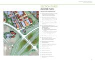
HIGHLANDER POINT: A GATEWAY - Floyd County Indiana
HIGHLANDER POINT: A GATEWAY - Floyd County Indiana
HIGHLANDER POINT: A GATEWAY - Floyd County Indiana

Create successful ePaper yourself
Turn your PDF publications into a flip-book with our unique Google optimized e-Paper software.
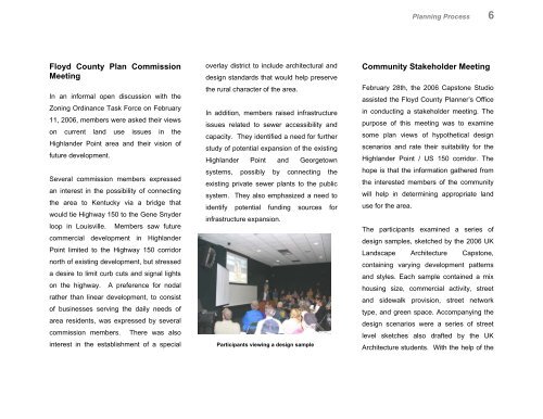
Planning Process 6<strong>Floyd</strong> <strong>County</strong> Plan CommissionMeetingIn an informal open discussion with theZoning Ordinance Task Force on February11, 2006, members were asked their viewson current land use issues in theHighlander Point area and their vision offuture development.Several commission members expressedan interest in the possibility of connectingthe area to Kentucky via a bridge thatwould tie Highway 150 to the Gene Snyderloop in Louisville. Members saw futurecommercial development in HighlanderPoint limited to the Highway 150 corridornorth of existing development, but stresseda desire to limit curb cuts and signal lightson the highway. A preference for nodalrather than linear development, to consistof businesses serving the daily needs ofarea residents, was expressed by severalcommission members. There was alsointerest in the establishment of a specialoverlay district to include architectural anddesign standards that would help preservethe rural character of the area.In addition, members raised infrastructureissues related to sewer accessibility andcapacity. They identified a need for furtherstudy of potential expansion of the existingHighlander Point and Georgetownsystems, possibly by connecting theexisting private sewer plants to the publicsystem. They also emphasized a need toidentify potential funding sources forinfrastructure expansion.Participants viewing a design sampleCommunity Stakeholder MeetingFebruary 28th, the 2006 Capstone Studioassisted the <strong>Floyd</strong> <strong>County</strong> Planner’s Officein conducting a stakeholder meeting. Thepurpose of this meeting was to examinesome plan views of hypothetical designscenarios and rate their suitability for theHighlander Point / US 150 corridor. Thehope is that the information gathered fromthe interested members of the communitywill help in determining appropriate landuse for the area.The participants examined a series ofdesign samples, sketched by the 2006 UKLandscape Architecture Capstone,containing varying development patternsand styles. Each sample contained a mixhousing size, commercial activity, streetand sidewalk provision, street networktype, and green space. Accompanying thedesign scenarios were a series of streetlevel sketches also drafted by the UKArchitecture students. With the help of the