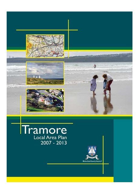
Tramore Local Area Plan - Waterford County Council
Tramore Local Area Plan - Waterford County Council
Tramore Local Area Plan - Waterford County Council
- No tags were found...

You also want an ePaper? Increase the reach of your titles
YUMPU automatically turns print PDFs into web optimized ePapers that Google loves.
Chapter 1: Introduction to the <strong>Plan</strong>II
Chapter 1: Introduction to the <strong>Plan</strong>CHAPTER TWODemographics2.1 POPULATION2.1.1 2002 Census Population Figures2.1.2 2006 Census Population Figures2.1.3 Population Projections2.2 EMPLOYMENT2.3 FUTURE DEVELOPMENT IMPACTSCHAPTER THREEResidential Development3.1 RESIDENTIALLY ZONED LAND3.1.1 Residentially zoned lands required3.1.2 Availability of Existing zoned landbank3.2 DEVELOPMENT STRATEGY3.2.1 <strong>Tramore</strong> Race Course3.2.2 Monvoy/knockenduff3.2.3 Pickardstown and Ballinattin3.3 BALANCED AND CO-ORDIANTED DEVELOPMENT3.4 PHASING OF DEVELOPMENT3.5 HOUSING STRATEGY3.6 SOCIAL AND AFFORDABLE HOUSING3.7 LIVING OVER THE SHOP3.8 TRAVELLER ACCOMODATION3.9 HOUSING FOR THE DISABLED3.10 ENERGY EFFICENT HOUSINGCHAPTER FOUREconomic Development4.1 EMPLOYMENT STRUCTURE4.2 EXISTING INDUSTRIAL DEVELOPMENT4.3 FUTURE DEVELOPMENT STRATEGY4.4 OFFICE DEVELOPMENTV
Chapter 1: Introduction to the <strong>Plan</strong>4.5 RETAIL DEVELOPMENT4.5.1 <strong>County</strong> Retail StrategyCHAPTER FIVECommunity & Social Development5.1 COMMUNITY FACILITIES AND SERVICES5.1.1 Civic and Community Services5.1.2 Burial Grounds and Places of Worship5.1.3 Fire and Garda Station5.1.4 Public Open Spaces5.1.5 Health Facilities5.2 EDUCATION5.3 NEIGHBOURHOOD CENTRES5.4 CHILDCARE FACILITIES5.5 SOCIAL INTERGRATION5.5.1 Traveller Community5.5.2 Refugees5.6 SPORTS AND RECREATION5.6.1 Amenity paths and Networks5.6.2 Need for Additional Facilities5.7 ARTS AND CULTURE5.7.1 Public ArtCHAPTER SIXTourism6.1 INTRODUCTION6.2 ACTIVITIES6.3 TOURISM ACCOMMODATION6.4 PROMOTION AND MARKETINGCHAPTER SEVENTransportation and Traffic Management7.1 INTRODUCTION7.2 TRAMORE TRAFFIC MANAGEMENT PLAN7.3 COMMUTER TRAFFIC7.4 NEW AND IMPROVED ROADSVI
Chapter 1: Introduction to the <strong>Plan</strong>7.5 PEDESTRIAN CYCLE ROUTES7.6 PARKING7.7 PUBLIC TRANSPORT7.7.1 BusCHAPTER EIGHTInfrastructure8.1 INFRASTRUCTURE8.2 WATER SUPPLY8.3 WASTE WATER TREATMENT SYSTEM8.4 SURFACE WATER, DRAINAGE SYSTEMS AND FLOODCONTROL8.5 WASTE MANAGEMENT8.6 RENEWABLE ENERGY8.7 TELECOMMUNICATIONS AND BROADBANDCHAPTER NINEThe Built Environment9.1 ARCHITECTURAL HERITAGE9.1.1 Legal and Policy Framework to protect ArchitecturalHeritage9.1.2 Record of Protected Structures9.1.3 Architectural Conservation <strong>Area</strong> (ACA)9.1.4 National Inventory of Architectural Heritage (NIAH)9.2 ARCHAEOLOGICAL HERITAGE9.2.1 Record of Monuments and Places (RMP)9.3 TOWNSCAPE AND URBAN DESIGNVII
Chapter 1: Introduction to the <strong>Plan</strong>CHAPTER TENOpen Space, Amenity & The Natural Environment10.1 COASTAL ZONE MANAGMENT10.1.1 Protection of the Dunes10.2 URBAN FORESTRY10.2.1 New Residential Developments10.3 PUBLIC OPEN SPACE10.3.1 Proposed Town Park10.4 PROTECTION OF THE NATURAL ENVIRONMENT10.6.1 Air quality10.6.2 Radon Gas10.6.3 Ground Water Resources10.6.4 River Basin District ManagementCHAPTER ELEVEN Development Standards11.1 INTRODUCTION11.2 LOCATION OF NEW DEVELOPMENT/ GENERAL11.3 REDEVELOPMENT OF BROWNFIELD SITES11.4 MASTER PLANS11.5 ROAD SAFTEY AUDITS11.6 STANDARDS FOR NEW DEVELOPMENT11.6.1 Access11.6.2 Building Lines11.6.3 Site <strong>Plan</strong>ting/ Landscaping11.6.4 Site Coverage11.6.5 Plot Ratio11.6.6 Density11.6.7 Design11.6.8 Access for Persons with Disabilities and the MobilityImpaired11.6.9 Layout11.6.10 Road Layout11.6.11 General Open Space Provision11.6.12 Private Amenity Space for individual Housing Units11.7 APARTMENTS11.7.1 Minimum Floor <strong>Area</strong>VIII
Chapter 1: Introduction to the <strong>Plan</strong>11.7.2 Internal Floor Space11.7.3 Amalgamation of Apartment Units11.7.4 Open Space Provision for Apartment Units11.8 CHILDCARE FACILITIES11.9 SERVICES11.9.1 Waste Water Treatment11.9.2 Surface Water Design11.8.3 Waste Management11.8.4 Refuse11.9.5 Public Lighting11.9.6 Electricity and Other Cables11.10 CAR PARKING11.10.1 The Central <strong>Area</strong>11.10.2 Other <strong>Area</strong>s11.11 DEVELOPMENT CONTRIBUTIONS11.12 BONDS AND SECURITY11.13 INDUSTRIAL AND COMMERCIAL DEVELOPMENTS11.13.1 General11.13.2 Seveso Establishments11.13.3 New Seveso Developments11.13.4 Garages and Petrol Stations11.14 ADVERTISING11.14.1 General11.14.2 Advertising Hoardings (Billboards)11.14.3 Signage for Tourist and <strong>Local</strong> Facilities11.14.4 Signage <strong>Local</strong> Events11.15 DEMOLITION OF BUILDINGS11.16 PROTECTED STRUCTURES11.17 ARCHITECTURAL CONSERVATION AREA & VERNACULARHERITAGE11.18 ARCHAEOLOGICAL HERITAGE11.19 AREA OF ARCHAEOLOGICAL POTENTIAL11.20 SHOPFRONTS11.21 TREE PRESERVATION ORDERS11.22 AGRICULTURAL DEVELOPMENTIX
Chapter 1: Introduction to the <strong>Plan</strong>11.23 ENVIRONMENTAL IMPACT ASSESSMENT11.24 ZONING OBJECTIVES11.24.1 Non-conforming Use11.24.2 Key to Different Land Use ZonesLIST OF APPENDICESAppendix A:LandscapingAppendix B:Land Use Definitions and AcronymsAppendix C:Fingerpost signageAppendix D:Record of Protected StructuresAppendix E:Short Medium and Long term road objectivesAppendix F:Strategic Environmental StatementX
CHAPTER ONEIntroduction to the <strong>Plan</strong>1.1 REVIEW OF THE2003 PLAN1.1.1 ResidentialDevelopment1.1.2 Retail Development1.1.3 Economic1.1.4 Infrastructure1.1.5 Refuse Disposal andWaste Management1.2 PURPOSE OF THEPLAN1.3 PHYSICALCONTEXT<strong>Waterford</strong> <strong>County</strong> <strong>Council</strong> is the planningauthority for <strong>Tramore</strong> town and surroundingareas. The <strong>Waterford</strong> <strong>County</strong> Development <strong>Plan</strong>was adopted in 2005 and it is in this context thatthe review of the <strong>Tramore</strong> <strong>Local</strong> <strong>Area</strong> <strong>Plan</strong> isbeing undertaken.This <strong>Local</strong> <strong>Area</strong> <strong>Plan</strong> sets out an overalldevelopment strategy and framework for theproper and sustainable development of <strong>Tramore</strong>for the period 2007-2013.This chapter gives a brief review of 2003 <strong>Plan</strong>,details the preparation of the new <strong>Plan</strong> andoutlines the planning policy framework withinwhich the <strong>Plan</strong> was formulated.1.4 PLAN PERIOD1.5 PLAN CONTENT1.6 FRAMINGDOCUMENTS
Chapter 1: Introduction to the <strong>Plan</strong>1.1 REVIEW OF THE 2003 PLAN1.1.1 Residential Development<strong>Tramore</strong> has experienced a boom in recent years in private residentialdevelopment. A significant portion of the new residential development hasoccurred in the vicinity of the <strong>Tramore</strong> ring road to the north of the town. Thenewer estates coming on line are providing for a mixture of house types andsizes to accommodate an improved socio-economic balance. Over the period2003-2005 there has been 60 social houses and 30 affordable houses madeavailable in the <strong>Tramore</strong> <strong>Area</strong>. During this time period the <strong>Council</strong> alsopurchased 23 houses in the locality for social housing.1.1.2 Retail DevelopmentIn the past <strong>Tramore</strong> has performed relatively poorly in terms of retaildevelopment. This is largely due to proximity to the larger retail centers in<strong>Waterford</strong> City. The Retail Strategy for <strong>County</strong> <strong>Waterford</strong> recognises theimportance of the provision of retail in <strong>Tramore</strong> as a secondary service centerand in achieving a sustainable local community that can compete with <strong>Waterford</strong>City. To this end it will be necessary to examine the role and functionality of theexisting town centre and plan for the expansion of same.1.1.3 Economic DevelopmentWhile <strong>Tramore</strong>‘s population has grown considerably in recent years the vastmajority of the working population commute to <strong>Waterford</strong> City or other urbanareas on a daily basis for work. This is a trend that shall have to be reversed if<strong>Tramore</strong> is to fulfill its role as <strong>County</strong> <strong>Waterford</strong>’s Secondary Service Centreand to provide a sustainable living environment for its current and futureresidents.Traditionally employment in <strong>Tramore</strong> has been largely related to the tourismsector and this has created a principally one dimensional employment base.However the Riverstown Industrial Park has been successful in terms ofoccupancy and take up rate over the period of the 2003 <strong>Plan</strong> and this successhighlights a clear need to zone additional industrial lands in <strong>Tramore</strong>.1.1.4 InfrastructureThe <strong>Tramore</strong> Sewerage Scheme, which consists of a substantial collectionsystem upgrade, new pumping stations and a wastewater treatment plant at a costestimate of 19.8m has commenced since the adoption of the 2003 LAP. It ishoped that the first phase of the treatment plant shall be operational by 2007with a capacity for 17500 PE.The <strong>Tramore</strong> Ring Road was opened in January 2005 and this has alleviatedsubstantial volumes of traffic from the more congested town centre areas. The2
Chapter 1: Introduction to the <strong>Plan</strong>Riverstown Relief Road has been included in <strong>County</strong> <strong>Council</strong> proposals forSpecific Improvement funding for 2006.1.1.5 Refuse Disposal and Waste managementSince the adoption of the <strong>Plan</strong>, <strong>Tramore</strong> Landfill has closed and landscapingworks have commenced. It is anticipated that remedial works will cost in theregion of €7 million. All waste in the <strong>County</strong> is currently being diverted to<strong>County</strong> Carlow.1.2 PURPOSE OF THE PLANThe purpose of this <strong>Local</strong> <strong>Area</strong> <strong>Plan</strong> is to establish physical developmentpolicies for <strong>Tramore</strong> up to the year 2013 and to identify specific objectives forthe achievement of those policies. The <strong>Plan</strong> is ultimately guided by the 2005<strong>County</strong> Development <strong>Plan</strong> but has a local focus and is a medium for fosteringand guiding future developments and meeting local needs. The <strong>Plan</strong> sets out thegeneral nature, location and extent of development and provides a framework forpublic and private sector investment relating to land use.This written document with accompanying maps comprises the <strong>Tramore</strong> <strong>Local</strong><strong>Area</strong> <strong>Plan</strong> 2007-2013 (hereinafter referred to as the <strong>Plan</strong>). The <strong>Plan</strong> will replacethe <strong>Tramore</strong> <strong>Local</strong> <strong>Area</strong> <strong>Plan</strong> 2003-2009.1.2.1 Preparation of the <strong>Local</strong> <strong>Area</strong> <strong>Plan</strong>With the enactment of the <strong>Plan</strong>ning & Development Act 2000, <strong>Local</strong> <strong>Area</strong> <strong>Plan</strong>s(LAP’s) were placed on a statutory footing. The <strong>Plan</strong>ning Act 2000 states that:“A <strong>Plan</strong>ning Authority shall take whatever steps it considers necessary toconsult the public before preparing, amending or revoking a local area planincluding consultations with any residents, public sector agencies, nongovernmental agencies, local community groups and business interest withthe area”.The <strong>Plan</strong>ning Authority hosted a Pre Draft <strong>Plan</strong> Evening in the Majestic Hotel in<strong>Tramore</strong> on the 16 th of February 2006. The event was successful with anattendance in excess of one hundred persons. Following on from this meeting,members of the public were invited to submit pre draft-plan submissions andthese submissions were considered in formulating the draft plan.3
Chapter 1: Introduction to the <strong>Plan</strong>Pre-<strong>Plan</strong>publicconsultationmeeting in<strong>Tramore</strong> ..Pre-<strong>Plan</strong> meeting held in the Majestic Hotel <strong>Tramore</strong>1.2.2 Strategic Environmental AssessmentStrategic Environmental Assessment (SEA) is the formal, systematic evaluationof the likely significant environmental effects of implementing a plan orprogramme before a decision is made to adopt the plan or programme.Article 1 of the SEA Directive states the following:StrategicEnvironmentalAssessment….“The objective of this Directive is to provide for a high level of protection ofthe environment and to contribute to the integration of environmentalconsiderations into the preparation and adoption of plans and programmeswith a view to promoting sustainable development, by ensuring that , inaccordance with this Directive, an environmental assessment is carried out ofcertain plans and programmes which are likely to have significant effects onthe environment”Under the <strong>Plan</strong>ning and Development Statutory (Strategic EnvironmentalAssessment) Regulations 2004 it is a requirement that an SEA be carried out fora <strong>Local</strong> <strong>Area</strong> <strong>Plan</strong> with a population in excess of 10, 000 people. The populationof <strong>Tramore</strong> is currently estimated at 10, 314 persons and therefore the <strong>Plan</strong>ningAuthority is committed to preparing an Environmental Report in conjunctionwith the <strong>Local</strong> <strong>Area</strong> <strong>Plan</strong>. The Environmental Report, while a separate documentin its own right, should be read in conjunction with the <strong>Tramore</strong> <strong>Local</strong> <strong>Area</strong> <strong>Plan</strong>1.2.3 VisionThe Vision Statement of the <strong>County</strong> states that:‘<strong>County</strong> <strong>Waterford</strong> will be a proactive, sustainable community, strongin its own identity, with a good quality of life for all.’4
Chapter 1: Introduction to the <strong>Plan</strong><strong>Tramore</strong>, as the <strong>County</strong>’s Secondary Service centre, has a significant role toplay in the achievement of this vision for <strong>County</strong> <strong>Waterford</strong>. This vision is atthe forefront of how <strong>Tramore</strong> should develop over the plan period and toachieve this, a number of goals have been formulated.• To develop <strong>Tramore</strong> as a leading retail and economic centre andrealise its potential as the <strong>County</strong>’s Secondary Service Centre.• To provide high quality residential development catering for amixture of house type and sizes to provide for the current and futurepopulation of <strong>Tramore</strong>.• To encourage industrial development in <strong>Tramore</strong> through a plan ledapproach.• To provide for services and infrastructure in a coherent andstrategic manner that will compliment and aid future developmentand growth.• To ensure the educational needs of the town are catered forthroughout the lifetime of the <strong>Plan</strong>.• To develop a Town park which will provide a public amenity andrecreational facility in <strong>Tramore</strong>.• To ensure that Community facilities are provided in conjunctionwith new residential development .• To improve mobility and accessibility throughout the town and toprioritise pedestrian movements.1.3 PHYSICAL CONTEXT<strong>Tramore</strong> occupies a coastal location overlooking <strong>Tramore</strong> Bay 13 km (8 miles)to the south of <strong>Waterford</strong> City 48km (30miles) to the east of Dungarvan and10 km (6.25 miles) to the south of <strong>Waterford</strong> Airport. The town is a leading seaside resort for the South East Region with good transport linkages to <strong>Waterford</strong>City and <strong>Waterford</strong> Airport.The existing form and structure of the town has been influenced by the naturaltopography and physical landform. Main Street forms a long narrow steep spinethrough the town and it is this configuration that has not lent itself historically tothe growth or expansion of the town. The 3 mile long strand is at the lowestpoint of the town and it is here the town’s main recreational and activity base iscentered.1.4 PLAN PERIODThe <strong>Plan</strong> relates to the development of the defined area over the period 2007-2013, and shall be taken as six years from the date the plan was made, or until itis subsequently reviewed or another <strong>Plan</strong> is made.5
Chapter 1: Introduction to the <strong>Plan</strong>1.5 PLAN CONTENTThe <strong>Plan</strong> comprises of this Written Statement together with the schedule ofmaps.Chapter 1 contains an introduction to the plan, review of the 2003 <strong>Plan</strong> and anoutline of the policy framework for the <strong>Local</strong> <strong>Area</strong> <strong>Plan</strong>Chapter 2 reviews the demographic profile of the town and estimates futurepopulation projections.Chapter 3 contains the policies and objectives with respect to residentialdevelopment. The chapter focuses on housing issues within the town, such as theavailability of zoned land, social and affordable housing provision and energyefficient building.Chapter 4 is concerned with Economic Development in the town. This chapterexamines the employment structure of the town and contains objectives andpolicies on how best to provide for sustainable economic developmentChapter 5 examines Social and Community Development and focuses onmatters relating to education, health, recreation, social exclusion and theprovision of community facilities.Chapter 6 relates to Tourism and identifies policies to maximize the tourismpotential of the town.Chapter 7 deals with transportation and traffic management looking at issuessuch as parking, public transport and road infrastructure.Chapter 8 relates to Infrastructure, and includes details of the <strong>Council</strong>’sinvestment in Water and Sewage infrastructure, as well as information on future<strong>Council</strong> investment proposals and schemes.Chapter 9 pertains to the Built Environment and covers issues such as the towncentre, urban design, built heritage and conservation.Chapter 10 outlines the <strong>Council</strong>’s approach to protecting the openspace/amenity areas and the natural environment.Chapter 11 sets out the Development Standards, and other issues that the<strong>Plan</strong>ning Authority will consider, when processing an application for planningpermission. Some of the relevant guidelines, to which applicants must haveregard, are also identified.There are a number of Appendices to the Written Statement. These Appendicesare part of the <strong>Plan</strong> and can be found at the back of this document. The scheduleof maps contained at the rear of this document includes a zoning map, principlesmaps etc.6
Chapter 1: Introduction to the <strong>Plan</strong>1.6 PLANNING POLICY FRAMEWORKNationalDevelopment<strong>Plan</strong> …1.6.1 National Development <strong>Plan</strong> 2007-2013-Transforming Ireland a better quality of life for allThis National Development <strong>Plan</strong> encompasses investment of €184 billion overthe next seven years. It sets out a programme of integrated investment that willunderpin the ability of the Country to grow in a manner that is economically,socially and environmental sustainable. As well as planning for the physicalinfrastructure to support progress, a major focus of the plan is on investment ineducation, science, technology and innovation. The National Development <strong>Plan</strong>integrates strategic development frameworks for regional development for ruralcommunities and for protection of the environment with common economic andsocial goals.The investment framework and strategy of the National Development <strong>Plan</strong> willenhance physical and spatial planning. It establishes a financial frameworkwithin which local physical planning can be articulated and its strategiesadvanced. Investing will be made in capitalizing on the important regional andlocal roles of Irelands network of towns so that these can attract investment andact as engines of local growth within a under revitalized and diversifying ruraleconomy.1.6.2 National Spatial StrategyNationalSpatialStrategy….The National Spatial Strategy (NSS), published in December 2002 by theDepartment of the Environment, Heritage and <strong>Local</strong> Government. The NSS is atwenty-year planning framework designed to achieve a better balance of social,economic, physical development and population growth between regions. TheNSS has determined that in the South East Region critical mass will be enhancedthrough <strong>Waterford</strong> performing as a gateway supported by Kilkenny andWexford as hubs. Its focus is on people, on places and on building communities.The NSS sets out a national context for spatial planning to inform regionalplanning guidelines and strategies including statutory development plans.The NSS stresses the importance of creating places that will attract and sustainboth people and jobs.7
Chapter 1: Introduction to the <strong>Plan</strong>Context of <strong>Tramore</strong> within the NSS1.6.3 Sustainable Development: A Strategy for IrelandThis was Ireland’s first comprehensive strategy on Sustainable Development,and was published in 1997. It was framed to “ensure that economy and societyin Ireland can develop to their full potential within a well protectedenvironment”. In trying to achieve this, the strategy was designed to applyconsiderations of sustainability more systematically to Irish economic policiesand to integrate them into associated decision-making processes.The Strategy reflects and takes forward Ireland's commitment to the principlesand agenda for sustainable development agreed at the Earth Summit in Rio in1992. The Strategy also puts in place mechanisms for monitoring and review.1.6.4 Principles for Sustainable DevelopmentComhar, the National Sustainable Development Partnership, was established in1999 to advance the national agenda for sustainable development and tocontribute to the formation of a national consensus. It seeks to encouragesustainable development across Irish society, and advises the Irish Governmenton policies which support and promote sustainable development.Comhar adopted a framework approach in the document Principles forSustainable Development which sets out an agreed view on what Comharconsiders sustainable development, and consists of a set of themes, a statementof principles and an explanation of their relevance to Ireland.It is set out in such a manner that the principle of sustainable development maybe used as a benchmark for measuring the effectiveness of policies.8
Chapter 1: Introduction to the <strong>Plan</strong>1.6.5. National Anti-Poverty StrategyThe issue of tackling poverty and social exclusion has now become one of themajor challenges facing Irish Society. The Government's Anti-Poverty Strategydefines poverty in the following terms:-“People are living in poverty, if their income and resources (material, culturaland social) are so inadequate as to preclude them from having a standard ofliving which is regarded as acceptable by Irish society generally”The adopted principles underlying the Government's National Anti-PovertyStrategy include:-• ensuring equal access and encouraging participation for all;• guaranteeing the rights of minorities; and• actively involving the community and voluntary sector, promotingempowerment (especially of marginalized groups) and social inclusionthrough participation, and encouraging appropriate consultative processes,especially with users of services.1.6.6 The National Biodiversity <strong>Plan</strong>In 1996, Ireland ratified the Convention on Biological Diversity (CBD), aconvention agreed at the Rio summit in 1992 to protect the earth's rapidlydwindling biological diversity. As such, Ireland has undertaken to promote theconservation and sustainable use of biodiversity. The National Biodiversity <strong>Plan</strong>outlines a series of measures that will enhance biodiversity. It considers theintegration of the conservation of biodiversity into all relevant sectors. The plancovers the 3 levels of biodiversity, which are ecosystem diversity, speciesdiversity and genetic diversity. The National Biodiversity <strong>Plan</strong> has beendeveloped to coincide with the National Heritage <strong>Plan</strong>, which sets out theframework for the protection and enhancement of all aspects of Ireland’sheritage, which includes our natural heritage. However, the NationalBiodiversity <strong>Plan</strong> focuses solely on biological diversity.1.6.7 The Heritage <strong>Plan</strong> for <strong>County</strong> <strong>Waterford</strong>The Heritage <strong>Plan</strong> for <strong>County</strong> <strong>Waterford</strong> was adopted by <strong>Waterford</strong> <strong>County</strong><strong>Council</strong> on 13 th February 2006. This plan is a summary of the responses of thelocal authorities, community groups and individuals and of funding bodies suchas the Heritage <strong>Council</strong>, to our need to look after our heritage. The aims of theplan are to:-• Collect and disseminate information on the heritage of <strong>County</strong> <strong>Waterford</strong>and make it available;• Raise the level of awareness of heritage in <strong>County</strong> <strong>Waterford</strong>;• Promote cooperation between various groups and individuals interested inheritage; and• Promote best practice with regard to our heritage.The Heritage <strong>Plan</strong> is an integrated five-year work plan (2006-2011) comprisingactions, which will maintain, improve and promote heritage in <strong>County</strong>9
Chapter 1: Introduction to the <strong>Plan</strong><strong>Waterford</strong>. <strong>Waterford</strong> <strong>County</strong> <strong>Council</strong> will be a lead partner in many of theactions and the Heritage Officer will have a role in overseeing the delivery ofthese actions.1.6.8 South East Regional Authority Regional <strong>Plan</strong>ning Guidelines:The Regional <strong>Plan</strong>ning Guidelines, formulated by the Regional Authority,represents a planning framework for the period2004-2020. The Regional <strong>Plan</strong>ning Guidelines takea holistic approach to planning by promoting anunderstanding of social, economic, cultural andenvironmental change and then identifyingappropriate policy objectives to achieve a betterbalance of sustainable development throughout theregion.It is intended that the guidelines will strengthenlocal authority development plans, addressingissues like settlement, transportation, industrialdevelopment, community facilities andenvironmental protection.The Guidelines note that <strong>Tramore</strong> has recently experienced a high level ofpopulation growth, it is further noted that the town continues to be an attractivelocation for new residential development. It is stated that care must be taken toensure that the continued expansion of these urban areas is regulated to ensurethat community, social and retail development keep pace with recent rapidphases of mainly residential development.The Guidelines encourage larger towns like <strong>Tramore</strong> to have regard to theirexisting character and to seek to support the role of the Gateway, Hubs and<strong>County</strong> Towns rather than trying to compete with them for growth.Each <strong>Plan</strong>ning Authority must have regard to adopted Regional <strong>Plan</strong>ningGuidelines in force when making a Development <strong>Plan</strong>. This <strong>Local</strong> <strong>Area</strong> <strong>Plan</strong>has been formulated, using the South East Regional <strong>Plan</strong>ning Guidelines as aframework in order to enhance the strategic dimensions of planning at the locallevel.1.6.9 <strong>Waterford</strong> <strong>County</strong> Development <strong>Plan</strong> 2005-2011<strong>Waterford</strong> <strong>County</strong> Development <strong>Plan</strong> 2005-2011 was adopted by the <strong>Council</strong> on11 th July 2005.The review of the <strong>Local</strong> <strong>Area</strong> <strong>Plan</strong> shall be consistent with theobjectives and policies as set out in the 2005 <strong>Waterford</strong> <strong>County</strong> Development<strong>Plan</strong> .10
Chapter 1: Introduction to the <strong>Plan</strong>1.6.10 <strong>Waterford</strong> <strong>County</strong> Strategy for Economic, Social and CulturalDevelopment, 2002-2012This Strategy was launched in July 2002, by the <strong>County</strong> Development Board,and aims to implement integrated strategies on a countywide basis that combinelocal programs for economic, social, and cultural development.One of the core fundamentals in relation to the successful implementation of theStrategy is the requirement that subsequent action, policy and frameworkdocuments, within the <strong>County</strong>, show a commitment, co-operation andcompatibility with the goals and objectives established in the Strategy.1.6.11 <strong>Waterford</strong> <strong>County</strong> Housing StrategyPart V of the 2000 <strong>Plan</strong>ning and Development Act requires the preparation ahousing strategy. The <strong>Waterford</strong> <strong>County</strong> Housing Strategy was prepared andadopted in 2001, and the <strong>Council</strong> will have regard to this strategy, and/or anysubsequent Housing Strategy formulated and adopted within the lifetime of thisdevelopment plan.1.6.12 <strong>Waterford</strong> <strong>County</strong> Retail StrategyThe Review of the <strong>County</strong> Retail Strategy was adopted on the 12 th of June 2006and it aims to consolidate and build on the research, policies and strategies asoutlined in the 2003 document, and will address the future provision of retailingwithin the <strong>County</strong>, and <strong>Tramore</strong> over this development <strong>Plan</strong> period.The <strong>County</strong> retail strategy recognises that <strong>Tramore</strong> is underperforming in termsof retail development and it is an objective to this <strong>Plan</strong> to reverse this situationand zone appropriate lands to accommodate new retail developments within thetown core.1.6.13 A Joint Waste Management <strong>Plan</strong> for the South-East RegionA Joint Waste Management <strong>Plan</strong> for the South-East Region was adopted in July2002 by the six waste Authorities in the South East Region. The plan period is2002-2021. The purpose of the plan is:-• The promotion of waste prevention and minimization through sourcereduction, producer responsibility and public awareness; and• The management for the recovery/ recycling/ disposal of waste arising on aregional basis.1.6.14 PLUTS (<strong>Waterford</strong> <strong>Plan</strong>ning Land Use and Transportation Study)The <strong>Waterford</strong> <strong>Plan</strong>ning, Land Use and Transportation Study (PLUTS) wascommissioned by <strong>Waterford</strong> City <strong>Council</strong> in February 2001 in response to theneed for an integrated framework of plans and solutions to address the needs ofthe city in both land use and transportation terms up to the year 2020. The11
Chapter 1: Introduction to the <strong>Plan</strong>strategy is consistent with the directional requirements of the NSS, and supportsand fosters balanced spatial development at a local, city and regional level.The <strong>Waterford</strong> PLUTS is one of the key enabling supports, which <strong>Waterford</strong><strong>County</strong> <strong>Council</strong> and <strong>Waterford</strong> City <strong>Council</strong> need to put in place to support thedevelopment of the Gateway at <strong>Waterford</strong>.1.6.15 Development <strong>Plan</strong>s – Public Consultation – Draft of Guidelines for<strong>Plan</strong>ning AuthoritiesThe Draft Development <strong>Plan</strong> Guidelines were issued by the Department of theEnvironment, Heritage and <strong>Local</strong> Government in April 2006. The Guidelines setout a framework within which development plans will achieve high standards.The guidelines state a number of key points as follows;• Development <strong>Plan</strong>s should be strategic• Development <strong>Plan</strong>s should be a catalyst for positive change and progress• Development <strong>Plan</strong>s should anticipate future needs on an objective basis• Development <strong>Plan</strong>s have a roles in protecting the environment andheritage• There is a need for consistency between plans and strategies at differentlevels is essential• Ownership of the development plan is central to effectiveimplementation• Diverse community needs should be addressed• The observation of a certain code of conduct in the making of adevelopment plan.This LAP has been prepared in the context of the draft Guidelines.1.6.16 Best Practice Guidelines on the Preparation of Waste Management<strong>Plan</strong>s of Construction and Demolition ProjectsThe Department of the Environment Heritage and <strong>Local</strong> Government issuedGuidelines on best practice in the Preparation of Waste Management <strong>Plan</strong>s forConstruction and Demolition projects. The Guidelines establish a set of criteriato determine if certain projects require Project C&D Waste Management <strong>Plan</strong>s.The Guidelines further specify what information should be contained in suchManagement <strong>Plan</strong>s.1.6.17 The European Convention on the Protection of the ArchaeologicalHeritage (Valletta Convention) 1992The aim of the Valletta Convention is ‘to protect the archaeological heritage asa source of the European collective memory and as an instrument for historicaland scientific study.’ The Convention provides the basic framework for policyon the protection of the archaeological heritage in Ireland. This was ratified byIreland in 1997 and requires that appropriate consideration be given toarchaeological issues at all stages of the planning and development process.12
Chapter 1: Introduction to the <strong>Plan</strong>1.6.18 The European Convention for the Protection of the ArchitecturalHeritage (the Granada Convention).Ireland ratified the Granada Convention in 1996. The purpose of the Conventionis to achieve the protection of the architectural heritage rather than itspreservation. The Convention considers architectural heritage to consist ofmonuments, groups of buildings and sites. The Convention outlines therequirements for each signatory and stipulates the need for:-• The maintenance of Inventories;• Statutory Protection procedures;• Ancillary Measures;• Sanctions;• The adoption of conservation policies;• Participation and association;• Provision of information and training; and• European co-ordination on Conservation issues.1.6.19 Step by Step – A Walking Strategy for <strong>County</strong> <strong>Waterford</strong>A strategy for developing walking in <strong>County</strong><strong>Waterford</strong> was produced in 2005 by<strong>Waterford</strong> <strong>County</strong> <strong>Council</strong> in collaborationwith state and local development agencies,including the Regional Tourism Authority,<strong>Waterford</strong> Leader Partnership and<strong>Waterford</strong> Sports Partnership. The strategylooks at the issues related to walking: health,environment, tourism and transport anddevelops strategies for co-ordinating workand activities, access, participation andsocial inclusion, trail development. It alsolooks at the economic gain in terms of atourism product.1.6.20 Childcare Facilities – Guidelines for <strong>Plan</strong>ning AuthoritiesProduced in 2001, these guidelines for <strong>Plan</strong>ning Authorities on ChildcareFacilities provide a framework to guide both local authorities in preparingdevelopment plans and assessing applications for planning permission anddevelopers and childcare providers in formulating development proposals.<strong>Plan</strong>ning permission for premises for childcare has been identifies as an area ofconcern for childcare service development. These guidelines are intended toensure a consistency of approach across the country. These guidelines relatesolely to the landuse planning aspect of childcare provision.13
Chapter 1: Introduction to the <strong>Plan</strong>14
CHAPTER TWODemographics2.1 POPULATION2.1.1 2002 Census PopulationFigures2.1.2 2006 PreliminaryCensus PopulationFigures2.1.3 Population projections2.2 EMPLOYMENT2.3 FUTUREDEVELOPMENT<strong>Tramore</strong> has been identified as a SecondaryService Center in <strong>County</strong> <strong>Waterford</strong>. Its manyassets include its expansive coast line, proximityto <strong>Waterford</strong> City, a major gateway, andaccessibility to good transportation networks. Inorder to realize and capitalize on the fullpotential of these assets it is necessary toprovide for future growth and populations interms of infrastructure services and facilities.The demographic and socio-economic profile of<strong>Tramore</strong> provides information on the probablefuture requirements for land and services in the<strong>Plan</strong> area. The analysis of changes in populationratio and structure provides information for theplanning of services and facilities, such aseducation, etc.Age breakdown90008000700060005000400030002000100000-14 15-24 25-44 45-64 65+ totalAge Profile for <strong>Tramore</strong> as per the 2002Population Census
Chapter 2: Demographics2.1 POPULATION2.1.1 1996/2002 Census Population Statistics for <strong>Tramore</strong> TownThe change in population for <strong>Tramore</strong> Town and <strong>Tramore</strong> ED between 1996 and2002 is shown in Table 1 below. It illustrates an increase of population within<strong>Tramore</strong> town of 1769 persons between 1996 and 2002 representing a significantpopulation increase of 27%.Table 1:PopulationFigures …ActualChange%ChangeYearPopulation1996 <strong>Tramore</strong> Town:6536<strong>Tramore</strong> ED:61232002 <strong>Tramore</strong> Town8305 1769 +27%<strong>Tramore</strong> ED76841561 +25.4%The 2002 census illustrates a population profile as per Table 2 below. It is thatthe largest portion of the population is in the 25-44 year old bracket with thenext highest section being the 0-14 year olds. This demographic profileillustrates that the population of <strong>Tramore</strong> is relatively young and that the needfor education and youth facilities is most important. Given that the 25-44 yearold bracket accounts for the greatest proportion of the population it is clear thatthere is a considerable amount of young families in <strong>Tramore</strong>. This may be as aresult of being priced out of the property market in <strong>Waterford</strong> City and otherurban areas and having to move to <strong>Tramore</strong> for more affordable housing.Table 2:AgeProfile asper the2002PopulationCensus…9000800070006000500040003000200010000Age breakdown0-14 15-24 25-44 45-64 65+ total16
Chapter 2: DemographicsAlthough there is a significant percentage of the population in the working agebracket there is no considerable local employer with the result that a highproportion of the population have to travel outside the <strong>Tramore</strong> area foremployment. Therefore <strong>Tramore</strong> is becoming largely a dormitory town that hasexpanded in terms of residential development and has under provided in terms oflocal job provision, retail and industry.2.1.2 2006 Census Population StatisticsThe preliminary results of the 2006 Census have been published and figures areavailable for <strong>Tramore</strong> ED, however figures for <strong>Tramore</strong> Town will not beavailable until mid 2007. <strong>Tramore</strong> ED does not take into account the full extentof <strong>Tramore</strong> town and this is why the figures for <strong>Tramore</strong> ED, albeit a greatergeographical area, are less than the figures for <strong>Tramore</strong> town.Figure 1:<strong>Tramore</strong>townillustratedby redboundaryline.Figure 2:Age<strong>Tramore</strong>DED(largergeographicalarea than<strong>Tramore</strong>town butencompassesless of thetownpopulation )The population of <strong>Tramore</strong> ED is 8, 799 persons, as stated in the 2006 CSOpreliminary census figures, this represents an increase of 1, 115 persons since2002 or a population increase of 14.5%. Since 2002 <strong>Tramore</strong> town hasexperienced considerable residential development and it is expected that the17
Chapter 2: Demographicspopulation has increased at a greater rate than the ED as was experienced in theperiod from 1996-2002. The figures presented below represent house counts ascompiled by the <strong>Plan</strong>ning Authority which gives a figure of 736 new householdsconstructed since 2002 to the end of 2005 or an additional 2009 persons living in<strong>Tramore</strong> at the end of 2005. This represents an annual increase of 2.54%. It canbe assumed that the population will grow a further 2.54% in 2006 and this wouldresult in a current population of 10, 575 persons residing in <strong>Tramore</strong>.Table 3:HouseCountFigures…Year House Count % change2002 268 3.72003 185 2.562004 180 2.52005 103 1.4Average yearly increase =2.54%2.1.3 Population ProjectionsIf the average yearly increase of 2.54% is sustained over the period of this <strong>Plan</strong>(from 2007 to 2013) then the population of <strong>Tramore</strong> is predicted to be 12, 605persons by 2013.Section 4.14 of the Draft Guidelines for <strong>Plan</strong>ning Authorities on the preparationof Development <strong>Plan</strong>s state that <strong>Plan</strong>ning Authorities should ensure that at thetime they make a development plan, enough land will be available to meet theresidential needs for at least the next nine years (i.e.) three years longer than thelife of the <strong>Plan</strong> .It is predicted, based on the current yearly average increase, thatthe population of <strong>Tramore</strong> shall be approximately 13, 637 persons by 2016.The above represents a total population increase over the lifetime of the plan of19% or 2030 persons. That equates to 743 households based on an averagehousehold size of 2.73 persons. If we take the density to be 10 units per acrethen the required amount of zoned land for the period of the plan is aprox 74acres or 30 hectares. To cater for an additional three years zoning requirementbeyond the lifetime of the <strong>Plan</strong> an additional 37.8 acres or 15.2 hectares isrequired to cater for an additional 378 households.Predicting population figures into the future is a difficult undertaking given theuncertainty of underlying factors such as global and national economics,migration patterns, population mobility etc. The Regional <strong>Plan</strong>ning Guidelinespredict that population growth will continue at its present rate and then slowdown due to a reduction in overspill development from the Greater Dublin <strong>Area</strong>.An average population growth of 9.47% is predicted between 2002 and 2020 forthe entire South East Region. It is considered that this growth rate isconservative and will be exceeded in the case of <strong>Tramore</strong>, based on thepopulation growth experienced in the period 1996-2002.On this basis, the population increase for <strong>Tramore</strong> is anticipated to be of theorder of 19% – providing for a population increase by 2013, of approximately18
Chapter 2: Demographics2030 persons, bringing the population for the town to approximately 12,605persons.2.2 EMPLOYMENT<strong>Tramore</strong> has developed primarily as a dormitory town and employmentopportunities have been very limited. In order to readdress this situation, suitablelands shall have to be ear marked for office /commercial /industrial developmentover the life time of this plan. Economic development is dealt with in moredetail in Chapter 4 of this <strong>Plan</strong>.2.3 FUTURE DEVELOPMENT IMPACTSA number of current and future initiatives are likely to have notable impacts onthe town, in terms of employment change and opportunity, over the life of this<strong>Local</strong> <strong>Area</strong> <strong>Plan</strong>. These include, amongst others:• <strong>Waterford</strong> City’s Gateway status (NSS and RPG designations);• WIT Campus expansion at Carriganore and possible University status forWIT;• Future development of <strong>Waterford</strong> Regional Airport;• Completion of <strong>Tramore</strong> Wastewater Treatment <strong>Plan</strong>t;• The expansion of the town area towards the promenade area;• Amalgamation of Secondary Schools.19
Chapter 2: Demographics20
CHAPTER THREEResidential Development3.1 RESIDENTIALLY ZONEDLAND3.1.1 Residentially zoned landrequired3.1.2 Availability of existing zonedlandbank3.2 DEVELOPMENT STRATEGY3.2.1 <strong>Tramore</strong> Race Course3.2.2 Monang/Knockenduff3.2.3 Pickardstown and Ballinattin3.3 BALANCED AND CO-ORDINATEDDEVELOPMENT3.4 PHASING OFDEVELOPMENT3.5 HOUSING STRATEGY3.6 SOCIAL AND AFFORDABLEHOUSING3.7 LIVING OVER THE SHOP3.8 TRAVELLERACCOMMDATIONIn recent years <strong>Tramore</strong> has witnessedsignificant increases in residential development,particularly in the form of large housing estateson the outskirts of the town in the vicinity of thenew ring road. <strong>Tramore</strong>, given its proximity to<strong>Waterford</strong> City, has become an attractive placeto reside and there is a continuing andincreasing demand for residential development.The <strong>Council</strong> aims to:• Ensure that sufficient and suitable landis zoned for all housing types to meet theprojected housing requirements over theplan period;• To ensure the provision of adequateindustrial lands;• To create high quality sustainable livingenvironments and• To ensure that all residents are able toenjoy an acceptable standard ofresidential amenity.This chapter examines the availability ofresidentially zoned lands and therequirement for additional zoning. It alsoexamines social and affordable housing andthe <strong>Council</strong>s requirement under Part V ofthe <strong>Plan</strong>ning and Development Act.3.9 HOUSING FOR THEDISABLED3.10 ENERGY EFFICENTHOSUING
Chapter 3: Residential Development3.1 RESIDENTIALLY ZONED LAND3.1.1 Residentially zoned lands requiredWhile the market dictates the demand and supply of new housing includinglocational preferences the <strong>Council</strong> is obliged to ensure that sufficient land iszoned for all types of housing over the <strong>Plan</strong> period and ensure that no undueshortages shall occur. The <strong>Council</strong> recognises that in order to sustain a diversecommunity a range of housing needs have to be catered for.The land use pattern in <strong>Tramore</strong> has been characterized by expanding residentialdevelopments of low/medium density estate type development on the outerfringes of the town. The optimum location for new residential development iswithin the existing town boundary however the majorities of these lands havebeen developed or are committed to development and there is a need to providefor lands outside the existing town boundary to cater for the continuing demandand to ensure there is sufficient opportunity for continued growth.3.1.2 Availability of existing zoned landCurrently there is relatively little land available for residential developmentwithin the town. In order to provide choice and ensure that lands can be madeavailable for development, and ensure the market doesn’t become artificiallyinflated due to a shortage of available land, it will be necessary to zoneadditional residential lands.Table 4:Residentialzonedland….It is estimated that there is currently aprox 55 Hectares (136 acres) ofundeveloped zoned lands within <strong>Tramore</strong>. This figure includes lands that havepermission and are not yet built upon and lands that are subject of an applicationor an appeal to An Bord Pleanala.Residential zonedlandConstructed/underConstructionunder the periodof the last <strong>Plan</strong>Ha9.7HaCommitteddevelopmentAvailableDevelopmenttofor40.09HaCapacity for aprox 601-1202 unitsbased on a density of 15 to 30units per hectare14.87 Ha Capacity for aprox 220 to 446units based on a density of 15-30units per hectare22
Chapter 3: Residential DevelopmentThere is increasing pressure for the expansion of <strong>Tramore</strong> and development ofthe lands outside the current boundary which is characterized by the GaurranStream. This issue is compounded by increasing house and land prices in thearea. It is therefore necessary that the <strong>Plan</strong>ning Authority provide sufficientadditional zoned lands to cater for the increasing development pressures andensure that the market does not become artificially inflated due to the lack ofzoned lands. The remaining available and undeveloped residential zoned landsdo not constitute significant landbanks however they are strategically locatedwithin the Town and the <strong>Council</strong> is committed to using compulsory purchaseorders to ensure the availability of all zoned land within the town if such land isnot being made available for development.3.2 DEVELOPMENT STRATEGYGiven <strong>Tramore</strong>’scoastal location thedirection in whichthe town canexpand is to somedegreepredetermined.While expansiontowards the coast isnot an option theelevated lands thatsurround <strong>Tramore</strong>can providedifficult terrain fordevelopment. It isthe aim of the<strong>Council</strong> to develop<strong>Tramore</strong> in a Aerial picture of <strong>Tramore</strong>coherent and logicalmanner. To this end it is considered that substantial land banks outside thecurrent town boundary should be subject to Master <strong>Plan</strong>s that shall address indetail the land use strategy for the area while paying particular attention to thetopography of the land and the protection of highly visual or exposed areas.3.2.1 <strong>Tramore</strong> Race Course (M1 on Zoning Map)This site is strategically located inclose proximity to the town centre on agood transportation network only ashort distance from the main<strong>Waterford</strong> Road. It is proposed thatthis strategic land bank would be thesubject of a Master <strong>Plan</strong> to be preparedby any perspective developer prior tosubmitting a planning application toensure the orderly and co-coordinated23<strong>Tramore</strong> Race Course
Chapter 3: Residential Developmentdevelopment of these lands. The <strong>Plan</strong>ning Authority will consider a mixture ofuses at this location including residential, office type development,social/community/recreational and the possibility of limited commercial /retaildevelopment which will meet the zoning objectives of this plan The <strong>Plan</strong>ningAuthority will aim to protect the viability and vitality of the town centre andshall not be favorably disposed to any development which may have a negativeimpact on the core area. The redevelopment of this site shall not take place priorto the relocation and establishment of the existing race course to an alternativelocation within the town and its environs to ensure the preservation of thissporting/tourism amenity.3.2.2 Monvoy /Knockenduff ( Zone R2)Lands at Monvoy/Knockenduff to forefront of picture24It is considerednecessary at this stage tozone a landbank to thenorth of the GaurranstreamatMonvoy/Knockenduff toaccommodate residentialdevelopment. Theselands shall be developedin a sequential approach,developing from thetown outwards in anorderly and plannedmanner. The <strong>Plan</strong>ningAuthority will not befavourably disposed tothe “leap frogging” of lands and the development of remoter areas over areascloser to the town centre leading to unrealistic demands on services andinfrastructure and isolation/detachment from the town centre.The subject lands are currently unserviced and <strong>Waterford</strong> <strong>County</strong> <strong>Council</strong> iscommitted to preparing a Master <strong>Plan</strong> for the area, prior to any development ofthe lands. The Master <strong>Plan</strong> shall specifically address issues relating to theservicing of the lands, access routes/roadways and the phasing of development.The <strong>Council</strong> is further committed, over the lifetime of this <strong>Plan</strong>, to undertakinga flood impact assessment of the Garraun Stream and adjoining areas toascertain any flood risks and provide mitigation measures where necessary. Nodevelopment on these lands shall be carried out prior to the carrying out of theFlood Studies Report and the implementation of the findings of that report.3.2.3 Pickardstown and Ballinattin (M2 and M3 respectively on ZoningMap)These lands are predominantly in agriculture use and are strategically located onthe periphery of the town. Individual Master <strong>Plan</strong> shall be prepared for the landsprior to any application for permission on the site; this is to ensure the coordinateand orderly development of the land. The lands at Ballinattin ( ZoneM3) shall be retained primarily for economic development which may include
Chapter 3: Residential Developmentindustrial, commercial and tourism development. No development on these lands(Zone M2& M3) shall be carried out prior to the carrying out of the FloodStudies Report and the implementation of the findings of that report.The Master <strong>Plan</strong>s for both land banks shall identify the following:• Appropriate land uses;• Provision of Infrastructure and services;• Provision of Community and social facilities where applicable ;• Access routes and road layouts;• Phasing <strong>Plan</strong> for the overall development of the site;• Landscaping <strong>Plan</strong>.Given the elevated nature of the lands it is imperative that any proposals fordevelopment would address the local topography and provide adequatescreening and planting to mitigate against any possible visual effects.In preparing the Master <strong>Plan</strong>s particular attention shall be given to sensitivelandscape and topography features, such as elevated areas or highly visibleareas. Highly visible and elevated areas should be incorporated into the overalldevelopment in a sensitive manner as open space. Where prominent land isconsidered developable, adequate screening and planting shall be required tominimize any negative visual impact. The Master <strong>Plan</strong> should identify areaswhich due to their elevation or exposure are deemed unsuitable for developmentand shall submit appropriate mitigation measure to minimize visual impact.25
Chapter 3: Residential DevelopmentPOLICYAdoptSequentialapproach toresidentialdevelopment…ResidentialPhase 2…Prepare a FloodImpacts Study…Preparation ofMaster <strong>Plan</strong>s ..Redevelopmentof theRacecourse..Lands atBallinattin….Footpaths andpublic lighting..Dual flushtoilets systems..PolicyRD1: To encourage new residential development in locations that are closest tothe town centre and which can avail of and be integrated into the existingpublic services and infrastructure. Development should progress in asequential and phased manner as the development of remote areas is notdesirable due to the associated demand on infrastructure and isolationfrom existing town centre facilities.RD2: The development of Residential Phase 2(lands at Knockenduff/Monvoy)shall be carried on a sequential approach with development spreading outfrom the town centre in an orderly and planned fashion.RD3: To prepare a Flood Impacts Study for the lands adjoining the GaurranStream over the life time of this <strong>Plan</strong>. The study shall be carried out and itsfindings implemented prior to any development of the lands to the north ofthe Gaurran stream that have been zoned for residential developmentunder this <strong>Local</strong> <strong>Area</strong> <strong>Plan</strong>. (Residential Phase 2)RD4: To ensure the development of lands identified as Zone M1 M2 & M3 inFig 3b land use zoning map are in accordance with Master <strong>Plan</strong>s so as toensure the co-ordinated and orderly development. The Master <strong>Plan</strong>s maybe prepared by a single developer or landowner or by a group ofdevelopers or landowners acting jointly.RD5 The redevelopment of the existing racecourse site shall not be permitteduntil such time as the racecourse has relocated and is fully operational onan alternative site within <strong>Tramore</strong> and its environs.RD6: Prior to any application being submitted on the lands in Ballinattin,identified as Master <strong>Plan</strong> 3 IN Fig 3b-land use zoning map, a Master <strong>Plan</strong>shall be prepared by a single developer or landowner or by a group ofdevelopers or landowners acting jointly and shall be presented to themembers of <strong>Waterford</strong> <strong>County</strong> <strong>Council</strong> for their consideration.RD7: In new residential developments all footpaths and public lighting shall bein place prior to any dwellings being occupied.RD8: To encourage the installation of dual flush toilets in all new housingdevelopments.26
Chapter 3: Residential DevelopmentOBJECTIVEMaster <strong>Plan</strong>for lands atKnockenduff/Monvoy…ObjectiveRDO1: The <strong>Council</strong> shall prepare a Master <strong>Plan</strong> in relation to the servicing,access and phasing of lands to the north of the Gaurran Stream atKnockenduff/Monvoy ( identified as Zone R2 in Fig 3b:land use zoningmap) that have been zoned for residential development in this <strong>Local</strong> <strong>Area</strong><strong>Plan</strong>. This Master <strong>Plan</strong> shall be completed prior to any developmenttaking place on these lands and shall form the basis for the futuredevelopment of these lands.3.3 BALANCED AND CO-ORDINATE DEVELOPMENTIt is necessary to ensure that the development of the town is balanced and thatland is made available at a range of locations. Special focus shall be given toexisting undeveloped zoned lands within the town boundary that provideoptimum sites for future development.It is envisaged that policies relating to the consolidation of the existing built upareas through increased residential densities and maximizing the potential ofunder developed lands will place increased importance on the provision ofquality passive and active areas of open spaces.3.4 PHASING OF DEVELOPMENTIn order to maximize the utility of existing and future infrastructure provisionand promote the achievement of sustainability, a logical sequential approachshould be taken to the zoning of land for development. Additional zoning shouldextend outwards from the town centre with undeveloped land closest to the corebeing developed first. The notion of “leap frogging” lands to develop of moreremote areas should be avoided as this exerts pressure for additional serviceswithout realizing the full potential of the existing services.The <strong>Council</strong> shall implement compulsory purchase orders in instances were siteswithin the town are required for development purposes and are not being madeavailable for development. Lands within in the existing town centre provide forthe most sustainable forms of development where access to existing services andinfrastructure is readily available.POLICYAdequateresidentiallyzoned landPolicyH1: To ensure that adequate amounts of residential land is zoned to meet theprojected population under the life time of the plan.Part VH2To fulfill the <strong>Council</strong>s responsibilities under Part V of the <strong>Plan</strong>ning andDevelopment Act 2000.CompulsoryPurchaseH3: To use, where necessary, compulsory acquisition of zoned land to ensureland availability and the orderly and sustainable development of the town.27
Chapter 3: Residential Development3.5 HOUSING STRATEGYThe <strong>Plan</strong> shall have regard to the <strong>Waterford</strong> <strong>County</strong> Housing Strategy which setsout the <strong>Local</strong> Authorities policies in relation to housing requirements for the<strong>County</strong> and the <strong>Council</strong>s obligations under Part V of the 2000 <strong>Plan</strong>ning andDevelopment Act 2000.3.6 SOCIAL & AFFORDABLE HOUSINGSocial Housing is defined as rented housing provided by either the <strong>Local</strong>Authority, or a voluntary or Co-operative housing body. Affordable housing isdefined as owner-occupier, or shared ownership housing, provided as a pricebelow market value. Both social and affordable housing are aimed at meeting“the needs of households where resources are insufficient to provide them withaccess to suitable and adequate housing” (DoEHLG: Social Housing, the WayAhead).The <strong>Council</strong> is the main provider of social and affordable housing building 60social and 30 affordable houses in <strong>Tramore</strong> in the period 2003-2005, both yearsinclusive. The involvement of voluntary housing associations, such asRESPOND, has broadened the social housing strategy response. RESPONDcompleted 26 houses for a voluntary housing scheme in 2005.It is worth notingthat the greatest and most fast growing demand in the <strong>County</strong> for social andaffordable housing is in the <strong>Tramore</strong> area with the current housing list for<strong>Tramore</strong> at 252 persons. At present the <strong>Council</strong> own a 10 acre site at CroballyUpper and it is hoped that the construction of 57 houses divided between socialand affordable housing on aprox 4 of the acres will begin in 2006. Six no housessocial and affordable houses are currently being constructed at Riverstown andthis development is at an advanced stage.In addition to the direct provision of social and affordable housing the <strong>Council</strong>will facilitate the provision of social housing through Part V of the <strong>Plan</strong>ning andDevelopment Act 2000. It is the <strong>Council</strong>’s intention to seek to accommodate20% social and affordable housing within new developments in an integratedmanner so as to avoid social segregation and isolation of social housing.POLICYSocialintegration..Social &Affordablehousingprovision…PolicyH5: To require an integrated mix of public and private housing withinindividual housing estate developments;H6 To ensure that 20% of any land zoned for residential use shall be madeavailable for the provision of social and affordable housing orotherwise in accordance with the requirements of Part V of the<strong>Plan</strong>ning and Development Act 2000 (as amended) and the HousingStrategy28
Chapter 3: Residential DevelopmentOBJECTIVESInfilldevelopment..ObjectiveHO1: To acquire further infill sites for the development of social/ affordablehousing to meet local needs at appropriate locations.3.7 LIVING OVER THE SHOPThere is significant potential in the reuse of vacant upper floors for residentialuse, creating the possibility of accommodating an increase in population withoutdisplacing existing uses. The provision of accommodation here will alsocontribute to the viability and vitality of the Town Centre.POLICY:Living over theShop…PolicyH7: To promote the sustainable use of vacant upper floors of town centrebuildings for residential use.3.8 TRAVELLER ACCOMMODATION<strong>Waterford</strong> <strong>County</strong> has the smallest traveller population in the Country. In 2003 itwas established by the Department of the Environment that there were onlytwenty four traveller families living in <strong>Waterford</strong> and the majority of same wererecorded as living in Dungravan. There currently is no demand for traveleraccommodation in <strong>Tramore</strong> however this situation is under constant review.The <strong>Plan</strong>ning Authority will co-operate with <strong>Waterford</strong> <strong>County</strong> <strong>Council</strong> in theimplementation of the Traveller Accommodation Programme (2005-2008) forthe <strong>County</strong>.OBJECTIVESTravellerAccommodation…ObjectiveHO3: To monitor the need for traveler accommodation in the <strong>Tramore</strong> area andto respond to any future demands in accordance with the TravellerAccommodation Programme (2005-2008)3.9 HOUSING FOR DISABLED PERSONSPart M of the Building Regulations 2000 provides for basic access provisionwhilst the concept of “Lifetime Adaptable Housing” goes one step further byincorporating, into the design, the provision for changes to a home at a later datewithout the need for major reconstruction.The <strong>Council</strong> will encourage prospective applicants to design houses thatanticipate later modifications to enable accessibility and will implement theDisabled Persons Grants (DPG) Scheme which will facilitate modificationswhere required.29
Chapter 3: Residential DevelopmentPOLICYAccommodationfor people withdisabilities…PolicyH8: To provide for the specific accommodation needs of people withdisabilities.3.10 ENERGY EFFICIENT HOUSINGThe <strong>Council</strong> shall encourage all new housing to provide some form ofsustainable renewable energy in line with <strong>Local</strong> Agenda 21 principles. Givenrising oil prices and climate change it is imperative that consideration is given tosustainable forms of energy in all new housing developments. The <strong>Council</strong> shallpromote a culture of energy conservation for all users and emphasis theimportance of renewable energy sources.The Heat Energy Rating programme has been developed by Sustainable EnergyIreland to act as a visual consideration in residential property purchase or rentaldecisions and to act as a stimulus to significant investment in upgrading theenergy & environmental performance of housing stock with poor energyperformance. An energy certificate will be compulsory in 2007/2008 for housingdevelopments, which is similar to the energy rated certificate for domesticappliances such as fridges.In line with <strong>Local</strong> Agenda 21 principles and the impending Heat Energy Ratingprogramme, the <strong>Council</strong> will provide energy saving advice to anyone seeking tobuild a house and to tenants in <strong>Local</strong> Authority housing. The EU BuildingDirective will also be implemented as and where possible the <strong>Council</strong> willencourage designs that:-• Limit heat loss through the fabric of the building.• Control the output of space heating and hot water systems.• Encourage the use of alternative means of renewable energy in housingconstruction.The <strong>Council</strong> shall continue to work in conjunction with <strong>Waterford</strong> EnergyBureau in promoting and actively assisting in the development of sustainableenergy technology in the <strong>Tramore</strong> area. <strong>Waterford</strong> Energy Bureau is located inthe Civic Offices in Tankfield <strong>Tramore</strong> and the serves the City and <strong>County</strong> of<strong>Waterford</strong>.POLICYEnergyEfficiency….PolicyH9: To ensure that buildings are designed and constructed so as to maximiseenergy efficiency in line with <strong>Local</strong> Agenda 21 Principals.H10: To promote and encourage the use of alternative forms of renewableenergy where suitable.30
CHAPTER FOUREconomic Development4.1 EMPLOYMENTSTRUCTURE4.2 EXISTING INDUSTRIALDEVELOPMENT4.3 FUTURE DEVELOPMENTSTRATEGY4.4 OFFICE DEVELOPMENT4.5 RETAIL DEVELOPMENT4.5.1 <strong>County</strong> Retail StrategyThis chapter looks at the employmentstructure in <strong>Tramore</strong> and economicdevelopment in terms of industry, retailand office type development. <strong>Tramore</strong>’seconomic future requires the timely andadequate provision of land foremployment needs including sites atsuitable locations for industrial andenterprise uses.The <strong>Council</strong> aims to;• Ensure the provision of adequatelands to expand the employmentsector in <strong>Tramore</strong>;• Strengthen the competitivenessof the local economy throughbalanced land use planning and• Encourage the expansion of thetown centre to allow for a mixedand extend range of retail outletsand services.
Chapter 4: Economic Development4.1 EMPLOYMENT STRUCTURE<strong>Tramore</strong> is currently very much a dormitory town with a high percentage of itspopulation travelling to <strong>Waterford</strong> City and other urban destinations to work. If<strong>Tramore</strong> is to become a self sustaining town then this commuting pattern shallhave to be reversed. There has been limited industrial and commercialdevelopment in <strong>Tramore</strong> over the period of the last <strong>Plan</strong>. An objective of this<strong>Plan</strong> is to reverse this trend and to provide sufficient zoned lands forcommercial/ retail and industrial development. It is therefore envisaged that overthe coming years the employment structure of <strong>Tramore</strong> shall changeconsiderably and shall lend itself to the positive reshaping of the town.An analysis of the distance travelled to work from the 2002 Census is a usefulindicator of where the residents of <strong>Tramore</strong> are employed. Approximately 27%work within 1 mile of their home. However, 35% travel 5-9 miles to work.(<strong>Waterford</strong> City is approximately 8 miles from <strong>Tramore</strong>, and is likely to accountfor most of this employment). While <strong>Tramore</strong> is becoming more self-sufficient,it is clearly still a satellite town of <strong>Waterford</strong> City in terms of employment. Theonly sizeable employment location at present is the Riverstown Industrial Park;therefore there is a limited employment base with a high level of commuting.Table 5:Journey toWork ..No. of persons20001500100050000milesJourney to Work - Distance travelled2002 CSO DATA1 mile 2miles3-4miles5-9miles10-14miles15-29miles30+milesnotstated1No. of miles4.2 EXISTING INDUSTRIAL DEVELOPMENTSince the adoption of the 2003 <strong>Plan</strong>,permission has been granted forindustrial unit/commercial units on allbut three of the sites at RiverstownBusiness Park. The remainingundeveloped light industrial landbankis therefore extremely limited. Therapid uptake of the sites at theRiverstown Business Park indicatesthat there is currently considerable<strong>Tramore</strong> Industrial Park as viewed from theDunmore Rd1 2002 CSO data32
Chapter 4: Economic Developmentdemand for commercial units/light industrial parks in <strong>Tramore</strong>. There arepresently no lands zoned for office/service development and the existing towncentre offers very limited potential for any additional commercial development.4.3 FUTURE DEVELOPMENT STRATEGYThe Regional <strong>Plan</strong>ning Guidelines highlights that new technologies, high addedvalue and knowledge based sectors such as Biotechnology, Medical Devices,Communication and Technology etc are the types of industry that offer longterms prospects for generating revenues. In order for <strong>Tramore</strong> to achievebalanced and sustainable industrial development, a diversified base ofemployment opportunities will have to be provided and developed for within thetown. The <strong>Council</strong> is committed to attracting large scale industry to <strong>Waterford</strong>and to the <strong>Tramore</strong> area. The establishment of the Invest in <strong>Waterford</strong> website isone of the key components in achieving this goal.The <strong>Council</strong> recognizesthe importance ofindustrial andcommercialdevelopment in termsof employment creationand the economic andsocial development of<strong>Tramore</strong>. While the<strong>Local</strong> <strong>Area</strong> <strong>Plan</strong> cannotdirectly influence futureindustrial andcommercialdevelopment, it can adopt a “plan led approach” by• Ensuring that sufficient and appropriate land is zoned and available forindustrial and commercial development;• Extending the existing town centre zoning;• Providing or facilitating the provision of infrastructure such as roads,drainage water etc;• Promoting <strong>Tramore</strong> as a viable location to work and live.POLICY:Employmentpromotion…Research &Development..PolicyIN1: To promote <strong>Tramore</strong> as a base for major industrial developmentthrough the zoning of appropriate industrial landsIN2: To support the economic development initiatives of relevant agenciessuch as the IDA, Enterprise Ireland and the <strong>County</strong> DevelopmentBoard as a means of supporting and encouraging industrialdevelopment in <strong>Tramore</strong>33
Chapter 4: Economic Development4.3 OFFICE DEVELOPMENTThe <strong>Council</strong> will actively promote the development of additional office andservice uses in town centre locations and in appropriate industrial andcommercial areas.OfficeDevelopment…Reuse of UpperFloors…TelecommunicationsInfrastructure…POLICYOF1: To promote appropriately scaled office type development in suitablyzoned locationsOF2: To promote the reuse of vacant buildings and vacant upper floors ofexisting retail premises for office development where suitable.OF2: To facilitate and promote the provision of a telecommunicationsnetwork infrastructure to address the socio –economic needs of thepopulation and the various employment sectors4.5 RETAIL DEVELOPMENTThe Retail <strong>Plan</strong>ning Guidelines for <strong>Plan</strong>ning Authorities were issued by the<strong>Plan</strong>ning Authorities by the Department of the Environment Heritage & <strong>Local</strong>Government in December 2000. These required <strong>Local</strong> Authorities to prepareretail policies for their administrative areas and set out matters that are to beconsidered.4.5.1 <strong>County</strong> Retail StrategyThe update and review of the <strong>County</strong> Retail Strategy was adopted on the 12 th ofJune 2006 and outlines the retail policies for the <strong>County</strong> and sets out matters tobe included in future Development <strong>Plan</strong>s. The current strategy notes that<strong>Tramore</strong> is under providing in terms of its retail provision. It further states thatthe council should be encouraging retail development within <strong>Tramore</strong> that isconsistent with the <strong>Local</strong> <strong>Area</strong> <strong>Plan</strong>, the retail strategy and all other relevantplans and policies.<strong>Tramore</strong> is designated as a Secondary Service Centre in the <strong>County</strong> SettlementHierarchy and a larger town in the National Spatial Strategy (NSS). <strong>Tramore</strong> haswitnessed no major retail development since the 2003 LAP was prepared and itsshare in the <strong>County</strong>’s total floorspace has declined by 3.6% to 13.9% over theintervening period. It remains the second largest retail centre in the <strong>County</strong> buthas only 22.3% the floorspace of Dungarvan. Currently there are no national orinternational comparison retailers in <strong>Tramore</strong> albeit there have been two recentplanning applications for major retail developments.The updated Retail Strategy emphases that while <strong>Tramore</strong> is the fastest growingtown in the <strong>County</strong> it is failing to meet both the daily and main shopping needsof people in the town or its hinterland .It acknowledges that the review of the<strong>Tramore</strong> <strong>Local</strong> <strong>Area</strong> <strong>Plan</strong> must identify and zone sites of an appropriate size to34
Chapter 4: Economic Developmentaccommodate the required major expansion of the towns convenience andcomparison shopping.POLICYExpansion oftown centrezoning…Reuse andregeneration ofderelict sites…R1R2To promote and encourage enhancement and expansion of theretail floorspace and Town Centre functions of <strong>Tramore</strong> and todevelop its competivness through a plan led approach.To address leakage of retail expenditure from the town and itscatchment through the appropriate zoning of land forretail/commercial development.R3: Promote the reuse and regeneration of derelict land andbuildings in <strong>Tramore</strong> for retail development where appropriate.R4To facilitate and promote new retail and commercialdevelopment on land zoned Town Centre for a range and typeconsistent with the function of the Town Centre.35
Chapter 4: Economic Development36
CHAPTER FIVECommunity & SocialDevelopment5.1 COMMUNITYFACILITIES &SERVICES5.1.1 Civic and CommunityServices5.1.2 Burial Grounds and placesof worship5.1.3 Fire and Garda Station5.1.4 Public Open Space5.1.5 Health Facilities5.2 EDUCATION5.3 NEIGHBOURHOODCENTRESThis section sets out the aims and objectivesrelating to Community & Social development in<strong>Tramore</strong> over the <strong>Plan</strong> period. Building strong,inclusive communities is a key element inachieving sustainable development. Sustainablecommunities not only require economicdevelopment but also social and communitydevelopment. Communities need opportunitiesto meet socially, interact and form bonds,essential prerequisites to the development of asense of place and a feeling of belonging.This chapter examines the requirement forsocial and community infrastructure necessaryto make <strong>Tramore</strong> a sustainable and attractiveplace to live for all members of society.5.4 CHILDCAREFACILITIES5.5 SOCIALINTERGRATION5.5.1 Traveller Community5.5.2 Refuges and asylumseekers5.6 SPORTS ANDRECREATION5.6.1 Amenity paths andnetworks5.6.2 Need for additionalfacilities<strong>Tramore</strong> Coast Guard Station5.7 ARTS AND CULTURE5.7.1 Public Art
Chapter 5: Community & Social Development5.1 COMMUNITY FACILITIES AND SERVICESCommunity facilities are an important element in the urban fabric of a town andshould form part of an integrated network of resources available to local people.They serve the basic needs of the town and provide a place where people canmeet and create a sense of town spirit and pride in their community. Communityfacilities also play an important role in the coming together and integration ofmarginalized sectors of the local population who can use such facilities asmeeting places.5.1.1 Civic and Community ServicesSince the adoption of the 2003 <strong>Plan</strong>, permission has been granted for theprovision of a Community Centre at the Friends Meeting House and anextension to the Community Centre on Pond Road. Extensions/Improvementshave been carried out on the <strong>Council</strong> owned centre at Riverstown in partnershipwith community groups. Community centres are an important element in thesocial fabric of a town as they provide a venue for social gatherings and meetings.5.1.2 Burial Grounds and Places of Public WorshipA new cemetery was opened at CroballyUpper in 2004. It is considered that there isno requirement at this point for additionallands to be reserved for burial grounds.The local Churches include Holy CrossChurch (Catholic) and Christ Church(Church of Ireland).5.1.3 Fire and Garda StationsThe <strong>Tramore</strong> Fire station is located on Pond Road and consists of a treble baystructure and control tower with offices. The Garda station is located off MarketStreet in modern offices which are considered adequate for the foreseeable future.<strong>Tramore</strong> Fire Station38
Chapter 5: Community & Social Development5.1.4 Public Open SpaceCurrently there are limited areas of public openspace in <strong>Tramore</strong> within existing housingdevelopment. Given the projected increase inpopulation there is a need to address this issue.The <strong>Council</strong> is committed to the redevelopmentof the boating lake area into a town park overthe life time of this <strong>Plan</strong>. This proposed townpark shall provide an excellent amenity areaaround the boating lake that can be integratedinto existing developments thorough theprovision of pedestrian linkages and secure andsafe walking routes. This will provide a publicarea that people can enjoy and can also be usedfor sporting /cultural uses.Children’s playground<strong>Tramore</strong>OBJECTIVETown ParkObjectiveOSO1: The <strong>Council</strong> are committed to the redevelopment of the Boatinglake area to a Town Park over the life time of the <strong>Plan</strong>5.1.5 Health FacilitiesThe South Eastern Health Bord Clinic is located on Pond Road. A range ofservices are provided for at this location including public nursing, dentalservices and community welfare. There is a meals on wheels service providedfor the elderly and disabled from this centre as well as a general drop in centre.The <strong>Council</strong> has adopted the Barcelona Declaration and its series of agreementsknown collectively as the Declarations of Cities and the Disabled. The <strong>Plan</strong>takes account of the Declaration and seeks to advance the implementation ofagreements, across the range of activities, services and physical surroundingswhich affect the disabled.5.2 EDUCATIONAt present there are three primary schools in <strong>Tramore</strong>.Glor na MaraGael Scoil Philib BarunHoly Cross School(Girls and infant boys)(Mixed)(Mixed)Post primary education needs in the town are catered for by two schoolsStella Maris Secondary SchoolChristian Brothers School(Girls)(Boys)39
Chapter 5: Community & Social DevelopmentThe two post primary schools are situated on lands that have limited potential forexpansion and growth. The 2002 Census data suggest that the school goingpopulation of <strong>Tramore</strong> is growing therefore it is imperative that provisions bemade to cater for additional pupils in the future. To this end, plans are at anadvanced stage for the provision of an amalgamated secondary school on landsin Ballycarnane. The amalgamated school will be developed through apublic/private “design and build and operate” scheme but it is hoped that theschool shall be fully operational through the life time of this <strong>Plan</strong>.Adult education in <strong>Tramore</strong> iscatered through the CBS Adult andCommunityEducationProgramme. All evening coursescommence in September andJanuary of each year. In addition tothis, <strong>County</strong> <strong>Waterford</strong> VECoperates a number of programmesthrough its Adult Education Centrein <strong>Tramore</strong>. <strong>Tramore</strong> Library islocated to the rear of the Strand <strong>Tramore</strong> LibraryHotel on Market Street. It isrecognized that the current facility is restricted in size for the population that it iscurrently serving and there is a need to provide more spacious and modernaccommodation for the library.POLICYEducationalFacilities…PolicyED1: Ensure, through the zoning of appropriate lands, adequate educationalfacilities to cater for the future population growth within the town andsurrounding areasOBJECTIVEAmalgamationof Schools….ObjectiveEDO1: Support the amalgamation of the secondary schools in <strong>Tramore</strong>5.3 NEIGHBOURHOOD CENTERSTo co-ordinate the provision of community services and facilities in an efficientand sustainable manner, it is proposed to establish neighbourhood centres intowhich basic facilities would be channeled. This would ensure that all areas in thetown would have equal access to facilities and that the facilities would begrouped to minimize journeys. Neighbourhood centres will provide a range ofcommunity facilities to serve the surrounding area. The type facilities/servicesthat are considered suitable for location in neighbourhood centres include:childcare facilities, small food stores, general practitioners, dentist, café andleisure uses etc.40
Chapter 5: Community & Social DevelopmentNine neighbourhood centres have been identified around the town (SeeObjectives Map). The exact location of the neighbourhood centres in the areassubject to Master <strong>Plan</strong>s including the lands zoned under residential phase 2 atMonvoy and Knockenduff shall be determined at Master <strong>Plan</strong> stage.5.4 CHILDCARE FACILITIESChildcare facilities include full day-care and session facilities, services for preschoolchildren and after-school care for school-going children. It coversservices involving the care, education and social integration of children.Childcare facilities: Guidelines for <strong>Plan</strong>ning Authorities (DoEHLG, June 2001),National Children’s Strategy, ‘Our Children – Their Lives’ (Dept. of Health andChildren, 2000) and the <strong>Waterford</strong> <strong>County</strong> Childcare Committee report, ‘<strong>County</strong>Childcare Strategy, 2002 – 2006’, deal with the needs of children. The <strong>Council</strong>will have regards to the above documents and will facilitate, where possible, theprovision of appropriate services. The <strong>Council</strong> shall liase with the <strong>Waterford</strong><strong>County</strong> Childcare Committee on the provision of future services. The <strong>Plan</strong>ningAuthority will direct future childcare facilities into the neighbourhood centresrather than their provision on a piece meal basis in individual housing estates.5.5 SOCIAL INTEGRATIONThe <strong>Local</strong> Authority has an important role to play in counteracting socialimbalances and inequities, through the provision and improvement of social andcommunity services. The implementation of Part V of the <strong>Plan</strong>ning andDevelopment Act 2000-2006 with regard to Social and Affordable Housing willensure a more balanced socio-economic profile in residential developments andwill ensure that public and private housing is better integrated.5.5.1 Traveller CommunityAt present there is no Traveller Community in <strong>Tramore</strong>. However the <strong>Council</strong>will continue to monitor this situation and if and when the need arises shalladdress the requirements of the community.5.5.2 Refugees, Asylum seekers and Immigrants.Atlantic House in <strong>Tramore</strong> currently houses approximately 75 single maleasylum seekers awaiting the outcome of their applications for asylum Asapplications are processed it is likely that there will be a turn over in occupancy.41
Chapter 5: Community & Social DevelopmentPOLICYSocialIntegration& Inclusion…Provision ofrecreational& CulturalFacilities …CommunityFacilities….Health CareFacilities…..PolicyCE1: To promote social integration through the provision of mixed tenurehousing estates and the fulfillment of the <strong>Council</strong>s requirement underPart V of the <strong>Plan</strong>ning and Development Act 2000.CE2: To promote recreational and cultural facilities and activities thatencourage inclusion of specific groups that may experience socialexclusion due to social status, race, religion or any other factor thatmay lead to social marginalisation.CE4:To promote a high quality living environment through the provision ofcommunity facilities in line with, and supporting new residentialdevelopment.CE5: To provide for the health care needs of the town’s population as itgrows and to provide for a mix of community related healthcarefacilities for people with various healthcare needs such as nursinghomes and health centers.CE6:To facilitate the provision of housing for the elderly, integrated into thecommunity, at appropriate locations with access to facilities andservices.5.6 SPORTS AND RECREATIONThe main leisure and recreational area in <strong>Tramore</strong> is along the promenade andbeach area. Historically <strong>Tramore</strong> has relied heavily on the fact that it is a seasideresort, that annually experiences an influxation of summer visitors.Notwithstanding the many benefits that <strong>Tramore</strong> has been afforded through itsstatus as a popular sea side resort, the town has developed somewhat of a onedimensional tourism product orientated solely around the beach area andassociated activities. Over reliance on a single tourism product may bedetrimental to the town especially given the dependence on the erratic Irishweather. It is necessary to promote other forms of tourism in <strong>Tramore</strong>, such agolfing holidays, racing packages, walking tours and to provide for a range ofyear round, and all weather recreational and sporting facilities.OBJECTIVEPromotesporting &recreationalactivities……ObjectiveSRO1: To promote sporting and recreational activities in the Town and toencourage the provision of indoor and outdoor facilities for localclubs and organizations.42
Chapter 5: Community & Social Development5.6.1 Amenity Paths and Networks“<strong>Waterford</strong> <strong>County</strong>: a Monument for the future-<strong>Waterford</strong> <strong>County</strong> Strategy forEconomic Social and Cultural Development 2002-2012” sets out an objective:“To enable <strong>Waterford</strong> to become the Walking Capital of Ireland”<strong>Tramore</strong> is home to a spectacular and varied coastline that provides exceptionalwalking routes such as Doneraile walk, the Cliff Road and Newtown woods. The<strong>Council</strong> will encourage all walking initiatives established in <strong>Tramore</strong> as atourism product for the area and in achieving <strong>Waterford</strong> <strong>County</strong>’s goal inbecoming the walking capital of Ireland.5.6.2 Need for Additional FacilitiesCommunityImpactAssessments…..Given the significant population increases in <strong>Tramore</strong> over the past number ofyears it is necessary that certain additional community and social facilities bedeveloped in line with future housing developments. It is necessary to supportthe increases in population with the required community facilities. The <strong>Council</strong>may require prospective developers of larger housing estate developments tosubmit a Community Impact Assessment to ascertain the capacity of the existingcommunity facilities to absorb the proposed development and the possible needfor additional facilities to accommodate the population increase. The report mayinclude a needs assessment of the following (amongst others)• Childcare facilities• Community buildings• Recreational/ sporting areas• Additional educational facilities5.7 ARTS AND • Elderly CULTURE housing unitsThe Office of Public Works has recentlyrestored <strong>Tramore</strong> Coast Guard Station.Every effort was made to retain thearchitectural and historic integrity of thislandmark building which is located on aprominent site overlooking <strong>Tramore</strong> Bay.<strong>Tramore</strong> Coast Guard Station has played animportant role in hosting various exhibitionsand social and cultural nights since itsrefurbishment and reopening to the public in2004. <strong>Waterford</strong> <strong>County</strong> <strong>Council</strong> lease partof the building and run it as a centre for arts,craft & heritage activities in partnershipwith <strong>Tramore</strong> Development Trust Ltd.43
Chapter 5: Community & Social DevelopmentAs stated in the 2003 <strong>Local</strong> <strong>Area</strong> <strong>Plan</strong> there is no cinema or dedicated theatricalcentre in <strong>Tramore</strong>. Given the escalating population such facilities are importantto the social fabric of the town and should be catered for.5.7.1 Public ArtPublic Art has an important role to play within a town context as it can create asense of identity and can define particular areas within the townscape. Theredevelopment of the boating lake area to provide for a town park provides anopportunity for the commissioning of a piece of public art. Ideally public artshould relate to the particular area that it is displayed on and should in some wayreflect a sense of what the town is about.POLICYRecreationalfacilities ….Centre foramenitywalks…..Amenitywalkways &cycle ways…Developmentof a cinema…Protection ofexistingfacilities…PolicyREC1:.To develop a programme to ensure that all communities have qualityaccessible playground facilities.REC2: The <strong>Council</strong> shall promote the development of additional recreationalfacilities within the town to cater for the current and projectedpopulationsREC3: To promote <strong>Tramore</strong> as an area for amenity walks and to play as rolein promoting <strong>Waterford</strong> as “The Walking Capital of Ireland”REC4:.Promote and facilitate the provision of a network of quality amenitypathways and cyclewaysREC5: Promote and encourage the development of a cinema andmultifunctional building suitably located within the town.REC6: To protect the existing recreational and sporting facilities in thetown.44
CHAPTER SIXTourism6.1 INTRODUCTION6.2 ACTIVITIES6.3 TOURISMACCOMMODATION6.4 PROMOTION &MARKETINGTourism is a valuable economic activityand employment generator in <strong>Tramore</strong>.Historically <strong>Tramore</strong> has been classifiedas the premier seaside resort in thesouth east. To realize the full potentialof this asset there is a need to develop ahigh quality product that provides foryear round visitors and a range ofactivities. This Chapter examines therole of tourism in the context of<strong>Tramore</strong> town.<strong>Tramore</strong> Amusements
Chapter 6: Tourism6.1 Introduction<strong>Tramore</strong> or “Big Strand” has a long standing reputation as the premier seasideresort of the south east. Indeed the 5 km sandy beach surrounded by the AtlanticOcean is a tremendous asset to the town and annually attracts significantnumbers of visitors. However sole dependency on the beach as <strong>Tramore</strong>’stourism product limits the tourism potential of the area. It is necessary to exploitalternative tourism resources that would encourage year round visitors and notbe solely reliant on the beach and erratic Irish weather<strong>Tramore</strong> CoastlineIn recent years, the popularity of traditional seaside resorts as holidaydestinations has declined. This is mainly due to a more affluent population withaccess to cheap package holidays abroad with guaranteed fine weather. There isalso a greater desire to travel and discover foreign counties which can be nowdone for a fraction of the cost of holidaying in Ireland.The promotion of Ireland as a holiday location is becoming increasingly difficultgiven the above factors. <strong>Tramore</strong> shall have to provide the necessary servicesand facilities that holidaymakers now expect if it is to remain a successful touristdestination. Such facilities would include a high quality 5 star hotel andassociated conference centre, a range or all weather activities and holidaypackages.<strong>Tramore</strong> has an extensive tourism product that has been largely unexploited.<strong>Tramore</strong> offers great opportunities for walking tours, surfing, golfing holidayshorse riding etc. Proximity to <strong>Waterford</strong> Airport and <strong>Waterford</strong> City is anadvantage to the town as it provides for good transport networks and linkagesmaking <strong>Tramore</strong> an accessible location within the South East Region.The <strong>Council</strong> shall promote the diversification of the tourism product in <strong>Tramore</strong>and support new innovations that would provide for a more sustainable tourismproduct.46
Chapter 6: Tourism6.2 Activitiesrelocate the Race Course from its currentlocation to the outskirts of the town on theDumore East Road. The availability of theexisting site for redevelopment will bedependant on the completion of thisrelocation.<strong>Tramore</strong> offers a wide range of touristactivities to seasonal visitors. Thegreatest attraction to <strong>Tramore</strong> isundoubtedly the long sandy strandwhich is also used for water basedactivity sports such as surfing. <strong>Tramore</strong>Race Course offers an exceptionalrecreational facility within the town,with the <strong>Tramore</strong> Races attracting largenumbers during the summer race weekin August. There are proposals to<strong>Tramore</strong> also boasts its own 18 hole golf course andthere are plans to extend this course even furtherwith the addition of another 9 holes. <strong>Tramore</strong> alsohas a golf driving range, GAA and soccer playingpitches. There is a tennis club located on DoneraileTerrace off Priests Road and a children’s playgroundon lands to the west of Priests road. There is aproposal by the <strong>Council</strong> to provide for an additionalplay ground at Riverstown as illustrated in the Objectives Map. Given theincreasing population and the populationprojections for the life time of the <strong>Plan</strong>additional recreational facilities shall haveto be provided for. Additional play areasmay be required by the <strong>Council</strong> fromdevelopers who are proposing largeresidential schemes or instances whereCommunity Impacts are sought. Developersmay be required as part of their planningapplication to provide for some of theshortcomings in relation to community GAA Groundsfacilities in the area, especially if thegranting of the development shall further exacerbate those shortcomings.There is limited passive public open space in <strong>Tramore</strong> but it is hoped that thedevelopment of a town park around the boating area will address this deficiencyin the near future.47
Chapter 6: TourismActivities in <strong>Tramore</strong>• Attractive Coastline with amenity walks• Horse Racing• Golfing• Pitch and Putt• Water based sport activities including swimming andsurfing• Horse riding• Fishing and angling• Tennis• Amusements• Soccer• GAA6.3 Tourism AccommodationThe main form of accommodation in <strong>Tramore</strong> is holiday home/caravan parkaccommodation to serve the huge influx of seasonal visitors. There are 5 Hotelswithin <strong>Tramore</strong> and these cater mainly for the holidaymakers in the vicinity ofthe beach area.The lack of a five star, high quality, hotel in <strong>Tramore</strong> hinders efforts to promote<strong>Tramore</strong> as a high class, year round tourist destination. It is necessary that<strong>Tramore</strong> caters for the higher end of the tourism market and to provide choice toconsumers and attract year round visitors. The provision of a conference centerwithin the town could also attract large numbers of business people and maycreate a spin off effect for the town in general.6.4 Promotion and MarketingPOLICYDiversificationof touristfacilities..The need to promote <strong>Tramore</strong> as more than solely a seaside resort is imperativeto its future success. Exclusive dependency on the attractive beach is notconducive to the expansion of a tourism product for the town. Promotion andmarketing are core components to the future development of <strong>Tramore</strong> as a highquality tourist and activity locationPolicyT1: To continue to work with relevant tourist and community bodies topromote and support the extension and diversification of the range oftourist facilities and attractions in <strong>Tramore</strong>.T2: To support the diversification of a range of a tourist facilities andattractions through the area, while protecting the surrounding naturalenvironment of <strong>Tramore</strong>.48
Chapter 6: TourismOBJECTIVEHigh qualityHotel ..Year roundtouristactivities..Blue Flagstatus ..Extension ofpromenade ..CorballyHouseEstate…<strong>Tramore</strong>Racecourse..Water basedtourismactivities…ObjectiveTO1: To encourage the establishment of a five star hotel associated leisurefacility and conference centre within the town to provide up marketaccommodation and to serve the needs of year round visitorsTO2: To encourage a mixture of tourist related uses along the promenade areawith a specific focus on year round activities.T03: To continue to strive for a Blue Flag status for <strong>Tramore</strong> beach and tomonitor water quality to achieve this aim.TO4: To investigate the feasibility of extending the promenade eastwardssubject to the availability of resources and likely environmental impacts.T05: To support the development of an integrated Rural Tourism Complex atCorballymore House Estate. Any development permitted shall haveregard to the character and setting of Corballymore House and curtilageand its designation as a Protected Structure.TO6: To support and facilitate the relocation of the existing racecourse atCorbally Upper to the outskirts of <strong>Tramore</strong> (Lisselan Intake)TO7: To support the establishment of a range of water based tourism activitiesin <strong>Tramore</strong>.49
Chapter 6: Tourism50
CHAPTER SEVENTransportation andTraffic Management7.1 INTRODUCTION7.2 TRAMORE TRAFFICMANAGEMENT PLAN7.3 COMMUTER TRAFFIC7.4 NEW AND IMPROVEDROADS7.5 PEDESTRIAN ANDCYCLE ROUTES7.6 PARKING7.7 PUBLIC TRANSPORT7.7.1 BusThe population of <strong>Tramore</strong> has increasedsignificantly over the last decade and so toohas the volume of traffic on the roads withan average of two vehicles per everyhousehold. Increased traffic on our roadshas lead to congestion and a requirement foradditional car parking facilities.This Chapter examines transportationnetworks in <strong>Tramore</strong> town and focuses onimprovements that can be made to ensurethat <strong>Tramore</strong> is easily accessible to allgroups of society and is adequately servicedin terms of public transportation andalternative transport modes.<strong>Tramore</strong> Ring Road
Chapter 7: Transportation and Traffic Management7.1 IntroductionTraffic growth on our roads has escalated to unprecedented levels in recentyears. This is mainly due to a prosperous economy with many families havingmultiple cars. The increasing population of <strong>Tramore</strong> has introducedsignificant amounts of additional traffic onto the roads which in turn led togreater demands on traffic management and car parking.The <strong>Plan</strong> must achieve a proper balance between providing good access,managing traffic and maintaining environmental quality. It is a policy of the<strong>Council</strong> to ensure the provision, improvement and maintenance of anadequate roads infrastructure to achieve the strategic objectives of the <strong>Plan</strong> inaccordance with the principles of sustainable planning and development.In order to ensure that developments are sustainable, land use andtransportation planning has to be co-ordinated and integrated. Developmentsshould be designed to reduce the trip generation by cars and a modal shift intransportation from cars to more sustainable forms of integrated publictransport will be encouraged.7.2 <strong>Tramore</strong> Traffic Management <strong>Plan</strong>The <strong>Tramore</strong> Traffic Management <strong>Plan</strong> was prepared in 2001 and its principalaim was to develop a 10 year Traffic Management <strong>Plan</strong> for <strong>Tramore</strong> whichwould relieve existing and future traffic congestion in the town takingaccount the predicted increase in traffic demand.Due to the increase in car usage and trip generation it is recommended thatthe Traffic Management <strong>Plan</strong> prepared for <strong>Tramore</strong> in 2001 be reviewed andupdated to address the current situation. Until such time as the TrafficManagement <strong>Plan</strong> is reviewed the policies contained within the current <strong>Plan</strong>are relevant and applicable.7.3 Commuter TrafficFigures taken from the 2002 census illustrate that the dominant mode oftransport in <strong>Tramore</strong> is the car. In achieving a sustainable communityalternative modes of transport shall have to be encouraged and promoted. Tothis end <strong>Waterford</strong> <strong>County</strong> <strong>Council</strong> is committed to ensuring high qualitypedestrian and cycle routes in all new applications.52
Chapter 7: Transportation and Traffic ManagementTable 6:Journey towork-Mode ofTransportJorney to work - Mode of transport7%19%20%1%8%0%1%44%footbicyclebustrainmotorcyclecar drivercar passengerother n/sAll major applications where there will be over 50 employees will be requiredto present to the <strong>Council</strong> for approval a detailed mobility plan for theproposed business. The mobility plan should address all modes of transportincluding pedestrian and cycle routes.7.4 New and Improved RoadsThe <strong>Tramore</strong> Ring Road was opened in January 2005 and this has alleviatedsubstantial volumes of traffic from the more congested town centre areas.It is an objective of this <strong>Plan</strong> to place a road reservation along the local roadserving the Monang/Knockenduff area to facilitate future development (SeeMap 3 Objectives map). One off dwelling houses shall be precluded in thisarea as it may hamper future road widening and realignment. This roadreservation shall in turn service a substantial land bank that has been zonedfor residential development.Riverstown Relief Road has been included in <strong>County</strong> <strong>Council</strong> proposals forSpecific Improvement funding for 2006/2007 and construction on same willcommence in 2007. A road reservation policy shall be included for this areato ensure that it is kept free from any development that may hinder theproposals for the relief road.Short, medium and long term road objectives are set out in Appendix E ofthis <strong>Plan</strong>. The route S2, as indicated on the Strategic Objectives Map (fig.5) isan indicative route only and may be subject to change.POLICYMobility <strong>Plan</strong>..PolicyTR1: All major applications where there will be over 50 employees will berequired to present to the <strong>Council</strong> for approval a detailed mobility planfor the propose business.53
Chapter 7: Transportation and Traffic ManagementOBJECTIVERoadreservations..TrafficManagement<strong>Plan</strong> …Glen Road…DisabilityAudit….ObjectiveTRO1: To preserve from development all proposed road reservations asshown on the Objectives Map in order to facilitate the futuredevelopment of substantial land banks.TRO2: The <strong>Council</strong> is committed to undertaking the review of the <strong>Tramore</strong>Traffic Management <strong>Plan</strong> within this LAP period. Until such time asthe review has been undertaken the policies and objectives as outlinedin the 2001 Traffic Management <strong>Plan</strong> are applicable.TRO3: To upgrade the junction of Glen Road and the Main<strong>Waterford</strong>/<strong>Tramore</strong> Road.TRO4: To implement the recommended works identified in the DisabilityAudit of the town.Improve accessto <strong>Waterford</strong>AirportImprove Air SeaRescue ServiceTR05: To improve the access between <strong>Tramore</strong> and <strong>Waterford</strong> Airport.TR06: To improve the provision of an adequate Air Sea Rescue Service.7.5 Pedestrian and cycle routesExpansion of the town centre area and increases in population and trafficflows will result in growing conflict between road vehicles and pedestrians inthe central area. For the town centre to continue to thrive as the social andeconomic centre of <strong>Tramore</strong>, increasing priority shall have to be afforded topedestrian routes as opposed to vehicular routes through the town centre.Good pedestrian routes should are essential in areas that cater for a diverserange of activities such as retail, commercial services, housing andemployment bases.It is also important to provide for pedestrian linkages through existing andnew developments to promote the integration of new development into theexisting town fabric.POLICYPedestrianlinksCycle lanesPolicyTR7: Ensure that all new developments provide for a high degree ofaccessibility and that pedestrian linkages are provided between existinga proposed developmentsTR8: Ensure that cycle lanes are provided throughout the town, wherepossible on new roads and that designated cycle bays are provided foras part of new retail/commercial/office type developments54
Chapter 7: Transportation and Traffic ManagementOBJECTIVEHigh qualitypedestrian andcycle paths atproposedamalgamatedschool site….ObjectiveTRO5: That the proposed amalgamated school site at Ballycarnane isintegrated to the surrounding area through high quality pedestrianand cycle paths7.6. ParkingThe lack of car parking in <strong>Tramore</strong> town has been long identified as aproblem, especially in the existing retail core. It is hoped that the review ofthe Traffic Management <strong>Plan</strong> will address the shortage of car parking spaceswithin the town centre and provide solutions for same. It is envisaged thatwith the extension of the town centre additional car parking spaces will berequired for new retail/commercial development and these may cater forsome of the shortcomings within the existing town centre.The high volumes of visitors in <strong>Tramore</strong> in the peak tourist period, oftenresults in traffic congestion and a high demand for car parking spaces.Therefore a park and ride facility, may be suitable, on the outskirts of thetown that would accommodate tourists and other motorists during the summermonths and may alleviate some of the demand for seasonal car parking.POLICYAdequate carparking..Loading baysandcirculationareas…Parking forthe disabled..PolicyTR8: Ensure the provision of adequate car parking at appropriate locationsto cater for residential, commercial and retail needs of the community.TR9: Ensure that commercial/industrial developments provide adequatenumber of parking spaces for vehicles, provision of loading bays andsufficient circulation for pedestrians, cyclists, motorists and delivery/service vehicles.TR10: Ensure that all new car park provision caters for the disabled and lessmobile.OBJECTIVEPark andRide..ObjectiveTR01: Investigate the feasibility of a park and ride facility on the Outskirtsof <strong>Tramore</strong> town.Helipad…TR02:Facilitate the provision of a helipad at a suitable location within<strong>Tramore</strong> town or its Environs7.7 Public TransportPublic transport investment is crucial to sustainable development and a goodquality living environment. Public transport provides for alternative modes oftransport, reduces overall trip generations and alleviates town centrecongestion.55
Chapter 7: Transportation and Traffic Management7.7.1 BusBus Eireann provides a regular daily service from <strong>Waterford</strong> City to <strong>Tramore</strong>and the service is augmented during the peak season to accommodate theadditional numbers of commuters/visitors. Inter <strong>County</strong>, Regional andNational bus services from <strong>Tramore</strong> are via <strong>Waterford</strong> City whereconnections are providedThe provision of an IMP type bus service in the town would be greatlywelcomed, especially with the proposed extension of the town centre. AnIMP service would allow passengers to go from the promenade area up toChurch street, thus connecting the upper and lower parts of the town. An IMPtype service would also mean that marginalized groups of society, elderlypeople or people with mobility problems would be able to access all areas ofthe town without great difficulty.56
CHAPTER EIGHTInfrastructure8.1 WATER SUPPLY8.2 WASTEWATER8.3 SURFACE WATER8.3.1 Flooding8.4 WASTE MANAGEMENT8.4.1 Joint Waste Management <strong>Plan</strong>8.4.2 Waste Disposal8.4.3 Materials Recovery FacilityAdequate infrastructure is a vitalcomponent for the continuing expansionand sustained development of <strong>Tramore</strong>Town.This Chapter provides an overview of theservices and infrastructure currentlyprovided in <strong>Tramore</strong> and discusses futurerequirements to ensure the orderly andplanned development of the area.8.5 ENERGY/RENEWABLEENERGY8.6 TELECOMMUNICATIONS/BROADBAND
Chapter 8: Infrastructure8.1 INFRASTRUCTUREThe provision of infrastructure is imperative for the continued sustainabledevelopment of <strong>Tramore</strong> town. The provision of additional infrastructure shouldbe compatible and concurrent with new construction so as to ensure that there isa systematic and planned approach to the provision of new services.POLICYProvision ofnew services..Policy:I1: Ensure that the timing and location of providing new services and utilitiesare compatible and concurrent with new construction.8.2 WATER SUPPLYThe <strong>Tramore</strong> water supply is supplied via two treatment plants namelyCarrigavantry (<strong>Tramore</strong>) and Adamstown (Kilmeaden). The Carrigavantrytreatment plant is supplied with raw water from impoundments at Ballyscanlonand Carrigavantry. The output of this scheme is limited by source capacity, thedry weather yield of which is assessed as 200, 000-250,000 g.p.d(gallons perday). Treatment at Carrigavantry is by rapid gravity filters, with P.H correction,chlorination and fluoridation of the water carried out.Treated water from the Carrigavantry plant is stored at Carrigavantry reservoirwith a capacity of 630m3. The higher levels of <strong>Tramore</strong> Town are served fromthis reservoir. The Tank Field reservoir supplies the lower areas of the town withthis reservoir being fed from the Carrigavantry reservoir. The balance of potablewater requirements, in excess of Carrigavantrys output is supplied from theAdamstown plant. The water supplied from Adamstown is stored atBallydrislane Reservoir and at Sporthouse ReservoirIt is anticipated that major improvement works of the East <strong>Waterford</strong> SupplyScheme will be undertaken in the near future. The project would see the outputof treated water from Adamstown double and would secure an adequate supplyof <strong>Tramore</strong>’s future needsPOLICY<strong>County</strong>StrategicWater Supplystudy ..Watersupply…The <strong>Council</strong> have also undertaken a water monitoring programme which extendsto the <strong>Tramore</strong> <strong>Area</strong>. This programme highlights any shortcomings or leakagesin the network and allows remedial work to be carried out promptly.Policy:WS1: To co-operate with <strong>Waterford</strong> <strong>County</strong> <strong>Council</strong> on the development of the<strong>County</strong>'s Strategic Water Supply Study and liaise with IDA/ EnterpriseIreland in the provision of water for industrial purposesWS2: Ensure adequate supplies of water for residential and other developmentsover the life time of the plan.58
Chapter 8: InfrastructureOBJECTIVESDistrictMeteringScheme…Upgrading andimproving thewater supply..Objectives:WSO1: To continue implementing the District Metering Scheme for watersupply and the detection and control of unaccounted for water (UFW)in the network.WSO2: Maintain a programme for upgrading and improving of the watersupply scheme in terms of quantity, quality, pressure, storage andreliability8.3 WASTE WATER TREATMENTThe existing <strong>Tramore</strong> Sewage system is a combined system, which incorporatesstorm overflows. All the sewage in <strong>Tramore</strong> discharges to the main pumphouseat the eastern end of the Promenade. This includes the Newtown area, which isserved by the Cove pumping station which in turn pumps sewage into the town’snetwork. From the Promenade pump house the sewage, after comminution, ispumped to the outfall.Construction is currently underway for the first phased of a waste watertreatment plant at Riverstown to serve the <strong>Tramore</strong> <strong>Area</strong>. This plant will providetreatment of effluent to E.U Urban waste water treatment Directive Standardsand EC and National Bathing water quality standards. The design population ofthe plant is for a year round population equivalent of 11,000 persons and thecapability of treating up to 20,000 p.e for the peak summer period. The actualload to the treatment plant is not yet known and will not be determinedaccurately until the commissioning of the plant when a build up of flow and loaddata can be collected during the process. The new scheme consists of anupgrading of the collection system, the provision of new pumping stations, awastewater treatment plant at Riverstown and a 2km outfall pipe for thedischarge of treated effluent into the Bay. The scheme is expected to becompleted by the end of 2007.POLICYProvision ofInfrastructure…Policy:WW1: To endeavour to facilitate the orderly growth of the urban area and topreserve coastal amenity by providing sewering of those areas delineatedfor development under this <strong>Plan</strong>.59
Chapter 8: InfrastructureOBJECTIVEServicing oflands to thenorth of theGaurranStream…ObjectiveWWO1: The lands to the north of the Gaurran stream are currentlyunserviced. The development of these lands will require the provisionof a new sewer along the northern banks of the stream and upgradingof the sewer along the Glen Road. The development of this overall areawhich is the subject of a Master <strong>Plan</strong> will be dependant on a publicprivate-partnershipapproach to infrastructure provision in the area.8.4 SURFACE WATER, DRAINAGE SYSTEMS AND FLOODCONTROLThe Garruan stream has a limited capacity to cater for additional surface waterrun off from adjoining lands. Any additional development north of the Garraunstream will have to be served by this water course. However prior to any furtherdevelopment in the catchement of the Gaurran stream a review of the 2001Flood studies report will have to be commissioned to examine the flooding issueand the viable solutions and mitigation measures that may need to beimplemented. Any attenuation measures should be specifically modelled as partof the catchment assessment and the success of such measures should beindicated. The report should include an interactive model so that all developmentproposals can effectively be checked prior to permission to ensure they do notaggravate flooding. The <strong>Council</strong> are committed to undertaking such a FloodStudies Report of the Garraun stream during the life time of this plan.POLICYSurfaceWaterAttenuation.Policy:SW1: To Ensure that all new developments can be attenuated on site or to anearby watercourse and shall not pose any risk of flooding to adjacentlands.OBJECTIVETo prepare aFloodStudiesReport…Objective:SWO1: To prepare a Flood Studies report for the lands within the catchmentof the Gaurran Stream.60
Chapter 8: Infrastructure8.5 WASTE MANAGEMENTThe <strong>Tramore</strong> Solid WasteLandfill Disposal Site closedat the end of 2005.This site is located on an areaof the backstrand just east of<strong>Tramore</strong> Town. Restorationand aftercare works, at anestimated cost in the regionof €7m have commenced onthe site and this shouldimprove the Environmentaland bathing quality standardsof the area. A flat rate wastecollection service is now in<strong>Tramore</strong> landfillplace throughout the <strong>County</strong>.There are three separate streams catering for refuse, recycling and compost. The<strong>Council</strong> is committed to reducing the amount of waste going to landfill and toencouraging the principle of reduce , reuse and recycle.OBJECTIVEC& D WasteManagement<strong>Plan</strong>s….Objective:WWO1: To ensure that Construction and Demolition Waste Management<strong>Plan</strong>s are prepared forIn line with the Department for the Environment, Heritage and <strong>Local</strong>Government’s document “Best Practice Guidelines on the Preparation of WasteManagement <strong>Plan</strong>s for Construction and Demolition Projects-July 2006” it issuggested that Project C&D Waste Management <strong>Plan</strong>s should be prepared for:• New residential developments of 10 houses or more;• New developments other than residential, including institutional,educational, health and other public facilities with an aggregated area inexcess of 1,250 meters squared;• Demotion/renovation/refurbishment projects generating in excess of 100meters cubed in volume of C&D waste;• Civil engineering projects producing in excess of 500 meters cubed ofwaste, excluding waste materials used for development works on site.POLICYC& D WasteReduce,reuse andrecyclePolicy:WM1: The <strong>Plan</strong>ning Authority shall implement the guidelines on Constructionand Demolition waste as prepared by the Department of the EnvironmentHeritage and <strong>Local</strong> Government –July 2006WM2: Promote the concept of reduce, reuse and recycle in an attempt to reducethe overall amount of waste currently being produced within the <strong>County</strong>.61
Chapter 8: Infrastructure8.6 RENEWABLE ENERGYPOLICYEnergyEfficientHousing …EnvironmentalManagement..The depletion of fossil fuels and their effects on the environment requires thedevelopment of renewable energy sources/alternative energy technology on alocal; <strong>County</strong> and Country wide basis. <strong>Waterford</strong> <strong>County</strong> <strong>Council</strong> “House ofTomorrow Development” at Crobally in <strong>Tramore</strong> includes 20 Social HousingUnits which contain energy efficient equipment. The thermal performance ofthese units is 20% more effective than the 2002 Department of the EnvironmentHeritage and <strong>Local</strong> Government BuildingRegulation Standards. The <strong>Council</strong> continuesto encourage such energy efficiency in allpublic and private housing. Considerationshall be given to the use of solar panels,domestic wind turbines, geothermal heatingetc in appropriate instances. The <strong>Council</strong> iscommitted to the continued co-operation with<strong>Waterford</strong> Energy Bureau in the promotion ofrenewable energy.Policy:EN1: Ensure high standards of energy efficiency in all housing developmentsand encourage owners and tenants to improve the environmentalperformance of the building stock, including the deployment ofrenewable energy.EN2: Promote sustainable approaches to housing design and construction andencourage responsible environmental management in construction8.7 TELECOMMUNICATIONS AND BROADBANDThe development of a good quality communications network is imperative forattracting major business and industrial development to a town. It will alsofacilitate individuals who may be afforded the opportunity to work from home.POLICYPromoteBroadbandTelecommunicationInfrastructureUnder Phase 2 of the Regional Broadband Programme the South East RegionalAuthority prepared and submitted a bid for funding for the roll out of broadbandto a further nine towns in the South East Region including the town of <strong>Tramore</strong>.Approval was granted for the funding and it is anticipated that the work shallbegin in <strong>Tramore</strong> in December 2006. This will provide <strong>Tramore</strong> with a goodquality communication infrastructure that will be an incentive in attracting newbusiness and investments to the town.Policy :TEL1: To encourage and promote the use of Broadband throughout <strong>Tramore</strong>TEL2: To ensure that all new developments including commercial retail andindustrial make provision on site for telecommunications infrastructure.62
CHAPTER NINEThe Built Environment9.1 ARCHITECTURALHERITAGE9.1.1 Legal Policy andFramework to protectArchitectural Heritage9.1.2 Record of ProtectedStructures9.1.3 ArchitecturalConservation <strong>Area</strong>s9.1.4 National Inventory ofArchitectural Heritage9.2 ARCHAEOLOGICALHERITAGEOur Architectural Heritage is aunique resource and irreplaceableexpression of our past. The <strong>Council</strong>recognises that the BuiltEnvironment is not a static entityand is ever evolving. However it isnecessary that a balance is struckbetween protecting the built heritagewhile at the same time allowing forchange and progression in terms ofuse and function. This chapterexamines the built environment of<strong>Tramore</strong> and focuses on protectionmeasures for same.9.2.1 Record of Monumentsand Places9.3 TOWNSCAPE ANDURBAN DESIGNMetal Man <strong>Tramore</strong>
Chapter 9: The Built Environment9.1 Architectural Heritage9.1.1 Legal and Policy Frameworks to protect Architectural HeritageIn the context of international initiatives such as UNESCO’s ConventionConcerning the Protection of the World Cultural and Natural Heritage ratifiedby Ireland in 1991 and the Grenada Convention ratified by Ireland in 1997, theGovernment has legislated for the increased protection of the architecturalheritage.The <strong>Plan</strong>ning and Development Act 2000 Part IV- Records of Protected Structures (RPS)- Architectural Conservation <strong>Area</strong>s (ACAs)National Monuments Act 1930-2004− National Monuments− Record of Monuments and Places9.1.2 Record of Protected StructuresWhat is aProtectedStructure?A protected structure or proposed protected structure is one that a <strong>Plan</strong>ningAuthority considers to be of special architectural, historical, archaeological,artistic, cultural, scientific, social or technical interest and includes the exteriorand interior fixtures, fittings and curtilage of the structure. Any works, whichwould materially affect the character of a protected structure, would requireplanning permission 2 .The Record of Protected Structures is included in Appendix D. There are afurther 199 structures recommended by the Minister for the EnvironmentHeritage and <strong>Local</strong> Government for inclusion in the RPS for the <strong>Tramore</strong> area.A Full Record of the Protected Structures is kept in the <strong>Council</strong> Offices and canalso be viewed on the <strong>Waterford</strong> <strong>County</strong> <strong>Council</strong> Website. Additions ordeletions can be made to the Record of Protected Structures throughout the lifetime of the <strong>Plan</strong>.9.1.3 Architectural Conservation <strong>Area</strong> (ACA)What is anArchitecturalConservation<strong>Area</strong>?An ACA designation identifies what is special to an area and provides forpolicies and objectives that would promote and enhance its character. An ACAis a place, area, group of structures or townscapes of special architectural,historical, archaeological, artistic, cultural, scientific, social or technical interest.2 The leaflet A Guide to Architectural Heritage published by the Department of the Environment, Heritage and <strong>Local</strong>Government is a practical guide to understanding the protection of structures of special interest and is available from the<strong>Council</strong>’s Conservation Officer.64
Chapter 9: The Built EnvironmentStructures such as street furniture, boundary walling or entrance gateways whichcontribute to the visual identity, character and existing sense of place, althoughperhaps not warranting protection in their own right but still forming part of thearchitectural heritage of the locality, can be given a degree of protection withinan ACA. The <strong>Council</strong> will assess the viability of designating an ArchitecturalConservation <strong>Area</strong> over the life time of the <strong>Plan</strong>.9.1.4 National Inventory of Architectural Heritage (NIAH)The National Inventory of Architectural Heritage (NIAH) interim survey waspublished in May 2004. This survey identified and highlighted a representativeselection of the architectural heritage of <strong>County</strong> <strong>Waterford</strong>. Many of theidentified structures were considered of Regional importance within theircategories of special interest. It isthe recommendation of theMinister of the Environment,Heritage and <strong>Local</strong> Government 3that these particular structures,specific parts of particularstructures or specific featureswithin the attendant grounds ofparticular structures be includedon the Record of ProtectedStructures (RPS). Within the<strong>Plan</strong> period the ConservationOfficer will commenceassessment of theserecommendations.Life Guard Station <strong>Tramore</strong>POLICYConservationof buildingsPolicyBE1: To seek the retention, conservation and appropriate repair of buildingsand traditional features such as traditional historic shopfronts andpubfronts, and other historic elements.OBJECTIVEDesignation ofan ACA…Assessment ofall buildings onthe NIAH …ObjectiveBEO1:To designate an Architectural Conservation <strong>Area</strong> in accordance with the<strong>Local</strong> Government (<strong>Plan</strong>ning and Development) Act, 2000 for the<strong>Tramore</strong> <strong>Area</strong> over the life time of this <strong>Plan</strong>.BE02: To assess all buildings on the NIAH survey recommended for inclusion inthe Record of Protected Structures and add these to the Record ofProtected Structures where appropriate.3 In accordance with the provisions of Section 53 of the <strong>Plan</strong>ning and Development Act 200065
Chapter 9: The Built Environment9.2 Archaeological HeritageThe <strong>Council</strong> will ensure that features or items of archaeological interest areprotected and preserved from inappropriate development that would adverselyeffect and /or detract from the interpretation and setting of these sites.What is theRecord ofMonuments& Places(RMP)?9.2.1 Record of Monuments and Places (RMP)The Record of Monuments and Places (RMP) of <strong>County</strong> <strong>Waterford</strong> identifiesarchaeological sites within the <strong>Tramore</strong> area, These recorded monuments areprotected under the National ( Amendment) Act 19949.3 Townscape and Urban DesignThrough the Urban and Village Renewal Scheme, €100,000 was provided for<strong>Tramore</strong> for 2004. Proposals for extending public lighting and provision of streetfurniture on promenade are currently under way. Public toilets have beenprovided on the Promenade under the <strong>Tramore</strong> Sewerage Scheme. A comparisonof the town’s performance in the Tidy Towns competition from 2003-2005shows that this investment in the town is being rewarded as the town continuesto improve its scoring.<strong>Tramore</strong> boasts some excellent terraced developments and individual buildings of19th century origin. Some of the best examples can be seen along upper andlower Branch Road. One of the greatest losses to the urban fabric of <strong>Tramore</strong> hasbeen the replacement of original shop fronts, windows and roof coverings. Theseseemingly relatively simple alterations can have detrimental effects on the visualappearance of such buildings.The design of new shop fronts should relate primarily to the characteristic of theoverall building of which they form part of. Details such a scale, proportion,fascia, soffits and signage will all have to be given careful consideration andtreatment so as not to detract from the overall building.66
CHAPTER TENOpen Space, Amenity &The Natural Environment10.1 COASTAL ZONEMANAGMENT10.1.1 Protection of sand dunes10.2 URBAN FORESTRY10.2.1 New Residential Development10.3 PUBLIC OPEN SPACE10.3.1 Proposed town park10.4 PROTECTION OF THENATURAL ENVIRONMENT10.4.1 Air Quality10.4.2 Radon Gas10.4.3 Ground Water Resources10.4.4 River Basin DistrictManagementThis Chapter examines the naturalenvironment of <strong>Tramore</strong> and outlinespolicies and objectives for its protectionand enhancement. This chapter alsofocuses on the open space provision forthe <strong>Tramore</strong> area and highlights theimportance for high standards areas ofquality amenity and recreational areas.The provision of open space has becomeever important given the populationincreases in <strong>Tramore</strong> in recent years. Withthis trend predicted continue it is necessarythat adequate and functional areas of openspace are provided for in conjunction withand to compliment new residentialdevelopments.
Chapter 10: Open Space, Amenity & The Natural Environment10.1 COASTAL ZONE MANAGEMENTThe National Development <strong>Plan</strong> highlights that coastal erosion is a serious threatto public infrastructure, tourist amenities and areas of ecological importance.The National <strong>Plan</strong> indicates that a strategic approach will be adopted toaddressing these problems in the context of a national coastal protectionstrategy. The emphasis is on the adoption of environmental friendly approachesto coastal protection.The <strong>Council</strong> recognises the need for a strategic approach to coastal protection. Itis considered that management of the coastal resource in the form of coastalzone management policies and strategies is necessary to ensure that futuredevelopment does not adversely impact on the coastal area, and that protectionmeasures are undertaken in a structured way that ensure that they areenvironmentally friendly and do not produce knock-on effects further down thecoastline. Research has shown that engineering solutions have not always beensuccessful and management or “soft” environmental options require anintegrated management strategy.10.1.1 Protection of the Sand Dunes<strong>Tramore</strong> possess a varied andattractive landscape with one of themajor attractions being the beach andsand dunes. <strong>Tramore</strong> dunes andbackstrand lie at the head of <strong>Tramore</strong>bay, east of <strong>Tramore</strong>. This area isdesignated a proposed NaturalHeritage <strong>Area</strong> (p NHA), candidateSpecial <strong>Area</strong> of Conservation ( c SAC)and Special Protection <strong>Area</strong> (SPA).The Dunes are well developed andcontain several habitats as listed onAnnex 1 of the EU Habitats Directive,including the priority habitat fixeddune with herbaceous vegetation.The Backstrand is an area of someimportance for shore birds on thesouth coast. The site regularly supportsinternationally important numbers ofBrent Goose and nationally importantnumbers of Golden Power.<strong>Tramore</strong> Dunes68
Chapter 10: Open Space, Amenity & The Natural EnvironmentThe main threats to the Dunes and the Backstrand area are as follows:Threats to theDunes &Backstrand• Threats from recreational purposes including horseriding, bike scrambling and casual walkers;• Proximity to <strong>Tramore</strong> town leading to high usageand trampling ;• Erosion.It is the aim of the <strong>Council</strong> to protect the sand dunes in so far as possible. Sandfencing and sand ladders are now the subject of funding applications and theseworks could be undertaken in the immediate to medium terms.POLICYProtection ofthe sanddunes….PolicyCZM1: It is the aim of the <strong>Council</strong> to protect where possible the sand dunes in<strong>Tramore</strong> and to implement any findings that may arises from the Centrefor Marine and Coastal Resources Report (2006)10.2 URBAN FORESTRY/ WOODLANDSUrban Forestry plays a major role in developing urban areas in terms ofsupporting flora and fauna and acting as a natural habitat for wild life. Visually,it can enhance the amenity of an area, often serving as a barrier betweenadjoining landuses. Furthermore, it may have valuable amenity potential for thelocal residents providing attractive walkways and paths.Generally urban forestryproposals for amenitypurposes will be supported,where planting of deciduousspecies will contribute to therichness and diversity of floraand fauna of the area, and theoverall visual amenity of thearea. <strong>Plan</strong>ting of coniferousforestry shouldbe avoided in the urban areaand in areas overlooking theNewtown Woodscoastline or along the riverestuary. Urban forestryproposals should include abroad mix of deciduous species indigenous to the area. Newtown woods wasestablished as a ‘Neighbourwood’ Scheme of the Forestry Service.69
Chapter 10: Open Space, Amenity & The Natural Environment10.2.1 New residential developmentThe <strong>Council</strong> will aim to protect and preserve mature and semi-mature treeswhere possible and will require new developments to be so designed as tointegrate existing trees into any new schemes. Sufficient distance should bemaintained between existing mature trees and new buildings.10.3 PUBLIC OPEN SPACE<strong>Tramore</strong> is currently under-providing in terms of public open space. While thereare many recreational and amenity facilities in <strong>Tramore</strong>, most are privatelyowned. The <strong>Council</strong> is to undertake the redevelopment of the boating lake into apublic park within the period of this <strong>Plan</strong>. This will provide a public amenityarea close to the town centre that can be enjoyed by the residents on a yearround base.10.3.1 Proposed Town ParkThe proposed Town Park shall be developed around the existing boating lakearea just off the promenade in <strong>Tramore</strong>. This area shall provide a significant areaof public open spaceand shall provide ayear roundrecreational andamenity area forBoating lake area<strong>Tramore</strong>. Theprovision of a TownPark not aloneprovides for aquality area of openspace but also allowsfor the developmentof a variety orartistic, cultural andrecreationalamenities such asplaygrounds, water features, concerts, markets , trade and exhibition stands etc.Proposals of the park include areas of active and passive open space and therewill be a strong emphasis on integration into the surrounding environmentthrough quality pedestrian linkages and high standards of lighting andlandscaping. This will compliment an area which is predominantly centeredaround the beach and the amusement park.70
Chapter 10: Open Space, Amenity & The Natural Environment<strong>Tramore</strong> Town Park• Create a diversified Environment• Create a welcoming and relaxing public open space• High quality landscaping providing for sheltered areas• Develop a variety of artistic , cultural and recreationalamenities• Provide areas of hard and soft landscaping• Consideration of a sensory playground• Provide areas of active and passive open space• High standards of security, cleanliness and physicalmaintenance• Multiple access and exit points• Good pedestrian linkages and networks to the existing town• Good provision of public lighting and pathways• Good signagePOLICYPreserveexistinghedgerowswherepossible…HeritageManagementand protectionof Dunes…..Hierarchy ofopen space…Private/publicinitiatives foramenityfacilities…PolicyOP1OP2To protect and preserve existing hedgerows and healthy matureand developing trees by incorporating then into the site layout ofany new development where appropriate and to encourage newplanting and the replacement of lost hedgerows and trees usingnative species.Integrate heritage management with the protection andenhancement of <strong>Tramore</strong> Dunes and Backstrand.OP3: Ensure that existing and proposed residential developments andamenity areas link effectively with each other through theprovision of safe pedestrian links, footpaths and lighting.OP4: Require the provision of a hierarchy of open space both for activeand passive recreational use in new residential developments.OP5: Encourage and facilitate private and public initiatives forimproving the quality and capacity of sporting, amenity andrecreational facilities, including the development of playgroundmarking schemes in residential areas.OBJECTIVETown park ..UrbanForestry…Playground atRiverstown …ObjectiveOPO1: It is the aim of the <strong>Council</strong> within the lifetime of this <strong>Plan</strong>, todevelop a town park for <strong>Tramore</strong>.OPO2: To improve urban forestry scheme at Newtown.OPO3: To provide a playground in the Riverstown area as illustrated inthe Objectives map accompanying this <strong>Plan</strong>.71
Chapter 10: Open Space, Amenity & The Natural Environment10.4 PROTECTION OF THE NATURAL ENVIRONMENT10.4.1 Air qualityThe protection of natural resources is a fundamental principle of sustainability.Policies in the <strong>Local</strong> <strong>Area</strong> <strong>Plan</strong> are designed to minimise the impact ofdevelopment on natural resources, or ensure that such impact is consistent withthe principles of sustainability.Clean, unpolluted air is essential to the health and well-being of the communityand the <strong>Council</strong> will encourage the reduction of emissions and dependency onfossil fuels. Air pollution is caused predominantly by emissions from theburning of fossil fuels. The largest consumer of fossil fuels is the transportationsector, followed by the industrial and agricultural sectors. Commercial anddomestic consumption of fossil fuels for power and heat also contribute to airpollution. The development of ‘green’ energy resources and technology has aconsiderablerole to play in reducing pollution and improving air quality and shall besupported and facilitated by the <strong>Council</strong>. (Also see Section 8.6 RenewableEnergy).POLICYPromoteGreenEnergy…OP12: Encourage the development of “Green Energy” technology andresources to reduce air pollution and improve air quality.10.4.2 Radon GasRadon gas originates naturally from the decay of uranium in rocks and soils.Should radon accumulate to unacceptably high concentrations (eg. when it entersan enclosed space, such as a house or other building), it may cause serious healthproblems. As such, the siting of new housing and/ or the incorporation ofremediation measures in relation to radon gas is an important consideration forany household.10.4.3 Ground Water ResourcesThe area within and adjoining <strong>Tramore</strong> Town supports a Regionally Importantfissure flow of extreme vulnerability and a poor generally unproductive flow ofhigh vulnerability.Consideration shall be given to the potential for adverse impact on thegroundwater resource in the area arising from the development within the <strong>Plan</strong>area. Appropriate mitigation measures will be required for developments so as toensure the ongoing protection of groundwater resources, surface water,associated habitats and species in the area. No development shall be permittedunless the <strong>Plan</strong>ning Authority is satisfied that adequate protection measures havebeen put in place for the protection of the ground water arising from theconstruction or subsequent operation of the development.72
Chapter 10: Open Space, Amenity & The Natural Environment10.4.4 River Basin District ManagementThe EU Water Framework Directive provides for a new an integrated approachto the protection, improvement and sustainable use of all waters, includingrivers, lakes, estuaries, coastal waters and groundwater. It proposes a system ofwater management based on natural river catchments. It aims at maintaining the‘high status’ of surface waters where it exists; preventing any deterioration in theexisting surface water status; and achieving ‘good status, at least, in all waters by2015.Ireland has been divided into River Basin Districts and International River BasinDistricts and the Department of the Environment, Heritage and <strong>Local</strong>Government are promoting and funding the establishment of river basinmanagement districts, and the appointment of consultants to develop River BasinManagement Systems.73
Chapter 10: Open Space, Amenity & The Natural Environment74
11.1 Introduction11.2 Location of NewDevelopment/General11.3 Redevelopment of brownfieldsites11.4 Master <strong>Plan</strong>s11.5 Road Safety Audits11.6 Standards for new Developments11.7 Apartments11.8 Childcare Facilities11.9 Services11.10 Car Parking11.11 Development Contributions11.12 Bonds and Security11.13 Industrial & CommercialDevelopments11.14 Advertising11.15 Demolition of Buildings11.16 Protected Structures11.17 Architectural Conservation <strong>Area</strong>& Vernacular Architecture11.18 Archaeological heritage11.19 <strong>Area</strong> of Archaeological Potential11.20 Shop Fronts11.21 Tree Preservation Orders11.22 Agricultural Development11.23 Environmental ImpactAssessment11.24 Zoning ObjectivesCHAPTER 11: Development Control StandardsThe <strong>Council</strong>, using the statutorypowers granted under the<strong>Plan</strong>ning and Development Act,2000-2002 Acts, guides newdevelopment by ensuring that alldevelopment proposals areconsistent with the aims andobjectives of this Development<strong>Plan</strong>.
Chapter 11: Development Control Standards11.1 INTRODUCTIONThe <strong>Council</strong>, using the statutory powers granted under the <strong>Plan</strong>ning andDevelopment Act 2000, sets out hereunder the standards and otherconsiderations, which must be complied with in order to qualify for planningpermission. In applying this, the <strong>Council</strong> will adopt a flexible approach wherebythe requirements may be relaxed where proposed developments are otherwiseconsistent with proper planning and development and where the preservationand improvement of amenities and facilities is ensured, and where it isdemonstrated that such a relaxation would have no significant adverse impact.Under the planning system, many minor works and structures do not normallyrequire planning permission. These works are known as exempted development.Schedule 2 of the <strong>Plan</strong>ning and Development Regulations 2001 sets out theclasses of Exempted Development. 411.2 LOCATION OF NEW DEVELOPMENT/ GENERALIt is the policy of the <strong>Council</strong> to ensure that all development that takes place inthe <strong>Tramore</strong> over the plan period is consistent with the sustainable settlementand development strategy that is set out in this <strong>Plan</strong>. The <strong>Council</strong> will encourageappropriate new development in areas that have been specifically zoned for suchpurposes. Sequential approach to development will be adopted whereby landclosest to the town centre and existing infrastructure shall be developed firstlywith future development extending outwards in an orderly fashion.11.3 RE-DEVELOPMENT OF BROWN FIELD SITESThe <strong>Council</strong> will encourage the utilisation and re-development of obsolete andvacant sites in preference to green-field development. Appropriate investigationswill be required where there is a risk of contaminated materials beingencountered during excavation works. The <strong>Council</strong> will refer all such cases tothe Health and Safety Authority for their advice and guidance as to what extentof investigations are required. Any contaminated materials found on the siteshall be treated and/or disposed in accordance with EU and national wastemanagement legislation and recommendations made by the Health and SafetyAuthority.4 It should be noted that there are certain restrictions to these classes as set out in Section 9 of said Regulations.76
Chapter 11: Development Control Standards11.4 MASTER PLANSA Master <strong>Plan</strong> will be required for the redevelopment of <strong>Tramore</strong> Race Course(M1), Pickardstown (M2) and Ballinattin (M3). The <strong>Council</strong> is committed toundertaking a Master <strong>Plan</strong> in relation to service, road layout and phasing ofdevelopment at Monvoy and Knockenduff (Zone R2)The Master <strong>Plan</strong>s shall contain a written statement and a plan or series of plans (in digital,3D or in any other format requested by the <strong>Plan</strong>ning Authority)indicating the objectives in such detail as may be determined by the <strong>Plan</strong>ningAuthority for the proper planning and sustainable development of the area andshould include the following ( It should be noted that this is by no means anexhaustive list and the <strong>Plan</strong>ning Authority may require additional information inthe preparation of a Master <strong>Plan</strong>)• Proposals in relation to the overall layout and design of the area;• Details regarding access/improvement of existing roads etc. A mobility<strong>Plan</strong> should also be submitted as part of the overall Master <strong>Plan</strong> ;• Details regarding the adequate servicing of the site;• Identification of appropriate set backs from alternative land uses;• Identify and protect sensitive and highly visible areas;• Outline phasing of development.11.5 ROAD SAFETY AUDITSThe council will require Road Safety Audits for developments requiring theprovision of a new vehicular access, or the alteration of an existing vehicularaccess point, onto National Primary and National Secondary Routes. A RoadSafety Audit may also be required on non-national routes, where council deemsit necessary. The current standard with regard to the submission of a RoadSafety Audit is the NRA’s DMRB HD19/01 and Guidelines HA42/01.There will be a presumption against development within road reservationcorridors, identified in this plan and for National Road developments.In addition, a Traffic Impact Assessment shall be submitted together with anydevelopment application, for developments likely to have significant impact onroad safety.11.6 STANDARDS FOR NEW DEVELOPMENTWhen considering proposals the council will assess the general ability ofdevelopments to satisfy site suitability and technical considerations. Theseinclude:-• The availability of adequate services and infrastructure;• The adequacy of screening/ landscaping;• The height, scale, bulk, finishes and detailed design;• The sustainability of storm/surface water storage and runoff proposals; and• The availability of adequate sight lines at vehicular entrance points.77
Chapter 11: Development Control StandardsAll new developments shall meet the standards laid down with respect to access,density, building lines, roadside boundaries, drainage and design.The <strong>Council</strong> will also have regard to any Guidelines for <strong>Plan</strong>ning Authoritiesproduced by the Department of the Environment, Heritage and <strong>Local</strong>Government, e.g. ‘Residential Density Guidelines for <strong>Plan</strong>ning Authorities’,(Department of the Environment and <strong>Local</strong> Government, 1999).All proposed development shall be in accordance with National and EUenvironmental legislation and the environmental policies and objectives set outin the current <strong>Waterford</strong> <strong>County</strong> Development <strong>Plan</strong> and this <strong>Plan</strong>.11.6.1 AccessThe location of access points onto the public road network shall be such as toachieve adequate sight distances to ensure traffic safety. In areas, whereroadways are substandard in width and/ or alignment, the <strong>Council</strong> will requirethe creation of a setback to improve vehicular access and road safety.11.6.2 Building LinesIn an urban environment, building lines can help preserve residential amenity.The <strong>Council</strong> will seek to ensure that development is not carried out in front ofestablished building lines or in a position, which would be in conflict with thebuilding lines determined by the <strong>Council</strong> to be appropriate for that area. Thetraditional street lines and linear street pattern will be required to be maintainedin any new buildings. Buildings on corner sites, which present facades onto twostreets, are particularly significant townscape features, and developmentproposals affecting corner sites will require careful design in recognition of theirlocational importance in the streetscape.In appropriate circumstances, the <strong>Council</strong> will consider deviations fromestablished building lines where this minimises overshadowing and allows newdwellings/ buildings to maximise the capacity to obtain natural light, as this willlead to a reduction in the usage of non-renewable energy in the dwelling.11.6.3 Site <strong>Plan</strong>ting/ LandscapingThe <strong>Council</strong> will aim to protect and preserve mature and semi-mature trees andwill require new developments to be so designed as to integrate existing treesinto any new schemes to the extent that this is appropriate and practicable.Where appropriate, a detailed tree survey and landscaping scheme shallaccompany development proposals and shall set out a scheme of planting for thedevelopment site including the type and density of species to be planted and thetimescale within which such planting will be completed.Detailed proposals providing for a mix of both hard and soft landscaped areasshould form part of any estate development application. In the interests ofsustainable development, existing trees should be retained. Additional planting78
Chapter 11: Development Control Standardsshould be selected from the lists of plants and trees in Appendix B wheredeemed necessary.11.6.4 Site CoverageSite coverage is a control for the purposes of preventing the adverse affects ofoverdevelopment and thus safeguarding sunlight and daylight within oradjoining proposed layouts or buildings.Site coverage is determined by dividing the total area of ground covered by thebuilding(s) by the total ground area within the curtilage of the site(s) excludingany land lying between the building line and the public street.Site Coverage =Footprint of development<strong>Area</strong> of site.The <strong>Council</strong> does not consider it appropriate to employ specified limits on plotratio and site coverage in a town of the size and with the other characteristics of<strong>Tramore</strong>. Plot ratio and site coverage should reflect traditional patterns of usagewithin the area and the <strong>Council</strong> will determine such issues in the particularcircumstances of the case.11.6.5 Plot RatioPlot ratio expresses the relationship between the area of a site and the total grossfloor area of the building(s) whether existing or intended to be erected on it. It isdetermined by the following equation:Plot ratio = Gross floor area of building(s)Site areaGross floor area is the sum of floorspace within the external walls of thebuildings, excluding plant and tank rooms and car parking areas. Site area relatesto the area of the development site and in the case of ''greenfield' sites wouldinclude access roads, car parking areas and open spaces within the site. Ingeneral, a flexible approach will be adopted in the determination of the preciseplot ratio and site coverage of each individual application, however generally theplot ratio should not exceed 2.11.6.6 DensityDensity is a measure of the relationship between buildings and their surroundingspace. Density should achieve an efficient use of land appropriate to its locationand context, while avoiding the problems associated with overdevelopment.Density isdetermined asa factor ofDesign…Existing residential densities vary considerably throughout <strong>Tramore</strong>. The densityof new housing development is a factor of design and each development shall beassessed on its own particular merits in terms of density. In the interests ofadhering to the principles of sustainable development, the <strong>Council</strong> willencourage a higher density of where there is an adequate physical, social and79
Chapter 11: Development Control Standardseconomic infrastructure to accommodate this level of development inaccordance with the ‘Residential Density Consultation for <strong>Plan</strong>ning Authorities’,(Department of the Environment and <strong>Local</strong> Government, 1999).High Qualityof design andlayout areessential..The <strong>Council</strong> will seek to promote appropriate levels of higher residential densityon brownfield sites, in the town centre and at other appropriate locations withinthe town boundary. While higher development densities will be promoted by the<strong>Council</strong>, it is recognised that over-development of sites can have an adverseaffect on the amenity of adjoining properties and areas, can give rise tosignificant levels of traffic and has implications for the provision of private openspace. The <strong>Council</strong> recognises that a high quality of design and layout and agood quality living environment are essential if increased residential densitiesare to be acceptable.11.6.7 DesignIn the interests of maintaining quality urban design, the scale, design andbuilding materials of infill development shall be in harmony with the existingbuilt environment.11.6.8 Access for Persons with Disabilities and the Mobility ImpairedAll future developments used by the public shall have access for persons withdisabilities and those who are mobility impaired, incorporated into the design ofthe building as an integral part of the proposal. Parking shall be provided for themobility impaired in locations that are convenient for users.11.6.9 LayoutThe <strong>Council</strong> is primarily concerned with the provision and protection ofresidential amenity. Residential amenity will be assessed on the basis of bothqualitative and quantitative criteria.For the purposesof this <strong>Plan</strong>,proposals thatinvolve theconstruction ofmore than twounits will beconsidered estatedevelopment……Qualitative CriteriaSafety;Privacy;Sense of identity;Variety;Functionalism;Convenience;Access for the disabled;Overall aesthetics (hard/soft landscaping)Quantitative CriteriaDensity;Site sizes;Public open space provision;Recreational open space;Play areas, etc.Housing estate developments are likely to meet both qualitative and quantitativecriteria if they are designed to provide:-80
Chapter 11: Development Control Standards● Hierarchical road system from distributor road to cul-de-sac.● Clustered groups of housing.● Variety of house types and design.● Judicious provision of open space, both private and public.● Mixture of hard and soft landscaping● The ‘living street’ design concept• The maintenance of access to sites for backland developmentIn terms of the above it is a policy requirement of <strong>Waterford</strong> <strong>County</strong> <strong>Council</strong>that development proposals for individual housing estates provide:-●●●●A variety of House type and size;A variety of design, elevational treatment and featured estateentrances;Landscaping proposals that include ‘street furniture’, planting,viable hard and soft community spaces;A minimum of 4.0m separation distance between the gables of nonattachedadjoining dwellings; and• Pedestrian linkages with adjoining developments, open space areasand amenity areas.The council may require prospective developers of larger housing estatedevelopments to submit a Community Impact Assessment that provides anassessment of the likely impact of their development in relation to (amongstothers):-●●●●●●The need for a community building;Accessibility to community facilities and services;Public transport facilities and services;Crèche/ childminding facilities;Educational facilities and provision andRecreational facilities and provision.It is envisaged that this measure will assist in flagging those services/ facilitiesthat require intervention and resolution, and also assist in protecting against ashortfall of such community facilities and services. Where the council considersit appropriate the planning authority may include conditions governing thephasing of the development and/or may extend the appropriate period of thedevelopment.81
Chapter 11: Development Control Standards11.6.10 Road LayoutRoad layout and design shall be as set out in ‘Recommendations for SiteDevelopment Works for Housing <strong>Area</strong>s 1998’ issued by the Department of theEnvironment and <strong>Local</strong> Government Publication and the National RoadsAuthority Road Safety Audit Guidelines. Provision shall be made in the layoutof housing areas for convenient pedestrian circulation within the area and toother adjoining areas, independently of the road system. Roads are divided intothree classes:-1. Access Road: distributing traffic within a housing area off which are culde-sacroads, short loop roads. In larger housing areas access roads shouldnot have houses accessing directly on to them.2. Estate Road: >30m in length3. Cul-de-Sac:
Chapter 11: Development Control Standardsconsidered appropriate to accept the sum of the area of both spaces as satisfyingthe private open space requirement for these dwellings.The <strong>Council</strong> reserves the right to accept contributions from developers in lieu ofprovision of open space in appropriate circumstances where it would achieve abetter distribution of open space and assist in the provision of amenities for thearea. (Also see Section 10.2).11.6.12 Private Amenity Space for Individual Housing UnitsThe <strong>Council</strong> will require the provision of private amenity space in accordancewith the following table for all new residential units (individual or withinhousing estates). This is based on a rear garden depth of 11 metres. This willalso facilitate domestic storage for residents and encourage residents to engagein recycling activities, such as composting.Table 8:MinimumPrivateAmenitySpaceRequirement..Unit TypePrivate Amenity Space RequirementTerraced House 90m 2Semi-detached House 120m 2Detached House 150m 2Note: These standards may be reduced for smaller houses such as housing for the elderly,but may not be less than 40m 2 .11.7 APARTMENTSApartments will be permitted at suitable locations having regard to proximity tothe town centre, access to services and facilities and compliance with thestandards set out below.11.7.1 Minimum Floor <strong>Area</strong>In general, the following minimum floor areas are required for all apartments.The planning authority shall encourage the provision of apartments that exceedthese minimum requirements.Table 9:MinimumFloor area forApartments..Apartment TypeOne bedroomTwo bedroomThree bedroomMinimum Floor <strong>Area</strong>45m 265m 290m 2The minimum size of rooms required for new developments and conversions inall instances are to be as set out in the current Guidelines on ResidentialDevelopments in Designated <strong>Area</strong>s, Department of the Environment (1995). Inall cases, the minimum size of the bathroom shall be 4m 2 , and the minimum sizeof a kitchenette shall be 4m 2 . Depending on site factors, the scale of thedevelopment and location, the planning authority may insist on the provision ofa high proportion of apartments, which exceed these minimum requirements.The minimum size of bedrooms shall be 6.5m 2 ; the minimum size of a habitableroom as required by the Building Regulations ranges from 6.5m 2 to 10.2m 2 and83
Chapter 11: Development Control Standardsshall be calculated as one bed-space. Bedrooms of 10.2m 2 and greater shall becalculated as two bed-spaces. In apartment developments, every apartment shallhave at least one bedroom a minimum of 10.2m 2 in floor area. The minimumsize for balconies in new apartment developments is 5m 2 .It is the intention of the planning authority to monitor and, where appropriate, toreview these minimum requirements during the life of this plan.11.7.2 Internal Floor SpaceAll rooms should be of a reasonable shape and proportion and have adequatespace for normal living purposes. The shape and layout of rooms shouldmaximise the amenity of residents. All living rooms, kitchens and bedroomsshould minimize overlooking of adjoining/adjacent residences, and should be solocated so as to avoid facing towards nearby high boundary or gable walls.In the case of conversions, partition walls within and between residential unitsshall not cut across windows.11.7.3 Amalgamation of Apartment UnitsIn order to ensure a degree of flexibility, the floor plans of small one and twobedroom apartment units shall be so designed that at a later date they can beamalgamated to form larger two and three bedroom units, without excessivedisruption to the structure of the building. This is intended to allow for changesin the size and mix of apartments in the long term, which reflect changingrequirements and demands of occupants.11.7.4 Open Space Provision for Apartment UnitsApartment units must generally have a minimum of 15m 2 open space perbedroom within the site. Alternatively, a financial contribution for the provisionof open space will be considered.In the case of apartment and duplex style schemes, private open space is to beprovided in the form of landscaped areas, courtyards, terraces/patios andbalconies. Roof gardens may also be considered, provided that they are easilyaccessible, secure, and attractively landscaped.Proposals incorporating a combination of private and semi-private (communal)spaces, eg. Courtyard layouts etc, will also be considered. In such cases, it maybe considered appropriate to accept the sum of the area of both spaces assatisfying the private open space requirement for these units.11.8 CHILDCARE FACILITIESIn accordance with the Government Guidelines on the Provision of ChildcareFacilities, the council will require the provision of a childcare facility to serveareas with 75, or more, dwellings. However where they appears to be an over84
Chapter 11: Development Control Standardsprovision of childcare facilities in a particular area the <strong>Plan</strong>ning Authority mayconsider the provision of an alternative community facility in lieu of a crèche.Developments of less than 75 units, which will also benefit from this communityfacility may be required to contribute to development costs, at the discretion of<strong>Waterford</strong> <strong>County</strong> <strong>Council</strong>, where such facility will serve the wider urban area.11.9 SERVICESAll services (such as roads, drainage, sanitary services) for estate developmentsshall be provided in accordance with An Foras Forbartha, ‘Recommendations forSite Development Works for Housing <strong>Area</strong>s’ and other relevant codes ofpractice, and in accordance with any additional specific requirements laid downby the <strong>Council</strong>.Provision shall also be made for the location of all services underground.11.9.1 Waste Water TreatmentThe <strong>Council</strong> is aware of its obligations to sustainable development with respectto the treatment and disposal of wastewater. The <strong>Council</strong> will insist that all newdevelopments within <strong>Tramore</strong> are connected to the public sewerage systemunless there is extenuating circumstance for providing an interim systemAll new developments shall maintain and, where possible, improve existingroadside drainage when developing driveways and access.11.9.2 Surface Water DesignAll proposals for housing estate development or for the development of a largenumber of houses in a particular area, are required to submit proposals for aSustainable Urban Drainage System (SUDS) – this is a sequence ofmanagement and control structures designed to drain surface water in a moresustainable manner than conventional techniques. As appropriate, suitablecontainment /control measures may be required in relation to specificdevelopment proposals taking into account the local environmental resources inparticular, ground water, surface water and associated habitats. A Flood ImpactStudy (FIS), where the <strong>Council</strong> considers a proposed development warrantssame, shall be carried out as part of the development submission.Monitoring of groundwater resources, estuarine water quality and estuarinehabitat quality is of key importance. Where developments are permitted, andtheir construction and/or operation may have the potential to adversely impacton these resources, conditions may be attached to any grant of permissionrequiring monitoring and, as necessary, mitigation measures.85
Chapter 11: Development Control StandardsSurface water runoffWhere deemed necessary, the <strong>Plan</strong>ning Authority may require the provision ofappropriate measures for the interception of pollutants from surface run-offassociated with hard standing areas such as fuel storage areas, car parking areasand roads to prevent the entry of same into surface waters. The construction andsubsequent operation of developments within the <strong>Local</strong> <strong>Area</strong> <strong>Plan</strong> area shouldnot result in discharge of polluting materials to surface and/or groundwaterresources.Flood Risk and DevelopmentAppropriately designed developments, which are not sensitive to the effects offlooding, may be permissible in flood plains provided it does not reduce theflood plain area or otherwise restrict flow across floodplains.Development must so far as is reasonably practicable incorporate the maximumprovision to reduce the rate and quantity of runoff. eg:- Hard surface areas (car parks etc), should be constructed in permeable orsemi-permeable materials;- On site storm-water ponds to store and/ or attenuate additional runoff fromthe development should be provided;- Soakaways or French drains should be provided to increase infiltration andminimise additional runoff.For developments adjacent to watercourses of a significant conveyance capacity,any structures (including hard landscaping) must be set back 5m – 10m from theedge of the watercourse to allow access for channel clearing/ maintenance.All new development must be designed and constructed to meet the followingminimum flood design standards:- for urban areas or where developments (existing, proposed or anticipated)are involved – the 100 year flood;- along the Coast and Estuaries – the 200 year tide level;- where streams, open drains or other watercourses are being culverted – theminimum permissible culvert diameter is 900mm (access for maintenanceshould be provided as appropriate).A flood impact assessment and proposals for the storage or attenuation of runoffdischarges (including foul drains) to ensure the development does notincrease the flood risk in the relevant catchment, must accompany applicationsfor planning permission for the development of areas exceeding 1Ha.11.9.3 Waste ManagementThe <strong>Council</strong> will encourage the reuse of waste and excavated materialsgenerated during the construction phases of development within the site. Anysurplus excavated/constructional/demolition material to be removed from thesite shall be brought to an authorised facility, following the authorisation of the86
Chapter 11: Development Control Standards<strong>Council</strong>. Prior to removal of any such material, the <strong>Council</strong> shall be informed ofthe approximate quantity of material and the location of the proposed facility.An integrated waste management plan will be required to be prepared for anylarge-scale developments within the <strong>Local</strong> <strong>Area</strong> <strong>Plan</strong> area prior to thecommencement of construction activities. This should include details for themanagement of waste (and, in particular, recyclable materials) within thedevelopment, including the provision of facilities for the storage, separation andcollection of the waste and, in particular, recyclable materials, and for theongoing management of these materials.11.9.4 RefuseIn all estate and apartment development proposals, provision shall be made for asecure, and well-screened, refuse storage and collection point area. Roads andaccess to these areas should be suitable for easy servicing and turning byemergency vehicles. Provision should also be made for a ‘Bottle-Bank’ facility.11.9.5 Public LightingPublic lighting shall conform to the guidelines outlined in the E.S.B. booklet‘Public Lighting in Residential Estates’. In cases where approval for adevelopment proposal is considered outside the area currently lit, the developershall be required to extend the public lighting system as far as the permitteddevelopment.11.9.6 Electricity and Other CablesThe <strong>Council</strong> will require that all cables in the urban area should be placedunderground.11.10 CAR PARKINGGenerally, developments that, in the opinion of the <strong>Plan</strong>ning Authority, arelikely to generate a need for parking spaces, will require the provision of parkingspace in accordance with the rates set out in the Table 10 over. Where, inrespect of the Town Centre or other development areas, the provision of parkingspaces within the curtilage of the development at the rates specified, might bedetrimental to the overall urban structure, a contribution in lieu of the provisionmay be accepted by the <strong>Plan</strong>ning Authority. These contributions will beequivalent to the cost of provision of the car parking spaces as determined in therelevant Development Contributions Scheme in place at the time and shall beused for like provision in the nearest convenient location, so as to facilitate thedevelopment.Car parking and service facilities shall be provided entirely within the curtilageof the development or convenient to the principal use served. Within housingestate/ residential developments where car parking cannot be provided in such amanner, alternative provision may be made for appropriate communal carparkingareas, with easy and safe access to individual dwelling units.87
Chapter 11: Development Control StandardsThe <strong>Council</strong> shall oversee that car parking and service facilities are sited withinestablished building lines to ensure minimum interference with adjoiningpremises.Despite the above, <strong>Council</strong> considers that it is inappropriate to apply a blanketset of standards throughout the town since there will be a variation from area toarea in parking requirements. A matching of the physical and environmentalcapacity of streets, redevelopment needs, adjoining uses, multi use of carparksand the need to conserve and retain existing patterns of development andstreetscapes will all be considered in the determination of precise parkingrequirements. In this regard two areas have been delineated where different carparking requirements will apply, the central area and the remainder of the planarea.11.10.1 The Central <strong>Area</strong>In the case of new development proposed within the central area it is intendedthat only operational parking should to be provided on-site and even then only ifthe developer can show the need for such operational spaces. In lieu of on-siteparking provision the <strong>Council</strong> will require a financial contribution towards thecost of provision of public parking in the vicinity, based on the standards set outin Table 10 of this Development <strong>Plan</strong>. This policy is to ensure that only aminimum of private parking remains outside the <strong>Council</strong>'s control.11.10.2 Other <strong>Area</strong>sIn the remainder of the <strong>Plan</strong> area, full off-street parking provision will berequired as per the standards set out in Table 10 of this <strong>Local</strong> <strong>Area</strong> <strong>Plan</strong>. Newdevelopments will also be required to show that adequate parking provision hasbeen made for service vehicles. Vehicular entrances and exits will be required tobe designed so as to avoid hazard to pedestrians and passing traffic. Car parkingareas will be required to be landscaped and maintained to a high standard.Applications for permission shall contain detailed landscaping proposals.In the case of a development where unusual circumstances or specialconsiderations arise, the planning authority may apply a more restrictive or lessonerous standards than that set out in Table 10 of this <strong>Plan</strong>, where it is satisfiedthat the proper planning and development of the area is better served by such anapproach.The required dimensions for the car parking spaces shall be 4.8 metres by 2.5metres (16 feet by 8 feet) per space and 6.1 metres by 3 metres (20 feet by 10feet) per bay for loading bays. The width of circulation aisles will be 6 metres(two-way) and 3 metres (one-way).88
Chapter 11: Development Control StandardsTable 10:ParkingRequirementsfor ParticularLand UsesLand UseAuditorium, Cinema,TheatreBallroom/ Dancing Club/Function Room 2Non Operational Parking Operational Parking SpacesSpaces Required Required1 per 10 persons Based on Particular Circumstances1 per 5 sq. m. ofpublic usable floor spaceBased on Particular CircumstancesBank 1 per 20 sq. m g.f.s. 1 C.V. per 2300m 2 plus 1space per employee.Bar/ Lounge 2, 31 per 4.5 sq. metres of 1 space per 4 employeespublic usable floor spaceChurch 1 per 10 persons Based on Particular CircumstancesDwelling 2 per Dwelling Unit –Flat / Apartment1 per Bedroom Unit to a –maximum of 2 parking spaces.Golf or Pitch and Putt Course – Based on Particular CircumstancesGuesthouses including B&B’s 1 per Bedroom unit plus the –requirement for dwellingHospital – Based on Particular CircumstancesHotel (excluding Function 1 per 2 bedrooms 1 C.V. per 230m 2 .g.f.sroom) 2Library 1 per 32 sq. m g.f.s. Based on Particular CircumstancesManufacturing (excluding 1 per 70 sq. m g.f.s. 1 H.C.V. per 2,300m 2 .g.f.s.Offices)Nursing Home 1 per 4 Patients Based on Particular CircumstancesOffice 1 per 37 sq. m g.f.s. 1 C.V. per 2300m 2 plus 1 space peremployee.Primary School 2 1 per 100 students 1 per Teaching Staff Member plus 1per 2 ancillary staffRestaurant/ Cafe 2, 31 per 10 sq. m of usable floor 1 space per 4 employeesspaceRetail Shop for Convenience 1 per 23 sq. m g.f.s. 1 H.C.V. per 930m 2 g.f.s. plus 1Goods (Exceeding 250m 2 g.f.s.) 4 space per 4 employeesRetail Shop 1 for Convenience 1 per 23 sq. m g.f.s. 1 C.V. plus 1 space per 4 employeesGoods (not exceeding 250m 2 g.f.s.) 4Secondary School 2 1 per 25 students 1 per Teaching Staff Member plus 1per 2 ancillary staff1 per 70 sq. m g.f.s. 1 H.C.V. per 930m 2 .g.f.s.Warehouse 2 for ComparisonGoods (excluding Offices) 4Abbrev: P.C.U. – Passenger Car Unit H.C.V. – Heavy Commercial VehicleC.V. – Commercial Vehicle g.f.s. – Gross Floor SpaceNote 1 Where groups of shops together exceed the specified figure for g.f.s. they maycollectively be required to meet the standard for a single unit in excess of 250m 2 g.f.s.Note 2 It will be necessary to provide for Bus Parking and Set-Down/ Pick-Up spaces off thepublic road where such spaces are not already provided in a convenient location.Note 3 This standard may be relaxed in town centres where the vehicle usage associated withthe premises could be expected to be reduced due to the nature and location of thedevelopment.Note 4 Convenience goods are food etc and other general shops. Comparison goods are otheroutlets, which cannot be classified as convenience goods outlets.89
Chapter 11: Development Control Standards11.11 DEVELOPMENT CONTRIBUTIONSThe <strong>Plan</strong>ning and Development Act 2000 provides for a DevelopmentContribution Scheme whereby <strong>Plan</strong>ning Authorities may, on granting planningpermission, under Section 34 of the Act include conditions requiring thepayment of a contribution in respect of public infrastructure and facilitiesbenefiting the development in the area of the <strong>Plan</strong>ning Authority and that isprovided or intended to be provided by or on behalf of the <strong>Local</strong> Authority,regardless of other sources of funding for the infrastructure and facilities.Section 48 of the Act outlines the legal procedure for the implementation of thisScheme. Contributions will be levied in accordance with the DevelopmentContribution Scheme in place at the time of granting permission.11.12 BONDS AND SECURITYIn the development of private residential schemes (both houses and apartments),roads and services are to be provided in advance of dwelling completion. In thecase of large developments, provision of roads and services may be phased withthe approval of the <strong>Plan</strong>ning Authority.To secure the satisfactory completion and maintenance of all roads, footpaths,open spaces and other services within a development, it shall be necessary forthe developer, prior to the commencement of the development, to submit a bondfrom an Insurance Company or other financial institution acceptable to the<strong>Plan</strong>ning Authority. The amount of the security Bond will be calculated on thebasis of 25% of the estimated cost of the development works. This bond shallremain in force until such time as all the works are satisfactorily completed, and/or the development has been taken in charge by <strong>Waterford</strong> <strong>County</strong> <strong>Council</strong>. Inthe instance of a developer carrying out site development works only, a bondgreater than 25% may be required.11.13 INDUSTRIAL AND COMMERCIAL DEVELOPMENTS11.13.1 GeneralWith new industrial and commercial developments, adequate provision shall bemade on site for storage and stacking space (in addition to provision for parkingof vehicles). Storage and stacking areas should be located to the rear of thebuilding, where possible.Table 11;Site Coverage &Plot Ratiomaximum site coverage maximum plot ratioCommercial/ Retail 75% 1.5Industrial 75% 1.1All development of an industrial nature shall be appropriately screened in orderto protect and contribute to the general amenity of the area.90
Chapter 11: Development Control StandardsTable 12IndustrialEstate SetbacksSet back DistanceFrom front boundary 5mFrom rear boundary 5mFrom side boundary 5mFrom residential zoned lands 10mFrom an alternative existing 10mlanduseIn addition to any screen fencing proposed, and specifically where othercategories of land use zones occur immediately adjacent to industrialdevelopment/ industrial zoned land, these boundaries shall be attractivelylandscaped through the use of earthern berms and appropriate planting. Anyindustrial building on industrial zoned lands shall be set back a minimun of 7mfrom an adjoining Land Use Zone.11.13.2 Seveso EstablishmentsIn line with the requirements laid down by Directive 96/82/EC, and RegulationsSI No. 476 of 2000 the National Authority for Occupational Health and Safety,as the Central Competent Authority, is obliged to provide technical advice to the<strong>Plan</strong>ning Authority in case of decisions taken regarding:-i. Development within the vicinity of existing Seveso site areas;ii. The proposed development of a new Seveso establishment; andiii. The modification of an existing establishment.This is in accordance with Regulation 29 of the said regulations, entitled "Adviceon Land Use <strong>Plan</strong>ning".Applicants considering any development as outlined above, will be required toconsult the Fire Services section of <strong>Waterford</strong> <strong>County</strong> <strong>Council</strong>, and the NationalAuthority For Occupational Health and Safety, prior to lodging any developmentapplication.11.13.3 New Seveso DevelopmentsIt is necessary for new “Greenfield/ Brownfield” establishments to demonstratethat they do not present a risk of a dangerous dose greater than 5 x 10 -6 to theircurrent neighbours or a risk of a dangerous dose greater than 1 x 10 -6 to thenearest residential type property. This may be relaxed in respect of neighbourswhere the new development is the same/similar to the existing neighbours, eg. anew oil storage depot being set up in a location already occupied by tank farms.11.13.4 Garages and Petrol StationsThe <strong>Council</strong> considers that petrol stations are most appropriately located on thetown periphery within speed limit areas. All new or redeveloped petrol stationsshall be so designed as to permit safe access for customer and delivery vehiclesand shall be so laid out as to permit all such vehicles using the facilities to beaccommodated clear of the public road at all times.91
Chapter 11: Development Control StandardsLarger site areas and more restrictive conditions may be required where it isproposed to store and sell liquid petroleum gas and regard will also be had insuch circumstances to the land use on adjoining sites. These requirements mayplace severe restrictions on the storage of liquid petroleum gas on sites in builtup areas and on sites of limited size.Petrol stations will be required to be designed to a high standard and standardcorporate designs may be required to be modified depending on localcircumstances. All applications shall be accompanied by comprehensive anddetailed landscaping and screening proposals which shall set out the type andlocation and timescale of planting together with proposals for its maintenance.The planting proposals relating to the rear and side view of the proposed petrolstation will be particularly important. In assessing petrol station applications the<strong>Council</strong> will have regard to impact on existing amenities and the streetscape.The sale of goods other than those relating to the motor trade or the placing ofcars, tents, caravans or other structures on the station shall not be permittedexcept where planning permission has been specifically granted for such by the<strong>Council</strong>. The <strong>Council</strong> may permit other uses ancillary to the principal use of thesale of petrol to be carried on including the sale of domestic fuel and the use ofpart of the premises as small convenience shops for the sale of confectionery,newspapers and small grocery items. However, such retail areas will be limitedto a specific area and will only be permitted to sell convenience type goods.In considering proposals for new Filling Stations (and at the <strong>Council</strong>s discretionin the case of existing stations), the <strong>Council</strong> will apply the following criteria:Standards forpetrol stations ..1. The station should have a frontage to the road of not less than 21.33m. (70 ft.) andthis frontage shall be kept clear for a depth of not less than 4.25m (15ft.) from theroad boundary of the site.2. No pump, hosepipe or other service shall be situated less than 4.5m. (15 ft.) from theroad boundary of the site.3. Where the petrol pumps, hosepipes and other services are at a distance of 9.14m. (30ft.) or over from the road boundary of the site, the frontage may be reduced to12.19m. (40 ft.)4. While the focus points in the road system will have an obvious attraction for PetrolStations, the siting will not be permitted at or on road junctions or so close tojunctions that a traffic hazard or obstruction to traffic movement is created. Thefollowing principles will be observed:-(a): Where the road width is greater than 15.24m. (50 ft.)Vehicular entrances or exits shall not be sited nearer to a road junction than33.52m. (110 ft.) from a junction with a road of 15.24m. (50 ft.) in width orover, 22.85m. (75 ft.) from a junction with a road of between 7.62m. (25 ft.)and 15.24m. (50 ft.) in width.(b): Where the road width is less than 15.24 m.(50 ft.),Vehicular entrances or exits shall not be sited nearer to a road than 22.85m.(75 ft.) from a junction with a road of 7.62m. (25 ft.) in width or over.92
Chapter 11: Development Control Standards5. Where the junction occurs on the opposite side of the road from the station, thevehicular entrances or exits shall be sited not nearer than 22.85m. (75ft.) from thejunction where the width of the intersecting road exceeds 7.62m. (25 ft.).6. No pump, hosepipe or other service may be made or adapted to serve vehiclesstanding on the public road. The station shall not have more than two vehiclesopenings on any road. Such openings shall have a maximum width of 7.62m. (25 ft.).7. The road boundary of the station must be finished except at openings with a wall orrailing to a height of not less than 0.45m. (1’ 6”) over the level of the adjoining road.8. Where sufficient space is available and amenity requirements (including car parkingspace) are complied with, the station may incorporate Show Rooms for the sale ofmotor vehicles and/ or motor accessories. A workshop, car wash or use for retailtrading other than such showrooms shall be regarded as ancillary to a petrol station.9. It will be necessary that landscaping, including tree planting and suitable screening,be incorporated in petrol stations having regard to the amenity of the surroundingareas. This requirement will be of particular importance in regard to the rear and sideview of the petrol station.10. In considering applications for permission to erect petrol stations, the <strong>Plan</strong>ningAuthority will have regard to the protection or improvement of existing amenitiesand will seek to prevent the creation of traffic hazards both from traffic movementsand lighting arrangements. In regard to the latter, the character of the road, trafficvolumes and speeds will be especially considered. Generally, petrol stations will notbe allowed on dual metalled surfaces on a bend or junction or where visibility isotherwise obstructed.11. Unless permission has been specifically granted for such, the placing of cars,caravans, kiosks, chalets or other structures on the station will be a contravention ofthe Development <strong>Plan</strong>.12. Canopy lighting and forecourt lighting should either be fully cut off or recessed so asnot to cause dazzle or distraction to other road users.13. All new fascia shall be slated and not illuminated.14. All petroleum-retailing stations must comply with the Air Pollution Act, 1987(Petroleum Vapour Emissions) Regulations, 1997 (S.I. No. 375 of 1997). From the1 December 2004, all existing stations must be fitted with vapour recoveryequipment.Petrol filling stations shall be used primarily for that purpose and any ancillaryretail use shall be limited in size to 100m 2 net.93
Chapter 11: Development Control Standards11.14 ADVERTISING11.14.1 GeneralAll advertisements and advertisement structures, other than those exemptedunder Part II, Second Schedule of the 2001 <strong>Plan</strong>ning and DevelopmentRegulations, shall be the subject of a formal planning application.CommercialSignage..Commercial signage and advertising will be limited to the commercial built-uparea where it is already a feature. Within <strong>Tramore</strong> town, the following generalpolicy will apply:● The size and scale of signs should not conflict with those existing structuresin the vicinity.● Signs will not be permitted if they compete with road signs or otherwiseendanger traffic safety.● Signs attached to buildings are preferable to those on freestandinghoardings.● Signs should not interfere with windows or other features of the façade orproject above the skyline.● Internally illuminated signs will generally not be permitted but illuminationby bracket or wash lighting will be allowed and good quality hanging signswill be encouraged where appropriate• Signs should not exceed 5.4m 2 .• The tradition of sign writing and the use of traditional materials inadvertising will also be encouraged.All fingerpost signs should be erected in accordance with the following:FingerpostSigns..1. The signs shall conform to the design as illustrated in Appendix F;2. The signs shall be made by a manufacturer approved by the Department ofEnvironment;3. The signs shall be left in position only for so long as the facility indicated isavailable or until the expiry of the license, whichever is the shorter;4. The signs shall be placed on existing <strong>Local</strong> Authority poles erected in thelocations to be agreed with the Town Engineer. No part of the signs shall becloser than 0.5m to the carriageway edge.5. Any license shall be limited to 10 years from the date of issue, at which timeall signage and support poles shall be demolished and removed from the siteat the operators expense, and the site shall be restored to its natural state atthat time, unless a formal application for the extension of the license hasbeen made to, and issued by, the <strong>Waterford</strong> <strong>County</strong> <strong>Council</strong>;6. Where, in the opinion of <strong>Waterford</strong> <strong>County</strong> <strong>Council</strong>, by reason of theincrease or alteration of traffic on the roads, or of the widening of the roadsor any improvement of, or relating to, the roads, the structure/s causes anobstruction or becomes dangerous, the <strong>Council</strong> may, by notice in writing,withdraw the licence and require the licensee to remove any of thestructure/s at their own expense.94
Chapter 11: Development Control Standards11.14.2 Advertising Hoardings (Billboards)AdvertisingHoardings..Consideration may be given to the provision of advertising panels at lay-bysoutside the built areas of the town, where facilities in these areas can be listed,and the traders can advertise in a fashion that would provide information topassers-by without interference with the amenities of the area. Such signs maynot exceed 2.7 m 2.11.14.3 Signage for Tourist and <strong>Local</strong> FacilitiesSigns that are designed as guides to the location of tourist facilities such ashotels, restaurants and guesthouses will be permitted under licence outside builtupareas subject to:-● Compliance with the Traffic Signs Manual produced by the Departmentof the Environment, in 1996;● Being fingerpost signs;● Being limited in number to the minimum required for that purpose.11.14.4 Signage <strong>Local</strong> EventsThe <strong>Plan</strong>ning Authority will permit the advertising of local events under licence,in accordance with regulations, which shall be strictly enforced to ensure thatsuch advertising does not become detrimental to safety or visual amenity.11.15 DEMOLITION OF BUILDINGSPermission is required for the demolition of any habitable dwelling, protectedstructure or proposed protected structure under the <strong>Plan</strong>ning and DevelopmentAct 2000.11.16 PROTECTED STRUCTURESIt is the policy of the <strong>Council</strong> to preserve all the structures of historical,architectural, artistic, archaeological, social, scientific, technical and culturalinterest recorded in this Development <strong>Plan</strong>. Full details of the Record ofProtected Structures can be found in Appendix C.DeclarationsCertain minor works are classified as exempted development. However, for aprotected structure, such works can be carried out without planning permissiononly if the works would not affect the character of the structure or any elementof the structure that contributes to its special interest. The owners and occupierscan seek a declaration under Section 57 of the <strong>Plan</strong>ning and Development Act2000 to clarify what categories of works are exempt and what requirespermission in the case of each building.DemolitionDemolition of Protected Structures and Proposed Protected Structures will notgenerally be permitted. In general, most structures can be practically and95
Chapter 11: Development Control Standardseconomically repaired, and a sustainable use can be found. The rehabilitation ofan existing building should generally be considered a more sustainable optionthan its demolition and construction of a replacement building. It allows thebuilding to continue to contribute to the character of the area in which it issituated. The demolition of the interior and the retention of just the façade willalso not be encouraged.Alterations and ExtensionsAlterations and extensions to Protected Structure are inevitable but it isimportant that the proposed changes do not result in damage to the specialcharacter of the structure. Extensions to Protected Structures are generallypermitted in principle, subject to compliance with certain conservationstandards. The scale and massing of the proposed extension should not dominatethe original structure. Owners of protected structures who wish to alter orrenovate their properties, are encouraged to consult with the <strong>Council</strong> at the initialpre-planning stage. The <strong>Council</strong> will adopt a partnership approach to theappropriate renovation and improvement of protected structures, vernacularheritage and historic buildings by offering advice to property owners.Any proposed works to a Protected Structure should be in accordance with bestconservation practice. This is based on principles such as keeping a building inuse, protecting the character and special interest of the building, promotingminimum intervention, respecting earlier alterations of interest, repair rather thanreplace, honesty of repairs and reversibility of alterations. The <strong>Plan</strong>ningAuthority will take account of the conservation guidelines issued by the Dept. ofthe Environment and <strong>Local</strong> Government and the R.I.A.I. All proposals foralterations or renovations will be submitted to Duchas for comment.If in the opinion of the council, proposed works have the potential to alter thecharacter a Protected Structure significantly, an Architectural ImpactAssessment may be required.RecordingAny works to a Protected Structure have the potential to affect the character ofthe structure. To provide for sustainable reuse of a building, certain elementsmay be altered/ lost. A full record of the building before works and a statementof value and significance should be prepared.<strong>Waterford</strong> <strong>County</strong> <strong>Council</strong> shall encourage the retention and development of thetraditional skills base in <strong>County</strong> <strong>Waterford</strong> with respect to traditional skills suchas thatching, stonework, etc.11.17 ARCHITECTURAL CONSERVATION AREA & VERNACULARHERITAGEIn an Architectural Conservation <strong>Area</strong>, protection is placed on the exterior of allstructures, and the carrying out of works to the exterior of a structure will onlybe exempted development only if those works will not materially affect thecharacter of the area. However, a declaration under Section 57 of the 2000 Act96
Chapter 11: Development Control Standardswill not apply (unless the structure is a RPS). All work done must be consistentwith the appearance of the neighbouring structures.It should be noted that designation of an ACA does not mean that there cannotbe new developments, or growth within an area. The regeneration of oldbuildings and their continued reuse is the essence of sustainable development.The <strong>Council</strong> will assess how a proposed development would affect the ACA. Toaid with this, the <strong>Council</strong> will have regard to the specific design guidelines to bedrawn up for new developments and acceptable repairs on existing structureswithin ACAs.The design of new buildings should appropriately consider the existingvernacular heritage. In this regard, it is acknowledged that what is appropriate inone environment is not necessarily appropriate in another.11.18 ARCHAEOLOGICAL HERITAGEIncreased development pressure increases the potential for impact on thearchaeological resources. All development which has the potential to impact onarchaeological heritage is required to follow the criteria set out in the documententitled: ‘Framework and Principles for the Protection of the ArchaeologicalHeritage’, published by the Department of Arts, Heritage, Gaeltacht and theIslands (1999).It is an objective of the <strong>Plan</strong> to ensure that development in the vicinity of a siteof archaeological interest shall not be detrimental to the character of thearchaeological site or its setting by reason of its location, scale, bulk or detailing.When considering development in the vicinity of all archaeological sites, theplanning authority will require the preparation of a full archaeologicalassessment detailing the potential impact of any development on upstandingstructures, buried structures and deposits. The assessment will also include avisual impact assessment to ensure adequate consideration of any potentialvisual impacts the proposed development may have on any upstanding remains.11.19 AREA OF ARCHAEOLOGICAL POTENTIALThe aim of the <strong>Council</strong> is to ensure that as far as possible archaeologicalmaterial is not unduly damaged or destroyed and sufficient opportunity isprovided to investigate and record any material found on sites within the zone ofArchaeological Potential.Any persons considering development proposals within the zone ofarchaeological potential should:• Consult with the Department of EHLG; and• In certain cases it may be necessary to employ an archaeologist to carryout site investigations works or report on the archaeology of the site.97
Chapter 11: Development Control StandardsRedevelopment within the medieval core shall have regard to the following:-• Protection and retention of the medieval street pattern;• The plot width;• Use of appropriate materials;• Medieval character of buildings in the area;• Vistas of existing medieval monuments; and• Appropriate paving and street furniture.11.20 SHOPFRONTSThe removal or major alteration of existing shopfronts listed for preservation isnot acceptable. Where minor repairs are effected they should be in sympathywith traditional design and be carried out with materials similar if not identicalto the original.The design of new shopfronts should relate primarily to the architecturalcharacteristics of the buildings of which they form part and reflect and respectthe scale and proportions of the streetscape. Large expanses of individual glasswill in general not be permitted and long runs of horizontal facades should bebroken up by elevation modelling and vertical proportioning. Tiled surrounds aregenerally considered to be inappropriate as are bright metal frames such asaluminum or stainless steel. If roller shuttering is to be provided it should belocated behind the line of the glazing.Fascia panels should be provided as an integral part of the shopfront and shouldbe of a depth appropriate to the size of the building and the proportion andlength of the shopfront. Where there are elements of the original shopfrontremaining these should be retained and integrated into the new shopfront andfeatures such as brackets, arches, plaster detailing and traditional colours allshould be considered in the new design.11.21 TREE PRESERVATION ORDERSIn recognition of the visual and ecological value of trees in some locations in theTown, the <strong>Council</strong> reserve the right to make tree preservation orders where treesmay be at risk.11.22 AGRICULTURAL DEVELOPMENTAgricultural developments within the agricultural belt around the town shallcomply with relevant guidelines as issued by the Department of Agriculture andForestry booklet entitled ‘Guidelines and Recommendations on Control ofPollution from Farmyard Waste’, 1985, EPA BAT Guidance Notes, the Code ofGood Agricultural Practise to Protect Waters from Pollution by Nitrates and theRural Environment Protection Scheme Guidance Documents (and as may beamended), as appropriate.98
Chapter 11: Development Control StandardsIt should be noted that certain agricultural developments may require anIntegrated Pollution Control Licence and the <strong>Local</strong> Authority will not be able todeal with the environmental aspects of applications of this nature. This will beassessed by the Environmental Protection Agency (EPA).11.23 ENVIRONMENTAL IMPACT ASSESSMENTWhere a planning application is made in respect of a development or class ofdevelopment referred to in Schedule 5 of the <strong>Plan</strong>ning and DevelopmentRegulations 2001, that application shall be accompanied by an EnvironmentalImpact Statement. Information to be contained in an Environmental ImpactStatement is outlined in Schedule 6 of the Regulations. Appropriate scopingshould be undertaken as early in the process as possible. In this regard,applicants are advised to contact the <strong>Council</strong> and the EPA in the early stages ofthe Assessment.11.24 ZONING OBJECTIVESThe purpose of land use zoning is to indicate the planning control objectives forall lands within the <strong>Council</strong>'s functional area. The zoning reflects the policies ofthe <strong>Council</strong> for different areas.The Land Use Zoning Map (Map 2) for <strong>Tramore</strong> must be read and considered inconjunction with the Land Use Zoning Matrix and zoning objectives set outbelow.The Zoning Matrix provides an indication of the types of uses which wouldgenerally be considered either:-INormallyPermissibleUses which are generally acceptable in principle in therelevant zone. However, each application must be assessedon its individual merits and have regard to other factorssuch as townscape, design, and general amenity.O Open forConsiderationX NotPermissibleUses which would not be acceptable in principle in certainparts of the relevant zone but may be permitted where theplanning authority is satisfied that the use would not beinconsistent with the overall objective for the zone andwould not have any undesirable effects and would not beinconsistent with the proper planning and development ofthe area.Uses which are generally not considered acceptable withinthe designated zone, as they would be contrary to theproper planning and development of the area. Uses in aZone which are existing, and which are in conflict with theuse zoning objectives, shall be regarded as non-conforminguses.99
Chapter 11: Development Control Standards11.24.1 Non-conforming UseExisting minority non-conforming uses within any land use zone, shall besupported except where such use is incompatible with the major use in the area.In such an event the minority use will be encouraged to relocate to a moreappropriate area.At the discretion of the <strong>Plan</strong>ning Authority, consideration may be given toallowing minor building extension and alterations to non-conforming usesprovided that the continued use does not prejudice the proper planning anddevelopment of the area.100
Chapter 11: Development Control Standards11.24.2 Key to Different Land Use ZonesZone I: IndustryTo Provide for General Industrial/ Enterprise Development.Zone EC: Educational, Institutional and Community FacilitiesTo Provide for Institutional, Educational and Community Developmentand Facilities.Zone OS: Open Space and AmenityTo Preserve Open Space for Amenity and Recreational uses (whichincludes the Preservation of Footpaths, Rights-of-way, Trees andHedgerows), and sporting fields (Active Open Space).Zone TC: Town CentreTo provide an integrated mix of uses including residential, social andcommercialZone R: Residential ZoneTo provide for the development of sustainable residential development.Zone R2:Residential ZoneTo provide for residential development on a sequential basisZone U: Utility ZoneTo provide for utility sites, facilities and services, eg. Wastewatertreatment plant; ESB sub-stationZone T: Tourism ZoneTo provide for tourist uses.Zone M1Master <strong>Plan</strong> for the Race CourseZone M2Master <strong>Plan</strong> for lands at PickardstownZone M3Master <strong>Plan</strong> for lands at BallinattinZone A : AgricultureTo provide for the development of agriculture, to provide for a clearphysical demarcation to the adjoining urban area, to provide for theconstruction of dwellings of the personal habitation of existinglandowners and their immediate families, and to protect and improve ruralamenity.Zone C: CommercialTo provide for commercial development.101
Chapter 11: Development Control StandardsI –generally permissible O - open to consideration X - not permissibleTYPE I EC TC R U OS T R2 C ATable 13;LanduseZoningMatrixAgricultural Machinery Outlet I X X X X X X X X XAgricultural Structures X X X X X X X X X OAmusement Centre O X I X X X O X X XBed & Breakfast/ Guesthouse X X O O X X I O O OBoarding Kennels X X X X X X X X X OCafé/ Tea Shop X X I O X X I O O XCaravan Parks/ Camping/ Tenting X X X X X X O X X OCash & Carry I X O X X X X X X XCasual Trading O X O X X X X X X XCemetery X O X X X X X X X OCinema/ Dance Hall/ Disco X X I X X X O X X XCivic Amenity O O I X X X O X X OCommunity Facility X O O O X O O O O OCreche & Play/ school, group X I I O X X O O O OCultural/ Heritage Building X O O O X X O O O ODwelling X X I I X X O I I OEducation X I O O X X X O O OEnterprise Centre I X X X X X X X X XFuneral Home O O O X X X X X X XGarden Centre X X X X X X X X X OGolf Course X X X X X O O X X OHalting Site X X X X X X X X X OHealth Centre/ Clinic X O I O X X X O O OHospital X O O X X X X X X OHostel X X O X X X I X X XHotel / Tourist Accommodation X X O O X X I O O XIndustry – Light I X X X X X X X X XIndustry - Other O X X X X X X X X XMajor Playing Fields/ Sports Club X X X X X O X X X OMotor- Repair Garage I X X X X X X X X XMotor Sales I X X X X X X X X XNursing Home X I O O X X X O O OOff - Licence X X I X X X X X O XOffice (other than ancilliary to main user) O X I O X X X O O XPark & Ride Facility (including car parking) X X X X X O O X X OPark/ Playground X O O I X O O I I XPetrol Station O X O X X X X X X XPlace of Worship X I O O X X X O O XPublic House X X I X X X O X O XPublic Waste Water Treatment <strong>Plan</strong>t O X X O I X O O O ORestaurant X X I X X X I X O XRetail Comparison Goods 1 I X O X X X X X X XRetail Conv. (corner/neigh. shop; petrol outlet ) X X I O X X O O O XStorage Depot/ Warehouse I X X X X X X X X XSupermarket/ Shopping Mall X X I X X X X X X XTake-Away X X O X X X O X X XTransport Depot O X X X X X X X X XVeterinary Surgery X X O O X X X O O XWaste Management Site (public & private) O X X X O X X X X OWholesale Outlets I X X X X X X X X XNote 1 Retail Comparison goods: Refers to the sale of durable goods including carpets, furniture, and household goods. Retail Shop(Convenience): Generally refers to small-scale convenience goods shopping (goods purchased on a very frequent basis), - essentiallylocal or neighbourhood shop.102
LIST OF APPENDICESAppendix A: LandscapingAppendix B: Land Use DefinitionsAppendix C: Finger Post SignAppendix D: Record of Protected StructuresAppendix E: Short, Medium and Long Term road ObjectivesAppendix F: Strategic Environmental Statement
APPENDIX ALandscapingThe following indigenous species may be recommended for planting. <strong>Plan</strong>ts of local provenance arealways preferable and do not interfere with the genetics of other wild ‘populations’.YewAspenSilver birchDowny birchAlderHazelSessile oakPedunculate OakCrab appleMountain ashIrish whitebeamHawthornWild cherryAshTaxus baccataPopulus tremulaBetula pendulaBetula pubescensAlnus glutinosaCorylus avellanaQuercus petraeaQuercus roburMalus sylvestrisSorbus aucupariaSorbus hibernicaCrataegus monogynaPrunus aviumFraxinus excelsiorHawthornIrish native shrubs suitable for planting in Co. <strong>Waterford</strong>:Rusty willowEared willowGoat willowBlackthornBroomFurze / GorseDwarf gorseHollySpindleElderGuelder rosePrivetSalix cinerea oleifoliaSalix auritaSalix capreaPrunus spinosaCytisus scopariusUlex europaeusUlex galliiIlex aquifoliumEuonymus europaeusSambucus nigraViburnum opulusLigustrum vulgareYellow GorseIrish native dwarf shrubs suitable for planting in Co. <strong>Waterford</strong>:Cross-leaved heathBell heatherLingBilberry FraughanErica tetralixErica cinereaCalluna vulgarisVaccinium myrtillusBell Heather104
The following indigenous trees, shrubs and climber can be recommended for use in exposed coastalareasHawthornBlackthornAshOakAspenWillowsIrish WhitebeamHollyElderMountain AshCommon AlderBurnet RoseIvyCrataegus monogynaPrunus spinosaFraxinus excelsiorQuercus petraeaPopulus tremulaSalix cinerea oleifoliaSorbus hibernicaIlexaquifoliumSambucus nigraSorbus aucupariaAlnus glutinosaRosa pimpinellifoliaHedera helixMountain AshThe following exotic species can be recommended for use in exposed coastal areas as they are notknown to spread by seed into habitats, though traditionally used in the countryside for decades.Scots Pine Pinus sylvestrisCorsican Pine Pinus nigra maritimaMonterey Pine PinusOleasterEleagnus spp.Escallonia Escallonia spp.Evergreen Oak Quercus ilexLaurustinus Viburnum tinusNew Zealand Holly Olearia macrodonta105
APPENDIX BLand Use DefinitionsMany of the land uses referred to in various sections of this development planare self-explanatory. Set out below are definitions of those landuses whosemeaning the <strong>Council</strong> considers requires to be confirmed.AdvertisementBed and BreakfastConvenience GoodsComparison GoodsCrêche/ Playgroup/PlayschoolCultural BuildingEducationEnterprise CentreFuneral HomeGuesthouseHealth FacilityHome Based OfficeAny structure, device or representation employed or designed for the purpose ofadvertising, announcement or direction. The definition includes the structure onwhich the advertisement is mounted.A building or part of a building where four or more bedrooms are primarilyavailable to provide sleeping accommodation for paying guests together withbreakfast and other ancillary facilities. See also the definition of Guesthousebelow.Convenience goods include grocery, other foods, chemists, tobacco, sweets andnewspapers.Comparison goods include clothing and footwear and durable household goodsand ‘other non-food’.A building or part of a building which is used for the education and/or care ofchildren of a pre-primary school age.A building or part of a building for activities that may be open to the public withor without charge and includes art gallery, museum, library, public hall, theatre,social centre and community centre.A building or part of a building used as a school or college or for othereducational use and will include buildings on adjoining or adjacent sites used asa residence for staff or students which is related to the principal use.A building or part of a building or land for small scale ‘starter type’ industriesand services, usually sharing grouped service facilities.A building or part of a building for the laying out of remains, the holding ofburial services and the assembling of funerals.A guesthouse will provide similar facilities to Bed and Breakfast (see definitionabove) but on a more extensive scale and will generally provide additionalfacilities.A building or part of a building used as a clinic, health centre, dental surgery orconsulting rooms.Small scale commercial activity carried out by resident of the house beingsubordinate to the use of the house as a single dwelling.106
Light IndustryMotor RepairGarageNatural Heritage<strong>Area</strong>s (NHS’s –proposed)OfficePetrol StationPlace of PublicWorshipPlaying SurfacePublic ServiceInstallationRecreationalBuildingsResidentialA building or part of a building in which the processes carried on or the plant ormachinery installed are such as could be carried on or installed in any residentialarea without detriment to the amenity of that area by reason of noise, vibration,smell, fumes, smoke, soot, ash, dust or grit.A building or part of a building used for providing repair, lubrication andmechanical services to vehicles and will generally include facilities for thesupply of fuel, washing facilities, spare parts for such vehicles and may alsoinclude an area for sale of vehicles.NHAs are areas of special interest, noted for their fauna and/or flora or for theirgeology/topography. It is EU policy that any development within a designatedNHA, SPA or SAC (see over) must be compatible with the protection of theenvironment or it will not avail of EU grant-aid. The DoEHLG has requestedthat it be advised by local authorities of any development likely to impact onNHAs.A building or other structure which is used for professional, administrative,financial, marketing or clerical work and in which the principal activity is thehandling or processing of information or research and includes a bank or abuilding society but not a post office or a betting office.A structure or land used for the retail sale of petrol, diesel, motor oils, car partsand accessories and the provision of minor services for vehicles such as air,water, cleaning facilities, car wash. It does not include a commercial garage orcar salesrooms but may include small convenience shops limited to a specificarea.A building or part of a building used as a church, chapel, oratory, monastery,convent, meeting house or other place of public devotion. It will also include theuses of structures for the social, recreational and educational activities of areligious body using the structure.An outdoor facility for the playing of games and sports.A building or part of a building used for the provision of public services whichwill include electricity, telephone, television and other statutory undertakers andstructures required by statutory undertakers in the carrying out of theirfunctions. It will also include public lavatories, telephone boxes, bus sheltersand other similar structures.A building or part of a building which is used as a swimming pool, skating rink,gymnasium, squash centre, health studio and for most indoor sports facilities. Itmay also include a concert hall, a music hall, a dance hall/disco, theatre, cinemaand similar type buildings. The use of any such building for any of thosepurposes specified above may be restricted by planning permission.The use for human habitation of a building or a part of a building including houses,flats, mews buildings and including other buildings located within the curtilage of adwelling which are used incidentally to the enjoyment of the dwelling.107
ResidentialInstitutionRetail WarehouseShopShop- NeighbourhoodSpecial <strong>Area</strong>s ofConservation(SAC’s)Special Protection<strong>Area</strong>s (SPA’s)A building or part of a building used for the boarding, care and maintenance ofpersons and includes use for penal or corrective purposes.A building or part of a building selling heavy bulky goods such as vehicles,caravans, boats, building materials, carpets, furniture, gardening products orDIY products.A building or part of a building where the primary purpose is the carrying on ofany retail trade or retail business and includes the use of a building as a postoffice, sale of tickets or a travel agency, the sale of sandwiches or other coldfood for consumption off the premises, hairdressing, the display of goods forsale, the hiring out of domestic or personal goods or articles, laundrettes or drycleaners, the reception of goods to be washed, cleaned or repaired, off licencesand other similar uses appropriate to a shopping area. It does not include use asa funeral home, a garage, a petrol station, a hotel, a restaurant, a public house oruse as a takeaway.A neighbourhood shop is one which primarily serves a local community anddoes not generally attract business from outside that community.SACs are being established under the EU Habitats Directive 92/43/EEC for theprotection of natural habitats and wild flora/fauna of European significance.They include SPAs and selected NHAs and will normally form part of theNatura 2000 network, based on strict scientific criteria. All candidate SACsmust be designated by 2004 by each member state.Once an SAC is adopted, the member state is obliged to designate it andestablish necessary measures to avoid deterioration of habitat or disturbance ofspecies. Any project which impacts on a SAC or SPA needs a fullEnvironmental Impact Assessment (EIA) and may only be allowed if there is noalternative solution and there are imperative reasons of overriding publicinterest.SPAs are established under the EU Wild Birds Directives (79/409/EEC,85/441/EEC and 91/244/EEC), now implemented under national law by theEuropean Communities (Natural Habitats) Regulations 1997. These directivesoblige member states to adopt a range of measures to conserve wild birdhabitats, especially listed rare or vulnerable species and migratory species.Within an SPA, Ireland is required to take appropriate steps to preventpollution, deterioration of habitat and disturbance to the birds. SPAs will alsoform an integral part of a larger European Entity rare or vulnerable species.The planning authority has a legal obligation to take the SPA designation intoaccount when considering development which might cause them or causedisturbance to birds.Storage DepotA structure or an open area used for the storage of materials such as agriculturalsupplies, building materials, coal, timber and other bulky goods.108
TakeawayTransport DepotWarehouseA building or part of a building the sole or partial purpose of which is the sale ofhot food for consumption off the premises.A building or land used in association with the transport business and includesthe parking, servicing and repair of vehicles.A building or part of a building where business, principally of a wholesalenature, is transacted and goods are stored or displayed but only incidentally tothe transaction of that business.109
APPENDIX CFinger Post Signage110
Rps No Townland/Town Location/Name Description Classification NIAH RefNo.266 <strong>Tramore</strong> Victoria House,Queen StreetTerraced four-bay two-storey house,c.1820, with square-headed passageway toright ground floor. Extensively renovated,c.1870, with rendered pubfront inserted toleft ground floor, and render façadeenrichments added.255 <strong>Tramore</strong> Queen Street No 22 Terraced three-bay two-storey house,c.1820. One of a group of three.254 <strong>Tramore</strong> Queen Street No 23 Terraced two-bay two-storey house,c.1820. Middle one of a group of three.261 <strong>Tramore</strong> Queen Street No 24 Terraced two-bay two-storey house,c.1820. One of a group of three.267 <strong>Tramore</strong> Power, QueenStreet238 <strong>Tramore</strong> 1 RosebankTerraceTerraced two-bay two-storey house,c.1875, retaining some originalfenestration. Renovated in the late 20thcentury with replacement timber pubfrontinserted to ground floor.End-of-terrace three-bay two-storey house,c.1890.Town HouseTown HouseTown HouseTown HouseTown HouseTown House228161452281614222816204228162052281614122816135262 <strong>Tramore</strong> 2 RosebankTerrace, UpperBranch Road253 <strong>Tramore</strong> 3 RosebankTerrace, UpperBranch RoadTerraced three-bay two-storey house,c.1890. Refenestrated. One of a terrace offive..Terraced three-bay two-storey house,c.1890. Refenestrated. Middle of a terraceof five.TownhouseTownhouse2281620022816201260 <strong>Tramore</strong> 4 Rosebank Terraced three-bay two-storey house, Town House 22816202111
Terrace, UpperBranch Road259 <strong>Tramore</strong> 5 RosebankTerrace, UpperBranch Road240 <strong>Tramore</strong> Christ Church(monument),Church Road252 <strong>Tramore</strong> Christ Church,Church Road348 <strong>Tramore</strong> Christ ChurchResource Centre345 <strong>Tramore</strong> Gurteen Terrace,Pond Road347 <strong>Tramore</strong> Gurteen Terrace,Pond Roadc.1890. Refenestrated. One of a terrace offive..Terraced three-bay two-storey house,c.1890. Refenestrated. End of a terrace offive..Freestanding limestone ashlar monument.Memorial to 'Sea Horse' tragedy, 1816.Six-bay double-height Gothic RevivalChurch of Ireland church, built 1851, on acruciform plan on site of earlier church.Single-bay double-height Gothic Revivalsingle-cell church hall, dated 1853.Originally accommodating school.End-of-terrace three-bay two-storey house,c.1860, retaining original fenestration. Oneof a terrace of three.Terrraced three-bay two-storey house,c.1860, retaining original fenestration.Middle one of a terrace of three.265 <strong>Tramore</strong> Spring Farm Seven-bay single-storey cottage ornéestylehouse, c.1820, on a cranked plan.Painted lime rendered boundary wall toperimeter of site over random rubble stoneconstruction with painted lime renderedcylindrical piers and wrought iron doublegates.Town HouseMonumentChurchChurch HallTown HouseTown HouseVernacular228162032281600622816007228160582281605922902607112
346 <strong>Tramore</strong> <strong>Tramore</strong> House Three-bay two-storey over basementhouse, c.1850, Subsequently in use asconvent, now in use as offices. Gatewaycomprising pair of rock-faced squaredlimestone piers with cast-iron doublegates. Set back from road in own groundson an elevated site overlooking <strong>Tramore</strong>Bay.Adminitratvie22816061263 <strong>Tramore</strong> Coast Restaurant,Lower BranchRoad258 <strong>Tramore</strong> Branch House,Lower BranchRoad245 <strong>Tramore</strong> <strong>Tramore</strong> RailwayStationEnd-of-terrace three-bay two-storey overraised basement house, c.1870, on a quasiL-shaped plan. to accommodate partcommercial use. One of a pair forming partof a terrace of three.Terraced two-bay two-storey over raisedbasement house, c.1870. One of a terraceof three. Pitched slate roof with clay ridgetiles, no chimney stacks. Set back fromroad in own grounds with forecourt havingunpainted roughcast boundary wall withunpainted rendered piers, cast-iron gate,and unpainted roughcast boundary wall torear elevation.Three-bay two-storey yellow brickElizabethan Revival-style railway stationopened 1853. Closed, 1961.Town HouseTown HouseStation228161252281612622816111242 <strong>Tramore</strong> <strong>Tramore</strong>Coastguard StationNine-bay two-storey over part-basementcoastguard station, built1875.Subsequently in multiple privateresidential use.CoastguardStation22816013113
248 <strong>Tramore</strong> Catholic Church ofthe Holy CrossGothic Revival Catholic church, built 1856- 1871, on site of earlier church, pre-1840,on a quasi T-shaped plan. d to west, andcut-stone quoins to corner. Built to thedesigns of J.J. McCarthy.246 <strong>Tramore</strong> Knockanduff Derelict remains of two filter beds,pumphouse and engine house.ChurchIndustrial22816038264 <strong>Tramore</strong> Newtown House Detached five-bay two-storey overbasement double-pile house with dormerattic, c.1750. Extended, c.1925,comprising three-bay single-storeyflanking wing to right (south-west)accommodating chapel. Detached two-baysingle-storey gate lodge, c.1850, to southwest.Gateway, c.1850, to south-west.<strong>County</strong> House244 <strong>Tramore</strong> Ballycarnae Ringfort. Ringfort241 <strong>Tramore</strong> Ballinattin Enclosure (site) Enclosure22902606114
Appendix E (Short, Medium and Long term road objectives)Short TermReference Location DescriptionS1R685-0 Glen Road, Improve existing roadMonvoy( From Glen rdbridge crossroads toGaurraun StreamS2BallycarnaneProvide new road and(From Summerhill Road toPriest Road)footpath to access zonedlands. Exact route of roadyet to be determined.Medium TermReference Location DescriptionM1L8035-0 Monvoy(From Glenroad bridgecrossroads to Clooney’scrossroads)Upgrade and improve roadto service potentialdevelopment landsM2R685 to R675 Pickardstown(Junction of Glen road with<strong>Tramore</strong> <strong>Waterford</strong> Road)Upgrade Glen Road andprovide a roundabout or newroad layout at junction with<strong>Tramore</strong>/<strong>Waterford</strong> road.Long TermReference Location DescriptionL1 L8034-0; L4058-0Carrickavrantry South(from Clooney’s crossroadsto junction of L4058/L4059)Upgrade and improve roadto service potentialdevelopment landsL2L4059-0 Knockanduff(from junction ofL4058/L4059 to <strong>Tramore</strong>waterworks)Upgrade and improve roadto service potentialdevelopment landsL3 L4058-0; R675-385Knockanduff;Carrickavrantry;Coolnagoppoge(from junction ofL4058/L4059 to <strong>Tramore</strong>ring road roundabout)Reservation for future roadimprovements to serve as anouter ring road115
Appendix FSEA StatementThe SEA Directive advocates the inclusion of an SEA Statement dealing conciselywith the environmental issues raised during the formulation of the EnvironmentalReport following adoption of the <strong>Plan</strong>. The following statement deals with theissues as required to be addressed and include:• Summary of how environmental considerations have been integrated into theplan;• Summary of how the Environmental Report and the submissions were takeninto account;• Reasons for choosing the plan as adopted;• Monitoring measures.1: Summary of how environmental considerations have been integrated intothe planThe primary objective of the SEA is to provide for a high level of protection to theenvironment and to contribute to the integration of environmental considerationsinto the preparation and adoption of the <strong>Plan</strong>.The core objective of the SEA is to assess the <strong>Local</strong> <strong>Area</strong> <strong>Plan</strong> in terms of its overallenvironmental impact, both positive and negative and to indicate where necessaryhow improvements can be incorporated into the plan to improve the plans’environmental performance.In order to achieve this objective a number of Environmental Objectives, specific toeach environmental topic were devised. These Environmental Objectives are afundamental part of the SEA process. The Objectives were derived throughconsultation between the planning authority, the report authors (guided by SEAguidelines) and are based on the overall strategy of the planning authority tosafeguard the environmental integrity of the area within its functional area.Initially the scope of the Environmental Report was assessed and details providedon the issues of potential concern listed. The Environmental Report attempted in sofar as was possible to establish the significance of these issues and address themaccordingly.The issues identified include:• Damage to Sand dunes/Coastal Erosion- Collection of biological material;- Recreational pressure and associated erosion/damage;- Burning;- Spread of unwanted species.• Flooding- Flooding of area around boating lake;- Combined sewer currently in place restricting capacities of sewerserving existing development.116
• Bathing water quality- Currently no waste water treatment plant (WWTP) exists for thetown – though the new WWTP will be operational in 2007;- Location of landfill.DunesThe plan identified the pressures on the sand dunes at <strong>Tramore</strong> and highlighted howefforts are underway to rectify the problem of coastal erosion. Sand fencing andsand ladders are now the subject of funding applications and these works can beundertaken in the immediate to medium term. The <strong>Council</strong> has given an undertakingto implement any findings that may arise from the Centre for Marine and CoastalResources Report (2006).FloodingThe <strong>Council</strong> is committed to undertaking a Flood Studies Report of the Garraunstream during the life time of this plan. The local authority will require applicationsfor planning permission for the development of areas exceeding 1Ha. to beaccompanied by a flood impact assessment and to provide proposals for the storageor attenuation of run-off discharges (including foul drains) to ensure thedevelopment does not increase the flood risk in the relevant catchment.Bathing water qualityThe <strong>Tramore</strong> Solid Waste Landfill Disposal Site closed at the end of 2005. This siteis located on an area of the backstrand just east of <strong>Tramore</strong> Town. Restoration andaftercare works, at an estimated cost in the region of €7m have commenced on thesite and this should improve the Environmental and bathing quality standards of thearea. All waste in the <strong>County</strong> is currently being diverted to <strong>County</strong> Carlow in linewith the Joint Waste Management <strong>Plan</strong> for the South East Region.Construction is currently underway for the first phased of a waste water treatmentplant at Riverstown to serve the <strong>Tramore</strong> <strong>Area</strong>. This plant will provide treatment ofeffluent to E.U Urban waste water treatment Directive Standards and EC andNational Bathing water quality standards. The design population of the plant is for ayear round population equivalent of 11,000 persons and the capability of treating upto 20,000 p.e for the peak summer period.All other environmental issues were dealt with in full in the SEA EnvironmentalReport and the <strong>Tramore</strong> <strong>Local</strong> <strong>Area</strong> <strong>Plan</strong>.2: Summary of how the Environmental Report and the submissions weretaken into accountNotice was placed in The Examiner newspaper on the 20 th December 2006 statingthat the Draft <strong>Tramore</strong> <strong>Local</strong> <strong>Area</strong> <strong>Plan</strong> and accompanying Environmental reportwere on display for a period of 6 weeks from Wednesday 20/12/06 to 09/02/07(both dates inclusive) at the following locations:-o <strong>Plan</strong>ning Department, Civic Offices, Dungarvan ,o <strong>Waterford</strong> <strong>County</strong> <strong>Council</strong> Civic Offices, <strong>Tramore</strong>, Co. <strong>Waterford</strong>Public Library, <strong>Tramore</strong>,o <strong>Waterford</strong> <strong>County</strong> <strong>Council</strong> website117
In accordance with Section 12 of the <strong>Plan</strong>ning & Development Act 2000, the<strong>Council</strong> sent notice and a copy of the draft LAP to the Minister for theEnvironment, Heritage and <strong>Local</strong> Government, An Bord Pleanala, the prescribedauthorities and the <strong>County</strong> Development Board.Amendments to the Draft <strong>Plan</strong> were put on public display from the 10 th of April2007 to the 10 th of May 2007.All submissions were summarised and reviewed and recommendations made onwhether to make amendments to the plan or environmental report. All proposalsand ultimately the recommendations for amendments were assessed against theenvironmental objectives as detailed in the draft environmental report. It wasconcluded that the changes proposed to the <strong>Local</strong> <strong>Area</strong> <strong>Plan</strong> subsequent to thepublic consultation phase were broadly in line with the overall environmentalobjectives of the local authority and that no deterioration of the local environmentwould result as a consequence of the proposed amendments. In conclusion theproposed changes were broadly speaking supported by the SEA.3: Reasons for choosing the plan as adoptedThe <strong>Local</strong> <strong>Area</strong> <strong>Plan</strong> for <strong>Tramore</strong>, its policies and objectives as set out by the localauthority are key to the future sustainable development of <strong>Tramore</strong>. The plan aimsto balance the needs of the population with the broader environment in which thatpopulation will live, work and play. The plan has a strong focus towards theconcept of sustainability. It has been shown in the Environmental Report thatalmost all of the plans policies and objectives are consistent with this summary andthat in general the plan will have a neutral to positive impact on the environment asa whole.Three alternative options were highlighted for assessment as part of the SEAprocess namely:• The “do nothing” scenario• The option of not reviewing the LAP• Alternative zoning locationsThe first two options were not considered viable as statutorily the LAP must bereviewed and the option of “doing nothing” and not zoning any additional landswould have a negative overall effect on <strong>Tramore</strong> and restrict its growth and futuredevelopment.The <strong>Plan</strong> highlighted the need for additional zoning and there were two alternativesoptions considered:1) Alternative and additional zonings within the ‘developed’ town area;and2) Additional zonings outside the ‘developed’ area of the town.118
Given the limited amount of available land within the town boundary it wasconsidered appropriate to zone lands outside the town boundary. A number ofzoning scenarios were considered. They are listed as follows:• Lands to the west of town;• Lands to the north of town;• Lands to the north east of town; and• Lands to the east of town.It was considered appropriate that lands to the west of the town would not beconsidered for development given the difficulties in servicing the land and locationof local amenities such as the golf course on these lands.It was considered that the remaining three areas investigated could cater for limiteddevelopment but should be the subject of Master <strong>Plan</strong>s to investigate the level andtype of development suitable4: Monitoring measuresThe local authority is the planning authority for the area and has regulatory controlover development within its functional area. The local authority will monitor theimplementation of the plan as required under the <strong>Plan</strong>ning and Development Act.Section 15(1) which states that the local authority is required to take all necessaryactions within its powers to ensure that the objectives and policies of the <strong>Local</strong> <strong>Area</strong><strong>Plan</strong> are implemented and under Section 15(2) of the Acts the planning authority isbound to provide reports to the elected members of the authority on theimplementation of the plan.Therefore monitoring is a continual and on-going process. The local authority willinstigate the Master <strong>Plan</strong> process for lands identified for development at Monvoy,the racecourse and Ballinattin. The Master plan process allows for more detailedanalysis of site specific issues and ultimately directs development in a co-ordinatedand sustainable manner. The master plans will ultimately enable the local authorityto achieve its strategic vision for the Town accommodating the predicted populationgrowth and developing an economic base in order to become an independent andself sustaining settlement.Ultimately the principal mechanism afforded to the local authority for monitoring isthrough the planning process. All applications for planning permission willtherefore be individually assessed by the planning authority against the principles ofthis plan. Proposals which accord with the principles of this plan will in general besupported. Also the local authority will co-operate with all other relevant agenciesto ensure that the environmental impacts of the plan are monitored in accordancewith the regulations.All monitoring aspects associated with the environmental objectives and indicatorsare listed in the table provided overleaf.Water DischargesThe development of a new wastewater treatment system will be a major asset to thetown and is due to be commissioned in 2007. The new wastewater treatment plant119
will be monitored for a range of physical and chemical variables and reportsproduced periodically for submission to the EPA. In this regard all information willbe made available for scrutiny and appraisal by the EPA and if required for publicuse through the local authority offices.Water SupplyThe <strong>Council</strong> has undertaken a water monitoring programme which extends to the<strong>Tramore</strong> <strong>Area</strong>. This programme highlights any shortcomings or leakages in thenetwork and allows remedial work to be carried out promptly.EcologyThe habitats of value both nationally and internationally will continue to bemonitored by the Department of the Environment, Heritage and <strong>Local</strong> Governmentand the local authority will be guided by the management principles of anyconservation plan drawn up by the department on the overall management of thesesites.The local authority will implement the findings arising from the Centre for Marineand Coastal Resources Report (2006).Air QualityAir quality will be monitored regionally and nationally by the local authority onbehalf of the EPA for a range of variables. There are no plans to provide monitoringof air quality in the town at this time.Traffic.The local authority will implement a review of the 2001 Traffic Management <strong>Plan</strong>for the town. The study will assess the current and predicted traffic situation in thetown. The local authority will assess the findings of the review when complete.120
121
122
123
124
125
126
127
128