
Create successful ePaper yourself
Turn your PDF publications into a flip-book with our unique Google optimized e-Paper software.
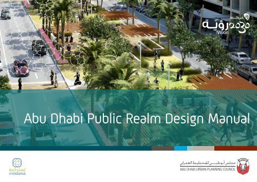
<strong>Abu</strong> <strong>Dhabi</strong> <strong>Public</strong> <strong>Realm</strong> <strong>Design</strong> <strong>Manual</strong>
Page ii
His Highness Sheikh Khalifa bin Zayed Al Nahyan<br />
President of the United Arab Emirates and Ruler of <strong>Abu</strong> <strong>Dhabi</strong><br />
Page iii
Page iv
His Highness General Sheikh Mohamed bin Zayed Al Nahyan<br />
Crown Prince of <strong>Abu</strong> <strong>Dhabi</strong>, Deputy Supreme Commander of the UAE Armed<br />
Forces and Chairman of the <strong>Abu</strong> <strong>Dhabi</strong> Executive Council<br />
Page v
Page vi
Part I<br />
1.0. Introduction 3<br />
1.1. <strong>Public</strong> <strong>Realm</strong> Definition 3<br />
1.2. <strong>Manual</strong> Jurisdiction 3<br />
1.3. Planning Context 4<br />
1.4. Planning Process 5<br />
2.0. Vision 9<br />
2.1. Principles 9<br />
2.2. Policies 9<br />
3.0 Level of Service 15<br />
3.1. <strong>Public</strong> <strong>Realm</strong> Hierarchy 15<br />
3.2. Universal Level of Service 16<br />
3.3. Park Hierarchy 17<br />
3.4. Streetscape Hierarchy 18<br />
3.5. Waterfront Hierarchy 19<br />
3.6. <strong>Public</strong> Place Hierarchy 20<br />
3.7. Park Service Area Analysis 21<br />
3.8. Existing Park and Open Space Conditions 25<br />
3.9. 2030 Park Level of Service 25<br />
TABLE OF CONTENTS<br />
ABU DHABI PUBLIC REALM DESIGN MANUAL<br />
Page vii<br />
Part II<br />
4.0. <strong>Public</strong> <strong>Realm</strong> Network 31<br />
4.1. <strong>Abu</strong> <strong>Dhabi</strong> Island Conceptual <strong>Public</strong> <strong>Realm</strong> Network 31<br />
4.2. <strong>Abu</strong> <strong>Dhabi</strong> Mainland Conceptual <strong>Public</strong> <strong>Realm</strong> Network 31<br />
4.3. Al Ain Conceptual <strong>Public</strong> <strong>Realm</strong> Network 31<br />
4.4. Continuing the Process 31<br />
5.0 Parks 37<br />
5.1. Park Planning Process 37<br />
5.2. Park Hierarchy 37<br />
5.3 Park <strong>Design</strong> Guidelines 39<br />
Park Universal <strong>Design</strong> Guidelines 41<br />
Art Park 43<br />
Baraha 45<br />
Ceremonial Park 47<br />
Community Garden 49<br />
Community Park 51<br />
Conservation Park 53<br />
Desert Park 55<br />
Family Park 57<br />
Heritage Park 59<br />
Linear Park 61<br />
Meyadeen 63<br />
Oasis Park 65<br />
Sports Park 67
6.0 Streetscapes 71<br />
6.1. Streetscape Planning Process 71<br />
6.2. Streetscape Hierarchy 71<br />
6.3 Streetscape <strong>Design</strong> Guidelines 73<br />
Streetscape Universal <strong>Design</strong> Guidelines 75<br />
Ceremonial Route 77<br />
Gateway 79<br />
Mushtarak (Shared-Use Access) 81<br />
Parking Area 83<br />
Pedestrian First Corridor 85<br />
Pedestrian Crossing 87<br />
Scenic Route 89<br />
Sikka (Paved Pedestrian Path) 91<br />
Themed Corridor 93<br />
Transit Corridor 95<br />
7.0 Waterfronts 99<br />
7.1. Waterfront Planning Process 99<br />
7.2. Waterfront Hierarchy 99<br />
7.3 Waterfront <strong>Design</strong> Guidelines 101<br />
Waterfront Universal <strong>Design</strong> Guidelines 103<br />
Waterfront Access 105<br />
Preservation Area 107<br />
Recreation Area 109<br />
Urban Area 111<br />
Page viii<br />
8.0 <strong>Public</strong> Places 115<br />
8.1. <strong>Public</strong> Places Planning Process 115<br />
8.2. <strong>Public</strong> Place Hierarchy 115<br />
8.3 <strong>Public</strong> Place <strong>Design</strong> Guidelines 117<br />
Part III<br />
<strong>Public</strong> Places Universal <strong>Design</strong> Guidelines 119<br />
Cultural Destination 121<br />
Heritage Feature 123<br />
Landmark Destination 125<br />
Mosque 127<br />
Plaza 129<br />
Souq 131<br />
Appendix A - Glossary 137<br />
Appendix B - Plant List 141<br />
Appendix C - Irrigation Guide 213<br />
Appendix D - Acknowledgements 215
FIGURES & TABLES<br />
ABU DHABI PUBLIC REALM DESIGN MANUAL<br />
Figure 1.1: Plan <strong>Abu</strong> <strong>Dhabi</strong> 2030 4<br />
Figure 1.2: Plan Al Ain 2030 4<br />
Table 3.1 <strong>Public</strong> <strong>Realm</strong> Hierarchy Definition 15<br />
Table 3.2 Universal Standards 16<br />
Table 3.3 <strong>Public</strong> <strong>Realm</strong> Park Hierarchy 17<br />
Table 3.4 <strong>Public</strong> <strong>Realm</strong> Streetscape Hierarchy 18<br />
Table 3.5 <strong>Public</strong> <strong>Realm</strong> Waterfront Hierarchy 19<br />
Table 3.6 <strong>Public</strong> <strong>Realm</strong> <strong>Public</strong> Place Hierarchy 20<br />
Figure 3.1 Park Coverage Gaps - <strong>Abu</strong> <strong>Dhabi</strong> Island 22<br />
Figure 3.2 Park Coverage Gaps - <strong>Abu</strong> <strong>Dhabi</strong> Mainland 23<br />
Figure 3.3 Park Coverage Gaps - Al Ain City 24<br />
Table 3.7 Existing Conditions of Parks and Open Space (2010) 25<br />
Table 3.8 Parks Allocation by Municipality 25<br />
Figure 4.1: <strong>Abu</strong> <strong>Dhabi</strong> Island Conceptual <strong>Public</strong> <strong>Realm</strong> Network 32<br />
Figure 4.2: <strong>Abu</strong> <strong>Dhabi</strong> Mainland Conceptual <strong>Public</strong> <strong>Realm</strong> Network 33<br />
Figure 4.3: Al Ain City Conceptual <strong>Public</strong> <strong>Realm</strong> Network 34<br />
Page ix<br />
Figure 5.1: PRDM Planning Process 37<br />
Table 5.1 <strong>Public</strong> <strong>Realm</strong> Park Hierarchy 38<br />
Table 5.2 Park Typologies 39<br />
Figure 6.1: PRDM Planning Process 71<br />
Table 6.1 <strong>Public</strong> <strong>Realm</strong> Streetscape Hierarchy 72<br />
Table 6.2. Streetscape Typologies 73<br />
Figure 7.1: PRDM Planning Process 99<br />
Table 7.1 <strong>Public</strong> <strong>Realm</strong> Waterfront Hierarchy 100<br />
Table 7.2. Waterfront Typologies 101<br />
Figure 8.1: PRDM Planning Process 115<br />
Table 8.1 <strong>Public</strong> <strong>Realm</strong> <strong>Public</strong> Place Hierarchy 116<br />
Table 8.2. <strong>Public</strong> Place Typologies 117
Page x
MANDATE OF THE ABU DHABI URBAN PLANNING COUNCIL<br />
The <strong>Abu</strong> <strong>Dhabi</strong> Urban Planning Council was<br />
created by Law No. 23 of 2007 and is the<br />
agency responsible for the future of <strong>Abu</strong><br />
<strong>Dhabi</strong>’s urban and regional environments,<br />
and the expert authority behind the<br />
visionary <strong>Abu</strong> <strong>Dhabi</strong> 2030 Urban Structure<br />
Framework Plan published September<br />
2007. Chaired by His Highness General<br />
Sheikh Mohamed bin Zayed Al Nahyan,<br />
Crown Prince of <strong>Abu</strong> <strong>Dhabi</strong>, Deputy<br />
Supreme Commander of the UAE Armed<br />
Forces and Chairman of the <strong>Abu</strong> <strong>Dhabi</strong><br />
Executive Council, the <strong>Abu</strong> <strong>Dhabi</strong> Urban<br />
Planning Council defines the shape of<br />
human settlements in the Emirate, ensuring<br />
factors such as sustainability, infrastructure<br />
capacity, community planning and quality<br />
of life, by overseeing development in the<br />
cities and in the Emirate as a whole. The<br />
<strong>Abu</strong> <strong>Dhabi</strong> Urban Planning Council ensures<br />
best practice in planning for both new and<br />
existing settlements.<br />
Page xi<br />
The <strong>Abu</strong> <strong>Dhabi</strong> Urban Planning Council’s<br />
primary purpose is to deliver upon the<br />
vision of His Highness Sheikh Khalifa Bin<br />
Zayed Al Nahyan, President of the United<br />
Arab Emirates and Ruler of <strong>Abu</strong> <strong>Dhabi</strong>,<br />
for the continued fulfillment of the grand<br />
design envisaged by the late Sheikh Zayed<br />
Bin Sultan Al Nahyan, Father of the Nation,<br />
and the ongoing evolution of the Emirate of<br />
<strong>Abu</strong> <strong>Dhabi</strong>. By drawing on urban planning<br />
expertise from local Emiratis, throughout<br />
the Arab States of the Gulf, and around the<br />
world, the Urban Planning Council strives<br />
to be a global authority on the future of<br />
urban planning and design.<br />
Building on the success of Plan <strong>Abu</strong> <strong>Dhabi</strong><br />
2030, the <strong>Abu</strong> <strong>Dhabi</strong> Urban Planning<br />
Council is pleased to issue the <strong>Public</strong> <strong>Realm</strong><br />
<strong>Design</strong> <strong>Manual</strong> for the Emirate of <strong>Abu</strong> <strong>Dhabi</strong><br />
the guidelines of which are contained<br />
within this document.
Page xii
Part I
Chapter 1.0 - INTRODUCTION<br />
1.1 <strong>Public</strong> <strong>Realm</strong> Definition<br />
1.2 <strong>Manual</strong> Jurisdiction<br />
1.3 Planning Context<br />
1.4 Planning Process
<strong>Abu</strong> <strong>Dhabi</strong> <strong>Public</strong> <strong>Realm</strong> <strong>Design</strong> <strong>Manual</strong><br />
Chapter 1 - Introduction<br />
Chapter 1 Page 2
The <strong>Abu</strong> <strong>Dhabi</strong> <strong>Public</strong> <strong>Realm</strong><br />
<strong>Design</strong> <strong>Manual</strong> (PRDM)<br />
was commissioned by the<br />
<strong>Abu</strong> <strong>Dhabi</strong> Urban Planning<br />
Council (UPC) to guide the<br />
development of a worldclass<br />
public realm.<br />
History’s greatest cities<br />
have unique physical<br />
patterns that are defined<br />
by the relationships<br />
between buildings, streets,<br />
open spaces and landforms.<br />
These relationships form<br />
the public realm system<br />
and create destinations.<br />
With the development of<br />
the PRDM, the Emirate<br />
of <strong>Abu</strong> <strong>Dhabi</strong> is actively<br />
planning for the public<br />
realm and building a worldclass<br />
community.<br />
The <strong>Public</strong> <strong>Realm</strong> <strong>Design</strong><br />
<strong>Manual</strong> is an essential<br />
planning tool that will help<br />
the Emirate achieve its<br />
vision for the future.<br />
1.0. Introduction<br />
This <strong>Manual</strong> is part of the UPC’s<br />
development regulations and is approved<br />
by the Emirate of <strong>Abu</strong> <strong>Dhabi</strong> Executive<br />
Council for use in all public realm designs<br />
across the Emirate, as defined by this<br />
<strong>Manual</strong> or otherwise by the UPC.<br />
This <strong>Manual</strong> constitutes one of many<br />
related design initiatives in the Emirate of<br />
<strong>Abu</strong> <strong>Dhabi</strong>. It shall be used in conjunction<br />
with other adopted standards and<br />
guidelines as applicable. The PRDM<br />
integrates the needs of different agencies<br />
and shall be undertaken by multiple<br />
professionals, including urban planners<br />
and designers, transport planners, traffic<br />
engineers, and landscape architects.<br />
The <strong>Manual</strong> shall be used by all agencies<br />
in the design and approval of all public<br />
realm designs in the Emirate of <strong>Abu</strong><br />
<strong>Dhabi</strong>, and shall take precedence over all<br />
existing public realm design manuals.<br />
The <strong>Abu</strong> <strong>Dhabi</strong> <strong>Public</strong> <strong>Realm</strong> <strong>Design</strong><br />
<strong>Manual</strong> will be updated regularly as new<br />
data and experience with best practices<br />
become available. Please check the UPC<br />
website for the latest version before<br />
using this <strong>Manual</strong>.<br />
The PRDM consists of three parts:<br />
• Part I: The foundation for public<br />
realm planning.<br />
• Part II: A step-by-step guide to<br />
developing a public realm project<br />
that is consistent with the public<br />
realm vision, principles and policies.<br />
• Part III: Technical Appendices.<br />
Each section focuses on how the public<br />
realm meets the needs of the future<br />
residents and visitors of the Emirate.<br />
Chapter 1 Page 3<br />
1.1. <strong>Public</strong> <strong>Realm</strong> Definition<br />
The public realm includes all exterior<br />
places, linkages and built form elements<br />
that are physically and/or visually<br />
accessible regardless of ownership.<br />
These elements can include, but are<br />
not limited to, streets, pedestrian ways,<br />
bikeways, bridges, plazas, nodes,<br />
squares, transportation hubs, gateways,<br />
parks, waterfronts, natural features,<br />
view corridors, landmarks and building<br />
interfaces.<br />
To simplify and plan for the Emirate,<br />
the public realm is organised into<br />
four categories: Parks, Streetscapes,<br />
Waterfronts and <strong>Public</strong> Places.<br />
Definitions for these categories are as<br />
follows:<br />
• Parks - <strong>Public</strong> spaces within a<br />
community for recreational use.<br />
Parks may include natural areas<br />
such as mountain ridges and wadi<br />
systems.<br />
• Streetscapes - The visual elements<br />
of a street including the road,<br />
sidewalk, street furniture, trees and<br />
open spaces that combine to form<br />
the street’s character.<br />
• Waterfronts - All land areas along<br />
the water’s edge.<br />
• <strong>Public</strong> Places - All open areas within<br />
a community visible to the public or<br />
for public gathering or assembly.<br />
If a proposed public realm design falls<br />
into more than one category, other<br />
category guidelines may be applied per<br />
area of variance. Any conflicts between<br />
typology design guidelines revert to<br />
the Universal <strong>Design</strong> Guidelines (UDG).<br />
Any conflicts between Universal <strong>Design</strong><br />
Guidelines revert to policies.<br />
<strong>Abu</strong> <strong>Dhabi</strong> <strong>Public</strong> <strong>Realm</strong> <strong>Design</strong> <strong>Manual</strong><br />
Chapter 1 - Introduction<br />
1.2. <strong>Manual</strong> Jurisdiction<br />
For the purpose of this <strong>Manual</strong>, the<br />
public realm includes all areas within the<br />
existing and planned urban and settled<br />
areas of the Emirate. Urban areas are<br />
defined in the maps contained in Capital<br />
2030, Plan Al Ain 2030 and Plan Al<br />
Gharbia 2030. Where ambiguity arises<br />
regarding the jurisdiction, consult with<br />
the UPC.<br />
The PRDM has developed Conceptual<br />
<strong>Public</strong> <strong>Realm</strong> Networks for three initial<br />
focus areas: <strong>Abu</strong> <strong>Dhabi</strong> Island, <strong>Abu</strong> <strong>Dhabi</strong><br />
Mainland and Al Ain City. The Networks<br />
provide specific guidance based on the<br />
unique qualities of each focus area.<br />
Conceptual <strong>Public</strong> <strong>Realm</strong> Networks will<br />
also be completed for Al Gharbia and the<br />
Al Ain in 2011.
<strong>Abu</strong> <strong>Dhabi</strong> <strong>Public</strong> <strong>Realm</strong> <strong>Design</strong> <strong>Manual</strong><br />
Chapter 1 - Introduction<br />
1.3. Planning Context<br />
The Emirate of <strong>Abu</strong> <strong>Dhabi</strong> is planning<br />
for the next generation. The PRDM is<br />
one piece of an Emirate-wide planning<br />
strategy. The PRDM builds on other<br />
planning documents in a continued effort<br />
to shape the future development of <strong>Abu</strong><br />
<strong>Dhabi</strong>.<br />
Central to the planning efforts in <strong>Abu</strong><br />
<strong>Dhabi</strong> are the 2030 Plans which establish<br />
a vision for future development of the<br />
Emirate. The 2030 Plans include:<br />
• Plan Capital 2030: Urban Structure<br />
Framework Plan<br />
• Plan Al Ain 2030: Urban Structure<br />
Framework Plan<br />
• Plan Al Gharbia 2030: Urban<br />
Structure Framework Plan<br />
The 2030 Plans regulate the pattern of<br />
urban expansion to balance economic,<br />
social and environmental priorities<br />
in a sustainable manner. The plans<br />
emphasise human-scale development<br />
within a pedestrian-friendly environment.<br />
In particular, the 2030 Plans establish<br />
a framework for public open space<br />
that preserves the unique ecology of<br />
the Emirate and prevents sprawling<br />
community development. Using these<br />
plans as guides, the PRDM develops<br />
specific strategies for enhancing the<br />
public realm.<br />
The PRDM also maintains the principles<br />
of one of the fundamental concepts of<br />
planning in <strong>Abu</strong> <strong>Dhabi</strong>: Estidama. The<br />
Arabic word for sustainability, Estidama<br />
is an initiative to incorporate sustainable<br />
principles into every aspect of planning in<br />
the Emirate.<br />
More than just a sustainability<br />
programme, Estidama is the symbol of<br />
an inspired vision for governance and<br />
community development. It promotes<br />
sustainable principles in every aspect of<br />
our community and nurtures lifestyleenhancing<br />
initiatives for the people of<br />
<strong>Abu</strong> <strong>Dhabi</strong> today, but also taking a longer<br />
term view for the next generations.<br />
In addition to coordinating with the<br />
guiding principles of the 2030 Plans and<br />
Estidama, the PRDM incorporates the<br />
fundamental concepts of the following<br />
UPC initiatives:<br />
• <strong>Abu</strong> <strong>Dhabi</strong> Development Code<br />
• Estidama Pearl Rating System (PRS)<br />
• <strong>Abu</strong> <strong>Dhabi</strong> Urban Street <strong>Design</strong><br />
<strong>Manual</strong> (USDM)<br />
• Interim Coastal Development<br />
Guidelines<br />
• Neighbourhood Planning<br />
• Consolidated Community Facilities<br />
Requirements for New Developments<br />
• <strong>Abu</strong> <strong>Dhabi</strong> Mosque <strong>Design</strong><br />
Regulations: Interim <strong>Design</strong><br />
Guidelines & Standards<br />
<strong>Public</strong> safety and security has also played<br />
an important role in the development<br />
of the PRDM. The safety and security<br />
element of the PRDM applies the<br />
principles of Crime Prevention Through<br />
ينارمعلا طيطختلل يبظوبأ سلجم <strong>Abu</strong> <strong>Dhabi</strong> Urban Planning Council<br />
62221 ب.ص P.O.Box 62221<br />
Environmental <strong>Design</strong> ةدحتملا ةيبرعلا تاراملإا ،يبظوبأ (CPTED) <strong>Abu</strong> <strong>Dhabi</strong>, United Arab Emirates and<br />
Tel: +971 2 409 6000<br />
Fax: +971 2 443 2903<br />
www.upc.gov.ae<br />
approaches the challenge of creating a<br />
defensible environment by addressing<br />
both the physical and psychological<br />
aspects of design.<br />
Urban Structure Framework Plan<br />
Plan <strong>Abu</strong> <strong>Dhabi</strong> 2030<br />
Chapter 1 Page 4<br />
Finally, the PRDM was developed in<br />
respect to the wide range of planning<br />
documents completed and compiled<br />
by the UPC, the Municipalities and<br />
other agencies to create a plan that<br />
appropriately addresses the public realm<br />
of the Emirate.<br />
Plan <strong>Abu</strong> <strong>Dhabi</strong> 2030<br />
Urban Structure Framework Plan<br />
Figure 1.1: Plan <strong>Abu</strong> <strong>Dhabi</strong> 2030 Figure 1.2: Plan Al Ain 2030
1.4. Planning Process<br />
The PRDM is focused on providing a<br />
public realm that meets the needs of the<br />
people of <strong>Abu</strong> <strong>Dhabi</strong>. Key to fulfilling<br />
this objective is understanding how<br />
the community views the public realm.<br />
During the planning process, various<br />
stakeholder meetings and a public survey<br />
were held to address community and<br />
agency needs.<br />
Stakeholder Meetings<br />
In seeking to realise our vision and to<br />
improve the quality of the public realm,<br />
numerous stakeholder meetings and<br />
consultations were conducted with<br />
key agencies involved in public realm<br />
planning, including:<br />
• The Department of Municipal Affairs<br />
(DMA)<br />
• <strong>Abu</strong> <strong>Dhabi</strong> Municipality (ADM)<br />
• Al Ain Municipality (AAM)<br />
• Department of Transportation (DoT)<br />
• Tourism Development and Investment<br />
Company (TDIC)<br />
• <strong>Abu</strong> <strong>Dhabi</strong> Authority for Culture and<br />
Heritage (ADACH)<br />
During each meeting, participants<br />
discussed current challenges in public<br />
realm planning, including best practice<br />
in the management and design of the<br />
public realm, and appropriate elements<br />
and tools to be utilised in the <strong>Manual</strong>.<br />
The outcome of these meetings was the<br />
development of the shared vision and<br />
principles outlined in Chapter 2.0.<br />
<strong>Public</strong> Survey<br />
As part of the PRDM, an opinion survey<br />
was conducted to gather input on the<br />
availability and use of parks. The<br />
survey gauged the public’s opinion to<br />
help inform the policies and guidelines<br />
produced in the PRDM. The findings of<br />
the survey are presented in Table 1.1.<br />
The survey was completed as part of<br />
the PRDM and provided a preliminary<br />
assessment of residents’ perceived needs<br />
for parks.<br />
As the UPC was completing a project<br />
in parallel to determine the community<br />
facility needs of residents, a community<br />
facilities survey was completed. A total<br />
of 10,882 households were surveyed<br />
as part of this project. The overall<br />
objectives of this household survey<br />
provided:<br />
• Focussed and up-to-date insights<br />
on the size, structure and<br />
characteristics of households<br />
throughout <strong>Abu</strong> <strong>Dhabi</strong> Emirate;<br />
• Insights on the current patterns of<br />
use of community facilities in the<br />
Emirate and frequency of visits;<br />
• Insights on community facilities that<br />
households perceived as missing or<br />
inadequately provided.<br />
Chapter 1 Page 5<br />
The Community Facilities Survey clearly<br />
showed that:<br />
• 63% of the total households (6,907<br />
households) said that there was one<br />
or more missing community facility<br />
from their local area;<br />
• The top most cited missing<br />
community facilities were;<br />
• a shopping or eating premises<br />
• places of entertainment<br />
(gardens, parks and<br />
playgrounds);<br />
• healthcare (especially in rural<br />
areas);<br />
• 2,663 households said that they<br />
were missing a park in their<br />
neighbourhood – the single, highest<br />
missing community facility that<br />
people specified;<br />
• 30% of households visit parks -<br />
more than three times any other<br />
sports facility.<br />
<strong>Abu</strong> <strong>Dhabi</strong> <strong>Public</strong> <strong>Realm</strong> <strong>Design</strong> <strong>Manual</strong><br />
Chapter 1 - Introduction<br />
Table 1.1: Key <strong>Public</strong> Survey Responses<br />
Key Qualities for Ideal Parks<br />
» Security<br />
» Family Seating Areas<br />
» Hygienic Restrooms<br />
» Game Areas for Children<br />
» Places to Buy Soft Drinks<br />
» Comfortable Seating<br />
» Shaded Areas<br />
» Diverse Play Equipment<br />
Key Qualities for Ideal Streetscapes<br />
» Safety and Security for Families<br />
» Property Separation Between People and<br />
Vehicles<br />
» Adequate Seating<br />
» High-quality Paving Materials<br />
» Shopping and Dining<br />
» Cycling Opportunities<br />
Key Qualities for Ideal Waterfronts<br />
» Proper Shading and Seating Along<br />
Pathways<br />
» Increased Access for Pedestrians and<br />
Cyclists<br />
» Naturalised Environment<br />
» Food, Drink and Restrooms<br />
Key Qualities for Ideal <strong>Public</strong> Places<br />
» Safety and Security<br />
» Proper Separation to Ensure Family<br />
Privacy<br />
» Variety of Shopping<br />
» Shaded Areas<br />
» Food, Drink and Restrooms
<strong>Abu</strong> <strong>Dhabi</strong> <strong>Public</strong> <strong>Realm</strong> <strong>Design</strong> <strong>Manual</strong><br />
Chapter 1 - Introduction<br />
Chapter 1 Page 6
Chapter 2.0 - VISION<br />
2.1 Principles<br />
2.2 Policies
<strong>Abu</strong> <strong>Dhabi</strong> <strong>Public</strong> <strong>Realm</strong> <strong>Design</strong> <strong>Manual</strong><br />
Chapter 2 Page 8
2.0. Vision<br />
The public realm in <strong>Abu</strong> <strong>Dhabi</strong> expresses<br />
traditional Arab culture while serving<br />
the diverse, multicultural population.<br />
It is a fully accessible and engaging<br />
experience that includes diverse public<br />
parks and civic spaces; an interconnected<br />
system of public walkways, bicycle trails<br />
and public transit; a vibrant and active<br />
waterfront; and active mixed-use areas<br />
that are all enhanced through highquality<br />
architecture, streetscape design<br />
and public art. It is safe, comfortable and<br />
responds to the climate and environment<br />
of <strong>Abu</strong> <strong>Dhabi</strong>.<br />
2.1. Principles<br />
Furthering this vision, nine principles<br />
expand on how the public realm<br />
addresses the following key themes:<br />
• Liveability<br />
• Identity<br />
• Access<br />
• Connectivity<br />
• Placemaking & <strong>Design</strong> Excellence<br />
• Environmental Stewardship<br />
• Inclusivity<br />
• Activation<br />
• Shared Ownership & Implementation<br />
The public realm principles support<br />
the decision-making process and<br />
the achievement of long-range and<br />
measurable results. They ensure that<br />
public realm development reflects the<br />
established vision.<br />
2.2. Policies<br />
The policies define and implement the nine<br />
public realm principles. These policies<br />
support and guide the decision-making<br />
process and should be used to inform the<br />
content of all public realm and development<br />
proposals from initial concept to<br />
implementation. Implementing public realm<br />
policies should result in a clear way forward<br />
to achieve quality outcomes.<br />
Principle 1.0<br />
Liveability - The public realm is a safe<br />
and comfortable space, where diverse<br />
activities can be experienced by all,<br />
contributing to people’s physical and<br />
mental wellness, and providing a highquality<br />
of life.<br />
1.1 General Policy<br />
1.1.1 The public realm promotes physical<br />
and mental health by providing an alternative<br />
to the urban environment.<br />
1.1.2 The public realm contributes to a<br />
high-quality of life by providing space for<br />
relaxation and enjoyment.<br />
1.1.3 Vegetation is located and grouped to<br />
increase the comfort of pedestrians through<br />
passive cooling and shading effects.<br />
1.1.4 Trees and shade structures are used to<br />
create continuous shadeways.<br />
1.1.5 High-quality materials that are easy<br />
to clean, maintain and repair are used in the<br />
public realm.<br />
1.1.6 Lighting is scaled for pedestrians and<br />
provides the greatest safety benefit for<br />
vehicles and pedestrians.<br />
1.1.7 The public realm is adequately<br />
maintained to ensure safety.<br />
Chapter 2 Page 9<br />
1.1.8 Crime prevention and security,<br />
through design principles, is used to create<br />
safe and secure places for the community.<br />
(CPTED)<br />
1.1.9 Security features are designed and<br />
integrated in the public realm so they are<br />
physically and visually cohesive with other<br />
streetscape elements.<br />
1.2 Park Policy<br />
1.2.1 Parks provide ample space for<br />
activities, sports, fitness and organised play.<br />
1.2.2 Parks are protected from development<br />
in perpetuity.<br />
1.2.3 Play areas offer clearly separated<br />
amenities to accommodate different age<br />
groups.<br />
1.2.4 Visibility is maintained throughout play<br />
areas so adults can supervise children.<br />
1.2.5 Furnishings and amenities for adults<br />
are clustered adjacent to play areas.<br />
1.3 Streetscape Policy<br />
1.3.1 Streetscapes are designed for<br />
pedestrians first.<br />
1.3.2 Streetscapes offer well-defined<br />
pedestrian routes, spaces and entrances to<br />
buildings for convenient movement.<br />
1.4 Waterfront Policy<br />
1.4.1 Waterfronts will include recreational<br />
activities such as swimming and boating.<br />
1.4.2 Waterfronts include access to the<br />
water’s edge using boardwalks, pathways<br />
and promenades for outdoor recreation.<br />
1.5 <strong>Public</strong> Place Policy<br />
1.5.1 <strong>Public</strong> places encourage social<br />
interaction.<br />
1.5.2 <strong>Public</strong> places seamlessly connect with<br />
their surroundings.<br />
<strong>Abu</strong> <strong>Dhabi</strong> <strong>Public</strong> <strong>Realm</strong> <strong>Design</strong> <strong>Manual</strong><br />
Principle 2.0<br />
Chapter 2 - Vision<br />
Identity - The public realm will be a<br />
unique expression of Arab culture,<br />
heritage, values and traditions expressed<br />
throughout <strong>Abu</strong> <strong>Dhabi</strong>, the UAE Capital.<br />
2.1 General Policy<br />
2.1.1 Plant materials used in the public<br />
realm will reinforce the unique regional<br />
identity of areas within the Emirate.<br />
2.1.2 The public realm incorporates a<br />
broad selection of public art based on the<br />
recommendations of the <strong>Public</strong> Art Master<br />
Plan and emerging policies.<br />
2.1.3 The public realm enhances the<br />
urban environment and encourages the<br />
development of a positive identity for the<br />
Emirate.<br />
2.1.4 Historic, cultural and natural resources<br />
in the public realm are preserved and<br />
enhanced.<br />
2.1.5 The public realm provides an authentic<br />
experience and learning opportunity about<br />
Arab culture and tradition.<br />
2.2 Park Policy<br />
2.2.1 Parks will provide space for cultural<br />
and social activities.<br />
2.2.2 Oases are the Emirate’s signature<br />
attraction for visitors to Al Ain.<br />
2.2.3 The interface with oases will<br />
be enhanced to highlight their unique<br />
characteristics as working farms.
<strong>Abu</strong> <strong>Dhabi</strong> <strong>Public</strong> <strong>Realm</strong> <strong>Design</strong> <strong>Manual</strong><br />
Chapter 2 - Vision<br />
2.3 Streetscape Policy<br />
2.3.1 Streetscape and gateway design<br />
communicates entry and arrival.<br />
2.3.2 Streetscape design enhances and<br />
preserves views of significant buildings,<br />
such as mosques, government or cultural<br />
facilities and natural areas such as coasts,<br />
deserts, mountains and oases.<br />
2.3.3 Streetscapes promote the visual<br />
prominence of important circulation routes<br />
by eliminating unsightly signage clutter,<br />
utility and mechanical equipment and by<br />
implementing a lighting strategy.<br />
2.4 Waterfront Policy<br />
2.4.1 Waterfronts define the coastal identity<br />
of <strong>Abu</strong> <strong>Dhabi</strong> Emirate.<br />
2.4.2 The Emirate defines and celebrates<br />
its relationship to the water through<br />
interpretive displays, signage and public art.<br />
2.4.3 A variety of water-related signature<br />
features create a unique waterfront.<br />
2.5 <strong>Public</strong> Place Policy<br />
2.5.1 <strong>Public</strong> places serve as destinations<br />
highlighting the special attributes and<br />
attractions of the Emirate.<br />
2.5.2 <strong>Public</strong> places are fully integrated with<br />
surrounding commercial uses to promote<br />
commerce and economic activity.<br />
Principle 3.0<br />
Access - The public realm ensures<br />
full access to Parks, Streetscapes,<br />
Waterfronts and <strong>Public</strong> Places.<br />
3.1 General Policy<br />
3.1.1 The public realm is visually and<br />
physically accessible.<br />
3.1.2 Within the public realm all water<br />
features will be accessible to the public.<br />
3.1.3 Special features in the public realm<br />
are accessible to all residents and visitors by<br />
meeting the standards of universal design<br />
and accessibility.<br />
3.1.4 The public realm includes a hierarchy<br />
of wayfinding signs such as maps,<br />
information kiosks and street signs.<br />
3.1.5 The public realm incorporates<br />
pedestrian, bicycle and vehicle safety<br />
features including ‘tactile’ paving at<br />
crossings, appropriate lighting and signalised<br />
pedestrian crossings.<br />
3.2 Parks Policy<br />
3.2.1 By 2030, 90% of all residents in<br />
the Emirate will be within 350 m walking<br />
distance of a park.<br />
3.2.2 Continuous public access will be<br />
provided along the edges of wadis above the<br />
flash flood level.<br />
3.3 Streetscape Policy<br />
3.3.1 Street furniture, walls, fencing and<br />
utilities are situated to minimise visual or<br />
physical obstructions for pedestrians and<br />
cyclists.<br />
3.4 Waterfront Policy<br />
3.4.1 Promote a multimodal transportation<br />
system that integrates ferries, water taxis<br />
and other waterborne transportation for<br />
pedestrians, bicycles and vehicles.<br />
3.4.2 Views to the waterfront are protected<br />
in areas where physical access is limited.<br />
3.4.3 Provide views and/or access points<br />
to the waterfront at a minimum of 1 every<br />
500 m.<br />
3.5 <strong>Public</strong> Place Policy<br />
3.5.1 <strong>Public</strong> places incorporate gateways<br />
and wayfinding techniques to encourage<br />
access.<br />
3.5.2 Commercial activities, such as<br />
markets and open-air souqs, extend along<br />
streetscapes to increase their visibility and<br />
accessibility.<br />
Principle 4.0<br />
Connectivity - The public realm is<br />
interconnected and enhances the<br />
mobility of people by providing<br />
continuous land and water access for<br />
pedestrians, cyclists and other modes of<br />
transport.<br />
4.1 General Policy<br />
4.1.1 The public realm is a continuous<br />
shaded pedestrian experience.<br />
4.1.2 Wadis link elements in the public<br />
realm.<br />
4.1.3 The public realm includes protected<br />
drop-off and pick-up areas to maximise<br />
safety, accessibility and connectivity to<br />
other modes of transportation.<br />
4.1.4 Community facilities are co-located<br />
with parks and open spaces to improve<br />
efficiency and encourage shared facilities.<br />
4.2 Park Policy<br />
4.2.1 Parks include a network of accessible<br />
spaces with diverse uses for the existing and<br />
future populations.<br />
4.2.2 Parks and oases are integral in<br />
the overall open space network of safe,<br />
attractive and legible links with residential<br />
and commercial areas.<br />
4.3 Streetscape Policy<br />
4.3.1 Streetscapes incorporate appropriate<br />
separation between pedestrian, bicycle and<br />
automobiles.<br />
Chapter 2 Page 10<br />
4.3.2 Streetscapes prioritise pedestrians<br />
over vehicles by including safe at-grade<br />
crossings and appropriate mid-block<br />
crossings.<br />
4.3.3 Sikkak are used to connect<br />
neighbourhoods.<br />
4.4 Waterfront Policy<br />
4.4.1 Waterfronts are part of a continuous<br />
active transportation system for pedestrians,<br />
bicycles and waterborne transport.<br />
4.4.2 Views are preserved by establishing<br />
sightlines down major street corridors.<br />
4.5 <strong>Public</strong> Place Policy<br />
4.5.1 Building landscapes are connected<br />
visually and thematically to the surrounding<br />
streets and neighbourhoods.<br />
4.5.2 Walls surrounding government facilities<br />
are eliminated, or their heights reduced, to<br />
enhance visual linkages to the surrounding<br />
neighbourhood.<br />
Principle 5.0<br />
Placemaking & <strong>Design</strong> Excellence - The<br />
public realm is made up of high-quality,<br />
human-scaled and visually interesting<br />
places. The public realm includes<br />
multi-functional, flexible and climate<br />
responsive design solutions using highquality,<br />
sustainably sourced materials.<br />
5.1 General Policy<br />
5.1.1 The public realm demonstrates high<br />
levels of design excellence and follows best<br />
practice maintenance procedures.<br />
5.1.2 The public realm meets the needs of<br />
the community while enhancing the historic<br />
and/or multi-cultural context of the Emirate.
5.1.3 The public realm promotes safety and<br />
security by providing adequate lighting, sight<br />
lines into parks, and minimising secluded<br />
spaces.<br />
5.1.4 Tree pruning is minimised to allow<br />
trees to grow naturally and assume their<br />
natural form.<br />
5.1.5 Structures and amenities will be<br />
constructed of heat-resistant materials such<br />
as timber or molded plastic.<br />
5.1.6 High-quality materials that are easy<br />
to clean, maintain and repair if damaged are<br />
used in the public realm.<br />
5.2 Park Policy<br />
5.2.1 The use of hedges around parks is<br />
minimised to ensure views remain open.<br />
5.3 Streetscape Policy<br />
5.3.1 Streetscapes reflect the scale,<br />
character and function of adjacent land uses<br />
and integrate with the surrounding natural<br />
and built environments.<br />
5.3.2 Streetscapes vary in scale and the<br />
use of paving, curbs, trims, channels and<br />
landscaping to differentiate streetscape<br />
typologies.<br />
5.4 Waterfront Policy<br />
5.4.1 Waterfronts will be compatible with<br />
adjacent development.<br />
5.4.2 The <strong>Abu</strong> <strong>Dhabi</strong> coastline includes<br />
world-class destinations in appropriate<br />
locations.<br />
5.4.3 Waterfronts will highlight views both<br />
to and from the water.<br />
5.5 <strong>Public</strong> Place Policy<br />
5.5.1 The urban environment is enhanced<br />
with inviting and interactive public places.<br />
5.5.2 High-quality landscape and plaza<br />
design contribute to the overall experience<br />
of the public realm.<br />
Principle 6.0<br />
Environmental Stewardship - The public<br />
realm is responsibly designed to achieve<br />
water and energy efficiency, and will<br />
respect important natural assets and<br />
native flora and fauna.<br />
6.1 General Policy<br />
6.1.1 Through temporary interpretive<br />
displays during, and permanent displays<br />
following construction, the public is involved<br />
with the design of the public realm.<br />
6.1.2 Solar, light-emitting diode(LED) or<br />
wind-powered lighting is used, where<br />
practical, to reduce energy consumption.<br />
6.1.3 The public realm design conserves<br />
water, preserves habitat and enhances<br />
biodiversity by using climate-appropriate<br />
plant materials.<br />
6.1.4 A water budget will be used for all<br />
public realm development to comply with<br />
Estidama.<br />
6.1.5 At least 80% of the total proposed<br />
landscaped areas in public realm projects<br />
consist of locally occurring, drought tolerant<br />
plant species.<br />
6.1.6 Irrigation water is used efficiently and<br />
will balance the benefits of creating a green<br />
environment with the cost of irrigating the<br />
green landscape.<br />
6.1.7 Irrigation water will be treated<br />
sewage effluent (TSE) and/or alternative<br />
water sources including harvested water<br />
from adjacent public sites, storm-water<br />
catchment, air conditioning condensate and<br />
ablution water from mosques.<br />
Chapter 2 Page 11<br />
6.1.8 Water features use grey water, TSE or<br />
salt water where feasible.<br />
6.1.9 Water features function only in the<br />
early morning hours (before 9 AM) and in<br />
the early evenings (after 6 PM).<br />
6.1.10 Mycorrihizal fungus and other<br />
beneficial microorganisms and fungi are<br />
added to planting soils to enhance plant<br />
health.<br />
6.1.11 Water metres and leakage detection<br />
technology are employed to monitor<br />
irrigation and ensure that water is not being<br />
wasted and the water budget maintained.<br />
6.2 Park Policy<br />
6.2.1 Plants that produce food are<br />
encouraged.<br />
6.2.2 Natural turf in parks is minimised on<br />
active recreation areas and sports pitches.<br />
6.3 Streetscape Policy<br />
6.3.1 Streetscapes are designed to minimise<br />
negative environmental impacts (heat island,<br />
excessive irrigation, etc.).<br />
6.3.2 Medians with natural turf are replaced<br />
with drought resistant plants and hard<br />
surfaces to reduce the need for irrigation.<br />
6.4 Waterfront Policy<br />
6.4.1 Waterfronts are maintained in their<br />
natural state, where appropriate.<br />
6.4.2 Alterations or work to waterfronts<br />
consider both terrestrial and marine<br />
habitats/ecosystems and in compliance with<br />
environmental policies and guidelines.<br />
6.4.3 Water quality is protected for<br />
recreational uses such as swimming, diving<br />
and underwater recreation.<br />
<strong>Abu</strong> <strong>Dhabi</strong> <strong>Public</strong> <strong>Realm</strong> <strong>Design</strong> <strong>Manual</strong><br />
Chapter 2 - Vision<br />
6.5 <strong>Public</strong> Place Policy<br />
6.5.1 Archaeological sites are preserved<br />
and enhanced as educational or interpretive<br />
areas.<br />
Principle 7.0<br />
Inclusivity - The public realm will provide<br />
a safe and comfortable array of diverse<br />
places and activities for all people to<br />
enjoy.<br />
7.1 General Policy<br />
7.1.1 The public realm includes amenities<br />
for everyone including young, old, physically,<br />
visually and mentally challenged individuals<br />
and their families.<br />
7.1.2 The public realm is inviting to people<br />
of all ethnicities.<br />
7.1.3 Adequate, properly maintained<br />
universally accessible public restrooms are<br />
provided in the public realm.<br />
7.2 Park Policy<br />
7.2.1 Residents and park users are included<br />
in park programming decisions.<br />
7.2.2 Universally accessible entertainment<br />
facilities, spaces for sports and leisure<br />
activities are developed to diversify parks<br />
and activate the landscape.<br />
7.3 Streetscape Policy<br />
7.3.1 The consistent use of Braille signage,<br />
‘tactile’ paving materials, multi-lingual<br />
signage, audible street crossing signals and<br />
other techniques are employed to ensure<br />
universal accessibility.
<strong>Abu</strong> <strong>Dhabi</strong> <strong>Public</strong> <strong>Realm</strong> <strong>Design</strong> <strong>Manual</strong><br />
Chapter 2 - Vision<br />
7.4 Waterfront Policy<br />
7.4.1 Universally accessible entertainment<br />
facilities, restaurants and cafés, spaces for<br />
sports and leisure activities are developed<br />
to diversify and activate waterfronts.<br />
7.4.2 Access to the water’s edge, and<br />
into the water, accommodates everyone<br />
regardless of age, physical, visual or<br />
mental ability.<br />
7.5 <strong>Public</strong> Place Policy<br />
7.5.1 <strong>Public</strong> places are designed to<br />
comfortably and equitably accommodate<br />
people of all ages and abilities.<br />
Principle 8.0<br />
Activation - The public realm<br />
will immediately be improved by<br />
ensuring activities and functions<br />
are appropriately integrated and<br />
programmed while also defining a<br />
clear operations and maintenance<br />
programme that ensures continued<br />
contribution to the identity of <strong>Abu</strong><br />
<strong>Dhabi</strong>.<br />
8.1 General Policy<br />
8.1.1 A single agency to address Emiratewide<br />
planning, development, operations<br />
and maintenance of the park and open<br />
space network should be formed.<br />
8.1.2 An active partnership among<br />
<strong>Abu</strong> <strong>Dhabi</strong> Municipality (ADM), Al<br />
Ain Municipality (AAM) and Western<br />
Region Municipality (WRM) encourages<br />
communication and information sharing.<br />
8.1.3 Regular maintenance will not disrupt<br />
park users during hours of peak use.<br />
8.1.4 A mechanism will be established for<br />
citizens to report maintenance problems.<br />
8.1.5 Landscapes within the public realm<br />
demonstrate low cost, environmentally<br />
effective maintenance techniques.<br />
8.1.6 Activation encourages active<br />
ownership by including local institutions,<br />
business owners, and other stakeholders<br />
in future decision-making processes.<br />
8.1.7 Activation includes flexible<br />
programming that accommodates a<br />
variety of uses.<br />
8.2 Park Policy<br />
8.2.1 A programme of continuous<br />
evaluation process for parks will be<br />
developed to ensure equipment, facilities,<br />
finishes, materials and treatments are<br />
maintained in good condition.<br />
8.2.2 A public education campaign<br />
engages the community in helping to keep<br />
parks litter-free.<br />
8.3 Streetscape Policy<br />
8.3.1 Street cleaning, litter removal and<br />
minor maintenance tasks increase the<br />
Emirate’s efforts to maintain and enhance<br />
the public realm and increase perceptions<br />
of safety and comfort.<br />
8.3.2 Activation of streetscapes consider<br />
existing pedestrian and retail circulation<br />
patterns to strengthen their relationship to<br />
the streetscape and stimulate greater use.<br />
8.4 Waterfront Policy<br />
8.4.1 Specific operations and maintenance<br />
procedures maintain the unique conditions<br />
of waterfronts.<br />
Chapter 2 Page 12<br />
8.5 <strong>Public</strong> Place Policy<br />
8.5.1 The interface of the public realm<br />
with public places provides a seamless link<br />
between activities.<br />
Principle 9.0<br />
Shared Ownership & Implementation<br />
- The public realm will be developed<br />
through a cooperative effort of<br />
government and/or private entities to<br />
ensure a high-quality resource that<br />
all stakeholders will contribute to and<br />
enjoy.<br />
9.1 General Policy<br />
9.1.1 Future public realm improvements<br />
are enhanced through mutual cooperation<br />
and information sharing.<br />
9.1.2 Unhealthy practices, such as public<br />
cigar and cigarette smoking and spitting,<br />
are prohibited in the public realm.<br />
9.1.3 Tourism and wayfinding materials<br />
and a corps of uniformed guides will be<br />
available in the public realm.<br />
9.2 Park Policy<br />
9.2.1 Civic and cultural groups are<br />
encouraged to ‘adopt’ parks and public<br />
places for group clean-ups, to increase a<br />
sense of ownership.<br />
9.3 Streetscape Policy<br />
9.3.1 Streetscape standards and<br />
regulations are consistently enforced for<br />
the enjoyment, safety and security of all<br />
and to increase the positive identity of the<br />
Emirate.<br />
9.3.2 Construction and streetscape<br />
maintenance programmes do not encroach<br />
unnecessarily on the public realm,<br />
jeopardise pedestrian or traffic safety or<br />
create other hazards.<br />
9.3.3 Building owners are encouraged<br />
to assist in identifying streetscape<br />
maintenance and security issues.<br />
9.4 Waterfront Policy<br />
9.4.1 Interpretive and communication<br />
programmes help people understand the<br />
value of maintaining clean and healthy<br />
waterfronts.<br />
9.5 <strong>Public</strong> Place Policy<br />
9.5.1 <strong>Public</strong> places are maintained and<br />
enhanced with the cooperation of both<br />
public and private entities.
Chapter 3.0 - Level of Service<br />
3.1 <strong>Public</strong> <strong>Realm</strong> Hierarchy<br />
3.2 Universal Level of Service<br />
3.3 Park Hierarchy<br />
3.4 Streetscape Hierarchy<br />
3.5 Waterfront Hierarchy<br />
3.6 <strong>Public</strong> Place Hierarchy<br />
3.7 Existing Park and Open Space<br />
Conditions<br />
3.8 Park Service Area Analysis<br />
3.9 Following the Standards
<strong>Abu</strong> <strong>Dhabi</strong> <strong>Public</strong> <strong>Realm</strong> <strong>Design</strong> <strong>Manual</strong><br />
Chapter 2 - Vision<br />
Chapter 3 Page 14
3.0 Level of Service<br />
Generally, Level of Service (LOS)<br />
standards are used to quantify the<br />
amount of parks and/or open space<br />
which must be provided to meet<br />
a community’s basic needs and<br />
expectations both now and in the future.<br />
The standards also provide a benchmark<br />
for evaluating service deficiencies in<br />
existing communities and for monitoring<br />
progress towards meeting growth<br />
management and park provision goals.<br />
For the purpose of the PRDM, Level<br />
of Service has been established by<br />
identifying a public realm hierarchy<br />
particular to the Emirate and a<br />
universal Level of Service derived from<br />
international best practice.<br />
Further consideration has been given<br />
to the following in order to ensure the<br />
standards meet the specific requirements<br />
of the Emirate:<br />
• Quantity – Targeting a total<br />
percentage of the defined urban areas<br />
to be set aside for parks, or protecting<br />
a total percentage of the land in any<br />
new development as open space;<br />
• Proximity – Locating a park within a<br />
defined proximity of every resident;<br />
• Accessibility – Ensuring parks are<br />
located to be physically accessible<br />
by foot, bicycle or public transit and<br />
visually accessible for the greater<br />
public;<br />
• Distribution – Arranging park<br />
locations to ensure balanced services<br />
across geographical areas;<br />
• Equity – Providing parks and<br />
open space evenly across diverse<br />
populations;<br />
• Coordination – Combining park<br />
objectives with other development<br />
plans;<br />
• Balance - Offering a mix of<br />
programming and activities<br />
throughout the park and open space<br />
system;<br />
• Shaping – Identifying ways that<br />
the park and open space system can<br />
promote or contain growth;<br />
• Connections – Identifying ways<br />
to link parks and open spaces and<br />
associated resources.<br />
Note - The PRDM quantifies Level Of<br />
Service only as it is applicable to the Park<br />
and Waterfront categories of the public<br />
realm.<br />
3.1. <strong>Public</strong> <strong>Realm</strong> Hierarchy<br />
The <strong>Public</strong> <strong>Realm</strong> Hierarchy forms<br />
the basis for identifying Level of<br />
Service. The hierarchy consists of five<br />
classifications: Emirate, Municipality,<br />
City, District and Neighbourhood.<br />
Each hierarchy classification defines the<br />
role the public realm plays in serving<br />
the population of the Emirate. Higher<br />
classifications of the hierarchy, such as<br />
Emirate, serve the entire Emirate and<br />
are used by all residents. The lower<br />
hierarchy levels, such as Neighbourhood,<br />
serve the local population and are<br />
integrated into daily routines with vital<br />
importance to the lives of local residents.<br />
Table 3.1 defines the <strong>Public</strong> <strong>Realm</strong><br />
Hierarchy. The hierarchy reflects<br />
traditional practices of public space<br />
planning found throughout the world<br />
and is refined to represent the levels of<br />
planning in <strong>Abu</strong> <strong>Dhabi</strong>.<br />
Table 3.1 <strong>Public</strong> <strong>Realm</strong> Hierarchy Definition<br />
Emirate<br />
PUBLIC REALM HIERARCHY<br />
Hierarchy Definition<br />
Municipality<br />
City<br />
District<br />
Chapter 3 Page 15<br />
Neighbourhood<br />
<strong>Abu</strong> <strong>Dhabi</strong> <strong>Public</strong> <strong>Realm</strong> <strong>Design</strong> <strong>Manual</strong><br />
Chapter 3 - Level of Service<br />
The highest level of the hierarchy is the Emirate level which includes public<br />
realm elements that serve the entire Emirate of <strong>Abu</strong> <strong>Dhabi</strong>. The Emirate level<br />
public realm elements include the most important parks, civic spaces and<br />
natural landscapes in the Emirate.<br />
The Municipality level features public realm elements that serve an entire<br />
Municipality (<strong>Abu</strong> <strong>Dhabi</strong>, Al Ain and Al Gharbia) within the Emirate and<br />
includes significant attractions for a variety of users. The Municipality level<br />
public realm elements form the central building blocks of each region’s public<br />
realm system.<br />
The City level includes public realm elements that serve all residents of a City<br />
or community. This would include all of the mainland cities, Al Ain, Madinat<br />
Zayed and Mussafah for example. The City level public realm elements are<br />
often defined through master plans. These elements should be developed<br />
within the context of the Municipality-wide system.<br />
The District level parks serve sectors within a City or small settlements such<br />
as Al Rahba, Al Saad or Liwa. The District level public realm elements serve<br />
multiple Neighbourhoods and are often the place where local events and<br />
festivals would occur.<br />
The Neighbourhood level of the hierarchy encompasses the smallest<br />
planning area and can include subdivisions, blocks or high-rise residential<br />
developments. <strong>Public</strong> realm elements at the Neighbourhood level are highly<br />
integrated into the daily lives of local residents and are where the most<br />
publicly prominent activities of daily life occur.
<strong>Abu</strong> <strong>Dhabi</strong> <strong>Public</strong> <strong>Realm</strong> <strong>Design</strong> <strong>Manual</strong><br />
Chapter 3 - Level of Service<br />
3.2. Universal Level of Service<br />
The Level of Service standards regulate<br />
the amount and location of public realm<br />
elements. Three universal standards are<br />
established for the Emirate. They include:<br />
• A universal Level of Service for parks;<br />
• A universal standard for open space;<br />
• A universal standard for the maximum<br />
distance to a park.<br />
The universal Level of Service for<br />
parks is the provision of 1.3 hectares<br />
of developed parks per every 1,000<br />
residents (1.3 ha/1,000 pop.). Developed<br />
parks include all parks and usable/active<br />
Waterfronts. This standard is not inclusive<br />
of conservation and natural areas that<br />
have been defined and protected for public<br />
purpose.<br />
The universal target for open space for<br />
each Municipality is to maintain 20% of<br />
developed areas as open space. Open<br />
space is defined as land or water that<br />
remains in an undeveloped, natural state<br />
as well as landscapes with low intensity<br />
development for public use, such as<br />
Parks, Streetscapes, <strong>Public</strong> Places and<br />
Waterfronts. This target will ensure a<br />
continued balance between the built urban<br />
environment and open space.<br />
The universal standard for the maximum<br />
distance to a park is 350 m. With this<br />
standard, a minimum of 90% of the<br />
residents of <strong>Abu</strong> <strong>Dhabi</strong> Emirate should be<br />
able to access a public park within 350 m<br />
of their homes.<br />
Table 3.2 Universal Standards<br />
Criteria Universal Standard<br />
Park Level of Service 1.3 ha/1,000 population<br />
Open Space 20% of Total Land Area<br />
Maximum Distance to Nearest Park 350 m or 10 minute walk<br />
Chapter 3 Page 16
3.3. Park Hierarchy<br />
The Park Hierarchy organises parks<br />
according to their role in serving the<br />
population of the Emirate. Each park will<br />
fall into one or more of the hierarchy<br />
levels. The design, scale and role of each<br />
park will vary depending upon its level<br />
within the hierarchy.<br />
Table 3.3, the Park Hierarchy, defines<br />
parks within each level of the hierarchy.<br />
The table identifies the targeted users<br />
of parks and general descriptions of<br />
the qualities common to parks at each<br />
level (major characteristics, features or<br />
activities and typical location). Parks in<br />
each hierarchy level will be developed<br />
to serve a certain population and draw<br />
users from a defined radius. Finally,<br />
the 1.3 ha/1,000 population standard is<br />
broken down, defining the proportions<br />
of each hierarchy level that will compose<br />
the entire Emirate-wide park system.<br />
This table is a general guide for<br />
developing parks within each level of the<br />
hierarchy. Its purpose is to achieve a<br />
park system that functions for the entire<br />
Emirate.<br />
Table 3.3 Park Hierarchy<br />
Hierarchy<br />
Emirate<br />
Municipality<br />
City<br />
District<br />
Neighbourhood<br />
Description<br />
Users Characteristics Features / Activities Location<br />
Residents of<br />
the Emirate<br />
Residents of a<br />
Municipality<br />
Residents of<br />
a City<br />
Residents of a<br />
District<br />
Residents<br />
of a local<br />
Neighbourhood<br />
» Spacious land areas of<br />
Emirate-wide significance<br />
» Natural, undeveloped<br />
landscapes<br />
» Preservation of<br />
important natural features<br />
» Emirate-wide important<br />
civic spaces<br />
» Municipality-important<br />
public spaces<br />
» Historic and civic<br />
landmarks<br />
» Important civic spaces<br />
» Preservation of unique<br />
and historic assets<br />
» Specialised destination<br />
sports facilities<br />
» Serves multiple<br />
Neighbourhoods<br />
» Mix of daily use and<br />
important district-wide<br />
public functions<br />
» Integrated with daily<br />
lifestyles and activities<br />
» Provide Neighbourhood<br />
users with a variety of<br />
play areas and gathering<br />
areas<br />
Total Developed Park Level of Service (ha/1,000 population)<br />
» Emirati significant public art<br />
» Areas for Emirate Day<br />
Celebrations<br />
» Passive Use<br />
» Major cultural events<br />
» Historic and civic landmarks<br />
» Monumental public art<br />
» Generally passive use<br />
» Suitable for Municipal-wide<br />
activities and gatherings<br />
» <strong>Public</strong> art<br />
» Performance space<br />
» Specialised sports facilities<br />
» Active and passive use<br />
» Smaller scale public art<br />
» Active and passive use<br />
» Large athletic fields for<br />
organised and informal<br />
activities<br />
» Features designated areas<br />
design for outdoor children’s<br />
play<br />
» Equipped playgrounds<br />
» Smaller sport pitches/courts<br />
» <strong>Abu</strong>ndant seating<br />
» <strong>Abu</strong>ndant shade<br />
» Active and passive use<br />
Chapter 3 Page 17<br />
<strong>Abu</strong> <strong>Dhabi</strong> <strong>Public</strong> <strong>Realm</strong> <strong>Design</strong> <strong>Manual</strong><br />
Dictated by natural landscapes, major<br />
historical landmarks and monumental<br />
central spaces within developed areas<br />
Chapter 3 - Level of Service<br />
Service<br />
Radius<br />
100<br />
km +<br />
Dictated by major civic entities,<br />
landmarks or historic landscapes of<br />
Municipality-wide significance 25 -<br />
150<br />
km<br />
Locations of major civic spaces should<br />
be central within densely populated<br />
areas. Additional City parks should be<br />
located around civic facilities and assets<br />
(museums, institutions, governmental<br />
buildings, historic landmarks, etc.).<br />
Larger City parks designed for specific<br />
uses are located adjacent and accessible<br />
to population centres<br />
Focused around developed population<br />
centres and can be co-located with other<br />
public uses such as schools<br />
Locations are within a maximum of 350<br />
m of residents. Smaller typologies such<br />
as the baraha have a general distribution<br />
of 1/developed residential block<br />
2.5 –<br />
25 km<br />
0.35 –<br />
2.5 km<br />
0.35<br />
km<br />
Service<br />
Population<br />
Level of<br />
Service<br />
(ha/1,000<br />
Population)<br />
Emirate N/A<br />
Municipality 0.2<br />
10,000 -<br />
20,000<br />
1,000 -<br />
10,000<br />
150 -<br />
1,000<br />
0.4<br />
0.4<br />
0.3<br />
1.3
<strong>Abu</strong> <strong>Dhabi</strong> <strong>Public</strong> <strong>Realm</strong> <strong>Design</strong> <strong>Manual</strong><br />
Chapter 3 - Level of Service<br />
3.4. Streetscape Hierarchy<br />
Streetscapes play a central role in the<br />
formation of the public realm. They<br />
function both as important public<br />
space and as the network of linkages,<br />
connecting all public and private space<br />
throughout the Emirate. The character<br />
and function of streetscapes can vary<br />
depending upon where they fall within<br />
the public realm hierarchy<br />
Table 3.4, the Streetscape Hierarchy,<br />
defines streetscapes of the public<br />
realm according to their role in serving<br />
the population within the overall<br />
transportation network. The table<br />
identifies the primary users of each<br />
hierarchy of streetscape, general<br />
characteristics and features/activities<br />
that are common to each hierarchy.<br />
The table identifies the typical location<br />
of each streetscape hierarchy. Size,<br />
Service Radius, Service Population and<br />
Level of Service are not applicable to<br />
streetscapes.<br />
This table is a general guide for<br />
developing streetscapes within each<br />
level of the hierarchy. Its purpose is to<br />
achieve a system that functions to serve<br />
the entire Emirate.<br />
Table 3.4 Streetscape Hierarchy<br />
Hierarchy<br />
Emirate<br />
Municipality<br />
City<br />
District<br />
Neighbourhood<br />
Description<br />
Users Characteristics Features / Activities Location<br />
Residents of<br />
the Emirate<br />
Residents of a<br />
Municipality<br />
Residents of<br />
a City<br />
Residents of a<br />
District<br />
Residents<br />
of a local<br />
Neighbourhood<br />
» Contains routes and byways that connect<br />
Municipalities throughout the region<br />
» Primary corridor into the Municipality<br />
» Often contains Emirate attractions or<br />
unique environmental features<br />
» Often contains Emirate-wide important<br />
civic spaces<br />
» Municipality-important streetscapes<br />
» Suitable for Municipal-wide activities<br />
and gatherings<br />
» Historic and civic landmarks<br />
» Principal corridors within a City<br />
» Provide access between Districts<br />
» Important civic spaces<br />
» Preservation of unique and historic<br />
assets<br />
» Accessible by individual Neighbourhoods<br />
located within the District<br />
» Mix of daily use and important districtwide<br />
streetscapes<br />
» Reflect the unique character of the<br />
District<br />
» Lower design speeds, narrower streets,<br />
and pedestrian-friendly character<br />
» Streetscapes intended for use by<br />
residents within walking distance<br />
» Integrated with daily lifestyles and<br />
activities<br />
» <strong>Design</strong>ed primarily for pedestrian/shared<br />
use and have limited to no vehicular access<br />
Total Developed Streetscapes Level of Service<br />
Chapter 3 Page 18<br />
» Ceremonial events<br />
» Emirate significant public<br />
art<br />
» Areas for Emirate Day<br />
Celebrations<br />
» Corridors for public<br />
transportation<br />
» Parking areas and<br />
pedestrian zones adjacent to<br />
Municipal buildings<br />
» Provides access to<br />
Municipality’s most<br />
important areas and<br />
landmarks<br />
» <strong>Public</strong> art<br />
» Gateways<br />
» Shopping and business<br />
districts<br />
» Pedestrian and transit<br />
connection to community<br />
facilities, business<br />
districts, and residential<br />
Neighbourhoods<br />
» Activities are<br />
accommodated by paved<br />
pedestrian access between<br />
residences and community<br />
facilities<br />
» <strong>Abu</strong>ndant seating<br />
» <strong>Abu</strong>ndant shade<br />
Dictated by connectivity to other<br />
Municipalities and presence of<br />
landmarks and places that are of<br />
Emirate-wide importance<br />
Service<br />
Radius<br />
Service Level of<br />
Population Service<br />
N/A N/A N/A<br />
Dictated by centralised urban<br />
location along corridors that<br />
carry users in and out of the<br />
Municipality and connect to<br />
major city-wide corridors N/A N/A N/A<br />
Located centrally within<br />
the urban areas and around<br />
shopping areas, business<br />
centres, civic facilities and<br />
assets (museums, institutions,<br />
governmental buildings, historic<br />
landmarks, etc.<br />
Focused around developed<br />
population centres<br />
Integrated within residential<br />
communities along primary<br />
bicycle and pedestrian corridors<br />
N/A N/A N/A<br />
N/A N/A N/A<br />
N/A N/A N/A<br />
N/A
3.5. Waterfront Hierarchy<br />
The waterfront is one of the <strong>Abu</strong> <strong>Dhabi</strong>’s<br />
greatest assets. To reach world-class<br />
status the waterfront must become a<br />
destination that is accessible to residents<br />
and visitors alike with high-quality,<br />
diverse public spaces that celebrate and<br />
strengthen local character and heritage.<br />
Table 3.5, the Waterfront Hierarchy,<br />
defines waterfronts according to their<br />
role as a part of the entire <strong>Abu</strong> <strong>Dhabi</strong><br />
coastline. The hierarchy defines the<br />
users, general characteristics, features/<br />
amenities and the typical location along<br />
the coastline. The table also gives<br />
guidance for scale, the population size<br />
that is served and a radius in which<br />
each level of waterfront can expect<br />
to draw users. Finally, the Level of<br />
Service provides benchmarks for the<br />
percentage of the accessible coastline<br />
to be developed or protected under each<br />
hierarchy level.<br />
This table is a general guide for<br />
developing waterfronts within each<br />
level of the hierarchy. Its purpose is to<br />
achieve a system that functions to serve<br />
the entire Emirate.<br />
Table 3.5 Waterfront Hierarchy<br />
Hierarchy<br />
Emirate<br />
Municipality<br />
City<br />
District<br />
Neighbourhood<br />
Description<br />
Users Characteristics Features / Amenities Locations<br />
Residents of<br />
the Emirate<br />
Residents of a<br />
Municipality<br />
Residents of<br />
a City<br />
Residents of a<br />
District<br />
Residents<br />
of a local<br />
Neighbourhood<br />
» Preservation<br />
and conservation<br />
of the Emirate’s<br />
most important<br />
natural waterfront<br />
features<br />
» Municipally<br />
significant<br />
shorelines<br />
» City-wide<br />
important<br />
Waterfront<br />
» Interpretive<br />
and educational<br />
opportunities<br />
» Passive<br />
enjoyment of the<br />
coast<br />
» Preservation<br />
and conservation<br />
of locally<br />
important<br />
landscapes<br />
Total Developed Waterfront Level of Service<br />
» Limited waterfront development<br />
» Provides public access to important<br />
waterfront landscapes<br />
» Large promenade<br />
» Iconic design<br />
» Focal point of the urban area<br />
» Passive recreation<br />
» Event space<br />
» Large gathering nodes<br />
» Major beach and conservation areas<br />
» Narrower promenade design than<br />
regional/Municipal level<br />
» Access to City’s most important beach<br />
areas<br />
» Beach preservation and development<br />
» Passive recreation<br />
» Trail access<br />
» District-oriented beach access<br />
» Smaller promenade/boardwalk design<br />
» Passive recreation<br />
» Trails integrated into the<br />
Neighbourhood<br />
» Neighbourhood-oriented shoreline<br />
access<br />
» Small boardwalks in central areas<br />
» Passive recreation<br />
Chapter 3 Page 19<br />
<strong>Abu</strong> <strong>Dhabi</strong> <strong>Public</strong> <strong>Realm</strong> <strong>Design</strong> <strong>Manual</strong><br />
Dictated by the presence<br />
Emirate significant<br />
waterfront features,<br />
natural landscapes and<br />
locations of Emirate<br />
importance.<br />
Dictated by the presence<br />
of coastline adjacent to a<br />
major urban city centre.<br />
Dictated by proximity to<br />
densely developed urban<br />
areas.<br />
Dictated by proximity<br />
to medium density<br />
developed areas, centrally<br />
located along a District’s<br />
edge.<br />
Dictated by proximity to<br />
Neighbourhood centre.<br />
Service<br />
Radius<br />
Chapter 3 - Level of Service<br />
Service<br />
Population<br />
Level of Service<br />
(% of Accessible<br />
Waterfront<br />
Frontage)<br />
100 km + Emirate 40 – 60%<br />
40 km Municipality 5 – 10%<br />
10 – 15<br />
km<br />
5 – 10<br />
km<br />
0.5 – 2<br />
km<br />
20,000 -<br />
50,000<br />
2,000 –<br />
20,000<br />
10 – 15%<br />
10 – 15%<br />
150 – 2,000 10 – 15%<br />
N/A
<strong>Abu</strong> <strong>Dhabi</strong> <strong>Public</strong> <strong>Realm</strong> <strong>Design</strong> <strong>Manual</strong><br />
Chapter 3 - Level of Service<br />
3.6. <strong>Public</strong> Place Hierarchy<br />
<strong>Public</strong> places are the most diverse<br />
category of the public realm. They<br />
define the public space around important<br />
destinations and features of the Emirate.<br />
<strong>Public</strong> places are categorised into the<br />
public realm hierarchy according to their<br />
role and importance as space in the<br />
Emirate.<br />
Table 3.6, the <strong>Public</strong> Place Hierarchy<br />
defines space surrounding public<br />
facilities, institutions and significant<br />
destinations. The table identifies the<br />
users and features/activities common to<br />
each level of the hierarchy. The typical<br />
location of public places is also provided.<br />
Because the development of public places<br />
is often tied directly to major landmarks,<br />
institutions or other pre-existing entities,<br />
scale, Service Radius, Service Population<br />
and Level of Service are not applicable<br />
within the hierarchy.<br />
This table is a general guide for<br />
developing public places within each<br />
level of the hierarchy. Its purpose is to<br />
achieve a system that functions to serve<br />
the entire Emirate.<br />
Table 3.6 <strong>Public</strong> Place Hierarchy<br />
Hierarchy<br />
Emirate<br />
Municipality<br />
City<br />
District<br />
Neighbourhood<br />
Description<br />
Users Characteristics Features / Activities Location<br />
Residents of<br />
the Emirate<br />
Residents of a<br />
Municipality<br />
Residents of<br />
a City<br />
Residents of a<br />
District<br />
Residents<br />
of a local<br />
Neighbourhood<br />
» <strong>Public</strong> realm surrounding a special<br />
feature or natural area of Emirate<br />
importance<br />
» Often contains Emirate attractions<br />
or unique environmental features<br />
» Regionally important public spaces<br />
established due their suitability<br />
for Municipal-wide activities and<br />
gatherings of significant cultural or<br />
historic amenities<br />
» Gatherings of significant cultural or<br />
historic amenities<br />
» Significant hotels, convention<br />
centres, theatres, museums and<br />
other destination sites<br />
» <strong>Public</strong> places intended for the use<br />
of entire City populations<br />
» Community features that serve<br />
multiple Neighbourhoods and provide<br />
a mix of uses (such as souqs,<br />
mosques, schools)<br />
» Mix of daily use and important<br />
district-wide public functions<br />
» Integrated with daily lifestyles and<br />
activities<br />
» Provide Neighbourhood users with<br />
a variety of play areas and gathering<br />
areas<br />
Total Developed <strong>Public</strong> Places Level of Service<br />
Chapter 3 Page 20<br />
» Emirate significant landmarks<br />
» Areas for Emirate-wide Day<br />
Celebrations<br />
» Plazas and facilities that serve<br />
Municipal purposes<br />
» Regional hotels and visitor<br />
destinations<br />
» Historic and civic landmarks<br />
» Monumental public art<br />
» Accommodates important<br />
shopping areas as well as civic<br />
spaces<br />
» Civic spaces and historic/<br />
cultural institutions that serve<br />
the City<br />
» Shopping and residential<br />
pedestrian areas<br />
» Plazas and community open<br />
space<br />
» <strong>Public</strong> places that<br />
accommodate daily<br />
Neighbourhood interests<br />
» Gathering spaces between<br />
residences and mosques<br />
» <strong>Abu</strong>ndant seating<br />
» <strong>Abu</strong>ndant shade<br />
Dictated by presence of<br />
Emirate attractions and<br />
features<br />
Dictated by the presence<br />
of regional shopping<br />
areas, business centres,<br />
civic entities, or<br />
landmarks<br />
Major public places<br />
centrally located within<br />
an urban area. Around<br />
business and retail areas,<br />
civic facilities and assets<br />
(museums, institutions,<br />
governmental buildings,<br />
historic landmarks, etc.)<br />
Focused around<br />
developed population<br />
centres and can be colocated<br />
with other public<br />
uses such as schools<br />
Locations are within a<br />
maximum of 350 m of<br />
residents<br />
Service<br />
Radius<br />
Service<br />
Population<br />
Level of<br />
Service<br />
N/A N/A N/A<br />
N/A N/A N/A<br />
N/A N/A N/A<br />
N/A N/A N/A<br />
N/A N/A N/A<br />
N/A
3.7. Park Service Area<br />
Analysis<br />
An analysis of the service area for each<br />
park shows that some portions of the<br />
communities are served by parks while<br />
others require additional parks. As the<br />
Emirate of <strong>Abu</strong> <strong>Dhabi</strong> continues to grow,<br />
so will the need for parks. The Service<br />
Area Analysis identifies the areas where<br />
parks exist or are currently planned. In<br />
addition, this analysis demonstrates<br />
areas that are not within the service<br />
range of a park. These areas are to be<br />
targeted for additional parks. In <strong>Abu</strong><br />
<strong>Dhabi</strong>, 350 m is the maximum desired<br />
distance that any person would have to<br />
walk to a park. The Park Service Area<br />
Analysis identifies this distance as the<br />
Park Service Area.<br />
Specifically, the Park Service Area<br />
includes the areas within the parks<br />
as well as all areas within 350 m of<br />
the park boundaries. The analysis<br />
assumes that all parks contain the<br />
minimal amenities necessary. By using<br />
Geographical Information System (GIS)<br />
to establish a buffer area around each<br />
existing or planned park, the analysis<br />
identifies the park service areas.<br />
This type of analysis should be carried<br />
out continuously while planning and<br />
prioritising the location of new parks.<br />
<strong>Abu</strong> <strong>Dhabi</strong> Island<br />
Figure 3.1 illustrates Park Coverage Gaps<br />
for <strong>Abu</strong> <strong>Dhabi</strong> Island. Currently, there is<br />
substantial park coverage for areas north<br />
of Zayed the First Street. This area is the<br />
most densely populated area.<br />
Between Zayed the First Street and Al<br />
Saada Street, there is less coverage. In this<br />
area, there is a large population that is a<br />
considerable distance from parks. South<br />
of Al Saada Street, there are several parks<br />
that provide a greater service area then<br />
the central part of the Island.<br />
Parks and playgrounds currently planned<br />
for <strong>Abu</strong> <strong>Dhabi</strong> Island, once completed, will<br />
fill in a significant portion of the service<br />
area gap in the central part of the Island.<br />
There is still a large gap near the Eastern<br />
Road Corridor. Planned parks increase the<br />
service area on the Island, but there are<br />
still areas where population is not within<br />
the Park Service Area.<br />
<strong>Abu</strong> <strong>Dhabi</strong> Mainland<br />
Figure 3.2, illustrates Park Coverage Gaps<br />
for the <strong>Abu</strong> <strong>Dhabi</strong> Mainland. Currently<br />
there are very few existing parks on the<br />
Mainland. Only three parks in Shahama<br />
and one in Ban Al Jesrain are located<br />
proximate to a population. The other<br />
parks are in remote locations where<br />
residents are required to drive to reach<br />
them. As a result, the park coverage is<br />
very limited on the Mainland.<br />
Khalifa City A, Khalifa City B, North<br />
Shamkha, and Mohammad Bin Zayed<br />
City are settled areas with no parks<br />
serving their residents, although many are<br />
currently planned.<br />
Chapter 3 Page 21<br />
Planned parks in Khalifa City A and<br />
Mohammad Bin Zayed City leave roughly<br />
half the area outside of the Park Service<br />
Area. Mussafah, although an industrial<br />
area, also has a population that is not<br />
currently served by parks.<br />
Many areas on the Mainland have planned<br />
or master planned park networks.<br />
North Wathba and South Shamkha are<br />
planned communities with extensive<br />
park networks. Park coverage includes<br />
the entire area. The Master Plan for the<br />
Capital District provides parks with a<br />
service area that covers the majority of<br />
the Capital District<br />
Shahama, Bahia, Al Rahba, and Bani Yas<br />
have planned parks that cover the majority<br />
of the populated areas. Mussafah, north<br />
of 8th street, will be a new mixed-use<br />
community served extensively by parks.<br />
Al Ain City<br />
Figure 3.3 illustrates Park Coverage<br />
Gaps for Al Ain City. If considering the<br />
oases and the Hili Archeological Park<br />
as parks, the central area of Al Ain City<br />
has a generous Park Service Area. Aside<br />
from these, Al Ain has few existing<br />
parks. Existing parks are separated by<br />
large distances leaving unserviced areas<br />
in between. Parks that are planned<br />
according to the plot data create a widely<br />
distributed system of parks. Many of<br />
these parks are not centrally located<br />
within the neighbourhood and, due to the<br />
low density of development, are often<br />
more than a kilometre away from the<br />
residents they are serving. There are<br />
two neighbourhoods that are completely<br />
within a Park Service Area.<br />
<strong>Abu</strong> <strong>Dhabi</strong> <strong>Public</strong> <strong>Realm</strong> <strong>Design</strong> <strong>Manual</strong><br />
Chapter 3 - Level of Service<br />
Service Area Analysis Findings<br />
The review of the Park Service Areas in<br />
<strong>Abu</strong> <strong>Dhabi</strong> Island, <strong>Abu</strong> <strong>Dhabi</strong> Mainland and<br />
Al Ain City show that, while there may be<br />
limited park service, the communities are<br />
currently expanding their park network.<br />
Nonetheless, the analysis demonstrates<br />
that further public realm improvements<br />
are needed to serve the increasing<br />
population needs.
<strong>Abu</strong> <strong>Dhabi</strong> <strong>Public</strong> <strong>Realm</strong> <strong>Design</strong> <strong>Manual</strong><br />
Chapter 3 - Level of Service<br />
* Planned Parks and Planned<br />
Playgrounds include parks and<br />
playgrounds that are presently<br />
planned and expected to be<br />
constructed for <strong>Abu</strong> <strong>Dhabi</strong> Island<br />
Figure 3.1 Park Coverage Gaps - <strong>Abu</strong> <strong>Dhabi</strong> Island<br />
Chapter 3 Page 22
* Planned Parks include parks<br />
that are presently planned and<br />
expected to be constructed for<br />
<strong>Abu</strong> <strong>Dhabi</strong> Mainland<br />
Figure 3.2 Park Coverage Gaps - <strong>Abu</strong> <strong>Dhabi</strong> Mainland<br />
Chapter 3 Page 23<br />
<strong>Abu</strong> <strong>Dhabi</strong> <strong>Public</strong> <strong>Realm</strong> <strong>Design</strong> <strong>Manual</strong><br />
Chapter 3 - Level of Service
<strong>Abu</strong> <strong>Dhabi</strong> <strong>Public</strong> <strong>Realm</strong> <strong>Design</strong> <strong>Manual</strong><br />
Chapter 3 - Level of Service<br />
* Planned Parks include parks<br />
that are presently planned and<br />
expected to be constructed for Al<br />
Ain<br />
Figure 3.3 Park Coverage Gaps - Al Ain<br />
Chapter 3 Page 24
3.8. Existing Park and Open<br />
Space Conditions<br />
With the universal standards established for<br />
the Emirate, a review was conducted of the<br />
public realm in <strong>Abu</strong> <strong>Dhabi</strong> Island, <strong>Abu</strong> <strong>Dhabi</strong><br />
Mainland and Al Ain City. The following<br />
is a description of the existing conditions<br />
identified.<br />
The <strong>Abu</strong> <strong>Dhabi</strong> Municipality (ADM) has<br />
531 hectares (ha) of developed parks that<br />
serve a population of approximately one<br />
million people (0.54 ha of parks for every<br />
1,000 residents). <strong>Abu</strong> <strong>Dhabi</strong> Island has<br />
386 hectares of parks (0.67 ha per 1,000<br />
residents).<br />
The Mainland has 145 hectares of parks<br />
(0.36 ha per 1,000 residents). When<br />
overall open space, defined to include<br />
parks, conservation areas and additional<br />
natural landscapes, is included, open spaces<br />
accounts for 12.7% of ADM’s land area.<br />
Al Ain City has 234 ha of developed parks,<br />
serving a population of nearly 340,000<br />
people. For every 1,000 residents, there is<br />
0.69 ha of parks. Of the City’s total land<br />
area 1.7% of Al Ain City is public open<br />
space.<br />
The review of the existing conditions in<br />
<strong>Abu</strong> <strong>Dhabi</strong> and Al Ain highlights the need<br />
for public spaces that are usable and<br />
accessible. Both <strong>Abu</strong> <strong>Dhabi</strong> and Al Ain City<br />
provide less than the universal standard<br />
of 20% open space recommended for the<br />
Emirate.<br />
A review of world-class cities shows<br />
that New York City and Washington, DC,<br />
each have nearly 20% of their total land<br />
areas dedicated to public open space. The<br />
Solidere, Beirut’s Central District, has<br />
master planned for 20% of the land area<br />
to be dedicated to open space, despite its<br />
location, land constraints and high density.<br />
The City of Singapore, which is approaching<br />
build out, is one of the most densely<br />
developed cities in the world. It has 10%<br />
of its land area as open space.<br />
Because <strong>Abu</strong> <strong>Dhabi</strong> and Al Ain are each<br />
projected to experience significant growth<br />
over the next 20 years, it is important that<br />
they designate land for open space as there<br />
is likely to be an increased demand for new<br />
parks and open spaces.<br />
3.9. 2030 Park Level of<br />
Service<br />
Anticipated park needs are provided by<br />
hierarchy in Table 3.8. The table identifies<br />
the expected parks for each hierarchy<br />
level that will be needed to fulfil the 1.3<br />
ha/1,000 standard for the 2030 population.<br />
Each hierarchy (below the Emirate level)<br />
has a defined Level of Service. This Level<br />
of Service, displayed in Table 3.8, identifies<br />
the quantity of parks that each Municipality<br />
needs to develop in order to adequately<br />
serve the 2030 population.<br />
The standards for parks are established<br />
to provide a systematic approach to<br />
developing the public realm. These<br />
standards offer a significant improvement in<br />
park and open space levels when compared<br />
to the existing conditions in the Emirate.<br />
As Parks, Streetscapes, Waterfronts and<br />
<strong>Public</strong> Places are evaluated, designed and<br />
developed, total space, typologies, facilities<br />
and access should all be considered in the<br />
context of these standards. Quantities of<br />
each should be continually reassessed as<br />
population changes to ensure the public<br />
realm is appropriately is developed to serve<br />
the residents of the Emirate.<br />
Chapter 3 Page 25<br />
Table 3.7 Existing Conditions of Parks and Open Space (2010)<br />
Table 3.8 Parks Allocation by Municipality<br />
Service Area<br />
Level of<br />
Service<br />
(ha/1,000<br />
population)<br />
<strong>Abu</strong> <strong>Dhabi</strong> <strong>Public</strong> <strong>Realm</strong> <strong>Design</strong> <strong>Manual</strong><br />
Parks Required for Existing<br />
Population (ha)<br />
<strong>Abu</strong> <strong>Dhabi</strong><br />
Island<br />
<strong>Abu</strong> <strong>Dhabi</strong><br />
Municipality<br />
<strong>Abu</strong> <strong>Dhabi</strong><br />
Mainland<br />
Chapter 3 - Level of Service<br />
<strong>Abu</strong> <strong>Dhabi</strong><br />
Island<br />
Al Ain<br />
Parks Required for 2030<br />
Projected Population (ha)<br />
<strong>Abu</strong> <strong>Dhabi</strong><br />
Island<br />
<strong>Abu</strong> <strong>Dhabi</strong><br />
Mainland<br />
Population 975,444 577,231 398,213 338,970<br />
Total Land Area (ha) 181,617 15,718 165,899 103,030<br />
Developed Parks (ha) 531 386 145 234<br />
Developed Parks Level of Service<br />
(ha/1,000 pop.) 0.54 0.67 0.36 0.69<br />
% Developed Parks of total land area 0.30% 2.50% 0.10% 0.20%<br />
Existing Open Space (ha) 22,980 386 22,594 1,785<br />
% Open Space of total land area 12.70% 2.50% 12.60% 1.70%<br />
<strong>Abu</strong> <strong>Dhabi</strong><br />
Mainland<br />
Emirate N/A N/A N/A N/A N/A N/A N/A<br />
Municipality 0.2 115 80 68 260 414 200<br />
City 0.4 231 159 136 520 828 400<br />
District 0.4 231 159 136 520 828 400<br />
Neighbourhood 0.3 173 119 102 390 621 300<br />
Overall Developed<br />
Park System 1.3 750 517 441 1,690 2,691 1,300<br />
Al Ain<br />
Al Ain
<strong>Abu</strong> <strong>Dhabi</strong> <strong>Public</strong> <strong>Realm</strong> <strong>Design</strong> <strong>Manual</strong><br />
Chapter 3 - Level of Service<br />
Chapter 3 Page 26
Part II
Chapter 4.0 - PUBLIC REALM NETWORK<br />
4.1 <strong>Abu</strong> <strong>Dhabi</strong> Island Conceptual<br />
<strong>Public</strong> <strong>Realm</strong> Network<br />
4.2 <strong>Abu</strong> <strong>Dhabi</strong> Mainland Conceptual<br />
<strong>Public</strong> <strong>Realm</strong> Network<br />
4.3 Al Ain Conceptual<br />
<strong>Public</strong> <strong>Realm</strong> Network<br />
4.4 Continuing the Process Through<br />
Further Study
<strong>Abu</strong> <strong>Dhabi</strong> <strong>Public</strong> <strong>Realm</strong> <strong>Design</strong> <strong>Manual</strong><br />
Chapter 4 Page 30
4.0. <strong>Public</strong> <strong>Realm</strong> Network<br />
<strong>Public</strong> realm networks identify an<br />
integrated and cohesive system of places<br />
and linkages for a community. The<br />
following describes the conceptual public<br />
realm networks for <strong>Abu</strong> <strong>Dhabi</strong> Island, <strong>Abu</strong><br />
<strong>Dhabi</strong> Mainland and Al Ain.<br />
Conceptual public realm networks will also<br />
be completed in due course for Al Gharbia,<br />
Al Ain Region and the Emirate of <strong>Abu</strong> <strong>Dhabi</strong>.<br />
4.1. <strong>Abu</strong> <strong>Dhabi</strong> Island<br />
Conceptual <strong>Public</strong> <strong>Realm</strong><br />
Network<br />
The Conceptual <strong>Public</strong> <strong>Realm</strong> Network<br />
developed for <strong>Abu</strong> <strong>Dhabi</strong> Island embraces<br />
the Island’s cosmopolitan nature by<br />
enhancing the urban grid pattern as the<br />
predominant organising element. The urban<br />
grid provides the foundation for developing<br />
an integrated system of Parks, Waterfronts<br />
and <strong>Public</strong> Places that combine to reinforce<br />
the Waterfront character and image of the<br />
Island. Streets are the primary links in the<br />
system that connect the Island’s attractions<br />
and destinations.<br />
Figure 4.1, identifies key gateways<br />
that announce arrival to the Island from<br />
the Mainland. These gateways provide<br />
orientation and reassert the image of<br />
<strong>Abu</strong> <strong>Dhabi</strong> as a world-class Waterfront<br />
community. Access to the central<br />
downtown and its primary Waterfront<br />
park – the Corniche - is provided through<br />
the centre of the Island and along the<br />
north and south shorelines. Arrival into<br />
the downtown is announced by a trio of<br />
gateways located at the intersections of<br />
Hazaa Bin Zayed Street.<br />
Across the entire Island, a system of<br />
‘water to water connectors’ reinforce the<br />
urban grid and unite the north and south<br />
shorelines. Key locations along the shore<br />
and a network of national, regional and<br />
city parks enhance waterfront access and<br />
provide diverse places and experiences.<br />
The perimeter of the Island along the<br />
water’s edge is envisioned to be public<br />
open space and ringed with a continuous<br />
and accessible pedestrian system. In areas<br />
where ownership or land use prevent this<br />
from occurring, connectivity is maintained<br />
with designated inland routes.<br />
4.2. <strong>Abu</strong> <strong>Dhabi</strong> Mainland<br />
Conceptual <strong>Public</strong> <strong>Realm</strong><br />
Network<br />
The Conceptual <strong>Public</strong> <strong>Realm</strong> Network for<br />
<strong>Abu</strong> <strong>Dhabi</strong> Mainland focuses on creating<br />
a system of linear corridors that link<br />
future destinations and major public<br />
spaces. The continuity of accessible and<br />
connected public open space along the<br />
water’s edge is preserved and enhanced<br />
through the creation of a series of parks<br />
at the shoreline. Each of these parks is<br />
the terminus of a system of ‘desert to<br />
water’ connectors which physically unite<br />
both elements of the natural landscape<br />
within the built environment. The ‘desert<br />
to water’ connectors pass through future<br />
conservation parks. A series of regional<br />
parks will function as the primary open<br />
space and organisational element of future<br />
communities and new cities.<br />
The Capital District, and approach to<br />
the mainland from Al Ain and Dubai, are<br />
announced with formal gateway features.<br />
Chapter 4 Page 31<br />
4.3. Al Ain Conceptual <strong>Public</strong><br />
<strong>Realm</strong> Network<br />
The Conceptual <strong>Public</strong> <strong>Realm</strong> Network for<br />
the City of Al Ain focuses on creating a<br />
circular linked open space system. The<br />
system adopts a radial form with the<br />
downtown and a new ceremonial park at<br />
the centre.<br />
Wadis and pathways become the spokes<br />
and a boundary pathway is the rim. The<br />
primary loop of the system surrounds<br />
downtown and links all of the oases and<br />
parks to create an inner city “greenway”.<br />
The loop is completed by developing a<br />
series of parks and buffers along the border<br />
of Oman. This buffer creates both an<br />
attractive entry into the Emirate and aids<br />
security with increased visibility.<br />
A secondary loop surrounds the City<br />
of Al Ain and defines the approximate<br />
development boundary of the City. The<br />
two loops are connected by Wadis and a<br />
radial system of pathways and corridors<br />
that links the desert to centre of the City.<br />
New regional parks are developed in areas<br />
surrounding the City near the junctions<br />
of the linear system. All of the main<br />
destinations in the City are linked within<br />
the system.<br />
Gateways announce entry into the City<br />
and are located at the main streets from all<br />
directions including Oman.<br />
<strong>Abu</strong> <strong>Dhabi</strong> <strong>Public</strong> <strong>Realm</strong> <strong>Design</strong> <strong>Manual</strong><br />
Chapter 4 - <strong>Public</strong> <strong>Realm</strong> Network<br />
4.4. Continuing the Process<br />
The following are additional studies that<br />
should be prepared to support the <strong>Public</strong><br />
<strong>Realm</strong> <strong>Design</strong> <strong>Manual</strong> and further develop<br />
the tools to implement a world class public<br />
realm.<br />
1. Parks and Recreation Master Plans<br />
A Parks and Recreation Master Plan is<br />
a plan that identifies existing parks and<br />
recreation programs, the Level of Services<br />
and supply, the needs and wants of the<br />
population, trends in recreation services<br />
and the deficiencies in supply. Master<br />
Plans should be completed for each of the<br />
Municipalities.<br />
2. <strong>Public</strong> <strong>Realm</strong> Detailed <strong>Manual</strong>s<br />
<strong>Public</strong> <strong>Realm</strong> Detailed <strong>Manual</strong>s identify, by<br />
typology, standard products and suppliers<br />
for all of the built components of the <strong>Public</strong><br />
<strong>Realm</strong> including: paving and hardscape<br />
materials, play structures, coordinated<br />
groupings of street and park furniture, light<br />
fixtures, light poles, bollards, etc.
<strong>Abu</strong> <strong>Dhabi</strong> <strong>Public</strong> <strong>Realm</strong> <strong>Design</strong> <strong>Manual</strong><br />
Chapter 4 - <strong>Public</strong> <strong>Realm</strong> Network<br />
Figure 4.1: <strong>Abu</strong> <strong>Dhabi</strong> Island<br />
Conceptual <strong>Public</strong> <strong>Realm</strong> Network<br />
Figure 4.1: <strong>Abu</strong> <strong>Dhabi</strong> Island Conceptual <strong>Public</strong> <strong>Realm</strong> Network<br />
Chapter 4 Page 32
Figure 4.2: <strong>Abu</strong> <strong>Dhabi</strong> Mainland Conceptual <strong>Public</strong> <strong>Realm</strong> Network<br />
Chapter 4 Page 33<br />
<strong>Abu</strong> <strong>Dhabi</strong> <strong>Public</strong> <strong>Realm</strong> <strong>Design</strong> <strong>Manual</strong><br />
Chapter 4 - <strong>Public</strong> <strong>Realm</strong> Network
<strong>Abu</strong> <strong>Dhabi</strong> <strong>Public</strong> <strong>Realm</strong> <strong>Design</strong> <strong>Manual</strong><br />
Chapter 4 - <strong>Public</strong> <strong>Realm</strong> Network<br />
Figure 4.3: Al Ain City Conceptual <strong>Public</strong> <strong>Realm</strong> Network<br />
Chapter 4 Page 34
Chapter 5.0 - PARKS<br />
5.1 Park Planning Process<br />
5.2 Park Hierarchy<br />
5.3 Park <strong>Design</strong> Guidelines
<strong>Abu</strong> <strong>Dhabi</strong> <strong>Public</strong> <strong>Realm</strong> <strong>Design</strong> <strong>Manual</strong><br />
Chapter 4 - <strong>Public</strong> <strong>Realm</strong> Network<br />
Chapter 5 Page 36
5.0 Parks<br />
As development occurs in the Emirate,<br />
the <strong>Public</strong> <strong>Realm</strong> <strong>Design</strong> <strong>Manual</strong> provides<br />
a shared direction that ties various public<br />
realm projects together to form a system.<br />
Together with the vision, principles and<br />
policies, the Parks section of the PRDM is<br />
a step-by-step guide to developing parks<br />
that enhance the public realm system.<br />
5.1. Park Planning Process<br />
The steps to park development include:<br />
policy review, hierarchy application<br />
and typology application. This section<br />
describes the hierarchy and typology<br />
application process.<br />
• Hierarchy Application: The hierarchy<br />
relates to a park’s role in serving<br />
the population of the Emirate.<br />
Determining the appropriate<br />
hierarchy level informs the Level of<br />
Service determination. The Level<br />
of Service provides the amount of<br />
developed parks needed for a given<br />
population.<br />
• Typology Application: The typology<br />
relates to a park’s design purpose.<br />
Determining the appropriate<br />
typology informs the application<br />
of design guidelines. Universal and<br />
typology design guidelines provide<br />
the minimum standards for park<br />
development.<br />
The planning process flowchart (Figure<br />
5.1) illustrates the steps to prepare a<br />
park project.<br />
5.2. Park Hierarchy<br />
Table 5.1 Park Hierarchy, defines parks<br />
within each level of the hierarchy. The<br />
table identifies the targeted users of<br />
parks and general descriptions of the<br />
qualities common to parks at each<br />
level (major characteristics, features or<br />
activities and typical location). Parks in<br />
each hierarchy level will be developed<br />
to serve a certain population and draw<br />
users from a defined radius. Finally, the<br />
1.3 ha/1,000 population Level of Service<br />
standard is broken down, defining the<br />
proportions of each hierarchy level that<br />
will compose the entire Emirate-wide<br />
park system.<br />
This table is a general guide for<br />
developing parks within each level of the<br />
hierarchy. Its purpose is to achieve a<br />
park system that functions for the entire<br />
Emirate.<br />
Chapter 5 Page 37<br />
<strong>Abu</strong> <strong>Dhabi</strong> <strong>Public</strong> <strong>Realm</strong> <strong>Design</strong> <strong>Manual</strong><br />
1 - Define Project<br />
2 - Review Policies<br />
3 - Identify Hierarchy<br />
4 - Determine Level of Service<br />
5 - Identify Typology<br />
Figure 5.1: PRDM Planning Process<br />
Chapter 5 - Parks<br />
6 - Apply Universal <strong>Design</strong> Guidelines<br />
7 - Apply Typology <strong>Design</strong> Guidelines<br />
8 - Complete UPC Approvals Process
<strong>Abu</strong> <strong>Dhabi</strong> <strong>Public</strong> <strong>Realm</strong> <strong>Design</strong> <strong>Manual</strong><br />
Chapter 5 - Parks<br />
Table 5.1 Park Hierarchy<br />
Hierarchy<br />
Emirate<br />
Municipality<br />
City<br />
District<br />
Neighbourhood<br />
Description Service<br />
Radius<br />
Users Characteristics Features / Activities Location<br />
Residents of<br />
the Emirate<br />
Residents of a<br />
Municipality<br />
Residents of<br />
a City<br />
Residents of a<br />
District<br />
Residents<br />
of a local<br />
Neighbourhood<br />
» Spacious land areas of Emirate<br />
significance<br />
» Natural, undeveloped landscapes<br />
» Preservation of important<br />
natural features<br />
» Emirate-wide important civic<br />
spaces<br />
» Municipality-important public<br />
spaces<br />
» Historic and civic landmarks<br />
» Important civic spaces<br />
» Preservation of unique and<br />
historic assets<br />
» Specialised destination sports<br />
facilities<br />
» Serves multiple Neighbourhoods<br />
» Mix of daily use and important<br />
district-wide public functions<br />
» Integrated with daily lifestyles<br />
and activities<br />
» Provide Neighbourhood users<br />
with a variety of play areas and<br />
gathering areas<br />
Total Developed Park Level of Service (ha/1,000 population)<br />
» Emirati significant public art<br />
» Areas for Emirate Day Celebrations<br />
» Passive Use<br />
» Major cultural events<br />
» Historic and civic landmarks<br />
» Monumental public art<br />
» Generally passive use<br />
» Suitable for Municipal-wide activities and<br />
gatherings<br />
» <strong>Public</strong> art<br />
» Performance space<br />
» Specialised sports facilities<br />
» Active and passive use<br />
» Smaller scale public art<br />
» Active and passive use<br />
» Large athletic fields for organised and<br />
informal activities<br />
» Features designated areas designed for<br />
outdoor children’s play<br />
» Equipped playgrounds<br />
» Smaller sport pitches/courts<br />
» <strong>Abu</strong>ndant seating<br />
» <strong>Abu</strong>ndant shade<br />
» Active and passive use<br />
Chapter 5 Page 38<br />
Dictated by natural landscapes, major historical landmarks<br />
and monumental central spaces within developed areas.<br />
Dictated by major civic entities, landmarks or historic<br />
landscapes of Municipality-wide significance.<br />
Locations of major civic spaces should be central within<br />
densely populated areas. Additional City parks should<br />
be located around civic facilities and assets (museums,<br />
institutions, governmental buildings, historic landmarks,<br />
etc.). Larger City parks designed for specific uses are<br />
located adjacent and accessible to population centres.<br />
Focused around developed population centres and can be<br />
co-located with other public uses such as schools.<br />
Locations are within a maximum of 350 m of residents.<br />
Smaller typologies such as the Baraha have a general<br />
distribution of 1/developed residential block.<br />
100<br />
km +<br />
25 -<br />
150 km<br />
2.5 –<br />
25 km<br />
0.3 –<br />
2.5 km<br />
0.1 –<br />
0.5 km<br />
Service<br />
Population<br />
Level of Service<br />
(ha/1,000<br />
Population)<br />
Emirate N/A<br />
Municipality 0.2<br />
10,000 -<br />
20,000<br />
1,000 -<br />
10,000<br />
0.4<br />
0.4<br />
150 - 1,000 0.3<br />
1.3
5.3 Park <strong>Design</strong> Guidelines<br />
The Park <strong>Design</strong> Guidelines are<br />
intended to implement the policies<br />
covered in Part I of the PRDM. The<br />
Park <strong>Design</strong> Guidelines represent the<br />
minimum standards that guide all park<br />
development. They ensure that all parks<br />
provide the basic elements essential to a<br />
functional public space. The application<br />
of these guidelines will help to build a<br />
coordinated park system for the Emirate.<br />
<strong>Design</strong> guidelines developed for parks<br />
include Universal <strong>Design</strong> Guidelines<br />
and Typology <strong>Design</strong> Guidelines. The<br />
Universal <strong>Design</strong> Guidelines are applicable<br />
to all parks. The Typology <strong>Design</strong><br />
Guidelines are applicable to specific<br />
park typologies. There are 13 different<br />
park typologies that provide a variety of<br />
leisure and recreation opportunities.<br />
Table 5.2 provides a brief description of<br />
all park typologies. Further descriptions<br />
are provided in the individual park<br />
typology sections.<br />
<strong>Design</strong> Guideline Language<br />
The design guidelines identify the<br />
language that defines various park<br />
elements. The topics addressed in the<br />
universal and typology design guidelines<br />
include:<br />
• External Linkages<br />
• Access<br />
• Internal Circulation<br />
• Parking<br />
• Universal Access<br />
• Buildings<br />
• Special Features<br />
• Shading<br />
• Softscape<br />
• Hardscape<br />
• Furniture<br />
• Water Features<br />
• <strong>Public</strong> Art<br />
• Lighting<br />
• Fences/Walls/Screens<br />
• Signage/Wayfinding<br />
• Services/Infrastructure<br />
• Safety/Security<br />
Guidelines on the minimum standards<br />
are provided for each topic. Compliance<br />
with the design guidelines is based on<br />
the form of the statement. Statements<br />
include:<br />
• Shall statements – mandatory to<br />
comply with the design guideline;<br />
• Should statements – recommended<br />
to comply with the design guideline;<br />
• May statements – permitted in the<br />
park design; discretionary based on<br />
programming needs, park function,<br />
site conditions.<br />
Table 5.2 Park Typologies<br />
Art Park<br />
Baraha<br />
Park<br />
Typology<br />
Ceremonial Park<br />
Community Garden<br />
Community Park<br />
Conservation Park<br />
Desert Park<br />
Family Park<br />
Heritage Park<br />
Linear Park<br />
Meyadeen<br />
Oasis Park<br />
Chapter 5 Page 39<br />
Sports Park<br />
<strong>Abu</strong> <strong>Dhabi</strong> <strong>Public</strong> <strong>Realm</strong> <strong>Design</strong> <strong>Manual</strong><br />
Description<br />
Purpose<br />
» To offer a space to interact with public art<br />
» To provide a small space for local passive use<br />
» To provide a facility for community-wide events and<br />
commemoration<br />
Chapter 5 - Parks<br />
» To provide a space for gardening activities, beautification,<br />
education, recreation and physical activity<br />
» To accommodate active and passive uses and community<br />
events<br />
» To preserve, rehabilitate or create natural features or areas<br />
» To preserve or recreate the natural desert landscape<br />
» To accommodate local active and passive recreation<br />
» To preserve historic landmarks, sites or places<br />
» To provide corridors for passive and active recreation<br />
» To provide a small central meeting area for passive use<br />
» To buffer the historic oases with a park for preservation and<br />
enhancement<br />
» To accommodate sports activities and active uses.
<strong>Abu</strong> <strong>Dhabi</strong> <strong>Public</strong> <strong>Realm</strong> <strong>Design</strong> <strong>Manual</strong><br />
Chapter 5 - Parks<br />
These selected images illustrate the aspiration for the parks of <strong>Abu</strong> <strong>Dhabi</strong><br />
Chapter 5 Page 40
Park Universal <strong>Design</strong><br />
Guidelines (UDG)<br />
<strong>Design</strong> Guidelines<br />
External Linkages<br />
• Shall link to other major features and<br />
destinations<br />
• Should link to the open space system<br />
• Should extend to street edge<br />
• Should maintain and relate to streetscape<br />
hierarchy<br />
• Should link to public transit<br />
Access<br />
• Shall accommodate emergency vehicle<br />
access<br />
• Should provide safe and direct access for<br />
pedestrians and cyclists<br />
• Should create a hierarchy of entrances<br />
that reflects the streetscape hierarchy<br />
Internal Circulation<br />
• Should create a hierarchy of pathways<br />
• Should provide a primary pathway as<br />
organising element<br />
• Should provide secondary pathways to<br />
link features in the park<br />
Parking<br />
• Shall sufficiently setback parking from<br />
higher profile facilities and building<br />
elements such as bridges<br />
• Should organise parking to limit impact<br />
on pedestrian circulation and park use<br />
Universal Access<br />
• Shall conform to international best<br />
practice in universal access<br />
• Shall maintain a minimum unobstructed<br />
width of 1.8 m on the primary pathway<br />
• Shall maintain a minimum unobstructed<br />
width of 1.5 m on all secondary pathways<br />
• Shall locate lighting columns, signposts,<br />
refuse/recycling containers, trees,<br />
bollards, benches and other furniture or<br />
fixtures at or beyond the boundaries of<br />
pedestrian routes<br />
• Shall create a clear distinction between<br />
pedestrian routes and adjoining surfaces<br />
using visual and audible indicators and<br />
tactile paving<br />
• Shall use a maximum gradient of 1:20<br />
on all pedestrian routes; gradients above<br />
1:20 shall use steps with integrated<br />
ramping<br />
• Shall provide a minimum of 10% reserved<br />
parking facilities for disabled access with<br />
minimum dimensions of 2.4 m x 4.8 m<br />
with a 1.2 m access zone<br />
• Shall provide the international symbol of<br />
accessibility on disabled access reserved<br />
parking<br />
• Shall provide accessible route from<br />
designated disabled access parking stalls<br />
to all accessible entrances<br />
• Shall incorporate Braille in all signage<br />
elements in all public places<br />
• Should locate disabled access parking near<br />
the primary circulation route<br />
• Should design seating arrangements to<br />
allow mobility restricted users to sit<br />
alongside friends and family or in groups<br />
• Should use well-defined edge treatments<br />
such as plant materials, change in texture<br />
or curbs to indicate any change in route<br />
Buildings<br />
• Shall design buildings to reflect the<br />
unique character of the typology<br />
• Shall locate and screen maintenance<br />
buildings away from public use areas<br />
• Should encourage a visual and connective<br />
interaction between interior and exterior<br />
space through outdoor classrooms, large<br />
windows and door openings and shaded<br />
outdoor terraces and arcades<br />
• Should locate buildings to enhance<br />
sightlines and emphasise views<br />
• Should design buildings to reflect the<br />
same architectural character as other site<br />
buildings as expressed through consistent<br />
use of materials, forms and colours<br />
Special Features<br />
• See Specific Typology<br />
Shading<br />
Chapter 5 Page 41<br />
• Shall provide continuous shade for<br />
80% of primary walkways based on<br />
a minimum 1.8 m width within the<br />
through zone.<br />
• Shall provide continuous shade for<br />
60% of secondary walkways based<br />
on a minimum 1.8 m width within the<br />
through zone.<br />
• Shall provide a minimum 1 shaded rest<br />
area every 500 linear metres of primary<br />
walkway<br />
• Shall provide a minimum 1 shaded<br />
rest area every 1000 linear metres of<br />
secondary walkway<br />
• Shall provide a minimum 40% shade for<br />
all surface car parking<br />
• Shall provide 100% shade coverage for<br />
all play structures<br />
• Shall provide a minimum of 40% shade<br />
for informal play<br />
<strong>Abu</strong> <strong>Dhabi</strong> <strong>Public</strong> <strong>Realm</strong> <strong>Design</strong> <strong>Manual</strong><br />
Chapter 5 - Parks<br />
• Shall provide a minimum of 80% shade<br />
for all gathering areas<br />
• Shall provide a minimum of 40% shade<br />
for all informal gathering areas<br />
• Should provide shade at limited access<br />
points, kiosks, viewing points and<br />
locations of interpretive displays<br />
• Should locate shading to promote outdoor<br />
activities, increase social interaction and<br />
encourage outdoor lifestyles<br />
• Should use various types of shade<br />
structures, softscape features or canopy<br />
trees to provide shade<br />
Softscape<br />
• Shall use PRDM plant list to determine<br />
appropriate plant materials<br />
• Should provide a minimum of 1 tree per<br />
50 m 2 of park area<br />
• Should cluster trees in groups<br />
• May provide open turf area for<br />
unstructured play<br />
Hardscape<br />
• Shall surround all water features with slip<br />
resistant materials<br />
• Shall surround all play structures with<br />
light coloured impact material<br />
• Should provide a variety of play surfaces,<br />
hard and soft, natural or synthetic<br />
• Should alter hardscape materials to<br />
indicate space transition<br />
• Should use permeable unit paving material<br />
of natural stone and at a scale that<br />
responds to the use of the area<br />
• Should use good-quality compacted<br />
crushed natural stone or gravel on<br />
pathways<br />
• Should use large format paving/motifs<br />
in primary gathering spaces and smaller<br />
format paving in small seating spaces
<strong>Abu</strong> <strong>Dhabi</strong> <strong>Public</strong> <strong>Realm</strong> <strong>Design</strong> <strong>Manual</strong><br />
Chapter 5 - Parks<br />
Furniture<br />
• Shall group furniture together, leaving<br />
clear a minimum width of 1.5 m<br />
between furniture<br />
• Shall use coordinated furniture designs<br />
that are contemporary, simple and<br />
appropriate to context<br />
• Shall use high-quality designs and<br />
materials that withstand climatic<br />
conditions, heavy use and vandalism<br />
• Should use light coloured and nonreflective<br />
furniture<br />
• Should provide a variety of seating<br />
options arranged in clusters to maximise<br />
social and community interaction<br />
• Should provide refuse/recycling<br />
containers at entrances and in gathering<br />
areas<br />
• Should provide shaded bicycle racks at all<br />
park entrances<br />
Water Features<br />
• Shall locate water features in areas of<br />
high activity<br />
• Should provide water features, rippled or<br />
flowing<br />
• Should minimise the use of water and<br />
recycle water when possible<br />
• Should use water features that are<br />
accessible to all park users<br />
• Should use timed water features such as<br />
pop jets, spouts and mist<br />
• May integrate public art within water<br />
features<br />
• May use water play features adjacent to<br />
children’s play areas<br />
<strong>Public</strong> Art<br />
• Shall use public art to enhance the public<br />
realm<br />
• Should provide public art in primary<br />
gathering areas<br />
• Should locate public art to accent view<br />
corridors and mark gathering areas<br />
• Should locate smaller public art near<br />
entrances or gateways to help draw users<br />
into the space<br />
• Should provide public art that is visual<br />
and tactile to generate interest and<br />
activity<br />
• Should use public art constructed of<br />
durable and low-maintenance materials<br />
• Should design public art to ensure public<br />
safety<br />
• Should surround interactive sculptures<br />
designed for children with light coloured<br />
impact materials<br />
• Should limit interactive sculptures<br />
designed for children to a maximum<br />
height of 1.8 m<br />
• Should use public art that is sensitive in<br />
colour and material to the park design<br />
palette<br />
• May provide interpretive public art that<br />
focuses on culturally, historically or<br />
environmentally significance<br />
Lighting<br />
• Shall use low-level or pedestrian lighting<br />
such as bollards, in-ground lights, step<br />
and wall lights<br />
• Shall clearly illuminate treads, risers and<br />
any other level differences along primary<br />
and secondary pathways<br />
• Shall prioritise the use of LED and high<br />
efficacy lighting<br />
Chapter 5 Page 42<br />
• Should provide light standards at park<br />
entrances and to define street edges<br />
• Should highlight public art, landscape,<br />
foliage and water features<br />
Fences/Walls/Screens<br />
• Should use fences/walls/screens only<br />
to define use areas and restrict public<br />
access where appropriate<br />
• Should minimise perimeter fencing<br />
• Should use walls to a maximum height of<br />
0.5 m to accommodate seating<br />
• Should use fences/walls/screens that<br />
are constructed of the same or similar<br />
materials expressed in the park design<br />
• Should use berms, low walls and dense,<br />
locally occurring plant materials for<br />
screening<br />
• May use walls/fences/screens that<br />
do not restrict views to maintain park<br />
security and encourage safety of park<br />
users<br />
Signage/Wayfinding<br />
• Shall avoid placement of signage and<br />
wayfinding in locations that interfere<br />
with pedestrian or cyclist through zone<br />
or sightlines<br />
• Shall provide a consistent hierarchy of<br />
signage and wayfinding elements<br />
• Shall use a unified visual language for<br />
all signage and wayfinding materials,<br />
colours, scales and types<br />
• Shall be durable, easily maintained and<br />
use a non-reflective matte finish on all<br />
signage<br />
• Shall be placed to reinforce primary<br />
gateways and landmarks<br />
• Shall integrate use of lighting in areas of<br />
high nighttime use<br />
• Should provide a map or directory kiosk<br />
at street intersections, entrances and<br />
pathway intersections<br />
Services/Infrastructure<br />
• Shall locate utility and access boxes<br />
outside the pedestrian travel zone<br />
• Shall design pedestrian access routes to<br />
be free of obstacles<br />
• Should separate and screen maintenance<br />
facilities from public circulation routes<br />
and use areas<br />
• Should provide a minimum of 1 drinking<br />
fountain<br />
Safety/Security<br />
• Shall employ Crime Prevention through<br />
Environmental <strong>Design</strong> (CPTED) principles<br />
• Should strategically place emergency call<br />
boxes (i.e. help stations) throughout park<br />
• Should locate amenities, such as<br />
playground equipment, picnic shelters,<br />
and sports courts, to provide visibility<br />
from adjoining streets<br />
• Should maintain clear sightlines to toilets,<br />
concession facilities and playgrounds<br />
• May use furnishing and landscaping to<br />
define and outline ownership of space<br />
to encourage natural surveillance and<br />
natural access control<br />
• May limit access by use of gates, fences,<br />
walls and landscape screens to prevent<br />
or discourage public access to park in<br />
unmonitored areas<br />
• May use security lighting with motion<br />
sensors in isolated and less frequented<br />
areas
Precedent: Outdoor Gallery<br />
Precedent: Interactive Displays<br />
Precedent: Contextual <strong>Public</strong> Art<br />
Art Park<br />
Context<br />
Art Parks are areas programmed primarily<br />
to display public art for interactive,<br />
educational and recreational uses.<br />
They provide opportunities for artistic<br />
expression within the community.<br />
Purpose<br />
Art Parks provide an opportunity<br />
to integrate fine arts, visual arts,<br />
performance arts, music and dance into<br />
the community. These facilities diversify<br />
the open space system while providing<br />
essential park amenities.<br />
The design of Art Parks focus on<br />
providing a distinct outdoor place for<br />
interaction, education and recreation.<br />
Art Parks also accommodate permanent<br />
and temporary art displays. All Art Parks<br />
have a distinct theme for unique and<br />
inspiring experiences.<br />
Facilities<br />
An interpretive centre is the focus of<br />
the Art Park. An art trail links a series<br />
of public art works with the interpretive<br />
centre, the primary entrances and other<br />
major attractions and features in the<br />
park. Active and passive recreation areas<br />
are located throughout the Art Park.<br />
Access<br />
Art Parks are accessible from primary<br />
streets, served by public transit and<br />
integrated into the pedestrian and cycling<br />
network.<br />
The entrance into the park is defined with<br />
gateways and provides direct access to<br />
the interpretive centre. An art trail is the<br />
primary organising element of the park.<br />
<strong>Design</strong> Guidelines<br />
External Linkages<br />
• Should link to a minimum 2 streets<br />
• Should incorporate streetscape elements<br />
into park entrances<br />
• Should front a public street and be<br />
within or adjacent to a neighbourhood<br />
or commercial area<br />
Access<br />
• Should define primary entrances with<br />
formal gateway features<br />
Internal Circulation<br />
• Shall provide a primary pathway with a<br />
minimum width of 5 m<br />
• Should design the primary pathway to<br />
link interpretive centre, event spaces,<br />
major displays and primary entrances<br />
• Should provide secondary pathways a<br />
minimum width of 3 m<br />
Parking<br />
Chapter 5 Page 43<br />
• Should provide shared off-site parking<br />
or underground parking if provided onsite<br />
• Should provide parking for tour and<br />
school bus<br />
Universal Access<br />
• See Park UDG<br />
<strong>Abu</strong> <strong>Dhabi</strong> <strong>Public</strong> <strong>Realm</strong> <strong>Design</strong> <strong>Manual</strong><br />
Buildings<br />
• See Park UDG<br />
Special Features<br />
Chapter 5 - Parks<br />
• Shall provide play structures that are<br />
custom designed for the park<br />
• May provide a media wall or LED display<br />
• May provide an interpretive centre<br />
• May provide an amphitheatre<br />
• May provide outdoor classrooms<br />
Shading<br />
• Should use tensile shade structures in<br />
activity areas and interactive sculpture<br />
areas<br />
• Should provide permanent shade<br />
structures at event spaces<br />
• Should maintain air circulation in<br />
permanent shade structures<br />
• May use sculptural mobiles as<br />
permanent shade structures<br />
Softscape<br />
• Should incorporate sculpted land forms<br />
to define space<br />
• Should locate trees and low shrubs to<br />
define outdoor art and sculpture display<br />
space<br />
• Should use trees, palms and shrubs to<br />
define pathways and park perimeter<br />
• May use annuals and perennials to<br />
highlight or accent gateways, pathways<br />
and installations of public art
<strong>Abu</strong> <strong>Dhabi</strong> <strong>Public</strong> <strong>Realm</strong> <strong>Design</strong> <strong>Manual</strong><br />
Chapter 5 - Parks<br />
Hardscape<br />
• Should design hardscape features to<br />
enhance the art function of the park<br />
• Should use a simplified hardscape<br />
palette to unify and strengthen the role<br />
of public art in the overall park design<br />
Furniture<br />
• Should provide sculptural furniture<br />
unique to site<br />
• Should calculate total seating area<br />
requirement based on:<br />
- 1 seating area per 20 linear metres<br />
of primary pathway<br />
- 1 seating area per 40 linear metres<br />
of secondary pathway<br />
• Should calculate total picnic table<br />
requirement based on:<br />
- 1 picnic table per 60 linear metres<br />
of secondary pathway<br />
Water Features<br />
• Should provide unique water features<br />
with integrated public art<br />
<strong>Public</strong> Art<br />
• Should incorporate public art into all<br />
design elements<br />
• Should provide interactive sculpture<br />
areas<br />
• Should incorporate public art into<br />
infrastructure (lighting, street furniture,<br />
tree grates, fences, street signs,<br />
manhole covers, water fountains)<br />
• May provide temporary exhibition<br />
space<br />
Lighting<br />
• Shall use customised lighting design to<br />
highlight public art and sculpture<br />
• Should use artistic lighting to define<br />
gateways, the primary pathway and<br />
gathering areas<br />
Fences/Walls/Screens<br />
• See Park UDG<br />
Signage/Wayfinding<br />
• Should provide a park identification<br />
sign and an interactive wayfinding<br />
kiosk at park entrances<br />
• Should provide interpretive displays at<br />
event spaces and gathering areas<br />
• May use directional colour coding on<br />
pathways<br />
Services/Infrastructure<br />
• See Park UDG<br />
Safety/Security<br />
• See Park UDG<br />
Chapter 5 Page 44<br />
<strong>Design</strong> Guideline Illustration: Central Gathering Area<br />
<strong>Design</strong> Guideline Illustration: Interactive Media Wall
Precedent: Shaded Play Area<br />
Precedent: Shaded Gathering Area<br />
Baraha<br />
Context<br />
Barahaat are spaces between homes<br />
that are located in a small number of key<br />
positions throughout the fareej. There are<br />
usually a small number of Baraha to create<br />
focal points for residents to come and<br />
interact with one another, ensure maximum<br />
use and provide a focus for a larger number<br />
of people. In urban areas these could also<br />
be referred to as pocket parks.<br />
Purpose<br />
Each Baraha is designed to meet the<br />
needs of the people and facilities closeby<br />
and provide a pleasant environment<br />
for residents. For example, Barahaat near<br />
schools may contain a small playground<br />
for children and families, whereas<br />
Barahaat near mosques may contain a<br />
public majlis or ‘berza’ which are found<br />
outside mosques, for worshippers from<br />
the neighbourhood to meet and greet each<br />
other.<br />
Facilities<br />
Typical park facilities include small seating<br />
areas, play areas, shading and landscape<br />
elements.<br />
Access<br />
Barahaat are accessible from the<br />
surrounding residences and sikkak within<br />
the fareej. Access is limited to pedestrians.<br />
Separation from private family areas is<br />
provided within the site. There is a welldefined<br />
transition of spaces from semipublic<br />
spaces to private spaces.<br />
Barahaat link to local community facilities<br />
and larger gathering spaces or meyadeen.<br />
<strong>Design</strong> Guidelines<br />
External Linkages<br />
• Should directly link to sikkak and<br />
immediately-adjacent residential units<br />
• Should be a semi-private space that is<br />
within the fareej<br />
• Should be visually separated from the<br />
street<br />
Access<br />
• Shall provide pedestrian access only<br />
Internal Circulation<br />
• Should provide a well-defined transition<br />
of spaces from semi-public to private<br />
Parking<br />
• Shall not allow parking<br />
Universal Access<br />
• See Park UDG<br />
Buildings<br />
• See Park UDG<br />
Special Features<br />
• N/A<br />
Shading<br />
Chapter 5 Page 45<br />
• Should provide shade for a minimum<br />
50% of the park area<br />
Softscape<br />
• Should provide small trees and/or palms<br />
• May use low-maintenance groundcovers<br />
and low flowering shrubs<br />
<strong>Abu</strong> <strong>Dhabi</strong> <strong>Public</strong> <strong>Realm</strong> <strong>Design</strong> <strong>Manual</strong><br />
Hardscape<br />
Chapter 5 - Parks<br />
• Should use hardscape features that<br />
reflect and enhance the character of the<br />
surrounding architecture<br />
Furniture<br />
• Should provide coordinated site furniture<br />
that responds to the character of the<br />
fareej<br />
• Should calculate the total seating area<br />
requirement based on:<br />
- 1 seating area per 5 linear metres of<br />
primary pathway<br />
• Should calculate total picnic table<br />
requirement based on:<br />
- 1 picnic table per 10 linear metres of<br />
secondary pathway<br />
Water Features<br />
• See Park UDG<br />
<strong>Public</strong> Art<br />
• See Park UDG<br />
Lighting<br />
• Shall use low-level or pedestrian lighting<br />
such as bollards, in-ground lights, step<br />
and wall lights<br />
Fences/Walls/Screens<br />
• See Park UDG<br />
Signage/Wayfinding<br />
• See Park UDG<br />
Services/Infrastructure<br />
• See Park UDG<br />
Safety/Security<br />
• See Park UDG
<strong>Abu</strong> <strong>Dhabi</strong> <strong>Public</strong> <strong>Realm</strong> <strong>Design</strong> <strong>Manual</strong><br />
Chapter 5 - Parks<br />
Chapter 5 Page 46
Precedent: Amphitheatre<br />
Precedent: Performance Space<br />
Ceremonial Park<br />
Context<br />
Ceremonial Parks are large areas<br />
programmed primarily for public assembly<br />
and commemoration. They are the focal<br />
point of the community and support the<br />
identity of the place.<br />
Purpose<br />
Ceremonial Parks are facilities for events,<br />
celebrations and commemorations of great<br />
significance to the community. Creating<br />
an iconic place, Ceremonial Parks provide<br />
formal locations to welcome foreign leaders,<br />
dignitaries and other visitors.<br />
Ceremonial Parks can host large,<br />
community-wide events. Their design<br />
focuses on providing monumental spaces for<br />
celebration.<br />
Facilities<br />
A large assembly space is a the focus of<br />
the park. A processional route leads to<br />
this space and is defined by gateways at<br />
the primary entrances. The park space is<br />
characterised by monumental public art.<br />
Picnic areas and interpretive displays are<br />
located outside of the assembly area to<br />
allow for large events in the park. When<br />
the park is not being used for an event it<br />
serves as a space for passive recreation and<br />
circulation, including picnicking, walking and<br />
cycling.<br />
Access<br />
Ceremonial Parks are accessible from all<br />
sides, served by public transit and integrated<br />
into the pedestrian and cycling network.<br />
Gateways define the entrances to the park<br />
that connect to the processional route and<br />
the assembly space. The processional route<br />
is the primary pedestrian pathway and a<br />
feature in the park. Secondary routes link<br />
other areas of the park to the processional<br />
route. Views in the park frame the<br />
monumental public art. Views out of the<br />
park focus on distant sightlines and iconic<br />
features.<br />
Security considerations include minimising<br />
surrounding building heights and visual<br />
access/sightlines into the park. Primary<br />
entrances link to the open space system.<br />
<strong>Design</strong> Guidelines<br />
External Linkages<br />
• Should provide an open and accessible<br />
interface between the streetscape and<br />
park<br />
• Should link to a minimum of 2 primary<br />
streets<br />
Access<br />
Chapter 5 Page 47<br />
• Should be accessible from all frontages<br />
• Should define entrances with formal<br />
gateway features<br />
Internal Circulation<br />
• Should provide a primary pathway a<br />
minimum width of 6 m<br />
• Should design the primary pathway as the<br />
processional route through the park<br />
• Should orientate processional route to<br />
maximise the cooling effects of prevailing<br />
winds and minimise solar gain<br />
<strong>Abu</strong> <strong>Dhabi</strong> <strong>Public</strong> <strong>Realm</strong> <strong>Design</strong> <strong>Manual</strong><br />
Parking<br />
Chapter 5 - Parks<br />
• Should provide shared off-site parking or<br />
underground parking if provided on-site<br />
• Should not allow parking on street<br />
frontage<br />
Universal Access<br />
• See Park UDG<br />
Buildings<br />
• See Park UDG<br />
Special Features<br />
• Should provide an assembly space linked<br />
to a centralised processional route to<br />
accommodate ceremonial events<br />
Shading<br />
• Should use colourful canopies and<br />
ceremonial tensile shade structures<br />
• Should use shade structures to define<br />
park perimeter and assembly space<br />
Softscape<br />
• Should use large canopy trees to reinforce<br />
the monumentality and ceremonial<br />
function of the park<br />
• Should use strong vertical rows of palms<br />
flanked by lower contrasting foliage trees<br />
to define processional route<br />
• Should use land forms to enclose large<br />
open spaces
<strong>Abu</strong> <strong>Dhabi</strong> <strong>Public</strong> <strong>Realm</strong> <strong>Design</strong> <strong>Manual</strong><br />
Chapter 5 - Parks<br />
Hardscape<br />
• Shall design hardscape to reflect<br />
ceremonial function of the park<br />
• Shall use high-quality natural stone<br />
Furniture<br />
• Should locate furniture along the<br />
perimeter<br />
• Should calculate total seating area<br />
requirement based on:<br />
- 1 seating area per 20 linear metres<br />
of primary pathway<br />
- 1 seating area per 40 linear metres<br />
of secondary pathway<br />
• Should calculate total picnic table<br />
requirement based on:<br />
- 1 table per 40 linear metres of<br />
secondary pathway<br />
Water Features<br />
• Should provide water features as a focal<br />
point of the park<br />
• Should design water features in<br />
recognition of the scale and function of<br />
the Ceremonial Park<br />
<strong>Public</strong> Art<br />
• Should provide a public art that is<br />
an iconic symbol and a defining and<br />
organising element of the park<br />
Lighting<br />
• Should use custom-designed light<br />
standards that reflect the monumental<br />
and ceremonial function of the park<br />
• Should provide light standards along the<br />
perimeter to a maximum height of 8 m<br />
• Should provide perimeter pedestrian<br />
lighting with light standards a maximum<br />
height of 4 m<br />
• Should provide low-level lights in park<br />
interior to a maximum height of 0.8 m<br />
Fences/Walls/Screens<br />
• Shall not allow perimeter fences or<br />
screens<br />
• May use low walls along a maximum<br />
15% of perimeter to a maximum height<br />
of 0.8 m<br />
Signage/Wayfinding<br />
• Should provide a media screen to a<br />
maximum size of 50 m 2<br />
• Should provide interactive wayfinding<br />
kiosks along the perimeter and in<br />
central gathering areas<br />
• Should provide interpretive displays<br />
located throughout the park<br />
Services/Infrastructure<br />
• See Park UDG<br />
Safety/Security<br />
• Should integrate security cameras along<br />
with perimeter light standards<br />
• Should provide bollards on the<br />
perimeter<br />
• Should use perimeter elements to<br />
enhance security<br />
• Should be designed for crowd<br />
management and control<br />
Chapter 5 Page 48<br />
<strong>Design</strong> Guideline Illustration: Ceremonial Park Connected to Processional Route
Precedent: Community Garden Market<br />
Precedent: Garden Plots<br />
Community Garden<br />
Context<br />
Community Gardens support and<br />
encourage local food security and<br />
production in local communities. They<br />
contribute to community awareness,<br />
positive social interaction, community<br />
education and the ecological biodiversity<br />
in urban areas.<br />
Purpose<br />
Community Gardens go beyond the<br />
traditional allotment garden, which<br />
is dedicated to individual use, and<br />
includes common areas that can involve<br />
wider community initiatives including<br />
educational programmes that involve<br />
schools and youth groups in gardening<br />
activities.<br />
Community Gardens can host educational<br />
programmes. Their design focuses<br />
on creating spaces to share gardening<br />
resources and experiences.<br />
Facilities<br />
Individual garden plots are the key<br />
facilities in the Community Garden. Plots<br />
are clustered around a central feature<br />
area. The feature area may be a market,<br />
a farm service building and/or a gathering<br />
area.<br />
Access<br />
Community Gardens are organised and<br />
maintained by local residents and other<br />
individuals who participate in gardening.<br />
They are accessible through controlled<br />
entrance gates and served by public<br />
transit.<br />
The primary entrances are located along<br />
the primary street. There are a minimum<br />
of two secondary entrances to the park.<br />
A hierarchy of pathways define circulation<br />
and gardening plots. Vehicular access<br />
is limited. All entrances link with the<br />
surrounding neighbourhood.<br />
<strong>Design</strong> Guidelines<br />
External Linkages<br />
• Should link to a minimum of 2 streets<br />
• Should link the market square to the<br />
streetscape<br />
Access<br />
• Should define primary entrances with<br />
gateway features<br />
• Should provide a single access point for<br />
service vehicles<br />
Internal Circulation<br />
• Should provide a primary pathway to<br />
accommodate vehicular, bicycle and<br />
pedestrian circulation with a minimum<br />
width of 6 m<br />
• Should integrate the market square into<br />
the primary pathway<br />
• May provide secondary pathways<br />
between all garden plots with a<br />
minimum width of 2 m<br />
Parking<br />
Chapter 5 Page 49<br />
• Should locate parking outside the<br />
perimeter wall<br />
• Should provide 1 parking stall per 3<br />
garden plots<br />
Universal Access<br />
• See Park UDG<br />
<strong>Abu</strong> <strong>Dhabi</strong> <strong>Public</strong> <strong>Realm</strong> <strong>Design</strong> <strong>Manual</strong><br />
Buildings<br />
Chapter 5 - Parks<br />
• Shall not allow temporary structures on<br />
individual plots<br />
• Should provide each garden plot with a<br />
storage facility to a maximum external<br />
size of 2.0 m in length, 2.0 m in width<br />
and 2.3 m in height<br />
• Should provide a centralised storage<br />
building<br />
Special Features<br />
• May provide a publicly accessible<br />
market square at the entrance or in the<br />
primary gathering area<br />
• May provide a central greenhouse for<br />
seed propagation<br />
Shading<br />
• Should provide a contiguous shade<br />
structure at the market square<br />
• Should provide 1 shade structure per 4<br />
garden plots<br />
• Should use shade structures<br />
constructed of natural materials<br />
Softscape<br />
• Should use locally occurring species to<br />
define plot edges, primary routes and<br />
entrances<br />
Hardscape<br />
• Should use good-quality compacted<br />
crushed natural stone or gravel on<br />
pathways<br />
• Should define central gathering areas<br />
and special features with permeable<br />
unit paving material
<strong>Abu</strong> <strong>Dhabi</strong> <strong>Public</strong> <strong>Realm</strong> <strong>Design</strong> <strong>Manual</strong><br />
Chapter 5 - Parks<br />
Furniture<br />
• Should provide 1 refuse/recycling<br />
container per 4 garden plots<br />
• Should provide 1 compost container per<br />
4 garden plots<br />
• Should calculate total seating area<br />
requirement based on:<br />
- 1 seating area per 40 linear metres<br />
of primary pathway<br />
- 1 seating area per 60 linear metres<br />
of secondary pathway<br />
• Should calculate total picnic table<br />
requirement based on:<br />
- 1 table per 60 linear metres of<br />
secondary pathway<br />
Water Features<br />
• See Park UDG<br />
<strong>Public</strong> Art<br />
• See Park UDG<br />
Lighting<br />
• Should provide lighting along pathways<br />
located on the exterior of the garden<br />
walls<br />
• Should provide lighting along garden<br />
plots located on the interior of the<br />
garden walls<br />
Fences/Walls/Screens<br />
• Should provide walls around all garden<br />
plots a maximum height of 0.8 m<br />
• Should use walls constructed of natural<br />
materials<br />
Signage/Wayfinding<br />
• Should provide a park identification sign<br />
at entrances<br />
• Should provide a regulations sign at the<br />
central storage building<br />
• Should provide identification markers at<br />
each garden plot<br />
• Should provide a garden plot key plan at<br />
entrance<br />
• Should provide interpretive displays<br />
located throughout the park<br />
Services/Infrastructure<br />
• See Park UDG<br />
Safety/Security<br />
• See Park UDG<br />
Chapter 5 Page 50<br />
<strong>Design</strong> Guideline Illustration: Garden Plots<br />
<strong>Design</strong> Guideline Illustration: Market Square
Precedent: Shaded Play Equipment<br />
Precedent: Event Space<br />
Community Park<br />
Context<br />
Community Parks range in size and<br />
are programmed for passive and active<br />
use. They are located near urban and<br />
rural areas to support the community<br />
environment.<br />
Purpose<br />
Community Parks are facilities that<br />
provide open space for active and<br />
passive recreation. These parks provide<br />
essential park amenities for residents and<br />
visitors. They are a meeting place in the<br />
community and provide space for local<br />
sports activities. Each Community Park<br />
provides wayfinding and public services<br />
for an enhanced community experience.<br />
Community Parks can host local<br />
community events. Their design focuses<br />
on creating spaces for community<br />
experiences.<br />
Facilities<br />
The focal point of the park is a central<br />
gathering area. Play areas, picnic areas,<br />
private seating areas and active and<br />
passive recreation areas are located<br />
around the gathering area. Active<br />
recreation areas serve as informal sports<br />
field facilities.<br />
All activity areas are defined by<br />
pathways and trees. Shade structures<br />
separate active and passive areas offering<br />
orientation to the park. The park also<br />
provides accessible public services,<br />
including toilets, that are located near the<br />
street.<br />
Access<br />
Community Parks are accessible from all<br />
street frontages, served by transit and<br />
integrated into the pedestrian and cycling<br />
network. The park is accessible at all<br />
hours.<br />
The primary entrances to the park are<br />
defined by a formal gateway or public<br />
art that serves as a park identifier. A<br />
primary pedestrian pathway is the<br />
key organising element of the park.<br />
Secondary pathways connect to active<br />
and passive areas within the park.<br />
The park links to the open space system<br />
and the surrounding community.<br />
<strong>Design</strong> Guidelines<br />
External Linkages<br />
• Should link to a minimum 2 streets<br />
Access<br />
Chapter 5 Page 51<br />
• Should define primary entrances with<br />
formal gateway features<br />
Internal Circulation<br />
• Shall provide a primary pathway with a<br />
minimum width of 3.5 m<br />
• Shall design the primary pathway to<br />
have a unique character<br />
• Should provide secondary pathways<br />
with a minimum width of 2.5 m<br />
• Should design pathways to link primary<br />
use areas, define space and enhance<br />
views<br />
<strong>Abu</strong> <strong>Dhabi</strong> <strong>Public</strong> <strong>Realm</strong> <strong>Design</strong> <strong>Manual</strong><br />
Parking<br />
Chapter 5 - Parks<br />
• Should provide off-site parking or<br />
underground parking if provided on-site<br />
• May provide on-street parking<br />
Universal Access<br />
• See Park UDG<br />
Buildings<br />
• See Park UDG<br />
Special Features<br />
• Should provide central space for<br />
community events<br />
• Should provide play structures that<br />
accommodate all ages and abilities and<br />
are unique to each park<br />
• Should locate adjacent to community<br />
facilities<br />
• May include in-built BBQ areas<br />
• May provide athletic fields<br />
Shading<br />
• See Park UDG<br />
Softscape<br />
• Should provide limited natural turf in<br />
passive recreation areas<br />
• Should provide synthetic turf in active<br />
recreation areas<br />
• Should locate large canopy trees<br />
adjacent to pathways to define<br />
circulation routes and activity spaces
<strong>Abu</strong> <strong>Dhabi</strong> <strong>Public</strong> <strong>Realm</strong> <strong>Design</strong> <strong>Manual</strong><br />
Chapter 5 - Parks<br />
Hardscape<br />
• See Park UDG<br />
Furniture<br />
• Should provide clusters of seating at<br />
entrances, playgrounds, gathering area<br />
and adjacent to pathways<br />
• Should calculate total seating area<br />
requirement based on:<br />
- 1 seating area per 20 linear metres<br />
of primary pathway<br />
- 1 seating area per 40 linear metres<br />
of secondary pathway<br />
• Should calculate total picnic table<br />
requirement based on:<br />
- 1 table per 40 linear metres of<br />
primary pathway<br />
Water Features<br />
• May provide interactive children’s water<br />
play area including pop jets and splash<br />
pad<br />
<strong>Public</strong> Art<br />
• Should provide public art that identifies<br />
the park<br />
• Should be located near the primary<br />
entrances<br />
Lighting<br />
• Should provide light standards along the<br />
primary pathway to a maximum height<br />
of 4 m<br />
• Should provide low-level lights on<br />
secondary pathways to a maximum<br />
height of 0.8 m<br />
• Should provide interior lighting for<br />
picnic shelters<br />
• May provide low-level lights at all<br />
entrances<br />
Fences/Walls/Screens<br />
• See Park UDG<br />
Signage / Wayfinding<br />
• Should provide a neighbourhood map/<br />
directory at the primary entrances<br />
• Should provide interpretive displays in<br />
gathering areas and points of interest<br />
Services / Infrastructure<br />
• See Park UDG<br />
Safety / Security<br />
• See Park UDG<br />
Chapter 5 Page 52<br />
<strong>Design</strong> Guideline Illustration: Central Gathering Area<br />
<strong>Design</strong> Guideline Illustration: Central Gathering Area
Precedent: Semi-private Family Spaces<br />
Precedent: Controlled Access<br />
Conservation Park<br />
Context<br />
Conservation Parks are areas primarily<br />
for the preservation, rehabilitation or<br />
creation of natural features or areas.<br />
They may be located to surround existing<br />
natural features to support environmental<br />
preservation.<br />
Purpose<br />
Conservation Parks are facilities primarily<br />
for environmental education and passive<br />
recreation. Creating these facilities<br />
preserves and enhances the unique<br />
environmental qualities of <strong>Abu</strong> <strong>Dhabi</strong>.<br />
Conservation Parks are predominantly<br />
natural in character and form, reflecting<br />
the landscape characteristics common to<br />
the Emirate.<br />
Conservation Parks can host<br />
environmental education and interpretive<br />
programmes. Each park promotes a<br />
better understanding of Estidama. Their<br />
design promotes bio-diversity and habitat<br />
preservation.<br />
Conservation Parks also accommodate<br />
tourists and diversify the appeal of <strong>Abu</strong><br />
<strong>Dhabi</strong> as a destination. Conservation<br />
Parks have a unique theme based on the<br />
environmental resources within the sites.<br />
Facilities<br />
The natural environment is the focal point<br />
of the park. A pathway marked with<br />
interpretive displays throughout the site<br />
is the key facility in the park.<br />
To maintain a natural environment, user<br />
services and amenities are restricted.<br />
Structures are restricted to those that<br />
enhance habitat, environmental quality<br />
and viewing of the natural environment.<br />
Access<br />
Conservation Parks have limited or<br />
controlled public access. They are<br />
accessible from local streets, served by<br />
public transit and integrated into the<br />
pedestrian and cycling network.<br />
Entrances are well-integrated with the<br />
landscape. A staging area that links<br />
directly with the entrance is located<br />
near the parking areas. Pedestrian<br />
circulation through the space is limited to<br />
designated pathways and boardwalks.<br />
Primary entrances connect to the open<br />
space system including streets, linear<br />
parks and natural corridors. View<br />
corridors and viewsheds towards<br />
Conservation Parks are preserved and<br />
enhanced.<br />
<strong>Design</strong> Guidelines<br />
External Linkages<br />
• Should only provide linkages outside of<br />
park boundary and park setback<br />
Access<br />
Chapter 5 Page 53<br />
• Shall not allow access in areas of high<br />
environmental sensitivity<br />
• Should have a 100 m setback around<br />
park boundary<br />
• Should define entrances with informal<br />
pedestrian scale features<br />
• Should provide pedestrian access only<br />
<strong>Abu</strong> <strong>Dhabi</strong> <strong>Public</strong> <strong>Realm</strong> <strong>Design</strong> <strong>Manual</strong><br />
Internal Circulation<br />
Chapter 5 - Parks<br />
• Shall provide a primary pathway to a<br />
maximum width of 2.5 m<br />
• Should provide secondary pathways to<br />
a maximum width of 1.8 m<br />
Parking<br />
• Should setback parking from park<br />
boundary<br />
• Should integrate parking into the<br />
natural landscape<br />
• Should provide parking that is 100%<br />
permeable<br />
Universal Access<br />
• See Park UDG<br />
Buildings<br />
• Should locate buildings off-site<br />
• Shall design buildings to reflect the<br />
unique character of the Conservation<br />
Park<br />
Special Features<br />
• Should provide gathering areas that<br />
support education/interpretation,<br />
passive recreation and relaxation<br />
• Should provide interpretive displays<br />
along pathways<br />
Shading<br />
• Should use shade structures<br />
constructed of natural materials<br />
• May provide shade structures at<br />
entrances
<strong>Abu</strong> <strong>Dhabi</strong> <strong>Public</strong> <strong>Realm</strong> <strong>Design</strong> <strong>Manual</strong><br />
Chapter 5 - Parks<br />
Softscape<br />
• Shall not allow natural turf or areas of<br />
open grass<br />
• Shall incorporate and reflect the native<br />
landscape of the Conservation Park<br />
• Shall use locally occurring, drought<br />
tolerant plant materials at natural<br />
densities<br />
• Shall allow the natural ecosystem to be<br />
self-maintaining to the greatest extent<br />
possible<br />
• Should incorporate sculpted land forms<br />
to define space<br />
• Should group all plant materials into<br />
distinct hydrozones<br />
Hardscape<br />
• Should use hardscape that is<br />
permeable and has a natural desert<br />
colour palette<br />
• Should use natural stone, tumbled<br />
glass, granular material, pea gravel,<br />
compacted or bound gravel and<br />
decomposed stone to stabilise sand<br />
areas and to assist surface water<br />
drainage<br />
Furniture<br />
• Should calculate total seating area<br />
requirement based on:<br />
- 1 seating area per 40 linear metres<br />
of primary pathway<br />
- 1 seating area per 80 linear metres<br />
of secondary pathway<br />
• Should calculate total picnic table<br />
requirement based on:<br />
- 1 table per 60 linear metres of<br />
secondary pathway<br />
• Should use furniture constructed of<br />
natural materials or an interpretation<br />
of the form, texture and colour of such<br />
materials<br />
• Should use furniture with a colour<br />
palette similar to the natural tones of<br />
the Conservation park<br />
• Should use furniture materials with<br />
minimal reflection<br />
Water Features<br />
• See Park UDG<br />
<strong>Public</strong> Art<br />
• See Park UDG<br />
Lighting<br />
• Shall use low-level lighting only<br />
Fences/Walls/Screens<br />
• See Park UDG<br />
Signage/Wayfinding<br />
• Should provide a park identification<br />
sign at entrances<br />
• Should provide pathway markers at<br />
grade level<br />
• Should support off-site education<br />
curriculum<br />
Services/Infrastructure<br />
• See Park UDG<br />
Safety/Security<br />
• See Park UDG<br />
Chapter 5 Page 54<br />
<strong>Design</strong> Guideline Illustration: Conservation Feature<br />
<strong>Design</strong> Guideline Illustration: Pathway
Precedent: Landscape Feature<br />
Precedent: Interpretive Display<br />
Precedent: Performance Space<br />
Desert Park<br />
Context<br />
Desert Parks showcase the unique<br />
biodiversity of the desert climate of<br />
the Emirate. Desert Parks also serve to<br />
preserve and enhance key natural areas<br />
and environments that act as a buffer<br />
between the natural desert or cultivated<br />
agricultural areas and developed urban<br />
and rural settlement areas.<br />
Desert Parks are intended to be lowmaintenance<br />
and have restricted water<br />
requirements.<br />
Purpose<br />
Desert Parks provide an opportunity<br />
for residents and visitors to experience<br />
and learn about native flora and fauna<br />
of the Arabian Desert. Programmed<br />
areas support gathering, education/<br />
interpretation, passive recreation and<br />
relaxation and include the potential for<br />
small performance spaces, public art and<br />
limited water features.<br />
Desert Parks can host educational and<br />
interpretive programmes and may include<br />
visitor centres, greenhouses, biodomes<br />
and conservatories. Their design<br />
focuses on emulating the natural desert<br />
landscape and topography and reinforcing<br />
traditional Emirati culture. This is<br />
achieved through low-impact sustainable<br />
design strategies and integrating high<br />
levels of native biodiversity. Desert<br />
Parks contain naturalised landscapes<br />
and terrain, pathways and limited water<br />
features to create a natural desertlike<br />
setting for walking, cycling and<br />
picnicking.<br />
Facilities<br />
The unique biodiversity of the natural<br />
desert environment is the focal point<br />
of the park. Pathways marked with<br />
interpretive and botanic displays are<br />
found throughout the park. Rock<br />
formations and desert landforms provide<br />
informal play areas for children.<br />
To maintain a natural environment, user<br />
services and facilities are restricted<br />
to those which enhance the habitat,<br />
environmental quality and viewing of the<br />
natural environment.<br />
Access<br />
Entrances and pathways link to gathering<br />
areas. Each Desert Park links to the open<br />
space network of the surrounding area.<br />
<strong>Design</strong> Guidelines<br />
External Linkages<br />
• Should link to adjacent public facilities,<br />
neighbourhoods, mosques, school<br />
parcels and commercial areas<br />
• Should incorporate streetscape<br />
elements into the park entrances<br />
Access<br />
Chapter 5 Page 55<br />
• Shall restrict vehicular access<br />
• Should define primary entrances with<br />
formal gateway features<br />
• Should define secondary entrances<br />
with enhanced landscape features<br />
Internal Circulation<br />
• Shall provide a primary pathway with a<br />
minimum width of 4.5 m<br />
<strong>Abu</strong> <strong>Dhabi</strong> <strong>Public</strong> <strong>Realm</strong> <strong>Design</strong> <strong>Manual</strong><br />
Chapter 5 - Parks<br />
• May provide secondary pathways with<br />
a minimum width of 2.5 m<br />
• Should design pathways to link to<br />
primary use areas, define space and<br />
enhance views<br />
Parking<br />
• Should provide on-street parking or<br />
shared off-site parking<br />
• Should minimise visual impact<br />
• Should provide parking that is 100%<br />
permeable<br />
Universal Access<br />
• See Park UDG<br />
Buildings<br />
• Shall design buildings to reflect<br />
the unique character of the desert<br />
landscape<br />
Special Features<br />
• Should provide gathering areas that<br />
support education/interpretation,<br />
passive recreation and relaxation<br />
• Should provide interpretive displays<br />
along pathways<br />
• May provide small performance spaces<br />
Shading<br />
• Should use shade structures<br />
constructed of natural materials or<br />
tensile fabrics
<strong>Abu</strong> <strong>Dhabi</strong> <strong>Public</strong> <strong>Realm</strong> <strong>Design</strong> <strong>Manual</strong><br />
Chapter 5 - Parks<br />
Softscape<br />
• Shall not allow natural turf or areas of<br />
open grass<br />
• Shall incorporate and reflect the native<br />
desert landscape<br />
• Shall use locally occurring, drought<br />
tolerant plant materials at natural<br />
densities<br />
• Shall allow the natural ecosystem to be<br />
self-maintaining to the greatest extent<br />
possible<br />
• Should incorporate sculpted land forms<br />
to define space<br />
• Should group all plant materials into<br />
distinct hydrozones<br />
Hardscape<br />
• Should use hardscape that is<br />
permeable and has a natural desert<br />
colour palette<br />
• Should use natural stone, tumbled<br />
glass, granular material, pea gravel,<br />
compacted or bound gravel and<br />
decomposed stone to stabilise sand<br />
areas and to assist surface water<br />
drainage<br />
Furniture<br />
• Should use furniture constructed<br />
of natural desert materials or an<br />
interpretation of the form, texture and<br />
colour of such materials<br />
• Should use furniture with a colour<br />
palette similar to the natural tones of<br />
the desert<br />
• Should use furniture materials with<br />
minimal reflection<br />
• Should calculate total seating area<br />
requirement based on:<br />
- 1 seating area per 40 linear metres<br />
of primary pathway<br />
- 1 seating area per 60 linear metres<br />
of secondary pathway<br />
• Should calculate total picnic table<br />
requirement based on:<br />
- 1 table per 80 linear metres of<br />
secondary pathway<br />
• May use furniture accent colours<br />
approximate to the desert in bloom,<br />
appropriate primarily in playgrounds<br />
Water Features<br />
• See Park UDG<br />
<strong>Public</strong> Art<br />
• Should provide public art that reflects<br />
or enhances the natural desert<br />
environment<br />
Lighting<br />
• See Park UDG<br />
Fences/Walls/Screens<br />
• Should not allow perimeter fencing<br />
Signage/Wayfinding<br />
• Should provide interpretive displays at<br />
gathering areas and unique features<br />
Services/Infrastructure<br />
• See Park UDG<br />
Safety/Security<br />
• See Park UDG<br />
Chapter 5 Page 56<br />
<strong>Design</strong> Guideline Illustration: Neutral Colour Pallet and Wadi Feature
Precedent: Children’s Play Structure<br />
Precedent: Water Play Feature<br />
Precedent: Community Gathering Space<br />
Family Park<br />
Context<br />
Family Parks are small areas programmed<br />
for active and passive recreation. They<br />
are located near residential developments<br />
to provide the local population with<br />
typical park amenities.<br />
Purpose<br />
Family Parks are facilities that provide<br />
space for active and passive recreation.<br />
Providing basic park amenities, Family<br />
Parks serve everyday recreational<br />
needs. They are local meeting places<br />
for residents and activity centres for<br />
children.<br />
Family Parks can host local community<br />
events. Their design focuses on creating<br />
spaces for family experiences. Family<br />
Parks also accommodate community<br />
wayfinding and interpretation.<br />
Facilities<br />
All Family Parks include a play structure<br />
with adjacent shaded seating areas.<br />
Play structures provide the focus of the<br />
park. Water play features, multi-use<br />
courts and picnic areas are provided if<br />
space permits. The design of these parks<br />
should minimise maintenance.<br />
Access<br />
Family Parks are accessible from local<br />
streets, served by public transit and<br />
integrated into the pedestrian and<br />
cycling network. Family Parks are only<br />
accessible by pedestrians and cyclists.<br />
Primary entrances link with the<br />
surrounding community. Entrances<br />
provide direct access to the feature play<br />
structure. A public art is located at the<br />
entrance of the park as a park identifier.<br />
Low seat walls are used to separate<br />
the park activities from the street but<br />
maintain direct visibility into the site.<br />
<strong>Design</strong> Guidelines<br />
External Linkages<br />
• Shall provide open and contiguous<br />
frontage on a minimum of 1 street<br />
• Should link to a minimum of 2 streets<br />
Access<br />
• Should locate primary entrances on<br />
primary street<br />
• Should restrict vehicular access<br />
• Should define primary entrances<br />
Internal Circulation<br />
• May provide pathways<br />
Parking<br />
• Should provide on-street parking or<br />
shared off-site parking<br />
Universal Access<br />
• See Park UDG<br />
Buildings<br />
Chapter 5 Page 57<br />
• See Park UDG<br />
Special Features<br />
• Should provide central space for<br />
community events<br />
<strong>Abu</strong> <strong>Dhabi</strong> <strong>Public</strong> <strong>Realm</strong> <strong>Design</strong> <strong>Manual</strong><br />
Chapter 5 - Parks<br />
• Should provide play structures that<br />
accommodate all ages and abilities and<br />
are unique to each park<br />
• Should locate adjacent to community<br />
facilities<br />
• May include in-built BBQ areas<br />
Shading<br />
• See Park UDG<br />
Softscape<br />
• Should provide limited natural turf in<br />
passive recreation areas<br />
• Should provide synthetic turf in active<br />
recreation areas<br />
• Should locate large canopy trees<br />
adjacent to pathways, picnic and play<br />
areas to define circulation routes and<br />
activity spaces<br />
Hardscape<br />
• See Park UDG<br />
Furniture<br />
• Should provide furniture at all play<br />
areas and entrances<br />
• Should calculate total seating area<br />
requirement based on:<br />
- 1 seating area per 20 linear metres<br />
of primary pathway<br />
- 1 seating area per 40 linear metres<br />
of secondary pathway<br />
• Should calculate total picnic table<br />
requirement based on:<br />
- 1 table per 40 linear metres of<br />
primary pathway
<strong>Abu</strong> <strong>Dhabi</strong> <strong>Public</strong> <strong>Realm</strong> <strong>Design</strong> <strong>Manual</strong><br />
Chapter 5 - Parks<br />
Water Features<br />
• May provide interactive children’s water<br />
play area including pop jets and splash<br />
pad<br />
<strong>Public</strong> Art<br />
• Should provide interactive public art<br />
aimed at children<br />
Lighting<br />
• Should provide low-level lights at<br />
entrances, play structures and shade<br />
structures to a maximum height of 0.8<br />
m<br />
Fences/Walls/Screens<br />
• Should allow walls only at entrances<br />
and street edge<br />
• Should provide screening for semiprivate<br />
family areas<br />
• May provide vegetative screens to a<br />
maximum height of 1.8 m<br />
Signage/Wayfinding<br />
• Should provide a neighbourhood map/<br />
directory at entrance<br />
Services/Infrastructure<br />
• See Park UDG<br />
Safety/Security<br />
• See Park UDG<br />
<strong>Design</strong> Guideline Illustration: Children’s Adventure Play Area<br />
<strong>Design</strong> Guideline Illustration: Shaded Play Spaces<br />
Chapter 5 Page 58
Precedent: Heritage Site Forecourt<br />
Precedent: Heritage Feature Entrance<br />
Heritage Park<br />
Context<br />
Heritage Parks are primarily for the<br />
preservation and enhancement of historic<br />
landmarks, sites or places. They surround<br />
heritage sites to support the historic and<br />
cultural identity of the Emirate.<br />
Purpose<br />
Heritage Parks are facilities for authentic,<br />
interpretive and educational experiences.<br />
Focusing on heritage resources, these<br />
parks provide places to learn about the<br />
unique culture and history of the Emirate.<br />
Heritage Parks can host educational<br />
and interpretive programmes. Their<br />
design focuses on providing interesting<br />
educational experiences. Heritage Parks<br />
also accommodate tourists and diversify<br />
the appeal of <strong>Abu</strong> <strong>Dhabi</strong> as a destination.<br />
Heritage Parks have themes based on the<br />
heritage resources within each site.<br />
Facilities<br />
The heritage site is the focus of the<br />
Heritage Park. Park amenities and<br />
features are located outside the heritage<br />
site boundary. Park facilities include<br />
gathering areas, picnic areas and<br />
interpretive displays. A staging area<br />
is located next to the parking area to<br />
enhance arrival to the park.<br />
Access<br />
Heritage Parks are accessible from local<br />
streets, served by public transit and<br />
integrated into the pedestrian and cycling<br />
network. Heritage sites are accessible<br />
from Heritage Parks.<br />
All entrances link directly to the Park.<br />
The heritage site is accessible from<br />
pathways within the park area.<br />
The primary pathway links the park<br />
area, the gathering area and the heritage<br />
site. Secondary pathways extend into<br />
the park area and the heritage site.<br />
Primary entrances to the Heritage Park<br />
are connected to the open space system.<br />
Views to and from the heritage site are<br />
preserved.<br />
<strong>Design</strong> Guidelines<br />
External Linkages<br />
• Should link to a minimum of 1 street<br />
• Should link to other major features and<br />
destinations<br />
Access<br />
• Should be visually open<br />
Internal Circulation<br />
• Shall provide a primary pathway with a<br />
minimum width of 3.5 m<br />
• Should provide secondary pathways<br />
with a minimum width of 2 m<br />
• Should link the staging area to the<br />
parking and the heritage site<br />
• Should reflect established circulation<br />
patterns in pathways<br />
Parking<br />
Chapter 5 Page 59<br />
• Should define and separate parking<br />
from heritage site<br />
• Should subdivide parking lots into<br />
shaded modules of a maximum 7<br />
parking stalls per module<br />
<strong>Abu</strong> <strong>Dhabi</strong> <strong>Public</strong> <strong>Realm</strong> <strong>Design</strong> <strong>Manual</strong><br />
Universal Access<br />
• See Park UDG<br />
Buildings<br />
Chapter 5 - Parks<br />
• Should locate buildings outside of the<br />
heritage site landscape<br />
Special Features<br />
• Should provide a staging area<br />
• Should provide interactive interpretive<br />
displays in staging area<br />
Shading<br />
• Should provide shade at staging area<br />
• Should use shading features that<br />
complement the heritage site<br />
Softscape<br />
• Shall extend the heritage site<br />
landscape into the park<br />
• Shall use 100% locally occurring<br />
species with a focus on native plant<br />
materials<br />
Hardscape<br />
• See Park UDG<br />
Furniture<br />
• Should calculate total seating area<br />
requirement based on:<br />
- 1 seating area per 20 linear metres<br />
of primary pathway<br />
- 1 seating area per 40 linear metres<br />
of secondary pathway
<strong>Abu</strong> <strong>Dhabi</strong> <strong>Public</strong> <strong>Realm</strong> <strong>Design</strong> <strong>Manual</strong><br />
Chapter 5 - Parks<br />
Water Features<br />
• See Park UDG<br />
<strong>Public</strong> Art<br />
• Should provide public art consistent<br />
with heritage feature Lighting<br />
• Should provide light standards along<br />
perimeter to a maximum height of 4 m<br />
• Should provide lighting consistent with<br />
heritage feature<br />
• Should provide feature lighting<br />
Lighting<br />
• See Park UDG<br />
Fences/Walls/Screens<br />
• Should allow walls only at staging area<br />
to a maximum height of 0.8 m<br />
• May use vegetative screens to a<br />
maximum height of 1.2 m<br />
Signage/Wayfinding<br />
• Should provide heritage feature<br />
identification sign at entrance<br />
• Should use bottom lit signs<br />
• Should provide a wayfinding map in<br />
staging area<br />
• Should direct visitors from parking area<br />
to heritage site<br />
• Should provide interpretive displays<br />
Services/Infrastructure<br />
• Should locate services/infrastructure<br />
outside of heritage site landscape<br />
Safety/Security<br />
• See Park UDG<br />
<strong>Design</strong> Guideline Illustration: Staging Area<br />
<strong>Design</strong> Guideline Illustration: Primary Pathway<br />
Chapter 5 Page 60
Precedent: Multi-use Path<br />
Precedent: Urban Linear Park<br />
Precedent: Integrated <strong>Public</strong> Art<br />
Linear Park<br />
Context<br />
Linear Parks are corridors for passive<br />
and active recreation. They are located<br />
along natural corridors, utility easements<br />
and other linear open spaces. They are<br />
located throughout the community.<br />
Purpose<br />
Linear Parks are facilities for walking and<br />
cycling that link the various elements,<br />
destinations and features in the<br />
surrounding community. Some Linear<br />
Parks can accommodate horse and camel<br />
riding. These parks provide opportunities<br />
for exercise and circulation within the<br />
community.<br />
The design of Linear Parks focuses on<br />
promoting non-motorised circulation<br />
for recreation and commuter traffic.<br />
These parks support healthy living and<br />
promote physical activity. Linear Parks<br />
also provide habitat corridors for wildlife<br />
and serve as areas for storm water<br />
management and grey water recycling.<br />
Each linear park has a theme that is<br />
enhanced by the unique urban or natural<br />
characteristics of the corridor.<br />
Facilities<br />
Linear Parks vary in width and may<br />
follow existing natural or urban corridors.<br />
A pathway is located through the park<br />
linking each park entrance. Rest areas<br />
are provided along the pathway and<br />
feature benches, shade structures<br />
and wayfinding features. Interpretive<br />
displays are also located at rest areas to<br />
identify natural or cultural features of the<br />
park or surrounding area.<br />
Access<br />
Linear Parks are accessible from streets,<br />
public places or other parks in the open<br />
space system. The parks are served by<br />
public transit and are key components of<br />
the pedestrian and cycling network.<br />
Entrances to the park are defined with a<br />
rest area, signage and wayfinding. Linear<br />
Parks link to the open space system and<br />
other various destinations within the<br />
community.<br />
<strong>Design</strong> Guidelines<br />
External Linkages<br />
• Should maintain existing and provide<br />
new public amenities along park edges<br />
• Should provide linkages to the park at<br />
a maximum of 200 m apart in urban<br />
areas or mid-block<br />
• Should provide linkages to the park at a<br />
maximum of 800 m apart in rural areas<br />
Access<br />
• See Park UDG<br />
Internal Circulation<br />
• Should provide a shared use pathway<br />
with a minimum width of 4.0 m<br />
• May design secondary pathways in<br />
sweeping curves and bends, avoiding<br />
straight lines and unnatural or tight<br />
curves<br />
Parking<br />
Chapter 5 Page 61<br />
• Should be provided off-site<br />
Universal Access<br />
• See Park UDG<br />
<strong>Abu</strong> <strong>Dhabi</strong> <strong>Public</strong> <strong>Realm</strong> <strong>Design</strong> <strong>Manual</strong><br />
Buildings<br />
Chapter 5 - Parks<br />
• May provide small-scale retail kiosks<br />
Special Features<br />
• Should provide a rest area at path<br />
intersections and access points<br />
Shading<br />
• Should provide shade at all path<br />
intersections and access points<br />
Softscape<br />
• Should conform to and enhance the<br />
existing natural landform<br />
• Should limit areas of natural turf<br />
• May provide surface stormwater<br />
detention within the corridor<br />
• May increase edge plant materials to<br />
minimise the visual impact of urban<br />
areas<br />
Hardscape<br />
• See Park UDG<br />
Furniture<br />
• Shall provide bollards at street<br />
intersections and access points<br />
• Should calculate total seating area<br />
requirement based on:<br />
- 1 seating area per 60 linear metres<br />
of primary pathway<br />
- 1 seating area per 80 linear metres<br />
of secondary pathway<br />
Water Features<br />
• May create a more connected water<br />
system as a consistent piece that<br />
unifies the park
<strong>Abu</strong> <strong>Dhabi</strong> <strong>Public</strong> <strong>Realm</strong> <strong>Design</strong> <strong>Manual</strong><br />
Chapter 5 - Parks<br />
<strong>Public</strong> Art<br />
• See Park UDG<br />
Lighting<br />
• May provide light standards to a<br />
maximum height of 4.0 m<br />
Fences/Walls/Screens<br />
• Should use bollards to define edges in<br />
urban areas<br />
• May allow light coloured chain-link<br />
fencing to a maximum height of 0.5 m<br />
if required to define the corridor<br />
Signage/Wayfinding<br />
• Should provide a park identification<br />
sign at street intersections to a<br />
maximum size of 1 m 2<br />
• Should provide a wayfinding map at<br />
street intersections<br />
• Should provide interpretive displays at<br />
pathway intersections<br />
Services/Infrastructure<br />
• Should provide a drinking fountain at<br />
street intersections<br />
Safety/Security<br />
• Should integrate security cameras with<br />
street light standards at entrances<br />
• May provide emergency call boxes at<br />
entrances<br />
<strong>Design</strong> Guideline Illustration: Shadeway linking Entrances<br />
<strong>Design</strong> Guideline Illustration: Integrated Uses<br />
Chapter 5 Page 62
Precedent: Central Meeting Area<br />
Precedent: Central Meeting Area<br />
Meyadeen<br />
Context<br />
Meyadeen are the larger neighbourhood<br />
level gathering spaces that tie together<br />
various community uses and are<br />
programmed primarily as central meeting<br />
areas. They are located as focal points<br />
in a traditional neighbourhood system or<br />
fareej.<br />
Purpose<br />
Meyadeen are facilities for meeting and<br />
gathering within the wider community.<br />
Their design focuses on providing safe<br />
and pleasant environments for residents.<br />
Facilities<br />
A central feature, such as a fountain or<br />
planting of palms, defines the formal<br />
gathering area in the Meyadeen.<br />
Seating areas, plant materials and shade<br />
structures are located around the site.<br />
Vegetated screens and small landscape<br />
features are used to allow women and<br />
children to pass privately around the site.<br />
Access<br />
A Meyadeen is accessible from<br />
surrounding residences and sikkak or<br />
small pathways within the fareej. Access<br />
is limited to pedestrians.<br />
There are a minimum of two primary<br />
entrances, both with direct access to<br />
the central feature. Circulation around<br />
the site is open and obstacle-free to<br />
accommodate large gatherings.<br />
<strong>Design</strong> Guidelines<br />
External Linkages<br />
• Should link to community facilities<br />
Access<br />
• Should provide pedestrian or shareduse<br />
access only<br />
Internal Circulation<br />
• See Park UDG<br />
Parking<br />
• Shall not allow parking<br />
Universal Access<br />
• See Park UDG<br />
Buildings<br />
• See Park UDG<br />
Special Features<br />
• May provide a semi-private family area<br />
Shading<br />
Chapter 5 Page 63<br />
• See Park UDG<br />
Softscape<br />
• May use low-maintenance<br />
groundcovers and low flowering<br />
shrubs<br />
• May utilise palms and trees in small<br />
bosque or grove configuration<br />
<strong>Abu</strong> <strong>Dhabi</strong> <strong>Public</strong> <strong>Realm</strong> <strong>Design</strong> <strong>Manual</strong><br />
Hardscape<br />
Chapter 5 - Parks<br />
• Should use hardscape features that<br />
reflect and enhance the character of<br />
the fareej<br />
• May use colour and pattern to define<br />
the gathering area<br />
Furniture<br />
• Should provide coordinated site<br />
furniture that responds to local context<br />
Water Features<br />
• See Park UDG<br />
<strong>Public</strong> Art<br />
• See Park UDG<br />
Lighting<br />
• See Park UDG<br />
Fences/Walls/Screens<br />
• See Park UDG<br />
Signage/Wayfinding<br />
• See Park UDG<br />
Services/Infrastructure<br />
• See Park UDG<br />
Safety/Security<br />
• See Park UDG
<strong>Abu</strong> <strong>Dhabi</strong> <strong>Public</strong> <strong>Realm</strong> <strong>Design</strong> <strong>Manual</strong><br />
Chapter 5 - Parks<br />
Chapter 5 Page 64
Precedent: Traditional irrigation<br />
Precedent: Primary Pathway<br />
Precedent: Edge Treatment<br />
Oasis Park<br />
Context<br />
Oases are historic sites for farming. An<br />
Oasis Park includes areas that surround<br />
the Emirate’s historic oases for the<br />
preservation and enhancement of these<br />
unique places.<br />
Purpose<br />
Oasis Parks are facilities for education<br />
and interpretation. Their design focuses<br />
on creating spaces for passive recreation<br />
while providing learning experiences.<br />
Oases Parks also provide gateways to the<br />
oases.<br />
Facilities<br />
The park area is within a buffer zone<br />
around the Oasis. A gathering area is<br />
provided as an orientation and central<br />
hub in the park area. Interpretive<br />
displays are located in the gathering area.<br />
Access<br />
Oasis Parks are accessible from primary<br />
streets, served by public transit and<br />
integrated into the pedestrian and<br />
cycling network. All oases are publicly<br />
accessible, although treated as semiprivate<br />
agricultural reserves, walled and<br />
have controlled access through gates.<br />
There are a minimum two primary<br />
entrances to the park. A primary<br />
pathway links the parking area and<br />
staging area to the Oasis entrance.<br />
Secondary pathways loop around the<br />
park area.<br />
The Oasis Park links to the open space<br />
system.<br />
<strong>Design</strong> Guidelines<br />
External Linkages<br />
• Should link to a minimum of 2 streets<br />
• Should link parking area and<br />
streetscape<br />
Access<br />
• Should define entrances with gateway<br />
features<br />
Internal Circulation<br />
• Shall provide a primary pathway with a<br />
minimum width of 3 m<br />
• Should link the staging area to the<br />
parking area and the oasis entrance<br />
• May provide secondary pathways with<br />
a minimum width of 2 m<br />
Parking<br />
• Should locate parking parallel to the<br />
street at a minimum of 30 m from the<br />
walled oasis perimeter<br />
• Should minimise the visual impact of<br />
parking<br />
Universal Access<br />
• See Park UDG<br />
Buildings<br />
Chapter 5 Page 65<br />
• Should locate buildings near parking<br />
• Should be constructed from natural<br />
materials reflecting oasis context<br />
• May provide an interpretive centre<br />
<strong>Abu</strong> <strong>Dhabi</strong> <strong>Public</strong> <strong>Realm</strong> <strong>Design</strong> <strong>Manual</strong><br />
Special Features<br />
Chapter 5 - Parks<br />
• Should provide a staging area near<br />
parking<br />
• May provide informal performance<br />
space at central location<br />
Shading<br />
• Should use shading features that<br />
complement the oasis<br />
Softscape<br />
• See Park UDG<br />
Hardscape<br />
• Should use compacted crushed sand,<br />
natural stone or gravel<br />
Furniture<br />
• Shall provide bollards at street<br />
intersections and access points<br />
• Should calculate total seating area<br />
requirement based on:<br />
- 1 seating area per 60 linear metres<br />
of the primary pathway<br />
Water Features<br />
• See Park UDG<br />
<strong>Public</strong> Art<br />
• See Park UDG<br />
Lighting<br />
• Should provide light standards along<br />
perimeter a maximum height of 4 m<br />
• Should provide low-level and in-wall<br />
lighting along the primary pathway<br />
• May up-light key landscape features
<strong>Abu</strong> <strong>Dhabi</strong> <strong>Public</strong> <strong>Realm</strong> <strong>Design</strong> <strong>Manual</strong><br />
Chapter 5 - Parks<br />
Fences/Walls/Screens<br />
• Shall replace or repair walls using<br />
materials and design equal to original<br />
oasis wall<br />
Signage/Wayfinding<br />
• Should provide a park identification<br />
sign at primary entrances<br />
• Should provide a park identification<br />
sign at secondary entrances<br />
• Should use bottom lit signs<br />
• Should provide a wayfinding map in<br />
staging area and central gathering area<br />
• Should provide interpretive displays in<br />
staging area<br />
• Should provide a minimum of 9<br />
interpretive displays in oasis, clustered<br />
in groups around key features<br />
Services/Infrastructure<br />
• See Park UDG<br />
Safety/Security<br />
• See Park UDG<br />
<strong>Design</strong> Guideline Illustration: Staging Area<br />
<strong>Design</strong> Guideline Illustration: Interpretive Display<br />
Chapter 5 Page 66
Precedent: Shaded Play Equipment<br />
Precedent: Shaded Event Seating<br />
Precedent: Synthetic Surfacing<br />
Sports Park<br />
Context<br />
Sports Parks are large areas programmed<br />
primarily for sport and active uses. They<br />
provide the recreational facilities for a<br />
variety of activities and are integral to all<br />
communities.<br />
Purpose<br />
Sports Parks are primarily for organised<br />
sporting events and active recreation.<br />
Consolidating these activities into a larger<br />
park promotes multi-use of the spaces<br />
and sharing of facilities and amenities.<br />
This leads to higher quality athletic<br />
facilities that are clustered in a common<br />
facility; other park typologies are then<br />
preserved for non-sporting activities.<br />
Sports Parks host larger scale events that<br />
occur over a number of days in a single<br />
location. Sports Parks also accommodate<br />
more informal activities such as walking<br />
trails, picnic facilities and play areas for<br />
children. Sports Parks have a common<br />
theme or character no matter where they<br />
are located.<br />
Facilities<br />
An activity centre is provided as an<br />
orientation and central hub in the park.<br />
Athletic fields are located to be quickly<br />
accessed from parking areas for those<br />
carrying equipment. Picnic facilities,<br />
walking trails and play structures are<br />
located near the organised sporting areas<br />
to allow easy access for spectators and<br />
children, but are spatially separated from<br />
streets.<br />
Access<br />
Sports Parks are accessible from the<br />
primary streets, served by public transit<br />
and integrated into the pedestrian and<br />
cycling network.<br />
A primary pedestrian pathway is the<br />
key organising element of the park.<br />
Secondary loop pathways extend from the<br />
primary pathway to define the perimeter<br />
and knit together passive and active areas.<br />
Tertiary loops complete the system in a<br />
series of links within the park.<br />
Primary entrances link to the open<br />
space system, define arrival and connect<br />
with the primary pathway. Secondary<br />
entrances, if required, link to the<br />
surrounding neighbourhood.<br />
<strong>Design</strong> Guidelines<br />
External Linkages<br />
• Should link to a minimum of 2 streets<br />
• Should maximise co-location and<br />
sharing opportunities between<br />
complementary sports and adjoining<br />
school facilities<br />
Access<br />
Chapter 5 Page 67<br />
• See Park UDG<br />
Internal Circulation<br />
• Shall provide a primary pathway with a<br />
minimum width of 5 m<br />
• Shall provide secondary pathways with<br />
a minimum width of 3.5 m<br />
• Shall provide separation between sports<br />
pitches and pathways<br />
<strong>Abu</strong> <strong>Dhabi</strong> <strong>Public</strong> <strong>Realm</strong> <strong>Design</strong> <strong>Manual</strong><br />
Parking<br />
Chapter 5 - Parks<br />
• Shall provide a minimum 22 parking<br />
stalls per athletic field<br />
• Shall provide a minimum 11 parking<br />
stalls per court<br />
• Shall provide a maximum 88 parking<br />
stalls per parking lot<br />
• Shall subdivide parking lots into shaded<br />
modules of a maximum 11 parking<br />
stalls per module<br />
• May provide staging areas for coach<br />
drop-offs<br />
• May provide overflow car parking<br />
Universal Access<br />
• Shall follow international best practice<br />
for sports facilities<br />
Buildings<br />
• Should locate public service building<br />
near gathering areas and entrances<br />
• Should provide changing facilities,<br />
recreation management office and<br />
community facilities in public service<br />
building<br />
Special Features<br />
• Shall provide single tier, shaded<br />
spectator stands<br />
• Should provide stands for medium and<br />
large pitches<br />
• Should provide viewing mounds for<br />
smaller pitches<br />
• Should provide 2 picnic shelters per<br />
gathering area with a minimum size of<br />
40 m 2<br />
• Should provide central play area<br />
• Should provide a range of play<br />
structures
<strong>Abu</strong> <strong>Dhabi</strong> <strong>Public</strong> <strong>Realm</strong> <strong>Design</strong> <strong>Manual</strong><br />
Chapter 5 - Parks<br />
Shading<br />
• Should provide shade structures adjacent<br />
to all sports pitches<br />
• Shall orientate viewing positions away<br />
from the setting sun<br />
• Shall orientate pitches to avoid low sun<br />
angles<br />
Softscape<br />
• Should define primary routes and<br />
gathering areas<br />
• Should use permeable synthetic turf for<br />
athletic fields<br />
• Should use groundcovers and shrubs only<br />
at the entrances to define the gateway<br />
Hardscape<br />
• Should avoid using loose gravel or<br />
materials which might adversely affect<br />
pitches<br />
Furniture<br />
• Should provide furniture at all play areas<br />
and entrances<br />
• Should calculate total seating area<br />
requirement based on:<br />
- 1 seating area per 40 linear metres<br />
of primary pathway<br />
- 1 seating area per 60 linear metres<br />
of secondary pathway<br />
• Should calculate total picnic table<br />
requirement based on:<br />
- 1 table per 60 linear metres of<br />
secondary pathway<br />
Water Features<br />
• May provide interactive children’s water<br />
play area including pop jets and splash<br />
pad<br />
<strong>Public</strong> Art<br />
• May provide public art that references<br />
sports<br />
Lighting<br />
• Shall not allow flood lighting with an<br />
illumination level above 200 lux at pitch<br />
level<br />
• Should provide light standards along the<br />
primary pathway to a maximum height<br />
of 4 m<br />
Fences/Walls/Screens<br />
• Shall provide chain-link fencing to<br />
enclose sports pitches with a minimum<br />
height of 1.2 m to a maximum height of<br />
3 m<br />
• May use Fences/Walls/Screens to buffer<br />
adjacent uses<br />
Signage/Wayfinding<br />
• Should provide a park identification sign<br />
at primary entrances to a maximum size<br />
of 5 m2 • Should provide a park identification<br />
sign at the secondary entrances to a<br />
maximum size of 1 m2 • Should use exterior lit signs<br />
Services/Infrastructure<br />
• Shall provide 1 toilet per 4 fields/courts<br />
Safety/Security<br />
• See Park UDG<br />
Chapter 5 Page 68<br />
<strong>Design</strong> Guideline Illustration: Multi-use Games Activity Area (MUGA)<br />
<strong>Design</strong> Guideline Illustration: Active and Passive Recreation Areas
Chapter 6.0 -STREETSCAPES<br />
6.1 Streetscape Planning Process<br />
6.2 Streetscape Hierarchy<br />
6.3 Streetscape <strong>Design</strong> Guidelines
<strong>Abu</strong> <strong>Dhabi</strong> <strong>Public</strong> <strong>Realm</strong> <strong>Design</strong> <strong>Manual</strong><br />
Chapter 6 Page 70
6.0 Streetscapes<br />
As development occurs in the Emirate,<br />
the <strong>Public</strong> <strong>Realm</strong> <strong>Design</strong> <strong>Manual</strong> (PRDM)<br />
provides a shared direction that ties<br />
various public realm projects together to<br />
form a system.<br />
Together with the vision, principles and<br />
policies, the Streetscapes section of<br />
the PRDM is a step-by-step guide to<br />
developing streetscapes that enhance the<br />
public realm system.<br />
Streetscapes play a central role in the<br />
formation of the public realm. They<br />
function both as important public space<br />
and as the network of pedestrian<br />
linkages and crossing points, connecting<br />
all public and private space throughout<br />
the Emirate. In the development of<br />
streetscapes, consideration is to be given<br />
to the scale and range of spaces created<br />
to ensure positive contribution to the<br />
public realm.<br />
6.1. Streetscape Planning<br />
Process<br />
The steps to streetscape development<br />
include: policy review, hierarchy<br />
application and typology application.<br />
This section describes the hierarchy and<br />
typology application process.<br />
• Hierarchy Application: The<br />
hierarchy relates to a streetscape’s<br />
role in serving the population of<br />
the Emirate. Determining the<br />
appropriate hierarchy level informs<br />
the character and function of the<br />
streetscape.<br />
• Typology Application: The<br />
typology relates to a streetscape’s<br />
design purpose. Determining the<br />
appropriate typology informs the<br />
application of design guidelines.<br />
Universal and typology design<br />
guidelines provide the minimum<br />
standards for streetscape<br />
development.<br />
The planning process flowchart (Figure<br />
6.1) illustrates the steps to prepare a<br />
streetscape project.<br />
6.2. Streetscape Hierarchy<br />
Table 6.1 Streetscape Hierarchy,<br />
defines streetscapes of the public<br />
realm according to their role in serving<br />
the population within the overall<br />
transportation network. The table<br />
identifies the primary users of each<br />
hierarchy of streetscape, general<br />
characteristics and features/activities<br />
that are common to each hierarchy.<br />
The table identifies the typical location<br />
of each streetscape hierarchy. Size,<br />
Service Radius, Service Population and<br />
Level of Service are not applicable to<br />
streetscapes.<br />
This table is a general guide for<br />
developing streetscapes within each<br />
level of the hierarchy. Its purpose is to<br />
achieve a system that functions to serve<br />
the entire Emirate.<br />
Chapter 6 Page 71<br />
<strong>Abu</strong> <strong>Dhabi</strong> <strong>Public</strong> <strong>Realm</strong> <strong>Design</strong> <strong>Manual</strong><br />
1 - Define Project<br />
2 - Review Policies<br />
3 - Identify Hierarchy<br />
Figure 6.1: PRDM Planning Process<br />
Chapter 6 - Streetscapes<br />
4 - Determine Level of Service<br />
5 - Identify Typology<br />
6 - Apply Universal <strong>Design</strong> Guidelines<br />
7 - Apply Typology <strong>Design</strong> Guidelines<br />
8 - Complete UPC Approvals Process
<strong>Abu</strong> <strong>Dhabi</strong> <strong>Public</strong> <strong>Realm</strong> <strong>Design</strong> <strong>Manual</strong><br />
Chapter 6 - Streetscapes<br />
Table 6.1 Streetscape Hierarchy<br />
Hierarchy<br />
Emirate<br />
Municipality<br />
City<br />
District<br />
Neighbourhood<br />
Description<br />
Users Characteristics Features / Activities Location<br />
Residents of the<br />
Emirate<br />
Residents of a<br />
Municipality<br />
Residents of a<br />
City<br />
Residents of a<br />
District<br />
Residents<br />
of a local<br />
Neighbourhood<br />
Total Developed Streetscapes Level of Service<br />
» Contains routes and byways that connect<br />
Municipalities throughout the Emirate<br />
» Primary corridor into a Municipality<br />
» Often contains Emirate attractions or unique<br />
environmental features<br />
» Often contains Emirate-wide important civic spaces<br />
» Municipality-important streetscapes<br />
» Suitable for Municipal-wide activities and gatherings<br />
» Historic and civic landmarks<br />
» Principal corridors within a City<br />
» Provide access between Districts<br />
» Important civic spaces<br />
» Preservation of unique and historic assets<br />
» Accessible by individual Neighbourhoods located<br />
within the District<br />
» Mix of daily use and important district-wide<br />
streetscapes<br />
» Reflect the unique character of the District<br />
» Lower design speeds, narrower streets, and<br />
pedestrian friendly character<br />
» Streetscapes intended for use by residents within<br />
walking distance<br />
» Integrated with daily lifestyles and activities<br />
» <strong>Design</strong>ed primarily for pedestrian/shared use and<br />
have limited to no vehicular access<br />
» Ceremonial events<br />
» Emirate significant public art<br />
» Areas for Emirate Day Celebrations<br />
» Corridors for public transportation<br />
» Parking areas and pedestrian zones<br />
adjacent to Municipal buildings<br />
» Provides access to Municipality’s<br />
most important areas and landmarks<br />
» <strong>Public</strong> art<br />
» Gateways<br />
» Shopping and business districts<br />
» Pedestrian and transit connection<br />
to community facilities, business<br />
districts, and residential<br />
Neighbourhoods<br />
» Activities are accommodated by<br />
paved pedestrian access between<br />
residences and community facilities<br />
» <strong>Abu</strong>ndant seating<br />
» <strong>Abu</strong>ndant shade<br />
Chapter 6 Page 72<br />
Dictated by connectivity to other Municipalities<br />
and presence of landmarks and places that are of<br />
Emirate-wide importance<br />
Dictated by centralised urban location along<br />
corridors that carry users in and out of the<br />
Municipality and connect to major city-wide<br />
corridors<br />
Located centrally within the urban areas and<br />
around shopping areas, business centres, civic<br />
facilities and assets (museums, institutions,<br />
governmental buildings, historic landmarks, etc.)<br />
Focused around developed population centres<br />
Integrated within residential communities along<br />
primary bicycle and pedestrian corridors<br />
Service<br />
Radius<br />
Service<br />
Population<br />
N/A N/A N/A<br />
N/A N/A N/A<br />
N/A N/A N/A<br />
N/A N/A N/A<br />
N/A N/A N/A<br />
Level of<br />
Service<br />
(ha/1,000<br />
Population)<br />
N/A
6.3 Streetscape <strong>Design</strong><br />
Guidelines<br />
The Streetscape <strong>Design</strong> Guidelines are<br />
intended to implement the policies<br />
covered in Part I of the PRDM. The<br />
Streetscape <strong>Design</strong> Guidelines are the<br />
minimum standards that will guide all<br />
streetscape development. They ensure<br />
that all streetscapes provide the basic<br />
elements essential to a functional<br />
public space. The application of these<br />
guidelines will help to build a coordinated<br />
streetscape system for the Emirate.<br />
<strong>Design</strong> guidelines developed for<br />
streetscapes include Universal <strong>Design</strong><br />
Guidelines and Typology <strong>Design</strong><br />
Guidelines. The Universal <strong>Design</strong><br />
Guidelines are applicable to all<br />
Streetscapes. The Typology <strong>Design</strong><br />
Guidelines are applicable to specific<br />
Streetscape typologies. There are 10<br />
different Streetscape typologies that<br />
provide a variety of circulation options.<br />
Table 6.2 provides a brief description<br />
of all Streetscape Typologies. Further<br />
descriptions are provided in the<br />
individual Streetscape Typology sections.<br />
<strong>Design</strong> Guideline Language<br />
The design guidelines identify the<br />
language that defines various streetscape<br />
elements. The topics addressed in the<br />
universal and typology design guidelines<br />
include:<br />
• External Linkages<br />
• Access<br />
• Internal Circulation<br />
• Parking<br />
• Universal Access<br />
• Special Features<br />
• Shading<br />
• Softscape<br />
• Hardscape<br />
• Furniture<br />
• Water Features<br />
• <strong>Public</strong> Art<br />
• Lighting<br />
• Fences/Walls/Screens<br />
• Signage/Wayfinding<br />
• Services/Infrastructure<br />
• Safety/Security<br />
Guidelines on the minimum standards<br />
are provided for each topic. Compliance<br />
with the design guidelines is based on<br />
the form of the statement. Statements<br />
include:<br />
Shall statements – mandatory to comply<br />
with the design guideline;<br />
Should statements – recommended to<br />
comply with the design guideline;<br />
May statements – permitted in the<br />
streetscape design; discretionary based<br />
on programming needs, streetscape<br />
function, site conditions.<br />
Table 6.2. Streetscape Typologies<br />
Typology<br />
Ceremonial Route<br />
Gateway<br />
Chapter 6 Page 73<br />
Mushtarak (Shared-<br />
Use Access)<br />
Parking Areas<br />
Pedestrian First<br />
Corridor<br />
Pedestrian Crossing<br />
Scenic Route<br />
Sikka (Paved<br />
Pedestrian Path)<br />
Themed Corridor<br />
Transit Corridor<br />
<strong>Abu</strong> <strong>Dhabi</strong> <strong>Public</strong> <strong>Realm</strong> <strong>Design</strong> <strong>Manual</strong><br />
Description<br />
Purpose<br />
Chapter 6 - Streetscapes<br />
» To link residents and visitors to significant landmarks and serve as a<br />
processional space for ceremonial events<br />
» To define major intersections and provide visual identification and sense of<br />
arrival<br />
» To offer shared-use streets primarily for pedestrians that can accommodate<br />
vehicles at low speeds<br />
» To provide underground, surface, structural and overflow parking systems<br />
» To serve as public open space and provide walkable communities<br />
» To provide safe and convenient pedestrian connections to the surrounding<br />
open space network<br />
» To frame views, vistas and scenic resources along corridors recognised for<br />
cultural, historic, natural and/or scenic qualities<br />
» To provide pedestrian access to nearby homes, gathering areas and<br />
community facilities<br />
» To connects heritage and cultural destinations and provide routes which<br />
contain features of a particular theme<br />
» To prioritise multimodal transit options over vehicular use
<strong>Abu</strong> <strong>Dhabi</strong> <strong>Public</strong> <strong>Realm</strong> <strong>Design</strong> <strong>Manual</strong><br />
Chapter 6 - Streetscapes<br />
These selected images illustrate the aspiration for the streetscapes of <strong>Abu</strong> <strong>Dhabi</strong><br />
Chapter 6 Page 74
Streetscape Universal<br />
<strong>Design</strong> Guidelines<br />
(UDG)<br />
<strong>Design</strong> Guidelines<br />
External Linkages<br />
• Should link to the open space system<br />
• Should maintain and relate to streetscape<br />
hierarchy<br />
• Should link to public transit<br />
Access<br />
• Shall accommodate emergency vehicular<br />
access<br />
• Should provide safe and direct access for<br />
pedestrians and cyclists<br />
Internal Circulation<br />
• Shall connect pedestrian crossings<br />
to adjacent sidewalks and be clearly<br />
designated for safety, with appropriate<br />
surface markings or variation in material,<br />
and signage<br />
• Should provide mid-block pedestrian<br />
crossings with ‘on-demand’ signals on<br />
long blocks<br />
• Should provide a buffer between the<br />
sidewalk and road, such as a planting<br />
strip, bicycle lane and/or on-street parking<br />
• Should provide continuous sidewalk with<br />
direct connections between destinations<br />
to form an unbroken coordinated<br />
pedestrian network<br />
• Should provide connectivity for pedestrian<br />
and bicycles<br />
• Should create a hierarchy of pathways<br />
Parking<br />
• Shall sufficiently setback parking from<br />
higher profile facilities and building<br />
elements such as bridges<br />
• Should organise parking to limit impact on<br />
pedestrian circulation and streetscape use<br />
• Should provide a physical barrier, such as<br />
landscaping or bollards, where parking<br />
areas are situated against the sidewalk<br />
(e.g. existing retail forecourt parking)<br />
Universal Access<br />
• Shall conform to international best<br />
practice in universal access<br />
• Shall maintain a minimum unobstructed<br />
width of 1.8 m on primary pathway<br />
• Shall maintain a minimum unobstructed<br />
width of 1.5 m on all secondary pathways<br />
• Shall locate lighting, signposts, refuse/<br />
recycling containers, trees, bollards,<br />
benches/furniture/fixtures at or beyond<br />
the boundaries of pedestrian routes<br />
• Shall create a clear distinction between<br />
pedestrian routes and adjoining surfaces<br />
using visual indicators and tactile paving<br />
• Shall use a maximum gradient of 1:20 on<br />
all pedestrian routes; gradients above 1:20<br />
shall use steps with integrated ramping<br />
and be clearly identifiable and contrast<br />
visually with their surroundings<br />
• Shall place gratings so that the long<br />
dimension is perpendicular to the dormant<br />
direction of travel<br />
• Shall provide curb cuts at right angles to<br />
path of travel with flared non-slip sides<br />
• Shall use curb cuts that are of a clearly<br />
different and detectable texture<br />
• Shall construct traffic islands with<br />
materials and finishes that are easily<br />
distinguishable from the surrounding<br />
paving<br />
Chapter 6 Page 75<br />
• Shall use traffic islands that are a<br />
minimum width of 2.5 m to provide<br />
persons using mobility aids and seniors<br />
with safe resting zones<br />
• Shall use audible signals that are a<br />
minimum 15 db louder than ambient noise<br />
• Shall provide two different audible signals<br />
identifying when it is safe to cross the<br />
street<br />
• Shall provide a minimum of 10% reserved<br />
parking facilities for disabled access with<br />
minimum dimensions of 2.4 m x 4.8 m<br />
with a 1.2 m access zone<br />
• Shall provide the international symbol of<br />
accessibility on disabled access reserved<br />
parking<br />
• Shall incorporate Braille in all signage<br />
elements in all public places<br />
• Shall provide an accessible route from<br />
designated disabled access parking stalls<br />
to all accessible entrances<br />
• Should locate disabled access parking near<br />
the primary circulation route<br />
• Should design seating arrangements to<br />
allow mobility restricted users to sit<br />
alongside friends and family or in groups<br />
• Should use well-defined edge treatments<br />
such as plant materials, change in texture<br />
or curbs to indicate extent or change in<br />
route<br />
Buildings<br />
• See Specific Typology<br />
Special Features<br />
• See Specific Typology<br />
Shading<br />
• Shall provide a minimum 1 shaded rest<br />
area every 500 linear metres of primary<br />
walkway<br />
<strong>Abu</strong> <strong>Dhabi</strong> <strong>Public</strong> <strong>Realm</strong> <strong>Design</strong> <strong>Manual</strong><br />
Chapter 6 - Streetscapes<br />
• Shall provide a minimum 1 shaded<br />
rest area every 1000 linear metres of<br />
secondary walkway<br />
• Shall follow Estidama guidance for outdoor<br />
thermal comfort<br />
• Shall provide a minimum of 80% shade<br />
for all formal gathering areas (includes<br />
picnic structures)<br />
• Shall provide a minimum of 40% shade<br />
for all informal gathering areas<br />
• Should provide a minimum 1 shaded rest<br />
area every 1000 linear metres of bicycle<br />
path<br />
• Shall provide shade for a minimum 50%<br />
of on-site surface parking lots<br />
• Should provide continuous shade on<br />
primary and secondary walkways<br />
• Should provide shade at access points,<br />
kiosks, viewing points and locations of<br />
interpretive displays<br />
• Should use shading to reduce glare,<br />
intense solar and UV exposure<br />
• Should locate shading to promote outdoor<br />
activities, increase social interaction and<br />
encourage outdoor lifestyles<br />
• Should use various types of shade<br />
structures or softscape features to provide<br />
shade<br />
Softscape<br />
• Shall use PRDM plant lists to determine<br />
appropriate plant materials<br />
• Shall avoid use of natural turf in medians<br />
• Should preserve existing street trees<br />
wherever possible, as mature street trees<br />
create a greater sense of enclosure along<br />
roads<br />
• Should locate street trees a minimum of<br />
1.5 m from the curb edge
<strong>Abu</strong> <strong>Dhabi</strong> <strong>Public</strong> <strong>Realm</strong> <strong>Design</strong> <strong>Manual</strong><br />
Chapter 6 - Streetscapes<br />
Hardscape<br />
• Shall surround all water features with slip<br />
resistant materials<br />
• Should alter hardscape materials to<br />
indicate space transition<br />
• Should use permeable unit paving material<br />
of natural stone and at a scale that<br />
responds to the use of the area<br />
• Should use good-quality compacted<br />
crushed natural stone or gravel on<br />
pathways<br />
• Should use large format paving and or<br />
motifs in primary gathering spaces and<br />
smaller format paving in small seating<br />
spaces<br />
• Should construct paved areas adjacent to<br />
trees to allow expanded root zones for<br />
enhanced growing conditions<br />
Furniture<br />
• Shall group street furnishings in a<br />
coordinated manner that does not<br />
obstruct pedestrian circulation on<br />
sidewalks, and vehicular circulation to<br />
driveways, parking, loading and service<br />
areas<br />
• Shall use coordinated furniture designs<br />
that are contemporary, simple and<br />
appropriate to context<br />
• Shall use high-quality designs and<br />
materials that withstand climatic<br />
conditions, heavy use and vandalism<br />
• Should use light coloured and nonreflective<br />
furniture<br />
• Should provide a variety of seating<br />
options<br />
• Should provide refuse/recycling<br />
containers at entrances and in gathering<br />
areas<br />
• Should provide shaded bicycle racks<br />
Water Features<br />
• Shall locate water features in areas of<br />
high activity<br />
• Should provide water features, rippled or<br />
flowing<br />
• Should minimise the use of water and<br />
recycle water when possible<br />
• Should use water features that are<br />
accessible to all streetscape users<br />
<strong>Public</strong> Art<br />
• Shall use public art to enhance the public<br />
realm<br />
• Should provide public art in primary<br />
gathering areas<br />
• Should act as a centrepiece<br />
• Should locate public art to accent view<br />
corridors and mark gathering areas<br />
• Should provide public art that is visual and<br />
tactile to generate interest and activity<br />
• Should use public art constructed of<br />
durable and low-maintenance materials<br />
• Should design public art to ensure public<br />
safety<br />
• Should surround interactive sculptures<br />
designed for children with light coloured<br />
impact materials<br />
• Should limit interactive sculptures<br />
designed for children to a maximum<br />
height of 1.8 m<br />
• Should use public art that is sensitive in<br />
colour and material to the streetscape<br />
design palette<br />
• May provide interpretive public art that is<br />
culturally, historically or environmentally<br />
significant<br />
• May provide public art developed and<br />
created by the community or through a<br />
significant member of the community<br />
• May consider locations for temporary<br />
public art installations<br />
Chapter 6 Page 76<br />
Lighting<br />
• Shall use energy efficient LED light<br />
technology<br />
• Shall use low-level or pedestrian lighting<br />
such as bollards, in-ground lights, step<br />
and wall lights<br />
• Shall clearly illuminate treads, risers and<br />
any other level differences along primary<br />
and secondary pathways<br />
• Should provide light standards to define<br />
streetscape<br />
• Should highlight public art, landscape,<br />
foliage and water features<br />
• Should be human-scaled and aid<br />
accessibility<br />
• May use security lighting with motion<br />
sensors in isolated and less frequented<br />
areas<br />
Fences/Walls/Screens<br />
• Shall use fences/walls/screens that<br />
maintain sightlines at intersections if<br />
provided<br />
• Should minimise perimeter fencing<br />
• Should use walls to a maximum height of<br />
0.5 m to accommodate seating<br />
Signage/Wayfinding<br />
• Shall avoid placement of signage and<br />
wayfinding elements in locations that<br />
interfere with pedestrian or cyclist<br />
through zone or sightlines<br />
• Shall provide a consistent hierarchy of<br />
signage and wayfinding elements<br />
• Shall use a unified visual language for<br />
all signage and wayfinding materials,<br />
colours, scales and types<br />
• Shall be durable, easily maintained and<br />
avoid deep colours<br />
• Shall use a non-reflective matte finish on<br />
all signage<br />
• Shall be placed to reinforce primary<br />
gateways and landmarks<br />
• Shall integrate use of lighting in areas of<br />
high nighttime use<br />
• Shall locate street names on all corners,<br />
perpendicular to the path of travel<br />
• Should provide a map or directory kiosk<br />
at street intersections, entrances and<br />
pathway intersections<br />
• May provide interpretive displays at<br />
pathway intersections<br />
Services/Infrastructure<br />
• Shall locate infrastructure underground<br />
• Should separate and screen maintenance<br />
facilities from public circulation routes<br />
and use areas<br />
Safety/Security<br />
• Shall employ Crime Prevention Through<br />
Environmental <strong>Design</strong> (CPTED) principles<br />
• Should strategically place emergency<br />
call boxes (i.e. help stations) throughout<br />
streetscape<br />
• Should maintain clear sightlines along the<br />
Streetscapes<br />
• May integrate video surveillance systems<br />
with emergency call boxes<br />
• May use furnishing and landscaping to<br />
define and outline ownership of space to<br />
encourage natural surveillance and natural<br />
access control
Precedent: Processional Route<br />
Precedent: National Day Celebrations<br />
Ceremonial Route<br />
Context<br />
Ceremonial Routes are grand-scale<br />
streetscapes programmed primarily as<br />
processional space for ceremonial events.<br />
They are the feature corridor in the<br />
community.<br />
Purpose<br />
The Ceremonial Route provides a direct<br />
route to landmark destinations in the<br />
community. This corridor is the formal<br />
welcome route for foreign leaders,<br />
dignitaries and other visitors. The<br />
Ceremonial Route is designed to host<br />
major processionals for community-wide<br />
ceremonial events.<br />
The Ceremonial Route is characterised<br />
by open views, uniform street trees, and<br />
ceremonial banners and flags. Streetscape<br />
features are consistent to give a unified<br />
appearance throughout the route.<br />
Facilities<br />
The Ceremonial Route is a linear, typically<br />
high volume corridor with defined<br />
starting and end points. The corridor<br />
accommodates large crowds and support<br />
facilities during ceremonial events.<br />
The Ceremonial Route contains a section<br />
(minimum 1 km) to be staged for<br />
events within 24 hours and to include<br />
grandstands, retractable bollards, toilets<br />
and other facilities.<br />
Access<br />
The Ceremonial Route provides easy<br />
access for residents and visitors from<br />
transit hubs and resort areas.<br />
The corridor intersects with other major<br />
corridors throughout the community.<br />
During parades, processionals and<br />
special events, vehicular traffic can<br />
be temporarily detoured to adjacent<br />
streets. Pedestrians are able to access<br />
the Ceremonial Route from the larger<br />
streetscape network.<br />
<strong>Design</strong> Guidelines<br />
External Linkages<br />
• Should link to public transit<br />
• Should link to major roadways<br />
• Should link to transit hubs and resort<br />
areas<br />
• Should accommodate event traffic on<br />
parallel streets<br />
Access<br />
• Shall provide security and emergency<br />
vehicle access<br />
• Should provide drop-off facilities to<br />
serve attractions as required<br />
Internal Circulation<br />
• Should design streetscape to link<br />
landmarks, heritage features and public<br />
institutions<br />
• Should accommodate large crowds<br />
during special events<br />
Parking<br />
Chapter 6 Page 77<br />
• Should provide Park-and-Ride<br />
opportunities for special events<br />
Universal Access<br />
• See Streetscape UDG<br />
• Shall provide an iconic streetscape to<br />
accommodate ceremonial events<br />
<strong>Abu</strong> <strong>Dhabi</strong> <strong>Public</strong> <strong>Realm</strong> <strong>Design</strong> <strong>Manual</strong><br />
Chapter 6 - Streetscapes<br />
• Should preserve and enhance views<br />
to significant landmark, cultural and<br />
heritage features<br />
Buildings<br />
• See Streetscape UDG<br />
Special Features<br />
• See Streetscape UDG<br />
Shading<br />
• Should provide temporary shade<br />
structures at grandstand areas<br />
• Should provide shade structures along<br />
pedestrian corridor and transit stops<br />
Softscape<br />
• Shall design and maintain the median to<br />
preserve open views<br />
• Shall limit the use of natural turf<br />
• Should use softscape features with<br />
a high level of formality and visible<br />
pattern<br />
• Should use large-scale matching trees<br />
and palms as street trees<br />
• Should limit street trees or palms to<br />
two or three species to provide unifying<br />
elements<br />
• Should use softscape features in the<br />
median that are simple, attractive and<br />
bold<br />
• May use trees at the perimeter to<br />
define the corridor, provide a backdrop<br />
and screen undesirable views<br />
Hardscape<br />
• Should use decorative paving at<br />
grandstand and gateway areas<br />
• Should use high-quality paving<br />
materials for curb, intersections and<br />
areas adjacent to landmarks
<strong>Abu</strong> <strong>Dhabi</strong> <strong>Public</strong> <strong>Realm</strong> <strong>Design</strong> <strong>Manual</strong><br />
Chapter 6 - Streetscapes<br />
Furniture<br />
• Should provide moveable seating and<br />
handrails for pedestrian comfort and<br />
accessibility<br />
• Should provide retractable bollards<br />
and oversized planters to close down<br />
sections of the route required for<br />
ceremonial purposes<br />
• Should calculate total seating area<br />
requirement based on:<br />
- 4 seating area per 250 linear<br />
metres of primary pathway<br />
Water Features<br />
• See Streetscape UDG<br />
<strong>Public</strong> Art<br />
• Should locate large-scale public art<br />
at gateways, gathering areas and<br />
destination points<br />
Lighting<br />
• Should provide decorative street<br />
lighting<br />
• Should size and space light standards<br />
to reflect the monumental and<br />
ceremonial function of the route<br />
Fences/Walls/Screens<br />
• Should provide unobtrusive barrier<br />
fencing for use during ceremonial and<br />
processional events<br />
• Should use Fences/Walls/Screens to<br />
visually hide undesirable views from<br />
ceremonial route<br />
Signage/Wayfinding<br />
• Shall not allow outdoor advertising<br />
unless directly related to an upcoming<br />
event<br />
• Shall incorporate pavement markings<br />
and other strategies to minimise need<br />
for signs<br />
• Should include ceremonial banners,<br />
flags and large speciality signage<br />
• Should allow event signage<br />
• Should limit signage to maintain views<br />
Services/Infrastructure<br />
• Shall have the ability to connect to<br />
electrical power for event-specific<br />
needs such as spotlights and public<br />
address systems<br />
• Shall function as an effective roadway<br />
during daily use<br />
• Should provide an additional water<br />
supply and lighting for special events<br />
• May camouflage highly visible<br />
transformers<br />
Safety/Security<br />
• Shall use security cameras strategically<br />
placed along route for use during<br />
special events<br />
• Should use traffic calming strategies<br />
Chapter 6 Page 78<br />
<strong>Design</strong> Guideline Illustration: Processional Route Connected to Ceremonial Park<br />
<strong>Design</strong> Guideline Illustration: Linear Planting and <strong>Design</strong> to Define Corridor
Precedent: Gateway Monument<br />
Precedent: Gateway Feature<br />
Gateway<br />
Context<br />
Gateways are programmed primarily to<br />
provide visual identification and sense of<br />
arrival to a unique section of roadway,<br />
announcing its beginning and end points.<br />
Purpose<br />
Gateways are features that define major<br />
intersections and entrances. These<br />
visual landmarks function as wayfinding<br />
elements in the community. They also<br />
contribute to the unique character of the<br />
roadway segment.<br />
Often located near important tourist<br />
destinations, hotels and retail areas,<br />
Gateways welcome visitors to<br />
destinations and, when used at a<br />
residential scale, each neighbourhood.<br />
The design of the Gateway reflects the<br />
identifiable features of the surrounding<br />
neighbourhood, such as the central<br />
business district, heritage features and<br />
natural areas.<br />
Facilities<br />
Gateways may incorporate signature<br />
focal points such as art installations,<br />
sculpture, monuments, fountains and<br />
unique landscape features.<br />
Access<br />
Gateways accommodate pedestrian and<br />
bicycle activity and connect it to the<br />
larger traffic circulation system.<br />
<strong>Design</strong> Guidelines<br />
External Linkages<br />
• Shall identify the beginning or ending<br />
of a roadway segment<br />
• Should incorporate the surrounding<br />
area’s features and characteristics in<br />
design and construction details<br />
Access<br />
• Shall provide at roundabouts with<br />
single-lane crossing, pedestrianactuated<br />
signals (HAWK, puffin, or<br />
similar)<br />
• Shall provide at roundabouts with<br />
multi-lane crossings, a pedestrian<br />
activated signal<br />
• Shall locate primary pedestrian<br />
crossings before yield line if the<br />
Gateway is a roundabout<br />
Internal Circulation<br />
• See Streetscape UDG<br />
Parking<br />
• See Streetscape UDG<br />
Universal Access<br />
• See Streetscape UDG<br />
Buildings<br />
Chapter 6 Page 79<br />
• See Streetscape UDG<br />
<strong>Abu</strong> <strong>Dhabi</strong> <strong>Public</strong> <strong>Realm</strong> <strong>Design</strong> <strong>Manual</strong><br />
Special Features<br />
Chapter 6 - Streetscapes<br />
• Should define major intersections and<br />
thoroughfares, landmarks and arrival<br />
points<br />
• Should provide a sense of arrival and<br />
departure<br />
• Should provide a visual landmark and<br />
wayfinding point<br />
Shading<br />
• Should provide shade at pedestrian<br />
crossings that does not interfere with<br />
sight lines<br />
Softscape<br />
• Shall use low-level plant materials at<br />
pedestrian crossings to maintain clear<br />
sight lines<br />
• Should use low-maintenance and low<br />
impact softscape features<br />
Hardscape<br />
• May use decorative paving to identify<br />
gateway parameters and/or pedestrian<br />
crossings<br />
Furniture<br />
• See Streetscape UDG<br />
Water Features<br />
• Should not provide water features in<br />
roundabouts<br />
<strong>Public</strong> Art<br />
• Shall provide public art visible from<br />
outside the Gateway
<strong>Abu</strong> <strong>Dhabi</strong> <strong>Public</strong> <strong>Realm</strong> <strong>Design</strong> <strong>Manual</strong><br />
Chapter 6 - Streetscapes<br />
Lighting<br />
• Should provide lighting features that<br />
reflect the identity of the Gateway<br />
Fences/Walls/Screens<br />
• See Streetscape UDG<br />
Signage/Wayfinding<br />
• Shall use signage and wayfinding<br />
features that are clearly identifiable<br />
from outside the Gateway<br />
• May provide wayfinding kiosks at<br />
pathway entrances that display a City<br />
map and indicate key landmarks, rest<br />
areas and features within walkable<br />
distance<br />
• May use colour as an identifying<br />
element for separate districts<br />
Services/Infrastructure<br />
• See Streetscape UDG<br />
Safety/Security<br />
• See Streetscape UDG<br />
Precedent: Gateway Sculptural Element<br />
Precedent: Gateway Roundabout<br />
Chapter 6 Page 80
Precedent: Shared Use Street<br />
Precedent: Shared Use Street<br />
Mushtarak<br />
Context<br />
Mushtarak are shared-use streets that are<br />
programmed to accommodate vehicular<br />
and pedestrian activity within the same<br />
space. Vehicle speeds are controlled to allow<br />
pedestrians and cyclists to safely share the<br />
street.<br />
Mushtarak are appropriate in all types of<br />
residential areas, including suburban, urban<br />
and inner city locations; and for all dwelling<br />
types including high–rise flats, terraces and<br />
semi–detached or detached homes.<br />
Purpose<br />
The purpose of the Mushtarak is to create<br />
a safe, well-connected neighbourhood and<br />
reduce the impact of cars in residential<br />
areas. Even though cars are given access,<br />
the primary function of the street is social<br />
interaction and gives priority to people<br />
rather than cars.<br />
Facilities<br />
A key feature in the Mushtarak is signage<br />
and wayfinding that clearly identifies the<br />
rules of the road. There is no vertical<br />
separation between vehicular and pedestrian<br />
uses and no marked travel lanes. Lower<br />
vehicle speeds are enforced by alternative<br />
paving, narrow lane widths and signage.<br />
Access<br />
Mushtarak are integrated into the network<br />
of neighbourhood streets. Because they are<br />
intended for low speed travel, Mushtarak<br />
are not accessible from major roadways.<br />
Pedestrians are able to access the Mushtarak<br />
from the neighbouring residences.<br />
<strong>Design</strong> Guidelines<br />
External Linkages<br />
• See Streetscape UDG<br />
Access<br />
• Shall accommodate neighbourhood<br />
access and discourage through traffic<br />
• Shall provide emergency vehicle access<br />
• Shall clearly indicate entrances and<br />
exits to the Mushtarak<br />
• Shall include traffic calming measures<br />
on approach<br />
• Should restrict length of individual<br />
Mushtarak streets to a maximum of<br />
400 m<br />
Internal Circulation<br />
• Shall limit vehicle speed to 30 km/h<br />
• Should balance the needs of<br />
pedestrians, cyclists and vehicles<br />
• May use variations and deviations<br />
in the width and alignment of the<br />
vehicle path, through the positioning<br />
of car parking spaces, trees and street<br />
furniture<br />
Parking<br />
Chapter 6 Page 81<br />
• Should arrange on–street parking so<br />
that it does not dominate views of the<br />
street or interfere upon other activities<br />
associated with Mushtarak<br />
• Should provide designated on-street<br />
parking<br />
• Should not be in blocks of more than<br />
4–6 vehicles.<br />
Universal Access<br />
• See Streetscape UDG<br />
<strong>Abu</strong> <strong>Dhabi</strong> <strong>Public</strong> <strong>Realm</strong> <strong>Design</strong> <strong>Manual</strong><br />
Buildings<br />
• See Streetscape UDG<br />
Special Features<br />
Chapter 6 - Streetscapes<br />
• Should use buildings, trees, planting<br />
and hardscape to define edges, rather<br />
than conventional kerb edges and<br />
carriageway widths<br />
• Should segregate formal play spaces<br />
Shading<br />
• See Streetscape UDG<br />
Softscape<br />
• Should provide forward visibility<br />
through height and positioning of<br />
planting<br />
Hardscape<br />
• Shall use surface treatment of Gateways<br />
to clearly distinguish the Mushtarak<br />
• Should use alternative paving surfaces<br />
to reduce vehicle speed<br />
• Should use contrasting surface materials<br />
to delineate vehicle pathways,<br />
pedestrian zones and parking areas<br />
Furniture<br />
• Should provide limited amounts of<br />
seating in the pedestrian zone to avoid<br />
blocking access<br />
Water Features<br />
• See Streetscape UDG<br />
<strong>Public</strong> Art<br />
• See Streetscape UDG
<strong>Abu</strong> <strong>Dhabi</strong> <strong>Public</strong> <strong>Realm</strong> <strong>Design</strong> <strong>Manual</strong><br />
Chapter 6 - Streetscapes<br />
Lighting<br />
• Should use pedestrian-scaled-lighting<br />
• Should use low-level at gathering<br />
areas<br />
• May use a combination of wall<br />
brackets and light columns in mixed<br />
vehicular and pedestrian areas<br />
Fences/Walls/Screens<br />
• Should integrate Fences/Walls/Screens<br />
with surrounding architecture<br />
• Should use screens to visually hide<br />
refuse/recycling containers<br />
Signage/Wayfinding<br />
• Shall use signage and wayfinding<br />
features to indicate entrance and exit<br />
of Mushtarak<br />
Services/Infrastructure<br />
• See Streetscape UDG<br />
Safety/Security<br />
• See Streetscape UDG<br />
<strong>Design</strong> Guideline Illustration: Residential Mushtarak Shared Surface<br />
<strong>Design</strong> Guideline Illustration: Urban Mushtarak Shared Surface<br />
Chapter 6 Page 82
Precedent: Integrated <strong>Public</strong> Art<br />
Precedent: Pedestrian Shadeway<br />
Precedent: Photovoltaic Parking Shade<br />
Parking Area<br />
Context<br />
Parking Areas are programmed primarily<br />
to accommodate transportation needs.<br />
Parking areas may include underground,<br />
surface, structured or overflow parking<br />
systems.<br />
Purpose<br />
Parking Areas accommodate parking<br />
needs for surrounding destinations while<br />
providing a safe and attractive landscape<br />
for pedestrians. Parking Areas take account<br />
of their impact on the overall character<br />
of a place and the contribution towards<br />
increased street activities.<br />
Underground and above-ground parking<br />
conveniently connect to the pedestrian<br />
network. Underused parcels of land<br />
adjacent to Parking Areas may be used for<br />
overflow parking; when not in use, these<br />
parcels may serve as recreational spaces.<br />
Facilities<br />
Parking Areas provide shaded rest areas,<br />
bicycle racks and wayfinding kiosks for<br />
pedestrians. Shade structures and paving<br />
materials are light-coloured. Parking<br />
Areas may contain artistic features. These<br />
features are used to improve the overall<br />
appearance of Parking Areas and to<br />
increase pedestrian comfort.<br />
Access<br />
Parking Areas contain multiple entry points<br />
for pedestrians in order to reduce walking<br />
distances. Vehicle entrances and exits<br />
to parking areas are designed to prevent<br />
conflicts with pedestrians.<br />
The area surrounding Parking Areas should<br />
be obstacle-free, shaded and provides<br />
convenient pedestrian connections to<br />
surrounding buildings and public transit<br />
stops.<br />
Wayfinding signage should show the<br />
locations of nearby places and link<br />
pedestrians to the wider community and<br />
open space system.<br />
<strong>Design</strong> Guidelines<br />
External Linkages<br />
• Should link to various commercial,<br />
recreational and cultural destination<br />
areas<br />
• Should link to multimodal transit<br />
• Should link to park and ride facilities<br />
Access<br />
Chapter 6 Page 83<br />
• Should provide drop-off areas, access<br />
points and crosswalks from parking areas<br />
to facility entries<br />
• Should locate surface parking behind<br />
or beside buildings, away from primary<br />
street frontages and street corners<br />
• Should locate entrances and exits away<br />
from intersections<br />
• Should provide access to surface parking<br />
lots from secondary streets whenever<br />
possible<br />
• Should avoid locating parking between<br />
the front facade line of buildings and a<br />
street edge<br />
• Should divide larger parking areas both<br />
visually and functionally into smaller<br />
parking courts<br />
• Should design for low speed vehicular<br />
entry and exit<br />
<strong>Abu</strong> <strong>Dhabi</strong> <strong>Public</strong> <strong>Realm</strong> <strong>Design</strong> <strong>Manual</strong><br />
Internal Circulation<br />
Chapter 6 - Streetscapes<br />
• Should provide at least 1 at grade<br />
pedestrian route that is uninterrupted by<br />
surface parking and driveways<br />
• Should accommodate pedestrian, transit<br />
and bicycle circulation<br />
• Should provide centrally-located shaded<br />
pathways for pedestrians<br />
Parking<br />
• Shall provide efficient, safe, attractive<br />
parking areas designed for shared use<br />
Universal Access<br />
• See Streetscape UDG<br />
Buildings<br />
• See Streetscape UDG<br />
Special Features<br />
• Should provide sheltered storage areas<br />
for bicycles<br />
Shading<br />
• Shall provide continuous shadeway to<br />
street edge<br />
• Should provide shade along pedestrian<br />
paths, drive lanes and parking areas<br />
• May use Photovoltaic Parking Shade<br />
Softscape<br />
• Should distribute softscape throughout<br />
the site to screen parking, reinforce<br />
circulation routes, create pleasant<br />
pedestrian conditions and maximise<br />
shade<br />
• May include landscaped islands at the<br />
beginning and end of each parking row<br />
and to break up longer rows or highlight<br />
special features
<strong>Abu</strong> <strong>Dhabi</strong> <strong>Public</strong> <strong>Realm</strong> <strong>Design</strong> <strong>Manual</strong><br />
Chapter 6 - Streetscapes<br />
Hardscape<br />
• Should use decorative paving or a<br />
change in hardscape material/colour<br />
to emphasise edges, pedestrian routes<br />
and crossings, entrances, loading areas<br />
and other special features within the<br />
parking area<br />
• Should use light-coloured materials,<br />
such as white asphalt or light-coloured<br />
pavers, in the hardscape to reduce<br />
urban heat island effect<br />
Furniture<br />
• See Streetscape UDG<br />
Water Features<br />
• Should not provide water features<br />
<strong>Public</strong> Art<br />
• See Streetscape UDG<br />
Lighting<br />
• Shall ensure all parking spaces and<br />
circulation routes are well-lit<br />
• Shall direct light downward and avoid<br />
light overspill on adjacent properties,<br />
streets and open spaces<br />
• Should use light standards maximum<br />
height of 6 m<br />
• Should provide pedestrian-scaled<br />
lighting, such as bollards or lowerscale<br />
pole fixtures along pedestrian<br />
routes<br />
Fences/Walls/Screens<br />
• May use combination of screening, low<br />
decorative fence/wall to provide buffer<br />
to street edge<br />
Signage/Wayfinding<br />
• Should provide wayfinding kiosks that<br />
display a map of the City and indicate<br />
landmarks, rest areas and features<br />
within walkable distance<br />
Services/Infrastructure<br />
• See Streetscape UDG<br />
Safety/Security<br />
• May incorporate emergency call boxes<br />
• May use security cameras to monitor<br />
parking structures and surface lots<br />
Chapter 6 Page 84<br />
<strong>Design</strong> Guideline Illustration: Shaded Parking<br />
<strong>Design</strong> Guideline Illustration: Shaded Pathway and Informal Gathering Area
Precedent: Shaded Pathway<br />
Precedent: High-quality Pedestrian <strong>Realm</strong><br />
Pedestrian First<br />
Corridor<br />
Context<br />
Pedestrian First Corridors are programmed<br />
primarily to accommodate pedestrian<br />
circulation. They have important<br />
pedestrian-oriented functions and/or<br />
connections to pedestrian destinations.<br />
Pedestrian First Corridors permit vehicular<br />
traffic at very slow speeds to discourage<br />
through-traffic and promote pedestrian<br />
priority.<br />
Purpose<br />
Pedestrian First Corridors have a mix<br />
of uses including highly animated uses<br />
with significant spill-out activities such<br />
as sidewalk cafés, street performances,<br />
concession stands, etc. They provide a safe<br />
route for daily use and access to public<br />
transportation, employment, shopping<br />
districts and hotels. These corridors<br />
provide a dedicated pedestrian space along<br />
a roadway. Prioritising pedestrians first,<br />
they provide a vital part of creating healthy,<br />
walkable communities.<br />
Rights-of-way may be used to provide onstreet<br />
parking, wide sidewalks and street<br />
furniture. Some corridors contain very<br />
wide landscape medians. These medians<br />
can be transformed into linear park-like<br />
pedestrian zones that feature walking<br />
paths, bicycle lanes and seating areas.<br />
Facilities<br />
Defining features of the Pedestrian First<br />
Corridor include: distinctive paving across<br />
the entire roadway extended to adjacent<br />
animated building faces; paving to appear<br />
as a plaza treatment without curbs;<br />
broadened sidewalks to enable continuous<br />
street trees; unique lighting, banners and<br />
furnishing; and fixtures that can close<br />
segments of the streets off from vehicular<br />
traffic for occasional street festivals,<br />
markets and other events.<br />
Access<br />
Narrow travel lanes, low speed limits, onstreet<br />
parking and pedestrian/bicycle rightof-way<br />
allow for a safer mix of pedestrian<br />
and vehicular access. Medians and rightsof-way<br />
are wide enough to accommodate<br />
festivals without having to close the street.<br />
<strong>Design</strong> Guidelines<br />
External Linkages<br />
• See Streetscape UDG<br />
Access<br />
Chapter 6 Page 85<br />
• Should provide pull-over and dropoff<br />
areas designed to accommodate<br />
multimodal transportation<br />
• Should accommodate service vehicle<br />
access and parking<br />
• Should provide conveniently located<br />
transit stops<br />
• Should provide access to pedestrian and<br />
bicycle pathways<br />
• Should provide signalised mid-block<br />
pedestrian crossings<br />
<strong>Abu</strong> <strong>Dhabi</strong> <strong>Public</strong> <strong>Realm</strong> <strong>Design</strong> <strong>Manual</strong><br />
Internal Circulation<br />
Chapter 6 - Streetscapes<br />
• Shall prioritise multimodal transit options<br />
over vehicular use<br />
• Should accommodate pedestrian and<br />
bicycle circulation<br />
Parking<br />
• May provide on-street parking<br />
Universal Access<br />
• See Streetscape UDG<br />
Buildings<br />
• See Streetscape UDG<br />
Special Features<br />
• Should provide unprogrammed open<br />
spaces for special events such as<br />
carnivals and art shows<br />
Shading<br />
• See Streetscape UDG<br />
Softscape<br />
• Should use groundcovers and other<br />
strategies to protect trees from<br />
maintenance equipment<br />
• Should use low impact and lowmaintenance<br />
softscape features<br />
• May incorporate sculpted land forms to<br />
define space<br />
Hardscape<br />
• Should vary surface materials in texture<br />
and colour to indicate rules of pathway
<strong>Abu</strong> <strong>Dhabi</strong> <strong>Public</strong> <strong>Realm</strong> <strong>Design</strong> <strong>Manual</strong><br />
Chapter 6 - Streetscapes<br />
Furniture<br />
• Shall provide shaded bicycle racks every<br />
1000 m<br />
• Should calculate total seating area<br />
requirement based on:<br />
- 2 seating areas per 150 linear<br />
metres of primary pathway<br />
- 1 seating area per 250 linear<br />
metres of secondary pathway<br />
Water Features<br />
• See Streetscape UDG<br />
<strong>Public</strong> Art<br />
• May provide public art as a navigation<br />
aid that is visible from long distances<br />
• May provide small public art along the<br />
pedestrian pathways<br />
Lighting<br />
• Should use lighting to encourage<br />
nighttime use and safety<br />
Fences/Walls/Screens<br />
• Should limit fences/walls/screens to<br />
maintain views, open spaces and safety<br />
Signage/Wayfinding<br />
• See Streetscape UDG<br />
Services/Infrastructure<br />
• See Streetscape UDG<br />
Safety/Security<br />
• Should locate emergency call boxes at<br />
intervals of 200 m<br />
<strong>Design</strong> Guideline Illustration: Integrated Shading Feature and Active Nighttime Use<br />
<strong>Design</strong> Guideline Illustration: Animated Uses with Spill-out Activities<br />
Chapter 6 Page 86
Precedent: Connected Destinations<br />
Precedent: Underpass Media Wall<br />
Precedent: Integrated <strong>Public</strong> Art<br />
Pedestrian Crossing<br />
Context<br />
Pedestrian Crossings provide a clear<br />
indication of a safe route for pedestrians<br />
to cross. Street-level Pedestrian Crossings<br />
also provide a traffic calming measure.<br />
Frequent crosswalks promote slower<br />
traffic speeds and cautious driving.<br />
Alternative types of Pedestrian Crossings<br />
include overpasses and underpasses.<br />
Purpose<br />
Pedestrian Crossings provide convenient<br />
pedestrian connections to the surrounding<br />
open space network and are used for<br />
safe access. Street-level crossings are an<br />
integral component in the public realm,<br />
allowing pedestrians to safely travel<br />
across traffic lanes. Where street-level<br />
pedestrian crosswalks are unsuitable,<br />
particularly along high-speed or highvolume<br />
roadways, pedestrian bridges and<br />
tunnels are provided.<br />
Facilities<br />
Important crossings contain shade<br />
structures and other vertical wayfinding<br />
elements to indicate their location to<br />
pedestrians. All Pedestrian Crossings<br />
incorporate high-quality materials that<br />
enhance, rather than detract, from the<br />
overall streetscape character.<br />
Access<br />
Pedestrian Crossings have defined<br />
entry points to indicate their location<br />
to pedestrians and alert motorists of<br />
the presence of pedestrians. They are<br />
well-connected to the existing pedestrian<br />
network of sidewalks and pathways.<br />
Entrances to pedestrian overpasses,<br />
underpasses and significant crosswalks<br />
are identifiable from 200 m away and<br />
follow the pedestrian’s natural line of<br />
travel as much as possible. Ramps and<br />
elevators provide universal access.<br />
<strong>Design</strong> Guidelines<br />
External Linkages<br />
• See Streetscape UDG<br />
Access<br />
• Should be located away from conflict<br />
points at uncontrolled junctions<br />
• Should be sufficient distance between<br />
the crossing and the priority marking<br />
for at least 1 waiting vehicle<br />
Internal Circulation<br />
• Should provide median refuge island<br />
where road widths exceed 15 m or<br />
more than four travel lanes<br />
Parking<br />
• See Streetscape UDG<br />
Universal Access<br />
• Shall have suitable curb ramps at each<br />
end of the crosswalk<br />
• Shall not contain manhole covers, storm<br />
gratings and other obstacles that limit<br />
free movement<br />
• Shall provide clearly identifiable push<br />
buttons (or other type of activation<br />
device) adjacent to the crosswalk at all<br />
pedestrian activated crossovers<br />
Buildings<br />
Chapter 6 Page 87<br />
• See Streetscape UDG<br />
<strong>Abu</strong> <strong>Dhabi</strong> <strong>Public</strong> <strong>Realm</strong> <strong>Design</strong> <strong>Manual</strong><br />
Special Features<br />
• See Streetscape UDG<br />
Shading<br />
Chapter 6 - Streetscapes<br />
• Shall provide shade structures at<br />
crossing areas<br />
• May integrate public art into the design<br />
of shade structures<br />
Softscape<br />
• Shall use low impact and lowmaintenance<br />
softscape features<br />
• Shall use locally occurring plant<br />
materials<br />
• Shall use low growing plant materials to<br />
maintain visibility<br />
• Should use ornamental plant materials<br />
at crossing entrances<br />
• May use softscape features to<br />
identify crossing areas and discourage<br />
pedestrians from crossing outside the<br />
identified area<br />
Hardscape<br />
• Should be paved continuously with<br />
decorative feature paving treatment<br />
• Should vary hardscape features in<br />
colour and texture<br />
• Should minimise grade changes<br />
• Should use parallel pavement markings<br />
for signalised or stop-controlled<br />
crossings to delineate the outside edges<br />
of the crosswalk, parallel to pedestrian<br />
travel<br />
• Should locate crossings to align as<br />
closely as possible with the through<br />
pedestrian zone of the corridor
<strong>Abu</strong> <strong>Dhabi</strong> <strong>Public</strong> <strong>Realm</strong> <strong>Design</strong> <strong>Manual</strong><br />
Chapter 6 - Streetscapes<br />
Furniture<br />
• See Streetscape UDG<br />
Water Features<br />
• See Streetscape UDG<br />
<strong>Public</strong> Art<br />
• See Streetscape UDG<br />
Lighting<br />
• Shall use lighting to increase safety and<br />
awareness<br />
• Should use lighting to encourage nighttime<br />
use and safety<br />
• May use accent lighting for special effects<br />
Fences/Walls/Screens<br />
• May use fences/walls/screens to increase<br />
safety by managing pedestrian circulation<br />
and preventing vehicle conflicts<br />
Signage/Wayfinding<br />
• Should incorporate pavement markings and<br />
other strategies to minimise the need for<br />
signs<br />
• Should use back-lit street-level maps and<br />
directional signage<br />
• May provide wayfinding kiosks that display<br />
and indicate landmarks, rest areas and<br />
features within walkable distance<br />
Services/Infrastructure<br />
• Should provide signalised pedestrian<br />
crossings where important destinations or<br />
significant walking traffic exists<br />
Safety/Security<br />
• See Streetscape UDG<br />
<strong>Design</strong> Guideline Illustration: Integrated <strong>Public</strong> Art Feature<br />
<strong>Design</strong> Guideline Illustration: Mid-block Crossing<br />
Chapter 6 Page 88
Precedent: Scenic Route<br />
Precedent: Scenic Route<br />
Scenic Route<br />
Context<br />
Scenic Routes are programmed primarily<br />
to recognise, preserve and enhance a<br />
roadway for its cultural, historic, natural<br />
and/or scenic qualities. They allow<br />
residents and visitors to view, engage<br />
and connect with vistas and landscapes<br />
unique to <strong>Abu</strong> <strong>Dhabi</strong>.<br />
Purpose<br />
Scenic Routes enhance significant<br />
corridors by framing views, vistas<br />
and scenic resources and to provide<br />
interpretive and educational resources.<br />
Each corridor has an individual character<br />
built upon its topography, views,<br />
geographic presence and cultural<br />
features.<br />
Scenic Routes provide access to and<br />
through the distinct regional landscape of<br />
the Emirate, from the waterfront of <strong>Abu</strong><br />
<strong>Dhabi</strong> to the mountain ridges and dunes<br />
of Al Ain and Al Gharbia.<br />
Facilities<br />
Scenic Routes provide facilities to<br />
support active and passive recreation,<br />
such as sightseeing, hiking, cycling,<br />
picnicking, bird watching and landscape<br />
photography. Interpretive and educational<br />
centres may be provided to reinforce<br />
cultural, historic, natural and/or scenic<br />
qualities.<br />
Access<br />
Scenic Routes are characterised by<br />
distinctive gateway features that provide<br />
a sense of arrival and departure. They<br />
provide access for cars, bicycles and<br />
public transportation. Pull-over and<br />
drop-off areas are provided along Scenic<br />
Routes.<br />
Each designated Scenic Route contributes<br />
to the overall road network through its<br />
distinct attributes.<br />
<strong>Design</strong> Guidelines<br />
External Linkages<br />
• Should link to other scenic routes<br />
through various wayfinding strategies<br />
• Should link to major roadways<br />
Access<br />
• Should provide pull-over and dropoff<br />
areas designed to accommodate<br />
multimodal transportation<br />
• Should provide pedestrian crossings<br />
from adjacent areas<br />
Internal Circulation<br />
• Shall provide a shared-use pathway<br />
• Should accommodate vehicle, transit<br />
and bicycle circulation<br />
Parking<br />
Chapter 6 Page 89<br />
• Should provide parking at viewing<br />
areas<br />
• Should provide on-street parking along<br />
sections of the corridor<br />
• Should visually screen parking from the<br />
roadway<br />
<strong>Abu</strong> <strong>Dhabi</strong> <strong>Public</strong> <strong>Realm</strong> <strong>Design</strong> <strong>Manual</strong><br />
Universal Access<br />
• See Streetscape UDG<br />
Buildings<br />
• See Streetscape UDG<br />
Special Features<br />
Chapter 6 - Streetscapes<br />
• Should provide roadside viewing areas<br />
• Should provide interpretive educational<br />
centres at pathway entrances<br />
• May feature environmental<br />
preservation and ecological restoration<br />
zones<br />
• May provide opportunities for<br />
mountain biking and hiking<br />
• May provide guided tours<br />
Shading<br />
• Should provide shade at viewing areas<br />
and pathway entrances<br />
• Should provide continuous shade along<br />
pathways<br />
Softscape<br />
• Should use low impact and lowmaintenance<br />
softscape features that do<br />
not detract from the natural landscape<br />
• Should maintain softscape features to<br />
preserve views<br />
• Should use softscape features to frame<br />
and enhance views and scenic qualities<br />
• Should use visually-attractive medians<br />
with low impact softscape features<br />
that reflect the local landscape<br />
• Should use softscape features in<br />
medians that allow for maximum<br />
cross-visibility<br />
• Should protect the Scenic Route’s<br />
environmental and ecological assets
<strong>Abu</strong> <strong>Dhabi</strong> <strong>Public</strong> <strong>Realm</strong> <strong>Design</strong> <strong>Manual</strong><br />
Chapter 6 - Streetscapes<br />
Hardscape<br />
• Shall use universal language pavement<br />
markings on shared-use pathway for<br />
directional guidance and rules of the<br />
pathway<br />
• Should use contrast in material colour,<br />
texture, and scale to draw attention to<br />
important points along the highway<br />
route<br />
Furniture<br />
• Should provide furniture along<br />
pedestrian paths and viewing areas<br />
• Should provide refuse/recycling<br />
containers at pull-overs/drop-off<br />
locations and viewing areas<br />
Water Features<br />
• See Streetscape UDG<br />
<strong>Public</strong> Art<br />
• Should provide public art that reflects<br />
and enhances the scenic area<br />
Lighting<br />
• Should provide light standards sized<br />
and spaced in scale with the route<br />
• Should limit the size and number of<br />
light standards to minimise visual<br />
interference with natural environment<br />
• Should use lighting that is programmed<br />
and designed using dark sky principles<br />
to prevent light spill into adjacent areas<br />
• May use feature lighting to highlight<br />
natural features and landscape<br />
elements<br />
Fences/Walls/Screens<br />
• Should limit fences/walls/screens to<br />
maintain views to significant features<br />
Signage/Wayfinding<br />
• Should provide unique signage<br />
designating the scenic route<br />
• Should provide directional signage<br />
to key geographic areas such as<br />
waterfronts, jebels, deserts and oases<br />
• Should provide roadway directional<br />
signage to specific facilities, such<br />
as lookouts, parks, recreation areas,<br />
campsites and rest areas<br />
• Should provide interpretive displays<br />
• Should limit signage to maintain views<br />
and vistas<br />
Services/Infrastructure<br />
• May provide toilets and drinking<br />
fountains at viewing areas, pathway<br />
entrances and other public areas<br />
Safety/Security<br />
• See Streetscape UDG<br />
Chapter 6 Page 90<br />
<strong>Design</strong> Guideline Illustration: Overlook<br />
<strong>Design</strong> Guideline Illustration: Overlook
Precedent: Urban Shadeway<br />
Precedent: In-built Shading<br />
Sikka<br />
Context<br />
The smallest elements of public space,<br />
Sikkak are narrow streets that link the<br />
neighbourhood together.<br />
In Emirati neighbourhoods, Sikkak<br />
provide a network of pedestrian priority<br />
routes to community services with<br />
traffic calming, safe crossings, and<br />
shade.<br />
Purpose<br />
Sikkak link each home both to<br />
neighbours and to community facilities.<br />
Shaded by the buildings they run along,<br />
Sikkak provide cool, safe, walkable<br />
routes to destinations.<br />
Facilities<br />
Sikkak are uncluttered pedestrian<br />
streets. They contain elements used to<br />
define entrances into the neighbourhood<br />
and passively cool the pathways. These<br />
elements are used to define entrances<br />
into the neighbourhood.<br />
Access<br />
Sikkak provide the internal access<br />
and linkages to the fareej traditional<br />
neighbourhood system. Access is<br />
defined through open gateways,<br />
adjacent structures and courtyard walls.<br />
<strong>Design</strong> Guidelines<br />
External Linkages<br />
• Should directly link to barahaat,<br />
meyadeen, residential units and<br />
surrounding community facilities<br />
• Should be separated from street edge<br />
Access<br />
• Shall not allow vehicular access<br />
Internal Circulation<br />
• See Streetscape UDG<br />
Parking<br />
• Shall not allow parking<br />
Universal Access<br />
• See Streetscape UDG<br />
Buildings<br />
• See Streetscape UDG<br />
Special Features<br />
• Should be designed to reflect the<br />
character and context of surrounding<br />
environment<br />
Shading<br />
Chapter 6 Page 91<br />
• Should provide continuous shadeway<br />
• May use overhead trellises or arbors<br />
to provide shade<br />
Softscape<br />
• May use low impact and lowmaintenance<br />
plant materials that do<br />
not interfere with the pedestrian<br />
through zone<br />
<strong>Abu</strong> <strong>Dhabi</strong> <strong>Public</strong> <strong>Realm</strong> <strong>Design</strong> <strong>Manual</strong><br />
Hardscape<br />
Chapter 6 - Streetscapes<br />
• Shall use unit paving<br />
• Should use hardscape features that<br />
reflect and enhance the character of<br />
the surrounding architecture<br />
Furniture<br />
• May provide seating dependent on<br />
minimum width of 3 m<br />
Water Features<br />
• See Streetscape UDG<br />
<strong>Public</strong> Art<br />
• See Streetscape UDG<br />
Lighting<br />
• Shall provide low-level, pedestrianscaled-lighting<br />
• May provide mini spotlight-type<br />
lighting at doorway locations<br />
Fences/Walls/Screens<br />
• Should limit fences/walls/screens<br />
to architectural features of adjacent<br />
structures<br />
Signage/Wayfinding<br />
• May provide Sikka network map at<br />
entrance<br />
Services/Infrastructure<br />
• See Streetscape UDG<br />
Safety/Security<br />
• May use safety provisions to prevent<br />
children from leaving the area
<strong>Abu</strong> <strong>Dhabi</strong> <strong>Public</strong> <strong>Realm</strong> <strong>Design</strong> <strong>Manual</strong><br />
Chapter 6 - Streetscapes<br />
Chapter 6 Page 92
Precedent: Linked Cultural Destination<br />
Precedent: Coordinated Feature Lighting<br />
Precedent: <strong>Public</strong> Art Theme<br />
Themed Corridor<br />
Context<br />
Themed Corridors connect significant<br />
cultural and heritage destinations. They<br />
are located throughout the Emirate in<br />
both urban and rural settings.<br />
Purpose<br />
Themed Corridors provide connections to<br />
important features, such as forts, palaces,<br />
mosques and cultural institutions. Each<br />
corridor has an individually themed<br />
character that links destinations with<br />
similar attributes. It includes cultural<br />
assets as well as amenities of a particular<br />
theme, such as flowering trees or iconic<br />
art. Themed Corridors are a part of a<br />
tourism strategy that promotes featured<br />
landmarks.<br />
Facilities<br />
The character of each Themed Corridor is<br />
expressed through thematic streetscape<br />
elements and reflects attributes of<br />
adjacent landmarks.<br />
Orientation areas with wayfinding kiosks<br />
educate pedestrians of the significance<br />
of landmarks or the themed subject along<br />
the route. Wayfinding elements along<br />
the corridor may incorporate distinctive<br />
symbols or paving patterns.<br />
Access<br />
A Themed Corridor has defined entrances<br />
along its route and is easily accessible<br />
from multiple points in the community.<br />
Entrances are enhanced with identifying<br />
features, such as gateway roundabouts,<br />
iconic sculptures, and monuments.<br />
Sidewalks and pedestrian corridors<br />
connect the Themed Corridor to the<br />
surrounding pedestrian network. The<br />
Themed Corridor provides easy and safe<br />
vehicular, pedestrian and bicycle access<br />
to landmarks and amenities.<br />
<strong>Design</strong> Guidelines<br />
External Linkages<br />
• Should directly link to public transit<br />
Access<br />
• Should provide pull-over and dropoff<br />
areas designed to accommodate<br />
multimodal transportation<br />
• Should provide transit stops<br />
conveniently located and with direct<br />
access to pedestrian and bicycle<br />
pathways<br />
Internal Circulation<br />
• Shall prioritise multimodal transit<br />
options over vehicular use<br />
• Shall provide continuous, obstacle-free<br />
pathways to allow uninterrupted and<br />
safe travel for cyclists and pedestrians<br />
• Should limit vehicular turning and<br />
reduce vehicle speeds<br />
• Should accommodate pedestrian,<br />
transit and bicycle circulation<br />
Parking<br />
Chapter 6 Page 93<br />
• Should provide on-street parking along<br />
the length of the corridor<br />
<strong>Abu</strong> <strong>Dhabi</strong> <strong>Public</strong> <strong>Realm</strong> <strong>Design</strong> <strong>Manual</strong><br />
Universal Access<br />
• See Streetscape UDG<br />
Buildings<br />
• See Streetscape UDG<br />
Special Features<br />
Chapter 6 - Streetscapes<br />
• Should provide interactive thematic<br />
streetscape elements that reflect<br />
attributes of adjacent landmarks<br />
• Should integrate historic, cultural, and<br />
scenic themes into structural details of<br />
the streetscape<br />
• May provide guided tours<br />
Shading<br />
• Should provide shade structures at<br />
seating areas and along pedestrian<br />
pathways<br />
• Should use sculptural overhead trellises<br />
or arbors to provide shade<br />
Softscape<br />
• Should design softscape to reflect<br />
corridor theme<br />
• Should use the colours, textures,<br />
material, and scale of adjacent features<br />
to design softscape<br />
• Should use identifiable tree species to<br />
provide unifying elements<br />
• Should use and maintain softscape to<br />
preserve and enhance views<br />
• May use softscape features to develop<br />
a theme<br />
• May use landforms and linear plant<br />
materials to frame/isolate key views
<strong>Abu</strong> <strong>Dhabi</strong> <strong>Public</strong> <strong>Realm</strong> <strong>Design</strong> <strong>Manual</strong><br />
Chapter 6 - Streetscapes<br />
Hardscape<br />
• Shall incorporate simple symbols or<br />
patterns in the hardscape features<br />
to provide directional guidance or to<br />
indicate of the theme of the corridor<br />
• Should use contrast in material colour,<br />
texture, and scale to draw attention to<br />
important points along the highway<br />
corridor<br />
• Should use the colours, textures,<br />
material, and scale of adjacent features<br />
to design hardscape<br />
Furniture<br />
• Should provide furniture along<br />
pedestrian pathways, transit stops<br />
pull-over/drop-off locations and<br />
gathering areas<br />
• Should provide refuse/recycling<br />
containers at street intersections<br />
• Shall provide shaded bicycle racks every<br />
1000 m<br />
• Should calculate total seating area<br />
requirement based on:<br />
- 1 seating area per 250 linear<br />
metres of primary pathway<br />
- 1 seating area per 450 linear<br />
metres of secondary pathway<br />
• May use low walls and planters for<br />
informal seating area<br />
Water Features<br />
• See Streetscape UDG<br />
<strong>Public</strong> Art<br />
• Should use public art to support the<br />
corridor theme<br />
Lighting<br />
• Shall provide security lighting at<br />
destinations and transit stops<br />
• Should provide decorative street<br />
lighting<br />
• Should provide light standards a<br />
maximum height of 4 m<br />
Fences/Walls/Screens<br />
• Should limit fences/walls/screens to<br />
maintain views to significant features<br />
• May use fences/walls/screens to<br />
visually hide unsightly views and<br />
prohibit trespassing onto private<br />
property<br />
Signage/Wayfinding<br />
• Shall not allow signage or wayfinding<br />
features to obstruct views and<br />
landmarks<br />
• Should provide roadway and pedestrian<br />
directional signage identifying route,<br />
key landmarks, heritage features,<br />
cultural destinations and elements<br />
relative to the corridor theme<br />
• Should provide interactive maps and<br />
kiosks for pedestrians that complement<br />
the corridor theme<br />
• Should use signage and wayfinding<br />
features that are uniform in height<br />
and colour and relevant to the corridor<br />
theme<br />
Services/Infrastructure<br />
• See Streetscape UDG<br />
Safety/Security<br />
• See Streetscape UDG<br />
Chapter 6 Page 94<br />
<strong>Design</strong> Guideline Illustration: Shading and Gathering Areas<br />
<strong>Design</strong> Guideline Illustration: Shared Path
Precedent: Multimodal Corridor<br />
Precedent: Transit Shelter<br />
Precedent: Integrated Transit Facilities<br />
Transit Corridor<br />
Context<br />
Transit Corridors are programmed<br />
to prioritise multimodal transit over<br />
vehicular use. They provide separate<br />
travel lanes, which may or may not be<br />
physically segregated for rail, bus, taxi<br />
and bicycles as well as safe pedestrian<br />
access to transit hubs and car parking.<br />
Purpose<br />
Transit Corridors are streetscapes with<br />
periods of high traffic volumes that<br />
include a safe and comfortable pedestrian<br />
zone with minimal vehicular conflict.<br />
They provide separated travel lanes for<br />
rail, bus and bicycles as well as safe<br />
pedestrian access to transit hubs and<br />
parking.<br />
Facilities<br />
Transit Corridor facilities include a<br />
streetscape with sufficient space to<br />
accommodate pedestrian traffic and<br />
amenities, such as street furniture and<br />
street trees.<br />
Transit elements, including shelters,<br />
toilets and platforms, are designed as<br />
public art in the overall streetscape.<br />
Individual station areas reflect the<br />
unique and identifiable features of the<br />
community.<br />
Access<br />
Multiple opportunities exist to access<br />
transit along the corridor. The Transit<br />
Corridor is integrated into the pedestrian<br />
network of surrounding office buildings<br />
and residences.<br />
A range of parking strategies, including<br />
Park-and-Ride, surface parking, onstreet<br />
parking and private parking, may<br />
be used in combination to increase<br />
opportunities to access and use the<br />
corridor.<br />
<strong>Design</strong> Guidelines<br />
External Linkages<br />
• Should link to residential areas,<br />
commercial centres and hotel districts<br />
• Should link to major transport facilities<br />
such as airports, high-speed rail and<br />
shipping ports<br />
• Should link to major roadways<br />
Access<br />
Chapter 6 Page 95<br />
• Shall provide access for security and<br />
emergency vehicles<br />
• Should provide drop-off areas a<br />
minimum 400 m apart relative to<br />
transit stops<br />
Internal Circulation<br />
• Should prioritise multimodal transit<br />
options over private motor vehicle use<br />
• Should design streetscape to easily link<br />
pedestrians to various forms of public<br />
transit<br />
• Should allow pedestrians to access<br />
various forms of public transit<br />
• Should provide separated bicycle lanes<br />
• Should limit vehicle speeds<br />
• Should accommodate pedestrian,<br />
transit and bicycle circulation<br />
<strong>Abu</strong> <strong>Dhabi</strong> <strong>Public</strong> <strong>Realm</strong> <strong>Design</strong> <strong>Manual</strong><br />
Parking<br />
Chapter 6 - Streetscapes<br />
• Shall provide on-street parking when<br />
possible to allow motorists to access<br />
pedestrian circulation opportunities<br />
• Should use various parking strategies<br />
including park and ride<br />
Universal Access<br />
• See Streetscape UDG Specil Features<br />
Buildings<br />
• See Streetscape UDG<br />
Special Features<br />
• Should design streetscape features to<br />
reflect the character and identity of<br />
the local area<br />
Shading<br />
• Should provide shade structures<br />
at transit stops along the primary<br />
pathway, gathering areas, rental<br />
stations and destination points<br />
Softscape<br />
• Should use softscape features to frame<br />
primary entrances for transit stops and<br />
pathways<br />
• Should use locally occurring and lowmaintenance<br />
plant materials<br />
• Should locate trees along pathways,<br />
rest areas<br />
• Should group low shrubs and<br />
groundcover to define pedestrian areas
<strong>Abu</strong> <strong>Dhabi</strong> <strong>Public</strong> <strong>Realm</strong> <strong>Design</strong> <strong>Manual</strong><br />
Chapter 6 - Streetscapes<br />
Hardscape<br />
• Should use varied colour and texture<br />
materials or road markings to identify<br />
mode of travel<br />
Furniture<br />
• Should calculate total seating area<br />
requirement based on:<br />
- 2 seating areas per 250 linear<br />
metres of primary pathway<br />
- 1 seating area per 500 linear<br />
metres of secondary pathway<br />
• Should locate refuse/recycling<br />
containers at transit shelters<br />
• Should provide shaded bicycle racks at<br />
transit stations and stops<br />
Water Features<br />
• May use decorative fountains to lessen<br />
street noise<br />
<strong>Public</strong> Art<br />
• Should relate to and enhance the<br />
corridor theme<br />
• May provide artist designed transit<br />
shelters<br />
Lighting<br />
• Shall provide low-level lighting for<br />
pedestrian areas<br />
• Should reflect and enhance character<br />
of surrounding area and relate to<br />
corridor theme<br />
Fences/Walls/Screens<br />
• May use fences/walls/screens to<br />
manage pedestrian traffic flow<br />
Signage/Wayfinding<br />
• Should provide wayfinding kiosks at<br />
pathway starting points that display a<br />
map of the City and indicate landmarks<br />
and rest areas<br />
• Should provide vehicular signage to<br />
indicate multimodal use<br />
Services/Infrastructure<br />
• See Streetscape UDG<br />
Safety/Security<br />
• See Streetscape UDG<br />
Chapter 6 Page 96<br />
<strong>Design</strong> Guideline Illustration: Multimodal Transit Options<br />
<strong>Design</strong> Guideline Illustration: Integrated Transit
Chapter 7.0 - WATERFRONT<br />
7.1 Waterfront Planning Process<br />
7.2 Waterfront Hierarchy<br />
7.3 Waterfront <strong>Design</strong> Guidelines
<strong>Abu</strong> <strong>Dhabi</strong> <strong>Public</strong> <strong>Realm</strong> <strong>Design</strong> <strong>Manual</strong><br />
Chapter 7 - Waterfront Areas<br />
Chapter 7 Page 98
7.0 Waterfront<br />
As development occurs in the Emirate,<br />
the <strong>Public</strong> <strong>Realm</strong> <strong>Design</strong> <strong>Manual</strong> (PRDM)<br />
provides a shared direction that ties<br />
various public realm projects together to<br />
form a system.<br />
Together with the vision, principles<br />
and policies, the Waterfront section of<br />
the PRDM is a step-by-step guide to<br />
developing Waterfronts that enhance the<br />
public realm system.<br />
The Waterfront is one of the <strong>Abu</strong> <strong>Dhabi</strong>’s<br />
greatest assets. To reach world-class<br />
status, the Waterfront must become a<br />
destination that is accessible to residents<br />
and visitors alike with high-quality,<br />
diverse public spaces that celebrate and<br />
strengthen local character and heritage.<br />
7.1. Waterfront Planning<br />
Process<br />
The steps to Waterfront development<br />
include: policy review, hierarchy<br />
application and typology application.<br />
This section describes the hierarchy and<br />
typology application process.<br />
• Hierarchy Application: The<br />
hierarchy relates to a Waterfront’s<br />
role in serving the population of<br />
the Emirate. Determining the<br />
appropriate hierarchy level informs<br />
the Level of Service determination.<br />
The Level of Service provides the<br />
hierarchy’s percentage of total<br />
accessible Waterfront frontage.<br />
• Typology Application: The<br />
typology relates to a Waterfront’s<br />
design purpose. Determining the<br />
appropriate typology informs the<br />
application of design guidelines.<br />
Universal and typology design<br />
guidelines provide the minimum<br />
standards for streetscape<br />
development.<br />
The planning process flowchart (Figure<br />
7.1) illustrates the steps to prepare a<br />
Waterfront project.<br />
7.2. Waterfront Hierarchy<br />
Table 7.1 Waterfront Hierarchy, defines<br />
Waterfronts according to their role as a<br />
part of the entire <strong>Abu</strong> <strong>Dhabi</strong> coastline.<br />
The hierarchy defines the users, general<br />
characteristics, features/amenities and<br />
the typical location along the coastline.<br />
The table also gives guidance for scale,<br />
the population size that is served and a<br />
radius in which each level of Waterfront<br />
can expect to draw users. Finally, the<br />
Level of Service provides benchmarks for<br />
the percentage of the accessible coastline<br />
to be developed or protected under each<br />
hierarchy level.<br />
This table is a general guide for<br />
developing Waterfronts within each<br />
level of the hierarchy. Its purpose is to<br />
achieve a system that functions to serve<br />
the entire Emirate.<br />
Chapter 7 Page 99<br />
<strong>Abu</strong> <strong>Dhabi</strong> <strong>Public</strong> <strong>Realm</strong> <strong>Design</strong> <strong>Manual</strong><br />
1 - Define Project<br />
2 - Review Policies<br />
3 - Identify Hierarchy<br />
Figure 7.1: PRDM Planning Process<br />
Chapter 7 - Waterfront Areas<br />
4 - Determine Level of Service<br />
5 - Identify Typology<br />
6 - Apply Universal <strong>Design</strong> Guidelines<br />
7 - Apply Typology <strong>Design</strong> Guidelines<br />
8 - Complete UPC Approvals Process
<strong>Abu</strong> <strong>Dhabi</strong> <strong>Public</strong> <strong>Realm</strong> <strong>Design</strong> <strong>Manual</strong><br />
Chapter 7 - Waterfront Areas<br />
Table 7.1 Waterfront Hierarchy<br />
Hierarchy<br />
Emirate<br />
Municipality<br />
City<br />
District<br />
Neighbourhood<br />
Description<br />
Users Characteristics Features / Amenities Locations<br />
Residents of the<br />
Emirate<br />
Residents of a<br />
Municipality<br />
Residents of a<br />
City<br />
Residents of a<br />
District<br />
Residents<br />
of a local<br />
Neighbourhood<br />
» Preservation and conservation<br />
of the Emirate’s most important<br />
natural Waterfront features<br />
» Municipally significant<br />
shorelines<br />
» City-wide important<br />
Waterfront<br />
» Interpretive and educational<br />
opportunities<br />
» Passive enjoyment of the<br />
coast<br />
» Preservation and conservation<br />
of locally important landscapes<br />
» Limited Waterfront development<br />
» Provides public access to important<br />
Waterfront landscapes<br />
» Large promenade<br />
» Iconic design<br />
» Focal point of the urban area<br />
» Passive recreation<br />
» Event space<br />
» Large gathering nodes<br />
» Major beach and conservation areas<br />
» Narrower promenade design than regional/<br />
Municipal level<br />
» Access to City’s most important beach<br />
areas<br />
» Beach preservation and development<br />
» Passive recreation<br />
» Trail access<br />
» District-oriented beach access<br />
» Smaller promenade/boardwalk design<br />
» Passive recreation<br />
» Trails integrated into the Neighbourhood<br />
» Neighbourhood-oriented shoreline access<br />
» Small boardwalks in central areas<br />
» Passive recreation<br />
Dictated by the presence of Emirate significant<br />
Waterfront features, natural landscapes and<br />
locations of Emirate-wide importance<br />
Dictated by the presence of coastline adjacent<br />
to a major urban city centre<br />
Dictated by proximity to densely developed<br />
urban areas<br />
Dictated by proximity to medium density<br />
developed areas, centrally located along a<br />
District’s edge<br />
Dictated by proximity to Neighbourhood centre<br />
Service<br />
Radius<br />
100<br />
km +<br />
Service<br />
Population<br />
Level of Service<br />
(% of Accessible<br />
Waterfront<br />
Frontage)<br />
Emirate 40 – 60%<br />
40 km Municipality 5 – 10%<br />
10 – 15<br />
km<br />
5 – 10<br />
km<br />
0.5 – 2<br />
km<br />
20,000 - 50,000 10 – 15%<br />
2,000 – 20,000 10 – 15%<br />
150 – 2,000 10 – 15%<br />
Total Developed Waterfront Level of Service N/A<br />
Chapter 7 Page 100
7.3 Waterfront <strong>Design</strong><br />
Guidelines<br />
The Waterfront <strong>Design</strong> Guidelines are<br />
intended to implement the policies covered<br />
in Part I of the PRDM. The Waterfront<br />
<strong>Design</strong> Guidelines are the minimum<br />
standards that will guide all Waterfront<br />
development. They ensure that all<br />
Waterfronts provide the basic elements<br />
essential to a functional public space. The<br />
application of these guidelines will help to<br />
identify <strong>Abu</strong> <strong>Dhabi</strong>’s waterfront.<br />
<strong>Design</strong> guidelines developed for Waterfronts<br />
include Universal <strong>Design</strong> Guidelines<br />
and Typology <strong>Design</strong> Guidelines. The<br />
Universal <strong>Design</strong> Guidelines are applicable<br />
to all Waterfronts. The Typology <strong>Design</strong><br />
Guidelines are applicable to specific<br />
Waterfront typologies. There are five<br />
different Waterfront typologies that<br />
provide a variety of Waterfront access and<br />
recreation opportunities.<br />
Table 7.2 provides a brief description of all<br />
Waterfront typologies. Further descriptions<br />
are provided in the individual Waterfront<br />
typology sections.<br />
<strong>Design</strong> Guideline Language<br />
The <strong>Design</strong> Guidelines identify the language<br />
that defines various Waterfront elements.<br />
The topics addressed in the universal and<br />
typology design guidelines include:<br />
• External Linkages<br />
• Access<br />
• Internal Circulation<br />
• Parking<br />
• Universal Access<br />
• Buildings<br />
• Special Features<br />
• Shading<br />
• Softscape<br />
• Hardscape<br />
• Furniture<br />
• Water Features<br />
• <strong>Public</strong> Art<br />
• Lighting<br />
• Fences/Walls/Screens<br />
• Signage/Wayfinding<br />
• Services/Infrastructure<br />
• Safety/Security<br />
Guidelines on the minimum standards are<br />
provided for each topic. Compliance with<br />
the Waterfront <strong>Design</strong> Guidelines is based<br />
on the form of the statement. Statements<br />
include:<br />
• Shall statements – mandatory to<br />
comply with the design guideline<br />
• Should statements – recommended to<br />
comply with the design guideline<br />
• May statements – permitted in the<br />
Waterfront design; discretionary based<br />
on programming needs, Waterfront<br />
function, site conditions<br />
Chapter 7 Page 101<br />
Table 7.2. Waterfront Typologies<br />
Typology<br />
Waterfront Access<br />
Preservation Area<br />
Recreation Area<br />
Urban Area<br />
<strong>Abu</strong> <strong>Dhabi</strong> <strong>Public</strong> <strong>Realm</strong> <strong>Design</strong> <strong>Manual</strong><br />
Chapter 7 - Waterfront Areas<br />
Description<br />
Purpose<br />
» To provide passive recreational use and environmental conservations<br />
» To protect ecologically significant waterfronts including mangroves, salt<br />
flats and sand dunes<br />
» To provide water or beach-based active and passive recreation<br />
opportunities<br />
» To offer public access and activity centres along the waterfront
<strong>Abu</strong> <strong>Dhabi</strong> <strong>Public</strong> <strong>Realm</strong> <strong>Design</strong> <strong>Manual</strong><br />
Chapter 7 - Waterfront Areas<br />
These selected images illustrate the aspiration for waterfronts in <strong>Abu</strong> <strong>Dhabi</strong><br />
Chapter 7 Page 102
Waterfront Universal<br />
<strong>Design</strong> Guidelines (UDG)<br />
<strong>Design</strong> Guidelines<br />
External Linkages<br />
• Shall maintain/enhance physical and<br />
visual connectivity to waterfront<br />
• Shall utilise access points to frame<br />
waterfront views<br />
• Should link to the open space system<br />
• Should extend to street edge<br />
• Should maintain and relate to streetscape<br />
hierarchy<br />
• Should link to public transit<br />
Access<br />
• Shall locate parking lots, storage<br />
areas and similar uses away from the<br />
waterfront edge and on unobtrusive sites<br />
• Should provide safe and direct access for<br />
pedestrians and cyclists<br />
• Should provide perpendicular connections<br />
between the waterfront and the street<br />
• Should provide continuous access to the<br />
waterfront<br />
• Should create a hierarchy of entrances<br />
that reflects the streetscape hierarchy<br />
• Should allow for water-based recreation<br />
and related uses<br />
Internal Circulation<br />
• Should create a hierarchy of pathways<br />
• Should provide a primary pathway as<br />
organising element<br />
• Should provide secondary pathways to<br />
link features in the Waterfront<br />
Parking<br />
• Shall sufficiently setback parking from<br />
higher profile facilities and building<br />
elements such as bridges<br />
• Should organise parking to limit impact<br />
on pedestrian circulation and Waterfront<br />
use<br />
Universal Access<br />
• Shall conform to international best<br />
practice in universal access<br />
• Shall maintain a minimum unobstructed<br />
width of 1.8 m on the primary pathway<br />
• Shall maintain a minimum unobstructed<br />
width of 1.5 m on all secondary<br />
pathways<br />
• Shall locate lighting columns, signposts,<br />
refuse/recycling containers, trees,<br />
bollards, benches and other furniture or<br />
fixtures at or beyond the boundaries of<br />
pedestrian routes<br />
• Shall create a clear distinction between<br />
pedestrian routes and adjoining surfaces<br />
using visual indicators and tactile paving<br />
• Shall use a maximum gradient of 1:20<br />
on all pedestrian routes; gradients above<br />
1:20 shall use steps with integrated<br />
ramping and be clearly identifiable and<br />
contrast visually with their surroundings<br />
• Shall provide a minimum of 10%<br />
reserved parking facilities for disabled<br />
access with a minimum dimensions of<br />
2.4 m x 4.8 m with a 1.2 m access zone<br />
• Shall provide the international symbol of<br />
accessibility on disabled access reserved<br />
parking<br />
• Shall incorporate Braille in all signage<br />
elements in all public places<br />
• Shall provide an accessible route from<br />
designated disabled access parking stalls<br />
to all accessible entrances<br />
Chapter 7 Page 103<br />
• Should locate disabled access parking<br />
near the primary circulation route<br />
• Should design seating arrangements to<br />
allow mobility restricted users to sit<br />
alongside friends and family or in groups<br />
• Should use well-defined edge treatments<br />
such as plant materials, change in texture<br />
or curbs to indicate extent or change in<br />
route<br />
Buildings<br />
• Shall design buildings to reflect the<br />
unique character of the typology<br />
• Shall locate and screen maintenance<br />
buildings away from public use areas<br />
• Should encourage a visual and connective<br />
interaction between interior and exterior<br />
space through outdoor classrooms, large<br />
windows and door openings and shaded<br />
outdoor terraces and arcades<br />
• Should locate buildings to enhance<br />
sightlines and emphasise views to the<br />
water<br />
• Should design buildings to reflect the<br />
same architectural character as other site<br />
buildings as expressed through consistent<br />
use of materials, forms and colours<br />
Special Features<br />
• See Specific Typology<br />
Shading<br />
• Shall provide continuous shade for<br />
80% of primary walkways based on<br />
a minimum 1.8 m width within the<br />
through zone.<br />
• Shall provide continuous shade for<br />
60% of secondary walkways based<br />
on a minimum 1.8 m width within the<br />
through zone.<br />
• Shall provide a minimum 1 shaded rest<br />
area every 500 linear metres of primary<br />
walkway<br />
<strong>Abu</strong> <strong>Dhabi</strong> <strong>Public</strong> <strong>Realm</strong> <strong>Design</strong> <strong>Manual</strong><br />
Chapter 7 - Waterfront Areas<br />
• Shall provide a minimum 1 shaded<br />
rest area every 1000 linear metres of<br />
secondary walkway<br />
• Shall provide a minimum 40% shade for<br />
surface car parking<br />
• Shall provide 100% shade coverage for<br />
all play structures<br />
• Shall provide a minimum of 40% for<br />
informal play<br />
• Shall provide a minimum of 80% shade<br />
for all formal gathering areas (includes<br />
picnic structures)<br />
• Shall provide a minimum of 40% shade<br />
for all informal gathering areas<br />
• Should provide shade at access points,<br />
kiosks, viewing points and locations of<br />
interpretive displays<br />
• Should use shading to reduce glare,<br />
intense solar and UV exposure<br />
• Should locate shading to promote<br />
outdoor activities, increase social<br />
interaction and encourage outdoor<br />
lifestyles<br />
• Should use various types of shade<br />
structures or softscape features to<br />
provide shade<br />
Softscape<br />
• Shall use PRDM plant list to determine<br />
appropriate plant materials<br />
• Should cluster trees in groups a minimum<br />
of 3 trees per group<br />
Hardscape<br />
• Shall surround all water features with slip<br />
resistant materials<br />
• Shall surround all play structures with<br />
light coloured impact material<br />
• Should alter hardscape materials to<br />
indicate space transition<br />
• Should use permeable unit paving<br />
material of natural stone and at a scale<br />
that responds to the use of the area
<strong>Abu</strong> <strong>Dhabi</strong> <strong>Public</strong> <strong>Realm</strong> <strong>Design</strong> <strong>Manual</strong><br />
Chapter 7 - Waterfront Areas<br />
• Should use good-quality compacted<br />
crushed natural stone or gravel on<br />
pathways<br />
• Should use large format paving and or<br />
motifs in primary gathering spaces and<br />
smaller format paving in small seating<br />
spaces<br />
• Should construct paved areas adjacent to<br />
trees to allow expanded root zones for<br />
enhanced growing conditions<br />
Furniture<br />
• Shall group furniture together, leaving<br />
clear a minimum width of 1.5 m between<br />
furniture<br />
• Shall use coordinated furniture designs<br />
that are contemporary, simple and<br />
appropriate to context<br />
• Shall use high-quality designs and<br />
materials that withstand climatic<br />
conditions, heavy use and vandalism<br />
• Should use light coloured, non-reflective<br />
furniture<br />
• Should provide a variety of seating options<br />
• Should provide refuse/recycling containers<br />
at entrances and in gathering areas<br />
• Should provide shaded bicycle racks at<br />
each Waterfront entrance<br />
Water Features<br />
• Shall locate water features in areas of high<br />
activity<br />
• Should provide water features, rippled or<br />
flowing<br />
• Should minimise the use of water and<br />
recycle water when possible<br />
• Should use water features that are<br />
accessible to all users<br />
• Should use timed water features such as<br />
pop jets, spouts and mist<br />
• May integrate public art within water<br />
features<br />
• May use water play feature adjacent to<br />
children’s play areas<br />
<strong>Public</strong> Art<br />
• Shall use public art to enhance the public<br />
realm<br />
• Should locate public art to accent view<br />
corridors and mark gathering areas<br />
• Should locate smaller public art near<br />
entrances or gateways<br />
• Should provide public art that is visual and<br />
tactile to generate interest and activity<br />
• Should use public art constructed of<br />
durable and low-maintenance materials<br />
• Should design public art to ensure<br />
public safety and avoid delicate or sharp<br />
protrusions that can be broken or harmful<br />
• Should surround interactive sculptures<br />
designed for children with light coloured<br />
impact materials<br />
• Should limit interactive sculptures<br />
designed for children to a maximum height<br />
of 1.8 m<br />
• Should use public art that is sensitive<br />
in colour and material to the Waterfront<br />
design palette<br />
• May provide interpretive public art that is<br />
culturally, historically or environmentally<br />
significant<br />
• May provide public art developed and<br />
created by the community<br />
• May consider locations for temporary<br />
public art installations<br />
Lighting<br />
• Shall design lighting levels and colour<br />
considering he overall affect on patterns,<br />
repetition, focal points, and rhythm within<br />
the panorama of the Waterfront<br />
Chapter 7 Page 104<br />
• Shall use low-level or pedestrian lighting<br />
such as bollards, in-ground lights, step<br />
and wall lights<br />
• Shall clearly illuminate treads, risers and<br />
any other level differences along primary<br />
and secondary pathways<br />
• Should be human-scaled and aid<br />
accessibility<br />
• Should use down-lighting<br />
Fences/Walls/Screens<br />
• Should use fences/walls/screens only<br />
to define use areas and restrict public<br />
access where appropriate<br />
• Should minimise perimeter fencing<br />
• Should use walls to a maximum height of<br />
0.5 m to accommodate seating<br />
• Should use fences/walls/screens that<br />
are constructed of the same or similar<br />
materials expressed in the Waterfront<br />
design<br />
• Should use earth berms, low walls and<br />
dense, locally occurring plant materials<br />
for screening<br />
• Should design guardrails to allow<br />
maximum views<br />
• Should design guardrails and handrails<br />
that relate to the architectural or<br />
landscape style of the public access area.<br />
• May use walls/fences/screens that do<br />
not restrict views to maintain Waterfront<br />
security and encourage safety of users<br />
Signage/Wayfinding<br />
• Shall avoid placement of signage and<br />
wayfinding elements in locations that<br />
interfere with pedestrian or cyclist<br />
through zone or sightlines<br />
• Shall provide a consistent hierarchy of<br />
signage and wayfinding elements<br />
• Shall use a unified visual language for<br />
all signage and wayfinding materials,<br />
colours, scales and types<br />
• Shall be durable, easily maintained and<br />
avoid deep colours<br />
• Shall use a non-reflective matte finish on<br />
all signage<br />
• Shall be placed to reinforce primary<br />
gateways and landmarks<br />
• Should provide a map or directory kiosk<br />
at street intersections, entrances and<br />
pathway intersections<br />
• May provide interpretive displays at<br />
pathway intersections<br />
Services/Infrastructure<br />
• Shall locate infrastructure underground<br />
• Should separate and screen maintenance<br />
facilities from public circulation routes<br />
and use areas<br />
• Shall provide a minimum of 1 drinking<br />
fountain at gathering areas<br />
Safety/Security<br />
• Shall employ Crime Prevention Through<br />
Environmental <strong>Design</strong> (CPTED) principles<br />
• Should strategically place emergency<br />
call boxes (i.e. help stations) throughout<br />
Waterfronts<br />
• Should maintain clear sightlines to toilets,<br />
concession facilities and playgrounds<br />
• May integrate video surveillance systems<br />
with emergency call boxes<br />
• May use furnishing and landscaping to<br />
define and outline ownership of space<br />
to encourage natural surveillance and<br />
natural access control<br />
• May limit access by use of gates, fences,<br />
walls and landscape screens to prevent<br />
or discourage public access to Waterfront<br />
area via dark or un-monitored areas
Precedent: Beach Access<br />
Precedent: Passive Recreational Use<br />
Waterfront Access<br />
Context<br />
Waterfront Access is programmed<br />
primarily for passive recreational use<br />
and environmental conservation. These<br />
areas are located around undeveloped or<br />
redeveloped waterfronts to support the<br />
natural <strong>Abu</strong> <strong>Dhabi</strong> Waterfront.<br />
Purpose<br />
Waterfront Access supports the<br />
conservation or redevelopment of<br />
naturalised sand beach waterfronts for<br />
passive recreational use. <strong>Design</strong>ating<br />
Waterfront Access maintains the<br />
continuity of public access to the water<br />
and provides an important link in the open<br />
space system. These areas also enhance<br />
environmental quality through appropriate<br />
beach regeneration techniques.<br />
Waterfronts Access can host<br />
environmental and interpretive<br />
programmes. The design of this<br />
Waterfront is based on the natural historic<br />
identity of the <strong>Abu</strong> <strong>Dhabi</strong> Waterfront.<br />
Facilities<br />
Open views and vistas to the water and<br />
along the water’s edge are the focal point<br />
of the Waterfront Access. To maintain<br />
a naturalised waterfront, recreational<br />
facilities are limited to those for passive<br />
water-based activities. In more natural<br />
areas, boardwalks, overlooks, observation<br />
platforms and interpretive displays are<br />
integrated to enhance public access and<br />
create interpretive opportunities.<br />
Canoe and kayak launching, picnicking,<br />
and overnight camping may be provided in<br />
suitable areas. A public service building is<br />
located near the beach or camping areas,<br />
if provided. Parking areas are located near<br />
street entrances to minimise their impact<br />
and intrusion on the site.<br />
Access<br />
Waterfront Access has controlled access<br />
for low-intensity recreational use.<br />
Informal entrances to the Waterfront<br />
Access orientate views and direct<br />
pedestrians to the water. Nature trails<br />
provide circulation within the site.<br />
<strong>Design</strong> Guidelines<br />
External Linages<br />
• See Waterfront UDG<br />
Access<br />
• Should define arrival to the beach with<br />
an informal entrance<br />
• Should limit vehicular access into the<br />
site<br />
Internal Circulation<br />
• Should direct views and circulation to<br />
the water<br />
• Should provide pathways compatible to<br />
the natural landscape<br />
Parking<br />
Chapter 7 Page 105<br />
• Should setback parking a minimum of<br />
20 m from the water’s edge<br />
<strong>Abu</strong> <strong>Dhabi</strong> <strong>Public</strong> <strong>Realm</strong> <strong>Design</strong> <strong>Manual</strong><br />
Chapter 7 - Waterfront Areas<br />
Universal Access<br />
• See Waterfront UDG<br />
Buildings<br />
• May provide public service building at<br />
beach entrance and/or camping areas<br />
Special Features<br />
• Should minimise disturbance and impact<br />
to natural environment<br />
• Should provide play structures in picnic<br />
areas and campgrounds only<br />
• Should design boardwalks and viewing<br />
platforms to sensitively integrate with<br />
landscape<br />
Shading<br />
• Should locate shade structures along<br />
pathways at beach area a maximum of<br />
200 m apart<br />
• Should use shade structures<br />
constructed of natural materials<br />
Softscape<br />
• Should design softscape at natural<br />
densities<br />
Hardscape<br />
• Should use good-quality compacted<br />
crushed natural stone or gravel next to<br />
beach
<strong>Abu</strong> <strong>Dhabi</strong> <strong>Public</strong> <strong>Realm</strong> <strong>Design</strong> <strong>Manual</strong><br />
Chapter 7 - Waterfront Areas<br />
Furniture<br />
• Should provide furniture at all play areas<br />
and entrances<br />
• Should calculate total seating area<br />
requirement based on:<br />
- 1 seating area per 100 linear metres<br />
of primary pathway<br />
- 1 seating area per 150 linear metres<br />
of secondary pathway<br />
• Should calculate total picnic table<br />
requirement based on:<br />
- 1 table per 75 linear metres of<br />
secondary pathway<br />
Water Features<br />
• Should not provide water features<br />
<strong>Public</strong> Art<br />
• See Waterfront UDG<br />
Lighting<br />
• Should provide low-level lighting at the<br />
entrance to a maximum height of 1 m<br />
Fences/Walls/Screens<br />
• See Waterfront UDG<br />
Signage/Wayfinding<br />
• Should provide an identification sign<br />
adjacent to parking<br />
• Should provide a site map at the entrance<br />
• Should provide interpretive displays<br />
Services/Infrastructure<br />
• See Waterfront UDG<br />
Safety/Security<br />
• See Waterfront UDG<br />
<strong>Design</strong> Guideline Illustration: Landscape at Natural Densities<br />
<strong>Design</strong> Guideline Illustration: Shaded Access<br />
Chapter 7 Page 106
Precedent: Mangrove Forest Boardwalk<br />
Precedent: Wildlife Preserve<br />
Preservation Area<br />
Context<br />
Preservation Areas are for the<br />
preservation and enhancement of<br />
ecologically significant waterfronts. They<br />
are located around natural waterfront<br />
resources, including mangroves, salt flats,<br />
seagrass beds and other natural shorelines<br />
to support these environmental features.<br />
Purpose<br />
Preservation Areas are waterfront facilities<br />
for the protection of <strong>Abu</strong> <strong>Dhabi</strong>’s natural<br />
waterfront environment. Recognising their<br />
ecological, scientific and aesthetic value,<br />
the Preservation Area serves to maintain<br />
and enhance these resources. No land<br />
development is permitted in Preservation<br />
Areas.<br />
Preservation Areas can host<br />
environmental, interpretive and scientific<br />
programmes. Their design focuses<br />
on ensuring minimal impact to the<br />
natural resources. These areas can<br />
also diversify environmental function<br />
through naturalisation and water quality<br />
enhancements.<br />
Facilities<br />
The natural environment is the focal point<br />
of the Preservation Area. A wide buffer<br />
zone is established around Preservation<br />
Areas to secure environmental integrity<br />
and maintain adequate separation from<br />
developed urban areas.<br />
Small parking areas are permitted within<br />
the buffer zone. Nature trails are a<br />
key feature within the Preservation<br />
Area. The trail links the parking areas<br />
to the natural environment. To maintain<br />
the natural environment, amenities are<br />
limited to those with minimal impact,<br />
such as overlooks, boardwalks and shade<br />
structures.<br />
Access<br />
Preservation Areas have limited or<br />
controlled public access. They are<br />
accessible from local streets.<br />
Entrances are well-integrated with the<br />
landscape. Pedestrian circulation through<br />
the site is provided with a loop trail<br />
system.<br />
<strong>Design</strong> Guidelines<br />
External Linkages<br />
• See Waterfront UDG<br />
Access<br />
Chapter 7 Page 107<br />
• Shall restrict access in environmentally<br />
sensitive areas<br />
Internal Circulation<br />
• Should provide pathways, if appropriate,<br />
compatible with natural landscape<br />
with a minimum width of 1.8 m to a<br />
maximum width of 2.5 m<br />
• Should create a loop system, if possible,<br />
to enhance experience and access to<br />
natural features<br />
<strong>Abu</strong> <strong>Dhabi</strong> <strong>Public</strong> <strong>Realm</strong> <strong>Design</strong> <strong>Manual</strong><br />
Parking<br />
Chapter 7 - Waterfront Areas<br />
• Should setback parking a minimum of<br />
30 m from the Waterfront<br />
• Should subdivide parking lots into<br />
modules of a maximum 7 parking stalls<br />
• May provide parking in buffer near and<br />
parallel to the street<br />
Universal Access<br />
• See Waterfront UDG<br />
Buildings<br />
• See Waterfront UDG<br />
Special Features<br />
• Shall minimise disturbance and impact<br />
to natural environment<br />
• May provide interpretive centre<br />
Shading<br />
• See Waterfront UDG<br />
Softscape<br />
• See Waterfront UDG<br />
Hardscape<br />
• Should use good-quality compacted<br />
crushed natural stone or gravel
<strong>Abu</strong> <strong>Dhabi</strong> <strong>Public</strong> <strong>Realm</strong> <strong>Design</strong> <strong>Manual</strong><br />
Chapter 7 - Waterfront Areas<br />
Furniture<br />
• Should calculate total seating area<br />
requirement based on:<br />
- 1 seating area per 150 linear<br />
metres of primary pathway<br />
• Should calculate total picnic table<br />
requirement based on:<br />
- 1 table per 150 linear metres of<br />
primary pathway<br />
Water Features<br />
• Shall not provide water features<br />
<strong>Public</strong> Art<br />
• See Waterfront UDG<br />
Lighting<br />
• See Waterfront UDG<br />
Fences/Walls/Screens<br />
• Should not allow fences/walls/screens<br />
Signage/Wayfinding<br />
• Should provide an identification sign<br />
• Should provide a site map at entrances<br />
• Should use unlit signs only<br />
• Should provide interpretive displays<br />
Services/Infrastructure<br />
• See Waterfront UDG<br />
Safety/Security<br />
• See Waterfront UDG<br />
<strong>Design</strong> Guideline Illustration: Boardwalk Overlook<br />
Chapter 7 Page 108
Precedent: Beach Amphitheatre<br />
Precedent: Beach Sports<br />
Precedent: <strong>Public</strong> Art<br />
Recreation Area<br />
Context<br />
Recreation Areas are programmed<br />
primarily for water or beach-based active<br />
and passive recreational uses. They are<br />
located as key destinations along the<br />
waterfront to support the recreational<br />
needs of residents and visitors.<br />
Purpose<br />
Recreation Areas are waterfront facilities<br />
for active and passive recreation and are<br />
key attractions along the Waterfront. The<br />
character of these areas vary and can<br />
include sand beaches, green spaces and<br />
marinas. Within the Recreation Area,<br />
the interface between land and water is<br />
focused on respecting natural processes,<br />
enhancing habitat, reducing shoreline<br />
erosion, and minimising impacts on water<br />
quality.<br />
Recreation Areas can host water or<br />
beach-based sporting events. Their<br />
design focuses on providing recreational<br />
opportunities along the waterfront.<br />
Recreation Areas also accommodate<br />
social and cultural gatherings. Recreation<br />
Areas have a common theme regardless<br />
of where they are located.<br />
Facilities<br />
Marinas, developed in combination with<br />
useable park space, are key activity<br />
centres in the Recreation Area. Shade<br />
structures and canopies along the<br />
Recreation Area provide protection from<br />
the sun. Boardwalks on public beaches<br />
are integrated and define the sand edge.<br />
<strong>Public</strong> service buildings, including<br />
showers and changing facilities, are<br />
incorporated at high use areas. Parking<br />
areas are integrated either on-site<br />
near entrances or at adjoining streets<br />
proximate to the water.<br />
Access<br />
Recreation Areas are accessible from all<br />
adjacent street ends, served by public<br />
transit and integrated into the pedestrian<br />
and cycling network. They provide<br />
access to the waterfront for both the<br />
physically and visually challenged.<br />
Formal gateways announce entrances.<br />
Continuous access is provided across the<br />
waterfront. A hierarchy of pathways<br />
provide circulation within the area.<br />
Primary entrances link with the open<br />
space system.<br />
<strong>Design</strong> Guidelines<br />
External Linkages<br />
• See Waterfront UDG<br />
Access<br />
Chapter 7 Page 109<br />
• Should define arrival with a series of<br />
formal gateways<br />
• Should provide access that is visually<br />
open both to and from the waterfront<br />
Internal Circulation<br />
• Shall provide continuous access to the<br />
waterfront<br />
• Should design the minimum depth of<br />
waterfront access to no less than 12 m<br />
from the highest observable tide line to<br />
the curb line of the street<br />
<strong>Abu</strong> <strong>Dhabi</strong> <strong>Public</strong> <strong>Realm</strong> <strong>Design</strong> <strong>Manual</strong><br />
Chapter 7 - Waterfront Areas<br />
• Shall provide a primary pathway with a<br />
minimum width of 5 m<br />
• Should provide a continuous<br />
boardwalk/promenade at beach areas<br />
• Should design the primary pathway to<br />
link to the gathering area<br />
• Should provide secondary pathways a<br />
minimum width of 2.5 m<br />
• Should provide a separate pathway for<br />
cycling with a minimum width of 3.0 m<br />
Parking<br />
• Should provide parking on-site or at<br />
adjoining streets<br />
• Should locate parking near and parallel<br />
to the street if on-site<br />
• Should orientate parking for water<br />
viewing<br />
• Should subdivide parking lots into<br />
modules of a maximum of 7 parking<br />
spaces<br />
• Should separate parking lots a minimum<br />
100 m apart<br />
• Should setback parking a minimum of<br />
20 m from water’s edge<br />
Universal Access<br />
• See Waterfront UDG<br />
Buildings<br />
• Should provide a public service building<br />
• Should setback the public service<br />
building a minimum 20 m from the<br />
water<br />
• Should include showers and changing<br />
rooms in the public service building
<strong>Abu</strong> <strong>Dhabi</strong> <strong>Public</strong> <strong>Realm</strong> <strong>Design</strong> <strong>Manual</strong><br />
Chapter 7 - Waterfront Areas<br />
Special Features<br />
• Should use stone shore protection at<br />
marinas<br />
• Should develop shore protection to<br />
enhance and protect marine habitat<br />
• May include retail kiosks<br />
• May include performance space and/or<br />
amphitheatre<br />
Shading<br />
• See Waterfront UDG<br />
Softscape<br />
• Should locate trees and palms in a<br />
linear pattern along the street edge<br />
• Should provide continuous landscape<br />
buffer from street edge except for<br />
required vehicular access points and<br />
pedestrian circulation facilities<br />
• Should use landscape to indicate<br />
transitions between the waterfront and<br />
the pedestrian network to which it is<br />
connected<br />
• May use land forms to buffer street<br />
noise in urban areas<br />
Hardscape<br />
• See Waterfront UDG<br />
Furniture<br />
• Should provide seating area at all play<br />
areas and entrances<br />
• Should calculate total seating area<br />
requirement based on:<br />
- 2 seating areas per 30 linear<br />
metres of primary pathway<br />
- 1 seating area per 60 linear metres<br />
of secondary pathway<br />
• Should calculate total picnic table<br />
requirement based on:<br />
- 1 table per 60 linear metres of<br />
secondary pathway<br />
Water Features<br />
• May provide interactive children’s<br />
water play area including pop jets and<br />
splash pad<br />
<strong>Public</strong> Art<br />
• Should use public art to define and<br />
enhance linear views to the waterfront<br />
Lighting<br />
• Should provide light standards at<br />
parking lots to a maximum height of<br />
4 m<br />
• Should provide low-level lights along<br />
boardwalk/primary pathway to a<br />
maximum height of 0.8 m<br />
Fences/Walls/Screens<br />
• Should use walls for grade change only<br />
to a maximum height of 0.8 m<br />
• Should allow screening at women and<br />
children’s and family beaches only<br />
Signage/Wayfinding<br />
• Should provide an identification sign<br />
• Should provide interpretive displays<br />
Services/Infrastructure<br />
• See Waterfront UDG<br />
Safety/Security<br />
• See Waterfront UDG<br />
Chapter 7 Page 110<br />
Recreation Area Guideline Illustration: Recreational Waterfront
Precedent: Distinct Waterfront<br />
Precedent: Unique Site Furniture<br />
Precedent: Contiguous Waterfront<br />
Urban Area<br />
Context<br />
Urban Areas are programmed primarily<br />
for public access to the waterfront and<br />
as waterfront activity centres. They are<br />
located in urban areas and include areas<br />
such as the Corniche.<br />
Purpose<br />
Urban Areas ensure access to the<br />
waterfront and maintain the waterfront<br />
identity of <strong>Abu</strong> <strong>Dhabi</strong> in urban areas.<br />
These areas provide opportunities to<br />
experience this distinct waterfront<br />
location.<br />
The design of Urban Areas focuses on<br />
preserving visual and physical access to<br />
the water’s edge. Urban Areas can host<br />
cultural and entertainment events and<br />
may accommodate temporary public art<br />
exhibits. Urban Areas have a common<br />
theme based on <strong>Abu</strong> <strong>Dhabi</strong>’s waterfront<br />
identity.<br />
Facilities<br />
Multiple shared use pathways are the<br />
key feature in the Urban Area. Piers and<br />
viewing platforms are provided along the<br />
water’s edge. A variety of temporary and<br />
permanent facilities are provided in the<br />
area, including cultural and entertainment<br />
venues, public services, concession<br />
outlets, playgrounds, multi-use games and<br />
activity areas. Parking includes a variety<br />
of on- and off-site solutions including,<br />
where appropriate, underground and<br />
multi-level parking structures.<br />
Access<br />
Urban Areas link together activity nodes,<br />
parks, open spaces and gathering spaces<br />
at the water’s edge through uninterrupted<br />
physical and visual connections. They are<br />
accessible from adjacent streets, served<br />
by public transit and integrated into the<br />
pedestrian and cycling network.<br />
The primary entrances are announced<br />
with a gateway and frames the terminus<br />
of the most significant sightline and vista.<br />
A hierarchy of shared use pathways<br />
are provided within the Urban Area for<br />
pedestrians, bicycles and other nonmotorized<br />
vehicles. Secondary entrances<br />
link with the open space system. Access<br />
also includes drop-off and pick-up areas,<br />
taxi stands and an alignment to local<br />
transit nodes.<br />
External Linkages<br />
• Shall preserve and enhance visual<br />
access, vistas and sightlines from<br />
intersecting primary and secondary<br />
streets<br />
• Should use primary entrances and<br />
gateway to frame sightlines to the<br />
water<br />
• Should maintain linear view corridors<br />
from street level to the water’s edge<br />
Access<br />
Chapter 7 Page 111<br />
• Should provide hard edged access<br />
with a minimum width of 5 m and a<br />
minimum depth of 2 m at appropriate<br />
locations to accommodate water<br />
transport access points<br />
• Should provide strategic focal points at<br />
the water’s edge<br />
<strong>Abu</strong> <strong>Dhabi</strong> <strong>Public</strong> <strong>Realm</strong> <strong>Design</strong> <strong>Manual</strong><br />
Chapter 7 - Waterfront Areas<br />
Internal Circulation<br />
• Shall provide a hierarchy of pathways<br />
parallel to the water<br />
• Shall provide a primary promenade<br />
pathway with a minimum width of 8 m<br />
• Should provide secondary pathways<br />
with a minimum width of 2 m<br />
Parking<br />
• Shall provide a mix of on-site and offsite<br />
parking with direct and convenient<br />
access to the waterfront<br />
Universal Access<br />
• See Waterfront UDG<br />
Buildings<br />
• Should setback buildings a minimum of<br />
20 m from the water<br />
• Should use buildings to frame sightlines<br />
to and from the waterfront<br />
• Should orientate buildings perpendicular<br />
to the waterfront<br />
• Should provide public service buildings a<br />
minimum 1,000 m apart<br />
Special Features<br />
• Should provide play structures<br />
• Should provide piers and viewing<br />
platforms<br />
• Should provide direct access to the<br />
water’s edge<br />
• May provide an outdoor performance<br />
space or amphitheatre<br />
• May include space for temporary<br />
pavillions<br />
• May provide small-scale retail kiosks
<strong>Abu</strong> <strong>Dhabi</strong> <strong>Public</strong> <strong>Realm</strong> <strong>Design</strong> <strong>Manual</strong><br />
Chapter 7 - Waterfront Areas<br />
Shading<br />
• Should provide continuous shadeway<br />
Softscape<br />
• Should provide groundcovers and<br />
shrubs only to define entrance and<br />
special features<br />
Hardscape<br />
• Should use permeable synthetic turf on<br />
athletic fields<br />
Furniture<br />
• Shall orientate all furniture to water’s<br />
edge<br />
• Should provide seating areas at all play<br />
areas and entrances<br />
• Should calculate total seating area<br />
requirement based on:<br />
- 2 seating areas per 30 linear<br />
metres of primary pathway<br />
- 1 seating area per 60 linear metres<br />
of secondary pathway<br />
• May use raised planters for informal<br />
seating<br />
Water Features<br />
• See Waterfront UDG<br />
<strong>Public</strong> Art<br />
• Should use public art to define<br />
gateways and primary entrances<br />
• May include temporary public art<br />
exhibition spaces<br />
Lighting<br />
• Should provide light standards on the<br />
primary pathway with a maximum<br />
height of 4 m<br />
• Should provide low-level lights on<br />
secondary pathways to a maximum<br />
height of 0.8 m<br />
• Should provide low-level lights in<br />
waterfront railing to a maximum height<br />
of 0.8 m<br />
Fences/Walls/Screens<br />
• Should not allow perimeter walls and<br />
hedges that obstruct sightlines or vistas<br />
• Should allow walls along the perimeter<br />
to a maximum height of 0.8 m where<br />
appropriate<br />
• Should allow screening at women and<br />
children’s and family beaches only<br />
Signage/Wayfinding<br />
• Should provide an identification sign at<br />
primary entrances<br />
• Should provide a Waterfront<br />
identification sign at secondary<br />
entrances<br />
• Should provide interpretive displays in<br />
each gathering area<br />
• Should provide public information and<br />
wayfinding kiosks at each public service<br />
building<br />
Services/Infrastructure<br />
• See Waterfront UDG<br />
Safety/Security<br />
• See Waterfront UDG<br />
Chapter 7 Page 112<br />
<strong>Design</strong> Guideline Illustration: Active Waterfront<br />
<strong>Design</strong> Guideline Illustration: Nighttime Use
Chapter 8.0 - PUBLIC PLACES<br />
8.1 <strong>Public</strong> Places Planning Process<br />
8.2 <strong>Public</strong> Places Hierarchy<br />
8.3 <strong>Public</strong> Place <strong>Design</strong> Guidelines
<strong>Abu</strong> <strong>Dhabi</strong> <strong>Public</strong> <strong>Realm</strong> <strong>Design</strong> <strong>Manual</strong><br />
Chapter 8 Page 114
8.0 <strong>Public</strong> Places<br />
As development occurs in the Emirate,<br />
the <strong>Public</strong> <strong>Realm</strong> <strong>Design</strong> <strong>Manual</strong> provides<br />
a shared direction that ties various public<br />
realm projects together to form a system.<br />
Together with the vision, principles and<br />
policies, the <strong>Public</strong> Places section of<br />
the PRDM is a step-by-step guide to<br />
developing public places that enhance the<br />
public realm system.<br />
<strong>Public</strong> places are the most diverse<br />
category of the public realm. They<br />
define the public space around important<br />
destinations and features of the Emirate.<br />
<strong>Public</strong> places are categorised into the<br />
public realm hierarchy according to their<br />
role and importance as space in the<br />
Emirate.<br />
8.1. <strong>Public</strong> Places Planning<br />
Process<br />
The steps to public place development<br />
include: policy review, hierarchy<br />
application and typology application.<br />
This section describes the hierarchy and<br />
typology application process.<br />
• Hierarchy Application: The<br />
hierarchy relates to a public place’s<br />
role in serving the population of<br />
the Emirate. Determining the<br />
appropriate hierarchy level informs<br />
the character and function of the<br />
public place.<br />
• Typology Application: The<br />
typology relates to a public place’s<br />
design purpose. Determining the<br />
appropriate typology informs the<br />
application of design guidelines.<br />
Universal and typology design<br />
guidelines provide the minimum<br />
standards for public place<br />
development.<br />
The planning process flowchart (Figure<br />
8.1) illustrates the steps to prepare a<br />
public place project.<br />
8.2. <strong>Public</strong> Places Hierarchy<br />
Table 8.1 <strong>Public</strong> Place Hierarchy defines<br />
space surrounding public facilities,<br />
institutions and significant destinations.<br />
The table identifies the users and<br />
features/activities common to each level<br />
of the hierarchy. The typical location of<br />
public places is also provided. Because<br />
the development of public places is<br />
often tied directly to major landmarks,<br />
institutions or other pre-existing entities,<br />
scale, Service Radius, Service Population<br />
and Level of Service are not applicable<br />
within the hierarchy.<br />
This table is a general guide for<br />
developing public places within each<br />
level of the hierarchy. Its purpose is to<br />
achieve a system that functions to serve<br />
the entire Emirate.<br />
Chapter 8 Page 115<br />
<strong>Abu</strong> <strong>Dhabi</strong> <strong>Public</strong> <strong>Realm</strong> <strong>Design</strong> <strong>Manual</strong><br />
1 - Define Project<br />
2 - Review Policies<br />
3 - Identify Hierarchy<br />
Figure 8.1: PRDM Planning Process<br />
Chapter 8 - <strong>Public</strong> Places<br />
4 - Determine Level of Service<br />
5 - Identify Typology<br />
6 - Apply Universal <strong>Design</strong> Guidelines<br />
7 - Apply Typology <strong>Design</strong> Guidelines<br />
8 - Complete UPC Approvals Process
<strong>Abu</strong> <strong>Dhabi</strong> <strong>Public</strong> <strong>Realm</strong> <strong>Design</strong> <strong>Manual</strong><br />
Chapter 8 - <strong>Public</strong> Places<br />
Table 8.1 <strong>Public</strong> Place Hierarchy<br />
Hierarchy<br />
Emirate<br />
Municipality<br />
City<br />
District<br />
Neighbourhood<br />
Description<br />
Users Characteristics Features / Activities Location<br />
Residents of the<br />
Emirate<br />
Residents of a<br />
Municipality<br />
Residents of a<br />
City<br />
Residents of a<br />
District<br />
Residents<br />
of a local<br />
Neighbourhood<br />
Total Developed <strong>Public</strong> Places Level of Service<br />
» <strong>Public</strong> realm surrounding a special feature or natural area<br />
of Emirate-wide importance<br />
» Often contains Emirate attractions or unique<br />
environmental features<br />
» Regionally important public spaces established due their<br />
suitability for Municipal-wide activities and gatherings of<br />
significant cultural or historic amenities<br />
» Gatherings of significant cultural or historic amenities<br />
» Significant hotels, convention centres, theatres,<br />
museums and other destination sites<br />
» <strong>Public</strong> places intended for the use of entire City<br />
populations<br />
» Community features that serve multiple Neighbourhoods<br />
and provide a mix of uses (such as souqs, mosques,<br />
schools)<br />
» Mix of daily use and important district-wide public<br />
functions<br />
» Integrated with daily lifestyles and activities<br />
» Provide Neighbourhood users with a variety of play<br />
areas and gathering areas<br />
» Emirate significant<br />
landmarks<br />
» Areas for National Day<br />
Celebrations<br />
» Plazas and facilities that<br />
serve Municipal purposes<br />
» Regional hotels and visitor<br />
destinations<br />
» Historic and civic landmarks<br />
» Monumental public art<br />
» Accommodates important<br />
shopping areas as well as<br />
civic spaces<br />
» Civic spaces and historic/<br />
cultural institutions that serve<br />
the City<br />
» Shopping and residential<br />
pedestrian areas<br />
» Plazas and community open<br />
space<br />
» <strong>Public</strong> places that<br />
accommodate daily<br />
Neighbourhood interests<br />
» Gathering spaces between<br />
residences and mosques<br />
» <strong>Abu</strong>ndant seating<br />
» <strong>Abu</strong>ndant shade<br />
Chapter 8 Page 116<br />
Dictated by presence of Emirate attractions<br />
and features<br />
Dictated by the presence of regional shopping<br />
areas, business centres, civic entities, or<br />
landmarks<br />
Major public places centrally located within<br />
an urban area. Around business and retail<br />
areas, civic facilities and assets (museums,<br />
institutions, governmental buildings, historic<br />
landmarks, etc.)<br />
Focused around developed population centres<br />
and can be co-located with other public uses<br />
such as schools<br />
Locations are within a maximum of 350 m of<br />
residents<br />
Service<br />
Radius<br />
Service<br />
Population<br />
Level of<br />
Service<br />
(ha/1,000<br />
Population)<br />
N/A N/A N/A<br />
N/A N/A N/A<br />
N/A N/A N/A<br />
N/A N/A N/A<br />
N/A N/A N/A<br />
N/A
8.3 <strong>Public</strong> Places <strong>Design</strong><br />
Guidelines<br />
The <strong>Public</strong> Place <strong>Design</strong> Guidelines are<br />
the minimum standards that will guide<br />
all public place development. They<br />
ensure that all public places provide the<br />
basic elements essential to a functional<br />
public space. The application of these<br />
guidelines will help to build a coordinated<br />
system of public places within the<br />
Emirate.<br />
<strong>Design</strong> Guidelines developed for<br />
<strong>Public</strong> Places include Universal <strong>Design</strong><br />
Guidelines and Typology <strong>Design</strong><br />
Guidelines. The Universal <strong>Design</strong><br />
Guidelines are applicable to all <strong>Public</strong><br />
Places. The Typology <strong>Design</strong> Guidelines<br />
are applicable to specific <strong>Public</strong> Place<br />
typologies. There are six different <strong>Public</strong><br />
Place typologies that provide venues<br />
for various public entertainment or<br />
interpretation.<br />
Table 8.2 provides a brief description<br />
of all <strong>Public</strong> Place typologies. Further<br />
descriptions are provided in the individual<br />
<strong>Public</strong> Place Typology sections.<br />
<strong>Design</strong> Guideline Language<br />
The design guidelines identify the<br />
language that defines various public place<br />
elements. The topics addressed in the<br />
universal and typology design guidelines<br />
include:<br />
• External Linkages<br />
• Access<br />
• Internal Circulation<br />
• Parking<br />
• Universal Access<br />
• Special Features<br />
• Shading<br />
• Softscape<br />
• Hardscape<br />
• Furniture<br />
• Water Features<br />
• <strong>Public</strong> Art<br />
• Lighting<br />
• Fences/Walls/Screens<br />
• Signage/Wayfinding<br />
• Services/Infrastructure<br />
• Safety/Security<br />
Guidelines on the minimum standards<br />
are provided for each topic. Compliance<br />
with the design guidelines is based on<br />
the form of the statement. Statements<br />
include:<br />
• Shall statements – mandatory to<br />
comply with the design guideline<br />
• Should statements – recommended<br />
to comply with the design guideline<br />
• May statements – permitted in the<br />
public place design; discretionary<br />
based on programming needs, public<br />
place function, site conditions<br />
Chapter 8 Page 117<br />
Table 8.2. <strong>Public</strong> Place Typologies<br />
Typology<br />
Cultural Destination<br />
Heritage Feature<br />
Mosque<br />
Landmark Destination<br />
Plaza<br />
Souq<br />
<strong>Abu</strong> <strong>Dhabi</strong> <strong>Public</strong> <strong>Realm</strong> <strong>Design</strong> <strong>Manual</strong><br />
Description<br />
Purpose<br />
Chapter 8 - <strong>Public</strong> Places<br />
» To enhance the character and scale of the area surrounding a cultural<br />
attraction<br />
» To preserve the heritage site and provide authentic interpretive and<br />
educational experiences<br />
» To improve the accessibility and pedestrian character between the street<br />
and the mosque<br />
» To reflect and enhance the character of the surrounding landmark venue<br />
» To provide a transitional open space between streets and prominent<br />
buildings, such as hotels and government offices.<br />
» To enhance the pedestrian environment around these shopping areas
<strong>Abu</strong> <strong>Dhabi</strong> <strong>Public</strong> <strong>Realm</strong> <strong>Design</strong> <strong>Manual</strong><br />
Chapter 8 - <strong>Public</strong> Places<br />
These selected images illustrate the aspiration for public places in <strong>Abu</strong> <strong>Dhabi</strong><br />
Chapter 8 Page 118
<strong>Public</strong> Place Universal<br />
<strong>Design</strong> Guidelines (UDG)<br />
<strong>Design</strong> Guidelines<br />
External Linkages<br />
• Should link to the open space system<br />
• Should extend to street edge<br />
• Should maintain and relate to<br />
streetscape hierarchy<br />
• Should link to public transit<br />
Access<br />
• Shall accommodate emergency vehicle<br />
access<br />
• Should provide safe and direct access<br />
for pedestrians and cyclists<br />
• Should create a hierarchy of entrances<br />
that reflects the streetscape hierarchy<br />
Internal Circulation<br />
• Should create a hierarchy of pathways<br />
• Should provide a primary pathway as<br />
organising element<br />
• Should provide secondary pathways to<br />
link features in the <strong>Public</strong> Place<br />
Parking<br />
• Shall sufficiently setback parking from<br />
higher profile facilities and building<br />
elements such as bridges<br />
• Should locate disabled access parking<br />
near the primary circulation route<br />
• Should organise parking to limit impact<br />
on pedestrian circulation and public<br />
place use<br />
Universal Access<br />
• Shall conform to international best<br />
practice in universal access<br />
• Shall maintain a minimum<br />
unobstructed width of 1.8 m on the<br />
primary pathway<br />
• Shall maintain a minimum<br />
unobstructed width of 1.5 m on all<br />
secondary pathways<br />
• Shall locate lighting columns,<br />
signposts, refuse/recycling containers,<br />
trees, bollards, benches and other<br />
furniture or fixtures at or beyond the<br />
boundaries of pedestrian routes<br />
• Shall create a clear distinction between<br />
pedestrian routes and adjoining<br />
surfaces using visual indicators and<br />
tactile paving<br />
• Shall use a maximum gradient of 1:20<br />
on all pedestrian routes; gradients<br />
above 1:20 shall use steps with<br />
integrated ramping and be clearly<br />
identifiable and contrast visually with<br />
their surroundings<br />
• Shall provide a minimum of 10%<br />
reserved parking facilities for disabled<br />
access with minimum dimensions of<br />
2.4 m x 4.8 m with a 1.2 m access<br />
zone<br />
• Shall incorporate Braille in all signage<br />
elements in all public places<br />
• Shall provide the international symbol<br />
of accessibility on disabled access<br />
reserved parking<br />
• Shall provide an accessible route from<br />
designated disabled access parking<br />
stalls to all accessible entrances<br />
• Should locate disabled access parking<br />
near the primary circulation route<br />
• Should design seating arrangements<br />
to allow mobility restricted users to<br />
sit alongside friends and family or in<br />
groups<br />
• Should use well-defined edge<br />
treatments such as plant materials,<br />
change in texture or curbs to indicate<br />
extent or change in route<br />
Buildings<br />
• See Specific Typology<br />
Special Fetaures<br />
• See Specific Typology<br />
Shading<br />
Chapter 8 Page 119<br />
• Shall provide shade at all gathering<br />
areas<br />
• Shall shade all play structures<br />
• Shall provide continuous shade for<br />
80% of primary walkways based on<br />
a minimum 1.8 m width within the<br />
through zone.<br />
• Shall provide continuous shade for<br />
60% of secondary walkways based<br />
on a minimum 1.8 m width within the<br />
through zone.<br />
• Shall provide a minimum 40% shade for<br />
surface car parking<br />
• Shall provide a minimum of 80% shade<br />
for all formal gathering areas (includes<br />
picnic structures)<br />
• Shall provide a minimum of 40% shade<br />
for all informal gathering areas<br />
• Should provide shade at access points,<br />
kiosks, viewing points and locations of<br />
interpretive displays<br />
• Should use shading to reduce glare,<br />
intense solar and UV exposure<br />
• Should locate shading to promote<br />
outdoor activities, increase social<br />
interaction and encourage outdoor<br />
lifestyles<br />
• Should use various types of shade<br />
structures or softscape features to<br />
provide shade<br />
<strong>Abu</strong> <strong>Dhabi</strong> <strong>Public</strong> <strong>Realm</strong> <strong>Design</strong> <strong>Manual</strong><br />
Softscape<br />
Chapter 8 - <strong>Public</strong> Places<br />
• Shall use PRDM plant list to determine<br />
appropriate plant materials<br />
• Should cluster trees in groups a<br />
minimum of 3 trees per group<br />
Hardscape<br />
• Shall surround all water features with<br />
slip resistant materials<br />
• Shall surround all play structures with<br />
light coloured impact material<br />
• Should alter hardscape materials to<br />
indicate space transition<br />
• Should use permeable unit paving<br />
material of natural stone and at a scale<br />
that responds to the use of the area<br />
• Should use good-quality compacted<br />
crushed natural stone or gravel on<br />
pathways<br />
• Should use large format paving and or<br />
motifs in primary gathering spaces and<br />
smaller format paving in small seating<br />
spaces<br />
• Should construct paved areas adjacent<br />
to trees to allow expanded root zones<br />
for enhanced growing conditions<br />
Furniture<br />
• Shall group furniture together, leaving<br />
clear a minimum width of 1.5 m<br />
between furniture<br />
• Shall coordinate furniture style, colour<br />
and siting<br />
• Shall use furniture designs that are<br />
contemporary, simple and appropriate<br />
to context<br />
• Shall use high-quality designs and<br />
materials that withstand climatic<br />
conditions, heavy use and vandalism
<strong>Abu</strong> <strong>Dhabi</strong> <strong>Public</strong> <strong>Realm</strong> <strong>Design</strong> <strong>Manual</strong><br />
Chapter 8 - <strong>Public</strong> Places<br />
• Should use light coloured and nonreflective<br />
furniture<br />
• Should provide a variety of seating<br />
options<br />
• Should provide refuse/recycling<br />
containers at entrances and in gathering<br />
areas<br />
• Should provide shaded bicycle racks at<br />
each public place entrance<br />
Water Features<br />
• Shall locate water features in areas of<br />
high activity<br />
• Should provide water features, rippled<br />
or flowing<br />
• Should minimise the use of water and<br />
recycle water when possible<br />
• Should use water features that are<br />
accessible to all public place users<br />
• Should use timed water features such<br />
as pop jets, spouts and mist<br />
• May integrate public art within water<br />
features<br />
• May use water play feature adjacent to<br />
children’s play areas<br />
<strong>Public</strong> Art<br />
• Shall use public art to enhance the<br />
public realm<br />
• Should provide public art in primary<br />
gathering areas<br />
• Should act as a centrepiece<br />
• Should locate public art to accent view<br />
corridors and mark gathering areas<br />
• Should locate smaller public art near<br />
entrances or gateways to help draw<br />
users into the space<br />
• Should provide public art that is visual and<br />
tactile to generate interest and activity<br />
• Should use public art constructed of<br />
durable and low-maintenance materials<br />
• Should design public art to ensure public<br />
safety<br />
• Should surround interactive sculptures<br />
designed for children with light coloured<br />
impact materials<br />
• Should limit interactive sculptures<br />
designed for children to a maximum<br />
height of 1.8 m<br />
• Should use public art that is sensitive in<br />
colour and material to the public place<br />
design palette<br />
• May provide interpretive public art that is<br />
culturally, historically or environmentally<br />
significant<br />
• May provide public art developed and<br />
created by the community or through a<br />
significant member of the community or<br />
artist<br />
• May consider locations for temporary<br />
public art installations<br />
Lighting<br />
• Shall use low-level or pedestrian lighting<br />
such as bollards, in-ground lights, step<br />
and wall lights<br />
• Shall clearly illuminate treads, risers and<br />
any other level differences along primary<br />
and secondary pathways<br />
• Should provide light standards at public<br />
place entrances and to define street<br />
edges<br />
• Should highlight public art, landscape,<br />
plant materials and water features<br />
• Should be human-scaled and aid<br />
accessibility<br />
Chapter 8 Page 120<br />
• May use security lighting with motion<br />
sensors in isolated and less frequented<br />
areas<br />
Fences/Walls/Screens<br />
• Should use fences/walls/screens only<br />
to define use areas and restrict public<br />
access where appropriate<br />
• Should minimise perimeter fencing<br />
• Should use walls a maximum height of<br />
0.5 m to accommodate seating<br />
• Should use fences/walls/screens that<br />
are constructed of the same or similar<br />
materials expressed in the public place<br />
design<br />
• Should use earth berms, low walls and<br />
dense locally occurring plant materials<br />
for screening<br />
• May use walls/fences/screens that do<br />
not restrict views to maintain public<br />
place security and encourage safety of<br />
public place users<br />
Signage/Wayfinding<br />
• Shall avoid placement of signage and<br />
wayfinding elements in locations that<br />
interfere with pedestrian or cyclist<br />
through zone or sightlines<br />
• Shall provide a consistent hierarchy of<br />
signage and wayfinding elements<br />
• Shall use a unified visual language for<br />
all signage and wayfinding materials,<br />
colours, scales and types<br />
• Shall be durable, easily maintained and<br />
avoid deep colours<br />
• Shall use a non-reflective matte finish<br />
on all signage<br />
• Shall be placed to reinforce primary<br />
gateways and landmarks<br />
• Shall integrate use of lighting in areas of<br />
high nighttime use<br />
• Should provide a map or directory kiosk<br />
at street intersections, entrances and<br />
pathway intersections<br />
• May provide interpretive displays at<br />
pathway intersections<br />
Services/Infrastructure<br />
• Shall locate infrastructure underground<br />
• Should separate and screen maintenance<br />
facilities from public circulation routes<br />
and use areas<br />
• Should provide drinking fountains at<br />
major public gathering and waiting areas<br />
Safety/Security<br />
• Shall employ Crime Prevention Through<br />
Environmental <strong>Design</strong> (CPTED) principles<br />
• Should strategically place emergency<br />
call boxes (i.e. help stations) throughout<br />
public place<br />
• Should maintain clear sightlines into the<br />
public place<br />
• Should maintain clear sightlines to<br />
toilets, concession facilities and<br />
playgrounds<br />
• May integrate video surveillance<br />
systems with emergency call boxes<br />
• May use furnishing and landscaping to<br />
define and outline ownership of space<br />
to encourage natural surveillance and<br />
natural access control<br />
• May limit access by use of gates,<br />
fences, walls and landscape screens to<br />
prevent or discourage public access to<br />
public places un-monitored areas
Precedent: Performance Hall<br />
Precedent: Cultural Attraction<br />
Cultural Destination<br />
Context<br />
Cultural Destinations are primarily for the<br />
enhancement of museums, monuments,<br />
concert halls, theatres, libraries and<br />
other cultural attractions. They surround<br />
cultural attractions with public places<br />
that support the cultural identity of the<br />
Emirate.<br />
Purpose<br />
Cultural Destinations welcome visitors<br />
and frame the cultural attraction setting.<br />
Views to the cultural attraction are<br />
preserved so that it is easily identifiable<br />
from the street.<br />
The design of Cultural Destinations<br />
carefully integrates elements that reflect<br />
the cultural attraction. They are primarily<br />
contemporary in nature, but can include<br />
historic features. The scale and character<br />
of the area may vary greatly depending on<br />
the location and cultural attraction.<br />
Facilities<br />
Facilities include seating, informal<br />
gathering areas, public art, water features<br />
and play structures. Wayfinding and<br />
educational signage are integrated into<br />
the area and appeal to a multicultural<br />
audience. Open and flexible areas are<br />
provided to accommodate special events.<br />
<strong>Public</strong> art encourages interaction with<br />
the cultural attraction. Other Cultural<br />
Destination facilities may include open-air<br />
cafés and retail areas.<br />
Access<br />
Cultural Destinations are accessible from<br />
streets, served by public transit and<br />
integrated into the pedestrian and cycling<br />
network. Sidewalks and pedestrian<br />
corridors connect the Cultural Destination<br />
to surrounding compatible uses, such as<br />
restaurants and shopping.<br />
External Linkages<br />
• See <strong>Public</strong> Place UDG<br />
Access<br />
• Should provide drop-off areas away<br />
from the primary entrances of the<br />
feature<br />
• Should provide clear sightlines to the<br />
Cultural Destination<br />
Internal Circulation<br />
• See <strong>Public</strong> Place UDG<br />
Parking<br />
• Should provide special event parking<br />
areas<br />
• May provide staging areas for coach<br />
drop-offs<br />
Universal Access<br />
• See <strong>Public</strong> Place UDG<br />
Buildings<br />
Chapter 8 Page 121<br />
• See <strong>Public</strong> Place UDG<br />
Special Features<br />
• Should provide a central gathering area<br />
<strong>Abu</strong> <strong>Dhabi</strong> <strong>Public</strong> <strong>Realm</strong> <strong>Design</strong> <strong>Manual</strong><br />
Shading<br />
• See <strong>Public</strong> Place UDG<br />
Softscape<br />
Chapter 8 - <strong>Public</strong> Places<br />
• Should design softscape to achieve an<br />
uncluttered and open appearance<br />
• Should use linear planting to frame<br />
views of Cultural Destination<br />
• Should provide softscape with colourful,<br />
scented and seasonal materials<br />
• Should mass shrubs and groundcover to<br />
define seating, gathering and entrance<br />
areas<br />
• Should use the colours, textures,<br />
material and scale of adjacent features<br />
to design softscape<br />
• May use landforms and linear plant<br />
materials to frame/isolate key views<br />
Hardscape<br />
• Should use hardscape features that<br />
reflect the design, purpose and<br />
character of cultural destination<br />
• Should define the central gathering area<br />
and special features with unit paving<br />
Furniture<br />
• Should provide shaded seating areas<br />
along pedestrian pathways and around<br />
central gathering area<br />
• Should design furniture to compliment<br />
the Cultural Destination<br />
Water Features<br />
• See <strong>Public</strong> Place UDG
<strong>Abu</strong> <strong>Dhabi</strong> <strong>Public</strong> <strong>Realm</strong> <strong>Design</strong> <strong>Manual</strong><br />
Chapter 8 - <strong>Public</strong> Places<br />
<strong>Public</strong> Art<br />
• See <strong>Public</strong> Place UDG<br />
Lighting<br />
• Should provide decorative lighting to<br />
highlight special features<br />
• May use up-lighters and spotlights<br />
integrated into the paving surfaces<br />
Fences/Walls/Screens<br />
• See <strong>Public</strong> Place UDG<br />
Signage/Wayfinding<br />
• Should provide interpretive displays that<br />
highlight the significance of the cultural<br />
attraction<br />
Services/Infrastructure<br />
• See <strong>Public</strong> Place UDG<br />
Safety/Security<br />
• See <strong>Public</strong> Place UDG<br />
<strong>Design</strong> Guideline Illustration: Central Gathering Area<br />
Chapter 8 Page 122
Precedent: Heritage Village<br />
Precedent: Performance Space<br />
Precedent: Archaeological Site<br />
Heritage Feature<br />
Context<br />
Heritage Features are primarily for the<br />
preservation and enhancement of forts,<br />
palaces, archaeological sites and other<br />
heritage sites. They surround heritage<br />
sites with public places that support<br />
the historic and cultural identity of the<br />
Emirate.<br />
Purpose<br />
Heritage Features preserve and provide<br />
authentic interpretive and educational<br />
experiences. The overall character is<br />
understated to enhance, rather than<br />
detract, from the significance of the<br />
heritage site.<br />
Facilities<br />
Gathering areas provide key information<br />
and contain shade structures, drinking<br />
fountains, seating areas and softscape<br />
features. Wayfinding maps are provided<br />
to enhance connectivity by indicating<br />
locations of nearby heritage sites and<br />
other attractions. Heritage Features may<br />
contain commercial opportunities within<br />
or adjacent to the heritage site.<br />
Access<br />
Heritage Features are accessible from<br />
streets, served by public transit and<br />
integrated into the pedestrian and cycling<br />
network. <strong>Public</strong> transportation routes<br />
connect users to Heritage Features.<br />
<strong>Design</strong> Guidelines<br />
External Linkages<br />
• See <strong>Public</strong> Place UDG<br />
Access<br />
• Should define the primary entrance using<br />
local and natural materials<br />
• Should provide drop-off areas away from<br />
the primary entrances<br />
• Should have direct connections to bicycle<br />
and pedestrian pathways<br />
Internal Circulation<br />
• See <strong>Public</strong> Place UDG<br />
Parking<br />
• Should provide on-site parking located<br />
away from front of the heritage site<br />
• Should design on-site parking to<br />
minimise impacts<br />
• May provide event parking areas<br />
• May locate overflow parking in open<br />
areas<br />
Universal Access<br />
• See <strong>Public</strong> Place UDG<br />
Buildings<br />
Chapter 8 Page 123<br />
• See <strong>Public</strong> Place UDG<br />
Special Features<br />
• May provide a central gathering area<br />
• May identify optimum photographing<br />
vantage points for different times of the<br />
day and night<br />
<strong>Abu</strong> <strong>Dhabi</strong> <strong>Public</strong> <strong>Realm</strong> <strong>Design</strong> <strong>Manual</strong><br />
Chapter 8 - <strong>Public</strong> Places<br />
• May provide interactive guided tours<br />
• May provide performance space<br />
Shading<br />
• Should provide a variety of shade<br />
structures<br />
• Should use shade structures constructed<br />
of natural materials<br />
• Should provide light coloured shade<br />
structures over seating<br />
• Should locate shade structures next<br />
to water features such as fountains or<br />
misters<br />
Softscape<br />
• Shall use softscape features to frames<br />
views<br />
• Should design softscape to be<br />
uncluttered and have an open appearance<br />
• Should locate softscape to maintain<br />
street-to-feature visibility to allow for<br />
optimum viewing and photographing<br />
opportunities<br />
• Should use locally occurring plant<br />
materials<br />
Hardscape<br />
• Should use hardscape features that<br />
reflect natural and traditional materials<br />
• Should use hardscape to define primary<br />
entrances<br />
• Should use hardscape features that are<br />
durable and low-impact and do not<br />
detract from the heritage site<br />
• Should use hardscape features that<br />
reflect the design, purpose and character<br />
of the Heritage Feature<br />
• May decorative paving to enhance the<br />
Heritage Feature
<strong>Abu</strong> <strong>Dhabi</strong> <strong>Public</strong> <strong>Realm</strong> <strong>Design</strong> <strong>Manual</strong><br />
Chapter 8 - <strong>Public</strong> Places<br />
Furniture<br />
• Should locate seating at the perimeter<br />
of the heritage site<br />
• Should use furniture constructed of<br />
natural materials<br />
• Should provide refuse/recycling<br />
containers near adjacent streetscape<br />
Water Features<br />
• May provide high-pressure water<br />
misting systems in gathering areas<br />
• May use water features to lessen<br />
street noise<br />
<strong>Public</strong> Art<br />
• Should use public art that relates to the<br />
heritage site<br />
• May provide mosaics, historical<br />
artefacts or re-creations of heritage<br />
elements<br />
Lighting<br />
• Shall use lighting that is appropriate in<br />
character to the heritage site<br />
• Should provide pedestrian lighting<br />
along the primary pathway and at<br />
gathering area entrances and rest areas<br />
Fences/Walls/Screens<br />
• See <strong>Public</strong> Place UDG<br />
Signage/Wayfinding<br />
• Should use wayfinding to indicate<br />
location of other heritage sites or<br />
attractions<br />
Services/Infrastructure<br />
• See <strong>Public</strong> Place UDG<br />
Safety/Security<br />
• See <strong>Public</strong> Place UDG<br />
Chapter 8 Page 124<br />
<strong>Design</strong> Guideline Illustration: Central Gathering Area<br />
<strong>Design</strong> Guideline Illustration: Heritage Site Separated from Street
Precedent: Landmark Destination<br />
Precedent: Landmark Destination<br />
Landmark Destination<br />
Context<br />
Landmark Destinations are primarily for<br />
the enhancement of large-scale venues<br />
that generate activity day and night such<br />
as hotels, convention centres and sports<br />
venues. They surround landmark venues<br />
with public places that support the Emirate<br />
as a tourist destination.<br />
Purpose<br />
Landmark Destinations reflect and enhance<br />
the character of the landmark venue.<br />
Views to the primary entrances of the<br />
landmark venue are preserved. Landmark<br />
Destinations are frequented by visitors<br />
and tourists and therefore require special<br />
design consideration.<br />
Facilities<br />
The Landmark Destination complements<br />
and reflects the architectural character<br />
of the landmark venue. A forecourt area<br />
in front of the feature frames the site<br />
and provides a space for gathering and<br />
photography. The public place is enhanced<br />
with unique softscape features and public<br />
art.<br />
Lighting is used to illuminate the Landmark<br />
Destination and forecourt area at night to<br />
ensure the landmark venue is recognisable<br />
and usable at all times. Landmark<br />
Destinations that have ample open space<br />
may contain park features, such as open<br />
lawns, seating areas, shade trees, shade<br />
structures and water features. Other<br />
typical facilities include open-air cafés and<br />
bicycle rental and storage.<br />
Access<br />
Landmark Destinations are accessible<br />
from streets, served by public transit and<br />
integrated into the pedestrian and cycling<br />
network. Sidewalks and pedestrian<br />
corridors connect the Landmark Destination<br />
to surrounding compatible uses, such as<br />
restaurants and shopping.<br />
Wide sidewalks with shade trees and<br />
wayfinding elements direct visitors<br />
from the street toward the Landmark<br />
Destination.<br />
External Linkages<br />
• Should be highly visible from all routes<br />
Access<br />
• Should define primary entrances with<br />
landscape, water features, public art and<br />
high-quality materials<br />
• Should provide drop-off areas<br />
Internal Circulation<br />
• Should provide a well-defined transition<br />
of spaces from public to semi-public to<br />
private<br />
• Shall provide a forecourt and arrival<br />
sequence<br />
Parking<br />
• Shall setback parking areas/vehicle<br />
circulation from primary entrances/<br />
gathering areas<br />
• Should provide on-street parking<br />
Universal Access<br />
• See <strong>Public</strong> Place UDG<br />
Buildings<br />
Chapter 8 Page 125<br />
• See <strong>Public</strong> Place UDG<br />
<strong>Abu</strong> <strong>Dhabi</strong> <strong>Public</strong> <strong>Realm</strong> <strong>Design</strong> <strong>Manual</strong><br />
Special Features<br />
Chapter 8 - <strong>Public</strong> Places<br />
• Should provide a central gathering area<br />
Shading<br />
• See <strong>Public</strong> Place UDG<br />
Softscape<br />
• Should use softscape to reinforce<br />
transition from public to private space<br />
• May mass shrubs and groundcover to<br />
define seating and entrances areas<br />
• May use small trees in raised planters<br />
Hardscape<br />
• Should use hardscape to define primary<br />
entrances<br />
• Should use hardscape features that are<br />
durable and low-impact and do not<br />
detract from the Landmark Destination<br />
• Should use hardscape features that<br />
reflect the design, purpose and character<br />
of the Landmark Destination<br />
• May use decorative paving to enhance<br />
the Landmark Destination<br />
Furniture<br />
• See <strong>Public</strong> Place UDG<br />
Water Features<br />
• May provide fountain as a focal point of<br />
the public place<br />
• May use water features to lessen street<br />
noise<br />
• May provide a high-pressure water<br />
misting systems along the primary<br />
pathway and gathering areas
<strong>Abu</strong> <strong>Dhabi</strong> <strong>Public</strong> <strong>Realm</strong> <strong>Design</strong> <strong>Manual</strong><br />
Chapter 8 - <strong>Public</strong> Places<br />
<strong>Public</strong> Art<br />
• Should provide large-scale public art as<br />
a central feature<br />
• Should provide public art that uses<br />
colour and lighting to create interest<br />
• Should integrate public art into design<br />
elements, such as paving, seating,<br />
furniture and infrastructure<br />
Lighting<br />
• Should use accent lighting and uplighting<br />
to enhance nighttime viewing<br />
• Should use decorative lighting to<br />
enhance special features<br />
• Should use lighting that is appropriate<br />
to the surrounding architectural context<br />
Fences/Walls/Screens<br />
• See <strong>Public</strong> Place UDG<br />
Signage/Wayfinding<br />
• Should provide interpretive displays<br />
that highlight the significance of the<br />
landmark venue<br />
Services/Infrastructure<br />
• See <strong>Public</strong> Place UDG<br />
Safety/Security<br />
• See <strong>Public</strong> Place UDG<br />
<strong>Design</strong> Guideline Illustration: Destination View<br />
Chapter 8 Page 126
Precedent: Men’s Garden<br />
Precedent: Central Gathering Area<br />
Mosque<br />
Context<br />
A Mosque is a place of worship and<br />
an important aspect of daily life in<br />
the Emirate. The size and scale of the<br />
Mosque varies according to function.<br />
The Masjid is a Mosque dedicated to<br />
daily prayer; the Jumaa Masjid is the<br />
larger Mosque for Friday sermon. Mosque<br />
design guidelines focus on the treatment<br />
of transitions from public spaces to semipublic<br />
spaces that surround the Mosque.<br />
Purpose<br />
The intent of this typology is to improve<br />
the accessibility to the Mosque and<br />
enhance the character and pedestrian<br />
experience of the surrounding outdoor<br />
space.<br />
Facilities<br />
Mosque spaces are unique in their site<br />
orientation and function in Islamic culture<br />
and customs. The unclean zone is the<br />
outer area of the Mosque and includes<br />
car parking and landscape buffers. The<br />
semi-clean area includes courtyards,<br />
landscaping, and ablution areas.<br />
Microclimates are improved by providing<br />
shade and water features.<br />
Environmental strategies, such as<br />
water conservation, shade and lowmaintenance<br />
areas, are combined with<br />
educational elements to enhance public<br />
understanding of the demonstrated<br />
strategy. Contemporary signage<br />
describing the process of water<br />
conservation may be used for education.<br />
Access<br />
The open space surrounding a Mosque<br />
offers a comfortable and purposeful<br />
transition. The Mosque is accessible<br />
to the surrounding street network,<br />
public transit and parking areas by way<br />
of shaded sidewalks. Neighbourhood<br />
Mosques are connected to the fareej<br />
network through sikkak.<br />
<strong>Design</strong> Guidelines<br />
External Linkages<br />
• See <strong>Public</strong> Place UDG<br />
Access<br />
• Should provide drop-off areas<br />
Internal Circulation<br />
• Shall provide a well-defined transition<br />
of spaces from public to semi-private<br />
to private<br />
Parking<br />
• Should provide on-street parking<br />
located away from primary entrances<br />
• May locate overflow parking in open<br />
areas<br />
Universal Access<br />
• See <strong>Public</strong> Place UDG<br />
Buildings<br />
Chapter 8 Page 127<br />
• See <strong>Public</strong> Place UDG<br />
Special Features<br />
• Should provide gathering areas located<br />
between mosque and parking<br />
<strong>Abu</strong> <strong>Dhabi</strong> <strong>Public</strong> <strong>Realm</strong> <strong>Design</strong> <strong>Manual</strong><br />
Chapter 8 - <strong>Public</strong> Places<br />
• Should use features that reflect the<br />
unique features and characteristics of<br />
the mosque<br />
Shading<br />
• See <strong>Public</strong> Place UDG<br />
Softscape<br />
• Shall use softscape to frame the<br />
entrance and maintain views<br />
• May use softscape to help differentiate<br />
the areas surrounding the Mosque from<br />
the semi-clean courtyard areas<br />
• May use softscape features with<br />
colourful, scented, edible and seasonal<br />
components<br />
Hardscape<br />
• Should use high-quality natural stone<br />
• Should use hardscape features that are<br />
durable and low-impact and enhance<br />
the Mosque<br />
• Should use hardscape features that<br />
reflect design, purpose and character<br />
of the Mosque<br />
• May use decorative unit paving to<br />
enhance the Mosque<br />
Furniture<br />
• See <strong>Public</strong> Place UDG<br />
Water Features<br />
• Should provide water features in the<br />
semi-clean zone<br />
• May provide water features that<br />
recycle wudu water into garden areas<br />
<strong>Public</strong> Art<br />
• See <strong>Public</strong> Place UDG
<strong>Abu</strong> <strong>Dhabi</strong> <strong>Public</strong> <strong>Realm</strong> <strong>Design</strong> <strong>Manual</strong><br />
Chapter 8 - <strong>Public</strong> Places<br />
Lighting<br />
• Shall use lighting that is appropriate in<br />
character to the Mosque<br />
• Should provide pedestrian lighting<br />
along the primary pathway and at rest<br />
areas, gathering areas and entrances<br />
Fences/Walls/Screens<br />
• May use vegetative screens to visually<br />
hide undesirable views from central<br />
gathering areas<br />
Signage/Wayfinding<br />
• See <strong>Public</strong> Place UDG<br />
Services/Infrastructure<br />
• See <strong>Public</strong> Place UDG<br />
Safety/Security<br />
• See <strong>Public</strong> Place UDG<br />
<strong>Design</strong> Guideline Illustration: Gathering Area<br />
<strong>Design</strong> Guideline Illustration: Lighting Features<br />
Chapter 8 Page 128
Precedent: Centralised Gathering Space<br />
Precedent: Plaza with Pop Jet Feature<br />
Plaza<br />
Context<br />
Plazas are the public space in front of a<br />
building available for civic purposes and<br />
commercial activities. Plazas are usually<br />
located at the intersection of important<br />
streets or other significant locations.<br />
Plazas can also be linear, following the<br />
path of the built environment.<br />
Purpose<br />
Plazas function as a transitional open<br />
space between streets and prominent<br />
buildings, such as hotels and government<br />
offices. Their primary function is to<br />
encourage diverse opportunities for<br />
social interaction and activities.<br />
Plazas provide rest areas along a<br />
connected pedestrian system and serve<br />
as focal points with unique placemaking<br />
features within the urban and rural<br />
framework.<br />
Facilities<br />
Each Plaza has a specific programme of<br />
use. While some Plazas act primarily<br />
as pedestrian nodes, others function as<br />
viewpoints to enhance the setting of a<br />
building. Plazas reflect and reinforce the<br />
character of its location. Good street-toplaza<br />
visibility signifies that the Plaza is<br />
a public space and allows users to watch<br />
street activity. Plazas provide a safe and<br />
comfortable open space and are well-lit<br />
and accessible both day and night.<br />
Access<br />
Plazas are accessible from streets, served<br />
by public transit, integrated into the<br />
pedestrian and cycling network and may<br />
be connected to interior spaces.<br />
<strong>Design</strong> Guidelines<br />
External Linkages<br />
• Should maintain open views to the<br />
Plaza so that it is easily visible from<br />
the street<br />
Access<br />
• See <strong>Public</strong> Place UDG<br />
Internal Circulation<br />
• Should provide pathways between<br />
Plaza and street for accessibility to<br />
surrounding buildings and parking<br />
areas<br />
Parking<br />
• See <strong>Public</strong> Place UDG<br />
Universal Access<br />
• See <strong>Public</strong> Place UDG<br />
Buildings<br />
Chapter 8 Page 129<br />
• See <strong>Public</strong> Place UDG<br />
Special Features<br />
• Should provide features that reflect the<br />
identity of the surrounding area<br />
<strong>Abu</strong> <strong>Dhabi</strong> <strong>Public</strong> <strong>Realm</strong> <strong>Design</strong> <strong>Manual</strong><br />
Shading<br />
Chapter 8 - <strong>Public</strong> Places<br />
• Should locate shade structures at<br />
gathering areas<br />
• Should provide light coloured shade<br />
structures that contain seating<br />
Softscape<br />
• Should use softscape with colourful,<br />
scented and seasonal components<br />
• Should mass shrubs and groundcover<br />
to define seating and entrance areas<br />
• May use trees in raised planters<br />
Hardscape<br />
• Should use hardscape features that<br />
reflect the design, purpose and<br />
character of surrounding context<br />
• May use paving colour and pattern<br />
to define primary entrances and<br />
circulation patterns<br />
Furniture<br />
• See <strong>Public</strong> Place UDG<br />
Water Features<br />
• See <strong>Public</strong> Place UDG<br />
<strong>Public</strong> Art<br />
• Should integrate public art into design<br />
elements, such as paving, seating,<br />
furniture and shelters<br />
• May use iconic sculpture or<br />
monuments as a central feature
<strong>Abu</strong> <strong>Dhabi</strong> <strong>Public</strong> <strong>Realm</strong> <strong>Design</strong> <strong>Manual</strong><br />
Chapter 8 - <strong>Public</strong> Places<br />
Lighting<br />
• Should use accent lighting and uplighting<br />
on flags, banners and water<br />
features to enhance building entrances<br />
and streetscapes<br />
• Should use lighting that is appropriate<br />
to the surrounding architectural<br />
context<br />
• Should provide pedestrian lighting<br />
along the primary pathway and at rest<br />
areas and plaza entrances<br />
Fences/Walls/Screens<br />
• See <strong>Public</strong> Place UDG<br />
Signage/Wayfinding<br />
• Should provide wayfinding kiosk at<br />
the primary entrances that displays<br />
a City map and other plaza locations,<br />
landmarks, parks, features and transit<br />
within walkable distance<br />
Services/Infrastructure<br />
• See <strong>Public</strong> Place UDG<br />
Safety/Security<br />
• Should maintain street-to-plaza<br />
visibility to increase safety<br />
• Should use perimeter elements to<br />
enhance security<br />
<strong>Design</strong> Guideline Illustration: Gathering Space with Open Air Market<br />
<strong>Design</strong> Guideline Illustration: Separation from Street Edge with Integrated Shading<br />
Chapter 8 Page 130
Precedent: Shade Structure<br />
Precedent: Open Courtyard<br />
Souq<br />
Context<br />
Souqs primarily serve as central market<br />
places and may be themed around a<br />
single commodity such as gold, fish or<br />
spices. The Souq typology enhances the<br />
pedestrian public realm around these<br />
shopping areas.<br />
Purpose<br />
Providing a wide range of shopping<br />
experiences. Souqs form a key part of<br />
<strong>Abu</strong> <strong>Dhabi</strong>’s cultural landscape. Souqs<br />
also serve important social functions<br />
by providing informal gathering spaces<br />
where people can come together. Large<br />
Souqs provide a festival atmosphere and<br />
function as visitor destinations. The<br />
Souq typology functions as a transitional<br />
zone between the marketplace and<br />
surrounding streets and parking areas.<br />
Facilities<br />
In the traditional Souq, small seating<br />
areas are provided. Modern Souqs may<br />
incorporate open-air cafés. Pedestrian<br />
amenities are added to enhance the<br />
public realm.<br />
Streetscape elements are coordinated to<br />
unify the different shopping areas and<br />
provide a common theme throughout the<br />
Souq.<br />
The space around the Souq should be<br />
obstacle-free and designed to allow<br />
vendors to set up and sell goods easily.<br />
Continuous pedestrian access throughout<br />
the Souq provides linkages between<br />
different markets.<br />
Access<br />
A gateway or other architectural feature<br />
defines the street-level entrance to the<br />
Souq.<br />
The Souq is an accessible and<br />
comfortable public space that connects<br />
to the pedestrian network of sidewalks<br />
and corridors. <strong>Public</strong> transit and<br />
conveniently-located stops connect<br />
the Souq to the larger multimodal<br />
transportation network. Pedestrianscale<br />
signage indicates parking areas and<br />
entrances to the Souq. The space within<br />
and around the Souq is clearly defined<br />
and easy to navigate.<br />
<strong>Design</strong> Guidelines<br />
External Linkages<br />
• See <strong>Public</strong> Place UDG<br />
Access<br />
Chapter 8 Page 131<br />
• Should provide pull-over and dropoff<br />
areas designed to accommodate<br />
multimodal transportation<br />
• Should provide service vehicle access<br />
and service truck parking<br />
• Should provide direct access to<br />
pedestrian and bicycle pathways<br />
Internal Circulation<br />
• Shall be continuous and obstacle free<br />
to allow for safe, uninterrupted travel<br />
• Should provide long, uninterrupted<br />
pathways that open onto small market<br />
squares and allow for special events<br />
such as small children’s carnivals and<br />
art shows<br />
• Should limit vehicular turning and<br />
reduce vehicular speeds<br />
• Should accommodate pedestrian,<br />
transit and bicycle circulation<br />
<strong>Abu</strong> <strong>Dhabi</strong> <strong>Public</strong> <strong>Realm</strong> <strong>Design</strong> <strong>Manual</strong><br />
Parking<br />
• See <strong>Public</strong> Place UDG<br />
Universal Access<br />
• See <strong>Public</strong> Place UDG<br />
Buildings<br />
• See <strong>Public</strong> Place UDG<br />
Special Features<br />
Chapter 8 - <strong>Public</strong> Places<br />
• Should provide unprogrammed open<br />
areas that are accessible to pedestrians<br />
and cyclists<br />
• Should provide food courts, festival<br />
spaces and viewing areas that serve as<br />
destinations to enhance markets<br />
Shading<br />
• Should locate shade structures to<br />
maintain air circulation in the Souq<br />
Softscape<br />
• May use small softscape features,<br />
such as raised planters and vertical<br />
elements, such as palms<br />
• Should use softscape features that<br />
reflect the design, culture and<br />
character of the Souq<br />
Hardscape<br />
• See <strong>Public</strong> Place UDG<br />
Furniture<br />
• See <strong>Public</strong> Place UDG<br />
Water Features<br />
• See <strong>Public</strong> Place UDG
<strong>Abu</strong> <strong>Dhabi</strong> <strong>Public</strong> <strong>Realm</strong> <strong>Design</strong> <strong>Manual</strong><br />
Chapter 8 - <strong>Public</strong> Places<br />
<strong>Public</strong> Art<br />
• Should use public art as central feature<br />
• May use public art throughout the<br />
Souq as an identifying element to<br />
individual areas<br />
Lighting<br />
• See <strong>Public</strong> Place UDG<br />
Fences/Walls/Screens<br />
• See <strong>Public</strong> Place UDG<br />
Signage/Wayfinding<br />
• Should provide wayfinding kiosks at<br />
market pathway starting points that<br />
display a map of the Souq and indicate<br />
local attractions, rest areas and<br />
features<br />
Services/Infrastructure<br />
• See <strong>Public</strong> Place UDG<br />
Safety/Security<br />
• See <strong>Public</strong> Place UDG<br />
<strong>Design</strong> Guideline Illustration: Shaded Open Market Area<br />
Chapter 8 Page 132
Part III
APPENDIX A - GLOSSARY
<strong>Abu</strong> <strong>Dhabi</strong> <strong>Public</strong> <strong>Realm</strong> <strong>Design</strong> <strong>Manual</strong><br />
Appendix A - Glossary<br />
Appendix A Page 136
Glossary<br />
The following are definitions for key terms<br />
used in the <strong>Public</strong> <strong>Realm</strong> <strong>Design</strong> <strong>Manual</strong>.<br />
Assembly Space - A generous and welldefined<br />
open space area that is paved to<br />
accommodate large public gatherings for<br />
special events and ceremonies<br />
Baraha - A small semi-private space<br />
located in a fareej (barahaat is the plural of<br />
baraha)<br />
Biodiversity - The diversity of plant and<br />
animal life in a particular habitat.<br />
Bioswale - A wide, shallow, vegetated<br />
ditch that is designed to filter silt and<br />
sediment from surface storm water runoff.<br />
Buffer - A space and/or landscape feature<br />
designed to provide separation to reduce or<br />
mitigate impacts between conflicting uses;<br />
provides protection for environmentally<br />
sensitive areas.<br />
Bumpout - A widened sidewalk area at<br />
intersections where on-street parking is<br />
replaced by the sidewalk.<br />
Waterfront - All land areas along the<br />
water’s edge.<br />
Commercial Pavilion - A primary structure<br />
that combines indoor space and covered<br />
outdoor space, used primarily for retail,<br />
commercial, entertainment purposes to<br />
stimulate activity and enhance the appeal/<br />
attraction of a place.<br />
Crime Prevention Through Environmental<br />
<strong>Design</strong> (CPTED) - Strategic opportunities<br />
identified during project planning and<br />
design to enhance public safety by<br />
reducing the potential for crime; often<br />
includes eliminating concealment areas,<br />
maintaining open sightlines, locating<br />
activity areas in clear view, enhancing<br />
communication ability, providing adequate<br />
illumination, maximising public access/use<br />
of space.<br />
Fareej - A traditional neighbourhood<br />
system.<br />
Gathering Area - A feature area designed<br />
to accommodate groups of people;<br />
provides relief from the heat and sun; can<br />
include site furniture, shade structures,<br />
landscaping, fountain, drinking fountain,<br />
art/sculpture, interpretive displays.<br />
Hardscape - Ground plane surfacing<br />
material primarily used to accommodate<br />
circulation needs and public gathering/<br />
assembly; material is made from a<br />
manufacturing process.<br />
HAT - Highest Astronomical Tide is the<br />
height of the water at the highest possible<br />
theoretical tide.<br />
Heat Island - An area with consistently<br />
higher temperatures than surrounding<br />
areas because of a greater retention of<br />
heat from buildings, concrete, and asphalt.<br />
Hierarchy - A series of ordered groupings<br />
of elements within a system.<br />
Hydrozones - A distinct grouping of plants<br />
with similar water needs and climatic<br />
needs.<br />
Appendix A Page 137<br />
Intermodal Station - A centralised hub or<br />
station that integrates and unites various<br />
modes of transportation; can include air,<br />
rail, boat, public transit, vehicular, parking,<br />
bicycle, pedestrian.<br />
Kiosk - A small free-standing structure<br />
designed to provide information; can be<br />
interactive and used for interpretation,<br />
education, wayfinding.<br />
Level of Service - Relates to the amount<br />
provided of a particular service for a given<br />
population.<br />
LAT - Lowest Astronomical Tide is the<br />
height of the water at the lowest possible<br />
theoretical tide.<br />
May statements - Permitted in the design;<br />
discretionary based on programming needs,<br />
function, site conditions.<br />
Media Wall - A graphic digital information/<br />
communication feature.<br />
Meyadeen - Small semi-public central<br />
meeting areas within a fareej.<br />
Multimodal - The movement of people by<br />
more than one method of transport.<br />
Mushtarak - Shared-use access<br />
streetscape.<br />
Natural Materials - Construction material<br />
that is from the earth or plants and retains<br />
the character and qualities of its original<br />
state; has undergone limited manufacturing<br />
or processing.<br />
<strong>Abu</strong> <strong>Dhabi</strong> <strong>Public</strong> <strong>Realm</strong> <strong>Design</strong> <strong>Manual</strong><br />
Appendix A - Glossary<br />
Open Space System (Open Space<br />
Network) - An area of land or water that<br />
remains in an undeveloped, natural state<br />
as well as landscapes with low intensity<br />
development for public use, such as<br />
Parks, Streetscapes, <strong>Public</strong> Places and<br />
Waterfronts.<br />
Outdoor Classroom - A small outdoor<br />
educational space with organised<br />
or clustered seating designed to<br />
accommodate gatherings of approximately<br />
30-40 people.<br />
Overlook - A design feature that provides<br />
a prominent viewing place.<br />
Parks - <strong>Public</strong> open spaces within a<br />
community for recreational use. Parks<br />
may include natural areas such as<br />
mountain ridges and wadi systems.<br />
Park-and-Ride - A parking strategy<br />
to reduce private motor vehicle traffic<br />
in busy areas by providing a remote<br />
parking lot that links users to alternative<br />
transportation opportunities.<br />
Pathway - A track or route along which<br />
pedestrians and/or cyclists are intended<br />
to travel.<br />
Picnic Shelter - A permanent, open aired<br />
structure which houses picnic tables,<br />
benches and other facilities. Barbeques<br />
are not allowed in picnic shelters.<br />
Placemaking - The process of creating<br />
Parks, Streetscapes, Waterfronts and<br />
<strong>Public</strong> Places that will attract people<br />
because they are pleasurable or<br />
interesting.
<strong>Abu</strong> <strong>Dhabi</strong> <strong>Public</strong> <strong>Realm</strong> <strong>Design</strong> <strong>Manual</strong><br />
Appendix A - Glossary<br />
<strong>Public</strong> Places - All open areas within a<br />
community visible to the public or for<br />
public gathering or assembly.<br />
<strong>Public</strong> <strong>Realm</strong> Categories - This includes<br />
Parks, Streetscapes, Waterfronts and<br />
<strong>Public</strong> Places. Note: If a public realm space<br />
falls into more than one category, other<br />
category guidelines may be applied per<br />
area of variance. Any conflicts between<br />
typology design guidelines revert to the<br />
Universal <strong>Design</strong> Guidelines. Any conflicts<br />
between Universal <strong>Design</strong> Guidelines revert<br />
to policies.<br />
<strong>Public</strong> Art - An artistic work that is created<br />
and located for public accessibility. <strong>Public</strong><br />
art is either located in or clearly seen from<br />
the public realm, such as a street, park,<br />
urban plaza or public building. It includes<br />
all art forms and may be permanent or<br />
temporary artworks (such as performance<br />
art and exhibitions). <strong>Public</strong> art may be<br />
freestanding or integrated into building<br />
exteriors, it may take the form of unique<br />
functional objects (such as seats or gates),<br />
but not architectural design, advertising<br />
signs or commercial branding.<br />
<strong>Public</strong> Service Building - A facility that<br />
includes public restrooms and could include<br />
showers, changing rooms, lockers, rental<br />
kiosk, first aid room or food concession;<br />
perimeter outdoor space can include<br />
shaded seating areas, site furniture,<br />
drinking fountains, etc.<br />
Open Space Network - The parks,<br />
streetscape, waterfronts and public places -<br />
and all links that connect these spaces - in<br />
a Neighbourhood, District, City, Municipality<br />
or Emirate.<br />
Recreation Area: Active - A defined<br />
outdoor space designed to accommodate<br />
organised/programmed sporting events<br />
or spontaneous and intense active play;<br />
constructed of synthetic turf or rubberised<br />
asphalt.<br />
Recreation Area: Passive - A defined<br />
outdoor space designed to accommodate<br />
rest, relaxation, lounging; constructed of<br />
natural turf.<br />
Shall statements - Mandatory to comply<br />
with the design guideline.<br />
Should statements - Recommended to<br />
comply with the design guideline.<br />
Staging Area - A feature area designed<br />
to provide a transitory gathering space<br />
between parking lot and primary site<br />
feature or destination.<br />
Setback - The minimum distance between<br />
a property line or demarcated boundary<br />
and the location where a structure or<br />
facility can be built.<br />
Sikka - Paved pedestrian only path (sikkak<br />
is the plural of sikka).<br />
Softscape - Elements of the landscape that<br />
comprised live, horticultural elements; may<br />
also include synthetic materials that exhibit<br />
similar characteristics and appearance.<br />
Special Features - Key design element(s)<br />
that are intended as primary attractions or<br />
places of activity in a public space.<br />
Appendix A Page 138<br />
Stewardship - Refers to the responsibility<br />
to care for the world’s natural resources -<br />
land, air, wildlife and water - sustainably so<br />
future generations can enjoy them.<br />
Streetscape - The visual elements of a<br />
street including the road, sidewalk, street<br />
furniture, trees and open spaces that<br />
combine to form the street’s character.<br />
Sustainability - Identifies a concept and<br />
attitude in development that considers<br />
a site’s natural land, water, and energy<br />
resources as integral aspects of the<br />
development.<br />
Trail - A pedestrian and/or cycling<br />
circulation path.<br />
TSE - Treated Sewage Effluent used for<br />
landscape or plant irrigation.<br />
Typology - The systematic classification<br />
of types that have characteristics, traits or<br />
functions in common.<br />
Universal Access - The ability of all people<br />
to have equal and unobstructed opportunity<br />
to experience the public realm regardless of<br />
social status, ethnicity, or physical, mental<br />
and sensory ability.<br />
Universal Language Pavement Markings -<br />
Internationally recognised traffic symbols<br />
applied to vehicular pavement surfaces to<br />
provide direction and instructions.<br />
Wadi - A valley or dry river bed.<br />
Water Feature - A design focal point that<br />
emphasises the display of water; may<br />
include pools, fountains, cascades, spray<br />
jets.<br />
Water Play Feature - An amenity intended<br />
primarily for use by children that allows<br />
creative interaction with water for play<br />
purposes; includes water that sprays,<br />
mists, bubbles, cascades, showers, or<br />
employs other effects; does not include<br />
standing water; does not require lifeguards<br />
and eliminates/drastically reduces potential<br />
for drowning; life cycle and maintenance/<br />
operation costs are typically significantly<br />
less than swimming pools.<br />
Wayfinding - The process by which people<br />
orientate themselves in space and navigate<br />
their way from place to place.<br />
WiMax - Wireless networking technology<br />
for long-range applications; coverage can<br />
extend several miles.
APPENDIX B - PLANT LIST
<strong>Abu</strong> <strong>Dhabi</strong> <strong>Public</strong> <strong>Realm</strong> <strong>Design</strong> <strong>Manual</strong><br />
Appendix B - Plant List<br />
Appendix B Page 140
Plant List<br />
A wide range of species have been<br />
identified for the public realm.<br />
Types of plants identified include:<br />
• Trees<br />
• Palms<br />
• Shrubs<br />
• Groundcover and Ornamental Grasses<br />
• Succulents and Perennials<br />
• Climbers<br />
Each plant identified for use in the public<br />
realm is listed in the matrix. The matrix<br />
provides the following information:<br />
• Botanical Name<br />
• Common Name<br />
• Locally Occurring Species (Þ)<br />
• Exposure Group<br />
A. Most tolerant of extreme<br />
conditions<br />
B. Requires some wind shelter for<br />
best growth<br />
C. Requires shelter from afternoon<br />
sun and strong wind<br />
D. Requires partial shade all day<br />
during summer, full shade in<br />
afternoon and wind shelter<br />
E. Requires total shade and shelter<br />
• Irrigation Classification<br />
S Low Irrigation Required<br />
SS Medium - Low Irrigation<br />
Required<br />
SSS Medium Irrigation Required<br />
SSSS High Irrigation Required<br />
h Wetland location<br />
• Hazards (Plants that are serious<br />
hazards should be excluded from<br />
parks.)<br />
• Inland Suitability<br />
n Suitable for Inland Urban location<br />
l Suitable for a Desert location<br />
• Waterfront Suitability<br />
n Suitable for Urban Waterfront<br />
location<br />
l Suitable for a Non-Urban<br />
Waterfront location<br />
• <strong>Public</strong> <strong>Realm</strong> Category<br />
Parks<br />
Streetscapes<br />
Waterfronts<br />
<strong>Public</strong> Places<br />
• Users Notes<br />
In addition, please refer to the Irrigation<br />
Rate Matrix in Appendix C for detailed<br />
information regarding irrigation of each<br />
plant category according to its irrigation<br />
classification, maturity and season.<br />
Appendix B Page 141<br />
<strong>Abu</strong> <strong>Dhabi</strong> <strong>Public</strong> <strong>Realm</strong> <strong>Design</strong> <strong>Manual</strong><br />
Appendix B - Plant List
<strong>Abu</strong> <strong>Dhabi</strong> <strong>Public</strong> <strong>Realm</strong> <strong>Design</strong> <strong>Manual</strong><br />
Appendix B - Plant List<br />
TREES BOTANIC NAME COMMON NAME<br />
LOCALLY OCCURING<br />
SPECIES<br />
EXPOSURE GROUP<br />
IRRIGATION<br />
CLASSIFICATION<br />
Acacia tortilis Samar � A S thorns n P P<br />
Acacia arabica Babul � B SS nl n P P P P<br />
Acacia nilotica Arabian Gum � A SS n P<br />
Maerua<br />
crassifolia<br />
Sarh � A SS n P<br />
HAZARDS<br />
INLAND SUITABILITY<br />
COASTAL SUITABILITY<br />
PARK CATEGORY<br />
Appendix B Page 142<br />
STREETSCAPE CATEGORY<br />
COASTAL AREA<br />
CATEGORY<br />
PUBLIC PLACE CATEGORY<br />
USER NOTES<br />
Samar is a tree that is an important part of the regional culture. It<br />
provides shade, light firewood and is a favorite for the wild bees.<br />
The classic inverted prism shape is its main feature. Suitable for<br />
heritage parks, desert parks and scenic roads but not for urban<br />
parks or streets.<br />
Can be used as a street tree, park tree or for scenic routes but not<br />
for locations that depend on uniformity. Can also fit in with a<br />
heritage location.<br />
Use in desert parks and any location requiring low irrigation<br />
status.<br />
A very good hardy species for inland areas. Provides fodder for<br />
animals and is an endangered species. Should be used more as an<br />
urban and rural species along roadsides and in parks.
TREES BOTANIC NAME COMMON NAME<br />
LOCALLY OCCURING<br />
SPECIES<br />
EXPOSURE GROUP<br />
IRRIGATION<br />
CLASSIFICATION<br />
Olea europaea Olive � C SS n n P P P P<br />
Salvadora<br />
persica<br />
Tecomella<br />
undulata<br />
HAZARDS<br />
Toothbrush Tree � A SS l l P P<br />
INLAND SUITABILITY<br />
COASTAL SUITABILITY<br />
PARK CATEGORY<br />
STREETSCAPE CATEGORY<br />
COASTAL AREA<br />
CATEGORY<br />
Rohida, Desert<br />
or Marwar Tree � A SS nl P P P<br />
PUBLIC PLACE CATEGORY<br />
<strong>Abu</strong> <strong>Dhabi</strong> <strong>Public</strong> <strong>Realm</strong> <strong>Design</strong> <strong>Manual</strong><br />
USER NOTES<br />
Appendix B - Plant List<br />
Best suited for inland areas away from humidity. Best used in<br />
themed landscape plazas but is outside its comfort zone.<br />
Hardy plant for highway landscape, best if allowed to grow<br />
without cutting.<br />
Hardy and colourful small tree native to the Hajar Mountains. Best<br />
suited to scenic highways, linear parks and desert parks.<br />
Cordia myxa Lasura Tree � B SSS n n P P P P Well suited for Al Ain and <strong>Abu</strong> <strong>Dhabi</strong> as a street tree and park tree.<br />
Appendix B Page 143
<strong>Abu</strong> <strong>Dhabi</strong> <strong>Public</strong> <strong>Realm</strong> <strong>Design</strong> <strong>Manual</strong><br />
Appendix B - Plant List<br />
TREES BOTANIC NAME COMMON NAME<br />
LOCALLY OCCURING<br />
SPECIES<br />
EXPOSURE GROUP<br />
IRRIGATION<br />
CLASSIFICATION<br />
HAZARDS<br />
INLAND SUITABILITY<br />
COASTAL SUITABILITY<br />
PARK CATEGORY<br />
STREETSCAPE CATEGORY<br />
COASTAL AREA<br />
CATEGORY<br />
PUBLIC PLACE CATEGORY<br />
USER NOTES<br />
Ficus carica Fig � B SSS n n P P P P Important tree for oases.<br />
Ficus cordata<br />
Wadi cordata<br />
Salicifolia � B SSS n n P P P P<br />
Morus alba White Mulberry � B SSS n n P P P<br />
Boswellia sacra<br />
Frankincense<br />
Tree<br />
B SS n n P P P P<br />
Appendix B Page 144<br />
Good street and park tree providing dense shade in a climate<br />
where shade is critical.<br />
Best limited to oases where the fruit can be harvested and not<br />
stain pavements<br />
Culturally significant species as the source of Frankincense,<br />
although not native to the Arabian Gulf region. It grows<br />
succesfully on Sir Bani Yas and in Al Ain with low irrigation rates<br />
so has wide application.
TREES BOTANIC NAME COMMON NAME<br />
Casuarina<br />
equisetifolia<br />
Parkinsonia<br />
aculeata<br />
Prosopis<br />
cineraria<br />
Ironwood,<br />
Coastal She-oak<br />
LOCALLY OCCURING<br />
SPECIES<br />
EXPOSURE GROUP<br />
IRRIGATION<br />
CLASSIFICATION<br />
HAZARDS<br />
INLAND SUITABILITY<br />
COASTAL SUITABILITY<br />
PARK CATEGORY<br />
STREETSCAPE CATEGORY<br />
COASTAL AREA<br />
CATEGORY<br />
A SS l P P<br />
PUBLIC PLACE CATEGORY<br />
USER NOTES<br />
Appendix B - Plant List<br />
Globally distributed as a coastal, foredune species requiring low<br />
irrigation levels. Excessive water is counterproductive as the tree<br />
grows rapidly then declines and loses its shape.<br />
Jerusalem Thorn A SS thorns n n P P P P Wide usage, often spoiled by poor pruning and overwatering.<br />
Ghaf Tree A SS thorns nl n P P P P<br />
Yucca brevifolia Joshua Tree C SS<br />
sharp<br />
pointed<br />
leaves<br />
<strong>Abu</strong> <strong>Dhabi</strong> <strong>Public</strong> <strong>Realm</strong> <strong>Design</strong> <strong>Manual</strong><br />
As significant as the Date Palm in UAE cultural history. Has<br />
application on highways and in urban parks and streets. Despite<br />
the view that it is a desert tree and therefore needs less water<br />
than other tree species, this is not the case. Ghaf can access<br />
water at great depths and appears to be surviving in the desert.<br />
Wherever such water has dried up, Ghaf have died. The tree will<br />
be sized according to the amount of water it receives.<br />
n n P P P Best suited to inland areas.<br />
Appendix B Page 145
<strong>Abu</strong> <strong>Dhabi</strong> <strong>Public</strong> <strong>Realm</strong> <strong>Design</strong> <strong>Manual</strong><br />
Appendix B - Plant List<br />
TREES BOTANIC NAME COMMON NAME<br />
Zizyphus spinachristi<br />
Albizia lebbeck<br />
Azadirachta<br />
indica<br />
Bauhinia<br />
purpurea<br />
LOCALLY OCCURING<br />
SPECIES<br />
EXPOSURE GROUP<br />
Sidr Tree A<br />
Women's<br />
Tongue<br />
IRRIGATION<br />
CLASSIFICATION<br />
SS &<br />
SSS<br />
HAZARDS<br />
INLAND SUITABILITY<br />
COASTAL SUITABILITY<br />
PARK CATEGORY<br />
STREETSCAPE CATEGORY<br />
COASTAL AREA<br />
CATEGORY<br />
PUBLIC PLACE CATEGORY<br />
thorns n n P P P P<br />
USER NOTES<br />
Symbolic of <strong>Abu</strong> <strong>Dhabi</strong>, found in oases, along wadis, in parks,<br />
along highways, school grounds, urban parks and streets. It can<br />
survive with little irrigation or it can benefit from a higher level of<br />
irrigation and be a much larger tree.<br />
B SSS n n P P P P Excellent street and park tree for urban areas.<br />
Neem Tree C SSS n n P P P P<br />
Purple Orchid<br />
Tree<br />
Excellent urban tree for streets, public plazas and parks. Very<br />
succesful in Al Ain.<br />
D SSS n P P Shelter and west sun protection.<br />
Appendix B Page 146
TREES BOTANIC NAME COMMON NAME<br />
Bauhinia<br />
variegata<br />
Bauhinia<br />
variegata 'Alba'<br />
Bombax ceiba<br />
Callistemon<br />
viminalis<br />
Orchid Tree,<br />
Poor Man's<br />
Orchid<br />
White Orchid<br />
Tree<br />
Silk Cotton Tree,<br />
Kapok Tree<br />
Weeping<br />
Bottlebrush<br />
LOCALLY OCCURING<br />
SPECIES<br />
EXPOSURE GROUP<br />
IRRIGATION<br />
CLASSIFICATION<br />
HAZARDS<br />
INLAND SUITABILITY<br />
COASTAL SUITABILITY<br />
PARK CATEGORY<br />
STREETSCAPE CATEGORY<br />
COASTAL AREA<br />
CATEGORY<br />
PUBLIC PLACE CATEGORY<br />
USER NOTES<br />
D SSS n P P Shelter and west sun protection<br />
D SSS n P P Shelter and west sun protection<br />
C SSS n P P P P<br />
C SSS n n P P P P<br />
Appendix B Page 147<br />
<strong>Abu</strong> <strong>Dhabi</strong> <strong>Public</strong> <strong>Realm</strong> <strong>Design</strong> <strong>Manual</strong><br />
Appendix B - Plant List<br />
Best suited to more humid coastal conditions and sheltered<br />
locations, will not grow to even half the height of such species in<br />
their native SE and South Asia locations but will flower if kept<br />
relatively dry during the winter months.<br />
Best suited to park use in Al Ain. Reduce water applications in<br />
winter months to achieve good flowering.
<strong>Abu</strong> <strong>Dhabi</strong> <strong>Public</strong> <strong>Realm</strong> <strong>Design</strong> <strong>Manual</strong><br />
Appendix B - Plant List<br />
TREES BOTANIC NAME COMMON NAME<br />
Calophyllum<br />
inophyllum<br />
Cassia excelsa<br />
Cassia fistula<br />
Cassia javanica<br />
'Nodosa'<br />
Beautyleaf,<br />
Kamani<br />
Crown of Gold<br />
Tree<br />
Golden Shower<br />
Tree<br />
Pink Shower,<br />
Pink Cassia<br />
LOCALLY OCCURING<br />
SPECIES<br />
EXPOSURE GROUP<br />
IRRIGATION<br />
CLASSIFICATION<br />
HAZARDS<br />
INLAND SUITABILITY<br />
COASTAL SUITABILITY<br />
PARK CATEGORY<br />
STREETSCAPE CATEGORY<br />
COASTAL AREA<br />
CATEGORY<br />
PUBLIC PLACE CATEGORY<br />
USER NOTES<br />
C SSS n P P P P Will grow best in coastal locations and is best in urban parks.<br />
C SSS n n P P P Attractive small tree for urban use.<br />
C SSS n n P P P P<br />
C SSS n P P P P<br />
Appendix B Page 148<br />
Good street and park tree but needs low irrigation level in cooler<br />
months to ensure effective flowering.<br />
Good street and park tree but needs low irrigation level in cooler<br />
months to ensure effective flowering.
TREES BOTANIC NAME COMMON NAME<br />
Cassia<br />
roxburghii<br />
Cassia<br />
surattensis ( syn<br />
C.glauca)<br />
Chitalpa<br />
tashkentensis<br />
Chorisia<br />
speciosa<br />
Ceylon Senna,<br />
Red Cassia<br />
Scrambled Egg<br />
Bush<br />
Pink Butterfly<br />
Bush<br />
LOCALLY OCCURING<br />
SPECIES<br />
EXPOSURE GROUP<br />
IRRIGATION<br />
CLASSIFICATION<br />
HAZARDS<br />
INLAND SUITABILITY<br />
COASTAL SUITABILITY<br />
PARK CATEGORY<br />
STREETSCAPE CATEGORY<br />
COASTAL AREA<br />
CATEGORY<br />
C SSS n P P P P<br />
PUBLIC PLACE CATEGORY<br />
USER NOTES<br />
Appendix B - Plant List<br />
Good street and park tree but needs low irrigation level in cooler<br />
months to ensure effective flowering.<br />
C SSS n P P P P Attractive fast growing small tree for coastal urban areas.<br />
C SSS n P<br />
Silk Floss Tree D SSS Thorns n n P P P<br />
Appendix B Page 149<br />
<strong>Abu</strong> <strong>Dhabi</strong> <strong>Public</strong> <strong>Realm</strong> <strong>Design</strong> <strong>Manual</strong><br />
Best suited in the drier climate of Al Ain, where there are already a<br />
good specimens. Needs shelter from wind and afternoon sun.<br />
Best suited in the drier climate of Al Ain, where there are already a<br />
good specimens. Needs shelter from wind and afternoon sun.
<strong>Abu</strong> <strong>Dhabi</strong> <strong>Public</strong> <strong>Realm</strong> <strong>Design</strong> <strong>Manual</strong><br />
Appendix B - Plant List<br />
TREES BOTANIC NAME COMMON NAME<br />
Coccoloba<br />
uvifera<br />
Conocarpus<br />
erectus<br />
Conocarpus<br />
erectus Silver<br />
form<br />
Conocarpus<br />
lancifolius<br />
LOCALLY OCCURING<br />
SPECIES<br />
EXPOSURE GROUP<br />
IRRIGATION<br />
CLASSIFICATION<br />
HAZARDS<br />
INLAND SUITABILITY<br />
COASTAL SUITABILITY<br />
PARK CATEGORY<br />
STREETSCAPE CATEGORY<br />
COASTAL AREA<br />
CATEGORY<br />
Seagrape B SSS nl P P P P<br />
Buttonwood,<br />
Button<br />
Mangrove<br />
Silver<br />
Buttonwood<br />
Ghatti Gum, Axle-<br />
Wood or Button<br />
Tree<br />
A SSS<br />
A SSS<br />
A SSS<br />
pollen<br />
allergy<br />
source<br />
pollen<br />
allergy<br />
source<br />
pollen<br />
allergy<br />
source<br />
l P P P<br />
l P P P<br />
l P P<br />
Appendix B Page 150<br />
PUBLIC PLACE CATEGORY<br />
USER NOTES<br />
Excellent coastal tree with large round leaves and edible fruit, very<br />
tolerant of salt laden winds. Will also grow inland.<br />
Although tolerant of harsh conditions it is best used along<br />
highways or in loations where the pollen will not aggravate allergy<br />
sufferers.<br />
Although tolerant of harsh conditions it is best used along<br />
highways or in loations where the pollen will not aggravate allergy<br />
sufferers.<br />
Although tolerant of harsh conditions it is best used along<br />
highways or in loations where the pollen will not aggravate allergy<br />
sufferers.
TREES BOTANIC NAME COMMON NAME<br />
Cordia lutea<br />
Cordia<br />
sebestena<br />
Cordia<br />
subcordata<br />
Cupaniopsis<br />
anacardioides<br />
Yellow Geiger,<br />
Muyuyo<br />
Geiger Tree,<br />
Geranium Tree<br />
Kou, Sea<br />
Trumpet<br />
Carrotwood,<br />
Tuckeroo Tree<br />
LOCALLY OCCURING<br />
SPECIES<br />
EXPOSURE GROUP<br />
IRRIGATION<br />
CLASSIFICATION<br />
HAZARDS<br />
INLAND SUITABILITY<br />
COASTAL SUITABILITY<br />
PARK CATEGORY<br />
STREETSCAPE CATEGORY<br />
COASTAL AREA<br />
CATEGORY<br />
C SSS n P P P P<br />
C SSS n P P P P<br />
C SSS n P P P P<br />
C SSS n P P P<br />
Appendix B Page 151<br />
PUBLIC PLACE CATEGORY<br />
<strong>Abu</strong> <strong>Dhabi</strong> <strong>Public</strong> <strong>Realm</strong> <strong>Design</strong> <strong>Manual</strong><br />
USER NOTES<br />
Appendix B - Plant List<br />
Prefers coastal locations, limited use due to medium water<br />
requirement.<br />
Widely used in <strong>Abu</strong> <strong>Dhabi</strong>, prefers coastal locations but in future<br />
its use needs to be limited.<br />
Coastal location only - good small tree for waterfront parks and<br />
urban plazas near the sea.<br />
Coastal location only - good small tree for waterfront parks and<br />
urban plazas near the sea.
<strong>Abu</strong> <strong>Dhabi</strong> <strong>Public</strong> <strong>Realm</strong> <strong>Design</strong> <strong>Manual</strong><br />
Appendix B - Plant List<br />
TREES BOTANIC NAME COMMON NAME<br />
Delonix regia<br />
Dracaena draco<br />
Erythrina caffra<br />
Ficus altissima<br />
Royal Poinciana,<br />
Flamboyant<br />
Dragon or<br />
Dragon's Blood<br />
Tree<br />
Kaffir Coral,<br />
Kaffirboom Tree<br />
Lofty Fig, False<br />
Banyan, Council<br />
Tree<br />
LOCALLY OCCURING<br />
SPECIES<br />
EXPOSURE GROUP<br />
IRRIGATION<br />
CLASSIFICATION<br />
HAZARDS<br />
INLAND SUITABILITY<br />
COASTAL SUITABILITY<br />
PARK CATEGORY<br />
STREETSCAPE CATEGORY<br />
COASTAL AREA<br />
CATEGORY<br />
C SSS n P P P P<br />
D SSS n n P P<br />
C SSS thorns n P P<br />
B SSS n n P P P P<br />
Appendix B Page 152<br />
PUBLIC PLACE CATEGORY<br />
USER NOTES<br />
Use only in humid coastal areas, excellent park, urban plaza and<br />
street tree but will not be uniform in character as they are grown<br />
from seed. Not attaractive during cooler months when leaves fall.<br />
Limited use as a park curiosity. Comes from Canary Islands which<br />
means climatically it needs protection from afternoon summer sun<br />
and is best used in <strong>Abu</strong> <strong>Dhabi</strong>.<br />
Limited use as a park tree, novelty but flowers poorly unless<br />
allowed very little water in winter months.<br />
Good street and park tree providing dense shade in a climate<br />
where shade is critical.
TREES BOTANIC NAME COMMON NAME<br />
Ficus<br />
benghalensis<br />
Indian Banyan<br />
Tree<br />
LOCALLY OCCURING<br />
SPECIES<br />
EXPOSURE GROUP<br />
IRRIGATION<br />
CLASSIFICATION<br />
HAZARDS<br />
INLAND SUITABILITY<br />
COASTAL SUITABILITY<br />
PARK CATEGORY<br />
STREETSCAPE CATEGORY<br />
COASTAL AREA<br />
CATEGORY<br />
B SSS n n P P P P<br />
Ficus infectoria Bo Tree B SSS n n P P P P<br />
Ficus<br />
microcarpa<br />
Ficus<br />
microcarpa<br />
'Benjamina'<br />
Malayan Banyan C SSS n P P P P<br />
Weeping Fig C SSS n P P P P<br />
Appendix B Page 153<br />
PUBLIC PLACE CATEGORY<br />
<strong>Abu</strong> <strong>Dhabi</strong> <strong>Public</strong> <strong>Realm</strong> <strong>Design</strong> <strong>Manual</strong><br />
USER NOTES<br />
Appendix B - Plant List<br />
Good street and park tree providing dense shade in a climate<br />
where shade is critical.<br />
Good street and park tree providing dense shade in a climate<br />
where shade is critical.<br />
Good street and park tree providing dense shade in a climate<br />
where shade is critical.<br />
Good street and park tree providing dense shade in a climate<br />
where shade is critical.
<strong>Abu</strong> <strong>Dhabi</strong> <strong>Public</strong> <strong>Realm</strong> <strong>Design</strong> <strong>Manual</strong><br />
Appendix B - Plant List<br />
TREES BOTANIC NAME COMMON NAME<br />
LOCALLY OCCURING<br />
SPECIES<br />
EXPOSURE GROUP<br />
IRRIGATION<br />
CLASSIFICATION<br />
Ficus religiosa Bodhi B SSS n P P P P<br />
Ficus salicifolia Willow leaf fig C SSS n P P P<br />
Hibiscus<br />
tiliaceus<br />
'Variegrata'<br />
Hibiscus<br />
tiliaceus<br />
Tricolour Sea<br />
Hibiscus<br />
Beach, Sea or<br />
Linden Hibiscus<br />
HAZARDS<br />
INLAND SUITABILITY<br />
COASTAL SUITABILITY<br />
PARK CATEGORY<br />
STREETSCAPE CATEGORY<br />
COASTAL AREA<br />
CATEGORY<br />
B SSS nl P P P P<br />
B SSS nl P P P P<br />
Appendix B Page 154<br />
PUBLIC PLACE CATEGORY<br />
USER NOTES<br />
Good street and park tree providing dense shade in a climate<br />
where shade is critical.<br />
Needs shelter from wind and best if sheltered from summer<br />
afternoon sun.<br />
Well suited to coastal areas, especially where there is salt laden<br />
air.<br />
Well suited to coastal areas, especially where there is salt laden<br />
air.
TREES BOTANIC NAME COMMON NAME<br />
LOCALLY OCCURING<br />
SPECIES<br />
EXPOSURE GROUP<br />
IRRIGATION<br />
CLASSIFICATION<br />
HAZARDS<br />
INLAND SUITABILITY<br />
COASTAL SUITABILITY<br />
PARK CATEGORY<br />
STREETSCAPE CATEGORY<br />
COASTAL AREA<br />
CATEGORY<br />
PUBLIC PLACE CATEGORY<br />
USER NOTES<br />
Appendix B - Plant List<br />
Kigelia africana Sausage Tree C SSS n n P P Best used as a curiosity in public parks and gardens.<br />
Mangifera indica Mango Tree B SSS n n P P P P<br />
Millingtonia<br />
hortensis<br />
Moringa oleifera<br />
Indian Cork Tree,<br />
Tree Jasmine<br />
Horseradish,<br />
Drumstick, Benoil<br />
tree<br />
C SSS n n P P P P<br />
A SSS nl P<br />
Appendix B Page 155<br />
<strong>Abu</strong> <strong>Dhabi</strong> <strong>Public</strong> <strong>Realm</strong> <strong>Design</strong> <strong>Manual</strong><br />
Important oasis species and also a good park tree. Not suited to<br />
street use. Has fragrant flowers and provides dense shade as well<br />
as very edible fruit<br />
Very good urban park tree, highly scented but will sucker so not<br />
suitable for streetsbut can be used in souks<br />
Good source of edible seed pods and suitable for community<br />
gardens and oases
<strong>Abu</strong> <strong>Dhabi</strong> <strong>Public</strong> <strong>Realm</strong> <strong>Design</strong> <strong>Manual</strong><br />
Appendix B - Plant List<br />
TREES BOTANIC NAME COMMON NAME<br />
LOCALLY OCCURING<br />
SPECIES<br />
EXPOSURE GROUP<br />
IRRIGATION<br />
CLASSIFICATION<br />
Pandanus utilis Screw Palm C SSS leaf spikes nl P P<br />
Pandanus<br />
veitchii<br />
Peltophorum<br />
inerme<br />
Pithecellobium<br />
dulce<br />
HAZARDS<br />
INLAND SUITABILITY<br />
COASTAL SUITABILITY<br />
PARK CATEGORY<br />
STREETSCAPE CATEGORY<br />
COASTAL AREA<br />
CATEGORY<br />
Ribbon Plant C SSS leaf spikes nl P P<br />
PUBLIC PLACE CATEGORY<br />
USER NOTES<br />
Best in coastal parks and urban plazas but needs partial shade to<br />
avoid summer burning.<br />
Best in coastal parks and urban plazas but needs partial shade to<br />
avoid summer burning.<br />
Yellow Poinciana B SSS n n P P P P Excellent urban tree, preferably in coastal areas.<br />
Madras Thorn,<br />
Manila Tamarind<br />
B SSS thorns n n P P P P Hardy tree for urban streets.<br />
Appendix B Page 156
TREES BOTANIC NAME COMMON NAME<br />
Plumeria obtusa<br />
Plumeria rubra<br />
'Acutifolia'<br />
Polyalthia<br />
longifolia<br />
Polyalthia<br />
longifolia<br />
pendula<br />
Singapore or<br />
White Frangipani<br />
Frangipani or<br />
Temple Tree,<br />
West Indian<br />
Jasmine<br />
LOCALLY OCCURING<br />
SPECIES<br />
EXPOSURE GROUP<br />
IRRIGATION<br />
CLASSIFICATION<br />
HAZARDS<br />
INLAND SUITABILITY<br />
COASTAL SUITABILITY<br />
PARK CATEGORY<br />
STREETSCAPE CATEGORY<br />
COASTAL AREA<br />
CATEGORY<br />
B SSS sap allergy n n P P P P<br />
C SSS sap allergy n n P P P P<br />
Mast Tree C SSS n P P P P<br />
Weeping Mast<br />
Tree<br />
C SSS n P P P P<br />
Appendix B Page 157<br />
PUBLIC PLACE CATEGORY<br />
<strong>Abu</strong> <strong>Dhabi</strong> <strong>Public</strong> <strong>Realm</strong> <strong>Design</strong> <strong>Manual</strong><br />
USER NOTES<br />
Appendix B - Plant List<br />
Widely used in coastal areas, can tolerate full sun or partial shade.<br />
Tolerant of salt laden winds.<br />
Widely used in coastal areas, can tolerate full sun or partial shade.<br />
Tolerant of salt laden winds.<br />
Must be grown where it has good shelter and protection from<br />
summer afternoon sun. Best for coastal regions.<br />
Must be grown where it has good shelter and protection from<br />
summer afternoon sun. Best for coastal regions.
<strong>Abu</strong> <strong>Dhabi</strong> <strong>Public</strong> <strong>Realm</strong> <strong>Design</strong> <strong>Manual</strong><br />
Appendix B - Plant List<br />
TREES BOTANIC NAME COMMON NAME<br />
Pongamia<br />
pinnata<br />
LOCALLY OCCURING<br />
SPECIES<br />
EXPOSURE GROUP<br />
IRRIGATION<br />
CLASSIFICATION<br />
HAZARDS<br />
INLAND SUITABILITY<br />
COASTAL SUITABILITY<br />
PARK CATEGORY<br />
STREETSCAPE CATEGORY<br />
COASTAL AREA<br />
CATEGORY<br />
Pongam Tree C SSS n P P P P<br />
Psidium guajava Tropical Guava C SSS n n P P P P<br />
Psidium littorale Cattley Guava C SSS n n P P P P<br />
PUBLIC PLACE CATEGORY<br />
USER NOTES<br />
Very good urban tree for streets, plazas, souks and parks. Best in<br />
coastal regions.<br />
Guava is commonly found in oases, but can be useful as an urban<br />
small tree.<br />
Guava is commonly found in oases, but can be useful as an urban<br />
small tree.<br />
Saraca indica Ashoka C SSS n P P P Colourful tree best suited to urban coastal areas.<br />
Appendix B Page 158
TREES BOTANIC NAME COMMON NAME<br />
Spathodea<br />
campanulata<br />
Spathodea<br />
campanulata<br />
'Scarlet'<br />
Tabebuia<br />
caraiba<br />
Tabebuia<br />
impetiginosa<br />
African Tulip<br />
Tree<br />
Scarlet African<br />
Tulip Tree<br />
Yellow Tabebuia,<br />
Trumpet Tree<br />
Purple Trumpet<br />
Tree<br />
LOCALLY OCCURING<br />
SPECIES<br />
EXPOSURE GROUP<br />
IRRIGATION<br />
CLASSIFICATION<br />
HAZARDS<br />
INLAND SUITABILITY<br />
COASTAL SUITABILITY<br />
PARK CATEGORY<br />
STREETSCAPE CATEGORY<br />
COASTAL AREA<br />
CATEGORY<br />
C SSS n P P P P<br />
C SSS n P P P P<br />
C SSS n P P P P<br />
C SSS n P P P P<br />
Appendix B Page 159<br />
PUBLIC PLACE CATEGORY<br />
<strong>Abu</strong> <strong>Dhabi</strong> <strong>Public</strong> <strong>Realm</strong> <strong>Design</strong> <strong>Manual</strong><br />
USER NOTES<br />
Appendix B - Plant List<br />
In its native habitat Spathodea grows to a very large tree, but this<br />
does not happen in the UAE. The few specimens in <strong>Abu</strong> <strong>Dhabi</strong> are<br />
medium sized trees enjoying shelter and shade from afternoon<br />
summer sun.<br />
In its native habitat Spathodea grows to a very large tree, but this<br />
does not happen in the UAE. The few specimens in <strong>Abu</strong> <strong>Dhabi</strong> are<br />
medium sized trees enjoying shelter and shade from afternoon<br />
summer sun.<br />
Hardy but slow growing species, suitable for <strong>Abu</strong> <strong>Dhabi</strong>. Grows<br />
best in sheltered location in parks or urban plazas.<br />
Hardy but slow growing species, suitable for <strong>Abu</strong> <strong>Dhabi</strong>. Grows<br />
best in sheltered location in parks or urban plazas.
<strong>Abu</strong> <strong>Dhabi</strong> <strong>Public</strong> <strong>Realm</strong> <strong>Design</strong> <strong>Manual</strong><br />
Appendix B - Plant List<br />
TREES BOTANIC NAME COMMON NAME<br />
Tabebuia rosea<br />
Tamarindus<br />
indica<br />
Terminalia<br />
arjuna<br />
Terminalia<br />
catappa<br />
Pink Trumpet<br />
Tree<br />
LOCALLY OCCURING<br />
SPECIES<br />
EXPOSURE GROUP<br />
IRRIGATION<br />
CLASSIFICATION<br />
HAZARDS<br />
INLAND SUITABILITY<br />
COASTAL SUITABILITY<br />
PARK CATEGORY<br />
STREETSCAPE CATEGORY<br />
COASTAL AREA<br />
CATEGORY<br />
C SSS n P P P P<br />
PUBLIC PLACE CATEGORY<br />
USER NOTES<br />
Hardy but slow growing species, suitable for <strong>Abu</strong> <strong>Dhabi</strong>. Grows<br />
best in sheltered location in parks or urban plazas.<br />
Tamarind B SSS n n P P P P Hardy, well shaped and textured tree.<br />
Arjuna, White<br />
Marudah<br />
C SSS n n P P P P Very good shade tree for urban streets and parks.<br />
Tropical Almond C SSS n P P P<br />
Appendix B Page 160<br />
Very good umbrella shaped shade tree for coastal areas including<br />
marinas and waterfront parks.
TREES BOTANIC NAME COMMON NAME<br />
Thespesia<br />
populnea<br />
Trichilia emetica<br />
Ziziphus jujuba<br />
Portia Tree,<br />
Indian Tulip Tree<br />
Natal Mahogany<br />
Tree<br />
Common Jujube,<br />
Chinese Date<br />
LOCALLY OCCURING<br />
SPECIES<br />
EXPOSURE GROUP<br />
IRRIGATION<br />
CLASSIFICATION<br />
Citrus limonum Lemon Tree D SSSS<br />
HAZARDS<br />
INLAND SUITABILITY<br />
COASTAL SUITABILITY<br />
PARK CATEGORY<br />
STREETSCAPE CATEGORY<br />
COASTAL AREA<br />
CATEGORY<br />
PUBLIC PLACE CATEGORY<br />
USER NOTES<br />
Appendix B - Plant List<br />
B SSS n n P P P Very good shade tree for coastal areas and inland.<br />
C SSS n P P P Good shade tree suited to Al Ain conditions.<br />
B SSS n n P P P P<br />
Thorns and<br />
disease risk<br />
n n P P<br />
Appendix B Page 161<br />
<strong>Abu</strong> <strong>Dhabi</strong> <strong>Public</strong> <strong>Realm</strong> <strong>Design</strong> <strong>Manual</strong><br />
An oasis species producing edible fruit. Also can be used as an<br />
urban park, street or plaza tree.<br />
Important oasis species but has suffered from a virus that has<br />
almost wiped it out.
<strong>Abu</strong> <strong>Dhabi</strong> <strong>Public</strong> <strong>Realm</strong> <strong>Design</strong> <strong>Manual</strong><br />
Appendix B - Plant List<br />
TREES BOTANIC NAME COMMON NAME<br />
Neodypsis<br />
decaryi<br />
Pseudobombax<br />
ellipticum<br />
Ravenala<br />
madagascariensi<br />
s<br />
LOCALLY OCCURING<br />
SPECIES<br />
EXPOSURE GROUP<br />
IRRIGATION<br />
CLASSIFICATION<br />
HAZARDS<br />
INLAND SUITABILITY<br />
COASTAL SUITABILITY<br />
PARK CATEGORY<br />
STREETSCAPE CATEGORY<br />
COASTAL AREA<br />
CATEGORY<br />
Triangle Palm D SSSS n P P<br />
Shaving Brush<br />
Tree<br />
C SSSS n P P P P<br />
Traveler's Palm E SSSS n P P<br />
Appendix B Page 162<br />
PUBLIC PLACE CATEGORY<br />
USER NOTES<br />
Limited use in urban plazas where it is sheltered from wind and<br />
has shade from summer afternoon sun.<br />
Unusual plant grown for interest only. Limited use in urban plaza<br />
or urban park.<br />
Strongly architectural, good plant for urban plazas but must be<br />
sheltered from wind and afternoon summer sun.
PALMS BOTANIC NAME COMMON NAME<br />
Nanorrhops<br />
ritchieanna<br />
Phoenix<br />
dactylifera<br />
Cycas circinalis<br />
LOCALLY OCCURING<br />
SPECIES<br />
EXPOSURE GROUP<br />
IRRIGATION<br />
CLASSIFICATION<br />
HAZARDS<br />
INLAND SUITABILITY<br />
COASTAL SUITABILITY<br />
PARK CATEGORY<br />
STREETSCAPE CATEGORY<br />
COASTAL AREA<br />
CATEGORY<br />
Zerbet � A SS leaf spikes nl P P<br />
Date Palm � B SSSS leak spikes n n P P P P<br />
Queen Sago<br />
Palm<br />
D SSS n P P P<br />
Cycas revoluta King Sago Palm D SSS n P P P<br />
Appendix B Page 163<br />
PUBLIC PLACE CATEGORY<br />
<strong>Abu</strong> <strong>Dhabi</strong> <strong>Public</strong> <strong>Realm</strong> <strong>Design</strong> <strong>Manual</strong><br />
USER NOTES<br />
Appendix B - Plant List<br />
Good species for scenic routes, urban plazas and parks where<br />
limited irrigation water is available.<br />
Date Palm is essential in both a cultural context and as urban<br />
shade. Does require higher water consumption than many tree and<br />
palm species but only at active growth periods. Over the 12<br />
months of the year, would use no more than any palm or tree of<br />
similar stature. Needs little water in cooler months and little during<br />
fruit ripening.<br />
Specimen plant best suited to humid coastal environments. Will<br />
burn in afternoon summer sun. Needs shelter and shade to grow<br />
best.<br />
Specimen plant best suited to humid coastal environments. Will<br />
burn in afternoon summer sun. Needs shelter and shade to grow<br />
best.
<strong>Abu</strong> <strong>Dhabi</strong> <strong>Public</strong> <strong>Realm</strong> <strong>Design</strong> <strong>Manual</strong><br />
Appendix B - Plant List<br />
PALMS BOTANIC NAME COMMON NAME<br />
Livistona<br />
chinensis<br />
Phoenix<br />
reclinata<br />
Phoenix<br />
roebelinii<br />
Chinese Fan<br />
Palm<br />
Senegal Date<br />
Palm<br />
LOCALLY OCCURING<br />
SPECIES<br />
EXPOSURE GROUP<br />
IRRIGATION<br />
CLASSIFICATION<br />
HAZARDS<br />
INLAND SUITABILITY<br />
COASTAL SUITABILITY<br />
PARK CATEGORY<br />
STREETSCAPE CATEGORY<br />
COASTAL AREA<br />
CATEGORY<br />
PUBLIC PLACE CATEGORY<br />
USER NOTES<br />
D SSS n P P P Needs shelter and afternoon shade in this region.<br />
C SSS leaf spikes n n P P P<br />
Pigmy Date Palm C SSS leaf spikes n n P P P<br />
Limited use as the Date Palm should be given priority as an<br />
integral part of community sustainability.<br />
Good feature plant where it is away from people access - leaf<br />
spikes are a serious hazard.<br />
Rhapis excelsa Lady Palm E SSS n P P Needs shaded and shelterd location.<br />
Appendix B Page 164
PALMS BOTANIC NAME COMMON NAME<br />
LOCALLY OCCURING<br />
SPECIES<br />
EXPOSURE GROUP<br />
IRRIGATION<br />
CLASSIFICATION<br />
Roystonea regia Royal Palm D SSS n P P<br />
Syagrus<br />
romanzoffiana<br />
Washingtonia<br />
filifera<br />
Washingtonia<br />
robusta<br />
HAZARDS<br />
INLAND SUITABILITY<br />
COASTAL SUITABILITY<br />
PARK CATEGORY<br />
STREETSCAPE CATEGORY<br />
COASTAL AREA<br />
CATEGORY<br />
Queen Palms E SSS n P P<br />
California Fan<br />
Palm<br />
Mexican Fan<br />
Palm<br />
B SSS<br />
B SSS<br />
PUBLIC PLACE CATEGORY<br />
leaf stem<br />
spikes n n P P P P<br />
leaf stem<br />
spikes n n P P P P<br />
Appendix B Page 165<br />
<strong>Abu</strong> <strong>Dhabi</strong> <strong>Public</strong> <strong>Realm</strong> <strong>Design</strong> <strong>Manual</strong><br />
USER NOTES<br />
Appendix B - Plant List<br />
Not suitable for this region except where sheltered from wind and<br />
from afternoon summer sun.<br />
Not suitable for this region except where sheltered from wind and<br />
from afternoon summer sun.<br />
Hardy palm for most urban conditions including waterfront,<br />
although salt laden winds do cause some leaf burn in summer.<br />
Hardy palm for most urban conditions including waterfront<br />
although salt laden winds do cause some leaf burn in summer.
<strong>Abu</strong> <strong>Dhabi</strong> <strong>Public</strong> <strong>Realm</strong> <strong>Design</strong> <strong>Manual</strong><br />
Appendix B - Plant List<br />
PALMS BOTANIC NAME COMMON NAME<br />
Archontophoeni<br />
x alexandrae<br />
Bismarckia<br />
nobilis<br />
Wodyetia<br />
bifurcata<br />
Alexander Palm,<br />
King Palm<br />
LOCALLY OCCURING<br />
SPECIES<br />
EXPOSURE GROUP<br />
IRRIGATION<br />
CLASSIFICATION<br />
HAZARDS<br />
INLAND SUITABILITY<br />
COASTAL SUITABILITY<br />
PARK CATEGORY<br />
STREETSCAPE CATEGORY<br />
COASTAL AREA<br />
CATEGORY<br />
PUBLIC PLACE CATEGORY<br />
USER NOTES<br />
E SSSS n P P P Shelter and west sun protection.<br />
Bismark Palm C SSSS n n P P P P Shelter and west sun protection<br />
Foxtail or<br />
Wodyetia Palm<br />
E SSSS n P P<br />
Appendix B Page 166<br />
Not suitable for this region except where sheltered from wind and<br />
from afternoon summer sun.
SHRUBS BOTANIC NAME COMMON NAME<br />
Acacia<br />
ehrenbergiana<br />
LOCALLY OCCURING<br />
SPECIES<br />
EXPOSURE GROUP<br />
IRRIGATION<br />
CLASSIFICATION<br />
Samal � A S thorns l P<br />
Aerva javanica Al Ara � A S l l P P P P<br />
Arthrocnemum<br />
macrostachyum<br />
Leptadenia<br />
pyrotechnica<br />
HAZARDS<br />
INLAND SUITABILITY<br />
COASTAL SUITABILITY<br />
PARK CATEGORY<br />
STREETSCAPE CATEGORY<br />
COASTAL AREA<br />
CATEGORY<br />
PUBLIC PLACE CATEGORY<br />
USER NOTES<br />
Appendix B - Plant List<br />
Use in desert parks and any location requiring low irrigation<br />
status.<br />
Aerva javanica occurs widely throughout the UAE, does not requie<br />
irrigation after establishment but has maintenance needs (subtle<br />
trimming) and is yet to be tested in urban environments.<br />
Hamadh � A S l P P P Waterfront species, as yet not produced by nursery industry.<br />
Fire Plant,<br />
Merekh � A S l P P<br />
Appendix B Page 167<br />
<strong>Abu</strong> <strong>Dhabi</strong> <strong>Public</strong> <strong>Realm</strong> <strong>Design</strong> <strong>Manual</strong><br />
Very hardy shrub best used as a wind break along highways<br />
where there is little or no irrigation.
<strong>Abu</strong> <strong>Dhabi</strong> <strong>Public</strong> <strong>Realm</strong> <strong>Design</strong> <strong>Manual</strong><br />
Appendix B - Plant List<br />
SHRUBS BOTANIC NAME COMMON NAME<br />
LOCALLY OCCURING<br />
SPECIES<br />
EXPOSURE GROUP<br />
IRRIGATION<br />
CLASSIFICATION<br />
Lycium shawii Desert Thorn � A S thorns l P P<br />
Adenium<br />
obesum<br />
Dodonaea<br />
viscosa<br />
HAZARDS<br />
INLAND SUITABILITY<br />
COASTAL SUITABILITY<br />
PARK CATEGORY<br />
STREETSCAPE CATEGORY<br />
COASTAL AREA<br />
CATEGORY<br />
Desert Rose � B SS sap allergy n n P P P P<br />
Shahus � A SS n n P P P<br />
PUBLIC PLACE CATEGORY<br />
USER NOTES<br />
Hardy plant - could be an excellent hedge plant but untested.<br />
Thorns restrict it's use to hedge planting.<br />
Adenium occurs in mountain regions of Oman, Yemen and Ethiopia<br />
where it benefits from moist air. It cannot survive in Al Ain or <strong>Abu</strong><br />
<strong>Dhabi</strong> without some irrigation. It is best used where it is not in<br />
direct contact with people.<br />
Hardy locally occuring species in Hajja Mountains. Needs little<br />
water and frequent light trimming to produce a good sustainable<br />
hedge.<br />
Senna italica Senna � A SS nl n P P P Small hardy shrub commonly found along wadis beds.<br />
Appendix B Page 168
SHRUBS BOTANIC NAME COMMON NAME<br />
Vitex agnuscastus<br />
Lawsonia<br />
inermis<br />
Calligonum<br />
comosum<br />
Haloxylon<br />
salicornium<br />
LOCALLY OCCURING<br />
SPECIES<br />
EXPOSURE GROUP<br />
IRRIGATION<br />
CLASSIFICATION<br />
HAZARDS<br />
INLAND SUITABILITY<br />
COASTAL SUITABILITY<br />
PARK CATEGORY<br />
STREETSCAPE CATEGORY<br />
COASTAL AREA<br />
CATEGORY<br />
PUBLIC PLACE CATEGORY<br />
USER NOTES<br />
Chastetree,<br />
Vitex � A SS n n P P P P Useful hedge plant and wind break.<br />
Henna Plant,<br />
Mignonette Tree � B SSS n n P P P<br />
Abal A S l P P P<br />
Rimth A S l l P P<br />
Appendix B Page 169<br />
<strong>Abu</strong> <strong>Dhabi</strong> <strong>Public</strong> <strong>Realm</strong> <strong>Design</strong> <strong>Manual</strong><br />
Appendix B - Plant List<br />
Henna is commonly grown in oases and along mountain wadis. It is<br />
culturally significant so should also be associated with heritage<br />
sites and community gardens.<br />
Good species for low irrigation water availability. It should be<br />
noted that all species need some water to survive. When new<br />
landscapes are installed there is a need for low irrigation<br />
application in order to increase or sustain a higher vegetation<br />
density than in natural context.<br />
Best used inland , untested as a landscape plant and will need<br />
special skills to properly maintain, however well worth developing<br />
for highway landscape use.
<strong>Abu</strong> <strong>Dhabi</strong> <strong>Public</strong> <strong>Realm</strong> <strong>Design</strong> <strong>Manual</strong><br />
Appendix B - Plant List<br />
SHRUBS BOTANIC NAME COMMON NAME<br />
Heliotropium<br />
curassavicum<br />
Adenium<br />
obesum<br />
'Grumbly White'<br />
Atriplex<br />
canescens<br />
Atriplex glauca<br />
LOCALLY OCCURING<br />
SPECIES<br />
EXPOSURE GROUP<br />
IRRIGATION<br />
CLASSIFICATION<br />
HAZARDS<br />
INLAND SUITABILITY<br />
COASTAL SUITABILITY<br />
PARK CATEGORY<br />
STREETSCAPE CATEGORY<br />
COASTAL AREA<br />
CATEGORY<br />
Khashafa A S l l P P<br />
Snowbell B SS sap allergy n n P P P<br />
Four-wing<br />
Saltbush<br />
Waxy Saltbush,<br />
Grey Saltbush<br />
B SS l P P P P<br />
B SS l P P P P<br />
Appendix B Page 170<br />
PUBLIC PLACE CATEGORY<br />
USER NOTES<br />
Can grow well in all areas including primary dune/ foreshore<br />
locations, some salt tolerance. Also untested as a landscape plant<br />
and will need special skills to grow properly.<br />
Adenium occurs in mountain regions of Oman, Yemen and Ethiopia<br />
where it benefits from moist air. It cannot survive in Al Ain or <strong>Abu</strong><br />
<strong>Dhabi</strong> without some irrigation. It is best used where it is not in<br />
direct contact with people.<br />
Very good species for low water demand landscapes, meeting<br />
sustainable targets with ease.<br />
Very good species for low water demand landscapes, meeting<br />
sustainable targets with ease.
SHRUBS BOTANIC NAME COMMON NAME<br />
LOCALLY OCCURING<br />
SPECIES<br />
EXPOSURE GROUP<br />
IRRIGATION<br />
CLASSIFICATION<br />
Atriplex halimus Sea Orach B SS l P P P P<br />
Atriplex<br />
nummularia<br />
Giant or Old Man<br />
Saltbush<br />
HAZARDS<br />
INLAND SUITABILITY<br />
COASTAL SUITABILITY<br />
PARK CATEGORY<br />
STREETSCAPE CATEGORY<br />
COASTAL AREA<br />
CATEGORY<br />
B SS l P P P P<br />
PUBLIC PLACE CATEGORY<br />
USER NOTES<br />
Appendix B - Plant List<br />
Very good species for low water demand landscapes, meeting<br />
sustainable targets with ease.<br />
Very good species for low water demand landscapes, meeting<br />
sustainable targets with ease.<br />
Gazania uniflora Treasure Flower C SS n n P P Hardy species for coastal parks and roadsides.<br />
Jatropha<br />
gossypifolia<br />
Bellyache Bush C SS poisonous n n P P P<br />
Appendix B Page 171<br />
<strong>Abu</strong> <strong>Dhabi</strong> <strong>Public</strong> <strong>Realm</strong> <strong>Design</strong> <strong>Manual</strong><br />
A hardy species but should not be grown in parks where contact<br />
with children is possible. Can use on highways and other contexts<br />
where human contact is less likely.
<strong>Abu</strong> <strong>Dhabi</strong> <strong>Public</strong> <strong>Realm</strong> <strong>Design</strong> <strong>Manual</strong><br />
Appendix B - Plant List<br />
SHRUBS BOTANIC NAME COMMON NAME<br />
Jatropha<br />
integerrima<br />
Leucophyllum<br />
frutescens<br />
Punica<br />
granatum<br />
Asclepias<br />
curassavica<br />
Peregrina, Spicy<br />
Jatropha<br />
Texas Ranger,<br />
Texas Sage<br />
LOCALLY OCCURING<br />
SPECIES<br />
EXPOSURE GROUP<br />
Pomegranate C<br />
IRRIGATION<br />
CLASSIFICATION<br />
HAZARDS<br />
INLAND SUITABILITY<br />
COASTAL SUITABILITY<br />
PARK CATEGORY<br />
STREETSCAPE CATEGORY<br />
COASTAL AREA<br />
CATEGORY<br />
C SS poisonous n n P P P<br />
B SS n n P P P P<br />
SS &<br />
SSS<br />
thorns n n P P P<br />
Blood Flower C SSS n n P P P P<br />
Appendix B Page 172<br />
PUBLIC PLACE CATEGORY<br />
USER NOTES<br />
A hardy species but should not be grown in parks where contact<br />
with children is possible. Can use on highways and other contexts<br />
where human contact is less likely.<br />
Very good hedge plant for most areas, low water demand and easy<br />
to maintain.<br />
Commonly grown in oases but should be used as a small tree in<br />
urban areas.
SHRUBS BOTANIC NAME COMMON NAME<br />
Caesalpinia<br />
gilliesi<br />
Caesalpinia<br />
pulcherrima<br />
Caesalpinia<br />
pulcherrima<br />
'Dwarf'<br />
Caesalpinia<br />
pulcherrima<br />
'Dwarf Pink'<br />
Bird of Paradise,<br />
Paradise<br />
Poinciana<br />
Red bird of<br />
paradise, Pride<br />
of Barbados<br />
LOCALLY OCCURING<br />
SPECIES<br />
EXPOSURE GROUP<br />
IRRIGATION<br />
CLASSIFICATION<br />
HAZARDS<br />
INLAND SUITABILITY<br />
COASTAL SUITABILITY<br />
PARK CATEGORY<br />
STREETSCAPE CATEGORY<br />
COASTAL AREA<br />
CATEGORY<br />
B SSS n n P P P P<br />
B SSS n n P P P P<br />
Dwarf Poinciana B SSS n n P P P P<br />
Pink Dwarf<br />
Poinciana<br />
B SSS n n P P P P<br />
Appendix B Page 173<br />
PUBLIC PLACE CATEGORY<br />
<strong>Abu</strong> <strong>Dhabi</strong> <strong>Public</strong> <strong>Realm</strong> <strong>Design</strong> <strong>Manual</strong><br />
USER NOTES<br />
Appendix B - Plant List<br />
Very common species, widely used. Needs low water regime but is<br />
often overwatered.<br />
Very common species, widely used. Needs low water regime but is<br />
often overwatered.<br />
Very common species, widely used. Needs low water regime but is<br />
often overwatered.<br />
Very common species, widely used. Needs low water regime but is<br />
often overwatered.
<strong>Abu</strong> <strong>Dhabi</strong> <strong>Public</strong> <strong>Realm</strong> <strong>Design</strong> <strong>Manual</strong><br />
Appendix B - Plant List<br />
SHRUBS BOTANIC NAME COMMON NAME<br />
Caesalpinia<br />
pulcherrima<br />
'Red'<br />
Caesalpinia<br />
pulcherrima var.<br />
flava<br />
Carissa<br />
grandiflora<br />
Cestrum<br />
diurnum<br />
Red Dwarf<br />
Poinciana<br />
Yellow Dwarf<br />
Poinciana<br />
LOCALLY OCCURING<br />
SPECIES<br />
EXPOSURE GROUP<br />
IRRIGATION<br />
CLASSIFICATION<br />
Natal Plum C SSS<br />
Inkberry, Day<br />
Jasmine<br />
HAZARDS<br />
INLAND SUITABILITY<br />
COASTAL SUITABILITY<br />
PARK CATEGORY<br />
STREETSCAPE CATEGORY<br />
COASTAL AREA<br />
CATEGORY<br />
B SSS n n P P P P<br />
B SSS n n P P P P<br />
PUBLIC PLACE CATEGORY<br />
USER NOTES<br />
Very common species, widely used. Needs low water regime but is<br />
often overwatered.<br />
Very common species, widely used. Needs low water regime but is<br />
often overwatered.<br />
poisonous<br />
berries n n P P P P Widely used low growing shrub, ideal hedge.<br />
C SSS n n P P P Fragrant shrub best located in background as plant is unattractive.<br />
Appendix B Page 174
SHRUBS BOTANIC NAME COMMON NAME<br />
Cestrum<br />
nocturnum<br />
Coccoloba<br />
grandiflora<br />
Cordyline<br />
fruticosa<br />
Dombeya<br />
wallichii<br />
LOCALLY OCCURING<br />
SPECIES<br />
EXPOSURE GROUP<br />
IRRIGATION<br />
CLASSIFICATION<br />
HAZARDS<br />
INLAND SUITABILITY<br />
COASTAL SUITABILITY<br />
PARK CATEGORY<br />
STREETSCAPE CATEGORY<br />
COASTAL AREA<br />
CATEGORY<br />
PUBLIC PLACE CATEGORY<br />
USER NOTES<br />
Appendix B - Plant List<br />
Night Jasmine C SSS n n P P P Fragrant shrub best located in background as plant is unattractive.<br />
Seagrape B SSS nl P P P P<br />
Ti Plant, Good<br />
Luck Plant<br />
Pinkball, Tropical<br />
Hydrangea<br />
Excellent coastal tree with large round leaves and edible fruit, very<br />
tolerant of salt laden winds. Will also grow inland.<br />
D SSS n P P P P Prefers coastal locations, use as an accent plant.<br />
C SSS n n P P P<br />
Appendix B Page 175<br />
<strong>Abu</strong> <strong>Dhabi</strong> <strong>Public</strong> <strong>Realm</strong> <strong>Design</strong> <strong>Manual</strong><br />
Semi herbaceous large shrub with attractive pink ball flowers.<br />
Needs to be in semi shade and shelter.
<strong>Abu</strong> <strong>Dhabi</strong> <strong>Public</strong> <strong>Realm</strong> <strong>Design</strong> <strong>Manual</strong><br />
Appendix B - Plant List<br />
SHRUBS BOTANIC NAME COMMON NAME<br />
Dombeya x<br />
seminole<br />
Duranta repens<br />
Hibiscus rosasinensis<br />
Hibiscus<br />
syriacus<br />
LOCALLY OCCURING<br />
SPECIES<br />
EXPOSURE GROUP<br />
IRRIGATION<br />
CLASSIFICATION<br />
HAZARDS<br />
INLAND SUITABILITY<br />
COASTAL SUITABILITY<br />
PARK CATEGORY<br />
STREETSCAPE CATEGORY<br />
COASTAL AREA<br />
CATEGORY<br />
Pink Cloud C SSS n n P P P<br />
Blue Butterfly<br />
Bush<br />
Tropical<br />
Hibiscus, Rose of<br />
China<br />
PUBLIC PLACE CATEGORY<br />
USER NOTES<br />
Semi herbaceous large shrub with attractive pink ball flowers.<br />
Needs to be in semi shade and shelter.<br />
D SSS n n P P Useful blue flowering shrub - needs afternoon summer shade.<br />
C SSS n P P P<br />
In recent years it has been badly damaged by insect attacks and<br />
will present a maintenance problem. It's use is not advised.<br />
Rose of Sharon C SSS n n P P Hardy flowering shrub for urban plazas and parks.<br />
Appendix B Page 176
SHRUBS BOTANIC NAME COMMON NAME<br />
Malvaviscus<br />
arboreus<br />
Malvaviscus<br />
arboreus var<br />
mexicanus<br />
Murraya exotica<br />
Murraya<br />
paniculata<br />
LOCALLY OCCURING<br />
SPECIES<br />
EXPOSURE GROUP<br />
IRRIGATION<br />
CLASSIFICATION<br />
HAZARDS<br />
INLAND SUITABILITY<br />
COASTAL SUITABILITY<br />
PARK CATEGORY<br />
STREETSCAPE CATEGORY<br />
COASTAL AREA<br />
CATEGORY<br />
PUBLIC PLACE CATEGORY<br />
USER NOTES<br />
Appendix B - Plant List<br />
Turk's Cap C SSS n n P P P Widely used in public gardens providing colour for most of year.<br />
Mexican Turk's<br />
Cap<br />
Orange Jasmine,<br />
Satin Wood,<br />
Honey Bush,<br />
Chinese Box<br />
Orange Jasmine,<br />
Chalcas<br />
<strong>Abu</strong> <strong>Dhabi</strong> <strong>Public</strong> <strong>Realm</strong> <strong>Design</strong> <strong>Manual</strong><br />
C SSS n n P P P Widely used in public gardens providing colour for most of year.<br />
D SSS n P P P Needs shelter and shade from summer afternoon sun<br />
D SSS n P P Needs shelter and shade from summer afternoon sun<br />
Appendix B Page 177
<strong>Abu</strong> <strong>Dhabi</strong> <strong>Public</strong> <strong>Realm</strong> <strong>Design</strong> <strong>Manual</strong><br />
Appendix B - Plant List<br />
SHRUBS BOTANIC NAME COMMON NAME<br />
Myrtus<br />
communis<br />
Peltophorum<br />
pterocarpum<br />
Plumbago<br />
auriculata<br />
LOCALLY OCCURING<br />
SPECIES<br />
EXPOSURE GROUP<br />
IRRIGATION<br />
CLASSIFICATION<br />
HAZARDS<br />
INLAND SUITABILITY<br />
COASTAL SUITABILITY<br />
PARK CATEGORY<br />
STREETSCAPE CATEGORY<br />
COASTAL AREA<br />
CATEGORY<br />
PUBLIC PLACE CATEGORY<br />
USER NOTES<br />
True Myrtle D SSS n P P P P Hardy shrub well suited to urban plazas and parks.<br />
Copper Pod B SSS n n P P P P Similar to P.inerme but hardier and also suitable for inland areas.<br />
Blue Plumbago,<br />
Cape Leadwort<br />
D SSS n n P P P P<br />
Plumbago<br />
auriculata 'Alba' White Plumbago D SSS n n P P P P<br />
Appendix B Page 178<br />
Needs careful pruning to sustain good character and grows best in<br />
partial shade.<br />
Needs careful pruning to sustain good character and grows best in<br />
partial shade.
SHRUBS BOTANIC NAME COMMON NAME<br />
Plumbago<br />
capensis<br />
Plumeria<br />
acutifolia<br />
LOCALLY OCCURING<br />
SPECIES<br />
EXPOSURE GROUP<br />
IRRIGATION<br />
CLASSIFICATION<br />
HAZARDS<br />
INLAND SUITABILITY<br />
COASTAL SUITABILITY<br />
PARK CATEGORY<br />
STREETSCAPE CATEGORY<br />
COASTAL AREA<br />
CATEGORY<br />
Cape Plumbago D SSS n n P P P P<br />
Frangipani Tree,<br />
Temple Tree<br />
B SSS sap allergy n n P P P P<br />
Plumeria rubra Frangipani C SSS sap allergy n n P P P P<br />
Pseuderanthem<br />
um<br />
atropurpureum<br />
Purple False<br />
Eranthemum<br />
D SSS n n P P<br />
Appendix B Page 179<br />
PUBLIC PLACE CATEGORY<br />
<strong>Abu</strong> <strong>Dhabi</strong> <strong>Public</strong> <strong>Realm</strong> <strong>Design</strong> <strong>Manual</strong><br />
USER NOTES<br />
Appendix B - Plant List<br />
Needs careful pruning to sustain good character and grows best in<br />
partial shade.<br />
Widely used in coastal areas, can tolerate full sun or partial shade.<br />
Tolerant of salt laden winds.<br />
Widely used in coastal areas, can tolerate full sun or partial shade.<br />
Tolerant of salt laden winds.<br />
Must have shade and shelter. A good plant for under tree locations<br />
in parks or urban plazas.
<strong>Abu</strong> <strong>Dhabi</strong> <strong>Public</strong> <strong>Realm</strong> <strong>Design</strong> <strong>Manual</strong><br />
Appendix B - Plant List<br />
SHRUBS BOTANIC NAME COMMON NAME<br />
Pseuderanthem<br />
um reticulatum<br />
Rhodocoma<br />
capensis<br />
Yellow-Vein<br />
Eranthemum<br />
South African<br />
Restio<br />
LOCALLY OCCURING<br />
SPECIES<br />
EXPOSURE GROUP<br />
IRRIGATION<br />
CLASSIFICATION<br />
HAZARDS<br />
INLAND SUITABILITY<br />
COASTAL SUITABILITY<br />
PARK CATEGORY<br />
STREETSCAPE CATEGORY<br />
COASTAL AREA<br />
CATEGORY<br />
D SSS n n P P<br />
PUBLIC PLACE CATEGORY<br />
USER NOTES<br />
Must have shade and shelter. A good plant for under tree locations<br />
in parks or urban plazas.<br />
D SSS n P P Needs shaded and shelterd location.<br />
Russelia<br />
equisetiformis Firecracker Plant C SSS n P P Needs shelter and shade from afternoon summer sun.<br />
Scaevola<br />
frutescens<br />
Beach Naupaka B SSS nl P P P P Hardy waterfront species best suited to <strong>Abu</strong> <strong>Dhabi</strong>.<br />
Appendix B Page 180
SHRUBS BOTANIC NAME COMMON NAME<br />
Tabernaemonta<br />
na corymbosa<br />
Tabernaemonta<br />
na divaricata<br />
Tecoma stans<br />
Tecoma x<br />
smithii<br />
LOCALLY OCCURING<br />
SPECIES<br />
EXPOSURE GROUP<br />
IRRIGATION<br />
CLASSIFICATION<br />
HAZARDS<br />
INLAND SUITABILITY<br />
COASTAL SUITABILITY<br />
PARK CATEGORY<br />
STREETSCAPE CATEGORY<br />
COASTAL AREA<br />
CATEGORY<br />
Flower of Love D SSS poisonous n n P P<br />
Crepe Jasmine,<br />
Pinwheel Flower<br />
Yellow Trumpet<br />
Bush<br />
D SSS poisonous n n P P<br />
B SSS n n P P P P<br />
Orange Bells B SSS n n P P P P<br />
Appendix B Page 181<br />
PUBLIC PLACE CATEGORY<br />
<strong>Abu</strong> <strong>Dhabi</strong> <strong>Public</strong> <strong>Realm</strong> <strong>Design</strong> <strong>Manual</strong><br />
USER NOTES<br />
Appendix B - Plant List<br />
Needs shade from afternoon summer sun and shelter, best used in<br />
private plazas.<br />
Needs shade from afternoon summer sun and shelter, best used in<br />
private plazas.<br />
Hardy species with wide application, needs little water in winter<br />
months.<br />
Hardy species with wide application, needs little water in winter<br />
months.
<strong>Abu</strong> <strong>Dhabi</strong> <strong>Public</strong> <strong>Realm</strong> <strong>Design</strong> <strong>Manual</strong><br />
Appendix B - Plant List<br />
SHRUBS BOTANIC NAME COMMON NAME<br />
Tecomaria<br />
capensis<br />
Thunbergia<br />
natalensis<br />
Acalypha<br />
wilkesiana<br />
Acalypha<br />
wilkesiana<br />
'Hoffmani'<br />
Cape<br />
Honeysuckle<br />
Dwarf<br />
Thunbergia,<br />
Natal Blue Bell<br />
LOCALLY OCCURING<br />
SPECIES<br />
EXPOSURE GROUP<br />
IRRIGATION<br />
CLASSIFICATION<br />
HAZARDS<br />
INLAND SUITABILITY<br />
COASTAL SUITABILITY<br />
PARK CATEGORY<br />
STREETSCAPE CATEGORY<br />
COASTAL AREA<br />
CATEGORY<br />
B SSS n n P P P<br />
PUBLIC PLACE CATEGORY<br />
USER NOTES<br />
Hardy species with wide application, needs little water in winter<br />
months.<br />
D SSS n n P P Limited use in urban plaza or community garden context.<br />
Copper Leaf D SSSS n n P P<br />
Hoffman Copper<br />
Plant<br />
D SSSS n n P P<br />
Appendix B Page 182<br />
Acalypha is a herbaceous shrub that needs shade from afternoon<br />
sun. It also needs a moderate level of irrigation.<br />
Acalypha is a herbaceous shrub that needs shade from afternoon<br />
sun. It also needs a moderate level of irrigation.
SHRUBS BOTANIC NAME COMMON NAME<br />
Acalypha<br />
wilkesiana<br />
'Yellow'<br />
Alocasia<br />
macrorrhiza<br />
detail<br />
Calliandra<br />
brevipes<br />
Gardenia<br />
augusta<br />
Yellow Copper<br />
Leaf<br />
Elephants Ear,<br />
Wild Taro<br />
LOCALLY OCCURING<br />
SPECIES<br />
EXPOSURE GROUP<br />
IRRIGATION<br />
CLASSIFICATION<br />
HAZARDS<br />
INLAND SUITABILITY<br />
COASTAL SUITABILITY<br />
PARK CATEGORY<br />
STREETSCAPE CATEGORY<br />
COASTAL AREA<br />
CATEGORY<br />
D SSSS n n P P<br />
PUBLIC PLACE CATEGORY<br />
USER NOTES<br />
Appendix B - Plant List<br />
Acalypha is a herbaceous shrub that needs shade from afternoon<br />
sun. It also needs a moderate level of irrigation.<br />
D SSSS n P P Full shade.<br />
Pink Powderpuff D SSSS n P P Limited use in urban plazas or parks .<br />
Gardenia, Cape<br />
Jasmine<br />
E SSSS n P P P<br />
Appendix B Page 183<br />
<strong>Abu</strong> <strong>Dhabi</strong> <strong>Public</strong> <strong>Realm</strong> <strong>Design</strong> <strong>Manual</strong><br />
Needs a very sheltered and shaded location with daily watering in<br />
summer, best excluded from public and commercial landscapes.
<strong>Abu</strong> <strong>Dhabi</strong> <strong>Public</strong> <strong>Realm</strong> <strong>Design</strong> <strong>Manual</strong><br />
Appendix B - Plant List<br />
SHRUBS BOTANIC NAME COMMON NAME<br />
Gardenia<br />
jasminoides<br />
Ixora casei<br />
Ixora chinensis<br />
Ixora coccinea<br />
Gardenia, Cape<br />
Jasmine<br />
Giant Ixora,<br />
Malay Ixora<br />
Prince of<br />
Orange, Chinese<br />
Ixora<br />
Jungle Flame,<br />
Jungle Geranium<br />
LOCALLY OCCURING<br />
SPECIES<br />
EXPOSURE GROUP<br />
IRRIGATION<br />
CLASSIFICATION<br />
HAZARDS<br />
INLAND SUITABILITY<br />
COASTAL SUITABILITY<br />
PARK CATEGORY<br />
STREETSCAPE CATEGORY<br />
COASTAL AREA<br />
CATEGORY<br />
E SSSS n P P P<br />
D SSSS n P P P<br />
D SSSS n P P P<br />
D SSSS n P P P<br />
Appendix B Page 184<br />
PUBLIC PLACE CATEGORY<br />
USER NOTES<br />
Needs a very sheltered and shaded location with daily watering in<br />
summer, best excluded from public and commercial landscapes.<br />
Needs shelter from wind and from afternoon sun, restrict its use<br />
to <strong>Abu</strong> <strong>Dhabi</strong> where it has a humid climate. Extreme heat will<br />
cause leaf burn.<br />
Needs shelter from wind and from afternoon sun, restrict its use<br />
to <strong>Abu</strong> <strong>Dhabi</strong> where it has a humid climate. Extreme heat will<br />
cause leaf burn.<br />
Needs shelter from wind and from afternoon sun, restrict its use<br />
to <strong>Abu</strong> <strong>Dhabi</strong> where it has a humid climate. Extreme heat will<br />
cause leaf burn.
GROUNDCOVER<br />
& GRASSES<br />
BOTANIC NAME COMMON NAME<br />
Crotalaria<br />
aegyptaica<br />
Indigofera<br />
intricata<br />
Boerhavia<br />
elegans<br />
Capparis<br />
spinosa<br />
LOCALLY OCCURING<br />
SPECIES<br />
EXPOSURE GROUP<br />
IRRIGATION<br />
CLASSIFICATION<br />
HAZARDS<br />
INLAND SUITABILITY<br />
COASTAL SUITABILITY<br />
PARK CATEGORY<br />
STREETSCAPE CATEGORY<br />
COASTAL AREA<br />
CATEGORY<br />
Nzah � A S l P P<br />
PUBLIC PLACE CATEGORY<br />
USER NOTES<br />
Appendix B - Plant List<br />
Limited use given it has not been developed as a landscape plant.<br />
Will need a similar level of sensitive maintenance as Haloxylon and<br />
Aerva javanica .<br />
Baysha � A S l l P P P Use in Al Ain, not suited to humid locations.<br />
Hamra � B SS n P<br />
Caper Plant � A SS thorns nl n P P P<br />
Appendix B Page 185<br />
<strong>Abu</strong> <strong>Dhabi</strong> <strong>Public</strong> <strong>Realm</strong> <strong>Design</strong> <strong>Manual</strong><br />
A particularly beautiful perennial flower but one that has not been<br />
grown in urban context. Flowers in the winter months then<br />
virtually disappears so it has limited value in urban landscapes.<br />
The species would require specialist maintenance skills.<br />
Locally occuring species, survives where roots have access to<br />
moisture (mostly on Jebel Hafeet). Is suitable as a ground cover<br />
and has attractive flowers. Will need competent maintenance re<br />
trimming and minimum irrigation.
<strong>Abu</strong> <strong>Dhabi</strong> <strong>Public</strong> <strong>Realm</strong> <strong>Design</strong> <strong>Manual</strong><br />
Appendix B - Plant List<br />
GROUNDCOVER<br />
& GRASSES<br />
BOTANIC NAME COMMON NAME<br />
Pennisetum<br />
divisum<br />
Pennisetum<br />
setaceum<br />
Tephrosia<br />
apollinea<br />
LOCALLY OCCURING<br />
SPECIES<br />
EXPOSURE GROUP<br />
IRRIGATION<br />
CLASSIFICATION<br />
HAZARDS<br />
INLAND SUITABILITY<br />
COASTAL SUITABILITY<br />
PARK CATEGORY<br />
STREETSCAPE CATEGORY<br />
COASTAL AREA<br />
CATEGORY<br />
Bristle Grass � A SS nl nl P P P P<br />
Crimson or<br />
African Fountain<br />
Grass<br />
PUBLIC PLACE CATEGORY<br />
USER NOTES<br />
Widespread hardy grass species very suitable for highway<br />
landscapes and desert parks. Excellent for dune stabilizing.<br />
� A SS nl nl P P P P Widespread use in urban areas, often overwatered.<br />
Dhafra � A SS n P P<br />
Arundo donax Giant Reed � B SSSS n n P P<br />
Appendix B Page 186<br />
Hardy small shrub for desert areas and low water demand urban<br />
landscapes. Untried as a urban plant.
GROUNDCOVER<br />
& GRASSES<br />
BOTANIC NAME COMMON NAME<br />
Cyperus<br />
laevigatus<br />
LOCALLY OCCURING<br />
SPECIES<br />
EXPOSURE GROUP<br />
IRRIGATION<br />
CLASSIFICATION<br />
HAZARDS<br />
INLAND SUITABILITY<br />
COASTAL SUITABILITY<br />
PARK CATEGORY<br />
STREETSCAPE CATEGORY<br />
COASTAL AREA<br />
CATEGORY<br />
Hasal A SS n n P P<br />
Euphorbia milii Crown of Thorns D SS<br />
PUBLIC PLACE CATEGORY<br />
thorns sap<br />
allergy n P P<br />
USER NOTES<br />
Appendix B - Plant List<br />
Hardy waterfront species - needs little water and tolerates salt<br />
laden winds.<br />
Thorns severely limit use, impossible to remove weeds from<br />
amidst them, low water demand and attractive flowers are the<br />
selling point but this is countered by maintenance issues.<br />
Gazania hybrids Treasure Flower C SS n n P P Hardy species for coastal parks and roadsides.<br />
Pennisetum<br />
setaceum<br />
rubrum<br />
Purple or Red<br />
Fountain Grass<br />
<strong>Abu</strong> <strong>Dhabi</strong> <strong>Public</strong> <strong>Realm</strong> <strong>Design</strong> <strong>Manual</strong><br />
B SS nl nl P P P P Widespread use in urban areas, often overwatered.<br />
Appendix B Page 187
<strong>Abu</strong> <strong>Dhabi</strong> <strong>Public</strong> <strong>Realm</strong> <strong>Design</strong> <strong>Manual</strong><br />
Appendix B - Plant List<br />
GROUNDCOVER<br />
& GRASSES<br />
BOTANIC NAME COMMON NAME<br />
Pennisetum<br />
villosum<br />
Portulaca<br />
grandiflora<br />
Saccharum<br />
ravennae<br />
Sesuvium<br />
portulacastrum<br />
Feathertop,<br />
White Fountain<br />
Grass<br />
LOCALLY OCCURING<br />
SPECIES<br />
EXPOSURE GROUP<br />
IRRIGATION<br />
CLASSIFICATION<br />
HAZARDS<br />
INLAND SUITABILITY<br />
COASTAL SUITABILITY<br />
PARK CATEGORY<br />
STREETSCAPE CATEGORY<br />
COASTAL AREA<br />
CATEGORY<br />
PUBLIC PLACE CATEGORY<br />
USER NOTES<br />
B SS nl nl P P P P Widespread use in urban areas, often overwatered.<br />
Moss Rose C SS nl P P Widely used summer annual.<br />
Ravenna or<br />
Sugarcane<br />
Plume Grass<br />
B SS n P<br />
Sea Purslane A SS nl nl P P P P<br />
Appendix B Page 188<br />
Needs to grow next to fresh water or receive higher irrigation rate<br />
during growing season.<br />
The best hardy ground cover requiring very low water and<br />
maintenance. S. Portulacastrum grows flat on the ground whereas<br />
S. Verrcosum is approx 150 to 200mm height.
GROUNDCOVER<br />
& GRASSES<br />
BOTANIC NAME COMMON NAME<br />
Sesuvium<br />
portulacastrum<br />
Red Form<br />
Sesuvium<br />
verrucosum<br />
Senecio<br />
cineraria<br />
Alternanthera<br />
bettzickiana<br />
Red Sea<br />
Purslane<br />
LOCALLY OCCURING<br />
SPECIES<br />
EXPOSURE GROUP<br />
IRRIGATION<br />
CLASSIFICATION<br />
HAZARDS<br />
INLAND SUITABILITY<br />
COASTAL SUITABILITY<br />
PARK CATEGORY<br />
STREETSCAPE CATEGORY<br />
COASTAL AREA<br />
CATEGORY<br />
PUBLIC PLACE CATEGORY<br />
USER NOTES<br />
Appendix B - Plant List<br />
A SS nl nl P P P Rusty red version of S.portulacastrum.<br />
Rohama A SS n P P P<br />
Dusty Miller D<br />
SS &<br />
SSS n n P P<br />
Joyweed C SSS n n P P P P<br />
Appendix B Page 189<br />
<strong>Abu</strong> <strong>Dhabi</strong> <strong>Public</strong> <strong>Realm</strong> <strong>Design</strong> <strong>Manual</strong><br />
Taller growing and frequently overwatered. Grows best on a low<br />
water regime. Should not be taller than 120mm.<br />
Perennial suitable for urban street, plaza or park use as a low<br />
water demand ground cover.<br />
Needs partial shade to avoid burning in extreme summer<br />
conditions.
<strong>Abu</strong> <strong>Dhabi</strong> <strong>Public</strong> <strong>Realm</strong> <strong>Design</strong> <strong>Manual</strong><br />
Appendix B - Plant List<br />
GROUNDCOVER<br />
& GRASSES<br />
BOTANIC NAME COMMON NAME<br />
Alternanthera<br />
flavescens<br />
Alternanthera<br />
versicolor<br />
Carex<br />
hachijoensis<br />
Carissa<br />
grandiflora<br />
'Green Carpet'<br />
LOCALLY OCCURING<br />
SPECIES<br />
EXPOSURE GROUP<br />
IRRIGATION<br />
CLASSIFICATION<br />
HAZARDS<br />
INLAND SUITABILITY<br />
COASTAL SUITABILITY<br />
PARK CATEGORY<br />
STREETSCAPE CATEGORY<br />
COASTAL AREA<br />
CATEGORY<br />
Yellow Joyweed C SSS n n P P P P<br />
Rose Bush C SSS n n P P P P<br />
PUBLIC PLACE CATEGORY<br />
USER NOTES<br />
Needs partial shade to avoid burning in extreme summer<br />
conditions.<br />
Needs partial shade to avoid burning in extreme summer<br />
conditions.<br />
Japanese Sedge D SSS n P P Attractive grass but needs to be used sparingly<br />
Dwarf Natal<br />
Plum<br />
C SSS<br />
poisonous<br />
berries n n P P P P Widely used ground cover with low water demand.<br />
Appendix B Page 190
GROUNDCOVER<br />
& GRASSES<br />
BOTANIC NAME COMMON NAME<br />
Carissa<br />
macrocarpa<br />
'Boxwood<br />
Beauty'<br />
Catharanthus<br />
roseus<br />
Clerodendrum<br />
inerme<br />
Cuphea<br />
hyssopifolia<br />
Compact Natal<br />
Plum<br />
Madagascar<br />
Periwinkle<br />
Seaside Glory-<br />
Bower<br />
Mexican<br />
Heather, False<br />
Heather<br />
LOCALLY OCCURING<br />
SPECIES<br />
EXPOSURE GROUP<br />
IRRIGATION<br />
CLASSIFICATION<br />
C SSS<br />
HAZARDS<br />
INLAND SUITABILITY<br />
COASTAL SUITABILITY<br />
PARK CATEGORY<br />
STREETSCAPE CATEGORY<br />
COASTAL AREA<br />
CATEGORY<br />
PUBLIC PLACE CATEGORY<br />
USER NOTES<br />
Appendix B - Plant List<br />
poisonous<br />
berries n n P P P P Widely used ground cover with low water demand.<br />
C SSS n n P P P P<br />
A SSS n n P P P P<br />
<strong>Abu</strong> <strong>Dhabi</strong> <strong>Public</strong> <strong>Realm</strong> <strong>Design</strong> <strong>Manual</strong><br />
Widely used as a hedge species, hardy but too often trimmed too<br />
hard and dies back leaving exposed woody branches and no leaf.<br />
D SSS n P P P Good ground cover for humid coastal locations.<br />
Appendix B Page 191
<strong>Abu</strong> <strong>Dhabi</strong> <strong>Public</strong> <strong>Realm</strong> <strong>Design</strong> <strong>Manual</strong><br />
Appendix B - Plant List<br />
GROUNDCOVER<br />
& GRASSES<br />
BOTANIC NAME COMMON NAME<br />
Dietes<br />
grandiflora<br />
Iresine herbstii<br />
Wild Iris, Fairy<br />
Iris<br />
Beefsteak Plant,<br />
Bloodleaf<br />
LOCALLY OCCURING<br />
SPECIES<br />
EXPOSURE GROUP<br />
IRRIGATION<br />
CLASSIFICATION<br />
Lantana camara Lantana C SSS<br />
Leonotis<br />
leonurus<br />
Lion's Tail,<br />
Lion's Ear, Wild<br />
Dagga<br />
HAZARDS<br />
INLAND SUITABILITY<br />
COASTAL SUITABILITY<br />
PARK CATEGORY<br />
STREETSCAPE CATEGORY<br />
COASTAL AREA<br />
CATEGORY<br />
PUBLIC PLACE CATEGORY<br />
USER NOTES<br />
D SSS n P P Limitd use in private urban plazas.<br />
C SSS n P P P P<br />
seeds<br />
poisonous<br />
n n P P P<br />
D SSS n n P P P<br />
Appendix B Page 192<br />
Useful ground cover where shaded from afternoon summer sun.<br />
Grows inland and in coastal urban locations.<br />
Commonly used colourful ground cover able to handle full sun.<br />
Overwatering is a common problem<br />
Perennial can be used amongst other planting in public gardens or<br />
private plazas.
GROUNDCOVER<br />
& GRASSES<br />
BOTANIC NAME COMMON NAME<br />
Rhoeo<br />
spathacea<br />
Ruellia<br />
caroliniensis<br />
Saccharum<br />
officinarum<br />
Setcreasea<br />
purpurea<br />
Oyster Plant,<br />
Moses-in-the-<br />
Cradle<br />
Wild Petunia,<br />
East Tennessee<br />
Pinkroot<br />
LOCALLY OCCURING<br />
SPECIES<br />
EXPOSURE GROUP<br />
IRRIGATION<br />
CLASSIFICATION<br />
HAZARDS<br />
INLAND SUITABILITY<br />
COASTAL SUITABILITY<br />
PARK CATEGORY<br />
STREETSCAPE CATEGORY<br />
COASTAL AREA<br />
CATEGORY<br />
PUBLIC PLACE CATEGORY<br />
USER NOTES<br />
D SSS n P P P P Needs shaded and shelterd location.<br />
C SSS n n P P P P<br />
Appendix B - Plant List<br />
Needs afternoon shade and shelter, can be invasive by seed<br />
distribution. Useful ground cover for urban park, street and plaza<br />
uses.<br />
Sugarcane C SSS n n P P P Oasis species with limited uses in community gardens.<br />
Purple Heart syn<br />
Tradescantia<br />
purpurea<br />
D SSS n P P P P<br />
Appendix B Page 193<br />
<strong>Abu</strong> <strong>Dhabi</strong> <strong>Public</strong> <strong>Realm</strong> <strong>Design</strong> <strong>Manual</strong><br />
Good ground cover for under shade trees or palms, burns if<br />
unshaded.
<strong>Abu</strong> <strong>Dhabi</strong> <strong>Public</strong> <strong>Realm</strong> <strong>Design</strong> <strong>Manual</strong><br />
Appendix B - Plant List<br />
GROUNDCOVER<br />
& GRASSES<br />
BOTANIC NAME COMMON NAME<br />
Strobilanthes<br />
dyeranus<br />
Tradescantia<br />
spathacea<br />
Tradescantia<br />
virginiana<br />
Verbena<br />
tenuisecta<br />
LOCALLY OCCURING<br />
SPECIES<br />
EXPOSURE GROUP<br />
IRRIGATION<br />
CLASSIFICATION<br />
HAZARDS<br />
INLAND SUITABILITY<br />
COASTAL SUITABILITY<br />
PARK CATEGORY<br />
STREETSCAPE CATEGORY<br />
COASTAL AREA<br />
CATEGORY<br />
Persian Shield D SSS n P P<br />
Oyster Plant,<br />
Moses-in-the-<br />
Cradle, Boat-Lily<br />
Virginia<br />
Spiderwort,<br />
Lady's Tears<br />
PUBLIC PLACE CATEGORY<br />
USER NOTES<br />
Needs full shade and shelter useful for under tree planting but not<br />
until the tree provides full shade cover.<br />
D SSS n P P P Needs shaded and shelterd location.<br />
D SSS n P P P Needs shaded and shelterd location.<br />
Moss Verbena D SSS n n P P P P<br />
Appendix B Page 194<br />
Winter flowering perennial - very good source of mauve/blue<br />
colour.
GROUNDCOVER<br />
& GRASSES<br />
BOTANIC NAME COMMON NAME<br />
Wedelia<br />
trilobata<br />
Juncus<br />
socotranus<br />
Phragmites<br />
australis<br />
Creeping Daisy,<br />
Yellow Dots<br />
LOCALLY OCCURING<br />
SPECIES<br />
EXPOSURE GROUP<br />
IRRIGATION<br />
CLASSIFICATION<br />
HAZARDS<br />
INLAND SUITABILITY<br />
COASTAL SUITABILITY<br />
PARK CATEGORY<br />
STREETSCAPE CATEGORY<br />
COASTAL AREA<br />
CATEGORY<br />
PUBLIC PLACE CATEGORY<br />
USER NOTES<br />
Appendix B - Plant List<br />
C SSS n n P P P Due to its vigour it has limited applications.<br />
Buchenau B h n P<br />
<strong>Abu</strong> <strong>Dhabi</strong> <strong>Public</strong> <strong>Realm</strong> <strong>Design</strong> <strong>Manual</strong><br />
Grows in shallow water. Good as a reed bed filtration species. Not<br />
suitable for saline or even slightly brackish water.<br />
Common Reed A h nl nl P P Salt tolerant reed.<br />
Appendix B Page 195
<strong>Abu</strong> <strong>Dhabi</strong> <strong>Public</strong> <strong>Realm</strong> <strong>Design</strong> <strong>Manual</strong><br />
Appendix B - Plant List<br />
SUCCULENTS &<br />
PERENNIALS<br />
BOTANIC NAME COMMON NAME<br />
LOCALLY OCCURING<br />
SPECIES<br />
EXPOSURE GROUP<br />
IRRIGATION<br />
CLASSIFICATION<br />
Aloe vera Aloe Vera � B SS leaf spines n n P P P P<br />
Agave<br />
americana<br />
angustifolia<br />
Agave<br />
americana<br />
'Green'<br />
Agave attenuata<br />
HAZARDS<br />
INLAND SUITABILITY<br />
COASTAL SUITABILITY<br />
PARK CATEGORY<br />
STREETSCAPE CATEGORY<br />
COASTAL AREA<br />
CATEGORY<br />
Century Plant B SS leaf spines n n P P P<br />
Century Plant B SS leaf spines n n P P P<br />
Swan's Neck,<br />
Fox Tails<br />
B SS leaf spines n n P P P<br />
Appendix B Page 196<br />
PUBLIC PLACE CATEGORY<br />
USER NOTES<br />
Has been known to burn in full summer sun. Does best in partial<br />
shade from Date Palms.<br />
Agave is a hardy genus however, plants have been burnt during<br />
periods of extreme heat. They present a problem for maintenance<br />
due to the sharp leaf tips.<br />
Agave is a hardy genus however, plants have been burnt during<br />
periods of extreme heat. They present a problem for maintenance<br />
due to the sharp leaf tips.<br />
Agave is a hardy genus however, plants have been burnt during<br />
periods of extreme heat. They present a problem for maintenance<br />
due to the sharp leaf tips.
SUCCULENTS &<br />
PERENNIALS<br />
BOTANIC NAME COMMON NAME<br />
Agave 'Blue<br />
Agave'<br />
Agave colorata<br />
Blue Agave,<br />
Tequila Agave<br />
Mescal Ceniza,<br />
Century Plant<br />
LOCALLY OCCURING<br />
SPECIES<br />
EXPOSURE GROUP<br />
IRRIGATION<br />
CLASSIFICATION<br />
HAZARDS<br />
INLAND SUITABILITY<br />
COASTAL SUITABILITY<br />
PARK CATEGORY<br />
STREETSCAPE CATEGORY<br />
COASTAL AREA<br />
CATEGORY<br />
B SS leaf spines n n P P P<br />
B SS leaf spines n n P P P<br />
Agave deserti Desert Agave B SS leaf spines n n P P P<br />
Aloe<br />
arborescens<br />
Krantz Aloe B SS leaf spines n n P P P<br />
Appendix B Page 197<br />
PUBLIC PLACE CATEGORY<br />
<strong>Abu</strong> <strong>Dhabi</strong> <strong>Public</strong> <strong>Realm</strong> <strong>Design</strong> <strong>Manual</strong><br />
USER NOTES<br />
Appendix B - Plant List<br />
Agave is a hardy genus however, plants have been burnt during<br />
periods of extreme heat. They present a problem for maintenance<br />
due to the sharp leaf tips.<br />
Agave is a hardy genus however, plants have been burnt during<br />
periods of extreme heat. They present a problem for maintenance<br />
due to the sharp leaf tips.<br />
Agave is a hardy genus however, plants have been burnt during<br />
periods of extreme heat. They present a problem for maintenance<br />
due to the sharp leaf tips.<br />
Has been known to burn in full summer sun. Does best in partial<br />
shade from Date Palms.
<strong>Abu</strong> <strong>Dhabi</strong> <strong>Public</strong> <strong>Realm</strong> <strong>Design</strong> <strong>Manual</strong><br />
Appendix B - Plant List<br />
SUCCULENTS &<br />
PERENNIALS<br />
BOTANIC NAME COMMON NAME<br />
LOCALLY OCCURING<br />
SPECIES<br />
EXPOSURE GROUP<br />
IRRIGATION<br />
CLASSIFICATION<br />
Aloe striata Coral Aloe B SS leaf spines n n P P P<br />
Crassula<br />
argentea<br />
Yucca baileyi<br />
'Navajoa'<br />
HAZARDS<br />
INLAND SUITABILITY<br />
COASTAL SUITABILITY<br />
PARK CATEGORY<br />
STREETSCAPE CATEGORY<br />
COASTAL AREA<br />
CATEGORY<br />
Jade Plant B SS n P P P P<br />
Navajo Yucca C SS<br />
Yucca brevifolia Joshua Tree C SS<br />
sharp<br />
pointed<br />
leaves<br />
sharp<br />
pointed<br />
leaves<br />
PUBLIC PLACE CATEGORY<br />
n n P P P<br />
USER NOTES<br />
Has been known to burn in full summer sun. Does best in partial<br />
shade from Date Palms.<br />
Can be widely used as a low water requirement ground cover<br />
plant.<br />
Best suited to inland areas. All Yuccas present problems for<br />
landscape maintenace as the spikey leaves restrict access.<br />
n n P P P Best suited to inland areas.<br />
Appendix B Page 198
SUCCULENTS &<br />
PERENNIALS<br />
BOTANIC NAME COMMON NAME<br />
LOCALLY OCCURING<br />
SPECIES<br />
EXPOSURE GROUP<br />
IRRIGATION<br />
CLASSIFICATION<br />
Canna indica Indian Shot C SSS n n P P P P<br />
Carica papaya<br />
Crinum<br />
asiaticum<br />
Crinum<br />
pedunculatum<br />
Papaya or Paw<br />
Paw<br />
Poison Bulb,<br />
Giant Crinum<br />
Lily<br />
Swamp, River or<br />
Spider Lily<br />
HAZARDS<br />
INLAND SUITABILITY<br />
COASTAL SUITABILITY<br />
PARK CATEGORY<br />
STREETSCAPE CATEGORY<br />
COASTAL AREA<br />
CATEGORY<br />
D SSS n n P P<br />
D SSS skin irritant n P P<br />
D SSS skin irritant n P P<br />
Appendix B Page 199<br />
PUBLIC PLACE CATEGORY<br />
<strong>Abu</strong> <strong>Dhabi</strong> <strong>Public</strong> <strong>Realm</strong> <strong>Design</strong> <strong>Manual</strong><br />
USER NOTES<br />
Appendix B - Plant List<br />
Widely grown but should be used sparingly to allow for greater use<br />
of lower water demand species.<br />
Important oasis species and may be grown in Community Gardens,<br />
but otherwise of limited use.<br />
Currently used extensively but burns in summer sun. Should only<br />
be used in semi shade or complete shade.<br />
Currently used extensively but burns in summer sun. Should only<br />
be used in semi shade or complete shade.
<strong>Abu</strong> <strong>Dhabi</strong> <strong>Public</strong> <strong>Realm</strong> <strong>Design</strong> <strong>Manual</strong><br />
Appendix B - Plant List<br />
SUCCULENTS &<br />
PERENNIALS<br />
BOTANIC NAME COMMON NAME<br />
Hymenocallis<br />
caroliniana<br />
Hymenocallis<br />
coronaria<br />
Hymenocallis<br />
festalis<br />
Hymenocallis<br />
latifolia<br />
LOCALLY OCCURING<br />
SPECIES<br />
EXPOSURE GROUP<br />
IRRIGATION<br />
CLASSIFICATION<br />
HAZARDS<br />
INLAND SUITABILITY<br />
COASTAL SUITABILITY<br />
PARK CATEGORY<br />
STREETSCAPE CATEGORY<br />
COASTAL AREA<br />
CATEGORY<br />
Water Spiderlily D SSS poisonous n P P P<br />
Shoals Spiderlily,<br />
Cahaba Lily<br />
Peruvian<br />
Daffodil,<br />
Spiderlily<br />
D SSS poisonous n P P P<br />
D SSS poisonous n P P P<br />
Spiderlily D SSS poisonous n P P P<br />
Appendix B Page 200<br />
PUBLIC PLACE CATEGORY<br />
USER NOTES<br />
Frequently used as a street and park understorey plant but<br />
wherever it is unshaded it will burn and spoil the plant's<br />
appearance. It is poisonous and should therefore be used where<br />
people are least likely to contact it.<br />
Frequently used as a street and park understorey plant but<br />
wherever it is unshaded it will burn and spoil the plant's<br />
appearance. It is poisonous and should therefore be used where<br />
people are least likely to contact it.<br />
Frequently used as a street and park understorey plant but<br />
wherever it is unshaded it will burn and spoil the plant's<br />
appearance. It is poisonous and should therefore be used where<br />
people are least likely to contact it.<br />
Frequently used as a street and park understorey plant but<br />
wherever it is unshaded it will burn and spoil the plant's<br />
appearance. It is poisonous and should therefore be used where<br />
people are least likely to contact it.
SUCCULENTS &<br />
PERENNIALS<br />
BOTANIC NAME COMMON NAME<br />
Pentas<br />
lanceolata<br />
Sansevieria<br />
trifasciata<br />
Strelitzia<br />
nicholii<br />
Strelitzia<br />
reginae<br />
Egyptian Star<br />
Cluster<br />
Mother-in-<br />
Law's Tongue<br />
Giant Bird of<br />
Paradise<br />
LOCALLY OCCURING<br />
SPECIES<br />
EXPOSURE GROUP<br />
IRRIGATION<br />
CLASSIFICATION<br />
HAZARDS<br />
INLAND SUITABILITY<br />
COASTAL SUITABILITY<br />
PARK CATEGORY<br />
STREETSCAPE CATEGORY<br />
COASTAL AREA<br />
CATEGORY<br />
D SSS n n P P P P<br />
PUBLIC PLACE CATEGORY<br />
USER NOTES<br />
Appendix B - Plant List<br />
Useful shrub, handles open sunny locations in urban parks, plazas<br />
and streets.<br />
D SSS n n P P P Hardy understorey for shade trees in urban context.<br />
E SSS n P P<br />
Bird of Paradise E SSS n P<br />
Appendix B Page 201<br />
<strong>Abu</strong> <strong>Dhabi</strong> <strong>Public</strong> <strong>Realm</strong> <strong>Design</strong> <strong>Manual</strong><br />
Needs shade from afternoon summer sun and shelter, best used in<br />
private plazas.<br />
Needs shade from afternoon summer sun and shelter, best used in<br />
private plazas.
<strong>Abu</strong> <strong>Dhabi</strong> <strong>Public</strong> <strong>Realm</strong> <strong>Design</strong> <strong>Manual</strong><br />
Appendix B - Plant List<br />
SUCCULENTS &<br />
PERENNIALS<br />
BOTANIC NAME COMMON NAME<br />
LOCALLY OCCURING<br />
SPECIES<br />
EXPOSURE GROUP<br />
IRRIGATION<br />
CLASSIFICATION<br />
Yucca aloifolia Spanish Bayonet C SSS<br />
Yucca gloriosa Spanish Dagger C SSS<br />
Cyperus<br />
alternifolius<br />
Cyperus<br />
involucratus<br />
HAZARDS<br />
sharp<br />
pointed<br />
leaves<br />
sharp<br />
pointed<br />
leaves<br />
INLAND SUITABILITY<br />
COASTAL SUITABILITY<br />
PARK CATEGORY<br />
STREETSCAPE CATEGORY<br />
COASTAL AREA<br />
CATEGORY<br />
PUBLIC PLACE CATEGORY<br />
n n P P P<br />
n n P P P<br />
Umbrella Plant C SSSS n P P P<br />
Umbrella Sedge,<br />
Dwarf Papyrus<br />
C SSSS n P P P<br />
Appendix B Page 202<br />
USER NOTES<br />
Dramatically shaped plant for coastal locations. Best allowed to<br />
grow freely as a multistemmed specimen.<br />
Leaves fold downward so less hazardous than other species of<br />
Yucca. Better suited to coastal locations in association with shade<br />
of palms.<br />
High water demand to grow properly, therefore limited application.<br />
Needs shelter and partial shade.<br />
High water demand to grow properly, therefore limited application.<br />
Needs shelter and partial shade.
SUCCULENTS &<br />
PERENNIALS<br />
BOTANIC NAME COMMON NAME<br />
Musa x<br />
paradisiaca<br />
LOCALLY OCCURING<br />
SPECIES<br />
EXPOSURE GROUP<br />
IRRIGATION<br />
CLASSIFICATION<br />
HAZARDS<br />
INLAND SUITABILITY<br />
COASTAL SUITABILITY<br />
PARK CATEGORY<br />
STREETSCAPE CATEGORY<br />
COASTAL AREA<br />
CATEGORY<br />
Banana D SSSS n P P<br />
Appendix B Page 203<br />
PUBLIC PLACE CATEGORY<br />
<strong>Abu</strong> <strong>Dhabi</strong> <strong>Public</strong> <strong>Realm</strong> <strong>Design</strong> <strong>Manual</strong><br />
USER NOTES<br />
Appendix B - Plant List<br />
Important oasis species but limited use elsewhere due to<br />
requirement for semi shade and shelter as well as its high water<br />
demand.
<strong>Abu</strong> <strong>Dhabi</strong> <strong>Public</strong> <strong>Realm</strong> <strong>Design</strong> <strong>Manual</strong><br />
Appendix B - Plant List<br />
CLIMBERS BOTANIC NAME COMMON NAME<br />
Bougainvillea<br />
glabra<br />
Bougainvillea<br />
hybrids<br />
Bougainvillea<br />
spectabilis<br />
Allamanda<br />
cathartica<br />
Bougainvillea,<br />
Paper Flower<br />
Bougainvillea<br />
Hybrids<br />
Bougainvillea,<br />
Paper Flower<br />
LOCALLY OCCURING<br />
SPECIES<br />
EXPOSURE GROUP<br />
IRRIGATION<br />
CLASSIFICATION<br />
HAZARDS<br />
INLAND SUITABILITY<br />
COASTAL SUITABILITY<br />
PARK CATEGORY<br />
STREETSCAPE CATEGORY<br />
COASTAL AREA<br />
CATEGORY<br />
B SS thorns n P P P P<br />
B SS thorns n P P P P<br />
B SS thorns n P P P P<br />
PUBLIC PLACE CATEGORY<br />
USER NOTES<br />
Very common species, widely used. Needs low water regime but is<br />
often overwatered.<br />
Very common species, widely used. Needs low water regime but is<br />
often overwatered.<br />
Very common species, widely used. Needs low water regime but is<br />
often overwatered.<br />
Golden Trumpet D SSS n n P P Vine best suited to sheltered, shaded environments.<br />
Appendix B Page 204
CLIMBERS BOTANIC NAME COMMON NAME<br />
Antigonon<br />
leptopus<br />
Clitoria ternatea<br />
Clytostoma<br />
callistegioides<br />
LOCALLY OCCURING<br />
SPECIES<br />
EXPOSURE GROUP<br />
IRRIGATION<br />
CLASSIFICATION<br />
HAZARDS<br />
INLAND SUITABILITY<br />
COASTAL SUITABILITY<br />
PARK CATEGORY<br />
STREETSCAPE CATEGORY<br />
COASTAL AREA<br />
CATEGORY<br />
Coral Vine B SSS n n P P P P<br />
Butterfly Pea,<br />
Blue Pea Vine<br />
Violet Trumpet<br />
Vine<br />
PUBLIC PLACE CATEGORY<br />
USER NOTES<br />
Appendix B - Plant List<br />
Best where shaded from afternoon summer sun, otherwise very<br />
hardy.<br />
C SSS n n P P P Limited use in parks and urban plazas.<br />
C SSS n n P P P Vigorous vine, very good for shade structures.<br />
Ipomoea biloba Morning Glory C SSS n n P P<br />
Appendix B Page 205<br />
<strong>Abu</strong> <strong>Dhabi</strong> <strong>Public</strong> <strong>Realm</strong> <strong>Design</strong> <strong>Manual</strong><br />
Mainly used to hide unwelcome structures, walls and fences, will<br />
grow in most locations except foreshore.
<strong>Abu</strong> <strong>Dhabi</strong> <strong>Public</strong> <strong>Realm</strong> <strong>Design</strong> <strong>Manual</strong><br />
Appendix B - Plant List<br />
CLIMBERS BOTANIC NAME COMMON NAME<br />
Ipomoea<br />
palmata<br />
Jasminum<br />
angulare<br />
Jasminum<br />
azoricum<br />
Jasminum<br />
grandiflorum<br />
Messina, Mile-a-<br />
Minute Vine<br />
South African<br />
Jasmine<br />
LOCALLY OCCURING<br />
SPECIES<br />
EXPOSURE GROUP<br />
IRRIGATION<br />
CLASSIFICATION<br />
HAZARDS<br />
INLAND SUITABILITY<br />
COASTAL SUITABILITY<br />
PARK CATEGORY<br />
STREETSCAPE CATEGORY<br />
COASTAL AREA<br />
CATEGORY<br />
C SSS n n P P<br />
C SSS n n P P P<br />
Azores jasmine C SSS n n P P P<br />
Spanish or Royal<br />
Jasmine<br />
C SSS n n P P P<br />
Appendix B Page 206<br />
PUBLIC PLACE CATEGORY<br />
USER NOTES<br />
Mainly used to hide unwelcome structures, walls and fences, will<br />
grow in most locations except foreshore.<br />
Most jasmines are hardy but do best where shaded from afternoon<br />
summer sun and are sheltered from wind. Will grow in coastal or<br />
inland urban areas.<br />
Most jasmines are hardy but do best where shaded from afternoon<br />
summer sun and are sheltered from wind. Will grow in coastal or<br />
inland urban areas.<br />
Most jasmines are hardy but do best where shaded from afternoon<br />
summer sun and are sheltered from wind. Will grow in coastal or<br />
inland urban areas.
CLIMBERS BOTANIC NAME COMMON NAME<br />
Jasminum<br />
nitidum<br />
Angelwing or<br />
Shining Jasmine<br />
LOCALLY OCCURING<br />
SPECIES<br />
EXPOSURE GROUP<br />
IRRIGATION<br />
CLASSIFICATION<br />
HAZARDS<br />
INLAND SUITABILITY<br />
COASTAL SUITABILITY<br />
PARK CATEGORY<br />
STREETSCAPE CATEGORY<br />
COASTAL AREA<br />
CATEGORY<br />
C SSS n n P P P<br />
PUBLIC PLACE CATEGORY<br />
USER NOTES<br />
Appendix B - Plant List<br />
Most jasmines are hardy but do best where shaded from afternoon<br />
summer sun and are sheltered from wind. Will grow in coastal or<br />
inland urban areas.<br />
Petrea volubilis Queen’s Wreath C SSS n n P P P Limited use.<br />
Pyrostegia<br />
venusta<br />
Quisqualis<br />
indica<br />
Flame Vine,<br />
Flaming<br />
Trumpet, Golden<br />
Shower, Flaming<br />
Trumpet<br />
Rangoon Creeper D SSS<br />
<strong>Abu</strong> <strong>Dhabi</strong> <strong>Public</strong> <strong>Realm</strong> <strong>Design</strong> <strong>Manual</strong><br />
D SSS n P P P Limited use where walls need to be covered.<br />
seeds<br />
poisonous n P P Useful, fragrant vine suitable for urban plazas but not for parks.<br />
Appendix B Page 207
<strong>Abu</strong> <strong>Dhabi</strong> <strong>Public</strong> <strong>Realm</strong> <strong>Design</strong> <strong>Manual</strong><br />
Appendix B - Plant List<br />
CLIMBERS BOTANIC NAME COMMON NAME<br />
Thunbergia alata<br />
Thunbergia<br />
battiscombei<br />
Allamanda<br />
cathartica<br />
'Cherries<br />
Jubilee'<br />
Jasminum<br />
sambac<br />
Black-Eyed<br />
Susan Vine<br />
Blue Glory, Clock<br />
Vine, Scrambling<br />
Sky Flower<br />
Lavender<br />
Trumpet<br />
LOCALLY OCCURING<br />
SPECIES<br />
EXPOSURE GROUP<br />
IRRIGATION<br />
CLASSIFICATION<br />
HAZARDS<br />
INLAND SUITABILITY<br />
COASTAL SUITABILITY<br />
PARK CATEGORY<br />
STREETSCAPE CATEGORY<br />
COASTAL AREA<br />
CATEGORY<br />
PUBLIC PLACE CATEGORY<br />
USER NOTES<br />
D SSS n n P P Limited use in urban plaza or community garden context.<br />
D SSS n n P P Limited use in urban plaza or community garden context.<br />
D SSSS n n P P Vine best suited to sheltered, shaded environments.<br />
Arabian Jasmine C SSSS n n P P P<br />
Appendix B Page 208<br />
J. sambac needs more water than other jasmines and is best used<br />
as a low growing shrub in semi shaded and sheltered locations.
CLIMBERS BOTANIC NAME COMMON NAME<br />
Mandevilla<br />
amoena<br />
Mucuna<br />
bennettii<br />
Pink Allamanda,<br />
Chilean Jasmine<br />
Red Jade Vine,<br />
New Guinea<br />
Creeper<br />
LOCALLY OCCURING<br />
SPECIES<br />
EXPOSURE GROUP<br />
IRRIGATION<br />
CLASSIFICATION<br />
HAZARDS<br />
INLAND SUITABILITY<br />
COASTAL SUITABILITY<br />
PARK CATEGORY<br />
STREETSCAPE CATEGORY<br />
COASTAL AREA<br />
CATEGORY<br />
E SSSS n P P P<br />
D SSSS n P P P<br />
Appendix B Page 209<br />
PUBLIC PLACE CATEGORY<br />
<strong>Abu</strong> <strong>Dhabi</strong> <strong>Public</strong> <strong>Realm</strong> <strong>Design</strong> <strong>Manual</strong><br />
USER NOTES<br />
Appendix B - Plant List<br />
Limited use in sheltered and partially shaded urban plazas and<br />
parks.<br />
Very limited use in parks where there is adequate shade and<br />
shelter
<strong>Abu</strong> <strong>Dhabi</strong> <strong>Public</strong> <strong>Realm</strong> <strong>Design</strong> <strong>Manual</strong><br />
Appendix B - Plant List<br />
Appendix B Page 210
APPENDIX C - IRRIGATION GUIDE
<strong>Abu</strong> <strong>Dhabi</strong> <strong>Public</strong> <strong>Realm</strong> <strong>Design</strong> <strong>Manual</strong><br />
Appendix C - Irrigation Rates<br />
Appendix C Page 212
Irrigation Guide<br />
Introduction<br />
The <strong>Abu</strong> <strong>Dhabi</strong> Emirate has reached a<br />
time when irrigation water is no longer<br />
as freely available as it was when <strong>Abu</strong><br />
<strong>Dhabi</strong> City, Al Ain and the Western Region<br />
were less developed. <strong>Abu</strong> <strong>Dhabi</strong> is<br />
taking part in the global effort to manage<br />
water use for landscape and minimise<br />
use of non renewable resources.<br />
Research has been undertaken since<br />
2000 to determine actual irrigation<br />
water use and irrigation practices in the<br />
public realm. The research confirmed,<br />
especially in Al Ain, that irrigation water<br />
use exceeded need for a variety of<br />
reasons including inappropriate or poorly<br />
maintained irrigation systems. The<br />
rates included in this Irrigation Guide are<br />
derived from this research.<br />
The water need, as per this Irrigation<br />
Guide, is greatly influenced by use of<br />
natural mineral based and polymer free<br />
soil moisture retention additives. Mineral<br />
additives, such as clay or similar, provide<br />
a permanent restructuring of soil while<br />
organic materials and polymers break<br />
down quickly in hot climates and are<br />
a temporary solution. Using natural<br />
mineral soil additives, it is possible to<br />
permanently establish a soil able to hold<br />
sufficient moisture to sustain plants with<br />
irrigation events every three days during<br />
the summer and every 7 to 10 days<br />
during winter.<br />
PRDM Irrigation Guide<br />
The PRDM Irrigation Guide provides<br />
general guidance on the irrigation needs<br />
of plants that may be used throughout<br />
the <strong>Abu</strong> <strong>Dhabi</strong> Emirate. Because this is<br />
a guide only, some of the information<br />
may not apply directly to all areas of the<br />
Emirate. While the Guide contains sound<br />
water and irrigation system management<br />
concepts, area-specific information, as it<br />
becomes available, should be used as it is<br />
developed. The Guide will be updated as<br />
required and revisions and additions are<br />
expected.<br />
The Irrigation Guide provides minimum<br />
irrigation levels that, through a<br />
combination of soil improvers, irrigation<br />
management and appropriate irrigation<br />
systems, will be achievable. These rates,<br />
which complement and are in line with<br />
upcoming Estidama requirements, will<br />
require a robust design and maintenance<br />
programme including implementing the<br />
following best practices:<br />
1. Water-conserving irrigation<br />
technologies should be used to<br />
optimize water delivery rates to<br />
evapotranspirational demand.<br />
2. Preference should be given to desert<br />
landscape design that use strategic<br />
size and placement of plant materials.<br />
3. Where appropriate and functional,<br />
turfgrass should be used to provide<br />
evapotranspirational cooling in<br />
landscapes as well as provide for local<br />
needs.<br />
4. A goal should be set to use 100%<br />
recycling of landscape green waste<br />
on site to encourage water retention,<br />
soil formation, nutrient recycling, and<br />
inhibit soil heating.<br />
Appendix C Page 213<br />
5. Plant materials should remain<br />
naturalized to the greatest extent<br />
possible. Combined with conservative<br />
water use, minimalized pruning<br />
strategies result in lower rates of<br />
green waste production and salt<br />
deposition in landscape soil.<br />
Using the Guide<br />
Planting plans in the Emirate must better<br />
utilize draught and salt tolerant materials.<br />
The Guide provides direction on achieving<br />
an attractive, functional landscape within<br />
the constraints of our irrigation resources.<br />
By understanding the creative ways that<br />
plants with lower water needs can be<br />
strategically combined with plants of<br />
higher water needs, the public realm design<br />
can still be attractive, yet more functional<br />
in the local climate. A proper balance can<br />
help to achieve the desired Estidama rating.<br />
Each plant species listed has a<br />
recommended water requirement indicated<br />
by water droplets. The droplets show water<br />
requirements ranging from one to four.<br />
Plants should be planted in hydrozones,<br />
based on these water requirements, to<br />
ensure that those with the same water<br />
requirement are clustered One and two<br />
droplet plants are preferable in public realm<br />
design. Three droplet plants typify the<br />
sub tropical plants that have been used<br />
regularly in the Emirate and should be<br />
used in lesser numbers. Because planting<br />
concepts may require a more diverse mix<br />
of plants, four droplet plants, or those<br />
that require more water, have also been<br />
included in the guide. These should be<br />
used strategically in public realm design<br />
because they require more water.<br />
<strong>Abu</strong> <strong>Dhabi</strong> <strong>Public</strong> <strong>Realm</strong> <strong>Design</strong> <strong>Manual</strong><br />
Al Ain Oasis<br />
Appendix C - Irrigation Rates
<strong>Abu</strong> <strong>Dhabi</strong> <strong>Public</strong> <strong>Realm</strong> <strong>Design</strong> <strong>Manual</strong><br />
Appendix C - Irrigation Rates<br />
Irrigation Rates<br />
Irrigation<br />
Requirements<br />
SSSS<br />
High<br />
SSS<br />
Medium<br />
1 - 2 years<br />
3 - 8 years<br />
Mature<br />
1 - 2 years<br />
3 - 8 years<br />
Mature<br />
Plant Age Season<br />
Quantity<br />
(L)<br />
Trees Palms Shrubs Ground Covers & Grasses<br />
Interval<br />
(Days)<br />
Quantity<br />
(L)<br />
Interval<br />
(Days)<br />
Quantity<br />
(L)<br />
Interval<br />
(Days)<br />
Quantity<br />
(L)<br />
Jan - Mar 40 6 50 8 20 7 15 7<br />
Apr - May 40 4 50 3 20 3 15 3<br />
Jun - Oct 40 3 50 3 20 3 15 3<br />
Nov - Dec 40 5 50 5 20 4 15 5<br />
Jan - Mar 70 8 100 8 25 7 15 7<br />
Apr - May 70 4 100 4 25 3 15 3<br />
Jun - Oct 70 3 100 3 25 3 15 3<br />
Nov - Dec 70 5 100 5 25 5 15 5<br />
Jan - Mar 100 8 120 8 25 7 15 7<br />
Apr - May 100 4 120 4 25 3 15 3<br />
Jun - Oct 100 3 120 3 25 3 15 3<br />
Nov - Dec 100 5 120 5 25 5 15 5<br />
Jan - Mar 40 5 40 5 15 7 10 7<br />
Apr - May 40 3 40 3 15 4 10 4<br />
Jun - Oct 40 3 40 3 15 2 10 3<br />
Nov - Dec 40 4 40 4 15 5 10 5<br />
Jan - Mar 60 8 60 6 20 7 10 7<br />
Apr - May 60 4 60 3 20 4 10 4<br />
Jun - Oct 60 3 60 3 20 3 10 3<br />
Nov - Dec 60 5 60 4 20 5 10 5<br />
Jan - Mar 80 8 80 6 20 7 10 7<br />
Apr - May 80 4 80 3 20 4 10 4<br />
Jun - Oct 80 3 80 3 20 3 10 3<br />
Nov - Dec 80 5 80 4 20 5 10 5<br />
Appendix C Page 214<br />
Interval<br />
(Days)
Irrigation Rates<br />
Irrigation<br />
Requirements<br />
SS<br />
Medium - Low<br />
S<br />
Low<br />
1 - 2 years<br />
3 - 8 years<br />
Mature<br />
1 - 2 years<br />
3 - 8 years<br />
Mature<br />
Plant Age Season<br />
Quantity<br />
(L)<br />
Appendix C - Irrigation Rates<br />
Trees Palms Shrubs Ground Covers & Grasses<br />
Interval<br />
(Days)<br />
Quantity<br />
(L)<br />
Interval<br />
(Days)<br />
Quantity<br />
(L)<br />
Interval<br />
(Days)<br />
Quantity<br />
(L)<br />
Jan - Mar 30 8 N/A N/A 12 8 10 10<br />
Apr - May 30 4 N/A N/A 12 4 10 5<br />
Jun - Oct 30 4 N/A N/A 12 4 10 4<br />
Nov - Dec 30 5 N/A N/A 12 7 10 7<br />
Jan - Mar 60 8 N/A N/A 25 7 10 10<br />
Apr - May 60 4 N/A N/A 25 4 10 5<br />
Jun - Oct 60 4 N/A N/A 25 4 10 4<br />
Nov - Dec 60 5 N/A N/A 25 7 10 7<br />
Jan - Mar 70 7 N/A N/A 25 7 10 10<br />
Apr - May 70 4 N/A N/A 25 4 10 5<br />
Jun - Oct 70 4 N/A N/A 25 4 10 4<br />
Nov - Dec 70 5 N/A N/A 25 7 10 7<br />
Jan - Mar 50 14 N/A N/A 12 20 12 20<br />
Apr - May 50 10 N/A N/A 12 12 12 10<br />
Jun - Oct 50 7 N/A N/A 12 7 12 7<br />
Nov - Dec 50 12 N/A N/A 12 12 12 12<br />
Jan - Mar 100 20 N/A N/A 25 20 12 20<br />
Apr - May 100 10 N/A N/A 25 12 12 10<br />
Jun - Oct 100 7 N/A N/A 25 10 12 7<br />
Nov - Dec 100 12 N/A N/A 25 12 12 12<br />
Jan - Mar 100 20 N/A N/A 25 20 12 20<br />
Apr - May 100 10 N/A N/A 25 12 12 10<br />
Jun - Oct 100 7 N/A N/A 25 10 12 7<br />
Nov - Dec 100 12 N/A N/A 25 12 12 12<br />
Appendix C Page 215<br />
<strong>Abu</strong> <strong>Dhabi</strong> <strong>Public</strong> <strong>Realm</strong> <strong>Design</strong> <strong>Manual</strong><br />
Interval<br />
(Days)
<strong>Abu</strong> <strong>Dhabi</strong> <strong>Public</strong> <strong>Realm</strong> <strong>Design</strong> <strong>Manual</strong><br />
Appendix C - Irrigation Rates<br />
Appendix C Page 216
APPENDIX D - ACKNOWLEDGEMENTS
<strong>Abu</strong> <strong>Dhabi</strong> <strong>Public</strong> <strong>Realm</strong> <strong>Design</strong> <strong>Manual</strong><br />
Appendix D - Acknowledgements<br />
Appendix D Page 218
ACKNOWLEDGEMENTS<br />
ABU DHABI PUBLIC REALM DESIGN MANUAL<br />
<strong>Abu</strong> <strong>Dhabi</strong> Urban Planning Council Board<br />
H.H. General Sheikh Mohamed bin Zayed Al Nahyan<br />
Crown Prince of <strong>Abu</strong> <strong>Dhabi</strong>, Deputy Supreme Commander<br />
of the UAE Armed Forces and Chairman of the <strong>Abu</strong> <strong>Dhabi</strong><br />
Executive Council (Chairman)<br />
H.E. Khaldoun Khalifa Al Mubarak<br />
Chairman of the Executive Affairs Authority (Deputy Chairman)<br />
H.E. Mohammad Ahmad Al Bowardi<br />
Secretary-General of the <strong>Abu</strong> <strong>Dhabi</strong> Executive Council<br />
H.E. Sheikh Sultan bin Tahnoon Al Nahyan,<br />
Chairman of <strong>Abu</strong> <strong>Dhabi</strong> Tourism Authority<br />
H.E. Majid Ali Al Mansouri<br />
Chairman of the Department of Municipal Affairs<br />
H.E. Abdullah Rashid Al Otaiba<br />
Chairman of the Department of Transport<br />
H.E. Nasser Ahmed Al Sowaidi<br />
Chairman of the Economic Development Department<br />
H.E. Razan Khalifa Al Mubarak<br />
Secretary General, Environment Agency – <strong>Abu</strong> <strong>Dhabi</strong><br />
Appendix D Page 219<br />
<strong>Abu</strong> <strong>Dhabi</strong> <strong>Public</strong> <strong>Realm</strong> <strong>Design</strong> <strong>Manual</strong><br />
Executive Steering Committee<br />
H.E. Falah Mohammed Al Ahbabi<br />
General Manager, <strong>Abu</strong> <strong>Dhabi</strong> Urban Planning Council<br />
H.E. Abdullah Rashid Khalaf Al Otaiba<br />
Chairman, Department of Transport<br />
H.E. Majed Ali Al Mansoori<br />
Chairman, Department of Municipal Affairs<br />
H.E. Khalifa Mohamed Al Mazrouei<br />
General Manager, <strong>Abu</strong> <strong>Dhabi</strong> City Municipality<br />
H.E. Hamood Humaid Al Mansoori<br />
General Manager, Al Gharbia Municipality<br />
H.E. Dr. Matar Mohammad Al Nuaimi<br />
General Manager, Al Ain Municipality<br />
H.E. Staff Major General Obaid Al Ketbi<br />
Deputy Director – General of <strong>Abu</strong> <strong>Dhabi</strong> Police<br />
Appendix D - Acknowledgements
<strong>Abu</strong> <strong>Dhabi</strong> <strong>Public</strong> <strong>Realm</strong> <strong>Design</strong> <strong>Manual</strong><br />
Appendix D - Acknowledgements<br />
ACKNOWLEDGEMENTS<br />
ABU DHABI PUBLIC REALM DESIGN MANUAL<br />
<strong>Abu</strong> <strong>Dhabi</strong> Urban Planning Council Staff<br />
Saood Al Juneibi, Director of Development Review and Urban <strong>Design</strong><br />
Amer Al Hammadi, Director of Planning Policy and TIES<br />
Jody Andrews, Director Capital District Development<br />
Abdulla Al Sahi, Director of Corporate Services<br />
Jean Philippe Coulaud, Director Corporate Communications<br />
John Madden, Senior Planning Manager<br />
Uwe Nienstedt, Senior Planning Manager<br />
Kais Samarrai, Senior Planning Manager<br />
Bill Lashbrook, Senior Planning Manager<br />
Noor Al Qassimi, Corporate Strategy Manager<br />
Mary Kopaskie Brown, Area Planning and Policy (Project Director)<br />
Michael Stott, Area Planning and Policy (Project Manager)<br />
Desiree Drewitt, Area Planning and Policy<br />
Diane Kirkpatrick, Area Planning and Policy<br />
Michael Hughes, Area Planning and Policy<br />
Michelle Stephens, Area Planning and Policy<br />
Mohamed <strong>Abu</strong> Yousef, Area Planning and Policy<br />
Muna Al Shehhi, Area Planning and Policy<br />
Toni Kennerley, Area Planning and Policy<br />
John Echlin, Development Review<br />
Aysha <strong>Abu</strong> Shahab, Estidama<br />
Kevin Reid, TIES<br />
Sonal Parikh, TIES<br />
Sonny Tomic, Urban <strong>Design</strong> Studio<br />
Nayla Naufal, Urban <strong>Design</strong> Studio<br />
Budour Al Rashedi, Corporate Communications<br />
Appendix D Page 220<br />
Governmental Agencies<br />
Department of Municipal Affairs (DMA)<br />
<strong>Abu</strong> <strong>Dhabi</strong> Municipality (ADM)<br />
Al Ain Municipality (AAM)<br />
Western Region Municipality (WRM)<br />
Department of Transport (DOT)<br />
<strong>Abu</strong> <strong>Dhabi</strong> Environment Agency (EAD)<br />
Tourism Development and Investment Company (TDIC)<br />
<strong>Abu</strong> <strong>Dhabi</strong> Authority for Culture and Heritage (ADACH)<br />
Office of the Brand <strong>Abu</strong> <strong>Dhabi</strong> (OBAD)<br />
Consultant Team<br />
peter j. smith & company, inc.<br />
IBI Group<br />
GCLA<br />
Feedback Market Research
Page 221
<strong>Abu</strong> <strong>Dhabi</strong> Urban Planning Council<br />
<strong>Abu</strong> <strong>Dhabi</strong>, United Arab Emirates<br />
P.O.Box 62221<br />
Tel: +971 2 409 6000<br />
Fax: +971 2 443 9443<br />
www.upc.gov.ae