Planning For Better Health - Greenbelt Alliance
Planning For Better Health - Greenbelt Alliance
Planning For Better Health - Greenbelt Alliance

Create successful ePaper yourself
Turn your PDF publications into a flip-book with our unique Google optimized e-Paper software.
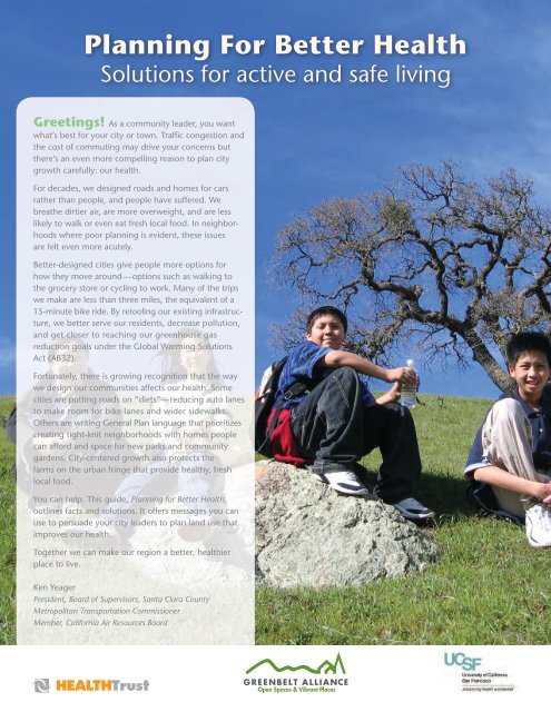
<strong>Planning</strong> <strong>For</strong> <strong>Better</strong> <strong>Health</strong>Solutions for active and safe livingGreetings! As a community leader, you wantwhat’s best for your city or town. Traffic congestion andthe cost of commuting may drive your concerns butthere’s an even more compelling reason to plan citygrowth carefully: our health.<strong>For</strong> decades, we designed roads and homes for carsrather than people, and people have suffered. Webreathe dirtier air, are more overweight, and are lesslikely to walk or even eat fresh local food. In neighborhoodswhere poor planning is evident, these issuesare felt even more acutely.<strong>Better</strong>-designed cities give people more options forhow they move around—options such as walking tothe grocery store or cycling to work. Many of the tripswe make are less than three miles, the equivalent of a15-minute bike ride. By retooling our existing infrastructure,we better serve our residents, decrease pollution,and get closer to reaching our greenhouse gasreduction goals under the Global Warming SolutionsAct (AB32).<strong>For</strong>tunately, there is growing recognition that the waywe design our communities affects our health. Somecities are putting roads on “diets”—reducing auto lanesto make room for bike lanes and wider sidewalks.Others are writing General Plan language that prioritizescreating tight-knit neighborhoods with homes peoplecan afford and space for new parks and communitygardens. City-centered growth also protects thefarms on the urban fringe that provide healthy, freshlocal food.You can help. This guide, <strong>Planning</strong> for <strong>Better</strong> <strong>Health</strong>,outlines facts and solutions. It offers messages you canuse to persuade your city leaders to plan land use thatimproves our health.Together we can make our region a better, healthierplace to live.Ken YeagerPresident, Board of Supervisors, Santa Clara CountyMetropolitan Transportation CommissionerMember, California Air Resources Board
The <strong>Health</strong> Issue: Obesity and AsthmaSolution: Complete Streets and Walkable NeighborhoodsPLANNINGFOR BETTERHEALTHQuick FactsFact: Obesity rates in the United States have increased dramatically in the last thirty years.Approximately two-thirds of U.S. adults and one-fifth of children are either obese or overweight.Overweight people are at risk of many chronic diseases including heart disease anddiabetes. (Source: U.S. Centers for Disease Control and Prevention)Fact: More than half of Americans would like to walk more and drive less. Poor communitydesign and lack of pedestrian facilities are the primary reasons people cite for not walkingmore. An overwhelming percentage support policies intended to make their communitiesmore livable by reducing traffic speed and creating a safer pedestrian environment.(Source: Surface Transportation Policy Partnership)Key messages you can use ~“Communities must be designed around people and not cars. Walkable neighborhoodsthat have a mix of homes, shops and jobs give people a choice to leave theircars parked and walk or bike instead. This is good for our health and good forthe planet.”“Nearly half of the Bay Area’s greenhouse gas pollution comes from driving. At thesame time, many of the trips we make are less than three miles — the equivalentof a 15-minute bike ride. If we make our streets safer for cyclists and pedestrians,we can improve air quality, reduce carbon emissions and engage in a moreactive lifestyle.”Policy Suggestions• Ensure that pedestrians, bicyclists, and transit riders of all ages and abilities can safelyshare the street network.• Identify barriers to pedestrian and bicycle access, especially at transit stations, andprioritize completion of these gaps.• Plan and implement a continuous network of walkways and bikeways and ensure they connect people with primary destinations (transit stations, job centers, shops,offices, libraries, parks).Performance Standards and Measurable OutcomesCommunities with complete streets policies can measure success through a numberof ways: the miles of on-street bicycle routes created; new linear feet of pedestrianaccommodation; changes in the number of people using public transportation, bicycling,or walking (mode shift); and number of new street trees.Resources & ReferencesHow walkable is your neighborhood? Check out www.walkscore.com.3
PLANNINGFOR BETTERHEALTHThe <strong>Health</strong> Issue: Childhood ObesitySolution: Safe Routes to SchoolQuick FactsFact: One generation ago, most children walked to school. Today, only one in tenchildren walks to school regularly. Since the mid 1960s rates of childhood obesity haveincreased exponentially from 4% to 16%, while the number of walking and bicyclingtrips made by children has fallen by 65%. (Source: U.S. Centers for Disease Controland Prevention)Fact: Travel to school accounts for 25% of all morning traffic. (Source: Trans<strong>For</strong>m)Fact: Studies from the American Heart Association and the Centers for Disease Controland Prevention found that walking to school is associated with higher overall physicalactivity throughout the day. There are many potential benefits of physical activity foryouth including weight and blood pressure control, bone, muscle, and joint healthand maintenance.Key messages you can use ~“When children walk and cycle to school, they build lifelong healthy habitswhile also helping to reduce traffic congestion near schools.”“Streets should be designed to meet the needs of the most vulnerable in ourcommunities. A sign of a quality city is one where children have safe access tosidewalks, crosswalks, and bike lanes.”Policy Suggestions• Partner with school districts to encourage safe routes to schools.• Identify the physical barriers that prevent children from safely getting to and fromschool and prioritize these streets for safety upgrades.Benefits of Safe Routes to Schools• Increases the amount of time devoted to physical activity, which helps reduce achild’s risk of obesity.• Improves concentration and increases alertness.• Enhances safety in the area around the school by reducing traffic.• Makes children more self-sufficient, an important part of developing social skills.• Empowers children to contribute positively to the environment, by travelingpollution-free.• Provides a great opportunity to develop healthy, lifelong habits of enjoying physicalactivity.• Is the perfect opportunity for family quality time.Resources & ReferencesTo learn more, visit www.saferoutesinfo.org.6
The <strong>Health</strong> Issue: <strong>Health</strong> DisparitiesSolution: Equal Access to Produce and ParksPLANNINGFOR BETTERHEALTHQuick FactsFact: There are 51 residential areas in the City of San Jose that do not have access to apark, school, or open space within 1/3 mile.Fact: In one Los Angeles neighborhood, about 20 fast-food restaurants are packed intoa quarter-mile stretch of road. Grocery store chains have historically been less likely tolocate in lower-income communities and communities of color. East Palo Alto, a communityof 30,000 and predominantly Hispanic and African American, approved its firstfull service grocery store in October 2009.Fact: In Los Angeles, white neighborhoods (where whites make up 75% or more of theresidents) boast 31.8 acres of park space for every 1,000 people, compared with 1.7acres in African-American neighborhoods and 0.6 acres in Latino neighborhoods.Fact: A <strong>Health</strong> Report from the City of Berkeley points to evidence that some Californiacommunities display a life expectancy that is 20 years greater in the wealthiest censustracts than in the most impoverished.Key messages you can use ~“It is vital that all residents of a community enjoy equal access to nature, andurban parks provide that visual and mental respite from the busyness of city life.”“Lower-income neighborhoods that are shown to have little to no access to parksmust be prioritized to receive these first as the city expands parkland. Having agreen place to play, walk, and relax benefits people of all ages.”Policy Suggestions• Apply resources to meet parks, recreation, and open space needs in underserved areasof the city, prioritizing lower income and higher density areas, which may have agreater need for these amenities.• Provide access to an existing or future park, open space lands, and/or a major city trailwithin a 1/3-mile radius walking distance of all residents by either acquiring landswithin 1/3 mile or providing safe connections to existing recreation facilities outside ofthe 1/3-mile radius walking distance.• Implement zoning designed to limit fast-food restaurants in overburdened communities.• Identify sites for community gardens and promote the expansion of farmers’ marketsand urban agriculture.• Measure the accessibility of healthy foods by neighborhood to identify nutrition-deficientneighborhoods in a city.Resources & ReferencesLooking for an interactive map to identify park-deficient neighborhoods? Check outwww.parkscore.org.7