to download a Non-Technical Summary - ScottishPower Renewables
to download a Non-Technical Summary - ScottishPower Renewables
to download a Non-Technical Summary - ScottishPower Renewables
- No tags were found...
Create successful ePaper yourself
Turn your PDF publications into a flip-book with our unique Google optimized e-Paper software.
Glen App WindfarmEnvironmental Statement<strong>Non</strong> - <strong>Technical</strong> <strong>Summary</strong>September 2012
Glen App WindfarmEnvironmental Statement<strong>Non</strong>-<strong>Technical</strong> <strong>Summary</strong>Prepared byLUCon behalf of<strong>ScottishPower</strong> <strong>Renewables</strong>September 2012
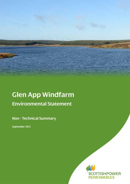
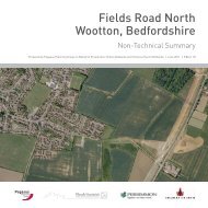
PrefaceThis <strong>Non</strong>-<strong>Technical</strong> <strong>Summary</strong> been prepared in support of the Glen App WindfarmEnvironmental Statement (ES) and planning application <strong>to</strong> construct and operate the 14turbine Glen App Windfarm in South Ayrshire. The Development is approximately 4.5kilometres (km) north-east of Cairnryan and 12km north-east of Stranraer and 6km south ofBallantrae.The Environmental Statement comprises a Written Statement, volume of Figures and volumeof Appendices and is accompanied by a Planning Statement, Design and Access Statementand Pre-Application Consultation Report.Copies of the full ES and accompanying documents, or further information on theDevelopment may be obtained from:<strong>ScottishPower</strong> <strong>Renewables</strong> (UK) LimitedGlen App Windfarm Project Team4th Floor1 Atlantic QuayGlasgowG2 8JBOr by emailing: info@glenappwindfarm.co.ukA hard copy of the Environmental Statement Volumes 1, 2 and 3 and the associateddocuments costs £300. In addition, all documents are available in an electronic format (asPDF for screen viewing only) on CD/DVD for £20. Further copies of the <strong>Non</strong>-<strong>Technical</strong><strong>Summary</strong> are available free of charge.The Environmental Statement and associated documents are available for viewing by thepublic during normal opening hours at the following locations:Girvan LibraryMontgomerie StreetGirvanKA 26 9HEBallantrae LibraryThe HallBallantraeKA26 0NBStranraer LibraryNorth Strand StreetStranraerDG9 7LDComments in relation <strong>to</strong> the Planning Application should be forwarded <strong>to</strong> the address below:South Ayrshire CouncilBurns HouseBurns Statue SqAyrKA7 1UTOr by emailing: planning.development@south-ayrshire.gov.ukThe image on the cover of this document is adapted from a pho<strong>to</strong>montage view of Glen App Windfarm as will be seen from thePenwhirn Reservoir. This pho<strong>to</strong>montage was generated as Viewpoint 3 in Chapter 6 of the Glen App Windfarm EnvironmentalStatement. A pho<strong>to</strong>montage is a visualisation which superimposes an image of a proposed development upon a pho<strong>to</strong>graph orseries of pho<strong>to</strong>graphs. Pho<strong>to</strong>montages are generated using computer software and used <strong>to</strong> illustrate the appearance of theproposed windfarm in the landscape.
TABLE OF CONTENTS1.1 Introduction1.2 Renewable Energy Policy1.3 Environmental Impact Assessment1.4 Development Area Selection and Design1.5 The Development Proposal1.6 Scoping and Consultation1.7 Landscape and Visual Amenity1.8 Hydrology, Hydrogeology, Geology and Peat1.9 Ecology1.10 Ornithology1.11 Noise1.12 Cultural Heritage1.13 Access, Traffic and Transport1.14 Socio-Economics, Tourism, Recreation and Land Use1.15 Other Issues1.16 <strong>Summary</strong>LIST OF FIGURESFigure 1: Development Area LocationFigure 2: Proposed Development LayoutThe image on the cover of this document is adapted from a pho<strong>to</strong>montage view of Glen AppWindfarm as will be seen from the Penwhirn Reservoir. This pho<strong>to</strong>montage was generatedas Viewpoint 3 in Chapter 6 of the Glen App Windfarm Environmental Statement. Apho<strong>to</strong>montage is a visualisation which superimposes an image of a proposed developmentupon a pho<strong>to</strong>graph or series of pho<strong>to</strong>graphs. Pho<strong>to</strong>montages are generated using computersoftware and used <strong>to</strong> illustrate the appearance of the proposed windfarm in the landscape.September 2012 i Glen App Windfarm Environmental Statement<strong>Non</strong>-<strong>Technical</strong> <strong>Summary</strong>
<strong>Non</strong>-<strong>Technical</strong> <strong>Summary</strong>1.1 Introduction1. <strong>ScottishPower</strong> <strong>Renewables</strong> (UK) Ltd (hereafter referred <strong>to</strong> as ‘SPR’), is applying<strong>to</strong> South Ayrshire Council for planning permission <strong>to</strong> construct and operate GlenApp Windfarm (hereafter referred <strong>to</strong> as ‘the Development’). The area within thered line boundary (see Figure 1) is hereafter referred <strong>to</strong> as ‘the DevelopmentArea’. The centre of the Development Area is approximately 4.5 kilometres (km)north-east of Cairnryan and 12km north-east of Stranraer. The northern extent ofthe Development Area is approximately 6km south of Ballantrae.2. As the Development will have a generating capacity of under 50 megawatts(MW), SPR is applying <strong>to</strong> South Ayrshire Council for planning permission underthe Town and Country Planning (Scotland) Act 1997, as amended (Ref.1-1).The application is categorised as a ‘Major Development’ under the Town andCountry Planning (Hierarchy of Development) (Scotland) Regulations 2009(Ref.1-2) on the basis that the installed capacity of the Development will be over20MW.3. SPR is part of Iberdrola, the world’s largest wind energy developer, with anoperating portfolio of over 14,000MW (as of June 2012). SPR is responsible forprogressing Iberdrola’s onshore wind and marine energy projects in the UK andIreland, and offshore windfarms throughout the world; managing thedevelopment, construction and operation of all (current and potential) projects.Securing its position at the forefront of the renewable energy industry, SPRbecame the first UK developer <strong>to</strong> reach an installed generating capacity of1,000MW in 2011, in addition <strong>to</strong> being awarded a second Queen’s Award forEnterprise for Sustainable Development. With a pipeline including 10,000MW ofoffshore wind, and the 10MW world-first tidal energy array in the Sound of Islay,SPR is firmly committed <strong>to</strong> the responsible development of renewable energy.4. The application is accompanied by the Environmental Statement (ES) that hasbeen undertaken in accordance with the Town and Country Planning(Environmental Impact Assessment) (Scotland) Regulations 2011) (‘the EIARegulations’) (Ref.1-3). The ES presents information on the identification andassessment of the likely environmental effects of the Development. Furtherdetails of the statu<strong>to</strong>ry requirements for Environmental Impact Assessment (EIA)are set out in Chapter 2: Approach <strong>to</strong> Environmental Impact Assessment ofthe ES.5. This <strong>Non</strong>-<strong>Technical</strong> <strong>Summary</strong> (NTS) summarises the findings and conclusions ofthe ES.6. The ES has been prepared by LUC on behalf of SPR. LUC also produced thefollowing ES chapters:Planning Policy Context;Landscape and Visual Amenity;Ecology;Socio-Economics, Tourism, Recreation and Land Use;Other Issues.September 2012 1 Glen App Windfarm Environmental Statement<strong>Non</strong>-<strong>Technical</strong> <strong>Summary</strong>
7. A number of sub-consultants under<strong>to</strong>ok further specialist assessments asfollows:Mott MacDonald under<strong>to</strong>ok the Hydrology, Hydrogeology and PeatStability, Access, Traffic and Transport and Carbon Balance assessments;Haworth Conservation Ltd under<strong>to</strong>ok the Ornithology assessment;Hoare Lea Acoustics under<strong>to</strong>ok the Noise assessment;CFA Archaeology under<strong>to</strong>ok the Cultural Heritage assessment;Pager Power provided expert advice on telecommunications and aviation.1.2 Renewable Energy Policy8. The UK Government and the Scottish Government are committed <strong>to</strong> ensuringthat an increased proportion of electricity is generated from wind power andother renewable energy sources. Improvements in technology and rising fossilfuel costs have resulted in the cost of wind power converging <strong>to</strong>wards the costsof conventional sources of electricity. Further growth in the wind energy sec<strong>to</strong>rcan therefore be expected.9. Scotland in particular has a significant wind resource. The report ‘Scotland'sRenewable Resource 2001’ considered a range of available renewable energytechnologies examining associated development constraints and costs. The keyconclusion in relation <strong>to</strong> onshore wind development was that the resource iswidespread and is the cheapest of the technologies considered and on the basisof cost, onshore wind energy can be expected <strong>to</strong> contribute <strong>to</strong> the bulk of neartermgovernment targets.10. The Climate Change (Scotland) Act 2009 aims for an 80% reduction inScotland’s greenhouse gas emissions by 2050 and includes an interim target ofa 42% reduction by 2020 (compared <strong>to</strong> 1990 levels). In 2007 the ScottishGovernment set a target for the supply of 50% of Scotland's electricity fromrenewable sources by 2020, and in May 2011 revised its targets and now aims <strong>to</strong>provide 100% of Scotland’s electricity generation from renewable sources by2020.1.3 Environmental Impact Assessment11. EIA involves the compilation, evaluation and presentation of any potentiallysignificant environmental effects resulting from a proposed development, <strong>to</strong>assist the consenting authority, statu<strong>to</strong>ry consultees, and wider public inconsidering an application. Early identification of potentially adverseenvironmental effects also leads <strong>to</strong> the identification and incorporation ofappropriate mitigation measures in<strong>to</strong> the scheme design <strong>to</strong> avoid, reduce and, ifpossible, remedy potentially significant adverse environmental effects.1.4 Development Area Selection and Design12. The Development Area is being proposed by SPR for a number of reasons: it has a good wind resource;September 2012 2 Glen App Windfarm Environmental Statement<strong>Non</strong>-<strong>Technical</strong> <strong>Summary</strong>
it is located within the ‘broad area of search’ for windfarm developmentidentified in the Addendum <strong>to</strong> the Ayrshire Joint Structure Plan <strong>Technical</strong>Report TR03/2006, Guidance on the Location of Windfarms within Ayrshire(Oc<strong>to</strong>ber 2009);it can accommodate turbines and associated infrastructure outwith sitesdesignated for their natural or heritage interests;it is accessible for construction traffic and turbine deliveries.13. Windfarm design must balance technical and environmental considerations, withthe iterative EIA process acting as a <strong>to</strong>ol <strong>to</strong> further refine the design process <strong>to</strong>achieve the most appropriate balance.14. The overall aim of the design strategy was <strong>to</strong> create a windfarm with a cohesivedesign that relates <strong>to</strong> the surrounding landscape whilst taking account of theenvironmental characteristics of the site, for example, priority habitats and keyornithological species, cultural heritage features and hydrological resources.15. The main components of the Development considered in the early design stagewere the turbines, given their form as tall man-made structures potentially visiblewithin a wide area. From the outset, the proximity of the Development Area <strong>to</strong>the Glen App and Galloway Moors Special Protection Area (SPA), designated forits breeding hen harriers, was also a key influence on the design. The optimumlayout of a windfarm is also influenced by a range of technical criteria.Generally, turbines are arranged at a set distance apart <strong>to</strong> minimise the effect ofturbulence. This set distance varies from site <strong>to</strong> site and between turbine models(on the manufacturer’s recommendation).16. Informed by the emerging design of the turbine layout, other infrastructurefeatures such as the access tracks were subsequently designed as was thefelling and res<strong>to</strong>cking design taking account of the same onsite environmentalparameters that informed the turbine locations.17. Further details of the design strategy can be found in Chapter 3: DevelopmentArea Selection and Design Strategy of the ES. The sections below also outlinethe key design modifications introduced in relation <strong>to</strong> each specialist <strong>to</strong>pic area.1.5 The Development Proposal18. A site layout plan is shown in Figure 2. The main components of the proposedDevelopment comprise:14 turbines of up <strong>to</strong> 126.5m in height <strong>to</strong> blade tip, with a maximum combinedoutput of 32.2 megawatts (MW);a <strong>to</strong>tal of 13.2km of permanent access tracks including existing upgradedtracks, passing places, turning areas and watercourse crossings;crane hardstandings;one permanent meteorological mast;onsite underground electrical and communication cables;one substation/control compound including a control building, substationbuilding and transformers/electrical equipment;September 2012 3 Glen App Windfarm Environmental Statement<strong>Non</strong>-<strong>Technical</strong> <strong>Summary</strong>
site signage;installation of close circuit television and communication masts;planting of 49.8ha of native broadleaved tree species.19. In addition <strong>to</strong> the above components of the operational Development,construction of the Development will also require:0.9km of temporary access tracks;felling of trees <strong>to</strong> accommodate turbines and associated infrastructure;the creation of up <strong>to</strong> three temporary onsite borrow pits for the extraction ofs<strong>to</strong>ne;a temporary construction compound/laydown area;up <strong>to</strong> five temporary power performance analysis masts (PPA masts).20. The main access <strong>to</strong> the Development Area will be from the A77 road via anexisting hard surfaced private road at Haggs<strong>to</strong>ne as shown in Figure 1(hereafter referred <strong>to</strong> as ‘Main Access’). The Main Access will serve constructiontraffic entering the site including abnormal load vehicles delivering wind turbinecomponents and will be permanent. Permanent access will also be taken fromthe A77 via an existing track near Mark, for 4x4 and light goods vehicles only(hereafter referred <strong>to</strong> as the ‘Mark Access’).21. The Development Area is currently predominantly planted with commercialforestry. To accommodate the Development, localised felling of trees will berequired. The turbines proposed within forested areas will be ‘keyholed’ in<strong>to</strong> thetrees. Keyholes will vary between 77.5m radius and 134.2m radius based on arequirement <strong>to</strong> maintain a buffer between the edge of the turbine blade sweptarea and the trees <strong>to</strong> minimise the collision risk <strong>to</strong> bats. Potential areas forcompensa<strong>to</strong>ry planting within the site have been investigated in detail and theproposed planting areas are detailed in the ES.22. Subject <strong>to</strong> the granting of planning permission, it is anticipated that theconstruction of the Development will take place over an 18 month programme.23. The operational life of the Development is 25 years. Following this, anapplication may be submitted <strong>to</strong> retain or replace the turbines, or the turbinescould be decommissioned.24. The turbines will connect in<strong>to</strong> the control building and substation via onsiteunderground cables. At the substation, the voltage will be stepped up fortransmission <strong>to</strong> the national electricity network (the ‘grid’). The connection fromthe on-site substation <strong>to</strong> the national grid will be via an overhead line supportedon wood poles or an underground cable.25. The Development will connect <strong>to</strong> the national grid via the operational<strong>ScottishPower</strong> Energy Networks substation at Arecleoch Windfarm, which islocated approximately 12km <strong>to</strong> the north-east of the Development substation.1.6 Scoping and Consultation26. The purpose of scoping and pre-application consultation is <strong>to</strong>:September 2012 4 Glen App Windfarm Environmental Statement<strong>Non</strong>-<strong>Technical</strong> <strong>Summary</strong>
ensure that consultees are informed of the proposal and provided with anopportunity <strong>to</strong> comment at an early stage in the EIA process;obtain baseline information regarding existing environmental site conditions;establish key environmental issues and identify potential effects <strong>to</strong> beconsidered during the EIA;identify those issues which are likely <strong>to</strong> require more detailed study andthose which can be justifiably excluded from further assessment;provide a means of confirming the most appropriate methods ofassessment.1.6.1 Scoping27. Scoping is undertaken at the outset of the assessment process according <strong>to</strong> theguidance provided in Planning Advice Note (PAN) 58: Environmental ImpactAssessment (Ref.1-5).28. The scope of the EIA was informed by the Scoping Opinion provided by theScottish Government in March 2011 1 and the consultation responses receivedfrom key consultees including Scottish Natural Heritage (SNH), His<strong>to</strong>ric Scotland(HS), South Ayrshire Council, and the Scottish Environment Protection Agency(SEPA).29. The request for a scoping opinion formed the basis for early consultation with anumber of organisations, who were asked for relevant information, opinions onthe scheme and views on the proposed assessment methodologies.30. In addition <strong>to</strong> the consultees contacted by the Scottish Government during theformal scoping process, <strong>to</strong>pic area specialists engaged in further consultationand contacted a number of other stakeholders <strong>to</strong> obtain background information<strong>to</strong> further inform the EIA and allow them the opportunity <strong>to</strong> raise any concernsthat they might have in relation <strong>to</strong> the Development.1.6.2 Consultation31. The process of consultation is critical <strong>to</strong> the development of a comprehensiveand balanced ES. Views of the key statu<strong>to</strong>ry and non-statu<strong>to</strong>ry consultees serve<strong>to</strong> focus the environmental studies and <strong>to</strong> identify key specific issues which mayrequire further investigation.32. Public consultation is a key element of the environmental assessment process.The following public consultation was carried out: Public Information Days (PIDs) were held between 23 rd and 26 th May 2011in Kirkcolm, Stranraer, Cairnryan and Ballantrae <strong>to</strong> provide information <strong>to</strong>local residents, and <strong>to</strong> gain feedback on the proposals. A second round ofPIDs were held in Kirkcolm, Cairnryan and Ballantrae between the 26 th and28 th of March 2012 <strong>to</strong> allow further findings of the environmental surveywork and the final turbine design of the Development <strong>to</strong> be presented.The Public Information Days were advertised in local newspapers, posterswere put up in venues in local communities, and leaflets describing the1 When Scoping was undertaken for the Development, it was proposed that the <strong>to</strong>tal output of the Development would exceed50 megawatts (MW) and that an application would therefore need <strong>to</strong> be made <strong>to</strong> the Scottish Government under Section 36 ofthe Electricity Act (1989).September 2012 5 Glen App Windfarm Environmental Statement<strong>Non</strong>-<strong>Technical</strong> <strong>Summary</strong>
proposals and advertising the events were sent <strong>to</strong> nearby properties and <strong>to</strong>surrounding community councils.Consultation letters were issued <strong>to</strong> all Community Councils whose area iswithin or adjoins the land where the Development is situated.Members of the project team also attended local Community Councilmeetings <strong>to</strong> provide an update on project progress.33. The information available at the PIDs included plans of the proposedDevelopment layout, information boards explaining the key potentialenvironmental effects, and pho<strong>to</strong>montages <strong>to</strong> illustrate anticipated views.Representatives of LUC and SPR were also available <strong>to</strong> provide additionalinformation and answer queries. A computer lap<strong>to</strong>p equipped with Windfarmsoftware was also available, allowing members of the public <strong>to</strong> see views fromrequested locations. Attendees were invited <strong>to</strong> complete feedback forms <strong>to</strong>provide input <strong>to</strong> the ongoing progression of the proposals. Information receivedat PIDs was fed back <strong>to</strong> the assessment team and incorporated in<strong>to</strong> theassessment process.1.7 Landscape and Visual Amenity34. The landscape and visual impact assessment (LVIA) considered the effect thatthe Development will have on the landscape and on the people who view thatlandscape.35. The study area for the assessment was defined as 35km from the outermostturbines of the Development in all directions, as recommended by current goodpractice guidance for turbines of 100m <strong>to</strong> blade tip or higher. The study area forthe identification of windfarms included in the assessment of cumulative effectsextended <strong>to</strong> 60km radius in accordance with relevant guidance from SNH. Toassess likely effects on visual amenity during operation of the proposedDevelopment, 15 viewpoints were selected for detailed review; these wereagreed in consultation with SNH, South Ayrshire Council and Dumfries andGalloway Council.36. The Development Area is located at the coastal edge of an undulating plateauthat occupies much of the south-western part of South Ayrshire and northwesternpart of Dumfries and Galloway. Whilst the Ayrshire Scenic Area includesa small part of the Development Area, the turbines are not located within thisdesignated area. The 35km radius study area contains three Regional ScenicAreas (RSAs) but no nationally designated landscapes. The closest settlementsinclude Cairnryan, Stranraer, Kirkcolm and Ballantrae, and there are also anumber of individual residences in proximity <strong>to</strong> the Development Area.37. The overall aim of the design strategy was <strong>to</strong> design a windfarm that representedan optimum landscape ‘fit’ within the technical and environmental parameters ofthe project and the Development Area. As wind turbines are tall man-madestructures, the initial design objectives considered their size and location, withemerging turbine layouts tested from key views around the Development Area.During the iterative design process, turbines were removed <strong>to</strong> reduce visualeffects, for example, on views from the Glen App Valley, whilst considerationwas also given <strong>to</strong> the siting of associated infrastructure, such as the visibility ofBorrow Pit 1 from the A77 road.38. During the construction phase, it is anticipated that there will be significanteffects on the local landscape of the Development Area relating <strong>to</strong> felling works,September 2012 6 Glen App Windfarm Environmental Statement<strong>Non</strong>-<strong>Technical</strong> <strong>Summary</strong>
excavations and track construction, and the presence of tall cranes and partiallybuilt <strong>to</strong>wers, whilst turbines are being erected. Effects will, however, betemporary and will not be significant following res<strong>to</strong>ration and reinstatementmeasures which will be implemented through the Construction MethodStatement.39. Once operational, there will be major effects on the landscape of theDevelopment Area and a locally significant effect on the ‘Plateau Moorland withForest’ (major) and ‘Upland Fringe’ (moderate) Landscape Character Types(LCTs) within which the Development is located. Significant visual effects arepredicted for six of the fifteen viewpoints (one with predicted ‘major’ effects, andfive with predicted ‘moderate’ effects) and minor or negligible effects arepredicted for the remaining nine viewpoints. It is important <strong>to</strong> note that theviewpoint locations with the clearest views of the Development were identified.These locations therefore represent the ‘maximum case’ views rather thantypical views across the study area. Significant visual effects are also predictedlocally on the Rhins Coast RSA, from the settlement of Kirkcolm, from the A716road and from the residential property of Little Laight. No significant effects arepredicted from other identified settlements, routes and residential propertieswithin the study area.40. The cumulative assessment of the proposed Development, in combination withother existing and planned windfarms, predicts a locally significant cumulativeeffect on the ‘Plateau Moorland with Forest’ but not on wider landscapecharacter. No significant cumulative visual effects, effects on settlements, routesor residential properties are predicted.41. Measures <strong>to</strong> reduce landscape and visual effects were predominantly achievedthrough the design of the Development, although effects during construction willbe further minimised through site res<strong>to</strong>ration measures in accordance with goodpractice.1.8 Hydrology, Hydrogeology, Geology and Peat42. The assessment of effects on hydrology, hydrogeology, geology and peat hasconsidered the potential effects of pollution risk and of erosion and sedimentationon surface water and groundwater, and on public and private water supplies, inaddition <strong>to</strong> flood risk during operation of the Development and potential effectsupon peat hydrology during construction and operation of the Development.43. The study area for the assessment spanned five catchments; Penwhirn Burn andReservoir, the Water of App and three smaller catchments that drain the westernside of the Development Area, discharging directly in<strong>to</strong> Loch Ryan which is adesignated Marine Conservation Area (MCA).44. Several watercourses cross the Development Area and there are some areas ofstanding water. The Development Area is also extensively covered by artificialdrainage channels which were installed originally <strong>to</strong> improve ground for forestplanting. The majority of the Development Area is covered by peat with a depthof 0.5 <strong>to</strong> 2m, although peat probing undertaken <strong>to</strong> inform the assessmentidentified isolated areas of deeper peat.45. The hydrology, hydrogeology and peat distribution within the Development Areainfluenced the design of the turbine and infrastructure layout <strong>to</strong> avoid and/orminimise potential effects on these recep<strong>to</strong>rs where possible. Application of aminimum distance for the location of infrastructure from watercourses is theprincipal means by which surface hydrology can be protected (and therefore anySeptember 2012 7 Glen App Windfarm Environmental Statement<strong>Non</strong>-<strong>Technical</strong> <strong>Summary</strong>
dependent ecology or water supplies). Due <strong>to</strong> downstream designations,including the MCA and a Drinking Water Protection Zone, 50m buffers wereapplied <strong>to</strong> all watercourses <strong>to</strong> minimise the risk of potential effects due <strong>to</strong>changes in runoff or sedimentation. This buffer distance is very precautionary asit is in excess of the 10m buffer distance required by SEPA’s PollutionPrevention Guideline 5 as well as the 10-20m recommendation stated in theForest and Water Guidelines.46. The presence of peat within the Development Area also formed a key designconsideration. Informed by the peat probing survey, the design processminimised the location of turbines and associated infrastructure within areas ofdeeper peat (>2m). The design process also sought <strong>to</strong> minimise the number ofwatercourse crossings required. The final layout includes four water crossings(of which two are existing crossings).47. During construction and operation of the windfarm, established good practicemeasures will be applied in relation <strong>to</strong> pollution risk, sediment management andmanagement of surface runoff rates and volumes. These will form part of theConstruction Management Plan (CMP) <strong>to</strong> be implemented for the Development.SPR is committed <strong>to</strong> implementing these measures which form an integral part ofthe design/construction process. With the adoption of additional mitigationmeasures <strong>to</strong> protect private water supplies and peatland hydrology, no significanteffects are predicted.1.9 Ecology48. The ecological assessment considered potential effects on terrestrial and aquaticecology, including habitat loss and disturbance <strong>to</strong> protected species.49. Desk studies were undertaken <strong>to</strong> search for statu<strong>to</strong>ry and non-statu<strong>to</strong>rydesignations within 10km of the Development Area and for available speciesrecords within 2km of the Development Area. Field surveys were carried out <strong>to</strong>establish habitat types and distributions and the presence of otters, water voles,bats, red squirrel and badgers, with the study area being determined by speciestype.50. There are no statu<strong>to</strong>ry designated sites for nature conservation within theDevelopment Area and five designated nature conservation sites within 10km ofthe Development Area. With regards <strong>to</strong> non-statu<strong>to</strong>ry designations, four blocks ofSemi-Natural Ancient Woodland are located in proximity <strong>to</strong> the northernboundary of the Development Area. The main habitat types within theDevelopment Area are coniferous plantation woodland, blanket bog, and marshygrassland.51. In relation <strong>to</strong> protected species, no otter resting sites were recorded within theDevelopment Area, and only limited evidence was recorded within the widerstudy area. Water vole occur across the study area and whilst fish were recordedon the Water of App and on the Loan of Turchloy, existing culverts create abarrier <strong>to</strong> movement, resulting in a reduced diversity of fish species. Noevidence of badger was identified by the field survey and given the sub-optimalnature of habitats, limited bat activity was recorded. Both the squirrel surveyresults and the his<strong>to</strong>rical records show the presence of red and grey squirrelswithin the Development Area.52. The final Development layout included a number of design modifications <strong>to</strong>reduce ecological effects. This included siting turbines over 250m from the mainareas of blanket bog habitat and proposing water crossings which will allow theSeptember 2012 8 Glen App Windfarm Environmental Statement<strong>Non</strong>-<strong>Technical</strong> <strong>Summary</strong>
free passage of otters and water voles. With respect <strong>to</strong> bats, buffers have beenplaced around features that may be used for commuting and foraging inaccordance with standard advice from Natural England, and endorsed by SNH.53. No significant effects are predicted on designated nature conservation sites asthe Development Area has no connectivity with these sites. Whilst the proposedMain Access runs past one area of Semi-Natural Ancient Woodland, using anexisting track, no trees from these woodland blocks will be removed and nosignificant effects are predicted.54. In relation <strong>to</strong> protected species, given the limited evidence of otter, effects on thisspecies are considered unlikely. Whilst the proposed Main Access track willcross two burns where water voles were identified, the closest burrows wereover 60m away, and the use of crossings which allow for the free passage ofmammals means that there will be only very limited loss of suitable water volehabitat and therefore that the construction effect on water voles is not predicted<strong>to</strong> be significant. As the Development will only cross two burns; neither of whichsupports salmonid, effects on fish are not predicted <strong>to</strong> be significant. Given thesub-optimal nature of habitats for bats and the proposals <strong>to</strong> key-hole rather thanclear fell woodland, the effects of both construction and operation of theDevelopment on bats are not predicted <strong>to</strong> be significant. As red squirrel evidencewas generally absent from the central sections of the Development Area, wherethe infrastructure is located, effects on red squirrel are not predicted <strong>to</strong> besignificant.55. Good practice construction measures will be identified in the CMP and anEcological Clerk of Works (ECoW) will oversee construction, in particular groundbreaking works and turf stripping, <strong>to</strong> ensure that measures with regards <strong>to</strong>ecology are implemented.1.10 Ornithology56. The assessment of potential effects on birds (ornithology) considered potentialeffects relating <strong>to</strong> direct and indirect habitat loss, collision risk and felling andfuture replanting. Particular attention has been paid <strong>to</strong> species of high ormoderate conservation importance (‘target species’). These include rap<strong>to</strong>rs(including hen harrier, peregrine, merlin, kestrel, buzzard, raven and goshawk),moorland breeding birds (including curlew) and black grouse.57. The study area for species other than hen harrier was the Western SouthernUplands and Inner Solway Natural Heritage Zone, with the exception of henharrier where the study area comprised the Glen App and Galloway Moors SPA.The assessment was informed by a desk study undertaken <strong>to</strong> collate existingbird records and/or data, consultation with SNH and the Royal Society for theProtection of Birds (RSPB) and field surveys. The surveys were undertaken overthe period 2010 <strong>to</strong> 2012 2 .58. The Development Area adjoins the Glen App and Galloway Moors SPA and Siteof Special Scientific Interest (SSSI), which is designated for its importance <strong>to</strong>breeding hen harriers. With respect <strong>to</strong> breeding activity, in 2010, one pair of henharriers was recorded within the study area with a further four recorded in 2011.However, none of these nests were recorded within the Development Area. In2012, hen harriers were observed approximately 2km from the Development2 An additional breeding bird survey, focussed predominantly on hen harriers, was undertaken in 2012. This providedadditional data on the distribution of breeding hen harriers in relation <strong>to</strong> the Development.September 2012 9 Glen App Windfarm Environmental Statement<strong>Non</strong>-<strong>Technical</strong> <strong>Summary</strong>
Area but there was no indication of any nesting attempt within the DevelopmentArea.59. In 2011, there was confirmed breeding by one pair of peregrines and one pair ofbarn owls and possible breeding by one pair of short-eared owls. <strong>Non</strong>e of thesebreeding records was within the Development Area boundary. The field surveysrecorded a low number of moorland breeding birds and no black grouse.60. Most flight activity in 2010 and 2011 comprised buzzards, kestrels and ravens. In<strong>to</strong>tal, 153 flights by hen harriers were recorded during 2010 and 2011. The vastmajority of the flight activity was over the moorland adjacent <strong>to</strong> the DevelopmentArea with little activity over the forest within the Development Area.61. One of the initial objectives of the design strategy was <strong>to</strong> develop a layout whichminimised effects on hen harrier, the qualifying species of the SPA. During theearly design process, a 500m buffer from the boundary of the SPA was appliedin accordance with the minimum disturbance free distance recommended bySNH. This has been maintained as a minimum distance between turbines andthe SPA throughout the design iteration process. Further <strong>to</strong> the application of thisbuffer, as the findings from the surveys became available, these were used <strong>to</strong>further inform the windfarm layout. Turbines were removed from theDevelopment design <strong>to</strong> take account of ornithological findings.62. As construction of the windfarm is programmed <strong>to</strong> last for approximately 18months, disturbance from construction activities could affect one or possibly twobird-breeding seasons. Pre-construction surveys for breeding birds will becarried out <strong>to</strong> inform any requirements for mitigation during construction, whilstthe ECoW will be present <strong>to</strong> establish and maintain appropriate disturbance freebuffer zones throughout the construction period.63. Given the design modifications introduced, collision risk calculations do notindicate any significant effects for any of the target species, for the windfarm inisolation and cumulatively with other relevant windfarm schemes. Given this, andthe proposed construction practices, no significant effects on ornithology arepredicted.64. In recent years, both the breeding population and productivity of hen harrierswithin the Glen App and Galloway Moors SPA have declined. SPR propose <strong>to</strong>implement moni<strong>to</strong>ring of the breeding population of hen harriers within theDevelopment Area and an area <strong>to</strong> the north and north-east within the SPA.Moni<strong>to</strong>ring would include the identification of any breeding attempts andsubsequent surveillance <strong>to</strong> assess fac<strong>to</strong>rs influencing breeding productivity. Theduration and frequency of the moni<strong>to</strong>ring programme will be discussed andagreed with SNH.1.11 Noise65. Once operational, windfarms may emit two types of noise. Aerodynamic noiserelates <strong>to</strong> the movement of the rotating blades through the air, and mechanicalnoise may emanate from components within the nacelle of a wind turbine, wherethe ro<strong>to</strong>r blades meet. However, modern turbine designs have evolved <strong>to</strong> ensurethat mechanical noise radiation from wind turbines is negligible. Aerodynamicnoise is usually only perceived when wind speeds are fairly low; in higher winds,aerodynamic noise is generally masked by the normal sound of wind blowingthrough trees and around buildings.66. Noise will also be generated during the construction phase of the Developmentfrom the operation of a range of construction plant and machinery andSeptember 2012 10 Glen App Windfarm Environmental Statement<strong>Non</strong>-<strong>Technical</strong> <strong>Summary</strong>
construction traffic. This will be temporary in nature, during the 18 monthconstruction period.67. The study area for the assessment included residential dwellings located in thevicinity of both the Development and the proposed construction traffic routes.The analysis of construction noise effects was undertaken in accordance withaccepted guidance that provides methods for predicting construction noise levelson the basis of reference data for the emissions of typical construction plant andactivities. Operational noise levels were assessed in line with governmentguidance on assessing noise from wind turbines, which compares predictedoperational noise levels with the existing background noise levels.68. The Development is located in an area of relatively low population density. Thenoise environment in the surrounding area is generally characterised by ‘natural’sources, such as wind disturbed vegetation and birds. Other sources of noiseinclude intermittent distant commercial aircraft as well as water flow noise fromthe Water of App and traffic travelling on the A77 road. Background noisemoni<strong>to</strong>ring was conducted in Oc<strong>to</strong>ber and November 2011 at seven noisemoni<strong>to</strong>ring locations agreed with the Environmental Health Departments of bothDumfries and Galloway Council and South Ayrshire Council as beingrepresentative of the background noise environment around the DevelopmentArea.69. During the early stages of the design process, an approximate 1km bufferdistance was applied between turbines and residential properties and this hasbeen maintained throughout the design process. Noise levels were calculated forprogressive turbine layouts and the final application layout reviewed <strong>to</strong> confirmcompliance with the limits set out in government guidance.70. It is not considered likely that noise levels during construction will exceedacceptable limits at residential properties. Notwithstanding this, SPR iscommitted <strong>to</strong> following accepted guidance and <strong>to</strong> using methods for minimisingnoise from construction activities. Given the compliance of the Development withgovernment limits for operational noise, both in isolation, and in combination withother windfarms, no significant operational noise effects are predicted.1.12 Cultural Heritage71. Cultural heritage assets include sites, features and areas with statu<strong>to</strong>ry and nonstatu<strong>to</strong>rydesignations, including Scheduled Monuments; Listed Buildings;Conservation Areas; Gardens and Designed Landscapes (Inven<strong>to</strong>ry and <strong>Non</strong>Inven<strong>to</strong>ry status); <strong>Non</strong> Statu<strong>to</strong>ry Register sites and other his<strong>to</strong>ric environmentinterests. The assessment considered direct effects, such as removal of, ordamage <strong>to</strong>, features within the Development Area, and indirect effects on thesetting of designated features in the surrounding landscape.72. The study area for direct effects comprised the Development Area. A wider studyarea, extending <strong>to</strong> 10km from the outermost turbines was defined as the studyarea for the identification of cultural heritages assets whose settings may beaffected by the Development. A desk based assessment of cultural heritagerecords was followed by a walkover survey of the Development Area and sitevisits <strong>to</strong> the wider area.73. The known features within the Development Area included four ScheduledMonuments ranging in date from the Early Bronze Age, through the medievalperiod and in<strong>to</strong> the 18th and 19th centuries. The nearby settlement of Cairnryanis designated as a Conservation Area and the north of the village is designatedSeptember 2012 11 Glen App Windfarm Environmental Statement<strong>Non</strong>-<strong>Technical</strong> <strong>Summary</strong>
as an Outstanding Conservation Area. The East Rhins ArchaeologicallySensitive Area (ASA) lies directly <strong>to</strong> the south of the site. The ASA is a regionaldesignation and contains many Scheduled Monuments and other archaeologicalsites. The closest Garden and Designed Landscape (GDL) is Loch Ryan House,which is located within 1km of the south-west Development Area boundary.74. The presence of cultural heritage features within the Development Areainfluenced the layout design primarily through seeking <strong>to</strong> avoid direct effects ondesignated and non-designated features. For example, the constructioncompound and the access <strong>to</strong> the construction compound have both been sited <strong>to</strong>avoid the location of cairns of archaeological interest and the turbine and tracklayout have also been designed <strong>to</strong> avoid further archaeological sites, althoughthese now lie within mature forestry and may well have been damaged ordestroyed by forestry ploughing and planting.75. Whilst there is a predicted direct effect of minor significance on surviving remainsof a former farmsteads field system from replanting, following implementation ofmitigation measures, there will be no residual effects. There are no predictedsignificant effects on the setting of any cultural heritage features during operationof the Development in isolation. Whilst a cumulative effect of minor significanceis predicted on the collective setting of the group of Scheduled Monuments withinthe East Rhins ASA, arising from the Development when added <strong>to</strong> otheroperational, consented or application windfarm developments in the local vicinity,the Development only makes a small contribution <strong>to</strong> this. No significant effectson cultural heritage are predicted as a result of construction or operation of theDevelopment.1.13 Access, Traffic and Transport76. The assessment of access, traffic and transport considers the potential effects ofconstruction and operational traffic associated with the Development on the roadnetwork and other road users, on road infrastructure condition and on communityrecep<strong>to</strong>rs 3 .77. The study area for access, traffic and transport has been defined as the publicroad network in the vicinity of the Development which will be used as accessroutes by traffic bound for the Development; this includes the A77, A75 and A751trunk roads. It is not anticipated that any vehicles will need <strong>to</strong> use any minor localroads near the Development Area. The assessment has been undertaken as acombination of desk-<strong>to</strong>p study, field survey and in consultation with statu<strong>to</strong>ryagencies in line with current good practice and policy advice.78. Effects associated with traffic generated by the Development will be mostpronounced in the vicinity of the accesses <strong>to</strong> the Development Area; as vehiclestravel away from the Development, they will split across the wider road network.The A77 local <strong>to</strong> the Development is considered <strong>to</strong> be between Stranraer andTurnberry. As a trunk road, it is typically well maintained and of a good standard.Community recep<strong>to</strong>rs on this section of the A77 have been identified withinStranraer, Cairnryan, Ballantrae and Girvan. The A75 local <strong>to</strong> the Developmentis considered <strong>to</strong> be between Stranraer and Castle Kennedy and is again wellmaintained and of a good standard. Additional community recep<strong>to</strong>rs have beenidentified within Stranraer. No community recep<strong>to</strong>rs were identified on the A751.All roads within the study area typically operate well below their design capacity.3 Community recep<strong>to</strong>rs are defined as areas where local people are likely <strong>to</strong> be more aware of changes in traffic flow (e.g.areas of high pedestrian movement, schools, playgrounds or hospitals.September 2012 12 Glen App Windfarm Environmental Statement<strong>Non</strong>-<strong>Technical</strong> <strong>Summary</strong>
79. During construction, turbine components and construction materials will bedelivered <strong>to</strong> the Development Area. Some materials will be transported by HeavyGoods Vehicles (HGVs) and turbine components need <strong>to</strong> be transported onvehicles capable of carrying ‘abnormal loads’ (vehicles longer than 17m and/orwider than 4m). It is proposed that turbine components will be landed at the Por<strong>to</strong>f Ayr and then transported southwards <strong>to</strong> the A77 road. Abnormal load vehicleswill then follow the A77 southwards <strong>to</strong> the Development Area. All other vehiclesbound for the Development Area are expected <strong>to</strong> originate from the north andsouth of the Development Area, from concrete plants, quarries and settlements,and approaching the Development Area on the identified trunk roads.80. Once operational, windfarms typically generate very low levels of traffic. It isestimated that the Development will generate less than ten vehicle movementsper day for the purposes of maintenance, repairs and servicing.81. Prior <strong>to</strong> mitigation, minor effects are predicted upon traffic flow and road usersand road infrastructure condition during construction for the Development inisolation. The implementation of a Traffic Management Plan (TMP) and themoni<strong>to</strong>ring and repair of any damage attributable <strong>to</strong> the transport activitiesrelating <strong>to</strong> the Development will, however, reduce the significance of theseeffects <strong>to</strong> negligible. A cumulative effect of moderate significance on traffic flowand road users is predicted during construction should the other schemesconsidered in the cumulative assessment be constructed at the same time as theDevelopment. It is considered very unlikely that the construction phases of theschemes assessed would overlap in reality and implementation of the TMP, andliaison with relevant authorities and other developers if required, would reducethe residual effect <strong>to</strong> minor. No significant residual effects in relation <strong>to</strong> access,traffic and transport are predicted from traffic generated by the Development.1.14 Socio-Economics, Tourism, Recreation and Land Use82. The assessment of the potential social and economic effects of the proposedDevelopment considered potential effects in relation <strong>to</strong> employment andeconomic benefits, <strong>to</strong>urism, recreation and public access, and land use.83. With respect <strong>to</strong> employment and wider economic benefits, the assessmentconsidered effects within the South Ayrshire and Dumfries and Gallowayadministrative areas. Direct effects on public access and land use wereconsidered for the Development Area and effects on recreation were consideredfor the Development Area and the adjacent land in South Ayrshire and Dumfriesand Galloway. The cumulative assessment considers effects within 35km of theDevelopment Area given the potential link between recreation and <strong>to</strong>urismeffects and visual effects. Desk based information sources were used <strong>to</strong> assessthe likely scale of effects, supplemented by consultation with local stakeholders.84. Within both South Ayrshire and Dumfries and Galloway, there is a highconcentration of jobs within the ‘skilled trades’ and ‘elementary occupations’ 4 ,compared with the <strong>to</strong>tal for Scotland as a whole. The unemployment rate iscurrently higher than the national average in South Ayrshire and lower than thenational average in Dumfries and Galloway.85. Visi<strong>to</strong>r attractions in the vicinity of the Development Area include Castle Kennedyand Gardens, and Penwhirn Reservoir which is fished for brown trout betweenMarch and September. The ferry port at Cairnryan is used for ferries travelling <strong>to</strong>and from Northern Ireland. The Glenapp Estate currently supports a diverse4 These usually require a short period of formal experience-related training <strong>to</strong> perform mostly routine tasks.September 2012 13 Glen App Windfarm Environmental Statement<strong>Non</strong>-<strong>Technical</strong> <strong>Summary</strong>
ange of land uses including lives<strong>to</strong>ck farming, stalking and shooting, commercialand residential properties, as well as the forestry within which it is proposed <strong>to</strong>locate the Development. Whilst the Development Area is not currently used forany formal recreational activities, the Loch Ryan Coastal Path is located withinthe Development Area and crosses/corresponds <strong>to</strong> the Main Access and theMark Access tracks respectively.86. Research commissioned by SPR found that employment opportunities for localpeople are currently greatest during the construction and installation of windfarminfrastructure, including enabling works, site clearance, the development ofborrow pits, the creation of access tracks, the building of turbine foundations, thedigging of cable trenches and cable laying, and control centre and substationconstruction. It is anticipated that a temporary workforce averaging 67 people atany one time will be employed during the 18 month construction period and thatit is likely that there will also be some local employment generated as an indirectresult of the construction of the Development. This could include supply chainspin-offs for local businesses relating <strong>to</strong> the transportation of labour andmaterials. Personnel will also be employed during the operational phase of theDevelopment <strong>to</strong> maintain and operate the windfarm. As a result of the skillsresearch commissioned, SPR is involved in discussions with various educationalinstitutions in south-west Scotland <strong>to</strong> help ensure that individuals and businesseshave the necessary skill sets <strong>to</strong> maximise opportunities arising from theinvestment that the Development would bring <strong>to</strong> the area.87. There will be no visibility of the Development from Glenapp Castle and limitedvisibility from the grounds of the associated Garden and Designed Landscape.There will be no visibility of the Development from Castle Kennedy and Gardens.A number of the viewpoints selected for the landscape and visual assessmentare of relevance <strong>to</strong> recreation and <strong>to</strong>urism and significant visual effects arepredicted for seven of these. Whilst the effect of changes of views will depend onthe personal opinion of the viewer, there is no evidence <strong>to</strong> suggest that, onceoperational, the Development will discourage people from visiting the local area.SPR is committed <strong>to</strong> maintaining public access during construction wherepossible; however, if deemed necessary, the Loch Ryan Coastal Path may beclosed temporarily during the construction phase, for example the upgrade of theMark access track would likely require a closure of three <strong>to</strong> four weeks. Suitablesignage and controls will be adopted that are compliant with Health and SafetyRegulations and best practice. During the operational phase of theDevelopment, public access <strong>to</strong> the Development Area will be fully reinstated88. Once operational, the current use of the Development Area as a commercialforestry plantation will continue. The Development will help <strong>to</strong> sustain theeconomic viability of the Glenapp Estate, which currently provides employmentfor a number of local people, and will enable the Estate <strong>to</strong> further diversify itsexisting activities.89. No significant effects are predicted on land use or <strong>to</strong>urism or on public accessand recreation as a result of construction or operation of the Development. SPRwill continue <strong>to</strong> seek <strong>to</strong> secure positive benefits for the local economy by workingwith others <strong>to</strong> identify training opportunities for local people in the skills requiredfor windfarm operational and maintenance roles.September 2012 14 Glen App Windfarm Environmental Statement<strong>Non</strong>-<strong>Technical</strong> <strong>Summary</strong>
1.15 Other Issues90. This section summarises the findings of the assessment of the potential effectsof the Development on aviation and defence, television reception, dust, and airquality. The findings of the Carbon Balance Assessment are also discussed.91. Wind turbines can potentially cause interference <strong>to</strong> telecommunication links.Whilst consultation with the relevant telecommunications opera<strong>to</strong>rs in the areaconfirmed that there is one communication link crossing the Development Area,no effects on this link are predicted.1.15.1 Aviation and Defence92. Once operational, windfarms can potentially affect navigation and surveillancesystems (including radar).93. The Development Area is approximately 18km from a military base at WestFreugh and the proposed turbines are likely <strong>to</strong> be in line of sight of the Ministry ofDefence (MoD) Primary Surveillance Radar (radar) at that facility.94. Whilst the MoD raised initial concerns in their response <strong>to</strong> the Scoping Reportthat the Development is located within the radar line of site, it has beenascertained that the usage of the Danger Areas which utilise the radar is limitedand it is not predicted that any effect which the Development will have on theradar would be significant. SPR has endeavoured <strong>to</strong> consult with the MoD inrelation <strong>to</strong> this issue but has not received a response; SPR will continue <strong>to</strong> seekdialogue with the MoD.1.15.2 Television (TV) Reception95. Wind turbines have the potential <strong>to</strong> interfere with television broadcasting systemscausing viewers <strong>to</strong> experience a degraded picture quality or loss of reception.96. The Development Area is located in the Border TV region and televisiontransmission for homes near the Development Area is likely <strong>to</strong> be provided bythe Caldbeck Transmitter group. The digital switchover for the Border TV regionwas completed in 2009.97. The BBC online <strong>to</strong>ol reported that no properties are likely <strong>to</strong> be affected by windturbines in this location. This was reported on the basis of a central gridreference for the Development Area. However, more detailed computermodelling has identified that there are ten properties where there may betheoretical interference. Whilst this effect is unlikely <strong>to</strong> be significant, any issuesexperienced by residents as a consequence of the Development would bemitigated through the installation of satellite television or upgrades of the currentantennae systems.1.15.3 Dust98. The movement of vehicles as they transport equipment and goods <strong>to</strong> site is themost likely source of dust during the construction period. The level anddistribution of emissions will vary according <strong>to</strong> fac<strong>to</strong>rs such as the duration ofdust-generating activity and weather conditions.99. Whilst it is anticipated that three properties in proximity <strong>to</strong> the Development Areacould potentially be affected by dust emissions, SPR is committed <strong>to</strong> adoptinggood practices for dust management during construction, thereby controlling andreducing any potential effects on the potential recep<strong>to</strong>rs identified. On this basis,no significant effects are predicted.September 2012 15 Glen App Windfarm Environmental Statement<strong>Non</strong>-<strong>Technical</strong> <strong>Summary</strong>
1.15.4 Air Quality100. During construction, the operation of equipment, staff transport, constructionvehicles and machinery will result in atmospheric emissions of waste exhaustgases containing nitrogen oxides (NOx), fine particles (PM 10 ) and otherpollutants. The quantities emitted will depend on engine type, vehicle age,service his<strong>to</strong>ry and fuel composition.101. Temporary effects on local air quality due <strong>to</strong> exhaust emissions are considerednot <strong>to</strong> be significant as the increase in traffic will not cause any exceedance of airquality standards either at the Development Area or within the wider SouthAyrshire and Dumfries and Galloway area.1.15.5 Carbon Balance102. A carbon balance assessment has been undertaken which demonstrates that theDevelopment will ‘payback’ any carbon dioxide (CO 2 ) emitted during constructionand operation within 24 months of operation. Beyond this period, the windfarmwill make a positive net contribution <strong>to</strong> CO 2 emissions savings. Therefore, thecarbon offset by the Development will contribute positively <strong>to</strong> meeting Scotland’stargets for reducing greenhouse gas emissions.1.16 <strong>Summary</strong>103. The EIA of the proposed Development was carried out in accordance withregula<strong>to</strong>ry requirements and guidance on good practice. The Development hasbeen located in a ‘broad area of search’ for windfarm development as identifiedby South Ayrshire Council (Ref.1-4).104. The overall aim of the design strategy was <strong>to</strong> create a windfarm with a cohesivedesign that relates <strong>to</strong> the surrounding landscape, whilst taking account of theenvironmental characteristics of the site.105. The findings of the surveys undertaken as part of the EIA, in addition <strong>to</strong>extensive consultation, have informed the design process and, as a result, anumber of significant design changes have been introduced <strong>to</strong> reduce effects onsurrounding recep<strong>to</strong>rs including local residences, and both natural and culturalheritage features.106. Overall, the ES shows that, given the iterative design process, and with thecommitted good practice measures and proposed mitigation in place, mostpotential environmental effects associated with the construction and operation ofthe Development can be avoided or minimised. Therefore, In terms of the EIARegulations, it is considered that the Development will not have significantadverse effects on the environment with the exception of a limited number oflandscape effects. In all cases the predicted effects of the Development arelong-term (persisting for the life of the Development) but reversible, such thatfollowing decommissioning these effects will no longer be present.107. The Development would represent an important environmental benefit in that itinvolves the generation of electricity from a renewable energy source that willreduce or avoid the use of fossil fuels. Burning fossil fuels produces carbondioxide which contributes <strong>to</strong> global warming. The Development has a paybacktime of 24 months. Beyond this period, it will make a positive net contribution <strong>to</strong>CO 2 emissions savings for the remainder of its 25 year operational period.Therefore, the carbon offset by the Development will contribute positively <strong>to</strong>meeting Scotland’s targets for reducing greenhouse gas emissions. TheSeptember 2012 16 Glen App Windfarm Environmental Statement<strong>Non</strong>-<strong>Technical</strong> <strong>Summary</strong>
proposed Development will also lead <strong>to</strong> beneficial effects in relation <strong>to</strong> itsemployment creation during construction.ReferencesRef.1-1Ref.1-2Ref .1-3Ref.1-4Ref.1-5The Town and Country Planning (Scotland) Act 1997, as amendedThe Town and Country Planning (Hierarchy of Development)(Scotland) Regulations 2009The Town and Country Planning (Environmental Impact Assessment)(Scotland) Regulations 2011Addendum <strong>to</strong> the Ayrshire Joint Structure Plan <strong>Technical</strong> ReportTR03/2006, Guidance on the Location of Windfarms within Ayrshire(Oc<strong>to</strong>ber 2009)Scottish Executive Development Department, 1999, Planning AdviceNote 58: Environmental Impact AssessmentSeptember 2012 17 Glen App Windfarm Environmental Statement<strong>Non</strong>-<strong>Technical</strong> <strong>Summary</strong>
North AyrshireNorth AyrshireAyr!East AyrshireSouth LanarkshireGlen App WindfarmDevelopment Area LocationGirvan!South AyrshireDevelopment Area BoundaryCairnryanStranraer!!Dumfries and GallowayFigure 1Map Scale @ A3:1:300,000²0 2.5 5 10 kmReproduced from Ordnance Survey digital map data © Crown copyright 2012. All rights reserved. Licence numbers 100047514, 0100031673.LUC GLA FIG01_4924_0169-r0_ProposedDevelopmentLocation 28/08/2012
Glen App WindfarmProposed Development LayoutDevelopment Area Boundary!A TurbineAccess Track (Upgraded)Access Track (New)Haul Road (Temporary Track)O and M Building / SubstationConstruction CompoundBorrow Pit Search AreaBorrow Pit Extraction Area2Crane Hardstanding AreaMet Mast Hardstanding AreaPassing PlaceTurning Area1T3T2? Permanent Met Mast0 Power Performance Assessment(PPA) MastPAccess Point1. Main Access2. Mark AccessIndicative Native BroadleavedCompensa<strong>to</strong>ry Planting (49.8 ha)T8T4T13T5T13T11T9T7T62T12T101T14Figure 2Map Scale @ A3:1:20,000²0 0.5 1 2 kmReproduced from Ordnance Survey digital map data © Crown copyright 2012. All rights reserved. Licence numbers 100047514, 0100031673.LUC GLA FIG02_4924_0170-r0_ProposedDevelopment 28/08/2012


