upperlands - Institute of Environmental Management and Assessment
upperlands - Institute of Environmental Management and Assessment
upperlands - Institute of Environmental Management and Assessment

Create successful ePaper yourself
Turn your PDF publications into a flip-book with our unique Google optimized e-Paper software.
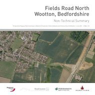
UPPERLANDSNON-TECHNICAL SUMMARYMay 2009TURLEYASSOCIATES
Page 2UPPERLANDSNON-TECHNICAL SUMMARY, MARCH 2009
CONTENTS1 INTRODUCTION PAge 42 Site <strong>and</strong> Surroundings PAge 63 The SurroundingS PAge 74 Project DESCRIPTION PAge 85 Planning ContexT PAge 106 POPULATION PAge 117 TRANSPORTATION PAge 118 Air QUALITY PAge 119 NOISE PAge 1210 EcologY PAge 1211 Flooding <strong>and</strong> HydrologY PAge 1312 CONTAMINATION PAge 1413 LANDSCAPE PAge 1414 Industrial ArchaeologY PAge 1615 Built HeritagE PAGE 1716 DrainagE PAge 1817 ServICES PAge 1818 Overall ASSESSMENT PAge 18Page 3TURLEYASSOCIATES
1 IntroductionThis is a Non-Technical Summary <strong>of</strong> an <strong>Environmental</strong>Statement (ES) prepared to accompany an application foroutline application for the heritage led regeneration (restoration<strong>and</strong> retention <strong>of</strong> listed mill buildings) <strong>of</strong> the former William Clark<strong>and</strong> Sons Linen Mill complex, Upperl<strong>and</strong>s, Maghera. The ESis a detailed report which articulates the wider <strong>Environmental</strong>Impact <strong>Assessment</strong> (EIA) undertaken by the project team. Itprovides an assessment <strong>of</strong> the likely environmental effects <strong>and</strong>their significance <strong>and</strong> sets out mitigation measures to addressany potentially adverse impacts <strong>of</strong> the proposal.The application is submitted by Turley Associates on behalf<strong>of</strong> JHT (Upperl<strong>and</strong>s) Ltd who purchased the site from WilliamClark <strong>and</strong> Sons Ltd in the summer <strong>of</strong> 2007. JHT (Upperl<strong>and</strong>sLtd) are a subsidiary company <strong>of</strong> JH Turkington <strong>and</strong> Son’s,one <strong>of</strong> Northern Irel<strong>and</strong>’s leading construction <strong>and</strong> propertydevelopment companies. The firm has a proven track recordin developing retail, residential, industrial <strong>and</strong> <strong>of</strong>fice projectsacross the Province.The application should also be read in t<strong>and</strong>em with the fullplanning application submitted in respect <strong>of</strong> the listed buildings<strong>and</strong> structures contained within the site complex.Intimate view between mill buildingsView across the Green Dam looking back towards the siteThe former William Clark site is one <strong>of</strong> the longest continuouslyoperating industrial sites in Ulster, with its unique process<strong>of</strong> beetling. The Clark family have been involved in the linenmanufacturing business since 1736, <strong>and</strong> the present day sitecontains a range <strong>of</strong> functionally diverse buildings which illustratethe processes entailed in finishing linen. Combined with thebleaching green they tell the story <strong>of</strong> the historical development<strong>of</strong> the site as a result <strong>of</strong> technological advances <strong>and</strong> demonstratehow the Clark’s family developed a sophisticated waterworkscomprising 5 dams <strong>and</strong> associated mill races. The worksencompass one <strong>of</strong> the largest, if not the largest, industrialwaterworks in Northern Irel<strong>and</strong>, all <strong>of</strong> which is still intact <strong>and</strong> fullyoperational.For centuries the William Clark <strong>and</strong> Sons’ linen mill was the lifeblood <strong>of</strong> the village, providing local people with employmentopportunities <strong>and</strong> knitting together the social fabric <strong>of</strong> the village.Since the 1980’s the village has gone into a steady period <strong>of</strong>decline. A lack <strong>of</strong> employment opportunities has meant thatthose members <strong>of</strong> the population, who are economically active,have left the village <strong>and</strong> sought employment elsewhere. Thesepeople have settled in other parts <strong>of</strong> the province, leaving anaging population within the village. This trend <strong>of</strong> out migrationhas had a direct impact upon social services <strong>and</strong> facilities withinthe village, <strong>and</strong> makes it difficult to encourage people to live inUpperl<strong>and</strong>s.The masterplan for the site has been tested through the EIAprocess. It has been informed by a range <strong>of</strong> comprehensivestudies which have assisted in devising the form, type <strong>and</strong>configuration <strong>of</strong> the uses proposed for this key heritageregeneration opportunity. The masterplan is illustrated within thisdocument to provide a clear underst<strong>and</strong>ing <strong>of</strong> what is proposedfor the site. This document is a summary <strong>of</strong> the EIA produced inan easy to underst<strong>and</strong> format to enable members <strong>of</strong> the public<strong>and</strong> all key stakeholders to readily underst<strong>and</strong> the proposals <strong>and</strong>the process which has been engaged in to robustly assess thepotential environmental impacts which the proposal may giverise to.Prominent l<strong>and</strong>mark building 10aPage 4UPPERLANDSNON-TECHNICAL SUMMARY, MARCH 2009
KILLSIDE ROADCRAIg’S DAMISLAND DAMgORTEADE ROADWEEDAMgREEN DAMNEW DAMKNOCKONEILL RIvERMACKNAgH ROADTHE gREENTIRgARvIL ROADKILREA ROADCLUNADY ROADFig 1. Site PlanPage 5TURLEYASSOCIATES
2 Site <strong>and</strong> surroundingsThe siteThe application site extends to approximately 34.7 hectares,the largest portion <strong>of</strong> site relates to the commercial/industrialcomplex on the northern side <strong>of</strong> the Kilrea Road. The complexis set in a mature l<strong>and</strong>scape <strong>and</strong> consists <strong>of</strong> a number <strong>of</strong>component elements: heavily wooded river corridor; areas <strong>of</strong>meadow/pasture l<strong>and</strong>; tree lined avenue; large open bleachgreen; four man made dams extending to approximately 8.9hectares; <strong>and</strong> an industrial core with approximately 27,870 sqmetres <strong>of</strong> building floor space in both old <strong>and</strong> modern structures(a number <strong>of</strong> these buildings are listed).The site is located <strong>of</strong>f the Kilrea Road, Upperl<strong>and</strong>s, approximately4.5km from Maghera. The main vehicular access point to the siteis from the Kilrea Road, although there is a second (underused)access point from the Macknagh Road which crosses theKnockoneill River.Ampertaine Primary SchoolTwo main uses have been established on the site sincethe mid 18th century; namely industrial <strong>and</strong> residential use.Approximately 27 workers are currently employed manufacturinglinen <strong>and</strong> technical textiles. Processes include dyeing, finishing,coating, laminating <strong>and</strong> beetling. Currently, only 16% <strong>of</strong> theindustrial floorspace within the complex is still in active use <strong>and</strong>the majority <strong>of</strong> buildings are underutilised due to their poor state<strong>of</strong> repair.In terms <strong>of</strong> residential development, there are a number <strong>of</strong>residential properties throughout the site which previouslyhoused mill workers <strong>and</strong> managers. The site also provides forrecreational activities, primarily angling <strong>and</strong> walking.Energy from the four dams is harnessed to power the hydroelectricgenerator, which is owned <strong>and</strong> operated by the Upperl<strong>and</strong>sCommunity Association. Power from the generator is then usedwithin the village, with the balance sold on to Northern Irel<strong>and</strong>Electricity (NIE).Linenhall Business CentreResidential properties on Kilrea RoadPage 6UPPERLANDSNON-TECHNICAL SUMMARY, MARCH 2009
Fig 2. Aerial Photo within indicative site boundary3 The SurroundingsMature vegetation, including substantial areas <strong>of</strong> designedl<strong>and</strong>scape, along the Knockoneill River defines the character<strong>of</strong> the settlement <strong>and</strong> enhances its setting. The area aroundthe mill complex is dominated by open countryside, <strong>and</strong> thesite itself is well screened by mature trees <strong>and</strong> woodl<strong>and</strong>s. Thewoodl<strong>and</strong> area <strong>and</strong> the area around the dams contain valuablenature conservation habitats.For the most part the William Clark <strong>and</strong> Sons’ Linen Mill complexis obscured from view, although there are a few limited views<strong>of</strong> the 1736 thatched beetling mill from Boyne Row, a listed millworkers terrace that abuts the complex.In terms <strong>of</strong> the area surrounding the mill complex it is worth notingthat the Clark family also built two large family homes. One <strong>of</strong>the homes, Ampertaine House (listed building) adjoins the mainmill building complex. With its gate-lodge (listed building), itlieswithin a designed l<strong>and</strong>scape setting which includes the rivercorridor <strong>and</strong> dominates the Kilrea road through the settlement.The second home built by the family, Ardtara House, is situatedalong the eastern boundary <strong>of</strong> the mill complex.The surrounding outlying area is dominated by small villages,the closest <strong>of</strong> which are Tamlaght, Culnady <strong>and</strong> Clady.Outside <strong>of</strong> the mill complex, the village is dominated byresidential properties, with the exception <strong>of</strong> the communitycentre (developed by the local community group) together witha small complex <strong>of</strong> commercial units, which is home to the PostOffice <strong>and</strong> a local village shop.Page 7TURLEYASSOCIATES
4 Project descriptionThe Concept Masterplan (CMP) seeks to deliver a high quality,sustainable environment through regeneration <strong>of</strong> a key brownfieldsite. The proposal is founded on a heritage led regeneration<strong>of</strong> the site <strong>and</strong> an integral part <strong>of</strong> the proposal includes theremoval <strong>of</strong> several less significant structures from the site alongwith the modern industrial sheds which permits the site to beopened up for redevelopment. The proposal seeks to retain thedense built form <strong>of</strong> the site <strong>and</strong> evoke the built form, scale <strong>and</strong>structure <strong>of</strong> a traditional mill village, albeit interpreting it througha contemporary design approach.The jewel in the crown <strong>of</strong> the development is the sensitive reuse<strong>of</strong> listed buildings <strong>and</strong> other buildings <strong>of</strong> historical significancefor residential use, industrial use (retention <strong>of</strong> Clark’s existingbusiness) as well as the creation <strong>of</strong> an exhibition <strong>and</strong> historicinterpretation space. This new development permits the creation<strong>of</strong> a village square within the heart <strong>of</strong> the proposal <strong>and</strong> alsoseeks to integrate the site’s key l<strong>and</strong>scape features within theproposal, whilst protecting the high ecological value <strong>of</strong> the site.Detailed below are the various uses within the proposal <strong>and</strong> thetotal amount <strong>of</strong> floor space associated with each use.The driving principles for the proposed redevelopment <strong>of</strong> theformer Mill complex are as follows:• creating natural extension to village - design an organicstructure form which creates a sense <strong>of</strong> evolution <strong>and</strong>intimacy to respect the semi-rural context;LAND USE• delivering mixed use regeneration - create acomplementary mix <strong>of</strong> uses including: employment;leisure <strong>and</strong> recreation; local facilities; cultural/historicalcentre; <strong>and</strong> residential;• respecting the industrial heritage - retain <strong>and</strong> refurbishthe listed buildings <strong>and</strong> others structures <strong>of</strong> historicalinterest;• protecting ecology - the site <strong>and</strong> surrounding environscomprise a wealth <strong>of</strong> ecology which the proposals seekto protect <strong>and</strong> enhance as a significant asset <strong>of</strong> thesite;• being economically viable - balance the costs associatedwith: restoring the historic buildings; protecting theecology; maintaining the dams <strong>and</strong> watercourses;consolidating Clark’s operations; providing community/cultural facilities; creating public open spaces <strong>and</strong> thepr<strong>of</strong>its from the proposed residential development; <strong>and</strong>• minimising impact <strong>of</strong> vehicles - reduce the visual <strong>and</strong>physical impact <strong>of</strong> cars <strong>and</strong> servicing by prioritisingthe pedestrian <strong>and</strong> cyclist <strong>and</strong> designing traffic calmedstreets with discrete parking are servicing areas.A parameters plan has been prepared to provide an indication <strong>of</strong>the disposition, location <strong>and</strong> mix <strong>of</strong> l<strong>and</strong> uses, together with theirrespective building heights as well as distinguishing retained,refurbished <strong>and</strong> proposed new build development. Thisapproach established the parameters <strong>of</strong> the project for testingthrough the EIA process. BUILDING HEIGHTSThe siteIndustrialCulturalLeisure / RecreationRefurbished buildings to apartmentsRefurbished buildings to residentialNew build houses1a 3 bed 2.5 storey1b 3 bed 2.5 storey1c 2 bed 2 storey1c1 2 bed 2 storey3 3 bed 2 storey3a 4 bed 2 storey4a 3 bed 2 storey4c 4 bed 2.5 storey4d 4 bed 2 storeyThe siteListed BuildingsOther Retained BuildingsRelocated Listed BuildingsEmployment / Industrial1 storey2 storeyResidential or equivalent1 storey2 storey2.5 storey3 storey4 storeySTREET HIERARCHYSIMPLE LAND USEFig 3. Plan illustrating proposed building heightsPage 8UPPERLANDSNON-TECHNICAL SUMMARY, MARCH 2009The siteProposed RoutesSpine RouteBus StopSecondary RouteTertiary RoutePedestrian RouteAccess to Parking CourtsExisting RoutesPrimary RoutesSecondary RoutesTertiary RoutesThe siteIndustrialCulturalLeisure / RecreationRefurbished buildings to apartmentsRefurbished buildings to residentialNew build houses
BUILDING HEIGHTSThe siteListed BuildingsapartmentsresidentialOther Retained BuildingsRelocated Listed BuildingsEmployment / Industrial1 storey2 storeyResidential or equivalent1 storey2 storey2.5 storey3 storey4 storeySIMPLE LAND USEThe siteIndustrialCulturalLeisure / RecreationRefurbished buildings to apartmentsRefurbished buildings to residentialurtsNew build housesFig 4. Plan illustrating mix <strong>of</strong> usesPage 9TURLEYASSOCIATES
5 Planning ContextThe proposed development has been thoroughly consideredagainst current planning policy.The extant Magherafelt Area Plan 1976-1996 identifies the siteas unzoned l<strong>and</strong> within the non-statutory limit, <strong>and</strong> accordinglythere is a presumption in favour <strong>of</strong> development provided thatthe proposal can address normal planning <strong>and</strong> environmentalcriteria. The Department has previously accepted that whilstthe development limit was a non-statutory limit that it had beeninforming development control decisions in Upperl<strong>and</strong>s for overtwo decades. This point was also accepted by the PlanningAppeals Commission.The proposals for the conservation, adaptation <strong>and</strong> reuse <strong>of</strong> thebuildings <strong>and</strong> the site as a whole seek sensitive redevelopment<strong>of</strong> the site to unlock the regenerating potential <strong>of</strong> the village botheconomically <strong>and</strong> socially. Furthermore, through its historicstatus, close association with the village <strong>and</strong> its people that asense <strong>of</strong> place <strong>and</strong> character can be created which will link thesite into the existing village. The mix <strong>of</strong> uses proposed on thesite all emanate from existing on site uses, <strong>and</strong> complementexisting facilities <strong>and</strong> services in the villageThe draft Magherafelt Area Plan 2015 will superseded the extantplan upon adoption <strong>and</strong> aims to provide a planning frameworkwhich facilities sustainable growth whilst protecting <strong>and</strong> whereappropriate enhancing the natural <strong>and</strong> man made environment.Within the draft plan, the entire mill complex is excluded fromthe settlement limit (policy US01). Whilst the site lies beyondthe development limit for Upperl<strong>and</strong>s, this draft designation issubject to objection <strong>and</strong> will be heard through the upcomingExamination in Public due to commence in August 2009.The outline planning application addresses normal planning<strong>and</strong> environmental considerations <strong>and</strong> highlights that nodemonstrable harm will occur to interests <strong>of</strong> acknowledgedimportance.The proposed development accords with all other policies<strong>and</strong> designations set out in the draft plan. In addition, it isimportant to note that there has been no change in the physicalcharacteristics <strong>of</strong> the application site from when the complexwas originally included within the development limit <strong>of</strong> the extantMAP.PPS4PPS6The RDS contains a SpatialDevelopment Strategy (SDS)<strong>and</strong> related Strategic PlanningGuidelines (SPGs) which aim toprovide long term policy directions<strong>and</strong> the principles <strong>of</strong> accommodatingdevelopment in a sustainable manner.The key principles are ensuring abetter quality <strong>of</strong> life for everyone,now <strong>and</strong> for future generations, byseeking to meet the four objectives<strong>of</strong> sustainable development: socialprogress which recognises the needs<strong>of</strong> everyone; effective protection <strong>of</strong> the environment; prudent use<strong>of</strong> natural resources; <strong>and</strong> maintenance <strong>of</strong> high <strong>and</strong> stable levels<strong>of</strong> economic growth <strong>and</strong> employment.Development <strong>of</strong> this major brownfield site for mixed usedevelopment is entirely in tune with the thrust <strong>of</strong> regionalplanning policy. It will bring declining buildings into effective use,successfully deliver compact urban form <strong>and</strong> integrate with thecharacter <strong>of</strong> the wider area.PPS7PPS8PPS 6 encourages the retention <strong>and</strong> re-use <strong>of</strong> historic buildings.It recognises the substantial community benefits that can bedelivered through economic regeneration <strong>and</strong> environmentalenhancement. The proposal is very much a collaborativeconservation led approach with listed <strong>and</strong> historically importantbuildings on the site being retained <strong>and</strong> renewed for economicallyviable uses. It also seeks to introduce complementary newbuildings which reflects the historical use <strong>of</strong> the site whilstrespecting the setting, scale, height <strong>and</strong> massing <strong>of</strong> the existinglisted buildings. This will deliver a variety in building style <strong>and</strong>materials which will contribute significantly to the interest <strong>and</strong>diversity <strong>of</strong> the site.The proposed sympathetic redevelopment <strong>of</strong> the site will resultin significant improvements to the built fabric <strong>of</strong> the site <strong>and</strong>wider location through refurbishment <strong>of</strong> listed <strong>and</strong> non-listedbuildings, heighten recognition <strong>of</strong> the historic status <strong>of</strong> the site,help to sustain existing facilities <strong>and</strong> inject the local area with avariety <strong>of</strong> new services <strong>and</strong> facilities.Page 10UPPERLANDSNON-TECHNICAL SUMMARY, MARCH 2009
6 PopulationA baseline survey <strong>of</strong> existing social <strong>and</strong> community facilities,employment <strong>and</strong> socio-economic statistics was completed in theformulation <strong>of</strong> this ES. An assessment <strong>of</strong> the potential impacts<strong>of</strong> the proposal on education, employment <strong>and</strong> local facilitateswas then undertaken. Given the types <strong>of</strong> facilities <strong>and</strong> extent<strong>of</strong> residential development proposed, an anticipated populationfor the new development was established <strong>and</strong> an assessmentmade <strong>of</strong> the likely job creation which the scheme can deliver.Impacts arising from the development include:KILLSIDE ROADCRAIg’S DAMISLAND DAMgORTEADE ROAD• Modest job retention through relocation <strong>of</strong> the existingWilliam Clark <strong>and</strong> Son’s linen mill to a refurbishedbuilding within the site;• The creation <strong>of</strong> new local facilities including a museum/exhibition space, playing fields <strong>and</strong> enhancedconnectivity between the site <strong>and</strong> surrounding area;gREEN DAMKNOCKONEILL RIvERNEW DAM• A positive cultural <strong>and</strong> tourism impact for Upperl<strong>and</strong>s<strong>and</strong> beyond with attraction <strong>of</strong> additional visitors to thearea;THE gREENMACKNAgH ROAD• Restoration <strong>of</strong> a locally significant l<strong>and</strong>mark siteenhancing its historical importance to the localcommunity <strong>and</strong> the linen industry as a whole.KILREA ROADOverall it is considered that the proposal will have a longterm beneficial impact on the social infrastructure <strong>and</strong> localeconomy.7 TransportationAccess to the application site for all vehicles will remainunchanged, with vehicles entering the site via the existing twoway priority junction <strong>of</strong>f the Kilrea Road. An integral part <strong>of</strong>proposal seeks to enhance the existing Macknagh Road junctionin order that both site accesses can accommodate vehiculartraffic entering <strong>and</strong> exiting the site.The location <strong>of</strong> the application site ensures that it benefits froma good level <strong>of</strong> transport infrastructure provision that presentsgenuine opportunities for people to travel by public transport orby non-car modes <strong>of</strong> transport.Capacity analysis <strong>of</strong> both proposed site access junctions <strong>and</strong>key junctions within the vicinity <strong>of</strong> the application site supportthe proposed development. It is anticipated that vehicle delaywill be negligible <strong>and</strong> any highway works required will beimplemented with procedures to reduce disturbance within thelocal environment.It is concluded that the proposed development will have a verylimited environmental impact on the surrounding area. Any likelyimpacts will be at worse ‘slight adverse’ <strong>and</strong> only on a ‘shortterm’ basis. Mitigation procedures have been highlighted in theES <strong>and</strong> suggested to rectify or reduce the envisaged impact.Fig 5. Movement <strong>and</strong> access plan8 Air QualityThe air quality impact assessment was carried out to assess thefollowing:• The existing air quality in the vicinity <strong>of</strong> the proposeddevelopment site.• The impact <strong>of</strong> the existing <strong>and</strong> proposed / future traffic flowsdue to the proposed development on local air quality.The Design Manual for Roads <strong>and</strong> Bridges (DMRB) is an acceptedmethod for screening areas where proposed developmentshave the potential to affect air quality. For the purposes <strong>of</strong> thisassessment background air quality data for the proposed areawas obtained from the www.airquality.co.uk website. Using thisinformation along with the predicted traffic flows with <strong>and</strong> withoutthe development in future years, it has been predicted that therewill be no exceedance <strong>of</strong> any relevant air quality limit values <strong>and</strong>the increase in pollutant levels as a result <strong>of</strong> the developmentare not considered significant.The predicted impact <strong>of</strong> the proposed development will not besignificant in terms <strong>of</strong> the existing local air quality.Page 11TURLEYASSOCIATES
9 NoiseA noise assessment was undertaken to determine the potentialnoise impact associated with the proposed development. Theassessment focussed on determining the likely impact <strong>of</strong> theproposed development on sensitive receptors, the likely impactfrom increased traffic <strong>and</strong> the impact <strong>of</strong> the construction phase.An assessment was also conducted to determine the suitability<strong>of</strong> the site for residential development.The baseline noise survey was carried out over a period <strong>of</strong>approximately 18 hours at one location within the site to berepresentative <strong>of</strong> typical noise levels in the vicinity <strong>of</strong> the buildingsto be retained <strong>and</strong> also in the area where new residentialproperties are to be constructed for both daytime <strong>and</strong> night timehours. The existing noise climate within the site is predominantlyrural with intermittent passing traffic on the nearby roads <strong>and</strong>from operations associated with the mill complex.A variety <strong>of</strong> habitats <strong>of</strong> varying quality are present on the site.The area <strong>of</strong> wet woodl<strong>and</strong>, treelines, lakes, hedgerows <strong>and</strong>swamp are the major features <strong>of</strong> conservation value on the site.It is noted that these features will be retained <strong>and</strong> improved.Bats, otters <strong>and</strong> a diverse range <strong>of</strong> birds are also present.Appropriate actions have been proposed to avoid impacts uponthese species. Suggested mitigation is likely to provide longtermbenefits for these animals, however the mobility <strong>of</strong> bats inparticular indicates that monitoring will be required throughoutthe development process.The assessment <strong>of</strong> traffic noise from the proposed developmentconcluded that as a result <strong>of</strong> increased traffic flows on KilreaRoad, the increase in noise levels would not be significant.Measures to attenuate the anticipated noise in order to reduceany potential impacts have been identified including fitting <strong>of</strong>double glazing within the proposed residential properties.The assessment <strong>of</strong> construction phase noise from the proposeddevelopment identified that there was the potential for a shortterm impact on the immediate area. Attenuation measures suchas specific working hours have been identified in order to reduceany potential impacts.Overall, the assessment concluded that the site is suitable forresidential development. While there may be some short termimpacts during the construction phase, the proposal will notresult in any significant long term impacts on sensitive receptorsin the area.10 EcologyEcological assessments were carried out according to bestpractice. The entire site was covered with five key aims:• To map the areas <strong>of</strong> extant habitats <strong>and</strong> identify keyplant species;• To determine priority habitats on site;• To identify signs <strong>of</strong> protected animal species (particularlyprotected mammal & bird species) which may be usingthe site;• To determine the impact <strong>of</strong> future development activitieson the site;• To recommend appropriate mitigation measures shouldthe proposed development go ahead.Fig 6. Plan sumarising bird activityThe current masterplan for the site avoids direct impacts uponvaluable habitats where possible <strong>and</strong> concentrates the majority<strong>of</strong> the development on lower value habitats. Where mitigation isproposed to compensate for impacts upon priority habitats (e.g.species rich hedgerows), it is generally located in retained areaswhere predicted disturbance will be lower over the lifetime <strong>of</strong> thedevelopment.The overall ecological impact assessment <strong>of</strong> the proposal ariseslargely from potential increased levels <strong>of</strong> diurnal disturbance <strong>and</strong>is currently assessed as moderate positive long-term. Mitigationplans proposed are appropriate to the habitats <strong>and</strong> speciesconcerned.The projected long-term beneficial impacts associated withspecific groups <strong>of</strong> animals arise entirely from the utilisation <strong>of</strong>appropriate design <strong>and</strong> the implementation <strong>of</strong> a long-term activemanagement plan designed to maximise biodiversity levels onsite. The agreement <strong>and</strong> conditioning <strong>of</strong> such a plan will ensurethe long-term biodiversity <strong>of</strong> the site <strong>and</strong> the presence <strong>of</strong> priorityspecies <strong>and</strong> habitats thereon.Page 12UPPERLANDSNON-TECHNICAL SUMMARY, MARCH 2009
s)Summary <strong>of</strong> Bat Activity on the SiteRed Polygons & Dots = Pipistrelle (both species)distribution & breeding perches.Green Polygons & Dots = Leisler’s batdistribution & breeding perches.Blue Polygon = Daubenton’s bat distributionYellow dots = Brown long-eared bat sightingsLight Blue dots = Roosts1 = Common Pipistrelle2 = Soprano Pipistrelle3 = Leisler’s bat4 = Daubenton’s bat (probable)Fig 7. Diagram sumarising bat activity11 Flooding <strong>and</strong> HydrologyThe Knockoneill River flows in a southerly direction to the west<strong>of</strong> application site. It has a steep gradient <strong>and</strong> is fast flowing <strong>and</strong>consequently there are virtually no areas where flood pondageoccurs. A 1 in 100 year flood has virtually no impact on theproposed development.A large number <strong>of</strong> weirs, sluices mill races <strong>and</strong> control structuresaffect the water levels in the reservoirs. There are five reservoirstructures within the site boundary which were constructed toprovide a water supply for William Clark <strong>and</strong> Son’s Mills. Thesestructures retain a significant total storage volume <strong>and</strong> will besubject to the Reservoirs Act 1975 when it becomes applicablein Northern Irel<strong>and</strong> in the near future. The baseline inspections<strong>of</strong> the reservoirs has shown that they have only very nominalmaintenance for many years <strong>and</strong> a review <strong>of</strong> design guidancehas shown that post development <strong>of</strong> the site, the reservoirswould all be classified as Category A within the 1996 Floods <strong>and</strong>Reservoir Safety Guide.A number <strong>of</strong> large diameter culverts convey water from thereservoirs <strong>and</strong> storm water from the existing buildings back tothe Knockoneill River. A walk-through condition survey <strong>of</strong> theseculverts was undertaken which established that there was nomajor defects but some <strong>of</strong> them were constructed extremelyclose to the surface.A 1 in 100 year flood event from the Knockoneill River poses anegligible risk to the proposed development. Failure to maintain<strong>and</strong> manage the existing sluices <strong>and</strong> control structures couldartificially raise water levels in the reservoirs. The appropriatestructural stability <strong>and</strong> hydraulic capacity <strong>of</strong> all elements <strong>of</strong> thereservoir system must be achieved <strong>and</strong> maintained to minimisethe risk to the proposed development. The existing culverts arepartially responsible for controlling water levels in the reservoirs.Mitigation measures have been identified in the ES to attenuateany potential impacts the proposal may have.Page 13TURLEYASSOCIATES
12 ContaminationTo determine baseline soil <strong>and</strong> groundwater quality atthe application site, contamination investigations <strong>and</strong> riskassessments have been conducted. The aim was also to identifywhether contamination is present at the site with the potentialto impact upon the proposed end users <strong>of</strong> the development,including residential, commercial <strong>and</strong> industrial l<strong>and</strong> uses, <strong>and</strong>also environmental receptors including the Knockoneil River.The contamination investigation included the completion <strong>of</strong> apreliminary risk assessment (PRA) comprising <strong>of</strong> the collection<strong>of</strong> desk based historical information on contaminative uses <strong>and</strong>a site walkover. Areas with the potential for contamination wereidentified due to the presence <strong>of</strong> a dye <strong>and</strong> bleaching house,use <strong>of</strong> chemicals, use <strong>and</strong> storage <strong>of</strong> fuels <strong>and</strong> areas <strong>of</strong> filledground. This was followed by completion <strong>of</strong> a site investigation,including the collection <strong>and</strong> analysis <strong>of</strong> soil <strong>and</strong> groundwatersamples to determine actual contamination levels, particularlyat locations where contamination was suspected. The resultswere assessed through completion <strong>of</strong> a generic quantitative<strong>and</strong> detailed quantitative risk assessments (GQRA & DQRA) todetermine potential unacceptable risks.The results <strong>of</strong> the contamination assessment found severalareas <strong>of</strong> the application site, with reduced quality soils orgroundwater due to contamination from the site’s use as a Mill<strong>and</strong> due to the presence <strong>of</strong> fill material. Remedial works areconsidered necessary in these areas to protect the end users <strong>of</strong>the development <strong>and</strong> the Knockoneil River. This includes areas<strong>of</strong> metal contamination in made ground or fill materials, an area<strong>of</strong> hydrocarbon (fuel) contamination in soil <strong>and</strong> groundwater, <strong>and</strong>an area with elevated ground gas.Necessary remedial works for metal contamination includeproviding proposed gardens <strong>and</strong> l<strong>and</strong>scaped areas with a cappinglayer or clean layer <strong>of</strong> soils which will prevent future users fromcoming into contact with contaminated soils. It is proposed toremediate hydrocarbon contaminated soils <strong>and</strong> groundwaterthrough bioremediation which involves encouraging the soilsnatural bacteria to degrade the contaminants, <strong>and</strong> pumping<strong>and</strong> treating <strong>of</strong> groundwater to lower contamination levels toacceptable concentrations.It is considered that the development <strong>and</strong> required remediationwill have some impacts. The remediation should result in a slightbeneficial impact by improving soils <strong>and</strong> groundwater qualitythrough remediation <strong>and</strong> potential importation <strong>of</strong> clean soils.Potential slight negative impacts have been identified due tothe potential for cross contamination <strong>of</strong> clean areas <strong>of</strong> the siteduring remediation <strong>and</strong> construction works. It is anticipated thatthe negative impacts will be easily mitigated through provision <strong>of</strong>suitable pollution control measures.13 L<strong>and</strong>scapeThe l<strong>and</strong>scape <strong>and</strong> townscape <strong>of</strong> Upperl<strong>and</strong>s village is integrallylinked to the history <strong>of</strong> the William Clark <strong>and</strong> Sons’ Linen Mills.The integration <strong>of</strong> architectural built form, mature man-made <strong>and</strong>natural l<strong>and</strong>scapes, l<strong>and</strong>scape history <strong>and</strong> unique legacy hasseen the application site being made subject to several proposednatural <strong>and</strong> built heritage designations that can be summarisedas “conserving the integral relationship between the built <strong>and</strong>natural environment, which is the essence <strong>of</strong> its character <strong>and</strong>appearance”.The proposed Local L<strong>and</strong>scape Policy Area (LLPA) highlightsthe key high value l<strong>and</strong>scape features including the maturevegetation along the Knockoneill River <strong>and</strong> elements <strong>of</strong> the millcomplex (including the listed buildings <strong>and</strong> dams). While there is avalued “sense <strong>of</strong> place”, there is also a melancholic characteristicassociated with its decline <strong>and</strong> current dilapidated, derelict <strong>and</strong>ab<strong>and</strong>oned state that reduces much <strong>of</strong> the l<strong>and</strong>scape value <strong>and</strong>quality. The construction <strong>of</strong> many utilitarian warehouses in the20th century is somewhat incongruous with what is a largelyintact 19th century mill complex <strong>and</strong> this, in conjunction with theab<strong>and</strong>oned buildings, has been very detrimental to the site’soverall character.The location <strong>of</strong> the site within a low wooded valley ensures thatvisibility into the application site is very limited <strong>and</strong> any changeson this site would not have a significant effect on the areas muchbeyond the immediate site boundary. While the new buildings<strong>and</strong> degraded appearance on the site may reduce the historicambience <strong>of</strong> the Mill complex, they have been absorbed into theRiver Knockoneill valley character without significant detrimentto either it or Upperl<strong>and</strong>s village itself.The proposals are for a major restoration project for the existingMill complex <strong>and</strong> creation <strong>of</strong> a hierarchy <strong>of</strong> streets, access,parking, open space, private gardens, recreational areas<strong>and</strong> public walkways in amongst a predominantly residentialdevelopment. The application site will be changed from anhistoric industrial l<strong>and</strong>scape to a primarily residential l<strong>and</strong>scapein a restored built <strong>and</strong> l<strong>and</strong>scape setting. The proposed built areais predominately located on the footprint <strong>of</strong> existing mill buildingswith existing utilitarian sheds <strong>and</strong> structures being replacedwith new buildings <strong>and</strong> listed buildings being restored <strong>and</strong>/orconverted. William Clark <strong>and</strong> Sons’ premises will be relocatedto the art-deco building (Building No. 22) to the east <strong>of</strong> the site.The external appearance is integral to how this former Millcomplex will be perceived <strong>and</strong> extensive l<strong>and</strong>scape proposalsinclude development <strong>of</strong> internal areas <strong>and</strong> courtyards within thesite <strong>and</strong> aside the river, dams, a village green <strong>and</strong> Bleach Green.The overall objective is to provide a high st<strong>and</strong>ard <strong>of</strong> layout <strong>and</strong>design that ensures the proposed site layout can be integratedinto the retained Mill complex <strong>and</strong> l<strong>and</strong>scape in the best possible<strong>and</strong> most appropriate manner that respects the intrinsic heritage<strong>of</strong> this site. The proposals also ensure that the majority <strong>of</strong>peripheral vegetation is retained thus ensuring a continued level<strong>of</strong> visual screening <strong>of</strong> much <strong>of</strong> the application site area.The l<strong>and</strong>scape <strong>and</strong> visual effects will predominantly be confinedto the application site <strong>and</strong> the immediate valley area <strong>and</strong> thereis likely to be short term slight to moderate adverse visualdisturbance during the construction period.The proposed development will have a negligible effect on thewider Upperl<strong>and</strong>s l<strong>and</strong>scape as the mature l<strong>and</strong>scape setting<strong>and</strong> augmentation planting will ensure that it will not be visiblefrom much <strong>of</strong> the surrounding area. Where views are affordedinto the site, the proposal <strong>of</strong>fers betterment in terms <strong>of</strong> visualamenity as the works to the degraded l<strong>and</strong>scape <strong>and</strong> ab<strong>and</strong>onedbuildings constitute a significant improvement in such views.The proposed development sits comfortably into the existingl<strong>and</strong>scape setting. Where it extends beyond the existing built oryard areas, it is within areas considered less sensitive in terms <strong>of</strong>l<strong>and</strong>scape character <strong>and</strong> these areas are visually well contained<strong>and</strong> such effects are very well contained. The only part <strong>of</strong> thePage 14UPPERLANDSNON-TECHNICAL SUMMARY, MARCH 2009
proposal that will be slightly visible will be the small group <strong>of</strong>proposed terraced houses aside Upperl<strong>and</strong>s Bridge which areset into a mature wooded boundary.Tree <strong>and</strong> scrub removal is normally considered a negative effect,though any loss is mitigated by the restorative nature <strong>of</strong> this project<strong>and</strong> the reinvigoration <strong>of</strong> a damaged l<strong>and</strong>scape with a restoredMill complex. The proposals will also have a beneficial effecton the l<strong>and</strong>scape character <strong>of</strong> the application site beyond theareas designated for buildings as the design <strong>and</strong> management<strong>of</strong> these areas will be imperative to their longer term contributionto the application site setting. Key woodl<strong>and</strong> groups are beingretained intact <strong>and</strong> augmented with a view to encouraging theirlonger term viability <strong>and</strong> therefore contribution to the character<strong>of</strong> the Upperl<strong>and</strong>s area <strong>and</strong> Knockoneill River valley, constitutinga beneficial effect to the l<strong>and</strong>scape character.Fig 8. Plan illustrating existing l<strong>and</strong>scapePage 15TURLEYASSOCIATES
14 Industrial ArchaeologyIndustrial activity began at Upperl<strong>and</strong>s in the 1730s with thesetting up <strong>of</strong> a bleach green by Jackson Clark. A water-poweredbeetling mill was subsequently erected <strong>and</strong> formed the basis fora family-run business which has been in operation for almostthree centuries.The bleaching <strong>and</strong> beetling <strong>of</strong> linen remained the focus <strong>of</strong> MessrsClarks’ activities until the mid 1800s when a dyeing facility wasadded. A major expansion occurred in the decades either side<strong>of</strong> 1900 with the erection <strong>of</strong> additional bleaching, beetling <strong>and</strong>storage facilities a weaving shed, the installation <strong>of</strong> a steamengine <strong>and</strong> water turbines, <strong>and</strong> linking <strong>of</strong> the premises to Ulster’srailway network. These developments formed a solid basis forthe firm to prosper <strong>and</strong> develop despite two world wars. In the1960s, Clarks developed ‘Everbond’, a fusible interlining whichcontinues to play a key role in the firm’s operations. In the 1970s,they also manufactured industrial filters in partnership with aGerman company under the name <strong>of</strong> BWC Textiles Ltd. Today,Messrs Clarks is one <strong>of</strong> the few operational textile manufacturersin Irel<strong>and</strong>, engaged in jobbing bleaching, dyeing, specialist clothtreatments <strong>and</strong> the manufacture <strong>of</strong> interlinings. It is also the onlyfirm still using beetling engines on a commercial scale.The above historical <strong>and</strong> technical developments are reflectedin a rich industrial heritage legacy <strong>of</strong> buildings, the architecture<strong>of</strong> which reflects their use for weaving, bleaching, dyeing <strong>and</strong>finishing. A massive network <strong>of</strong> mill ponds <strong>and</strong> races whichutilized the Knockoneill River for power- <strong>and</strong> process water alsosurvives. The buildings contain a significant assemblage <strong>of</strong> plant<strong>and</strong> machinery for power generation <strong>and</strong> cloth production. Ofparticular note is the engine house which contains four steampoweredengines installed between the 1920s <strong>and</strong> ‘80s for thegeneration <strong>of</strong> electricity.Some <strong>of</strong> the buildings which are <strong>of</strong> special industrial heritagemerit have been listed by the Northern Irel<strong>and</strong> EnvironmentAgency <strong>and</strong> virtually all <strong>of</strong> them will be incorporated in theproposed new development. In addition, there are a number<strong>of</strong> significant buildings which are not listed but which will alsobe retained. The network <strong>of</strong> mill ponds <strong>and</strong> races will also bepreserved <strong>and</strong> it is also proposed that significant items <strong>of</strong> plant<strong>and</strong> machinery be displayed in the new development. Whereit is necessary to demolish buildings <strong>of</strong> heritage interest, theirrecording both photographically <strong>and</strong> by way <strong>of</strong> measureddrawings will mitigate their loss <strong>and</strong> ensure a permanent record<strong>of</strong> their existence.Inside building 4bBuilding 1aFrom an industrial archaeological perspective, the proposeddevelopment will be largely beneficial. Most <strong>of</strong> those buildingswhich are <strong>of</strong> special heritage significance will have a viablereuse which will ensure their future survival as a reminder <strong>of</strong> thesite’s unique contribution to Ulster’s linen industry. In addition,the waterworks will also be preserved as will significant items <strong>of</strong>plant <strong>and</strong> machinery.Building 2aPage 16UPPERLANDSNON-TECHNICAL SUMMARY, MARCH 2009
Fig 9. Historical photo from 1982, view <strong>of</strong> the site from the north-eastFig 10. Historical photo from 1926, view <strong>of</strong> site looking south over the Bleach Green15 Built HeritageThe proposals for regeneration <strong>of</strong> the former William Clark <strong>and</strong>Sons’ Linen Mill have been designed around the retention, repair<strong>and</strong> re-use <strong>of</strong> the majority <strong>of</strong> the listed buildings on the site <strong>and</strong>some not currently listed buildings.The proposals include the alteration, extension <strong>and</strong> re-use <strong>of</strong>substantial listed buildings, principally the Engine House (block4) <strong>and</strong> the ‘New’ Brown Room (building 10). This is a significantbrownfield site <strong>and</strong> all the new buildings are on the site <strong>of</strong>, orclose to modern industrial blocks or other previously developedareas. Proposed new buildings have a potential impact on thesetting <strong>of</strong> the listed buildings.The proposals have been tested against all relevant policiesin Planning Policy Statement 6 <strong>and</strong> there are no significantnegative impacts. There are however, considerable positiveimpacts with the maximum heritage interest being retained asthe listed buildings are restored <strong>and</strong> put to suitable new uses.Page 17TURLEYASSOCIATES
16 DrainageThe proposed development will require new sewerage <strong>and</strong>drainage infrastructure within the site <strong>and</strong> will place additionalloadings on both the terminating Wastewater Treatment Works(WwTW) <strong>and</strong> adjacent watercourses.NI Water has advised that at present the existing foul sewerageinfrastructure <strong>and</strong> Waste Waster Treatment Works does nothave sufficient capacity to cater for the full additional residentialpopulation. This information has been supplied based on thecapabilities <strong>of</strong> the 2 operating Rotating Biological Contactors(RBCs) at the terminating WWTW. There is a third RBC at theWWTW, which is not operating as there is no requirement for itat present. NI Water have advised that the third RBC unit canbe brought online <strong>and</strong> that this additional capacity is likely t<strong>of</strong>acilitate the majority if the development. Details regarding theexact timing <strong>of</strong> various phases <strong>of</strong> the proposed development willbe discussed with NI Water as part <strong>of</strong> the formal “Application toConnect to a Public Sewer” to take place outside the planningcontext.The plans involve the redevelopment <strong>of</strong> an urban l<strong>and</strong>scape onthe site <strong>and</strong> this will therefore involve insignificant alteration tothe current run<strong>of</strong>f volumes <strong>and</strong> rate emanating from the site.To reduce the impact <strong>of</strong> additional stormwater run<strong>of</strong>f on theexisting watercourses, sustainable drainage elements will beconsidered at design stage, managed in accordance with TheSuDS Manual, <strong>and</strong> incorporate drainage systems in line with theSUDS principles (equal regard given to water quality, quantity<strong>and</strong> amenity/biodiversity).The final discharge locations will mimic existing locations to theKnockoneill watercourse, via storm sewers considered at thedetailed design stage.17 ServicesIn order to provide service connections to the proposeddevelopment, modification works will be required to all theexisting NIE <strong>and</strong> BT services. The scale <strong>of</strong> the works variesfrom minor service connections to substantial mains extensions,depending upon the specific users requirements i.e. largecommercial supply to the relocated factory <strong>and</strong> small domesticsupplies to the housing development .A new independent system <strong>of</strong> road <strong>and</strong> amenity lighting shallbe included throughout the proposed development <strong>and</strong> shall bedesigned to DoE current st<strong>and</strong>ards for adoption. Where sharedsurfaces exist the street lighting within these area shall beenergized from local ground mounted mini pillarsThe provision <strong>of</strong> natural gas (Firmus) to the development hasnot been explored as an option for the site as Firmus currentlyhave no plans for extension <strong>of</strong> the gas network to this area.The primary residual impact <strong>of</strong> this development will be duringthe construction phase. Except where impractical e.g. high ormedium voltage NIE cabling, all the service provisions will beunderground.18 Overall <strong>Assessment</strong>The proposal has evolved through a detailed analysis <strong>of</strong> the sitein terms <strong>of</strong> its assets, constraints <strong>and</strong> development potential.The EIA process has been undertaken in parallel with the designprocess in an integrated manner so that interactions between thepotential effects have been properly considered <strong>and</strong> addressedthrough design <strong>and</strong> mitigation.The long terms environmental implications <strong>of</strong> the proposalgenerally identify beneficial, long term impacts. These includeadaption <strong>and</strong> re-use <strong>of</strong> important listed buildings, retention <strong>of</strong>local employment opportunities, provision <strong>of</strong> new housing<strong>and</strong> delivery <strong>of</strong> enhanced physical, social <strong>and</strong> environmentalinfrastructure.Following mitigation there will be some slight adverse, residualenvironmental effects including increases in vehicular flows,construction noise/dust <strong>and</strong> increases in emissions.Page 18UPPERLANDSNON-TECHNICAL SUMMARY, MARCH 2009
Fig 11. Aerial photo <strong>of</strong> sitePage 19TURLEYASSOCIATES