upperlands - Institute of Environmental Management and Assessment
upperlands - Institute of Environmental Management and Assessment
upperlands - Institute of Environmental Management and Assessment
Create successful ePaper yourself
Turn your PDF publications into a flip-book with our unique Google optimized e-Paper software.
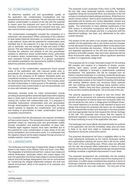
12 ContaminationTo determine baseline soil <strong>and</strong> groundwater quality atthe application site, contamination investigations <strong>and</strong> riskassessments have been conducted. The aim was also to identifywhether contamination is present at the site with the potentialto impact upon the proposed end users <strong>of</strong> the development,including residential, commercial <strong>and</strong> industrial l<strong>and</strong> uses, <strong>and</strong>also environmental receptors including the Knockoneil River.The contamination investigation included the completion <strong>of</strong> apreliminary risk assessment (PRA) comprising <strong>of</strong> the collection<strong>of</strong> desk based historical information on contaminative uses <strong>and</strong>a site walkover. Areas with the potential for contamination wereidentified due to the presence <strong>of</strong> a dye <strong>and</strong> bleaching house,use <strong>of</strong> chemicals, use <strong>and</strong> storage <strong>of</strong> fuels <strong>and</strong> areas <strong>of</strong> filledground. This was followed by completion <strong>of</strong> a site investigation,including the collection <strong>and</strong> analysis <strong>of</strong> soil <strong>and</strong> groundwatersamples to determine actual contamination levels, particularlyat locations where contamination was suspected. The resultswere assessed through completion <strong>of</strong> a generic quantitative<strong>and</strong> detailed quantitative risk assessments (GQRA & DQRA) todetermine potential unacceptable risks.The results <strong>of</strong> the contamination assessment found severalareas <strong>of</strong> the application site, with reduced quality soils orgroundwater due to contamination from the site’s use as a Mill<strong>and</strong> due to the presence <strong>of</strong> fill material. Remedial works areconsidered necessary in these areas to protect the end users <strong>of</strong>the development <strong>and</strong> the Knockoneil River. This includes areas<strong>of</strong> metal contamination in made ground or fill materials, an area<strong>of</strong> hydrocarbon (fuel) contamination in soil <strong>and</strong> groundwater, <strong>and</strong>an area with elevated ground gas.Necessary remedial works for metal contamination includeproviding proposed gardens <strong>and</strong> l<strong>and</strong>scaped areas with a cappinglayer or clean layer <strong>of</strong> soils which will prevent future users fromcoming into contact with contaminated soils. It is proposed toremediate hydrocarbon contaminated soils <strong>and</strong> groundwaterthrough bioremediation which involves encouraging the soilsnatural bacteria to degrade the contaminants, <strong>and</strong> pumping<strong>and</strong> treating <strong>of</strong> groundwater to lower contamination levels toacceptable concentrations.It is considered that the development <strong>and</strong> required remediationwill have some impacts. The remediation should result in a slightbeneficial impact by improving soils <strong>and</strong> groundwater qualitythrough remediation <strong>and</strong> potential importation <strong>of</strong> clean soils.Potential slight negative impacts have been identified due tothe potential for cross contamination <strong>of</strong> clean areas <strong>of</strong> the siteduring remediation <strong>and</strong> construction works. It is anticipated thatthe negative impacts will be easily mitigated through provision <strong>of</strong>suitable pollution control measures.13 L<strong>and</strong>scapeThe l<strong>and</strong>scape <strong>and</strong> townscape <strong>of</strong> Upperl<strong>and</strong>s village is integrallylinked to the history <strong>of</strong> the William Clark <strong>and</strong> Sons’ Linen Mills.The integration <strong>of</strong> architectural built form, mature man-made <strong>and</strong>natural l<strong>and</strong>scapes, l<strong>and</strong>scape history <strong>and</strong> unique legacy hasseen the application site being made subject to several proposednatural <strong>and</strong> built heritage designations that can be summarisedas “conserving the integral relationship between the built <strong>and</strong>natural environment, which is the essence <strong>of</strong> its character <strong>and</strong>appearance”.The proposed Local L<strong>and</strong>scape Policy Area (LLPA) highlightsthe key high value l<strong>and</strong>scape features including the maturevegetation along the Knockoneill River <strong>and</strong> elements <strong>of</strong> the millcomplex (including the listed buildings <strong>and</strong> dams). While there is avalued “sense <strong>of</strong> place”, there is also a melancholic characteristicassociated with its decline <strong>and</strong> current dilapidated, derelict <strong>and</strong>ab<strong>and</strong>oned state that reduces much <strong>of</strong> the l<strong>and</strong>scape value <strong>and</strong>quality. The construction <strong>of</strong> many utilitarian warehouses in the20th century is somewhat incongruous with what is a largelyintact 19th century mill complex <strong>and</strong> this, in conjunction with theab<strong>and</strong>oned buildings, has been very detrimental to the site’soverall character.The location <strong>of</strong> the site within a low wooded valley ensures thatvisibility into the application site is very limited <strong>and</strong> any changeson this site would not have a significant effect on the areas muchbeyond the immediate site boundary. While the new buildings<strong>and</strong> degraded appearance on the site may reduce the historicambience <strong>of</strong> the Mill complex, they have been absorbed into theRiver Knockoneill valley character without significant detrimentto either it or Upperl<strong>and</strong>s village itself.The proposals are for a major restoration project for the existingMill complex <strong>and</strong> creation <strong>of</strong> a hierarchy <strong>of</strong> streets, access,parking, open space, private gardens, recreational areas<strong>and</strong> public walkways in amongst a predominantly residentialdevelopment. The application site will be changed from anhistoric industrial l<strong>and</strong>scape to a primarily residential l<strong>and</strong>scapein a restored built <strong>and</strong> l<strong>and</strong>scape setting. The proposed built areais predominately located on the footprint <strong>of</strong> existing mill buildingswith existing utilitarian sheds <strong>and</strong> structures being replacedwith new buildings <strong>and</strong> listed buildings being restored <strong>and</strong>/orconverted. William Clark <strong>and</strong> Sons’ premises will be relocatedto the art-deco building (Building No. 22) to the east <strong>of</strong> the site.The external appearance is integral to how this former Millcomplex will be perceived <strong>and</strong> extensive l<strong>and</strong>scape proposalsinclude development <strong>of</strong> internal areas <strong>and</strong> courtyards within thesite <strong>and</strong> aside the river, dams, a village green <strong>and</strong> Bleach Green.The overall objective is to provide a high st<strong>and</strong>ard <strong>of</strong> layout <strong>and</strong>design that ensures the proposed site layout can be integratedinto the retained Mill complex <strong>and</strong> l<strong>and</strong>scape in the best possible<strong>and</strong> most appropriate manner that respects the intrinsic heritage<strong>of</strong> this site. The proposals also ensure that the majority <strong>of</strong>peripheral vegetation is retained thus ensuring a continued level<strong>of</strong> visual screening <strong>of</strong> much <strong>of</strong> the application site area.The l<strong>and</strong>scape <strong>and</strong> visual effects will predominantly be confinedto the application site <strong>and</strong> the immediate valley area <strong>and</strong> thereis likely to be short term slight to moderate adverse visualdisturbance during the construction period.The proposed development will have a negligible effect on thewider Upperl<strong>and</strong>s l<strong>and</strong>scape as the mature l<strong>and</strong>scape setting<strong>and</strong> augmentation planting will ensure that it will not be visiblefrom much <strong>of</strong> the surrounding area. Where views are affordedinto the site, the proposal <strong>of</strong>fers betterment in terms <strong>of</strong> visualamenity as the works to the degraded l<strong>and</strong>scape <strong>and</strong> ab<strong>and</strong>onedbuildings constitute a significant improvement in such views.The proposed development sits comfortably into the existingl<strong>and</strong>scape setting. Where it extends beyond the existing built oryard areas, it is within areas considered less sensitive in terms <strong>of</strong>l<strong>and</strong>scape character <strong>and</strong> these areas are visually well contained<strong>and</strong> such effects are very well contained. The only part <strong>of</strong> thePage 14UPPERLANDSNON-TECHNICAL SUMMARY, MARCH 2009


