- Page 3: Roots in the Text, Roots in the Soi
- Page 6 and 7: General description:To accomplish t
- Page 8: L e s s o n 1:The Meaning of Israel
- Page 11 and 12: Sources1. From an Interview with Sh
- Page 13 and 14: Correspondingly, much of the debate
- Page 15 and 16: A. D. Gordon, “Our Tasks Ahead”
- Page 17 and 18: In fact, knowing my students and my
- Page 19: politics: since the Rabinassassinat
- Page 23 and 24: 5. Thoughts on practical applicatio
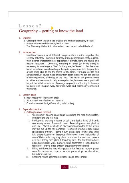
- Page 25 and 26: L e s s o n 3:Locating ourselves on
- Page 27 and 28: Sources1. Suggested names for chron
- Page 29 and 30: f. Passover HaggadahIn every genera
- Page 31 and 32: Behind this seemingly minor semanti
- Page 33 and 34: L e s s o n 4:Early Ties I: Abraham
- Page 35 and 36: iv.that are destroyed because of th
- Page 37 and 38: L e s s o n 5:Early Ties II: Isaac
- Page 39 and 40: i. Claims on the land:1. God’s co
- Page 41 and 42: L e s s o n 6:Egypt - Prototype of
- Page 43 and 44: SourcesI. Accounts of the Diaspora1
- Page 45 and 46: 4.11One day he went into the house
- Page 47 and 48: leadership” and therefore interpr
- Page 49 and 50: 4. Expanded Outlinea. Identifying D
- Page 51 and 52: Questions for Discussion: Annually
- Page 53 and 54: c. Concrete examples of how the ens
- Page 55 and 56: When life is good among the nations
- Page 57 and 58: The Netziv: Haaemek Dvar on same ve
- Page 59 and 60: more than a little unpopular and it
- Page 61 and 62: L e s s o n 8:The Desert Experience
- Page 63 and 64: The desert experience can be divide
- Page 65 and 66: preferred a “spiritual” nationa
- Page 67 and 68: Sources1. Abarbanel Introduction to
- Page 69 and 70: divine providence the Land enjoys,
- Page 71 and 72:
Emek Dvar Numbers 32:18“So that t
- Page 73 and 74:
Lesson 9:“…for the land is Mine
- Page 75 and 76:
The Torah promises us “Follow my
- Page 77 and 78:
Question:How are we, a recently est
- Page 79 and 80:
However if we see the mitzvah as ca
- Page 81 and 82:
The "OU" does not rely on the stand
- Page 83 and 84:
prevailed. This is to teach you tha
- Page 85 and 86:
d. Since the beginnings of Zionism,
- Page 87 and 88:
ief illustration of the difficulty.
- Page 89 and 90:
phenomenon is the history of Jewish
- Page 91 and 92:
L e s s o n 11:adam v’adama: The
- Page 93 and 94:
iii.The rabbis were somewhat more c
- Page 95 and 96:
created I created for you. Take car
- Page 97 and 98:
an architect who builds a palace, f
- Page 99 and 100:
Mark Twain, Innocents AbroadWhen I
- Page 101 and 102:
eading the text; following the conq
- Page 103 and 104:
Palestine. Nor does the archaeologi
- Page 105 and 106:
ut first some of the basic underlyi
- Page 107 and 108:
which would testify to peaceful rel
- Page 109 and 110:
egard to the interpretation of the
- Page 111:
we do know about the history of the
- Page 114 and 115:
Sources1. A general background essa
- Page 116 and 117:
capital, etc. In chapter 11, when t
- Page 118 and 119:
he suggests building a royal temple
- Page 120 and 121:
112אתה בא אלי בחרב וב
- Page 122 and 123:
בלדה למלךמילים: ב
- Page 124 and 125:
L e s s o n 14:The Empire and its d
- Page 126 and 127:
presence among Israel, an ongoing a
- Page 128 and 129:
400300Hellenistic conquest 330200 H
- Page 130 and 131:
(17:3-6). King Hezekiah, the next r
- Page 132 and 133:
L e s s o n 15:Destruction of the F
- Page 134 and 135:
II Kings 24: Nebuchadnezzar's campa
- Page 136 and 137:
•History is what we see: armies a
- Page 138 and 139:
Sources1. A time line, to keep thin
- Page 140 and 141:
4. Expanded outlinea. Prophetic ori
- Page 142 and 143:
Jesus became a popular preacher in
- Page 144 and 145:
Daniel 12 - apocalyptic vision Mark
- Page 146 and 147:
R. Kattina said: Six thousand years
- Page 148 and 149:
L e s s o n 17:Shivat Tziyon1. Outl
- Page 150 and 151:
what we have here is a separation o
- Page 152 and 153:
1. Nehemiah 5 presents a very inter
- Page 154 and 155:
L e s s o n 18:Teaching the Bible,
- Page 156 and 157:
. Pre-zionismi. Before the end of t
- Page 158 and 159:
Sources1. Louis Ginzburg, Legends o
- Page 160 and 161:
the note attached to the goat's ear
- Page 162 and 163:
7. Land and Identity - an activity
- Page 164 and 165:
Lesson 19:The Hellenistic period an
- Page 166 and 167:
ii.Perhaps the most important point
- Page 168 and 169:
iii.…Which brings us back to the
- Page 170 and 171:
this pagan counterattack. In any ca
- Page 172 and 173:
In those days, in this seasonThe Ma
- Page 174 and 175:
4. Expanded outlinea. History of th
- Page 176 and 177:
1.Antiquities of the Jews, 13.5.9:
- Page 178 and 179:
them animals for the continual offe
- Page 180 and 181:
sought to harmonize between the rea
- Page 182 and 183:
5. Thoughts on teaching this lesson
- Page 184 and 185:
ii.iii.iv.Nevertheless, its net res
- Page 186 and 187:
arch showing the Romans carrying aw
- Page 188 and 189:
They wanted to give it a push. He s
- Page 190 and 191:
Lesson 22:The MishnahNote: this les
- Page 192 and 193:
SourcesAttached are photocopies of:
- Page 194 and 195:
for the temple worship itself, and
- Page 196 and 197:
Note that there is a hierarchical s
- Page 198 and 199:
setting of the calendar, they respo
- Page 200 and 201:
Hananiah, Rabbi Yehoshua's nephew,
- Page 202 and 203:
marking time has no relation to the
- Page 204 and 205:
celebrated for one. Passover and Su
- Page 206 and 207:
calculations involving the time of
- Page 208 and 209:
equinox. Any two of these reasons c
- Page 210 and 211:
8. Mishna Rosh Hashanah Chapter 2 M
- Page 212 and 213:
This is not an apropos remark. The
- Page 214 and 215:
3. Lesson goalsa. "Taste" the compl
- Page 216 and 217:
After the movie: The movie shows th
- Page 218 and 219:
AsiaAfricaEurope-Americas14.418.467
- Page 220 and 221:
Apple and honeyAnd apple on a flagA
- Page 222 and 223:
Lesson 26:Sukkot1. Outlinea. Booths
- Page 224 and 225:
http://www.plantoftheweek.org/week1
- Page 226 and 227:
stronger sense of dependence whatev
- Page 228 and 229:
Sources:Mishnah Sukkot4:1 The lulav
- Page 230 and 231:
Bible as a holiday and first appear
- Page 232 and 233:
iii.of God's Holy shefa, all of lif
- Page 234 and 235:
Conclusion and Questions for Discus
- Page 236 and 237:
Snow is falling on my city through
- Page 238 and 239:
[Tu Beshvat] is a reminder to us th
- Page 240 and 241:
Our seven kinds of fruit are comple
- Page 242 and 243:
L e s s o n 28:Megilat Esther, Exil
- Page 244 and 245:
12-14: Mordecai brings her down to
- Page 246 and 247:
27. Hamantaschen (“Haman pockets
- Page 248 and 249:
a. The first Pesach in Eretz Yisrae
- Page 250 and 251:
surprise of Babylonian children at
- Page 252 and 253:
Translations of excerpts from:מו
- Page 254 and 255:
p. 101, Ayelet Hashachar, 1953Excer
- Page 256 and 257:
To arms, comrades!Seize sword and l
- Page 258 and 259:
coverage of related topics, and sad
- Page 260 and 261:
Source #2 is an excerpt from a circ
- Page 262 and 263:
Strengthening the ties of young Isr
- Page 264 and 265:
On the other hand, I wonder about t
- Page 266 and 267:
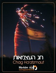
L e s s o n 31:Yom Yom Ha-Atma'aut1
- Page 268 and 269:
Discussion: Do the ways Israelis ch
- Page 270 and 271:
envisioned Yom HaAtzmaut as the foc
- Page 272 and 273:
questions troubling the religious Z
- Page 274 and 275:
In the Second World War, the Jewish
- Page 276 and 277:
Nathan Alterman (translated by Davi
- Page 278 and 279:
there is no need for Kria (rending
- Page 280 and 281:
L e s s o n 32Counting down to Shav
- Page 282 and 283:
Once it gets dark, he says to them:
- Page 284 and 285:
ecause they did not show respect fo
- Page 286 and 287:
onfires has morphed into a fiery ni
- Page 288 and 289:
http://www.myjewishlearning.com/dai
- Page 290 and 291:
23. Clearly, there were some vague
- Page 292 and 293:
what does he mean coming to us talk
- Page 294 and 295:
L e s s o n 34Israel in the Liturgy
- Page 296 and 297:
It seems that the groundwork for th
- Page 298 and 299:
specific land of Israel. It could b
- Page 300 and 301:
xiii. 5). But the custom which was
- Page 302 and 303:
would fear me," etc. (Dent. v. 26).
- Page 304 and 305:
L e s s o n 35Childhood1. Outlinea.
- Page 306 and 307:
And in a commandment to the priests
- Page 308 and 309:
Connectedness to Jewish history Imp
- Page 310 and 311:
addition to other ways of marking t
- Page 312 and 313:
The "celebration of the group" whic
- Page 314 and 315:
life based on the notion of a “Ne
- Page 316 and 317:
on%20for%20Democracy%20at%20the%20S
- Page 318 and 319:
20. Three Galilee Diary entries on
- Page 320 and 321:
and stressing the importance of ser
- Page 322 and 323:
which some see as an important role
- Page 324 and 325:
Continue to live in Israel 84%Move
- Page 326 and 327:
Source 4:Intend to enlistafter high
- Page 328 and 329:
As a rite of passage and a leveler,
- Page 330 and 331:
L e s s o n 37Marriage1. Outline:a.
- Page 332 and 333:
gladdened the heart of a bridegroom
- Page 334 and 335:
certification by a court. There is
- Page 336 and 337:
classification that would have prev
- Page 338 and 339:
4.Expanded Outline:j. References to
- Page 340 and 341:
2. The sages ruled that a person li
- Page 342 and 343:
17. In an attempt to address the di
- Page 344 and 345:
Sources:1. http://www.itim.org.il/b
- Page 346 and 347:
8. http://www.irac.org/article_e.as
- Page 348 and 349:
19. Mishna Ketubot Chapter 13 Mishn
- Page 350 and 351:
almost entirely an aliyah of famili
- Page 352 and 353:
2. In 1948, the IDF began to reorga
- Page 354 and 355:
groups there is a slight difference
- Page 356 and 357:
large. Women, however, are not enco
- Page 358 and 359:
in the Arab sector. A small number
- Page 360 and 361:
Sources1. http://www.ithl.org.il/bo
- Page 362 and 363:
An insider (male) view of Haredi wo
- Page 364 and 365:
L e s s o n 39Death and Mourning1.
- Page 366 and 367:
vii.There is a well-known belief, f
- Page 368 and 369:
Traveling with a dog on El Al can b
- Page 370 and 371:
Thou shalt carry me out of Egypt an
- Page 372 and 373:
L e s s o n 40Medieval Connections
- Page 374 and 375:
however, resisted the temptation to
- Page 376 and 377:
Isaac Luria - the Lion (the Holy Ar
- Page 378 and 379:
The Baal Shem Tov felt a powerful l
- Page 380 and 381:
Discussion: Are these spiritual ele
- Page 382 and 383:
and purity of life reach perfection
- Page 384 and 385:
My God, break not the breakers of t
- Page 386 and 387:
now I have come to reveal the follo
- Page 388 and 389:
4. He said that he was very happy t
- Page 390 and 391:
unlocking Jewish wealth and enterpr
- Page 392 and 393:
Questions for discussion:Do you see
- Page 394 and 395:
ooklet Rome and Jerusalem; The Last
- Page 396 and 397:
was the crowd shouting at Dreyfus
- Page 398 and 399:
Sources1. THE ASSEMBLY OF JEWISH NO
- Page 400 and 401:
Are they bound to obey the laws and
- Page 402 and 403:
4. Moshe Lilienblum, (b in 1843, ra
- Page 404 and 405:
experience itself…The objections
- Page 406 and 407:
If other national movements which h
- Page 408 and 409:
L e s s o n 42Different Directions
- Page 410 and 411:
other words, Zionism is not just an
- Page 412 and 413:
How could socialist Zionism be reco
- Page 414 and 415:
Another possibility is to bring a p
- Page 416 and 417:
een given the Torah to teach us to
- Page 418 and 419:
4. Nahman Syrkin, “The Jewish Que
- Page 420 and 421:
the fifth-century Europeans. We sho
- Page 422 and 423:
L e s s o n 43Jews in Eretz Yisrael
- Page 424 and 425:
seeking authenticity in a return to
- Page 426 and 427:
and I am sent from the 'Alliance Is
- Page 428 and 429:
for industriousness, conquest of li
- Page 430 and 431:
This step required much deliberatio