Understanding the Castle Hayne Aquifer - BIPAC
Understanding the Castle Hayne Aquifer - BIPAC
Understanding the Castle Hayne Aquifer - BIPAC
- No tags were found...

Create successful ePaper yourself
Turn your PDF publications into a flip-book with our unique Google optimized e-Paper software.
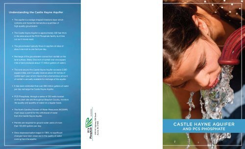
<strong>Understanding</strong> <strong>the</strong> <strong>Castle</strong> <strong>Hayne</strong> <strong>Aquifer</strong>• The aquifer is a wedge-shaped limestone layer whichcontains and transmits tremendous quantities ofhigh-quality groundwater.• The <strong>Castle</strong> <strong>Hayne</strong> <strong>Aquifer</strong> is approximately 300 feet thickin <strong>the</strong> area around <strong>the</strong> PCS Phosphate facility but thinsout as it moves west.• The groundwater typically flows in aquifers at rates ofabout one inch to one foot per day.• Recharge of <strong>the</strong> groundwater comes from rainfall on <strong>the</strong>land surface. (Note: One inch of rainfall over one squaremile of land produces about 17 million gallons of water.)• The land around <strong>the</strong> <strong>Castle</strong> <strong>Hayne</strong> <strong>Aquifer</strong> exceeds 5,000square miles, and it usually receives about 40 inches ofrainfall each year which means that a tremendous amountof rainfall is annually available for recharge of <strong>the</strong> aquifer.• It has been estimated that over 280 million gallons of waterper day recharge <strong>the</strong> <strong>Castle</strong> <strong>Hayne</strong> <strong>Aquifer</strong>.• PCS Phosphate, through a series of 200 wells locatedon <strong>the</strong> plant site and throughout Beaufort County, monitors<strong>the</strong> quality and quantity of water on a regular basis.• The North Carolina Division of Water Resources (NCDWR)must issue a permit for <strong>the</strong> withdrawal of waterfrom <strong>the</strong> <strong>Castle</strong> <strong>Hayne</strong> <strong>Aquifer</strong>.• Permits are required for ground water users of morethan 100,000 gallons per day.• Since depressurization began in 1965, no significantchanges have been observed in <strong>the</strong> quality of watercoming from <strong>the</strong> aquifer.Helping Nature ProvidePCS Phosphate Company, Inc.Aurora Division1530 NC Highway 306 SouthAurora, NC 27806CASTLE HAYNE AQUIFERAND PCS PHOSPHATE
“The <strong>Castle</strong> <strong>Hayne</strong> <strong>Aquifer</strong> is a tremendous resource for <strong>the</strong> citizens of <strong>the</strong> region.It is being naturally recharged at a rate at least equal to <strong>the</strong> present rate ofpumping. I truly believe that if we manage it properly, it will supply <strong>the</strong> citizensof <strong>the</strong> region with abundant and high-quality water for a long time.”— Dr. Spruill, Associate Professor of Hydrogeology, ECUPCS Phosphate and <strong>the</strong> <strong>Castle</strong> <strong>Hayne</strong> <strong>Aquifer</strong>Groundwater PermittingMonitoring <strong>the</strong> <strong>Castle</strong> <strong>Hayne</strong> <strong>Aquifer</strong>Groundwater plays an important role in PCS Phosphate’s dailymining operations. Due to its significance, <strong>the</strong> company employs ateam of people whose primary job consists of monitoring, recording,and reporting on <strong>the</strong> wells and groundwater surrounding <strong>the</strong> mineand plant operations. This data is reported to <strong>the</strong> North CarolinaDepartment of Environment and Natural Resources – Division ofWater Resources (NCDWR).The PCS Phosphate mine is located over <strong>the</strong> <strong>Castle</strong> <strong>Hayne</strong><strong>Aquifer</strong>. To prevent <strong>the</strong> groundwater from flooding <strong>the</strong> mine pit,it is necessary to depressurize <strong>the</strong> aquifer. Depressurization isaccomplished by installing a series of wells approximately 700 feetapart surrounding <strong>the</strong> perimeter of <strong>the</strong> mine. Each well pumps anaverage of about 3,000 gallons of water per minute.In <strong>the</strong> late 1960s, NCDWR established <strong>the</strong> state’s first capacityuse area. Capacity Use Area No. 1 was formed to protect <strong>the</strong>groundwater resources of <strong>the</strong> east-central coastal plain of NorthCarolina in direct response to what was <strong>the</strong>n Texas Gulf SulfurCompany, now PCS Phosphate’s mining operation near Aurora,North Carolina. The formation of Capacity Use Area No. 1 hasserved <strong>the</strong> resource well as additional users have accessed <strong>the</strong><strong>Castle</strong> <strong>Hayne</strong>’s groundwater. These users include aquaculture,agriculture, turf grass producers, golf course irrigation, aggregatemining, and public water supplies.Currently, <strong>the</strong> NCDWR regulates <strong>the</strong> amount of water that is pumped by allpermitted users. While PCS draws approximately 65 million gallons of waterper day from <strong>the</strong> aquifer, <strong>the</strong> current permit allows for withdrawals up to 78million gallons per day. PCS Phosphate compiles a groundwater report ona monthly basis and provides <strong>the</strong> information to <strong>the</strong> NCDWR.Where does <strong>the</strong> water go afterit is pumped from <strong>the</strong> aquifer?A portion of <strong>the</strong> water pumped from <strong>the</strong> aquifer by PCS is sent to <strong>the</strong> plantsite and used in a variety of plant operations. Water not needed for plantoperations flows, in its natural state, to <strong>the</strong> Pamlico River. Currently, PCSPhosphate has a contract with Eagle Water Company which allows Eagleto sell <strong>the</strong> water to public and/or private water systems as well as o<strong>the</strong>rcustomers within North Carolina.How does depressurization of <strong>the</strong>mine area affect my personal well?Pumping of any well produces a cone-shaped depression on <strong>the</strong> “watertable” or “pressure surface.” Pumping at PCS Phosphate produces a “coneof depression” which extends outward approximately 20 miles from <strong>the</strong>center of <strong>the</strong> mine. Deep wells that are located in close proximity of <strong>the</strong>cone of depression may experience problems due to a slight drop in <strong>the</strong>water level. PCS Phosphate has conducted detailed evaluations on <strong>the</strong>effect of <strong>the</strong> cone of depression and consistently mitigates its impact toprivate drinking water wells.For more than 40 years, PCS Phosphate has monitored <strong>the</strong> quantity andquality of <strong>the</strong> <strong>Castle</strong> <strong>Hayne</strong> <strong>Aquifer</strong> through its network of approximately200 wells located along <strong>the</strong> plant site and throughout Beaufort County.Water levels stabilized shortly after pumping started and have remainedconsistent since depressurizationbegan in 1965. During this time,<strong>the</strong>re has been no significantchange in <strong>the</strong> water quality.PCS Phosphate operates sixpublic water systems that utilize<strong>the</strong> <strong>Castle</strong> <strong>Hayne</strong> <strong>Aquifer</strong> andsupply water for drinking, cookingand o<strong>the</strong>r general purposes on<strong>the</strong> plant site. These public watersystems meet <strong>the</strong> drinking waterstandards which are set by <strong>the</strong> U.S.Environmental Protection Agency.In addition, <strong>the</strong> aquifer provideswater to area municipalities thatsupply Belhaven, Chocowinity,Washington and o<strong>the</strong>r townsacross eastern North Carolina.They too are testing <strong>the</strong> waterquality and have experienced nonotable changes.Dr. Richard K. Spruill, Associate Professor of Hydrogeology in <strong>the</strong>Department of Geological Sciences at East Carolina University is anexpert in groundwater research and notes that <strong>the</strong> <strong>Castle</strong> <strong>Hayne</strong> <strong>Aquifer</strong>is one of <strong>the</strong> most studied aquifers in <strong>the</strong> nation.