

Glenasmole Roads
Glenasmole Roads
Glenasmole Roads
- No tags were found...

Create successful ePaper yourself
Turn your PDF publications into a flip-book with our unique Google optimized e-Paper software.
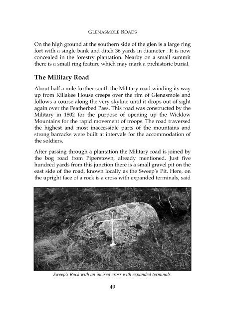
GLENASMOLE ROADSOn the high ground at the southern side of the glen is a large ringfort with a single bank and ditch 36 yards in diameter . It is nowconcealed in the forestry plantation. Nearby on a small summitthere is a small ring feature which may mark a prehistoric burial.The Military RoadAbout half a mile further south the Military road winding its wayup from Killakee House creeps over the rim of <strong>Glenasmole</strong> andfollows a course along the very skyline until it drops out of sightagain over the Featherbed Pass. This road was constructed by theMilitary in 1802 for the purpose of opening up the WicklowMountains for the rapid movement of troops. The road traversedthe highest and most inaccessible parts of the mountains andstrong barracks were built at intervals for the accommodation ofthe soldiers.After passing through a plantation the Military road is joined bythe bog road from Piperstown, already mentioned. Just fivehundred yards from this junction there is a small gravel pit on theeast side of the road, known locally as the Sweep’s Pit. Here, onthe upright face of a rock is a cross with expanded terminals, saidSweep’s Rock with an incised cross with expanded terminals.49