CP - Norfolk Coast Area of Outstanding Natural Beauty
CP - Norfolk Coast Area of Outstanding Natural Beauty
CP - Norfolk Coast Area of Outstanding Natural Beauty
- No tags were found...

You also want an ePaper? Increase the reach of your titles
YUMPU automatically turns print PDFs into web optimized ePapers that Google loves.
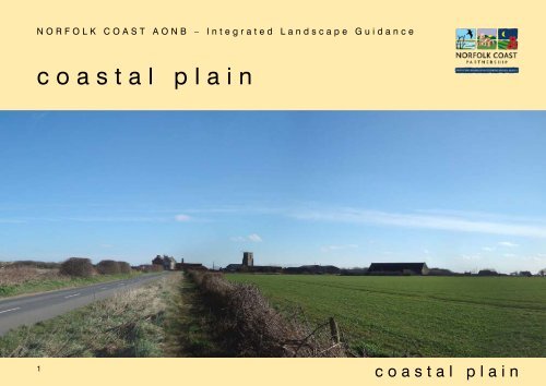
NORFOLK O R F O L K COAST C O A SAONB T A O– NIntegrated B – I n t eLandscape g r a t e d L Guidancea n d s c a p e G u i d a n c ecoastal plain1coastal plain
Landscapesensitivity and changeOnly small areas <strong>of</strong> the <strong>Coast</strong>al Plain are found within the <strong>Norfolk</strong> <strong>Coast</strong> AONB. Key environmental assets which are sensitive to change are:• The long seaward views and the immediate foreground to these views – the low sandy cliffs and sand dunes with brackish scrub-enclosedpools to the rear <strong>of</strong> the dunes - which abut parts <strong>of</strong> the shoreline.• The landscape setting <strong>of</strong> prominent churches and historic farmsteads, which are <strong>of</strong>ten sited on minor ridges.• The remnant woodlands and low hedgerows, which provide a structure to the landscape and help to integrate built development – the remnantlow lying scrubby woodlands, fen and grazing meadows are <strong>of</strong> particularly high ecological value and in some areas connect to the extensivewetland habitats <strong>of</strong> the Broads.• Older, multi-species hedgerows, which are <strong>of</strong> relatively high ecological value.• Ditches around fields, particularly where these connect to small water courses and scrubby woodland habitats.• The smaller pastures, hedgerows and woodlands which contribute to the landscape setting <strong>of</strong> some older settlements.3coastal plain
Variationsin characterVariations in character and inherent landscape sensitivities are highlighted in the following distinctive landscape character areas within the <strong>Coast</strong>al Plainlandscape type, which fall within the AONB area:Landscape character area Distinctive character Inherent sensitivityBacton to Sea Palling - <strong>CP</strong>1Level or very gently rolling landform, which graduallydeclines towards Sea Palling and becomes sea fenaround Horsey. Settlement pattern is linear alongthe coast, with large areas <strong>of</strong> ad hoc development,but underlying historic dispersed semi-nucleatedsettlement pattern just about apparent. Largecaravan and chalet parks along coastal fringe – some(eg Bacton) have wooden huts <strong>of</strong> some antiquity– ‘pre-war). Plotlands holiday developmentsmay be quite isolated and extensive in contrastto some older settlements (eg Happisburgh)have a distinctive vernacular architecture <strong>of</strong>small cottages with thatched ro<strong>of</strong>s and coursedhigh quality flintwork. Bacton Gas Terminal is adominant influence – less so from north (Paston)side from which it is partly hidden by rising ground.• Remaining trees and smaller enclosures onthe outskirts <strong>of</strong> the older settlements• Hedgerows and hedgerow trees, which arerelatively uncommon, but which contributea sense <strong>of</strong> enclosure and scale• Early C20th structures which reflect thespecial history <strong>of</strong> the area – eg pre-warwooden chalets in the park at Bacton,wooden and board bungalows (distributedalong the coast) and former wartimedefensive structures eg pill boxes andspigot mortar posts.4coastal plain
Landscape character area Distinctive character Inherent sensitivitySea Palling to Waxham - <strong>CP</strong>2Lower landform, which becomes sub sea level inplaces. Predominantly arable land use. Simplearea with few jarring elements, ecept for largepoultry units and some extensive touring caravansites. Historic Barn, Hall and Church complex atWaxham. Isolated and remote character, withsome areas <strong>of</strong> scrub, fen and reed on the fringes<strong>of</strong> the Broads. Few hedged boundaries – mostlyditched and reed-lined and very few field boundarytrees (mostly willows). <strong>Coast</strong>al area is dunedand there are brackish ‘slacks’ – scrub enclosedwater bodies just to the rear <strong>of</strong> the dune system• Isolated and remote character• Setting for the historic barn, church and hallcomplex at Waxham• Scrub belts and extensive reed fens/wetgrazing meadows on the fringes <strong>of</strong> theBroads• System <strong>of</strong> coastal dunes and brackishslacks5coastal plain
Integratedlandscape guidance1 Conserve and enhance the character <strong>of</strong> the characteristic seaward views• Give priority to the conservation and enhancement <strong>of</strong> landscape elements which form the immediate foreground to the seaward views – thelow sandy cliffs, beaches and breakwaters and the sand dunes with brackish scrub-enclosed pools which sometimes occur to the rear <strong>of</strong>the dunes.• Enhance the character and quality <strong>of</strong> the coastal footpaths and viewpoints along the coast.2 Conserve and enhance the remnant habitats <strong>of</strong> biodiversity value, which also contribute to the overall visual structure <strong>of</strong> the <strong>Coast</strong>alPlain• Conserve and enhance all remnant woodlands, copses and woodland belts and all hedgerows.• Seek opportunities for new woodland and hedgerow planting, perhaps in connection with new built development, aiming to increaseconnectivity through intensively farmed and developed areas.• Give priority to the conservation and enhancement <strong>of</strong> the scrubby woodland and wetland habitats – fen, grazing marshes and reed-bedsin low lying areas and on the fringes <strong>of</strong> the Broads, aiming to make and enhance connections between habitats along watercourses whichdrain towards the Broads.8coastal plain
Integratedlandscape guidance (continued)3 Conserve and enhance the character and landscape setting <strong>of</strong> the <strong>Coast</strong>al Plain settlements• Conserve and seek to enhance remnant woodlands, tree belts, individual trees and small pastures which form the landscape setting andgateway to some <strong>of</strong> the older settlements. These features should not be lost as a result <strong>of</strong> infill development.• Initiate a programme <strong>of</strong> landscape restoration within and on the approaches to the principal settlements, with planting, signage and publicrealm areas designed to enhance the ‘view from the road’ and from public rights <strong>of</strong> way and viewpoints along the coast.• Ensure new large rural structures (eg agricultural buildings, caravan parks and other commercial developments) are carefully integratedinto the surrounding landscape with appropriate planting, colouring <strong>of</strong> buildings, minimal signage and careful design <strong>of</strong> lighting and accessroads.• Initiate a detailed design guide for the <strong>Coast</strong>al Plain settlements which seeks to identify the intrinsic character <strong>of</strong> the settlements and ensurethat key aspects <strong>of</strong> that character – scale <strong>of</strong> buildings, types <strong>of</strong> boundary features, width <strong>of</strong> sidewalk, tree cover etc) is reflected in future newdevelopment, extensions and replacement buildings.• Initiate a programme <strong>of</strong> <strong>of</strong>f-site planting which is designed to integrate the Bacton Gas Terminal in long views along the coast. Such plantingmight include strategic landscaping belts, copses, hedgerows, and replacement coastal habitat at a distance from the site. The aim wouldbe to partially screen and integrate the Terminal complex while not affecting the access to the site or its security. Although the Terminal is notin the AONB, it is within the overall viewshed <strong>of</strong> AONB landscapes and the implementation <strong>of</strong> this programme would secure an enhancedlandscape character at a point where the AONB is relatively narrow and vulnerable to the erosion <strong>of</strong> its boundaries.9coastal plain
Detailed maps• Standard - landform, drainage, rights <strong>of</strong> way and statutory designations• Biodiversity - ecological networks 1• Historic landscapes - broad historic landscape character types 2 and data from the Historic Environment Record 31<strong>Norfolk</strong> Wildlife Trust on behalf <strong>of</strong> the <strong>Norfolk</strong> Biodiversity Partnership, July 2006, Ecological Network Mapping Project for <strong>Norfolk</strong>2<strong>Norfolk</strong> Landscape Archaeology, january 2009, <strong>Norfolk</strong> Historic Landscape Character - a report on the <strong>Norfolk</strong> Landscape Characterisation (HLC)Project3www.heritage.norfolk.gov.uk - provides a computerised, searchable database (with integrated digital mapping) <strong>of</strong> all areas <strong>of</strong> knownarchaeological activity, sites, finds, cropmarks, earthworks, industrial remains, structures and historic buildings in the county10coastal plain
Information based upon © Crown copyright. All rights reserved.Licence number 100019340 2009© Intermap Technologies Inc. All rights reserved DNOR650 (2008)MAP 23b (i) - STANDARD MAP - COASTAL PLAIN (NORTH)Statutory Designations Heritage Connections TopographyRamsar SiteSpecial Protection <strong>Area</strong>Ancient WoodlandLocal Nature ReserveForestry CommissionWoodlandScheduled AncientMonumentsConservation <strong>Area</strong>sNational Cycle RouteCyclewaysLong Distance PathContour Line (Interval 5 m)30 m Contour Line50 m Contour Line‘A’ Road‘B’ RoadMain RiverSite <strong>of</strong> Special ScientificSpecial <strong>Area</strong> <strong>of</strong>Historic ParksFootpath<strong>Area</strong> <strong>of</strong> <strong>Outstanding</strong>InterestConservationand GardensBridleway<strong>Natural</strong> <strong>Beauty</strong>County Wildlife SitesRestricted BywaySettlementDistrict Council Boundaries11coastal plain
Information based upon © Crown copyright. All rights reserved.Licence number 100019340 2009© Intermap Technologies Inc. All rights reserved DNOR650 (2008)MAP 23b (ii) - BIODIVERSITY MAP - COASTAL PLAIN (NORTH)Statutory Designations Heritage Connections TopographyCore Ramsar Woodland Site <strong>Area</strong>Local <strong>Coast</strong>al Nature Habitat Reserve Enhancement Zone Scheduled <strong>Coast</strong>al Ancient Buffer Zone National Cycle RouteContour Line (Interval 5 m)Zone Special <strong>of</strong> General Protection Habitat <strong>Area</strong>Forestry Calcareous Commission Grassland Core <strong>Area</strong>MonumentsBroads & River Buffer Zone Cycleways30 m Contour LineEnhancementAncient WoodlandWoodland Core Habitat Corridors Conservation <strong>Area</strong>sLong Distance Path50 m Contour LineZone Site <strong>of</strong> <strong>of</strong> Special Grassland-HeathlandScientific Special Paston <strong>Area</strong> Bam <strong>of</strong> Bat SiteHistoric ParksFootpath-Woodland Interest Enhancement ConservationManagement <strong>Area</strong>and GardensBridlewayWetland County Wildlife Habitat SitesEnhancement ZoneRestricted Byway12‘A’ Road‘B’ RoadMain River<strong>Area</strong> <strong>of</strong> <strong>Outstanding</strong><strong>Natural</strong> <strong>Beauty</strong>SettlementDistrict Council Boundariescoastal plain
Information based upon © Crown copyright. All rights reserved.Licence number 100019340 2009© Intermap Technologies Inc. All rights reserved DNOR650 (2008)MAP 23d (i) - STANDARD MAP - COASTAL PLAIN (SOUTH)Statutory Designations Heritage Connections TopographyRamsar SiteSpecial Protection <strong>Area</strong>Ancient WoodlandLocal Nature ReserveForestry CommissionWoodlandScheduled AncientMonumentsConservation <strong>Area</strong>sNational Cycle RouteCyclewaysLong Distance PathContour Line (Interval 5 m)30 m Contour Line50 m Contour Line‘A’ Road‘B’ RoadMain RiverSite <strong>of</strong> Special ScientificSpecial <strong>Area</strong> <strong>of</strong>Historic ParksFootpath<strong>Area</strong> <strong>of</strong> <strong>Outstanding</strong>InterestConservationand GardensBridleway<strong>Natural</strong> <strong>Beauty</strong>County Wildlife SitesRestricted BywaySettlementDistrict Council Boundaries14coastal plain
Information based upon © Crown copyright. All rights reserved.Licence number 100019340 2009© Intermap Technologies Inc. All rights reserved DNOR650 (2008)MAP 23d (ii) - BIODIVERSITY MAP - COASTAL PLAIN (SOUTH)Statutory Designations Heritage Connections TopographyCore Ramsar Woodland Site <strong>Area</strong>Local <strong>Coast</strong>al Nature Habitat Reserve Enhancement Zone Scheduled <strong>Coast</strong>al Ancient Buffer Zone National Cycle RouteContour Line (Interval 5 m)Zone Special <strong>of</strong> General Protection Habitat <strong>Area</strong>Forestry Calcareous Commission Grassland Core <strong>Area</strong>MonumentsBroads & River Buffer Zone Cycleways30 m Contour LineEnhancementAncient WoodlandWoodland Core Habitat Corridors Conservation <strong>Area</strong>sLong Distance Path50 m Contour LineZone Site <strong>of</strong> <strong>of</strong> Special Grassland-HeathlandScientific Special Paston <strong>Area</strong> Bam <strong>of</strong> Bat SiteHistoric ParksFootpath-Woodland Interest Enhancement ConservationManagement <strong>Area</strong>and GardensBridlewayWetland County Wildlife Habitat SitesEnhancement ZoneRestricted Byway15‘A’ Road‘B’ RoadMain River<strong>Area</strong> <strong>of</strong> <strong>Outstanding</strong><strong>Natural</strong> <strong>Beauty</strong>SettlementDistrict Council Boundariescoastal plain
Information based upon © Crown copyright. All rights reserved.Licence number 100019340 2009© Intermap Technologies Inc. All rights reserved DNOR650 (2008)MAP 23d (iii) - HISTORIC LANDSCAPES MAP - COASTAL PLAIN (SOUTH)Statutory Designations Heritage Connections Topography18th-19th Ramsar Site Century Enclosure Commons, Local Nature Wastes, Reserve Heaths MiscellaneousScheduled AncientHER National ‘point’ Cycle RouteContour Line (Interval 5 m)‘A’ Road20th Special Century Protection Agriculture <strong>Area</strong>Forestry CommissionMonumentsHistoric EarthworkParks, Garden, Recreation HERCycleways‘line’30 m Contour Line‘B’ RoadAncient WoodlandWoodlandConservation <strong>Area</strong>sBuilt up <strong>Area</strong>s - HistoricHorticultureWater FeaturesLong Distance Path50 m Contour LineMain RiverSite <strong>of</strong> Special Scientific Special <strong>Area</strong> <strong>of</strong>Historic ParksHER ‘area’Footpath<strong>Area</strong> <strong>of</strong> <strong>Outstanding</strong>BuiltInterestup <strong>Area</strong>s - ModernIndustry ConservationWoodlandGardensBridleway<strong>Natural</strong> <strong>Beauty</strong><strong>Coast</strong>al County - Wildlife Drainage Sites Enclosure<strong>Coast</strong>al - Managed WetlandInland - Managed WetlandMarginalRestricted BywaySettlementDistrict Council Boundaries16coastal plain