Roadside Management Guidelines 1 - Mid Western Regional Council
Roadside Management Guidelines 1 - Mid Western Regional Council
Roadside Management Guidelines 1 - Mid Western Regional Council
- No tags were found...
You also want an ePaper? Increase the reach of your titles
YUMPU automatically turns print PDFs into web optimized ePapers that Google loves.
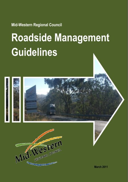
<strong>Mid</strong>-<strong>Western</strong> <strong>Regional</strong> <strong>Council</strong><strong>Roadside</strong> <strong>Management</strong><strong>Guidelines</strong>1March 2011
This booklet supplements the Vegetation database (2010), and the VegetationAssessment Report (2010). It is designed to be used by road maintenance staff, orothers involved in roadside corridor management.Acknowledgement is due to the RTA and Greening Australia for the precursor<strong>Roadside</strong> <strong>Management</strong> <strong>Guidelines</strong> Book 1 Main Road 55 Lithgow-Mudgee-Dunedoo(1996) designed and written by Venita Kulinskisand the Model <strong>Guidelines</strong>, The NSW <strong>Roadside</strong> Environment Committee (REC),funded by the RTAand Vic Roads An Environmental Guide for Road Construction and Maintenance 2006Special acknowledgement to the Botanic Gardens Trust for use of images in theThreaten Species Guide June 2010. PlantNET; http://plantnet.rbgsyd.nsw.gov.auand Shireen Murphy and Linda Shreeve of <strong>Mid</strong>-<strong>Western</strong> <strong>Regional</strong> <strong>Council</strong>This report was written by Anne Careyand Meredith Brainwood,Applied Ecology Pty LtdCentral West (Bathurst) OfficeMaps produced byApplied Ecology Pty Ltdwww.appliedecology.com.aufor <strong>Mid</strong>-<strong>Western</strong> <strong>Regional</strong> <strong>Council</strong>77 Louee StreetRylstone NSW 2849109 Herbert StreetGulgong NSW 285286 Market StreetMudgee NSW 2850This project was assisted withfunding from the Hunter- CentralRivers Catchment <strong>Management</strong>Authority.2
Table of ContentsSection 1.....................................................................................................4Introduction ............................................................................................4How to use this Booklet ..........................................................................5Section 2.....................................................................................................6Special <strong>Management</strong> Road Reserves ......................................................6High Conservation Value Road Reserves-Characteristics........................7High Conservation Value Road Reserves-Maintenance <strong>Guidelines</strong> ........8Medium Conservation Value Road Reserves-Characteristics .................9Medium Conservation Value Road Reserves- Maintenance<strong>Guidelines</strong> ................................................................................................11Low Conservation Value Road Reserves-Characteristics ......................12Low Conservation Value Road Reserves-Maintenance <strong>Guidelines</strong> .......13Section 3 Map Set ....................................................................................14Section 4 Threatened Species ..................................................................76Section 5...................................................................................................88Weeds ...................................................................................................88Revegetation ............................................................................................99Planting notes ..........................................................................................99Section 6.................................................................................................101Other Planning Considerations ...........................................................101Section 7.................................................................................................104Best Practice........................................................................................1043
Section 1IntroductionRoad reserves were surveyed in the past to access paddocks andfields, and often included a narrow strip of native vegetation. Theseroad verges are often the last refuge of intact remnant woodlands inmany agricultural landscapes, and consequently are of highconservation status. Despite the importance of roadsideenvironments for biodiversity conservation, many are under threatfrom human disturbance and utilisation. Roads were developed fortransportation, and therefore road reserves experience ongoingimpacts from road construction and maintenance activities. They alsoprovide service corridors for powerlines, water, sewage, gas,telecommunication and other utilities. In conjunction, manyroadsides are affected by grazing from domestic stock, soil erosion,pest plant and animal invasions, firewood and bush rock collection,and chemical drift from adjacent farms.The immediate aims of vegetation management are to:Conserve existing vegetation communities;Control of non-native species, particularly noxiousweeds;Revegetation of cleared areas; andMinimise impacts of construction activities.Medium and long term objectives of vegetation management are to:Establish a viable habitat corridors for native faunathrough habitat creation and revegetation; andMaintain and enhance species richness of both floraand fauna.4
How to use this BookletThis handbook has been created to assist <strong>Mid</strong>-<strong>Western</strong> <strong>Regional</strong><strong>Council</strong> personnel involved in the management of roadsideenvironments in making informed decisions when planning andundertaking works in <strong>Council</strong>'s road reserves.Section 2 describes the characteristics of the four broad managementcategories of vegetation in the road reserves within the <strong>Council</strong> area.These are characterised as Special <strong>Management</strong>, High, Medium orLow Conservation Value.Section 3 contains maps of <strong>Council</strong> maintained roads. Each road hasbeen mapped to show its conservation value. The maps also showthe location of Threatened Species, Endangered EcologicalCommunities, and Heritage Items.Prior to undertaking works check your proposed works area with themaps in Section 3. Determine the conservation value (or values) ofthe vegetation your works might affect. Check the guidelines forworks within the category you have determined in Section 2. Seekadvice from <strong>Council</strong>'s Environmental Staff if your proposed works arenear a threatened species, an "EEC" (Endangered EcologicalCommunity) or heritage item before proceeding. These will be clearlymarked on the map. Check the Best Practice <strong>Guidelines</strong> andcomplete the Site <strong>Management</strong> Environmental Checklist in Section 7before commencing works and on completion of works.Section 4 contains a quick guide to threatened species that may beencountered in <strong>Mid</strong>-<strong>Western</strong> <strong>Regional</strong> <strong>Council</strong> area.Section 5 contains standard notes for weeding, planting andrevegetation.Section 6 contains guidelines for managing other impacts on roadsidevegetation.5
Section 2Special <strong>Management</strong> Road ReservesSpecial management areas contain heritage sites, rare andendangered species, endangered ecological communities, orculturally important plantings. Examples of culturally importantplantings include plants associated with heritage sites and plants ofsignificance to local Aboriginal peoples.Capertee Stringybark (Eucalyptus cannonii) seen here with Red Stringybark (E.macrorhynca) on Riverlea Road is a threatened species and is afforded special protectionunder the Threatened Species Act 1993.Special features will be denoted on themap set (section 3) with a symbol:Seek advice from <strong>Council</strong>'s EnvironmentalStaff before proceeding with works nearspecial items. You will be able to find outexactly what the item is and how itslocation may affect your planned work.6
High Conservation Value Road Reserves-CharacteristicsHigh Conservation Value (HCV) areas are in a relatively undisturbed state,contain a range of vegetation communities with regrowth and minimalweeds, and require low maintenance. Some areas will contain goodwildlife habitat. These areas will be ranked "1" or "2" on the map set. Ifthe area is flagged as potential EEC on the map set it may be affordedspecial protection under State and/or Federal legislation. Many of thesevegetation communities have been extensively cleared in the region (upto 95%) so these HCV roadside remnants are very valuable.These HCV areas are located on Razorback Road ,Razorback (above) and Clarkes Creek Rd,Pyramul (below).A HCV area will have: Low grazing intensity Tree and shrub regeneration present(seedlings and saplings) Infrequent fire regime (more than 10years between fires) Healthy mature trees (no dieback) Low abundance of weeds (most remnants contain some weeds) No evidence of firewood collection No obvious signs of erosion or salinity Not susceptible to fertiliser application, herbicide or pesticide drift Fallen timber and logs are left on the ground <strong>Roadside</strong> corridor is large (> 15m wide in total is optimum) Connected to or in close proximity to other remnant vegetation7
High Conservation Value Road Reserves-Maintenance <strong>Guidelines</strong>Only do what you have to do and cause as little disturbance as possibleRefer to Section 6 for other specific conditions treat noxious weeds treat environmental weeds using a 3-5 year control plan spot spray weeds in understorey using broadleaf herbicide, spotspray grasses using glyphosate and hand-weed or use cut and painttechniques for isolated weeds. Do not blanket spray. Time sprayingto treat weeds before seed set install signs to indicate high conservation area in areas where vegetation needs to be pruned or cleared, ensure allmaterial is left on site or chipped and mulched (if possible) on site;mulch should be spread on bare areas, but not on native vegetation plan stockpiles outside HCV areas, remove existing stockpiles. eliminate or restrict mowing and slashing, subject to road safety andbushfire management requirements limit mowing and slashing to one slasher width or less, and do notslash beyond the table drain do not “tidy up”, retain natural features such as logs, leaf litter, fallentimber and rocks avoid pushing graded material onto vegetation, grade only theminimum road width required to enable the road formation to drain. where possible, maintain groundcover vegetation within tabledrains avoid grading beyond the existing road shoulder except whereessential for drainage purposes, dispose of excess spoil away fromvegetation, import additional fill instead of removing soil from theroadside corridor topsoil can contain a good seedbank, so where possible stockpile itfor less than 12 months to ensure that the seed in the soil remainsviable stockpile to a maximum height of 2 metres, so as to preserve seedviability8
undertake revegetation works using appropriate species and localprovenance stock.Regrowth (above) is the "recruitment" of young plants to the vegetationcommunity-it is vital to the long term health of vegetation. Do not overspray andkill young native regrowth (below) that can be obscured amongst grasses.Medium Conservation Value Road Reserves-CharacteristicsMedium Conservation Value (MCV) areas are in a semi-naturalcondition. They have been modified, with weed incursion and loss of9
one or more layers (storeys) of vegetation. Trees are often scattered orin clumps, there may be signs of dieback and limited recruitment. Theremay be areas of bare earth and limited habitat diversity such as logs,rocks and leaflitter.MCV areas provide a good opportunity forrevegetation and to create linkages to HCV areas. MCV areas areranked "3" on the map set.A MCV zone on Tongbong Road. It has several features of an EEC but has beendegraded by grazing. Note the fallen logs which are important habitatcomponents. Do not "tidy up" by removing debris or collecting fallen timber forfirewood.10
An MCV zone on Wattlegrove Lane showing signs of dieback, probably because ofsalinity.Medium Conservation Value Road Reserves- Maintenance<strong>Guidelines</strong>Only do what you have to do and cause as little disturbance as possibleRefer to Section 6 for other specific conditions treat noxious weeds treat environmental weeds using a 3-5 year control plan selective herbicide spraying can be used to control invasive weeds butspot spray in areas with native regrowth and do not blanket spray. locate regrowth saplings/plants prior to spraying/slashing and flag ormark location to avoid accidental destruction slash weeds in growth season and before seed set. Slash up to the backof table drains or to 3 m from pavement edge when there is no drain plan new stockpiles away from MCV areas and establish and maintainsediment control structures around existing stockpile sites; manageweeds in these areas remove existing stockpiles from the root zones of trees avoid pushing graded material onto vegetation, grade only theminimum road width required for safe clearance where possible, maintain groundcover vegetation within table drains avoid soil compaction and disturbance. Minor compaction of surfacesoils around trees will kill them slowly over a couple of years avoid grading beyond the existing road shoulder, dispose of excessspoil away from vegetation, import additional fill instead of removingsoil from the roadside corridor do not “tidy up”, retain natural features such as logs, leaf litter, fallentimber and rocks in areas where vegetation needs to be pruned or cleared, ensure allmaterial is chipped and mulched on site; mulch should be spread onweeds and bare areas, but not on native vegetation11
no ploughing to occur along roadsides in these areas undertake revegetation works using appropriate species and localprovenance stock.Low Conservation Value Road Reserves-CharacteristicsLow Conservation Value (LCV) areas are highly altered from their naturalstate. LCV areas are ranked "4" or "5" on the map set. They often havefew or no canopy species, low or no recruitment, and are dominated byweedy species. They rarely contain habitat elements such as rocks andlogs.Saffron Thistle on a rank 5 degraded roadside edge, Stoney Creek Road.Whiskey Grass dominates this rank 5 roadside corridor and adjoining property on UlanWollar Road.12
Low Conservation Value Road Reserves- Maintenance <strong>Guidelines</strong>Refer to Section 6 for other specific conditionsLCV areas are to be maintained to minimise the spread of weeds andexotics, fire and erosion. These are good areas for storage-stockpiles,plant and machinery. treat noxious weeds treat environmental weeds using a 3-5 year control plan Selective herbicide spraying can be used to control invasive weeds butspot spray in areas with any native regrowth. locate regrowth saplings/native plants prior to spraying and flag ormark location to avoid accidental destruction slash weeds in growth season and before seedset. Slash up to the back of table drains or to 3m from pavement edge when there is no drain spoil from grading and drain clearing willcontain weed seed. Under no circumstancesreuse this spoil outside the LCV area. Excessspoil should be carted to a recognised landfillsite. keep machinery within the works area to avoidspreading weeds and contaminated soils. practice good hygiene when moving from LCVareas to higher CV areas. Clean weed seedfrom plant and equipment.Weed seeds on boots, vehicles and equipmentshould not be transferred to bushland areas. Thispoor practice ultimately costs money and time.Machinery should be washed down well away fromcreeks and good quality vegetation sites, preferablyin previously disturbed areas, which already haveweed problems.13
<strong>Roadside</strong> <strong>Management</strong> <strong>Guidelines</strong> Map SetLegend<strong>Roadside</strong> Corridor Condition Ranking1 High Conservation Value (HCV) see pages 8-9 for guidelines2 High Conservation Value (HCV) see pages 8-9 for guidelines3 Medium Conservation Value (MCV) see pages 10-12 for guidelines4 Low Conservation Value (LCV) see pages 13-14 for guidelines5 Low Conservation Value (LCV) see pages 13-14 for guidelinesThreatened Species (TS) RecordEndangered Ecological Community (EEC) RecordEECs have special protection under State and Federal legislation.Heritage ParcelThreatened species have special protection under State andFederal legislation. Seek advice from <strong>Council</strong>’s EnvironmentalStaff before proceeding with works near Threatened Species.EEC - seek advice from <strong>Council</strong>’s Environmental Staff beforeproceeding with works in EECsPotential EEC - Seek advice from <strong>Council</strong>’s Environmental Staffbefore proceeding with works in potential EECs.Heritage Parcels can contain protected vegetation.Seek advice from <strong>Council</strong>’s Environmental Staff beforeproceeding with works in Heritage Parcels.National ParkCrown LandsState Forest<strong>Mid</strong>-<strong>Western</strong> <strong>Regional</strong> LGARoads (other)River or Creek15
B-3A-3 Limit of MapsA-3AVONSIDE NORTH RD AVONSIDE NORTHHWYGCASTLEREAGH HWYNSIDE NORTH RDH RDLimit of MapsLAHEYS CREEK RDPARKVIEW RD22BIRRIWA RDCASTLEREAGH HWY335333 2 2 3BIRRIWA BUS ROUTE STHA-4TUCKLAN RDLAHEYS CREEK RD3ARTZ LN3GINGERS LNLINCOLN RDTUCKLAN RD33 3SPIR RD533TUCKLAN RD0 2.002 2kilometersScale: 1: 1:99,990 100 0002ANNE RDS LN3TUCKLAN RDThreatened Species EEC Potential EECRank 1 2 3 4 52WHIS16
B-4A-4 Limit of MapsA-4GOLDEN HWYWARDENS RDGOLDEN HWYSIR IVAN DOUGHERTY DRWARDENS RDGOLDEN HWYMEROTHERIE RD33BIRRIWA BUS ROUTE NTH334A-33BIRRIWA BUS ROUTE STH3433353223MEROTHERIE RDBIRKALLA RD3A-5MEROTHERIE RD2SANDY LNBIRKALLA RD2232522COPPERS LN3MEROTHERIE RD3BARNEYS REEF RD50 2.002 2kilometersScale: 1: 1:99,990 100 000Threatened Species EEC 2 Potential EECRank1 2 3 4 5BARNEYS REEF R17
B-5A-5 Limit of MapsA-5SIERRWARDENS RDMELROSE RDGOLDEN HWYROSS CROSSING SOUTH RDROCOSIER RDCLIFFDALE RDCLIA-4BIRKALLA RDBIRKALLA RD333A-6LN33BLUE SPRINGS RD2355321BLUE SPRINGS RDWONGA ROO RDFIRETAIL LN20 2.002 2kilometersScale: 1: 1:99,990 100 000311Threatened Species EECRankPotential EEC1 2 3 4 518
B-6A-6 Limit of MapsA-6TONGY RDGOLDEN HWYROSS CROSSING NORTH RDTURILL RD4CLIFFDALE RDTURILL RD1A-5CLIFFDALE RD3CLIFFDALE RD143332225ULAN RD3333PHELPS LNA-75GREENHILLS LN2ULAN RDBOBADEEN RD0 2.002 2kilometersScale: 1: 1:99,990 100 000323BOBADEEN RDULAN RDDURRIDGERE RD3 2 332Threatened Species EEC Potential EECRank1 2 3 4 5319
B-7A-7 Limit of MapsA-7GOLDARRUMBUNGLES WYSTOTTS RDGOLDEN HWYNEELEYS RD4ULAN RDA-634A-8333PHELPS LN1SUMMERHILL RD3SUMMERHILL RD4 3333SUDURRIDGERE RD233SMEDES LNDURRIDGERE RD332 10 2.002 2kilometersScale: 1: 1:99,990 100 00023332332333 3 3DURRIDGERE RDThreatened Species EEC Potential EECRank1 2 3 4 5SMED20
B-8A-8 Limit of MapsA-8GOLDEWYGOLDEN HWYA-7SUMMERHILL RDROSEBUD RD3Limit of Maps3SUMMERHILL RD334SMEDES LN0SUMMERHILL RDkilometersScale: 1: 1:99,990 100 0002.002 2Threatened Species EEC Potential EECRank 1 2 3 4 521
C-1B-1 Limit of MapsB-1SADAPPER RDSANDY CREEK RDGOLLAN RDLimit of MapsEP59866 DIEHM RDGOOLMA RDB-223GOLLAN RD34433LAMBING HILL RD43KARUMA RD0 2.002 2kilometersScale: 1: 1:99,990 100 0002BROWIE RD5333Threatened Species EECRank4BROWIE RD34Potential EECGOLLAN RD1 2 3 4 522
C-2B-2 Limit of MapsB-2DAPPER RDSPRILAHEYS CREEK RDLAHEYS CREEK RDBROOKLYN RDSPRING RIDGE RDB-1SANDY LN2 223B-3SPRING RIDGE RD23MA RD3PINELEA RDWOODBURN RD5344 45UPPER MEBUL RDUPPER MEBUL RD33UPPER MEBUL RD0PINELEA RDkilometers31: 100 000Scale: 1:99,99022.017Threatened Species EEC Potential EEC3Rank 1 2 3 4 523MEBUL RD23
C-3B-3 A-3B-33TUCSUZANNE RD2CORISHS LNCORISHS LN23TUCKLAN RD25WHISTONS LNWHISTONS LN2CASTLEREAGH HWY33ADELONG RDB-232MONTAZA RD3353 33HONEYSETT RD545B-425CASTLEREAGH HWY33 33EP597133SPRING RIDGE RDLAHEYS CREEK RD2333EP3048152323JENKINGS LNPUGGOON RD333TRILBY LN530kilometersScale: 1:99,9902.007 2SPRING RIDGE RDHOLLEYS LNBERYL RDANNIES ROCK RDCASTLEREAGH HWYThreatened Species EEC Potential 4 EEC5 2Rank 1 2 3 3 2 4 5532224
C-4B-4 A-4B-4EEF RD5BARNEYS REEF RD2232MEROTHERIE RD222B-335BLUE SPRINGS RD2B-5GOVERNOR RD330PUGGOON SIDING RDJACKSONS LNkilometersScale: 1:99,9902BARNEYS REEF RDOLD BARNEYS REEF RDDLEY ST2 334532332.007 23STUBBO RDSANDGROVE LNBLACK LEAD LN52CARAWATHA RDT LNMARTINS CROSSING RDCOPE RDWHITEHELOUERA RDBROADFIELD RDCARRAMAR RD4 443332Threatened Species 3 3Rank3COPE RDCOPE RDBROADFIELD RD323BEELA RDRAYDON LNEEC3433SPRING CREEK RD32WYOMING RD33Potential EEC1 2 3 4 525
C-5B-5 A-5B-523133342B-4BLUE SPRINGS RD32COPE RD32232COPE RD3COPE RD3B-63TOOLESPRINGWOOD PARK RD4323ULAN RDMAIALA RD33 4MAIALA LNRIDGE RD3332ULAN RD320SPRING CREEK RDkilometersScale: 1:99,9902.007 223BYWONG LNSPRING CREEK RD455 3 3 3 3 4Threatened 3 Species 5EEC Potential 5 EEC31 2 3 4 5RankCYPRESS DRMAIALA RDE RDINCHESTER CRES26
C-6B-6 A-6B-632ULAN RD23BOBADEEN RD3ULAN RD21 1SADDLERS CREEK RDB-53B-7ULAN WOLLAR RDCOPE RD3TOOLE RDULAN RD353ULAN RD5355555CARRS GAP RD33333 322MURRAGAMBA RDULAN WOLLAR RD33LAGOONS RD3 3320kilometersScale: 1: 100 1:99,990 0002.007 2Threatened Species EEC Potential EECRank 1 2 3 4 527
C-7B-7 A-7B-7DURRIDGE332 1233 3 3DURRIDGERE RD333SMEDEB-6B-80BUNGULLA RDTRGO CL5P1936/93kilometersScale: 1:99,9902.007 23ULAN WOLLAR RDROBINSONS RD342SLAULAN WOLLAR RDMOGO RD1Threatened Species EEC Potential 3 3EEC51 2 3 3Rank3 4 534ULANARALUEN RD28
C-8Limit of MapsB-8 A-8B-83SUMMERHILL4SMEDES LN121B-72MOGO RD122WOLLARA RD10MOGO RDkilometersScale: 1:99,9902.007 2Threatened Species EEC Potential EEC51 2 3 4 5RankNGWOOD RD RINGWOOD RD29
Limit of MapsC-1 B-1C-153334BROWIE RD34GOLLAN RD2BROWIE RD3GOOLMA RD32GOLLAN33GOOLM3 2Limit of Maps3C-20kilometersScale: 1: 1:99,990 100 0002.002 2Threatened Species EECRankPotential EEC1 2 3 4 5BEN B30
D-2C-2 B-2C-23PINELE3PINELEA RD33UPPER MEBUL RD33422MEBUL RDGOLLAN RD333GORRIES LNMEBUL RD1WRIGHTS LN433GUM GUGOOLMA RD53334GORRIES LNGOOLMA RD4435GARDINERS RD33C-1333UAMBY LN24BEN BUCKLEY RDGORRIES LN3335GOOLMA RD3553HUGHES RDC-3335HUGHES2LOWER PIAMBONG RD4233BEN BUCKLEY RD33TWELVE MILE RD0BEN BUCKLEY RD4kilometersScale: 1: 1:99,990 100 0002.002 2344LOWER PIAMBONG RDThreatened Species EEC Potential EECRank 1 2 3 4 5331
D-3C-3 B-3C-3SPRING RIDGE RD53 22WOODS LNLOBLEY LN2HOLLEYS LNBERYL RDANNIES ROCK RD5 23 2CASTLEREAGH HWY4332GUM GULLY RD42 2MEBUL RD3 3SPRING RIDGE RDPERSEVERANCE RD33TURNERS LNPE3G333GARDINERS RD3332GOOLMA RD3GOOLMA RD3 355 5C-2HUGHES RDGUNTAWANG RD535C-45HUGHES RD3GUNTAWANGMBONG RD0kilometersScale: 1: 1:99,990 100 0002.002 2LOWER PIAMBOKALUDABAH RD4 43GUNTAWANG RD33Threatened Species EEC Potential EECRank 1 2 3 4 5KALUD32
D-4C-4 B-4C-4Y333PERSEVERANCE RD33 3 3GOOLMA RD54BERGALIN RD53ADAMS LEAD RD52NEYS REEF RDMEDLEY STBLACK LEAD LN555INDUSTRIAL AVEFLIRTATION HILL LN4GRIMSHAW LNNUGGET LN54RIDOUT LNTUXFORD LNCOPE RDSNELSONS LN435 545S CROSSING RD3332333 3322 3 323BROADFIELD RDWHITEHOUSE RDWILLIARDT LN3 343RIDOUT LNBROADFIELD RDSPRING CREEK RD52SPRING CREEK RD333 3HENRY LAWSON DR4SPRINGFIELD LNCANADIAN LEAD RDC-33MAGPIE LNSHIRAZ DR22CASTLEREAGH HWY2554REEF RDHILLSIDE LN25434433STANLEY STC-5SPRINGFIELD LN5ROSEDALE LNWILBETREE RD4KAOLIN RD333DREWS LN323CASTLEREAGH HWY35 5NORRIS LNWILBETREE RDGUNTAWANG RD3SILLS LN3UNTAWANG RD55SILLS LN3KALUDABAH RD204kilometersScale: 1: 1:99,990 100 0003CULLENBONE2.002 24Threatened Species EECRankSILLS LNPotential 3EEC1 52 3 4 53HENR33


