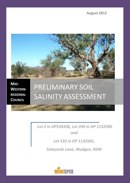
preliminary soil salinity assessment - Mid Western Regional Council
preliminary soil salinity assessment - Mid Western Regional Council
preliminary soil salinity assessment - Mid Western Regional Council

You also want an ePaper? Increase the reach of your titles
YUMPU automatically turns print PDFs into web optimized ePapers that Google loves.
This report has been prepared byConsultation and operational support to the mining industryPO BOX 604, MUDGEE NSW 2850DISCLAIMERThe contents and information provided within this report have been created using data and information provided by or on behalf of theclient and Minespex. Minespex accepts no liability for the accuracy or completeness of the data and information provided to it by, orobtained by it, from any third parties, even if that data has been incorporated into or relied upon for generating this report. This reporthas been produced by Minespex using information that is available to the client as at the date stated within this report and cannot berelied upon in any way if situation at the subject site changes. Minespex is under no obligation to update the information contained withinthe report at any time.ISSUE AND AMENDMENT CONTROL HISTORYIssue Revision Date Description Author QA/QC1 JULY 2012 DRAFT REPORT CB PE1 2 AUGUST 2012 FINAL DRAFT CB MWRC2 3 AUGUST 2012 FINAL REPORT CB MINESPEXPRELIMINARY SOIL SALINITY ASSESSMENTii
Contents1 INTRODUCTION ............................................................................................................................... 11.1 Background ............................................................................................................................. 11.2 Urban Salinity Requirements .................................................................................................. 11.3 Preliminary Salinity Investigation Scope ................................................................................. 22 SITE INVESTIGATION ....................................................................................................................... 32.1 Desktop Review ....................................................................................................................... 32.2 Climate .................................................................................................................................... 52.3 Site Location and Land Use ..................................................................................................... 62.4 Site Inspection ......................................................................................................................... 82.5 Landscape Description and Site Observations of Salinity Indicators ...................................... 82.5.1 Topography and Surface Water Movement ................................................................... 92.5.2 Soils and Site Condition ................................................................................................... 92.5.3 Vegetation ..................................................................................................................... 132.6 Soil Sampling ......................................................................................................................... 142.6.1 Soil Sampling Sites......................................................................................................... 142.6.2 Soil Sampling Methodology .......................................................................................... 152.6.3 Soil Sampling for Laboratory Analysis ........................................................................... 163 SITE INVESTIGATION RESULTS AND DISCUSSION ......................................................................... 203.1 Results of Laboratory Analysis .............................................................................................. 203.2 Current Salinity Situation ...................................................................................................... 233.3 Implications for Urban Development ................................................................................... 234 CONCLUSIONS AND RECOMMENDATIONS ................................................................................... 245 REFERENCES .................................................................................................................................. 27Appendix A ................................................................................................................................................Appendix B ................................................................................................................................................Appendix C ................................................................................................................................................PRELIMINARY SOIL SALINITY ASSESSMENTiii
Table of TablesTable 1: Summary of the Main Soils of Craigmore Soil Landscape ......................................................... 5Table 2: Monthly Rainfall Records, Mudgee NSW .................................................................................. 6Table 3: Dominant Ground Cover Species Site 1 .................................................................................. 14Table 4: Dominant Ground Cover Species Site 2 .................................................................................. 14Table 5: Dominant Ground Cover Species Site 3 .................................................................................. 14Table 6: Dominant Ground Cover Species Site 4 .................................................................................. 14Table 7: Dominant Ground Cover Species Site 5 .................................................................................. 14Table 8: Dominant Ground Cover Species Site 6 .................................................................................. 14Table 9: Soil Profile Sites GPS Locations ............................................................................................... 15Table 10: Soil Sample Depths ................................................................................................................ 15Table 11: Factors for Converting EC 1:5 to EC e ........................................................................................ 17Table 12: EC e Values of Soil Salinity Classes .......................................................................................... 18Table 13: ESP Rating for Sodicity .......................................................................................................... 18Table 14: Exposure Classification for Steel Piles - Piles in Soil .............................................................. 18Table 15: Exposure Classification for Concrete Piles – Piles in Soil ...................................................... 19Table 16: Summary of Laboratory Analysis Results .............................................................................. 21Table of FiguresFigure 1: Causes of Urban Salinity .......................................................................................................... 1PRELIMINARY SOIL SALINITY ASSESSMENTiv
DP 534336, DP 1132580, DP 1132581 Saleyards Lane,Mudgee, NSWPreliminary Soil Salinity Assessment1 INTRODUCTION1.1 Background<strong>Mid</strong>-<strong>Western</strong> <strong>Regional</strong> <strong>Council</strong> currently owns Lot 2 in DP 534336, Lot 399 in DP 1132580, and Lot532 in DP 1132581 in the Parish of Mudgee within the <strong>Mid</strong>-<strong>Western</strong> <strong>Regional</strong> Local GovernmentArea as shown on the map in Appendix A: Location Map. The land area totals 5.665 hectares and islocated approximately 1.5km northwest of Mudgee on Saleyards Lane.The land was the previous site of the Mudgee livestock saleyards however the facilities have beenmoved to a new location and in recent years the site has been used for stockpiling roadworkmaterials and some cattle grazing.<strong>Mid</strong>-<strong>Western</strong> <strong>Regional</strong> <strong>Council</strong> is proposing to sell the land and has requested that a <strong>preliminary</strong> <strong>soil</strong><strong>salinity</strong> <strong>assessment</strong> be carried out for the purpose of gaining an initial insight into the current <strong>salinity</strong>hazard at the site and obtain guidance regarding any site <strong>salinity</strong> issues which may restrict thesuitability of the land for future urban uses. The <strong>assessment</strong> would seek to consider the currentsituation at this site combined with the likely impacts of urban development.1.2 Urban Salinity RequirementsSaline <strong>soil</strong> is defined as a <strong>soil</strong> that contains sufficient soluble salt to adversely affect plant growthand/or land use (Department of Land and Water Conservation, 2002). Soil <strong>salinity</strong> refers to theaccumulation of water soluble salts mainly sodium, but also potassium, calcium and magnesiumwhich may be chlorides, sulfates or carbonates. Salts originate in mineral weathering and reach highconcentrations wherever water, carrying dissolved salts, collects, evapourates and leaves the saltsbehind.The development of urban <strong>salinity</strong> is illustrated in Figure 1: Causes of Urban Salinity below.FIGURE 1: CAUSES OF URBAN SALINITYPRELIMINARY SOIL SALINITY ASSESSMENT1
Source: NSW Department of Primary Industries, Primefact 938 ‘Urban Salinity – Causes and Impacts’Salinity can develop in urban environments if salt contained in layers deep within the <strong>soil</strong> profile aremobilised by rising groundwater. In particular, when groundwater levels rise to within 2 m of thesurface and water containing salts is pulled to the surface through capillary action. The salt can bedetrimental to urban development in a number of ways including:Corrosive to iron/steel materials;Decreases the lifespan of road pavements;Corrodes the properties of bitumen, concrete and brick structures; andPrevents establishment of many garden vegetation species at moderate to high levels andimpacts on growth of many plant species at low to moderate <strong>salinity</strong> levels.However, without increased addition of water to the water table, salts remain attached to the <strong>soil</strong>particles and are unable to be drawn to the surface and concentrated through evapouration(Nicholson and Wheeler, 1999).Salinity is a significant consideration for planning urban land use and investigation of <strong>salinity</strong> risks arean important prelude to further development <strong>assessment</strong>s.1.3 Preliminary Salinity Investigation ScopeMinespex was engaged to carry out a <strong>preliminary</strong> <strong>salinity</strong> <strong>assessment</strong> of Lot 2 in DP 534336, Lot 399in DP 1132580, and Lot 532 in DP 1132581, Saleyards Lane, Mudgee as shown on the map inAppendix A: Location Map. This report has been prepared in the context of aiming to provideguidance regarding any site <strong>salinity</strong> issues which may restrict the suitability of the land for futureresidential uses. This <strong>preliminary</strong> <strong>assessment</strong> seeks to consider the interactions particular to this sitecombined with the likely impacts of the proposed development.The <strong>preliminary</strong> <strong>salinity</strong> <strong>assessment</strong> included a desktop review, site inspections, <strong>soil</strong> sampling andlaboratory analysis of <strong>soil</strong> samples.PRELIMINARY SOIL SALINITY ASSESSMENT2
2 SITE INVESTIGATION2.1 Desktop ReviewSoil and <strong>salinity</strong> information related to the site was reviewed including:Local Government Salinity Initiative Program information and guidelines;<strong>Mid</strong>-<strong>Western</strong> <strong>Regional</strong> <strong>Council</strong> Comprehensive Land Use Strategy – Salinity ConstraintsInvestigation for Mudgee and Gulgong, NSW 2007 (Environmental and Earth Sciences); andSoil Landscapes of the Dubbo 1:250 000 Sheet Map and report, B.W Murphy and J.W. Lawrie,1998;Proposed Development on Common Road Mudgee Salinity Inspection – Preliminary Report,A. Nicholson and H. Wheeler, 1999;NSW Natural Resource Atlas – http://www.nratlas.nsw.gov.au and discussions with NSWOffice of Water regarding groundwater data.The local rural and urban areas of Mudgee have a significant number of <strong>salinity</strong> site expressions(Nicholson and Wheeler, 1999). These are areas of land where the effects of <strong>salinity</strong> are evident anddiagnosed. Nicholson and Wheeler (1999) reported that <strong>salinity</strong> affects are visible in establishedareas of Mudgee. Public buildings and parks, commercial premises, roads and homes are affected.In the context of known <strong>salinity</strong> in the wider locality, saline <strong>soil</strong>s have been identified at variousdepths in the <strong>soil</strong> profile in the Gulgong and Mudgee areas as discussed in the <strong>Mid</strong> <strong>Western</strong> <strong>Regional</strong><strong>Council</strong> Comprehensive Land Use Strategy – Salinity Constraints Investigation for Mudgee andGulgong, New South Wales (Environmental and Earth Sciences, 2007). According to theEnvironmental and Earth Sciences (2007) report, there are a limited number of expressions of<strong>salinity</strong> identified in the area investigated. The report states that ‘the development and/or severityof <strong>salinity</strong> in the study areas will be dependent on how groundwater levels respond to changes inland use, and in particular, impacts to natural drainage from infrastructure such as roads,stormwater and sewerage pipes, and buildings slabs.’ An area of land covering 75ha, identified in theEnvironmental and Earth Sciences (2007) report as Mudgee Area 2, is located approximately 1000mto the south of the land that is the subject of this report.An electromagnetic survey (EM-31) of Mudgee Area 2 was carried out as part of the detailedinvestigation followed by deep boring to collect <strong>soil</strong> samples for analysis to ground truth the EM-31results. Soil samples were collected over 0.50m intervals for the first 5.0m of each bore, and at 1.0mintervals thereafter to a depth of 20m. Saline <strong>soil</strong> was found at varying depths across the areahowever electrical conductivity (EC 1:5 ) was generally more elevated at depths ranging from 3.5 to 7meters below ground level with <strong>salinity</strong> at these depths rated as non-saline (NS) to moderatelysaline (MS) according to the <strong>salinity</strong> criteria applied.An actively discharging saline site was also found during the Environmental and Earth Sciences(2007) investigation within Mudgee Area 2. Indicators of <strong>salinity</strong> including couch grass, erosion and<strong>soil</strong> structure decline were observed at the site. It was reported that “the proximity of theinvestigation area to the Mudgee Fault, the break of slope and presence of springs indicates alikelihood of this area being an active discharge point for groundwater driven by both local andPRELIMINARY SOIL SALINITY ASSESSMENT3
egional processes”. Existing and artificial barriers such as roads and drains were also expected to beimpacting on drainage and subsurface flows at the saline site.The Environmental and Earth Sciences (2007) report includes information from Department of Landand Water Conservation’s (DLWC) Central West Groundwater Data (2002) which reveals that waterbearing zones were typically located between 15 and 35m in fractured rock in bores drilled withinthe vicinity of Mudgee Area 2.Aside from the saline site within Mudgee Area 2, the remainder of the area surveyed byEnvironmental and Earth Sciences (2007) was found to be well vegetated with perennial pastures,native grasses, and/or lawns with no evidence of salt accumulation on the surface, and no erosion.The Soil Landscapes of the Dubbo 1:250 000 Sheet Map (1998) identifies <strong>soil</strong>s within the subject areaas Craigmore (cm). According to the associated report, the Craigmore <strong>soil</strong>s are generally Non-calcicBrown Soils and Red Earths with isolated low levels of <strong>salinity</strong> occurring along some drainage linesand depressions. Parent materials are quaternary alluvium and eluvium, sand, silt clay and somegravel.A summary of the main <strong>soil</strong>s of the Craigmore <strong>soil</strong> landscape are contained in Table 1: Summary ofthe Main Soils of Craigmore Soil Landscape.PRELIMINARY SOIL SALINITY ASSESSMENT4
TABLE 1: SUMMARY OF THE MAIN SOILS OF CRAIGMORE SOIL LANDSCAPESource: B.W Murphy and J.W. Lawrie, 1998A review of any existing groundwater bore data for the site was undertaken using the NSW NaturalResource Atlas followed by a Groundwater Database search carried out by NSW Office of Water.According to the Natural Resource Atlas, a groundwater bore has been recorded at the site on DP1132580 (registered as GW013263). However, MWRC were not aware of a bore at the site. Followupenquiries with NSW Office of Water revealed that a well had been constructed at the site and wasoriginally dug out to a depth of 7.6m then increased in 1932 to a final depth of 10.6m below groundlevel. There were no other records available for the well and it is unknown specifically what thewater bearing zone was at any time. Records also indicate another groundwater bore (GW056262) islocated approximately 1km north of the subject land however no there were no records in theGroundwater Database regarding <strong>salinity</strong> or water bearing zone details for this bore.2.2 ClimateRainfall Data for the year prior to this <strong>assessment</strong> is summarised in Table 2: Monthly RainfallRecords, Mudgee NSW. Annual rainfall for the twelve months prior to this <strong>salinity</strong> <strong>assessment</strong> wasabove the average of 677mm with approximately 825mm falling between May 2011 and April 2012.PRELIMINARY SOIL SALINITY ASSESSMENT5
TABLE 2: MONTHLY RAINFALL RECORDS, MUDGEE NSWMonthlyRainfallReceived(mm)AverageMonthlyRainfall(mm)May June July Aug Sept Oct Nov Dec Jan Feb Mar April TOTAL2011 2011 2011 2011 2011 2011 2011 2011 2012 2012 2012 201250.2 16.4 9.6 67.0 86.0 53.4 127.6 65.2 55.2 145.0 137.2 12.2* 82549.4 54.6 52.9 53.4 52.0 60.3 62.3 65.3 67.5 64.1 51.1 44.2 677.1* Record for nearby station Mudgee, Airport AWS as data unavailable for Mudgee, George St.Source: Bureau of Meterology, http://www.bom.gov.au/jsp/ncc/cdio/weatherData2.3 Site Location and Land UseThe subject site, as detailed in Appendix A: Location Map, has a total land area of 5.665 hectaresand is located approximately 1.5km west of Mudgee. The land is intersected by Saleyards Lane withLot 2 in DP 534336 (1.214ha) located on the northern side of the lane, and Lot 399 in DP 1132580(2.428ha), and Lot 532 in DP 1132581 (2.023ha) on the southern side.Livestock sales were conducted at the saleyards constructed on the site from the 1880’s. Cattle weresold from these saleyards until 1994 and sheep until 2003. Pigs were also sold at the saleyards ataround this time. The land is now used for low intensity cattle grazing and storage of councilroadwork materials.Most records for the site were lost during a fire at the council’s offices in the 1980’s howeverdocuments obtained from the council dating post fire, in addition to personal comms with a localequipment hire company contracted to carry out maintenance work at the saleyards in the 1980’sand 1990’s (Mr Colin Box, C & M Box Hire) have provided an indication of the site layout andinfrastructure supporting the saleyard facility. This information has been used to gain someunderstanding of <strong>soil</strong> profile disturbance and previous land use likely to impact on the current<strong>salinity</strong> status of the site.Livestock were held frequently at sale time for short periods on Lot 399 in DP 1132580 and Lot 532in DP 1132581. The lower slopes on these two parcels of land were used for selling pens. Cattleyards were constructed along the south eastern side of the site. These were gravel lined and notsealed. It is understood that sheep yards were constructed along the lower slopes facing SaleyardLane with gravel lining. A pig shed with concrete flooring was located in the northwestern corner ofthis area.Further upslope to the top of the small hill on the south west of the subject land were variousholding yards which are believed to have been unlined. The relatively steep slope of the site wasused to facilitate drainage for the saleyards. It is understood that run-off from the selling pens andholding yards flowed downslope to the adjacent waterway south east of the site and across SaleyardLane to leachate ponds constructed within DP 534336.Remnants of the old saleyards still remain including a section of yard fence along the south easternside of the site and piles of materials previously part of the fencing and watering system that havebeen pulled down. All concrete flooring has been removed on the southern side of Saleyards Land. A6PRELIMINARY SOIL SALINITY ASSESSMENT
number of piles of material containing <strong>soil</strong>, concrete, gravel and some fencing materials exist on thesite particularly on the lower slopes. It appears the site was graded after the pens and yards wereremoved however no information was found by council to confirm this observation.A brick building still exists on DP 534336 which was associated with the old saleyards and lateroccupied by the State Emergency Service. West of this building remains a concrete pad that waspreviously used as a truck washdown facility. Dirty water from this washdown facility is believed tohave been directed to the nearby leachate ponds.At the initial site investigation and <strong>soil</strong> testing on 15 th May 2012 DP 534336 also contained a numberof piles of materials used for road construction by <strong>Mid</strong>-<strong>Western</strong> <strong>Regional</strong> <strong>Council</strong>. These occupied alarge area of this parcel of land. A small area to the north west of DP534336 appears to be relativelyundisturbed, which was confirmed anecdotally by Mr Colin Box.The land has been cleared almost entirely with a small number of eucalypt trees retained on the hillin the south western corner of the site and other scattered trees that appear to have been plantedfor shade. Groundcover across the site consists of a variety of grass and weed species. The hill areahas a mixture of perennial native grass species, while the lower slopes are dominated by couch grass(Cynodon dactylon) and kikuyu (Pennisetum clandestinum).The previous land use at this site raises particular concerns regarding <strong>soil</strong> <strong>salinity</strong>. Animal waste(faeces and urine) contains salt, including sodium salt. The intensive animal stocking at saleyardsresults in a concentration of animal waste with a relatively high level of salt that can potentiallyaccumulate at the site or enter the environment from the site. The amount of salt to enter the <strong>soil</strong>and waterways, and the impact of this salt on the environment, will depend on a range of factorssuch as:Design of animal holding facilities including the floor material and compaction of the pensand yards, and slope of earthern floored facilities,Animal waste collection, storage and disposal system design,Design of dirty water management system including containment and disposal,Rainfall,Soil profile characteristics within and surrounding the facilities, andNatural ground and surface water systems.From the limited information available on the now removed saleyard facilities and wastemanagement at the site, it is likely that some leaching of salts may have occurred into the <strong>soil</strong> profileacross the site. The relatively steep slope of some of the land south of Saleyards Lane (depicted inAppendix B: Current Site Layout, Topography and Soil Pit Locations is likely to have assisted inminimising leaching of salts into the <strong>soil</strong> profile on these sloped areas where some of the pens andyards were located.However, on the lower slopes and across Saleyards Lane where it is understood dirty water wasdirected to the leachate ponds and low lying areas, leaching of salts into the profile have occurred.As salts dissolve in <strong>soil</strong> water and are mobile in <strong>soil</strong>, rainfall across the site since the saleyards wereremoved is likely to have led to leaching of salts through the <strong>soil</strong> profile or into groundwater and isPRELIMINARY SOIL SALINITY ASSESSMENT7
likely to have reduced the concentration of salts in the upper layers of <strong>soil</strong> across the site. The rateof leaching depends on a number of factors including the amount of water applied and how freelydraining <strong>soil</strong>s are through the profile and determining the long term movement of leached salts isbeyond the scope of this <strong>preliminary</strong> investigation.2.4 Site InspectionOn 8 th May 2012 Minespex carried out a brief site inspection for the purpose of planning for <strong>soil</strong>testing. Initial <strong>soil</strong> <strong>salinity</strong> testing on the northern side of Saleyards Lane was restricted by:Stockpiles of roadwork’s material being stored on this area of land creating areas that wereinaccessible to the excavator and <strong>soil</strong> sampler ;Activity of machinery on the site during <strong>soil</strong> testing associated with this roadwork material.The following week on 15 th May 2012 a field investigation was carried out onsite with visualobservations recorded including topography, existing vegetation type and density, and <strong>soil</strong>condition. At this time Minespex also carried out top and sub<strong>soil</strong> sampling to assist with an overall<strong>preliminary</strong> <strong>salinity</strong> <strong>assessment</strong> at four sites (Sites 1 to 4). The <strong>soil</strong> samples were forward to ALSLaboratory in Sydney for analysis to determine electrical conductivity (EC w 1:5 ), cation exchangecapacity (CEC), sodium (ESP % and sodium mg/kg), pH w , chlorides (meq/100g) and <strong>soil</strong> texture.Following receipt of these initial <strong>soil</strong> test results and improved access to the northern area of thesubject land with the council removing roadworks stockpiles and leveling the site, further top andsub<strong>soil</strong> testing was carried out at two sites (Sites 5 and 6) immediately adjacent to the truckwashdown facility and remaining leachate pond on 3 rd July 2012. The <strong>soil</strong> samples were to ALSLaboratory in Sydney for analysis of the same parameters as for Sites 1 to 4.2.5 Landscape Description and Site Observations of Salinity IndicatorsThere are a number of factors that have been considered to provide a <strong>preliminary</strong> <strong>assessment</strong> of the<strong>salinity</strong> hazard at the site such as regional <strong>salinity</strong> issues, topography, vegetation, site history, <strong>soil</strong>type, <strong>soil</strong> condition and surface water movement. This information has been used as part of theoverall <strong>salinity</strong> risk <strong>assessment</strong> and to determine a suitable <strong>soil</strong> sampling protocol for the site.The previous land use has impacted dramatically on vegetation across the site with the majority ofgroundcover consisting of species that are able to establish and survive in highly disturbed, poor<strong>soil</strong>s. In particular, couch grass (Cynodon dactylon) and slender rat’s tail grass (Sporobolus spp.) aredominant on the southern side of Saleyards Lane, with kikuyu (Pennisetum clandestinum) growingprolifically on the land north of the lane and other low lying areas across the subject land.Whilst both couch and kikuyu grasses are considered <strong>salinity</strong> indicator species, they are also knownto invade disturbed, poor <strong>soil</strong>s where <strong>salinity</strong> is not an issue and are found extensively within theMudgee region as lawn grasses.No bare patches, saline scalds or seepage areas were visible during the site inspection. Trees acrossthe site were in reasonable condition.The SES building had very little indication of possible <strong>salinity</strong> damage to the exterior. There were noobvious wet ‘tide’ marks on the building. White colouration was seen on three small spots on bricksPRELIMINARY SOIL SALINITY ASSESSMENT8
and mortar in the lower 30cm (approximately) of the exterior walls and one brick was found with alittle crumbling however there was no white marking around this brick.2.5.1 Topography and Surface Water MovementThe land generally slopes down from a small hill on the south western side of the subject area with anorth and north eastern aspect as shown on the topographic map of the general area contained inAppendix B: Current Site Layout, Topography and Soil Pit Locations. The upper slopes are relativelysteeply sloped with the lower slopes more gently sloping down to the virtually flat area of land northof Saleyards Lane. A small embankment runs along the north eastern boundary of Lot 2 in DP534336 the site dropping steeply by approximately 1m down to the alluvial swampy flats adjacent tothe subject land. It appears this embankment has resulted from leveling of the site.The site is dominated by the small hill on the western side of the subject land with limited surfacewater runoff entering the main area of the site from outside. However, a natural watercourse runsalong the eastern side of Lot 399 in DP 1132580 with local drainage flowing north easterly.2.5.2 Soils and Site ConditionErosion was minimal across most of the site however the upper slopes of the hill had very littletop<strong>soil</strong> and sparse vegetation, which is typical of light, gravelly <strong>soil</strong> types after heavy grazing.No significant bare patches, saline scalds or saline seepage areas were visible during the siteinspection. Couch grass (Cynodon dactylon) and kikuyu (Pennisetum clandestinum) were observed inareas across the site. These species are considered to be <strong>salinity</strong> indicator species as they aretolerant of mildly saline conditions.Given that the site was being used for stockpiling roadworks, and on the basis of visual observationsrelating to <strong>soil</strong> <strong>salinity</strong>, for the purpose of a <strong>preliminary</strong> <strong>salinity</strong> <strong>assessment</strong> four (4) sites wereinitially selected within the subject land. These sites were believed to be representative of thedevelopment area and were determined to be areas where <strong>soil</strong> <strong>salinity</strong> may occur due totopography, previous land use and existing water movement within the landscape. Soil pits wereexcavated to approximately 120cm at each of these sites and are identified throughout this report asSites 1 – 4. Further <strong>soil</strong> testing was carried out at sites immediately adjacent to the truck washdownpad (close to the SES building) and immediately next to the remaining leachate pond, once theseareas became accessible and are identified as Site 5 (north of truckwashdown pad, west of SESbuidling) and Site 6 (west of leachate ponds). The locations of the 6 <strong>soil</strong> pit sites were recorded usinga handheld GPS device and are shown on the maps in Appendix B: Current Site Layout, Topographyand Soil Pit Locations. Observations of the <strong>soil</strong> profile were recorded for each pit and <strong>soil</strong> samplingconducted as detailed in Section 2.6 below.The <strong>soil</strong> profiles at the six <strong>soil</strong> pits excavated for use in the field investigation are shown in Plates 1to 6 below. In general, the upper layers of the <strong>soil</strong> profiles (A and B Horizons) across the site aregenerally sandy loams and loams with clay sub<strong>soil</strong>s (C Horizons).Site 1 had grey brown sandy loam top<strong>soil</strong> (A Horizon) down to approximately 15cm. Below this layer,the upper sub<strong>soil</strong> (B Horizon) was a leached, pale grey clay loam that contained dark grey to black,angular gravel less than 20mm diameter appearing in a relatively defined layer. This gravel materialdid not appear to be consistent with the <strong>soil</strong> type and is likely to have been brought in to improvePRELIMINARY SOIL SALINITY ASSESSMENT9
drainage in the floor of the livestock pens in the previous saleyard facility. The evidence of leachingsupports this assumption with water used to wash the pens likely to have increased leaching in theupper <strong>soil</strong> layers. The sub<strong>soil</strong> (C Horizon) at Site 1 was medium, orange brown clay with red andorange mottling and contained reddish brown gravel less than 20mm diameter. Visual observationsof the profile indicate the <strong>soil</strong> at this location has moderate to slow drainage.Site 2 had a relatively shallow, pale, grayish brown, loamy top<strong>soil</strong> (A Horizon). The upper sub<strong>soil</strong> (BHorizon) was orange clay and the lower sub<strong>soil</strong> (C Horizon) a pale, greyish yellow clay with asignificant portion of angular rocks and shale up to 100mm diameter. The sub<strong>soil</strong> contained blackgravel chips and dark grey mottling throughout. Concrete chips were also found in the throughoutthe sub<strong>soil</strong>. It appears this <strong>soil</strong> profile may have been previously disturbed with gravel and concreteused in construction of the saleyards incorporated into the sub<strong>soil</strong> during construction ormaintenance activities at the site. The profile also indicates water is likely to have caused leaching ofiron compounds in the upper layers with some waterlogging lower in the profile possibly due topoorer drainage. The sub<strong>soil</strong> at this location was very hard relative to the other <strong>soil</strong> pit locations.Due to the presence of bitumen like gravel and concrete throughout the sub<strong>soil</strong> at this site and thestrong possibility that this profile has been disturbed, the sub<strong>soil</strong> at this site was sampled as onelayer described as ‘sub<strong>soil</strong>’.Site 3 had lighter <strong>soil</strong> than the other sites with a light brown, sandy loam top<strong>soil</strong> (A Horizon). Theupper sub<strong>soil</strong> layer (B Horizon) was a light, grey clay loam containing red and brown gravel up to50mm diameter. The lower sub<strong>soil</strong> (C Horizon) was yellow clay containing a high portion of shale andother rocks up to 150mm diameter. There appeared to be a slightly wetter, compacted layer or ‘<strong>soil</strong>pan’ at the top of the C Horizon.Site 4 was located on the northern side of Saleyards Lane. This <strong>soil</strong> pit location was selected for <strong>soil</strong>sampling and analysis as information regarding the old saleyard facilities indicates that the areaaround Site 4 is likely to be relatively undisturbed and may represent a more natural <strong>salinity</strong>situation than across the remaining area of DP534336. The top<strong>soil</strong> (A Horizon) at Site 4 was a friable,orange brown loamy <strong>soil</strong>. The upper sub<strong>soil</strong> <strong>soil</strong> (B Horizon) was slightly darker in colour with thelower sub<strong>soil</strong> (C Horizon) changing to a heavy brown clay that was moist and puggy to dig. Very littlegravel was found within the profile at Site 4.Site 5 was located approximately 2m north of the truck washdown concrete pad and approximately10m west of the SES building. The top<strong>soil</strong> (A Horizon) was brown loamy <strong>soil</strong> containing black angulargravel chips to 40mm. The upper sub<strong>soil</strong> (B Horizon) was leached light grey and orange sandy loam.Below this the lower sub<strong>soil</strong> (C Horizon) was a yellow brown clay <strong>soil</strong> containing sub-angular blockygravel less than 30mm. Some black and red mottling was observed. It appears this clay layer is slowto drain and may have have contributed to leaching of the upper sub<strong>soil</strong> due to waterlogging.Site 6 was selected to provide an indication of <strong>salinity</strong> in the top 1.3m of <strong>soil</strong> in the area immediatelynorth of the remaining leachate pond. The top<strong>soil</strong> (A Horizon) was found to be a light brown clay.The upper sub<strong>soil</strong> below this (B Horizon) was friable sandy loam brown <strong>soil</strong> containing a smallportion of gravel less than 40mm. The lower sub<strong>soil</strong> (C Horizon) was a heavier brown clay <strong>soil</strong>.PRELIMINARY SOIL SALINITY ASSESSMENT10
Plate 1: Soil profile at Site 1 <strong>soil</strong> pit.Plate 2: Soil profile at Site 2 <strong>soil</strong> pit.Plate 3: Soil profile at Site 3 <strong>soil</strong> pit.Plate 4: Soil profile at Site 4 <strong>soil</strong> pit.PRELIMINARY SOIL SALINITY ASSESSMENT11
Plate 5: Soil profile at Site 5 <strong>soil</strong> pit.Plate 6: Soil profile at Site 6 <strong>soil</strong> pit.PRELIMINARY SOIL SALINITY ASSESSMENT12
2.5.3 VegetationThe subject land is generally cleared of timber with a number of large eucalypt (Eucalyptus spp.)trees and saplings retained in an area on top of the hill. Established eucalypt, pepper trees (Schinusareira) and another unknown tree species were also found scattered across the site. The trees werein a reasonably healthy condition given the site’s history with no obvious signs of stress or <strong>salinity</strong>damage.Groundcover is moderate on the southern side of Saleyards Lane consisting of predominantly couchgrass (Cynodon dactylon), native rat’s tail grass (Sporobolus spp.), red grass (Bothriochloa macra),and broadleaf weeds. Most plants across this area are growing poorly however this is expected giventhe site history, lack of top<strong>soil</strong>, and current grazing by cattle and kangaroos. On the area of landnorth of Saleyards Lane that has not been disturbed during recent use, kikuyu (Pennisetumclandestinum) is dense and vigorously growing up to 60cm high. Couch grass and kikuyu are knownto be tolerant of mildly saline <strong>soil</strong>. However, these species are also used as lawn species and arecommonly found on disturbed <strong>soil</strong>s. Couch in particular is also known to be indicative of poor <strong>soil</strong>fertility.The main groundcover species identified in the field during the investigation at each of the sixsample sites are listed in Tables 3 to 8 below.Plate 7 shows typical vegetation and topography across the subject land (photo taken from thenorthern end of the property near the adjacent shed, looking south west).Plate 7: Typical Vegetation and TopographyPRELIMINARY SOIL SALINITY ASSESSMENT13
TABLE 3: DOMINANT GROUND COVER SPECIES SITE 1Common NameCouch GrassNative Rats Tail GrassSpear ThistleBotanical NameCynodon dactylonSporobolus spp.Cirsium vulgareTABLE 4: DOMINANT GROUND COVER SPECIES SITE 2Common NameNative Rats Tail GrassRed GrassGoose GrassBotanical NameSporobolus spp.Bothriochloa macraEleusine tristachyaTABLE 5: DOMINANT GROUND COVER SPECIES SITE 3Common NameNative Rats Tail GrassRed GrassFleabaneCouch GrassBotanical NameSporobolus spp.Bothriochloa macraConyza spp.Cynodon dactylonTABLE 6: DOMINANT GROUND COVER SPECIES SITE 4Common NameKikuyuPaspalumPhalarisPrairie GrassFleabaneBotanical NamePennisetum clandestinumPaspalum dilatatumPhalaris aquaticaBromus spp.Conyza spp.TABLE 7: DOMINANT GROUND COVER SPECIES SITE 5Common NameKikuyuBotanical NamePennisetum clandestinumTABLE 8: DOMINANT GROUND COVER SPECIES SITE 6Common NameKikuyuBotanical NamePennisetum clandestinum2.6 Soil Sampling2.6.1 Soil Sampling SitesFor the purpose of <strong>soil</strong> sampling six sites were selected that were determined to be areas where <strong>soil</strong><strong>salinity</strong> may occur due to topography, vegetation, previous land use and existing water movementwithin the landscape.PRELIMINARY SOIL SALINITY ASSESSMENT14
Each <strong>soil</strong> pit site was recorded using a hand held GPS to provide an accurate reference of the samplelocations. The GPS coordinates for the samples sites are provided in Table 9: Soil Profile Sites GPSLocations.TABLE 9: SOIL PROFILE SITES GPS LOCATIONSSite NameGPS CoordinatesSite 1 E 740894 N 6391807 Zone 55Site 2 E 740891 N 6391986 Zone 55Site 3 E 740840 N 6392017 Zone 55Site 4 E 740849 N 6392186 Zone 55Site 5 E 740992 N 6392045 Zone 55Site 6 E 740980 N 6392090 Zone 552.6.2 Soil Sampling MethodologySoil pits were excavated using a 4 tonne excavator to approximately 1.3m at the six sample sitesreferred to as Sites 1 – 6. Observations of the <strong>soil</strong> profile were made and <strong>soil</strong> samples taken fromupper sub<strong>soil</strong> (B Horizon) and lower sub<strong>soil</strong> (C Horizon) within each pit except Site 2. Site 2 sub<strong>soil</strong>was sampled as an aggregated sample of the upper and lower sub<strong>soil</strong> as the profile had blackbitumen like gravel and concrete chips found throughout the profile indicating the profile may havebeen previously disturbed and mixed through earthworks or construction work (discussed previouslyin Section 2.5.2). At Sites 1,2,3,4,and 6, ten (10) top<strong>soil</strong> cores were also taken at 1m intervals along atransect in an easterly direction from each <strong>soil</strong> pit to a depth of 10 - 20cm depending on the depth ofA Horizon at the site. These cores were aggregated to provide a representative sample. The top<strong>soil</strong>at Site 5 had to be taken from the pit as recent earthworks had disturbed all of the top<strong>soil</strong>surrounding the site. The top<strong>soil</strong> and sub<strong>soil</strong> layer depths sampled at each site are provided in Table10: Soil Sample Depths.TABLE 10: SOIL SAMPLE DEPTHSSoil Sample SiteNameTop<strong>soil</strong> Layer Depth(cm)Upper Sub<strong>soil</strong> Layer Depth(cm)Lower Sub<strong>soil</strong>DepthSite 1 0 – 15 15 – 35 35 - 100Site 2 0 – 10 10 – 100-(B & C Horizons)Site 3 0 – 10 10 – 30 30 – 100Site 4 0 – 15 15 – 40 40 - 110Site 5 0 – 20 20 – 60 60 - 130Site 6 0 – 20 20 – 70 70 - 130Samples were stored in sterile sealed bags. One sampler performed all collection procedureswearing clean disposable gloves at each site. Sampling equipment was cleaned after sampling ofeach site to prevent cross contamination of samples. The 17 <strong>soil</strong> samples were then taken from thesite and laboratory tested.Soil sampling was performed by Minespex on the 15th May 2012 (Sites 1 – 4) and 3 rd July 2012 (Sites5 & 6). One (1) duplicate <strong>soil</strong> sample was collected during this sampling event.PRELIMINARY SOIL SALINITY ASSESSMENT15
2.6.3 Soil Sampling for Laboratory Analysis2.6.3.1 Quality Assurance / Quality ControlIn summary, quality controls that Minespex employed forming the field quality assurance were: Duplicate samples collected for each of the sample sites for the sampling event;Sampling personnel were consistent throughout field sampling;Logs were kept and sampling locations were recorded using a handheld GPS mapping deviceat the time of sample collection. The GPS points were overlayed onto a topographic map ofthe subject site as contained within Appendix B: Current Site Layout, Topography and SoilPit Locations;Sample holding times were acceptable, with the samples being delivered to the laboratorywithin 24 hours of collection and transported in an esky.The duplicate has been held by Minespex in case re-sampling is required. Identical methods ofpreservation, storage and transportation were used and the duplicate is stored in cool, dryconditions.All samples were forwarded to ALS Sydney for analysis via the Mudgee ALS laboratory. ALS has NATAaccreditation for all analyses performed, ALS NATA Accreditation Number 825 – Work order no.:ES1212263 (Sites 1 – 4) and ES1216497 (Sites 5 & 6). ALS also performed tests under a qualitysystem complying with AS17025.2.6.3.2 AnalytesWith reference to ‘Site Investigations for Urban Salinity’ (DLWC, 2002), the analytes tested toprovide <strong>preliminary</strong> information on <strong>salinity</strong> at the sites sampled include:Salinity - This is a measure of the total soluble salts in a <strong>soil</strong>. A saline <strong>soil</strong> is one with anaccumulation of free salts at the <strong>soil</strong> surface and/or within the profile affecting plant growthand/or land use. It is generally attributed to changes in land use or natural changes indrainage or climate, which affects the movement of water through the landscape. Salinitylevels of <strong>soil</strong> were tested by determining the electrical conductivity (EC) of a mixture of <strong>soil</strong>and water at 1:5 ratio (Electrical Conductivity, 1:5 <strong>soil</strong> in water expressed as µS/cm –EC 1:5 ).The higher the salt content the more electrical current that the mixture conducts. The ECreading is then converted to an approximate value of EC e by using a conversion factor of <strong>soil</strong>texture. The <strong>soil</strong> texture at each of the sample sites was analysed by ALS Laboratory andconversion factors applied for each sample as detailed in ‘Site Investigations for UrbanSalinity’ (DLWC, 2002) and summarised in Section 2.6.3.3 below.Cation Exchange Capacity (CEC) - indicates the <strong>soil</strong>’s capacity to store the available positivelycharged cations such as sodium (Na), calcium (Ca), magnesium (Mg) and potassium (K). It isdependent on the amount and type of clay and organic matter present in the <strong>soil</strong>. Thereason for the inclusion of CEC is that it is required for assessing sodicity. Sodicity is the levelof exchangeable sodium in the <strong>soil</strong>.Exchangeable Sodium (meq/100g) and Exchangeable Sodium Percentage (ESP%) – Sodic<strong>soil</strong>s are generally dispersive on wetting and impact on the <strong>soil</strong>’s drainage and erosivity.PRELIMINARY SOIL SALINITY ASSESSMENT16
Sodium is also often the main cation contributing to saline <strong>soil</strong>s. Sodicity or exchangeablesodium percentage (ESP) is the amount of exchangeable sodium as a percentage of the CEC.ESP = [Exchangeable sodium / CEC] x 100.Soil pH - Measures acidity or alkalinity of a <strong>soil</strong> and is important in determining thecorrosivity of the <strong>soil</strong> to building materials.Chlorides (mg/kg) - These are negatively charged anions which are corrosive to buildingmaterial, such as steels and can damage other building structures. Soluble chloride ions (inwater) gradually penetrate into concrete and cause corrosion of the reinforcement. Sodiumchloride is a type of salt commonly found in saline <strong>soil</strong>s.2.6.3.3 Selected Assessment CriteriaThere is no one prescriptive list of tests to determine the impact of <strong>salinity</strong> prior to development.Soil tests for sodicity are used to provide information on water movement through the <strong>soil</strong> andpossible impediments to drainage. Tests to assist in determining if a <strong>soil</strong> may be corrosive are usedincluding pH, EC and chlorides. Information obtained from the range of tests assists in assessing thepossible impact of water movement through the landscape and interactions with salts through theprofile.Salinity is determined in <strong>soil</strong> tests by measuring the electrical conductivity (EC) of a mixture of 1 part<strong>soil</strong> to 5 parts distilled water (EC 1:5 ). The results can be expressed in µS/cm or converted to dS/m bydividing by 1000.The effects of <strong>salinity</strong> levels expressed as EC 1:5 at 25 o (uS/cm), on plants are:0 to 1,000 very low <strong>salinity</strong>, effects on plants mostly negligible.1,000 to 2,000 low <strong>salinity</strong>, only yields of very sensitive crops are restricted.> 2,000 saline <strong>soil</strong>s, yields of many crops restricted.The impact of EC 1:5 at 25 o is then considered taking into account the inherent electrical conductivityof the <strong>soil</strong> minerals which can be described as the <strong>soil</strong> texture. Relatively impermeable <strong>soil</strong>s such asheavy clays do not allow as rapid flow of electrical current as more permeable <strong>soil</strong>s such as sands. Toallow for such an <strong>assessment</strong>, the EC 1:5 result may then be converted to EC e using a multiplier factorbased on the texture of the <strong>soil</strong> as shown in Table 11: Factors for Converting EC1 :5 to ECe.TABLE 11: FACTORS FOR CONVERTING EC 1:5 TO EC ESoil texture groupMultiplication factorsSands 17Sandy loams 14Loams 10Clay loams 9Light clays 8.5Light medium clays 8Medium clays 7Heavy clays 6Source: ‘Site Investigations for Urban Salinity’, Department of Land and Water Conservation (2002)17PRELIMINARY SOIL SALINITY ASSESSMENT
Table 12: ECe Values of Soil Salinity Classes provides <strong>assessment</strong> of EC e values as referred to byHazelton, P. and Murphy, B. (2007). These relationships are largely based on chloride salts.TABLE 12: EC e VALUES OF SOIL SALINITY CLASSESClass EC e (dS/m) CommentsNon-Saline (NS) 16 Only a few very tolerant crops yield satisfactorilySource: ‘Site Investigations for Urban Salinity’, Department of Land and Water Conservation (2002)The <strong>assessment</strong> of the exchangeable sodium percentage (ESP%) is based on rating referred to byDepartment of Land and Water Conservation (2002) ‘Site Investigations for Urban Salinity’ and iscontained in Table 13: ESP Rating for Sodicity.TABLE 13: ESP RATING FOR SODICITYESP%Rating15 Highly SodicSource: ‘Site Investigations for Urban Salinity’, Department of Land and Water Conservation (2002)Chlorine is present in <strong>soil</strong> as chloride ion (Cl) and is a component of many primary and secondaryminerals and common salt (sodium chloride). High levels of chloride generally contribute to highelectrical conductivity of the <strong>soil</strong> solution. Chloride levels between 180 – 600mg/kg in loamy <strong>soil</strong>sand between 300 - 900mg/kg in clay <strong>soil</strong>s are considered slightly elevated for agricultural productionand can cause chloride toxicity in some plants. The Australian Standard 2159: 1995 Piling – Designand Installation provides an exposure classification for steel piles – piles in <strong>soil</strong> in Table 6.5.2 (C) ofthe standard. The exposure classification as provided in AS 2159 is provided in Table 14: ExposureClassification for Steel Piles - Piles in Soil. Note that 1ppm = 1mg/kg.TABLE 14: EXPOSURE CLASSIFICATION FOR STEEL PILES - PILES IN SOILpHChlorides (Cl) in <strong>soil</strong>ppmIn high permeability<strong>soil</strong>s (i.e. sands andgravels) which are ingroundwaterIn low permeability <strong>soil</strong>s(i.e. silts and clays) or all<strong>soil</strong>s above groundwater>5
for concrete piles – piles in <strong>soil</strong> in Table 6.4.2 (C) of the standard. The exposure classification asprovided in AS 2159 is provided in Table 15: Exposure Classification for Concrete Piles – Piles in Soil.TABLE 15: EXPOSURE CLASSIFICATION FOR CONCRETE PILES – PILES IN SOILpHIn high permeability <strong>soil</strong>s (i.e.sands and gravels) which are ingroundwater>5.5 Mild Non-aggressive4.5–5.5 Moderate Mild4–4.5 Severe Moderate
3 SITE INVESTIGATION RESULTS AND DISCUSSION3.1 Results of Laboratory AnalysisA summary of the results of the top (A horizon), upper sub<strong>soil</strong> (B horizon) and lower sub<strong>soil</strong> (Chorizon) <strong>soil</strong> sample analysis for each site is provided in Table 16: Summary of Laboratory AnalysisResults. The laboratory Certificate of Analysis with details of the <strong>soil</strong> analysis is contained inAppendix C: Laboratory Certificate of Analysis of Soil Samples.The EC 1:5 recordings within the study area were low ranging from 28 to 292 µS/cm. The top<strong>soil</strong>s wereloam and light clay type <strong>soil</strong>s and the sub<strong>soil</strong>s (B and C horizons) ranged from loams to heavy clay<strong>soil</strong>s. Based on the <strong>soil</strong> textures for each site and corresponding conversion multiplication factors(see Table 11: Factors for Converting EC1 :5 to ECe), the EC e across the site ranged from 0.21 to 1.99dS/m. Therefore, the <strong>soil</strong>s sampled at each of the four sites are considered Non-Saline based on theelectrical conductivity results and taking into account the <strong>soil</strong> texture multiplication factors. Notethat the EC e of the top<strong>soil</strong> at Site 1 and lower sub<strong>soil</strong> at Site 4 are slightly elevated (1.99 dS/m and1.75 dS/m respectively) and close to the threshold for <strong>soil</strong>s considered Slightly Saline (2-4 dS/m).Exchangeable sodium percentage (ESP %) varied across the site. The top<strong>soil</strong>s (A horizons) and uppersub<strong>soil</strong>s (B Horizons) were all found to be non-sodic. However, the lower sub<strong>soil</strong>s (C horizons) at Site1 and Site 4 were highly sodic measuring 23.7 and 16.2 ESP% respectively. The lower sub<strong>soil</strong> (CHorizon) at Site 6 was also found to be slightly sodic with an ESP% of 6.3.Chloride levels in most of the <strong>soil</strong>s sampled were found to be low, consistent with the EC findings.However, chlorides were slightly elevated at Site 6 measuring 320mg/kg in the top<strong>soil</strong> (A Horizon)and 360mg/kg in the lower sub<strong>soil</strong> (C Horizon). Although this level of chloride in clay <strong>soil</strong> wouldgenerally be considered slightly elevated for agricultural production and may cause chloride toxicityon some garden plants, these chlorides did not result in elevated EC levels and according to theAustralian Standard 2159: 1995 Piling – Design and Installation, this level of chlorides would beconsidered non-aggressive for steel piles in <strong>soil</strong>. Chloride levels were also slightly elevated at Site 4(290 mg/kg) and in conjunction with the high sodium levels and slightly elevated EC e calculated forthis site, indicate that the main type of salt contributing to the slightly elevated EC e is sodiumchloride. This chloride level would also be considered non-aggressive according to AustralianStandard 2159: 1995 Piling – Design and Installation.The pH varied across the subject land with the pH of the 17 <strong>soil</strong> samples ranging from slightly acid(6.2) to slightly alkaline (8.6). According to AS 2159: 1995 Piling – Design and Installation this pHrange is considered non-aggressive.PRELIMINARY SOIL SALINITY ASSESSMENT20
TABLE 16: SUMMARY OF LABORATORY ANALYSIS RESULTSCompoundUnit Site 1TopSite 1UpperSubSite 1LowerSubSite 2TopSite 2SubSite 3TopSite 3UpperSubSite 3LowerSubSite 4TopSite 4UpperSubSite 4LowerSubSite 5TopSite 5UpperSubSite 5LowerSubSite 6TopSite 6UpperSubSite 6LowerSubEC 1:5 @ 25° µS/cm 142 97 30 90 199 93 31 46 55 28 292 71 73 81 127 72 73EC 1:5 @ 25° dS/m 0.142 0.097 0.03 0.09 0.199 0.093 0.031 0.046 0.055 0.028 0.292 0.071 0.073 0.081 0.127 0.072 0.073Soil TextureConversionFactorEC e usingconversionfactor for <strong>soil</strong>textureSandyLoamClayLoamMedClaySandyLoamMedClaySandyLoamClayLoamLightClayLoam14 9 7 14 7 14 9 8.5 10 10 6 10 14 7 8.5 14 7dS/m 1.99 0.87 0.21 1.26 1.39 1.30 0.28 0.39 0.55 0.28 1.75 0.71 1.02 0.57 1.08 1.01 0.51Sodium meq/100g 0.1 0.3 2.2
This page has been intentionally left blank.PRELIMINARY SOIL SALINITY ASSESSMENT22
3.2 Current Salinity SituationAccording to results of the laboratory analysis and taking into account <strong>soil</strong> textures, <strong>soil</strong> <strong>salinity</strong>levels within the sampling depth across the six sites are low.Laboratory results indicate that <strong>salinity</strong> is slightly elevated in the lower sub<strong>soil</strong> (C Horizon 40 –100cm) at Site 4 with an EC e of 1.75dS/m. Although this is below the Non-Saline threshold of 2.0dS/m, considered in the wider context of local drainage, site history, saline material found deeper inthe profile from drilling in the region (Environmental and Earth Sciences, 2007), and elevatedchloride levels in the sub<strong>soil</strong> at Site 6, there may be salts deeper in the profile in the low lying areaaround Site 4 and Site 6 that are naturally occurring or have accumulated due to leaching,waterlogging or groundwater.Site 6 recorded slightly elevated chloride levels in the top<strong>soil</strong> (A Horizon) and lower sub<strong>soil</strong> (CHorizon) and slightly sodic lower sub<strong>soil</strong>, however electrical conductivity was found to be low. Thismay be a result of leaching of chlorides from the adjacent leachate ponds or due to natural occurring<strong>soil</strong> chemistry deeper in the profile in this low lying, natural drainage depression area (as shown onthe topographic map in Appendix B: Current Site Layout, Topography and Soil Pit Locations).Sodic <strong>soil</strong> was found at three of the six sites in the lower sub<strong>soil</strong> with Sites 1 and 4 considered highlysodic (DLWC, 2002). Highly sodic <strong>soil</strong>s are usually dense with low permeability and disperse whenwet (Hazleton and Murphy, 2007). This causes sodic <strong>soil</strong>s to be generally prone to poor waterinfiltration and erosion and may lead to perched water tables above the sodic material.Based on the limited number of <strong>soil</strong> pits, depth of sampling, and <strong>soil</strong> laboratory analysis results,current <strong>soil</strong> <strong>salinity</strong> down to approximately one meter appears to be low. However, when thesefindings are considered in addition to the slightly elevated EC e of top<strong>soil</strong> sampled at Site 1 andsub<strong>soil</strong> sampled at Site 4 in the low lying drainage area, slightly elevated chloride levels at Site 6(also in the low lying drainage area), presence of extensive areas of kikuyu and couch on lowerslopes and flats, site history with possibility of leached salts deeper in the <strong>soil</strong> profile, and incidenceof <strong>salinity</strong> in other sites in the local area, urban development at the site is considered to have a low<strong>salinity</strong> hazard on the mid to upper slopes and a low to moderate <strong>salinity</strong> hazard on the lowerslopes and low lying areas. In addition, site conditions may change under different conditions suchas a series of high rainfall years. Therefore, any future urban development of the subject land shouldadopt a precautionary approach to <strong>salinity</strong> management including adoption of the principles ofBuilding in a Saline Environment (DIPNR, 2003).3.3 Implications for Urban Development at the SiteThe construction of subdivisions has the potential to alter any existing <strong>salinity</strong> both within thisdevelopment and in surrounding areas due to changing landform, varying the vegetation in rechargeand discharge areas, siting of infrastructure and services, and water management associated withdevelopments. Therefore, residential subdivision developments need to be undertaken in a <strong>salinity</strong>sensitive manner otherwise urban land use may result in <strong>salinity</strong> issues in areas with even a low<strong>salinity</strong> hazard (DLWC, 2005).PRELIMINARY SOIL SALINITY ASSESSMENT23
As discussed previously (Section 3.2), although the current <strong>soil</strong> <strong>salinity</strong> levels within the samplingdepth at each of the six sites appears to be low, considerations of other findings of the <strong>preliminary</strong><strong>salinity</strong> <strong>assessment</strong> including the desktop review, site history, topography, location of natural waterdrainage areas, and known local and regional <strong>salinity</strong> issues, the site is considered to have a low tomoderate <strong>salinity</strong> hazard for urban development. Therefore, it is recommended that urbandevelopment designs would need to incorporate <strong>salinity</strong> mitigation measures.In particular, consideration should be given to:Subdivision designs with regard to the site’s water balance and water management toprevent increased accessions to groundwater both onsite and downslope of the subject landto minimise the risk of the water table rising towards the surface both on and offsite (DLWC,2002).Cumulative impacts with other current and proposed developments in the area west ofMudgee with regard to groundwater and drainage patterns and implications for long term<strong>salinity</strong> risks if saline groundwater levels rise or perched water tables occur.Water drainage will be an important consideration to prevent a perched water table fromoccurring in sodic areas at the site which could also lead to <strong>salinity</strong> issues.Sodic sub<strong>soil</strong>, particularly in the low lying areas, will need to be considered in the proposeddevelopment due to the low permeability and dispersive nature of these <strong>soil</strong>s. Theimplications for urban development from sodic <strong>soil</strong>s include:o Sodic <strong>soil</strong>s may be susceptible to erosion and tunneling;o The swelling and dispersion of sodic <strong>soil</strong> reduces <strong>soil</strong> pore spaces andreduces internal drainage in the <strong>soil</strong>. This can result in waterlogging and aperched watertable may sometimes form above the sodic layer. This wouldneed to be considered particularly with regard to foundations with the useof damp proofing, effluent disposal schemes, and waste managementschemes where sodic <strong>soil</strong>s occur;o Sodic <strong>soil</strong>s disperse in water and the suspended <strong>soil</strong> particles cannot becollected in gross pollutant traps;o Some garden plants species may be intolerant to high ESP%.Planning gardens and vegetation at the site with designs that promote evapotranspirationthrough retaining or establishing deep rooted trees and plants, with care given to notoverwatering (DLWC, 2002). Consideration should also be given to incorporating ’Waterwise’plants when designing open spaces and gardens as detailed in Waterwise Parks and Gardens(DIPNR, 2004). Landscape design may also need to consider the slightly elevated chloridelevels in sub<strong>soil</strong> in the lower slopes and low lying areas of the subject land.4 CONCLUSIONS AND RECOMMENDATIONSMinespex was engaged to carry out a Preliminary Soil Salinity Assessment of Lot 2 in DP 534336, Lot399 in DP 1132580, and Lot 532 in DP 1132581, to assist in determining suitability of the site forfuture urban development with regard to <strong>salinity</strong> hazard.Research and field investigations were undertaken by Minespex supported by NATA accreditedlaboratory analysis of <strong>soil</strong> samples. Samples were collected from the top<strong>soil</strong>s and sub<strong>soil</strong>s at six (6)PRELIMINARY SOIL SALINITY ASSESSMENT24
sites across the investigation area on the basis of visual observations of <strong>salinity</strong> indicators,topography, site drainage and previous land use. Soil samples were analysed to determine <strong>soil</strong>texture and measure existing <strong>soil</strong> <strong>salinity</strong> levels, sodium, chlorides and pH down to approximately1.0m – 1.3m.Results of the laboratory analysis of <strong>soil</strong> <strong>salinity</strong>, based on electrical conductivity of the <strong>soil</strong>s sampledat each of the six <strong>soil</strong> pit sites indicate <strong>salinity</strong> levels are currently low within the sampling depth. Thetop<strong>soil</strong> sample from Site 1 and lower sub<strong>soil</strong> sampled at Site 4 were found to have slightly elevatedEC e but were still within the non-saline class. Chlorides in the lower sub<strong>soil</strong> at Site 4 and top andlower sub<strong>soil</strong> at Site 6 were slightly elevated for some agricultural and garden plants but considerednon-aggressive for steel piers according to Australian Standard 2159: 1995 Piling – Design andInstallation. Sodic sub<strong>soil</strong> was found at Sites 1, 4 and 6.With consideration of the overall findings of the <strong>preliminary</strong> <strong>salinity</strong> <strong>assessment</strong> including the slightlyelevated EC e of top<strong>soil</strong> sampled at Site 1 and sub<strong>soil</strong> sampled at Site 4 in the low lying drainage area,slightly elevated chloride levels at Site 6 (also in the low lying drainage area), presence of extensiveareas of kikuyu and couch on lower slopes and flats, site history with possibility of leached saltsdeeper in the <strong>soil</strong> profile, and incidence of <strong>salinity</strong> in other sites in the local area (Environmental andEarth Sciences, 2007), urban development of the site is considered to have a low <strong>salinity</strong> hazard onthe mid to upper slopes and a low to moderate <strong>salinity</strong> hazard on the lower slopes and low lyingareas. Therefore, any future urban development of the subject land should adopt a precautionaryapproach to <strong>salinity</strong> management including application of the principles of Building in a SalineEnvironment (DIPNR, 2003).As detailed in Section 3.3 consideration should also be given to subdivision designs with regard towater management and drainage, cumulative impacts with other current and proposeddevelopments in the area, management of sodic sub<strong>soil</strong>s, and garden designs.With consideration of the regional <strong>salinity</strong> issues, observed landscape, and the <strong>soil</strong> laboratoryanalysis results, it is concluded that the land should not be precluded from being zoned to permitfuture residential subdivision on the basis of <strong>salinity</strong> hazard.The following recommendations are made in respect of the findings of the <strong>preliminary</strong> <strong>salinity</strong><strong>assessment</strong>:Pre-Development/Design Stage:1. Development designs will need to consider natural subsurface water drainage and ensurelateral water movement is not impeded by structures such as roads and deep peers;2. Storm water and waste water management systems will need to be designed to preventaccessions to groundwater system and consideration should be given to water managementin the context of other current and proposed developments in the area west of Mudgee;3. A precautionary approach to development designs are recommended through adoption ofprinciples of ‘Building in a Saline Environment’ DIPNR (2003), particularly on lower slopesand low lying areas of the subject land.Construction of Subdivision:PRELIMINARY SOIL SALINITY ASSESSMENT25
4. Consider drainage with adequate falls on blocks to allow runoff of water and avoid waterlogging, water ponding and increased infiltration of rainfall into the ground;5. If subdivision or building designs include cutting deeper into the <strong>soil</strong> profile or placinginfrastructure into <strong>soil</strong> deeper than the layers tested in this <strong>preliminary</strong> investigationconsider testing <strong>soil</strong> for <strong>salinity</strong>;6. Ensure exposed <strong>soil</strong>s at all stages of the project are managed to prevent erosion particularlywith respect to dispersive sub<strong>soil</strong>s;7. Top<strong>soil</strong> should be stockpiled and maintained appropriately with care not to over handletop<strong>soil</strong> to prevent compaction and structural damage.Implementation of <strong>salinity</strong> mitigation and management practices for urban developments shouldensure that potential <strong>salinity</strong> impacts from the development are minimised and on this basis theproposed inclusion of the land in the Draft LEP for future residential land use should not be hindereddue to <strong>salinity</strong> issues.PRELIMINARY SOIL SALINITY ASSESSMENT26
5 REFERENCESDepartment of Infrastructure, Planning and Natural Resources (2003). Building in a SalineEnvironment.Department of Infrastructure, Planning and Natural Resources (2004). Waterwise Parks andGardens.Department of Land and Water Conservation, Sydney, NSW (2002). Site Investigations for UrbanSalinity.Department of Land and Water Conservation, Sydney, NSW (2005). Landuse Planning and UrbanSalinity.Department of Primary Industries (Industry and Investment NSW), (2009). Primefact 938, UrbanSalinity – Causes and Impacts, www.dpi.nsw.gov.au/primefactsEnvironmental and Earth Sciences (2007). <strong>Mid</strong>-<strong>Western</strong> <strong>Regional</strong> <strong>Council</strong> Comprehensive land UseStrategy – Salinity Constraints Investigation for Mudgee and Gulgong, NSW.Hazelton, P. and Murphy, B. (2007). Interpreting Soil Test Results. 2nd ed. NSW Government, Dept ofNatural Resources and University of Technology Sydney, Sydney, New South Wales, Australia.Murphy B.W and Lawrie J.W. (1998). Soil Landscapes of the Dubbo 1:250 000 Sheet Map and Report.National Resource Management Ministerial <strong>Council</strong> (2004). Australian Drinking Water Guidelines.Nicholson A. and Wheeler H. (1999). Proposed Development on Common Road Mudgee SalinityInspection – Preliminary Report.PRELIMINARY SOIL SALINITY ASSESSMENT27
Appendix ALocation MapThe land subject of this investigation is highlighted yellow and green.
This page has been intentionally left blank.
This page has been intentionally left blank.
Appendix BCurrent Site Layout,Topography and Soil PitLocations
This page has been intentionally left blank.
This page has been intentionally left blank.
Appendix CLaboratory Certificate ofAnalysis of Soil Samples
This page has been intentionally left blank.
This page has intentionally been left blank.