26This talk covers:• the habitats and species on the revised marineBAP list,• a brief introduction to the statutory underpinningprovided for BAP priorities,• information gaps and needs of marine BAPpriority habitats and species.Horse mussel reefs – biodiversityhotspots feeling the heatW.G. Sanderson * , R.H.F. Holt*, E.I.S. Rees † &J.D. Bennell †*Countryside Council for Wales, Maes yFfynnon, Ffordd Penrhos, Bangor, LL57 2LQ, UK.†School of Ocean Sciences, University of WalesBangor, Menai Bridge, Ynys Mon, LL59 5EY, UK.Horse mussels (Modiolus modiolus) form intoclumping masses in our continental seas andthese complex matrices are known to build-up intobiodiverse reefs in some locations. In the Irish Seathere are five places where horse mussel reefs havebeen recorded. In the Pen Llŷn a’r Sarnau SAC innorth Wales we have used digital side-scan sonar,multibeam echosounder, RoxAnn acoustic grounddiscrimination systems, and a sub-bottom profilingsystem over the last nine years. We now know thatthe horse mussel reef has a distinctive, undulatingform with characteristic properties to the acousticreflections and this has meant that we are able todifferentiate the reef from other surrounding hardground habitats and therefore map its estimatedarea as 349 - 373 hectares. The undulations of thereef are up to 1 m high above the underlying gravelsand are perpendicular to the tide but, when ‘seen’acoustically they differ from typical sand or gravelwaves, which are smaller and more regular withstraighter continuous crests.When the reef has been investigated biologically bydivers and with towed cameras, the small-scale formof the undulations was also reflected in the animalsgrowing in and on the Modiolus modiolus reef. Thecommunities in the troughs were ‘reduced’ comparedto the ridges where the reef is more built-up. Animalswere almost three times more abundant on the ridgesand equated to about 22,000 individuals per metresquare. Some species were found to have significantassociations with the horse mussels themselves andoverall, the apparently high biodiversity of thisbenthic habitat seems due to the physical complexityof the biogenic habitat and in part to the enhanceddeposition caused by the mussels. Sediments of thePMNHS <strong>Newsletter</strong> No.<strong>25</strong> <strong>Winter</strong> <strong>2008</strong>/09reef, within the matrices contain higher proportionsof fine sand, very fine sand and silt/clay thanconsistent with ‘normal’ sediments in an area whereaverage spring tidal currents run at approximately 2knots or 100cms -1 .Our on-going monitoring at the Pen Llŷn a’r SarnauModious reef has now been linked with a reef in theIsle of Man. Early results from fixed quadrat stationsover the last five years in N. Wales, suggests thatsome areas of a reef may undergo localised decline.Two of the known horse mussel reefs in the Irish Seahave undergone catastrophic declined within the last50 years, probably as a result of disturbance by heavybenthic fishing gear. There is evidence that the reefwe studied has existed for at least 150 years but ourmost recent acoustic surveys have shown evidence ofillegal scallop dredging in the area. It is tempting tosuggest from the abundance in other places of shellaccumulations that these functionally importantreefs may once have been more widespread in theIrish Sea and that their future may not be secure.Lyme Bay - Marine ProtectedAreas (MPAs) to conserve amarine biodiversity hotspotHilmar Hinz 1 , Jan Hiddink and Michel J.Kaiser1Bangor University, oss604@bangor.ac.ukThe limestone reefs, located in the eastern part ofLyme Bay, harbour several species of conservationinterest such as the pink sea fan Eunicella verrucosa,the ross coral Pentapora fascialis and the Devon cupcoral Caryophyllia smithii. Scallop dredging, oneof the main fisheries within Lyme Bay, has beenidentified as one of the activities that could be indirect conflict with local conservation efforts. As aresult, four voluntary marine reserves were designatedover the reef area in September 2006 to exclude alltowed fishing gears. In March and in August 2007 thereefs were extensively surveyed using video and stillcamera tows. Areas that experienced different fishingintensities were compared inside and outside of thereserves. Abundance and mean size of four speciesof interest were assessed: pink seafans Eunicellaverrucosa, dead men’s fingers Alcyonium digitatum,ross coral Pentapora fascialis and king scallops Pectenmaximus. The survey among others had three aimsi) to establish if the right areas were identified forprotection ii) assess the effects of scallop dredgingon selected species and iii) to establish overallbaseline conditions of the reefs shortly after theclosure, to allow future monitoring of potentialbenthic recovery. Preliminary results from the first
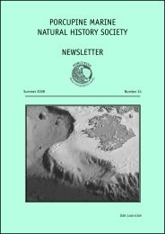
survey showed that the highest abundances of thepink sea fan Eunicella verrucosa were found withinthe reserve boundaries. No significant difference washowever found between areas of different fishingintensities for this species. Alcyonium digitatum wasthe only species showing a significant response torecent trawling activities. The preliminary baselinedata demonstrated that the location of the reservesdid protect high density areas of pink sea fans,the species of main conservation interest. A clearrelationship between fishing and the presence orabsence of pink sea fans could, however, not bedemonstrated. The baseline data collected thus farshould be well suited to monitor any future changesin the benthic communities within and outside of thefour reserves following changes in the distributionof fishing effort from towed fishing gears.Deep-sea conservation for theUK: developing habitat-basedmanagement of deep-sea areasFinding Sanctuary – Developinga regional MPA network for southwest EnglandLouise LieberknechtSouth West Food and Drink, Dart Farm,Topsham, Devon EX30 Q17louise.lieberknecht@southwestfoodanddrink.comFinding Sanctuary is a regional partnership 2 projectwith the aim to design an MPA network around SouthWest England. The project covers a large area, some90,000 km 2 of sea from the high water mark outto the continental shelf limits off the south westpeninsula (see figure).Jason Hall-Spencer 1 , Maria Campbell 1 , TinaKerby 1 , Andrew Davies 2 , Murray Roberts 2 , AlanHughes 3 , Jon Moore 41Marine Institute, University of Plymouth;2Scottish Association of Marine Science; 3NationalOceanographic Centre Southampton; 4CALM (jon@ticara.co.uk)Major advances are being made in both thediscovery and protection of deep-water habitatsaround the UK. The <strong>Porcupine</strong> Marine NaturalHistory Society recently began coordinating aproject entitled ‘Deep-sea Conservation for the UK’(see www.deepseaconservation.org). This involvesa team of researchers based at the Universityof Plymouth, the Scottish Association of MarineScience and the National Oceanographic CentreSouthampton (see Moore et al., 2007). This talkwill describe the project and progress that hasbeen made so far in the following three areas:1. Large-scale habitat classification of the deepsearealm2. Predicting the occurrence of vulnerable deep-seahabitats and species3. Practical monitoring and management ofprotected deep-sea areasMoore J. et al. (2007) <strong>Porcupine</strong> Marine NaturalHistory <strong>Newsletter</strong> 23, 11-15.Finding Sanctuary project areaThe goal of the MPA network will be twofold:to safeguard and encourage recovery of marinebiodiversity, and to help ensure the long-termsustainability of marine resources in the region.Finding Sanctuary is going further than theidentification of biodiversity “hotspots”: We willexplore ways of configuring a network that willfunction as a whole to deliver the best results forregional marine biodiversity in its totality. Thatmeans a network that represents the full range ofregional marine biodiversity, including habitats thatare highly diverse, as well as those that are less so.We are taking a systematic, regional-scale approachto reserve planning, which is in line with currentthinking in conservation science. The use of decisionsupport tools such as Marxan and GIS are at the coreof our technical planning work.The application of sound science is important toachieve a positive outcome, but the project itself isnot a science project. Our planning approach combinesthe needs and views of stakeholders with science, todevelop an MPA network that can realistically deliverpositive results. Because areas of sea cannot bePMNHS <strong>Newsletter</strong> No.<strong>25</strong> <strong>Winter</strong> <strong>2008</strong>/0927