Bathymetric Mapping and Sediment Studies in Kansas Reservoirs ...
Bathymetric Mapping and Sediment Studies in Kansas Reservoirs ...
Bathymetric Mapping and Sediment Studies in Kansas Reservoirs ...
- No tags were found...

You also want an ePaper? Increase the reach of your titles
YUMPU automatically turns print PDFs into web optimized ePapers that Google loves.
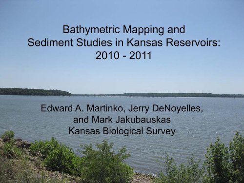
<strong>Bathymetric</strong> <strong>Mapp<strong>in</strong>g</strong> <strong>and</strong><strong>Sediment</strong> <strong>Studies</strong> <strong>in</strong> <strong>Kansas</strong> <strong>Reservoirs</strong>:2010 - 2011Edward A. Mart<strong>in</strong>ko, Jerry DeNoyelles,<strong>and</strong> Mark Jakubauskas<strong>Kansas</strong> Biological Survey
We have built many reservoirs across the <strong>Kansas</strong> l<strong>and</strong>scape
Federal, State, <strong>and</strong> Local <strong>Reservoirs</strong> <strong>in</strong> <strong>Kansas</strong>• Dr<strong>in</strong>k<strong>in</strong>g water for more than 50% of Kansans• $1.29 billion annually for water treatment, waterrecreation, boat purchases, <strong>and</strong> irrigation (KWO)• 120,000 reservoirs of all sizes, <strong>in</strong>cl. farm ponds• <strong>Reservoirs</strong> used for dr<strong>in</strong>k<strong>in</strong>g water: 93• Average age = 55 years old• Federal reservoirs: 24• Average age = 45 years old
4,000 larger reservoirs constructed <strong>in</strong> the three highestsediment yield zones
Recent issues affect<strong>in</strong>g reservoirs <strong>in</strong> the stateAlgae bloomsKDHE Advisories/Warn<strong>in</strong>gs:2010:• Lovewell Reservoir• Central City Park Lake, Topeka• Meade Lake, Meade• Anthony City Lake• Centralia City Lake• Santa Fe Lake, Augusta2011:• Cheney Reservoir• Milford Lake• Perry Reservoir• Big Hill Reservoir• Tuttle Creek Reservoir• Well<strong>in</strong>gton City Lake• Her<strong>in</strong>gton City Lake• Augusta City <strong>and</strong> Augusta-Santa Fe Lakes• Harvey County East <strong>and</strong> West Lakes• Marion County Lake, Marion County• Logan City Lake, Phillips County• Warnock Lake, Atchison County• Memorial Park Lake, Great Bend• Dillon Park Lake, Reno County
Recent issues affect<strong>in</strong>g reservoirs <strong>in</strong> the stateAugusta‐Santa Fe LakeDroughtAugusta City Lake
Reservoir Assessment <strong>in</strong> <strong>Kansas</strong> –Progress <strong>and</strong> Status
Status of federal reservoir surveys <strong>in</strong> <strong>Kansas</strong> priorto KWO-KBS 2007-2012 <strong>in</strong>itiativeReservoirDate of closureDate of previoussurveyYears s<strong>in</strong>ce last survey(as of 2007)Kanopolis 1948 1982 26Marion 1968 1982 26Wilson 1964 1984 24Council Grove 1964 1985 23Melvern 1972 1985 22Pomona 1963 1989 18Fall River 1949 1990 17Toronto 1960 1990 17Cl<strong>in</strong>ton 1977 1991 16Big Hill 1981 1992 15Elk City 1966 1992 15Milford 1967 1994 13Hillsdale 1981 1996 11Cheney 1964 1998 9Tuttle Creek 1962 2000 7Perry 1969 2001 6El Dorado 1981 2005 2
Integrated Reservoir AssessmentIn support of the objectives of secur<strong>in</strong>g, protect<strong>in</strong>g, <strong>and</strong> restor<strong>in</strong>g reservoirs <strong>in</strong> our state.ASTRA = Applied Science <strong>and</strong> Technology for ReservoirAssessment Program● Created <strong>in</strong> 2006 by KBS (>$100,000 KU <strong>in</strong>vestment).● Contract fund<strong>in</strong>g by KWO (2007 – present).● Responds to statewide need for <strong>in</strong>formation about our lakes <strong>and</strong>reservoirs.● Focus areas:– <strong>Bathymetric</strong> mapp<strong>in</strong>g– <strong>Sediment</strong> studies (assessment <strong>and</strong> mapp<strong>in</strong>g)– Bottom type classification– Model<strong>in</strong>g (watershed <strong>and</strong> water body)– Integrated Reservoir Assessment
Acoustic echosound<strong>in</strong>gTransducer: transmits /receives the acoustic signalTypical frequencies:420 kHz – Plankton, SAV200 kHz – SAV, fish, bathymetry, bottom class.120 kHz - fish, bathymetry, bottom class38 kHz – fish (mar<strong>in</strong>e), sediment penetrationHigher <strong>and</strong> lower frequencies are potentially possible.
A long-term bathymetric mapp<strong>in</strong>g program<strong>Reservoirs</strong> mapped by KBS for KWO s<strong>in</strong>ce 2007ALMA CITY LAKEANTHONY CITY LAKEAUGUSTA LAKEAUGUSTA SANTA FE LAKEBANNER CREEK LAKECEDAR VALLEY LAKECENTRALIA LAKECHENEY RESERVOIRCLINTON RESERVOIRCOUNCIL GROVE CITY LAKECOUNCIL GROVE RESERVOIREL DORADO LAKEELK CITY LAKEEUREKA LAKEFALL RIVER LAKEFT. SCOTT CITY LAKEHERINGTON LAKEHERINGTON RESERVOIRHILLSDALE RESERVOIRJOHN REDMOND RES.KANOPOLIS RESERVOIRLAKE AFTONLAKE SHAWNEELEAVENWORTH CO. SFLLOUISBURG SFLLOVEWELL RESERVOIRMADISON CITY LAKEMELVERN LAKEMIOLA LAKEMILL CREEK LAKEMISSION LAKEMOLINE CITY LAKEMOUND CITY LAKEOLPE CITY LAKEOSAGE CO. SFLOSAGE CITY LAKEPARSONS LAKEPLEASANTON RESERVOIRPOLK DANIELSPOMONA LAKEPOTTAWATOMIE CO SFL #1PONY CREEK /SABETHA LAKEROCK CREEK LAKESEVERY CITY LAKESOUTH OWL (YATES CTR OLD)TORONTO LAKEWABAUNSEE LAKEWEBSTER RESERVOIRWELLINGTON CITY LAKEWILSON RESERVOIRWILSON CO. SFLWOODSON CO. SFLWINFIELD CITY LAKEWOLF CREEK LAKEWYANDOTTE CO. LAKEYATES CENTER RESERVOIR
Integrated Reservoir Assessment:Assess<strong>in</strong>g changes over time by map differenc<strong>in</strong>gJohn Redmond Reservoir1957 lake depth 2007 lake depth
Integrated Reservoir Assessment:Assess<strong>in</strong>g changes over time by map differenc<strong>in</strong>gJohn Redmond Reservoir37% loss of volume <strong>in</strong> 50 years
Reservoir volumes updated based on new surveys10090Source: KWO80706050403020100<strong>Kansas</strong> Federal <strong>Reservoirs</strong>Loss of Capacity, Multi-Purpose PoolPercent LossBig HillMelvernWebsterEl DoradoMarionCheneyHillsdaleCedar BluffCl<strong>in</strong>tonWacondaMilfordCouncil GrovePerryPomonaElk CityKanopolisFall RiverTuttleJohn RedmondToronto
<strong>Sediment</strong> cor<strong>in</strong>g to assess sediment thickness <strong>and</strong>physical / chemical propertiesThickness – calibrate /check subbottomprofile extraction softwareProperties – analyze for texture, bulkdensity, organic matter, water content,etc, <strong>in</strong> both substrate <strong>and</strong> sediment.
<strong>Sediment</strong>ation patterns:<strong>Sediment</strong> thickness <strong>and</strong> deposition patternsPatterns observed:Expected:• Little s<strong>and</strong>• Silt dom. upper end• Clay dom. lower endLess expected:• Often thickest near dam• “Dry holes” (no sed.)Particle SizeAnalysisS<strong>and</strong>SiltClay
Mission Lake Project
Significant sedimentation by 2005Surface area reduced to 123 acresMaximum water depth only 13 feet<strong>Sediment</strong> >10 feet <strong>in</strong> many places
Dredg<strong>in</strong>g: 2009-2010Objective: Dredge 1 million cubicyards of sediment from lake byprivate contractor funded by City ofHorton <strong>and</strong> State of <strong>Kansas</strong>
Mission Lake: Before/After dredg<strong>in</strong>gDredg<strong>in</strong>gadded 10acres ofsurface areato lake
Beyond Bathymetry:New Developments <strong>in</strong> Reservoir Assessment
Integrated Reservoir Assessment:<strong>Sediment</strong> core dat<strong>in</strong>g by radionuclide analysisWHEN was the sedimentdeposited ?Radioactive fallout patterns from aboveground test<strong>in</strong>g• Need a “marker” <strong>in</strong> the sediment tofix a date●Preimpoundment <strong>in</strong>terface usuallyvisible (lake construction)• Radionuclides:– Fallout from weapons tests– Onset <strong>in</strong> the early 1950’s– Peak activity <strong>in</strong> 1963– Decrease for post-1963.●239+240 Plutonium use as marker– Rapid analysis– PU b<strong>in</strong>ds to clay (less mobilepost-deposition)Aboveground test<strong>in</strong>gceased <strong>in</strong> 1963
Radionuclide analysis of sedimentsTop of core<strong>Sediment</strong> core sliced <strong>in</strong>to 5-cmsections (“hockey pucks”).Laboratory analysis to identifyplutonium “spike” that<strong>in</strong>dicates 1963.Base of core
Augusta Lake:<strong>Sediment</strong>ation rate201019631930Peak <strong>in</strong> radionuclides occurs <strong>in</strong> 1963~ 50 cm <strong>in</strong> 33 years (1.5 cm/yr)(1930-1963)~ 65 cm <strong>in</strong> 47 years (1.4 cm/yr)(1963-2010)Fairly constant rate ?
Nutrient history <strong>in</strong> sediment cores:Total Nitrogen <strong>in</strong> Augusta City Lake, 1930-2010Total NTop of coreBase of coreACL-15-110ACL-15-105ACL-15-100ACL-15-95ACL-15-90ACL-15-85ACL-15-80ACL-15-75ACL-15-70ACL-15-65ACL-15-60ACL-15-55ACL-15-50ACL-15-45ACL-15-40ACL-15-35ACL-15-30ACL-15-25ACL-15-20ACL-15-15ACL-15-10ACL-15-5ACL-15-02010196319301000 1200 1400 1600 1800 2000 2200 2400Augusta City Lake
<strong>Sediment</strong> sequenc<strong>in</strong>g exp<strong>and</strong>ed to <strong>in</strong>clude texture analysis<strong>and</strong> organic matter content <strong>in</strong> addition to Total N, Total P.s<strong>and</strong> silt clayTotal N (ppm)Total P (ppm)% OrganicTop of core0% 20% 40% 60% 80% 100%AT-2-240AT-2-2400 500 1000 1500 2000AT-2-2400 100 200 300 400 500 600AT-2-2400.0 1.0 2.0 3.0 4.0 5.0AT-2-230AT-2-230AT-2-230AT-2-230AT-2-220AT-2-220AT-2-220AT-2-220AT-2-210AT-2-210AT-2-210AT-2-210AT-2-200AT-2-200AT-2-200AT-2-200AT-2-190AT-2-190AT-2-190AT-2-190AT-2-180AT-2-180AT-2-180AT-2-180AT-2-170AT-2-170AT-2-170AT-2-170AT-2-160AT-2-160AT-2-160AT-2-160AT-2-150AT-2-150AT-2-150AT-2-150AT-2-140AT-2-140AT-2-140AT-2-140AT-2-130AT-2-130AT-2-130AT-2-130AT-2-120AT-2-120AT-2-120AT-2-120AT-2-110AT-2-110A T - 2 - 110A T - 2 - 110AT-2-100AT-2-100AT-2-100AT-2-100AT-2-90AT-2-90AT-2-90AT-2-90AT-2-80AT-2-80AT-2-80AT-2-80AT-2-70AT-2-70AT-2-70AT-2-70AT-2-60AT-2-60AT-2-60AT-2-60AT-2-50AT-2-50AT-2-50AT-2-50AT-2-40AT-2-40AT-2-40AT-2-40AT-2-30AT-2-30AT-2-30AT-2-30Base of coreAT-2-20AT-2-10AT-2-20AT-2-10AT-2-20AT-2-10AT-2-20AT-2-10Atchison County Lake
Development of Automated Extraction ofReservoir Pre-Impoundment Surfacesfrom Acoustic Echosounder DataFederal Interagency <strong>Sediment</strong> Program(FISP) Research Grant, 2010-2011(Jakubauskas <strong>and</strong> Kastens)
Project ObjectivesGOAL: Acoustic mapp<strong>in</strong>g of sediment thicknessPrimary objective:● Automated method for extract<strong>in</strong>g sediment thickness fromechosounder data.Secondary objective:● Assess accuracy of thickness estimation method.● Determ<strong>in</strong>e what characteristics of the sediment – texture ?bulk density ? - control penetration of the low-frequencysonar to the pre-impoundment surface.
Test-bed: Kanopolis ReservoirHigh-frequency data:Present-day bottomLow-frequency data:Orig<strong>in</strong>al lake bottom
Kanopolis Lake testSub-bottom was identifiable<strong>in</strong> 10,348 of the 41,930orig<strong>in</strong>al total bathymetrypo<strong>in</strong>ts.<strong>Sediment</strong> thickness (right)was computed by differencebetween present-day lakebottom <strong>and</strong> extracted subbottom.Method is not applicable tovery shallow waters or verythick sediments.
Acoustic Remote Sens<strong>in</strong>g of Total Phosphorus <strong>in</strong>Reservoir Bottom <strong>Sediment</strong>sAssumptions:● The echo received back by the echosounder is affected bybottom type composition (s<strong>and</strong>, silt, clay).● Phosphorus b<strong>in</strong>ds to clay <strong>in</strong> sediments.● The acoustic signal can be used to <strong>in</strong>fer phosphorus levelsPhosphorusClayFractaldimension ofacoustic signal
Total Phosphorus versus average Fractal Dimension (FD)of the reflected acoustic signalR 2 = 0.62Lakes used:Augusta City LakeAugusta-Santa FeCentralia City LakeElk City ReservoirMelvern ReservoirToronto Reservoir6 reservoirs;~15 sites/reservoir:For each site:• Fractal dimension of theecho computed for highfrequencyechosounderdata;• Surface sedimentsamples analyzed fortotal phosphorus (ppm).
Phosphorus map based on acoustic signal fractal dimension
This work was conducted <strong>and</strong> funded by the <strong>Kansas</strong> BiologicalSurvey together with the <strong>Kansas</strong> Water Office through the StateWater Plan Fund <strong>in</strong> support of the Reservoir Susta<strong>in</strong>ability Initiative.