Lab 9: Eolian and Arid Region Landforms - Classes
Lab 9: Eolian and Arid Region Landforms - Classes
Lab 9: Eolian and Arid Region Landforms - Classes

You also want an ePaper? Increase the reach of your titles
YUMPU automatically turns print PDFs into web optimized ePapers that Google loves.
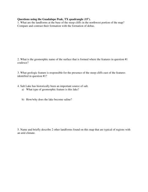
Questions using the Guadalupe Peak, TX quadrangle (15’).1. What are the l<strong>and</strong>forms at the base of the steep cliffs in the northwest portion of the map?Compare <strong>and</strong> contrast their formation with the formation of deltas.2. What is the geomorphic name of the surface that is formed where the features in question #1coalesce?3. What geologic feature is responsible for the presence of the steep cliffs east of the featuresidentified in question #1?4. Salt Lake has historically been an important source of salt.a) What type of geomorphic feature is this lake?b) How/why does the lake become saline?5. Name <strong>and</strong> briefly describe 2 other l<strong>and</strong>forms found on this map that are typical of regions withan arid climate.