Lab 9: Eolian and Arid Region Landforms - Classes
Lab 9: Eolian and Arid Region Landforms - Classes
Lab 9: Eolian and Arid Region Landforms - Classes
Create successful ePaper yourself
Turn your PDF publications into a flip-book with our unique Google optimized e-Paper software.
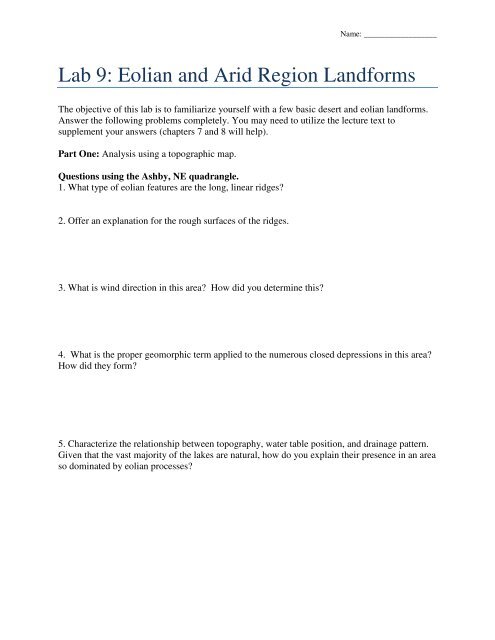
Name: __________________<strong>Lab</strong> 9: <strong>Eolian</strong> <strong>and</strong> <strong>Arid</strong> <strong>Region</strong> L<strong>and</strong>formsThe objective of this lab is to familiarize yourself with a few basic desert <strong>and</strong> eolian l<strong>and</strong>forms.Answer the following problems completely. You may need to utilize the lecture text tosupplement your answers (chapters 7 <strong>and</strong> 8 will help).Part One: Analysis using a topographic map.Questions using the Ashby, NE quadrangle.1. What type of eolian features are the long, linear ridges?2. Offer an explanation for the rough surfaces of the ridges.3. What is wind direction in this area? How did you determine this?4. What is the proper geomorphic term applied to the numerous closed depressions in this area?How did they form?5. Characterize the relationship between topography, water table position, <strong>and</strong> drainage pattern.Given that the vast majority of the lakes are natural, how do you explain their presence in an areaso dominated by eolian processes?
Questions using the Guadalupe Peak, TX quadrangle (15’).1. What are the l<strong>and</strong>forms at the base of the steep cliffs in the northwest portion of the map?Compare <strong>and</strong> contrast their formation with the formation of deltas.2. What is the geomorphic name of the surface that is formed where the features in question #1coalesce?3. What geologic feature is responsible for the presence of the steep cliffs east of the featuresidentified in question #1?4. Salt Lake has historically been an important source of salt.a) What type of geomorphic feature is this lake?b) How/why does the lake become saline?5. Name <strong>and</strong> briefly describe 2 other l<strong>and</strong>forms found on this map that are typical of regions withan arid climate.
Questions using the Antelope Peak, AZ quadrangle.1. Locate each of the features listed below <strong>and</strong> identify them as either a(n) alluvial fan, arroyo,bajada, inselberg, pediment, or wash.a. Sec 18 T7S R3E:b. Sec 34 T6S R2E:c. Sec 28 T5S R3E:d. Sec 19 & 30 T6S R3E <strong>and</strong> Sec 25 & 36 T6S R2E:e. SE1/4 Sec 2 T7S R3E :f. SE1/4 Sec 2 T6S R1E:2. Why do you suppose there are very few alluvial fans on this l<strong>and</strong>scape?3. Compare <strong>and</strong> contrast the stage of l<strong>and</strong>scape development evident on this map with thatvisible on the Guadalupe Peak, TX map.Questions using the Furnace Creek, CA quadrangle1. Determine the average slope of the alluvial fan emerging from Trail Canyon, in degrees.Measure from the mouth of the canyon to the base of the fan at the Devil’s Speedway. Showyour work!2. What is the difference between an alluvial fan <strong>and</strong> a pediment?
Part Two: Analysis using stereographic photographsQuestions using Stereogram 116 (Inselbergen).1. Notice the 'isl<strong>and</strong> mountains' surrounded by a low relief surface. Explain how the 'isl<strong>and</strong>mountains' <strong>and</strong> the surrounding surface form.2. Citing evidence visible on the photograph, discuss the relative importance of eolian <strong>and</strong> fluvialprocesses in creating the visible l<strong>and</strong>forms. Why does one dominate the other?3. What role does vegetation appear to play here?Questions using Stereogram 125 (Stovepipe Wells).1. Study the differences in tone on the alluvial fans. Given the arid climate, explain why thesurface tones vary so dramatically <strong>and</strong> suggest the processes that are responsible for the obviouscontrasts.2. What type of dune is present in the upper left portion of the photograph? Assume that the s<strong>and</strong>source is to the upper left of the dunes.3. What type of dune is present in the lower left portion of the photograph?
4. How does prevailing wind direction change across the photograph (assume north is toward thetop of the page)?Questions using Stereogram 509 (Tularosa Basin).1. This photograph is from White S<strong>and</strong> National Monument. Identify the dune types in thefollowing portions of the photograph:a. Lower right corner:b. Lower left corner:c. Upper half:2. What is the prevailing wind direction across the photograph (assume north is toward the top ofthe page)?3. Contrast the relationship here between topography, water table position, <strong>and</strong> drainage patternwith your observations from the Ashby, NE quadrangle in Part 1.Part Three: <strong>Eolian</strong> concepts.1. Explain the processes that allow s<strong>and</strong> <strong>and</strong> snow fences to control blowing or driftings<strong>and</strong>/snow.
Part Four: Use of Entrainment EquationsAs might be expected, the ability of wind to erode sediment is constrained by the ability oftypical wind velocities to mobilize sediment. On a typical windy day in Fort Collins, you observewind speeds at 5 feet above the ground surface that attain sustained velocities of 25 mph. Thefollowing equation describes the change in wind velocity with the height above the ground:where zV z = 5.75 V * logzk= the height of interest (above the ground surface),V z = velocity at a given height above the surface,V * = surface friction speed or drag velocity, <strong>and</strong>k = thickness of zero velocity boundary layer at ground surface.Using the figure below <strong>and</strong> the above equation, calculate the maximum particle size that thisobserved wind (25 mph at 5 ft above the ground) can mobilize <strong>and</strong> transport through saltation.Assume that k is 1/30 the diameter of the surface grain size. Show all calculations <strong>and</strong> keep inmind that you may need to iteratively solve the problem (note that s<strong>and</strong> ranges in size from0.0625 mm to 2 mm). Pages 274-278 of your text will be very helpful.FluidthresholdImpactthreshold


