Phase A - Alternatives Analysis Report - Urban Drainage and Flood ...
Phase A - Alternatives Analysis Report - Urban Drainage and Flood ...
Phase A - Alternatives Analysis Report - Urban Drainage and Flood ...

Create successful ePaper yourself
Turn your PDF publications into a flip-book with our unique Google optimized e-Paper software.
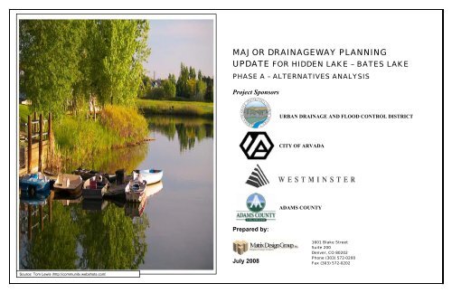
MAJOR DRAINAGEWAY PLANNINGUPDATE FOR HIDDEN LAKE – BATES LAKEPHASE A – ALTERNATIVES ANALYSISProject SponsorsURBAN DRAINAGE AND FLOOD CONTROL DISTRICTCITY OF ARVADAADAMS COUNTYPrepared by:July 20081601 Blake StreetSuite 200Denver, CO 80202Phone (303) 572-0200Fax (303) 572-0202Source: Tom Lewis (http://community.webshots.com)
PHASE A – ALTERNATIVES ANALYSIS REPORTMajor <strong>Drainage</strong>way Planning Update for Hidden Lake-Bates LakeTHIS PAGE LEFT INTENTIONALLY BLANK2
PHASE A – ALTERNATIVES ANALYSIS REPORTMajor <strong>Drainage</strong>way Planning Update for Hidden Lake-Bates LakeJULY 29, 2008Mr. Ken MacKenzie<strong>Urban</strong> <strong>Drainage</strong> <strong>and</strong> <strong>Flood</strong> Control District2480 West 26 th Avenue, Suite 156-BDenver, CO 80211Subject:Dear Mr. MacKenzie:Major <strong>Drainage</strong>way Planning Update for Hidden Lake – Bates Lake<strong>Phase</strong> A - <strong>Alternatives</strong> <strong>Analysis</strong> <strong>Report</strong>UDFCD Agreement No. 08-01.06Matrix Design Group, Inc. is pleased to submit this report entitled Major <strong>Drainage</strong>way Planning Update forHidden Lake-Bates Lake, <strong>Phase</strong> A – <strong>Alternatives</strong> <strong>Analysis</strong> <strong>Report</strong>, dated July 2008.Many changes have occurred in the study area since the last Major <strong>Drainage</strong>way Planning Study wascompleted in 1975. L<strong>and</strong> use has changed <strong>and</strong> there has been extensive development within the watershed,which has changed the imperviousness of the area. Because of the changes in the watershed this <strong>Phase</strong> A<strong>Report</strong> will be used to determine which of the proposed alternatives will be selected to be furtherinvestigated in the <strong>Phase</strong> B <strong>Report</strong> with the selected drainage improvement alternatives.We would like to acknowledge the help <strong>and</strong> support in the preparation of this report that was furnished bythe City of Arvada, the City of Westminster, <strong>and</strong> Adams County.The enclosed text <strong>and</strong> exhibits present the alternatives analyses that were completed for the Hidden Lake-Bates Lake <strong>Drainage</strong>way. <strong>Alternatives</strong> were explored that will either: reduce flooding, improve stormwaterconveyance, or improve water quality.Thank you for the opportunity to complete this phase of the project.Regards,Matrix Design Group, Inc.________________________________________________________________Stu Williams, P.E.Principal-In-Charge________________________________________________________________Robert Krehbiel, P.E.Project Manager________________________________________________________________Tim Fairbank, P.E.Project Engineer________________________________________________________________Jennifer Newby, E.I.EngineerThis study will supersede the alternatives evaluation that was done for the “Major <strong>Drainage</strong>way Planning:Hidden Lake – Bates Lake” by Hydro-Triad, Ltd., dated November 1975.3
PHASE A – ALTERNATIVES ANALYSIS REPORTMajor <strong>Drainage</strong>way Planning Update for Hidden Lake-Bates LakeTHIS PAGE LEFT INTENTIONALLY BLANK4
PHASE A – ALTERNATIVES ANALYSIS REPORTMajor <strong>Drainage</strong>way Planning Update for Hidden Lake-Bates LakeEXECUTIVE SUMMARY ........................................................................................................................................................ES-11 INTRODUCTION................................................................................................................................................................1-11.1 Authorization .................................................................................................................................1-11.2 Purpose <strong>and</strong> Scope .........................................................................................................................1-11.3 Summary of Data Obtained ...........................................................................................................1-11.4 Mapping Sources ...........................................................................................................................1-11.5 Data Collection ..............................................................................................................................1-12 STUDY AREA DESCRIPTION .........................................................................................................................................2-12.1 Project Area ...................................................................................................................................2-12.2 L<strong>and</strong> Use & Percent Impervious....................................................................................................2-12.3 Soils Information ...........................................................................................................................2-12.4 Reach Description..........................................................................................................................2-12.5 <strong>Flood</strong> History .................................................................................................................................2-22.6 Wetl<strong>and</strong> <strong>and</strong> Riparian Zones..........................................................................................................2-23 HYDROLOGIC ANALYSIS ..............................................................................................................................................3-13.1 Overview........................................................................................................................................3-13.2 Design Rainfall ..............................................................................................................................3-13.3 Subwatershed Characteristics ........................................................................................................3-13.4 Hydrograph Routing ......................................................................................................................3-13.5 Previous Studies.............................................................................................................................3-23.6 Results of <strong>Analysis</strong> ........................................................................................................................3-24 HYDRAULIC ANALYSIS..................................................................................................................................................4-14.1 General...........................................................................................................................................4-14.2 Hydraulic Evaluation of Existing Facilities................................................................................... 4-14.3 Split Flow Areas ............................................................................................................................4-14.4 <strong>Flood</strong>ed Areas ................................................................................................................................4-15 ALTERNATIVE DEVELOPMENTS ................................................................................................................................5-15.1 Alternative Development Process..................................................................................................5-15.2 Alternative Categories ...................................................................................................................5-15.3 Design Criteria...............................................................................................................................5-25.4 Hydraulic Evaluation .....................................................................................................................5-25.5 Alternative Plans............................................................................................................................5-25.5.1 Reach H-1 ..............................................................................................................................5-45.5.2 Reach H-2 ..............................................................................................................................5-65.5.3 Reach H-3 ..............................................................................................................................5-85.5.4 Reach H-4 ............................................................................................................................5-105.5.5 Reach B-1.............................................................................................................................5-125.5.6 Reach B-2.............................................................................................................................5-146 ALTERNATIVE EVALUATION ......................................................................................................................................6-16.1 Evaluation Process.........................................................................................................................6-1i6.2 Combination of <strong>Alternatives</strong>.......................................................................................................... 6-16.2.1 Reach H-1 ..................................................................................................................................... 6-16.2.2 Reach B-1...................................................................................................................................... 6-16.3 <strong>Flood</strong> Damage Evaluation.............................................................................................................. 6-26.4 Benefit-Cost <strong>Analysis</strong> .................................................................................................................... 6-26.5 Alternative Selection...................................................................................................................... 6-56.5.1 Reach H-1 ..................................................................................................................................... 6-56.5.1 Reach H-2 ..................................................................................................................................... 6-56.5.1 Reach H-3 ..................................................................................................................................... 6-56.5.1 Reach H-4 ..................................................................................................................................... 6-56.5.1 Reach B-1...................................................................................................................................... 6-56.5.1 Reach B-2...................................................................................................................................... 6-57 RECOMMENDED PLAN .................................................................................................................................................. 7-17.1 Plan Description............................................................................................................................. 7-17.2 Operations <strong>and</strong> Maintenance.......................................................................................................... 7-17.3 Recommended Plan Costs.............................................................................................................. 7-18 REFERENCES .................................................................................................................................................................... 8-1LIST OF TABLESTable ES-1 Comparison of Peak Flows Between ModelsTable ES-2 Summary of Costs for Recommended PlanTable ES-3 Project Participants <strong>and</strong> StakeholdersTable 2-1 Future L<strong>and</strong> UseTable 3-1 Rainfall DepthTable 3-2 Comparison of Peak FlowsTable 5-1 Alternative Unit Cost InformationTable 5-2 Reach H-1 Alternative Cost EstimatesTable 5-3 Reach H-2 Alternative Cost EstimatesTable 5-4 Reach H-3 Alternative Cost EstimatesTable 5-5 Reach H-4 Alternative Cost EstimatesTable 5-6 Reach B-1 Alternative Cost EstimatesTable 5-7 Reach B-2 Alternative Cost EstimatesTable 6-1 Reach H-1 Combination of <strong>Alternatives</strong> Cost EstimatesTable 6-2 Reach B-1 Combination of <strong>Alternatives</strong> Cost EstimatesTable 6-3 Building Damage PercentTable 6-4 Alternative Plans Costs <strong>and</strong> Benefit RatiosTable 7-1 Recommended Plan Cost Estimate <strong>and</strong> Benefit RatiosLIST OF FIGURESFigure 1 Study Area MapFigure 2-1 Future L<strong>and</strong> Use MapFigure 2-2 Future Percent Impervious MapFigure 2-3 Soils MapFigure 2-4 Reach Location MapFigure 2-5 100-Year FEMA <strong>Flood</strong>plains MapFigure 3-1 Sub-Basin Routing MapFigure 3-2 EPA SWMM Routing SchematicFigure 3-3 Hidden Lake Peak Discharge Profile
PHASE A – ALTERNATIVES ANALYSIS REPORTMajor <strong>Drainage</strong>way Planning Update for Hidden Lake-Bates LakeFigure 3-4 Bates Lake Peak Discharge ProfileFigure 3-5 Tributary A Peak Discharge ProfileFigure 4-1 100-Year <strong>Flood</strong>plain MapFigure 5-1 Hidden Lake Reach H-1Figure 5-2 Hidden Lake Reach H-2Figure 5-3 Hidden Lake Reach H-3Figure 5-4 Hidden Lake Reach H-4Figure 5-5 Bates Lake Reach B-1Figure 5-6 Bates Lake Reach B-2Figure 7-1 Hidden Lake Reach H-1 – Recommended PlanFigure 7-2 Hidden Lake Reach H-2 – Recommended PlanFigure 7-3 Hidden Lake Reach H-3 – Recommended PlanFigure 7-4 Hidden Lake Reach H-4 – Recommended PlanFigure 7-5 Bates Lake Reach B-1 – Recommended PlanFigure 7-6 Bates Lake Reach B-2 – Recommended PlanAPPENDIX A Meeting MinutesKickoff Meeting April 23, 2008Progress Meeting May 19, 2008Progress Meeting June 3, 2008Progress Meeting June 19, 2008Public Meeting June 25, 2008APPENDIX B Hydrologic <strong>Analysis</strong>Table B-1 CUHP Sub Basin CharacteristicsTable B-2 Existing Detention Basins EPA SWMM Input CharacteristicsTable B-3 Peak Flow SummaryFigure B-1 Existing Detention Basins : 10-Year <strong>and</strong> 100-Year HydrographsFigure B-2 Key Design Points: 2, 5, 10, 25, 50, <strong>and</strong> 100-Year HydrographsTable B-4 EPA SWMM Input FileTable B-5 EPA SWMM Output FileAPPENDIX C HYDRAULIC ANALYSISTable C-1 HEC-RAS Summary TableProject PhotographsAPPENDIX D Legal OpinionsAPPENDIX E Wetl<strong>and</strong> <strong>and</strong> Riparian InventoryFigure E-1 Wetl<strong>and</strong> <strong>and</strong> Riparian MapAPPENDIX F Damage <strong>Analysis</strong>Table F-1 2-Year Storm Event Inundated Buildings Actual ValueTable F-2 5-Year Storm Event Inundated Buildings Actual ValueTable F-3 10-Year Storm Event Inundated Buildings Actual ValueTable F-4 25-Year Storm Event Inundated Buildings Actual ValueTable F-5 50-Year Storm Event Inundated Buildings Actual ValueTable F-6 100-Year Storm Event Inundated Buildings Actual ValueTable F-7 Sheridan Boulevard @ W. 69 th Avenue Loss of FunctionTable F-8 Lowell Boulevard @ W. 66 th Avenue Loss of FunctionTable F-9 Tennyson Street @ Union Pacific Railroad Loss of Functionii
PHASE A – ALTERNATIVES ANALYSIS REPORTMajor <strong>Drainage</strong>way Planning Update for Hidden Lake-Bates LakeEXECUTIVE SUMMARYThe Major <strong>Drainage</strong>way Planning, <strong>Phase</strong> A, <strong>Alternatives</strong> <strong>Analysis</strong> <strong>Report</strong> summarizes the evaluations <strong>and</strong>recommendations for the Hidden Lake <strong>and</strong> Bates Lake watersheds. <strong>Alternatives</strong> were identified to mitigatethe impacts to stormwater conveyance, floodplain management, <strong>and</strong> stormwater quality. In general, thedrainageway planning includes a variety of alternatives, including regional detention; improved conveyanceincluding channel reconstruction, storm drain pipe <strong>and</strong> box construction, <strong>and</strong> road crossing culvertreplacement; <strong>and</strong> water quality best management practices (BMP’s) including water quality ponds, wetl<strong>and</strong>sconstruction, <strong>and</strong> directly connecting open channels to pervious areas.Purpose <strong>and</strong> ObjectiveThe purpose of this study is to analyze the existing drainage conditions within the Hidden Lake-Bates Lakedrainage basins <strong>and</strong> floodplains; develop alternate drainageway planning concepts to mitigate flooddamages; <strong>and</strong> prepare a preliminary design of an alternative selected by the Project Sponsors. This study isdivided into three parts; the Baseline Hydrology <strong>Report</strong>, the <strong>Phase</strong> A <strong>Alternatives</strong> <strong>Analysis</strong> <strong>Report</strong> <strong>and</strong> the<strong>Phase</strong> B <strong>Drainage</strong>way Planning Study. The <strong>Phase</strong> A study includes the hydrologic analysis included in theBaseline Hydrology <strong>Report</strong>, the hydraulic analysis <strong>and</strong> the development <strong>and</strong> evaluation of mitigationalternatives. The <strong>Phase</strong> B <strong>Report</strong> will include preliminary design of the selected alternative.Planning ProcessThe study effort began in April of 2008. An initial kickoff meeting was held in April of 2008, followed by aseries of progress meetings during which information was exchanged between the Project Sponsors <strong>and</strong>Matrix Design Group. Preliminary alternatives were developed <strong>and</strong> presented at the progress meetings toobtain Sponsor feedback <strong>and</strong> to eliminate alternatives that were not appropriate or feasible. In addition,preliminary hydrologic <strong>and</strong> hydraulic findings were presented <strong>and</strong> discussed. A public meeting was held inJune of 2008 to present the goals <strong>and</strong> objectives of the study to the public <strong>and</strong> to obtain comments regardingflooding concerns <strong>and</strong> the public desires for the project.The Baseline Hydrology <strong>Report</strong> was submitted in May of 2008 <strong>and</strong> was reviewed by the Project Sponsors<strong>and</strong> finalized in June of 2008. The draft <strong>Phase</strong> A <strong>Report</strong> was submitted in June of 2008 <strong>and</strong> was reviewedby the Project Sponsors. Comments <strong>and</strong> suggested changes were incorporated into the final <strong>Phase</strong> A<strong>Report</strong>. Following finalization of the <strong>Phase</strong> A <strong>Report</strong> <strong>and</strong> the selection of an alternative by project sponsors,the <strong>Phase</strong> B <strong>Report</strong> will be prepared, providing preliminary design for the plan elected by the sponsors.Project Area DescriptionThe Hidden Lake-Bates Lake study area is approximately 4.89 square miles <strong>and</strong> is located within AdamsCounty <strong>and</strong> Jefferson County. The Hidden Lake <strong>and</strong> Bates Lake watersheds flow in a southeasterlydirection toward Clear Creek with the main confluence of the Hidden Lake watershed located immediatelyupstream of the Federal Blvd. Bridge across Clear Creek. The Bates Lake watershed confluences with theHidden Lake watershed in Lake Sangraco. A portion of the study area drains directly to Clear Creek <strong>and</strong> isnot an integral part of either watershed. The location of this study area is illustrated in Figure 1.Hydrology SummaryA Hydrologic Study for Hidden Lake <strong>and</strong> Bates Lake has been conducted to estimate the peak runoff for the2, 5, 10, 25, 50, <strong>and</strong> 100-year storm events. The analysis was conducted for the existing conditions of thewatershed with the future l<strong>and</strong> uses. The Colorado <strong>Urban</strong> Hydrograph Procedure (CUHP 2005) was used todetermine runoff from sub-watersheds that were delineated from USGS Digital Elevation Maps (DEM),survey information provided by the Project Sponsors for this project as well as storm drain networks <strong>and</strong>street layouts provided by the Project Sponsors. The runoff from these sub-watersheds was then routedusing the current version of EPA SWMM (Environmental Protection Agency Stormwater ManagementModel) version 5.0. A comparison of the current peak flows in the 2, 10, <strong>and</strong> 100-year storm events to theflows that were determined as part of the 1975 study can be seen for key design points in Table ES-1below. A summary of peak flows in all of the modeled storm events at all of the design points can be seenin Appendix B.Table ES-1Comparison of Peak Flows Between ModelsHydroTriadDesignPointMatrixDesignPointH-1 102H-2 103H-3 104H-4 110/111H-6 112H-7 113H-8 117B-1 200/201B-3 204C-2 118C-3 C3LocationUDSWMMHydroTriad 2-yr(1975)EPASWMMMatrix2-yr(2008)Future L<strong>and</strong> Use Peak Flow (cfs)EPAUDSWMM SWMMHydro Triad10-yr(1975)Matrix10-yr(2008)UDSWMMHydroTriad100-yr(1975)EPASWMMMatrix100-yr(2008)68th, 69th &Pierce Street 120 173 367 405 500 82669th & IngallsStreet 180 239 548 525 755 92469th &Sheridan Blvd. 412 481 1255 991 1693 1589Hidden Lake atDam / Routed 566 / 14 665/43 1611 / 73 1256/130 2171 / 326 2323/29664th & LowellBlvd. 131 102 378 251 507 545Jim BakerReservoir 173 146 500 358 671 807Lake Sangracoat Dam 195 97 522 217 709 553Bates Lake atDam / Routed 125 / 22 91/22 350 / 25 233/25 466 / 26 519/26Sheridan &Railroad 151 222 498 457 675 917Clear Creek &Railroad 115 99 261 224 335 567Federal & ClearCreek 58 57 162 117 215 257ES-1
PHASE A – ALTERNATIVES ANALYSIS REPORTMajor <strong>Drainage</strong>way Planning Update for Hidden Lake-Bates LakeAlternative <strong>Analysis</strong>The general approach taken for the alternatives development was to minimize the extent of planned facilitiesto only those deemed necessary. Arterial road crossing improvements were designed for the 100-year event<strong>and</strong> other facilities such as reconstructed channels <strong>and</strong> pipes were designed to convey the remainder of the100-year event that could not be contained within the road cross-section without flooding structures.Regional detention facilities were designed for full spectrum detention, which controls releases for all stormevents (minor <strong>and</strong> major) up to the 100-year storm. A detailed list of the alternatives considered <strong>and</strong> thecosts associated with them is presented in Section 5.• Alternative 1: No <strong>Drainage</strong>way Improvements – Maintain Existing ConfigurationThis alternative will maintain the existing channel, pipes, <strong>and</strong> crossing structures without considering anytype of improvements to increase conveyance or improve flood prone areas. It does consider generalroutine, restorative <strong>and</strong> rehabilitation maintenance of the existing channel <strong>and</strong> facilities.• Alternative 2: Regional DetentionThis alternative will either construct a regional detention facility to help attenuate peak flows or modifyexisting detention facilities to bring them up to District st<strong>and</strong>ards <strong>and</strong> draft an agreement between theprivate owner, the local sponsor, <strong>and</strong> the District for a flowage <strong>and</strong> maintenance easement on the facility.• Alternative 3: Improved ConveyanceThis alternative replaces undersized storm drain pipes, boxes, channels, <strong>and</strong> culvert crossings with ones thatwill convey enough runoff to minimize flooding damages in a 100-year storm event. This alternative alsoincludes constructing new channels, pipes, boxes, <strong>and</strong> culvert crossings where previously no improvementsexisted.Table ES-2 – Summary of Costs for Recommended PlanStructural Improvements $2,110,545Traffic Control $157,133Utility Relocations $133,076L<strong>and</strong> Acquisition $123,585Engineering, CM, & Contingencies $738,691Operation <strong>and</strong> Maintenance $97,000Total $3,360,030AcknowledgementsThis report was prepared with cooperation from local officials as well as the <strong>Urban</strong> <strong>Drainage</strong> <strong>and</strong> <strong>Flood</strong>Control District. In particular, we would like to acknowledge the assistance received from the District, theCity of Arvada, the City of Westminster, <strong>and</strong> Adams County.Participant NameKen MacKenzieShea ThomasBesharah NajjarKelly HargadinGeorgia SimpsonJohn BurkeTable ES-3 – Project Participants <strong>and</strong> StakeholdersOrganization<strong>Urban</strong> <strong>Drainage</strong> & <strong>Flood</strong> Control District<strong>Urban</strong> <strong>Drainage</strong> & <strong>Flood</strong> Control DistrictAdams CountyAdams CountyCity of ArvadaCity of Westminster• Alternative 4: Water QualityThis alternative improves the stormwater quality with in the study area. This will be accomplished byconstructing stormwater quality detention facilities either in the bottom of existing detention facilities,constructing new stormwater quality detention facilities, or directly connecting open channels to perviousareas allowing runoff to be filtered by vegetation <strong>and</strong> the soil before it reaches water bodies or groundwateraquifers.• Alternative 5: Combination of <strong>Alternatives</strong>This alternative utilizes a combination of the alternatives presented above to provide the best overall plan toprovide a means of improving stormwater conveyance, reducing flooding, <strong>and</strong> improving stormwaterquality for the reaches identified in the Hidden Lake – Bates Lake project area.Recommended PlanThe recommended plan of improvements for the Hidden Lake – Bates lake study area is Alternative 5,which presents a plan that combines the most cost effective structural <strong>and</strong> non structural improvements.These alternatives have the lowest overall project cost <strong>and</strong> provide the level of protection identified by theproject team <strong>and</strong> sponsors.The cost summary for the recommended plan is provided in Table ES-2. The Recommended Plan ispresented in Figures 7-1 though 7-6.ES-2
P I E R C E S TW A D S W O R T H B DW 7 6 T H A VB R A D B U R N B DZ U N I S TFranklinReservoirlhW 7 2 N D A VW 7 0 T H A VS H E R I D A N B DE S T E S S THiddenLakeP E C O S S TA VP I E R C E S TW 6 4 T H A VW 6 4 T H A VGordonLakeW 6 2 N D A VG A R R I S O N S TL A M A R S TC A R R S TLakeSangracoW 6 0 T H A VkW 5 8 T H A VDeweyLakeW A D S W O R T H B DW 5 6 T H A VBURLINGTON NORTHERN SANTA FET E N N Y S O N S TT E J O N S TP E C O S S TW 5 3 R D A V5 2 N D A VW 5 2 N D A VE L P A S O B Dr e e k C a n a lCrC l e aw e rC r e e koLC l e a rK S TW 5 6 T H A VW 7 6 T H A VW 6 8 T H A VF E D E R A L B DL O W E L L B DW 7 4 T H A VW 7 2 N D A VW 6 8 T H A VW 6 2 N D A VO B E R O N R DG R A N D V I E W A VI N D E P E N D E N C E S TJ E F F E R S O N C O U N T YA D A M S C O U N T YJ E F F E R S O N C O U N T YA D A M S C O U N T YStudy AreaBoundaryHidden Lake WatershedBates Lake WatershedJim BakerReservoirClear Creek TributaryD E N V E R C O U N T YClear Creek TributaryLittle Dry Creek OutfallWater Quality Pondhcti n D ia36BURLINGTON NORTHERN SANTA FE287t c hh e r D isF i76R o c k y M o u n tBatesLakeUNION PACIFIC RAILROADe e kC rraeC lC r o k eCa n alUNION PACIFIC RAILROADe erD i t c hC h uhr ci n e C a n a lF a r mr s H i geOberonLakesOberonLakesa l s t o n CRBURLINGTON NORTHERN SANTA FE0 1,000 2,000FeetFIGURE 1STUDY AREA MAPHIDDEN LAKE AND BATES LAKEES-3Study AreaLegendSecondary BasinCounty BoundaryCity of ArvadaUnincorporated Admas CountyUnincorporated Jefferson CountyCity of WestminsterFILE: \\Tartarus\gis\GIS_Projects\UDFCD_Hidden_Lake\08.155.006\active\apps\HiddenLake_Study_Area_Map.mxd, 7/25/2008, chris_martin
PHASE A – ALTERNATIVES ANALYSIS REPORTMajor <strong>Drainage</strong>way Planning Update for Hidden Lake-Bates LakeThis Page Left Intentionally BlankES-4
PHASE A – ALTERNATIVES ANALYSIS REPORTMajor <strong>Drainage</strong>way Planning Update for Hidden Lake-Bates Lake1 INTRODUCTION1.1 AuthorizationOn May 1, 2008 the <strong>Urban</strong> <strong>Drainage</strong> <strong>and</strong> <strong>Flood</strong> Control District (UDFCD or District), in joint sponsorshipwith the City of Arvada, the City of Westminster <strong>and</strong> Adams County contracted with Matrix Design Group,Inc. for the provision of engineering services for a major drainageway planning update for the Hidden Lake<strong>and</strong> Bates Lake watersheds. Specific hydrology, hydraulics <strong>and</strong> alternatives analysis tasks were performedin accordance with Agreement Number 08-01.16. This major drainageway planning update replaces the1975 Major <strong>Drainage</strong>way Planning Study for Hidden Lake – Bates Lake.1.2 Purpose <strong>and</strong> ScopeThis report was prepared to provide a comprehensive master drainageway plan of improvements for theHidden Lake <strong>and</strong> Bates Lake watersheds. This <strong>Phase</strong> A investigation includes the compilation of existingdata, necessary field work, <strong>and</strong> the development <strong>and</strong> evaluation of reasonable alternatives so that the mostfeasible drainage <strong>and</strong> flood control plans can be determined for each of the reaches of the Hidden Lake <strong>and</strong>Bates Lake watersheds. This report was closely coordinated with the project sponsors to incorporate the everchanging goals <strong>and</strong> objectives for each community. This basin is mostly built out with only a few in-fillprojects proposed. A major anticipated change within this drainage basin is the RTD construction of the“Gold Line” light rail tracks <strong>and</strong> station along the existing railroad tracks.The scope of this project generally consists of summarizing hydrology from the “Baseline Hydrology<strong>Report</strong>,” hydraulic evaluations, problem identification, alternatives evaluations <strong>and</strong> selection of a plan ofimprovements that can be recommended for conceptual design.Deliverables resulting from this master drainageway planning study include the following:• Baseline Hydrology <strong>Report</strong>• <strong>Phase</strong> A – <strong>Alternatives</strong> <strong>Analysis</strong> <strong>Report</strong>• <strong>Phase</strong> B -Planning <strong>Report</strong>1.3 Summary of Data ObtainedThe major drainageway planning is completed in two distinct phases. The alternative evaluation phaseincludes a summary of the hydrology that was developed in the Baseline Hydrology <strong>Report</strong> which wasutilized for the development of the floodplain data <strong>and</strong> associated problem identification. Alternativeimprovements are then identified <strong>and</strong> developed to help determine the most appropriate system to mitigateexisting flood-prone areas as well as planning for areas that have future development potential. A final planis then recommended. Project Sponsors will review the proposed alternatives <strong>and</strong> the recommended plan<strong>and</strong> ultimately select a preferred plan of improvements. Once a plan is selected, the District will giveauthorization to develop a conceptual preliminary design of those improvements, which will be presented inthe <strong>Phase</strong> B - Planning <strong>Report</strong>. Once the <strong>Phase</strong> B report is adopted, it will supersede the previous masterplanning studies for the Hidden Lake – Bates Lake project area.Following the hydrology summary <strong>and</strong> the identification of floodplain problem areas, the alternativesdevelopment <strong>and</strong> evaluation phase was initiated. The entire study area was separated into six separatereaches. Improvement alternatives were considered on a reach by reach basis. Where inadequate capacities<strong>and</strong> flooding exist, alternatives were considered that included regional detention, improved conveyance, <strong>and</strong>water quality enhancement. The possible alternatives were narrowed only to those that were consideredreasonably viable for the Hidden Lake – Bates Lake project area. Viable alternatives were evaluated byconsidering the impact on the reach hydraulics, adjacent existing <strong>and</strong> future development <strong>and</strong> by comparingthe costs with the benefits of each. The alternatives considered for the Hidden Lake <strong>and</strong> Bates Lakewatersheds are presented <strong>and</strong> discussed in this Major <strong>Drainage</strong>way Planning <strong>Phase</strong> A, <strong>Alternatives</strong> <strong>Analysis</strong><strong>Report</strong>.1.4 Mapping SourcesDetailed 2-foot contour topography was provided by UDFCD, Westminster, <strong>and</strong> Adams County for aportion of the watershed. The area that was not covered by the detailed 2-foot contour topography was filledin with the United States Geological Survey (USGS) 10-meter Digital Elevation Model (DEM). The aerialphotography, provided by UDFCD, was mapped by Accurate EngiSurv, LLC in 2007. The horizontalcoordinates are in Colorado State Plane Coordinate System, North American Datum of 1983 (SPCSNAD83), Central Zone. The elevations on these contours are on the North American Vertical Datum of1988 (NAVD88). All work has been completed on NAVD88.The 2-foot contour topography that was provided by Westminster was on the SPCS NAD83, North ZoneHorizontal Datum. The Westminster elevations for these contours were on the National Geodetic VerticalDatum of 1929 (NGVD29). The contours provided by Westminster had to be converted to the SPCSNAD83 Central Zone Horizontal Datum <strong>and</strong> the NAVD88 Vertical Datum. The 2-foot contour topographythat was provided by Adams County was on the NAVD88 Vertical Datum <strong>and</strong> the SPCS NAD83, CentralZone Horizontal Datum.Electronic l<strong>and</strong> use <strong>and</strong> storm drain network data was provided by Arvada, Westminster <strong>and</strong> Adams County.Additional geographic data was obtained from CDOT’s website.1.5 Data CollectionMany sources for existing data were used to compile the hydrology, to complete hydraulic evaluations <strong>and</strong>for completing the evaluation of improvement alternatives. Data was obtained from previous reportscompleted for <strong>and</strong> obtained from the District. The local sponsors from the cities <strong>and</strong> counties have providedexisting utility information in a digital format.The following District reports were utilized in providing background information for this study:• Hidden Lake Major <strong>Drainage</strong>way Planning Study <strong>Phase</strong> A <strong>Report</strong>, April 1975• Major <strong>Drainage</strong>way Planning, Hidden Lake-Bates Lake <strong>Phase</strong> B <strong>Report</strong>, November 1975• Hidden Lake Backup Data Vol. I, February 1976• Hidden Lake Backup Data Vol. II, February 1976• Revised Hydrology Study Hidden Lake Dam & Reservoir, December 1980• Hidden Lake <strong>Drainage</strong>way 100-Year <strong>Flood</strong>plain Revisions, May 19861-1
PHASE A – ALTERNATIVES ANALYSIS REPORTMajor <strong>Drainage</strong>way Planning Update for Hidden Lake-Bates Lake• Hidden Lake <strong>Drainage</strong>way 100-Year <strong>Flood</strong>plain Revisions, May 1986• Hidden Lake <strong>Drainage</strong>way Channel Improvements, Hidden Lake to Clear Creek Schedule II, May1986• Schoenberg Shopping Center – Wal-Mart – <strong>Phase</strong> II <strong>Drainage</strong> <strong>Report</strong>, April 2005• <strong>Report</strong> of Aerial Control Survey, Hidden Lake Aerial Control, September 2007• Schoenberg Farms Commercial Center – <strong>Phase</strong> III <strong>Drainage</strong> <strong>Report</strong>, December 2007• <strong>Flood</strong>plain Study Grace Church of Arvada, April 20081-2
PHASE A – ALTERNATIVES ANALYSIS REPORTMajor <strong>Drainage</strong>way Planning Update for Hidden Lake-Bates Lake2 STUDY AREA DESCRIPTION2.1 Project AreaThe total area of the study area is approximately 4.89 square miles <strong>and</strong> is located within Adams County <strong>and</strong>Jefferson County, including portions of the City of Arvada, the City of Westminster, <strong>and</strong> unincorporatedAdams County. The study area is roughly bordered by 76 th Avenue on the north, Clear Creek on the south,Estes Street on the west, <strong>and</strong> Zuni Street on the east. This study is with in the Project Reuse Basin Number4304. Elevations within the Hidden Lake-Bates Lake study area range from5190 to 5640 feet above meansea level. Slopes within the study area vary from 0.5% to 5%. The Hidden Lake <strong>and</strong> Bates Lakewatersheds flow in a southeasterly direction toward Clear Creek with the main confluence of the HiddenLake watershed with Clear Creek located immediately upstream of the Federal Boulevard Bridge. The BatesLake watershed joins with the Hidden Lake watershed in Lake Sangraco. The project area can be seen onFigure 1.2.2 L<strong>and</strong> Use & Percent ImperviousProposed l<strong>and</strong> use data was obtained from the City of Arvada, the City of Westminster, <strong>and</strong> Adams County.These future l<strong>and</strong> uses were grouped into 14 l<strong>and</strong> use categories. The future l<strong>and</strong> uses within the study areaare shown on Table 2-1 <strong>and</strong> Figure 2-1. As can be seen on Table 2-1 <strong>and</strong> Figure 2-1, the study area isdominated by residential development with pockets of commercial, industrial <strong>and</strong> open space l<strong>and</strong> uses.Impervious values for the specific l<strong>and</strong> uses identified in UDFCD’s Table RO-3 were used wheneverpossible. The percent impervious values used in this study range from 5 percent to 100 percent. The futurel<strong>and</strong> use percent imperviousness is shown in Table 2-1 <strong>and</strong> on Figure 2-2.Table 2-1Future L<strong>and</strong> UseL<strong>and</strong> UseCodeDescriptionUDFCDL<strong>and</strong> Use Acres% of StudyArea%ImperviousO-1 Parks <strong>and</strong> Open SpaceParks,Cemeteries 81 2.59% 5OS-1 Open Space NA 220 7.02% 10R-S-4R-3.5 = (Residential -under 3.5 DU/AC) Residential 126 4.02% 40R-0R-8 = (Residential - up to8 DU/AC) Residential 1228 39.21% 48R-3-XMedium DensityResidential Residential 107 3.42% 57R-2AR-18 = (Residential - upto 18 DU/AC) Residential 11 0.35% 61R-5 Public/Quasi-Public NA 46 1.47% 64R-3 High Density Residential Residential 8 0.26% 66C-MU-30Neighborhood/CommunityCommercialIndustrial -Light Areas 58 1.85% 80T-MU-30 Transit Mised Use NA 28 0.89% 80I-1 Clear Creek - Subarea A Industrial 197 6.29% 85R-MU-30 Mixed Use NA 0 0.00% 87Commercial CommercialBusiness -CommercialAreas 249 7.95% 95Water Water NA 274 8.75% 100Rights OfWay Rights Of Way NA 499 15.93% 100Total 3,132 100%2.3 Soils InformationThe Soil Conservation Service groups soils into four hydrologic groups; Type A, Type B, Type C, <strong>and</strong> TypeD. All four of these hydrologic soil groups were found within the study area. The dominating soil groupwithin the study area is Type C. The hydrologic soil groups within the study area are shown on Figure 2-3.2-12.4 Reach DescriptionHidden Lake is a large recreational lake <strong>and</strong> neighborhood amenity that also serves for flood control.Hidden Lake has a normal water surface area of 100 acres <strong>and</strong> an active flood control storage volume of 530acre feet. During a major rainstorm event, the lake level is raised by as much as 5 feet to store <strong>and</strong> attenuatethe flood event. Although the 100-year flow into Hidden Lake is estimated to be approximately 2,300 cfs,the release rate is reduced to approximately 300 cfs.
PHASE A – ALTERNATIVES ANALYSIS REPORTMajor <strong>Drainage</strong>way Planning Update for Hidden Lake-Bates LakeBates Lake is actually a 9-acre dry parkl<strong>and</strong> area graded with a sump, capable of short-term storage ofapproximately 22 acre-feet of stormwater during a rainfall event. To the community, this appears as atypical park known as Homestead Park. During a rain event, the storm pipes reach capacity <strong>and</strong> begin to fillthe sump until the storm subsides <strong>and</strong> the storm pipes can convey the flow. Maintenance personnel state thatBates Lake stores water for a brief period each year.wetl<strong>and</strong> areas. An inventory of the wetl<strong>and</strong>s <strong>and</strong> riparian zones within the study area can be seen on FiguresE-1 through E-X in Appendix E.The project area was split into six individual reaches, four of which are in the Hidden Lake watershed(designated as “H”) <strong>and</strong> two of which are in the Bates Lake watershed (designated as “B”). The extents ofeach reach can be seen on Figure 2-4.• Reach H-1 extends from the Hidden Lake watershed headwaters, near the intersection of Carr Street<strong>and</strong> 69 th Place to the intersection of Sheridan Boulevard <strong>and</strong> 69 th Avenue.• Reach H-2 is dominated by Hidden Lake itself <strong>and</strong> extends from the intersection of SheridanBoulevard <strong>and</strong> 69 th Avenue to the outlet of Hidden Lake.• Reach H-3 is immediately adjacent to Lowell Boulevard <strong>and</strong> extends from the outlet of HiddenLake to where the existing 96-inch CMP storm sewer discharges to Lake Sangraco.• Reach H-4 is dominated by Lake Sangraco itself <strong>and</strong> extends from where the existing 96-inch CMPstorm sewer discharges to Lake Sangraco, through Lake Sangraco, <strong>and</strong> the open channel east of theLake Sangraco outlet to Clear Creek.• Reach B-1 extends from the Bates Lake watershed headwaters, near the intersection of Pierce Street<strong>and</strong> 67 th Avenue, to the intersection of Sheridan Boulevard <strong>and</strong> the Union Pacific Railroad.• Reach B-2 is immediately north <strong>and</strong> adjacent to the Union Pacific Railroad <strong>and</strong> extends from whereSheridan Boulevard crosses the railroad to where Tennyson Street crosses the railroad.2.5 <strong>Flood</strong> HistoryThere is limited data on historic flooding within this drainage basin. <strong>Report</strong>s are anecdotal <strong>and</strong> no data hasbeen presented documenting flood damages. Minor flooding is known to occur on Sheridan Boulevard near69 th Avenue where the Hidden Lake drainageway passes under the roadway in a culvert. The existing twin6’ x 4’ reinforced concrete box culvert under Sheridan can convey approximately a 5-year flood eventbefore overtopping occurs. Local criteria for this culvert recommend 100-year capacity for arterial roadwaystructures over major drainageways. Some minor flooding immediately upstream of this intersection on theHidden Lake drainageway has also been reported.FEMA has established a Zone A floodplain along the west side of Lowell Blvd. between 64 th Ave. <strong>and</strong> 67 thAve. The Zone A floodplain extends into Hidden Lake. These floodplains can be seen on FEMA <strong>Flood</strong>Insurance Rate Map (FIRM) Numbers 08001C0583H <strong>and</strong> 08059C0208E. Lake Sangraco, Lake L’Nor, <strong>and</strong>Aloha Beach Lake are designated by FEMA as Zone AE on FIRM Numbers 08001C0591H <strong>and</strong>08001C6592H. See Figure 2-5 for current FEMA FIRM floodplain limits.2.6 Wetl<strong>and</strong> <strong>and</strong> Riparian ZonesQuality wetl<strong>and</strong>s <strong>and</strong> riparian zones exist along the perimeters of Hidden Lake <strong>and</strong> Lake Sangraco. Thereare additional wetl<strong>and</strong>s within the drainageway west of the intersection of Sheridan Boulevard <strong>and</strong> 69 thAvenue. Grace Church built an access roadway across the Hidden Lake watershed’s main flow path <strong>and</strong>installed a 24” corrugated metal pipe (CMP) culvert. The existing 24” CMP is undersized to convey stormflows <strong>and</strong> storm runoff ponds up west of the access road, which has exp<strong>and</strong>ed the wetl<strong>and</strong>s that existed atthat location prior to the construction of the access road. The alternatives should consider impacts to these2-2
P I E R C E S TW A D S W O R T H B DW 7 6 T H A VB R A D B U R N B DZ U N I S TlhW 7 2 N D A VW 7 0 T H A VS H E R I D A N B DE S T E S S THiddenLakeP E C O S S TH A VW 6 6 T H A VP I E R C E S TF E D E R A L B L V DC-3W 6 4 T H A VW 6 4 T H A VGordonLake93 56%ACW 6 2 N D A VG A R R I S O N S TL A M A R S TJim BakerReservoirC A R R S TLakeSangracoW 6 0 T H A VkW 5 8 T H A VDeweyLakeW A D S W O R T H B DW 5 6 T H A VBURLINGTON NORTHERN SANTA FET E N N Y S O N S TT E J O N S TW 5 3 R D A V5 2 N D A VW 5 2 N D A VE L P A S O B DP E C O S S TK S TW 5 6 T H A VW 7 6 T H A Vr e e k C a n a lCW 6 8 T H A VrC l e aw e rC r e e kBURLINGTON NORTHERN SANTA FEoLC l e a rt c hh e r D isF ihcti n D iaR o c k y M o u n tF E D E R A L B DL O W E L L B DW 7 4 T H A VW 7 2 N D A VW 6 8 T H A VW 6 2 N D A VO B E R O N R DG R A N D V I E W A VI N D E P E N D E N C E S TJ E F F E R S O N C O U N T YA D A M S C O U N T YJ E F F E R S O N C O U N T YA D A M S C O U N T YH-1499 44%ACB-7165 56%ACH-15147 69%ACUNION PACIFIC RAILROADH-250 35%ACH-3157 49%ACH-1111 43%ACH-796 38%ACH-889 46%ACH-4121 48%ACH-9118 62%ACH-683 50%ACH-5111 47%ACH-11156 78%ACH-10117 53%ACH-1298 48%ACB-182 49%ACB-697 57%ACH-1358 48%ACB-2110 54%ACB-3121 72%ACBatesLakeB-4105 65%ACB-829 81%ACH-1683 75%ACB-9133 72%ACB-549 76%ACC-2162 56%ACC-162 45%ACD E N V E R C O U N T Y28736C-5120 49%ACC-4111 95%AC76e e kC rraeC lC r o k eCa n alUNION PACIFIC RAILROADe erD i t c hr cC h uhi n e C a n a lF a r mr s H i geOberonLakesOberonLakesa l s t o n CRBURLINGTON NORTHERN SANTA FE0 1,000 2,000FeetFIGURE 2-1FUTURE LAND USE MAPHIDDEN LAKE AND BATES LAKE2-3SubbasinCounty BoundaryLegendL<strong>and</strong> Use CategoriesBusiness - Commercial Areas Residential:IndustrialIndustrial - Light AreasOpen SpaceParks, CemeteriesT-MU-30WaterR-0R-2AR-3R-3-XR-5R-MU-30R-S-4FILE: \\Tartarus\gis\GIS_Projects\UDFCD_Hidden_Lake\08.155.006\active\apps\HiddenLake_Future_L<strong>and</strong>_Use_Map.mxd, 7/25/2008, chris_martin
P I E R C E S TW A D S W O R T H B DW 7 6 T H A VB R A D B U R N B D8085Z U N I S T8795lhW 7 2 N D A VW 7 0 T H A VS H E R I D A N B DE S T E S S THiddenLakeP E C O S S TA VW 6 6 T H A VP I E R C E S TF E D E R A L B L V DC-3W 6 4 T H A VW 6 4 T H A VGordonLake93 56%ACW 6 2 N D A VG A R R I S O N S TL A M A R S TJim BakerReservoirC A R R S TLakeSangracoW 6 0 T H A VkW 5 8 T H A VDeweyLakeW A D S W O R T H B DcW 5 6 T H A VaBURLINGTON NORTHERN SANTA FET E N N Y S O N S TT E J O N S TP E C O S S TW 5 3 R D A V5 2 N D A VW 5 2 N D A VK S TE L P A S O B Dr e e k C a n a lCrC l e aw e rC r e e kC l e a rhoLti n D iW 5 6 T H A VW 7 6 T H A VW 6 8 T H A VBURLINGTON NORTHERN SANTA FEt c hs h e r D iF iR o c k y M o u n tF E D E R A L B DL O W E L L B DW 7 4 T H A VW 7 2 N D A VW 6 8 T H A VW 6 2 N D A VO B E R O N R DG R A N D V I E W A VI N D E P E N D E N C E S TJ E F F E R S O N C O U N T YA D A M S C O U N T YJ E F F E R S O N C O U N T YA D A M S C O U N T YH-1499 44%ACB-7165 56%ACH-15147 69%ACUNION PACIFIC RAILROADH-250 35%ACH-3157 49%ACH-1111 43%ACH-796 38%ACH-889 46%ACH-4121 48%ACH-9118 62%ACH-683 50%ACH-5111 47%ACH-11156 78%ACH-10117 53%ACH-1298 48%ACB-182 49%ACB-697 57%ACH-1358 48%ACB-2110 54%ACB-3121 72%ACBatesLakeB-4105 65%ACB-829 81%ACH-1683 75%ACB-9133 72%ACB-549 76%ACC-2162 56%ACC-162 45%ACD E N V E R C O U N T YC-5120 49%ACC-4111 95%ACe e kC rraeC lC r o k eCa n alUNION PACIFIC RAILROADe erD i t c hr cC h uhi n e C a n a lF a r mr s H i geOberonLakesOberonLakesa l s t o n CRBURLINGTON NORTHERN SANTA FE0 1,000 2,000FeetFIGURE 2-2FUTURE PERCENT IMPERVIOUS MAPHIDDEN LAKE AND BATES LAKE2-4SubbasinLegendCounty BoundaryPercent Impervious55710614064456648100FILE: \\Tartarus\gis\gis_projects\UDFCD_Hidden_Lake\08.155.006\active\apps\HiddenLake_Impervious_Map.mxd, 7/25/2008, chris_martin
CP I E R C E S TW A D S W O R T H B DW 7 6 T H A VB R A D B U R N B DZ U N I S TFranklinReservoirClhW 7 2 N D A VW 7 0 T H A VS H E R I D A N B DE S T E S S THiddenLakeCP E C O S S TCA VP I E R C E S TW 6 4 T H A VW 6 4 T H A VGordonLakeW 6 2 N D A VAG A R R I S O N S TL A M A R S TJim BakerReservoirC A R R S TLakeSangracoW 6 0 T H A VkW 5 8 T H A VDeweyLakeW A D S W O R T H B DD iW 5 6 T H A VaBURLINGTON NORTHERN SANTA FET E N N Y S O N S TT E J O N S TP E C O S S TW 5 3 R D A V5 2 N D A VW 5 2 N D A VE L P A S O B DK S TCCBCW 5 6 T H A VW 7 6 T H A VW 6 8 T H A VW 7 4 T H A VL O W E L L B DF E D E R A L B DCCW 6 2 N D A VCW 7 2 N D A VW 6 8 T H A VO B E R O N R DG R A N D V I E W A VI N D E P E N D E N C E S TJ E F F E R S O N C O U N T YA D A M S C O U N T YJ E F F E R S O N C O U N T YA D A M S C O U N T YCCCCCCCCCCCCCCCCCCCCCBCCCCCCCCCH-1CCCCCCCCCCBCCCCCCCH-3CCBCCCCCCCCCDCH-7ACH-8C89 46%ACCC CCCCCH-6H-5 CCCCCCCCCCB-2CCCB-3ACD E N V E R C O U N T YCCC CH-11CCBCCCB-7ACCH-9H-10WaterCCWaterWaterCCB-9CCCAACCCH-12CCCCH-15AWaterWaterWaterH-16WaterWaterC-1WaterClosed L<strong>and</strong>fillAACWaterCACC-3WaterWaterAA76BDABCCCADDWaterAClosed L<strong>and</strong>fillACABB DBACDCDCDACCr e e k C a n a lCCrAC l e aACw e rC r e e kC l e a rAABBBhcAABCoLti n D iR o c k y M o u n tc ht157 49%ACH-4121 48%AC111 47%AC156 78%AC165 56%AC147 69%ACUNION PACIFIC RAILROADUNION PACIFIC RAILROAD121 72%AC118 62%AC117 53%ACC-2162 56%ACs h e rF i111 43%ACH-250 35%AC96 38%B-182 49%AC83 50%AC110 54%ACBatesLakeB-697 57%ACB-4105 65%ACB-549 76%ACB-8C29 81%AC133 72%ACH-1358 48%AC98 48%ACH-1499 44%AC83 75%AC62 45%AC93 56%AC287C-4111 95%AC36C-5120 49%ACWatere e krCraelCC r o k eCa n ale erD i t c hr cC h uhi n e C a n a lF a r mr s H i geOberonLakesOberonLakesa l s t o n CRBURLINGTON NORTHERN SANTA FE0 1,000 2,000FeetFIGURE 2-3SOILS MAPHIDDEN LAKE AND BATES LAKE2-5LegendSubbasinCounty BoundaryHydrologic Soil GroupABCDClosed L<strong>and</strong>fillWaterFILE: \\Tartarus\gis\GIS_Projects\UDFCD_Hidden_Lake\08.155.006\active\apps\HiddenLake_HSG.mxd, 7/25/2008, chris_martin
P I E R C E S TW A D S W O R T H B DW 7 6 T H A VB R A D B U R N B DZ U N I S TFranklinReservoirlhW 7 2 N D A VW 7 0 T H A VS H E R I D A N B DE S T E S S THiddenLakeP E C O S S TA VP I E R C E S TW 6 4 T H A VW 6 4 T H A VGordonLakeW 6 2 N D A VG A R R I S O N S TL A M A R S TC A R R S TLakeSangracoW 6 0 T H A VkW 5 8 T H A VDeweyLakeW A D S W O R T H B DW 5 6 T H A VBURLINGTON NORTHERN SANTA FET E N N Y S O N S TT E J O N S TP E C O S S TW 5 3 R D A V5 2 N D A VW 5 2 N D A VE L P A S O B Dr e e k C a n a lCrC l e aw e rC r e e koLC l e a rK S TW 7 6 T H A VW 6 8 T H A VL O W E L L B DF E D E R A L B DW 5 6 T H A VW 7 4 T H A VW 7 2 N D A VW 6 8 T H A VW 6 2 N D A VO B E R O N R DG R A N D V I E W A VI N D E P E N D E N C E S TJ E F F E R S O N C O U N T YA D A M S C O U N T YJ E F F E R S O N C O U N T YA D A M S C O U N T YStudy AreaBoundaryHidden Lake WatershedBates Lake Watershed Clear Creek TributaryJim BakerReservoirClear Creek TributaryD E N V E R C O U N T YLittle Dry Creek OutfallWater Quality Pondhcti n D ia36BURLINGTON NORTHERN SANTA FE287BatesLaket c hs h e r D iF iUNION PACIFIC RAILROAD76R o c k y M o u n te e kC rraeC lC r o k eCa n alUNION PACIFIC RAILROADe erBURLINGTON NORTHERN SANTA FEi n e C a n a la l s t o n CD i t c hr cC h uhF a r mr s H i geOberonLakesOberonLakesR0 1,000 2,000FeetReach H-1Reach H-2Reach H-3Reach B-1Reach B-2Reach H-4FIGURE 2-4REACH LOCATION MAPHIDDEN LAKE AND BATES LAKE2-6LegendHEC-RAS CenterlineStudy AreaSecondary BasinCounty BoundaryFILE: \\Tartarus\gis\gis_projects\UDFCD_Hidden_Lake\08.155.006\active\apps\HiddenLake_Reach_Location_Map.mxd, 7/25/2008, chris_martin
P I E R C E S TW A D S W O R T H B DW 7 6 T H A VB R A D B U R N B DZ U N I S TFranklinReservoirlhW 7 2 N D A VW 7 0 T H A VF E D E R A L B DS H E R I D A N B DE S T E S S TCHiddenLakeC l e aP E C O S S TA V287P I E R C E S TW 6 4 T H A VW 6 4 T H A VGordonLakeW 6 2 N D A VG A R R I S O N S TL A M A R S TC A R R S TLakeSangracoW 6 0 T H A VkW 5 8 T H A VDeweyLakeW A D S W O R T H B DhcW 5 6 T H A VaBURLINGTON NORTHERN SANTA FET E N N Y S O N S TT E J O N S TP E C O S S TW 5 3 R D A V5 2 N D A VW 5 2 N D A Vr e e k C a n a lK S TrC r e e kE L P A S O B Dw e roLC l e a rti n D iW 5 6 T H A VW 7 6 T H A VW 6 8 T H A VBURLINGTON NORTHERN SANTA FEt c hs h e r D iF iR o c k y M o u n tL O W E L L B DW 7 4 T H A VW 7 2 N D A VW 6 8 T H A VW 6 2 N D A VO B E R O N R DG R A N D V I E W A VI N D E P E N D E N C E S TJ E F F E R S O N C O U N T YA D A M S C O U N T YBatesLakeJim BakerReservoirUNION PACIFIC RAILROADJ E F F E R S O NC O U N T YA D A M SC O U N T YD E N V E R C O U N T Y3676C r e e ka relCC r o k eCa n alUNION PACIFIC RAILROADe erD i t c hC h uhr ci n e C a n a lF a r mr s H i geOberonLakesOberonLakesa l s t o n CRBURLINGTON NORTHERN SANTA FE0 1,000 2,000FeetFIGURE 2-5100-YEAR FEMA FLOODPLAINS MAPHIDDEN LAKE AND BATES LAKE2-7LegendStudy AreaCounty BoundaryFEMA <strong>Flood</strong>plainFILE: \\Tartarus\gis\gis_projects\UDFCD_Hidden_Lake\08.155.006\active\apps\HiddenLake_100yr_FEMA_<strong>Flood</strong>plains.mxd, 7/25/2008, chris_martin
PHASE A – ALTERNATIVES ANALYSIS REPORTMajor <strong>Drainage</strong>way Planning Update for Hidden Lake-Bates LakeTHIS PAGE LEFT INTENTIONALLY BLANK2-8
PHASE A – ALTERNATIVES ANALYSIS REPORTMajor <strong>Drainage</strong>way Planning Update for Hidden Lake-Bates Lake3 HYDROLOGIC ANALYSIS3.1 OverviewA Baseline Hydrology <strong>Report</strong> was completed in June 2008 as part of this Major <strong>Drainage</strong>way PlanningUpdate for Hidden Lake <strong>and</strong> Bates Lake which updates the hydrologic analysis that was originallycompleted in 1975. Many changes have occurred in the watershed since the 1975 study, primarily related tochanges in l<strong>and</strong> use, development, <strong>and</strong> storm sewer improvements. Modifications have been made to theHidden Lake spillway since 1975. The James Baker Reservoir was constructed after the release of the 1975study. The reservoir is a raw water storage facility capable of storing the 100-year stormwater event.Peak flows were determined using the physical sub basin parameters <strong>and</strong> rainfall information, along with theexisting drainage system conveyance characteristics detailed in the Baseline Hydrology <strong>Report</strong>. The subbasin characteristics used for each sub basin on the CUHP model are shown in Table B-1 in Appendix B.The sub basins, design points, conveyance elements, detention facilities, <strong>and</strong> split flow locations used in thestudy can be seen on Figure 3-1. Table B-3 provides peak flow rate information for each of the sub basins,design points, <strong>and</strong> conveyance elements in the study area for the 2-, 5-, 10-, 25-, 50-, <strong>and</strong> 100-year stormevents with future l<strong>and</strong> use conditions.3.2 Design RainfallThe 1-hour <strong>and</strong> 6-hour rainfall depths for the 2-, 5-, 10-, 25-, 50-, <strong>and</strong> 100-year storm events were gatheredfrom Figures RA 1 through RA 12 in the <strong>Urban</strong> Storm <strong>Drainage</strong> Criteria Manual (USDCM, 2001). Therainfall depths for the corresponding design storms are shown in Table 3-1.Table 3-1Rainfall Depth (inches)Return Period 1-Hour Rainfall2-Year 0.985-Year 1.4010-Year 1.6025-Year 2.0250-Year 2.30100-Year 2.60Since the study area is less than ten square miles, no rainfall correction factor was used in this study.3.3 Subwatershed CharacteristicsA total of 30 sub basins were delineated in the Hidden Lake-Bates Lake <strong>Drainage</strong>way study area. The subbasin identification <strong>and</strong> locations are displayed on Figure 3-1. Table B-1 contains the physicalcharacteristics of each sub basin. The total area included in the study area is 4.89 square miles. Thecomposite percent impervious of the entire study area is 57.54%. Table B-2 contains thestage/storage/discharge relationships of each of the detention basins modeled.The available contour topography, storm drain network, <strong>and</strong> street network were used to modify sub basinboundaries from those shown in the 1975 study. The sub basins range in size from 29.4 acres to 165.0 acreswith a median sub basin area of 104.4 acres. The goal is to keep the sub basin area between 90 acres <strong>and</strong>130 acres. There are several reasons some of the sub-basins were delineated to have less than 90 acres.There were several key design point locations that had less than 90 acres tributary to them such as theproposed Gold Line Light Rail Station between Sheridan <strong>and</strong> Tennyson. There were some sub basins thatare tributary to specific storm drain networks that connect to the main stem system with less than 90 acrestributary to them. There are also some sub basins that are smaller than 90 acres that are directly tributary toClear Creek. Because the CUHP 2005 computer program tends to under estimate the flows for sub basinsless than 90 acres, the sub basins, that are in the interior of the study area were calibrated to be within 10%of the 100-year storm event flows. The sub basins that are directly tributary to Clear Creek do not have asignificant effect on the study area, so no calibration was completed for those sub basins.3.4 Hydrograph RoutingThe existing drainage network is generally comprised of storm drain pipe, culverts, open channels <strong>and</strong>detention basins. Figure 3-1, the Sub basin Routing Map, illustrates the location <strong>and</strong> connectivity of thedrainage system elements. The Routing Map shows where the sub basins connect into the drainage system<strong>and</strong> the specific design points defined at these locations. In addition, the routing elements illustrate wherethe runoff is connected to the next downstream design point. For clarity, the routing has also been displayedin a EPA SWMM Routing Schematic (See Figure 3-2).The routing elements within this model are open channels <strong>and</strong> conduits. The pipes within the study areawere modeled with open channels / street sections above them. Within EPA SWMM, the routing wasclassified according to the following characteristics:• Shape• Maximum Depth• Length• RoughnessFour detention basins were modeled in the hydrologic model. Two of the lakes are publicly owned <strong>and</strong> twoof them are privately owned with flowage easements. There are several other detention basins <strong>and</strong> waterquality basins within the study area, however they are privately owned <strong>and</strong> they do onto have flood controlagreements with the local agencies; therefore they were not modeled in the hydrologic model. Theattenuation in these detention basins reduce peak flows in the downstream storm drain networks. The stage/ storage / discharge relationships as well as where the routing information was obtained can be seen inTable B-2 in Appendix B. All of the routing information except the state / storage relationship for BatesLake / Homestead Park was obtained from previous studies. The storage in Bates Lake / Homestead Parkwas determined by digitizing the available 2-foot contours <strong>and</strong> applying the average-area-end method todetermine volume. For the hydrologic routing, it was assumed that Bates Lake did not have any water in itat the beginning of the storm events. For Hidden Lake, James Baker Reservoir, <strong>and</strong> Lake Sangraco it wasassumed that the lakes were full of water up to their spillway elevation at the beginning of the storm events.3-1
PHASE A – ALTERNATIVES ANALYSIS REPORTMajor <strong>Drainage</strong>way Planning Update for Hidden Lake-Bates LakeA summarized input file from the EPA SWMM model is included in Table B-4 in Appendix B, whichincludes the physical attributes assigned to each conveyance element used in the EPA SWMM model.3.5 Previous StudiesUpdated flow rates within the study area have been modeled. The flows that were determined as part of thisstudy were compared to the flows determined in the 1975 study at similar design points. This comparisoncan be seen in Table 3-2.3.6 Results of <strong>Analysis</strong>As can be seen in Table 3-2, some of the current flow rates are smaller <strong>and</strong> some are larger than thosedetermined in the 1975 study. However, none of the flows determined in this study are drastically differentthan those determined in the 1975 study. These differences in flows were anticipated <strong>and</strong> can be attributedto the physical improvements within the study area such as storm sewer pipe improvements, sub basin redelineation,change in imperviousness for the future condition, the construction of the James BakerReservoir, <strong>and</strong> the use of newer computer modeling software programs: Colorado <strong>Urban</strong> HydrographProcedure (CUHP) 2005 <strong>and</strong> EPA Storm Water Management Model (SWMM) 5.0. The flows determinedas part of this study will be used to verify the capacity of existing facilities <strong>and</strong> plan proposed improvementswith in the study area.A summarized output file from the EPA SWMM model is included in Table b-5 in Appendix B. The 10-year <strong>and</strong> the 100-year inflow <strong>and</strong> outflow hydrographs for each of the detention basins modeled can be seenon Figure B-1 in Appendix B. The hydrographs for all of the storm evens modeled can be seen on Figure B-2 in Appendix B for several key design points.(1975)DesignPoint(2008)DesignPointLocationTable 3-2Comparison of Peak FlowsFuture L<strong>and</strong> Use Peak Flow (cfs)2-Year 10-Year 100-YearUDSWMM(1975)EPASWMM(2008)UDSWMM(1975)EPASWMM(2008)UDSWMM(1975)EPASWMM(2008)H-1 10268th, 69th & PierceStreet 120 173 367 405 500 826H-2 103 69th & Ingalls Street 180 239 548 525 755 924H-3 10469th & SheridanBlvd. 412 481 1,255 991 1,693 1,589H-4 110/111Hidden Lake at DamIn/Out 566 / 14 665/43 1,611 / 73 1,256/130 2,171 / 326 2,323/296H-6 112 64th & Lowell Blvd. 131 102 378 251 507 545H-7 113 Jim Baker Reservoir 173 146 500 358 671 807H-8 117Lake Sangraco atDam 195 97 522 217 709 553B-1 200/201Bates Lake at DamIn/Out 125 / 22 91/22 350 / 25 233/25 466 / 26 519/26B-3 204 Sheridan & Railroad 151 222 498 457 675 917C-2 118Clear Creek &Railroad 115 99 261 224 335 567C-3 C3Federal & ClearCreek 58 57 162 117 215 2573-2
184812P I E R C E S TW A D S W O R T H B DW 7 6 T H A V3648B R A D B U R N B D188Z U N I S TFranklinReservoir3024lh100418W 7 2 N D A V1216181004A15332118W 7 0 T H A V2142151002182772601002A480S H E R I D A N B D46153615E S T E S S T184HiddenLake1818P E C O S S T24A V1253C536P I E R C E S T36184830W 6 4 T H A V2421W 6 4 T H A V15GordonLake96422000C-4152000AW 6 2 N D A VC4111 95%AC24G A R R I S O N S TL A M A R S T2007A20074824C A R R S TLakeSangraco4836548W 6 0 T H A Vk181182001A200168X43c h3068X43e r D i tW 5 8 T H A V36DeweyLakei s hF12W A D S W O R T H B D763024hcW 5 6 T H A Va0X00X00BURLINGTON NORTHERN SANTA FET E N N Y S O N S T12780X01224152418T E J O N S TP E C O S S T06036W 5 3 R D A V24305 2 N D A V1548W 5 2 N D A V3630E L P A S O B Dr e e k C a n a lCrC l e aC r e e kC l e a rUNION PACIFIC RAILROADK S Tw e roLti n D iW 5 6 T H A VW 7 6 T H A V54W 6 8 T H A V0X08430603636R o c k y M o u n t1818F E D E R A L B D12141448L O W E L L B DW 7 4 T H A VW 7 2 N D A VW 6 8 T H A VW 6 2 N D A VO B E R O N R DG R A N D V I E W A VI N D E P E N D E N C E S TJ E F F E R S O N C O U N T Y2421A D A M S C O U N T Y24212415015271542544800181512303618211836018121512152115181818121830X1972Jim BakerReservoir48182761814181510184224012365466J E F F E R S O NC O U N T YA D A M SC O U N T Y20924365454D E N V E R C O U N T Y18301524188363015241812424663315123018818182412824181512181518183612301821244012B-7165 56%ACC-2162 56%AC181218360X00X0 0X0 0X00X0 0X00X00X068X431524600X00X0481836181212H-3157 49%H-2ACH3H-1H2111 43%ACH1H-796 38%ACH-4121 48%ACH-5111 47%ACB-2110 54%ACB-3121 72%ACH-9H-889 46%AC118 62%ACH-10117 53%ACB-4H-11156 78%ACH-15147 69%ACB-9133 72%ACC-5120 49%AC10051005A50 35%ACB-182 49%AC100110061001AH410031003AH5H7B1H-683 50%AC105 65%ACB-697 57%ACB-829 81%ACH-1358 48%ACH-1499 44%AC2010H-1683 75%ACH-1298 48%ACC-393 56%AC1013B3H6B2H8H9B4B8B6B710142006B-5200449 76%ACC-1200962 45%AC3624183012UNION PACIFIC RAILROAD482412183030200820032002B5B9C1C2C310001000A4242101102103200201203104204H10H11206110207H13114H14H16111113115112H12116H15117210205208287361015C r e e ka relCe erCh u rch Di18ht ci n e C a n a lF a r mr s H i ge12C a n a lC r o k e24OberonLakes2415OberonLakesBatesLake105101010111011A20051518151515a l s t o n CRBURLINGTON NORTHERN SANTA FE0 1,000 2,000FeetFIGURE 3-1SUB-BASIN ROUTING MAPHIDDEN LAKE AND BATES LAKE3-3LegendSubbasinArea % IMPDesign PointDetentionSplit FlowRouting ElementRouting LineMajor BasinSecondary BasinSubbasinCounty BoundaryExisting Storm MainFILE: \\Tartarus\gis\gis_projects\UDFCD_Hidden_Lake\08.155.006\active\apps\HiddenLake_Hydrology_Map.mxd, 7/25/2008, chris_martin
3-4
Figure 3-3 Hidden Lake Peak Discharge Profile18001600Hidden LakeSheridenBlvd.14001200Flow Discharge, Q (cfs)100080060064th AvenueLamar St.100-Year Event50-Year Event25- Year Event10-Year Event5-Year Event2-Year Event40020000 2000 4000 6000 8000 10000 12000 14000 16000Distance in feet above confluence with Clear Creek3-5
18001600Jim Baker ReservoirTennyson St.Figure 3-4 Bates Lake Peak Discharge Profile1400Flow Discharge, Q (cfs)12001000800600Sheriden Blvd.100-Year Event50-Year Event25-Year Event10-Year Event5-Year Event2-Year Event40020000 1000 2000 3000 4000 5000 6000 7000 8000 9000Distance in feet above confluence with Hidden Lake Main Stem3-6
450400350Sheriden Blvd.North of Railroad TracksFigure 3-5 Tributary A Peak Discharge Profile300Flow Discharge, Q (cfs)250200150100-Year Event50-Year Event25-Year Event10-Year Event5-Year Event2-Year Event1005000 500 1000 1500 2000 2500Distance in feet above confluence with Bates Lake Main Stem3-7
PHASE A – ALTERNATIVES ANALYSIS REPORTMajor <strong>Drainage</strong>way Planning Update for Hidden Lake-Bates LakeTHIS PAGE LEFT INTENTIONALLY BLANK3-8
PHASE A – ALTERNATIVES ANALYSIS REPORTMajor <strong>Drainage</strong>way Planning Update for Hidden Lake-Bates Lake4 HYDRAULIC ANALYSIS4.1 GeneralA Hydraulic <strong>Analysis</strong> was done on the main stem flow paths for the Hidden Lake <strong>and</strong> Bates Lakewatersheds <strong>and</strong> a tributary to the Bates Lake main stem, with the Hydraulic Engineering Center River<strong>Analysis</strong> System (HEC-RAS 3.1.3). The flows that were determined in the Baseline Hydrology <strong>Report</strong> wereused in the HEC-RAS model. <strong>Flood</strong>plain profiles <strong>and</strong> flooding extents were developed for each of thereaches in the 2-, 5-, 10-, 25-, 50-, <strong>and</strong> 100-year storm events. The results of the 100-year floodplain can beseen on Figure 4-1. A normal depth analysis was done for street hydraulics in Reach H-1 for the areaupstream of where detailed 2-foot contour data was available. This allowed approximate floodplain extentsto be established along the rest of the Hidden Lake main stem flow path.4.2 Hydraulic Evaluation of Existing FacilitiesA large portion of Reach H-1 has less than the 100-year capacity <strong>and</strong> overbank flooding is evident on thefloodplain map west of Benton Ct. The culverts in Reach H-1 at the Grace Church access road <strong>and</strong> atSheridan Blvd. do not have capacity to convey the 100-year event. Reach H-2 does not have any hydraulicdeficiencies in the 100-year storm event. In Reach H-3, the channel adjacent to Lowell Boulevard has 100-year capacity except for the elliptical culverts under 66 th Ave. Reach H-4 does not have any hydraulicdeficiencies in the 100-year storm event. The pipes <strong>and</strong> streets within Reach B-1 do not have the capacity toconvey the 100-year storm event. In addition, the pipes under the Union Pacific Railroad at the extension ofDepew St. <strong>and</strong> Sheridan Blvd. do not have 100-year capacity <strong>and</strong> this forces storm flows east into Reach B-2 along the north side of the railroad tracks. The railroad tracks in Reach B-2 are overtopped in the 100-year event.Storm pipe within the residential areas generally have between 2-year <strong>and</strong> 5-year capacity. Once thecapacity of the downstream pipe is reached, stormwater will be conveyed in the streets.The Manning’s η values used in the study vary along each of the HEC-RAS cross sections. Site visits wereconducted to determine what Manning’s η values to use for specific cover types. Typical Manning’s ηvalues used in the hydraulic analysis can be seen in Table 4-1 below.Table 4-1 Typical η ValuesDescriptionManning's η ValuesStreet Sections 0.013 - 0.015Paved Areas 0.013 - 0.018Open Grass Lined Channel 0.025 - 0035Vegitated Overbank 0.020 - 0.045There are several major structures along the Hidden Lake <strong>and</strong> Bates Lake mainstems. A list of the existingmajor structures along both the Hidden Lake <strong>and</strong> Bates Lake mainstems can be seen in Table 4-2 below.Hidden LakeMainstemBates LakeMainstemTable 4-2 Major StructuresLocationTypeSheridan Blvd.Double 4'x6' RCBCHidden LakeDam Spillway66th AveDouble 53"x34" HE-RCP65th AveDouble 83"x53" HE-RCP64th AveDouble 91"x58" HE-RCPSouth of 64th Ave96" CMPLake SangracoDam SpillwayJim BakerReservoirDam Spillway4.3 Split Flow AreasThere are three locations along the Bates Lake watershed where “split flow” was modeled in the hydrologicmodel. Split flow is defined as areas where the water can flow in more than one direction, usually adifference between pipe direction <strong>and</strong> surface topography. These locations are where the Union PacificRailroad crosses Tennyson Street, Sheridan Boulevard <strong>and</strong> the extension of Depew Street. Split flow wasmodeled at these locations because small storm sewer pipe convey minor flows under the railroad tracks toClear Creek, but the tracks act as a berm for higher flows which travel east along the north side of therailroad tracks to Jim Baker Reservoir. For the hydraulic model, the high flows that travel along the northside of the tracks were modeled as the main overl<strong>and</strong> flow path.4.4 <strong>Flood</strong>ed AreasHydraulic models have been developed to identify the structures susceptible to flooding in the 2-, 5-, 10-,25, 50-, <strong>and</strong> 100-year flood events. The extents of the 100-year floodplain can be seen on Figure 4-1. Thefloodplain delineations for this study have not been submitted to FEMA <strong>and</strong> will not be used for floodinsurance evaluations. These floodplains have been identified to determine the benefits associated withstormwater infrastructure improvements. Existing structures within these flood zones have been identified<strong>and</strong> an assessment of flood damages has been computed based upon the value of the structure <strong>and</strong> flooddepth. The structures that are inundated in the 100-year event have been shaded in tan on Figure 4-1 <strong>and</strong> arealso shown on Figures 5-1 through 5-6. A listing of the inundated buildings in each of the storm eventsstudied can be seen in Appendix F on Tables F-1 through F-6. The buildings are identified by their parcelID <strong>and</strong> their address <strong>and</strong> it is identified in the tables what type of building it is, it’s actual value, <strong>and</strong> thesource of the value estimate.4-1
5310P I E R C E S T145855300530015310W 6 9 T H A V53105310529052605240529052905230L A M A R S T527052505300P I E R C E S T531052905280530052805250528052195189S H E R I D A N B D52705260493652406 4 T H A VW 6 4 T H A V52505220423342185280T E N N Y S O N S T52603535260W 6 2 N D A V287052002840522052002378W O L F F S T5220522019472278522053202701460W 6 0 T H A V5260587241522052207149520052805230686752705280266564555045240522052705240F E D E R A L B D52405240527052405230527052305260525052505270522052201608347698968766542599159765865580553675347467246494509216901187011839121447471843545392511286HiddenLakeJim BakerReservoir2995280485136824327491912102636712913786613771BatesLakeLakeSangraco16108Limits ofDetailed StudyLimits ofDetailed StudyLimits ofDetailed StudyLimits ofDetailed StudyLimits ofDetailed Study52105280526052405220522052205210522052205220522052105230522052805280529052805280526052705260525052705270526052805260527052505260527052405260524052305250524052105230521052205210521052105200521052105200521052005210523052305230522052305210524052405210523052505270528052805220522052605280W 6 8 T H A V52805290W 6 7 T H A V52905300530052905290529052805280527052705260525052305230522052205220522052205220528052905290W 6 5 T H A V527052405220521052105220522052205300528052705210L O W E L L B D529052905290529052905290528052805280W 6 6 T H A V5290529052805290529052705270526052605270526052705250524052205260523052405250523052305230522052205220523052305230522052305230523052205310531053005300529053105290530053105300529052905290529053005290529052905290529052905300529053105300532053005310529052905300529052805300W 6 4 T H A V5290528052705290527052805280527052705270W 6 1 S T P L5230524052605230530052305270525052305260529052705260525052505260527052505260528052405280527052905310530053005310531053005290531052705310531053105290530052705310531053205310531052905320530053105320532053205330532053105290H A R L A N S T5330533053405340535053505360W 6 8 T H A VW 5 8 T H A V0 450 900FeetFIGURE 4-1100-YEAR FLOODPLAIN MAPHIDDEN LAKE AND BATES LAKE4-2LegendCross SectionHEC-RAS CenterlineInundated Building Footprint100-Year <strong>Flood</strong>plainFILE: \\Tartarus\gis\gis_projects\UDFCD_Hidden_Lake\08.155.006\active\apps\GeoRAS\HiddenBatesGeoRAS_PlotMap_100yr_D_Size.mxd, 7/25/2008, chris_martin
PHASE A – ALTERNATIVES ANALYSIS REPORTMajor <strong>Drainage</strong>way Planning Update for Hidden Lake-Bates Lake5 ALTERNATIVE DEVELOPMENTS5.1 Alternative Development Process<strong>Alternatives</strong> were identified to mitigate problems within the Hidden Lake <strong>and</strong> Bates Lake watersheds,including stormwater detention, stormwater conveyance <strong>and</strong> water quality. In general, the drainagewayplanning evaluated a variety of alternatives, including regional detention, major underground conduits, roadculvert crossings, open channels, regional water quality ponds, concrete forebays for detention facilities,removing directly connected impervious surfaces <strong>and</strong> incorporating water quality into detention facilities.The general approach taken for the alternatives development was to minimize the extent of planned facilitiesto only those deemed necessary. In general, major crossing improvements <strong>and</strong> other facilities were designedfor the 100-year event. In some instances the County or other local jurisdictions indicated that a lesser levelof protection, such as the 50-year event, was acceptable for drainage improvements. In those cases the lowerfrequency was considered in the alternatives analysis.Proposed alternatives were discussed with the project stakeholders at several progress meetings throughoutthe planning process. A public meeting was held Wednesday June 25 th 2008 to present the findings of thehydrology <strong>and</strong> hydraulics studies, <strong>and</strong> the proposed drainage improvement alternatives.5.2 Alternative CategoriesBased on the problem areas identified, four alternative groups were considered to be viable for developmentof potential improvements in each reach. These alternative groupings are described below. For the purposesof this report, the alternatives assume that all local entities will continue to provide floodplain regulation,<strong>and</strong> will require on-site detention for new development within the drainage basin.A total of nine different types of improvement alternatives were initially considered for each reach in theHidden Lake <strong>and</strong> Bates Lake watersheds. Costs were estimated for the alternatives that generally includedthe cost associated with the drainageway improvement, traffic control, utility relocation, l<strong>and</strong> acquisition,operation <strong>and</strong> maintenance over a 50-year period as well as contingencies, engineering, <strong>and</strong> constructionmanagement costs. A general description of the alternative categories considered includes the following:Alternative 1: No <strong>Drainage</strong>way Improvements – Maintain Existing ConfigurationThis alternative will maintain the existing channels, pipes, <strong>and</strong> crossing structures. This “do nothing”alternative is considered applicable in areas where no structures are inundated in the 100-year floodplain orif no improvements are warranted because the hazards or damages associated with flooding are low. Thisoption does consider changes to general routine, restorative <strong>and</strong> rehabilitation maintenance of the existingchannel <strong>and</strong> facilities. This alternative does not solve existing flood hazard problems.Alternative 2: Regional DetentionThis alternative will either construct regional detention facilities to help attenuate peak flows or modifyexisting detention facilities to make them regional <strong>and</strong> maintenance eligible by the <strong>Urban</strong> <strong>Drainage</strong> & <strong>Flood</strong>Control District. Agreements would be needed between private owners, the local sponsor, <strong>and</strong> the District5-1for a flowage <strong>and</strong> maintenance easement on the facility. This alternative includes creating additional storagefor flood reduction. The storage of floodwater within the system can have a dramatic impact on the peakflood discharge if volumes for detention are large enough, <strong>and</strong> the facility is placed in the proper locationwithin the drainage basin.Alternative 3: Improved ConveyanceThis alternative replaces undersized storm drain pipes, boxes, channels, <strong>and</strong> culvert crossings with ones thatwill convey enough runoff to minimize flooding damages in a 100-year storm event. This alternative alsoincludes constructing new channels, pipes, boxes, <strong>and</strong> culvert crossings where previously no improvementsexisted.Major Underground Conduits - These would include large diameter pipes or box culverts that would beinstalled to convey the flood flows in areas where a channel could not be constructed due to right-of waylimitations.Culvert Improvements - This alternative includes culvert additions or culvert upsizing improvements toincrease flow capacity under roadways. This alternative is selected when streets are being overtoppedcausing a loss of function for vehicle traffic or isolated improvements are warranted.Open Channel Improvements – This alternative includes new or increasing the size of open channels tosafely convey storm runoff through the watershed. This alternative is selected when there is enough room toconstruct an open channel.Alternative 4: Water QualityThis alternative improves the stormwater quality within the study area. This will be accomplished byconstructing stormwater quality detention facilities either in the bottom of existing detention facilities,constructing new stormwater quality detention facilities, or directly connecting open channels to perviousareas allowing runoff to be filtered by vegetation <strong>and</strong> the soil before it reaches water bodies or groundwateraquifers.Regional Water Quality Ponds – This alternative includes constructing inline or offline detention basins totreat storm runoff <strong>and</strong> settle out sediments <strong>and</strong> heavy metals. This alternative is selected when there are noother water quality features along the main stem <strong>and</strong> where there is enough area to construct a regionalwater quality pond.Water Quality Forebay – This alternative includes constructing forebays at the entrances to existingdetention facilities. These facilities trap trash <strong>and</strong> allow sediments to settle out of stormwater before enteringa regional detention facility. Since the forebay is concrete, it is easy to get in with a tractor <strong>and</strong> scoop outsediment <strong>and</strong> trash. This alternative is selected when there is not enough space or when it is not costeffective to construct a regional water quality pond.Removing Directly Connected Impervious Surfaces – This alternative removes concrete low flow channelsfrom open channels to allow storm runoff to infiltrate into the groundwater aquifer <strong>and</strong> allow vegetation totreat storm runoff. The concrete low flow channels will be replaced with buried soil riprap which could be
PHASE A – ALTERNATIVES ANALYSIS REPORTMajor <strong>Drainage</strong>way Planning Update for Hidden Lake-Bates Lakemade up of the broken up concrete low flow channel. This alternative is selected when there are low flowconcrete channels in the bottom of the flood control channels <strong>and</strong> when eliminating these concrete channelswill not adversely affect the channel hydraulics.Incorporating Water Quality into Detention Facilities – This alternative modifies the outlet of an existing orproposed detention pond to increase detention time in minor events to allow contaminants to settle out ofstorm runoff <strong>and</strong> also plants wetl<strong>and</strong> vegetation to help treat stormwater runoff. This alternative is selectedfor all proposed detention facilities <strong>and</strong> for existing detention facilities that have extra capacity <strong>and</strong> do notalready have water quality incorporated into them.5.3 Design CriteriaIn general, the alternatives considered for each area were designed to meet the requirements of theUDFCD’s <strong>Urban</strong> Storm <strong>Drainage</strong> Criteria Manual. Additional criteria were provided by local jurisdictionsfor use in selecting alternatives for each area. Improvements utilized 100-year criteria where possible. Forsituations where the 100-year improvements were not cost effective, smaller storm events were used for thedesign criteria to help improve the level of service provided to the community.5.4 Hydraulic EvaluationEach alternative was evaluated hydraulically to assess the level of protection provided to the community.The reduction in damages were computed as a “benefit” to the community in a Benefit-Cost analysis.5.5 Alternative PlansThe alternatives evaluated for each reach are presented on Figures 5-1 through 5-6. Cost estimates weredeveloped for each alternative <strong>and</strong> are shown in Tables 5-2 through 5-7. A summary of unit costs ispresented in Table 5-1. Cost data was taken from engineering experience with other projects.Table 5-1: Alternative Unit Cost InformationItem Unit Unit PriceCapital Improvement:Remove RCP/CMP LF $10 - $15Remove Elliptical RCP & 96” CMP LF $100Remove Low Flow Channel Concrete Pan SF $8Remove Existing Driveway SY $5Unclassified Excavation (CIP) CY $6 - $1018” RCP LF $10060” RCP LF $22566” RCP LF $24878” RCP LF $42484” RCP LF $45796” RCP LF $522RCBC CY $600Large Diameter Manhole EA $15,000Manhole Splitter Structure EA $40,000Storm Sewer Inlet EA $3,000Asphalt Paving SF $5Concrete Forebay CY $600Concrete Forebay Outlet EA $5,000Revise / Construct Pond Outlet Works / Headwalls EA $10,000-$30,000Pond Inlet Works EA $1,500Type L Soil Riprap CY $50Check Structure EA $500Wetl<strong>and</strong> Plants SF $2.25Seeding SF $0.25Irrigation SF $1.00Edge Treatment SF $2.25Erosion Control (varies depending on project) LS (Varies)Mobilization % 5Traffic Control (varies depending on project) % 5 - 15Utility Relocations (varies depending on project) % 5 - 10Engineering & Construction Management Services % 10Contingencies % 25Yearly Operation & Maintenance (varies depending on project) % 3 - 5Property Acquisition (% of actual property value being taken) % (Varies)5-2
PHASE A – ALTERNATIVES ANALYSIS REPORTMajor <strong>Drainage</strong>way Planning Update for Hidden Lake-Bates LakeTHIS PAGE LEFT INTENTIONALLY BLANK5-3
PHASE A – ALTERNATIVES ANALYSIS REPORTMajor <strong>Drainage</strong>way Planning Update for Hidden Lake-Bates Lake5.5.1 Reach H-1This reach extends from the Hidden Lake watershed headwaters, near the intersection of Carr Street <strong>and</strong> 69 thPlace to the intersection of Sheridan Boulevard <strong>and</strong> 69 th Avenue.Alternative 1: No <strong>Drainage</strong>way ImprovementsAs previously discussed, the purpose of this alternative is to maintain the existing channel <strong>and</strong> crossingstructures without implementing additional improvements to increase conveyance or improve flood proneareas. It does consider general routine, restorative <strong>and</strong> rehabilitation maintenance of the existing channel <strong>and</strong>facilities. The annual costs of maintenance have been estimated based on the facilities within the reach.Alternative 2a & 4a: Regional Detention & Water QualityThis alternative constructs a 14.5 Acft regional detention basin in the open space at the intersection ofWadsworth Blvd. & 68th Ave. (Arvada Center) & provides water quality in the detention basin. Thisdetention basin detains the 100-year storm <strong>and</strong> releases it at a rate that does not exceed the capacity of thedownstream storm sewer.Alternative 2b: Regional DetentionThis alternative converts the existing pond in Faversham Park into a regional detention basin. The pond inFaversham Park is owned <strong>and</strong> operated by the City of Westminster. Since as-built plans were not availablefor this pond, it was assumed that the pond is 5-feet deep <strong>and</strong> its entire volume is available for peak flowdetention.Alternative 3a: Improved ConveyanceThis alternative replaces the existing storm sewer pipe with new storm sewer pipe that has the capacity toconvey the 100-year storm event when also taking advantage of full flow within the street right of way in68 th Avenue between Wadsworth Boulevard <strong>and</strong> Pierce Street, in Pierce Street between 68 th Avenue <strong>and</strong>69 th Avenue, <strong>and</strong> in 69 th Avenue between Pierce Street <strong>and</strong> Sheridan Boulevard.Alternative 3b: Improved ConveyanceThis alternative replaces the existing double 4-foot by 6-foot reinforced concrete box culvert under SheridanBoulevard near the intersection of Sheridan Boulevard <strong>and</strong> 69 th Avenue with a new reinforced concrete boxculvert that has the capacity to convey the 100-year storm event without overtopping Sheridan Boulevard.Alternative 3c: Improved ConveyanceThis alternative replaces the existing 24-inch corrugated metal pipe (CMP) under the Grace Church accessroad near the intersection of Sheridan Boulevard <strong>and</strong> 69 th Avenue with a new reinforced concrete boxculvert that has the capacity to convey the 100-year storm event without overtopping the reconstructedaccess road..Alternative PlanTable 5-2: Reach H-1 Alternative Cost EstimatesStructuralImprovementsTrafficControlUtilityRelocationsPropertyAcquisitionEngineering,CM, &ContingenciesOperation &MaintenanceAlternativeTotalREACH H-1: Watershed Headwaters to Sheridan Boulevard1a Do nothing $0 $0 $0 $0 $0 $45,000 $45,0002a4a2b3a3b3c4bConstructdetention basinwith water qualityin open space atthe Arvada CenterDraft anagreement toconvert theexisting detentionbasin inFaversham Parkinto a regionaldetention basin.ConstructadditionalconveyancebetweenWadsworth Blvd.<strong>and</strong> Sheridan Blvd.Upsize box culvertunder SheridanBlvd. Raise theGrace Churchaccess road <strong>and</strong>install a boxculvert.Construct a waterquality pondupstream of theGrace Churchaccess road.$365,763 $0 $0 $0 $128,017 $30,000 $523,780$117,450 $0 $0 $0 $41,108 $7,000 $165,558$4,025,445 $201,272 $402,545 $0 $1,408,906 $40,000 $6,078,168$680,232 $102,035 $68,023 $15,585 $238,081 $17,000 $1,120,956$148,499 $0 $0 $32,315 $51,975 $4,000 $236,788Alternative 4b: Water QualityThis alternative constructs a water quality pond upstream of the Grace Church access road. The existing 24-inch CMP culvert under the Grace Church access road is undersized to convey storm flows <strong>and</strong> storm runoffponds up west of the access road, which has exp<strong>and</strong>ed the wetl<strong>and</strong>s that existed at that location prior to theconstruction of the access road. Care should be taken to protect these wetl<strong>and</strong>s when constructing a waterquality pond.5-4
48121830X1948W 76TH AV2724818242415WADSWORTH BD15122715SHERIDAN BD181836211515726018421830HiddenLake481536181524ESTES STLAMAR STCARR ST151818W 66TH AVPIERCE ST1027214212H-1: 2bFaversham Parkregional detenionHARLAN STW 74TH AVW 72ND AVW 70TH AVW 69TH AVH-1: 2a & 4aArvada Center regionaldetention with water qualityH-1: 3a100-yr storm sewerH-1: 4bWater quality atGrace ChurchH-1: 3cUpsize Grace Churchbox culvertH-1: 3bUpsize double boxculverts at Sheridan181818541821211527336124861842181818182112151815W 68TH AV1818424C a n a l181827eLegendHEC-RAS CenterlinekC r o24Major BasinSecondary BasinCounty BoundaryExisting Storm PipeInundated Building FootprintProposed Detention24Proposed ConveyanceProposed Water Quality100-Year <strong>Flood</strong>plain122424OberonLakes150 500 1,000FeetFIGURE 5-1HIDDEN LAKE REACH H-1ALTERNATIVES ANALYSIS5-530FILE: \\Tartarus\gis\gis_projects\UDFCD_Hidden_Lake\08.155.006\active\apps\HiddenLake_Reach_H-1_Map.mxd, 7/25/2008, chris_martin
PHASE A – ALTERNATIVES ANALYSIS REPORTMajor <strong>Drainage</strong>way Planning Update for Hidden Lake-Bates Lake5.5.2 Reach H-2This reach is dominated by Hidden Lake itself <strong>and</strong> extends from the intersection of Sheridan Boulevard <strong>and</strong>69 th Avenue to the outlet of Hidden Lake.Alternative 1: No <strong>Drainage</strong>way ImprovementsAs previously discussed, the purpose of this alternative is to maintain the existing channel <strong>and</strong> crossingstructures without implementing additional improvements to increase conveyance or improve flood proneareas. It does consider general routine, restorative <strong>and</strong> rehabilitation maintenance of the existing channel <strong>and</strong>facilities. The annual costs of maintenance have been estimated based on the facilities within the reach.Alternative 4a: Water QualityThis alternative constructs a wetl<strong>and</strong> east of Sheridan Blvd, south of 69 th Ave. This wetl<strong>and</strong> will be locatedjust downstream of the two major outfalls to Hidden Lake from the west. This facility will trap trash, filterstormwater, <strong>and</strong> allow sediments to settle out of stormwater before the runoff enters Hidden Lake.Alternative PlanTable 5-3: Reach H-2 Alternative Cost EstimatesStructuralImprovementsTrafficControlUtilityRelocationsPropertyAcquisitionEngineering,CM, &ContingenciesOperation &MaintenanceAlternativeTotalREACH H-2: Hidden Lake1a Do nothing $0 $0 $0 $0 $0 $0 $04a Construct wetl<strong>and</strong>east of SheridanBlvd, south of 69thAve.$200,272 $0 $0 $0 $70,095 $10,000 $280,3675-6
W 72ND AV273324W 70TH AV722760W 69TH AV36HiddenLake53TENNYSON STSHERIDAN BDW 64TH AV12151512483642BURLINGTON NORTHERN SANTA FE36018W 68TH AVLOWELL BD181512W 67TH AV181824W 66TH AV30X191212W 65TH AV36 48 18301818181521H-2: 4aWetl<strong>and</strong>s eastof Sheridan21541836612360 300 600FeetLegendHEC-RAS CenterlineMajor BasinSecondary BasinCounty BoundaryExisting Storm PipeInundated Building FootprintProposed Water Quality100-Year <strong>Flood</strong>plainFIGURE 5-2HIDDEN LAKE REACH H-2ALTERNATIVES ANALYSIS5-7FILE: \\Tartarus\gis\gis_projects\UDFCD_Hidden_Lake\08.155.006\active\apps\HiddenLake_Reach_H-2_Map.mxd, 7/25/2008, chris_martin
PHASE A – ALTERNATIVES ANALYSIS REPORTMajor <strong>Drainage</strong>way Planning Update for Hidden Lake-Bates Lake5.5.3 Reach H-3This reach is immediately adjacent to Lowell Boulevard <strong>and</strong> extends from the outlet of Hidden Lake towhere the existing 96-inch CMP storm sewer discharges to Lake Sangraco.Alternative 1: No <strong>Drainage</strong>way ImprovementsAs previously discussed, the purpose of this alternative is to maintain the existing channel <strong>and</strong> crossingstructures without implementing additional improvements to increase conveyance or improve flood proneareas. It does consider general routine, restorative <strong>and</strong> rehabilitation maintenance of the existing channel <strong>and</strong>facilities. The annual costs of maintenance have been estimated based on the facilities within the reach.Alternative 3a: Improved ConveyanceThis alternative replaces the existing double 53-inch by 34-inch reinforced concrete elliptical pipes under66 th Avenue near the intersection of Lowell Boulevard <strong>and</strong> 66 th Avenue with a new reinforced concrete boxculvert that has the capacity to convey the 100-year storm event without overtopping 66 th Avenue.Alternative 3b: Improved ConveyanceThis alternative replaces the existing 96-inch CMP in Lowell Boulevard between 64 th Avenue <strong>and</strong> AlohaBeach Lake. This pipe is approaching its design life expectancy <strong>and</strong> will most likely need to be replaced inthe near future. At a minimum the existing CMP should be monitored <strong>and</strong> inspected on a regular basis.Alternative 4a: Water QualityThis alternative removes the low flow concrete channel in the bottom of the open channel along the westside of Lowell Boulevard. The low flow concrete channel will be replaced with soil riprap to protect theinvert <strong>and</strong> banks of the open channel from erosion. Check structures will also be installed to reduce thelongitudinal slope of the channel <strong>and</strong> provide storm runoff more of an opportunity to infiltrate into thegroundwater.Table 5-4: Reach H-3 Alternative Cost EstimatesAlternative PlanStructuralImprovementsTrafficControlUtilityRelocationsPropertyAcquisitionEngineering,CM, &ContingenciesOperation &MaintenanceAlternativeTotalREACH H-3: Between Hidden Lake & Aloha Beach Lake along Lowell Blvd.1a Do nothing $0 $0 $0 $0 $0 $30,000 $30,0003aUpsize the ellipticalpipes under 66 th Ave.$127,583 $6,379 $12,758 $0 $44,654 $3,000 $194,3743b4aReplace 96” CMP inLowell Blvd.Remove the low flowconcrete channel <strong>and</strong>replace with soilriprap <strong>and</strong> checkstructures.$952,140 $142,821 $95,214 $0 $333,249 $29,000 $1,552,424$107,460 $5,373 $0 $0 $37,611 $4,000 $154,4435-8
LegendHEC-RAS CenterlineMajor BasinSecondary BasinCounty Boundary1824BURLINGTON NORTHERN SANTA FE18Existing Storm Pipe4836186030W 64TH AV212424TENNYSON ST9630WOLFF STC r e e ke a rC l3646120X1201418FEDERAL BD24W 68TH AV12LOWELL BD1818W 67TH AV18W 66TH AV1830X1918W 65TH AVHiddenLakeW 61ST PLH-3: 3aReplace eliptical pipesat 66th Ave with boxculvertH-3: 4aRemove low flowconcrete channelH-3: 4aRemove low flowconcrete channelH-3: 4aRemove low flowconcrete channel14H-3: 3bReplace 96" CMP72Jim BakerReservoirLakeSangraco541218182424183036180 300 600FeetFIGURE 5-3HIDDEN LAKE REACH H-3ALTERNATIVES ANALYSIS5-9Inundated Building FootprintProposed ConveyanceProposed Water Quality100-Year <strong>Flood</strong>plainFILE: \\Tartarus\gis\gis_projects\UDFCD_Hidden_Lake\08.155.006\active\apps\HiddenLake_Reach_H-3_Map.mxd, 7/25/2008, chris_martin
PHASE A – ALTERNATIVES ANALYSIS REPORTMajor <strong>Drainage</strong>way Planning Update for Hidden Lake-Bates Lake5.5.4 Reach H-4This reach is dominated by Lake Sangraco itself <strong>and</strong> extends form where the existing 96-inch CMP stormsewer discharges to Aloha Beach Lake, through both Aloha Beach Lake <strong>and</strong> Lake Sangraco, <strong>and</strong> the openchannel east of the Lake Sangraco outlet to Clear Creek.Alternative 1: No <strong>Drainage</strong>way ImprovementsAs previously discussed, the purpose of this alternative is to maintain the existing channel <strong>and</strong> crossingstructures without implementing additional improvements to increase conveyance or improve flood proneareas. It does consider general routine, restorative <strong>and</strong> rehabilitation maintenance of the existing channel <strong>and</strong>facilities. The annual costs of maintenance have been estimated based on the facilities within the reach.Alternative 4a: Water QualityThis alternative revises the 96-inch CMP outlet to have low flows discharge into a forebay north of 62 ndAve. A connection between the forebay pond <strong>and</strong> Lake L’Nor will also need to be made.Alternative PlanTable 5-5: Reach H-4 Alternative Cost EstimatesStructuralImprovementsTrafficControlUtilityRelocationsPropertyAcquisitionEngineering,CM, &ContingenciesOperation &MaintenanceAlternativeTotalREACH H-4: Aloha Beach Lake to Clear Creek1a Do nothing $0 $0 $0 $0 $0 $0 $04aRevise the 96-inchRCP outlet to havelow flows dischargeinto a fore-bay northof 62 nd Ave.$189,000 $18,900 $9,450 $9,200 $66,150 $6,000 $298,7005-10
483618483624W 64TH AV24TENNYSON ST3096r e e kC368C l e a12I-76D i t c h68X4348F i s h e r24603636r14FEDERAL BDW 65TH AV8318LOWELL BD18W 61ST PLH-4: 4aLow flow diversion<strong>and</strong> water qualitypond2472Jim BakerReservoir LakeSangraco54UNION PACIFIC RAILROAD30124836303668X4321W 60TH AV0 300 600FeetFIGURE 5-4HIDDEN LAKE REACH H-4ALTERNATIVES ANALYSIS5-11LegendHEC-RAS CenterlineMajor BasinSecondary BasinCounty BoundaryExisting Storm PipeInundated Building FootprintProposed Water Quality100-Year <strong>Flood</strong>plainFILE: \\Tartarus\gis\gis_projects\UDFCD_Hidden_Lake\08.155.006\active\apps\HiddenLake_Reach_H-4_Map.mxd, 7/25/2008, chris_martin
PHASE A – ALTERNATIVES ANALYSIS REPORTMajor <strong>Drainage</strong>way Planning Update for Hidden Lake-Bates LakeTable 5-6: Reach B-1 Alternative Cost Estimates5.5.5 Reach B-1This reach extends from the Bates Lake watershed headwaters, near the intersection of Price Street <strong>and</strong> 67 thAvenue, to the intersection of Sheridan Boulevard <strong>and</strong> the Union Pacific Railroad.Alternative 1: No <strong>Drainage</strong>way ImprovementsAs previously discussed, the purpose of this alternative is to maintain the existing channel <strong>and</strong> crossingstructures without implementing additional improvements to increase conveyance or improve flood proneareas. It does consider general routine, restorative <strong>and</strong> rehabilitation maintenance of the existing channel <strong>and</strong>facilities. The annual costs of maintenance have been estimated based on the facilities within the reach.Alternative 2a & 4a: Regional DetentionThis alternative constructs a formal outlet for the existing detention basin in Homestead Park, named BatesLake.Alternative 2b & 4c: Regional Detention & Water QualityThis alternative constructs a 2.8 Acft regional detention basin north of the Union Pacific Railroad tracks atthe extension of Depew Street west of Sheridan Boulevard <strong>and</strong> provides water quality within the detentionbasin. This detention basin detains all of the 100-year storm event that exceeds the capacity proposed pipesunder the railroad tracks, which will extend to Clear Creek, at the extension of Depew Street <strong>and</strong> at SheridanBoulevard.Alternative 3a: Improved ConveyanceThis alternative replaces the existing 36-inch pipe under the Union Pacific Railroad tracks at the extensionof Depew Street with a 60-inch pipe. The new 60-inch pipe under the railroad tracks will connect to theexisting 60-inch pipe just south of the railroad tracks.Alternative PlanBates Lake WatershedStructuralImprovementsTrafficControlUtilityRelocationsPropertyAcquisitionEngineering,CM, &ContingenciesOperation &MaintenanceAlternativeTotalREACH B-1: Watershed Headwaters to Railroad Tracks at Sheridan Boulevard1a Do nothing $0 $0 $0 $0 $0 $20,000 $20,0002a2b4c3a3b4bConstruct a formaloutlet in Bates Lake /Homestead Park.Construct a regionaldetention basin northof the railroad tracksat the extension ofDepew St.Upsize the pipesunder the railroadtracks along theextension of DepewSt. <strong>and</strong> alongSheridan Blvd.Build an end of thepipe water qualitybasin east ofSheridan Blvd.$33,600 $1,680 $0 $0 $11,760 $4,000 $51,040$145,373 $0 $7,269 $108,000 $50,880 $9,000 $320,522$598,883 $59,888 $59,888 $0 $209,609 $17,000 $945,269$415,905 $0 $0 $13,726 $145,567 $13,000 $588,198Alternative 3b: Improved ConveyanceThis alternative replaces the existing undersized pipe under the Union Pacific Railroad tracks <strong>and</strong> alongSheridan Boulevard all the way to Clear Creek.Alternative 4b: Water QualityThis alternative constructs an 11.5 Acft regional water quality pond east of Sheridan Boulevard north ofClear Creek.5-12
18HiddenLakeWADSWORTH BD1830X1953LAMAR ST48362121W 64TH AV30PIERCE ST189621TENNYSON STW 62ND AV15SHERIDAN BD4248WOLFF ST18WADSWORTH BDW 60TH AV15301868X4368X433618122418W 56TH AV0X0780X015241818W 66TH AV1272B-1: 2aFormalize outletat Bates LakeW 61ST PLJim BakerReservoirI-76e k361818363036r C r eC l e a301815181827633HARLAN ST15B-1: 2b & 4cRegional detentionwith water quality8B-1: 3aUpsize 36" pipeB-1: 3bImproved conveyanceunder the railroad tracks<strong>and</strong> along Sheridanunderneath the railroad B-1: 4bWater quality pond24546010121218153636UNION PACIFIC RAILROAD815Clear Creek1812603621424818W 58TH AV36W68THAV3630480X0240X00X0240X0 0X0360X0240X00X00X00X0302418OBERON RD54UNION PACIFIC RAILROADslaRkC r et o ne1524LegendHEC-RAS Centerline18Major Basin72BURLINGTON NORTHERN SANTA FESecondary BasinCounty BoundaryExisting Storm PipeBatesLake66Inundated Building Footprint15Proposed Detention845X29Proposed ConveyanceProposed Water Quality1224100-Year <strong>Flood</strong>plain0 500 1,000FeetFIGURE 5-5BATES LAKE REACH B-1ALTERNATIVES ANALYSIS5-13FILE: \\Tartarus\gis\gis_projects\UDFCD_Hidden_Lake\08.155.006\active\apps\HiddenLake_Reach_B-1_Map.mxd, 7/25/2008, chris_martin
PHASE A – ALTERNATIVES ANALYSIS REPORTMajor <strong>Drainage</strong>way Planning Update for Hidden Lake-Bates Lake5.5.6 Reach B-2This reach is immediately north <strong>and</strong> adjacent to the Union Pacific Railroad <strong>and</strong> extends from whereSheridan Boulevard crosses the railroad to where Tennyson Street crosses the railroad.Alternative 1: No <strong>Drainage</strong>way ImprovementsAs previously discussed, the purpose of this alternative is to maintain the existing channel <strong>and</strong> crossingstructures without implementing additional improvements to increase conveyance or improve flood proneareas. It does consider general routine, restorative <strong>and</strong> rehabilitation maintenance of the existing channel <strong>and</strong>facilities. The annual costs of maintenance have been estimated based on the facilities within the reach.Alternative 3a: Improved ConveyanceThis alternative constructs an improved channel north of the Union Pacific Railroad tracks betweenSheridan Boulevard <strong>and</strong> Tennyson Street. This open channel will have the capacity to convey the 100-yearstorm flows that exceed the capacity of the proposed pipes under the railroad tracks, which will extend toClear Creek, at the extension of Depew Street <strong>and</strong> at Sheridan Boulevard.Alternative 3b: Improved ConveyanceThis alternative constructs a direct reinforced box culvert connection between the proposed open channelalong the north side of the Union Pacific Railroad tracks <strong>and</strong> Jim Baker Reservoir. Currently high flowspond up on the west side of Tennyson Street <strong>and</strong> ultimately overtop Tennyson Street <strong>and</strong> flow overl<strong>and</strong> intoJim Baker Reservoir.Alternative PlanStructuralImprovementsTable 5-7: Reach B-2 Alternative Cost EstimatesTrafficControlUtilityRelocationsPropertyAcquisitionEngineering,CM, &ContingenciesOperation &MaintenanceAlternativeTotalReach B-2: Along Railroad Tracks from Sheridan Boulevard to Tennyson Street1a Do nothing $0 $0 $0 $0 $0 $0 $0Build an improvedchannel north ofthe railroad tracks<strong>and</strong> Construct a3adirect pipe3bconnection underTennyson St. toJames BakerReservoir.$489,225 $48,923 $48,923 $38,475 $171,229 $15,000 $811,7745-14
1230TENNYSON ST9624SHERIDAN BDWOLFF ST48W 60TH AV303668X433660h181818LOWELL BD72W 61ST PLJim BakerReservoir LakeSangraco2454363012B-2: 3a100-yr channelB-2: 3bBox culvert underneathTennyson481830303612UNION PACIFIC RAILROAD68X43keC r el e a rCi t cDreI-76s hiF361515082427BatesLake1824UNION PACIFIC RAILROADR a l st o n C r e e k3638X240 300 600FeetLegendHEC-RAS CenterlineMajor BasinSecondary BasinCounty BoundaryExisting Storm PipeInundated Building FootprintProposed Conveyance100-Year <strong>Flood</strong>plainFIGURE 5-6BATES LAKE REACH B-2ALTERNATIVES ANALYSIS5-15FILE: \\Tartarus\gis\gis_projects\UDFCD_Hidden_Lake\08.155.006\active\apps\HiddenLake_Reach_B-2_Map.mxd, 7/25/2008, chris_martin
PHASE A – ALTERNATIVES ANALYSIS REPORTMajor <strong>Drainage</strong>way Planning Update for Hidden Lake-Bates LakeTHIS PAGE LEFT INTENTIONALLY BLANK5-16
PHASE A – ALTERNATIVES ANALYSIS REPORTMajor <strong>Drainage</strong>way Planning Update for Hidden Lake-Bates Lake6 ALTERNATIVE EVALUATION6.1 Evaluation Process<strong>Alternatives</strong> were evaluated on a reach by reach basis. Several factors were considered in the evaluationprocess. These factors include: effectiveness in reducing the 100-year floodplain limits, project costs, publicsafety, impact on wetl<strong>and</strong> <strong>and</strong> other natural resources <strong>and</strong> habitat, implementation of other priorities for thecorridor including RTD/FasTracks.6.2 Combination of <strong>Alternatives</strong>For some of the reaches it made sense to combine some of the alternatives mentioned in Section 5 togetherto provide the best overall plan to provide a means of improving stormwater conveyance, reducing flooding,<strong>and</strong> improving stormwater quality for the reaches identified in the Hidden Lake <strong>and</strong> Bates Lake project area.Reach H-1 <strong>and</strong> Reach B-1 where the two reaches that were benefited by a combination of alternatives.6.2.1 Reach H-1This reach extends from the Hidden Lake watershed headwaters, near the intersection of Carr Street <strong>and</strong> 69 thPlace to the intersection of Sheridan Boulevard <strong>and</strong> 69 th Avenue. A schematic of this reach can be seen onFigure 5-1.Alternative 5a: Combination of <strong>Alternatives</strong>This alternative is a combination of <strong>Alternatives</strong> 2a, 4a, 3b, <strong>and</strong> 3c. This alternative takes into considerationthe peak flood attenuation that is occurring in Alternative 2a when sizing <strong>Alternatives</strong> 3b <strong>and</strong> 3c. Thisalternative eliminates the flooding along Reach H-1 as well as the overtopping of Sheridan Boulevard in a100-year storm event.Alternative 5b: Combination of <strong>Alternatives</strong>This alternative is a combination of <strong>Alternatives</strong> 2b, 3b, <strong>and</strong> 3c. This alternative takes into consideration thepeak flood attenuation that is occurring in Alternative 2b when sizing <strong>Alternatives</strong> 3b <strong>and</strong> 3c. Thisalternative eliminates overtopping of Sheridan Boulevard in a 100-year storm event.Alternative 5c: Combination of <strong>Alternatives</strong>This alternative is a combination of <strong>Alternatives</strong> 3a, 3b, <strong>and</strong> 3c. This alternative eliminates the floodingalong Reach H-1 as well as the overtopping of Sheridan Boulevard in a 100-year storm event.Alternative 5d: Combination of <strong>Alternatives</strong>This alternative is a combination of <strong>Alternatives</strong> 3b <strong>and</strong> 3c. This alternative eliminates overtopping ofSheridan Boulevard in a 100-year storm event.Alternative PlanTable 6-1: Reach H-1 Combination of <strong>Alternatives</strong> Cost EstimatesStructuralImprovementsTrafficControlUtilityRelocationsREACH H-1: Watershed Headwaters to Sheridan Boulevard5a5b5c5dCombination of<strong>Alternatives</strong> 2a, 4a,3b & 3c.Combination of<strong>Alternatives</strong> 2b, 3b& 3c.Combination ofalternatives 3a, 3b,& 3c.Combination ofalternatives 3b &3c.PropertyAcquisitionEngineering,CM, &ContingenciesOperation &MaintenanceAlternativeTotal$965,596 $89,975 $59,983 $15,585 $337,959 $47,000 $1,516,098$746,915 $94,420 $62,946 $15,585 $261,420 $24,000 $1,205,286$4,705,677 $303,307 $470,568 $15,585 $1,646,987 $57,000 $7,199,124$680,232 $102,035 $68,023 $15,585 $238,081 $17,000 $1,120,9566.2.2 Reach B-1This reach extends from the Bates Lake watershed headwaters, near the intersection of Pierce Street <strong>and</strong> 67 thAvenue, to the intersection of Sheridan Boulevard <strong>and</strong> the Union Pacific Railroad. A schematic of thisreach can be seen on Figure 5-5.Alternative 5a: Combination of <strong>Alternatives</strong>This alternative is a combination of <strong>Alternatives</strong> 2b, 4c, 3a <strong>and</strong> 3b. This alternative takes into considerationthe peak flood attenuation that is occurring in Alternative 2b when sizing <strong>Alternatives</strong> 3a <strong>and</strong> 3b. Thiscombination of four alternatives conveys the entire 100-year peak runoff tributary to the intersection ofSheridan Boulevard <strong>and</strong> the Union Pacific Railroad, eliminates the overtopping of the Union PacificRailroad, eliminates the flood of structures north of the tracks between Sheridan Blvd. <strong>and</strong> Tennyson St.,<strong>and</strong> eliminates the overtopping of Tennyson St.Alternative 5b: Combination of <strong>Alternatives</strong>This alternative is a combination of <strong>Alternatives</strong> 3a <strong>and</strong> 3b from Reach B-1 <strong>and</strong> <strong>Alternatives</strong> 3a <strong>and</strong> 3b fromReach B-2. This combination of four alternatives conveys the entire 100-year peak runoff tributary to theintersection of Sheridan Boulevard <strong>and</strong> the Union Pacific Railroad, eliminates the overtopping of the UnionPacific Railroad, eliminates the flood of structures north of the tracks between Sheridan Blvd. <strong>and</strong> TennysonSt., <strong>and</strong> eliminates the overtopping of Tennyson St.6-1
PHASE A – ALTERNATIVES ANALYSIS REPORTMajor <strong>Drainage</strong>way Planning Update for Hidden Lake-Bates LakeAlternative PlanBates Lake WatershedTable 6-2: Reach B-1 Combination of <strong>Alternatives</strong> Cost EstimatesStructuralImprovementsTrafficControlUtilityRelocationsPropertyAcquisitionREACH B-1: Watershed Headwaters to Railroad Tracks at Sheridan Boulevard5a5bCombination of<strong>Alternatives</strong> 2b, 4c,3a & 3b.Combination of<strong>Alternatives</strong> 3a &3b from Reach B-1<strong>and</strong> 3a & 3b fromReach B-2.Engineering,CM, &ContingenciesOperation &MaintenanceAlternativeTotal$782,896 $63,752 $71,021 $108,000 $274,014 $29,000 $1,328,683$1,088,108 $108,811 $108,811 $38,475 $380,838 $32,000 $1,757,0436.3 <strong>Flood</strong> Damage EvaluationAs mentioned in Section 4.4, flood flows overtop the channel banks in some of the reaches <strong>and</strong> the existingpipes <strong>and</strong> street cross sections do not have enough capacity to convey runoff is some of the lager stormevents. In order to determine how much damage would be done in each storm event, a depth of floodinganalysis was done along both the Hidden Lake mainstem <strong>and</strong> the Bates Lake mainstem. As part of thisanalysis the depths of flooding for each of the structures along the mainstems was determined. After theflood depths at each of the structures were determined, a percent damage of the structure was determinedfrom the <strong>Flood</strong> Insurance Administration (FIR) Depth-Building Damage Data Table. A portion of the tableis included in Table 6-3. The structure values for each of the inundated structures were acquired from theAdams <strong>and</strong> Jefferson County Assessors offices. A listing of the inundated building in each of the stormevents studied can be seen in Appendix F on Tables F-1 through F-6. The buildings are identified by theirparcel ID <strong>and</strong> their address. It is identified in the tables what type of buildings are affected, the actual valueof the structure, the source of the value estimate, the depth of flooding at the structure, the percent damage,<strong>and</strong> the actual value assumed for the damages in each storm event. The FEMA st<strong>and</strong>ard default value of30% for the contents of structures was used in the benefit cost analysis.Table 6-3 : Building Damage Percent1 or 2 Story Structure with<strong>Flood</strong> DepthBasement(ft) (%)-2 4-1 80 111 152 203 234 28is overtopped at 66 th Avenue. Along the Bates Lake mainstem, Tennyson Street is overtopped just north ofthe Union Pacific Railroad crossing. First it was determined in which storm events each of the roads wouldbe overtopped. Next it was determined for how long of a time the road would be inundated <strong>and</strong> how long itwould take travelers to detour around the flooded intersection. Last the average daily traffic on each of theaffected roadways was obtained from the local sponsors. All of these values were input into FEMA’sLimited Data Module: Benefit-Cost <strong>Analysis</strong> of <strong>Flood</strong> Mitigation Projects to determine a monetary value forthe loss of function at each of the affected roadways. All of the assumptions made <strong>and</strong> information used forthe loss of function evaluation can be seen in Tables F-7 through F-9 in Appendix F.6.4 Benefit-Cost <strong>Analysis</strong>The benefit-cost analysis is a tool used by policy makers to help decide if a project, or a series of projects, isa reasonable expenditure of public funds. The concept of this analysis is that if the benefits exceed the costs,it makes sense to build the project(s).The result of a benefit-cost analysis is typically the benefit-cost (B-C) ratio. The B-C ratio is the sum of allthe benefits divided by the sum of all the costs. B-C ratios greater than one immediately indicate the projectis worthy of investment since the tangible benefits are greater than the costs. Projects with a B-C ratio lessthan 1.0 may be viable to meet certain community “level-of-service” expectations during rainfall events.The benefits <strong>and</strong> costs are measured in dollars, <strong>and</strong> while the costs of alternatives can generally bedetermined with reasonable accuracy, the benefits are not always as simple to quantify in terms of dollars.Therefore, a listing of benefits not included in the B-C ratio can have equal or even greater importance topolicy makers as the computed ratio.Although many items are considered in computing project benefits, the largest item is the reduction ofdamages to structures <strong>and</strong> content. And typically, the greatest damage reduction occurs when flooding isexperienced during frequent storm events such as the 2, 5-, <strong>and</strong> 10-year storm events. Increased damages doresult from larger storms; however their frequency of occurrence is significantly lower when compared tothe more frequent flooding events.A benefit-cost analysis was done for the alternatives or combination of alternatives that help to reduceflooding along the Hidden Lake <strong>and</strong> Bates Lake mainstems. There were seven benefit-cost analysis run, thealternatives that were analyzed are Reach H-1 Alternative 5a, Reach H-1 Alternative 5b, Reach H-1Alternative 5c, Reach H-1 Alternative 5d, Reach H-3 Alternative 3a, Reach B-1 Alternative 5a, <strong>and</strong> ReachB-1 Alternative 5b. The print outs from FEMA’s Limited Data Module: Benefit-Cost <strong>Analysis</strong> of <strong>Flood</strong>Mitigation Projects are included in Appendix F for each of alternatives analyzed. A summary of thealternatives costs, pre <strong>and</strong> post project damages, <strong>and</strong> the benefit-cost ratio for the recommended plan <strong>and</strong> therest of the alternatives which a benefit-cost analysis was run can be seen in Table 6-4.A loss of function was also taken into consideration when doing the flood damage evaluation. The loss offunction is an important factor to consider when doing flood damage evaluations because if a major road isflooded in a storm event, emergency response vehicles will be delayed. There are two road crossings alongthe Hidden Lake mainstem <strong>and</strong> one along the Bates Lake mainstem that are overtopped during storm events.Along the Hidden Lake mainstem, Sheridan Boulevard is overtopped at 69 th Avenue <strong>and</strong> Lowell Boulevard6-2
PHASE A – ALTERNATIVES ANALYSISMajor <strong>Drainage</strong>way Planning Update for Hidden Lake-Bates LakeStructuralImprovementsTrafficControlAlternative PlanREACH H-1: Watershed Headwaters to Sheridan Boulevard5a Construct detention basin withwater quality in open space atthe Arvada Center. Upsize boxculvert under Sheridan Blvd.Raise the Grace Churchaccess road <strong>and</strong> install a boxculvert.UtilityRelocationsTable 6-4: Alternative Plans Costs <strong>and</strong> Benefit RatiosPropertyAcquisitionEngineering, CM,& ContingenciesOperation &MaintenanceAlternativeTotal CostsTotalAnnualizedDamages *Total AnnualizedDamages AfterMitigationBenefit-Cost Ratio$965,596 $89,975 $59,983 $15,585 $337,959 $47,000 $1,516,098 $384,670 $0 2.515b Convert the pond inFaversham Park into aregional detention basin.Upsize box culvert underSheridan Blvd. Raise theGrace Church access road <strong>and</strong>install a box culvert.$746,915 $94,420 $62,946 $15,585 $261,420 $24,000 $1,205,286 $384,670 $377,934 0.065cConstruct additionalconveyance betweenWadsworth Blvd. <strong>and</strong> SheridanBlvd. Upsize box culvert under$4,705,677 $303,307 $470,568 $15,585 $1,646,987 $57,000 $7,199,124 $384,670 $0 0.67Sheridan Blvd. Raise theGrace Church access road <strong>and</strong>install a box culvert.5d Upsize box culvert underSheridan Blvd. Raise theGrace Church access road <strong>and</strong>$680,232 $102,035 $68,023 $15,585 $238,081 $17,000 $1,120,956 $384,670 $377,934 0.07install a box culvert.REACH H-2: Hidden Lake4a Construct wetl<strong>and</strong> east ofSheridan Blvd, south of 69th $200,272 $0 $0 $0 $70,095 $10,000 $280,367 0.00Ave.REACH H-3: Between Hidden Lake & Lake Sangraco along Lowell Blvd.3a Upsize the elliptical pipesunder 66th Ave.$127,583 $6,379 $12,758 $0 $44,654 $3,000 $194,374 $334 $0 0.024aRemove the low flow concretechannel <strong>and</strong> replace with soil$107,460 $5,373 $0 $0 $37,611 $4,000 $154,443 0.00riprap <strong>and</strong> check structures.REACH H-4: Lake Sangraco to Clear Creek1a Do nothing $0 $0 $0 $0 $0 $0 $0 0.00NotesImproves water quality,eliminates structural damage inthe 100-year event, <strong>and</strong>eliminates overtopping ofSheridan Boulevard in the 100-year event.Eliminates overtopping ofSheridan Boulevard in the 100-year event.Eliminates structural damage inthe 100-year event, <strong>and</strong>eliminates overtopping ofSheridan Boulevard in the 100-year event.Eliminates overtopping ofSheridan Boulevard in the 100-year event.Improves water quality.Eliminates flooding of LowellBoulevard in the 100-year event.Improves water quality.6-3
PHASE A – ALTERNATIVES ANALYSISMajor <strong>Drainage</strong>way Planning Update for Hidden Lake-Bates LakeStructuralImprovementsTrafficControlUtilityRelocationsAlternative PlanREACH B-1: Watershed Headwaters to Railroad Tracks at Sheridan Boulevard2aConstruct a formal outlet inBates Lake / Homestead Park.5a5bConstruct a regional detentionbasin north of the railroadtracks at the extension ofDepew St. Upsize the pipesunder the railroad tracks alongthe extension of Depew St. <strong>and</strong>along Sheridan Blvd.Upsize the pipes under therailroad tracks along theextension of Depew St. <strong>and</strong>along Sheridan Blvd. Build animproved channel north of therailroad tracks <strong>and</strong> Construct adirect pipe connection underTennyson St. to Jim BakerReservoir.PropertyAcquisitionEngineering, CM,& ContingenciesOperation &MaintenanceAlternativeTotal CostsTotalAnnualizedDamages *Total AnnualizedDamages AfterMitigationBenefit-Cost Ratio$33,600 $1,680 $0 $0 $11,760 $4,000 $51,040 0.00 Improves safety in HomesteadPark.$782,896 $63,752 $71,021 $108,000 $274,014 $29,000 $1,328,683 $413,710 $180,078 1.77NotesImproves water quality, reducesstructural damage in the 100-year event, <strong>and</strong> eliminatesovertopping of Tennyson Streetin the 100-year event.$1,088,108 $108,811 $108,811 $38,475 $380,838 $32,000 $1,757,043 $413,668 $180,078 1.49 Reduces structural damage inthe 100-year event, <strong>and</strong>eliminates overtopping ofTennyson Street in the 100-yearevent.Reach B-2: Along Railroad Tracks from Sheridan Boulevard to Tennyson Street$0 $0 $0 $0 $0 $0 $0 0.001a Do nothing* Values include <strong>Flood</strong>ing Damages <strong>and</strong> Loss of Function due to flooding within each reach.Table 6-4: Alternative Plans Costs <strong>and</strong> Benefit Ratios (Continued)The improvements in Reach B-1will eliminate flooding withinReach B-2 <strong>and</strong> also eliminateovertopping of Tennyson Streetin the 100-year event.6-4
PHASE A – ALTERNATIVES ANALYSIS REPORTMajor <strong>Drainage</strong>way Planning Update for Hidden Lake-Bates Lake6.5 Alternative Selection<strong>Alternatives</strong> were evaluated on a reach by reach basis. The most significant problems in each reach wereidentified <strong>and</strong> alternatives that addressed these problems were evaluated to determine if they could eliminatethe problem in a cost effective manner. The alternative that solved the significant problems in each reachcost effectively was chosen as the recommended alternative.6.5.1 Reach H-1In Reach H-1 the most significant problems are inundation of structures west of Benton Ct., the overtoppingof the Grace Church access road, <strong>and</strong> the overtopping of Sheridan Blvd. In order to address all of theseproblems, composite <strong>Alternatives</strong> 5a <strong>and</strong> 5c were considered. As can be seen on Table 6-4, Alternative 5ahas a benefit-cost ratio of 2.51 <strong>and</strong> Alternative 5c has a benefit-cost ratio of 0.67. Because the benefit costratio of Alternative 5a is much higher than the benefit cost ratio of Alternative 5c <strong>and</strong> Alternative 5a alsoprovides water quality in the Arvada Center detention basin, this was the alternative that was selected for therecommended plan.6.5.1 Reach H-2In Reach H-2 the most significant problem is the water quality in Hidden Lake. Since there is very minimalflooding within this reach, it did not make sense to do a benefit-cost analysis for this reach. Alternative 4adoes help improve the water quality within Hidden Lake. In addition, this alternative was supported bycommunity members at the Public Meeting, the local sponsors, <strong>and</strong> also by the owner of Hidden Lake so itwas included in the recommended plan.plan event though it does not alleviate any flooding <strong>and</strong> it does not provide any water quality. Since there isalready a detention basin in Homestead Park that attenuates peak flows, no improvements were proposed inthe upper portion of Reach B-1. For <strong>Alternatives</strong> 5a <strong>and</strong> 5b, the flooding north of the Union PacificRailroad <strong>and</strong> the overtopping of the tracks was looked at in both Reach B-1 <strong>and</strong> B-2. A benefit-costanalysis was done for both <strong>Alternatives</strong> 5a <strong>and</strong> 5b. The benefit-cost ratios ended up being very closetogether with 1.77 for Alternative 5a <strong>and</strong> 1.49 for Alternative 5b. Alternative 5a was selected for therecommended plan because the proposed detention facility at the extension of Depew St. providedadditional water quality in Reach B-1 <strong>and</strong> the open channel north of the railroad tracks between SheridanBlvd. <strong>and</strong> Tennyson St. that was proposed in Alternative 5b would have impacted the proposed Gold Linelight rail station east of Sheridan Blvd.6.5.1 Reach B-2In Reach B-2 the most significant problems are the inundation of structures north of the Union PacificRailroad, <strong>and</strong> the overtopping of the railroad itself. Since the flooding in this reach was considered in thecombination alternatives for Reach B-1, <strong>and</strong> an alternative was selected that eliminated the flooding in thisreach without any actual improvements in the reach, Alternative 1, the “Do Nothing” alternative wasincluded in the recommended plan for this reach.6.5.1 Reach H-3In Reach H-3 the most significant problems are the water quality in Aloha Beach Lake, <strong>and</strong> Lake Sangracoalong with the overtopping of Lowell Blvd. at 66 th Ave. A benefit-cost analysis was done for Alternative3a, however the benefit-cost ratio turned out very low, 0.02, because Lowell Blvd is only overtopped instorm events exceeding the 50-year event <strong>and</strong> no structures are flooded due to the overtopping. However,due to the importance of keeping arterial roadways clear in major storm events to allow emergency vehiclesaccess <strong>and</strong> the relatively low cost of the improvements, this alternative was included in the recommendedplan. Alternative 4a was considered because it does help improve the water quality within Aloha BeachLake, <strong>and</strong> Lake Sangraco. In addition, this alternative was supported by community members at the PublicMeeting therefore it was included in the recommended plan.6.5.1 Reach H-4There were no significant problems identified with in Reach H-4 besides the water quality in Aloha BeachLake, <strong>and</strong> Lake Sangraco which is addressed with Alternative 4a in Reach H-3. Therefore Alternative 1, the“Do Nothing” alternative was included in the recommended plan.6.5.1 Reach B-1In Reach B-1 the most significant problems are the safety of the operation of the Bates Lake inlet <strong>and</strong> outletstructure, the inundation of structures west of Sheridan Boulevard, <strong>and</strong> the overtopping of the Union PacificRailroad. Since public safety is a major concern <strong>and</strong> it was documented by City of Arvada maintenancepersonnel that the grated manhole that acts as both an inlet <strong>and</strong> outlet for the detention basin shoots up intothe air when the pipes are surcharged in a major event, Alternative 2a was included in the recommended6-5
PHASE A – ALTERNATIVES ANALYSIS REPORTMajor <strong>Drainage</strong>way Planning Update for Hidden Lake-Bates LakeTHIS PAGE LEFT INTENTIONALLY BLANK6-6
PHASE A – ALTERNATIVES ANALYSIS REPORTMajor <strong>Drainage</strong>way Planning Update for Hidden Lake-Bates Lake7 RECOMMENDED PLAN7.1 Plan DescriptionThe recommended plan for the Hidden Lake <strong>and</strong> Bates Lake watersheds is a combination of selectalternatives from each of the reaches. The improvement alternatives included in this plan include; themaintenance of existing drainageway facilities, regional detention facilities, major underground conduits,roadway culvert improvements, water quality ponds, removing directly connected impervious surfaces, <strong>and</strong>incorporating water quality into proposed detention facilities. The recommended plan is presented in Table7-1 <strong>and</strong> on Figures 7-1 through 7-6.In the existing condition there are two street crossing locations that are overtopped during multiple stormevents along the main stem flow path of the Hidden Lake; Sheridan Boulevard at 69 th Avenue <strong>and</strong> 66 thAvenue at Lowell Boulevard. In the existing condition there is one street crossing that is overtopped duringmultiple storm events along the main stem flow path of the Bates Lake watershed; Tennyson Street at theUnion Pacific Railroad crossing. The recommended plan eliminates the overtopping at these three locationsfor all storm events up to <strong>and</strong> including a 100-year storm event.Multiple structures were identified as being inundated in multiple storm events within the study area in theexisting condition. The structures identified as being inundated in the hydraulic analysis for this study alongHidden Lake Reach H-1 will be removed from the 100-year floodplain with the improvements proposed inthe recommended plan. The structures identified as being inundated in the hydraulic analysis for this studyalong Hidden Lake Reach H-2 will not be removed from the 100-year floodplain since they are immediatelyadjacent to Hidden Lake <strong>and</strong> no flood reduction improvements are proposed to Hidden Lake as a part of thisstudy. There are no structures identified as being inundated along Hidden Lake Reach H-3. There are onlytwo structures identified as being inundated along Hidden Lake Reach H-4. These structures are along theeast bank of Lake Sangraco the will not be removed from the 100-year floodplain since no improvementsare proposed to Lake Sangraco as a part of this study. The structures identified as being inundated in thehydraulic analysis for this study along Bates Lake Reach B-1 will not be removed from the 100-yearfloodplain since no improvements are proposed to reduce flooding in that reach as a part of this study. Thestructures identified as being inundated in the hydraulic analysis for this study along Bates Lake Reach B-2will be removed from the 100-year floodplain with the improvements proposed in the recommended plan.7.2 Operations <strong>and</strong> MaintenanceOperation <strong>and</strong> maintenance costs have been included in the alternative cost estimates. Since the studycovers such a large area, only existing facilities immediately adjacent to proposed alternatives are beingconsidered for the “Do Nothing” alternative operations <strong>and</strong> maintenance costs.7.3 Recommended Plan CostsA summary of costs associated with the recommended plan, the existing flooding damages, the floodingdamages after the recommended plan is implemented, <strong>and</strong> benefit-cost ratios are presented in Table 7-1.The costs have been broken into sub-categories including Structural Improvements; Traffic Control; UtilityRelocations; Property Acquisition; Engineering, CM, <strong>and</strong> Contingencies; <strong>and</strong> Operation <strong>and</strong> Maintenance.The overall cost of the recommended plan is $3,525,006.7-1
PHASE A – ALTERNATIVES ANALYSISMajor <strong>Drainage</strong>way Planning Update for Hidden Lake-Bates LakeStructuralImprovementsTrafficControlAlternative PlanREACH H-1: Watershed Headwaters to Sheridan Boulevard5aUtilityRelocationsPropertyAcquisitionEngineering, CM,& ContingenciesOperation &MaintenanceAlternativeTotal CostsTotalAnnualizedDamages *Total AnnualizedDamages AfterMitigationBenefit-Cost RatioConstruct detention basinwith water quality in openImproves water quality,space at the ArvadaCenter. & Upsize box $965,596 $89,975 $59,983 $15,585 $337,959 $47,000 $1,516,098 $384,670 $0 2.51 eliminates structural damage inculvert under Sheridanthe 100-year event, <strong>and</strong>Blvd. Raise the Graceeliminates overtopping ofChurch access road <strong>and</strong>install a box culvert.Sheridan Boulevard in the 100-year event.REACH H-2: Hidden Lake4a Construct wetl<strong>and</strong> east ofSheridan Blvd, south of $200,272 $0 $0 $0 $70,095 $10,000 $280,367 0.0069th Ave.Improves water quality.REACH H-3: Between Hidden Lake & Lake Sangraco along Lowell Blvd.3a Upsize the elliptical pipesEliminates flooding of Lowell$127,583 $6,379 $12,758 $0 $44,654 $3,000 $194,374 $334 $0 0.02under 66th Ave.Boulevard in the 100-year event.4a Remove the low flowconcrete channel <strong>and</strong>replace with soil riprap <strong>and</strong>$107,460 $5,373 $0 $0 $37,611 $4,000 $154,443 0.00check structures.Improves water quality.REACH H-4: Lake Sangraco to Clear Creek1a Do nothing $0 $0 $0 $0 $0 $0 $0 0.00REACH B-1: Watershed Headwaters to Railroad Tracks at Sheridan Boulevard2a Construct a formal outlet inBates Lake / HomesteadPark.$33,600 $1,680 $0 $0 $11,760 $4,000 $51,040 Improves safety in HomesteadPark.5aCombination of<strong>Alternatives</strong> 2b, 4c, 3a &3b.$782,896 $63,752 $71,021 $108,000 $274,014 $29,000 $1,328,683 $413,710 $180,078 1.77Reach B-2: Along Railroad Tracks from Sheridan Boulevard to Tennyson Street1a Do nothingTotal$0 $0 $0 $0 $0 $0 $0 0.00$2,217,406 $167,159 $143,763 $123,585 $776,092 $97,000 $3,525,006 $798,714 $180,078* Values include <strong>Flood</strong>ing Damages <strong>and</strong> Loss of Function due to flooding within each reach.Table 7-1 Recommended Plan Cost Estimate <strong>and</strong> Benefit RatiosNotesImproves water quality,eliminates structural damage inthe 100-year event, <strong>and</strong>eliminates overtopping ofTennyson Street in the 100-yearevent.The recommended imprvementsin Reach B-1 will eliminateflooding within Reach B-2 <strong>and</strong>also eliminate overtopping ofTennyson Street in the 100-yearevent.7-2
48121830X1948W 76TH AV272421818242415WADSWORTH BD1515122715SHERIDAN BD183318360211515726018421830HiddenLake481536181524ESTES STLAMAR STCARR ST151818W 66TH AVPIERCE ST1027214212HARLAN STW 74TH AVW 72ND AVW 70TH AVW 69TH AVH-1: 2a & 4aArvada Center regionaldetention with water qualityH-1: 3cUpsize Grace Churchbox culvertH-1: 3bUpsize double boxculverts at Sheridan181818541821273361248618421818211815W 68TH AV181815181812154LegendHEC-RAS Centerline42C r oek24C a n a lMajor BasinSecondary BasinCounty BoundaryExisting Storm PipeInundated Building Footprint18Proposed DetentionProposed Conveyance24Proposed Water Quality100-Year <strong>Flood</strong>plain - Proposed12182424OberonLakes15270 500 1,000FeetFIGURE 7-1HIDDEN LAKE REACH H-1RECOMMENDED PLAN7-330FILE: \\Tartarus\gis\gis_projects\UDFCD_Hidden_Lake\08.155.006\active\apps\HiddenLake_Reach_H-1_Recommended_Plan_Map.mxd, 7/25/2008, chris_martin
W 72ND AV273324W 70TH AV722760W 69TH AV36HiddenLake53TENNYSON STSHERIDAN BDW 64TH AV12151512483642BURLINGTON NORTHERN SANTA FE36018W 68TH AVLOWELL BD181512W 67TH AV181824W 66TH AV30X191212W 65TH AV36 48 18301818181521H-2: 4aWetl<strong>and</strong>s eastof Sheridan21541836612360 300 600FeetLegendHEC-RAS CenterlineMajor BasinSecondary BasinCounty BoundaryExisting Storm PipeInundated Building FootprintProposed Water Quality100-Year <strong>Flood</strong>plain - ProposedFIGURE 7-2HIDDEN LAKE REACH H-2RECOMMENDED PLAN7-4FILE: \\Tartarus\gis\gis_projects\UDFCD_Hidden_Lake\08.155.006\active\apps\HiddenLake_Reach_H-2_Recommended_Plan_Map.mxd, 7/25/2008, chris_martin
LegendHEC-RAS CenterlineMajor BasinSecondary BasinCounty Boundary1824BURLINGTON NORTHERN SANTA FE18Existing Storm Pipe4836186030W 64TH AV21242496TENNYSON ST30WOLFF STC r e e ke a rC l3646120X1201418FEDERAL BD24W 68TH AV12LOWELL BD1818W 67TH AV18W 66TH AV1830X1918W 65TH AVHiddenLakeW 61ST PLH-3: 3aReplace eliptical pipesat 66th Ave with boxculvertH-3: 4aRemove low flowconcrete channelH-3: 4aRemove low flowconcrete channelH-3: 4aRemove low flowconcrete channel142472Jim BakerReservoirLakeSangraco541218182424183036180 300 600FeetFIGURE 7-3HIDDEN LAKE REACH H-3RECOMMENDED PLAN7-5Inundated Building FootprintProposed ConveyanceProposed Water Quality100-Year <strong>Flood</strong>plain - ProposedFILE: \\Tartarus\gis\gis_projects\UDFCD_Hidden_Lake\08.155.006\active\apps\HiddenLake_Reach_H-3_Recommended_Plan_Map.mxd, 7/25/2008, chris_martin
LegendHEC-RAS CenterlineMajor BasinSecondary Basin1848181821County BoundaryW 64TH AV24243096TENNYSON ST3060r e e kC123681236I-76D i t c h68X433648F i s h e r24r18FEDERAL BDC l e aW 65TH AV8314LOWELL BDW 61ST PLH-4: 1Do nothingalternative72Jim BakerReservoir LakeSangraco54UNION PACIFIC RAILROAD301248242436303668X43W 60TH AV0 300 600FeetFIGURE 7-4HIDDEN LAKE REACH H-4RECOMMENDED PLAN7-6Existing Storm PipeInundated Building Footprint100-Year <strong>Flood</strong>plain - ProposedFILE: \\Tartarus\gis\gis_projects\UDFCD_Hidden_Lake\08.155.006\active\apps\HiddenLake_Reach_H-4_Recommended_Plan_Map.mxd, 7/25/2008, chris_martin
18HiddenLake18WADSWORTH BD1830X1953LAMAR ST48362121W 64TH AV30PIERCE ST189621TENNYSON STW 62ND AV15SHERIDAN BD4248WOLFF ST18WADSWORTH BDW 60TH AV15301868X4368X433618122418W 56TH AV0X0780X015241818W 66TH AV1272B-1: 2aFormalize outletat Bates LakeW 61ST PLJim BakerReservoirI-76e k36181836UNION PACIFIC RAILROAD3036r C r eC l e a181833HARLAN STB-1: 2b & 4cRegional detentionwith water qualityB-1: 3aUpsize 36" pipeunderneath the railroadB-1: 3bImproved conveyanceunder the railroad tracks<strong>and</strong> along Sheridan542460827615101236818301512153615241812603621424818W 58TH AV36W68THAV3630482436Clear Creek0X0 0X00X0 0X0 0X0 240X00X00X00X00X0302418OBERON RD54UNION PACIFIC RAILROADslaRkC r et o ne1524LegendHEC-RAS Centerline18Major Basin72BURLINGTON NORTHERN SANTA FESecondary BasinCounty BoundaryExisting Storm PipeBatesLake66Inundated Building Footprint15Proposed Detention845X29Proposed ConveyanceProposed Water Quality1224100-Year <strong>Flood</strong>plain - Proposed0 500 1,000FeetFIGURE 7-5BATES LAKE REACH B-1RECOMMENDED PLAN7-7FILE: \\Tartarus\gis\gis_projects\UDFCD_Hidden_Lake\08.155.006\active\apps\HiddenLake_Reach_B-1_Recommended_Plan_Map.mxd, 7/25/2008, chris_martin
1230TENNYSON ST9624SHERIDAN BDWOLFF ST48W 60TH AV303668X433660h1818LOWELL BD72B-2: 1Do nothingalternativeW 61ST PLJim BakerReservoir LakeSangraco543012keC r e48l e a rCi t cD18reI-76s hiF18303624361283030UNION PACIFIC RAILROAD68X4336150241827BatesLake1824UNION PACIFIC RAILROADR a l st o n C r e e k3638X240 300 600FeetFIGURE 7-6BATES LAKE REACH B-2RECOMMENDED PLAN7-8LegendHEC-RAS CenterlineMajor BasinSecondary BasinCounty BoundaryExisting Storm PipeInundated Building Footprint100-Year <strong>Flood</strong>plain - ProposedFILE: \\Tartarus\gis\gis_projects\UDFCD_Hidden_Lake\08.155.006\active\apps\HiddenLake_Reach_B-2_Recommended_Plan_Map.mxd, 7/25/2008, chris_martin
PHASE A – ALTERNATIVES ANALYSIS REPORTMajor <strong>Drainage</strong>way Planning Update for Hidden Lake-Bates Lake8 References“Colorado <strong>Urban</strong> Hydrograph Procedure Excel-Based Computer Program (CUHP2005)-User Manual”,<strong>Urban</strong> <strong>Drainage</strong> <strong>and</strong> <strong>Flood</strong> Control District, March 2008.“<strong>Flood</strong> Hazard Area Delineation, Clear Creek (Adams County)”, Ayres Associates, December 2005.“<strong>Flood</strong>plain Study Grace Church of Arvada”, Lane Engineering Service, Inc., April 2008.“Hidden Lake Backup Data Vol I”, Hydro-Triad, LTD., February 1976.“Hidden Lake Backup Data Vol II”, Hydro-Triad, LTD., February 1976.“Hidden Lake <strong>Drainage</strong>way 100-Year <strong>Flood</strong>plain Revisions”, HydroTriad, LTC., May 1986.“Hidden Lake <strong>Drainage</strong>way Channel Improvements, Hidden Lake to Clear Creek Schedule II”, Hydro-Triad, LTD., May 1983.“Hidden Lake Major <strong>Drainage</strong>way Planning Study <strong>Phase</strong> A <strong>Report</strong>”, Hydro-Triad, LTD., April 1975.“Major <strong>Drainage</strong>way Planning, Hidden Lake-Bates Lake <strong>Phase</strong> B <strong>Report</strong>”, Hydro-Triad, LTD., November1975.“Major <strong>Drainage</strong>way Planning, <strong>Phase</strong> B, Conceptual Preliminary Design for Clear Creek”, IconEngineering, February 2008.“<strong>Report</strong> of Aerial Control Survey, Hidden Lake Aerial Control”, Accurate EngiSurv LLC, September 2007.“Revised Hydrology Study Hidden Lake Dam & Reservoir”, Hydro-Triad, LTD., December 1980.“Shoenberg Farms Commercial Center – <strong>Phase</strong> III <strong>Drainage</strong> <strong>Report</strong>”, Calibre Engineering, Inc., December2007.“Shoenberg Shopping Center – Wal Mart - <strong>Phase</strong> II <strong>Drainage</strong> <strong>Report</strong>”, CLC Associates, Inc., April 2005.“Storm Water Management Model-User’s Manual Version 5.0”, Environmental Protection Agency, March2008.“<strong>Urban</strong> Storm <strong>Drainage</strong> Criteria Manual Volume 1”, <strong>Urban</strong> <strong>Drainage</strong> <strong>and</strong> <strong>Flood</strong> Control District, June 2001.8-1
PHASE A – ALTERNATIVES ANALYSIS REPORTMajor <strong>Drainage</strong>way Planning Update for Hidden Lake-Bates LakeTHIS PAGE LEFT INTENTIONALLY BLANK7-10
APPENDIX AMeeting MinutesPHASE A – ALTERNATIVES ANALYSIS REPORTMajor <strong>Drainage</strong>way Planning Update for Hidden Lake-Bates Lake
PHASE A – ALTERNATIVES ANALYSIS REPORTMajor <strong>Drainage</strong>way Planning Update for Hidden Lake-Bates LakeMeeting MinutesHidden Lake – Bates LakeMajor <strong>Drainage</strong>way Planning UpdateWednesday April 23, 2008, 10:30am – 12:00 pm at UDFCDAttendees:Ken MacKenzie UDFCD 303-455-6277 kam@udfcd.orgShea Thomas UDFCD 303-455-6277 sthomas@udfcd.orgBesharah Najjar Adams County 303-453-8770 bnajjar@co.adams.co.usGeorgia Simpson City of Arvada 720-898-7646 gsimpson@arvada.orgJohn Burke City of Westminster 303-430-2400 x2126 jburke@ci.westminster.co.usRobert Krehbiel Matrix Design Group 303-572-0200 robertk@matrixdesigngroup.comTim Fairbank Matrix Design Group 303-572-0200 tim_fairbank@matrixdesigngroup.comWilson Wheeler Matrix Design Group 303-572-0200 wilson_wheeler@matrixdesigngroup.comJenn Newby Matrix Design Group 303-572-0200 jennifer_newby@matrixdesigngroup.com1. PurposeKick-off meeting <strong>and</strong> determine the additional information needed to start the project.2. Project Schedule – Compressed to 7 monthsA project schedule was presented at the meeting that compresses the project into 7 months <strong>and</strong> reduces thereview periods to two weeks <strong>and</strong> allows one month to select the preferred alternative.a. May 20 – Baseline Hydrology <strong>Report</strong>b. June 11 – Benefit-Cost Calculationsc. June 18 – Draft <strong>Phase</strong> A <strong>Report</strong>d. July 2 – Comments Duee. July 18 – Final <strong>Phase</strong> A <strong>Report</strong>f. July 25 – Public Meetingg. August 18 – Select Preferred Alternativeh. October 16 – Draft <strong>Phase</strong> B <strong>Report</strong>i. October 30 – Comments Duej. November 14 – Final <strong>Phase</strong> B <strong>Report</strong>k. November 19 – Public Meeting4. Hydrologya. Impervious values for l<strong>and</strong> use will be taken from the UDFCD criteria manual. More detailed correlationof other l<strong>and</strong> use types to imperviousness will require review by the District.b. Sub-Basin Size (90-130 acre goal). Areas slightly larger than 130Ac are ok. If areas less than 90Ac areused, the C T , C P <strong>and</strong> Horton’s coefficients will need to be calibrated so the flows are not underestimated.c. Sub-Basins <strong>and</strong> design points will be renumbered for the study. A table will be developed that relates thenew design points to the design points in the 1975 study for comparison of the hydrology.d. Topography. Confirm that all elevation are on NAVD ’88. (Westminster <strong>and</strong> Adams County may be onNGVD ’29 <strong>and</strong> will need conversion.5. Opportunities – Constraints Mappinga. Known <strong>Drainage</strong> Issues or <strong>Flood</strong>ing Problemsi. RTD Gold Lineii. Grace Church Driveway Culvertiii. Sheridan Culvertiv. CLOMR on Hidden Lakev. Alternative to Sheridan & Wellington Proposed Detention6. Public Involvementa. A project website will be set up before the next meeting.b. Public meetings will be held after the Draft <strong>Phase</strong> A report is submitted <strong>and</strong> after the Draft <strong>Phase</strong> B reportis submitted.c. The website can be hosted by UDFCD or Matrix.d. Website will contain a list of contacts, meeting minutes, maps, project description, schedule, etc.e. Website will remain through project completion <strong>and</strong> a few months beyond.7. Next MeetingThe next progress meeting is Monday May 19 th at 2:30 PM.8. Actions Itemsa. UDFCD will look into the existence of an agreement between UDFCD <strong>and</strong> the private owners ofHidden Lake regarding flood storage.b. UDFCD will look into the possibility of modeling privately owned detention basins if there is anoperational agreement between the private owner <strong>and</strong> the local government.c. Data collection per the following list:3. Additional Information Neededa. Previous Studies:i. <strong>Phase</strong> A <strong>Report</strong> Major <strong>Drainage</strong>way Planning Study, 1975 by Hydro-Triad (UDFCD)b. Crestview Water & Sanitation District contact information for the spillway design (Westminster)c. Storm infrastructure (Arvada & Adams Co.)d. Parcel data (Westminster & Adams Co.)e. Future l<strong>and</strong> use (Adams Co.)f. 2007 Aerial imagery (UDFCD)g. 2-foot contour topography (Arvada & Adams Co.)h. Digital <strong>Flood</strong>plain Data (UDFCD)i. Soils Information (NRCS)j. CUHP/UDSWM Models from <strong>Phase</strong> B <strong>Report</strong> (UDFCD)k. Storage-Discharge relationship for Hidden Lake after spillway modifications (UDFCD)
PHASE A – ALTERNATIVES ANALYSIS REPORTMajor <strong>Drainage</strong>way Planning Update for Hidden Lake-Bates LakeRequested FromDateRequestedDescriptionAdams County 4/23/2008 2' Topographic ContoursAdams County 4/23/2008 Future L<strong>and</strong> UseStatusReceived 4/15/08, but missing someareaReceived 4/15/08, but missing someareaAdams County 4/23/2008 Parcels Will request from County AssessorAdams County 4/23/2008 Storm Utility Data Received 5/1/08City of Arvada 4/23/2008 Storm Utility DataGeorgia indicated data will be sent inAutoCAD format 4/23/08Westminster 4/23/2008 Parcels Will request from County AssessorWestminster 4/23/2008Crestview Water & SanitationDistrict Contact InfoReceived 4/28/08Westminster 4/23/2008 Wal-Mart <strong>Drainage</strong> Study ReceivedUDFCD 4/23/2008 2007 Aerial Received 4/23/08UDFCD 4/23/2008 <strong>Flood</strong>plains Received 4/28/08UDFCD 4/23/2008Hidden Lake 1975 <strong>Phase</strong> A<strong>Report</strong>Received 4/23/08UDFCD 4/23/2008Hidden Lake 1975 <strong>Phase</strong> BHydraulic ModelElectronic Model not availableUDFCD 4/23/2008As-Built Storage/DischargeRelationship Hidden LakeReceived 4/24/08UDFCD 4/23/2008CLOMR submittal for 14proposed lots @ Hidden LakeReceived 5/15/08
PHASE A – ALTERNATIVES ANALYSIS REPORTMajor <strong>Drainage</strong>way Planning Update for Hidden Lake-Bates LakeMeeting MinutesHidden Lake – Bates LakeMajor <strong>Drainage</strong>way Planning UpdateMonday May 19, 2008, 2:30pm – 4:00 pm at UDFCDAttendees:Ken MacKenzie UDFCD 303-455-6277 kam@udfcd.orgShea Thomas UDFCD 303-455-6277 sthomas@udfcd.orgKelly Hargadin Adams County 303-453-8766 khargadin@co.adams.co.usGeorgia Simpson City of Arvada 720-898-7646 gsimpson@arvada.orgJohn Burke City of Westminster 303-430-2400 x2126 jburke@ci.westminster.co.usRobert Krehbiel Matrix Design Group 303-572-0200 robertk@matrixdesigngroup.comTim Fairbank Matrix Design Group 303-572-0200 tim_fairbank@matrixdesigngroup.comWilson Wheeler Matrix Design Group 303-572-0200 wilson_wheeler@matrixdesigngroup.comJenn Newby Matrix Design Group 303-572-0200 jennifer_newby@matrixdesigngroup.com1. PurposeReview Draft Baseline Hydrology <strong>Report</strong>2. Updated Near-Term Project Scheduled. May 23 – Baseline Hydrology <strong>Report</strong>e. June 11 – Benefit-Cost Calculationsf. June 18 – Draft <strong>Phase</strong> A <strong>Report</strong>3. Data Gatheringg. Received at the meeting:i. Shoenberg Farms Commercial Center <strong>Drainage</strong> <strong>Report</strong>ii. Shoenberg Shopping Center – Wal-Mart <strong>Drainage</strong> Study4. Hydrologyh. Rainfall depths have increased since the 1975 study was completed.i. The C T values in CUHP have been changed since the 1975 study due to a change in the shape of thehydrograph.j. Impervious values for l<strong>and</strong> use taken from the UDFCD criteria manual. Correlation of other l<strong>and</strong> usetypes to imperviousness based upon actual imperviousness of similar development. Table 2-2 summarizesthe future imperviousness. Figure 2-2 shows future l<strong>and</strong> use categories, Figure 2-3 shows futureimperviousness. Composite imperviousness of the 1975 study was 53.8%; current study is 56.8%.k. Variable % imperviousness for Bates Lake. Use 100% in the 100-year model. Could use less than 100%in lesser storm events.l. Some Sub-Basins are less than 90 acres. Combine basins as a check. Calibrate smaller sub-basins to bewithin 10% of the combined basins. Adjust C T , C P <strong>and</strong> Horton’s coefficients to calibrate flows.m. Comments on the draft information are due by Friday May 23. Send comments to: Tim Fairbank, with acc: to Shea Thomas.5. <strong>Alternatives</strong> <strong>Analysis</strong>n. Develop 4 to 5 alternatives per reach. Typical considerations are:i. Do nothingii. Detention (new or enhanced)iii. Improved conveyanceiv. Water quality enhancemento. Examples of reaches are:i. Hidden Lake <strong>Drainage</strong>way: Headwater to Sheridanii. Hidden Lake <strong>Drainage</strong>way: Sheridan to Lowelliii. Hidden Lake <strong>Drainage</strong>way: Adjacent to Lowelliv. Hidden Lake <strong>Drainage</strong>way: Lake Sangraco to Clear Creekv. Bates Lake <strong>Drainage</strong>way: Headwater to 60 thvi. Bates Lake <strong>Drainage</strong>way: 60 th to 58 thvii. Bates Lake <strong>Drainage</strong>way: Along future RTD Gold Line6. Websitef. Matrix to host the web site. UDFCD to provide link.g. Need to post project description, Baseline Hydrology <strong>Report</strong>, list of contacts, meeting minutes, maps,project description, schedule, <strong>and</strong> a way to get added to an information distribution list.h. Public Meeting latter half of July. Post cards need to arrive 1 week before the meeting. One week isneeded by UDFCD to compile the address list. Post public meeting notice on the web site by about July 4.i. Website will remain through project completion <strong>and</strong> a few months beyond.7. Actions Itemsp. Steering Committee Comments on Draft Baseline Hydrology <strong>Report</strong> by May 23.q. Arvada Parks & Rec Maintenance Superintendent to comment on Bates Lake if the pond fills in lesserstorm events.r. Matrix to set up website by May 23.s. Matrix to finalize Baseline Hydrology <strong>Report</strong> by May 23.t. Matrix to prepare Hydraulic Model.
PHASE A – ALTERNATIVES ANALYSIS REPORTMajor <strong>Drainage</strong>way Planning Update for Hidden Lake-Bates LakeMeeting MinutesHidden Lake – Bates LakeMajor <strong>Drainage</strong>way Planning UpdateTuesday June 3, 2008, 2:30pm – 4:00 pm at UDFCDAttendees:Ken MacKenzie UDFCD 303-455-6277 kam@udfcd.orgShea Thomas UDFCD 303-455-6277 sthomas@udfcd.orgBesharah Najjar Adams County 303-453-8770 bnajjar@co.adams.co.usGeorgia Simpson City of Arvada 720-898-7646 gsimpson@arvada.orgJohn Burke City of Westminster 303-430-2400 x2126 jburke@ci.westminster.co.usStu Williams Matrix Design Group 303-572-0200 stu_williams@matrixdesigngroup.comRobert Krehbiel Matrix Design Group 303-572-0200 robertk@matrixdesigngroup.comTim Fairbank Matrix Design Group 303-572-0200 tim_fairbank@matrixdesigngroup.comJenn Newby Matrix Design Group 303-572-0200 jennifer_newby@matrixdesigngroup.comPurpose:a. Review Baseline Hydrology <strong>Report</strong> commentsb. Review Draft <strong>Flood</strong>plain <strong>and</strong> Hydraulic Modelingc. Discuss <strong>Phase</strong> A <strong>Alternatives</strong>Near Term Schedule Upcoming Deadlinesa. June 6 – Public Meeting Invite List due from Communities to UDFCDb. June 13 – Mail Out Public Meeting Noticec. June 19 – Benefit-Cost Calculationsd. June 19 – Steering Committee Meetinge. June 25 – Draft <strong>Phase</strong> A <strong>Report</strong>f. June 24-26 – Public Meeting (to be determined based upon site availability)g. July 9 - Comments Dueh. July 23 – Final <strong>Phase</strong> A <strong>Report</strong>1. Baseline Hydrology <strong>Report</strong> Comments from UDFCD to be addresseda. Update the tributary area in Table A-3 for Design Points 116, 117, 118, 207, 208, <strong>and</strong> 209.b. Discuss how the split flows were determined.c. Correct area <strong>and</strong> % impervious values in Table A-1 for sub-basins B2 <strong>and</strong> B3.d. Correct % impervious value for sub-basin B2 on Figure 2-5.e. The flow at Design Point 114 looks high. Verify flow is being routed <strong>and</strong> reported correctly.f. Why is there a double peak in the Hydrograph for James Baker Reservoir? The peak flow in thehydrograph is larger than the peak flow reported in Table A-3.g. UDFCD has noted problems with the current version of CUHP-2005. Once the model is fixed, UDFCDwill have Matrix re-run the hydrology with the updated model version.2. Project Websitea. The project website has been set up <strong>and</strong> is located at: http://projects.udfcd.org/hidden_lake/index.htm3. Presentation of Initial <strong>Flood</strong>plain <strong>Analysis</strong>a. Presentation of floodplain mapping <strong>and</strong> profilesi. Confirm starting elevation of Clear Creek floodplain for all profiles. Use 10-yr WSE on ClearCreek as the downstream control for the 100-yr analysis of Hidden Lake.b. Deficiencies1. Hidden Lakei.Sheridan crossing – undersized for 100-year flowii.66 th Avenue – twin 42” equivalent need to be twin 48” equivalent2. Bates Lakei.RR tracks inundatedc. Damage Assessment – inundated buildings noted on the floodplain map4. <strong>Phase</strong> A <strong>Alternatives</strong>Hidden Lake WatershedReach H-1: Headwaters to Sheridan Boulevard1. Do Nothing2. Regional Detentiona. Construction detention basin in park at the intersection of Wadsworth Blvd & 68 th Ave.(Arvada Center)b. Draft agreements to convert the existing detention basin in Faversham Park into a regionaldetention basin.c. Draft agreements to convert the existing detention basins on the Wal-Mart property into aregional detention basin.3. Improved Conveyancea. Construct additional conveyance between Wadsworth Blvd. <strong>and</strong> Sheridan Blvd.b. Upsize the box culvert under Sheridan Blvd. to increase capacity.c. Raise the Grace Church access road <strong>and</strong> install a box culvert under it.4. Water Qualitya. Provide water quality in the bottom of the detention basin proposed in Alternative 2a.b. Construct a water quality pond upstream of the Grace Church access road.Reach H-2: Hidden Lake1. Do Nothing2. Water Quality - Construct a fore-bay east of Sheridan Blvd, south of 69 th Ave.Reach H-3: Lowell Blvd. between Hidden Lake & Lake Sangraco1. Do Nothing2. Improved Conveyancea. Upsize the elliptical pipes under 66 th Ave to a box culvert.b. Replace 96” CMP if needed due to corrosion <strong>and</strong> abrasion3. Water Quality - Remove the low flow concrete channel <strong>and</strong> replace with a buried soil riprap lined lowflow channel <strong>and</strong> water quality check structures.Reach H-4: Lake Sangraco to Clear Creek.1. Do Nothing2. Water Quality - Revise the 96-inch RCP outlet to have low flows discharge into a fore-bay north of62 nd Ave.
PHASE A – ALTERNATIVES ANALYSIS REPORTMajor <strong>Drainage</strong>way Planning Update for Hidden Lake-Bates LakeBates Lake WatershedReach B-1: Watershed Headwaters to Railroad Tracks at Sheridan Boulevard1. Do Nothing2. Regional Detentiona. Improve the inlet pipes to Bates Lake / Homestead Park to discharge to the surface.Construct a formal outlet for Bates Lake.b. Construct a regional detention basin north of the railroad tracks at the extension of Depew St.(Possible conflict with Gold Line)3. Improved Conveyancea. Upsize the pipe under the railroad tracks along the extension of Depew St.b. Upsize the pipe under the railroad tracks to Clear Creek along Sheridan Blvd.4. Water Qualitya. Incorporate water quality into Bates Lake / Homestead Park.b. Build an end of the pipe water quality basin east of Sheridan Blvd.Reach B-2: Along Railroad Tracks from Sheridan Boulevard to Tennyson Street1. Do Nothing2. Improved Conveyancea. Improved channel north of the railroad tracks. Possible conflict with Gold Line.b. Construct a direct pipe connection under Tennyson St. to James Baker Reservoir.5. Action Itemsa. Arvada/Westminster/Adams Co. to provide mailing address list for public meeting notificationb. Matrix to secure location for the first public meetingc. UDFCD to send out public meeting announcement at least one week before the meetingd. Matrix to incorporate hydrology comments <strong>and</strong> revise reporte. UDFCD to provide Matrix an updated CUHP 2005 model version to re-run the hydrologyf. Matrix to evaluate condition of existing 96” CMP along Lowell Blvdg. Matrix to complete benefit/cost analysis for best alternatives for the six reaches identifiedh. Matrix to check HEC-RAS model for starting water surface conditions
PHASE A – ALTERNATIVES ANALYSIS REPORTMajor <strong>Drainage</strong>way Planning Update for Hidden Lake-Bates LakeMeeting MinutesHidden Lake – Bates LakeMajor <strong>Drainage</strong>way Planning UpdateThursday June 19, 2008, 2:00pm – 4:00 pm at UDFCDAttendees:Ken MacKenzie UDFCD 303-455-6277 kam@udfcd.orgShea Thomas UDFCD 303-455-6277 sthomas@udfcd.orgBesharah Najjar Adams County 303-453-8770 bnajjar@co.adams.co.usGeorgia Simpson City of Arvada 720-898-7646 gsimpson@arvada.orgJohn Burke City of Westminster 303-430-2400 x2126 jburke@ci.westminster.co.usRobert Krehbiel Matrix Design Group 303-572-0200 robertk@matrixdesigngroup.comTim Fairbank Matrix Design Group 303-572-0200 tim_fairbank@matrixdesigngroup.comJenn Newby Matrix Design Group 303-572-0200 jennifer_newby@matrixdesigngroup.com4. Benefit / Cost <strong>Analysis</strong>e. It is difficult to get a drainage improvement project to have a Benefit / Cost <strong>Analysis</strong> (BCA)ratio above 1.00.f. If the BCA ratios are not over 1.00 for proposed projects, describe the advantages <strong>and</strong>disadvantages of the proposed alternatives.5. Public Meeting : Wednesday June 25 th 6:30 – 8:00PMg. Matrix will provide a sign-in sheet <strong>and</strong> blank comment sheets.h. If the Draft <strong>Phase</strong> A <strong>Report</strong> is done in time for the meeting upload to the website <strong>and</strong> bring hardcopies for the local sponsors.i. Matrix will provide a large map of the entire watershed as well as maps of each of the reaches withalternatives identified.Purpose:a. Discuss Updated Baseline Hydrology <strong>Report</strong>b. Review Hydraulicsc. Review Updated <strong>Alternatives</strong>d. Review Preliminary Benefit Cost <strong>Analysis</strong>Near Term Schedule Upcoming Deadlinesa. June 25- Public Meetingb. June 25 – Draft <strong>Phase</strong> A <strong>Report</strong>c. July 9 – Comments Dued. July 23 – Final <strong>Phase</strong> A <strong>Report</strong>1. Updated Baseline Hydrology <strong>Report</strong>a. All of the project sponsor comments have been addressed in the updated Baseline Hydrology <strong>Report</strong>.b. Send updated Baseline Hydrology <strong>Report</strong> directly to sponsors.c. CUHP-SWMM files will be added to the CD’s.2. Hydraulicsa. <strong>Report</strong>s of floodingi. Overtopping of Sheridan.ii. Look into the building southwest of Grace Church.b. Remove Aloha Beach houses from the floodplain; the assumption was made that these were builtabove the 100-year floodplain.3. <strong>Alternatives</strong>c. Reach H-1i. Georgia provided the l<strong>and</strong> plan for the Arvada Center, the proposed detention pond at this sitewill be revised to avoid the proposed improvements.d. Reach H-3i. Re-evaluate the size of the proposed RCP in Lowell Blvd. with a Manning’s roughnesscoefficient of η=0.015.ii. Check with David Mallory to see if the open channel along the west side of Lowell Blvd. ison his maintenance eligible list.
PHASE A – ALTERNATIVES ANALYSIS REPORTMajor <strong>Drainage</strong>way Planning Update for Hidden Lake-Bates LakeAttendees:Ken MacKenzieMark OmotoGeorgia SimpsonJohn BurkeRobert KrehbielTim FairbankStu WilliamsLarry & Karen StineWayne HardinKenneth & Xyla WagnerFred KissellDiann KissellRon YankerDick LaidleyDona ChurchwellEleaner ScottAnthony ElliotRick MayoTom KotmalGeoff RosePat DaleyLois & Dave GraberDavid FerlieMike LitzanCarla RemboltDon HillsGeorge ClarkGladus ElliottHeidi KaplinPeter RomanyshynTom BrossS<strong>and</strong>y FlemingMeeting MinutesHidden Lake – Bates LakeMajor <strong>Drainage</strong>way Planning UpdateThursday June 25, 2008, 6:30pm – 8:00 pmUDFCDAdams CountyCity of ArvadaCity of WestminsterMatrix Design GroupMatrix Design GroupMatrix Design Group4534 W. 65 th Ave.4147 W. 64 th Ave.8530 Cedar Ln.4779 W 68 th Ave.4779 W. 68 th Ave.2800 Cottonwood Dr.6396 Otis St.6787 Faton St.6650 Quitman Ct.6231 Lowell Blvd.5130 W. 69 th Pl.6862 Wyman Way6749 Quay St.3196 W. 62 nd Ave.6340 Chase6725 King5005 W. 60 th Ave.6787 Eaton St.5933 Willowbrook Ct.6100 N. Federal Blvd.6261 Lowell Blvd.4731 W. 66 th Ave.6511 W. 72 nd Dr.6469 Xavier St.7432 Saulsbury St.Purpose:Inform the community about the stormwater hydrology, hydraulics <strong>and</strong> sewer improvement alternatives that are beingconsidered as part of the Hidden Lake – Bates Lake Major <strong>Drainage</strong>way Planning Update for the <strong>Urban</strong> <strong>Drainage</strong> &<strong>Flood</strong> Control District, as well as the local community sponsors of the City of Arvada, City of Westminster <strong>and</strong>Adams County.6. Introductionsa. Ken MacKenzie introduced the local sponsors <strong>and</strong> consulting engineers.7. Project purposea. Ken MacKenzie described the purpose of updating the Major <strong>Drainage</strong>way Planning study for HiddenLake <strong>and</strong> Bates Lake, which was originally done in 1975, <strong>and</strong> he also described the benefits this studywill provide to the community.8. Updated Hydrologya. Tim Fairbank described that an updated hydrologic analysis needed to be preformed on thewatersheds within the study area because there has been many physical changes in the watershedsince the last Major <strong>Drainage</strong>way Planning Study was done in 1975.9. <strong>Flood</strong>plain <strong>Analysis</strong>a. Robert Krehbiel described how the floodplains were developed along the main stem flowpaths for theHidden Lake <strong>and</strong> Bates Lake watersheds.b. The purpose of developing floodplains is not to re-map any regulatory floodplains in the area but toidentify areas that could flood in the future so that alternatives can be proposed to eliminate or reducepotential flooding.10. Main Stem Reachesa. Tim Fairbank described the extents of the six individual reaches, along the Hidden Lake <strong>and</strong> BatesLake main stem flowpaths, within the study area. (H-1, H-2, H-3, H-4, B-1 <strong>and</strong> B-2)11. Possible <strong>Alternatives</strong>a. Tim Fairbank went through the five categories of alternatives that were considered in the alternativesanalysis. (Do Nothing, Regional Detention, Improved Conveyance, Water Quality, <strong>and</strong> Combinationof <strong>Alternatives</strong>)b. Tim Fairbank also went through each of the specific alternatives that have been investigated as part ofthis <strong>Phase</strong> A – <strong>Alternatives</strong> Evaluation report.12. Public Commentsa. Are climate adjustments taken into consideration when performing the hydrologic analysis? It wasdescribed that hydrology is based on past events <strong>and</strong> therefore historical climatization is taken intoaccount when rainfall values that were used in the study were established by UDFCD.b. What water feeds Hidden Lake? A member of the community described that Juchem Ditch feeds intoHidden Lake. Also storm runoff, water from washing of cars, <strong>and</strong> water from over-watering lawnsalso feed the lake.c. When the 96” CMP storm pipe was installed in Lowell Blvd., the spring <strong>and</strong> well on a resident’sproperty near Lowell Blvd. <strong>and</strong> 62 nd Ave reportedly dried up. Care will be taken when working ingroundwater to not alter historic condition if any work is completed on this pipe. No construction willbe completed under this study project.d. There is a concern as to the capacity of the trash rack upstream of the 96” in Lowell Blvd. Trashracks are not necessary on pipes over 4 feet in diameter if daylight can be seen through the culvert. Ifthese conditions cannot be met, then current design st<strong>and</strong>ards for trash racks are to haveapproximately 4 times the capacity of the pipe.e. Are there any immediately planned improvements to Lowell Blvd? Mark Omoto described streetimprovements planned for Lowell Blvd. between 62 nd Ave <strong>and</strong> 68 th Ave. The suggestion was made toinstall a new pipe in the street as the same time the street improvements are being done if possible.f. It was brought to the group’s attention that the 96” pipe in Lowell Blvd. discharges to Aloha Lakenorth of Lake Sangraco <strong>and</strong> not Lake Sangraco itself. There is a concern that high flows into eitherAloha Lake or Lake Sangraco, the houses to the north of the lake could be flooded. Since the houseswere built after modifications were made to Lake Sangraco <strong>and</strong> after James Baker Reservoir was builtthey should have been required to be built above the 100-year floodplain per current developmentcriteria.g. A concern was raised that with the installation of James Baker Reservoir that the flooding of LakeSangraco could be worse because the James Baker Reservoir spillway discharges to Lake Sangraco.Since James Baker Reservoir is a major facility <strong>and</strong> was built recently it should have been arequirement during the design to look into what would happen to the downstream Lake Sangraco if
PHASE A – ALTERNATIVES ANALYSIS REPORTMajor <strong>Drainage</strong>way Planning Update for Hidden Lake-Bates Lakethe James Baker Reservoir were to overtop. James Baker Reservoir contains the 100-year storm eventfrom the basin.h. Are there any flooding issues near Federal Blvd? That area is not adjacent to either of the main stemflowpaths so no detailed hydraulic model was developed in that area. No flooding issues wereidentified in that area as part of this study. Pipes have been recently added to 64 th Ave.i. The suggestion was made to crush up the existing concrete low flow channel adjacent to Lowell Blvd<strong>and</strong> use the concrete as riprap for the channel bank lining if the water quality alternative of removingthe concrete low flow channel is proposed.j. The suggestion was made to install a wetl<strong>and</strong> pond as the forebay upstream of Hidden Lake east ofSheridan Blvd.k. The concern was raised that designing storm drains for a 2 or 5-year storm event is not conservativeenough. Current design criteria in Arvada is to design the pipe for the 3½ year storm <strong>and</strong> have theroads convey any additional flow.l. A concern was raised about a lack of maintenance of facilities after they are constructed. It wasdescribed that quite a few State restrictions have been put on local communities regardingmaintenance when they discharge to Waters of the US, such as Clear Creek. If facilities are designed<strong>and</strong> built per current criteria, they can be declared “maintenance eligible” by UDFCD. UDFCD willmaintain them on behalf of the local community.Meeting MinutesHidden Lake – Bates LakeMajor <strong>Drainage</strong>way Planning UpdateThursday July 15, 2008, 2:00pm – 4:00 pm at UDFCDAttendees:Ken MacKenzie UDFCD 303-455-6277 kam@udfcd.orgShea Thomas UDFCD 303-455-6277 sthomas@udfcd.orgGeorgia Simpson City of Arvada 720-898-7646 gsimpson@arvada.orgJohn Burke City of Westminster 303-658-2126 jburke@ci.westminster.co.usRobert Krehbiel Matrix Design Group 303-572-0200 robertk@matrixdesigngroup.comTim Fairbank Matrix Design Group 303-572-0200 tim_fairbank@matrixdesigngroup.comJenn Newby Matrix Design Group 303-572-0200 jennifer_newby@matrixdesigngroup.comGeorge Kast Hidden Lake OwnerAlan Gillan Aloha Beach Ownerj. George Kast was concerned about any changes, due to this study, that would affect his ability toconstruct a development along the north shore of Hidden Lake. No new restrictions on developmentwill be imposed due to this study.14. Draft <strong>Phase</strong> A Commentsa. A list of the formal comments <strong>and</strong> resolutions are included on the attached spreadsheet.b. Additional comments to those formally submitted.i. The formal name of James Baker Reservoir is “Jim Baker Reservoir”. Change the name onall of the exhibits <strong>and</strong> in the <strong>Phase</strong> A report.ii. Make the <strong>Phase</strong> A report a double sided document.iii. Include the jurisdictional boundaries on the Study Area Map.iv. Submit all of the copies of the Final <strong>Phase</strong> A report to Ken on July 29 th .15. Resolutionsa. Overalli. Model the hydraulics of the recommended plan <strong>and</strong> show the proposed floodplain on Figures7-1 through 7-6.b. Reach H-1i. Keep the proposed box culvert under the Grace Church access road a double 3.5’ x 10’ boxculvert. This culvert has the 100-year capacity <strong>and</strong> is easier to maintain than the currentlyproposed double 2.5’ x 10’ box culvert.ii. Include property acquisition costs for the box culvert under the Grace Church access road.c. Reach H-2i. Change the proposed forebays in Reach H-2 to a water quality wetl<strong>and</strong>.ii. Remove the restaurant over Hidden Lake from the “Inundated buildings” hatching.d. Reach B-1i. Review options for water quality in the Bates Lake improvements. The existing low flowsbypass this lake. Parks <strong>and</strong> the community may be concerned with st<strong>and</strong>ing water for 40hours. It may not be possible to retrofit this Park with water quality.Purpose – Review Draft <strong>Phase</strong> A <strong>Report</strong> commentsu. Meet the owners of Hidden Lake <strong>and</strong> Aloha Beachv. Discussions about the operation of Hidden Lakew. Address <strong>Phase</strong> A CommentsNear Term Schedule Upcoming Deadlinesi. July 29 – Final <strong>Phase</strong> A <strong>Report</strong>j. August 26 – Selection of Preferred Alternative13. Update on Lake Operationh. Hidden Lake has a total volume of 2,200 Acft.i. Lake L’Nor <strong>and</strong> Lake Pompano are the lakes north of Aloha Beach Lake.
THIS PAGE LEFT INTENTIONALLY BLANKPHASE A – ALTERNATIVES ANALYSIS REPORTMajor <strong>Drainage</strong>way Planning Update for Hidden Lake-Bates Lake
APPENDIX BHydrologic <strong>Analysis</strong>PHASE A – ALTERNATIVES ANALYSIS REPORTMajor <strong>Drainage</strong>way Planning Update for Hidden Lake-Bates Lake
PHASE A – ALTERNATIVES ANALYSIS REPORTMajor <strong>Drainage</strong>way Planning Update for Hidden Lake-Bates LakeSubbasinArea(acre)Area(mi 2 )DistancetoCentroid(miles)Length(miles)Table B-1CUHP Sub Basin CharacteristicsSlope(ft/ft)PercentImperviousnessDepression StoragePervious(inches)Impervious(inches)Horton's Infiltration ParametersHorton'sInitialFinalDecayRateRateCoefficient(in/hr)(in/hr)(1/Seconds)H-1 111 0.174 0.4782 0.8049 0.0405 43.08 0.35 0.1 3 0.0018 0.5H-2 50 0.078 0.3409 0.7102 0.0443 34.84 0.35 0.1 3 0.0018 0.5H-3 157 0.246 0.5492 0.9564 0.0396 48.91 0.35 0.1 3 0.0018 0.5H-4 121 0.189 0.3977 0.7007 0.0405 48.48 0.35 0.1 3 0.0018 0.5H-5 111 0.174 0.4261 0.6439 0.0241 46.81 0.35 0.1 3 0.0018 0.5H-6 83 0.130 0.5019 0.8523 0.0284 49.91 0.35 0.1 3 0.0018 0.5H-7 96 0.149 0.2888 0.7528 0.0151 37.84 0.35 0.1 3 0.0018 0.5H-8 89 0.139 0.4640 0.6439 0.0294 46.15 0.35 0.1 3 0.0018 0.5H-9 118 0.185 0.3883 0.7765 0.0219 61.98 0.35 0.1 3 0.0018 0.5H-10 117 0.182 0.3504 0.5966 0.0419 52.61 0.35 0.1 3 0.0018 0.5H-11 156 0.244 0.1000 0.2462 0.0520 77.85 0.35 0.1 3 0.0018 0.5H-12 98 0.153 0.2462 0.6250 0.0182 48.18 0.35 0.1 3 0.0018 0.5H-13 58 0.091 0.3977 0.7008 0.0162 48.00 0.35 0.1 3 0.0018 0.5H-14 99 0.155 0.3883 0.9564 0.0166 43.80 0.35 0.1 3.337 0.0016 0.585H-15 147 0.229 0.7196 1.4960 0.0278 69.41 0.35 0.1 3 0.0018 0.5H-16 83 0.129 0.0500 0.1136 0.0200 75.07 0.35 0.1 3.444 0.0016 0.611B-1 82 0.128 0.3125 0.8617 0.0145 48.87 0.35 0.1 3 0.0018 0.5B-2* 110 0.172 0.1799 0.5492 0.0110 54.01 0.35 0.1 3 0.0018 0.5B-3 121 0.189 0.3598 0.7102 0.0219 72.00 0.35 0.1 3 0.0018 0.5B-4 105 0.164 0.4924 0.8143 0.0232 64.78 0.35 0.1 3.016 0.0018 0.504B-5 49 0.077 0.4640 0.7860 0.0072 76.21 0.35 0.1 3.18 0.0017 0.539B-6 97 0.151 0.4640 0.8901 0.0264 57.19 0.35 0.1 3 0.0018 0.5B-7 165 0.258 0.5777 0.9280 0.0176 55.67 0.35 0.1 3.094 0.0017 0.524B-8 29 0.046 0.2083 0.4261 0.0151 80.59 0.35 0.1 3.648 0.0014 0.662B-9 133 0.207 0.4451 0.8428 0.0081 71.92 0.35 0.1 3.824 0.0013 0.706C-1 62 0.096 0.3125 0.4356 0.0061 45.03 0.35 0.1 4.154 0.0012 0.788C-2 162 0.252 0.5397 1.0410 0.0058 55.89 0.35 0.1 3.454 0.0016 0.614C-3 93 0.145 0.6629 1.0320 0.0169 56.13 0.35 0.1 3.466 0.0015 0.617C-4 111 0.173 0.2746 0.6250 0.0091 95.00 0.35 0.1 4.296 0.0011 0.824C-5 120 0.187 0.1894 0.6629 0.0211 48.62 0.35 0.1 3.696 0.0014 0.674Total Area = 4.89 Composite Imperviousness = 57.21*Variable Imperviousness: 2-yr=47.46, 5-yr=48.82, 10-yr=50.07, 25-yr=51.22, 50-yr=54.01, 100-yr=54.01
PHASE A – ALTERNATIVES ANALYSIS REPORTMajor <strong>Drainage</strong>way Planning Update for Hidden Lake-Bates LakeTable B-2Existing Detention BasinsEPA SWMM Input CharacteristicsBates Lake / Homestead Park Hidden LakeDesign Point #200 Design Point #110The stage / discharge relationship for this lake is based on the information provided in the 1975 Major<strong>Drainage</strong>way Planning Hidden Lakes-Bates Lake <strong>Phase</strong> B <strong>Report</strong> for the Future Development, Existing<strong>Drainage</strong> Facilities condition. The stage / storage relationship was calculated from the available 2-controurtopography.The storage / discharge relationship for this lake is based on the information provided in the 1975 Major<strong>Drainage</strong>way Planning Hidden Lakes-Bates Lake <strong>Phase</strong> B <strong>Report</strong> for the Future Development, Existing<strong>Drainage</strong> Facilities condition.Storage Table Discharge Table Storage Table Discharge TableStage Area Storage Stage Discharge Stage Area Storage Stage Discharge(ft) (Ac) (Ac-ft) (ft) (cfs) (ft) (Ac) (Ac-ft) (ft) (cfs)5326.0 0.00 0.00 5328.75 22 5283.0 100.0 0.00 5283.3 225328.0 1.90 1.90 5332.50 25 5283.3 100.7 30.11 5283.6 745330.0 4.55 8.35 5335.50 26 5283.6 101.5 60.44 5284.2 2195332.0 9.02 21.92 5284.2 102.7 121.69 5284.8 4165284.8 104.3 183.80 5285.0 4935285.0 104.8 204.71 5285.2 5755285.2 105.3 225.71 5285.5 7055285.5 106.0 257.41 5285.8 1,1505285.8 106.7 289.32 5286.0 1,6055286.0 107.3 310.72 5286.5 3,0755286.5 108.5 364.67 5287.0 4,9355287.0 109.7 419.22 5287.5 7,0805287.5 111.0 474.39 5288.0 9,4905288.0 112.2 530.19
PHASE A – ALTERNATIVES ANALYSIS REPORTMajor <strong>Drainage</strong>way Planning Update for Hidden Lake-Bates LakeTable B-2 (continued)Existing Detention BasinsEPA SWMM Input CharacteristicsJames Baker Reservoir Lake SangracoDesign Point #114 Design Point #116The stage / storage / discharge relationship for this reservoir is based on the design plans for the reservoirdated 04/1994.The stage / discharge relationship for this lake is based on the information provided in the 1986 "Hidden Lake<strong>Drainage</strong>way 100-year <strong>Flood</strong>plain Revisions".Storage Table Discharge Table Storage Table Discharge TableStage Area Storage Stage Discharge Stage Area Storage Stage Discharge(ft) (Ac) (Ac-ft) (ft) (cfs) (ft) (Ac) (Ac-ft) (ft) (cfs)5201.0 0.3 0.00 5223.0 11.4 5211.58 0.0 0.00 5212.58 785203.0 7.0 7.30 5224.0 20.0 5213.00 15.5 11.01 5213.58 2655205.0 12.5 26.80 5225.0 27.3 5214.60 19.9 39.33 5214.58 5675207.0 20.6 59.88 5226.0 32.85209.0 26.7 107.16 5227.0 35.65211.0 31.5 165.36 5228.0 39.25213.0 34.6 231.46 5228.5 41.15215.0 37.9 303.96 5229.0 118.05217.0 41.2 383.06 5230.0 466.35219.0 44.4 468.66 5231.0 985.65221.0 48.3 561.36 5232.0 1,640.65223.0 51.2 660.86 5232.5 2,013.05225.0 52.5 764.565227.0 53.8 870.865228.5 57.6 954.415230.5 58.7 1,070.715232.5 60.8 1,190.215234.5 62.5 1,313.51
Identification#ElementTypeLocationPHASE A – ALTERNATIVES ANALYSIS REPORTMajor <strong>Drainage</strong>way Planning Update for Hidden Lake-Bates LakeTable B-3Peak Flow SummaryTributary2-Year Flow 5-Year Flow 10-Year Flow 25-Year Flow 50-Year Flow 100-Year Flow<strong>Drainage</strong> Area(acres) (mi 2 ) (cfs) (cfs) (cfs) (cfs) (cfs) (cfs)H1 Sub-basin 111 0.174 58 126 151 238 286 340H2 Sub-basin 50 0.078 21 55 71 118 142 170H3 Sub-basin 157 0.246 97 195 232 354 419 505H4 Sub-basin 121 0.189 86 170 210 325 387 454H5 Sub-basin 111 0.174 69 140 171 268 320 376H6 Sub-basin 83 0.130 32 61 72 115 136 164H7 Sub-basin 96 0.149 38 91 111 179 215 261H8 Sub-basin 90 0.141 53 110 134 210 252 296H9 Sub-basin 118 0.185 118 203 244 357 419 484H10 Sub-basin 116 0.182 97 186 225 338 400 472H11 Sub-basin 156 0.244 445 692 826 1,146 1,318 1,492H12 Sub-basin 98 0.153 70 141 173 267 317 374H13 Sub-basin 58 0.091 33 67 80 123 146 176H14 Sub-basin 99 0.155 46 93 114 186 224 271H15 Sub-basin 147 0.229 133 218 255 365 426 494H16 Sub-basin 83 0.129 115 174 203 282 329 385B1 Sub-basin 82 0.128 29 55 66 104 124 149B2 Sub-basin 110 0.172 79 166 205 315 385 456B3 Sub-basin 121 0.189 160 257 302 424 492 567B4 Sub-basin 105 0.165 103 173 207 300 352 405B5 Sub-basin 49 0.077 34 53 60 87 101 119B6 Sub-basin 97 0.151 76 139 163 243 288 338B7 Sub-basin 165 0.258 117 214 255 384 454 540B8 Sub-basin 29 0.046 32 47 54 76 88 103B9 Sub-basin 132 0.207 141 210 244 351 413 492C1 Sub-basin 62 0.097 21 32 41 73 90 111C2 Sub-basin 162 0.253 93 162 193 302 359 430C3 Sub-basin 93 0.145 57 97 117 182 217 257C4 Sub-basin 111 0.173 206 293 332 432 495 566C5 Sub-basin 119 0.187 88 151 188 306 373 453101 Design Pt 68th Ave & Wadsworth Blvd 161 0.252 79 180 220 355 429 507102 Design Pt 69th Ave & Pierce St. 319 0.498 173 326 405 655 827 826103 Design Pt 69th Ave & Ingalls St. 440 0.687 239 424 525 742 783 924104 Design Pt 69th Ave & Sheridan Blvd. 938 1.465 481 837 991 1,371 1,491 1,589105 Design Pt 72nd Ave & Sheridan Blvd. 186 0.290 86 169 210 344 420 511110 Design Pt Hidden Lake 1,210 1.891 665 1,049 1,256 1,878 1,951 2,323111 Design Pt Hidden Lake Outlet 1,210 1.891 43 97 130 197 239 296112 Design Pt 64th Ave & Lowell 1,366 2.135 102 204 251 388 463 545113 Design PtLowell Blvd/North of LakeSangraco 1,465 2.289 146 298 358 562 668 807114 Design Pt Jim Baker Reservoir* 83 0.129 323 641 781 1,283 1,549 1,841115 Design Pt Jim Baker Reservoir Outlet* 83 0.129 4 7 8 12 14 17116 Design Pt Lake Sangraco 1,612 2.519 281 517 616 931 1,100 1,306117 Design Pt Lake Sangraco Outlet 1,612 2.519 97 179 217 363 442 553
PHASE A – ALTERNATIVES ANALYSIS REPORTMajor <strong>Drainage</strong>way Planning Update for Hidden Lake-Bates LakeIdentification#ElementTypeLocationTributary2-Year Flow 5-Year Flow 10-Year Flow 25-Year Flow 50-Year Flow 100-Year Flow<strong>Drainage</strong> Area(acres) (mi 2 ) (cfs) (cfs) (cfs) (cfs) (cfs) (cfs)118 Design Pt Outfall into Clear Creek 1,694 2.647 99 183 224 372 453 567200 Design Pt Bates Lake 192 0.299 91 188 233 360 440 519201 Design Pt Bates Lake Outlet 192 0.299 22 24 25 26 26 26203 Design Pt Railroad Split Flow 313 0.488 182 278 324 446 514 589204 Design PtSheridan Blvd & RailroadTracks* 105 0.165 222 389 457 660 774 917205 Design Pt Outfall into Clear Creek 155 0.242 68 87 95 122 136 154206 Design Pt Railroad Split Flow* 29 0.046 163 342 415 638 758 911207 Design Pt Tennyson & Railroad Tracks* 291 0.455 300 597 712 1,147 1,386 1,637208 Design Pt 58th Ave & Tennyson 291 0.455 9 9 9 9 9 9209 Design Pt Outfall into Clear Creek 423 0.661 149 219 253 359 421 500210 Design Pt Outfall into Clear Creek 313 0.488 39 39 39 39 38 391000 Routing 76 95 95 95 95 951001 Routing 166 161 161 161 161 1611002 Routing 210 210 210 210 210 2101003 Routing 43 46 46 46 46 461004 Routing 38 39 39 39 39 391005 Routing 87 88 88 88 88 881006 Routing 491 875 989 1273 1501 15991010 Routing 43 97 130 197 239 2961011 Routing 101 205 245 376 445 5361013 Routing 147 299 362 567 674 8121014 Routing 4 7 8 12 14 171015 Routing 96 179 217 363 442 5532000 Routing 28 55 65 80 80 802001 Routing 22 24 25 26 26 262002 Routing 39 39 39 39 38 392003 Routing 121 216 258 375 441 5172004 Routing 35 35 35 37 35 352005 Routing 139 300 367 569 678 8162006 Routing 155 325 394 607 717 8622007 Routing 19 19 19 19 19 192008 Routing 9 9 9 9 9 92009 Routing 9 9 9 9 9 92010 Routing 285 586 703 1129 1370 16211000A Routing 0 65 105 231 313 3131001A Routing 0 142 221 391 391 3911002A Routing 16 188 267 267 267 2671003A Routing 18 78 105 193 227 2271004A Routing 0 39 60 128 164 2091005A Routing 0 72 113 251 288 2881011A Routing 0 0 0 0 0 02000A Routing 0 0 0 18 37 632001A Routing 0 0 0 0 0 02007A Routing 47 107 131 208 250 272*These design points are receiving additional flow from upstream split flow locations. Tributary area is determined by primary flow paths.
PHASE A – ALTERNATIVES ANALYSIS REPORTMajor <strong>Drainage</strong>way Planning Update for Hidden Lake-Bates LakeFigure B-1Existing Detention Basins10-Year <strong>and</strong> 100-Year HydrographsHidden LakeBates Lake2,5006002,000500Flow (cfs)1,5001,00010-year Inflow10-year Outflow100-year Inflow100-year OutflowFlow (cfs)40030020010-year Inflow10-year Outflow100-year Inflow100-year Outflow50010000:00 2:24 4:48 7:1200:00 1:12 2:24 3:36 4:48 6:00 7:12Time (hours:min)Tim e (hours:min)James Baker ReservoirLake Sangraco2,0001,4001,8001,6001,2001,4001,000Flow (cfs)1,2001,00080010-year Inflow10-year Outflow100-year Inflow100-year OutflowFlow (cfs)80060010-year Inflow10-year Outflow100-year Inflow100-year Outflow600400400200200000:00 0:28 0:57 1:26 1:55 2:24 2:520:00 2:24 4:48 7:12Time (hours:min)Time (hours:min)
PHASE A – ALTERNATIVES ANALYSIS REPORTMajor <strong>Drainage</strong>way Planning Update for Hidden Lake-Bates LakeFigure B-2Key Design Points2, 5, 10, 25, 50, <strong>and</strong> 100-Year HydrographsDesign Point 104Design Point 1121,8006001,6001,400500Flow (cfs)1,2001,0008006002-year5-year10-year25-year50-year100-yearFlow (cfs)4003002002-year5-year10-year25-year50-year100-year400200100000:00 0:28 0:57 1:26 1:55 2:240:00 1:12 2:24 3:36 4:48 6:00 7:12 8:24Time (hours:min)Time (hours:min)Design Point 204Flow (cfs)1,00090080070060050040030020010000:00 0:28 0:57 1:26 1:55 2:24Time (hours:min)2-year5-year10-year25-year50-year100-year
PHASE A – ALTERNATIVES ANALYSIS REPORTMajor <strong>Drainage</strong>way Planning Update for Hidden Lake-Bates Lake[TITLE][OPTIONS]FLOW_UNITS CFSINFILTRATION HORTONFLOW_ROUTING KINWAVESTART_DATE 01/01/2005START_TIME 00:00:00REPORT_START_DATE 01/01/2005REPORT_START_TIME 00:00:00END_DATE 01/01/2005END_TIME 12:00:00SWEEP_START 01/01SWEEP_END 12/31DRY_DAYS 0REPORT_STEP 00:05:00WET_STEP 00:05:00DRY_STEP 00:05:00ROUTING_STEP 0:05:00ALLOW_PONDING NOINERTIAL_DAMPING PARTIALVARIABLE_STEP 0.75LENGTHENING_STEP 0MIN_SURFAREA 0NORMAL_FLOW_LIMITED NOSKIP_STEADY_STATE NOIGNORE_RAINFALL NOTable B-3EPA SWMM Input File[FILES]USE INFLOWS "R:\08.155.006 (Hidden Lake)\<strong>Analysis</strong>\CUHP2005\Hidden-Bates Lake-2yr.dat"[JUNCTIONS];; Invert Max. Init. Surcharge Ponded;;Name Elev. Depth Depth Depth Area;;------------------------------------------------------------------------104 5294 0 0 0 0113 5223 0 0 0 0206 5254 0 0 0 0111 5281 0 0 0 0117 5212 0 0 0 0115 5222 0 0 0 0208 5242 0 0 0 0[OUTFALLS];; Invert Outfall Stage/Table Tide;;Name Elev. Type Time Series Gate;;------------------------------------------------------------118 5200 FREE NO205 5250 FREE NO210 5262 FREE NO209 5236 FREE NO[DIVIDERS];; Invert Diverted Divider;;Name Elev. Link Type Parameters;;------------------------------------------------------------------207 5245 2010 CUTOFF 12.8 0 00 0204 5259 2005 CUTOFF 53.36 0 00 0203 5265 2003 CUTOFF 37.73 0 00 0102 5402.5 1001A OVERFLOW 0 0 00101 5464.5 1000A OVERFLOW 0 0 00103 5328 1002A OVERFLOW 0 0 00H5 5323 1003A OVERFLOW 0 0 00H7 5386 1004A OVERFLOW 0 0 00B1 5341.75 2000A OVERFLOW 0 0 00201 5326 2001A OVERFLOW 0 0 00105 5325.5 1005A OVERFLOW 0 0 00B6 5289.5 2007A OVERFLOW 0 0 00112 5263 1011A OVERFLOW 0 0 00[STORAGE];; Invert Max. Init. Shape ShapePonded Evap.;;Name Elev. Depth Depth Curve ParametersArea Frac.;;------------------------------------------------------------------------------------------------110 5274 100 9 TABULAR HiddenLake 00114 5201 31.5 20.8 TABULAR JimBakerReservoir 00116 5211.58 10 0 TABULAR Sangreco 00200 5226 100 0 TABULAR BatesLake 00[CONDUITS];; Inlet Outlet Manning InletOutlet Init. Maximum;;Name Node Node Length N HeightHeight Flow Flow;;------------------------------------------------------------------------------------------------------------------------1000 101 102 3250 .02 00 0 01001 102 103 2500 .02 00 0 01002 103 104 2450 .02 00 0 0
PHASE A – ALTERNATIVES ANALYSIS REPORTMajor <strong>Drainage</strong>way Planning Update for Hidden Lake-Bates Lake1003 H5 104 2900 .02 00 0 01005 105 104 1950 .02 00 0 01004 H7 105 3150 .02 00 0 01006 104 110 700 .044 00 0 01011 112 113 1300 .02 00 0 01013 113 116 450 .02 00 0 02010 207 114 300 .044 37 0 02007 B6 207 3100 .02 00 0 0;Railroad Tracks2006 206 207 800 .044 08 0 0;Railroad Tracks Split Flow2005 204 206 1800 .044 70 0 0;Railroad Tracks Split Flow2003 203 204 1200 .044 57 0 01010 111 112 2300 .044 00 0 01015 117 118 650 .044 00 0 01014 115 118 1950 .044 00 0 02004 204 205 1400 .02 00 0 02002 203 210 950 .02 00 0 02001 201 203 2950 .02 00 0 02000 B1 200 1300 .02 00 0 02008 207 208 950 .02 00 0 02009 208 209 400 .044 00 0 01000A 101 102 3250 .02 44 0 01001A 102 103 2500 .02 44 0 01002A 103 104 2450 .02 44 0 01003A H5 104 2900 .02 44 0 01004A H7 105 3150 .02 44 0 01005A 105 104 1950 .02 44 0 02000A B1 200 1300 .02 44 0 02001A 201 203 2950 .02 44 0 02007A B6 207 3100 .02 44 0 01011A 112 113 1300 .02 44 0 0[OUTLETS];; Inlet Outlet Outflow Discharge Qcoeff/Flap;;Name Node Node Height Curve QtableQexpon Gate;;---------------------------------------------------------------------------------------------------2 116 117 0 TABULARSangrecoOutlet NO3 114 115 20.8 TABULARJimBakerOutlet NO4 200 201 0 TABULARBatesLakeOutlet NO1 110 111 9 TABULARHiddenLakeOutlet NO[XSECTIONS];;Link Type Geom1 Geom2 Geom3 Geom4 Barrels;;---------------------------------------------------------------------------------1000 CIRCULAR 3.5 0 0 0 11001 CIRCULAR 4 0 0 0 11002 CIRCULAR 5 0 0 0 11003 CIRCULAR 3 0 0 0 11005 CIRCULAR 3.5 0 0 0 11004 CIRCULAR 2.5 0 0 0 11006 TRAPEZOIDAL 15 20 4 4 11011 CIRCULAR 8 0 0 0 11013 CIRCULAR 8 0 0 0 12010 TRAPEZOIDAL 3 20 4 4 12007 CIRCULAR 2 0 0 0 12006 TRAPEZOIDAL 10 15 3 3 12005 TRAPEZOIDAL 5 20 4 4 12003 TRAPEZOIDAL 5 15 4 4 11010 TRAPEZOIDAL 15 3 4 4 11015 TRAPEZOIDAL 6 20 4 4 11014 TRAPEZOIDAL 2 15 4 4 12004 CIRCULAR 3 0 0 0 12002 CIRCULAR 5 0 0 0 12001 CIRCULAR 3 0 0 0 12000 CIRCULAR 2.5 0 0 0 12008 CIRCULAR 2 0 0 0 12009 TRAPEZOIDAL 4 5 4 4 11000A TRAPEZOIDAL 1 20 20 20 11001A TRAPEZOIDAL 1 20 20 20 11002A TRAPEZOIDAL 1 20 20 20 11003A TRAPEZOIDAL 1 20 20 20 11004A TRAPEZOIDAL 1 20 20 20 11005A TRAPEZOIDAL 1 20 20 20 12000A TRAPEZOIDAL 1 20 20 20 12001A TRAPEZOIDAL 1 20 20 20 1
PHASE A – ALTERNATIVES ANALYSIS REPORTMajor <strong>Drainage</strong>way Planning Update for Hidden Lake-Bates Lake2007A TRAPEZOIDAL 1 20 20 20 11011A TRAPEZOIDAL 1 20 20 20 1[CURVES];;Name Type X-Value Y-Value;;-------------------------------------------------HiddenLake Storage 0 3628548HiddenLake 9 4356000HiddenLake 9.3 4386492HiddenLake 9.6 4421340HiddenLake 10.2 4473612HiddenLake 10.8 4543308HiddenLake 11 4565088HiddenLake 11.2 4586868HiddenLake 11.5 4617360HiddenLake 11.8 4647852HiddenLake 12 4673988HiddenLake 12.5 4726260HiddenLake 13 4778532HiddenLake 13.5 4835160HiddenLake 14 4887432JimBakerReservoir Storage 0 13068JimBakerReservoir 2 304920JimBakerReservoir 4 544500JimBakerReservoir 6 892980JimBakerReservoir 8 1163052JimBakerReservoir 10 1372140JimBakerReservoir 12 1507176JimBakerReservoir 14 1650924JimBakerReservoir 16 1794672JimBakerReservoir 18 1934064JimBakerReservoir 20 2103948JimBakerReservoir 22 2230272JimBakerReservoir 24 2286900JimBakerReservoir 26 2343528JimBakerReservoir 27.5 2509056JimBakerReservoir 29.5 2556972JimBakerReservoir 31.5 2648448JimBakerReservoir 33.5 2722500BatesLake Storage 0 13504BatesLake 2 82764BatesLake 4 198198BatesLake 6 392911Sangreco Storage 0 0Sangreco 1.42 674873Sangreco 3.02 8654301 Rating 0 0HiddenLakeOutlet Rating 0 0HiddenLakeOutlet .3 22HiddenLakeOutlet .6 74HiddenLakeOutlet 1.2 219HiddenLakeOutlet 1.8 416HiddenLakeOutlet 2 493HiddenLakeOutlet 2.2 575HiddenLakeOutlet 2.5 705HiddenLakeOutlet 2.8 1150HiddenLakeOutlet 3 1605HiddenLakeOutlet 3.5 3075HiddenLakeOutlet 4 4935HiddenLakeOutlet 4.5 7080HiddenLakeOutlet 5 7350JimBakerOutlet Rating 0 0JimBakerOutlet 1.2 11.44JimBakerOutlet 2.2 20JimBakerOutlet 3.2 27.3JimBakerOutlet 4.2 32.8JimBakerOutlet 5.2 35.6JimBakerOutlet 6.2 39.2JimBakerOutlet 6.7 41.1JimBakerOutlet 7.2 118JimBakerOutlet 8.2 466.3JimBakerOutlet 9.2 985.6JimBakerOutlet 10.2 1640.6JimBakerOutlet 10.7 2013BatesLakeOutlet Rating 2.75 22BatesLakeOutlet 4.5 25BatesLakeOutlet 5.5 26SangrecoOutlet Rating 1 78SangrecoOutlet 2 265SangrecoOutlet 3 567[REPORT]INPUT YESCONTROLS NO[TAGS][MAP]DIMENSIONS 0.000 0.000 10000.000 10000.000UNITS None[COORDINATES];;Node X-Coord Y-Coord104 6814.159 7982.301113 12185.315 4312.354206 7546.620 2494.172111 11346.154 7354.312117 14026.807 3216.783115 12744.755 2948.718208 8828.671 1351.981118 15029.138 2808.858205 5946.903 867.257210 4306.527 932.401209 8863.636 664.336207 8796.460 2407.080204 6054.779 2517.483
PHASE A – ALTERNATIVES ANALYSIS REPORTMajor <strong>Drainage</strong>way Planning Update for Hidden Lake-Bates Lake203 4388.112 2564.103102 991.150 8000.000101 -1719.269 7375.415103 4318.584 7876.106H5 3970.359 6193.448H7 3564.743 11825.273B1 3397.436 5582.751201 4434.732 4067.599105 6809.672 9953.198B6 7989.510 5757.576112 12150.350 5559.441110 9711.388 7566.303114 11416.084 3146.853116 12942.890 3682.984200 4469.697 4848.485[VERTICES];;Link X-Coord Y-Coord1000 921.927 7392.0271003 5686.427 6099.8441003 5624.025 7675.5071004 4095.164 11357.2541004 5124.805 11357.2541004 5592.824 10031.2012007 8653.846 5745.9211010 12103.730 7354.3122000 3397.436 4860.1401000A -556.478 8006.6451001A 2981.728 8322.2591002A 5639.535 8372.0931003A 5157.807 6727.5751003A 5290.698 7724.2521004A 4061.462 10897.0101004A 4975.083 10664.4521004A 5340.532 9584.7181005A 6320.598 8936.8772000A 3048.173 4601.3292001A 3629.568 3455.1502007A 8397.010 5332.2261011A 11569.767 4950.166
PHASE A – ALTERNATIVES ANALYSIS REPORTMajor <strong>Drainage</strong>way Planning Update for Hidden Lake-Bates LakeTable B-5EPA SWMM Output FileEPA STORM WATER MANAGEMENT MODEL - VERSION 5.0 (Build 5.0.009)--------------------------------------------------------------****************<strong>Analysis</strong> Options****************Flow Units ............... CFSFlow Routing Method ...... KINWAVEStarting Date ............ JAN-01-2005 00:00:00Ending Date .............. JAN-01-2005 12:00:00Antecedent Dry Days ...... 0.0<strong>Report</strong> Time Step ......... 00:05:00Routing Time Step ........ 300.00 sec*************Element Count*************Number of rain gages ...... 0Number of subcatchments ... 0Number of nodes ........... 28Number of links ........... 37Number of pollutants ...... 0Number of l<strong>and</strong> uses ....... 0************Node Summary************Invert Max. Ponded ExternalName Type Elev. Depth Area Inflow------------------------------------------------------------------------------104 JUNCTION 5294.00 15.00 0113 JUNCTION 5223.00 8.00 0206 JUNCTION 5254.00 10.00 0111 JUNCTION 5281.00 15.00 0117 JUNCTION 5212.00 6.00 0115 JUNCTION 5222.00 20.80 0208 JUNCTION 5242.00 4.00 0118 OUTFALL 5200.00 6.00 0205 OUTFALL 5250.00 3.00 0210 OUTFALL 5262.00 5.00 0209 OUTFALL 5236.00 4.00 0207 DIVIDER 5245.00 18.00 0204 DIVIDER 5259.00 12.00 0203 DIVIDER 5265.00 10.00 0102 DIVIDER 5402.50 5.00 0101 DIVIDER 5464.50 5.00 0103 DIVIDER 5328.00 5.00 0H5 DIVIDER 5323.00 5.00 0H7 DIVIDER 5386.00 5.00 0B1 DIVIDER 5341.75 5.00 0201 DIVIDER 5326.00 5.00 0105 DIVIDER 5325.50 5.00 0B6 DIVIDER 5289.50 5.00 0112 DIVIDER 5263.00 15.00 0110 STORAGE 5274.00 100.00 0114 STORAGE 5201.00 31.50 0116 STORAGE 5211.58 10.00 0200 STORAGE 5226.00 100.00 0************Link Summary************Name From Node To Node Type Length %Slope N------------------------------------------------------------------------------------------1000 101 102 CONDUIT 3250 1.9077 0.02001001 102 103 CONDUIT 2500 2.9800 0.02001002 103 104 CONDUIT 2450 1.3878 0.02001003 H5 104 CONDUIT 2900 1.0000 0.02001005 105 104 CONDUIT 1950 1.6154 0.02001004 H7 105 CONDUIT 3150 1.9206 0.02001006 104 110 CONDUIT 700 2.8571 0.04401011 112 113 CONDUIT 1300 3.0769 0.02001013 113 116 CONDUIT 450 2.5378 0.02002010 207 114 CONDUIT 300 13.3333 0.04402007 B6 207 CONDUIT 3100 1.4355 0.02002006 206 207 CONDUIT 800 0.1250 0.04402005 204 206 CONDUIT 1800 0.6667 0.04402003 203 204 CONDUIT 1200 0.3333 0.04401010 111 112 CONDUIT 2300 0.7826 0.04401015 117 118 CONDUIT 650 1.8462 0.04401014 115 118 CONDUIT 1950 1.1282 0.04402004 204 205 CONDUIT 1400 0.6429 0.02002002 203 210 CONDUIT 950 0.3158 0.02002001 201 203 CONDUIT 2950 2.0678 0.02002000 B1 200 CONDUIT 1300 8.9038 0.02002008 207 208 CONDUIT 950 0.3158 0.02002009 208 209 CONDUIT 400 1.5000 0.04401000A 101 102 CONDUIT 3250 1.9077 0.02001001A 102 103 CONDUIT 2500 2.9800 0.02001002A 103 104 CONDUIT 2450 1.3878 0.02001003A H5 104 CONDUIT 2900 1.0000 0.02001004A H7 105 CONDUIT 3150 1.9206 0.02001005A 105 104 CONDUIT 1950 1.6154 0.02002000A B1 200 CONDUIT 1300 8.9038 0.02002001A 201 203 CONDUIT 2950 2.0678 0.02002007A B6 207 CONDUIT 3100 1.4355 0.02001011A 112 113 CONDUIT 1300 3.0769 0.02002 116 117 OUTLET3 114 115 OUTLET4 200 201 OUTLET1 110 111 OUTLET*********************Cross Section Summary
PHASE A – ALTERNATIVES ANALYSIS REPORTMajor <strong>Drainage</strong>way Planning Update for Hidden Lake-Bates Lake*********************Full Full Hyd. Max. No. of FullConduit Shape Depth Area Rad. Width Barrels Flow---------------------------------------------------------------------------------------1000 CIRCULAR 3.50 9.62 0.88 3.50 1 90.321001 CIRCULAR 4.00 12.57 1.00 4.00 1 161.181002 CIRCULAR 5.00 19.63 1.25 5.00 1 199.431003 CIRCULAR 3.00 7.07 0.75 3.00 1 43.351005 CIRCULAR 3.50 9.62 0.88 3.50 1 83.121004 CIRCULAR 2.50 4.91 0.63 2.50 1 36.951006 TRAPEZOIDAL 15.00 1200.00 8.35 140.00 1 28197.471011 CIRCULAR 8.00 50.27 2.00 8.00 1 1039.931013 CIRCULAR 8.00 50.27 2.00 8.00 1 944.432010 TRAPEZOIDAL 3.00 96.00 2.15 44.00 1 1969.542007 CIRCULAR 2.00 3.14 0.50 2.00 1 17.622006 TRAPEZOIDAL 10.00 450.00 5.75 75.00 1 1724.792005 TRAPEZOIDAL 5.00 200.00 3.27 60.00 1 1214.102003 TRAPEZOIDAL 5.00 175.00 3.11 55.00 1 727.361010 TRAPEZOIDAL 15.00 945.00 7.46 123.00 1 10778.441015 TRAPEZOIDAL 6.00 264.00 3.80 68.00 1 2949.931014 TRAPEZOIDAL 2.00 46.00 1.46 31.00 1 212.432004 CIRCULAR 3.00 7.07 0.75 3.00 1 34.762002 CIRCULAR 5.00 19.63 1.25 5.00 1 95.132001 CIRCULAR 3.00 7.07 0.75 3.00 1 62.342000 CIRCULAR 2.50 4.91 0.63 2.50 1 79.562008 CIRCULAR 2.00 3.14 0.50 2.00 1 8.262009 TRAPEZOIDAL 4.00 84.00 2.21 37.00 1 589.751000A TRAPEZOIDAL 1.00 40.00 0.67 60.00 1 313.091001A TRAPEZOIDAL 1.00 40.00 0.67 60.00 1 391.311002A TRAPEZOIDAL 1.00 40.00 0.67 60.00 1 267.041003A TRAPEZOIDAL 1.00 40.00 0.67 60.00 1 226.681004A TRAPEZOIDAL 1.00 40.00 0.67 60.00 1 314.151005A TRAPEZOIDAL 1.00 40.00 0.67 60.00 1 288.112000A TRAPEZOIDAL 1.00 40.00 0.67 60.00 1 676.402001A TRAPEZOIDAL 1.00 40.00 0.67 60.00 1 325.962007A TRAPEZOIDAL 1.00 40.00 0.67 60.00 1 271.591011A TRAPEZOIDAL 1.00 40.00 0.67 60.00 1 397.62************************** Volume VolumeFlow Routing Continuity acre-feet Mgallons************************** --------- ---------Dry Weather Inflow ....... 0.000 0.000Wet Weather Inflow ....... 0.000 0.000Groundwater Inflow ....... 0.000 0.000RDII Inflow .............. 0.000 0.000External Inflow .......... 458.995 149.570External Outflow ......... 281.567 91.753Surface <strong>Flood</strong>ing ......... 27.935 9.103Evaporation Loss ......... 0.000 0.000Initial Stored Volume .... 1425.102 464.391Final Stored Volume ...... 1559.119 508.062Continuity Error (%) ..... 0.821******************Node Depth Summary******************----------------------------------------------------------------------------------------Average Maximum Maximum Time of Max Total TotalDepth Depth HGL Occurrence <strong>Flood</strong>ing MinutesNode Type Feet Feet Feet days hr:min acre-in <strong>Flood</strong>ed----------------------------------------------------------------------------------------104 JUNCTION 4.09 5.00 5299.00 0 00:40 0 0113 JUNCTION 4.04 5.69 5228.69 0 00:35 0 0206 JUNCTION 0.53 7.48 5261.48 0 00:40 0 0111 JUNCTION 2.47 3.64 5284.64 0 01:45 0 0117 JUNCTION 1.40 2.59 5214.59 0 01:15 0 0115 JUNCTION 0.44 0.48 5222.48 0 02:15 0 0208 JUNCTION 0.51 2.00 5244.00 0 00:35 0 0118 OUTFALL 5.96 6.00 5206.00 0 00:10 0 0205 OUTFALL 3.00 3.00 5253.00 0 00:05 0 0210 OUTFALL 4.97 5.00 5267.00 0 00:10 0 0209 OUTFALL 4.00 4.00 5240.00 0 00:05 0 0207 DIVIDER 9.97 18.00 5263.00 0 00:15 8.60 140204 DIVIDER 7.82 12.00 5271.00 0 00:15 22.56 115203 DIVIDER 5.28 9.39 5274.39 0 00:30 0 0102 DIVIDER 4.07 5.00 5407.50 0 00:30 66.74 30101 DIVIDER 4.05 5.00 5469.50 0 00:30 16.40 20103 DIVIDER 4.09 5.00 5333.00 0 00:25 165.81 60H5 DIVIDER 4.06 5.00 5328.00 0 00:30 19.29 20H7 DIVIDER 4.05 4.84 5390.84 0 00:35 0 0B1 DIVIDER 4.01 4.29 5346.04 0 00:45 0 0201 DIVIDER 4.00 4.00 5330.00 0 00:05 0 0105 DIVIDER 4.07 5.00 5330.50 0 00:30 28.37 25B6 DIVIDER 4.07 5.00 5294.50 0 00:30 7.45 15112 DIVIDER 4.00 4.12 5267.12 0 00:30 0 0110 STORAGE 9.82 10.43 5284.43 0 01:45 0 0114 STORAGE 22.41 22.63 5223.63 0 02:15 0 0116 STORAGE 1.52 2.96 5214.54 0 01:15 0 0200 STORAGE 5.03 6.36 5232.36 0 02:15 0 0*****************Node Flow Summary*****************------------------------------------------------------------------------------------Maximum Maximum MaximumLateral Total Time of Max <strong>Flood</strong>ing Time of MaxInflow Inflow Occurrence Overflow OccurrenceNode Type CFS CFS days hr:min CFS days hr:min------------------------------------------------------------------------------------104 JUNCTION 579.54 1589.10 0 00:40 0.00113 JUNCTION 270.60 806.78 0 00:35 0.00206 JUNCTION 102.54 910.77 0 00:40 0.00111 JUNCTION 0.00 295.89 0 01:45 0.00117 JUNCTION 0.00 553.29 0 01:15 0.00115 JUNCTION 0.00 16.82 0 02:15 0.00208 JUNCTION 0.00 8.65 0 00:25 0.00118 OUTFALL 0.00 566.63 0 01:15 0.00205 OUTFALL 118.98 153.74 0 00:45 0.00210 OUTFALL 0.00 38.61 0 00:20 0.00
PHASE A – ALTERNATIVES ANALYSIS REPORTMajor <strong>Drainage</strong>way Planning Update for Hidden Lake-Bates Lake209 OUTFALL 491.72 500.00 0 00:35 0.00207 DIVIDER 539.94 1636.68 0 00:40 3.88 0 00:40204 DIVIDER 404.64 916.83 0 00:35 15.82 0 01:30203 DIVIDER 566.87 589.01 0 00:30 0.00102 DIVIDER 504.76 826.15 0 00:40 248.25 0 00:40101 DIVIDER 507.02 507.02 0 00:30 91.42 0 00:35103 DIVIDER 454.43 924.22 0 00:35 424.38 0 00:40H5 DIVIDER 375.51 375.51 0 00:30 97.70 0 00:35H7 DIVIDER 260.81 260.81 0 00:35 0.00B1 DIVIDER 149.12 149.12 0 00:45 0.00201 DIVIDER 0.00 26.00 0 01:00 0.00105 DIVIDER 295.68 511.31 0 00:35 125.25 0 00:40B6 DIVIDER 338.01 338.01 0 00:35 45.10 0 00:35112 DIVIDER 542.86 545.48 0 00:30 0.00110 STORAGE 1831.22 2322.80 0 00:35 0.00114 STORAGE 384.94 1841.21 0 00:40 0.00116 STORAGE 494.28 1306.37 0 00:35 0.00200 STORAGE 455.70 519.09 0 00:30 0.00**********************Storage Volume Summary**********************--------------------------------------------------------------------------------------Average Avg Maximum Max Time of Max MaximumVolume Pcnt Volume Pcnt Occurrence OutflowStorage Unit 1000 ft3 Full 1000 ft3 Full days hr:min CFS--------------------------------------------------------------------------------------110 39539.480 5 42283.488 5 0 01:45 295.89114 29689.872 57 30187.604 58 0 02:15 16.82116 600.301 6 1655.934 16 0 01:15 553.29200 694.433 0 1116.532 0 0 02:15 26.00***********************Outfall Loading Summary***********************-----------------------------------------------Flow Avg. Max.Freq. Flow FlowOutfall Node Pcnt. CFS CFS-----------------------------------------------118 99.31 215.96 566.63205 100.00 15.87 153.74210 99.31 27.22 38.61209 100.00 26.97 500.00-----------------------------------------------System 99.65 286.02 923.76********************Link Flow Summary********************Maximum Time of Max Maximum Max/ Max/ TotalFlow Occurrence Velocity Full Full MinutesLink Type CFS days hr:min ft/sec Flow Depth Surcharged------------------------------------------------------------------------------------------1000 CONDUIT 94.73 0 00:30 12.27 1.05 1.00 501001 CONDUIT 161.18 0 00:30 16.53 1.00 1.00 551002 CONDUIT 209.93 0 00:35 13.31 1.05 1.00 601003 CONDUIT 46.33 0 00:40 8.05 1.07 1.00 501005 CONDUIT 88.04 0 00:30 10.74 1.06 1.00 601004 CONDUIT 39.18 0 00:35 9.78 1.06 1.00 601006 CONDUIT 1598.70 0 00:40 11.14 0.06 0.27 01011 CONDUIT 536.18 0 00:35 21.08 0.52 0.51 01013 CONDUIT 812.09 0 00:35 21.18 0.86 0.71 02010 CONDUIT 1620.62 0 00:40 19.39 0.82 0.90 02007 CONDUIT 19.00 0 00:50 8.00 1.08 1.00 952006 CONDUIT 862.36 0 00:45 3.34 0.50 0.74 02005 CONDUIT 815.75 0 00:40 5.69 0.67 0.81 02003 CONDUIT 517.13 0 00:35 3.99 0.71 0.83 01010 CONDUIT 295.63 0 01:55 4.65 0.03 0.24 01015 CONDUIT 553.49 0 01:15 7.04 0.19 0.43 01014 CONDUIT 16.81 0 02:30 2.05 0.08 0.24 02004 CONDUIT 35.42 0 00:25 6.79 1.02 1.00 1052002 CONDUIT 38.61 0 00:20 4.64 0.41 0.44 02001 CONDUIT 26.00 0 01:30 8.42 0.42 0.45 02000 CONDUIT 79.56 0 00:40 19.21 1.00 1.00 502008 CONDUIT 8.65 0 00:25 3.45 1.05 1.00 1352009 CONDUIT 8.62 0 00:25 2.27 0.01 0.13 01000A CONDUIT 313.09 0 00:45 10.28 1.00 4.71 151001A CONDUIT 391.31 0 00:40 13.21 1.00 4.73 301002A CONDUIT 267.04 0 01:10 10.81 1.00 4.73 401003A CONDUIT 226.68 0 00:45 7.58 1.00 4.70 201004A CONDUIT 209.24 0 00:40 8.44 0.67 0.80 01005A CONDUIT 288.11 0 00:45 8.29 1.00 4.73 202000A CONDUIT 62.62 0 00:50 8.52 0.09 0.29 02001A CONDUIT 0.00 0 00:00 0.00 0.00 0.00 02007A CONDUIT 271.59 0 00:40 7.21 1.00 4.62 101011A CONDUIT 0.00 0 00:00 0.00 0.00 0.00 02 DUMMY 553.29 0 01:153 DUMMY 16.82 0 02:154 DUMMY 26.00 0 01:001 DUMMY 295.89 0 01:45*************************Routing Time Step Summary*************************Minimum Time Step : 300.00 secAverage Time Step : 300.00 secMaximum Time Step : 300.00 secPercent in Steady State : 0.00Average Iterations per Step : 1.22<strong>Analysis</strong> begun on: Wed Jun 04 16:03:44 2008Total elapsed time: < 1 sec-----------------------------------------------------------------------------------------
THIS PAGE LEFT INTENTIONALLY BLANKPHASE A – ALTERNATIVES ANALYSIS REPORTMajor <strong>Drainage</strong>way Planning Update for Hidden Lake-Bates Lake
APPENDIX CHydraulic <strong>Analysis</strong>PHASE A – ALTERNATIVES ANALYSIS REPORTMajor <strong>Drainage</strong>way Planning Update for Hidden Lake-Bates Lake
Table C-1 HEC-RAS Summary TablePHASE A - ALTERNATIVES ANALYSIS REPORTMajor <strong>Drainage</strong>way Planning Update for Hidden Lake-Bates LakeHEC-RAS Plan: Plan 01River Reach River Sta Profile Q Total Min Ch El W.S. Elev Crit W.S. E.G. Elev E.G. Slope Vel Chnl Flow Area Top Width Froude # Chl(cfs) (ft) (ft) (ft) (ft) (ft/ft) (ft/s) (sq ft) (ft)BatesLake Reach01 25 100-year 17.00 5212.00 5217.32 5217.32 0.000000 0.00 4991.62 965.77 0.00BatesLake Reach01 25 50-year 14.00 5212.00 5217.32 5217.32 0.000000 0.00 4983.13 965.67 0.00BatesLake Reach01 25 25-year 12.00 5212.00 5217.31 5217.31 0.000000 0.00 4978.41 965.61 0.00BatesLake Reach01 25 10-year 8.00 5212.00 5217.30 5217.30 0.000000 0.00 4970.87 965.52 0.00BatesLake Reach01 25 5-year 7.00 5212.00 5217.30 5217.30 0.000000 0.00 4970.87 965.52 0.00BatesLake Reach01 25 2-year 4.00 5212.00 5217.30 5217.30 0.000000 0.00 4968.98 965.50 0.00BatesLake Reach01 90 100-year 17.00 5214.00 5217.32 5217.33 0.000029 0.43 39.94 24.80 0.06BatesLake Reach01 90 50-year 14.00 5214.00 5217.31 5217.32 0.000020 0.35 39.73 24.72 0.05BatesLake Reach01 90 25-year 12.00 5214.00 5217.31 5217.31 0.000015 0.30 39.62 24.68 0.04BatesLake Reach01 90 10-year 8.00 5214.00 5217.30 5217.30 0.000007 0.20 39.44 24.62 0.03BatesLake Reach01 90 5-year 7.00 5214.00 5217.30 5217.30 0.000005 0.18 39.44 24.62 0.02BatesLake Reach01 90 2-year 4.00 5214.00 5217.30 5217.30 0.000002 0.10 39.41 24.61 0.01BatesLake Reach01 100 LOWELL BOULEVARD CulvertBatesLake Reach01 216 100-year 17.00 5214.80 5217.39 5214.98 5217.39 0.000001 0.15 112.28 47.11 0.02BatesLake Reach01 216 50-year 14.00 5214.80 5217.36 5214.96 5217.36 0.000001 0.13 110.86 47.02 0.01BatesLake Reach01 216 25-year 12.00 5214.80 5217.34 5214.94 5217.34 0.000000 0.11 110.10 46.97 0.01BatesLake Reach01 216 10-year 8.00 5214.80 5217.32 5214.91 5217.32 0.000000 0.07 108.86 46.90 0.01BatesLake Reach01 216 5-year 7.00 5214.80 5217.31 5214.91 5217.31 0.000000 0.06 108.68 46.88 0.01BatesLake Reach01 216 2-year 4.00 5214.80 5217.31 5214.87 5217.31 0.000000 0.04 108.25 46.86 0.00BatesLake Reach01 270 100-year 17.00 5228.30 5228.42 5228.42 5228.49 0.008021 2.17 7.85 64.81 1.10BatesLake Reach01 270 50-year 14.00 5228.30 5228.42 5228.42 5228.47 0.006326 1.87 7.50 64.81 0.97BatesLake Reach01 270 25-year 12.00 5228.30 5228.40 5228.40 5228.45 0.008316 1.91 6.30 64.81 1.08BatesLake Reach01 270 10-year 8.00 5228.30 5228.37 5228.37 5228.42 0.009066 1.66 4.81 64.81 1.08BatesLake Reach01 270 5-year 7.00 5228.30 5228.37 5228.37 5228.41 0.010053 1.63 4.30 64.81 1.11BatesLake Reach01 270 2-year 4.00 5228.30 5228.36 5228.36 5228.38 0.005419 1.08 3.70 64.81 0.80BatesLake Reach01 353 100-year 1637.00 5214.00 5228.50 5228.50 0.000000 0.08 20647.78 1481.49 0.00BatesLake Reach01 353 50-year 1386.00 5214.00 5228.48 5228.48 0.000000 0.07 20609.44 1481.29 0.00BatesLake Reach01 353 25-year 1147.00 5214.00 5228.46 5228.46 0.000000 0.06 20585.58 1481.17 0.00BatesLake Reach01 353 10-year 712.00 5214.00 5228.42 5228.42 0.000000 0.03 20529.90 1480.88 0.00BatesLake Reach01 353 5-year 597.00 5214.00 5228.41 5228.41 0.000000 0.03 20515.44 1480.80 0.00BatesLake Reach01 353 2-year 300.00 5214.00 5228.38 5228.38 0.000000 0.01 20464.10 1480.54 0.00BatesLake Reach01 2278 100-year 1637.00 5220.82 5228.50 5228.50 0.000006 0.54 3074.40 499.56 0.04BatesLake Reach01 2278 50-year 1386.00 5220.82 5228.47 5228.48 0.000005 0.46 3061.96 499.02 0.03BatesLake Reach01 2278 25-year 1147.00 5220.82 5228.46 5228.46 0.000003 0.38 3054.17 498.69 0.03
Table C-1 HEC-RAS Summary TablePHASE A - ALTERNATIVES ANALYSIS REPORTMajor <strong>Drainage</strong>way Planning Update for Hidden Lake-Bates LakeHEC-RAS Plan: Plan 01 (Continued)River Reach River Sta Profile Q Total Min Ch El W.S. Elev Crit W.S. E.G. Elev E.G. Slope Vel Chnl Flow Area Top Width Froude # Chl(cfs) (ft) (ft) (ft) (ft) (ft/ft) (ft/s) (sq ft) (ft)BatesLake Reach01 2278 10-year 712.00 5220.82 5228.42 5228.42 0.000001 0.24 3035.92 497.90 0.02BatesLake Reach01 2278 5-year 597.00 5220.82 5228.41 5228.41 0.000001 0.20 3031.06 497.69 0.01BatesLake Reach01 2278 2-year 300.00 5220.82 5228.38 5228.38 0.000000 0.10 3014.06 496.95 0.01BatesLake Reach01 2804 100-year 1637.00 5244.00 5246.77 5246.77 5247.31 0.004753 5.34 319.08 299.51 0.67BatesLake Reach01 2804 50-year 1386.00 5244.00 5246.64 5246.64 5247.14 0.004854 5.16 280.23 294.16 0.67BatesLake Reach01 2804 25-year 1147.00 5244.00 5246.50 5246.50 5246.96 0.005048 4.99 239.41 288.44 0.67BatesLake Reach01 2804 10-year 712.00 5244.00 5246.14 5246.14 5246.56 0.006726 4.93 144.42 212.90 0.75BatesLake Reach01 2804 5-year 597.00 5244.00 5246.05 5246.05 5246.43 0.006839 4.75 125.84 199.63 0.75BatesLake Reach01 2804 2-year 300.00 5244.00 5245.59 5245.59 5245.92 0.009153 4.11 65.62 108.76 0.80BatesLake Reach01 2995 100-year 1637.00 5246.00 5248.43 5248.43 5249.35 0.009790 7.74 214.03 116.49 0.96BatesLake Reach01 2995 50-year 1386.00 5246.00 5248.23 5248.23 5249.06 0.010116 7.34 190.60 116.49 0.96BatesLake Reach01 2995 25-year 1147.00 5246.00 5247.98 5247.98 5248.76 0.011447 7.08 161.94 104.32 1.00BatesLake Reach01 2995 10-year 712.00 5246.00 5247.61 5247.50 5248.12 0.009771 5.71 124.62 98.57 0.90BatesLake Reach01 2995 5-year 597.00 5246.00 5247.50 5247.35 5247.93 0.008990 5.25 113.61 95.71 0.85BatesLake Reach01 2995 2-year 300.00 5246.00 5247.14 5246.89 5247.35 0.006158 3.72 80.71 86.11 0.68BatesLake Reach01 3682 100-year 911.00 5246.00 5250.40 5250.49 0.000356 2.66 411.84 202.11 0.24BatesLake Reach01 3682 50-year 758.00 5246.00 5250.11 5250.19 0.000346 2.49 356.92 176.57 0.24BatesLake Reach01 3682 25-year 638.00 5246.00 5249.83 5249.90 0.000343 2.33 310.33 154.68 0.23BatesLake Reach01 3682 10-year 415.00 5246.00 5249.20 5249.26 0.000391 2.15 218.61 137.24 0.24BatesLake Reach01 3682 5-year 342.00 5246.00 5248.99 5249.05 0.000389 2.02 190.73 131.48 0.24BatesLake Reach01 3682 2-year 163.00 5246.00 5248.30 5248.34 0.000370 1.62 109.16 106.24 0.22BatesLake Reach01 4327 100-year 911.00 5253.80 5255.26 5255.26 5255.80 0.008915 5.89 154.64 143.64 1.00BatesLake Reach01 4327 50-year 758.00 5253.80 5255.12 5255.12 5255.61 0.009227 5.61 135.19 138.79 1.00BatesLake Reach01 4327 25-year 638.00 5253.80 5255.00 5255.00 5255.45 0.009673 5.37 118.71 134.55 1.01BatesLake Reach01 4327 10-year 415.00 5253.80 5254.76 5254.76 5255.11 0.010345 4.74 87.59 126.14 1.00BatesLake Reach01 4327 5-year 342.00 5253.80 5254.66 5254.66 5254.98 0.011221 4.54 75.26 122.65 1.02BatesLake Reach01 4327 2-year 163.00 5253.80 5254.41 5254.41 5254.61 0.012315 3.58 45.53 113.79 1.00BatesLake Reach01 4919 100-year 882.00 5257.46 5259.66 5259.55 5260.33 0.006518 6.58 134.05 82.59 0.91BatesLake Reach01 4919 50-year 739.00 5257.46 5259.51 5259.37 5260.08 0.006198 6.06 121.89 81.89 0.88BatesLake Reach01 4919 25-year 625.00 5257.46 5259.38 5259.22 5259.87 0.005917 5.61 111.37 81.29 0.84BatesLake Reach01 4919 10-year 422.00 5257.46 5259.11 5258.94 5259.46 0.005530 4.74 89.08 79.99 0.79BatesLake Reach01 4919 5-year 354.00 5257.46 5259.01 5258.81 5259.30 0.005197 4.35 81.45 79.54 0.76BatesLake Reach01 4919 2-year 187.00 5257.46 5258.66 5258.48 5258.84 0.004918 3.44 54.34 72.32 0.70BatesLake Reach01 5504 100-year 882.00 5264.00 5266.30 5266.30 5266.89 0.009018 6.19 142.47 123.22 1.01
Table C-1 HEC-RAS Summary TablePHASE A - ALTERNATIVES ANALYSIS REPORTMajor <strong>Drainage</strong>way Planning Update for Hidden Lake-Bates LakeHEC-RAS Plan: Plan 01 (Continued)River Reach River Sta Profile Q Total Min Ch El W.S. Elev Crit W.S. E.G. Elev E.G. Slope Vel Chnl Flow Area Top Width Froude # Chl(cfs) (ft) (ft) (ft) (ft) (ft/ft) (ft/s) (sq ft) (ft)BatesLake Reach01 5504 50-year 739.00 5264.00 5266.18 5266.18 5266.70 0.009138 5.80 127.45 122.90 1.00BatesLake Reach01 5504 25-year 625.00 5264.00 5266.06 5266.06 5266.53 0.009771 5.54 112.83 122.59 1.02BatesLake Reach01 5504 10-year 422.00 5264.00 5265.66 5265.66 5266.14 0.009524 5.53 76.25 81.29 1.01BatesLake Reach01 5504 5-year 354.00 5264.00 5265.54 5265.54 5265.98 0.009727 5.34 66.34 75.92 1.01BatesLake Reach01 5504 2-year 187.00 5264.00 5265.14 5265.14 5265.49 0.010731 4.71 39.74 59.12 1.01BatesLake Reach02 5645 100-year 550.00 5264.00 5267.34 5267.52 0.001809 3.54 167.65 115.15 0.42BatesLake Reach02 5645 50-year 475.00 5264.00 5267.17 5267.34 0.001924 3.45 147.94 108.53 0.43BatesLake Reach02 5645 25-year 407.00 5264.00 5267.03 5267.18 0.001902 3.27 133.25 103.32 0.42BatesLake Reach02 5645 10-year 285.00 5264.00 5266.68 5266.81 0.002150 3.03 99.38 90.17 0.43BatesLake Reach02 5645 5-year 239.00 5264.00 5266.54 5266.66 0.002176 2.86 87.48 85.07 0.43BatesLake Reach02 5645 2-year 143.00 5264.00 5266.14 5266.24 0.002660 2.52 57.25 66.08 0.45BatesLake Reach02 6367 100-year 550.00 5268.00 5269.72 5269.55 5270.00 0.008477 4.22 130.32 146.22 0.79BatesLake Reach02 6367 50-year 475.00 5268.00 5269.64 5269.46 5269.89 0.008234 4.03 117.99 139.04 0.77BatesLake Reach02 6367 25-year 407.00 5268.00 5269.52 5269.37 5269.77 0.008769 3.97 102.64 129.71 0.79BatesLake Reach02 6367 10-year 285.00 5268.00 5269.34 5269.18 5269.54 0.008182 3.53 80.65 115.02 0.74BatesLake Reach02 6367 5-year 239.00 5268.00 5269.25 5269.10 5269.43 0.008324 3.40 70.23 107.34 0.74BatesLake Reach02 6367 2-year 143.00 5268.00 5269.06 5268.88 5269.18 0.006948 2.80 51.14 91.64 0.66BatesLake Reach02 6867 100-year 589.00 5272.94 5274.98 5274.98 5275.51 0.002672 6.90 123.90 115.40 0.97BatesLake Reach02 6867 50-year 514.00 5272.94 5274.89 5274.89 5275.37 0.002704 6.65 112.52 114.14 0.97BatesLake Reach02 6867 25-year 446.00 5272.94 5274.80 5274.80 5275.24 0.002648 6.32 102.87 113.03 0.95BatesLake Reach02 6867 10-year 324.00 5272.94 5274.62 5274.62 5274.99 0.002613 5.73 82.83 110.68 0.92BatesLake Reach02 6867 5-year 278.00 5272.94 5274.55 5274.55 5274.89 0.002535 5.42 75.13 109.76 0.90BatesLake Reach02 6867 2-year 182.00 5272.94 5274.39 5274.39 5274.64 0.002249 4.61 57.56 107.58 0.82BatesLake Reach02 7149 100-year 283.00 5288.00 5288.64 5288.64 5288.93 0.016730 4.34 65.21 116.94 1.02BatesLake Reach02 7149 50-year 246.00 5288.00 5288.58 5288.58 5288.85 0.017318 4.18 58.83 114.46 1.03BatesLake Reach02 7149 25-year 212.00 5288.00 5288.53 5288.53 5288.78 0.017313 3.97 53.40 112.31 1.01BatesLake Reach02 7149 10-year 151.00 5288.00 5288.43 5288.43 5288.63 0.017757 3.55 42.55 107.87 1.00BatesLake Reach02 7149 5-year 129.00 5288.00 5288.38 5288.38 5288.57 0.019580 3.46 37.28 105.66 1.03BatesLake Reach02 7149 2-year 80.00 5288.00 5288.29 5288.29 5288.42 0.020646 2.95 27.08 101.22 1.01BatesLake Reach02 7241 100-year 283.00 5291.50 5292.50 5292.50 5292.78 0.016391 4.25 66.54 121.04 1.01BatesLake Reach02 7241 50-year 246.00 5291.50 5292.45 5292.45 5292.70 0.016421 4.04 60.89 119.83 1.00BatesLake Reach02 7241 25-year 212.00 5291.50 5292.39 5292.39 5292.63 0.018111 3.94 53.80 118.28 1.03BatesLake Reach02 7241 10-year 151.00 5291.50 5292.30 5292.30 5292.49 0.019291 3.54 42.71 115.86 1.03BatesLake Reach02 7241 5-year 129.00 5291.50 5292.25 5292.25 5292.43 0.020481 3.39 38.03 114.85 1.04BatesLake Reach02 7241 2-year 80.00 5291.50 5292.18 5292.18 5292.29 0.018486 2.74 29.25 112.94 0.95
Table C-1 HEC-RAS Summary TablePHASE A - ALTERNATIVES ANALYSIS REPORTMajor <strong>Drainage</strong>way Planning Update for Hidden Lake-Bates LakeHEC-RAS Plan: Plan 01 (Continued)River Reach River Sta Profile Q Total Min Ch El W.S. Elev Crit W.S. E.G. Elev E.G. Slope Vel Chnl Flow Area Top Width Froude # Chl(cfs) (ft) (ft) (ft) (ft) (ft/ft) (ft/s) (sq ft) (ft)BatesLake Reach02 7471 100-year 283.00 5299.91 5300.70 5300.70 5300.93 0.017208 3.81 74.24 368.00 1.00BatesLake Reach02 7471 50-year 246.00 5299.91 5300.66 5300.66 5300.86 0.016847 3.64 67.60 330.09 0.98BatesLake Reach02 7471 25-year 212.00 5299.91 5300.60 5300.60 5300.80 0.018685 3.62 58.50 309.10 1.02BatesLake Reach02 7471 10-year 151.00 5299.91 5300.52 5300.52 5300.68 0.018122 3.26 46.38 289.01 0.98BatesLake Reach02 7471 5-year 129.00 5299.91 5300.48 5300.48 5300.63 0.018460 3.13 41.19 278.72 0.98BatesLake Reach02 7471 2-year 80.00 5299.91 5300.37 5300.37 5300.49 0.020346 2.86 28.01 221.66 0.99BatesLake Reach02 7866 100-year 283.00 5313.02 5314.18 5314.18 5314.34 0.009045 3.44 92.32 281.80 0.70BatesLake Reach02 7866 50-year 246.00 5313.02 5314.17 5314.17 5314.30 0.008110 3.20 86.97 280.37 0.66BatesLake Reach02 7866 25-year 212.00 5313.02 5314.13 5314.13 5314.26 0.007990 3.10 78.52 278.09 0.65BatesLake Reach02 7866 10-year 151.00 5313.02 5314.07 5314.07 5314.19 0.007471 2.84 61.28 273.39 0.62BatesLake Reach02 7866 5-year 129.00 5313.02 5313.86 5313.86 5314.12 0.020877 4.04 31.93 64.36 1.01BatesLake Reach02 7866 2-year 80.00 5313.02 5313.69 5313.69 5313.90 0.023081 3.67 21.78 54.06 1.02BatesLake Reach02 8435 100-year 189.00 5318.00 5319.30 5319.30 5319.72 0.002021 5.90 56.05 78.58 0.94BatesLake Reach02 8435 50-year 164.00 5318.00 5319.21 5319.21 5319.61 0.002086 5.68 48.89 73.44 0.94BatesLake Reach02 8435 25-year 141.00 5318.00 5319.12 5319.12 5319.49 0.002149 5.45 42.35 68.40 0.94BatesLake Reach02 8435 10-year 101.00 5318.00 5318.94 5318.94 5319.26 0.002247 4.93 31.17 58.81 0.93BatesLake Reach02 8435 5-year 86.00 5318.00 5318.86 5318.86 5319.16 0.002309 4.70 26.84 54.65 0.93BatesLake Reach02 8435 2-year 53.00 5318.00 5318.66 5318.66 5318.90 0.002609 4.11 16.96 43.67 0.94HiddenLake Reach01 1 100-year 553.00 5200.31 5217.30 5200.20 5217.30 0.000000 0.14 5001.54 455.26 0.01HiddenLake Reach01 1 50-year 442.00 5200.31 5217.30 5200.00 5217.30 0.000000 0.11 5001.54 455.26 0.00HiddenLake Reach01 1 25-year 363.00 5200.31 5217.30 5199.83 5217.30 0.000000 0.09 5001.54 455.26 0.00HiddenLake Reach01 1 10-year 217.00 5200.31 5217.30 5199.53 5217.30 0.000000 0.06 5001.54 455.26 0.00HiddenLake Reach01 1 5-year 179.00 5200.31 5217.30 5199.43 5217.30 0.000000 0.05 5001.54 455.26 0.00HiddenLake Reach01 1 2-year 97.00 5200.31 5217.30 5199.19 5217.30 0.000000 0.02 5001.54 455.26 0.00HiddenLake Reach01 58 100-year 553.00 5206.00 5217.30 5217.30 0.000006 0.52 1674.75 384.98 0.03HiddenLake Reach01 58 50-year 442.00 5206.00 5217.30 5217.30 0.000004 0.42 1674.94 384.99 0.02HiddenLake Reach01 58 25-year 363.00 5206.00 5217.30 5217.30 0.000002 0.34 1675.13 384.99 0.02HiddenLake Reach01 58 10-year 217.00 5206.00 5217.30 5217.30 0.000001 0.20 1675.13 384.99 0.01HiddenLake Reach01 58 5-year 179.00 5206.00 5217.30 5217.30 0.000001 0.17 1675.32 384.99 0.01HiddenLake Reach01 58 2-year 97.00 5206.00 5217.30 5217.30 0.000000 0.09 1675.32 384.99 0.01HiddenLake Reach01 347 100-year 553.00 5208.00 5217.30 5217.31 0.000026 0.81 759.78 160.94 0.06HiddenLake Reach01 347 50-year 442.00 5208.00 5217.30 5217.30 0.000017 0.64 759.94 160.95 0.04HiddenLake Reach01 347 25-year 363.00 5208.00 5217.30 5217.30 0.000011 0.53 760.10 160.95 0.04HiddenLake Reach01 347 10-year 217.00 5208.00 5217.30 5217.30 0.000004 0.32 760.10 160.95 0.02
Table C-1 HEC-RAS Summary TablePHASE A - ALTERNATIVES ANALYSIS REPORTMajor <strong>Drainage</strong>way Planning Update for Hidden Lake-Bates LakeHEC-RAS Plan: Plan 01 (Continued)River Reach River Sta Profile Q Total Min Ch El W.S. Elev Crit W.S. E.G. Elev E.G. Slope Vel Chnl Flow Area Top Width Froude # Chl(cfs) (ft) (ft) (ft) (ft) (ft/ft) (ft/s) (sq ft) (ft)HiddenLake Reach01 347 5-year 179.00 5208.00 5217.30 5217.30 0.000003 0.26 760.25 160.96 0.02HiddenLake Reach01 347 2-year 97.00 5208.00 5217.30 5217.30 0.000001 0.14 760.25 160.96 0.01HiddenLake Reach01 608 100-year 553.00 5210.00 5217.30 5217.32 0.000087 1.27 487.38 150.38 0.10HiddenLake Reach01 608 50-year 442.00 5210.00 5217.30 5217.31 0.000055 1.01 487.45 150.38 0.08HiddenLake Reach01 608 25-year 363.00 5210.00 5217.30 5217.31 0.000037 0.83 487.52 150.39 0.07HiddenLake Reach01 608 10-year 217.00 5210.00 5217.30 5217.30 0.000013 0.50 487.45 150.38 0.04HiddenLake Reach01 608 5-year 179.00 5210.00 5217.30 5217.30 0.000009 0.41 487.60 150.40 0.03HiddenLake Reach01 608 2-year 97.00 5210.00 5217.30 5217.30 0.000003 0.22 487.60 150.40 0.02HiddenLake Reach02 2840 100-year 545.00 5212.00 5217.58 5214.80 5217.95 0.000982 4.88 111.62 2125.82 0.36HiddenLake Reach02 2840 50-year 463.00 5212.00 5217.48 5214.56 5217.76 0.000752 4.22 109.64 2125.42 0.32HiddenLake Reach02 2840 25-year 388.00 5212.00 5217.42 5214.23 5217.62 0.000548 3.58 108.46 2125.19 0.27HiddenLake Reach02 2840 10-year 251.00 5212.00 5217.34 5213.71 5217.43 0.000241 2.35 106.87 2124.87 0.18HiddenLake Reach02 2840 5-year 204.00 5212.00 5217.33 5213.50 5217.39 0.000160 1.91 106.60 2124.82 0.15HiddenLake Reach02 2840 2-year 102.00 5212.00 5217.31 5212.94 5217.32 0.000041 0.96 106.17 2124.73 0.07HiddenLake Reach02 2870 100-year 545.00 5212.00 5217.62 5214.87 5217.98 0.000961 4.85 112.32 2117.69 0.36HiddenLake Reach02 2870 50-year 463.00 5212.00 5217.51 5214.56 5217.78 0.000741 4.20 110.14 2117.19 0.32HiddenLake Reach02 2870 25-year 388.00 5212.00 5217.44 5214.27 5217.64 0.000542 3.57 108.81 2116.88 0.27HiddenLake Reach02 2870 10-year 251.00 5212.00 5217.35 5213.71 5217.44 0.000240 2.35 107.01 2116.46 0.18HiddenLake Reach02 2870 5-year 204.00 5212.00 5217.34 5213.50 5217.39 0.000160 1.91 106.70 2116.39 0.15HiddenLake Reach02 2870 2-year 102.00 5212.00 5217.31 5212.93 5217.32 0.000041 0.96 106.19 2116.28 0.07HiddenLake Reach02 4200 LOWELL BLVD. CulvertHiddenLake Reach02 4218 100-year 545.00 5243.80 5253.85 5247.28 5254.05 0.000191 3.62 150.74 15.00 0.20HiddenLake Reach02 4218 50-year 463.00 5243.80 5252.80 5246.92 5252.99 0.000183 3.43 135.04 15.00 0.20HiddenLake Reach02 4218 25-year 388.00 5243.80 5251.85 5246.54 5252.01 0.000173 3.21 120.70 15.00 0.20HiddenLake Reach02 4218 10-year 251.00 5243.80 5250.02 5245.87 5250.13 0.000144 2.69 93.26 15.00 0.19HiddenLake Reach02 4218 5-year 204.00 5243.80 5249.33 5245.61 5249.43 0.000132 2.46 82.97 15.00 0.18HiddenLake Reach02 4218 2-year 102.00 5243.80 5247.60 5244.94 5247.65 0.000095 1.79 56.97 15.00 0.16HiddenLake Reach02 4233 100-year 545.00 5249.65 5253.09 5253.09 5254.82 0.003613 10.55 51.64 15.00 1.00HiddenLake Reach02 4233 50-year 463.00 5249.65 5252.74 5252.74 5254.29 0.003595 10.00 46.28 15.00 1.00HiddenLake Reach02 4233 25-year 388.00 5249.65 5252.39 5252.39 5253.77 0.003577 9.43 41.14 15.00 1.00HiddenLake Reach02 4233 10-year 251.00 5249.65 5251.70 5251.70 5252.73 0.003597 8.16 30.75 15.00 1.00HiddenLake Reach02 4233 5-year 204.00 5249.65 5251.43 5251.43 5252.34 0.003640 7.62 26.76 15.00 1.01HiddenLake Reach02 4233 2-year 102.00 5249.65 5250.78 5250.78 5251.34 0.003834 6.04 16.88 15.00 1.00
Table C-1 HEC-RAS Summary TablePHASE A - ALTERNATIVES ANALYSIS REPORTMajor <strong>Drainage</strong>way Planning Update for Hidden Lake-Bates LakeHEC-RAS Plan: Plan 01 (Continued)River Reach River Sta Profile Q Total Min Ch El W.S. Elev Crit W.S. E.G. Elev E.G. Slope Vel Chnl Flow Area Top Width Froude # Chl(cfs) (ft) (ft) (ft) (ft) (ft/ft) (ft/s) (sq ft) (ft)HiddenLake Reach02 4509 100-year 545.00 5251.75 5255.19 5255.19 5256.92 0.003638 10.58 51.52 15.00 1.01HiddenLake Reach02 4509 50-year 463.00 5251.75 5254.84 5254.84 5256.39 0.003588 10.00 46.31 15.00 1.00HiddenLake Reach02 4509 25-year 388.00 5251.75 5254.49 5254.49 5255.87 0.003577 9.43 41.14 15.00 1.00HiddenLake Reach02 4509 10-year 251.00 5251.75 5253.80 5253.80 5254.83 0.003620 8.18 30.69 15.00 1.01HiddenLake Reach02 4509 5-year 204.00 5251.75 5253.54 5253.54 5254.44 0.003615 7.61 26.81 15.00 1.00HiddenLake Reach02 4509 2-year 102.00 5251.75 5252.88 5252.88 5253.44 0.003829 6.04 16.88 15.00 1.00HiddenLake Reach02 4539 100-year 545.00 5251.90 5257.03 5254.77 5257.40 0.001348 4.86 112.19 32.39 0.46HiddenLake Reach02 4539 50-year 463.00 5251.90 5256.42 5254.44 5256.80 0.001205 4.92 94.04 27.55 0.47HiddenLake Reach02 4539 25-year 388.00 5251.90 5255.86 5254.19 5256.22 0.000907 4.87 79.66 23.00 0.46HiddenLake Reach02 4539 10-year 251.00 5251.90 5254.81 5253.61 5255.10 0.000642 4.31 58.17 20.00 0.45HiddenLake Reach02 4539 5-year 204.00 5251.90 5254.41 5253.40 5254.67 0.000663 4.06 50.24 20.00 0.45HiddenLake Reach02 4539 2-year 102.00 5251.90 5253.43 5252.82 5253.60 0.000774 3.33 30.63 20.00 0.47HiddenLake Reach02 4600 64TH AVE. CulvertHiddenLake Reach02 4649 100-year 545.00 5252.40 5259.38 5255.26 5259.53 0.000418 3.18 171.14 43.81 0.26HiddenLake Reach02 4649 50-year 463.00 5252.40 5258.13 5254.93 5258.34 0.000724 3.65 126.72 33.87 0.33HiddenLake Reach02 4649 25-year 388.00 5252.40 5257.53 5254.69 5257.73 0.000623 3.60 107.65 29.02 0.33HiddenLake Reach02 4649 10-year 251.00 5252.40 5256.33 5254.07 5256.49 0.000260 3.19 78.64 20.00 0.28HiddenLake Reach02 4649 5-year 204.00 5252.40 5255.90 5253.90 5256.03 0.000243 2.92 69.96 20.00 0.27HiddenLake Reach02 4649 2-year 102.00 5252.40 5254.80 5253.33 5254.87 0.000190 2.12 48.08 20.00 0.24HiddenLake Reach02 4672 100-year 545.00 5252.80 5259.31 5259.58 0.001604 4.18 130.68 37.29 0.35HiddenLake Reach02 4672 50-year 463.00 5252.80 5258.05 5258.42 0.002750 4.88 94.92 26.16 0.45HiddenLake Reach02 4672 25-year 388.00 5252.80 5257.44 5257.81 0.003138 4.88 79.48 24.27 0.48HiddenLake Reach02 4672 10-year 251.00 5252.80 5256.21 5256.57 0.004257 4.84 51.90 20.48 0.54HiddenLake Reach02 4672 5-year 204.00 5252.80 5255.77 5256.11 0.004703 4.73 43.17 19.12 0.55HiddenLake Reach02 4672 2-year 102.00 5252.80 5254.67 5254.95 0.006183 4.23 24.09 15.76 0.60HiddenLake Reach02 4936 100-year 296.00 5259.47 5261.56 5261.56 5262.17 0.017573 6.25 47.36 39.82 1.01HiddenLake Reach02 4936 50-year 239.00 5259.47 5261.37 5261.37 5261.93 0.018340 5.97 40.02 37.20 1.01HiddenLake Reach02 4936 25-year 197.00 5259.47 5261.22 5261.22 5261.73 0.018662 5.68 34.67 35.16 1.01HiddenLake Reach02 4936 10-year 130.00 5259.47 5260.94 5260.94 5261.35 0.019939 5.14 25.28 31.27 1.01HiddenLake Reach02 4936 5-year 97.00 5259.47 5260.77 5260.77 5261.13 0.021019 4.79 20.25 28.97 1.01HiddenLake Reach02 4936 2-year 43.00 5259.47 5260.43 5260.43 5260.66 0.024716 3.90 11.02 24.19 1.02HiddenLake Reach02 5189 100-year 296.00 5268.80 5271.80 5271.80 5273.31 0.004303 9.88 29.97 10.00 1.01HiddenLake Reach02 5189 50-year 239.00 5268.80 5271.40 5271.40 5272.71 0.004188 9.18 26.04 10.00 1.00HiddenLake Reach02 5189 25-year 197.00 5268.80 5271.08 5271.08 5272.24 0.004161 8.62 22.84 10.00 1.01
Table C-1 HEC-RAS Summary TablePHASE A - ALTERNATIVES ANALYSIS REPORTMajor <strong>Drainage</strong>way Planning Update for Hidden Lake-Bates LakeHEC-RAS Plan: Plan 01 (Continued)River Reach River Sta Profile Q Total Min Ch El W.S. Elev Crit W.S. E.G. Elev E.G. Slope Vel Chnl Flow Area Top Width Froude # Chl(cfs) (ft) (ft) (ft) (ft) (ft/ft) (ft/s) (sq ft) (ft)HiddenLake Reach02 5189 10-year 130.00 5268.80 5270.54 5270.54 5271.41 0.004070 7.48 17.37 10.00 1.00HiddenLake Reach02 5189 5-year 97.00 5268.80 5270.23 5270.23 5270.94 0.004081 6.79 14.29 10.00 1.00HiddenLake Reach02 5189 2-year 43.00 5268.80 5269.63 5269.63 5270.05 0.004358 5.20 8.27 10.00 1.01HiddenLake Reach02 5219 100-year 296.00 5268.80 5273.63 5270.72 5273.76 0.000434 2.91 101.56 29.01 0.27HiddenLake Reach02 5219 50-year 239.00 5268.80 5272.97 5270.45 5273.09 0.000316 2.84 84.17 23.72 0.27HiddenLake Reach02 5219 25-year 197.00 5268.80 5272.46 5270.26 5272.57 0.000199 2.69 73.11 20.00 0.25HiddenLake Reach02 5219 10-year 130.00 5268.80 5271.57 5269.91 5271.66 0.000199 2.34 55.46 20.00 0.25HiddenLake Reach02 5219 5-year 97.00 5268.80 5271.08 5269.70 5271.15 0.000201 2.12 45.68 20.00 0.25HiddenLake Reach02 5219 2-year 43.00 5268.80 5270.14 5269.32 5270.18 0.000211 1.61 26.76 20.00 0.24HiddenLake Reach02 5300 65TH AVE. CulvertHiddenLake Reach02 5347 100-year 296.00 5270.70 5275.32 5273.49 5275.44 0.000935 2.72 108.67 43.91 0.31HiddenLake Reach02 5347 50-year 239.00 5270.70 5274.73 5273.21 5274.85 0.001237 2.85 83.94 39.19 0.34HiddenLake Reach02 5347 25-year 197.00 5270.70 5274.26 5273.00 5274.40 0.001573 2.96 66.61 35.18 0.38HiddenLake Reach02 5347 10-year 130.00 5270.70 5273.47 5272.59 5273.62 0.002265 3.09 42.01 27.22 0.44HiddenLake Reach02 5347 5-year 97.00 5270.70 5273.04 5272.34 5273.19 0.002771 3.11 31.19 23.34 0.47HiddenLake Reach02 5347 2-year 43.00 5270.70 5272.18 5271.75 5272.31 0.003931 2.96 14.53 15.19 0.53HiddenLake Reach02 5367 100-year 296.00 5272.00 5275.30 5275.49 0.001887 3.49 84.82 40.30 0.42HiddenLake Reach02 5367 50-year 239.00 5272.00 5274.69 5274.92 0.002850 3.85 62.07 34.68 0.51HiddenLake Reach02 5367 25-year 197.00 5272.00 5274.21 5274.49 0.004208 4.23 46.55 30.26 0.60HiddenLake Reach02 5367 10-year 130.00 5272.00 5273.32 5273.31 5273.82 0.013111 5.65 23.00 22.80 0.99HiddenLake Reach02 5367 5-year 97.00 5272.00 5273.10 5273.10 5273.54 0.014424 5.35 18.13 20.98 1.01HiddenLake Reach02 5367 2-year 43.00 5272.00 5272.68 5272.68 5272.96 0.016099 4.30 10.01 17.55 1.00HiddenLake Reach02 5805 100-year 296.00 5272.00 5276.05 5276.15 0.001143 2.54 116.65 48.83 0.29HiddenLake Reach02 5805 50-year 239.00 5272.00 5275.64 5275.74 0.001204 2.44 97.77 45.04 0.29HiddenLake Reach02 5805 25-year 197.00 5272.00 5275.35 5275.44 0.001192 2.31 85.17 42.31 0.29HiddenLake Reach02 5805 10-year 130.00 5272.00 5274.93 5274.99 0.000958 1.91 68.06 38.30 0.25HiddenLake Reach02 5805 5-year 97.00 5272.00 5274.62 5274.66 0.000889 1.72 56.52 35.33 0.24HiddenLake Reach02 5805 2-year 43.00 5272.00 5273.90 5273.92 0.000737 1.28 33.58 28.33 0.21HiddenLake Reach02 5865 100-year 296.00 5272.40 5276.11 5274.57 5276.24 0.001562 2.80 105.83 48.46 0.33HiddenLake Reach02 5865 50-year 239.00 5272.40 5275.72 5274.34 5275.83 0.001670 2.73 87.47 43.61 0.34HiddenLake Reach02 5865 25-year 197.00 5272.40 5275.43 5274.16 5275.53 0.001691 2.61 75.37 40.54 0.34HiddenLake Reach02 5865 10-year 130.00 5272.40 5274.99 5273.80 5275.07 0.001451 2.22 58.62 35.99 0.31HiddenLake Reach02 5865 5-year 97.00 5272.40 5274.67 5273.60 5274.74 0.001405 2.03 47.76 32.67 0.30HiddenLake Reach02 5865 2-year 43.00 5272.40 5273.95 5273.15 5273.99 0.001317 1.60 26.84 24.98 0.27
Table C-1 HEC-RAS Summary TablePHASE A - ALTERNATIVES ANALYSIS REPORTMajor <strong>Drainage</strong>way Planning Update for Hidden Lake-Bates LakeHEC-RAS Plan: Plan 01 (Continued)River Reach River Sta Profile Q Total Min Ch El W.S. Elev Crit W.S. E.G. Elev E.G. Slope Vel Chnl Flow Area Top Width Froude # Chl(cfs) (ft) (ft) (ft) (ft) (ft/ft) (ft/s) (sq ft) (ft)HiddenLake Reach02 5900 66TH AVE. CulvertHiddenLake Reach02 5976 100-year 296.00 5272.60 5280.43 5275.12 5280.56 0.000302 2.91 101.77 389.32 0.18HiddenLake Reach02 5976 50-year 239.00 5272.60 5280.17 5274.80 5280.26 0.000220 2.43 98.38 370.37 0.16HiddenLake Reach02 5976 25-year 197.00 5272.60 5278.41 5274.54 5278.52 0.000362 2.61 75.52 54.37 0.19HiddenLake Reach02 5976 10-year 130.00 5272.60 5276.23 5274.07 5276.35 0.000754 2.75 47.21 40.58 0.25HiddenLake Reach02 5976 5-year 97.00 5272.60 5275.52 5273.79 5275.62 0.000866 2.55 37.98 33.85 0.26HiddenLake Reach02 5976 2-year 43.00 5272.60 5274.41 5273.31 5274.46 0.000842 1.83 23.51 27.18 0.24HiddenLake Reach02 5991 100-year 296.00 5274.00 5280.57 5280.57 0.000043 0.74 470.79 379.40 0.06HiddenLake Reach02 5991 50-year 239.00 5274.00 5280.26 5280.27 0.000052 0.78 358.18 357.42 0.07HiddenLake Reach02 5991 25-year 197.00 5274.00 5278.51 5278.53 0.000175 1.18 168.07 57.65 0.12HiddenLake Reach02 5991 10-year 130.00 5274.00 5276.31 5276.37 0.001005 1.95 66.73 37.71 0.26HiddenLake Reach02 5991 5-year 97.00 5274.00 5275.56 5275.65 0.002429 2.41 40.24 32.17 0.38HiddenLake Reach02 5991 2-year 43.00 5274.00 5274.51 5274.51 5274.75 0.023445 3.89 11.05 23.73 1.01HiddenLake Reach02 6542 100-year 296.00 5276.00 5280.57 5280.66 0.000624 2.33 127.31 45.20 0.24HiddenLake Reach02 6542 50-year 239.00 5276.00 5280.29 5280.35 0.000534 2.08 114.94 41.99 0.22HiddenLake Reach02 6542 25-year 197.00 5276.00 5278.63 5278.82 0.002395 3.51 56.08 29.14 0.45HiddenLake Reach02 6542 10-year 130.00 5276.00 5277.30 5277.74 0.009403 5.31 24.50 19.55 0.84HiddenLake Reach02 6542 5-year 97.00 5276.00 5277.32 5277.55 0.005047 3.91 24.78 19.57 0.61HiddenLake Reach02 6542 2-year 43.00 5276.00 5277.10 5276.55 5277.17 0.001775 2.09 20.61 19.33 0.36HiddenLake Reach02 6876 100-year 296.00 5278.00 5280.84 5280.97 0.001390 2.86 103.61 53.36 0.36HiddenLake Reach02 6876 50-year 239.00 5278.00 5280.53 5280.65 0.001475 2.73 87.49 50.44 0.37HiddenLake Reach02 6876 25-year 197.00 5278.00 5279.71 5279.95 0.005018 3.98 49.50 40.72 0.64HiddenLake Reach02 6876 10-year 130.00 5278.00 5279.49 5279.64 0.003735 3.18 40.85 37.67 0.54HiddenLake Reach02 6876 5-year 97.00 5278.00 5279.15 5279.32 0.005567 3.37 28.81 32.96 0.63HiddenLake Reach02 6876 2-year 43.00 5278.00 5278.53 5278.53 5278.76 0.016965 3.82 11.26 24.62 1.00HiddenLake Reach02 6989 100-year 1589.00 5282.00 5282.72 5282.72 5283.05 0.014897 4.82 350.62 542.21 1.01HiddenLake Reach02 6989 50-year 1491.00 5282.00 5282.68 5282.68 5283.01 0.015974 4.81 328.92 531.11 1.03HiddenLake Reach02 6989 25-year 1371.00 5282.00 5282.66 5282.66 5282.96 0.014793 4.54 319.60 529.29 0.99HiddenLake Reach02 6989 10-year 991.00 5282.00 5282.54 5282.54 5282.78 0.015853 4.09 254.53 514.60 0.99HiddenLake Reach02 6989 5-year 837.00 5282.00 5282.47 5282.47 5282.70 0.017647 3.96 221.19 504.52 1.02HiddenLake Reach02 6989 2-year 481.00 5282.00 5282.33 5282.33 5282.49 0.018924 3.26 153.17 484.09 1.00HiddenLake Reach02 11286 100-year 1589.00 5282.00 5287.17 5287.21 0.000315 2.02 1177.12 539.80 0.19HiddenLake Reach02 11286 50-year 1491.00 5282.00 5287.07 5287.10 0.000305 1.95 1123.11 513.82 0.19
Table C-1 HEC-RAS Summary TablePHASE A - ALTERNATIVES ANALYSIS REPORTMajor <strong>Drainage</strong>way Planning Update for Hidden Lake-Bates LakeHEC-RAS Plan: Plan 01 (Continued)River Reach River Sta Profile Q Total Min Ch El W.S. Elev Crit W.S. E.G. Elev E.G. Slope Vel Chnl Flow Area Top Width Froude # Chl(cfs) (ft) (ft) (ft) (ft) (ft/ft) (ft/s) (sq ft) (ft)HiddenLake Reach02 11286 25-year 1371.00 5282.00 5286.87 5286.90 0.000296 1.84 1023.16 446.29 0.18HiddenLake Reach02 11286 10-year 991.00 5282.00 5286.29 5286.31 0.000261 1.51 799.14 345.23 0.16HiddenLake Reach02 11286 5-year 837.00 5282.00 5286.07 5286.09 0.000246 1.39 725.81 331.49 0.16HiddenLake Reach02 11286 2-year 481.00 5282.00 5285.40 5285.41 0.000207 1.13 519.28 289.05 0.14HiddenLake Reach02 11839 100-year 1589.00 5286.00 5293.18 5293.18 5294.67 0.010268 9.79 162.28 56.88 1.02HiddenLake Reach02 11839 50-year 1491.00 5286.00 5293.06 5293.06 5294.49 0.009859 9.59 155.48 54.46 1.00HiddenLake Reach02 11839 25-year 1371.00 5286.00 5292.80 5292.80 5294.25 0.009959 9.65 142.11 49.53 1.00HiddenLake Reach02 11839 10-year 991.00 5286.00 5291.69 5291.69 5293.27 0.010142 10.08 98.30 31.93 1.01HiddenLake Reach02 11839 5-year 837.00 5286.00 5291.31 5291.31 5292.76 0.010120 9.67 86.52 29.84 1.00HiddenLake Reach02 11839 2-year 481.00 5286.00 5290.15 5290.15 5291.31 0.010869 8.67 55.48 23.82 1.00HiddenLake Reach02 11870 100-year 1589.00 5289.00 5294.41 5294.41 5295.52 0.006711 8.54 189.64 508.74 0.90HiddenLake Reach02 11870 50-year 1491.00 5289.00 5294.30 5294.30 5295.38 0.006736 8.40 180.48 505.30 0.91HiddenLake Reach02 11870 25-year 1371.00 5289.00 5294.13 5294.13 5295.20 0.006917 8.31 166.78 500.47 0.92HiddenLake Reach02 11870 10-year 991.00 5289.00 5292.80 5292.80 5294.24 0.013186 9.61 103.10 35.45 0.99HiddenLake Reach02 11870 5-year 837.00 5289.00 5292.46 5292.46 5293.77 0.013279 9.19 91.12 33.76 0.99HiddenLake Reach02 11870 2-year 481.00 5289.00 5291.46 5291.46 5292.46 0.014444 8.03 59.94 29.18 0.99HiddenLake Reach02 12000 SHERIDAN BLVD. CulvertHiddenLake Reach02 12102 100-year 1589.00 5290.00 5298.71 5296.02 5298.82 0.000267 2.93 590.81 253.37 0.19HiddenLake Reach02 12102 50-year 1491.00 5290.00 5298.60 5295.89 5298.71 0.000261 2.86 565.18 244.15 0.19HiddenLake Reach02 12102 25-year 1371.00 5290.00 5298.46 5295.76 5298.57 0.000255 2.79 531.79 233.54 0.18HiddenLake Reach02 12102 10-year 991.00 5290.00 5297.95 5295.28 5298.04 0.000184 2.26 434.04 206.54 0.15HiddenLake Reach02 12102 5-year 837.00 5290.00 5297.70 5294.93 5297.78 0.000174 2.14 390.45 190.72 0.15HiddenLake Reach02 12102 2-year 481.00 5290.00 5296.61 5293.40 5296.68 0.000246 2.26 228.79 122.14 0.17HiddenLake Reach02 12144 100-year 1589.00 5294.00 5298.56 5298.91 0.000920 3.69 352.42 145.97 0.33HiddenLake Reach02 12144 50-year 1491.00 5294.00 5298.47 5298.80 0.000909 3.60 338.69 142.46 0.33HiddenLake Reach02 12144 25-year 1371.00 5294.00 5298.34 5298.65 0.000905 3.51 320.36 137.64 0.32HiddenLake Reach02 12144 10-year 991.00 5294.00 5297.85 5298.10 0.000924 3.23 257.41 124.11 0.32HiddenLake Reach02 12144 5-year 837.00 5294.00 5297.61 5297.84 0.000971 3.14 228.01 120.63 0.32HiddenLake Reach02 12144 2-year 481.00 5294.00 5296.40 5296.39 5296.82 0.005753 5.35 93.37 102.01 0.72HiddenLake Reach02 12913 100-year 924.00 5298.00 5299.77 5299.77 5300.38 0.011783 6.28 150.08 134.84 0.98HiddenLake Reach02 12913 50-year 783.00 5298.00 5299.63 5299.63 5300.19 0.012555 6.00 131.98 127.06 1.00HiddenLake Reach02 12913 25-year 742.00 5298.00 5299.59 5299.59 5300.13 0.012610 5.90 127.00 124.74 0.99HiddenLake Reach02 12913 10-year 525.00 5298.00 5299.34 5299.34 5299.79 0.013719 5.41 97.05 109.41 1.00HiddenLake Reach02 12913 5-year 424.00 5298.00 5299.20 5299.20 5299.61 0.014221 5.14 82.48 101.55 1.01
Table C-1 HEC-RAS Summary TablePHASE A - ALTERNATIVES ANALYSIS REPORTMajor <strong>Drainage</strong>way Planning Update for Hidden Lake-Bates LakeHEC-RAS Plan: Plan 01 (Continued)River Reach River Sta Profile Q Total Min Ch El W.S. Elev Crit W.S. E.G. Elev E.G. Slope Vel Chnl Flow Area Top Width Froude # Chl(cfs) (ft) (ft) (ft) (ft) (ft/ft) (ft/s) (sq ft) (ft)HiddenLake Reach02 12913 2-year 239.00 5298.00 5299.50 5298.88 5299.57 0.001710 2.08 115.57 119.12 0.36HiddenLake Reach02 13771 100-year 924.00 5305.07 5306.58 5306.38 5306.88 0.005245 4.36 211.74 207.39 0.76HiddenLake Reach02 13771 50-year 783.00 5305.07 5306.48 5306.28 5306.74 0.005090 4.09 191.27 201.61 0.74HiddenLake Reach02 13771 25-year 742.00 5305.07 5306.44 5306.25 5306.70 0.005096 4.02 184.42 199.64 0.74HiddenLake Reach02 13771 10-year 525.00 5305.07 5306.26 5306.07 5306.45 0.004949 3.55 147.81 188.77 0.71HiddenLake Reach02 13771 5-year 424.00 5305.07 5306.15 5305.98 5306.32 0.004911 3.30 128.67 182.83 0.69HiddenLake Reach02 13771 2-year 239.00 5305.07 5305.77 5305.77 5305.99 0.012369 3.73 64.09 151.24 1.01HiddenLake Reach02 14585 100-year 924.00 5319.07 5320.21 5320.21 5320.55 0.008855 4.77 204.04 320.45 0.95HiddenLake Reach02 14585 50-year 783.00 5319.07 5320.12 5320.12 5320.44 0.009368 4.55 178.11 311.75 0.96HiddenLake Reach02 14585 25-year 742.00 5319.07 5320.10 5320.10 5320.41 0.009609 4.50 169.93 308.96 0.96HiddenLake Reach02 14585 10-year 525.00 5319.07 5319.93 5319.93 5320.21 0.011053 4.22 124.44 224.28 1.00HiddenLake Reach02 14585 5-year 424.00 5319.07 5319.82 5319.82 5320.09 0.011571 4.17 101.71 193.15 1.01HiddenLake Reach02 14585 2-year 239.00 5319.07 5319.63 5319.63 5319.83 0.012198 3.58 66.68 165.26 0.99HiddenLake Reach02 15310 100-year 924.00 5330.00 5332.27 5332.27 5332.88 0.007884 6.30 150.98 141.57 0.97HiddenLake Reach02 15310 50-year 783.00 5330.00 5332.12 5332.12 5332.69 0.008496 6.05 131.11 131.53 0.99HiddenLake Reach02 15310 25-year 742.00 5330.00 5332.08 5332.08 5332.63 0.008761 5.98 125.08 128.32 1.00HiddenLake Reach02 15310 10-year 525.00 5330.00 5331.80 5331.80 5332.28 0.009493 5.57 94.25 99.69 1.01HiddenLake Reach02 15310 5-year 424.00 5330.00 5331.64 5331.64 5332.09 0.009841 5.37 78.96 90.66 1.01HiddenLake Reach02 15310 2-year 239.00 5330.00 5331.27 5331.27 5331.63 0.010473 4.82 49.57 70.09 1.01HiddenLake Reach02 16108 100-year 826.00 5352.00 5354.24 5354.24 5354.89 0.001732 6.49 142.43 263.30 0.90HiddenLake Reach02 16108 50-year 827.00 5352.00 5354.24 5354.24 5354.89 0.001757 6.52 141.62 262.96 0.91HiddenLake Reach02 16108 25-year 655.00 5352.00 5353.92 5353.92 5354.58 0.002297 6.54 100.14 141.84 1.01HiddenLake Reach02 16108 10-year 405.00 5352.00 5353.50 5353.50 5354.02 0.002349 5.77 70.18 68.86 0.99HiddenLake Reach02 16108 5-year 326.00 5352.00 5353.33 5353.33 5353.80 0.002436 5.50 59.30 61.49 0.99HiddenLake Reach02 16108 2-year 173.00 5352.00 5352.92 5352.92 5353.27 0.002895 4.79 36.15 52.56 1.02TribA Reach01 266 100-year 405.00 5269.11 5270.34 5270.34 5270.53 0.005910 3.94 137.43 352.93 0.67TribA Reach01 266 50-year 352.00 5269.11 5270.31 5270.31 5270.48 0.005797 3.82 126.25 351.31 0.67TribA Reach01 266 25-year 300.00 5269.11 5270.28 5270.28 5270.43 0.005857 3.75 113.25 349.41 0.66TribA Reach01 266 10-year 207.00 5269.11 5270.20 5270.20 5270.33 0.005902 3.58 87.62 345.65 0.66TribA Reach01 266 5-year 173.00 5269.11 5270.19 5270.19 5270.29 0.004980 3.24 81.89 344.80 0.60TribA Reach01 266 2-year 103.00 5269.11 5270.12 5270.12 5270.20 0.003899 2.74 60.28 341.58 0.53TribA Reach01 851 100-year 270.00 5285.42 5286.49 5286.49 5286.71 0.002417 4.76 84.46 170.29 0.95TribA Reach01 851 50-year 234.00 5285.42 5286.43 5286.43 5286.65 0.002491 4.62 75.59 166.20 0.95TribA Reach01 851 25-year 200.00 5285.42 5286.40 5286.40 5286.58 0.002231 4.24 70.35 163.74 0.90
Table C-1 HEC-RAS Summary TablePHASE A - ALTERNATIVES ANALYSIS REPORTMajor <strong>Drainage</strong>way Planning Update for Hidden Lake-Bates LakeHEC-RAS Plan: Plan 01 (Continued)River Reach River Sta Profile Q Total Min Ch El W.S. Elev Crit W.S. E.G. Elev E.G. Slope Vel Chnl Flow Area Top Width Froude # Chl(cfs) (ft) (ft) (ft) (ft) (ft/ft) (ft/s) (sq ft) (ft)TribA Reach01 851 10-year 138.00 5285.42 5286.30 5286.30 5286.45 0.002164 3.77 54.58 156.09 0.86TribA Reach01 851 5-year 116.00 5285.42 5286.26 5286.26 5286.40 0.002201 3.61 47.80 152.69 0.86TribA Reach01 851 2-year 68.00 5285.42 5286.16 5286.16 5286.27 0.001934 2.98 33.40 145.19 0.78TribA Reach01 1460 100-year 270.00 5298.00 5300.43 5300.43 5300.77 0.002113 5.16 89.62 175.41 0.71TribA Reach01 1460 50-year 234.00 5298.00 5300.35 5300.35 5300.68 0.002035 4.92 77.06 165.27 0.69TribA Reach01 1460 25-year 200.00 5298.00 5300.26 5300.26 5300.58 0.002019 4.73 62.85 152.93 0.68TribA Reach01 1460 10-year 138.00 5298.00 5299.67 5299.67 5300.20 0.004831 5.84 23.64 22.46 1.00TribA Reach01 1460 5-year 116.00 5298.00 5299.52 5299.52 5300.02 0.005075 5.68 20.42 20.97 1.01TribA Reach01 1460 2-year 68.00 5298.00 5299.16 5299.16 5299.55 0.005351 5.03 13.52 17.37 1.00TribA Reach01 1947 100-year 135.00 5302.65 5303.66 5303.66 5303.92 0.003103 4.10 32.95 65.55 1.01TribA Reach01 1947 50-year 117.00 5302.65 5303.61 5303.61 5303.85 0.003180 3.95 29.59 61.85 1.00TribA Reach01 1947 25-year 100.00 5302.65 5303.55 5303.55 5303.78 0.003219 3.81 26.22 58.12 1.00TribA Reach01 1947 10-year 69.00 5302.65 5303.43 5303.43 5303.62 0.003389 3.55 19.44 49.90 1.00TribA Reach01 1947 5-year 58.00 5302.65 5303.37 5303.37 5303.56 0.003520 3.45 16.81 46.32 1.01TribA Reach01 1947 2-year 34.00 5302.65 5303.24 5303.24 5303.38 0.003699 3.08 11.05 37.51 1.00TribA Reach01 2378 100-year 135.00 5308.00 5308.59 5308.59 5308.88 0.002935 4.36 33.78 64.90 1.00TribA Reach01 2378 50-year 117.00 5308.00 5308.53 5308.53 5308.80 0.003279 4.26 29.61 61.71 1.04TribA Reach01 2378 25-year 100.00 5308.00 5308.49 5308.49 5308.72 0.003069 3.92 27.33 60.96 0.99TribA Reach01 2378 10-year 69.00 5308.00 5308.38 5308.38 5308.57 0.003366 3.48 20.93 58.80 0.99TribA Reach01 2378 5-year 58.00 5308.00 5308.34 5308.34 5308.51 0.003558 3.31 18.42 57.93 1.00TribA Reach01 2378 2-year 34.00 5308.00 5308.24 5308.24 5308.36 0.003953 2.76 12.75 55.92 1.00
PHASE A – ALTERNATIVES ANALYSIS REPORTMajor <strong>Drainage</strong>way Planning Update for Hidden Lake-Bates LakeGrace Church Access RoadSheridan Double Box CulvertOutlet of 72” pipe at 69 th Ave <strong>and</strong> Sheridan Blvd.Hidden Lake
PHASE A – ALTERNATIVES ANALYSIS REPORTMajor <strong>Drainage</strong>way Planning Update for Hidden Lake-Bates LakeHidden Lake SpillwayInlet of 96” CMP in Lowell Blvd.Outlet of 96” CMP at Aloha Beach LakeReach H-3: Lowell Blvd Open Channel
PHASE A – ALTERNATIVES ANALYSIS REPORTMajor <strong>Drainage</strong>way Planning Update for Hidden Lake-Bates LakeOverflow to Bates Lake from SouthwestReach B-1: Open ChannelBates Lake/Homestead ParkReach B-1: Street Flow Section
PHASE A – ALTERNATIVES ANALYSIS REPORTMajor <strong>Drainage</strong>way Planning Update for Hidden Lake-Bates LakeUnion Pacific Railroad Under Sheridan Blvd.Rundown into Jim Baker Reservoir at Tennyson St.Reach B-2: Open ChannelJim Baker Reservoir
Jim Baker Reservoir SpillwayPHASE A – ALTERNATIVES ANALYSIS REPORTMajor <strong>Drainage</strong>way Planning Update for Hidden Lake-Bates Lake
THIS PAGE LEFT INTENTIONALLY BLANKPHASE A – ALTERNATIVES ANALYSIS REPORTMajor <strong>Drainage</strong>way Planning Update for Hidden Lake-Bates Lake
APPENDIX DLegal OpinionPHASE A – ALTERNATIVES ANALYSIS REPORTMajor <strong>Drainage</strong>way Planning Update for Hidden Lake-Bates Lake
THIS PAGE LEFT INTENTIONALLY BLANKPHASE A – ALTERNATIVES ANALYSIS REPORTMajor <strong>Drainage</strong>way Planning Update for Hidden Lake-Bates Lake
APPENDIX EEnvironmental InventoryPHASE A – ALTERNATIVES ANALYSIS REPORTMajor <strong>Drainage</strong>way Planning Update for Hidden Lake-Bates Lake
P I E R C E S TW A D S W O R T H B DW 7 6 T H A VB R A D B U R N B DZ U N I S TFranklinReservoirlhW 7 2 N D A VW 7 0 T H A VF E D E R A L B DS H E R I D A N B DE S T E S S THiddenLakeP E C O S S TA V287P I E R C E S TW 6 4 T H A VW 6 4 T H A VGordonLakeW 6 2 N D A VG A R R I S O N S TL A M A R S TC A R R S TLakeSangracoW 6 0 T H A VkW 5 8 T H A VDeweyLakeW A D S W O R T H B DW 5 6 T H A VT E N N Y S O N S TT E J O N S TW 5 3 R D A V5 2 N D A VW 5 2 N D A VE L P A S O B DP E C O S S TK S TW 5 6 T H A VW 7 6 T H A Vr e e k C a n a lCW 6 8 T H A VrC l e aw e rC r e e kBURLINGTON NORTHERN SANTA FEoLC l e a rL O W E L L B DW 7 4 T H A VW 7 2 N D A VW 6 8 T H A VW 6 2 N D A VO B E R O N R DG R A N D V I E W A VI N D E P E N D E N C E S TJ E F F E R S O N C O U N T YA D A M S C O U N T YJ E F F E R S O N C O U N T YA D A M S C O U N T YJim BakerReservoirD E N V E R C O U N T Y36Little Dry Creek OutfallWater Quality Pondt c hh e r D isF i76hcti n D iaR o c k y M o u n tBatesLakee e kC rraeC lC r o k eCa n alUNION PACIFIC RAILROADe erD i t c hr cC h uhi n e C a n a lF a r mr s H i geOberonLakesOberonLakesa l s t o n CR0 1,000 2,000FeetFIGURE E-1WETLAND AND RIPARIAN MAPHIDDEN LAKE AND BATES LAKEWetl<strong>and</strong> AreasFreshwater EmergentOtherRiparian AreasFreshwater Forested/ShrubRiverineProject ReachesBates Lake Reach B-1Bates Lake Reach B-2Hidden Lake Reach H-1LegendLakes & PondsStudy AreaSecondary BasinCounty BoundaryPolitical BoundaryCity of ArvadaUnincorporated Admas CountyUnincorporated Jefferson CountyCity of WestminsterHidden Lake Reach H-2Hidden Lake Reach H-3Hidden Lake Reach H-4FILE: \\Tartarus\gis\gis_projects\UDFCD_Hidden_Lake\08.155.006\active\apps\HiddenLake_Wetl<strong>and</strong>s_Map.mxd, 7/28/2008, chris_martin
APPENDIX FDamage <strong>Analysis</strong>PHASE A – ALTERNATIVES ANALYSIS REPORTMajor <strong>Drainage</strong>way Planning Update for Hidden Lake-Bates Lake
PHASE A – ALTERNATIVES ANALYSIS REPORTMajor <strong>Drainage</strong>way Planning Update for Hidden Lake-Bates LakeBates Lake Reach 1Parcel IDAddressActual Valuation(in dollars)Table F-1 2-Year Storm Event Inundated Buildings Actual ValueType Source Comment39-124-00-003 5550 W 60th Ave Arvada 1,090,000 Commercial Jefferson County Assessor 1 15.00% $163,50039-124-01-002 5965 Sheridan Blvd Arvada 194,533 Commercial Jefferson County Assessor 9 buildings on property for $500,830 2 20.00% $38,90739-121-10-044 6047 Depew St Arvada 184,100 Residential Jefferson County Assessor 0 11.00% $20,2511,468,633 $222,658Bates Lake Reach 2Parcel IDAddressActual Valuation(in dollars)Type Source Comment0182507306002 5880 Sheridan Blvd 543,445 Commercial Adams County AssessorTwo buildings symbolized as one (onevalue) 1 15.00% $81,5170182507304002 5981 Tennyson St Arvada 1,628,588 Commercial Adams County Assessor 1 15.00% $244,2882,172,033 $325,805Hidden Lake Reach 1Parcel IDAddressActual Valuation(in dollars)Type Source Comment39-011-00-011 5605 W 69th Ave Arvada 433,100 Residential Jefferson County Assessor Detached garage (not on map) 1 15.00% $64,965433,100 $64,965Hidden Lake Reach 2Parcel ID0182506213014Hidden Lake Reach 3NoneHidden Lake Reach 4Parcel IDAddressActual Valuation(in dollars)Type Source CommentDepth of<strong>Flood</strong>ing(in feet)Depth of<strong>Flood</strong>ing(in feet)Depth of<strong>Flood</strong>ing(in feet)Depth of<strong>Flood</strong>ing(in feet)4839 W 69th AveWestminster 194,111 Residential Adams County Assessor 3 23.00% $44,646194,111 $44,646AddressActual Valuation(in dollars)Type Source Comment0182508211002 Unknown 158,127 Residential Adams County Assessor Assessed as a pair 3 23.00% $36,3690182508211002 Unknown 0 Residential Adams County Assessor Assessed as a pair (no value added) 3 23.00% $0158,127 $36,369Gr<strong>and</strong> Total Valuation: 4,426,004*Note: Jefferson County Assessor's residential valuations are both property <strong>and</strong> structure. All other valuations are structure only.Depth of<strong>Flood</strong>ing(in feet)%Damage%Damage%Damage%Damage%DamageDamageDamageDamageDamageDamage
PHASE A – ALTERNATIVES ANALYSIS REPORTMajor <strong>Drainage</strong>way Planning Update for Hidden Lake-Bates LakeTable F-2 5-Year Storm Event Inundated Buildings Actual ValueBates Lake Reach 1Parcel IDAddressActual Valuation(in dollars)Type Source CommentDepth of<strong>Flood</strong>ing(in feet)% Damage Damage39-121-20-006 5370 Wellington Pkwy Arvada 189,600 Residential Jefferson County Assessor 0 11.00% $20,85639-124-00-003 5550 W 60th Ave Arvada 1,090,000 Commercial Jefferson County Assessor 1 15.00% $163,50039-124-01-002 5965 Sheridan Blvd Arvada 194,533 Commercial Jefferson County Assessor 9 buildings on property for $500,830 2 20.00% $38,90739-124-01-002 5965 Sheridan Blvd Arvada 194,533 Commercial Jefferson County Assessor 9 buildings on property for $500,830 2 20.00% $38,90739-121-10-044 6047 Depew St Arvada 184,100 Residential Jefferson County Assessor 0 11.00% $20,2511,852,766 $282,420Bates Lake Reach 2Parcel IDAddressActual Valuation(in dollars)Type Source CommentDepth of<strong>Flood</strong>ing(in feet)% Damage DamageTwo buildings symbolized as one(one value) 1 15.00% $81,5170182507306002 5880 Sheridan Blvd 543,445 Commercial Adams County Assessor0182507304002 5981 Tennyson St Arvada 1,628,588 Commercial Adams County Assessor 1 15.00% $244,2882,172,033 $325,805Hidden Lake Reach 1Parcel IDAddressActual Valuation(in dollars)Type Source CommentDepth of<strong>Flood</strong>ing(in feet)% Damage Damage39-011-00-011 5605 W 69th Ave Arvada 433,100 Residential Jefferson County Assessor Detached garage (not on map) 1 15.00% $64,96539-011-00-013 5975 W 69th Ave Arvada 885,260 Residential Jefferson County Assessor Detached garage (not on map) 0 11.00% $97,37939-012-22-006 6276 W 68th Pl Arvada 227,880 Residential Jefferson County Assessor 0 11.00% $25,06739-012-22-005 6296 W 68th Pl Arvada 205,700 Residential Jefferson County Assessor 0 11.00% $22,62739-012-22-004 6316 W 68th Pl Arvada 223,280 Residential Jefferson County Assessor 0 11.00% $24,56139-012-21-013 6317 W 68th Pl Arvada 215,980 Residential Jefferson County Assessor 0 11.00% $23,75839-012-22-003 6336 W 68th Pl Arvada 202,780 Residential Jefferson County Assessor 0 11.00% $22,30639-012-21-012 6337 W 68th Pl Arvada 207,680 Residential Jefferson County Assessor 0 11.00% $22,84539-021-00-006 7135 W 68TH AVE 549,700 Commercial Jefferson County Assessor 0 4.00% $21,98839-021-00-008 6983 W 68TH AVE 257,200 Residential Jefferson County Assessor 0 4.00% $10,28839-021-00-010 6825 W 68TH AVE 278,850 Residential Jefferson County Assessor 0 4.00% $11,15439-021-00-013 6845 W 68TH AVE 326,400 Commercial Jefferson County Assessor 0 4.00% $13,05639-021-19-004 6802 WADSWORTH BLVD 64,300 Commercial Jefferson County Assessor 0 4.00% $2,57239-021-19-005 7421 W 68TH AVE 184,580 Residential Jefferson County Assessor 0 4.00% $7,38339-021-20-008 7391 W 68TH AVE 236,380 Residential Jefferson County Assessor 0 4.00% $9,45539-021-20-009 7305 W 68TH AVE 244,840 Residential Jefferson County Assessor 0 4.00% $9,79439-021-21-001 7203 W 68TH AVE 210,800 Residential Jefferson County Assessor 0 4.00% $8,43239-021-21-002 7235 W 68TH AVE 188,940 Residential Jefferson County Assessor 0 4.00% $7,55839-021-21-022 6807 QUAY CT 209,680 Residential Jefferson County Assessor 0 4.00% $8,38739-021-22-001 6806 QUAY CT 206,580 Residential Jefferson County Assessor 0 4.00% $8,26339-021-22-032 6817 PIERCE ST 237,980 Residential Jefferson County Assessor 0 4.00% $9,51939-021-22-037 6925 W 68TH AVE 268,800 Residential Jefferson County Assessor 0 4.00% $10,75239-021-22-038 6885 W 68TH AVE 315,600 Residential Jefferson County Assessor 0 4.00% $12,624
PHASE A – ALTERNATIVES ANALYSIS REPORTMajor <strong>Drainage</strong>way Planning Update for Hidden Lake-Bates Lake39-024-01-001 6797 PIERCE ST 200,080 Residential Jefferson County Assessor 0 4.00% $8,00339-024-02-001 6795 PIERCE WAY 230,080 Residential Jefferson County Assessor 0 4.00% $9,20339-024-02-035 6780 QUAY ST 184,780 Residential Jefferson County Assessor 0 4.00% $7,39139-024-03-001 6779 QUAY ST 196,680 Residential Jefferson County Assessor 0 4.00% $7,86739-024-03-034 6772 QUAY CT 195,120 Residential Jefferson County Assessor 0 4.00% $7,80539-024-04-001 6781 QUAY CT 192,380 Residential Jefferson County Assessor 0 4.00% $7,69539-024-04-034 6774 REED ST 183,320 Residential Jefferson County Assessor 0 4.00% $7,33339-024-05-001 6783 REED ST 197080 Residential Jefferson County Assessor 0 4.00% $7,88339-024-05-035 6778 SAULSBURY ST 187,680 Residential Jefferson County Assessor 0 4.00% $7,50739-024-06-001 7120 W 68TH AVE 121,800 Commercial Jefferson County Assessor 0 4.00% $4,87239-024-06-002 7194 W 68TH AVE 186,720 Residential Jefferson County Assessor 0 4.00% $7,46939-024-06-003 7204 W 68TH AVE 175,420 Residential Jefferson County Assessor 0 4.00% $7,01739-024-06-004 7234 W 68TH AVE 166,620 Residential Jefferson County Assessor 0 4.00% $6,66539-024-06-005 7264 W 68TH AVE 174,620 Residential Jefferson County Assessor 0 4.00% $6,98539-024-07-001 6765 UPHAM ST 177,020 Residential Jefferson County Assessor 0 4.00% $7,08139-024-07-002 7334 W 68TH AVE 187,620 Residential Jefferson County Assessor 0 4.00% $7,50539-024-07-003 7364 W 68TH AVE 180,100 Residential Jefferson County Assessor 0 4.00% $7,20439-024-07-004 7394 W 68TH AVE 160,320 Residential Jefferson County Assessor 0 4.00% $6,41339-024-07-005 7404 W 68TH AVE 165,920 Residential Jefferson County Assessor 0 4.00% $6,63739-024-07-006 7434 W 68TH AVE 175,820 Residential Jefferson County Assessor 0 4.00% $7,03339-024-07-007 7464 W 68TH AVE 174,220 Residential Jefferson County Assessor 0 4.00% $6,96939-024-07-008 7494 W 68TH AVE 155,130 Residential Jefferson County Assessor 0 4.00% $6,20539-024-08-001 6700 WADSWORTH BLVD 1,333,600 Commercial Jefferson County Assessor 0 4.00% $53,34411,684,420 $666,817Hidden Lake Reach 2Parcel IDAddressActual Valuation(in dollars)Type Source CommentDepth of<strong>Flood</strong>ing(in feet)% Damage Damage0182506213014 4839 W 69th Ave Westminster 194,111 Residential Adams County Assessor 2 20.00% $38,822194,111 $38,822Hidden Lake Reach 3NoneHidden Lake Reach 4Parcel IDAddressActual Valuation(in dollars)Type Source CommentDepth of<strong>Flood</strong>ing(in feet)% Damage Damage0182508211002 Unknown 158,127 Residential Adams County Assessor Assessed as a pair 3 23.00% $36,3690182508211002 Unknown 0 Residential Adams County Assessor Assessed as a pair (no value added) 3 23.00% $0158,127 $36,369Gr<strong>and</strong> Total Valuation: 16,061,457*Note: Jefferson County Assessor's residential valuations are both property <strong>and</strong> structure. All other valuations are structure only.
PHASE A – ALTERNATIVES ANALYSIS REPORTMajor <strong>Drainage</strong>way Planning Update for Hidden Lake-Bates LakeTable F-3 10-Year Storm Event Inundated Buildings Actual ValueBates Lake Reach 1Parcel IDAddressActual Valuation(in dollars)Type Source Comment39-121-20-006 5370 Wellington Pkwy Arvada 189,600 Residential Jefferson County Assessor 0 11.00% $20,85639-124-00-003 5550 W 60th Ave Arvada 1,090,000 Commercial Jefferson County Assessor 1 15.00% $163,50039-121-00-023 5575 W 60th Ave Arvada 278,500 Residential Jefferson County Assessor Detached garage <strong>and</strong> two sheds (not on map) 0 11.00% $30,63539-124-01-002 5965 Sheridan Blvd Arvada 194,533 Commercial Jefferson County Assessor 9 buildings on property for $500,830 2 20.00% $38,90739-124-01-002 5965 Sheridan Blvd Arvada 194,533 Commercial Jefferson County Assessor 9 buildings on property for $500,830 2 20.00% $38,90739-121-10-044 6047 Depew St Arvada 184,100 Residential Jefferson County Assessor 0 11.00% $20,2512,131,266 $313,055Bates Lake Reach 2Parcel IDAddressActual Valuation(in dollars)Type Source Comment0182507306002 5880 Sheridan Blvd 543,445 Commercial Adams County Assessor Two buildings symbolized as one (one value) 1 15.00% $81,5170182507304002 5981 Tennyson St Arvada 1,628,588 Commercial Adams County Assessor 2 20.00% $325,7182,172,033 $407,234Hidden Lake Reach 1Parcel IDAddressActual Valuation(in dollars)Type Source Comment39-011-00-011 5605 W 69th Ave Arvada 433,100 Residential Jefferson County Assessor Detached garage (not on map) 1 15.00% $64,96539-011-00-013 5975 W 69th Ave Arvada 885,260 Residential Jefferson County Assessor Detached garage (not on map) 0 11.00% $97,37939-012-22-006 6276 W 68th Pl Arvada 227,880 Residential Jefferson County Assessor 0 11.00% $25,06739-012-22-005 6296 W 68th Pl Arvada 205,700 Residential Jefferson County Assessor 0 11.00% $22,62739-012-21-014 6297 W 68th Pl Arvada 210,500 Residential Jefferson County Assessor 0 11.00% $23,15539-012-22-004 6316 W 68th Pl Arvada 223,280 Residential Jefferson County Assessor 1 15.00% $33,49239-012-21-013 6317 W 68th Pl Arvada 215,980 Residential Jefferson County Assessor 0 11.00% $23,75839-012-22-003 6336 W 68th Pl Arvada 202,780 Residential Jefferson County Assessor 1 15.00% $30,41739-012-21-012 6337 W 68th Pl Arvada 207,680 Residential Jefferson County Assessor 0 11.00% $22,84539-021-00-006 7135 W 68TH AVE 549,700 Commercial Jefferson County Assessor 0 6.00% $32,98239-021-00-008 6983 W 68TH AVE 257,200 Residential Jefferson County Assessor 0 6.00% $15,43239-021-00-010 6825 W 68TH AVE 278,850 Residential Jefferson County Assessor 0 6.00% $16,73139-021-00-013 6845 W 68TH AVE 326,400 Commercial Jefferson County Assessor 0 6.00% $19,58439-021-19-004 6802 WADSWORTH BLVD 64,300 Commercial Jefferson County Assessor 0 6.00% $3,85839-021-19-005 7421 W 68TH AVE 184,580 Residential Jefferson County Assessor 0 6.00% $11,07539-021-20-008 7391 W 68TH AVE 236,380 Residential Jefferson County Assessor 0 6.00% $14,18339-021-20-009 7305 W 68TH AVE 244,840 Residential Jefferson County Assessor 0 6.00% $14,69039-021-21-001 7203 W 68TH AVE 210,800 Residential Jefferson County Assessor 0 6.00% $12,64839-021-21-002 7235 W 68TH AVE 188,940 Residential Jefferson County Assessor 0 6.00% $11,33639-021-21-022 6807 QUAY CT 209,680 Residential Jefferson County Assessor 0 6.00% $12,58139-021-22-001 6806 QUAY CT 206,580 Residential Jefferson County Assessor 0 6.00% $12,395Depth of<strong>Flood</strong>ing(in feet)Depth of<strong>Flood</strong>ing(in feet)Depth of<strong>Flood</strong>ing(in feet)%Damage%Damage%DamageDamageDamageDamage
PHASE A – ALTERNATIVES ANALYSIS REPORTMajor <strong>Drainage</strong>way Planning Update for Hidden Lake-Bates Lake39-021-22-032 6817 PIERCE ST 237,980 Residential Jefferson County Assessor 0 6.00% $14,27939-021-22-037 6925 W 68TH AVE 268,800 Residential Jefferson County Assessor 0 6.00% $16,12839-021-22-038 6885 W 68TH AVE 315,600 Residential Jefferson County Assessor 0 6.00% $18,93639-024-01-001 6797 PIERCE ST 200,080 Residential Jefferson County Assessor 0 6.00% $12,00539-024-02-001 6795 PIERCE WAY 230,080 Residential Jefferson County Assessor 0 6.00% $13,80539-024-02-035 6780 QUAY ST 184,780 Residential Jefferson County Assessor 0 6.00% $11,08739-024-03-001 6779 QUAY ST 196,680 Residential Jefferson County Assessor 0 6.00% $11,80139-024-03-034 6772 QUAY CT 195,120 Residential Jefferson County Assessor 0 6.00% $11,70739-024-04-001 6781 QUAY CT 192,380 Residential Jefferson County Assessor 0 6.00% $11,54339-024-04-034 6774 REED ST 183,320 Residential Jefferson County Assessor 0 6.00% $10,99939-024-05-001 6783 REED ST 197080 Residential Jefferson County Assessor 0 6.00% $11,82539-024-05-035 6778 SAULSBURY ST 187,680 Residential Jefferson County Assessor 0 6.00% $11,26139-024-06-001 7120 W 68TH AVE 121,800 Commercial Jefferson County Assessor 0 6.00% $7,30839-024-06-002 7194 W 68TH AVE 186,720 Residential Jefferson County Assessor 0 6.00% $11,20339-024-06-003 7204 W 68TH AVE 175,420 Residential Jefferson County Assessor 0 6.00% $10,52539-024-06-004 7234 W 68TH AVE 166,620 Residential Jefferson County Assessor 0 6.00% $9,99739-024-06-005 7264 W 68TH AVE 174,620 Residential Jefferson County Assessor 0 6.00% $10,47739-024-07-001 6765 UPHAM ST 177,020 Residential Jefferson County Assessor 0 6.00% $10,62139-024-07-002 7334 W 68TH AVE 187,620 Residential Jefferson County Assessor 0 6.00% $11,25739-024-07-003 7364 W 68TH AVE 180,100 Residential Jefferson County Assessor 0 6.00% $10,80639-024-07-004 7394 W 68TH AVE 160,320 Residential Jefferson County Assessor 0 6.00% $9,61939-024-07-005 7404 W 68TH AVE 165,920 Residential Jefferson County Assessor 0 6.00% $9,95539-024-07-006 7434 W 68TH AVE 175,820 Residential Jefferson County Assessor 0 6.00% $10,54939-024-07-007 7464 W 68TH AVE 174,220 Residential Jefferson County Assessor 0 6.00% $10,45339-024-07-008 7494 W 68TH AVE 155,130 Residential Jefferson County Assessor 0 6.00% $9,30839-024-08-001 6700 WADSWORTH BLVD 1,333,600 Commercial Jefferson County Assessor 0 6.00% $80,01611,894,920 $888,670Hidden Lake Reach 2Parcel IDAddressActual Valuation(in dollars)Type Source Comment0182506213014 4839 W 69th Ave Westminster 194,111 Residential Adams County Assessor 3 23.00% $44,646194,111 $44,646Hidden Lake Reach 3NoneHidden Lake Reach 4Parcel IDAddressActual Valuation(in dollars)Type Source Comment0182508211002 Unknown 158,127 Residential Adams County Assessor Assessed as a pair 3 23.00% $36,3690182508211002 Unknown 0 Residential Adams County Assessor Assessed as a pair (no value added) 3 23.00% $0158,127 $36,369Gr<strong>and</strong> Total Valuation: 16,550,457Depth of<strong>Flood</strong>ing(in feet)Depth of<strong>Flood</strong>ing(in feet)%Damage%DamageDamageDamage*Note: Jefferson County Assessor's residential valuations are both property <strong>and</strong> structure. All other valuations are structure only.
PHASE A – ALTERNATIVES ANALYSIS REPORTMajor <strong>Drainage</strong>way Planning Update for Hidden Lake-Bates LakeBates Lake Reach 1Parcel IDAddressTable F-4 25-Year Storm Event Inundated Buildings Actual ValueActual Valuation(in dollars)Type Source Comment39-121-13-013 5345 Wellington Pkwy Arvada 210,700 Residential Jefferson County Assessor 0 11.00% $23,17739-121-20-006 5370 Wellington Pkwy Arvada 189,600 Residential Jefferson County Assessor 0 11.00% $20,85639-121-99-002 5375 W 60th Ave Arvada 107,900 Commercial Jefferson County Assessor 0 11.00% $11,86939-124-00-003 5550 W 60th Ave Arvada 1,090,000 Commercial Jefferson County Assessor 1 15.00% $163,50039-121-00-023 5575 W 60th Ave Arvada 278,500 Residential Jefferson County Assessor Detached garage <strong>and</strong> two sheds (not on map) 0 11.00% $30,63539-121-10-045 5636 W 60th Pl Arvada 164,800 Residential Jefferson County Assessor 0 11.00% $18,12839-124-01-002 5965 Sheridan Blvd Arvada 194,533 Commercial Jefferson County Assessor 9 buildings on property for $500,830 2 20.00% $38,90739-124-01-002 5965 Sheridan Blvd Arvada 194,533 Commercial Jefferson County Assessor 9 buildings on property for $500,830 2 20.00% $38,90739-121-10-044 6047 Depew St Arvada 184,100 Residential Jefferson County Assessor 1 15.00% $27,6152,614,666 $373,593Bates Lake Reach 2Parcel IDAddressActual Valuation(in dollars)Type Source Comment0182507306002 5880 Sheridan Blvd 543,445 Commercial Adams County Assessor Two buildings symbolized as one (one value) 2 20.00% $108,6890182507304002 5981 Tennyson St Arvada 1,628,588 Commercial Adams County Assessor 2 20.00% $325,7182,172,033 $434,407Hidden Lake Reach 1Parcel IDAddressActual Valuation(in dollars)Type Source Comment39-011-00-011 5605 W 69th Ave Arvada 433,100 Residential Jefferson County Assessor Detached garage (not on map) 1 15.00% $64,96539-011-00-013 5975 W 69th Ave Arvada 885,260 Residential Jefferson County Assessor Detached garage (not on map) 0 11.00% $97,37939-012-22-010 6215 W 68th Cir Arvada 219,200 Residential Jefferson County Assessor 0 11.00% $24,11239-012-22-011 6235 W 68th Cir Arvada 219,300 Residential Jefferson County Assessor 1 15.00% $32,89539-012-22-012 6255 W 68th Cir Arvada 215,780 Residential Jefferson County Assessor 1 15.00% $32,36739-012-22-007 6256 W 68th Pl Arvada 199,980 Residential Jefferson County Assessor 0 11.00% $21,99839-012-22-006 6276 W 68th Pl Arvada 227,880 Residential Jefferson County Assessor 1 15.00% $34,18239-012-22-005 6296 W 68th Pl Arvada 205,700 Residential Jefferson County Assessor 1 15.00% $30,85539-012-21-014 6297 W 68th Pl Arvada 210,500 Residential Jefferson County Assessor 1 15.00% $31,57539-012-22-004 6316 W 68th Pl Arvada 223,280 Residential Jefferson County Assessor 1 15.00% $33,49239-012-21-013 6317 W 68th Pl Arvada 215,980 Residential Jefferson County Assessor 1 15.00% $32,39739-012-22-003 6336 W 68th Pl Arvada 202,780 Residential Jefferson County Assessor 1 15.00% $30,41739-012-21-012 6337 W 68th Pl Arvada 207,680 Residential Jefferson County Assessor 1 15.00% $31,15239-012-22-002 6356 W 68th Pl Arvada 205,900 Residential Jefferson County Assessor 0 11.00% $22,64939-012-21-011 6357 W 68th Pl Arvada 209,200 Residential Jefferson County Assessor 0 11.00% $23,01239-021-00-006 7135 W 68TH AVE 549,700 Commercial Jefferson County Assessor 0 8.00% $43,97639-021-00-008 6983 W 68TH AVE 257,200 Residential Jefferson County Assessor 0 8.00% $20,57639-021-00-010 6825 W 68TH AVE 278,850 Residential Jefferson County Assessor 0 8.00% $22,30839-021-00-013 6845 W 68TH AVE 326,400 Commercial Jefferson County Assessor 0 8.00% $26,11239-021-19-004 6802 WADSWORTH BLVD 64,300 Commercial Jefferson County Assessor 0 8.00% $5,14439-021-19-005 7421 W 68TH AVE 184,580 Residential Jefferson County Assessor 0 8.00% $14,76639-021-20-008 7391 W 68TH AVE 236,380 Residential Jefferson County Assessor 0 8.00% $18,91039-021-20-009 7305 W 68TH AVE 244,840 Residential Jefferson County Assessor 0 8.00% $19,587Depth of<strong>Flood</strong>ing(in feet)Depth of<strong>Flood</strong>ing(in feet)Depth of<strong>Flood</strong>ing(in feet)%Damage%Damage%DamageDamageDamageDamage
PHASE A – ALTERNATIVES ANALYSIS REPORTMajor <strong>Drainage</strong>way Planning Update for Hidden Lake-Bates Lake39-021-21-001 7203 W 68TH AVE 210,800 Residential Jefferson County Assessor 0 8.00% $16,86439-021-21-002 7235 W 68TH AVE 188,940 Residential Jefferson County Assessor 0 8.00% $15,11539-021-21-022 6807 QUAY CT 209,680 Residential Jefferson County Assessor 0 8.00% $16,77439-021-22-001 6806 QUAY CT 206,580 Residential Jefferson County Assessor 0 8.00% $16,52639-021-22-032 6817 PIERCE ST 237,980 Residential Jefferson County Assessor 0 8.00% $19,03839-021-22-037 6925 W 68TH AVE 268,800 Residential Jefferson County Assessor 0 8.00% $21,50439-021-22-038 6885 W 68TH AVE 315,600 Residential Jefferson County Assessor 0 8.00% $25,24839-024-01-001 6797 PIERCE ST 200,080 Residential Jefferson County Assessor 0 8.00% $16,00639-024-02-001 6795 PIERCE WAY 230,080 Residential Jefferson County Assessor 0 8.00% $18,40639-024-02-035 6780 QUAY ST 184,780 Residential Jefferson County Assessor 0 8.00% $14,78239-024-03-001 6779 QUAY ST 196,680 Residential Jefferson County Assessor 0 8.00% $15,73439-024-03-034 6772 QUAY CT 195,120 Residential Jefferson County Assessor 0 8.00% $15,61039-024-04-001 6781 QUAY CT 192,380 Residential Jefferson County Assessor 0 8.00% $15,39039-024-04-034 6774 REED ST 183,320 Residential Jefferson County Assessor 0 8.00% $14,66639-024-05-001 6783 REED ST 197080 Residential Jefferson County Assessor 0 8.00% $15,76639-024-05-035 6778 SAULSBURY ST 187,680 Residential Jefferson County Assessor 0 8.00% $15,01439-024-06-001 7120 W 68TH AVE 121,800 Commercial Jefferson County Assessor 0 8.00% $9,74439-024-06-002 7194 W 68TH AVE 186,720 Residential Jefferson County Assessor 0 8.00% $14,93839-024-06-003 7204 W 68TH AVE 175,420 Residential Jefferson County Assessor 0 8.00% $14,03439-024-06-004 7234 W 68TH AVE 166,620 Residential Jefferson County Assessor 0 8.00% $13,33039-024-06-005 7264 W 68TH AVE 174,620 Residential Jefferson County Assessor 0 8.00% $13,97039-024-07-001 6765 UPHAM ST 177,020 Residential Jefferson County Assessor 0 8.00% $14,16239-024-07-002 7334 W 68TH AVE 187,620 Residential Jefferson County Assessor 0 8.00% $15,01039-024-07-003 7364 W 68TH AVE 180,100 Residential Jefferson County Assessor 0 8.00% $14,40839-024-07-004 7394 W 68TH AVE 160,320 Residential Jefferson County Assessor 0 8.00% $12,82639-024-07-005 7404 W 68TH AVE 165,920 Residential Jefferson County Assessor 0 8.00% $13,27439-024-07-006 7434 W 68TH AVE 175,820 Residential Jefferson County Assessor 0 8.00% $14,06639-024-07-007 7464 W 68TH AVE 174,220 Residential Jefferson County Assessor 0 8.00% $13,93839-024-07-008 7494 W 68TH AVE 155,130 Residential Jefferson County Assessor 0 8.00% $12,41039-024-08-001 6700 WADSWORTH BLVD 1,333,600 Commercial Jefferson County Assessor 0 8.00% $106,68813,164,280 $1,270,067Hidden Lake Reach 2Parcel IDAddressActual Valuation(in dollars)Type Source Comment0182506213014 4839 W 69th Ave Westminster 194,111 Residential Adams County Assessor 3 23.00% $44,646194,111 $44,646Hidden Lake Reach 3NoneHidden Lake Reach 4Parcel IDAddressActual Valuation(in dollars)Type Source Comment0182508211002 Unknown 158,127 Residential Adams County Assessor Assessed as a pair 3 23.00% $36,3690182508211002 Unknown 0 Residential Adams County Assessor Assessed as a pair (no value added) 3 23.00% $0158,127 $36,369Gr<strong>and</strong> Total Valuation: 18,303,217Depth of<strong>Flood</strong>ing(in feet)Depth of<strong>Flood</strong>ing(in feet)%Damage%DamageDamageDamage*Note: Jefferson County Assessor's residential valuations are both property <strong>and</strong> structure. All other valuations are structure only.
PHASE A – ALTERNATIVES ANALYSIS REPORTMajor <strong>Drainage</strong>way Planning Update for Hidden Lake-Bates LakeTable F-5 50-Year Storm Event Inundated Buildings Actual ValueBates Lake Reach 1Parcel IDAddressActualValuation(indollars)Type Source CommentDepth of<strong>Flood</strong>ing (infeet)%Damage39-121-13-013 5345 Wellington Pkwy Arvada 210,700 Residential Jefferson County Assessor 0 11.00% $23,17739-121-20-006 5370 Wellington Pkwy Arvada 189,600 Residential Jefferson County Assessor 0 11.00% $20,85639-121-99-002 5375 W 60th Ave Arvada 107,900 Commercial Jefferson County Assessor 0 11.00% $11,86939-124-00-003 5550 W 60th Ave Arvada 1,090,000 Commercial Jefferson County Assessor 1 15.00% $163,50039-121-00-023 5575 W 60th Ave Arvada 278,500 Residential Jefferson County AssessorDetachedgarage <strong>and</strong> twosheds (not onmap) 0 11.00% $30,63539-121-10-045 5636 W 60th Pl Arvada 164,800 Residential Jefferson County Assessor 0 11.00% $18,12839-121-10-046 5666 W 60th Pl Arvada 186,200 Residential Jefferson County Assessor 0 11.00% $20,48239-124-01-002 5965 Sheridan Blvd Arvada 194,533 Commercial Jefferson County Assessor9 buildings onproperty for$500,830 2 20.00% $38,90739-124-01-002 5965 Sheridan Blvd Arvada 194,533 Commercial Jefferson County Assessor9 buildings onproperty for$500,830 2 20.00% $38,90739-121-10-044 6047 Depew St Arvada 184,100 Residential Jefferson County Assessor 1 15.00% $27,6152,800,866 $394,075Bates Lake Reach 2Parcel IDAddressActualValuation(indollars)Type Source CommentDepth of<strong>Flood</strong>ing (infeet)%Damage0182507306013 4750 W 59th Ave Arvada 89,563 Commercial Adams County Assessor 0 11.00% $9,8520182507306002 5880 Sheridan Blvd 543,445 Commercial Adams County AssessorTwo buildingssymbolized asone (one value) 2 20.00% $108,6890182507304002 5981 Tennyson St Arvada 1,628,588 Commercial Adams County Assessor 2 20.00% $325,7182,261,596 $444,259Hidden Lake Reach 1Parcel IDAddressActualValuation(indollars)Type Source Comment39-011-00-011 5605 W 69th Ave Arvada 433,100 Residential Jefferson County AssessorDepth of<strong>Flood</strong>ing (infeet)%DamageDamageDamageDamageDetachedgarage (not onmap) 1 15.00% $64,965Detachedgarage (not on39-011-00-013 5975 W 69th Ave Arvada 885,260 Residential Jefferson County Assessor map) 0 11.00% $97,379Detachedgarage <strong>and</strong>shed (not on39-011-00-016 6004 W 69th Ave Arvada 329,780 Residential Jefferson County Assessor map) 0 11.00% $36,27639-012-21-011 6357 W 68th Pl Arvada 209,200 Residential Jefferson County Assessor 0 11.00% $23,012
39-012-21-012 6337 W 68th Pl Arvada 207,680 Residential Jefferson County Assessor 1 15.00% $31,15239-012-21-013 6317 W 68th Pl Arvada 215,980 Residential Jefferson County Assessor 1 15.00% $32,39739-012-21-014 6297 W 68th Pl Arvada 210,500 Residential Jefferson County Assessor 1 15.00% $31,57539-012-21-015 6277 W 68th Pl 216,380 Residential Jefferson County Assessor 0 11.00% $23,80239-012-21-016 6257 W 68th Pl 210,900 Residential Jefferson County Assessor 0 11.00% $23,19939-012-21-017 6237 W 68th Pl 215,580 Residential Jefferson County Assessor 0 11.00% $23,71439-012-21-018 6865 Jay St 215,500 Residential Jefferson County Assessor 0 11.00% $23,70539-012-22-002 6356 W 68th Pl Arvada 205,900 Residential Jefferson County Assessor 0 11.00% $22,64939-012-22-003 6336 W 68th Pl Arvada 202,780 Residential Jefferson County Assessor 1 15.00% $30,41739-012-22-004 6316 W 68th Pl Arvada 223,280 Residential Jefferson County Assessor 1 15.00% $33,49239-012-22-005 6296 W 68th Pl Arvada 205,700 Residential Jefferson County Assessor 1 15.00% $30,85539-012-22-006 6276 W 68th Pl Arvada 227,880 Residential Jefferson County Assessor 1 15.00% $34,18239-012-22-007 6256 W 68th Pl Arvada 199,980 Residential Jefferson County Assessor 0 11.00% $21,99839-012-22-008 6236 W 68th Pl 190,580 Residential Jefferson County Assessor 0 11.00% $20,96439-012-22-009 6845 Jay St 221,300 Residential Jefferson County Assessor 0 11.00% $24,34339-012-22-010 6215 W 68th Cir Arvada 219,200 Residential Jefferson County Assessor 0 11.00% $24,11239-012-22-011 6235 W 68th Cir Arvada 219,300 Residential Jefferson County Assessor 1 15.00% $32,89539-012-22-012 6255 W 68th Cir Arvada 215,780 Residential Jefferson County Assessor 1 15.00% $32,36739-012-22-013 6275 W 68th Cir 201,680 Residential Jefferson County Assessor 0 11.00% $22,18539-012-22-014 6295 W 68th Cir 230,100 Residential Jefferson County Assessor 0 11.00% $25,31139-012-22-015 6315 W 68th Cir 188,580 Residential Jefferson County Assessor 0 11.00% $20,74439-012-22-016 6335 W 68th Cir 224,400 Residential Jefferson County Assessor 0 11.00% $24,68439-021-00-006 7135 W 68TH AVE 549,700 Commercial Jefferson County Assessor 0 11.00% $60,46739-021-00-008 6983 W 68TH AVE 257,200 Residential Jefferson County Assessor 0 11.00% $28,29239-021-00-010 6825 W 68TH AVE 278,850 Residential Jefferson County Assessor 0 11.00% $30,67439-021-00-013 6845 W 68TH AVE 326,400 Commercial Jefferson County Assessor 0 11.00% $35,90439-021-19-004 6802 WADSWORTH BLVD 64,300 Commercial Jefferson County Assessor 0 11.00% $7,07339-021-19-005 7421 W 68TH AVE 184,580 Residential Jefferson County Assessor 0 11.00% $20,30439-021-20-008 7391 W 68TH AVE 236,380 Residential Jefferson County Assessor 0 11.00% $26,00239-021-20-009 7305 W 68TH AVE 244,840 Residential Jefferson County Assessor 0 11.00% $26,93239-021-21-001 7203 W 68TH AVE 210,800 Residential Jefferson County Assessor 0 11.00% $23,18839-021-21-002 7235 W 68TH AVE 188,940 Residential Jefferson County Assessor 0 11.00% $20,78339-021-21-022 6807 QUAY CT 209,680 Residential Jefferson County Assessor 0 11.00% $23,06539-021-22-001 6806 QUAY CT 206,580 Residential Jefferson County Assessor 0 11.00% $22,72439-021-22-032 6817 PIERCE ST 237,980 Residential Jefferson County Assessor 0 11.00% $26,17839-021-22-037 6925 W 68TH AVE 268,800 Residential Jefferson County Assessor 0 11.00% $29,56839-021-22-038 6885 W 68TH AVE 315,600 Residential Jefferson County Assessor 0 11.00% $34,71639-024-01-001 6797 PIERCE ST 200,080 Residential Jefferson County Assessor 0 11.00% $22,00939-024-02-001 6795 PIERCE WAY 230,080 Residential Jefferson County Assessor 0 11.00% $25,30939-024-02-035 6780 QUAY ST 184,780 Residential Jefferson County Assessor 0 11.00% $20,32639-024-03-001 6779 QUAY ST 196,680 Residential Jefferson County Assessor 0 11.00% $21,63539-024-03-034 6772 QUAY CT 195,120 Residential Jefferson County Assessor 0 11.00% $21,46339-024-04-001 6781 QUAY CT 192,380 Residential Jefferson County Assessor 0 11.00% $21,16239-024-04-034 6774 REED ST 183,320 Residential Jefferson County Assessor 0 11.00% $20,16539-024-05-001 6783 REED ST 197080 Residential Jefferson County Assessor 0 11.00% $21,67939-024-05-035 6778 SAULSBURY ST 187,680 Residential Jefferson County Assessor 0 11.00% $20,64539-024-06-001 7120 W 68TH AVE 121,800 Commercial Jefferson County Assessor 0 11.00% $13,39839-024-06-002 7194 W 68TH AVE 186,720 Residential Jefferson County Assessor 0 11.00% $20,53939-024-06-003 7204 W 68TH AVE 175,420 Residential Jefferson County Assessor 0 11.00% $19,29639-024-06-004 7234 W 68TH AVE 166,620 Residential Jefferson County Assessor 0 11.00% $18,32839-024-06-005 7264 W 68TH AVE 174,620 Residential Jefferson County Assessor 0 11.00% $19,20839-024-07-001 6765 UPHAM ST 177,020 Residential Jefferson County Assessor 0 11.00% $19,472PHASE A – ALTERNATIVES ANALYSIS REPORTMajor <strong>Drainage</strong>way Planning Update for Hidden Lake-Bates Lake
PHASE A – ALTERNATIVES ANALYSIS REPORTMajor <strong>Drainage</strong>way Planning Update for Hidden Lake-Bates Lake39-024-07-002 7334 W 68TH AVE 187,620 Residential Jefferson County Assessor 0 11.00% $20,63839-024-07-003 7364 W 68TH AVE 180,100 Residential Jefferson County Assessor 0 11.00% $19,81139-024-07-004 7394 W 68TH AVE 160,320 Residential Jefferson County Assessor 0 11.00% $17,63539-024-07-005 7404 W 68TH AVE 165,920 Residential Jefferson County Assessor 0 11.00% $18,25139-024-07-006 7434 W 68TH AVE 175,820 Residential Jefferson County Assessor 0 11.00% $19,34039-024-07-007 7464 W 68TH AVE 174,220 Residential Jefferson County Assessor 0 11.00% $19,16439-024-07-008 7494 W 68TH AVE 155,130 Residential Jefferson County Assessor 0 11.00% $17,06439-024-08-001 6700 WADSWORTH BLVD 1,333,600 Commercial Jefferson County Assessor 0 11.00% $146,696Hidden Lake Reach 2Parcel IDAddress15,609,060 $1,811,476ActualValuation(indollars)Type Source CommentDepth of<strong>Flood</strong>ing (infeet)%Damage0182506213014 4839 W 69th Ave Westminster 194,111 Residential Adams County Assessor 3 23.00% $44,646194,111 $44,646Hidden Lake Reach 3NoneHidden Lake Reach 4Parcel IDAddressActualValuation(indollars)Type Source CommentDepth of<strong>Flood</strong>ing (infeet)%Damage0182508211002 Unknown 158,127 Residential Adams County AssessorAssessed as apair 3 23.00% $36,3690182508211002 Unknown 0 Residential Adams County AssessorAssessed as apair (no valueadded) 3 23.00% $0158,127 $36,369Gr<strong>and</strong> Total Valuation: 21,023,760*Note: Jefferson County Assessor's residential valuations are both property <strong>and</strong> structure. All other valuations are structureonly.DamageDamage
PHASE A – ALTERNATIVES ANALYSIS REPORTMajor <strong>Drainage</strong>way Planning Update for Hidden Lake-Bates LakeTable F-6 100-Year Storm Event Inundated Buildings Actual ValueBates Lake Reach 1Parcel IDAddressActual Valuation(in dollars)Type Source Comment39-121-13-012 5325 Wellington Pkwy Arvada $240,300 Residential Jefferson County Assessor 0 11.00% $26,43339-121-13-013 5345 Wellington Pkwy Arvada $210,700 Residential Jefferson County Assessor 0 11.00% $23,17739-121-20-006 5370 Wellington Pkwy Arvada $189,600 Residential Jefferson County Assessor 0 11.00% $20,85639-121-99-002 5375 W 60th Ave Arvada $107,900 Commercial Jefferson County Assessor 1 15.00% $16,18539-124-00-003 5550 W 60th Ave Arvada $1,090,000 Commercial Jefferson County Assessor 1 15.00% $163,50039-121-00-023 5575 W 60th Ave Arvada $278,500 Residential Jefferson County Assessor Detached garage <strong>and</strong> two sheds (not on map) 0 11.00% $30,63539-121-10-045 5636 W 60th Pl Arvada $164,800 Residential Jefferson County Assessor 0 11.00% $18,12839-121-10-046 5666 W 60th Pl Arvada $186,200 Residential Jefferson County Assessor 0 11.00% $20,48239-124-01-002 5965 Sheridan Blvd Arvada $194,533 Commercial Jefferson County Assessor 9 buildings on property for $1,750,800 2 20.00% $38,90739-124-01-002 5965 Sheridan Blvd Arvada $194,533 Commercial Jefferson County Assessor 9 buildings on property for $1,750,800 2 20.00% $38,90739-121-10-044 6047 Depew St Arvada $184,100 Residential Jefferson County Assessor 1 15.00% $27,615$3,041,166 $424,824Bates Lake Reach 2Parcel IDAddressActual Valuation(in dollars)Type Source Comment0182507306013 4750 W 59th Ave Arvada 89,563 Commercial Adams County Assessor 0 11.00% $9,8520182507306002 5880 Sheridan Blvd 543,445 Commercial Adams County Assessor Two buildings symbolized as one (one value) 2 20.00% $108,6890182507304002 5981 Tennyson St Arvada 1,628,588 Commercial Adams County Assessor 2 20.00% $325,7182,261,596 $444,259Hidden Lake Reach 1Parcel IDAddressActual Valuation(in dollars)Type Source Comment39-011-00-011 5605 W 69th Ave Arvada 433,100 Residential Jefferson County Assessor Detached garage (not on map) 1 15.00% $64,96539-011-00-013 5975 W 69th Ave Arvada 885,260 Residential Jefferson County Assessor Detached garage (not on map) 0 11.00% $97,37939-011-00-016 6004 W 69th Ave Arvada 329,780 Residential Jefferson County Assessor Detached garage <strong>and</strong> shed (not on map) 0 11.00% $36,27639-011-09-001 6896 Gray Dr Arvada 204,300 Residential Jefferson County Assessor 0 11.00% $22,47339-012-21-011 6357 W 68th Pl Arvada 209,200 Residential Jefferson County Assessor 0 11.00% $23,01239-012-21-012 6337 W 68th Pl Arvada 207,680 Residential Jefferson County Assessor 1 15.00% $31,15239-012-21-013 6317 W 68th Pl Arvada 215,980 Residential Jefferson County Assessor 1 15.00% $32,39739-012-21-014 6297 W 68th Pl Arvada 210,500 Residential Jefferson County Assessor 1 15.00% $31,57539-012-21-015 6277 W 68th Pl 216,380 Residential Jefferson County Assessor 0 11.00% $23,80239-012-21-016 6257 W 68th Pl 210,900 Residential Jefferson County Assessor 0 11.00% $23,19939-012-21-017 6237 W 68th Pl 215,580 Residential Jefferson County Assessor 0 11.00% $23,71439-012-21-018 6865 Jay St 215,500 Residential Jefferson County Assessor 0 11.00% $23,70539-012-22-002 6356 W 68th Pl Arvada 205,900 Residential Jefferson County Assessor 0 11.00% $22,64939-012-22-003 6336 W 68th Pl Arvada 202,780 Residential Jefferson County Assessor 1 15.00% $30,41739-012-22-004 6316 W 68th Pl Arvada 223,280 Residential Jefferson County Assessor 1 15.00% $33,49239-012-22-005 6296 W 68th Pl Arvada 205,700 Residential Jefferson County Assessor 1 15.00% $30,85539-012-22-006 6276 W 68th Pl Arvada 227,880 Residential Jefferson County Assessor 1 15.00% $34,182Depth of<strong>Flood</strong>ing(in feet)Depth of<strong>Flood</strong>ing(in feet)Depth of<strong>Flood</strong>ing(in feet)%Damage%Damage%DamageDamageDamageDamage
PHASE A – ALTERNATIVES ANALYSIS REPORTMajor <strong>Drainage</strong>way Planning Update for Hidden Lake-Bates Lake39-012-22-007 6256 W 68th Pl Arvada 199,980 Residential Jefferson County Assessor 0 11.00% $21,99839-012-22-008 6236 W 68th Pl 190,580 Residential Jefferson County Assessor 0 11.00% $20,96439-012-22-009 6845 Jay St 221,300 Residential Jefferson County Assessor 0 11.00% $24,34339-012-22-010 6215 W 68th Cir Arvada 219,200 Residential Jefferson County Assessor 0 11.00% $24,11239-012-22-011 6235 W 68th Cir Arvada 219,300 Residential Jefferson County Assessor 1 15.00% $32,89539-012-22-012 6255 W 68th Cir Arvada 215,780 Residential Jefferson County Assessor 1 15.00% $32,36739-012-22-013 6275 W 68th Cir 201,680 Residential Jefferson County Assessor 0 11.00% $22,18539-012-22-014 6295 W 68th Cir 230,100 Residential Jefferson County Assessor 0 11.00% $25,31139-012-22-015 6315 W 68th Cir 188,580 Residential Jefferson County Assessor 0 11.00% $20,74439-012-22-016 6335 W 68th Cir 224,400 Residential Jefferson County Assessor 0 11.00% $24,68439-021-00-006 7135 W 68TH AVE 549,700 Commercial Jefferson County Assessor 1 15.00% $82,45539-021-00-008 6983 W 68TH AVE 257,200 Residential Jefferson County Assessor 1 15.00% $38,58039-021-00-010 6825 W 68TH AVE 278,850 Residential Jefferson County Assessor 1 15.00% $41,82839-021-00-013 6845 W 68TH AVE 326,400 Commercial Jefferson County Assessor 1 15.00% $48,96039-021-19-004 6802 WADSWORTH BLVD 64,300 Commercial Jefferson County Assessor 1 15.00% $9,64539-021-19-005 7421 W 68TH AVE 184,580 Residential Jefferson County Assessor 1 15.00% $27,68739-021-20-008 7391 W 68TH AVE 236,380 Residential Jefferson County Assessor 1 15.00% $35,45739-021-20-009 7305 W 68TH AVE 244,840 Residential Jefferson County Assessor 1 15.00% $36,72639-021-21-001 7203 W 68TH AVE 210,800 Residential Jefferson County Assessor 1 15.00% $31,62039-021-21-002 7235 W 68TH AVE 188,940 Residential Jefferson County Assessor 1 15.00% $28,34139-021-21-022 6807 QUAY CT 209,680 Residential Jefferson County Assessor 1 15.00% $31,45239-021-22-001 6806 QUAY CT 206,580 Residential Jefferson County Assessor 1 15.00% $30,98739-021-22-032 6817 PIERCE ST 237,980 Residential Jefferson County Assessor 1 15.00% $35,69739-021-22-037 6925 W 68TH AVE 268,800 Residential Jefferson County Assessor 1 15.00% $40,32039-021-22-038 6885 W 68TH AVE 315,600 Residential Jefferson County Assessor 1 15.00% $47,34039-024-01-001 6797 PIERCE ST 200,080 Residential Jefferson County Assessor 1 15.00% $30,01239-024-02-001 6795 PIERCE WAY 230,080 Residential Jefferson County Assessor 1 15.00% $34,51239-024-02-035 6780 QUAY ST 184,780 Residential Jefferson County Assessor 1 15.00% $27,71739-024-03-001 6779 QUAY ST 196,680 Residential Jefferson County Assessor 1 15.00% $29,50239-024-03-034 6772 QUAY CT 195,120 Residential Jefferson County Assessor 1 15.00% $29,26839-024-04-001 6781 QUAY CT 192,380 Residential Jefferson County Assessor 1 15.00% $28,85739-024-04-034 6774 REED ST 183,320 Residential Jefferson County Assessor 1 15.00% $27,49839-024-05-001 6783 REED ST 197080 Residential Jefferson County Assessor 1 15.00% $29,56239-024-05-035 6778 SAULSBURY ST 187,680 Residential Jefferson County Assessor 1 15.00% $28,15239-024-06-001 7120 W 68TH AVE 121,800 Commercial Jefferson County Assessor 1 15.00% $18,27039-024-06-002 7194 W 68TH AVE 186,720 Residential Jefferson County Assessor 1 15.00% $28,00839-024-06-003 7204 W 68TH AVE 175,420 Residential Jefferson County Assessor 1 15.00% $26,31339-024-06-004 7234 W 68TH AVE 166,620 Residential Jefferson County Assessor 1 15.00% $24,99339-024-06-005 7264 W 68TH AVE 174,620 Residential Jefferson County Assessor 1 15.00% $26,19339-024-07-001 6765 UPHAM ST 177,020 Residential Jefferson County Assessor 1 15.00% $26,55339-024-07-002 7334 W 68TH AVE 187,620 Residential Jefferson County Assessor 1 15.00% $28,14339-024-07-003 7364 W 68TH AVE 180,100 Residential Jefferson County Assessor 1 15.00% $27,01539-024-07-004 7394 W 68TH AVE 160,320 Residential Jefferson County Assessor 1 15.00% $24,04839-024-07-005 7404 W 68TH AVE 165,920 Residential Jefferson County Assessor 1 15.00% $24,88839-024-07-006 7434 W 68TH AVE 175,820 Residential Jefferson County Assessor 1 15.00% $26,37339-024-07-007 7464 W 68TH AVE 174,220 Residential Jefferson County Assessor 1 15.00% $26,13339-024-07-008 7494 W 68TH AVE 155,130 Residential Jefferson County Assessor 1 15.00% $23,27039-024-08-001 6700 WADSWORTH BLVD 1,333,600 Commercial Jefferson County Assessor 1 15.00% $200,04015,813,360 $2,197,259
Hidden Lake Reach 2Parcel IDAddressActual Valuation(in dollars)Type Source CommentPHASE A – ALTERNATIVES ANALYSIS REPORTMajor <strong>Drainage</strong>way Planning Update for Hidden Lake-Bates Lake0182506213014 4839 W 69th Ave Westminster 194,111 Residential Adams County Assessor 3 23.00% $44,646194,111 $44,646Hidden Lake Reach 3NoneHidden Lake Reach 4Parcel IDAddressActual Valuation(in dollars)Type Source Comment0182508211002 Unknown 158,127 Residential Adams County Assessor Assessed as a pair 3 23.00% $36,3690182508211002 Unknown 0 Residential Adams County Assessor Assessed as a pair (no value added) 3 23.00% $0158,127 $36,369Gr<strong>and</strong> Total Valuation: 21,468,360*Note: Jefferson County Assessor's residential valuations are both property <strong>and</strong> structure. All other valuations are structure only.Depth of<strong>Flood</strong>ing(in feet)Depth of<strong>Flood</strong>ing(in feet)%Damage%DamageDamageDamage
PHASE A – ALTERNATIVES ANALYSIS REPORTMajor <strong>Drainage</strong>way Planning Update for Hidden Lake-Bates LakeTable F-7 Sheridan Boulevard @ W. 69th Avenue Loss of FunctionTable F-8 Lowell Boulevard @ W. 66th Avenue Loss of FunctionTable F-9 Tennyson Street @ Union Pacific Railroad Loss ofFunctionAvg DailyTraffic* Total Peak Hour**Avg DailyTraffic*Total PeakHour*Avg DailyTraffic*Total PeakHour*41,100 4,110 9,688 1,059 4,630 439South Bound Detour: South Bound Detour: South Bound Detour:Start at Sheridan Blvd. & 72nd Ave. - West on 72nd Ave. - South on Lamar St. -East on 66th Ave - End at Sheridan Blvd. & 66th Ave.Start at Lowell Blvd. & 67th Ave. - East on 67th Ave. - South on Federal Blvd. -West on 64th Ave - End at Lowell Blvd. & 64th Ave.Start at Tennyson St. & 60th Ave. - West on 60th Ave. - South on SheridanBlvd. - East on 52nd Ave - End at Tennyson St. & 52nd Ave.Detour Length: Detour Length: Detour Length:2.26 mi 1.37 mi 2.00 miAt a 25mph detour speed; Travel time on the detour will take approximately 5.4minutes however, there will be traffic backing up <strong>and</strong> vehicle drivers will not knowexactly what detour to take. Therefore, the total detour time is assumed to be 20minutes.*Sheridan Blvd at 60th Ave Average Daily Traffic values as reported by the City ofWestminster.At a 25mph detour speed; Travel time on the detour will take approximately 3.3minutes however, there will be traffic backing up <strong>and</strong> vehicle drivers will notknow exactly what detour to take. Therefore, the total detour time is assumed tobe 20 minutes.* The total Average Daily Traffic <strong>and</strong> Peak Hour traffic are that reported byAdams County from a traffic count that was done on June 4th 2008.At a 25mph detour speed; Travel time on the detour will take approximately4.8 minutes however, there will be traffic backing up <strong>and</strong> vehicle drivers willnot know exactly what detour to take. Therefore, the total detour time isassumed to be 20 minutes.* The total Average Daily Traffic <strong>and</strong> Peak Hour traffic are that reported byAdams County from a traffic count that was done on June 4th 2008.** The total Peak Hour traffic is assumed to be 10% of the Average Daily Trafficreported by the City of Westminster.Loss of Function Time Loss of Function Time Loss of Function TimeThe loss of function time is the amount of time the road is overtopped plus 2-hoursto removed debris from the roadway <strong>and</strong> secure safe passage for vehicle traffic.The loss of function time is the amount of time the road is overtopped plus 2-hours to removed debris from the roadway <strong>and</strong> secure safe passage for vehicletraffic.The loss of function time is the amount of time the road is overtopped plus 2-hours to removed debris from the roadway <strong>and</strong> secure safe passage forvehicle traffic.Storm EventLoss of FunctionTime Storm EventLoss of FunctionTime Storm EventLoss of FunctionTime2-Year 0.00 Hours 2-Year 0.00 Hours 2-Year 4.50 Hours5-Year 0.00 Hours 5-Year 0.00 Hours 5-Year 4.50 Hours10-Year 2.50 Hours 10-Year 0.00 Hours 10-Year 4.50 Hours25-Year 2.75 Hours 25-Year 0.00 Hours 25-Year 4.50 Hours50-Year 2.83 Hours 50-Year 3.50 Hours 50-Year 4.50 Hours100-Year 3.00 Hours 100-Year 4.00 Hours 100-Year 4.50 Hours